
by Alan K. Lee
Johnston Canyon Trail
Where: Banff National Park, Canada
Type: Out and back
Distance: 3.4 miles (5.5 km) round trip to Upper Falls, 7.5 miles (12 km) round trip to the Ink Pots
Elevation gain: Approx. 330 feet (100 meters) to Upper Falls, 1970 feet (600 meters) to the Ink Pots
Difficulty: Easy to Upper Falls, Moderate (for distance and elevation gain) to the Ink Pots
Map: All Trails
Overview:
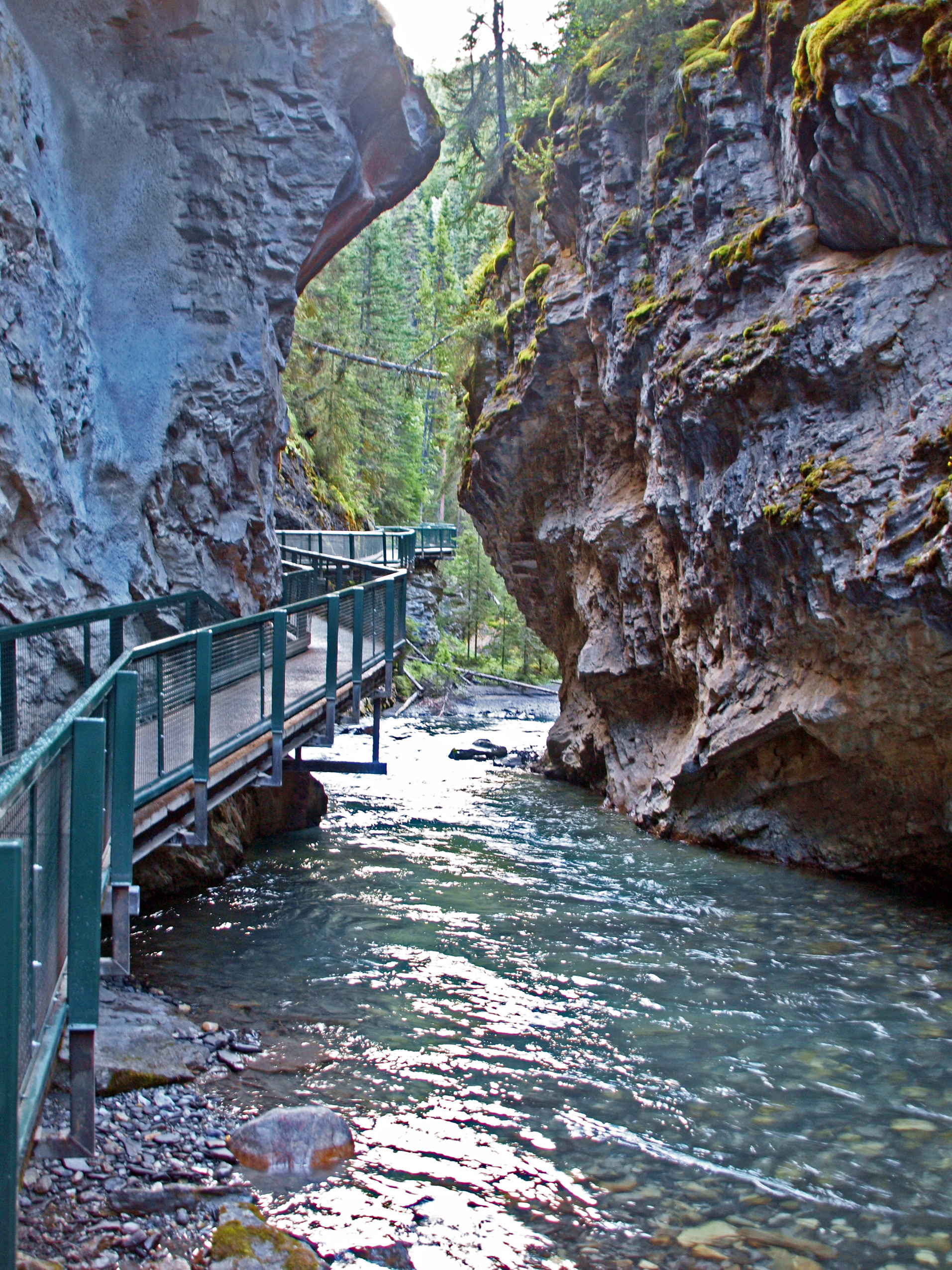
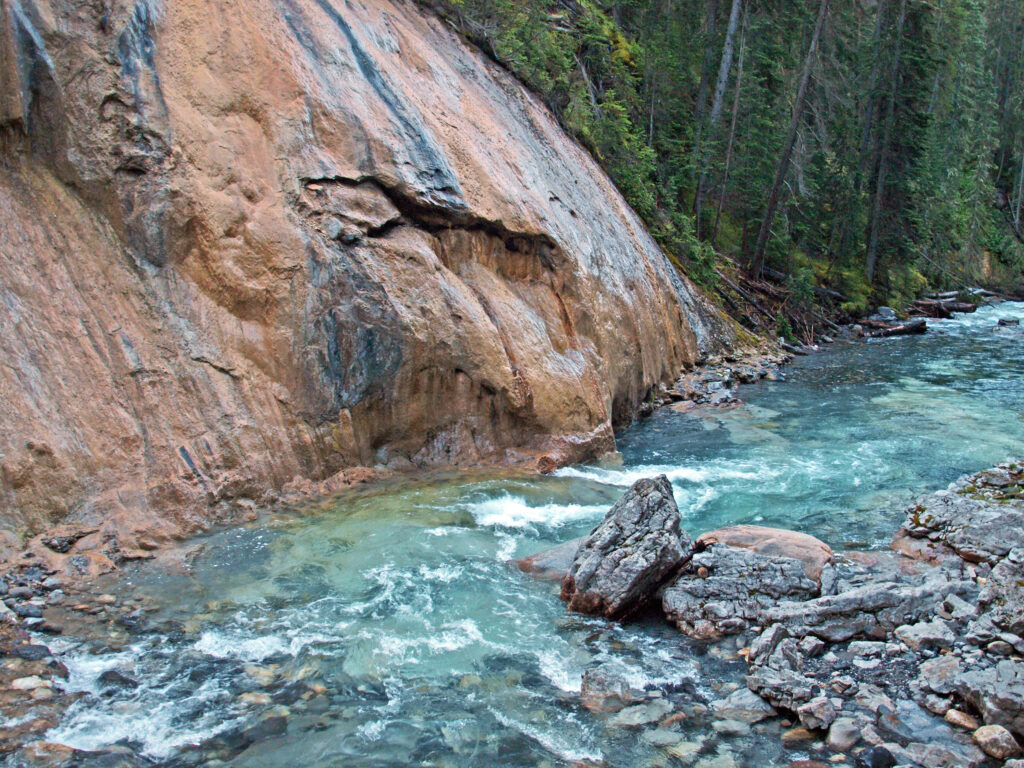
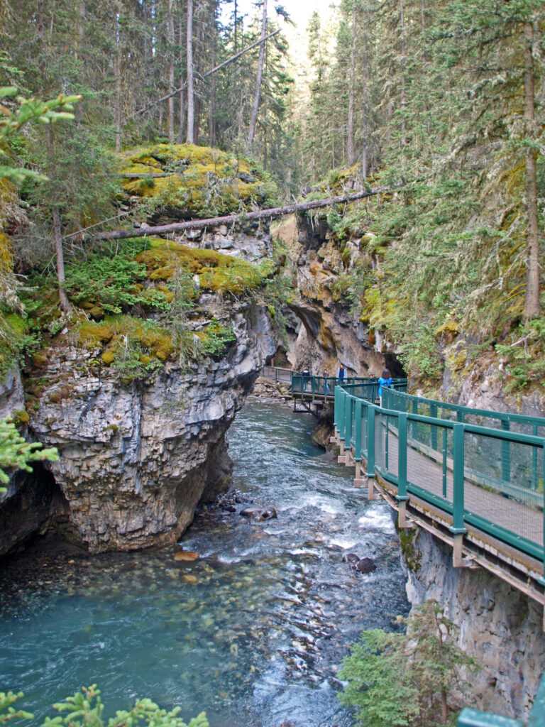
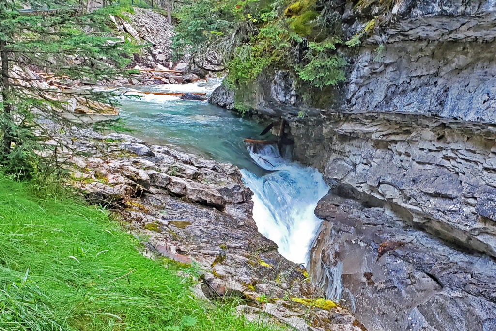
The Johnston Canyon Trail is one of the best hikes you’ll find anywhere in the Canadian Rockies. Johnston Creek cascades through a narrow gorge with many small waterfalls and two larger ones. Parts of the canyon are so narrow that the creek fills the canyon floor from wall to wall. Here you’re hiking directly above the creek on a catwalk bolted to the side of the gorge. Sure, it’s very, very popular and can be incredibly crowded, but it’s an incredible hike, not to be missed. Just go early in the morning or in the evening.
Getting there:
From the town of Banff, take the Trans Canada Hwy west for 3.4 miles (5.5 km) to the exit for the Bow Valley Parkway. Proceed on the parkway for another 11.0 miles (17.7 km) to the trailhead parking lot on the right. (Note that for the past three years the east end of the parkway from Hwy 1 to Johnston Canyon has been closed to vehicles – but open to bicycles – from May 1 to June 25 and for the month of September. During those periods vehicles must travel from Banff to Castle Junction on Hwy 1, then backtrack east on the parkway to Johnston Canyon. This has been a pilot program and these closures may or may not continue beyond 2024.
You can also get to Johnston Canyon directly from Banff via the Roam Route 9 bus. Check the website for schedules. There is also a hop-on-hop-off bus from Banff that stops at Moraine Lake and Lake Louise in addition to Johnston Canyon.
Trailhead:
The main trailhead parking area has approximately 120 spaces, but it fills up early. There is now a second parking area on the opposite side of the parkway, but that likely also fills up early and you may see cars parked along the parkway on both sides. There are restrooms with flush toilets at the trailhead and water is available. There is also a small café at the trailhead. There is no fee to park or hike. Dogs are allowed on leash. Strollers are not recommended on the trail, but the trail is easy enough for kids of all ages.
The hike:
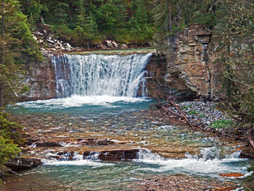
The trail is an easy hike, with relatively little elevation gain. In 0.7 mile (1.2 km) you come to the100-foot (30-meter) Lower Falls. Here you can walk through a short tunnel that emerges just feet from the falling water. Just be prepared to get wet.
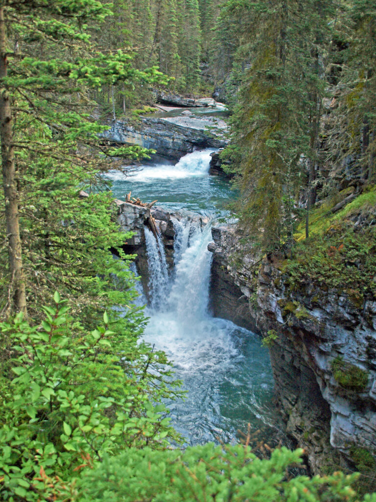
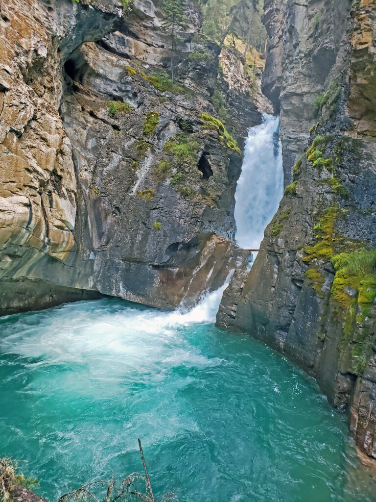
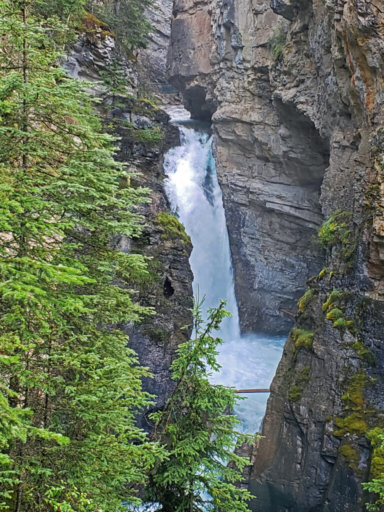
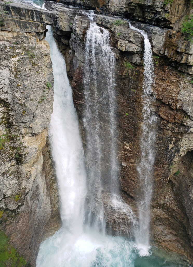
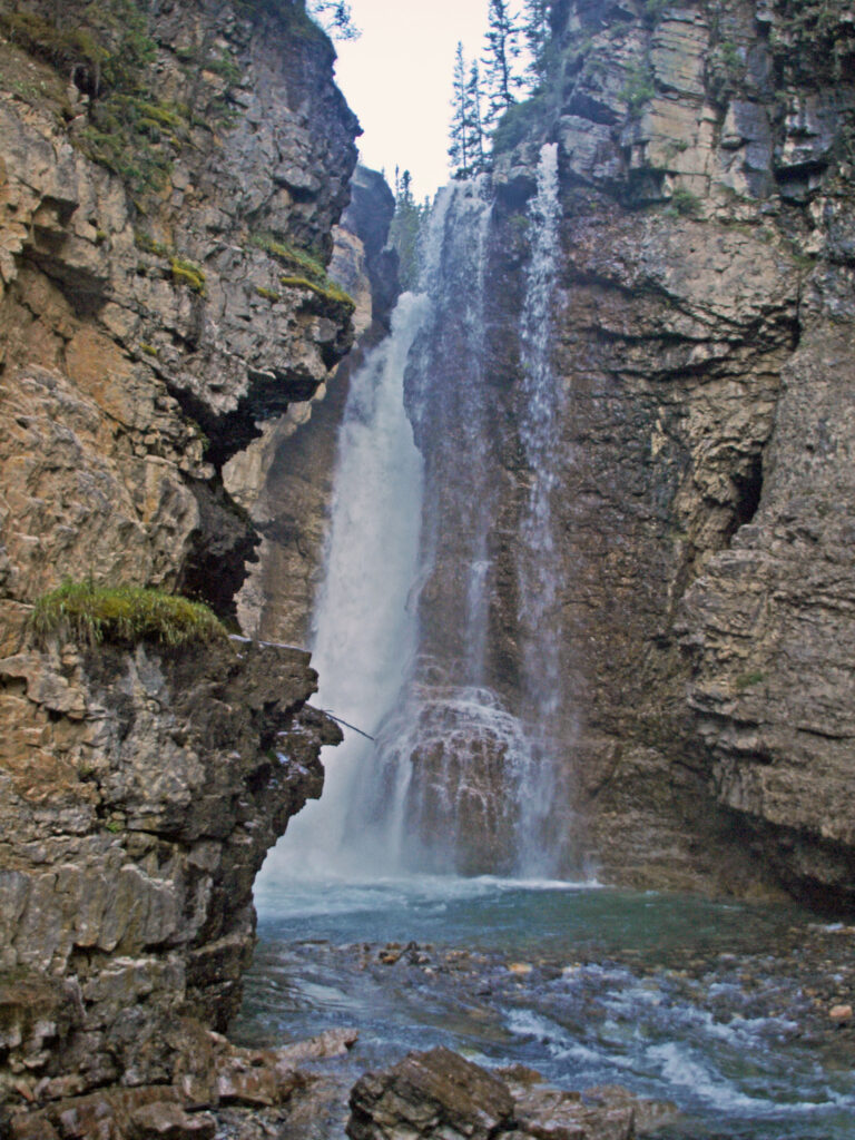
The trail continues for another 0.9 mile (1.4 km) to the bottom of Upper Falls. There the trail branches, with a side trail going to a viewpoint near the base of the falls and the main trail climbing 130 feet (40 meters) to the top of the falls. We turned around at that point, but the trail continues another 2.5 miles (4.0 km) beyond Upper Falls to the Ink Pots, a group of beautiful spring fed ponds in a mountain meadow.
Check the Banff Travel website for a much more detailed description of the hike.
Other area attractions and activities:
There are too many other attractions in Banff National Park and the surrounding area to list them all, but here are links to some of the best –
The town of Banff
The town of Canmore
Posted July 31, 2024
All photos ©Alan K. Lee