
By Alan K. Lee
Introduction
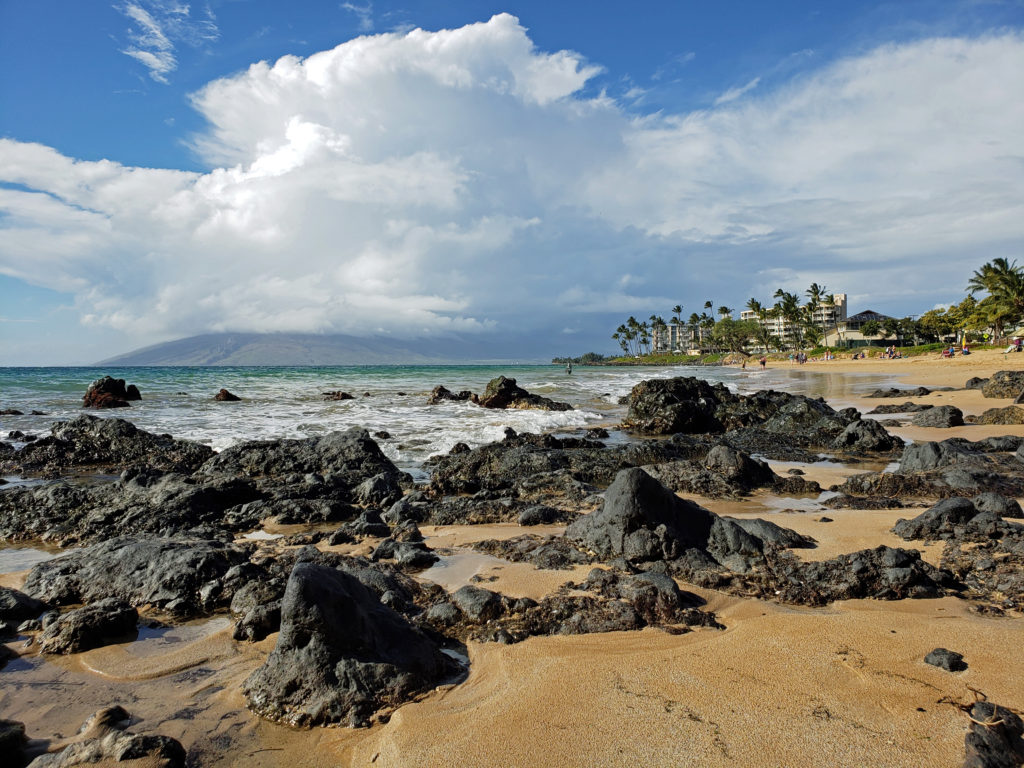
Bisbee is one of the most unique and interesting towns in Arizona (or anywhere for that matter). My brother worked as an electrical engineer for a company based in Bisbee for many years, and my wife and I visited Bisbee many times during those years. He is now retired, but has remained in the area, living in nearby Sierra Vista. We always include a day in Bisbee on our visits, most recently in the spring of 2026.
History
Bisbee was founded in 1880 and incorporated in 1902. Its early economy was based on copper, gold, and silver mining. Demand for copper surged during World War I and Bisbee’s population peaked at 9205 in the 1920 Census. Mining activity declined significantly in the 1930s and 40s, and Bisbee’s population had dropped to 3801 by 1950.

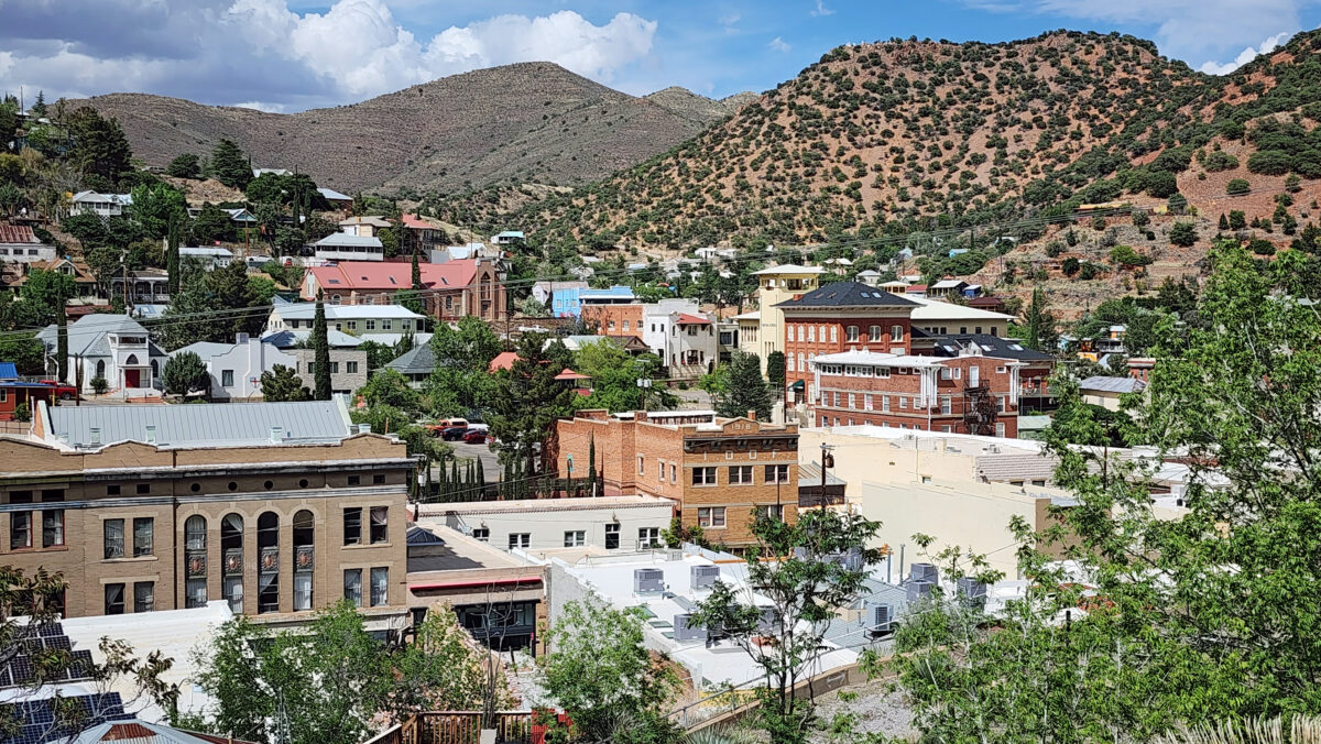
Housing prices crashed in the 1960s, leading to an influx of artists and counter culture types taking advantage of the cheap housing. That combination of artists and eccentrics of all types gave Bisbee a unique and colorful local culture that persists to this day.
Phelps Dodge Corporation ceased all mining activities in Bisbee in 1975, and local leadership pivoted to tourism to boost the economy. Today, tourism is the largest component of Bisbee’s economy.
Copper Queen Mine
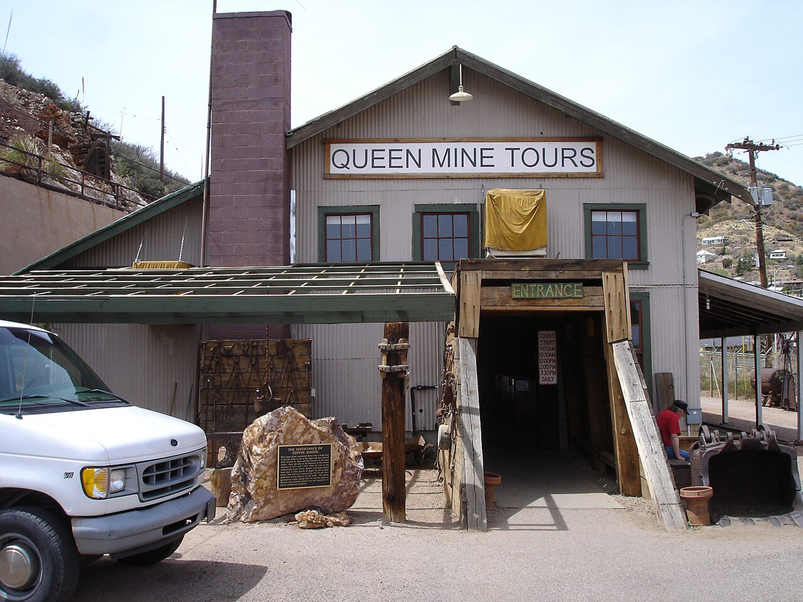
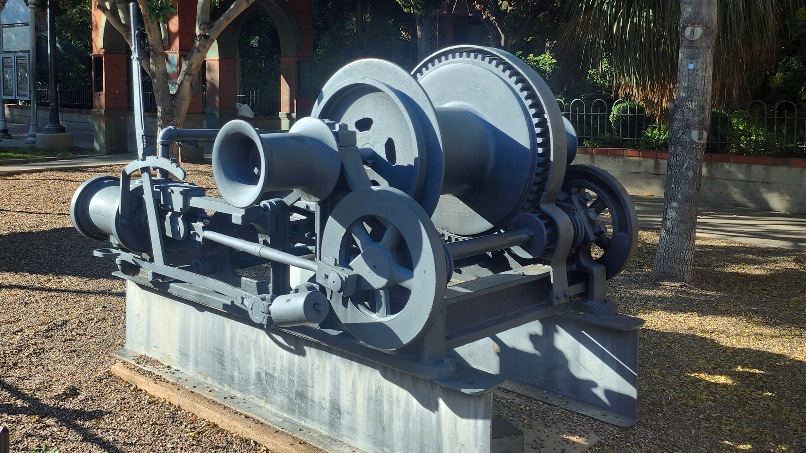
The Copper Queen was the largest mine in the Bisbee area and produced ore that was 23% copper, an extremely high grade, with lesser amounts of gold and silver. The mine closed in 1975, and local leaders persuaded Phelps Dodge to allow a portion of the mine to be opened to the public. Tours of the mine began in 1976 and more than a million people have taken the tour to date. That total does not include my wife and I, but the Copper Queen tour is the top tourist attraction in Bisbee. Tour prices as of 2026 are $16 for adults and $8 for children 6-12. (Children under six are not allowed on the tour). Reservations are required and can be made online.
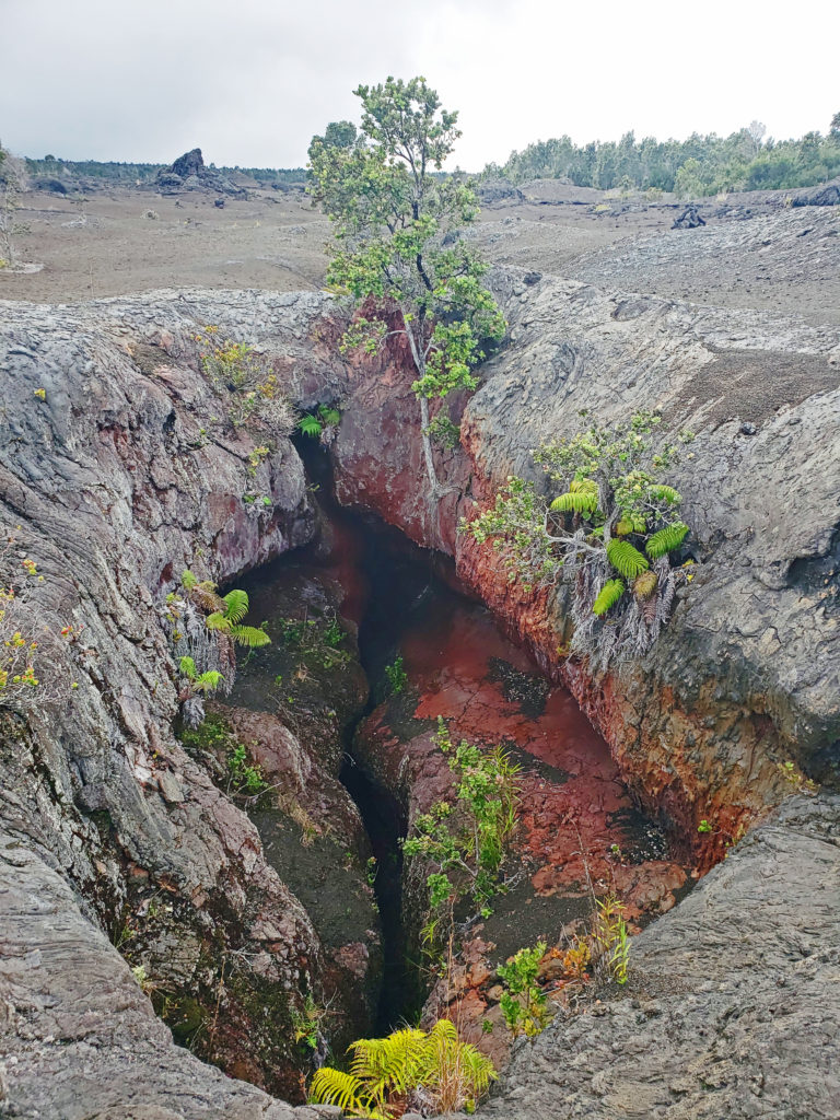
Lavender Pit
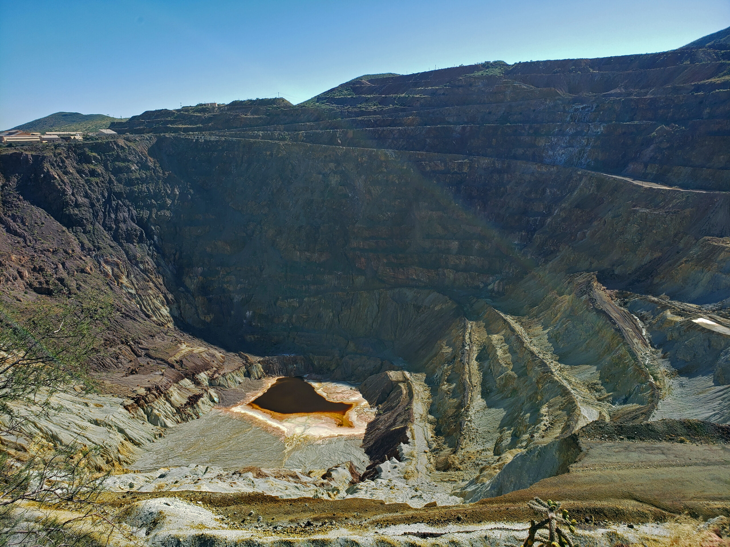
Phelps Dodge began open pit mining in 1950 and continued until 1974, taking advantage of a process promoted by Harrison Lavender, then Vice President of Phelps Dodge, that allowed profitable extraction of copper from ore as low as 0.7% copper. Today, the Lavender Pit is an impressively large (300 acres and 900 feet deep) hole in the ground, but to my eye is more an eyesore than an attraction.
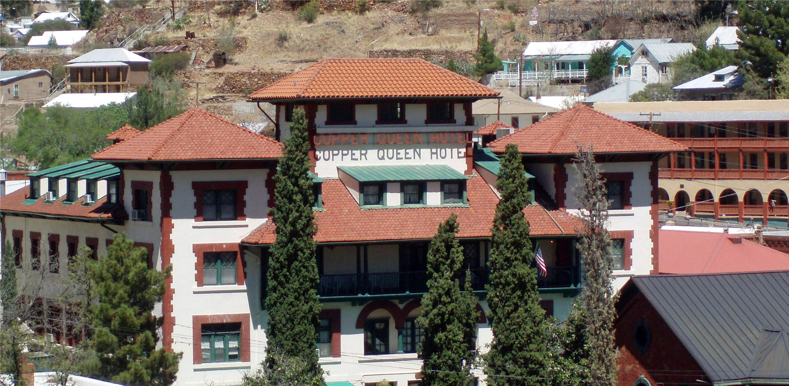
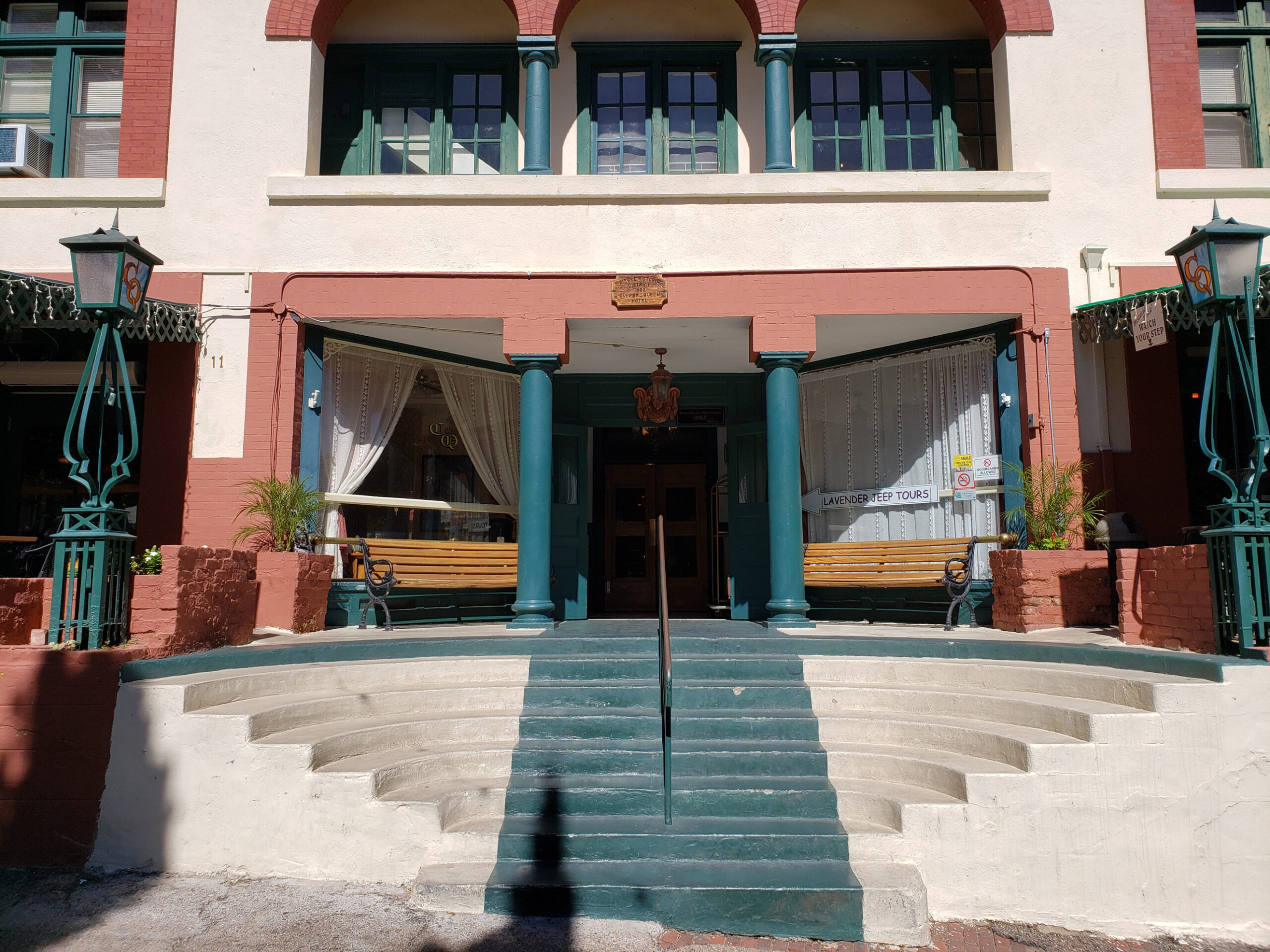
Copper Queen Hotel
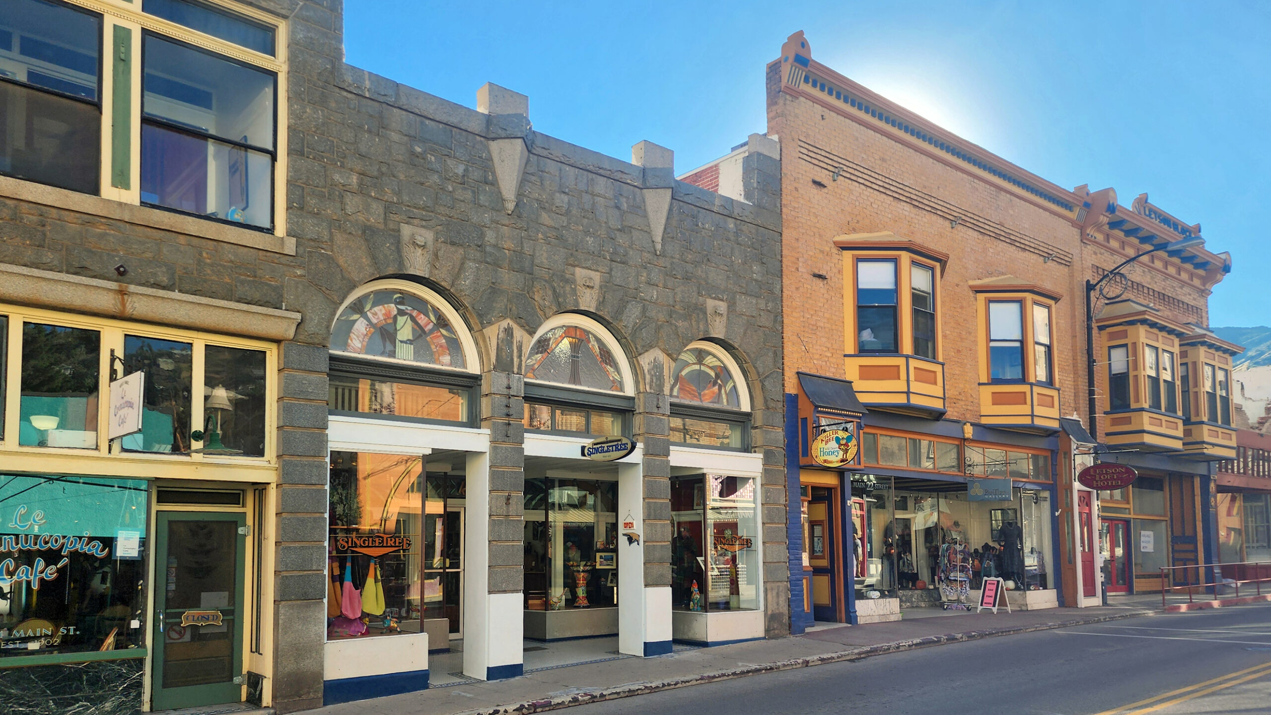
Downtown Bisbee streets are lined with many old brick buildings dating to the early 20th century. There are also many fine Victorian era and Craftsman style houses in the town’s residential areas. Probably the most noteworthy building in Bisbee is the Copper Queen Hotel. The hotel was constructed around the turn of the 20th century by Phelps Dodge and is the longest continually operated hotel in Arizona. It is listed on the National Register of Historic Places.
The hotel had deteriorated over the years and was sold by Phelps Dodge to artist Stephen Hutchinson and his wife Marcia in 1970. They did a complete renovation of the structure, along with other buildings in the downtown area that is now called Old Bisbee.
The Hutchinsons lured many celebrities to Bisbee, most notably John Wayne, who visited often and later became a business partner of the Hutchinsons, and helped establish Bisbee as a tourist destination. Many of the rooms are named after celebrities that have stayed at the hotel. In addition to John Wayne, those include Teddy Roosevelt, Harry Houdini, and Lilly Langtree.
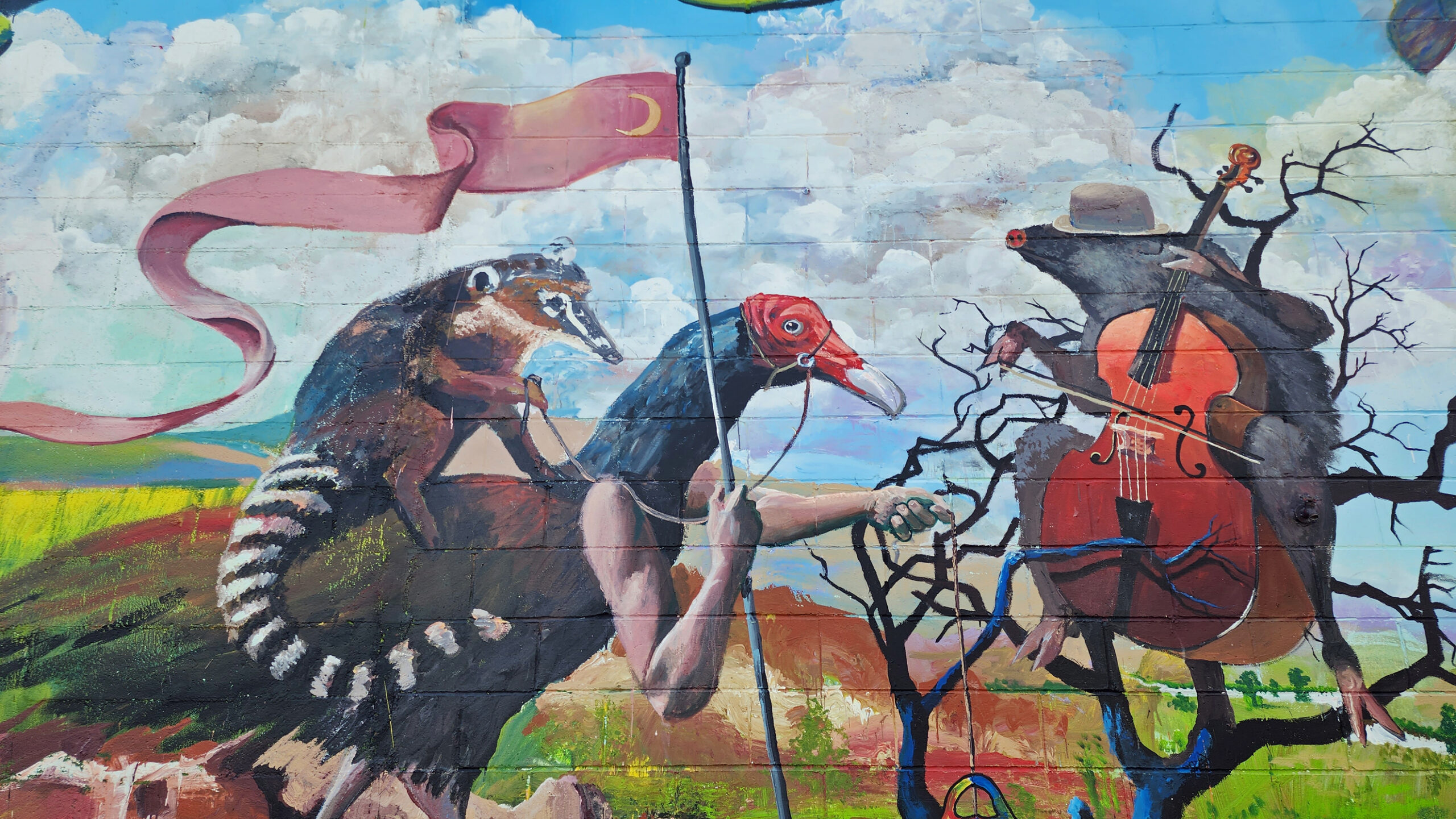
Bisbee Arts Scene
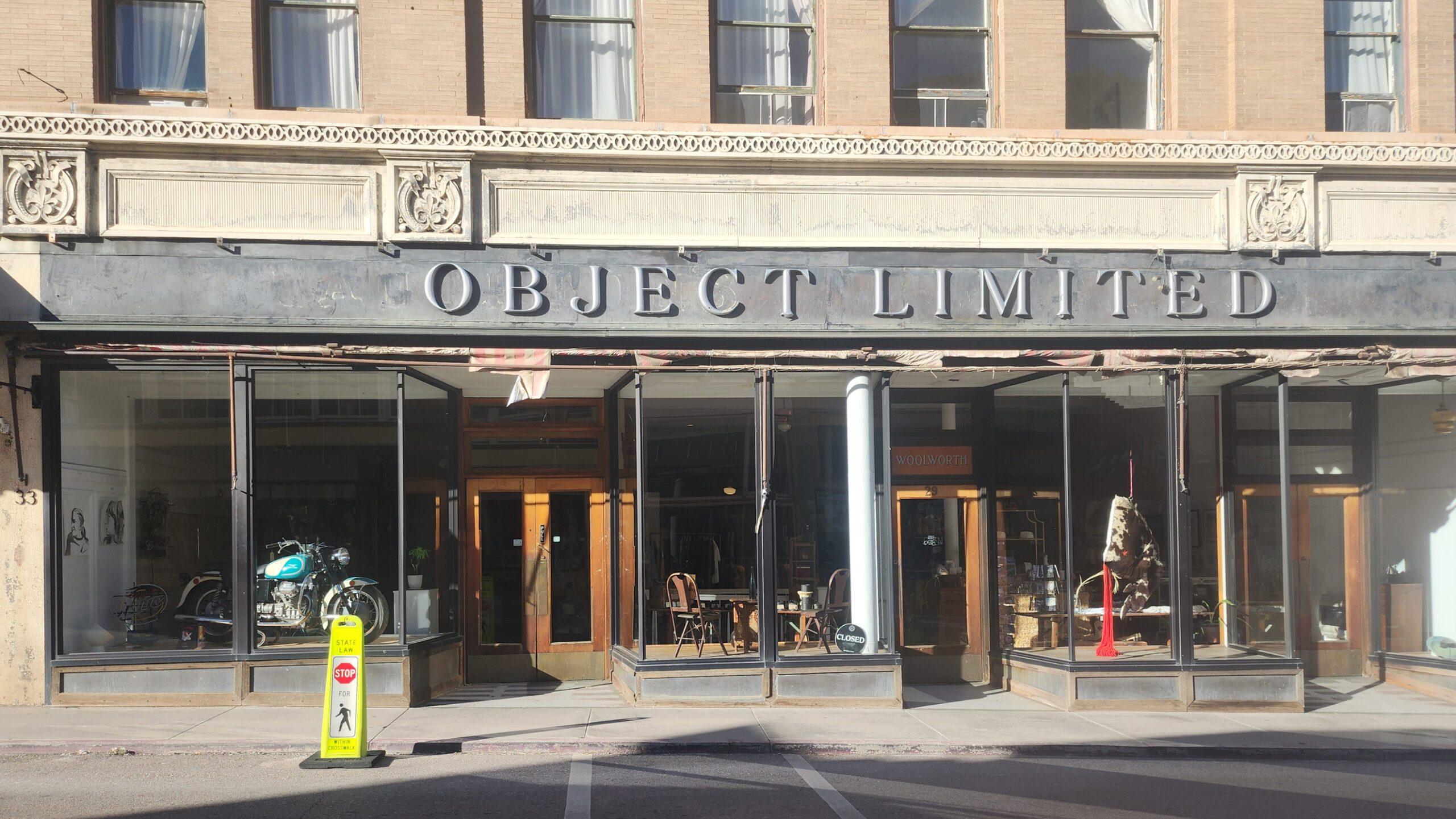
Bisbee is home to almost twenty art galleries. Some of the more popular include Sam Poe Gallery, Belleza Fine Art Gallery, Artemezia Foundation – Gallery 818, Subway Gallery, and 55 Main Gallery. About half of Bisbee’s galleries can be found on Main Street.
The Bisbee After Five Art Walk, a self-guided tour of galleries, stores, and restaurants in Old Bisbee takes place on the second Saturday of every month from 5 to 8 pm.

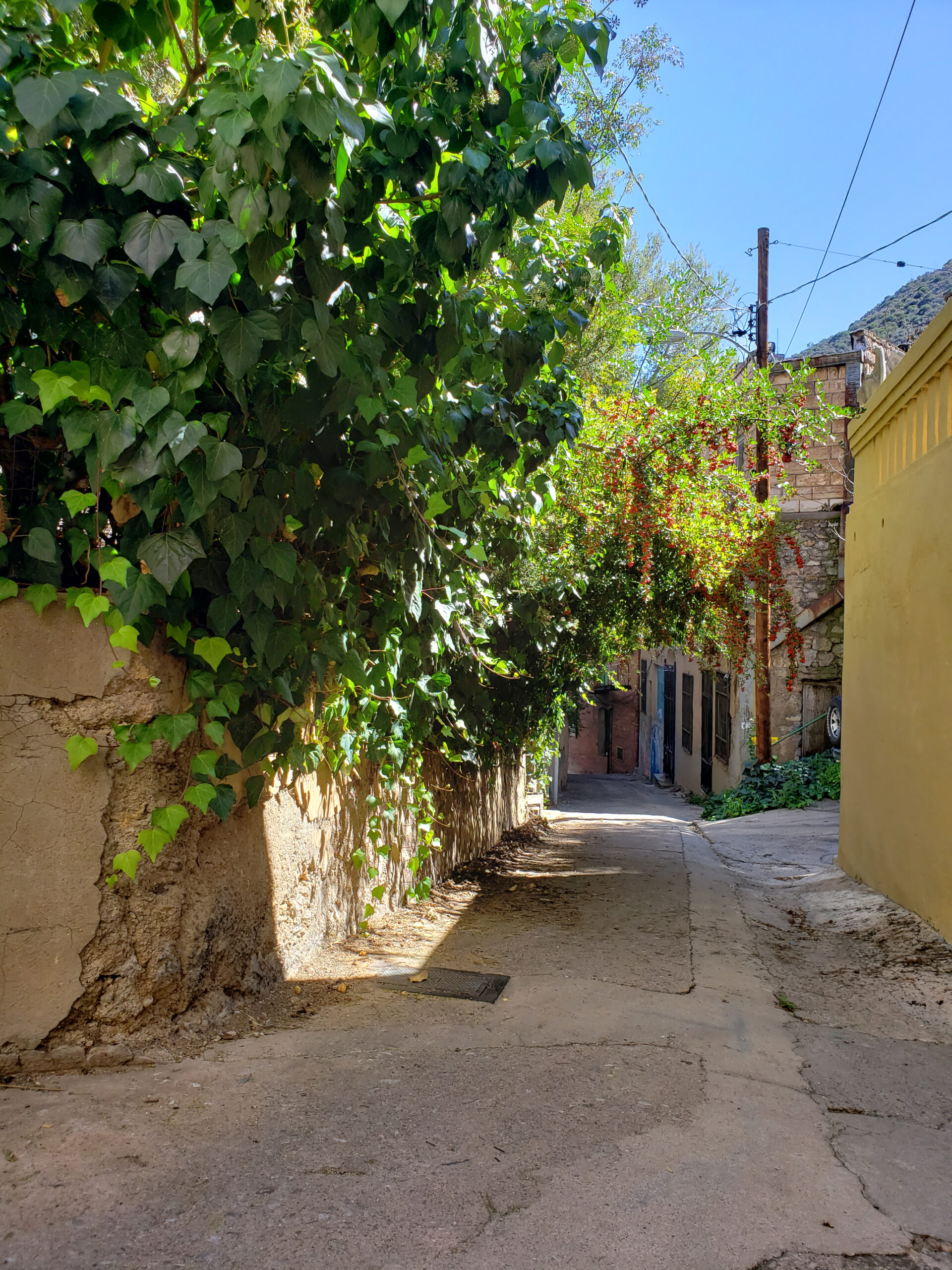
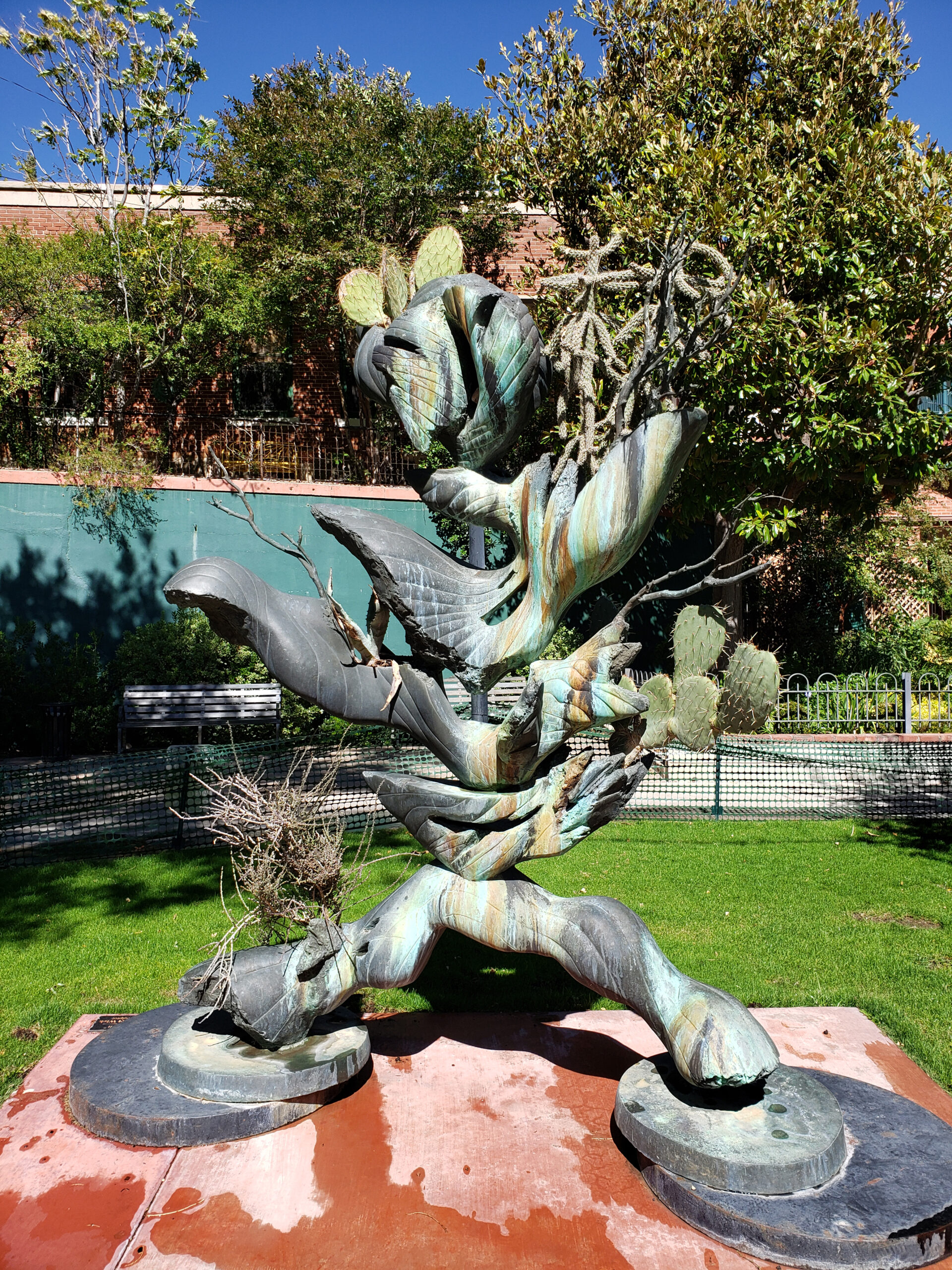
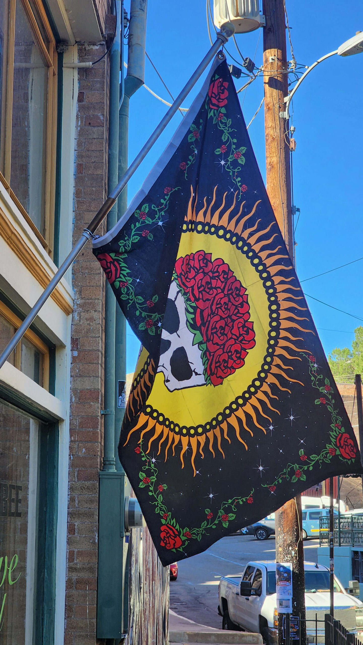
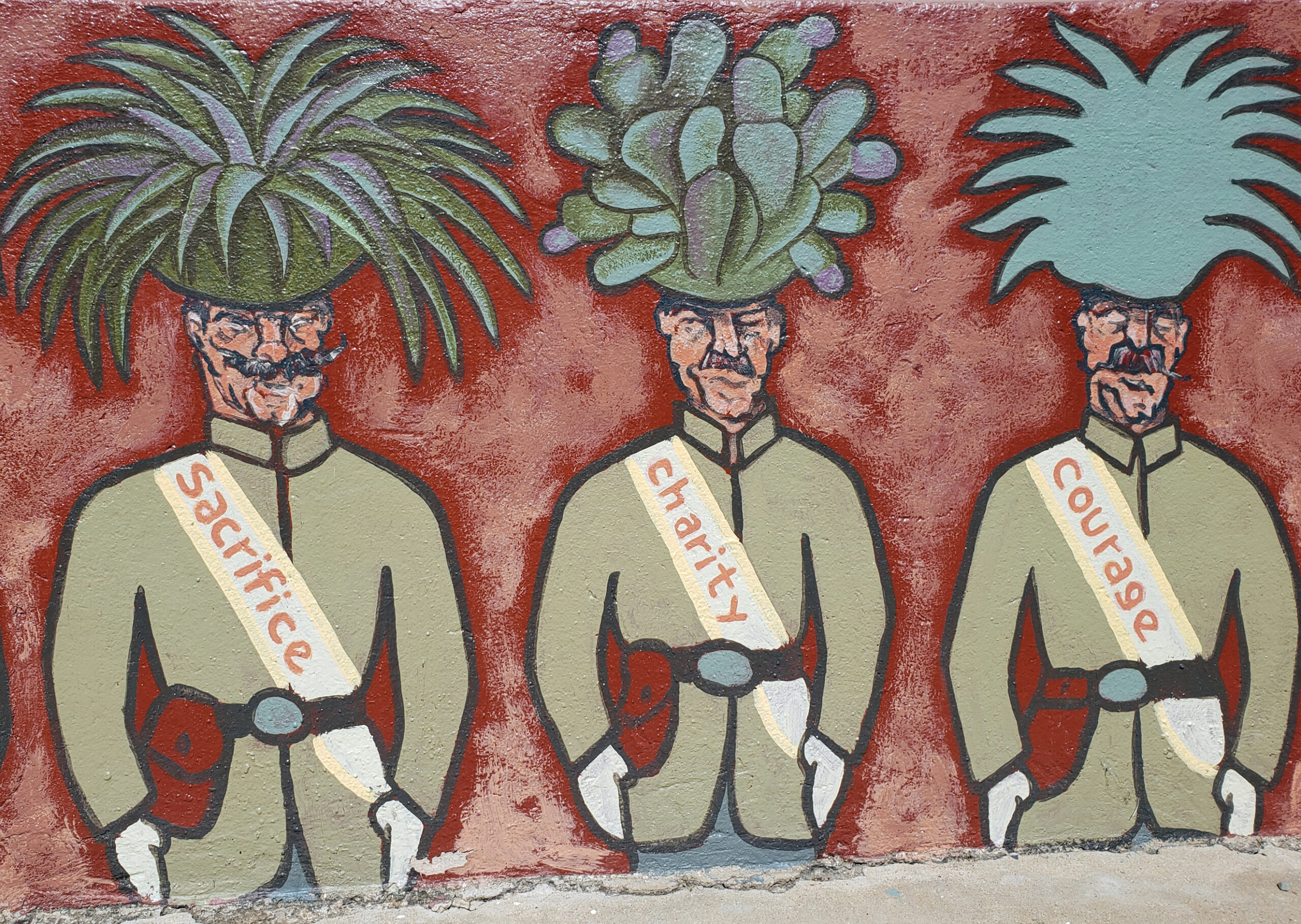
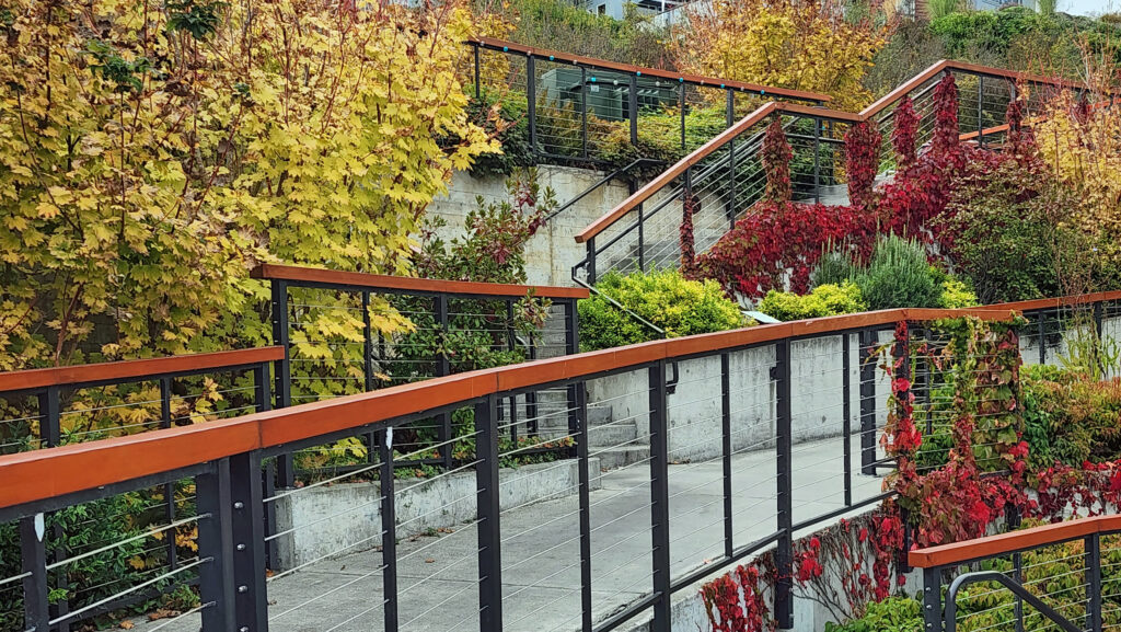
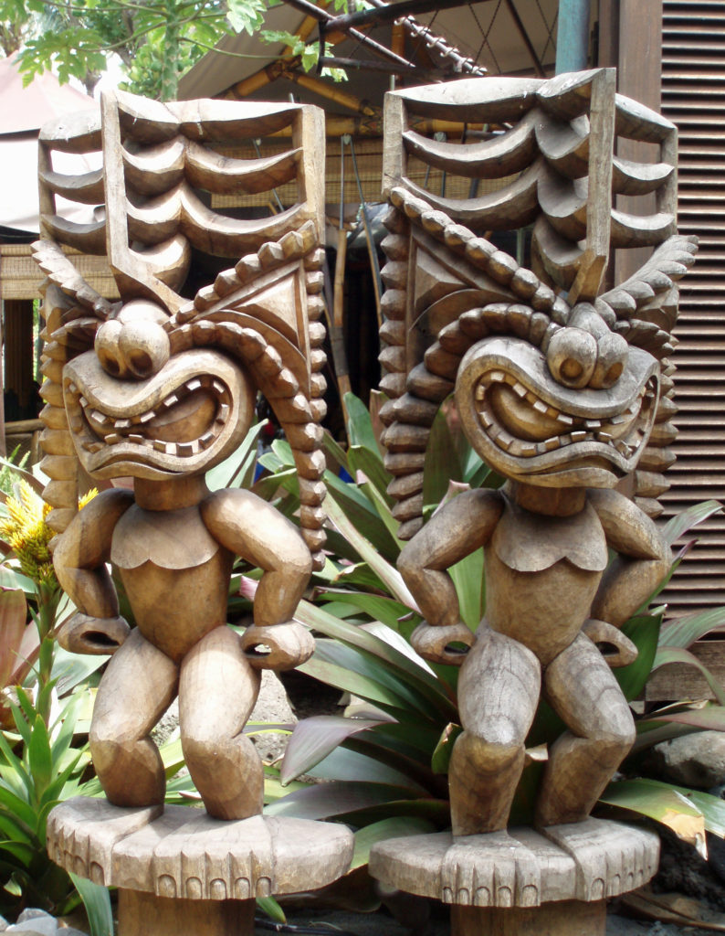
For me, one of the joys of visiting Bisbee is simply wandering around the town and taking in all of the often off-beat public art and artist’s studios that permeate the town. It seems like we find a new murals and other pieces of public art on every visit.

Food and Drink
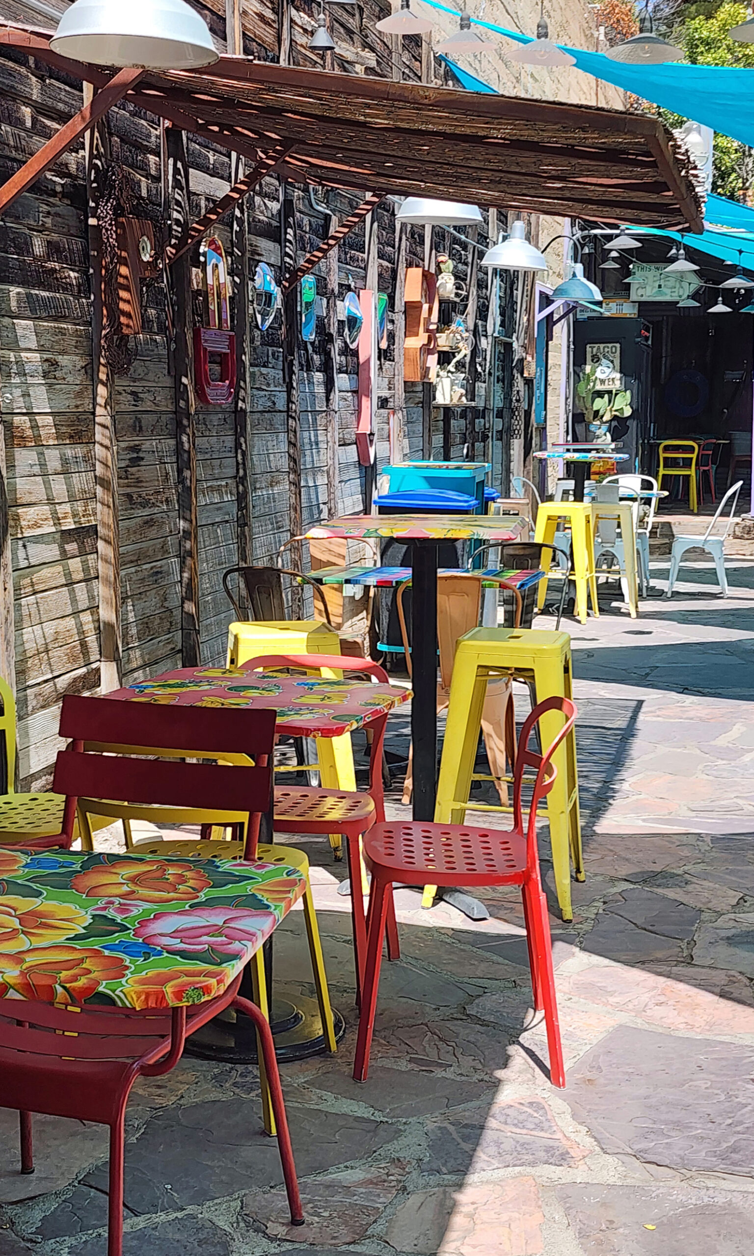
While the food and drink scene in Bisbee isn’t what draws people to the town, there’s no shortage of decent places to eat and quench your thirst. In Old Bisbee, Bisbee’s Table is a place we’ve dined at a number of times and can recommend. Another place is Le Cornucopia. If you’re a vegetarian or vegan or need gluten free food, you might want to try Bisbee Badassery. It’s also dog friendly. Poco Restaurant + Market’s Mexican inspired 100% vegan menu is another option. Another place to get great Mexican food is Taqueria Outlaw. Café Roka gets good reviews and offers a more upscale dining experience than most of the other restaurants in Old Bisbee. Legion Bar & Grill and Old Bisbee Brewing are two places that I can recommend for good beer and pub food.
Accommodations
My wife and I have only done day trips to Bisbee from Sierra Vista, so I can’t speak from personal experience, but there are a number of highly rated hotels in Bisbee. Among those are Letson Loft Hotel, Warner Hotel, El Dorado Suites Hotel, Copper City Inn, Canyon Rose Hotel, and The Oliver House. The Copper Queen Hotel doesn’t get great reviews, but it’s such an iconic attraction that it might be worth a stay. Sierra Vista offers many other hotels and motels (try the Comfort Inn & Suites on Fry Boulevard). And, of course, there are numerous B&Bs in both Bisbee and Sierra Vista to choose from.
Other Area Attractions
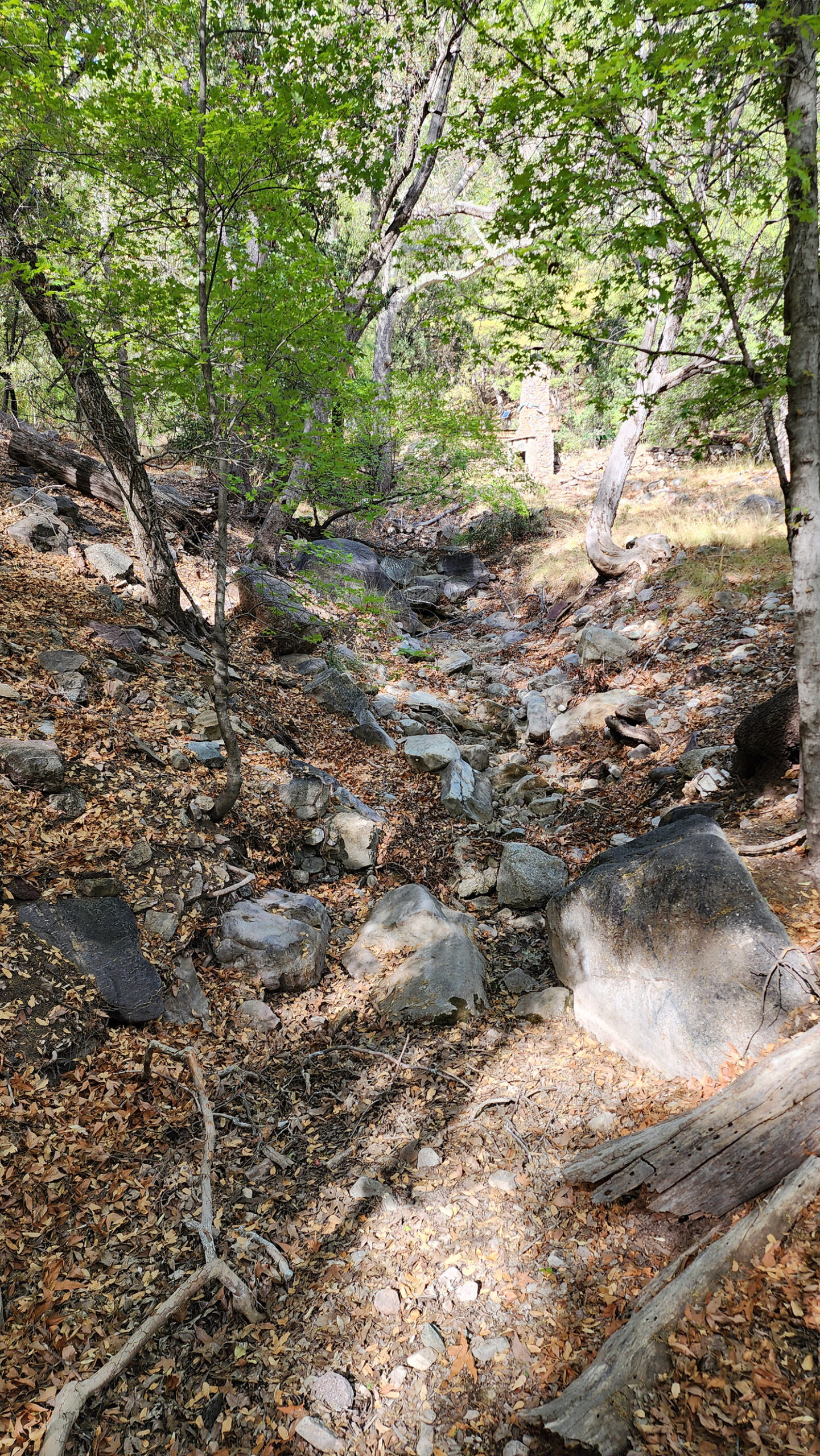
Bisbee is surrounded by abundant natural and cultural attractions. Jeep tours of the surrounding Mule Mountains are popular. Another mountain range, the Huachuca Mountains, west and southwest of Sierra Vista, offer outdoor enthusiasts a variety of hiking and sightseeing options. My wife and I took a short hike at the Nature Conservancy’s Ramsey Canyon Preserve on our most recent visit.
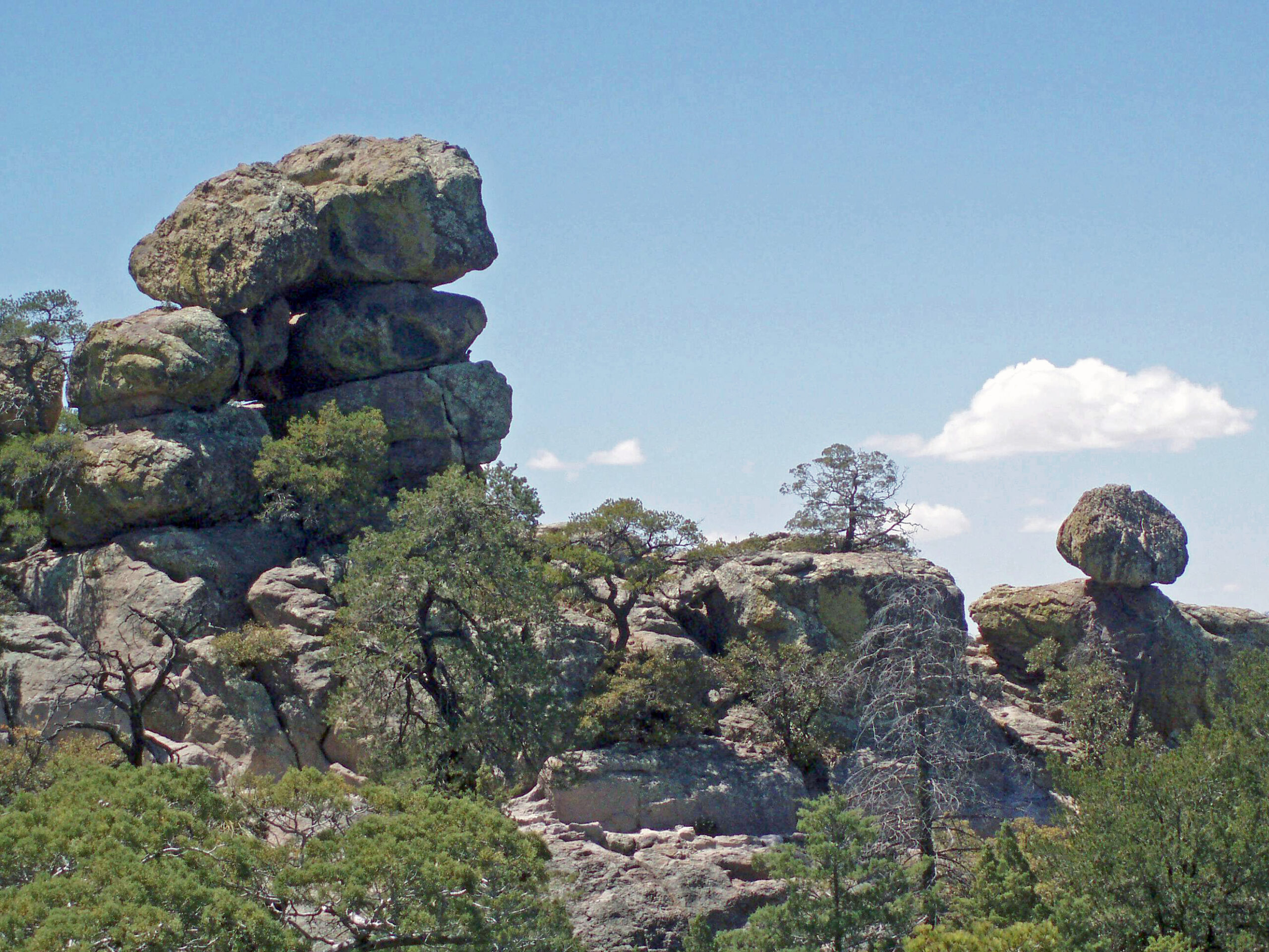
A little farther afield, Chiricahua National Monument, about an hour’s drive from Bisbee, is a spectacular collection of rock formations well worth a visit if you have the time. Karchner Caverns, about twenty miles north of Sierra Vista is also well worth a visit. Park rangers give guided tours of the caverns several times a day.
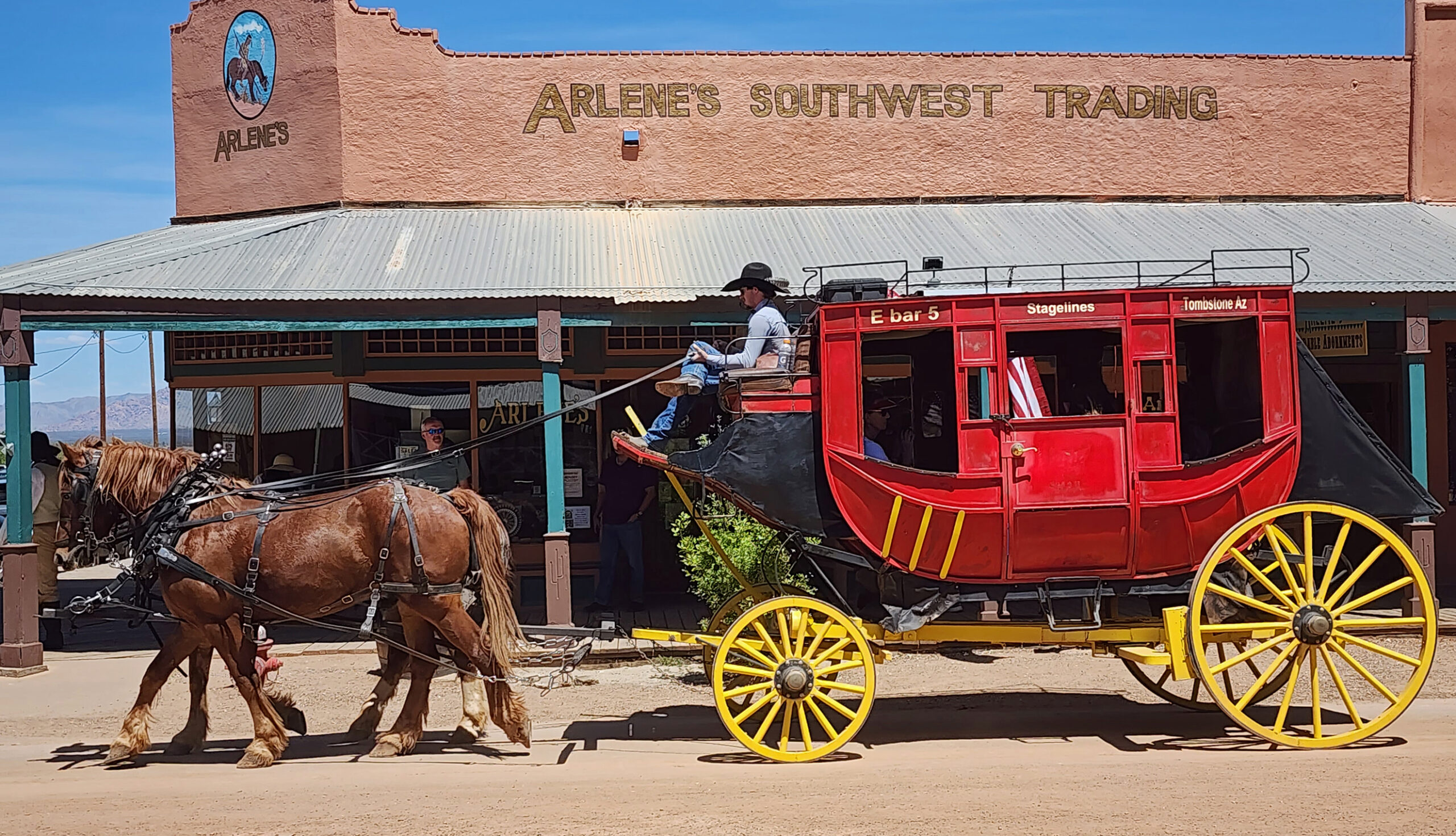
And, about 25 miles north of Bisbee, the wild west town of Tombstone draws thousands of tourists every week. You can visit the O.K. Corral and watch reenactments of the famous gunfight between the Earps (with Doc Holliday) and the Clantons, and visit the Boot Hill Cemetery. The whole town is a bit of a tourist trap, but interesting enough and close enough to Bisbee to make a visit worthwhile.
Sierra Vista, home to the large Fort Huachuca army base, is a good place to base explorations of the area, but doesn’t offer much in the way of attractions of its own.
While my wife and I have not spent much time in the city of Tucson, about 90 miles northwest of Bisbee, we can recommend several nearby attractions that we have visited, some multiple times.

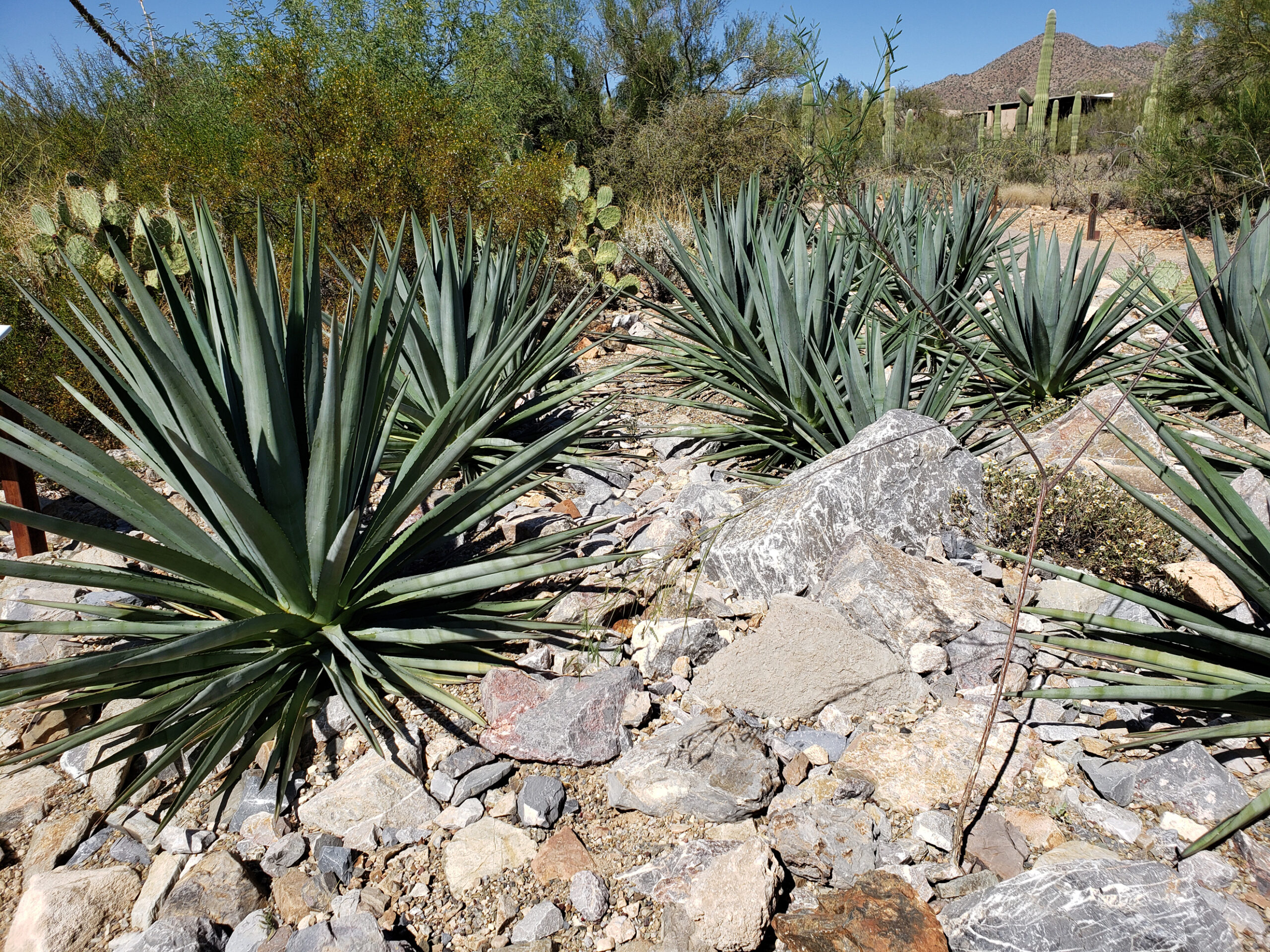
There are two units of Saguaro National Park near Tucson, one just east of the city and one just west. Near the west unit of Saguaro National Park, the Arizona-Sonora Desert Museum is one of my favorite places in Arizona.

And you may be surprised to learn, as I was, that the Tucson area boasts a local ski area. At an elevation of more than 9000 feet, Mount Lemmon rises 6500 vertical feet above the city and is home to the Mount Lemmon Sky Center Observatory and the small community of Summerhaven, as well as Mount Lemmon Ski Valley. A paved road leads to the summit area with a number of spectacular viewpoints looking down on the city and to the Sonora Desert beyond. There are also many trailheads along the roadway that offer a variety of hiking trails.

Conclusion
Bisbee is often described as quirky and charming, which it certainly is. That, combined with its unique history, contemporary arts scene, distinctive architecture, beautiful mountain environment, and great weather, makes Bisbee a unique and memorable destination worth every bit of the effort it takes to get there. Spring and fall are probably the best times to visit, but I don’t think there is a bad time. At an elevation of more than 5000 feet, it’s still hot in the summer, but considerably cooler than Phoenix. It can get cold in the winter because of the elevation, but cold is a relative term here. This is Arizona, after all.
Posted July 12, 2026
All photos © Alan K. Lee, except as noted
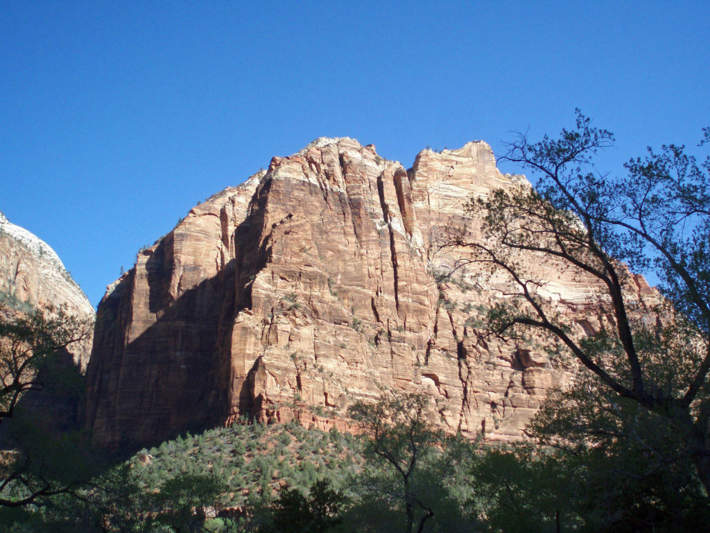
 Bicycling is permitted on all park roadways and on the Pa’rus Trail. All other park trails, off-trail routes, and the Zion-Mount Carmel Tunnel are closed to bikes. There are a number of places in Springdale where you can rent bikes and there are also numerous companies offering bicycle tours of Zion. Biking the canyon is a good alternative to riding the shuttle. From the Zion Canyon Visitor Center to the Temple of Sinawava at the end of the Zion Canyon Scenic Drive is about eight miles, with a few moderate hills along the way.
 If you drive an electric vehicle, two charging stations are located within Zion National Park, one at the Zion Canyon Visitor Center and the other at the Kolob Canyons Visitor Center in the north end of the park. You can purchase a $5 pass code at the Zion Canyon Visitor Center that is valid for three days at either of the park’s charging stations. In Springdale, there are three Tesla charging stations (as well as others in nearby communities). Electrify America stations are located in St. George and Cedar City. ChargePoint and SemaConnect stations can be found in St. George.
 If you’re camping, Zion Canyon Campground in Springdale has 133 RV sites and 47 tent sites. Zion River Resort in nearby Virgin, Utah also has RV sites and cabins. There are two campgrounds within the national park near Springdale, South Campground and Watchman Campground. South Campground has 117 sites, but no hookups. Watchman has about 120 RV sites with full hookups and about 70 tent sites. South and Watchman both require advance reservations, except in winter. The small Lava Point Campground in the north end of the park is first come, first served, but has only six primitive sites. Check the park website for more detailed information. Reservations for the South and Watchman campgrounds can be made through
 Where to Eat
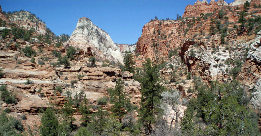
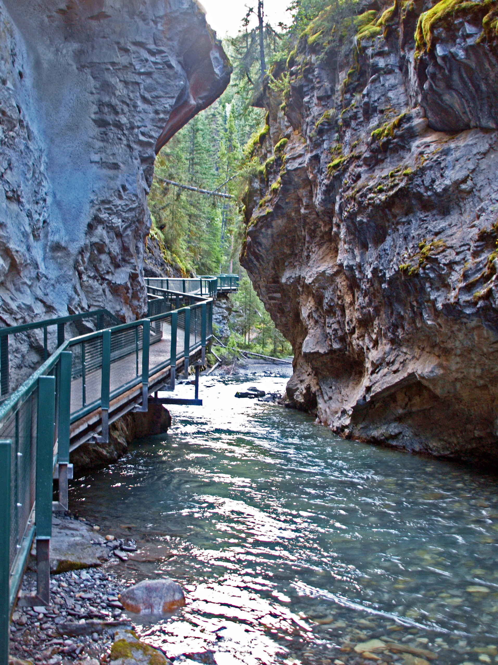
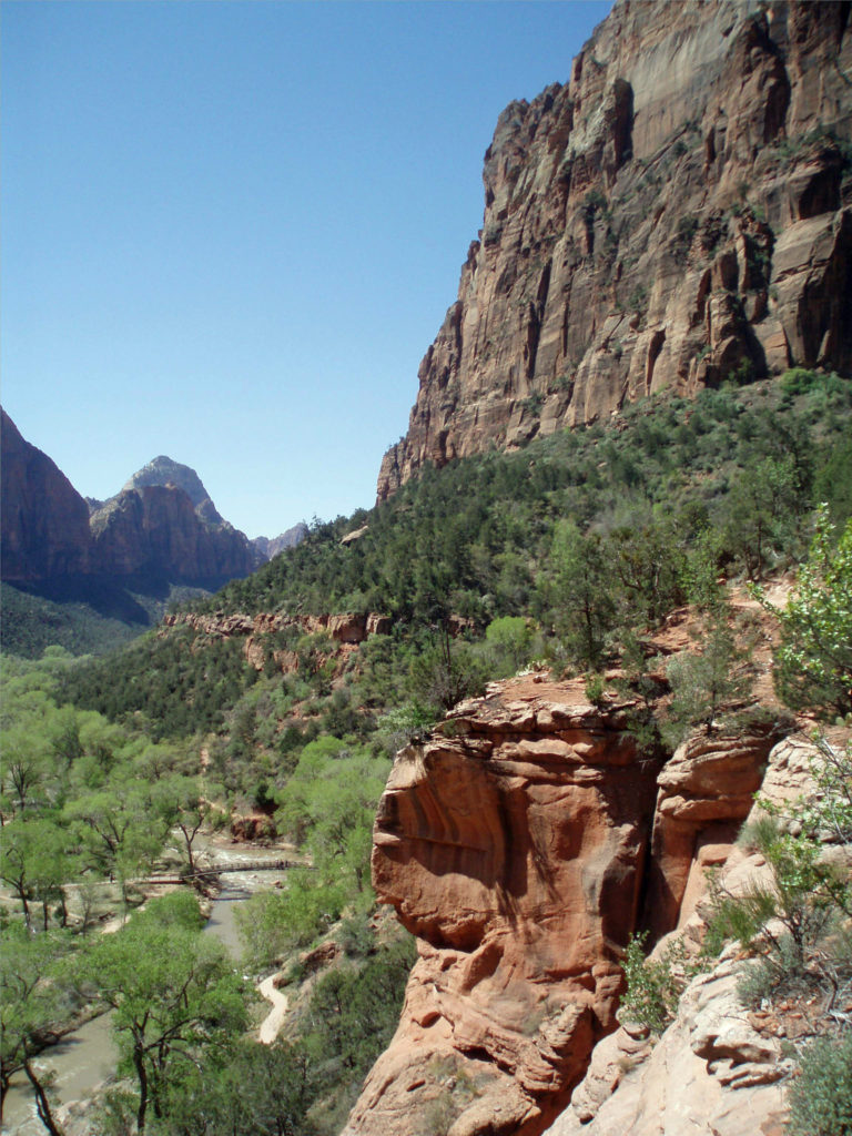
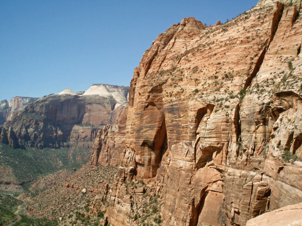 One of the most spectacular hikes in the canyon is The Narrows. There is no trail through The Narrows – you’re hiking the bed of the Virgin River through a narrow canyon no more than 40 feet wide in places. If you’re interested in hiking The Narrows, be sure to check with the park rangers at the Zion Canyon Visitor Center. No permit is required, but The Narrows may be closed to hiking due to the possibility of flash floods. Thunderstorms many miles north of the park may lead to sudden and potentially life threatening rises in the river level with no warning, even when the park is sunny and cloudless. But if it’s doable safely, it’s a fantastic and unique hiking experience.
 Trails outside of Zion Canyon (and all canyoneering routes) require a wilderness pass. Most are available online through the park’s website, but permits for some trails are only available in person.
 One hour and three hour horseback rides within the park can be booked through
  Off road vehicle tours are also available from a variety of providers. Like mountain bike tours, these are outside of the park. Again, I have no personal experience, so can’t make any recommendations, but the tours are popular.
 I can pretty much guarantee that no matter who you are or where your interests lie, a trip to Zion National Park will be an adventure you will not soon forget.
 Originally posted June 14, 2021 by Alan K. Lee. Updated and re-posted March 15, 2024.
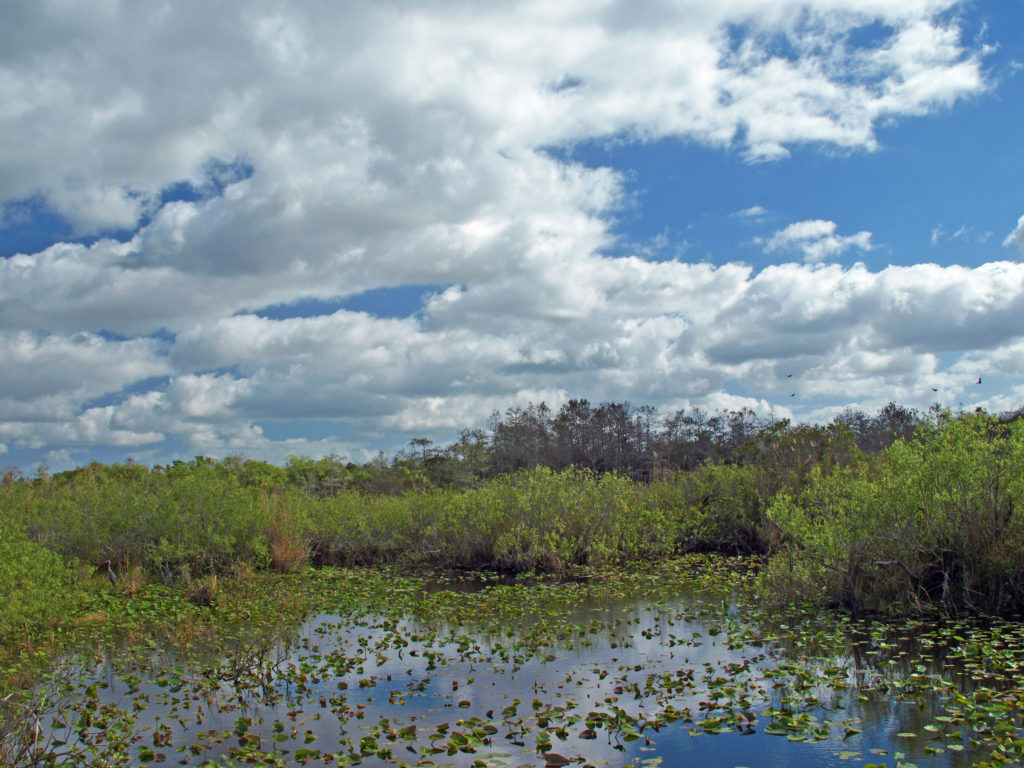
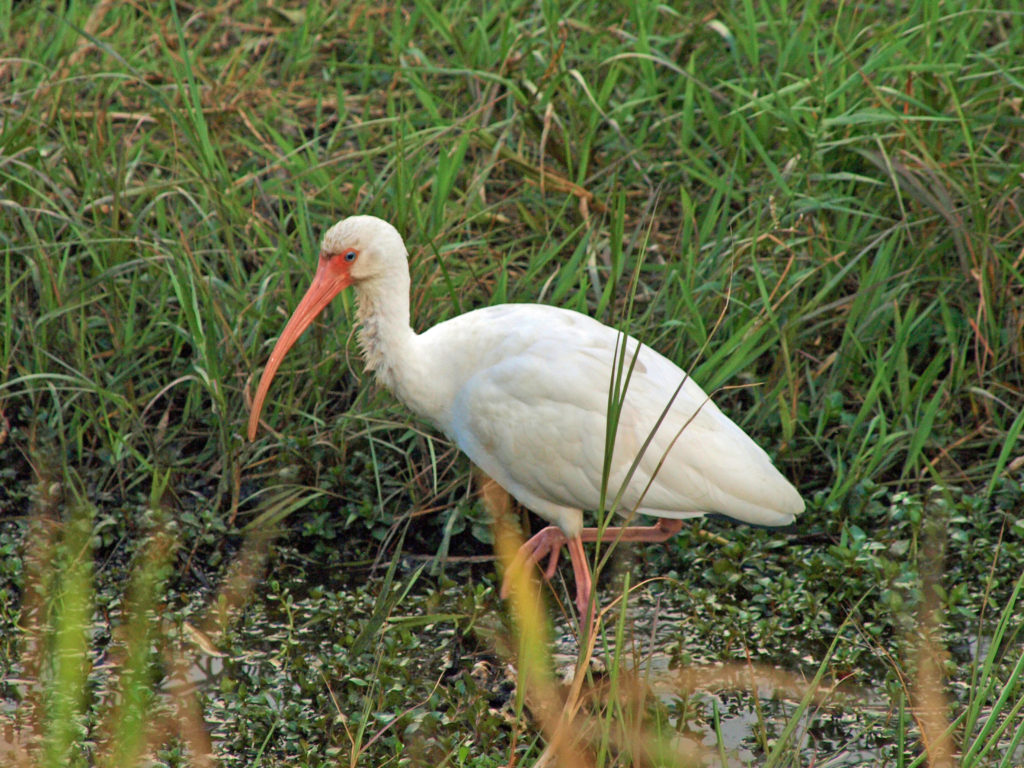
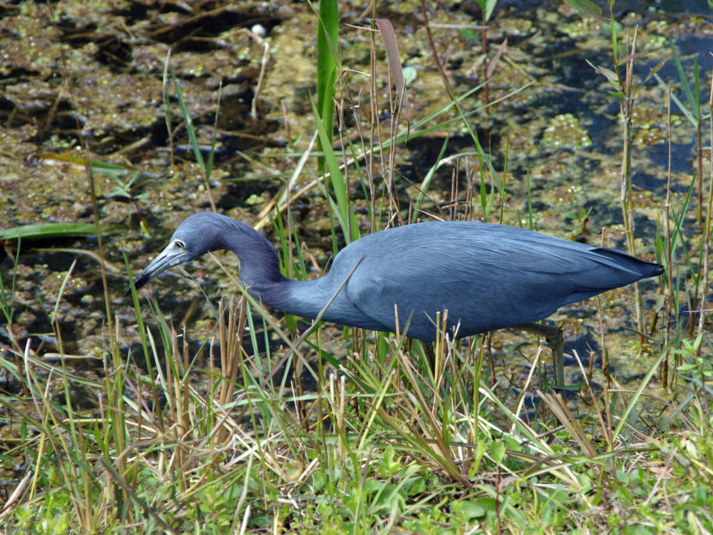
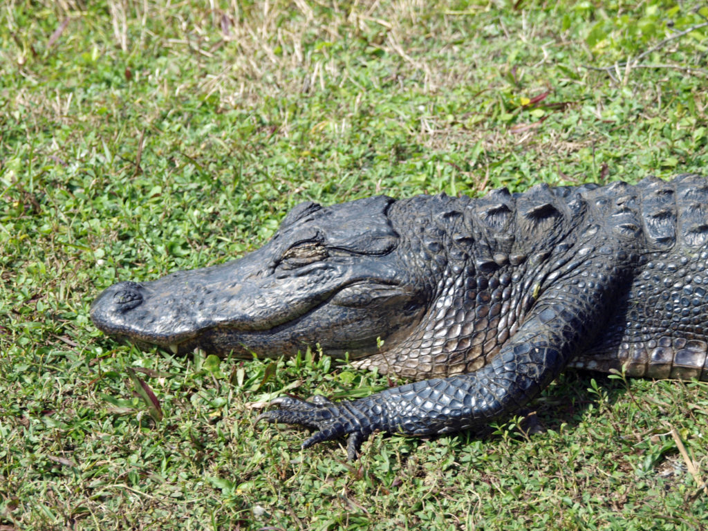
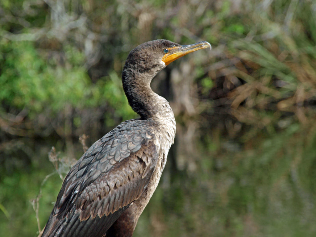
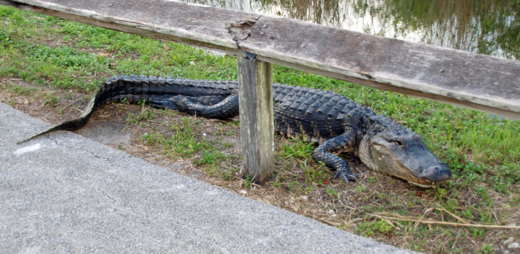
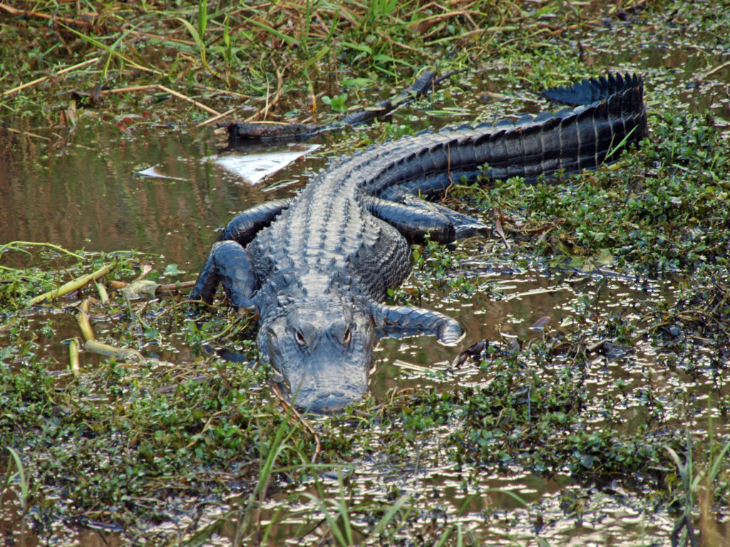 Today, the Everglades are still one of the most endangered ecosystems in the country. Diversion of water upstream of the park for use by the agricultural industry and the ever growing population of southern Florida has greatly reduced the volume of water flowing through the park, which in turn has had a significant impact on the flora and fauna of the park. Nutrient pollution and residual pesticides from agricultural runoff have also had a significant impact on the park’s ecosystem. Introduced species, such as the Burmese python, have also put stress on the system. And, since much of the Everglades is less than three feet above sea level, global warming and sea level rise threaten the very existence of the Everglades.
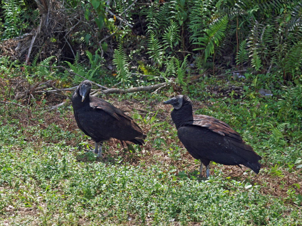

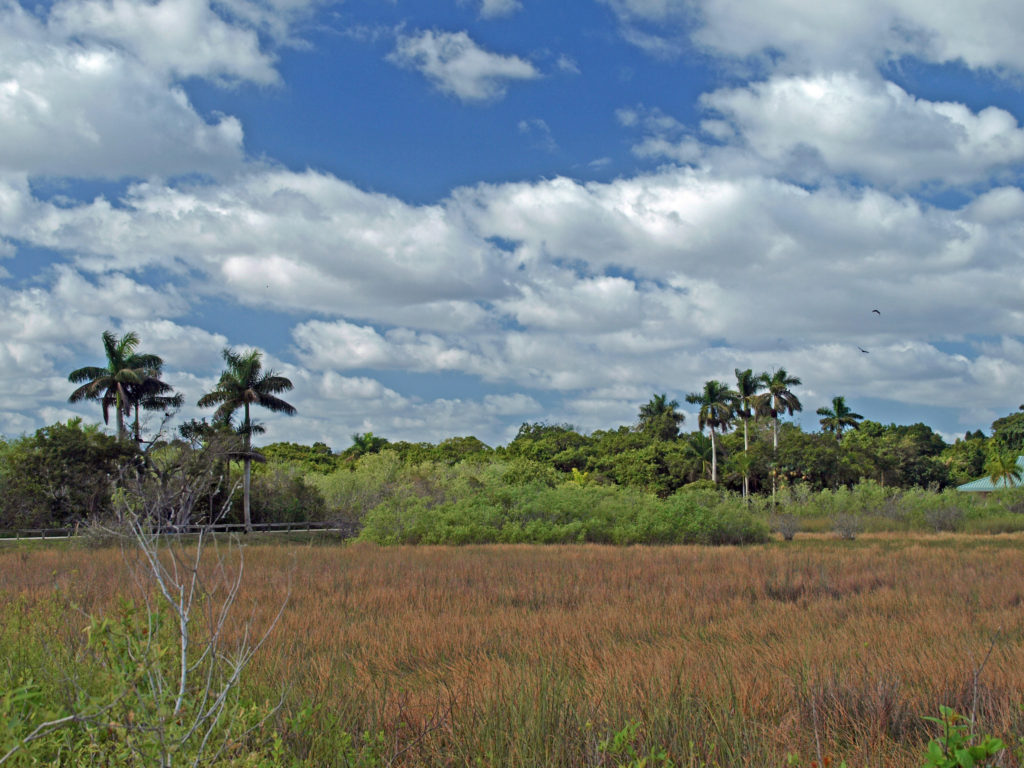
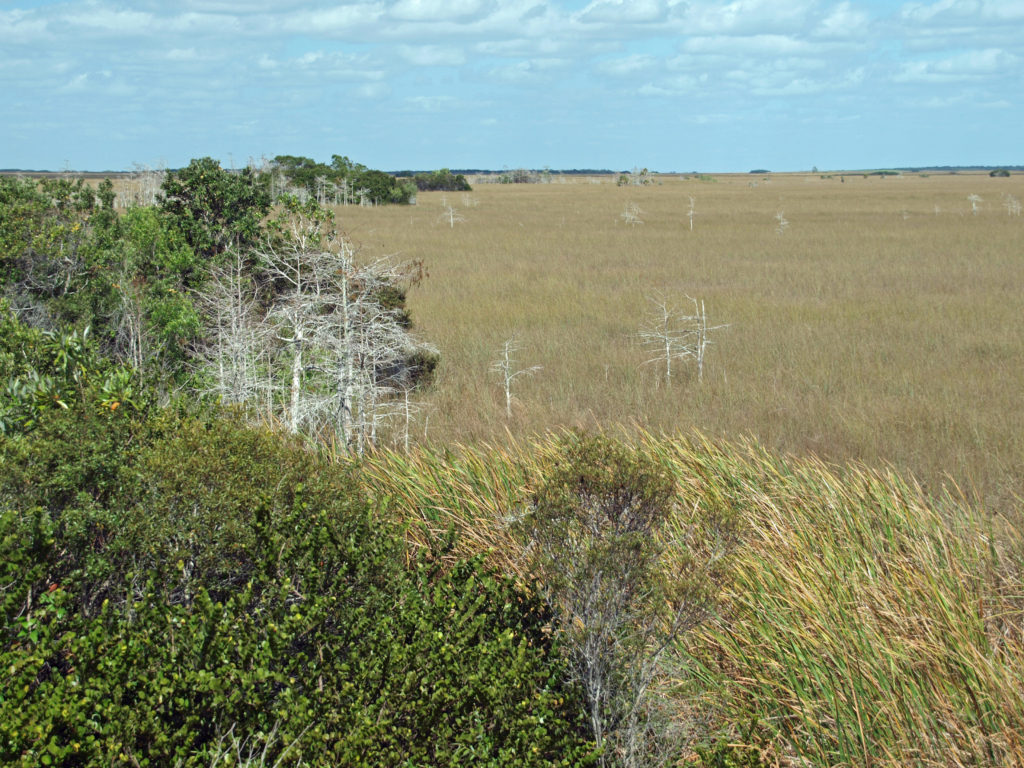 Farther along the road to Flamingo, the Long Pine Key, Pahayokey Overlook, and Mahogany Hammock stops offer short hiking trails. Canoeing and kayaking opportunities are found at Nine Mile Pond and West Lake. You’ll also find a nice picnic area at Nine Mile Pond, and another at Paroutis Pond.
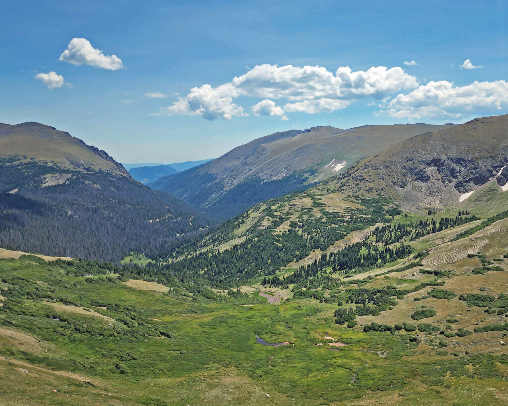
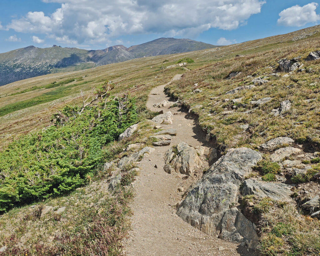
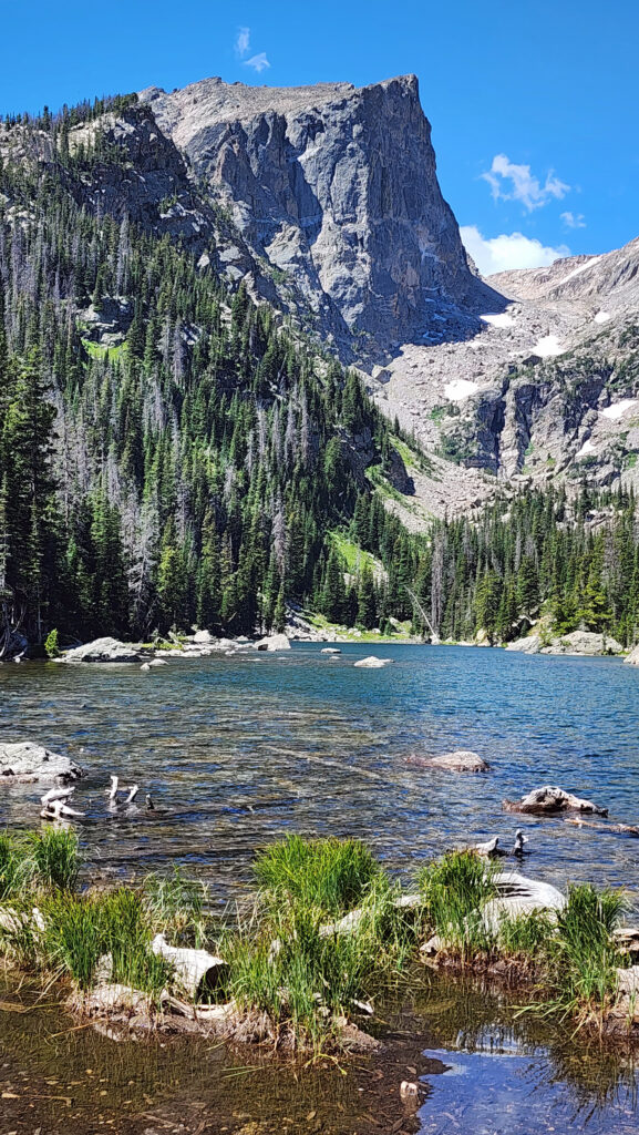
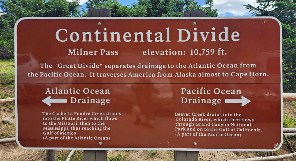 Coming down off Trail Ridge we stopped on the continental divide at Milner Pass (at 10,759 feet you actually come down in elevation from Trail Ridge to the divide). We did a short walk there along the shore of Poudre Lake and, of course, took a photo of the continental divide sign before heading south.
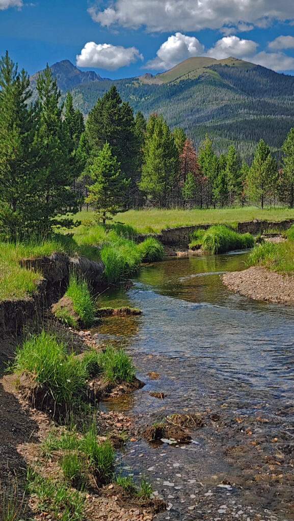

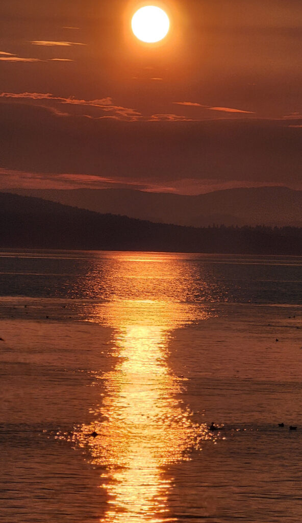
 There is no shortage of places to eat in Friday Harbor. For breakfast and lunch, I can personally recommend both Rocky Bay Café and Tina’s Place. For dining with a view, go to Downriggers on the bayfront. Classic Italian food can be found at Vinny’s Ristorante. Vegetarian and vegan food can be had at Mike’s Café and Wine Bar. For quality craft beers and upscale pub food, try San Juan Brewing. For seafood in a casual dining space, check out Friday’s Crab House. We ate at all of those, and all were good. But that’s just a sampling of what Friday Harbor offers. I wish we had had a few more days to sample more of the town’s eateries. What’s a vacation for, after all.
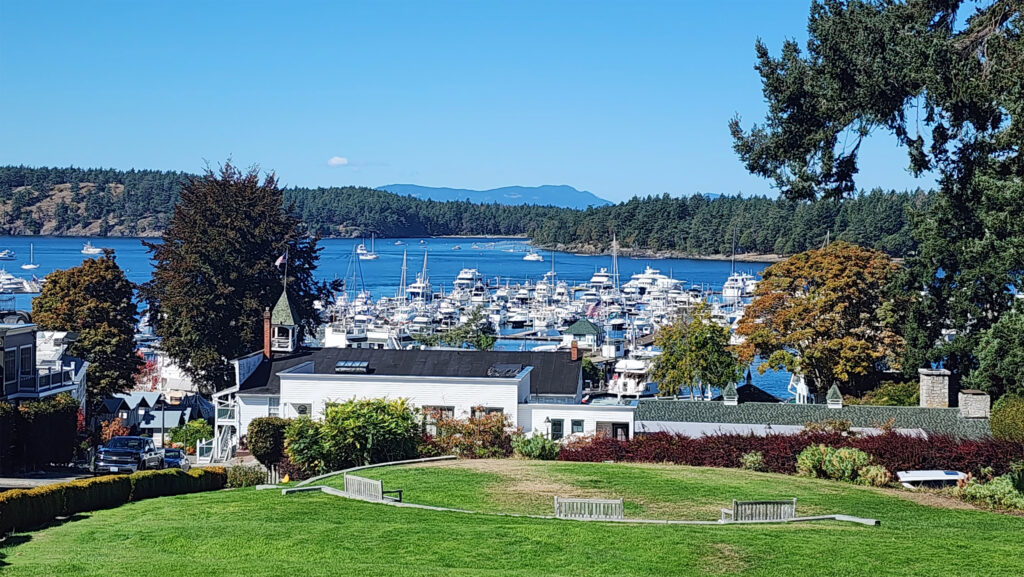
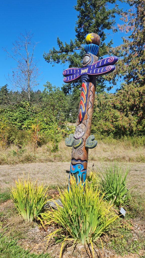
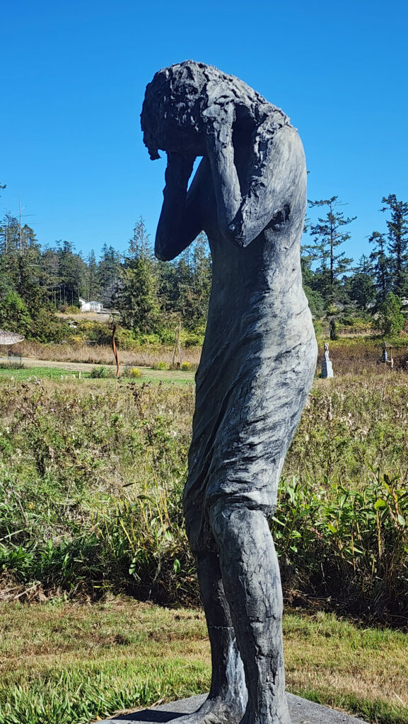
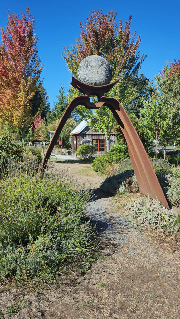
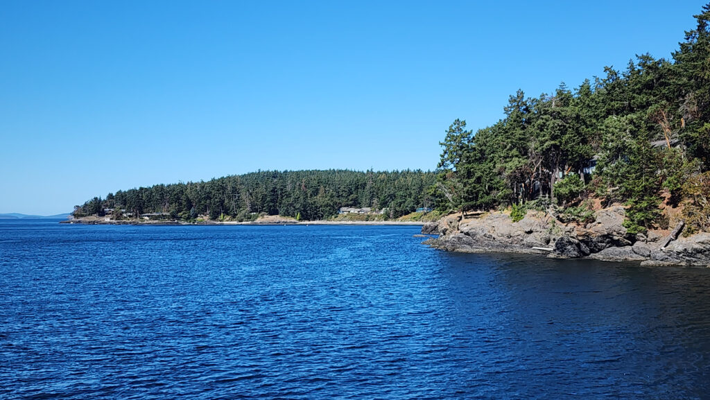
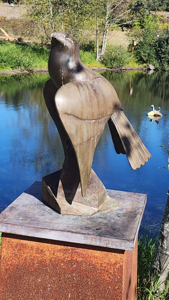 Near Roche Harbor (I think it’s actually part of the resort), the San Juan Islands Sculpture Park is a must see if you’re at all interested in sculpture. There are over 100 works of art (it seemed like many more) spread out over the twenty acres of the garden. Plan to spend at least an hour here. We spent more than that and still didn’t see it all. Admission is free, but donations are requested.
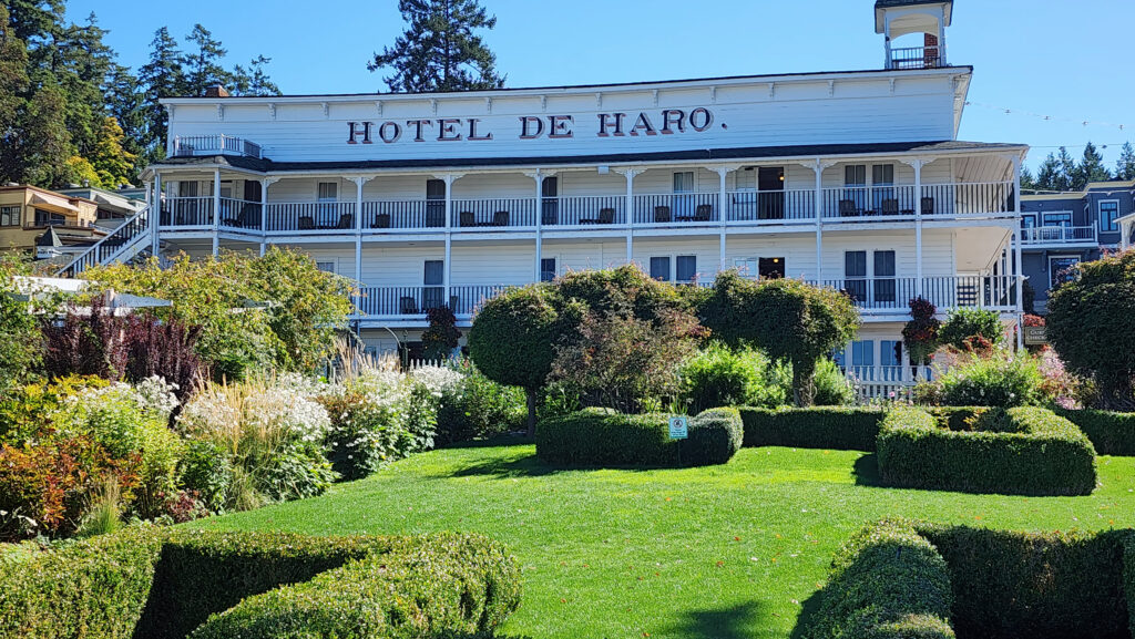
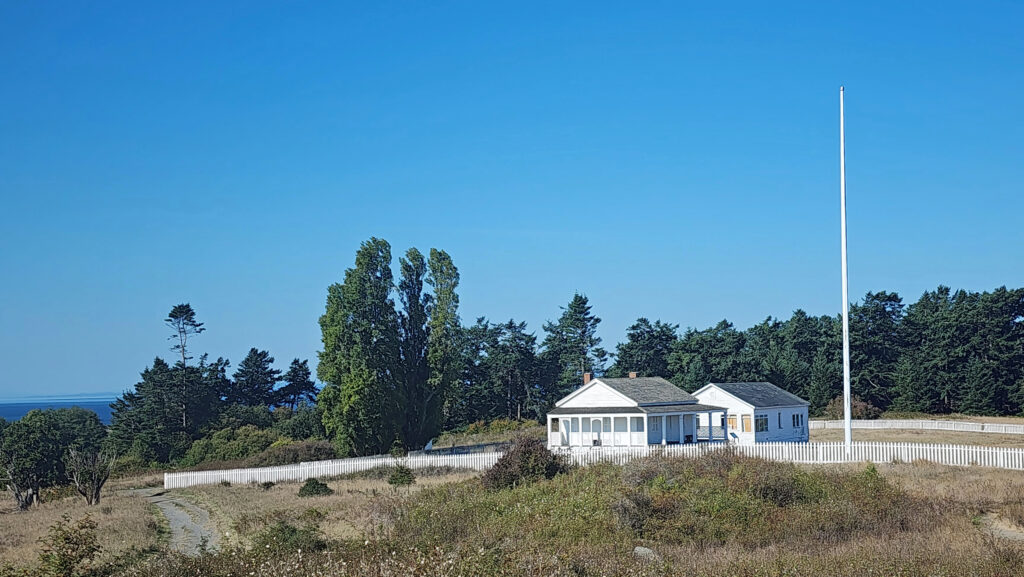
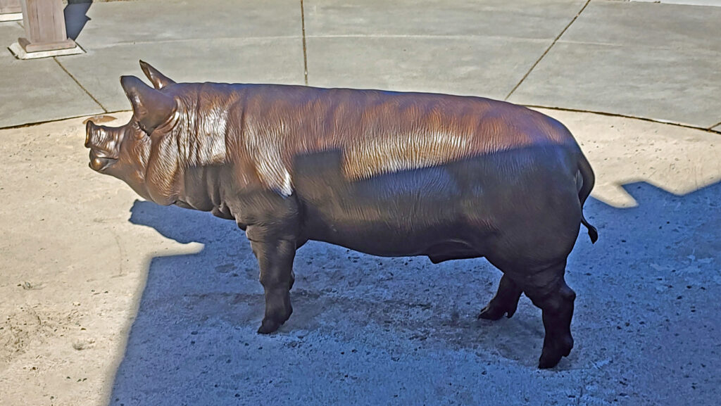 Tensions between the American and British contingents led both England and the U.S. to send military forces to the island. From 1859 to 1872, when the boundary dispute was finally settled in favor of the United States, the island was jointly occupied by both forces. No actual combat occurred, and no one was injured in the Pig War. The sites of the two country’s military installations are now part of
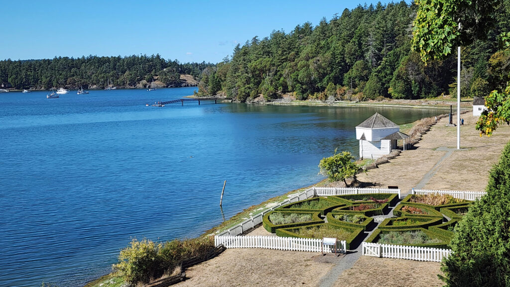
 Conclusion
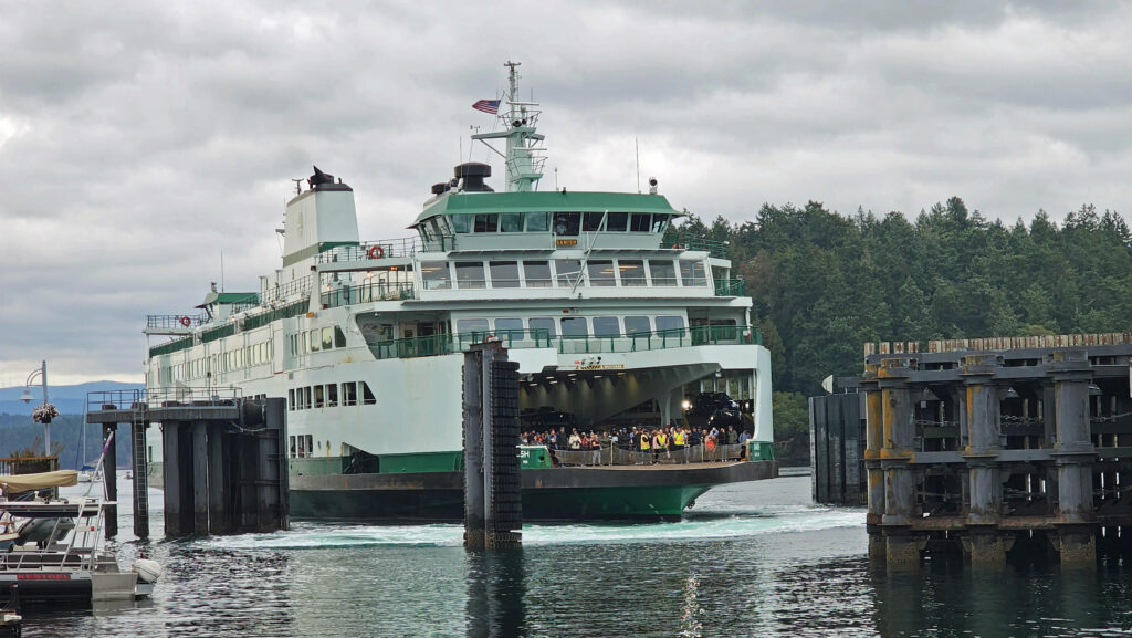
 Posted October 12, 2023 by Alan K. Lee
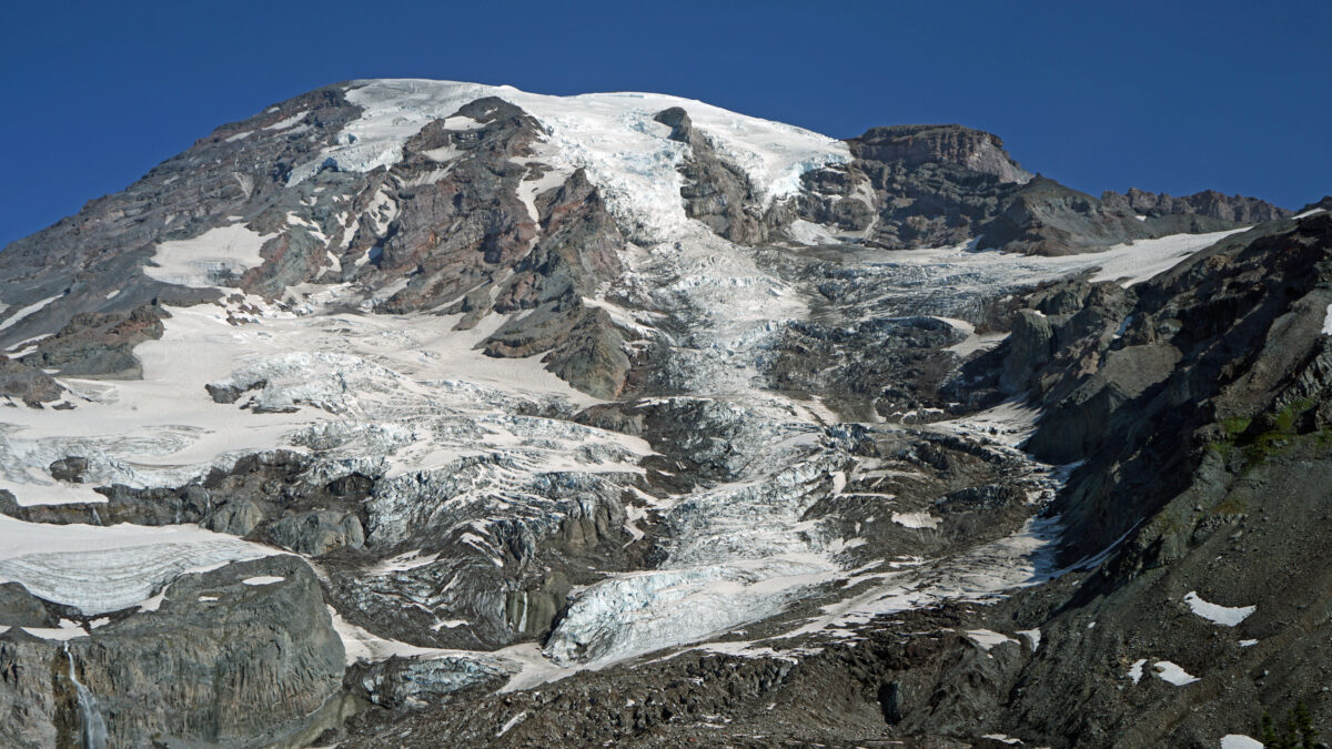
 Best Times to Go:
 The hike:
 Other area attractions and activities:
 Overview:
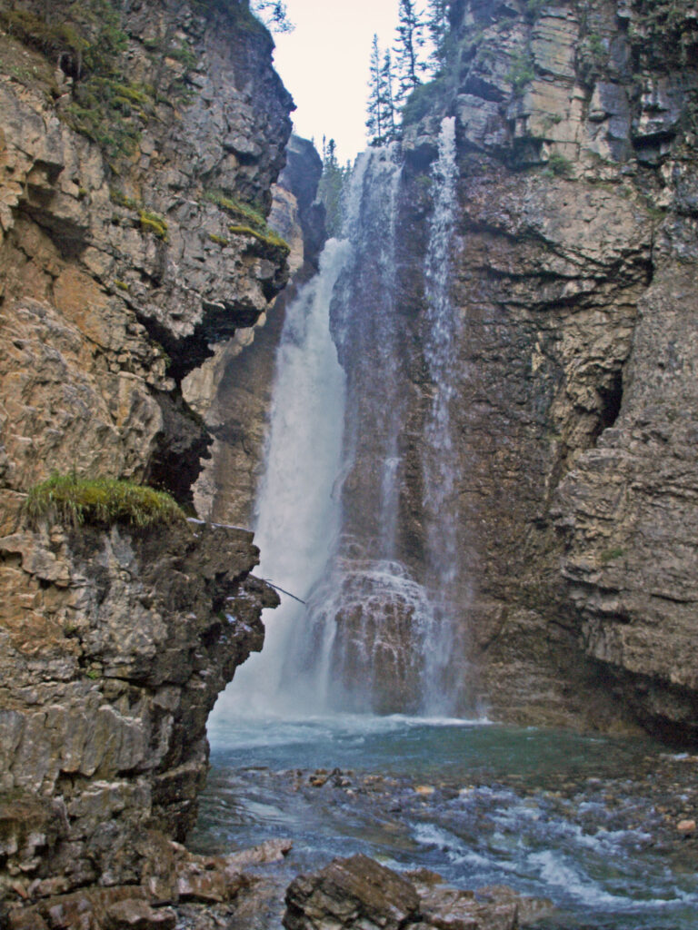
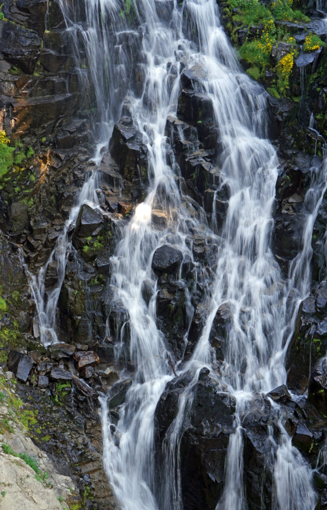
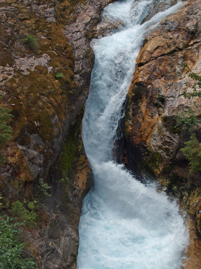
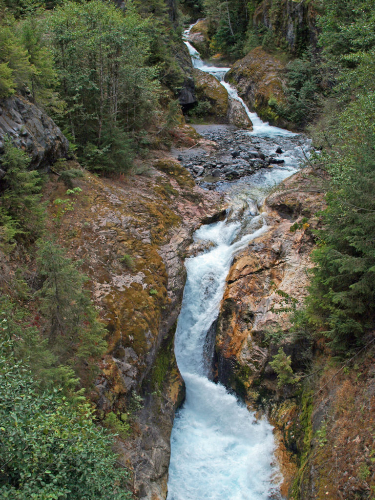 The history of Lava Canyon begins about 3500 years ago when an eruption of Mount St. Helens sent a flow of lava down the old valley of the Muddy River, destroying the forest and filling the valley with molten rock. Over the intervening years, the Muddy River cut a new course through the lava flow, and the canyon gradually filled with sediment. Then came the 1980 eruption, which melted the summit glaciers and sent a huge lahar (volcanic mudflow) down the valley, destroying the rebuilt forest and scouring out the built-up sediment, exposing the remnants of the earlier lava flow. What was left is a steeply descending canyon with an almost continuous series of spectacular waterfalls and cascades. (For more information on the 1980 eruption, see my
  Getting there:
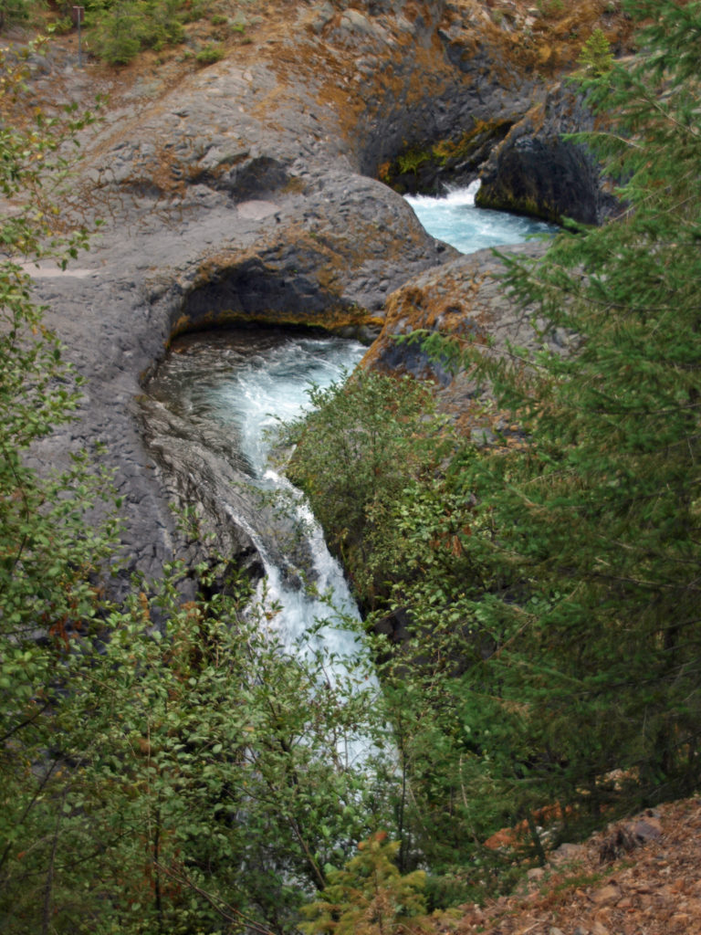 Trailheads:
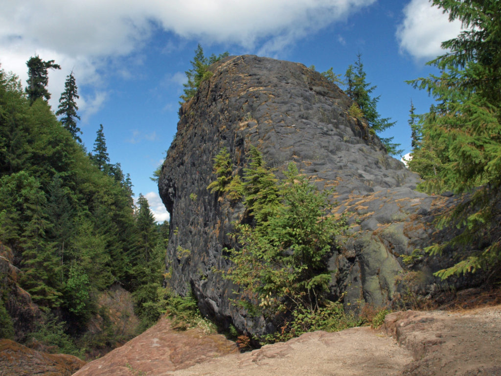 The hike:
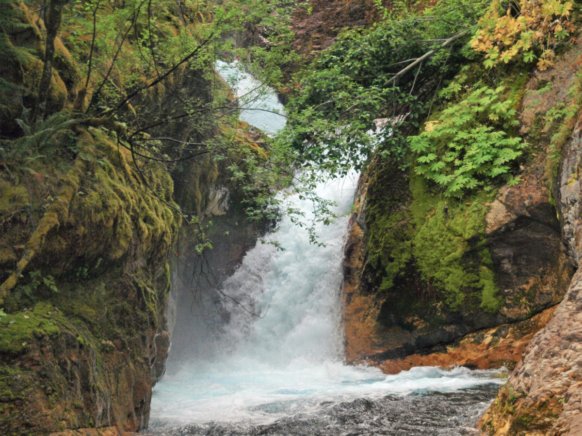
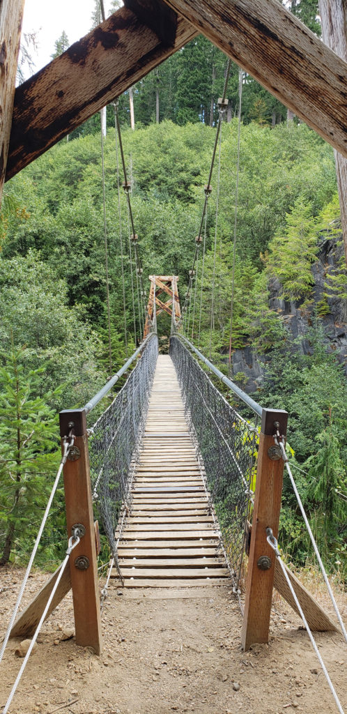 Below the overlook, the path is rock and dirt, steep in places. After another three tenths of a mile, you come to another side trail and a suspension bridge over the river that gives a bird’s eye view of the canyon and waterfalls. On the other side of the bridge is a connecting trail that takes you back to the upper bridge, making for a 1.4-mile loop. (Update: As of June 2023 the suspension bridge is closed. Check the National Forest Service’s
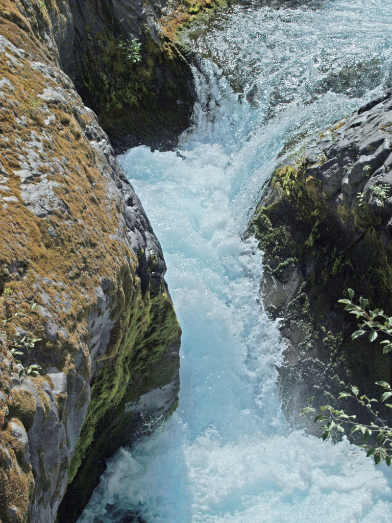
 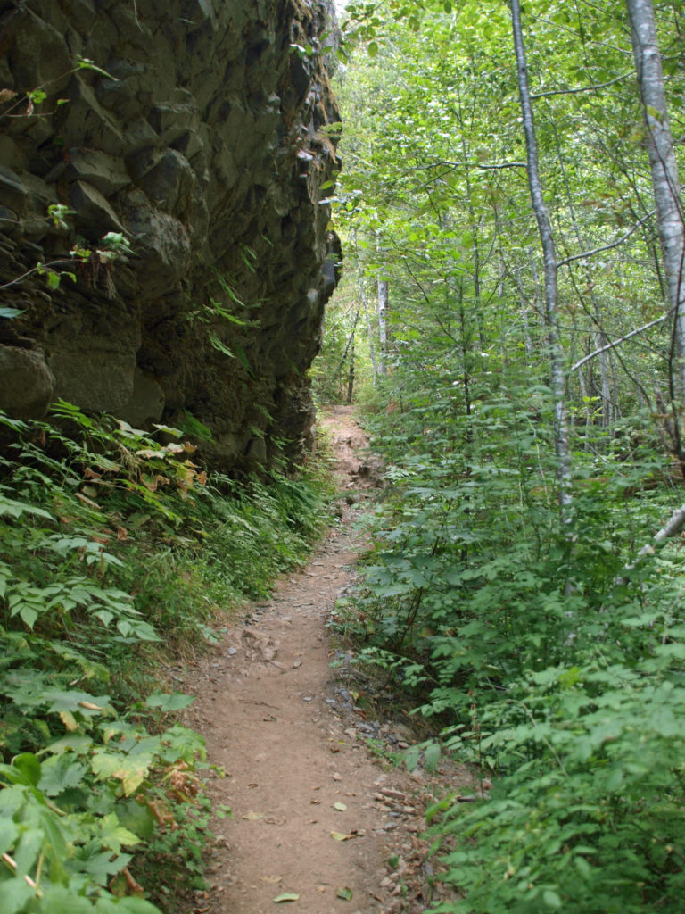 At about the 1.3-mile mark, the trail descends a 40-foot ladder to the base of the rock formation known as The Ship. Before 1980, sediment filled the canyon to the top of The Ship, to give you an idea of how much sediment was scoured out of the canyon. A short but steep side trail (and another ladder) leads to the top of The Ship.
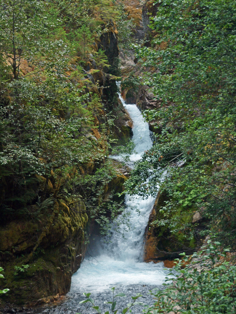 (Below The Ship, the trail continues another 1.5 miles to the lower trailhead. The entire hike from upper to lower trailhead and back is about six miles and the elevation gain coming back is 1350 feet.)
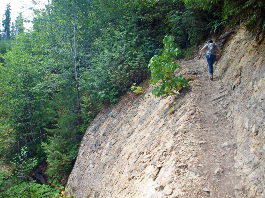 Return from The Ship the way you came. Cross the suspension bridge if it is open and take the trail on the opposite bank to the upper bridge and re-cross the river. The two bridges both give you great views of the river and canyon below.
 Originally posted in a different format September 29, 2018 by Alan K. Lee. Updated and re-posted March 23, 2021. Edited, updated and posted in this format June 29, 2023.
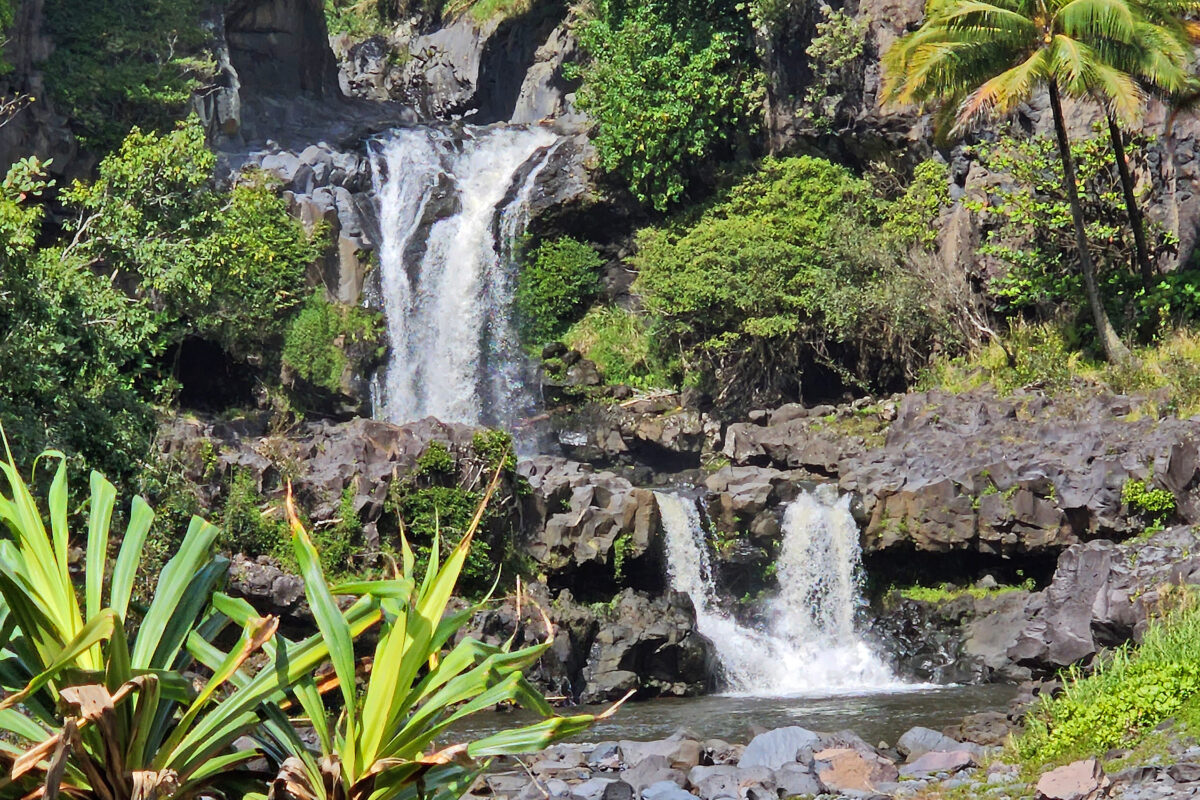
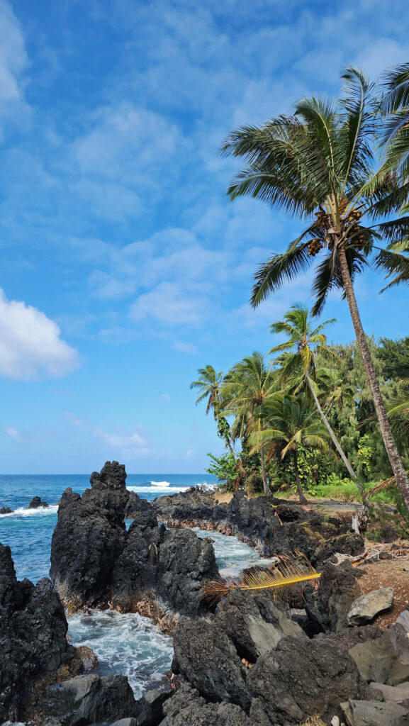
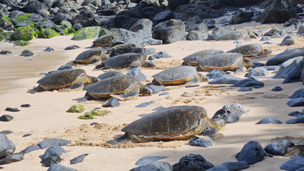
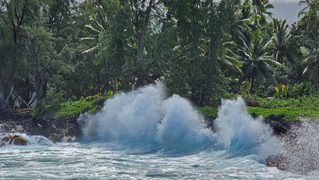
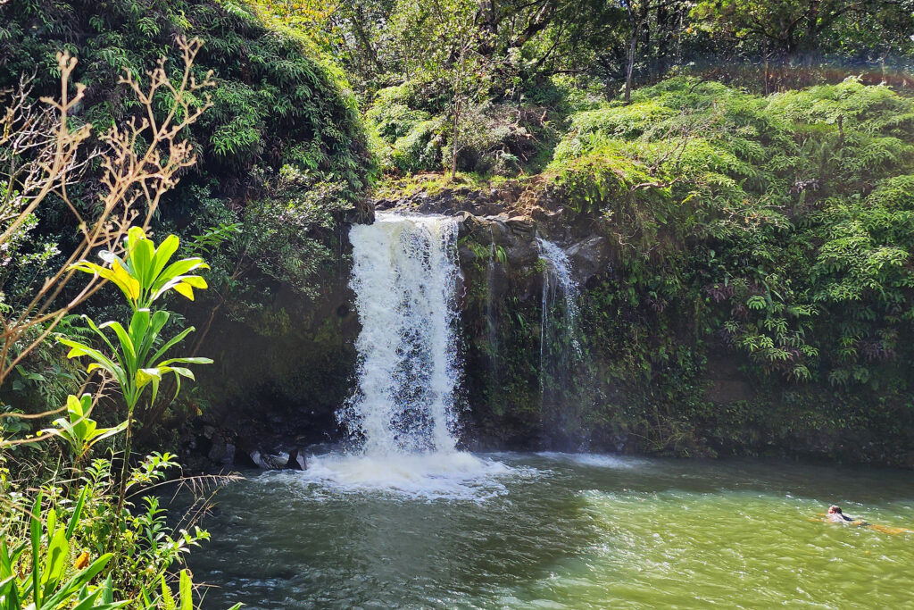
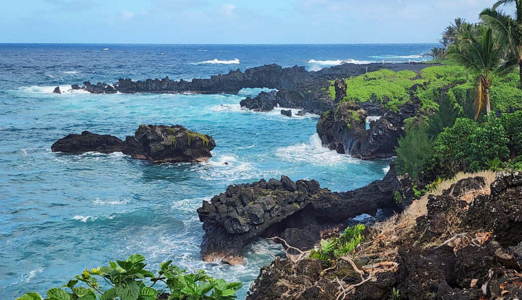
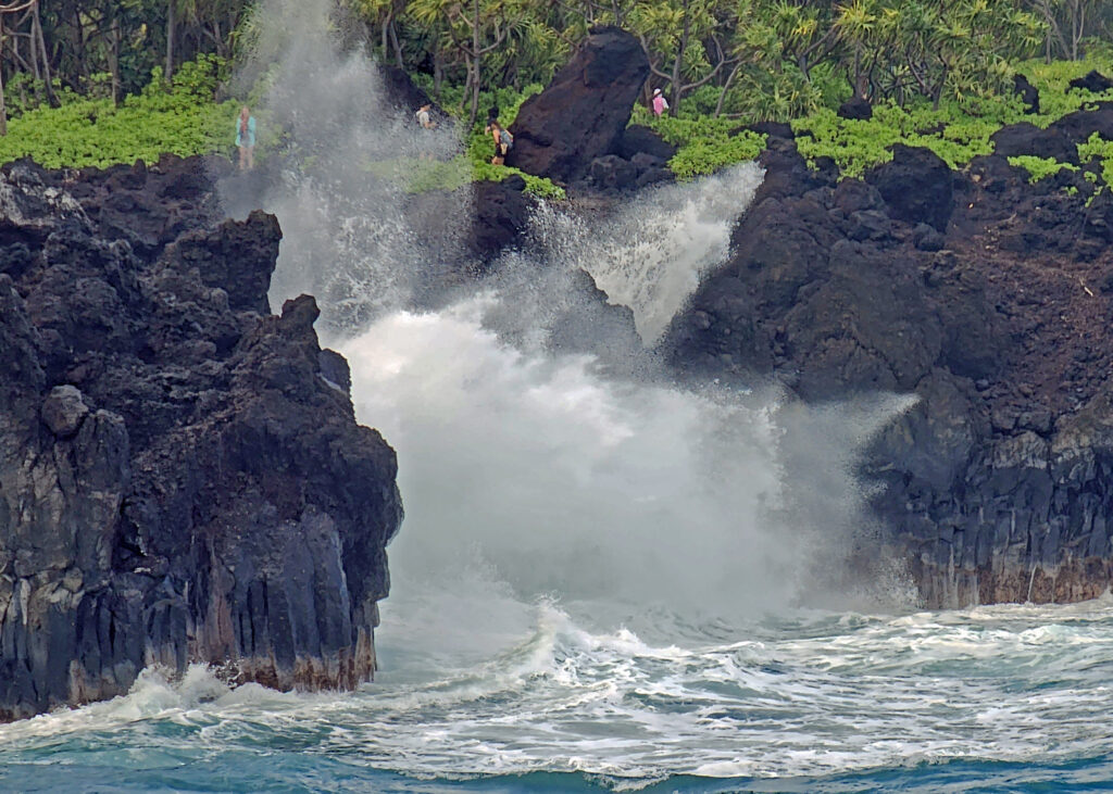
 There are a lot of things that you’ll miss if you’re visiting Hana as a day trip. Better to do as we did and spend a night or two. That will give you enough time to really see and enjoy the East Maui area. But be forewarned, Hana is expensive.
 Posted March 3, 2023.


 Originally posted August 6, 2019. Updated and re-posted November 19, 2022.
 The nearby
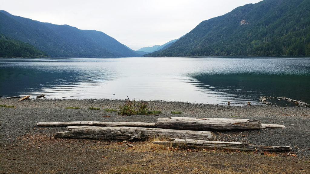
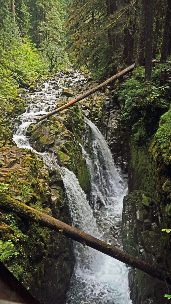
 After our hike to Sol Duc Falls we drove to the Hurricane Ridge Visitor Center to do some more hiking and sightseeing. The visitor center is located 17 miles south of Port Angeles at an elevation of 5242 feet above sea level. Hurricane Ridge is the only alpine area in Olympic National Park accessible by car, which makes it very popular and means it can be very crowded, especially on summer weekends. We were there in the middle of the week in late September, though, so crowds weren’t much of an issue.
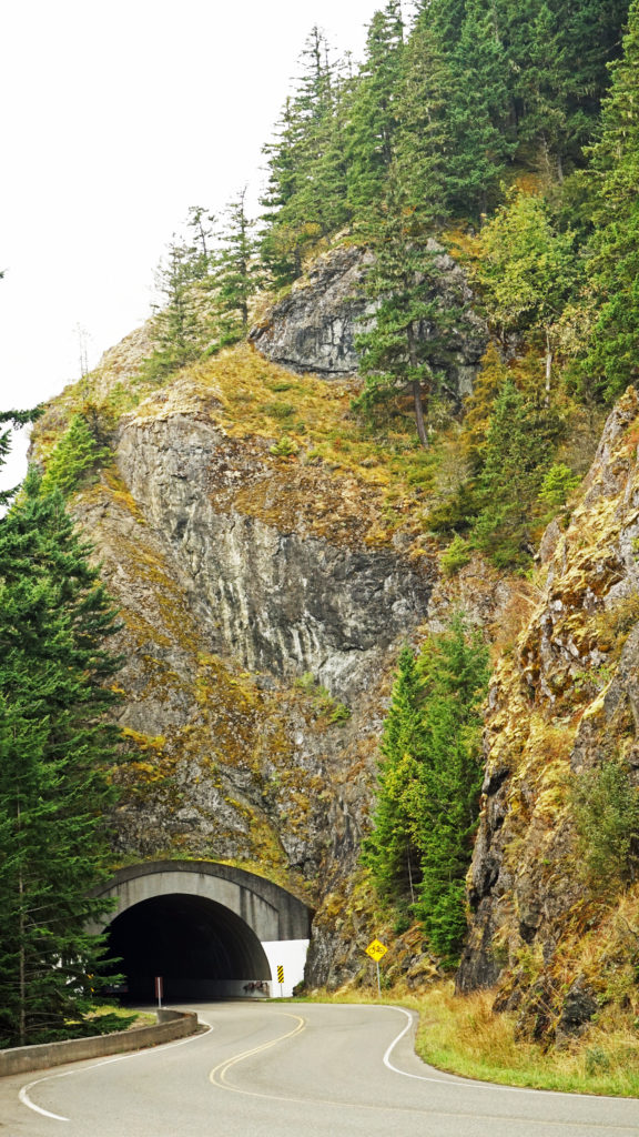 The Hurricane Ridge Road is paved, but winding with poor sight lines and several tunnels. It is also a popular challenge for cyclists because of the elevation gain, so go slow and watch for bicycles on the road.
 Originally posted November 7, 2020. Updated and re-posted November 9, 2022.
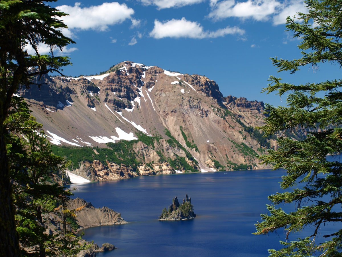
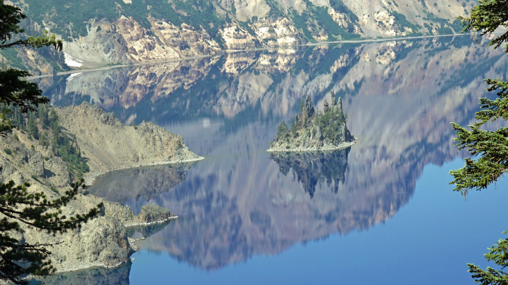
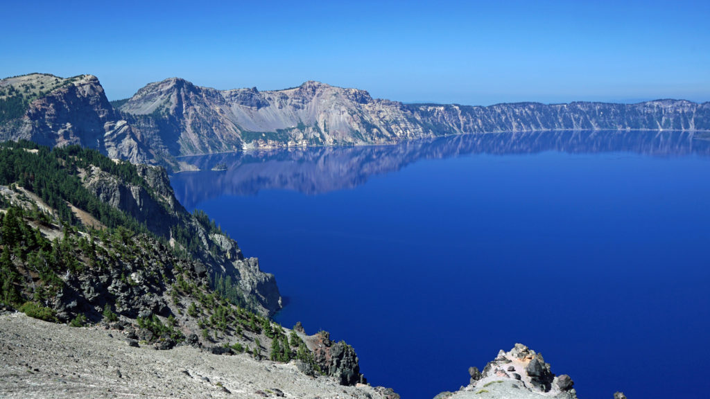 The Lake
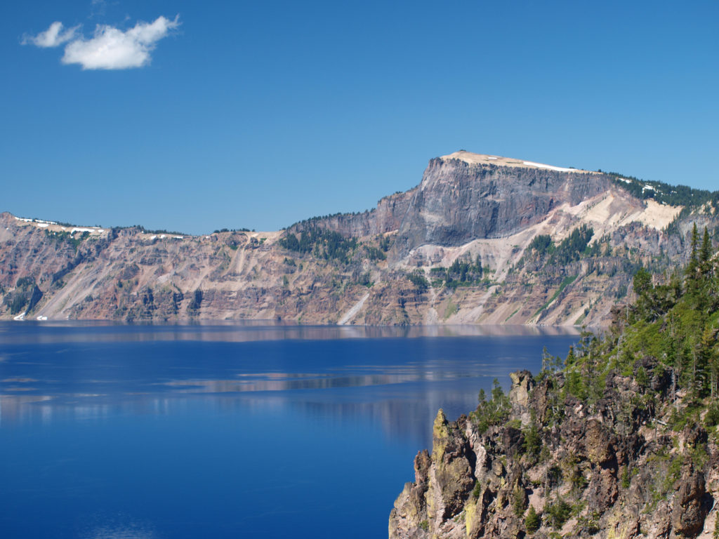 Crater Lake is 1943 feet deep, making it the deepest lake in the United States, second deepest in North America, and ninth deepest in the world. It is also one of the cleanest and clearest lakes in the world. It’s that combination of depth and clarity that results in its intense deep blue color.
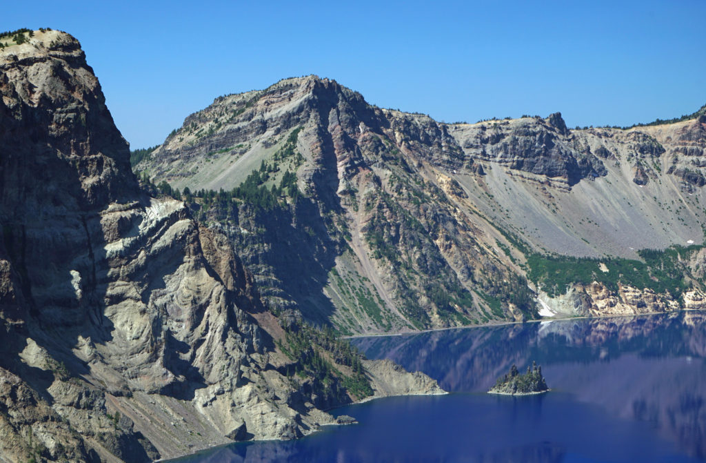 The caldera that Crater Lake occupies was formed 7700 years ago when the summit of 12,000 foot tall Mount Mazama collapsed after a massive eruption. Over time rain and snow filled the caldera to its present level. The lake has no outlet. The level of the lake remains nearly the same because the amount of evaporation from the surface of the lake closely matches the amount of precipitation falling on it in any given year.
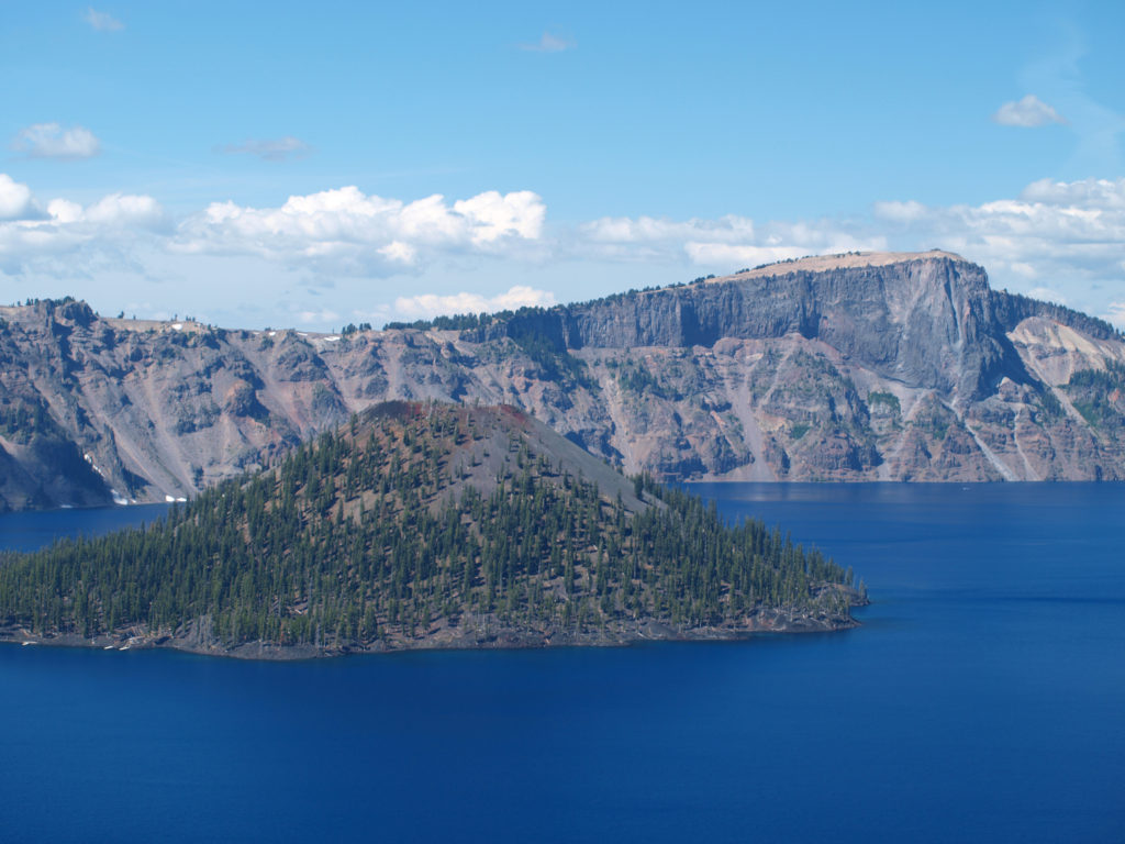 Wizard Island formed sometime after the eruption that formed the caldera. It rises 770 feet above the surface of the lake, 2713 feet above the deepest point in the lake. It last erupted about 5000 years ago, but it is considered dormant, not extinct. Conceivably, it could erupt again at any time. Merriam Cone also erupted after the caldera was formed, but never reached the lake surface. Its summit lies almost 500 feet below the average lake level.
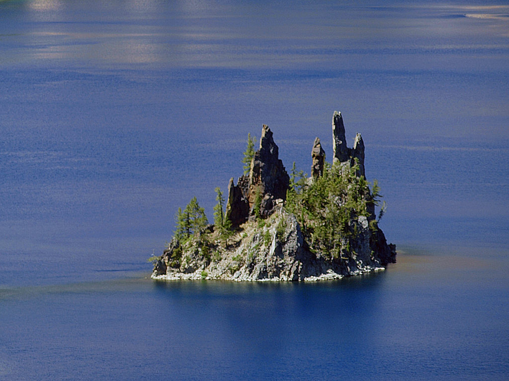 Phantom Ship, a remnant of an eruption 400,000 ago, rises 170 feet above the lake surface. Its formation predates that of Mount Mazama itself.
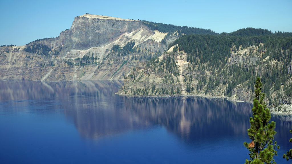 The Park
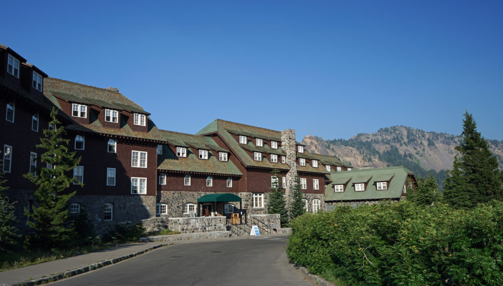 Crater Lake Lodge
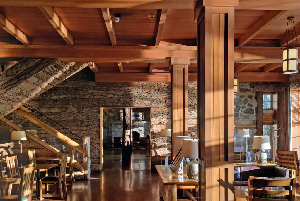 My wife and I recently spent three nights at the lodge. Although it lacks the amenities of a luxury hotel, our room was comfortable, with a private bathroom, and the location more than makes up any lack of luxuries.
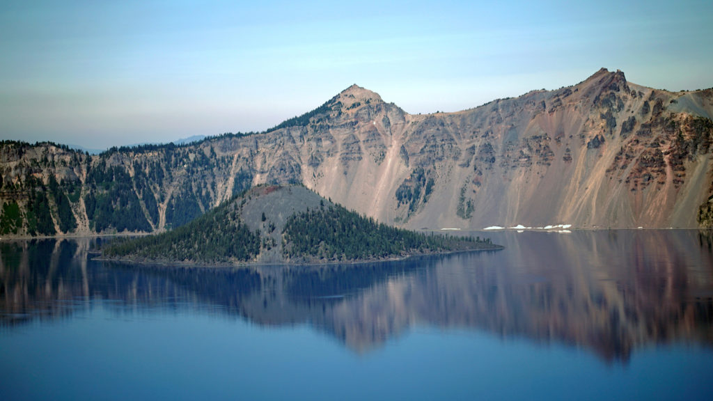 The Rim Drive
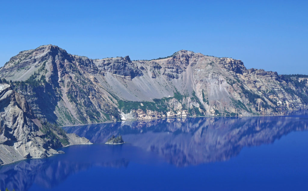 You’ll want to stop at all of the viewpoints. Maybe combine the drive with a hike down to Cleetwood Cove and a boat tour of the lake. You can get off at Wizard Island and hike to the summit and then catch a later boat back.
 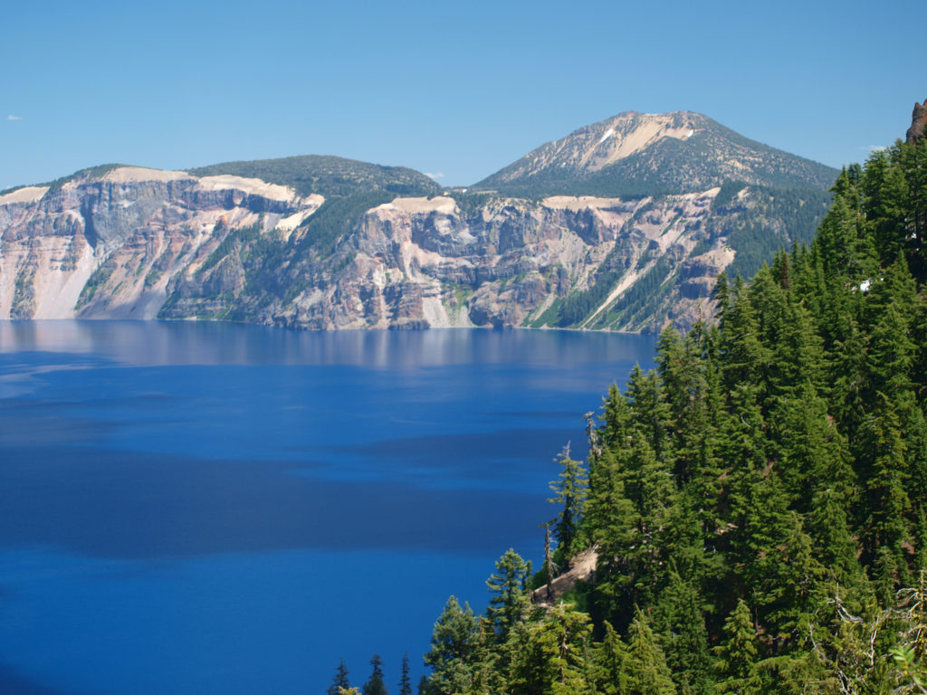 For a more adventurous day, hike to the summit of Mount Scott, the highest point in the park. It’s a two mile hike to the summit with 1250 feet of elevation gain, so it’s not an easy hike (All Trails rates it “moderate”), but the view might just be worth the effort.
 Hiking Trails
 The Pacific Crest Trail passes through the park, but does not ascend to the rim of the caldera. Hikers on the PCT can take the Dutton Creek Trail that climbs up to the Rim Village, then hike the trail that parallels the West Rim Drive and reconnect with the PCT north of the lake.
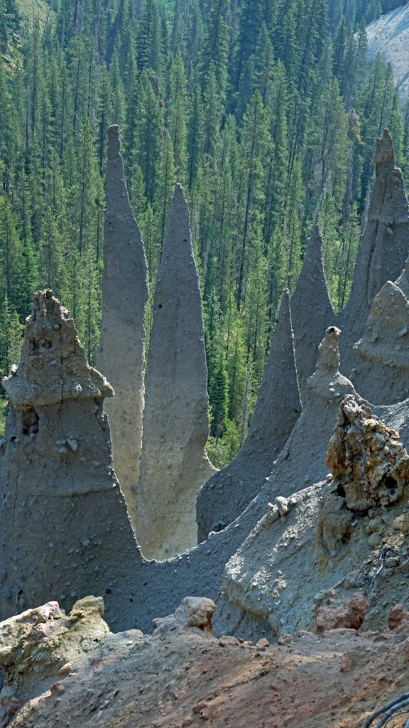
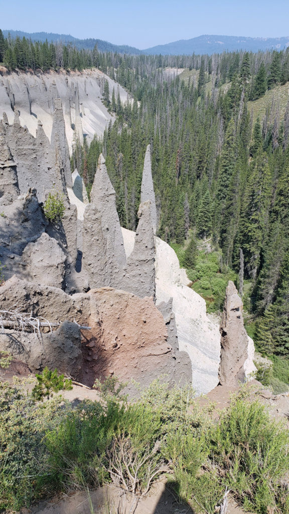 The Pinnacles
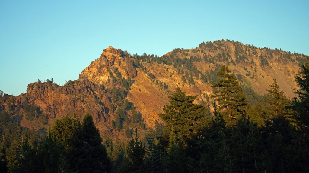 Practical Info
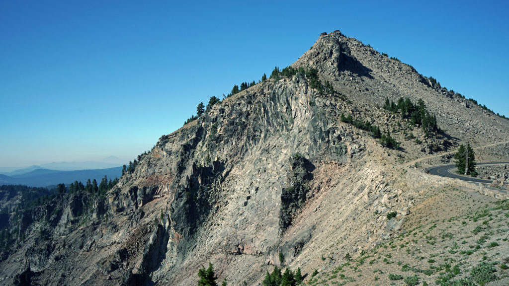
 There are two lodges in the park, Crater Lake Lodge in the Rim Village and The Cabins At Mazama Village that are open for the summer season. Crater Lake Lodge has 71 rooms, starting at $246/night. The Cabins At Mazama Village has 40 rooms, all at $160/night. Prices listed are for the 2024 season. Note that the concessionaire that operates both lodges is changing, so prices may also change. Check the park website (linked above) for current information.
 There are two campgrounds in the park. Mazama Campground has 75 RV sites, 18 tent sites with electricity, and 121 tent sites without electricity. Tent sites start at $22. RV sites run from $32 to $44 per night. Mazama Campground is usually open from early June through late to September. Lost Creek Campground, located on Pinnacles Road, is a primitive tent only campground with 18 sites, operated by the park service. Lost Creek Campground is currently closed and will not be open for the 2024 season. Backcountry camping is allowed in the park by
 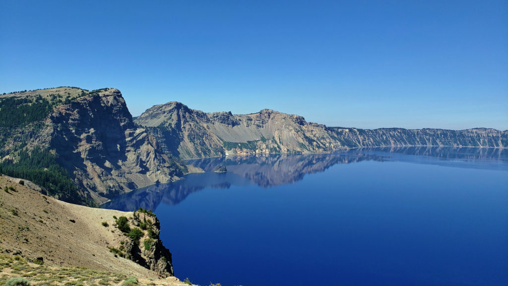 Dining options in the park are somewhat limited. The dining room at Crater Lake Lodge is open to all visitors, but reservations can only be made by people staying in the park. The Rim Village Cafe offers “grab and go” sandwiches and salads (I had a pulled pork sandwich from there on our recent visit that was very good). It is open from 9am to 8pm in the summer and 10am to 5pm in the winter. The Annie Creek Restaurant in Mazama Village is open from 7am until 9pm. The Mazama Village Store sells packaged sandwiches and snacks.
 Summer park entrance fees are $30 for private vehicles and $25 for motorcycles. Winter fees are $10 less. Snowmobilers, bicyclists, and pedestrians are charged $15 per individual. All entrance fees are good for seven days. Entry reservations do not need to be made.
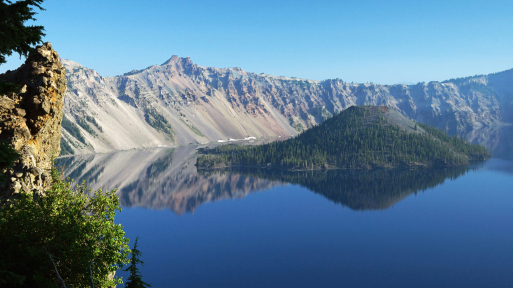
 Originally posted September 13, 2021. Most recently updated April 6, 2024.
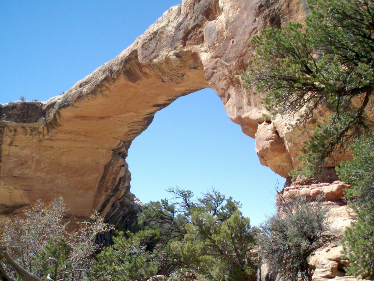
 First Impressions
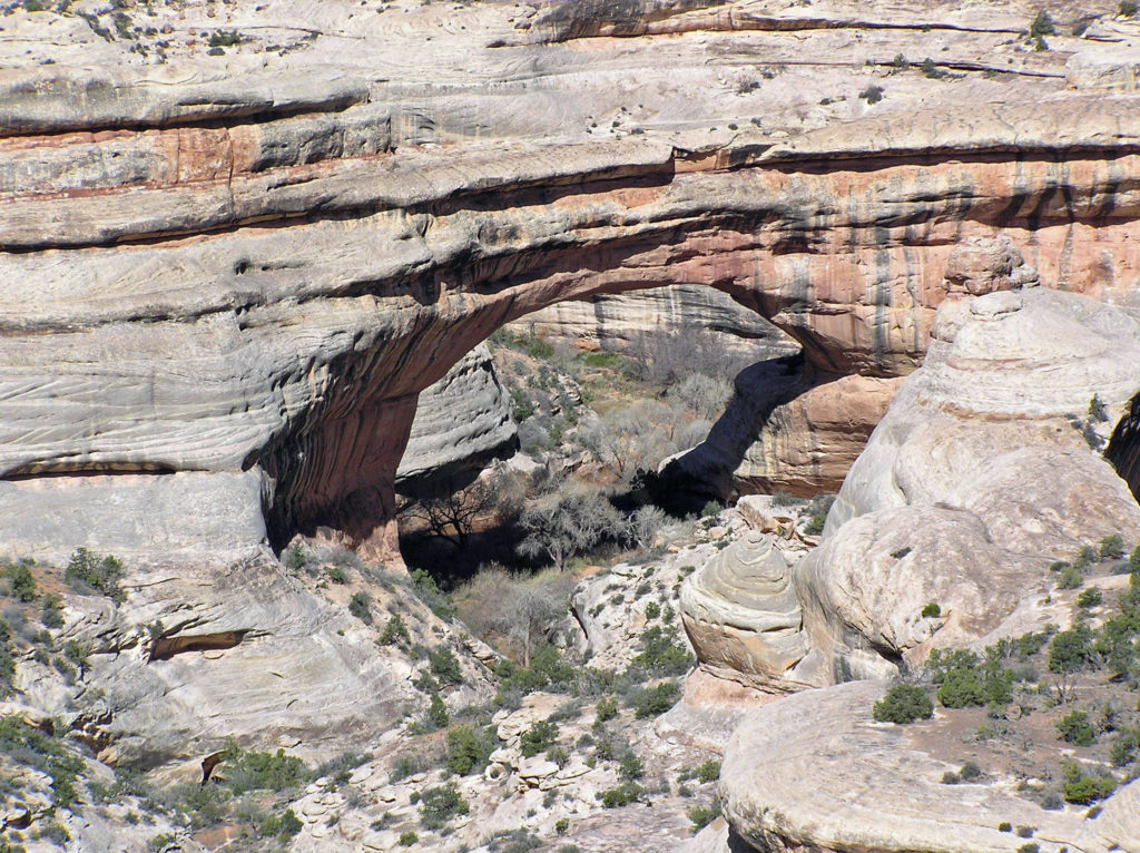 My wife and I have been back once since that first visit. The photos here were taken on that second trip in 2008. I think we’re long overdue for a third visit.
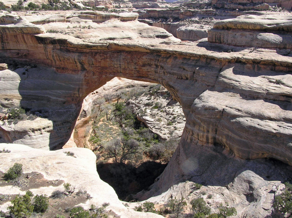
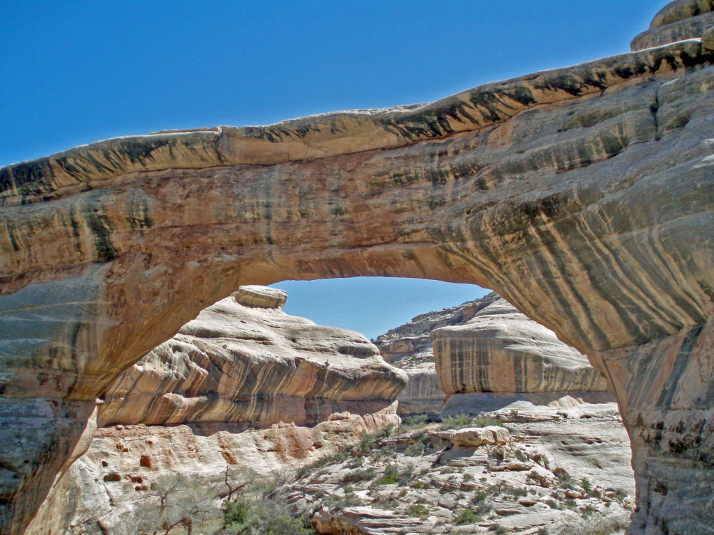
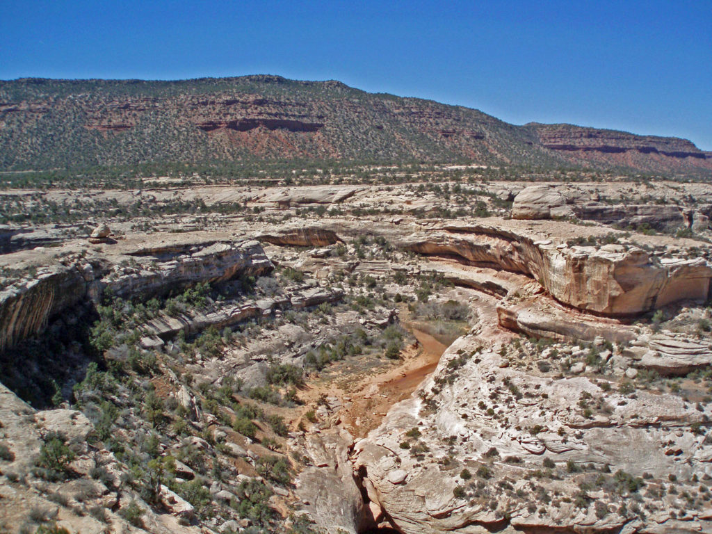
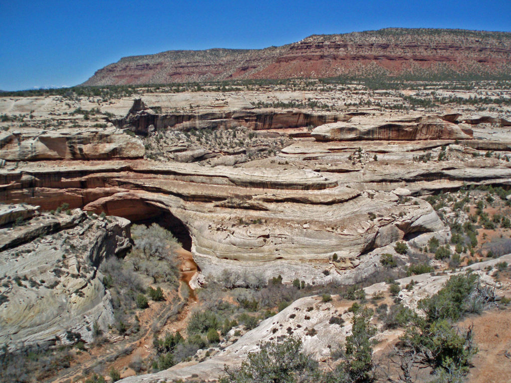 The white Cedar Mesa Sandstone of the canyons in Natural Bridges was formed from white quartz sand with relatively little iron. The red and orange sandstone of the mesa tops gets its color from more iron rich rocks. Oxygen and hydrogen react with the iron, forming compounds that vary in color depending on the relative proportions of oxygen and hydrogen in the rock.
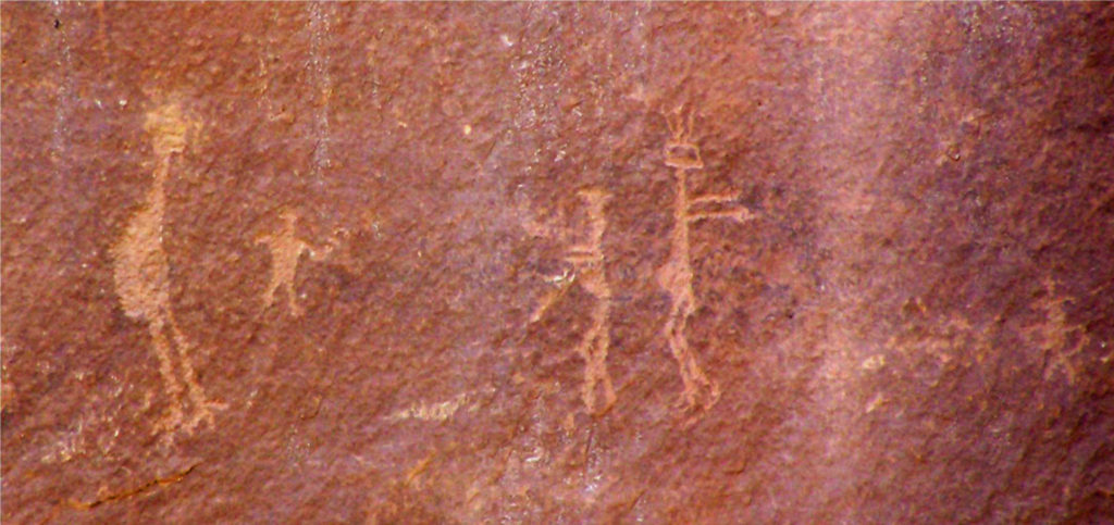 Human Presence
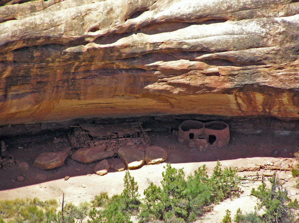 The Ancestral Puebloan people began farming the mesa tops around 1500 years ago, but later abandoned the area, presumably because of a prolonged drought. After 300 years, the ancestors of modern day Hopi and Navajo returned to the Natural Bridges area, only to abandon the area again around the year 1280 CE. Modern Hopi, Navaho, and Paiute peoples reoccupied the area once again at later dates.
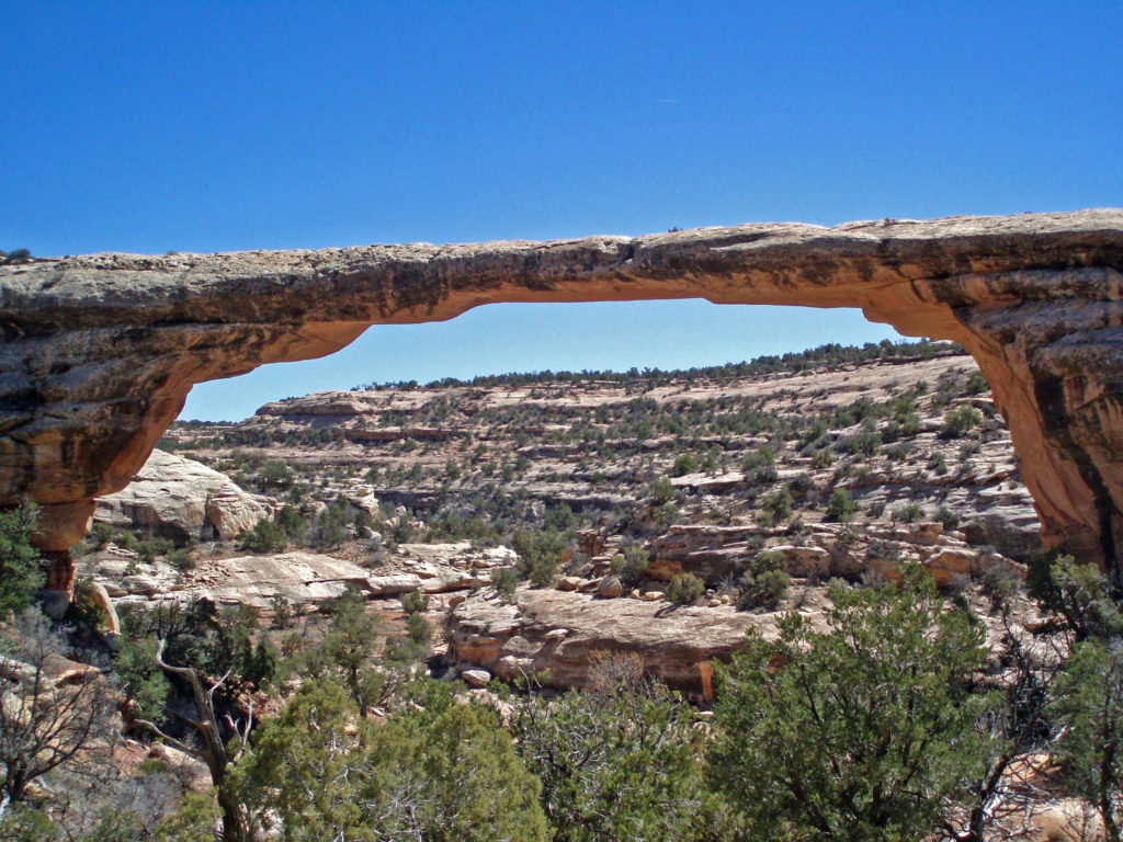 Europeans didn’t discover the area until 1883 when prospector Cass Hite ventured into the canyons looking for gold. He didn’t find any gold, but he did find the three magnificent natural bridges. Twenty years later, National Geographic Magazine published an article about the bridges, gaining the attention of President Theodore Roosevelt, who established
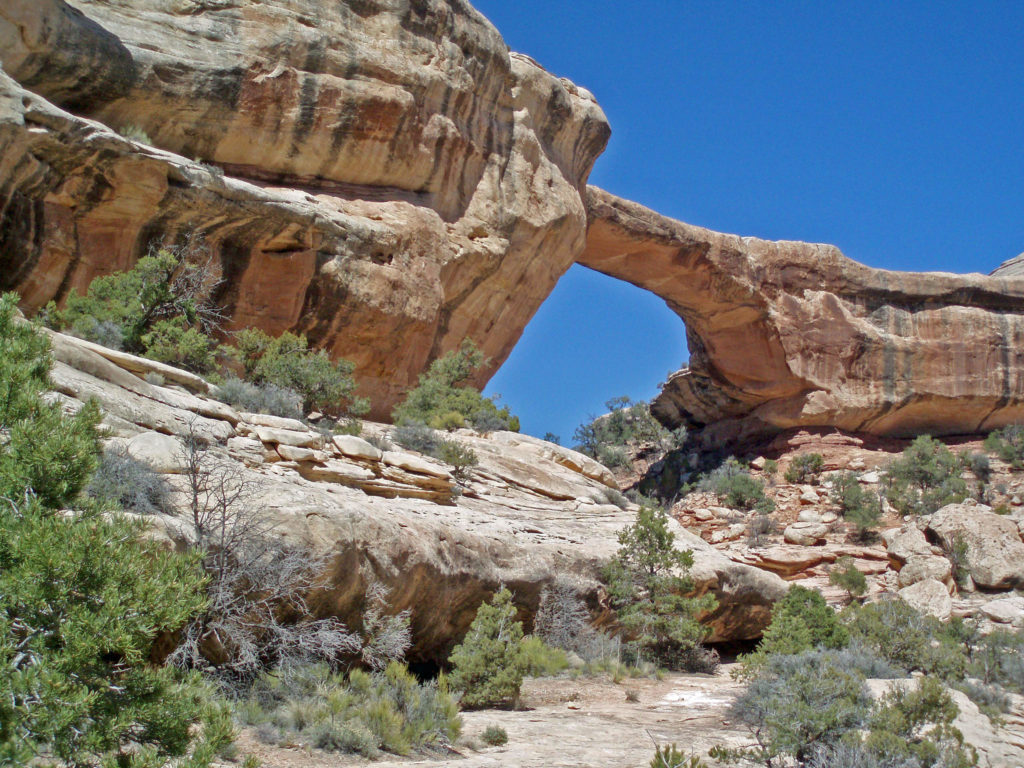
  The bridges were named President, Senator and Congressman by Cass Hite. Later explorers gave them the names Augusta, Caroline and Edwin. But neither set of names stuck. In 1909 the bridges were given the Hopi names they carry today: Sipapu, Kachina, and Owachomo.
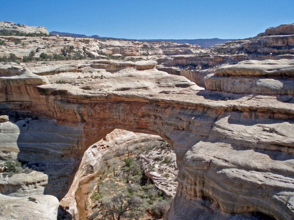
 Visitor Center
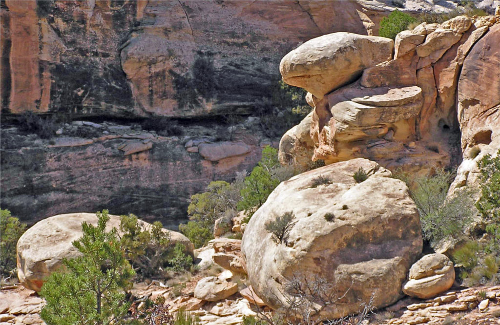


 Conclusion
 Originally posted July 10, 2021. Updated July 21, 2024.