by Alan K. Lee
Introduction
My wife and I had driven through Spokane once or twice on our way to Glacier National Park, but it had been decades since I had actually set foot in Spokane. My wife, though, had spent a few days there a couple of years ago and had enjoyed her time there. That got me to thinking about paying the town another visit, so we packed up our bags and spent a few days exploring the city this past summer.
History
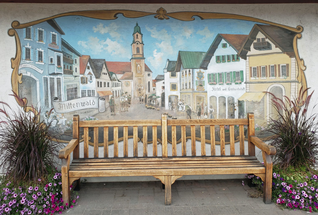
The city gets its name from the Spokane (or Spokan) Tribe of Native Americans that lived in what is now eastern Washington for millennia prior to the arrival of European settlers. The first European presence in the Spokane area was a trading post of the North West Company that opened in 1810. The city of Spokane was incorporated (originally as Spokane Falls) in 1881, the same year that the Northern Pacific Railway line was completed, linking Spokane to both Seattle and the Midwest and East Coast of the United States.
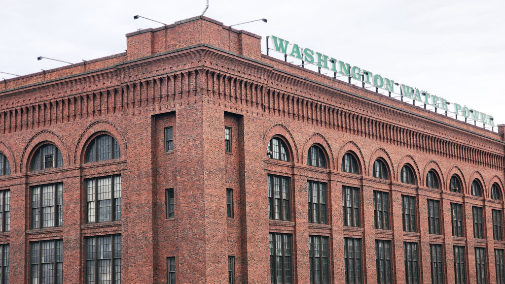
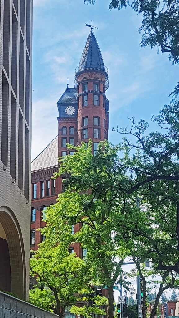
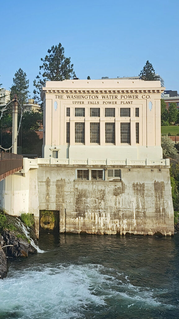
Two years after the city was incorporated, gold was discovered near Coeur d’Alene, Idaho, about 30 miles east of Spokane. That set off a boom in both Spokane’s economy and population. By 1890 Spokane’s population was almost 20,000. By 1910 it exceeded 100,000. The city was powered by electricity generated at Spokane Falls by the Washington Water Power Company. Many of the buildings constructed in that period are still standing, giving the visitor a visual link to the city’s early history.
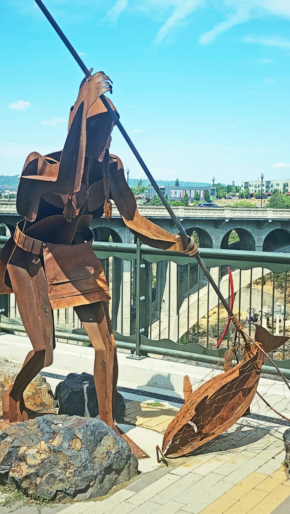
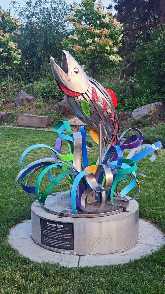
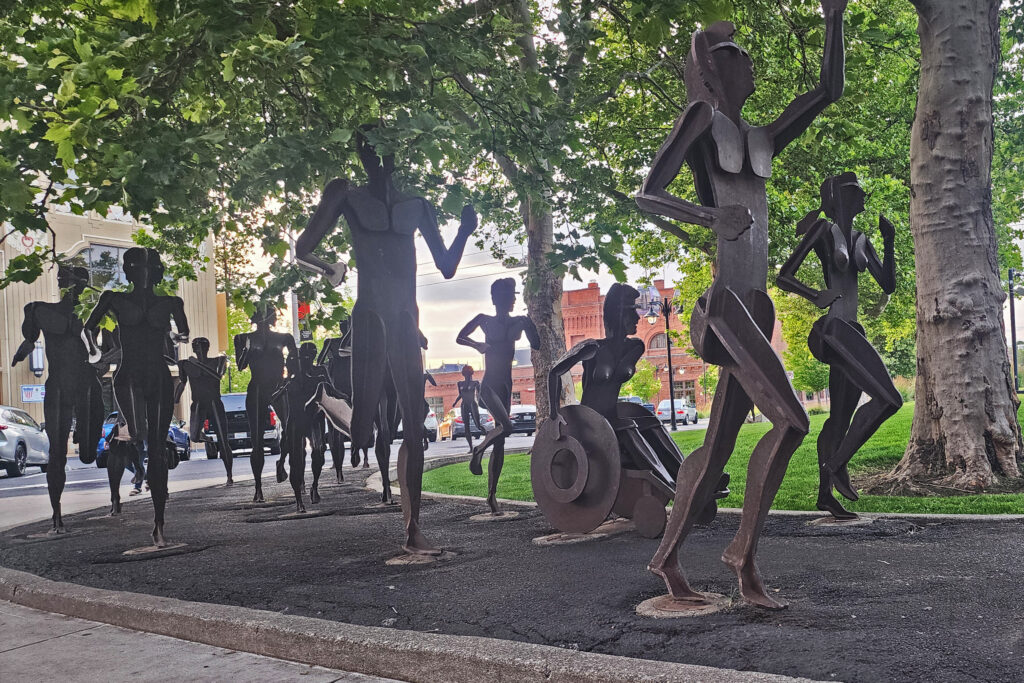
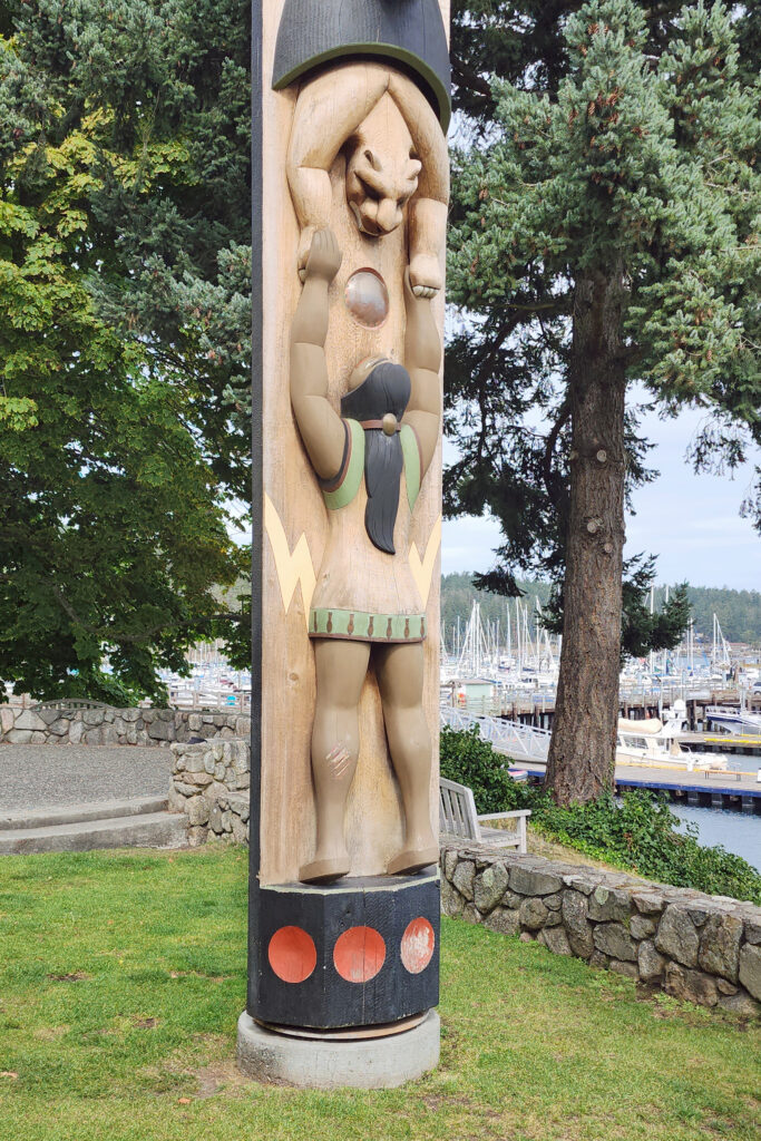
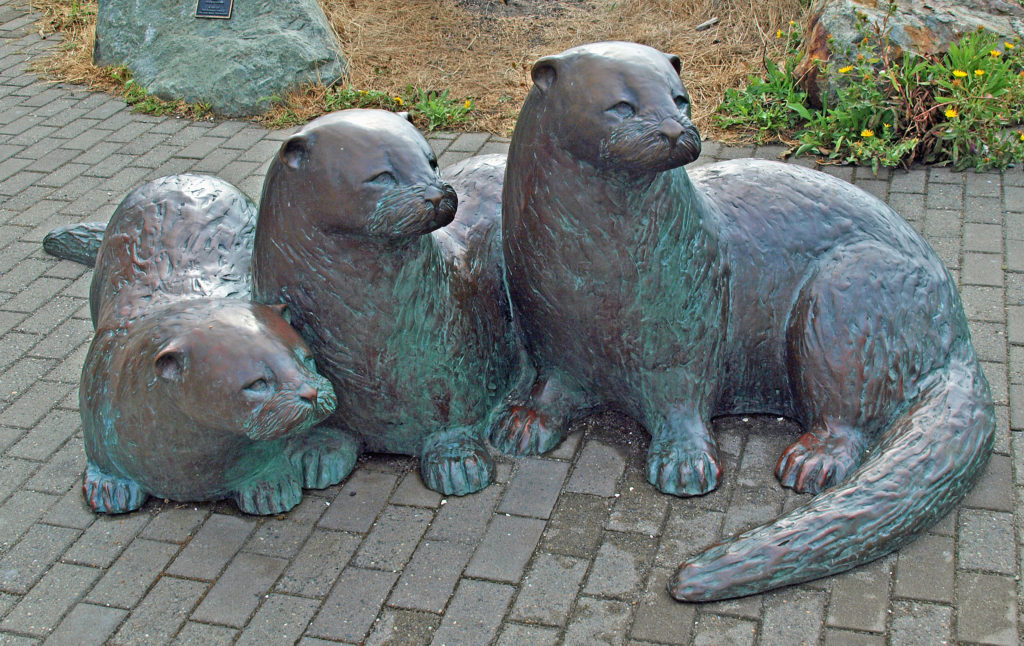
With the decline of the mining industry in the early 20th century and then the advent of the Great Depression, Spokane’s economy stagnated and its population plateaued. By the 1960s Spokane was in serious decline. To turn things around, the local business community began a planning process that eventually led to Spokane hosting the environmentally themed World’s Fair, Expo ’74, and the revitalization of the downtown area. Today, Spokane has a lively downtown, the site of Expo ’74 has become Riverfront Park, and you’ll find public artworks scattered throughout the city.
Getting There
We chose to drive from our home in the Portland area. It’s a long drive – 350 miles and 5½ hours (plus any stops along the way). It’s a little shorter trip from Seattle – 280 miles and 4¼ hours. Flying from Portland to Spokane takes just over an hour and tickets can be had for as little as $150 dollars. Cost and flight time from Seattle are similar. A brief search of Amtrak routes and ticket costs yielded a quickest trip from either Seattle or Portland of 7½ hours and basic coach fares of $50-70 (one way), but you might need to be flexible on your departure and return dates, and the cheapest tickets were for overnight trips.
Our Visit
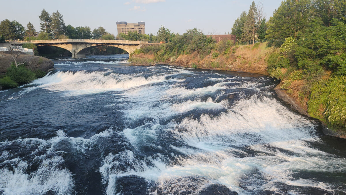
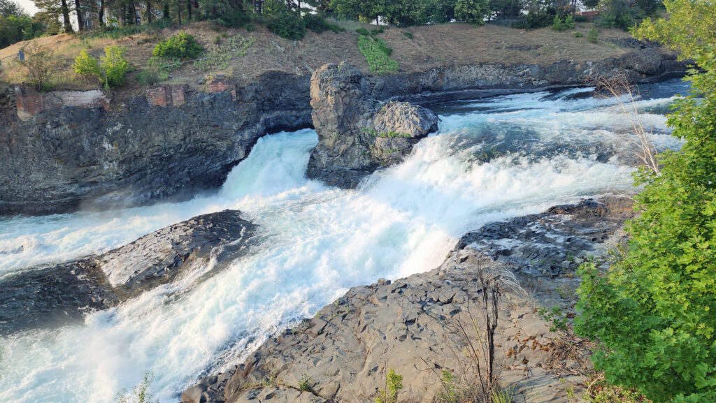
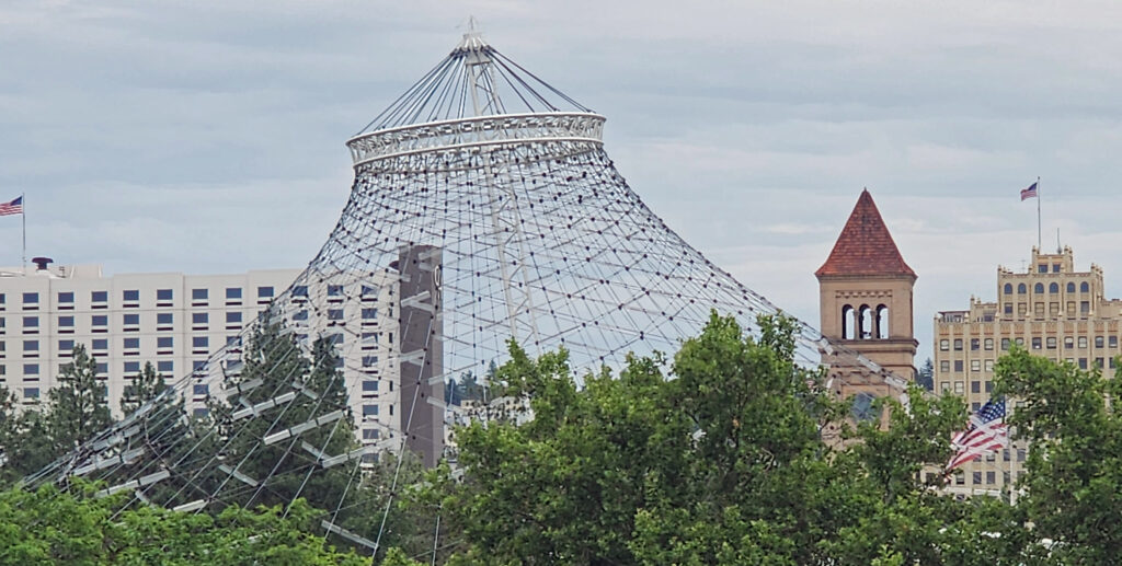
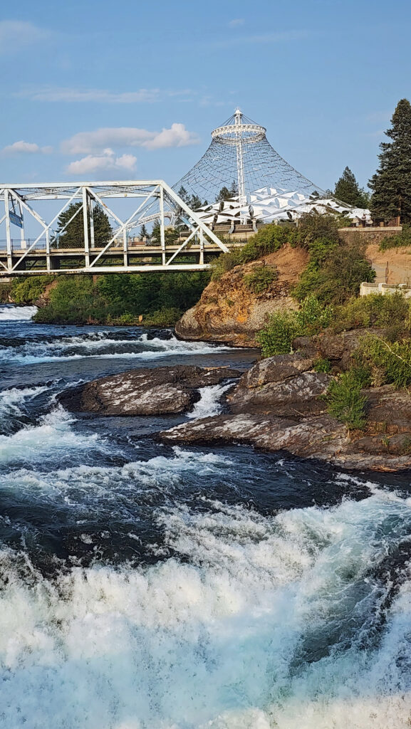
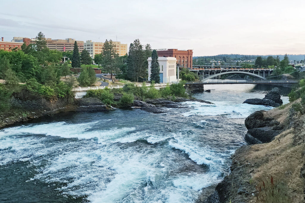
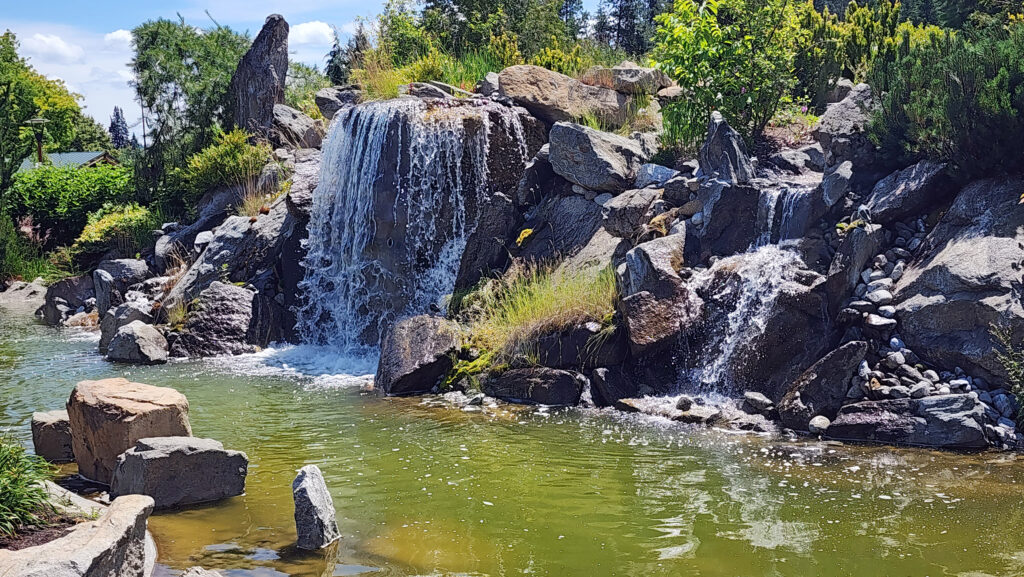
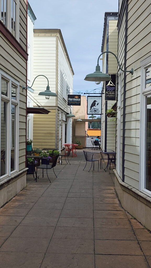
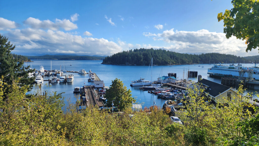
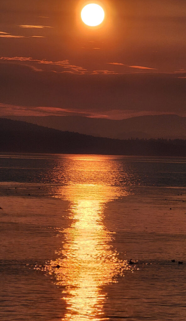
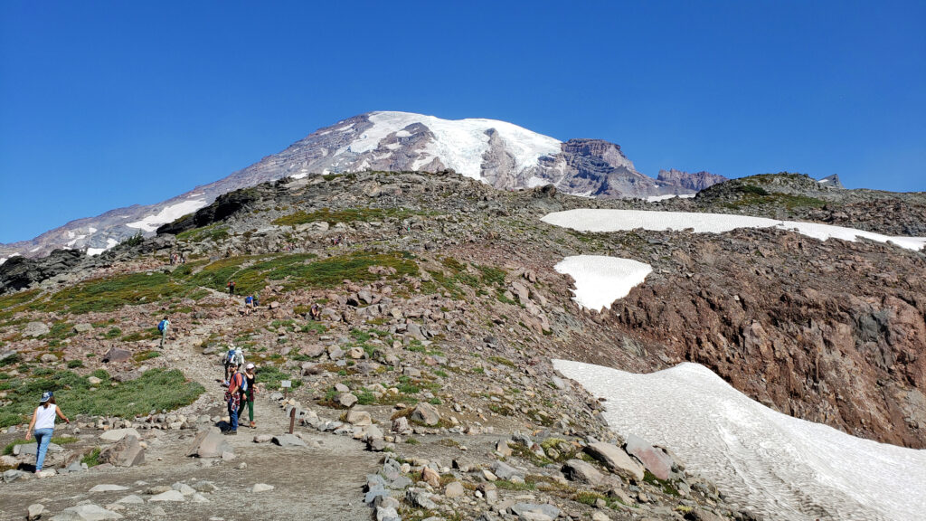
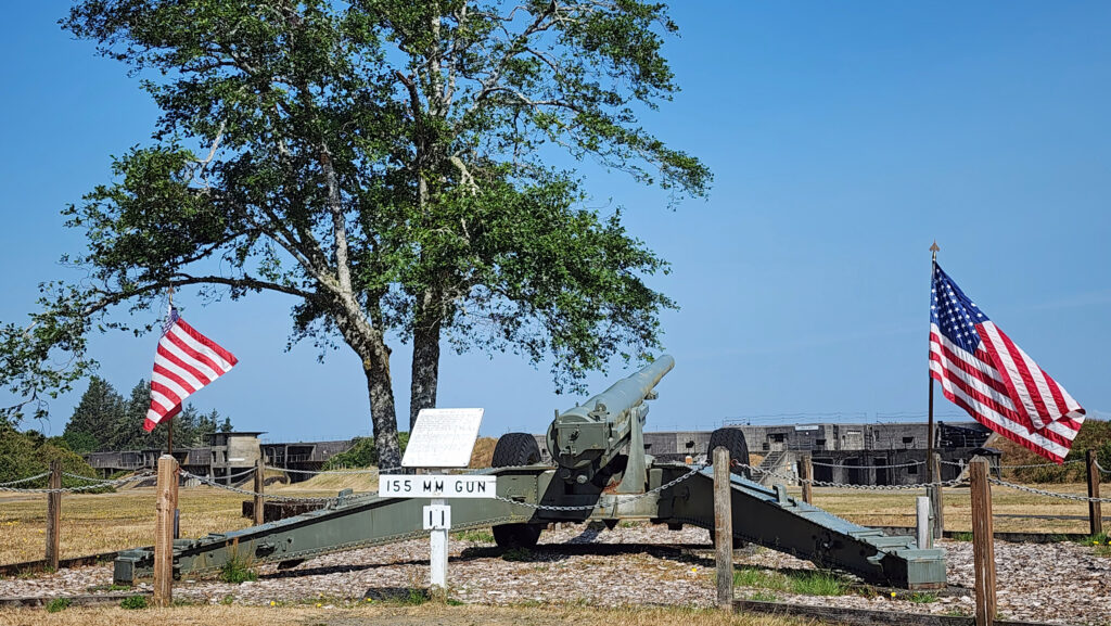
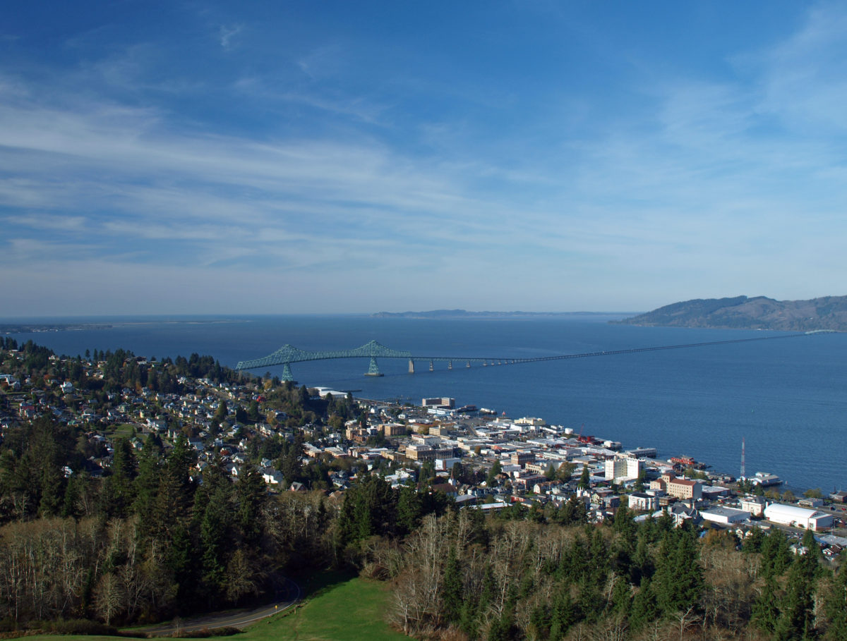
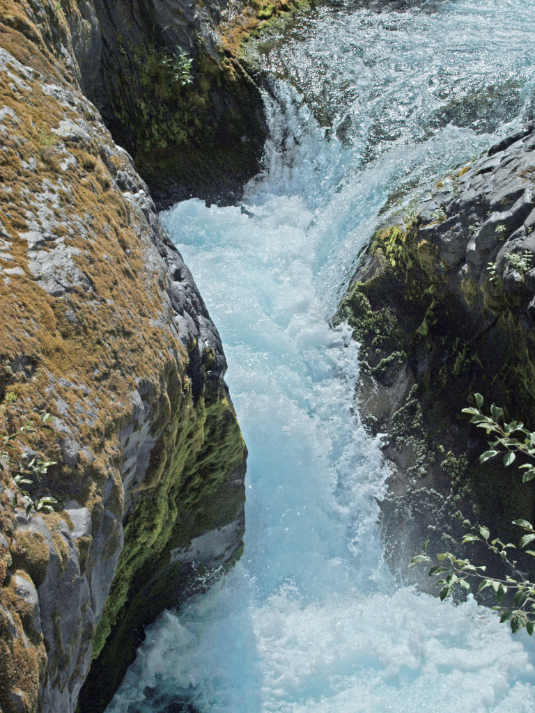
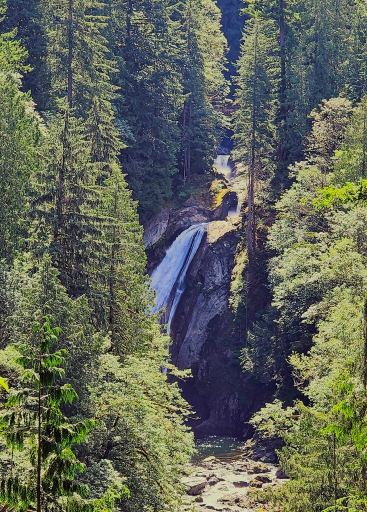
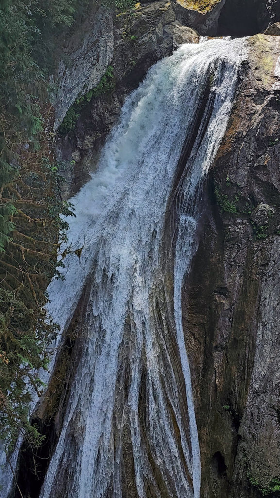
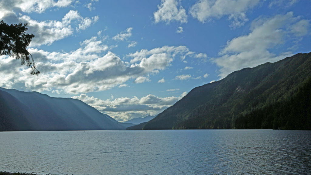
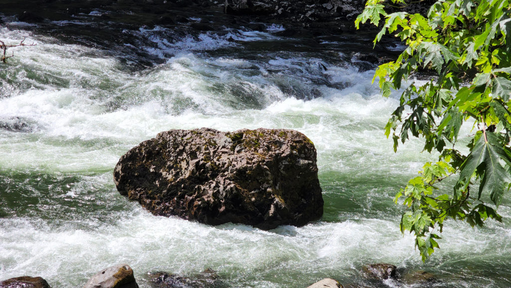
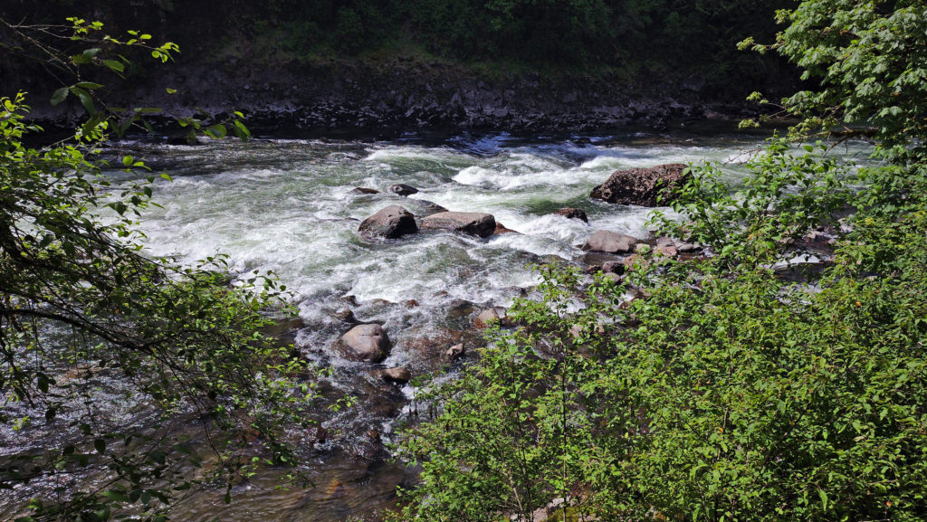
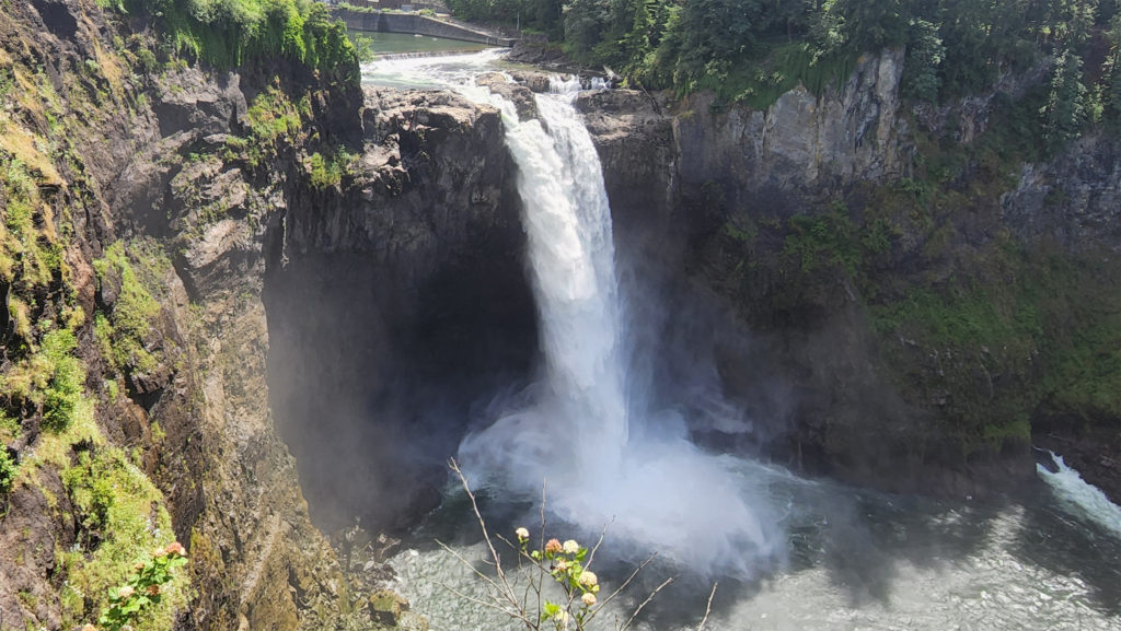
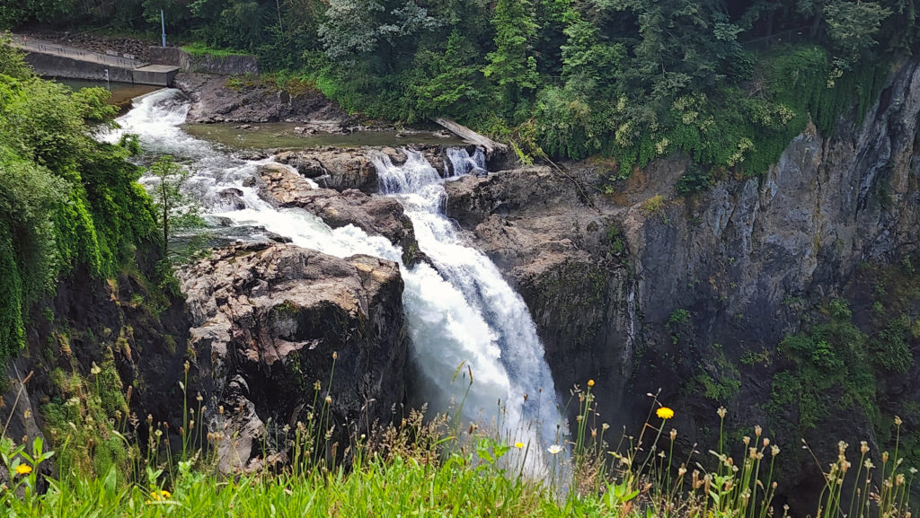
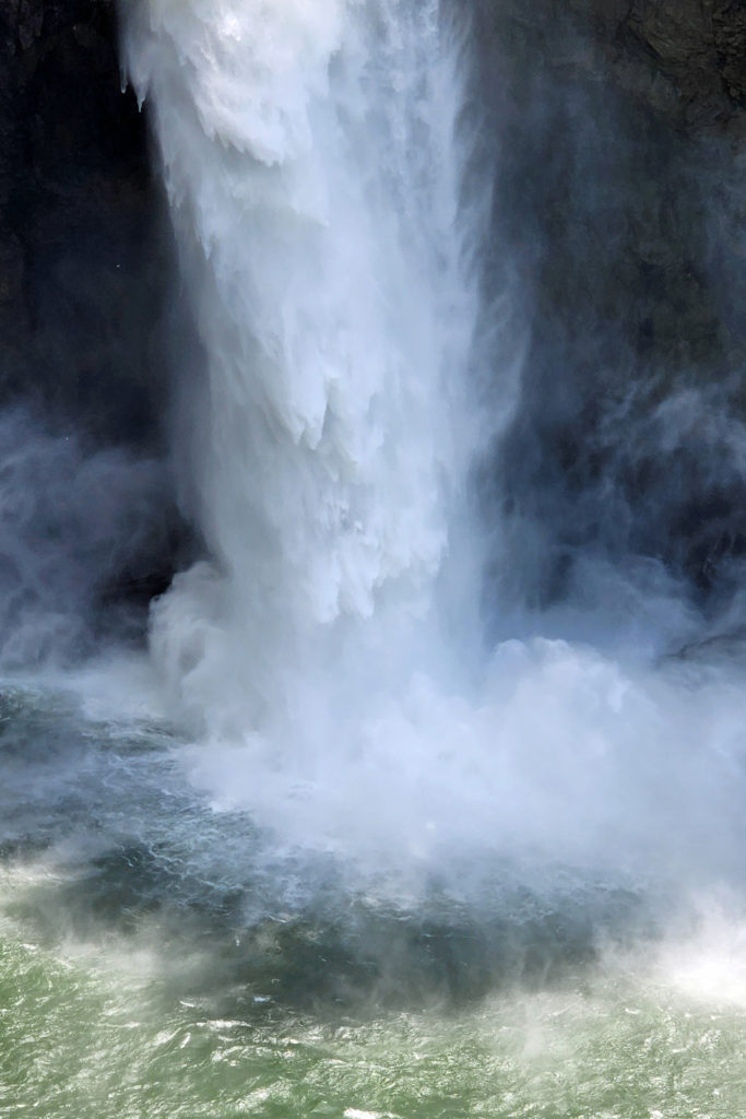
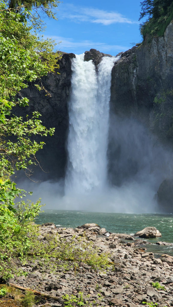
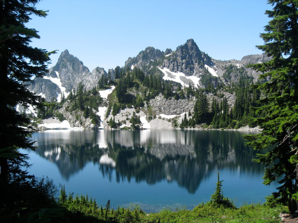
I’m old enough to remember a trip my older brother and I took to see the World’s Fair in 1974. Although I didn’t remember much about the actual fair, one of the things that left a lasting impression on me was Spokane Falls. Not many cities have a major waterfall in the middle of the downtown area. The fair spread across both banks of the Spokane River and Havermale and Canada Islands in the river. Canada Island is literally in the middle of the two cascades of the upper falls.
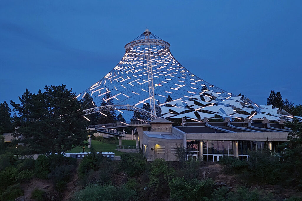
Most of the Expo ’74 structures were dismantled after the fair closed, but the Spokane Pavilion and the bones of the United States Pavilion still stand. The U.S. Pavilion was an open air structure with a fabric roof. The roof is gone, but the supporting structure remains, the cables that supported the roof now strung with hundreds of lights that are lit every night. The ground below is now a grassy park, part of Riverfront Park, the jewel of Spokane’s downtown.
We spent three days exploring downtown Spokane. Riverfront Park and Spokane Falls kept drawing us back. It’s really quite a marvelous area. Spokane is still the second largest city in Washington (the metropolitan area has a population of over 600,000), but it’s also small enough to have retained something of a small town vibe, something Seattle, Portland, and Vancouver, BC, definitely lack.
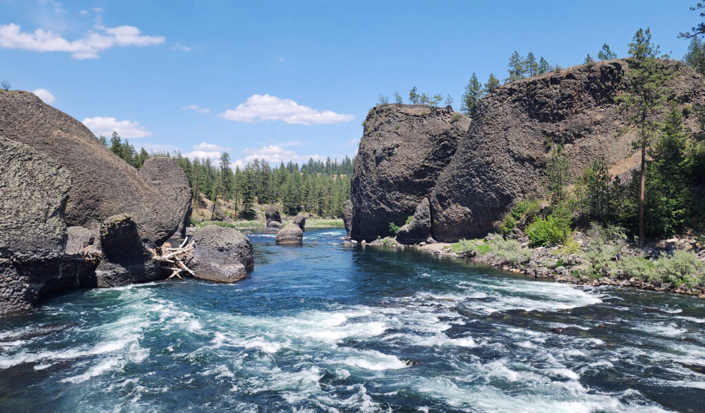
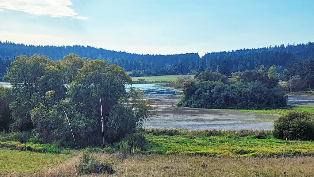
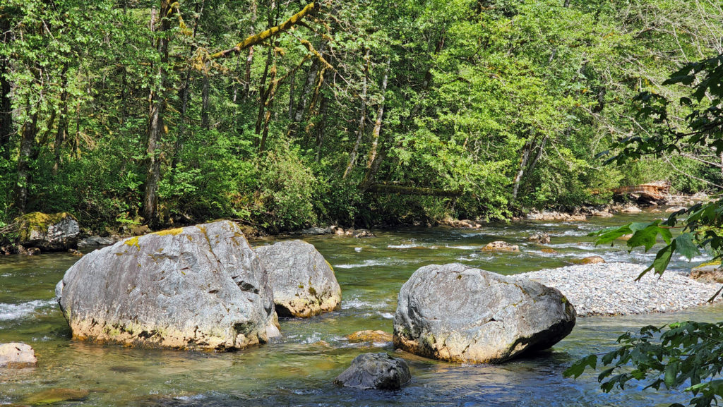
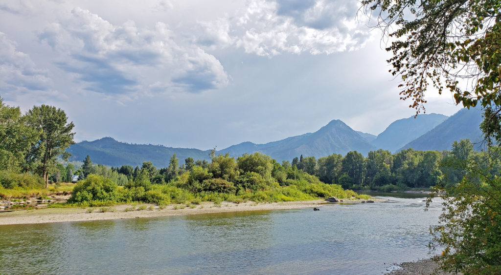
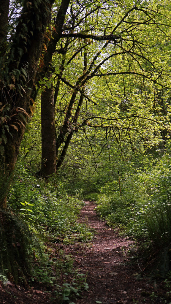
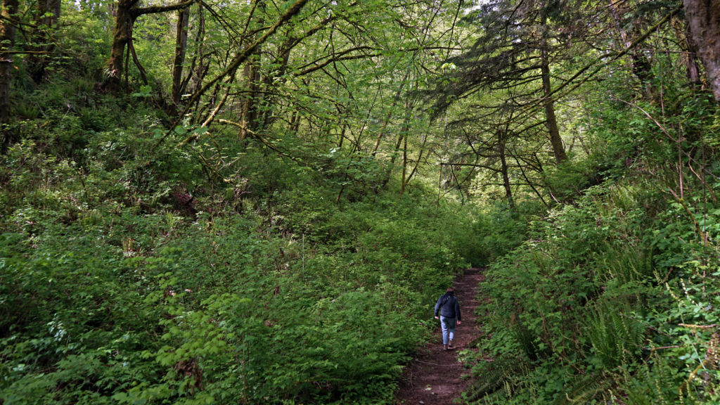
On our last day in town, we drove to Riverside State Park, a 9000 acre park along the banks of the Spokane and Little Spokane Rivers, about five miles downstream of downtown Spokane. The Bowl and Pitcher area of the park features a picnic area, ranger station, and campground on the east bank of the Spokane River, and miles of hiking trails on the west bank.
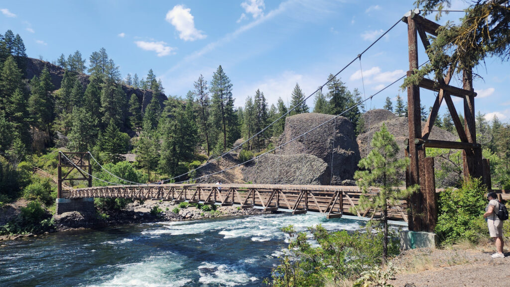
The trail network is accessed by a pedestrian-only suspension bridge spanning the Spokane River. We crossed the bridge and did a short hike along the river, but we could easily have spent all day there.
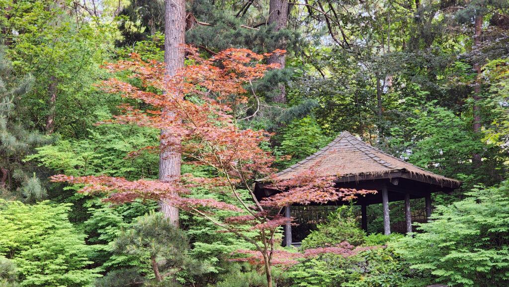
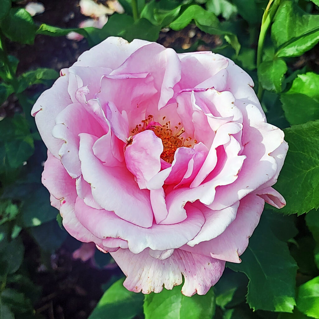
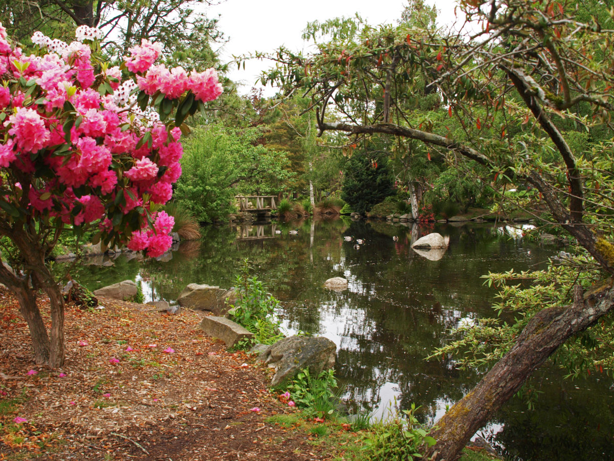
Later that day we visited the Japanese garden and rose garden in Manito Park before returning to our hotel to get ready for the long drive back to Portland.


We left Spokane the next morning, the day before the start of Hoopfest 2025. The Spokane Hoopfest is the largest 3-on-3 basketball tournament in the world. Every year more than 6000 teams and 25,000 players take part in the tournament that features 450 courts covering 45 city blocks and draws more than 250,000 spectators. It is a very, very big deal. One I had never heard of. And I’m sorry we missed it.
Other Area Attractions
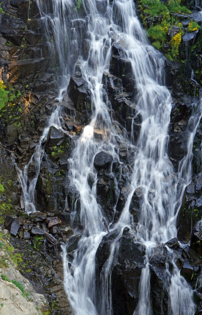
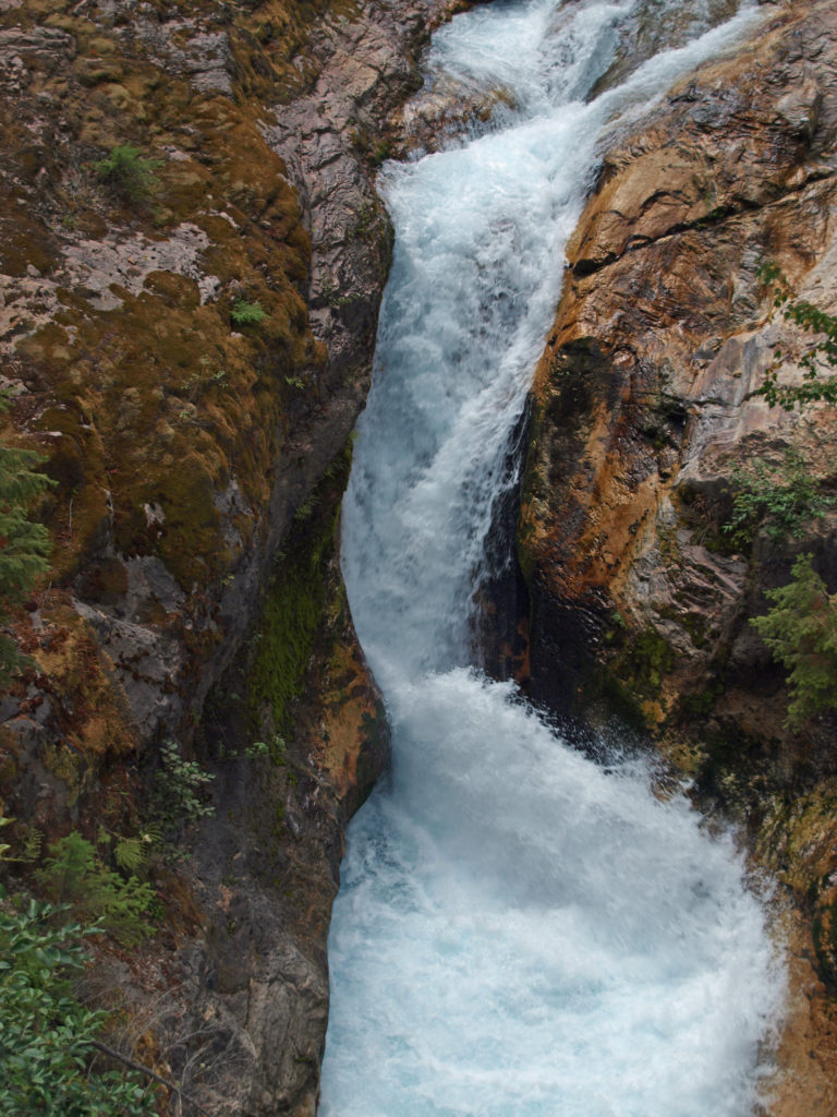
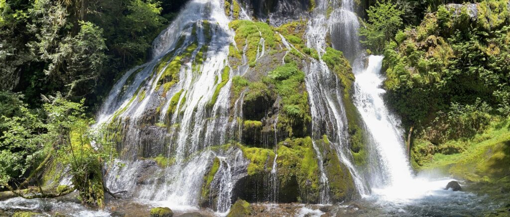
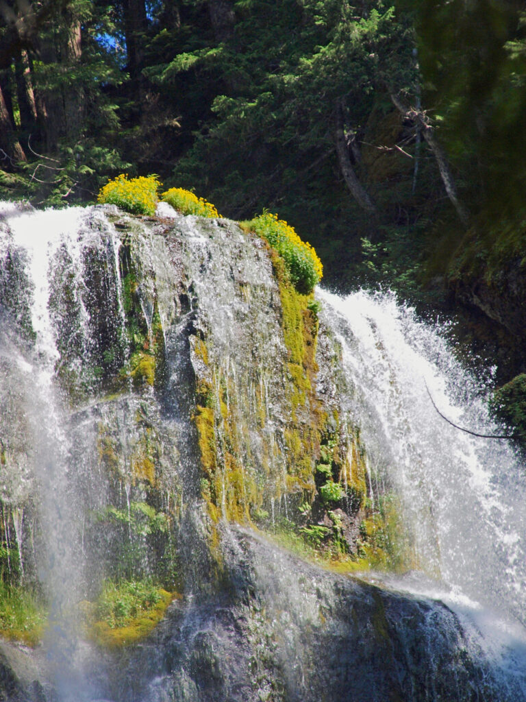
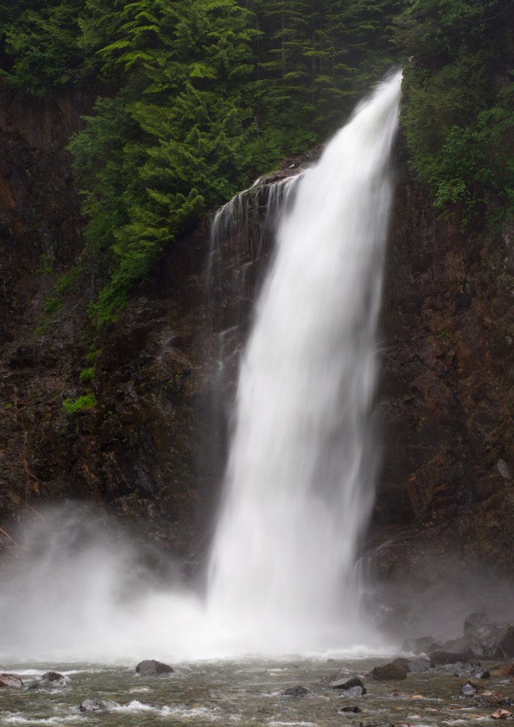
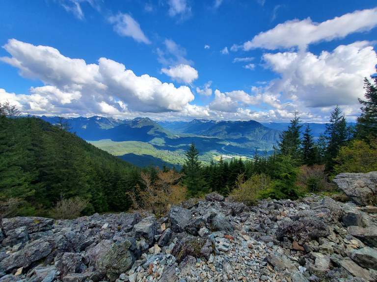
There are a number of other areas near Spokane that are worth visiting. We took day trips to both Sandpoint, Idaho, and Coeur d’Alene, Idaho during our weeklong visit. Look for future posts on both on this site in the coming months. Outdoor enthusiasts might want to take the 30 mile journey to Mount Spokane, northeast of the city. And if you drive to Spokane, or fly and rent a car, Grand Coulee Dam and Lake Roosevelt National Recreation Area are about a 90 minute drive west of Spokane, making for an easy day trip or a worthwhile detour on a trip back to Seattle. We didn’t make that side trip, but we did make a detour to Palouse Falls, a spectacular 200 foot high falls on the Palouse River south of Ritzville, Washington, on our way back to Portland.
Conclusion
I was surprised by how much I enjoyed my time in Spokane. It’s a beautiful city with an interesting history and lively downtown. Visiting the site of Expo ’74 brought back memories that I had long forgotten, and our side trips to Sandpoint, Coeur d’Alene, and Palouse Falls added to the enjoyment of our trip. I think we’ll be back. (And if you go, make sure to stop by Rosie’s Restaurant and try their breakfast burrito. It’s one of the best I’ve ever had).
Posted September 10, 2025
All photos © Alan K. Lee, except as noted
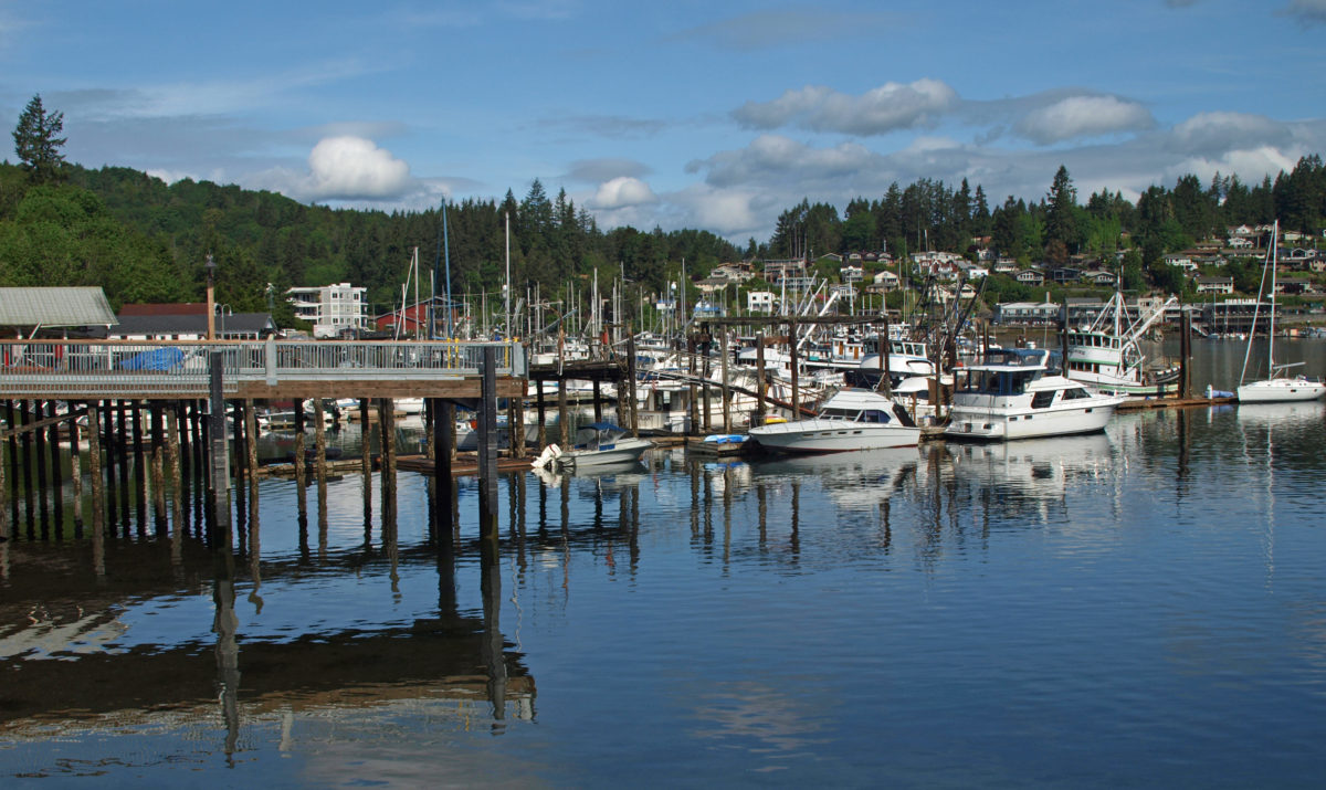
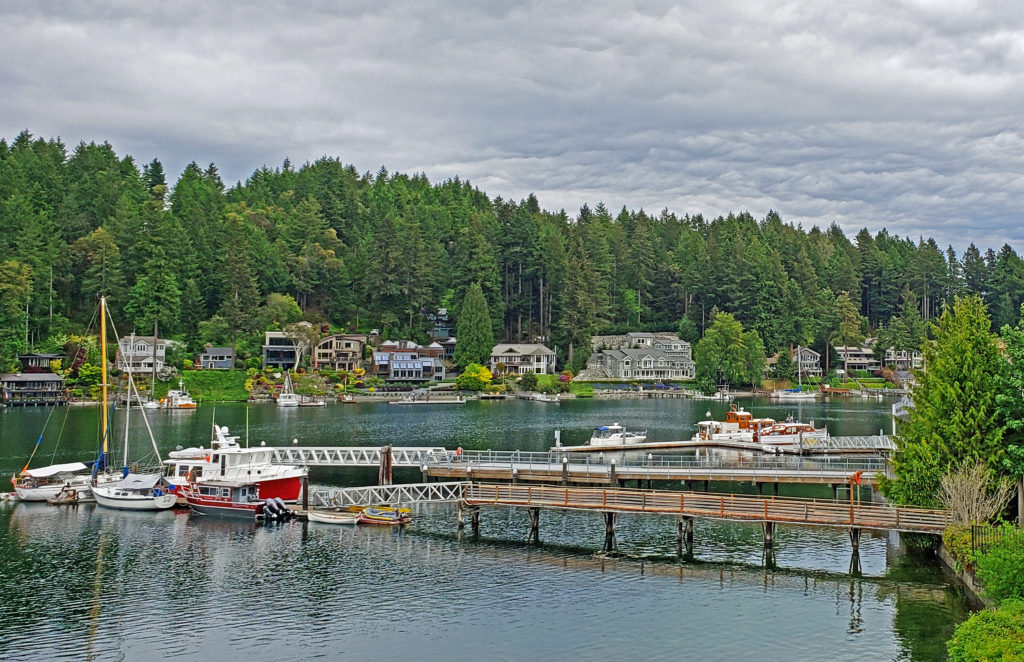
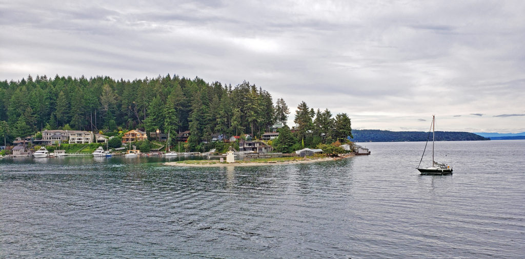
 Gig Harbor, Washington is located on Puget Sound near Tacoma. My first visit came about eight years ago. At the time it was one of the few towns on Puget Sound that I had not explored. I had heard testimonials to the town’s charm. And charming it is, at least the historic downtown along the waterfront. Like
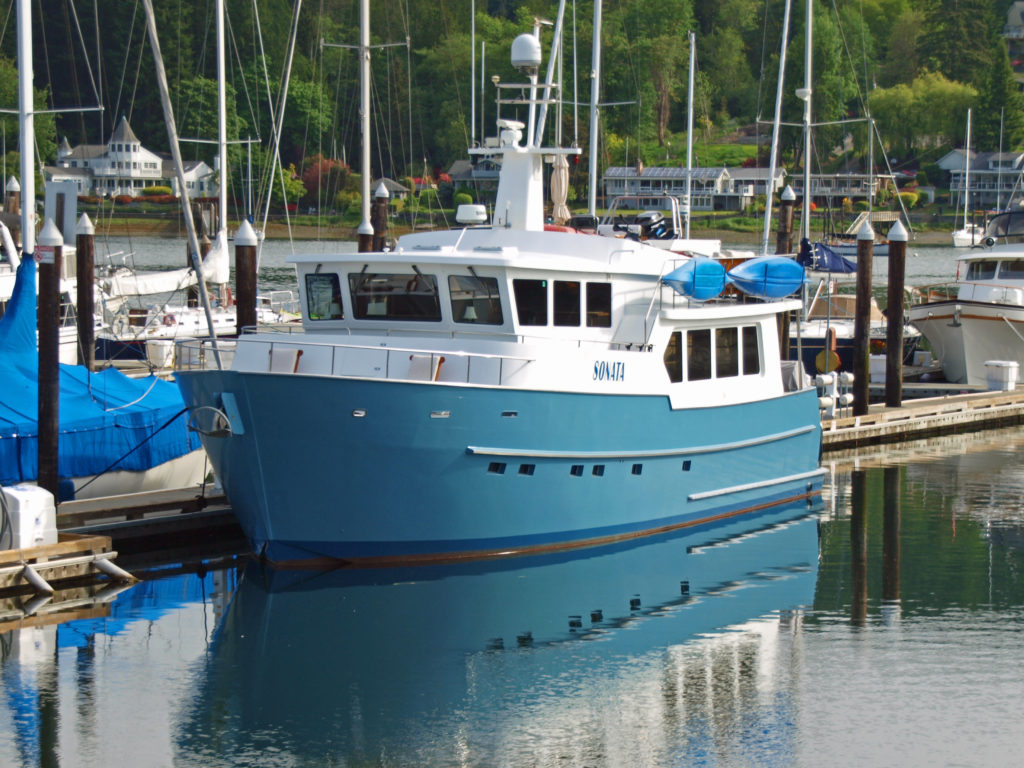
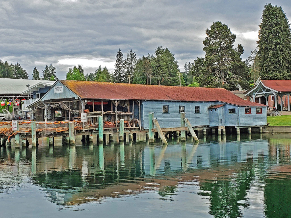
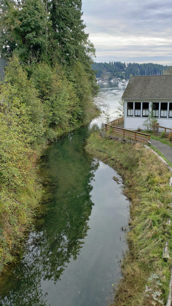
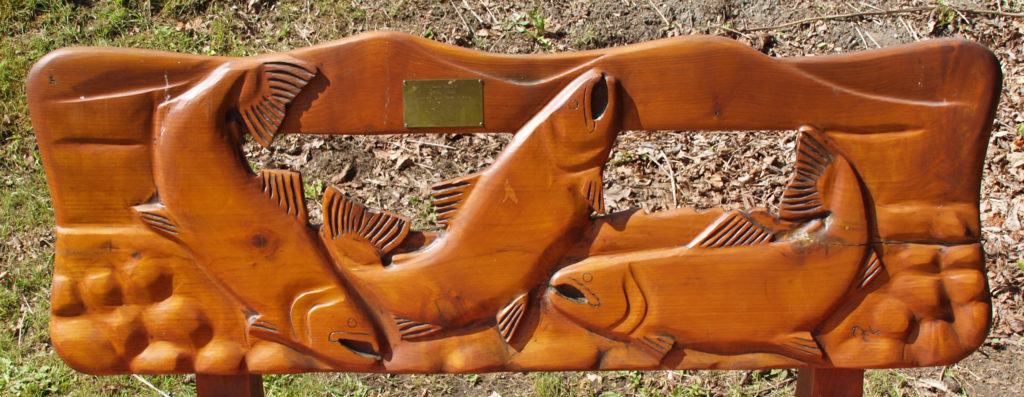
 The museum is located where Donkey Creek flows into the harbor, and when the salmon are spawning you can watch them swimming upstream from viewing platforms in Donkey Creek Park, across Harborview Drive from the museum.
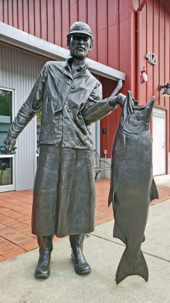
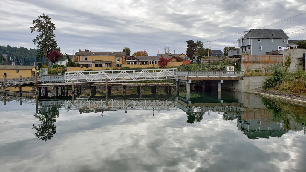 Tourism is more important than fishing to Gig Harbor’s economy today, but a small fishing fleet still exists and is still important to the cultural identity of the town. On the first weekend of June each year, during the Maritime Gig Festival, the fleet gathers in the bay for a Blessing of the Fleet ceremony.
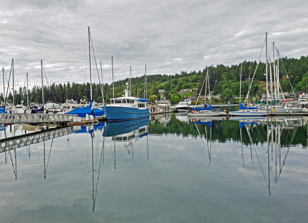
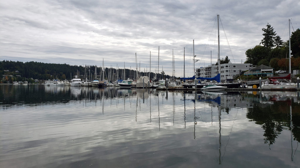 Getting out on the water is both great fun and a way to view the waterfront from a different perspective. You can rent kayaks, stand-up paddle boards, and electric boats at
  If you’re thinking about paying Gig Harbor a visit, a good place to start is the
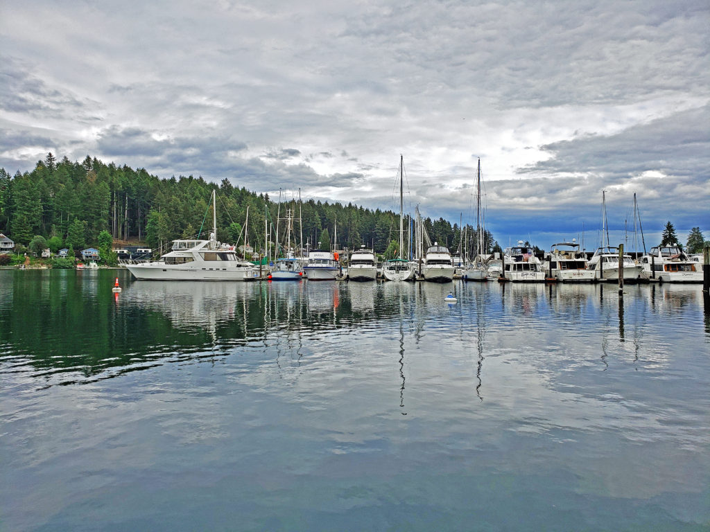
 My wife and I timed our first visit to coincide with the Gig Harbor Beer Festival. We’re from Beervana (also known as Portland), after all, and we frequently seek out new opportunities to sample craft beers that we’ve not tried before. Gig Harbor has four craft breweries: Gig Harbor Brewing, 7 Seas Brewing, Wet Coast Brewing, and Dunagan Brewing. We sampled beers from all but Dunagan at the beer festival, and we both found a number of beers to our liking, even though we have very different tastes in beer. We’ve attended the festival (now called the Gig Harbor Beer and Cider Festival) several more times since that first visit. Gig Harbor Brewing and 7 Seas Brewing have taprooms located on the waterfront in Gig Harbor. Wet Coast has a taproom just off Hwy 16 in the newer part of Gig Harbor. And Dunagan’s Irish Pub and Brewery is located about a mile south of Wet Coast, also just off Hwy 16. Of the four, only Dunagan’s serves food. If you want to eat as well as drink, try the Tides Tavern or one of the other establishments listed in the Gig Harbor Guide.
 One restaurant that you should not miss is
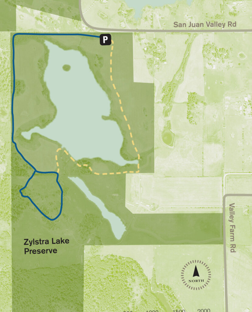
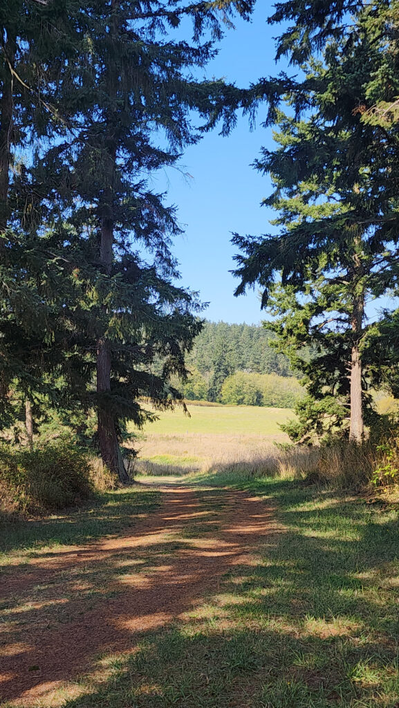
 The property was formerly a privately owned farm that was the site of a proposed housing development. Instead, the property was sold to the land bank in 2015 and the trust obtained the conservation easement. Thirty acres of the property, including the farmhouse and agricultural buildings, were sold by the land bank to Island Haven, a non-profit animal sanctuary, with a conservation easement to protect the land.
 Currently, there is no public access to the lakeshore, and the eastern and southern portions of the trail around the lake are closed from October through March. The northern and western portions of the loop are open year-round and can be hiked as a lollipop loop during the winter.
 Getting there:
 Trailhead:
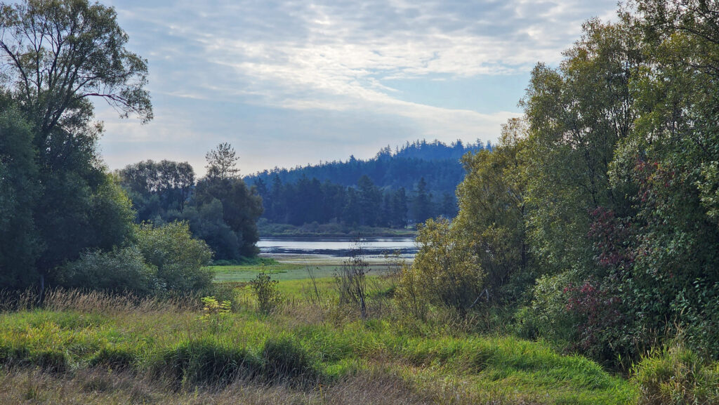 The hike:
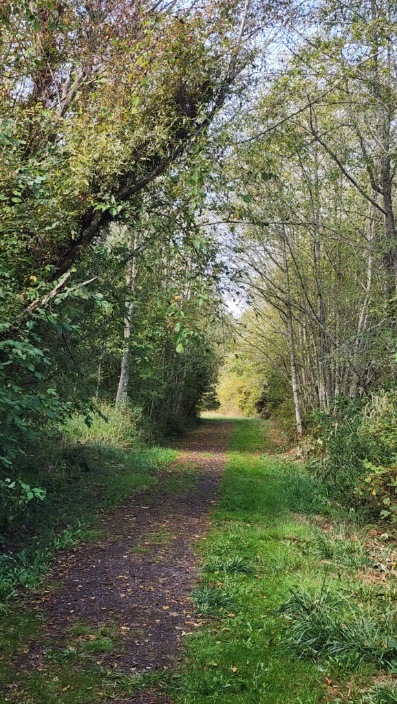
 At 0.3 miles the trail turns south and runs along the western boundary of the preserve for another 0.4 miles. The trail then turns southeast and follows the edge of an open field with good views of the lake.
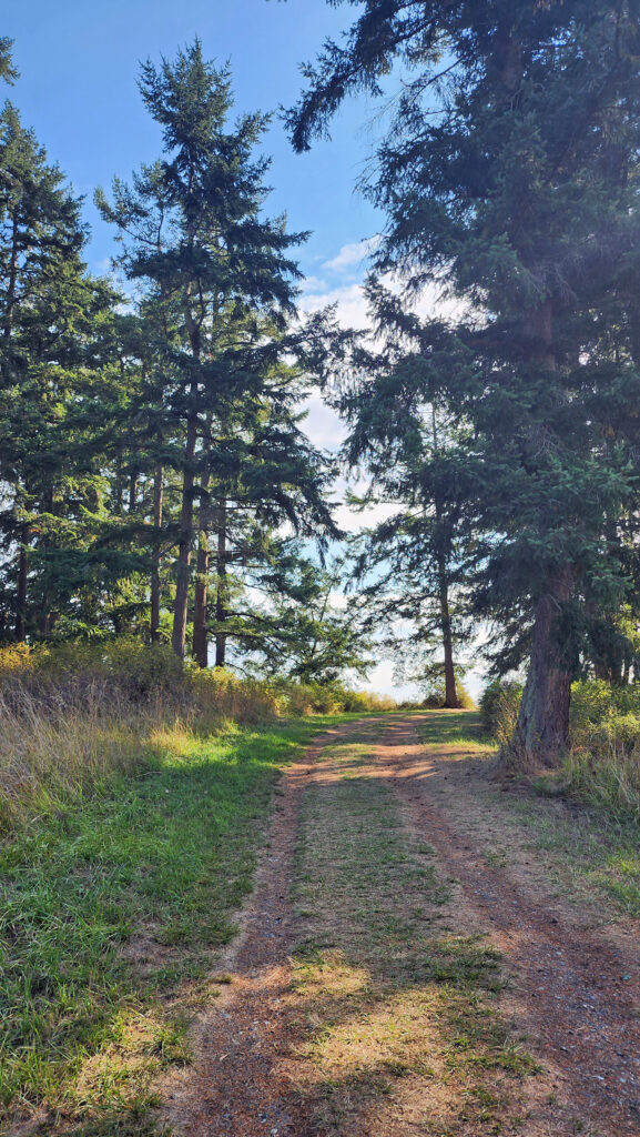
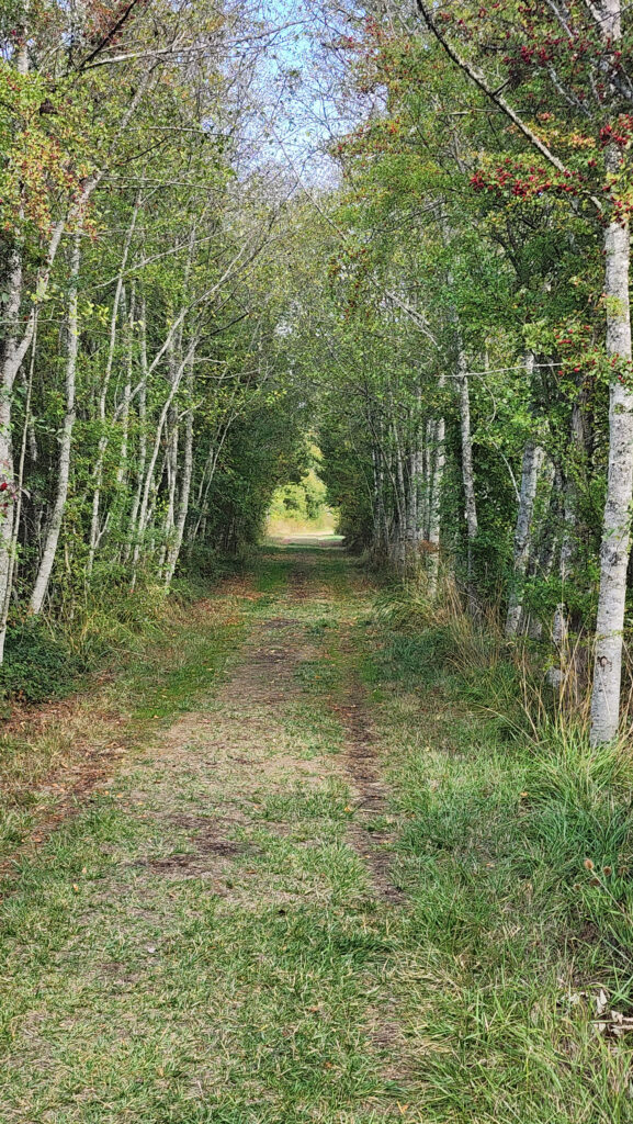
 At the 0.85-mile mark, turn right onto a trail that leads through a mix of open fields and partially logged woodland.
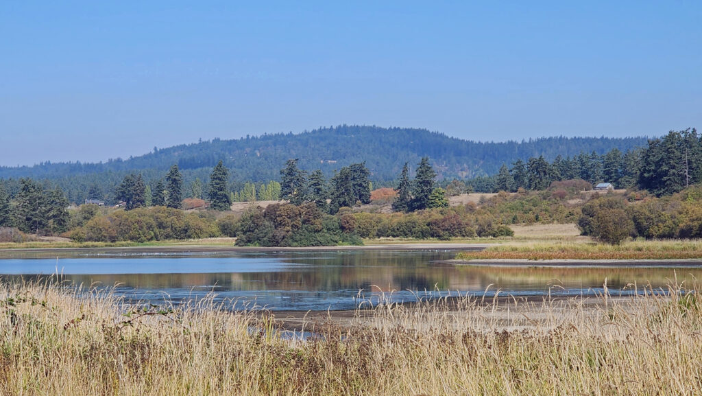 At the 1.25-mile mark, the trail returns to the open field. In winter, the trail ahead is closed, so you need to turn left and retrace your route back to the trailhead parking area.
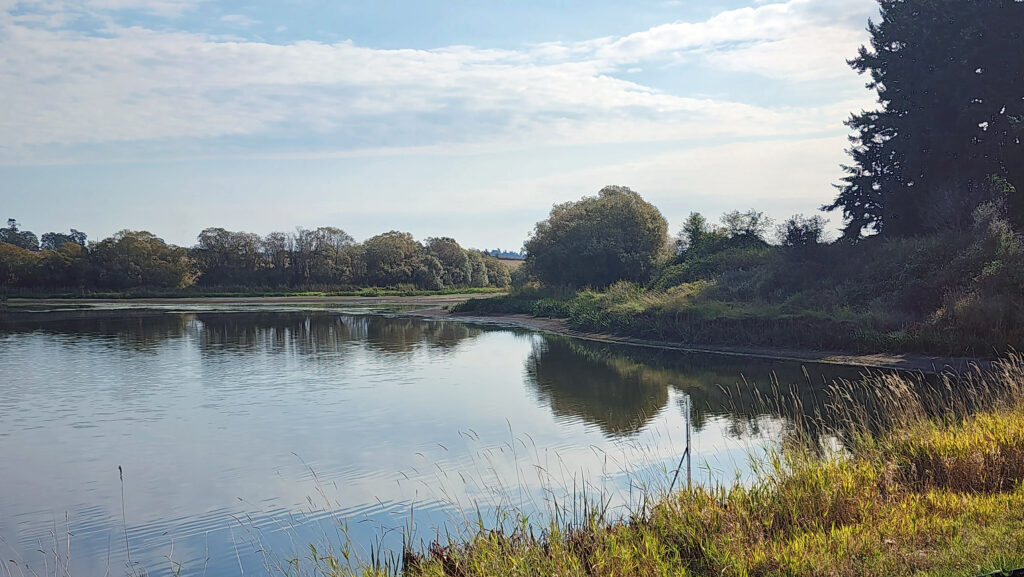 In summer, you can continue straight. The trail then turns right and crosses a bridge over the creek that flows from the lake. Beyond the bridge, the trail runs along the top of the dam that forms the lake, then passes through a small grove of trees.
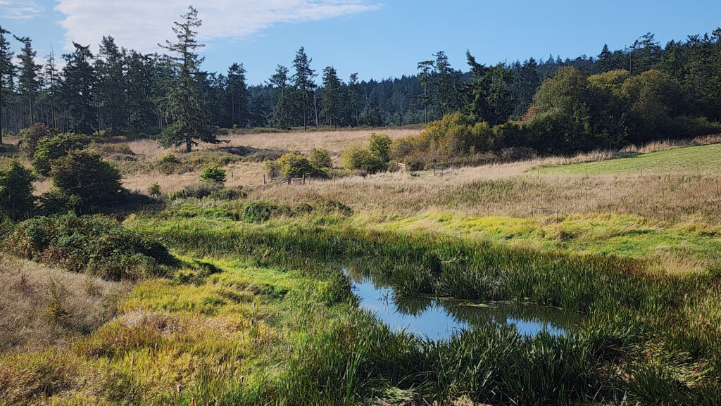 From there, the trail runs between fields to the old farmhouse site that is now home to the Island Haven animal sanctuary. The trail turns left there and follows a gravel farm road back to the trailhead.
 Posted October 12, 2023 by Alan K. Lee
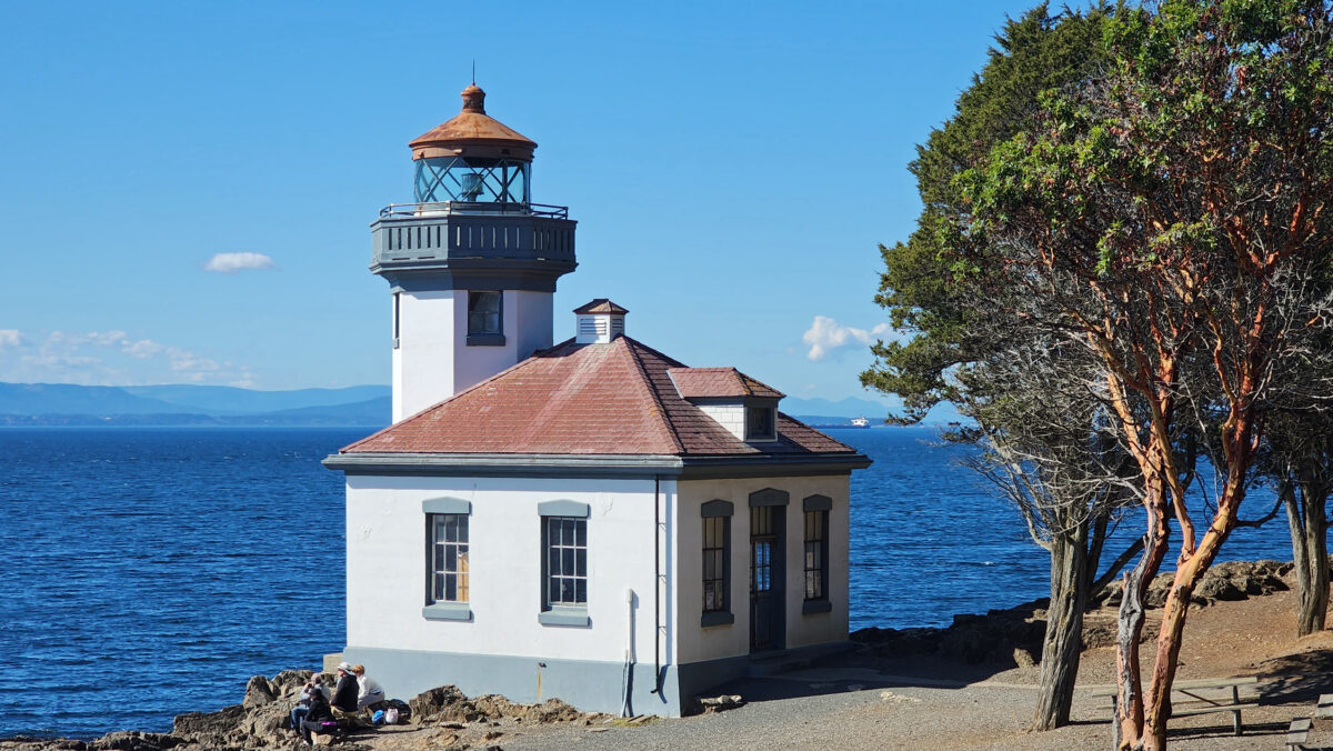
 There is no shortage of places to eat in Friday Harbor. For breakfast and lunch, I can personally recommend both Rocky Bay Café and Tina’s Place. For dining with a view, go to Downriggers on the bayfront. Classic Italian food can be found at Vinny’s Ristorante. Vegetarian and vegan food can be had at Mike’s Café and Wine Bar. For quality craft beers and upscale pub food, try San Juan Brewing. For seafood in a casual dining space, check out Friday’s Crab House. We ate at all of those, and all were good. But that’s just a sampling of what Friday Harbor offers. I wish we had had a few more days to sample more of the town’s eateries. What’s a vacation for, after all.
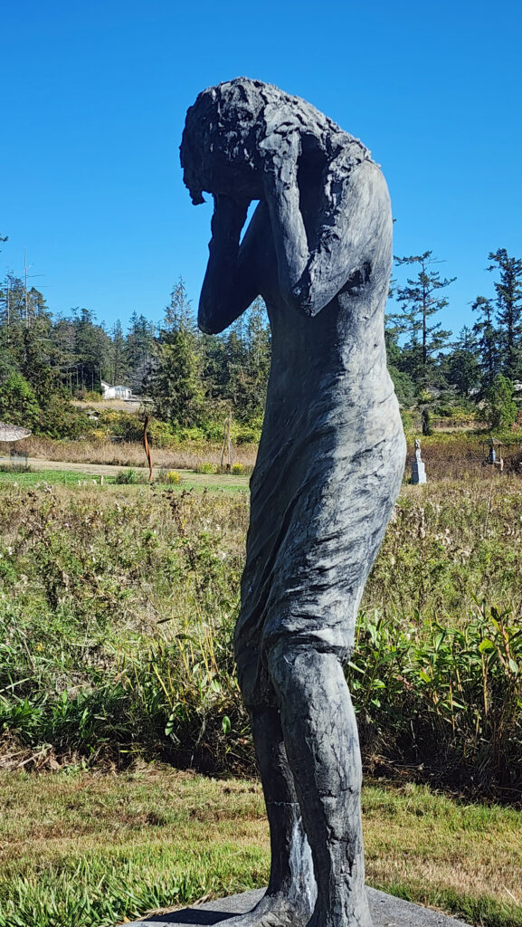
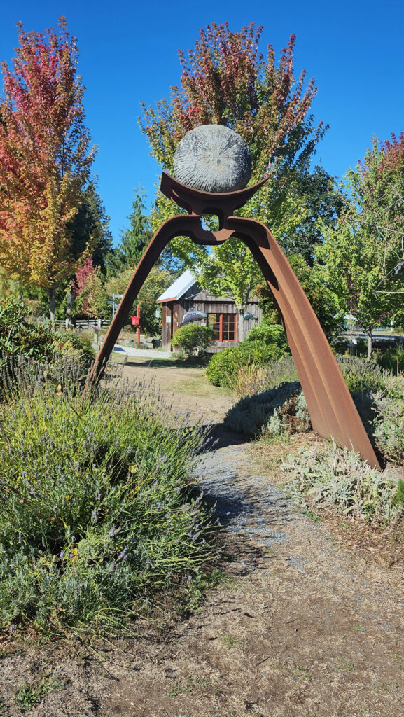
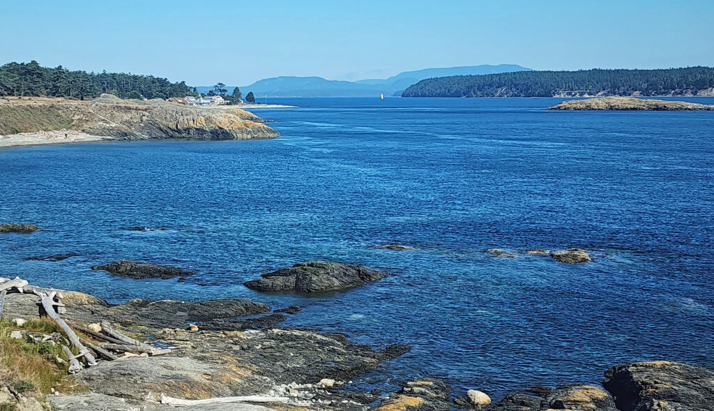
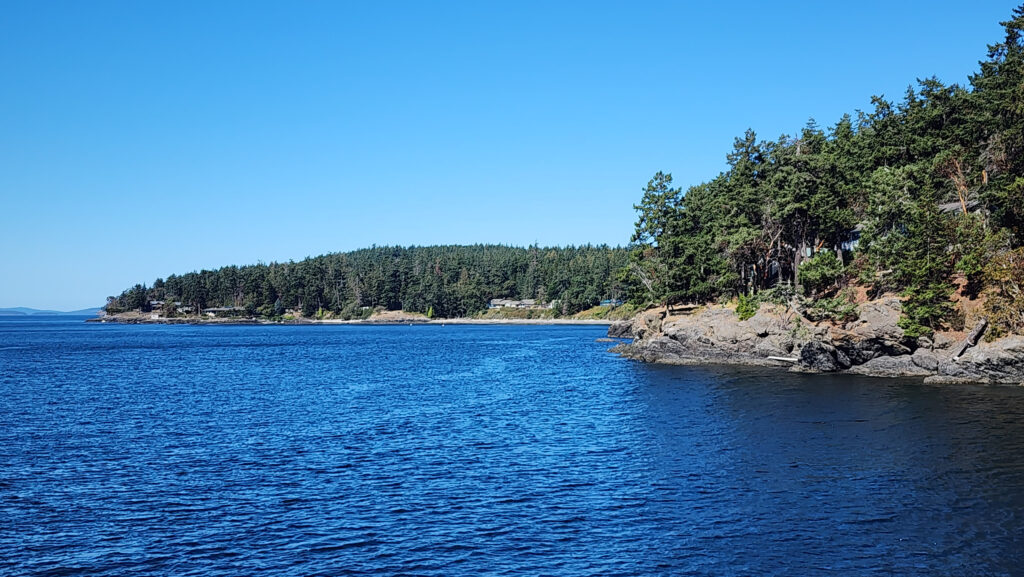
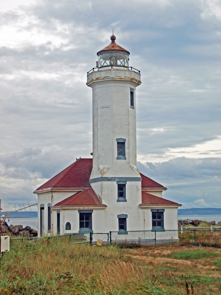
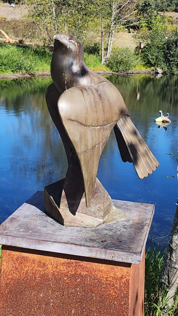 Near Roche Harbor (I think it’s actually part of the resort), the San Juan Islands Sculpture Park is a must see if you’re at all interested in sculpture. There are over 100 works of art (it seemed like many more) spread out over the twenty acres of the garden. Plan to spend at least an hour here. We spent more than that and still didn’t see it all. Admission is free, but donations are requested.
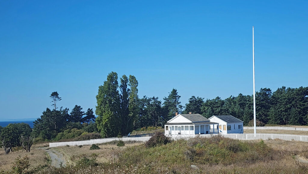
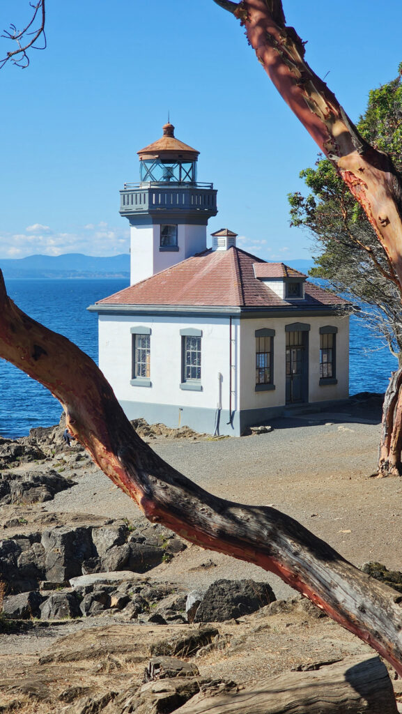
 Tensions between the American and British contingents led both England and the U.S. to send military forces to the island. From 1859 to 1872, when the boundary dispute was finally settled in favor of the United States, the island was jointly occupied by both forces. No actual combat occurred, and no one was injured in the Pig War. The sites of the two country’s military installations are now part of
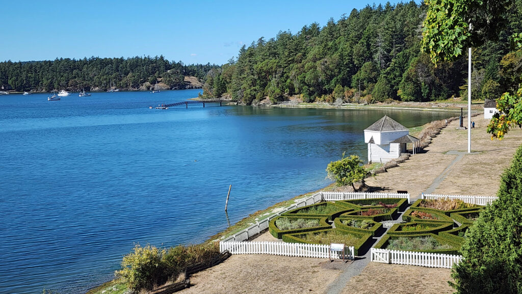

 Conclusion
 Posted October 12, 2023 by Alan K. Lee
 Best Times to Go:
 The hike:
 Other area attractions and activities:


 Overview:
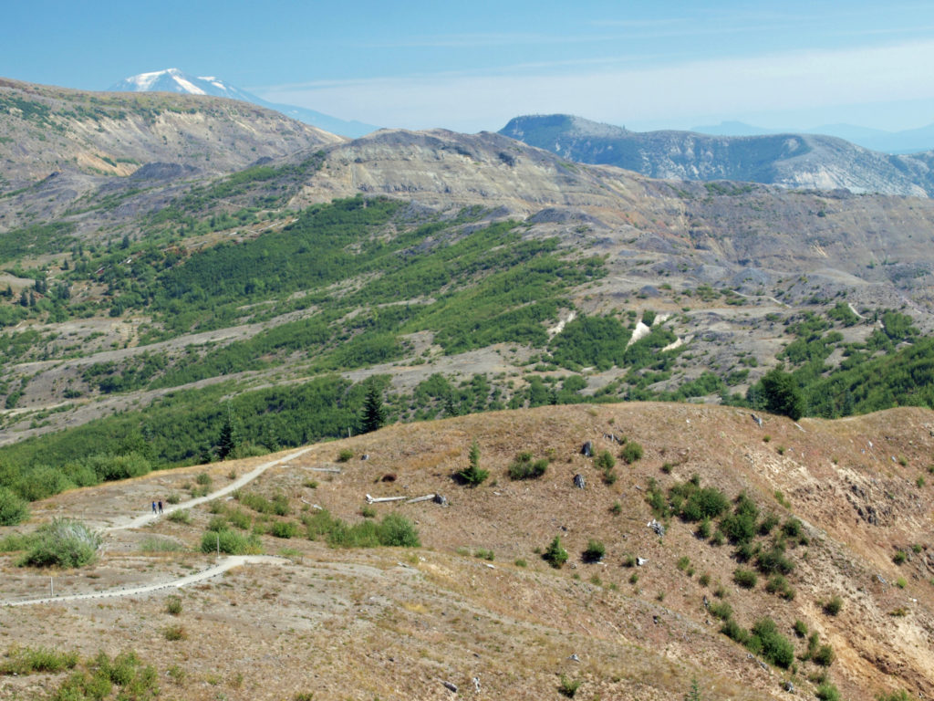
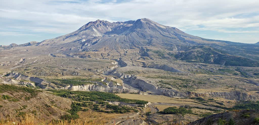
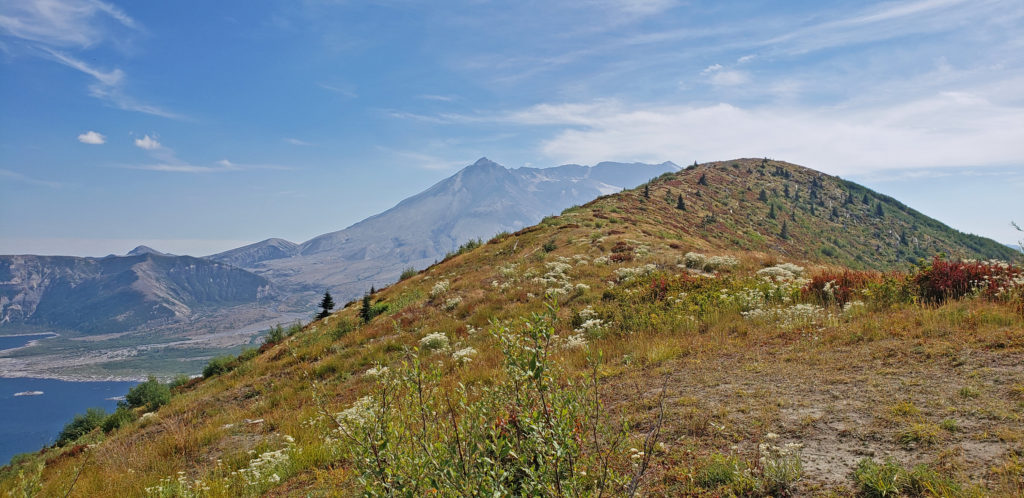
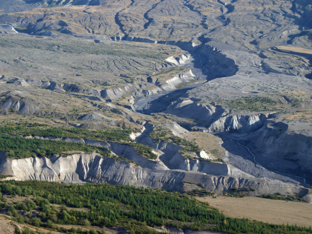
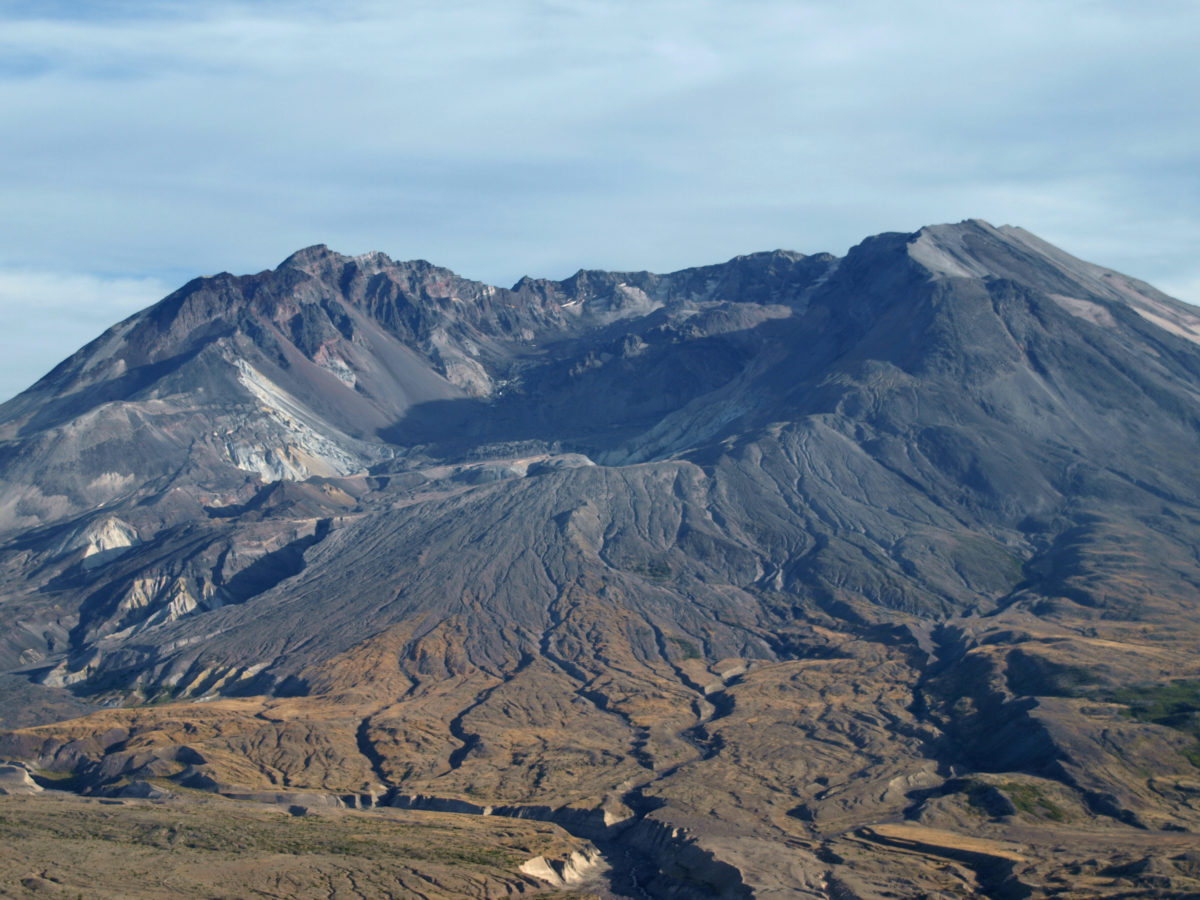
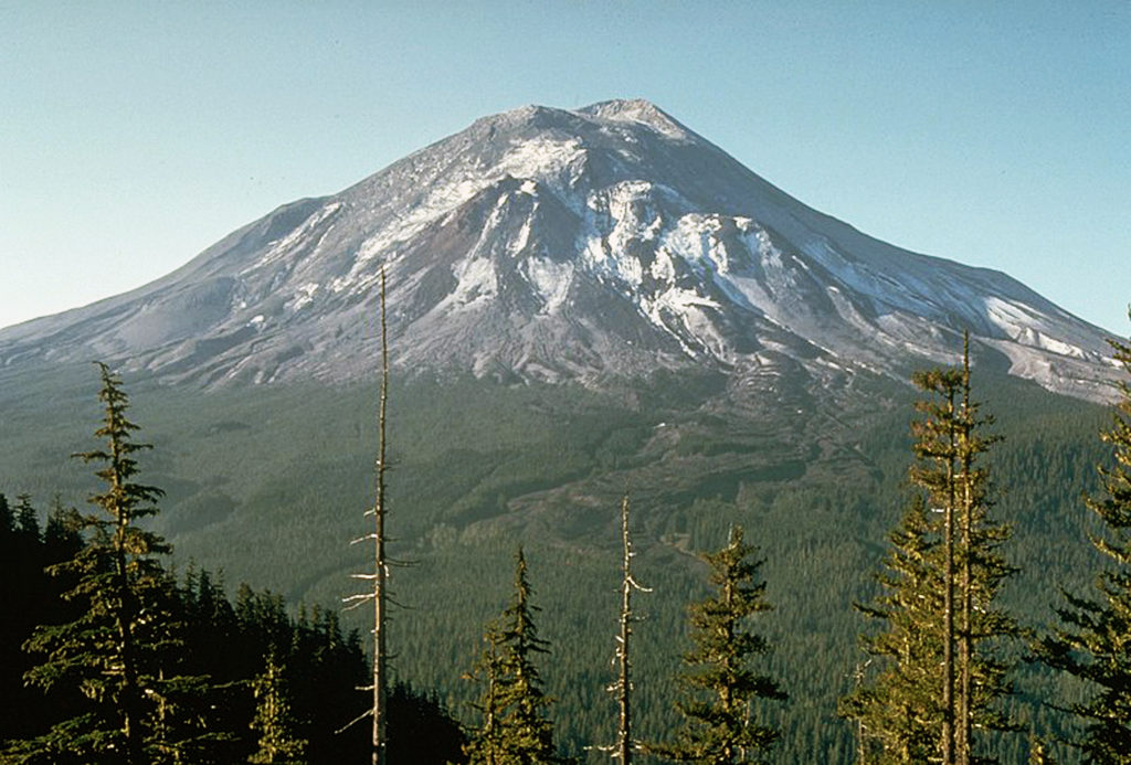
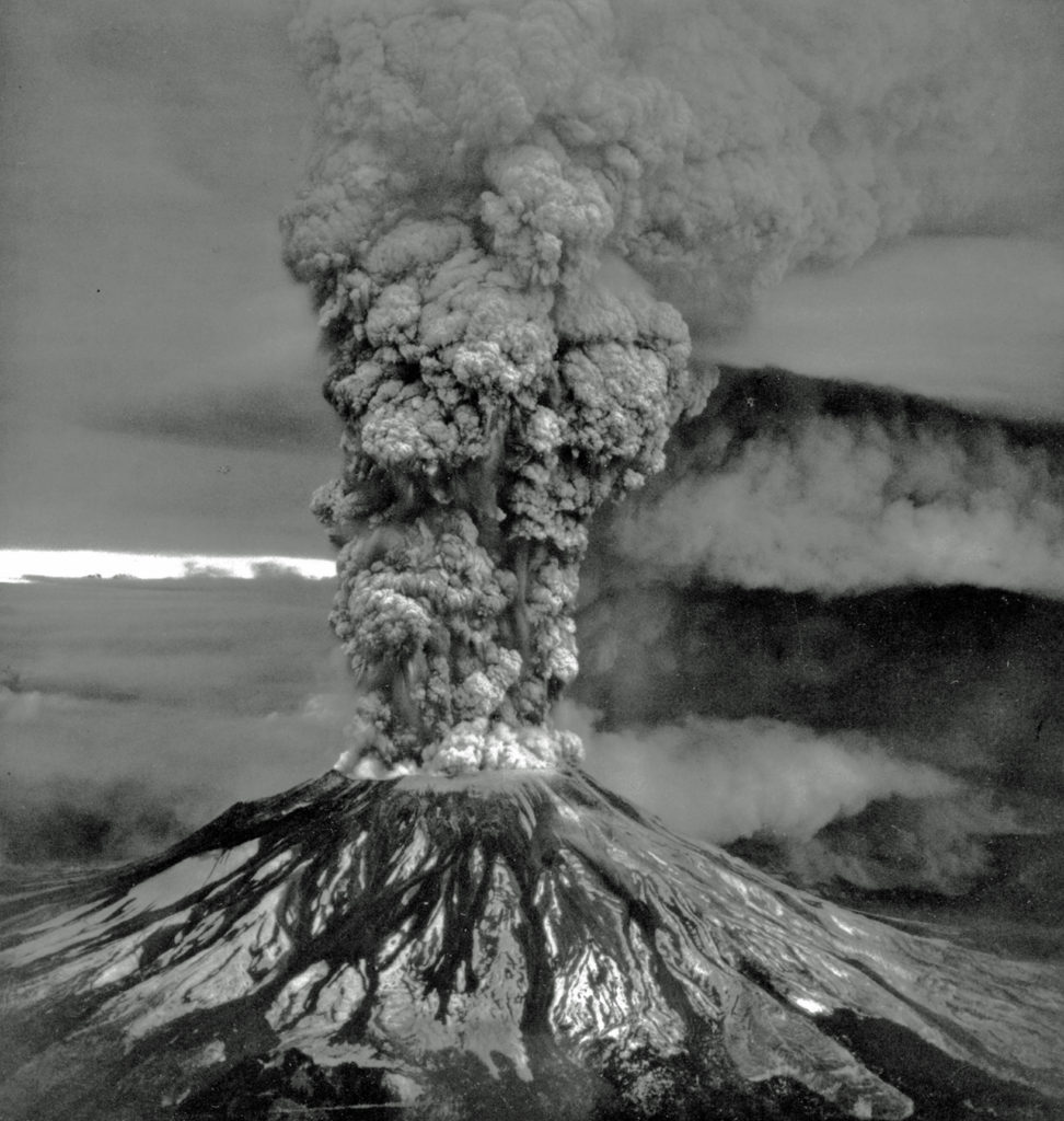
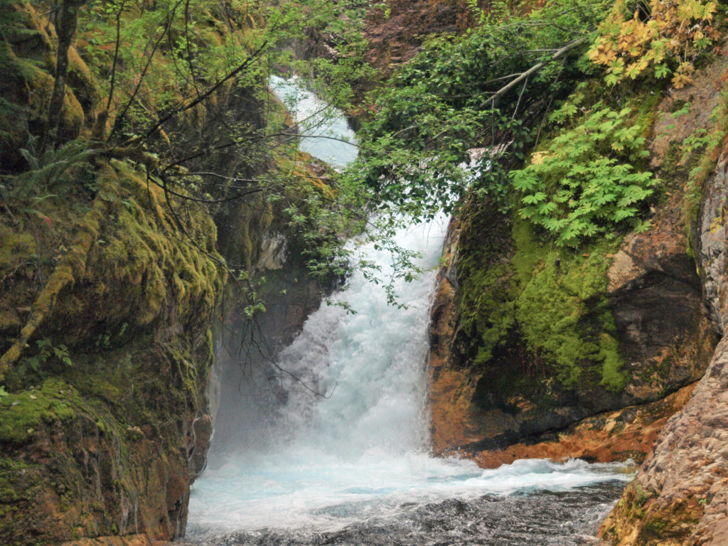
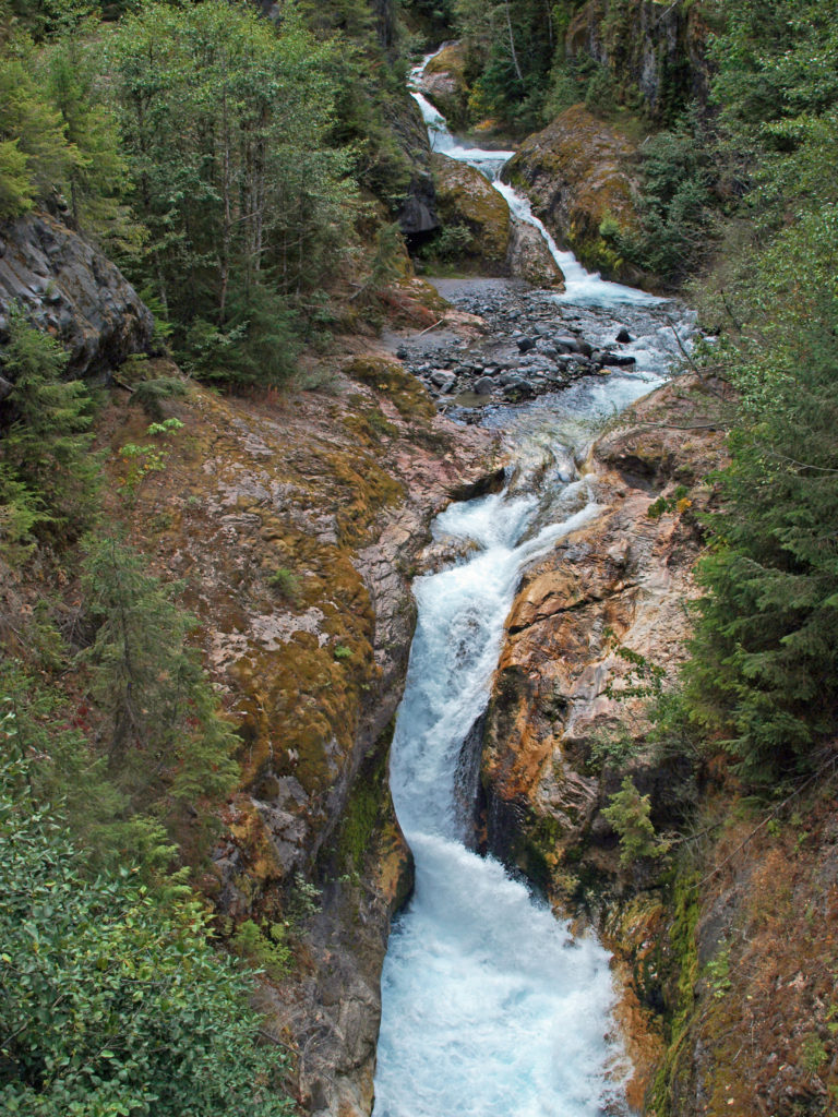 The history of Lava Canyon begins about 3500 years ago when an eruption of Mount St. Helens sent a flow of lava down the old valley of the Muddy River, destroying the forest and filling the valley with molten rock. Over the intervening years, the Muddy River cut a new course through the lava flow, and the canyon gradually filled with sediment. Then came the 1980 eruption, which melted the summit glaciers and sent a huge lahar (volcanic mudflow) down the valley, destroying the rebuilt forest and scouring out the built-up sediment, exposing the remnants of the earlier lava flow. What was left is a steeply descending canyon with an almost continuous series of spectacular waterfalls and cascades. (For more information on the 1980 eruption, see my
  Getting there:
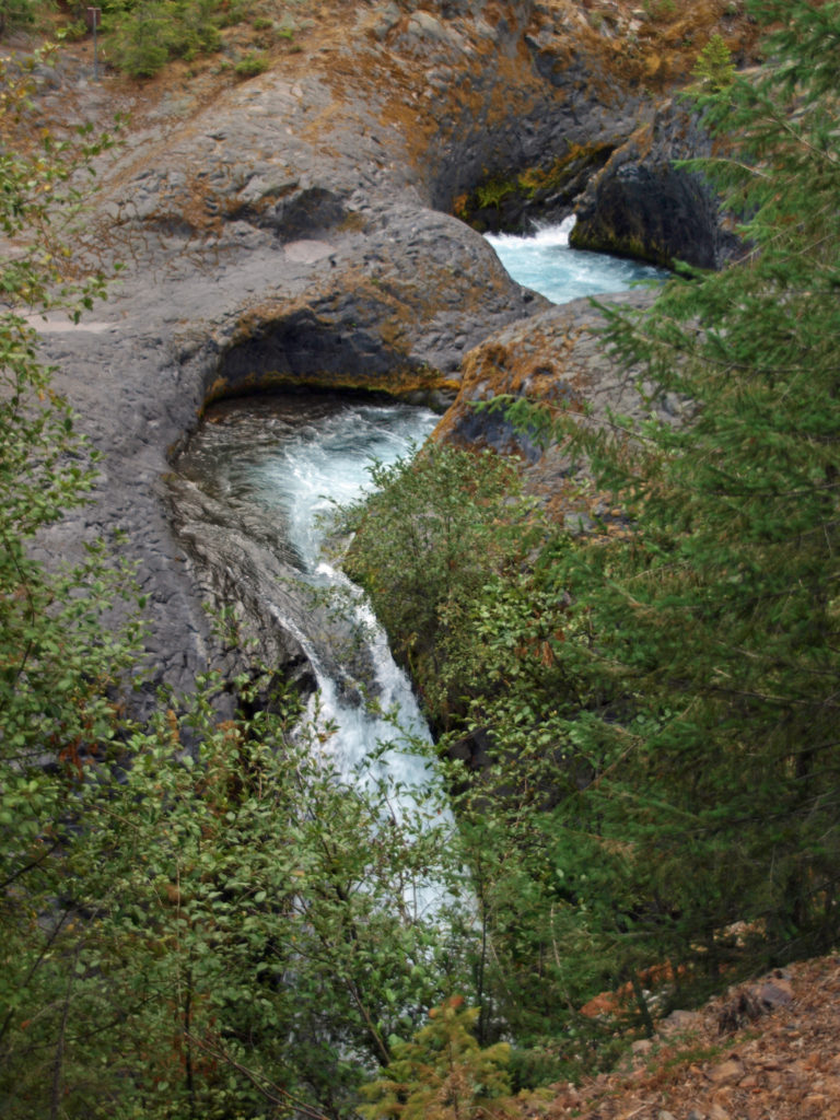 Trailheads:
 The hike:
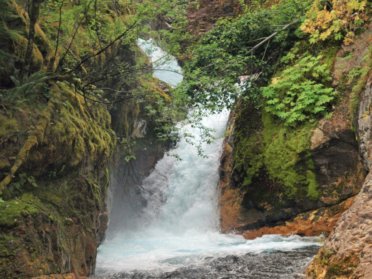
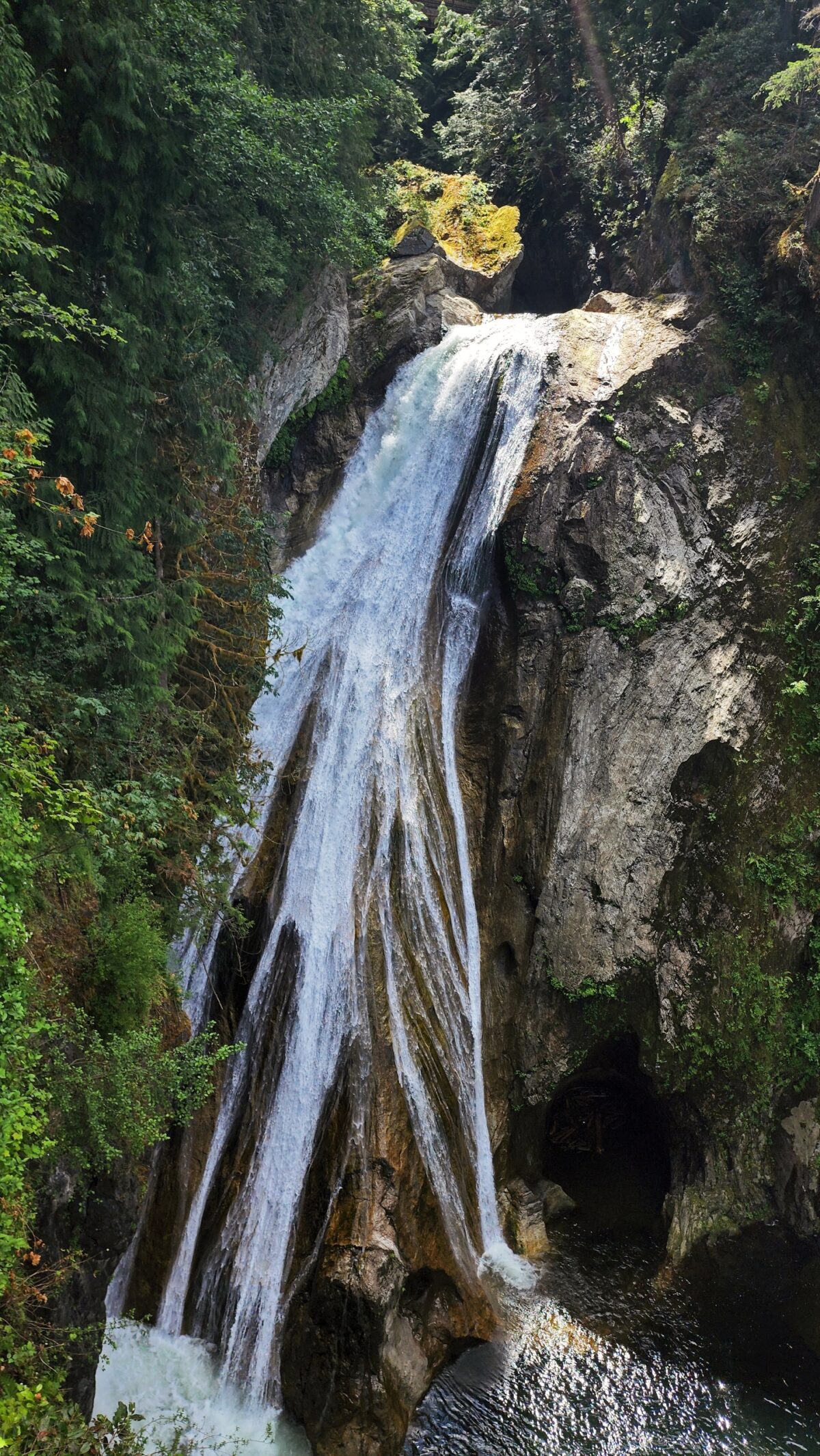
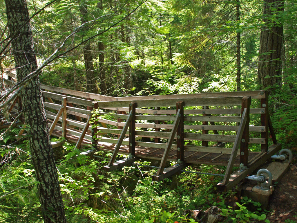
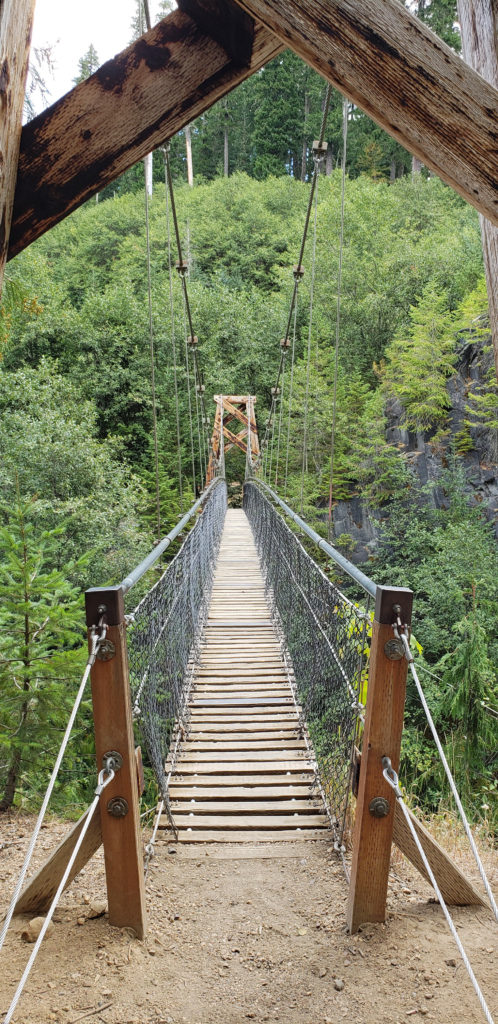 Below the overlook, the path is rock and dirt, steep in places. After another three tenths of a mile, you come to another side trail and a suspension bridge over the river that gives a bird’s eye view of the canyon and waterfalls. On the other side of the bridge is a connecting trail that takes you back to the upper bridge, making for a 1.4-mile loop. (Update: As of June 2023 the suspension bridge is closed. Check the National Forest Service’s
 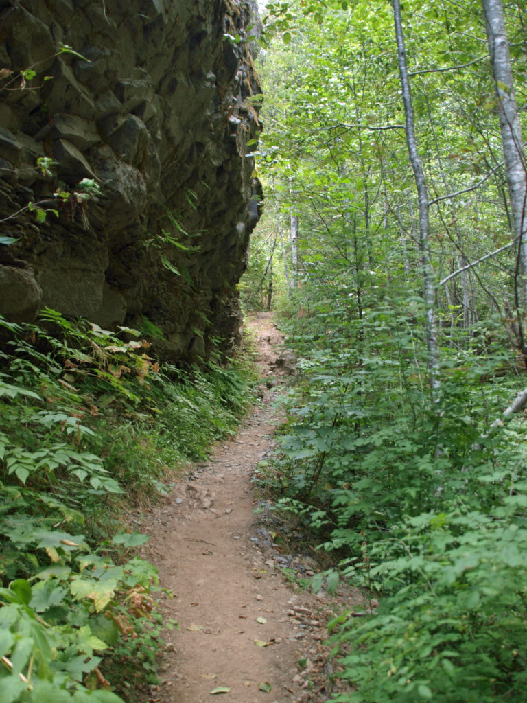 At about the 1.3-mile mark, the trail descends a 40-foot ladder to the base of the rock formation known as The Ship. Before 1980, sediment filled the canyon to the top of The Ship, to give you an idea of how much sediment was scoured out of the canyon. A short but steep side trail (and another ladder) leads to the top of The Ship.
 (Below The Ship, the trail continues another 1.5 miles to the lower trailhead. The entire hike from upper to lower trailhead and back is about six miles and the elevation gain coming back is 1350 feet.)
 Return from The Ship the way you came. Cross the suspension bridge if it is open and take the trail on the opposite bank to the upper bridge and re-cross the river. The two bridges both give you great views of the river and canyon below.
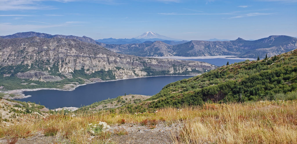
 Originally posted in a different format September 29, 2018 by Alan K. Lee. Updated and re-posted March 23, 2021. Edited, updated and posted in this format June 29, 2023.


 Overview:
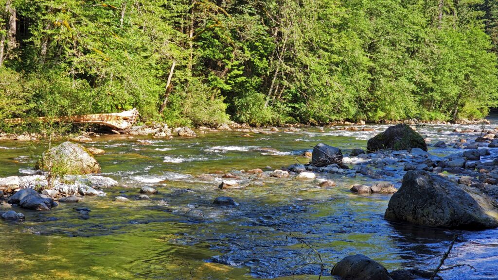
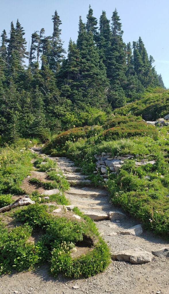
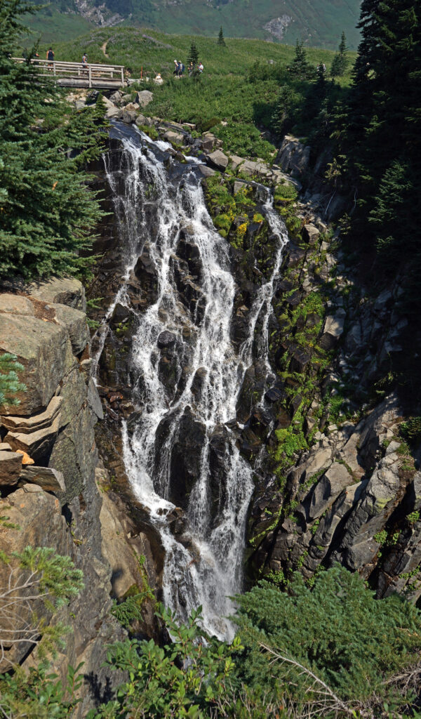
 The trail then drops back down before making a second climb to another summit. Beyond that the trail descends a series of stairs and a side trail leads down another set of steps to a viewpoint of the lower falls that is well worth the 104 steps back up to the main trail.
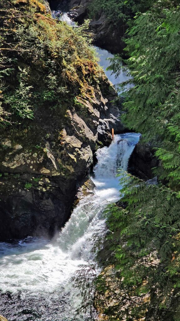

 Where: Washington side of the Columbia River Gorge
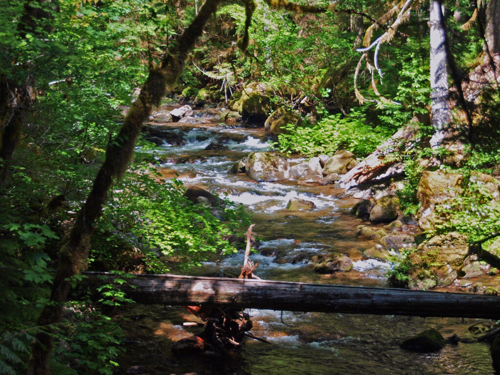 Overview:
 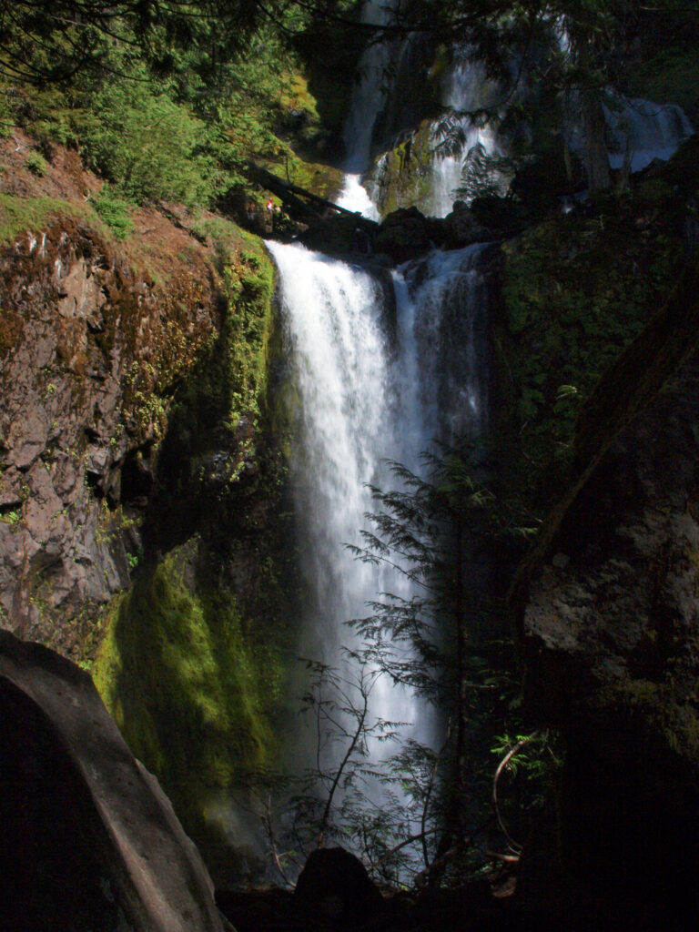 Best time to go:
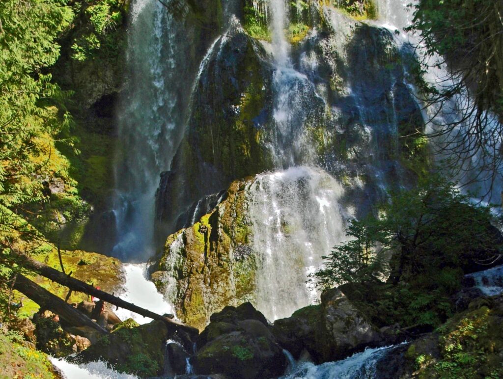
 Posted April 12, 2023 by Alan K. Lee
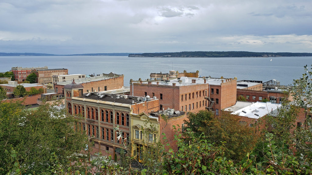

 Wooden sailing ships were key to the town’s early economy and history, and the boatbuilding and woodworking crafts live on in Port Townsend. The Northwest School of Wooden Boat Building in nearby Port Hadlock and the Port Townsend School of Woodworking help preserve and promote the skills that were so vital to the early history of Port Townsend.
 more than a dozen fine art and craft galleries can be found in the historic waterfront section of town.
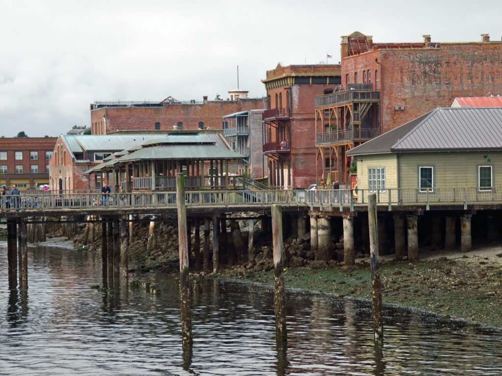
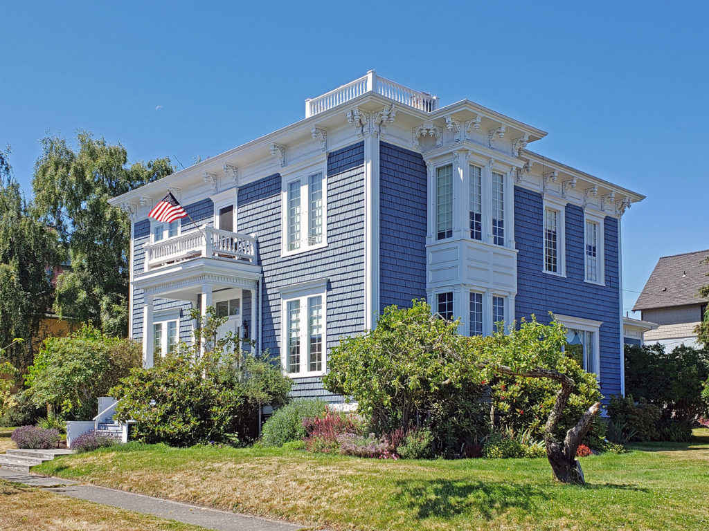 Take a walk along Water Street. It’s not hard to imagine what the town was like 130 years ago because most of the buildings you see today date from that period. Venture up to the bluff above the waterfront and you’ll find many Victorian era homes, most of which have been well preserved or restored. If you visit in the summer months you can tour the
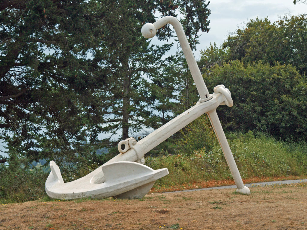
 Even if you’re not interested in the town’s history, its maritime traditions, or the arts, Port Townsend is still worth visiting, if only to take in its beautiful setting and indulge in its food and drink scene.
 On the food side, Owl Spirit Cafe is a good place to grab a sandwich or burrito for lunch. If you have pizza in mind, try Waterfront Pizza. My go to spot for breakfast and lunch is
  My wife and I stayed at the Water Street Hotel on our most recent visit, recently renamed the
 Originally posted November 20, 2020. Updated and re-posted January 12, 2023.
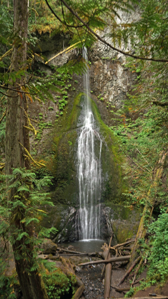
 The nearby
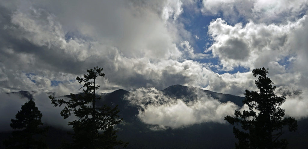
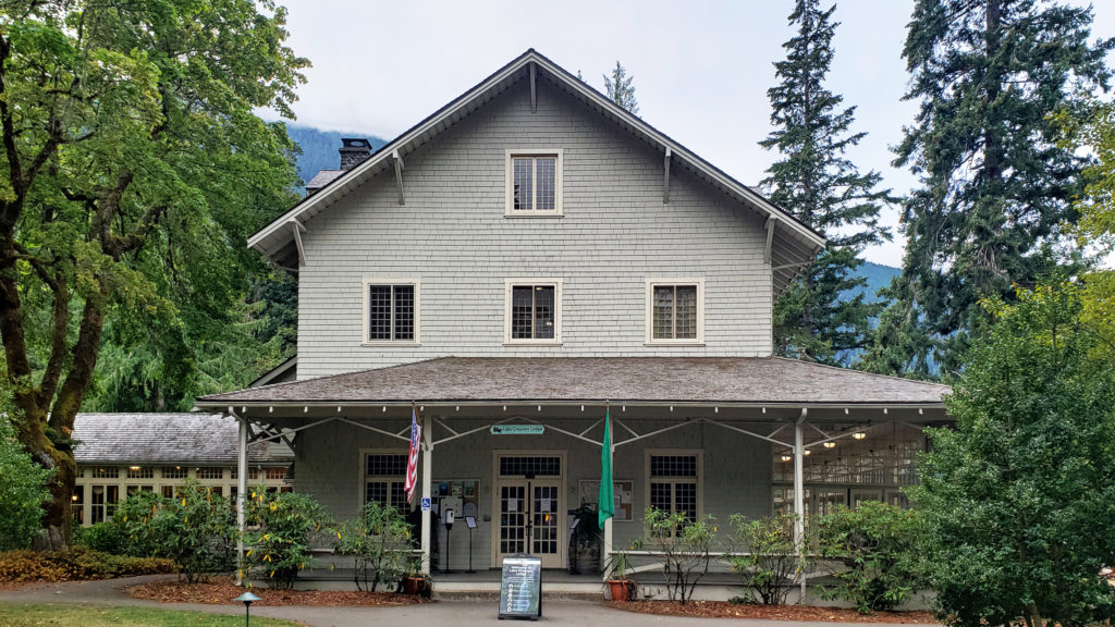
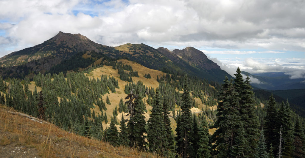 After our hike to Sol Duc Falls we drove to the Hurricane Ridge Visitor Center to do some more hiking and sightseeing. The visitor center is located 17 miles south of Port Angeles at an elevation of 5242 feet above sea level. Hurricane Ridge is the only alpine area in Olympic National Park accessible by car, which makes it very popular and means it can be very crowded, especially on summer weekends. We were there in the middle of the week in late September, though, so crowds weren’t much of an issue.
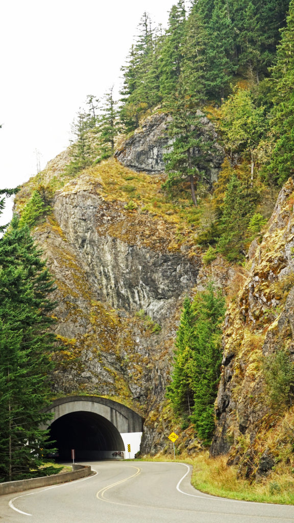 The Hurricane Ridge Road is paved, but winding with poor sight lines and several tunnels. It is also a popular challenge for cyclists because of the elevation gain, so go slow and watch for bicycles on the road.
 Originally posted November 7, 2020. Updated and re-posted November 9, 2022.
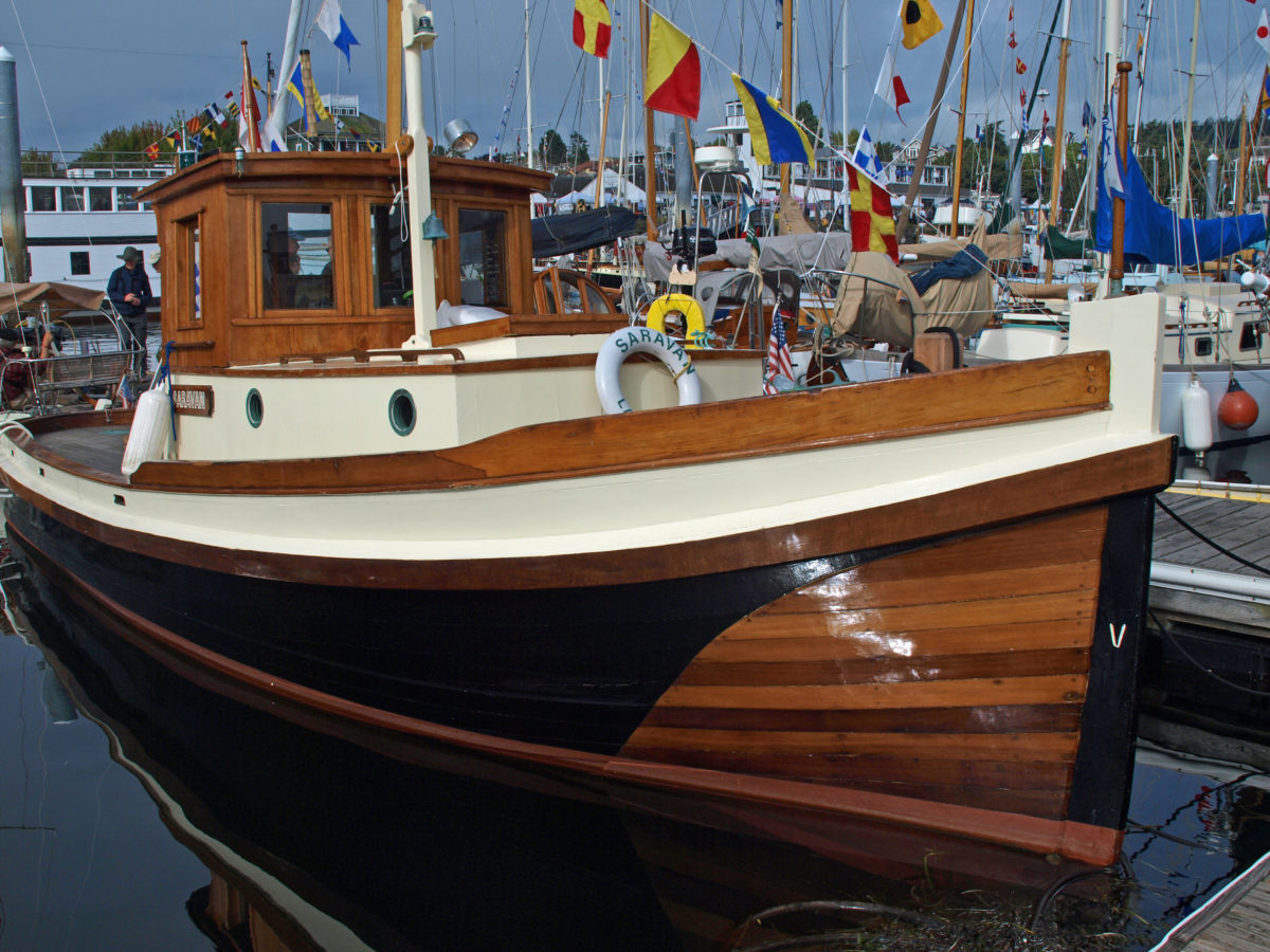
 That year, I decided to attend the festival only a month or so before it started, so most of the accommodations in
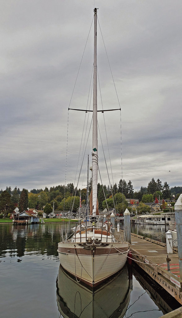
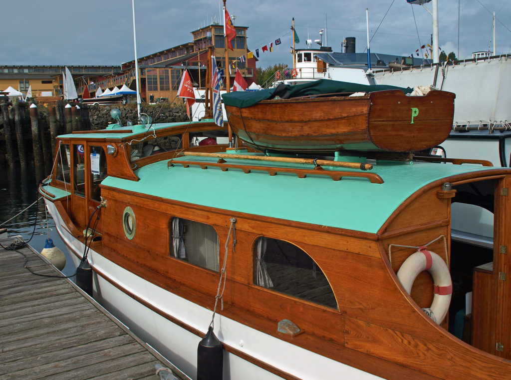
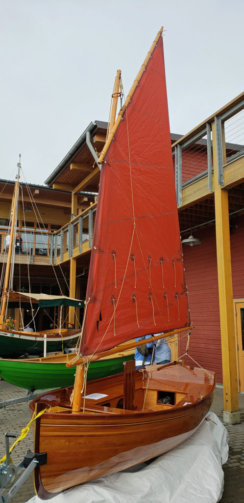
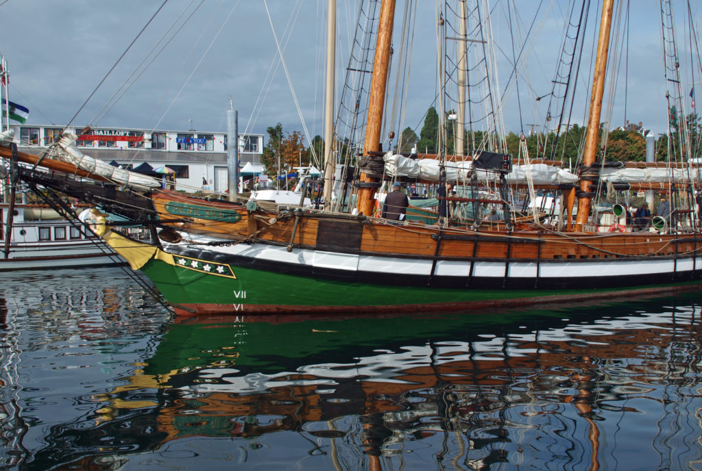
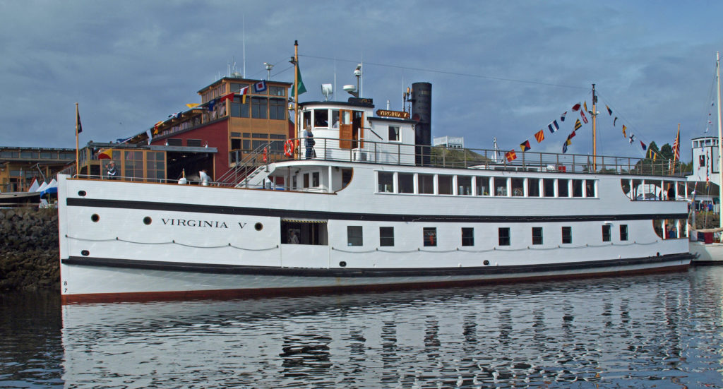
 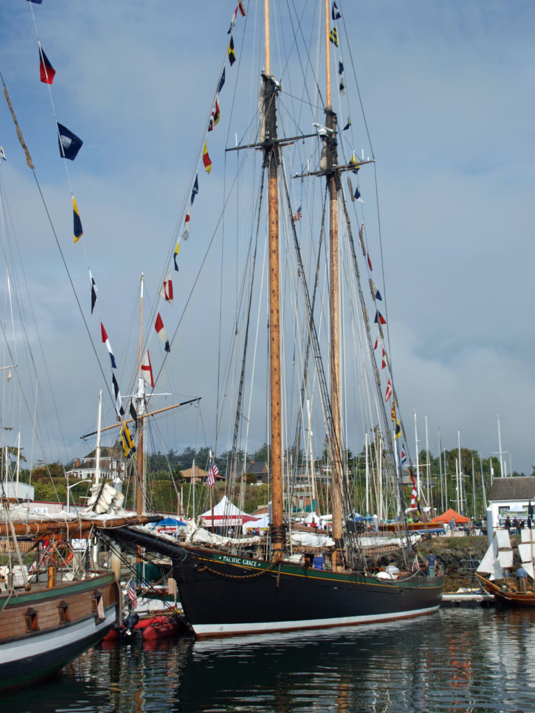 I found the Wooden Boat Festival to be as amazing an event as I had imagined, and maybe then some. It was quite a treat to see so many beautiful boats in one place. There were more than 300 boats featured at the 2018 show. Many of the owners welcomed guests aboard their boats and all were happy to talk about their boats and answer any questions.
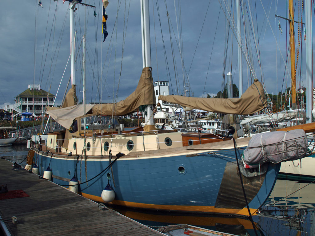 There were sailing, paddling, and rowing races, panel discussions, music, food and drink, films, and dozens of classes on boat designing and building, boat maintenance, sailing, navigation, living aboard, and much more. You could sail on one of several tall ships, try your hand at paddle boarding, or crew on a replica of one of Captain George Vancouver’s longboats from 1792. There was also a boat building competition in which teams endeavored to build boats from scratch in three days. And there were lots of activities for kids.
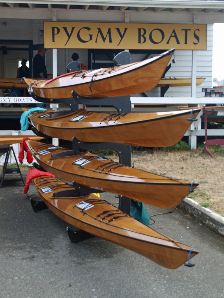 One of the highlights for me was being able to talk to some of the many boat builders at the festival, and seeing some of the boats that they’ve built. Casey Wilkerson of
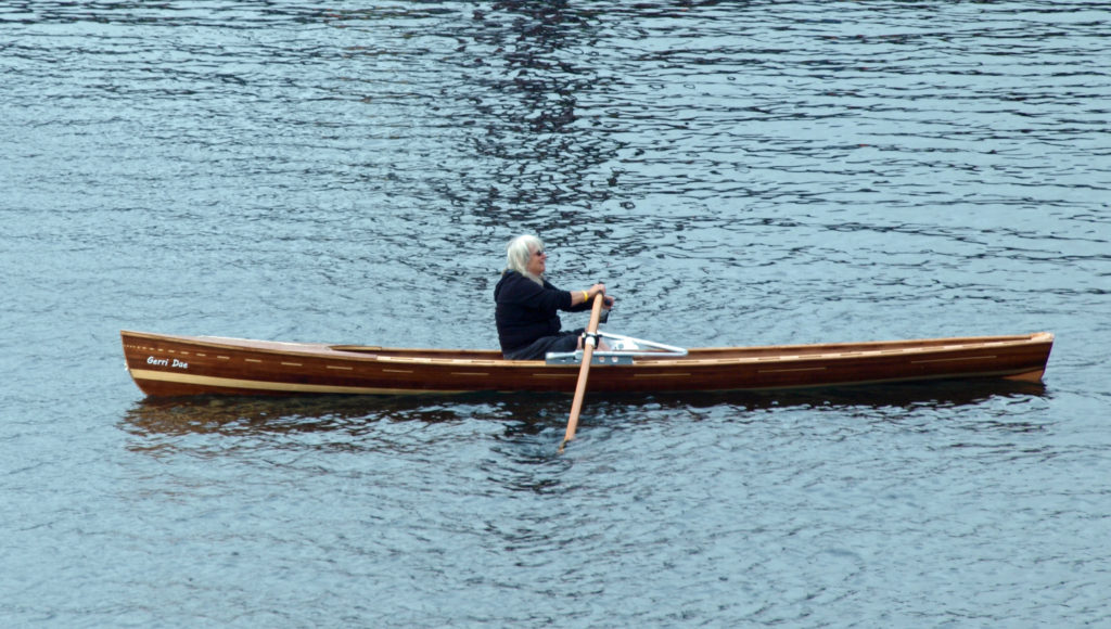
 All in all, there was far too much to see and do in a single day. I haven’t been back since the 2018 festival, but I’m hoping to attend the 2023 festival, to be held September 8-10. This time I’ll plan a little farther ahead, stay in Port Townsend, and take in the entire three days of the festival. And by the way, even if you’re not a wooden boat fan, Port Townsend is a pretty cool town, well worth a visit any time of the year.
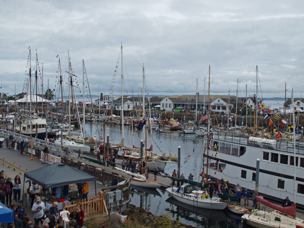 For more information about the festival, check out the festival’s
 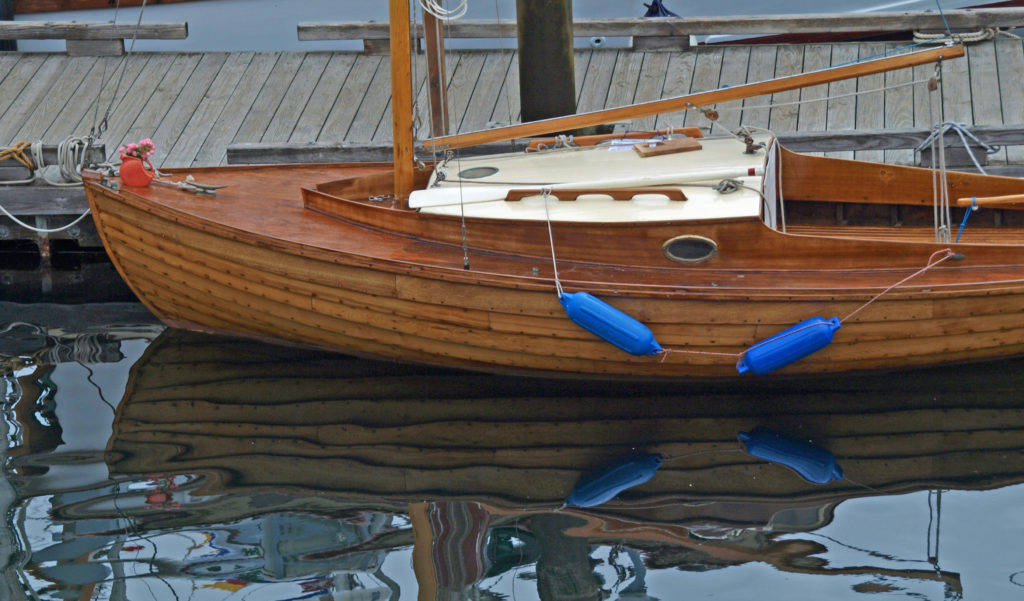 Originally posted September 13, 2018. Edited and re-posted September 20, 2022.
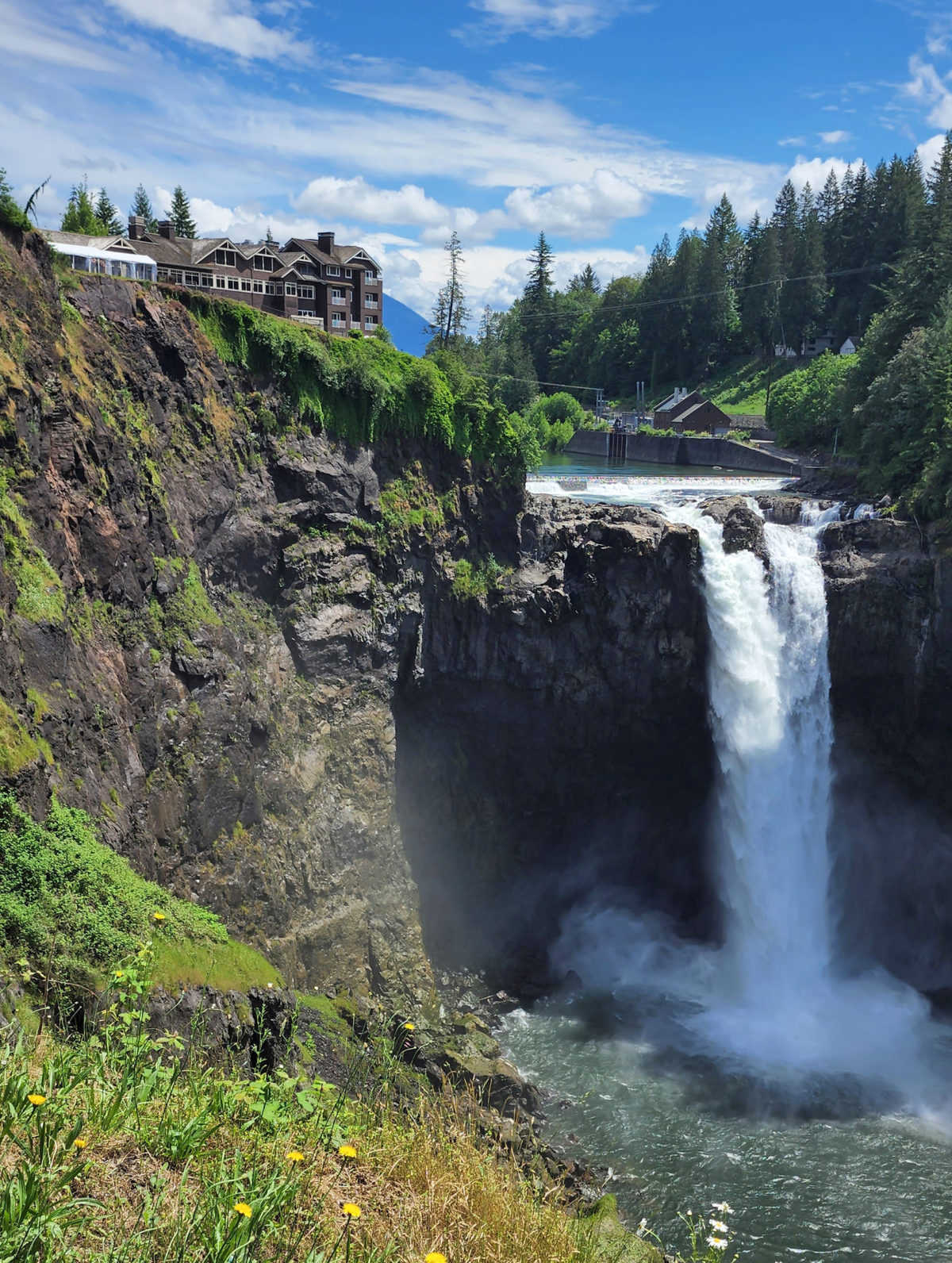
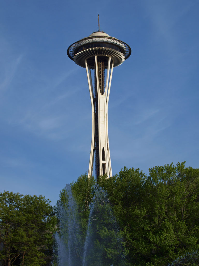
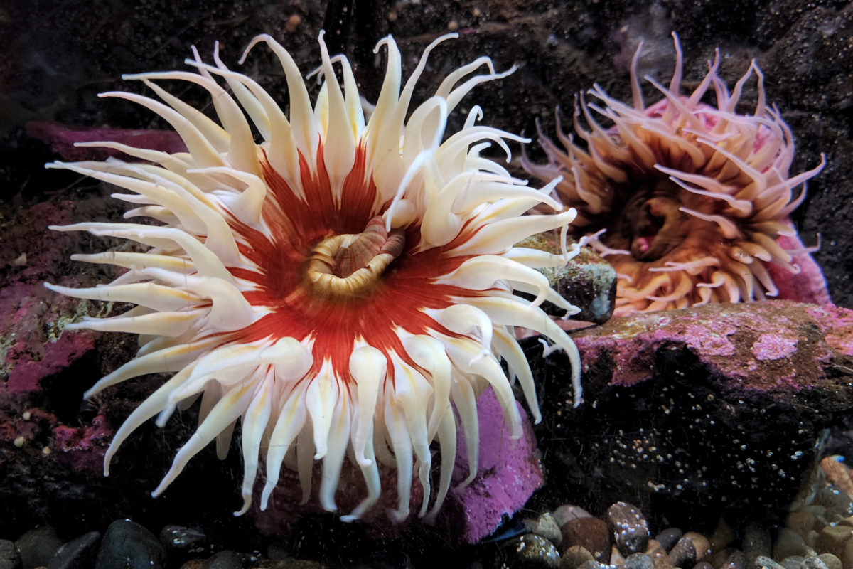

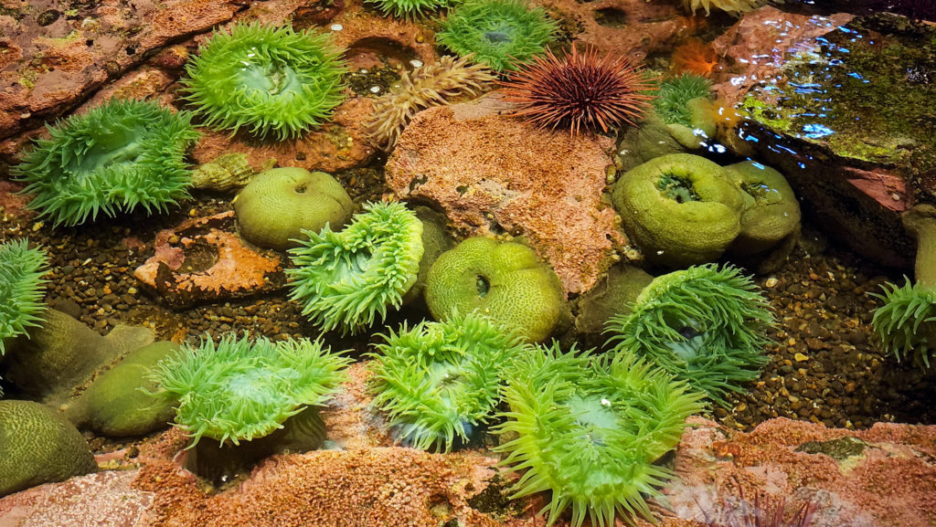

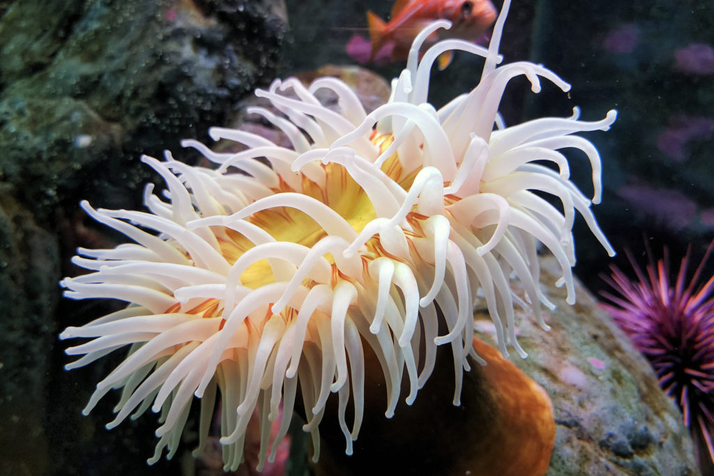


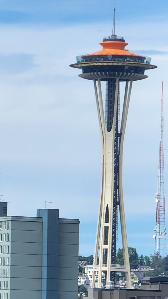 My wife and I spent the recent Fourth of July weekend exploring Seattle and vicinity with my step-daughter and her family. The grandkids had a great time at the aquarium, riding the Great Wheel and the Monorail, and seeing the sights from the top of the Space Needle. Seattle is truly a great place for the whole family. And the environment surrounding Seattle, both terrestrial and marine, is beautiful and often awe inspiring. Look for an upcoming post on this site on the Snoqualmie Valley, just a short drive east of Seattle. The abundance of close at hand natural areas perfectly balances the urban environment, making a visit to Seattle an even more attractive trip for everyone.
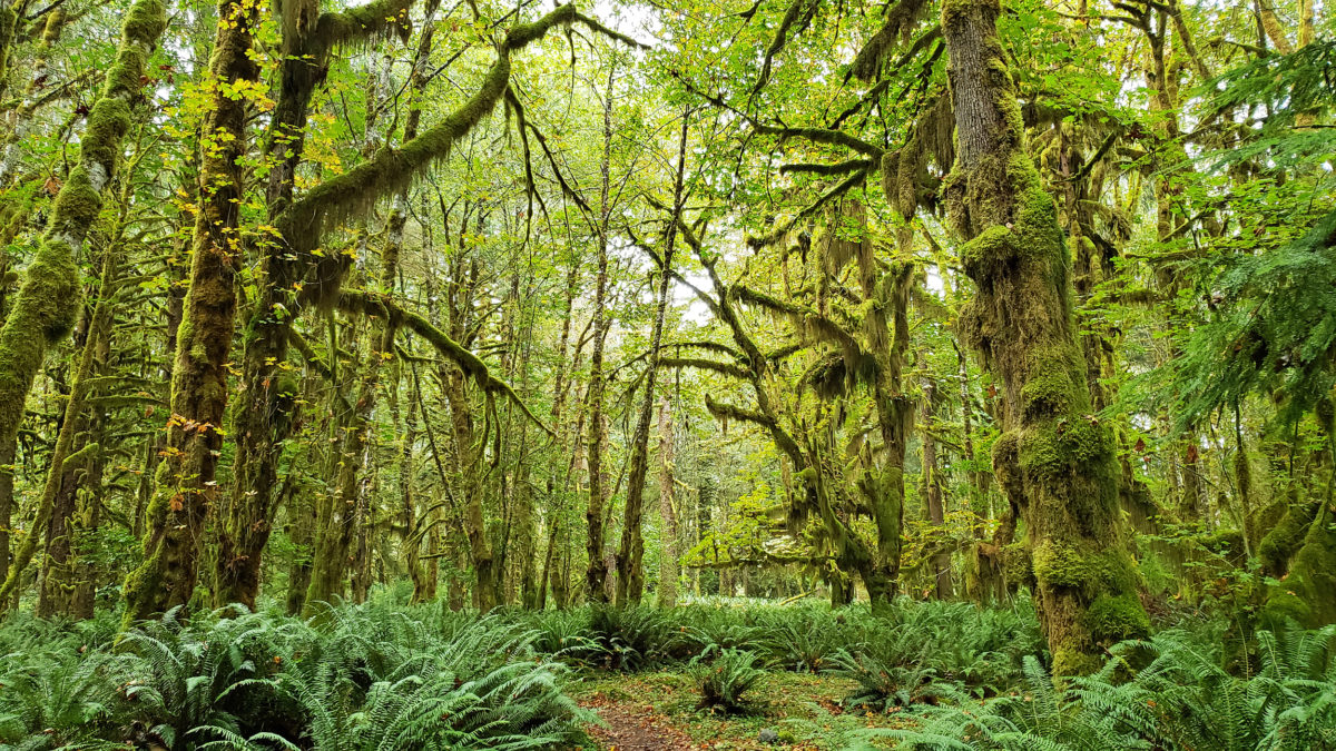
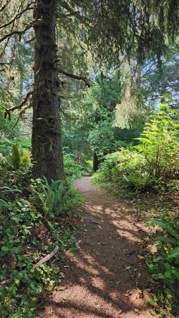
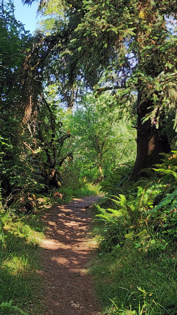
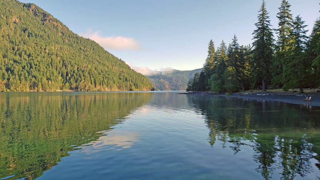
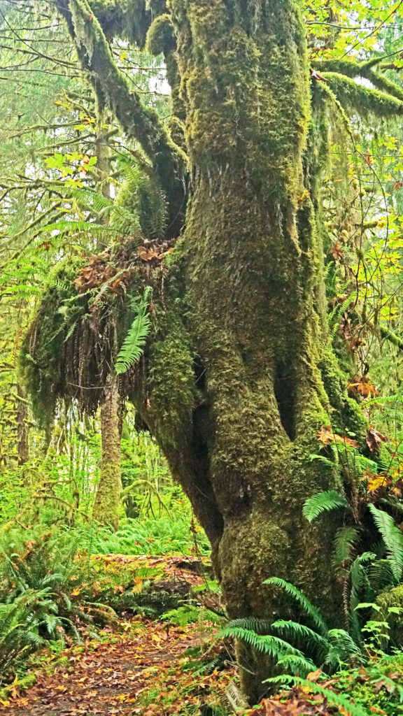
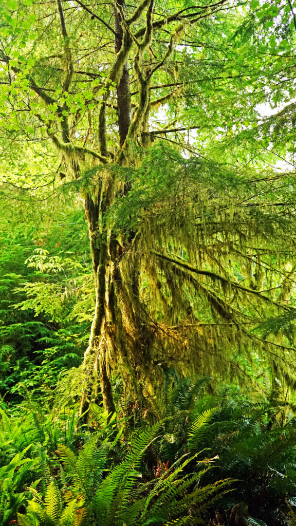
 The Quinault Rain Forest lies in the southwestern corner of Olympic National Park, the adjacent Olympic National Forest, and the Quinault Indian Reservation in western Washington. It’s less than a four hour drive from either Portland or Seattle, but it seems a world apart, and more than a little stuck in time. It looks much as I remember it from when I first visited as a child more than a half century ago. Cell phone service and wi-fi availability are spotty. There are no big resorts and no towns of any size. Urban America is nowhere to be found.
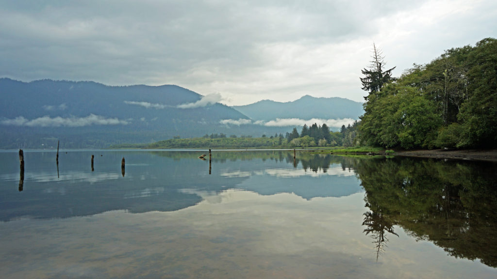 The pandemic has kept all of us from traveling as much as maybe we’d like. That certainly applies to my wife and I. Most of our vacation plans for 2020 had to be cancelled. And just when the parks and recreation areas were beginning to reopen, wildfires in western Oregon and Washington shut them down again. But the Olympic Peninsula was largely unaffected by the fires. So, my wife and I decided that the Olympics would be an ideal, and much needed, escape from Portland, and in September 2020 we headed to the Olympic Peninsula. Our first stop was Lake Quinault.
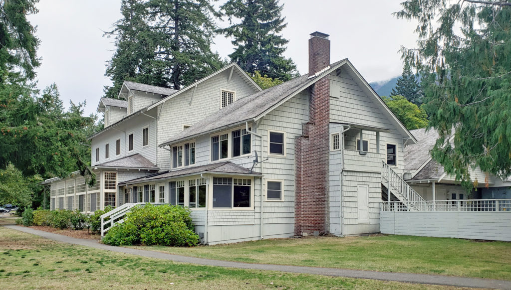
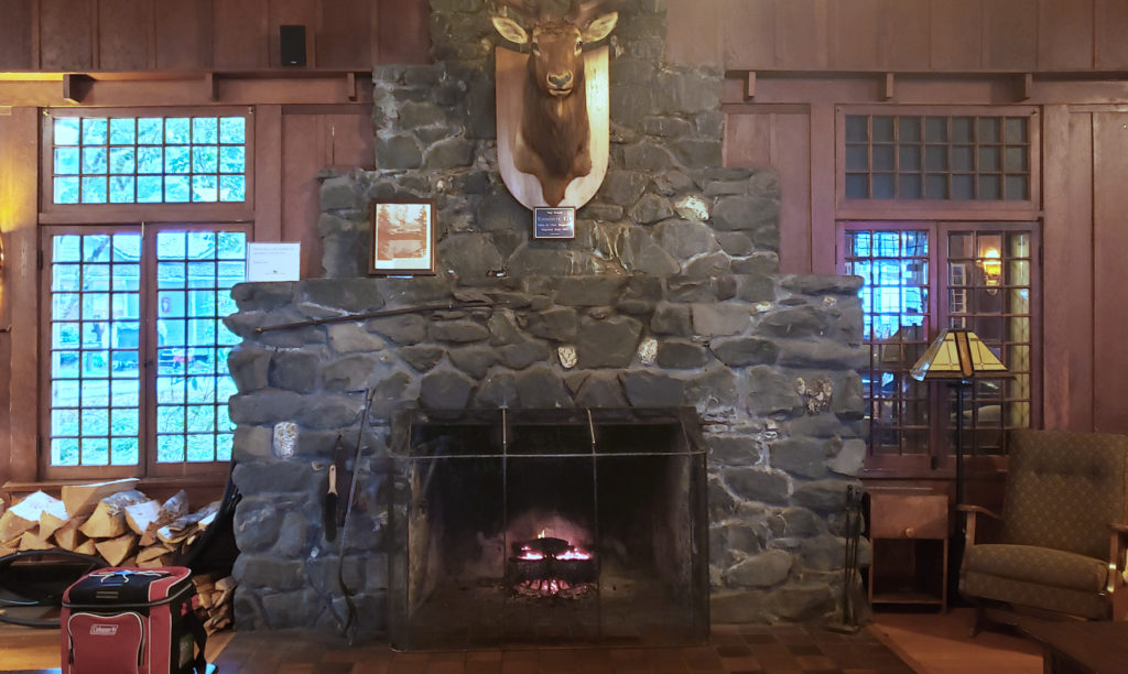
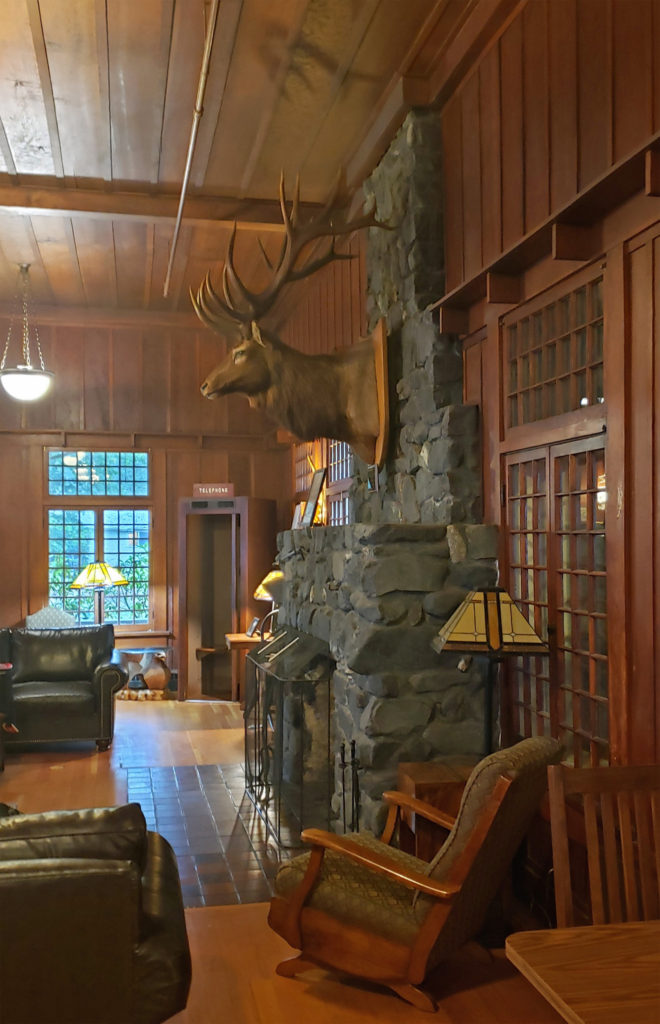
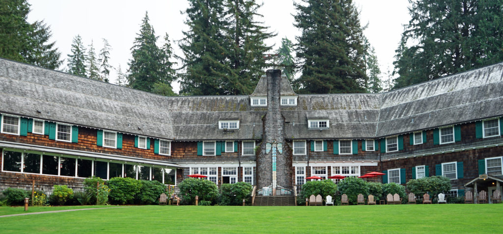 We treated ourselves to a stay at the historic Lake Quinault Lodge, one of the iconic grand lodges of the American West. The original Lake Quinault Lodge was built in 1904. The Boathouse annex was built in 1923. The original lodge burned down in 1924 and the current main lodge was constructed in 1926 on the site of the older lodge. Two additional annexes have been added since then. The existing lodge was placed on the National Register of Historic Places in 1998.
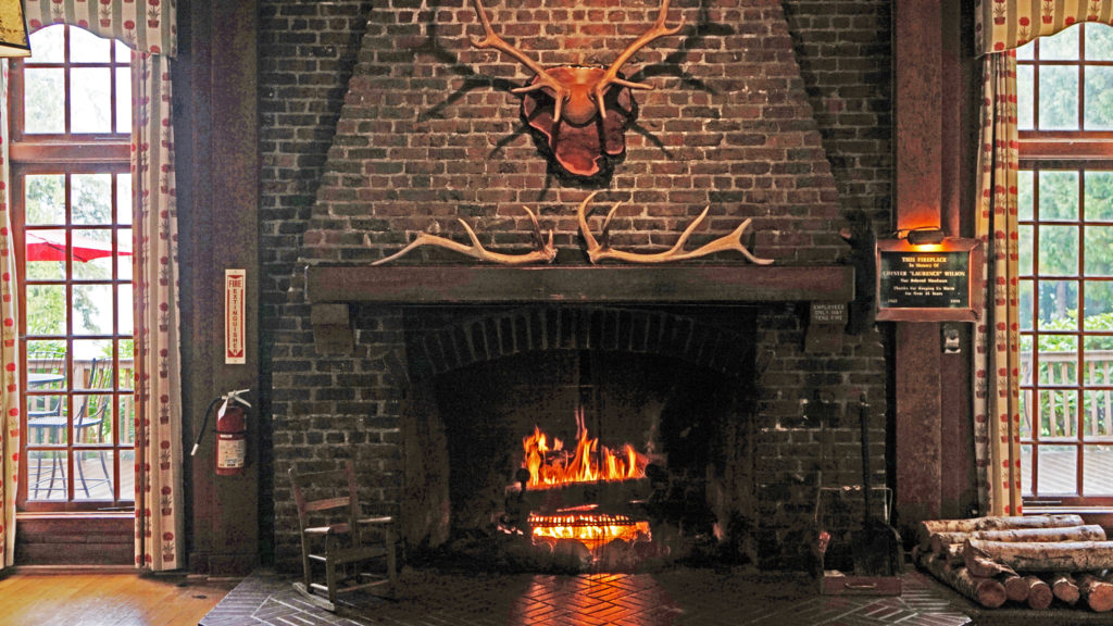 Rooms at the lodge are a little pricey, but you’re paying for the history, charm, and iconic nature of the lodge more than for the amenities provided. There are no TVs in any of the main lodge rooms, no fridges, or microwaves, no phones and no cell phone service. But that’s all part of the charm. The Boathouse and the other two annexes offer a few more amenities. Some come with fireplaces, the Lakeside Rooms are billed as family friendly, and the Boathouse Rooms are pet friendly. Our room in the main lodge came with all we needed, a comfortable bed and a view of the lake.
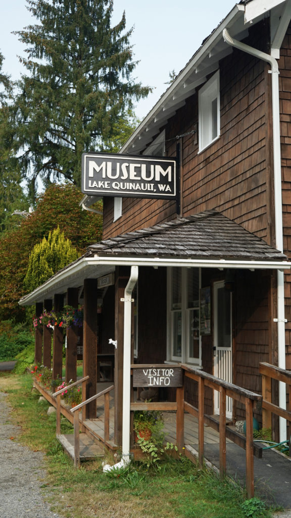 Services at the lodge were limited by the pandemic during our stay. The swimming pool, sauna, and game room were closed. The restaurant served take out meals, but the dining room was closed (outside seating was available and you could eat in the main hall or in your room). However, all services have been restored to pre-pandemic levels.
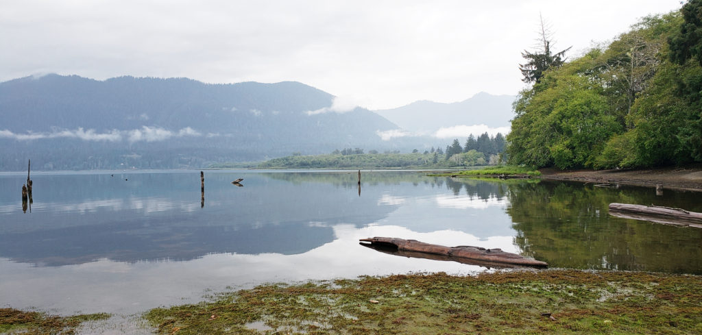 A somewhat cheaper alternative to Lake Quinault Lodge is the nearby Rain Forest Resort, which has a 16 room lodge, cabins (some with hot tubs), an RV park, and a restaurant. The world’s largest Sitka Spruce grows a short walk from the resort. Other options are the Quinault River Inn on Hwy 101 in Amanda Park, and Lochaerie Resort on North Shore Road. And there are three campgrounds on the south shore of Lake Quinault, and two (one a walk-in) on the north shore.
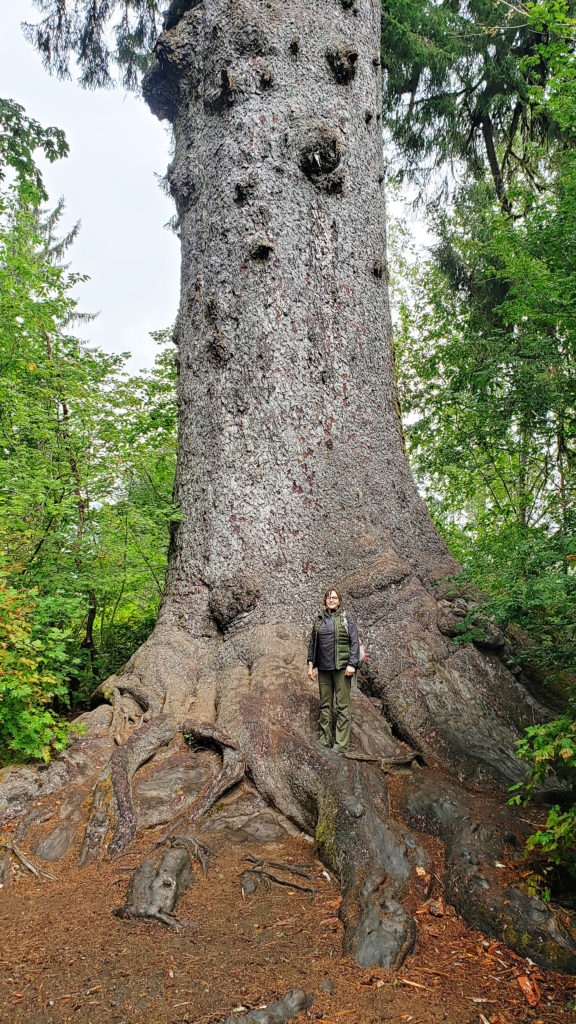 Lake Quinault Lodge, the Rain Forest Resort, or any of the three south shore campgrounds make an ideal base for exploring the area. Hikers have a variety of options, from the half mile Rain Forest Nature Trail Loop to a loop of about seven miles that takes you to Gatton Creek Falls, Cascade Falls, the Cedar Bog, the Rain Forest Nature Trail, and along the lake shore. Cutoff trails make shorter loops of various distances possible. Other hiking trails are a short drive from the lodge.
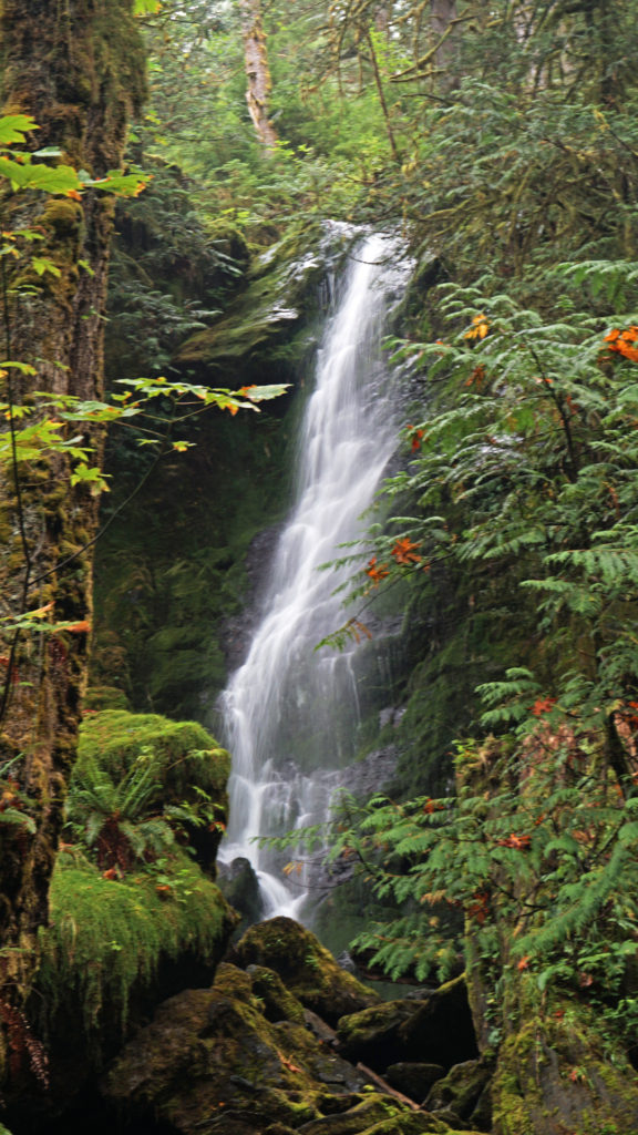 Two stops along South Shore Road worth making are Merriman Falls and Bunch Falls. Both are just east of Lake Quinault and both are right by the road, so no hiking required.
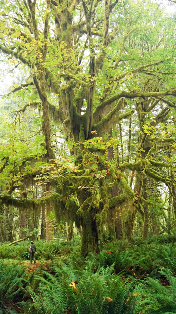
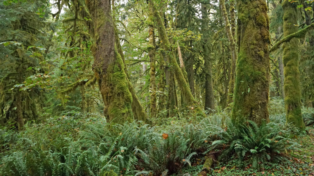
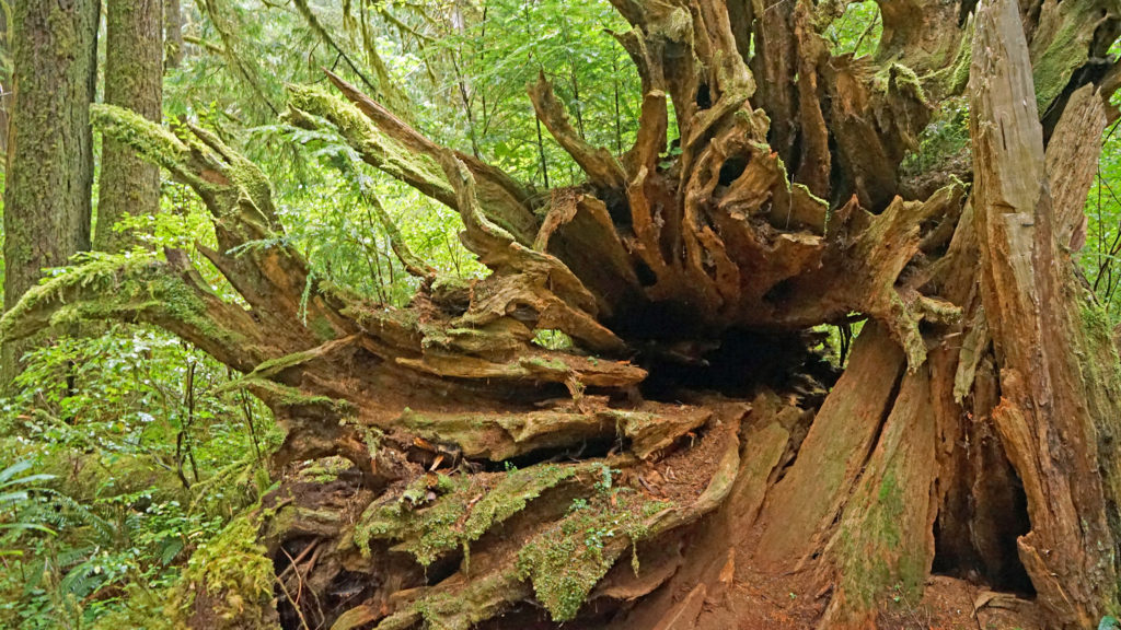
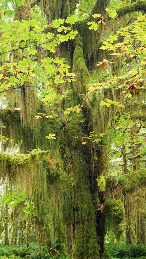 One hike that everyone should do is the Maple Glade Trail at the Quinault River Ranger Station on North Shore Road. It is spectacularly beautiful, and like the Rain Forest Nature Trail, it’s an easy 0.5 mile loop. But, unlike the Rain Forest Nature Trail, which takes you through a coniferous forest of Douglas Fir, Western Hemlock, and Western Red Cedar, the Maple Glade Trail immerses you in a Bigleaf Maple forest. There the ground is covered in ferns and other low growing shrubs and the maples soar overhead, but in between is mostly open and airy. The effect is like being in a gigantic room carpeted with ferns and roofed with a canopy of maple leaves.
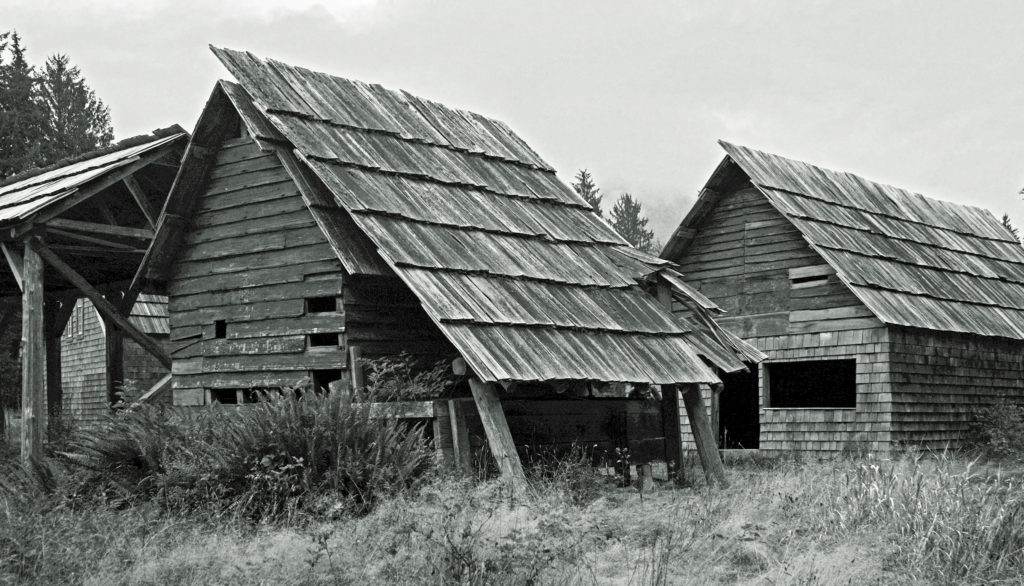 The Maple Glade Trail can be extended by taking the connecting trail to the Kestner Homestead. There you’ll find the Kestner house, barn, outbuildings, and a cool old rusted delivery truck.
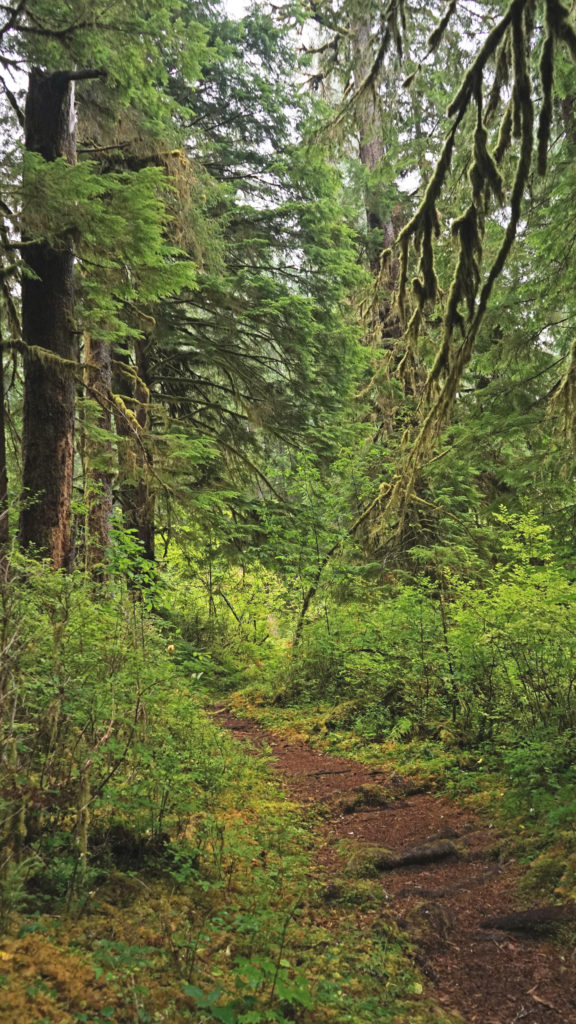
 There are also much longer hikes that can be taken into the Olympic National Park from the Quinault Valley. The most famous, and probably most hiked, is the Enchanted Valley Trail. It’s a 13 mile hike along the East Fork of the Quinault River to reach the Enchanted Valley, so it is not a casual outing. Most people do it as a 3-5 day backpacking trip. My backpacking days are behind me, but the Enchanted Valley is one of the hikes that I regret having never done.
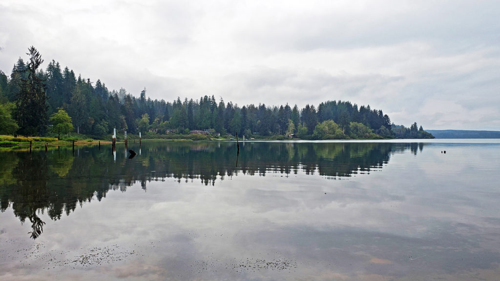
 Originally posted October 26, 2020. Updated and re-posted August 11, 2022.
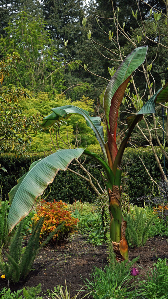
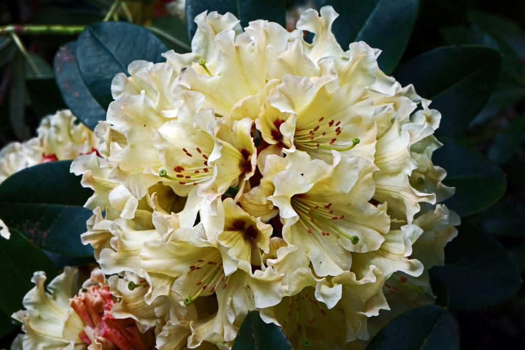
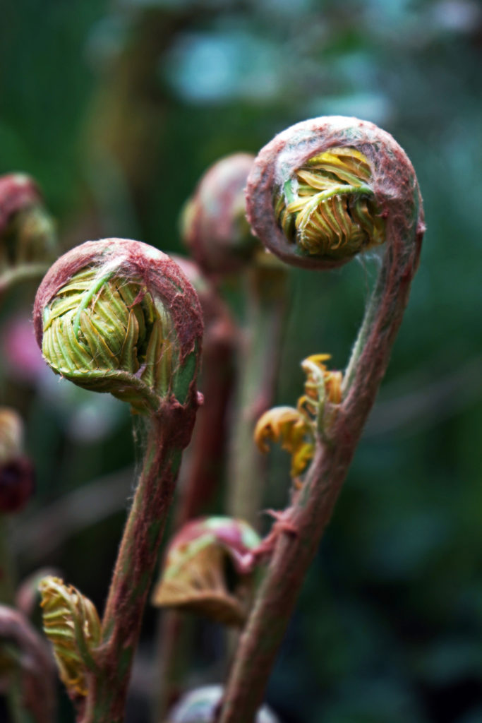
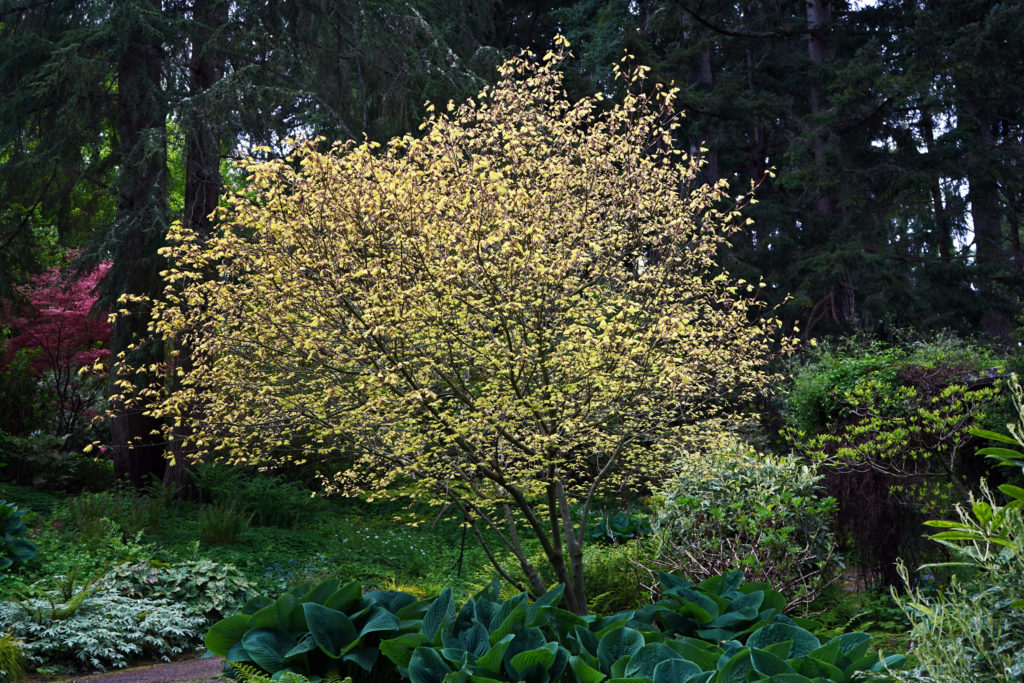
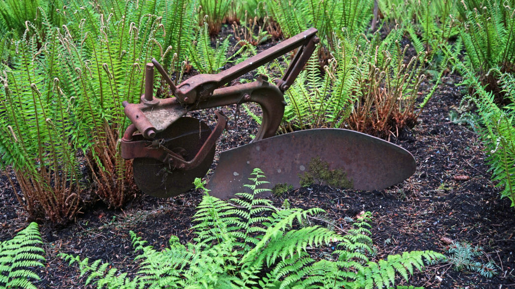
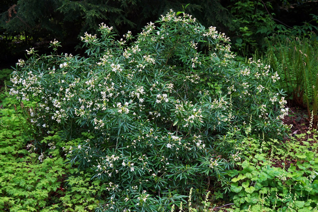
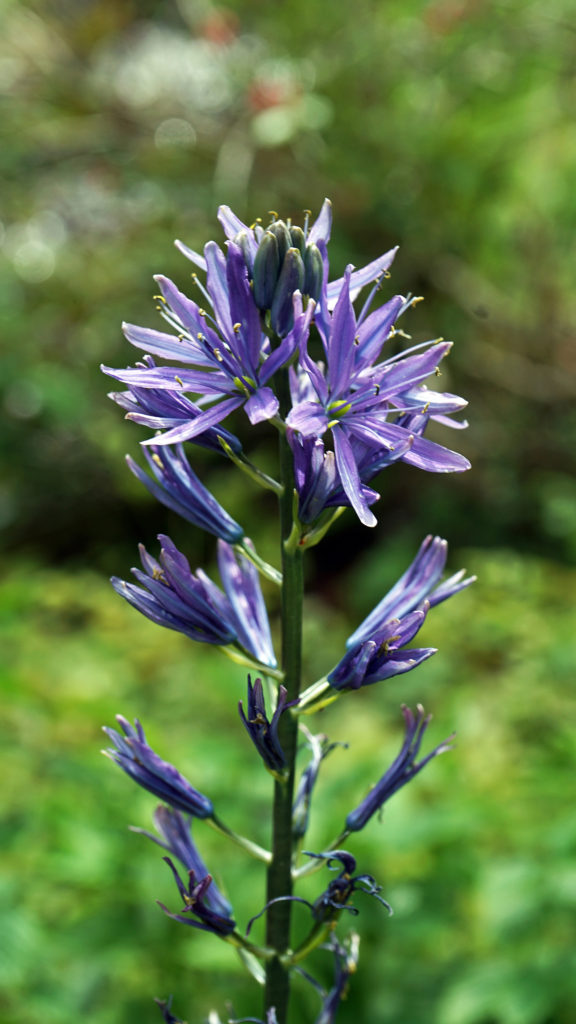
 Powells Wood Garden is located at 430 S. Dash Point Road in Federal Way. The garden is open Tuesday through Saturday from 10am to 3pm. Admission is $7 per person (children 12 and under are free). Tickets can be purchased online on the Garden’s
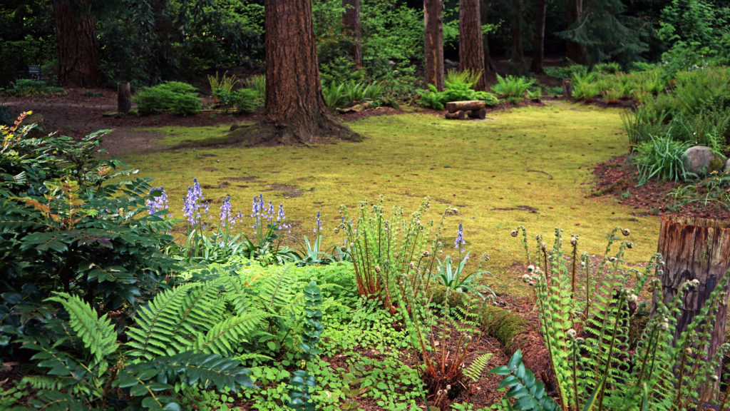
 If you visit Powells Wood Garden, you might also want to stop in at
 While Powells Wood Garden is probably not worth a trip to Tacoma on its own, the Tacoma area has a lot of other attractions, not the least of which are the Museum of Glass and the Tacoma Art Museum, both part of the