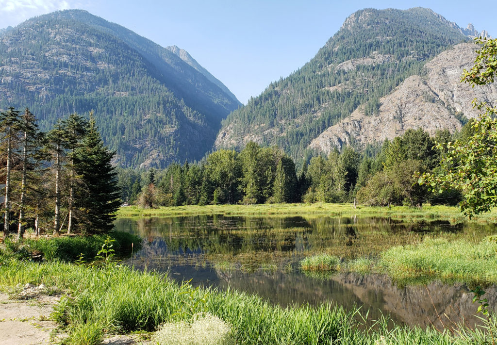
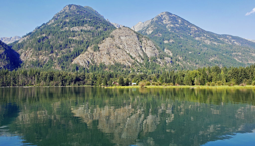
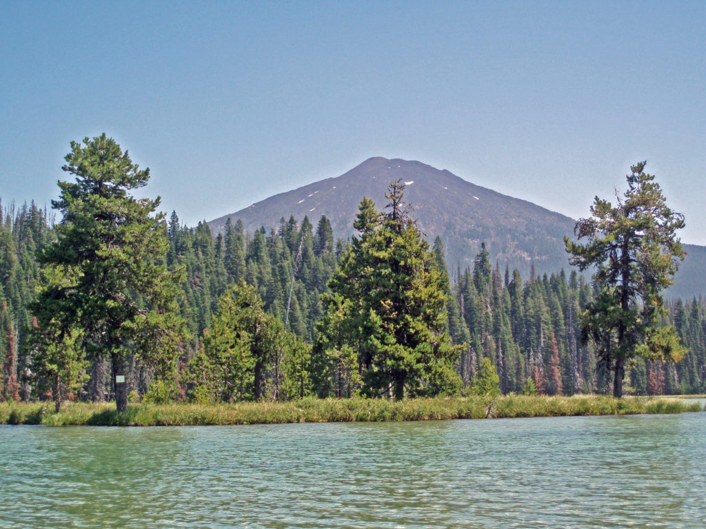
Hosmer Lake is located just off the Cascade Lakes Highway, about 30 miles west of Bend, Oregon. The water is cold and crystal clear, and the scenery is spectacular. Mount Bachelor (elevation 9065 feet) rises only a few miles to the east, and the 10,358-foot South Sister and 9173-foot Broken Top are only slightly farther away, in full view to the north.
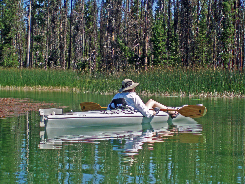
The photos here are from a summer day of kayaking on Hosmer a few years ago.
Hosmer Lake is an interesting body of water, well on its way to becoming a marsh or a meadow (in a few thousand years, perhaps). Big Marsh, about 40 miles to the south is an example of a former lake that has become all marshland. The technical term for this process is lake succession if you’re interested in learning more about it.
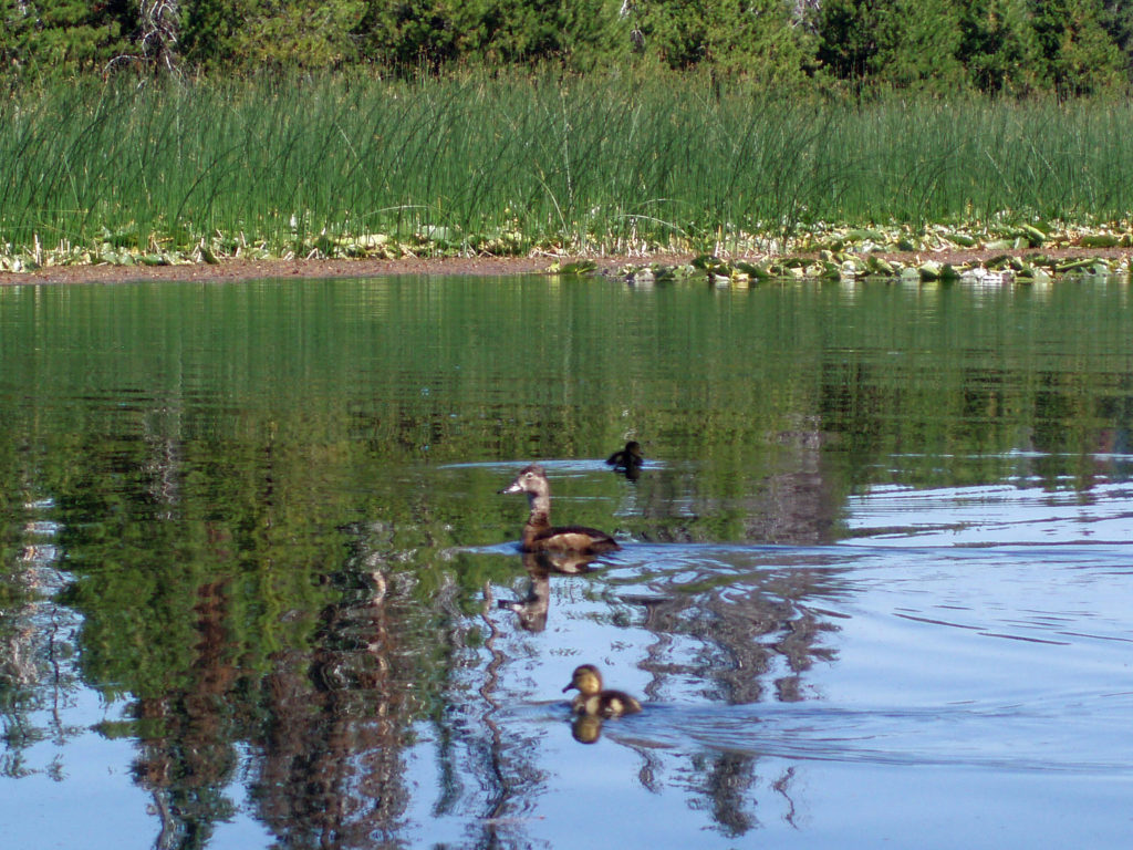
Hosmer Lake is a mix of open water and reeds, rushes, water lilies, and other marsh plants. Motorized craft (except for electric motor powered) are not allowed on the lake, which makes it ideal for kayaking or canoeing. It’s also not a big lake at 160 acres, so you can easily explore it all in an afternoon.
Hosmer is a popular fishing destination because it is one of the few lakes in Oregon that are stocked with Atlantic salmon. According to the Oregon Dept. of Fish and Wildlife, the Atlantic salmon average 16 inches in length and range up to 22 inches. It’s also stocked with brook trout, which run only slightly smaller. It is a fly fishing only lake, so that limits its use somewhat. My wife and I have kayaked there a number of times, and it’s never been crowded.
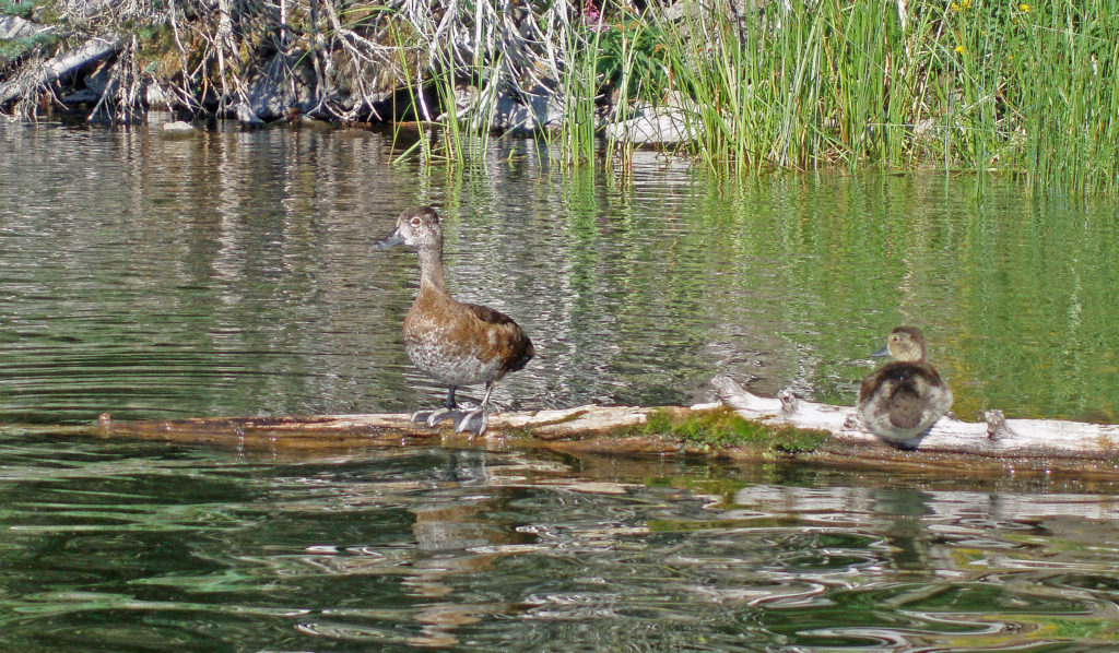
Hosmer Lake is also a popular birding area. Waterfowl and shore birds, such as American Bitterns, Virginia Rails, Sora, and Wood Ducks, are common. Red-winged and Yellow-headed Blackbirds are abundant during the breeding season and into the fall. And Clark’s Nutcrackers, Gray Jays and other birds can often be seen in the forest surrounding the lake. The relatively uncommon Three-toed and Black-backed Woodpeckers are also found in the surrounding area.
Elk and black bear also frequent the area. And let’s not forget the mosquitoes. Forget your insect repellent at your own risk here. Early in the season is especially bad.
At an elevation of 4966 feet, the recreational season is short at Hosmer. There may be snow and the lake may be still frozen until late May or even into early June some years, and the first snow in the fall can come anytime after the middle of September. But the short summer is glorious.
Hosmer is a good place to pitch a tent or park your RV. There are two small forest service campgrounds on the lake that have about 35 sites between them. Note that no water is available at theses campgrounds, so campers will need to bring their own. Water is available at Little Fawn Campground (8 sites) on the south end of nearby Elk Lake and there are many other forest service campgrounds in the surrounding area. There is also a resort at the north end of Elk Lake.
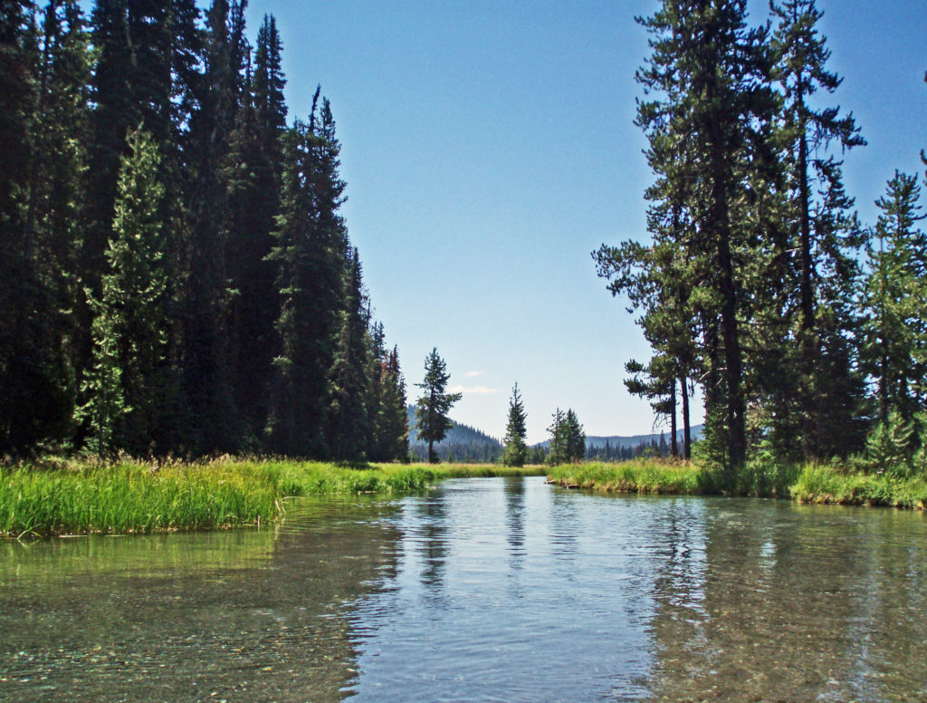
Hosmer Lake is fed by Quinn Creek, which flows into the north end of the lake. Quinn Creek is narrow and shallow, but it is possible to paddle up it for a ways. When we were there last, downed trees blocked our passage a few hundred yards from the mouth of the creek. We hauled our kayaks out of the water at that point and hiked along the creek to a small waterfall where we ate lunch and lingered awhile before heading back out on the water.
Recalling our visits to Hosmer Lake, I’m eager now to get back to the area and get back on the water again. It’s a beautiful place, and one of my favorite destinations. Hosmer Lake is located in the Deschutes National Forest. Check the Forest Service website for information on forest fire danger and possible use restrictions.
While Hosmer Lake is a worthy destination in its own right, there are plenty of other attractions in the immediate area. Elk Lake, a popular fishing and camping spot, is just west of Hosmer Lake. Sparks Lake, to the northeast, is another good canoeing and kayaking destination. There are a number of other lakes along the Cascade Lakes Highway, many trailheads along the highway that give access to the Three Sisters Wilderness, and many campgrounds in the area.
Nearby Mount Bachelor Resort is one of the prime alpine and Nordic ski areas in the Northwest, but it’s also worth a visit in the summer. Take a chair lift to Pine Mountain Lodge at the 7748 foot level and dine at the restaurant there. Then, if you’re adventurous enough, you can take the 3-stage, 1.3-mile long zip line that descends nearly 1400 vertical feet to the base of the mountain. Or just ride the chairlift back down and enjoy the magnificent views of the South Sister, Broken Top, and the surrounding area.
Originally posted December 10, 2018 by Alan K. Lee
Most recently edited and updated September 25, 2023
The Skyline Trail loop is one of the Pacific Northwest’s iconic hikes. Beginning at the Visitor Center in the Paradise section of the park, the trail takes you up the mountain with great views of the summit, awesome views of the Nisqually Glacier, and panoramic views south to the Tatoosh Range and Mount St. Helens and Mount Adams in the distance. The high point of the trail is just over 7000 feet in elevation (and still 7400 feet below the summit). The lower portions of the trail take you through alpine forest and mountain meadows. The upper part is all above timberline with open views in all directions.
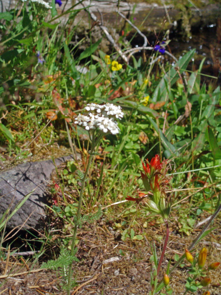
The Paradise area is famous for its spectacular wildflower displays that carpet the meadows, including the alpine meadows above timberline. Look for deer and elk in the lower meadows and forested areas. Look, and listen, for hoary marmots and pikas along the trail. Gray Jays and Clark’s Nutcrackers are common (and tame) below timberline, and you might see White-tailed Ptarmigans in the higher reaches.
The Skyline Trail is a very popular hike for many reasons, and you will have plenty of company on it. But the views are incredible, the mountain is utterly massive, and wildlife and wildflowers are abundant, all of which make putting up with the crowds well worth it.
Getting there:
From Portland, take Interstate-5 north to US Hwy 12 (Exit 68). Follow US12 east to Morton, then Washington Hwy 7 north to Elbe. Turn east on Hwy 706 and proceed to the Longmire Entrance to Mt. Rainier National Park. In the park, follow the signs to Paradise.
From Seattle, take I-5 south through Tacoma to Exit 127 (Hwy 512). Go east on Hwy 512 to Hwy 7, then south to Elbe. From Elbe, proceed as described above.
The park entrance fee is $30 if you don’t have one of the various national park passes and is good for seven days. The park no longer accepts cash payments.
Best Times to Go:
The hiking season is limited in the Paradise area and even more so for the upper part of the Skyline Loop. Paradise is also the most visited part of the park and is always crowded on summer weekends, so your best bet is to come on a weekday morning, or anytime after Labor Day. Even then, you may have trouble finding a parking spot. There are plenty of other worthwhile hikes in the Longmire and Paradise areas, so come prepared with a Plan B hike just in case.
Another option, if you can afford it, is to book a room at Paradise Inn, which allows you to park in the inn’s parking lot. But even that doesn’t guarantee you a parking spot, as we found out one afternoon after returning from a day hike lower on the mountain. The inn’s lot was full, as was the visitor center lot. We had to park in the lower lot and walk to the inn. The National Park Inn in Longmire is another lodging option to consider.
Trailheads:
The trail begins and ends near the Henry M. Jackson Memorial Visitor Center. Restrooms and drinking water are available in the visitor center. You can also start the hike from Paradise Inn, just uphill from the visitor center. Parking at the visitor center is limited and fills up early in the day. Parking at Paradise Inn is restricted to visitors staying at the inn. An alternative trailhead starts at the lower parking lot. (There is a trail to the visitor center, or you can take the Deadhorse Creek Trail up the mountain and join the Skyline Trail just below Glacier Vista. Starting at the lower trailhead adds only about two tenths of a mile to the hike.)
The hike:
From the trailhead at the visitor center, the trail heads straight up the mountain on a moderately steep grade. There are a myriad of trails crisscrossing the Paradise area above the visitor center, but most of the trail intersections are well signed. If in doubt, just head uphill. But bring a trail map, just in case.
At the 0.2-mile mark, you’ll come to a junction with the Alta Vista Trail, a side trail that takes you to a good viewpoint before rejoining the Skyline Trail. The Alta Vista Trail adds a little to the elevation gain of this hike, but doesn’t add any distance.
Stay on the main trail at the junction with the Deadhorse Creek Trail. The next trail junction, at the one-mile mark, is with the Glacier View Trail. Like the Alta Vista Trail, the Glacier View Trail parallels the Skyline Trail and doesn’t add any distance to the hike, but does provide a good view of the massive Nisqually Glacier.
Above Glacier View, the Skyline Trail switchbacks up a steeper section of the mountain above timberline. At the 1.6-mile mark you come to the junction with the Upper Skyline Trail (which may be signed as the Pebble Creek Trail). Staying on the main trail will take you to the well-named and very popular Panorama Point, with sweeping views down to Paradise Inn and the visitor center, across to the Tatoosh Range, and beyond to Mount St. Helens and Mount Adams. The Upper Skyline Trail is a three tenths of a mile shortcut and bypasses the often crowded Panorama Point. If you take the shortcut, stay right at the next junction to rejoin the main trail above Panorama Point.
Just above Panorama Point is a restroom open during the summer (it may be closed after Labor Day). Follow the trail going straight up the mountain where you will come to the eastern junction with the Upper Skyline Trail. Older maps show the Skyline Trail descending from Panorama Point across a snow field to the east and rejoining the Upper Skyline Trail on the ridge beyond. That is no longer the official route and is not maintained, although I saw a group of people taking it the last time I was there. Google Maps also still shows that trail.
Just past the junction with the Upper Skyline Trail, you’ll reach the high point of the hike at 7040 feet. From there, the trail traverses the rocky southeastern slopes of the mountain, then descends to the junction with the Golden Gate Trail at the 3.3-mile mark of the hike. Taking the Golden Gate Trail, which switchbacks down a steep slope before rejoining the Skyline Trail, cuts about a mile off the total distance of the hike.
Past the Golden Gate Trail junction, the Skyline Trail follows the crest of a ridge, then descends to a beautiful alpine meadow near the headwaters of the Paradise River. After crossing the river, which is still a small creek at that point, you will come to the junction with the Paradise Glacier Trail at the 3.9-mile mark of the hike, which once led to the famous Paradise Ice Caves. The caves no longer exist, however. Beyond the junction, look for the Stevens-Van Trump Historical Marker, commemorating the first ascent of the mountain in 1870.
Beyond the monument, the trail parallels the edge of a 1000-foot drop off to Stevens Creek to the east before turning west. Stay right at the junction with the Lakes Trail and follow the Skyline Trail as it switchbacks down to meet the Paradise River again. Stay right again at the 4th Crossing Trail junction. The trail then traverses the slope above the river and crosses over a ridge. Just past the lower junction with the Golden Gate Trail, you come to Myrtle Falls at the 5.2-mile mark. Myrtle Falls is one of the most photographed spots in the park, and one of the most crowded. Welcome back to civilization. From Myrtle Falls it’s a short half-mile jaunt back to the trailhead.
Other area attractions and activities:
Mount Rainier National Park offers innumerable attractions other than this hike. The Longmire area has an interesting history and a number of interesting hikes. Between Longmire and Paradise there are several waterfall hikes. The Reflection Lakes area below Paradise has several other nice hikes, as do the Stevens Canyon and Ohanapecosh areas. And the Sunrise area on the east side of the mountain has spectacular views of the mountain and many trails. And, as its name suggests, it offers especially gorgeous views of the mountain at sunrise.
Conclusion:
The Skyline Trail, even if you hike only a portion of the loop, should be on every hikers bucket list of destinations. There simply is no other high altitude trail that is as accessible and as scenic in the Pacific Northwest.
Silver Falls State Park opened a new day use area, called North Canyon, in July 2023, the first phase of a North Gateway complex that will also feature a visitor center and a new 50-unit campground. (Both construction of the campground and completion of the visitor center were put on hold by Oregon State Parks in November 2025 due to a lack of available funds.) North Canyon features a new picnic area, ADA accessible restrooms, and a 59-space parking lot, which more than doubles the available parking in the north end of the park.
North Canyon also features a new trail, the North Rim Trail, that runs along the canyon rim between the new day use area and the existing North Falls parking lot and North Falls trailhead. The new trail is ADA accessible to a viewpoint of North Falls. This new trail at Silver Falls makes possible a new 2.4-mile loop hike that is this week’s hike of the week.
Getting there:
Silver Falls State Park is located about fifteen miles east of Salem, Oregon. Coming from Salem or south, take Ore Hwy 22 east and look for signs to Silver Falls. The turn off onto Ore Hwy 214 is about five miles east of Interstate-5. The South Falls day use area is about 15 miles from Hwy 22. The North Falls parking area is about 2.2 miles farther, and the new North Canyon day use area is just beyond that (look for a sign for the group camp area).
Coming from the north, take exit 271 off I-5 at Woodburn. Proceed through Woodburn on Ore Hwy 214 and follow 214 through the towns of Mount Angel and Silverton. The park is about 12 miles from Silverton. The North Canyon turnoff (old group camp area) is the first right after entering the park. The North Falls parking area is a short distance beyond the North Canyon turnoff.
North Silver Creek
Trailheads:
You can start and end the North Canyon Loop hike from either the North Falls or the new North Canyon trailheads. Both have restrooms and water is available at both. Day use parking permits cost ten dollars and can be purchased at either parking area. Twelve month and twenty-four month Oregon State Park passes are available for $30 and $50 respectively from the Reserve America website. (Beginning in January 2026, the 12-month pass will increase to $60 and the 24-month pass will no longer be sold.)
North Silver Creek
The hike:
This hike can be done in either clockwise or counterclockwise directions. Going counterclockwise avoids the steep climb out of the canyon from Twin Falls to the North Canyon trailhead. I went the other way, though.
North Rim Trail
I started at the new North Canyon trailhead. The North Rim Trail is a wide gravel path with a gradual (less than 5%) grade that is ADA accessible from the trailhead to the North Falls Viewpoint. Beyond that, the trail is narrower and not ADA compliant.
Just beyond the trailhead you’ll come to the junction with the Twin Falls Trail, an older trail that takes you down a steep descent into the canyon. Turn right at the junction to do the loop in the counterclockwise direction.
Beyond the Twin Falls Trail junction, the North Rim Trail meanders through the forest, passing a children’s play area and a small two-table picnic area.
North Rim Trail bridge
There are two bridges on the new trail built to meet ADA requirements.
North Falls from North Rim Trail viewpoint
In about six tenths of a mile, the ADA accessible portion of the trail ends at a spectacular viewpoint looking up the canyon to North Falls. This is a good spot to stop and linger for a while.
North Rim Trail beyond the North Falls viewpointUpper North Falls
Beyond the viewpoint, the trail is a narrower non-ADA accessible dirt path that continues for another two tenths of a mile to the North Falls parking area. The North Falls and Upper North Falls trailheads are on the opposite side of the parking lot. The 0.6-mile out and back hike to Upper North Falls is a very worthwhile addition to this loop, making for a slightly longer 3.0-mile hike.
North Falls from the Canyon Trail
From the North Falls trailhead, take the Canyon Trail, which descends a set of steps and then loops back behind North Falls, one of the four falls in the park that you can walk behind. You’ll probably want to linger here, too, for a while. It’s a pretty unique and pretty special spot, in my opinion.
Twin Falls
Continue on the Canyon Trail, passing almost directly below the viewpoint on the North Rim Trail, for about a mile to the lower junction of the Twin Falls Trail. Stay on the Canyon Trail for now. The best view of Twin Falls is a few hundred yards beyond the junction. Then retrace your steps and take the Twin Falls Trail, which switchbacks steeply up the side of the canyon. You’ll gain about 250 feet in the first three tenths of a mile. The last two tenths of a mile back to the North Canyon trailhead is still uphill, but not nearly as steep.
Canyon Trail
Despite the steep climb out of the canyon, this new loop is a relatively easy hike, and a nice addition to the many other possible loops the park offers. As a life-long hiker, I can tell you that Silver Falls is about as close to paradise as it gets, and you could make a good argument for the Trail of Ten Falls being the best hiking trail in the Northwest. Silver Falls State Park has a lot more to offer than just hiking opportunities, too. For an overview of the park as a whole, click here.
The Oregon Garden
Other area attractions and activities:
The nearby town of Silverton has a variety of dining and lodging options. Stop in at the Silver Falls Brewery and Alehouse after your hike for a bite to eat and a pint of craft brewed beer. Or try the Benedictine Brewery near Mount Angel that is operated by monks from the Mount Angel Abbey. Silverton is also home to the Oregon Garden, one of the state’s leading botanical gardens. Next door to the Oregon Garden is the Gordon House, the only surviving Frank Lloyd Wright designed house in Oregon.
North Silver Creek
Conclusion:
A new trail at Silver Falls is a rare occurrence – I can’t remember an entirely new trail opening at the park in my lifetime – and certainly a welcome one. The North Canyon Loop isn’t the most spectacular hike in the park, but it is a nice addition to the park’s already extensive list of outstanding hiking options.
North Falls
Posted August 8, 2023 by Alan K. Lee. Updated November 14, 2025.
Where: Mount St. Helens National Volcanic Monument
Distance: 7.8 miles
Type: Out and back
Elevation gain: 1500 feet
Difficulty: Moderate (for length)
Johnston Ridge
Overview:
The trail to Harry’s Ridge is one of my favorite hikes on Mount St. Helens. My wife and I spent a long weekend exploring Mount St. Helens a few years ago, and I was eager to see what changes had taken place since my last visit. My wife had been up to the mountain only a couple of weeks before, kayaking Coldwater Lake with a friend of hers, but it had been many years since I had been there.
Mount St. Helens, May 18, 1980. Photo credited to U.S. Geological Survey. Sourced from Wikimedia Commons.
Everyone knows about the eruption of Mount St. Helens, so I won’t go into any detail here. Check out my Mount St. Helens post for more information on the eruption and see more photos of the mountain and the blast zone, if you’re interested.
Harry R. Truman. US Forest Service photo, sourced from Wikimedia Commons
Harry’s Ridge is named for Harry R. Truman, the 83-year-old curmudgeon and owner of Spirit Lake Lodge who refused to evacuate and died in the May 18, 1980 eruption. The hike begins at the Johnston Ridge Observatory, named for volcanologist David A. Johnston, who was camping near where the observatory is now located and was also killed in the eruption).
Mount St. Helens from Johnston Ridge
The observatory provides a panoramic view into the crater of the mountain and down to the valley below that was filled by the eruption landslide, pyroclastic flows, and lahars. It’s an otherworldly vista that you will not find anywhere else in the country.
Looking north from Johnston Ridge
Getting there:
The observatory is located at the end of the Spirit Lake Highway (WA 504). To get there from the Seattle area, travel south on I-5 and take WA 505 (Exit 63) through the town of Toledo to the junction with WA 504. From Portland, take Exit 49 off I-5 at Castle Rock. Johnston Ridge is approximately 50 miles east of I-5.
2023 update: As of July 6, the Johnston Ridge Observatory is inaccessible due to a landslide near the Coldwater Visitor Center on Hwy 504. Check the Observatory website linked above for more information.
Boundary Trail
Trailhead:
Park in the Johnston Ridge Observatory parking lot. There is an $8.00 per person per day charge payable in the Observatory. National Park Senior Passes and America the Beautiful Passes allow the holder entry without charge. A Northwest Forest Pass will allow one person entry without charge. But you need to check in at the Observatory before heading out on the trail, even if you have a pass. Trail maps, restrooms and drinking water are available in the Observatory.
Young Noble Firs on Johnston Ridge
The hike:
From the Observatory, follow the paved trail to an overlook on Johnston Ridge near the Observatory. There are good views here into the crater of the mountain and the blast zone. At the junction just beyond the overlook, turn right onto the Boundary Trail.
Wildflowers along the Boundary Trail
There are great views all along the trail. Wildflowers were still abundant when my wife and I did this hike in late August. On the north side of the ridge, you will see a new forest beginning to grow. The trail descends gradually for about a mile and a half through mostly open terrain to a trail junction. Stay left here on a new portion of the trail to avoid a traverse of a steep slope on the old trail. At the 1.8-mile mark you will come to another trail junction. Stay left on the Boundary Trail. The trail to the right takes you to the Devil’s Point viewpoint.
Boundary Trail
At about the two-mile point in the hike the trail descends the south side of the ridge to a junction with the Truman Trail at the 2.2-mile mark. At the junction, continue straight on the Boundary Trail. This section of trail has some shaded spots with small trees and shrubs. The trail then climbs steadily for about another mile and a half to the junction with the Harry’s Ridge Trail.
Spirit Lake and Windy Ridge
There are good views of Spirit Lake on the Boundary Trail just beyond the junction. Huckleberry bushes, lupine, and Indian paintbrush are abundant here. Back at the junction, take the Harry’s Ridge Trail up to the summit of the ridge. Along the trail to the summit there are more views of Spirit Lake, Windy Ridge to the east of the lake, and Mt. Adams in the distance.
Harry’s Ridge
At the summit of Harry’s Ridge there is a closer view into the crater than can be had from the Observatory, and the blast zone extends around you in all directions. You’ll want to linger here and take in the view. It’s a good spot for lunch, too, and a good turnaround point. The trail continues down the ridge to another lower viewpoint, if you want an even closer view into the crater. When you’re ready to leave, return to the Observatory the way you came.
Plain below Johnston Ridge
Other area attractions and activities:
There are other worthwhile hikes that start at Johnston Ridge, as well. The Truman Trail, for example, will take you into the blast zone directly below the crater. Check at the Observatory or the Observatory website for more information. There is also a nice trail around Coldwater Lake, and the lake is a good place to canoe or kayak. And the day after we hiked to Harry’s Ridge my wife and I hiked Lava Canyon, on the southeast side of Mount St. Helens, another hike that is very much worth doing.
LupineIndian Paintbrush
Originally posted September 25, 2018 by Alan K. Lee. Most recently updated July 6, 2023.
Where: Mount St. Helens National Volcanic Monument
Distance: 2.6 miles
Type: Out and back
Elevation gain: 900 feet
Difficulty: Moderate (for some steep sections and trail conditions)
Restrictions: Dogs and other animals not allowed.
Overview:
Lava Canyon, on the southeast flank of Mount St. Helens, is one of my favorite hikes in the Pacific Northwest. If you’re a waterfall lover (and who isn’t), Lava Canyon is a must see. The Muddy River crashes through the canyon here, cascading over and through a seemingly endless series of ledges and narrow chutes, one right after the other for about a mile and a half. It is truly spectacular.
The history of Lava Canyon begins about 3500 years ago when an eruption of Mount St. Helens sent a flow of lava down the old valley of the Muddy River, destroying the forest and filling the valley with molten rock. Over the intervening years, the Muddy River cut a new course through the lava flow, and the canyon gradually filled with sediment. Then came the 1980 eruption, which melted the summit glaciers and sent a huge lahar (volcanic mudflow) down the valley, destroying the rebuilt forest and scouring out the built-up sediment, exposing the remnants of the earlier lava flow. What was left is a steeply descending canyon with an almost continuous series of spectacular waterfalls and cascades. (For more information on the 1980 eruption, see my Mount St. Helens post).
Getting there:
To get to the canyon, take Washington State Route 503 east from the town of Woodland, 20 miles north of Portland on I-5. Continue east past the town of Cougar. Where SR 503 turns south toward Vancouver, continue straight on SR 503 Spur, which becomes US Forest Road 90. Just past Swift Dam, turn left onto Forest Road 83. The upper trailhead of the Lava Canyon Trail is at the end of FR 83. (The lower trailhead can be reached by FR 8322, which branches off from FR 83 shortly before you reach the upper trailhead. The most spectacular part of the canyon is the upper section, though, so if you haven’t already explored that, you’ll want to start at the top.)
Trailheads:
The upper trailhead has restrooms and water is available. Parking requires a Northwest Forest Pass. There are no facilities at the lower (Smith Creek) trailhead and no parking permit is required.
The hike:
The trail from the upper trailhead begins as an ADA accessible paved path with sections of wooden boardwalk. This section of the trail has a number of interpretive displays explaining the history and geology of the canyon. After about four tenths of a mile, a side trail leads to a bridge across the river. The paved path continues a few hundred yards to a waterfall overlook.
Below the overlook, the path is rock and dirt, steep in places. After another three tenths of a mile, you come to another side trail and a suspension bridge over the river that gives a bird’s eye view of the canyon and waterfalls. On the other side of the bridge is a connecting trail that takes you back to the upper bridge, making for a 1.4-mile loop. (Update: As of June 2023 the suspension bridge is closed. Check the National Forest Service’s Lava Canyon Trail web page for current information).
Below the suspension bridge the trail descends very steeply. This portion of the path is narrow, covered with loose rock in places, and there are sheer drops to the river below. Take extreme care on this section of the trail. There have been several fatalities here in recent years. Shortly after my wife and I did this hike in 2018 an 18-year-old man went missing in the canyon. It is presumed that he fell into the river and drowned. You can read the story here. Those that do brave the trail, though, will be rewarded with the most spectacular part of the canyon. Just take the warning signs seriously and be careful.
At about the 1.3-mile mark, the trail descends a 40-foot ladder to the base of the rock formation known as The Ship. Before 1980, sediment filled the canyon to the top of The Ship, to give you an idea of how much sediment was scoured out of the canyon. A short but steep side trail (and another ladder) leads to the top of The Ship.
(Below The Ship, the trail continues another 1.5 miles to the lower trailhead. The entire hike from upper to lower trailhead and back is about six miles and the elevation gain coming back is 1350 feet.)
Return from The Ship the way you came. Cross the suspension bridge if it is open and take the trail on the opposite bank to the upper bridge and re-cross the river. The two bridges both give you great views of the river and canyon below.
View of Spirit Lake on the hike to Harry’s Ridge
Other area attractions and activities:
There are many other hikes on Mount St. Helens that are worth doing, including Harry’s Ridge and Ape Cave. On the southern flank of the mountain, Swift Reservoir and Lake Merwin offer boating, camping, and fishing opportunities. Just east of Woodland, Cedar Creek Gristmill is a historic restored mill open to the public. And in Woodland, Hulda Klager Lilac Gardens is well worth a visit.
Originally posted in a different format September 29, 2018 by Alan K. Lee. Updated and re-posted March 23, 2021. Edited, updated and posted in this format June 29, 2023.
Where: Upper McKenzie River Valley, Willamette National Forest, Oregon
Distance: 5.0 miles
Elevation gain: Minimal
Difficulty: Easy to Moderate (for rough sections of the trail through the lava flows)
Clear Lake
Overview:
Clear Lake is one of the clearest (as the name would suggest), cleanest, coldest, and most beautiful lakes in the Cascade Range. It’s also the headwaters of the spectacularly beautiful McKenzie River. This hike takes you through the forest and lava fields around the lake, with great views of the lake from all sides.
Note that the trail along the west side of the lake may be closed periodically to protect bald eagle nesting sites. Call the McKenzie River Ranger Station at 541-822-7254 for more information. (The Ranger District’s website wasn’t much help, and the link to their email didn’t work).
Clear Lake is located along Oregon Hwy 126 about 65 miles east of Eugene. From the Portland area, take I-5 south to exit 253, then travel east on Ore Hwy 22 for 79 miles to the junction with US Hwy 20, go west for three miles, then turn south on Ore Hwy 126. The lake is about three miles south of the junction. From the Bend area, take US Hwy 20 west over Santiam Pass to the junction with Ore Hwy 126, then south to the lake.
Clear Lake Trail
Trailheads:
You can start this hike from either the day use area at Clear Lake Resort on the northwest side of the lake or Coldwater Cove Campground on the southeast side. The resort has a small cafe (open limited hours) and restrooms, and drinking water is available. There is no charge to park and a Northwest Forest Pass is not required. The Coldwater Cove trailhead is at the end of Forest Road 770, about one mile east of Hwy 126 just south of the lake. There are vault toilets at the campground and drinking water is available. Parking requires a Northwest Forest Pass. The trail description below starts and ends at the resort.
Clear Lake
The hike:
If you’re starting the hike at the resort, park in the day use area at the resort (unless you are renting one of the cabins or the yurt) and walk north through the resort along the shore of the lake. In a few hundred yards you’ll see the trailhead on your right.
North end of Clear Lake
The first part of the trail takes you through the forest with filtered views of the lake. Several side trails lead down to the lake for better views.
The old Fish Lake Creek bridge, 2022The new and much improved Fish Lake Creek bridge, 2024The new Fish Lake Creek bridge
The trail continues north away from the lake, then crosses Ikenick Creek and doubles back to the lake before turning north again for about a half mile to a junction with the McKenzie River National Scenic Trail. Here the trail crosses Fish Lake Creek. (The Forest Service was in the process of replacing the old single log bridge when I was there in 2022 and the bridge was closed, but the creek was dry and you could scramble down the slope and climb back up the other side. The new bridge was in place when I did this hike again in the summer of 2024.
Great Spring
After crossing Fish Lake Creek, the trail turns south and runs along the eastern shore of the lake to the Great Spring. This was the source of the McKenzie River before Clear Lake was formed about 3000 years ago when a lava flow damned the river.
From the Great Spring the trail follows the east shore through the lava fields and forest. Parts of the trail are pretty rough. Good quality hiking boots are advised, although I did this hike in sneakers on my latest visit. But open toed sandals or flip flops are definitely not acceptable footwear on this section of the trail.
Clear Lake Lodge from the opposite shore
The section of trail immediately north of Coldwater Cove Campground is paved. South of the campground, the trail runs through the forest to the south end of the lake where you’ll come to a trail junction. Turn right to return to the resort.
Clear Lake outlet and the beginning of the McKenzie River
The trail crosses the lake’s outfall on a bridge that provides good views south to the beginning of the McKenzie River and north across the lake. Across the bridge, the trail turns north through the forest along the west shore of the lake. There is one good side trail that will take you to the lakeshore, but the main trail gives only limited views of the lake before you return to the resort where you started.
Clear Lake
Other area attractions and activities:
Koosah Falls
There are too many other hikes in the area to list all of them, but two of the best are the four mile out and back hike to the Blue Pool on the McKenzie River, and the 2.6-mile McKenzie Waterfalls Loop that takes you past both Sahalie and Koosah Falls on the McKenzie. The Pacific Crest Trail crosses Santiam Pass northeast of Clear Lake giving hikers access to trails in both the Mount Jefferson Wilderness to the north and the Mount Washington Wilderness to the south.
Fish Lake
Fish Lake, a few miles north of Clear Lake, is definitely worth a visit. The lake dries up completely in the summer and becomes a lush, green meadow, even in late summer when the surrounding forest is bone dry. The 19th century Santiam Wagon Road crossed the Cascades here, and there was a Forest Service guard station here in the first half of the 20th century. Several of the Forest Service buildings and historic homesteads have been preserved and the area is now a National Historic Site.
Thermal pool at Belknap Hot Springs. Photo from Tripadvisor website.
One of the many hot springs in the Cascade Range is Belknap Hot Springs, located about 15 miles south of Clear Lake. The hot springs are at Belknap Hot Springs Lodge and Gardens. Day use visitors can soak in one of the hot springs pools for a $10/hr fee.
American Dipper. Photo by Joan E. Newman
Originally posted June 22, 2023. Updated September 7, 2024.
The 1980 eruption of Mount St. Helens was one of the most significant natural disasters in U.S. history. Everyone knows about the eruption, but a little history is in order here, I think.
Mount St. Helens had been dormant for 123 years until it awoke in March 1980. On March 15th a series of small, shallow earthquakes were recorded, centered below the summit of the mountain. In the days that followed, more quakes occurred, the largest a magnitude 4.2 quake on March 20th.
Mount St. Helens, May 17, 1980. Photo by Harry Glicken, USGS/CVO. Sourced from Wikimedia Commons.
Between March 25th and 27th 174 earthquakes greater than magnitude 2.6 were recorded, the largest a magnitude 5.1 quake on the 27th. The first eruption, also on the 27th, opened a new summit crater. The north flank of the mountain also began bulging outward, with the bulge growing 5-6 feet per day. More eruptions occurred over the next week few weeks. By April 7th the new crater measured 1700 by 2300 feet and was 500 feet deep. By mid-May the north side of the mountain had moved outward by 400 feet and the summit area had begun to collapse.
Mount St. Helens, May 18, 1980. Photo credited to U.S. Geological Survey. Sourced from Wikimedia Commons.
At 8:32 a.m. on May 18, 1980 a magnitude 5.1 earthquake caused the north flank of the mountain to collapse in the largest landslide ever recorded. A few seconds later the mountain erupted in a lateral blast that devastated an area as far as 20 miles from the summit and felled 230 square miles of forest. The blast superheated the waters of Spirit Lake instantly, causing a huge secondary steam explosion. This secondary explosion was heard as far away as San Francisco (but, interestingly, was not heard in the Portland area).
Mount St. Helens from Johnston Ridge, August 2018
The eruption sent an ash cloud 12 miles into the sky. In the Yakima Valley, northeast of the mountain, the ash cloud completely blocked the sun and noon was as dark as midnight. Ash fell as far away as Minnesota. The energy released by the eruption was estimated to be equivalent to 24 megatons of TNT, more than 1400 times the energy released by the atomic bomb that destroyed Hiroshima in World War II.
Pumice Plain between Johnston Ridge and the crater
At least 55 people were killed in the eruption. The official total is listed as 57, but two people on the list who were reported missing after the eruption may not have been in the blast zone that day, and three others who are not on the official list may have been. Two of the most prominent people that died that day were Harry R. Truman and David A. Johnston.
Pumice Plain below Johnston Ridge.
Eighty-three year old Harry Truman owned Mount St. Helens Lodge on the shore of Spirit Lake. He had lived there for more than 50 years and refused to leave when the area was evacuated. He was a colorful, locally well known character who had lived an eventful life and had become something of a celebrity in the months leading up to the eruption. He was buried by the initial landslide.
Spirit Lake and Windy Ridge
David Johnston was a highly respected geologist and volcanologist. He was camping near where the Johnston Ridge Observatory is now located. He was the first to report the eruption. “Vancouver! Vancouver! This is it!” he radioed the USGS office in Vancouver, Washington just before he was hit by the blast.
Boundary Trail, Johnston Ridge
Also killed in the eruption were photographers Reid Blackburn and Robert Landsburg. Blackburn’s body was found in his car at Coldwater Camp four days after the eruption. His camera was found later, but the film was not salvageable. Landsburg’s body was found seventeen days after the eruption. His camera was found inside his backpack under his body. The film in his camera survived and the photos he took before the ash cloud engulfed him provided some of the most dramatic and scientifically valuable photos of the eruption.
Young Noble Firs on Johnston Ridge
Thirty-eight years after the eruption, when these photos were taken, the area between the new crater and Johnston Ridge still looked much like it did when I first visited the area some 25 years before. Trees were beginning to regrow on the north side of the ridge, though, and shrubs and wildflowers were abundant. The land is recovering, but it will be generations, perhaps centuries, before the forest returns to anything like it was before the eruption.
Spirit Lake
The Johnston Ridge Observatory is a good place to begin an exploration of Mount St. Helens. At the observatory you can view interpretive displays and videos, and get information about the mountain, the eruption, and area hiking trails. The observatory is located at the end of the Spirit Lake Highway (WA 504). To get there from the Seattle area, travel south on I-5 and take WA 505 (Exit 63) through the town of Toledo to the junction with WA 504. From Portland, take Exit 49 off I-5 at Castle Rock. Johnston Ridge is approximately 50 miles east of I-5. There is an $8 parking/entry fee, payable at the observatory.
Wildflowers along the Boundary Trail on Johnston Ridge
One of the best hikes on the mountain is the trail to Harry’s Ridge, which begins at the Johnston Ridge Observatory. Total out and back mileage is about eight miles and total elevation gain is about 1000 feet. Check out my Harry’s Ridge Hike post for a more detailed description of the hike. You can also hike into the heart of the blast zone between Johnston Ridge and the crater. Check the Johnston Ridge Observatory website, linked above, for current information.
Lava Canyon
Another one of my favorite Mount St. Helens hikes is the Lava Canyon Trail on the southeast side of the mountain. Distances and elevation gains vary depending on how far down (or up) the canyon you go. You don’t have to go far down the trail from the upper trailhead to see some of the most spectacular waterfalls in the Pacific Northwest, though. The initial section of the trail is ADA accessible and everyone can view some of the best waterfalls. Again, check my blog post on Lava Canyon for more details.
Lava Canyon
Both the Harry’s Ridge and Lava Canyon hikes are among the best in the Northwest. They are very different, but both are incredibly beautiful and relatively easy hikes, and both can be done in a single weekend. But even if you’re not a hiker, visiting the Johnston Ridge Observatory and taking the short ADA accessible trail at Lava Canyon are more than worthwhile for everyone. And anyone who has not explored the mountain should do so at some point. It’s an unforgettable experience.
Lava Canyon
Originally posted March 27, 2021 by Alan K. Lee. Updated and re-posted June 19, 2023.
Where: South Fork Snoqualmie River, Washington Cascades
Type: Out and back
Distance: 2.6 miles round trip
Elevation gain: 525 feet
Difficulty: Easy
Overview:
The Twin Falls Trail is a relatively easy, family friendly hike to a beautiful set of falls consisting of a lower falls and a smaller two-tier upper falls. We had two of our grandkids with us (ages four and six), and both made the round trip without much difficulty.
Getting there:
Twin Falls is located just off Interstate 90 east of Seattle. Take Exit 34 and go south on 468th Ave, turn left onto 159th St and proceed to the parking area at the end of the road.
Trailhead:
The sizeable parking area has room for 30 or 40 cars and there is room along the road to park if the lot is full. There are restrooms (vault toilets) but no water available. There is a $10 parking fee if you don’t have a Washington Discover Pass.
Best Time to go:
We did this hike in 2022 on the fourth of July, definitely not the best time to go if you want to avoid crowds. We were there in the morning, though, and the trail wasn’t overly crowded on the way to the falls – lots of people coming up the trail as we were going back, though. The trailhead and falls are both under 1000’ elevation, so the trail is snow free most of the year and makes for a good winter getaway from the Seattle metro area. Being so close to Seattle and so easily accessible means that it is likely to be crowded whenever you go in the summer, so it’s best on weekday mornings and evenings.
The hike:
The first half of the hike to the falls parallels the river with little elevation gain. There are several places on this section of the trail where you can access the river. Then the trail turns away from the river and switchbacks up to a high point where there is a partial view of the lower falls.
The trail then drops back down before making a second climb to another summit. Beyond that the trail descends a series of stairs and a side trail leads down another set of steps to a viewpoint of the lower falls that is well worth the 104 steps back up to the main trail.
Continue on the main trail and descend another set of stairs to a bridge over the river. There are awesome views from the bridge, both down the valley and of the two upper falls. Cross the bridge and climb another set of stairs for the best view of the upper falls. Take in the views, then return the way you came.
Other area attractions and activities:
For other hikes in the area and a broader overview of the Snoqualmie Valley, click here.
Afoot & Afield: Portland/Vancouver by Douglas Lorain
100 Hikes in the Central Oregon Cascades by William L Sullivan
Waterfall Lover’s Guide: Pacific Northwest by Gregory A. Plumb
Waterfalls of the Pacific Northwest by David L. Anderson
Overview:
Silver Falls was voted Oregon’s favorite state park a few years ago, and for good reason. With more than ten waterfalls, six of them more than 90 feet in height, Silver Falls is a waterfall lovers paradise. And the Trail of Ten Falls (there are actually eleven named and at least one unnamed falls along the trail) is one of the finest hiking trails in the Pacific Northwest. I don’t know of anywhere else where you can see a dozen falls on a single hike, and four of them here have trails that actually take you behind the falls.
It’s no wonder, then, that Silver Falls can be crowded. The area around South Falls gets by far the most use and can be very crowded on summer weekends. But this is a spectacularly beautiful hike and is worth doing even at the park’s busiest times.
Best Times to Go:
Flows in the creeks are at their highest, and the falls at their most spectacular, in winter and early spring. Late September through October is best for fall color. Summer is best for reliably good weather, but the park is almost always crowded with other hikers in summer. For my money, the best times are weekday mornings in spring and fall. But there is no bad time to hike here, except when there is snow or ice on the trails. But even in mid-winter, the trails are usually open and snow free, and you might even have the trail to yourself.
Getting there:
Silver Falls State Park is located about fifteen miles east of Salem, Oregon. Coming from Salem or south, take Ore Hwy 22 east and look for signs to Silver Falls. The turn off onto Ore Hwy 214 is about five miles east of Interstate-5. The South Falls day use area is about 15 miles from Hwy 22.
Coming from the north, take exit 271 off I-5 at Woodburn. Proceed through Woodburn on Ore Hwy 214, which will take you through the towns of Mount Angel and Silverton. The park is about 12 miles from Silverton.
South Silver Creek
Trailheads:
There are two primary trailheads that can be used for this hike. The North Falls trailhead has a fairly small parking lot, but the recent (July 2023) opening of the North Canyon day-use area more than doubles the amount of parking on the north end of the park. And the new North Rim Trail connects the two parking areas, so either can be used as the north end trailhead. The South Falls area gets much more use than the north end, but also has much more parking, so it is the most common starting point for this hike. The trail can also be accessed from the Winter Falls trailhead.
The hike:
South Falls
Most people start and end their hikes at the South Falls Day Use Area, so I’ll start there as well. From the parking area, follow the signs to the top of South Falls. There is a viewpoint there, and seeing the creek disappear over the edge of the cliff is a pretty awesome sight. From there, the trail descends to a good vantage point a quarter of a mile or so down the trail. There are several more places where you can get a good view of the entire falls farther down the trail before it dives behind the falls.
Just below the first viewpoint look for a signed side trail to Frenchie Falls. This is the eleventh named falls and the smallest by volume. When I was last there, in early June, it was just a trickle, and it often dries out by mid-summer. But it’s worth a look.
Canyon Trail behind South Falls
Continue down the main trail, which will take you behind South Falls. Here you will be between two layers of the Columbia River Basalt lava flows that are about 15-16 million years old. In between is a softer layer of sedimentary rock laid down by an ancient stream. This softer layer has eroded away to form the “cave” behind the falls.
Lower South Falls
Below the falls there are several good viewpoints. Just downstream of the falls you’ll come to the first trail junction. The trail across the bridge will take you back to the parking area. Continuing on the Canyon Trail, you’ll next come to Lower South Falls at approximately the one-mile mark. Here the trail also goes behind the falls.
Canyon Trail
Below the falls, you’ll come to the junction with the Maple Ridge Trail at the 1.4-mile mark. The Maple Ridge Trail climbs out of the canyon and returns to the parking area, making for a 2.5-mile loop. Beyond the Maple Ridge Trail junction, the Canyon Trail leaves the south fork of Silver Creek and joins the north fork. Following the creek upstream, look for an intermittent waterfall across the creek at the 1.9-mile mark.
Lower North falls
The trail then takes you to Lower North Falls (30 feet) at the 2.4-mile mark. Just above the falls a side trail leads to Double Falls, the highest in the park at 184 feet (combined drops). The volume of water flowing over Double Falls is much less than the falls on the two forks of Silver Creek, but still worth a look.
Double FallsDrake FallsMiddle North Falls
Next up is Drake Falls (27 feet), then the 106-foot drop of Middle North Falls. A side trail here leads behind the falls, but dead ends on the other side. Back on the main trail, you will come to the junction of the Winter Falls Trail at the 2.9-mile mark. A half mile out and back side trip will take you to the base of Winter Falls.
Winter Falls
Like Double Falls, Winter Falls is on a side stream and the volume of water is much less than the falls on North and South Silver Creeks. From the falls, the Winter Falls Trail will take you up out of the canyon to a junction with the Rim Trail. From there you can return to the South Falls Day Use Area to complete a 4.5-mile loop.
Twin Falls
If you return to the Canyon Trail, you will next come to Twin Falls (31 feet), three tenths of a mile from the Winter Falls Trail junction. Just beyond Twin Falls there is a steep side trail leading up to the new North Canyon day-use area (the old group camp area) trailhead.
North Falls
Stay on the Canyon Trail for another mile to North Falls (134 feet). Here once again the trail goes behind the falls. Look up to the ceiling of the overhang and you may be able make out cylindrical indentations that were formed when lava flowed around tree trunks and solidified before the trees burned. From North Falls, the trail climbs steeply to the North Falls trailhead three tenths of a mile beyond the falls.
Upper North Falls
The 0.6 mile out and back trail to Upper North Falls (65 feet) passes under the highway bridge at the North Falls parking area.
North Falls viewed from the Rim Trail
Back at the North Falls trailhead, take the Rim Trail. At about 0.3 miles from the North Falls trailhead you’ll come to a nice view back to North Falls. From there, it is 1.6 miles on a mostly flat trail back to the South Falls parking area.
Other area attractions and activities:
Silver Falls State Park is Oregon’s largest state park. In addition to the Trail of Ten Falls, the park has 35 miles of back country trails open to hiking, mountain biking, and horseback riding. There is also a campground with 91 camp sites and 14 cabins, and a café and a nature store at the South Falls Day Use Area.
The Oregon Garden
The nearby town of Silverton has a variety of dining and lodging options. Stop in at the Silver Falls Brewery and Alehouse after your hike for a bite to eat and a pint of craft brewed beer. Or try the Benedictine Brewery near Mount Angel that is operated by monks from the Mount Angel Abbey. Silverton is also home to the Oregon Garden, one of the state’s leading botanical gardens. Next door to the Oregon Garden is the Gordon House, the only surviving Frank Lloyd Wright designed house in Oregon.
The Trail of Ten Falls is an iconic hiking trail that every serious hiker in the state has likely done multiple times. It’s so spectacular that it alone is worth making the trek to Oregon from wherever you reside, no matter how far away that is. As an Oregon resident, I know I’m a little biased, but I don’t think I’m exaggerating here. If you’re a waterfall lover, come see for yourself. A trip to Silver Falls, combined with a visit to the waterfalls of the Columbia River Gorge will make for an unforgettable experience.
Lower South Falls
Posted March 27, 2023 by Alan K. Lee. Updated August 2, 2023.
Sunriver Resort in Central Oregon has become a favorite destination for my wife and I over the years. Even during the first year of the corona virus pandemic we spent the 4th of July holiday at Sunriver with my step-daughter and her family. That year was a little different – we cooked all of our meals at the house we rented instead of dining out as we usually do, for example. But the nature center was open (with restrictions), as was the marina and the stables. And there are miles of bike paths winding through the resort and residential areas, which we took full advantage of.
Meadow near Sunriver Nature Center
Sunriver Resort is located about 15 miles south of Bend on the site of the former Camp Abbot, a WWII era Army training facility for combat engineers. After the end of WWII, Camp Abbot was abandoned. Most of the buildings were demolished and the land was sold to private developers. The only remaining Camp Abbot structure is the former officer’s club, now the resort’s Great Hall. Of Camp Abbot’s 5500 acres, 2200 were added to the Deschutes National Forest and the remaining 3300 acres eventually became what is now Sunriver.
Bike path bridge at Sunriver Lodge
Sunriver is more than just a destination resort. It is also a planned community of more than 4000 homes and condominium units. Most of the residences are second homes, many of them available as short-term rentals. Sunriver also has about 1500 full time residents, a fire department, several parks, community water and wastewater treatment systems, a public works facility that maintains the roads, bike paths and parks, and an airport.
Sunriver Marina
Recreational facilities at the resort include two public golf courses, two private courses open to resort guests, tennis and pickleball courts, several swimming pools, parks, and the large Sunriver Homeowners Aquatic and Recreation Center (SHARC). Sunriver Marina offers canoe and kayak rentals and guided rafting trips. And the Sunriver Stables offer horseback and pony rides.
Deschutes River above Benham Falls
In the winter, snow sports take center stage. Snowshoe and cross country ski trails are close by. Alpine skiers and snowboarders make up a large portion of Sunriver’s winter visitors, as Mount Bachelor, one of the Northwest’s premier ski areas, is only about a 30 minute drive from the resort. Mount Bachelor also has a Nordic center with more than 30 miles of cross country ski trails.
Deschutes RiverFloating the Descutes at Sunriver
With 300 days of sunshine a year, Sunriver has much to offer the outdoor enthusiast. Hiking, biking, fishing, and river rafting and paddling are all popular summer activities. The Deschutes River forms the western boundary of the resort, and the river is wide and placid in that stretch, perfect for a leisurely float. And floating the river is a very popular activity in the summer. The river is often crowded with people enjoying the river in canoes, kayaks, rafts, and inner tubes.
Benham Falls
Downstream of the resort, the river changes drastically, becoming narrow and raging as it cuts through an ancient lava flow. Scenic Benham Falls is only a few miles from the resort. A relatively flat paved bike path makes cycling from Sunriver to Benham Falls quick and easy. You can also drive there, but the bike path is shorter and probably faster. And there is a somewhat longer and more challenging mountain bike trail from Sunriver to the falls for the more adventurous.
Lava Butte
The bike path continues on to Lava Butte and the Lava Lands Visitor Center, part of Newberry National Volcanic Monument. Also part of the National Monument, Newberry Crater (actually a caldera) contains two lakes, East and Paulina, and a large and fascinating obsidian flow. You can also drive to the summit of Paulina Peak on the caldera rim where you’ll look down into the caldera and take in the panoramic views of the Cascade Range peaks to the west, the ponderosa and lodgepole pine forests surrounding the caldera, and the sage and juniper lands of the high desert to the east. Newberry Crater is about 25 miles by road from Sunriver. (Look for a future post on this site with more information and photos of Newberry Crater).
Paulina Lake viewed from Paulina Peak
Sunriver Resort makes an ideal base for exploring all that Central Oregon offers. Besides Newberry Crater and Lava Butte, other attractions in Newberry National Volcanic Monument include the Lava Cast Forest , and Lava River Cave.
Hosmer LakeSparks lake
West of Sunriver, the Cascade Lakes Highway runs parallel to the crest of the Cascade Range and passes close to Todd, Sparks, and Elk Lakes. Hosmer Lake, just off the highway, is a fly fishing only lake where motor boats are prohibited, making it ideal for paddlers. The highway also passes close by Big and Little Lava Lakes, Davis Lake, Cultus Lake, Crane Prairie Reservoir, and Wickiup Reservoir. For those seeking to get deeper into nature, numerous hiking trails lead from the highway into the adjacent Three Sisters Wilderness Area to the west.
High Desert Museum
While you’re in the area, I highly recommend that you visit the High Desert Museum, on Hwy 97 about ten miles north of Sunriver. The museum offers visitors a chance to see native wildlife up close, and to learn about both the pioneering history of the area and the culture and lifestyles of the Native American tribes that lived in the area for thousands of years prior to the arrival of white settlers. The High Desert Museum consistently rates as one of the top attractions in Central Oregon.
Old Mill District, Bend
For those wanting a more urban experience, Bend is only about a 20 minute drive north of Sunriver. Once a small lumber town, Bend is now a fast growing city with a population of about 90,000. Besides being one of the West’s premier outdoor recreation centers, Bend also has many fine dining establishments, brew pubs, wine bars, boutique hotels, art galleries, and numerous specialty shops. I’ll cover Bend in more detail in a future post.
Sunriver Lodge
Sunriver itself has a variety of restaurants, a nice brew pub (Sunriver Brewing), a number of small shops, and many fun things for kids to do (think bumper cars and climbing walls). Most of that is concentrated in The Village, located near the main entry to the resort. The Lodge also has several restaurants, and there is a Mexican restaurant (Hola!) on the river next to Sunriver Marina.
Mule Deer in Sunriver residential area
Sunriver Resort offers a variety of rooms and suites in the Lodge and adjacent Lodge Village and River Lodges. More than 300 homes and condos in Sunriver can also be booked through the resort. Check the resort website for more information. Many other vacation rentals are available through VRBO, Vacasa, Airbnb, and Sunriver Vacation Rentals.
Sunriver Nature Center
We’ve visited Sunriver Resort many times, and we will return again many more times, I’m sure. It’s a great place for the whole family, and Central Oregon is a paradise for people who love the outdoors.
Deschutes River at Sunriver
Originally posted December 20, 2020. Updated and re-posted January 21, 2023.
Clear Lake, in the central Oregon Cascades, is the source of the McKenzie River, and as its name suggests, it’s one of the clearest lakes you’ll find in the Cascade Range (or anywhere, for that matter). It’s also one of the cleanest, coldest, and most beautiful lakes in the Cascades.
Clear Lake is very young geologically, having been formed only about 3000 years ago when a lava flow from nearby Sand Mountain dammed the McKenzie River. One of the remarkable features of Clear Lake is the Underwater Forest, remnants of the forest that stood on the shore of the McKenzie prior to the eruption. The clean and very cold water of the lake preserved the trees, and some of them still stand upright on the lake bottom.
Clear Lake offers the outdoor enthusiast a number recreational options, including hiking, fishing, paddling, or just taking in the views and soaking up the beauty and peacefulness of nature.
My wife and I have taken short vacations at Clear Lake a couple of times in the past couple of years, most recently in August 2024. Both times, we stayed in one of the cabins at Clear Lake Resort on the northwest shore of the lake. Coldwater Cove Campground, on the southeast shore of the lake, is another option. The campground has 34 campsites, drinking water, and vault toilets, but no RV hookups. There are many other campgrounds and a few other resorts within a short drive of Clear Lake, as well. And the lake is also close enough to all of the communities in the Willamette Valley and Central Oregon to make it a day trip destination if you don’t want to spend the night.
Clear Lake Resort is a good option for those, like my wife and I, that prefer the warmth of a heated cabin to an unheated tent or cramped RV. The resort has 14 cabins and one yurt. Six of the cabins have two bedrooms, a full kitchen, and a bathroom. The other cabins and the yurt have power but no indoor plumbing. (There is a heated central rest room with showers at the resort).
The resort also has a small cafe and a day use area with picnic tables, a large fire pit, and a boat ramp. And you can rent row boats or canoes there (motorized craft are prohibited on the lake).
For hikers, the Clear Lake Loop Trail is an easy 5.0 mile hike with almost no elevation gain. You can start the hike from either the resort or Coldwater Cove Campground. Note that the trail along the west side of the lake may be closed periodically to protect bald eagle nesting sites. Call the McKenzie River Ranger Station at 541-822-7254 for more information. (The Ranger District’s website wasn’t much help, and the link to their email didn’t work).
The Clear Lake and upper McKenzie area is one of the most scenic and most interesting parts of the Cascades, and offers a number of other hiking options besides the Clear Lake Loop. The 2.6-mile McKenzie Waterfalls Loop is another easy, family friendly hike that takes you to both Sahalie and Koosah Falls. The 3.9-mile out-and-back Blue Pool hike is another. Like the Clear Lake Loop, both of those also incorporate parts of the 22 mile long McKenzie River National Scenic Trail. And the nearby Santiam Pass and McKenzie Pass areas both give access to the Pacific Crest Trail and more expansive views of Mount Jefferson, Three Fingered Jack, Mount Washington, and the Three Sisters.
Clear Lake also offers other recreational options besides hiking. Fishing is a popular activity at Clear Lake, as it is in most Cascade lakes. Brook and cutthroat trout reproduce naturally in the lake and rainbow trout are stocked annually. You’ll usually see at least a few people fishing from row boats on the lake in the morning and evening.
The lake is also a great place to paddle, and canoes and kayaks are a frequent sight on the lake. The clear water allows you to see deep into the lake and you get a perspective that you can’t get from the shore. My wife spent part of our stay exploring the lake in her kayak both times that we’ve there. Some of the photos here were taken by her from her kayak. Boats can be launched at either the day use area at the resort or at the campground’s boat ramp. Summer weekends can be very crowded with day trippers, though, as you can see from the photo above.
Photo by Joan E. Newman
If you’re a scuba diver, the clear water and submerged forest make Clear Lake a great place to dive, even though the water is extremely cold (38° year round). Check the Scuba Bubbles website for more information about diving in Clear Lake.
Photo by Joan E. Newman
From the Portland area, Clear Lake is about a 130 mile drive. Take I-5 south to Salem, then Ore Hwy 22 east past Detroit Lake to the junction with US Hwy 20. Go west on Hwy 20 for three miles to the junction with Ore Hwy 126. Clear Lake is a few miles south of the junction. From the Eugene area it’s a 75 mile drive on Hwy 126 to the lake. From Bend, the lake is a 50 mile drive west on Hwy 20, or about 65 miles via the very scenic McKenzie Pass Hwy (Ore 242).
You can take in Clear Lake and do the Waterfall Loop in a weekend. Make it a long weekend and add the Blue Pool hike or spend a day out on the lake. Better yet, make a week of it and check out Fish Lake, the Santiam Pass and McKenzie Pass areas, and the lower McKenzie River. You won’t run out of things to do.
Originally posted November 29, 2022. Updated September 6, 2024.
My wife and I have visited the small community of Stehekin at the head of Lake Chelan in central Washington several times. Our most recent visit came on a week-long escape during the pandemic in 2021.
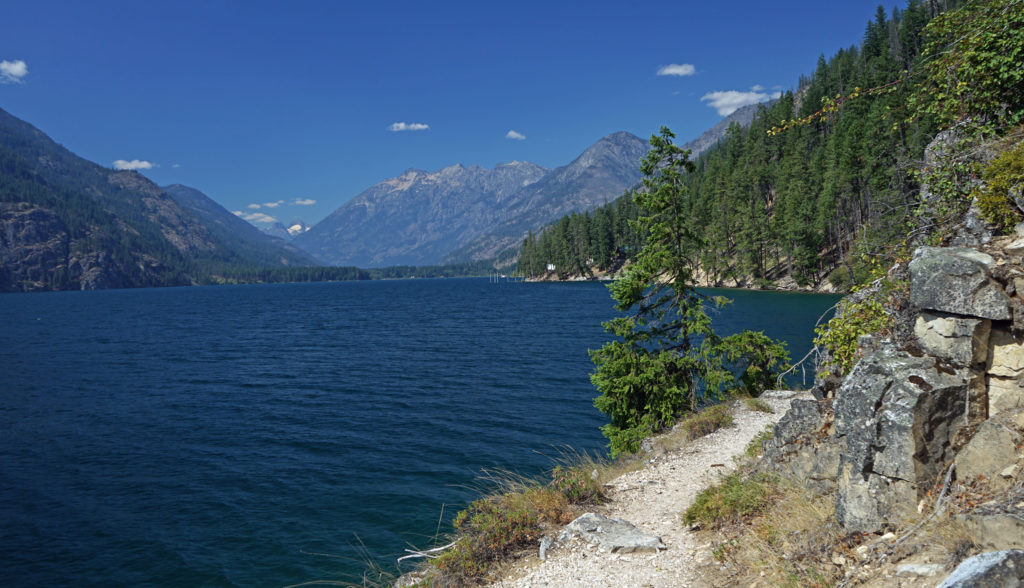
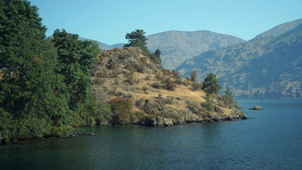
Lake Chelan from the Lakeshore Trail
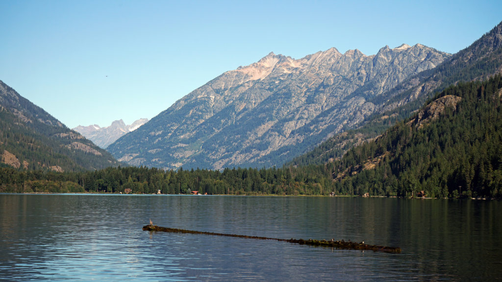
Lake Chelan is a fjord-like body of water, fifty miles long and no more than two miles wide at any point. It is also one of the deepest lakes in the United States, with a maximum depth of 1486 feet. Only Crater Lake and Lake Tahoe in the U.S. are deeper. The upper end of the lake is part of Lake Chelan National Recreation Area, which borders North Cascades National Park.
Upper end of Lake Chelan at Stehekin
The Lake Chelan Basin was formed by two glaciers during the last ice age, an alpine glacier that came down the valley from the North Cascades, and a lobe of the Cordilleran ice sheet that later came up the valley from the east. The terminal morraine of the Cordilleran glacier, at what is known as The Narrows, forms the narrowest and shallowest part of the lake.
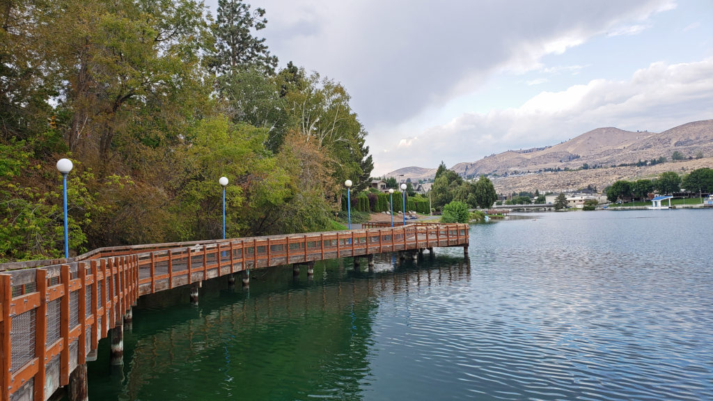
Riverwalk Park, Chelan
The town of Chelan, 170 miles east of Seattle and 160 miles west of Spokane, lies at the lower, eastern end of the lake, and is the jumping off spot for exploring the lake. While Chelan offers a lot for the visitor to enjoy, we spent only one night there before heading up the lake in 2021. We stayed at the Riverwalk Inn, a 13 room hotel across the street from Riverwalk Park that has been in operation since 1918. There is also a café on the property, but, unfortunately, it was closed when we were there.
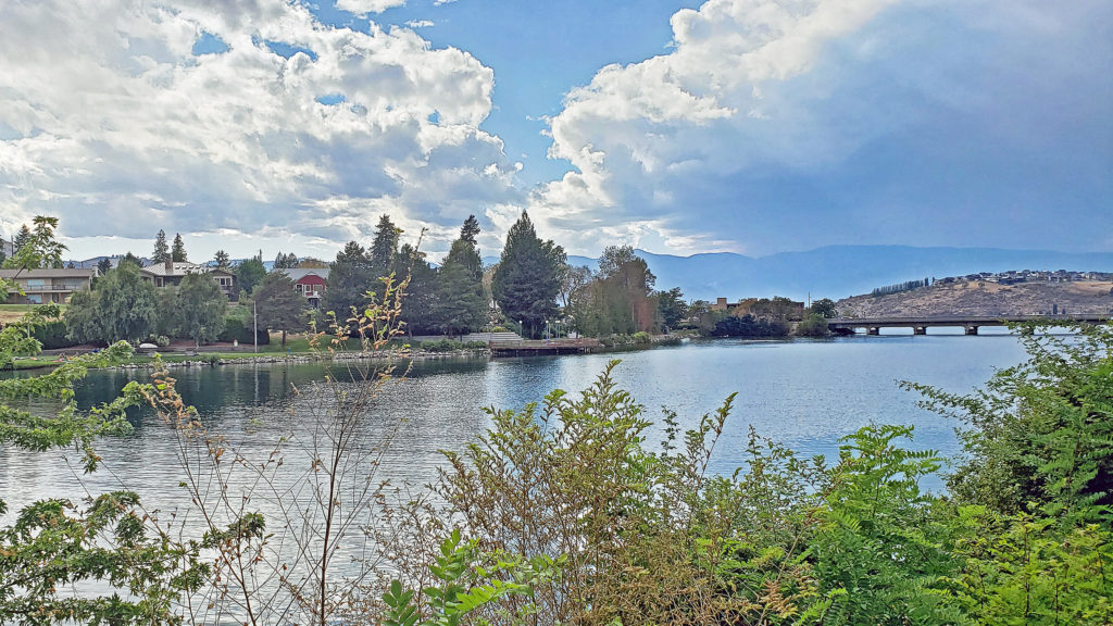
Lake Chelan from Riverwalk Park
While I can recommend the Riverwalk Inn, Chelan has a wide variety of other lodging options, from rustic cabins to full service hotels. Chelan also has a variety of places to eat and drink. If you’re a fan of craft beers, you’ll want to check out Stormy Mountain Brewery. While the service was somewhat lacking, the beer selection and quality were both good and the pulled pork nachos we had were superb.
Lake Chelan at Fields Point Landing
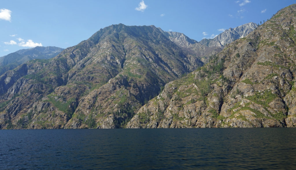
The lower end of the Lake Chelan is easily accessible and can be explored by car. From Chelan, the South Lakeshore Road goes as far as Twenty-five Mile Creek State Park, twenty miles from Chelan. On the north shore, you can drive as far as Green Point, about ten miles from Chelan. Beyond those two points, though, there are no roads along either shore of the lake, and no access to the lake by road. The only way to explore the majority of the lake is by boat.
Near upper end of Lake Chelan
Between Twenty-five Mile Creek State Park and Stehekin the surrounding mountains drop steeply to the shore. The only structures you will see are a few isolated cabins along the shore and a small group of cabins at Lucerne.
Lucerne LandingStehekin Landing
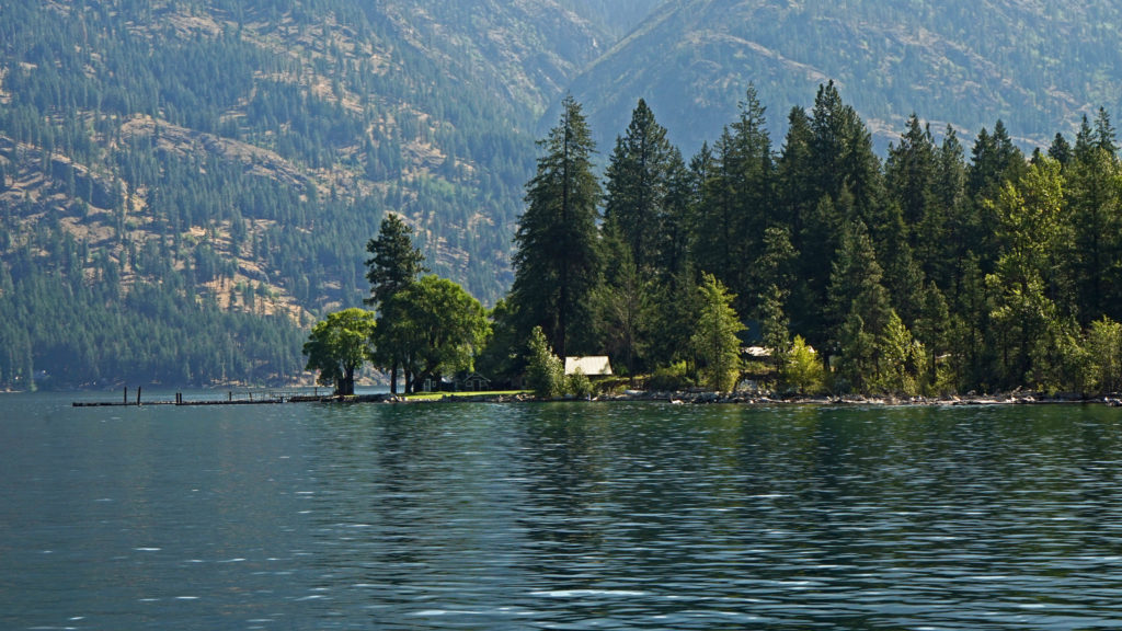
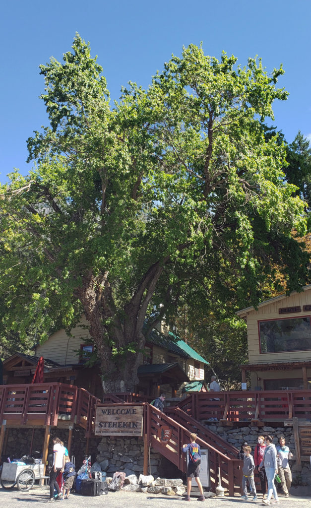
Stehekin lies near the upper end of the lake, surrounded by the peaks of the North Cascades. It is a strikingly beautiful and totally unique place. What sets Stehekin apart from almost all other communities in the Pacific Northwest is that you cannot get there by car. The only road out of Stehekin dead ends in North Cascades National Park. You have to come by boat, float plane, or on foot. The Stehekin area has fewer than 100 year round residents, but, despite its isolation, bustles with tourists, summer residents, Pacific Crest Trail through-hikers, and seasonal workers from spring through fall.
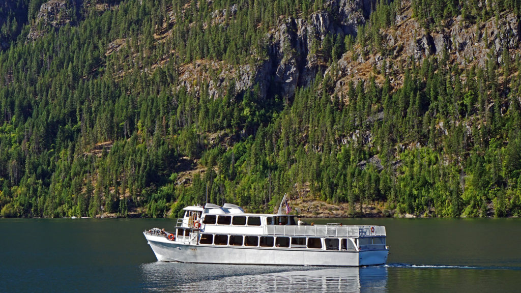
Lady of the Lake II
Getting to Stehekin from Chelan requires some advance planning. If you don’t have a boat of your own, you can rent one in Chelan, but most visitors to Stehekin come by passenger ferry. Lake Chelan Boat Company (better known as Lady of the Lake) operates three ferries that run from Chelan to Stehekin. Another option is the Stehekin Ferry, which runs from Fields Point Landing (about 17 miles from Chelan on the south shore of the lake) to Stehekin. In the summer months, demand is high and tickets sell out well in advance. Reservations need to be several months before your planned visit. Note: Lake Chelan Boat Company is in the process of acquiring the Stehekin Ferry business, so you should be able to reserve a trip on the Stehekin Ferry through the Lady of the Lake website linked above beginning sometime in the spring or summer of 2025.
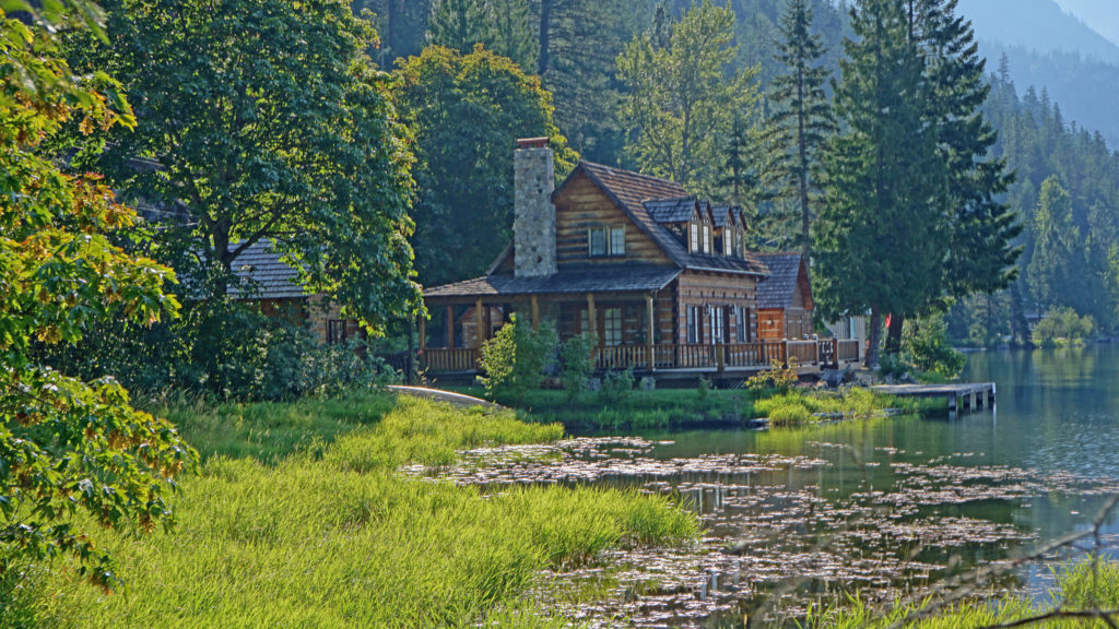
Private cabin at Stehekin
You can do a day tour from Chelan to Stehekin and back via ferry, and many visitors to Stehekin are day trippers. But the length of the ferry ride (from an hour and a half to four hours each way, depending on which ferry) limits the amount of time you have to explore the area. Many people, my wife and I included, prefer to spend multiple days in Stehekin, but lodging options are limited and also require some advance planning.
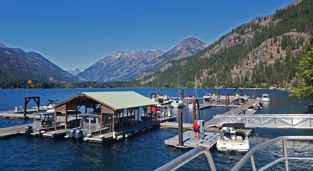
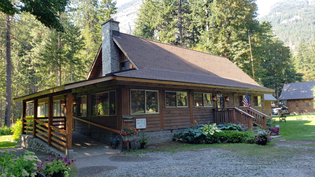
North Cascades Lodge (photo from lodge website)
North Cascades Lodge in Stehekin is located at the ferry landing. It’s the most convenient and has by far the most rooms available. The only other lodging options are private cabin rentals, the Stehekin Valley Ranch, ten miles up the valley from the ferry landing, and a few primitive campgrounds. Lodging reservations must also be made well in advance, and must be coordinated with your ferry reservations.
North Cascades Lodge
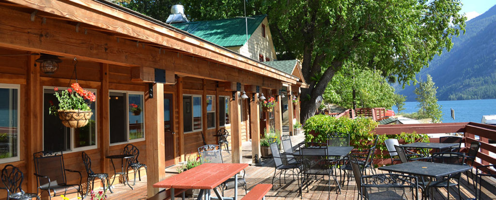
We have stayed at North Cascades Lodge several times. You can rent a room (some with fireplaces) with a private bath, a cabin with a small kitchen, or an entire lakefront house that sleeps as many as 12. Our room was fairly basic, but comfortable and large enough to serve our needs well. The lodge also has a store and a full service restaurant, one of the few dining options in Stehekin. Stehekin Valley Ranch also has a dining room (reservations required), and you can get breakfasts and lunches at Stehekin Valley Pastry Company (aka The Bakery), located a couple of miles from the ferry landing. The only other dining option is renting a cabin with a kitchen and cooking your own meals.
Stehekin River at High Bridge
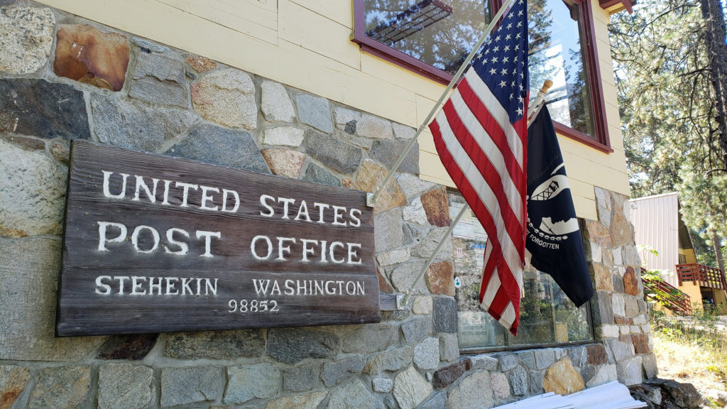
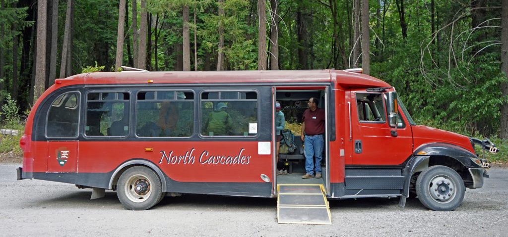
A few people arrive in Stehekin by float plane. A surprising number arrive on foot, many of them Pacific Crest Trail through-hikers. The PCT crosses the Stehekin River at High Bridge about ten miles up the valley from the head of the lake. The National Park Service operates a shuttle bus (called the Red Bus for obvious reasons) between Stehekin and High Bridge. There is also a post office in Stehekin where through-hikers can send supplies for the final leg of their hike to the Canadian border and the end of their journey. And a few backpackers make it to Stehekin via the 23 mile hike over Cascade Pass from the west side of the Cascades.
The Red Bus
Stehekin is one of the most isolated communities in the country. Not only is there no road access, there’s no cell phone service and only very limited wi-fi. But that’s part of its appeal. Turn off your phone. Forget about TV. The sheer beauty of the place and its proximity to North Cascades National Park and Glacier Peak Wilderness, as well as the PCT, make it an ideal destination for the outdoor oriented traveler. And there are plenty of things to keep you entertained while there.
The Bakery
The Golden West Visitor Center, operated by the National Park Service, is located near the ferry terminal and is a good starting point for your exploration of the area. There is an information desk there, and you can find books, maps, and other items related to the area. And audiovisual programs are available throughout the day. It was closed due to the Covid-19 pandemic when we were last there, and was closed during the Pioneer Fire in 2024, but should reopen for the 2025 season. Check the North Cascades National Park website for more information.
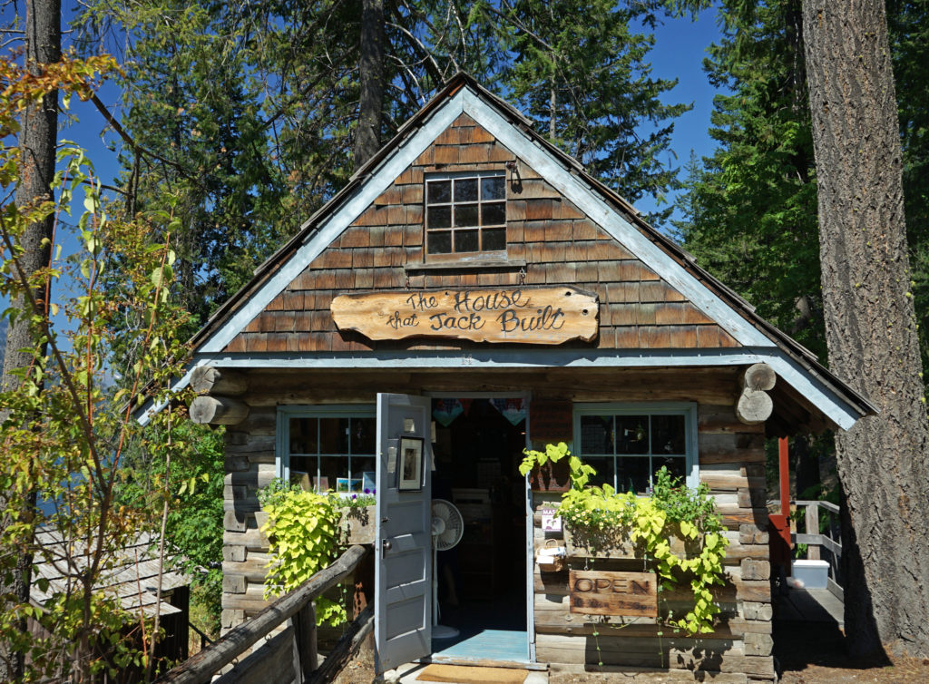
The House That Jack Built
Just uphill from the North Cascades Lodge, adjacent to the visitor center, there is a craft shop, The House That Jack Built, that displays and sells souvenirs, hand crafted gifts, and artwork created by local artisans. It’s small, but worth checking out.
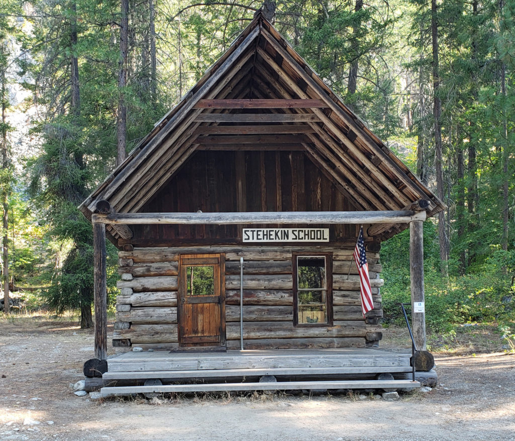
The Old Stehekin School
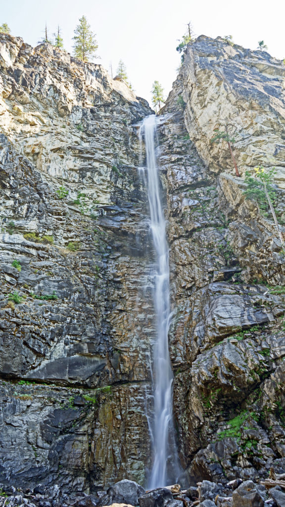
You can rent bikes (or bring your own) and ride the road up the valley to The Bakery (a must stop), 320 foot high Rainbow Falls (another must stop), The Garden, an organic produce farm, the Old Stehekin School (now a free museum), or all the way to High Bridge. The Red Bus also makes daily runs to The Bakery, Rainbow Falls, and High Bridge. You can even rent ATVs and explore the valley that way (no off-roading allowed, though).
Rainbow Falls
You can rent kayaks or an electric boat at Stehekin to explore the lake, and there are a number of hiking options, from short loop trails in the Stehekin area to longer outings along the shore of the lake or from the Rainbow Falls and High Bridge areas. Or you can just relax in Stehekin and enjoy the view of the lake and the surrounding mountains.
On our most recent outing we rented bikes and rode to the Bakery and Rainbow Falls one morning. That is a very easy ride on a paved road. We also stopped at The Garden and the Old Stehekin School. Above Harlequin Bridge the road is gravel and a little more challenging, although on a previous visit we rode all the way to High Bridge and back.
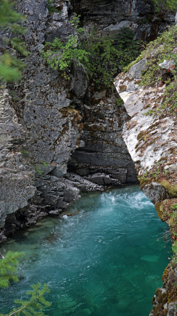
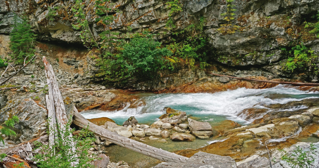
Agnes Creek
The next day we rode the Red Bus to High Bridge in the morning to hike and photograph the upper end of the valley, and returned on the Red Bus that afternoon. There are several worthwhile hikes starting at High Bridge. The 5.5 mile out and back Agnes Gorge Trail leads to a 200 foot deep canyon and a very scenic section of Agnes Creek in Glacier Peak Wilderness. You can also do the 3.3 mile out and back hike from High Bridge to Howard Lake on the PCT. It’s also possible to do a longer loop that takes you past Howard Lake and returns to High Bridge along the Stehekin River. Or you can hike a portion of the PCT that follows Agnes Creek. High Bridge is also the starting point for the 16 mile roundtrip to the summit of McGregor Mountain, more than 6500 vertical feet above High Bridge – more than a bit beyond my capabilities at this point, I’m afraid.
Upper end of Lake Chelan at Stehekin
We had planned to get out on the lake on our final day in Stehekin, but it was very windy that day, so we spent the day reading and relaxing at the lodge instead. No problem, though. The beauty and uniqueness of the Stehekin area make it a wonderful place even when the weather doesn’t cooperate. It’s one of my favorite places in the Northwest to visit despite the difficulty in getting there. The only reason that we haven’t visited more often is that there are so many other wonderful places in the Pacific Northwest (and beyond) to explore.
View from Stehekin Landing
The Garden
Originally posted September 30, 2021. Most recently updated February 22, 2025.


 Hosmer Lake is a mix of open water and reeds, rushes, water lilies, and other marsh plants. Motorized craft (except for electric motor powered) are not allowed on the lake, which makes it ideal for kayaking or canoeing. It’s also not a big lake at 160 acres, so you can easily explore it all in an afternoon.
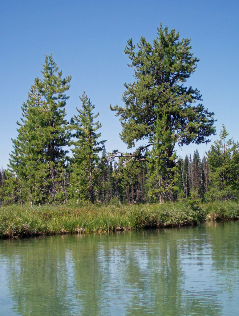
 Hosmer Lake is fed by Quinn Creek, which flows into the north end of the lake. Quinn Creek is narrow and shallow, but it is possible to paddle up it for a ways. When we were there last, downed trees blocked our passage a few hundred yards from the mouth of the creek. We hauled our kayaks out of the water at that point and hiked along the creek to a small waterfall where we ate lunch and lingered awhile before heading back out on the water.
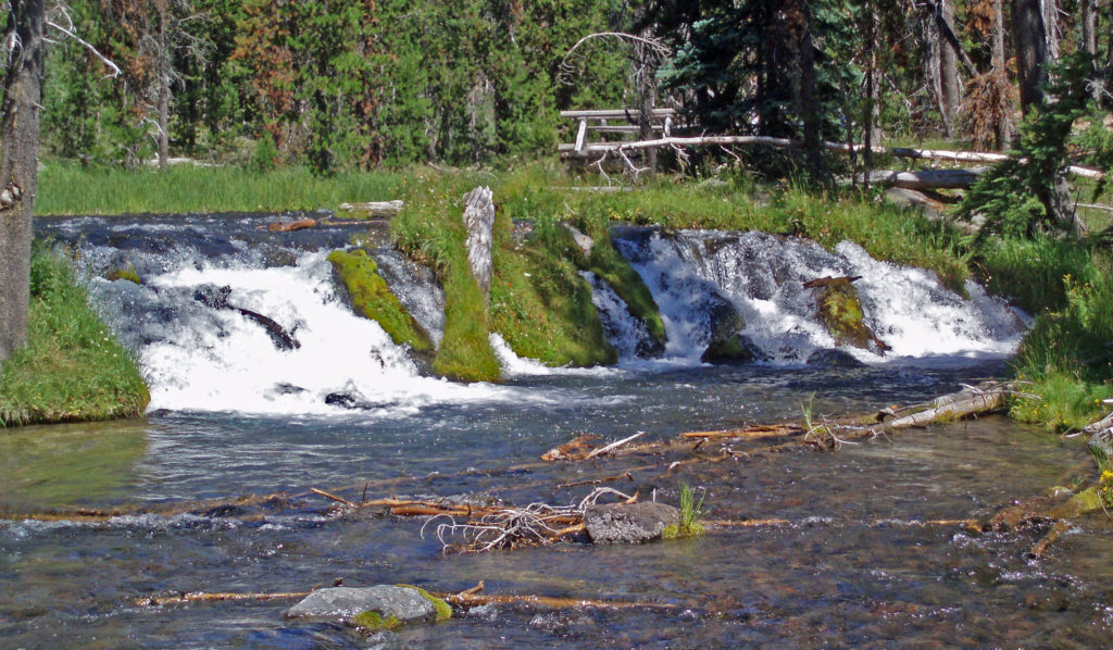 Recalling our visits to Hosmer Lake, I’m eager now to get back to the area and get back on the water again. It’s a beautiful place, and one of my favorite destinations.
 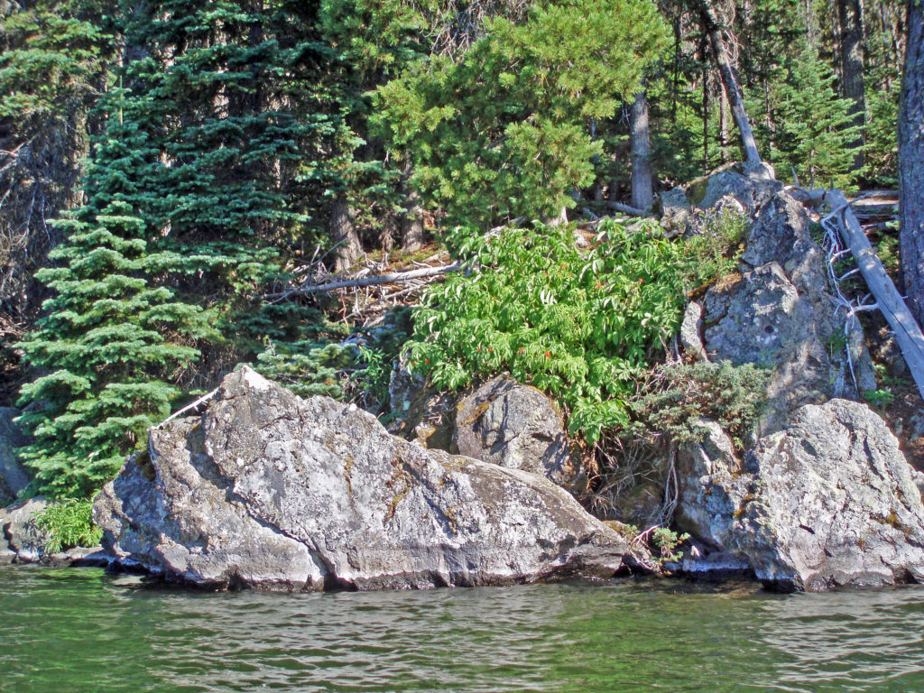 Hosmer Lake is located in the Deschutes National Forest. Check the Forest Service website for information on forest fire danger and possible use restrictions.
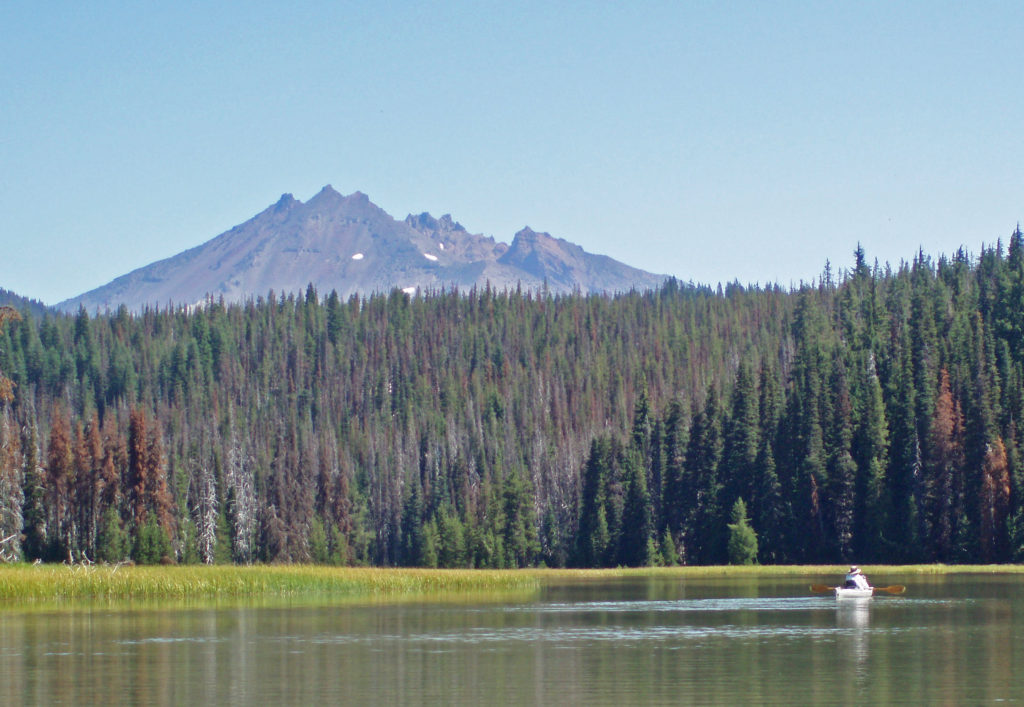
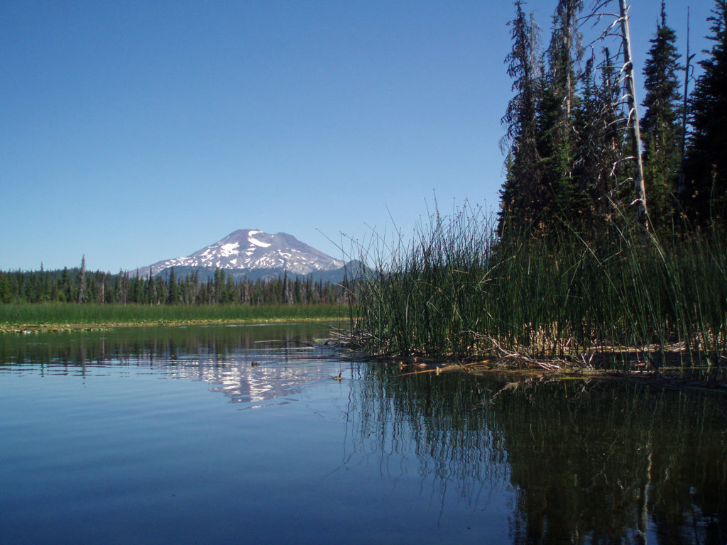
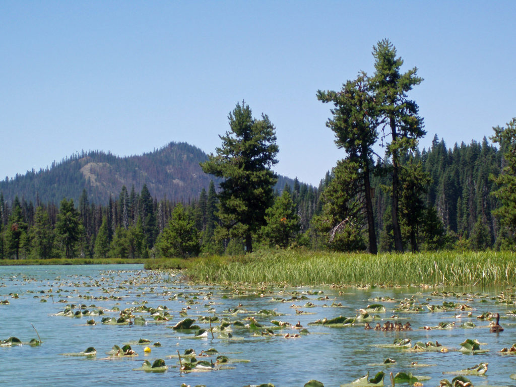
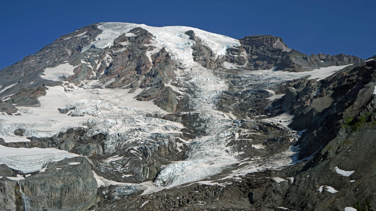
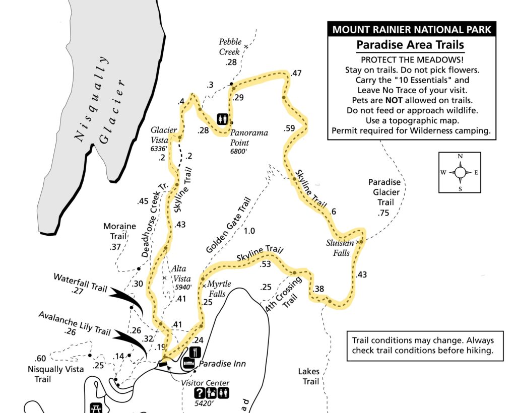
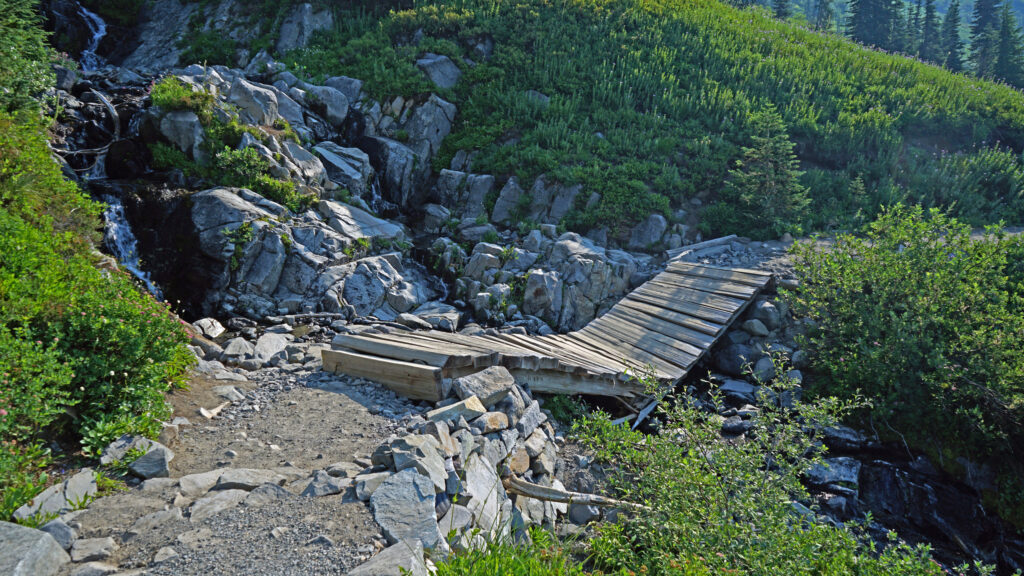
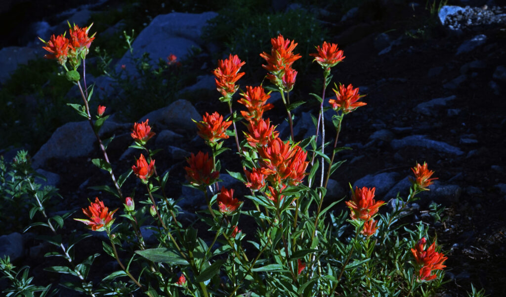
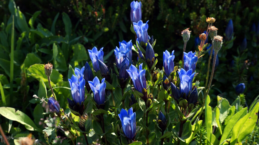
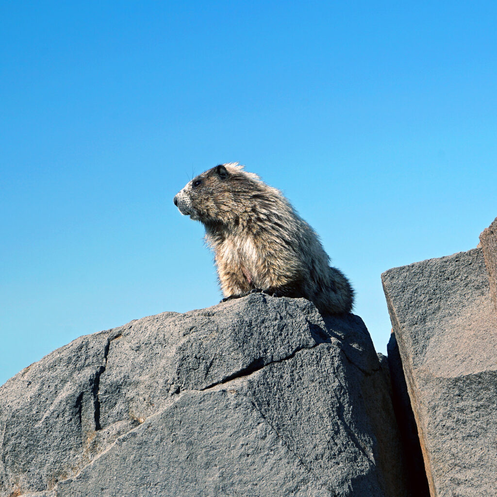
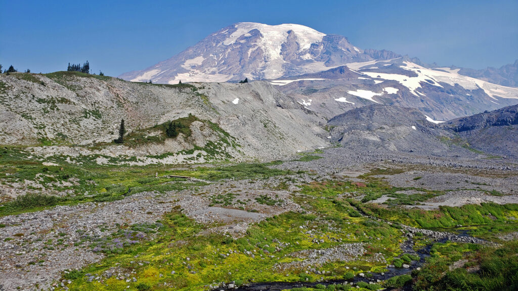 Best Times to Go:
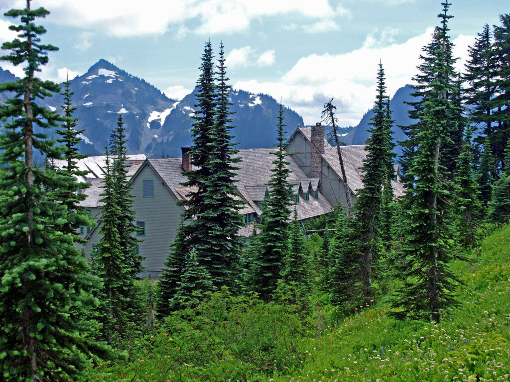
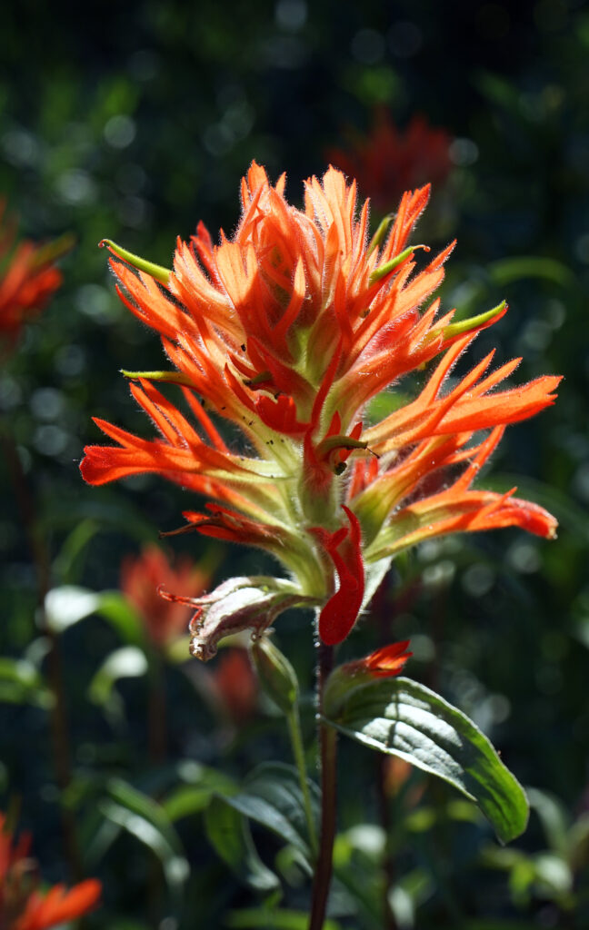
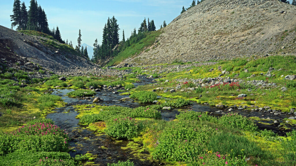 The hike:
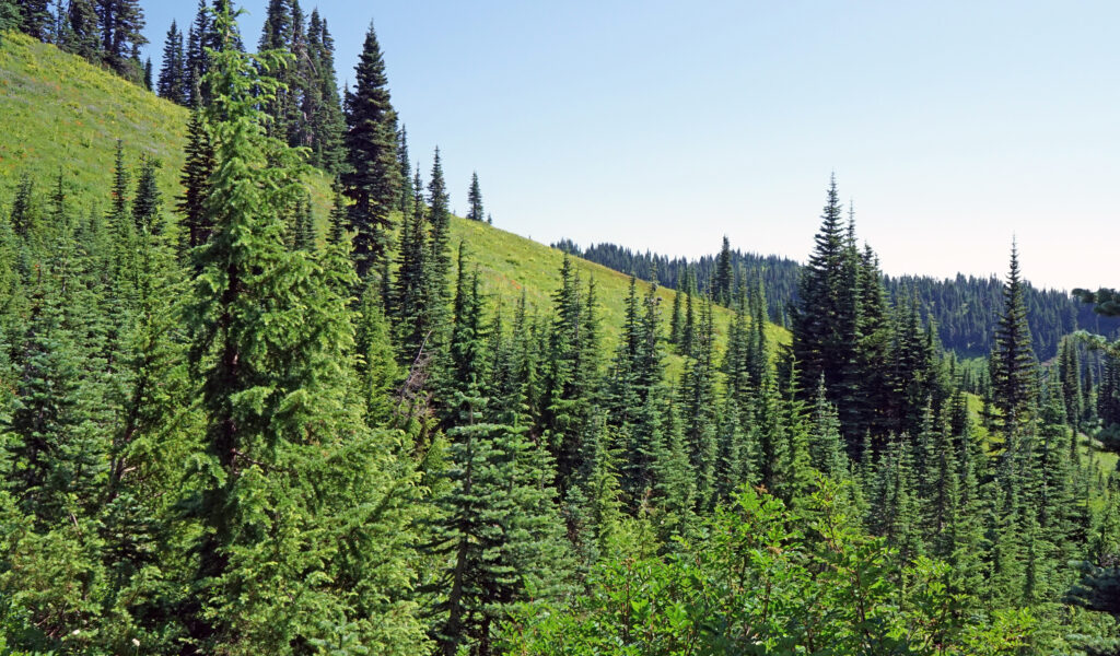
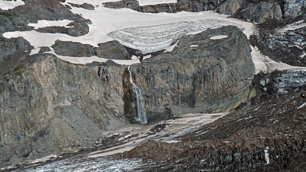
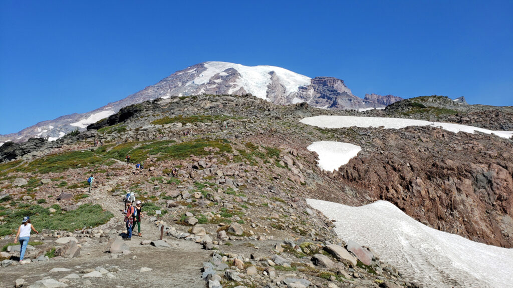
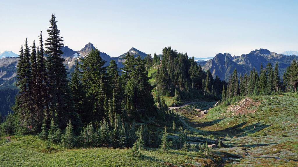
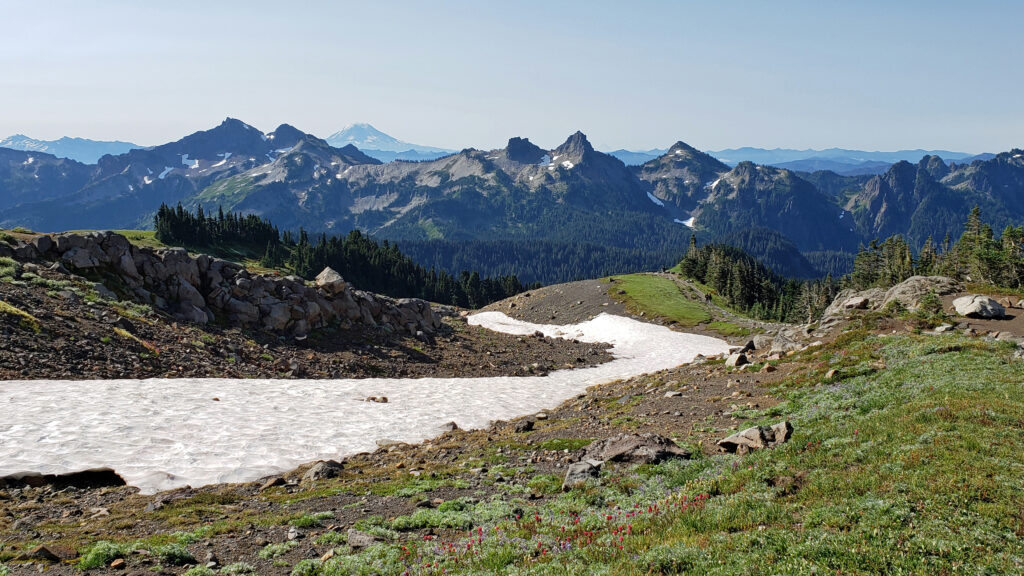
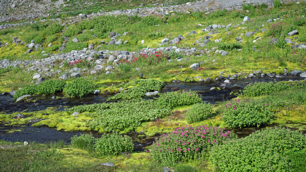
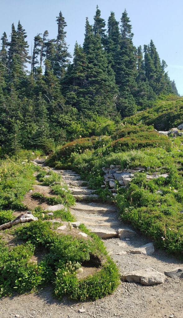
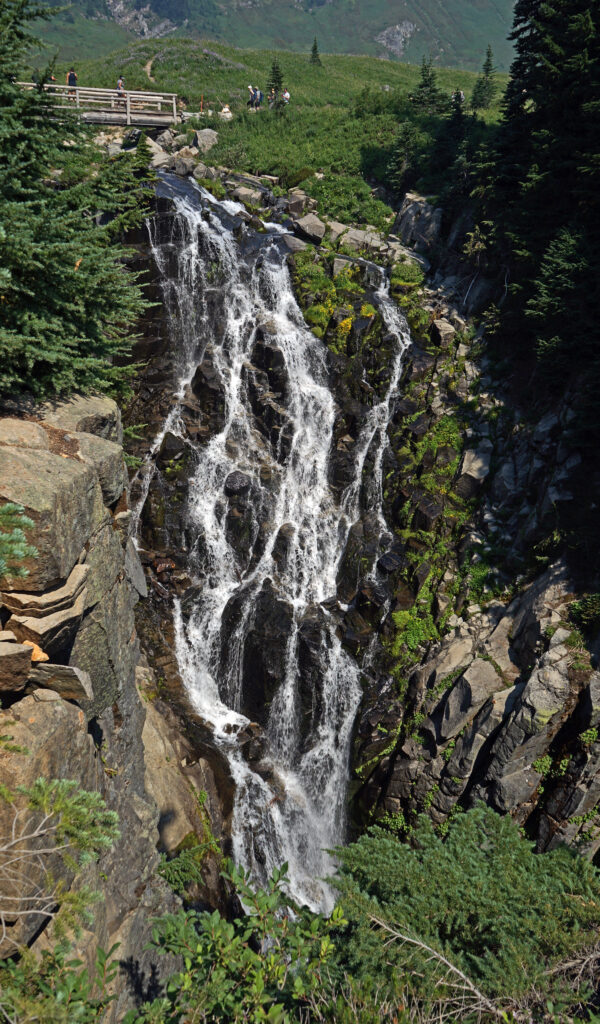
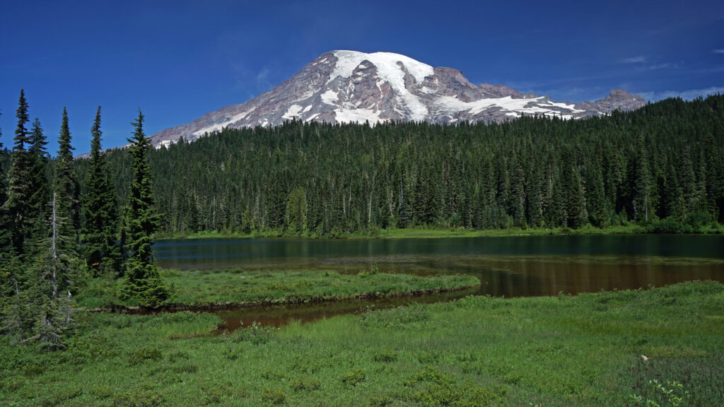 Other area attractions and activities:
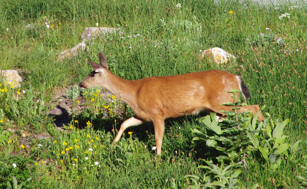
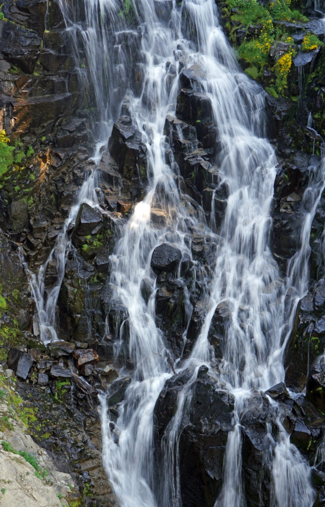
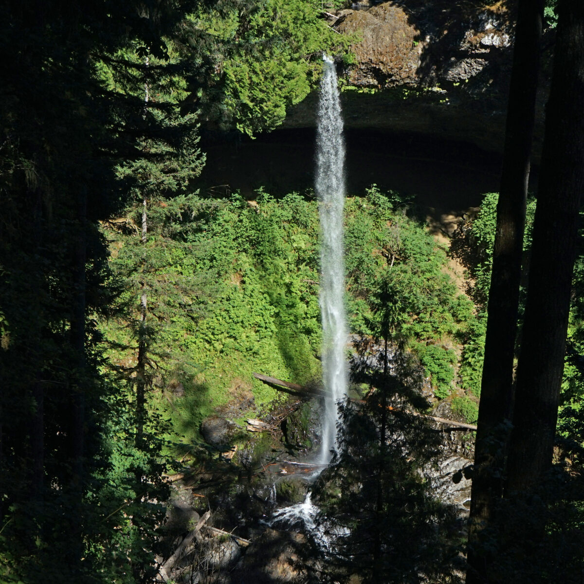
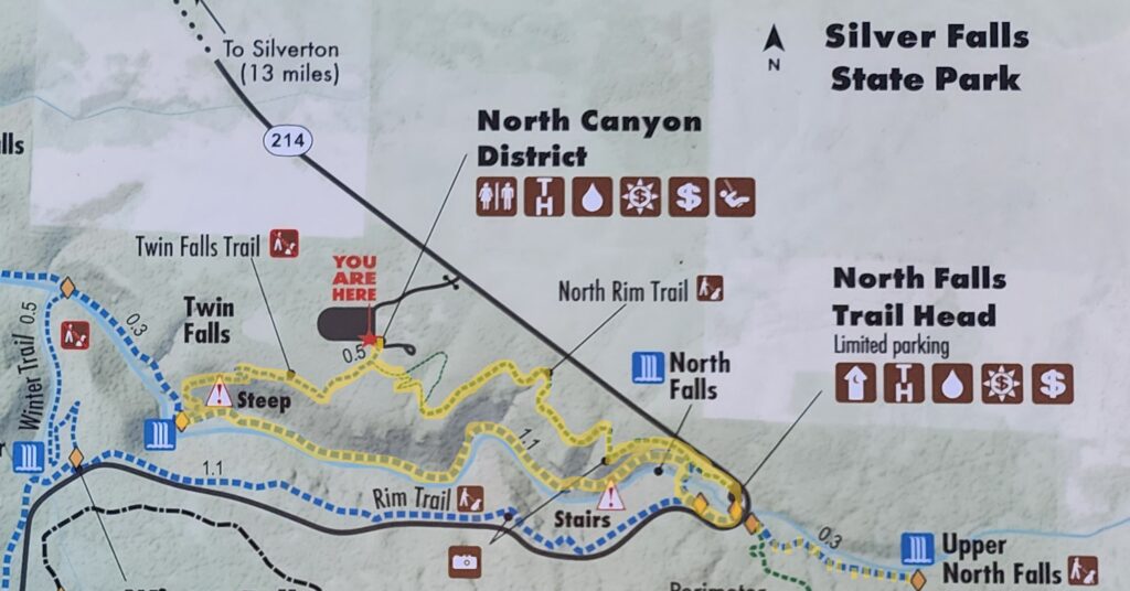
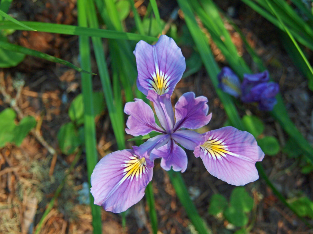
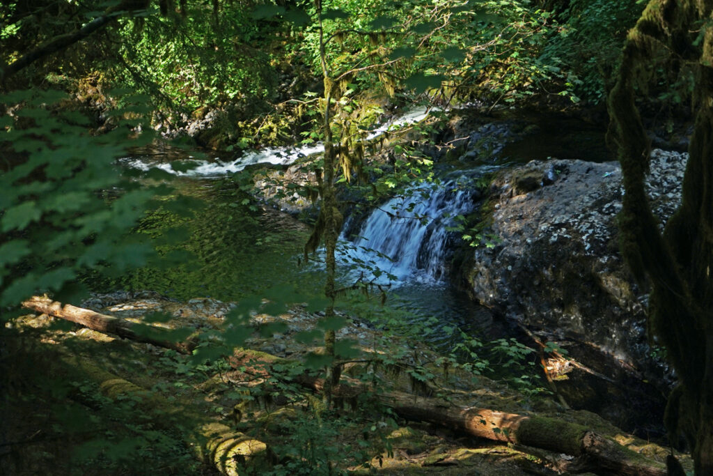
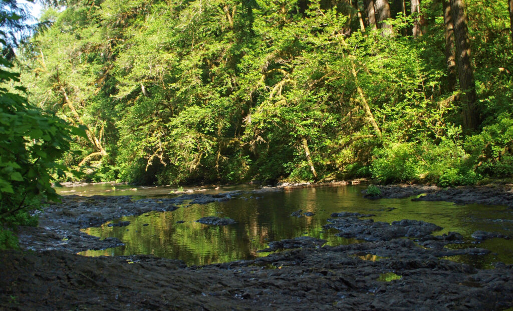
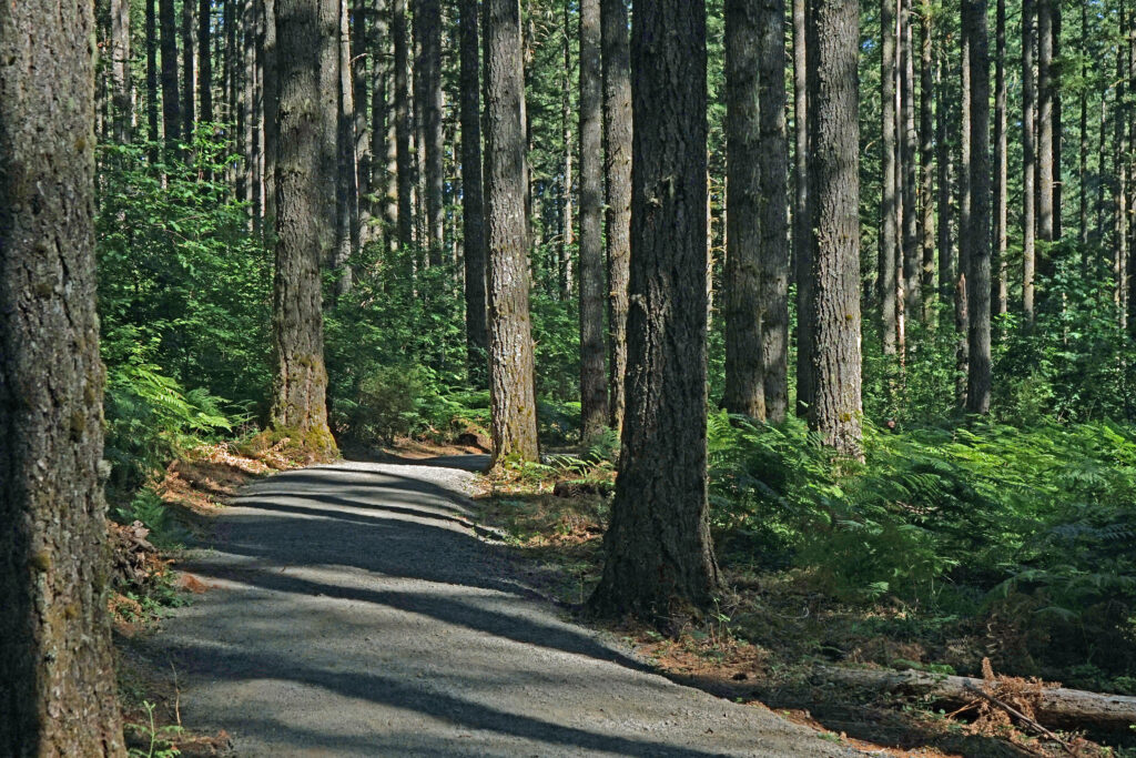
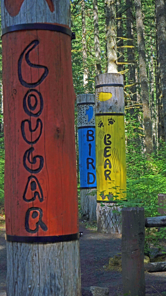
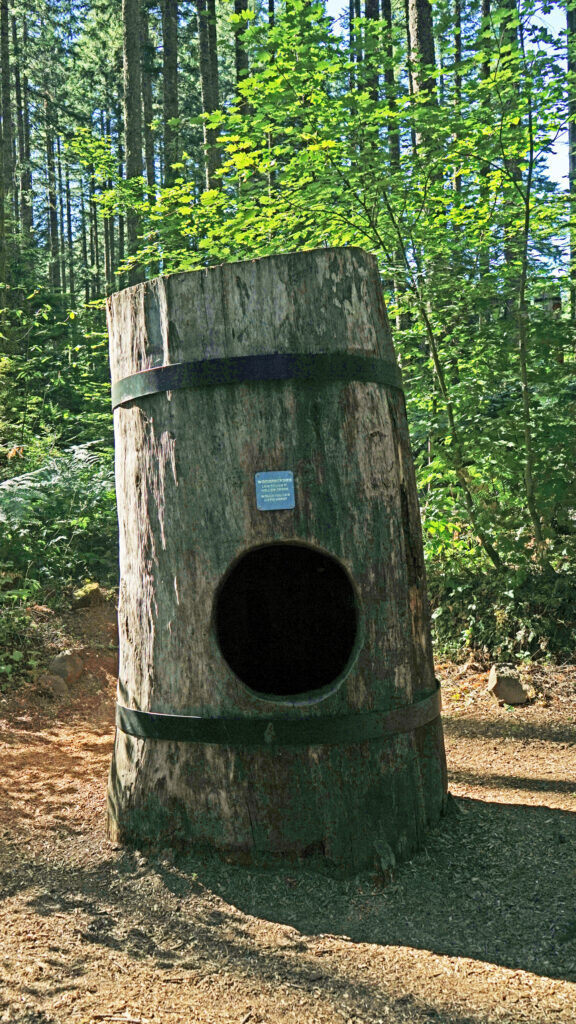 Beyond the Twin Falls Trail junction, the North Rim Trail meanders through the forest, passing a children’s play area and a small two-table picnic area.
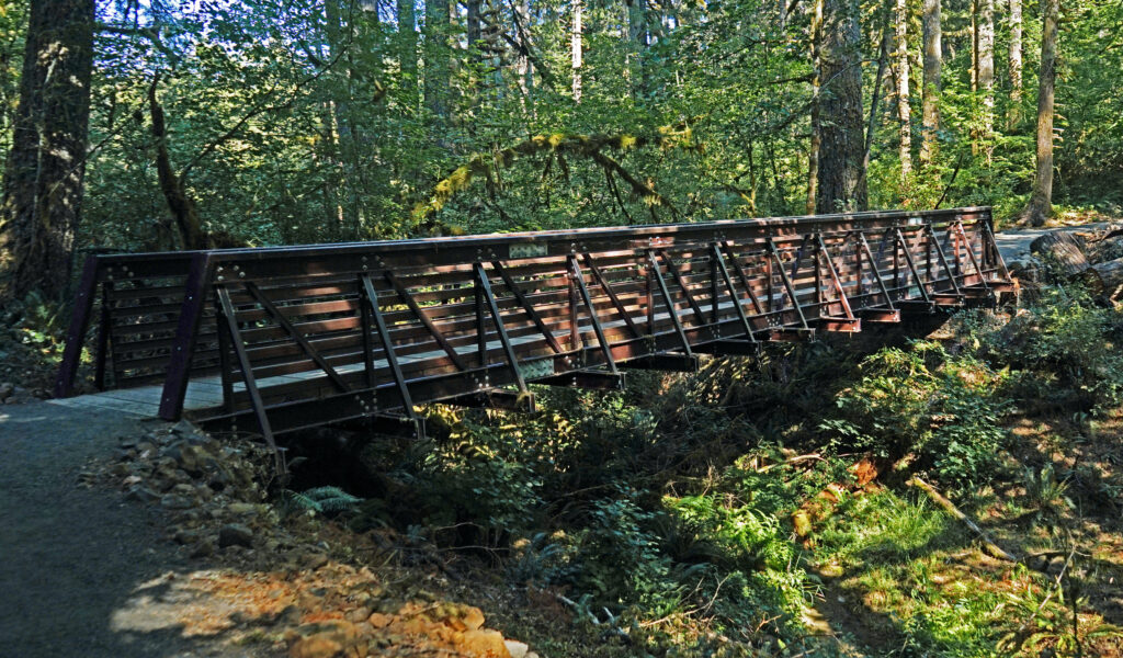
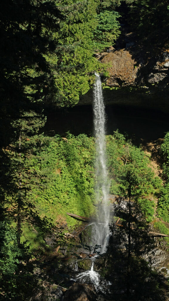
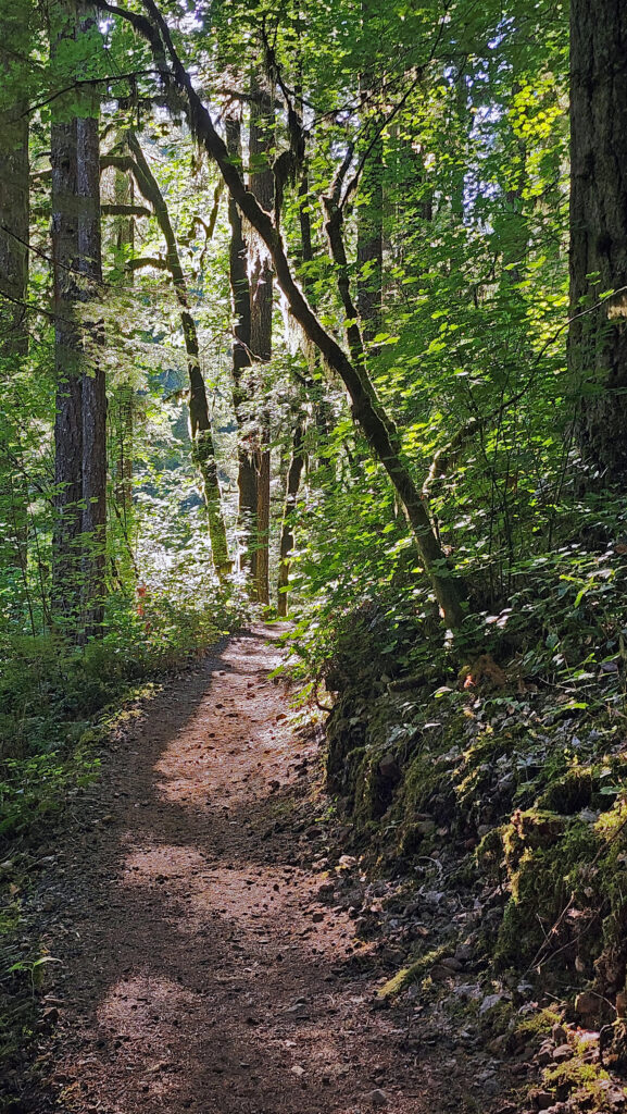
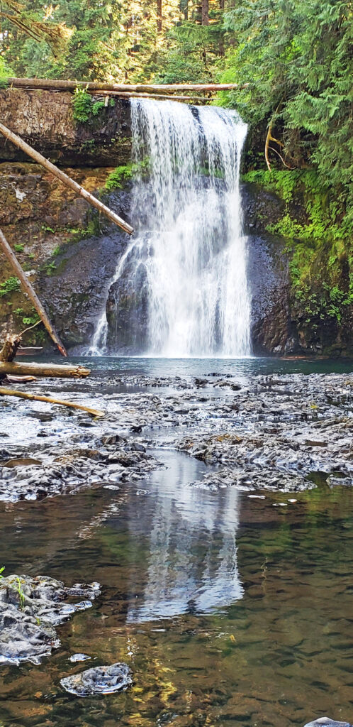
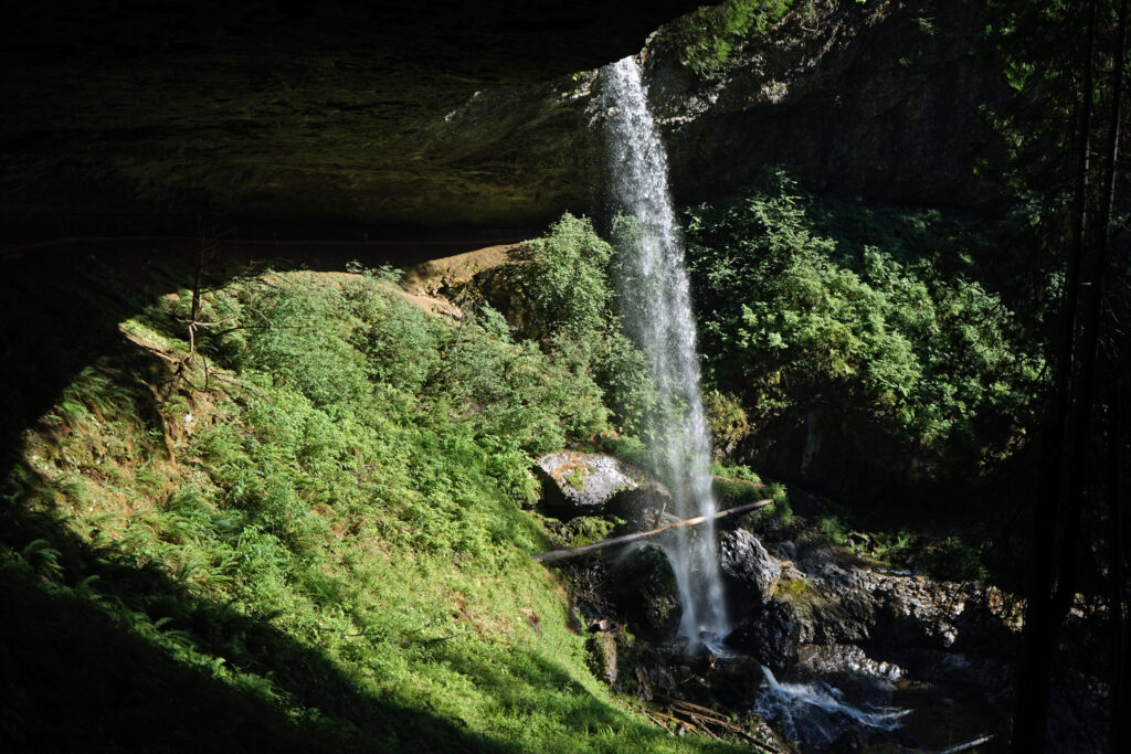
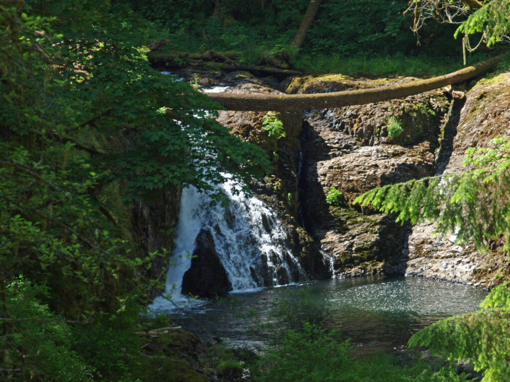
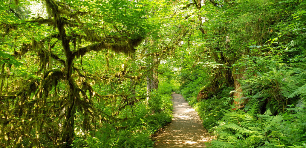
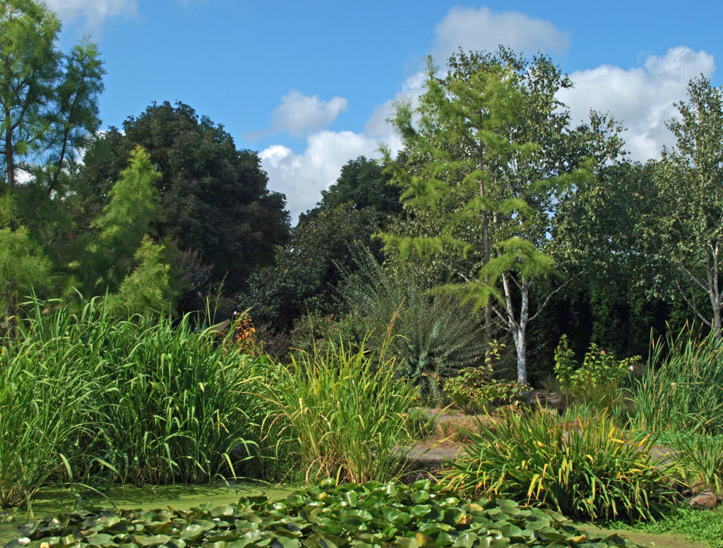
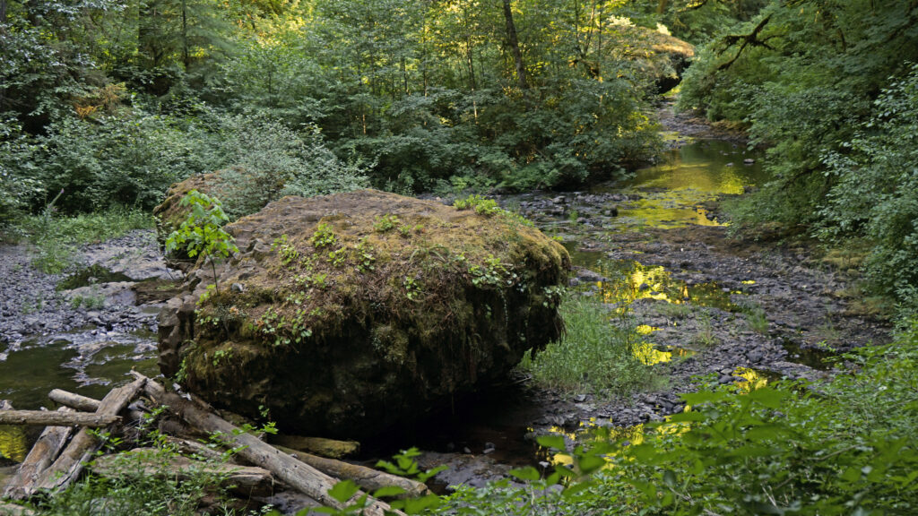
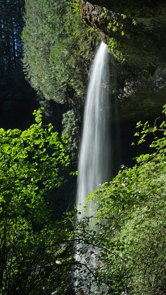
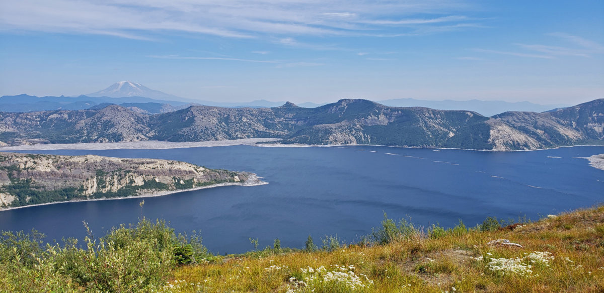
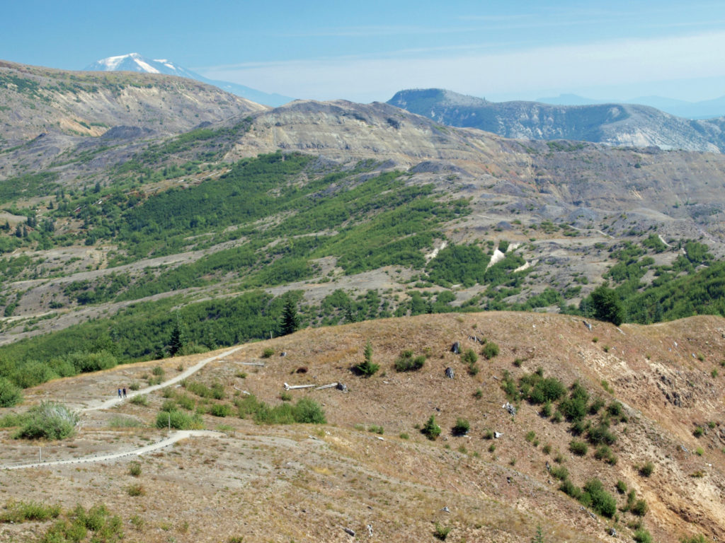


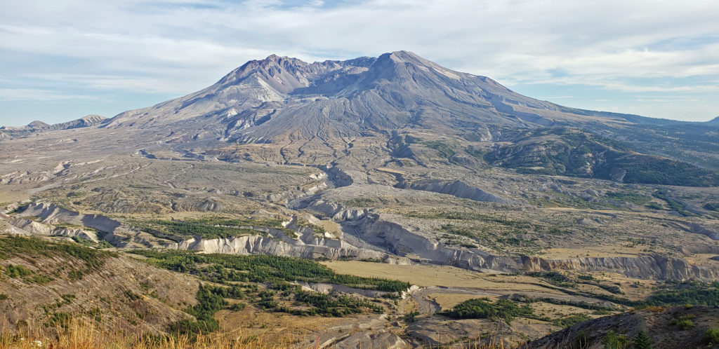
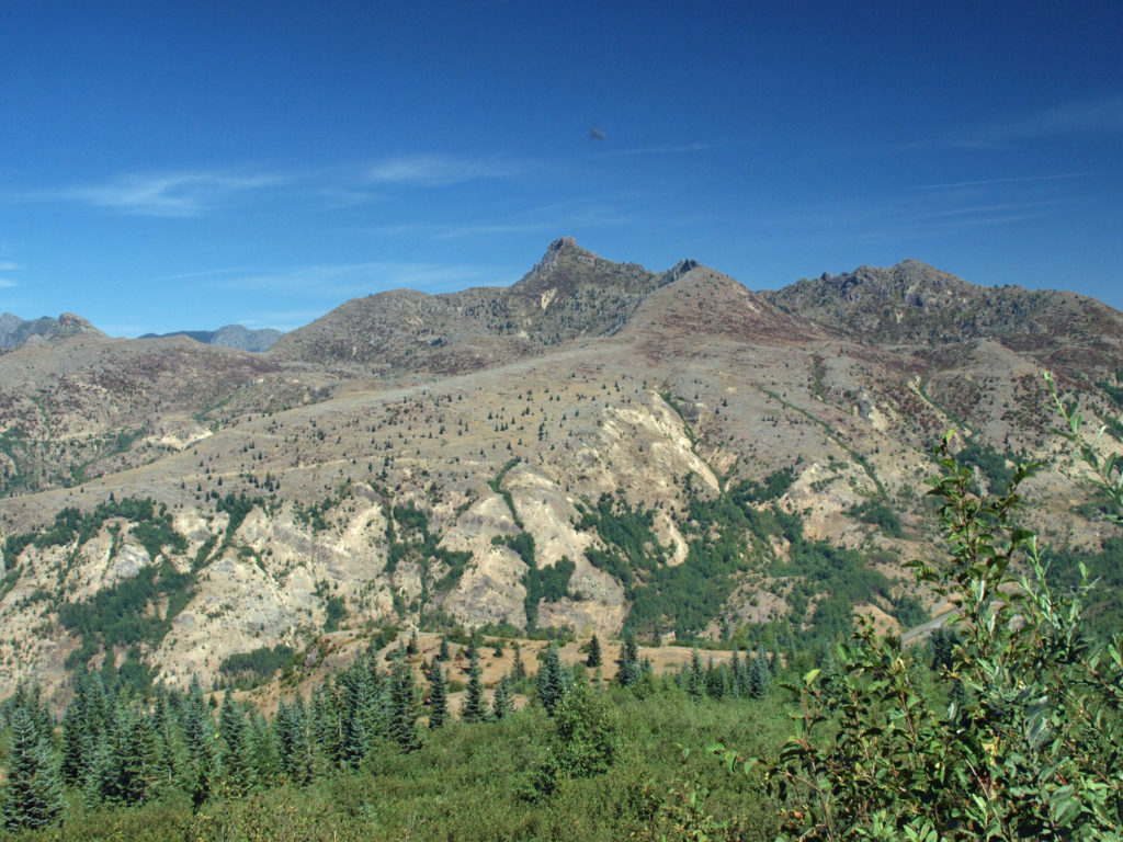
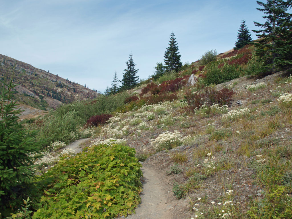
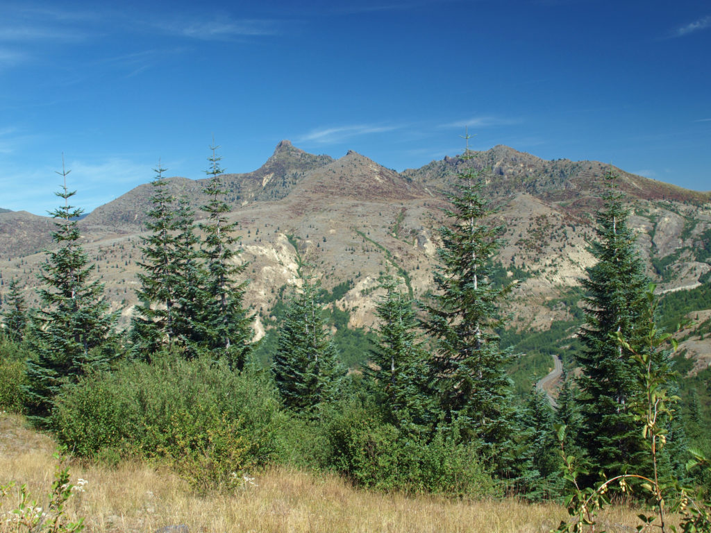
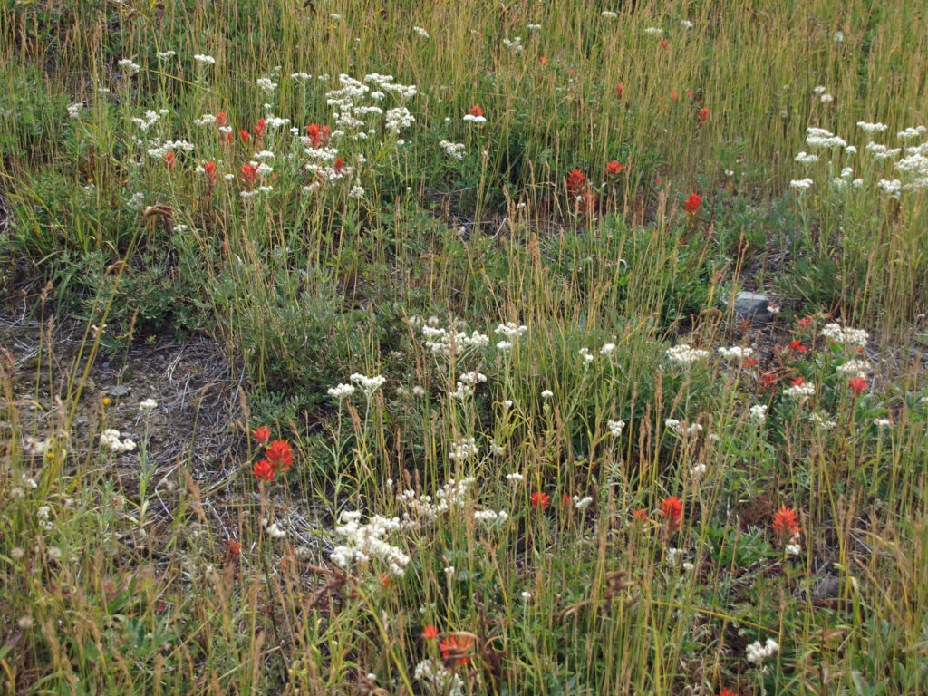
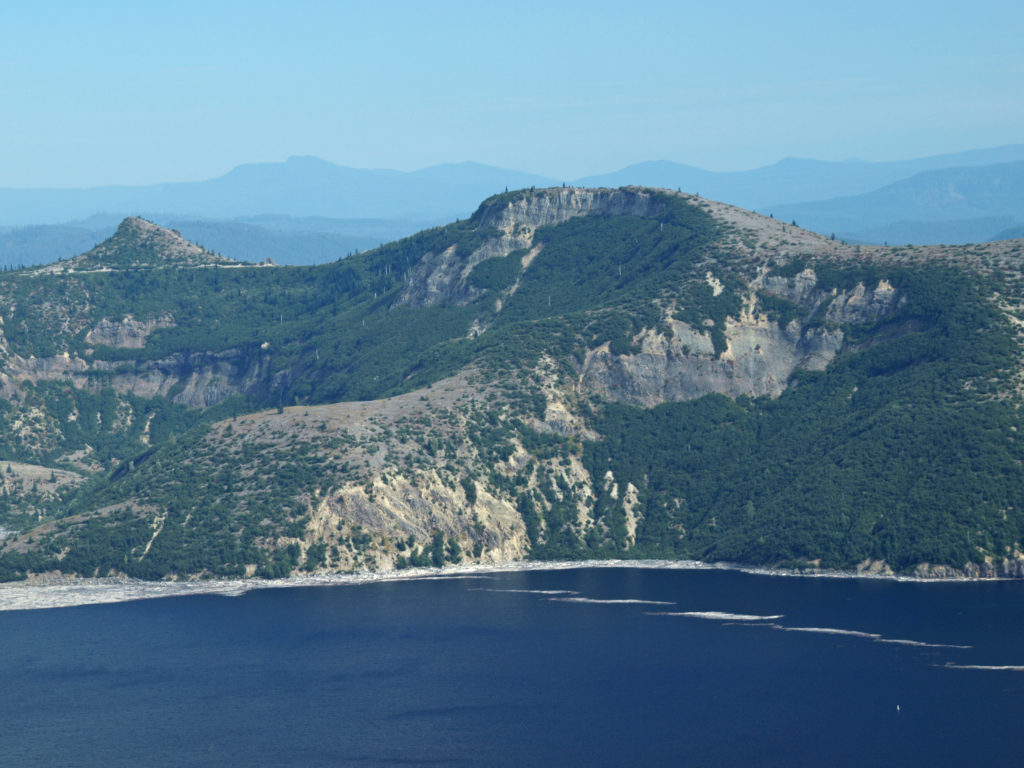
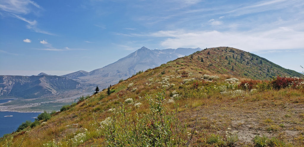
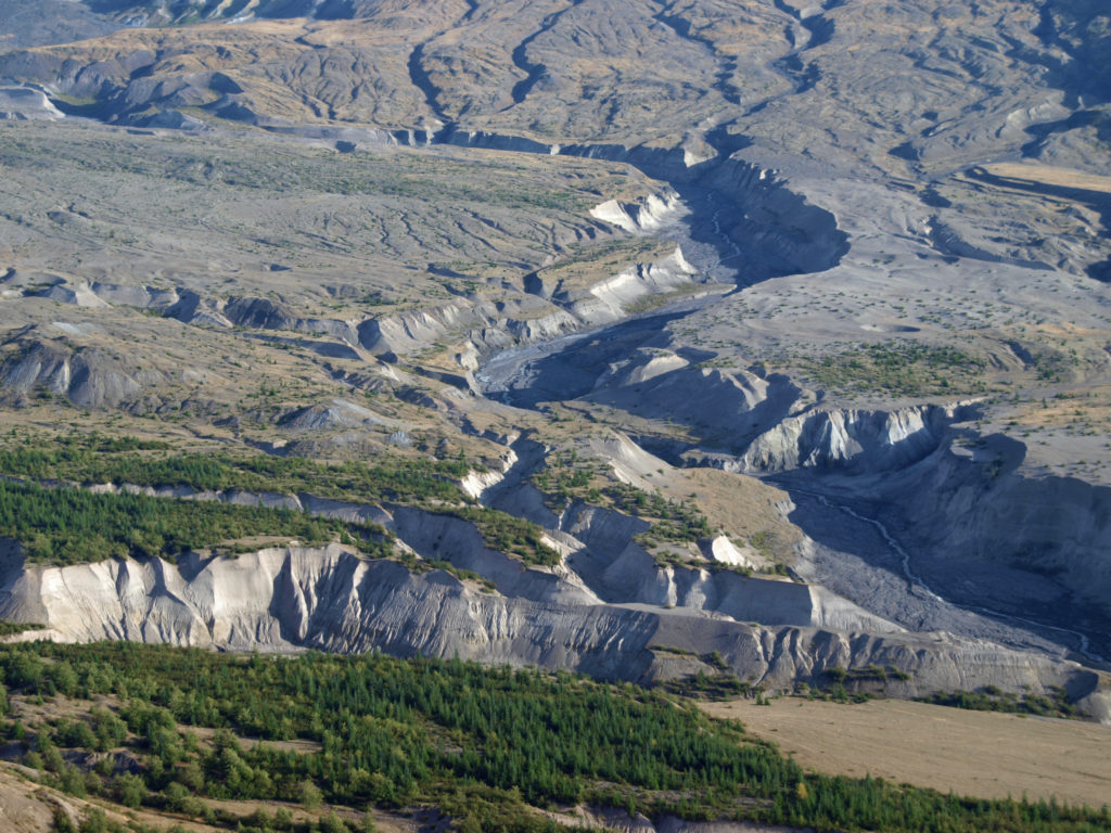
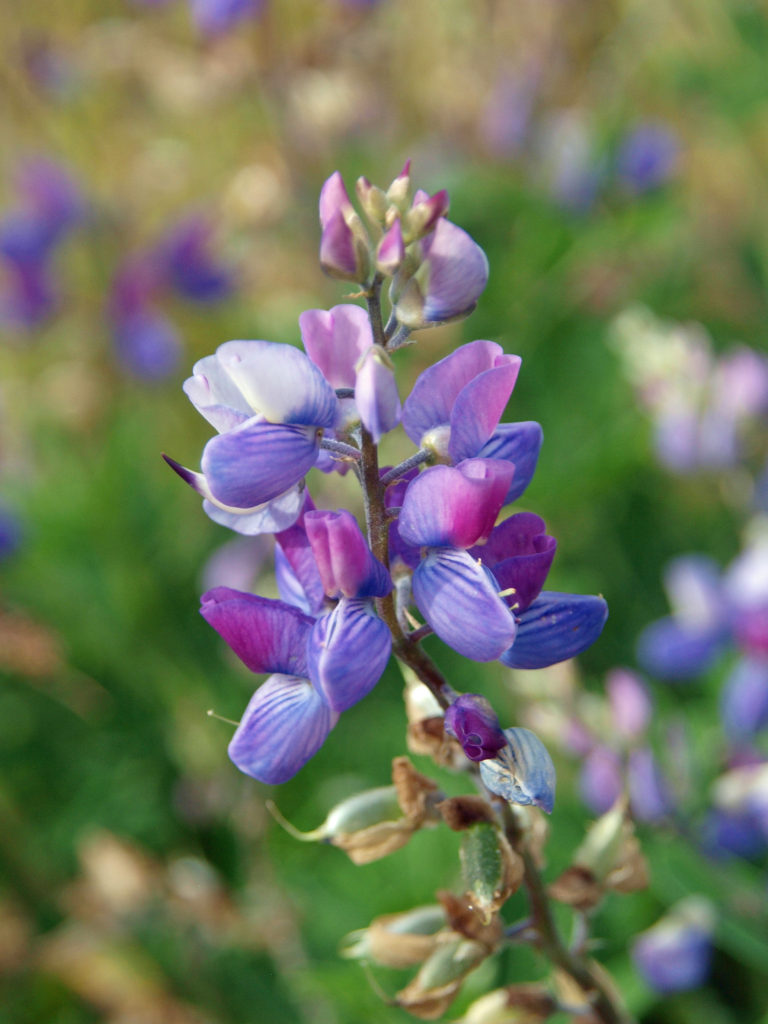
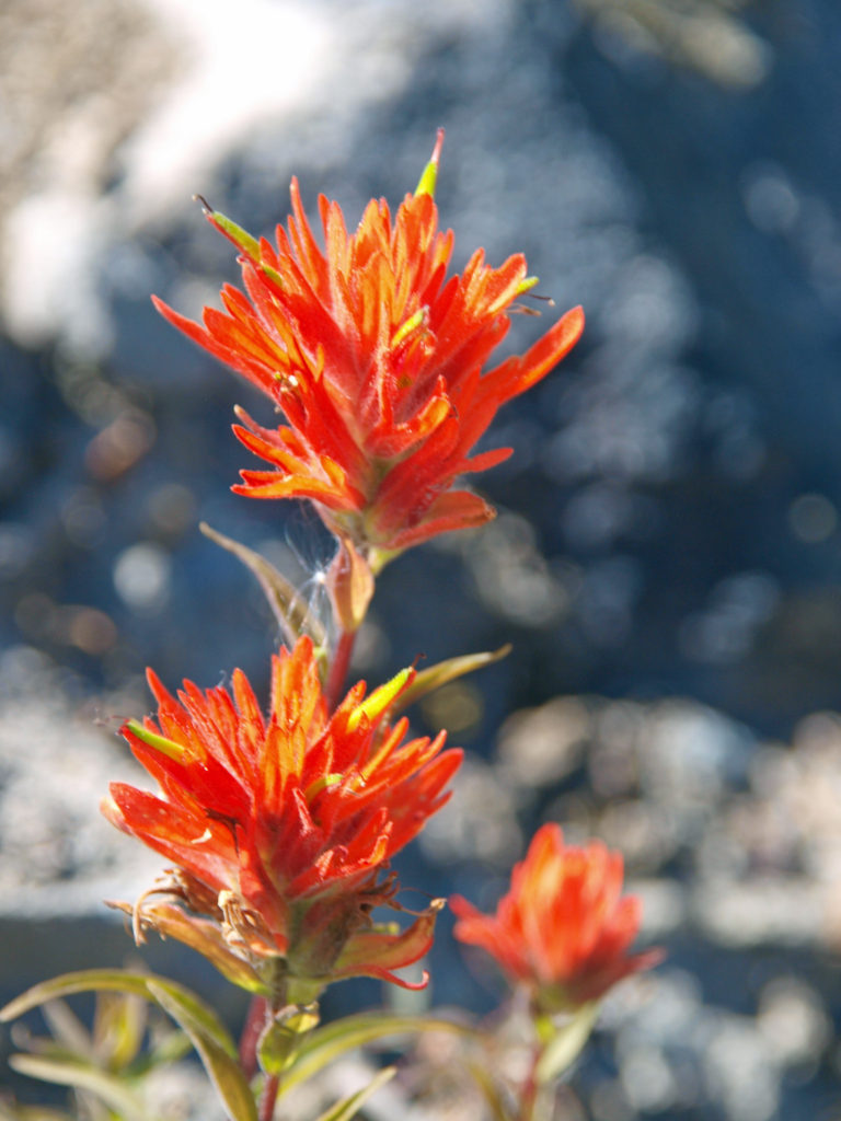
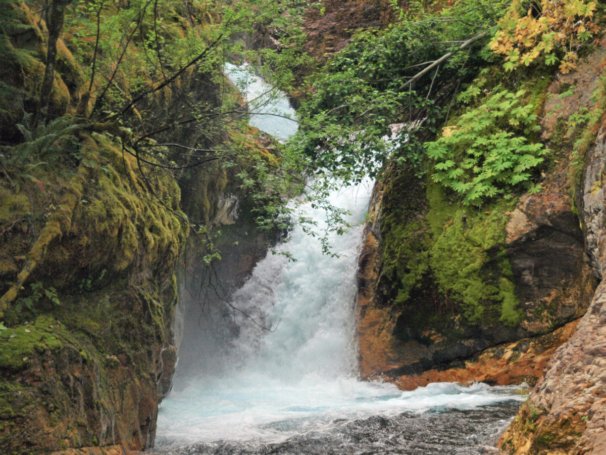
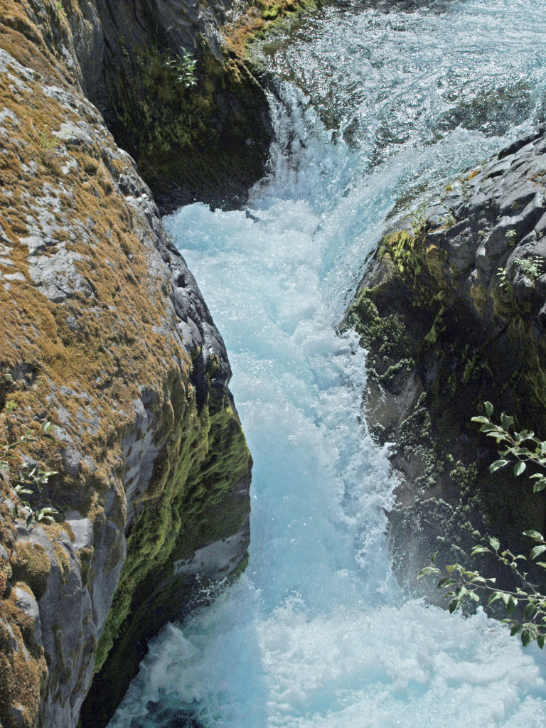 Overview:
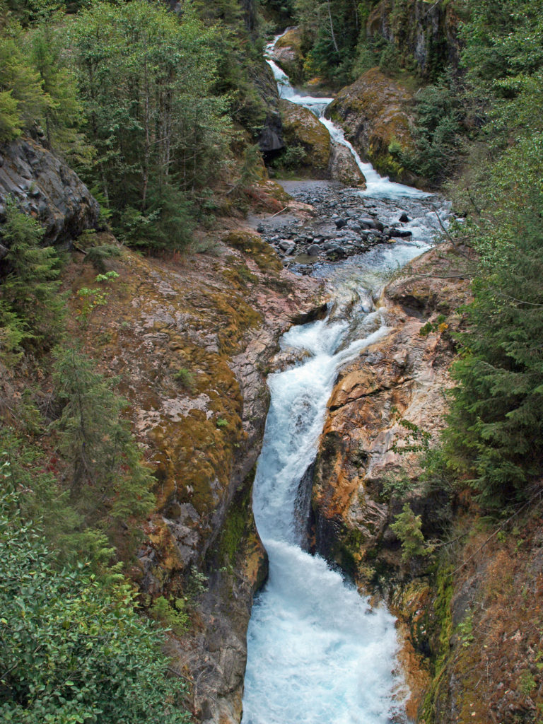 The history of Lava Canyon begins about 3500 years ago when an eruption of Mount St. Helens sent a flow of lava down the old valley of the Muddy River, destroying the forest and filling the valley with molten rock. Over the intervening years, the Muddy River cut a new course through the lava flow, and the canyon gradually filled with sediment. Then came the 1980 eruption, which melted the summit glaciers and sent a huge lahar (volcanic mudflow) down the valley, destroying the rebuilt forest and scouring out the built-up sediment, exposing the remnants of the earlier lava flow. What was left is a steeply descending canyon with an almost continuous series of spectacular waterfalls and cascades. (For more information on the 1980 eruption, see my
  Getting there:
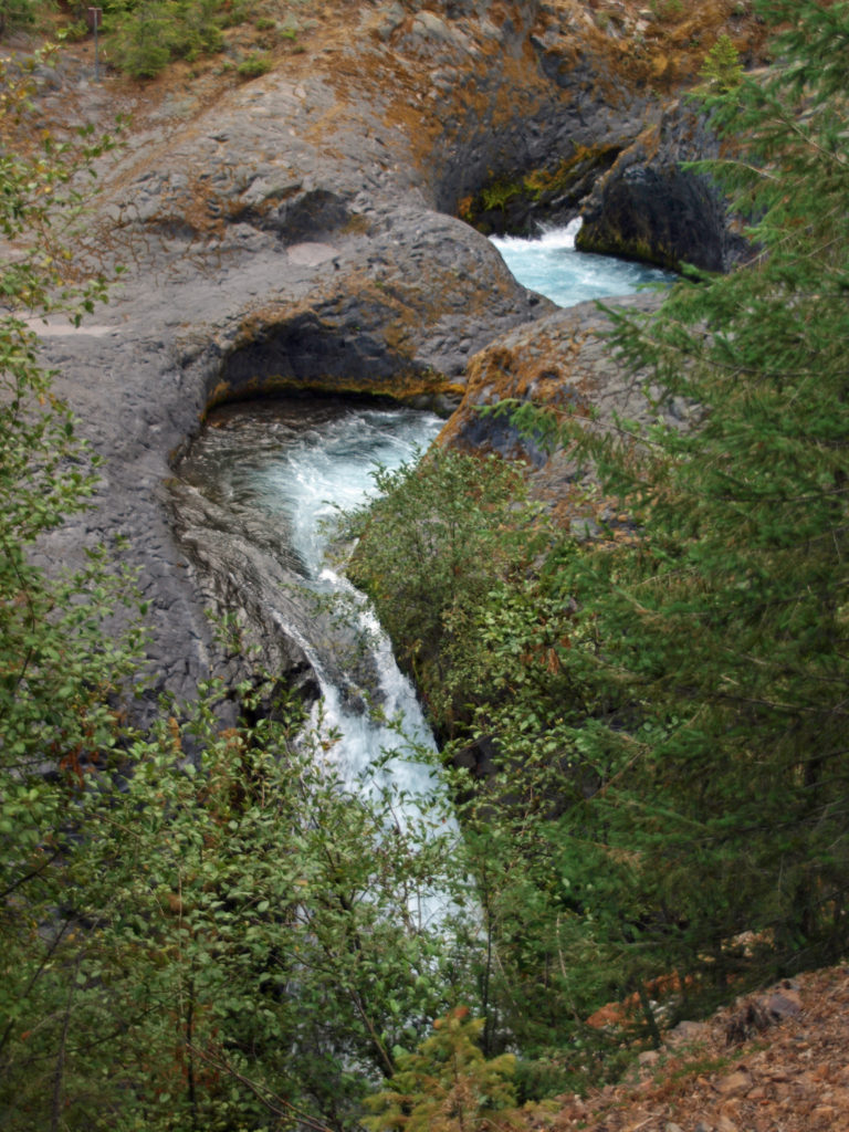 Trailheads:
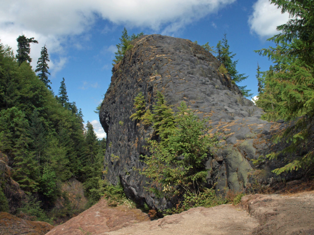 The hike:
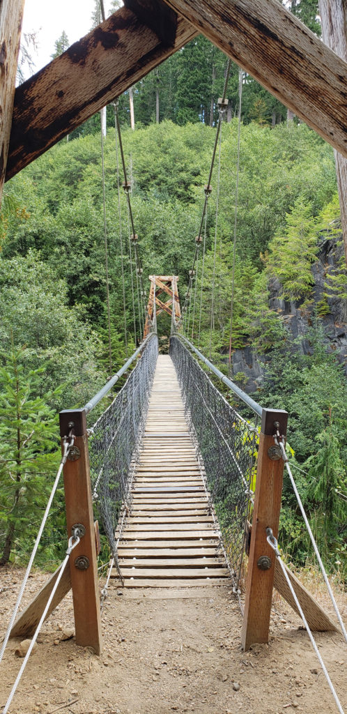 Below the overlook, the path is rock and dirt, steep in places. After another three tenths of a mile, you come to another side trail and a suspension bridge over the river that gives a bird’s eye view of the canyon and waterfalls. On the other side of the bridge is a connecting trail that takes you back to the upper bridge, making for a 1.4-mile loop. (Update: As of June 2023 the suspension bridge is closed. Check the National Forest Service’s
 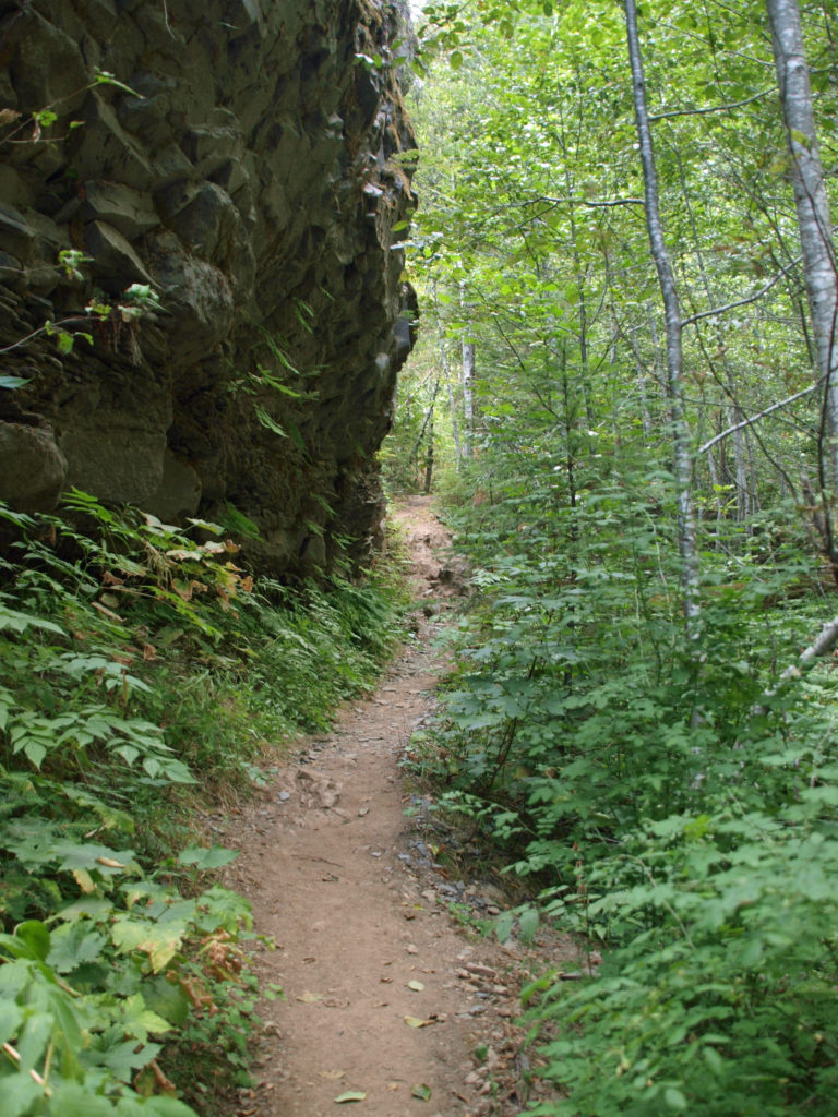 At about the 1.3-mile mark, the trail descends a 40-foot ladder to the base of the rock formation known as The Ship. Before 1980, sediment filled the canyon to the top of The Ship, to give you an idea of how much sediment was scoured out of the canyon. A short but steep side trail (and another ladder) leads to the top of The Ship.
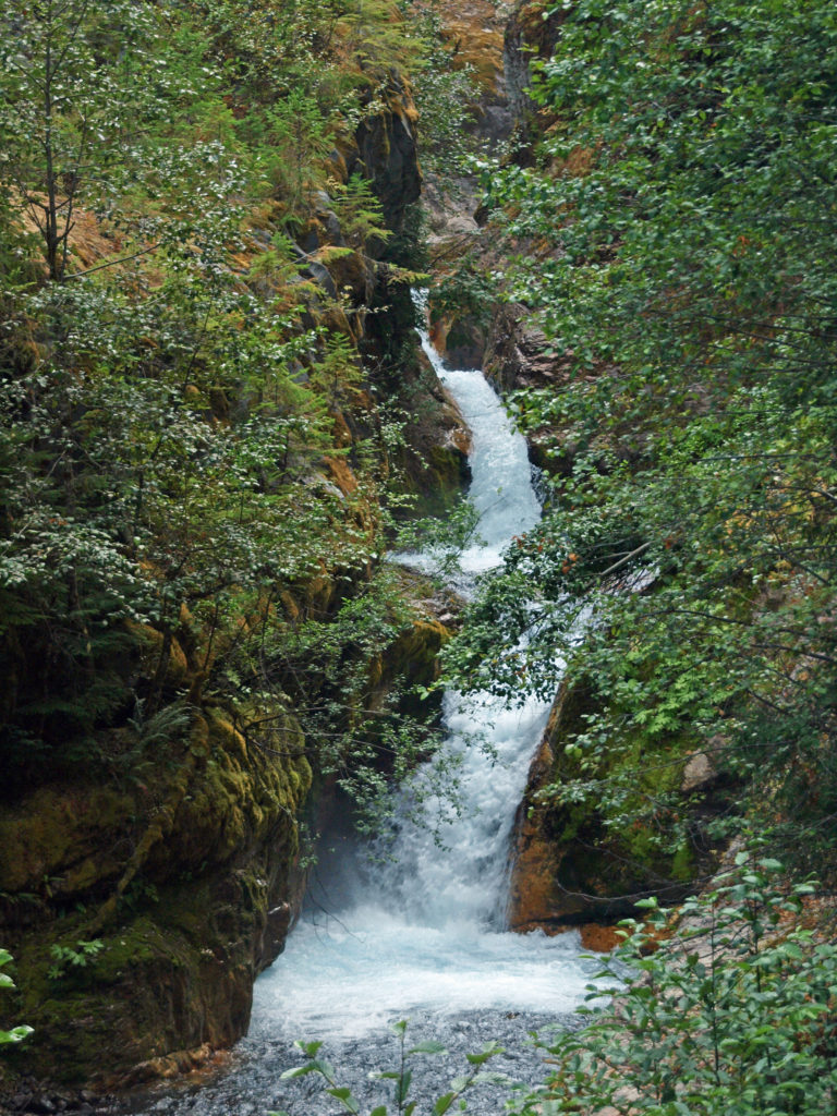 (Below The Ship, the trail continues another 1.5 miles to the lower trailhead. The entire hike from upper to lower trailhead and back is about six miles and the elevation gain coming back is 1350 feet.)
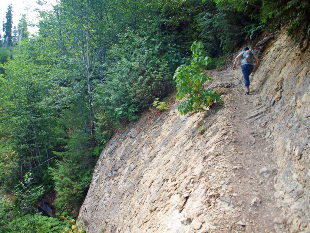 Return from The Ship the way you came. Cross the suspension bridge if it is open and take the trail on the opposite bank to the upper bridge and re-cross the river. The two bridges both give you great views of the river and canyon below.
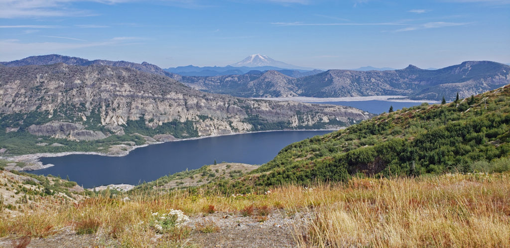
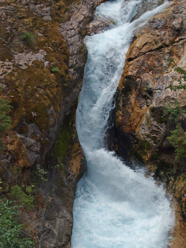 Originally posted in a different format September 29, 2018 by Alan K. Lee. Updated and re-posted March 23, 2021. Edited, updated and posted in this format June 29, 2023.
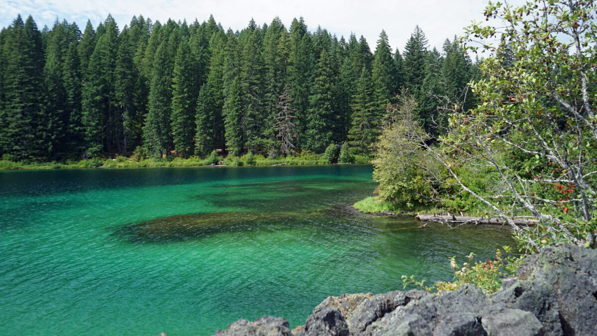
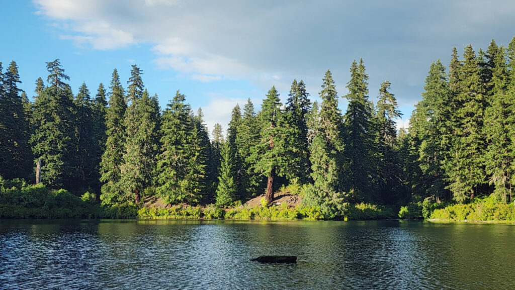
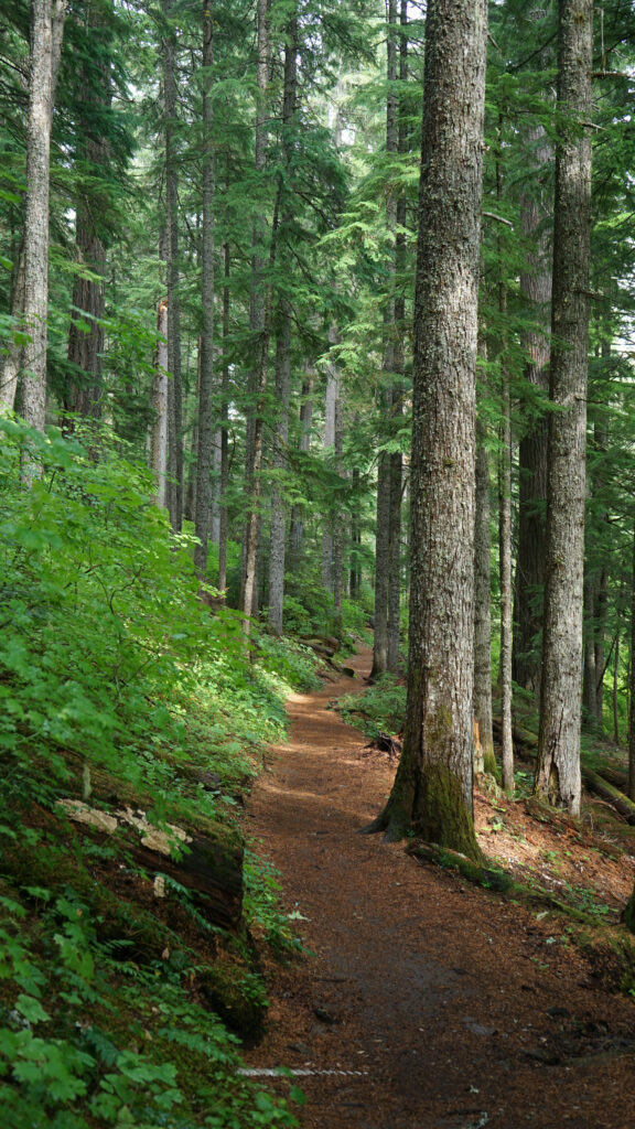

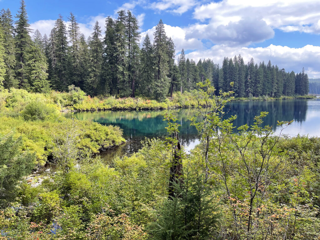
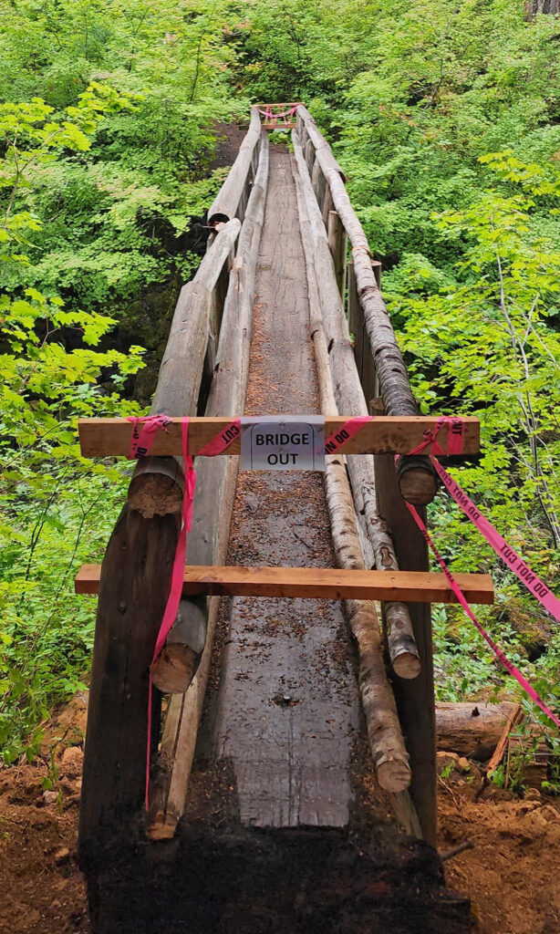
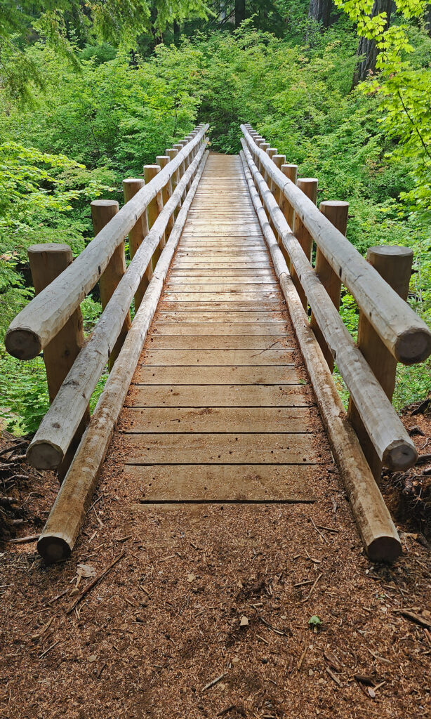
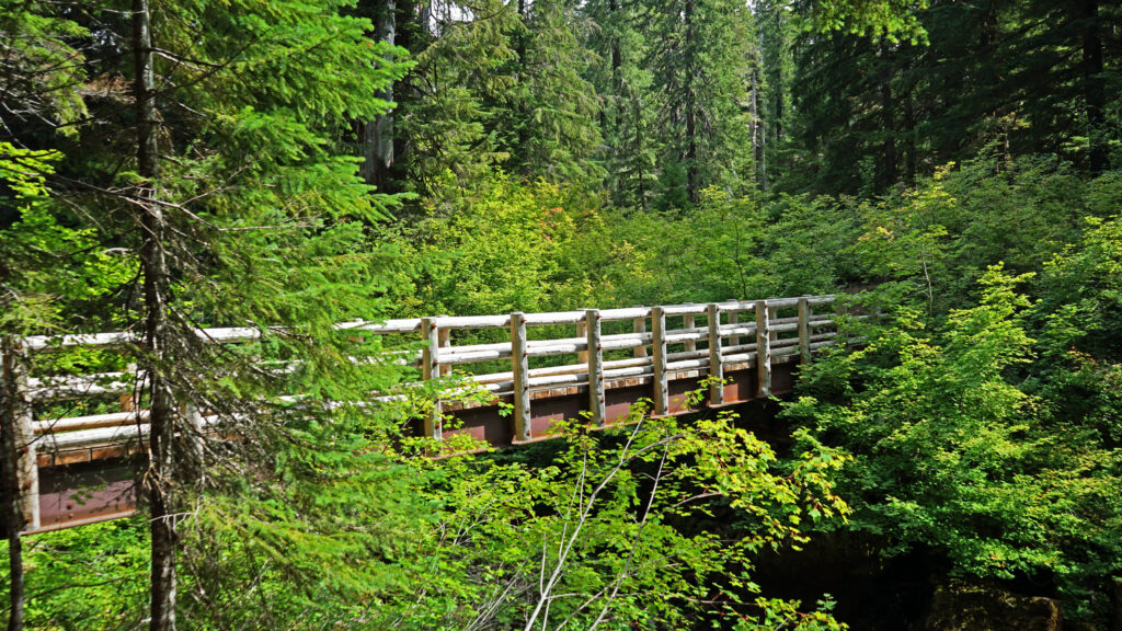
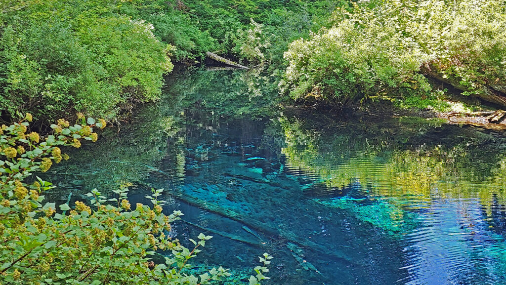
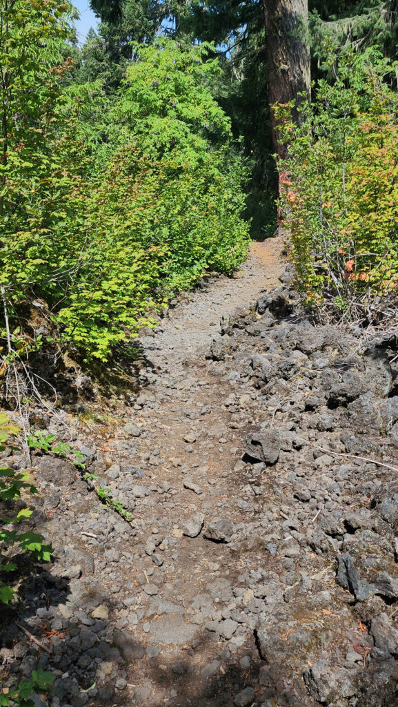
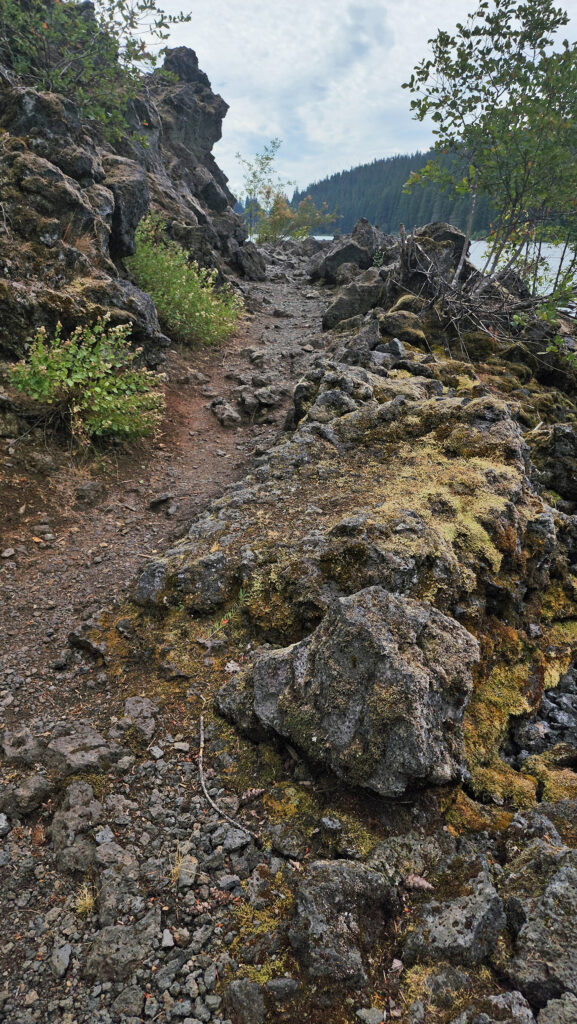 From the Great Spring the trail follows the east shore through the lava fields and forest. Parts of the trail are pretty rough. Good quality hiking boots are advised, although I did this hike in sneakers on my latest visit. But open toed sandals or flip flops are definitely not acceptable footwear on this section of the trail.
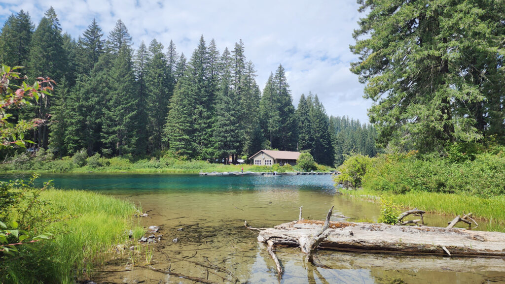
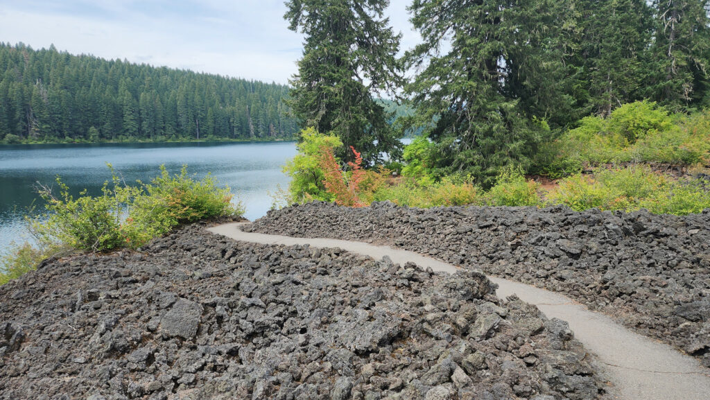
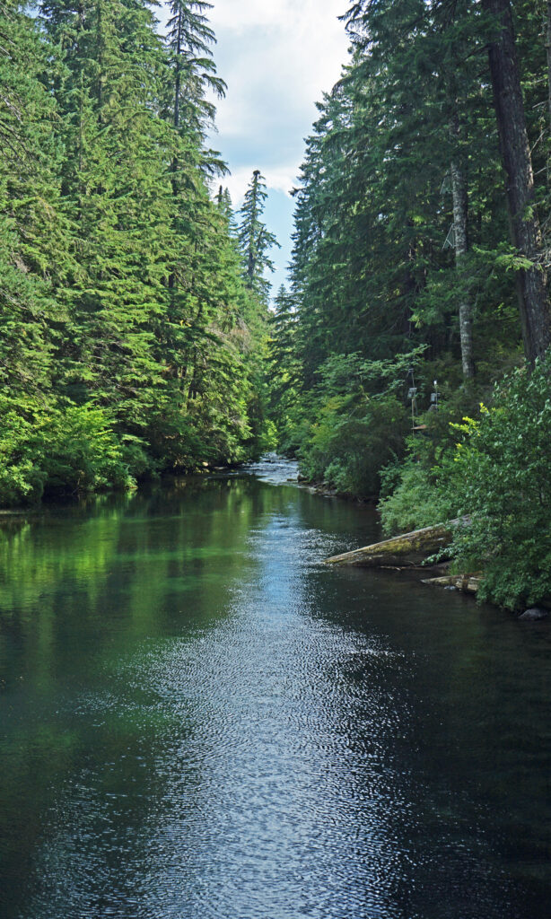

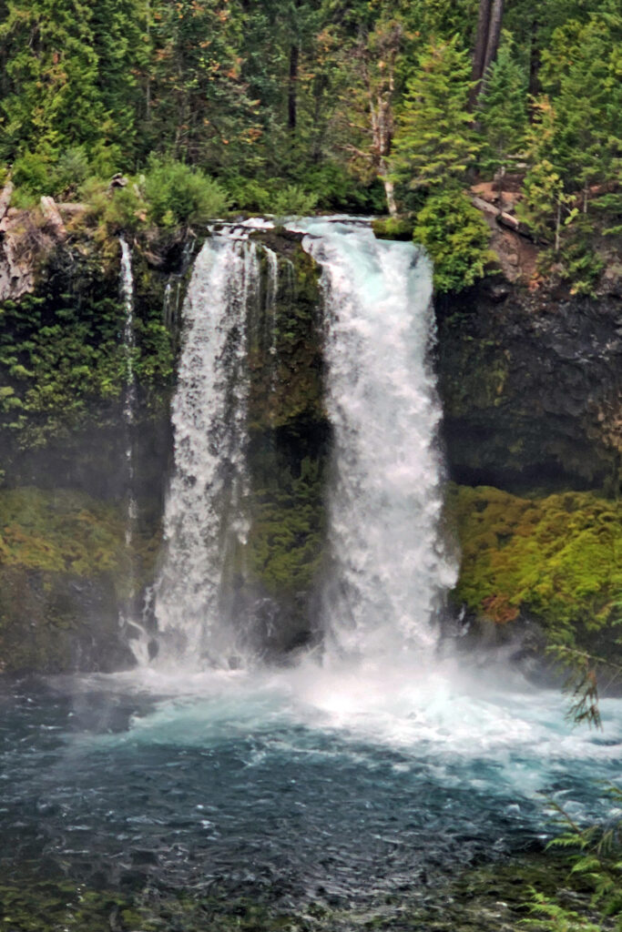
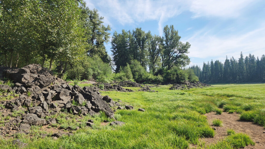
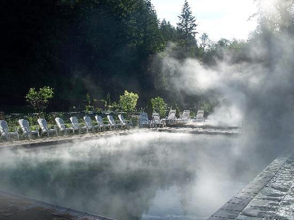

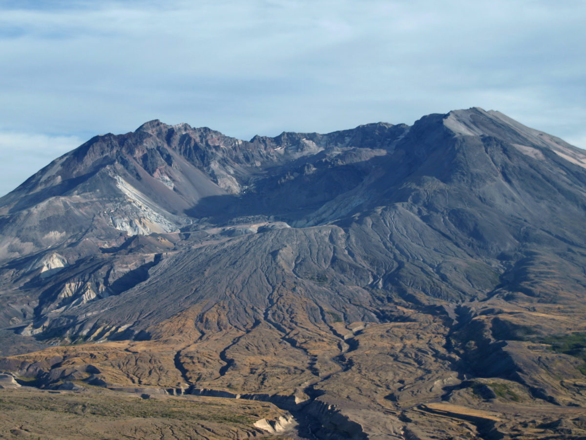
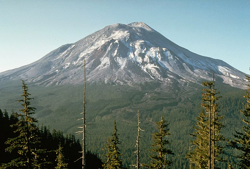
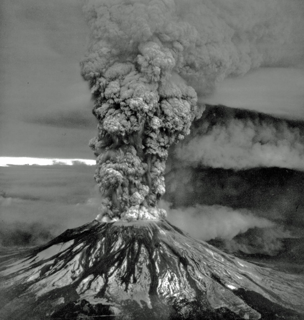

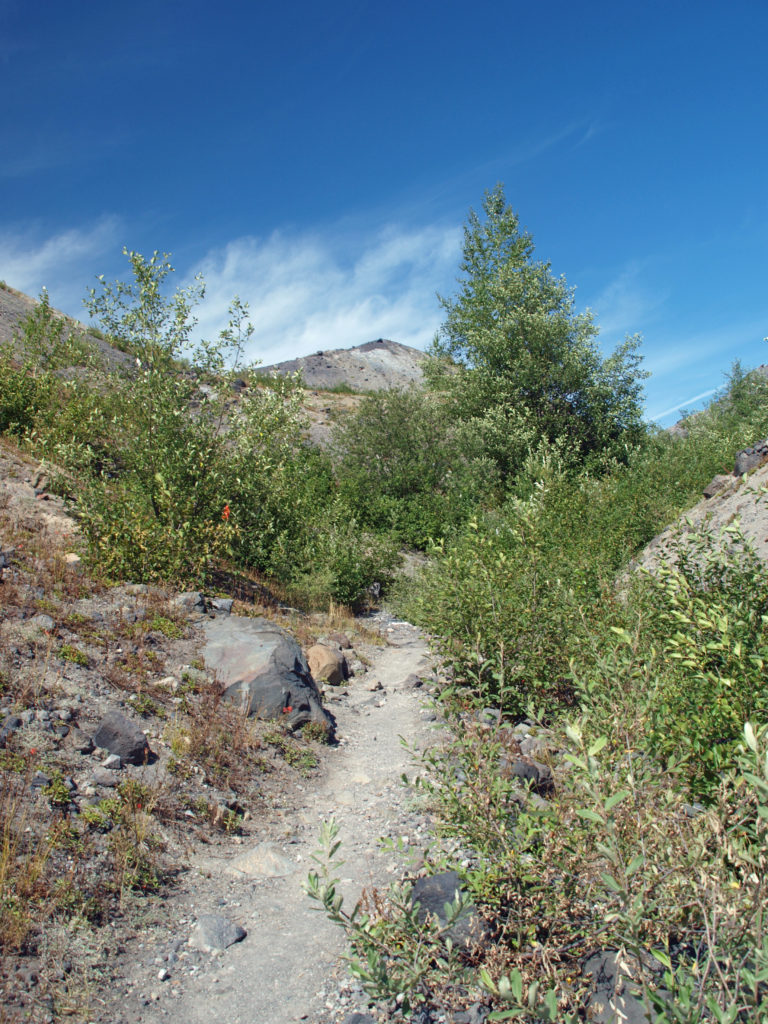
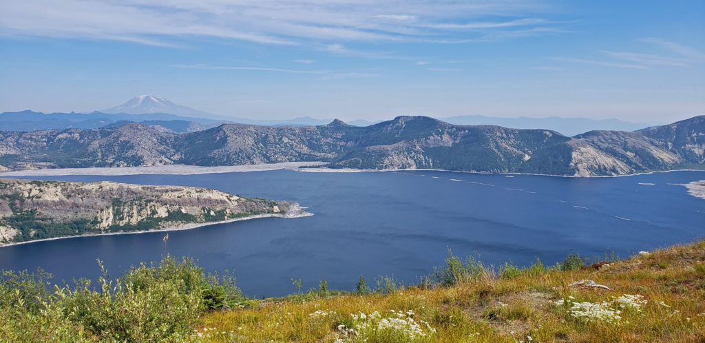
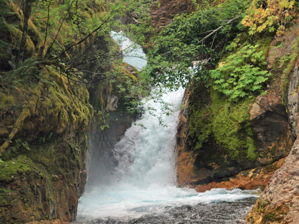
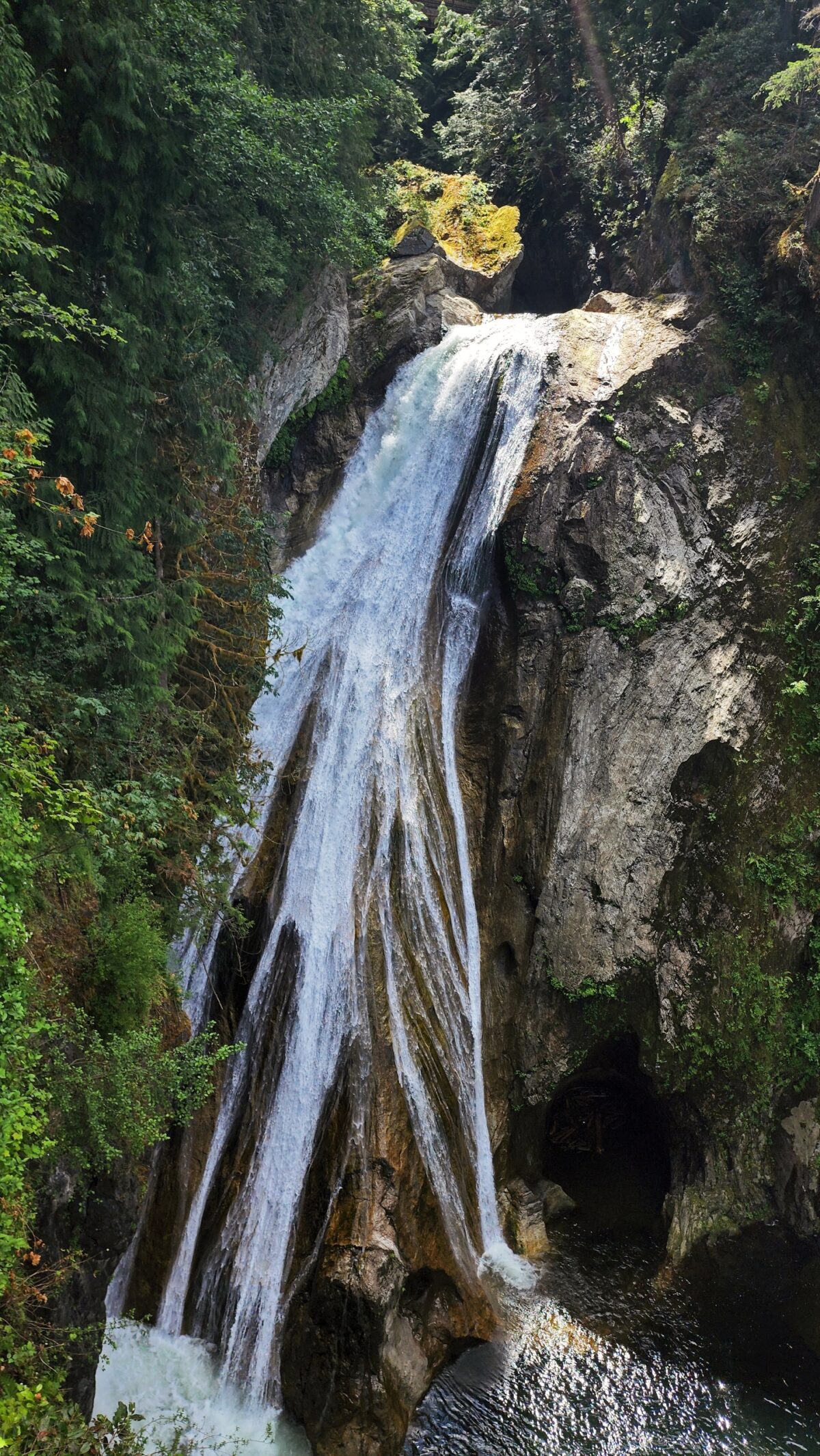
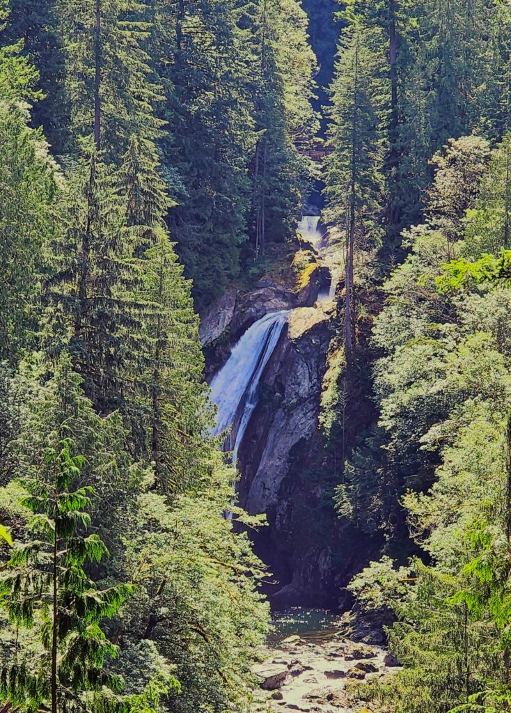 Overview:
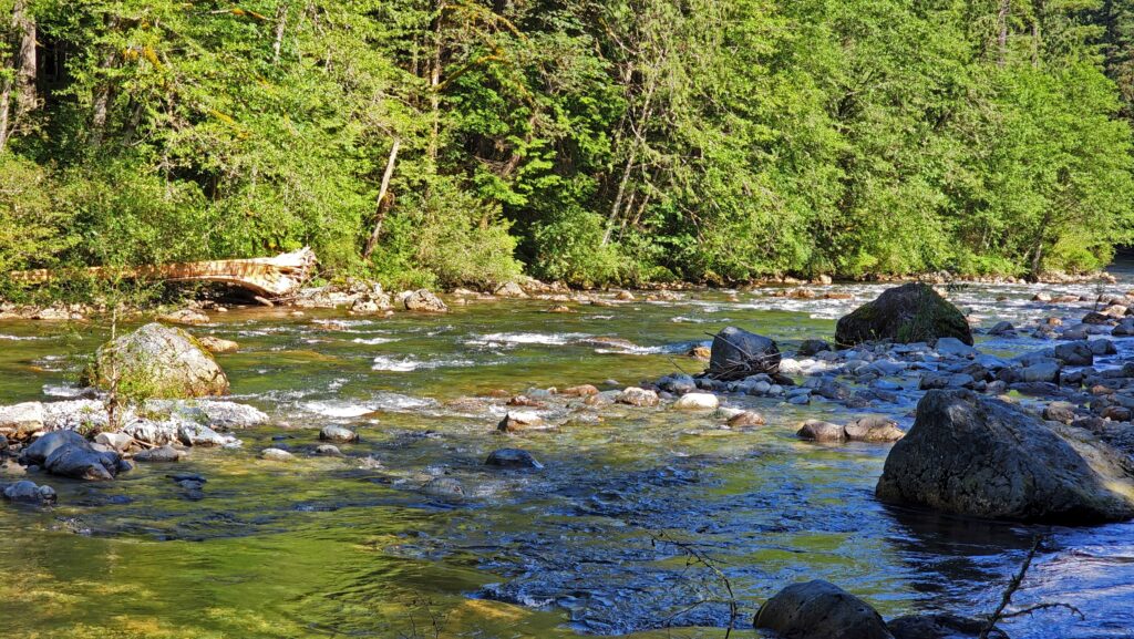
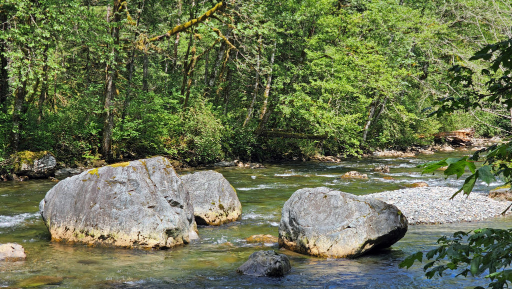
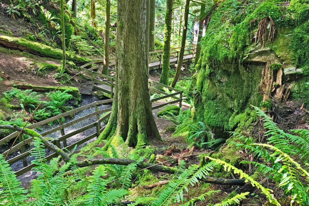 The trail then drops back down before making a second climb to another summit. Beyond that the trail descends a series of stairs and a side trail leads down another set of steps to a viewpoint of the lower falls that is well worth the 104 steps back up to the main trail.
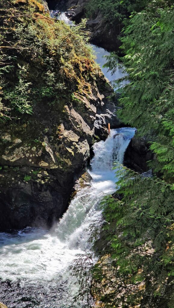
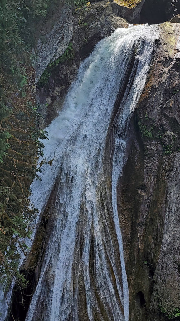
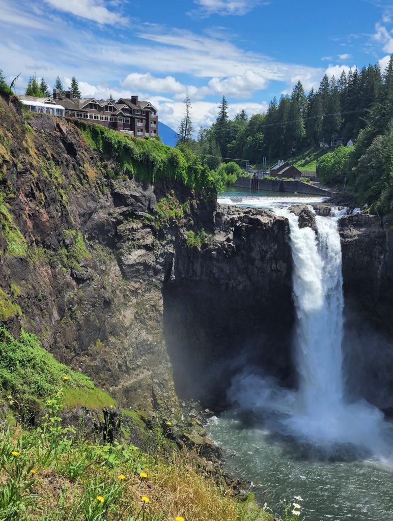
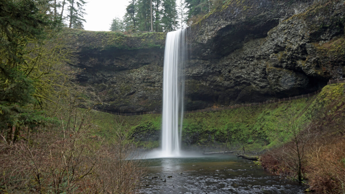
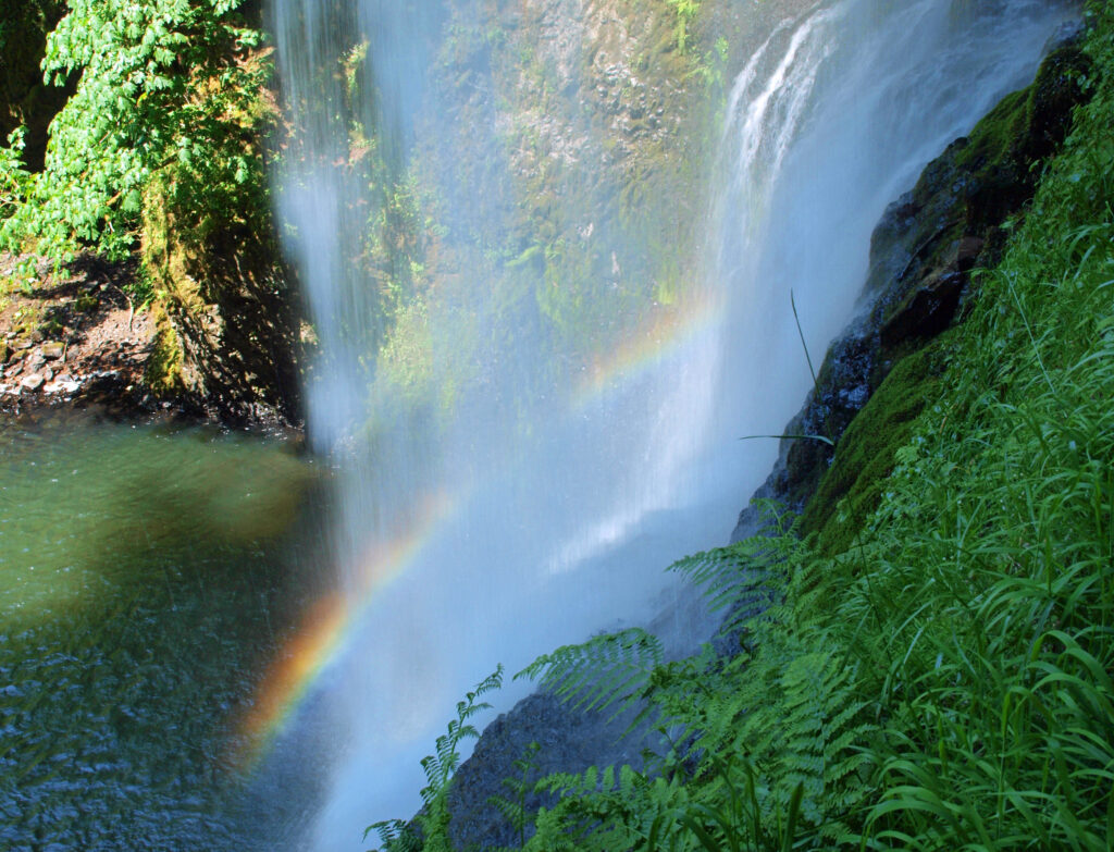
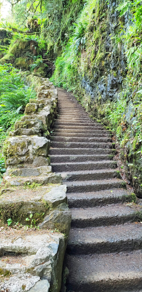 Silver Falls was voted Oregon’s favorite state park a few years ago, and for good reason. With more than ten waterfalls, six of them more than 90 feet in height, Silver Falls is a waterfall lovers paradise. And the Trail of Ten Falls (there are actually eleven named and at least one unnamed falls along the trail) is one of the finest hiking trails in the Pacific Northwest. I don’t know of anywhere else where you can see a dozen falls on a single hike, and four of them here have trails that actually take you behind the falls.
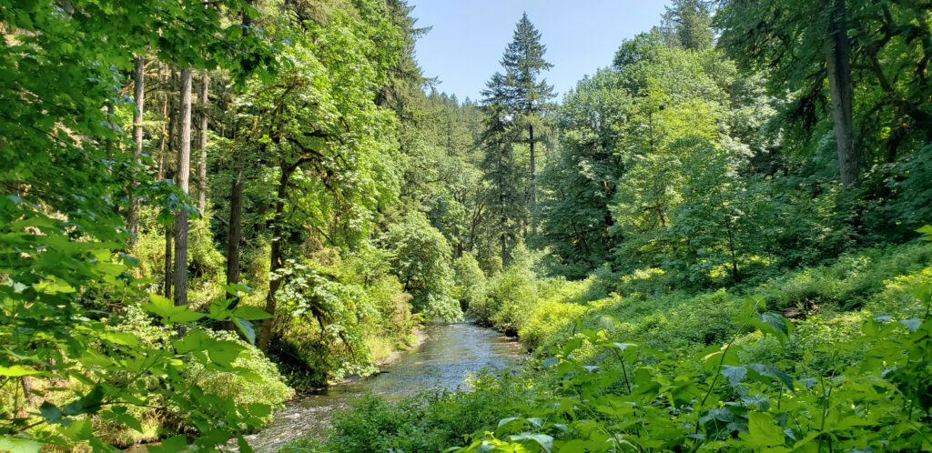
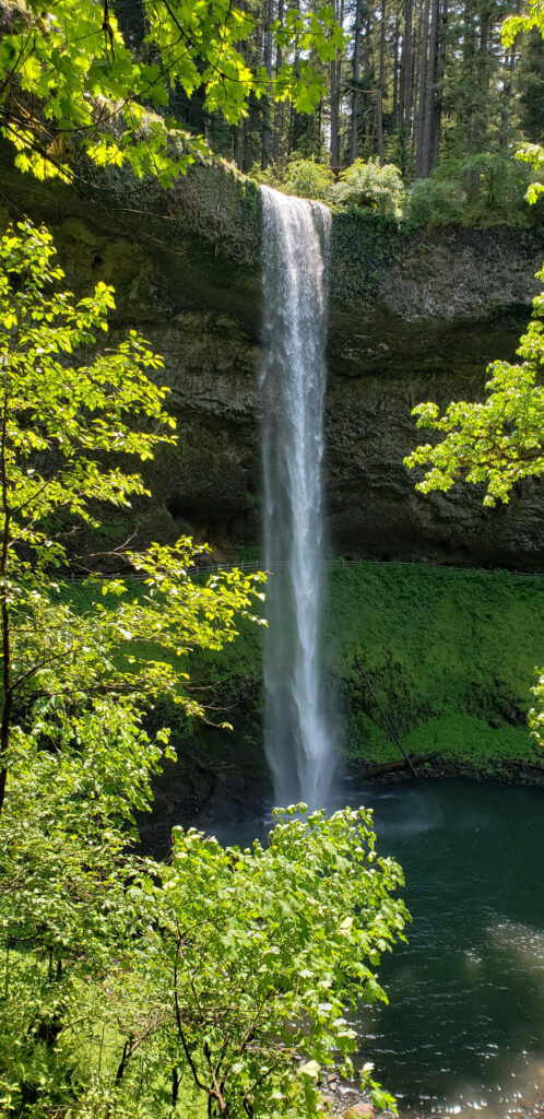

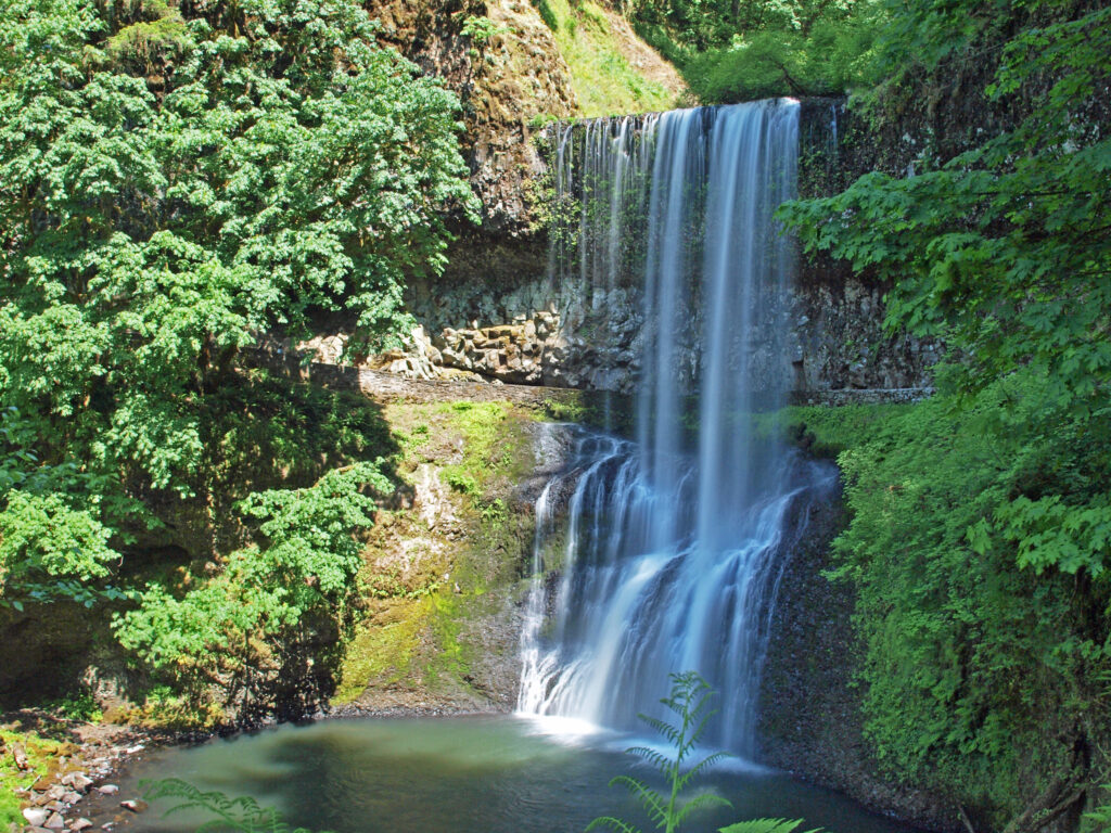
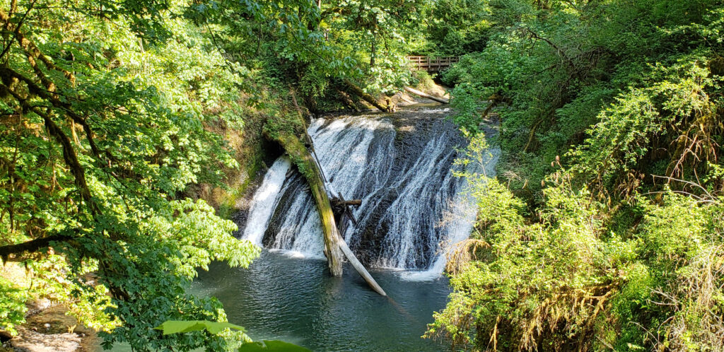
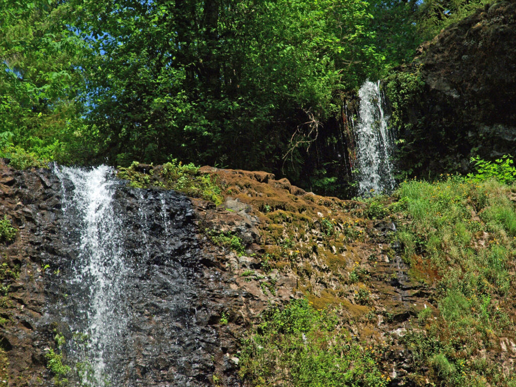


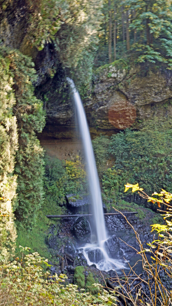
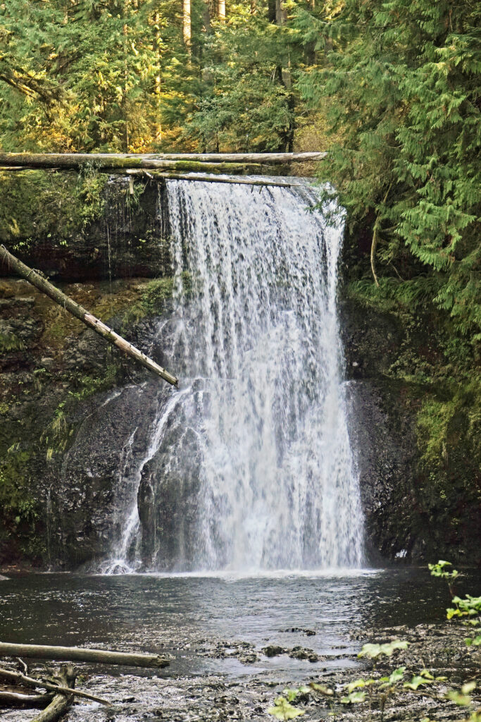
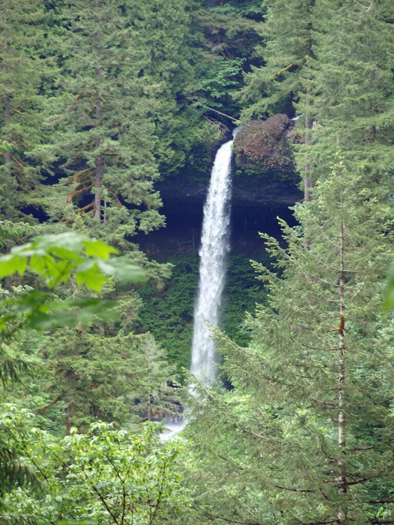
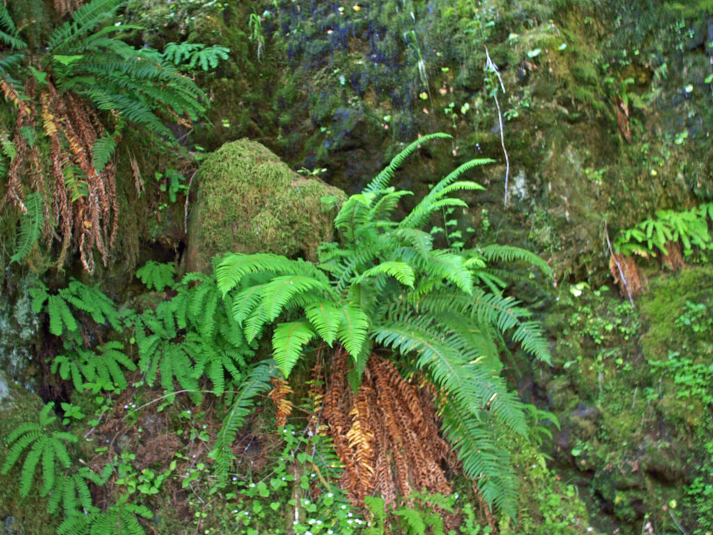 Other area attractions and activities:
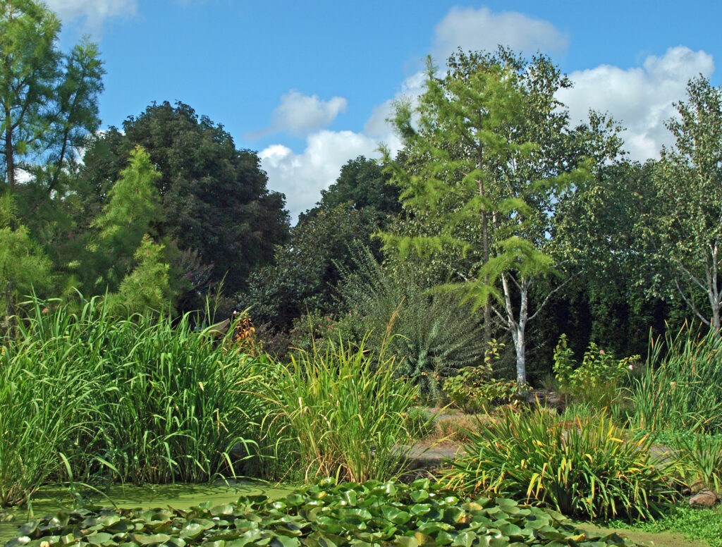
 The Trail of Ten Falls is an iconic hiking trail that every serious hiker in the state has likely done multiple times. It’s so spectacular that it alone is worth making the trek to Oregon from wherever you reside, no matter how far away that is. As an Oregon resident, I know I’m a little biased, but I don’t think I’m exaggerating here. If you’re a waterfall lover, come see for yourself. A trip to Silver Falls, combined with a visit to the waterfalls of the Columbia River Gorge will make for an unforgettable experience.
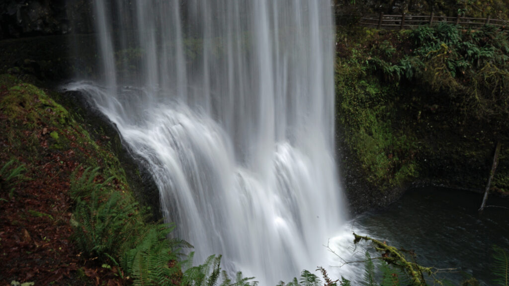
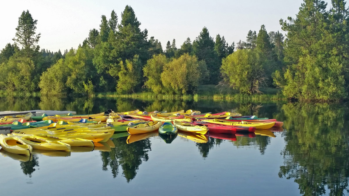
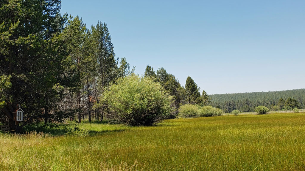
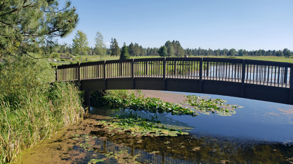
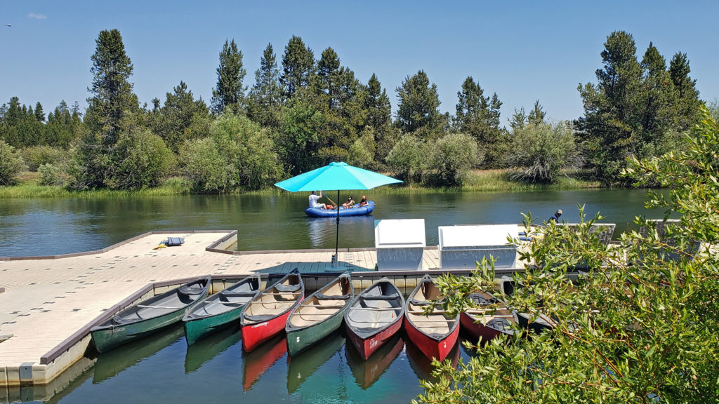
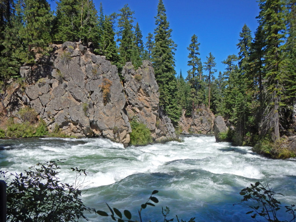
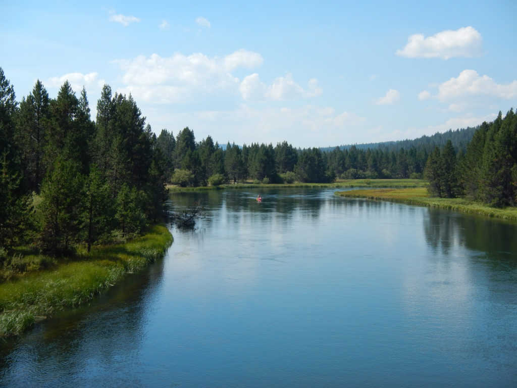
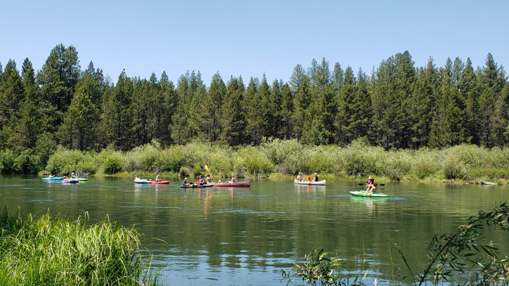
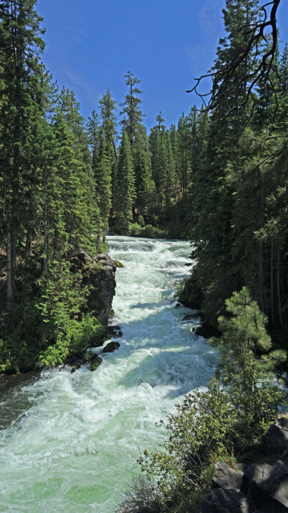
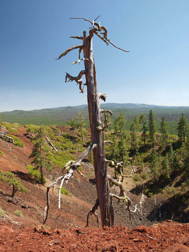
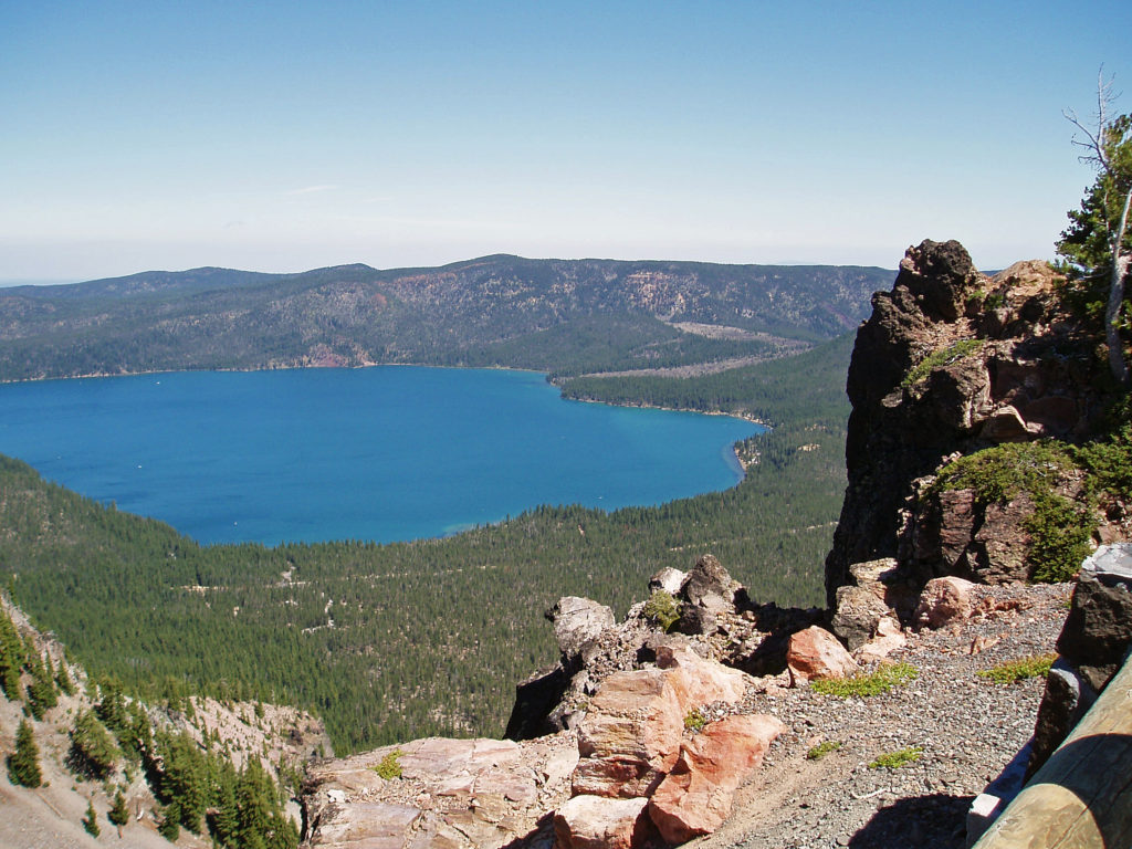
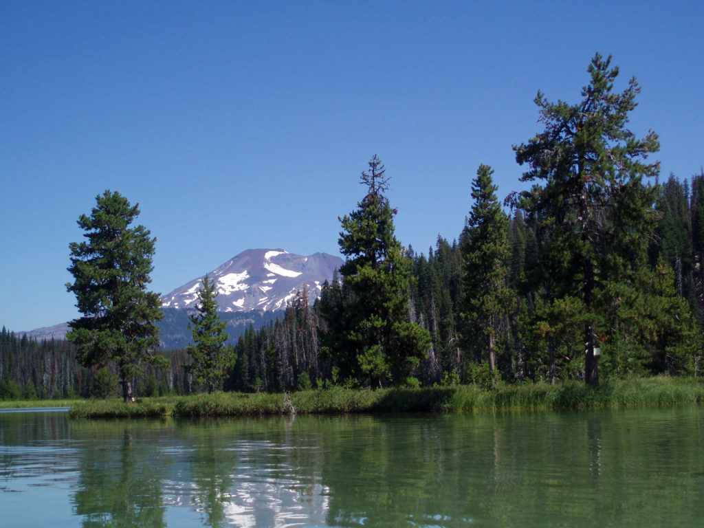
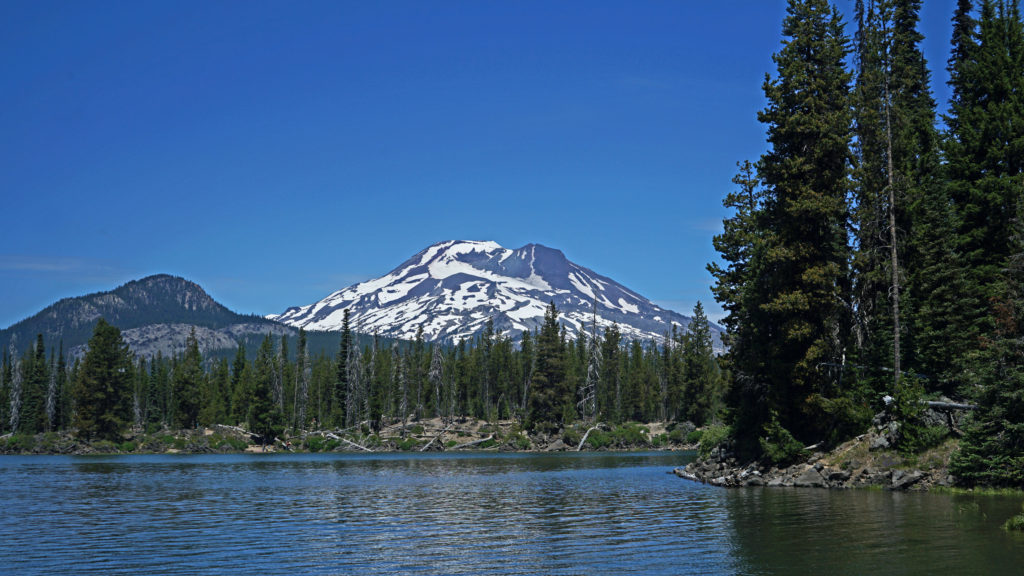
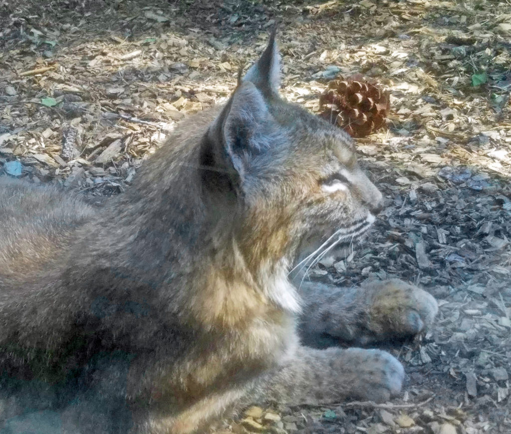
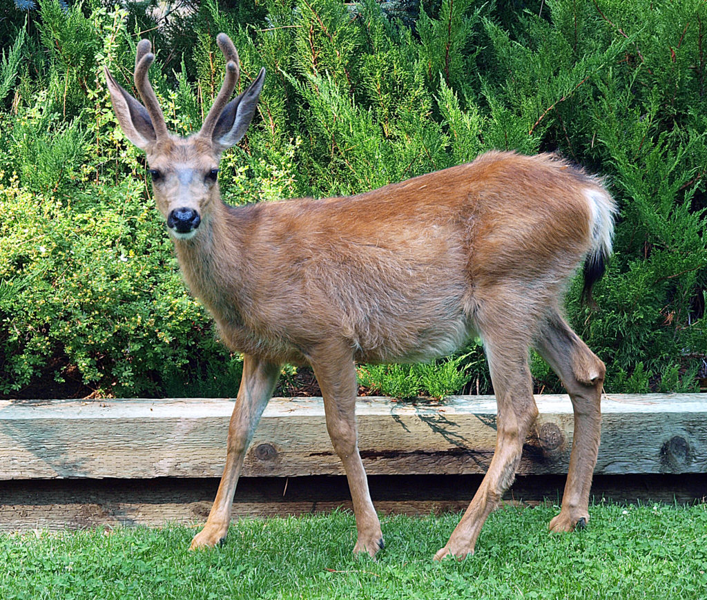
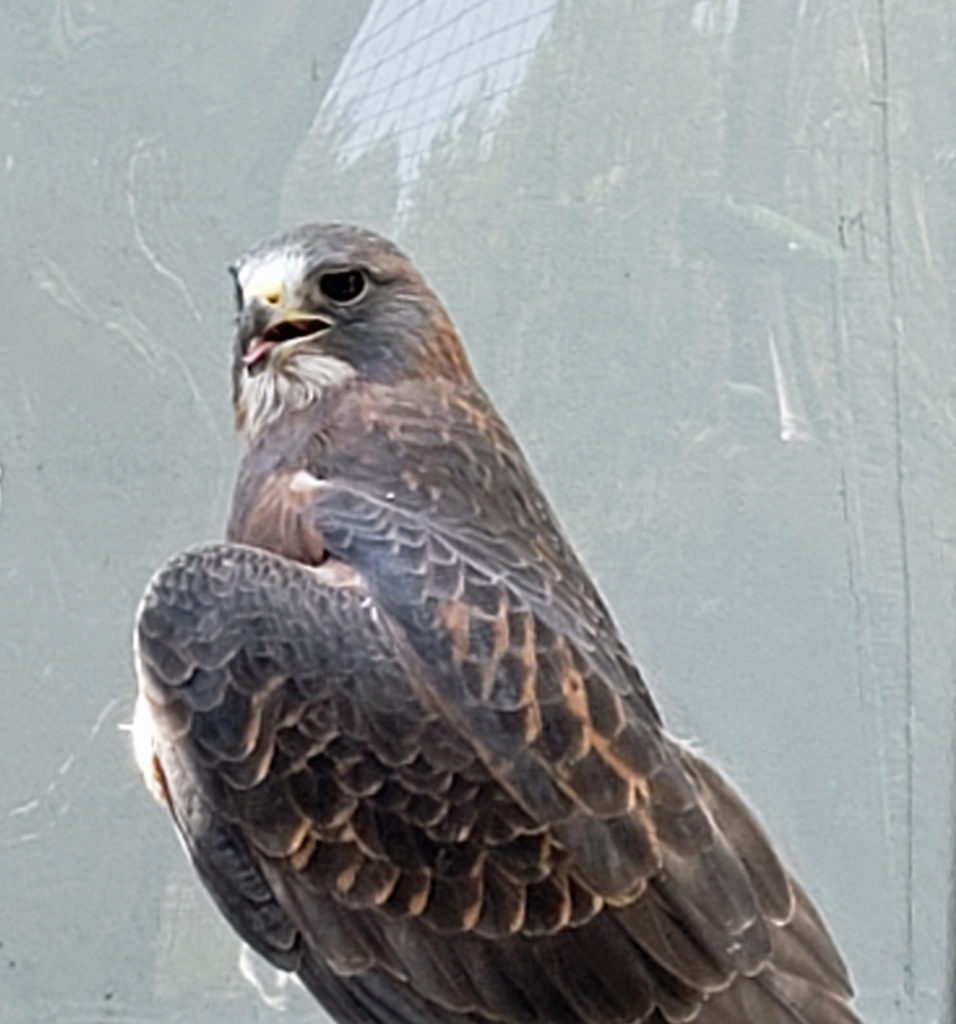
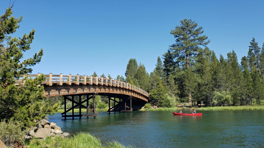
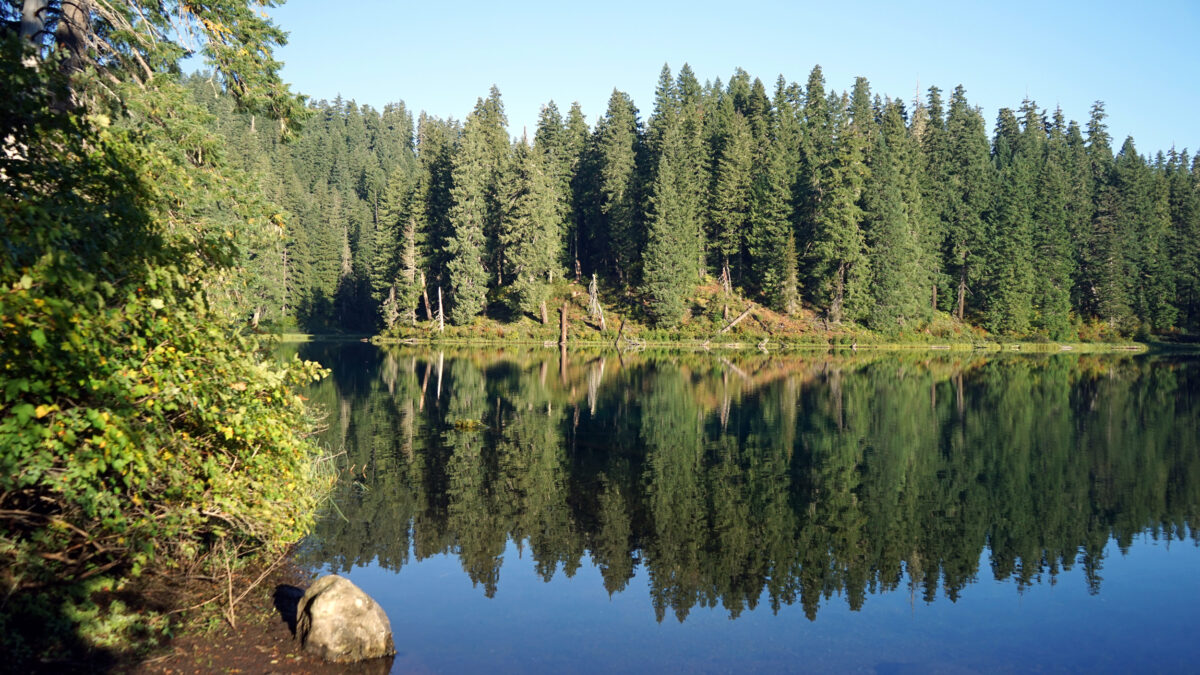
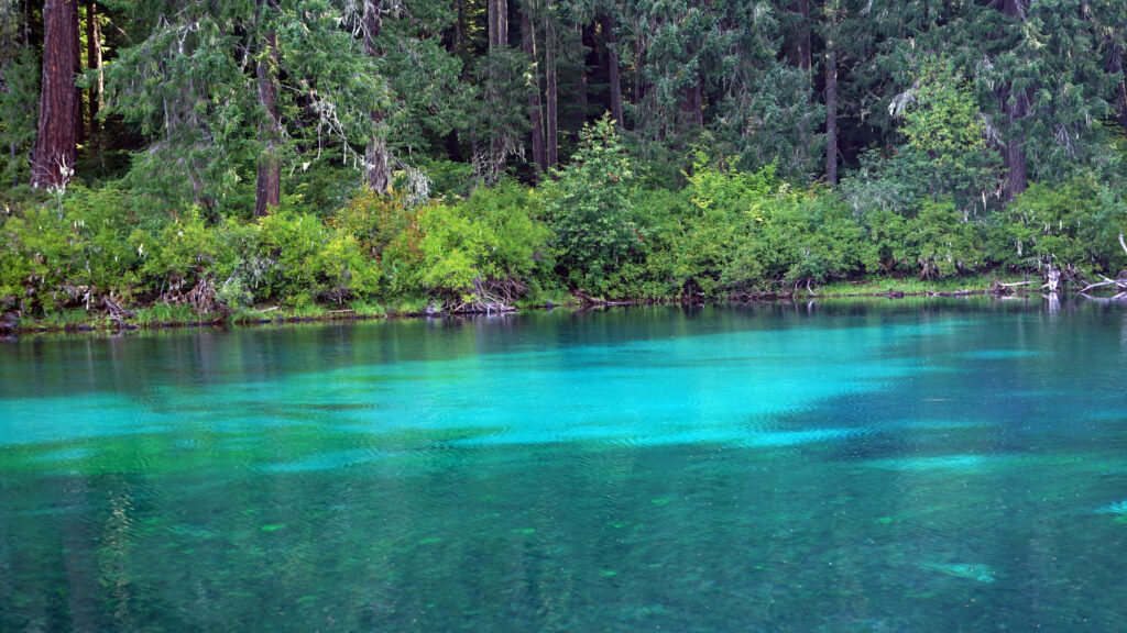
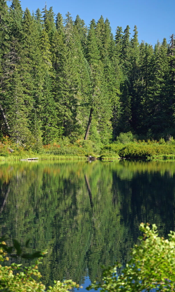
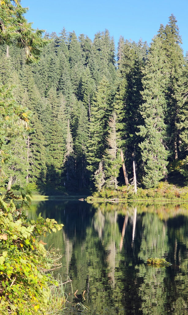 Clear Lake offers the outdoor enthusiast a number recreational options, including hiking, fishing, paddling, or just taking in the views and soaking up the beauty and peacefulness of nature.
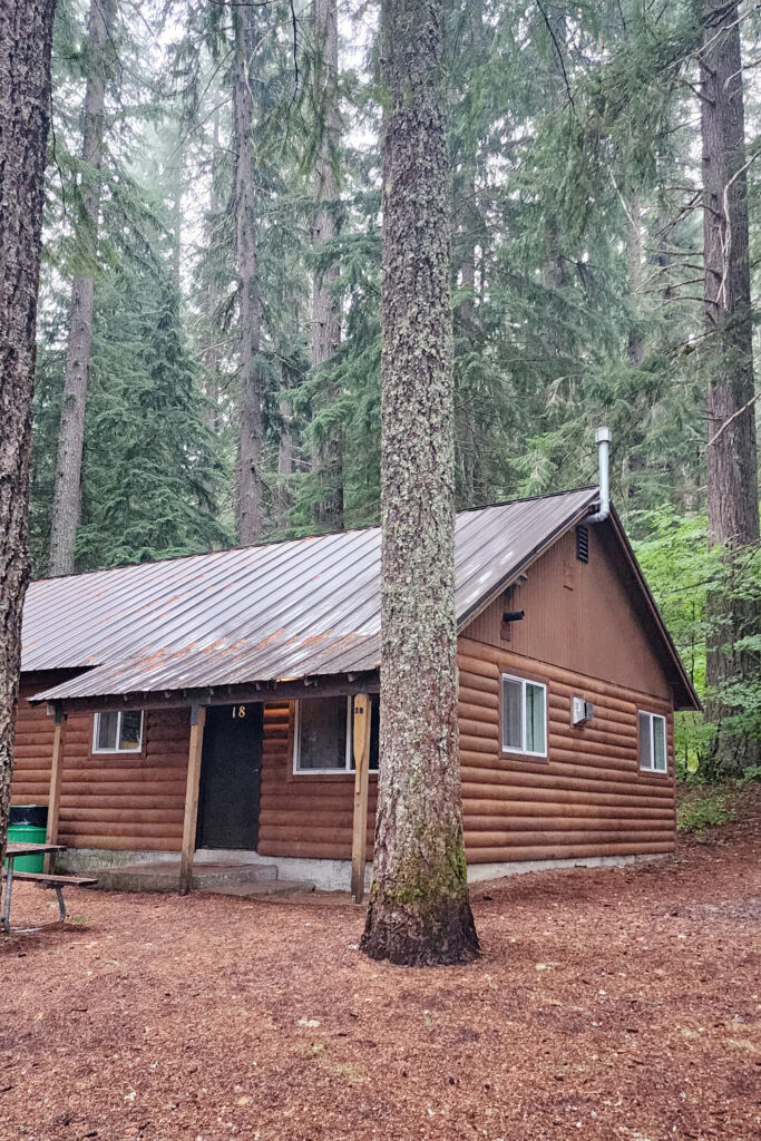
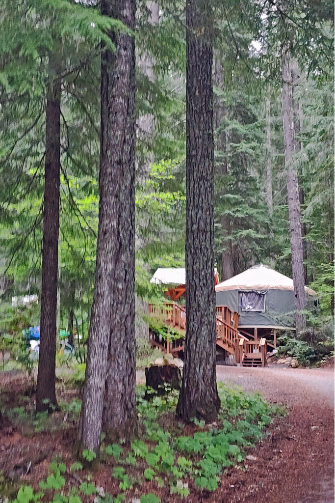
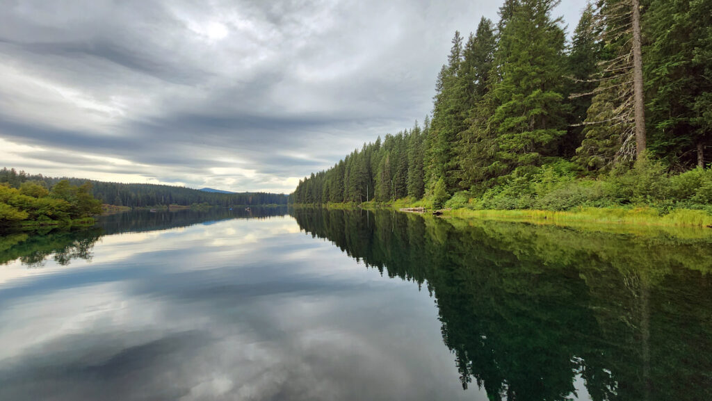
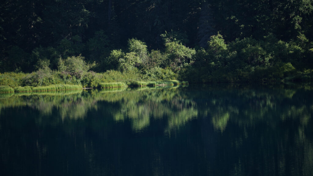
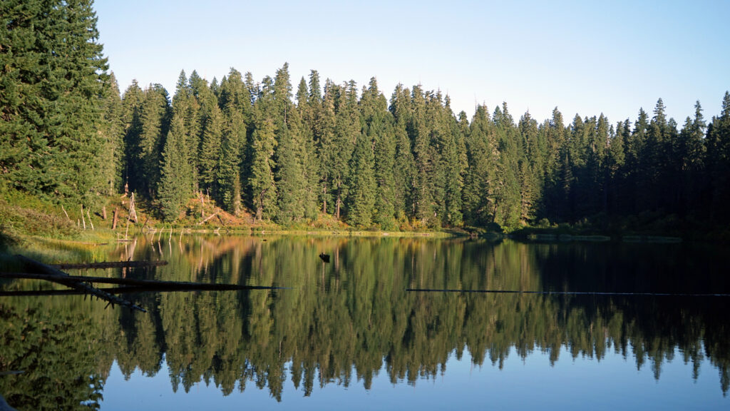 The Clear Lake and upper McKenzie area is one of the most scenic and most interesting parts of the Cascades, and offers a number of other hiking options besides the Clear Lake Loop. The 2.6-mile
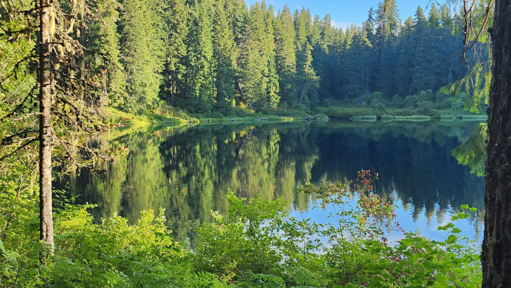
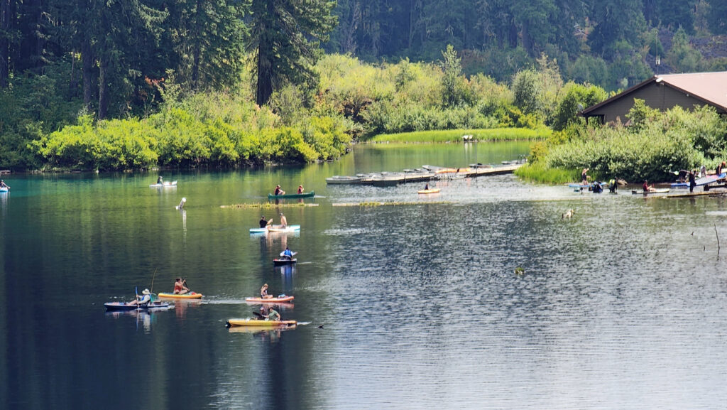
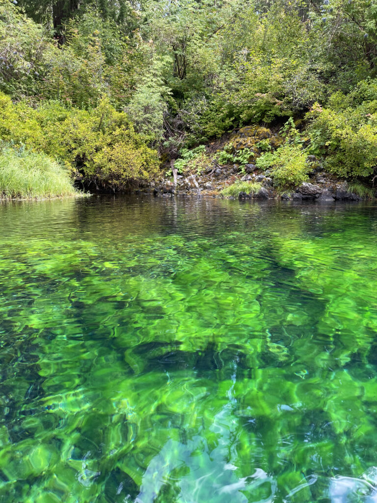
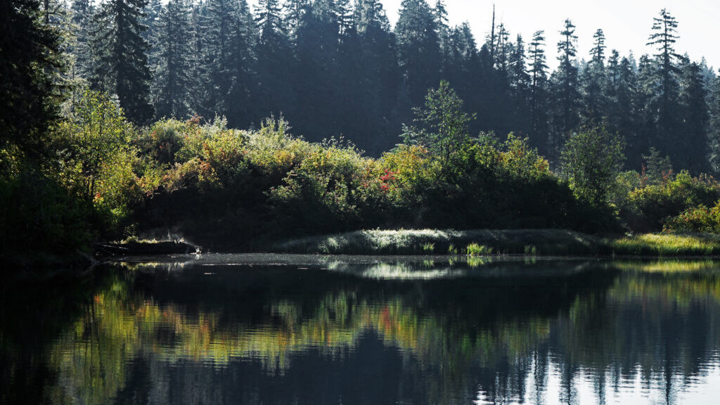 You can take in Clear Lake and do the Waterfall Loop in a weekend. Make it a long weekend and add the Blue Pool hike or spend a day out on the lake. Better yet, make a week of it and check out Fish Lake, the Santiam Pass and McKenzie Pass areas, and the lower McKenzie River. You won’t run out of things to do.
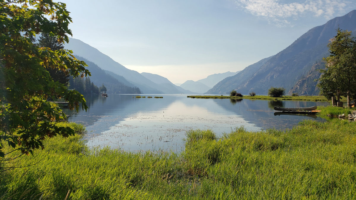
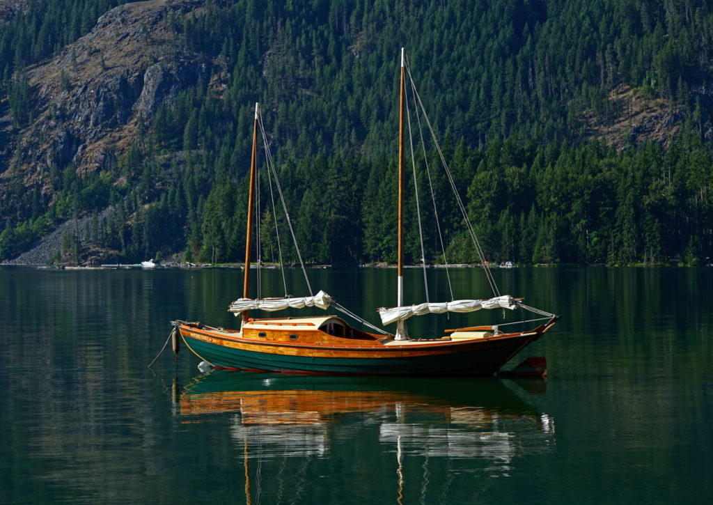 My wife and I have visited the small community of Stehekin at the head of Lake Chelan in central Washington several times. Our most recent visit came on a week-long escape during the pandemic in 2021.