
The McKenzie River Waterfalls Loop Trail
Where: Willamette National Forest, Oregon Cascade Range
Distance: 2.6 miles
Elevation gain: 400 feet
Difficulty: Easy
Map:
Digital map: Oregon Hikers website
Overview:
The McKenzie River Waterfalls Loop hike gives you close views of Sahalie Falls, Koosah Falls, and the wild and spectacularly beautiful McKenzie River from both sides of the river. Or you can make a longer hike of it and start from Clear Lake Resort (6.4 miles round trip) or Coldwater Cove Campground (4.0 miles) on Clear Lake.
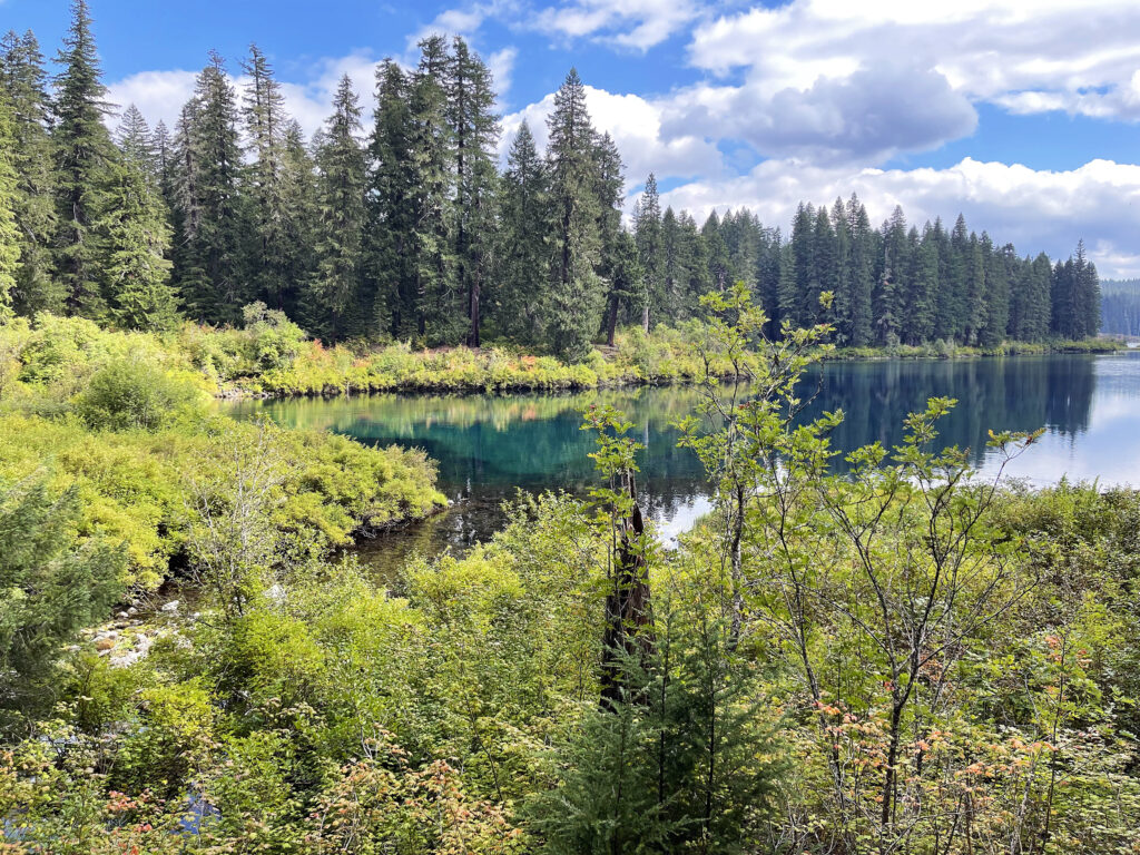
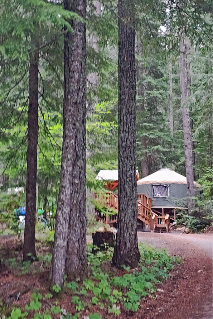
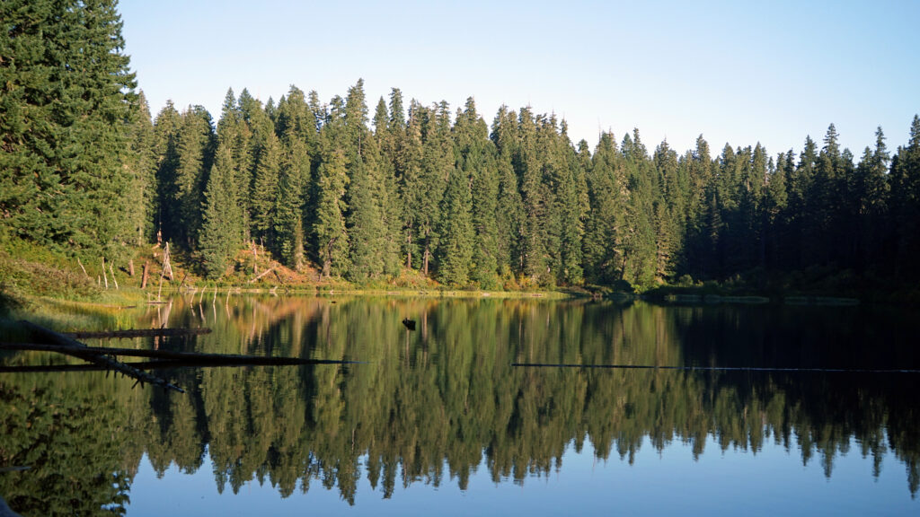
Clear Lake Resort on the northwest shore of Clear Lake and Coldwater Cove on the southeast shore both make ideal base camps for hiking the upper McKenzie area, as well as the Santiam Pass and McKenzie Pass areas. The resort has 14 cabins, four of which have two bedrooms, a kitchen, and a bathroom. The resort is popular, and reservations need to be made well in advance of your planned visit, especially for the four cabins with bathrooms. Coldwater Cove Campground has 44 camp sites. Water is available and there are vault toilets, but no RV hookups.
Getting there:
The upper McKenzie River area is about 65 miles east of Eugene, 50 miles west of Bend, and 130 miles southeast of Portland. From the Portland area, take I-5 south to exit 253, then travel east on Ore Hwy 22 for 79 miles to the junction with US Hwy 20, go west for three miles, then turn south on Ore Hwy 126. The Sahalie Falls trailhead is about five miles south of the junction. From Bend, take US Hwy 20 west to the junction with Ore Hwy 126 a few miles west of Santiam Pass, then south on 126 to the trailhead. From Eugene, take Hwy 126 east and then north to any of the three trailheads.
Trailheads:
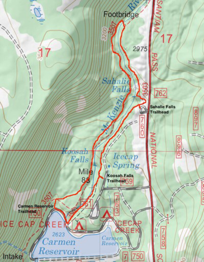
The McKenzie Waterfalls Loop can be accessed from Sahalie Falls, Koosah Falls, or Carmen Reservoir. The Sahalie Falls trailhead has a sizeable parking area, but it’s a popular stop along the highway, and it is sometimes difficult to find a parking spot. The Koosah Falls and Carmen Reservoir trailheads are used less but also have smaller parking areas. There are restrooms and water available at the Sahalie trailhead. The Koosah and Carmen trailheads have vault toilets but no water. The Sahalie trailhead is located about a mile south of Clear Lake. The Koosah Falls trailhead is about a third of a mile south of the Sahalie trailhead. The Carmen Reservoir trailhead is just south of Koosah Falls on Forest Road 750 about three quarters of a mile west of Hwy 126.
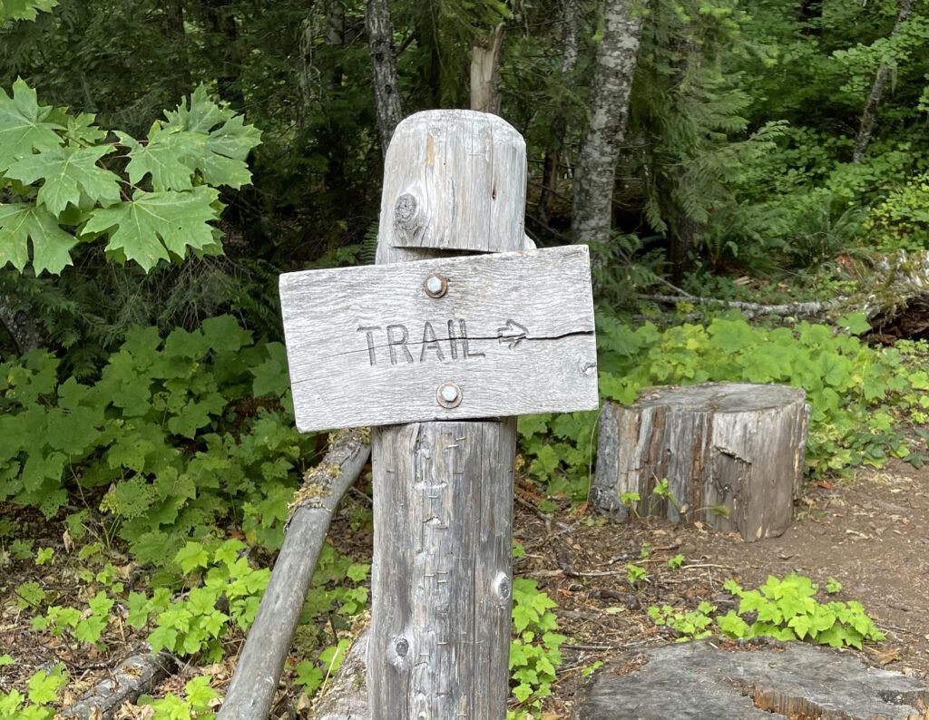
The hike:
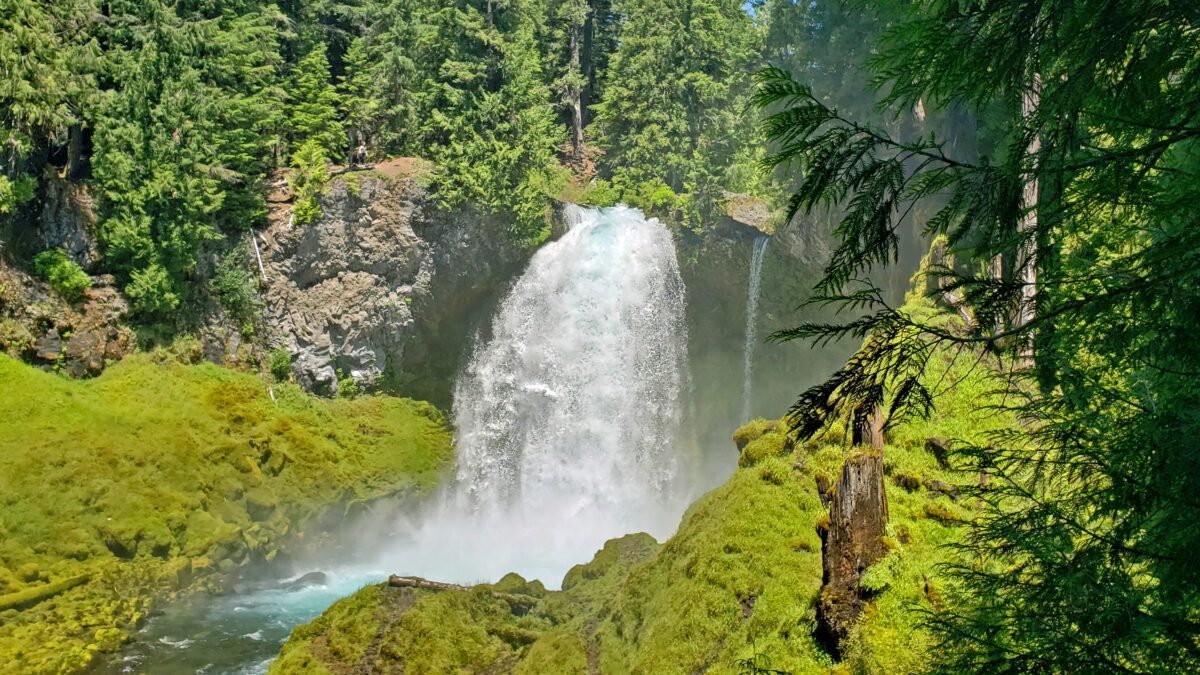
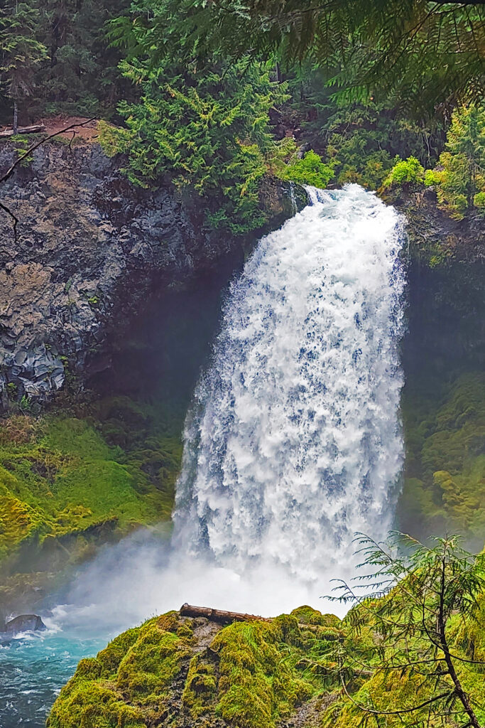
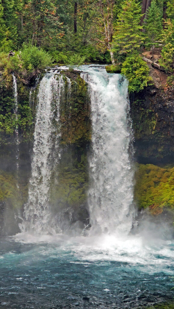
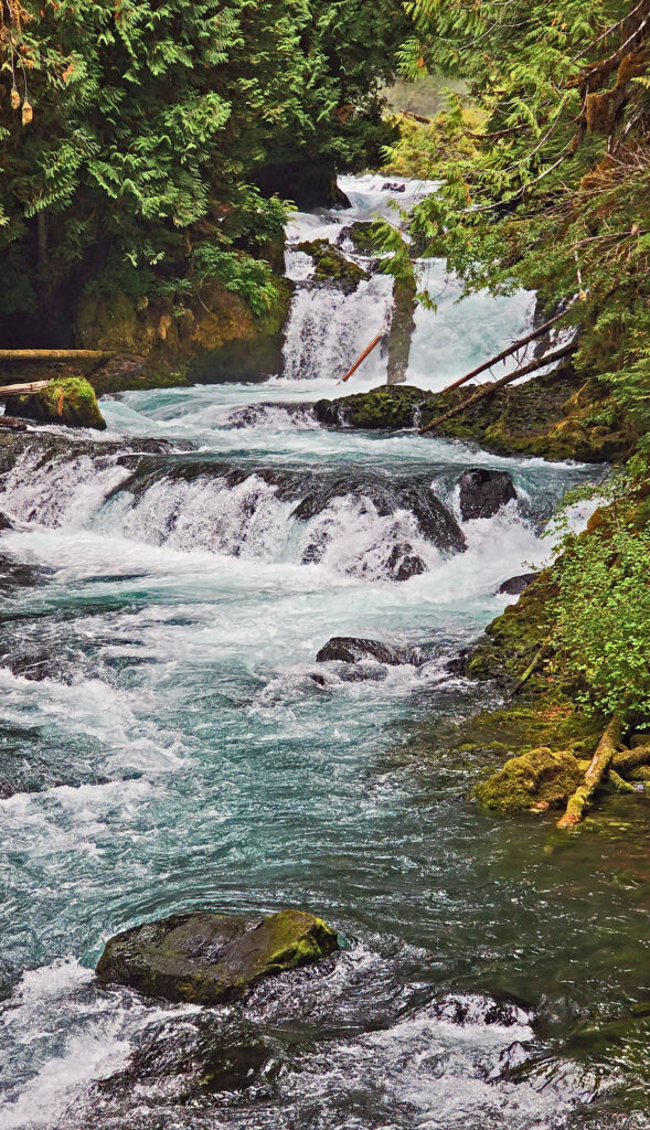
Starting at the Sahalie Falls parking area, which is about a mile south of Clear Lake, take the short, paved trail from the parking lot to the viewpoint for a great view of Sahalie Falls. Here the river plunges 75 feet over the edge of a lava flow from the Sand Mountain eruption about 3000 years ago. Even at the end of summer, when the river flow is at its lowest, the volume of water pouring through the notch in the cliff and crashing into the bowl below is impressive.
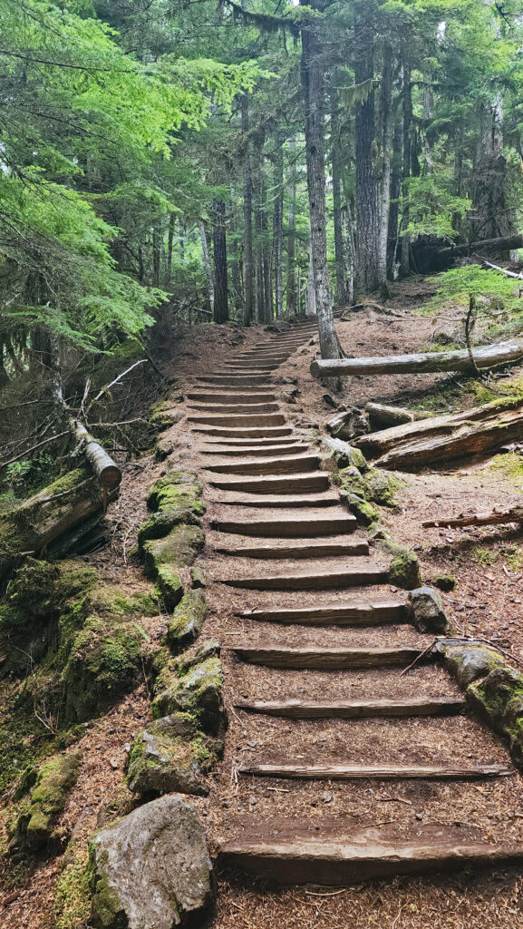
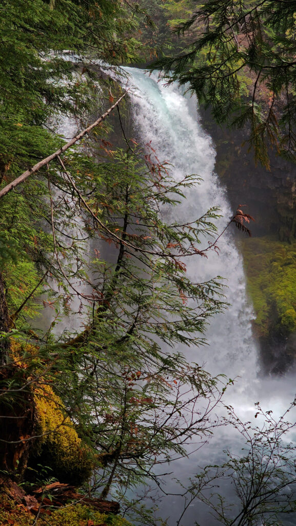
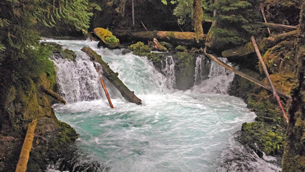
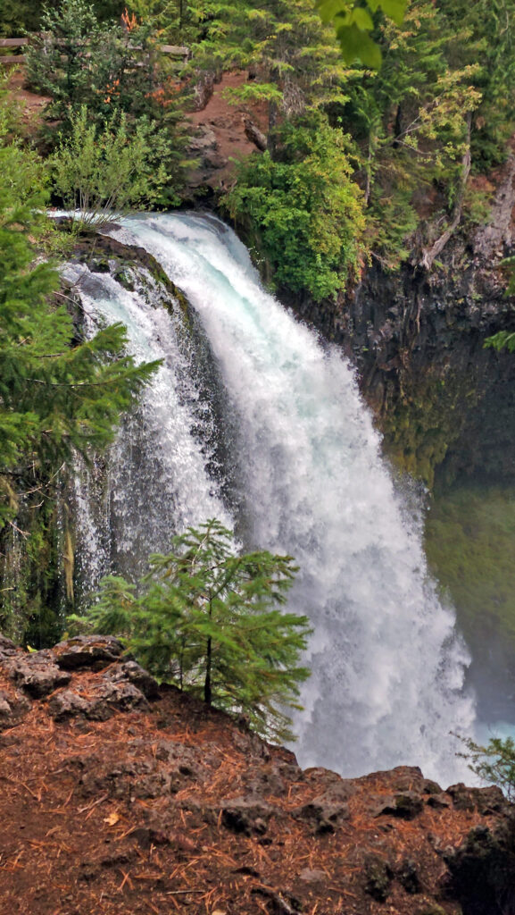
When you’re done taking in the view, retrace your steps and look for the trail to your right, which descends a set of steps. The trail follows the east bank of the river downstream past a series of cascades and a fifteen-foot, unnamed falls. This short section of trail is one of the most beautiful you will find anywhere. In about a quarter mile you’ll come to a viewpoint that gives a partial view of Koosah Falls, which, like Sahalie, drops 75 feet over the edge of another lava flow from Sand Mountain.
Stay right at the junction with the trail from the Koosah Falls trailhead. At the next junction, a side trail leads down a set off steps to the best viewpoint of Koosah Falls.
Back on the main trail, continue along the river. In another quarter mile you’ll come to a road along Carmen Reservoir. Cross the river on the road bridge and continue along the road for about 150 yards, then pick up the trail again at the Carmen Reservoir trailhead, to the right of the vault toilet and parking area.
In about 100 yards you’ll come to a junction with the McKenzie River Trail. Turn right and follow the trail north to another viewpoint of Koosah Falls.
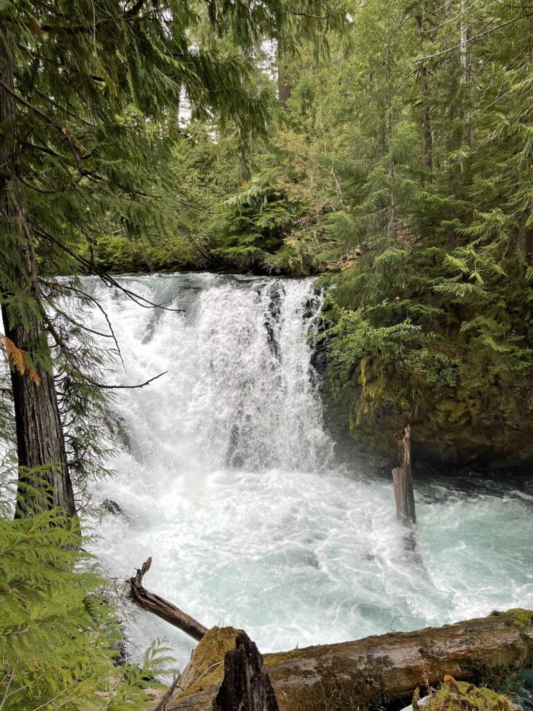
Above the falls, a side trail leads to a good view of the fifteen-foot unnamed falls.
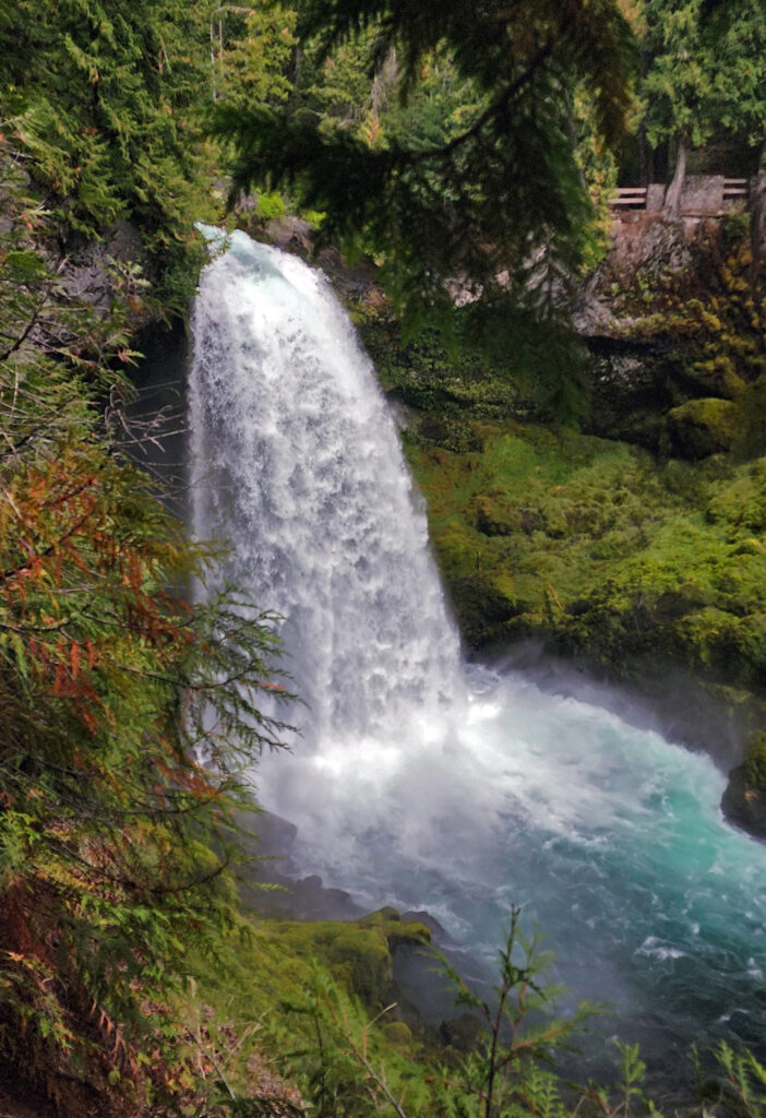
Farther along the main trail, another side trail leads to a view of Sahalie Falls. On the main trail there is another view of Sahalie. The trail passes close to the lip of the falls, then continues north through the forest and lava rock for about half a mile to a footbridge across the river. Cross the bridge and follow the trail south to your starting point at Sahalie. (If you started at Clear Lake, turn left after crossing the bridge to return to the lake).
Other area attractions and activities:
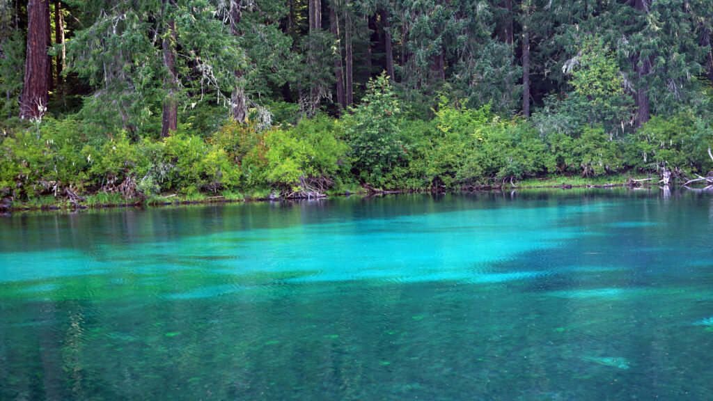
There are many other hikes in the area that are well worth doing in addition to the McKenzie Waterfalls Loop. Adding the 5.3 mile Clear Lake Loop Trail and the 4.2 mile out-and-back hike to the Blue Pool on the McKenzie River Trail make for a nice trio of hikes with amazing scenery – a beautiful mountain lake, a wild and scenic river with two spectacular waterfalls, and an almost otherworldly cobalt blue pool the color of Crater Lake. The Pacific Crest Trail crosses Santiam Pass only a few miles northeast of upper McKenzie area, giving hikers access to both the Mount Jefferson Wilderness to the north and the Mount Washington Wilderness to the south. And one of the many hot springs in the Cascade Range, Belknap Hot Springs, is only about 15 miles south of the McKenzie Waterfalls Loop. The hot springs are located at Belknap Hot Springs Lodge and Gardens. Day use visitors can soak in one of the hot spring’s pools for a $10/hr fee.
Originally posted December 4, 2022 by Alan K. Lee in a different format. Updated and re-posted September 28, 2023
All photos ©Alan K. Lee, except as noted
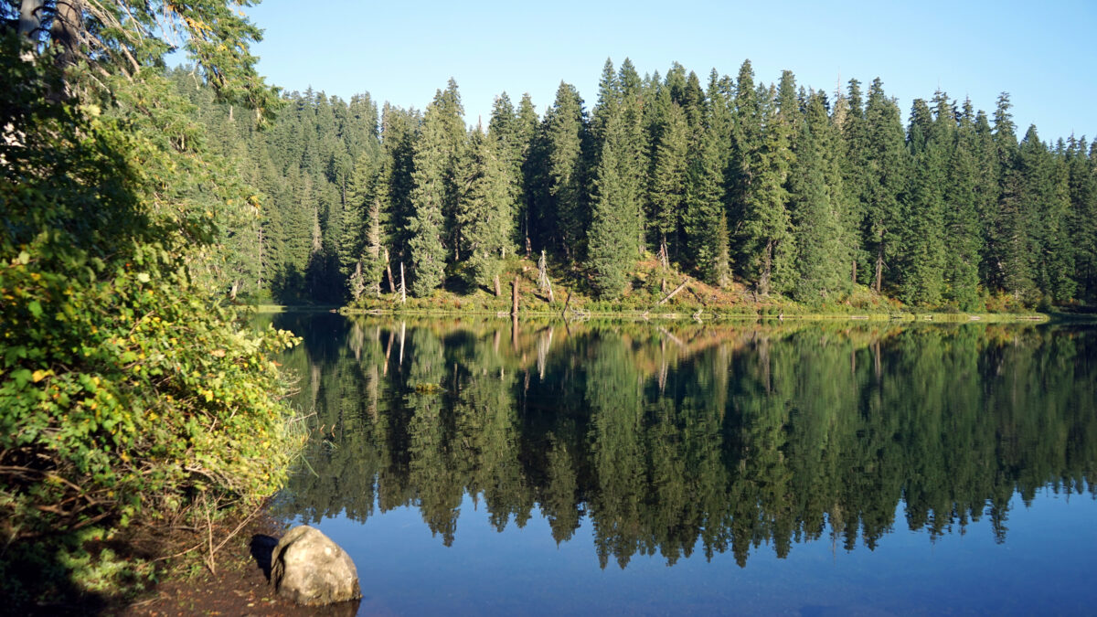
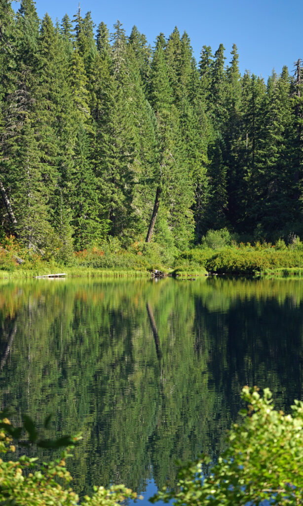
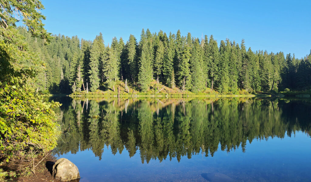
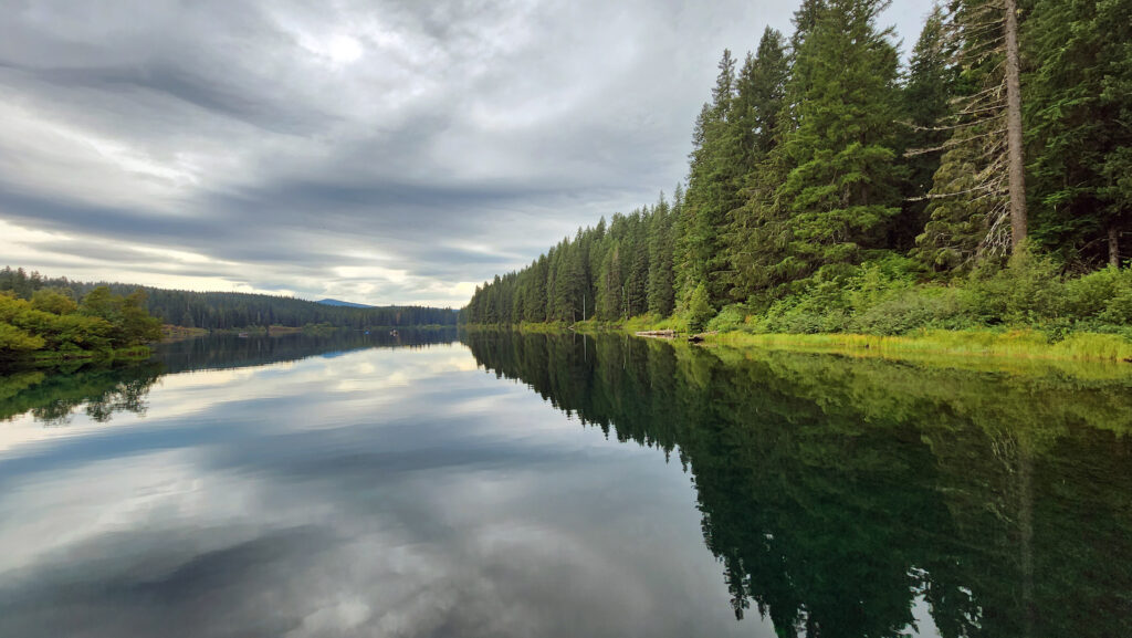
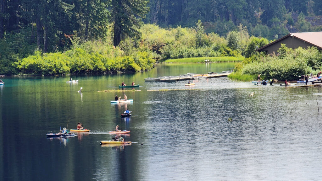
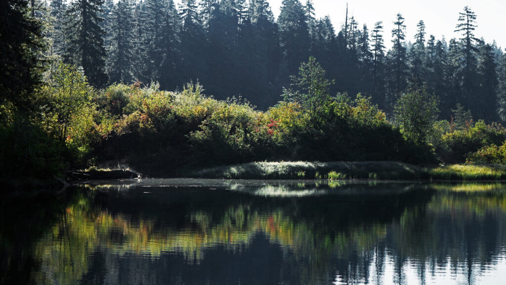
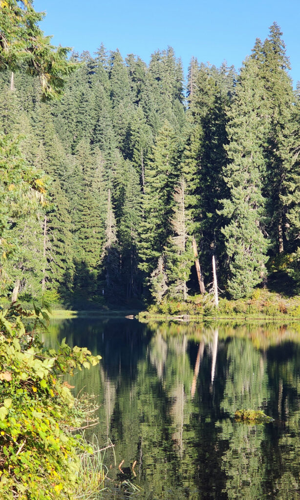 Clear Lake offers the outdoor enthusiast a number recreational options, including hiking, fishing, paddling, or just taking in the views and soaking up the beauty and peacefulness of nature.
 My wife and I have taken short vacations at Clear Lake a couple of times in the past couple of years, most recently in August 2024. Both times, we stayed in one of the cabins at
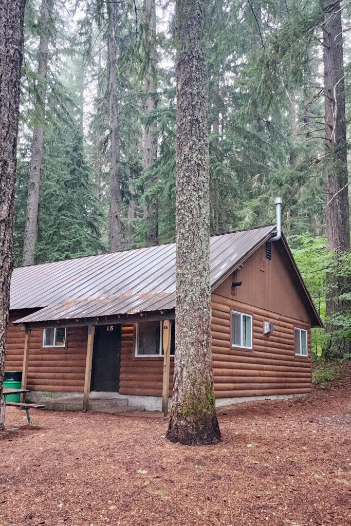
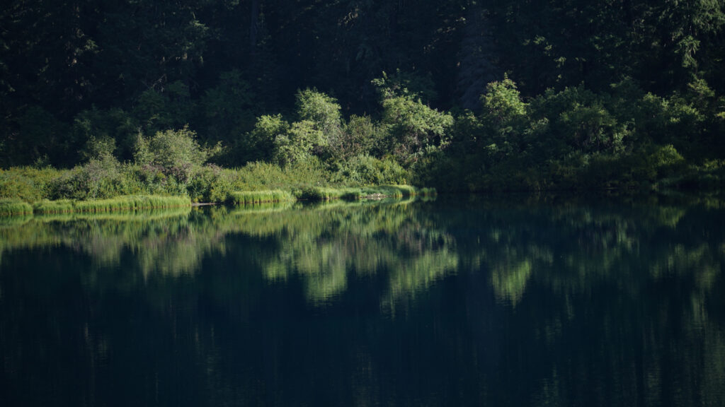
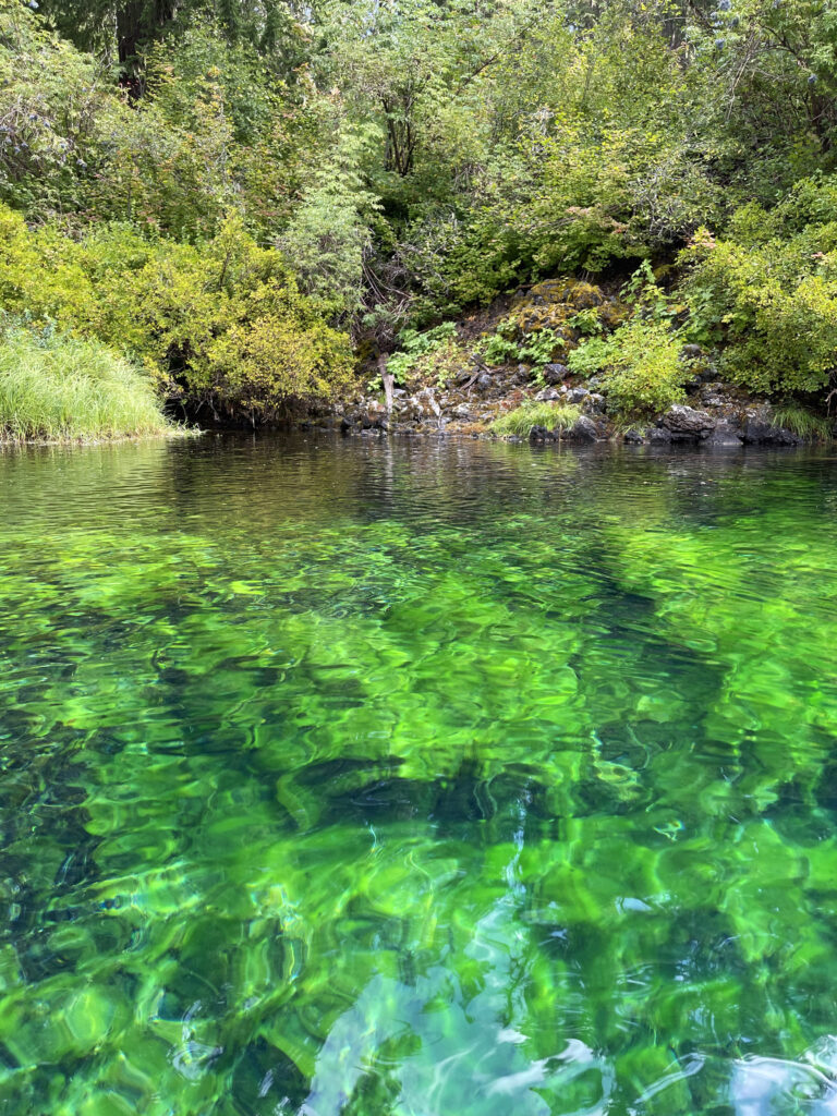
 The Clear Lake and upper McKenzie area is one of the most scenic and most interesting parts of the Cascades, and offers a number of other hiking options besides the Clear Lake Loop. The 2.6-mile
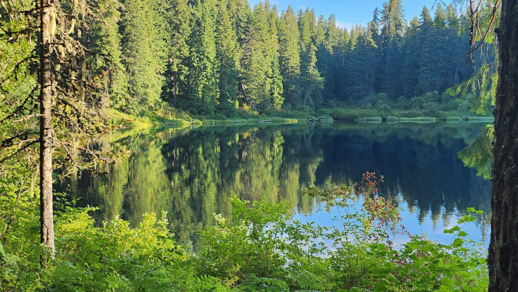

 You can take in Clear Lake and do the Waterfall Loop in a weekend. Make it a long weekend and add the Blue Pool hike or spend a day out on the lake. Better yet, make a week of it and check out Fish Lake, the Santiam Pass and McKenzie Pass areas, and the lower McKenzie River. You won’t run out of things to do.