
by Alan K. Lee
Introduction
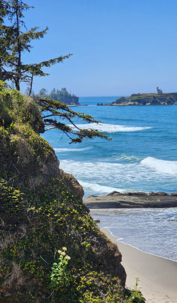
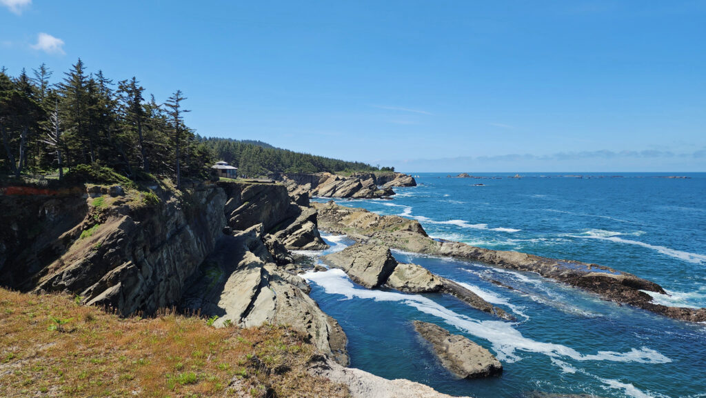
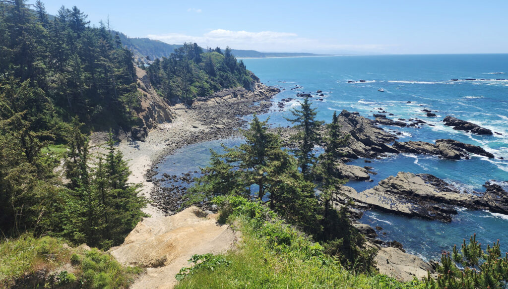
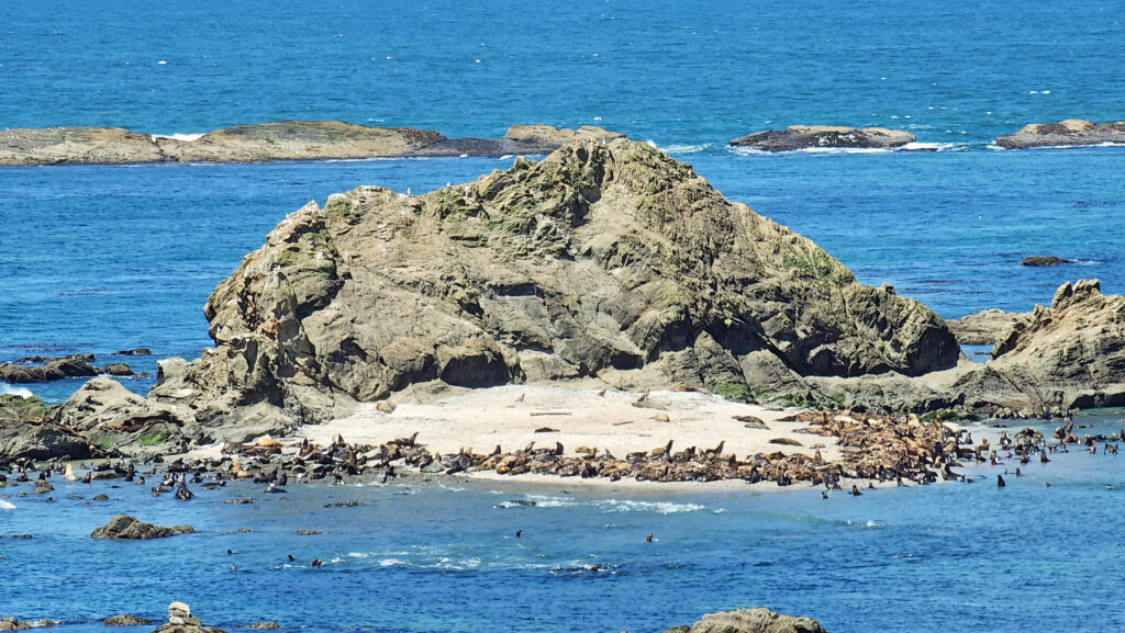
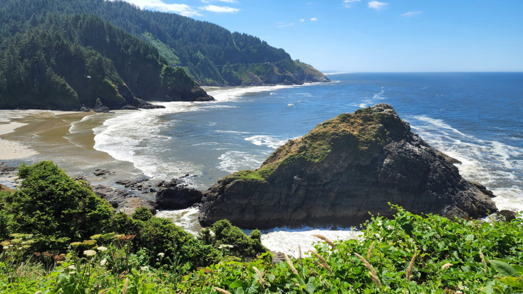
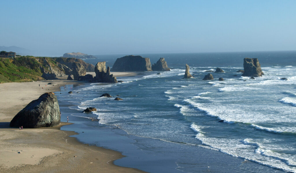
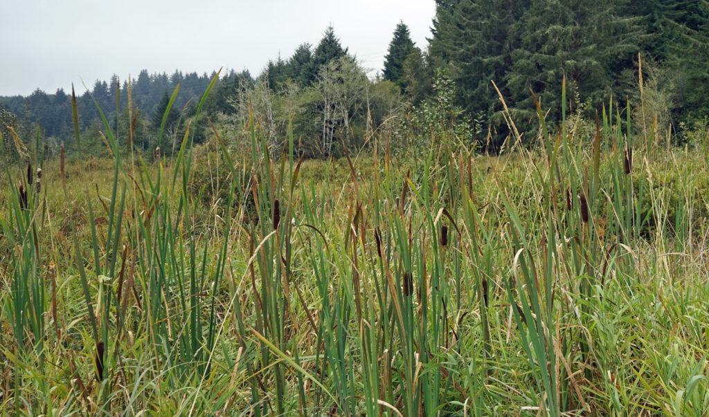
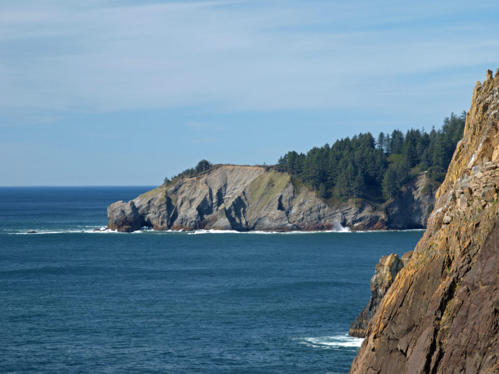
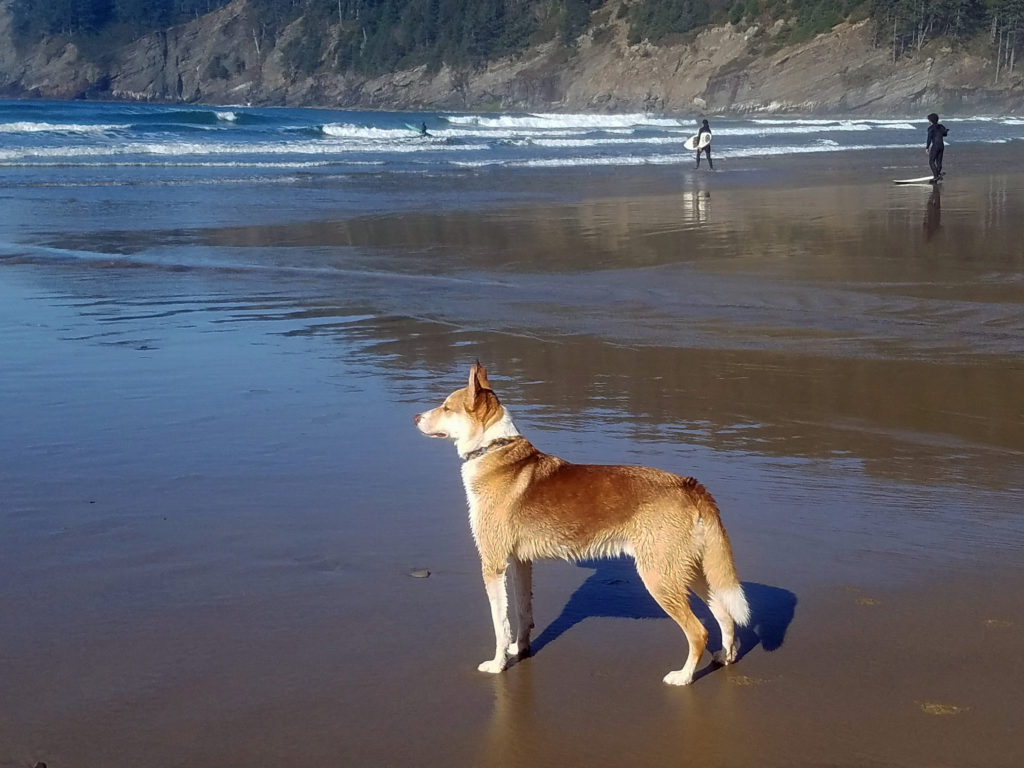
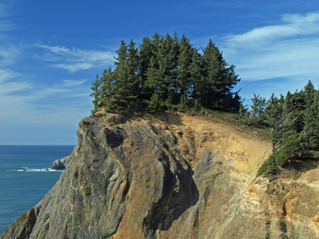
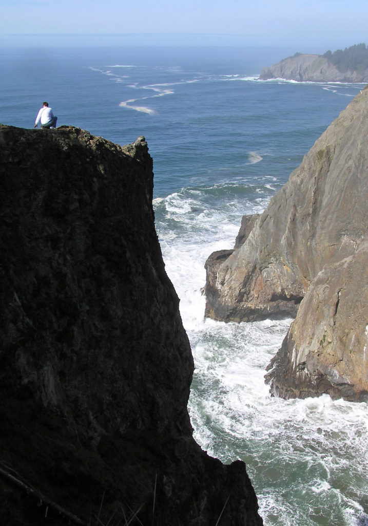
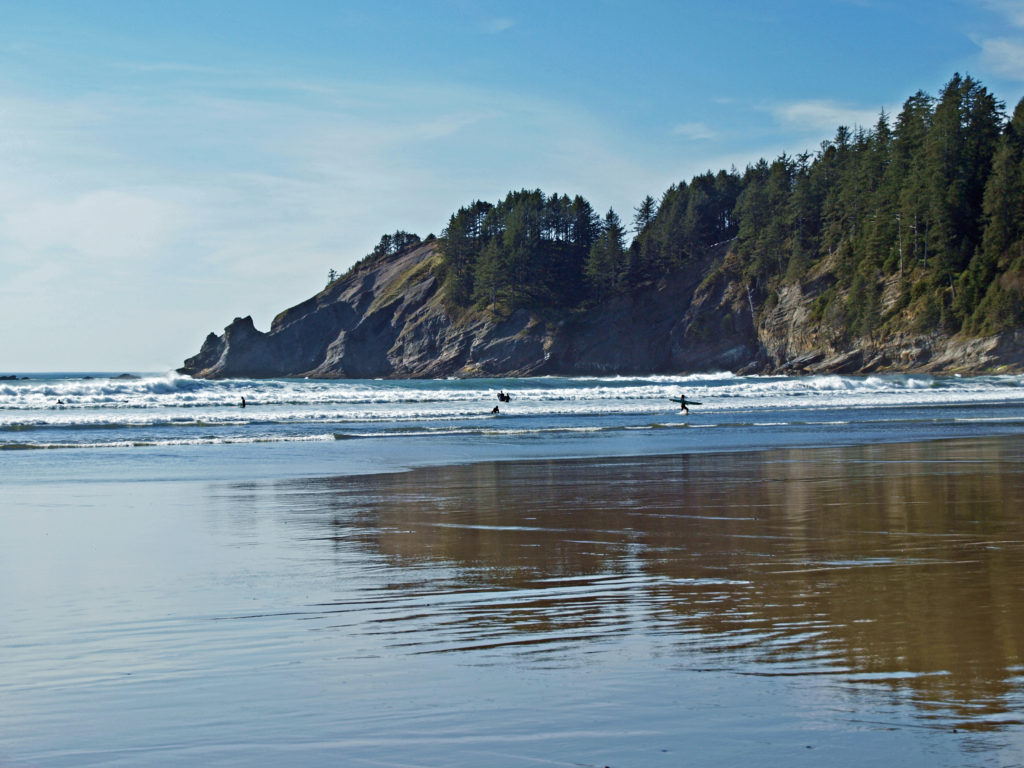
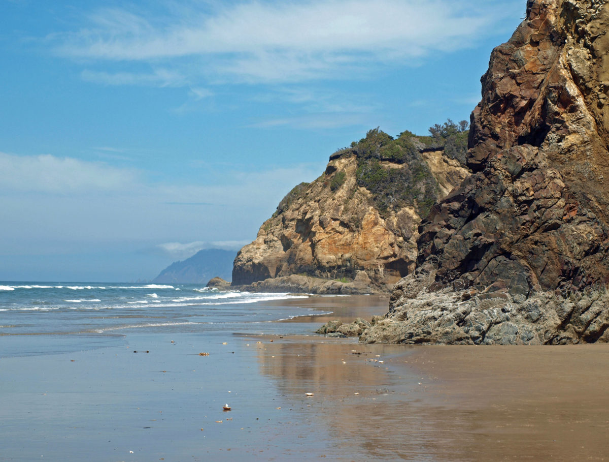
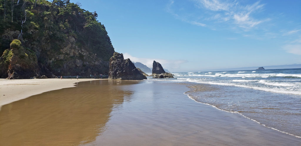
Cape Arago, on the southern Oregon coast south of the mouth of Coos Bay, is not as impressive as some of the other headlands on the Oregon coast, but it has a diversity of attractions that no other place on the coast can match. It’s mostly known for the three state parks (Sunset Bay, Shore Acres, and Cape Arago) that line its shores. But there’s also a state natural site, a county park (Bastendorff Beach), a privately run RV park, the decommissioned Cape Arago Lighthouse, and a golf course, in addition to scenic offshore islands, sea stacks, rocky shorelines, a reef with an active sea lion rookery, five beaches, two campgrounds, a historic botanical garden, and miles of hiking trails. Tens of thousands of visitors make the trip to this remote section of the Pacific coast every year. And the surrounding area has an abundance of attractions as well.
Bastendorff Beach
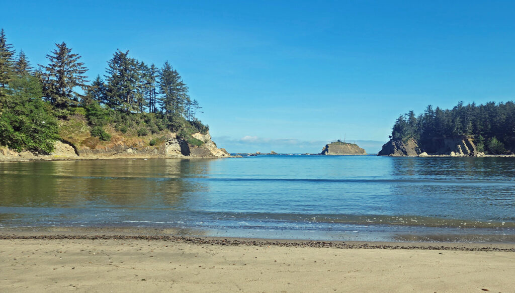
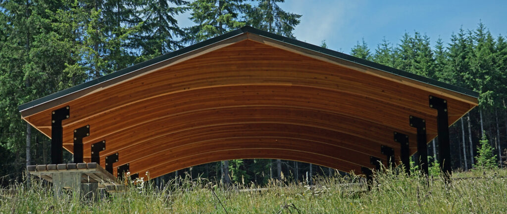
The mile long Bastendorff Beach, located adjacent to the south jetty at the mouth of Coos Bay, is the largest of the five beaches on the Cape Arago shoreline. Bastendorff Beach County Park has a 99 site campground (74 RV sites with water and electric hookups and 25 tent sites with no hookups), an 18 unit group campground, two RV dump stations, a large day use area with two picnic shelters, a fire pit and barbecue, horseshoe and basketball courts, a children’s playground, and easy access to the beach. There is also a private RV campground (Sun Outdoors Coos Bay) at the southwest end of the beach.
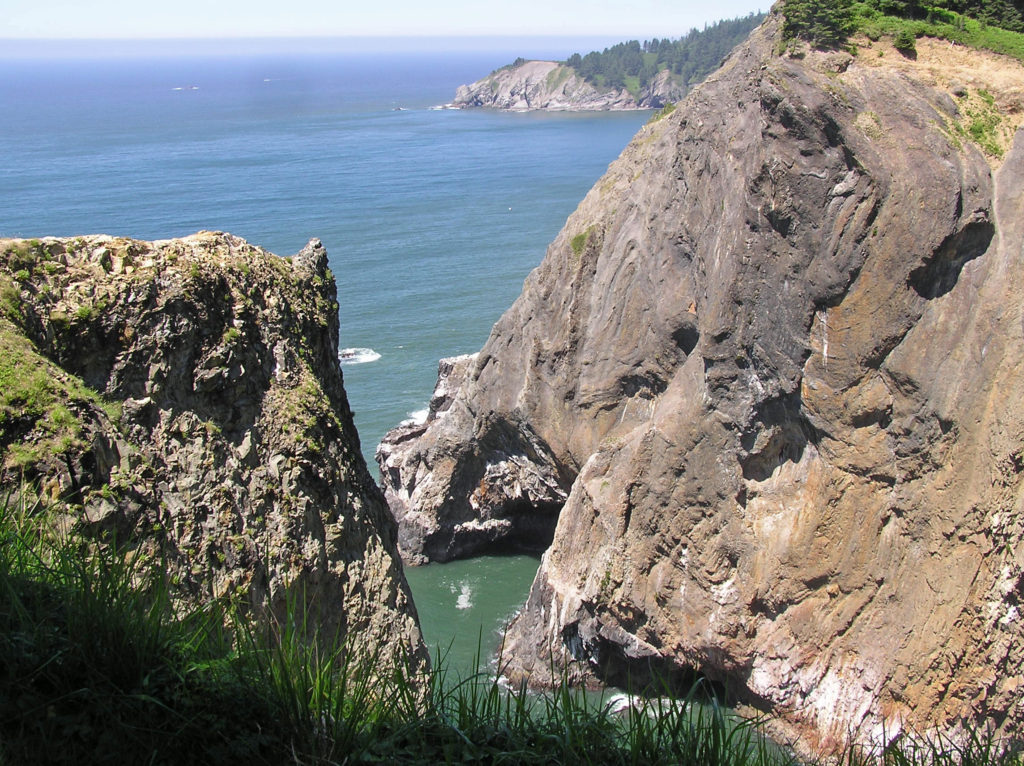
Yoakam Point State Natural Site
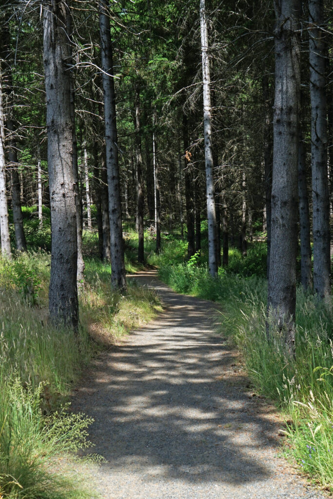
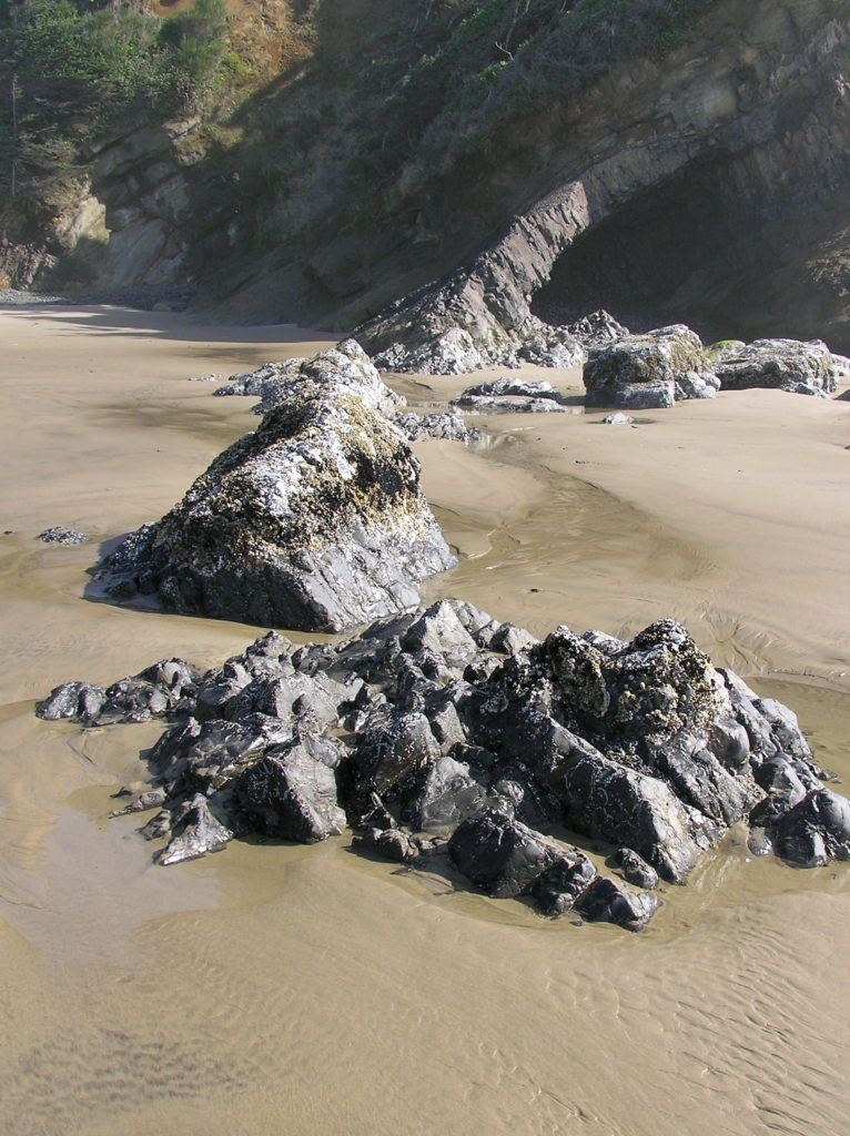
Yoakam Point separates Bastendorff Beach from Lighthouse Beach. Hiking trails (mostly unmaintained but passable) give access to scenic views of the rocky cliffs of the point, Bastendorff Beach, and Cape Arago Lighthouse. The site has no rest rooms or other amenities – just scenic splendor. (You might be tempted to scramble down the cliff from Yoakam Point to Lighthouse Beach, but I would advise against it. The cliff lined beach, like all Oregon beaches, is public, but the bluff is lined with private homes with no public access point. Access from Yoakam Point is possible but dangerous. Best to leave this one to the residents. They think they own it anyway.)
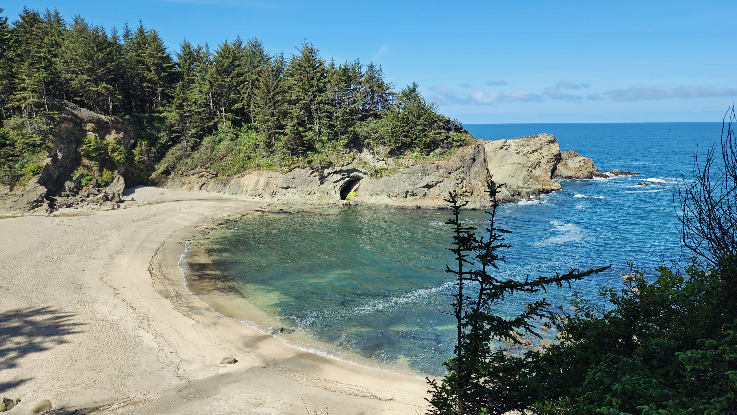
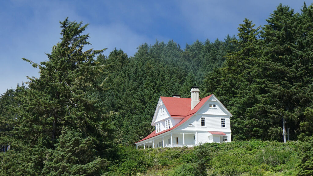
Cape Arago Lighthouse
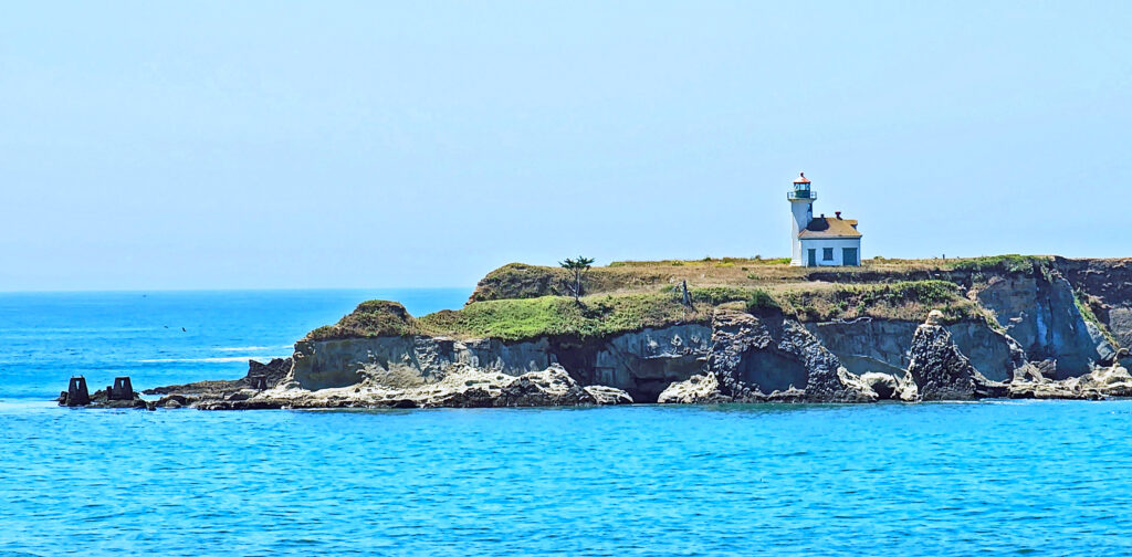
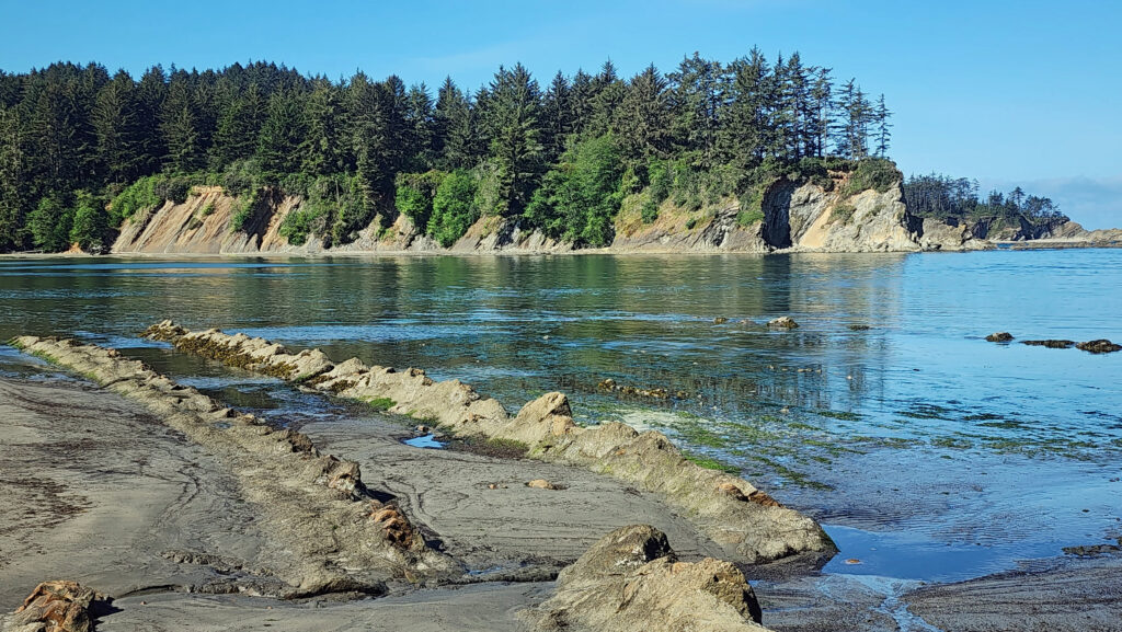
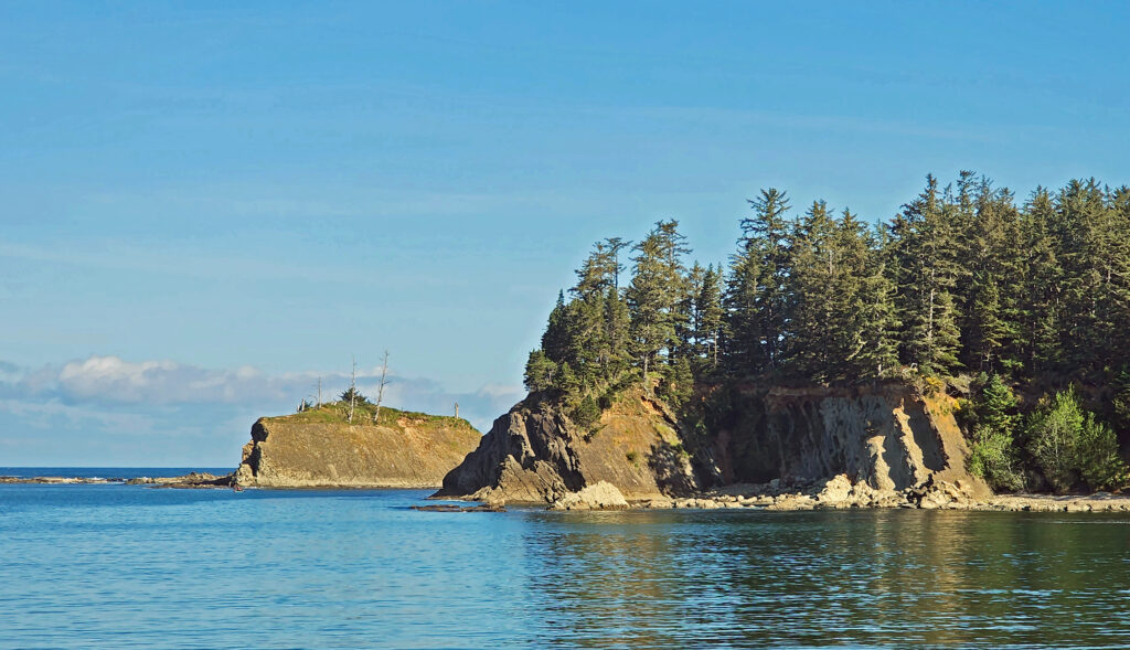
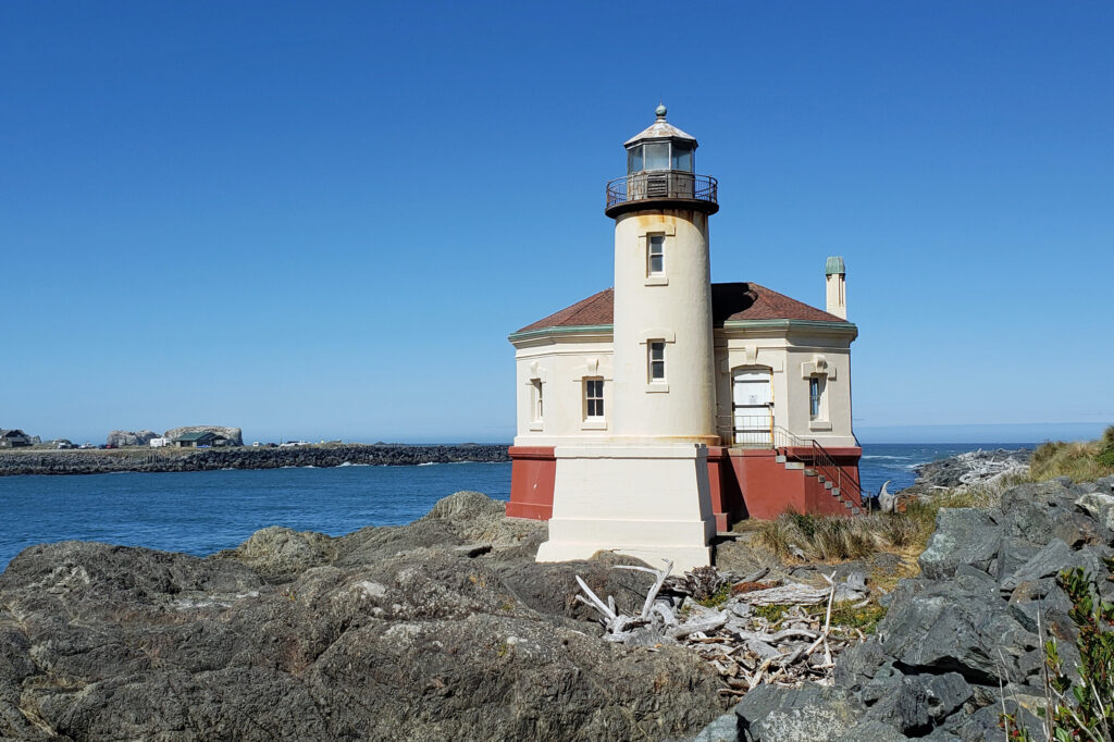
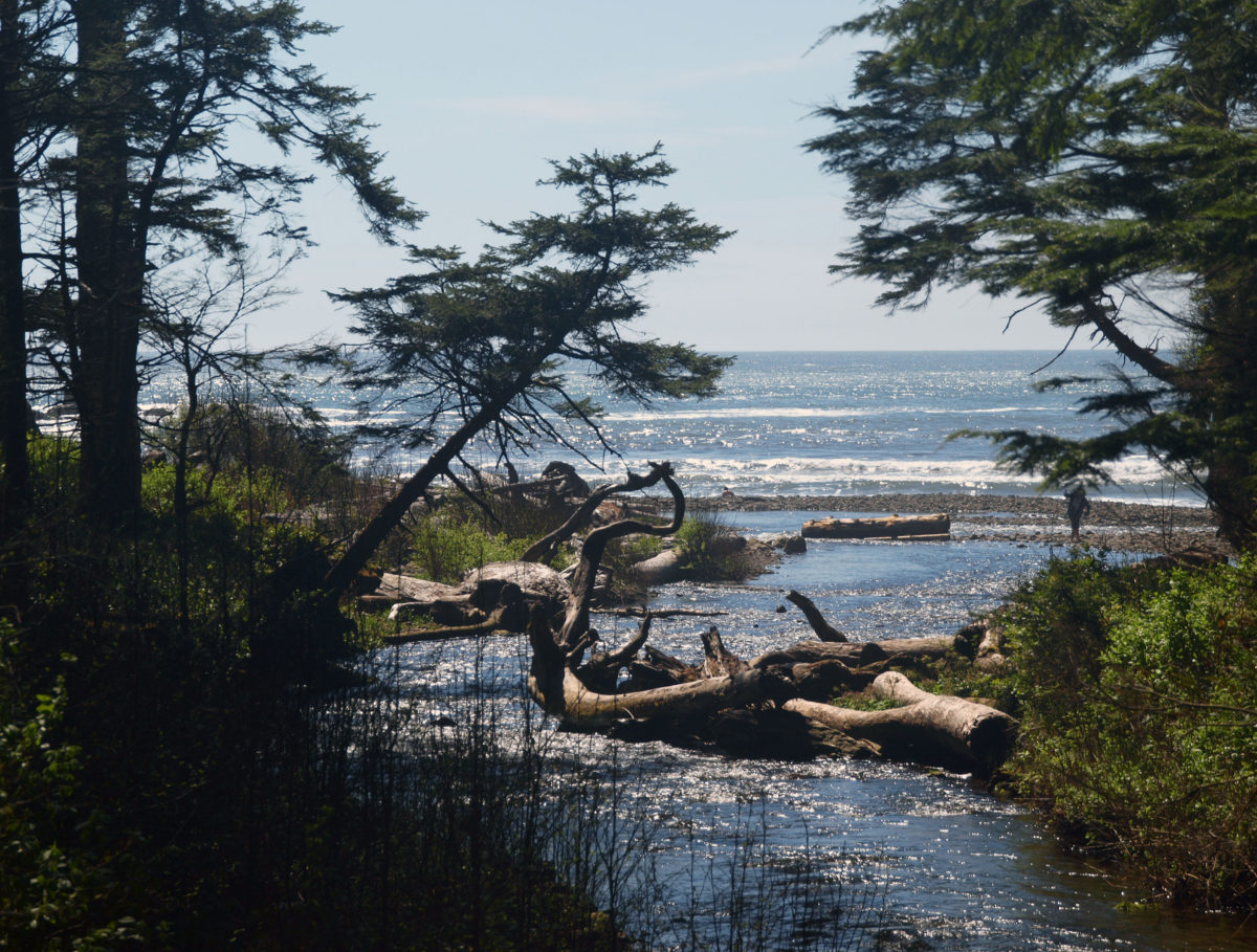
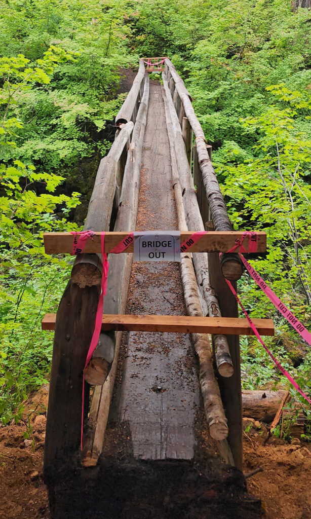
Cape Arago Lighthouse is located on Chiefs Island just off Gregory Point between Lighthouse Beach and Sunset Beach. The existing lighthouse structure is the third in a series of lighthouses on the island, dating back to 1866. The first was replaced by a taller structure with a better light in 1909. That was replaced by the current structure in 1934. In 1966 the light was automated and continued in service until 2006 when it was decommissioned.
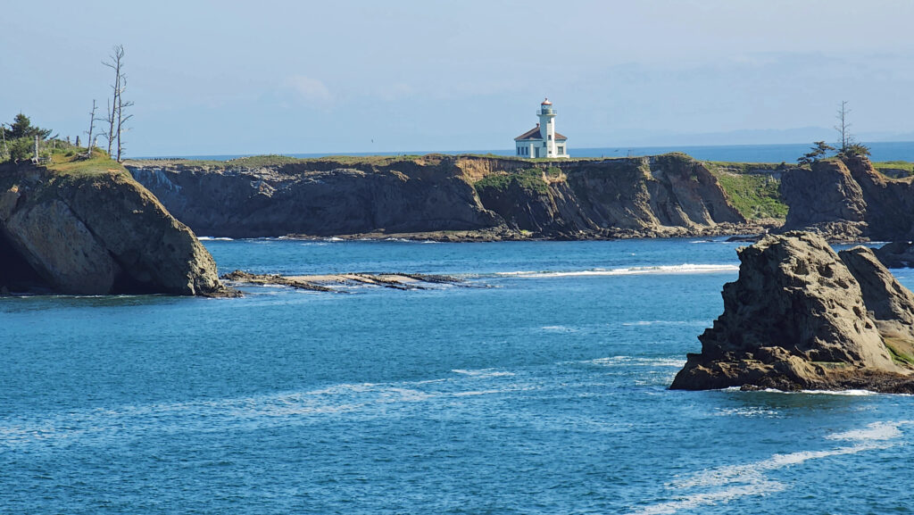
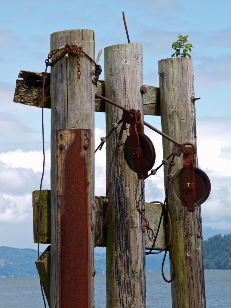
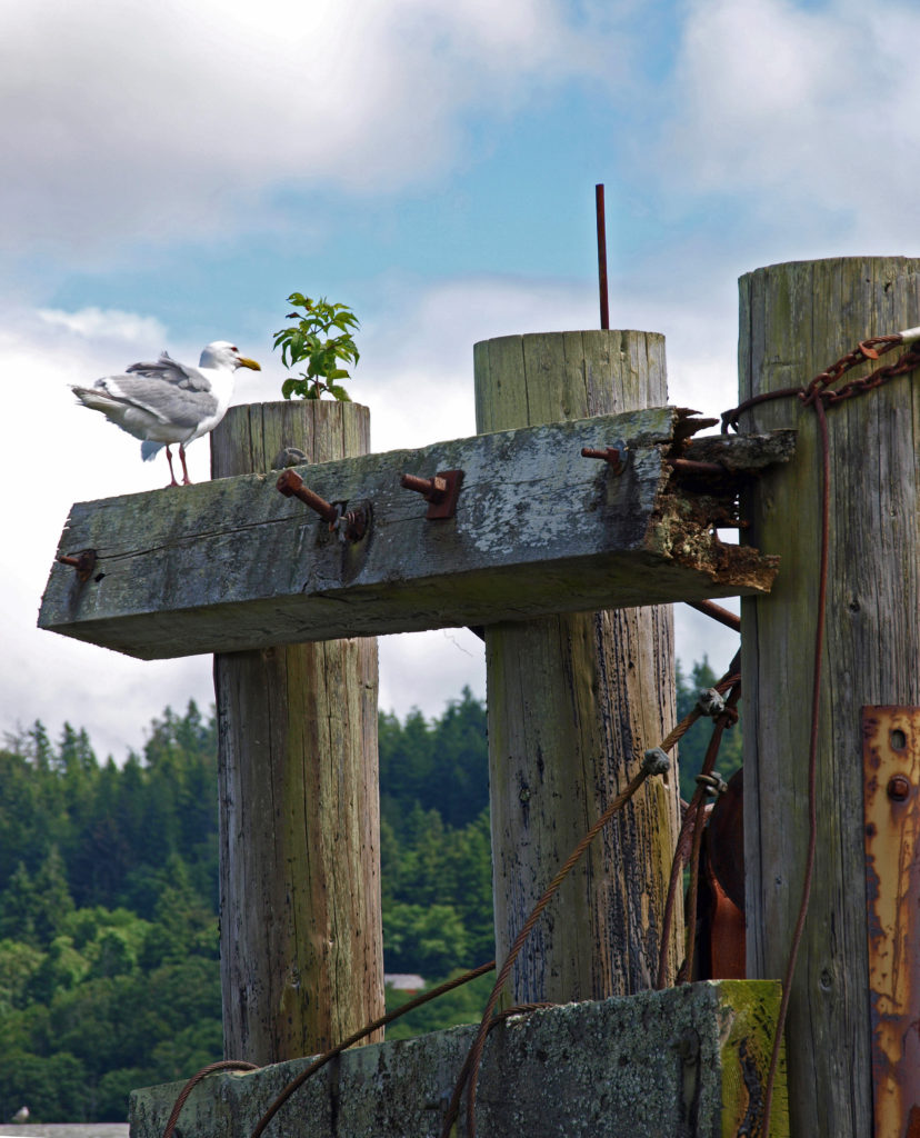
The lighthouse keeper’s residence was on the mainland, connected to Chiefs Island by a wooden bridge. The bridge stood until it was destroyed by storms in the winter of 2012-13. The first two lighthouse towers, other structures on the island, and the keeper’s house have all been demolished over the years. All that remains are the third tower and some of the piers that supported the bridge.
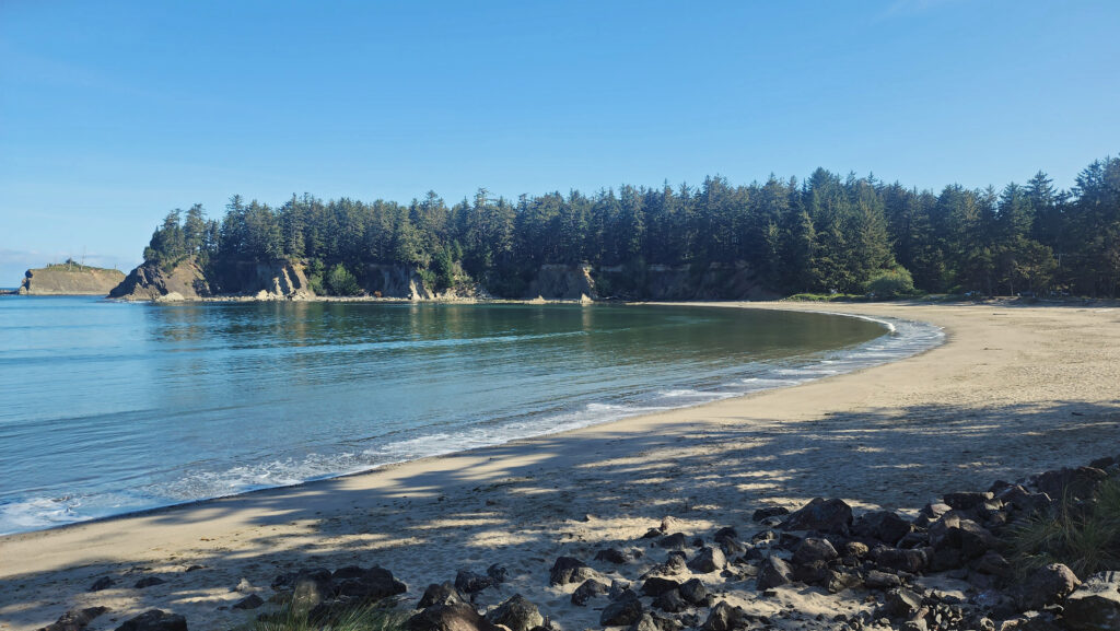
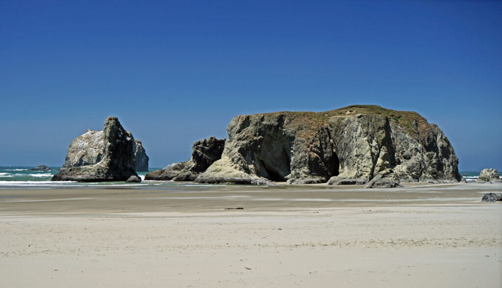
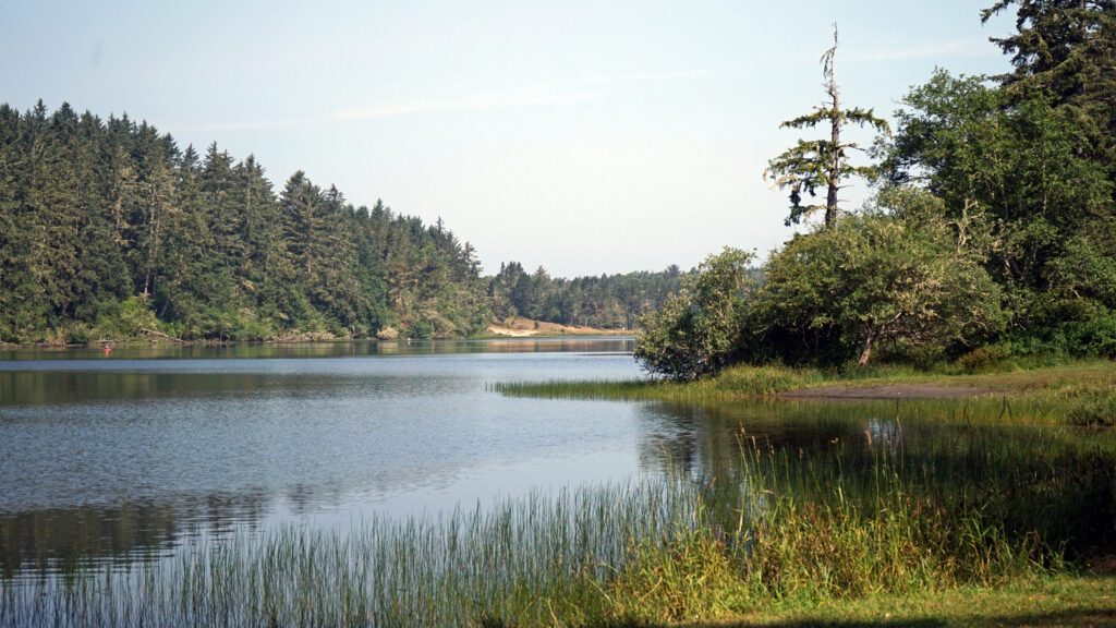
Sunset Bay State Park
A beautiful, crescent shaped beach at Sunset Bay State Park wraps around a shallow bay protected by a reef and flanked by rocky outcroppings. The inner bay makes for a safe swimming area and a boat ramp on the north end provides a good launching point for small boats, kayaks, and standup paddle boards.
My wife and I have kayaked out of Sunset Bay on numerous occasions over the years. On some of those days the calm waters of the bay belied rougher water offshore (large swells and/or significant wind chop) and we either stayed in the bay or close to it. But other times the ocean conditions were benign enough to allow us to safely get out into deep water and explore the surrounding coastline.
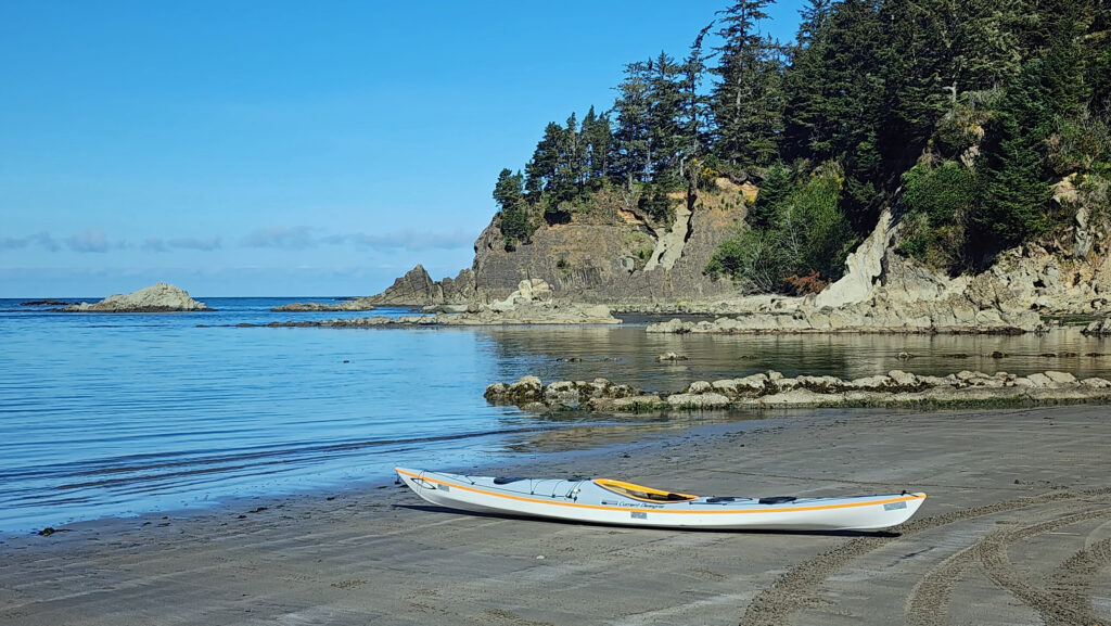
On one of those occasions, a sunny, windless day with a flat, glassy ocean, we spent most of a day paddling south to Simpson Reef to watch the sea lions, and then back north, where we circumnavigated Chiefs Island where the Cape Arago Lighthouse sits. And a lot of the time we just drifted on the amazingly flat ocean and soaked up the sunshine and the views of the shoreline. Quite a day.
Sunset Bay State Park offers not only one of the finest beaches on the Oregon coast, but also 65 campsites (30 RV sites with full hookups and 35 tent sites with electricity and water), eight yurts (three are pet friendly) and a group tent camp that will accommodate up to 25 people. Three of the campsites and three of the yurts are accessible to campers with disabilities. We have camped there many times and have always enjoyed our stay.
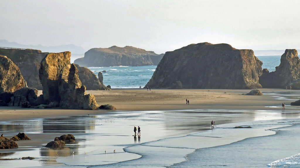
Shore Acres State Park
The park is named for Shore Acres (originally spelled Shoreacres), the estate of Louis Simpson, son of the 19th century shipping magnate, Asa Meade Simpson, who made a fortune shipping logs and lumber, first to California, and later to as far as Australia and Africa.
Louis Simpson’s first mansion at Shore Acres was completed in 1908, but burned down in 1921. It was replaced by an even larger mansion in 1927. But Simpson’s fortunes took a turn for the worse when demand for timber all but disappeared during the Great Depression. He went bankrupt in 1940 and his creditors sold the estate to the State of Oregon.
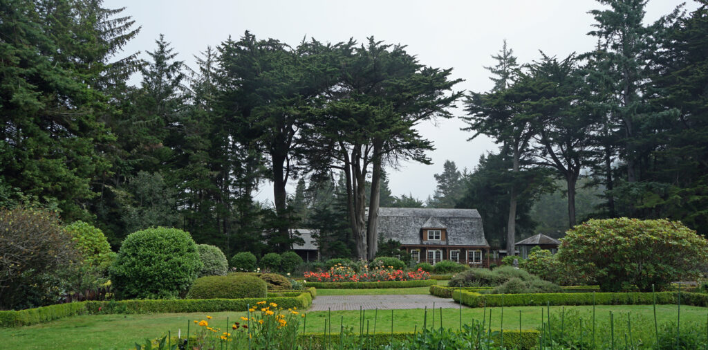
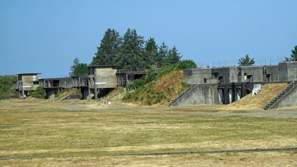
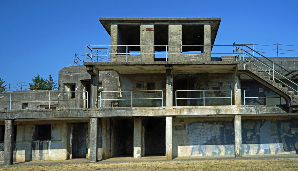
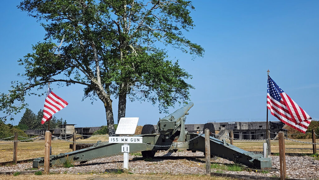
In 1942 Oregon loaned the estate to the U.S. Army for use as a radar installation. The Simpson mansion was used as a barracks and officer’s club. The mansion suffered from the harsh climate and lack of maintenance and was torn down in 1949. The only original structure remaining at Shore Acres is what was once the gardener’s cottage.
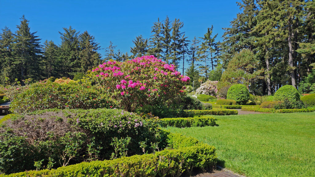
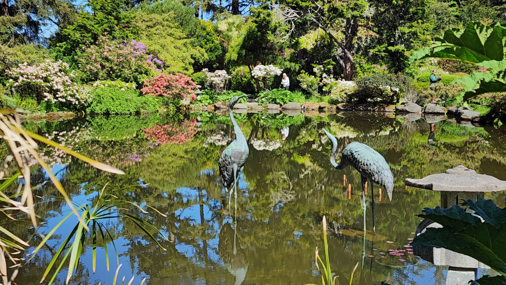
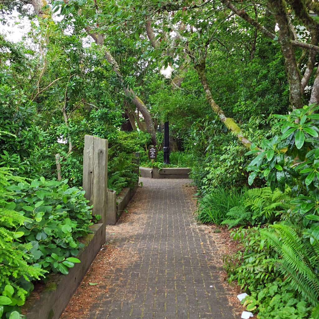
The estate’s formal gardens fell into disarray, but were restored in the 1970s. Covering five acres, the gardens now draw thousands of visitors each year. In December the gardens are lit up each evening with a spectacular Christmas lighting display using thousands of lights.
From the gardens, a short trail leads to Simpson Beach, once the Simpson’s private beach, similar to but smaller and less used than the one at Sunset Bay.
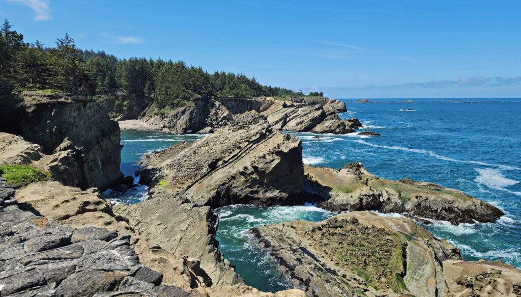
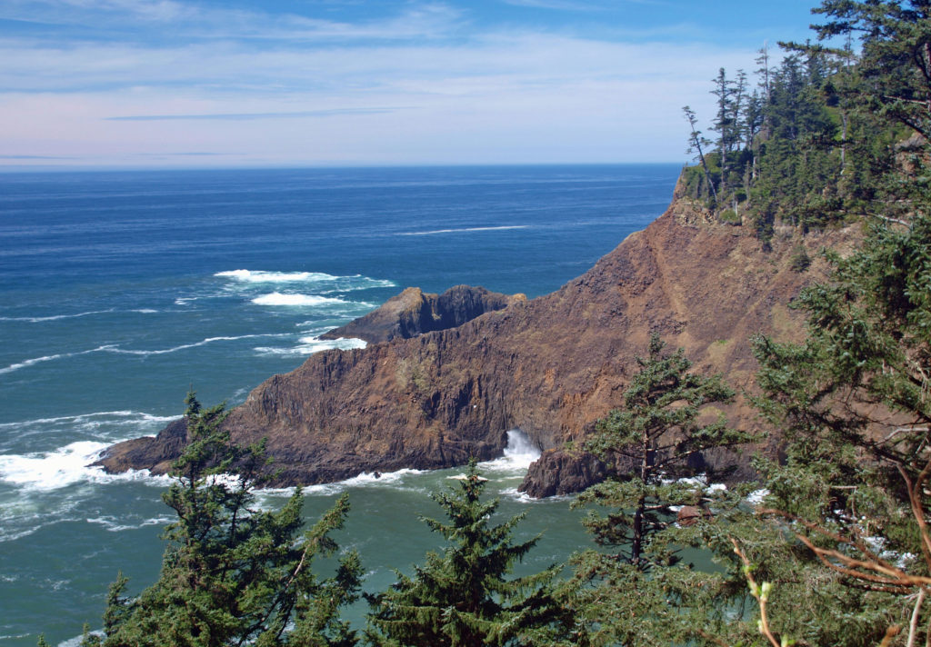
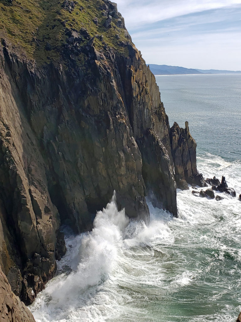
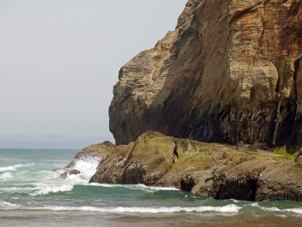
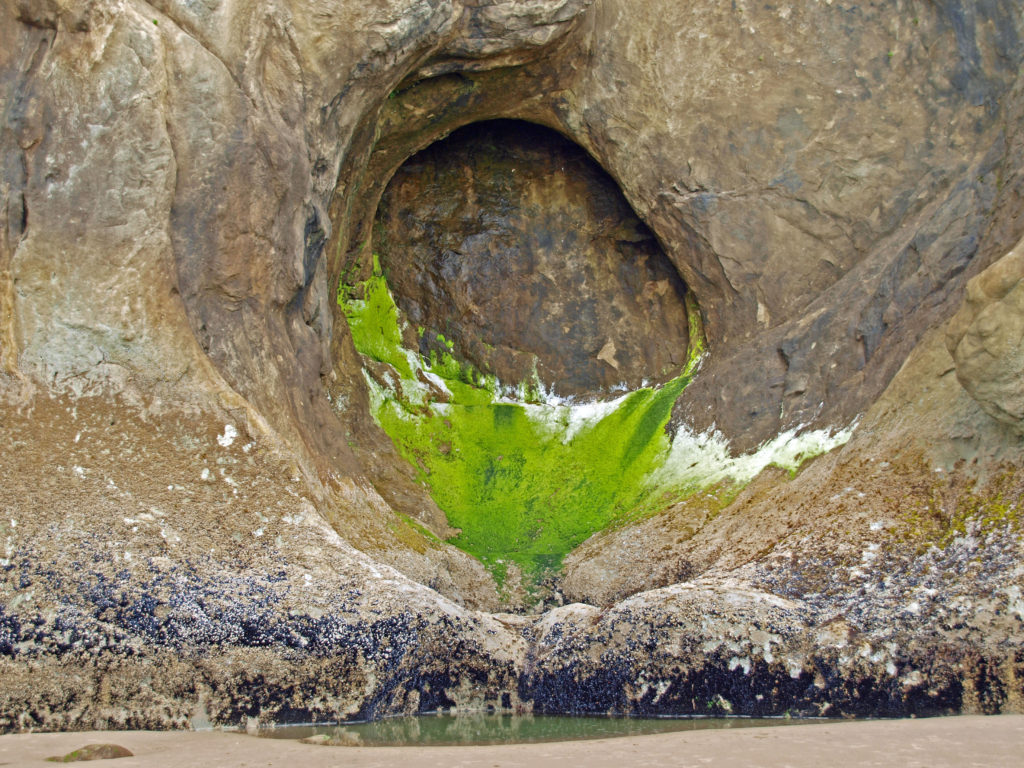
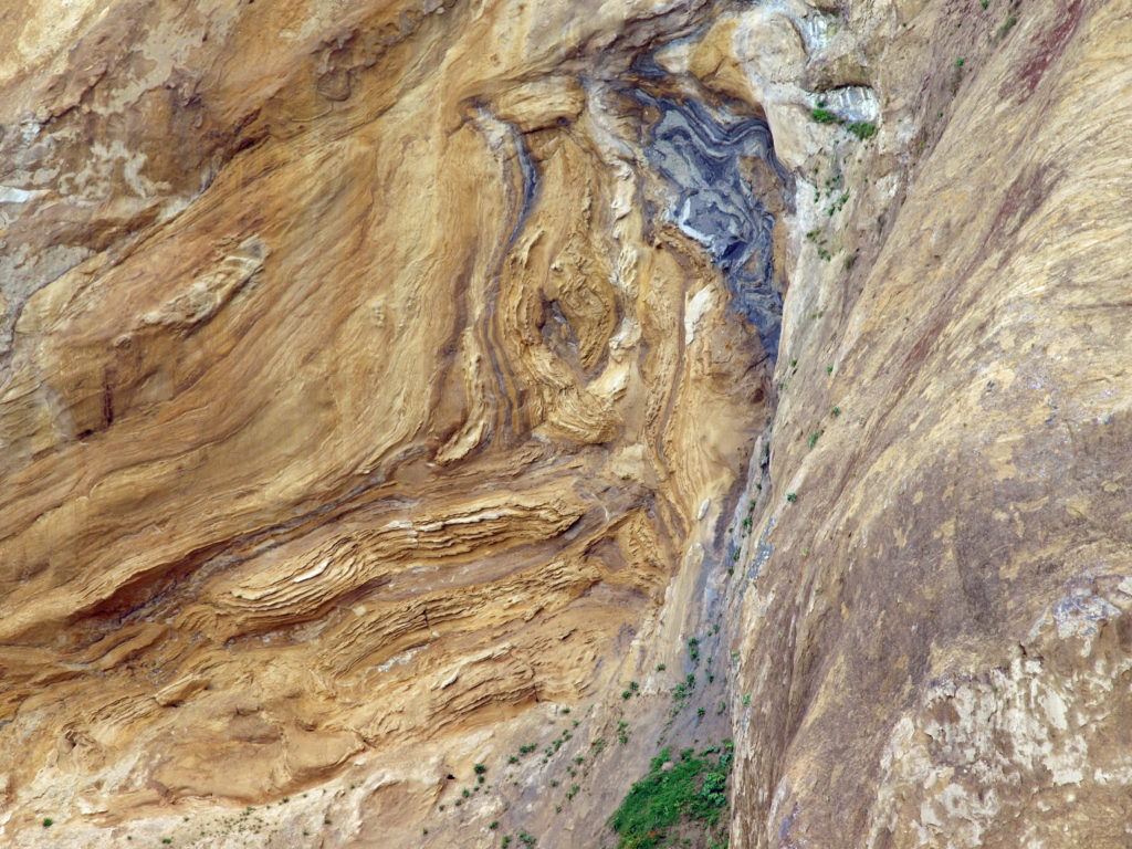
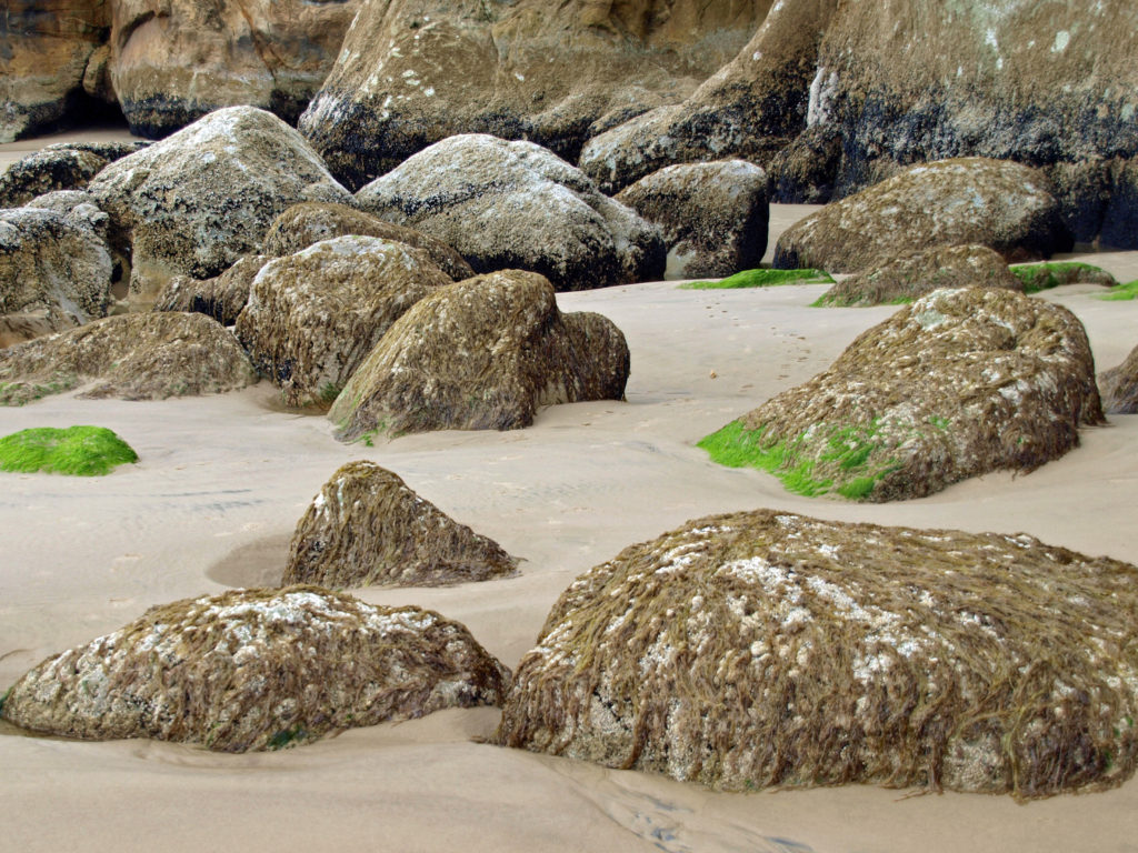
The shoreline at Shore Acres consists of eroded sandstone cliffs and ledges. Storm watchers come from all over to view the huge waves crashing into the rocks during winter storms. Even in summer, the shoreline is fascinating and people clammer over the rocks to sightsee and birdwatch. In December and again in late spring Shore Acres is a prime spot for whale watching.
Cape Arago State Park
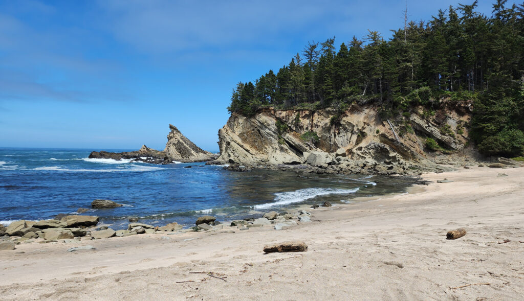
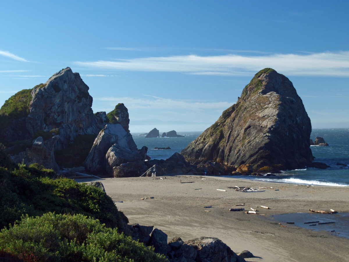
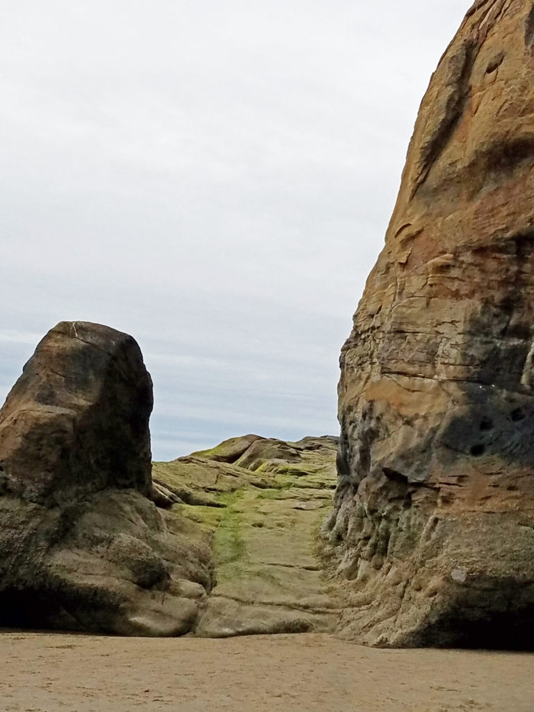
Like Shore Acres, what is now Cape Arago State Park was once part of Louis Simpson’s estate. He donated the land to the State of Oregon in 1932. Located at the end of the Cape Arago Highway, the park has a covered picnic shelter, picnic tables, and restrooms, although the restrooms are currently (as of the summer of 2025) closed. There are also trails to South Cove, where there is a sandy beach, and to North Cove with its rocky shoreline.
Other local attractions
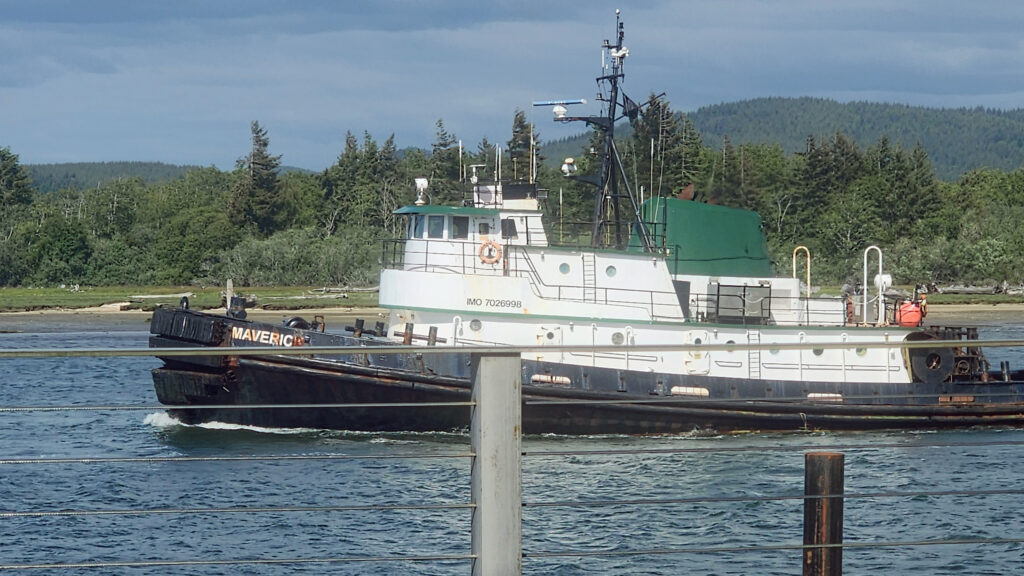
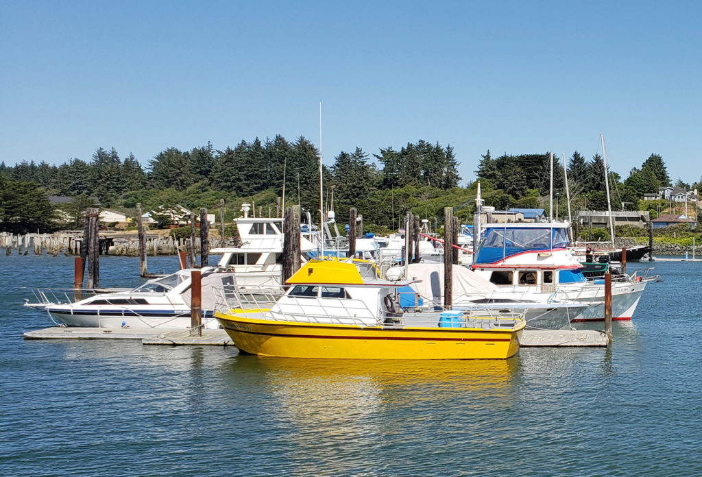
The town of Charleston is located on Coos Bay about a mile east of Bastendorff Beach. It’s home to a large commercial fishing fleet and has a number of sport fishing charter operations. It’s also the gateway to South Slough, one of the best kayaking and canoeing spots on the Oregon coast. And it’s a good place to stop for a bite to eat or get a cold beer after your Cape Arago adventures. Try Miller’s at the Cove Sports Bar and Grill for surprisingly good food and a good selection of cold beers on tap.
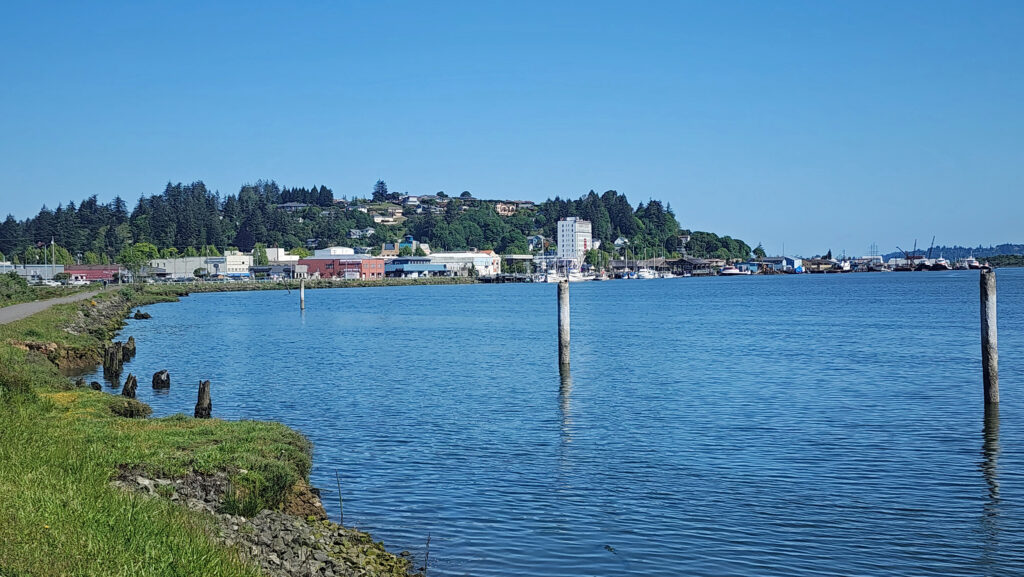
The Cape Arago area is remote enough that it’s not really a day trip destination from any population center, so it’s best to make a weekend of it or stay longer. Fortunately, the Coos Bay-North Bend area is large enough to have many hotels, motels, BNBs, and restaurants. Take a day (or more) to explore Cape Arago, but leave some time to also explore the two cities. There’s a casino if you enjoy gambling. There’s also a good art gallery or two, interesting antique shops, nice parks and museums, and a trail along the bayfront. I’ll cover Coos Bay and North Bend in more detail in a future post.
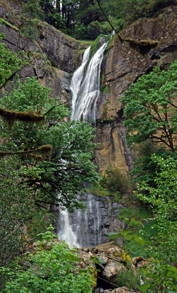
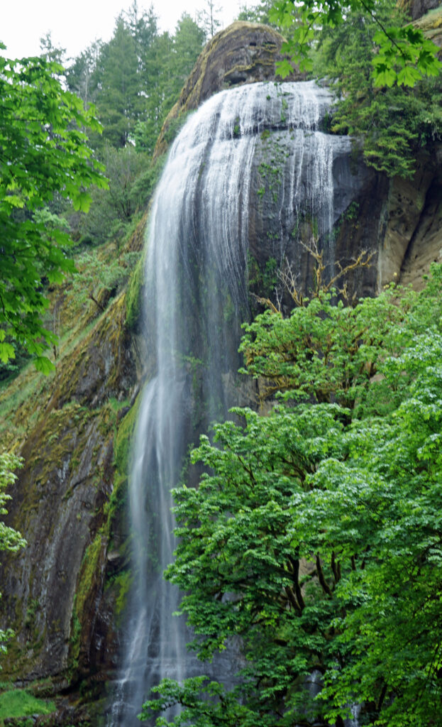
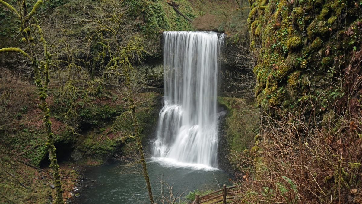
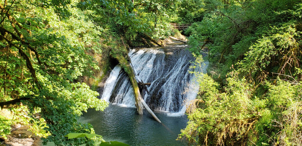
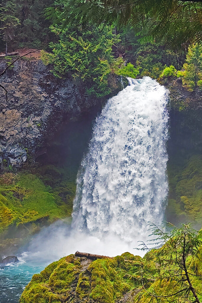
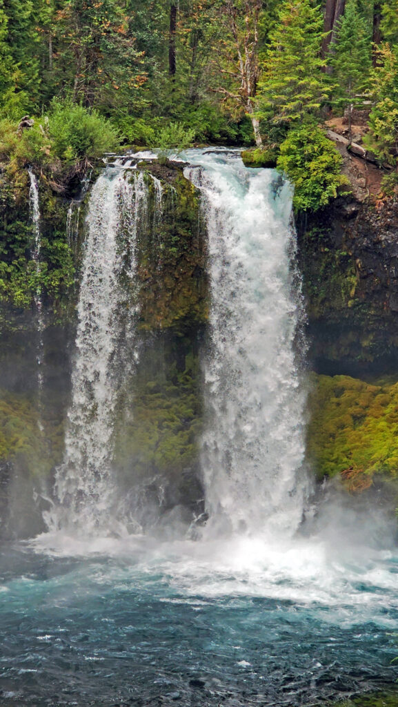
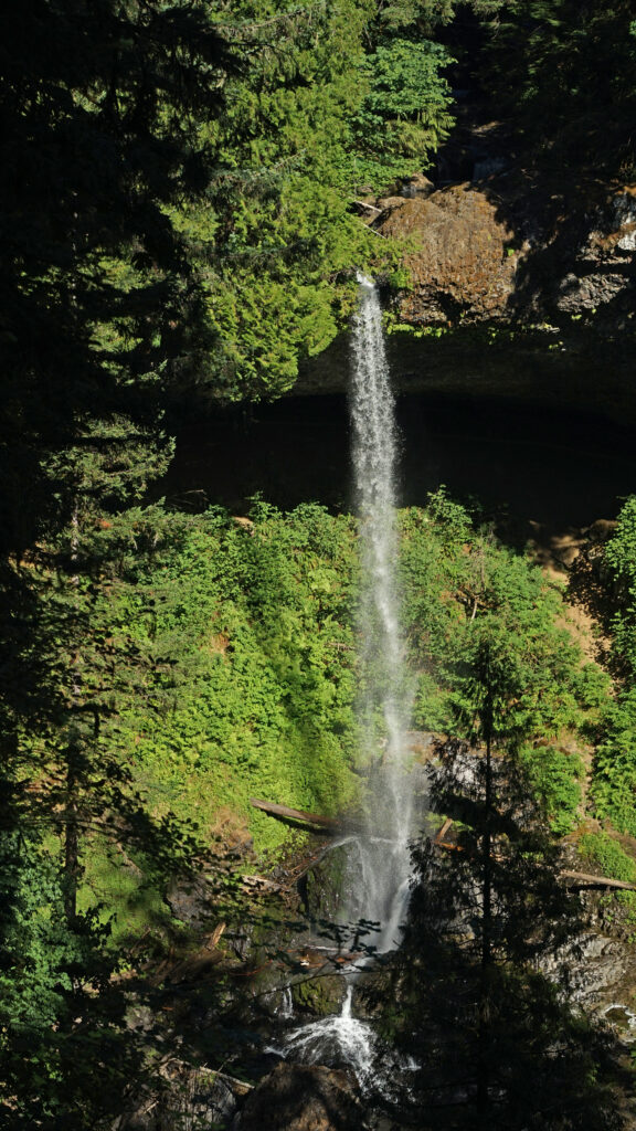
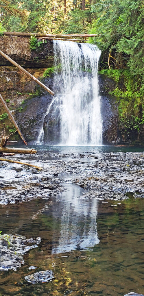
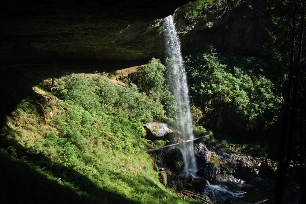
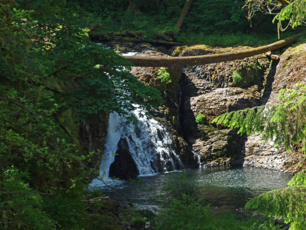
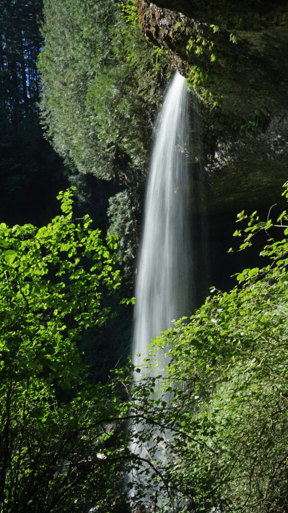
About twenty-five miles east of Coos Bay, Golden and Silver Falls State Natural Area (not to be confused with Silver Falls State Park near Salem) boasts two large and scenic waterfalls, both more than 200 feet high, and three hiking trails that take you to the base of each falls and to the top of Golden Falls.
The town of Bandon, about 15 miles south of Coos Bay, is located at the mouth of the Coquille River. The Old Town section offers a variety of interesting shops, an art gallery well worth visiting (Second Street Gallery), several popular seafood spots (try Tony’s Crab Shack), and numerous restaurants, coffee shops, pubs, and a good bakery (Bandon Baking Company and Deli). A little east of Old Town on Hwy 101, Face Rock Creamery offers a wide variety of cheeses and has an extensive (and free) tasting area where you can sample most of them.
Across the bay from Old Town, the historic Coquille River Lighthouse in Bullards Beach State Park is open to the public and worth a visit.
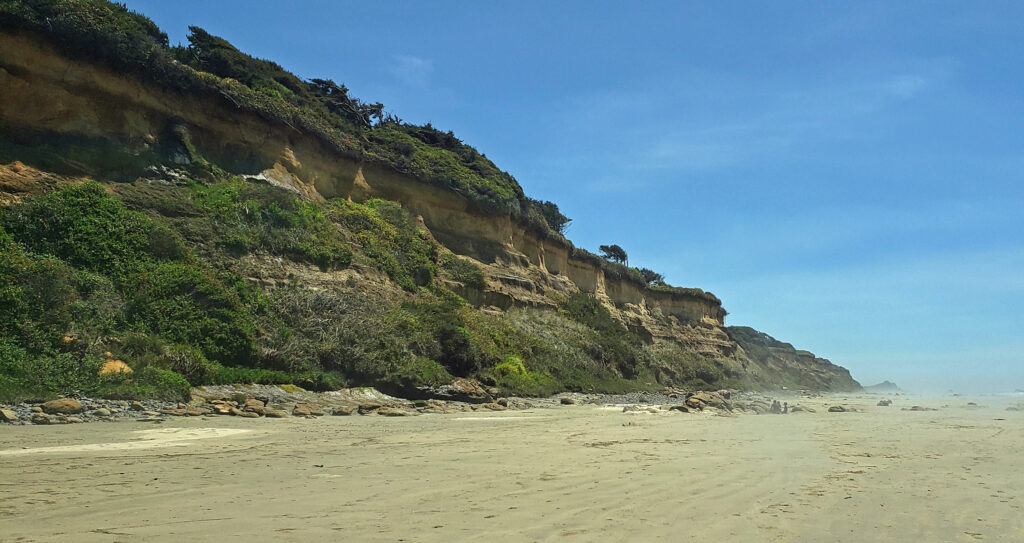
South of Old Town you’ll find one of the most scenic shorelines anywhere on the Pacific Coast, with many offshore islands and sea stacks, and miles of sandy beach.
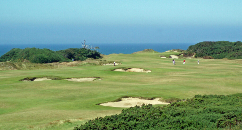
And Bandon Dunes Golf Resort, just north of the town of Bandon, offers five world class eighteen hole courses, a 13-hole par three course, a large driving range and practice facility, and lodging and restaurants. This is truly one of the greatest golf destinations in the world. And there are other golf courses in the area. Bandon Crossings, south of Bandon, is a scenic and challenging eighteen hole layout that is significantly less expensive than Bandon Dunes. And Sunset Bay Golf Course, located next to Sunset Bay State Park, is an interesting 12 hole, par 47 course.
Beyond Bandon, the southern Oregon coast, from Bandon to the California border, is spectacularly beautiful and ranks, along with the Olympic Peninsula in Washington, the northern California coast, and Big Sur, as one of the must see sections of the entire Pacific coast.
Conclusion
Cape Arago and the surrounding area has so much to offer visitors that almost everyone will find something there that will make them want to come back. My wife and I visit the area often. Almost every year we spend at least a weekend revisiting our favorite spots. And I’m sure we will continue to do so in the future.
Posted August 2, 2025
All photos © Alan K. Lee


 Introduction:
 The Park:
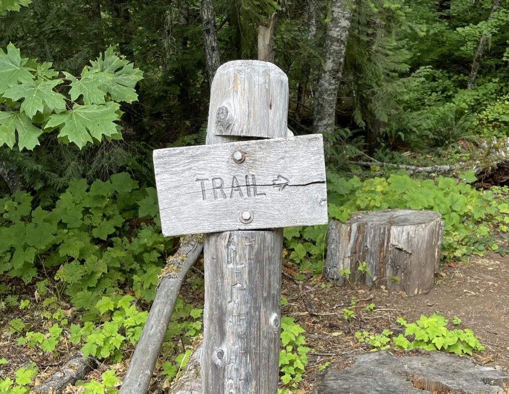
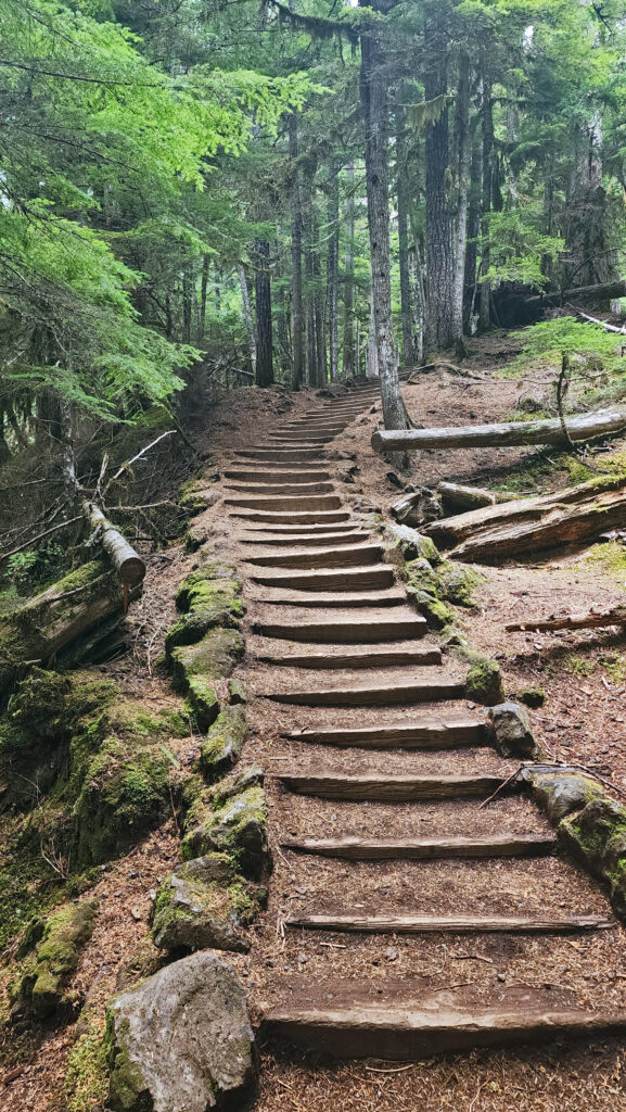
 The Hike:
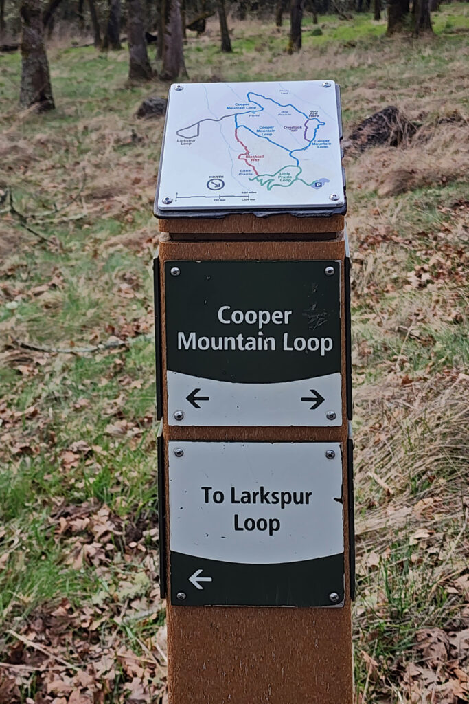
 Trailhead:
 The hike:
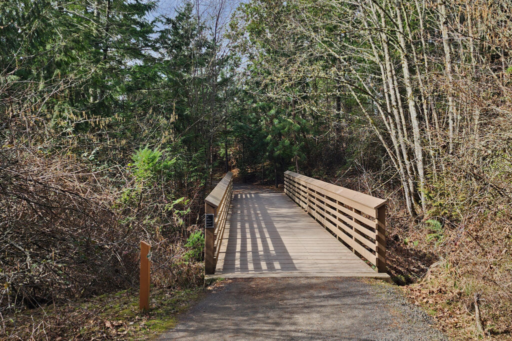
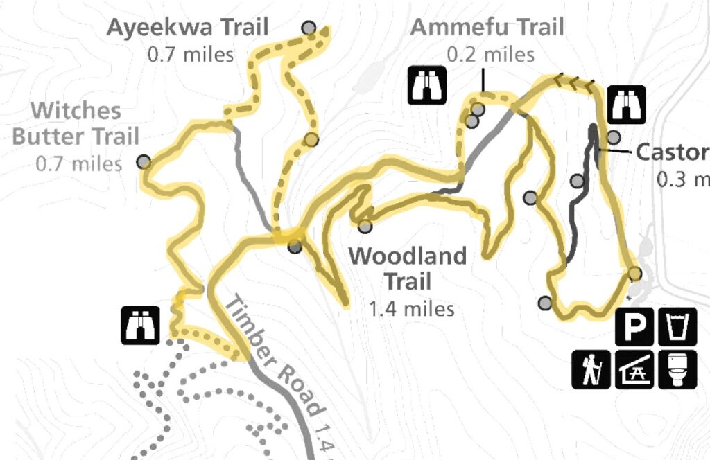
 At the next junction, turn right onto Blacktail Way, which climbs, steeply in places, for half a mile to the next junction. Here there is a short trail to the right to a viewpoint. Back at the junction, turn right onto Little Prairie Loop and follow it through the forest and back to the trailhead.
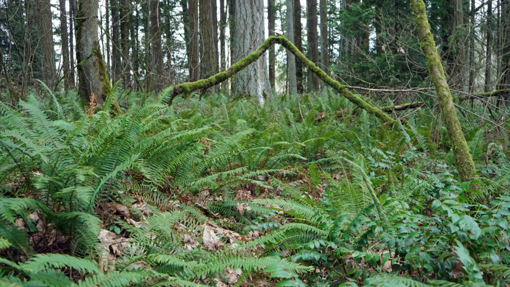
 Posted May 2, 2025. Updated with new photos June 16, 2025.
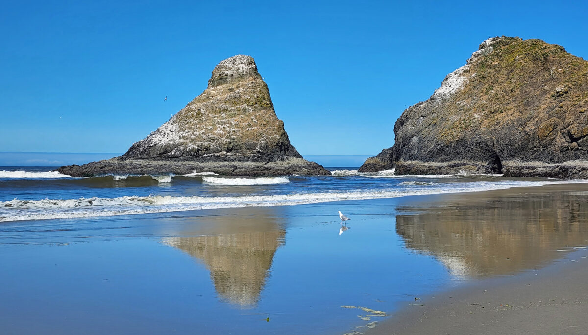


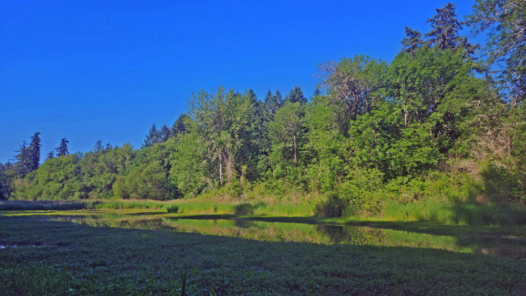
 The Beaver Creek visitor center, 1.2 miles east of Hwy 101 on North Beaver Creek Road, would normally be a good first stop to acquaint yourself with the area. If it’s open, you can pick up an informational brochure and map of the trail system there. The map and brochure can also be downloaded from the Beaver Creek State Natural Area website (linked above). There is also a small parking area a few hundred yards east of the visitor center that may have the map and brochure if the visitor center is closed. You can also find a checklist of the birds found at Beaver Creek on the website.


 The park, originally called Short Sand Beach State Park, was created in 1931 through the efforts of Oregon’s first State Parks Superintendent, Samuel H. Boardman. Boardman was a fervent believer that of as much of the coast should be preserved in public ownership as possible. Many of the state parks along the coast were created under his stewardship. Short Sand Beach State Park was renamed in 1958 to honor former Oregon Governor
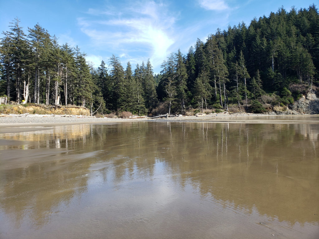
 Devils Cauldron is a spectacularly beautiful little cove on the north side of Neahkahnie Mountain. It can be reached by either a one mile hike from Short Sand Beach or a much shorter hike from where the Coast Trail crosses Hwy 101. To access the shorter route, drive south on Hwy 101 from the Short Sand Beach parking lots and look for a gravel parking area on the ocean side of the highway. Follow the Coast Trail north a short ways to a signed junction. The Devils Cauldron viewpoint is just a quarter mile walk from the parking area.
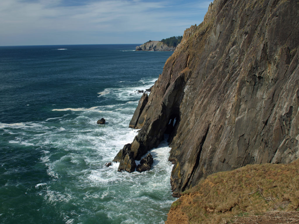 On your way back to the trailhead look for another trail branching off to the south. The junction here is unsigned and the trail is sometimes overgrown and impassable. But if it’s open, the trail leads to a narrow shelf of rock that falls away on three sides to the ocean below, and the cliffs of Neahkahnie Mountain tower over the viewpoint to both the north and south. It may not be a place for people with a fear of heights, but it’s one of the most awesome places on the entire coast.
 Oswald West State Park is about a two hour drive from Portland, so it’s easily doable as a day trip if you’re from the Portland area or are visiting Portland. But if you want to make a weekend of it, there are plenty of other attractions on the north Oregon coast beyond Oswald West.
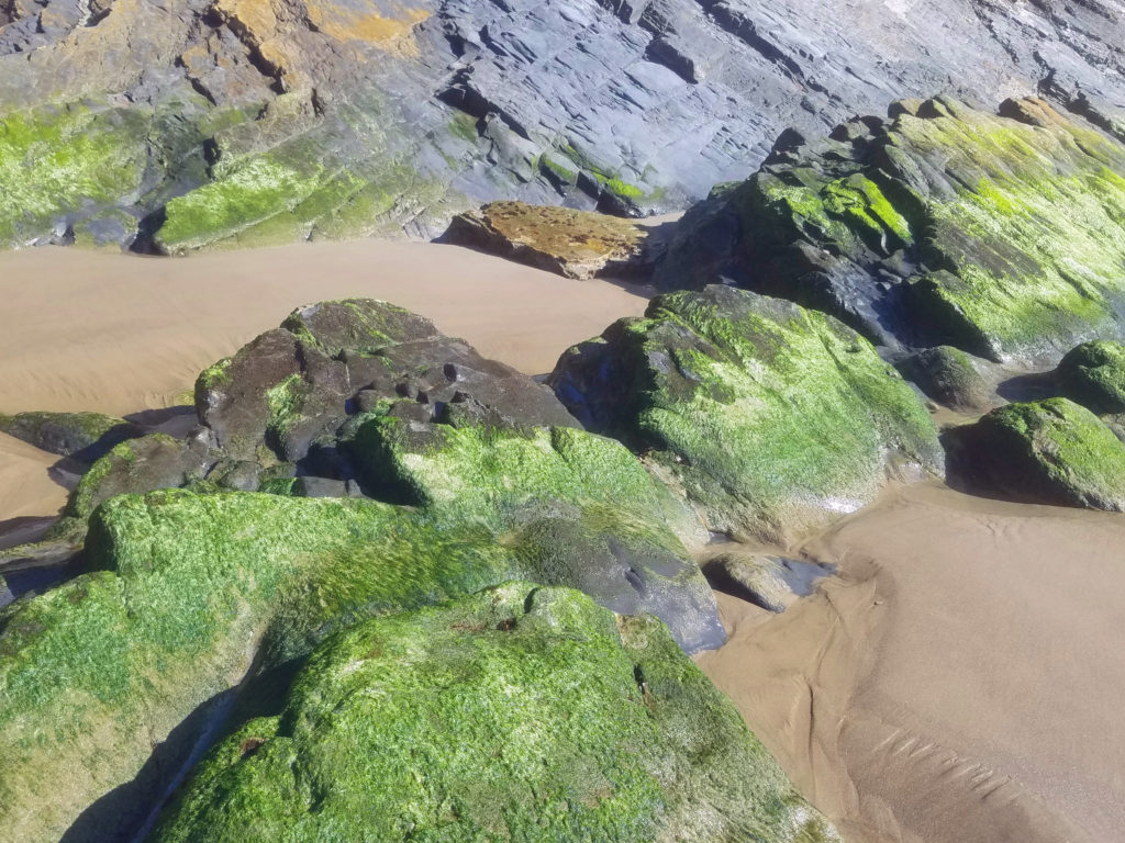
 Overview:
 Getting there:
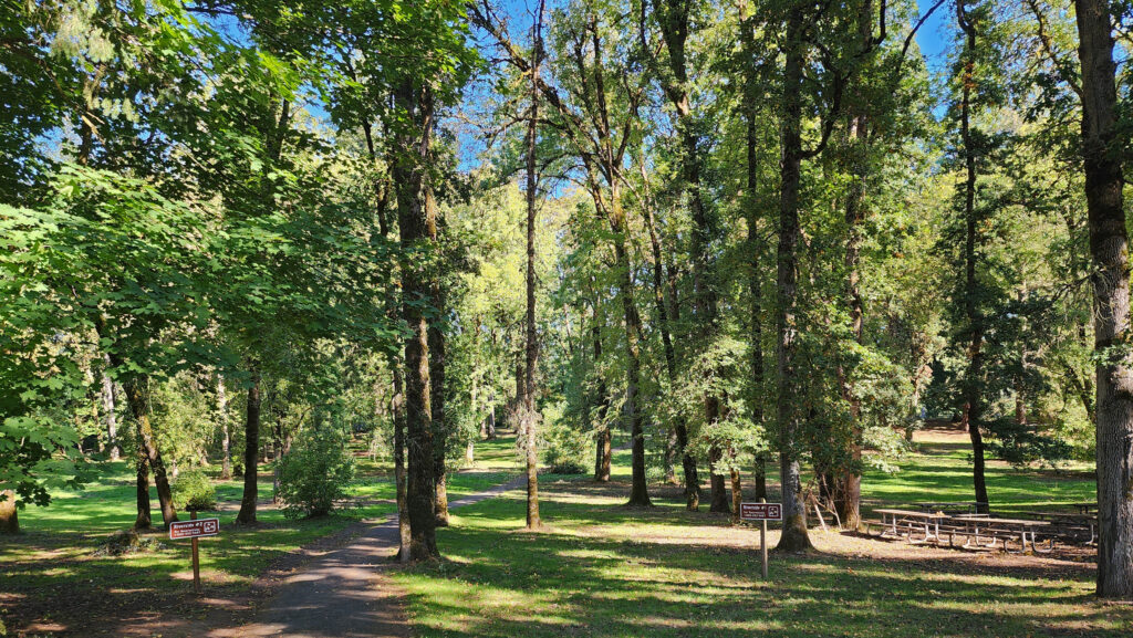 Trailhead:
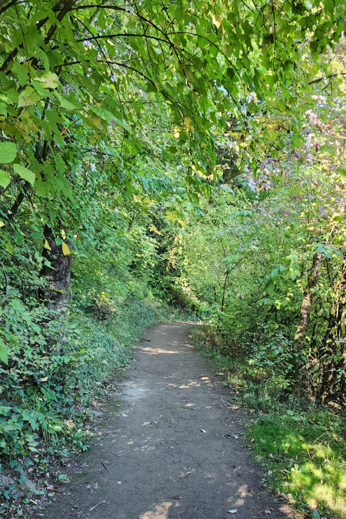 The hike:
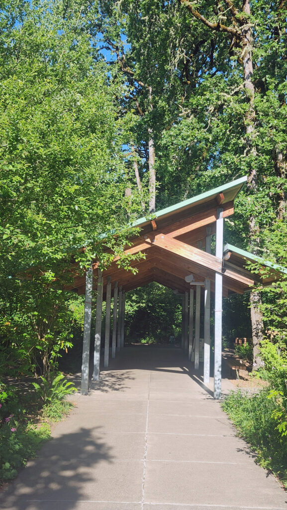
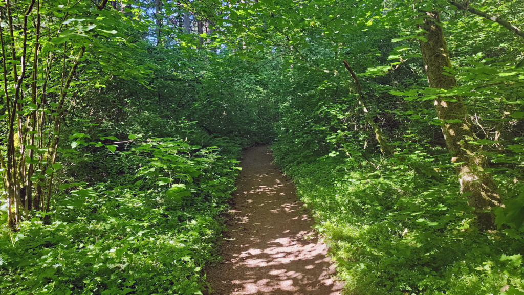
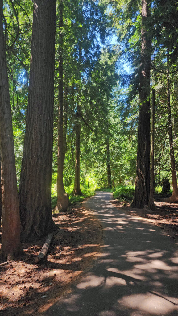
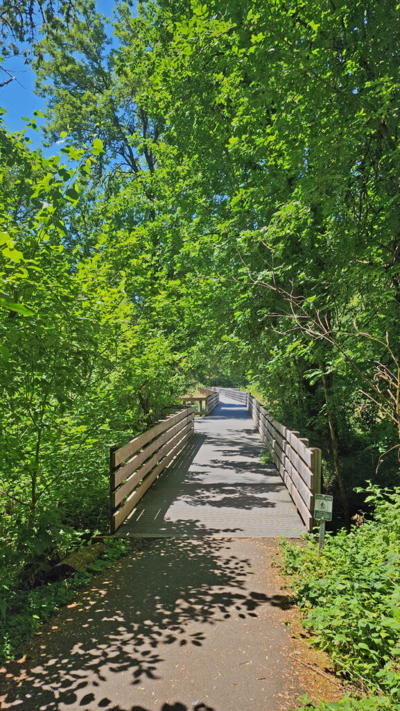
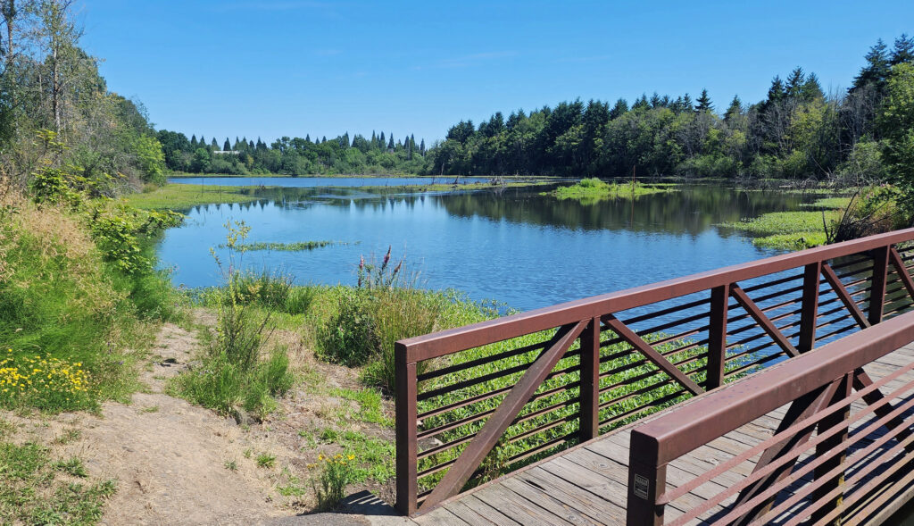
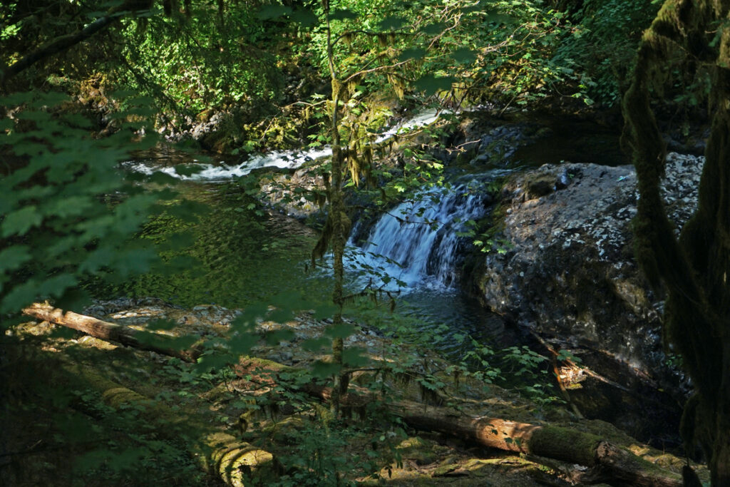
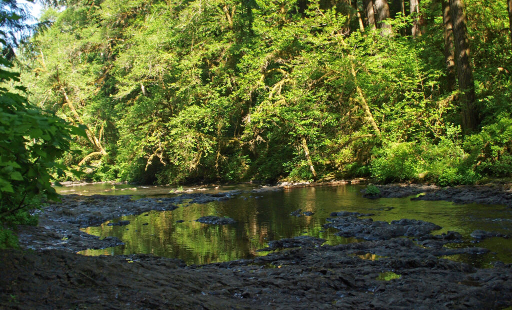
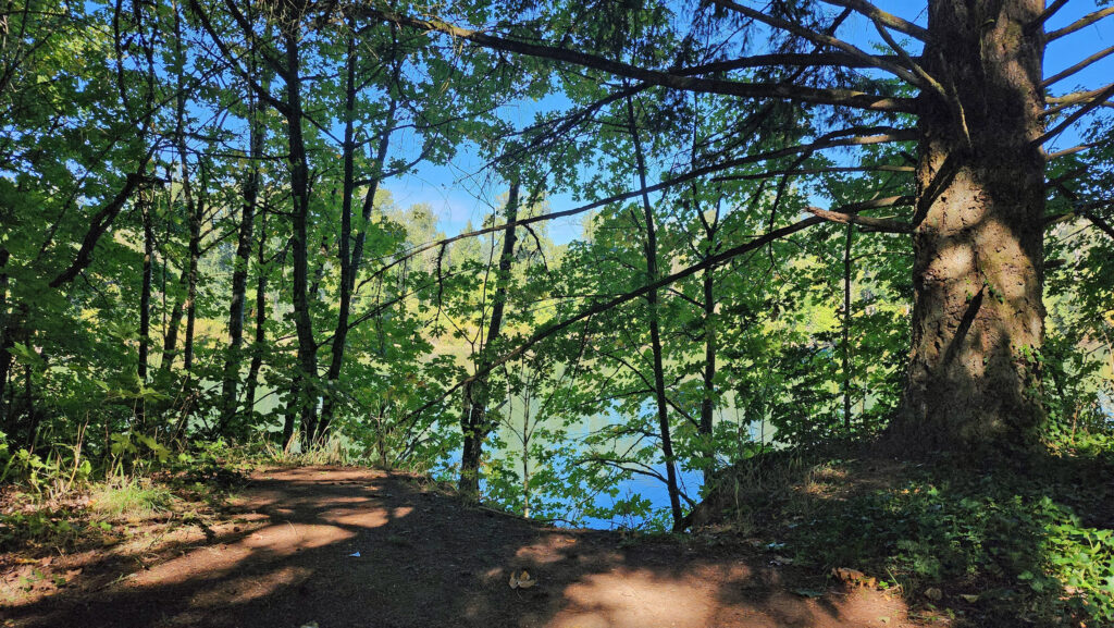 The Townsite Trail takes you along the river through a mixed woodland of Douglas fir, bigleaf maple, and red alder with partially screened views of the river. There are several user-made trails leading down to the water, but they are steep (and dangerous if the ground is wet), so be careful if you want to get to the water for a better view of the river.
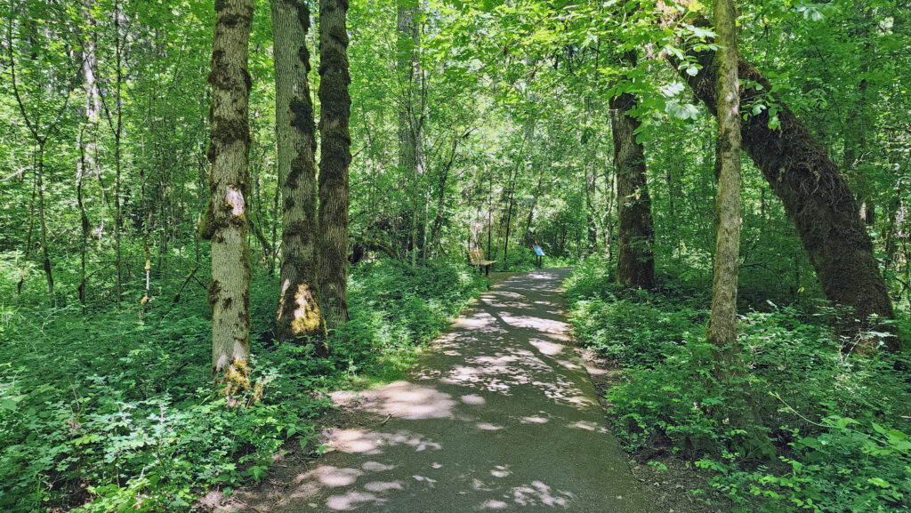
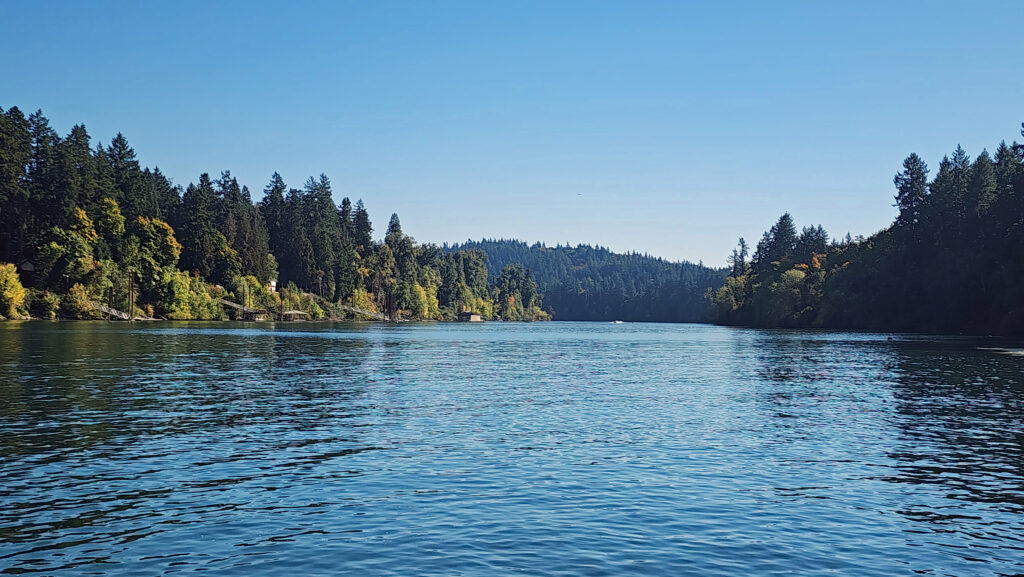 At about the one-mile mark you’ll come to an open field on your right and you’ll see a boat dock ahead on your left. There is a small parking area here with a restroom. Head down to the dock for the best views of the river on this hike.
 Coming back up from the dock, look for a trail to your left. This will take you to Champoeg Creek where it flows into the Willamette. The trail then loops back through the forest and comes out into a clearing. Follow the edge of the clearing back to the restroom above the dock. From there, retrace your route back to the trailhead at the Riverside picnic area.
 Best time to go:
 Champoeg State Park:
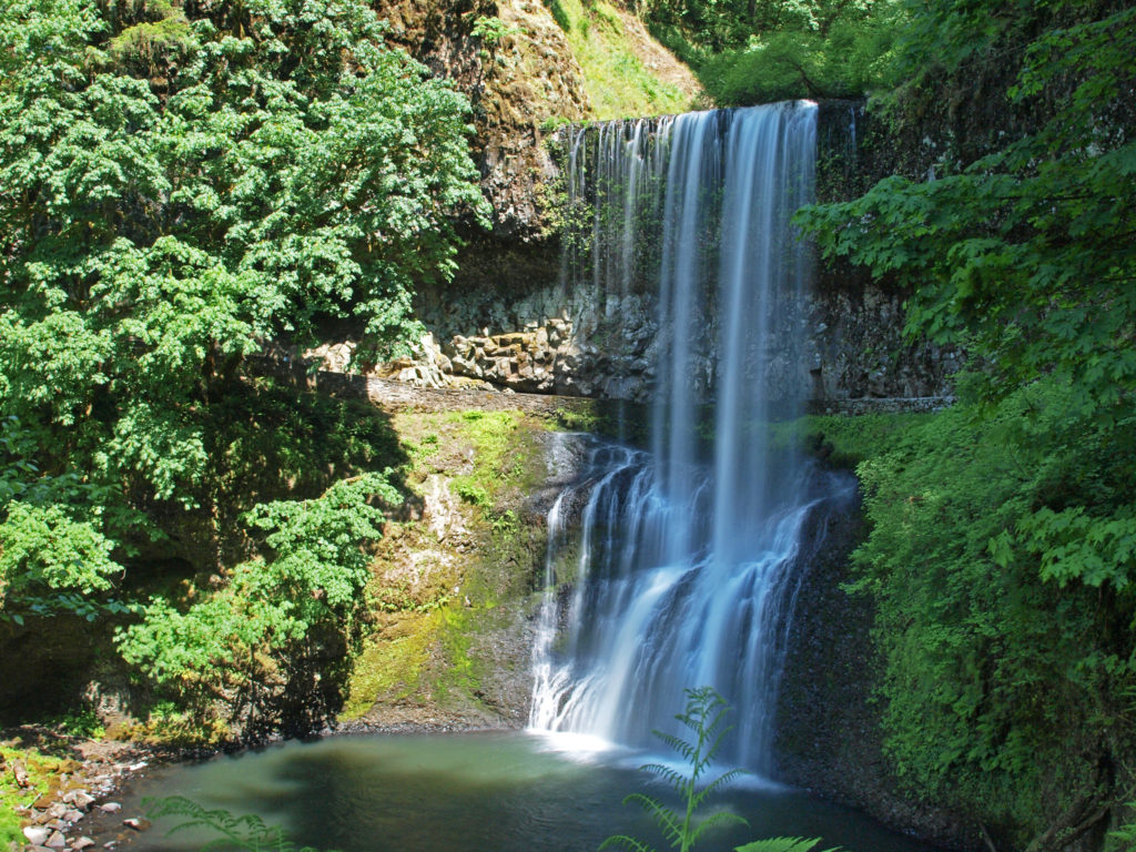
 Posted October 26, 2023 by Alan K. Lee
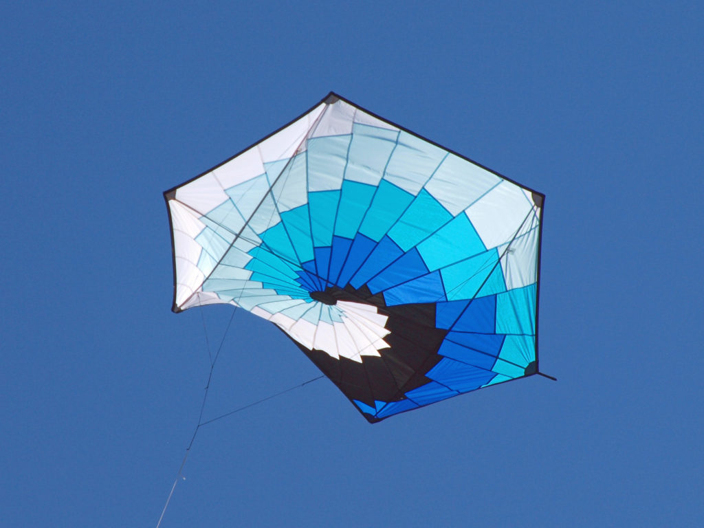
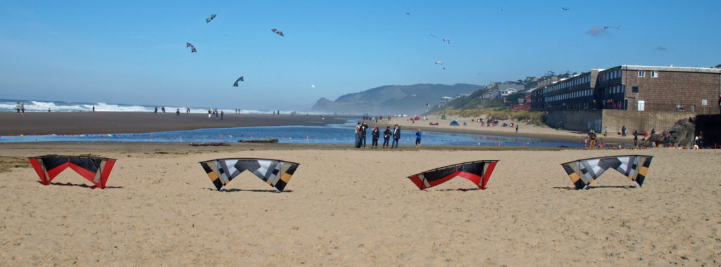
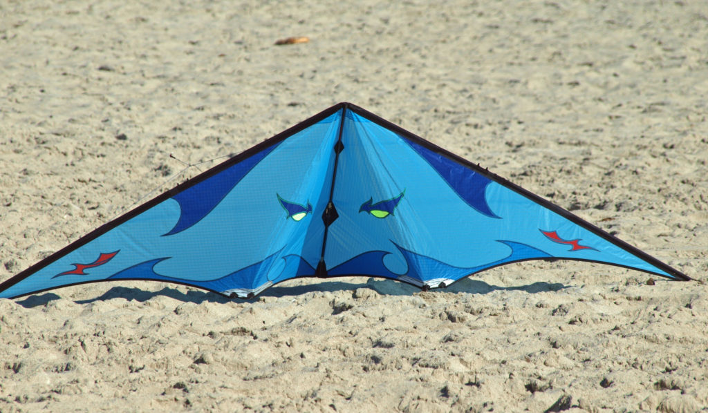
 I’ve been lucky enough to experience Lincoln City’s kite festivals when the weather was perfect for kite flying. And my wife and I even got the last available parking spot at the D River Wayside, where the festivals are held, one year. Luck really was with us. There was a brisk, but not cold, breeze on the beach that time – perfect kite flying weather and a pretty near perfect day for just hanging out on the beach.
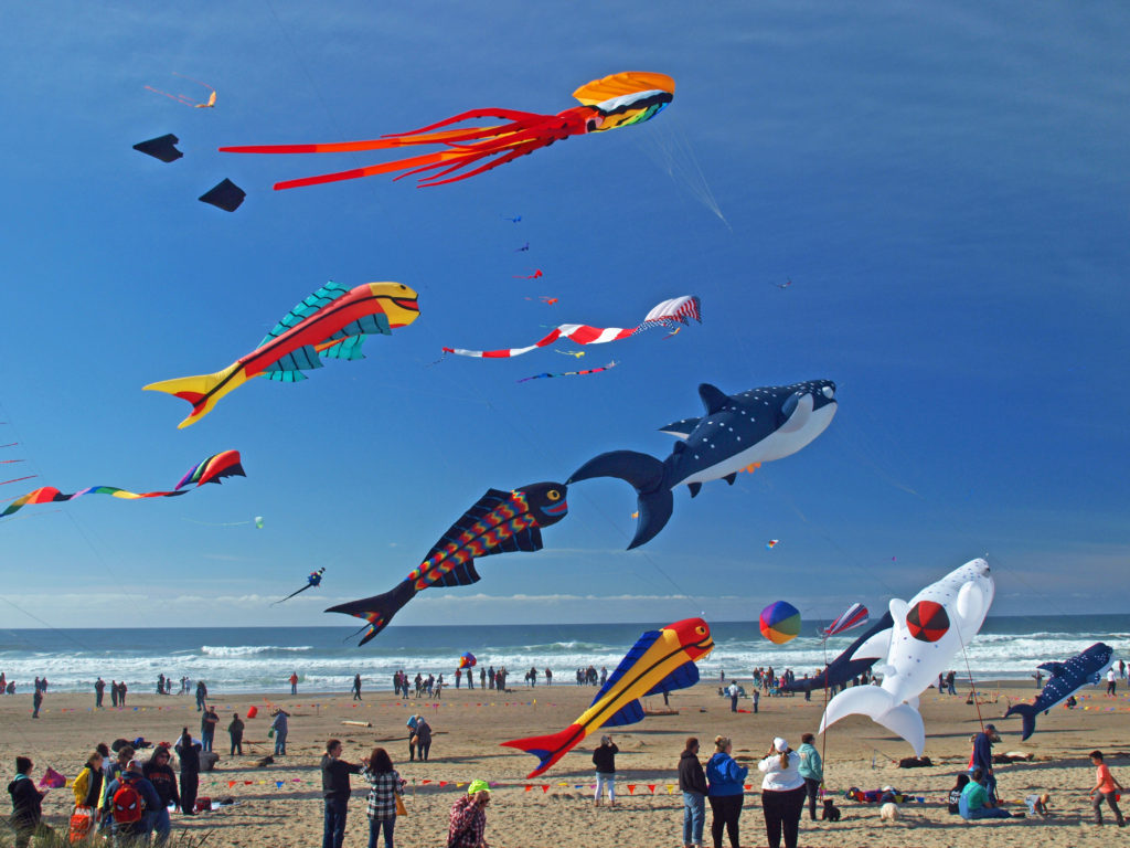 The festivals typically feature a lot of very big kites, and quite a few performance kite fliers demonstrating their talents. One of the all time highlights for me was a flier named Spence Watson flying two quad strings kites. Normally it takes two hands to fly a single quad string. Flying one one-handed is a feat in itself, but he was flying one right-handed and one left-handed, and controlling each one perfectly. Pretty amazing.
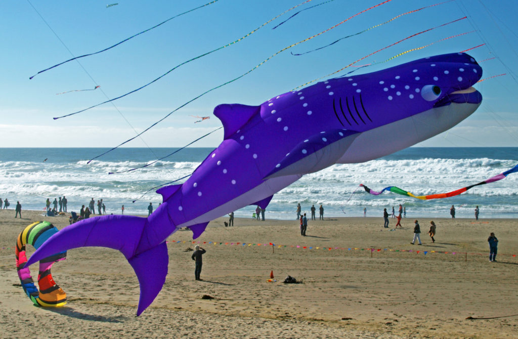
 Watching the kite flyers is often as entertaining as watching the kites. It’s really a very physical dance that they’re doing. Their movements are perfectly coordinated with the music, but everyone’s moves are a little bit different. If you watch long enough you begin to see the different styles of the flyers. It’s really quite interesting.
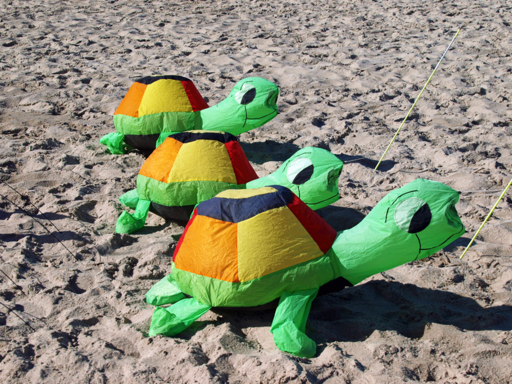
 There’s plenty to do at the festivals for the whole family. Kids can take part in kite making classes, get their faces painted, learn about ocean conservation, fly their own kites, and, of course, just play in the sand.
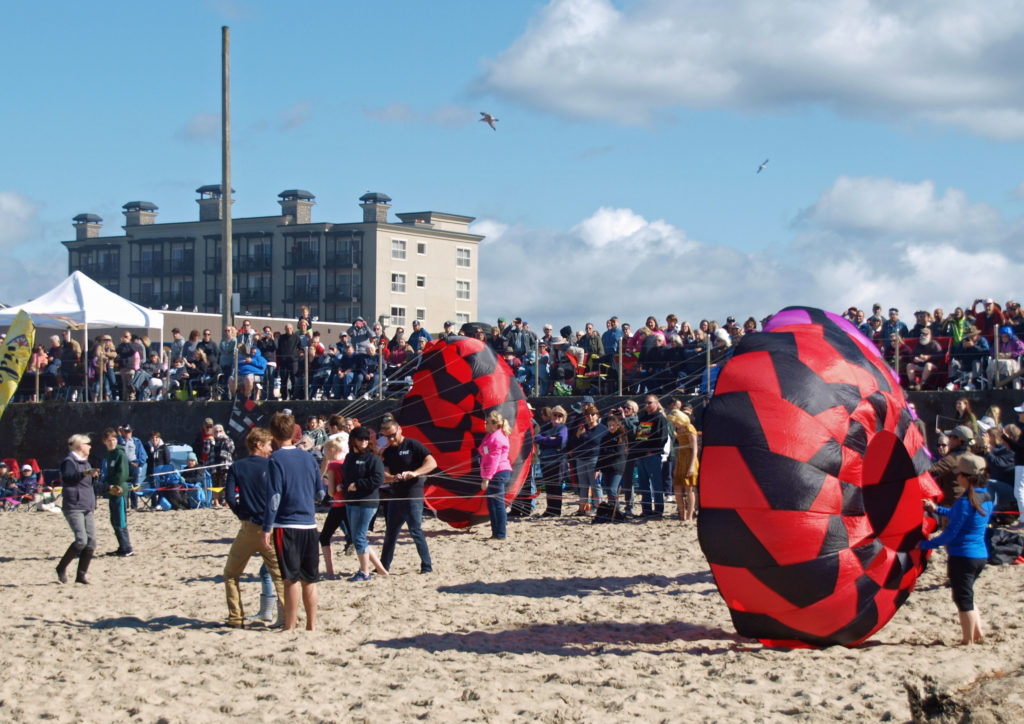
 I lived in Lincoln city for most of the 1980s, so I sometimes take a walking tour of the downtown area when I visit Lincoln City. The whole town has changed a great deal since I lived there, including the house that I lived in for a time. It’s been extensively remodeled and added on to, so it’s nothing like it was when I lived there. And that’s a fitting description of the whole city.
 There are numerous other kite fests up and down the Oregon and Washington coasts in addition to the Lincoln City festivals, including the Southern Oregon Kite Festival in Brookings in July, and the
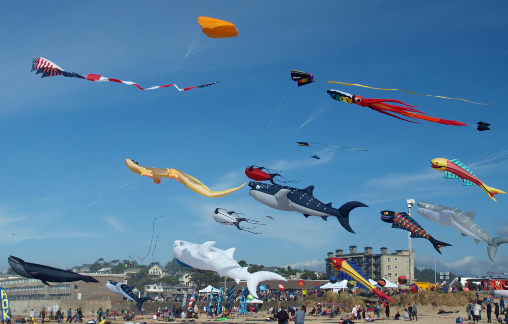

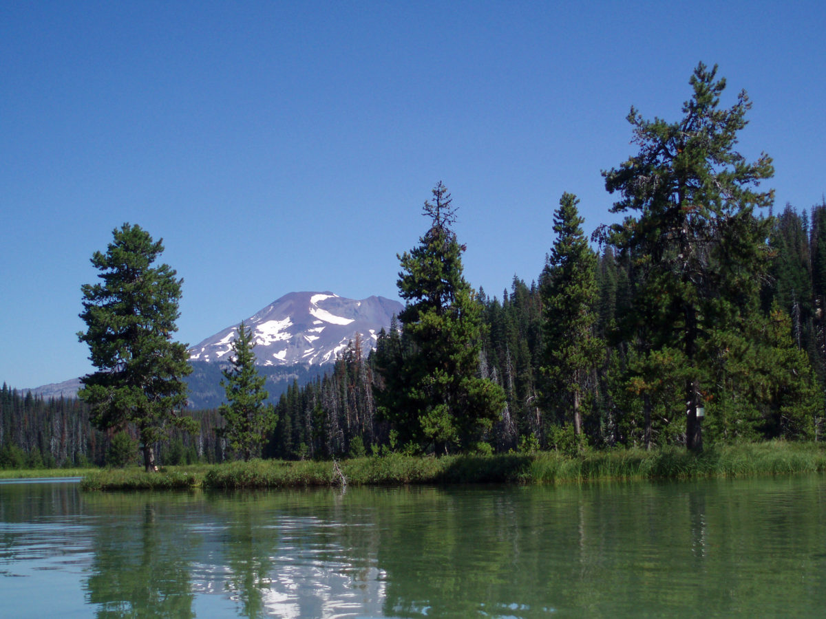
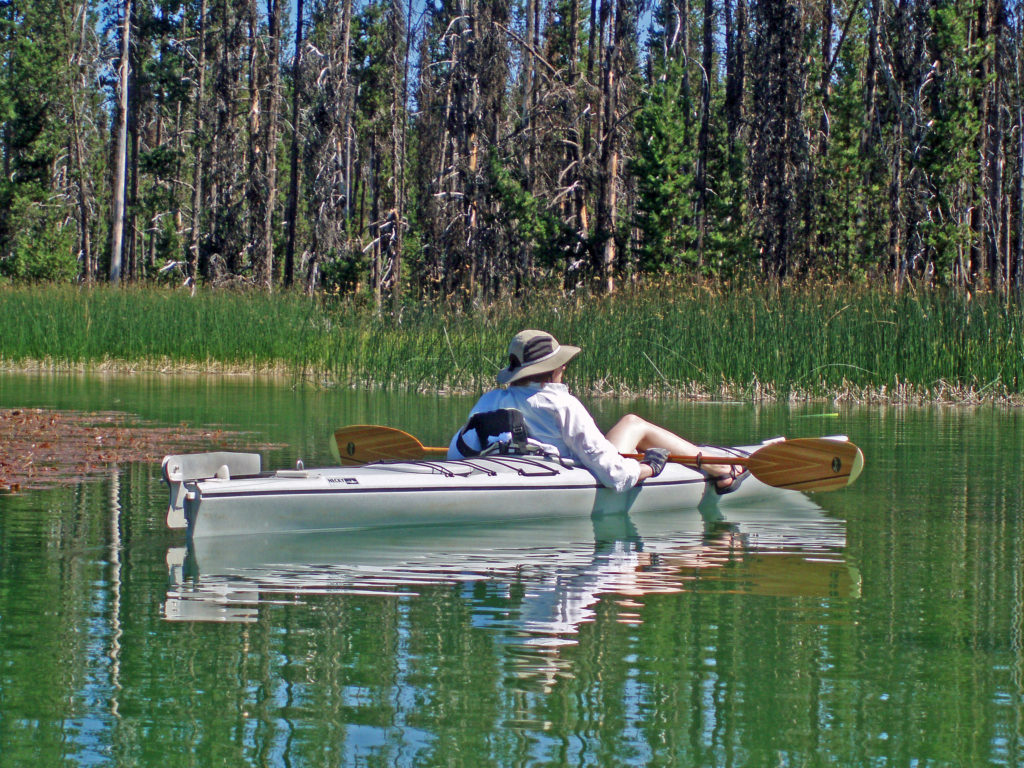
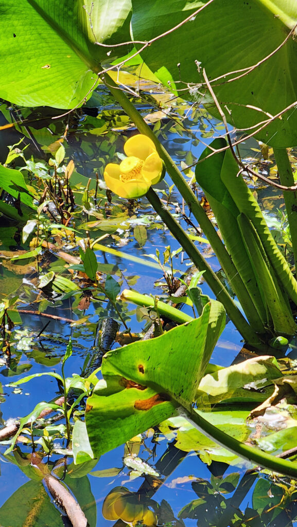
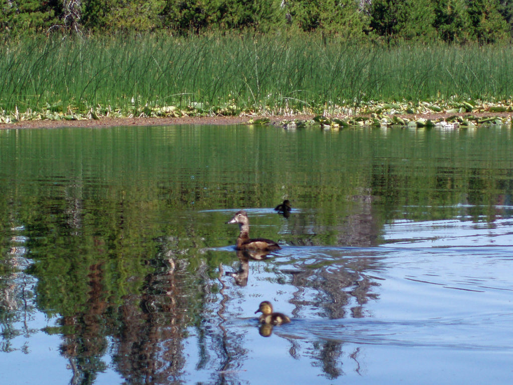
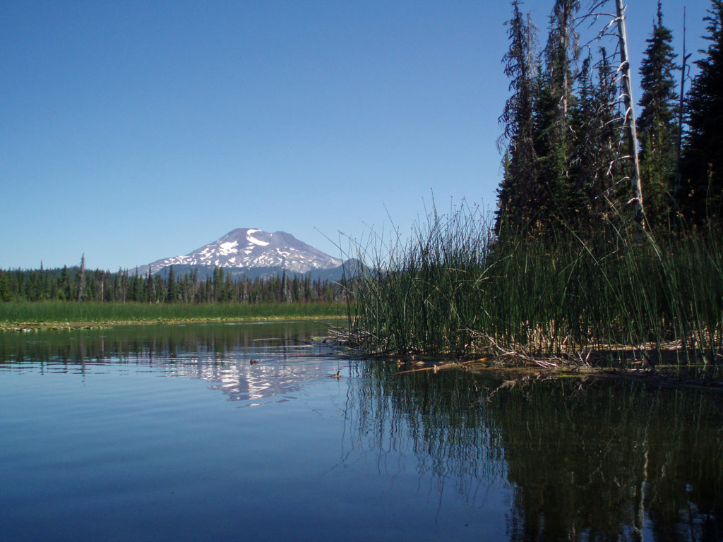
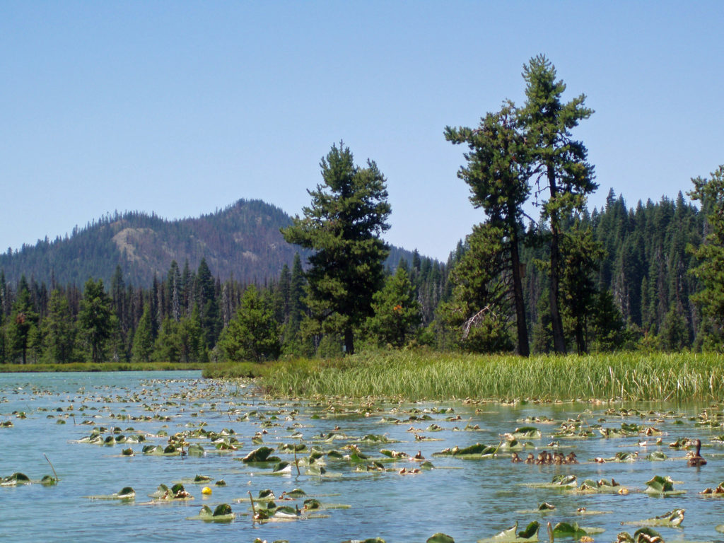
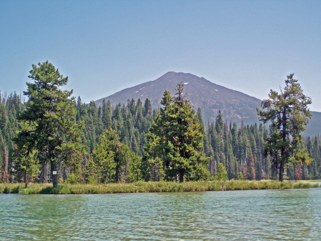 Hosmer Lake is a mix of open water and reeds, rushes, water lilies, and other marsh plants. Motorized craft (except for electric motor powered) are not allowed on the lake, which makes it ideal for kayaking or canoeing. It’s also not a big lake at 160 acres, so you can easily explore it all in an afternoon.
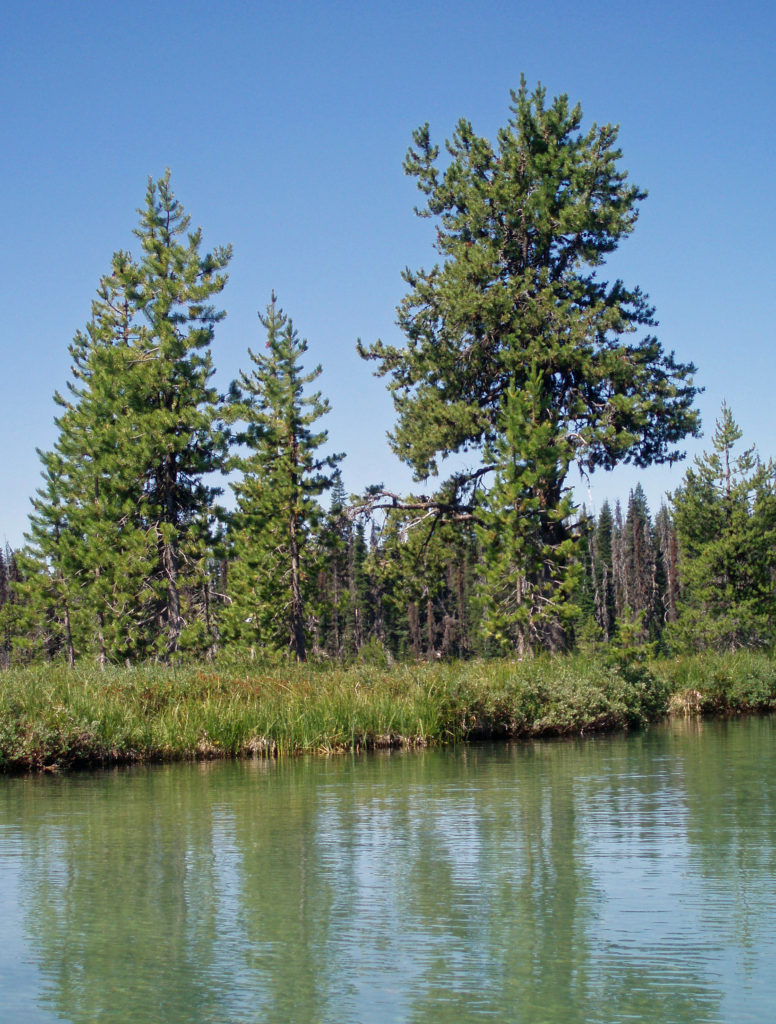
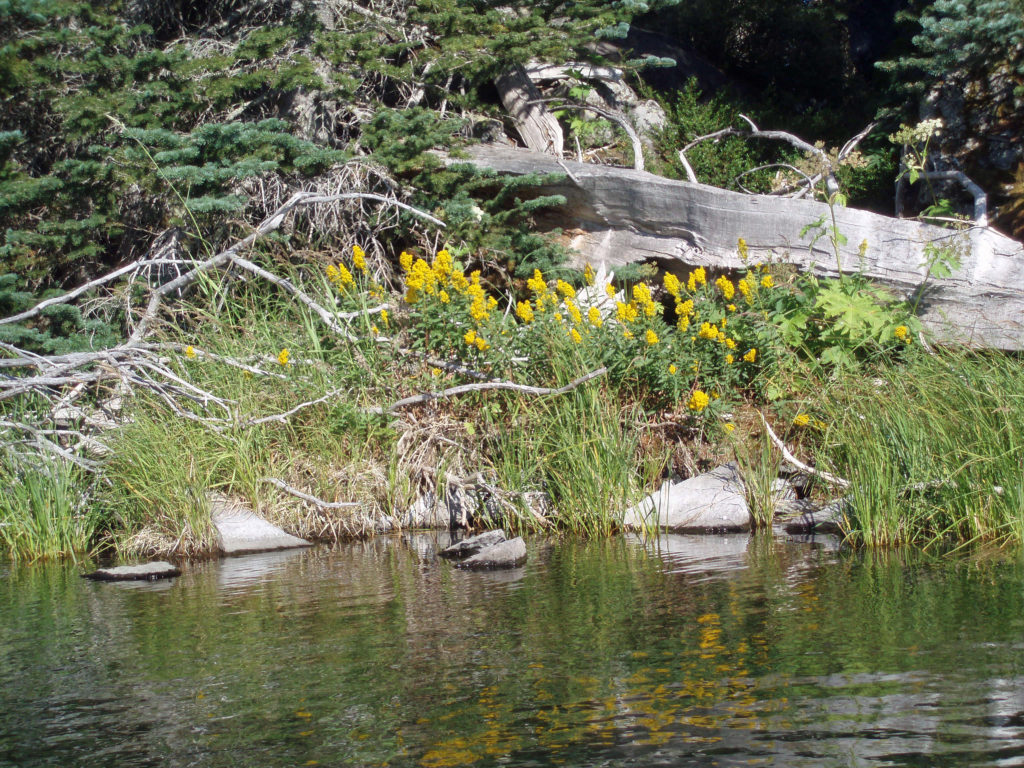
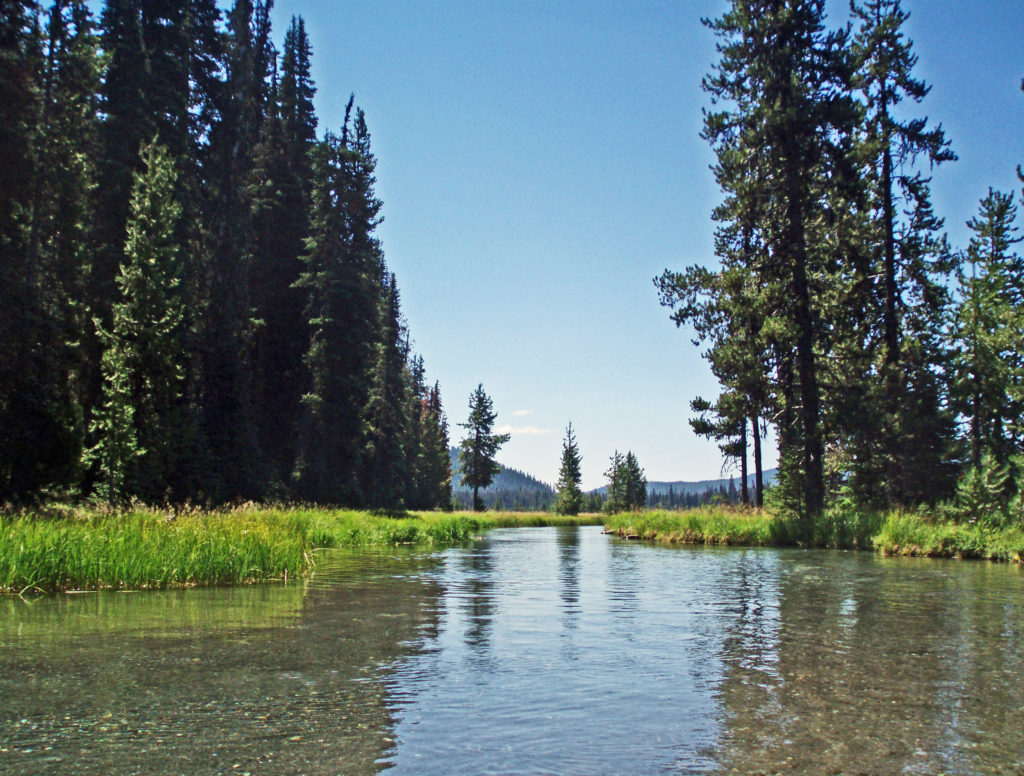 Hosmer Lake is fed by Quinn Creek, which flows into the north end of the lake. Quinn Creek is narrow and shallow, but it is possible to paddle up it for a ways. When we were there last, downed trees blocked our passage a few hundred yards from the mouth of the creek. We hauled our kayaks out of the water at that point and hiked along the creek to a small waterfall where we ate lunch and lingered awhile before heading back out on the water.
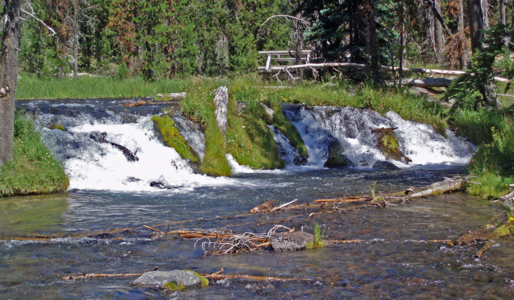 Recalling our visits to Hosmer Lake, I’m eager now to get back to the area and get back on the water again. It’s a beautiful place, and one of my favorite destinations.
 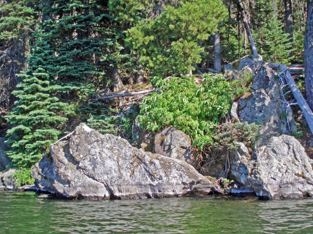 Hosmer Lake is located in the Deschutes National Forest. Check the Forest Service
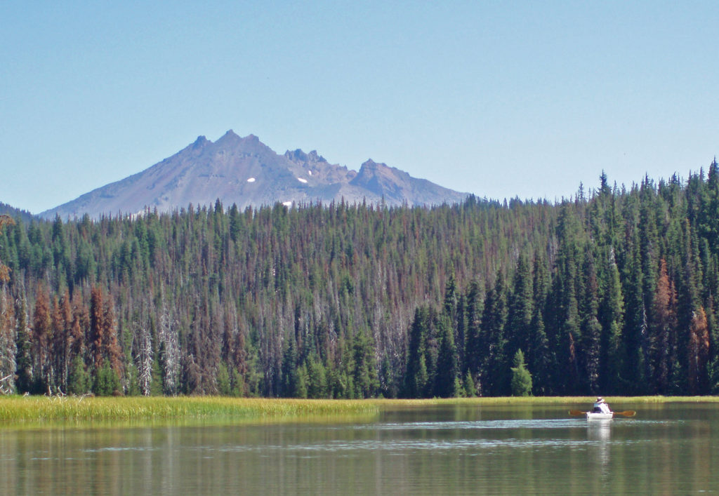
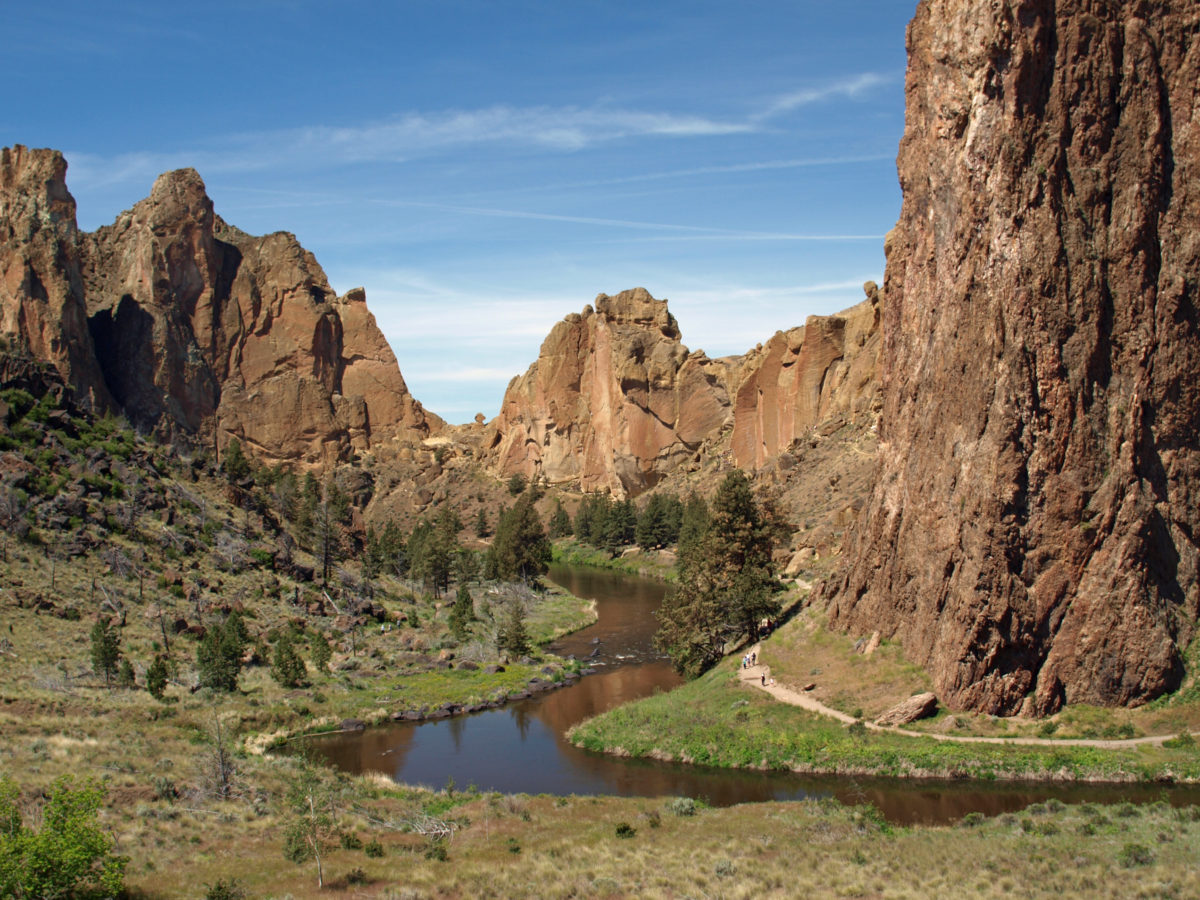
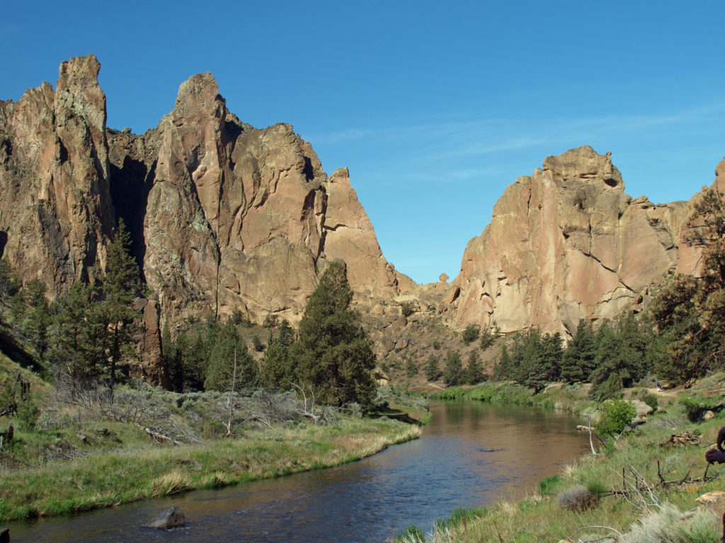
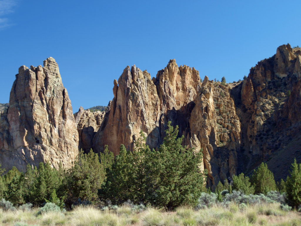
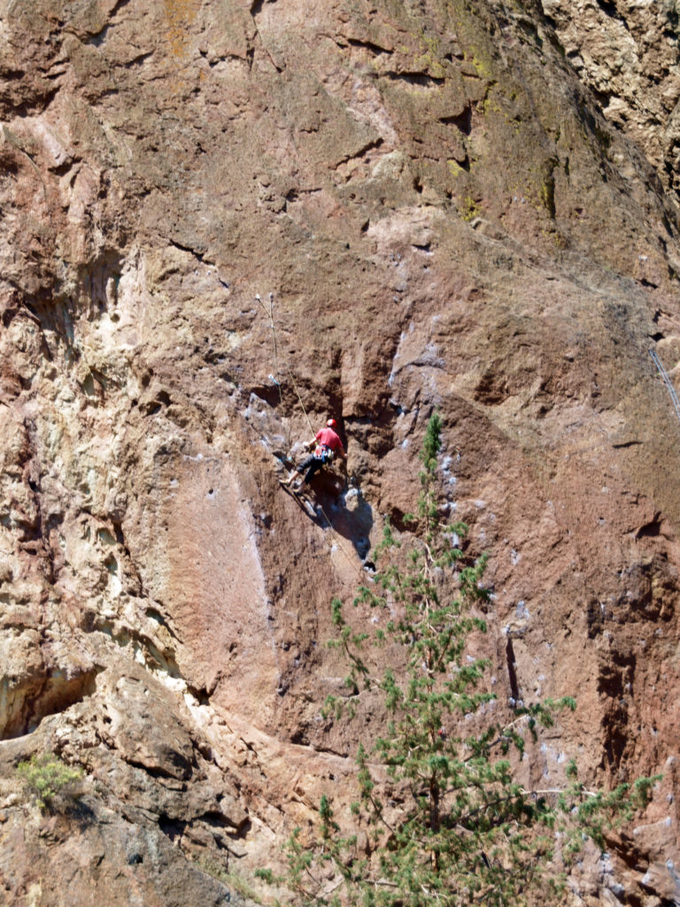
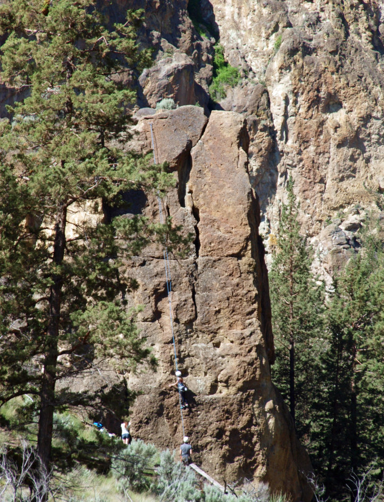
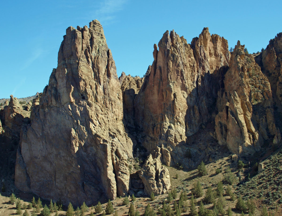
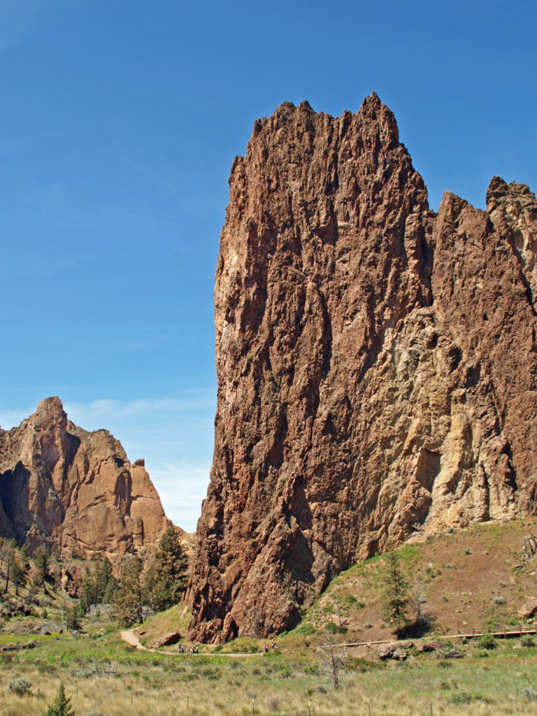
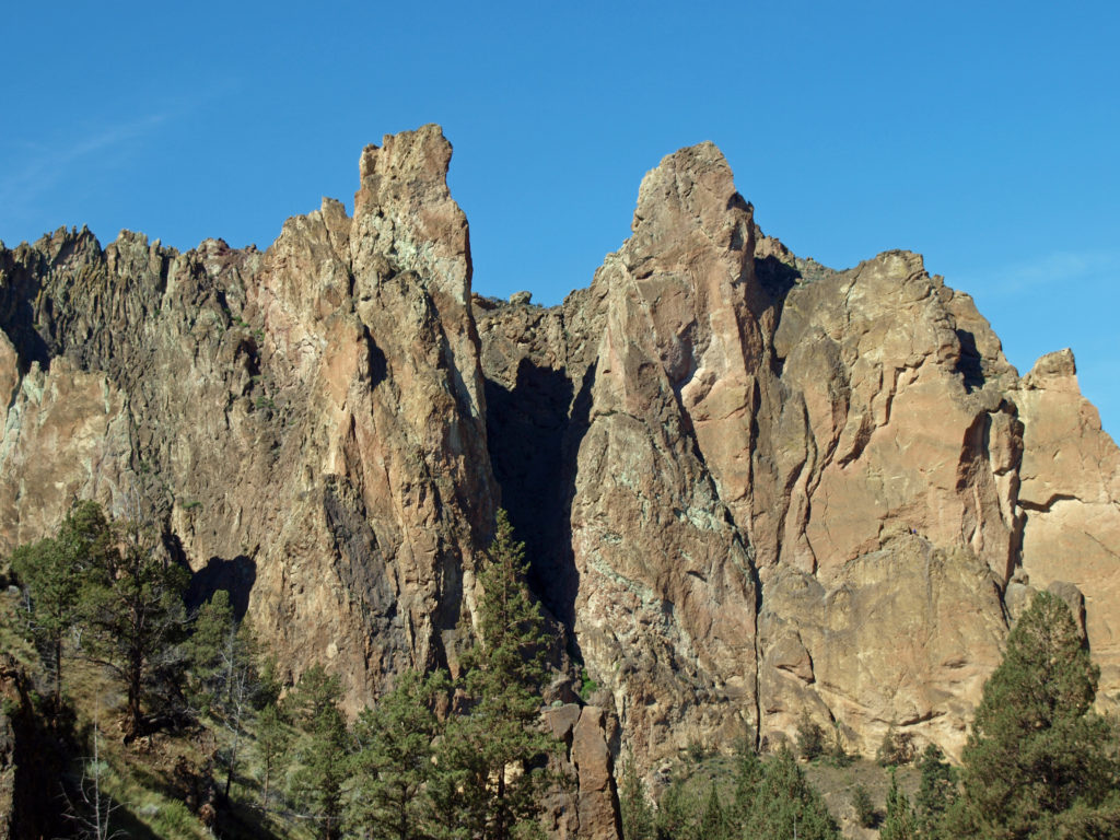
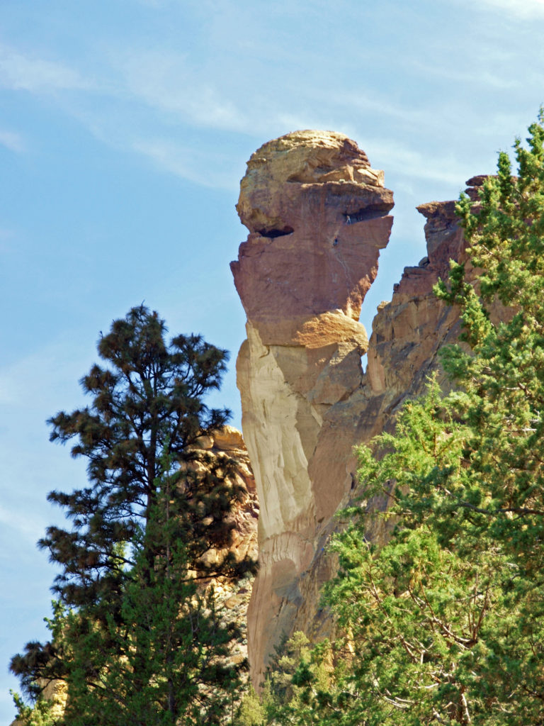 Several thousand climbing routes exist within the park, including more than a thousand bolted routes. Climbers literally come from all over the globe to climb here. And an extensive trail system within the park offers hikers a variety of routes of varying lengths and difficulty. Many of the trails are multi-use trails, open also to mountain bikers and horseback riders. Click
 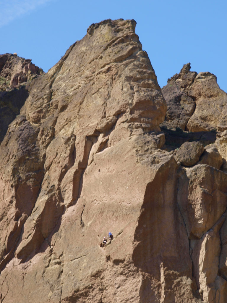 Thirty million years ago the area that is now Smith Rock was on the western rim of the Crooked River Caldera. Over time, nearby volcanic eruptions filled the caldera with ash that compacted into volcanic tuff. The tuff was later overtopped with basalt lava flows from vents about fifty miles away. The Crooked River then eroded much of that, leaving the formations we see today.
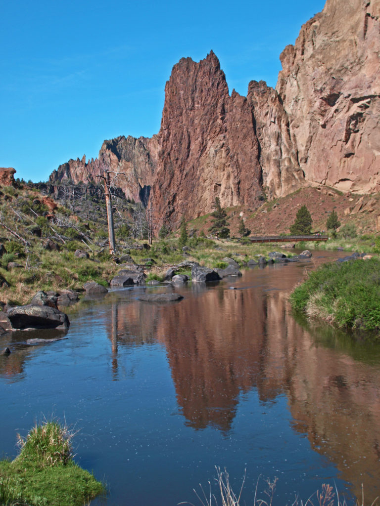
 On summer weekends you need to come early to have a chance of finding a place to park. The parking areas fill up quickly, and it’s not unusual to see cars parked along both sides of the road leading to the park and people walking in the road. There has been a shuttle system proposed that would allow visitors to park in the nearby town of Terrebonne and bus into the park, but that (to the best of my knowledge) has yet to be implemented. Even during the week, and on spring and fall weekends, parking can be a problem.
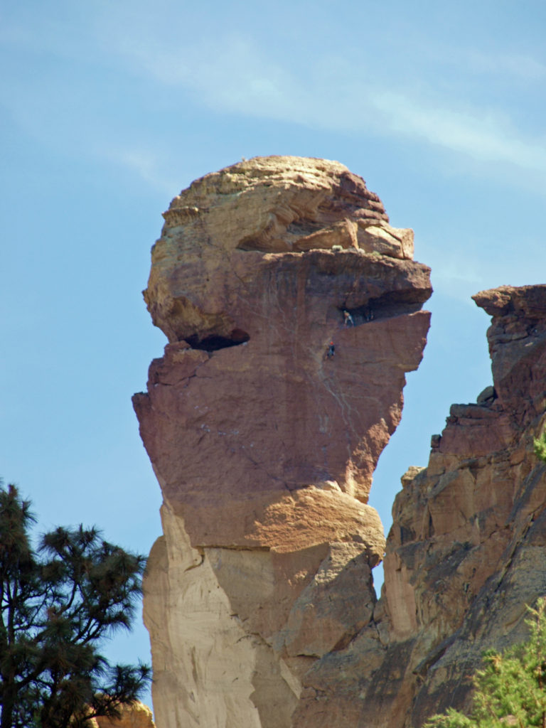
 Despite the crowds and other problems, Smith Rock is a Pacific Northwest bucket list destination, not to be missed. It’s a spectacularly beautiful place. But if you’re looking for a wilderness experience, you won’t find it at Smith Rock (except maybe in the middle of winter). If you don’t mind sharing the place with others, though, the park is large enough that visitors tend to spread out, and even at full capacity the park doesn’t feel overly crowded if you get a little ways away from the parking areas. (A recent visitor survey found that 69% of the respondents felt the park to be somewhat to very crowded, however.)
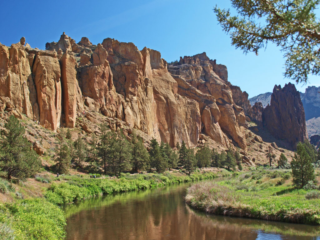
 The park is located just east of the town of Terrebonne, which is about 25 miles north of Bend, Oregon, and about 140 miles southeast of Portland. For more information, go to the
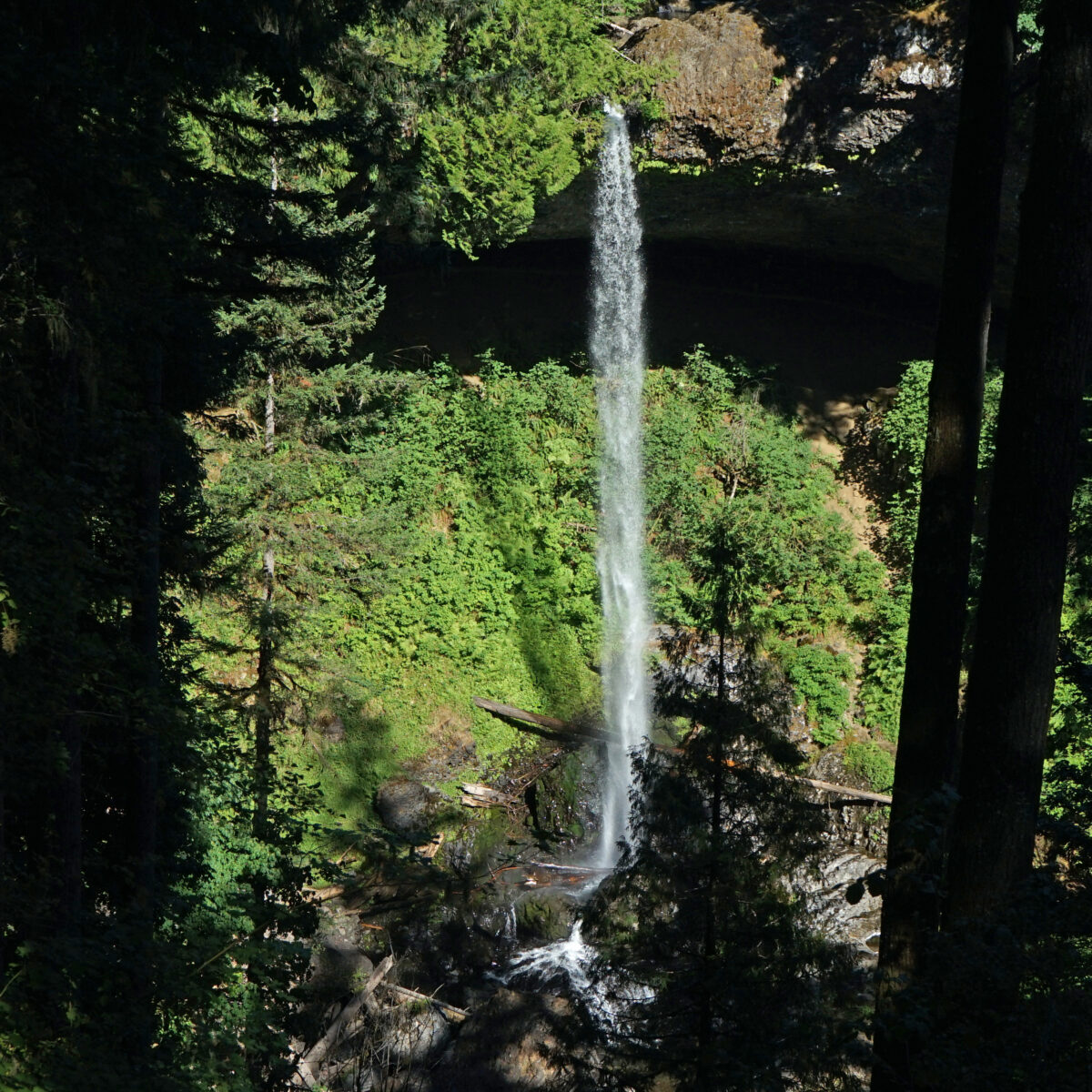
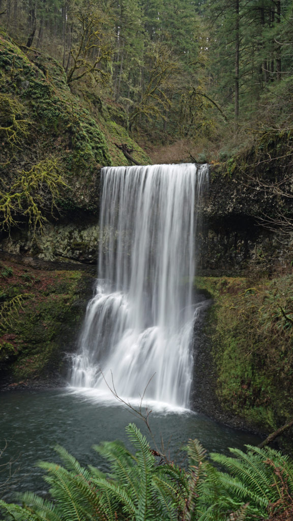
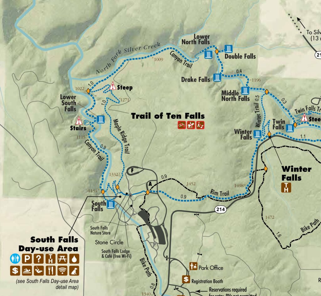
 Beyond the Twin Falls Trail junction, the North Rim Trail meanders through the forest, passing a children’s play area and a small two-table picnic area.
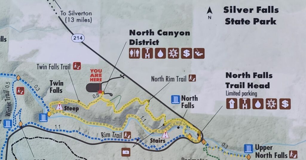
 For a map of the entire park, click
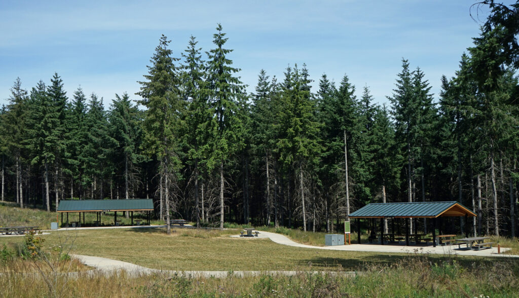
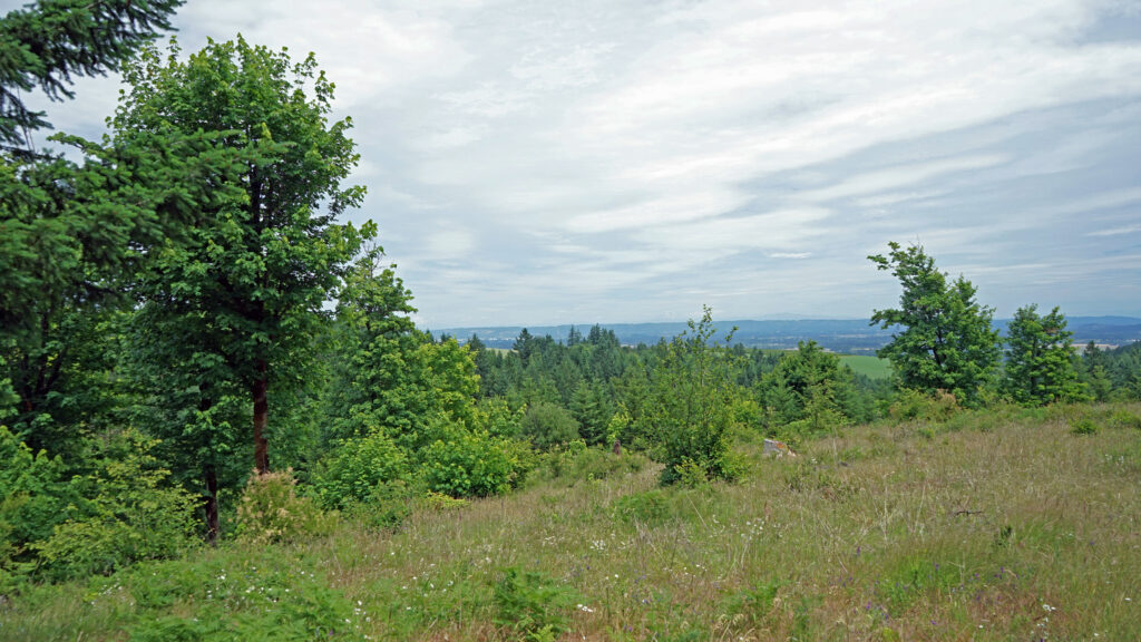
 Chehalem Ridge Nature Park is in a rural area with no other close by hiking or biking opportunities, but the west metro area, not far from Chehalem Ridge, has an abundance. Some of my favorite hikes in the area include
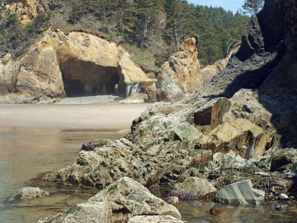
 I love the eroded sandstone rock formations found at Hug Point. The layered sandstone of the point has been warped and folded by tectonic processes and eroded by wind and water into fantastic formations. The tidewater rocks are covered in green algae and seaweed, barnacles, and mussels. The rocks, sand, colorful vegetation, waves, and ever changing light make for great photo opportunities.
 Hug Point State Park is located about five miles south of Cannon Beach. The point can also be reached from Arcadia Beach State Park, about a mile to the north. It’s an easy day trip from the Portland area, but there many other attractions in the area, so many visitors spend a weekend or longer in the area.
 The nearby towns of Cannon Beach, Seaside, and Manzanita all have numerous motels, BNBs, and other accommodations, as well as many restaurants and cafes serving fresh seafood and other locally sourced foods.
 One note of caution, though. If you go, pay attention to the tides. The waterfall and caves that draw most of the visitors to Hug Point State Park are nestled between Adair Point, immediately north of the beach access, and Hug Point itself. At high tide it can be difficult or impossible to get around these two points, so it is possible to get trapped between them.


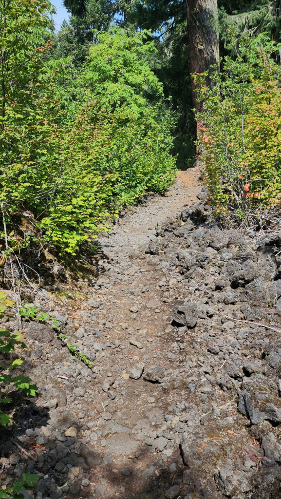
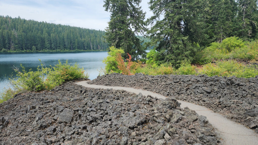
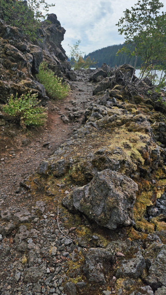 From the Great Spring the trail follows the east shore through the lava fields and forest. Parts of the trail are pretty rough. Good quality hiking boots are advised, although I did this hike in sneakers on my latest visit. But open toed sandals or flip flops are definitely not acceptable footwear on this section of the trail.


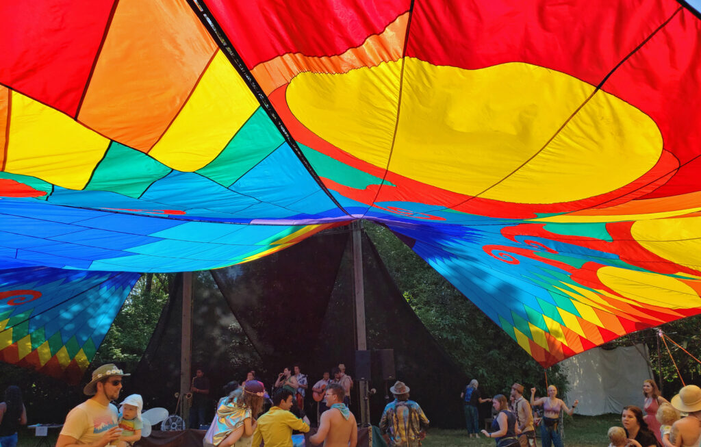
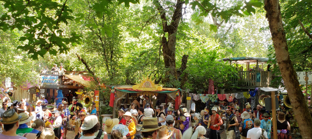
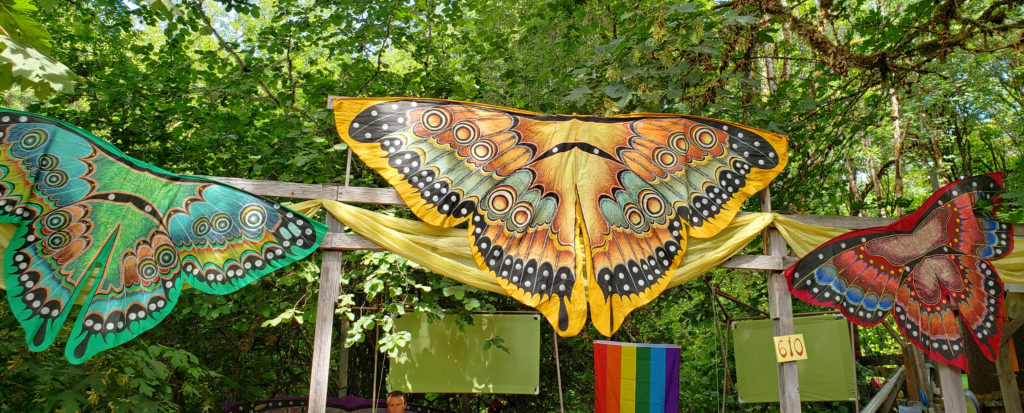
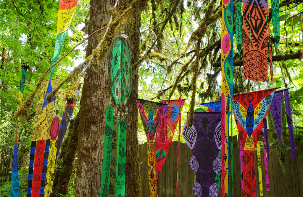
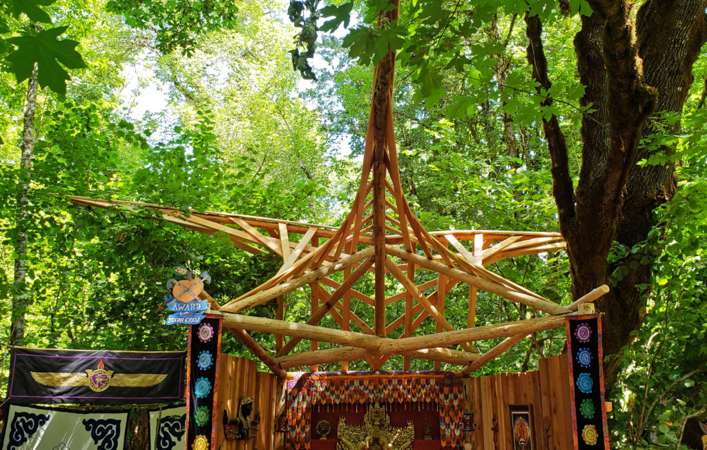
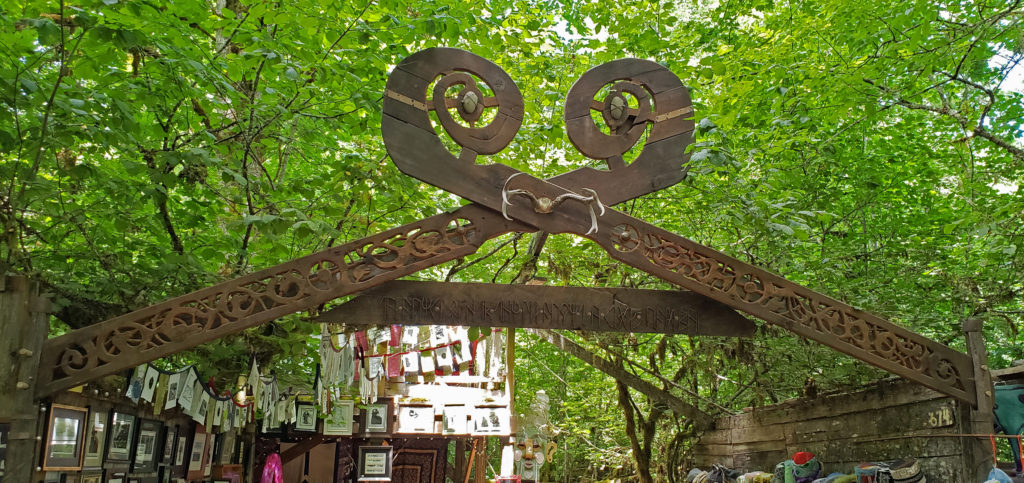
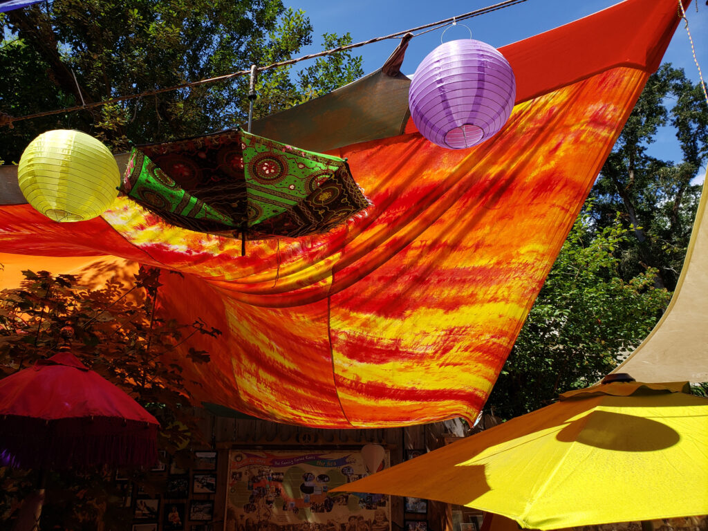
 The OCF is a remnant of the 1960s counterculture, for sure, but it is anything but stuck in the 60s. Over its 54-year history the Oregon Country Fair has not only survived but grown and thrived. It’s hard to describe just how big this thing has become. The schedule of events for the 2018 fair listed 120 performances on the first day, spread over 19 stages. There are dozens of musical acts, dancers, comedy acts, vaudeville, circus acts, and more than a dozen groups of performers that wander the miles of paths of the fairgrounds. And that’s just the entertainment.
 There are also more than 300 artisans selling hand crafted goods – pottery, jewelry, leatherworks, glassworks, furniture and other woodworks, sculptures, paintings, photography, clothing, and you name it. There are also dozens of workshops, classes, and “gatherings,” and almost ninety food booths. There is a childcare center, three first aid stations, a cell phone charging station, drinking water bottle filling stations, showers, and five ATMs.
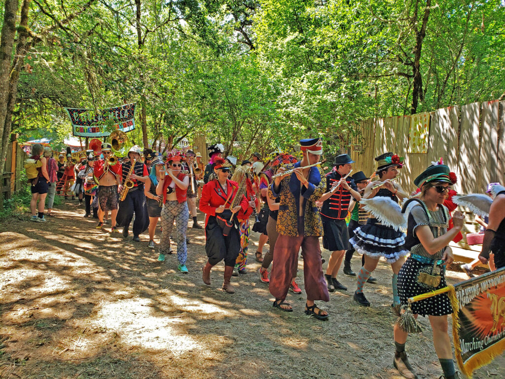

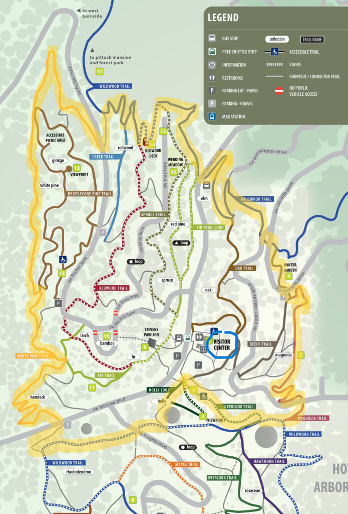
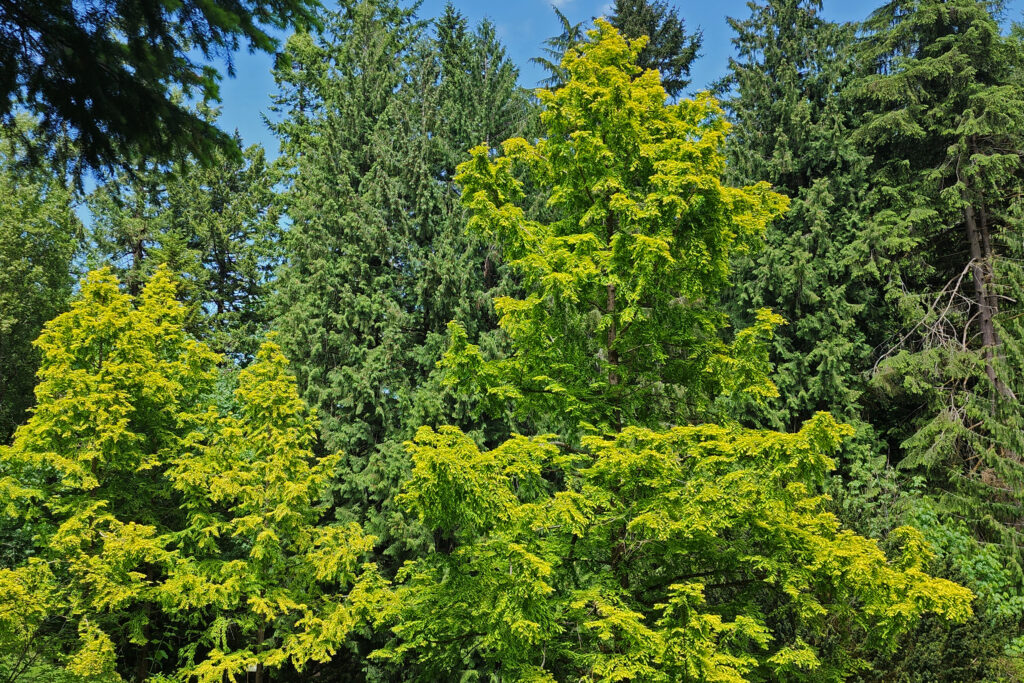
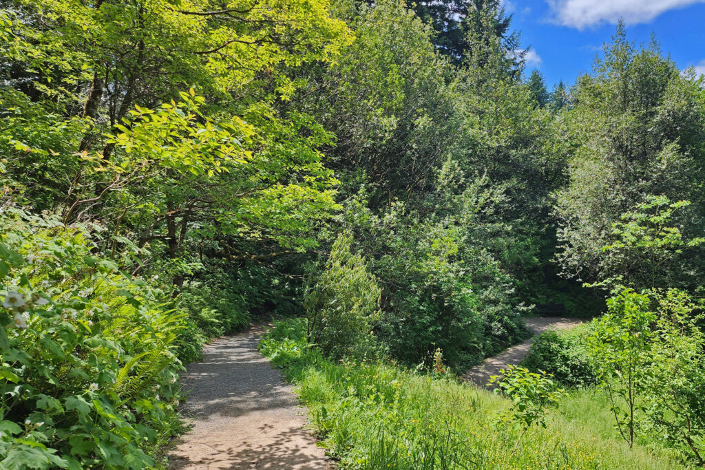
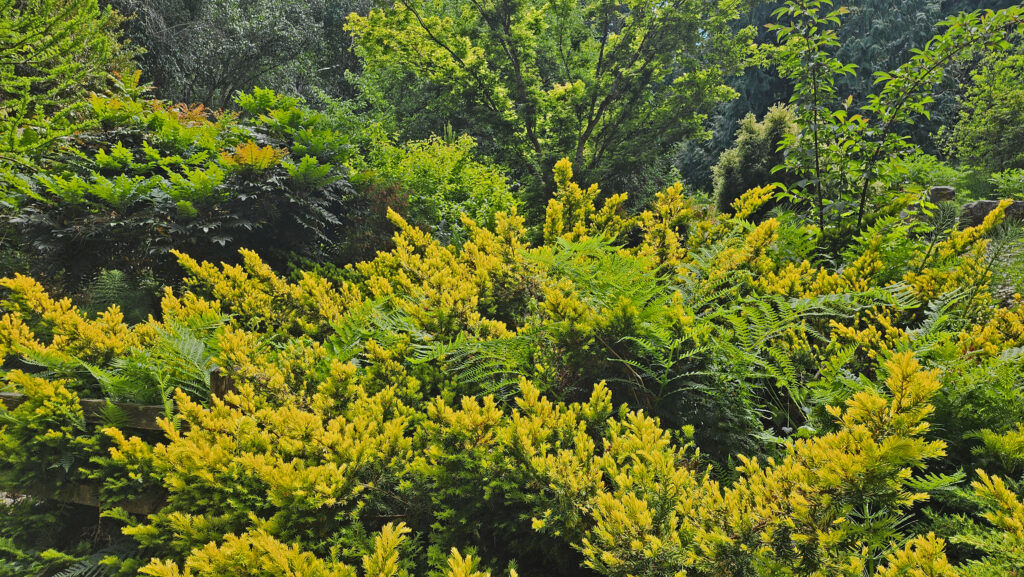
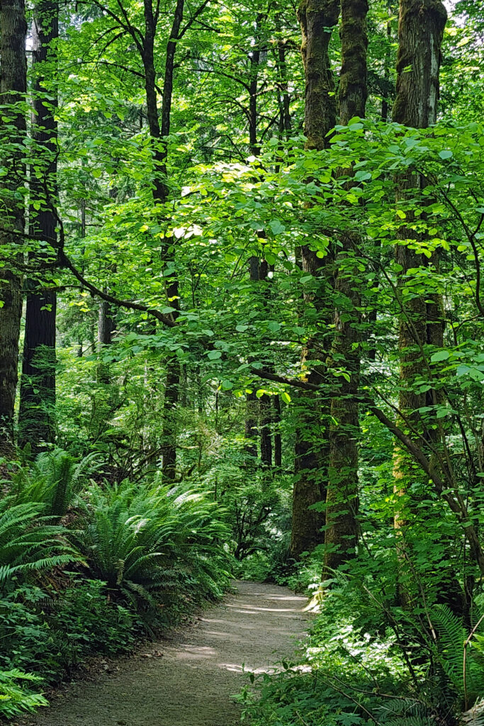
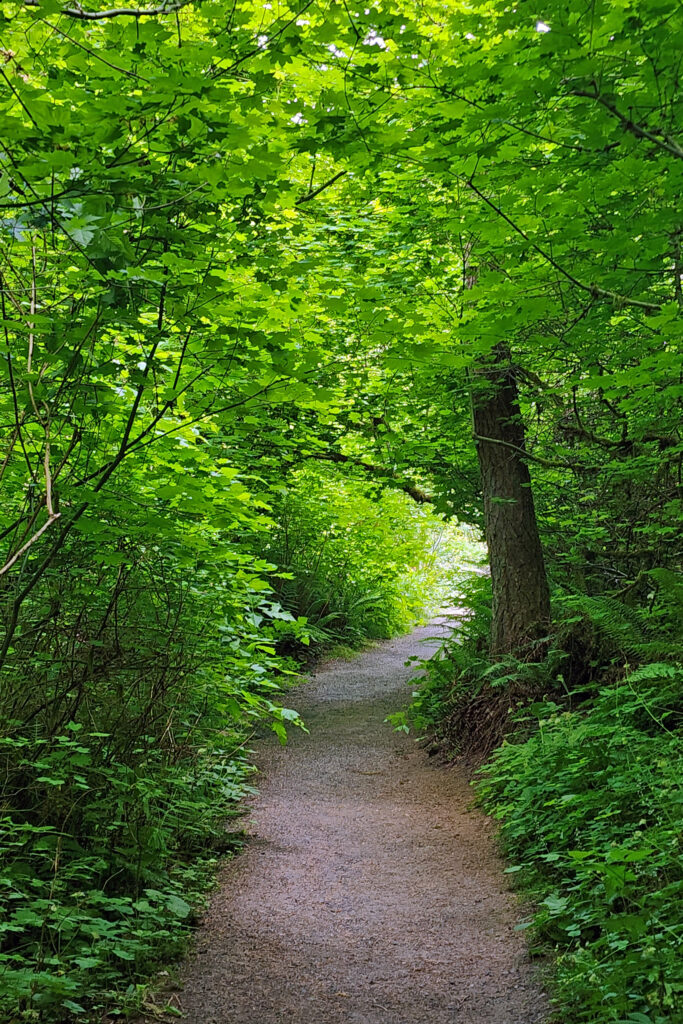
 Hoyt Arboretum offers a multitude of possible hikes over its 189 acres and 12 miles of trails. The hike described here passes through many of the arboretum’s tree collections and is a good introduction to the arboretum for anyone that has not visited previously. It also incorporates several short sections of the iconic Wildwood Trail that meanders for 30 miles through Washington and Forest Parks. The trail junctions in the arboretum are well signed, so it would be hard to get lost, but the sheer number of intersecting trails can be confusing. I recommend carrying a map of the trail system whenever you’re hiking in the arboretum. Download and print the arboretum map linked above or pick up a free map and brochure at the visitor center. The brochure provides some interesting information and has a larger and more easily read map than the download.
 Trailheads:
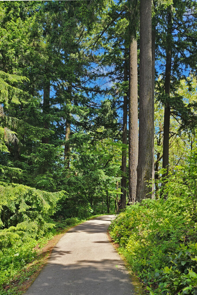