by Alan K. Lee
Introduction
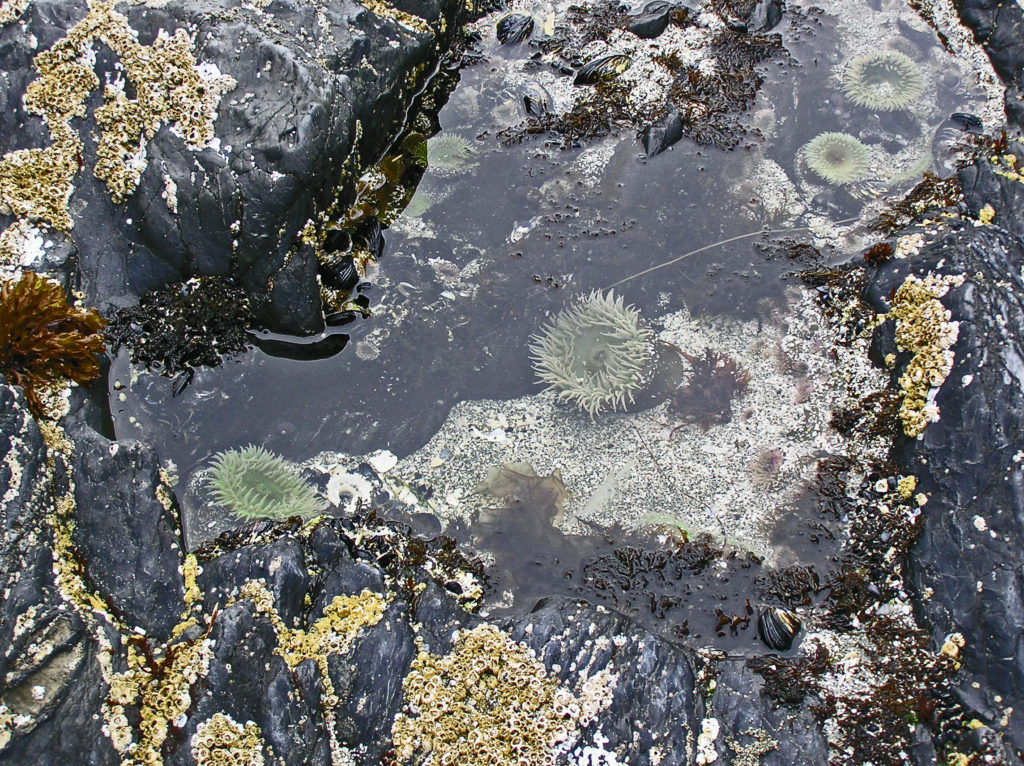
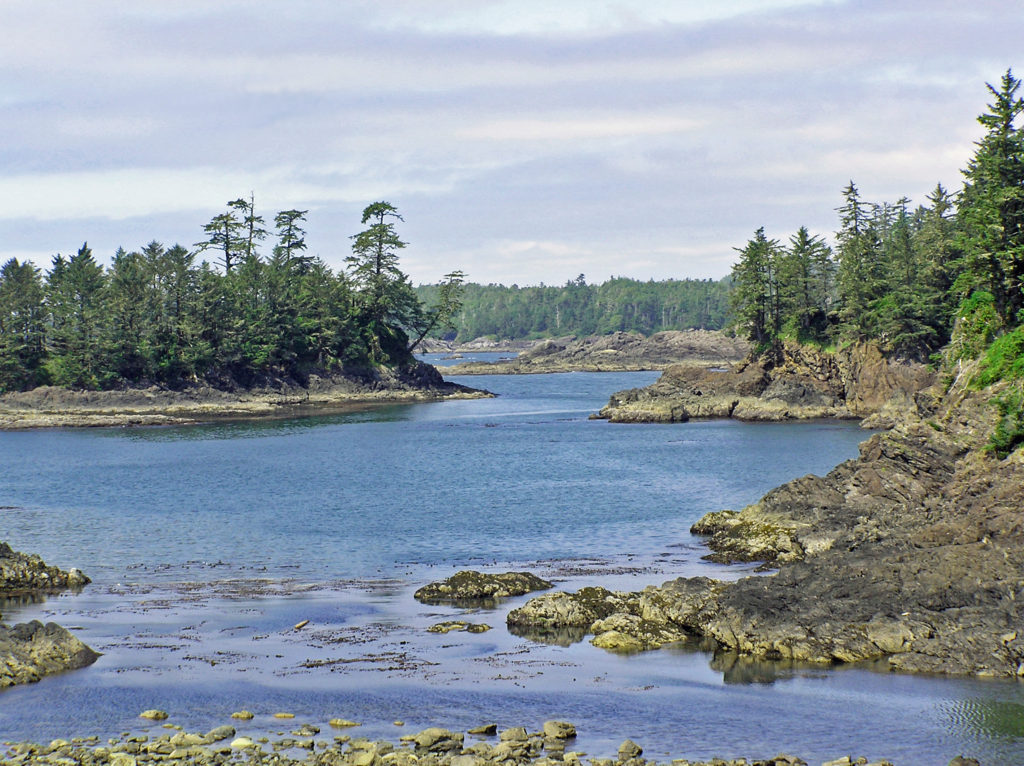
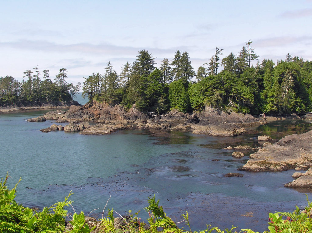
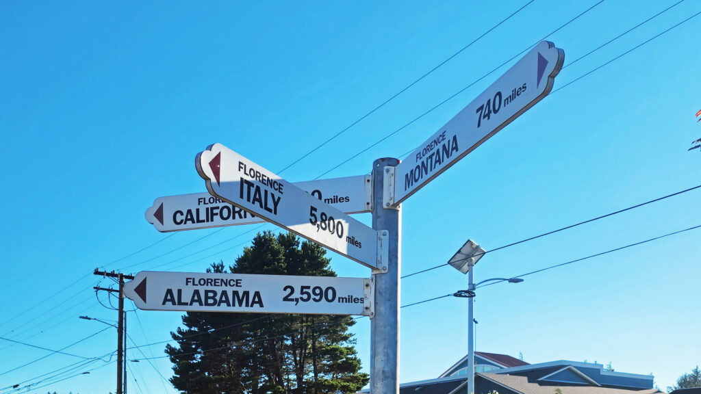
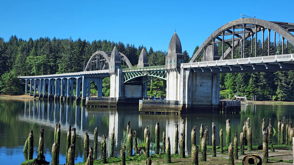
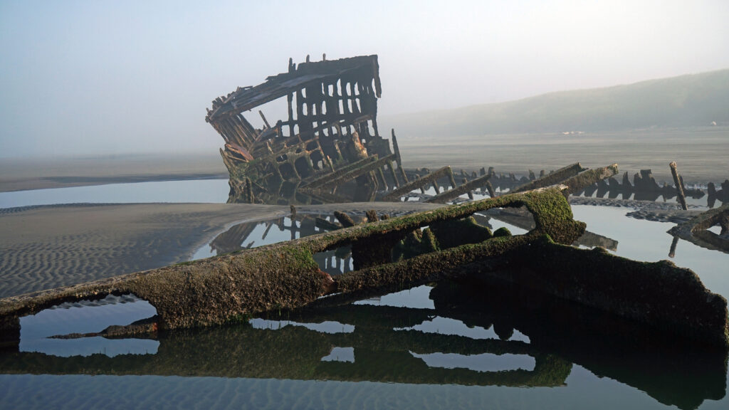
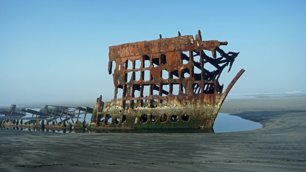
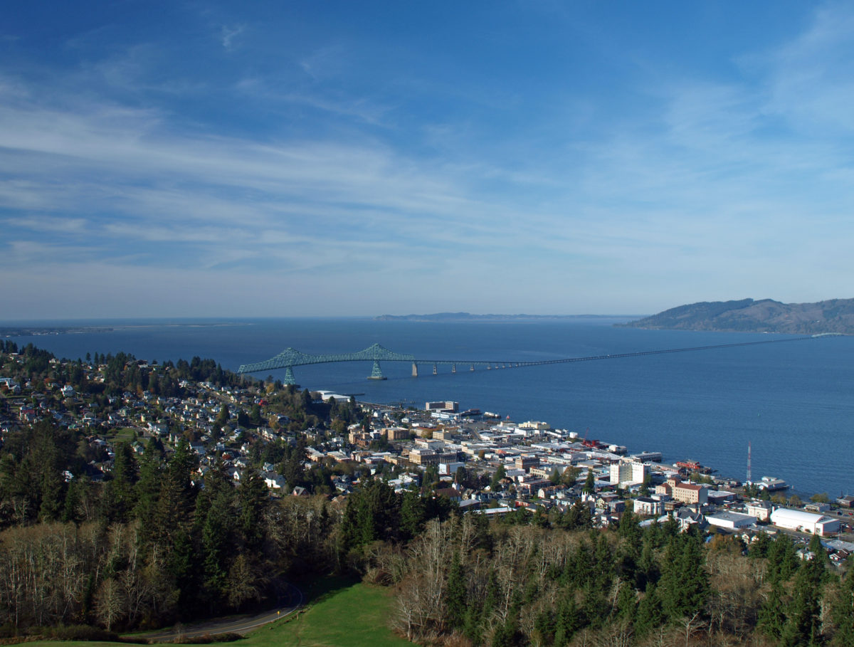
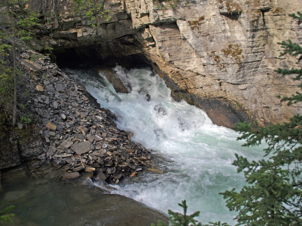
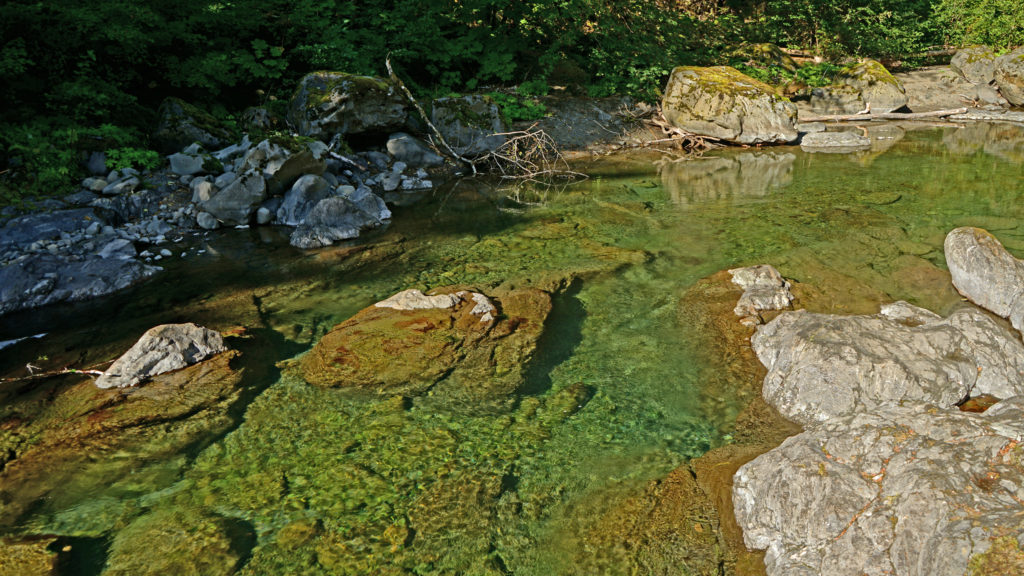
Florence, Oregon (not to be confused with Florence, Italy) is a small town on Oregon’s central coast. The town lies on the estuary of the Siuslaw River, a few miles inland from the Pacific Ocean. Historically, Florence’s economy centered around commercial fishing and the timber industry, but today sport fishing and general tourism are more important. Florence has a vibrant old town area, many festivals and parks, and access to miles of ocean beach. The surrounding area also has many tourist draws, most prominently the 31,500-acre Oregon Dunes National Recreation Area that runs for forty miles along the coast from the Siuslaw River to Coos Bay.
The Town
I have to confess that for years Florence was, to me, just a not terribly attractive town that you passed through to get to the lakes, streams, beaches, headlands, and dunes that were the real attractions of the area. It wasn’t until a few years ago that I discovered the charms of the old town waterfront area, the many quality eating establishments to be found in the town, and the parks and other attractions of the town. While the surrounding areas are still the main draw, Florence makes an attractive base to explore the area and has plenty of attractions of its own.
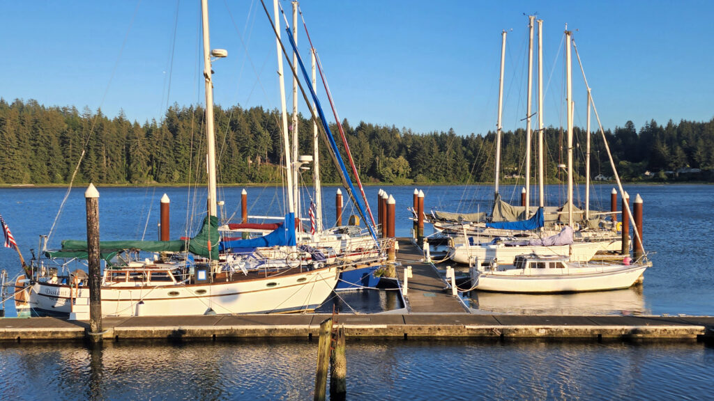
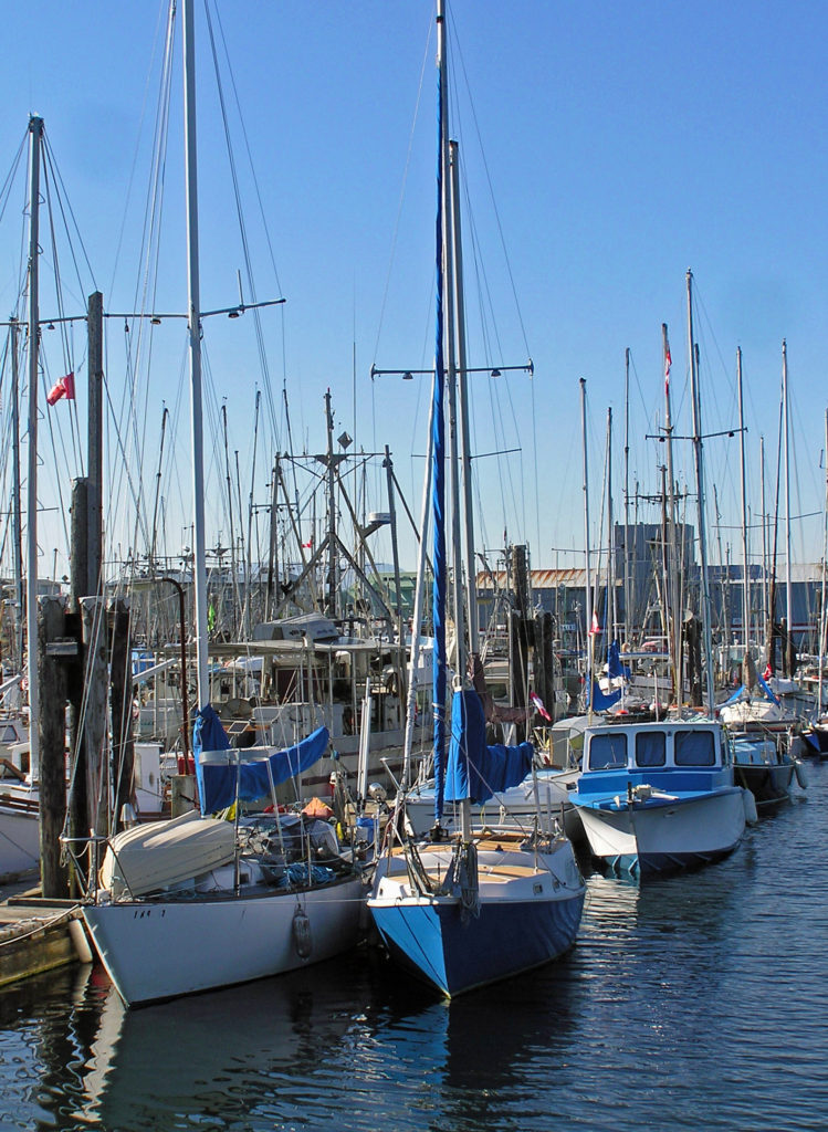
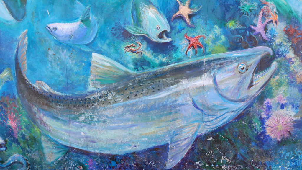
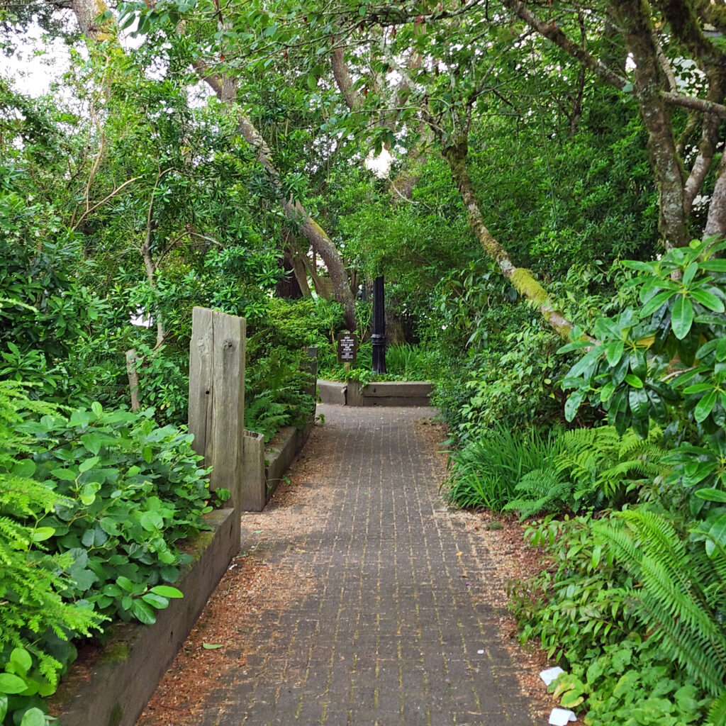
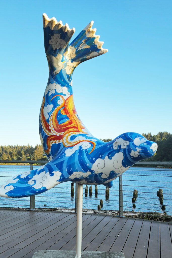
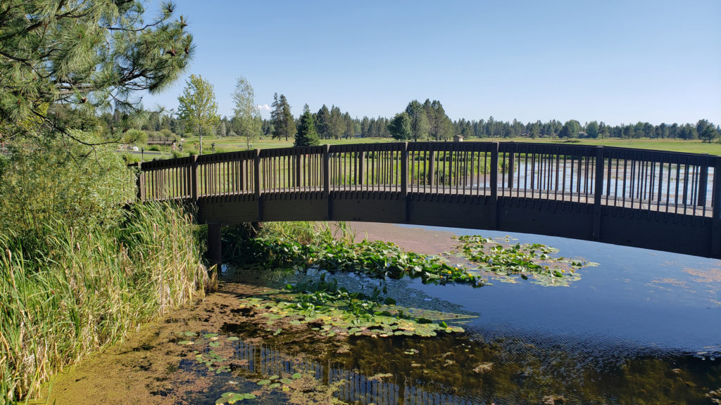
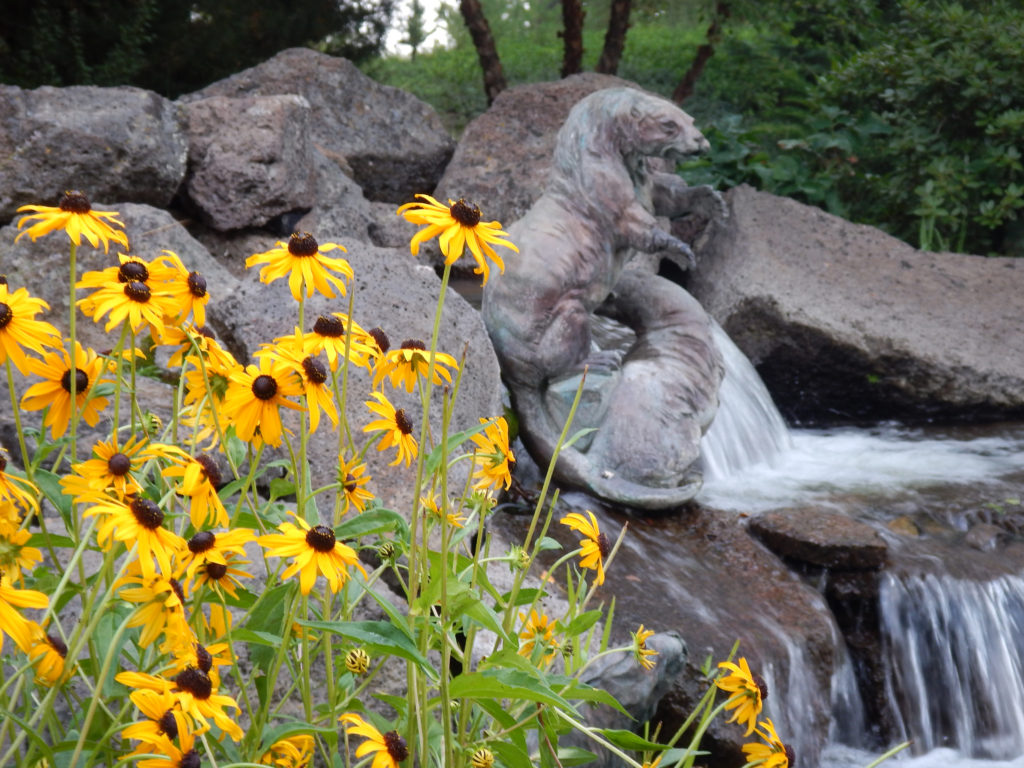
The old town area of Florence lies along the shore of the Siuslaw River. Although not large, the area has many restaurants and cafes and numerous small hotels and guest houses. There is a marina and an RV park, trails along the river, and a number of public art works. On my last visit, the main old town street was closed to vehicle traffic one evening to facilitate a giant block party that drew a huge crowd, with live music and many food vendors that made for a very festive evening.
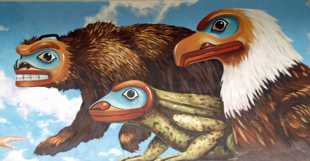
Art lovers will want to check out the Blue Heron Gallery and Backstreet Gallery, both in the old town area. For history buffs, the Siuslaw Pioneer Museum offers “a taste of life as it was 150 years ago.”
Quality dining in the old town can be found at Waterfront Depot, Nosh Eatery, Maple Street Bistro, 1285 Restobar, and the Firehouse. Outside of old town, Venny’s Café on Hwy 101 gets good reviews and Fresh Harvest Café, farther north on 101, is a good place to get breakfast or lunch. Brew pubs worth checking out include Beachcomber Pub and Homegrown Public House, both in the old town.
You might want to try the sport of sandboarding, especially if you are a family with active kids. Think snowboarding but on the dunes not the mountain slopes. Sand Master Park, just north of Fred Meyer in the north end of town, bills itself as the world’s first sandboarding park. You can get lessons, rent sandboards, and try out the sport onsite on 200 acres of dunes.
If you enjoy gambling, Three Rivers Casino Resort, just off Hwy 126 about a mile east of Hwy 101, offers plenty of opportunities to strike it rich (or not), plus several dining options and frequent live entertainments events. The casino is owned and operated by the Confederated Tribes of the Coos, Lower Umpqua, and Siuslaw Indians. The Tribes also own and operate Ocean Dunes Golf Links, one of two 18-hole courses in Florence, the other being Florence Golf Links (formerly known as Sand Pines).
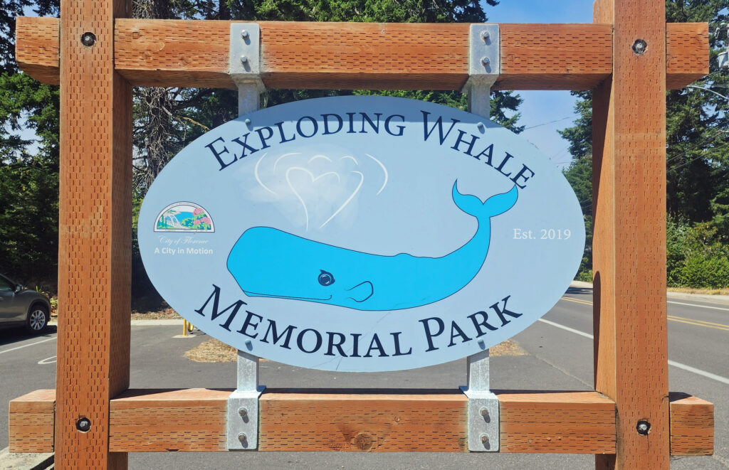
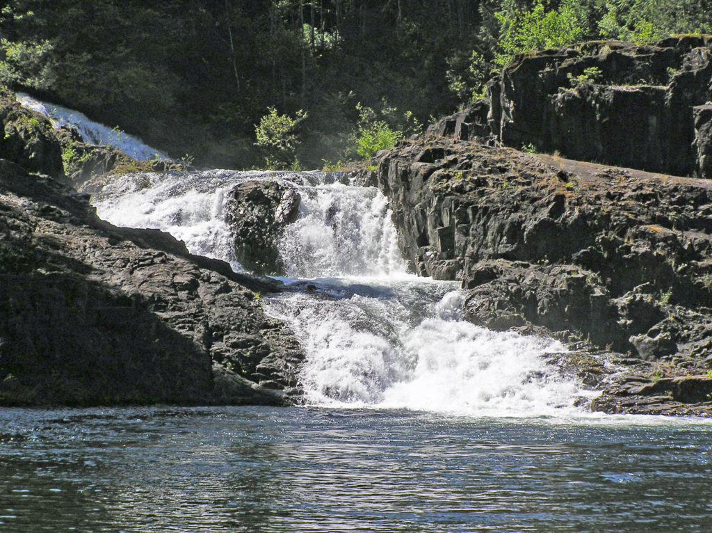
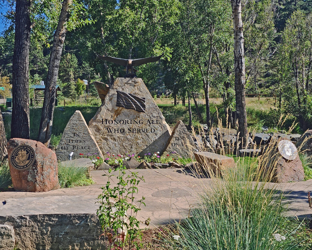
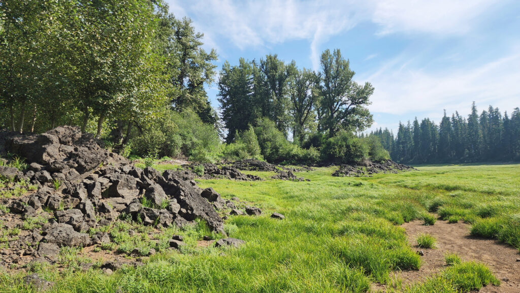
One of the oddities of Florence, Oregon involves an exploding whale. In 1970 a 45-foot sperm whale carcass washed ashore at Florence. The Oregon Highway Division used twenty cases (literally a ton) of dynamite in an attempt to break the carcass into small pieces. The resulting explosion sent pieces of the whale flying as much as 800 feet from the beach. No one was injured but several vehicles were damaged by falling blubber. The KATU-TV news story and video of the event has become something of a cult-classic and continues to be frequently viewed more than half a century later. An exhibit at the Siuslaw Pioneer Museum has bone fragments from the whale and a city park along the riverfront west of Hwy 101 was recently renamed Exploding Whale Park.
The Oregon Dunes
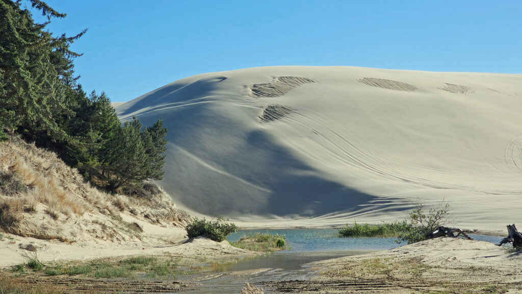
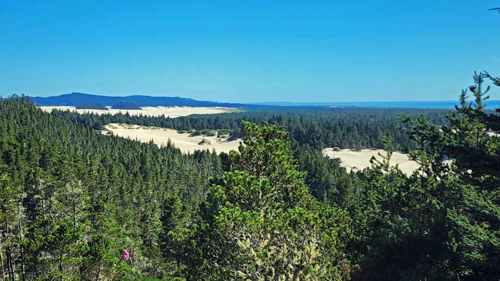
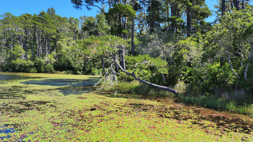
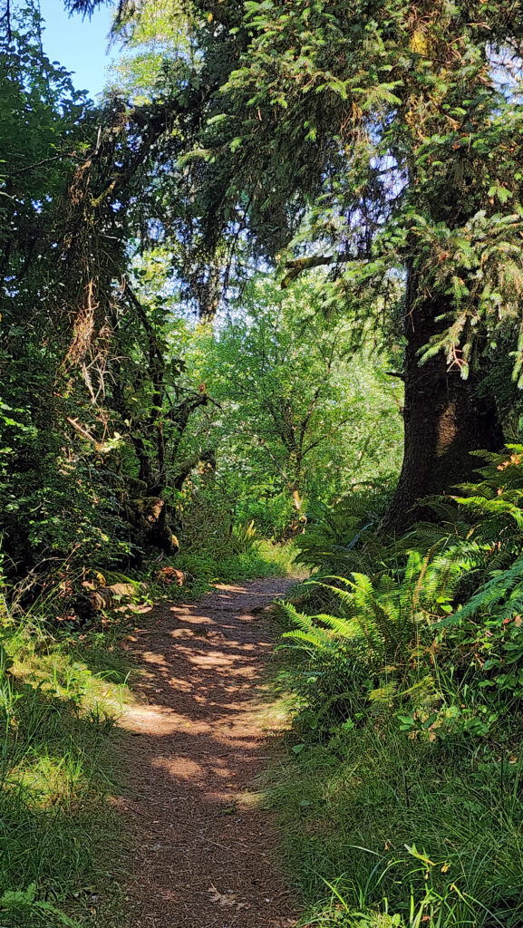
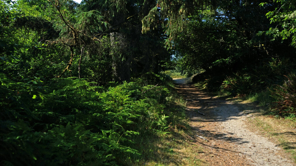
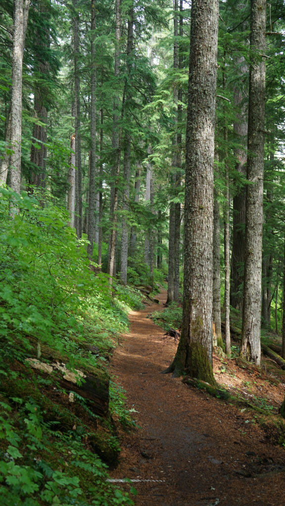
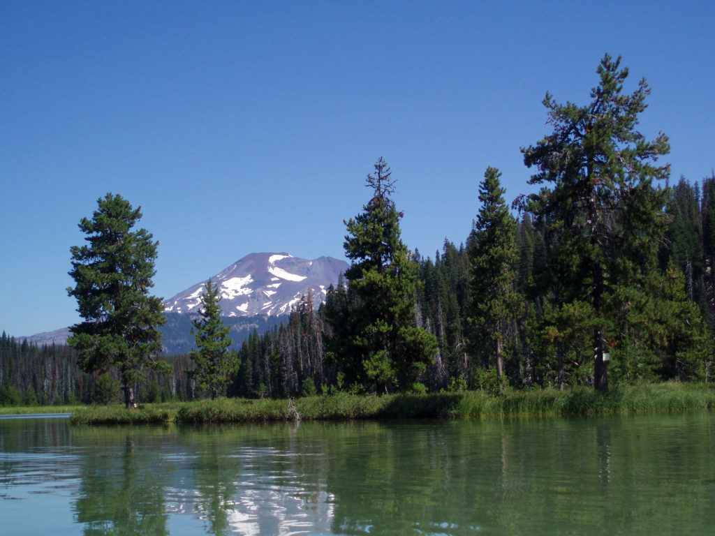
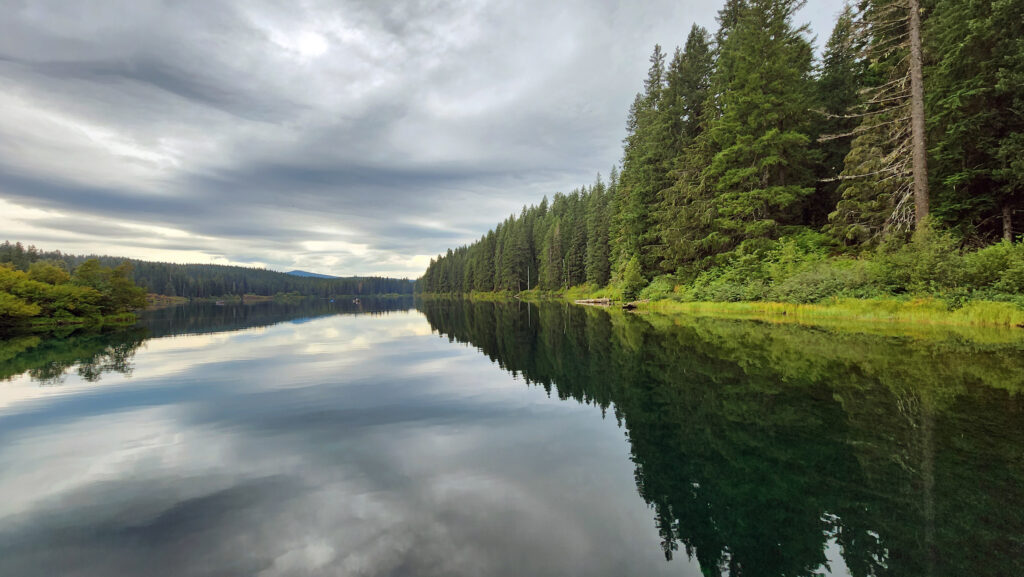
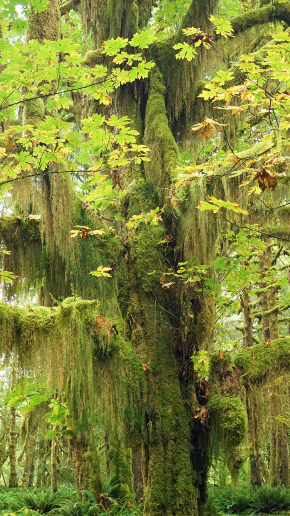
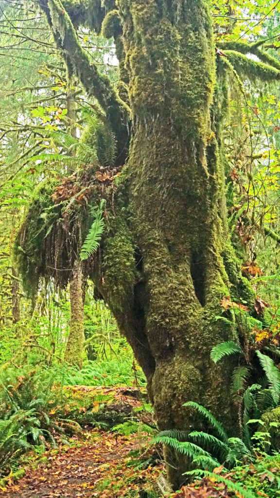
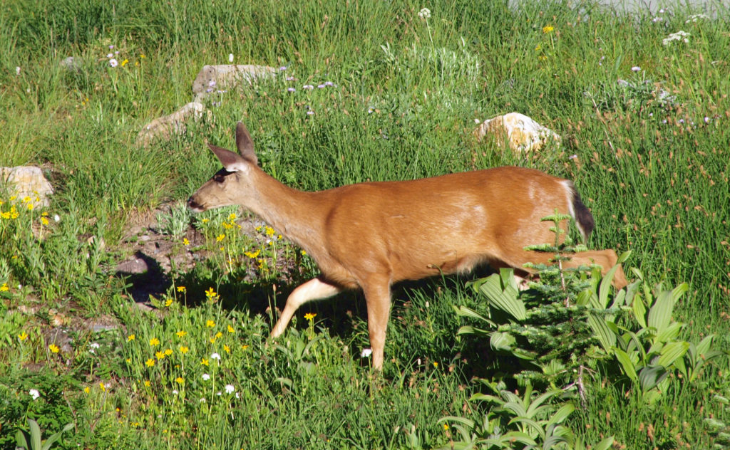
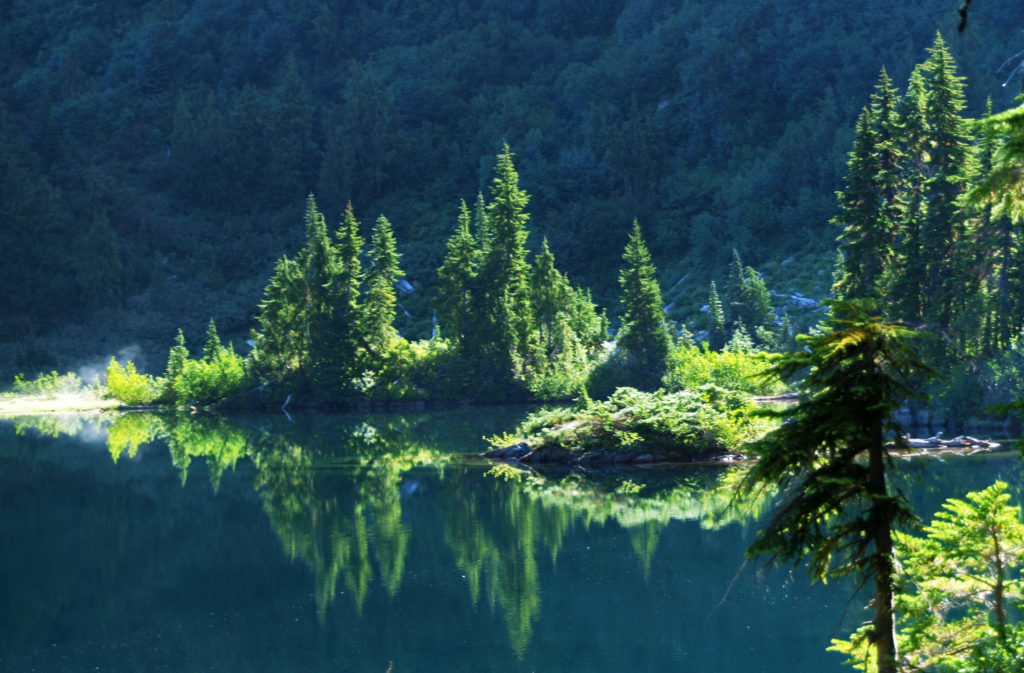
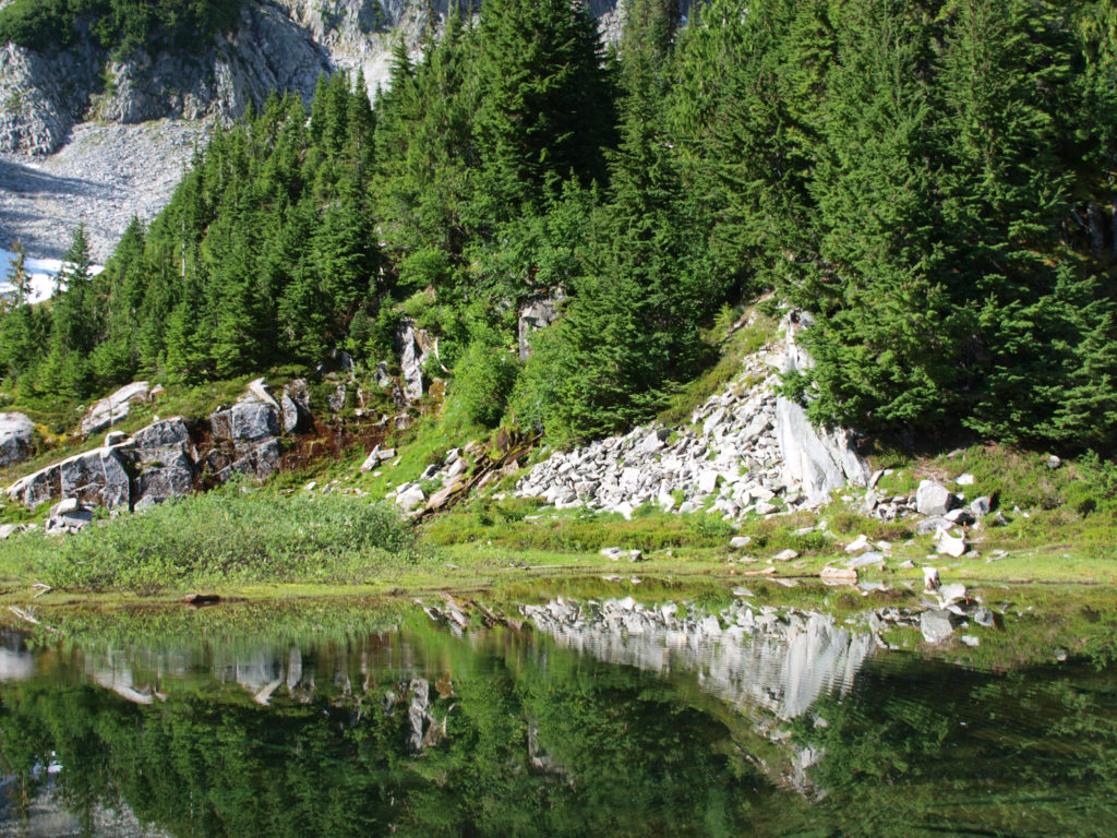
The Oregon Dunes consist of the largest coastal dune field in North America, coastal spruce and pine forest that includes many “tree islands” surrounded by dunes, miles of ocean beaches, and numerous freshwater lakes and wetlands. Outside the boundary of the national recreation area (NRA) there are several state parks and a number of Siuslaw National Forest campgrounds.
Honeyman State Park, about three miles south of Florence, has a large (364 site) campground, dunes access for both hikers and OHVs (Oct-Apr), picnic areas, a children’s playground, restrooms and showers, and two freshwater lakes.
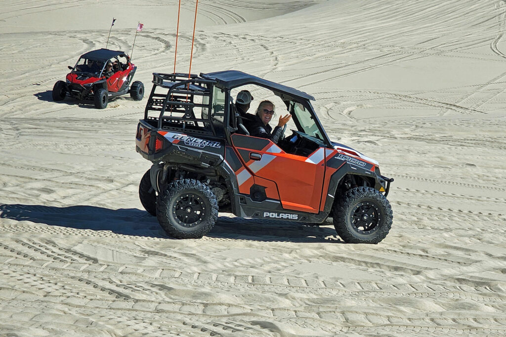
The miles of dunes are a very popular off-highway vehicle (OHV) recreational area. You can rent dune buggies if you don’t have your own, and tours on larger OHVs are also available. About one third of the NRA is open to off-highway vehicles. There are also ample areas within and adjacent to the NRA that are off limits to OHVs that provide a quieter experience for hikers, paddlers, birders, photographers, beachcombers, and other nature lovers.
Fishing and Boating
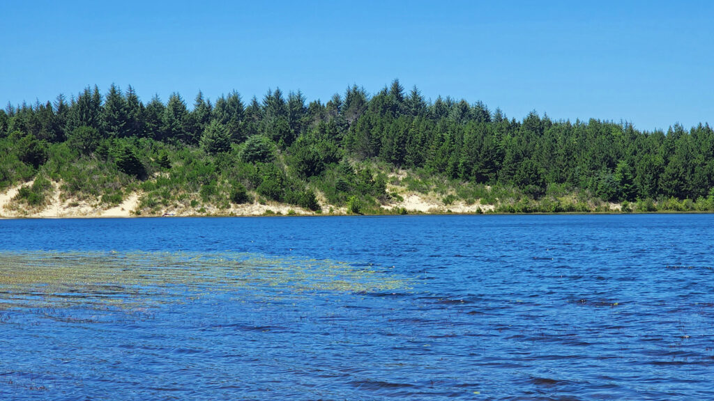
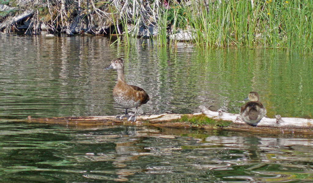
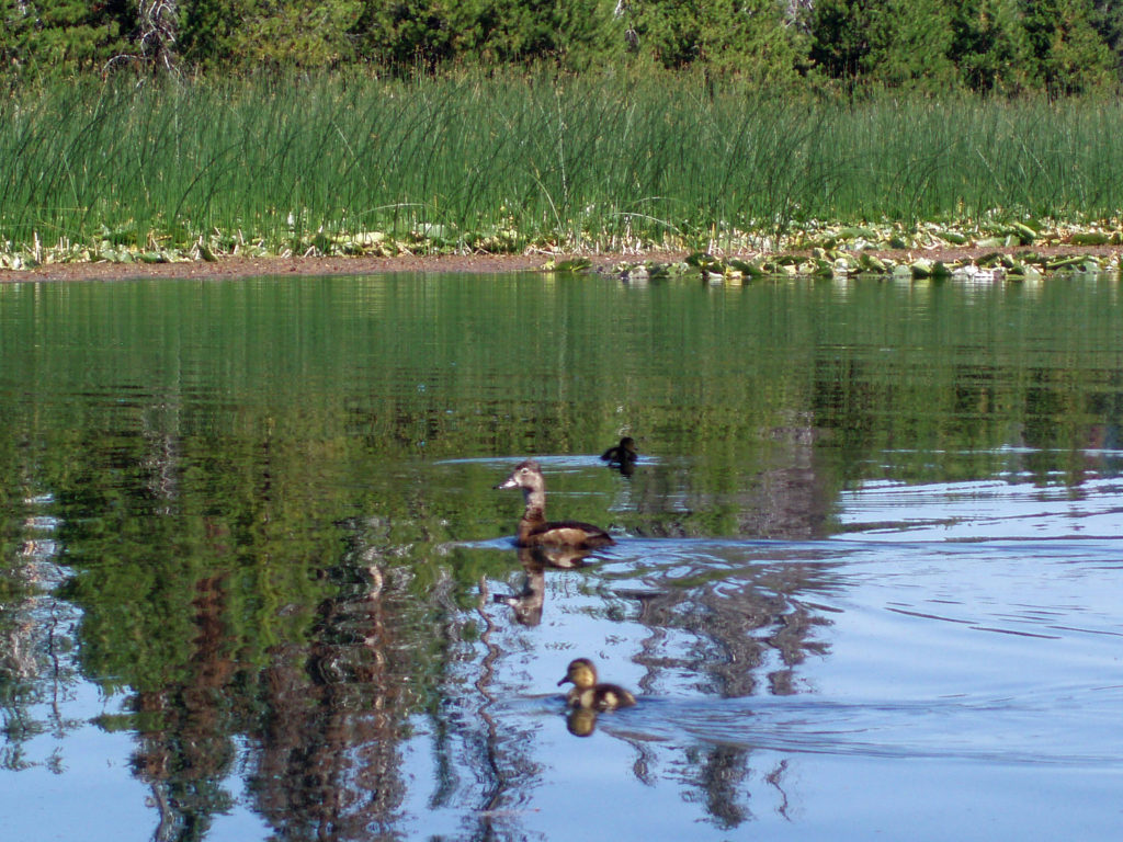
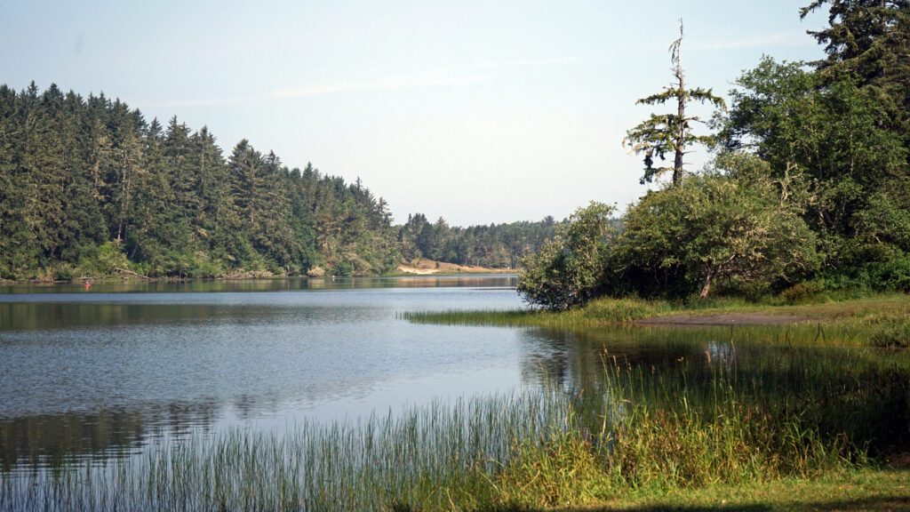
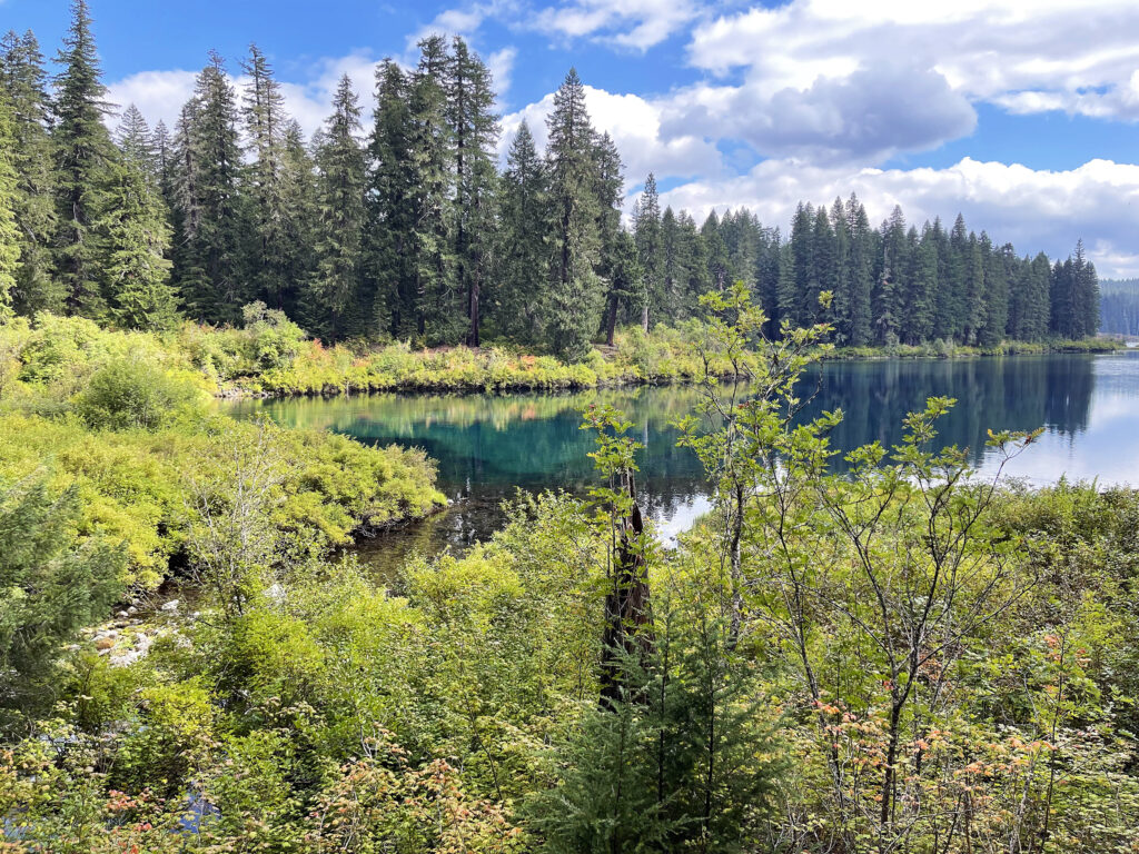
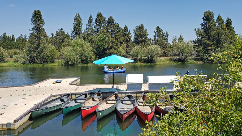
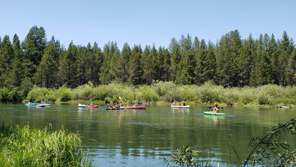
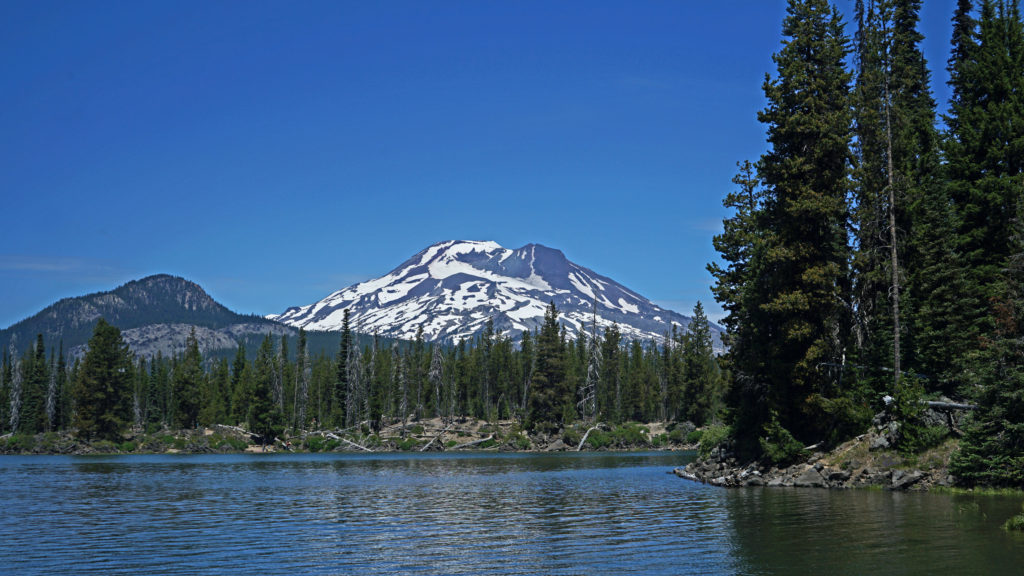
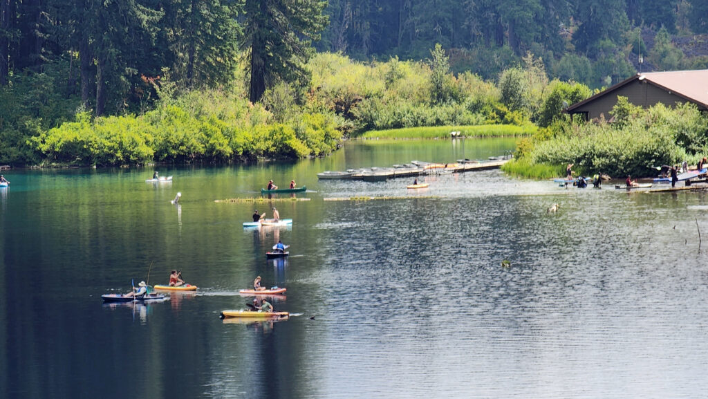
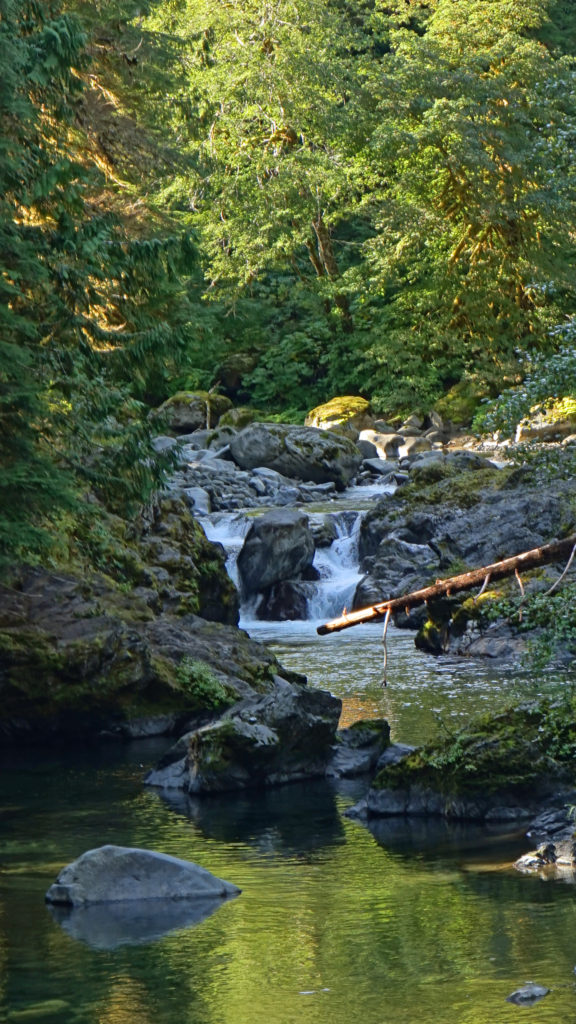
Fishing for rainbow and cutthroat trout and warm water species like bass and perch are popular activities on the freshwater lakes near Florence. Woahink, Siltcoos, and Tahkenitch Lakes south of Florence are all prime fishing grounds. All have public boat ramps that also give canoers, kayakers and paddleboarders access to the lakes. Cleawox Lake in Honeyman State Park also is a popular paddling spot. The Siuslaw River has both salmon and steelhead runs, and ocean fishing trips can be booked through charter services in Winchester Bay (aka Salmon Harbor) about twenty-five miles south of Florence. A list of local fishing guides can be found on the Port of Siuslaw website.
Area Beaches
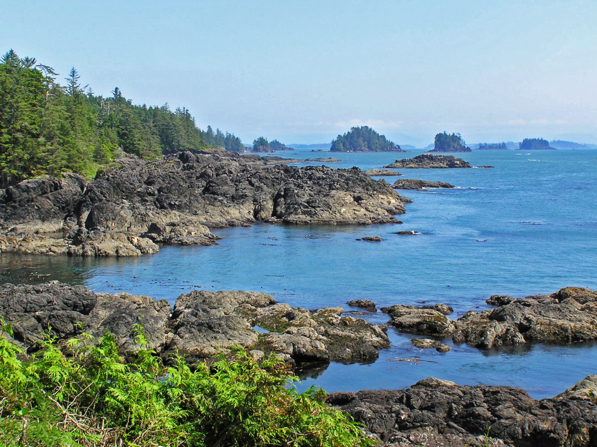
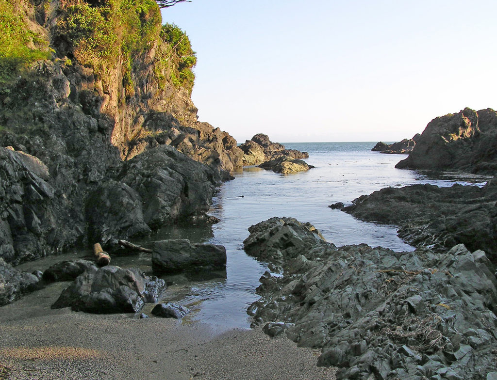
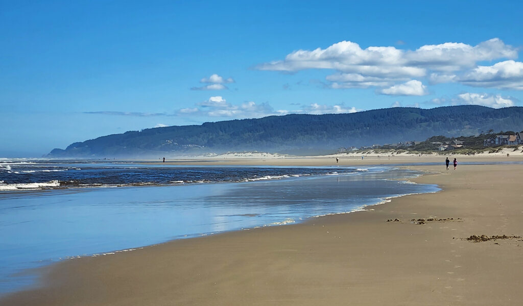
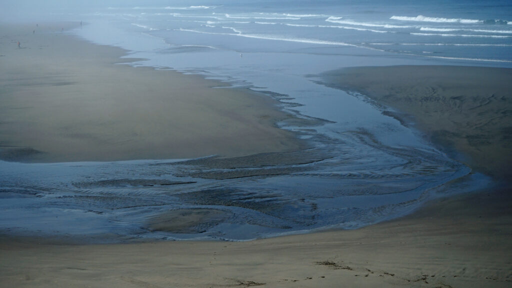
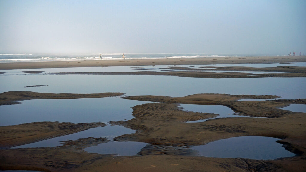
The south jetty area has five beach access points and four miles of beach where OHVs are not permitted. Go south on Hwy 101 and turn right onto Sand Dunes Road about a half mile south of the Siuslaw River Bridge. At the north end of town, the north jetty area and Heceta Beach County Park give access to another five miles of ocean beach. There are also many beach access points both north and south of Florence.
Heceta Head
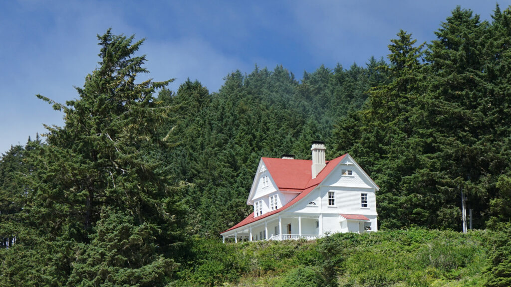
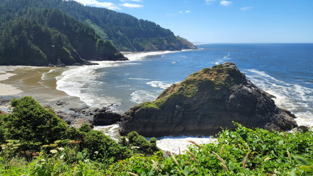
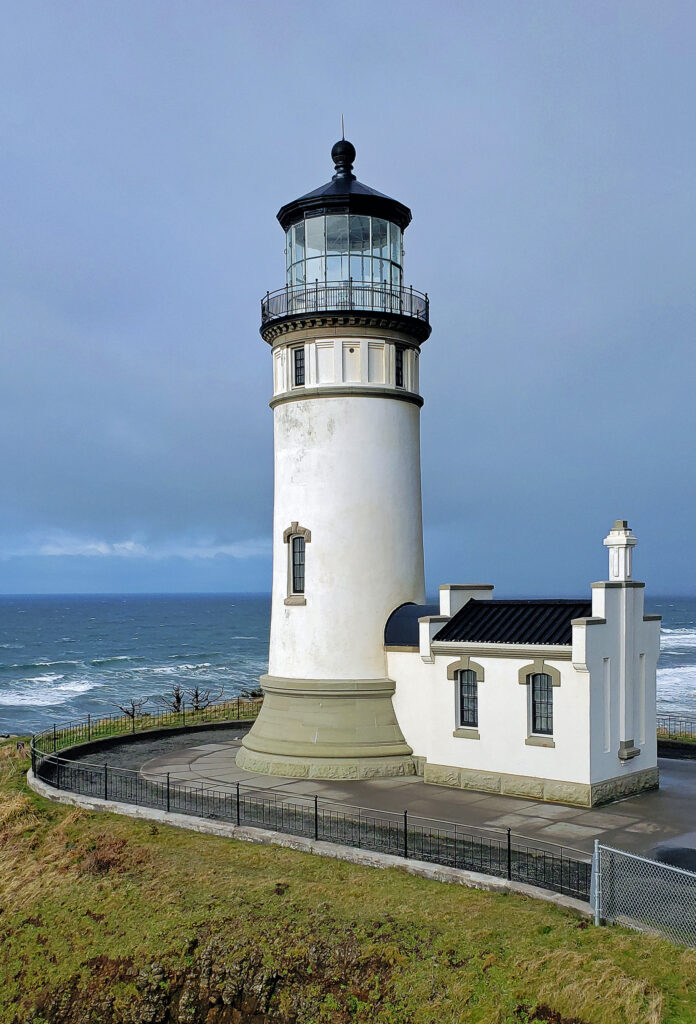
Heceta Head Lighthouse, about ten miles north of Florence, is one of the Oregon coast’s most iconic and most photographed locations. The lighthouse, built in 1893, is 56 feet tall and sits 200 feet above the ocean, making it one of the best whale-watching points on the coast. And the original assistant lightkeeper’s house is now a bed and breakfast inn with six rooms and features a seven-course breakfast menu.
Sea Lion Caves
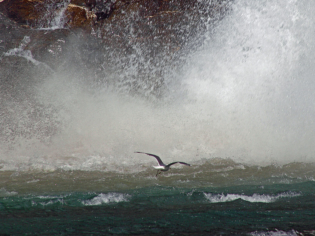
Located on Sea Lion Point about a mile south of Heceta Head , Sea Lion Caves is a privately owned attraction featuring the largest sea cave in the Americas. The cave (and the surrounding rocky shoreline) is the only mainland rookery of Steller Sea Lions. From the observation deck at the gift shop there is a great view of Heceta Head Lighthouse. From there, a short trail brings you to an elevator that descends over 200 feet to the cave. In winter and spring, you’ll likely see hundreds of sea lions in the huge cave, but in the summer and fall there may not be any sea lions in the cave. They’ll mostly be found on the rocks outside the cave in those months. But the cave itself (about 300 feet across and 125 feet high) is worth the cost of admission.
Darlingtonia Wayside
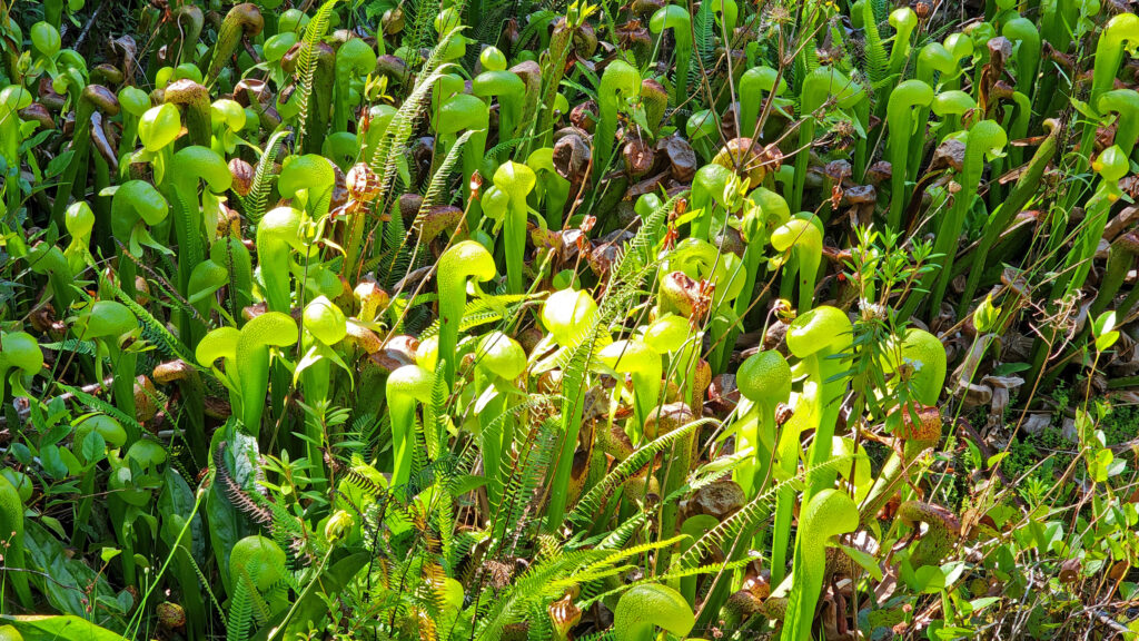
A few miles north of Florence at Darlingtonia Wayside (now officially Darlingtonia State Natural Site) you’ll find one of the few places in the Pacific Northwest where cobra lilies (Darlingtonia californica) can be found. These carnivorous plants trap and consume insects that provide the plant with nitrogen and nutrients that they can’t get from the boggy soil. There are restrooms at the parking area and a short boardwalk trail that takes you into the cobra lily’s domain.
Conclusion
Florence, Oregon is a great stopping point on a tour of the 363 miles of Oregon coastline. There’s so much to see and do in the surrounding area and in the town itself that you could easily spend a week in Florence and not run out of things to do and sights to see. I’m looking forward to my next visit, maybe an off-season trip this winter.
And if you’re heading farther down the coast, make sure to stop in Bandon-by-the-sea. Farther south, the southern Oregon coast has spectacular scenery and is as uncrowded and unspoiled as it gets on the Pacific coast.
Posted Dec 2, 2024
All photos © Alan K. Lee
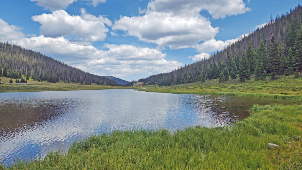
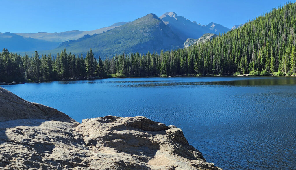
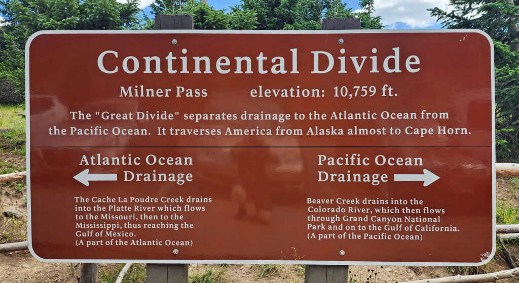 Coming down off Trail Ridge we stopped on the continental divide at Milner Pass (at 10,759 feet you actually come down in elevation from Trail Ridge to the divide). We did a short walk there along the shore of Poudre Lake and, of course, took a photo of the continental divide sign before heading south.
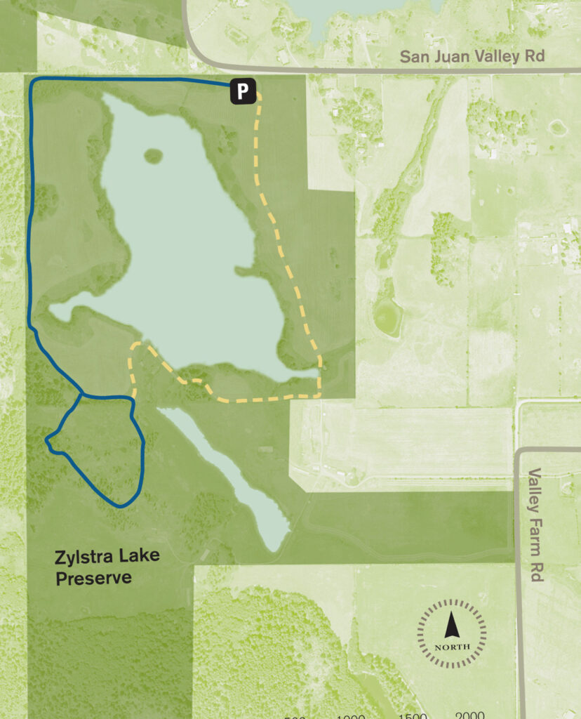
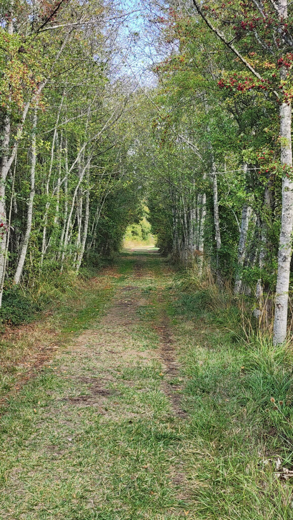
 The property was formerly a privately owned farm that was the site of a proposed housing development. Instead, the property was sold to the land bank in 2015 and the trust obtained the conservation easement. Thirty acres of the property, including the farmhouse and agricultural buildings, were sold by the land bank to Island Haven, a non-profit animal sanctuary, with a conservation easement to protect the land.
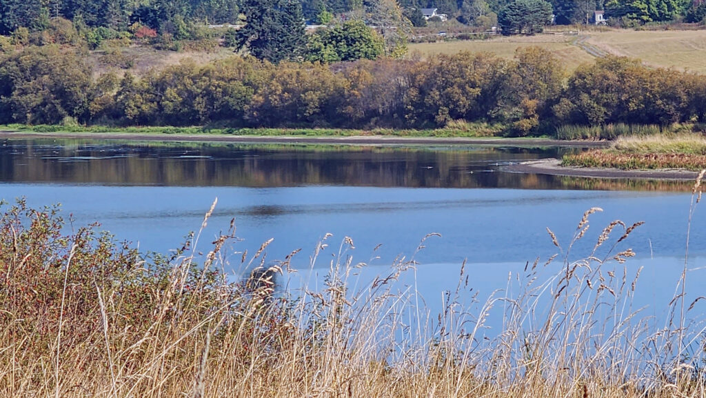 Currently, there is no public access to the lakeshore, and the eastern and southern portions of the trail around the lake are closed from October through March. The northern and western portions of the loop are open year-round and can be hiked as a lollipop loop during the winter.
 Getting there:
 Trailhead:
 The hike:
 At 0.3 miles the trail turns south and runs along the western boundary of the preserve for another 0.4 miles. The trail then turns southeast and follows the edge of an open field with good views of the lake.
 At the 0.85-mile mark, turn right onto a trail that leads through a mix of open fields and partially logged woodland.
 At the 1.25-mile mark, the trail returns to the open field. In winter, the trail ahead is closed, so you need to turn left and retrace your route back to the trailhead parking area.
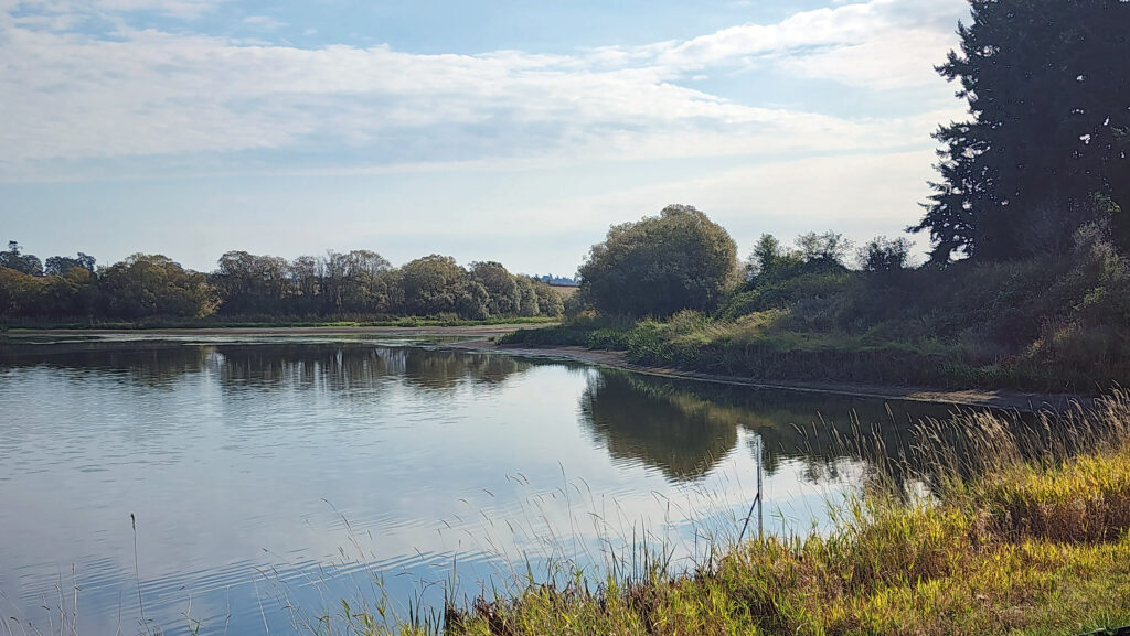 In summer, you can continue straight. The trail then turns right and crosses a bridge over the creek that flows from the lake. Beyond the bridge, the trail runs along the top of the dam that forms the lake, then passes through a small grove of trees.
 From there, the trail runs between fields to the old farmhouse site that is now home to the Island Haven animal sanctuary. The trail turns left there and follows a gravel farm road back to the trailhead.
 Posted October 12, 2023 by Alan K. Lee
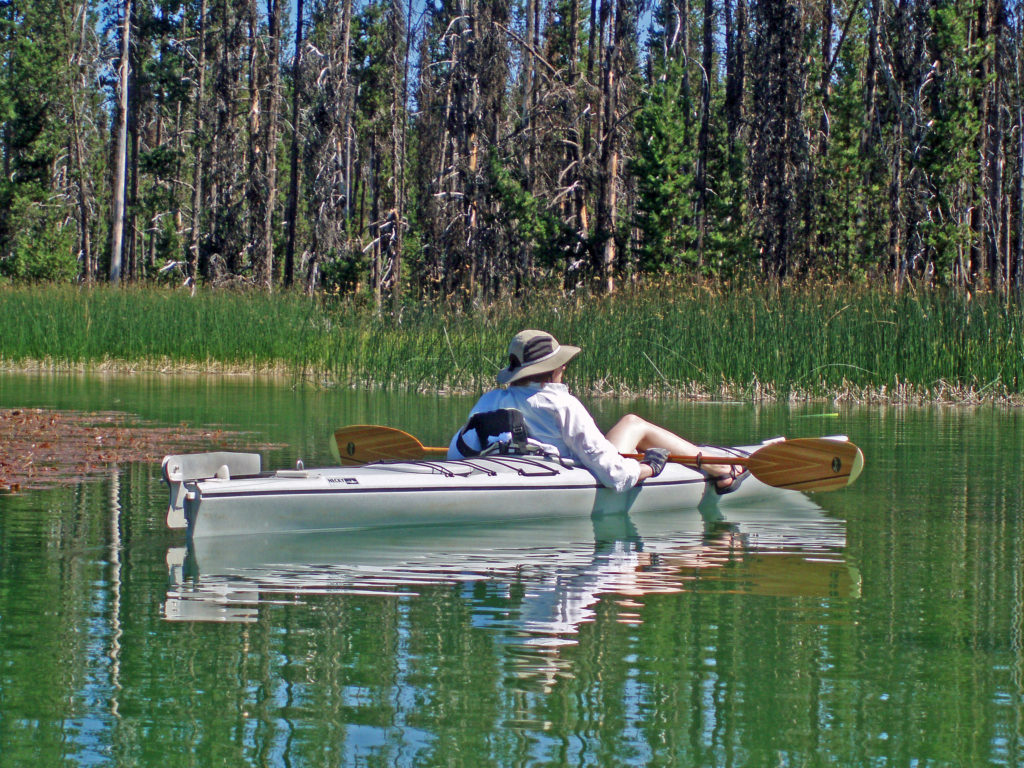
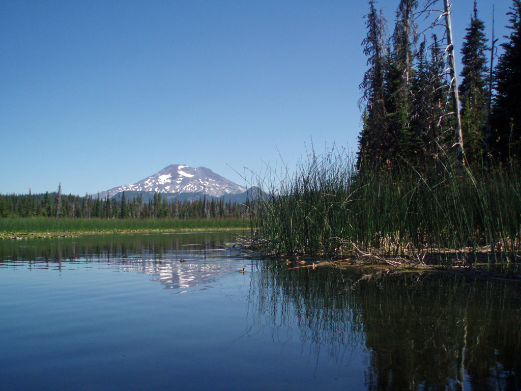
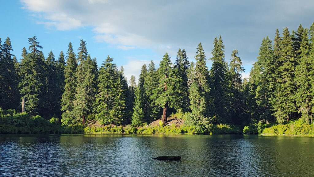
 Hosmer Lake is a mix of open water and reeds, rushes, water lilies, and other marsh plants. Motorized craft (except for electric motor powered) are not allowed on the lake, which makes it ideal for kayaking or canoeing. It’s also not a big lake at 160 acres, so you can easily explore it all in an afternoon.
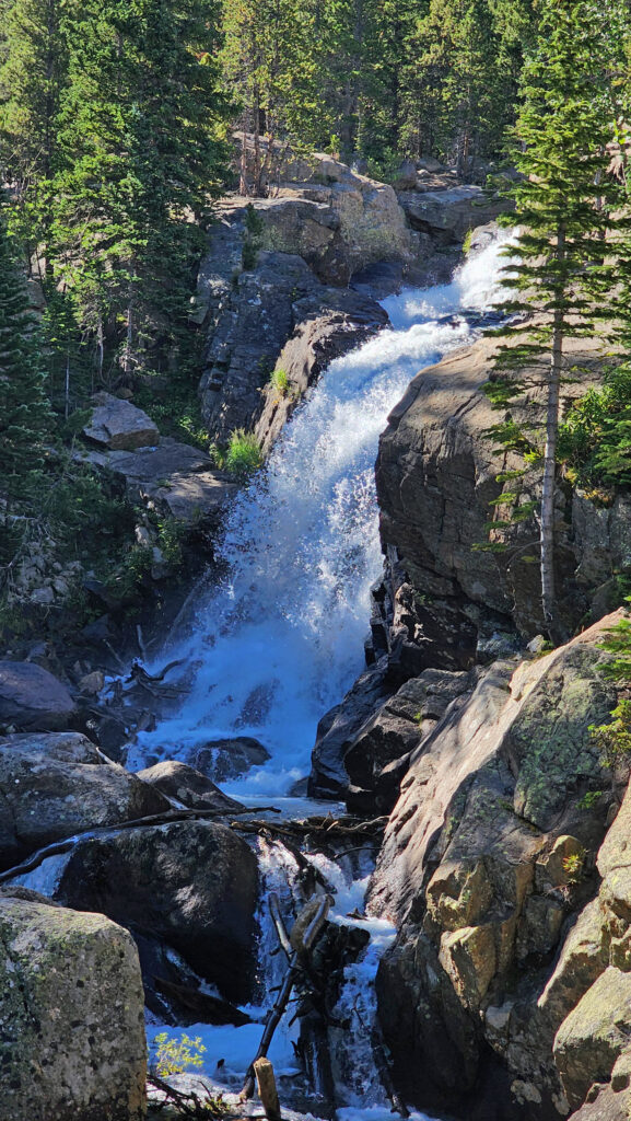
 Hosmer Lake is fed by Quinn Creek, which flows into the north end of the lake. Quinn Creek is narrow and shallow, but it is possible to paddle up it for a ways. When we were there last, downed trees blocked our passage a few hundred yards from the mouth of the creek. We hauled our kayaks out of the water at that point and hiked along the creek to a small waterfall where we ate lunch and lingered awhile before heading back out on the water.
 Recalling our visits to Hosmer Lake, I’m eager now to get back to the area and get back on the water again. It’s a beautiful place, and one of my favorite destinations.
  Hosmer Lake is located in the Deschutes National Forest. Check the Forest Service
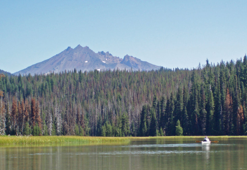

 From the Great Spring the trail follows the east shore through the lava fields and forest. Parts of the trail are pretty rough. Good quality hiking boots are advised, although I did this hike in sneakers on my latest visit. But open toed sandals or flip flops are definitely not acceptable footwear on this section of the trail.
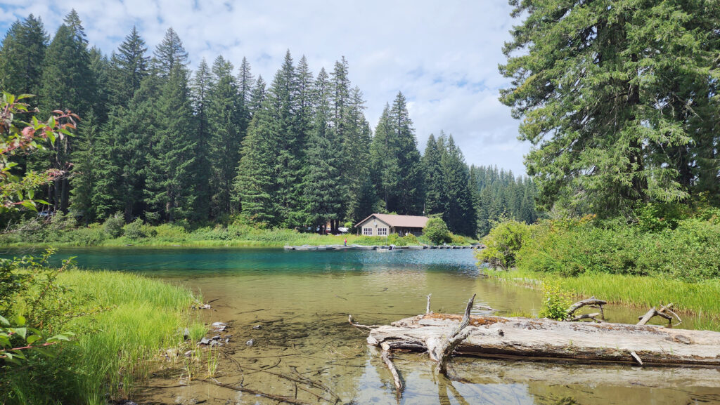


 The Icefields Parkway ends at the town of Jasper, a smaller, less crowded, and lower key version of Banff. There are abundant restaurants, pubs, galleries, and shops there, but accommodations are limited, and hotels and motels are expensive. Book your stay well in advance. We opted for staying in a travel trailer at an RV park 30 miles (48 km) from Jasper, just outside the park boundary, because that was the only thing available through Airbnb when we were planning our trip. It was a little inconvenient, but in the end it worked fine.


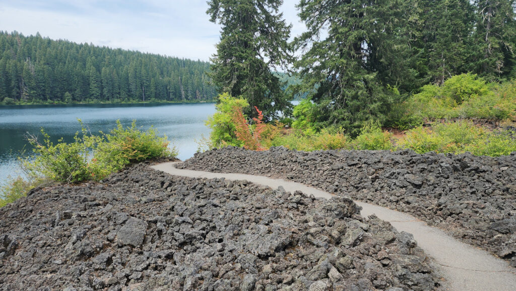
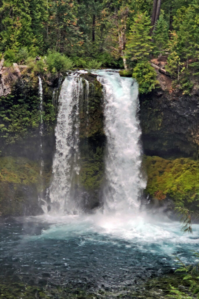
 Clear Lake offers the outdoor enthusiast a number recreational options, including hiking, fishing, paddling, or just taking in the views and soaking up the beauty and peacefulness of nature.
 The Clear Lake and upper McKenzie area is one of the most scenic and most interesting parts of the Cascades, and offers a number of other hiking options besides the Clear Lake Loop. The 2.6-mile
 You can take in Clear Lake and do the Waterfall Loop in a weekend. Make it a long weekend and add the Blue Pool hike or spend a day out on the lake. Better yet, make a week of it and check out Fish Lake, the Santiam Pass and McKenzie Pass areas, and the lower McKenzie River. You won’t run out of things to do.
 The nearby
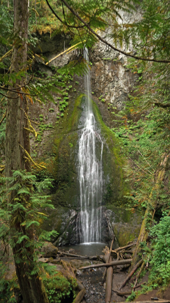
 After our hike to Sol Duc Falls we drove to the Hurricane Ridge Visitor Center to do some more hiking and sightseeing. The visitor center is located 17 miles south of Port Angeles at an elevation of 5242 feet above sea level. Hurricane Ridge is the only alpine area in Olympic National Park accessible by car, which makes it very popular and means it can be very crowded, especially on summer weekends. We were there in the middle of the week in late September, though, so crowds weren’t much of an issue.
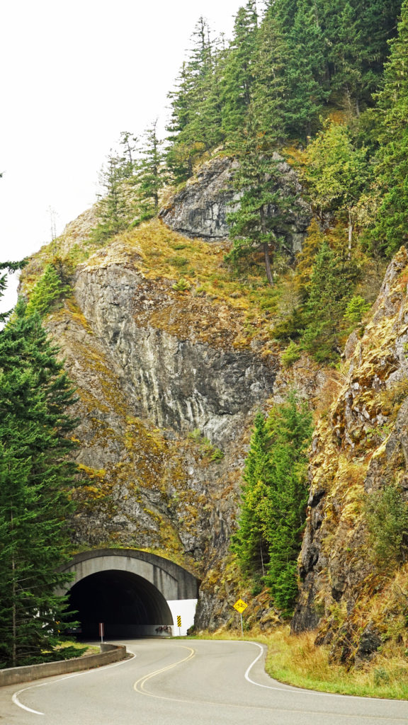 The Hurricane Ridge Road is paved, but winding with poor sight lines and several tunnels. It is also a popular challenge for cyclists because of the elevation gain, so go slow and watch for bicycles on the road.
 Originally posted November 7, 2020. Updated and re-posted November 9, 2022.
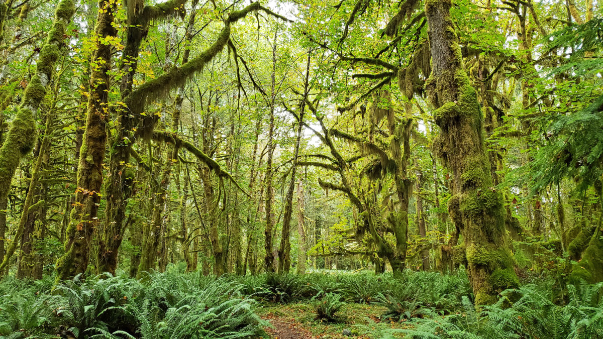
 The Quinault Rain Forest lies in the southwestern corner of Olympic National Park, the adjacent Olympic National Forest, and the Quinault Indian Reservation in western Washington. It’s less than a four hour drive from either Portland or Seattle, but it seems a world apart, and more than a little stuck in time. It looks much as I remember it from when I first visited as a child more than a half century ago. Cell phone service and wi-fi availability are spotty. There are no big resorts and no towns of any size. Urban America is nowhere to be found.
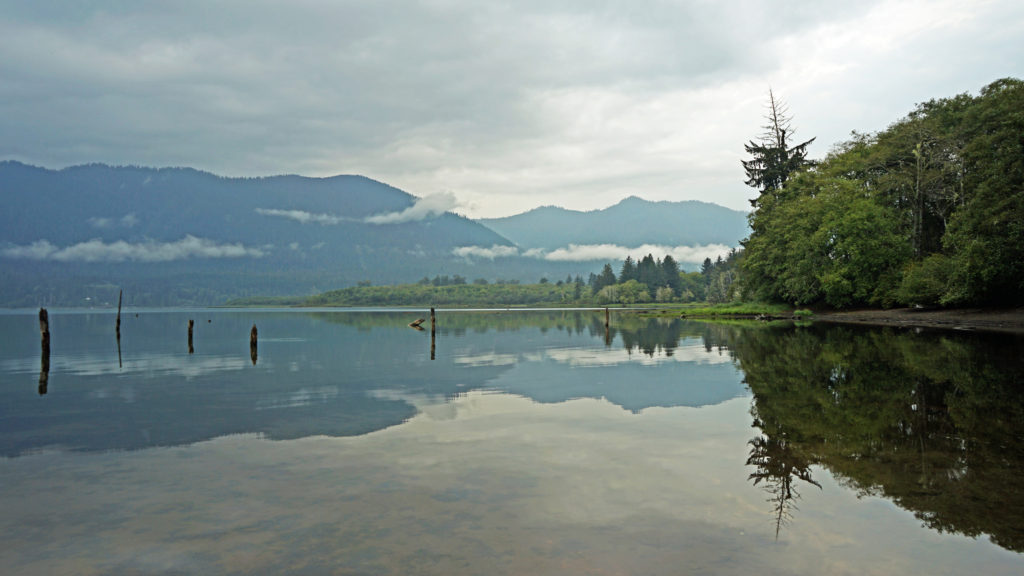 The pandemic has kept all of us from traveling as much as maybe we’d like. That certainly applies to my wife and I. Most of our vacation plans for 2020 had to be cancelled. And just when the parks and recreation areas were beginning to reopen, wildfires in western Oregon and Washington shut them down again. But the Olympic Peninsula was largely unaffected by the fires. So, my wife and I decided that the Olympics would be an ideal, and much needed, escape from Portland, and in September 2020 we headed to the Olympic Peninsula. Our first stop was Lake Quinault.
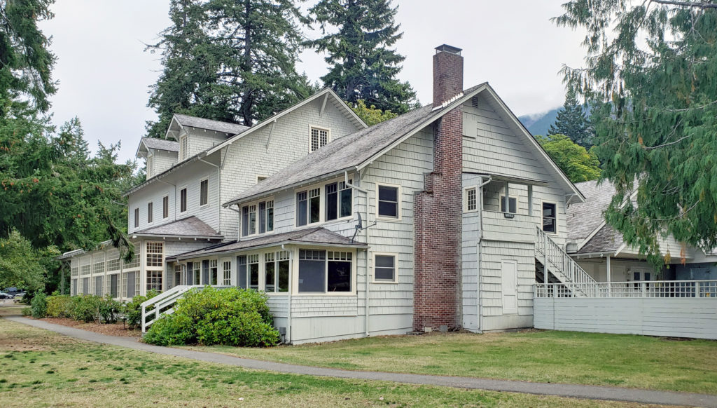
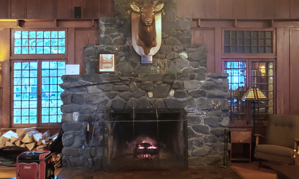
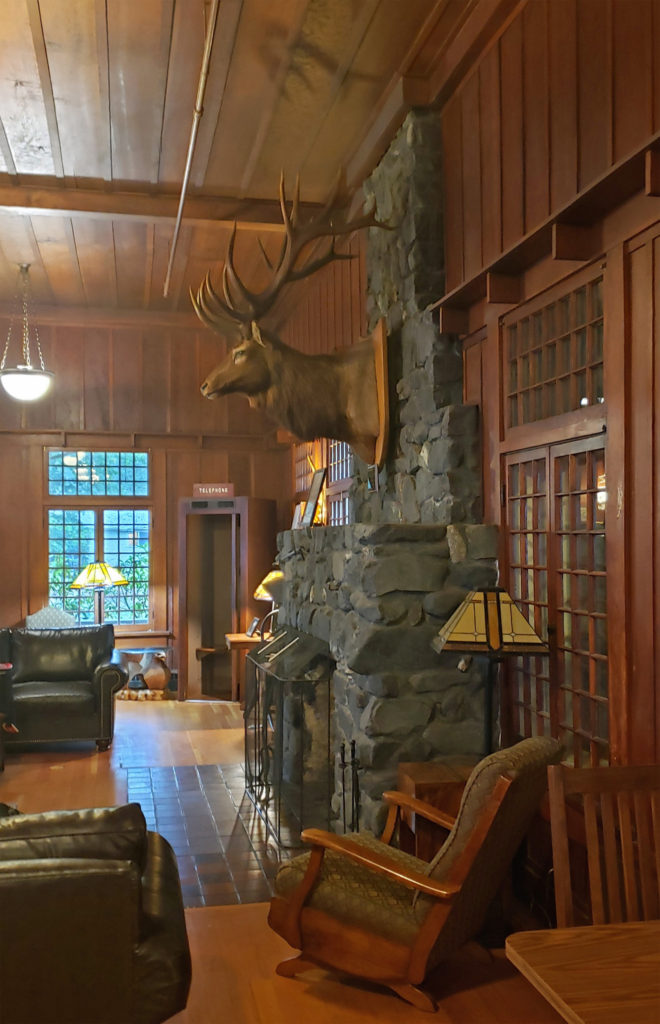
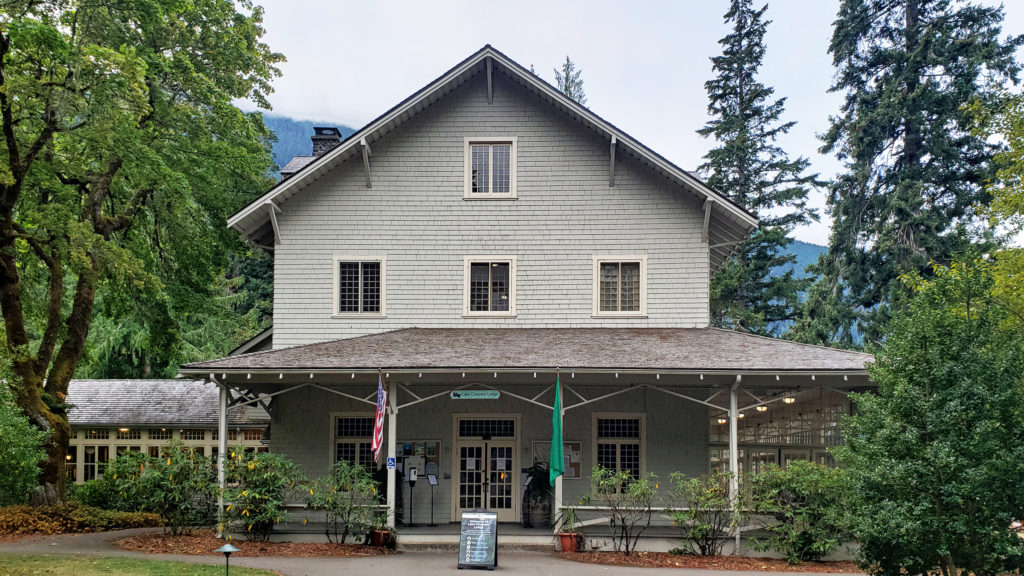
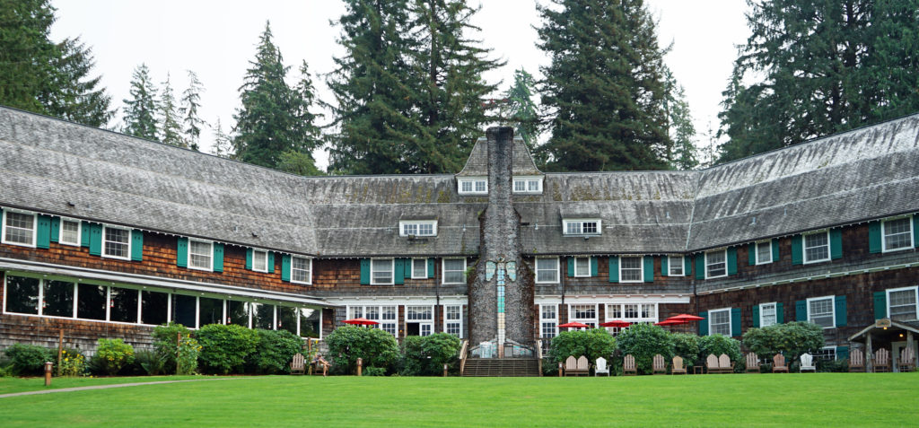 We treated ourselves to a stay at the historic Lake Quinault Lodge, one of the iconic grand lodges of the American West. The original Lake Quinault Lodge was built in 1904. The Boathouse annex was built in 1923. The original lodge burned down in 1924 and the current main lodge was constructed in 1926 on the site of the older lodge. Two additional annexes have been added since then. The existing lodge was placed on the National Register of Historic Places in 1998.
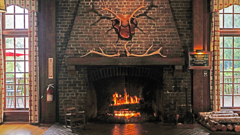 Rooms at the lodge are a little pricey, but you’re paying for the history, charm, and iconic nature of the lodge more than for the amenities provided. There are no TVs in any of the main lodge rooms, no fridges, or microwaves, no phones and no cell phone service. But that’s all part of the charm. The Boathouse and the other two annexes offer a few more amenities. Some come with fireplaces, the Lakeside Rooms are billed as family friendly, and the Boathouse Rooms are pet friendly. Our room in the main lodge came with all we needed, a comfortable bed and a view of the lake.
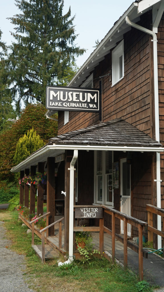 Services at the lodge were limited by the pandemic during our stay. The swimming pool, sauna, and game room were closed. The restaurant served take out meals, but the dining room was closed (outside seating was available and you could eat in the main hall or in your room). However, all services have been restored to pre-pandemic levels.
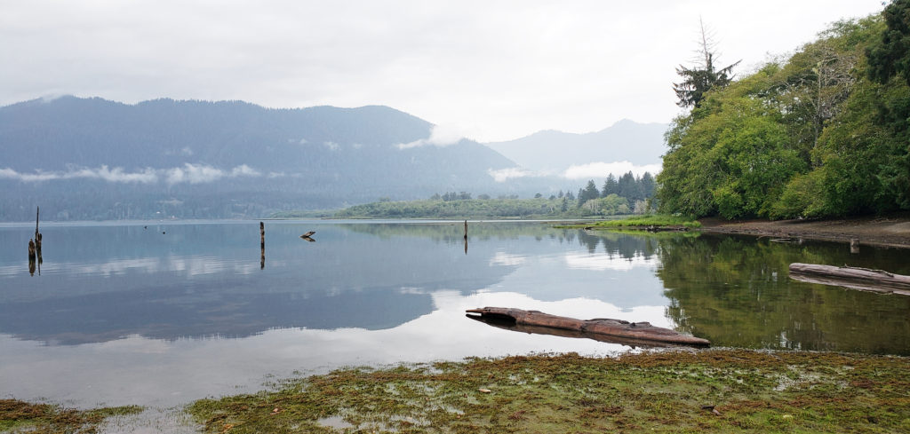 A somewhat cheaper alternative to Lake Quinault Lodge is the nearby Rain Forest Resort, which has a 16 room lodge, cabins (some with hot tubs), an RV park, and a restaurant. The world’s largest Sitka Spruce grows a short walk from the resort. Other options are the Quinault River Inn on Hwy 101 in Amanda Park, and Lochaerie Resort on North Shore Road. And there are three campgrounds on the south shore of Lake Quinault, and two (one a walk-in) on the north shore.
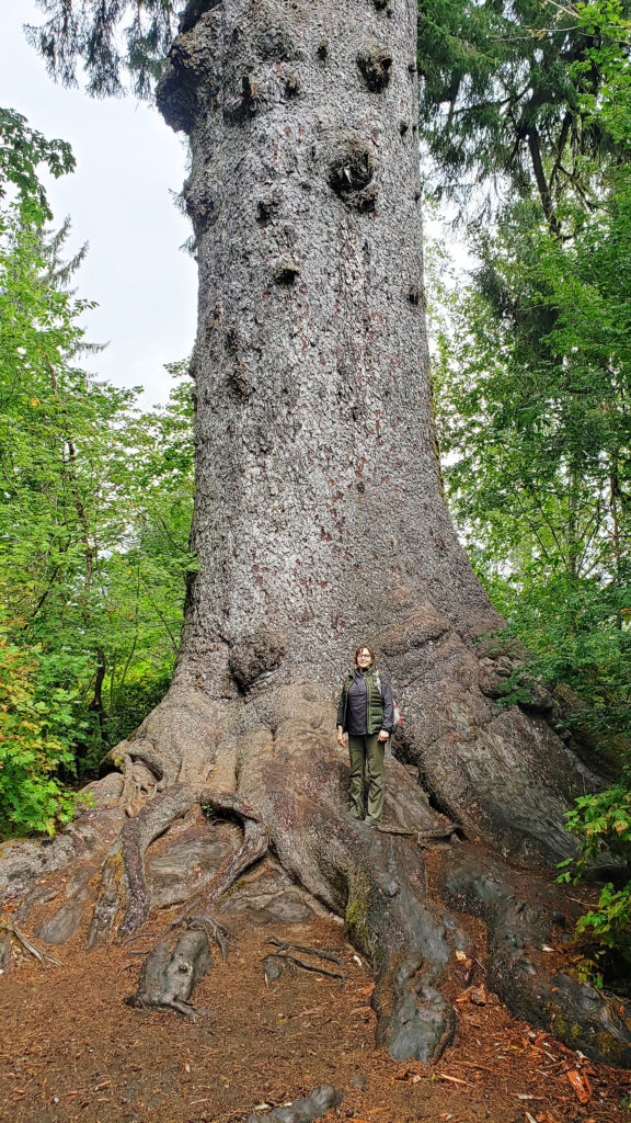 Lake Quinault Lodge, the Rain Forest Resort, or any of the three south shore campgrounds make an ideal base for exploring the area. Hikers have a variety of options, from the half mile Rain Forest Nature Trail Loop to a loop of about seven miles that takes you to Gatton Creek Falls, Cascade Falls, the Cedar Bog, the Rain Forest Nature Trail, and along the lake shore. Cutoff trails make shorter loops of various distances possible. Other hiking trails are a short drive from the lodge.
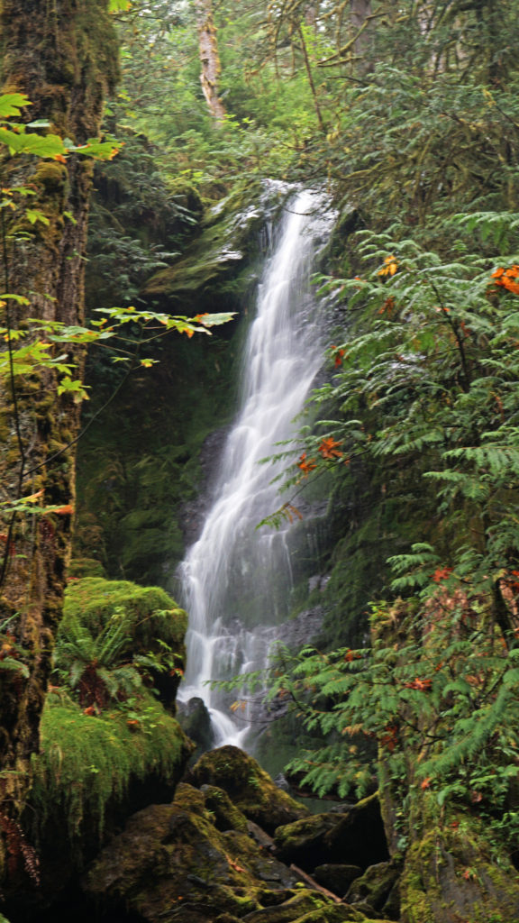 Two stops along South Shore Road worth making are Merriman Falls and Bunch Falls. Both are just east of Lake Quinault and both are right by the road, so no hiking required.
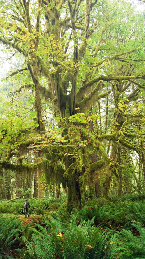
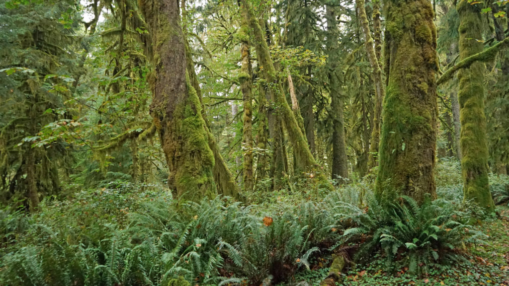
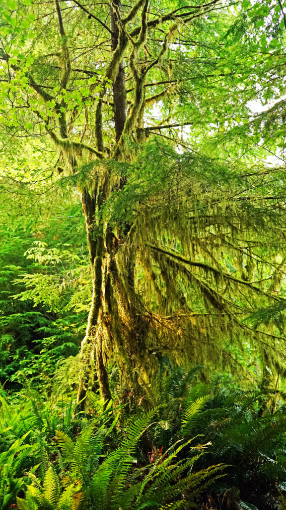
 One hike that everyone should do is the Maple Glade Trail at the Quinault River Ranger Station on North Shore Road. It is spectacularly beautiful, and like the Rain Forest Nature Trail, it’s an easy 0.5 mile loop. But, unlike the Rain Forest Nature Trail, which takes you through a coniferous forest of Douglas Fir, Western Hemlock, and Western Red Cedar, the Maple Glade Trail immerses you in a Bigleaf Maple forest. There the ground is covered in ferns and other low growing shrubs and the maples soar overhead, but in between is mostly open and airy. The effect is like being in a gigantic room carpeted with ferns and roofed with a canopy of maple leaves.
 The Maple Glade Trail can be extended by taking the connecting trail to the Kestner Homestead. There you’ll find the Kestner house, barn, outbuildings, and a cool old rusted delivery truck.
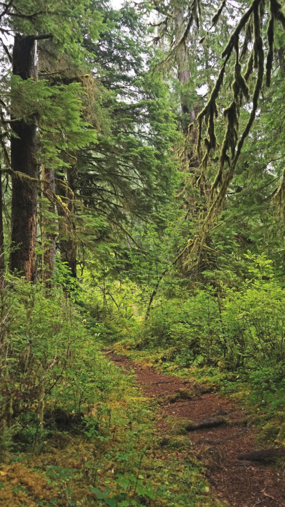
 There are also much longer hikes that can be taken into the Olympic National Park from the Quinault Valley. The most famous, and probably most hiked, is the Enchanted Valley Trail. It’s a 13 mile hike along the East Fork of the Quinault River to reach the Enchanted Valley, so it is not a casual outing. Most people do it as a 3-5 day backpacking trip. My backpacking days are behind me, but the Enchanted Valley is one of the hikes that I regret having never done.
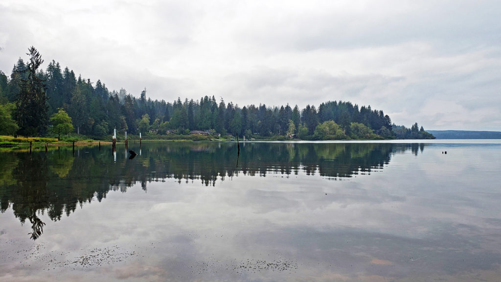
 Originally posted October 26, 2020. Updated and re-posted August 11, 2022.
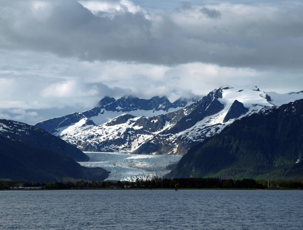
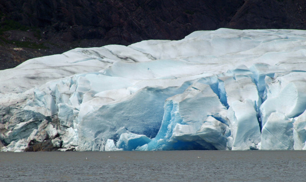
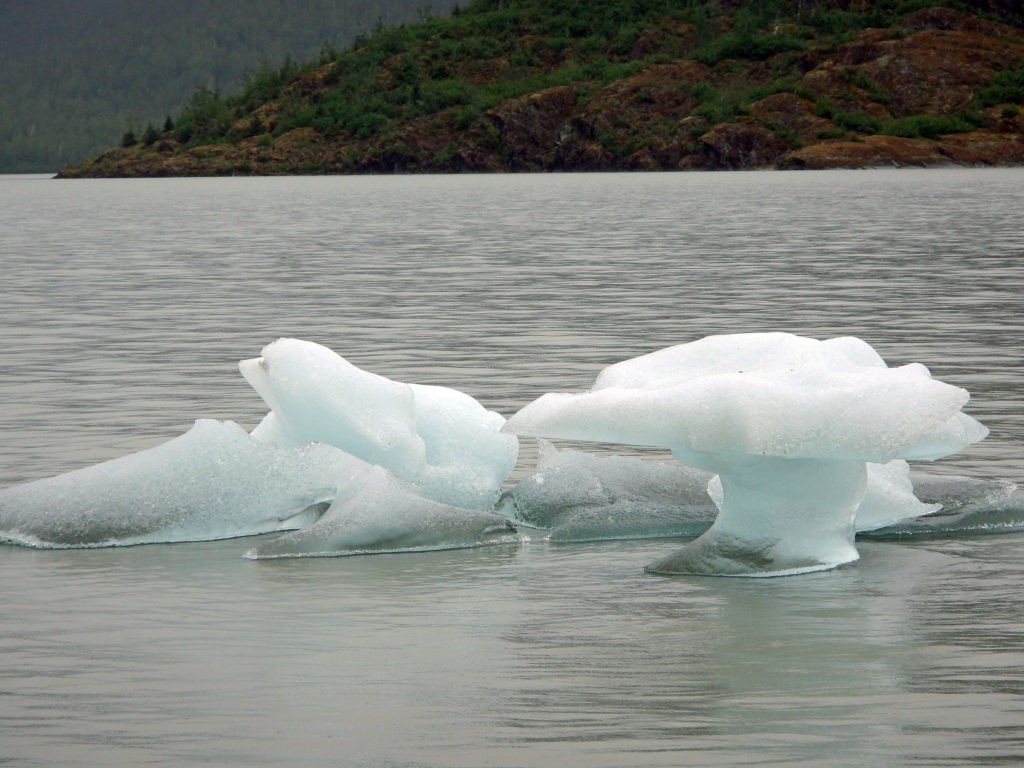
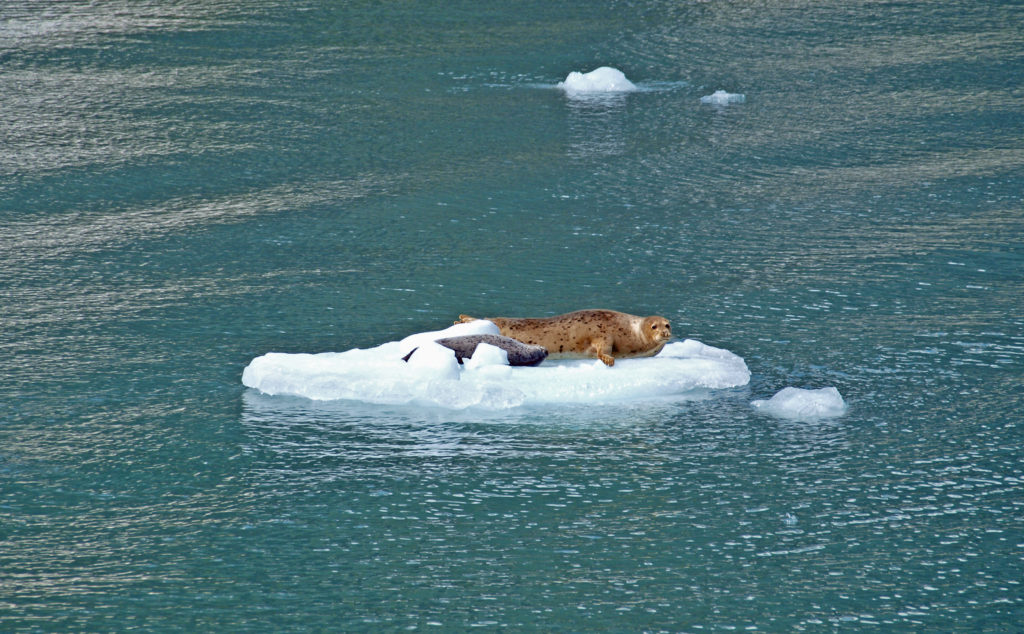 Seals often haul out on the bergs to rest and sleep. At the head of the inlet you’ll get a close up view of South Sawyer Glacier. How close you get will depend on the boat that you’re on and the amount of ice in the water, but you will get a spectacular look at the face of the glacier and there’s a chance that you’ll witness large blocks of ice calving off the face and crashing into the water below. The cruise was one of the highlights of our trip. We didn’t have time to repeat the cruise on latest visit, but if you can fit it into your itinerary, I highly recommend that you do so. Day trips start at about $275 per person.
 The highlights of the trip were the two hikes we did on the Skyline Trail. The first was the four mile out and back hike to Panorama Point. The second was the roughly four mile Skyline-Golden Gate loop. Both are listed as “moderate” hikes, but both have significant elevation gains (1700′ and 1400′ respectively). We did both hikes early in the day during the week, but we were far from the only ones on the trail, especially on the hike to Panorama Point. But the area above Paradise is so incredibly scenic that the crowds didn’t diminish the experience much.
 Close to Paradise Inn, the Jackson Memorial Visitor Center, named after long-time U.S. Senator Henry M. Jackson, offers general information, exhibits, a park film, guided ranger programs, a book/gift store and a cafeteria. Unfortunately, all visitor centers in the park are currently closed due to the ongoing pandemic.
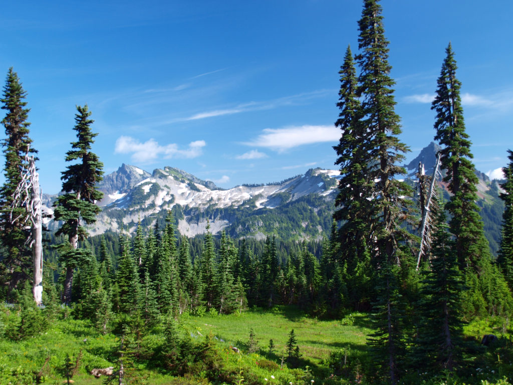
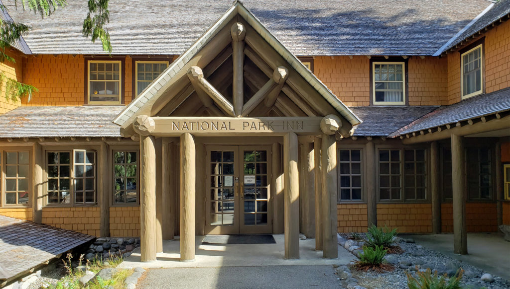 Both Paradise Inn and the National Park Inn have full service restaurants, but both were operating on a reduced scale due to the pandemic when we were there in August. The National Park Inn dining room was closed, but take out meals could be ordered and picked up at the reception desk in the lobby. The dining room at Paradise Inn was open for dinner only for most of our visit, but closed (unexpectedly) for the season on our last day there. Paradise Inn also has a limited service cafe, and there is a cafeteria at the Jackson Memorial Visitor Center that is open daily during the summer season and on most weekends and holidays in the winter (depending on road conditions). The National Park Inn restaurant is open year round.
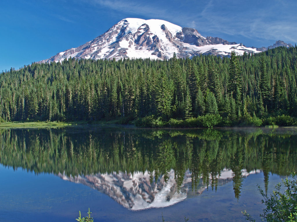
 The nearby Snow Lake Trail is an easy and worthwhile hike. To the east, the Stevens Canyon area has a number of interesting areas, including Box Canyon, a 180 foot deep slot canyon, and a number of roadside waterfalls.
 The Longmire area has some interesting history, a museum, nice hiking trails, and the National Park Inn offers both lodging and dining options for the visitor. The road to Longmire is also plowed in the winter, so it’s a year round destination. (The road from Longmire to Paradise is open in winter when the weather allows.)
 In the Ohanapecosh area in the southeastern corner of the park, the Grove of the Patriarchs Trail is a good family friendly outing. And the nearby Silver Falls Trail is a must for waterfall lovers. In the northeastern section of the park, the Sunrise area offers beautiful views of the eastern side of the mountain and has an abundance of hiking trails.
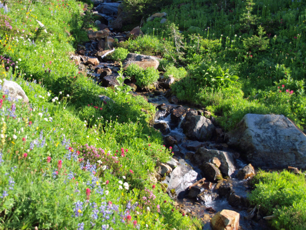
 The Lake
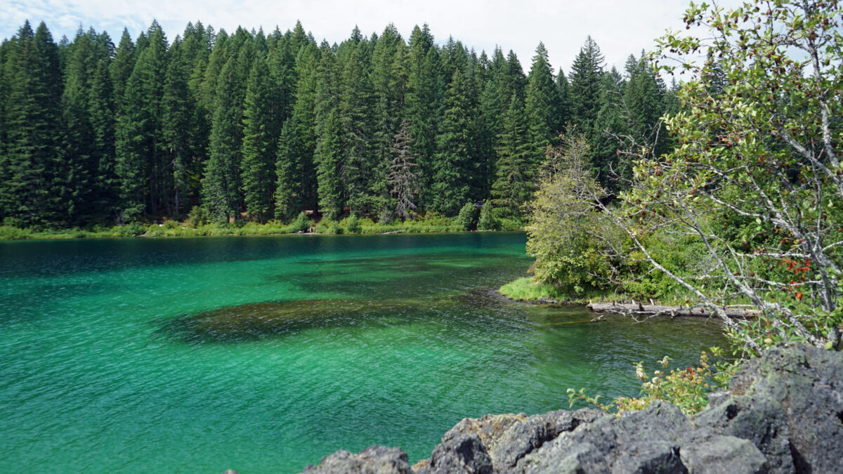
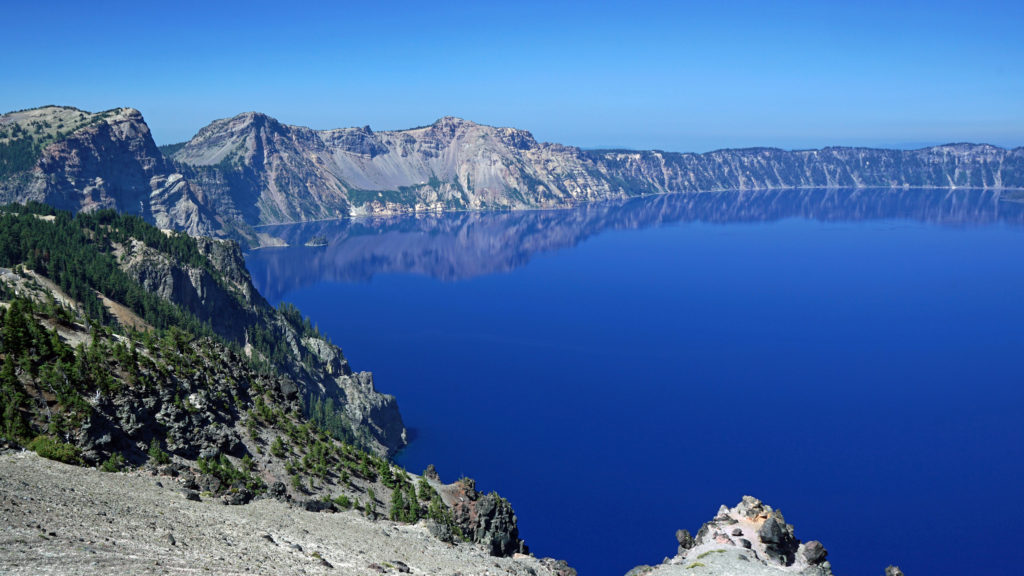
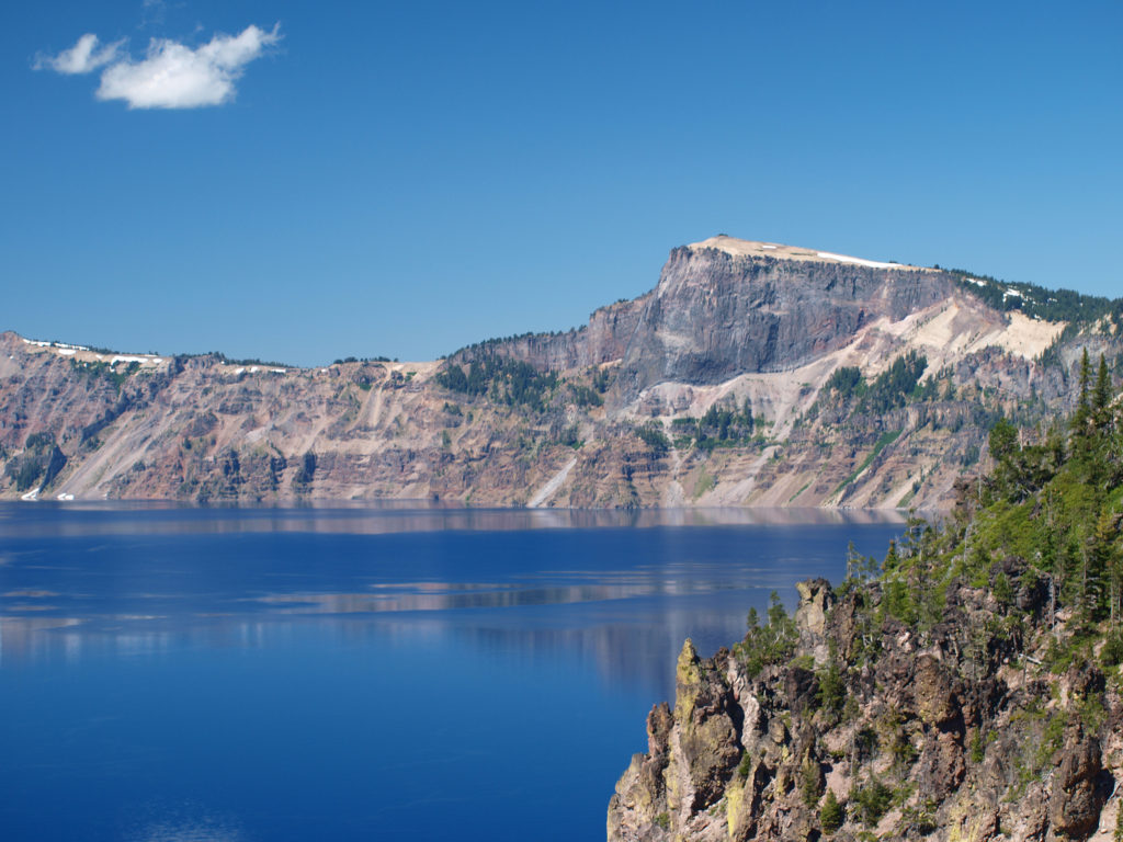 Crater Lake is 1943 feet deep, making it the deepest lake in the United States, second deepest in North America, and ninth deepest in the world. It is also one of the cleanest and clearest lakes in the world. It’s that combination of depth and clarity that results in its intense deep blue color.
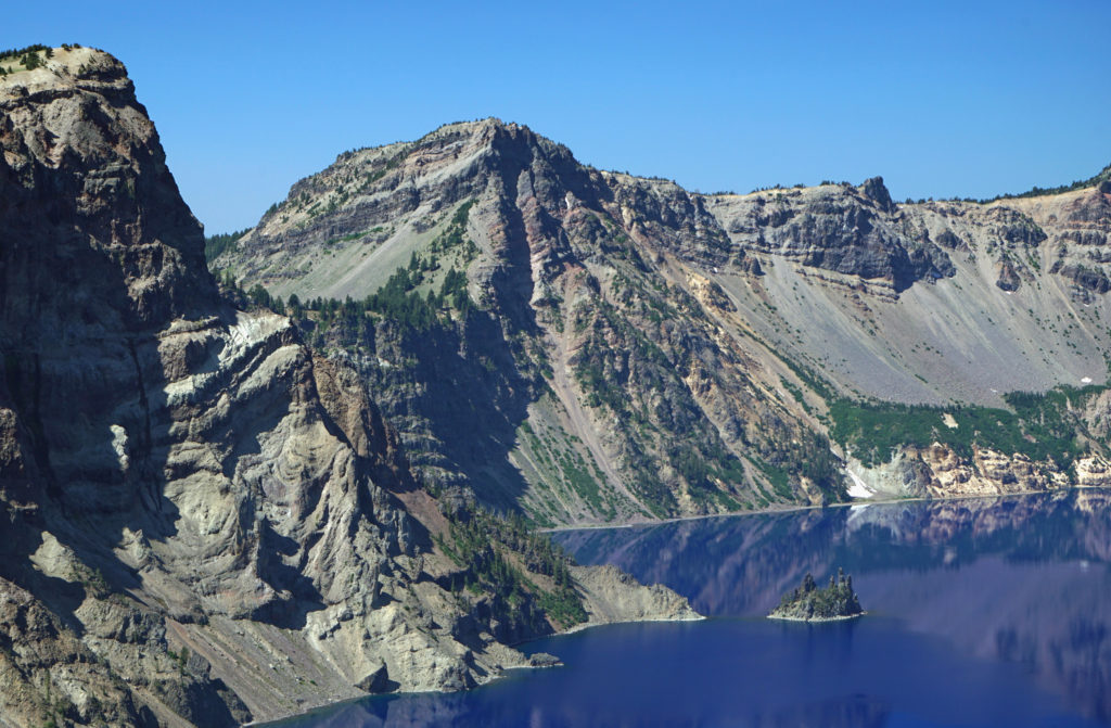 The caldera that Crater Lake occupies was formed 7700 years ago when the summit of 12,000 foot tall Mount Mazama collapsed after a massive eruption. Over time rain and snow filled the caldera to its present level. The lake has no outlet. The level of the lake remains nearly the same because the amount of evaporation from the surface of the lake closely matches the amount of precipitation falling on it in any given year.
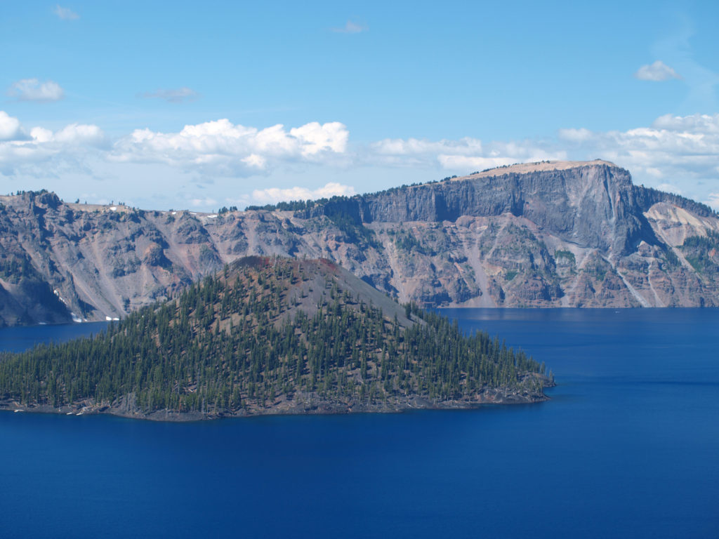 Wizard Island formed sometime after the eruption that formed the caldera. It rises 770 feet above the surface of the lake, 2713 feet above the deepest point in the lake. It last erupted about 5000 years ago, but it is considered dormant, not extinct. Conceivably, it could erupt again at any time. Merriam Cone also erupted after the caldera was formed, but never reached the lake surface. Its summit lies almost 500 feet below the average lake level.
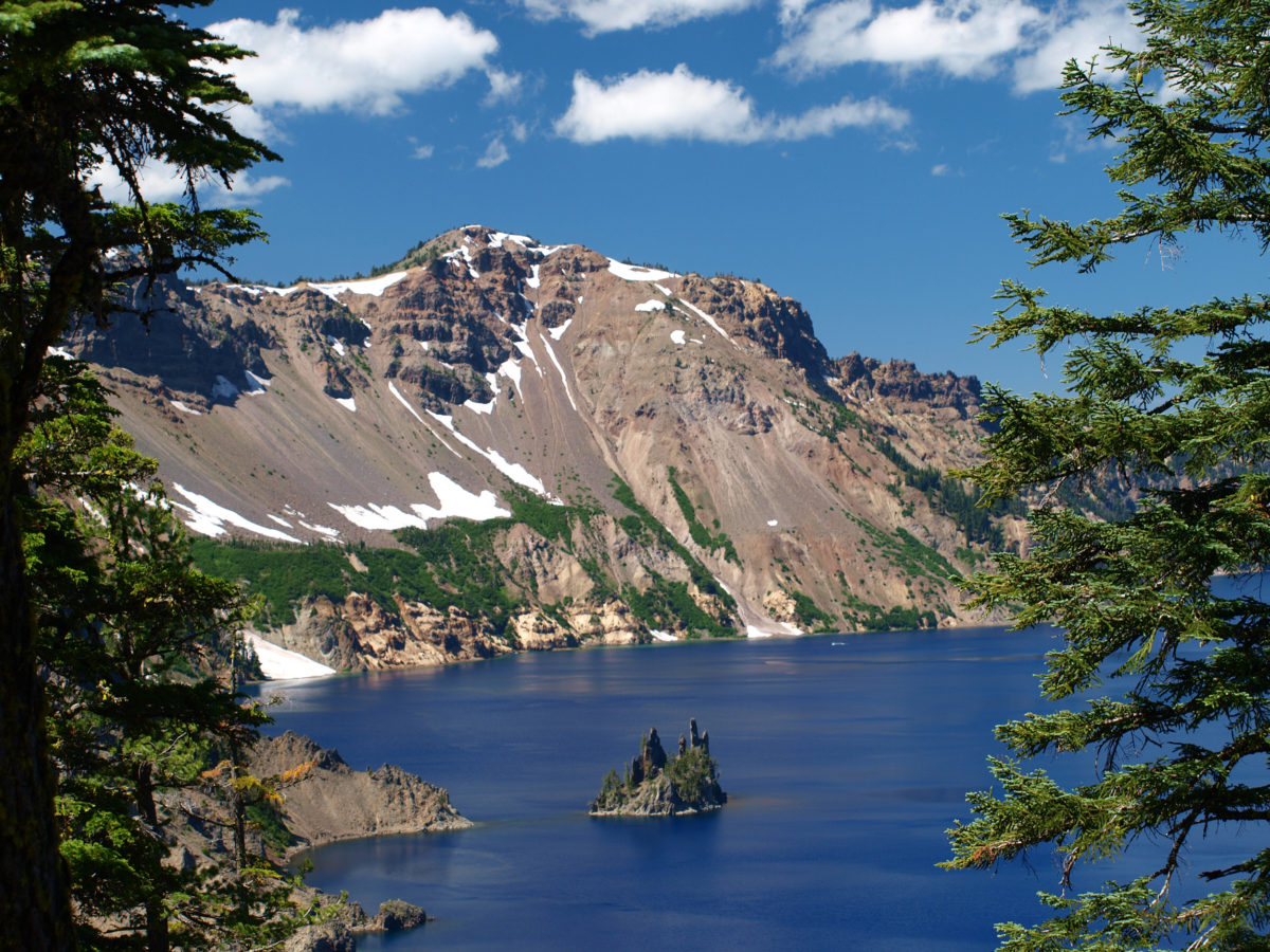
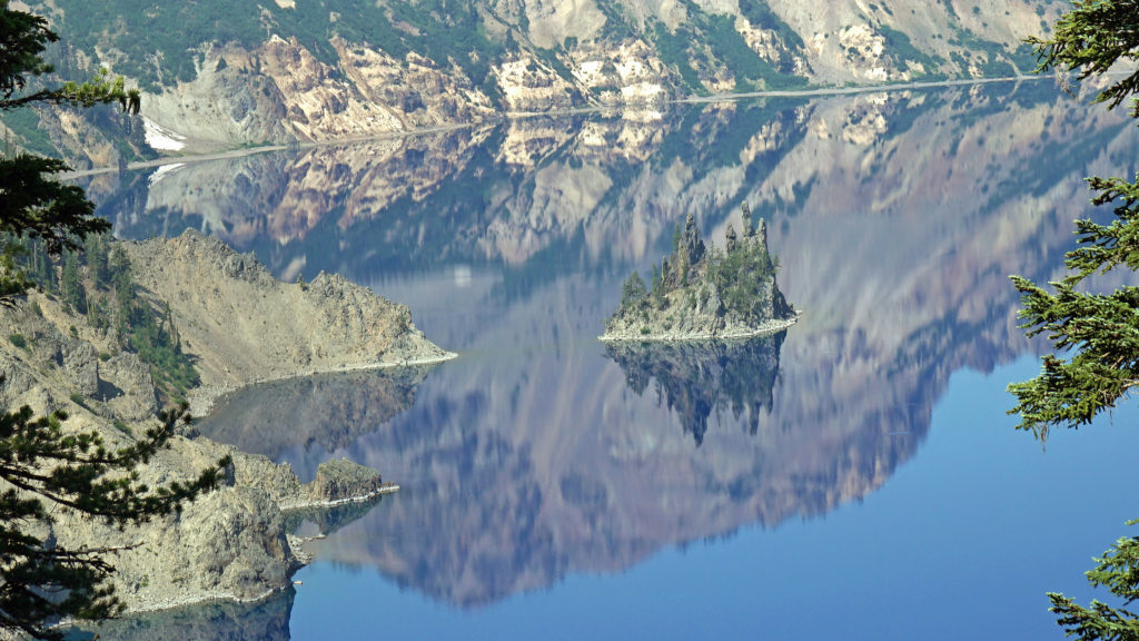
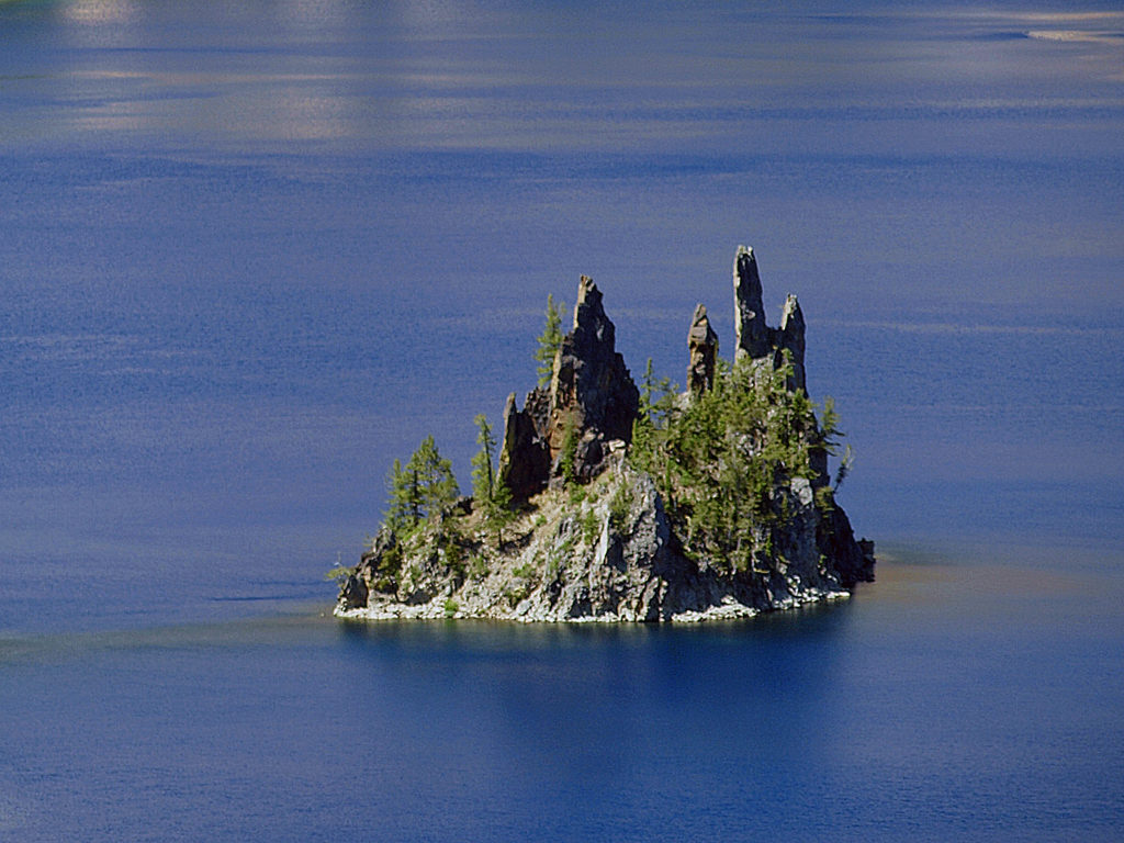 Phantom Ship, a remnant of an eruption 400,000 ago, rises 170 feet above the lake surface. Its formation predates that of Mount Mazama itself.
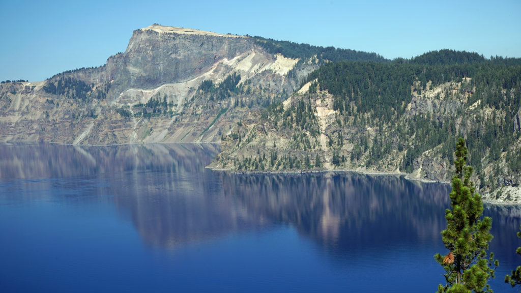 The Park
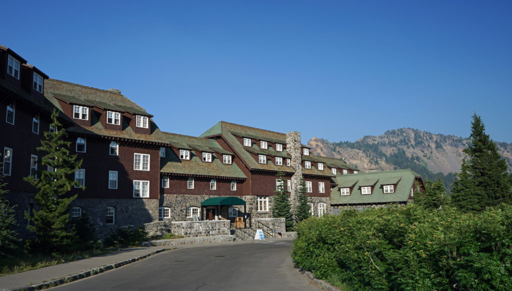 Crater Lake Lodge
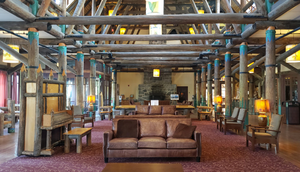
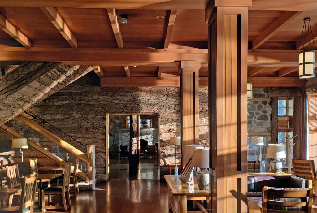 My wife and I recently spent three nights at the lodge. Although it lacks the amenities of a luxury hotel, our room was comfortable, with a private bathroom, and the location more than makes up any lack of luxuries.
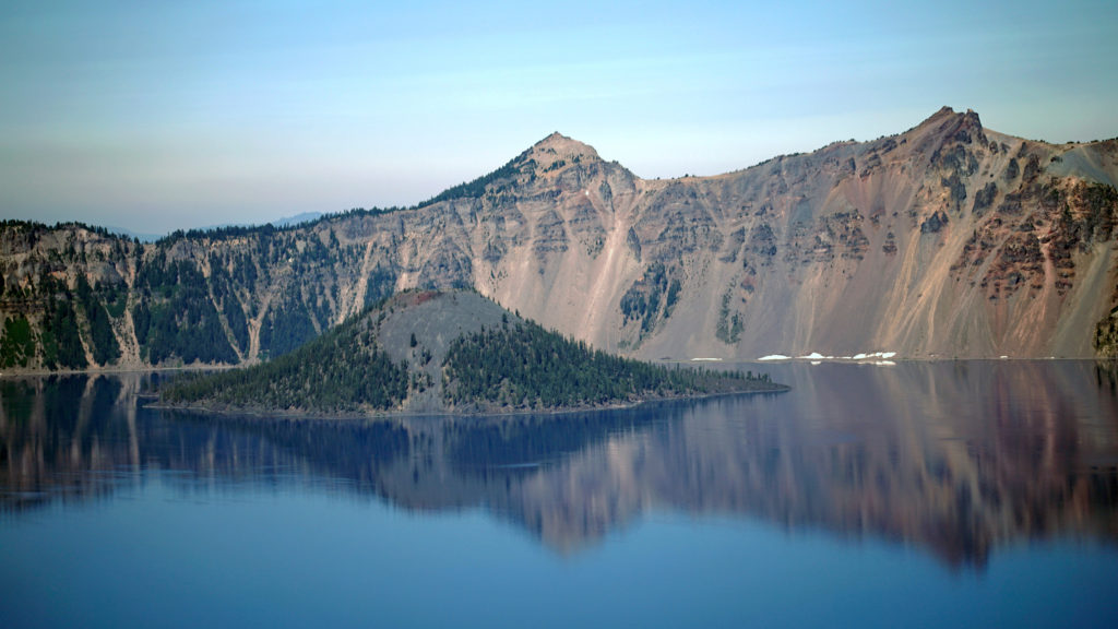 The Rim Drive
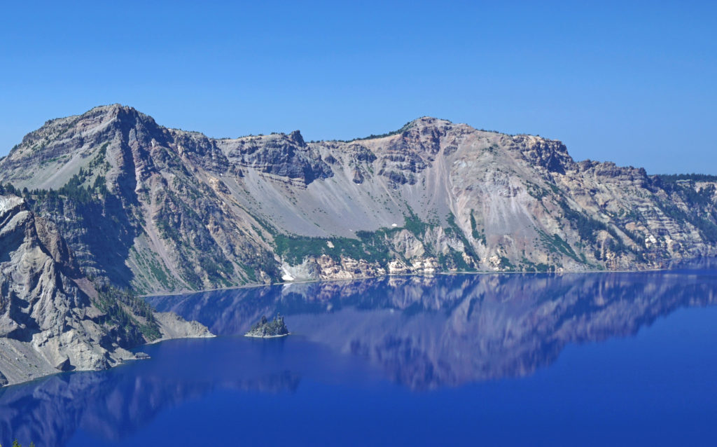 You’ll want to stop at all of the viewpoints. Maybe combine the drive with a hike down to Cleetwood Cove and a boat tour of the lake. You can get off at Wizard Island and hike to the summit and then catch a later boat back.
 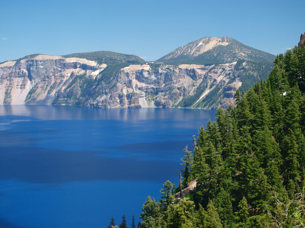 For a more adventurous day, hike to the summit of Mount Scott, the highest point in the park. It’s a two mile hike to the summit with 1250 feet of elevation gain, so it’s not an easy hike (All Trails rates it “moderate”), but the view might just be worth the effort.
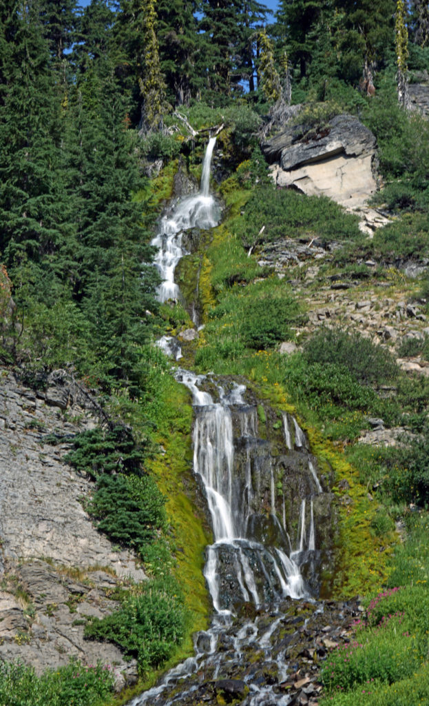
 Hiking Trails
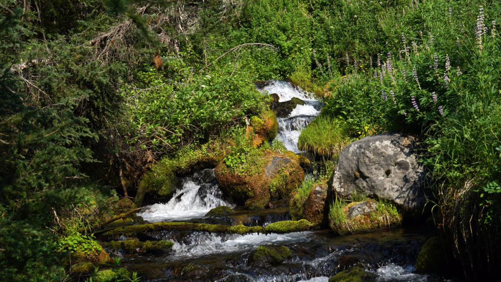 The Pacific Crest Trail passes through the park, but does not ascend to the rim of the caldera. Hikers on the PCT can take the Dutton Creek Trail that climbs up to the Rim Village, then hike the trail that parallels the West Rim Drive and reconnect with the PCT north of the lake.
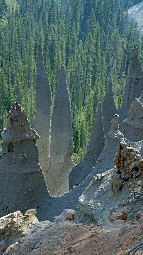
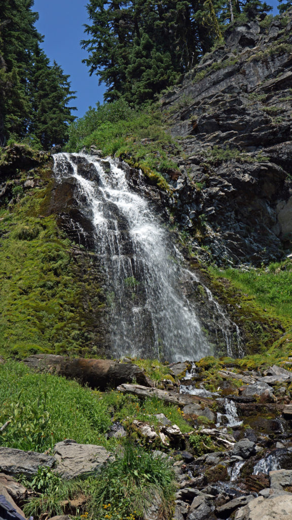
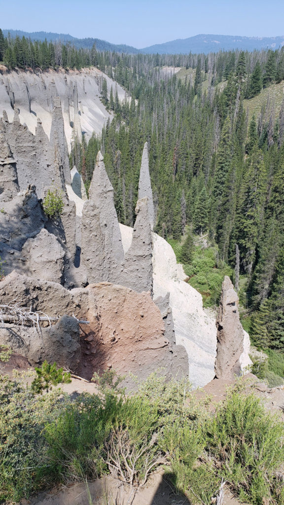 The Pinnacles
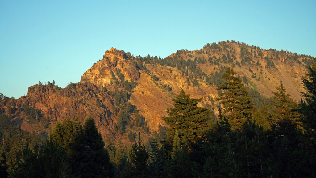 Practical Info
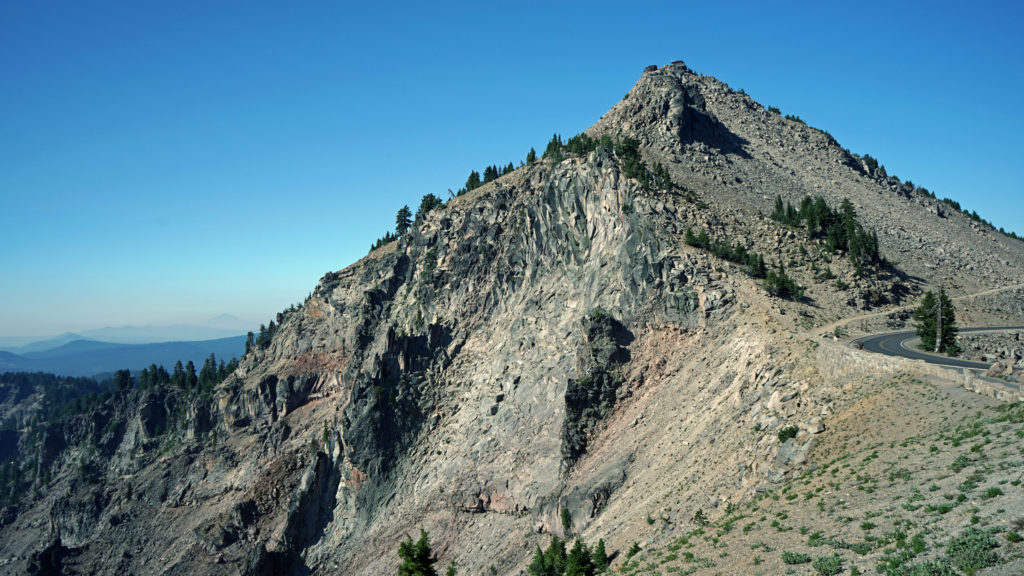
 There are two lodges in the park, Crater Lake Lodge in the Rim Village and The Cabins At Mazama Village that are open for the summer season. Crater Lake Lodge has 71 rooms, starting at $246/night. The Cabins At Mazama Village has 40 rooms, all at $160/night. Prices listed are for the 2024 season. Note that the concessionaire that operates both lodges is changing, so prices may also change. Check the park website (linked above) for current information.
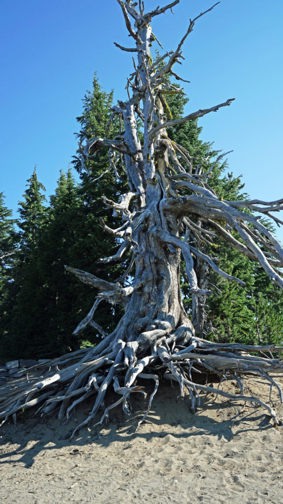
 There are two campgrounds in the park. Mazama Campground has 75 RV sites, 18 tent sites with electricity, and 121 tent sites without electricity. Tent sites start at $22. RV sites run from $32 to $44 per night. Mazama Campground is usually open from early June through late to September. Lost Creek Campground, located on Pinnacles Road, is a primitive tent only campground with 18 sites, operated by the park service. Lost Creek Campground is currently closed and will not be open for the 2024 season. Backcountry camping is allowed in the park by
 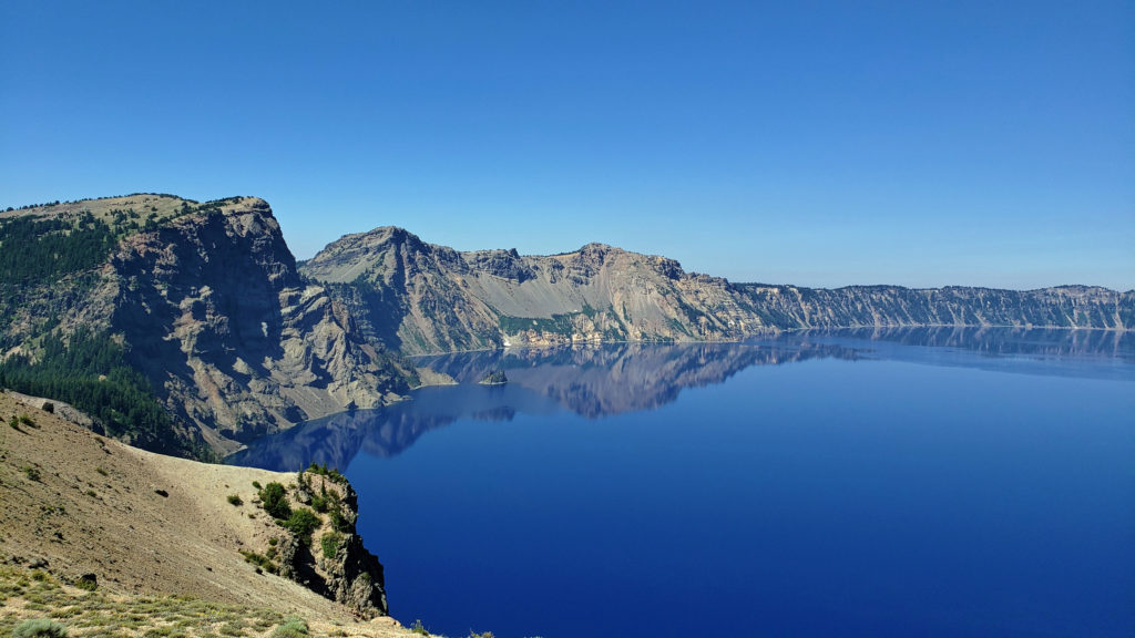 Dining options in the park are somewhat limited. The dining room at Crater Lake Lodge is open to all visitors, but reservations can only be made by people staying in the park. The Rim Village Cafe offers “grab and go” sandwiches and salads (I had a pulled pork sandwich from there on our recent visit that was very good). It is open from 9am to 8pm in the summer and 10am to 5pm in the winter. The Annie Creek Restaurant in Mazama Village is open from 7am until 9pm. The Mazama Village Store sells packaged sandwiches and snacks.
 Summer park entrance fees are $30 for private vehicles and $25 for motorcycles. Winter fees are $10 less. Snowmobilers, bicyclists, and pedestrians are charged $15 per individual. All entrance fees are good for seven days. Entry reservations do not need to be made.
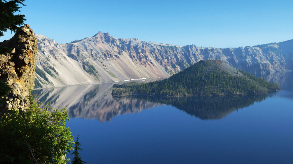
 Originally posted September 13, 2021. Most recently updated April 6, 2024.