Overview
Rocky Mountain National Park in northern Colorado is without question one of the most scenic places I have ever been. Its mountains, lakes, meadows, waterfalls, rivers, and forests rival those of Glacier National Park, the Canadian Rockies, and the Teton Range. And its vast tracks of alpine tundra above the timberline and its 14,000-foot peaks make it unique. All of that, and its proximity to the Denver metropolitan area, make it one of the most visited national parks in the country.
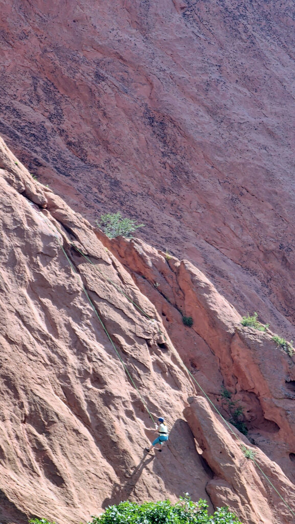
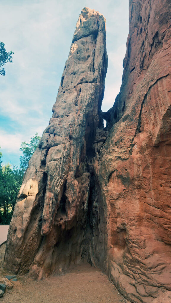
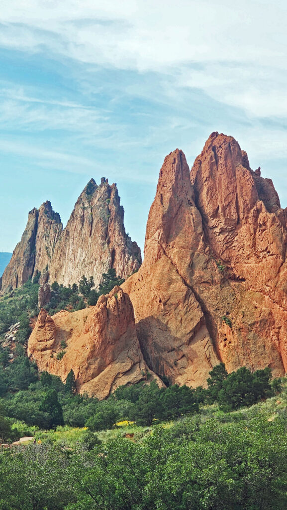
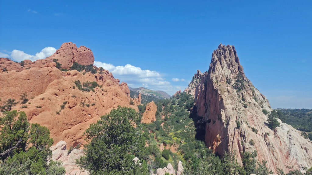
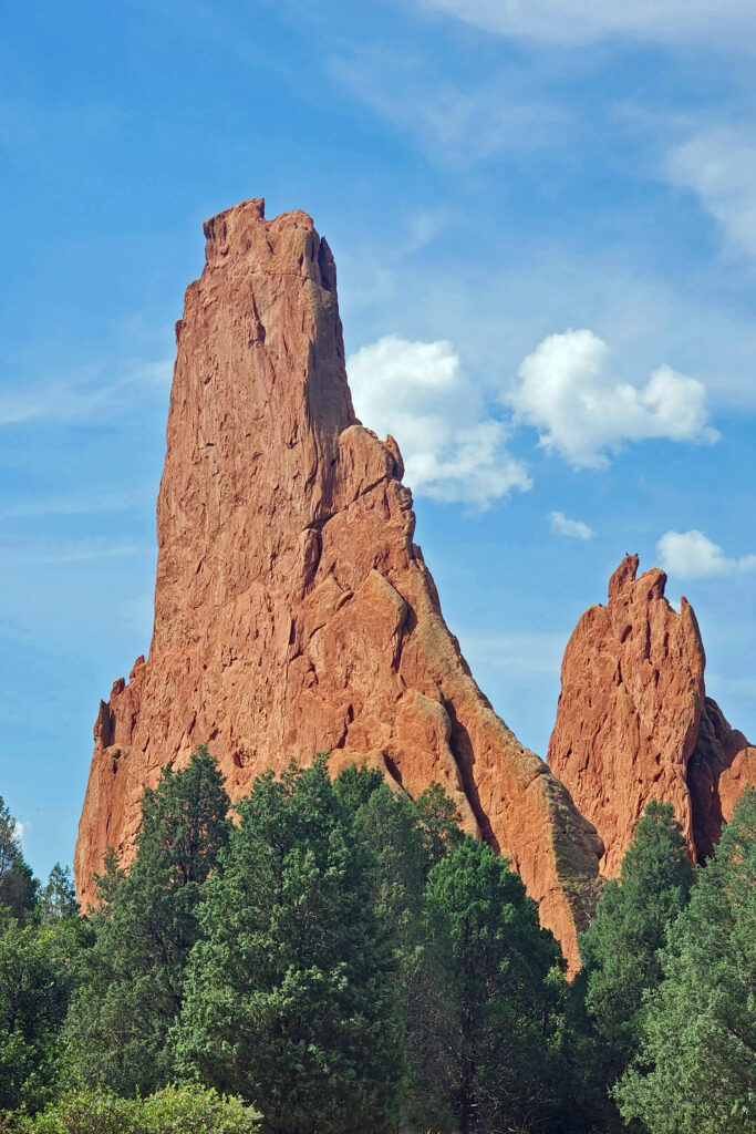
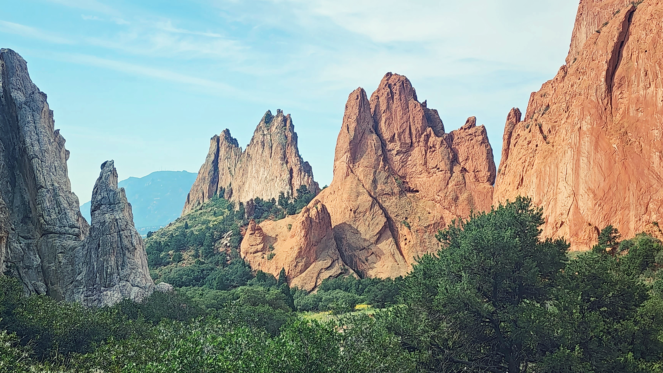
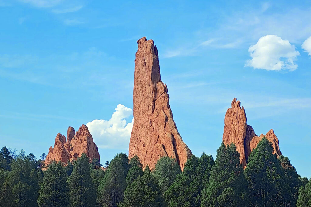
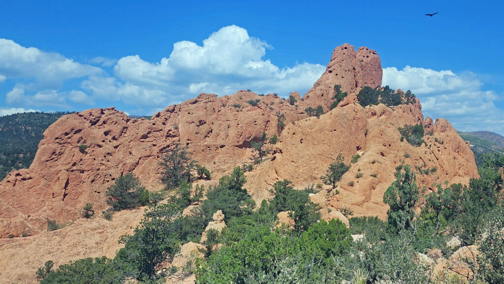
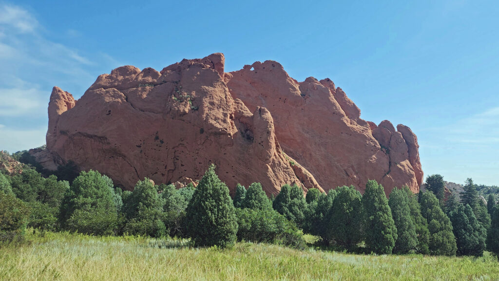
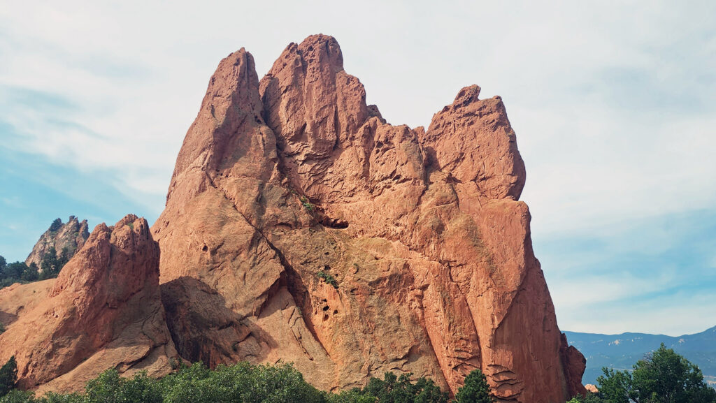
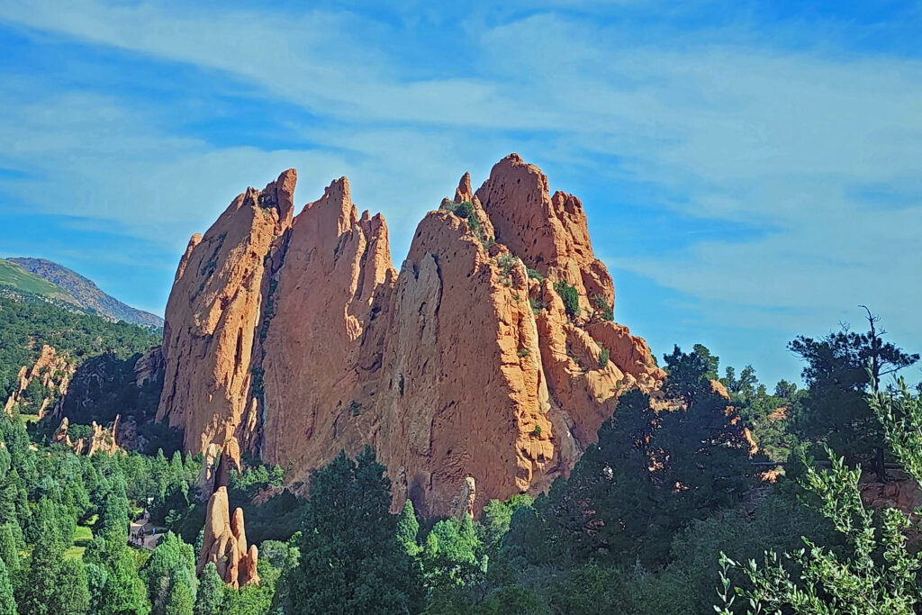
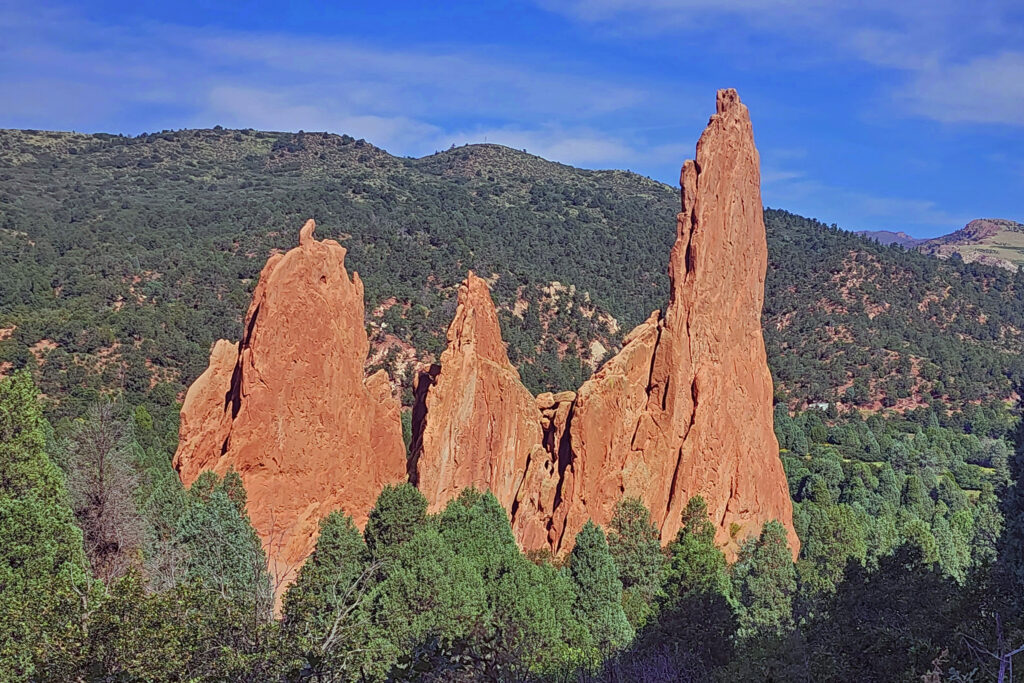
I had the pleasure of visiting the park last August (2023) with my wife at the beginning of our tour of the Colorado Rockies that also took us to Breckenridge, Leadville, Aspen, Great Sand Dunes National Park, Alamosa, Royal Gorge, Pueblo, and Colorado Springs. We ended our tour at the Garden of the Gods, an incredibly beautiful collection of rock spires that is another of the most scenic spots I’ve ever visited.
The popularity of Rocky Mountain National Park has led to overcrowding in the past. To limit the number of visitors, the park has instituted timed entry permits, which are needed to visit both the Bear Lake area of the park and to access Trail Ridge Road, which takes you through the high-altitude country along the continental divide. The permits can be obtained through the park website but go quickly.
On the first day of each month during the summer tourist season, the park opens the sale of permits for the following month. We had already made reservations for lodging in Estes Park, as well as our flight to Denver and our car rental before the entry permits for the days in August that we planned to visit were available. So, my wife got on the web early on July 1 to ensure that we got permits for our desired days, which she was able to obtain. Otherwise, we would have been scrambling to change our plans.
Estes Park
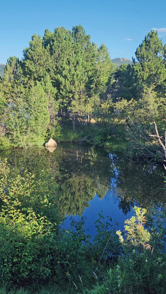
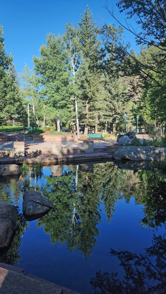
The town of Estes Park, located just outside the eastern boundary of the park, is the gateway to the park and an ideal base for exploring the park. It is a tourist town, to be sure, with at least some of the negatives that being one brings. But it also has enough appeal to make spending a whole day there an enjoyable start to your trip. We had fun exploring the compact downtown area with its many cafes, bars, art galleries, and shops. The Riverwalk along the Big Thompson River and Estes Lake is pretty, and many of the downtown businesses can be accessed from both the main street and the Riverwalk.
At an elevation of 7500 feet, Estes Park is also a good place to spend a couple of days acclimating to the altitude. If, like us, you live near sea level, giving yourself a few days to get used to the lesser oxygen content of the atmosphere is definitely something that you should consider doing. We didn’t, but we paid a bit of a price for not doing so, too.
Bear Lake Area
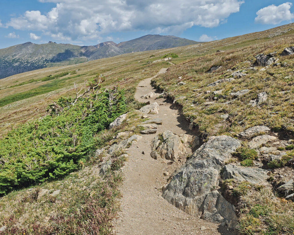
Our first full day in the Rockies was spent in the Bear Lake area of Rocky Mountain National Park. Having a timed entry permit doesn’t mean you’ll find a parking spot at Bear Lake, so we opted to park in the park-and-ride lot a few miles past the entry station and ride the shuttle up to the lake. The shuttles run frequently and the trip is short – 15 minutes, maybe. So, if you don’t get on the first shuttle, another will be along soon.
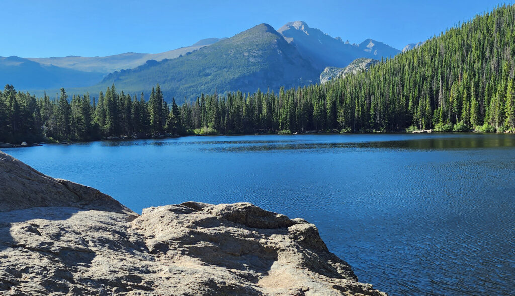
We did three hikes that day. The first, a short, almost flat 0.8-mile loop around Bear Lake, was a good start. Bear Lake is at almost 9500 feet, so the air was noticeably thinner than even at Estes Park. But we took it slow, soaking up the scenery and taking lots of photos.
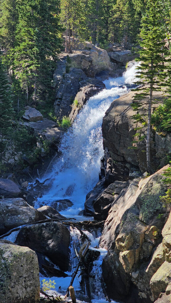
Our second hike was longer, about two miles, and took us to Alberta Falls. The trail descends about 300 feet from Bear Lake to Tyndall Creek, then climbs to the falls on Glacier Creek. We took a shortcut on the return trip by hiking down to the Glacier Gorge trailhead and riding the shuttle back to up Bear Lake rather than hiking back up the hill.
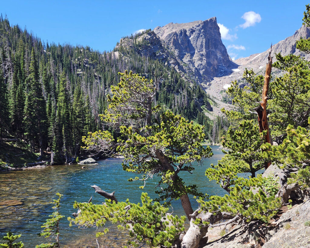
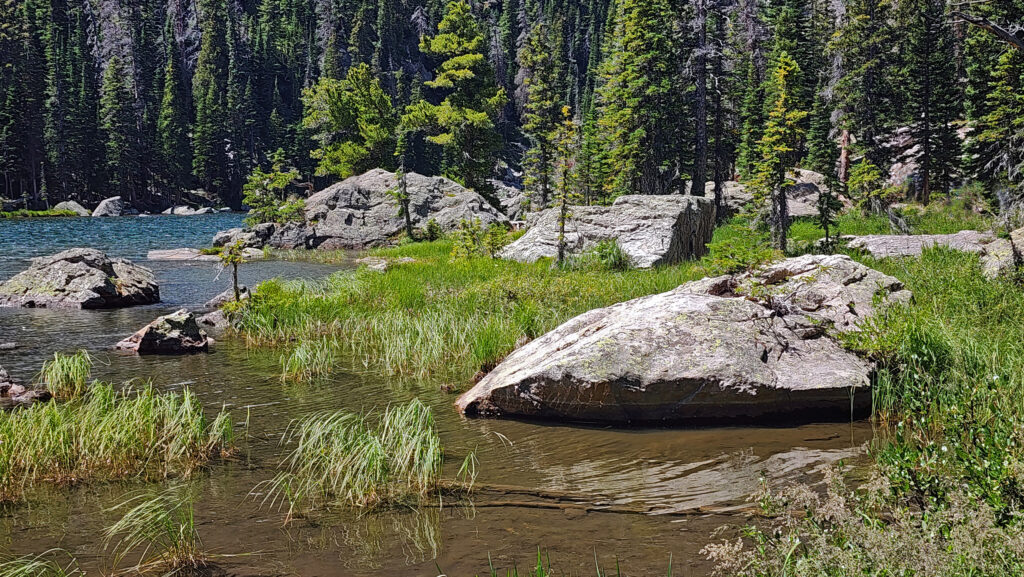
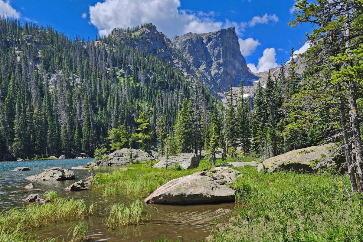
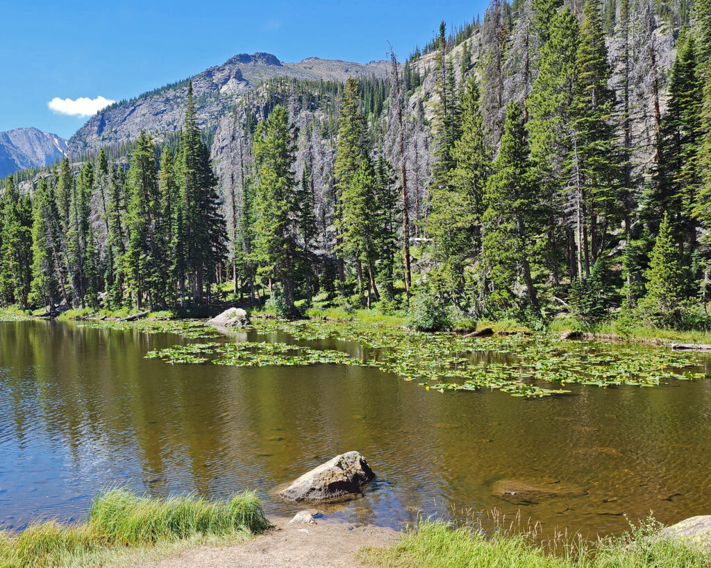
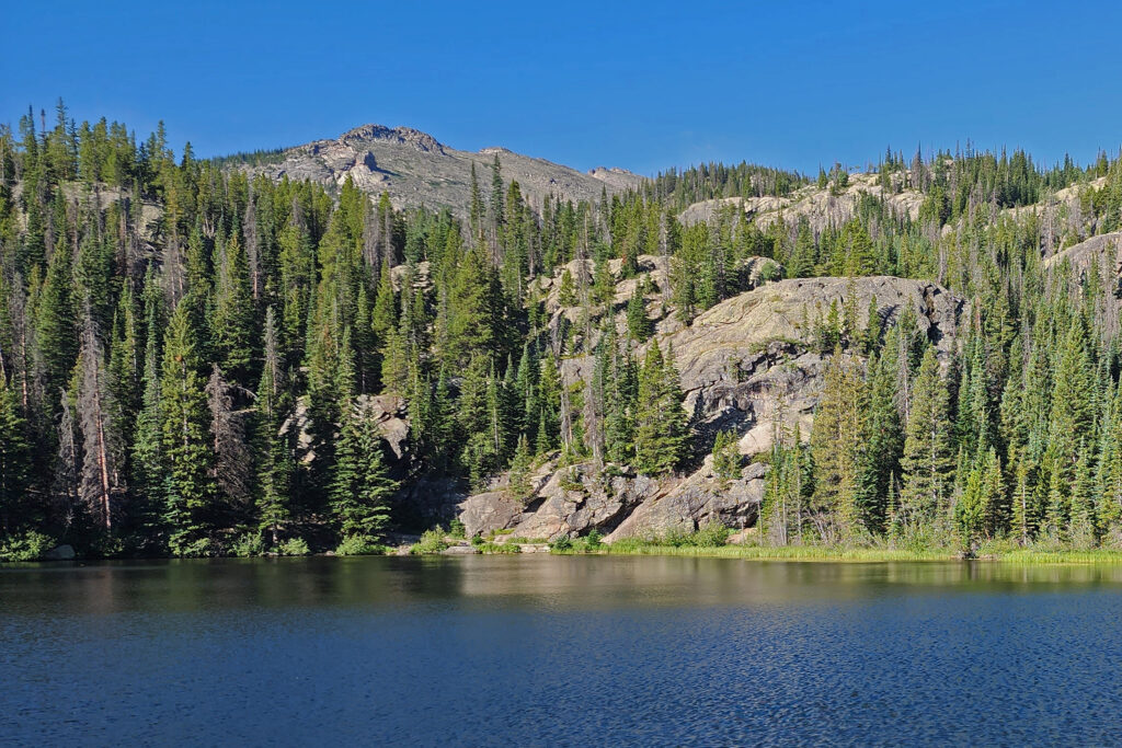
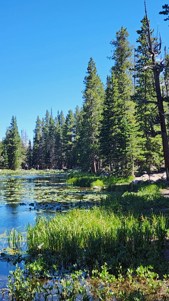
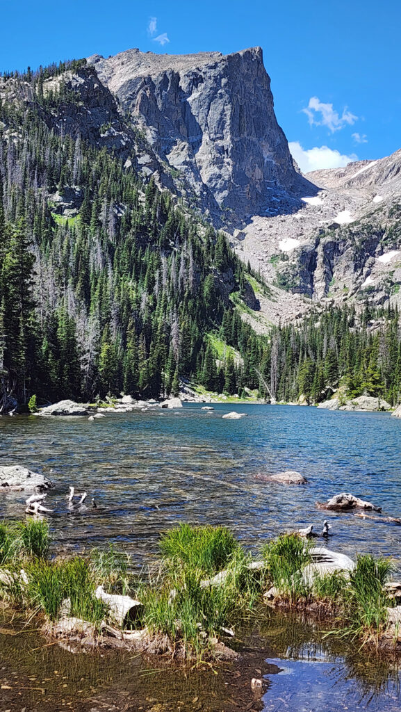
Our third hike was the 2.5-mile out and back hike up to the aptly named Dream Lake at just under 10,000 feet. We were feeling the altitude by the time we got to the lake. We spent quite a bit of time at the lake resting and taking in the absolutely gorgeous setting. Emerald Lake is only about a third of a mile from Dream Lake, and possibly even more beautiful, but I was gassed by then, so we turned around at the head of the lake and returned to Bear Lake and picked up a shuttle ride back to our SUV.
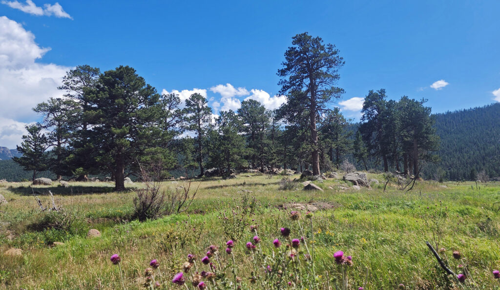
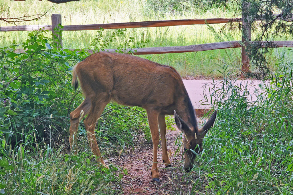
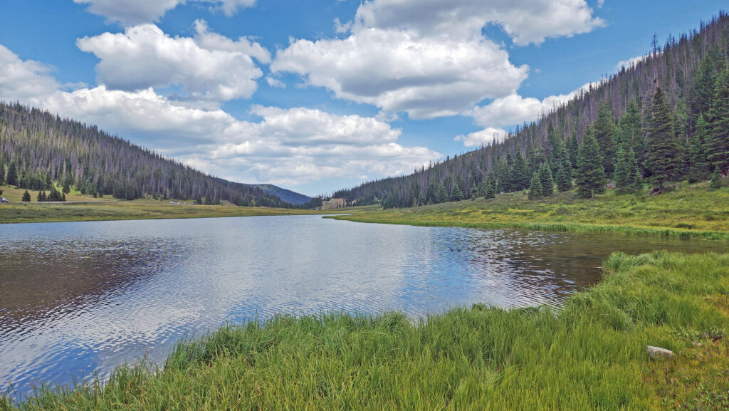
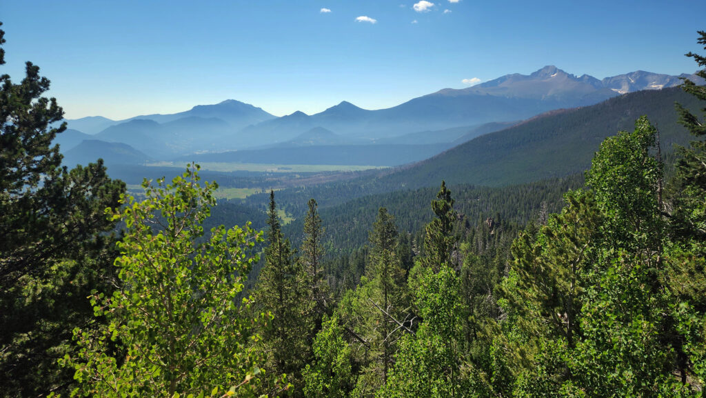
On our way back to Estes Park we took a side trip to Moraine Park, a glacier-carved valley on the Big Thompson Reservoir lined by steep ridges to the north and south. Moraine Park was once home to a resort and golf course but has been restored to its natural state of meadow and marshland. Moraine Park is known for its elk and other wildlife, but the elk were nowhere to be seen when we were there.
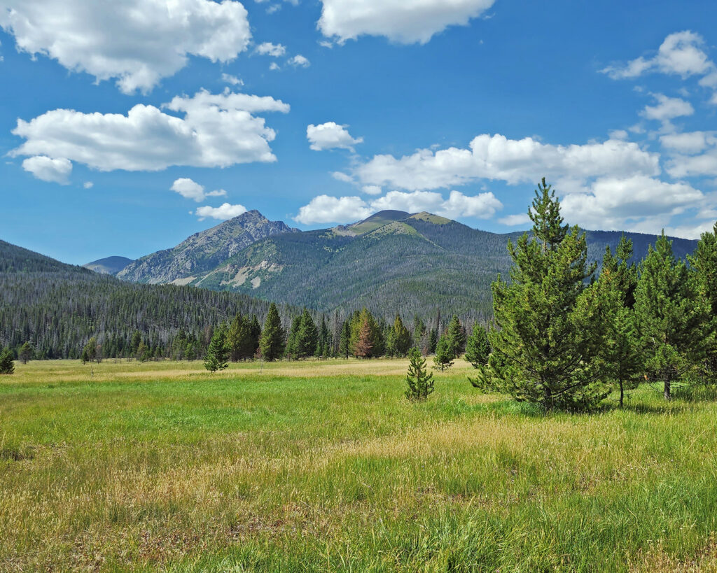
Trail Ridge Road
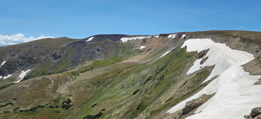
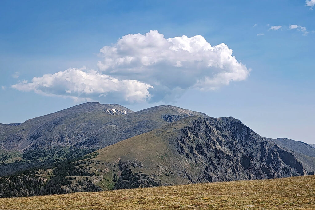
The next morning, we packed up and headed for the high country of Trail Ridge Road. Much of the drive is above timberline. The high point of the drive is at almost 12,200 feet.
We stopped at Rock Cut and did a short hike at an elevation of 12,150 feet. It had to be short because just walking around at that elevation was enough to make both of us lightheaded. But, my God, what incredible scenery.
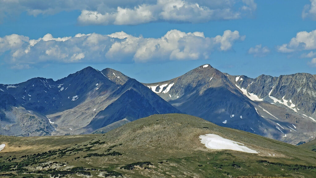
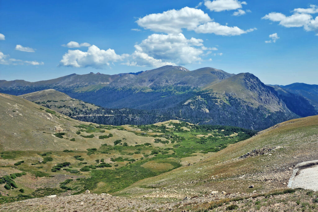
I can say with confidence that Trail Ridge Road is one of the most beautiful drives on the planet. Just awesome.
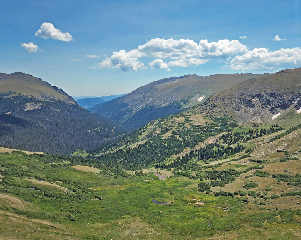
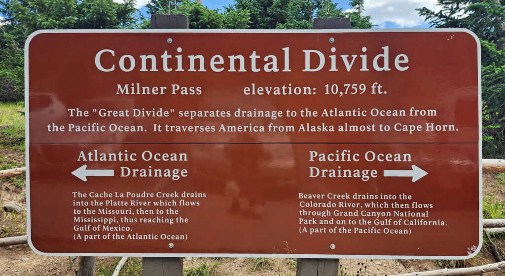 Coming down off Trail Ridge we stopped on the continental divide at Milner Pass (at 10,759 feet you actually come down in elevation from Trail Ridge to the divide). We did a short walk there along the shore of Poudre Lake and, of course, took a photo of the continental divide sign before heading south.
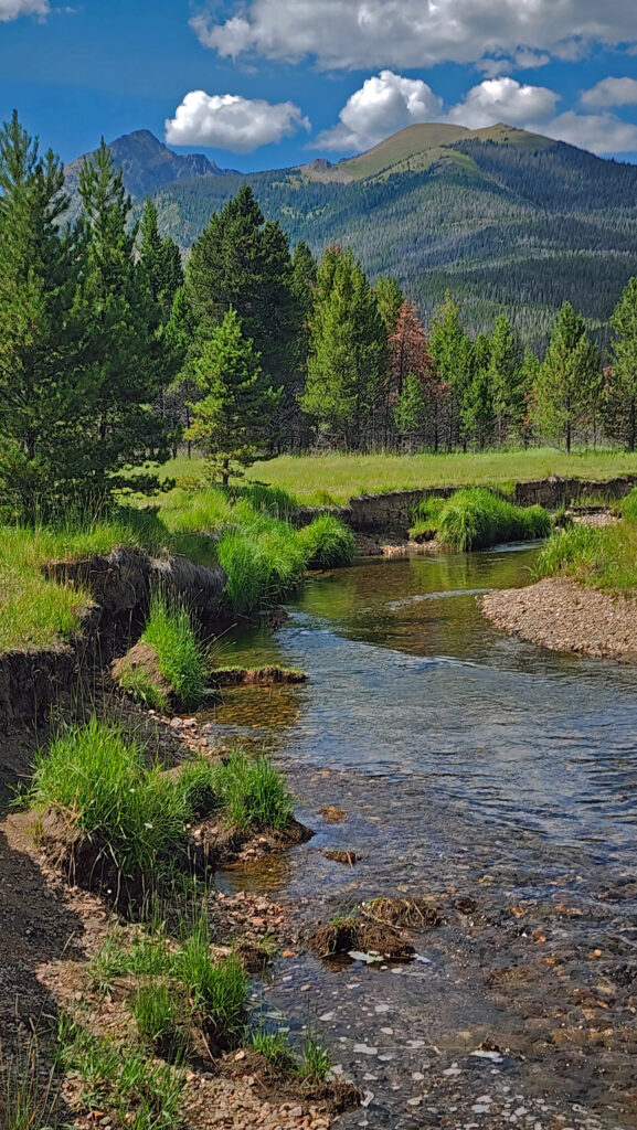
Upper Colorado River
The headwaters of the Colorado River lay just northwest of Milner Pass. We stopped in Coyote Valley, where we did another short hike (about 1¼ miles) along the upper reaches of the river, which at that point is just an easily wadable creek.
Conclusion
We exited the park that afternoon at Grand Lake, with some regrets that we didn’t plan for more time in the park. Two days weren’t enough. It was a pretty grand two days, but we missed a lot of what the park has to offer. I’m hopeful that we will be back someday, maybe as part of a longer Rocky Mountain adventure. I’m up for a return trip Rocky Mountain National Park, and to the Tetons, Yellowstone, and Glacier, too. I don’t know if that will happen, there are so many places that we’ve never been to, but the dream is there, and why wouldn’t it be?
Posted November 16, 2023 by Alan K. Lee
All photos ©Alan K. Lee

 In 1859, Colorado City was founded and later became the capital of the Colorado Territory before the capital was moved first to Golden, then Denver. Colorado Springs was founded in 1871 just east of what became known as Old Colorado City. Colorado Springs grew rapidly and eventually Old Colorado City became incorporated into the growing city, and is now a neighborhood west of downtown Colorado Springs.
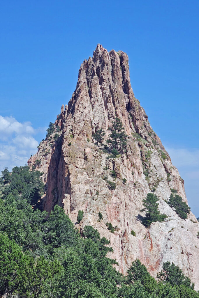
 The park is very popular and parking can be a problem, but there is also a large overflow parking area just west of 30th Street if the visitor center parking lot is full. There is a pedestrian tunnel under 30th Street to get from the overflow lot to the visitor center. The park also operates a free shuttle bus in the summer that runs from the visitor center to the center of the park with stops at the overflow parking area and the Rock Ledge Ranch Historic Site.