
Skyline Trail Loop
Where: Mount Rainier National Park
Distance: 4.4 to 5.9 miles
Type: Loop
Elevation gain: 1700 feet
Difficulty: Moderate to Hard (for distance and elevation gain)
Map:
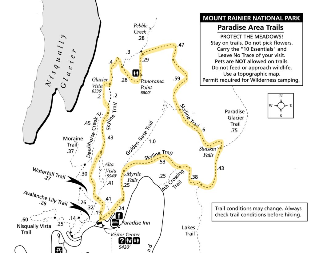
Paradise area trail map and description (from the Mount Rainier National Park website).
Overview:
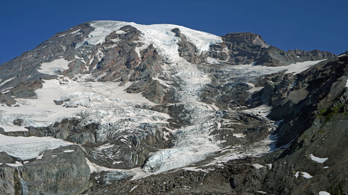
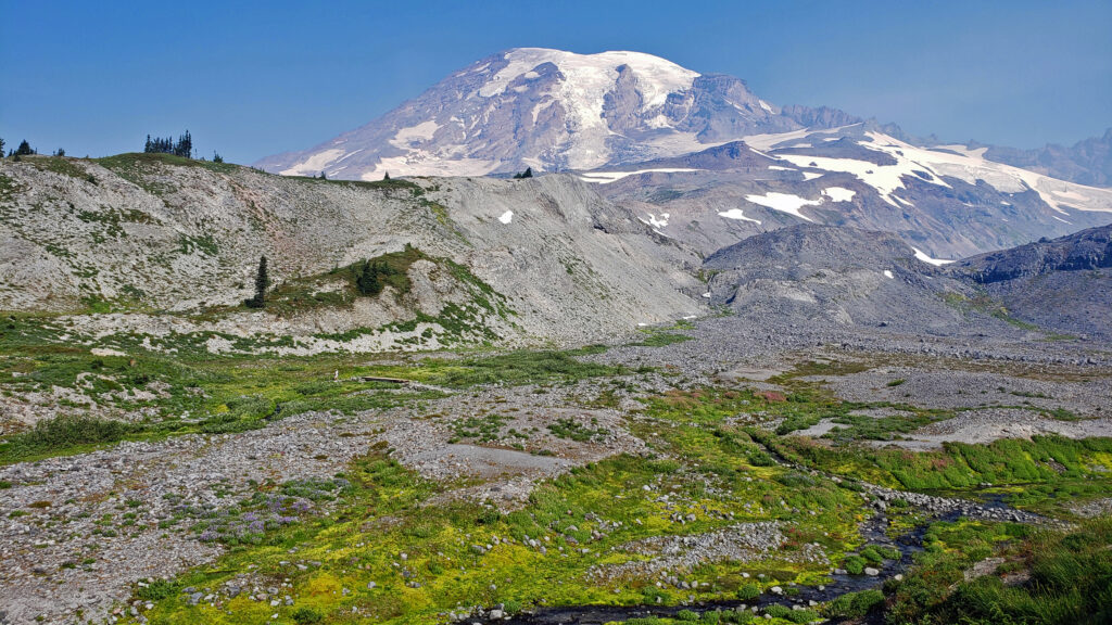
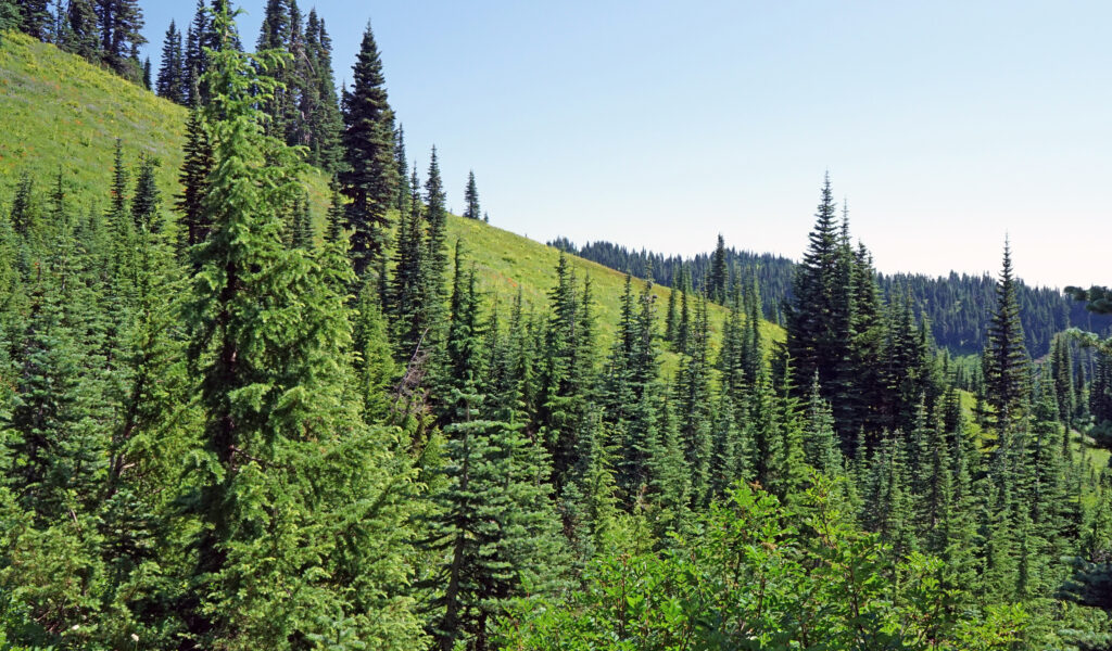
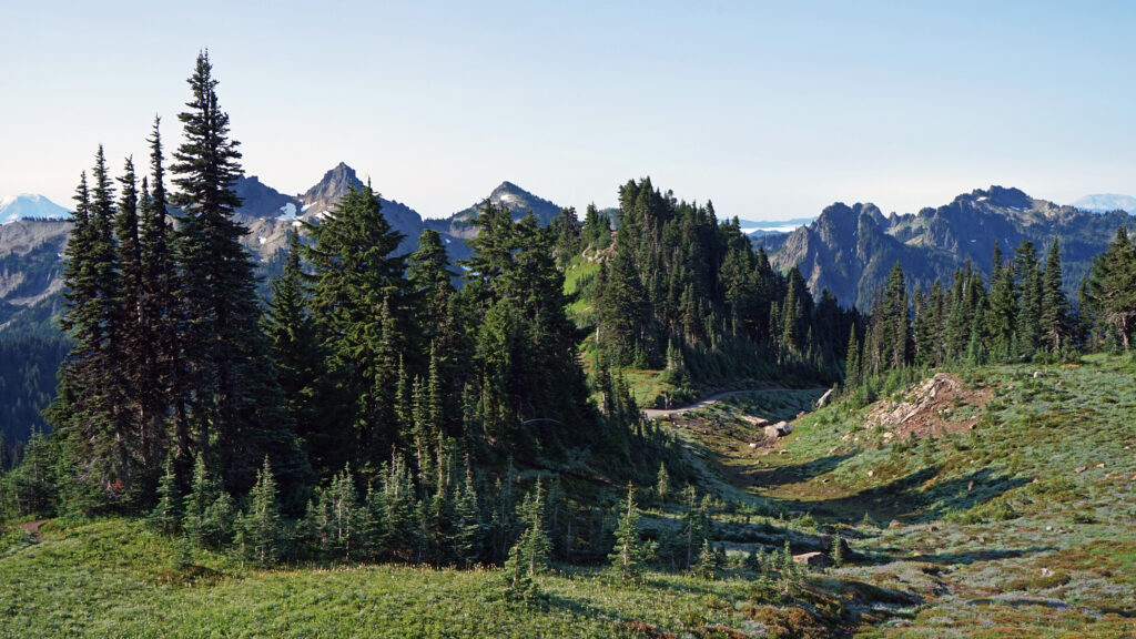
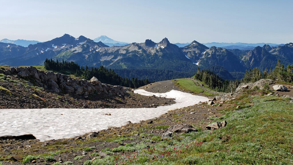
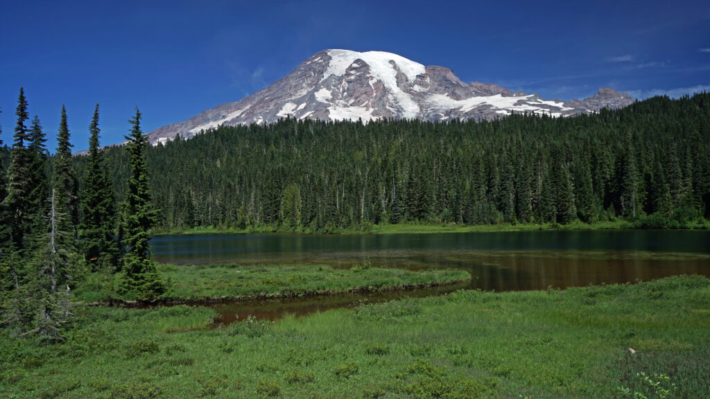
The Skyline Trail loop is one of the Pacific Northwest’s iconic hikes. Beginning at the Visitor Center in the Paradise section of the park, the trail takes you up the mountain with great views of the summit, awesome views of the Nisqually Glacier, and panoramic views south to the Tatoosh Range and Mount St. Helens and Mount Adams in the distance. The high point of the trail is just over 7000 feet in elevation (and still 7400 feet below the summit). The lower portions of the trail take you through alpine forest and mountain meadows. The upper part is all above timberline with open views in all directions.
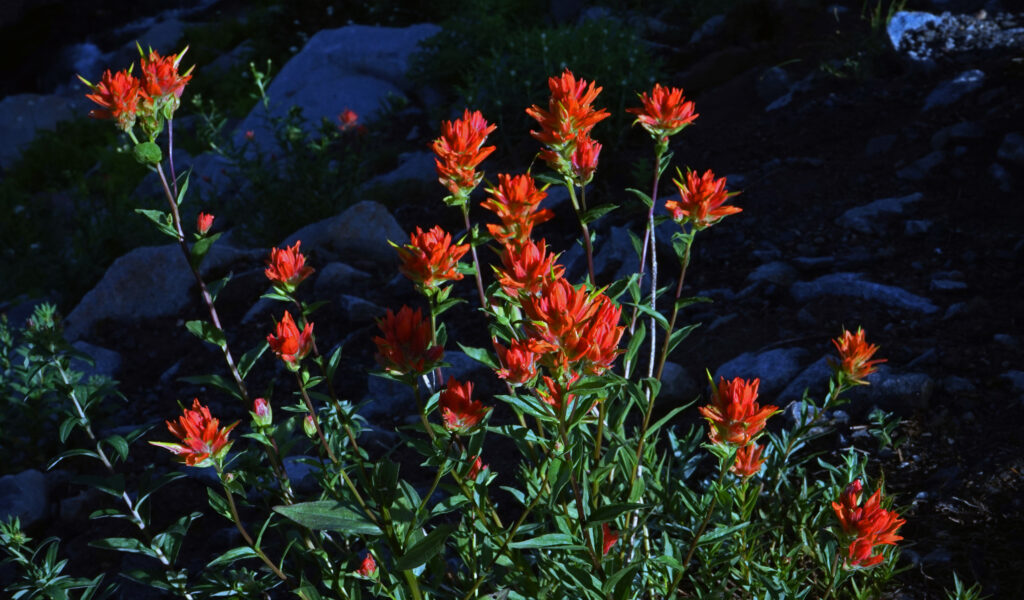
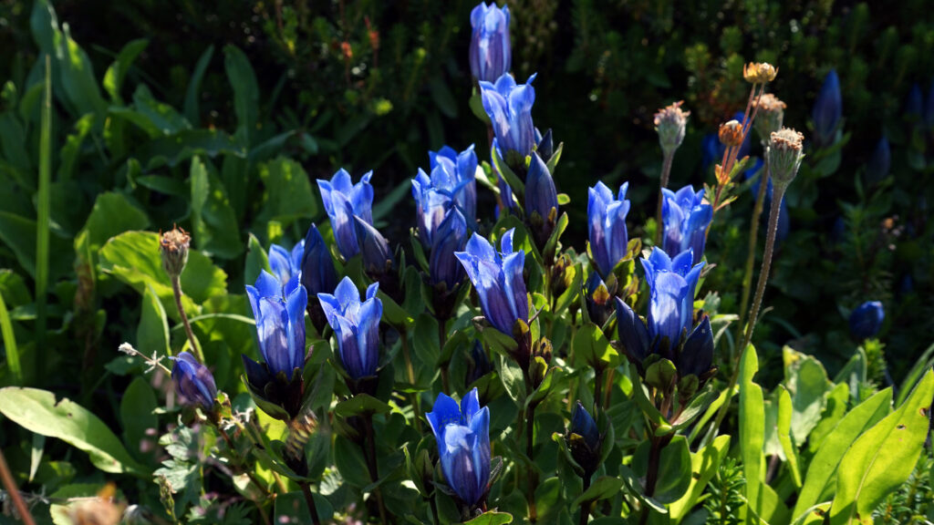
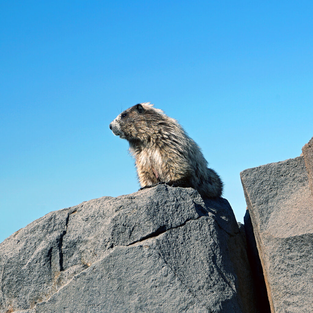
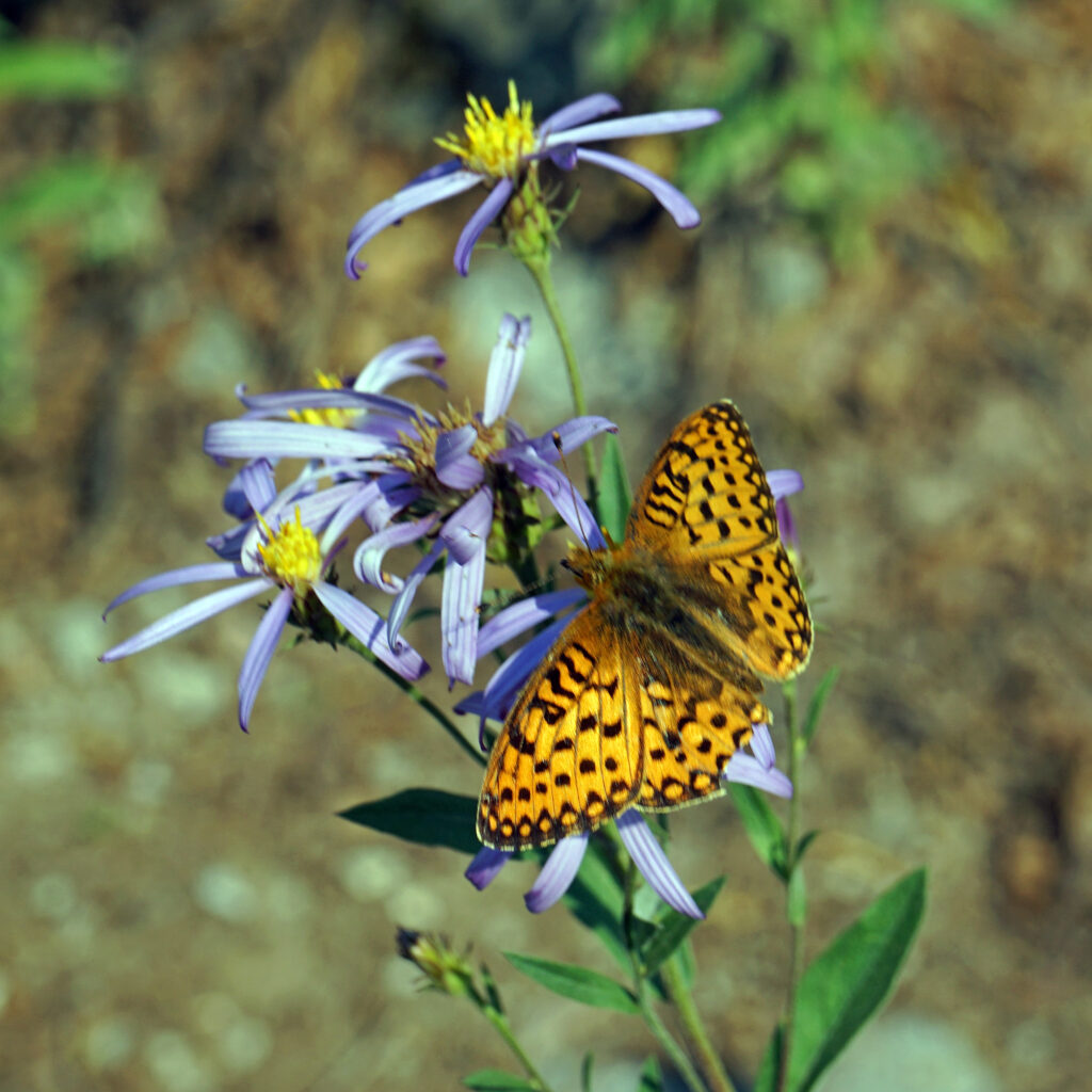
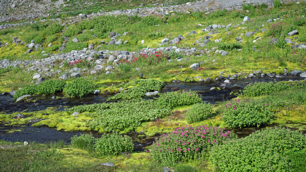
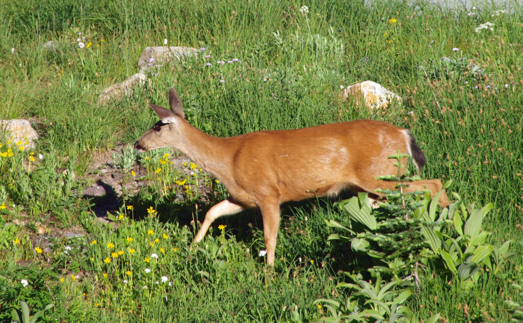
The Paradise area is famous for its spectacular wildflower displays that carpet the meadows, including the alpine meadows above timberline. Look for deer and elk in the lower meadows and forested areas. Look, and listen, for hoary marmots and pikas along the trail. Gray Jays and Clark’s Nutcrackers are common (and tame) below timberline, and you might see White-tailed Ptarmigans in the higher reaches.
The Skyline Trail is a very popular hike for many reasons, and you will have plenty of company on it. But the views are incredible, the mountain is utterly massive, and wildlife and wildflowers are abundant, all of which make putting up with the crowds well worth it.
Getting there:
From Portland, take Interstate-5 north to US Hwy 12 (Exit 68). Follow US12 east to Morton, then Washington Hwy 7 north to Elbe. Turn east on Hwy 706 and proceed to the Longmire Entrance to Mt. Rainier National Park. In the park, follow the signs to Paradise.
From Seattle, take I-5 south through Tacoma to Exit 127 (Hwy 512). Go east on Hwy 512 to Hwy 7, then south to Elbe. From Elbe, proceed as described above.
The park entrance fee is $30 if you don’t have one of the various national park passes and is good for seven days. The park no longer accepts cash payments.
 Best Times to Go:
The hiking season is limited in the Paradise area and even more so for the upper part of the Skyline Loop. Paradise is also the most visited part of the park and is always crowded on summer weekends, so your best bet is to come on a weekday morning, or anytime after Labor Day. Even then, you may have trouble finding a parking spot. There are plenty of other worthwhile hikes in the Longmire and Paradise areas, so come prepared with a Plan B hike just in case.
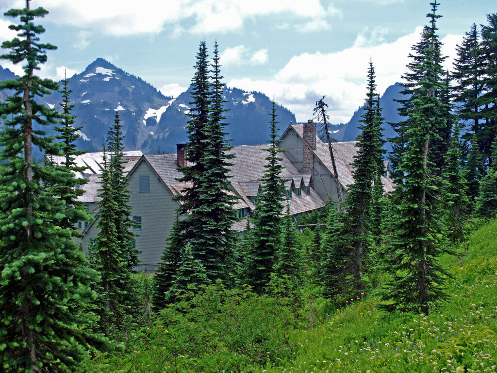
Another option, if you can afford it, is to book a room at Paradise Inn, which allows you to park in the inn’s parking lot. But even that doesn’t guarantee you a parking spot, as we found out one afternoon after returning from a day hike lower on the mountain. The inn’s lot was full, as was the visitor center lot. We had to park in the lower lot and walk to the inn. The National Park Inn in Longmire is another lodging option to consider.

Trailheads:
The trail begins and ends near the Henry M. Jackson Memorial Visitor Center. Restrooms and drinking water are available in the visitor center. You can also start the hike from Paradise Inn, just uphill from the visitor center. Parking at the visitor center is limited and fills up early in the day. Parking at Paradise Inn is restricted to visitors staying at the inn. An alternative trailhead starts at the lower parking lot. (There is a trail to the visitor center, or you can take the Deadhorse Creek Trail up the mountain and join the Skyline Trail just below Glacier Vista. Starting at the lower trailhead adds only about two tenths of a mile to the hike.)
 The hike:
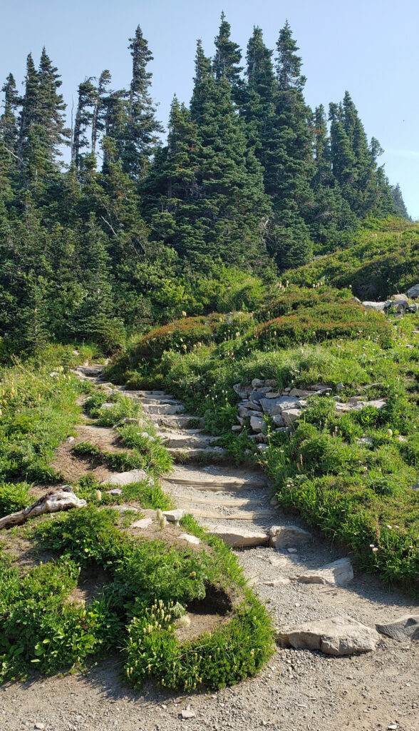
From the trailhead at the visitor center, the trail heads straight up the mountain on a moderately steep grade. There are a myriad of trails crisscrossing the Paradise area above the visitor center, but most of the trail intersections are well signed. If in doubt, just head uphill. But bring a trail map, just in case.
At the 0.2-mile mark, you’ll come to a junction with the Alta Vista Trail, a side trail that takes you to a good viewpoint before rejoining the Skyline Trail. The Alta Vista Trail adds a little to the elevation gain of this hike, but doesn’t add any distance.
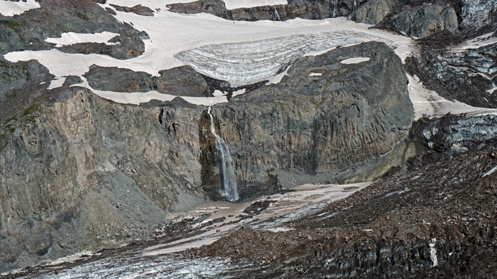
Stay on the main trail at the junction with the Deadhorse Creek Trail. The next trail junction, at the one-mile mark, is with the Glacier View Trail. Like the Alta Vista Trail, the Glacier View Trail parallels the Skyline Trail and doesn’t add any distance to the hike, but does provide a good view of the massive Nisqually Glacier.
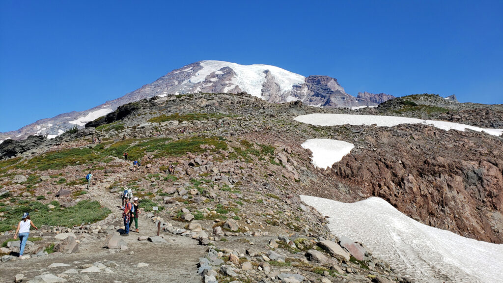
Above Glacier View, the Skyline Trail switchbacks up a steeper section of the mountain above timberline. At the 1.6-mile mark you come to the junction with the Upper Skyline Trail (which may be signed as the Pebble Creek Trail). Staying on the main trail will take you to the well-named and very popular Panorama Point, with sweeping views down to Paradise Inn and the visitor center, across to the Tatoosh Range, and beyond to Mount St. Helens and Mount Adams. The Upper Skyline Trail is a three tenths of a mile shortcut and bypasses the often crowded Panorama Point. If you take the shortcut, stay right at the next junction to rejoin the main trail above Panorama Point.
Just above Panorama Point is a restroom open during the summer (it may be closed after Labor Day). Follow the trail going straight up the mountain where you will come to the eastern junction with the Upper Skyline Trail. Older maps show the Skyline Trail descending from Panorama Point across a snow field to the east and rejoining the Upper Skyline Trail on the ridge beyond. That is no longer the official route and is not maintained, although I saw a group of people taking it the last time I was there. Google Maps also still shows that trail.
Just past the junction with the Upper Skyline Trail, you’ll reach the high point of the hike at 7040 feet. From there, the trail traverses the rocky southeastern slopes of the mountain, then descends to the junction with the Golden Gate Trail at the 3.3-mile mark of the hike. Taking the Golden Gate Trail, which switchbacks down a steep slope before rejoining the Skyline Trail, cuts about a mile off the total distance of the hike.
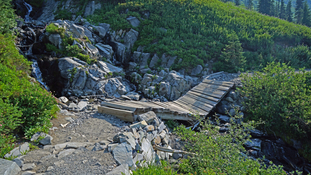
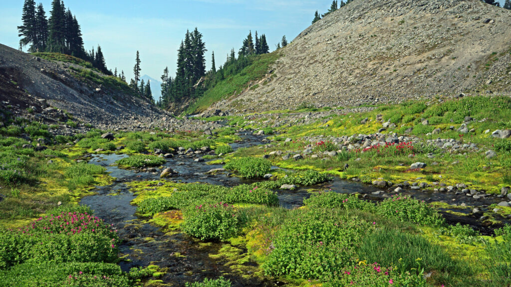
Past the Golden Gate Trail junction, the Skyline Trail follows the crest of a ridge, then descends to a beautiful alpine meadow near the headwaters of the Paradise River. After crossing the river, which is still a small creek at that point, you will come to the junction with the Paradise Glacier Trail at the 3.9-mile mark of the hike, which once led to the famous Paradise Ice Caves. The caves no longer exist, however. Beyond the junction, look for the Stevens-Van Trump Historical Marker, commemorating the first ascent of the mountain in 1870.
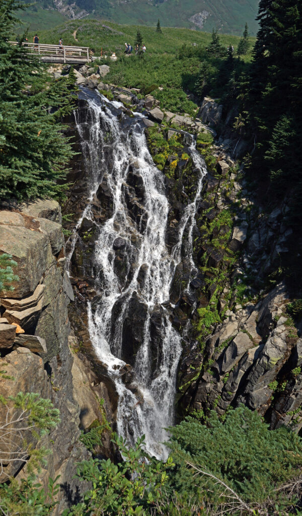
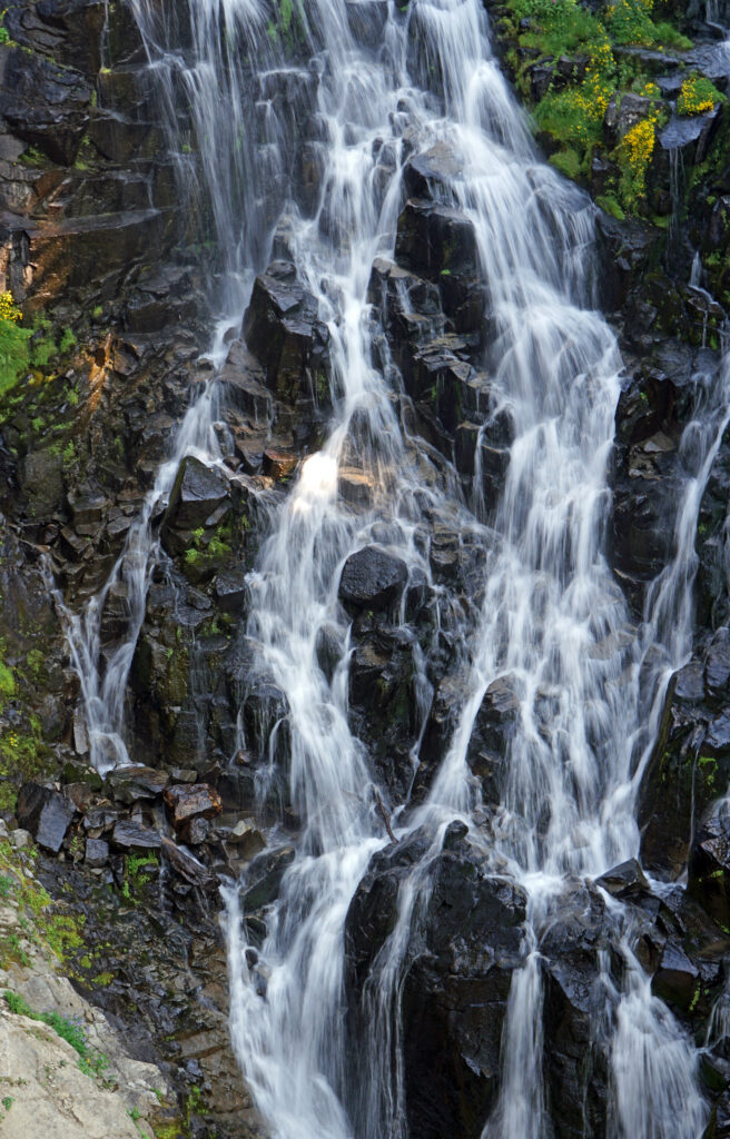
Beyond the monument, the trail parallels the edge of a 1000-foot drop off to Stevens Creek to the east before turning west. Stay right at the junction with the Lakes Trail and follow the Skyline Trail as it switchbacks down to meet the Paradise River again. Stay right again at the 4th Crossing Trail junction. The trail then traverses the slope above the river and crosses over a ridge. Just past the lower junction with the Golden Gate Trail, you come to Myrtle Falls at the 5.2-mile mark. Myrtle Falls is one of the most photographed spots in the park, and one of the most crowded. Welcome back to civilization. From Myrtle Falls it’s a short half-mile jaunt back to the trailhead.
 Other area attractions and activities:
Mount Rainier National Park offers innumerable attractions other than this hike. The Longmire area has an interesting history and a number of interesting hikes. Between Longmire and Paradise there are several waterfall hikes. The Reflection Lakes area below Paradise has several other nice hikes, as do the Stevens Canyon and Ohanapecosh areas. And the Sunrise area on the east side of the mountain has spectacular views of the mountain and many trails. And, as its name suggests, it offers especially gorgeous views of the mountain at sunrise.
Conclusion:
The Skyline Trail, even if you hike only a portion of the loop, should be on every hikers bucket list of destinations. There simply is no other high altitude trail that is as accessible and as scenic in the Pacific Northwest.
Posted September 8, 2023 by Alan K. Lee
All photos ©Alan K. Lee