Map: The park map and brochure is available online at the park website and at the park visitor center.
Overview:
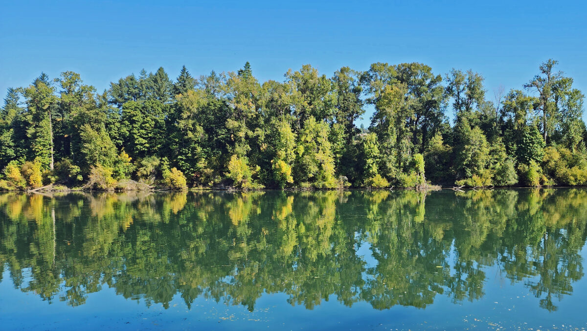
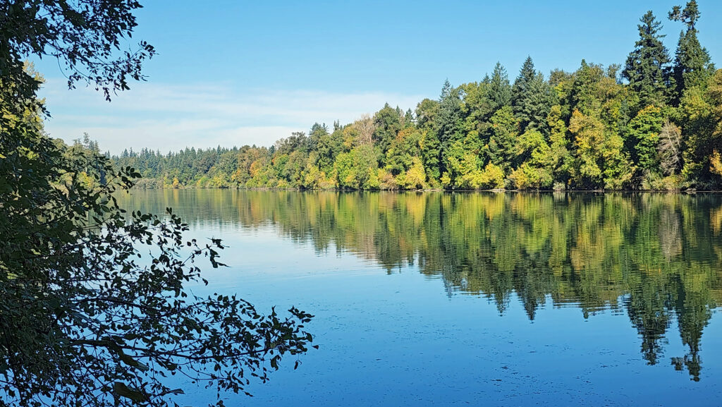
The Champoeg Riverside Trail along the Willamette River in Champoeg (pronounced sham-poo-ee) State Heritage Area is an easy family and pet friendly hike with little to no elevation gain. The trail features some good views of the river and is a good year-round option for hikers, close to both the Salem and Portland metropolitan areas. Champoeg State Heritage Area is also one of the most significant historical sites in Oregon (see below).
Getting there:
From Portland or Salem, proceed to Exit 278 (Aurora-Donald) on Interstate-5, go west on Ehlen Road for 3.5 miles, then turn right onto Case Road and follow it to Campoeg State Heritage Area. The park can also be reached from Newberg by taking Oregon Hwy 219 south for four miles to Champoeg Road, then east on Champoeg Road for two miles to the park entrance.
Trailhead:
Inside the park, follow signs to the Riverside picnic area. Restrooms and water are available at the parking area. An Oregon State Park day-use pass ($5/day or $30/year) is required.
The hike:
From the Riverside parking area there are several trails leading to the riverbank. Once there, turn right and follow the packed dirt and gravel trail along the riverbank east to the Townsite picnic area at about the quarter-mile mark. Continue east through the parking area and pick up the Townsite Trail at the east end.
The Townsite Trail takes you along the river through a mixed woodland of Douglas fir, bigleaf maple, and red alder with partially screened views of the river. There are several user-made trails leading down to the water, but they are steep (and dangerous if the ground is wet), so be careful if you want to get to the water for a better view of the river.
At about the one-mile mark you’ll come to an open field on your right and you’ll see a boat dock ahead on your left. There is a small parking area here with a restroom. Head down to the dock for the best views of the river on this hike.
Coming back up from the dock, look for a trail to your left. This will take you to Champoeg Creek where it flows into the Willamette. The trail then loops back through the forest and comes out into a clearing. Follow the edge of the clearing back to the restroom above the dock. From there, retrace your route back to the trailhead at the Riverside picnic area.
Best time to go:
Weekdays from mid-June to mid-October are best, but this is a year-round trail and a good option for winter hikes in the Willamette Valley. Summer weekends can be crowded (and hot), so go early in the day if possible. The trail can be muddy in places in the winter and spring, so hiking boots are advised, and the many side trails leading down to the water are slippery and dangerous when the ground is wet.
Champoeg State Park:
In addition to its hiking trails, the park also offers several large picnic areas that can be reserved for group outings and a 94-site campground. The park is also the site of the historic 1843 vote that led to the area becoming part of the United States rather the United Kingdom. Until that vote, the de facto government of the area was the English owned Hudson Bay Company. For more information on the area history, go to the Oregon State Parks website, or visit the Visitor Center at the park.
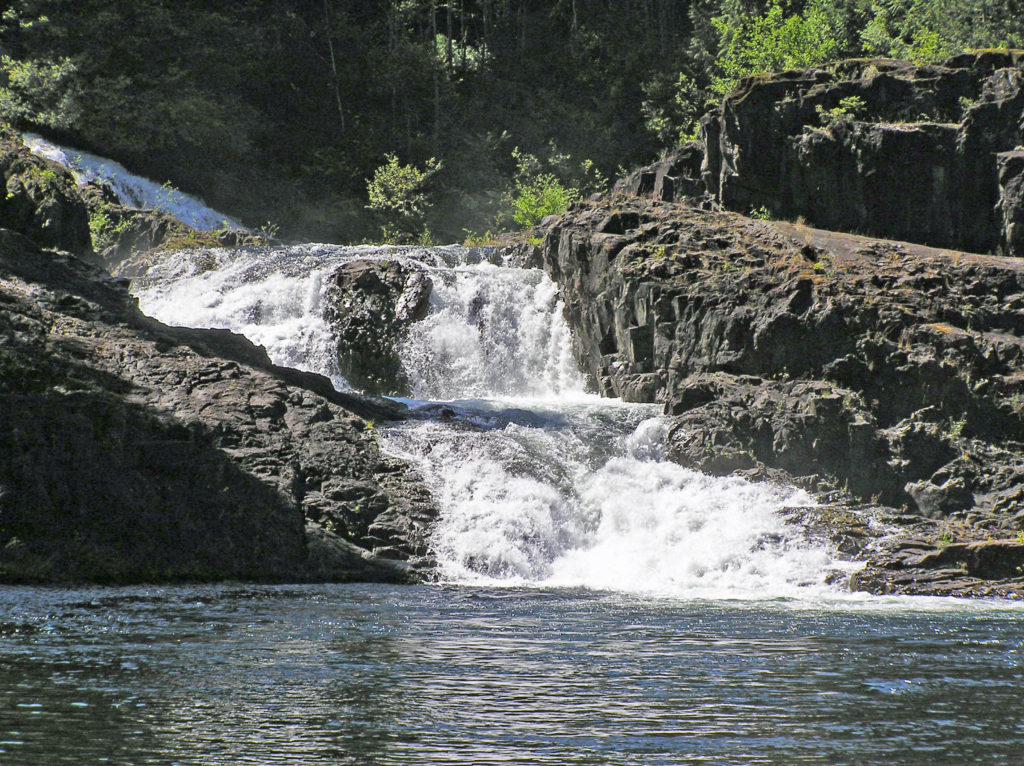
Lower South Falls, Silver Falls State Park
Other area attractions:
Silver Falls State Park, one of the best year-round hiking destinations you’ll find anywhere, is located about 30 miles south of Champoeg and 15 miles east of Salem. If you go, you might also want to check out the nearby Oregon Garden, located in the small town of Silverton.
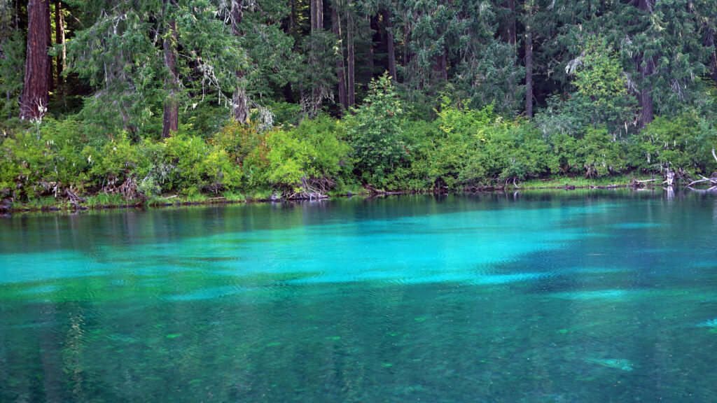
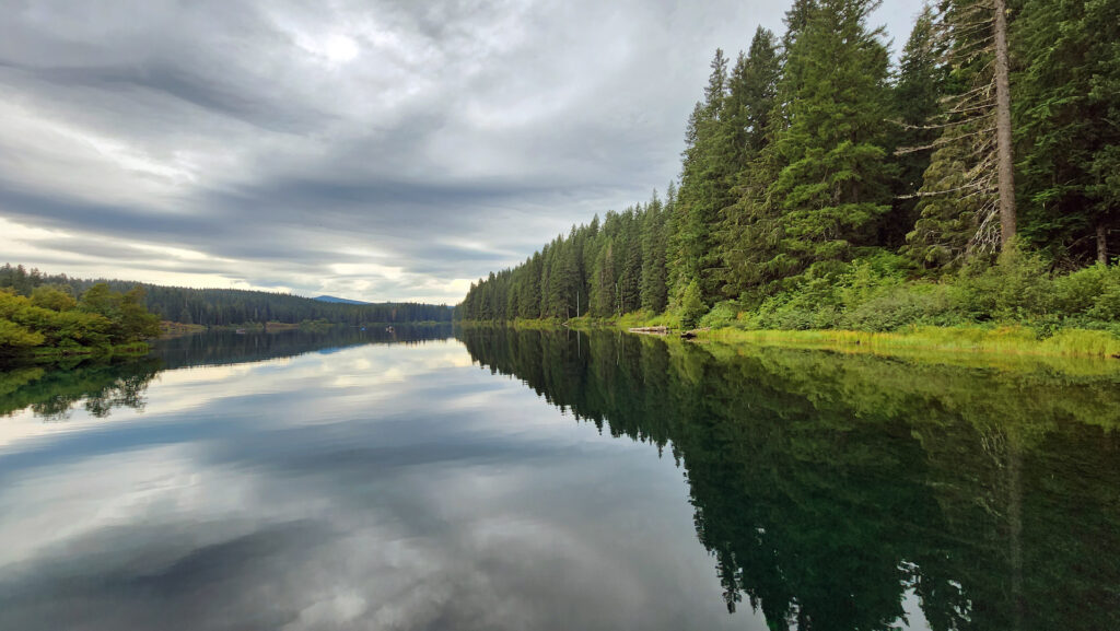
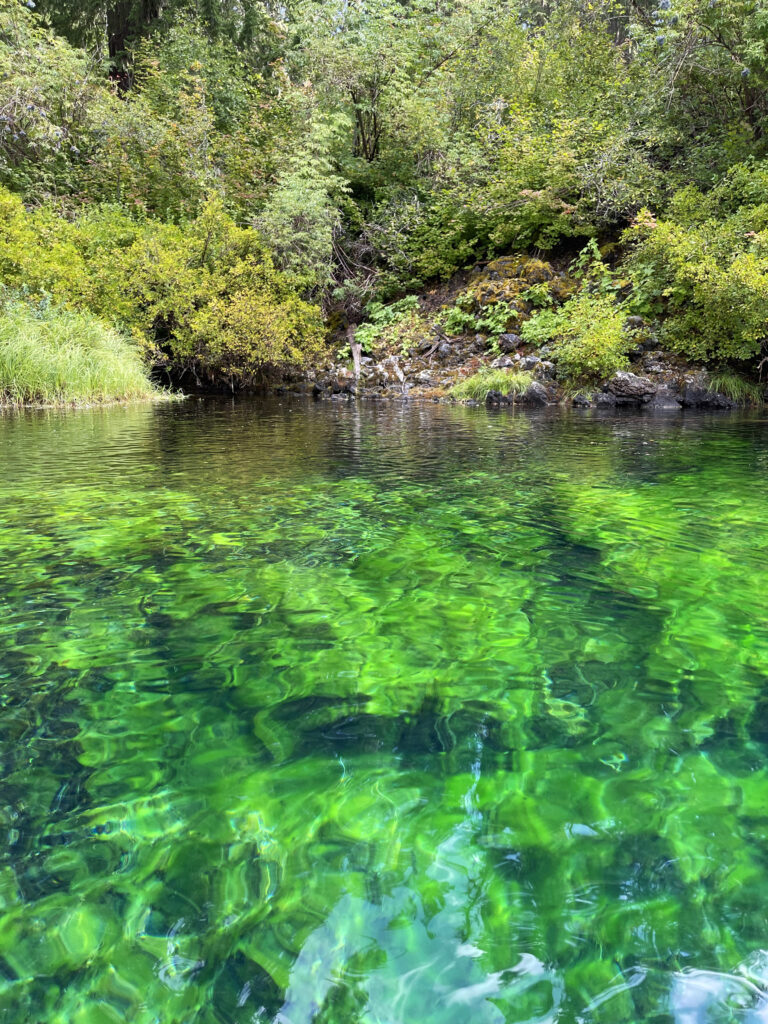
Clear Lake, in the central Oregon Cascades, is the source of the McKenzie River, and as its name suggests, it’s one of the clearest lakes you’ll find in the Cascade Range (or anywhere, for that matter). It’s also one of the cleanest, coldest, and most beautiful lakes in the Cascades.
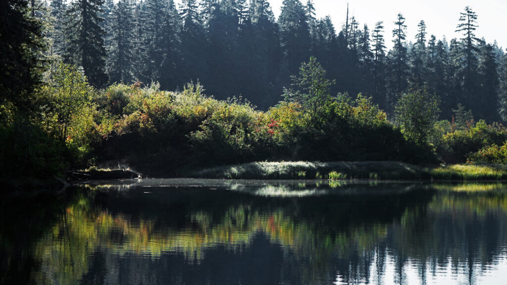
Clear Lake is very young geologically, having been formed only about 3000 years ago when a lava flow from nearby Sand Mountain dammed the McKenzie River. One of the remarkable features of Clear Lake is the Underwater Forest, remnants of the forest that stood on the shore of the McKenzie prior to the eruption. The clean and very cold water of the lake preserved the trees, and some of them still stand upright on the lake bottom.
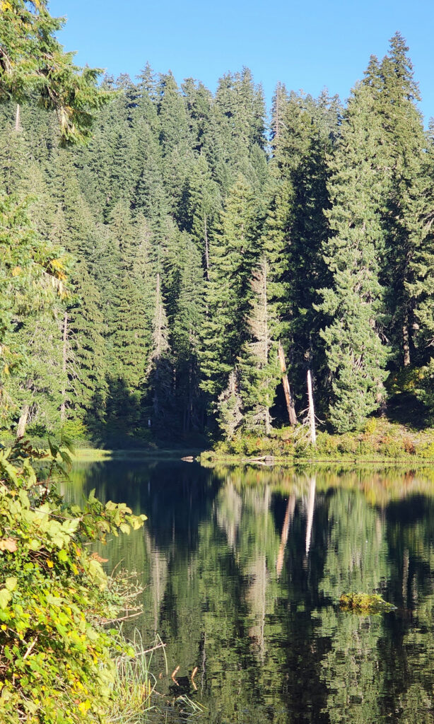
Clear Lake offers the outdoor enthusiast a number recreational options, including hiking, fishing, paddling, or just taking in the views and soaking up the beauty and peacefulness of nature.
My wife and I have taken short vacations at Clear Lake a couple of times in the past couple of years, most recently in August 2024. Both times, we stayed in one of the cabins at Clear Lake Resort on the northwest shore of the lake. Coldwater Cove Campground, on the southeast shore of the lake, is another option. The campground has 34 campsites, drinking water, and vault toilets, but no RV hookups. There are many other campgrounds and a few other resorts within a short drive of Clear Lake, as well. And the lake is also close enough to all of the communities in the Willamette Valley and Central Oregon to make it a day trip destination if you don’t want to spend the night.
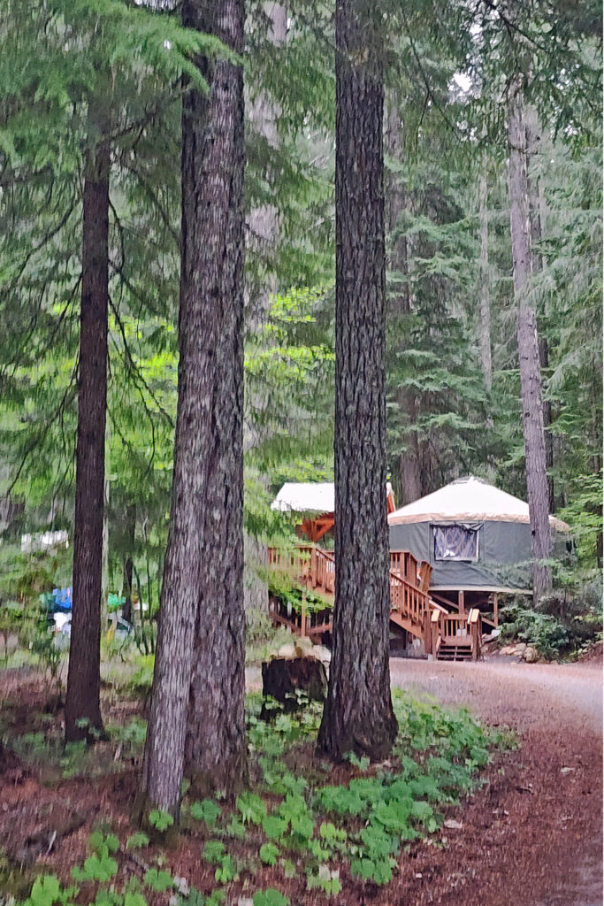
Clear Lake Resort is a good option for those, like my wife and I, that prefer the warmth of a heated cabin to an unheated tent or cramped RV. The resort has 14 cabins and one yurt. Six of the cabins have two bedrooms, a full kitchen, and a bathroom. The other cabins and the yurt have power but no indoor plumbing. (There is a heated central rest room with showers at the resort).
The resort also has a small cafe and a day use area with picnic tables, a large fire pit, and a boat ramp. And you can rent row boats or canoes there (motorized craft are prohibited on the lake).
For hikers, the Clear Lake Loop Trail is an easy 5.0 mile hike with almost no elevation gain. You can start the hike from either the resort or Coldwater Cove Campground. Note that the trail along the west side of the lake may be closed periodically to protect bald eagle nesting sites. Call the McKenzie River Ranger Station at 541-822-7254 for more information. (The Ranger District’s website wasn’t much help, and the link to their email didn’t work).
The Clear Lake and upper McKenzie area is one of the most scenic and most interesting parts of the Cascades, and offers a number of other hiking options besides the Clear Lake Loop. The 2.6-mile McKenzie Waterfalls Loop is another easy, family friendly hike that takes you to both Sahalie and Koosah Falls. The 3.9-mile out-and-back Blue Pool hike is another. Like the Clear Lake Loop, both of those also incorporate parts of the 22 mile long McKenzie River National Scenic Trail. And the nearby Santiam Pass and McKenzie Pass areas both give access to the Pacific Crest Trail and more expansive views of Mount Jefferson, Three Fingered Jack, Mount Washington, and the Three Sisters.
Clear Lake also offers other recreational options besides hiking. Fishing is a popular activity at Clear Lake, as it is in most Cascade lakes. Brook and cutthroat trout reproduce naturally in the lake and rainbow trout are stocked annually. You’ll usually see at least a few people fishing from row boats on the lake in the morning and evening.
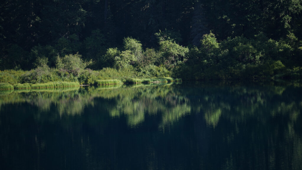
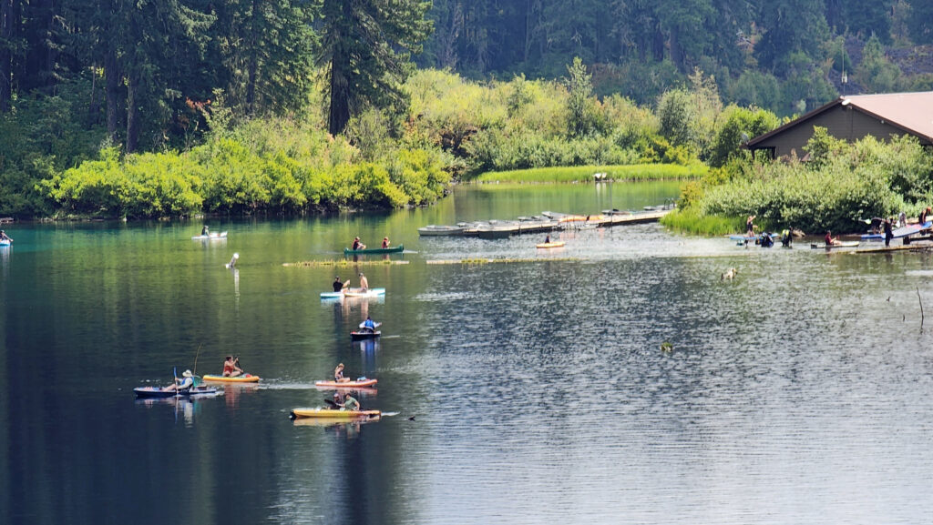
The lake is also a great place to paddle, and canoes and kayaks are a frequent sight on the lake. The clear water allows you to see deep into the lake and you get a perspective that you can’t get from the shore. My wife spent part of our stay exploring the lake in her kayak both times that we’ve there. Some of the photos here were taken by her from her kayak. Boats can be launched at either the day use area at the resort or at the campground’s boat ramp. Summer weekends can be very crowded with day trippers, though, as you can see from the photo above.
Photo by Joan E. Newman
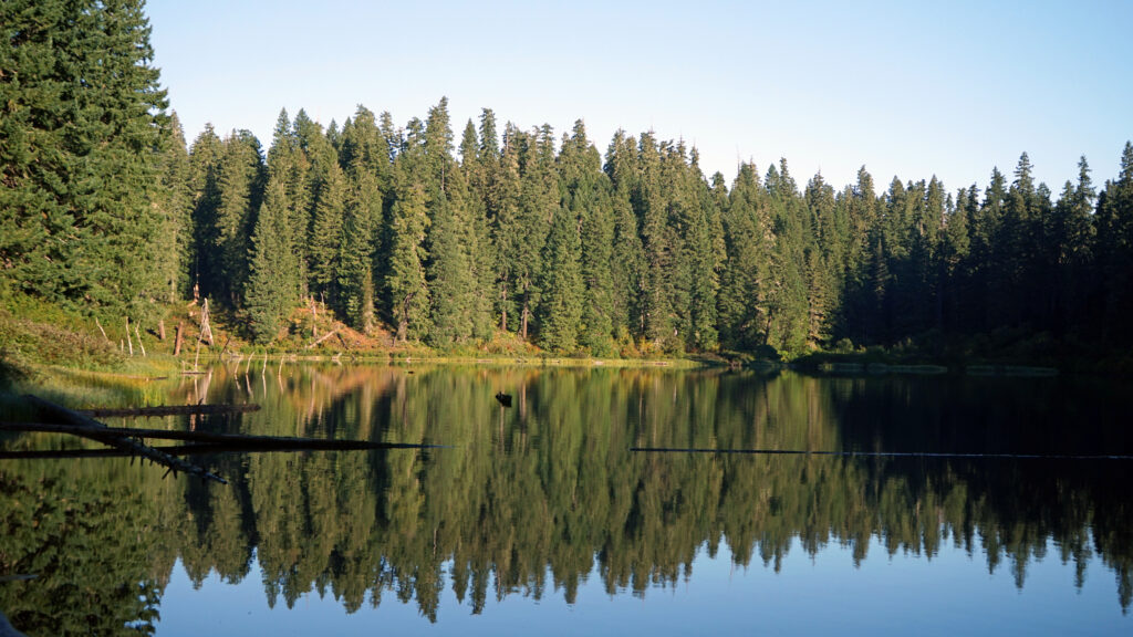
If you’re a scuba diver, the clear water and submerged forest make Clear Lake a great place to dive, even though the water is extremely cold (38° year round). Check the Scuba Bubbles website for more information about diving in Clear Lake.
Photo by Joan E. Newman
From the Portland area, Clear Lake is about a 130 mile drive. Take I-5 south to Salem, then Ore Hwy 22 east past Detroit Lake to the junction with US Hwy 20. Go west on Hwy 20 for three miles to the junction with Ore Hwy 126. Clear Lake is a few miles south of the junction. From the Eugene area it’s a 75 mile drive on Hwy 126 to the lake. From Bend, the lake is a 50 mile drive west on Hwy 20, or about 65 miles via the very scenic McKenzie Pass Hwy (Ore 242).
You can take in Clear Lake and do the Waterfall Loop in a weekend. Make it a long weekend and add the Blue Pool hike or spend a day out on the lake. Better yet, make a week of it and check out Fish Lake, the Santiam Pass and McKenzie Pass areas, and the lower McKenzie River. You won’t run out of things to do.
Originally posted November 29, 2022. Updated September 6, 2024.
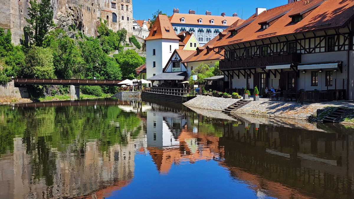
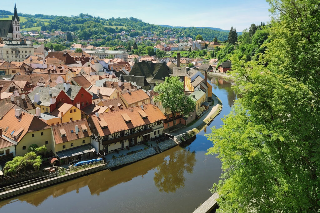
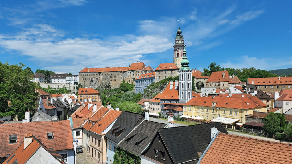
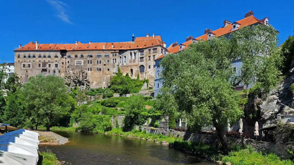
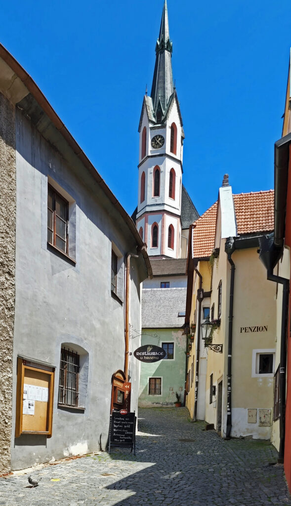
Czesky Krumlov is a small city in the Czech Republic about 85 miles south of Prague on the Vltava River. The old town section of the city, with its well preserved Gothic, Renaissance, and Baroque architecture and a castle complex that towers over the city, is one of the top tourist destinations in the country, drawing more than a million visitors a year.
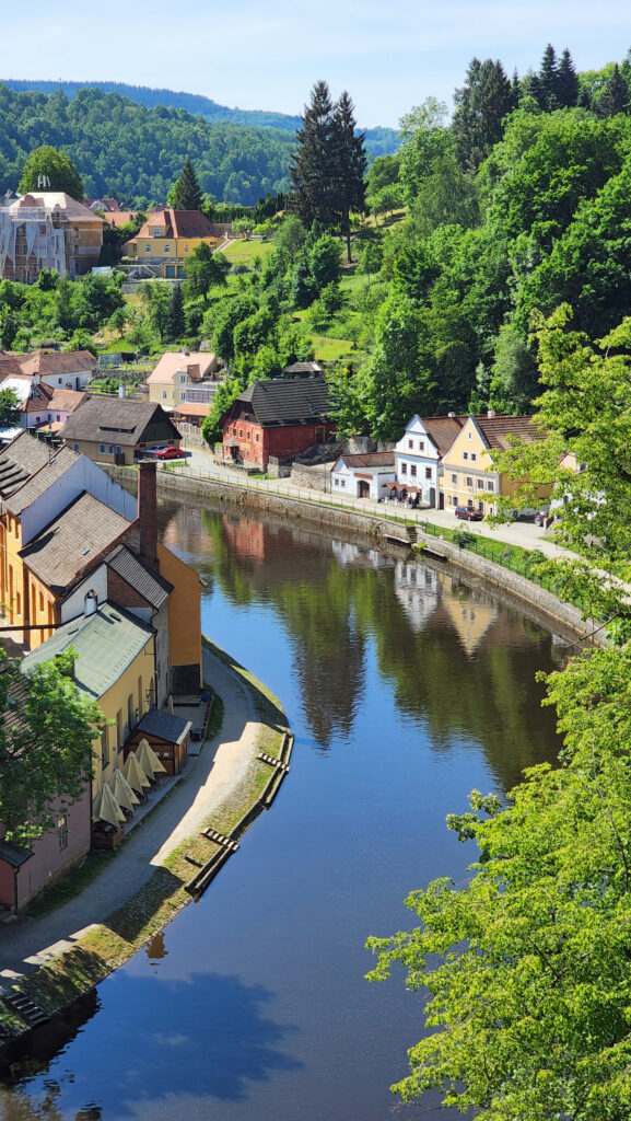
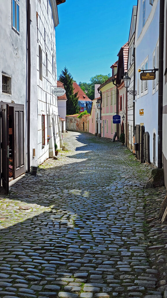
You’ll see a lot of superlatives in descriptions of Czesky Krumlov: romantic, charming, magical, fairytale-like, enchanted, and so forth. If that sounds a bit Disneyesque, the town does have a bit of a theme park vibe. But it’s undoubtedly beautiful and the old town is ancient and authentic. It has been a UNESCO World Heritage Site since 1992.
You’ll also see Czesky Krumlov described as unbearably touristy. Many of the comments I read on tourist forums recommended spending the night in the city so that you can see the city in the evening after the tour buses have left and in the morning before they arrive. My wife and I were there in early June, a little before peak season. There certainly were many other tourists there, but I wouldn’t call it unbearably crowded. And the beauty of the city and its undeniable charms would have trumped the detrimental aspects of any crowds, anyway, in my opinion.
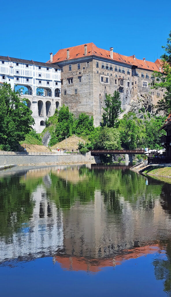
The Cesky Krumlov Castle complex , with its Baroque Theater (one of only two remaining in Europe that are open to the public), is probably the biggest tourist draw. There are four different tours of the castle that you can take, all lasting from 45 minutes to an hour with adult admission prices of 180 to 280 Czech Korunas ($7 to $12 at current exchange rates).
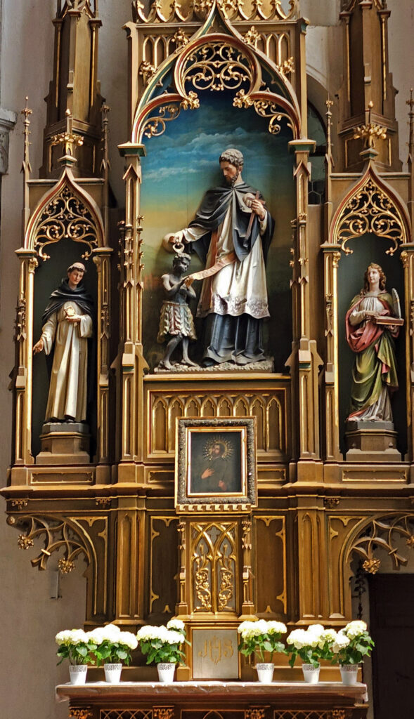
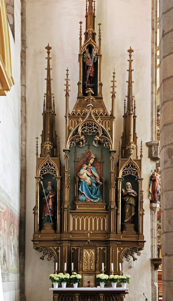
Another top attraction is the 15th century Church of St. Vitus in the historic old town area.
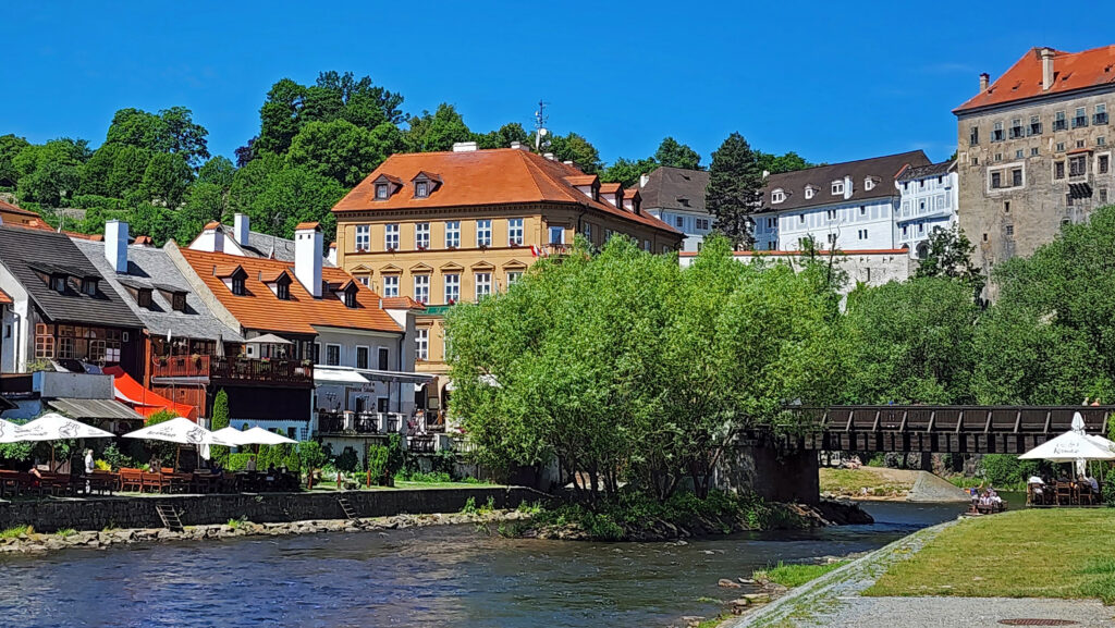
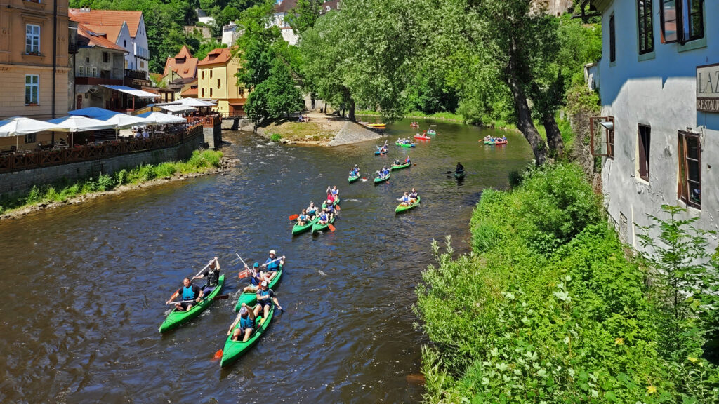
Floating the Vltava River through town is another popular activity.
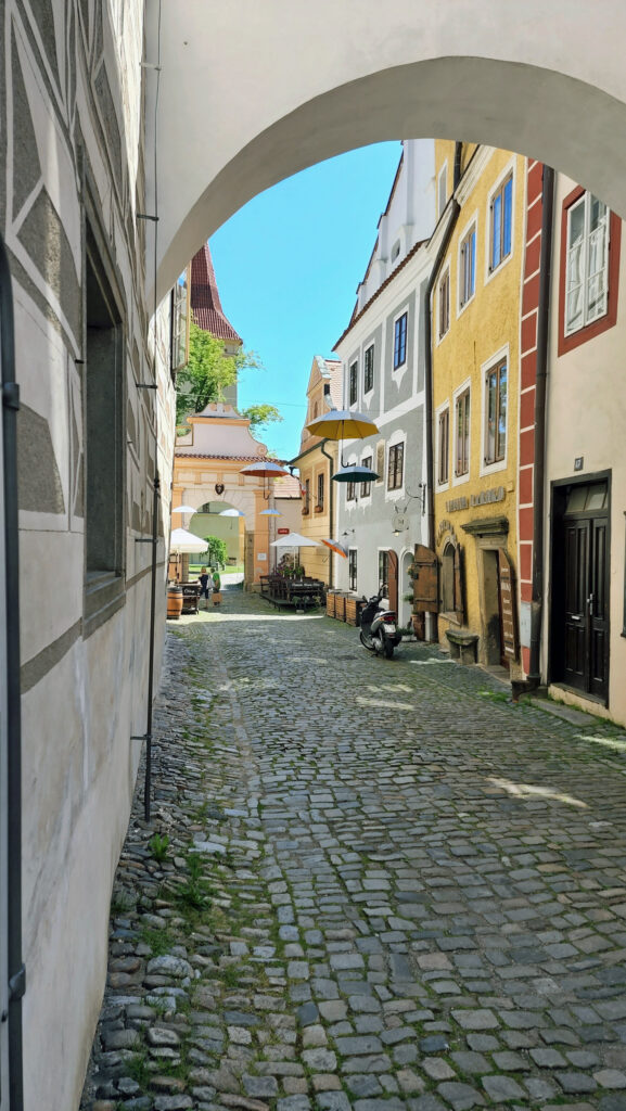
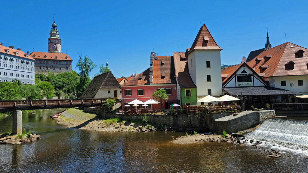
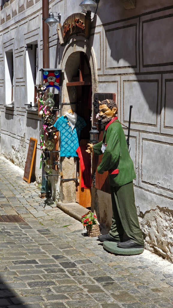
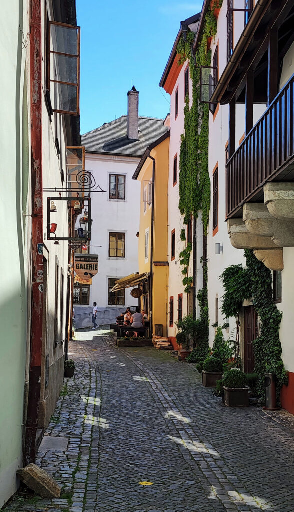
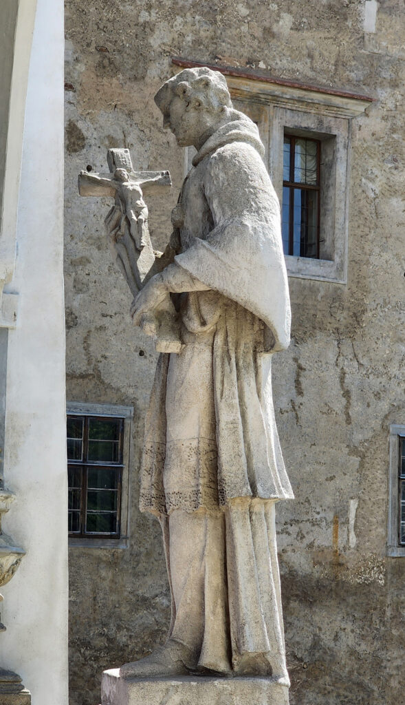
For my money, the best part of our visit was simply wandering around the historic center, walking the cobblestone streets and taking in the wonderful architecture, the beauty of the Vltava River that meanders around and through the town, and finding some of the charming and quirky things that set Czesky Krumlov apart. The old town area is car free and pedestrian friendly.
We didn’t do any of the castle tours or tour the Castle Garden. But our tour guide gave us a good deal of information about the town and its history, and we had plenty of time to just wander around the old town on our own. And that was enough to make it well worth the long bus ride from Linz.
Guided walking tours are available for about $40-50 per person, but you don’t need a tour guide to enjoy the sights. We spent only one afternoon in Czesky Krumlov (we were among those hordes that arrived on tourist buses), so we hardly experienced all of its charms. The only regret we had about our visit was that we didn’t have more time to spend there.
Everyone visiting Prague and/or Vienna (or doing a Danube River cruise) should consider adding Cesky Krumlov to their itinerary. It is an absolutely beautiful city and a wonderful place to visit. The guide books and reviews were right, too – you should spend the night there, if you can, and give yourself plenty of time to fully explore this fascinating town. More information about Cesky Krumlov can be found here.
My wife and I visited Cesky Krumlov as part of a Danube River cruise that we took earlier this year (2022) on Viking River Cruises. If you’re interested in more information about river cruising, check out the Viking website and our river cruising post.
The roughly 100 mile (as the crow flies) stretch of the Snake River, from south of Boise to just west of Twin Falls, is a geologically interesting area, wildlife is abundant, the scenery is outstanding, and there’s plenty there for those interested in the history of the American West, as well. Thousand Springs, Balanced Rock, Bruneau Dunes, and the Snake River Canyon are all beautiful, unique, and well worth visiting.
Snake River Birds of Prey
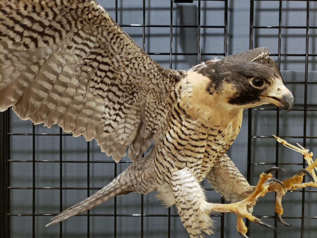
People from all over the world come to the Morley Nelson Snake River Birds of Prey National Conservation Area to view, photograph, and study the hawks, owls, eagles, and falcons that make the Snake River Canyon home. And Boise is home to the World Center For Birds of Prey, the home base of the Peregrine Fund, a non-profit environmental organization that played a key role in bringing the Peregrine Falcon back from the brink of extinction. The Peregrine Fund now runs raptor recovery and protection programs around the world. The canyon is not just for hardcore birders, though. It is spectacularly beautiful for one thing. And there are cultural and historic attractions as well.
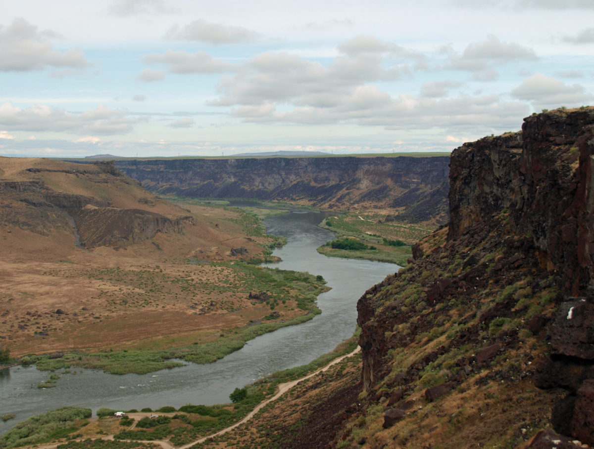
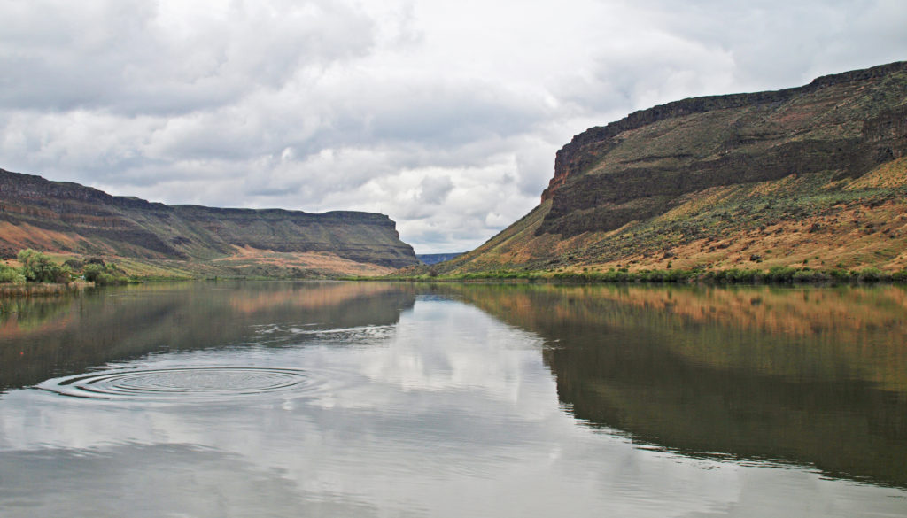
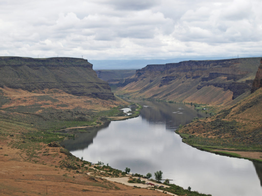
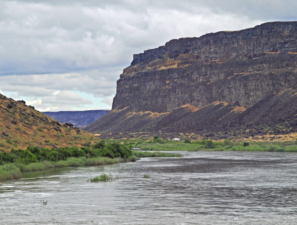
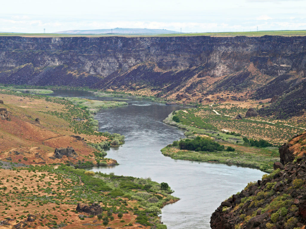
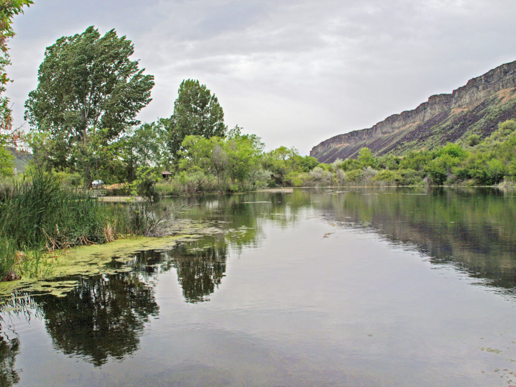
There are two primary access points to the Snake River Canyon in the Birds Of Prey NCA – Swan Falls and Celebration Park. Our first stop was the Dedication Point Overlook on the rim of the canyon above the Swan Falls area. The canyon here is about 600 feet deep, with sheer vertical walls several hundred feet high below the rim. There was a group of photographers there attempting to get photos of raptors. We saw a few hawks soaring overhead, but too high to get decent photos. It’s a scenic spot, though, and we hung around for awhile, before heading down to Swan Falls.
The falls are long gone, flooded by construction of Swan Falls Dam in the early 1900s. Swan Falls was the first hydroelectric project on the Snake River. A fish ladder was constructed, but was largely ineffective, and the dam effectively blocked salmon and steelhead passage. That was a different era, and the fish ladder was never made functional. Newer dams were built both upstream and downstream with no fish ladders at all. Electricity was the point. The fish didn’t matter. But it’s a historically interesting and beautiful area, so it’s worth a visit even if, like me, you’d rather see the dam gone.
A new power generation facility was constructed at Swan Falls Dam in the 1990s. The dam’s original power plant is now open to the public, with some of the century-old generators and other equipment still in place. There are also displays depicting the history of the area, and the construction and operation of the dam. We walked across the dam after visiting the power house museum, then drove down the canyon a ways. The road was too rough for the car, though, and we turned around and drove back up to Dedication Point, and then on to Celebration Park.
Celebration Park is Idaho’s only archaeological park. Petroglyphs dating back as far as 10,000 years can be found there. Visitors can learn about the Native American “lifeways” at the visitor center, try their hand at throwing a spear with an atlatl, and explore the petroglyph area on a self-guided walk. There is a picnic ground, and a small tent campground. The visitor center is open from 10:00 to 2:00 daily, except holidays. Check the park website for more information.
A short ways downstream, the Guffey Railroad Bridge provides pedestrian and equestrian access to the south bank of the Snake River and the Guffey Butte area. The bridge was built in the late 19th century and carried rail traffic until the 1940s. It is listed in the National Register of Historic Places. Guided tours of the area highlighting the area’s early mining and railroad history are conducted periodically.
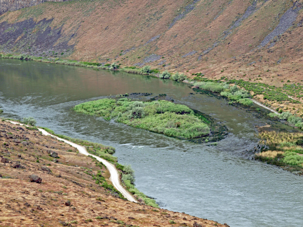
Hikers will find trails on both sides of the river. On the north side a trail follows the river upstream for about five miles to the end of the road from Swan Falls Dam. A side trail leads to Halverson Lake, nestled against the cliffs of the canyon wall.
We didn’t have time to do any hiking at Celebration Park, but the trail to Swan Falls would be an interesting outing, and a good place to do some serious raptor watching, if you’re so inclined, away from most of the human influences in the Conservation Area.
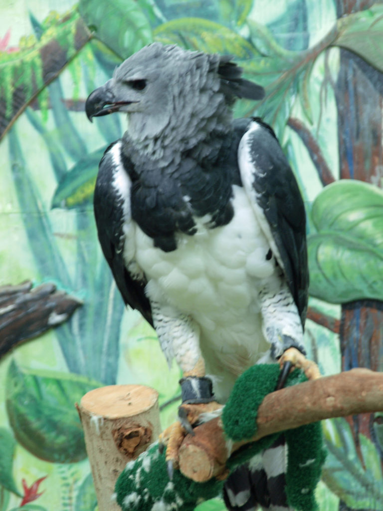
Back in Boise, we toured the World Center For Birds of Prey the following morning. The staff there are friendly and knowledgeable, and dedicated to the mission of educating the public about birds of prey and protecting the vulnerable populations of raptors around the world. We sat in on a talk given by two of the staff that was fascinating, informative, and entertaining.
There are a number of raptors from around the world on display there, birds that for one reason or another could not be returned to the wild. Being able to see these magnificent birds up close was a highlight of our trip. The center is also home to a pair of California Condors, North America’s largest bird, that are part of the captive breeding program that has helped save the species from extinction.
For more on Boise, a lively, surprisingly cosmopolitan city that still has a small town vibe, and the other posts in this series, click on the links below:
In eastern Idaho, northwest of Idaho Falls, the Big Lost River, Little Lost River, and other smaller streams sink into the lava fields and disappear. That water re-emerges a hundred miles to the southwest, from springs on the north side of the Snake River west of Twin Falls – the Thousand Springs.
Niagara Springs
I can remember seeing part of the Thousand Springs somewhere along US Hwy 30 on a family vacation when I was a kid, back in the late 1950s or early 60s. We didn’t stop back then, but seeing all that water gushing out of the canyon wall obviously made a big impression on me, as I have retained that memory for more than fifty years. And I had a chance to chase down that memory a couple of years ago when my wife and I spent five days exploring southwest Idaho. We spent the first day at Thousand Springs State Park, which consists of seven separate units spread out along the Snake River.
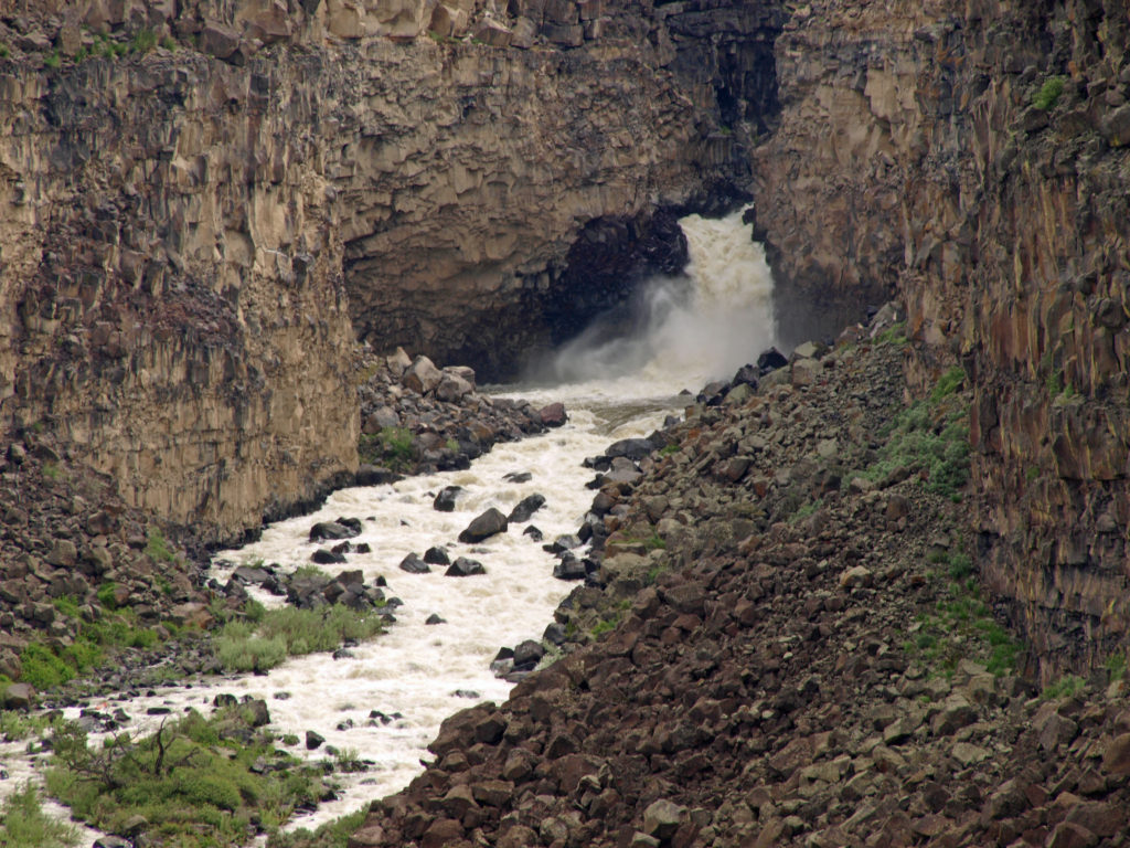
Devil’s Washbowl
The Malad Gorge unit was our first stop. It’s the most accessible of the seven sections of the park, just off I-84. In what the signs still called Malad Gorge State Park, there is a short trail from a parking area near the park entrance to a viewpoint on the rim of the canyon overlooking the narrow gorge and the 60-foot waterfall and plunge pool known as the Devil’s Washbowl.
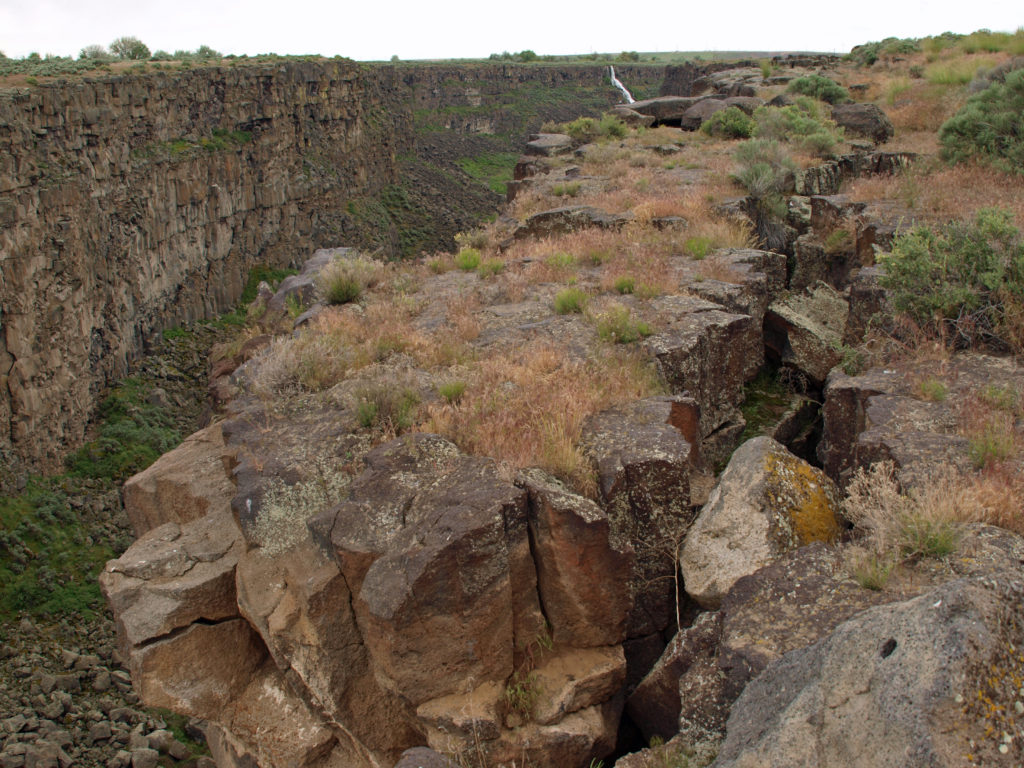
Malad GorgeCanyon rim at Malad Gorge
The trail continues across a foot bridge 250 feet above the river to another viewpoint a short ways downstream. The road through the park continues from the first parking area to other viewpoints, a large picnic area, and a campground.
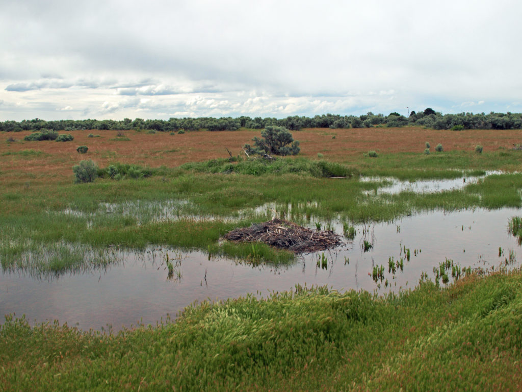
Upland area near Malad GorgeMarsh at Malad Gorge State Park
Near the campground is another canyon called Woody’s Cove. Although not as impressive as Malad Gorge, the springs at the head of Woody’s Cove were the first of the Thousand Springs that we had a chance to see. (The source of the Malad River is in the Sawtooth Mountains to the north, near Sun Valley, not the Thousand Springs).
Malad GorgeWoody’s Cove
There are no trails to the bottom of either Malad Gorge or Woody’s Cove, but the views from the rims of both make the park well worth the five dollar entrance fee. On the other side of I-84 from Malad Gorge is the Kelton Trail section of the park. Here there is a section of the historic Oregon Trail where the wagon wheel ruts can still be seen.
Billingsley Creek Wildlife Management AreaFarm pond adjacent to Billingsley Creek
Two of the park’s units are along Billingsley Creek. The lower unit, Billingsley Creek Wildlife Management Area, just north of the town of Hagerman, is an area of marsh and open water that is prime waterfowl and wildlife habitat. Upstream, a few miles east of Hagerman, the Vardis Fisher Day Use Area runs along Billingsley Creek in a narrow valley. The unit is named for the Idaho author of the novel Mountain Man, which was the basis for the 1972 movie Jeremiah Johnson. The ruins of the Fisher home are located in the park unit.
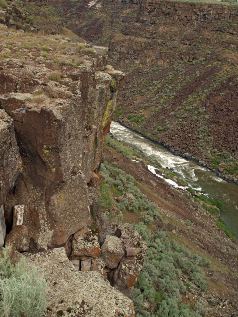
Canyon wall above Ritter Island
A few miles to the south is the Ritter Island unit of the park. The island was once home to the historic Thousand Springs Dairy Farm run by a locally famous woman named Minnie Miller in the first half of the 20th Century. Ritter Island was also the site of the Payne Lewis Ferry Crossing on the Kelton Road from Boise to Utah. This was an important transportation route in the 19th Century prior to the coming of the railroad.
Ritter Island Unit, Thousand Springs State Park
Some of the structures from the farm and ferry crossing are still standing. There are several miles of hiking trails on the island and, according to the park literature, an abundance of wildlife and wonderful views of the Hagerman Valley. It’s also a good place to kayak, according to the reviews I read. Unfortunately, the island is only open from Memorial Day to Labor Day, and we were there a few days before the island’s opening. It was disappointing that we couldn’t get onto the island, but the springs here made the area worth visiting, regardless.
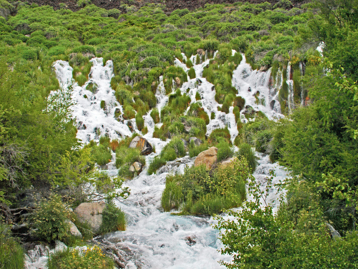
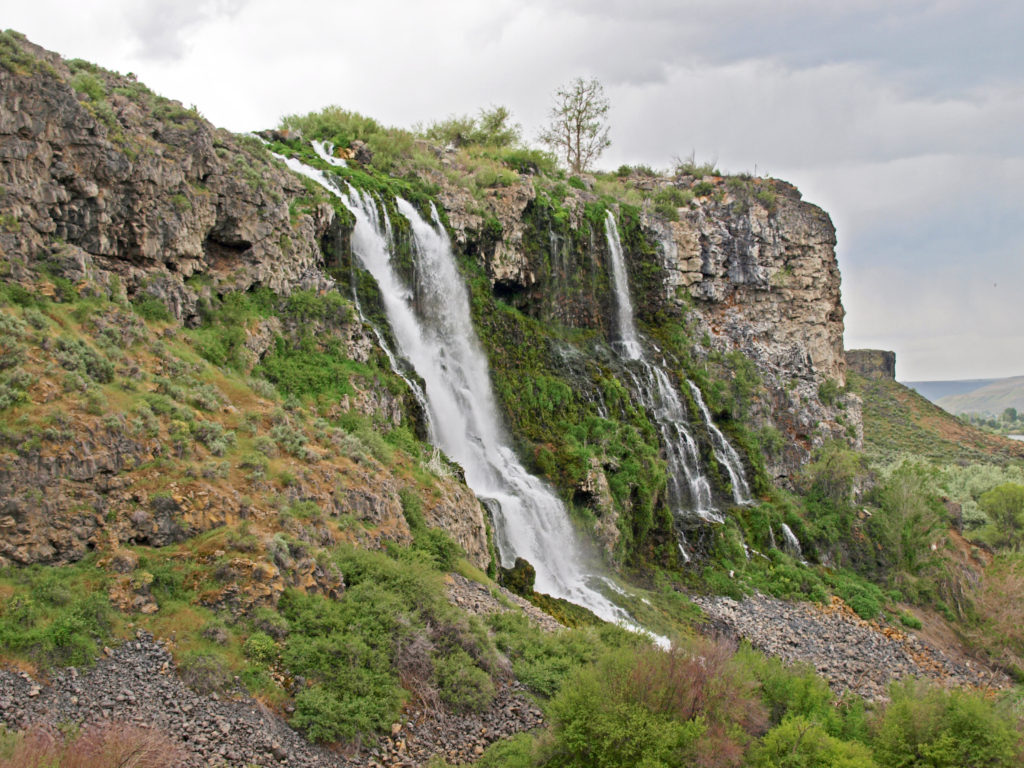
Ritter Island springs
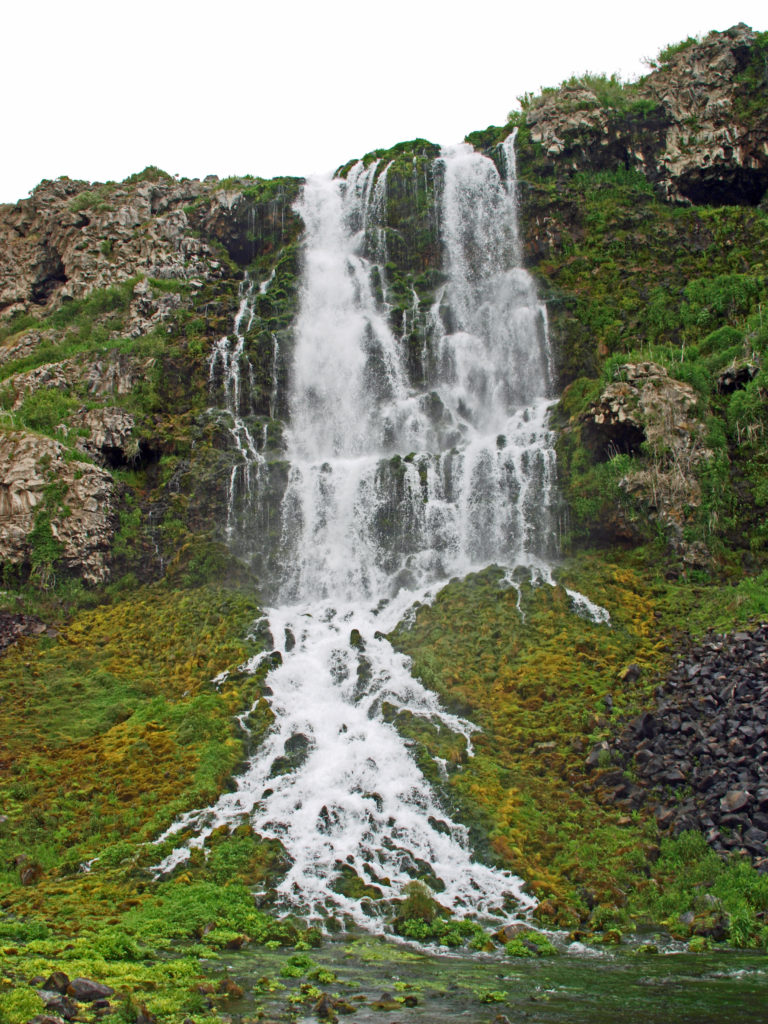
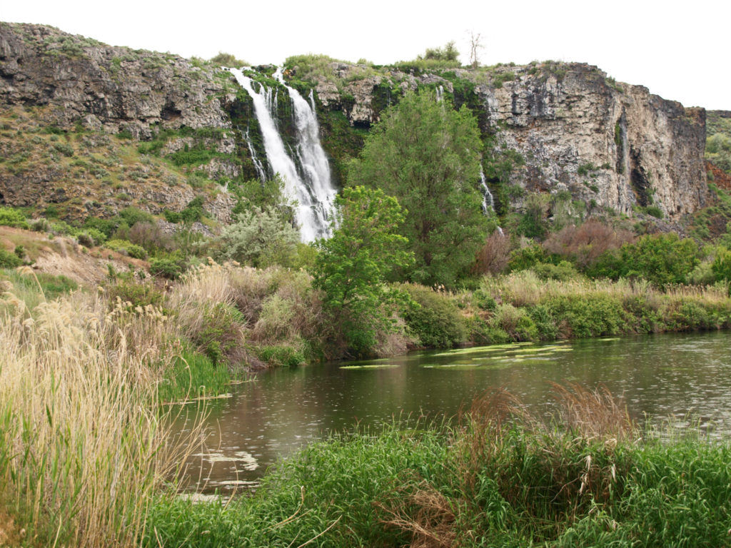
There are literally hundreds of springs midway up the canyon wall above Ritter Island, and Sand Spring Creek emerges full blown from the cliff face. Much of the water from the springs and the creek have been diverted to a hydroelectric generating plant, and some of the spring water is also diverted to the Ten Springs Fish Hatchery. But there is still lots of water pouring down the canyon walls to a side channel of the Snake River.
Falls below Ten Springs Fish Hatchery
The outfall from the fish hatchery tumbles over the cliff face in an impressive waterfall. And below the hatchery there is a Nature Conservancy preserve that has a nice trail along the river below the canyon walls.
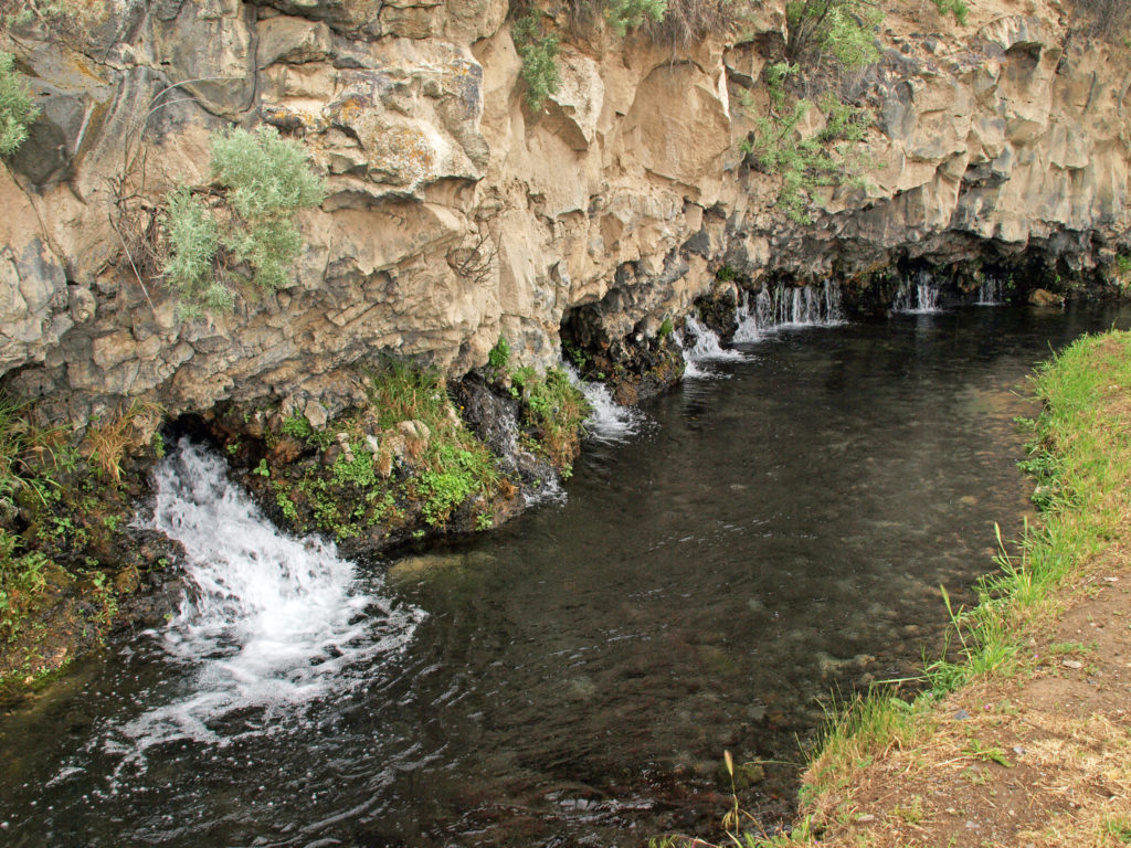
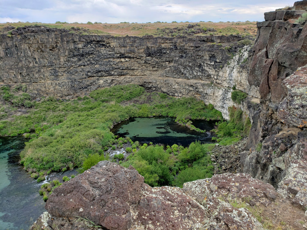
Box CanyonBox Canyon Springs
Our next stop was the Box Canyon unit of the park (officially the Earl M. Hardy Box Canyon Springs Preserve), a couple of miles south of Ritter Island. The springs at the head of the canyon flow at an impressive 180,000 gallons per minute.
Box Canyon Springs
Like at Malad Gorge, there is no trail to the bottom of the canyon here. There is a trail to a viewing platform that overlooks a small waterfall. That trail was closed when we were there, but the views from the canyon rim, here too, were impressive enough.
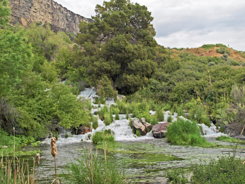
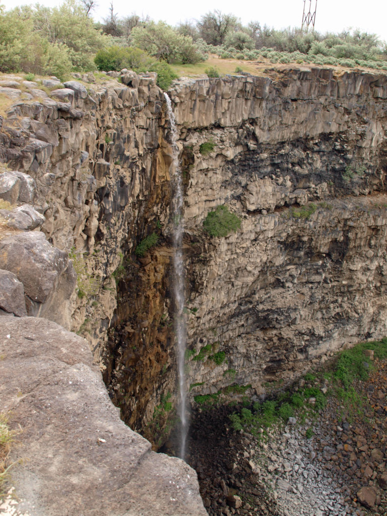
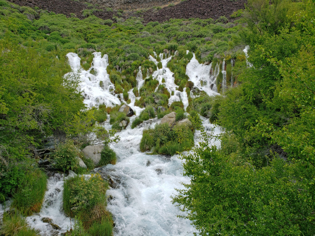
Niagara Springs
The final stop on our tour of the Thousand Springs was Niagara Springs, eight miles southeast of Box Canyon. The springs are on the left side of the access road just beyond a fish hatchery. If you have your windows rolled down, you’ll probably hear them before you see them. The roar the springs make is no doubt the inspiration for their name.
There is a short trail to a viewing platform directly below the springs, which flow out of a 150 foot wide section of the canyon wall at a rate of almost 2,000 gallons per second. Just beyond the springs there’s a picnic area and a small tent campground on the right side of the road adjacent to the fish hatchery.
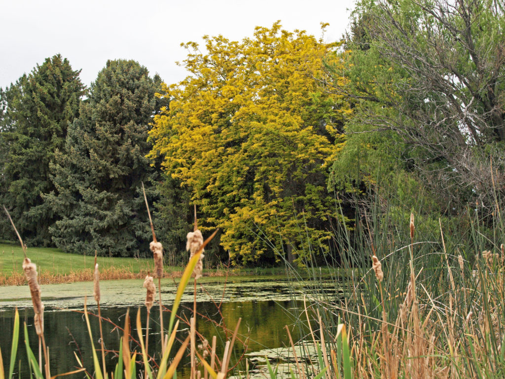
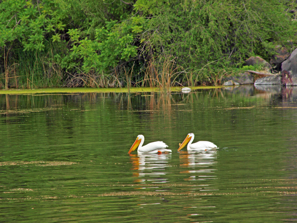
White Pelicans on Crystal LakeCrystal Springs
About a mile beyond Niagara Springs you’ll find Crystal Springs and Crystal Lake, which is a popular swimming and fishing spot. But we were there on a Thursday and it was quiet and peaceful, almost deserted. The only swimmers were a pair of white pelicans.
Balanced Rock
After leaving Niagara Springs and getting a bite to eat in Buhl, we took a short side trip to the rock formation known as Balanced Rock. After climbing up to the base of the rock, we resumed our journey back to Boise, where we were staying. The road from Balanced Rock took us back to Hwy 30 and the Snake River, not far from the Ritter Island area..
Ritter Island Unit, Thousand Springs State Park
I was curious if I could find the spot along the highway that had made such an impression on me on that family vacation so long ago, and I think I did. I’m pretty sure what I saw back then was the springs above Ritter Island. The highway is on the opposite side of the river, but if the hydroelectric plant had not yet been built and none of the spring water was being diverted, there must have been an incredible amount of water pouring out of the canyon wall and tumbling down to the river. No wonder it made such an lasting impression on me. Even with the water diversions, the springs there are still quite a sight from the highway. That was the end of our first day’s outing. Not a bad start, to say the least.
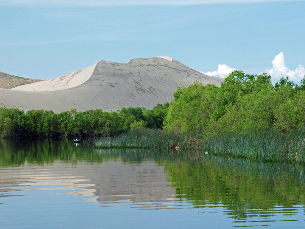
Snake River CanyonBruneau Dunes
Our trip continued in the following days with visits to Bruneau Dunes State Park, the Snake River Birds of Prey National Conservation Area, and the World Center For Birds of Prey in Boise. We also spent time exploring downtown Boise and the parks and trails of the Boise River Greenbelt. Check out the rest of our southwest Idaho exploration:
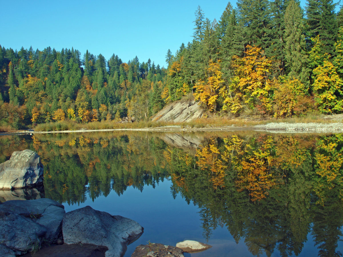
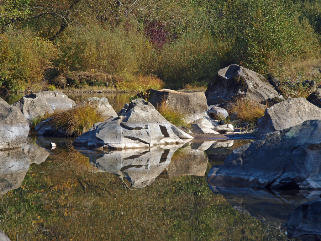
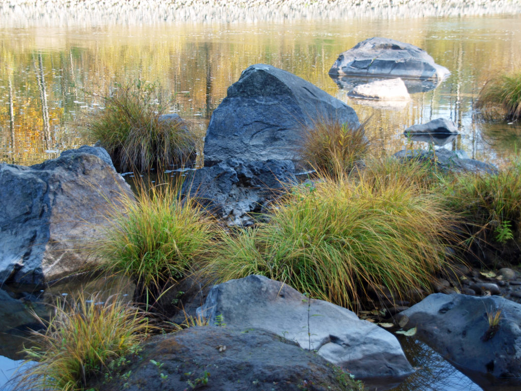
Oxbow Park is a popular picnicking and camping area located on the Sandy River just east of Portland, Oregon at the base of the Cascade foothills. The photos here were taken a few years ago when my wife and I visited on a beautiful fall day.
Oxbow Regional Park is owned and operated by the Metropolitan Service District (Metro for short), the regional government agency covering Multnomah, Washington, and Clackamas. The park covers 1000 acres on both sides of the river. There are twelve miles of hiking trails, five group picnic areas that can accommodate groups as large as 300 people, many smaller picnicking areas, a public campground with 74 tent sites, 12 RV sites, and four ADA accessible sites, and two group campgrounds available to non-profit youth organizations.
In past years, Metro has conducted a variety of nature education programs and activities at Oxbow, including school and group field trips, nature programs for families and individuals, and custom programs for groups. Most of those activities have been put on hold due to the Covid-19 pandemic, but the park still sees plenty of use.
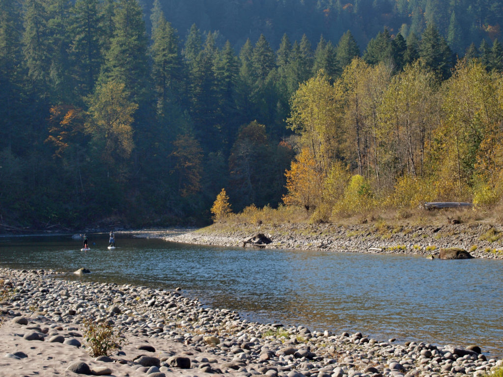
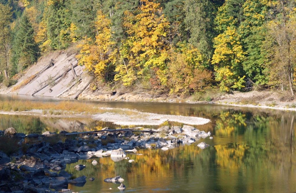
The park can be very crowded on summer weekends, but gets much less use after Labor Day. Even on a sunny October day there were just a few people fishing from the river bank and some out for a hike or just enjoying the sunshine. This section of the river is popular with kayakers and rafters in the summer, but we didn’t see anyone on the river other than one family that floated by on stand up paddle boards.
The Sandy River flows from its headwaters on Mount Hood to the Columbia River at Troutdale. Two sections of the river totaling 25 miles are designated Wild and Scenic, including the section of the river that runs through Oxbow Park.
In 2007 the Marmot Dam on the Sandy River was demolished, making the river free flowing for its entire 57 mile course for the first time in nearly a century, and opening up miles of restored spawning grounds for salmon and steelhead. A smaller dam on the Little Sandy River was also demolished.
One of the more popular events at Oxbow is the annual Salmon Homecoming weekend held in mid-October when you can watch salmon spawning in the gravel beds of the river.
Most of the visitor activity at the park takes place along the banks of the river. The upland trails through the mixed conifer and hardwood forest get much less use. But the forest is beautiful, quiet, and peaceful. If you’re looking for tranquility, head away from the river. On our visit when these photos were taken, we hiked some of the forest trails and saw almost no one.
To get to the park, take I-84 east from Portland to Exit 17 at Troutdale. Turn right onto Graham Road, then left onto the Historic Columbia River Highway. In two blocks, turn right onto Buxton Road. Follow Buxton (which becomes South Troutdale Road) to Division Street. Turn left on Division and follow the signs to the park.
One of the great things about the Pacific Northwest is that there are so many beautiful places like this that are within a half hour drive of even the biggest cities. Just one of the reasons that I think this is one of the best places in the world to live.
Originally posted 10/31/18. Updated and re-posted 12/6/21.
Surrounded by the salt waters of the Pacific Ocean and Inside Passage, dotted with freshwater lakes and streams, recipient of abundant precipitation (more than 120″ per year along its west coast), Vancouver Island is a land defined by water.
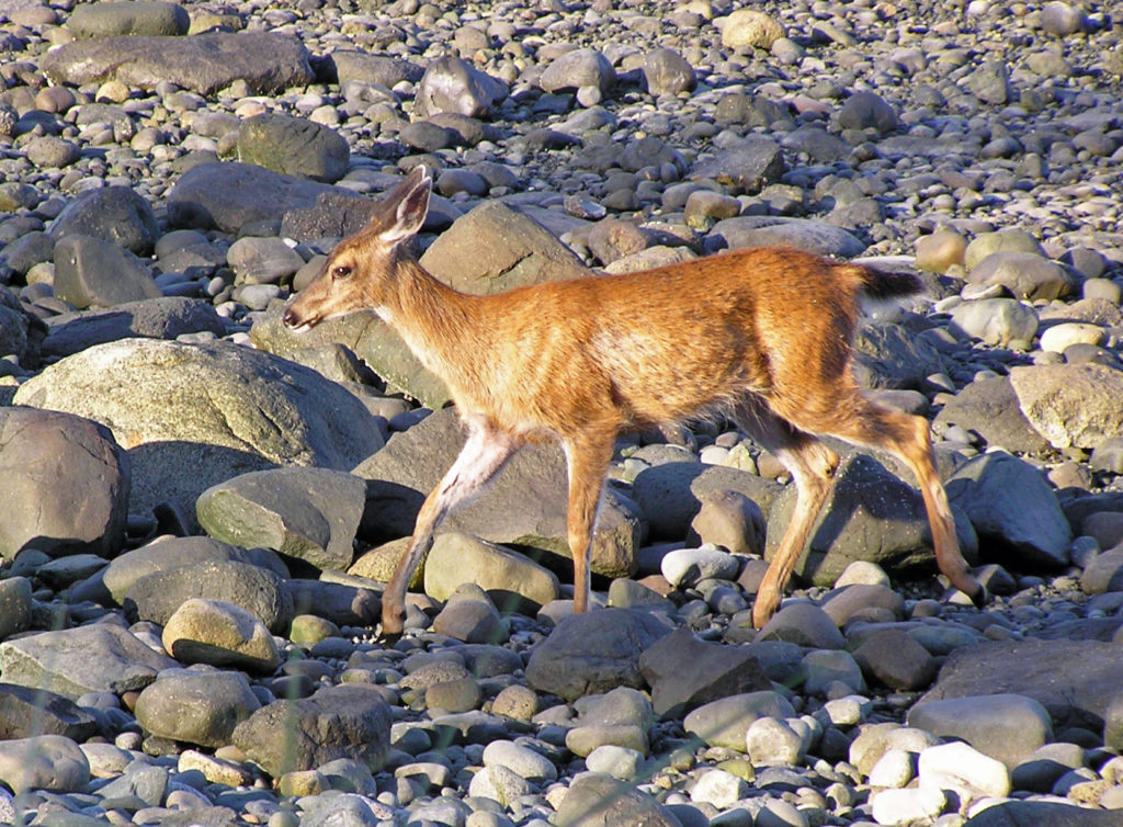
Deer on the Campbell River waterfront
The island’s relatively mild, wet climate makes it one of the most productive and diverse terrestrial ecosystems on the planet. And the cold, nutrient rich ocean waters make the marine environment equally productive.
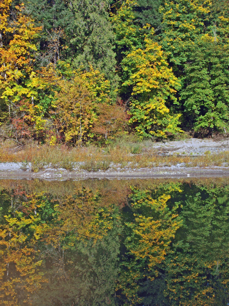
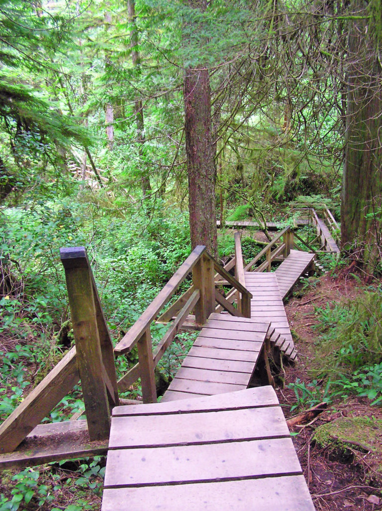
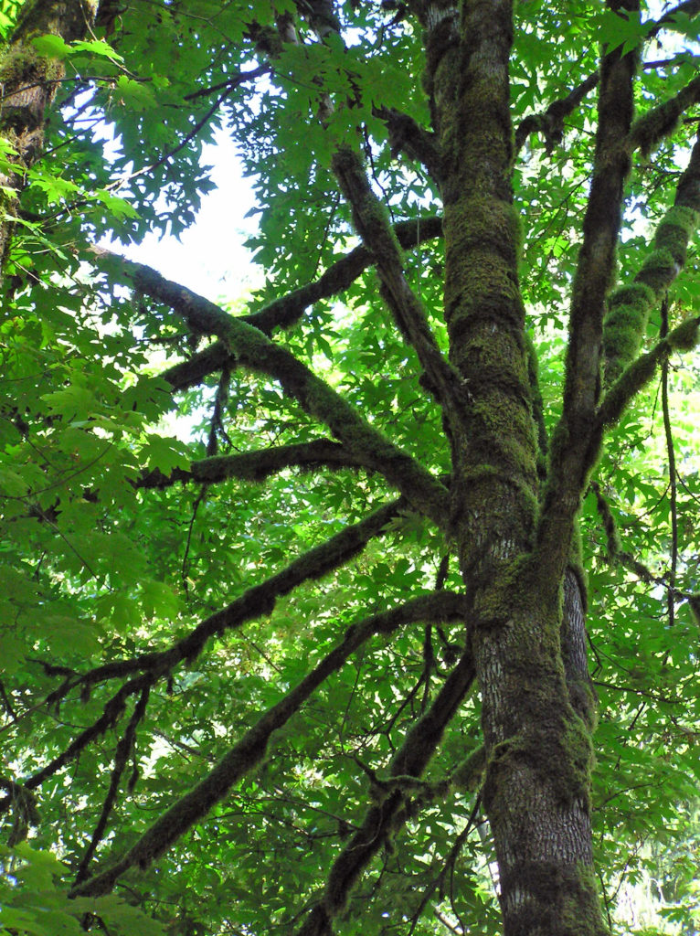
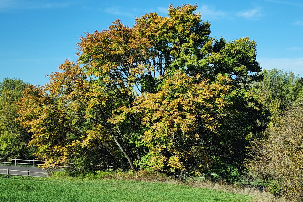
Forest trail on the west coast of the islandBigleaf Maple
Anyone planning a visit to Vancouver Island should note that it’s a big place.It’s 280 miles long by 60 miles wide. Look at a map of British Columbia and it looks small in comparison to the province as a whole. But British Columbia is huge – far bigger than the state of Texas – and Vancouver Island by itself is larger than nine U.S. states. It’s just too big to fully explore in a single trip.
Any trip to Vancouver Island should include a stay in Victoria, but beyond that it’s best to pick one or two areas and plan your visit around those. It’s also far too large and has far too many outstanding areas to cover in a single blog post. We’ll focus here on the area near the town Campbell River (including Quadra Island), Strathcona Provincial Park, and the west coast of the island near Tofino and Ucluelet.
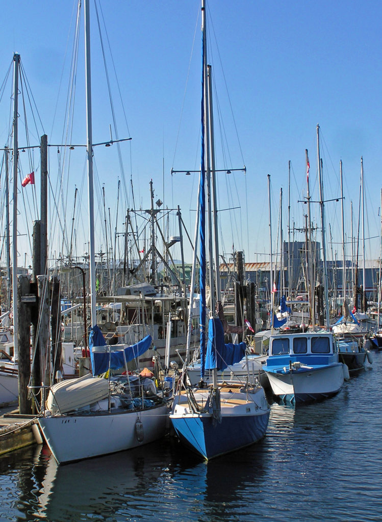
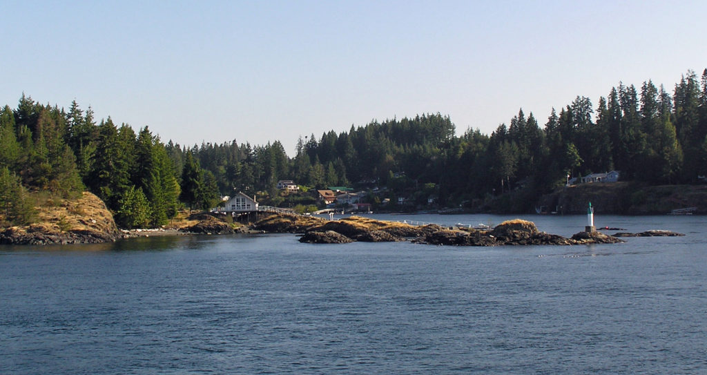
Campbell River harbor
Roughly midway up the east coast of the island, the town of Campbell River, the self-proclaimed “salmon capital of the world,” is a good base from which to explore the area. Fishermen have flocked to Campbell River since at least the 1880s. In the 1920s the Campbell River Tyee Club popularized the area with fishermen world-wide. Painter’s Lodge, opened in 1929, attracted Hollywood stars such as Bob Hope and Bing Crosby, which further popularized the area.
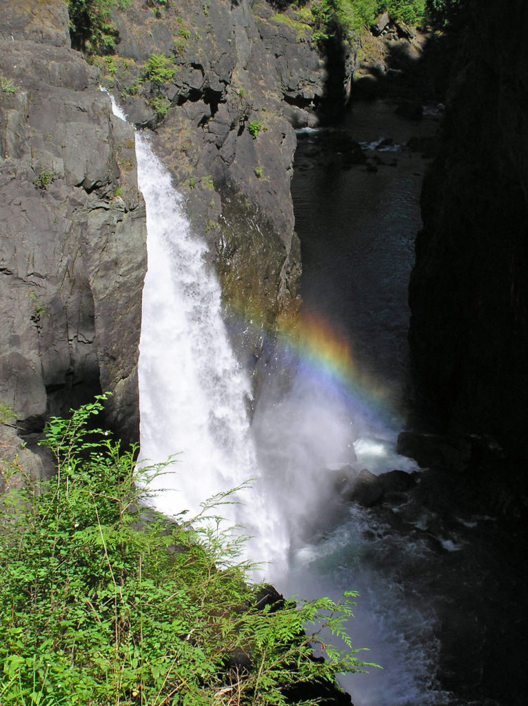
Painter’s Lodge recently reopened, and offers lodging, event space, helicopter tours, whale watching, grizzly bear tours, and wildlife tours, in addition to guided fishing trips. Campbell River has a variety of other accommodations, including a nice campground at Elk Falls Provincial Park on the outskirts of town. In 2015 a suspension bridge was built just downstream of Elk Falls. Check out the video on the park website.
Elk Falls
Campbell River has a variety of dining options for any budget. Anglers Dining Room at Dolphins Resort gets consistently good reviews. Ideal Cafe, Locals, and Quay West also get good reviews. Check out Beach Fire Brewing and Cornerstone Taphouse for good craft beers.
Quadra Island
Only a short 15 minute ferry ride across Discovery Passage from Campbell River, Quadra Island has a full range of tourist facilities, including a number of cafes and lodging options if you desire a quieter, more rural environment than you’ll find in Campbell River. Quadra, largest of the Discovery Islands, provides the outdoor enthusiast with a network of hiking and mountain biking trails, kayak and boat launching facilities, and beach access points. The northern end of the island has several lakes and parks, the largest being Main Lakes Provincial Park. Hike, bike, paddle, or just take in the scenery and enjoy the quiet, natural area.
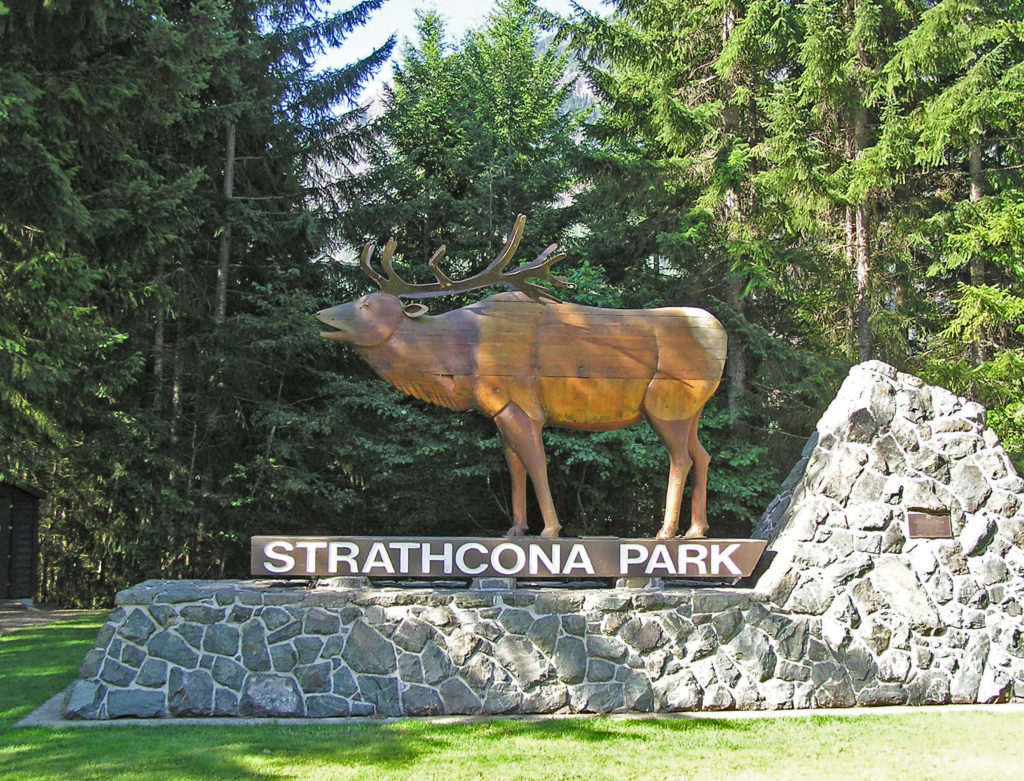
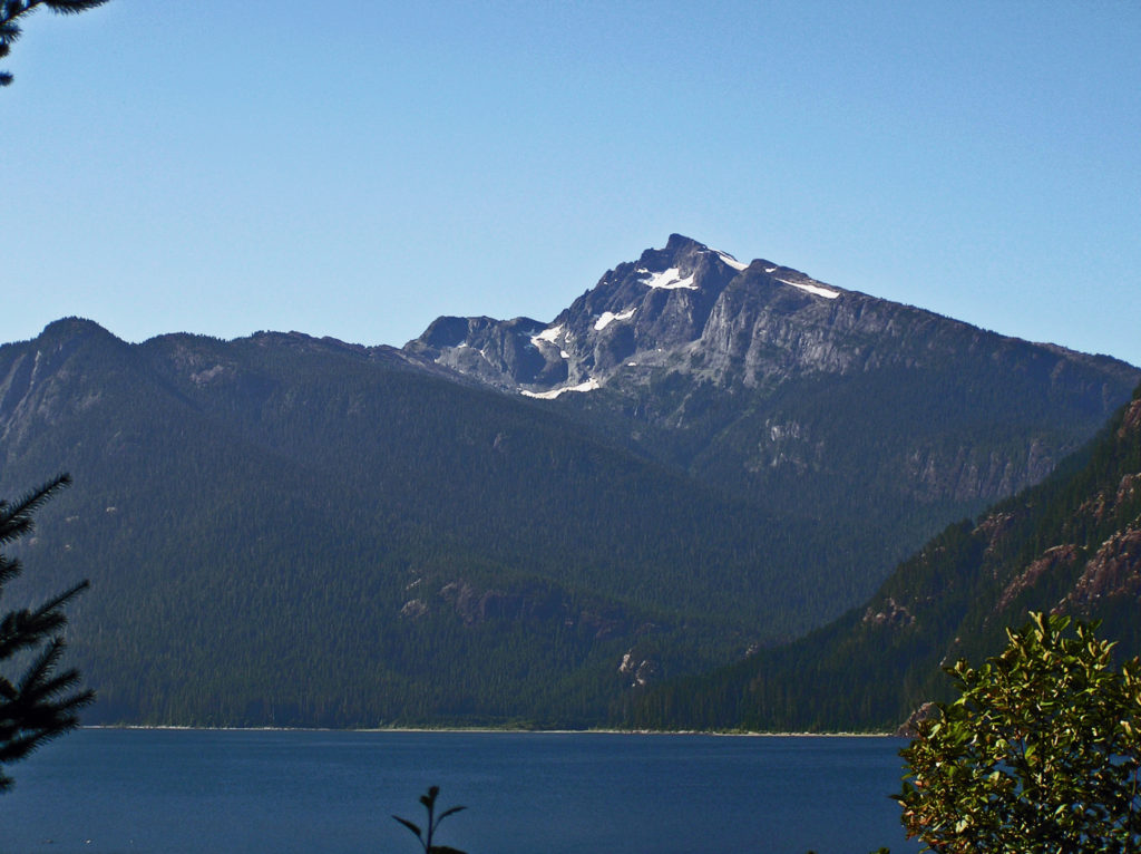
Strathcona Provincial Park, established in 1911, is the oldest provincial park in British Columbia. With the highest peaks on Vancouver Island and the highest waterfall in Canada, Strathcona’s scenery is hard to beat. Located 15 miles west of Campbell River, the majority of the park is wilderness.
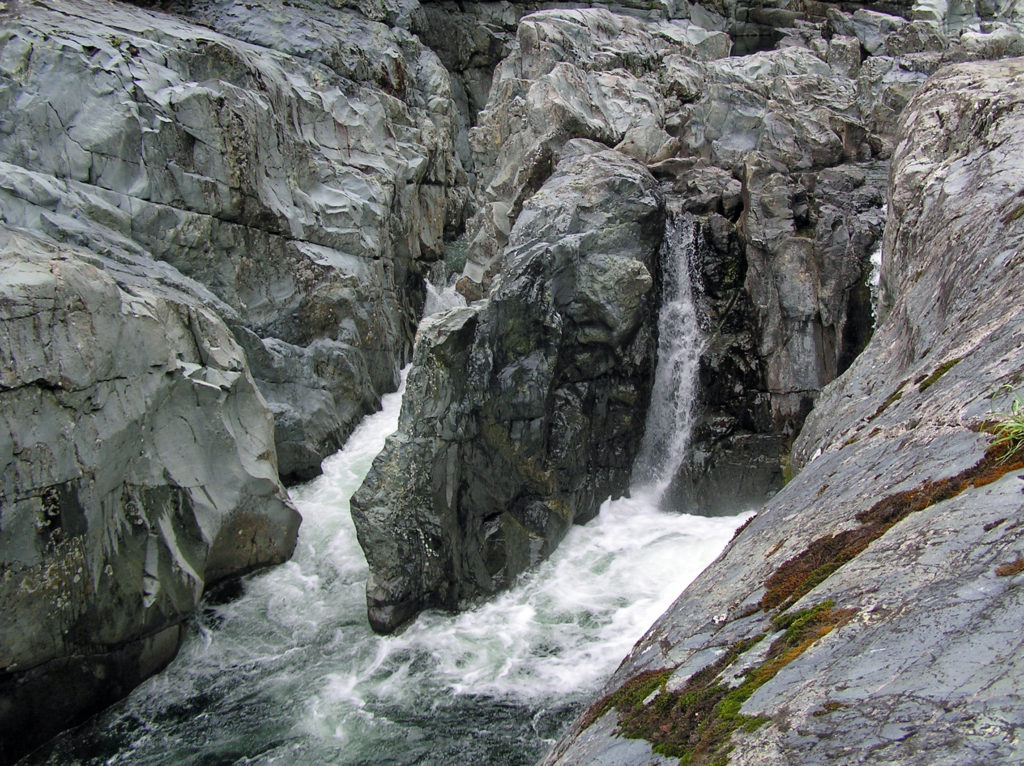
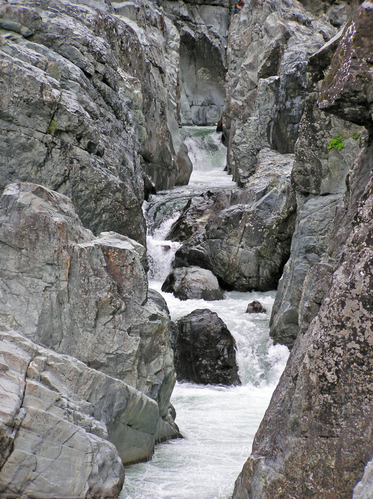
Kennedy River
Fabulous hiking trails can be found throughout the park. Paddling and fishing can be had at Buttle Lake. There are two fairly large campgrounds – Buttle Lake Campground (85 sites) and Ralph River Campground (75 sites). There are also three group camp areas available by reservation only, and a variety of back country campsites not accessible by road.
Myra FallsButtle Lake
Accommodations a bit more upscale than camping can be found at Strathcona Park Lodge and Outdoor Education Centre on Buttle Lake a few miles outside of the park. You can rent small motor boats, canoes and kayaks, and stand up paddle boards there. For the more adventurous, there is a zip line and a high ropes course. And you can get information there about local hiking and mountain bike trails, and whitewater and sea kayaking opportunities.
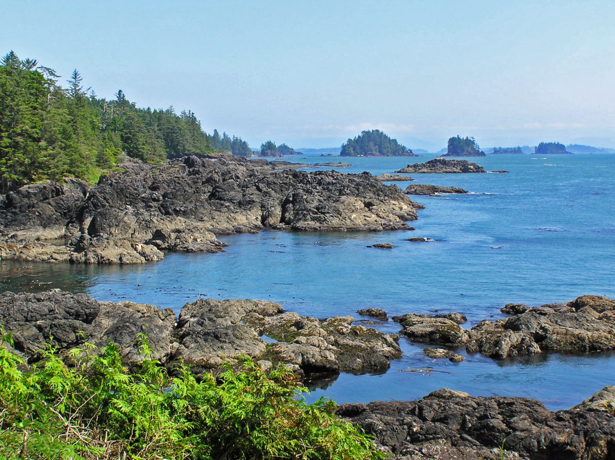
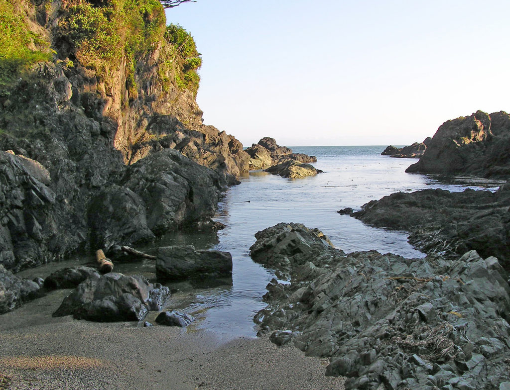
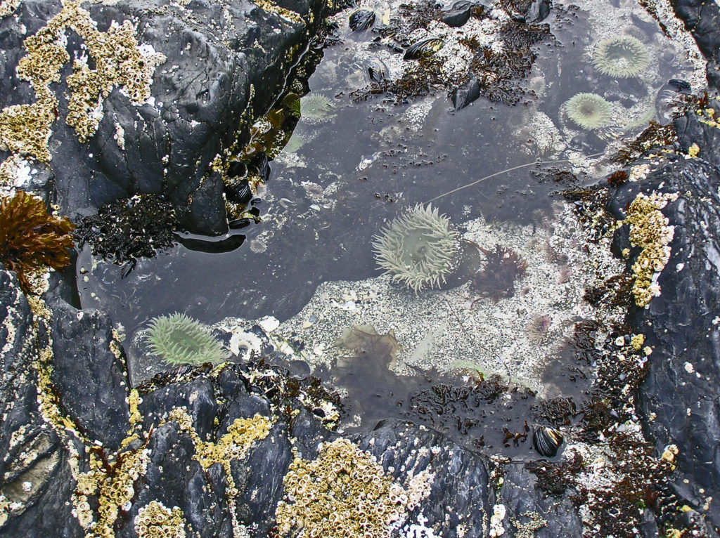
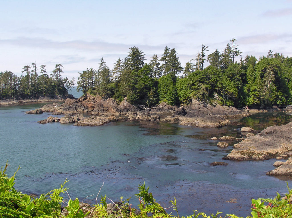
Tidepool near Ucluelet
On the west side of the island, the stretch of coastline from Ucluelet to Tofino is part of the Pacific Rim National Park Reserve (https://www.pc.gc.ca/en/pn-np/bc/pacificrim). The tamer sibling of the more remote and wild section of the park that includes the 47 mile West Coast Trail, the Long Beach unit of the park is easily accessible and has numerous small inlets, rocky coves, and beautiful sandy beaches.
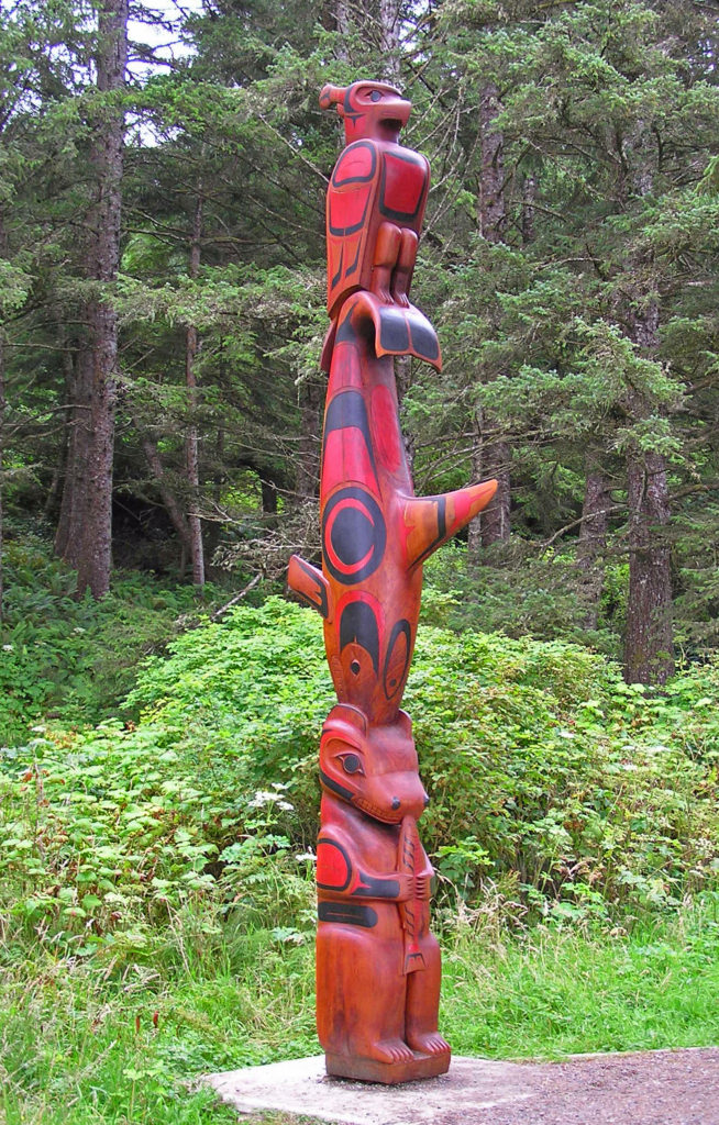
Totem pole in Tofino
Tofino has long been a popular tourist destination and can be crowded in the summer, but the other seasons also bring people to Tofino. Storm watchers flock to the area in the winter. Surfers come for Rip Curl Pro Tofino, the official Canadian surfing championship, in May, and the all-female Queen of the Peak competition in October. There are a variety of festivals throughout the year that bring people to Tofino, including ArtSplash in March, the Tofino Shorebird Festival in May, the Clayoquot Salmon Festival in August and September, and the Tofino Winterlights Festival in December.
Pacific Rim National Park Preserve
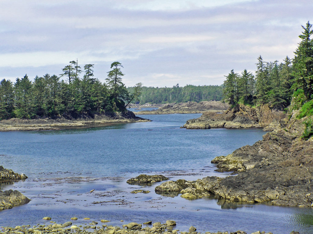
Ucluelet, about 25 miles south of Tofino, is less touristy and more down to earth than its glitzier neighbor. The town is situated on a peninsula between Ucluth Inlet and the Pacific Ocean. It’s a popular fishing port and the rugged coastline has a number of secluded coves and beaches that, for my money, are about as pretty as it gets. Hike the easy 1.6 mile Wild Pacific Trail loop at the tip of the peninsula for some of the most spectacular scenery you’ll find anywhere on the island.
Shoreline near Ucluelet viewed from the Wild Pacific Trail
Ucluelet has fewer dining and lodging options than Tofino, but you shouldn’t have any trouble finding a place to stay, and you’ll find some of the freshest and best seafood anywhere.
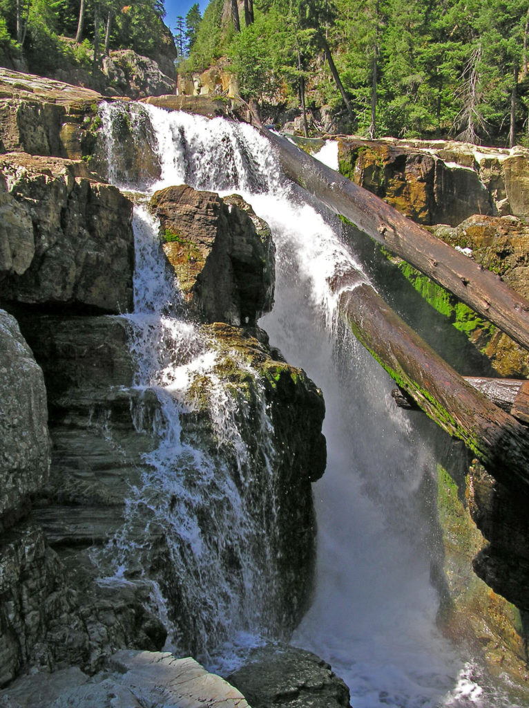
Moose Falls
There is, of course, way more to Vancouver Island than this post covers, and it’s hard to go wrong regardless what part of the island you choose to explore. My wife and I will be making another trip to the island soon, perhaps this fall if the covid-19 pandemic eases and the border reopens.

 Overview:
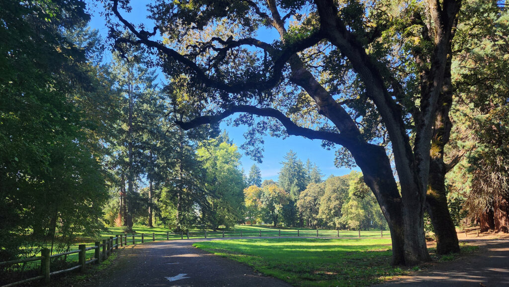 Getting there:
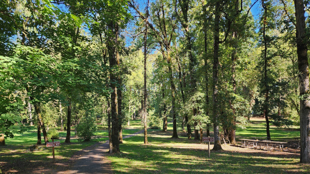 Trailhead:
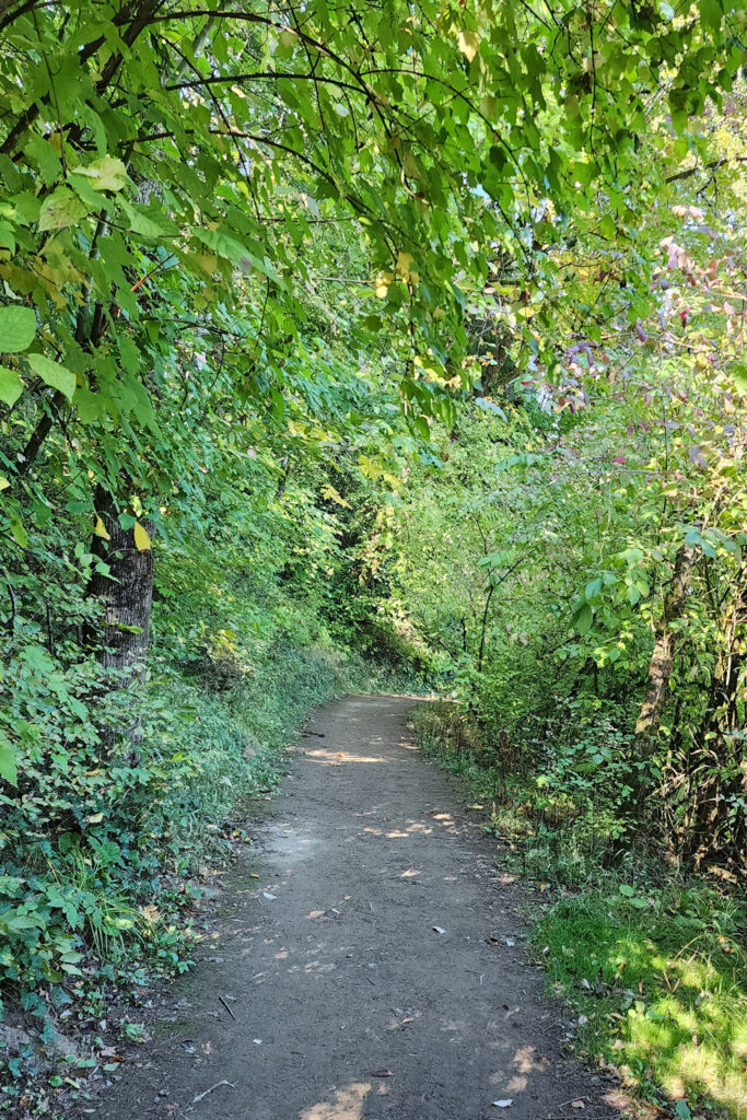 The hike:
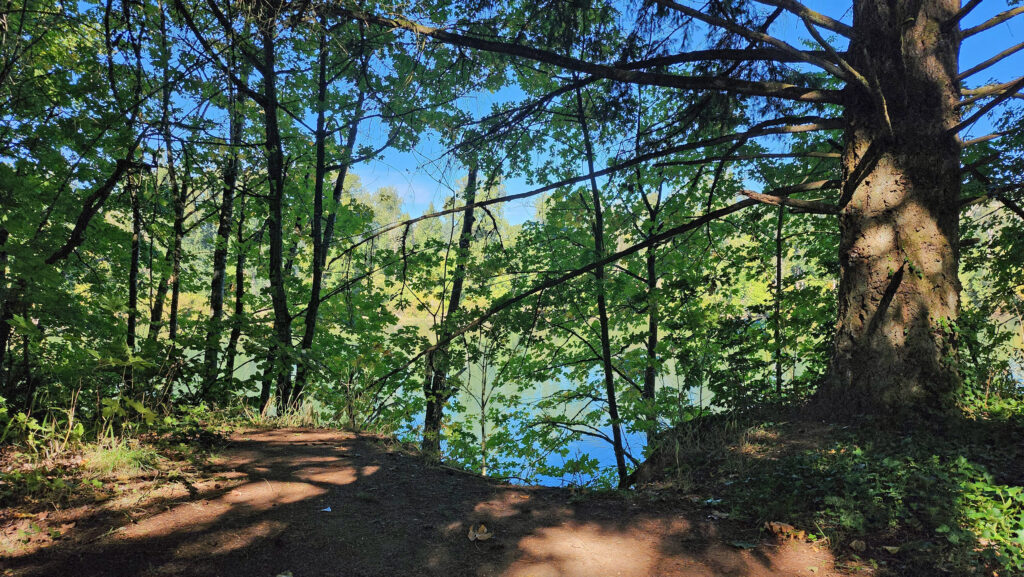 The Townsite Trail takes you along the river through a mixed woodland of Douglas fir, bigleaf maple, and red alder with partially screened views of the river. There are several user-made trails leading down to the water, but they are steep (and dangerous if the ground is wet), so be careful if you want to get to the water for a better view of the river.
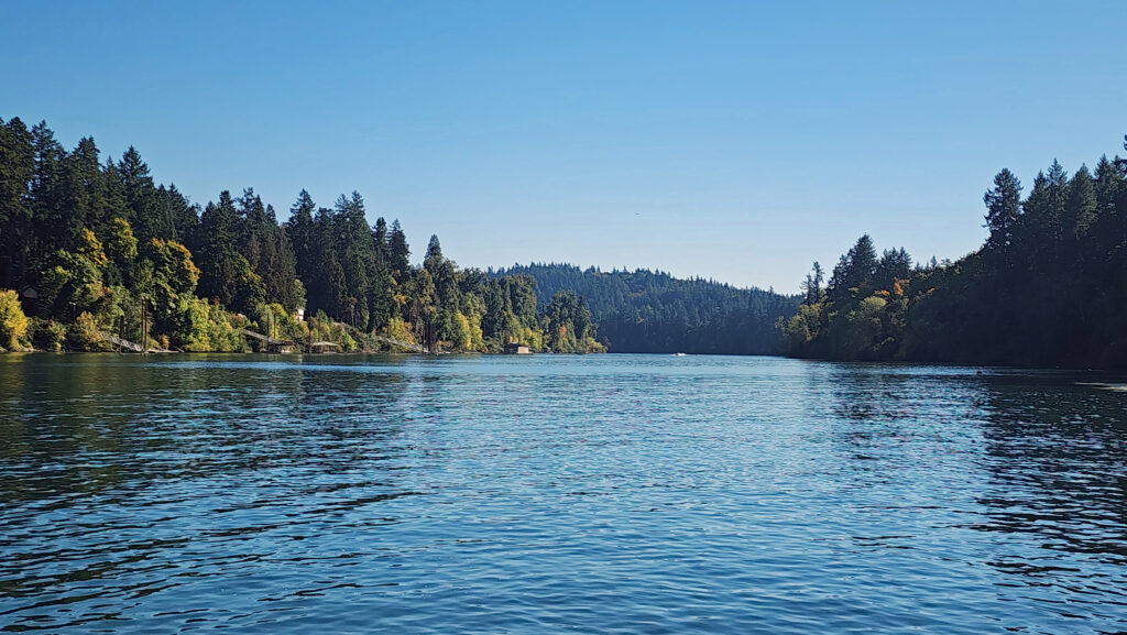 At about the one-mile mark you’ll come to an open field on your right and you’ll see a boat dock ahead on your left. There is a small parking area here with a restroom. Head down to the dock for the best views of the river on this hike.
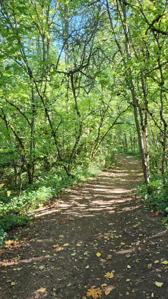
 Coming back up from the dock, look for a trail to your left. This will take you to Champoeg Creek where it flows into the Willamette. The trail then loops back through the forest and comes out into a clearing. Follow the edge of the clearing back to the restroom above the dock. From there, retrace your route back to the trailhead at the Riverside picnic area.
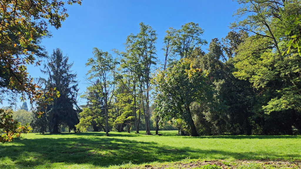 Best time to go:
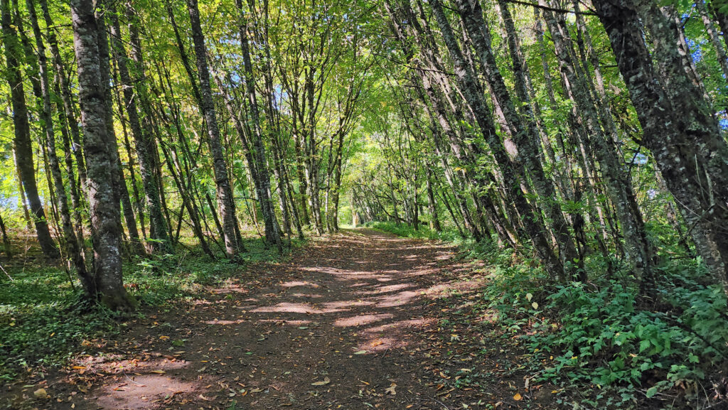 Champoeg State Park:
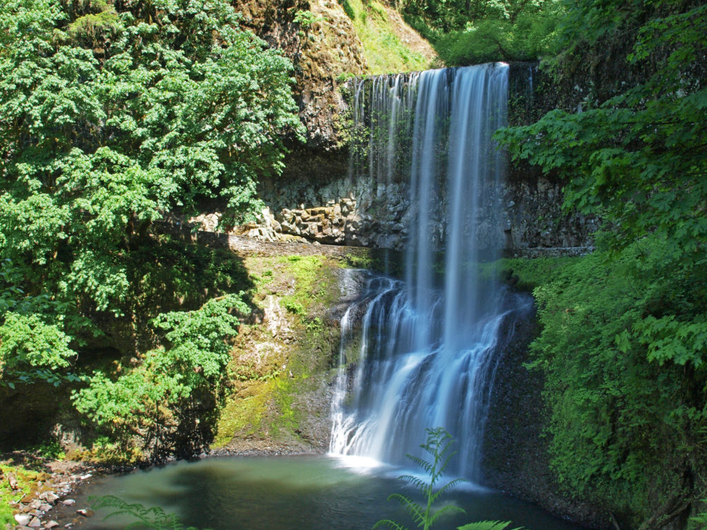
 Posted October 26, 2023 by Alan K. Lee
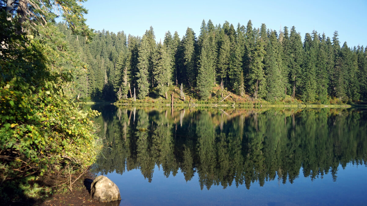
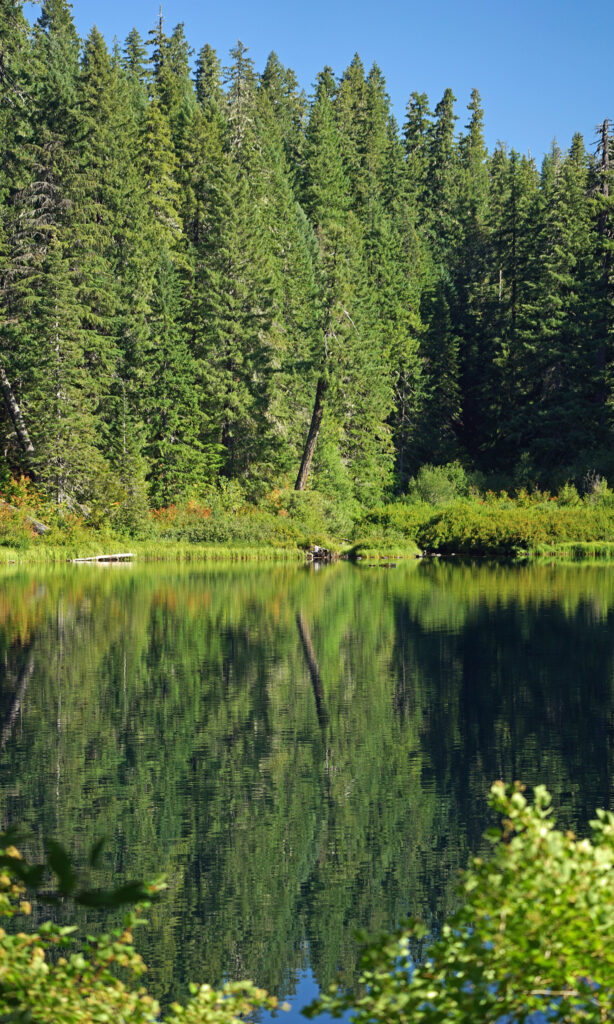
 Clear Lake offers the outdoor enthusiast a number recreational options, including hiking, fishing, paddling, or just taking in the views and soaking up the beauty and peacefulness of nature.
 My wife and I have taken short vacations at Clear Lake a couple of times in the past couple of years, most recently in August 2024. Both times, we stayed in one of the cabins at
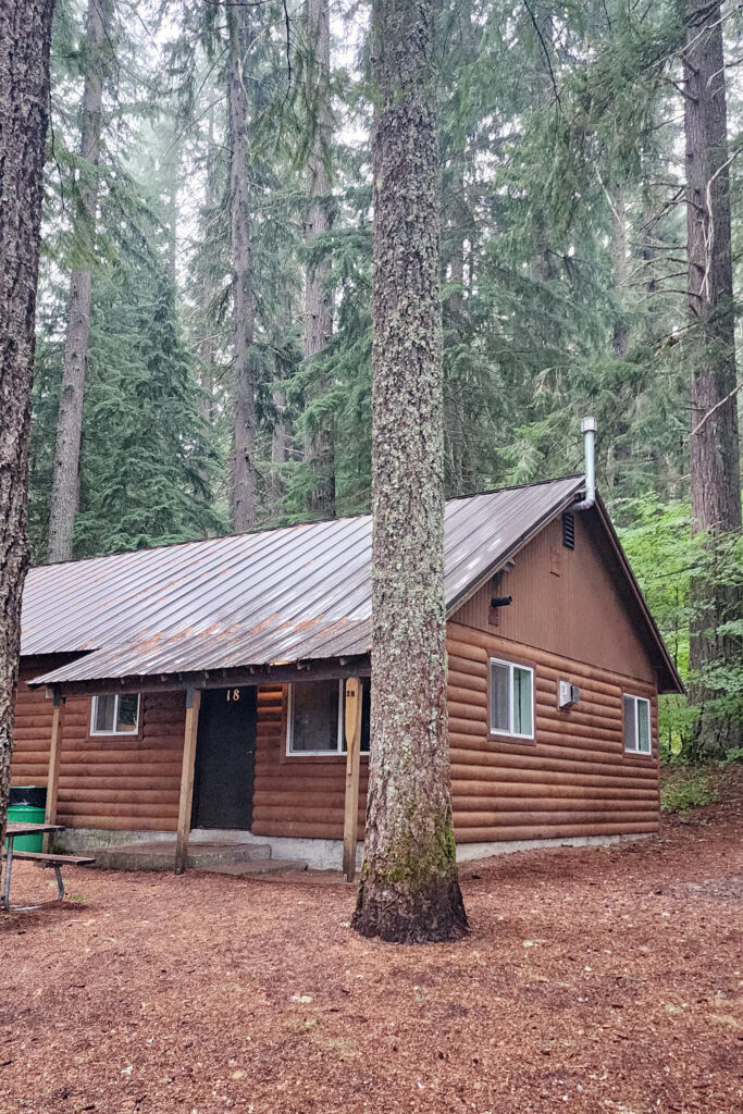
 The Clear Lake and upper McKenzie area is one of the most scenic and most interesting parts of the Cascades, and offers a number of other hiking options besides the Clear Lake Loop. The 2.6-mile
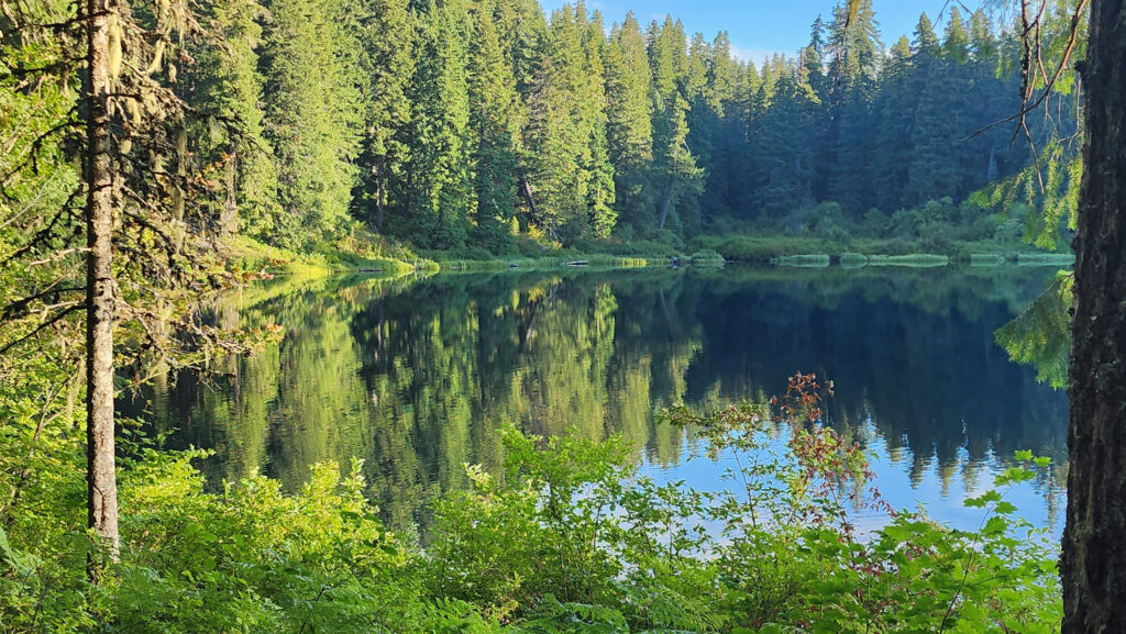

 You can take in Clear Lake and do the Waterfall Loop in a weekend. Make it a long weekend and add the Blue Pool hike or spend a day out on the lake. Better yet, make a week of it and check out Fish Lake, the Santiam Pass and McKenzie Pass areas, and the lower McKenzie River. You won’t run out of things to do.
 For my money, the best part of our visit was simply wandering around the historic center, walking the cobblestone streets and taking in the wonderful architecture, the beauty of the Vltava River that meanders around and through the town, and finding some of the charming and quirky things that set Czesky Krumlov apart. The old town area is car free and pedestrian friendly.
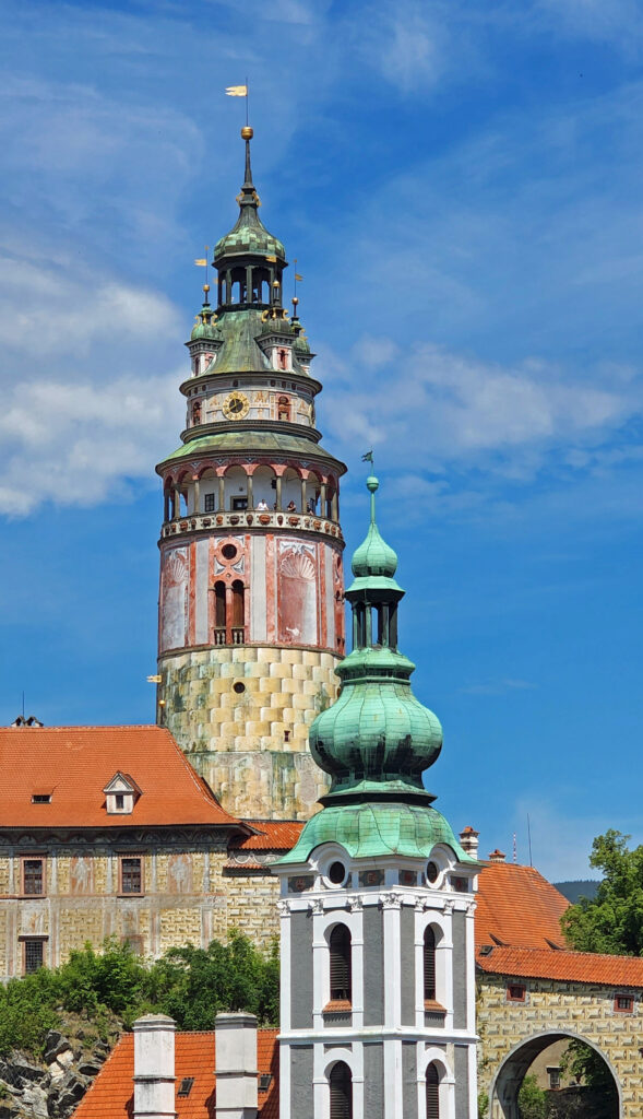
 The falls are long gone, flooded by construction of Swan Falls Dam in the early 1900s. Swan Falls was the first hydroelectric project on the Snake River. A fish ladder was constructed, but was largely ineffective, and the dam effectively blocked salmon and steelhead passage. That was a different era, and the fish ladder was never made functional. Newer dams were built both upstream and downstream with no fish ladders at all. Electricity was the point. The fish didn’t matter. But it’s a historically interesting and beautiful area, so it’s worth a visit even if, like me, you’d rather see the dam gone.
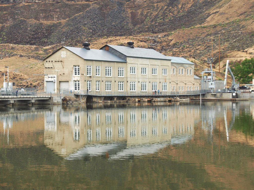
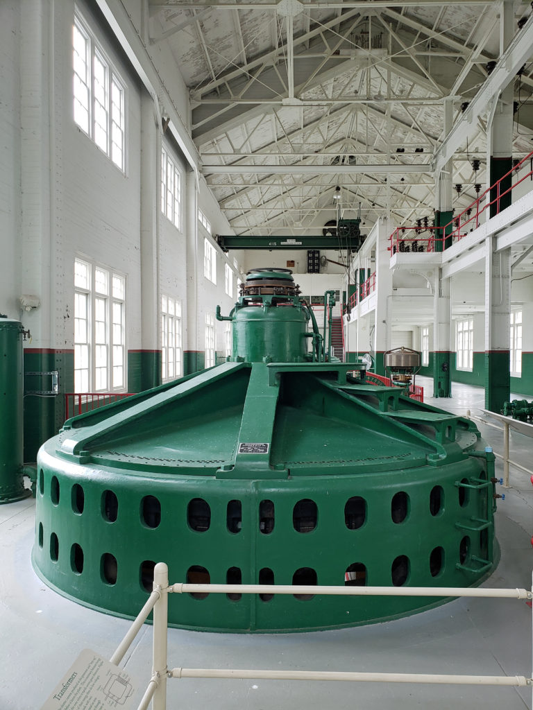 A new power generation facility was constructed at Swan Falls Dam in the 1990s. The dam’s original power plant is now open to the public, with some of the century-old generators and other equipment still in place. There are also displays depicting the history of the area, and the construction and operation of the dam. We walked across the dam after visiting the power house museum, then drove down the canyon a ways. The road was too rough for the car, though, and we turned around and drove back up to Dedication Point, and then on to Celebration Park.
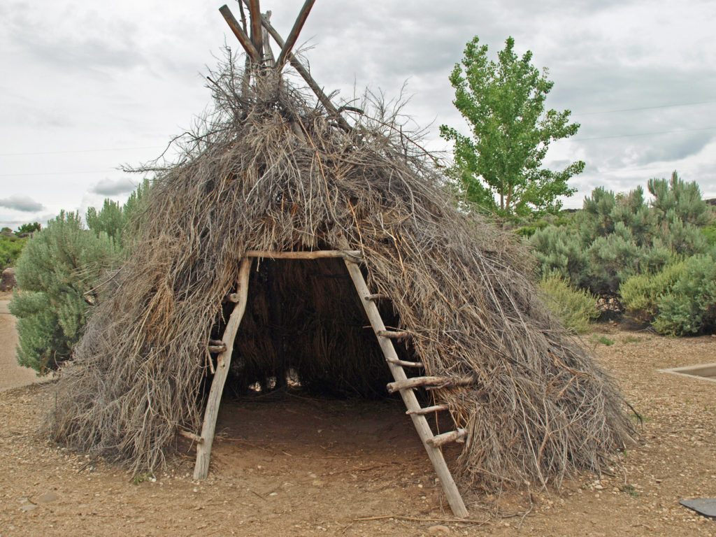 Celebration Park is Idaho’s only archaeological park. Petroglyphs dating back as far as 10,000 years can be found there. Visitors can learn about the Native American “lifeways” at the visitor center, try their hand at throwing a spear with an atlatl, and explore the petroglyph area on a self-guided walk. There is a picnic ground, and a small tent campground. The visitor center is open from 10:00 to 2:00 daily, except holidays. Check the park
 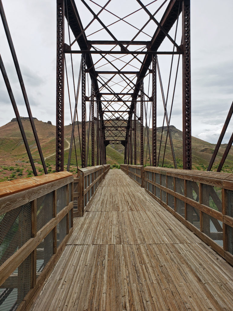 A short ways downstream, the Guffey Railroad Bridge provides pedestrian and equestrian access to the south bank of the Snake River and the Guffey Butte area. The bridge was built in the late 19th century and carried rail traffic until the 1940s. It is listed in the National Register of Historic Places. Guided tours of the area highlighting the area’s early mining and railroad history are conducted periodically.
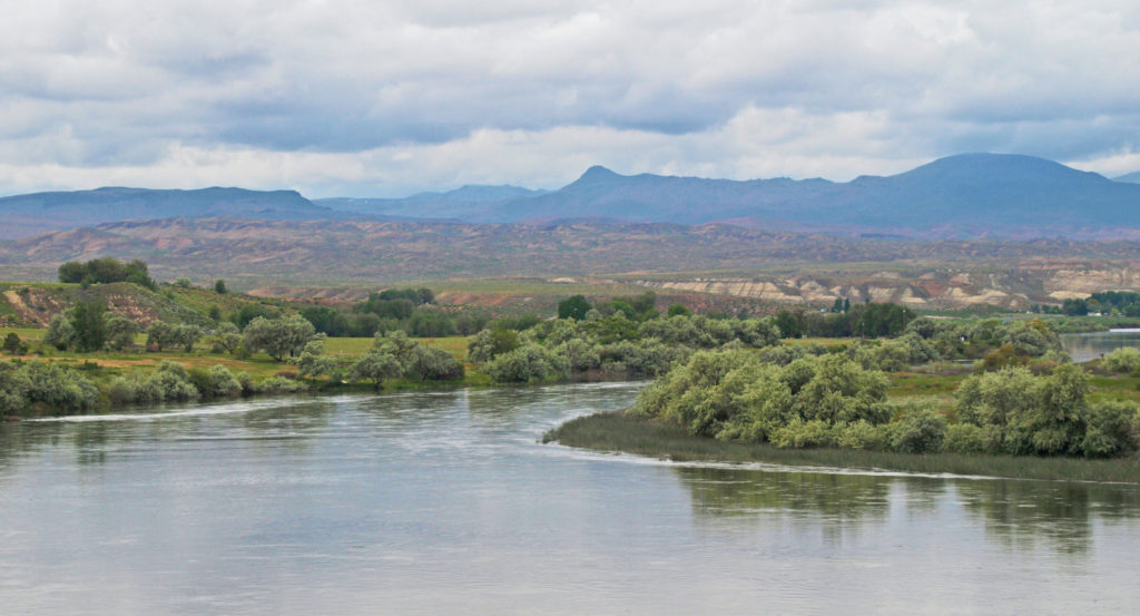
 Back in Boise, we toured the
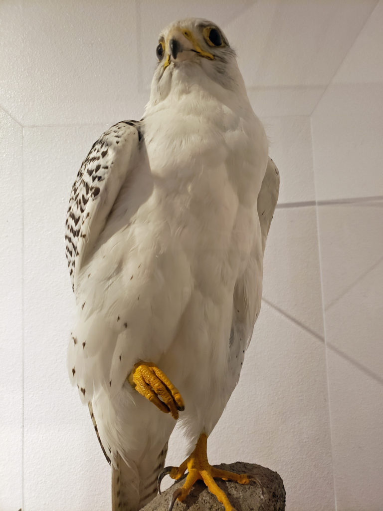


 The park can be very crowded on summer weekends, but gets much less use after Labor Day. Even on a sunny October day there were just a few people fishing from the river bank and some out for a hike or just enjoying the sunshine. This section of the river is popular with kayakers and rafters in the summer, but we didn’t see anyone on the river other than one family that floated by on stand up paddle boards.
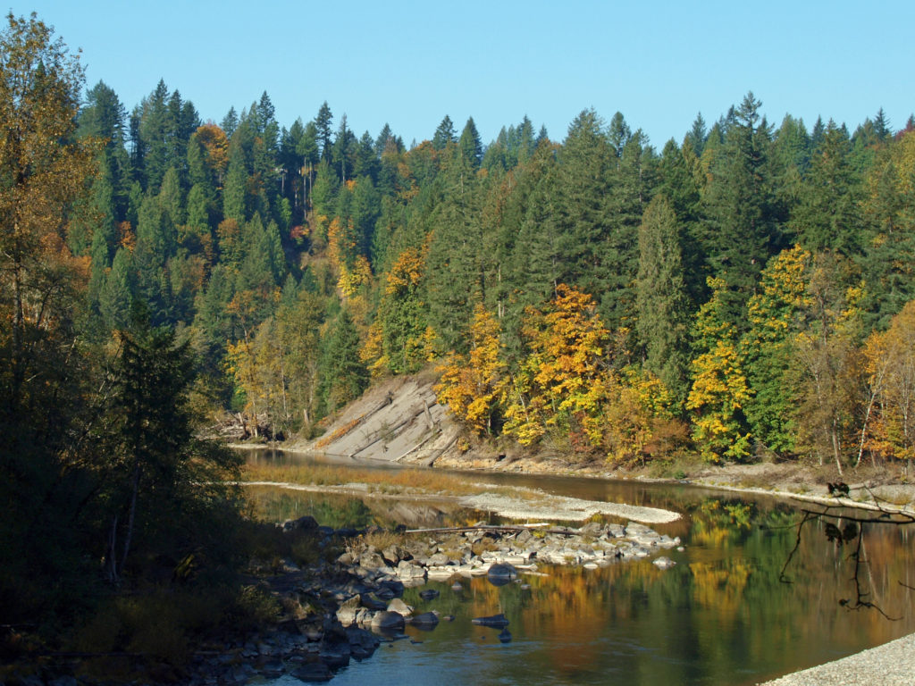 The Sandy River flows from its headwaters on Mount Hood to the Columbia River at Troutdale. Two sections of the river totaling 25 miles are designated Wild and Scenic, including the section of the river that runs through Oxbow Park.
 In 2007 the Marmot Dam on the Sandy River was demolished, making the river free flowing for its entire 57 mile course for the first time in nearly a century, and opening up miles of restored spawning grounds for salmon and steelhead. A smaller dam on the Little Sandy River was also demolished.
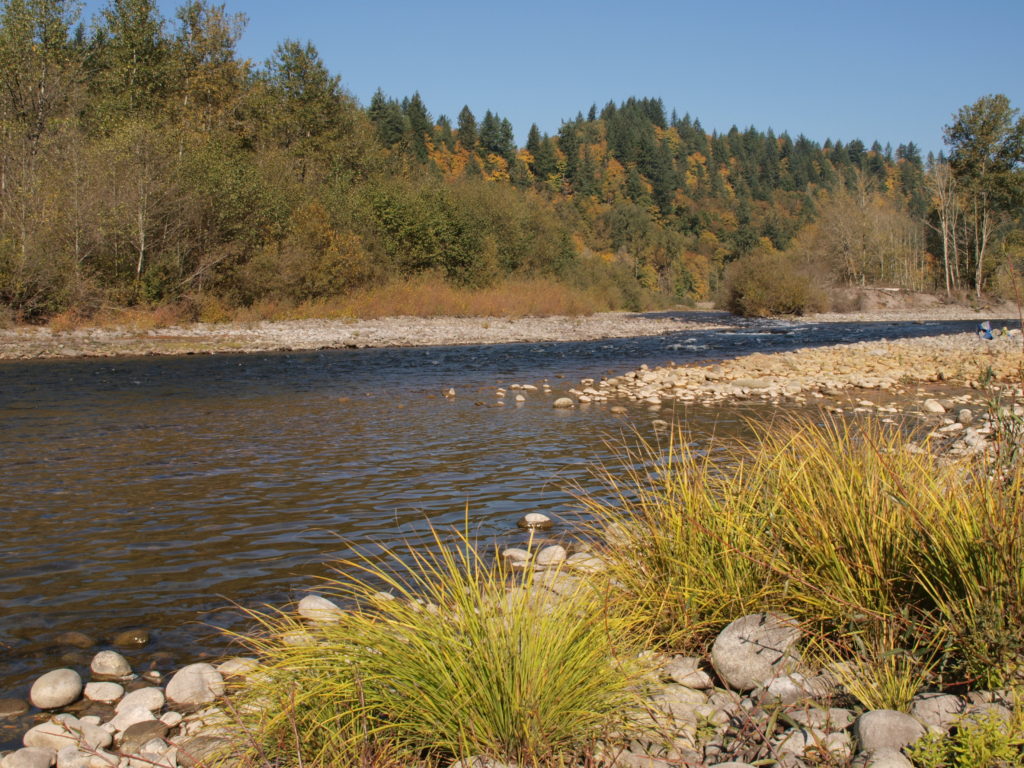 One of the more popular events at Oxbow is the annual
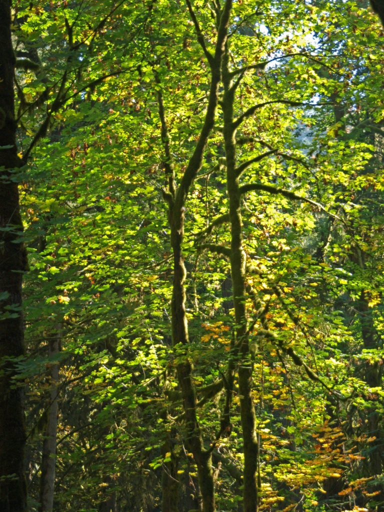
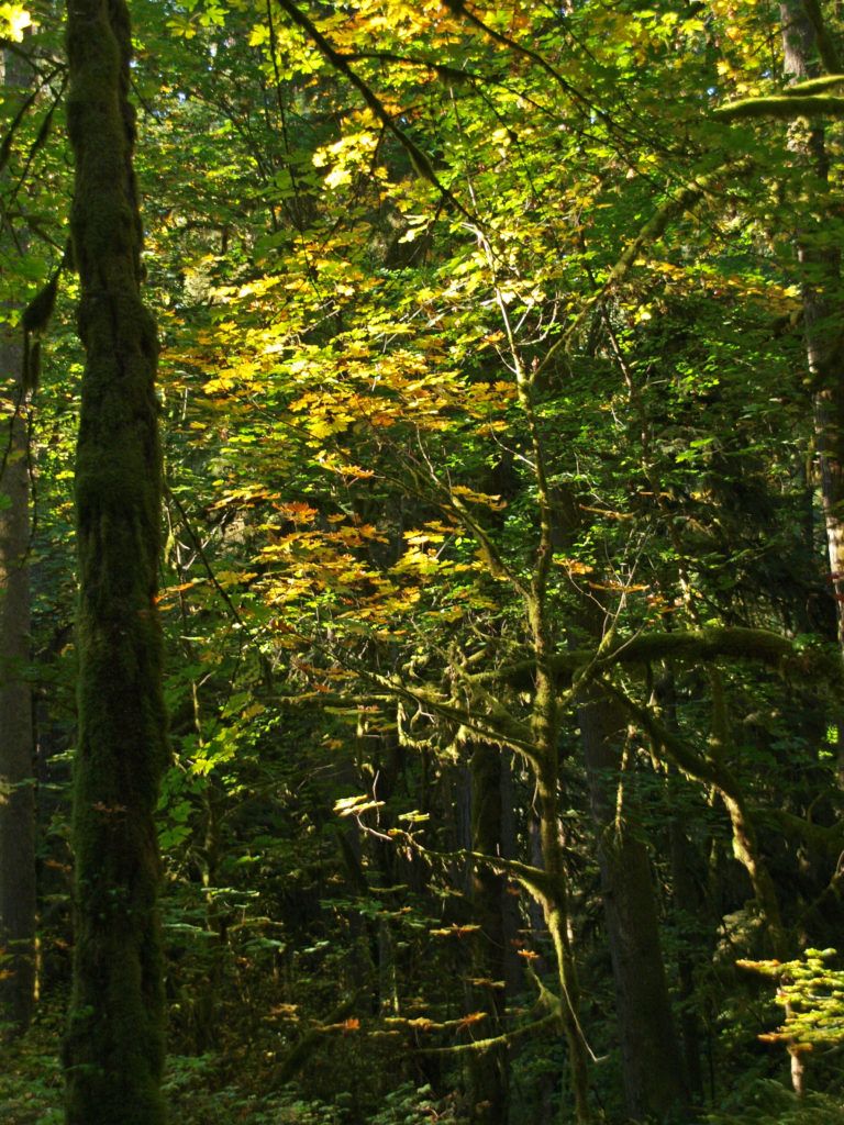 Most of the visitor activity at the park takes place along the banks of the river. The upland trails through the mixed conifer and hardwood forest get much less use. But the forest is beautiful, quiet, and peaceful. If you’re looking for tranquility, head away from the river. On our visit when these photos were taken, we hiked some of the forest trails and saw almost no one.
 To get to the park, take I-84 east from Portland to Exit 17 at Troutdale. Turn right onto Graham Road, then left onto the Historic Columbia River Highway. In two blocks, turn right onto Buxton Road. Follow Buxton (which becomes South Troutdale Road) to Division Street. Turn left on Division and follow the signs to the park.
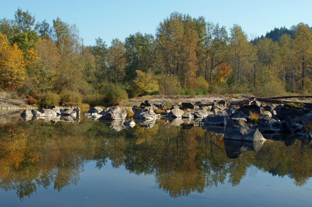 One of the great things about the Pacific Northwest is that there are so many beautiful places like this that are within a half hour drive of even the biggest cities. Just one of the reasons that I think this is one of the best places in the world to live.