
by Alan K. Lee
In eastern Idaho, northwest of Idaho Falls, the Big Lost River, Little Lost River, and other smaller streams sink into the lava fields and disappear. That water re-emerges a hundred miles to the southwest, from springs on the north side of the Snake River west of Twin Falls – the Thousand Springs.
I can remember seeing part of the Thousand Springs somewhere along US Hwy 30 on a family vacation when I was a kid, back in the late 1950s or early 60s. We didn’t stop back then, but seeing all that water gushing out of the canyon wall obviously made a big impression on me, as I have retained that memory for more than fifty years. And I had a chance to chase down that memory a couple of years ago when my wife and I spent five days exploring southwest Idaho. We spent the first day at Thousand Springs State Park, which consists of seven separate units spread out along the Snake River.

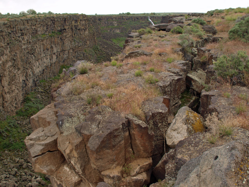
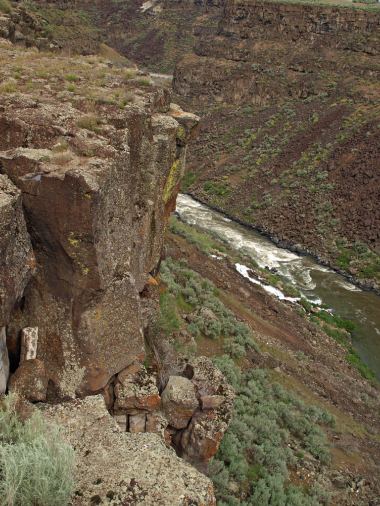
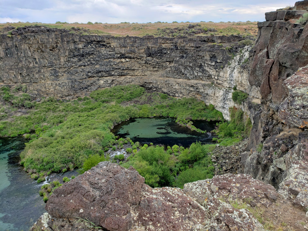
The Malad Gorge unit was our first stop. It’s the most accessible of the seven sections of the park, just off I-84. In what the signs still called Malad Gorge State Park, there is a short trail from a parking area near the park entrance to a viewpoint on the rim of the canyon overlooking the narrow gorge and the 60-foot waterfall and plunge pool known as the Devil’s Washbowl.
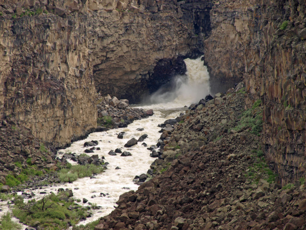
The trail continues across a foot bridge 250 feet above the river to another viewpoint a short ways downstream. The road through the park continues from the first parking area to other viewpoints, a large picnic area, and a campground.

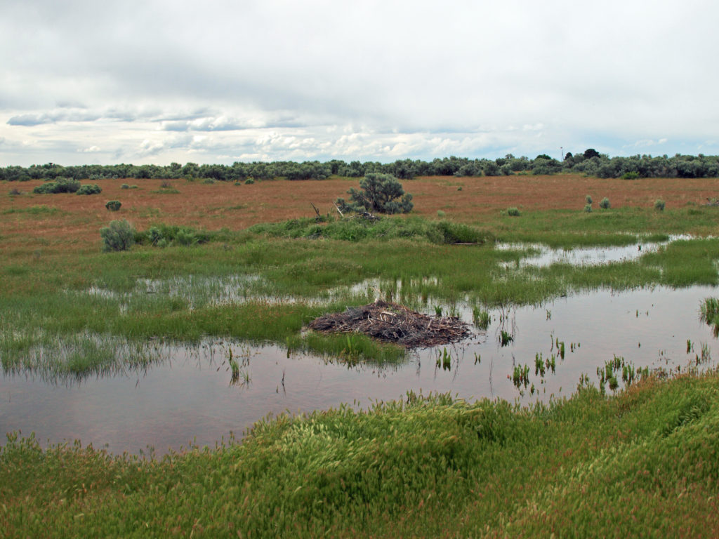
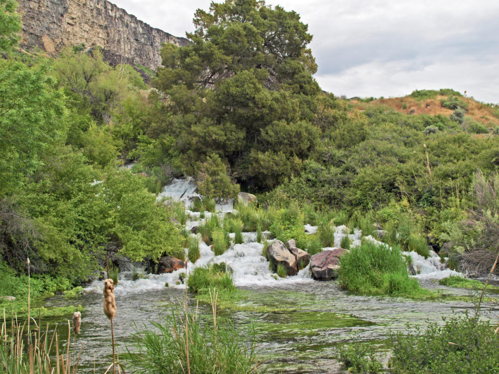
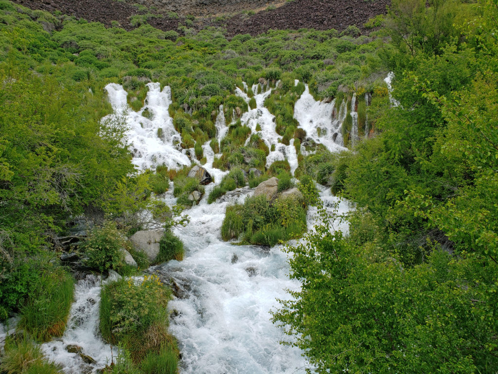
Near the campground is another canyon called Woody’s Cove. Although not as impressive as Malad Gorge, the springs at the head of Woody’s Cove were the first of the Thousand Springs that we had a chance to see. (The source of the Malad River is in the Sawtooth Mountains to the north, near Sun Valley, not the Thousand Springs).
There are no trails to the bottom of either Malad Gorge or Woody’s Cove, but the views from the rims of both make the park well worth the five dollar entrance fee. On the other side of I-84 from Malad Gorge is the Kelton Trail section of the park. Here there is a section of the historic Oregon Trail where the wagon wheel ruts can still be seen.

Two of the park’s units are along Billingsley Creek. The lower unit, Billingsley Creek Wildlife Management Area, just north of the town of Hagerman, is an area of marsh and open water that is prime waterfowl and wildlife habitat. Upstream, a few miles east of Hagerman, the Vardis Fisher Day Use Area runs along Billingsley Creek in a narrow valley. The unit is named for the Idaho author of the novel Mountain Man, which was the basis for the 1972 movie Jeremiah Johnson. The ruins of the Fisher home are located in the park unit.
A few miles to the south is the Ritter Island unit of the park. The island was once home to the historic Thousand Springs Dairy Farm run by a locally famous woman named Minnie Miller in the first half of the 20th Century. Ritter Island was also the site of the Payne Lewis Ferry Crossing on the Kelton Road from Boise to Utah. This was an important transportation route in the 19th Century prior to the coming of the railroad.

Some of the structures from the farm and ferry crossing are still standing. There are several miles of hiking trails on the island and, according to the park literature, an abundance of wildlife and wonderful views of the Hagerman Valley. It’s also a good place to kayak, according to the reviews I read. Unfortunately, the island is only open from Memorial Day to Labor Day, and we were there a few days before the island’s opening. It was disappointing that we couldn’t get onto the island, but the springs here made the area worth visiting, regardless.
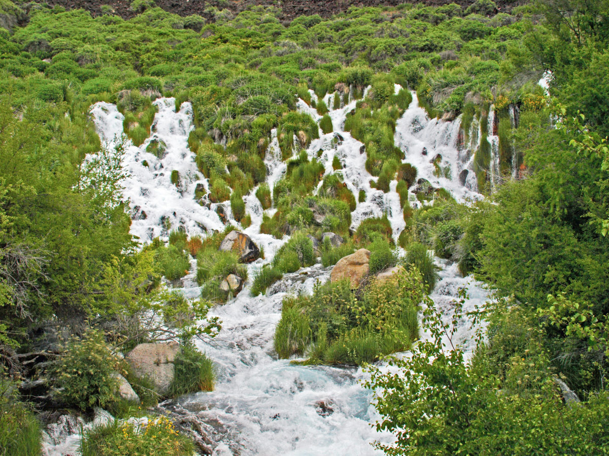
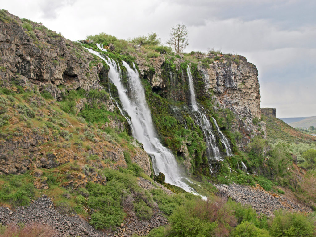
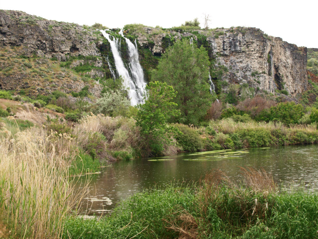
There are literally hundreds of springs midway up the canyon wall above Ritter Island, and Sand Spring Creek emerges full blown from the cliff face. Much of the water from the springs and the creek have been diverted to a hydroelectric generating plant, and some of the spring water is also diverted to the Ten Springs Fish Hatchery. But there is still lots of water pouring down the canyon walls to a side channel of the Snake River.
The outfall from the fish hatchery tumbles over the cliff face in an impressive waterfall. And below the hatchery there is a Nature Conservancy preserve that has a nice trail along the river below the canyon walls.


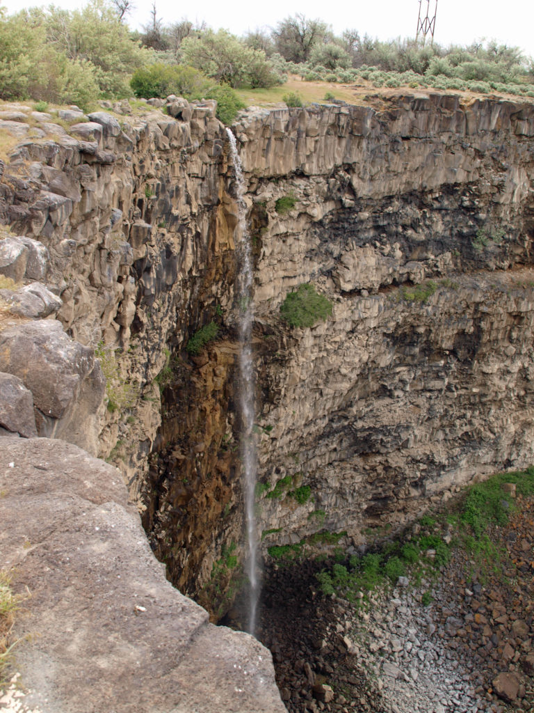
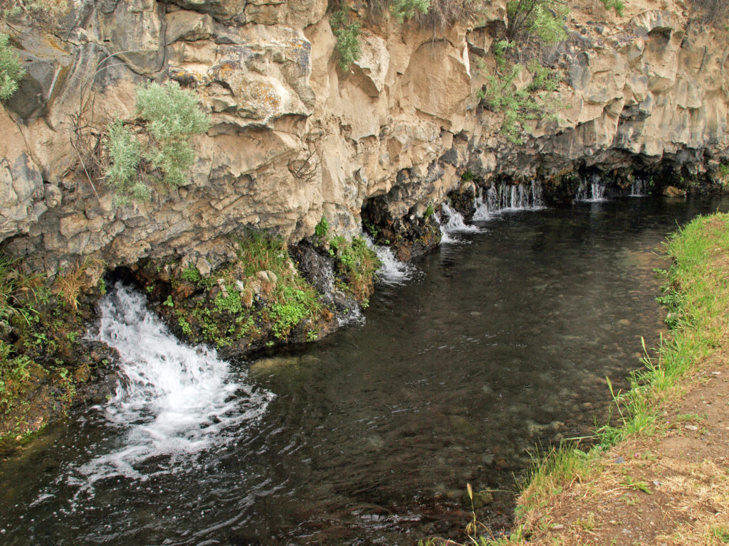
Our next stop was the Box Canyon unit of the park (officially the Earl M. Hardy Box Canyon Springs Preserve), a couple of miles south of Ritter Island. The springs at the head of the canyon flow at an impressive 180,000 gallons per minute.
Like at Malad Gorge, there is no trail to the bottom of the canyon here. There is a trail to a viewing platform that overlooks a small waterfall. That trail was closed when we were there, but the views from the canyon rim, here too, were impressive enough.
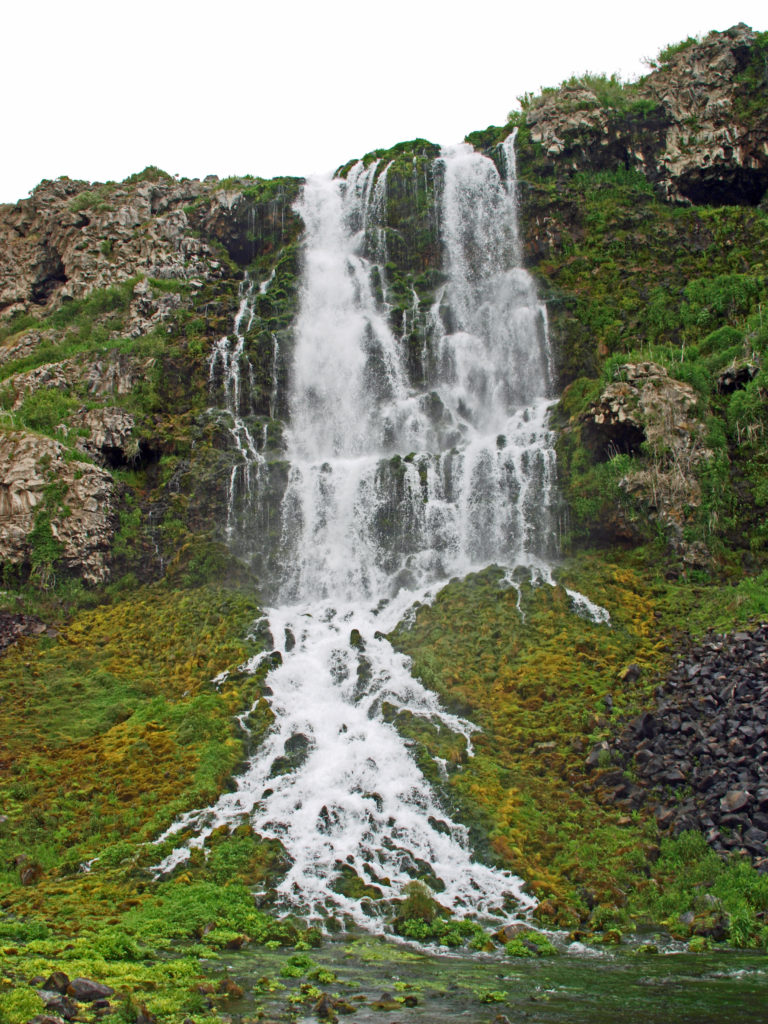
The final stop on our tour of the Thousand Springs was Niagara Springs, eight miles southeast of Box Canyon. The springs are on the left side of the access road just beyond a fish hatchery. If you have your windows rolled down, you’ll probably hear them before you see them. The roar the springs make is no doubt the inspiration for their name.
There is a short trail to a viewing platform directly below the springs, which flow out of a 150 foot wide section of the canyon wall at a rate of almost 2,000 gallons per second. Just beyond the springs there’s a picnic area and a small tent campground on the right side of the road adjacent to the fish hatchery.
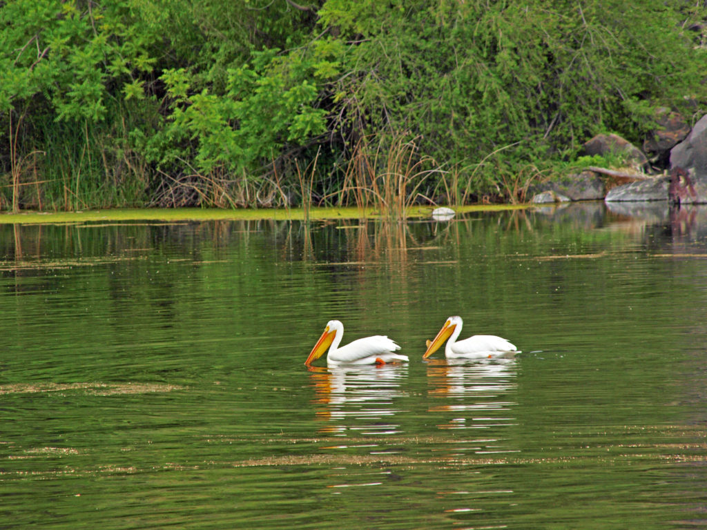

About a mile beyond Niagara Springs you’ll find Crystal Springs and Crystal Lake, which is a popular swimming and fishing spot. But we were there on a Thursday and it was quiet and peaceful, almost deserted. The only swimmers were a pair of white pelicans.

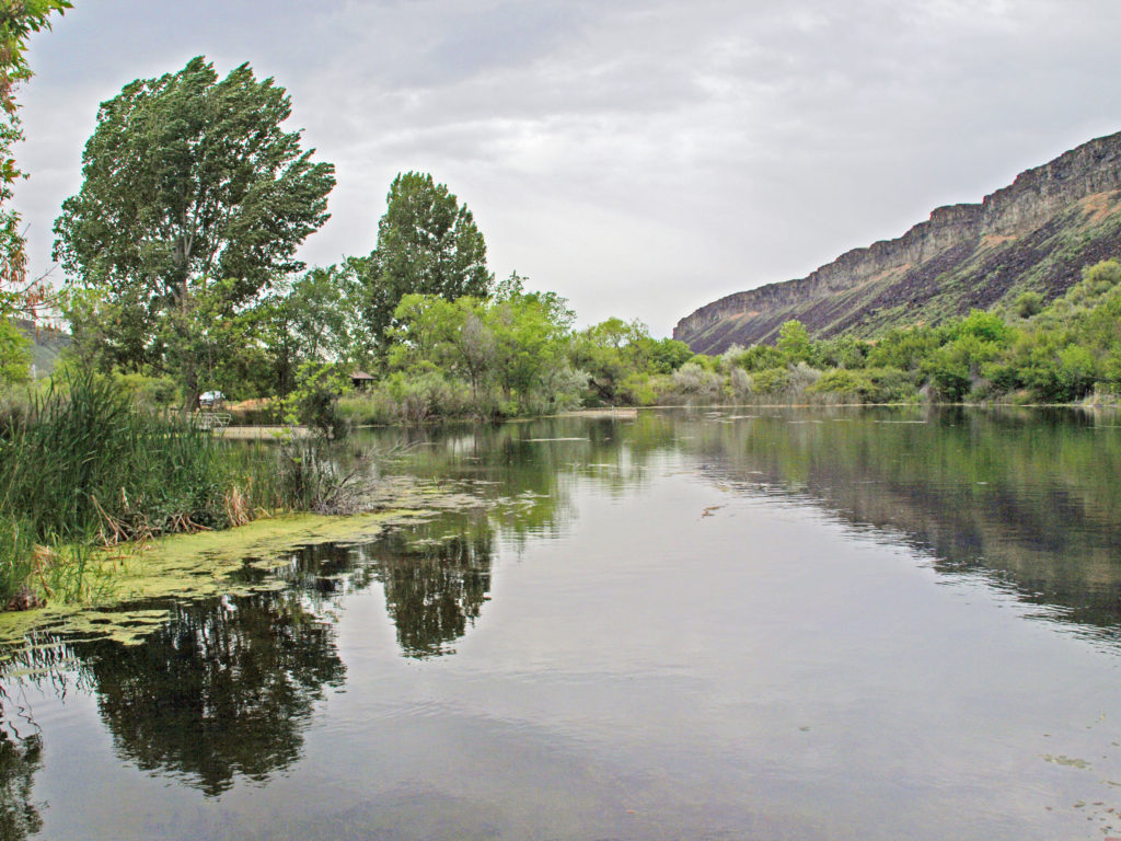
After leaving Niagara Springs and getting a bite to eat in Buhl, we took a short side trip to the rock formation known as Balanced Rock. After climbing up to the base of the rock, we resumed our journey back to Boise, where we were staying. The road from Balanced Rock took us back to Hwy 30 and the Snake River, not far from the Ritter Island area..
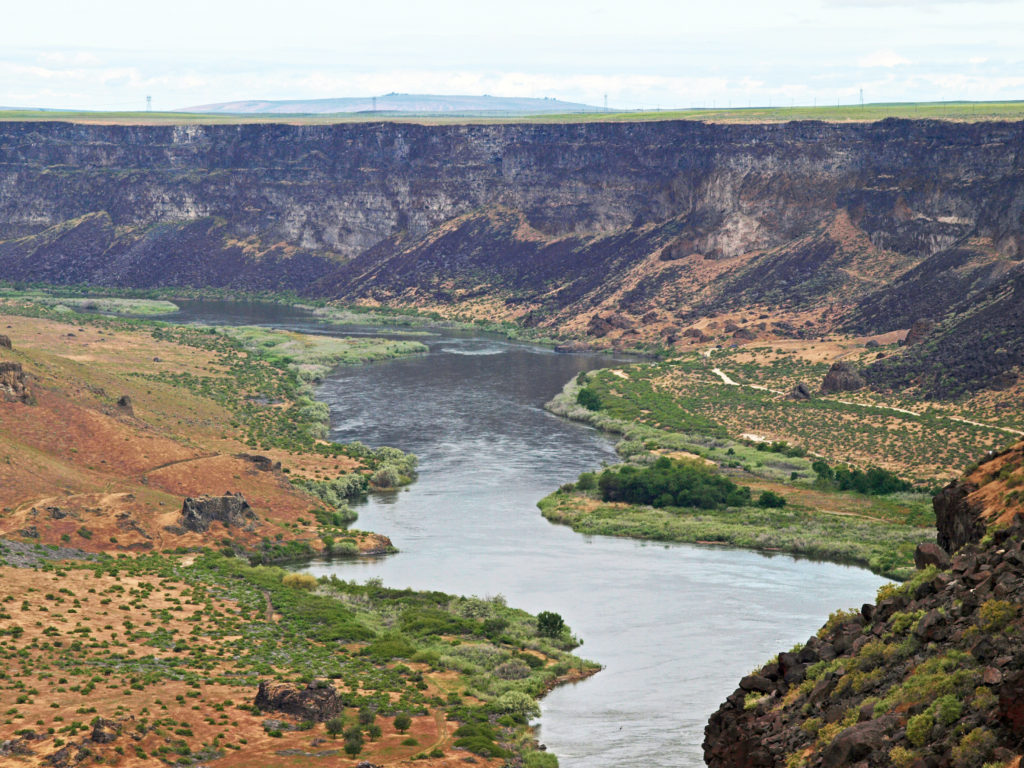
I was curious if I could find the spot along the highway that had made such an impression on me on that family vacation so long ago, and I think I did. I’m pretty sure what I saw back then was the springs above Ritter Island. The highway is on the opposite side of the river, but if the hydroelectric plant had not yet been built and none of the spring water was being diverted, there must have been an incredible amount of water pouring out of the canyon wall and tumbling down to the river. No wonder it made such an lasting impression on me. Even with the water diversions, the springs there are still quite a sight from the highway. That was the end of our first day’s outing. Not a bad start, to say the least.
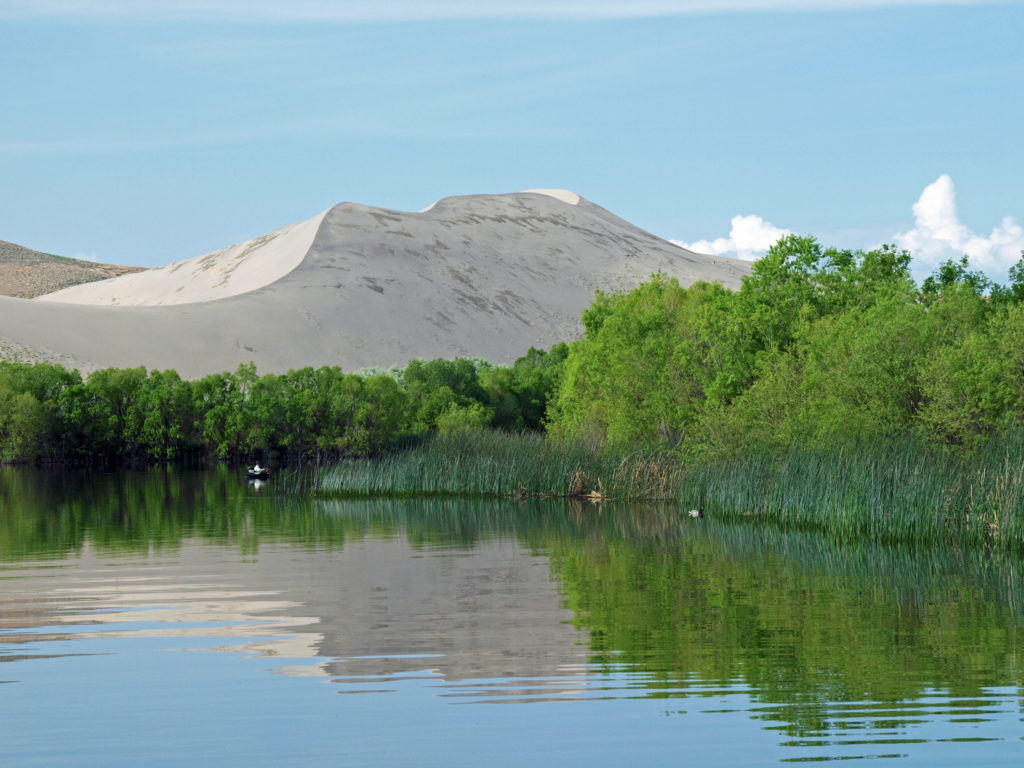
Our trip continued in the following days with visits to Bruneau Dunes State Park, the Snake River Birds of Prey National Conservation Area, and the World Center For Birds of Prey in Boise. We also spent time exploring downtown Boise and the parks and trails of the Boise River Greenbelt. Check out the rest of our southwest Idaho exploration:
Balanced Rock and Bruneau Dunes
The Snake River Canyon and Birds of Prey
Originally posted June 16, 2019. Most recently updated March 31, 2025.
All photos © Alan K. Lee