By Alan K. Lee
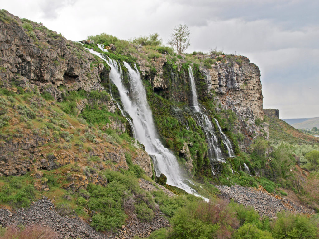
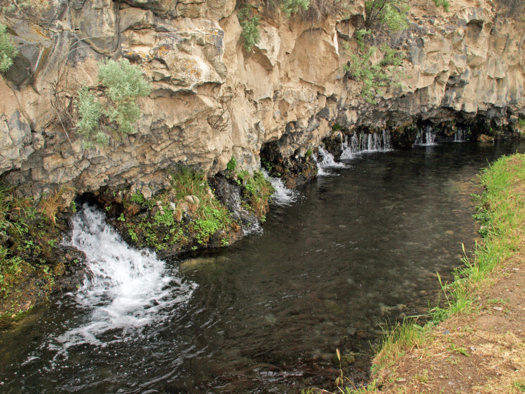
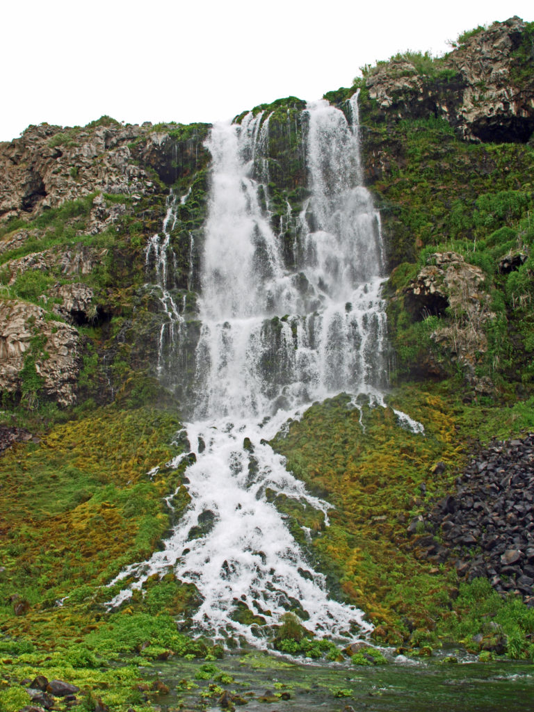
During our exploration of southwest Idaho, my wife and I used Boise as our base and did day trips to Thousand Springs, Balanced Rock, Bruneau Dunes, and the Snake River Birds of Prey National Conservation Area, as I’ve documented in the past few posts.
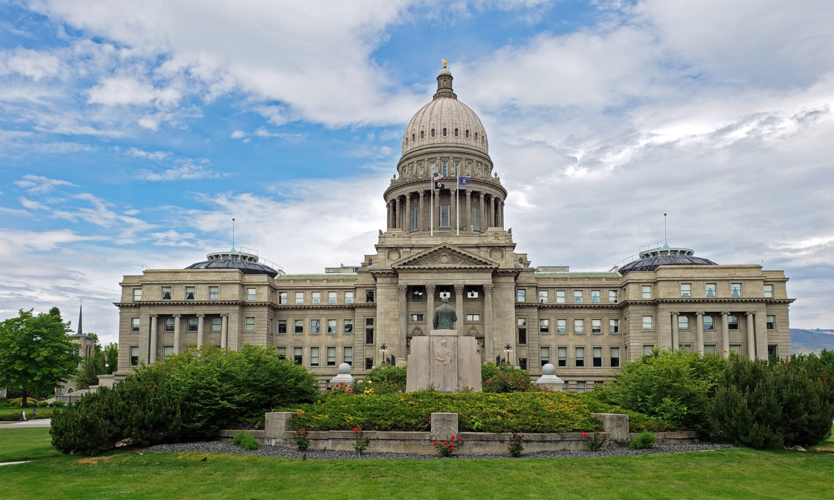
 Boise is Idaho’s capital and largest city, with a metropolitan area population of around 750,000. It’s large enough to have many of the amenities of a big city, but small enough to still retain something of a small town feel. And it’s a surprisingly modern and cosmopolitan city, blending elements of both West Coast and Rocky Mountain cultures.
My wife and I are both art lovers, and Boise has a vibrant arts community featuring both visual and performing arts. The Velma V. Morrison Performing Arts Center on the Boise State University campus is home to the Boise Philharmonic, Ballet Idaho, the Trey McIntyre Project (modern dance company), and the Boise Shakespeare Festival. The Gene Harris Jazz Festival is held each spring, also on the Boise State campus.
The Boise Art Museum in Julia Davis Park, just south of the downtown center, features permanent American, Northwest, Native American, and Asian Art collections, and rotating temporary exhibits. In addition to the Boise Art Museum, there are a number of notable art galleries in the downtown area, including the Art Source Gallery, Capitol Contemporary Gallery, the Delia Dante Gallery and FireFusion Studio, and MING Studios.
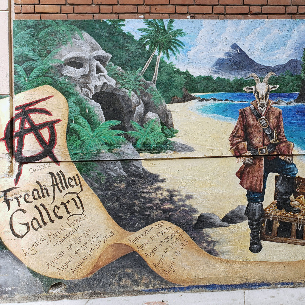
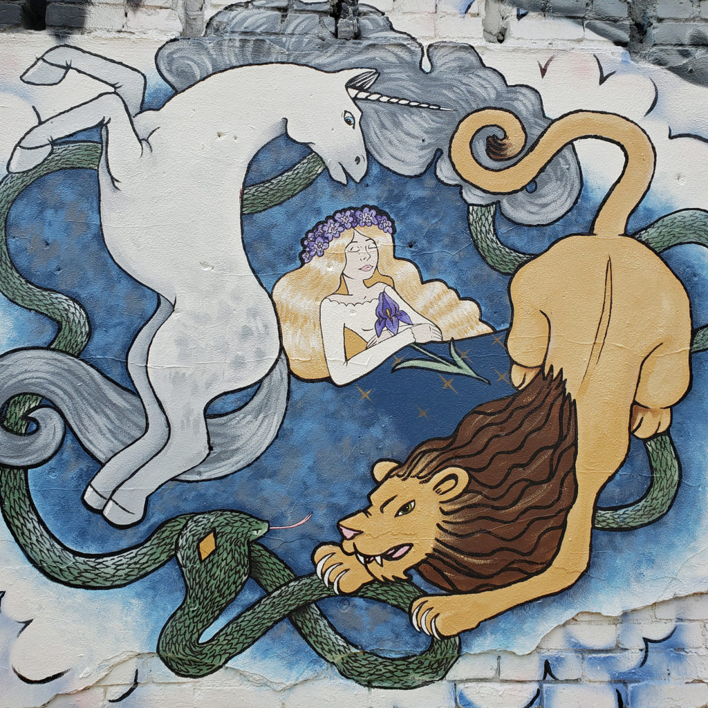
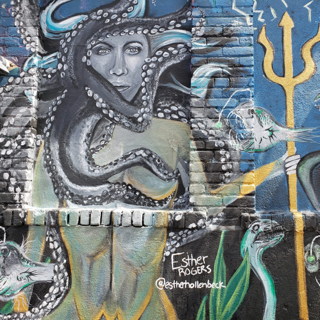
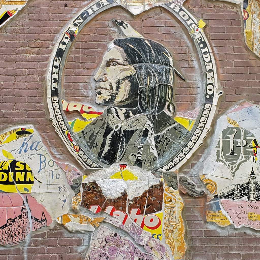
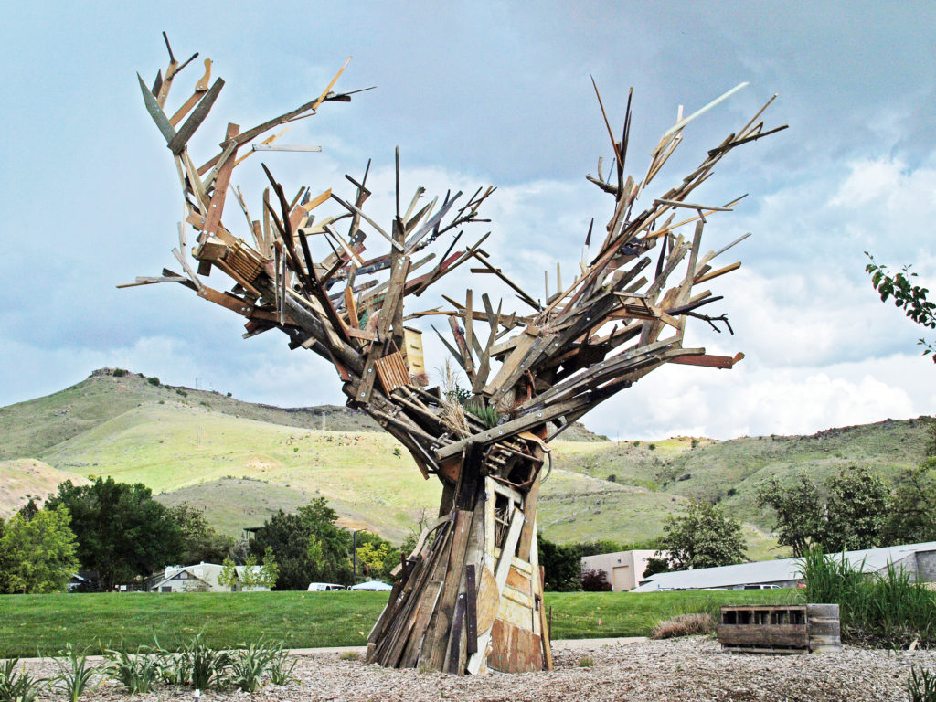
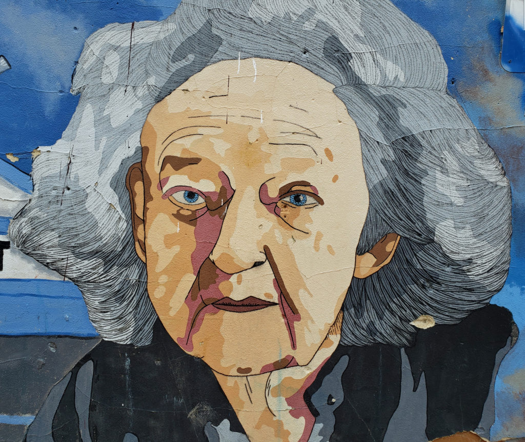
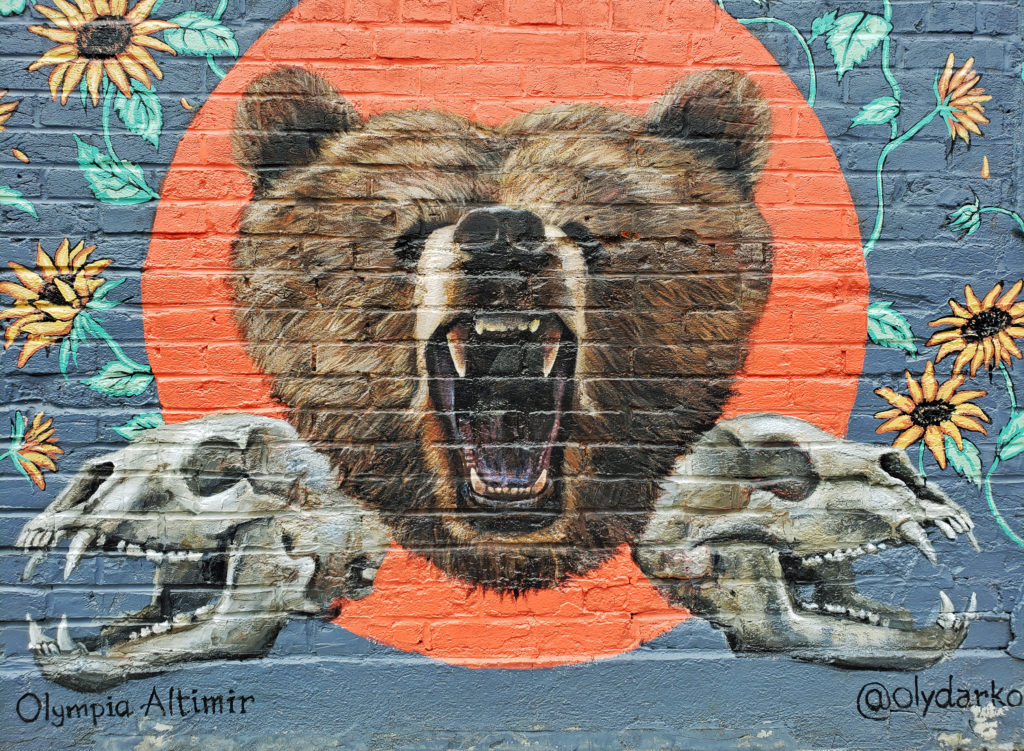
There is also an interesting street art scene in Boise, featured prominently in the building murals of the outdoor gallery known as Freak Alley in the downtown center.
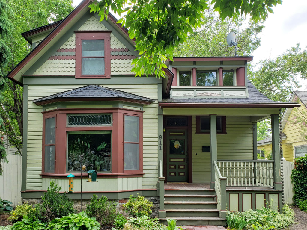
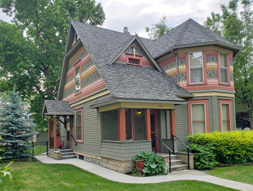 Many fine Victorian houses and architecturally interesting buildings can also be found in the downtown area.
Other points of interest in the downtown area include the Anne Frank Human Rights Memorial and the Wassmuth Center For Human Rights, the Idaho Black History Museum, the Idaho State Museum, the Basque Museum and Cultural Center, and the Idaho Discovery Center, a hands-on, interactive science, technology, engineering, and mathematics (STEM) educational center.
If you want to take a break, grab a bite to eat, and have a glass of wine or a pint of beer, there are plenty of places in downtown Boise to do just that. Moon’s Kitchen Cafe, Wild Root Cafe, and the vegan High Note Cafe are all within a few blocks of the capitol building. Goldy’s Corner is a small cafe and bakery that features a take-a-book/leave-a-book free library. For beer lovers, Ten Barrel Brewing Boise, Prost German Pub, Mad Swede Brew Hall, and Bittercreek Alehouse are all within a few blocks of the Capitol. Near Julia Davis Park you’ll find Boise Brewing, White Dog Brewing, Mother Earth Brew Company, and the Double Tap Pub. If you’re an oenophile, Les Bois Wines, Voodoo Cellar Boise, Thick As Thieves, Press and Pony, and Ochos are all within two blocks of the Capitol. I’m sure Boise has an interesting night life scene, but we didn’t explore that aspect of the city on this trip.
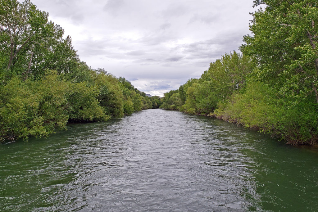
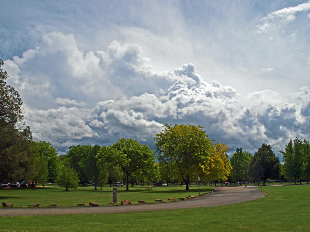
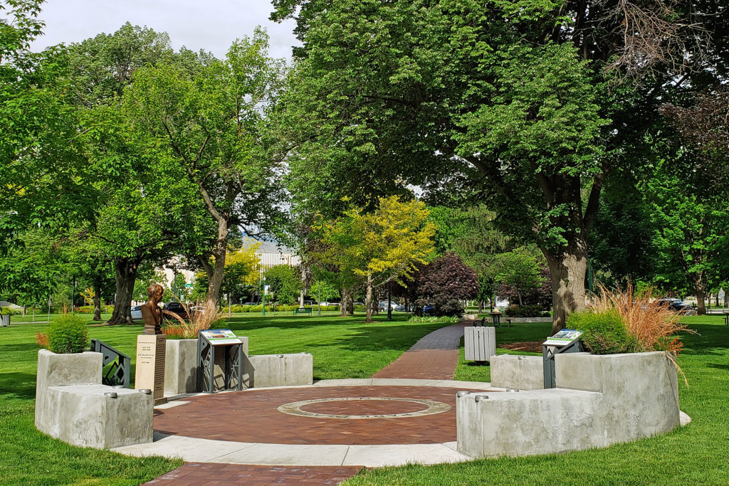
We did explore a number of Boise’s many parks and natural areas. The nearly 25-mile long Boise River Greenbelt has many miles of trails along both banks of the river.
 Anne Morrison Memorial Park on the south bank of the river, and the Julia Davis Park, just south of the downtown area on the north bank, are large urban parks with a variety of open spaces and tree lined paths along the river.
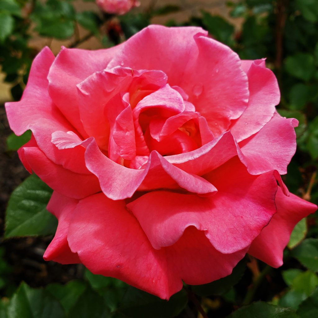
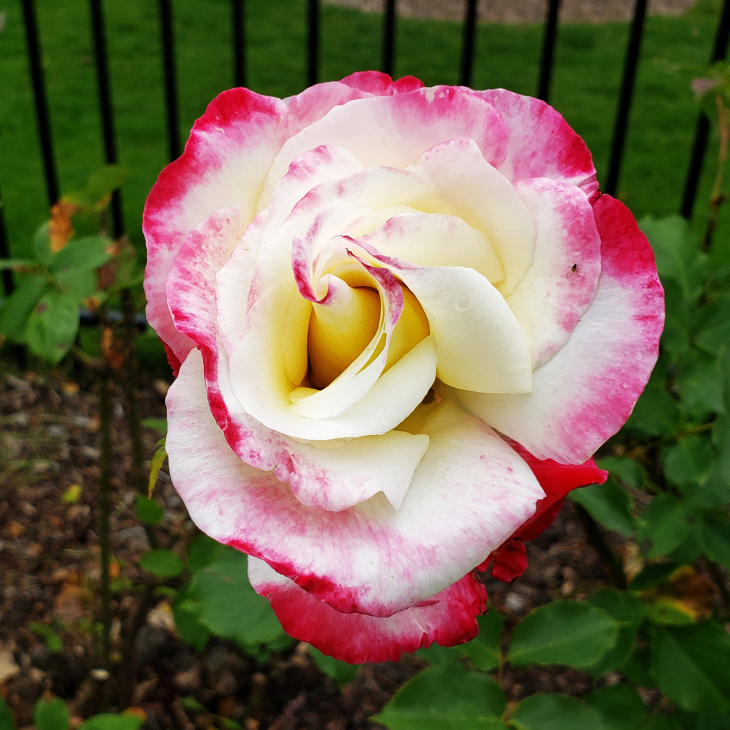
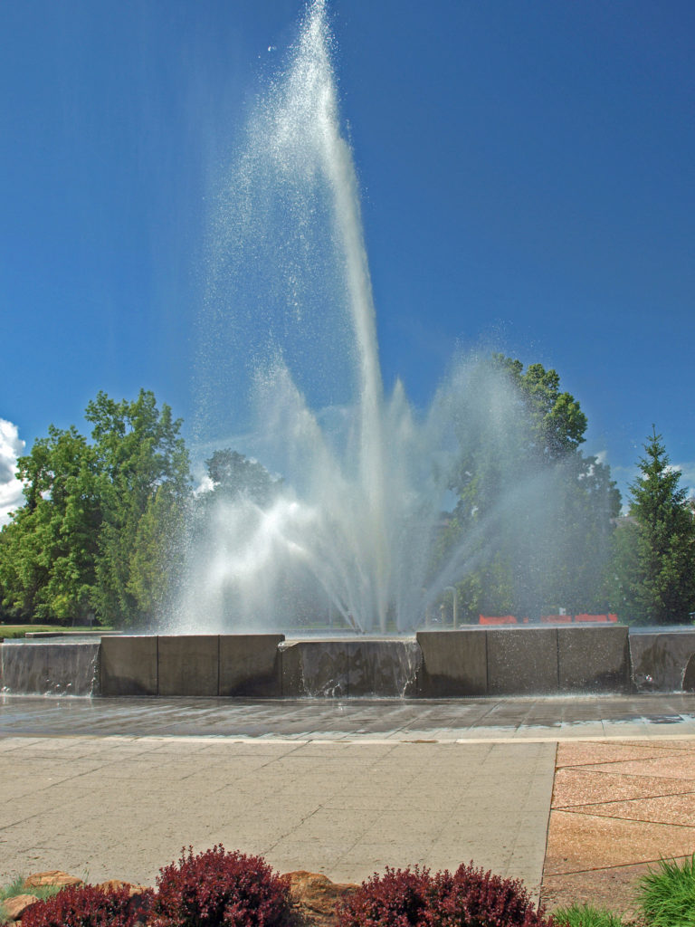
Julia Davis Park is also home to the Boise Rose Garden and Zoo Boise. Idaho Botanical Garden, a mile or so southeast of downtown, is also definitely worth a visit.
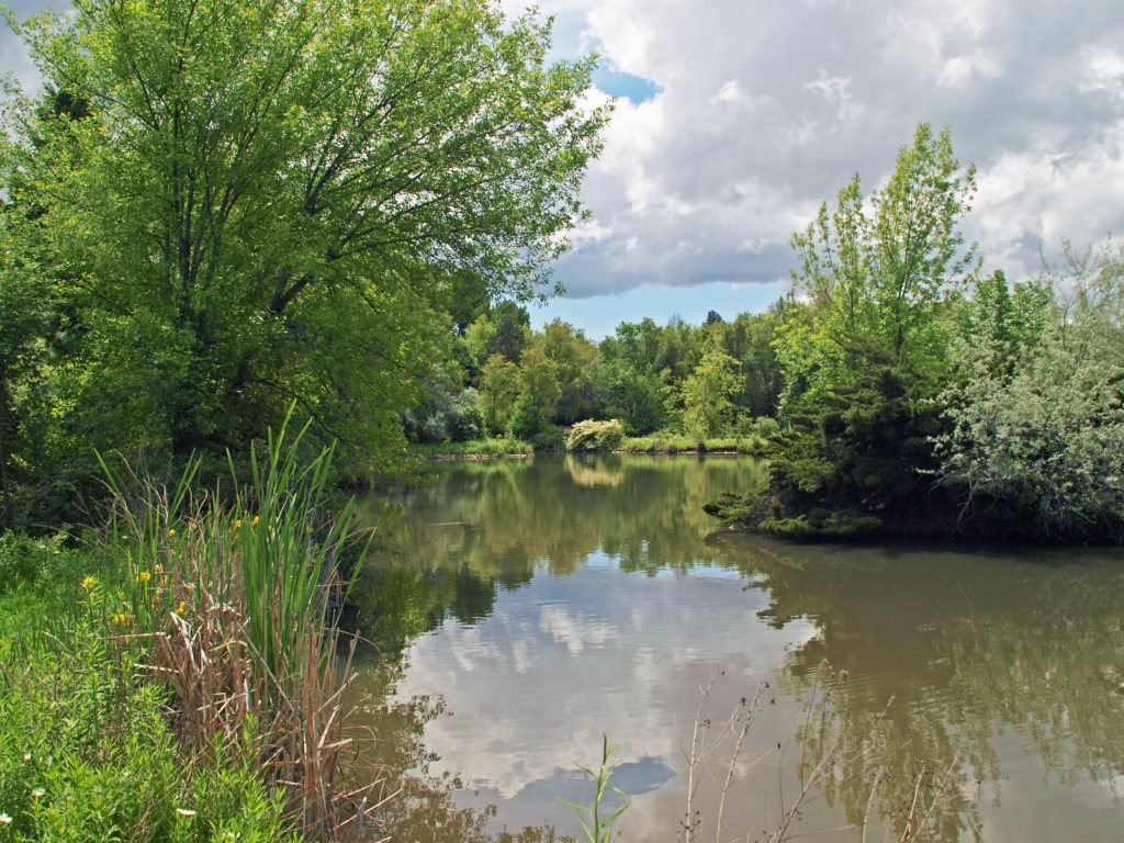
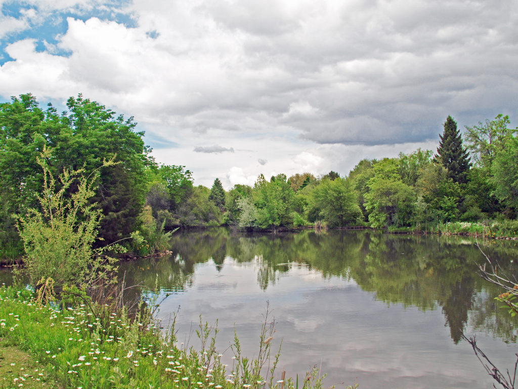
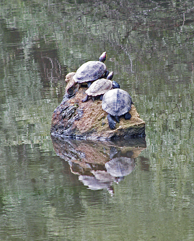
Kathryn Albertson Park , across Americana Blvd from Anne Morrison Park, is a nature park with several large ponds that is home to a variety of wildlife and provides the visitor with more intimate natural areas to explore.
I hadn’t been in Boise for quite a few years. The last time had been for an environmental conference and I didn’t see much of the city on that trip. And, honestly, we didn’t come to Idaho to explore Boise on this trip. But I found it surprisingly beautiful and interesting on a number of different levels. It’s definitely not the cowboy town I remember visiting in my younger days. Boise has grown up a lot (and maybe it was never as much of a cow town as I remember it being).
We had a great time exploring Boise, but there is far too much there to experience it all in in the short time we had on this trip. We’ll almost certainly be visiting Idaho again in the near future, and I’m sure we’ll spend another few days exploring more of what Boise has to offer. We may even see what Boise nightlife is like on our next visit.
 Boise is definitely worth visiting, and southwest Idaho has many truly unique, beautiful, and enjoyable places to visit, all within a short drive of each other. For more on those, check out my other Exploring Southwest Idaho posts:
Balanced Rock and Bruneau Dunes
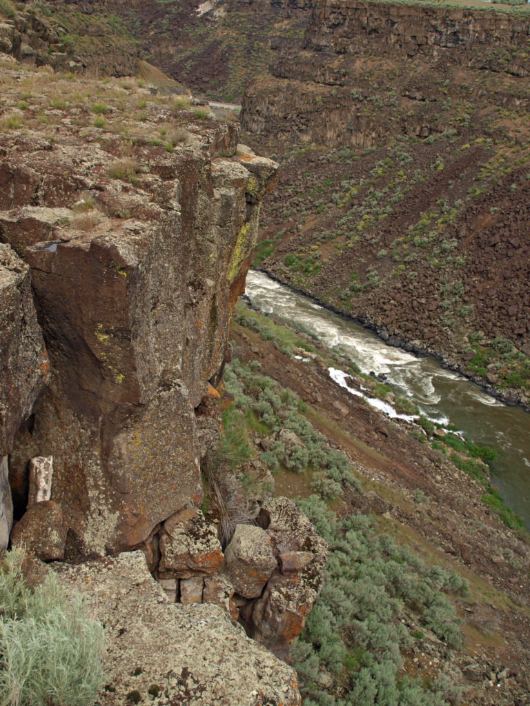
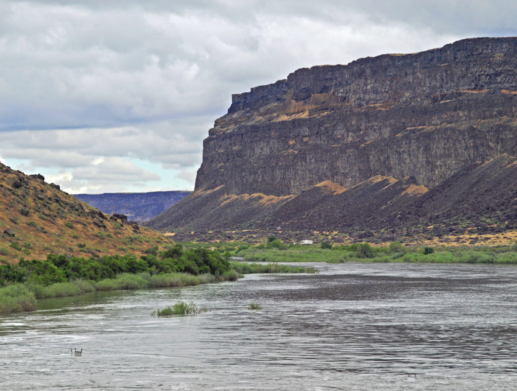
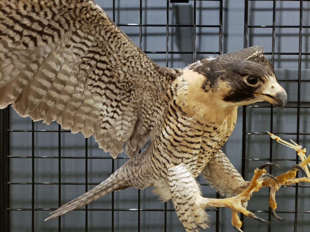
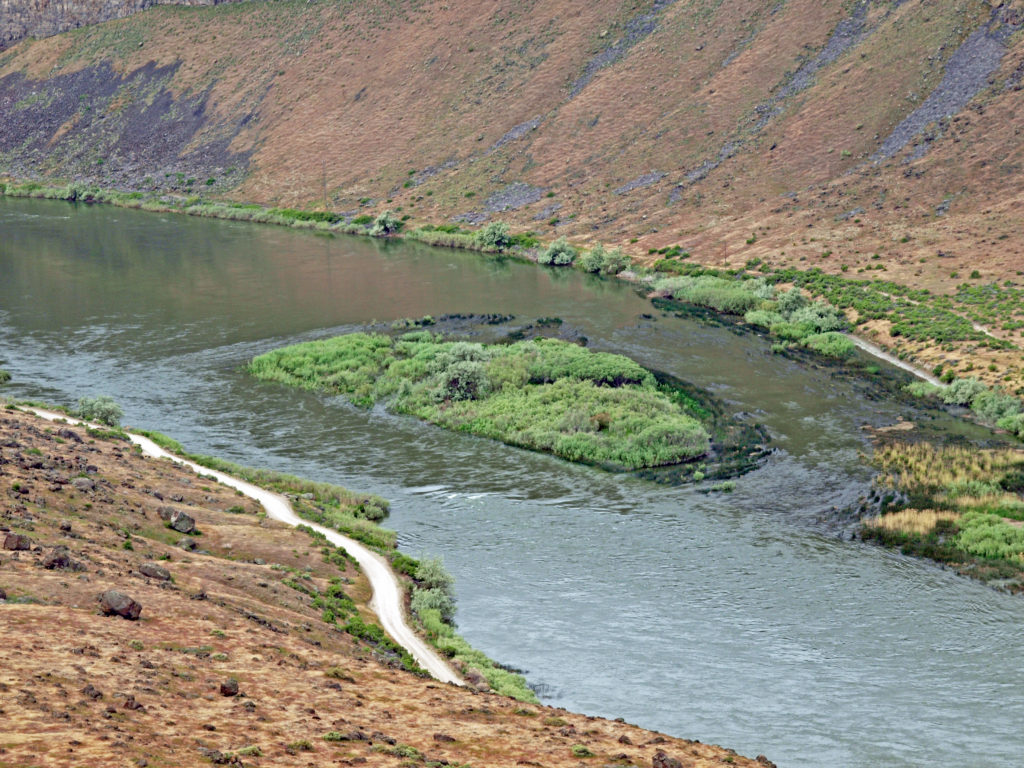
The Snake River Canyon and Birds of Prey
Posted January 17, 2022. Updated April 8, 2025.
All photos © Alan K. Lee
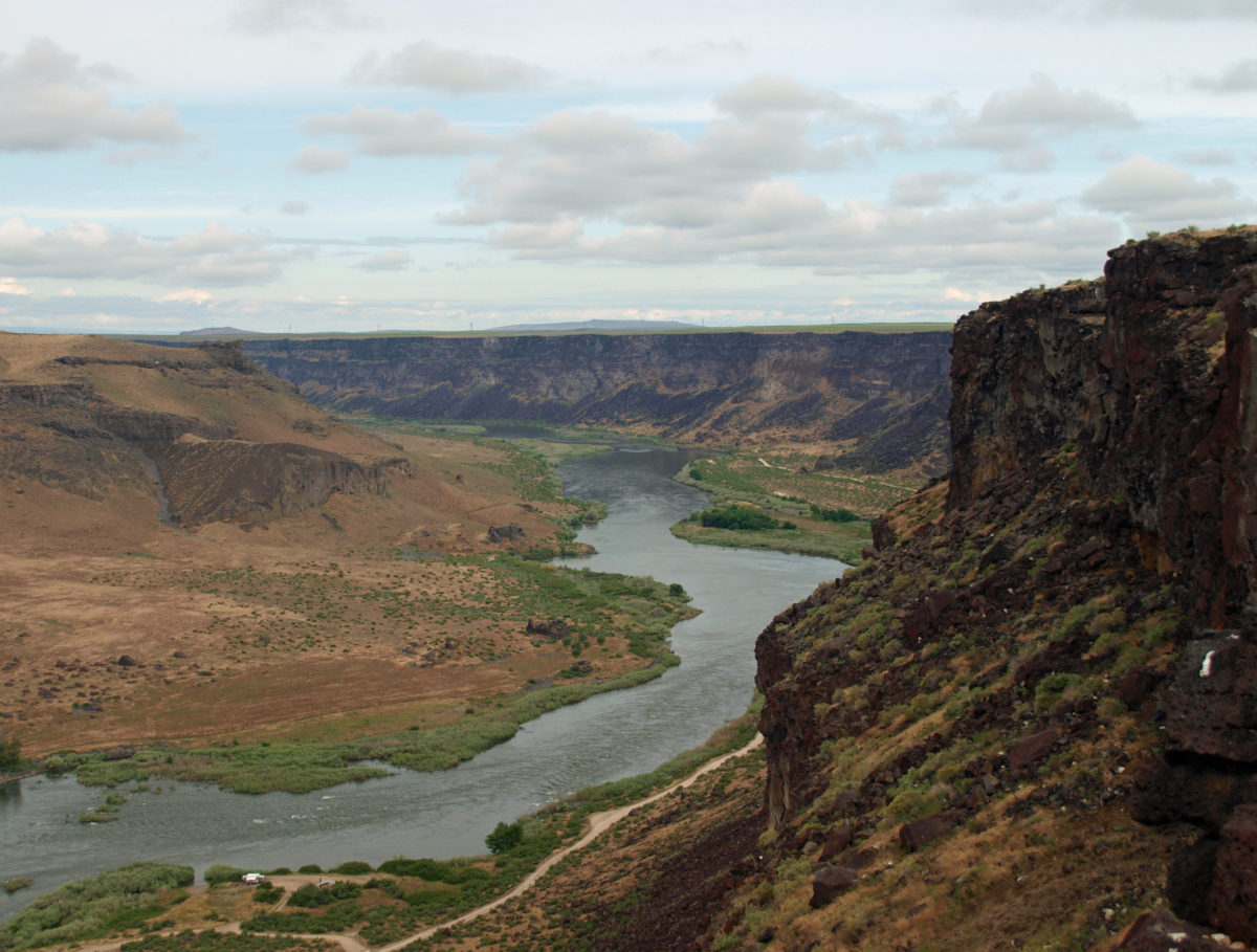
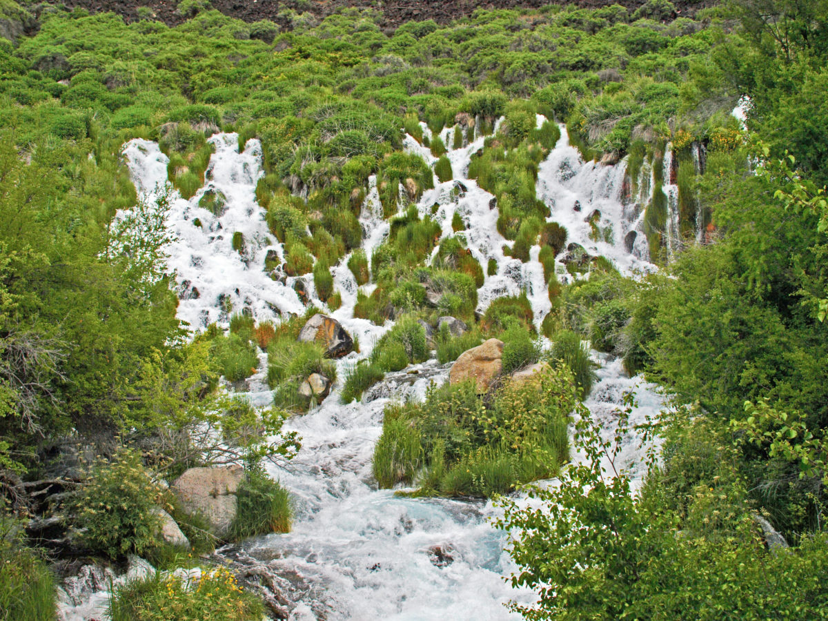
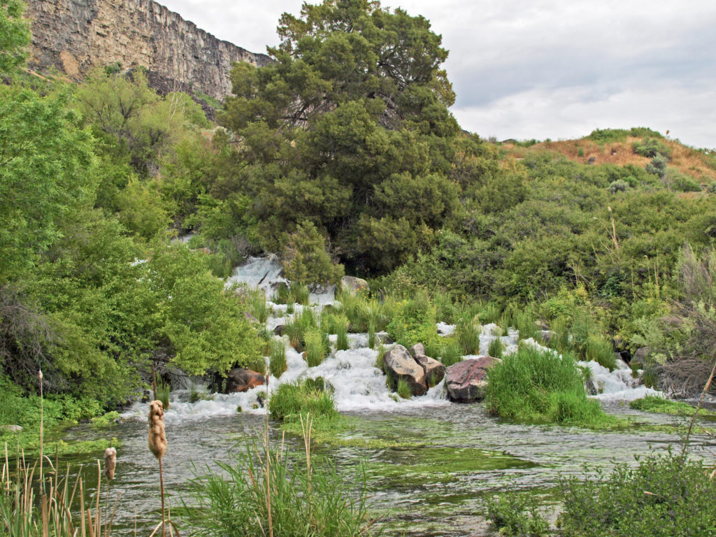
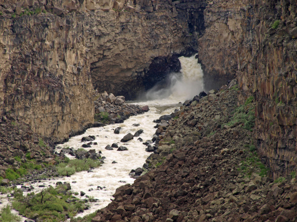
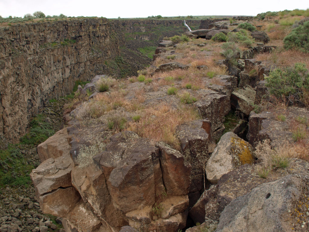
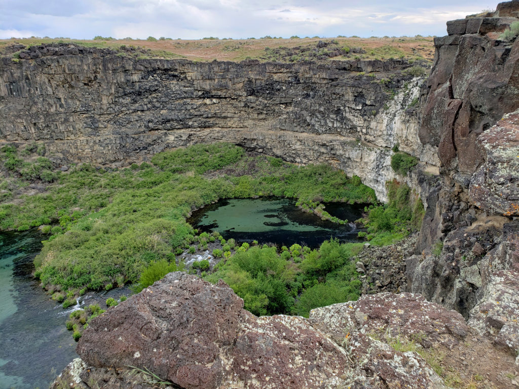
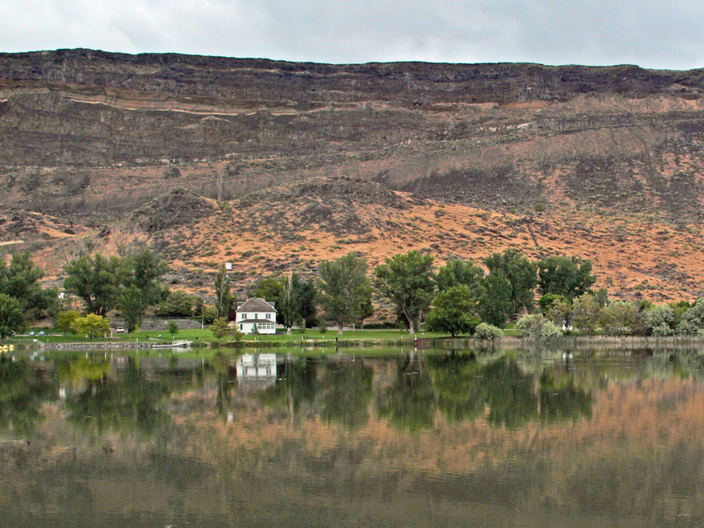 The falls are long gone, flooded by construction of Swan Falls Dam in the early 1900s. Swan Falls was the first hydroelectric project on the Snake River. A fish ladder was constructed, but was largely ineffective, and the dam effectively blocked salmon and steelhead passage. That was a different era, and the fish ladder was never made functional. Newer dams were built both upstream and downstream with no fish ladders at all. Electricity was the point. The fish didn’t matter. But it’s a historically interesting and beautiful area, so it’s worth a visit even if, like me, you’d rather see the dam gone.
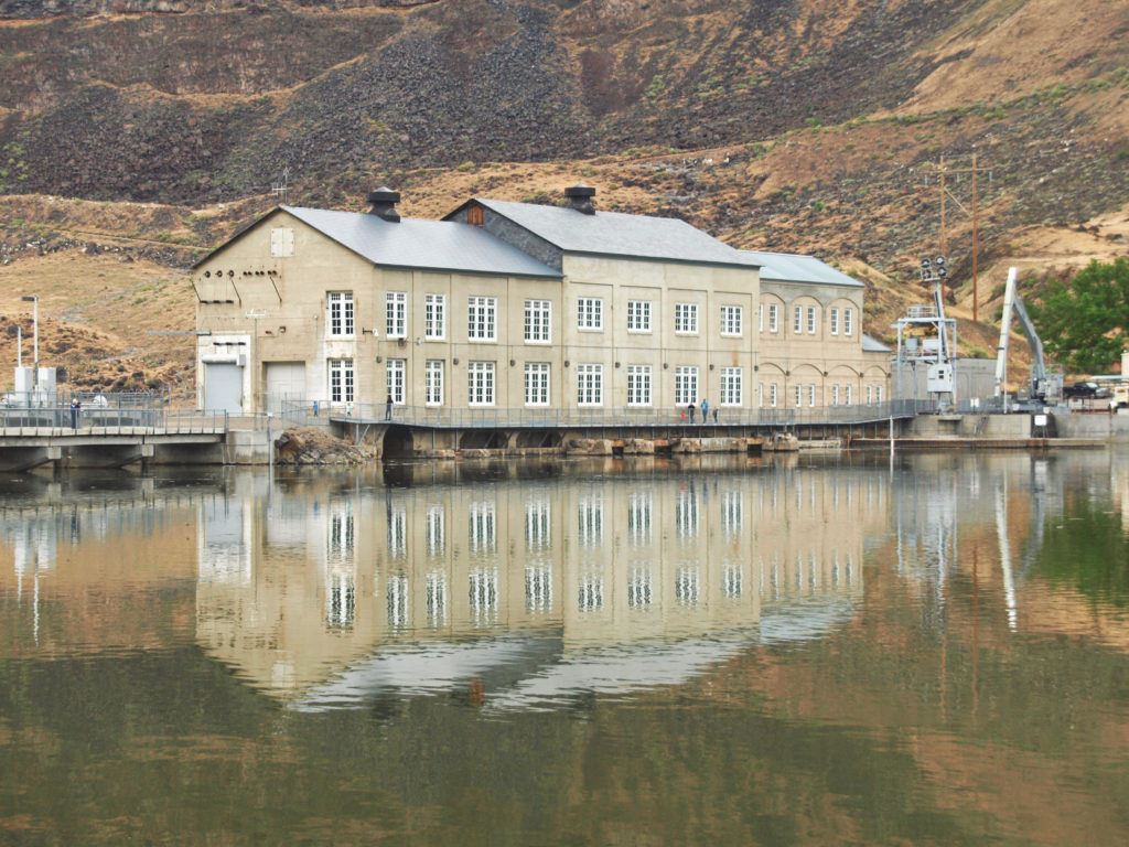
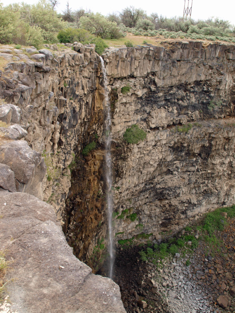
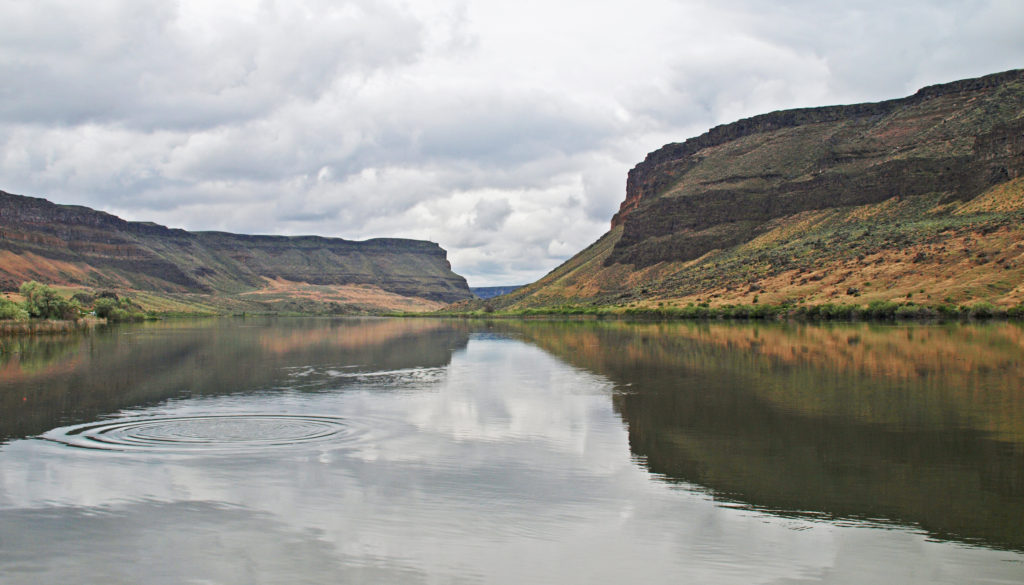
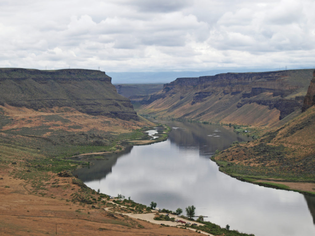
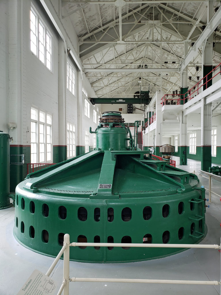 A new power generation facility was constructed at Swan Falls Dam in the 1990s. The dam’s original power plant is now open to the public, with some of the century-old generators and other equipment still in place. There are also displays depicting the history of the area, and the construction and operation of the dam. We walked across the dam after visiting the power house museum, then drove down the canyon a ways. The road was too rough for the car, though, and we turned around and drove back up to Dedication Point, and then on to Celebration Park.
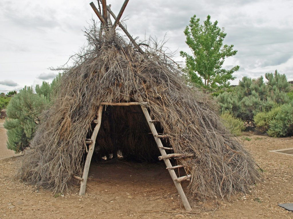 Celebration Park is Idaho’s only archaeological park. Petroglyphs dating back as far as 10,000 years can be found there. Visitors can learn about the Native American “lifeways” at the visitor center, try their hand at throwing a spear with an atlatl, and explore the petroglyph area on a self-guided walk. There is a picnic ground, and a small tent campground. The visitor center is open from 10:00 to 2:00 daily, except holidays. Check the park
 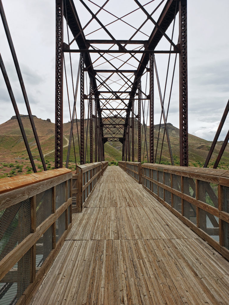 A short ways downstream, the Guffey Railroad Bridge provides pedestrian and equestrian access to the south bank of the Snake River and the Guffey Butte area. The bridge was built in the late 19th century and carried rail traffic until the 1940s. It is listed in the National Register of Historic Places. Guided tours of the area highlighting the area’s early mining and railroad history are conducted periodically.
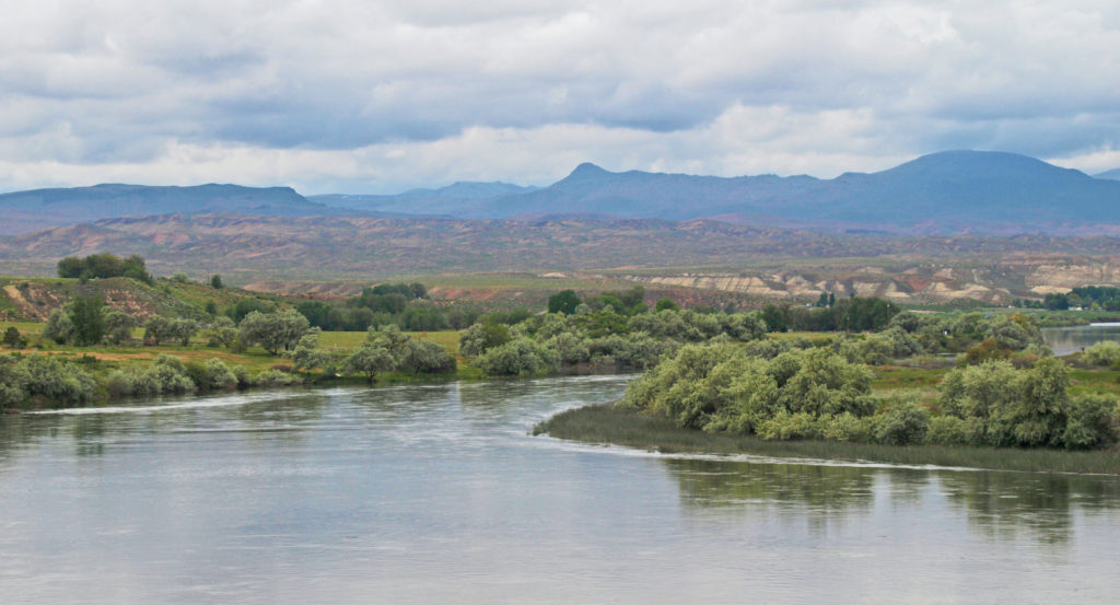
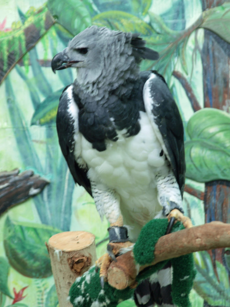
 Back in Boise, we toured the
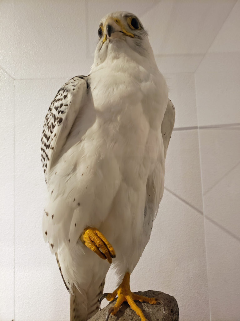
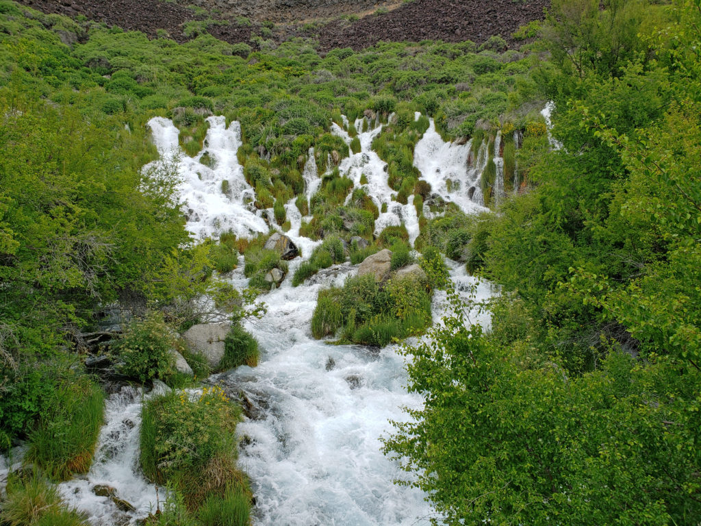
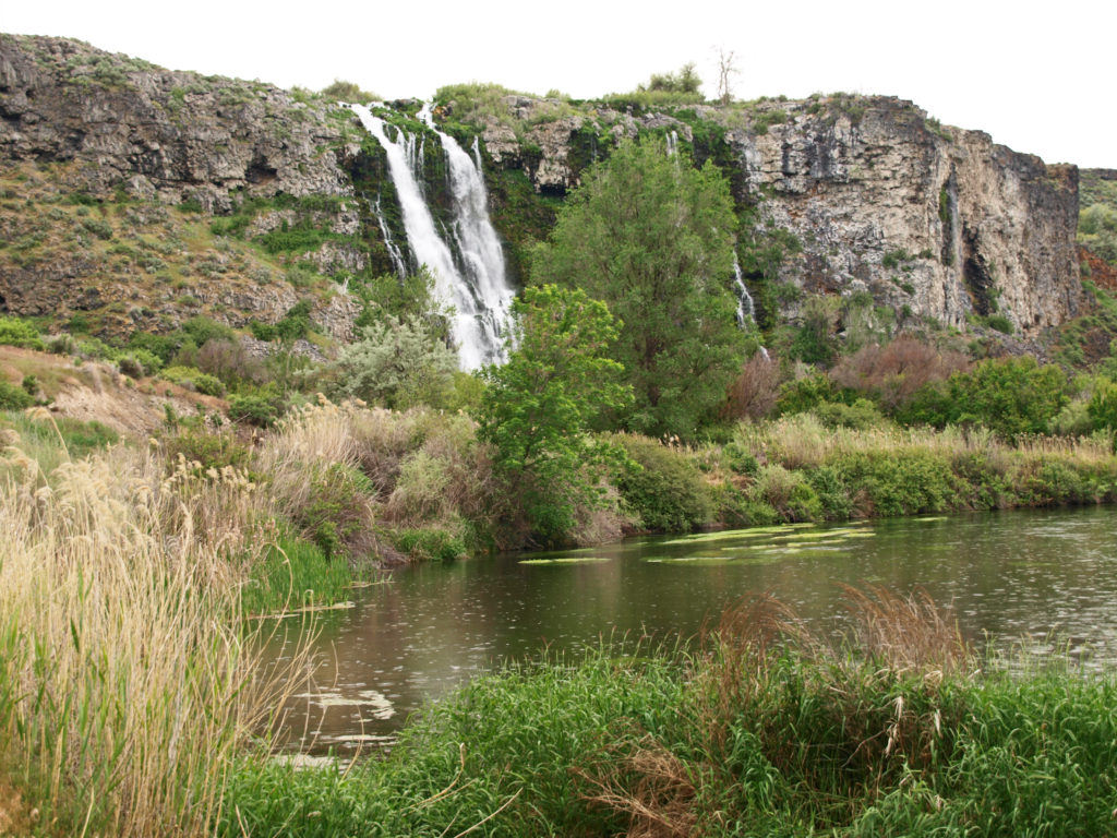
 After touring the Thousand Springs area at the beginning of an extended Memorial Day weekend trip to Southwest Idaho, my wife and I took a short side trip to
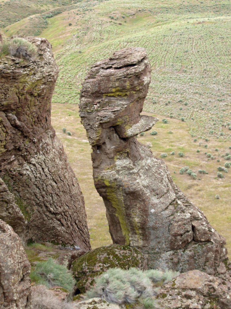
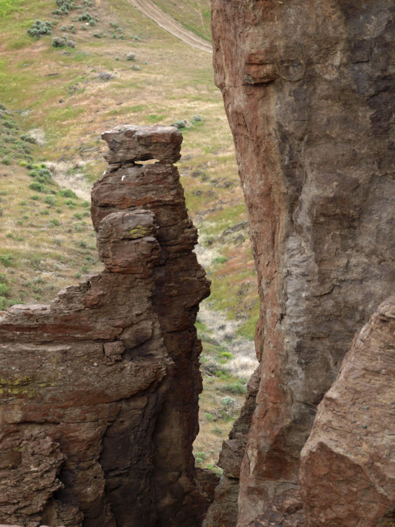 Balanced Rock is located about twenty miles west of Twin Falls and ten miles from Buhl, the nearest town. The area around Buhl is flat, featureless farm land that looks more like Kansas than the pictures I had seen of Balanced Rock, which had more the look of the Arizona or Utah deserts. But after a few miles, the road began to drop into a canyon and the view and landscape changed radically.
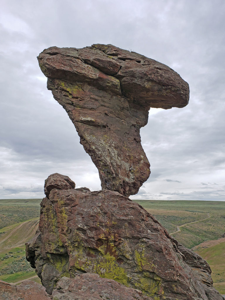 Balanced Rock is nearly fifty feet tall, weighs forty tons, and is supported precariously by a stem of rock less than three feet in diameter. It is, to say the least, a striking sight. We climbed up to the rock and hiked along the hillside above the rock formations (there’s quite a lot more than just Balanced Rock). It’s not a large area, and the trail is short and not difficult. It’s easy to explore in an hour or so, and I found it definitely worth the time and effort. But you can still get a good view of Balanced Rock and the other rock formations from the parking area if you don’t want to, or are unable to, climb up to them.
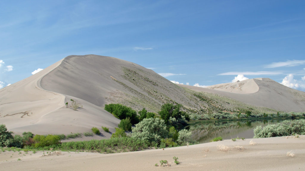 Bruneau Dunes
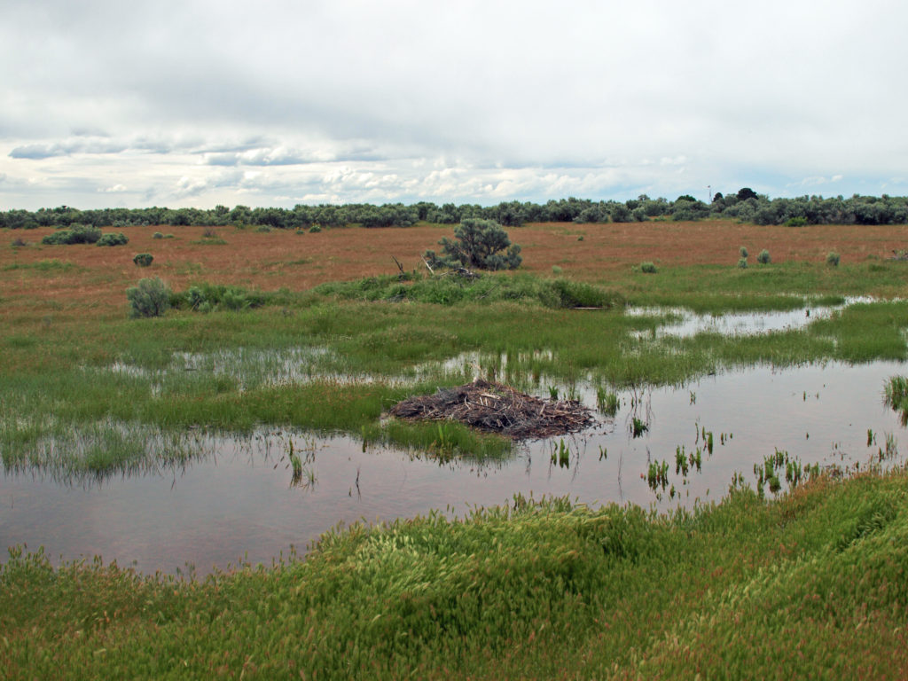
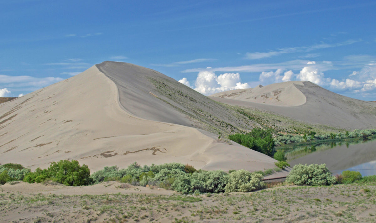
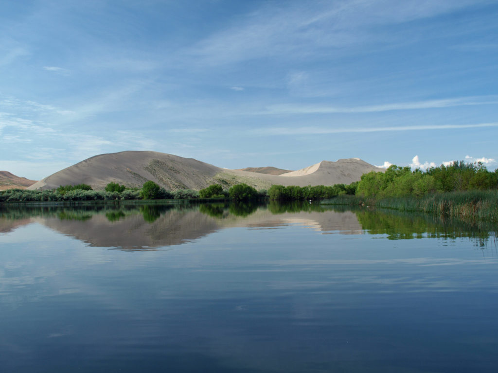 The dunes are impressive and certainly the main attraction here, but the park also has two small lakes, marshes and wetland areas, and open desert areas to explore. The marshes and lakes are full of waterfowl, and coyotes, jackrabbits, lizards, and gopher snakes can be found in the drier areas of the park. In the spring, desert wildflowers are abundant.
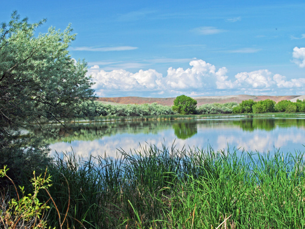 For hikers, there’s a six mile loop trail that takes you over the top of the dunes. There is also an equestrian camp and a ten mile long horse trail, two campgrounds, a picnic area, and a visitor center. We didn’t do the six mile hike, but did climb the Small Dune, hiked around the smaller lake, checked out the picnic area on the Big Lake, and, of course, spent a lot of time photographing the area.
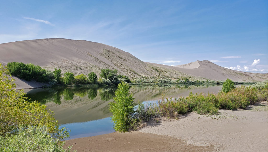 Bruneau Dunes is also an outstanding “dark skies” area, and the Boise Astronomical Society has constructed an observatory at the park. On weekends, visitors can view the depths of space through the observatory’s 25 inch telescope.
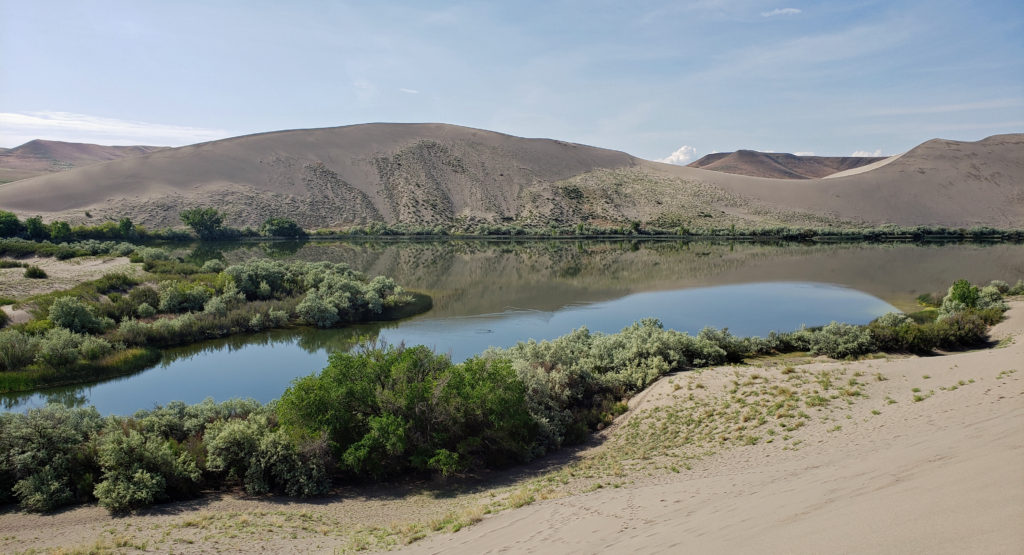 The weather was better than it was for our Thousand Springs and Balanced Rock visits on the previous day, and the sunshine made for some good photo ops. But it got a little warm on the dunes after awhile, and there were swarms of mosquitoes by the water where it was cooler. Still, it was a nice morning’s outing. The dunes and the small lakes between them are incredibly beautiful, and climbing the dunes was a fun adventure.
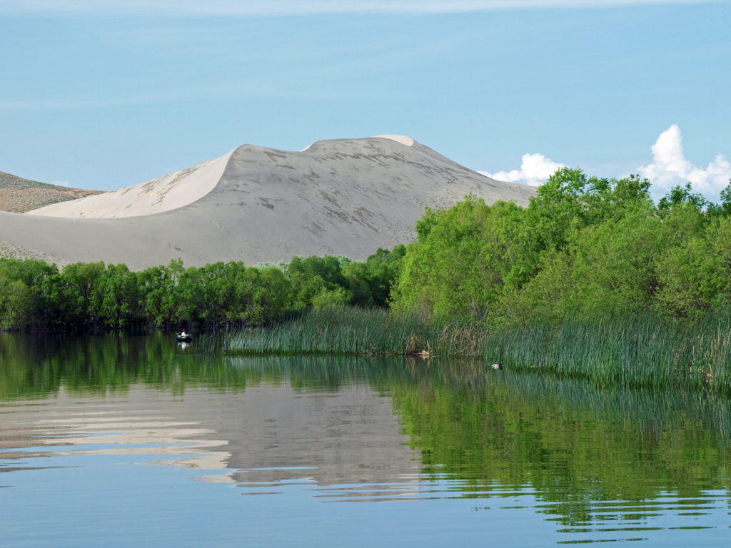 Bruneau Dunes definitely exceeded my expectations. The dunes are huge, much bigger than I expected, and the area around them is interesting and very beautiful. The park is small enough that it can be explored in half a day, which is what we did, but there’s enough there to keep you occupied for a few days, at least. It’s also a place where you can slow down, relax, and spend some time just enjoying the views and the peace and quiet, which won’t be marred by the presence of dune buggies and trail bikes. They’re prohibited in the park to protect the dunes.
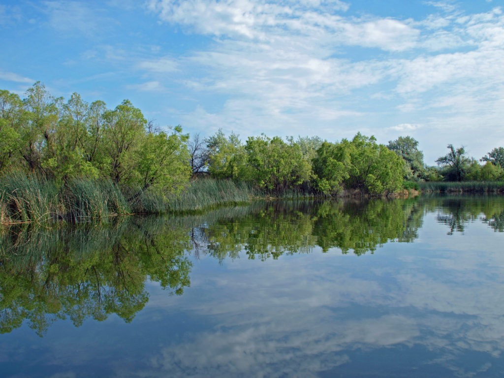 We returned to Boise that afternoon and spent some time exploring the downtown area and the parks and paths along the Boise River Greenway. The next day it was on to the Snake River Canyon, the Birds of Prey National Conservation Area, and the World Center for Birds of Prey. Click on the links below to view other posts from our trip.
 Originally posted June 20, 2019. Most recently updated April 2, 2025.