
Clear lake Loop Trail
Where: Upper McKenzie River Valley, Willamette National Forest, Oregon
Distance: 5.0 miles
Elevation gain: Minimal
Difficulty: Easy to Moderate (for rough sections of the trail through the lava flows)
Overview:
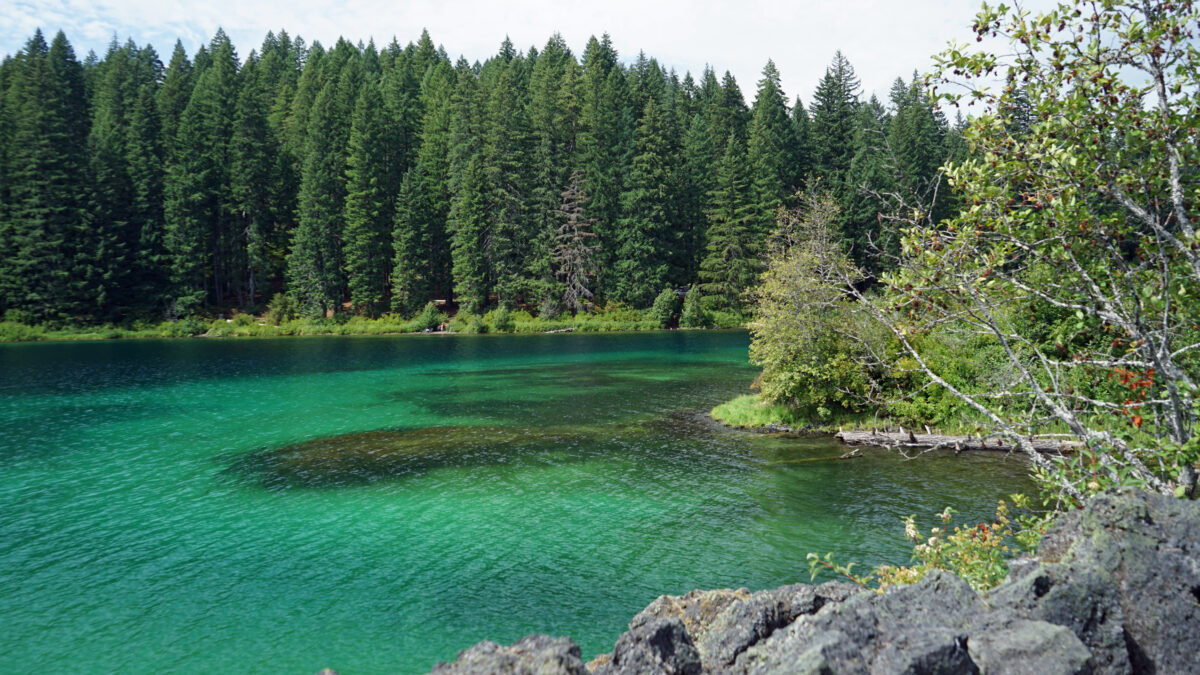
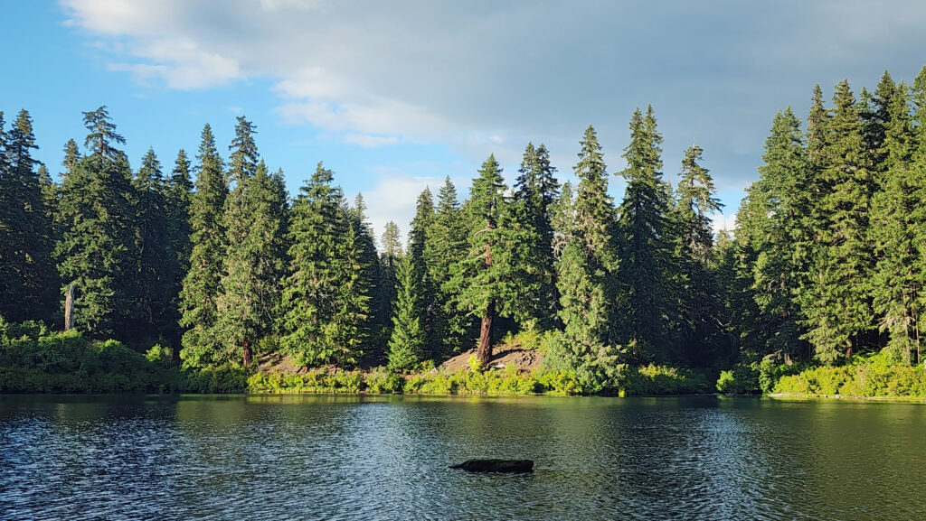
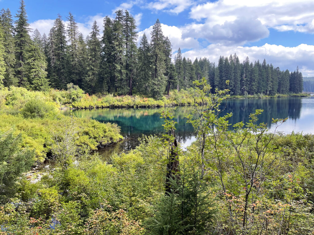
Clear Lake is one of the clearest (as the name would suggest), cleanest, coldest, and most beautiful lakes in the Cascade Range. It’s also the headwaters of the spectacularly beautiful McKenzie River. This hike takes you through the forest and lava fields around the lake, with great views of the lake from all sides.
Note that the trail along the west side of the lake may be closed periodically to protect bald eagle nesting sites. Call the McKenzie River Ranger Station at 541-822-7254 for more information. (The Ranger District’s website wasn’t much help, and the link to their email didn’t work).
Map: Oregon Hikers
![]()
Getting there:
Clear Lake is located along Oregon Hwy 126 about 65 miles east of Eugene. From the Portland area, take I-5 south to exit 253, then travel east on Ore Hwy 22 for 79 miles to the junction with US Hwy 20, go west for three miles, then turn south on Ore Hwy 126. The lake is about three miles south of the junction. From the Bend area, take US Hwy 20 west over Santiam Pass to the junction with Ore Hwy 126, then south to the lake.
Trailheads:
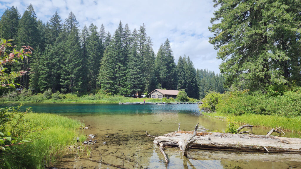
You can start this hike from either the day use area at Clear Lake Resort on the northwest side of the lake or Coldwater Cove Campground on the southeast side. The resort has a small cafe (open limited hours) and restrooms, and drinking water is available. There is no charge to park and a Northwest Forest Pass is not required. The Coldwater Cove trailhead is at the end of Forest Road 770, about one mile east of Hwy 126 just south of the lake. There are vault toilets at the campground and drinking water is available. Parking requires a Northwest Forest Pass. The trail description below starts and ends at the resort.

The hike:
If you’re starting the hike at the resort, park in the day use area at the resort (unless you are renting one of the cabins or the yurt) and walk north through the resort along the shore of the lake. In a few hundred yards you’ll see the trailhead on your right.
The first part of the trail takes you through the forest with filtered views of the lake. Several side trails lead down to the lake for better views.
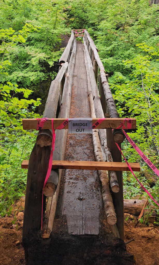
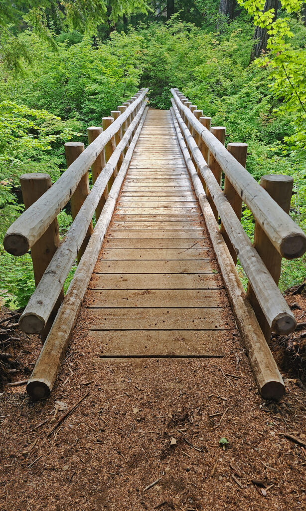
The trail continues north away from the lake, then crosses Ikenick Creek and doubles back to the lake before turning north again for about a half mile to a junction with the McKenzie River National Scenic Trail. Here the trail crosses Fish Lake Creek. (The Forest Service was in the process of replacing the old single log bridge when I was there in 2022 and the bridge was closed, but the creek was dry and you could scramble down the slope and climb back up the other side. The new bridge was in place when I did this hike again in the summer of 2024.
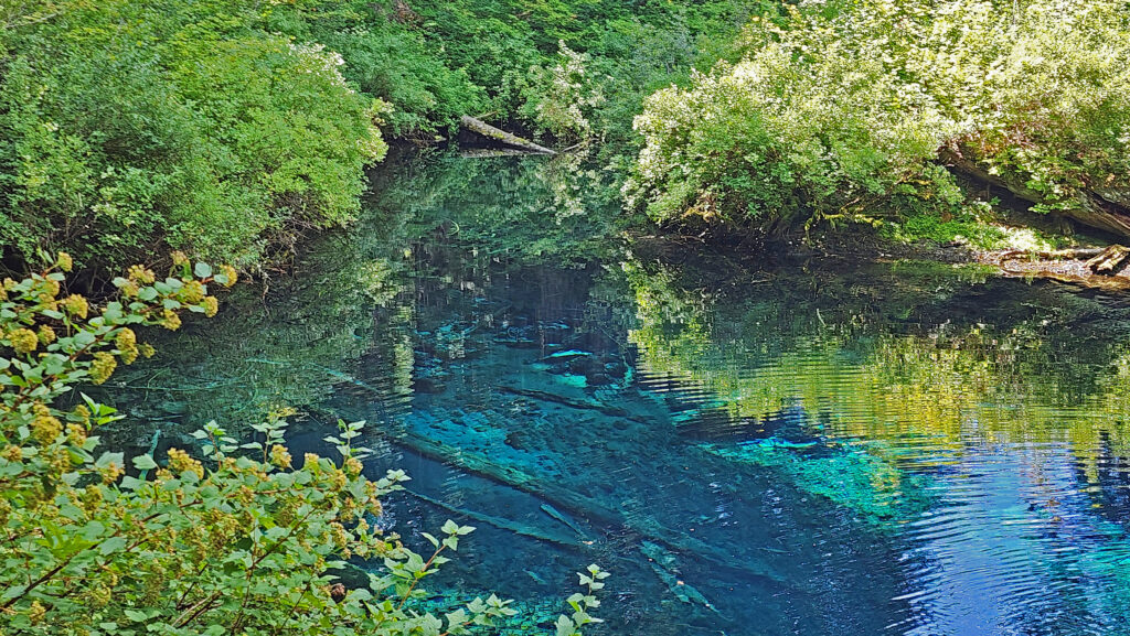
After crossing Fish Lake Creek, the trail turns south and runs along the eastern shore of the lake to the Great Spring. This was the source of the McKenzie River before Clear Lake was formed about 3000 years ago when a lava flow damned the river.
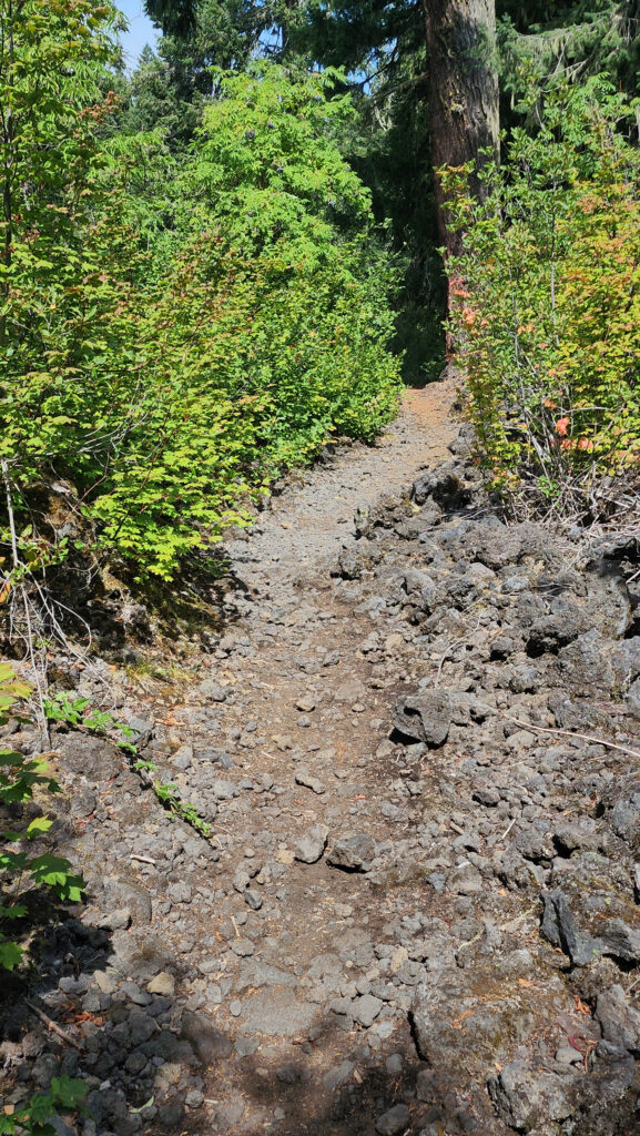
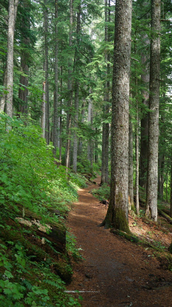
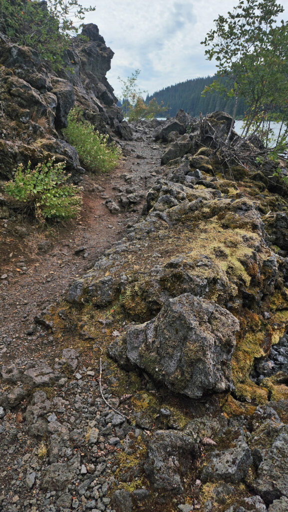 From the Great Spring the trail follows the east shore through the lava fields and forest. Parts of the trail are pretty rough. Good quality hiking boots are advised, although I did this hike in sneakers on my latest visit. But open toed sandals or flip flops are definitely not acceptable footwear on this section of the trail.
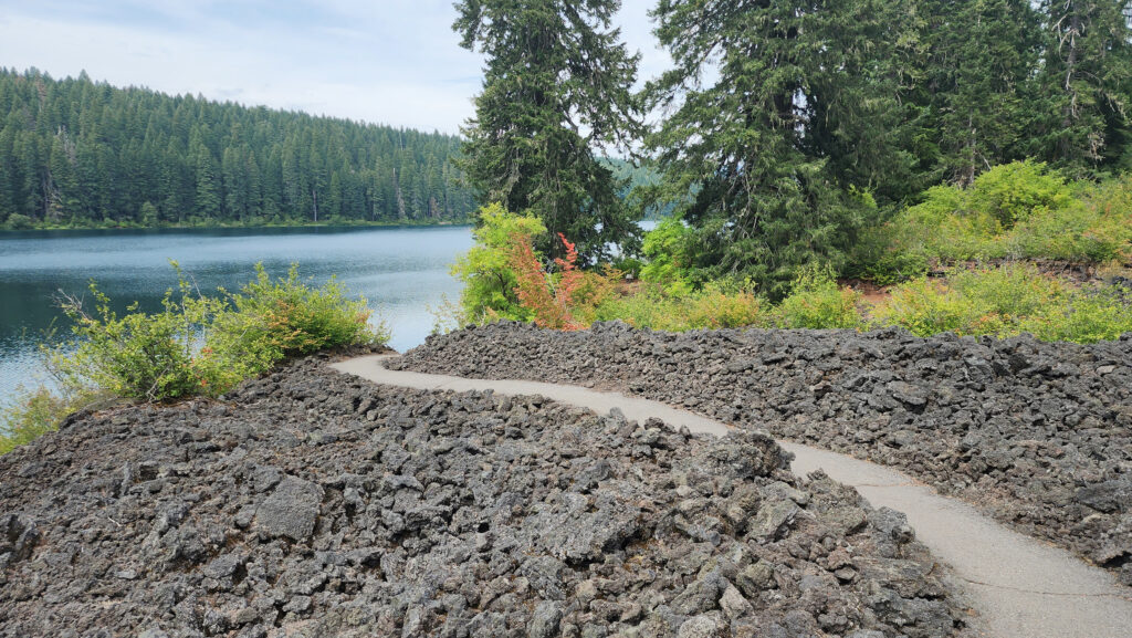
The section of trail immediately north of Coldwater Cove Campground is paved. South of the campground, the trail runs through the forest to the south end of the lake where you’ll come to a trail junction. Turn right to return to the resort.
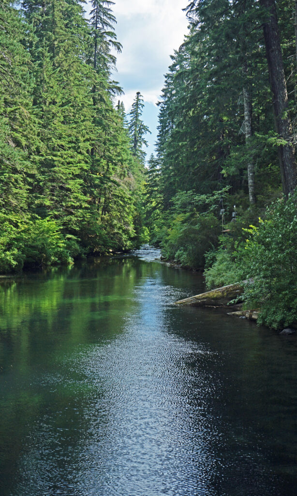
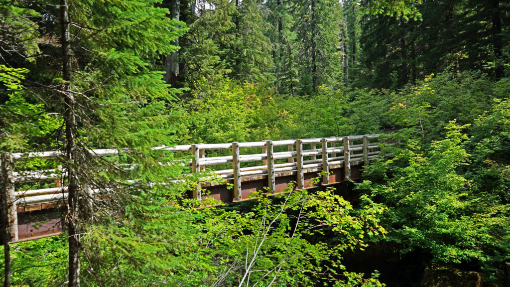
The trail crosses the lake’s outfall on a bridge that provides good views south to the beginning of the McKenzie River and north across the lake. Across the bridge, the trail turns north through the forest along the west shore of the lake. There is one good side trail that will take you to the lakeshore, but the main trail gives only limited views of the lake before you return to the resort where you started.

Other area attractions and activities:
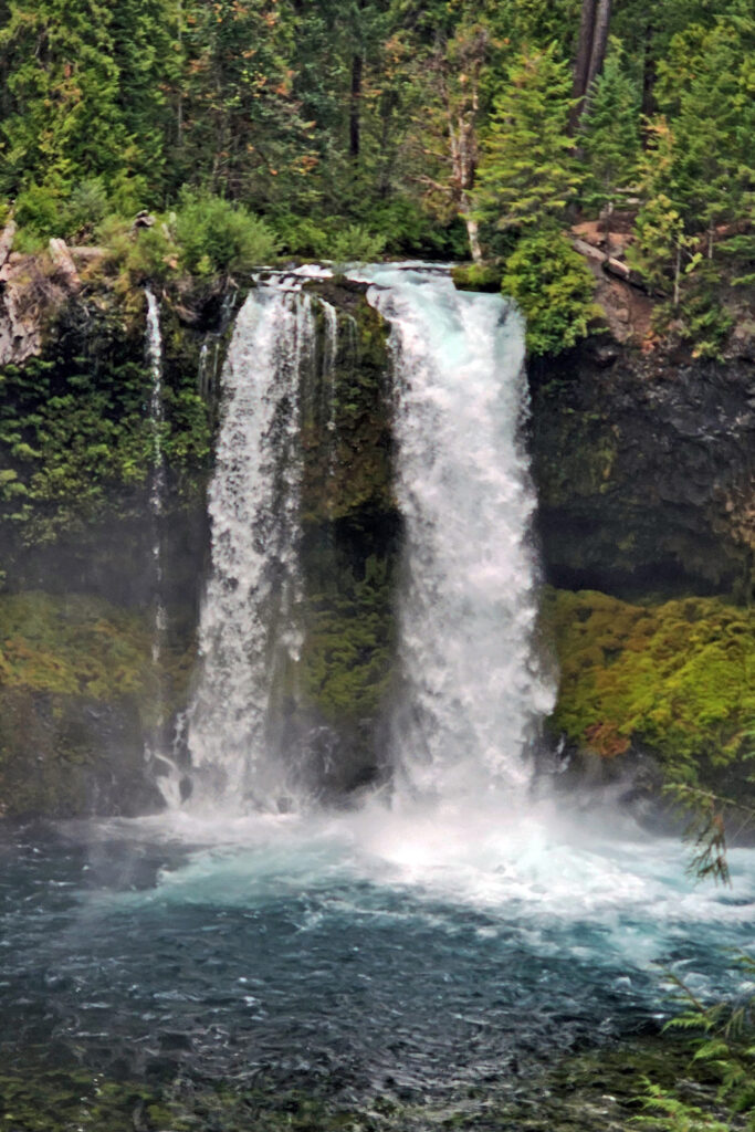
There are too many other hikes in the area to list all of them, but two of the best are the four mile out and back hike to the Blue Pool on the McKenzie River, and the 2.6-mile McKenzie Waterfalls Loop that takes you past both Sahalie and Koosah Falls on the McKenzie. The Pacific Crest Trail crosses Santiam Pass northeast of Clear Lake giving hikers access to trails in both the Mount Jefferson Wilderness to the north and the Mount Washington Wilderness to the south.
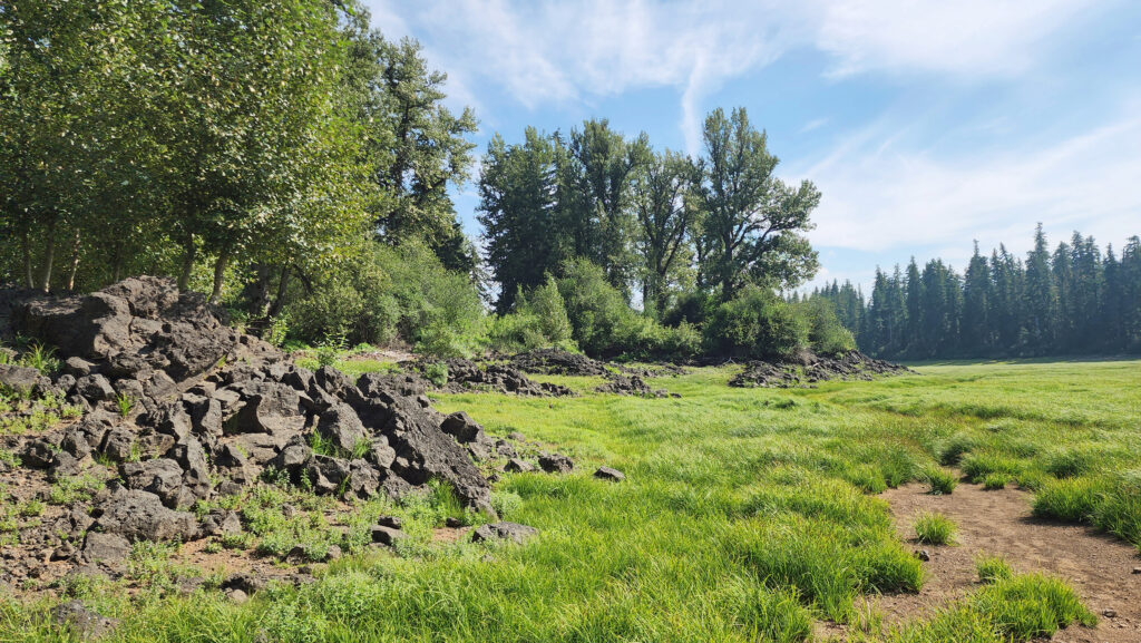
Fish Lake, a few miles north of Clear Lake, is definitely worth a visit. The lake dries up completely in the summer and becomes a lush, green meadow, even in late summer when the surrounding forest is bone dry. The 19th century Santiam Wagon Road crossed the Cascades here, and there was a Forest Service guard station here in the first half of the 20th century. Several of the Forest Service buildings and historic homesteads have been preserved and the area is now a National Historic Site.
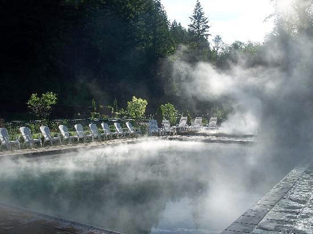
One of the many hot springs in the Cascade Range is Belknap Hot Springs, located about 15 miles south of Clear Lake. The hot springs are at Belknap Hot Springs Lodge and Gardens. Day use visitors can soak in one of the hot springs pools for a $10/hr fee.

Originally posted June 22, 2023. Updated September 7, 2024.
All photos ©Alan K. Lee, except as noted