by Alan K. Lee
Introduction
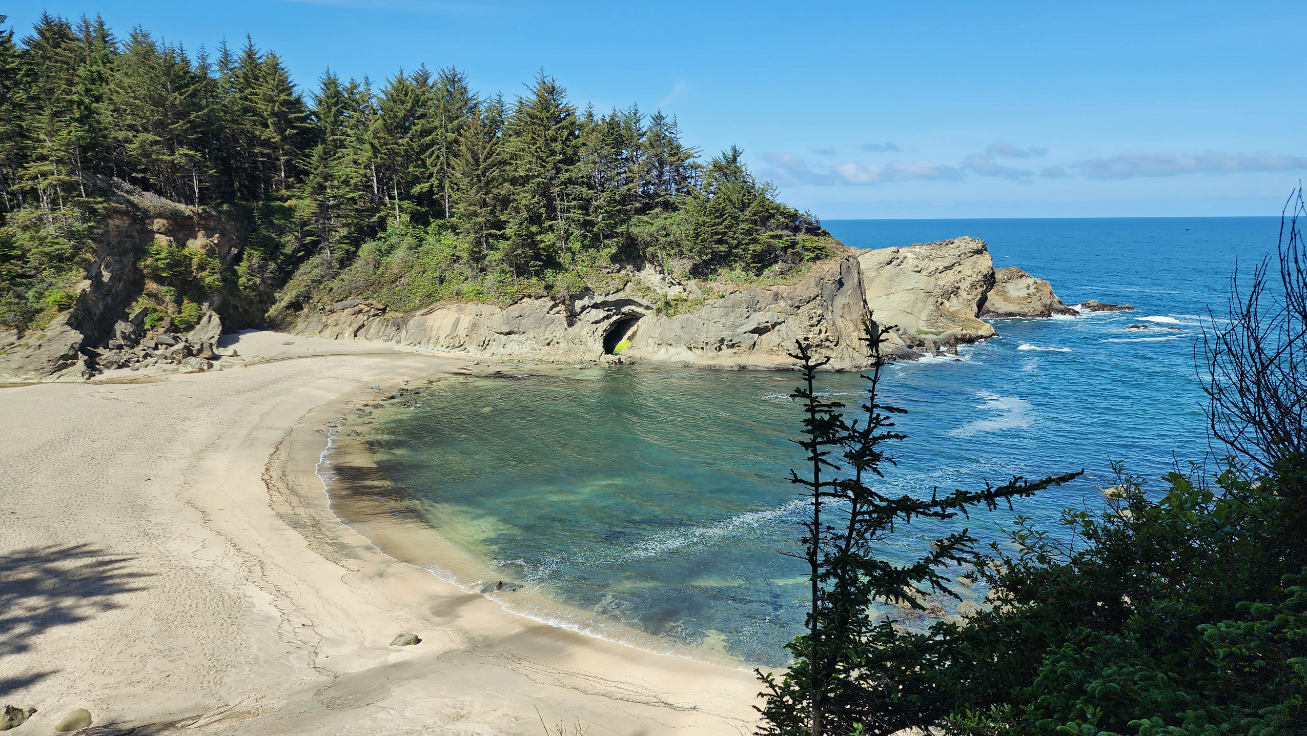
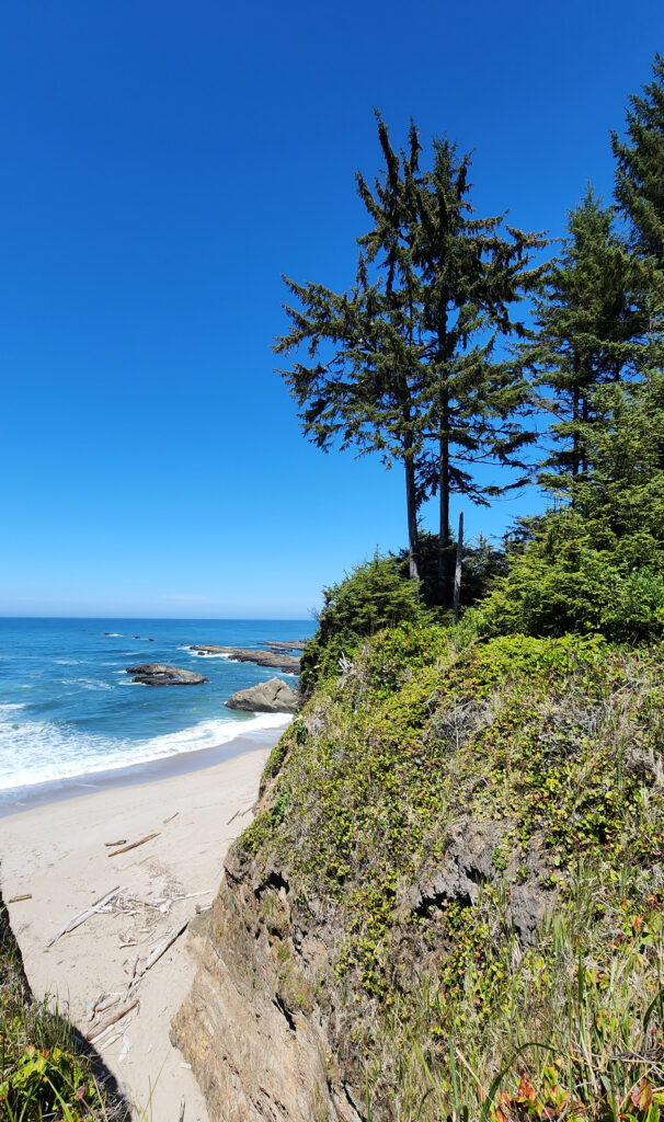
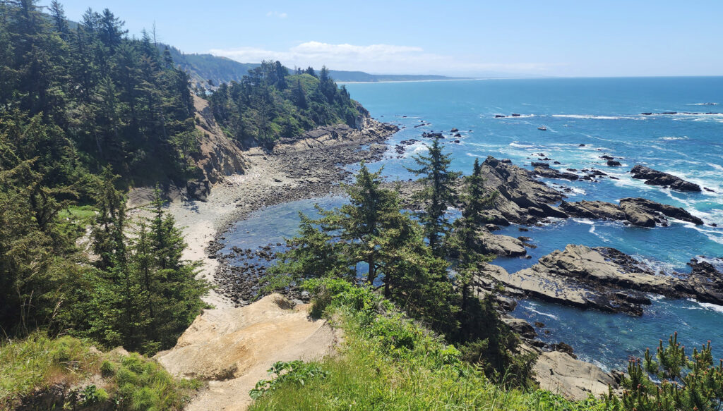
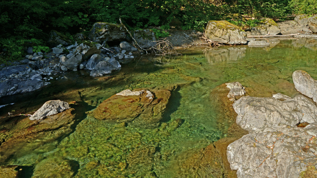
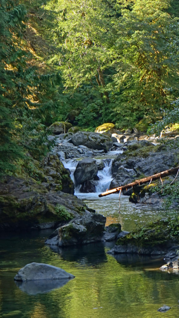
Cape Arago, on the southern Oregon coast south of the mouth of Coos Bay, is not as impressive as some of the other headlands on the Oregon coast, but it has a diversity of attractions that no other place on the coast can match. It’s mostly known for the three state parks (Sunset Bay, Shore Acres, and Cape Arago) that line its shores. But there’s also a state natural site, a county park (Bastendorff Beach), a privately run RV park, the decommissioned Cape Arago Lighthouse, and a golf course, in addition to scenic offshore islands, sea stacks, rocky shorelines, a reef with an active sea lion rookery, five beaches, two campgrounds, a historic botanical garden, and miles of hiking trails. Tens of thousands of visitors make the trip to this remote section of the Pacific coast every year. And the surrounding area has an abundance of attractions as well.
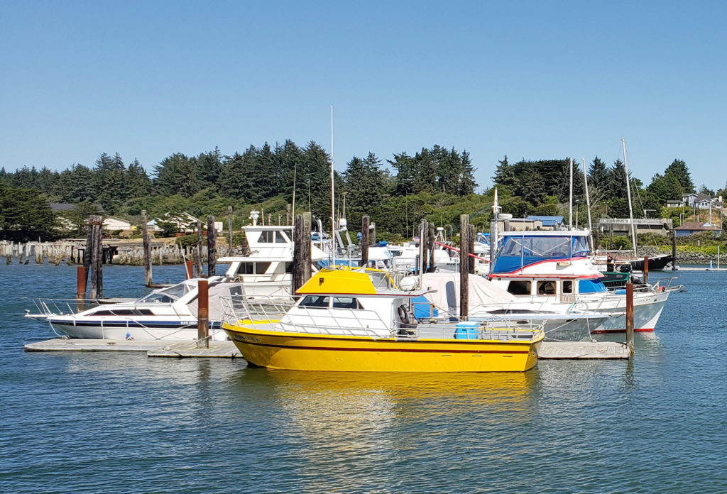
Bastendorff Beach
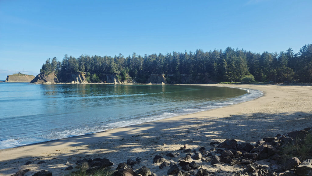
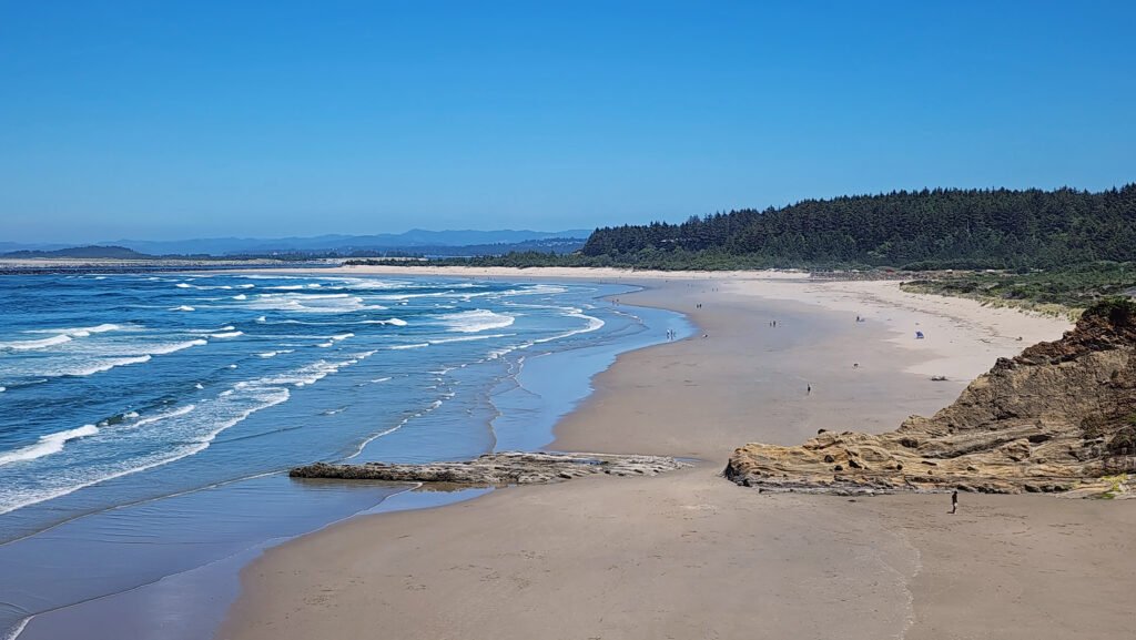
The mile long Bastendorff Beach, located adjacent to the south jetty at the mouth of Coos Bay, is the largest of the five beaches on the Cape Arago shoreline. Bastendorff Beach County Park has a 99 site campground (74 RV sites with water and electric hookups and 25 tent sites with no hookups), an 18 unit group campground, two RV dump stations, a large day use area with two picnic shelters, a fire pit and barbecue, horseshoe and basketball courts, a children’s playground, and easy access to the beach. There is also a private RV campground (Sun Outdoors Coos Bay) at the southwest end of the beach.
Yoakam Point State Natural Site
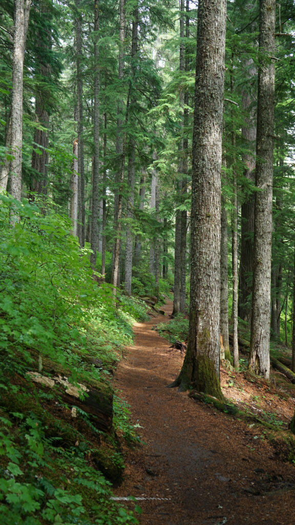
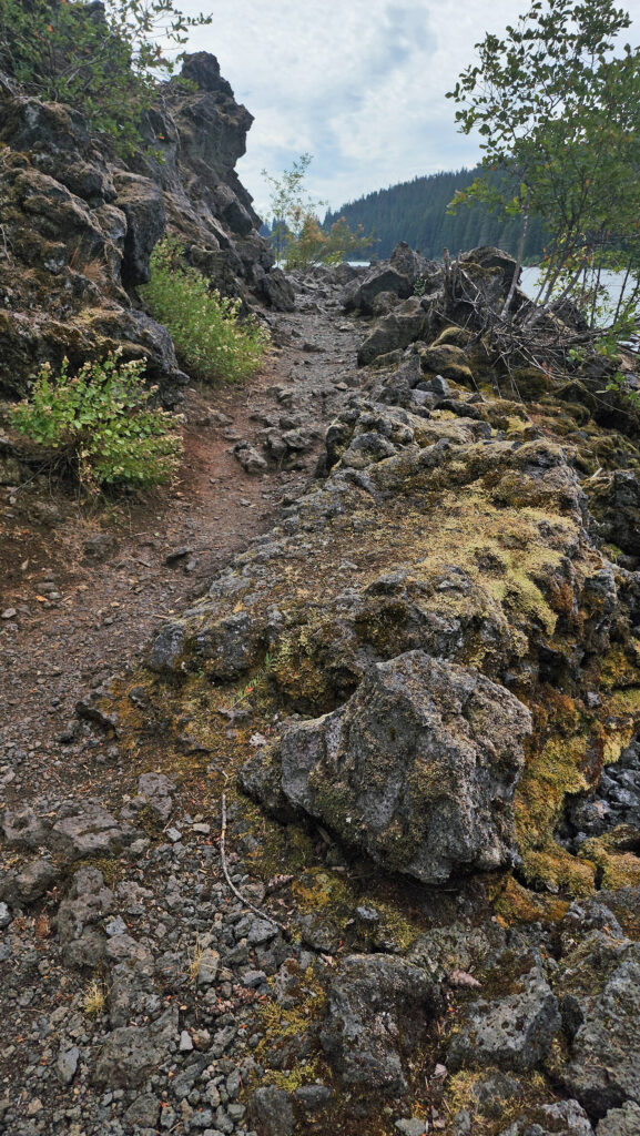
Yoakam Point separates Bastendorff Beach from Lighthouse Beach. Hiking trails (mostly unmaintained but passable) give access to scenic views of the rocky cliffs of the point, Bastendorff Beach, and Cape Arago Lighthouse. The site has no rest rooms or other amenities – just scenic splendor. (You might be tempted to scramble down the cliff from Yoakam Point to Lighthouse Beach, but I would advise against it. The cliff lined beach, like all Oregon beaches, is public, but the bluff is lined with private homes with no public access point. Access from Yoakam Point is possible but dangerous. Best to leave this one to the residents. They think they own it anyway.)
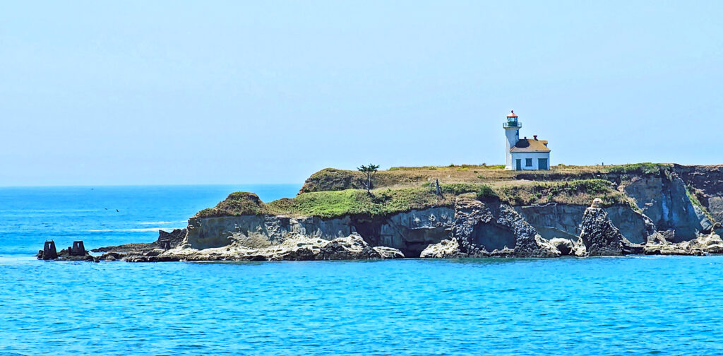
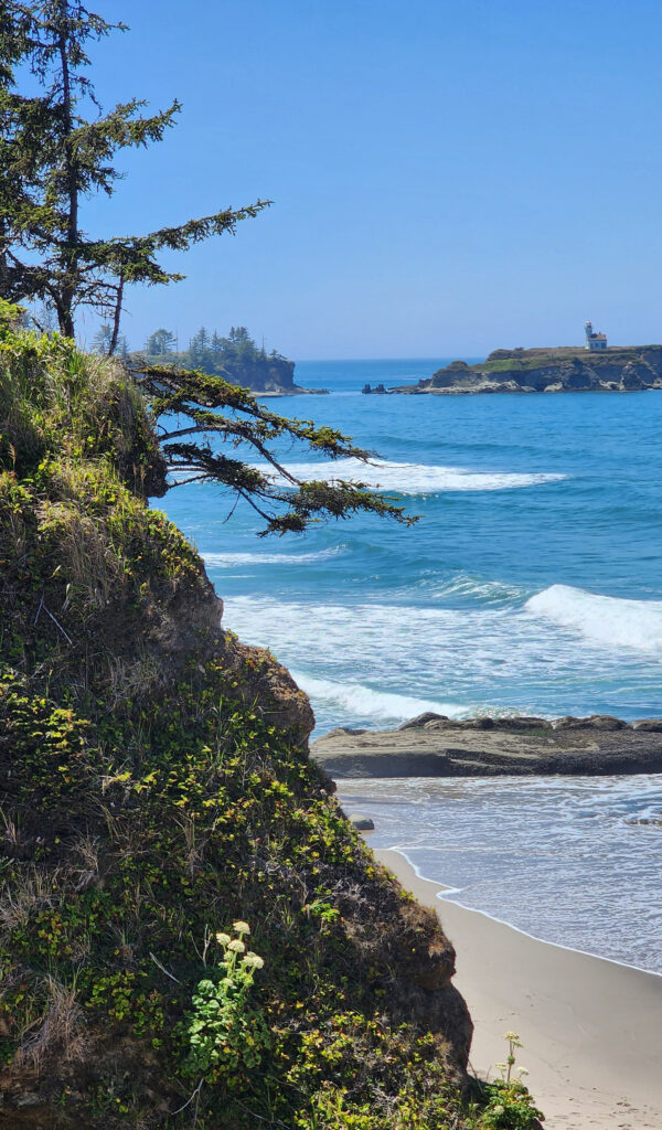
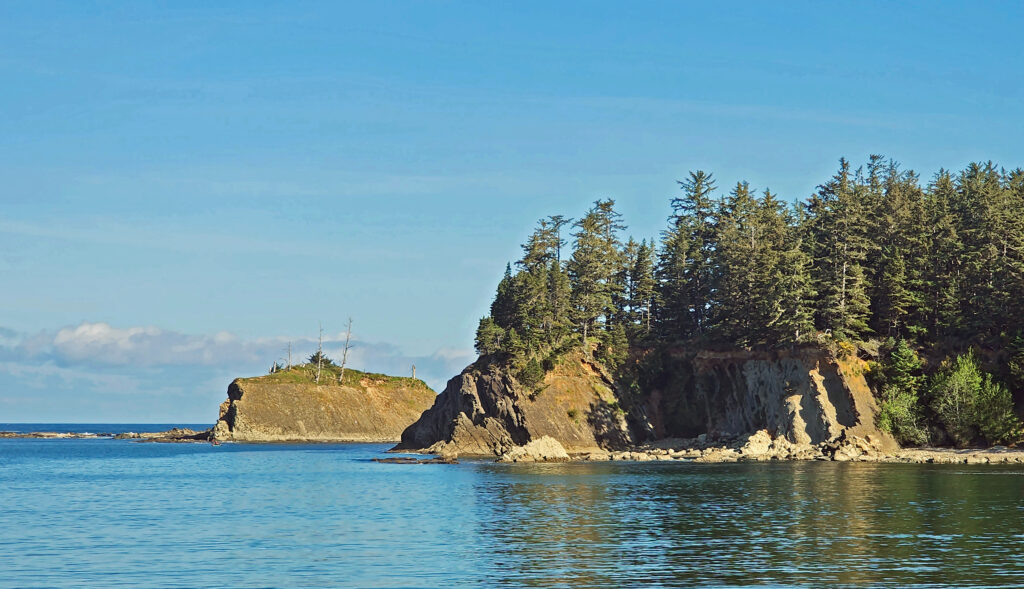
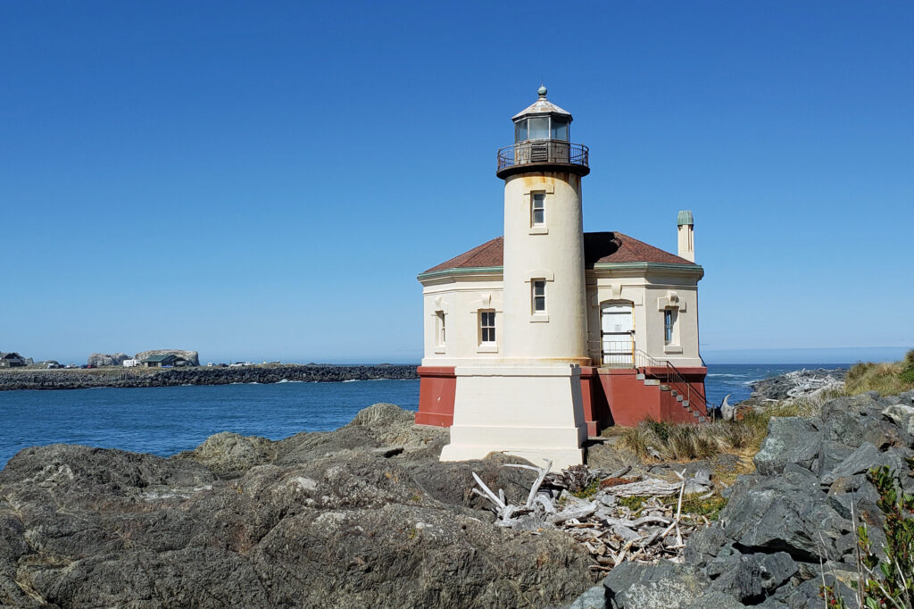
Cape Arago Lighthouse
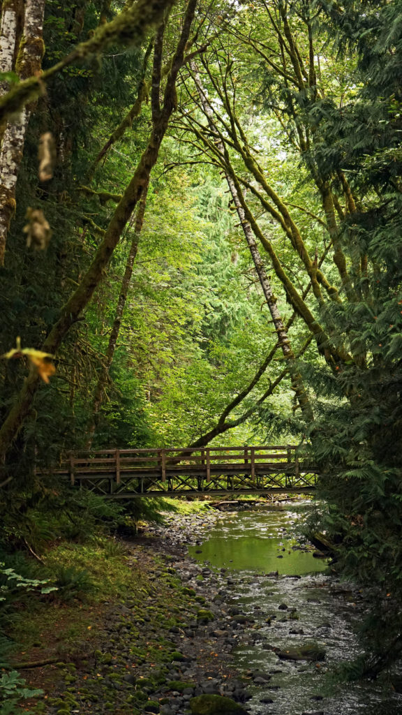
Cape Arago Lighthouse is located on Chiefs Island just off Gregory Point between Lighthouse Beach and Sunset Beach. The existing lighthouse structure is the third in a series of lighthouses on the island, dating back to 1866. The first was replaced by a taller structure with a better light in 1909. That was replaced by the current structure in 1934. In 1966 the light was automated and continued in service until 2006 when it was decommissioned.
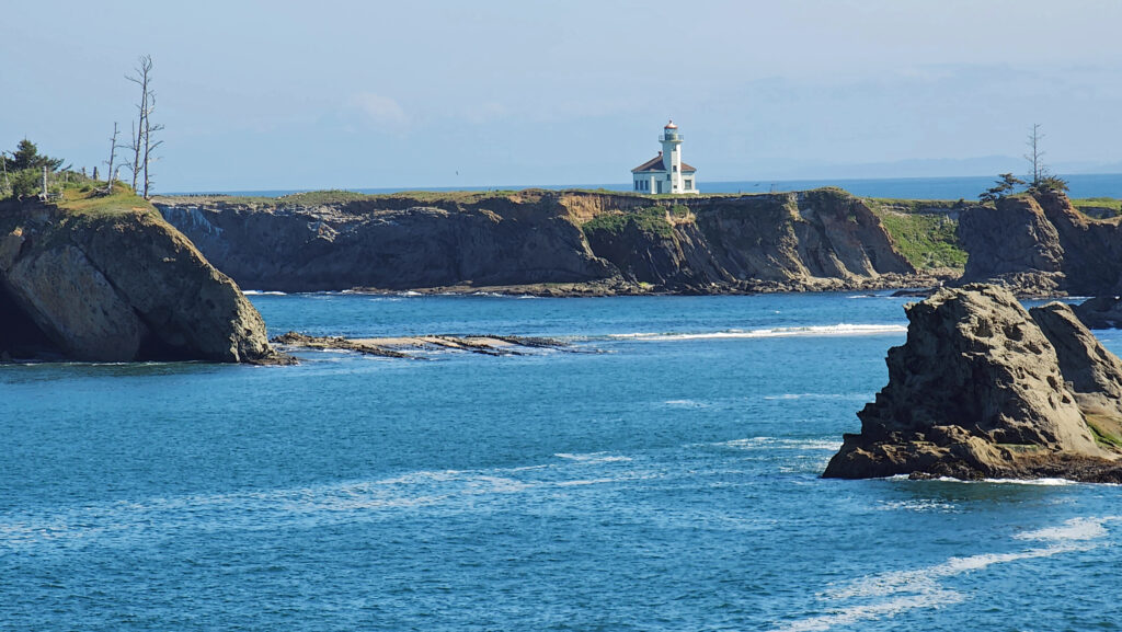
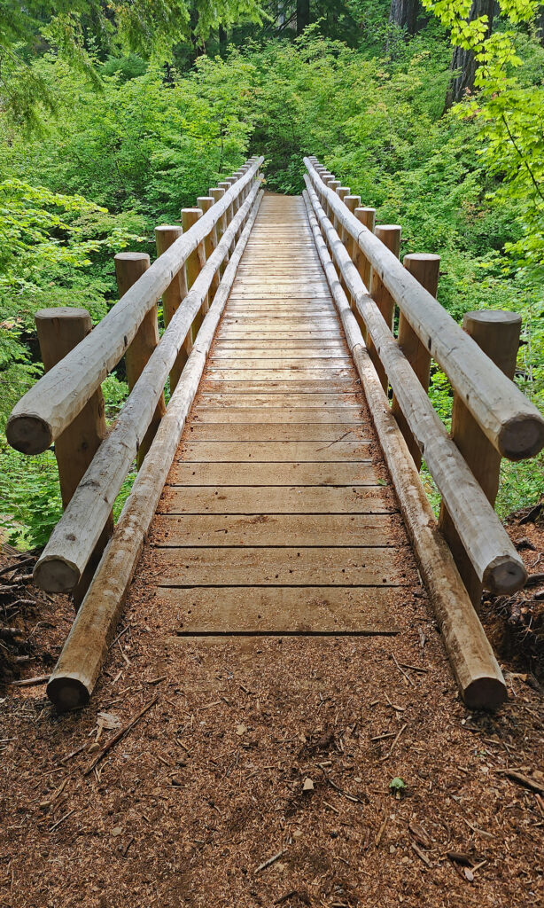
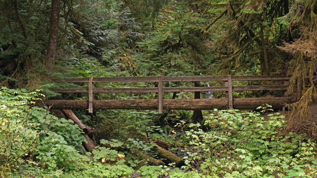
The lighthouse keeper’s residence was on the mainland, connected to Chiefs Island by a wooden bridge. The bridge stood until it was destroyed by storms in the winter of 2012-13. The first two lighthouse towers, other structures on the island, and the keeper’s house have all been demolished over the years. All that remains are the third tower and some of the piers that supported the bridge.
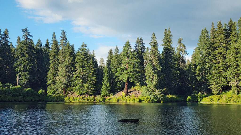
Sunset Bay State Park
A beautiful, crescent shaped beach at Sunset Bay State Park wraps around a shallow bay protected by a reef and flanked by rocky outcroppings. The inner bay makes for a safe swimming area and a boat ramp on the north end provides a good launching point for small boats, kayaks, and standup paddle boards.
My wife and I have kayaked out of Sunset Bay on numerous occasions over the years. On some of those days the calm waters of the bay belied rougher water offshore (large swells and/or significant wind chop) and we either stayed in the bay or close to it. But other times the ocean conditions were benign enough to allow us to safely get out into deep water and explore the surrounding coastline.
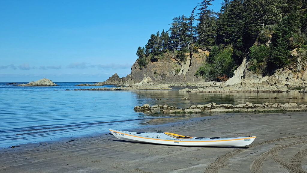
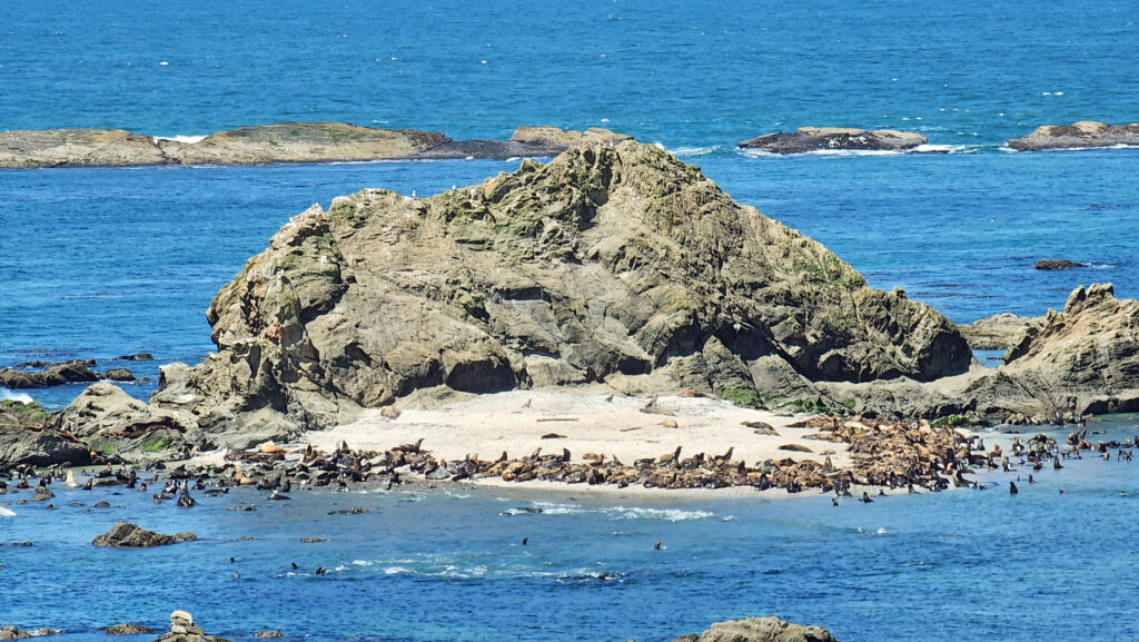
On one of those occasions, a sunny, windless day with a flat, glassy ocean, we spent most of a day paddling south to Simpson Reef to watch the sea lions, and then back north, where we circumnavigated Chiefs Island where the Cape Arago Lighthouse sits. And a lot of the time we just drifted on the amazingly flat ocean and soaked up the sunshine and the views of the shoreline. Quite a day.
Sunset Bay State Park offers not only one of the finest beaches on the Oregon coast, but also 65 campsites (30 RV sites with full hookups and 35 tent sites with electricity and water), eight yurts (three are pet friendly) and a group tent camp that will accommodate up to 25 people. Three of the campsites and three of the yurts are accessible to campers with disabilities. We have camped there many times and have always enjoyed our stay.
Shore Acres State Park
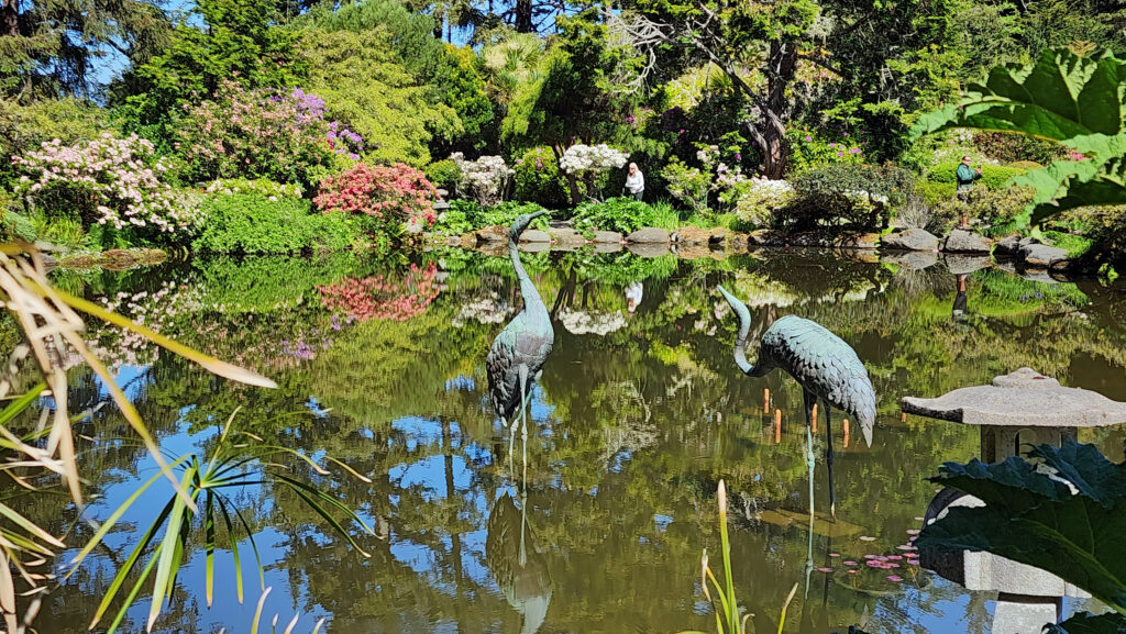
The park is named for Shore Acres (originally spelled Shoreacres), the estate of Louis Simpson, son of the 19th century shipping magnate, Asa Meade Simpson, who made a fortune shipping logs and lumber, first to California, and later to as far as Australia and Africa.
Louis Simpson’s first mansion at Shore Acres was completed in 1908, but burned down in 1921. It was replaced by an even larger mansion in 1927. But Simpson’s fortunes took a turn for the worse when demand for timber all but disappeared during the Great Depression. He went bankrupt in 1940 and his creditors sold the estate to the State of Oregon.
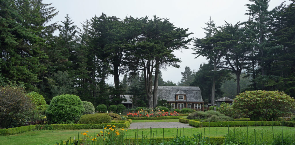
In 1942 Oregon loaned the estate to the U.S. Army for use as a radar installation. The Simpson mansion was used as a barracks and officer’s club. The mansion suffered from the harsh climate and lack of maintenance and was torn down in 1949. The only original structure remaining at Shore Acres is what was once the gardener’s cottage.
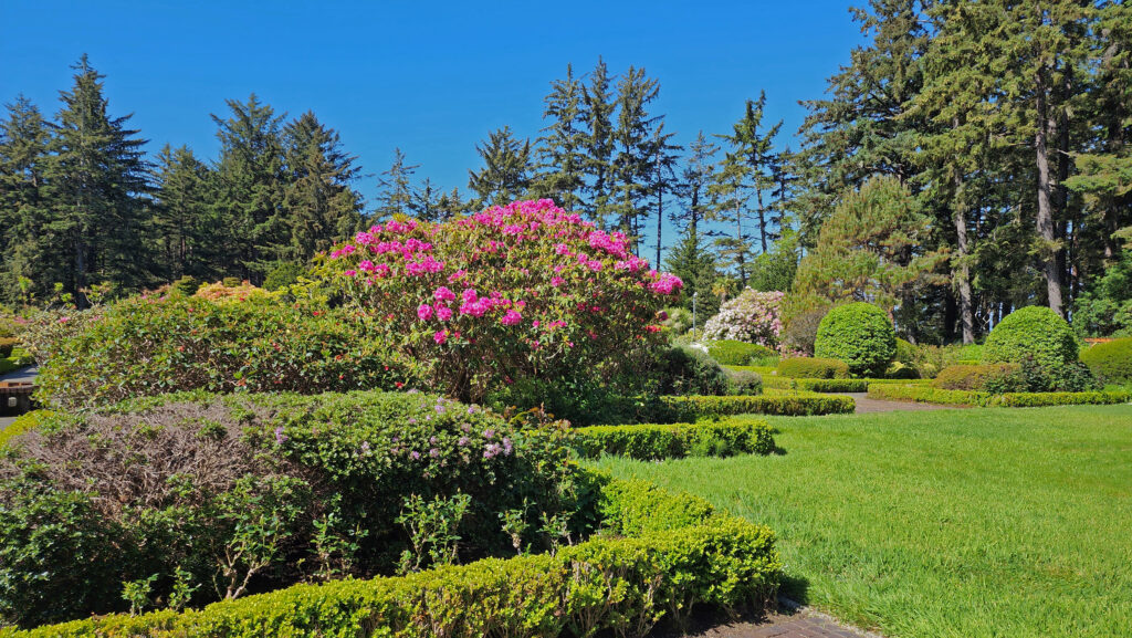
The estate’s formal gardens fell into disarray, but were restored in the 1970s. Covering five acres, the gardens now draw thousands of visitors each year. In December the gardens are lit up each evening with a spectacular Christmas lighting display using thousands of lights.
From the gardens, a short trail leads to Simpson Beach, once the Simpson’s private beach, similar to but smaller and less used than the one at Sunset Bay.
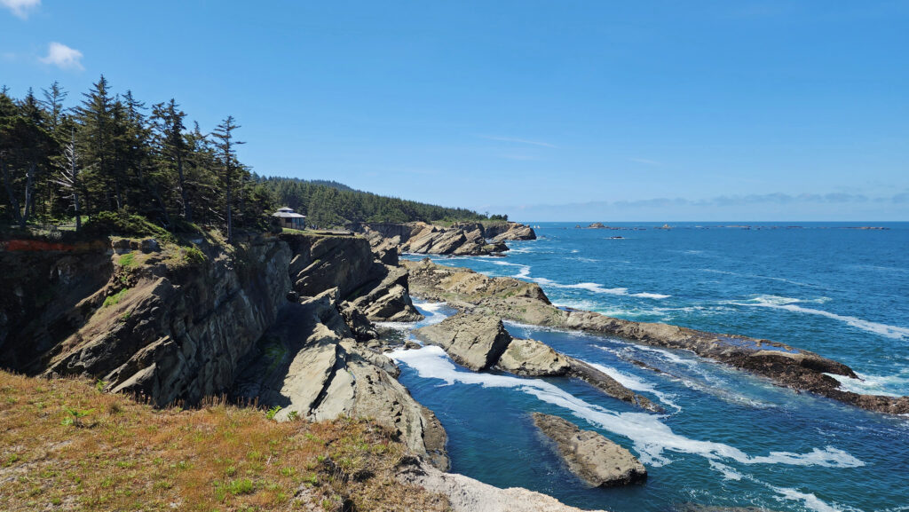
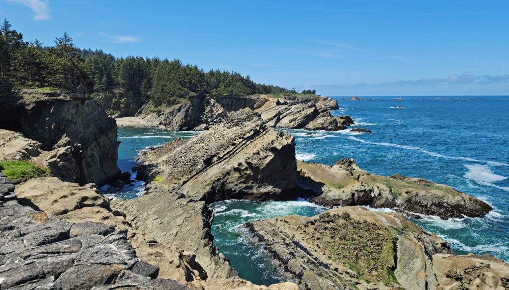
The shoreline at Shore Acres consists of eroded sandstone cliffs and ledges. Storm watchers come from all over to view the huge waves crashing into the rocks during winter storms. Even in summer, the shoreline is fascinating and people clammer over the rocks to sightsee and birdwatch. In December and again in late spring Shore Acres is a prime spot for whale watching.
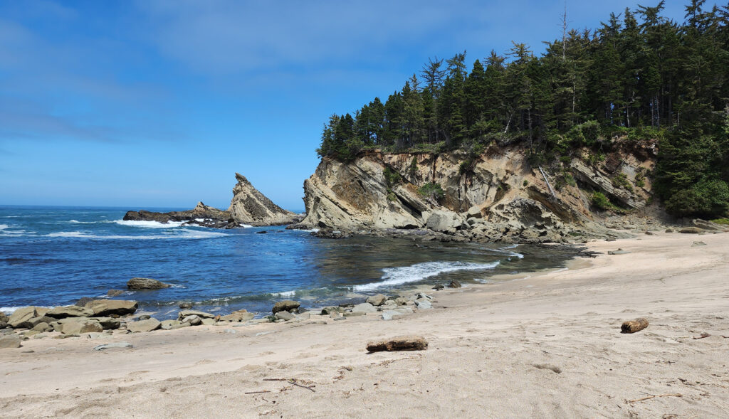
Cape Arago State Park
Like Shore Acres, what is now Cape Arago State Park was once part of Louis Simpson’s estate. He donated the land to the State of Oregon in 1932. Located at the end of the Cape Arago Highway, the park has a covered picnic shelter, picnic tables, and restrooms, although the restrooms are currently (as of the summer of 2025) closed. There are also trails to South Cove, where there is a sandy beach, and to North Cove with its rocky shoreline.
Other local attractions
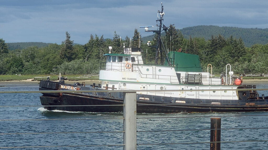
The town of Charleston is located on Coos Bay about a mile east of Bastendorff Beach. It’s home to a large commercial fishing fleet and has a number of sport fishing charter operations. It’s also the gateway to South Slough, one of the best kayaking and canoeing spots on the Oregon coast. And it’s a good place to stop for a bite to eat or get a cold beer after your Cape Arago adventures. Try Miller’s at the Cove Sports Bar and Grill for surprisingly good food and a good selection of cold beers on tap.
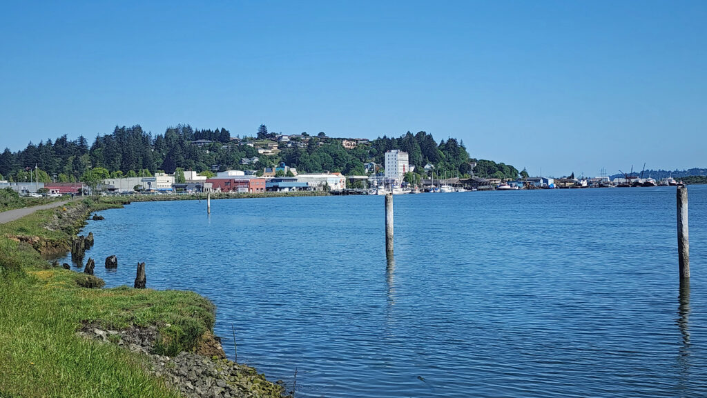
The Cape Arago area is remote enough that it’s not really a day trip destination from any population center, so it’s best to make a weekend of it or stay longer. Fortunately, the Coos Bay-North Bend area is large enough to have many hotels, motels, BNBs, and restaurants. Take a day (or more) to explore Cape Arago, but leave some time to also explore the two cities. There’s a casino if you enjoy gambling. There’s also a good art gallery or two, interesting antique shops, nice parks and museums, and a trail along the bayfront. I’ll cover Coos Bay and North Bend in more detail in a future post.
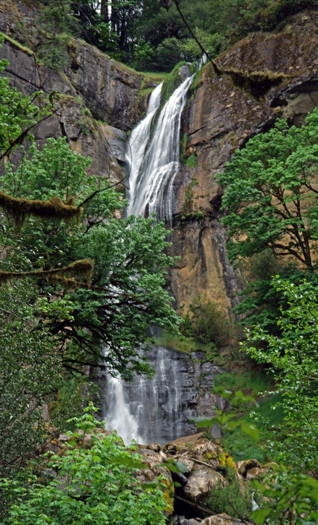
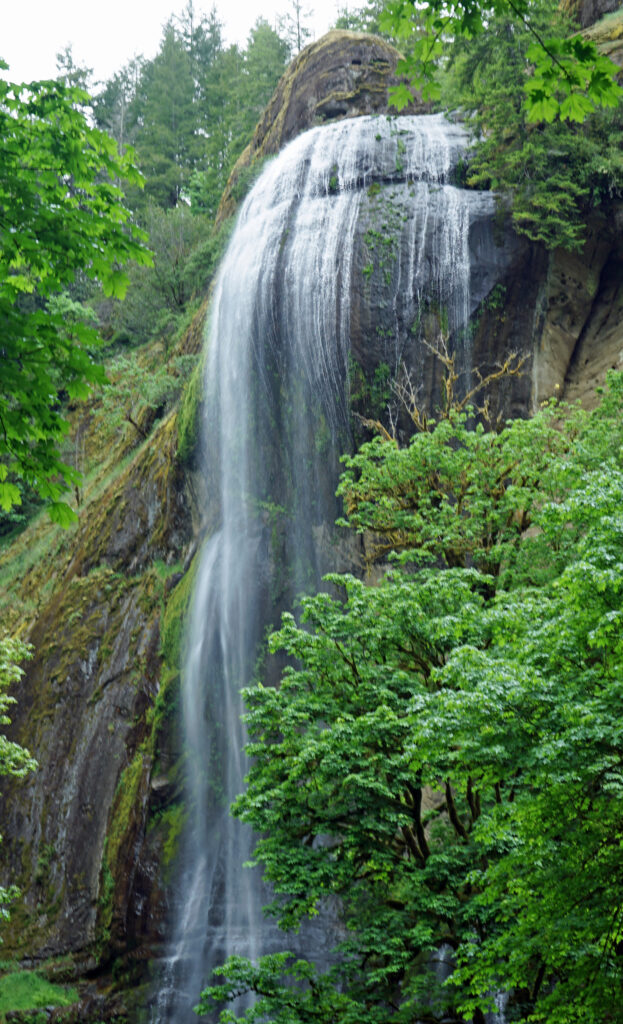
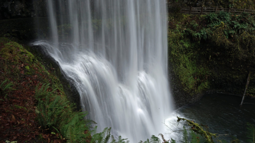
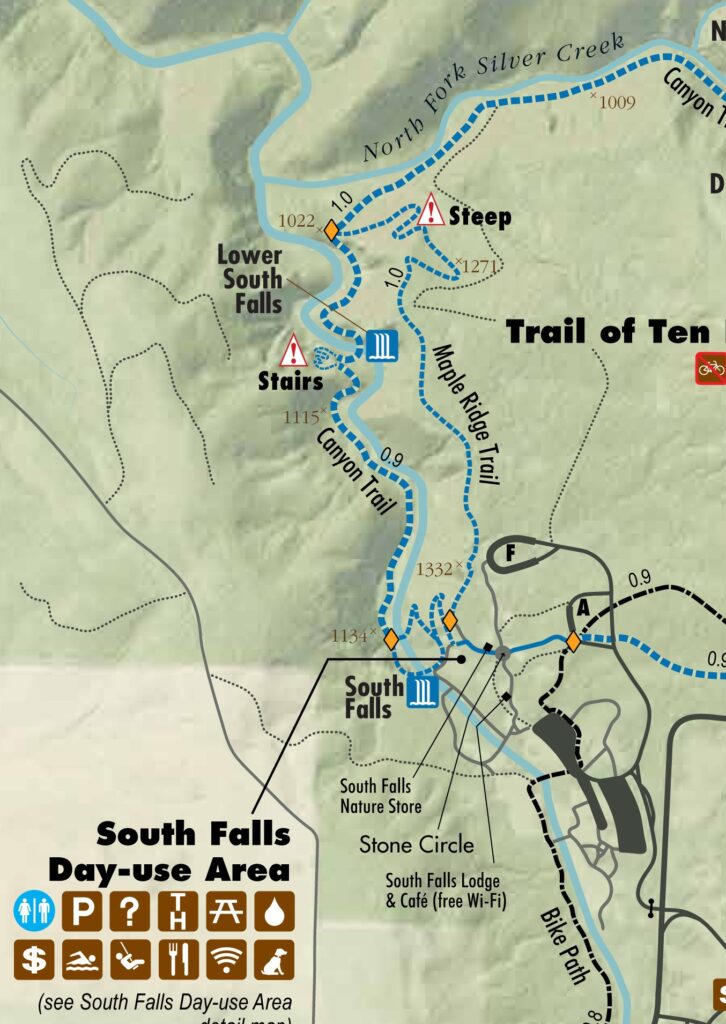
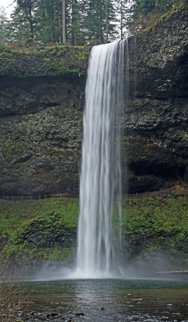
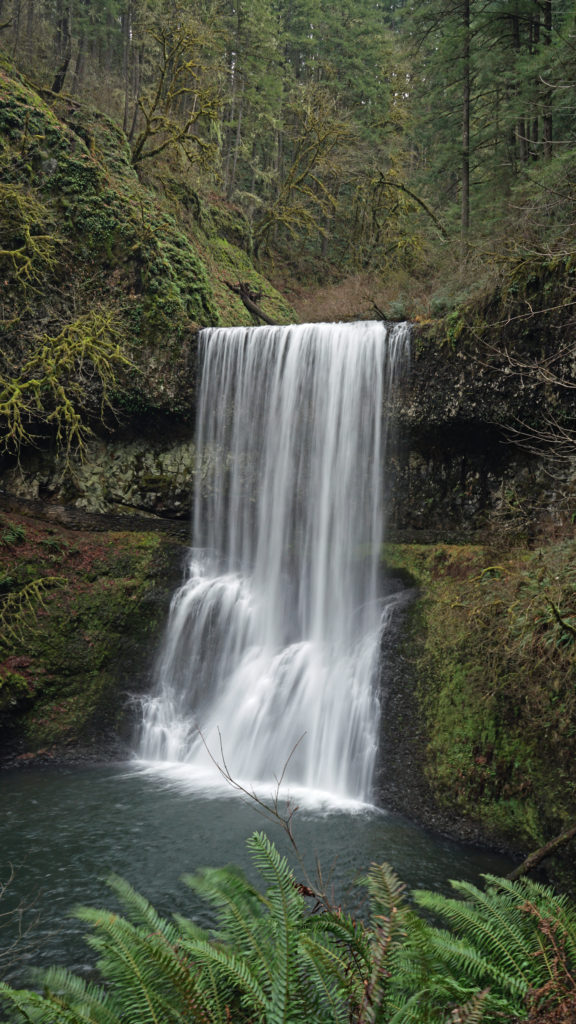
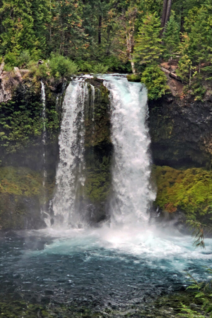
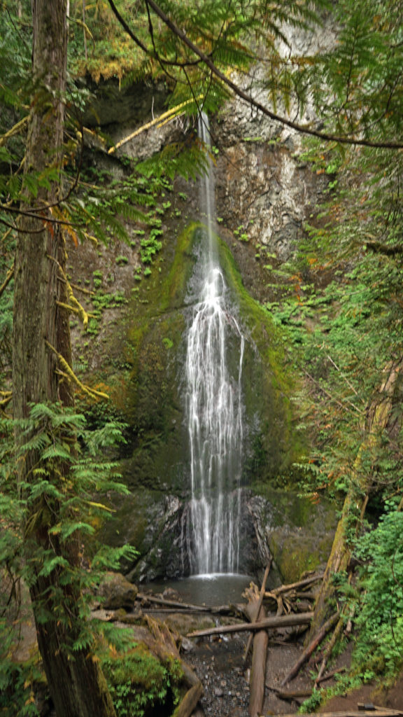
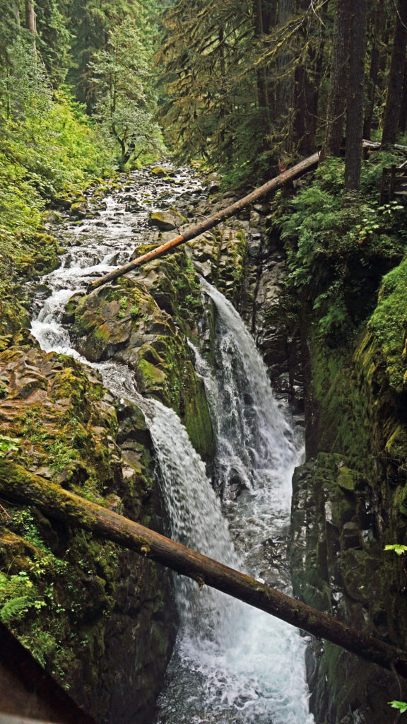
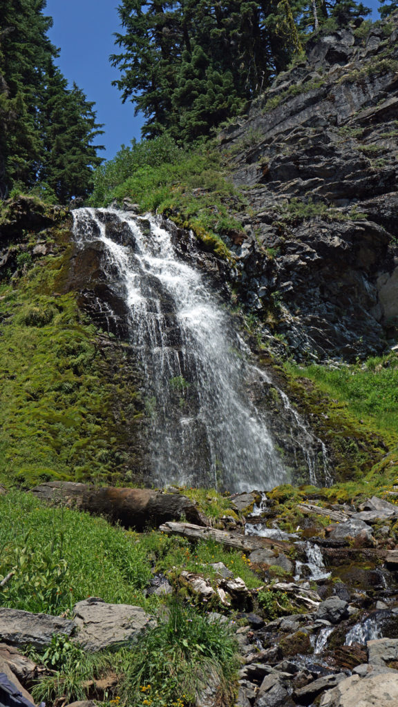
About twenty-five miles east of Coos Bay, Golden and Silver Falls State Natural Area (not to be confused with Silver Falls State Park near Salem) boasts two large and scenic waterfalls, both more than 200 feet high, and three hiking trails that take you to the base of each falls and to the top of Golden Falls.
The town of Bandon, about 15 miles south of Coos Bay, is located at the mouth of the Coquille River. The Old Town section offers a variety of interesting shops, an art gallery well worth visiting (Second Street Gallery), several popular seafood spots (try Tony’s Crab Shack), and numerous restaurants, coffee shops, pubs, and a good bakery (Bandon Baking Company and Deli). A little east of Old Town on Hwy 101, Face Rock Creamery offers a wide variety of cheeses and has an extensive (and free) tasting area where you can sample most of them.
Across the bay from Old Town, the historic Coquille River Lighthouse in Bullards Beach State Park is open to the public and worth a visit.
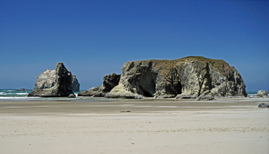
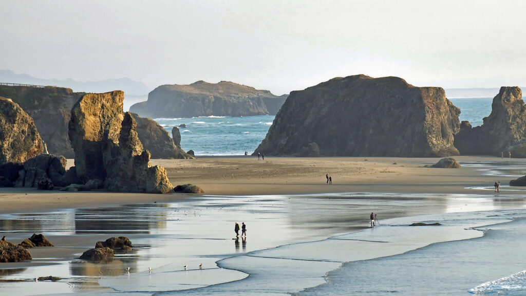
South of Old Town you’ll find one of the most scenic shorelines anywhere on the Pacific Coast, with many offshore islands and sea stacks, and miles of sandy beach.
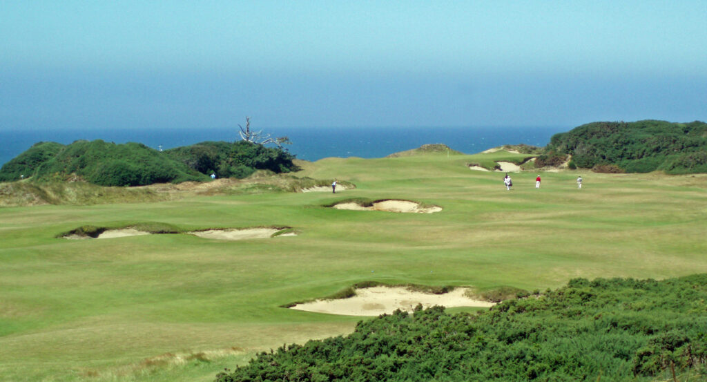
And Bandon Dunes Golf Resort, just north of the town of Bandon, offers five world class eighteen hole courses, a 13-hole par three course, a large driving range and practice facility, and lodging and restaurants. This is truly one of the greatest golf destinations in the world. And there are other golf courses in the area. Bandon Crossings, south of Bandon, is a scenic and challenging eighteen hole layout that is significantly less expensive than Bandon Dunes. And Sunset Bay Golf Course, located next to Sunset Bay State Park, is an interesting 12 hole, par 47 course.
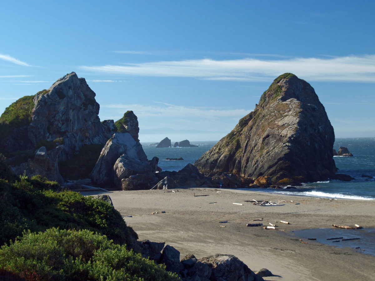
Beyond Bandon, the southern Oregon coast, from Bandon to the California border, is spectacularly beautiful and ranks, along with the Olympic Peninsula in Washington, the northern California coast, and Big Sur, as one of the must see sections of the entire Pacific coast.
Conclusion
Cape Arago and the surrounding area has so much to offer visitors that almost everyone will find something there that will make them want to come back. My wife and I visit the area often. Almost every year we spend at least a weekend revisiting our favorite spots. And I’m sure we will continue to do so in the future.
Posted August 2, 2025
All photos © Alan K. Lee
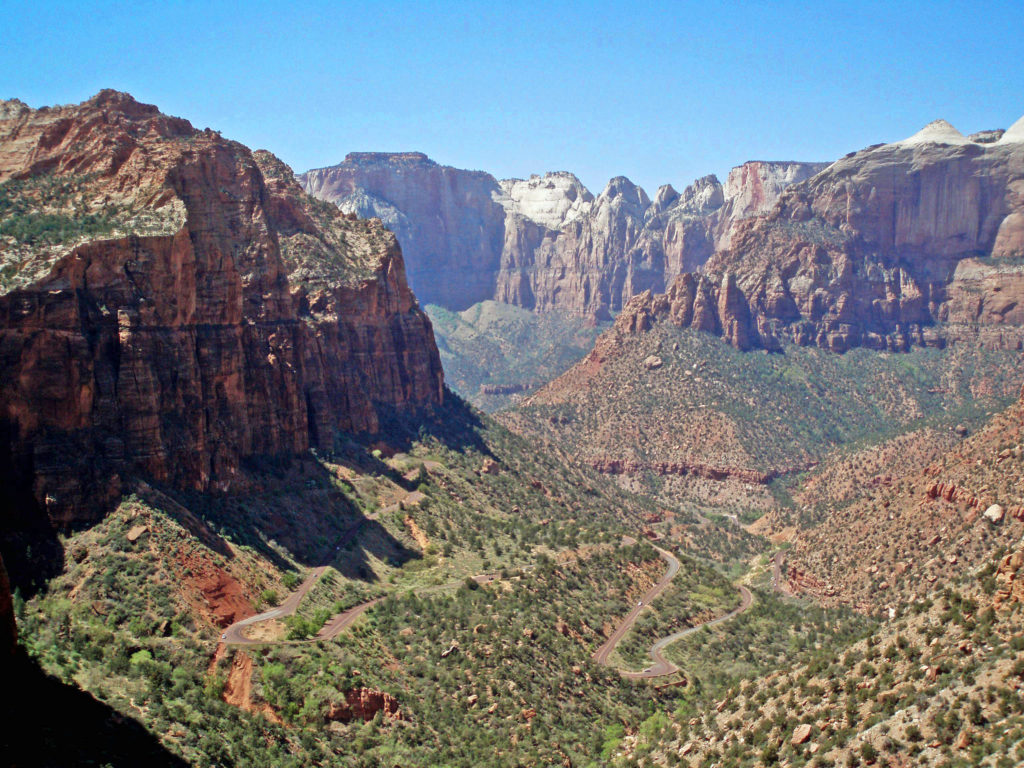
 Bicycling is permitted on all park roadways and on the Pa’rus Trail. All other park trails, off-trail routes, and the Zion-Mount Carmel Tunnel are closed to bikes. There are a number of places in Springdale where you can rent bikes and there are also numerous companies offering bicycle tours of Zion. Biking the canyon is a good alternative to riding the shuttle. From the Zion Canyon Visitor Center to the Temple of Sinawava at the end of the Zion Canyon Scenic Drive is about eight miles, with a few moderate hills along the way.
 If you drive an electric vehicle, two charging stations are located within Zion National Park, one at the Zion Canyon Visitor Center and the other at the Kolob Canyons Visitor Center in the north end of the park. You can purchase a $5 pass code at the Zion Canyon Visitor Center that is valid for three days at either of the park’s charging stations. In Springdale, there are three Tesla charging stations (as well as others in nearby communities). Electrify America stations are located in St. George and Cedar City. ChargePoint and SemaConnect stations can be found in St. George.
 If you’re camping, Zion Canyon Campground in Springdale has 133 RV sites and 47 tent sites. Zion River Resort in nearby Virgin, Utah also has RV sites and cabins. There are two campgrounds within the national park near Springdale, South Campground and Watchman Campground. South Campground has 117 sites, but no hookups. Watchman has about 120 RV sites with full hookups and about 70 tent sites. South and Watchman both require advance reservations, except in winter. The small Lava Point Campground in the north end of the park is first come, first served, but has only six primitive sites. Check the park website for more detailed information. Reservations for the South and Watchman campgrounds can be made through
 Where to Eat
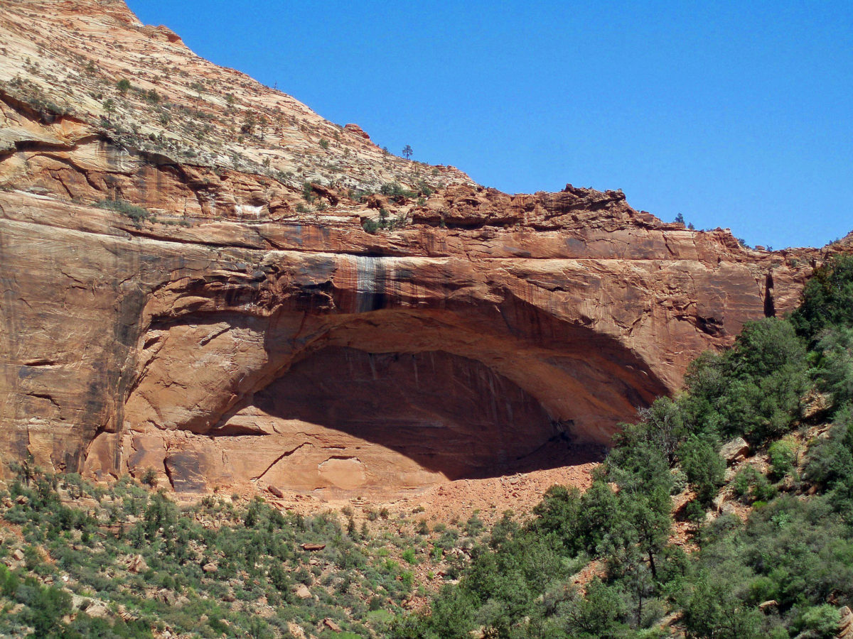
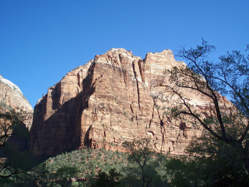
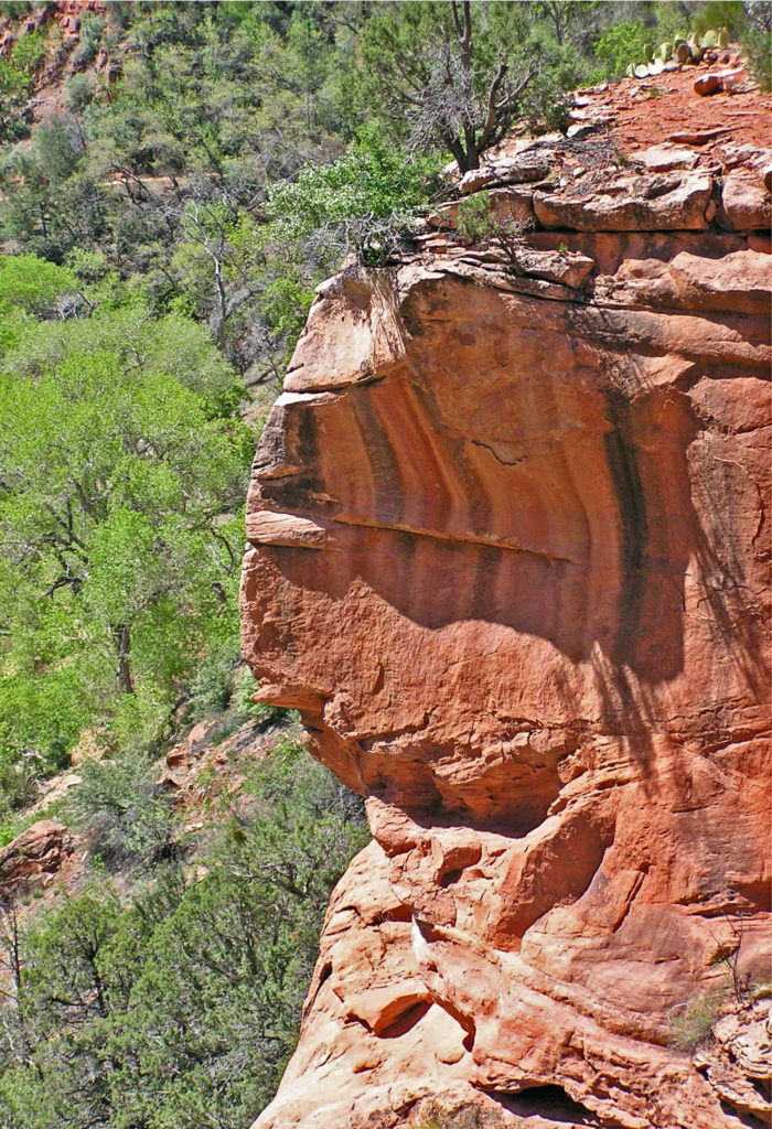
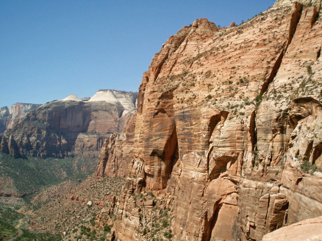 One of the most spectacular hikes in the canyon is The Narrows. There is no trail through The Narrows – you’re hiking the bed of the Virgin River through a narrow canyon no more than 40 feet wide in places. If you’re interested in hiking The Narrows, be sure to check with the park rangers at the Zion Canyon Visitor Center. No permit is required, but The Narrows may be closed to hiking due to the possibility of flash floods. Thunderstorms many miles north of the park may lead to sudden and potentially life threatening rises in the river level with no warning, even when the park is sunny and cloudless. But if it’s doable safely, it’s a fantastic and unique hiking experience.
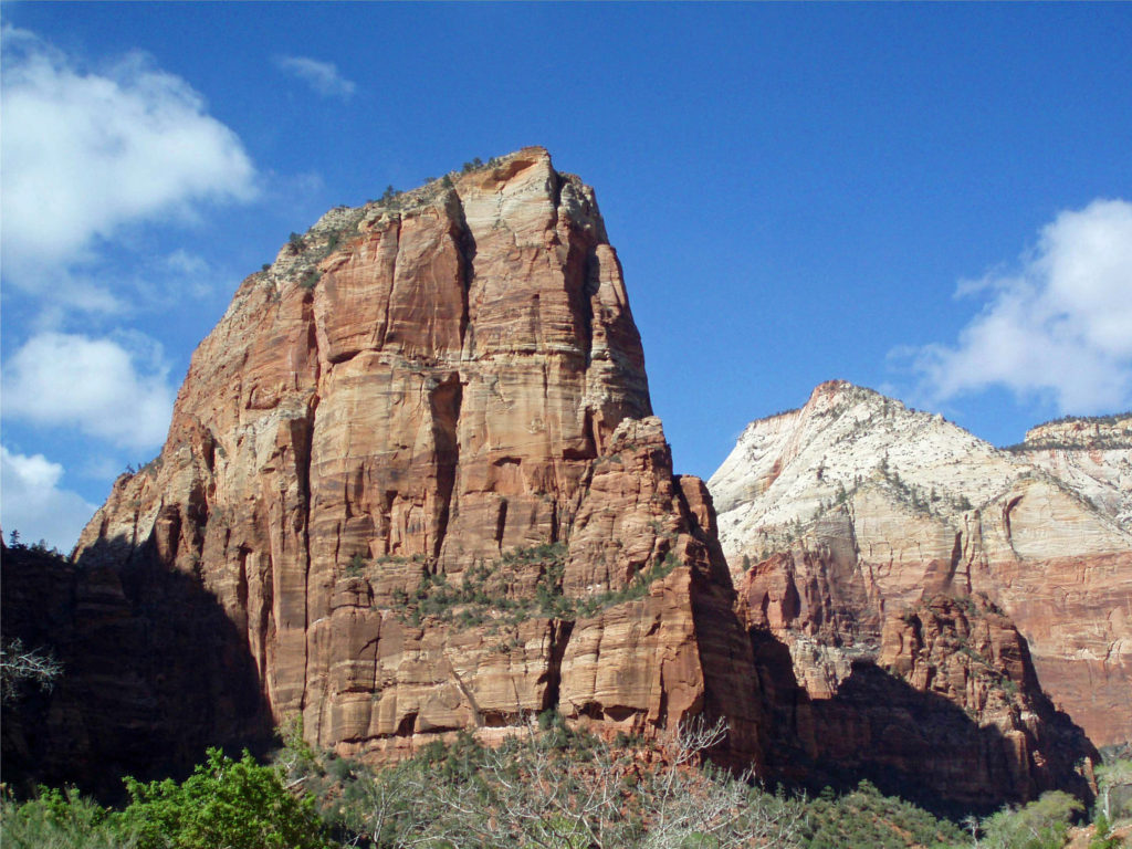 Trails outside of Zion Canyon (and all canyoneering routes) require a wilderness pass. Most are available online through the park’s website, but permits for some trails are only available in person.
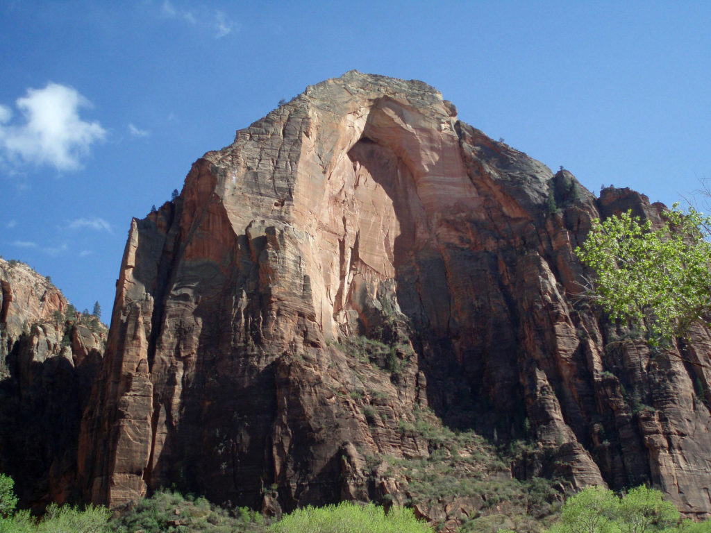
 One hour and three hour horseback rides within the park can be booked through
 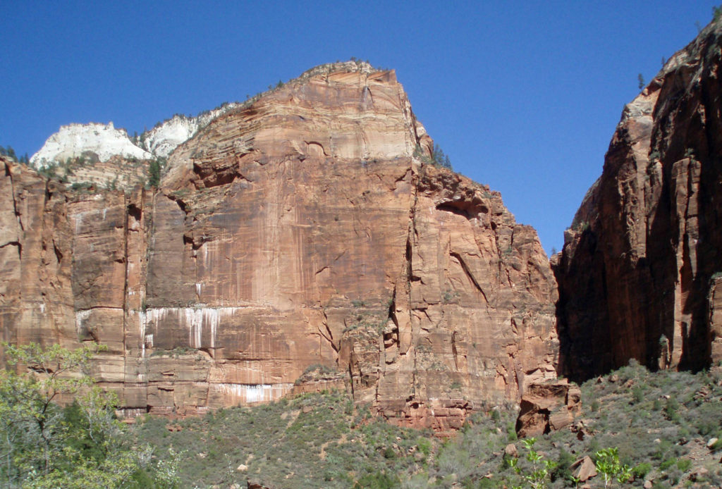 Off road vehicle tours are also available from a variety of providers. Like mountain bike tours, these are outside of the park. Again, I have no personal experience, so can’t make any recommendations, but the tours are popular.
 I can pretty much guarantee that no matter who you are or where your interests lie, a trip to Zion National Park will be an adventure you will not soon forget.
 Originally posted June 14, 2021 by Alan K. Lee. Updated and re-posted March 15, 2024.


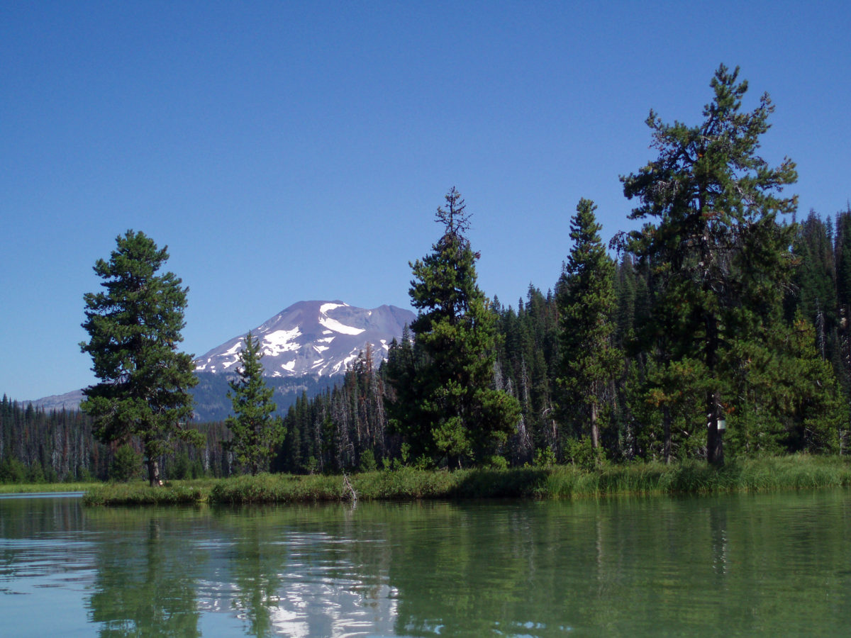
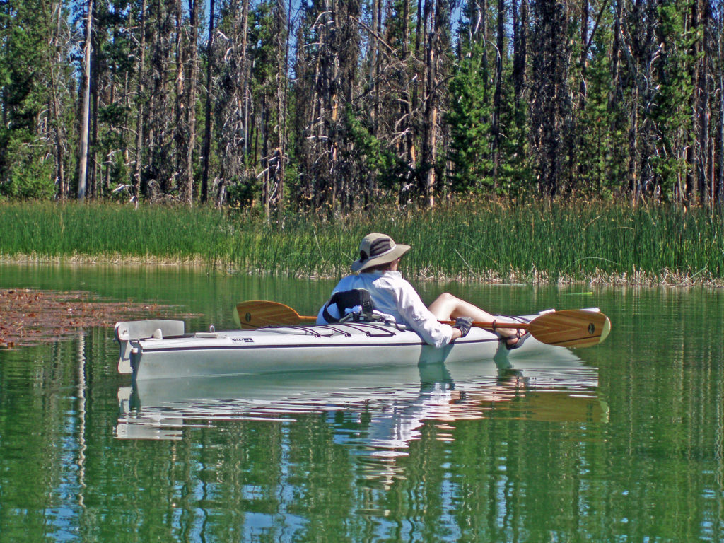
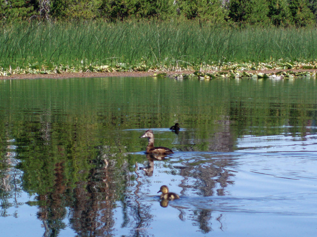
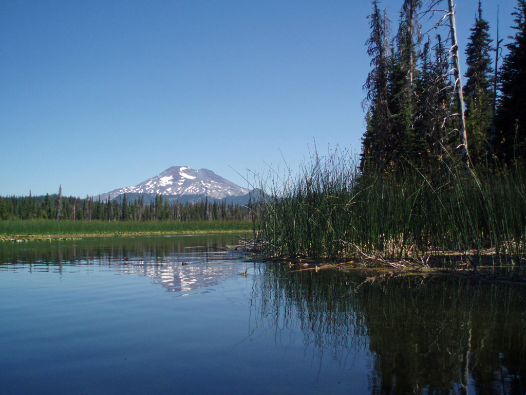
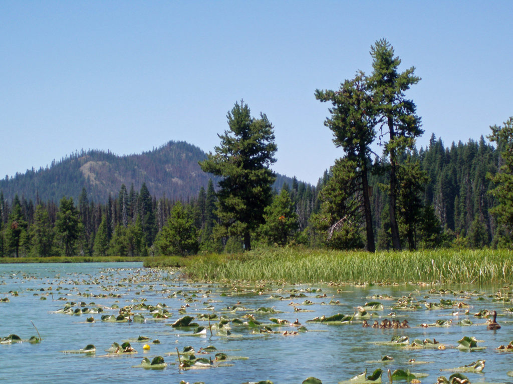
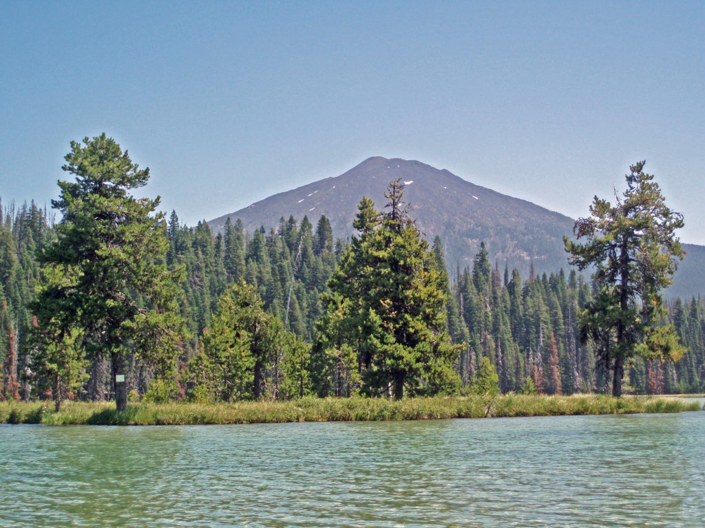 Hosmer Lake is a mix of open water and reeds, rushes, water lilies, and other marsh plants. Motorized craft (except for electric motor powered) are not allowed on the lake, which makes it ideal for kayaking or canoeing. It’s also not a big lake at 160 acres, so you can easily explore it all in an afternoon.
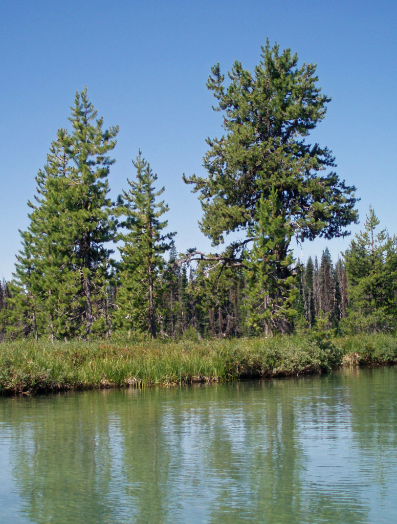
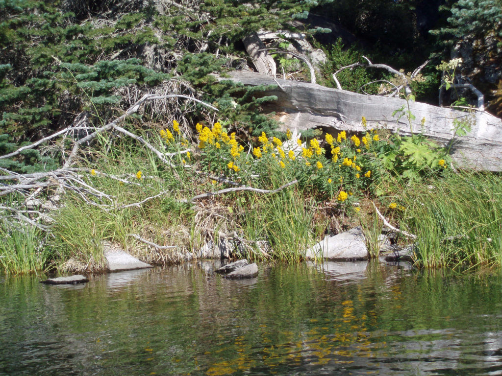
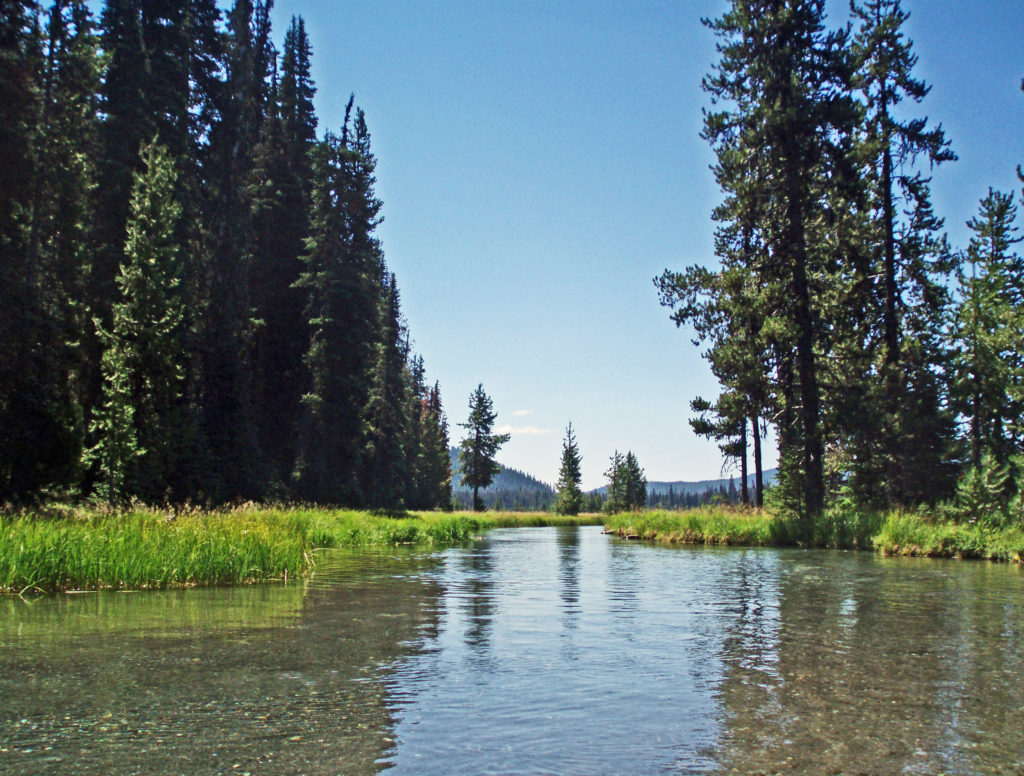 Hosmer Lake is fed by Quinn Creek, which flows into the north end of the lake. Quinn Creek is narrow and shallow, but it is possible to paddle up it for a ways. When we were there last, downed trees blocked our passage a few hundred yards from the mouth of the creek. We hauled our kayaks out of the water at that point and hiked along the creek to a small waterfall where we ate lunch and lingered awhile before heading back out on the water.
 Recalling our visits to Hosmer Lake, I’m eager now to get back to the area and get back on the water again. It’s a beautiful place, and one of my favorite destinations.
  Hosmer Lake is located in the Deschutes National Forest. Check the Forest Service
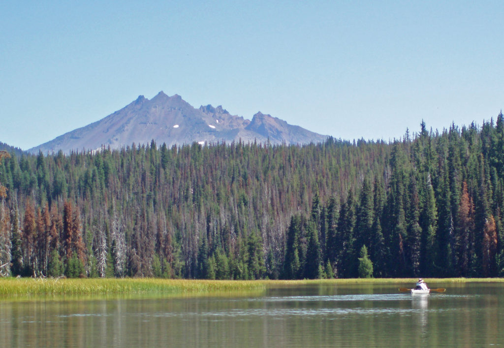

 From the Great Spring the trail follows the east shore through the lava fields and forest. Parts of the trail are pretty rough. Good quality hiking boots are advised, although I did this hike in sneakers on my latest visit. But open toed sandals or flip flops are definitely not acceptable footwear on this section of the trail.
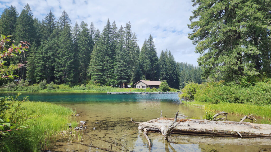


 The nearby
 After our hike to Sol Duc Falls we drove to the Hurricane Ridge Visitor Center to do some more hiking and sightseeing. The visitor center is located 17 miles south of Port Angeles at an elevation of 5242 feet above sea level. Hurricane Ridge is the only alpine area in Olympic National Park accessible by car, which makes it very popular and means it can be very crowded, especially on summer weekends. We were there in the middle of the week in late September, though, so crowds weren’t much of an issue.
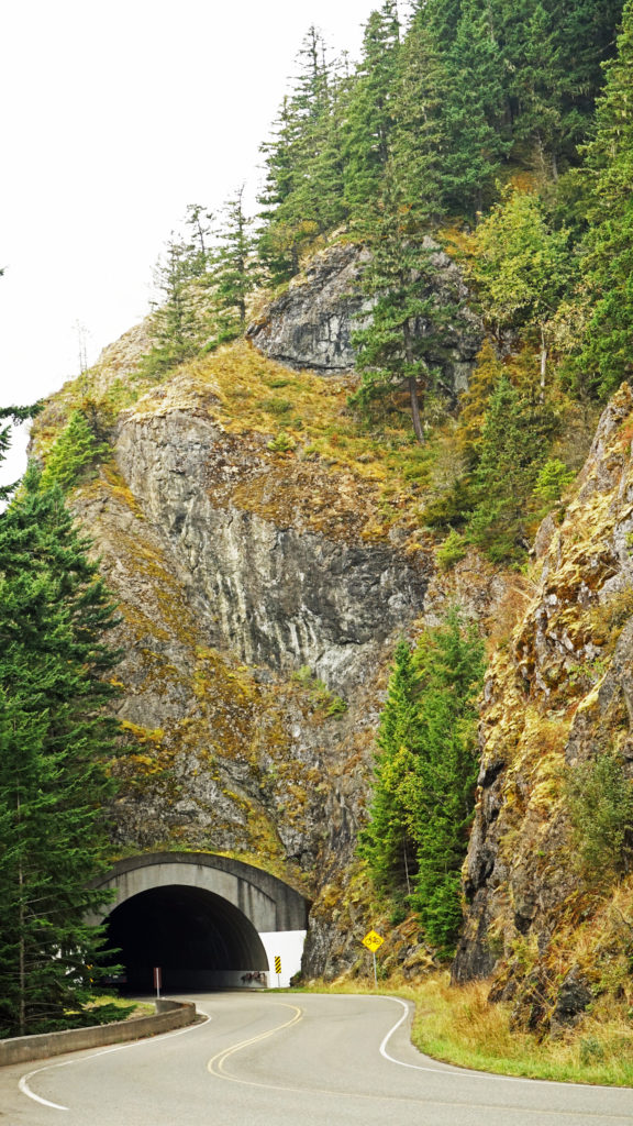 The Hurricane Ridge Road is paved, but winding with poor sight lines and several tunnels. It is also a popular challenge for cyclists because of the elevation gain, so go slow and watch for bicycles on the road.
 Originally posted November 7, 2020. Updated and re-posted November 9, 2022.
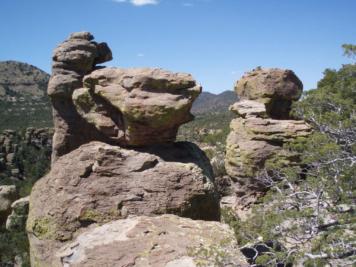

 Originally posted April 28, 2020. Edited, updated, and re-posted February 5, 2022
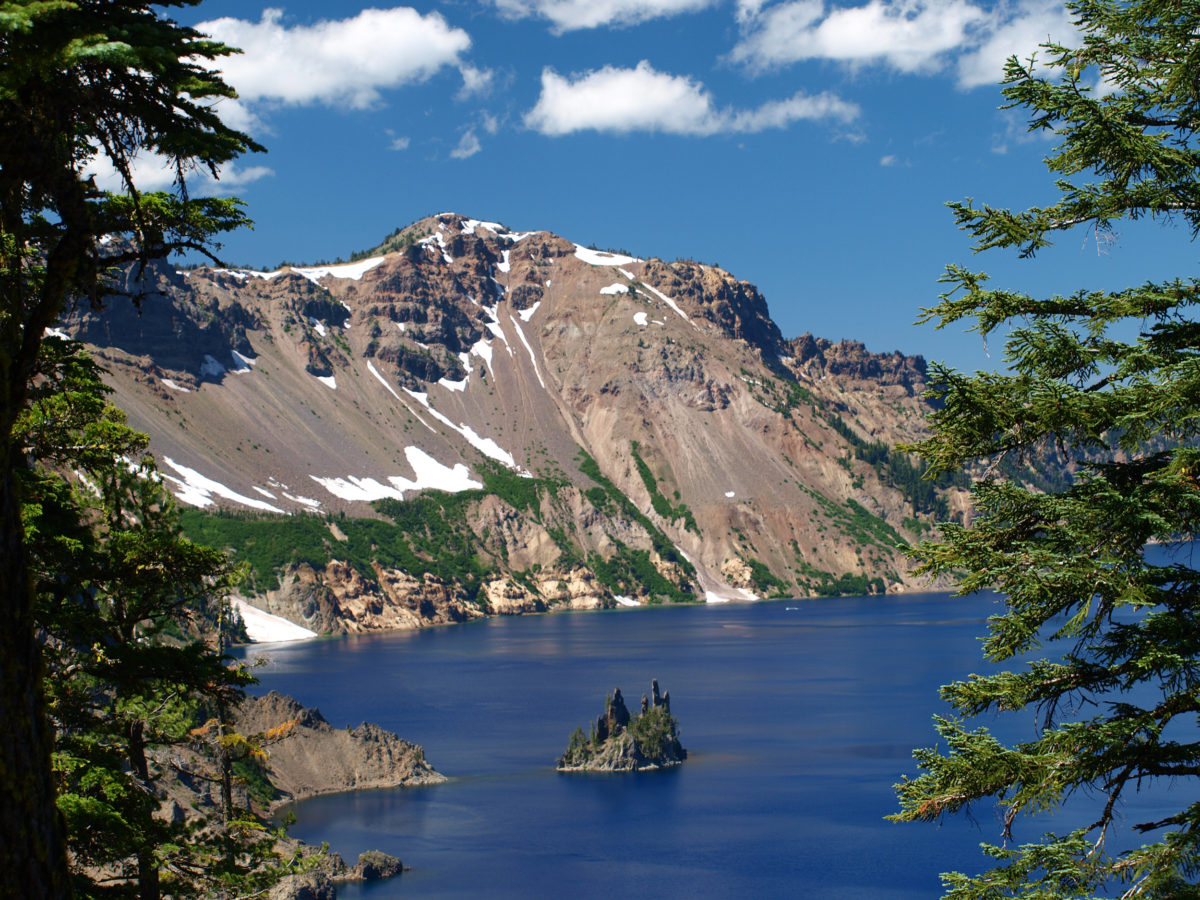
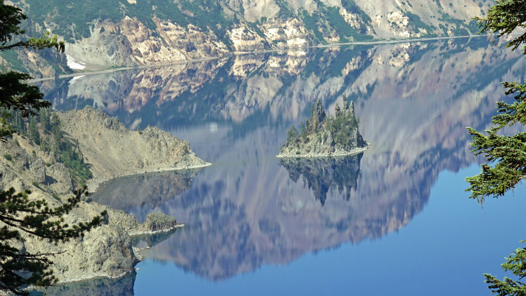
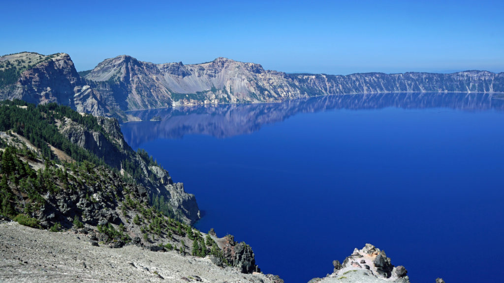 The Lake
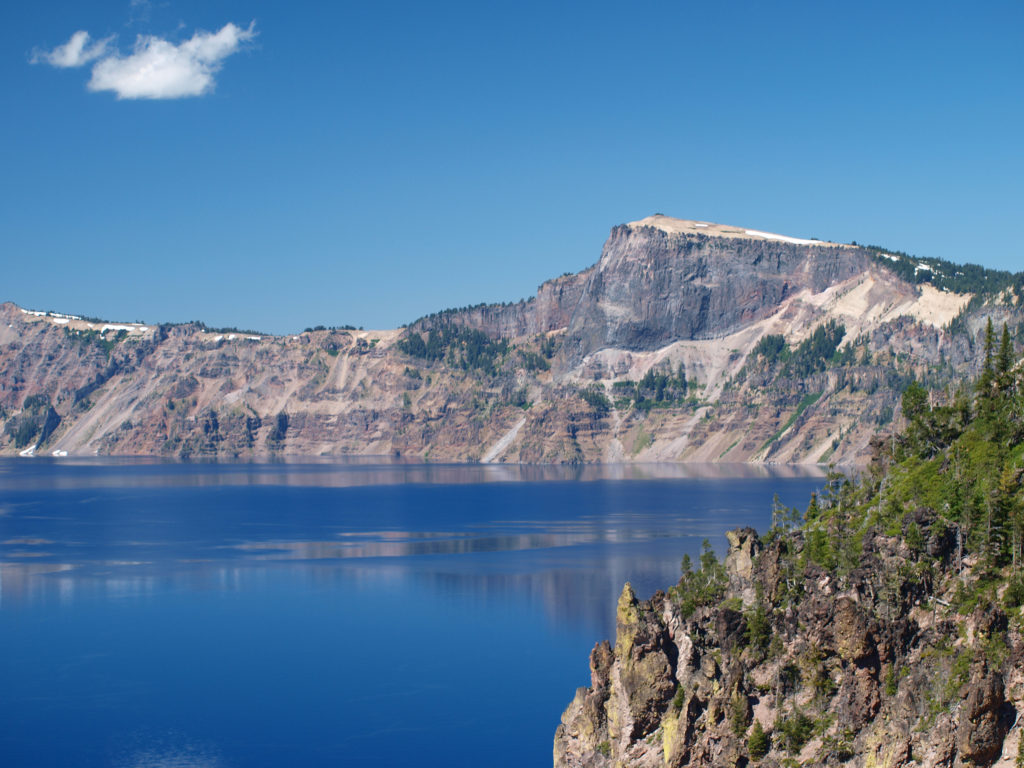 Crater Lake is 1943 feet deep, making it the deepest lake in the United States, second deepest in North America, and ninth deepest in the world. It is also one of the cleanest and clearest lakes in the world. It’s that combination of depth and clarity that results in its intense deep blue color.
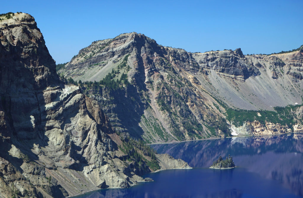 The caldera that Crater Lake occupies was formed 7700 years ago when the summit of 12,000 foot tall Mount Mazama collapsed after a massive eruption. Over time rain and snow filled the caldera to its present level. The lake has no outlet. The level of the lake remains nearly the same because the amount of evaporation from the surface of the lake closely matches the amount of precipitation falling on it in any given year.
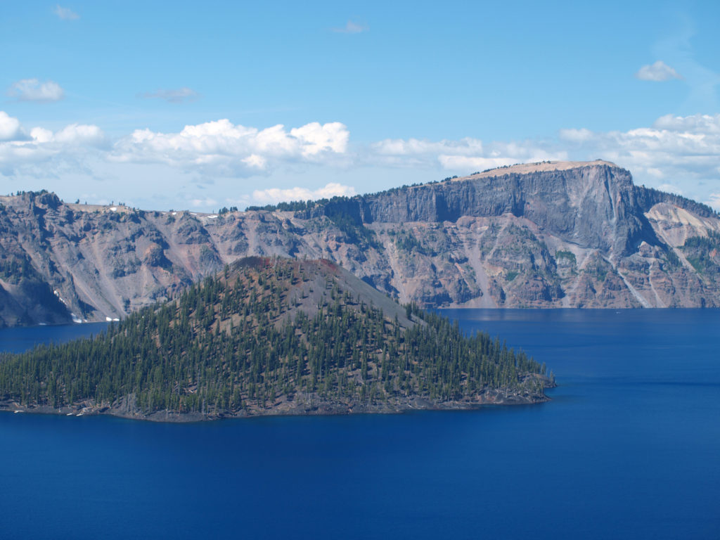 Wizard Island formed sometime after the eruption that formed the caldera. It rises 770 feet above the surface of the lake, 2713 feet above the deepest point in the lake. It last erupted about 5000 years ago, but it is considered dormant, not extinct. Conceivably, it could erupt again at any time. Merriam Cone also erupted after the caldera was formed, but never reached the lake surface. Its summit lies almost 500 feet below the average lake level.
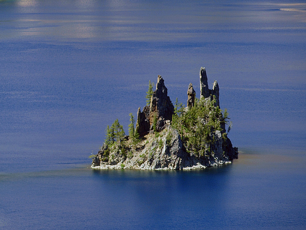 Phantom Ship, a remnant of an eruption 400,000 ago, rises 170 feet above the lake surface. Its formation predates that of Mount Mazama itself.
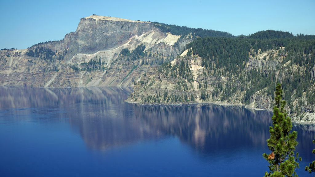 The Park
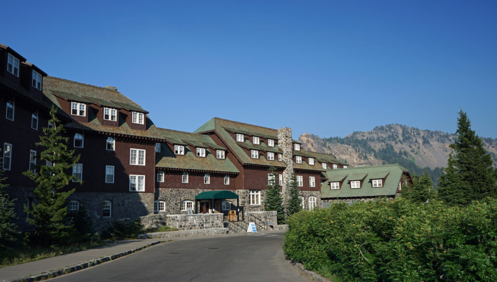 Crater Lake Lodge
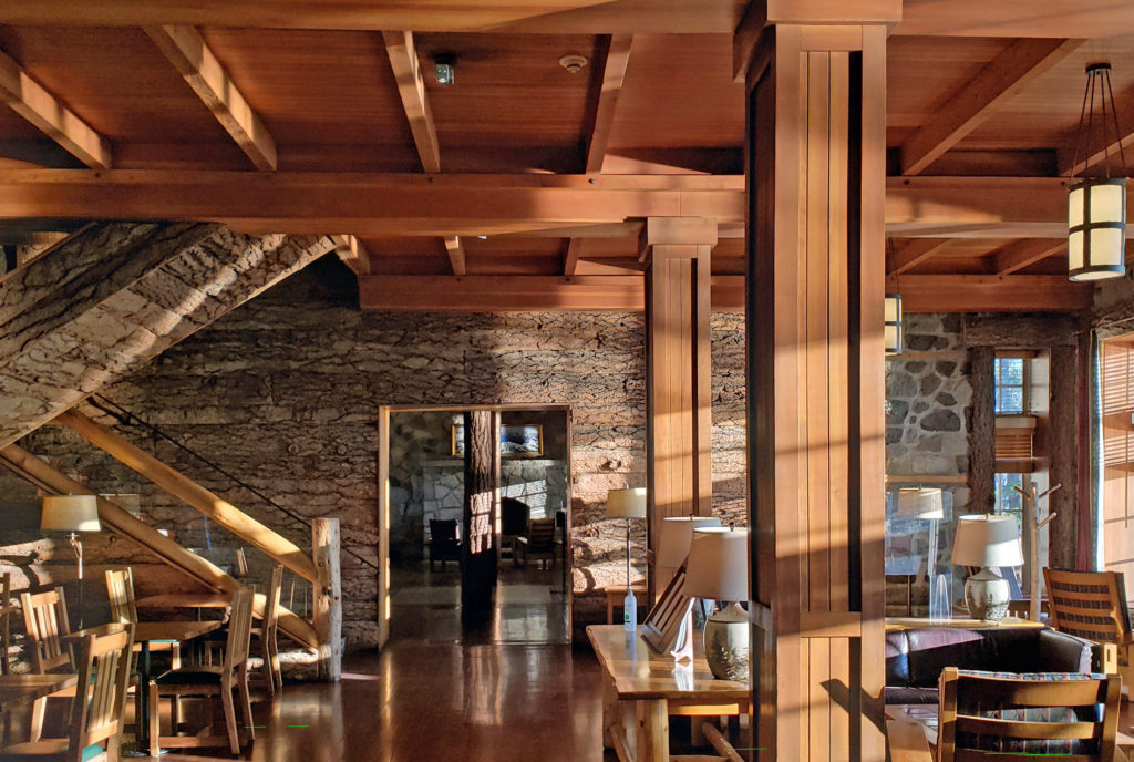 My wife and I recently spent three nights at the lodge. Although it lacks the amenities of a luxury hotel, our room was comfortable, with a private bathroom, and the location more than makes up any lack of luxuries.
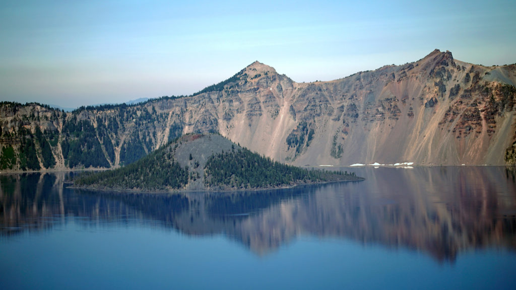 The Rim Drive
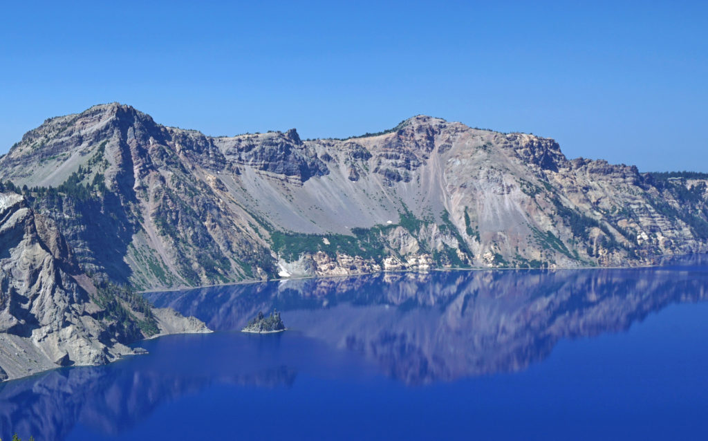 You’ll want to stop at all of the viewpoints. Maybe combine the drive with a hike down to Cleetwood Cove and a boat tour of the lake. You can get off at Wizard Island and hike to the summit and then catch a later boat back.
 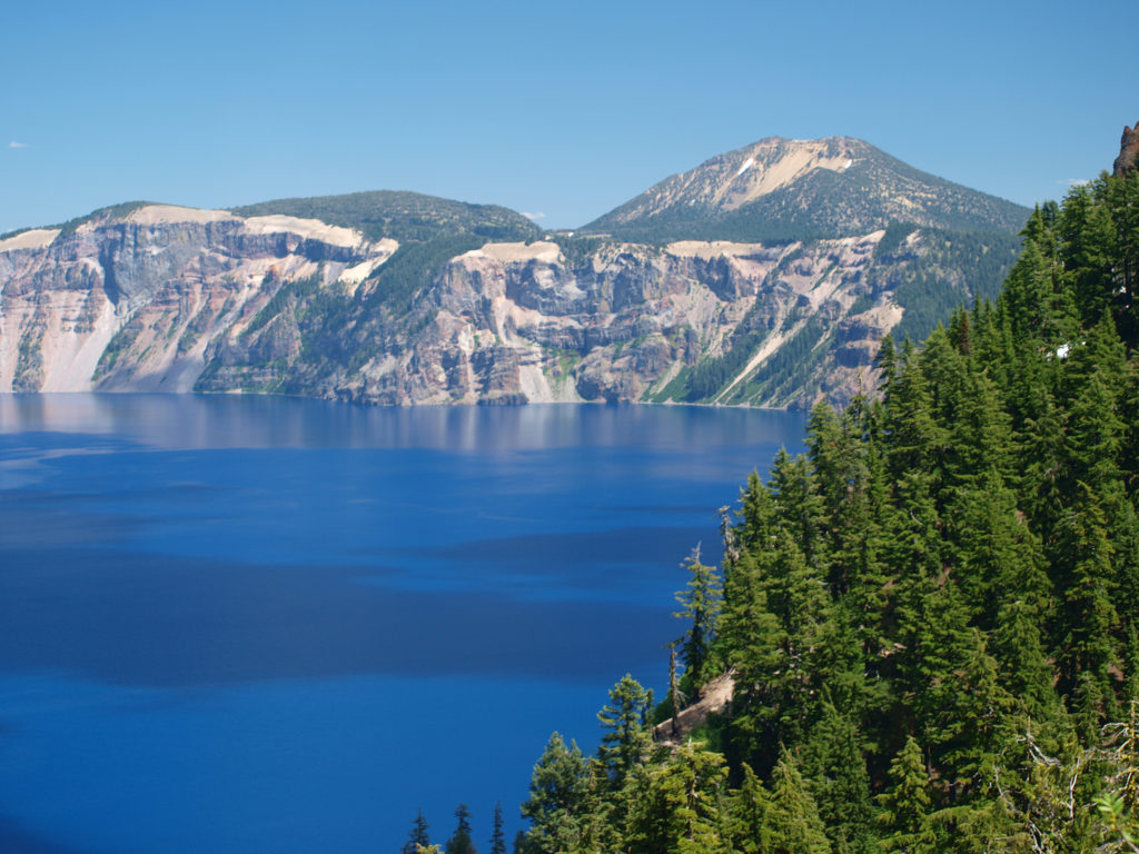 For a more adventurous day, hike to the summit of Mount Scott, the highest point in the park. It’s a two mile hike to the summit with 1250 feet of elevation gain, so it’s not an easy hike (All Trails rates it “moderate”), but the view might just be worth the effort.
 Hiking Trails
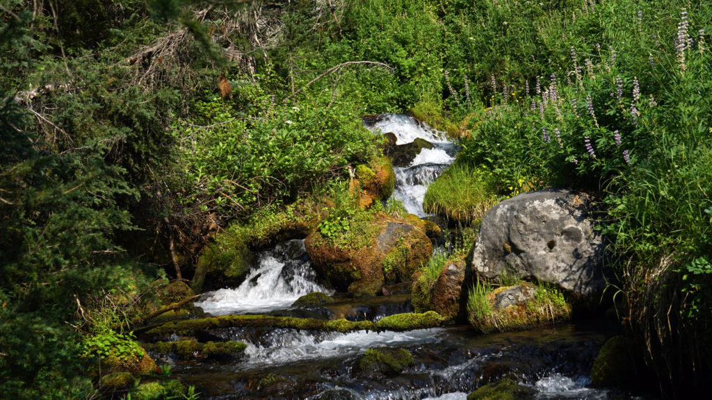 The Pacific Crest Trail passes through the park, but does not ascend to the rim of the caldera. Hikers on the PCT can take the Dutton Creek Trail that climbs up to the Rim Village, then hike the trail that parallels the West Rim Drive and reconnect with the PCT north of the lake.
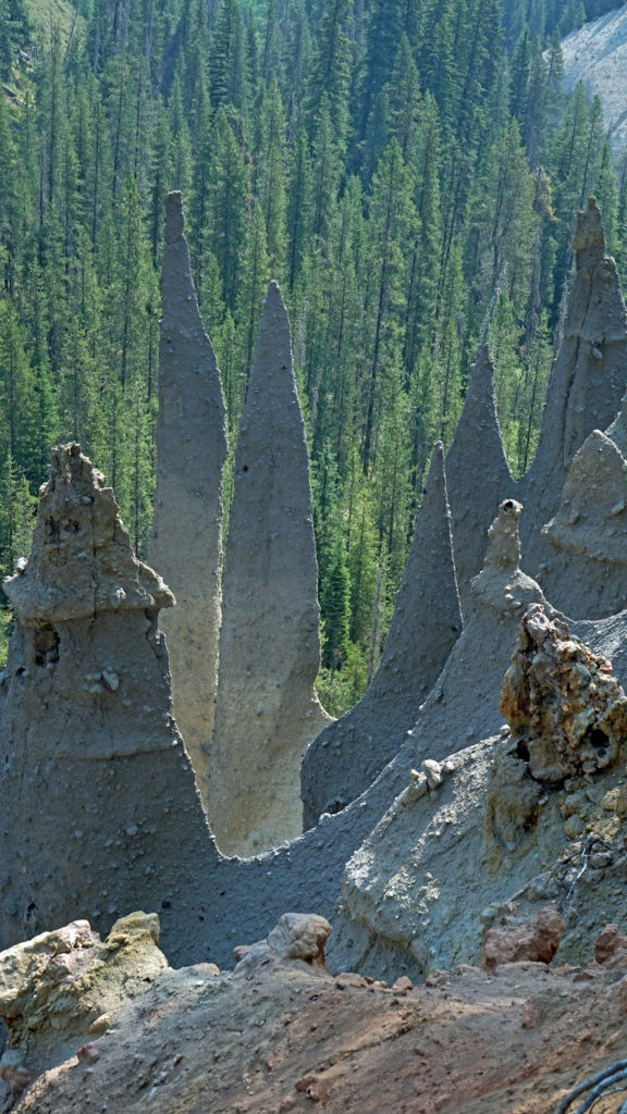
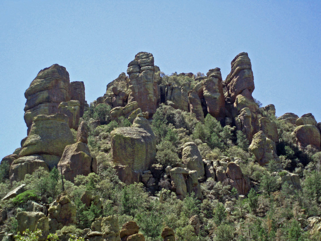
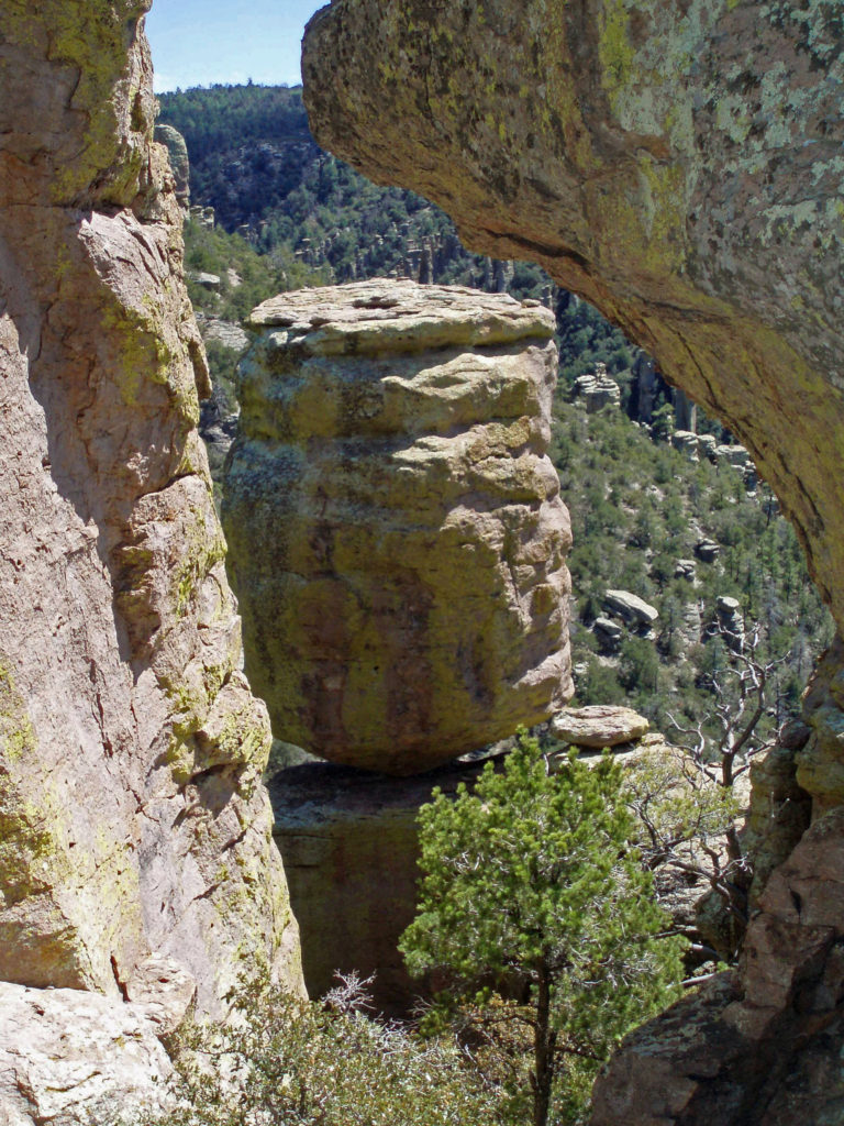
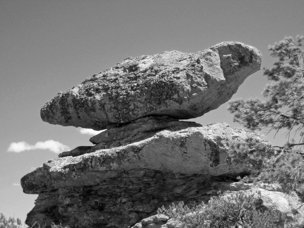
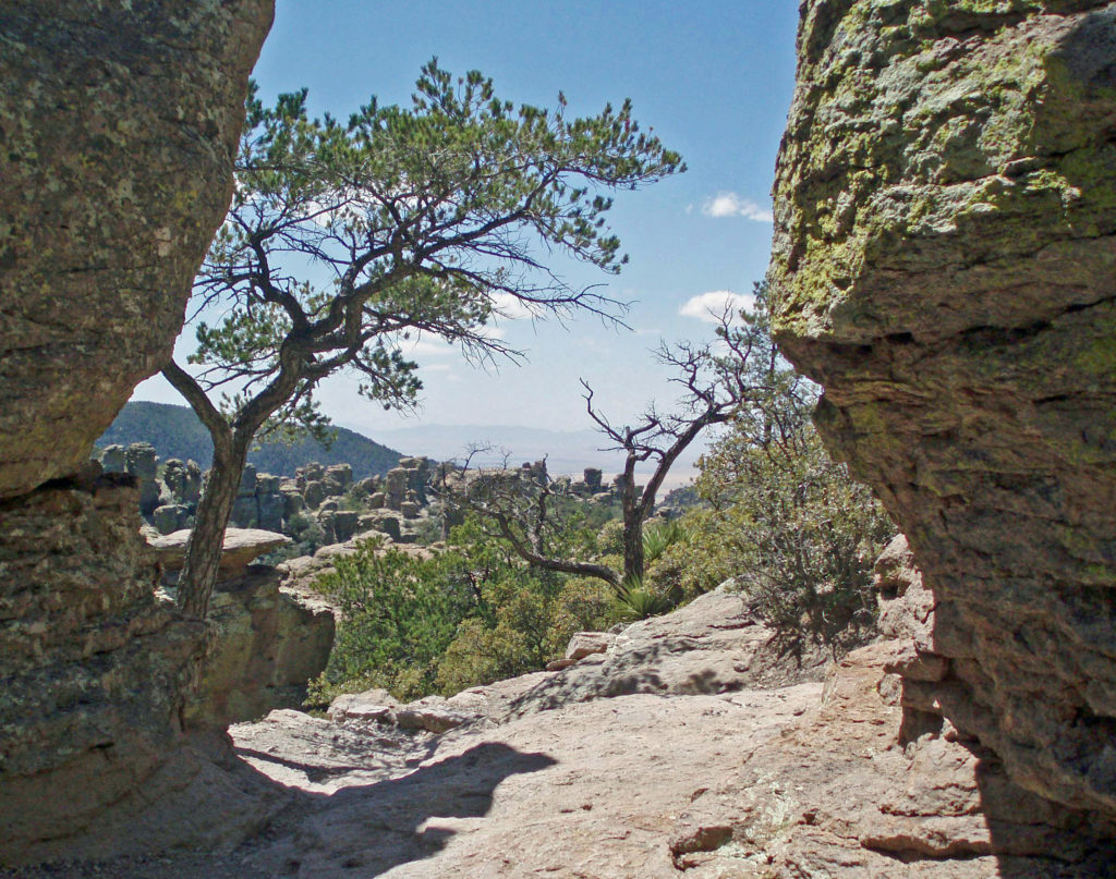
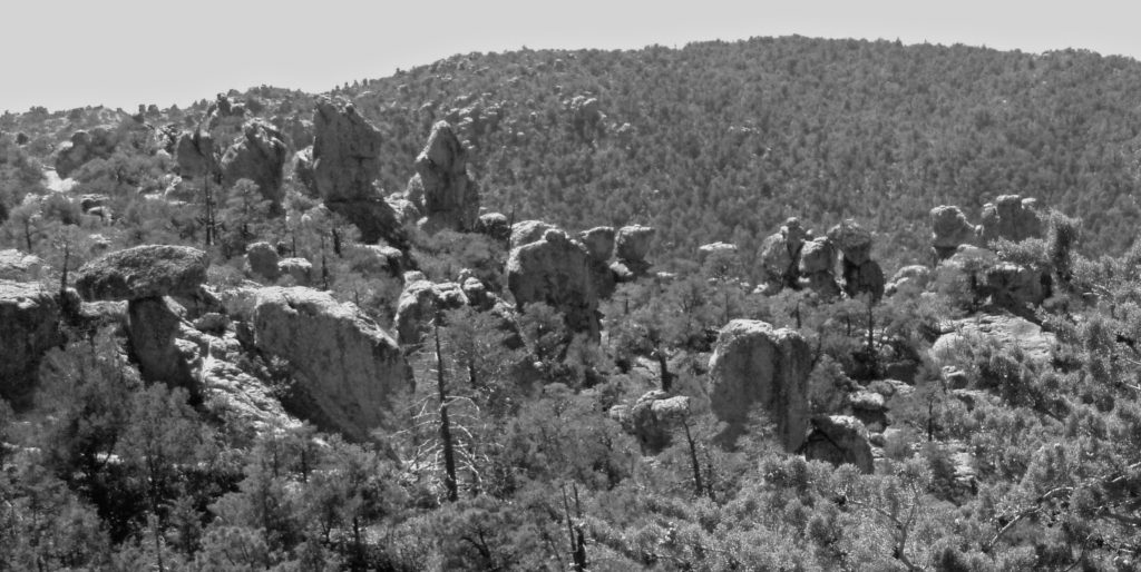
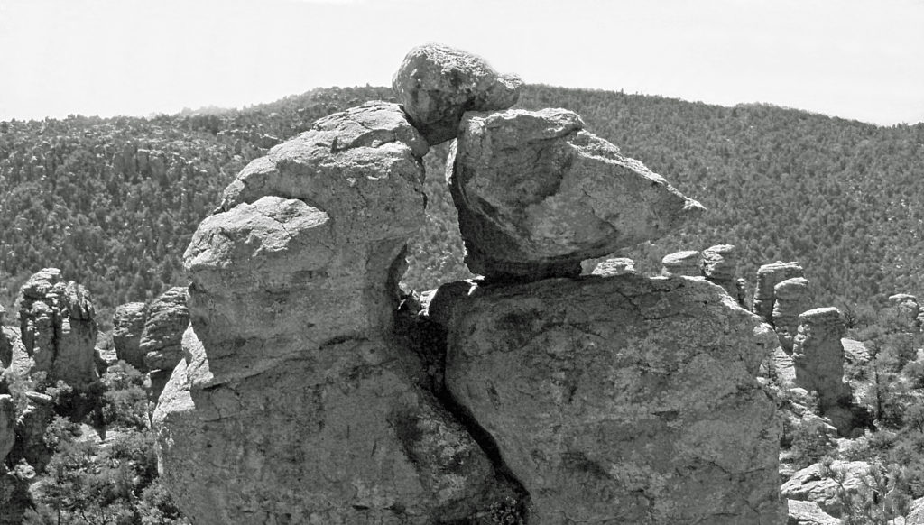
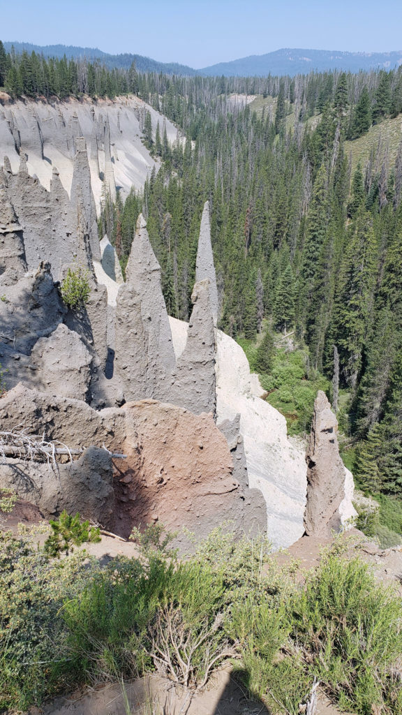 The Pinnacles
 Practical Info
 There are two lodges in the park, Crater Lake Lodge in the Rim Village and The Cabins At Mazama Village that are open for the summer season. Crater Lake Lodge has 71 rooms, starting at $246/night. The Cabins At Mazama Village has 40 rooms, all at $160/night. Prices listed are for the 2024 season. Note that the concessionaire that operates both lodges is changing, so prices may also change. Check the park website (linked above) for current information.
 There are two campgrounds in the park. Mazama Campground has 75 RV sites, 18 tent sites with electricity, and 121 tent sites without electricity. Tent sites start at $22. RV sites run from $32 to $44 per night. Mazama Campground is usually open from early June through late to September. Lost Creek Campground, located on Pinnacles Road, is a primitive tent only campground with 18 sites, operated by the park service. Lost Creek Campground is currently closed and will not be open for the 2024 season. Backcountry camping is allowed in the park by
 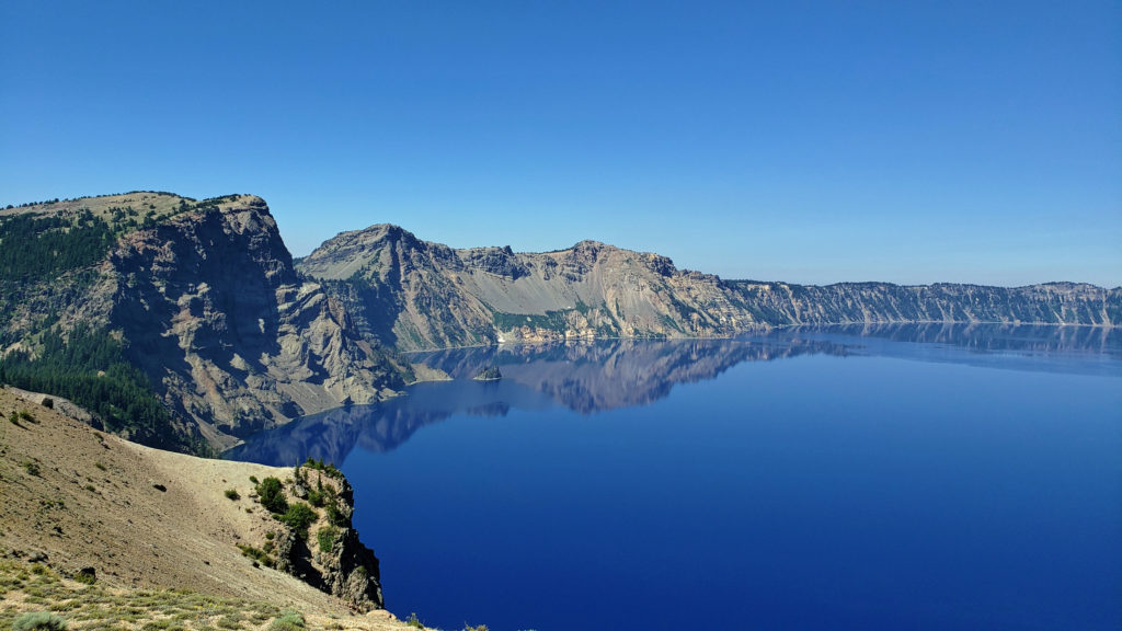 Dining options in the park are somewhat limited. The dining room at Crater Lake Lodge is open to all visitors, but reservations can only be made by people staying in the park. The Rim Village Cafe offers “grab and go” sandwiches and salads (I had a pulled pork sandwich from there on our recent visit that was very good). It is open from 9am to 8pm in the summer and 10am to 5pm in the winter. The Annie Creek Restaurant in Mazama Village is open from 7am until 9pm. The Mazama Village Store sells packaged sandwiches and snacks.
 Summer park entrance fees are $30 for private vehicles and $25 for motorcycles. Winter fees are $10 less. Snowmobilers, bicyclists, and pedestrians are charged $15 per individual. All entrance fees are good for seven days. Entry reservations do not need to be made.
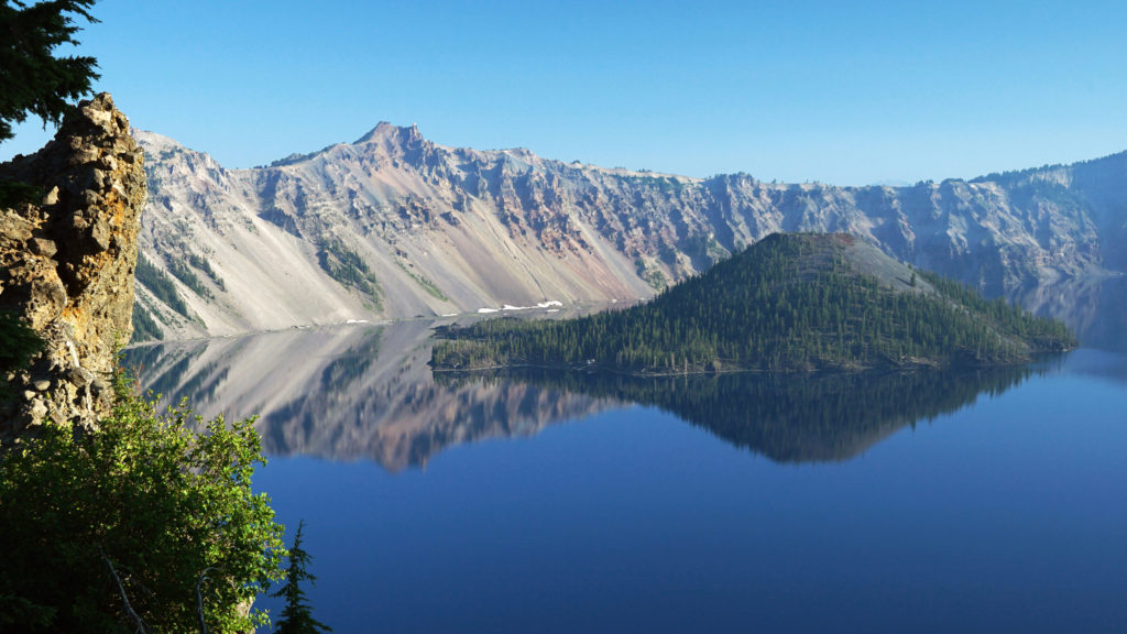
 Originally posted September 13, 2021. Most recently updated April 6, 2024.
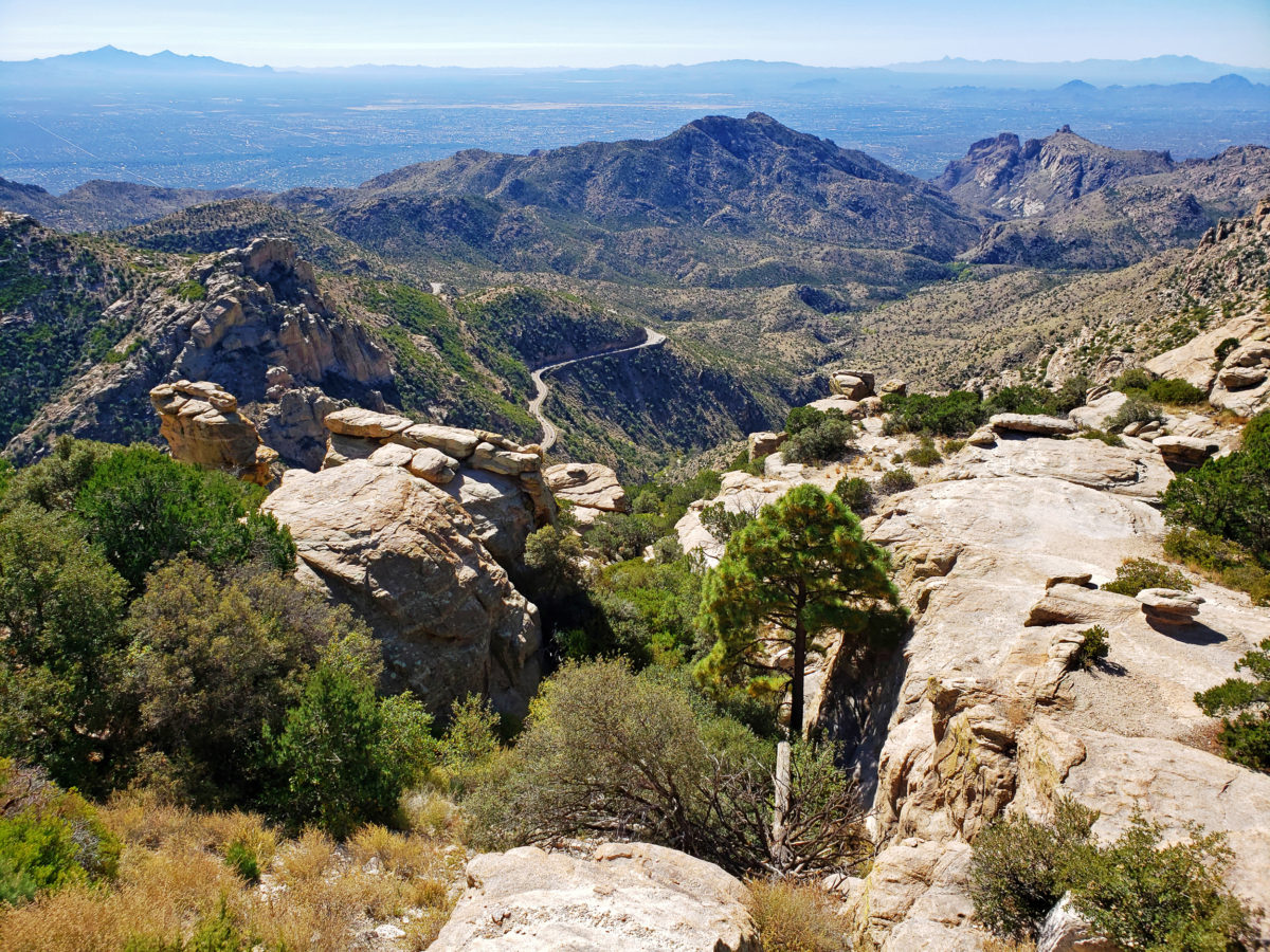
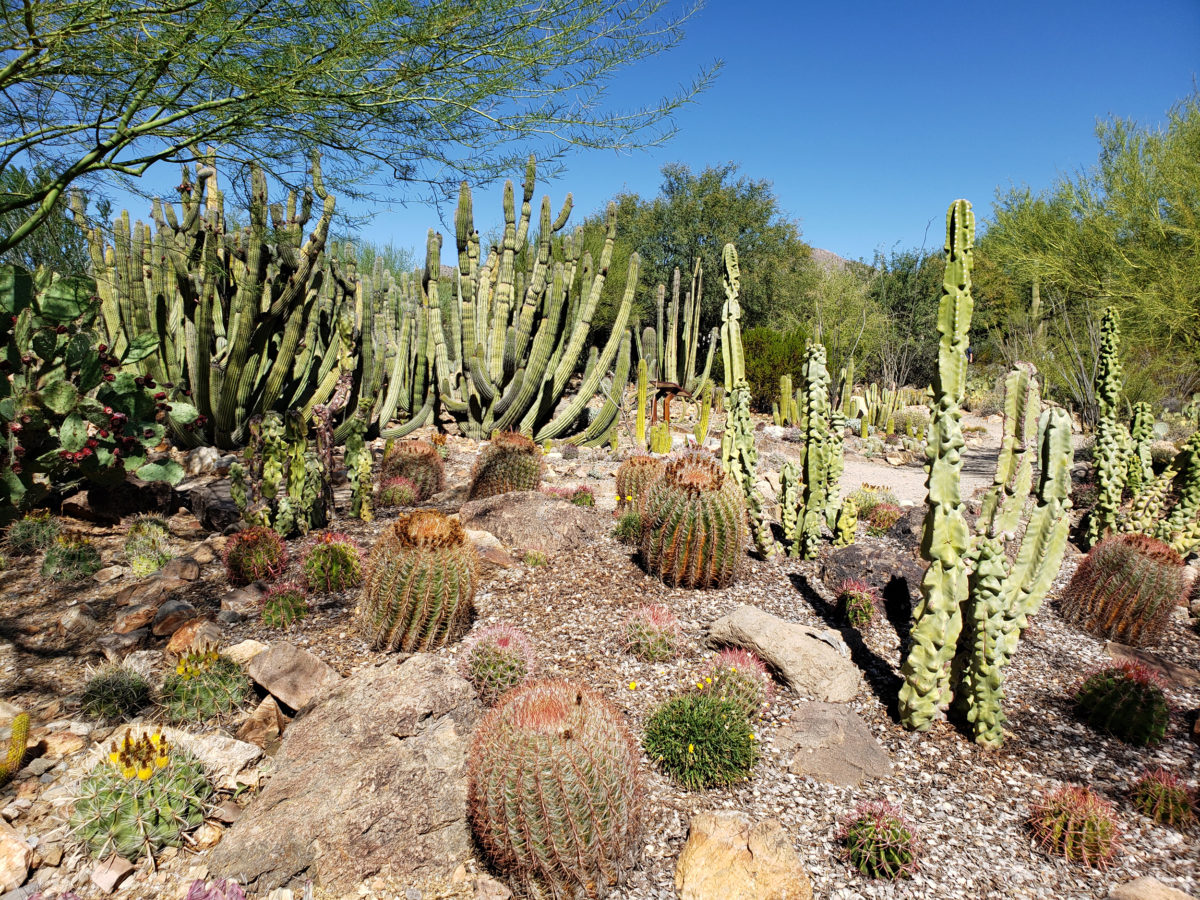
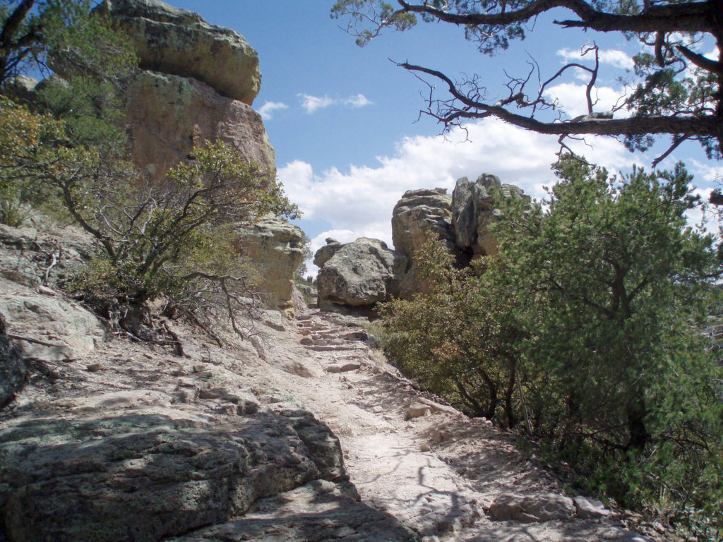
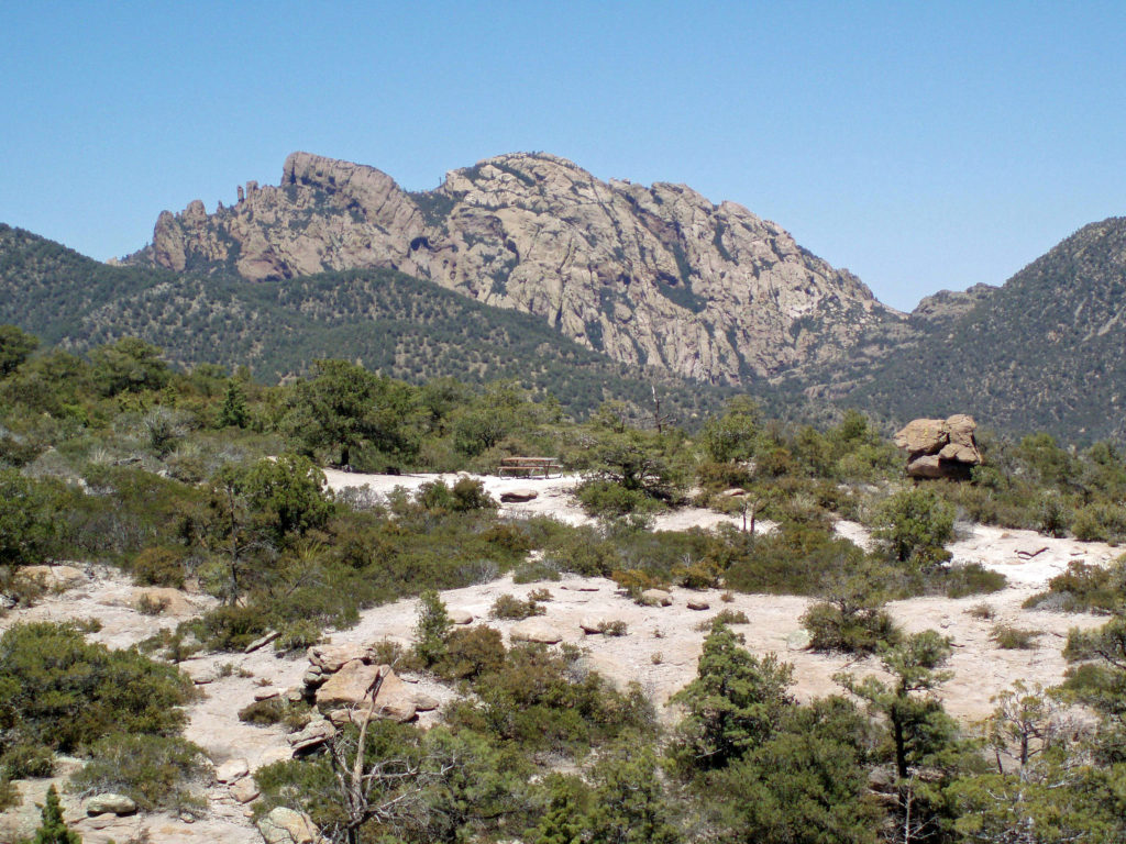
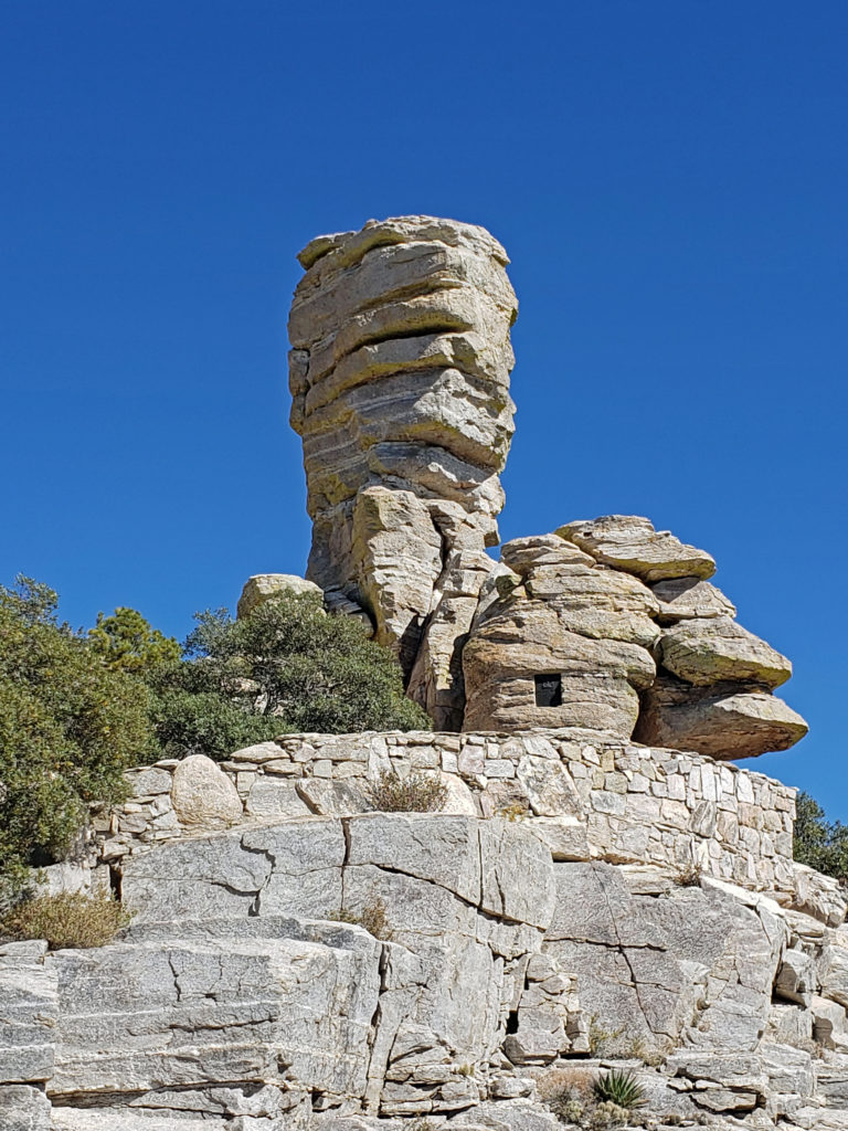
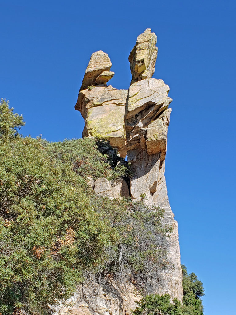
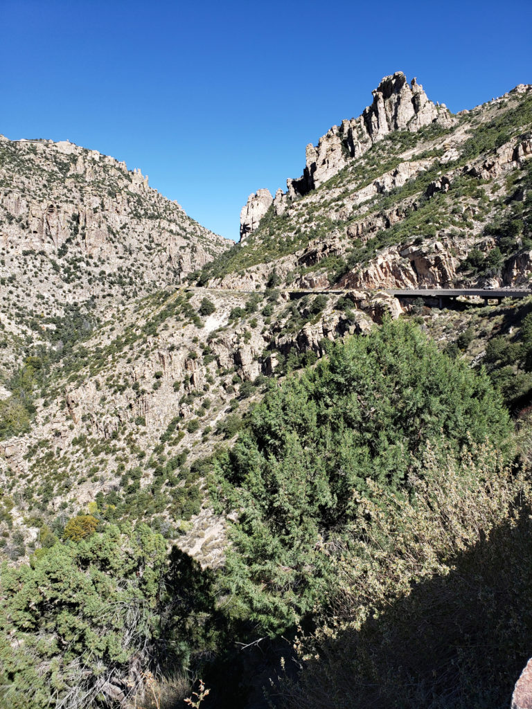
 If you’re ever in the Tucson area, consider making the drive to the top of Mount Lemmon. A paved road takes you to the summit, more than 6500 feet above the valley floor. Numerous viewpoints along the way provide spectacular vistas of the mountain, the surrounding desert below, and the mountains beyond. And numerous trailheads provide access to the ridges and canyons beyond the road for those who want to lace up their hiking boots and immerse themselves in the desert or mountain environment.
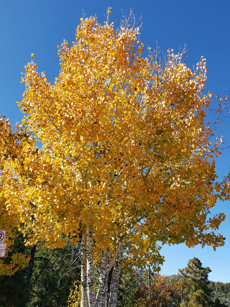
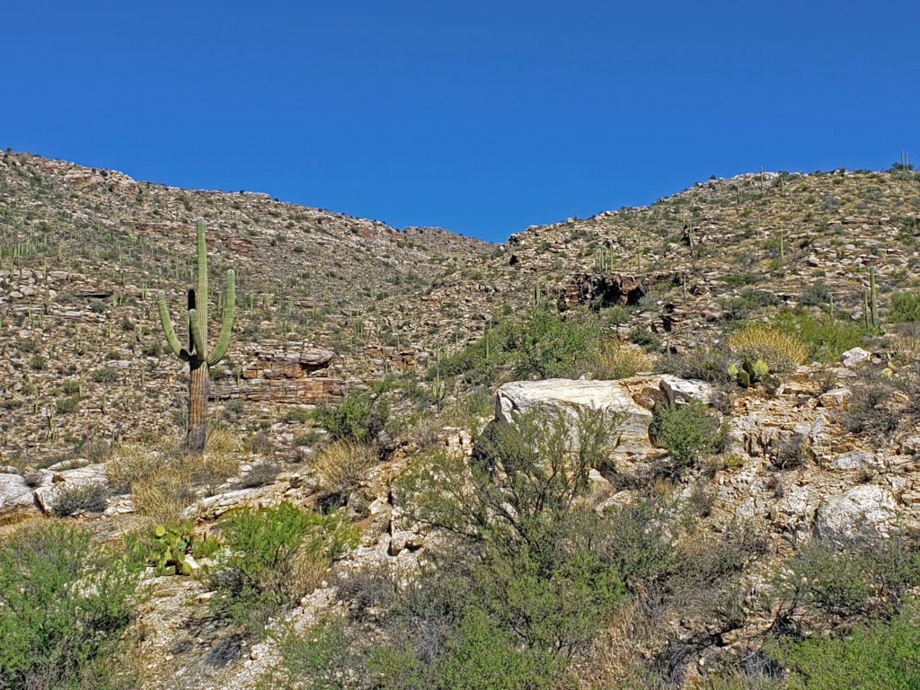 The drive takes you through numerous climatic and ecological zones, from the iconic saguaro cactus of the Sonoran Desert at the base of the mountain to an aspen and ponderosa pine forest at the summit.
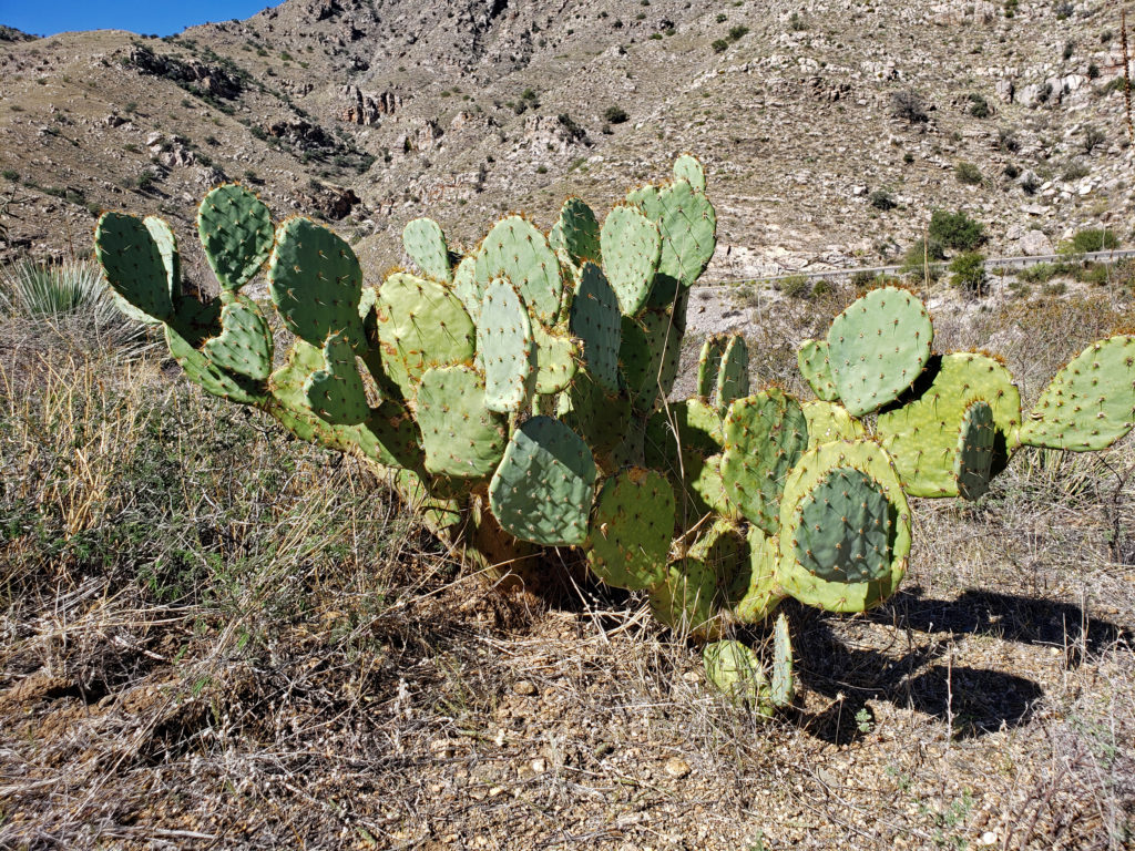 My wife and I made the drive to the summit in October 2019 while in Arizona to visit my brother and attend a wedding. I had never heard of Mount Lemmon and I wasn’t keen on making that long of a side trip, but my wife convinced me that it would be worthwhile, and she nailed this one. Mount Lemmon is more than just worthwhile, and worth more than just a side trip. It’s a worthy destination in its own right.
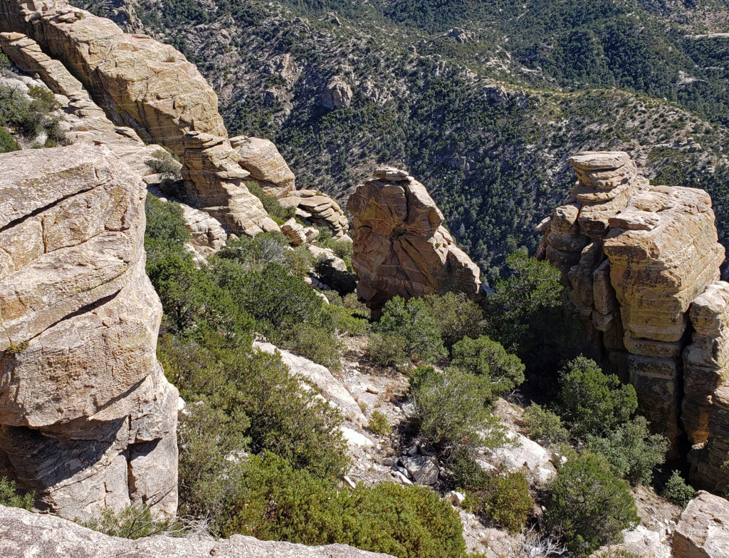
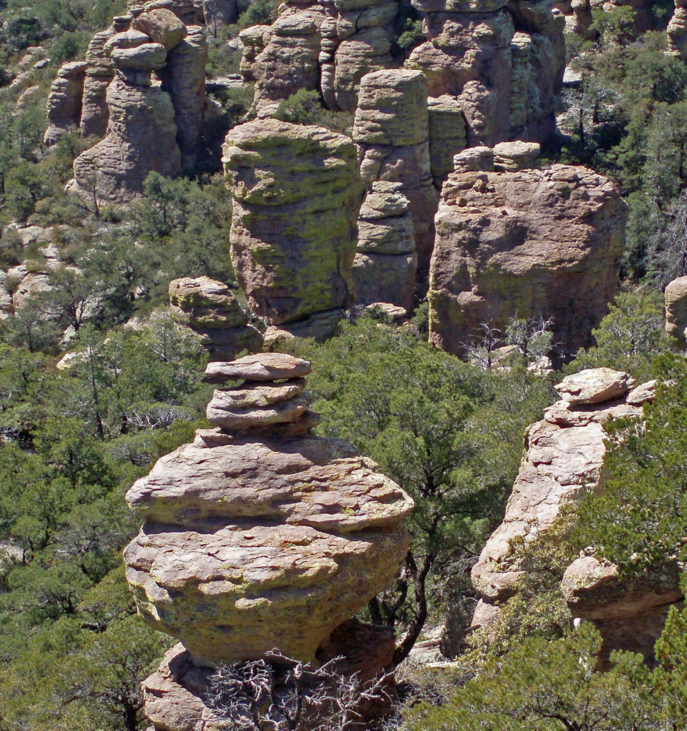
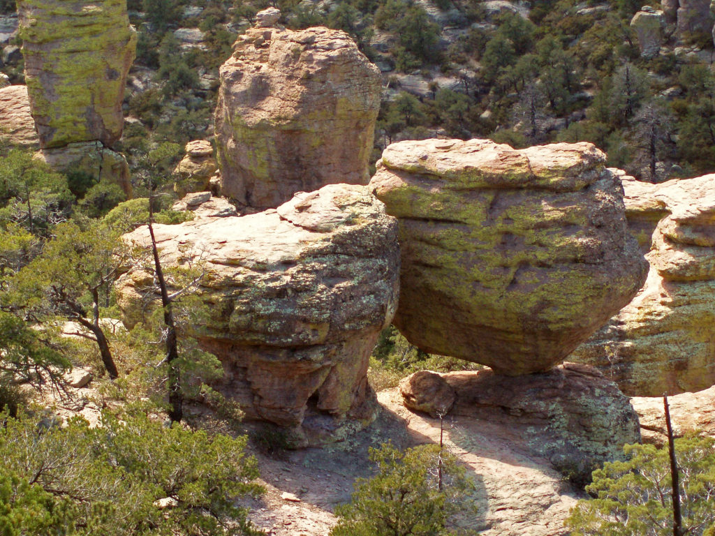
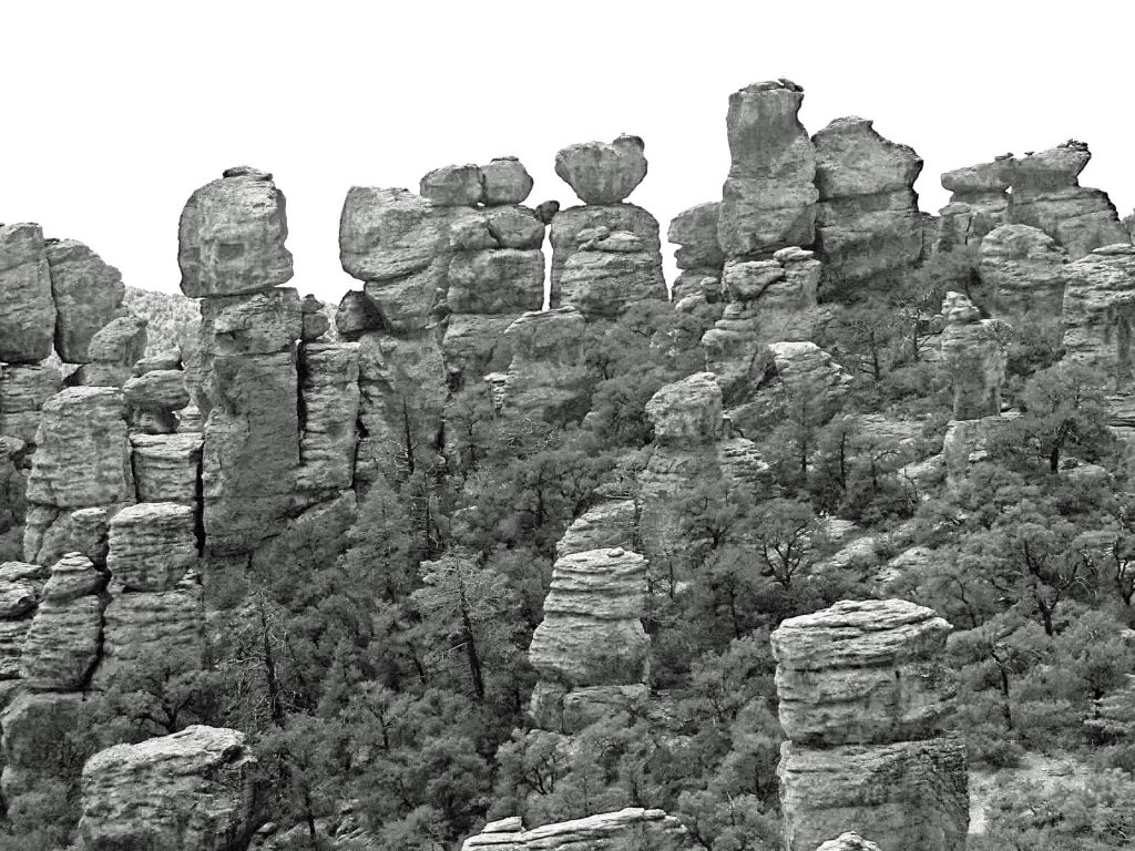
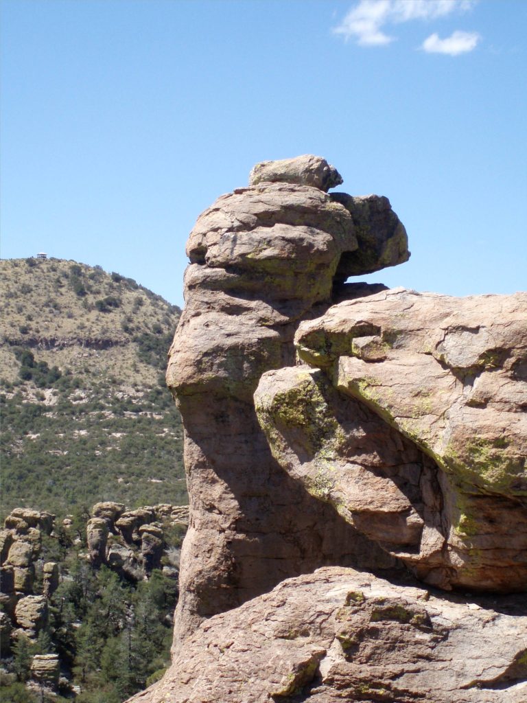
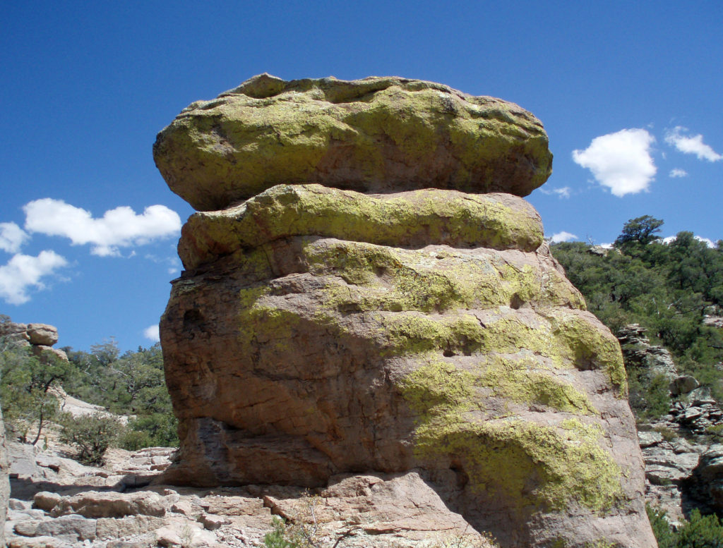
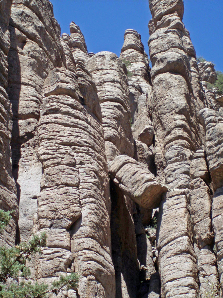
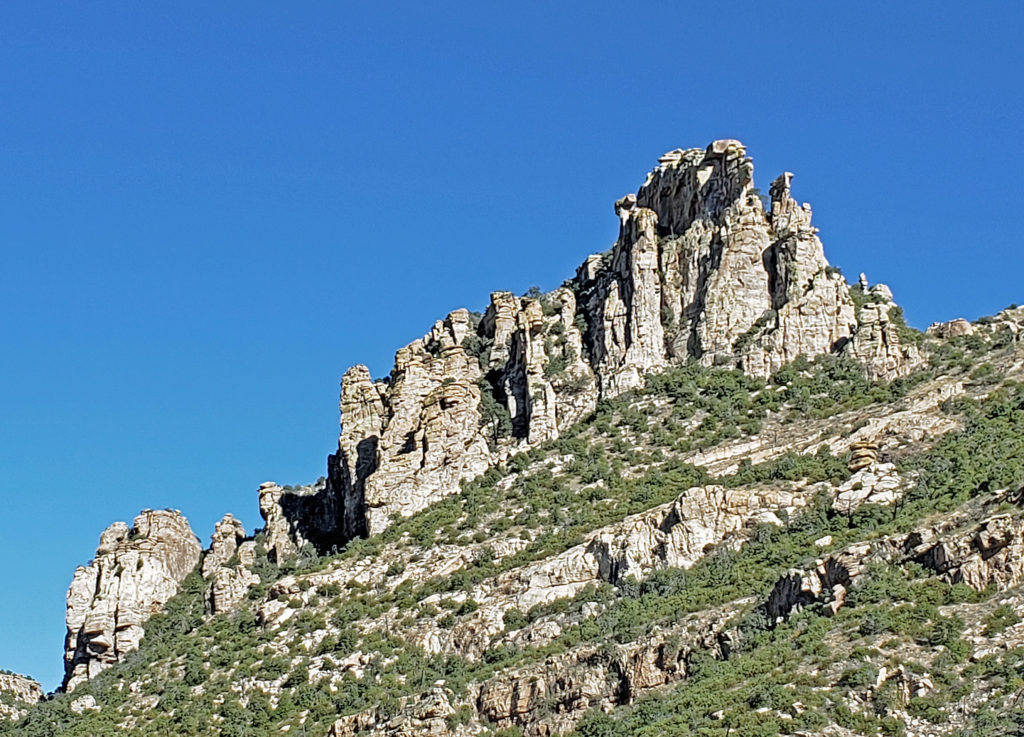
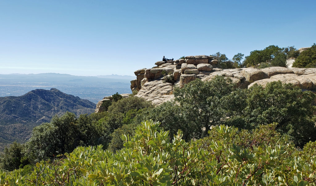 Windy Point, about seventeen miles from the beginning of the highway in Tanque Verde, has got to be one of the most spectacular viewpoints in southern Arizona. You’ll want to stop here and just wander around for a while. Take in the views of Tucson and the desert far below, the mountains beyond, and the rock formations around you. About four miles farther up the highway you’ll come to the San Pedro Vista, which gives you a panoramic view east across the San Pedro Valley to the Galiuro Mountains.
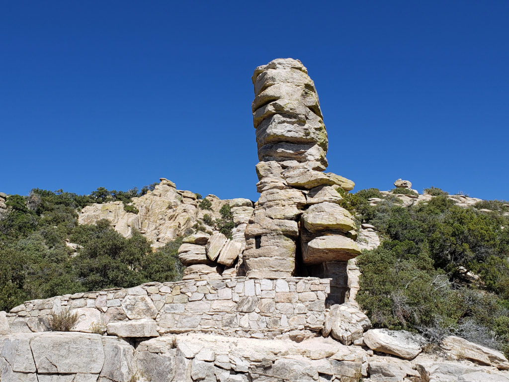 Another couple miles brings you to the
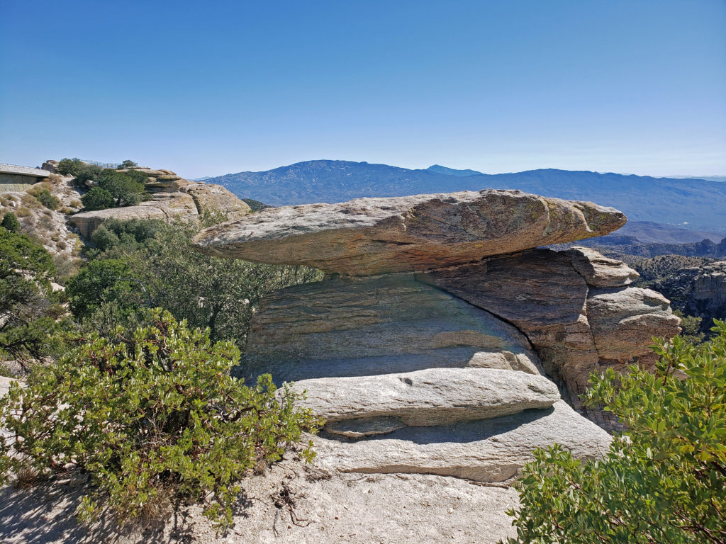
 If you go, note that the summit of Mount Lemmon can be thirty degrees cooler than Tucson, so dress accordingly. And if you plan to do any hiking, avoid mid-summer if possible and always bring plenty of water. There are no sources of safe drinking water on any of the hiking trails in the area, to my knowledge.
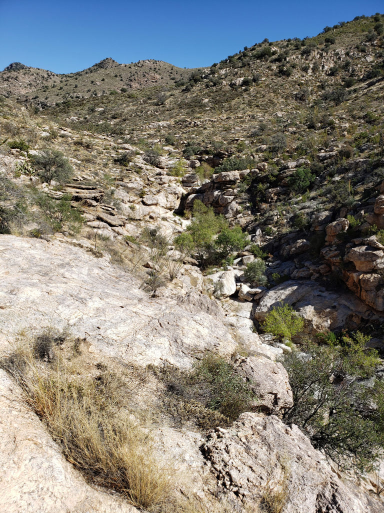
 Not only am I glad we took the drive, I wish we could have spent more time exploring the mountain. For those that do have the time, there are several picnic areas along the highway and a few places to eat in Summerhaven, and there are several campgrounds a short ways off of the highway if you want to spend more than a day on the mountain. If you don’t want to camp, Summerhaven also has a few rental cabins, and a newly built small hotel. Check the
 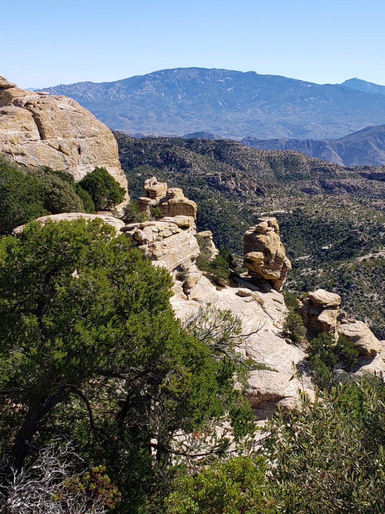 Note: In the summer of 2020 the entire area was closed to the public because of the Bighorn Fire that burned 120,000 acres in the Santa Catalina Mountains. Photos taken after the fire showed some badly burned areas, but others that were largely untouched. All of the area is open again, including the Palisades Visitor Center.