
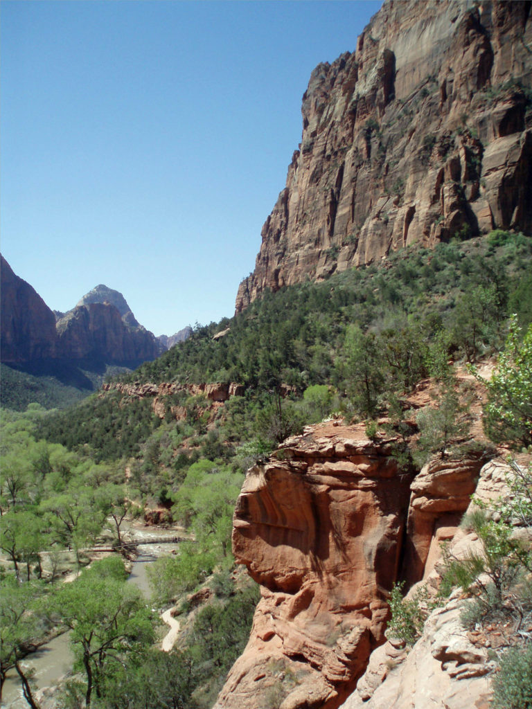
The southwestern United States is a wonderland of deserts, mountains, and canyons. Zion Canyon is among the most spectacular of the Southwest’s many canyons, maybe second only to the Grand Canyon. And while the vast majority of visitors to the Grand Canyon never venture below the canyon rim, Zion is much more accessible.
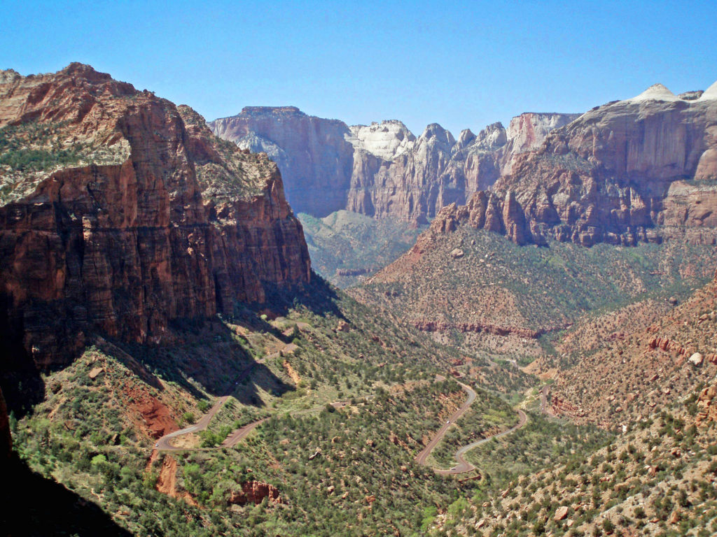
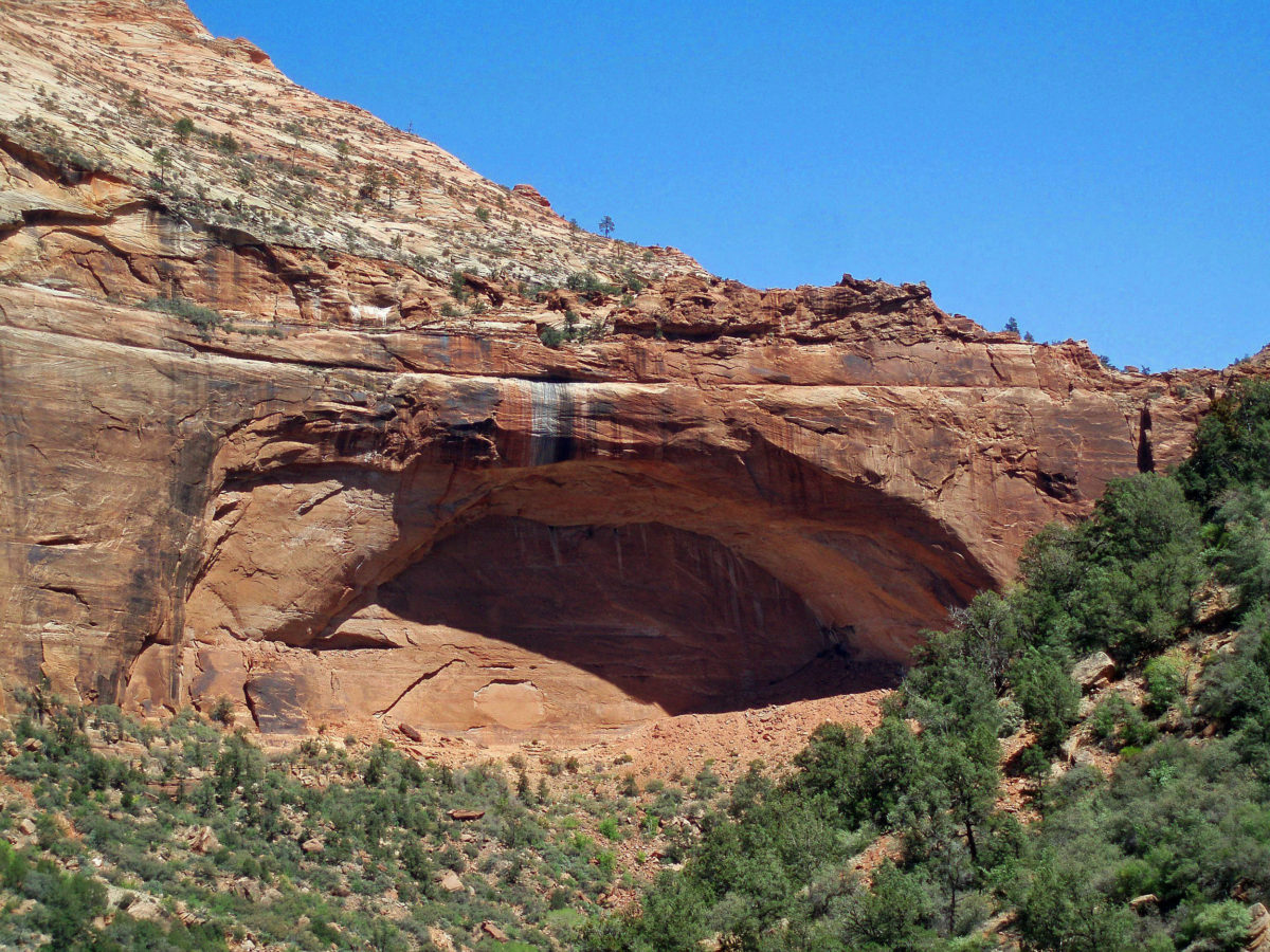
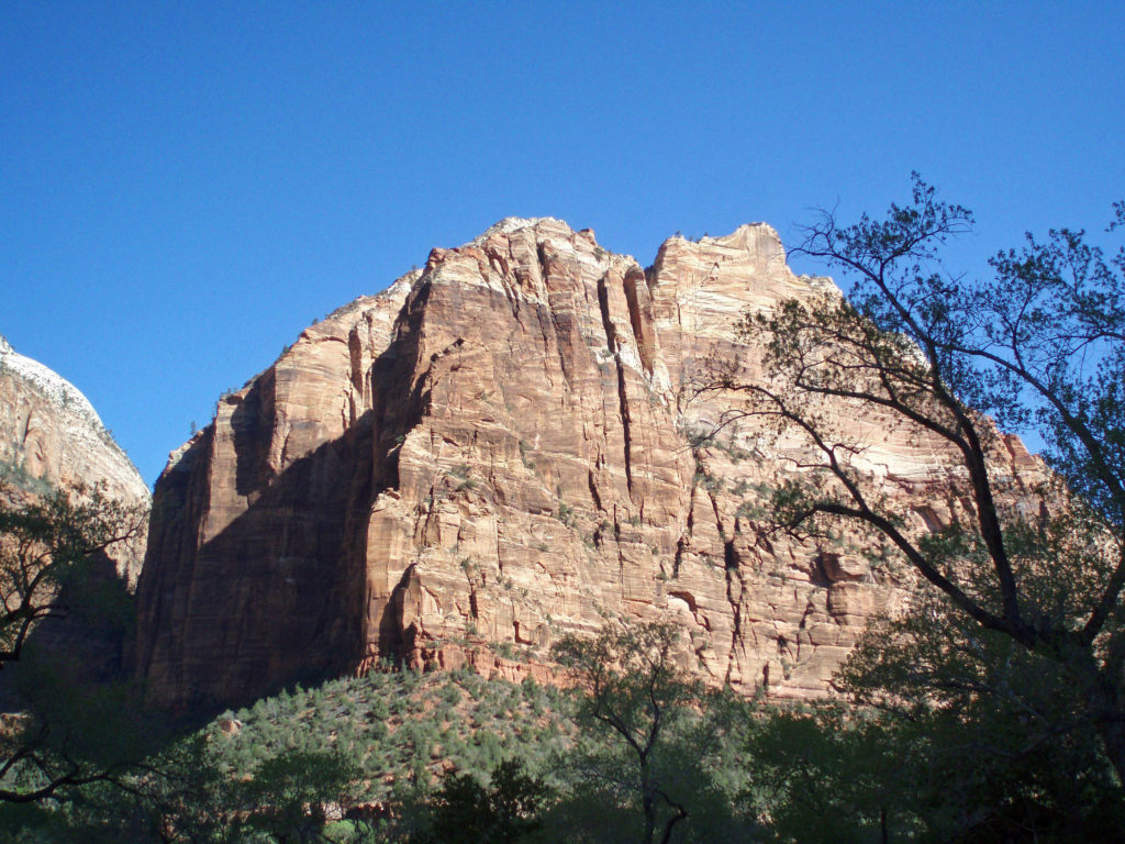
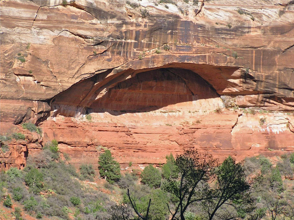
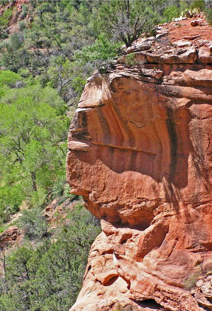
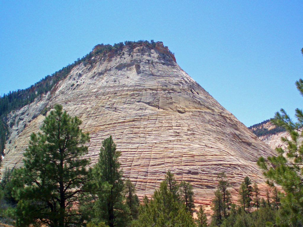
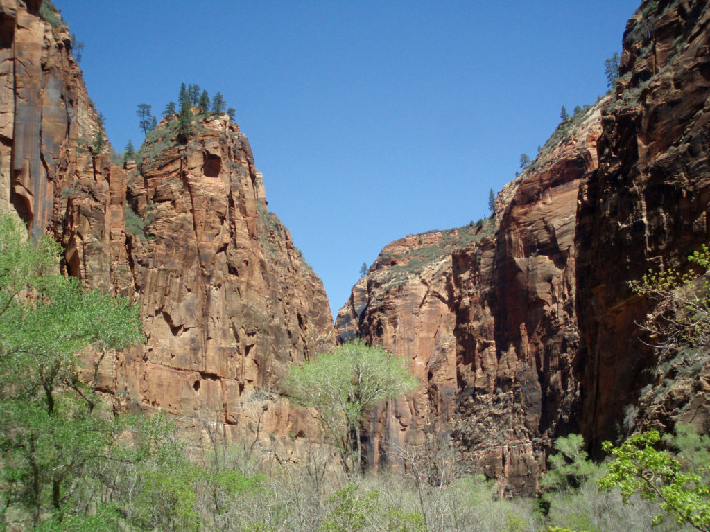
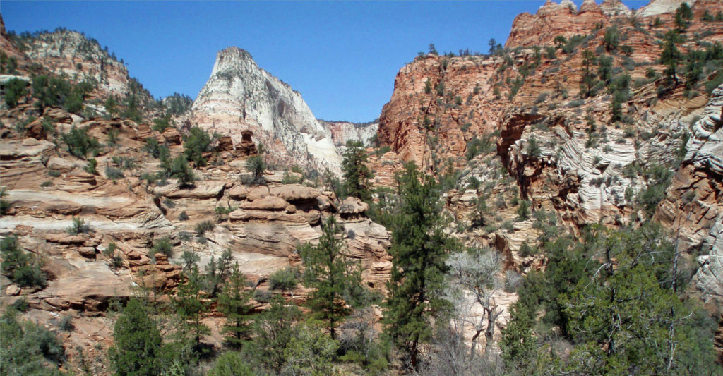
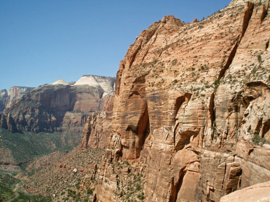
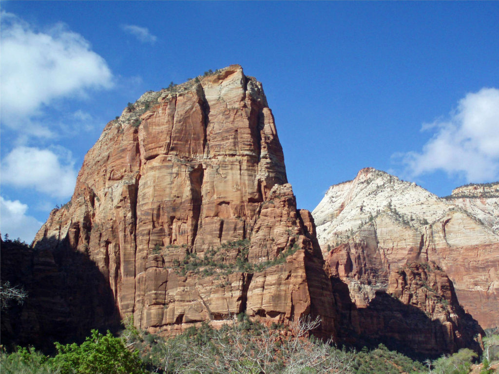
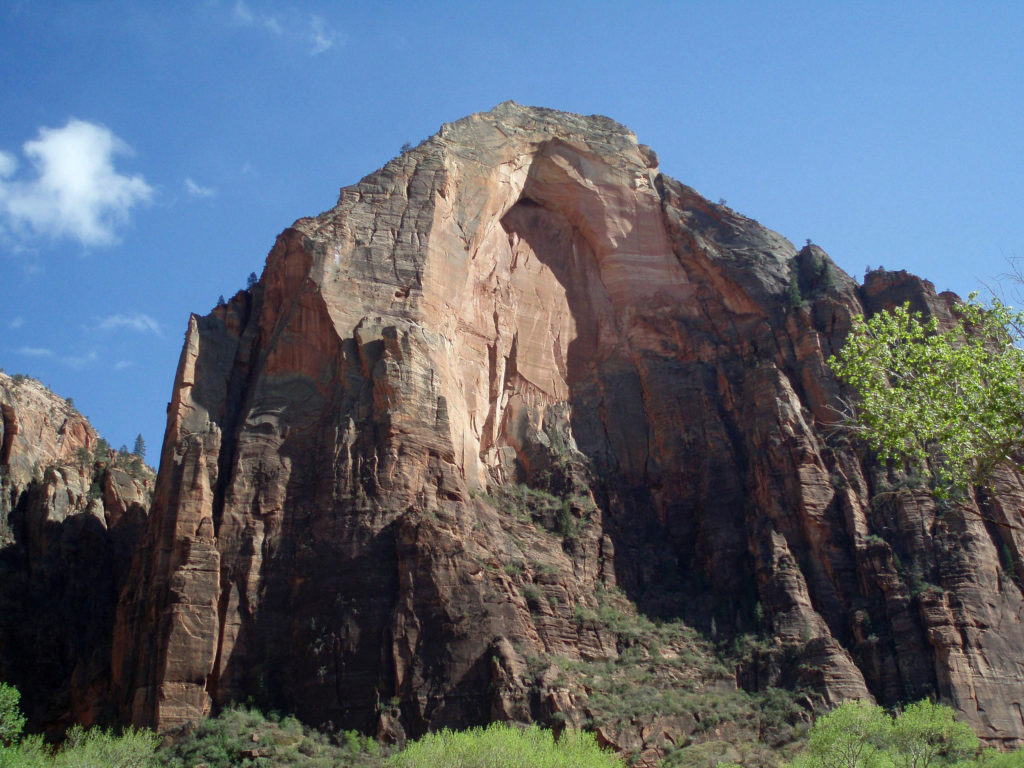
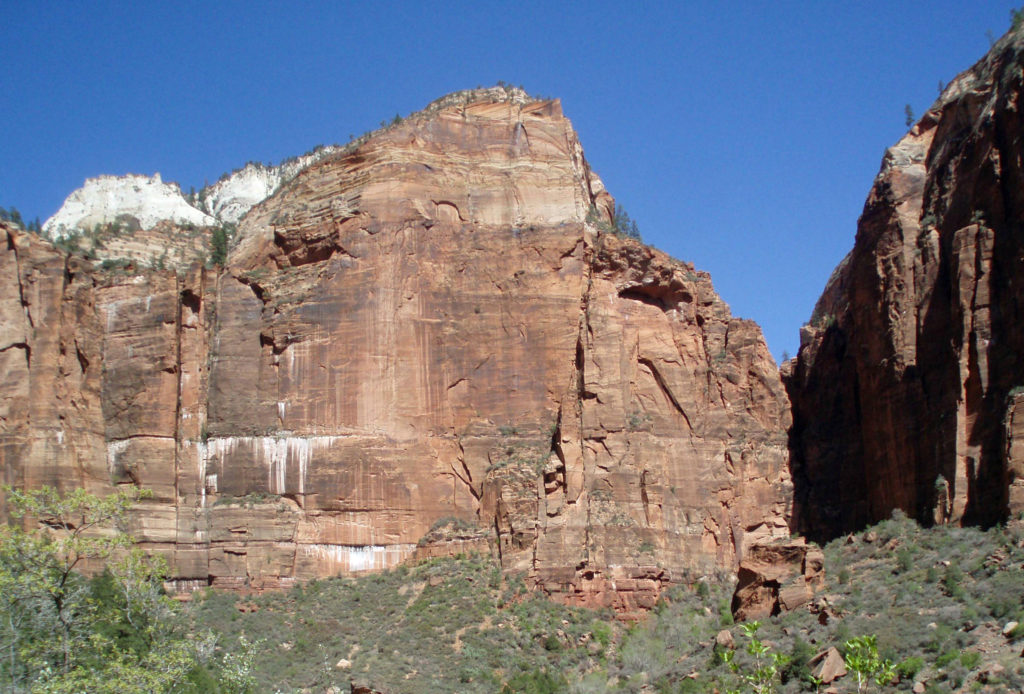
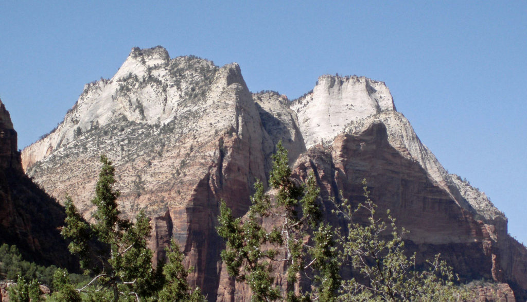
At Zion, you’re in the canyon, surrounded by the red and white Navajo sandstone walls of the canyon that tower as much as 2600 feet above you. Being immersed within Zion Canyon is a much more intimate experience than just looking down into the Grand Canyon. Everyone should visit the Grand Canyon at least once, but if I had to choose between visiting the Grand Canyon or Zion Canyon, I’d take Zion.
Getting There
By car, Zion Canyon is 165 miles from Las Vegas and 305 miles from Salt Lake City. If you’re flying, Delta flies to the nearby Cedar City and St. George regional airports from their Salt Lake City hub. United flies to St. George through it’s Denver hub, and American also flies to St. George through its Phoenix hub. There does not appear to be any commercial service from Las Vegas to either Cedar City or St. George. Check the airline websites or your travel agent for details.
Springdale
The small town of Springdale, Utah is the gateway to Zion Canyon. There are a variety of lodging and dining choices in Springdale, along with services such as gas stations and grocery stores, making it a good base for your exploration of the canyon. Springdale is a pretty town with a number of attractions itself, so budget some time to explore the town. If you’re an art lover like my wife and I, DeZion Gallery, Sorrelia Gallery, Worthington Gallery, David J. West Gallery, and Tribal Arts Zion are all worth a visit. One of David West’s photographs hangs on my living room wall.
Getting Around
Private vehicles are not allowed in Zion Canyon beyond Canyon Junction (unless you are staying at Zion Lodge). The National Park Service operates two free shuttle bus routes. The Springdale Shuttle makes nine stops in Springdale and at the park’s pedestrian and bicycle entrance near the Zion Canyon Visitor Center. The Zion Canyon Shuttle runs from the visitor center to the Temple of Sinawava, with numerous stops along the way. The shuttles are wheelchair accessible, strollers can be taken on board, and they have bicycle racks (electric bikes do not fit on the racks, though). Check the park’s website for current information and shuttle schedules.
 Bicycling is permitted on all park roadways and on the Pa’rus Trail. All other park trails, off-trail routes, and the Zion-Mount Carmel Tunnel are closed to bikes. There are a number of places in Springdale where you can rent bikes and there are also numerous companies offering bicycle tours of Zion. Biking the canyon is a good alternative to riding the shuttle. From the Zion Canyon Visitor Center to the Temple of Sinawava at the end of the Zion Canyon Scenic Drive is about eight miles, with a few moderate hills along the way.
 If you drive an electric vehicle, two charging stations are located within Zion National Park, one at the Zion Canyon Visitor Center and the other at the Kolob Canyons Visitor Center in the north end of the park. You can purchase a $5 pass code at the Zion Canyon Visitor Center that is valid for three days at either of the park’s charging stations. In Springdale, there are three Tesla charging stations (as well as others in nearby communities). Electrify America stations are located in St. George and Cedar City. ChargePoint and SemaConnect stations can be found in St. George.
Where to Stay
Dozens of hotels, motels, B&Bs, and vacation rentals can be found in Springdale and the neighboring community of Rockville. Check the Zion Canyon Visitors Bureau website or Utah.com for lodging information. Cedar City and St. George offer even more choices. Rates run from under $100 per night to over $500. One option worth considering is Zion National Park Lodge , located within Zion Canyon (not to be confused with Zion Canyon Lodge, which is in Springdale, not in the canyon itself). Summer rates for 2024 start at $257 (plus tax) per night at Zion Lodge. Plan ahead, though. Reservations often need to be made several months in advance.
 If you’re camping, Zion Canyon Campground in Springdale has 133 RV sites and 47 tent sites. Zion River Resort in nearby Virgin, Utah also has RV sites and cabins. There are two campgrounds within the national park near Springdale, South Campground and Watchman Campground. South Campground has 117 sites, but no hookups. Watchman has about 120 RV sites with full hookups and about 70 tent sites. South and Watchman both require advance reservations, except in winter. The small Lava Point Campground in the north end of the park is first come, first served, but has only six primitive sites. Check the park website for more detailed information. Reservations for the South and Watchman campgrounds can be made through Recreation.gov.
 Where to Eat
Probably no one comes to Zion for the food, but Springdale offers a number of dining options. Oscar’s Cafe, Spotted Dog Cafe, Kings Landing Bistro, and Bit and Spur Restaurant and Saloon all get good reviews. Zion National Park Lodge in the canyon has two restaurants, as well. The Red Rock Grill in the main lodge is a full service restaurant open for lunch and dinner. The seasonal Castle Dome Cafe adjacent to the lodge offers burgers, hot dogs, and snack food. And, Zion Canyon Brew Pub in Springdale offers a full food menu in addition to a variety of craft brews.
Hiking in Zion Canyon
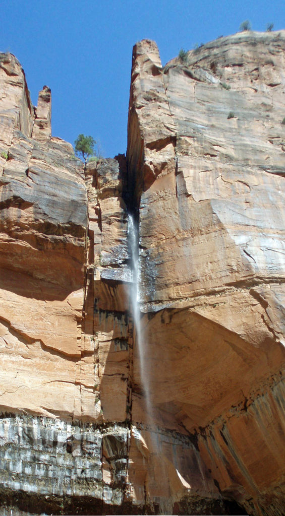
Zion National Park offers more hiking options than I can list here, from the 0.4 mile Archaeology Trail in Zion Canyon to the 47 mile (one way) Trans-Zion Trek from the East Entrance to Lee’s Pass in the Kolob Canyons section of the park. Popular hikes in Zion Canyon include the 3.5 mile round trip Watchman Trail and Pa’Rus Trail hikes near the South (Springdale) Entrance, the Emerald Pools Trail, the West Rim Trail, and the strenuous (five miles roundtrip with 1520 feet of elevation gain) Angel’s Landing Trail. Hiking the Angel’s Landing Trail now requires a permit. Permits are limited and are awarded via a lottery system. Check the park’s website for information on applying for a permit.
 One of the most spectacular hikes in the canyon is The Narrows. There is no trail through The Narrows – you’re hiking the bed of the Virgin River through a narrow canyon no more than 40 feet wide in places. If you’re interested in hiking The Narrows, be sure to check with the park rangers at the Zion Canyon Visitor Center. No permit is required, but The Narrows may be closed to hiking due to the possibility of flash floods. Thunderstorms many miles north of the park may lead to sudden and potentially life threatening rises in the river level with no warning, even when the park is sunny and cloudless. But if it’s doable safely, it’s a fantastic and unique hiking experience.
 Trails outside of Zion Canyon (and all canyoneering routes) require a wilderness pass. Most are available online through the park’s website, but permits for some trails are only available in person.
Other Things to do in and near Zion Canyon
If you’re young and adventurous, canyoneering may interest you. Canyoneering involves traversing canyons, primarily slot canyons, that do not have established trails. Some, but not all, routes require technical rock climbing or rappelling skills. Since canyoneering permits within Zion National Park go quickly, advance planning is required. If you’re new to the sport, a guided canyoneering trip is probably the best way to go. There are a number of canyoneering guides, including ZionGuru, Zion Rock and Mountain Guides, and Zion Adventure Company, that offer a variety of trips for all skill levels, including family tours.
 One hour and three hour horseback rides within the park can be booked through Canyon Trail Rides.
Mountain biking tours are available from a number of tour companies in Springdale. Note that these tours are outside of the park. I have no personal experience here, but from their websites they look to be pretty scenic and more than a little adventurous. Check the tour company websites for pricing and other information. Some offer discounts if you bring your own bike.
 Off road vehicle tours are also available from a variety of providers. Like mountain bike tours, these are outside of the park. Again, I have no personal experience, so can’t make any recommendations, but the tours are popular.
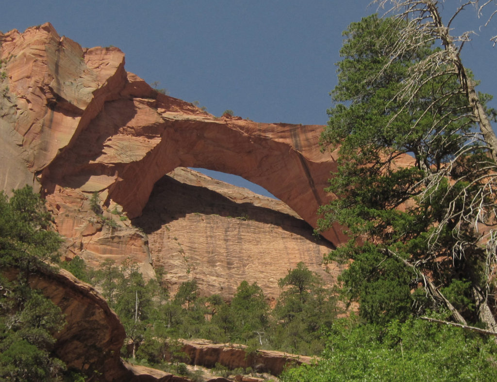
When you’ve finished exploring Zion Canyon, take a drive to the Kolob Canyons area in the north end of the park. This is an area that many visitors to Zion skip, but shouldn’t. Stop at the visitor center just off I-15 at Exit 40, then drive to the Kolob Canyons Viewpoint at the end of the road and hike the short Timber Creek Overlook Trail. If you’re up for more of an adventure, take the 14 mile out and back hike to Kolob Arch. This is a strenuous hike and should only be done by experienced hikers in good condition, but the reward is a view of the second largest free standing arch in the world (second only to Landscape Arch in Arches National Park). The trail to Kolob Arch starts at Lee’s Pass on the Kolob Canyons Road.
Outside of Zion
Often overlooked, Cedar Breaks National Monument, about 60 miles north of Zion Canyon, is an easy day trip and well worth a visit. Bryce Canyon National Park is only about 80 miles from Springdale, so it’s another easy day trip (but is spectacular enough you’ll want to spend a few days there). Coral Pink Sand Dunes State Park is a short ways off the road to Bryce and is also worth a stop, as is Kodachrome Basin State Park, just east of Bryce. And if you’ve got another few days (or weeks), the sprawling, nearly one million acre Grand Staircase-Escalante National Monument stretches from Bryce Canyon east to Capitol Reef National Park.
 I can pretty much guarantee that no matter who you are or where your interests lie, a trip to Zion National Park will be an adventure you will not soon forget.
 Originally posted June 14, 2021 by Alan K. Lee. Updated and re-posted March 15, 2024.
All photos © Alan K. Lee, except as noted

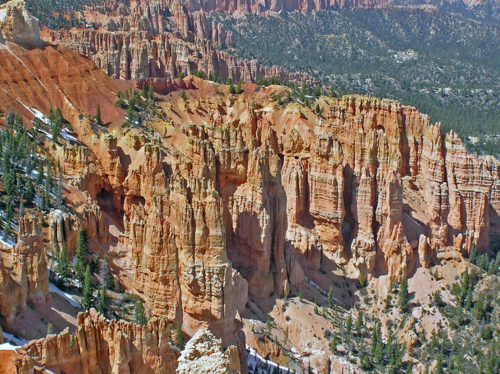

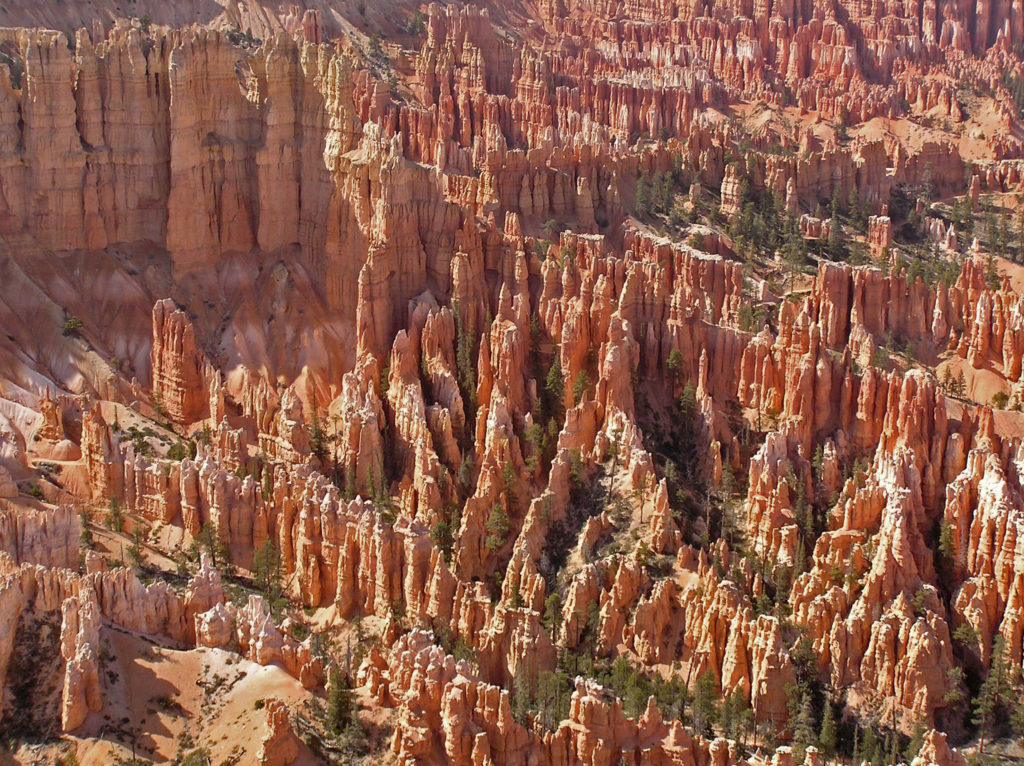
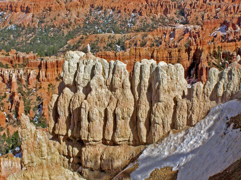
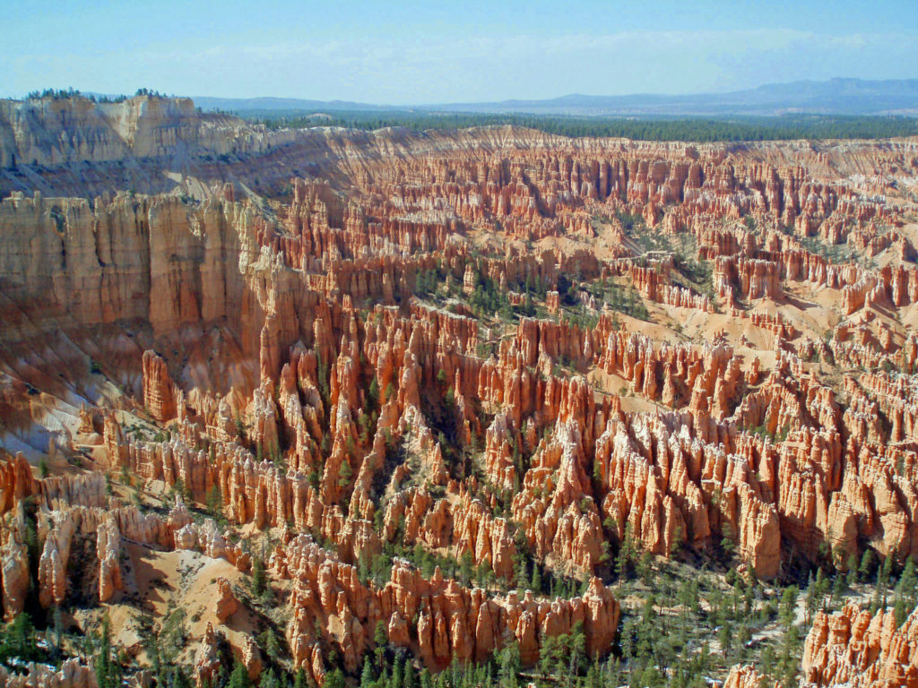
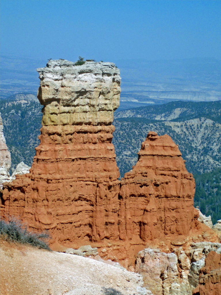
 The altitude also means that nights can be cold there even in the middle of summer. And in spring and fall, it’s not uncommon to encounter cold weather even in the middle of the day. (The photos here were taken in early May and, as you can see, there was still snow in places). Winters are cold, sometimes very, and can be snowy. Many of the trails are closed in winter. But winter also has its charms. Most of the best photos I’ve seen of Bryce Canyon have been taken when the hoodoos were covered in snow.
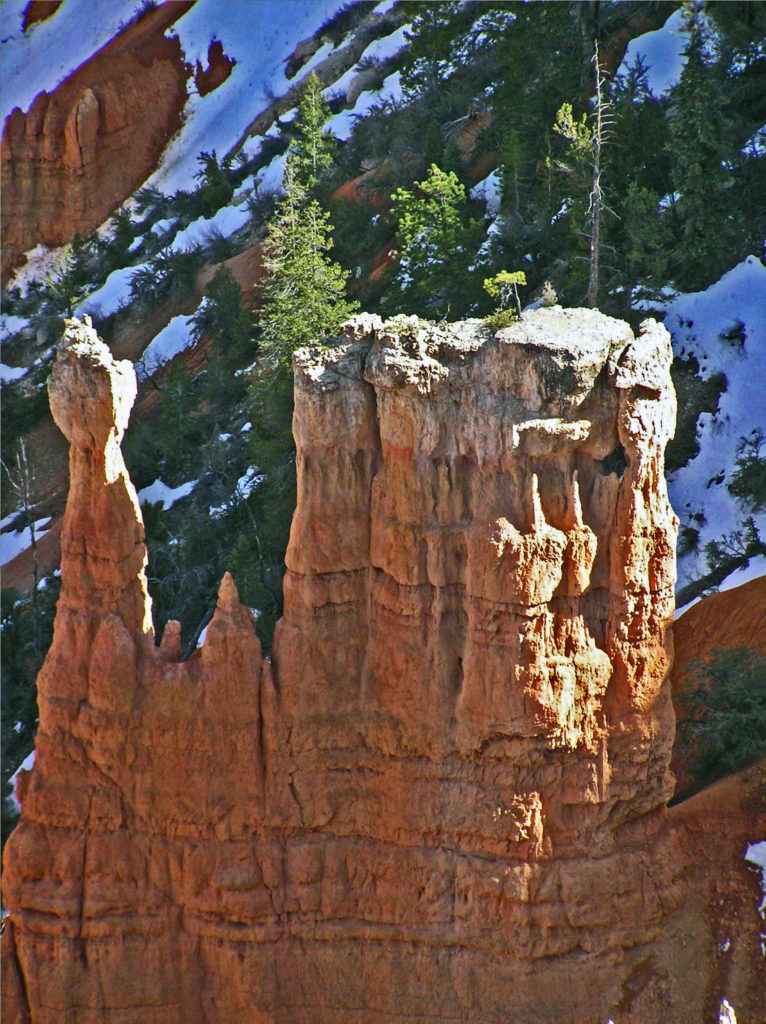

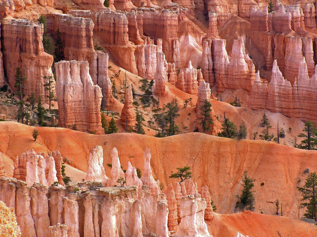
 The good news is that you don’t have to hike very far into the hoodoos to get away from the crowds. There are a number of loop and out-and-back trails that will get you away from the crowds, some of them fairly easy hikes. The rim trail along the edge of the Bryce Amphitheater can also get you away from the worst of the crowds without actually descending into the hoodoos. And if you don’t want to (or can’t) hike into the amphitheaters, there are mule rides available. Check at the visitor center when you arrive. Some of the trails in the park are also paved and wheelchair accessible.
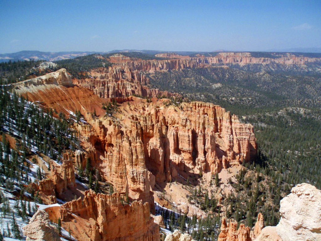
 The only road in the park (other than a section of Utah Hwy 12 that cuts across the far northern end of the park) runs north to south along the top of the Paunsaugunt Plateau from the park entrance to Yovimpa Point and Rainbow Point at the southern end of the plateau. Because the park receives so many visitors in the summer, traffic congestion can be a problem. Consider parking your car at the visitor center or the lodge and taking the free shuttle that runs the length of the park. The buses run frequently and you can hop off at any of the viewpoints and catch a later shuttle if you want to do some hiking or just sit and enjoy the scenery for awhile. Taking the shuttle also makes point to point hikes possible without having two cars.
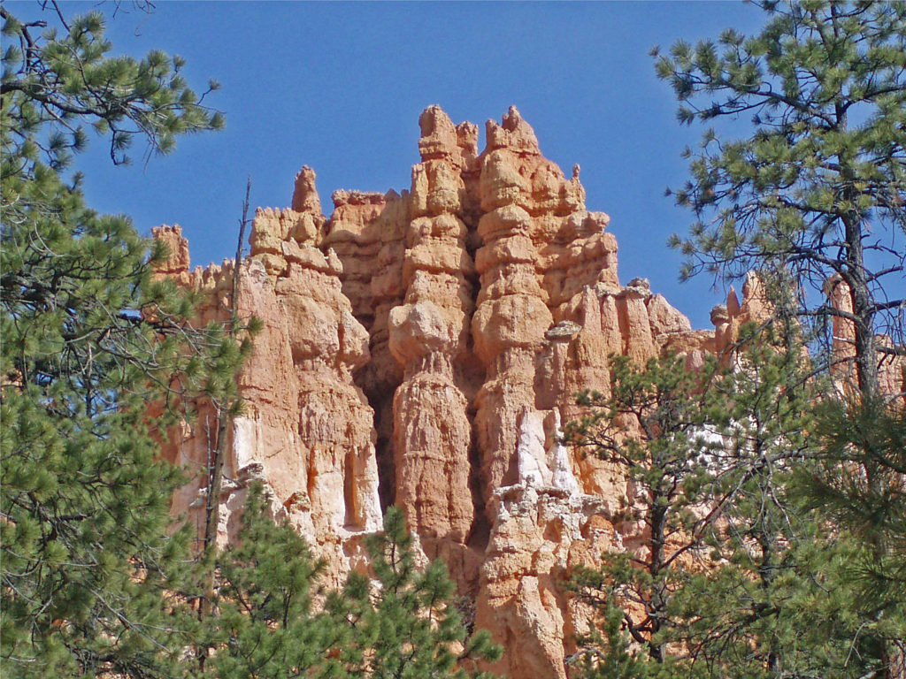 Besides being a spectacularly beautiful place during the day, Bryce Canyon is also great place to star gaze. It’s far from any light polluting urban areas, and the night skies in the park can be incredible. The park offers both astronomy programs and guided full moon hikes. Check the Bryce Canyon National Park
  The park website is a good place to begin when planning a trip to Bryce. The
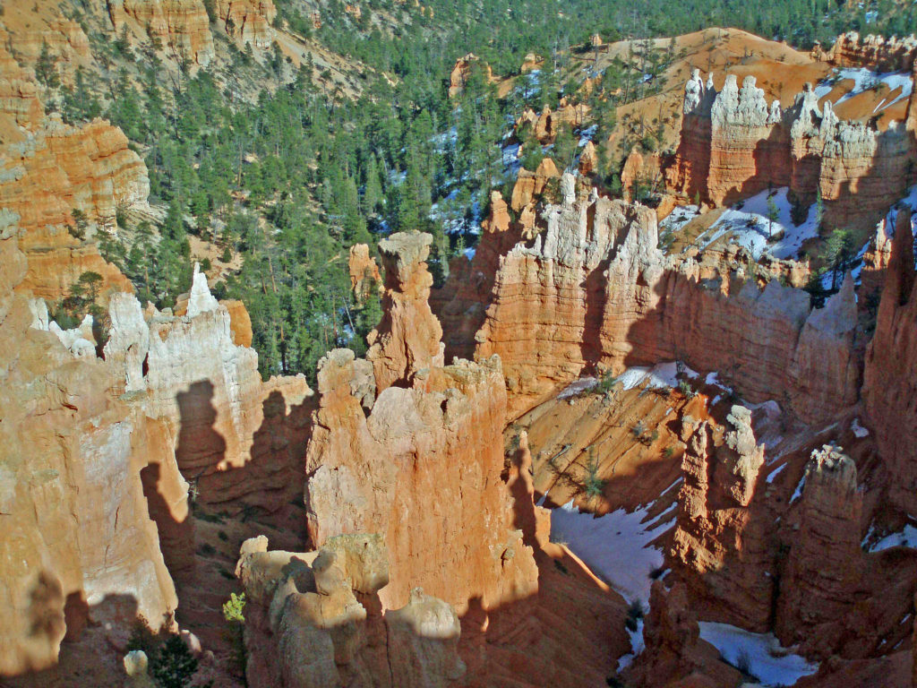
 The Covid-19 pandemic is still with us as I write this (Feb. 2022), but the park is open with only a few restrictions. Masks are still required for everyone, regardless of vaccination status, in all NPS buildings, crowded outdoor spaces, and all forms of enclosed public transportation. But there are no other restrictions and all facilities are open. Additional details are available on the park website and at
  If you’re not ready to begin traveling again, though, here are links to a short video by
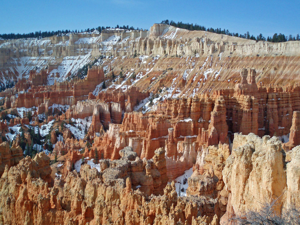
 Originally posted March 20, 2020. Updated and re-posted February 19, 2022.
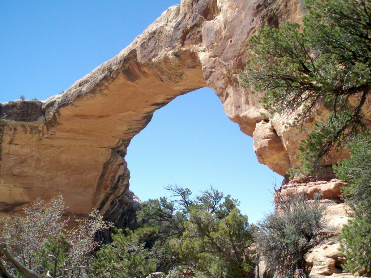
 First Impressions
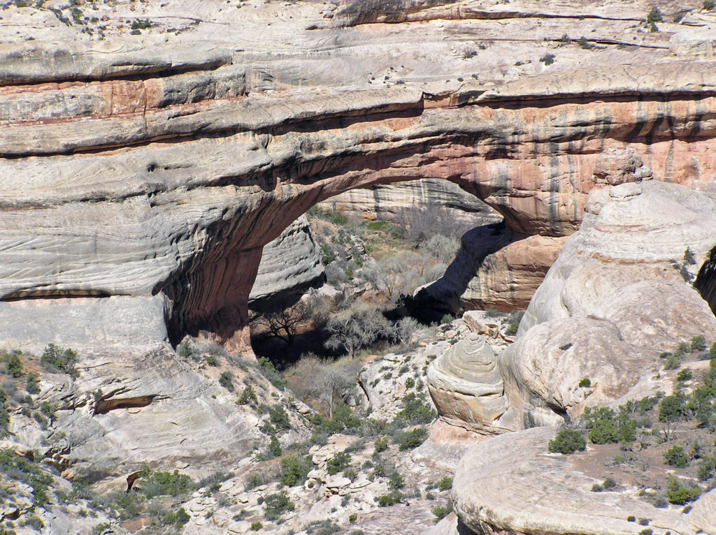 My wife and I have been back once since that first visit. The photos here were taken on that second trip in 2008. I think we’re long overdue for a third visit.
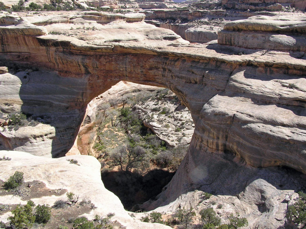
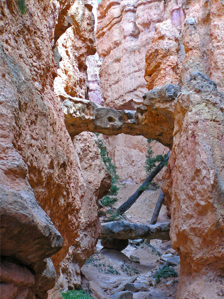
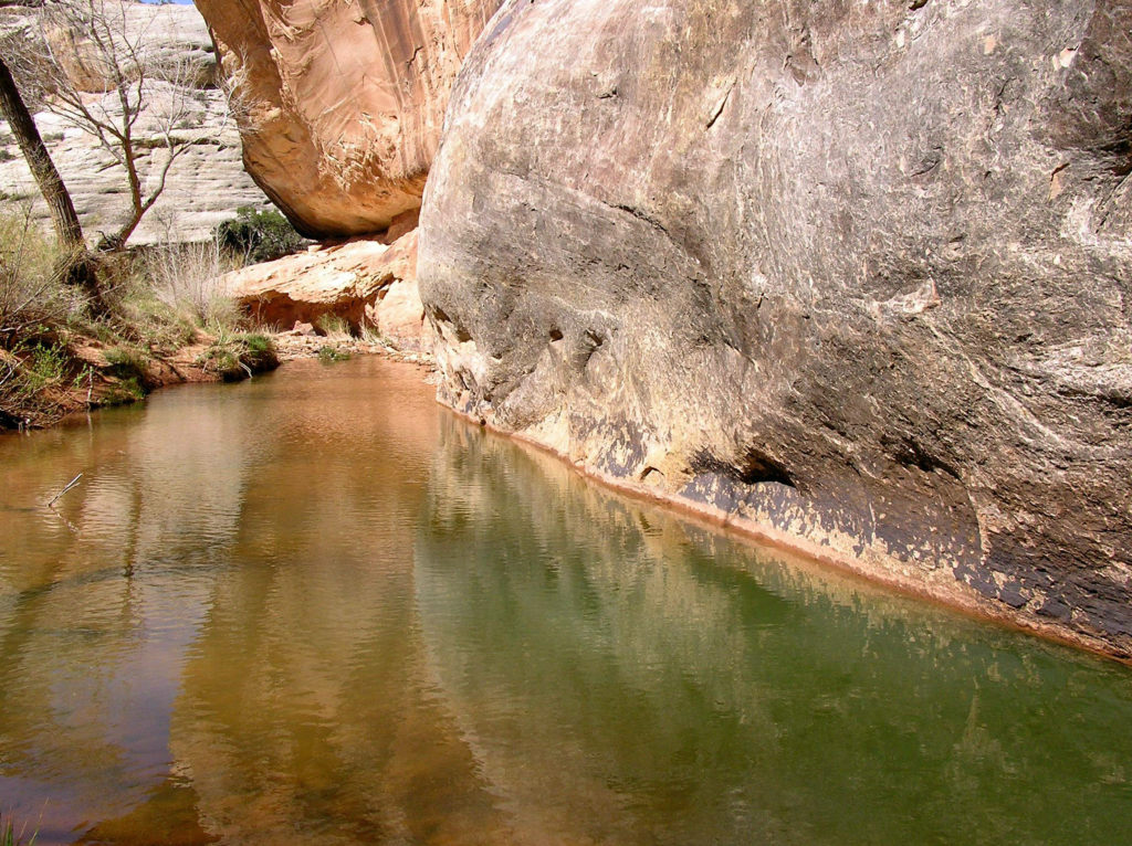
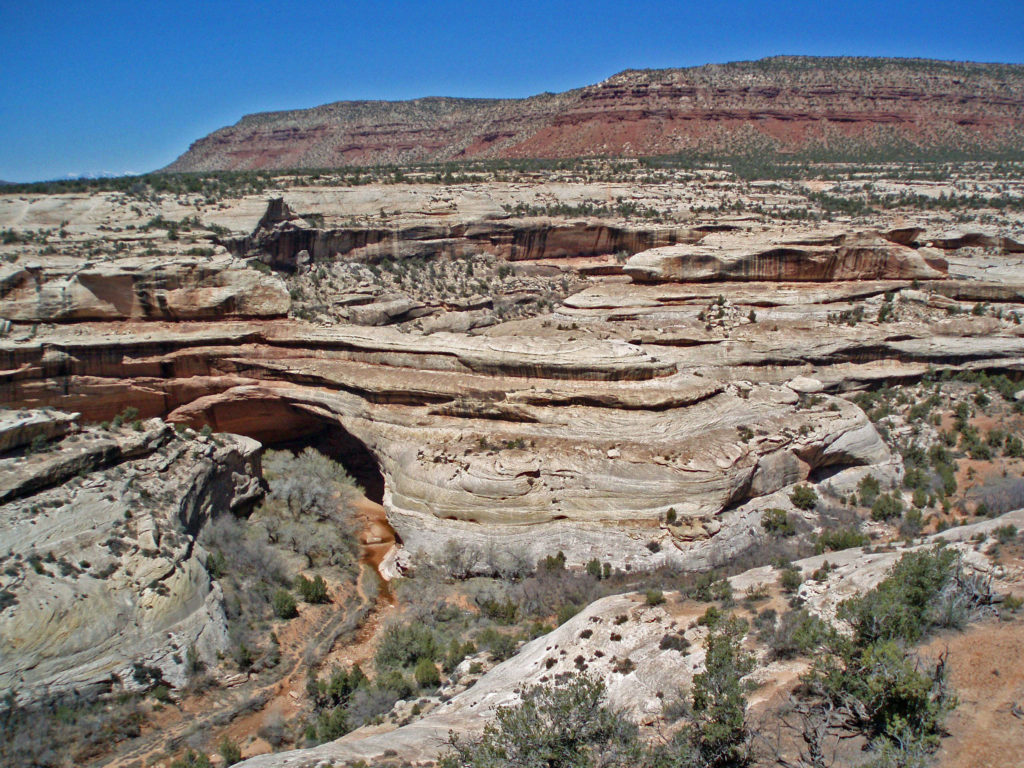 The white Cedar Mesa Sandstone of the canyons in Natural Bridges was formed from white quartz sand with relatively little iron. The red and orange sandstone of the mesa tops gets its color from more iron rich rocks. Oxygen and hydrogen react with the iron, forming compounds that vary in color depending on the relative proportions of oxygen and hydrogen in the rock.
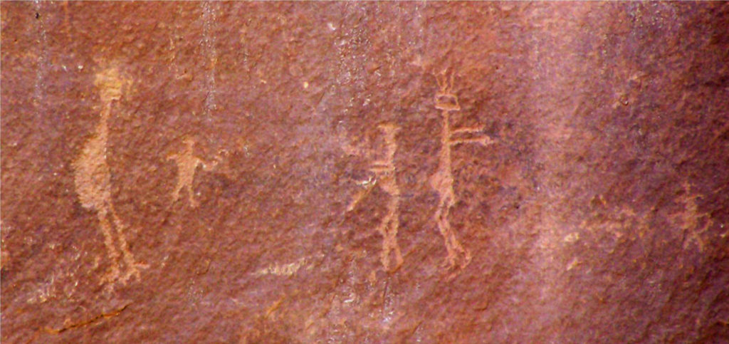 Human Presence
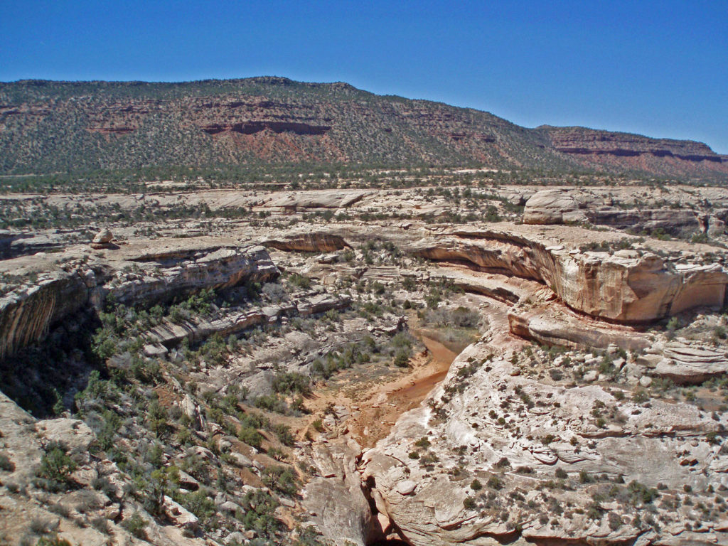
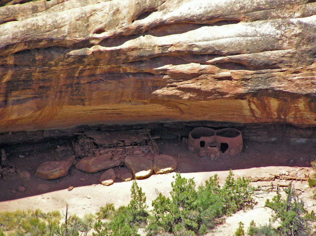 The Ancestral Puebloan people began farming the mesa tops around 1500 years ago, but later abandoned the area, presumably because of a prolonged drought. After 300 years, the ancestors of modern day Hopi and Navajo returned to the Natural Bridges area, only to abandon the area again around the year 1280 CE. Modern Hopi, Navaho, and Paiute peoples reoccupied the area once again at later dates.
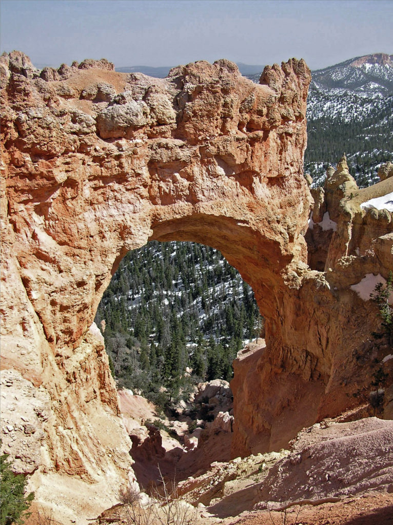
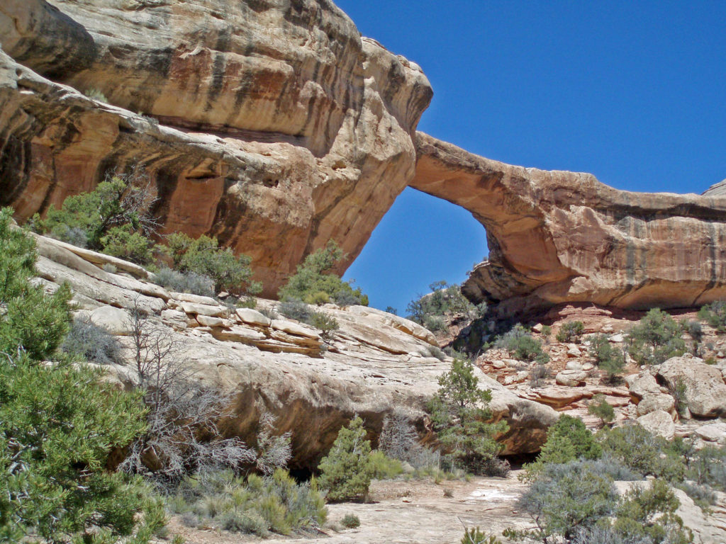
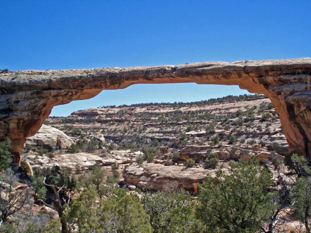 Europeans didn’t discover the area until 1883 when prospector Cass Hite ventured into the canyons looking for gold. He didn’t find any gold, but he did find the three magnificent natural bridges. Twenty years later, National Geographic Magazine published an article about the bridges, gaining the attention of President Theodore Roosevelt, who established
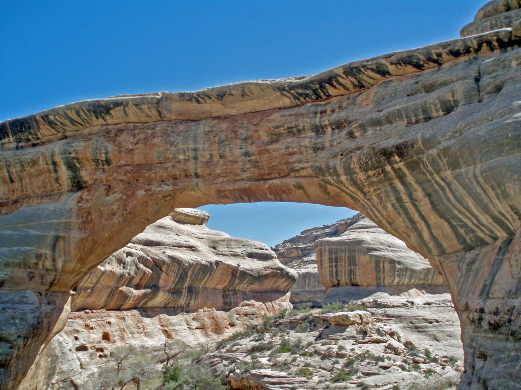
 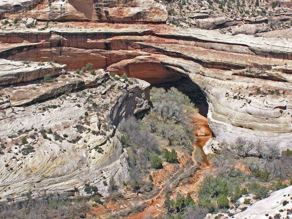 The bridges were named President, Senator and Congressman by Cass Hite. Later explorers gave them the names Augusta, Caroline and Edwin. But neither set of names stuck. In 1909 the bridges were given the Hopi names they carry today: Sipapu, Kachina, and Owachomo.
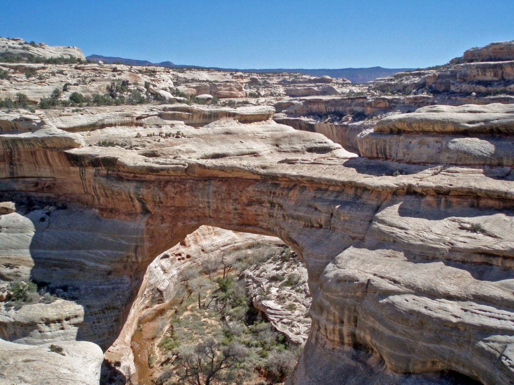
 Visitor Center
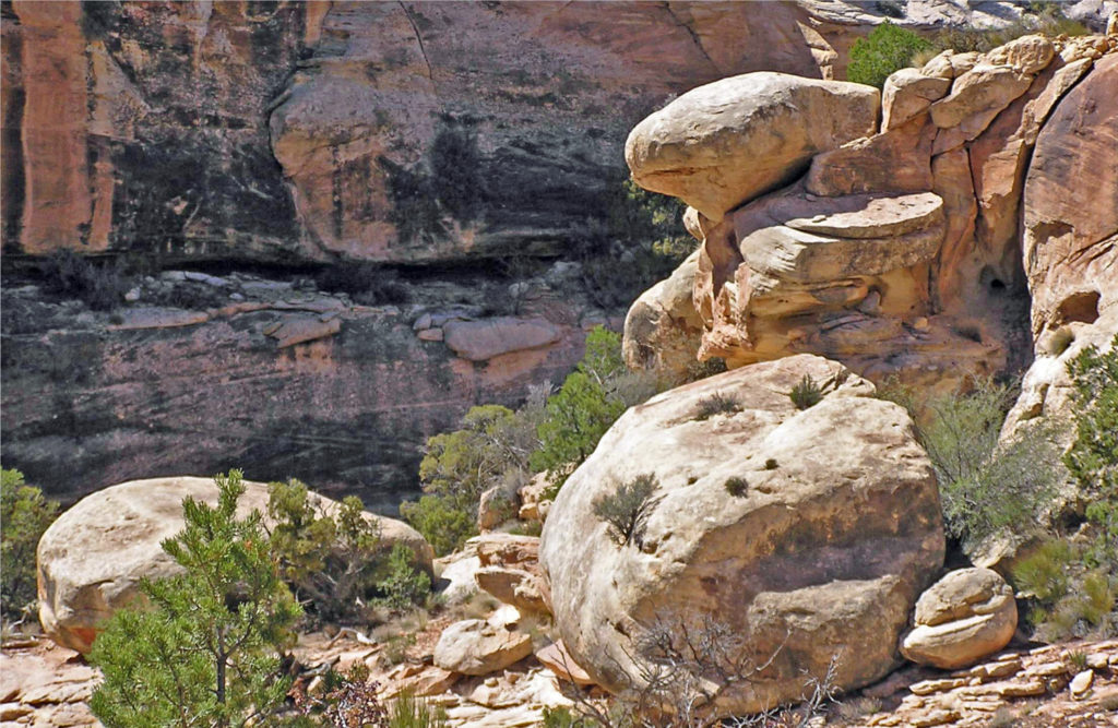


 Conclusion
 Originally posted July 10, 2021. Updated July 21, 2024.