
Lava Canyon Trail
Where: Mount St. Helens National Volcanic Monument
Distance: 2.6 miles
Type: Out and back
Elevation gain: 900 feet
Difficulty: Moderate (for some steep sections and trail conditions)
Restrictions: Dogs and other animals not allowed.
 Overview:
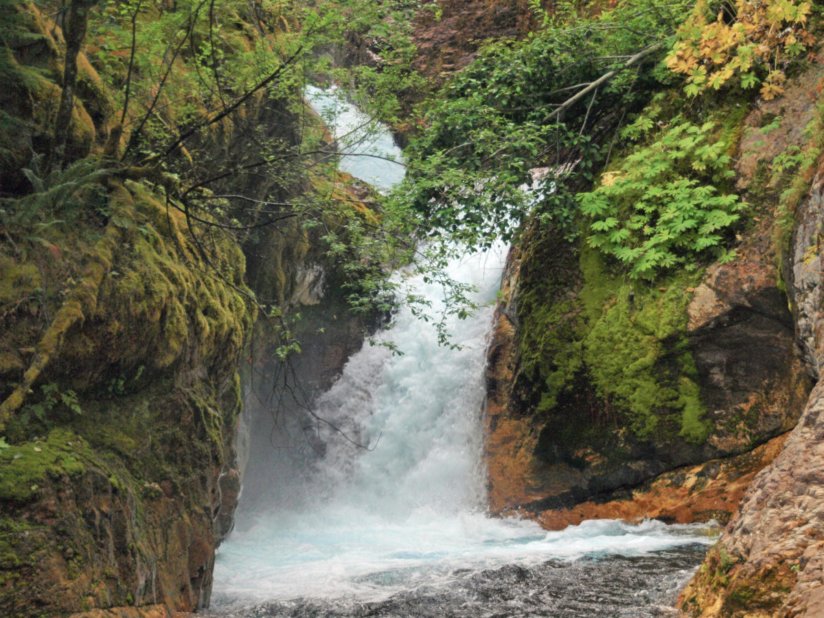
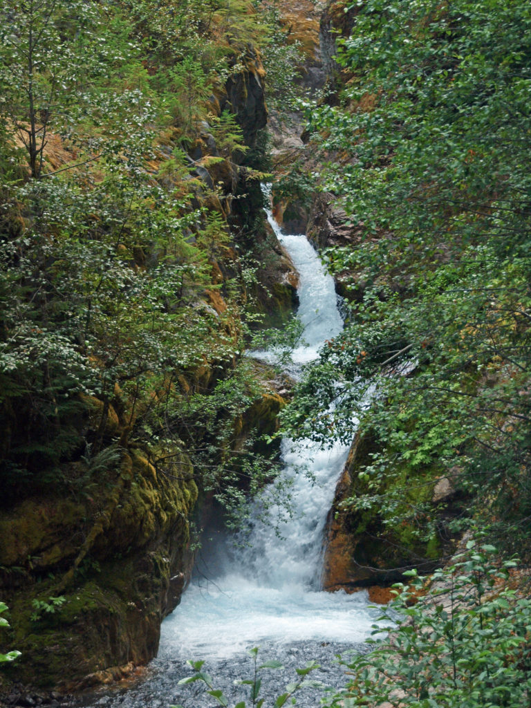
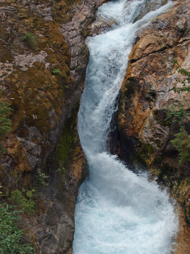
Lava Canyon, on the southeast flank of Mount St. Helens, is one of my favorite hikes in the Pacific Northwest. If you’re a waterfall lover (and who isn’t), Lava Canyon is a must see. The Muddy River crashes through the canyon here, cascading over and through a seemingly endless series of ledges and narrow chutes, one right after the other for about a mile and a half. It is truly spectacular.
 The history of Lava Canyon begins about 3500 years ago when an eruption of Mount St. Helens sent a flow of lava down the old valley of the Muddy River, destroying the forest and filling the valley with molten rock. Over the intervening years, the Muddy River cut a new course through the lava flow, and the canyon gradually filled with sediment. Then came the 1980 eruption, which melted the summit glaciers and sent a huge lahar (volcanic mudflow) down the valley, destroying the rebuilt forest and scouring out the built-up sediment, exposing the remnants of the earlier lava flow. What was left is a steeply descending canyon with an almost continuous series of spectacular waterfalls and cascades. (For more information on the 1980 eruption, see my Mount St. Helens post).
 Getting there:
To get to the canyon, take Washington State Route 503 east from the town of Woodland, 20 miles north of Portland on I-5. Continue east past the town of Cougar. Where SR 503 turns south toward Vancouver, continue straight on SR 503 Spur, which becomes US Forest Road 90. Just past Swift Dam, turn left onto Forest Road 83. The upper trailhead of the Lava Canyon Trail is at the end of FR 83. (The lower trailhead can be reached by FR 8322, which branches off from FR 83 shortly before you reach the upper trailhead. The most spectacular part of the canyon is the upper section, though, so if you haven’t already explored that, you’ll want to start at the top.)
 Trailheads:
The upper trailhead has restrooms and water is available. Parking requires a Northwest Forest Pass. There are no facilities at the lower (Smith Creek) trailhead and no parking permit is required.
 The hike:
The trail from the upper trailhead begins as an ADA accessible paved path with sections of wooden boardwalk. This section of the trail has a number of interpretive displays explaining the history and geology of the canyon. After about four tenths of a mile, a side trail leads to a bridge across the river. The paved path continues a few hundred yards to a waterfall overlook.
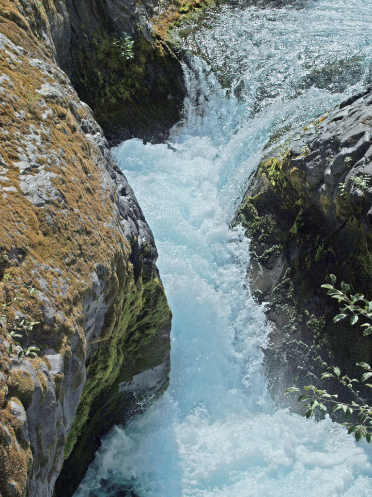
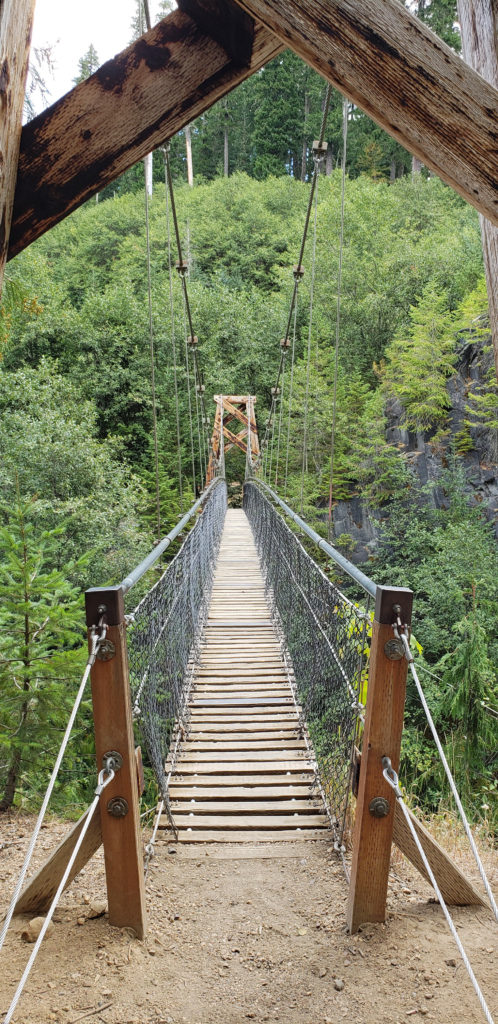 Below the overlook, the path is rock and dirt, steep in places. After another three tenths of a mile, you come to another side trail and a suspension bridge over the river that gives a bird’s eye view of the canyon and waterfalls. On the other side of the bridge is a connecting trail that takes you back to the upper bridge, making for a 1.4-mile loop. (Update: As of June 2023 the suspension bridge is closed. Check the National Forest Service’s Lava Canyon Trail web page for current information).
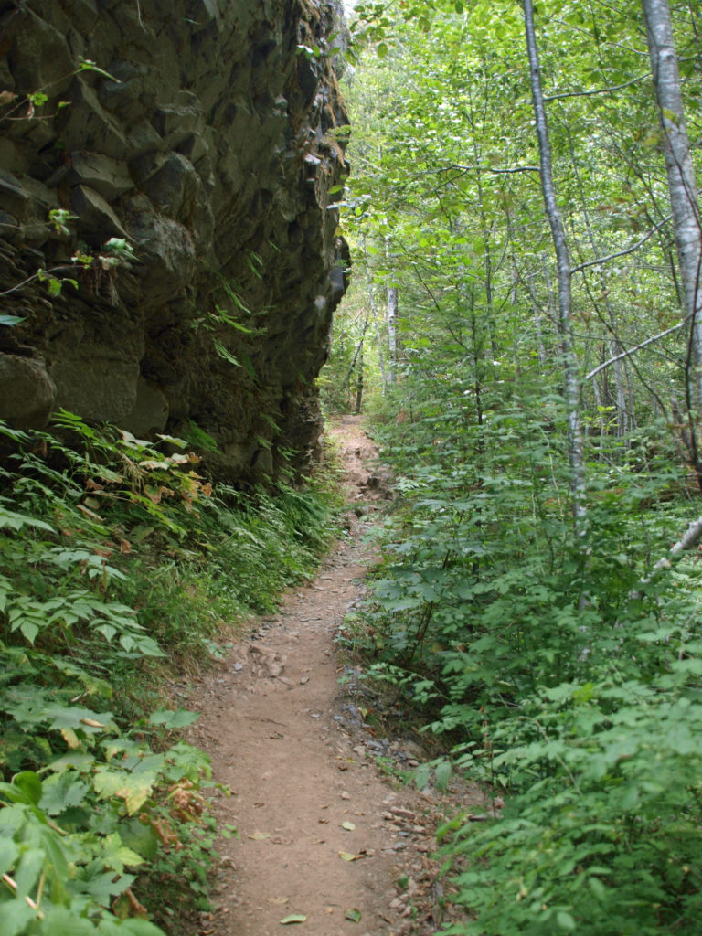
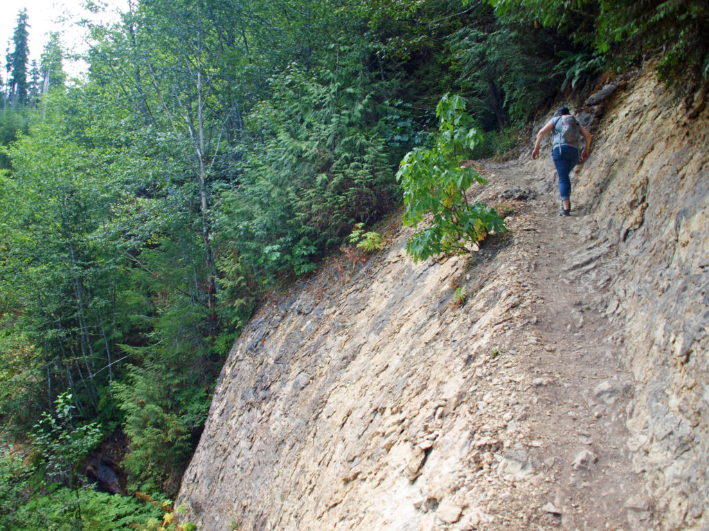
Below the suspension bridge the trail descends very steeply. This portion of the path is narrow, covered with loose rock in places, and there are sheer drops to the river below. Take extreme care on this section of the trail. There have been several fatalities here in recent years. Shortly after my wife and I did this hike in 2018 an 18-year-old man went missing in the canyon. It is presumed that he fell into the river and drowned. You can read the story here. Those that do brave the trail, though, will be rewarded with the most spectacular part of the canyon. Just take the warning signs seriously and be careful.
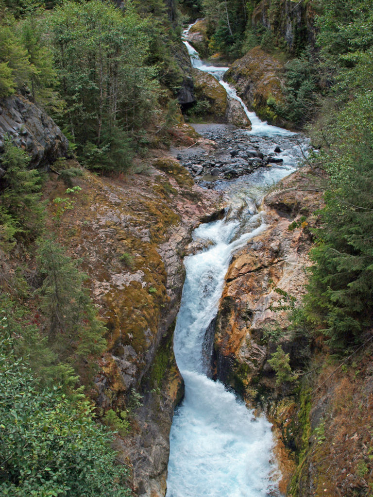
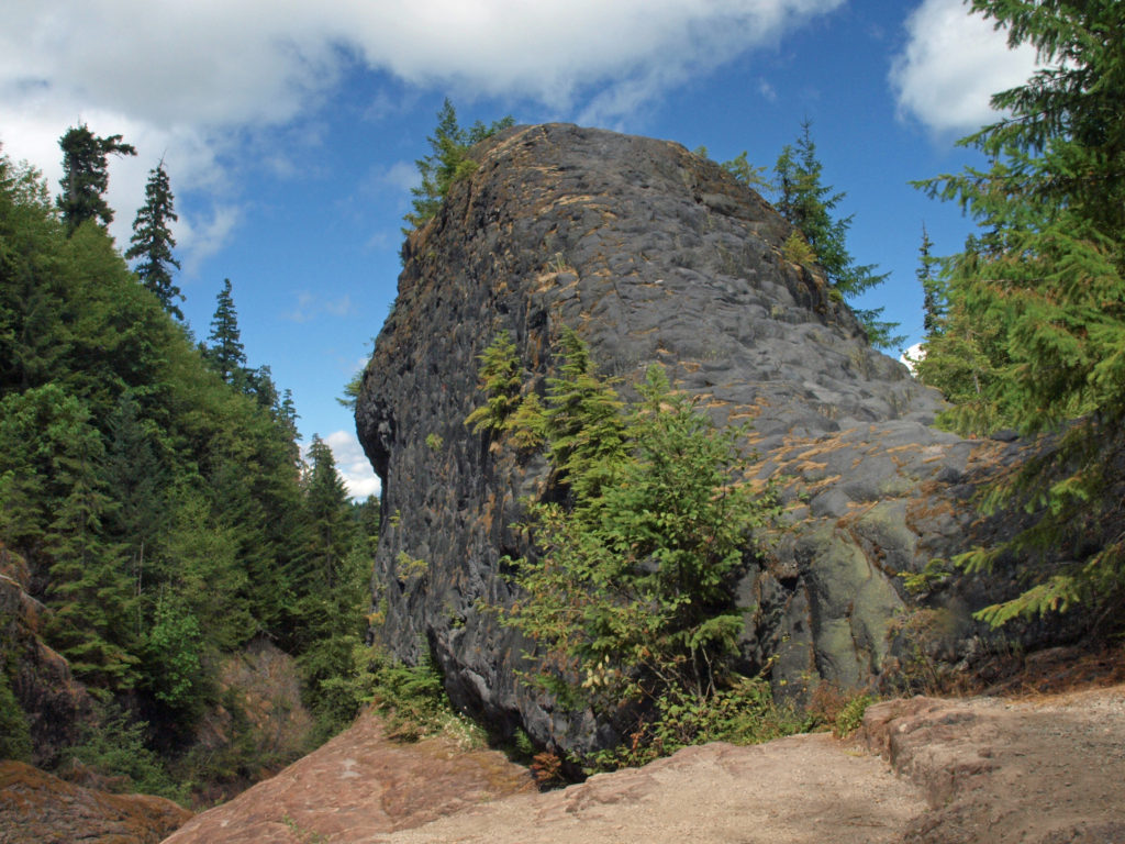
 At about the 1.3-mile mark, the trail descends a 40-foot ladder to the base of the rock formation known as The Ship. Before 1980, sediment filled the canyon to the top of The Ship, to give you an idea of how much sediment was scoured out of the canyon. A short but steep side trail (and another ladder) leads to the top of The Ship.
 (Below The Ship, the trail continues another 1.5 miles to the lower trailhead. The entire hike from upper to lower trailhead and back is about six miles and the elevation gain coming back is 1350 feet.)
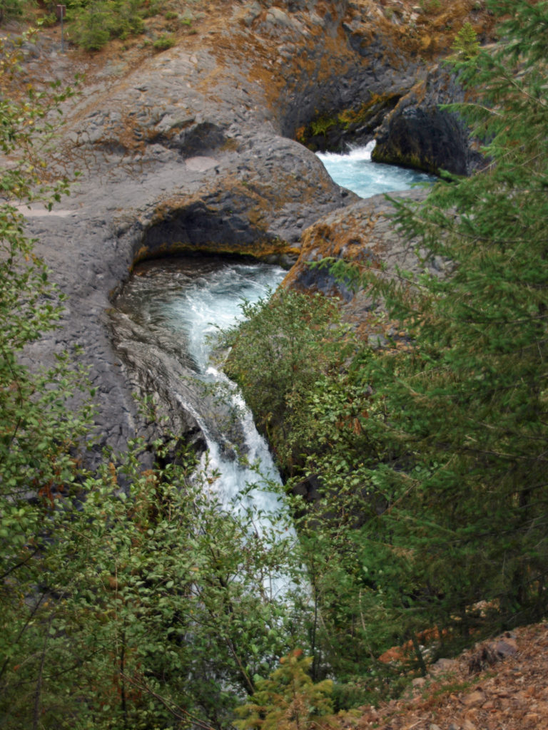
 Return from The Ship the way you came. Cross the suspension bridge if it is open and take the trail on the opposite bank to the upper bridge and re-cross the river. The two bridges both give you great views of the river and canyon below.
Other area attractions and activities:
There are many other hikes on Mount St. Helens that are worth doing, including Harry’s Ridge and Ape Cave. On the southern flank of the mountain, Swift Reservoir and Lake Merwin offer boating, camping, and fishing opportunities. Just east of Woodland, Cedar Creek Gristmill is a historic restored mill open to the public. And in Woodland, Hulda Klager Lilac Gardens is well worth a visit.
 Originally posted in a different format September 29, 2018 by Alan K. Lee. Updated and re-posted March 23, 2021. Edited, updated and posted in this format June 29, 2023.
All photos ©Alan K. Lee