
The 1980 eruption of Mount St. Helens was one of the most significant natural disasters in U.S. history. Everyone knows about the eruption, but a little history is in order here, I think.
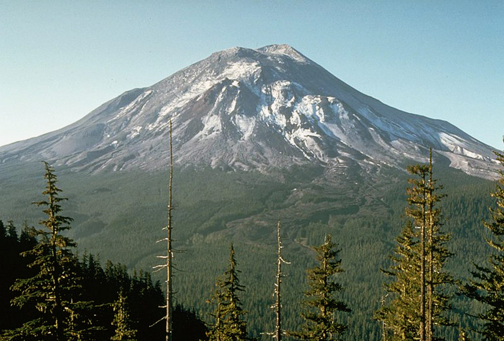
Mount St. Helens had been dormant for 123 years until it awoke in March 1980. On March 15th a series of small, shallow earthquakes were recorded, centered below the summit of the mountain. In the days that followed, more quakes occurred, the largest a magnitude 4.2 quake on March 20th.
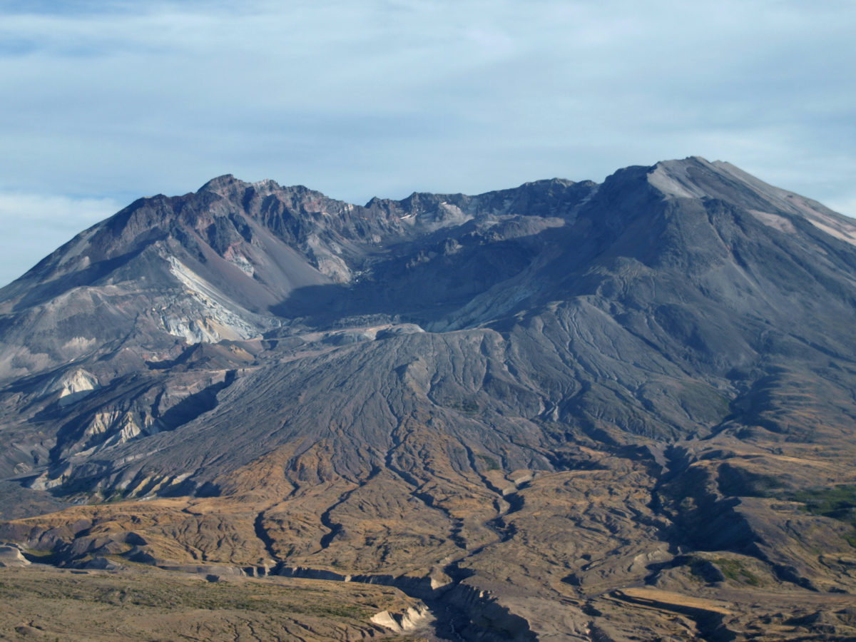
Between March 25th and 27th 174 earthquakes greater than magnitude 2.6 were recorded, the largest a magnitude 5.1 quake on the 27th. The first eruption, also on the 27th, opened a new summit crater. The north flank of the mountain also began bulging outward, with the bulge growing 5-6 feet per day. More eruptions occurred over the next week few weeks. By April 7th the new crater measured 1700 by 2300 feet and was 500 feet deep. By mid-May the north side of the mountain had moved outward by 400 feet and the summit area had begun to collapse.
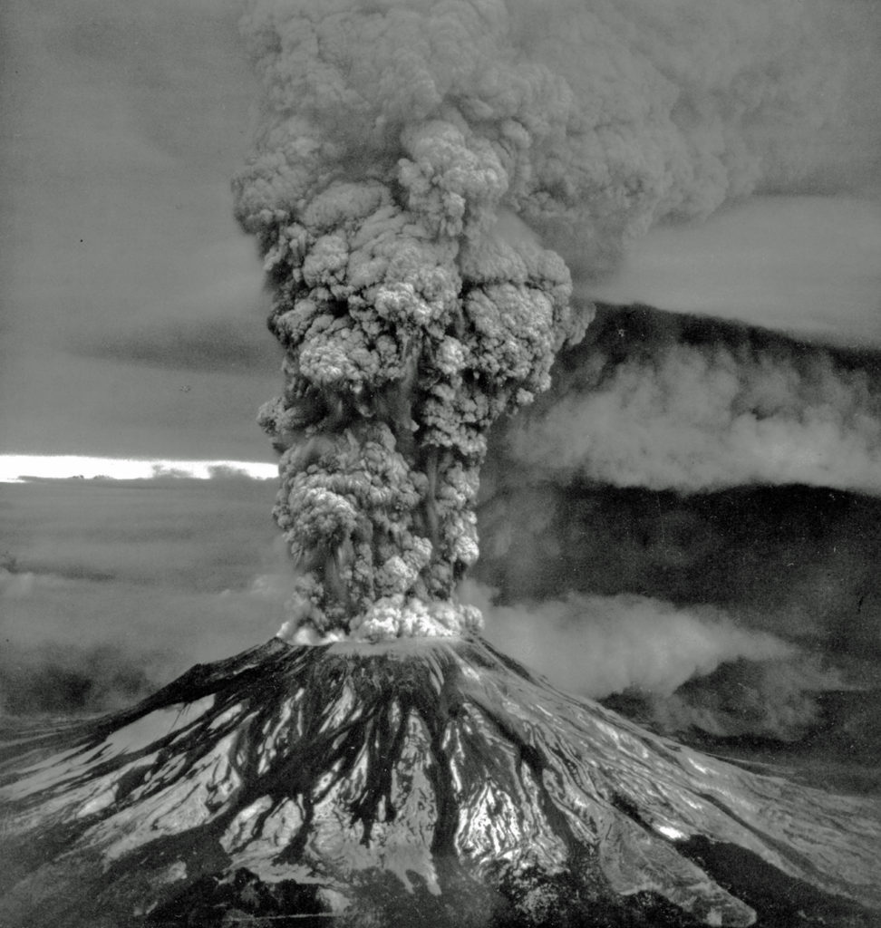
At 8:32 a.m. on May 18, 1980 a magnitude 5.1 earthquake caused the north flank of the mountain to collapse in the largest landslide ever recorded. A few seconds later the mountain erupted in a lateral blast that devastated an area as far as 20 miles from the summit and felled 230 square miles of forest. The blast superheated the waters of Spirit Lake instantly, causing a huge secondary steam explosion. This secondary explosion was heard as far away as San Francisco (but, interestingly, was not heard in the Portland area).
The eruption sent an ash cloud 12 miles into the sky. In the Yakima Valley, northeast of the mountain, the ash cloud completely blocked the sun and noon was as dark as midnight. Ash fell as far away as Minnesota. The energy released by the eruption was estimated to be equivalent to 24 megatons of TNT, more than 1400 times the energy released by the atomic bomb that destroyed Hiroshima in World War II.
At least 55 people were killed in the eruption. The official total is listed as 57, but two people on the list who were reported missing after the eruption may not have been in the blast zone that day, and three others who are not on the official list may have been. Two of the most prominent people that died that day were Harry R. Truman and David A. Johnston.

Eighty-three year old Harry Truman owned Mount St. Helens Lodge on the shore of Spirit Lake. He had lived there for more than 50 years and refused to leave when the area was evacuated. He was a colorful, locally well known character who had lived an eventful life and had become something of a celebrity in the months leading up to the eruption. He was buried by the initial landslide.
David Johnston was a highly respected geologist and volcanologist. He was camping near where the Johnston Ridge Observatory is now located. He was the first to report the eruption. “Vancouver! Vancouver! This is it!” he radioed the USGS office in Vancouver, Washington just before he was hit by the blast.
Also killed in the eruption were photographers Reid Blackburn and Robert Landsburg. Blackburn’s body was found in his car at Coldwater Camp four days after the eruption. His camera was found later, but the film was not salvageable. Landsburg’s body was found seventeen days after the eruption. His camera was found inside his backpack under his body. The film in his camera survived and the photos he took before the ash cloud engulfed him provided some of the most dramatic and scientifically valuable photos of the eruption.
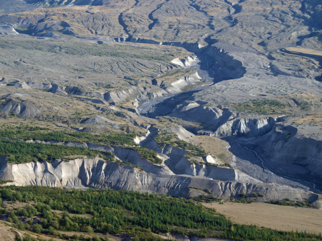
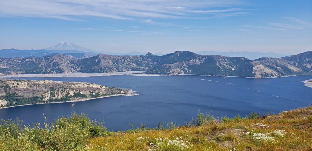
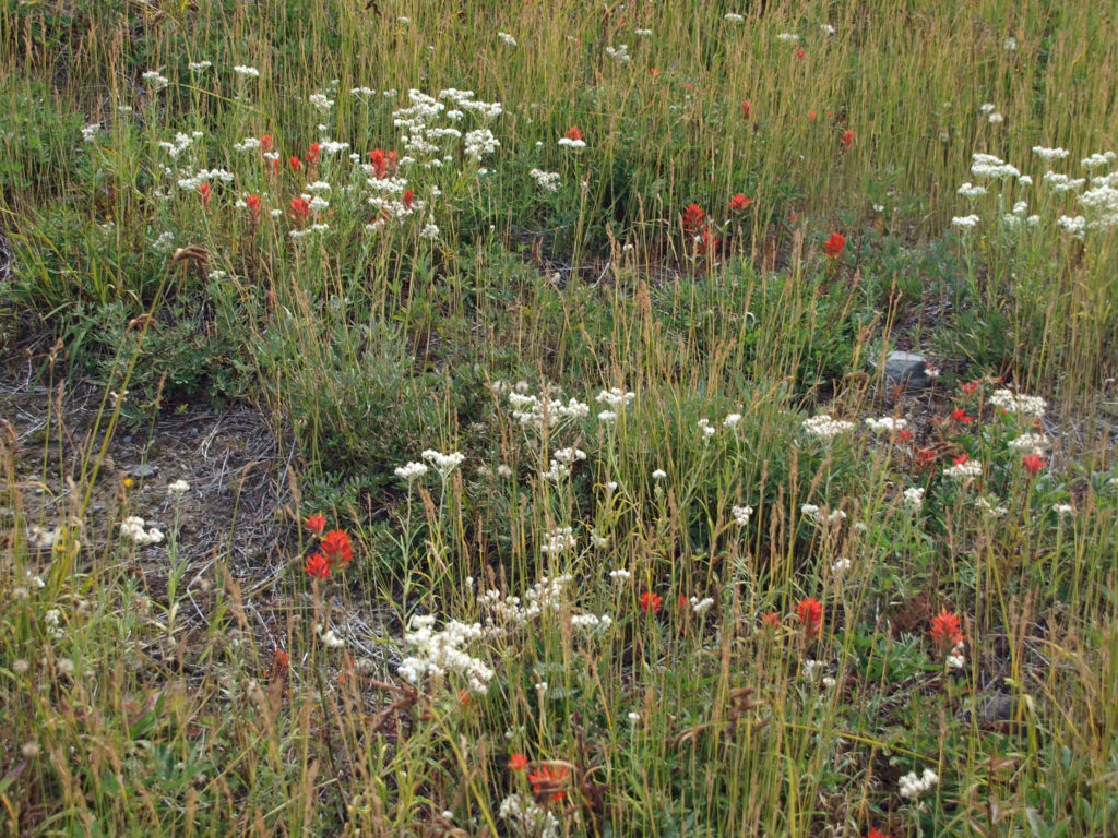
Thirty-eight years after the eruption, when these photos were taken, the area between the new crater and Johnston Ridge still looked much like it did when I first visited the area some 25 years before. Trees were beginning to regrow on the north side of the ridge, though, and shrubs and wildflowers were abundant. The land is recovering, but it will be generations, perhaps centuries, before the forest returns to anything like it was before the eruption.
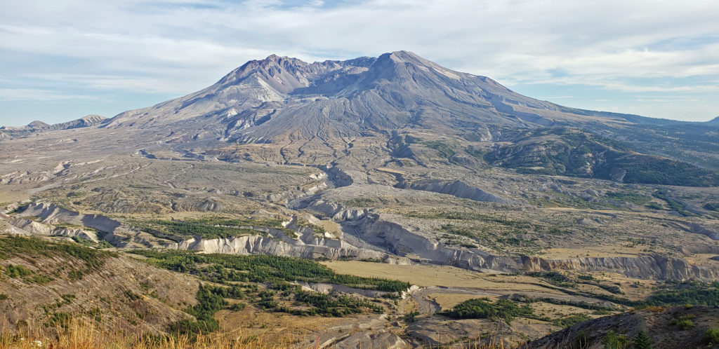
The Johnston Ridge Observatory is a good place to begin an exploration of Mount St. Helens. At the observatory you can view interpretive displays and videos, and get information about the mountain, the eruption, and area hiking trails. The observatory is located at the end of the Spirit Lake Highway (WA 504). To get there from the Seattle area, travel south on I-5 and take WA 505 (Exit 63) through the town of Toledo to the junction with WA 504. From Portland, take Exit 49 off I-5 at Castle Rock. Johnston Ridge is approximately 50 miles east of I-5. There is an $8 parking/entry fee, payable at the observatory.
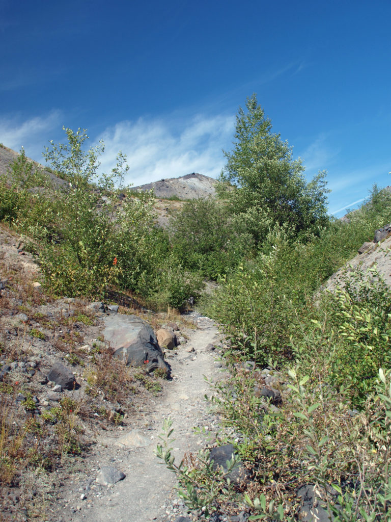
One of the best hikes on the mountain is the trail to Harry’s Ridge, which begins at the Johnston Ridge Observatory. Total out and back mileage is about eight miles and total elevation gain is about 1000 feet. Check out my Harry’s Ridge Hike post for a more detailed description of the hike. You can also hike into the heart of the blast zone between Johnston Ridge and the crater. Check the Johnston Ridge Observatory website, linked above, for current information.
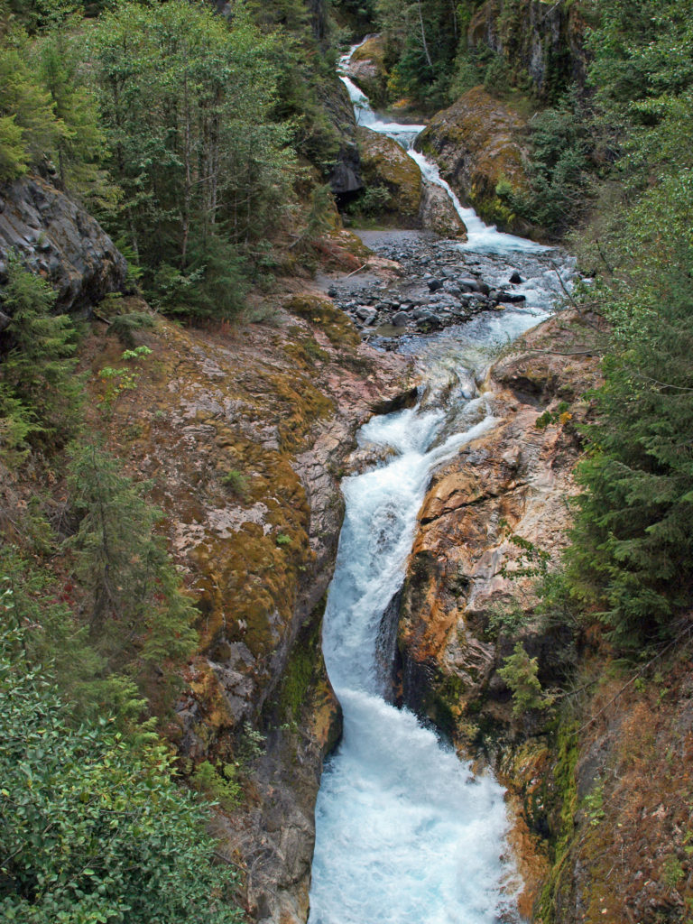
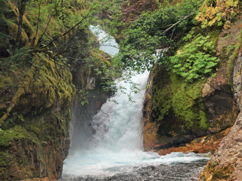
Another one of my favorite Mount St. Helens hikes is the Lava Canyon Trail on the southeast side of the mountain. Distances and elevation gains vary depending on how far down (or up) the canyon you go. You don’t have to go far down the trail from the upper trailhead to see some of the most spectacular waterfalls in the Pacific Northwest, though. The initial section of the trail is ADA accessible and everyone can view some of the best waterfalls. Again, check my blog post on Lava Canyon for more details.

Both the Harry’s Ridge and Lava Canyon hikes are among the best in the Northwest. They are very different, but both are incredibly beautiful and relatively easy hikes, and both can be done in a single weekend. But even if you’re not a hiker, visiting the Johnston Ridge Observatory and taking the short ADA accessible trail at Lava Canyon are more than worthwhile for everyone. And anyone who has not explored the mountain should do so at some point. It’s an unforgettable experience.
Originally posted March 27, 2021 by Alan K. Lee. Updated and re-posted June 19, 2023.
All photos © Alan K. Lee, except as noted