
God’s Thumb Hike
Where: Oregon Coast
Type: Out and back
Distance: 4.5 miles
Elevation gain: 1100 feet
Difficulty: Easy to moderate
 Overview:
God’s Thumb is a conical basalt headland rising out of the sea like a giant thumb just north of Lincoln City, Oregon. I first laid eyes on God’s Thumb in the 1980s, from the open grassland on the summit of Cascade Head. From there the Salmon River Estuary is immediately below you and just beyond is the town of Lincoln City. In between, there is a rocky headland – God’s Thumb. There’s also an isolated cove and a nice beach visible from Cascade Head. I wondered how you could get there. When I inquired about the area, I was disappointed to find out that you couldn’t. Even though God’s Thumb was (and is) part of the Siuslaw National Forest, there was no public access to it. The only ways to get there crossed private property that were not open to the public.
 The God’s Thumb hike remained closed to the public until about a decade ago. Although people occasionally trespassed across private property to get to it, God’s Thumb remained largely unknown. But in 2013 Lincoln City purchased about 500 acres of property that was the site of a failed subdivision and negotiated an easement with the owner of the neighboring property, making God’s Thumb legally accessible to the public for the first time.
 Trailhead:
The God’s Thumb hike starts just north of Lincoln City. Coming from Lincoln City, go north on Hwy 101, past the turn to Road’s End and Chinook Winds Casino, and turn left onto NE Devil’s Lake Boulevard at the next traffic signal. The trailhead is on your left just before the cul de sac at the end of the road.
 The hike:
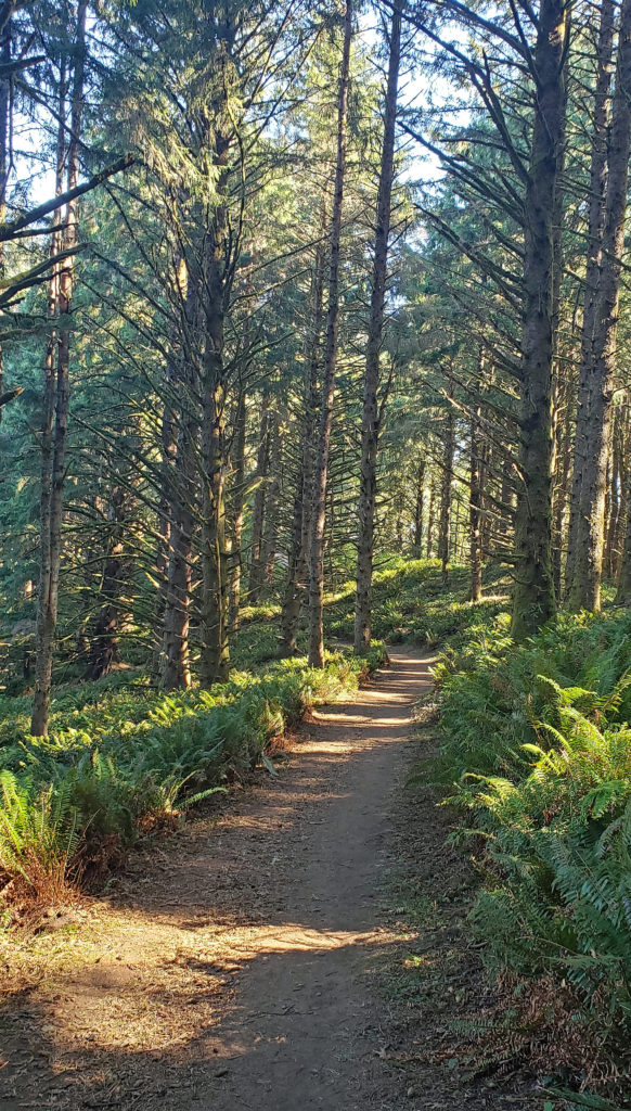
From the parking area at the trailhead, the trail wanders through the woods for about a quarter mile before crossing Logan Creek on a bridge. On the other side of the creek you’ll come to Sal La Sea Drive. You’ll note that there is a small parking lot there. Turn right and walk up Sal La Sea Drive another quarter mile and turn right onto Port Drive. You’ll see a gate ahead. You’ll also note that there is parking for four or five cars at the end of Sal La Sea Drive. (See A few notes on parking, below). Walk around the gate and follow an old gravel road straight up the hill. In about a quarter of a mile you’ll come to a junction. Turn left and walk out to The Knoll.
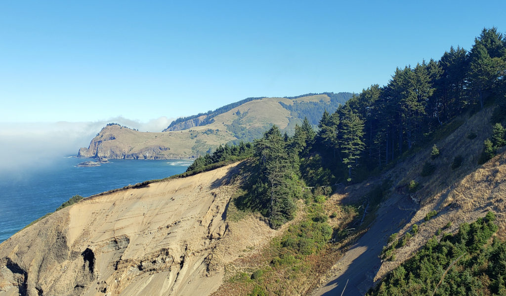
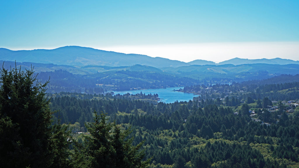
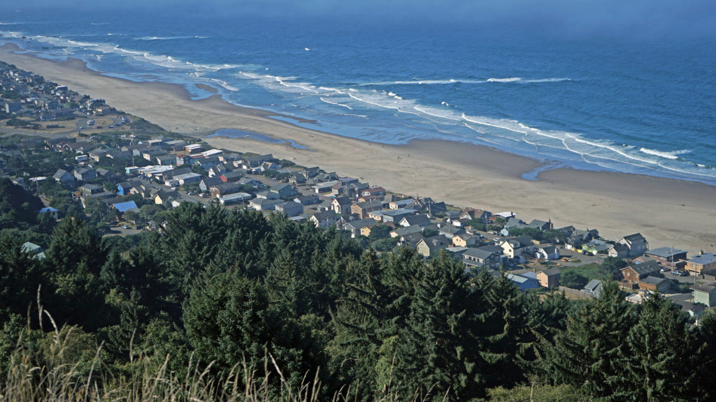 You don’t want to skip this because the view here is spectacular. The Pacific Ocean is spread out before you in all its glory. The Road’s End section of Lincoln City is directly below you. Lincoln City stretches out before you, with Devil’s Lake to the east and Siletz Bay to the south. The view extends south to Cape Foulweather. You might want to park yourself on the grassy summit and just sit for a while. Apparently, the local herd of elk also like the view because they often bed down here at night.
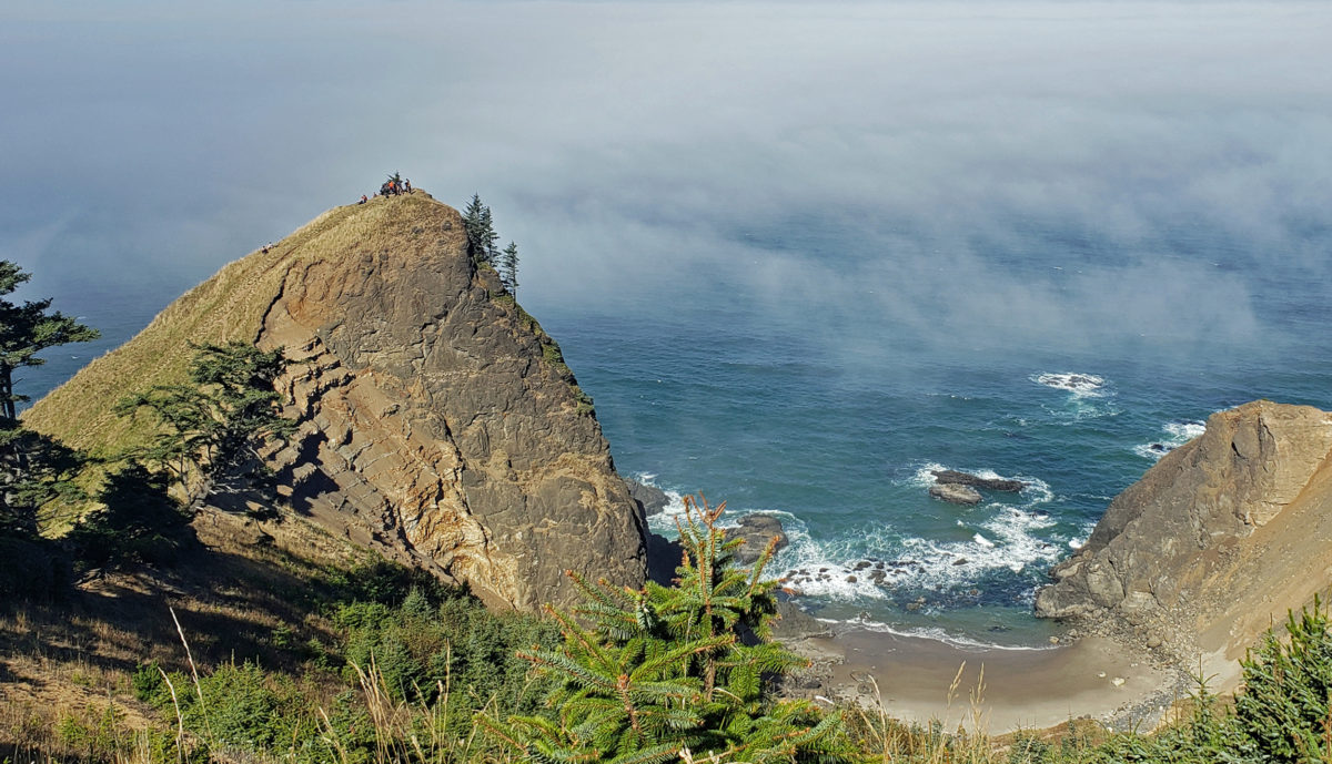
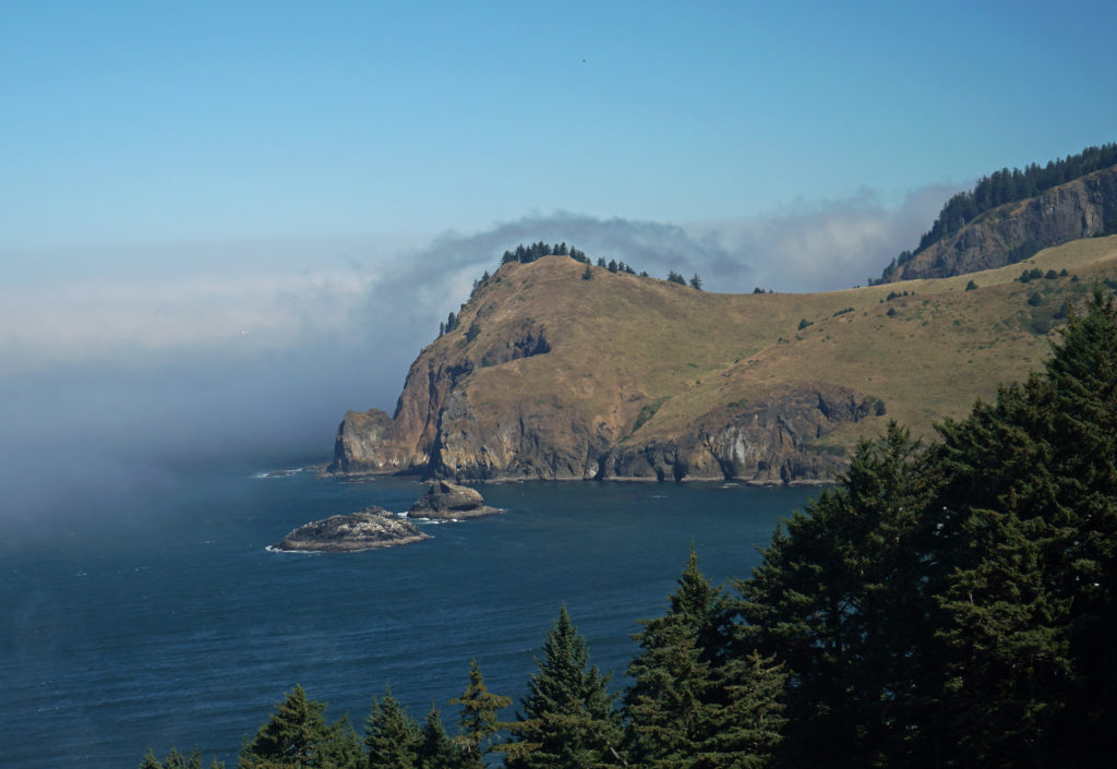
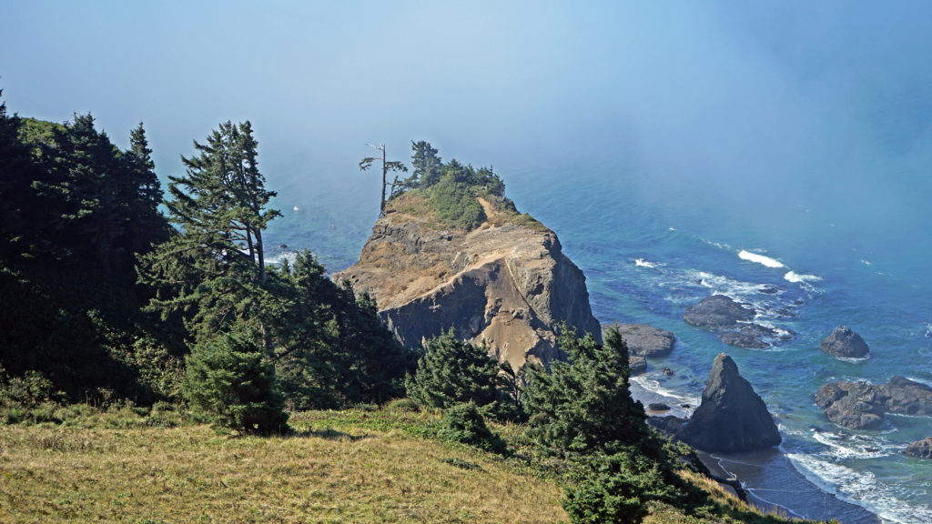
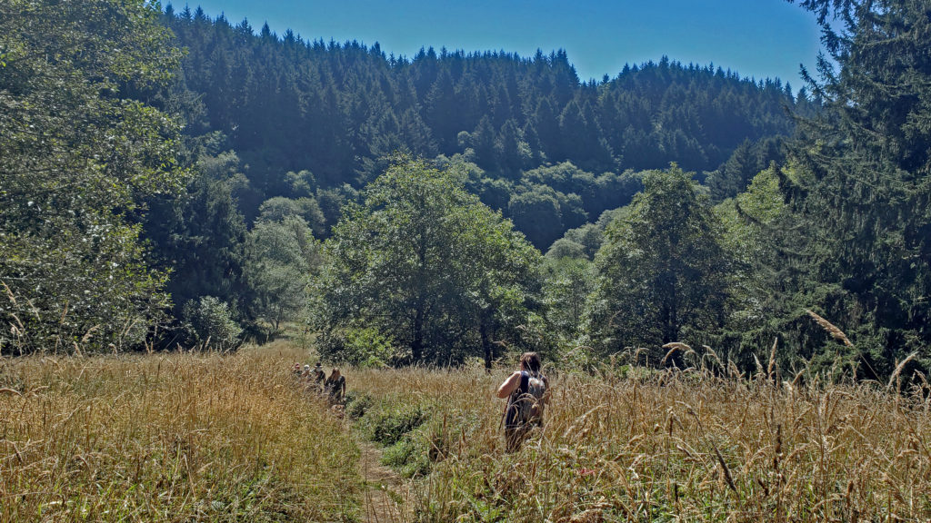
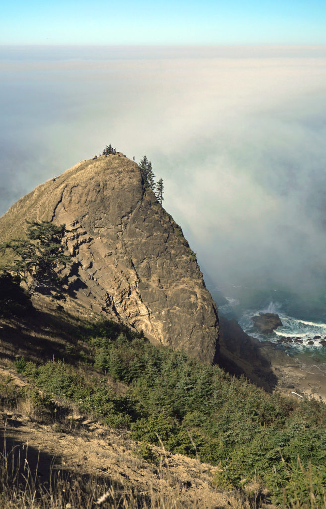
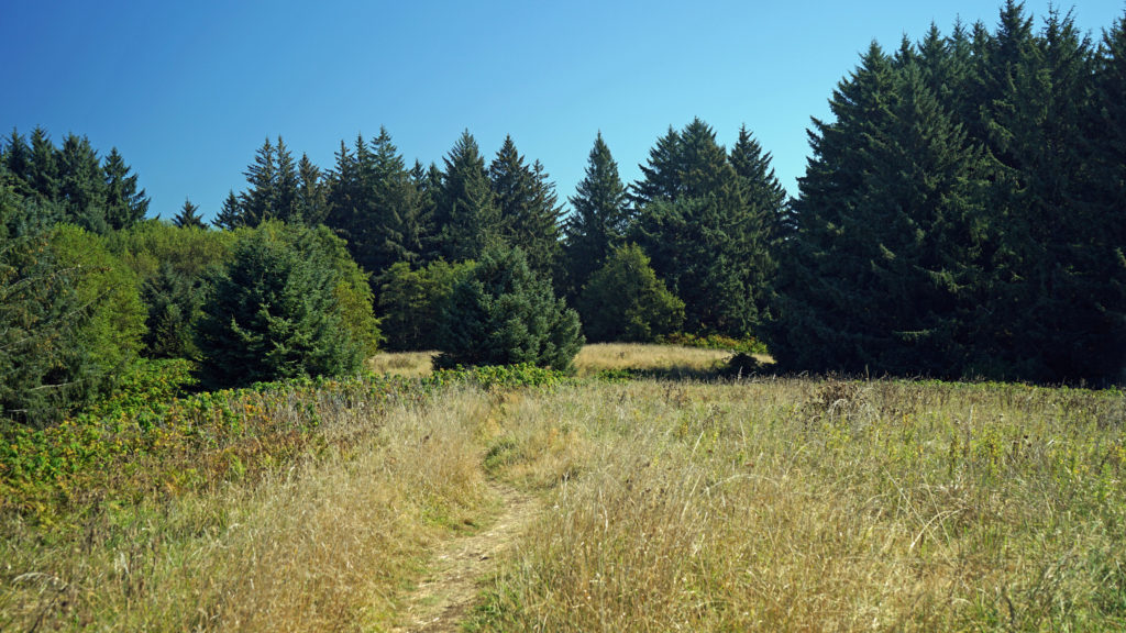 When you’re done taking in the view from The Knoll, return to the main trail and continue north. This portion of the trail is on the easement granted to the city by the property owner. The trail takes you through a spruce and hemlock forest and across a small meadow. Parts of the trail are steep, but the elevation gain is modest, and most people won’t have any difficulty. You’ll soon come to a trail junction. Stay left to continue on to God’s Thumb. You’ll pass through more spruce, hemlock and alder forest, and across several grassy meadows before the trail swings to the west and comes to another trail junction. The trail to the right comes up from the private Camp Westwind on the Salmon River Estuary. Stay left at the junction and you’ll soon see God’s Thumb in front of you. Stop here and admire the view of The Thumb and the surrounding cliffs, the two coves and beaches on either side of The Thumb, and Cascade Head to the north.
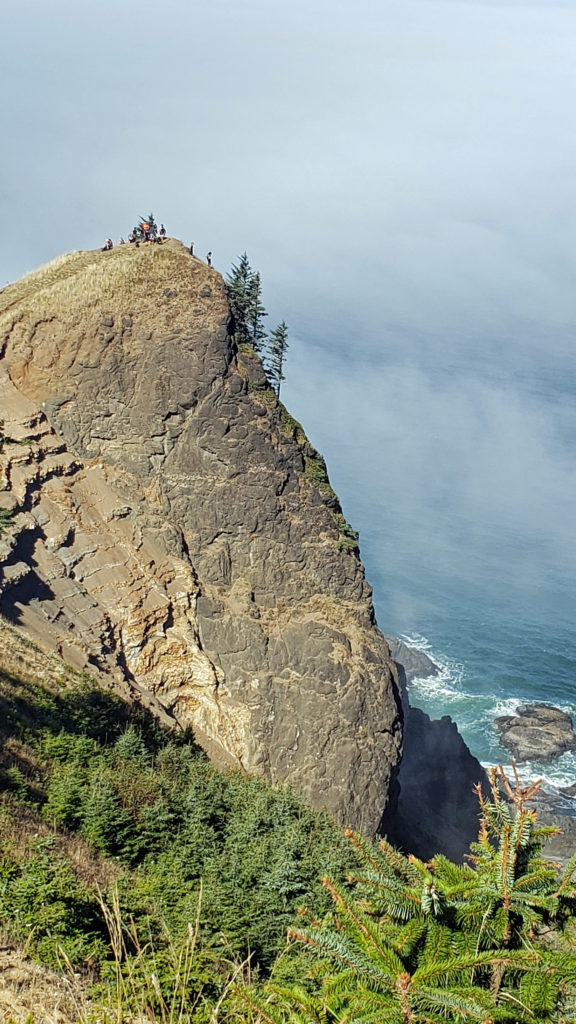
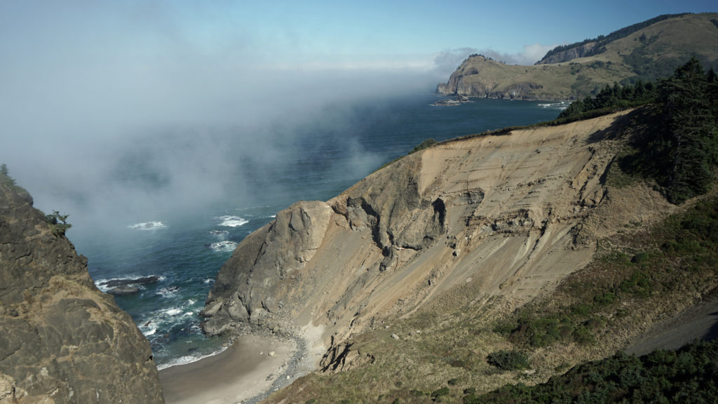 The trail then drops steeply down the slope and across along a narrow ridge before climbing very steeply up the slope to the summit of God’s Thumb. This section can be tricky to navigate and can also be slippery if the trail is wet. Some people choose not to venture down and then up to the summit. But if you do, you’ll be rewarded with magnificent views in all directions. Even if you don’t, the views you do get make the hike well worthwhile.
 When you’re done taking in the views, return the way you came. When you reach the second trail junction, before you get to The Knoll, you have the option of taking the trail to the left for an alternate, slightly longer route back to the end of Devil’s Lake Boulevard where you left your car. Check the Oregon Hikers website for a description of this trail and more information about the whole hike. If you don’t take the alternate route, venture out to The Knoll again. The view might be completely different if the fog has come in (or gone out).
 A few notes on parking:
The two parking areas along Sal La Sea Drive that I mentioned are both okay to park in (legally) if you want to shorten your hike a little. But they’re not officially sanctioned because they fill up quickly and many people have parked on residential streets close by when they are full, to the ire of the local residents. Please do not park on any residential street. The Devil’s Lake trailhead was developed to give hikers an additional parking area and lessen the amount of people parking where they shouldn’t. If all of the parking areas mentioned are full, you can park at Road’s End State Recreational Area on Logan Road and walk up Sal La Sea Drive to the Port Drive trailhead. That makes the round-trip hike only about half a mile longer than starting at the Devil’s Lake Boulevard trailhead. And under no circumstances should you use the shorter trail from the end of Logan Road to get to God’s Thumb. The property owner has not granted public access across their property. They haven’t fenced it off, but please respect their property rights. And besides, there is no public parking anywhere on Logan Road other than at Road’s End State Recreation Area, so you risk having your vehicle towed if you park illegally.
 Other area hikes and other attractions:
Other worthwhile hikes in the Lincoln City area include the Nature Conservancy’s Cascade Head Preserve, the Hartz Cove Trail on the north side of Cascade Head, and the Drift Creek Falls Trail in the Coast Range foothills to the east. More on those in later posts. And farther south, the Beaver Creek State Natural Area offers a nice, quiet, and peaceful hike that not many people know about.
And the central coast from Lincoln City to Newport has numerous other attractions, including the Oregon Coast Aquarium in Newport, the charming (but increasingly touristy) town of Depoe Bay, Chinook Winds Casino in Lincoln City, and numerous state parks and waysides.
Originally posted (in a slightly different format) May 19, 2021 by Alan K. Lee. Edited, reformatted, and re-posted May 3, 2023.
All photos © Alan K. Lee