Many of us that live in the Pacific Northwest have a connection of one kind or another to the state of Arizona. Many Northwest retirees, like my parents, become snowbirds, escaping the Northwest winters by spending the colder months in the sunnier and warmer climes of the desert Southwest. Others, like my brother, escape at an earlier age. Most of the rest of us have vacationed at least once in Arizona, or at least have dreamed of doing so. My wife and I have both lived in the Pacific Northwest all our lives, but we’ve made many trips to Arizona over the years. One of our favorite places is Frank Lloyd Wright’s Taliesin West.
Taliesin West is one of Frank Lloyd Wright’s most iconic creations. Begun in the same year that Falling Water, arguably his greatest creation, was built, Taliesin West was Wright’s winter home for the last two decades of his life.
Taliesin West was founded as the winter home for the Frank Lloyd Wright Fellowship, Wright’s school of architecture. It was always a school of architecture as well as Wright’s winter home. The Fellowship evolved into the Frank Lloyd Wright School of Architecture, which conducted classes at Taliesin West until 2020, when it separted from the Frank Lloyd Wright Foundation, changed its name to The School of Architecture, and moved its campus to Cosanti and Arcosanti, Arizona.
Wright’s designs and his design philosophy had a profound impact on American architecture. He is without question the most famous American architect, by a wide margin. Ask anyone to name an architect and almost all, if they can name any, will name Wright.
Wright first achieved fame shortly after the turn of the 20th century for his Prairie House residential designs, and he was always more interested in designing homes for people than structures for businesses or government agencies. During the Great Depression he designed a planned community that featured simple, affordable residences that he called Usonian homes. Although his planned community was never built, many Usonian homes were. One of those, the Gordon House, is now located at the Oregon Garden in Silverton, Oregon, not far from my home.
Over his long career, Wright designed more than 1100 structures, 532 of which were built. But as famous and influential as he was, for much of his career he received few commissions. In the 1920s he made most of his income from writing and lecturing, rather than from his designs.
In 1932 Wright formed the Taliesin Fellowship, an apprenticeship program that taught not just architectural design, but also construction and “farming, gardening, and cooking, and the study of nature, music, art, and dance” according to the Frank Lloyd Wright Foundation website.
The original Taliesin, in Spring Green, Wisconsin, was Wright’s primary residence for most of his life and also served as the campus of the Taliesin Fellowship. In 1934, to escape the often brutal weather in Wisconsin, Wright began taking his students to Arizona each winter.
Taliesin West began as the winter camp for Wright and his students. And it was an actual camp in the beginning. The students lived in tents for their first few winters in Arizona, and Taliesin West was an ongoing project for many years. Even after most of the structures were completed, for example, all of the windows were simply openings in the walls, without glass, for almost a decade.
Wright’s design philosophy was holistic, and humanistic. He saw houses as organic structures that should be built in harmony with their environment and in tune with their inhabitants. “It is quite impossible to consider the building as one thing, its furnishings another and its setting and environment still another,” he wrote. He believed that all had to work “as one thing.” There is a story, whether true or not I don’t know, that the purchasers of one of his early residential designs invited him to their home after they moved in and he was so appalled by the way they had furnished the home that from that point on he not only designed the structures, he designed all of the furniture (much of it built in), the lighting, the rugs, the artwork, and even the dinnerware that went into them.
The structures at Taliesin West reflect Wright’s belief that architecture must reflect the natural setting of the site. To that end, they were built using native stone and other materials harvested from the site. That, and the long, horizontal orientation and flat roofed construction help them blend almost seamlessly into the environment. Taliesin West would still be a beautiful and striking piece of architecture even if it was located elsewhere, but it would not be as in harmony with its setting as it is, and it would be a lesser work.
The grounds of Taliesin West are beautifully landscaped and feature many outdoor works of art by various artists. Wright saw architecture as the “mother” of all the arts, and art was an important component of his designs, as was the landscaping.
Wright’s work ensures his place in history as one of the architectural greats. Today, Taliesin West lives on as testament to that greatness, and as home to the Frank Lloyd Wright Foundation.
Taliesin West is located in Scottsdale, Arizona, about 20 miles northeast of downtown Phoenix.
Originally posted November 26, 2019. Updated and re-posted January 7, 2022.
In August 2019, on a long road trip from our home near Portland, Oregon, my wife and I travelled to both Banff and Jasper in the Canadian Rockies. We had been to Banff before, but had never visited Jasper National Park.
Moraine Lake, Banff National Park
We spent a few days exploring Canmore, just outside of Banff National Park, and the town of Banff, then visited Moraine Lake, Johnston Canyon, and Lake Louise before heading north into Jasper National Park on the Icefields Parkway. (Click here to read about our time in Banff).
Bow Lake, Banff National Park
The Icefields Parkway parallels the Continental Divide from just north of Lake Louise to the town of Jasper. It is without question one of the most scenic drives I’ve ever taken. Jagged peaks, glaciers, pristine lakes, spectacular waterfalls – it has it all.
Mount Andromeda, Jasper National Park
From the beginning of the Icefield Parkway, just north of Lake Louise, the country felt wilder, more remote, and more removed from civilization. While Banff and Lake Louise seem relatively civilized because of the facilities, and the crowds, Jasper National Park is another animal. You won’t completely leave the crowds behind, of course, but you don’t have to venture very far off the road to find places with little or no trace of civilization.
Wilcox Peak, Jasper National Park
Although it is only 143 miles (230 km) long and can be driven in less than three hours, you’ll want to spend a full day or more exploring the many scenic viewpoints, hiking trails, lakes, rivers, glaciers, waterfalls, and wildlife viewing opportunities that the Parkway offers.
Athabasca Glacier
We didn’t have enough time to stop at every viewpoint along the parkway, much less do any serious hiking or exploring. (If we go back, we’ll budget our time more wisely because there is so much that we missed on this trip). Our first stop after leaving Banff and entering Jasper came at the Icefield Centre, where the Athabasca Glacier drops down from the Columbia Icefield that straddles the Continental Divide.
Athabasca Glacier
From the Icefield Centre, visitors can take tour busses up to the Athabasca Glacier, then onto the glacier itself in special sno-coaches equipped to deal with the unique terrain presented by the surface of the glacier. You can also take a guided hiking tour onto the surface of the glacier.
Sunwapta Lake
We opted instead to hike to the terminal moraine of the glacier, where we could get a good view of the entire glacier as it descends from the massive Columbia Icefield. We then drove to nearby Sunwapta Lake, fed by runoff from the glacier. The whole area is beautiful, a bit unworldly, and truly magnificent.
Tangle Falls
From the Icefield Centre, the parkway follows the Sunwapta River north. We stopped for a short time at Tangle Falls, a beautiful series of small falls, which is immediately adjacent to the highway, no hiking required.
Sunwapta Falls
Then it was on to Sunwapta Falls. A short walk of a few hundred feet brings you to the top of the falls, where the Sunwapta River drops into a narrow canyon. The Sunwapta is a sizable tributary of the Athabasca River and the volume of water funneling into such a narrow passage is very impressive to see, and hear. The best view is from a pedestrian bridge that crosses the riverjust below the main falls. There is also a much less traveled 1¼ mile trail to Lower Sunwapta Falls, where the gorge empties out into the broad Athabasca Valley.
Athabasca Falls
Our next stop was Athabasca Falls. Here Hwy 93A splits off from the Icefields Parkway. Like at Sunwapta Falls, the river here also drops into a narrow gorge, and a pedestrian bridge above the gorge gives a fantastic view of the falls. Before we left on our trip I saw a video of a black bear crossing that same bridge, full of tourists. Some of the people froze in place and some ran for their lives. The bear passed within inches of some of the people, paying them no mind, and went on its way.
Athabasca Falls
If Sunwapta Falls was impressive, and it was, the Athabasca River here is bigger, the volume of water is greater, and the noise of the falls is deafening. Awesome is the only word for it. Athabasca Falls is world famous for a reason. Many highly hyped tourist attractions turn out to be less than advertised, but Athabasca Falls is not one of them.
Astoria River Valley
After leaving Athabasca Falls, we continued north on Hwy 93A instead of returning to the Icefields Parkway and followed it about ten miles north to the junction of the road leading to the Mount Edith Cavell Day Use Area. The road up has a half dozen very sharp switchbacks, and trailers and RVs over 25′ are not allowed. (There is a parking area at the base of the road where you can leave your trailer, if you want to unhitch.) The road is paved, though, and fine for passenger vehicles and smaller RVs. The day use area is at the end of the road, directly below the summit of Mount Edith Cavell.
Meltwater from the Cavell Glacier, Mount Edith Cavell
The mountain is named for a British nurse who helped hundreds of British, French, and Belgian soldiers escape German-occupied Belgium in World War I. She was arrested, tried, and executed by the Germans in 1915.
Cavell Pond, Mt. Edith Cavell
From the day use area, a short but steep trail leads to a viewpoint that looks down to Cavell Pond and up nearly 5000 vertical feet to the 11,047′ summit. The lake was still partially ice covered when we were there in the middle of August.
The Icefields Parkway ends at the town of Jasper, a smaller, less crowded, and lower key version of Banff. There are abundant restaurants, pubs, galleries, and shops there, but accommodations are limited, and hotels and motels are expensive. Book your stay well in advance. We opted for staying in a travel trailer at an RV park 30 miles (48 km) from Jasper, just outside the park boundary, because that was the only thing available through Airbnb when we were planning our trip. It was a little inconvenient, but in the end it worked fine.
Maligne Canyon
No visit to Jasper National Park should go without a stop at Maligne Canyon, just a few miles northeast of town. Here the Maligne River flows through a narrow slot canyon. In some places the canyon is more than 150 feet deep and only 10 feet wide. It’s an amazingly place, not to be missed.
Maligne Canyon
To get to Maligne Canyon from Jasper, take Hwy 16 toward Edmonton. Just outside of town, turn right onto Maligne Lake Road and cross the Athabasca River. A few miles down the road you will first come to Maligne Canyon Viewpoint, then the Maligne Canyon Trailhead parking area.
Maligne Canyon
From the trailhead parking area, look to the southeast and you’ll see, strangely enough, a restaurant (Maligne Canyon Wilderness Kitchen). The trail begins there. A short ways down the trail you will come to First Bridge. It spans the canyon immediately downstream of an impressive waterfall.
Maligne Canyon
There are a total of five foot bridges that cross the Maligne River. The first four all give incredible views down into the canyon. The trail along the rim of the canyon also offers numerous viewpoints. Words simply cannot describe this place.
Maligne Canyon
Because it is so spectacularly beautiful, Maligne Canyon can also be spectacularly crowded. Come early in the day (before 9:00) if possible to beat the tour bus crowd. The crowds thin out, though, below Second Bridge. Below Fourth Bridge the canyon opens up and becomes less spectacular, but still scenic. One way of avoiding some of the crowds, though a longer hike, is to start at the lower trailhead at Fifth Bridge and hike up the canyon.
Maligne Lake
After spending most of the morning at Maligne Canyon, we drove the 25 miles south to Maligne Lake. There we did a short hike along the east shore of the lake. The north end of the lake is less scenic than the fjord-like southern end, but there are no roads beyond the north end of the lake. Tour boats take visitors part way down the lake, but we weren’t there at the right time of day to get good photos, so we opted to skip the boat ride this time, one of the many things we left for our next visit to Jasper.
If you’re contemplating a visit to Jasper National Park, plan to spend at least five days. And you could easily spend longer. There’s a lot to see, as Jasper is a big place, larger than Yellowstone National Park. The two and a half days we had were not close to enough. If you want to see the Canadian Rockies and time is a constraint, my advice would be to skip Banff and focus on Jasper. Banff has it’s attractions, but Jasper is much less crowded and even more scenic. The Icefields Parkway website is a good starting point for planning your trip. Another good reference is the Jasper National Park website.
Creek along Edith Cavell Trail
Originally posted September 19, 2019 as The Icefields Parkway. Edited, updated, and re-posted December 26, 2022.
Banff National Park in the Canadian Rockies is flat out gorgeous, one of the most beautiful places I’ve ever been. My wife and I made our first visit a couple of decades ago and loved it. But it took us twenty years to get back. We finally made it back to Banff in August 2019 as part of a long road trip from our home in the Portland, Oregon area.
Bow Falls
It was a long drive. It’s more than 700 miles from Portland to Banff by the shortest route, even farther by the route we took. We took our time, though, and stopped in a number of places in southern British Columbia on the way. (Banff is a long ways from pretty much everywhere. If you don’t want to make the long drive, another option is to fly to Calgary and rent a car. Banff is less than a two hour drive west of Calgary.)
Bow River
Besides being incredibly scenic, Banff is also significant in that it is part of one of the largest protected areas in North America. The park borders three other Canadian national parks, Kootenay, Yoho, and Jasper. The four national parks in turn border more than half a dozen provincial parks and protected areas. Altogether, the contiguous protected area totals more than 12,000 square miles (31,500 square kilometers). That’s almost four times the size of Yellowstone National Park, for comparison.
Policeman’s CreekHistoric North West Mounted Police Barracks, Canmore
On our 2019 trip, we rented a house in Canmore, just outside the park, since it was more affordable than staying in the park itself. Canmore turned out to be a pretty interesting place in its own right. It has a compact and very walkable downtown area with plenty of cafes and restaurants, brew pubs (try Canmore Brewing), interesting art galleries (don’t miss the Jeff Walker Gallery), and some interesting historical sites. There’s also a nice walking trail along Policeman’s Creek. And Canmore is only about a five minute drive from the southern entrance to Banff National Park.
Banff Springs Hotel
The town of Banff, although crowded and touristy, is charming enough to warrant at least a few hours of your time. The Banff Springs Hotel is also worth a visit, even if you’re not staying there. If you’re a hiker, try the Tunnel Mountain Trail. We didn’t hike all the way to the top, but still got some great views of the town and the surrounding mountains, and a good workout.
Upper Falls, Johnston Canyon
One of the best hikes you’ll find anywhere is the Johnston Canyon Trail, about 15 miles north of the town of Banff. Here Johnston Creek cascades through a narrow gorge with many small waterfalls and two larger ones.
Moraine Lake
Another must see destination in Banff National Park is Moraine Lake. The turquoise blue water and soaring peaks surrounding the lake make it one of the most beautiful lakes in the world. It’s an easy walk up to a stunning viewpoint from the parking lot, and there is a trail along the shoreline that gives you more incredible views of this beautiful lake and the high peaks above it. You can also rent a canoe there and get out on the water for more spectacular views. And again, go early. Parking at the lake is limited and traffic on the road to the lake may be restricted if the parking lot is full.
Moraine Lake
You can avoid the parking hassles and the crowds, at least in the morning or evening, by booking a room at the Moraine Lake Lodge. It’s expensive, but if you can afford it, it might be worth it.
Lake Louise
Lake Louise is justifiably famous, but fame brings people. Lots of people. There’s a lot more parking here than at Moraine Lake, but even though we were there early, we still had to park in one of the lower lots and walk up to the lake. And honestly, Moraine Lake is even prettier and less crowded. But if you’ve never been there, seeing Lake Louise is worth fighting the crowds. Rent a canoe and get out on the water, or take a hike along the shore to get away from the crowds. And, like the Banff Springs Hotel, Chateau Lake Louise is a destination in itself.
The portion of Banff National Park north of Lake Louise has a lot of attractions that many visitors never see. This part of the park was new to me. On our first trip we were among the many that didn’t venture north of Lake Louise. On this trip we did, though. Our journey took us on into Jasper National Park on the Icefields Parkway.
Hector Lake
Drive a few miles north from Lake Louise on the Trans Canada Highway, turn onto the Icefields Parkway, and you’re in a different world. The crowds thin out and the country becomes wilder, more open, and more removed from civilization.
Bow Lake
Unfortunately, we didn’t have enough time to really explore that part of the park. We made a quick stop at Hector Lake viewpoint, only a few miles from Lake Louise, and stopped for a little longer at Bow Lake before motoring on into Jasper National Park. (Click here to go to our post on Jasper.)
Bow River
There’s much more to Banff than I have described here, of course. It’s a big park, and you could easily spend a couple of weeks there without running out of things to do, longer if you also visit some of the surrounding parks. But it’s worth the effort to get there at least once in your life, even if you can only spend a few days there.
“B’Air of Importance” by Shannon Ford, Banff Springs Hotel
Originally posted December 26, 2022. Most recently updated July 31, 2024.
Kona, on the Big Island, was where I first set foot in Hawai’i, back in the year 2000. I will never forget stepping out of the plane and immediately being bathed in sunshine and enveloped in the warmth that is so ever present in Hawai’i. It wasn’t just that it was warm. The air felt different, not the suffocating humidity of summers in the much of the country or the oppressive furnace-like heat of the Southwest. Here it just felt welcoming. Two steps out of the plane I knew I was in paradise.
Kohala Coast, north of Kona
My first view of the Big Island was also memorable. Looking out the window of the plane at the Kohala Coast as we descended toward Kona, I expected to see lush green jungle, but instead I saw black lava fields and brown grassland. There wasn’t a tree in sight. The land looked more the high desert of eastern Oregon than what I envisioned Hawai’i should look like.
Saffron Finch, photographed in downtown Kailua-Kona
Kailua-Kona isn’t a desert by any means, but the average annual rainfall is a bit under 30 inches, less than Portland or Seattle. Parts of the Kohala Coast to the north of Kona get less than 10 inches of rain per year. In contrast, Hilo on the east side of the island averages more than 10 feet (127″) per year.
Banyan tree
My wife and I have been back to the Big Island a couple of times since our first visit. Our most recent visit came in February 2019. After visiting my wife’s cousin and her husband at their home on Maui, the four of us took the short hop over to Kona to explore the Big Island. It had been 15 years since our last trip to Kona, so I was interested to see how much it had changed. The answer turned out to be not all that much. A little bigger, more traffic, maybe a little more touristy, but essentially the same as I remembered it.
After settling into our condo rental near downtown Kailua-Kona, we walked into town. It was hotter and a little more humid than I remembered it being on our previous visits, so our first stop was a local pub to get a cold brew. After slaking our thirst and having a bite to eat, we walked around the town and harbor-front for awhile.
Sea and sky near Kailua-Kona
Kailua-Kona still has a small town feel and the downtown area is compact and easily walkable. Many of the businesses that were there 15 years ago are still there. The shave-ice place that we discovered on our first visit is still there, although with a different name now. The town is worth a look, but it is often crowded with tourists, especially when there’s a cruise ship in port. When there is, it’s probably best to avoid the area. Fortunately, the attractions of the Big Island are numerous and varied, and regardless of what your idea of the perfect tropical vacation is, you can probably find it on the Big Island.
Manini ParkView across Kealakekua Bay to the Captain Cook Monument
We spent one morning at Kealakekua Bay, about 20 miles south of Kailua-Kona. On our last trip, my wife and I took a day cruise to Kealakekua to snorkel. That was one of the best snorkelling experiences I’ve ever had. This time we drove to Manini Beach, a pretty cool little park with a small sand beach, frequented more by locals than tourists. We would never have found it on our own, but the owners of the condo we rented put together an information book that had photos and directions to the park. Across the bay is a monument marking the spot where Captain James Cook was killed in 1779.
Place of Refuge
We spent two or three hours lounging and swimming at Manini Beach, then drove to the Place of Refuge (Pu’uhonua o Honaunau National Historic Park), on Honaunau Bay, a few miles south of Kealakekua, where we spent another couple of hours exploring. Pu’uhonua o Honaunau played a significant role in the lives of Hawai’ian people prior to contact with Europeans. If you have any interest in Hawai’ian history, this is a place you definitely should visit. Next door to the Place of Refuge there is also a very good (and popular) snorkelling access point called Two Steps. You are certain to find lots of colorful fish and sea turtles in the bay there.
Fish ponds at Kalahuipua’a Historic Park, Mauna Lani Resort
More native history can be found along the Kohala Coast to the north of Kailua-Kona. The Mauna Lani Resort has preserved a couple of features of native Hawai’ian life on their property. Kalahuipua’a Historic Park contains archaeological sites and preserves two ancient fish ponds. The ponds were originally shallow embayments that the native Hawai’ians walled off to raise fish for food. Over time the ground here has subsided, making the ponds deeper and larger than they once were.
Puako Petroglyph Archaeological Park
Puako Petroglyph Archaeological Park, also on the Mauna Lani property, preserves an area of relatively flat, smooth lava, several acres in size, that is literally covered with petroglyphs. It’s about a 3/4 mile hike, but a quite incredible site, and well worth the hike, even on a hot afternoon. I’ve never seen another place with anything close to the number of petroglyphs that can be found at Puako. The entire Puako Petroglyph Archaeological Preserve covers 223-acres and boasts more than 3,000 ancient petroglyphs, some dating to 1200 AD.
Lapakahi State Historical ParkNorth Kohala Coast
Farther north, in the North Kohala District, Lapakahi State Historical Park preserves the ruins of an ancient settlement. Several of the structures have been recreated to give an inkling of what life was like in the village. The park also protects 1.5 miles of shoreline and off shore coral reefs.
Kilauea CalderaSteam vent near the rim of Kilauea Caldera
We came to the Big Island not long after the end of 2018’s epic eruption of Kilauea. The volcano was quiet when we were there, but most of the rim road and almost all of the trails in the summit area were still closed. That was a big disappointment. I would have liked to get a close up look at how much the crater had changed since our last visit. From what we could see, the Halema’uma’u Crater within the Kilauea Caldera is now many times larger than it was in 2004, but we couldn’t get near enough to see down into the crater. The trails down into the Kilauea Iki Crater were also closed, as was the Thompson Lava Tube Trail. The Chain Of Craters Road was open, so we stopped and explored a couple of interesting areas of much older eruptions that we probably would have skipped if more of the summit area had been accessible.
Vent of an ancient eruptionLava field off the Chain Of Craters Road
After leaving Volcanoes National Park, we drove to Hilo, looking for Rainbow Falls. Our navigation system led us astray, however, leading us down a private road that went nowhere. We backtracked to Hilo to reconnoiter. While there, we had a wonderful dinner at the Cafe Pesto. Our friends had eaten there before and their recommendation was definitely on target. After dinner we consulted a map of Hilo and found our way to Rainbow Falls with no trouble. Our previous visit to Hilo (in 2004) came in the middle of a months long drought on the Big Island, and Rainbow Falls was barely a trickle then. But this time the Wailuku River was flowing strongly and twin streams of water were pouring over the edge of the cliff. As impressive as it was, I couldn’t help but wonder how much more so it would be after a heavy rainstorm.
Rainbow Falls
We made our way back to Kona via the Saddle Road that crosses over the divide between Mauna Loa and Mauna Kea. In 2004 this was such a bad road that rental car companies specifically prohibited taking their cars on it. But much work has been done on it recently, and it is now one of the better highways on the Big Island, and by far the quickest route between Kailua-Kona and Hilo.
Place Of Refuge
Four days wasn’t close to enough time to do anything but scratch the surface of what the Big Island has to offer. There are beaches, of course, and snorkeling, golf, hiking trails, you name it. But even if you only have a few days, the Big Island is a great choice of places to visit. If you are thinking about visiting, a good starting point for your planning is the Big Island Guide website. It has tons of information on accommodations, dining, activities, sightseeing, the history and culture of the island, and much more.
Pond at the Punalu’u Bake Shop
No matter what your interests, I think it would be hard to have a truly bad experience on the Big Island, or any of the other islands, for that matter. Whether you choose to visit Kaua’i, Oahu, Maui, Moloka’i, the Big Island or Lana’i doesn’t matter. All of the islands of Hawai’i really are paradise.
Originally posted August 6, 2019. Updated and re-posted November 19, 2022.
Czesky Krumlov is a small city in the Czech Republic about 85 miles south of Prague on the Vltava River. The old town section of the city, with its well preserved Gothic, Renaissance, and Baroque architecture and a castle complex that towers over the city, is one of the top tourist destinations in the country, drawing more than a million visitors a year.
You’ll see a lot of superlatives in descriptions of Czesky Krumlov: romantic, charming, magical, fairytale-like, enchanted, and so forth. If that sounds a bit Disneyesque, the town does have a bit of a theme park vibe. But it’s undoubtedly beautiful and the old town is ancient and authentic. It has been a UNESCO World Heritage Site since 1992.
You’ll also see Czesky Krumlov described as unbearably touristy. Many of the comments I read on tourist forums recommended spending the night in the city so that you can see the city in the evening after the tour buses have left and in the morning before they arrive. My wife and I were there in early June, a little before peak season. There certainly were many other tourists there, but I wouldn’t call it unbearably crowded. And the beauty of the city and its undeniable charms would have trumped the detrimental aspects of any crowds, anyway, in my opinion.
The Cesky Krumlov Castle complex , with its Baroque Theater (one of only two remaining in Europe that are open to the public), is probably the biggest tourist draw. There are four different tours of the castle that you can take, all lasting from 45 minutes to an hour with adult admission prices of 180 to 280 Czech Korunas ($7 to $12 at current exchange rates).
Another top attraction is the 15th century Church of St. Vitus in the historic old town area.
Floating the Vltava River through town is another popular activity.
For my money, the best part of our visit was simply wandering around the historic center, walking the cobblestone streets and taking in the wonderful architecture, the beauty of the Vltava River that meanders around and through the town, and finding some of the charming and quirky things that set Czesky Krumlov apart. The old town area is car free and pedestrian friendly.
We didn’t do any of the castle tours or tour the Castle Garden. But our tour guide gave us a good deal of information about the town and its history, and we had plenty of time to just wander around the old town on our own. And that was enough to make it well worth the long bus ride from Linz.
Guided walking tours are available for about $40-50 per person, but you don’t need a tour guide to enjoy the sights. We spent only one afternoon in Czesky Krumlov (we were among those hordes that arrived on tourist buses), so we hardly experienced all of its charms. The only regret we had about our visit was that we didn’t have more time to spend there.
Everyone visiting Prague and/or Vienna (or doing a Danube River cruise) should consider adding Cesky Krumlov to their itinerary. It is an absolutely beautiful city and a wonderful place to visit. The guide books and reviews were right, too – you should spend the night there, if you can, and give yourself plenty of time to fully explore this fascinating town. More information about Cesky Krumlov can be found here.
My wife and I visited Cesky Krumlov as part of a Danube River cruise that we took earlier this year (2022) on Viking River Cruises. If you’re interested in more information about river cruising, check out the Viking website and our river cruising post.
Bratislava is the capital of Slovakia, but it is less known and less visited than its neighboring country’s capitals, Prague, Vienna, and Budapest. You won’t find many guide books devoted solely to Bratislava. Prague, Vienna, and Budapest are all great cities and there are a multitude of reasons to visit them. But Bratislava has its own charms, and anyone traveling to the region should consider adding it to their itinerary.
Apollo Bridge
Bratislava lies on the Danube River, between Budapest and Vienna. It’s a mere 35 miles from Vienna, and about 100 from Budapest – a short hop by train or car (or in our case, by boat) from either. My wife and I were fortunate to have visited all three cities on a Danube River cruise last spring.
Downtown Bratislava
We spent less than 24 hours in Bratislava, so we didn’t get to know the city well, but saw enough of it to think that another day or two (or more) wouldn’t have been wasted.
Bratislava Castle
Bratislava Castle Gate
Our day in Bratislava began with a bus tour that took us through parts of the city and up to Bratislava Castle, 290 feet above the river. The first castle on the site was built around 1000 AD and was remodeled, expanded, and rebuilt a number of times. In 1811 the castle burned and lay in ruins for 150 years. The present castle dates only to the 1960s, but looks and feels much older. The ruins of Devin Castle, another important historic site, lie about seven miles west of the city center..
Primate’s Palace
After the castle tour, we did a guided walking tour of the old town area along the river. Among the highlights of the old town are St. Martin’s Cathedral, the old Slovak National Theater building, Michael’s Gate, and the historic Hlavne namestie (town square).
Roland Fountain (aka Maximilian’s Fountain)
The Bratislava area has a long and varied history, like many central European cities. The region was part of the Roman Empire from the first to the fourth century AD. After Roman rule ended, what is now Bratislava became part of the first Slavic nation. In the 10th century, it became part of the Hungarian Empire, then became part of the Hapsburg Empire in the 16th century. During the reign of Queen Maria Theresa in the 18th century Bratislava flourished, and was the capital and largest city in Hungary.
In the 19th and 20th centuries Bratislava’s influence waned, becoming a sleepy regional center of no great significance during the Soviet era. But Bratislava today is a vibrant, modern city with a diverse population and a surprisingly Western European vibe.
Neighboring Vienna is internationally recognized as a center of classical music and culture, but Bratislava has its own deeply rooted history of arts and culture. Mozart gave a concert in Bratislava at the age of six, and Franz Liszt’s career began (at nine years of age) with a concert in Bratislava. And Hayden, Beethoven, and many other prominent composers performed or conducted concerts in Bratislava in the 19th century. Today, there are a number of music festivals in Bratislava throughout the year, and the Slovak National Theater has been staging performances for more than a century. (The old Slovak National Theater building is the featured photo at the top of this article).
Old Town Hall
As with most ancient European cities, religion has played a central role in both Bratislava’s history and culture. Every major city that we’ve visited in Europe has a central cathedral and Bratislava is no different. St. Martin’s Cathedral may not be as large or grand as some others, but it has a significant place in the history of the region, politically and culturally as well as spiritually. The cathedral was completed in 1452, and from 1563 to 1830 it was the coronation site for the crowning of eleven kings of Hungary. It was also the site of the first performance of Beethoven’s Missa Solemnis in 1830 and Franz Liszt conducted his Coronation Mass in St. Martin’s in 1883.
There is much for the visitor to see and do in Bratislava, the vast majority of which we did not have time to take in. But I’m glad that we were able to see at least a portion of this small but interesting and historic city.
Salzburg, Austria is a beautiful, charming, and historic city on the turquoise blue Salzach River. Salzburg’s old town (the Altstadt) is wonderfully preserved and is a UNESCO World Heritage Site. It would be easy to imagine yourself time traveling back to medieval days while walking its streets were it not for the hordes of (other) tourists who are drawn to Salzburg in all seasons.
Salzach River, Mulln Church (left), and Slazburg Christ Church tower (right)
Salzburg was Mozart’s birthplace and boyhood home, and that draws many classical music fans to the city. And much of The Sound of Music was filmed in and around Salzburg. That draws many of fans of the movie (and there are millions of them).
Salzburg Altstadt and Salzburg Fortress
Many visitors come for the summer Salzburg Festival with its classical music concerts, opera, and theater performances. Others come in January for the Mozart Festival. And just the beauty and charm of the city draws many more. But despite the crowds, Salzburg was one of the highlights of our recent trip.
Collegiate Church
Even if you have only one day to explore Salzburg, the Altstadt is compact, easily walkable, and full of historic sites, wonderful baroque architecture, palaces, gardens, churches, museums, restaurants, and much more. You can pack a lot into one day. My wife and I did just that.
Hellbrun Palace GardenSound of Music pavilion
We arrived in Salzburg on a Sunday afternoon. Our first stop was the Hellbrunn Palace (Schloss Hellbrunn) on the south edge of the city. This was actually the last stop on a bus tour of Sound of Music filming locations in the rural area east of Salzburg. We didn’t tour the palace, but the large surrounding park provides plenty of shade on sunny days, and the palace’s garden is beautiful and renowned for its trick fountains (you might get wet) and whimsical sculptures. You’ll also find the pavillion where “Sixteen Going On Seventeen” in the The Sound of Music was filmed, although it has been moved from its original location.
Pegasus FountainDwarf Garden
Our only full day in Salzburg started with a guided walking tour of the Altstadt that took us first to the Mirabell Gardens where parts of The Sound of Music were filmed. Fans of the movie will recognize the Pegasus Fountain, the Dwarf Garden, and the Vine Tunnel. We didn’t tour Mirabell Palace (Schloss Mirabell), but entrance is free, and you can attend evening chamber music performances in the Marble Hall, where some of the young Mozart’s earliest performances took place.
Our tour then took us to Mozart’s residence (Mozart-Wohnhaus) where he lived from age 17-25, and across the Salzach River to his birthplace (Mozarts Geburtshaus), now a museum. In the Altstadt you’ll also find the Salzburg Cathedral (Salzburger Dom), the Mozart Plaza (Mozartplatz) with its large statue of Mozart, the Residenzplatz, a large plaza with a 15 meter (50 foot) tall fountain, the Salzburg Museum, and many other historic and interesting sites. Guided walking tours of the Salzburg Altstadt are available for as little as $10 per person, and Lonely Planet has a guide to free things to do in Salzburg that includes a self-guided walking tour.
Although you can have a great time and see a lot of interesting sites without spending much (or any) money, purchasing a Salzburg Card can save you a good deal of money if you want to visit the Fortress, tour Mozart’s birthplace or residence, and visit any of the city’s many museums. A Salzburg Card also gives you free rides on the city’s public transit system. Cards can be purchased that are valid for 24, 48, or 72 hours. Twenty-four hour cards cost €30 for adults. Forty-eight hour cards are €39, and seventy-two hour cards are €45. Children 6-12 are half price. Cards are about 10% less in winter.
Salzburg FortressModel of the Altstadt and Fortress made entirely of salt, Fortress Museum
The Salzburg Fortress (Festung Hohensalzburg) looms over the Altstadt and can be seen from most of the city. It’s one of Salzburg’s must see attractions. Our tour didn’t include the Fortress, but we had all afternoon on our own, and it was our first stop. We took the funicular, but you can also walk up. Either way, I’d recommend getting “all inclusive” tickets that get you into the museum, arsenal, princely chambers, and the Magic Theatre. The current price for an all inclusive funicular adult ticket is €16.60 (about $17). Walk-up all inclusive adult tickets are €12.60 (about $13).. Admission is free with a Salzburg Card. Even if you don’t have a Salzburg Card, the Fortress is well worth the price of admission, even if just for the amazing views of the city and surrounding mountains. Climb the observation tower for the best views.
View of Salzburg from the Salzburg FortressSalzburg Cathedral
After touring the Fortress, we returned to the Cathedral and toured the interior. The exterior of the cathedral is not as grand as cathedrals in many European cities, but the interior is stunning.
Salzburg Cathedral ceiling
There has been a cathedral on the site for more than 1200 years. The original cathedral was built in 774 AD and burned down in 842. The second was severely damaged in the 16th century and was demolished. The current cathedral dates to 1628. The cathedral was damaged in World War II by an Allied bombing raid, but was rebuilt after the war, and reopened in 1959. It is by any account spectacularly beautiful. Entrance to the cathedral is free.
Our final stop that afternoon was the Augustiner Braustubl beer garden. Most of the seating is outside, under a canopy of trees. It happened to be a holiday, though, and the place was packed (but maybe it always is). We had to settle for a table in the smoking section under a second story patio, but that was fine. It was open to the main garden area and only a couple of people were smoking. And the beer was good, and cheap. There are other beer gardens, of course, but the Augustiner Brewery is ancient and iconic. The Munich brewery dates to 1328. The Salzburg brewery is a little younger. It’s only been there for 400 years. It opened in 1621.
That evening, we dined at a local restaurant not far from our hotel. It wasn’t listed in our guide book, but the food and the service were both very good, the prices reasonable, and by the look of things, the locals vastly outnumbered our fellow tourists. The moral here is don’t be afraid to ignore the guide book recommendations. You can find good, authentic Austrian cuisine at a restaurant that doesn’t cater to tourists, and you can dine like a real Salzburger.
Residence Fountain and Salzburg Cathedral
The next morning we were off to Munich, but our brief time in Salzburg left a lasting impression on us. We definitely recommend visiting Salzburg at some point in your life, if you can. It certainly gets two thumbs up from us.
Salzburg Christ Church
Our tour of Salzburg was an extension of our recent Danube River cruise. A river cruise can be a good way to get at least an introduction to European history and culture. And the cruises themselves have their own charm and have several advantages over both other types of organized tours and independent travel. Rhine and Danube River cruises, in particular, are popular with Americans making their first trip to Europe. But we also found that many of the passengers on our ship had done at least one prior river cruise or had made other visits to Europe, or both.
Our cruise began in Budapest and ended in Passau, Germany eight days later. In between we visited Bratislava, Slovakia, Vienna and Krems, Austria, and Cesky Krumlov in the Czech Republic. And we spent an afternoon cruising the beautiful Wachau Gorge. If you think you might enjoy a European river cruise, check out our river cruising post here for more information and a few tips.
Budapest, Hungary was one of the highlights of the Danube River cruise that my wife and I took in 2022. I knew very little about Budapest or any of that part of Europe before our visit, and it had never been very high on my bucket list of travel destinations. But some friends had visited Budapest a few years ago and liked the city, and for a variety of reasons my wife and I decided a river cruise would be a good way to ease back into international travel. So, we took the plunge and booked the cruise when Europe was reopening to foreign visitors and it looked like the pandemic was waning. (For more on river cruising in general, see the link at the end of this post).
Castle Hill
Among the many things that I found out on our visit is that Budapest is a truly ancient city. The area was originally settled by Celtic tribes more than 2000 years ago. The Romans established the city of Aquincum near the site of present day Budapest around 100 AD, and the area has been home to many different peoples over the past two milleniums, including Bulgarians, Magyars, and Ottoman Turks, who ruled the area for 150 years. After the Turks were driven out of Budapest in 1686, it became part of the Hapsburg Empire.
View from Gellert Hill
What is now Budapest was originally three cities, Buda and Obuda (Old Buda) on the west side of the Danube River, and Pest (pronounced “pesht”) on the east side. In 1849 the first bridge (the Chain Bridge) across the Danube was completed linking Buda and Pest. The three cities merged in 1873, creating the city of Budapest as we know it today.
Budapest street scene
One of the other things that I discovered is that the city’s long history and the many, diverse cultures that have contributed to the city’s growth over the centuries gives Budapest a unique character, unlike any of the other European cities that we’ve visited. And while it has a long history rooted in Eastern Europe, Budapest today has as much of a modern Western European vibe as it does an ancient Eastern European one.
View of the Hungarian Parliament from Castle Hill
Another thing that I discovered is that Budapest is much bigger than I anticipated. The metropolitan area has a population of over three million, making it the second largest city on the Danube River. Only Vienna is larger. There is simply no way to experience all that Budapest has to offer in one short visit. We had only one evening and the following day to explore the city.
Liberty Bridge
On our first evening there, we walked across the Liberty Bridge and did some exploring along the waterfront of the Buda side of the river. After crossing back to the Pest side, we briefly explored that side of the river before returning to the Viking “longship” that we would call home for the next week. We were pretty significantly jet lagged by that time, and called it a night after having dinner on the ship.
Central Market before opening
We were up early the next morning. Before breakfast we did some more exploring on the Pest side, including the huge Central Market. We were there early, though, and most of the market stalls were not yet open. That was followed by a guided tour that took us through Pest on a motor coach, then to Castle Hill on the Buda side of the river.
Matthias Church
After a guided walking tour of Castle Hill we had some time to explore on our own. We didn’t have time to visit the Hungarian National Gallery, the Royal Palace, or the Castle Museum. But we were able to take in the magnificent architecture of the Matthias Church and the sweeping views of the city from the Fisherman’s Bastion, as well as the many splendid statues and other structures that adorn Castle Hill. It wouldn’t be hard to spend most or all of a day on Castle Hill. It is definitely one of the top attractions in Budapest.
Matthias ChurchMatthias ChurchGellert Hill
That afternoon we crossed the Liberty Bridge again and climbed to the Citadella and Liberty Monument on the summit of Gellert Hill (Gellert-Hegy). Unfortunately, both the Citadella and the Liberty Monument were undergoing renovations and were fenced off. But there were good views of the city and climbing the hill was a nice workout. Afterwards we took a different trail down to the river and crossed the Elizabeth Bridge to Pest where we had a couple of very refreshing beers at a local pub. (The prices listed were in Hungary’s official currency, the Forint, so I had no idea what those beers cost until I got my credit card statement. The two pints came to about $3.50 each.)
Heroes Square, City Park
One of the advantages of a river cruise is that you get to see a lot of places and get at least a taste of the local history and culture. But the down side is that you don’t stay long enough in any one place to even begin to see everything worth seeing. That was certainly the case with our time in Budapest. It’s a magnificent city and I would love to come back when we have more time to explore its sights and dive into the culture a little more.
Visiting one of the city’s famous thermal baths is one of the many things that we didn’t have time to do. There are over a hundred thermal and mineral springs in Budapest and dozens of bath houses. I also wish we could have visited the Roman ruins of Aquincum. And I’d like to have spent more time on Castle Hill and explored more of the Pest side – City Park, Parliament, the Basilica of St. Steven, the Great Synagogue, and more. The list goes on. Unfortunately, we had to move on.
Royal PalaceBudapest, Hungary
Our ship departed after sunset. Many of the buildings along the river front, the bridges, the Royal Palace, the Parliament Buildings, and Castle Hill were all lit up. It was a striking and very beautiful sight. Quite a nice way to leave the city. Hopefully, we will be back some day.
Viking Longship “Kadlin” docked on the Pest side of the Danube
If you’ve never done a river cruise, but think you might like to, click here for more information on river cruising in general, and during the pandemic in particular. And look for future posts on this site about other places we visited on our cruise.
My first experience with river cruising came on a Rhine River cruise that my wife and I did in 2015. That was one of the most stress-free, relaxing vacations we’ve ever taken, and we fell in love with Europe on that trip. In 2018 we did an independent tour of Tuscany and Cinque Terra in Italy, and we were in the beginning stage of planning another independent trip, this time to Portugal and Spain, when the Covid-19 pandemic put all our travel plans on hold. We did no traveling at all in 2020, except for one trip to the Olympic Peninsula in Washington, and very little in 2021. But toward the end of 2021 it looked like the pandemic was waning, and countries in Europe were reopening, so we began thinking about another trip across the Atlantic.
Passau, Germany
There were still a lot of different and seemingly ever-changing travel restrictions from one country to the next, though. Planning a trip seemed like a pretty daunting task. So, we started thinking about an organized tour of one kind or another. I wasn’t completely sold on another river cruise at first, despite the entirely positive experience we had on our Rhine River cruise. But a river cruise does offer a good middle ground between an organized tour and independent travel, and allows you to get a taste of a variety of cities, other destinations, and often multiple countries, in a short period of time. There are down sides, of course, but since our first river cruise was such an easy and enjoyable experience, we decided maybe another river cruise would be a good way to ease back into international travel.
Viking “Longship”
We ultimately decided to take the plunge and booked a Danube River cruise, despite the risks. And there were significant risks, both health-wise and financial. The risk of catching Covid-19 was still there, of course, but the cruise line’s testing and vaccination requirements (more on those later) were more strict than any of the country’s that we would be visiting. That helped ease the fear of catching Covid. The financial risk came from having to pay for the trip upfront with no guarantee that the trip would not be cancelled or that we would not be able to go because one or both of us tested positive for Covid, or some other circumstance beyond our control. And cancel-for-any-reason travel insurance is expensive, so much so that we decided to forego it.
Passau, Germany
I was considerably more concerned with the financial risk than the health risk. The cruise line promised to provide a voucher for a future trip if the trip was cancelled on their part due to Covid or other reasons. But I had read stories about cruise lines not fully living up to those promises. And if we had to cancel the trip, or failed to pass the required pre-trip Covid testing, we might lose the entire cost of the trip.
Passau, Germany
Since we had to provide proof of a negative test taken no more than 72 hours before our flight, we didn’t know until less than 48 hours before boarding our flight that the trip would actually happen. But we both tested negative, and the trip came off as planned. The photos here are from that trip.
Melk Abbey, Austria
Once on board, we were tested again for Covid, and then three more times during the voyage. Fortunately, we tested negative each time, as did all of the people we got to know on the cruise. At least four couples did test positive during the cruise, though, and were removed from the ship. And then we had to pass a sixth test before we could return the U.S. That all added a bit of stress to this trip that didn’t exist on our Rhine River cruise, but we still had a very enjoyable trip.
Wachau Gorge, Austria
If you’re contemplating a river cruise, start planning well in advance of your intended departure. Cruises often sell out early, and the more desirable staterooms go quickly. Early booking also usually gets you a better price. We booked our Danube cruise six months in advance, but we still had to settle for a basic stateroom on the lowest deck (our window near the ceiling was just barely above the waterline). The better staterooms on the deck above ours were already fully booked, as were most of the more expensive suites on the top deck.
Wachau Gorge, Austria
Both of our cruises were on Viking River Cruises, and both were very enjoyable and problem free. Viking is the largest river cruise line, but there are many other river cruise lines operating in Europe and elsewhere. Uniworld, Tauck, AmaWaterways, Avalon Waterways, and others all offer a variety of river cruises.
Wachau Gorge, Austria
Viking caters to middle aged or older couples (children under 18 are not allowed on Viking cruises), and river cruise lines haven’t typically catered to families or single travelers in the past, but that is changing as cruise lines look to expand their clientele.
Krems, Austria
Itineraries, cruise length, amenities, number and type of shore excursions, and river boats sizes and number of passengers vary, both between cruise lines, and often between different cruises offered by the same line. Prices also vary between cruise lines and by seasons.
Vienna, Austria
The more research you do, the more likely you will find that cruise that perfectly matches your needs and desires. The Affordable Tours website is a good place to start. It gives a good overview of the benefits of river cruising, river cruise destinations, information about most of the cruise lines, and suggestions for which lines to check out based on your preferences. Check out the cruise lines’ web sites, also. And there are other websites that provide information on river cruises, as well.
Viking “Longship”
Before our 2015 Rhine River cruise, I was not sure that river cruising would be to my liking. But by the second day of that voyage I knew we had made a good decision. That cruise is easily the most relaxing trip I’ve ever taken. We simply had nothing to do except sit back, relax, and enjoy the scenery. Everything was taken care of for us. Most meals were provided, and the food was superb. That was a pleasant surprise.
Vienna, Austria
Another surprise was the quality and variety of the shore tours. The Heidelberg tour, for example, was conducted by a grad student at Heidelberg University working on his doctorate in history. We got a college course worth of local history packed into a two hour tour. And the pub crawl in Cologne was almost worth the price of the whole cruise. Most of the actual cruising was done at night, so on most days we spent the majority of our time on shore. There was at least one free tour each day, and usually one or two optional, extra cost tours. And there was always time to explore on our own at each port of call.
Danube River
Viking lost a lot of their staff during the pandemic downtime, and many of the crew members on our Danube cruise were new and still learning their jobs. The level of service and the quality of the meals was a notch below that of our Rhine River cruise, but still nothing to complain about. And without exception the crew members on our ship were friendly and eager to please.
Bratislava, Slovakia
Viking “longships” carry about 190 passengers. Some of the ships on other lines carry as few as 125 passengers. With relatively few other passengers and a small ship, you have plenty of opportunities and ample time to get to know your fellow travelers on a week long cruise. Meeting and getting to know people from other places and other walks of life that share your wanderlust is one of the benefits of a river cruise. Most of the people on the cruise were Americans, but the crew members came from all over Europe, and there was a surprising amount of interaction between the crew and the passengers.
Budapest, Hungary
River cruising is not for everyone, but my wife and I thoroughly enjoyed both of our cruises. If you think you might enjoy a river cruise, check out the various cruise lines and search out other peoples opinions. You might find a reason that will stop you from going, but if not, give it a try. You might love it.
Hungarian Parliament
Look for more on our Danube River cruise in future posts on this site. And if you’re interested in learning more about our Rhine River cruise, click on any of the links below.
Exploring Bryce Canyon National Park can be an otherworldly experience. Hiking through the eroded limestone hoodoos, you might imagine yourself on another planet – Mars, maybe, or Tatooine. I lack that kind of imagination for the most part, but Bryce Canyon is still a magical place for me. I’ve never seen another place quite like it.
The term “canyon” is a bit of a misnomer here. The park’s main features are the eroded amphitheaters of the slopes of the Paunsaugunt Plateau. The hoodoos were formed through wind erosion and the freeze-thaw cycle, rather than being eroded by running water, so they aren’t true canyons. The park’s namesake canyon is actually just the largest of more than a dozen of those natural amphitheaters. (It’s now called Bryce Amphitheater, not Bryce Canyon, on park maps.)
Before you visit Bryce Canyon, there are a few things that you should know about the park. The first is the altitude. The top of the plateau varies from just under 8000 feet to just over 9000 feet in elevation. The air is noticeably thinner than you’re probably used to. Factor that into any hiking plans that you make.
The altitude also means that nights can be cold there even in the middle of summer. And in spring and fall, it’s not uncommon to encounter cold weather even in the middle of the day. (The photos here were taken in early May and, as you can see, there was still snow in places). Winters are cold, sometimes very, and can be snowy. Many of the trails are closed in winter. But winter also has its charms. Most of the best photos I’ve seen of Bryce Canyon have been taken when the hoodoos were covered in snow.
The second thing you should know is that Bryce Canyon is a very popular place in the summer. The park gets more than two million visitors each year, the vast majority of them between the middle of June and the middle of September. The area around Bryce Canyon Lodge can be very crowded at times, as can the various viewpoints along the 18 mile rim drive.
The good news is that you don’t have to hike very far into the hoodoos to get away from the crowds. There are a number of loop and out-and-back trails that will get you away from the crowds, some of them fairly easy hikes. The rim trail along the edge of the Bryce Amphitheater can also get you away from the worst of the crowds without actually descending into the hoodoos. And if you don’t want to (or can’t) hike into the amphitheaters, there are mule rides available. Check at the visitor center when you arrive. Some of the trails in the park are also paved and wheelchair accessible.
The only road in the park (other than a section of Utah Hwy 12 that cuts across the far northern end of the park) runs north to south along the top of the Paunsaugunt Plateau from the park entrance to Yovimpa Point and Rainbow Point at the southern end of the plateau. Because the park receives so many visitors in the summer, traffic congestion can be a problem. Consider parking your car at the visitor center or the lodge and taking the free shuttle that runs the length of the park. The buses run frequently and you can hop off at any of the viewpoints and catch a later shuttle if you want to do some hiking or just sit and enjoy the scenery for awhile. Taking the shuttle also makes point to point hikes possible without having two cars.
Besides being a spectacularly beautiful place during the day, Bryce Canyon is also great place to star gaze. It’s far from any light polluting urban areas, and the night skies in the park can be incredible. The park offers both astronomy programs and guided full moon hikes. Check the Bryce Canyon National Park website for more information.
The park website is a good place to begin when planning a trip to Bryce. The Utah.com website also has a lot of good info. The Travel Awaits what to know and best places to stay web pages are also full of very useful information.
The Covid-19 pandemic is still with us as I write this (Feb. 2022), but the park is open with only a few restrictions. Masks are still required for everyone, regardless of vaccination status, in all NPS buildings, crowded outdoor spaces, and all forms of enclosed public transportation. But there are no other restrictions and all facilities are open. Additional details are available on the park website and at www.nps.gov/coronavirus.
If you’re not ready to begin traveling again, though, here are links to a short video by National Geographic, a ten minute video by Amazing Places On Your Planet, and an hour and fifteen minute documentary from the 4K Relaxation Channel. There is also a six minute video on the park website.
The videos don’t give you the full experience of actually being there, of course, but they will give you a taste of what the park offers, and maybe help to tide you over until you can safely travel there in person once the pandemic has run its course.
Bryce Canyon is one of southern Utah’s five national parks (the “Big Five” ): Zion, Bryce, Capitol Reef, Arches, and Canyonlands. Throw in the sprawling Grand Staircase-Escalante National Monument, Cedar Breaks National Monument, Kodachrome Basin State Park, Coral Pink Sand Dunes State Park, Natural Bridges National Monument, and Lake Powell, and you have the makings of a truly epic road trip.
Originally posted March 20, 2020. Updated and re-posted February 19, 2022.
Canyon de Chelly is a strikingly beautiful canyon located on the Navajo Nation in the northeast corner of Arizona. The canyon walls rise vertically from the flat bottom of the canyon as much as 1000 feet to the canyon rim, and everywhere you look there are spectacular rock formations, like the 750 foot spire known as Spider Rock (pictured below).
The name Chelly comes from the Spanish spelling of the Navajo name for canyon, tseyi, which translates literally as “within the rock.” Over time the Spanish pronunciation, “chay-ee”, has evolved into the current pronunciation, “shay”.
Located a couple of miles east of Chinle, Arizona, the monument’s Welcome Center is a good place to start your visit. Pick up a free map of the monument and watch a short film about the monument to orient yourself. The park rangers can answer any questions you have about tours of the canyon, accommodations, the canyon’s history or geology, what plants and animals you’ll find in the park, or any other questions you might have. There is also a gift shop where souvenirs of your visit can be purchased.
Canyon de Chelly is worth a visit just for the spectacular scenery it affords, but it is also an important cultural and historic site. The canyon is one of the longest continuously inhabited places in North America. The Ancestral Puebloans (also known as the Anasazi) first settled in the area some 4,000 years ago. The canyon was later occupied by the Hopi, descendents of the Ancestral Puebloans, and more recently by the Navaho.
Canyon de Chelly National Monument is actually owned by the Navaho Tribal Trust, not the federal government. It is jointly managed by the tribe and the National Park Service. Two main canyons, Canyon de Chelly and Canyon del Muerto, along with several smaller side canyons, make up the majority of the monument’s 83,000 acres.
About forty Navaho families live within the monument, some of whom still farm the canyon floor and raise livestock as their ancestors did. Access to the floor of the canyon is restricted to tours led by tribal guides or NPS rangers, except for the White House Ruin Trail, which descends more than 500 feet from south rim of Canyon de Chelly to the bottom of the canyon and across the floor of the canyon to the ruins.
Unless you take one of the guided trips through the canyon, hiking the White House Ruins Trail is the only way to get a close up view of any of Ancestral Puebloan ruins in the canyon. And walking the same ground that the ancestral people walked thousands of years ago and seeing where and how they lived can bring a profound feeling of connection to those people across all those centuries. It is really well worth the effort if you can make the hike.
(February 2022 update: The White House Overlook and Trail are currently closed because of safety and law enforcement concerns. Check the park website Alerts page for current information.)
Although access to the canyon floor is restricted, the South Rim Drive along Canyon de Chelly and the North Rim Drive along Canyon del Muerto provide a total of ten overlooks into the canyons. Plan to spend at least half a day touring the rim drives. Add another two hours or more if you plan to hike to the White House Ruins. And if you want to tour the canyon floor, there are half and full day jeep, horseback, and hiking options available. A list of tour operators can be found here. There are also free ranger led hikes. Ask at the Welcome Center about availability and schedules.
My wife and I have taken many trips to Arizona over the years. We have been fortunate enough to have visited many of the parks and other natural and culturally significant sites in the state. Canyon de Chelly stands out as one of the best, both scenically and culturally. The photos here are from a trip we took that also included a visit to Chiricahua National Monument. That was a number of years ago, but the memories remain fresh in mind. And once the corona virus pandemic ends and we can all travel safely again, I hope to go back and revisit the canyon.
Pandemic update: As of February 2022, the park is open. Masks are required in all indoor areas and outdoors where social distancing is not possible. There are no other requirements.
Originally posted May 14, 2020. Updated and re-posted February 14, 2022.
Chiricahua National Monument in the southeastern corner of Arizona is geological wonderland of rocks – hoodoos, balanced rocks, stacked rocks, rocks of all shapes and sizes.
The Chiricahua Mountains are one of a number of mountain ranges known as “sky islands” that run from the Sierra Madre Occidental in Mexico to the Rocky Mountains. The rock that is the central feature of Chiricahua originated as pyroclastic flows from a massive volcano just south of the monument that erupted about 27 million years ago. It is estimated that amount of material ejected in that eruption was more than 100 times that of the 1980 eruption of Mount St. Helens.
As with Bryce Canyon, the rock formations of the Chiricahua Mountains are more the result of wind erosion and the freeze-thaw cycle than erosion by running water.
Chiricahua National Monument was created in 1924 to protect the fantastic rhyolitic tuff rock formations. The original monument was a little over 4200 acres in size. Additions in 1938, 1978, and 1984 brought the size of the monument to its current 11,985 acres. Most of the park (10,340 acres) is designated wilderness.
Although the altitude at Chiricahua (from 5100 to 7300 feet) makes it cooler than many parts of Arizona, this is still Arizona after all, and it can get dangerously hot. Triple digit temperatures are possible from May through September. And despite this being part of the Chihuahua Desert, thunderstorms are an almost daily occurrences from early July into early September. Almost half of the monument’s annual rainfall of 19.3″ falls in the months of July and August.
April and May and are the driest months, with daily high temperatures varying from the low 70s to the mid 80s, and spring is probably the best time to visit. The days are also pleasant from mid-September to mid-November, but rain is more common than in the spring. Winters are much cooler, with snowfall and sub-freezing temperatures common from December through March.
Hiking is a popular activity at Chiricahua. There are 17 miles of trails in the park, with hikes of various lengths, from 0.2 to 9.5 miles. Trails range in difficulty from easy saunters to strenuous hikes with elevation gains of up to 1000 feet. Horses are also permitted (with restrictions) on many of the trails. As elsewhere in Arizona, carrying enough water is essential. The park staff recommend hikers carry at least one quart for each hour they plan to be out during the summer months. Sunscreen and a hat are also essential, even in spring and fall.
A free hiker shuttle runs from the visitor center to two of the more popular trailheads. Check in at the visitor center the day before or the morning of your hike to reserve a seat. The shuttle is limited to 14 people and reservations cannot be made on line or by phone.
Bird watching is another popular activity at the monument. More than 170 species have been recorded within the monument boundaries, and the American Bird Conservancy has designated Chiricahua National Monument an Important Bird Area. (And the San Pedro Valley, an internationally known birding hot spot, is only about 75 miles to the west). The monument also is home to 71 species of mammals, 46 species of reptiles, 8 amphibian species, and uncounted numbers of insect species.
People interested in the history of the area should check out the historic Faraway Ranch, just off the main road near the park entrance.
Chiricahua has never been a particularly popular place, owing mostly, I think, to its remote location and relatively small size. Even at the peak of its popularity, in 1993, it saw an average of only 350 visitations per day. In recent years the average has been about 150 per day. This is a place where it’s still possible to find some solitude, and it doesn’t take hours of hiking to find a quiet place to yourself.
There is a 26 unit campground in the park, but no other accommodations. The campground can accommodate RVs up to 29 feet (several reviews suggested that 20 feet is a more realistic max, though). The campground has running water and flush toilets, there are no RV hookups. Wilcox, 35 miles to the northwest, has a number of RV parks with full hookups, and has a variety of other accommodations for those that do not want to camp.
Chiricahua National Monument is not on a lot of people’s bucket lists, but it should be in my humble opinion. The scenery is outstanding, it’s a geologically interesting area, the biological mix of plant and animal species is interesting, and it’s unique. There’s no place else like it. It is well worth the 35 mile detour off of I-10 if you are traveling through the area, and is an end-point destination on its own that is worth considering. Combine a visit to Chiricahua with the many attractions in the Tucson area (only a two hour drive away), Karchner Caverns State Park, the old copper mining town of Bisbee, and the famous wild west town of Tombstone, to make a vacation the whole family will enjoy.
February 2022 update:
The visitor center is open daily from 8:30 to 4:30, but the museum exhibits are closed due to Covid-19. The hiker shuttle service is not operating, also due to Covid-19 protocols. Masks are required in all buildings and outdoor areas where social distancing is not possible. The historic ranch house at Faraway Ranch is closed for renovations. The campground is open. The park has experienced some storm damage and some of the roads may be closed temporarily, but the main road is open.
Originally posted April 28, 2020. Edited, updated, and re-posted February 5, 2022
Santa Fe bills itself as “The City Different,” and the Santa Fe Tourism website calls it “a city unlike any other.” A few years ago my wife and I stopped in Santa Fe for a few days on a trip through the Southwest, and I found that Santa Fe largely lives up to those descriptions. The unique blend of Spanish, American, and Puebloan history, culture, and arts make Santa Fe and Taos interesting and unique destinations for the traveler.
Santa Fe’s history dates back more than 1000 years, to when a Tanoan Pueblo village was established on the Santa Fe River at a location that is now downtown Santa Fe. Descendants of those early settlers continue to live in six Tewa-speaking Pueblos in the Santa Fe area.
Spanish colonization of the area dates to 1598, when the first European settlements were built in what became the province of Santa Fe de Nuevo Mexico, part of New Spain. What is now New Mexico became part of the U.S. in 1848 as a result of the peace treaty that ended the Mexican-American War. New Mexico became the 47th state in 1912, with Santa Fe as its capital.
Native American culture and arts have survived in the Southwest to a degree not found elsewhere in the United States. Evidence of that is everywhere in modern day Santa Fe, Taos, and the Pueblo settlements remaining in the area. Native influenced art works can be found in the many art galleries and the numerous public art installations that are found throughout Santa Fe and Taos. The Puebloan culture is also represented in the architecture of the city, and the local cuisine.
Santa Fe’s Spanish roots also remain a significant influence on Santa Fe’s modern culture. You can explore the city’s history at the many museums that dot downtown Santa Fe, such as the New Mexico History Museum and the Palace of the Governors, both adjacent to the Santa Fe Plaza, the cultural and social heart of the city.
The Plaza is an ideal place to begin your exploration of Santa Fe, particularly if you are an art lover, as my wife and I are. The New Mexico Museum of Art and the Museum of Contemporary Native American Arts are both within a block of the Plaza. For fans of Georgia O’Keefe, the Georgia O’Keefe Museum and Museum Annex are both within a few blocks of the Plaza. The Gib Singleton Museum of Fine Art is also only a couple of blocks off the Plaza. Pop art fans should check out the Pop Gallery Santa Fe, two blocks north of the Plaza.
Southeast of the Plaza, within easy walking distance, the Canyon Road Arts District is a must see destination for the art lover. More than fifty galleries and studios line what had once been a residential street. It was impossible for us to visit more than just a fraction of the galleries in the district in the short time we had, but just walking the street and viewing the outdoor art installations was memorable, one of the highlights of our visit.
Of course there are plenty of things to see and do in Santa Fe beyond just the visual arts and local history. The Tourism Santa Fe website offers dozens of suggestions including outdoor recreation, dining, shopping, performing arts, activities for kids, and other attractions. The site also has tips on visiting, information on accommodations, and a calendar of events.
There are also a lot of places outside of Santa Fe itself that are worth visiting. Taos, about 65 miles north of Santa Fe, is another arts oriented community. The Taos Society of Artists has been in existence for more than a century. Many of the early artists’ galleries have been preserved and are open to visitors.
Puebloan history and culture is an even more pronounced component of modern day Taos than it is in Santa Fe. The nearby Taos Pueblo is both a UNESCO World Heritage Site and a National Historic Landmark. The Pueblo has been occupied continuously for over 1000 years and continues to be an active Native American community. Unfortunately, Taos Pueblo is currently (as of February 2, 2022) closed to the public due to the Covid-19 pandemic. Check their website for current information. There are also a number of other pueblos in the Santa Fe and Taos area that may be open to visitors. Each pueblo is independent and makes its own decisions concerning rules for public visitation, so check the Indian Pueblo Cultural Center website for more information.
Another site near Santa Fe that is well worth visiting is Bandelier National Monument. While it is not as well known as many of the other Native American historical sites, the park features impressive ruins of cliff dwellings that can be easily explored, plus one high up the cliff that can only be reached by climbing several long ladders. Bandelier is about 30 mile northwest of Santa Fe, near the town White Rock.
While some sites may be closed due to the Covid-19 pandemic, New Mexico is largely open at present. There is a statewide mask mandate in force, but no other restrictions.
Santa Fe and Taos are high on our list of places to revisit and we’re looking forward to another, and hopefully longer, visit. And I’d encourage everyone to visit Santa Fe at least once. It truly is The City Different.
Originally posted June 29, 2020. Updated and re-posted February 2, 2022
My wife and I have been to Hawai’i many times, but only once to Kaua’i. But that was a memorable trip, and I’ve been contemplating a return to Kaua’i lately.
Kapa’a Creek
Kaua’i is called the Garden Isle, and for good reason. Abundant rainfall and the tropical climate make the island a botanical paradise. Think of the jungle depicted in the movie Jurassic Park. Much of the original movie and sequels were filmed on Kaua’i.
McBryde Garden
No trip to Kaua’i is complete without visiting at least one of the island’s famed botanical gardens. Three of the five National Tropical Botanical Gardens are located on Kaua’i. Other notable botanical gardens on Kaua’i include Na ‘Aina Kai Botanical Garden and Princeville Botanical Garden on the north shore, and Smith’s Tropical Paradise on the east shore in Wailua River State Park. Check the park websites for ticket prices, open dates, and details. Na ‘Aina Kai and Princeville require advanced purchase of tickets. Tickets to Smith’s are available only at the park entrance.
McBryde Garden
National Tropical Botanical Garden is a non-profit corporation chartered by the U.S. Congress in 1964, dedicated to “discovering, saving, and studying the world’s tropical plants and sharing what is learned.” The three NTBG gardens on Kaua’i are Limahuli Garden and Preserve on the north shore, and Allerton Garden and McBryde Garden on the south shore in the Lawa’i Valley.
McBryde Garden
We toured McBryde Garden on our visit and it was one of the highlights of our trip. Advanced purchase of tickets is not required, but is strongly advised. Tickets are limited and are likely to be sold out. Tickets are $30 for adults and $15 for children, and stays are limited to 2.75 hours. Open Tuesday, Thursday, and Saturday in 2025. The adjacent Allerton Garden also requires you to buy timed entry tickets ($65 for adults, $32.50 for children under 13). All Allerton Garden tours are 2.5 hour guided tours. McBryde Garden tours are self-guided. Combined McBryde and Allerton guided tours are available for the same price as Allerton Garden guided tours and are available for Tuesday and Saturday tours.
McBryde Garden
Limahuli Garden self-guided tours are $30 for adults and free for children under 13. Timed entry tickets are required if arriving by car and parking must be reserved at the time of purchase. Timed entry tickets are not required if arriving by North Shore Shuttle and there is a $5 discount off ticket prices. Limahuli guided tours are available for $60 (adults only, no children allowed) and parking is included. Tours are 2.5 hours long and are available at 9 a.m. only on Tuesday and Thursday. Advance reservations are required.
Spouting Horn Park
If you tour McBryde or Allerton Garden, also stop at the nearby Spouting Horn Park, especially if the surf is up. Spouting Horn is a blowhole that shoots water fifty to a hundred feet into the air every ten seconds or so when it is most active, an impressive sight to say the least.
Polihale Beach
There’s more to do on Kaua’i than touring botanical gardens, of course. Relaxing on a tropical beach has to be high on every visitor’s priority list, and Kaua’i has many, many fine beaches. One of the best beaches on the island, and listed in one article I’ve read as one of the best beaches in the world, is Polihale Beach on the west end of the island.
Polihale Beach
The last few miles of the road to Polihale is a rough, pothole filled sand, gravel and dirt track that is best tackled with an SUV or pickup. We managed it in a compact rental car, though, so it can be done if you take your time. But the road was clearly not being maintained, and it may have gotten worse in the decade since we were there. But if you can manage to get there, you’ll be rewarded with three miles of uninterrupted and uncrowded beach ending at the spectacular cliffs of the NaPali Coast.
NaPali cliffs and Polihale Beach
Polihale State Park has no lifeguards and there are strong currents, so it’s not a good swimming beach. Best to stay out of the water. And there is no drinking water available (or any services), so if you go, plan on bringing everything you’ll need. But despite all that, the scenery and the solitude that you can find there make it well worth it.
Hawaiian Monk Seal
A more accessible beach on the west end of the island is Kekaha Beach Park. Located at the southern end of a nearly five mile long stretch of sand, Kekaha Beach is one of the best places on the island to view the sunset, but lacks Polihale’s scenery and seclusion. Glass Beach is also a worthwhile stop.
Poipu Beach
Poipu Beach on the south shore is all things Polihale is not. It’s a very popular and always crowded tourist destination. You won’t find anything resembling solitude there and the scenery doesn’t compare to Polihale. But it’s easy to get to, a good swimming beach, and one of the best places on the island to snorkel. And all of the amenities you could ask for are close at hand.
Kilauea Lighthouse
Many of the best beaches on Kaua’i are on the north shore. Moloa’a is a nice uncrowded beach on the north shore where you’re likely to find more locals than tourists. Kauapea Beach (aka Secret Beach) is a not so secret beach just west of the town of Kilauea. The trailhead is at the end of Secret Beach Road. Anini Beach is another place where you might find more locals than tourists. Kalihikai Park at Anini Beach has picnic tables, restrooms, and outdoor showers. Hanalei, farther east, also has a nice beach and the town is an interesting place that would be worth a visit on its own, even without the beach.
Moloa’a Beach
Tunnels Beach is another popular north shore beach. It’s best to park at Ha’ena Beach Park, although there are now entrance and parking fees for non-residents ($5 per person and $10 per vehicle) which must be purchased in advance. Tunnels is about a third of a mile east of Ha’ena Beach. There is a shorter trail to the beach from the highway, but parking is very limited and I don’t believe it is signed, so it may be easy to miss. There are restrooms, showers and lifeguards at Ha’ena Beach, but not at Tunnels.
Ke’e Beach
Ke’e Beach, at the end of the road, is protected by a reef, making it good for swimming and snorkeling, except in the winter months when all of the north shore beaches can be subject to high surf and strong currents. Even when we were there around the first of April there were warnings of dangerous conditions. Ke’e is part of Ha’ena Beach Park and the same entry and parking fees apply. The parking lot at the end of the road fills up early, partly because it is also the trailhead for the famed Kalalau Trail. There is an overflow parking area about a quarter mile from the end of the road that might be a better option. There are restrooms and showers at Ke’e, and lifeguards on duty.
Kapa’a Beach
These are only a few of the dozens of beaches on Kaua’i. For a more comprehensive list, check out the beaches page of the Kauai.com website.
A good way to see the whole island is by helicopter. Most one hour helicopter tours run from $220 to $320 per adult. We opted for a “doors off” tour because we wanted to get better photos than you can get by shooting through a helicopter window. I had never flown in a helicopter before and I have to admit to being a bit nervous before the flight, and not just because we were going doorless. But the whole thing was a blast and I never felt in any danger. And we both got some great photos.
NaPali Coast
The only disappointment was that the NaPali Coast had some low clouds obscuring the tops of the cliffs. But I highly recommend the experience. There is no other way to see the whole island the way you can by helicopter. And the only way to view the 400 foot high Manawaiopuna Falls (aka Jurassic Park Falls) is from the air.
Manawaiopuna FallsWailua Falls
Kaua’i’s abundant rain and mountainous terrain result in many spectacular waterfalls. One of the prettiest is the twin cascades of Wailua Falls, about five miles west of Lihue. The falls are at the end of Maalo Road (Hwy 583). You can get a decent view of the falls from the observation area adjacent to the road. There is a very steep unmaintained trail down to the base of the falls where you probably can get better photos, but there are prominent danger signs that are probably there for a reason, so I wouldn’t risk the trail, especially if it is wet. (If you opt for a helicopter tour you will get a very good view of the falls from the air.)
Opaeka’a Falls
Another beautiful waterfall in the same area is Opaeka’a Falls. Again, no trail to the falls, but a good view from the highway. Opaeka’a Falls is two miles west of Wailua on Kuamo’o Road (Hwy 580).
Ho’opi’i Falls
An interesting waterfall, this one at the end of a hike through a Jurassic Park-like tropical rain forest, is Ho’opi’i Falls (actually two separate falls). These are a little harder to find, and they’re not big falls, but the trail to them is absolutely awesome. If its raining or has rained recently, the trail will likely be muddy and slippery, but I think it would still be worth the effort. We were lucky enough to do this hike when it was dry, so it was an easy and thoroughly enjoyable outing for us.
Ho’opi’i Falls Trail
The trailhead is on Kapahi Road west of Kapa’a. Please note that Kapahi Road is a residential area and not all of the residents welcome tourists, so be respectful of the locals. Park in the gravel area provided, not in front of any of their homes, please be quiet (especially early in the day), and don’t leave any trash behind when you depart.
Red Dirt Falls
One more interesting falls is Red Dirt Falls on Waimea Canyon Drive, north of the town of Waimea. This is a seasonal falls, so it may not be flowing when you’re there, and it’s a very small waterfall that would be totally unremarkable if it weren’t carved out of the striking red dirt that gives it its name. It’s located at about the 23 mile marker on Hwy 550.
Waimea Canyon
There are more waterfalls to be seen farther up Waimea Canyon, which is one of the must see destination on Kaua’i. It’s often called the Grand Canyon of the Pacific. The red dirt that makes Red Dirt Falls so compelling also gives the canyon a much different look than most of the other scenic attractions on the island. The canyon is 14 miles long, a mile wide, and as much as 3500 feet deep – not as big or as deep as the real Grand Canyon, but still pretty impressive.
Waimea Canyon
There are two state parks, Waimea Canyon and Koke’e in the canyon. For non-residents there is the same $5 per person entrance fee and $10 per vehicle parking fee as at Haena Beach State Park. The fees get you into both parks. You don’t have to pay twice.
View from Kalalau Overlook, Koke’e State Park
There are numerous viewpoints along the highway in the two parks that give you expansive views of the canyon and its waterfalls. And the highway takes you to the top of the NaPali Coast cliffs. Two truly spectacular viewpoints in Koke’e Park give you views down to the NaPali Coast and the ocean more than 4000 feet below you.
For hikers, there are more than 45 miles of trails in the canyon. You could easily spend days in the canyon and not hike all of the trails. For those that do want to spend multiple days hiking or sightseeing, Koke’e Lodge offers rustic cabins with kitchens. There is also a campground in Koke’e State Park and there are other cabins available nearby. And Waimea town at the base of the canyon has many lodging options.
Russian Fort Elizabeth Park
Updating this post brought back a lot of memories and stoked my desire to go back to Kaua’i and revisit some of the places we explored in 2012.
Among the many national parks and monuments of southern Utah, Natural Bridges National Monument often gets overlooked. The Big Five national parks – Zion, Bryce Canyon, Capitol Reef, Canyonlands, and Arches (and Grand Staircase- Escalante National Monument) are all deserving of the accolades they receive. They all are full of spectacularly beautiful and awe inspiring places. But if a trip to southern Utah is on your bucket list, don’t leave out a visit to Natural Bridges.
First Impressions
My first visit to Natural Bridges made a lasting impression on me almost immediately. We were there on a very hot day, but once we descended into the canyon, we entered a cool, shaded riparian environment very different from the hot desert landscape above. Natural bridges, unlike arches, are formed by the erosive action of flowing water. And it is that water that makes this place such a welcoming oasis.
My wife and I have been back once since that first visit. The photos here were taken on that second trip in 2008. I think we’re long overdue for a third visit.
Geology
Some 260 million years ago eastern Utah was on the shores of an ancient sea. Over many millions of years the sand deposited on the sea floor was compressed into sandstone, then uplifted by tectonic forces that created the Colorado Plateau. Rivers and streams have since cut their way into the relatively soft sandstone, leaving arches where harder rock overlaid softer, more easily eroded rock.
The white Cedar Mesa Sandstone of the canyons in Natural Bridges was formed from white quartz sand with relatively little iron. The red and orange sandstone of the mesa tops gets its color from more iron rich rocks. Oxygen and hydrogen react with the iron, forming compounds that vary in color depending on the relative proportions of oxygen and hydrogen in the rock.
Human Presence
The Natural Bridges area has been inhabited periodically for about 9000 years. For most of that period, nomadic hunter-gatherers passed through the area. Many of the petroglyphs you’ll find on the canyon walls were done by these Archaic peoples.
The Ancestral Puebloan people began farming the mesa tops around 1500 years ago, but later abandoned the area, presumably because of a prolonged drought. After 300 years, the ancestors of modern day Hopi and Navajo returned to the Natural Bridges area, only to abandon the area again around the year 1280 CE. Modern Hopi, Navaho, and Paiute peoples reoccupied the area once again at later dates.
Europeans didn’t discover the area until 1883 when prospector Cass Hite ventured into the canyons looking for gold. He didn’t find any gold, but he did find the three magnificent natural bridges. Twenty years later, National Geographic Magazine published an article about the bridges, gaining the attention of President Theodore Roosevelt, who established Natural Bridges National Monument in 1908, Utah’s first national monument.
The bridges were named President, Senator and Congressman by Cass Hite. Later explorers gave them the names Augusta, Caroline and Edwin. But neither set of names stuck. In 1909 the bridges were given the Hopi names they carry today: Sipapu, Kachina, and Owachomo.
Getting There
Natural Bridges is located in southeastern Utah, south of Canyonlands National Park. From the town of Blanding drive south on US 191 then turn west on Utah Highway 95. In about 30 miles turn right on Utah 275. The Natural Bridges Visitor Center is 4.5 miles from the junction with Hwy 95.
Visitor Center
The Natural Bridges Visitor Center is a logical first stop when visiting the monument. Pick up a map of the park, fill your water bottles, and ask the staff for information on current conditions, hiking trails, park history, geology, plants and wildlife, etc. There is also a small store and public restrooms. The restrooms and water are available even when the visitor center is closed.
Bridge View Drive
Bridge View Drive is a nine mile one way loop road through the monument, with about a dozen viewpoints, all worth stopping at. There are maintained trails descending into the canyon to all three bridges from Bridge View Drive. All are short, easy hikes down into the canyons, without a huge amount of elevation gain on the return to the canyon rim. There is also an unmaintained trail in the canyon bottoms linking the three bridges, and there is a trail on top of the mesa between the Sipapu Bridge and Kachina Bridge viewpoints.
Night Skies
As beautiful and spectacular as Natural Bridges is during the day, it may be even more so at night. I say it may be only because I’ve not been there after dark. But by all accounts, star gazing is one of the park’s top attractions. Of the 104 International Dark Sky Parks in the world, Natural Bridges was the first so designated.
Where To Stay
There is a small first come first served campground adjacent to the visitor center in the monument, but there are no water, electric, or sewer hookups. The nearest town of any size is Blanding. There are several RV parks and a variety of motels and other accommodations in Blanding, as well as a number of cafes and restaurants.
Roadtripping
Natural Bridges can be included in a gigantic loop that includes Zion, Cedar Breaks, Bryce Canyon, Grand Staircase-Escalante, Capitol Reef, Arches, Canyonlands, Mesa Verde, Monument Valley, Lake Powell, and the North Rim of the Grand Canyon – a truly epic road trip that might take a month or longer to fully experience. And, of course, there are a variety of shorter loops that can be done if you can’t fit all of those destinations into your plans.
Conclusion
Any road trip to southeastern Utah should include a visit to Natural Bridges. It’s a beautiful, interesting, and unique place very worthy of its place among the other parks and monuments of the region. And the surrounding region, part of the 1.3 million acre Bears Ears National Monument, is also well worth exploring.
Originally posted July 10, 2021. Updated July 21, 2024.
Not your typical museum, the Arizona-Sonora Desert Museum will surprise you. Equal parts zoo, botanical garden, natural history museum, and educational institution, this museum packs a lot into a single site.
Throw in an art gallery for good measure. And maybe most surprisingly, since it’s located in the middle of the Sonora Desert where water is scarce, an aquarium.
There’s also a (man made) underground cavern to explore, where you can learn about the geology of the area.
The zoological exhibits feature big cats (bobcats, an ocelot, and a mountain lion), desert bighorn sheep, prairie dogs, a gray fox, and other desert mammals and lizards. There is also a riparian area with beavers, a river otter, and fish and other aquatic creatures. And on the desert trail loop you might encounter coyotes or javalinas.
Don’t miss the aviary where you can get up close looks at free flying hummingbirds and other desert birds.
Take a walk through the botanical garden where you can learn about the flora and fauna of the Sonora Desert environment.
The museum also features a cafe, a casual food court, a coffee bar, and an ice cream parlor. You can even get a beer to go at the food court or coffee bar, and take it with you as you explore the exhibits and walk the paved trail through the botanical garden and the gravel desert trail loop.
The Arizona-Sonora Desert Museum is one of the Tucson area’s must see attractions, especially for families. There are a lot of opportunities for kids (and adults) to both learn about the desert and its denizens and have fun in the process. There’s something for everyone there.
There is so much here that you probably can’t see it all in one visit. My wife and I have visited the museum on a couple of our Arizona excursions, and on our last visit I was surprised at how much I had missed on our earlier visit. Plan to spend at least two hours at the museum. Allow half a day to more fully explore what the museum has to offer, if you can.
The museum is located west of Tucson, adjacent to the west unit of Saguaro National Park . See the museum’s website for more detailed directions. Tucson Mountain Park and Old Tucson are also nearby.
General admission is $29.95 per person. Seniors (65+) and active military personnel get a $2.00 discount. Children (3-12) get in for $19.95, and children under three are free. The museum is open from 8:30 to 5:00 from October through May and 7:30 to 4:00 from June through September. Strollers ($7.00), wheelchairs ($8.00), and electric scooters ($25.00) are available for rent.
Mount Lemmon
And while you’re in the Tucson area, you may want to visit nearby Mount Lemmon. It’s a bit of a drive to the top of the mountain, but well worth it.
Originally posted June 29, 2021. Updated December 16, 2024.
If you’re ever in the Tucson area, consider making the drive to the top of Mount Lemmon. A paved road takes you to the summit, more than 6500 feet above the valley floor. Numerous viewpoints along the way provide spectacular vistas of the mountain, the surrounding desert below, and the mountains beyond. And numerous trailheads provide access to the ridges and canyons beyond the road for those who want to lace up their hiking boots and immerse themselves in the desert or mountain environment.
The drive takes you through numerous climatic and ecological zones, from the iconic saguaro cactus of the Sonoran Desert at the base of the mountain to an aspen and ponderosa pine forest at the summit.
My wife and I made the drive to the summit in October 2019 while in Arizona to visit my brother and attend a wedding. I had never heard of Mount Lemmon and I wasn’t keen on making that long of a side trip, but my wife convinced me that it would be worthwhile, and she nailed this one. Mount Lemmon is more than just worthwhile, and worth more than just a side trip. It’s a worthy destination in its own right.
The summit of Mount Lemmon is only 17 miles as the crow flies from downtown Tucson, but you have to navigate your way across the city and then up the 30 mile long Catalina Highway. The highway is winding and slow, and there was a lot of tourist traffic when we were there. It takes about 90 minutes to make the drive from downtown Tucson to the top of the mountain, but you’ll want to stop and admire the views in numerous places, and you’ll want to spend some time exploring the top of the mountain, so allow at least half a day for the trip. But I guarantee that you will not be sorry you did.
Windy Point, about seventeen miles from the beginning of the highway in Tanque Verde, has got to be one of the most spectacular viewpoints in southern Arizona. You’ll want to stop here and just wander around for a while. Take in the views of Tucson and the desert far below, the mountains beyond, and the rock formations around you. About four miles farther up the highway you’ll come to the San Pedro Vista, which gives you a panoramic view east across the San Pedro Valley to the Galiuro Mountains.
Another couple miles brings you to the Palisades Visitor Center, with still more panoramic views. You can get information about the area there, and the non-profit Public Lands Interpretive Association operates a bookstore at the center. Another few miles up the mountain is the Aspen Vista Point, another place you’ll want to stop and explore, especially if you’re there in the fall when the aspens are pure gold.
I was surprised to find a small community, Summerhaven, near the summit of the mountain, and even more surprised to find a small ski area. Snow skiing is not something I would have ever associated with Tucson or any place in southern Arizona. But at an elevation of 9157 feet, the top of the mountain gets enough snow in the winter to support an active ski area. There’s also a small astronomical observatory on the summit. The Mount Lemmon Sky Center Observatory is operated by the University of Arizona, and provides public viewing programs using their 24″ and 32″ telescopes.
If you go, note that the summit of Mount Lemmon can be thirty degrees cooler than Tucson, so dress accordingly. And if you plan to do any hiking, avoid mid-summer if possible and always bring plenty of water. There are no sources of safe drinking water on any of the hiking trails in the area, to my knowledge.
Not only am I glad we took the drive, I wish we could have spent more time exploring the mountain. For those that do have the time, there are several picnic areas along the highway and a few places to eat in Summerhaven, and there are several campgrounds a short ways off of the highway if you want to spend more than a day on the mountain. If you don’t want to camp, Summerhaven also has a few rental cabins, and a newly built small hotel. Check the Mount Lemmon General Store website for more information (click on the attractions tab).
Note: In the summer of 2020 the entire area was closed to the public because of the Bighorn Fire that burned 120,000 acres in the Santa Catalina Mountains. Photos taken after the fire showed some badly burned areas, but others that were largely untouched. All of the area is open again, including the Palisades Visitor Center.
Arizona-Sonora Desert Museum
If you’re in the Tucson area, or even just passing through, the drive to the top of Mount Lemmon is definitely worth your while. It’s too spectacular to pass up. Another place in the area well worth visiting is the Arizona-Sonora Desert Museum, a few miles west of Tucson.
Originally posted April 25, 2021. Updated September 27, 2024.
My wife, Joan, and I are both art lovers as well as enthusiastic travelers. Finding local artworks is always on our agenda. We tour local museums, of course, but we also seek out street art wherever we go. Street art is alive, connected to the community, always interesting, and often surprising. The photos below are a sampling of the building murals that we’ve found on some of our more recent trips around the Pacific Northwest (and beyond), starting with Freak Alley in Boise, Idaho.
Another large collection of building murals can be found in the small town of Nelson, British Columbia, home of the Nelson International Mural Festival.
The town of Leavenworth, Washington offers a more traditional, sponsored set of building murals that highlight the Bavarian village theme of the town.
Other Northwest towns with significant collections of building murals include Chemainus, British Columbia (aka Muraltown), and Estacada, Oregon.
Farther afield, we recently traveled to Arizona where we spent an afternoon exploring the back streets and alleys of the former copper mining town of Bisbee.
Downtown Phoenix also offered up a large collection of building murals and other street art, as well as abundant sunshine and 85 degree October afternoons.
Art enriches everyone’s life. And public art does so in a much more direct and immediate way than art that is hidden away in a museum. And yes, art saves lives.
The final leg of our Rhine River cruise took us to Freiburg, Germany, Colmar, France, and Basel, Switzerland.
On the next to last day of our cruise, we docked at Breisach, Germany, after an overnight sail from Kehl. After breakfast a number of us boarded a bus that took us to Freiburg im Breisau. Others opted for a day long bus tour of the Black Forest.
Freiburg
Freiburg is a city of about a quarter of a million people, located on the western edge of the Black Forest, about 15 miles east of the Rhine River. It is another ancient city, founded in 1120 at the intersection of trading routes from the Mediterranean to northern Europe and from the Rhine River to the Danube.
“Freiburg” translates to “free town” and the city has a long history of independent minded and educated citizens. Freiburg has long been an academic and research center, and today is home to the Albert Ludwig University of Freiburg and several other universities. The city has an interesting mix of old and new, provided by the city’s long and valued history and the youthful energy generated by the large university student population.
Freiburg residents have a strong environmental commitment, and Freiburg is known as an “eco city.” In 1995 the city council passed an ordinance allowing only “low energy” buildings to be constructed, and Freiburg has become home to a growing solar power industry and is a leading center of green energy research and development.
Much of Freiburg was destroyed in WWII by Allied bombing raids (and one, mistakenly, by the German Luftwaffe in 1940). The city’s cathedral, though, was spared, and the city was rebuilt along its medieval plan, so its city center retains the look and feel of a medieval town. Most of the historical center is a car-free pedestrian zone, which also adds to its medieval feel.
The city has an unusual network of street gutters with flowing water diverted from the Dreisam River. These “bachle” were originally built to provide water for livestock and for fighting fires. They are at least partly responsible for Freiburg never having had a major fire, unlike almost every other medieval town.
To the east of the historic center, Schlossberg hill rises almost 900 feet above the city. A funicular railway takes visitors part way up the hill to a restaurant with a good view of the city below. Hiking trails lead higher, to a park near the summit with an observation tower. While we didn’t have time to take the funicular and hike to the summit, we did have enough time after our guided tour to hike part way up the hill to get a good view of the city.
Freiburg is a beautiful and very interesting place, and I wish we had been able to spend more time there. But we had to return to the boat with the rest of the tour group. After lunch, we once again boarded a bus for a second excursion, this time across the Rhine to Colmar, France.
Colmar
Like Strasbourg, Colmar has changed hands between France and Germany several times over the centuries and its local culture is a mix of French and German. It’s also similar to Strasbourg in look and feel, with its half-timbered buildings and cobble stone streets. And Colmar is even older than Strasbourg, dating back to at least the early ninth century.
One of the first things we saw upon arriving in Colmar was a scaled down replica of the Statue of Liberty. It’s there because the creator of the statue, Frederic-Auguste Bartholdi, hailed from Colmar. In addition to the Statue of Liberty, Bertholdi created many other large-scale sculptures and fountains, including the Lion of Belfort. The Bartholdi Museum, located in what was once the Bartholdi family home, contains scale models of the Statue of Liberty and the Lion of Belfort used in creation of those works, as well as many of Bartholdi’s other works. Other Colmar museums include the Unterlinden Museum, the Musee du Jouet (Toy Museum), and the Hansi Museum, dedicated to the works of Jean-Jacques Waltz, a native of Colmar known for his satirical works and his opposition to German control of the region.
Colmar is known for its white wines, and one of the optional tours that many of our fellow passengers took advantage of was a tour of the areas wineries and vineyards. A variety of grapes are grown in the region, including reisling, gewurtztraminer, pinot gris, and pinot blanc. Colmar and the Alsace region have been producing these wines since the early middle ages.
After our organized tour of the city, we had time to wander around the town for awhile on our own. The old town of Colmar is interesting, historic, and one of the prettier towns we visited on our cruise. Part of the old city along the Lauch River is known as Petite Venise (Little Venice). That comparison might be a little off the mark, but it is certainly picturesque. I took many photos of Little Venice and we would have lingered there longer, but, alas, once again we had to return to the ship with our fellow passengers or get left behind. One of the downsides to river cruising, I guess.
Basel
Our cruise ended the following morning in Basel, Switzerland. We rather reluctantly said goodbye to our Viking Longship and the friends we had made on the trip.
After disembarking the ship and taking a taxi to our hotel, we had the rest of the day to explore the city. Since Rick Steves’ Switzerland guide book had not a single mention of Basel, I didn’t have high expectations. But we discovered, on our way to Museum of Contemporary Art, an old section of the city (the St. Alban District) that is as picturesque and has all of the charm of the other old city centers we’ve visited, but with few tourists and no crowds.
We spent the rest of the day exploring the city center, including Basel Cathedral (Basel Munster), and the Basel Town Hall, and sampling Swiss cuisine. All in all, Basel was a delightful surprise, and a fitting end to our Rhine River cruise.
The end of our cruise wasn’t the end of our vacation, though, as we continued on to the Lauterbrunnen Valley in the Berner Oberland section of Switzerland. Look for a future post on that delightful extension of our trip.
The fourth full day of our Rhine River cruise took us to Heidelberg, Germany. Day five found us in Strasbourg, France.
After docking for the evening in Rudesheim (see my previous posts on Amsterdam and Kinderdijk, and Cologne and the Middle Rhine), our cruise ship sailed overnight to Manheim, Germany. After breakfast on board we ventured to Heidelberg by bus. First stop was Heidelberg Castle.
The road to the castle is steep and narrow and there are several hairpin turns that were definitely not built with tour busses in mind. It took a good bit of maneuvering and a bit of time, but the driver had obviously done this before and we made it up the hill without incident.
Heidelberg Castle overlooks the old city, and is largely in ruins. The first structure was built on the present site around 1300. Shortly after the first castle was built, a second was built higher up the mountainside. The second castle was destroyed by a lightning strike in 1537 and nothing remains of it today. The remaining lower castle was heavily damaged in the early 1600s during the Thirty Years War, and almost completely destroyed by the French in the late 1600s. A portion of it was restored in the late nineteenth century and the ruins of the rest of the castle were stabilized and remain in the condition they were in at the time.
Our tour guide was a graduate student working on his doctorate in history at Heidelberg University, so we got a wealth of local history during our tour, told in an entertaining and often humorous manner. The castle ruins are a treasure trove of photo opportunities, as well. I could easily have spent a full day, or more, at the castle, but had to move on with the group.
After touring the castle, we made the short trip back down to the old city. We opted for an abbreviated tour by our guide, giving us ample time to wander the city on our own. Like many of the old medieval centers in European cities, the historical center of Heidelberg is quaint, picturesque, and thoroughly charming.
We spent an hour or so exploring the old city, then stopped at a sidewalk cafe at one of the hotels for lunch. While there, another of the couples on the cruise joined us. Fran and Victor, from Santiago, Chile, were one of the few non-American couples on the cruise. Coincidentally, Victor, who is a surgeon, had been sent to Heidelberg some time previously by the university hospital where he practiced (they had some sort of reciprocal relationship with Heidelberg University), and had stayed in the same hotel at which we were dining.
While we were touring Hedielberg, our cruise ship had sailed upstream to Speyer, where we rejoined the ship. The historical center of Speyer was only a short walk from where our ship was docked, so we had plenty of time to explore it that evening.
Speyer has a long history, dating back to its founding by the Romans in 10 BC. The Speyer Cathedral, begun in 1030, was the site of the 1526 Diet of Speyer that temporarily suspended the Edict of Worms that had banned Martin Luther in 1521. In 1529 a second Diet of Speyer essentially reinstated the Edict of Worms. Supporters of Luther then issued a Letter of Protest, and henceforth became known as Protestants.
The Altpoertel (Old Gate), one of the other major sights in Speyer, was built in the 13th century. One of the 68 original towers of the old city’s wall, the Altpoertel is one of the largest medieval city gates and towers in Germany.
That night the ship took us to Kehl, Germany while we slept. There the Rhine forms the boundary between Germany and France, and the next morning we bused across the river to the city of Strasbourg, France . Neither my wife nor I had been to France before, so this was an interesting excursion for us.
Strasbourg today is home to the European Parliament and a number of other European Union institutions. In the past, it has been part of German territory, so its culture is a mix of French and German. In fact, it has changed hands between France and Germany four times in the last 150 years. Our tour guide’s grandparents lived under both French and German rule, and had to make the transition from one to the other three separate times. France and Germany have very different legal and political structures, as well as languages, so it must have been very difficult to adapt each time the city changed from one to the other.
The historic city center of Strasbourg, the Grand Ile, is an island in the Ill River, which flows through Strasbourg before joining the Rhine. The Grand Ile has been a UNESCO World Heritage Site since 1988. The Ile is full of magnificently preserved and very beautiful examples of medieval architecture, particularly the Strasbourg Cathedral, which was constructed between 1176 and 1439. Its 466 foot high north spire made the cathedral the tallest building in the world from 1647 until 1874. The cathedral is also noted for its massive (18 meter tall) and intricate astronomical clock, completed in 1843. The current clock replaced an earlier one built in the 16th century, the remains of which are preserved in the Museum of Decorative Arts.
We had a wonderful time wandering around Grand Ile on our own after the end of the organized tour, taking lots of photos, and having a leisurely lunch, dining outside at one of the many local cafes. After returning to the ship, we walked into the town of Kehl and did some further exploring.
From Kehl, the ship sailed that evening to Breisach, Germany. Our excursions on the following day took us to Freiburg, Germany and Colmar, France. Look for an upcoming post on those outings.

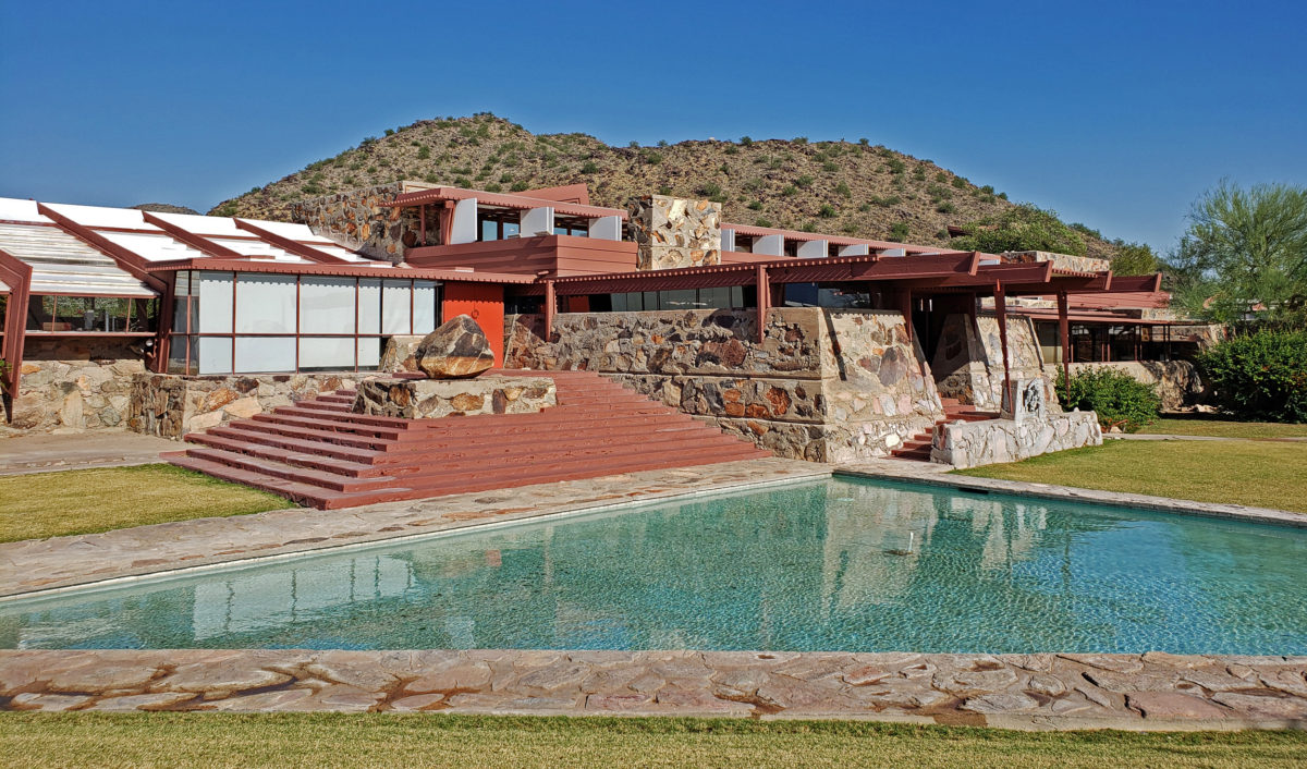
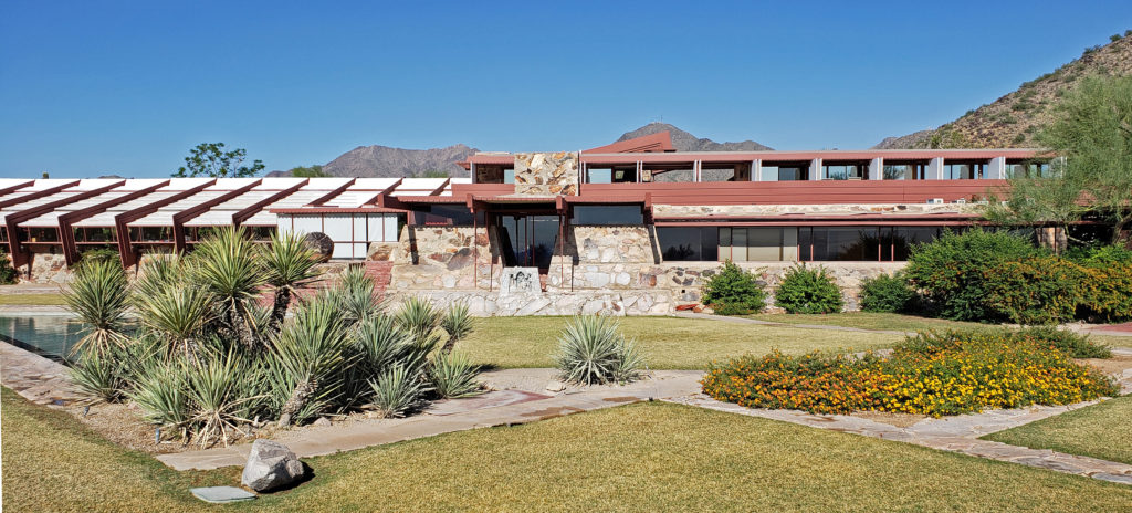
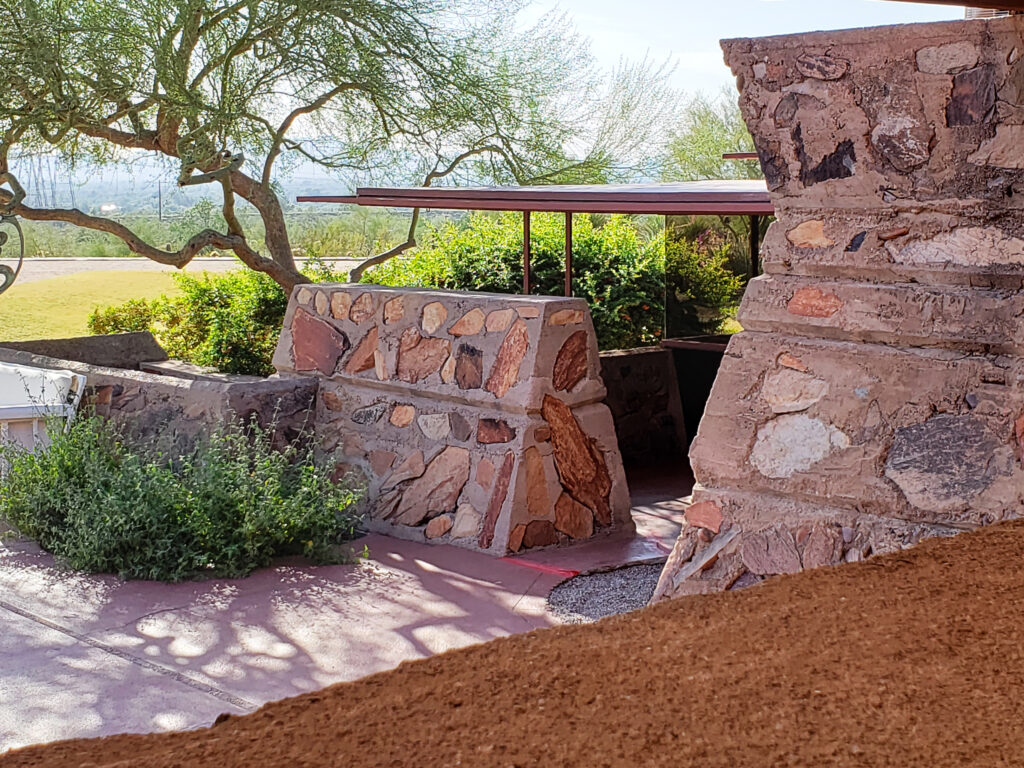 Taliesin West was founded as the winter home for the Frank Lloyd Wright Fellowship, Wright’s school of architecture. It was always a school of architecture as well as Wright’s winter home. The Fellowship evolved into the Frank Lloyd Wright School of Architecture, which conducted classes at Taliesin West until 2020, when it separted from the Frank Lloyd Wright Foundation, changed its name to The School of Architecture, and moved its campus to Cosanti and Arcosanti, Arizona.
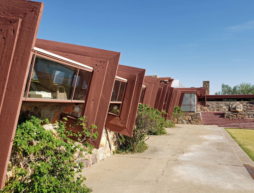
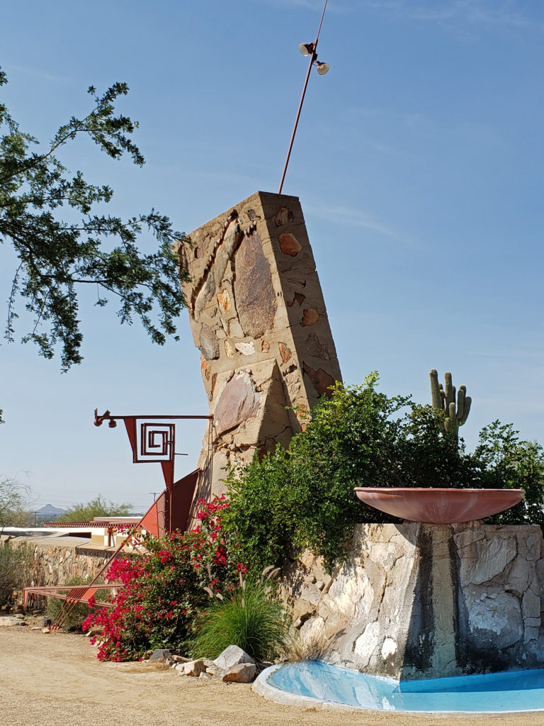
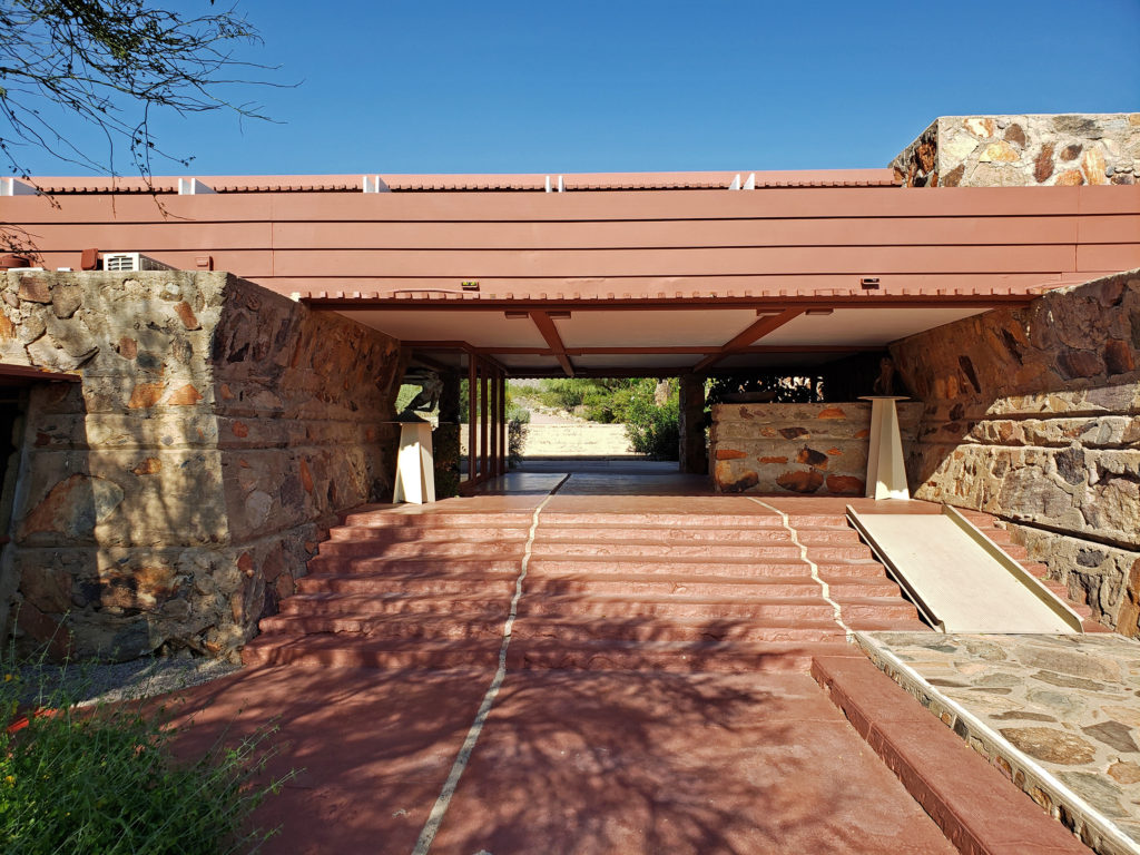
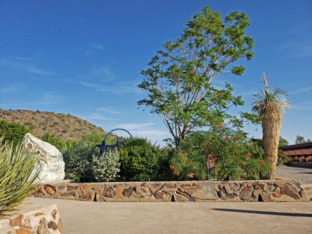
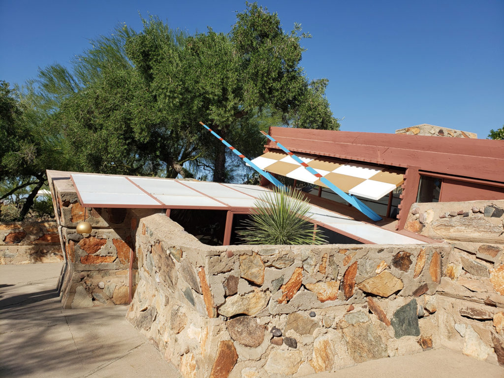
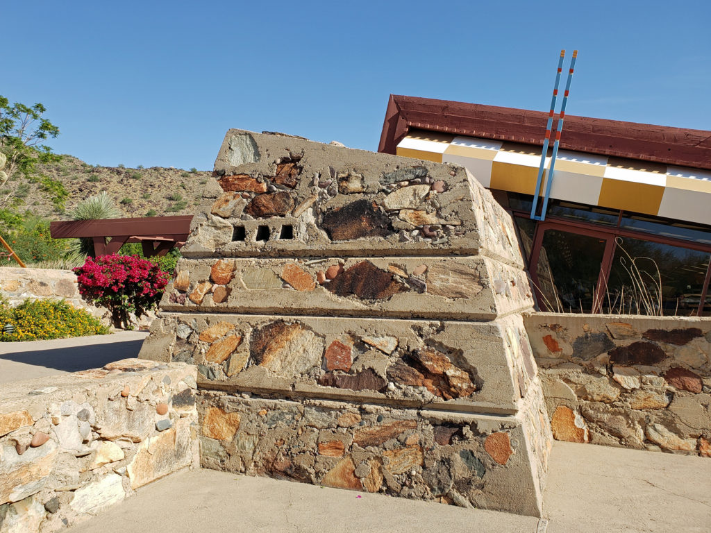
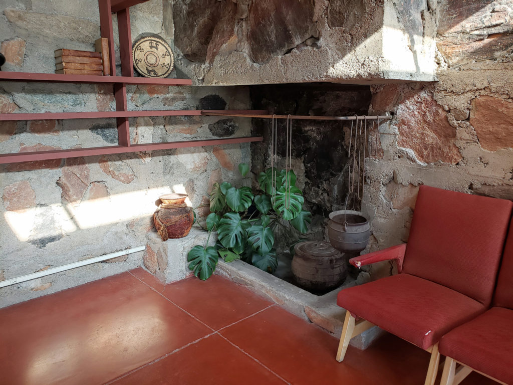
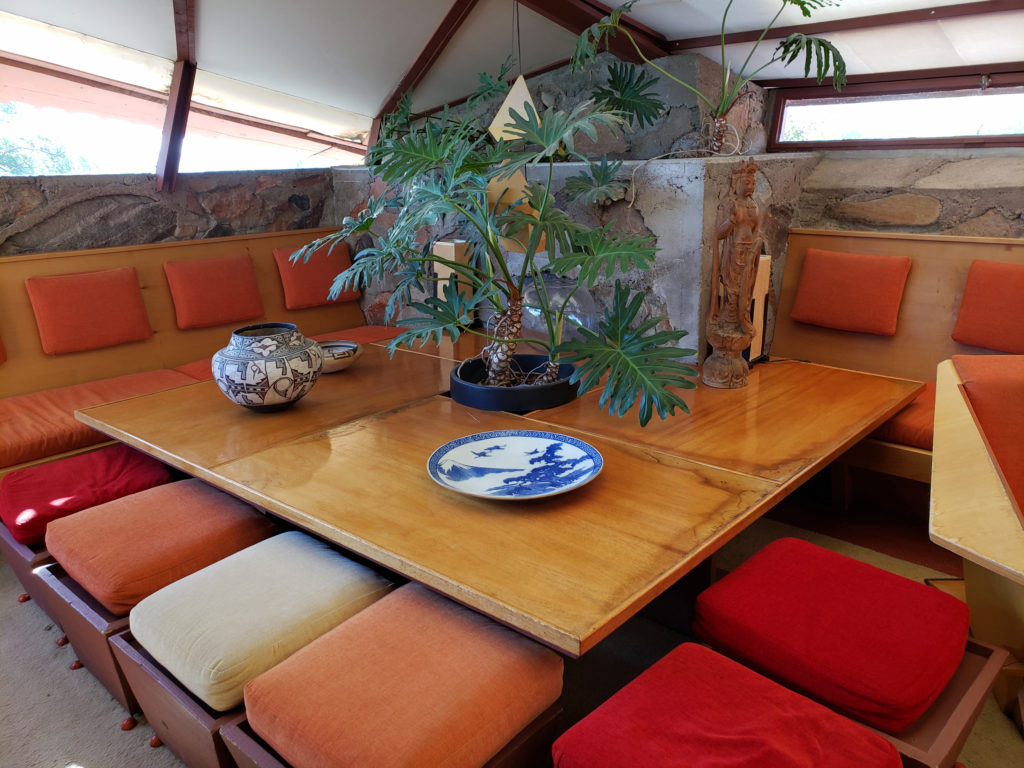
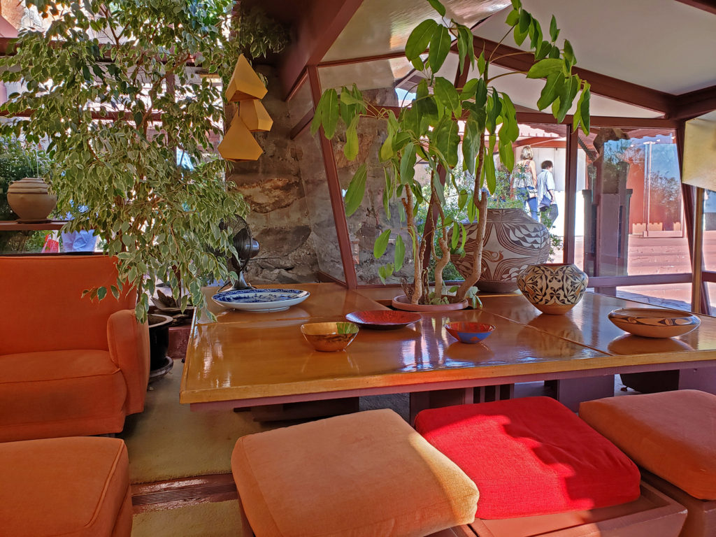
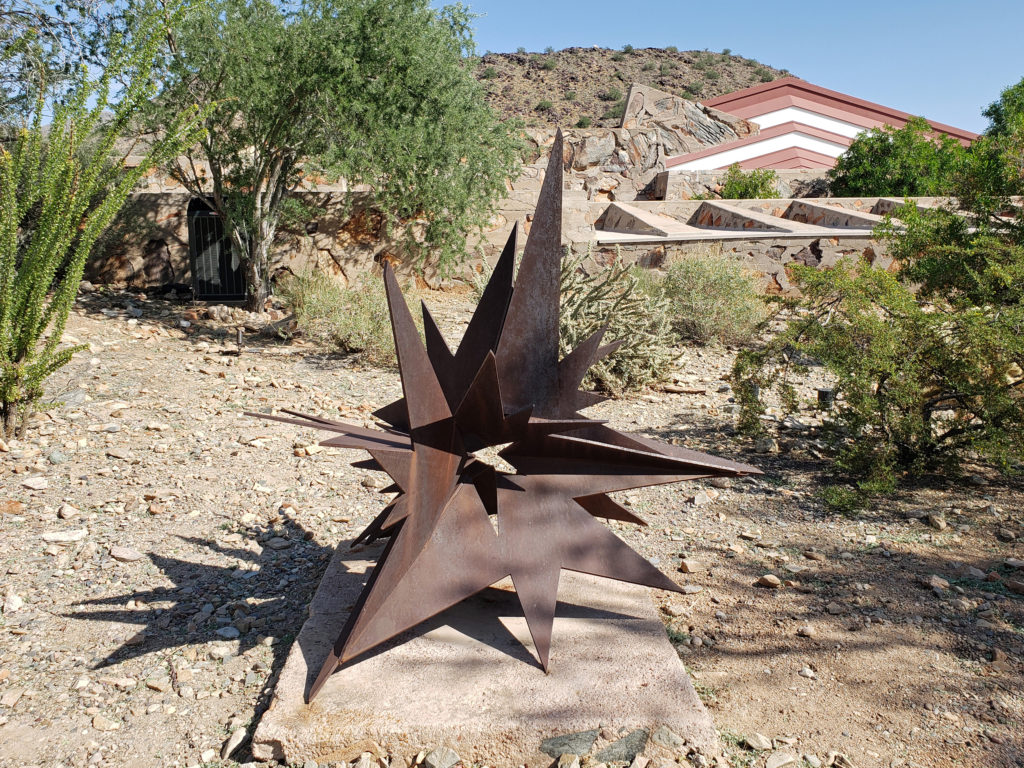
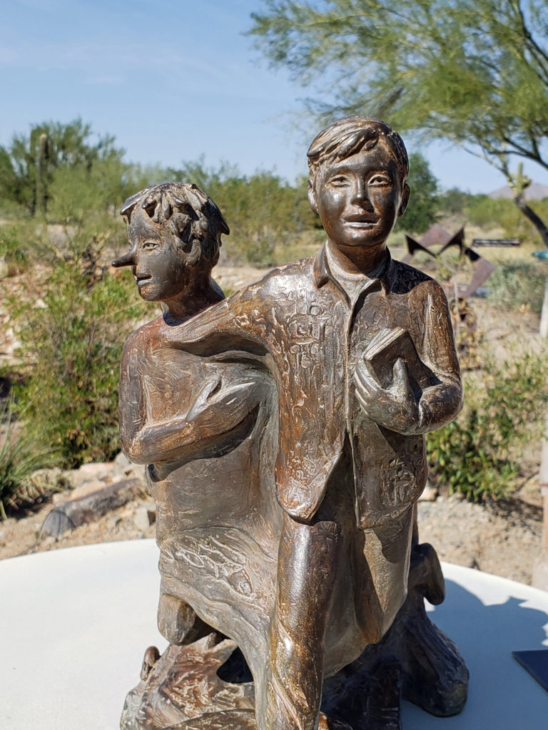
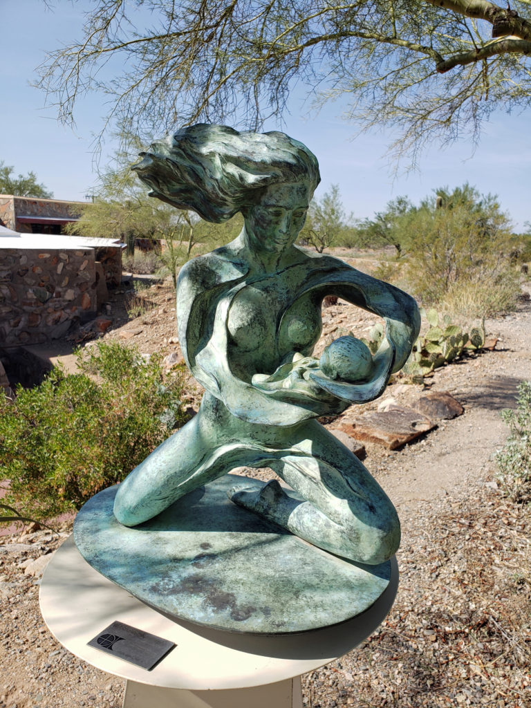
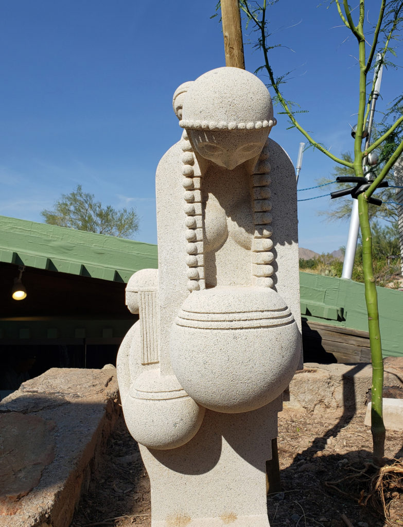
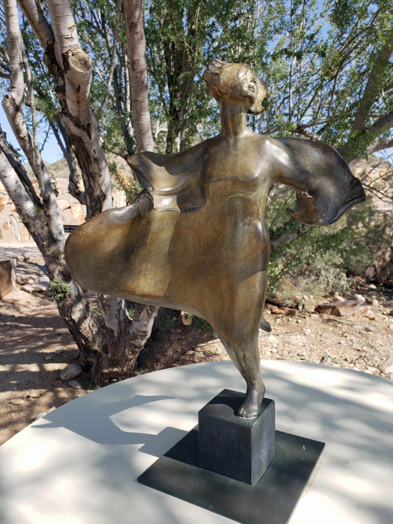 The grounds of Taliesin West are beautifully landscaped and feature many outdoor works of art by various artists. Wright saw architecture as the “mother” of all the arts, and art was an important component of his designs, as was the landscaping.
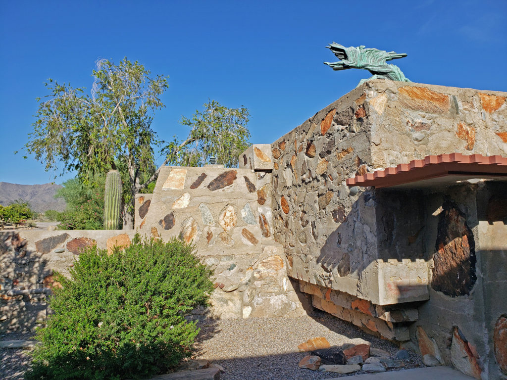
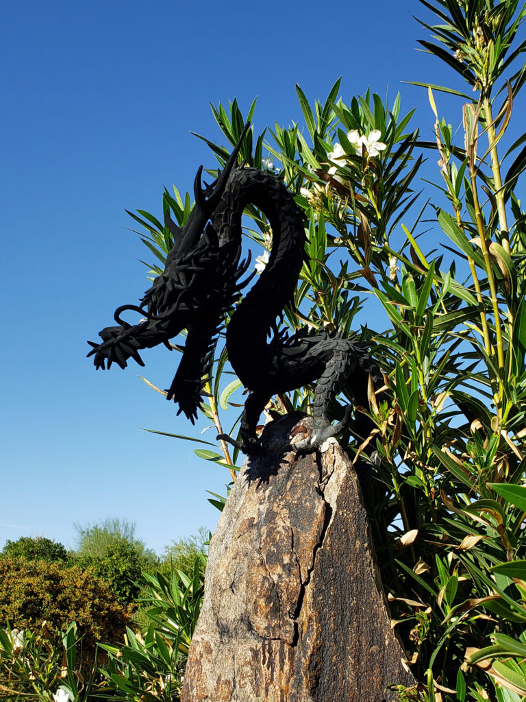 Taliesin West is located in Scottsdale, Arizona, about 20 miles northeast of downtown Phoenix.
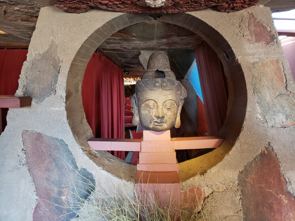 Originally posted November 26, 2019. Updated and re-posted January 7, 2022.
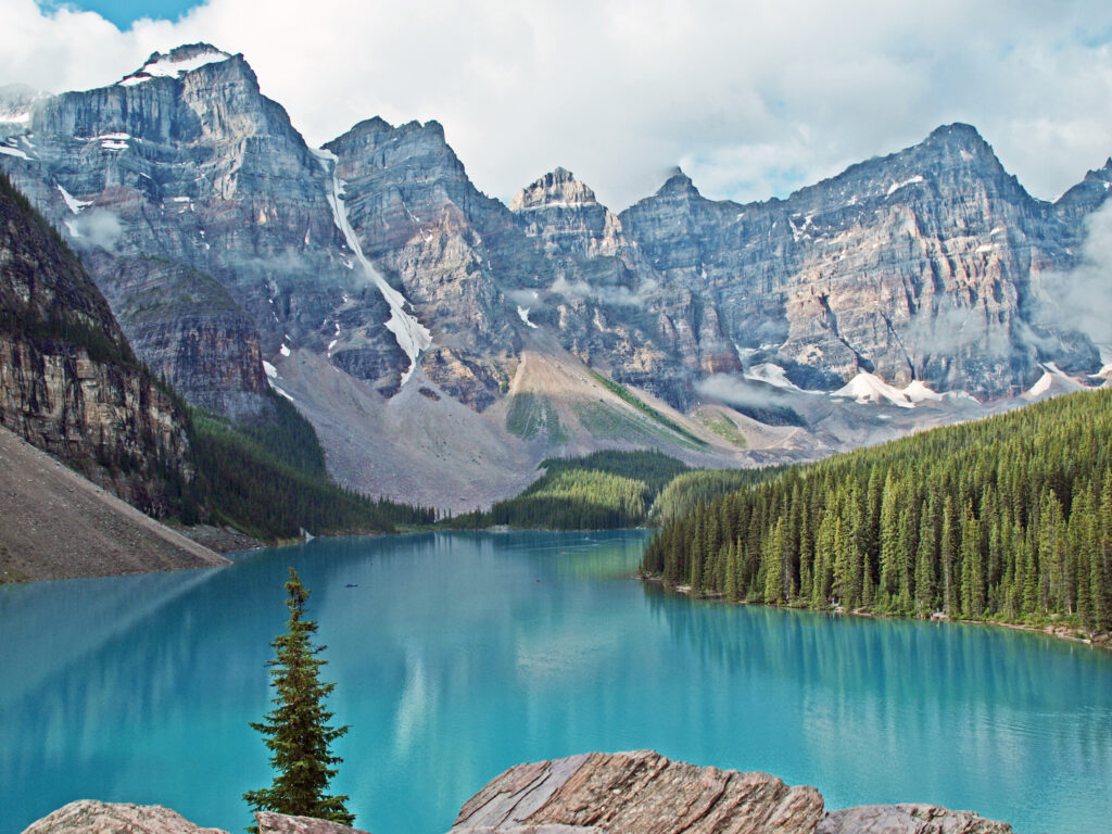
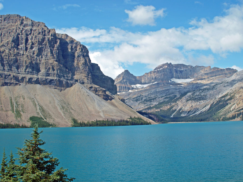
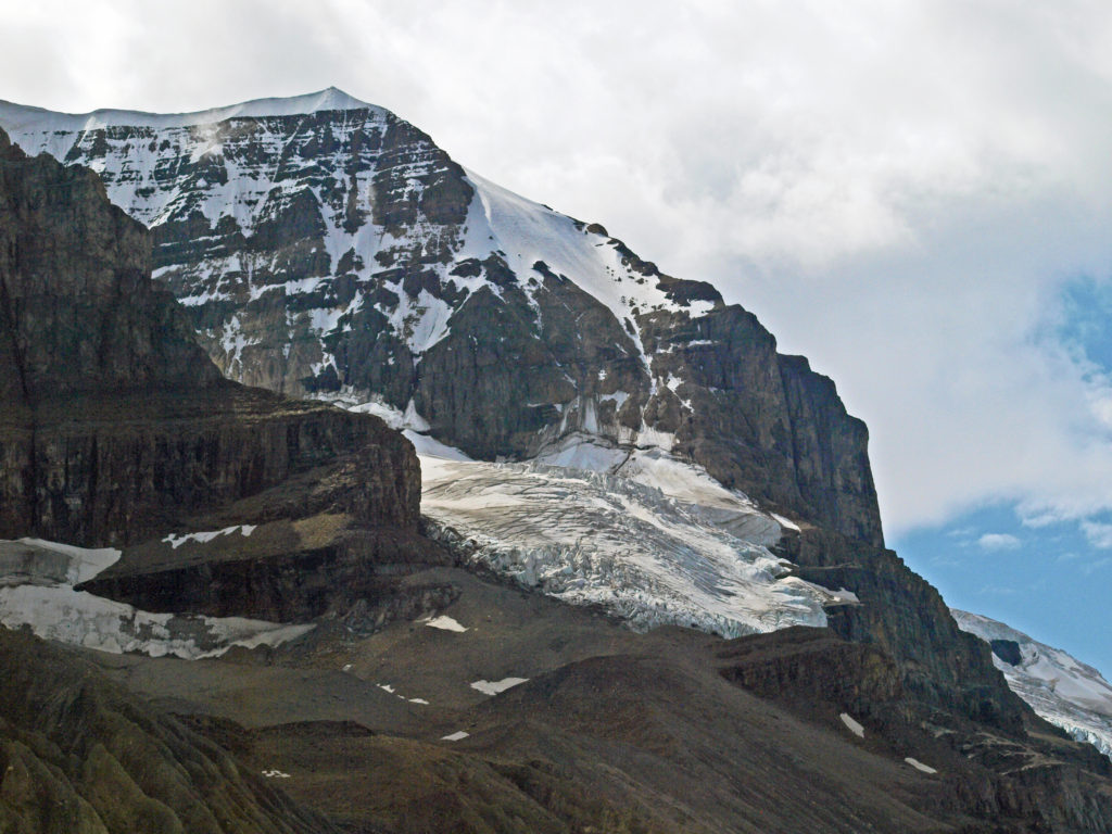
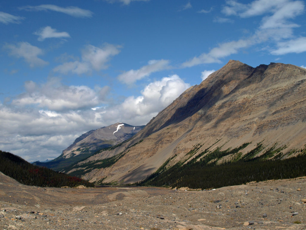
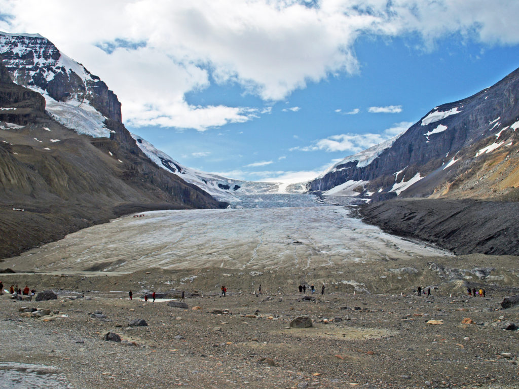
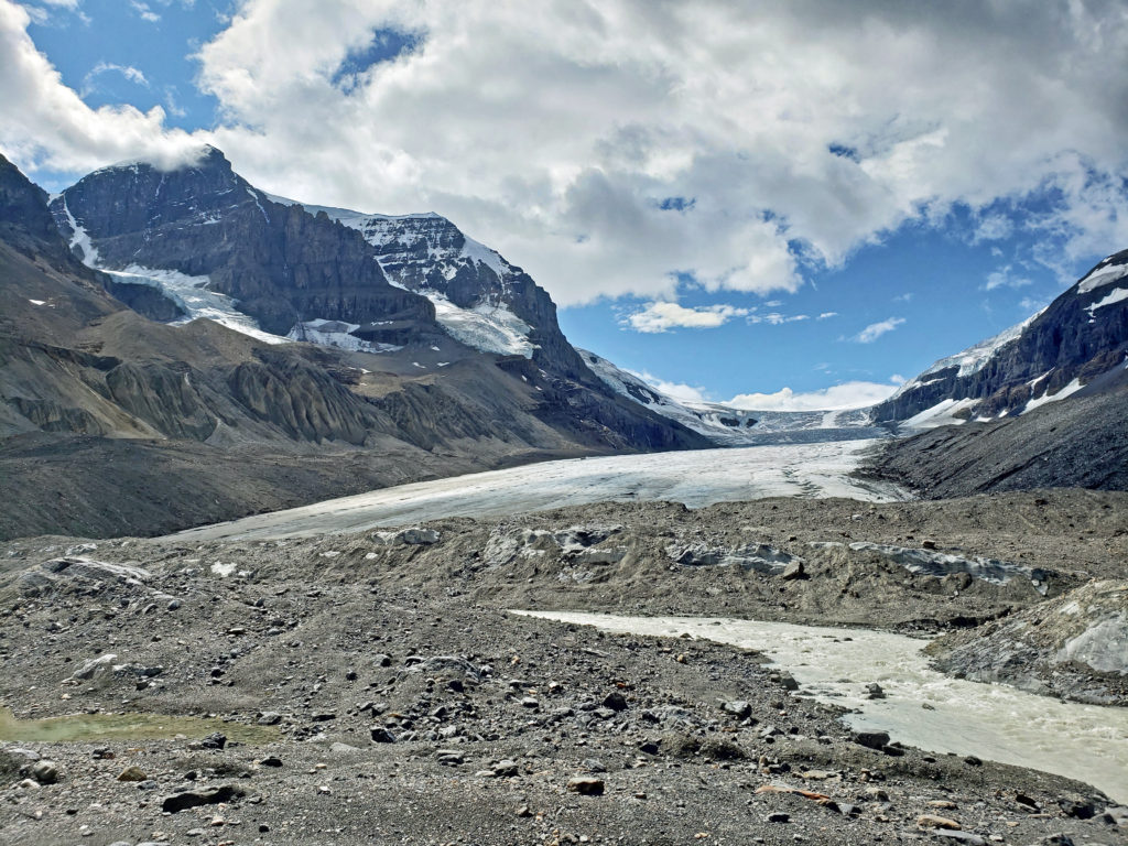
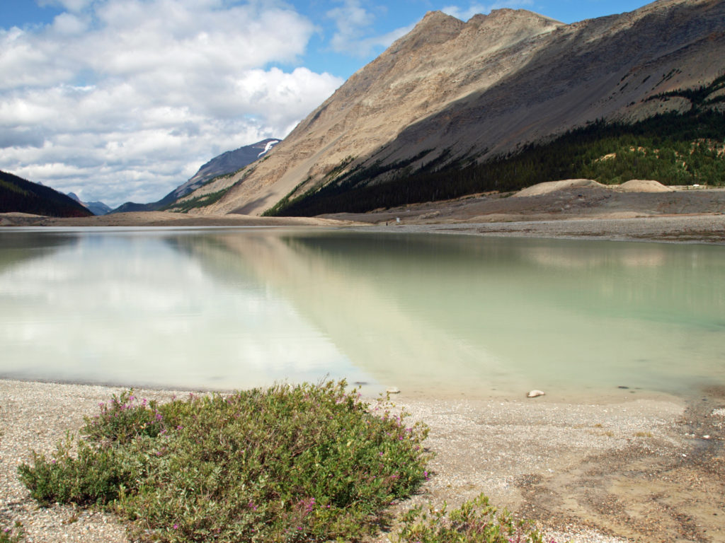
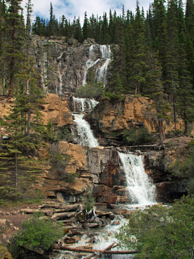
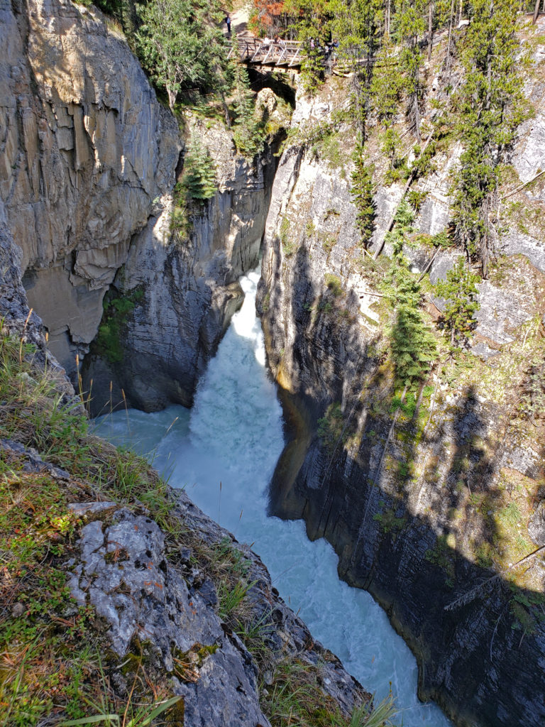
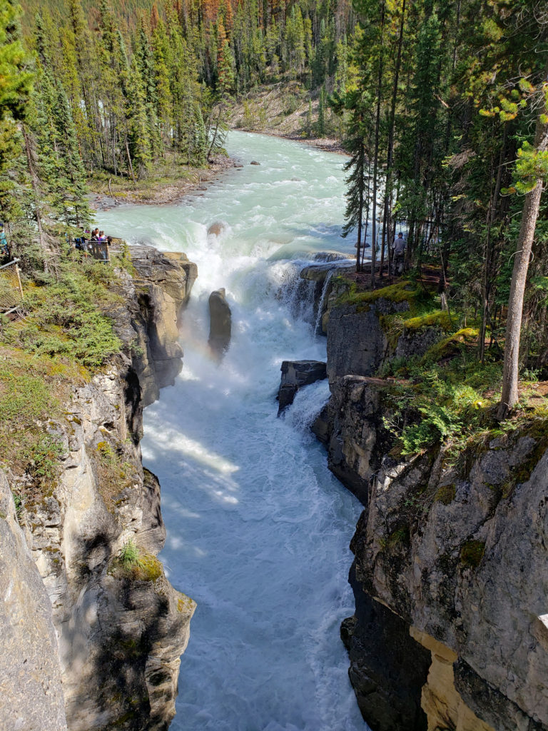
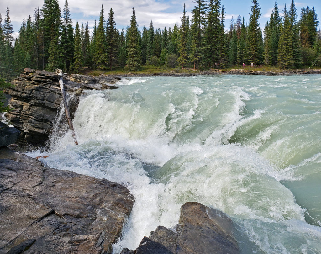
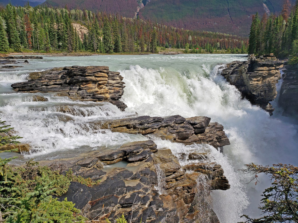
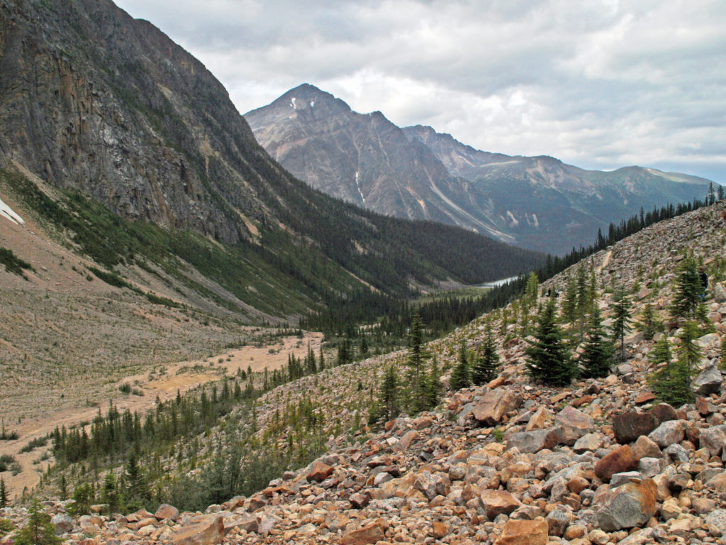
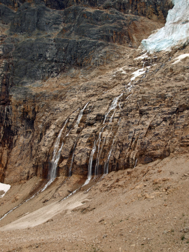
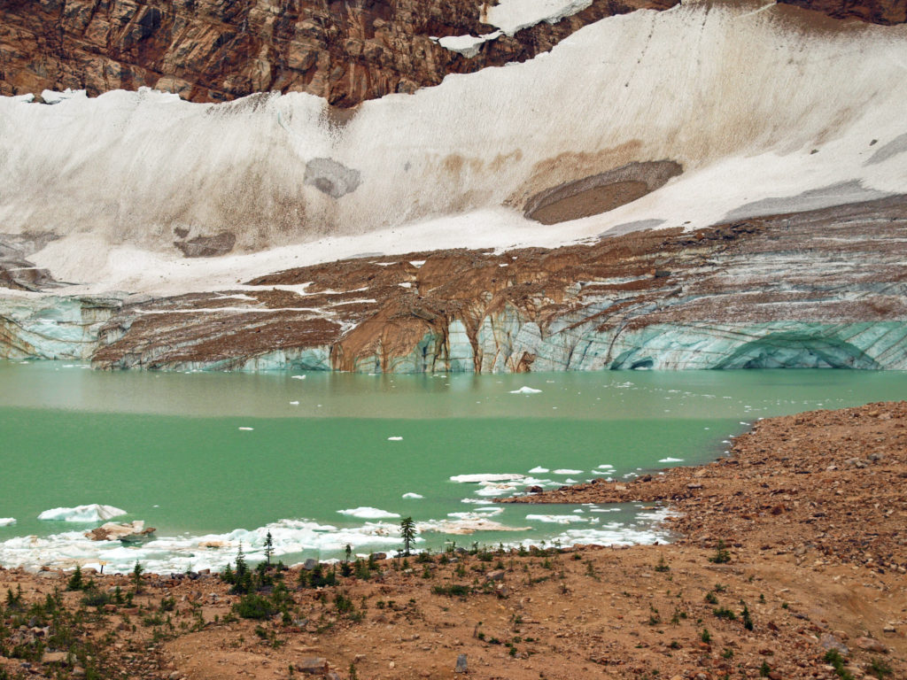
 The Icefields Parkway ends at the town of Jasper, a smaller, less crowded, and lower key version of Banff. There are abundant restaurants, pubs, galleries, and shops there, but accommodations are limited, and hotels and motels are expensive. Book your stay well in advance. We opted for staying in a travel trailer at an RV park 30 miles (48 km) from Jasper, just outside the park boundary, because that was the only thing available through Airbnb when we were planning our trip. It was a little inconvenient, but in the end it worked fine.
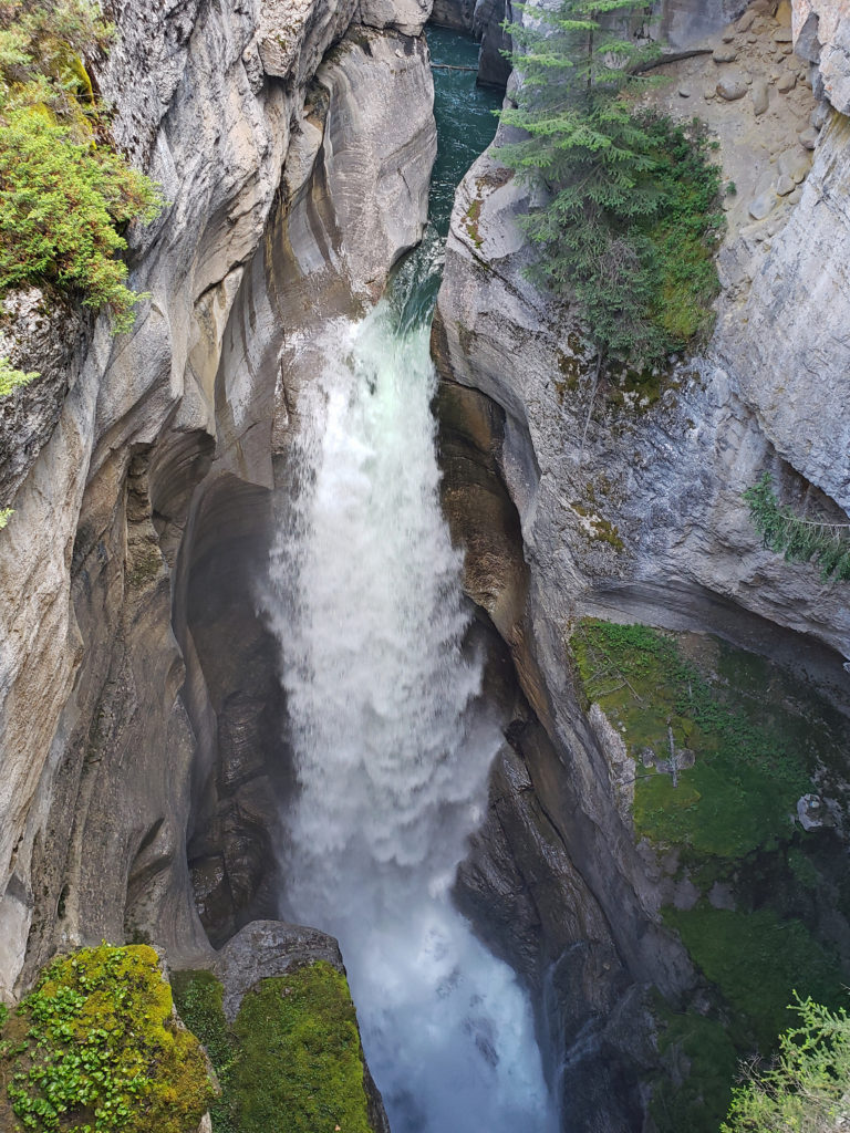
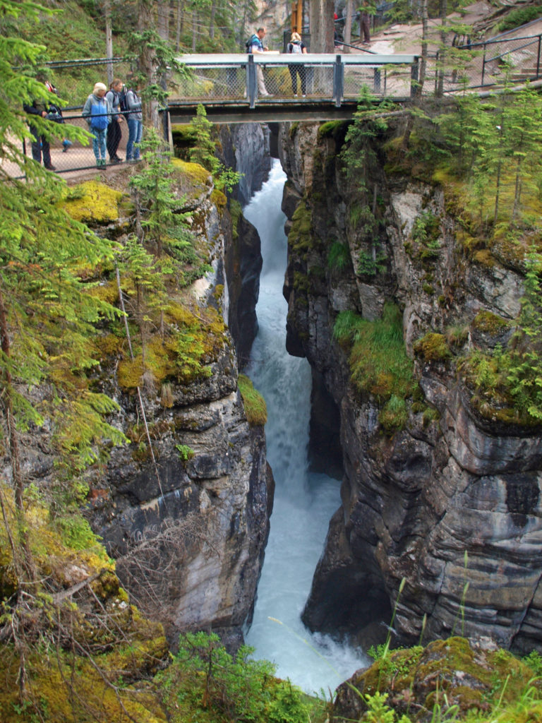
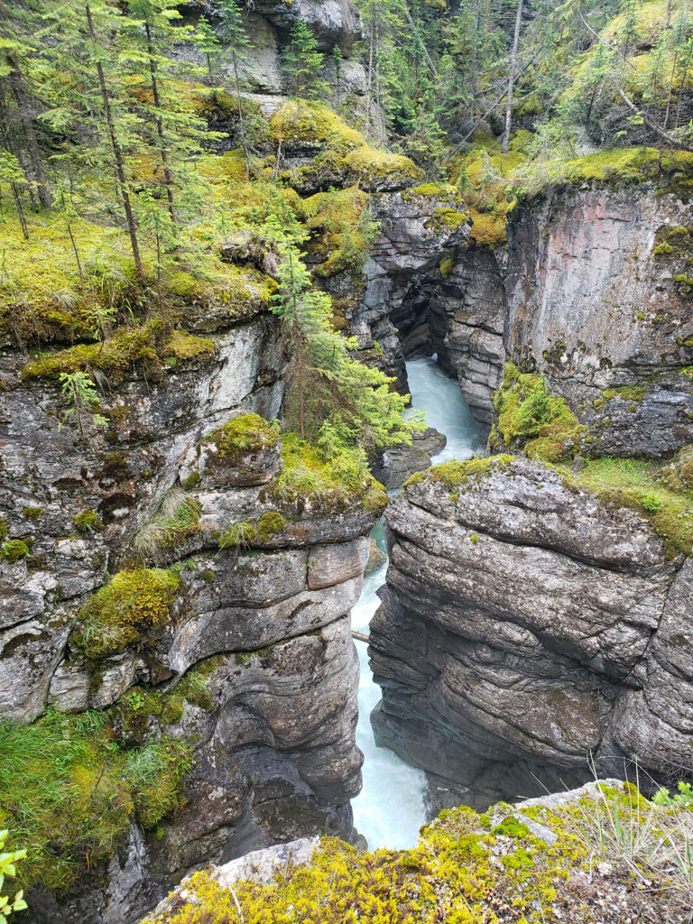
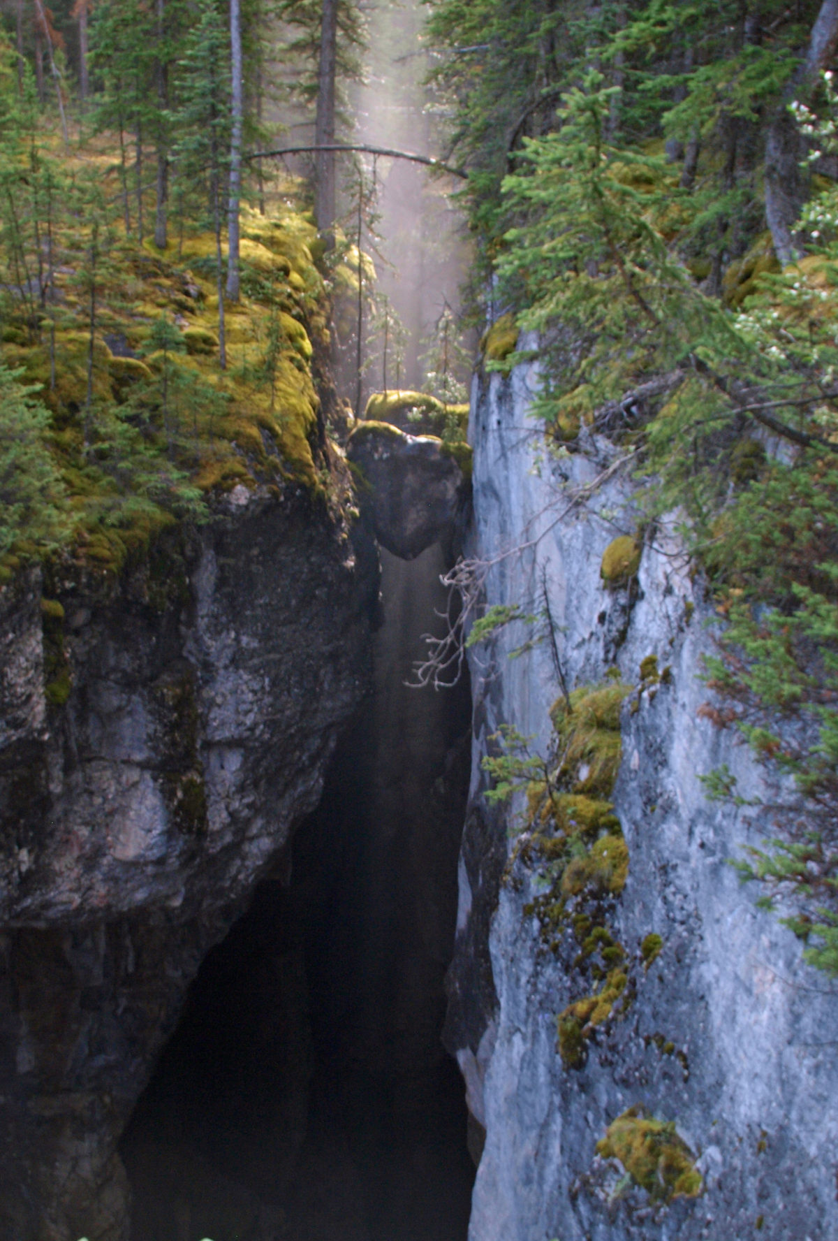
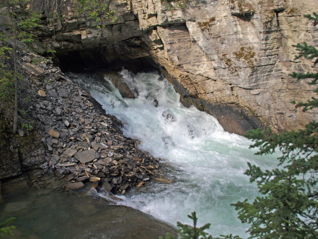
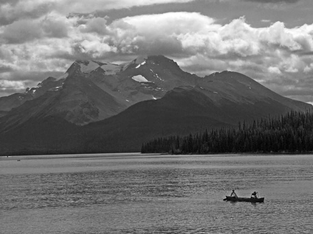
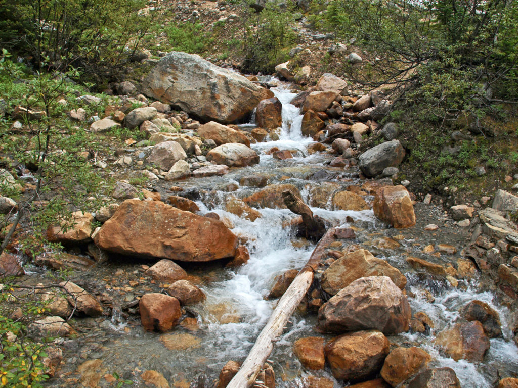
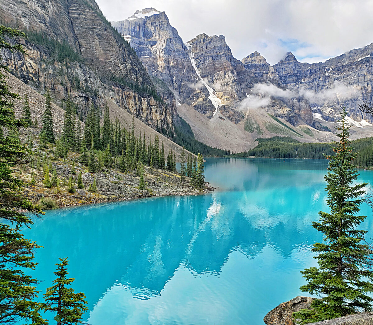

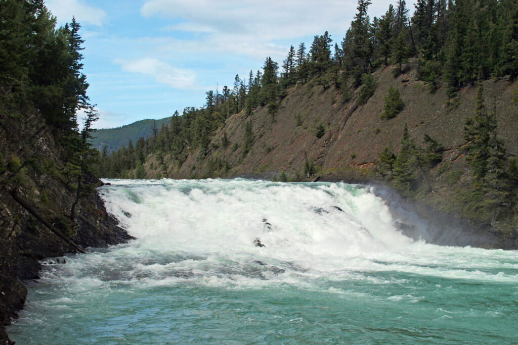
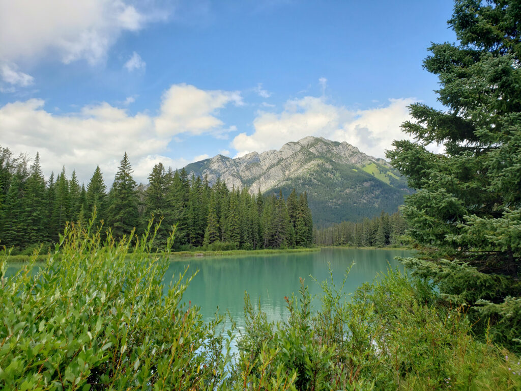

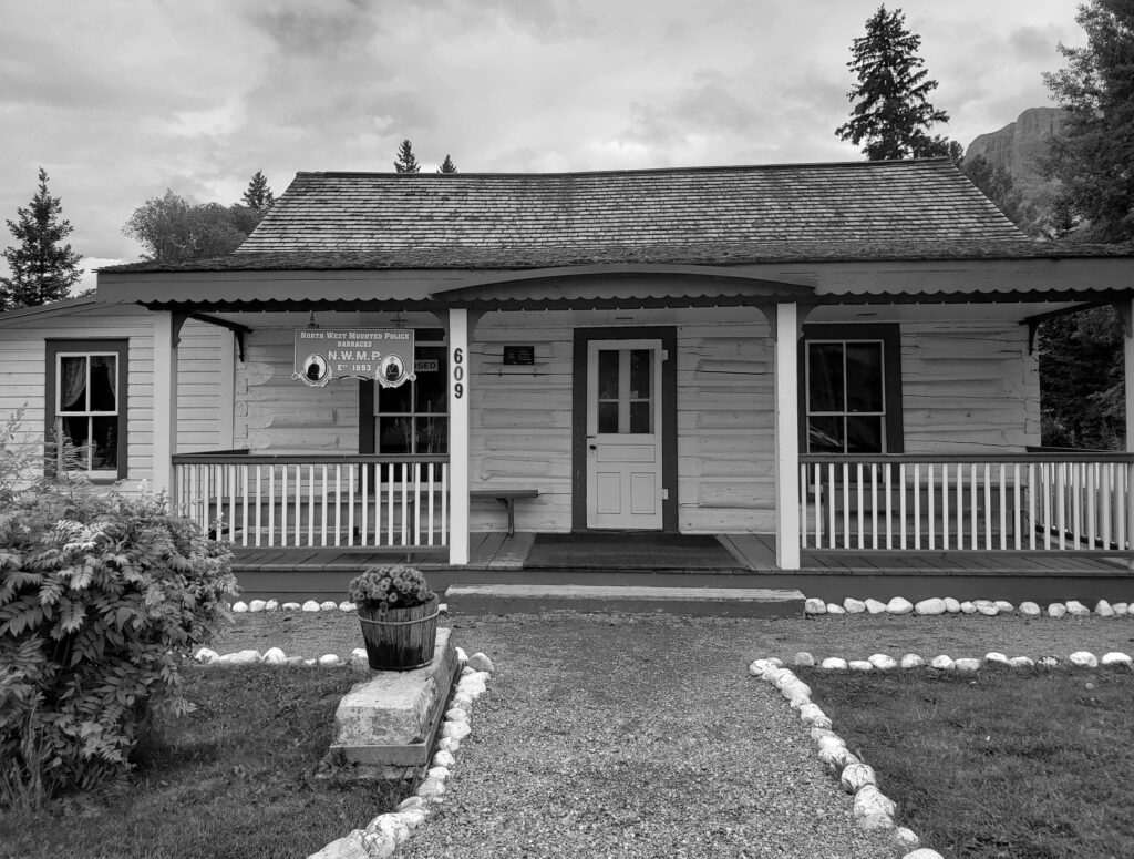
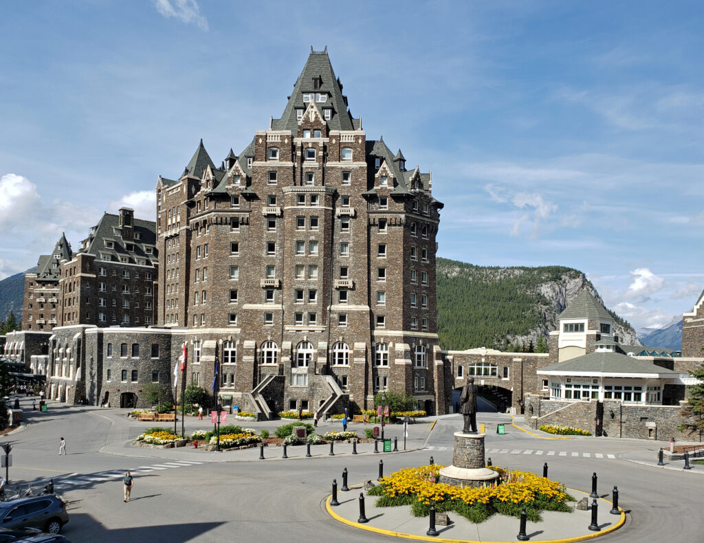

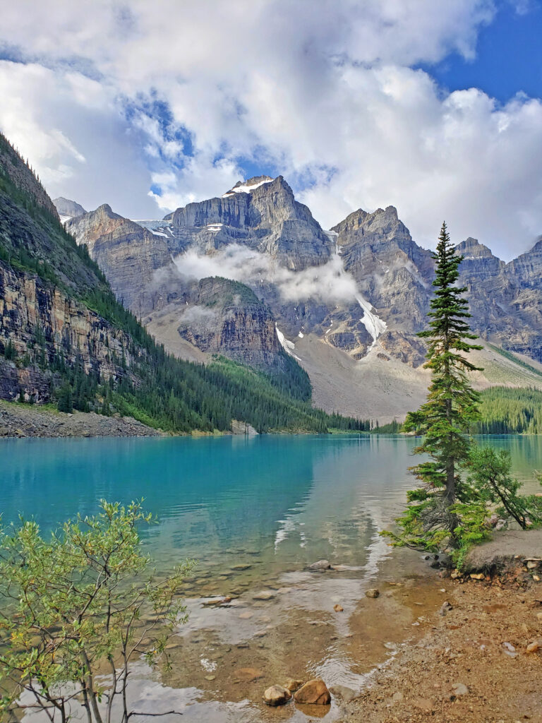
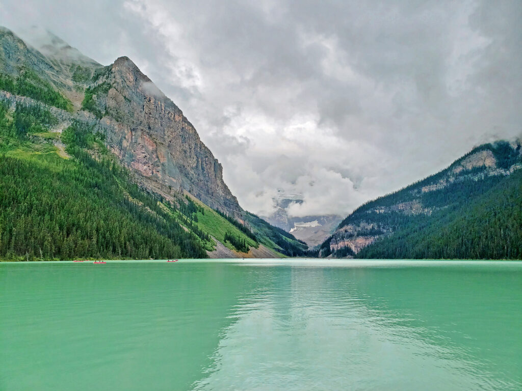
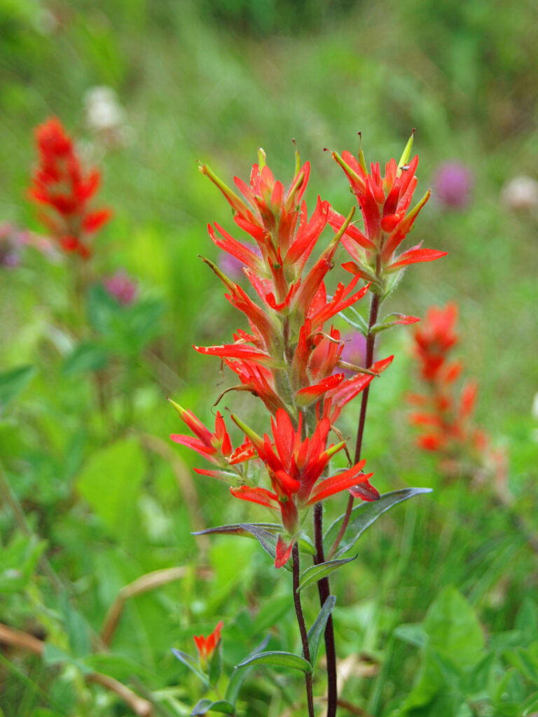

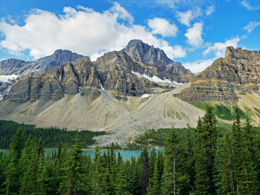
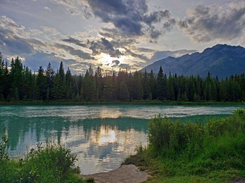

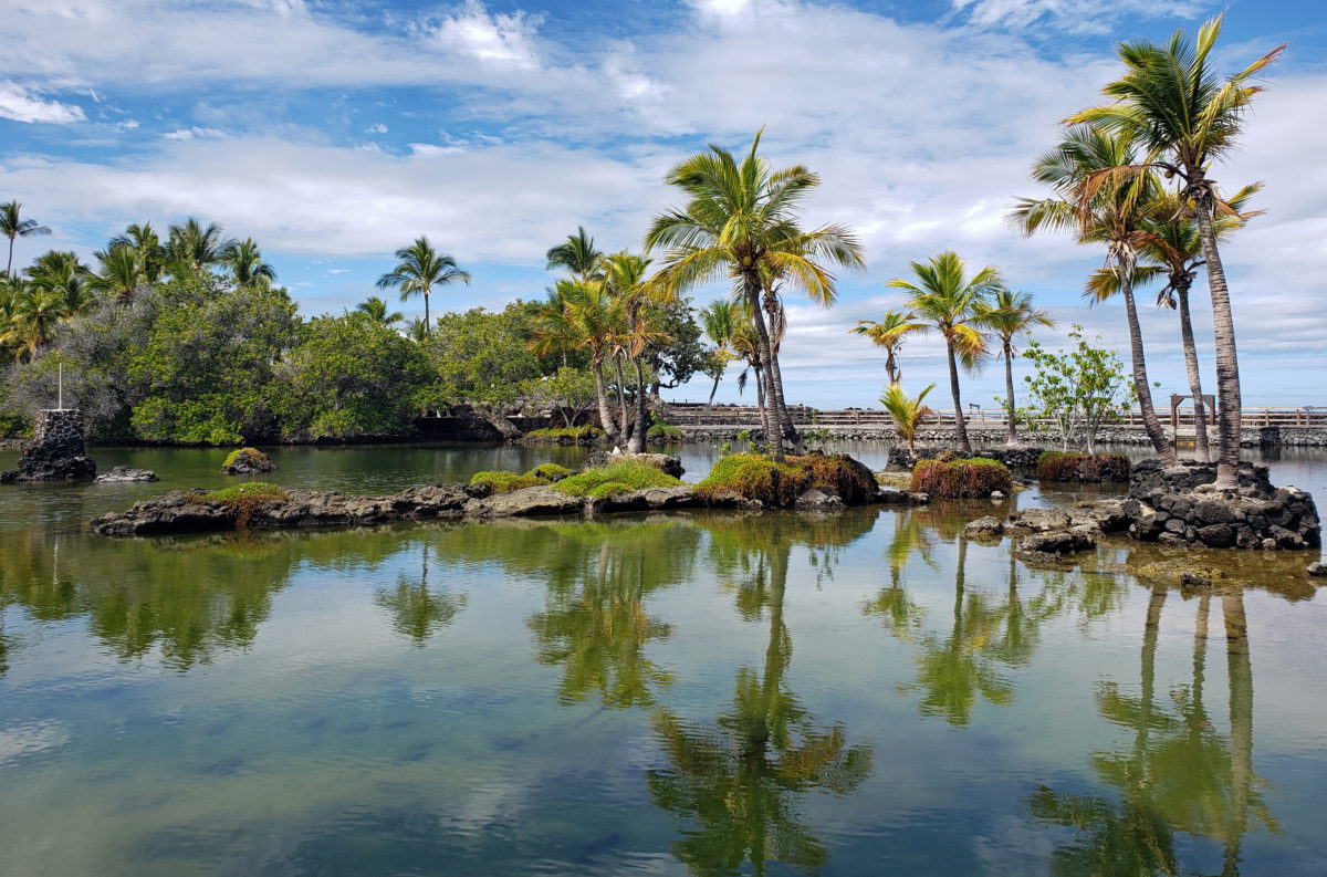

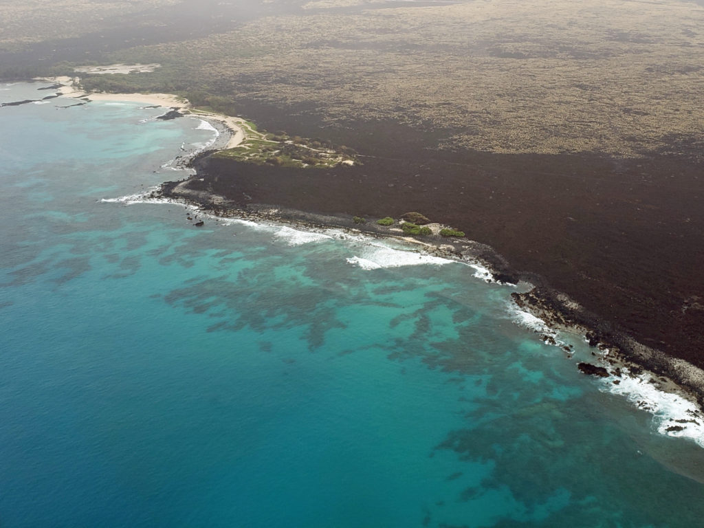
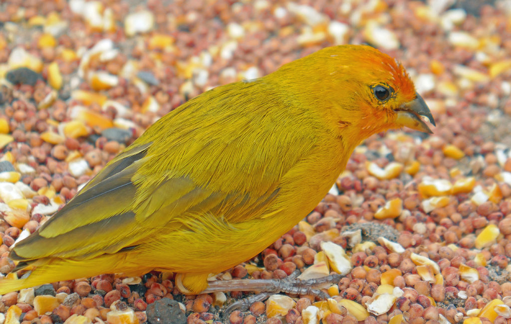
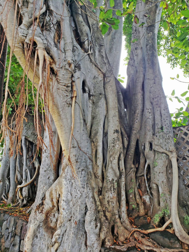
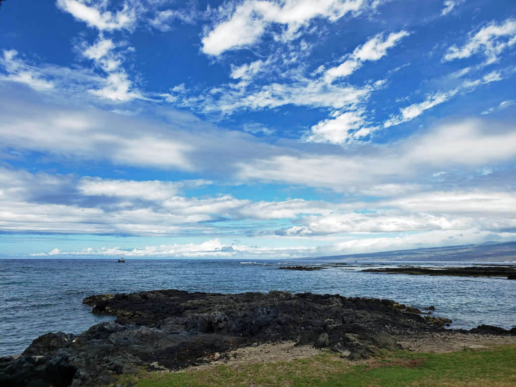
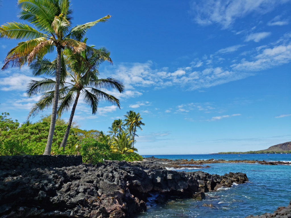
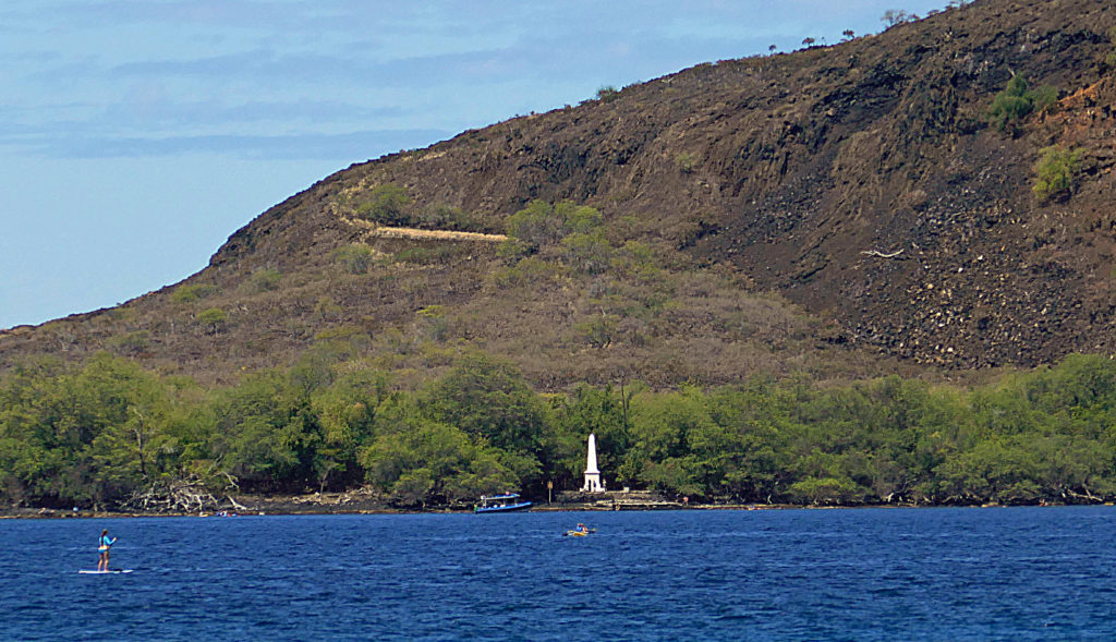
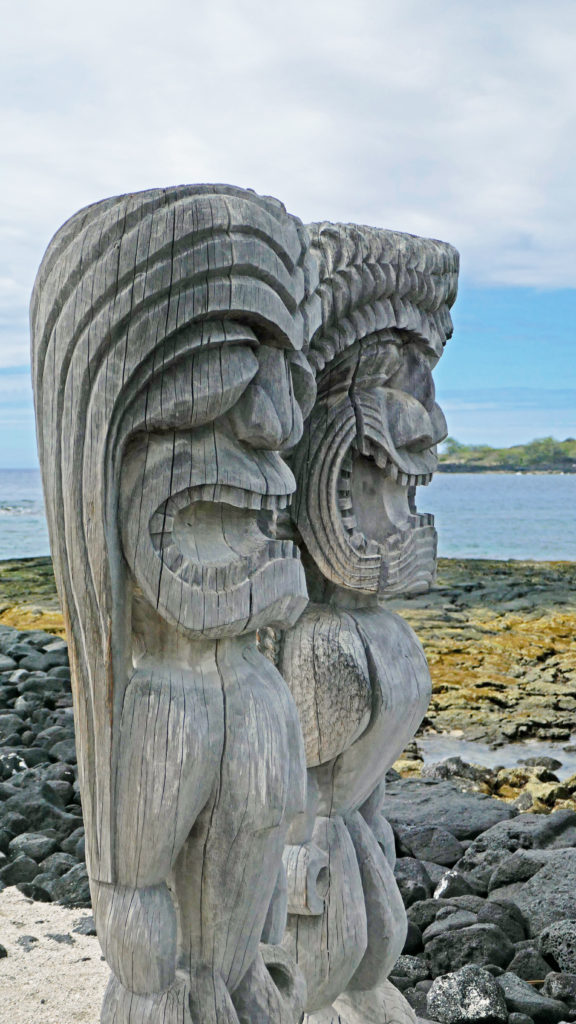
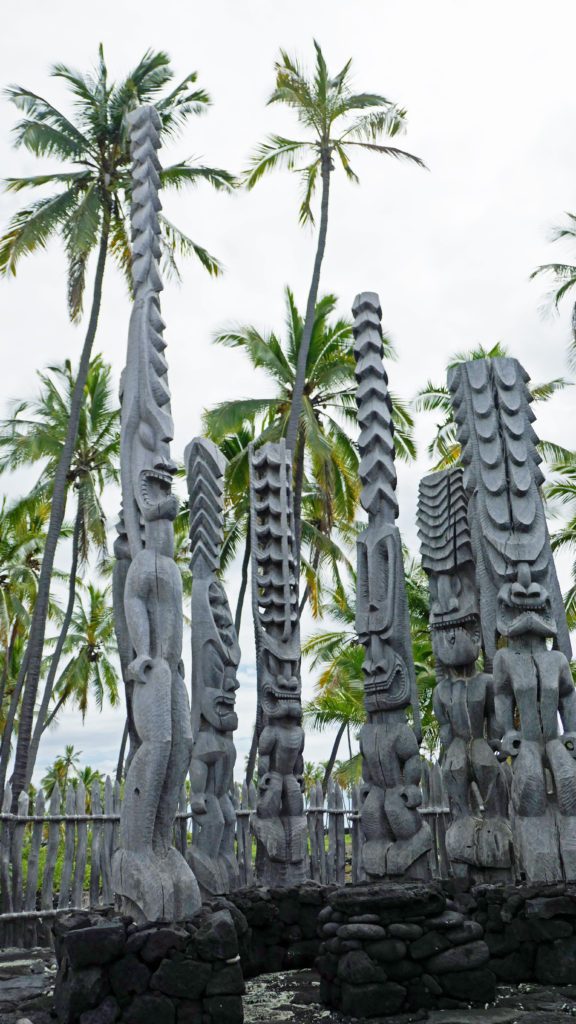
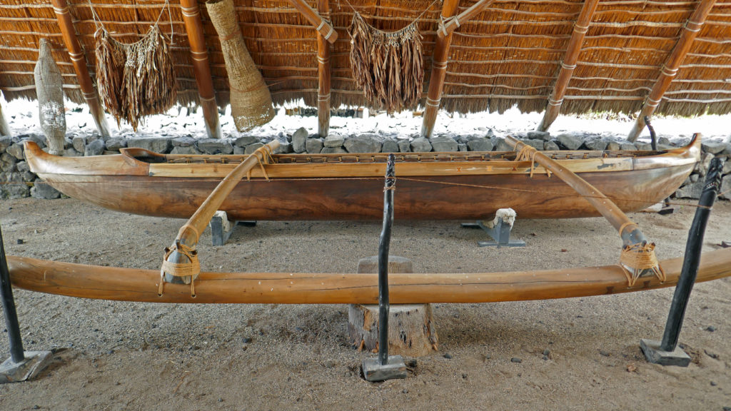
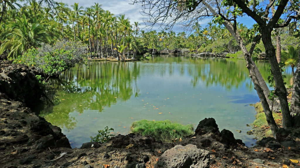
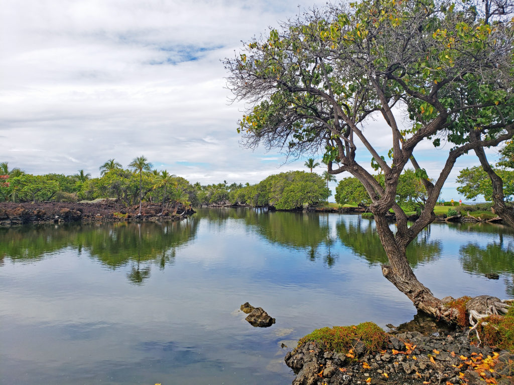
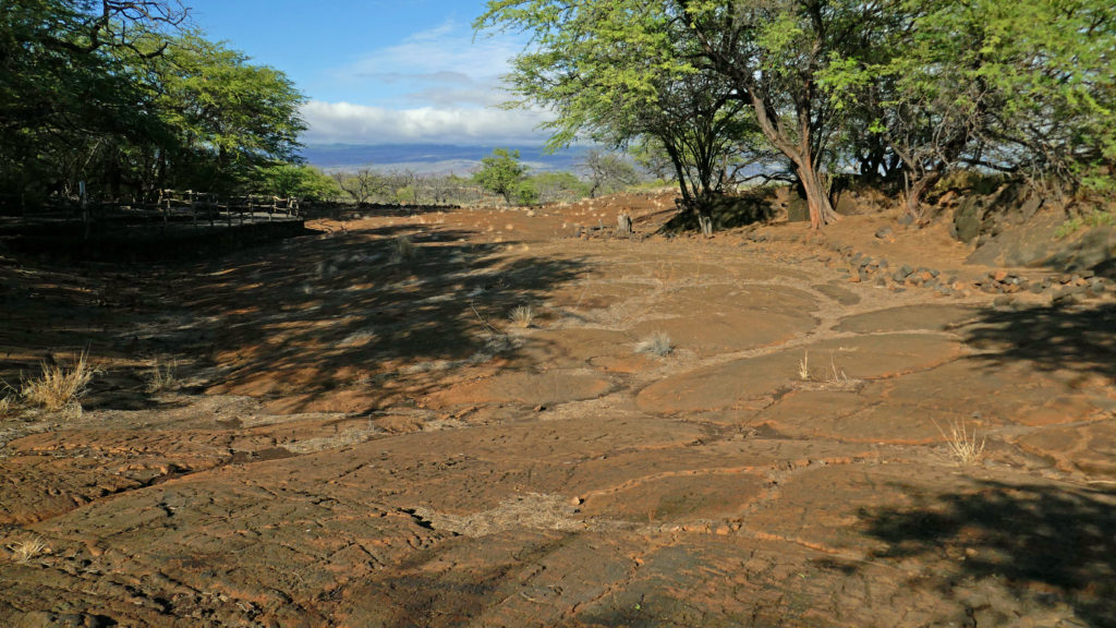
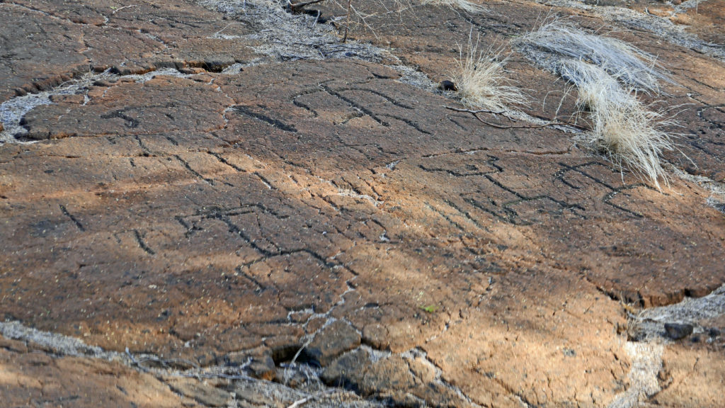
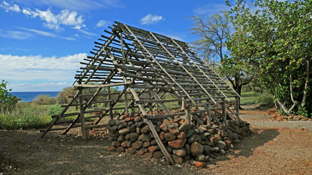
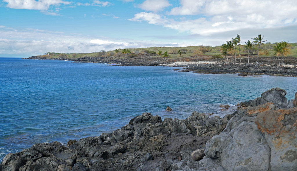
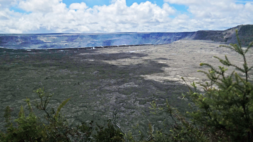
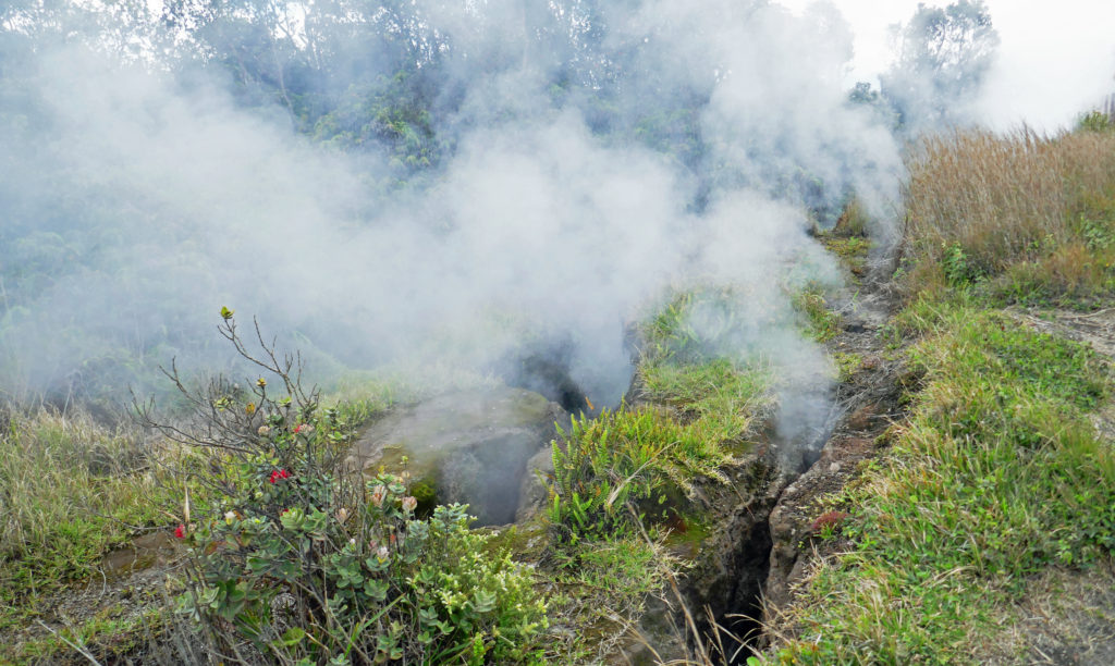
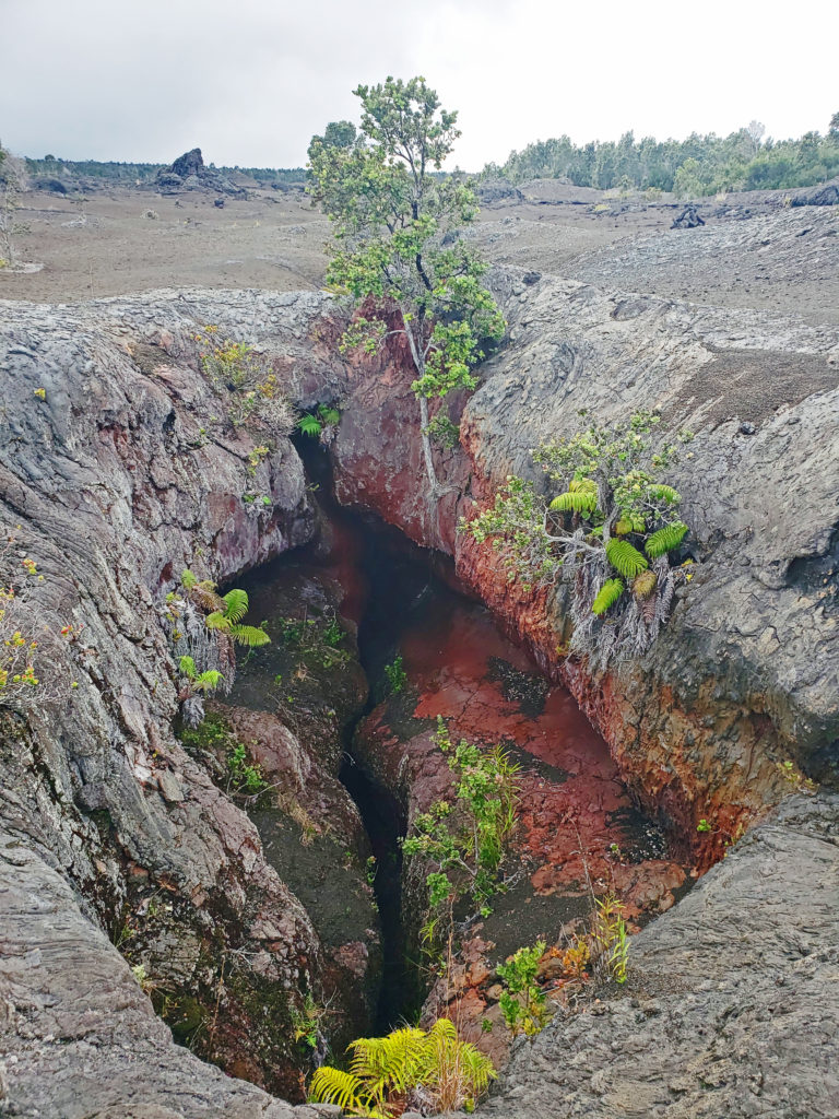
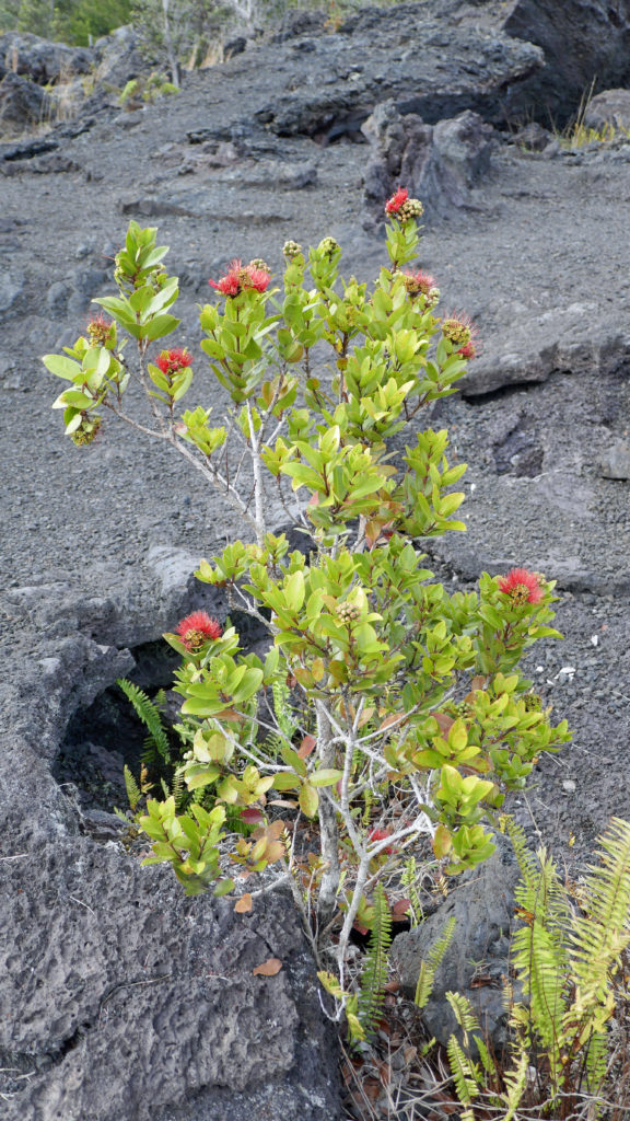
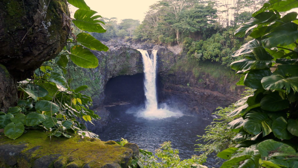
 Originally posted August 6, 2019. Updated and re-posted November 19, 2022.
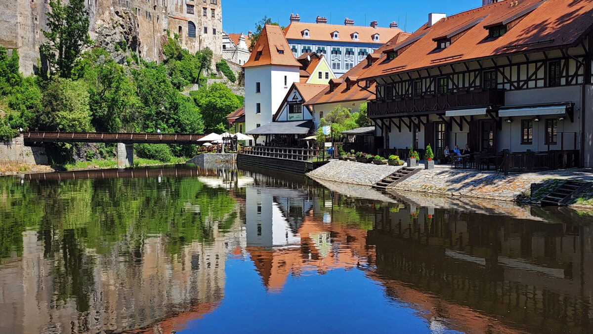
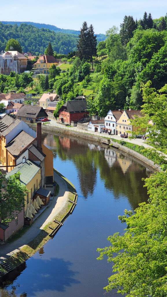
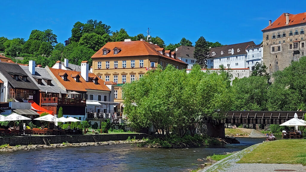
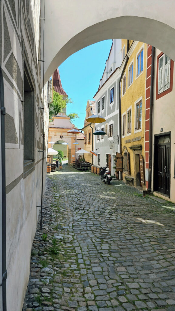
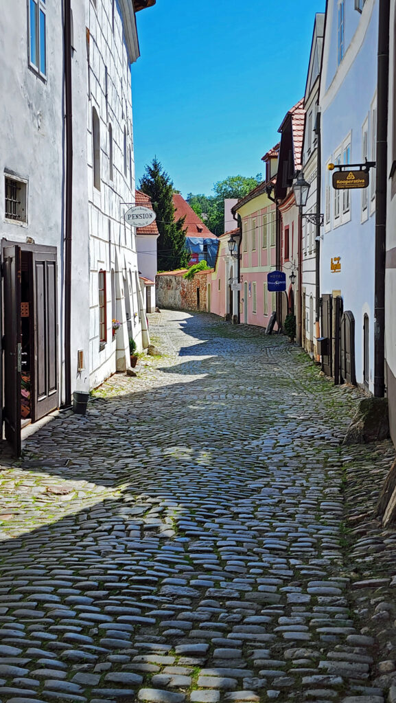
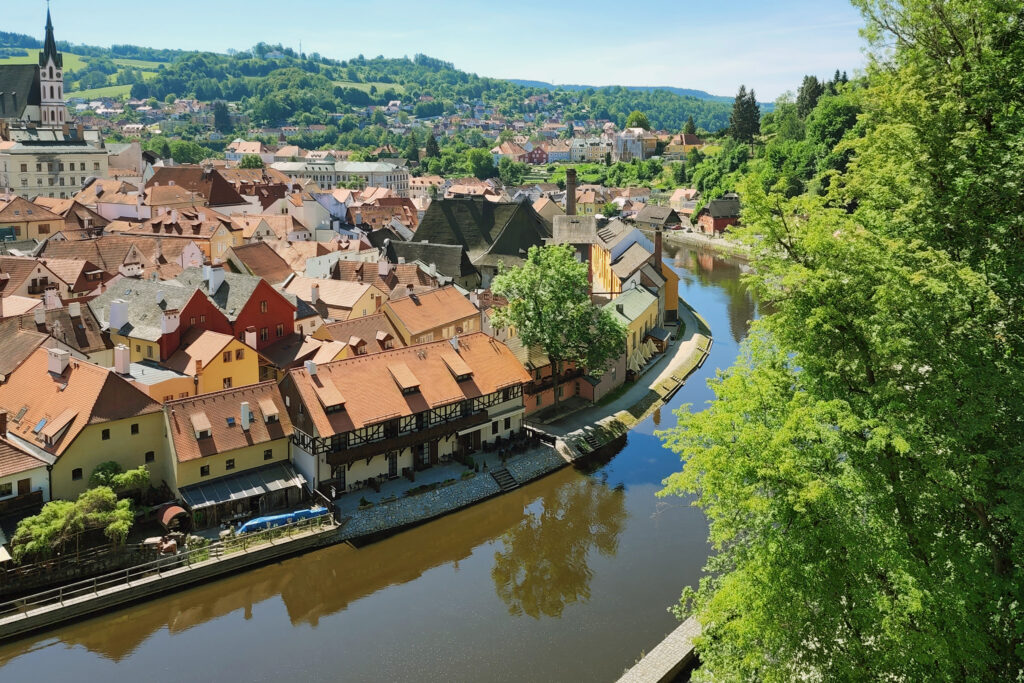
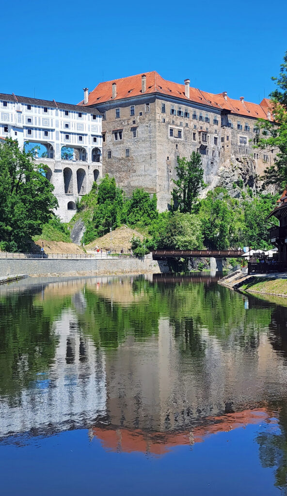
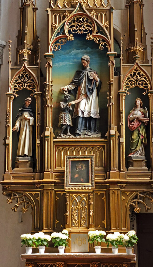
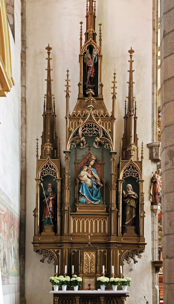
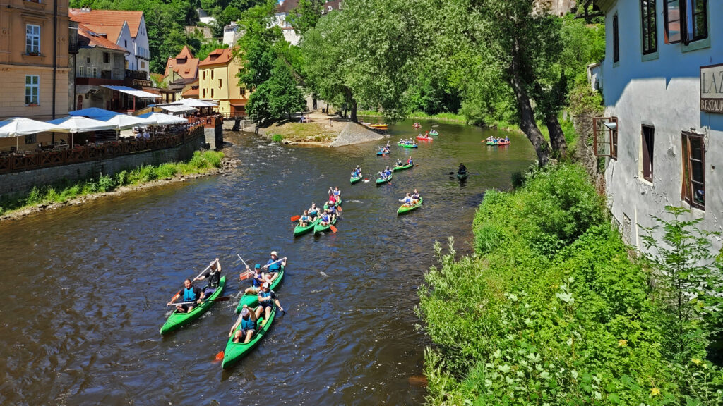
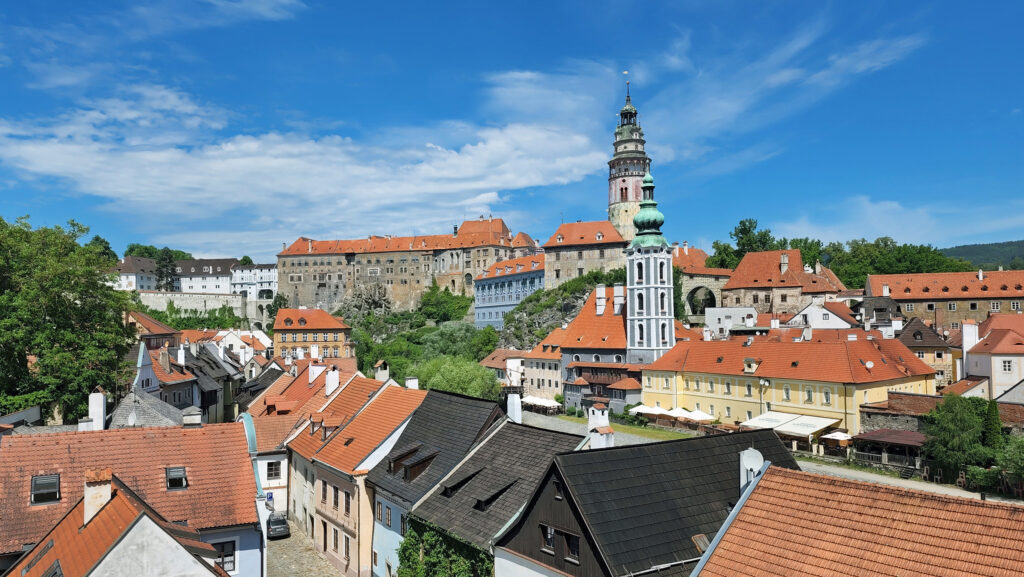
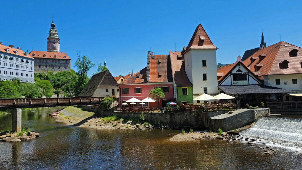
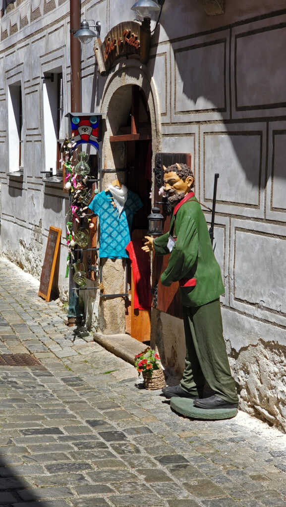 For my money, the best part of our visit was simply wandering around the historic center, walking the cobblestone streets and taking in the wonderful architecture, the beauty of the Vltava River that meanders around and through the town, and finding some of the charming and quirky things that set Czesky Krumlov apart. The old town area is car free and pedestrian friendly.
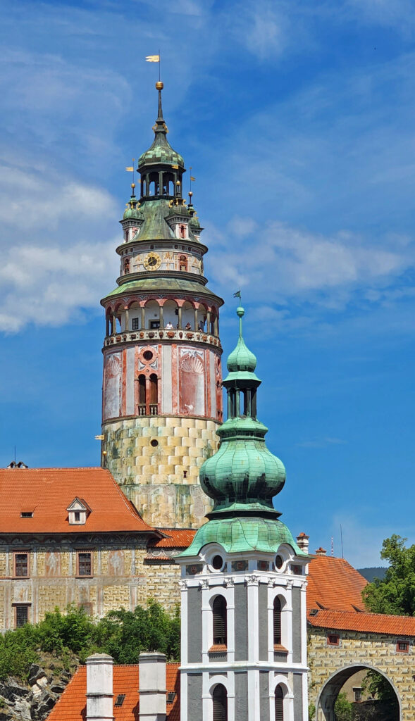
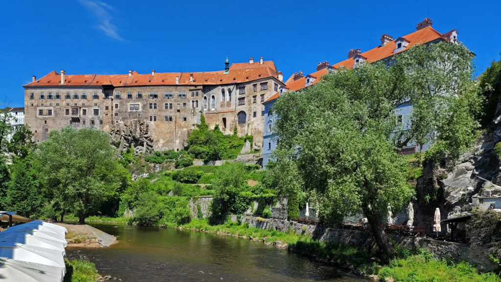
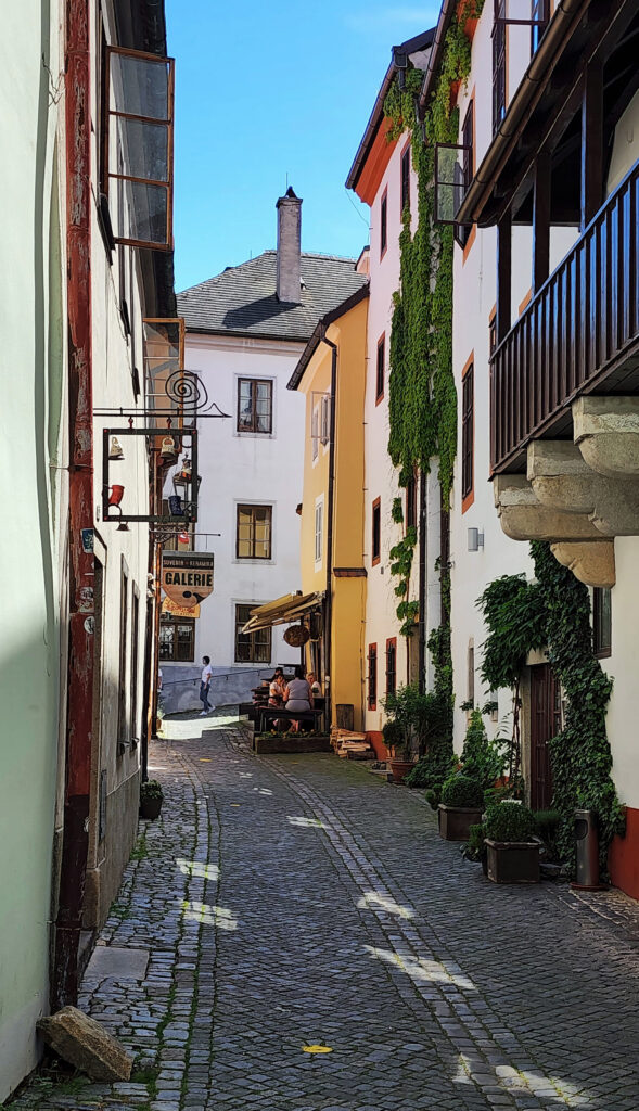
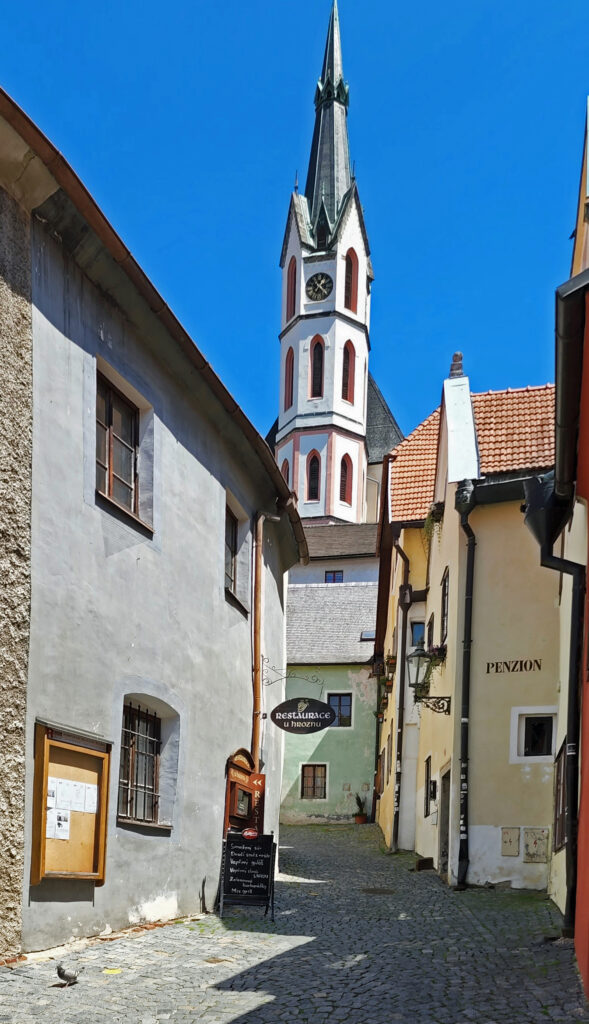
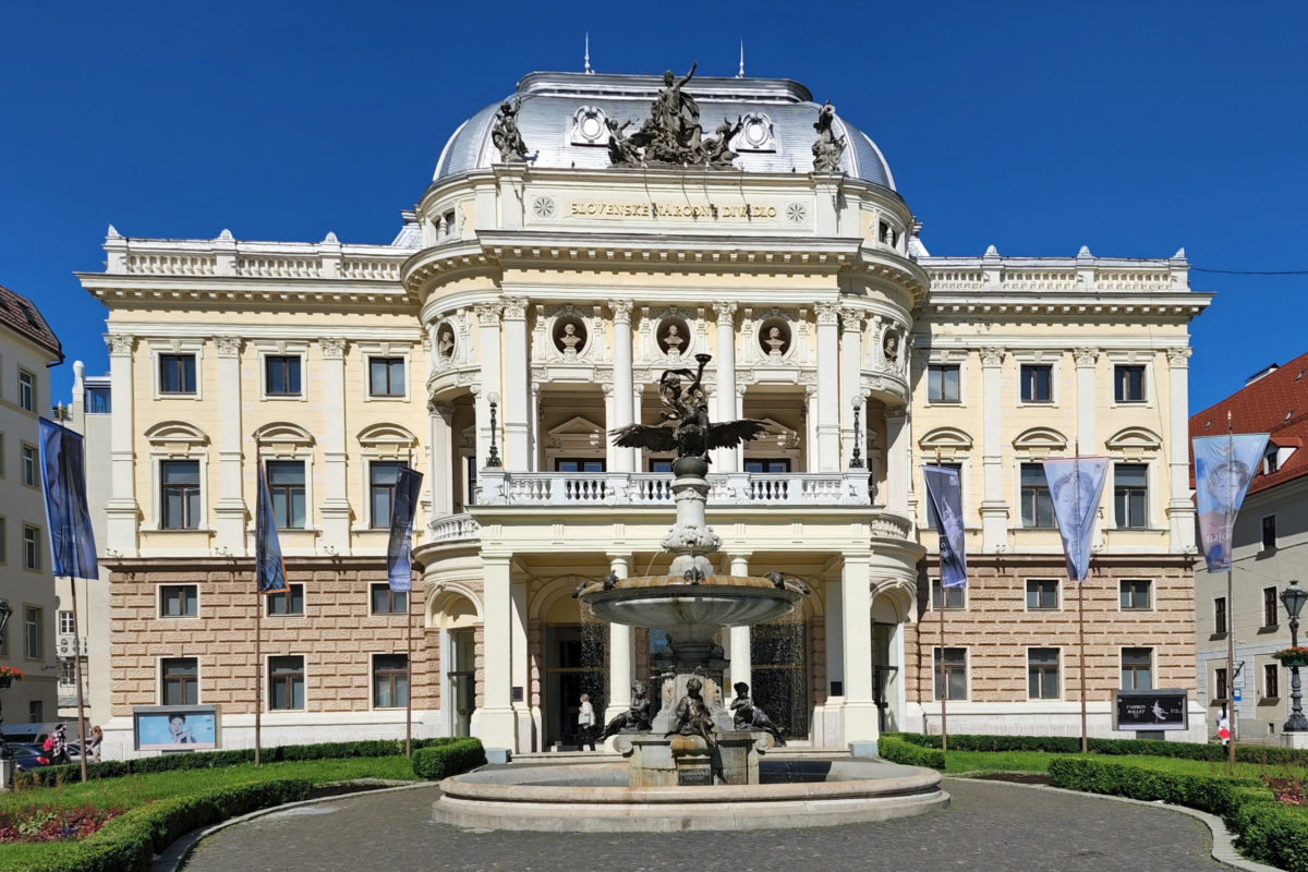
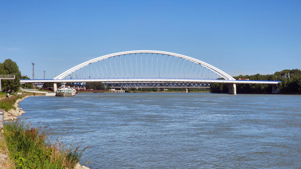
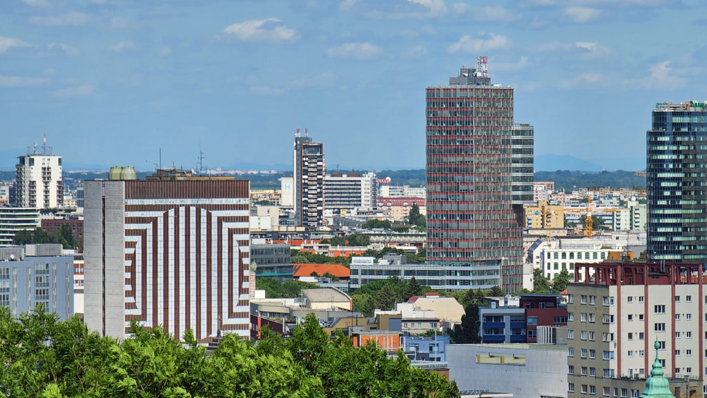
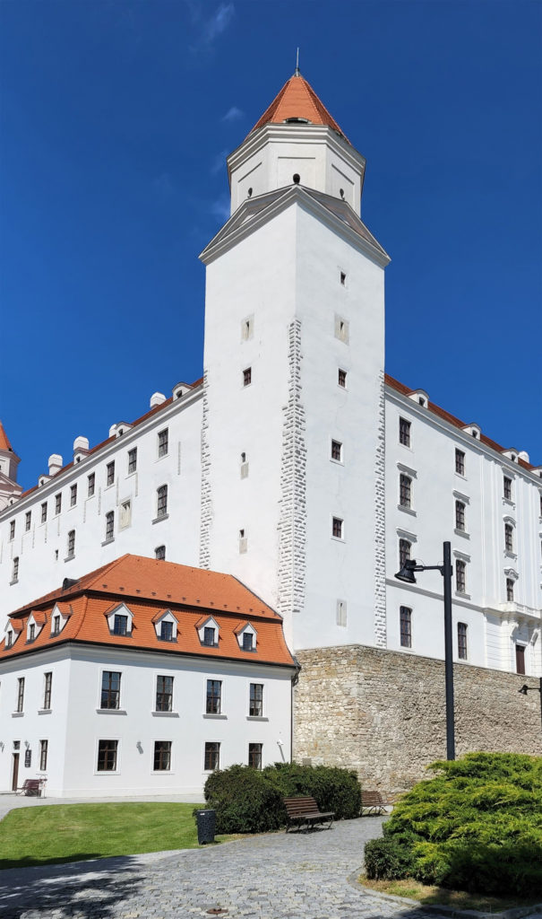
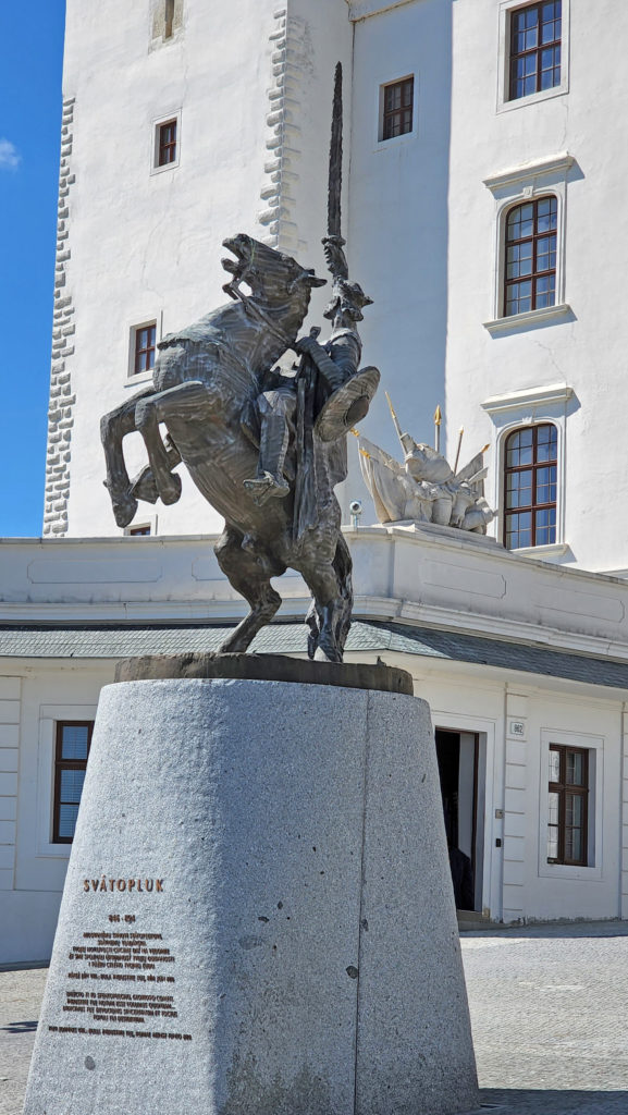
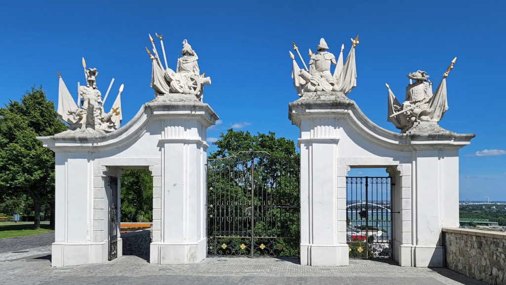
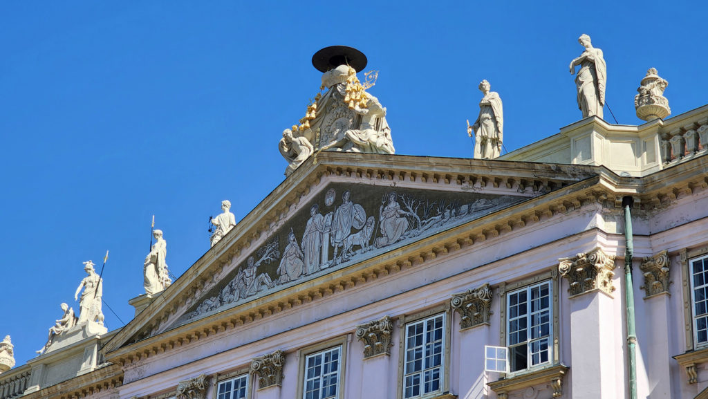
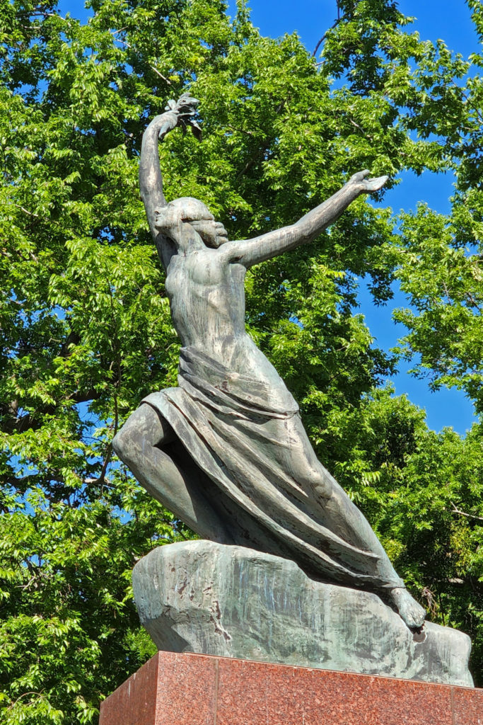
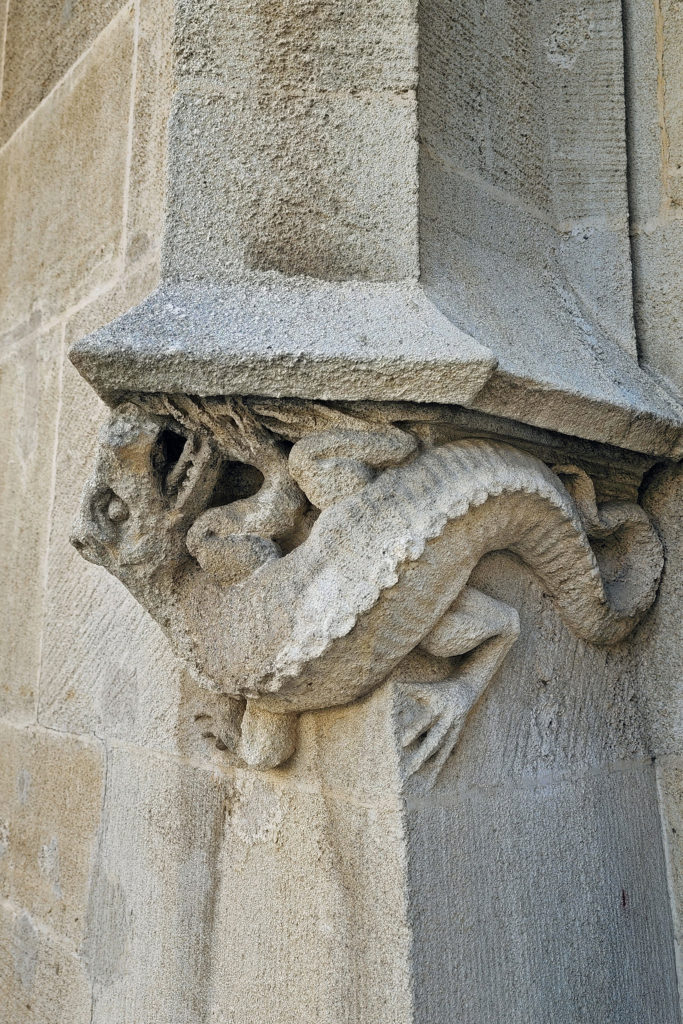 After the castle tour, we did a guided walking tour of the old town area along the river. Among the highlights of the old town are St. Martin’s Cathedral, the old Slovak National Theater building, Michael’s Gate, and the historic Hlavne namestie (town square).
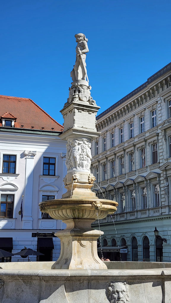
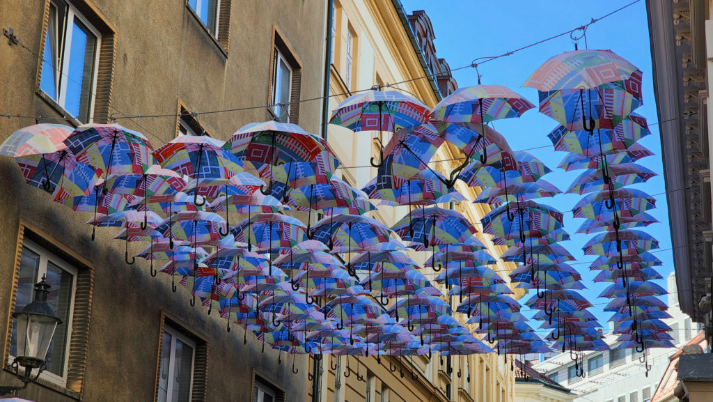 In the 19th and 20th centuries Bratislava’s influence waned, becoming a sleepy regional center of no great significance during the Soviet era. But Bratislava today is a vibrant, modern city with a diverse population and a surprisingly Western European vibe.
 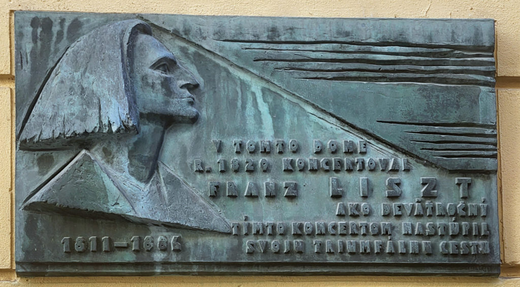 Neighboring Vienna is internationally recognized as a center of classical music and culture, but Bratislava has its own deeply rooted history of arts and culture. Mozart gave a concert in Bratislava at the age of six, and Franz Liszt’s career began (at nine years of age) with a concert in Bratislava. And Hayden, Beethoven, and many other prominent composers performed or conducted concerts in Bratislava in the 19th century. Today, there are a number of music festivals in Bratislava throughout the year, and the
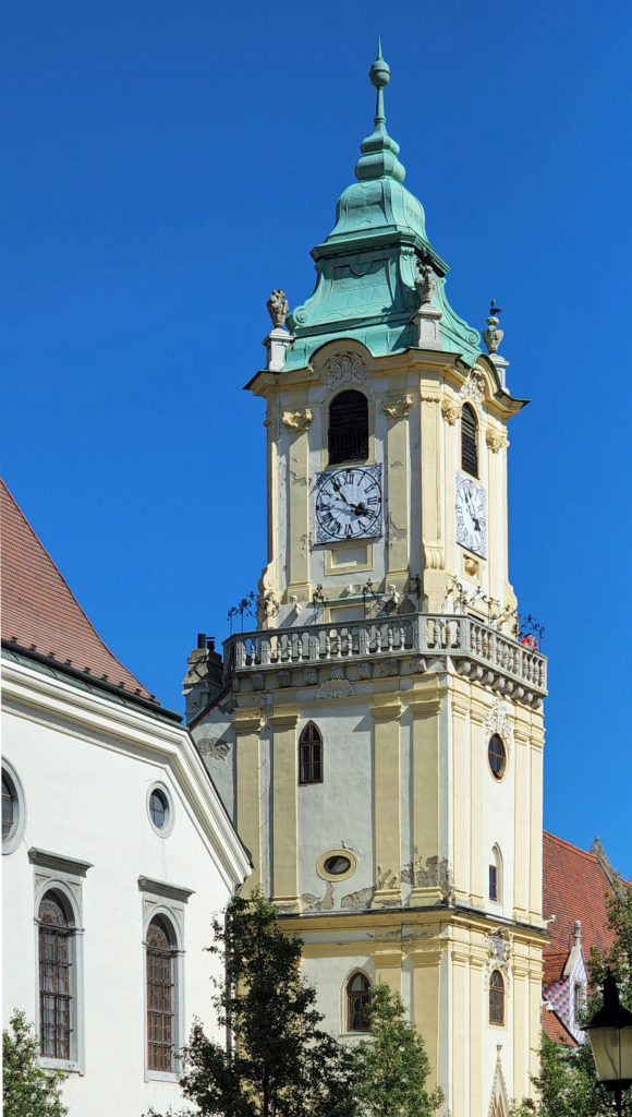
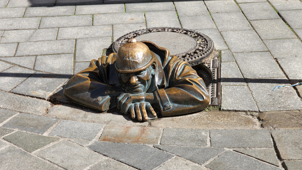 There is much for the visitor to see and do in Bratislava, the vast majority of which we did not have time to take in. But I’m glad that we were able to see at least a portion of this small but interesting and historic city.
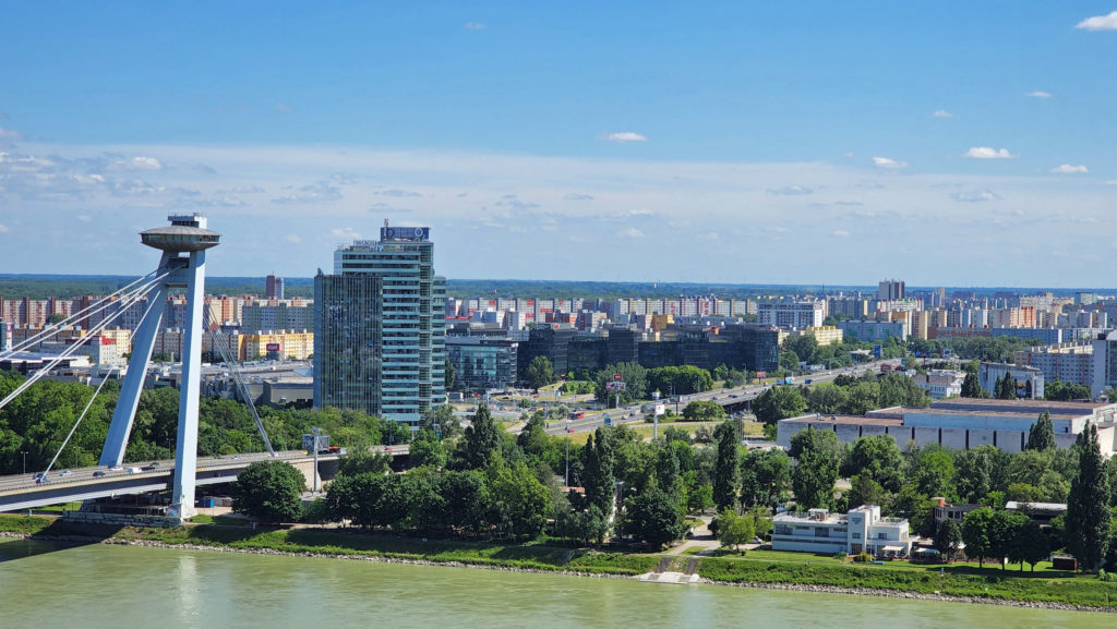 Posted September 14, 2022
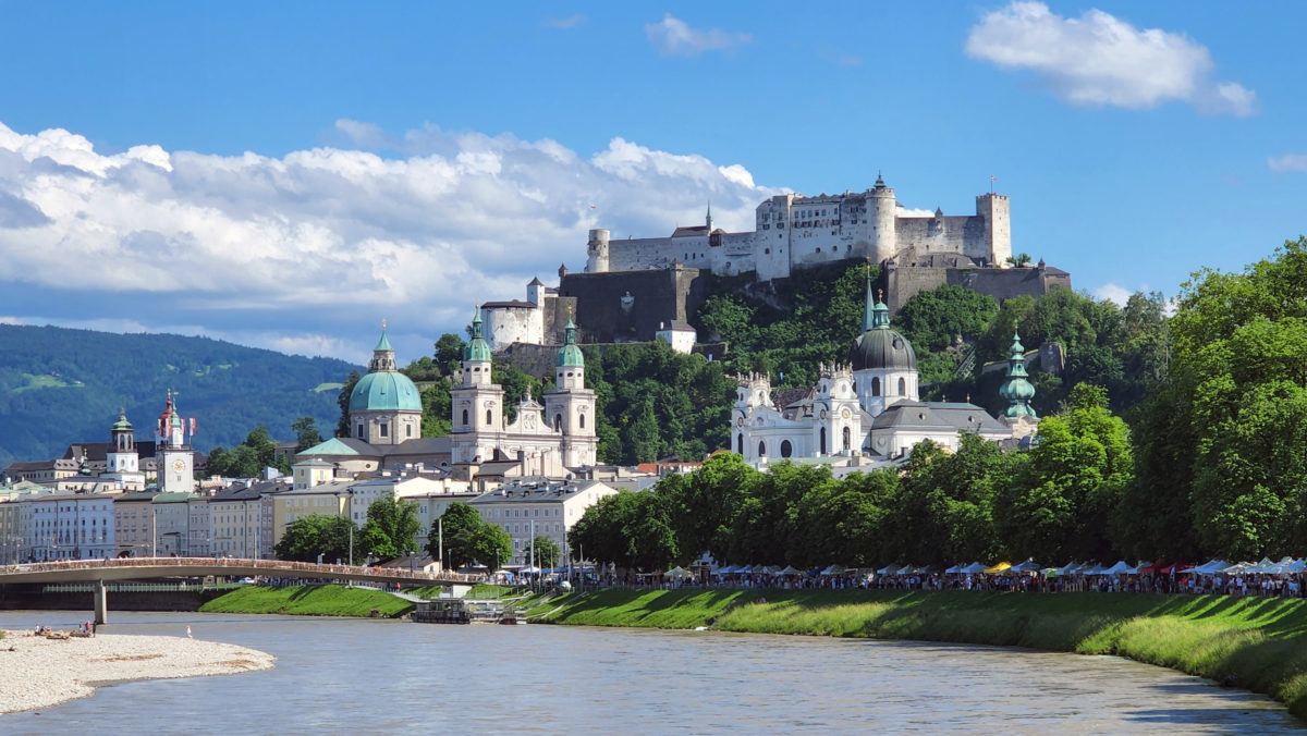
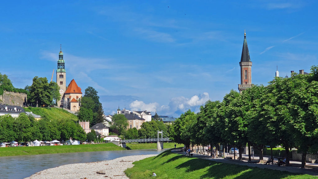
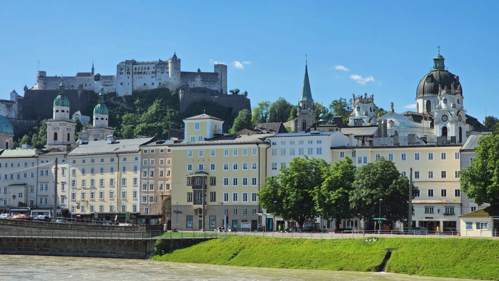
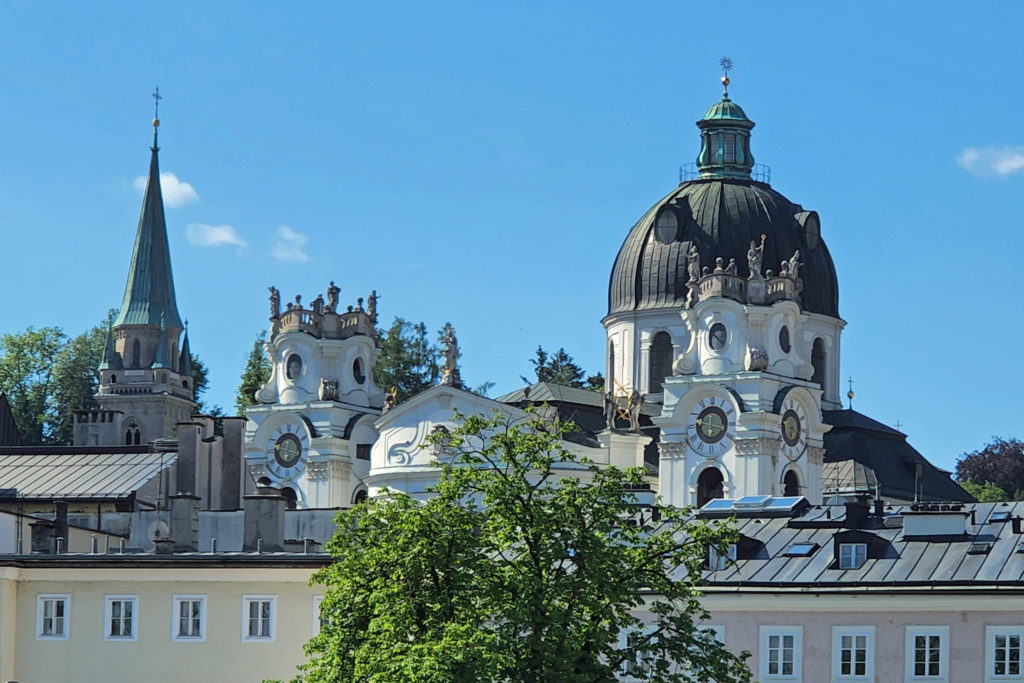
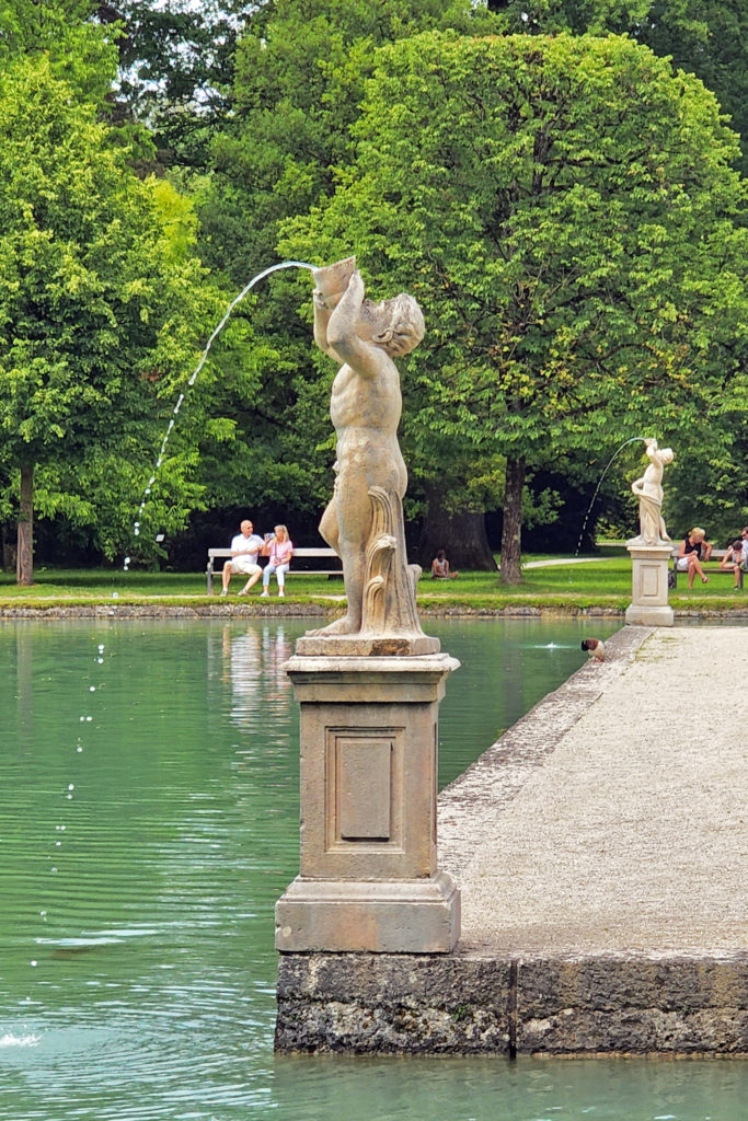
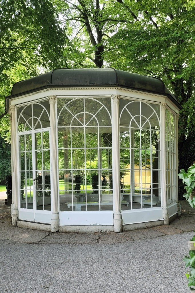
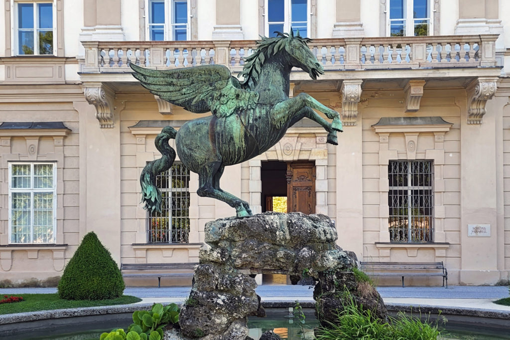
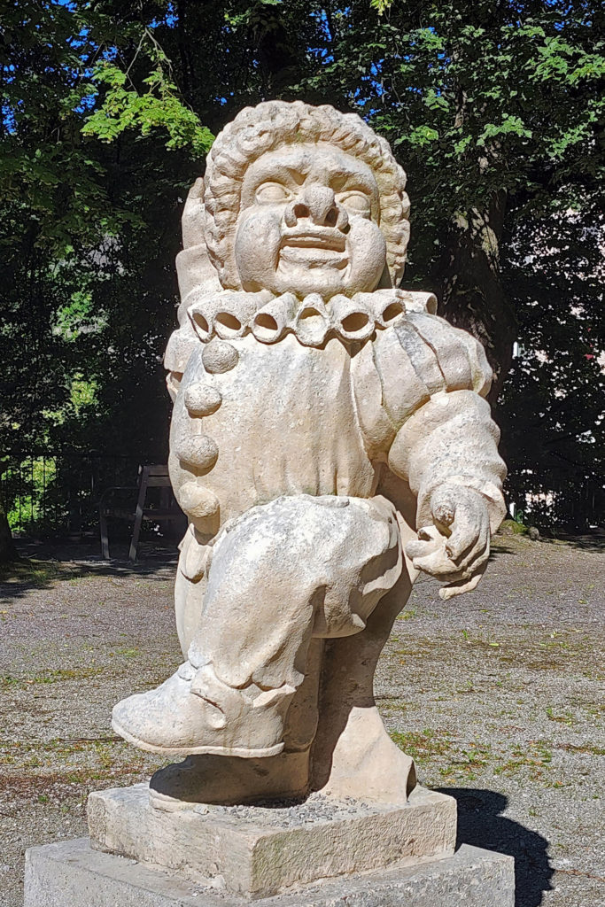
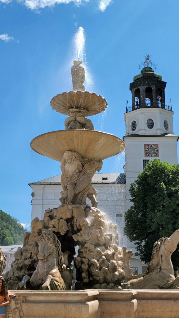
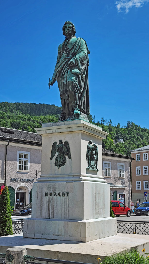
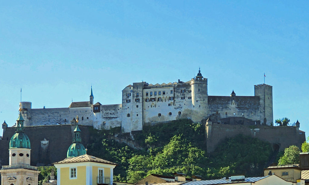
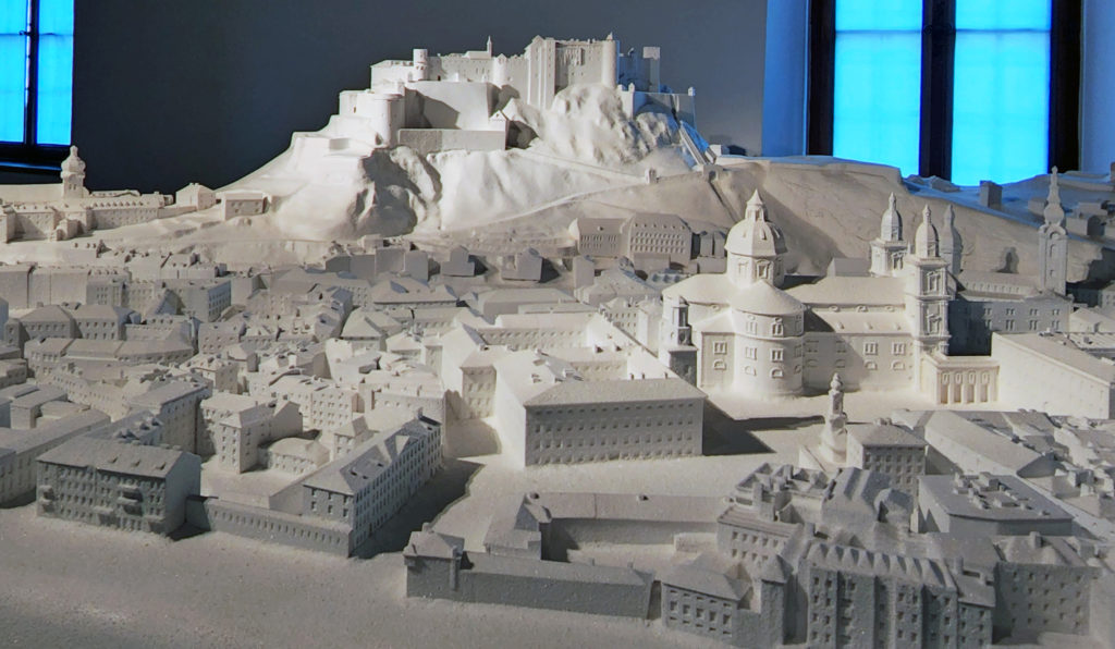
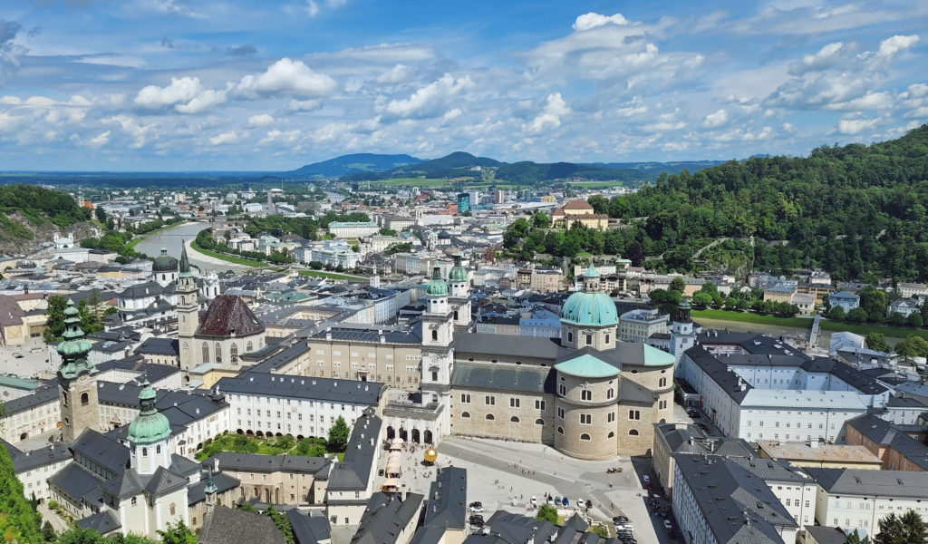
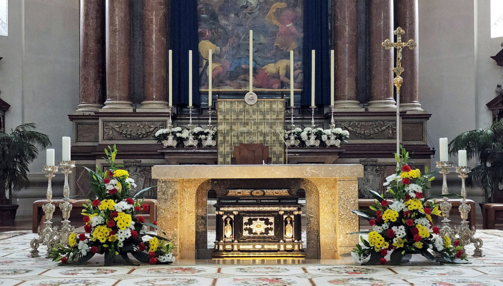
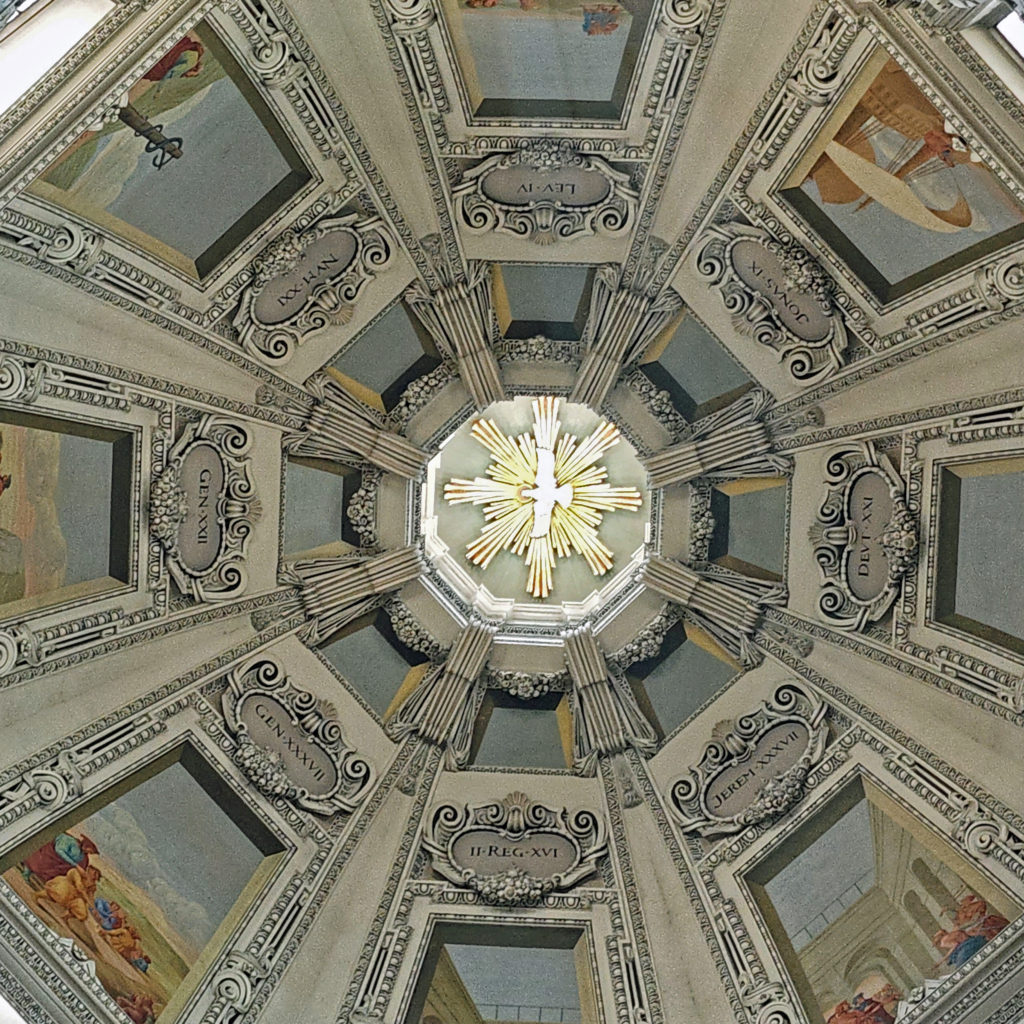
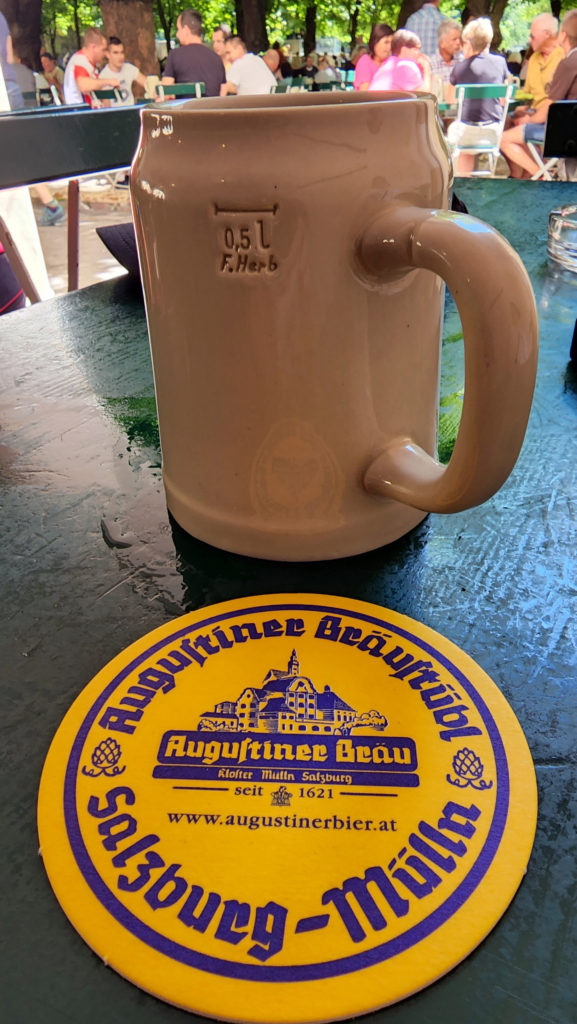
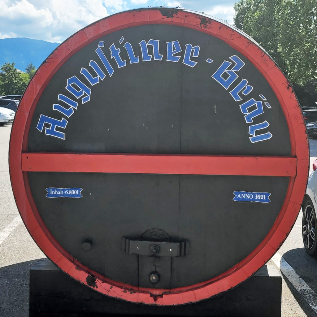
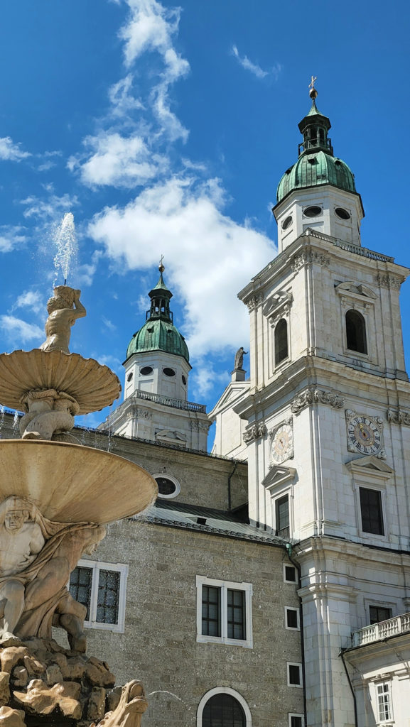
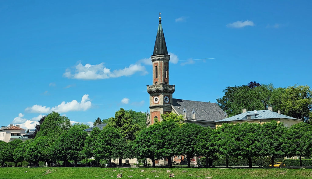
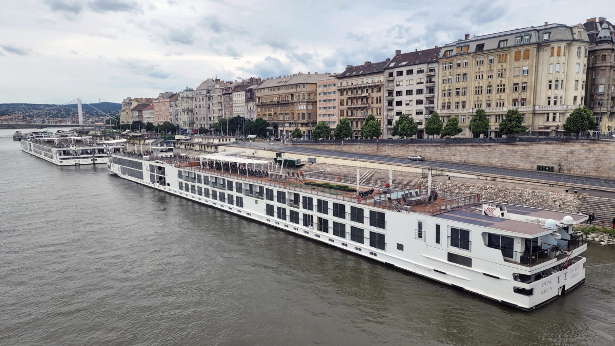
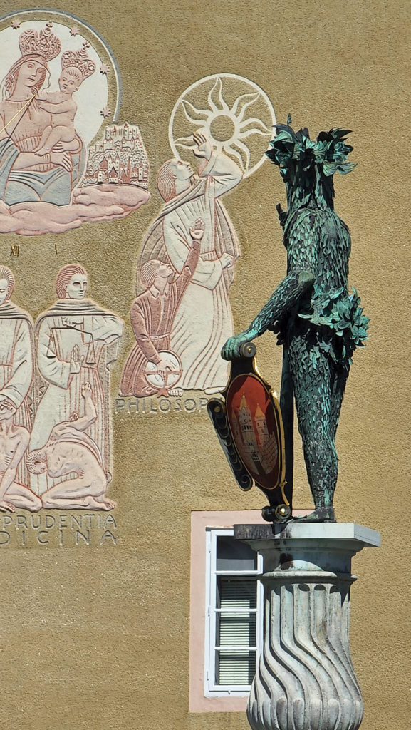
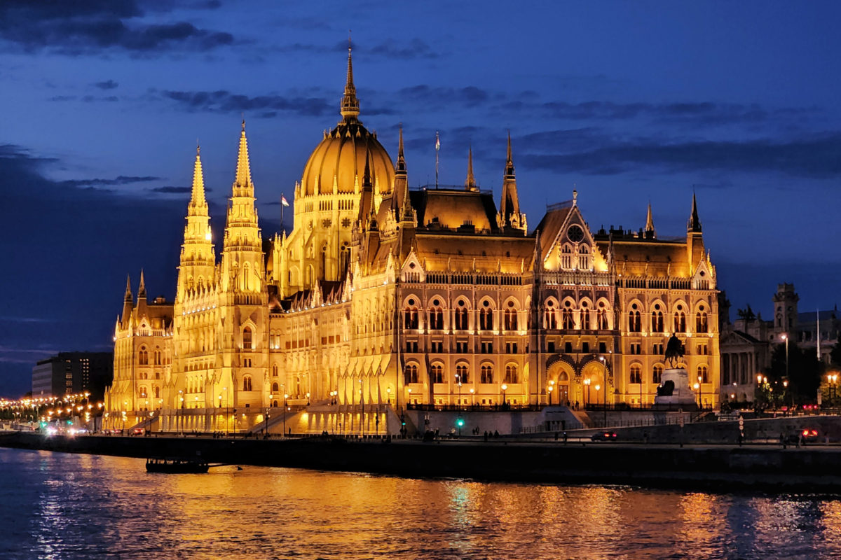
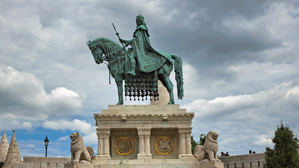
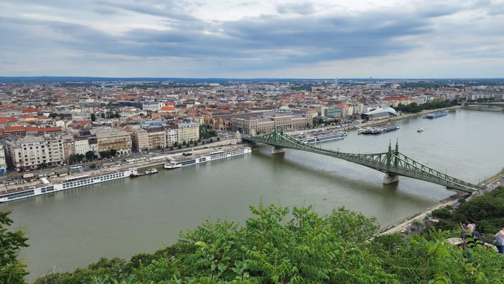
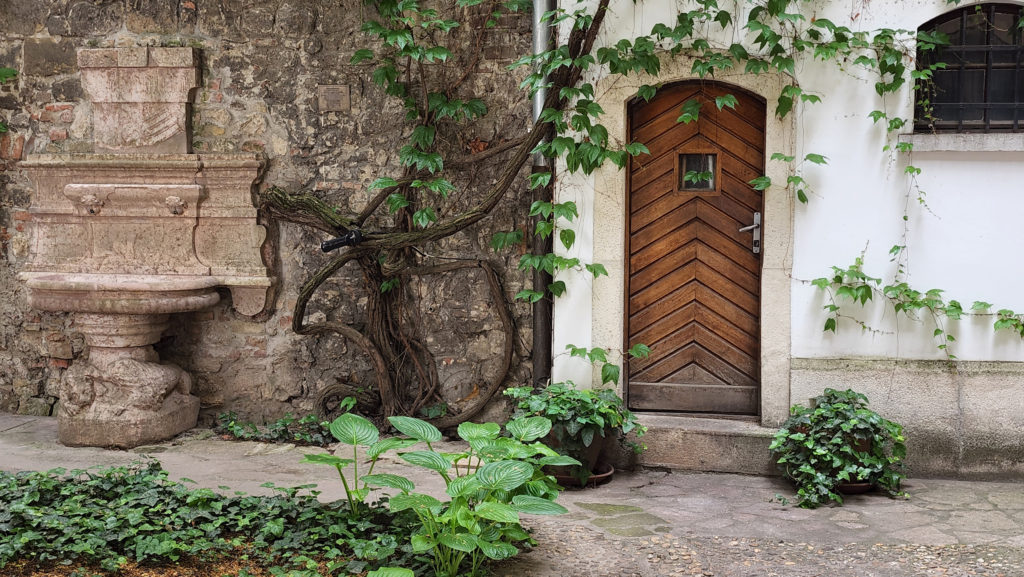
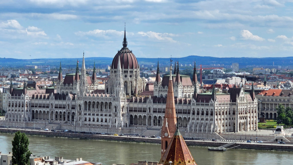
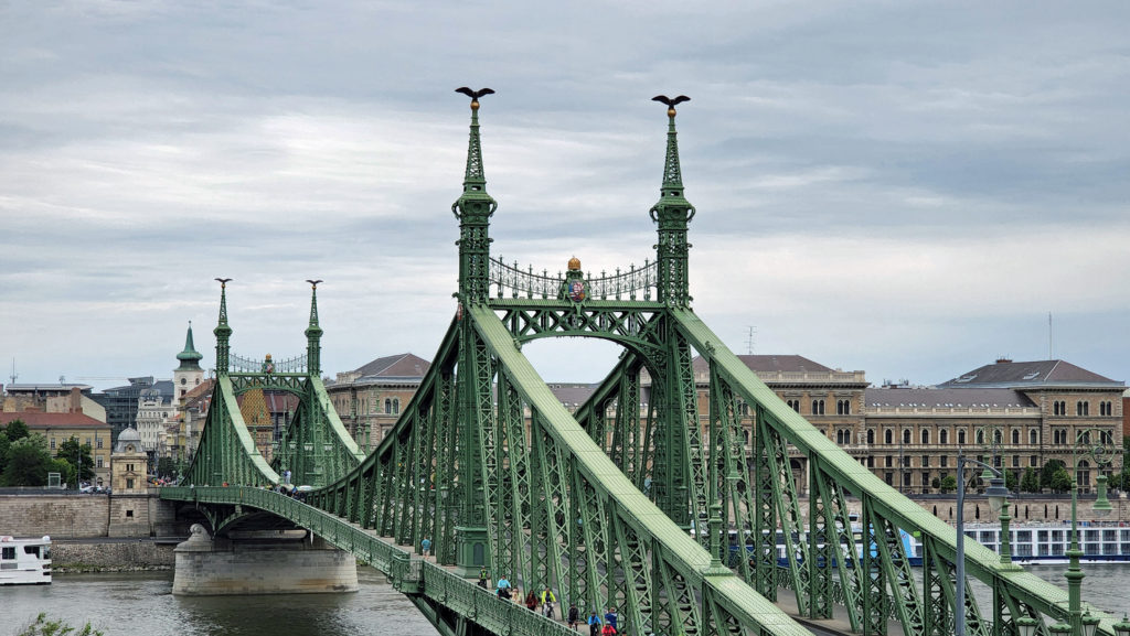
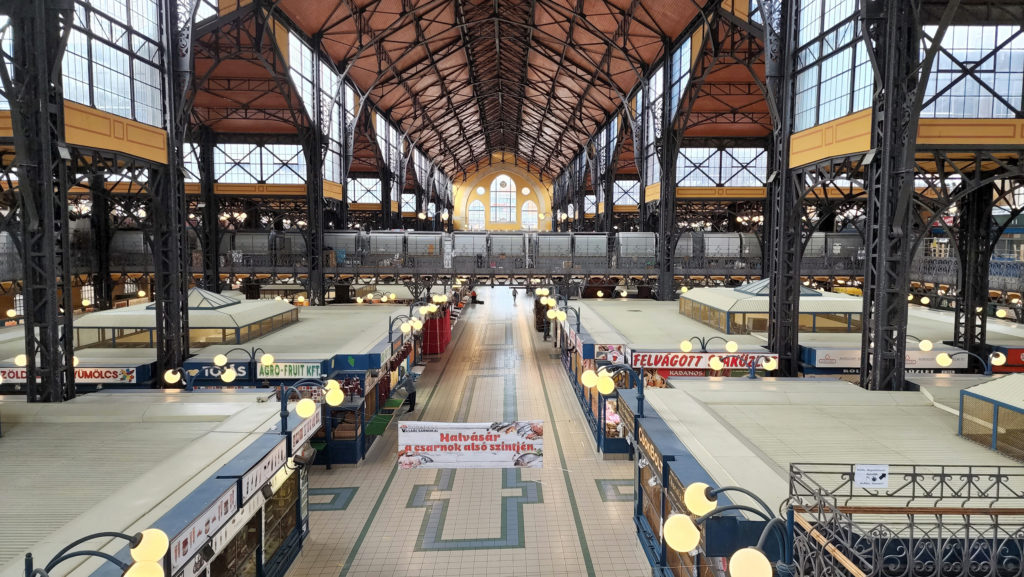
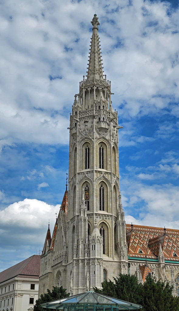
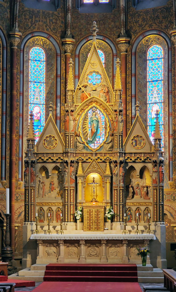
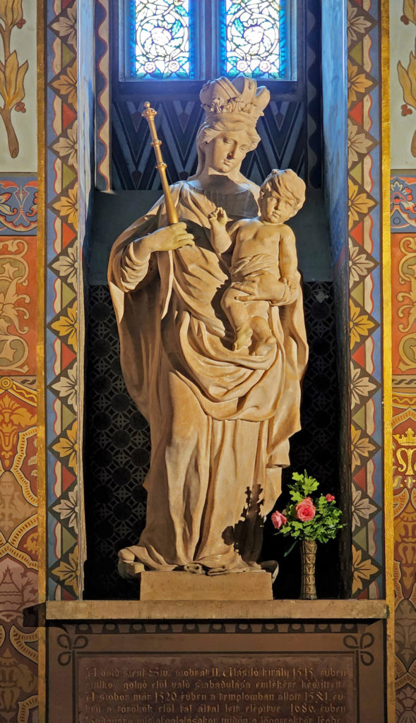
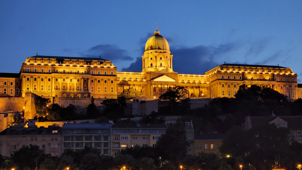
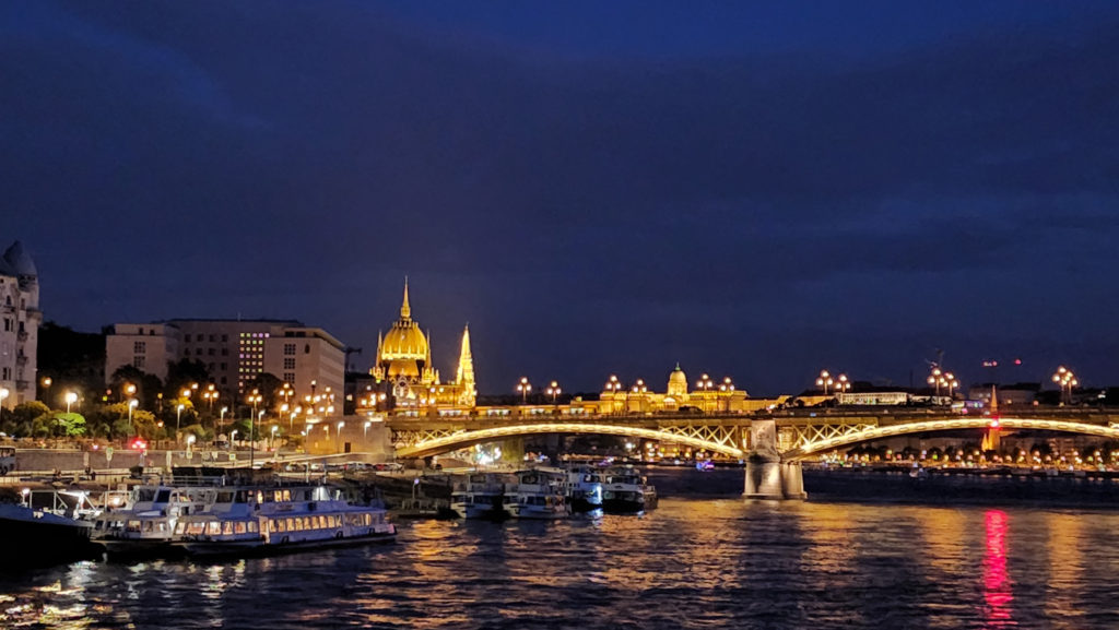
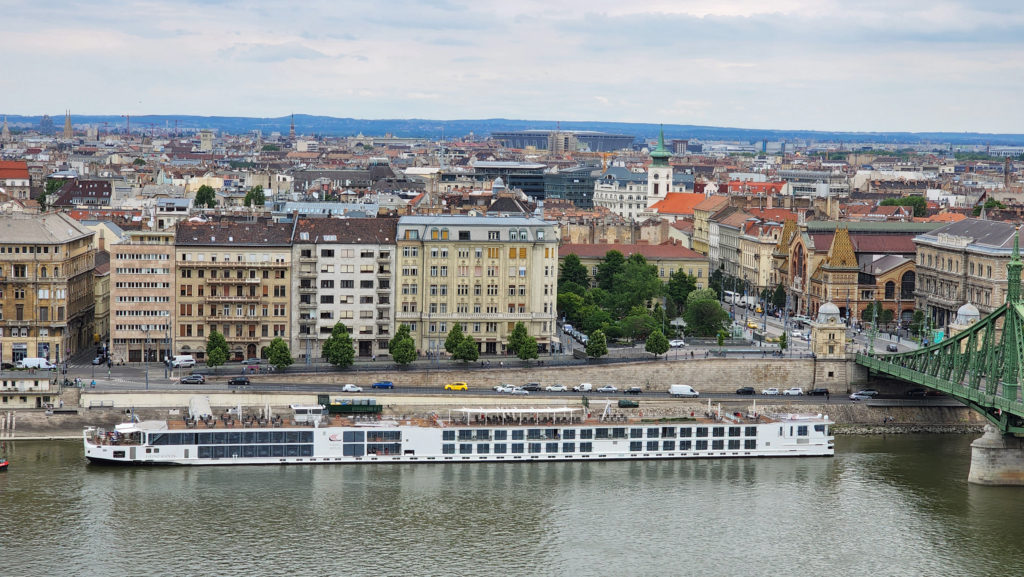
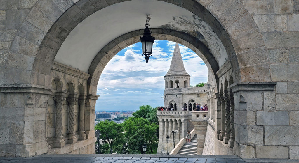
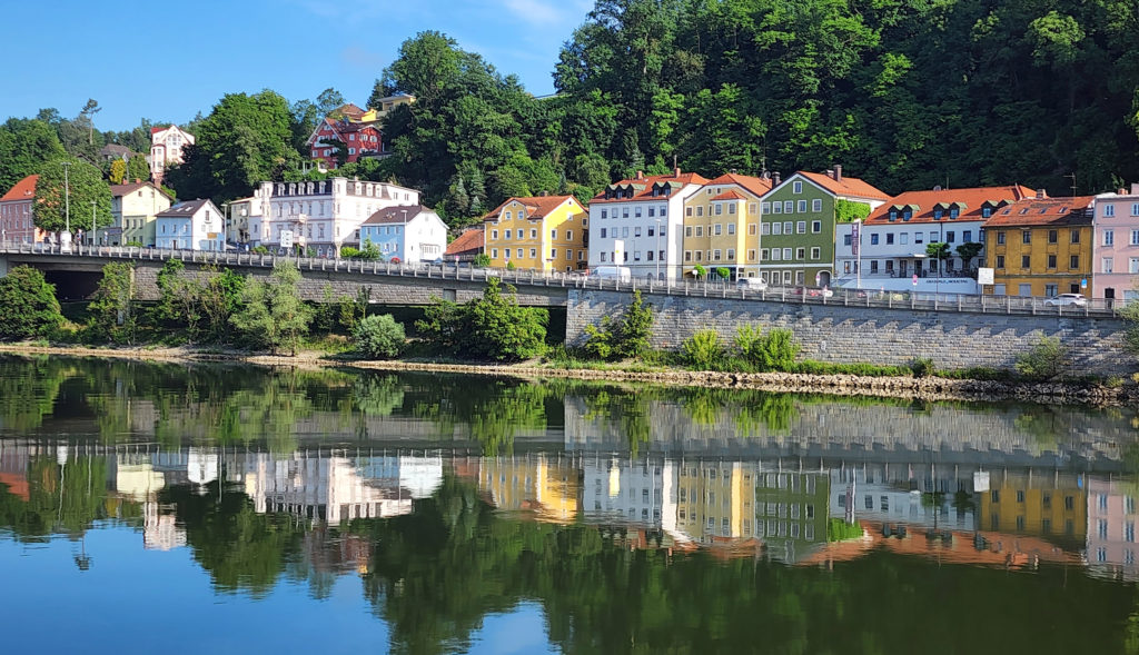
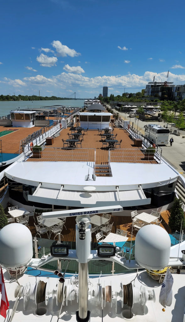
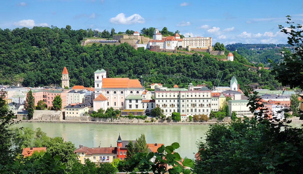
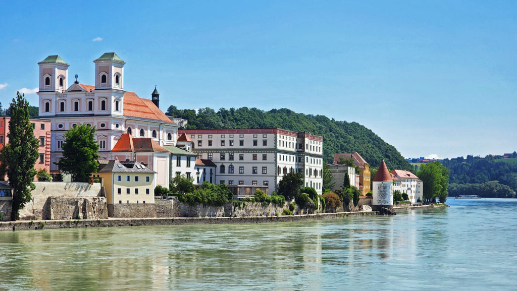
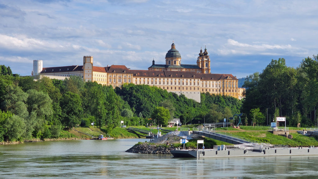
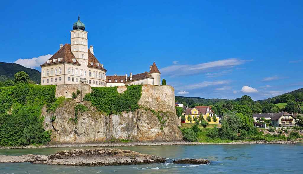
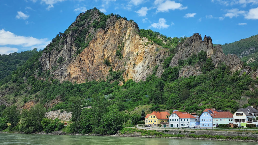
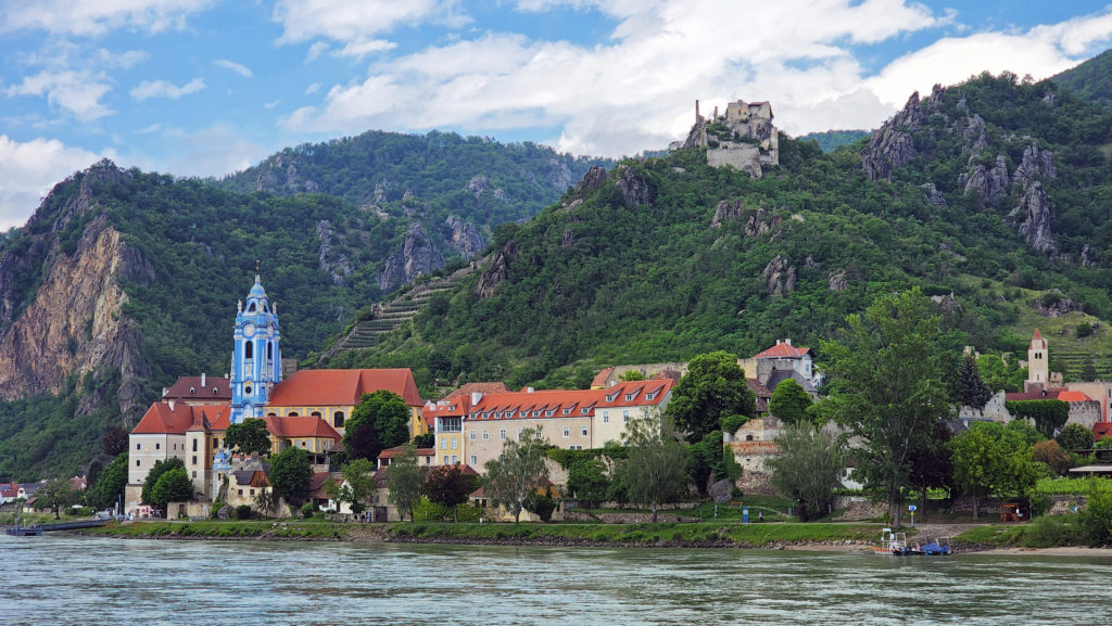
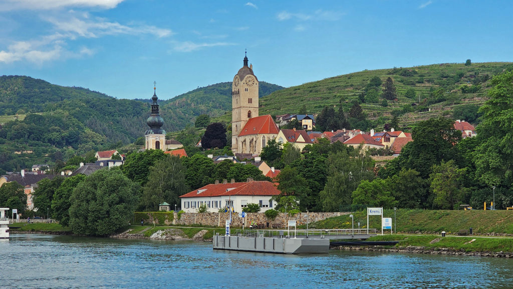
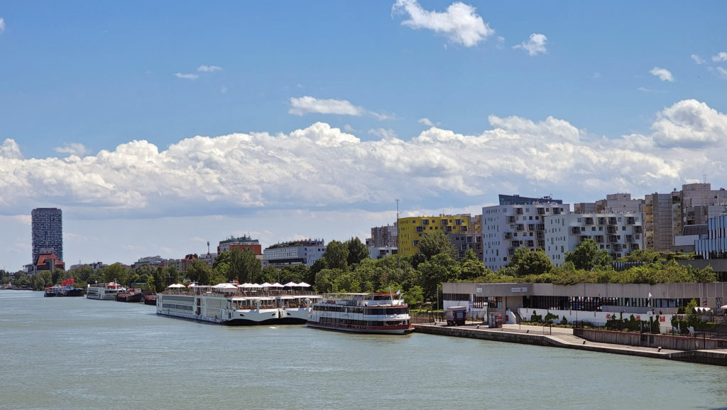
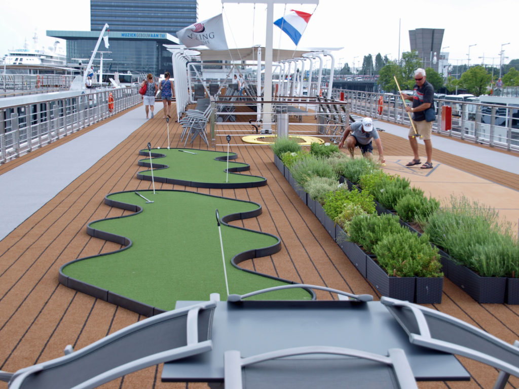
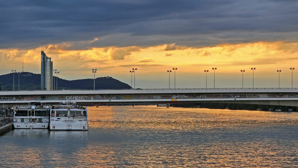
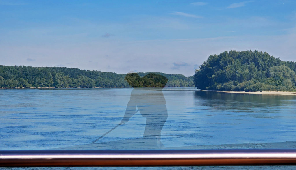
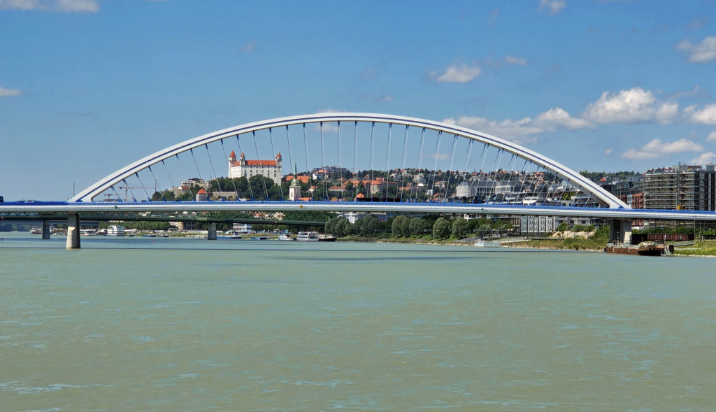
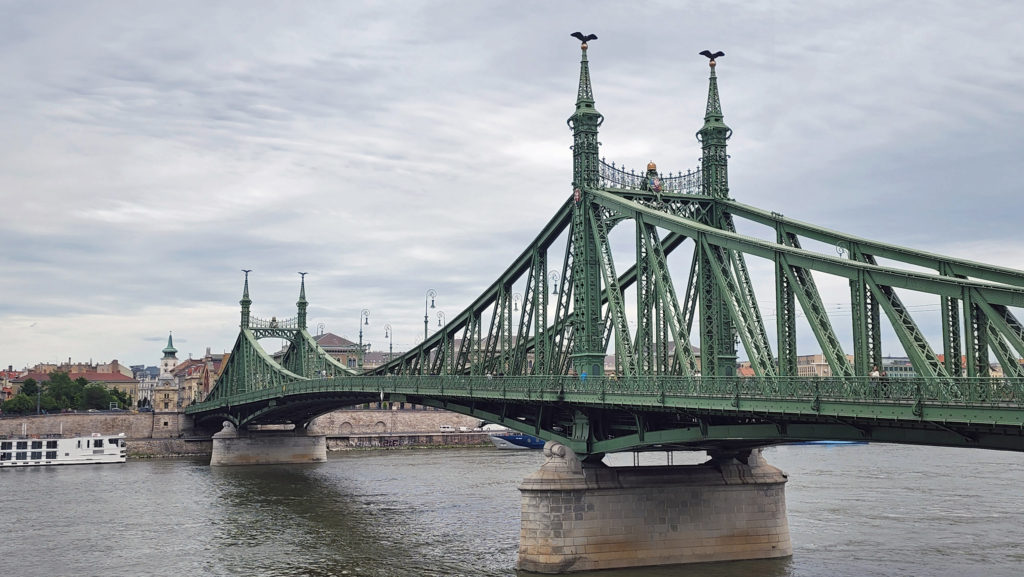
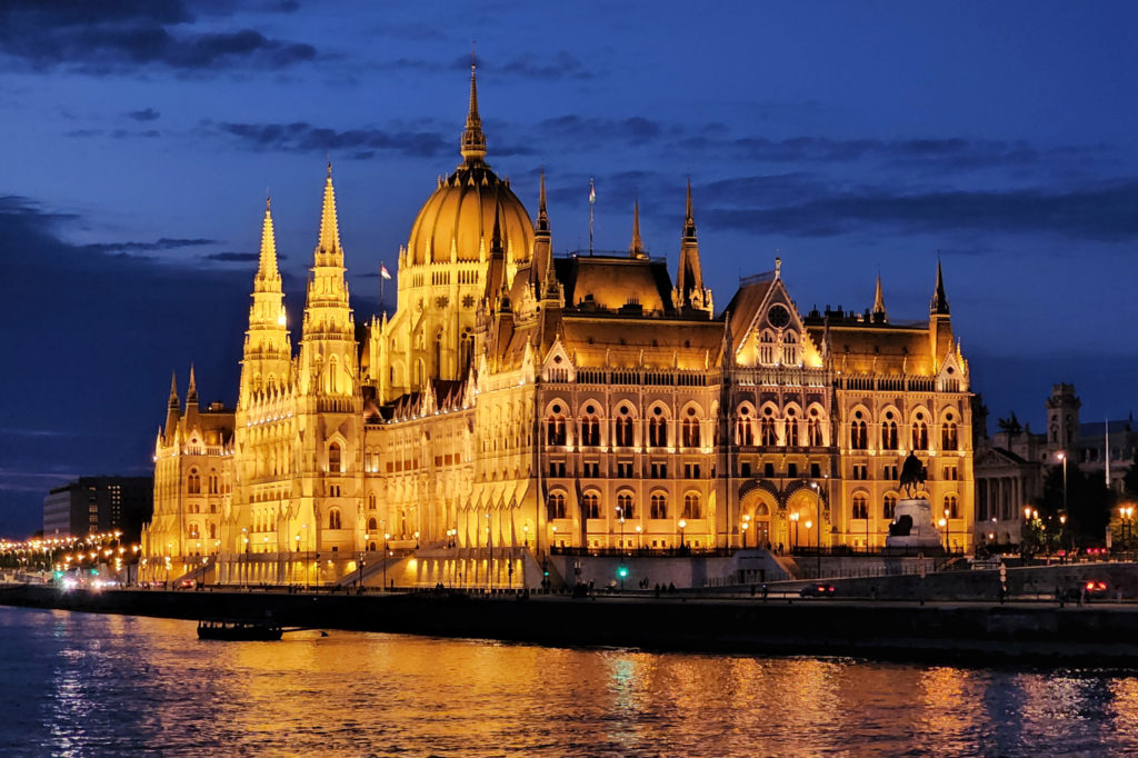


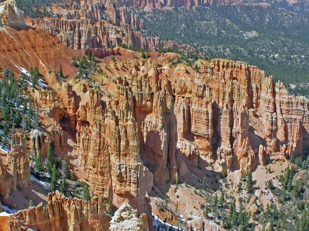
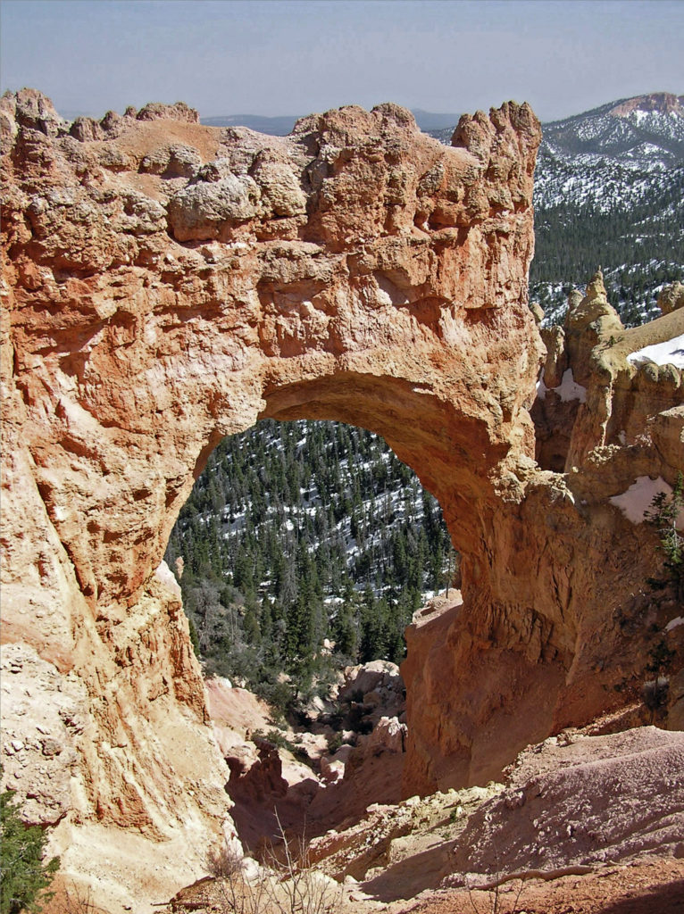

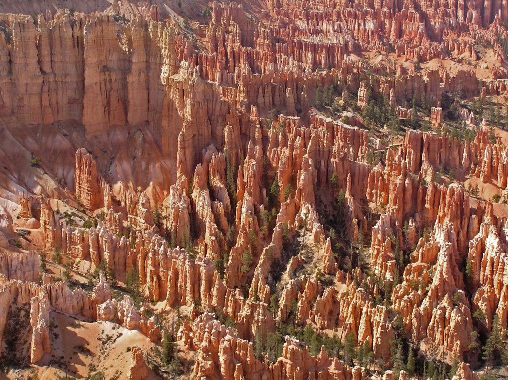
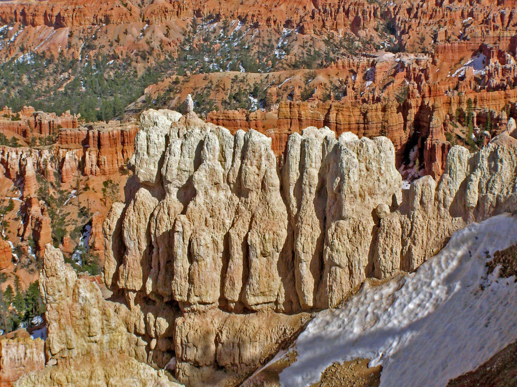
 The altitude also means that nights can be cold there even in the middle of summer. And in spring and fall, it’s not uncommon to encounter cold weather even in the middle of the day. (The photos here were taken in early May and, as you can see, there was still snow in places). Winters are cold, sometimes very, and can be snowy. Many of the trails are closed in winter. But winter also has its charms. Most of the best photos I’ve seen of Bryce Canyon have been taken when the hoodoos were covered in snow.
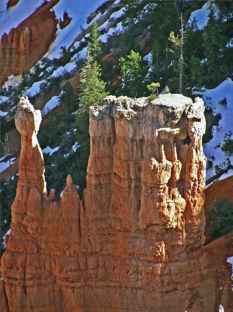

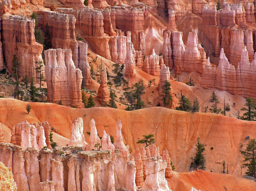
 The good news is that you don’t have to hike very far into the hoodoos to get away from the crowds. There are a number of loop and out-and-back trails that will get you away from the crowds, some of them fairly easy hikes. The rim trail along the edge of the Bryce Amphitheater can also get you away from the worst of the crowds without actually descending into the hoodoos. And if you don’t want to (or can’t) hike into the amphitheaters, there are mule rides available. Check at the visitor center when you arrive. Some of the trails in the park are also paved and wheelchair accessible.
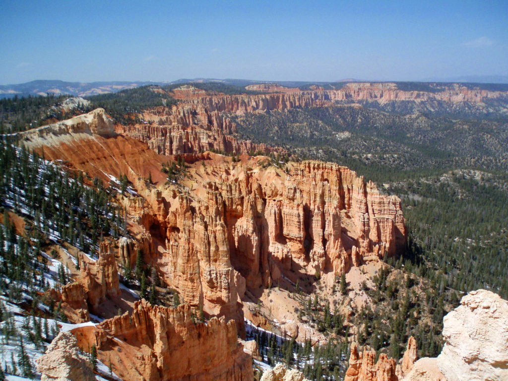
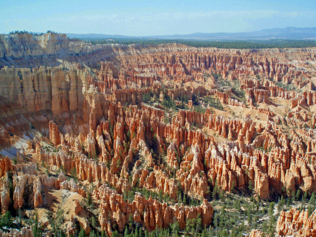
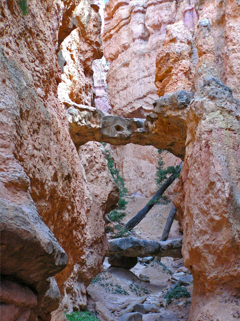 The only road in the park (other than a section of Utah Hwy 12 that cuts across the far northern end of the park) runs north to south along the top of the Paunsaugunt Plateau from the park entrance to Yovimpa Point and Rainbow Point at the southern end of the plateau. Because the park receives so many visitors in the summer, traffic congestion can be a problem. Consider parking your car at the visitor center or the lodge and taking the free shuttle that runs the length of the park. The buses run frequently and you can hop off at any of the viewpoints and catch a later shuttle if you want to do some hiking or just sit and enjoy the scenery for awhile. Taking the shuttle also makes point to point hikes possible without having two cars.
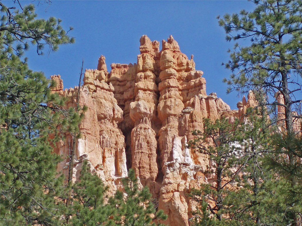 Besides being a spectacularly beautiful place during the day, Bryce Canyon is also great place to star gaze. It’s far from any light polluting urban areas, and the night skies in the park can be incredible. The park offers both astronomy programs and guided full moon hikes. Check the Bryce Canyon National Park
  The park website is a good place to begin when planning a trip to Bryce. The
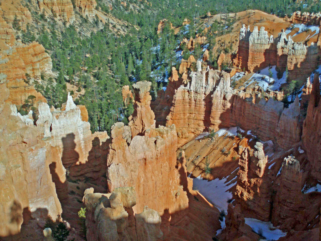
 The Covid-19 pandemic is still with us as I write this (Feb. 2022), but the park is open with only a few restrictions. Masks are still required for everyone, regardless of vaccination status, in all NPS buildings, crowded outdoor spaces, and all forms of enclosed public transportation. But there are no other restrictions and all facilities are open. Additional details are available on the park website and at
  If you’re not ready to begin traveling again, though, here are links to a short video by
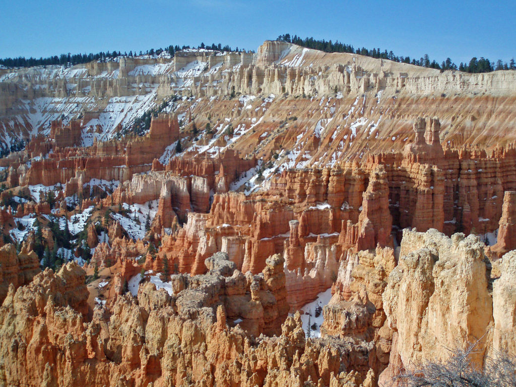
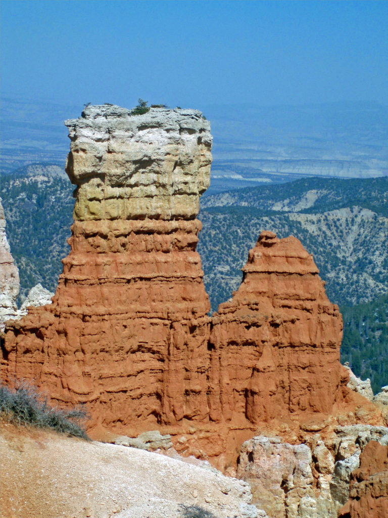 Originally posted March 20, 2020. Updated and re-posted February 19, 2022.
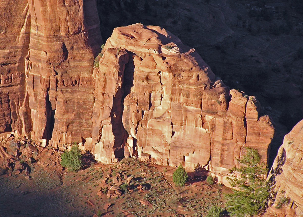
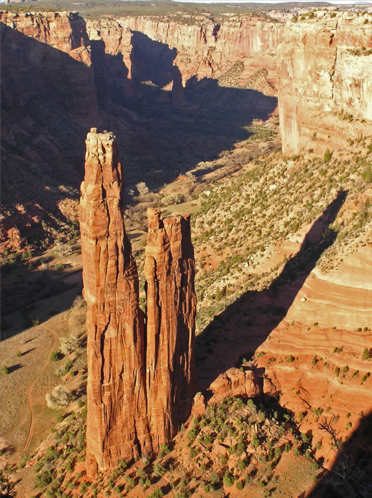 The name Chelly comes from the Spanish spelling of the Navajo name for canyon, tseyi, which translates literally as “within the rock.” Over time the Spanish pronunciation, “chay-ee”, has evolved into the current pronunciation, “shay”.
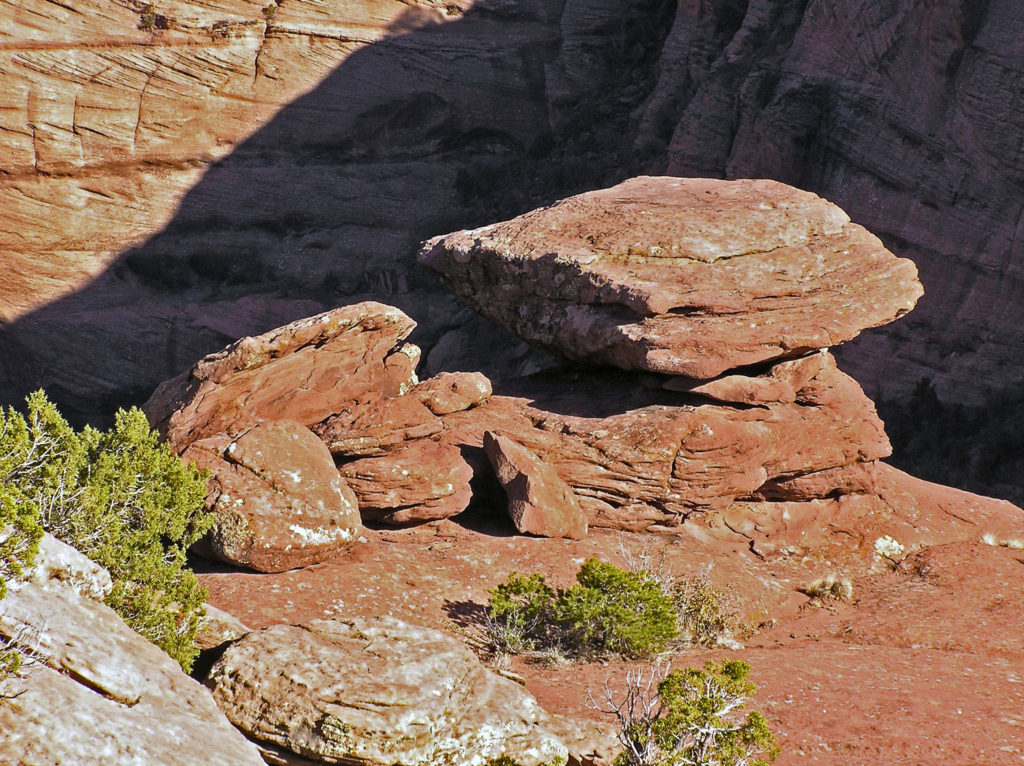
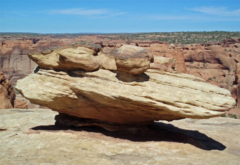 Located a couple of miles east of Chinle, Arizona, the monument’s Welcome Center is a good place to start your visit. Pick up a free map of the monument and watch a short film about the monument to orient yourself. The park rangers can answer any questions you have about tours of the canyon, accommodations, the canyon’s history or geology, what plants and animals you’ll find in the park, or any other questions you might have. There is also a gift shop where souvenirs of your visit can be purchased.
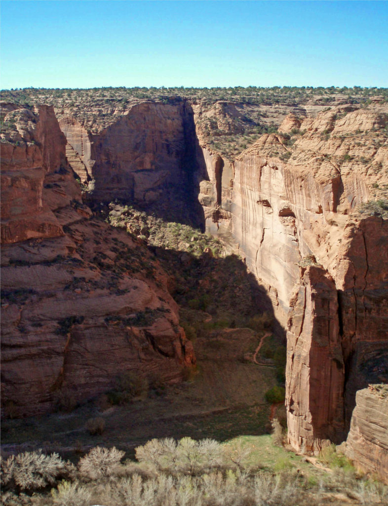
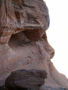 Canyon de Chelly is worth a visit just for the spectacular scenery it affords, but it is also an important cultural and historic site. The canyon is one of the longest continuously inhabited places in North America. The Ancestral Puebloans (also known as the Anasazi) first settled in the area some 4,000 years ago. The canyon was later occupied by the Hopi, descendents of the Ancestral Puebloans, and more recently by the Navaho.
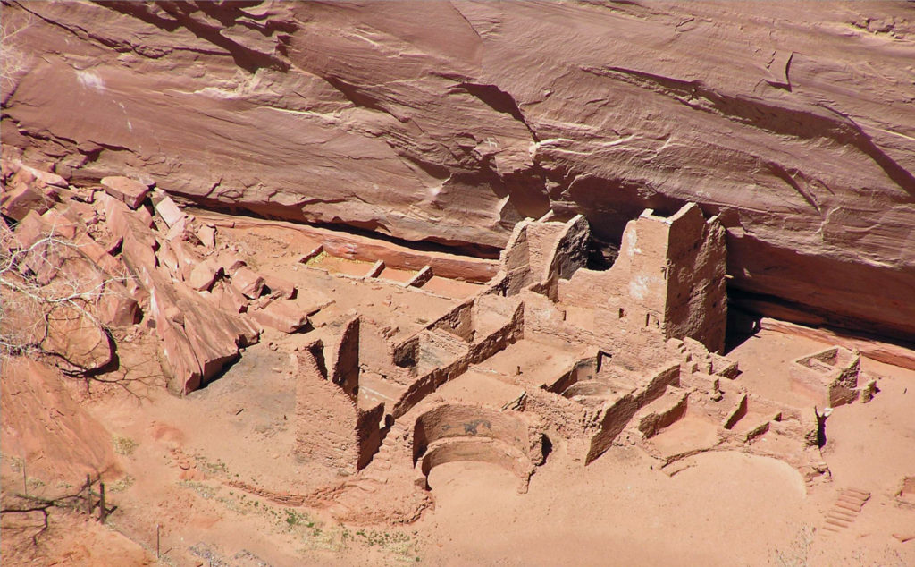
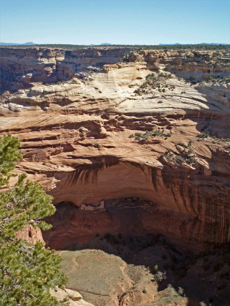
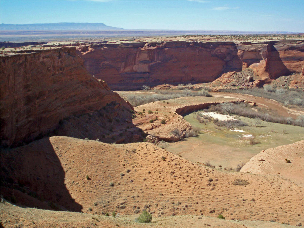
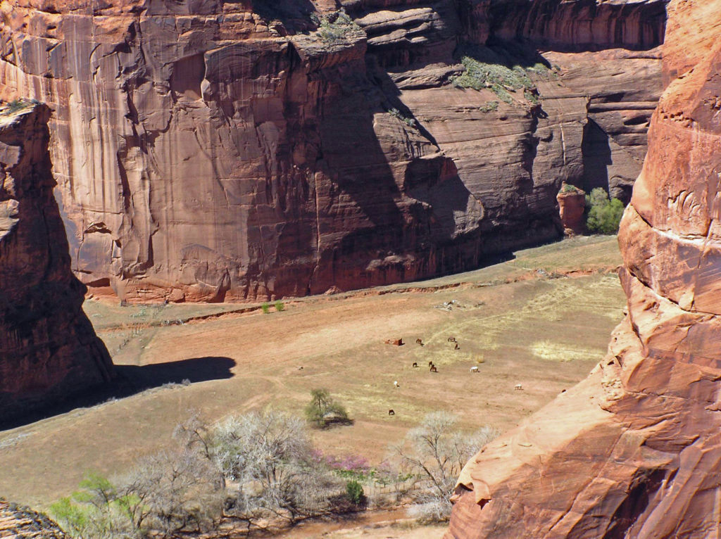
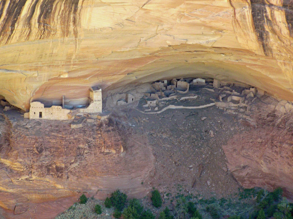
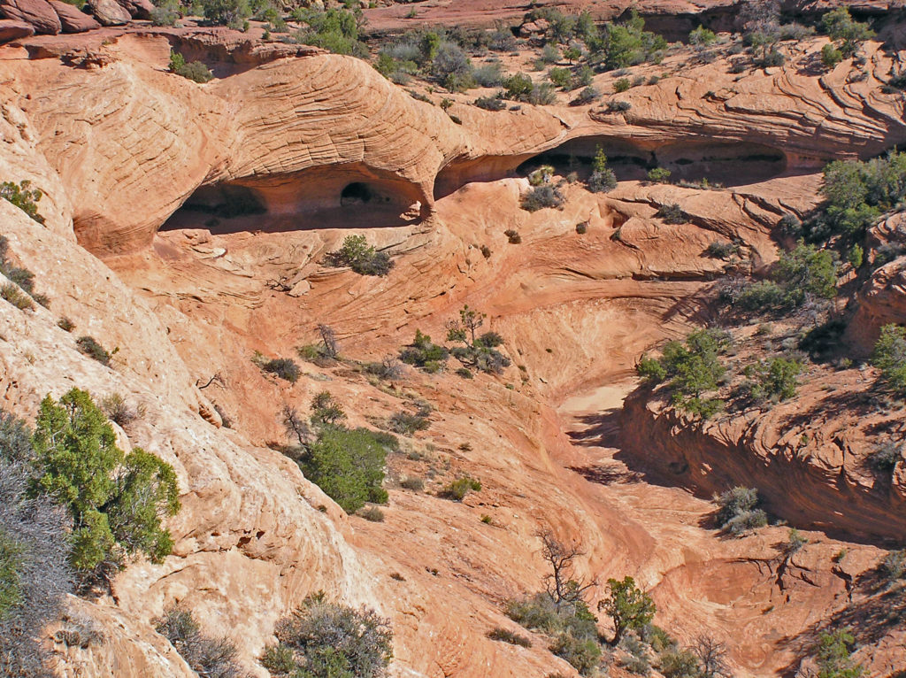
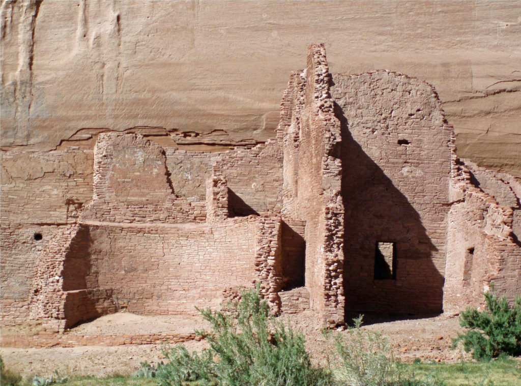
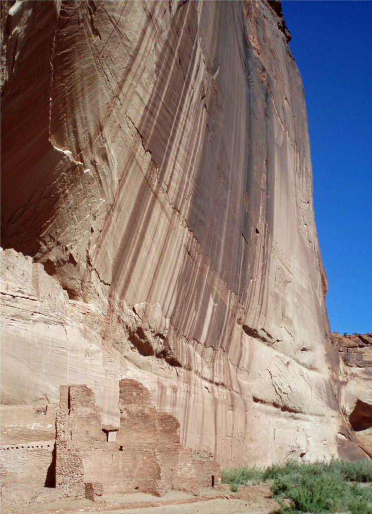
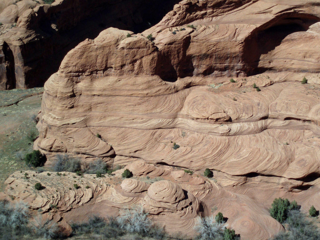
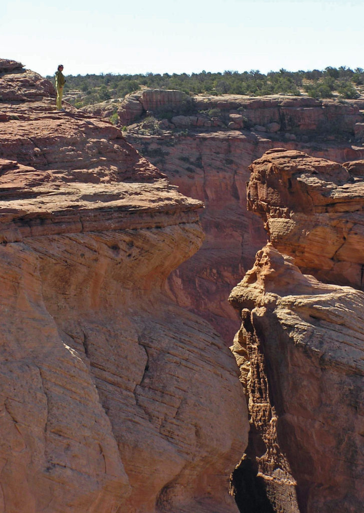
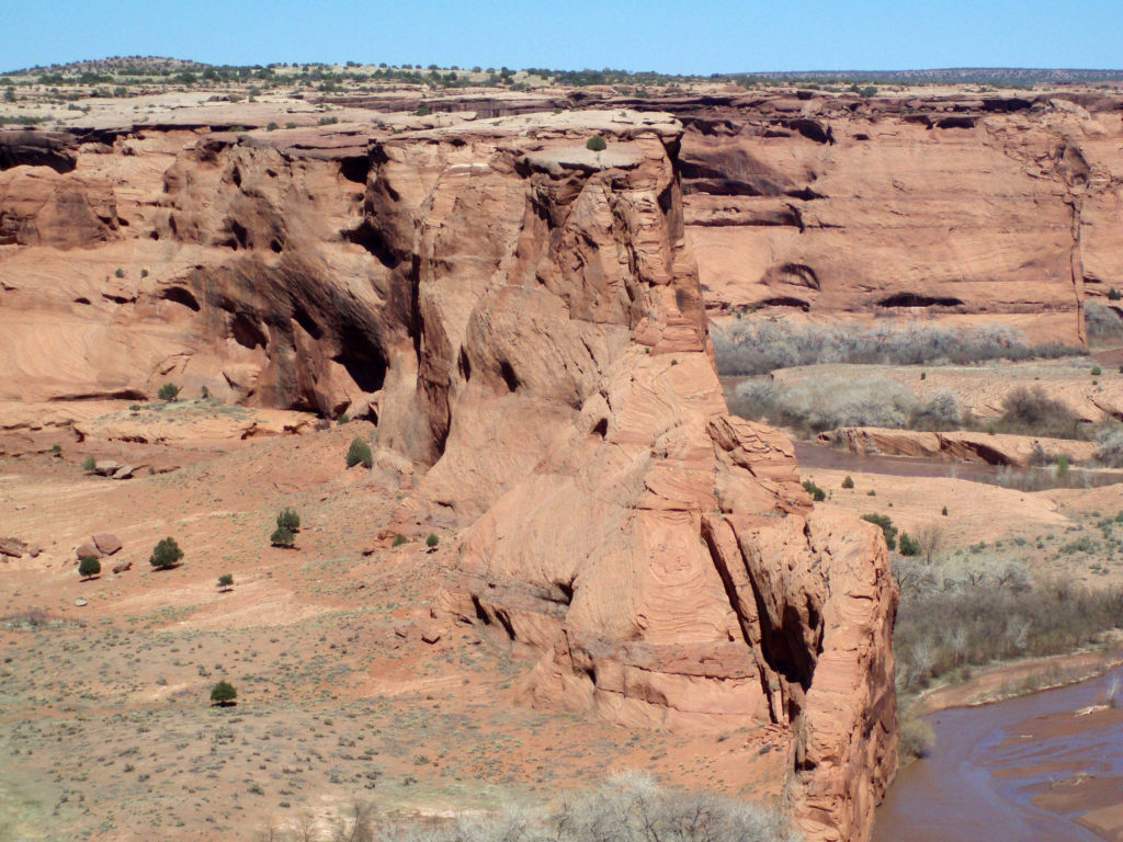
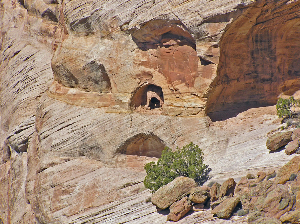 Originally posted May 14, 2020. Updated and re-posted February 14, 2022.
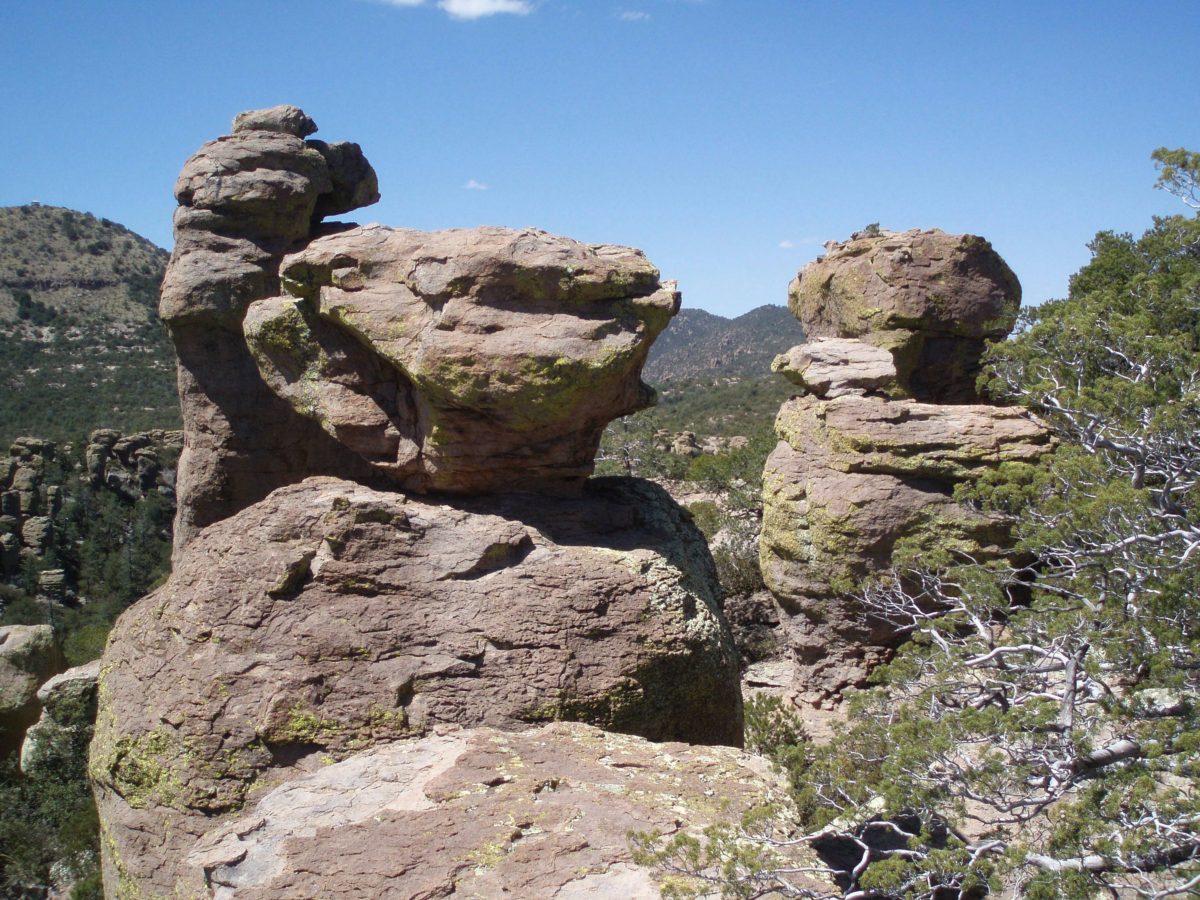
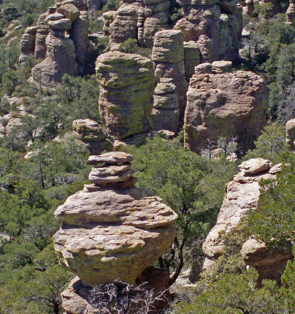
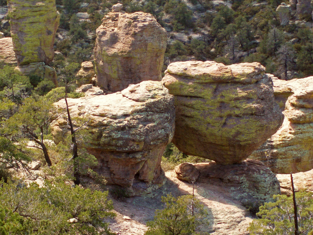
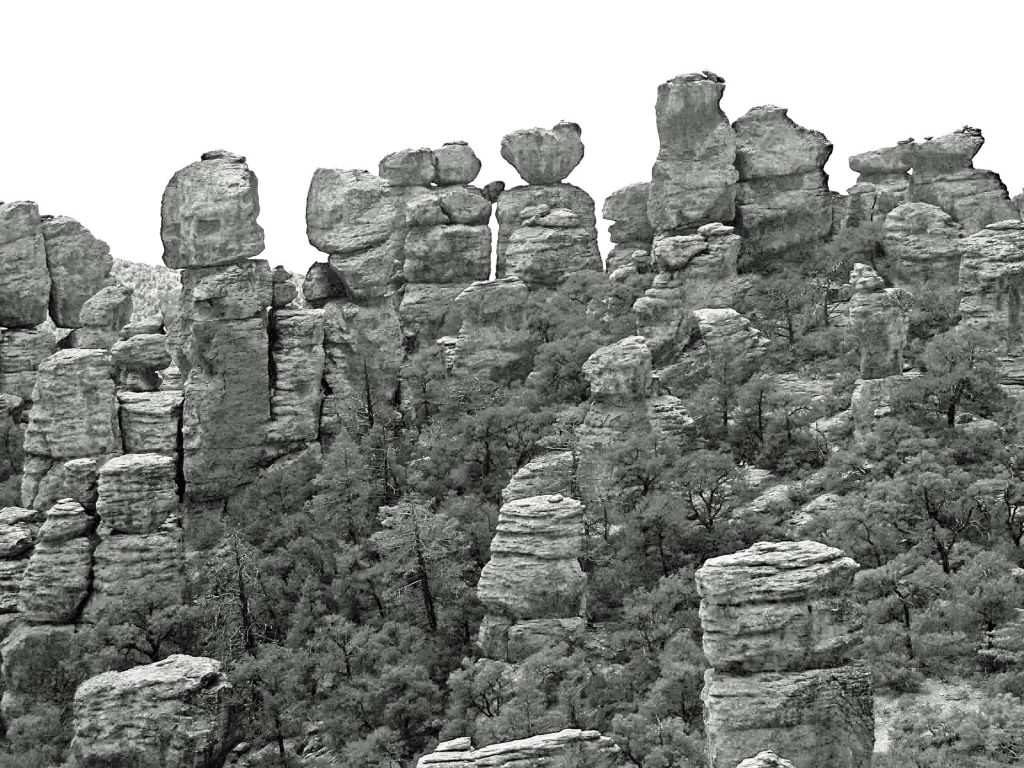
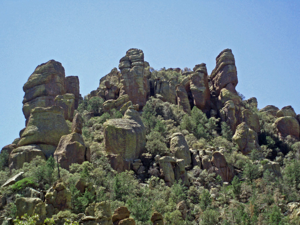
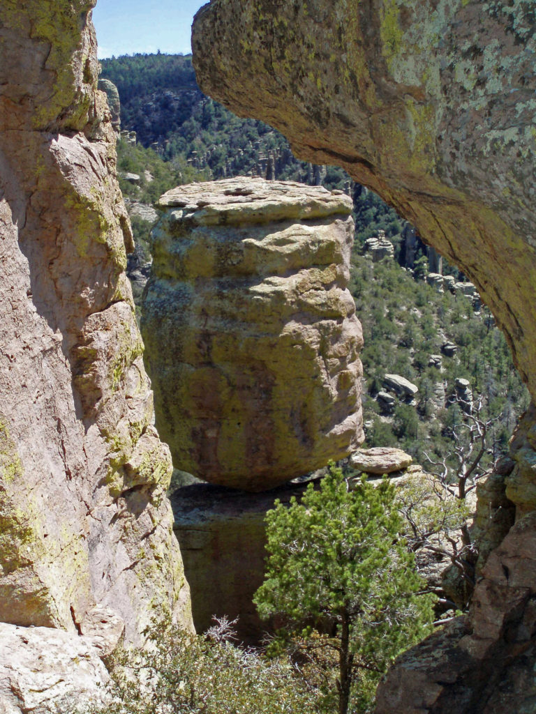
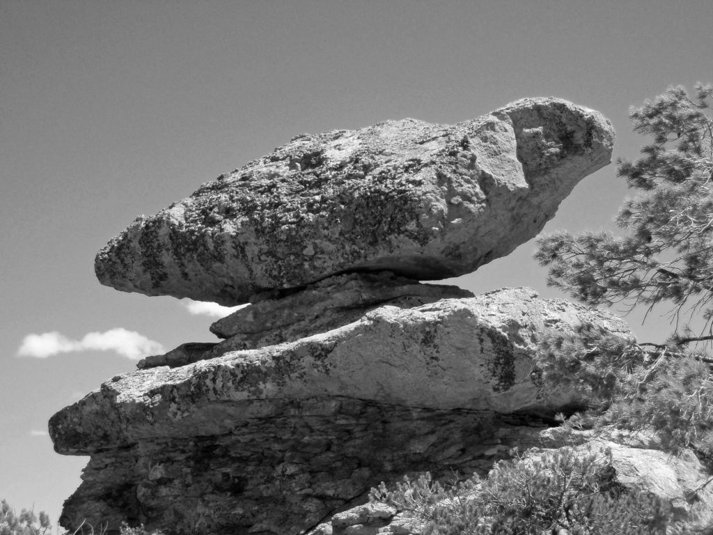
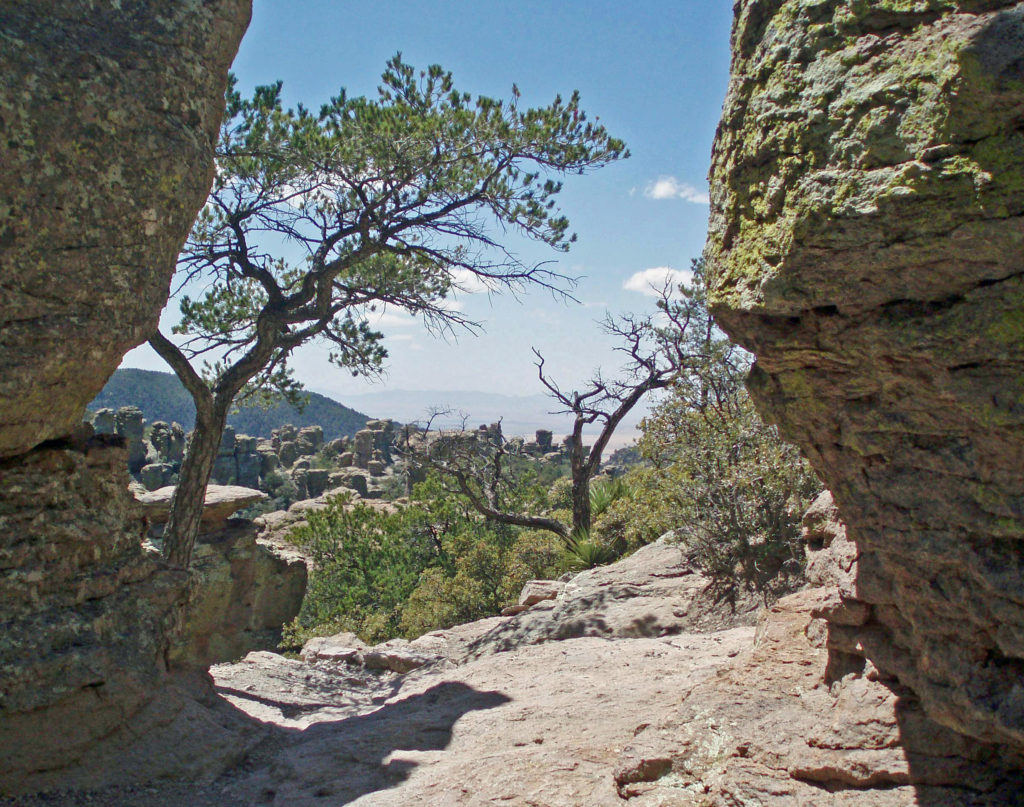
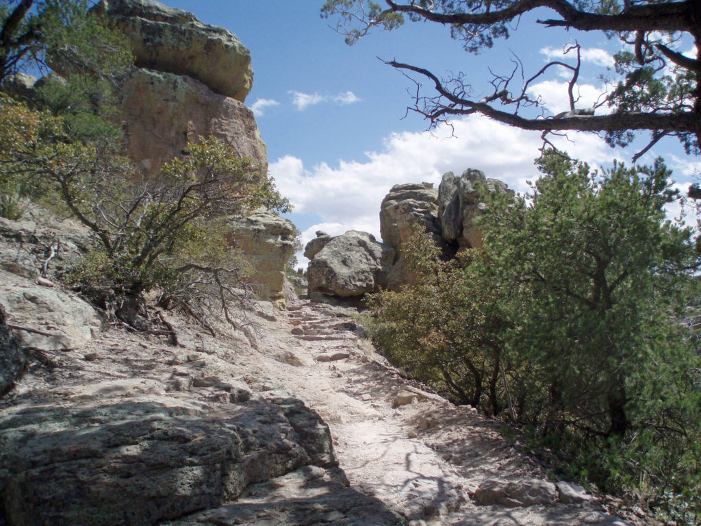
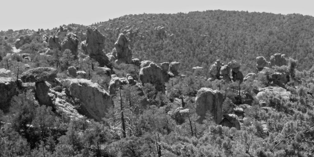
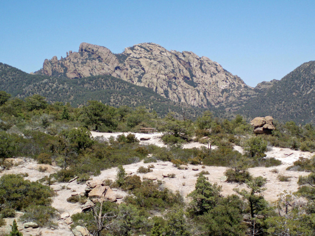

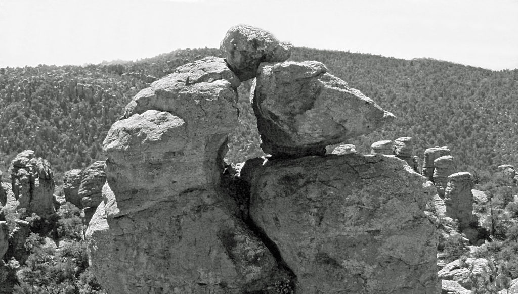
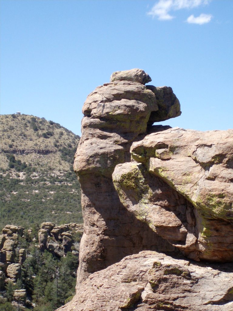
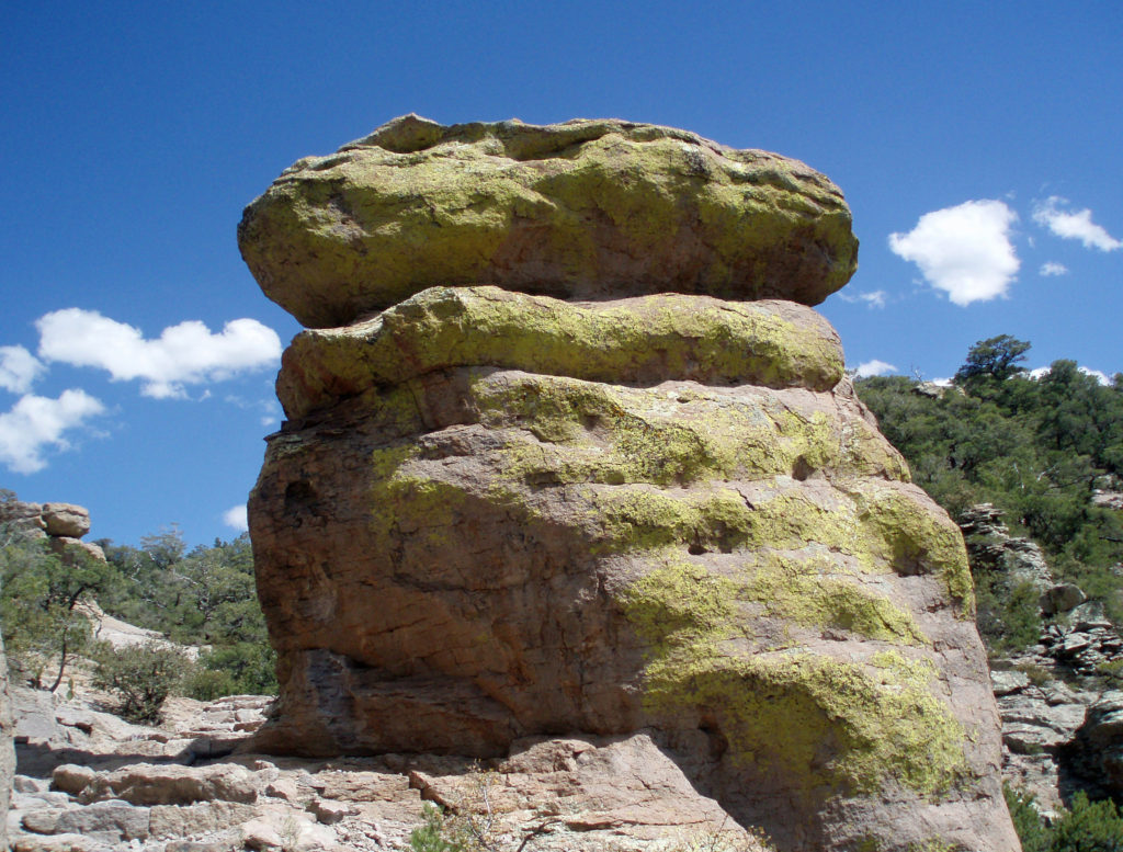
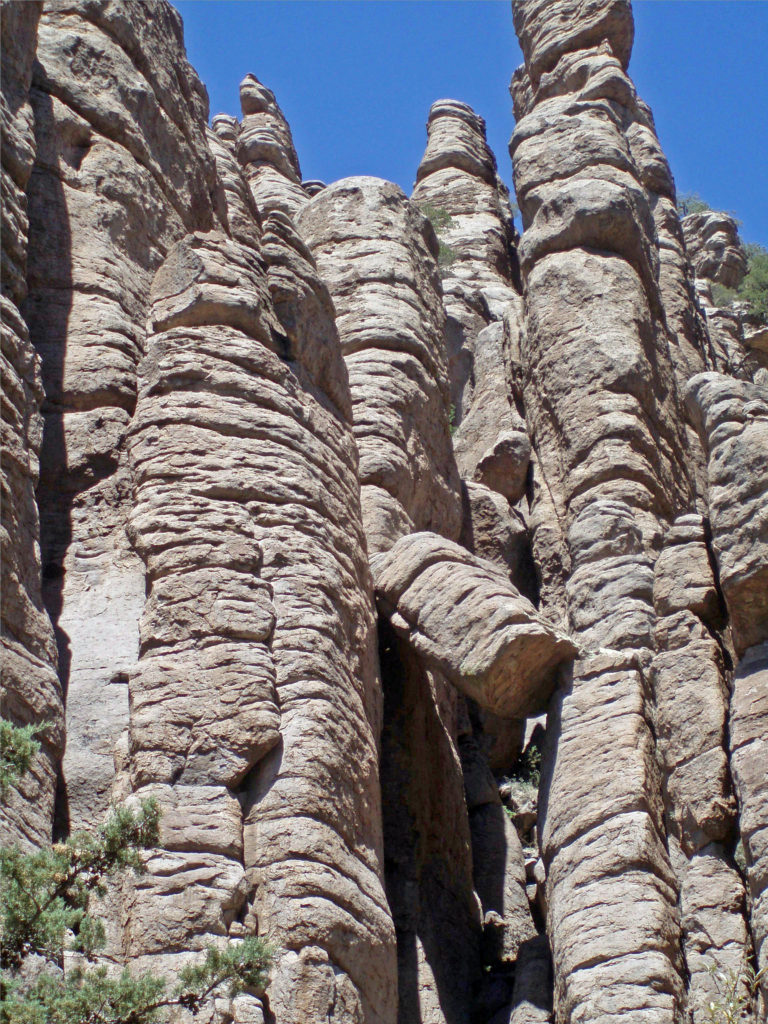 Originally posted April 28, 2020. Edited, updated, and re-posted February 5, 2022
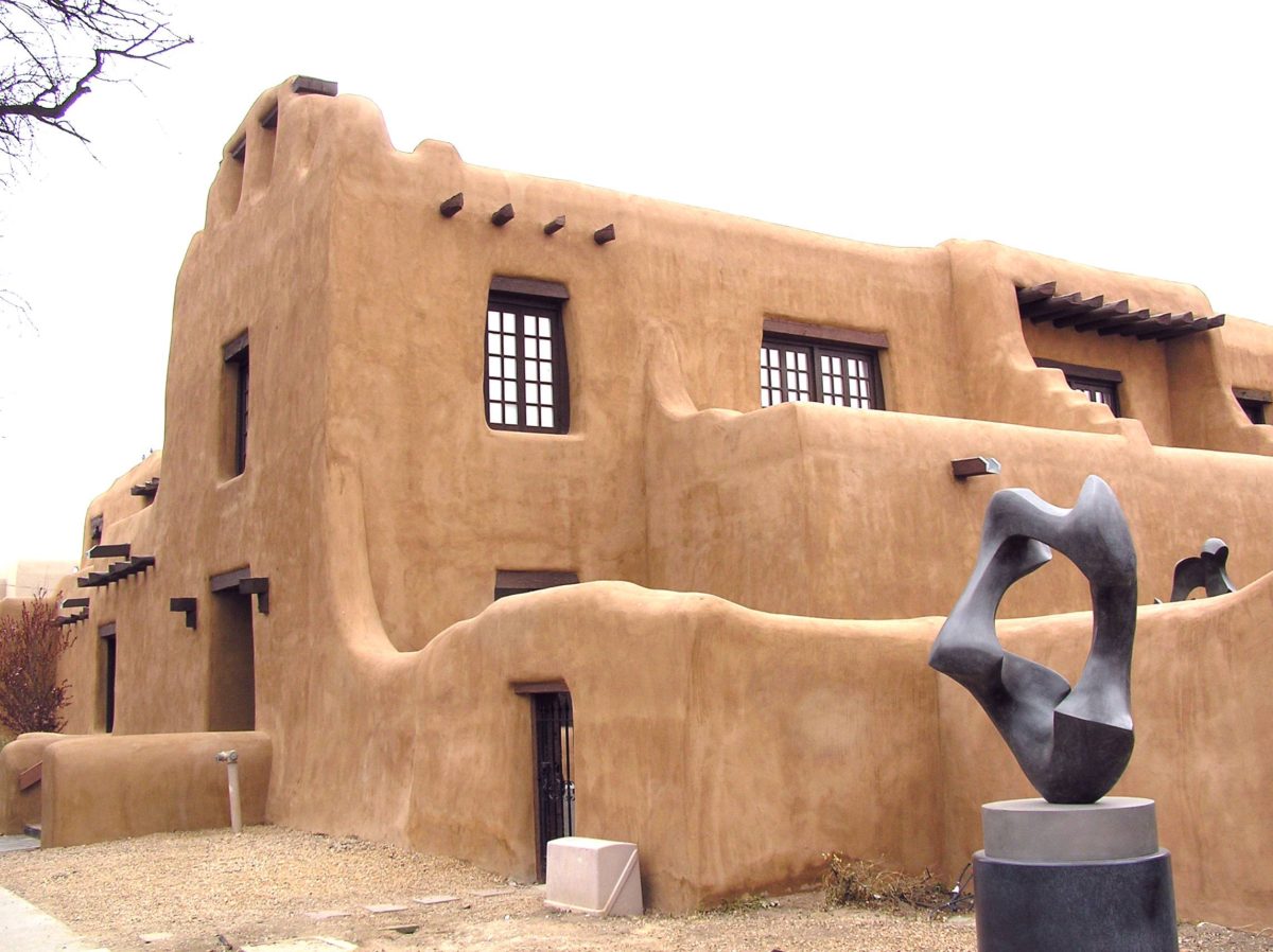
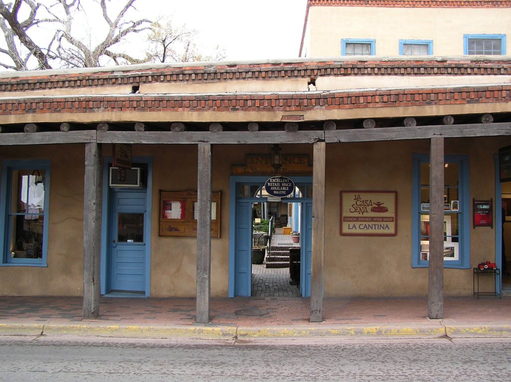
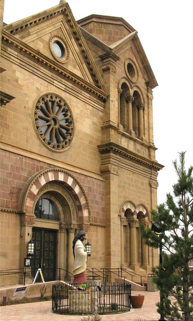
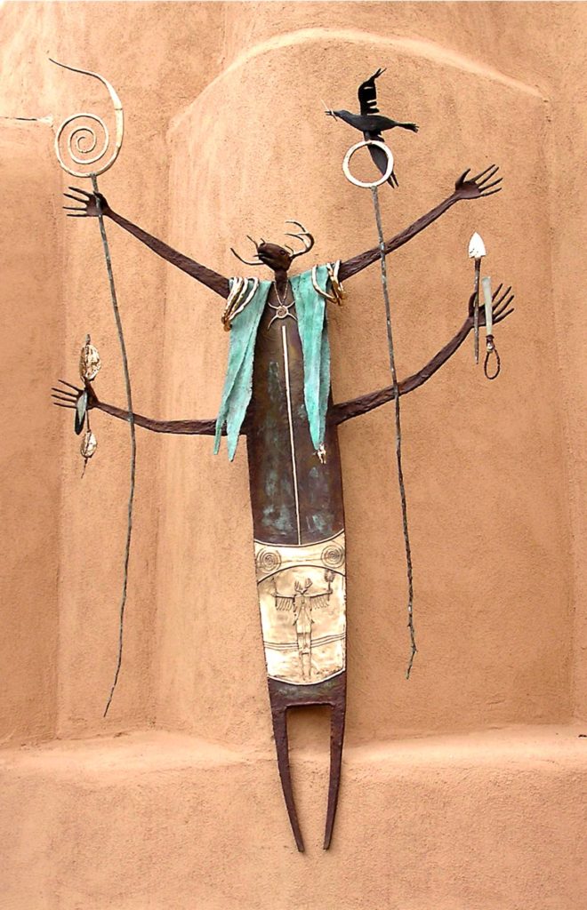
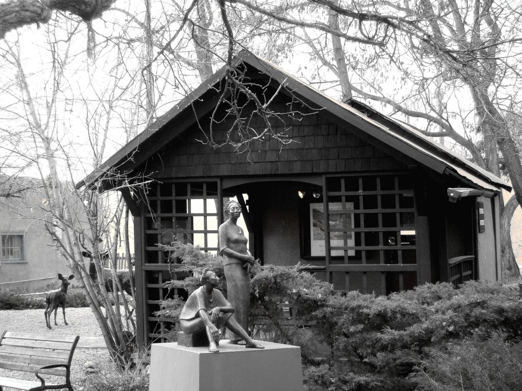
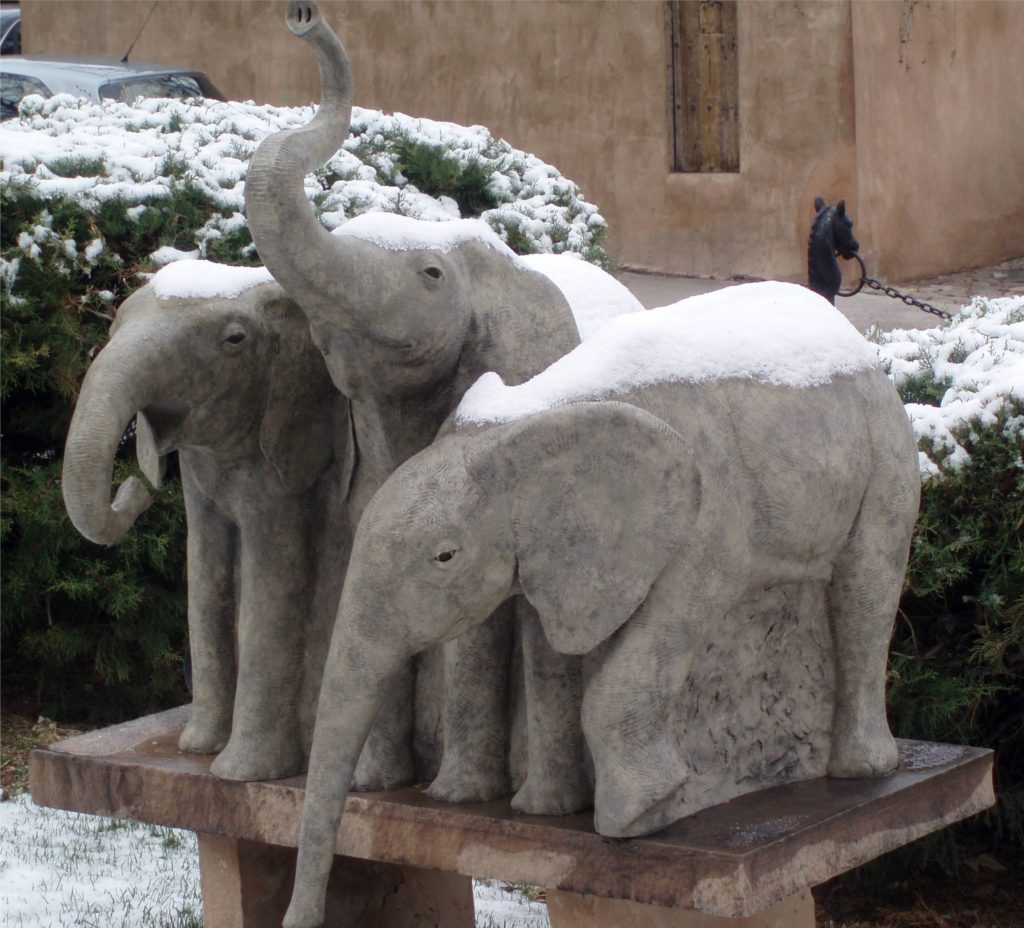 The Plaza is an ideal place to begin your exploration of Santa Fe, particularly if you are an art lover, as my wife and I are. The New Mexico Museum of Art and the
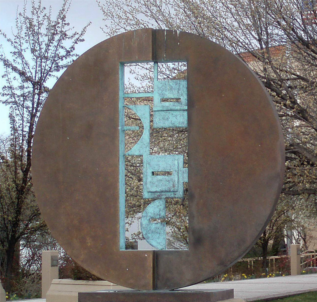
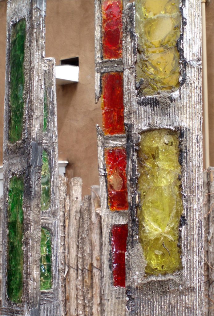
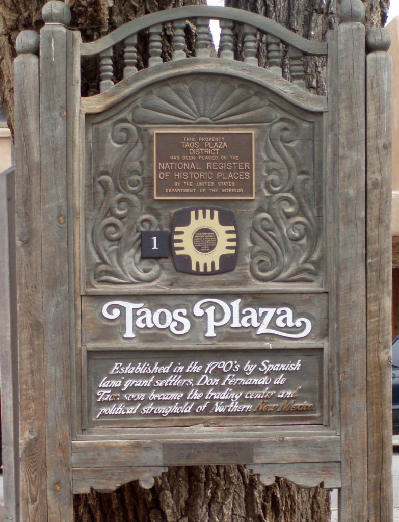
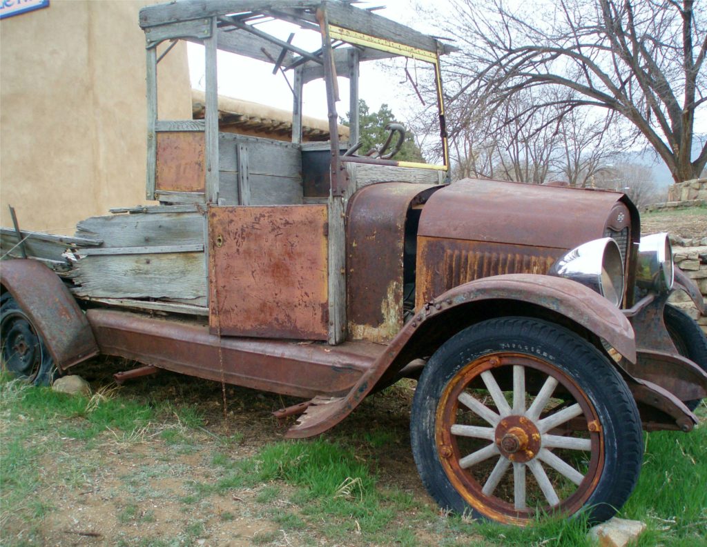 Puebloan history and culture is an even more pronounced component of modern day Taos than it is in Santa Fe. The nearby
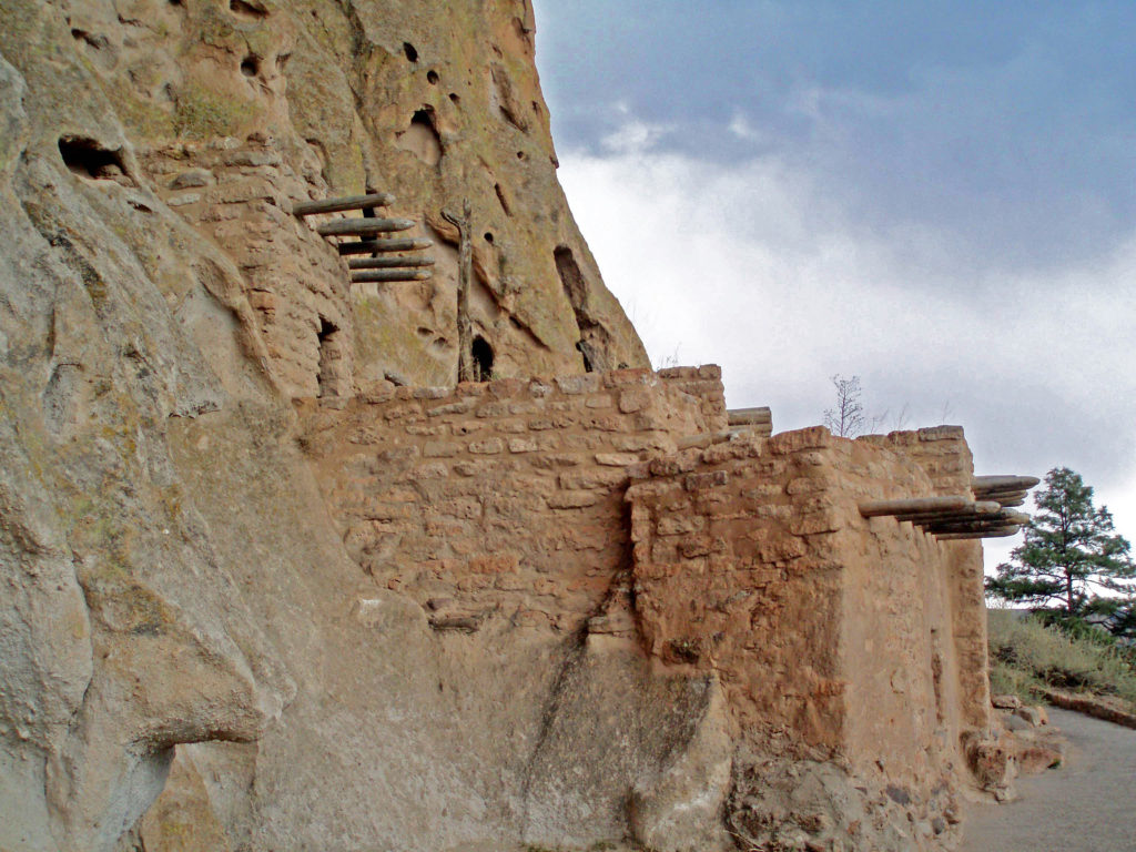
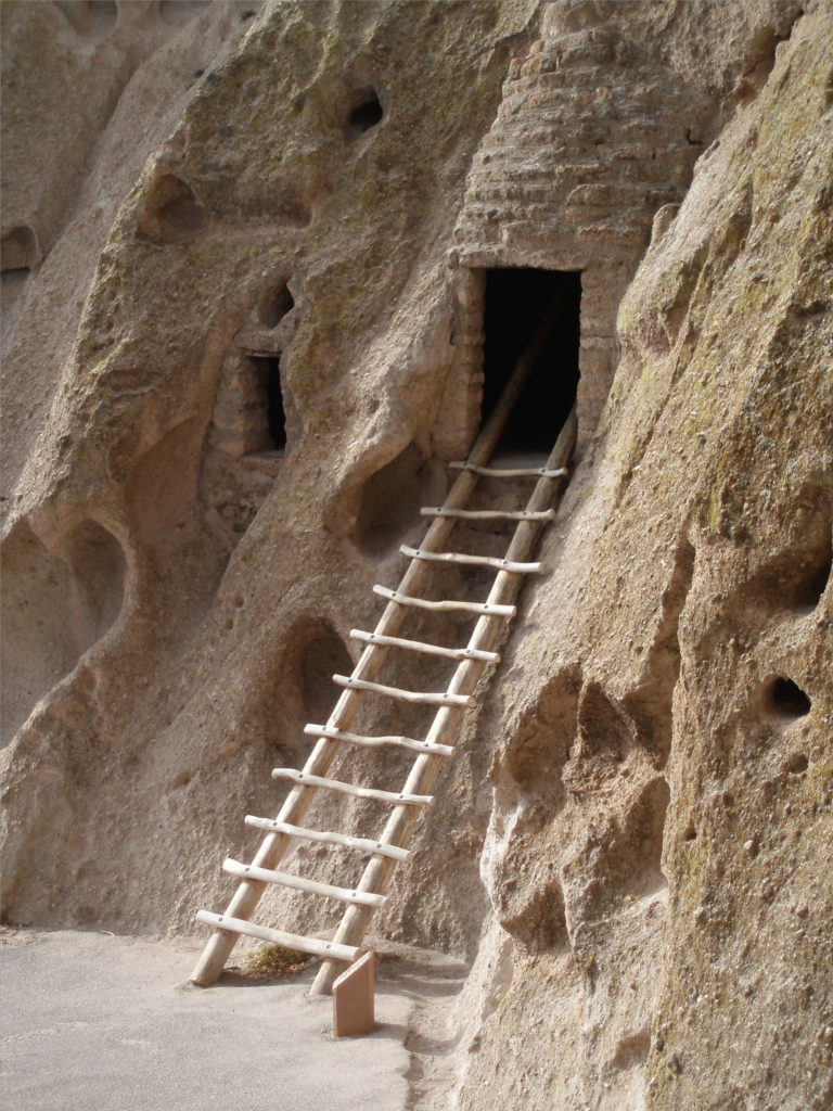
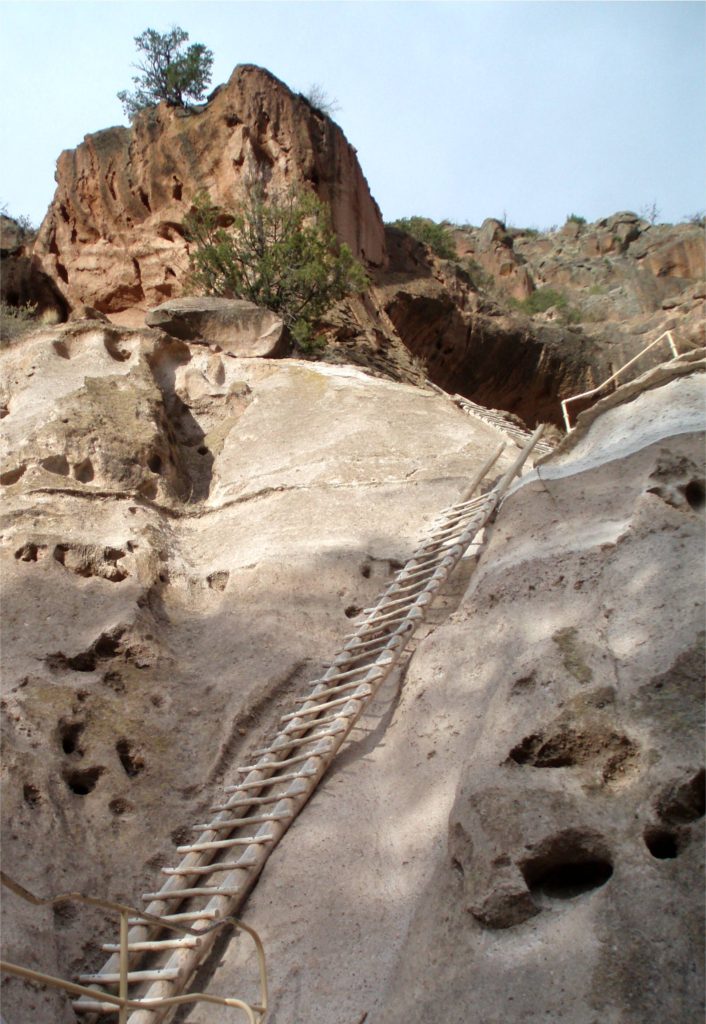
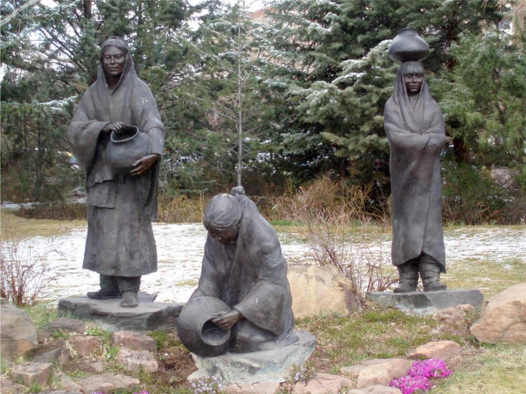
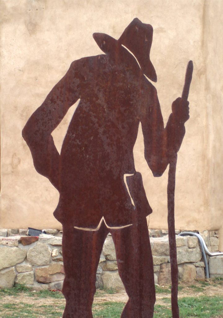

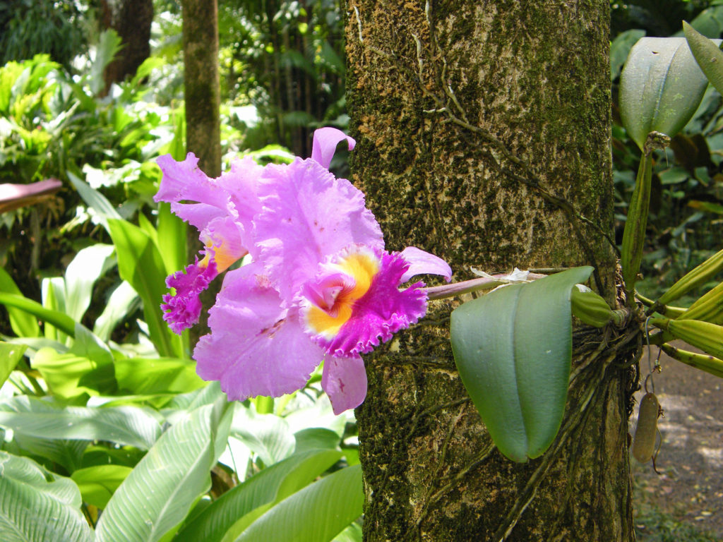
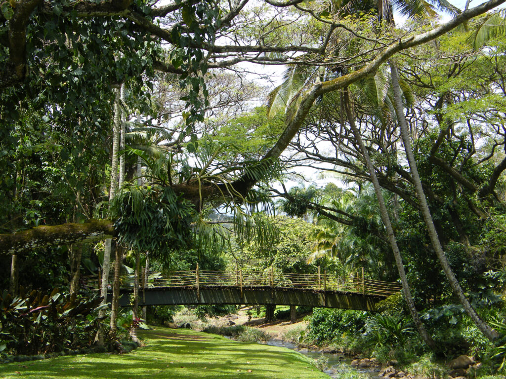
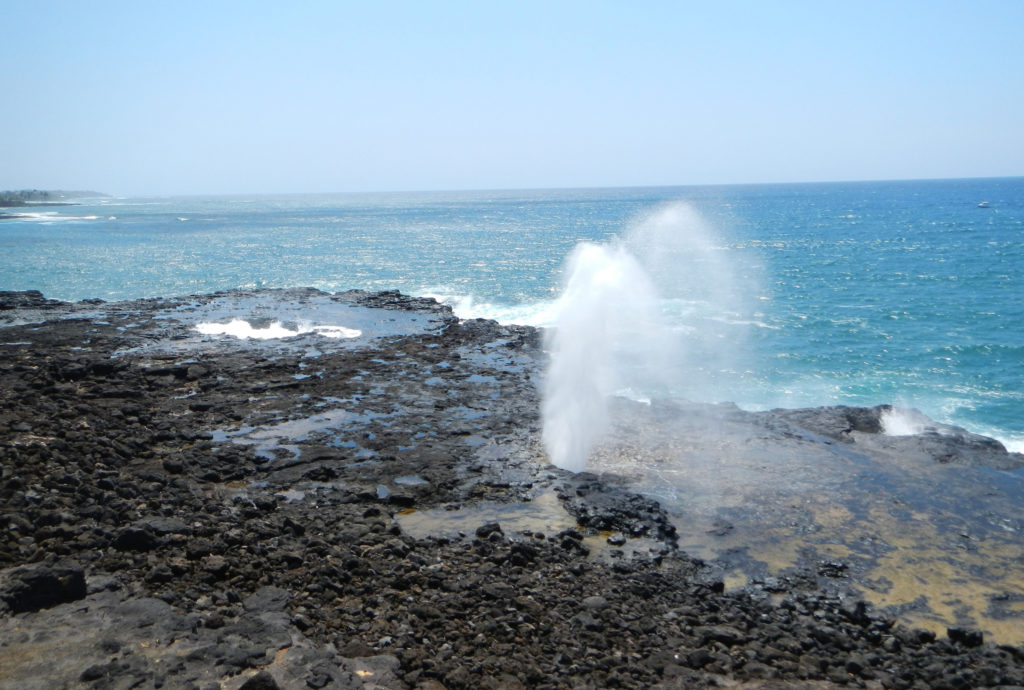
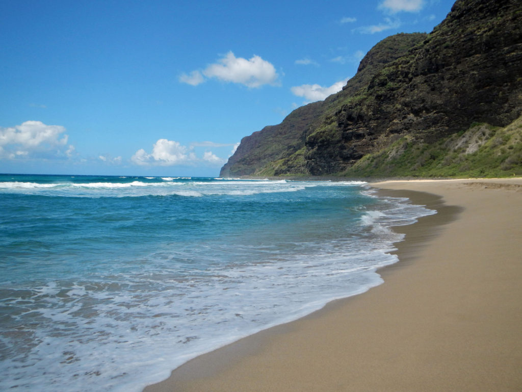
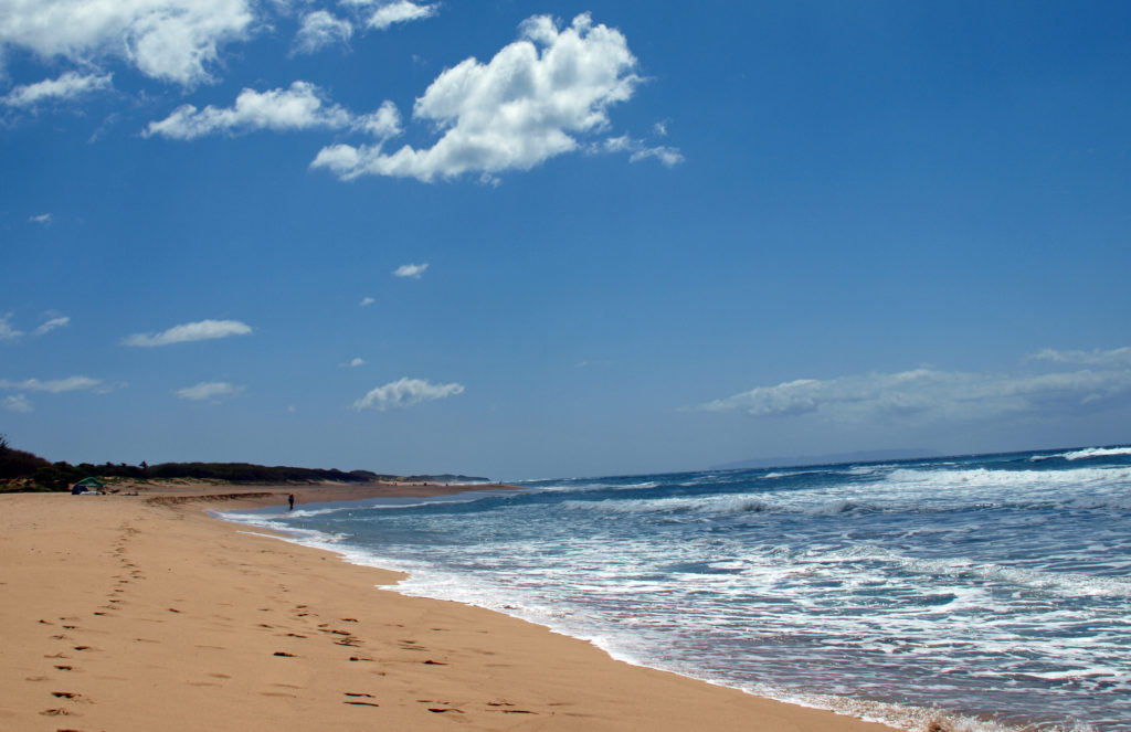
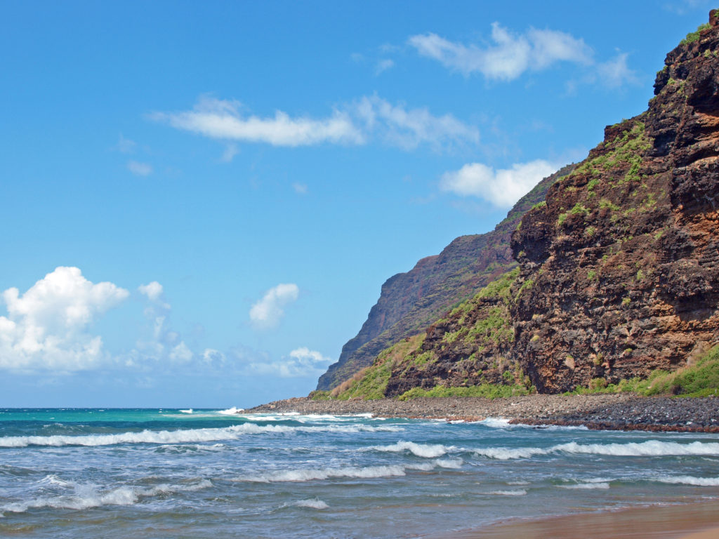
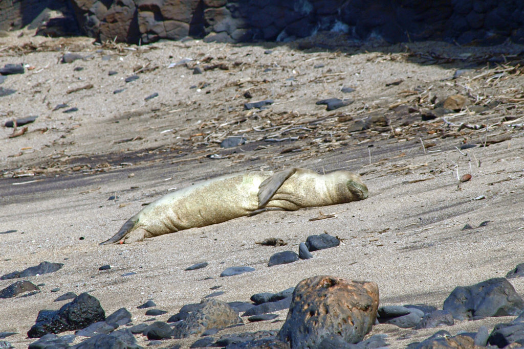
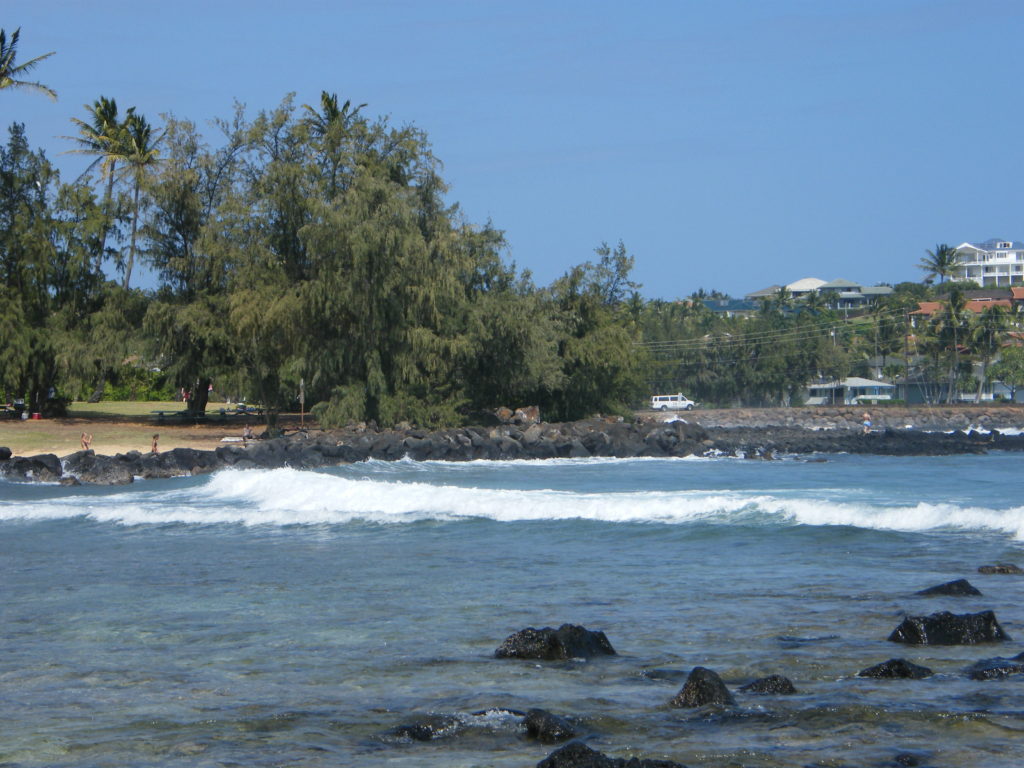
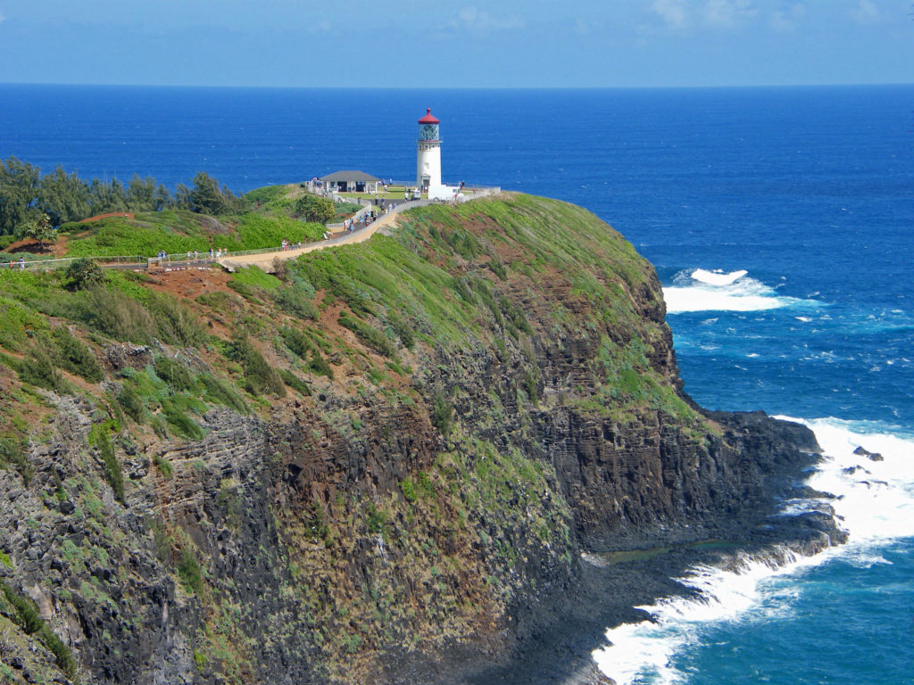
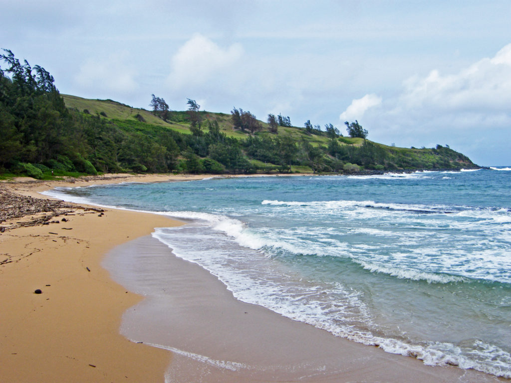
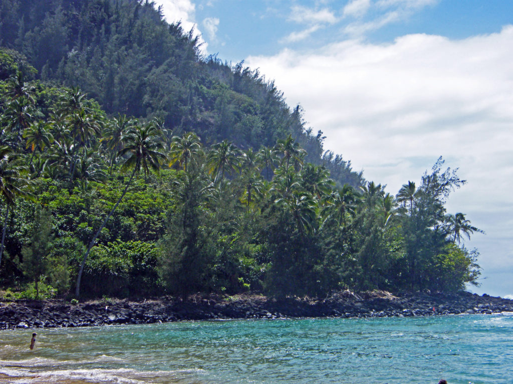
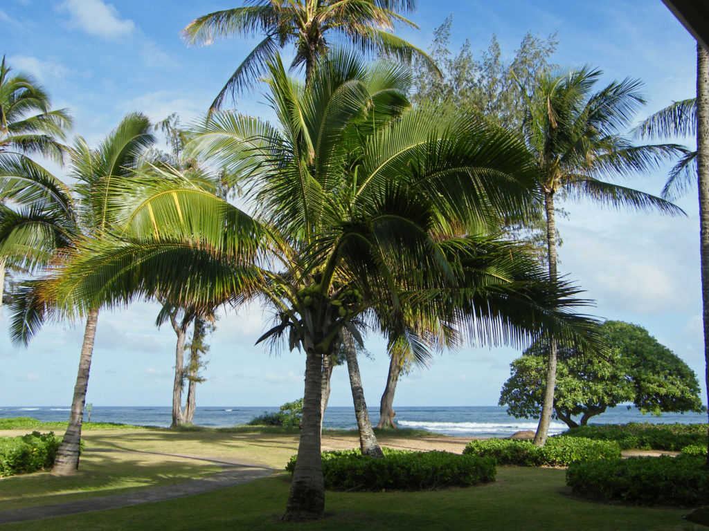
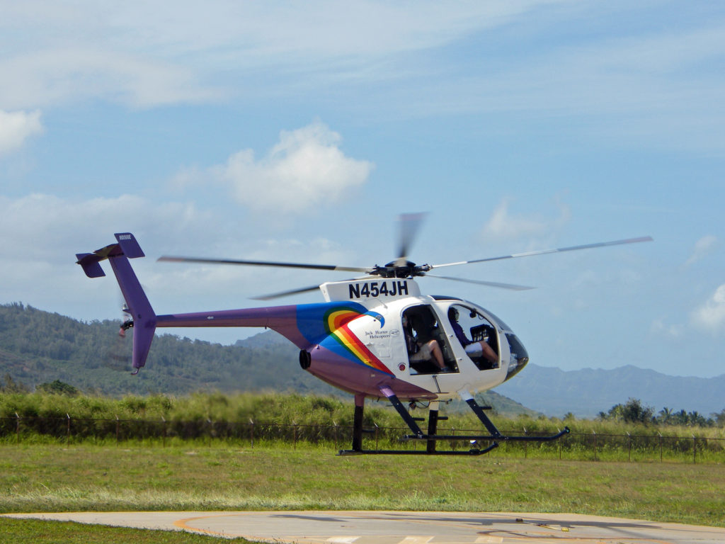
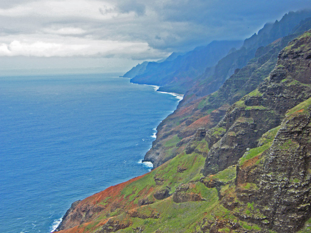
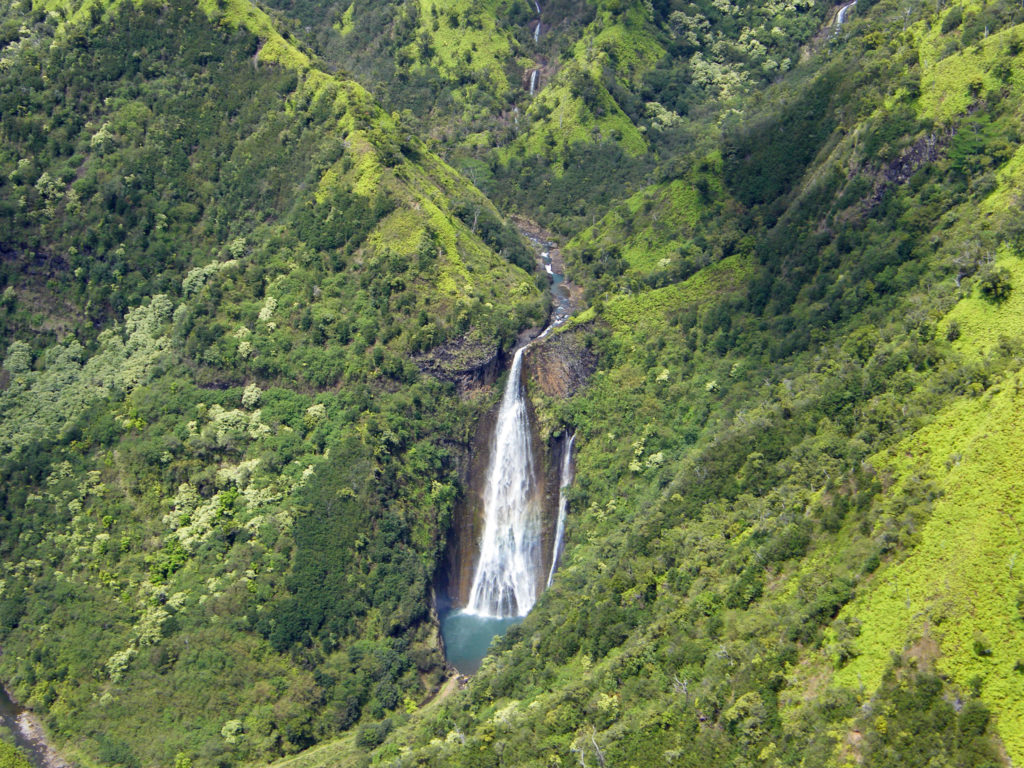
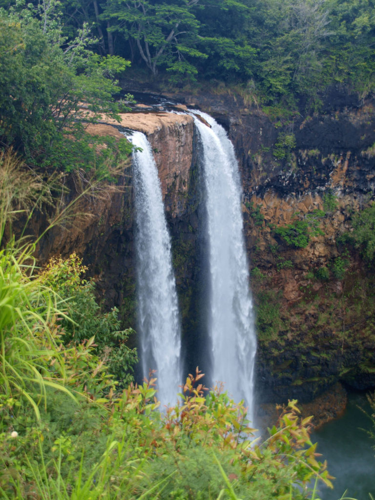
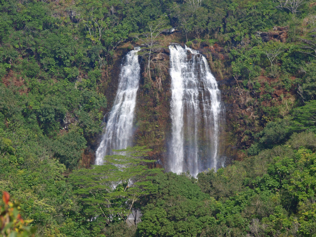
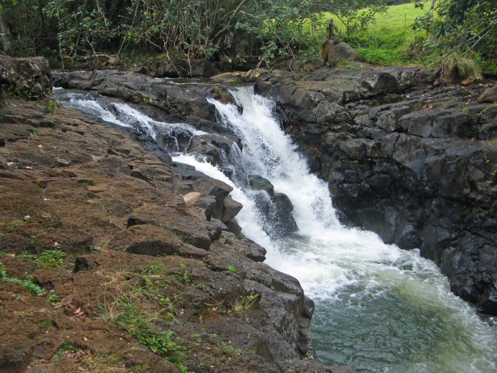
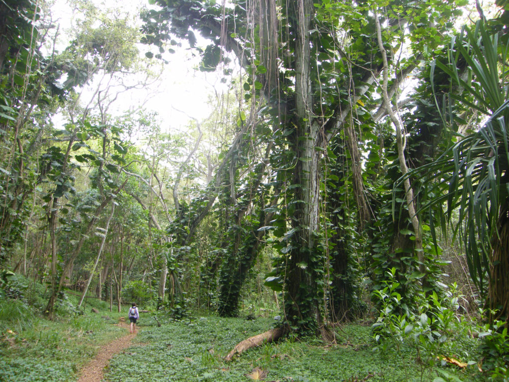
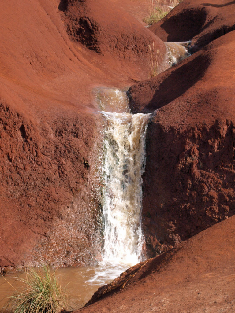
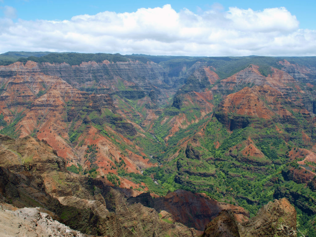
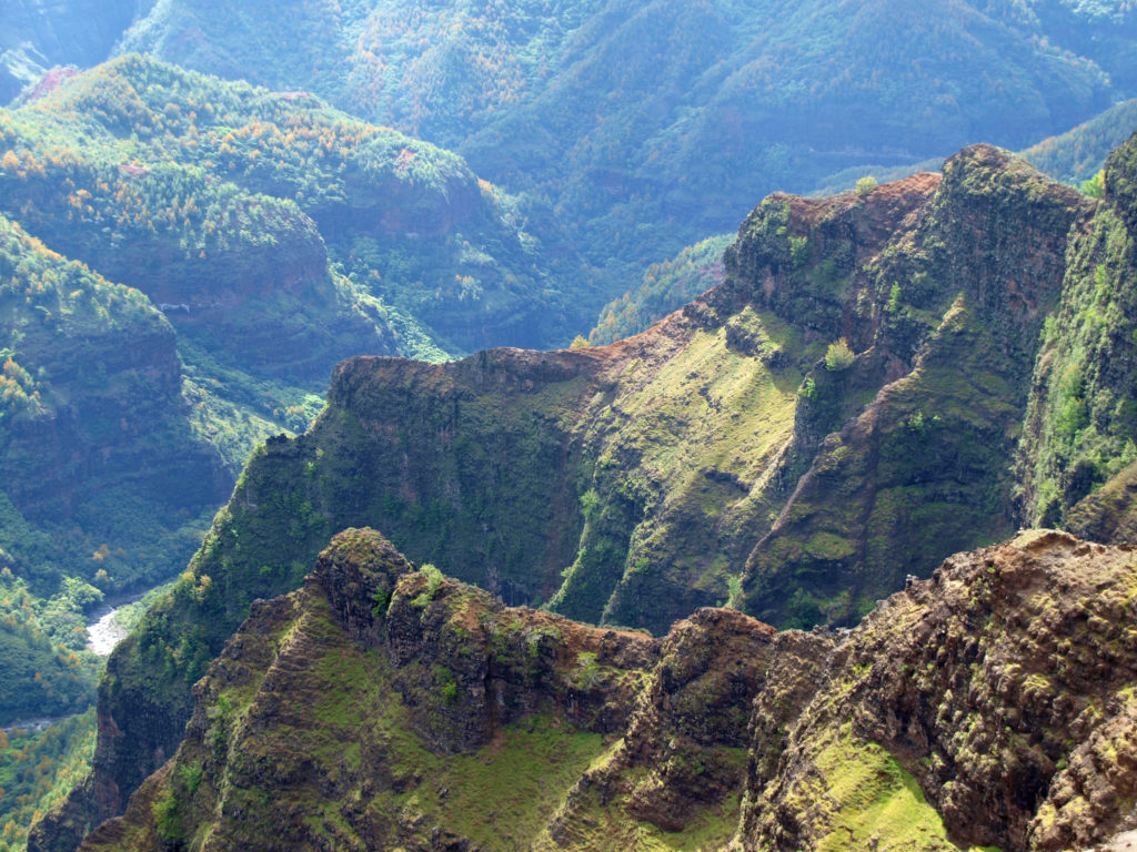
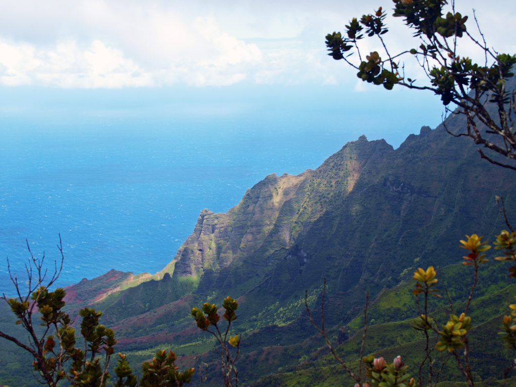
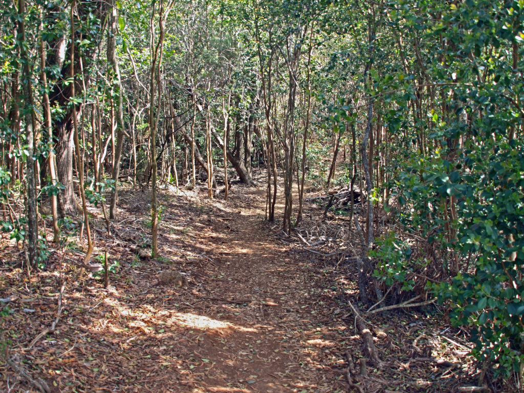 For hikers, there are more than 45 miles of trails in the canyon. You could easily spend days in the canyon and not hike all of the trails. For those that do want to spend multiple days hiking or sightseeing,
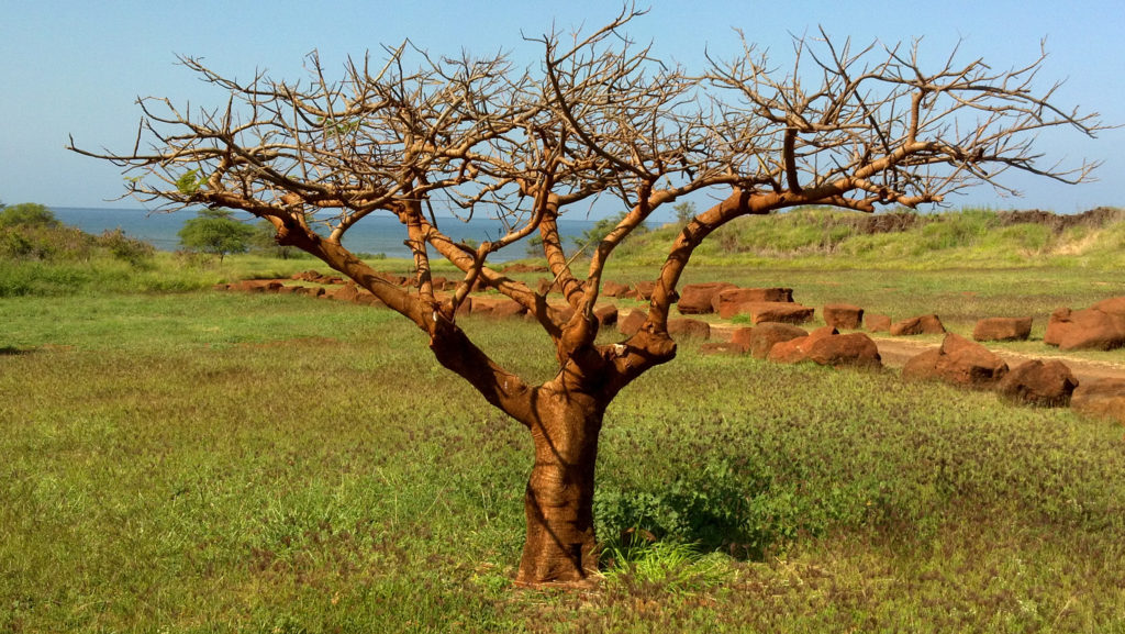
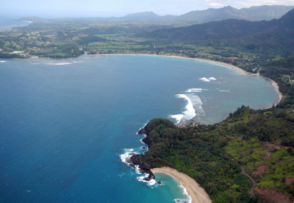
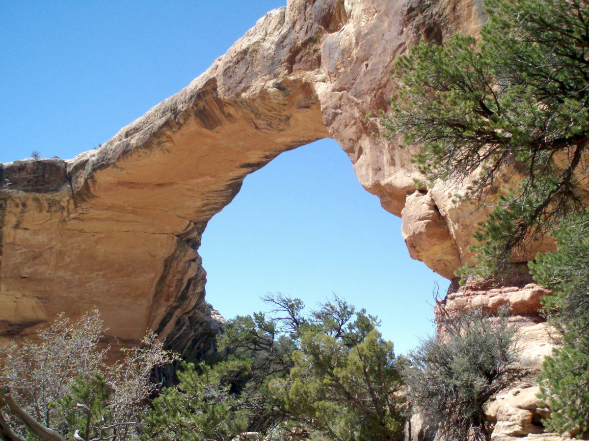
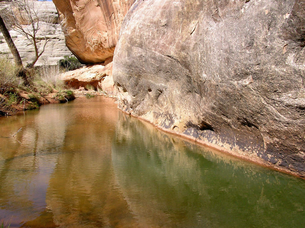 First Impressions
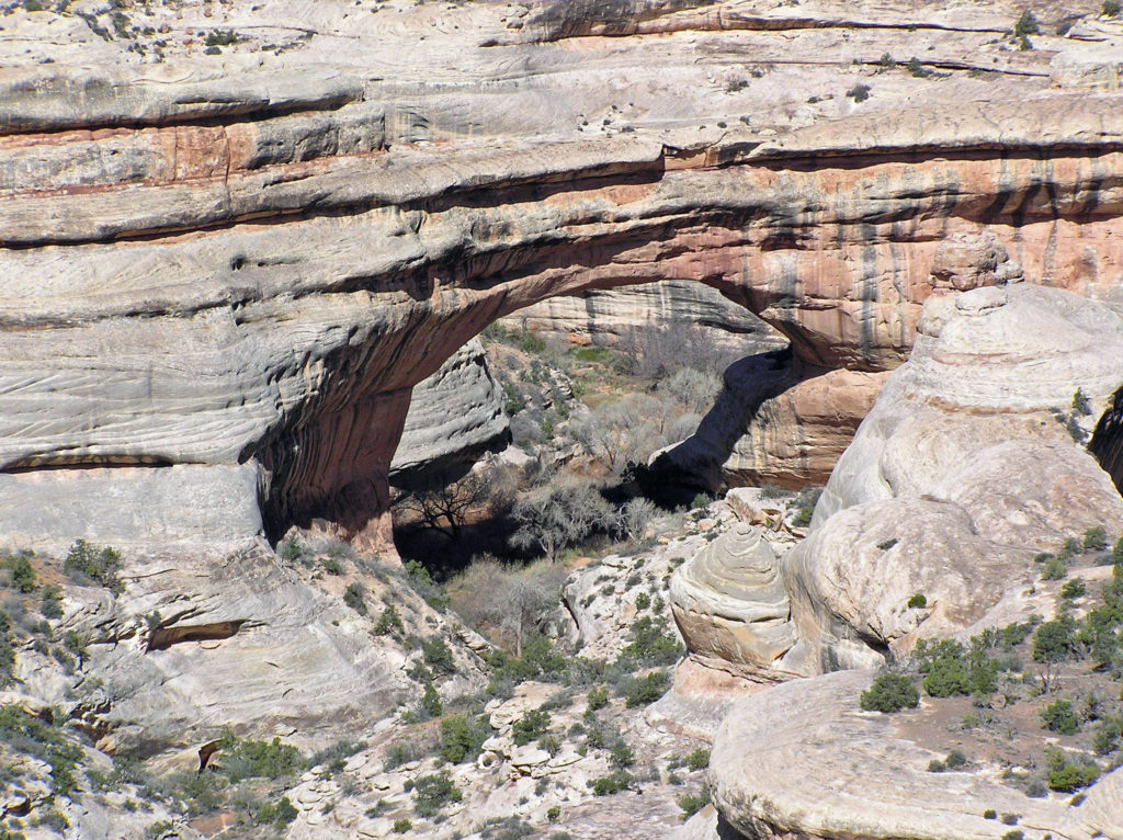 My wife and I have been back once since that first visit. The photos here were taken on that second trip in 2008. I think we’re long overdue for a third visit.
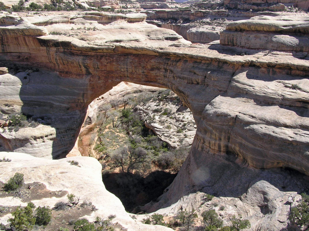
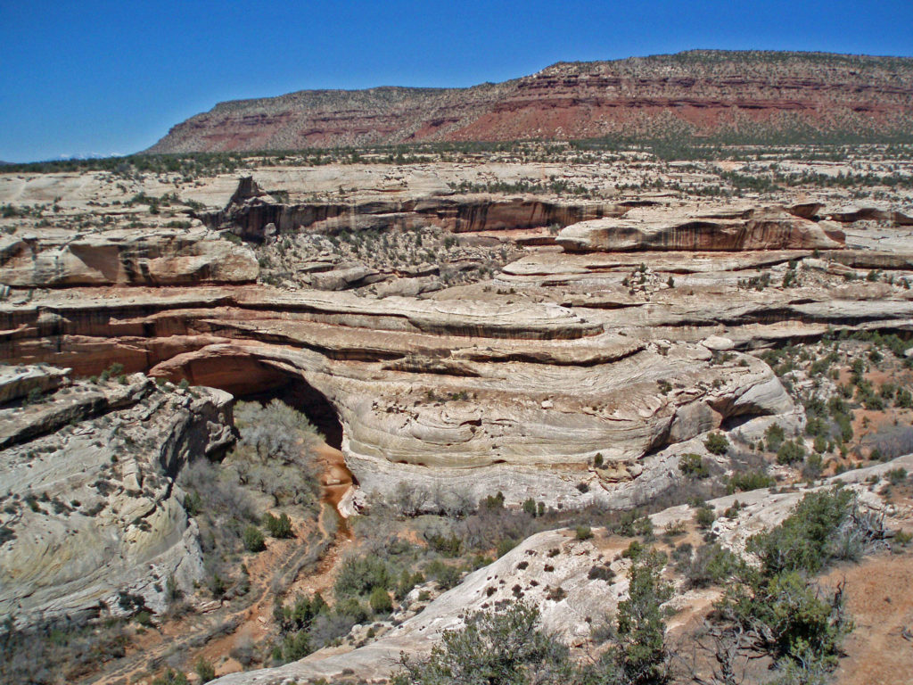 The white Cedar Mesa Sandstone of the canyons in Natural Bridges was formed from white quartz sand with relatively little iron. The red and orange sandstone of the mesa tops gets its color from more iron rich rocks. Oxygen and hydrogen react with the iron, forming compounds that vary in color depending on the relative proportions of oxygen and hydrogen in the rock.
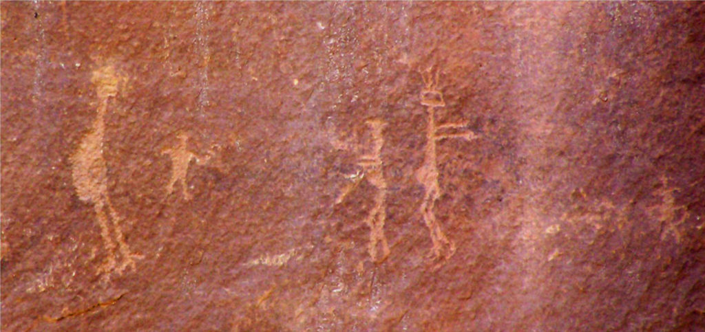 Human Presence
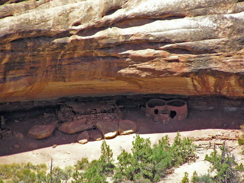 The Ancestral Puebloan people began farming the mesa tops around 1500 years ago, but later abandoned the area, presumably because of a prolonged drought. After 300 years, the ancestors of modern day Hopi and Navajo returned to the Natural Bridges area, only to abandon the area again around the year 1280 CE. Modern Hopi, Navaho, and Paiute peoples reoccupied the area once again at later dates.
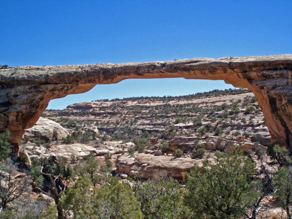 Europeans didn’t discover the area until 1883 when prospector Cass Hite ventured into the canyons looking for gold. He didn’t find any gold, but he did find the three magnificent natural bridges. Twenty years later, National Geographic Magazine published an article about the bridges, gaining the attention of President Theodore Roosevelt, who established
 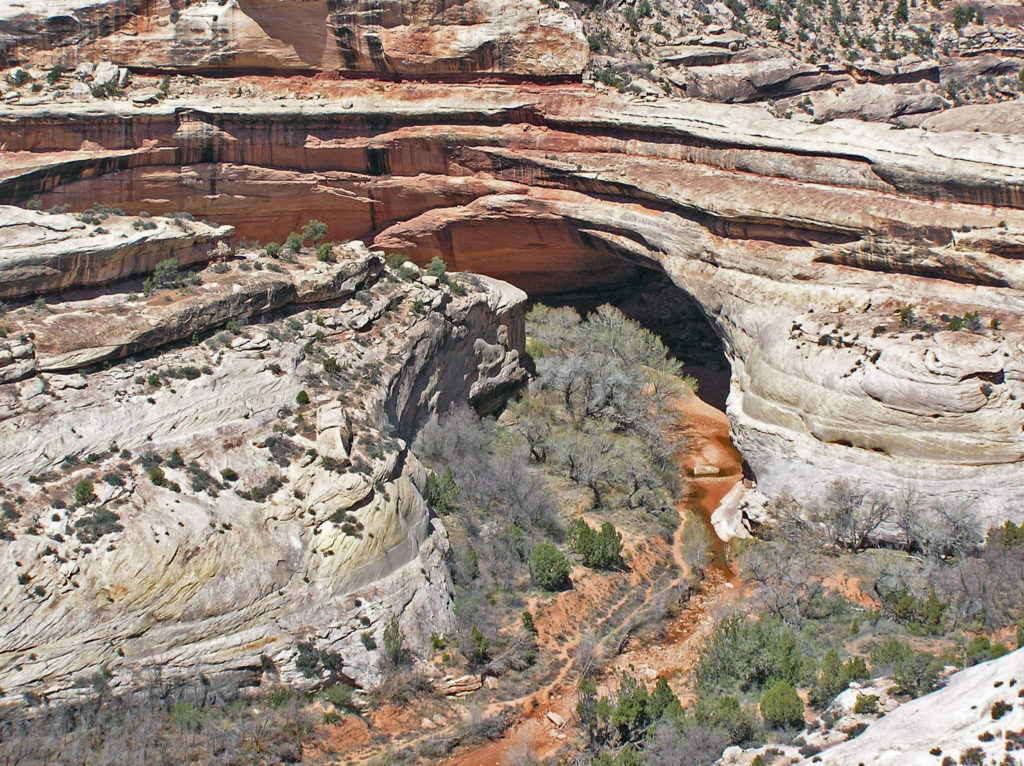 The bridges were named President, Senator and Congressman by Cass Hite. Later explorers gave them the names Augusta, Caroline and Edwin. But neither set of names stuck. In 1909 the bridges were given the Hopi names they carry today: Sipapu, Kachina, and Owachomo.
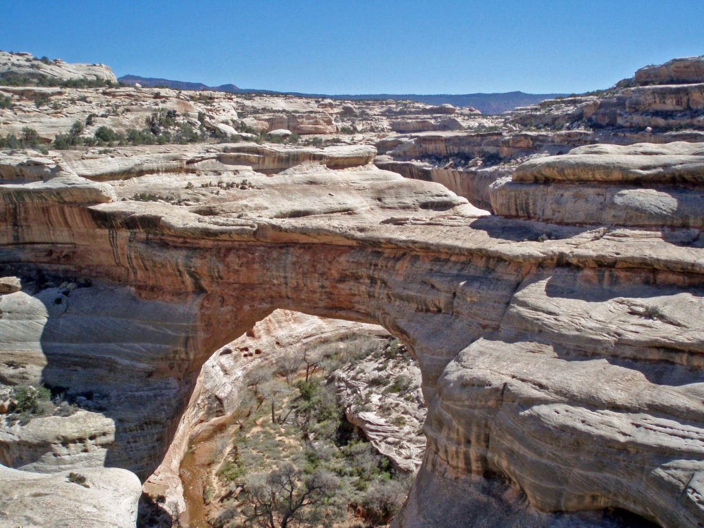
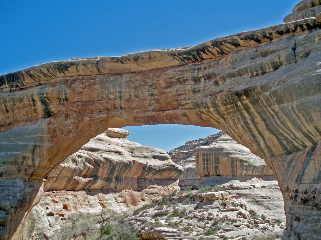 Visitor Center
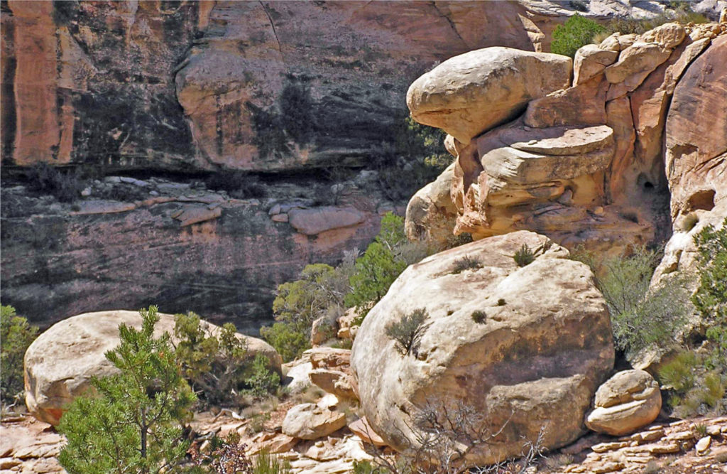
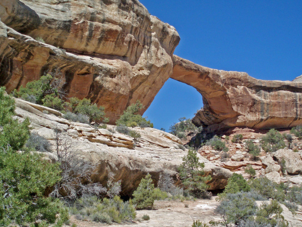


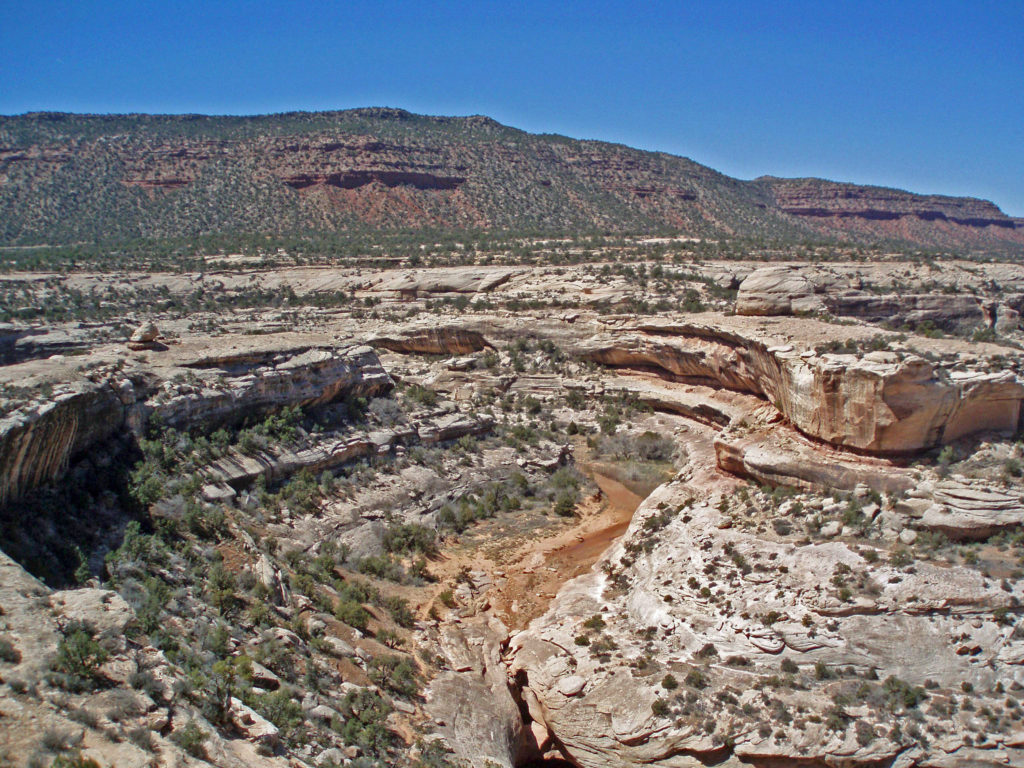 Conclusion
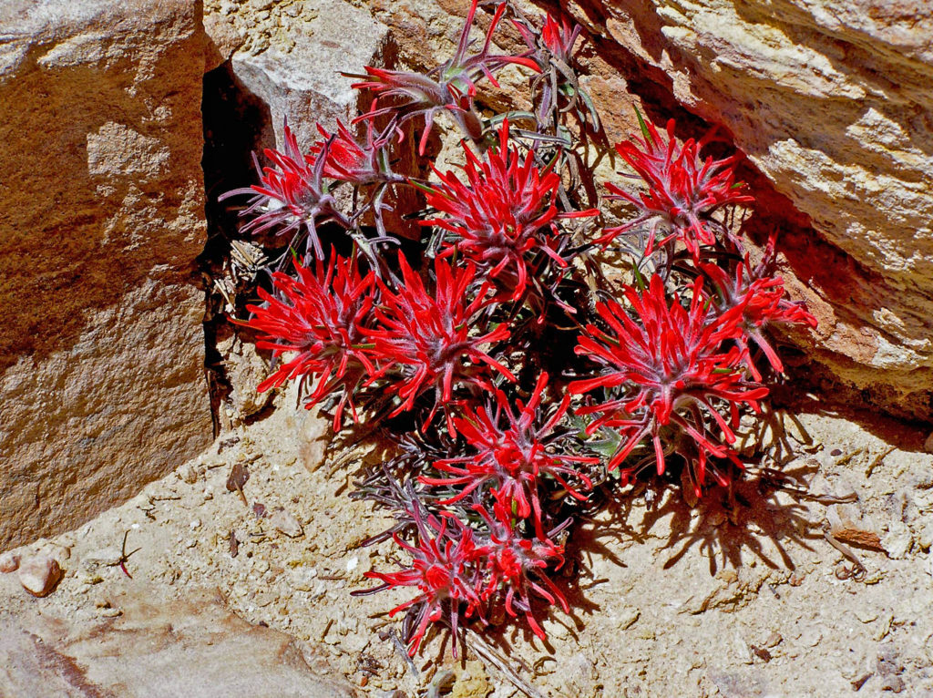 Originally posted July 10, 2021. Updated July 21, 2024.
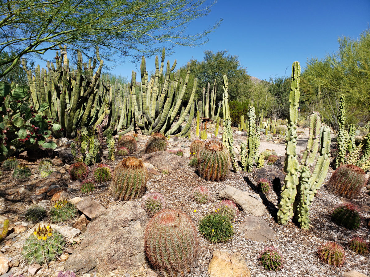

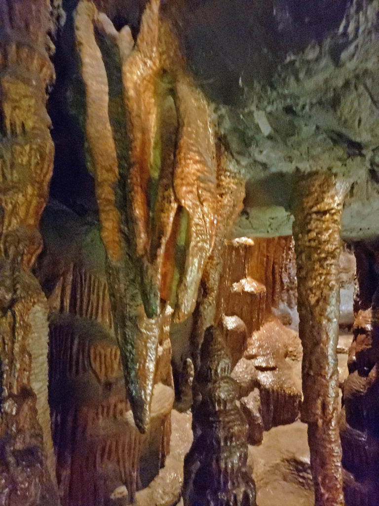
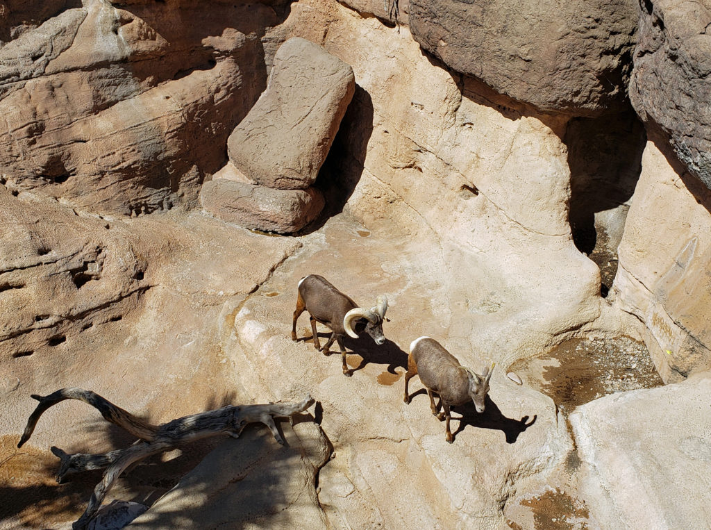
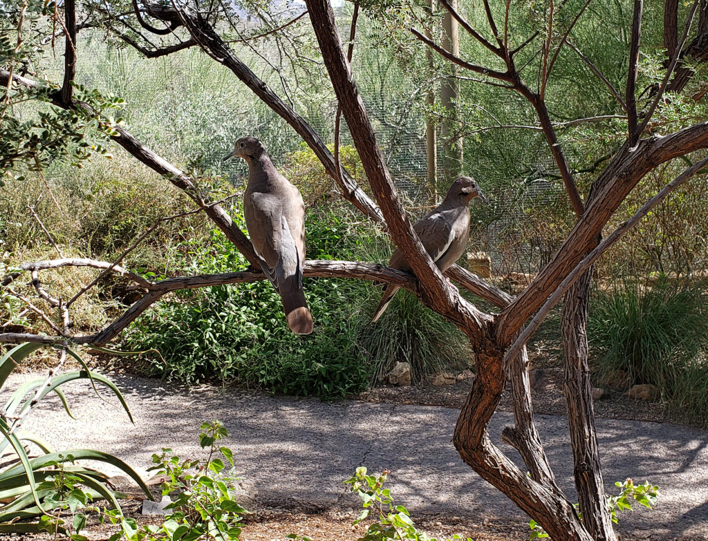
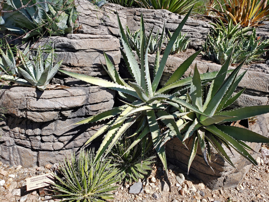 There is so much here that you probably can’t see it all in one visit. My wife and I have visited the museum on a couple of our Arizona excursions, and on our last visit I was surprised at how much I had missed on our earlier visit. Plan to spend at least two hours at the museum. Allow half a day to more fully explore what the museum has to offer, if you can.
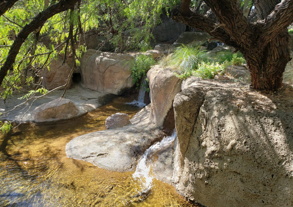
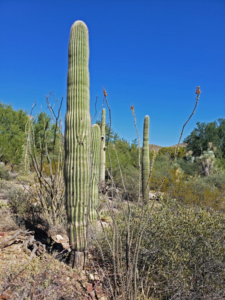
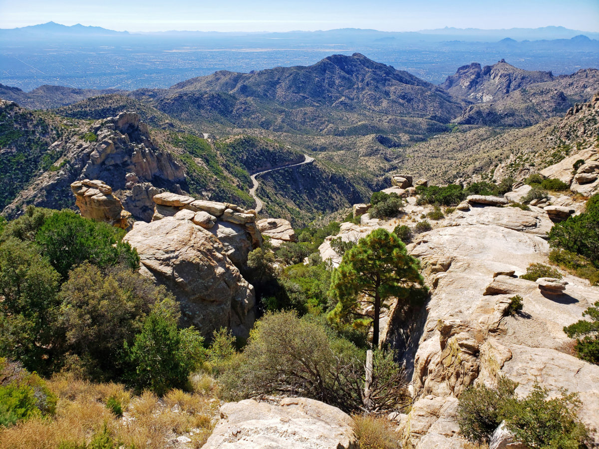
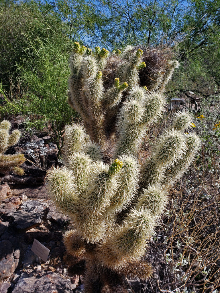
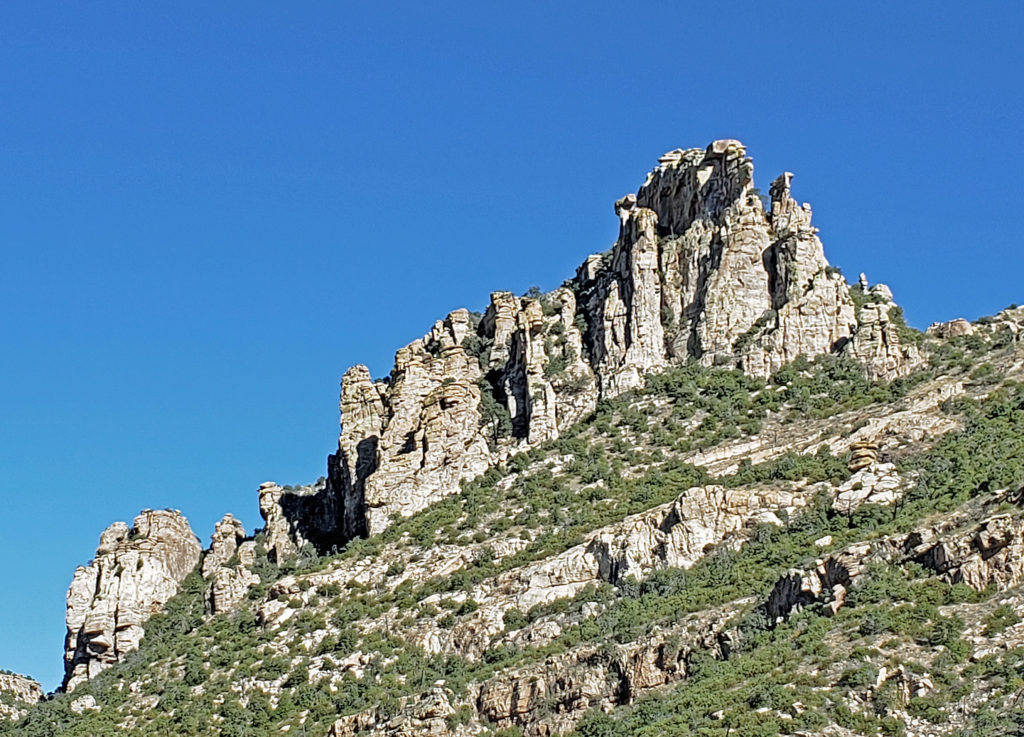 If you’re ever in the Tucson area, consider making the drive to the top of Mount Lemmon. A paved road takes you to the summit, more than 6500 feet above the valley floor. Numerous viewpoints along the way provide spectacular vistas of the mountain, the surrounding desert below, and the mountains beyond. And numerous trailheads provide access to the ridges and canyons beyond the road for those who want to lace up their hiking boots and immerse themselves in the desert or mountain environment.
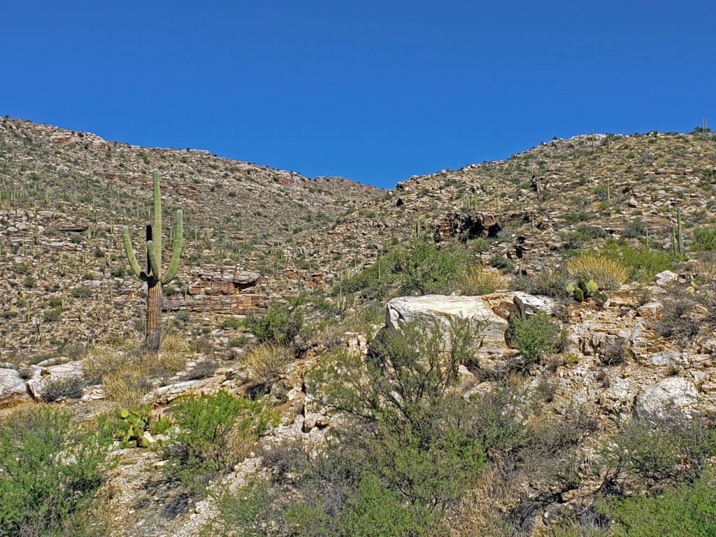 The drive takes you through numerous climatic and ecological zones, from the iconic saguaro cactus of the Sonoran Desert at the base of the mountain to an aspen and ponderosa pine forest at the summit.
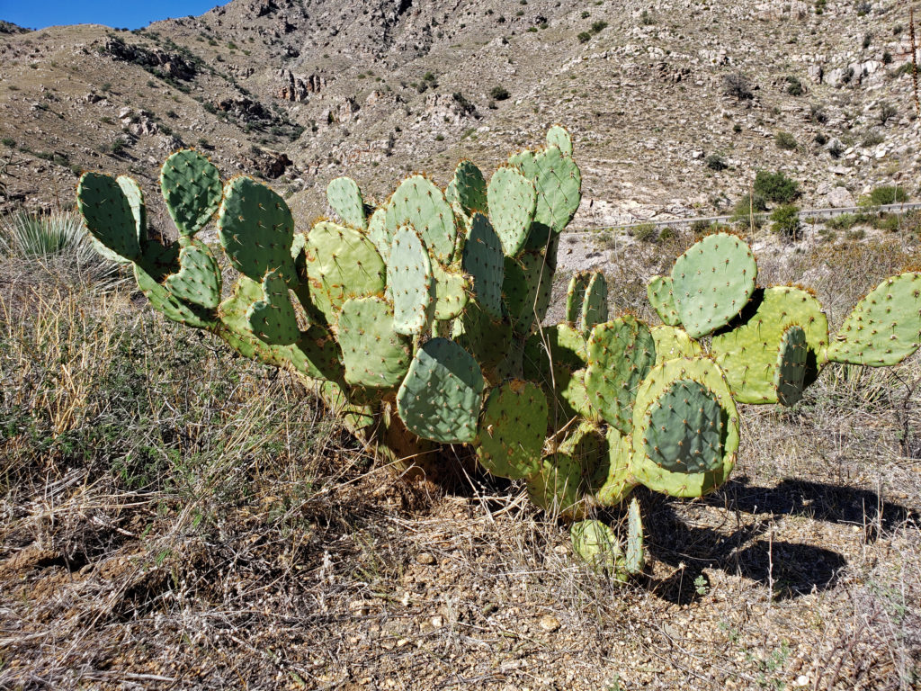 My wife and I made the drive to the summit in October 2019 while in Arizona to visit my brother and attend a wedding. I had never heard of Mount Lemmon and I wasn’t keen on making that long of a side trip, but my wife convinced me that it would be worthwhile, and she nailed this one. Mount Lemmon is more than just worthwhile, and worth more than just a side trip. It’s a worthy destination in its own right.
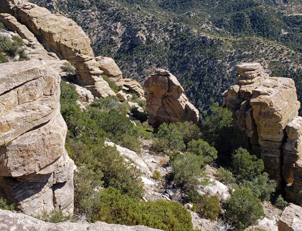
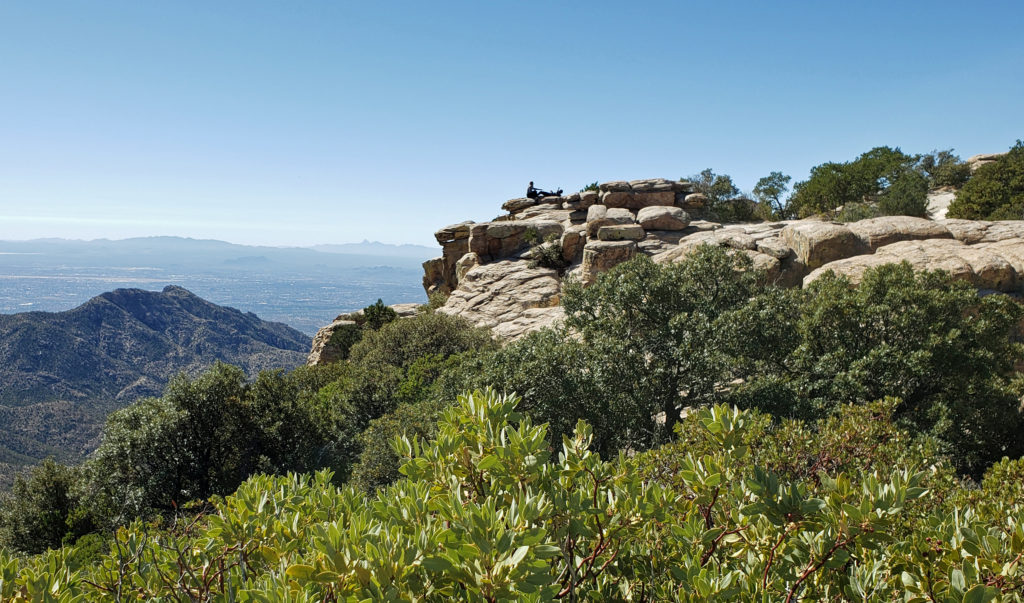 Windy Point, about seventeen miles from the beginning of the highway in Tanque Verde, has got to be one of the most spectacular viewpoints in southern Arizona. You’ll want to stop here and just wander around for a while. Take in the views of Tucson and the desert far below, the mountains beyond, and the rock formations around you. About four miles farther up the highway you’ll come to the San Pedro Vista, which gives you a panoramic view east across the San Pedro Valley to the Galiuro Mountains.
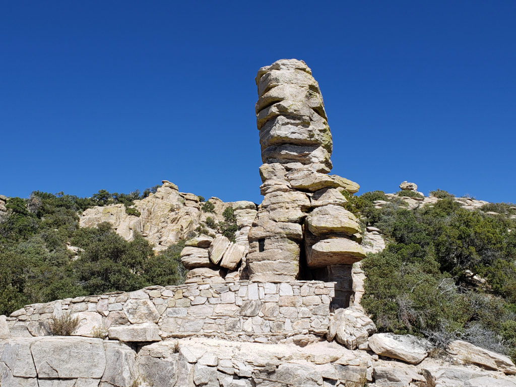 Another couple miles brings you to the
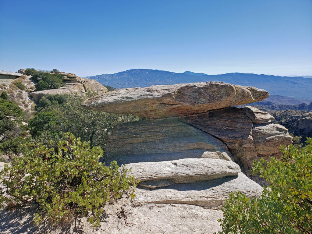
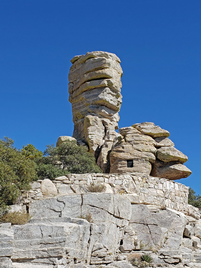
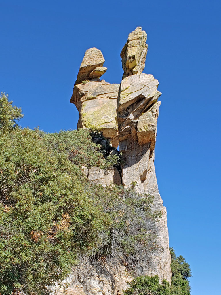 If you go, note that the summit of Mount Lemmon can be thirty degrees cooler than Tucson, so dress accordingly. And if you plan to do any hiking, avoid mid-summer if possible and always bring plenty of water. There are no sources of safe drinking water on any of the hiking trails in the area, to my knowledge.
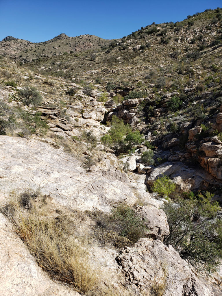
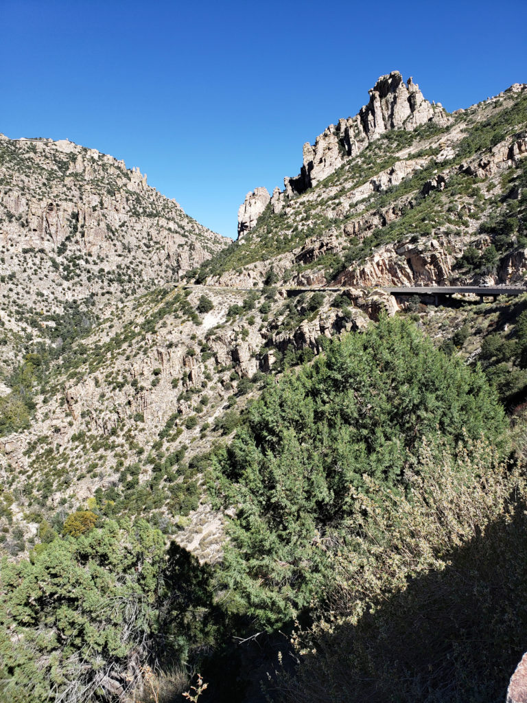 Not only am I glad we took the drive, I wish we could have spent more time exploring the mountain. For those that do have the time, there are several picnic areas along the highway and a few places to eat in Summerhaven, and there are several campgrounds a short ways off of the highway if you want to spend more than a day on the mountain. If you don’t want to camp, Summerhaven also has a few rental cabins, and a newly built small hotel. Check the
 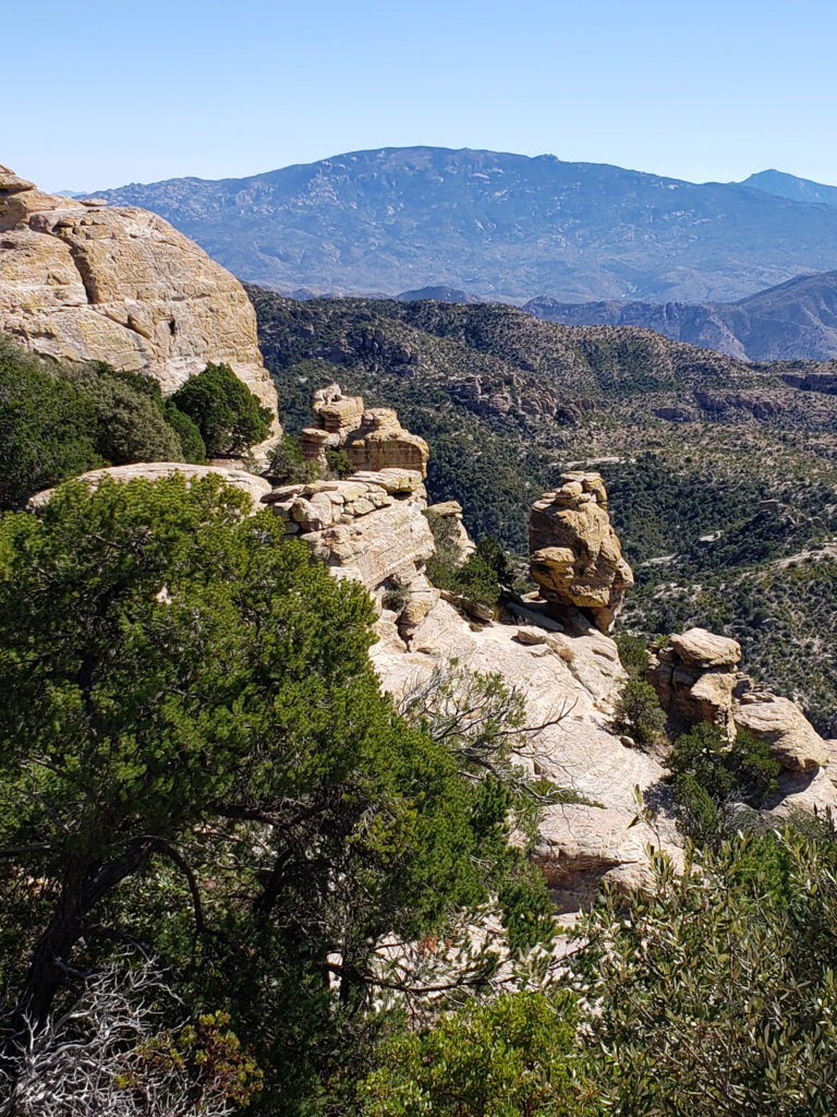 Note: In the summer of 2020 the entire area was closed to the public because of the Bighorn Fire that burned 120,000 acres in the Santa Catalina Mountains. Photos taken after the fire showed some badly burned areas, but others that were largely untouched. All of the area is open again, including the Palisades Visitor Center.
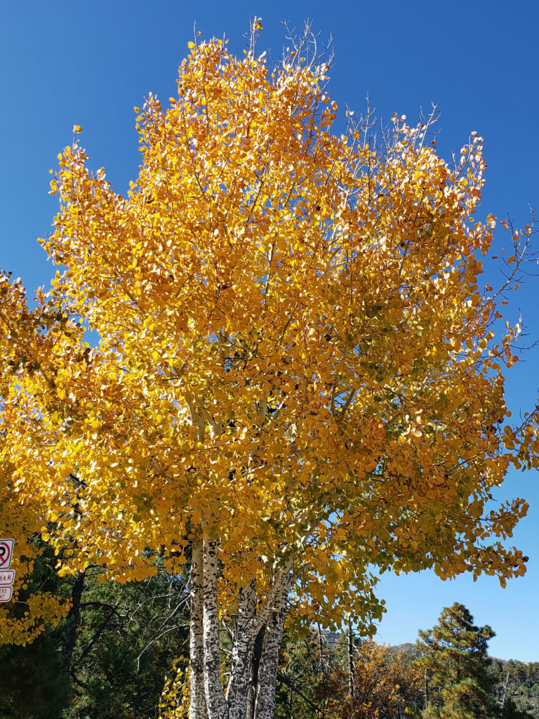
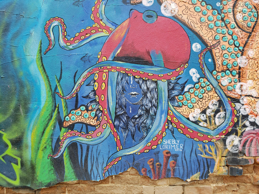


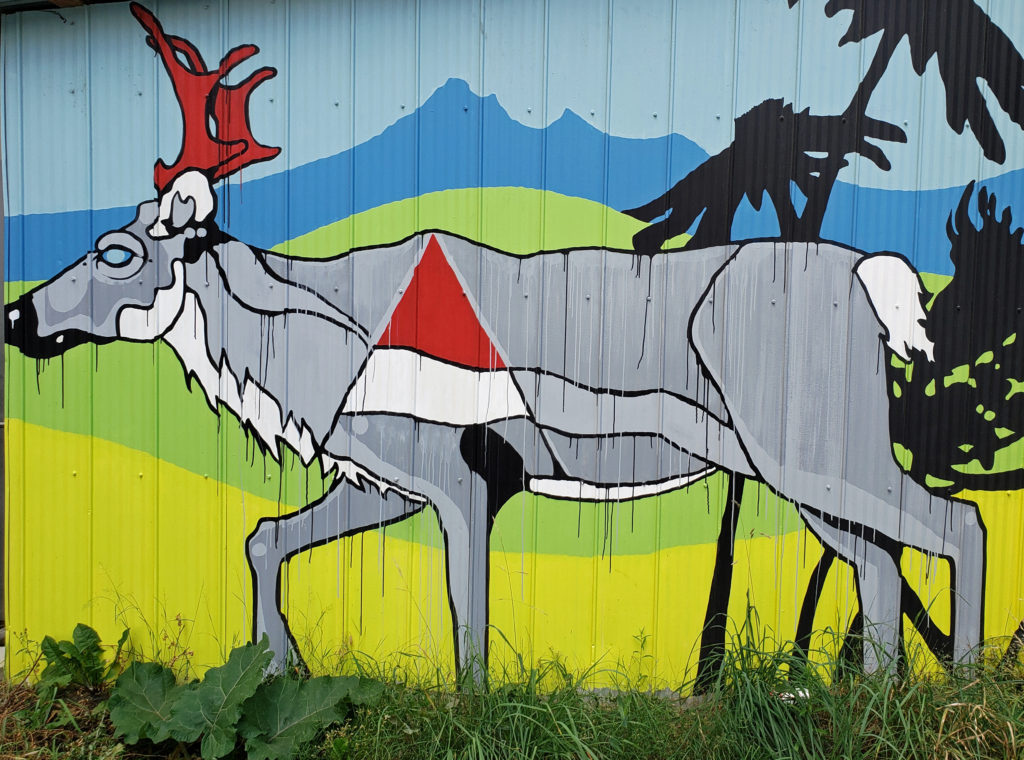


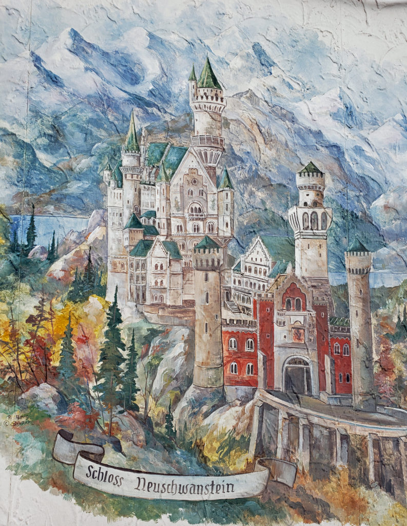


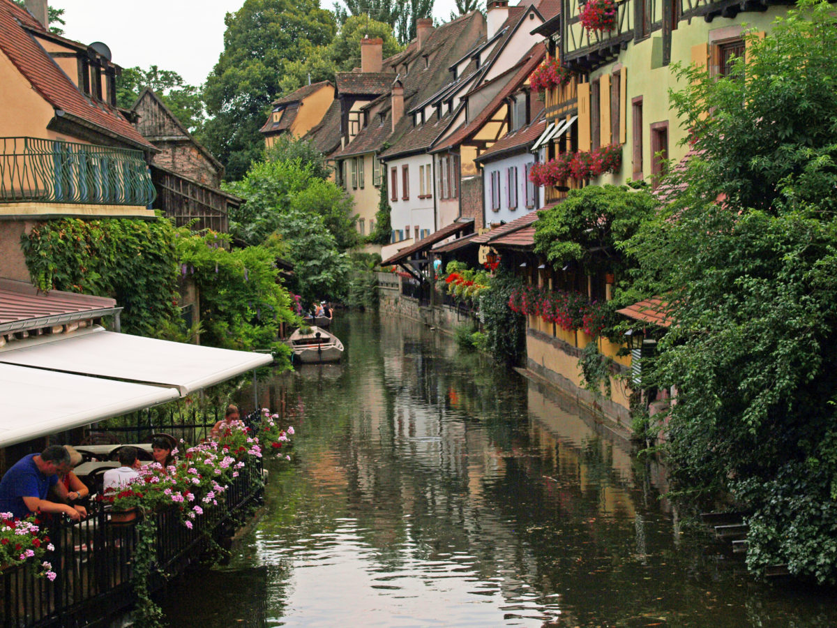
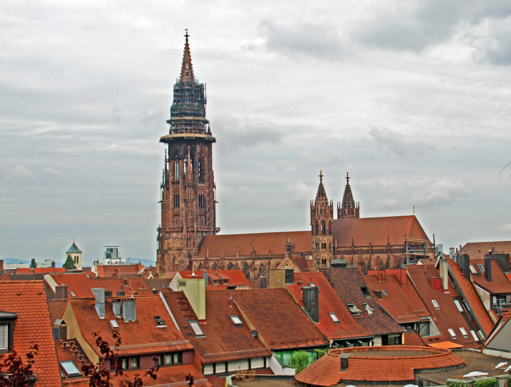
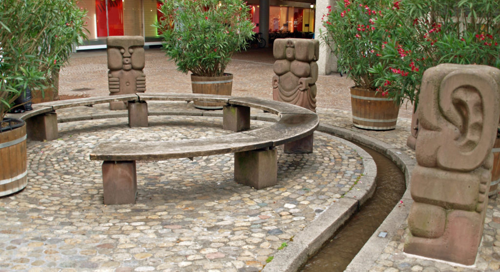
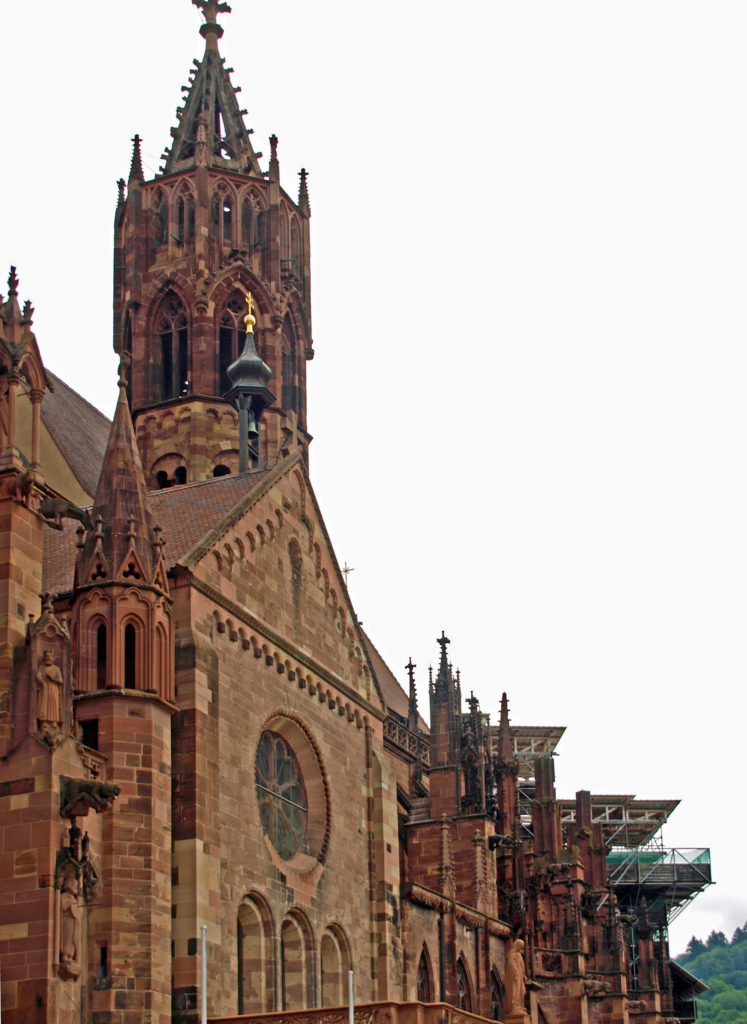
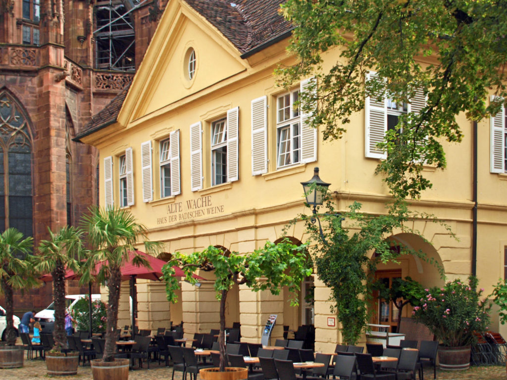
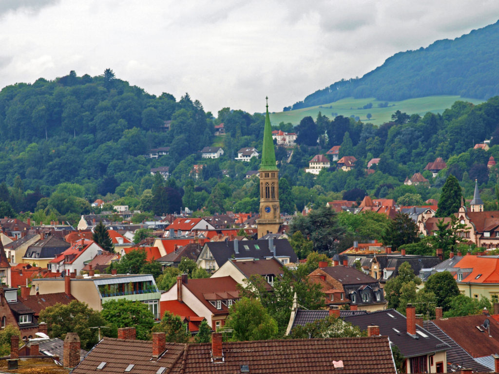
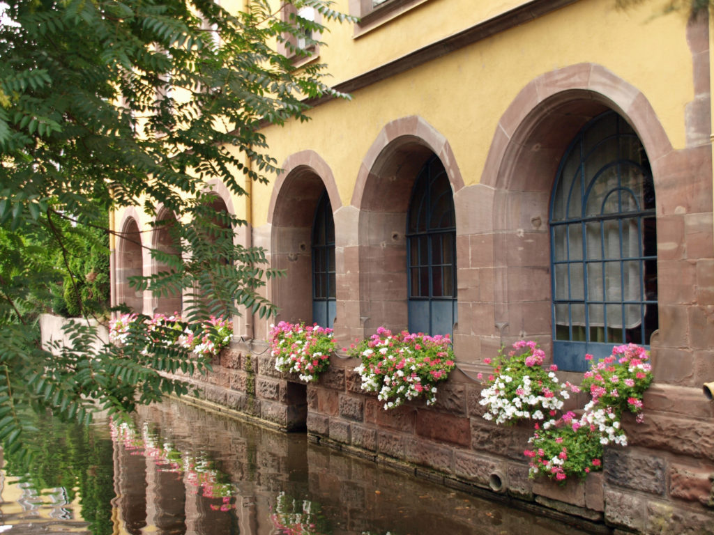
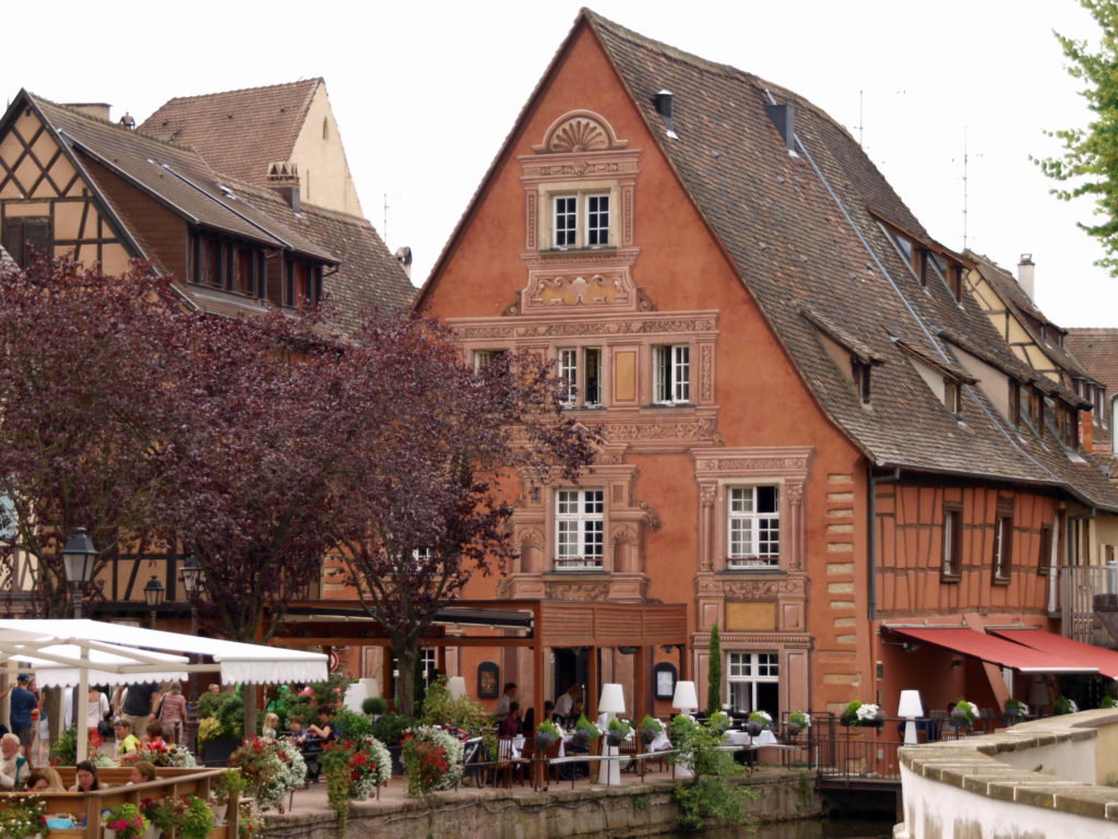
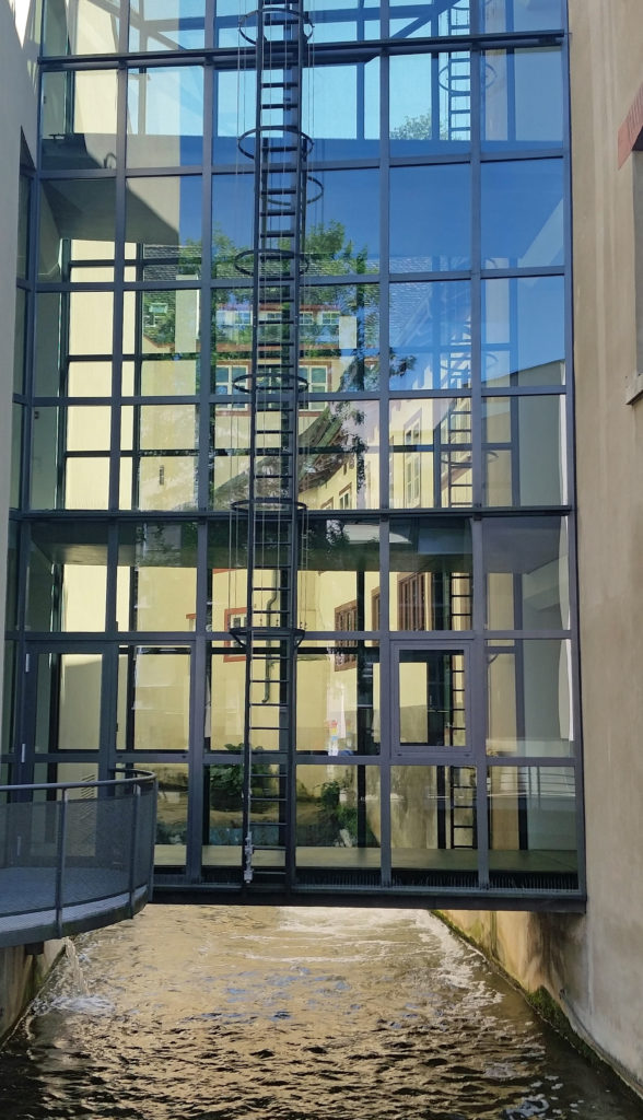
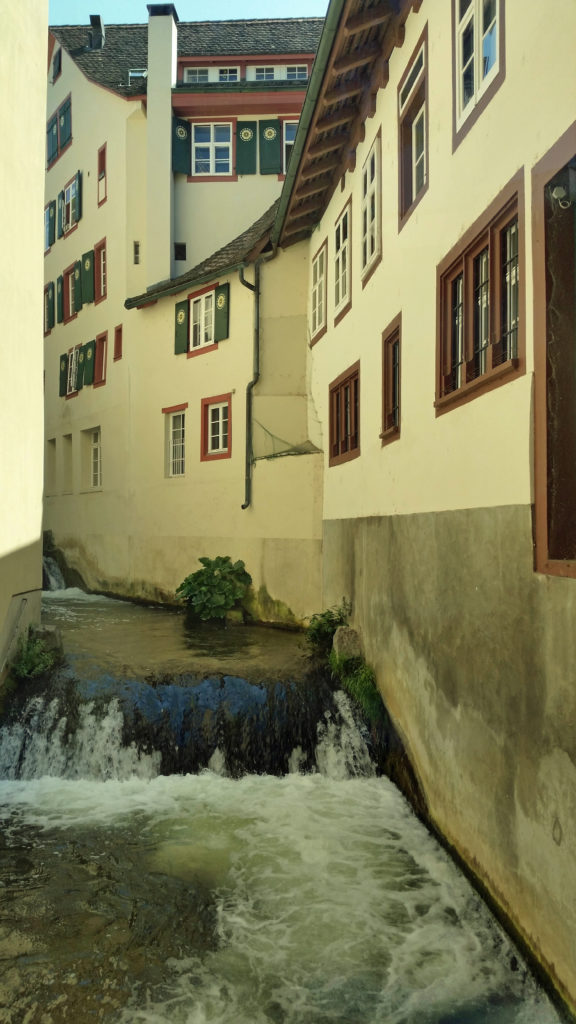
 We spent the rest of the day exploring the city center, including Basel Cathedral (Basel Munster), and the Basel Town Hall, and sampling Swiss cuisine. All in all, Basel was a delightful surprise, and a fitting end to our Rhine River cruise.
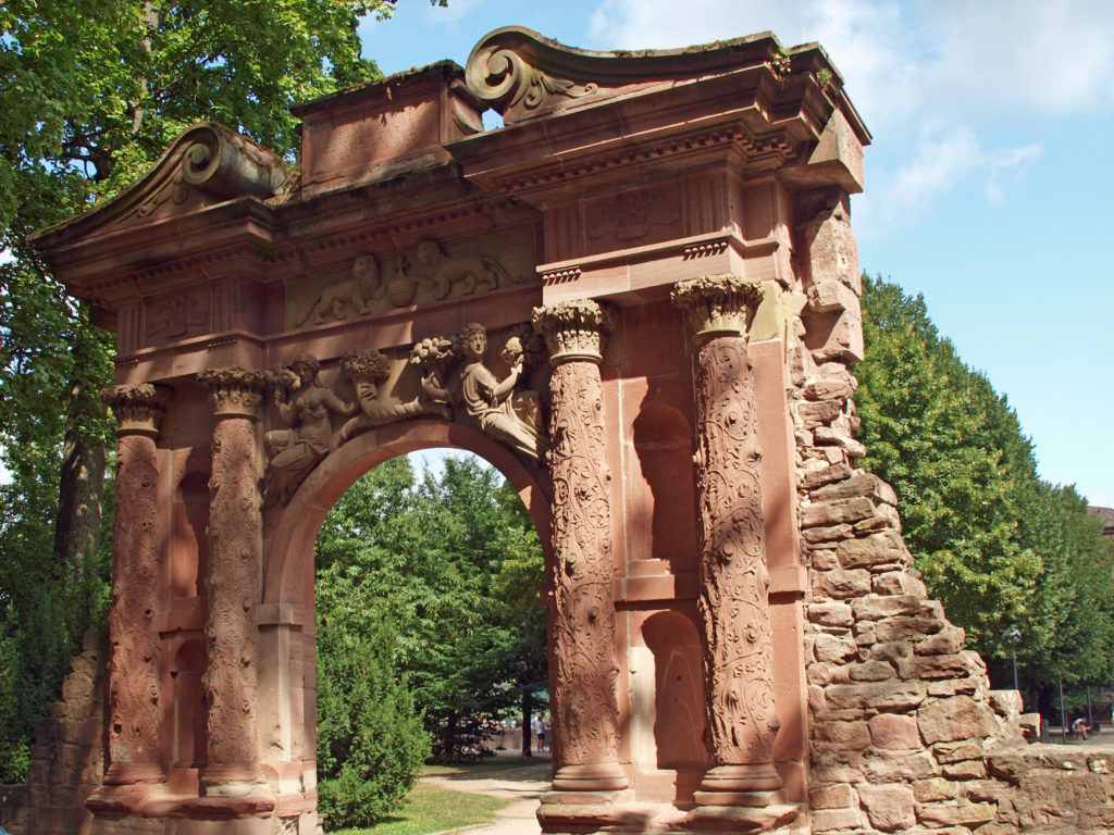
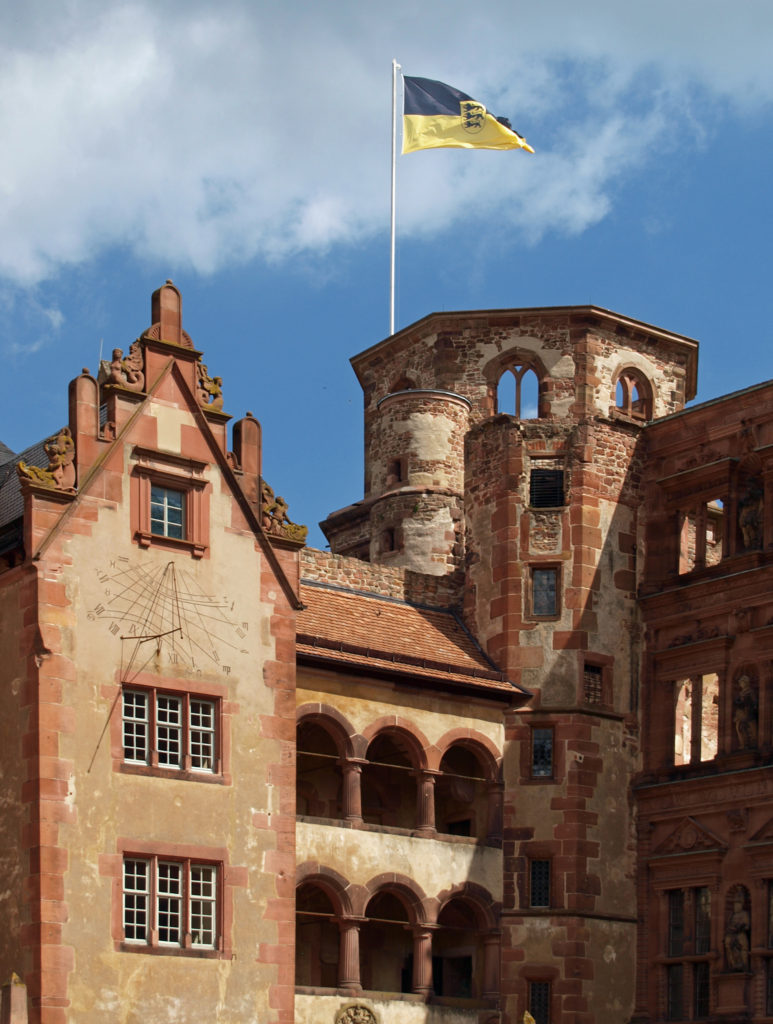
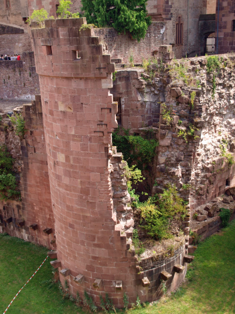 Our tour guide was a graduate student working on his doctorate in history at Heidelberg University, so we got a wealth of local history during our tour, told in an entertaining and often humorous manner. The castle ruins are a treasure trove of photo opportunities, as well. I could easily have spent a full day, or more, at the castle, but had to move on with the group.
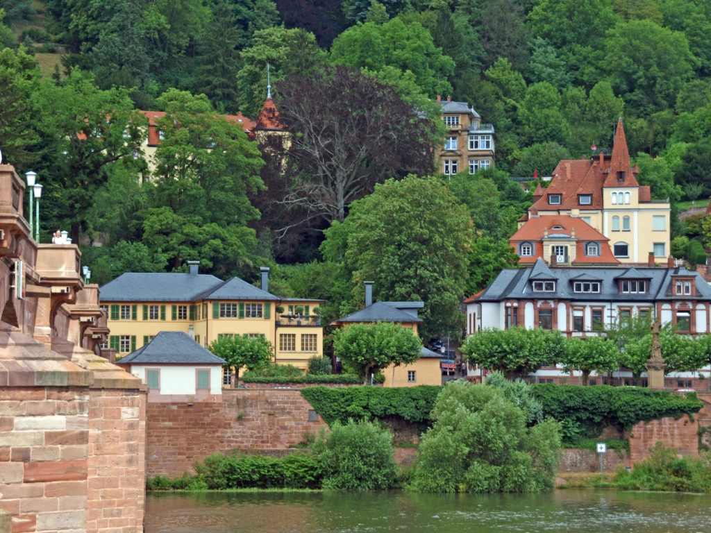
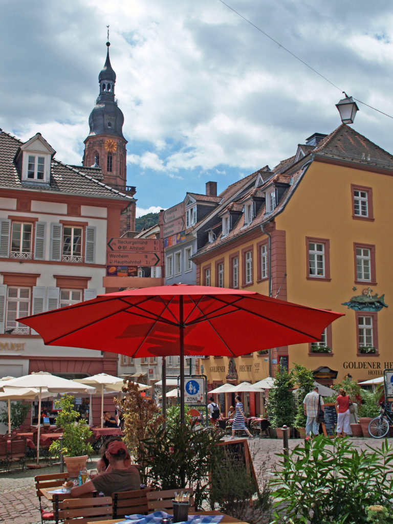
 We spent an hour or so exploring the old city, then stopped at a sidewalk cafe at one of the hotels for lunch. While there, another of the couples on the cruise joined us. Fran and Victor, from Santiago, Chile, were one of the few non-American couples on the cruise. Coincidentally, Victor, who is a surgeon, had been sent to Heidelberg some time previously by the university hospital where he practiced (they had some sort of reciprocal relationship with Heidelberg University), and had stayed in the same hotel at which we were dining.
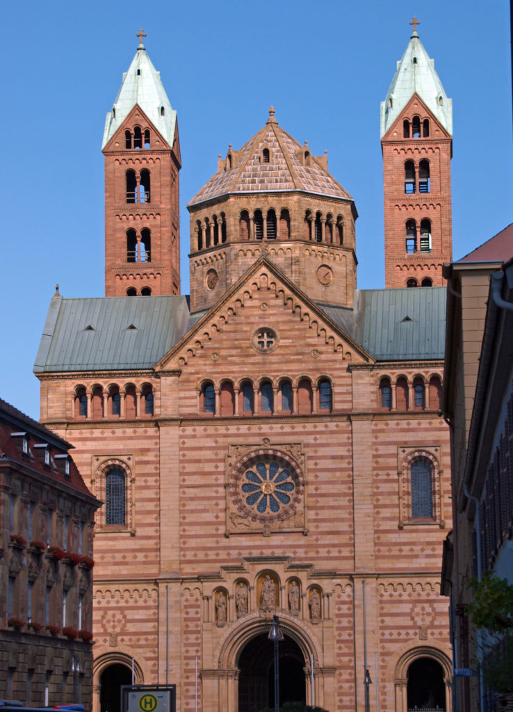
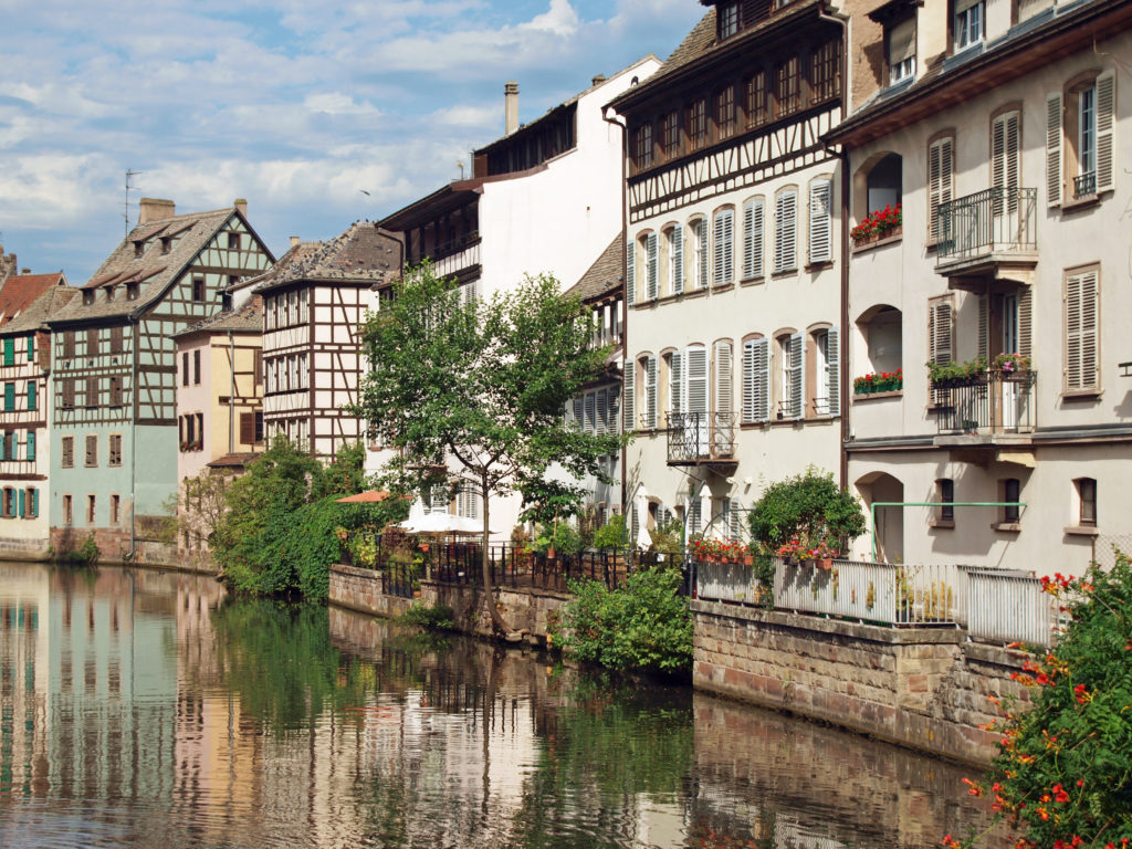
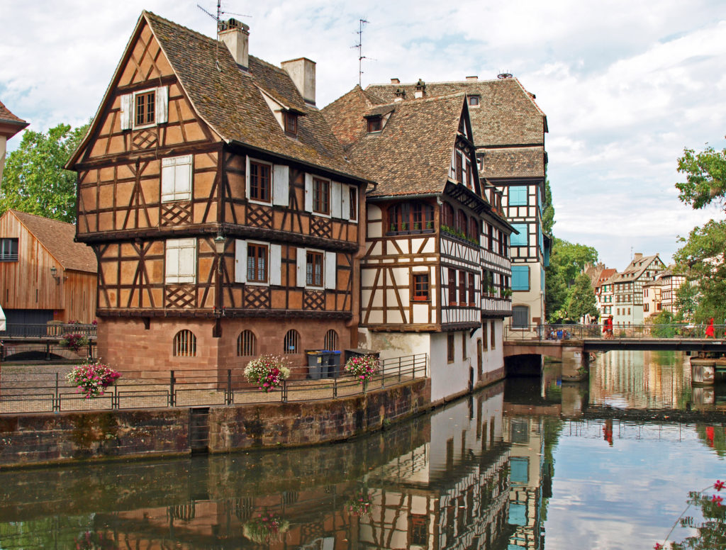
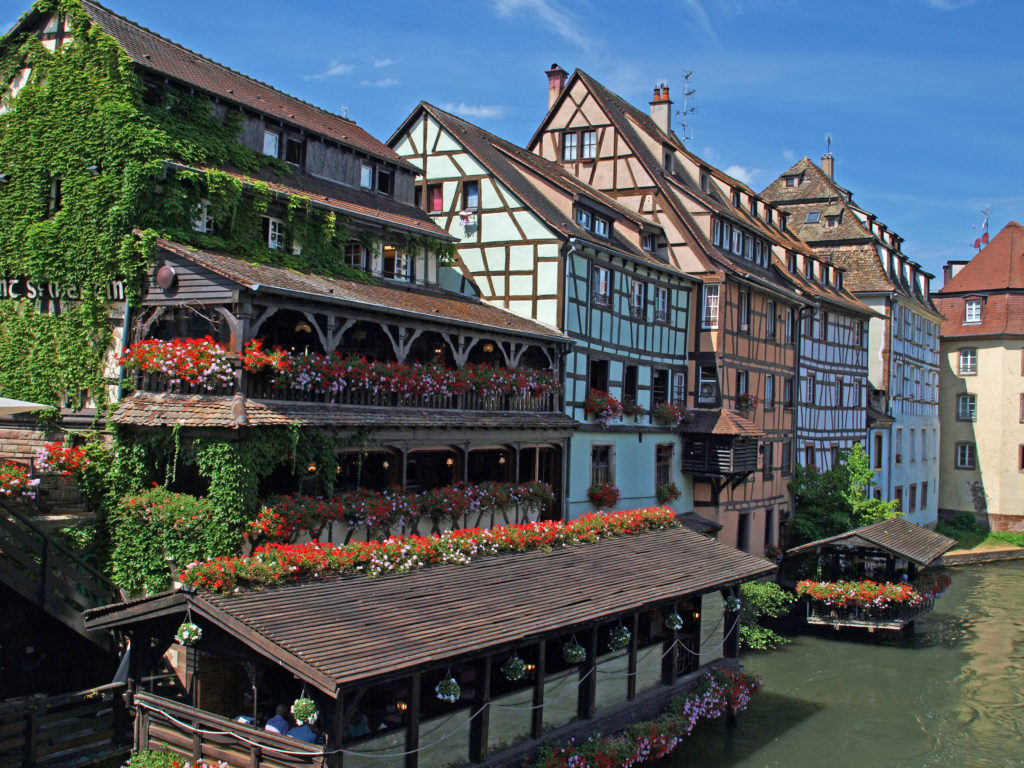
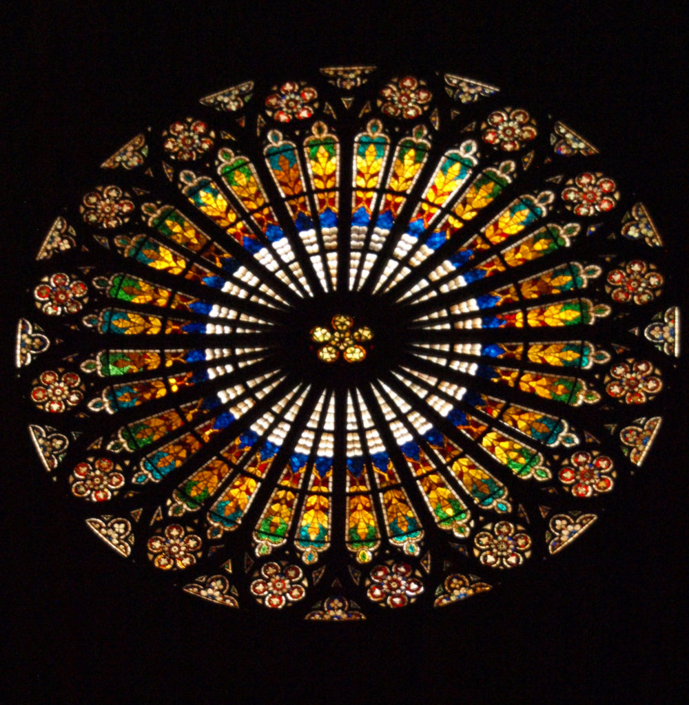
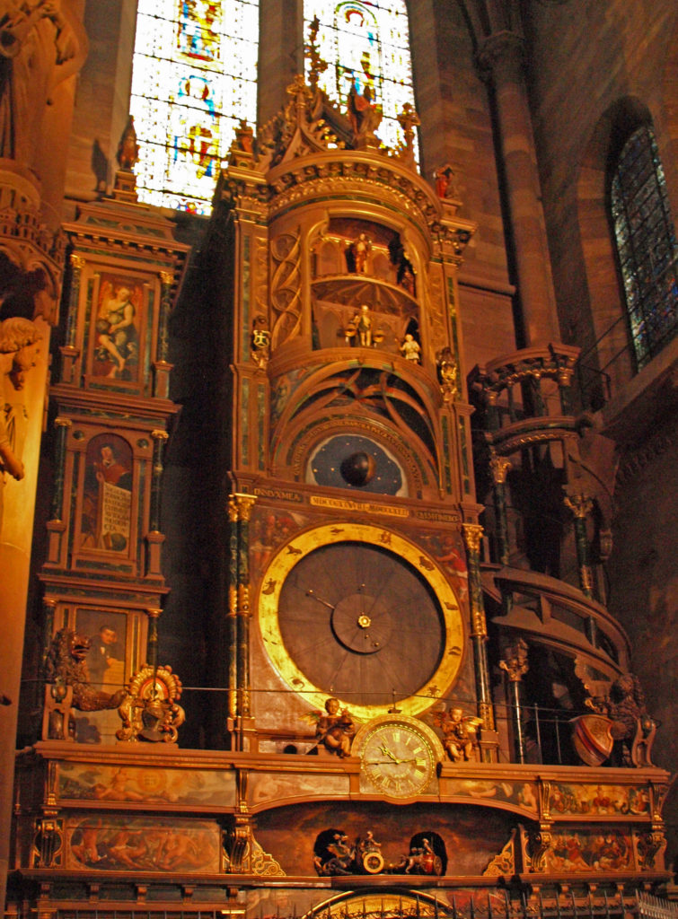
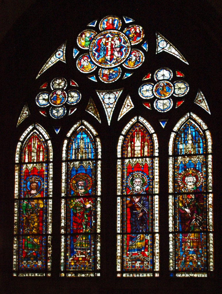
 From Kehl, the ship sailed that evening to Breisach, Germany. Our excursions on the following day took us to Freiburg, Germany and Colmar, France. Look for an upcoming post on those outings.