By Alan K. Lee
The High Desert Museum, located about five miles south of Bend, Oregon, offers visitors a chance to see native wildlife up close and learn about both the pioneering history of the area and the culture and lifestyles of the Native American tribes that lived in the area for thousands of years prior to the arrival of white settlers. All told, the museum has 100,000 square feet of exhibit space on its 135 acre campus.
 The High Desert Museum consistently rates as one of the top attractions of the Bend area, and it won the 2021 National Medal from the Institute of Museum and Library Services. My most recent trip to the museum came as part of a family vacation to the nearby Sunriver Resort, and everyone, especially the kids, thoroughly enjoyed the visit. It’s one of the most interesting museums that I’ve ever visited. There is something for everyone there.
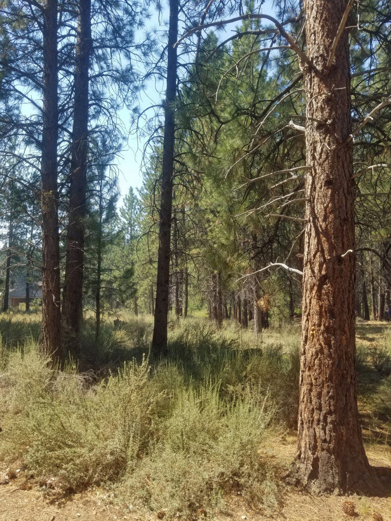
“High desert” can be a bit of a misnomer, as the term is often generically applied to all of central and eastern Oregon. The Bend area actually straddles the boundary between the ponderosa and lodgepole pine forest of the eastern slope of the Cascade Range and the sagerush and juniper lands to the east that are more typical of true desert habitat. The High Desert Museum is located in an area of pine forest, so the museum has no true desert habitat. But that does not detract from its appeal.
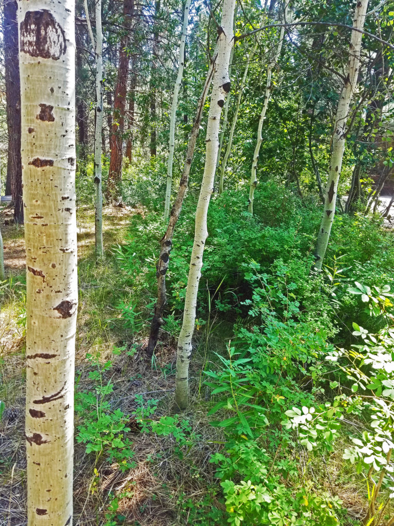
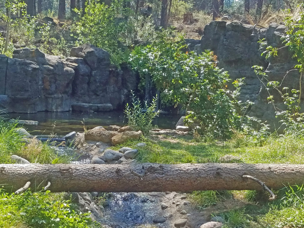
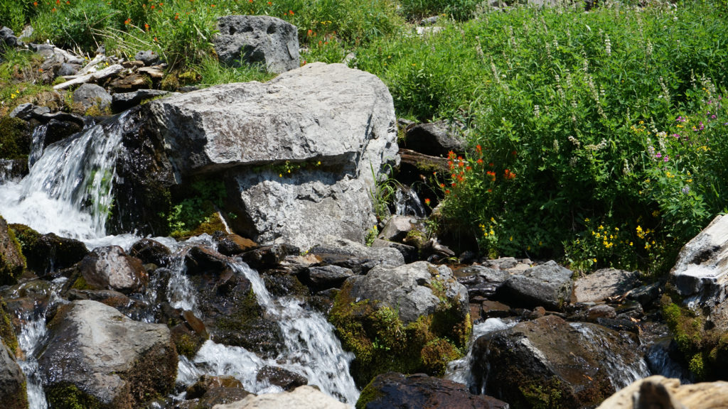
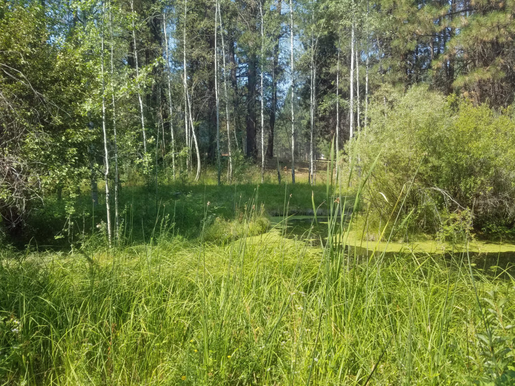 There is a small stream that runs through the museum grounds and several small ponds, giving the museum riparian as well as forest habitats. You can explore the pine forest and riparian areas on the trails that wander through the 135 acres of the museum grounds.
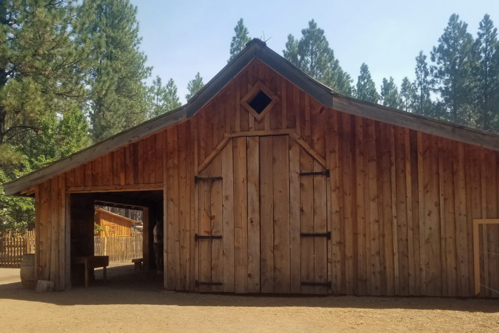
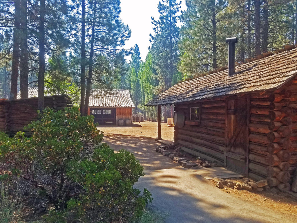
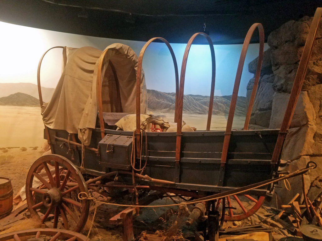
The Miller Family Ranch, one of the museum’s permanent outdoor exhibits, is a historically accurate recreation of an early 20th century homestead. The exhibit includes a cabin, barn, bunkhouse, root cellar, woodshop, and sawmill. Volunteers give visitors hands-on experience of what life on the homestead was like. Mrs. Miller and her son James will put your kids to work doing chores – and the kids will like it! The kids can also play some of the games that the children of the pioneers played.
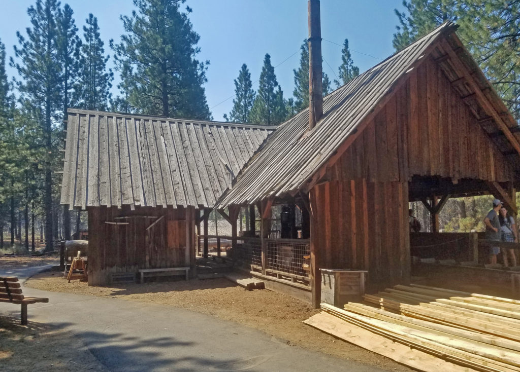 The Lazinka Sawmill is a working mill, originally located in Pilot Rock, Oregon. Originally driven by steam power, the mill is now powered by electricity. The lumber used to build the barn at the Miller homestead exhibit was cut at the Lazinka Mill. Museum staff fire up the mill once a month during the summer months, so check the museum’s schedule (linked below) if you are interested in seeing it in operation.
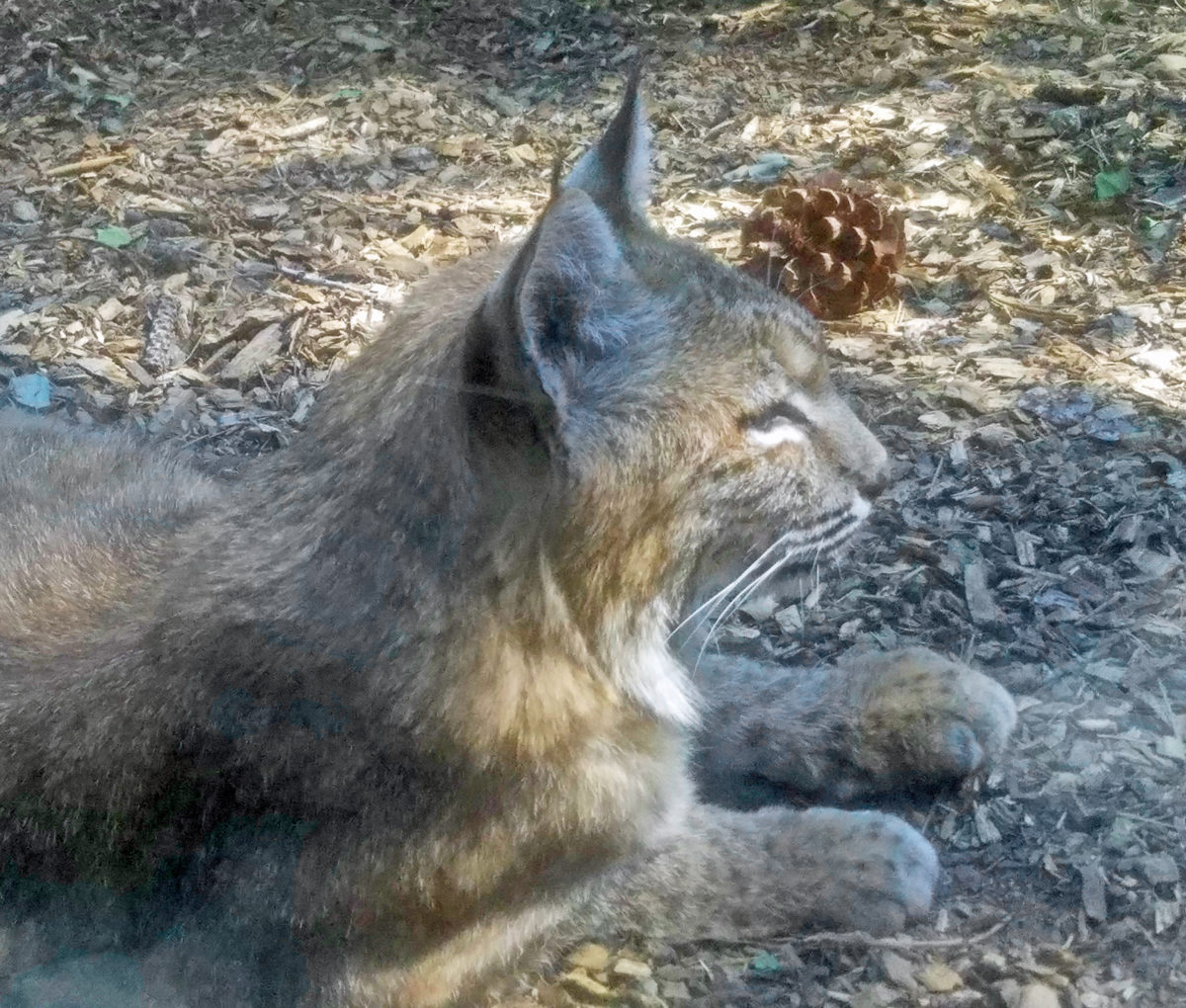
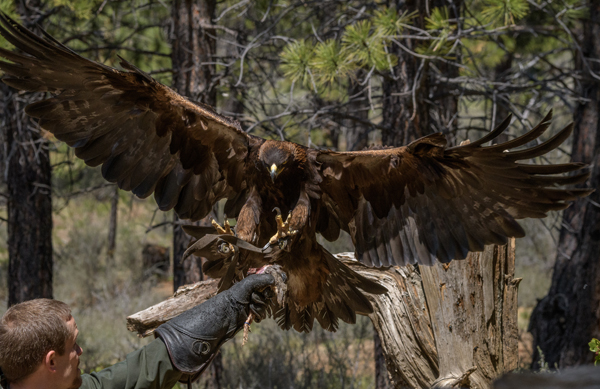
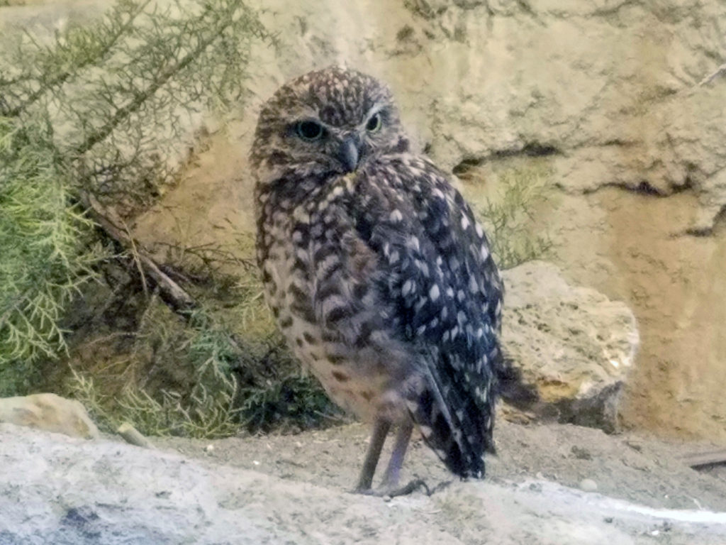 Get an up close look at some of the raptors of the high desert and learn about desert carnivores, otters, and other desert dwellers at the Donald M. Kerr Birds of Prey Center. Check the museum website for current programs and schedule.
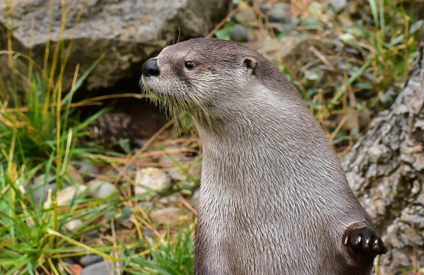
Three river otters live at the Autzen Otter Exhibit, although all three were apparently napping when we were there. I have seen them in the past visits, though, and when they’re out and about they are playful, funny, and very entertaining to watch. The exhibit includes both outdoor and indoor viewing areas, including viewing windows below the water level of their pool where you can watch them in their underwater habitat.

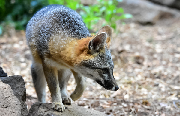
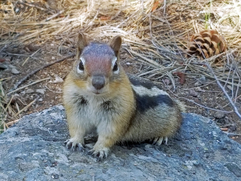
The museum also is home to two porcupines, siblings Tumbleweed and Juniper. Tumbleweed stars in the museum’s summer Desert Dwellers program. Both were born in captivity, and like all of the animals at the High Desert Museum, cannot live in the wild. The museum also recently added a resident gray fox, Gert, to their family.
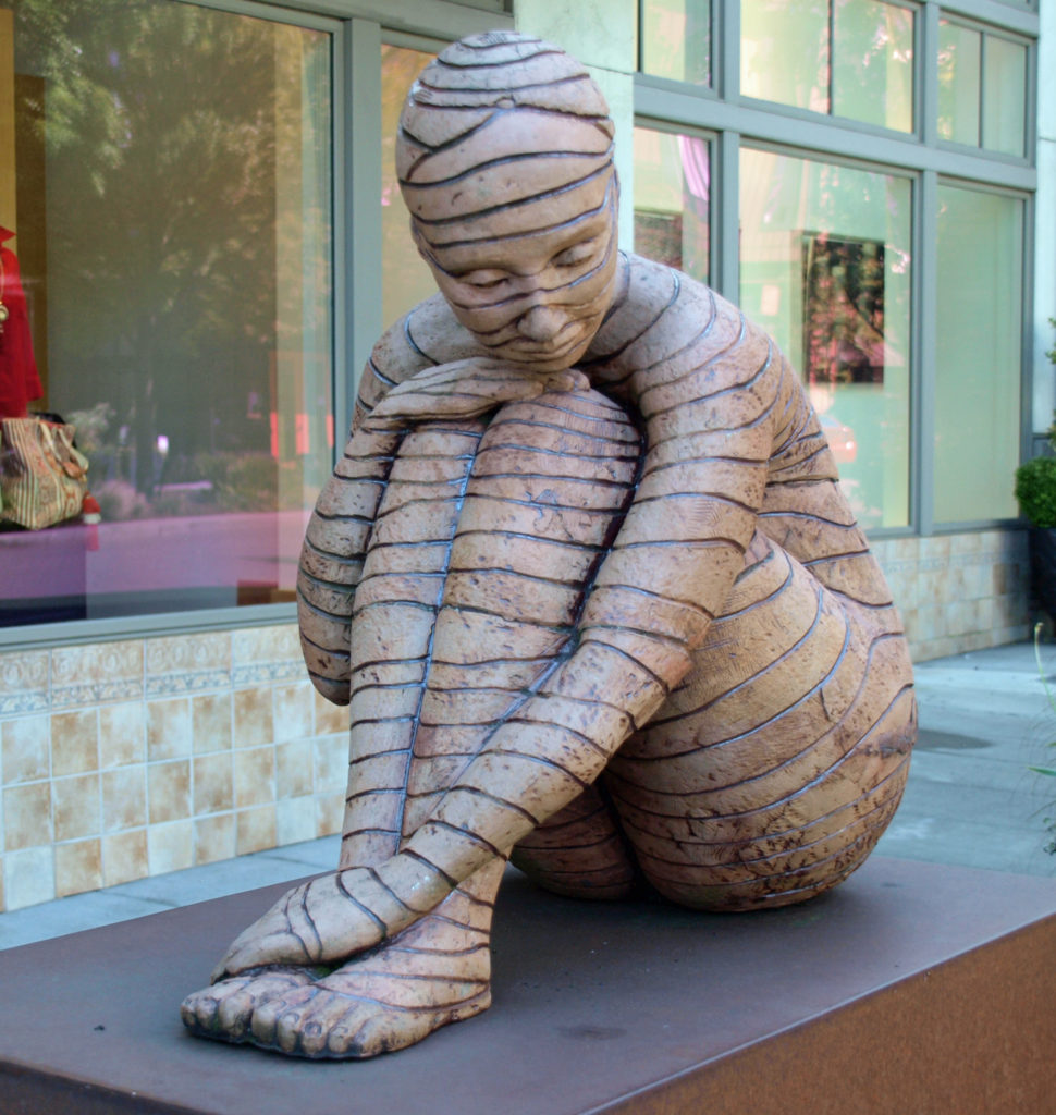
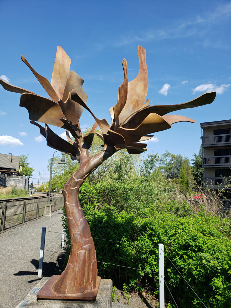
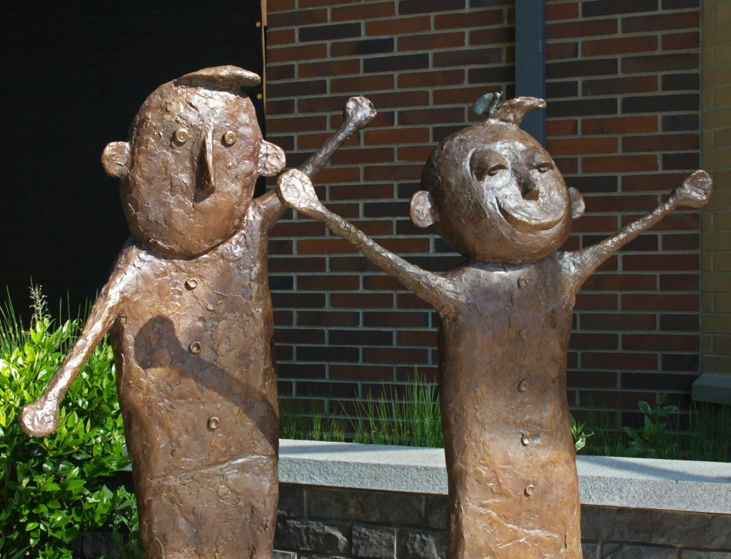
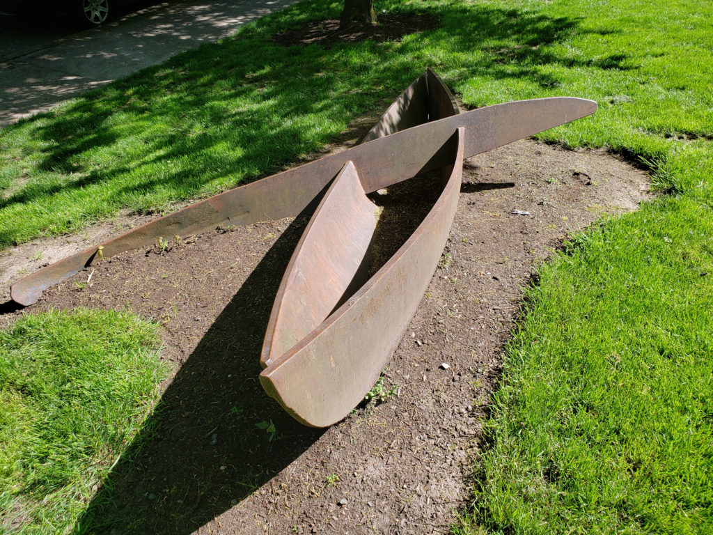
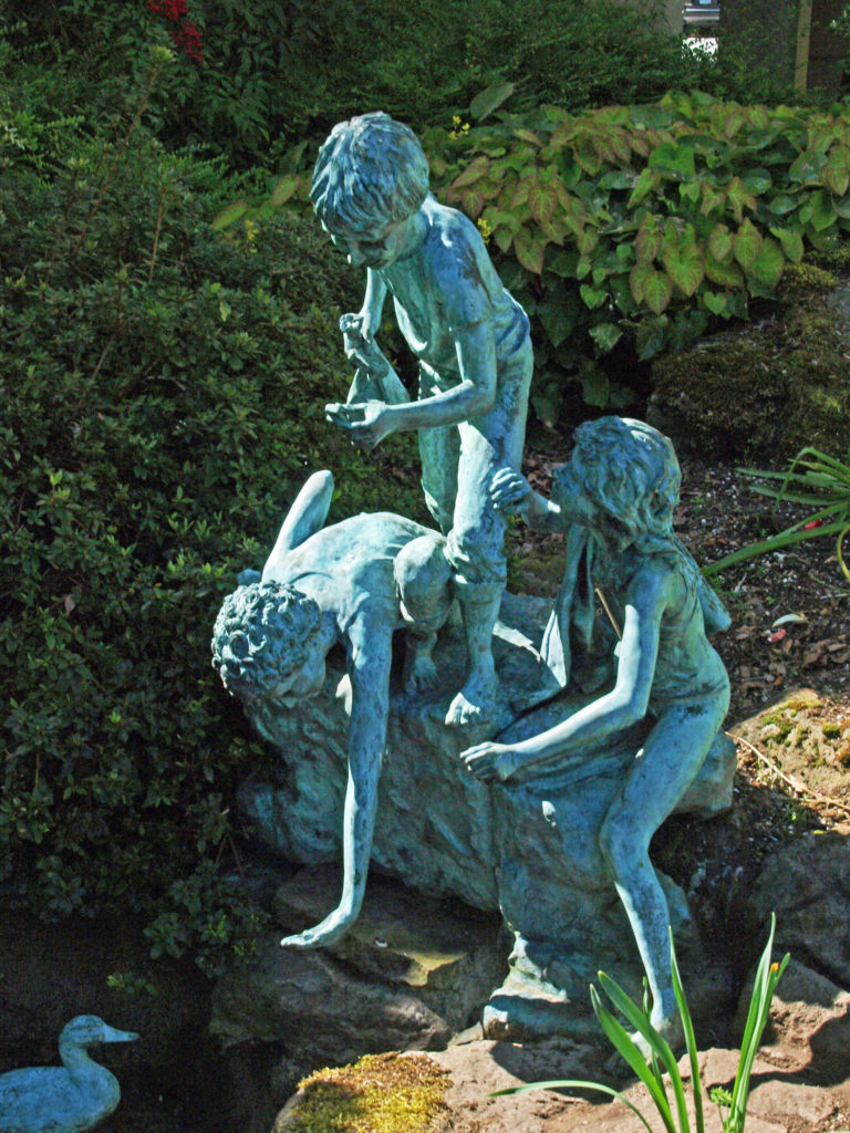
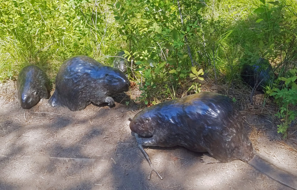
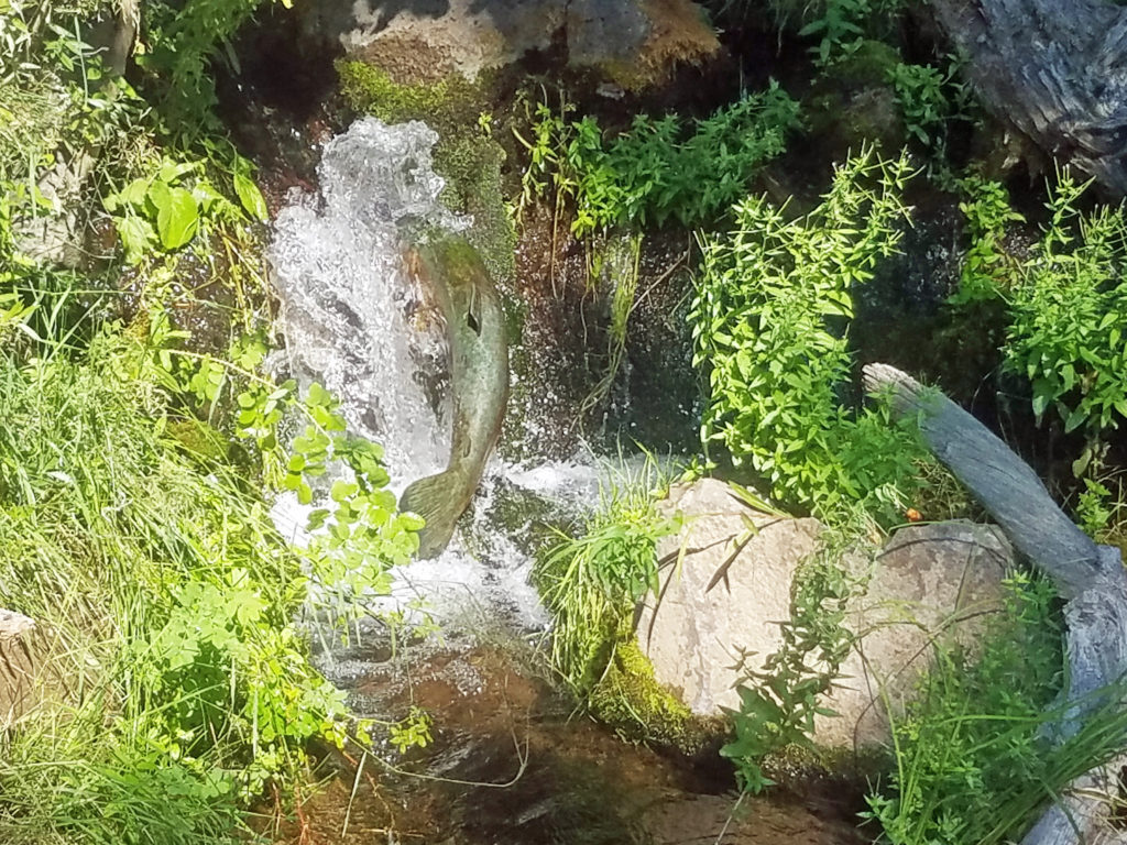
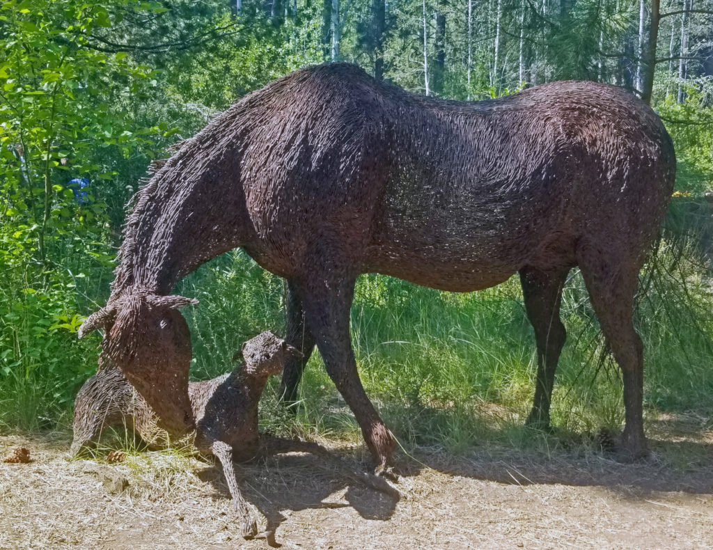 Throughout the grounds, you will find sculptures and other works of art. I particularly like the wire sculptured mare and foal, the bronze beavers, and the frozen-in-time bronze of a salmon in mid-leap.
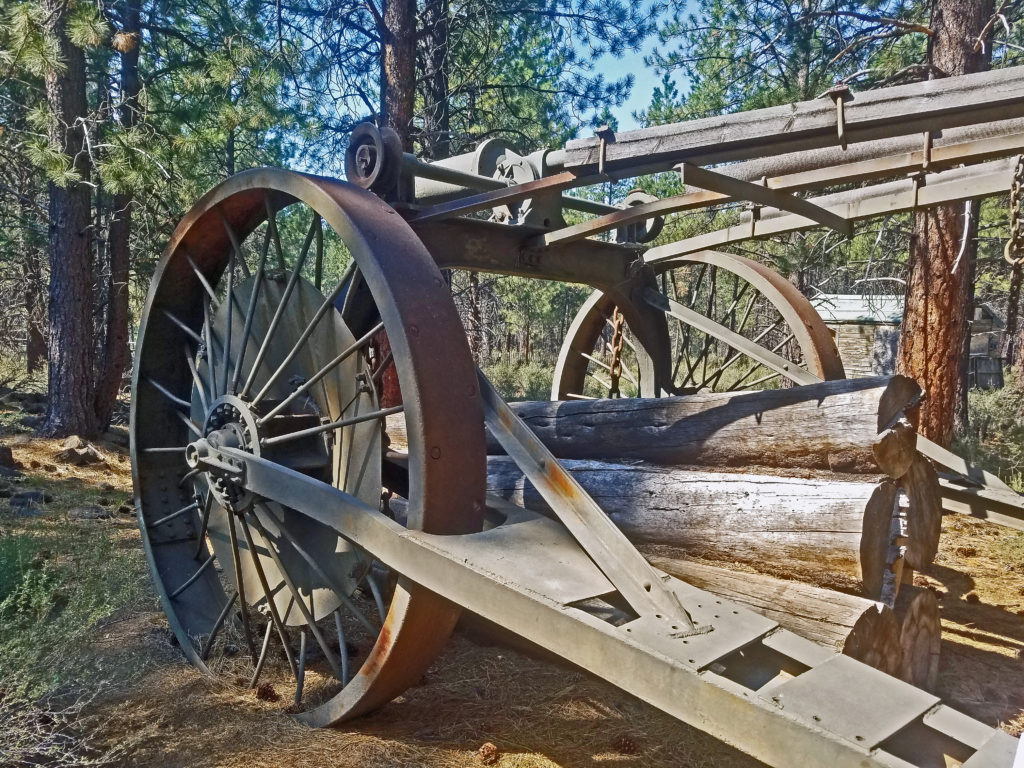
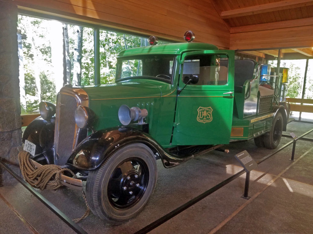
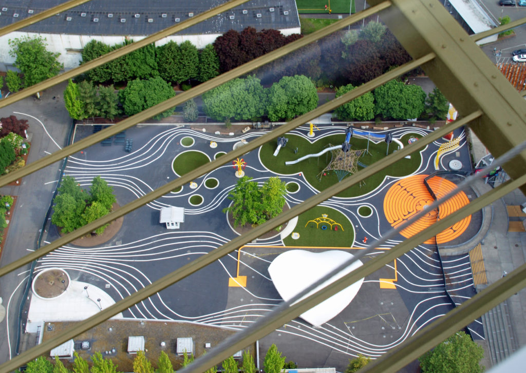
 Other features of the museum include a Forest Service ranger office built in 1933, vintage logging equipment, a forest service fire truck from the 1930s, and a WWII army motorcycle made by Harley-Davidson. The museum’s most recent addition is the E. L. Wiegand Ponderosa Playscape, a children’s play area near the otter exhibit.
 Inside the main building, the Desertarium Exhibit showcases some of the animals that make the High Desert home, including snakes, lizards, and desert tortoises. Other permanent indoor exhibits include Spirit of the West, which documents the history of the people of the region, and By Hand Through Memory, a look at the history and culture of the Plateau Indian Nations.
 The museum also hosts changing exhibits. Check the museum’s website for what exhibits are currently on display.
 In addition to enjoying all the museum’s exhibits, you can get made-to-order sandwiches and wraps, and a variety of beverages at the newly remodeled Rimrock Cafe inside the main building. The cafe features locally made food and drink from Big Ed’s Artisan Bread, Humm Kombucha, and Strictly Organic Coffee. And souvenirs of your visit and books and other educational materials are available at Silver Sage Trading, the museum store.
 Plan on spending at least several hours at the museum, especially if you have kids in tow. There’s too much worth seeing to experience it all in less time. Check the museum website for hours and admission fees. Tickets are available for purchase on the website, but advance purchase is not required.
Originally posted Sept. 9, 2019. Most recently updated May 4, 2025.
All photos © Alan K. Lee, except as noted
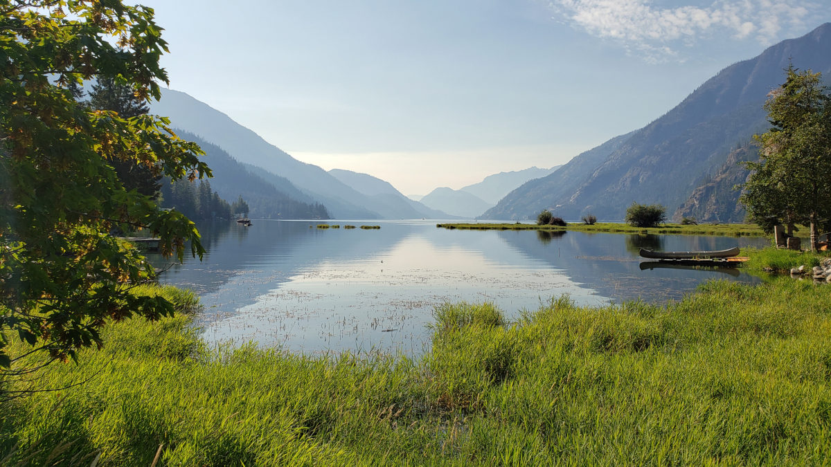
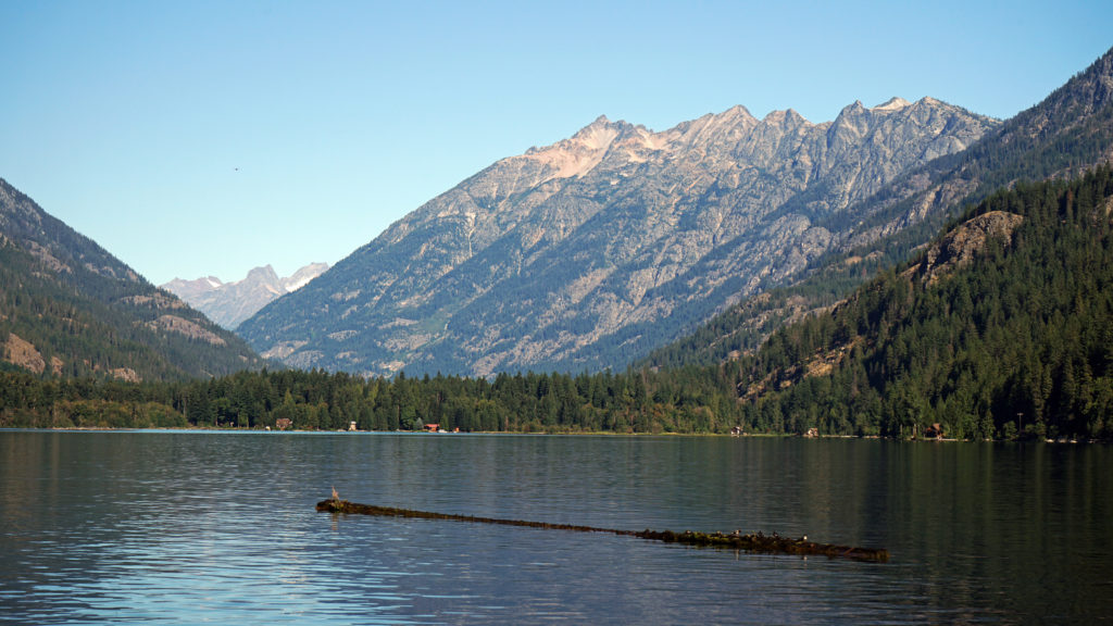
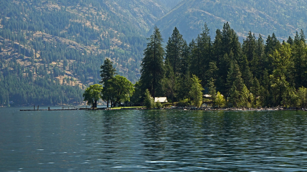
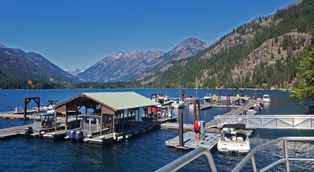
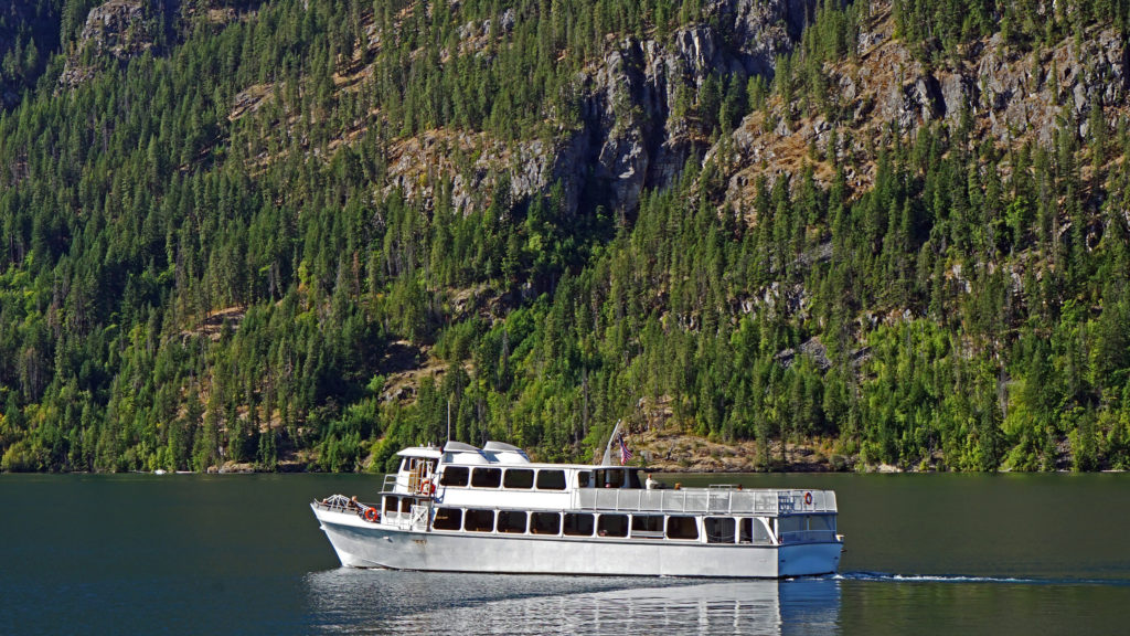
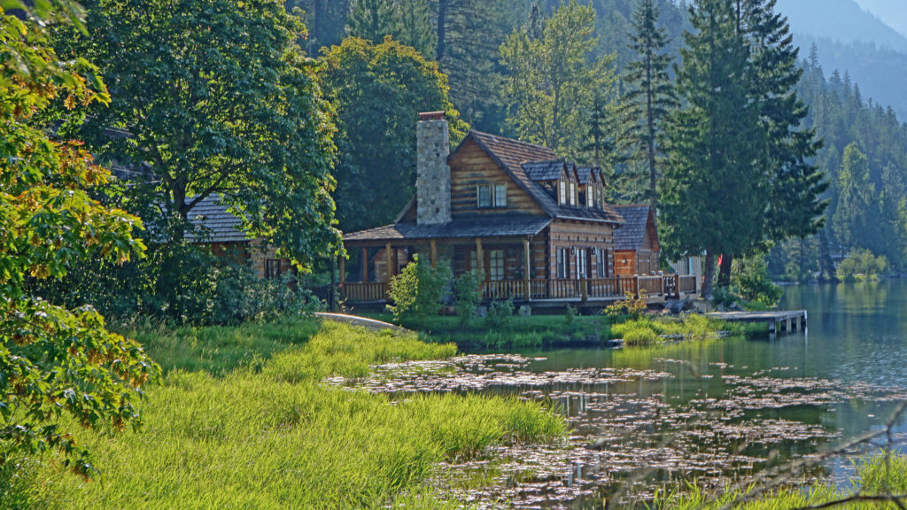
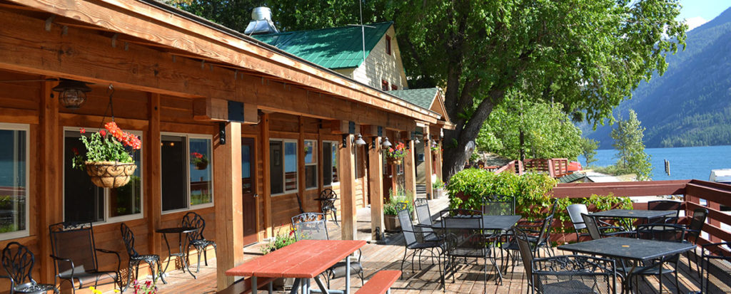
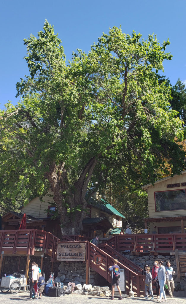
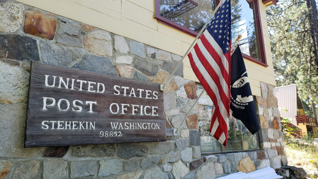
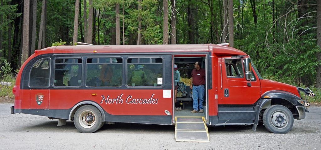
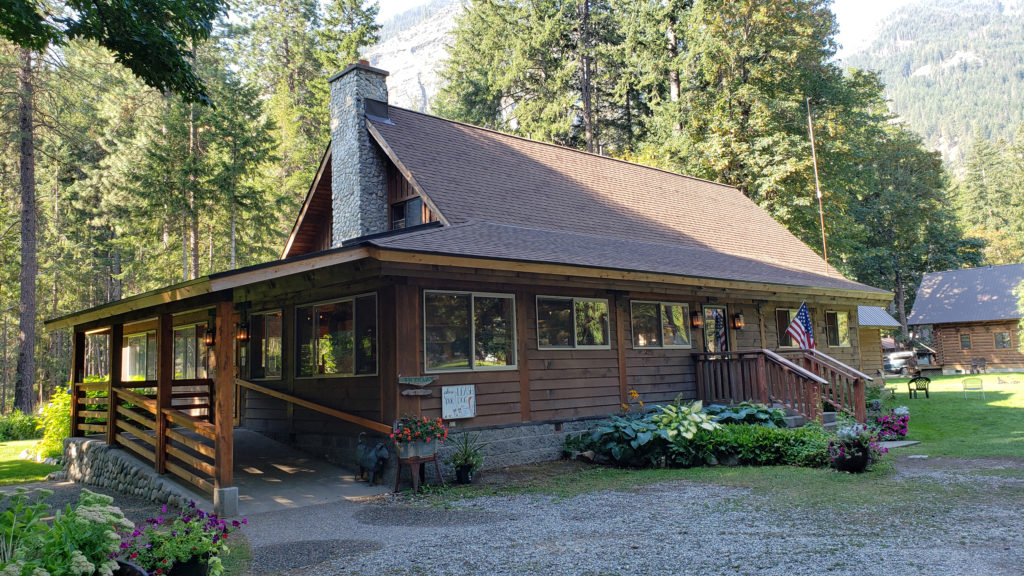
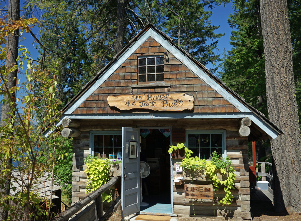
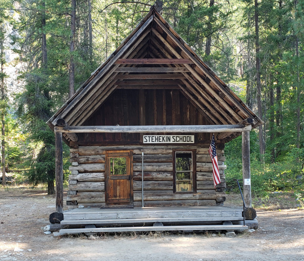
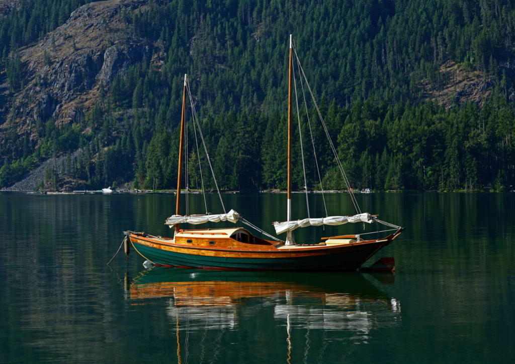 My wife and I have visited the small community of Stehekin at the head of Lake Chelan in central Washington several times. Our most recent visit came on a week-long escape during the pandemic in 2021.
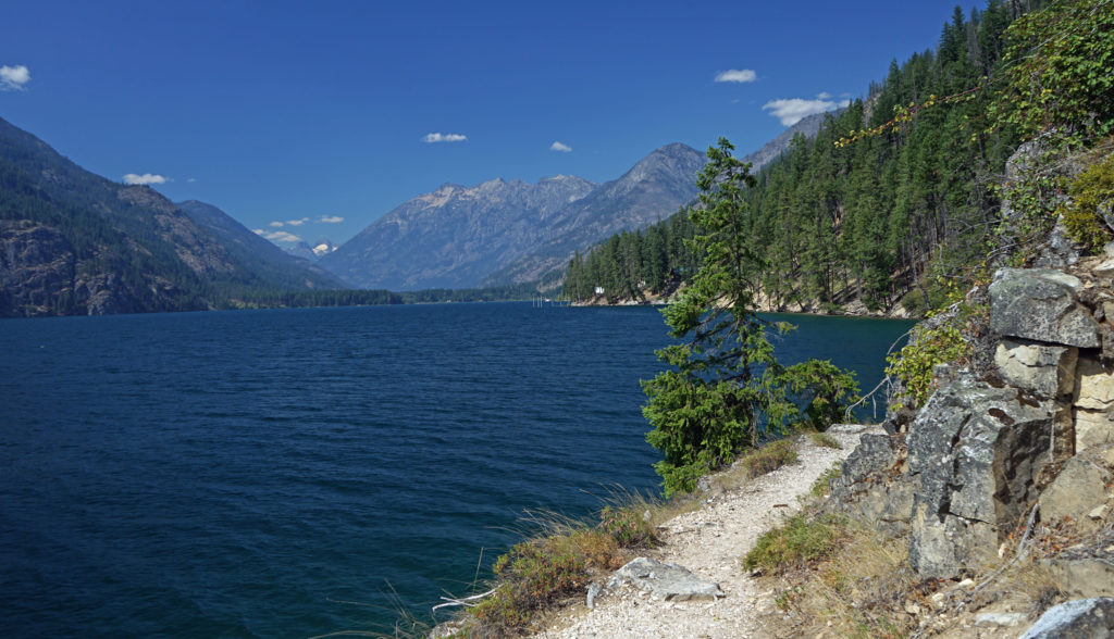


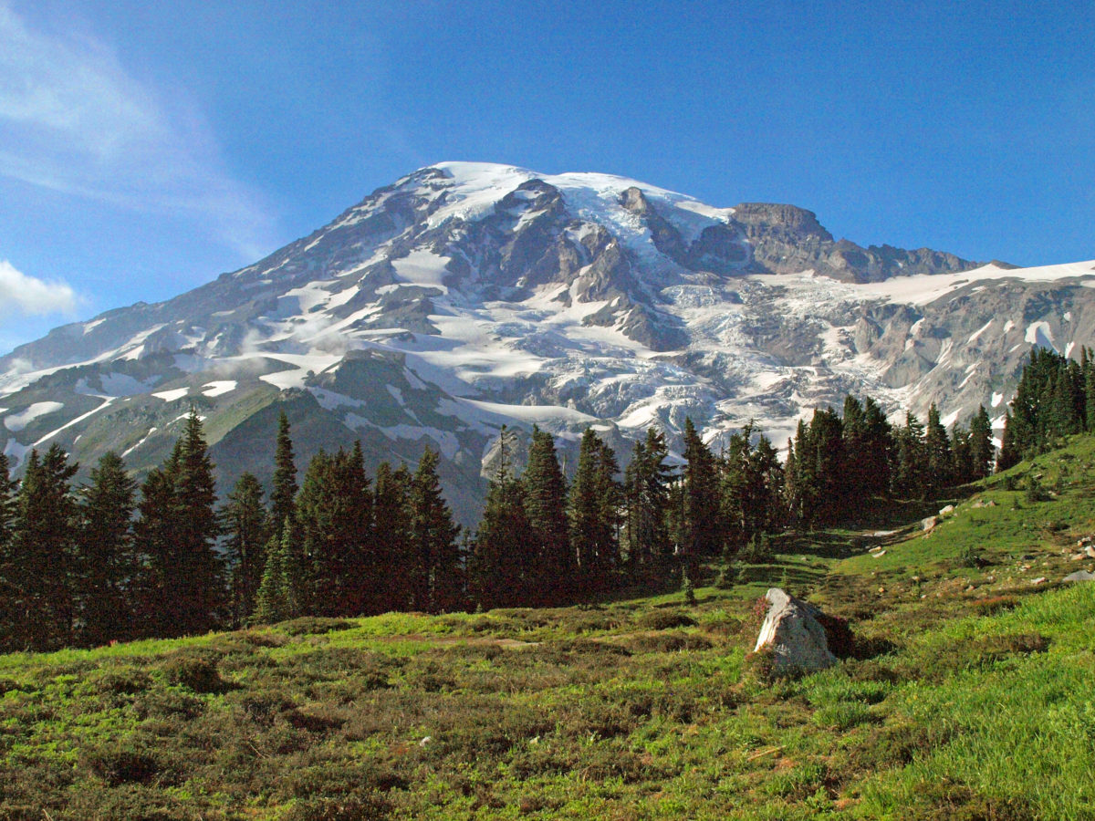
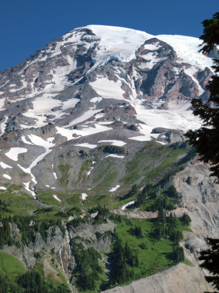

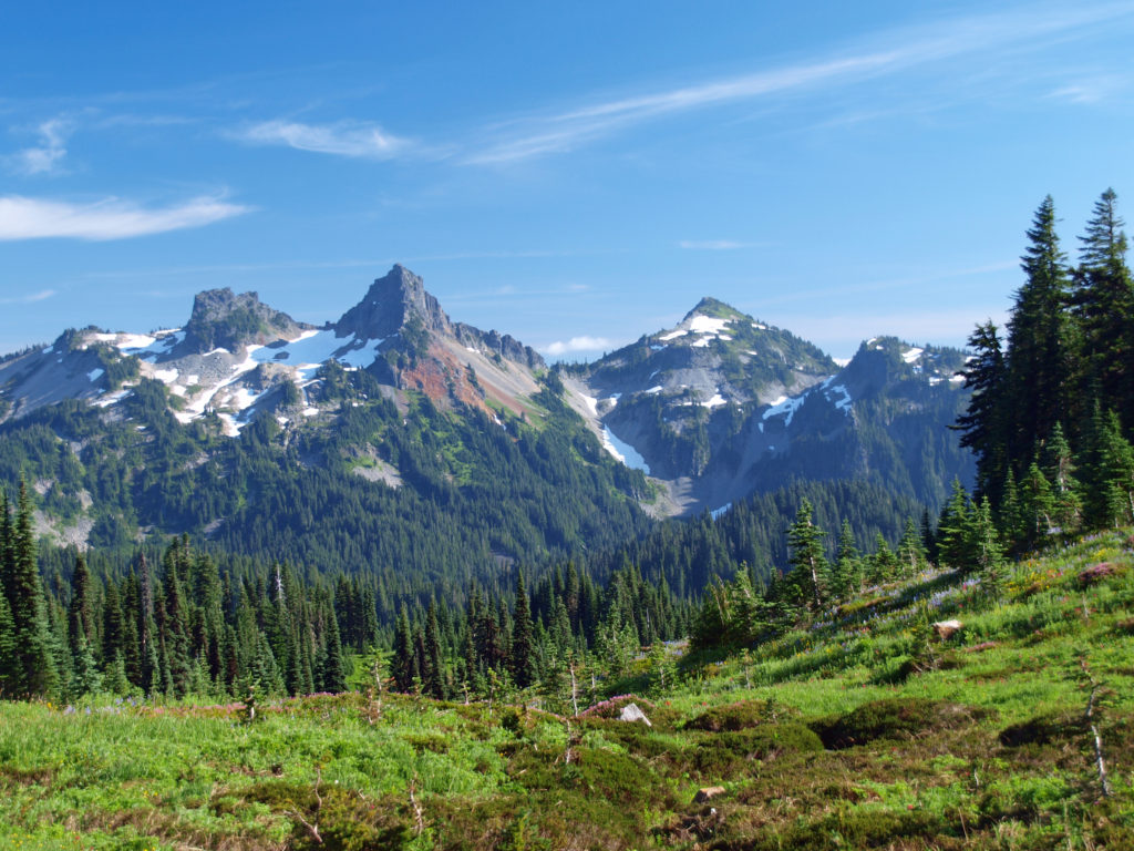
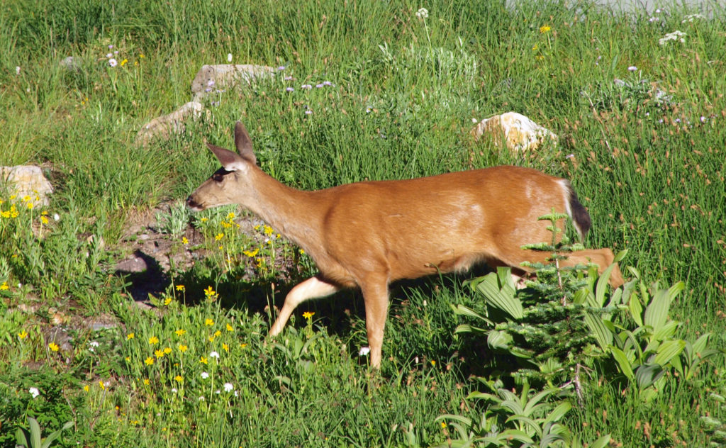
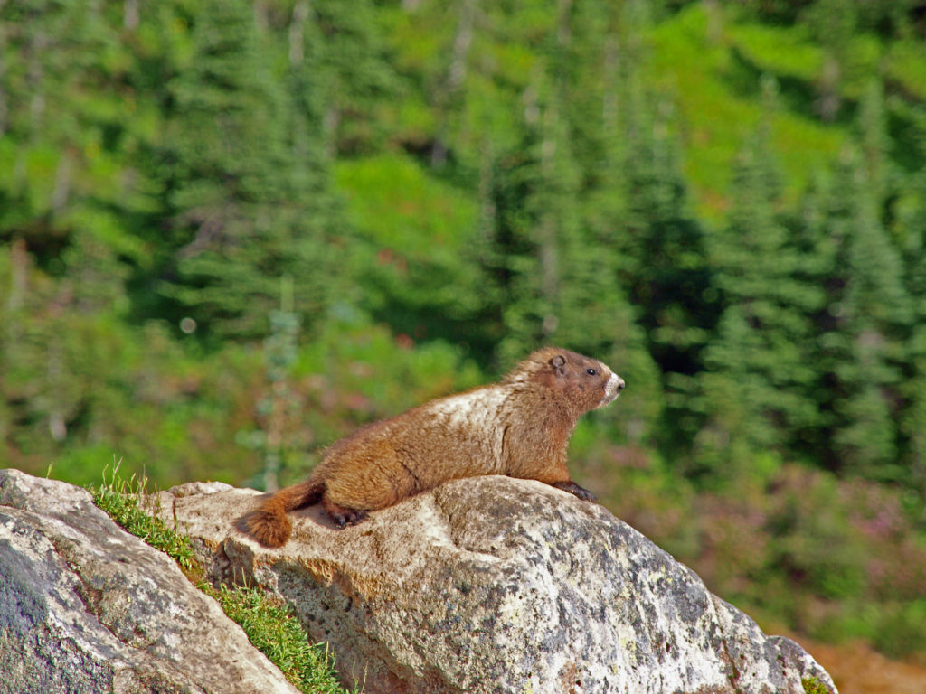
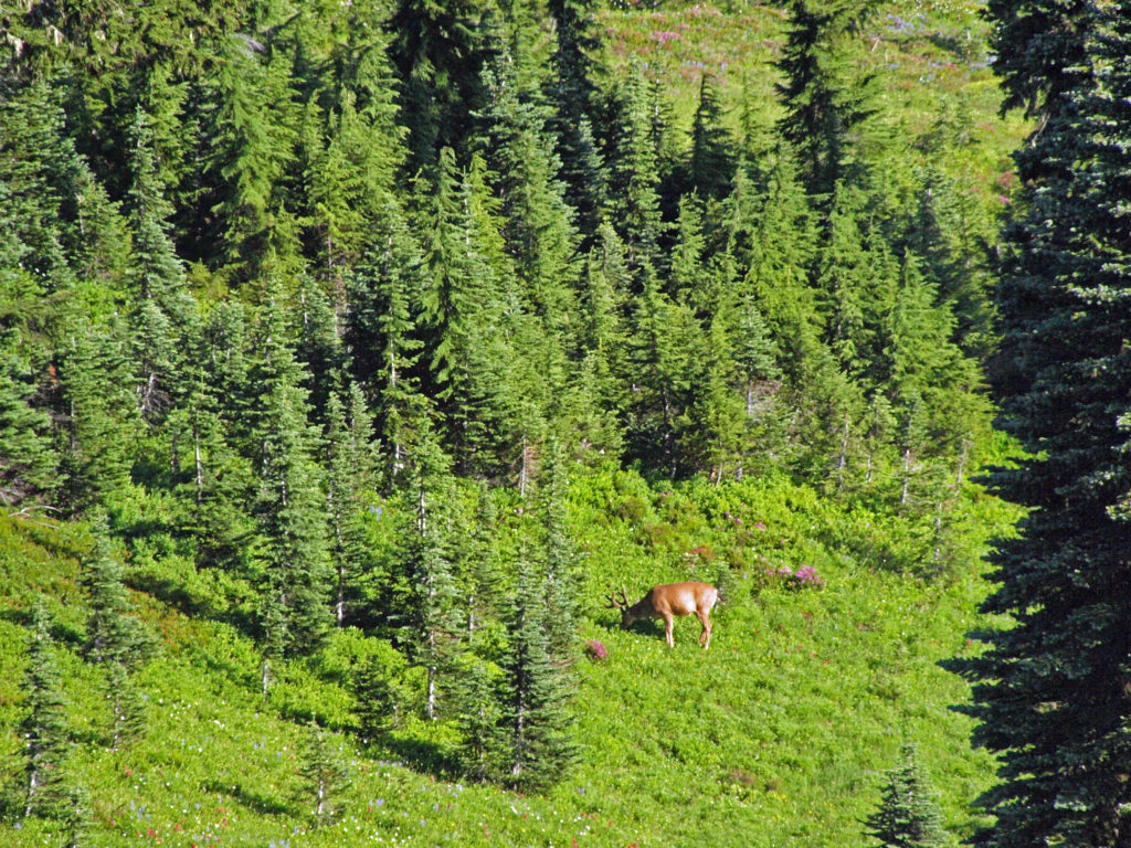
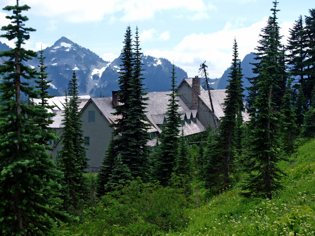
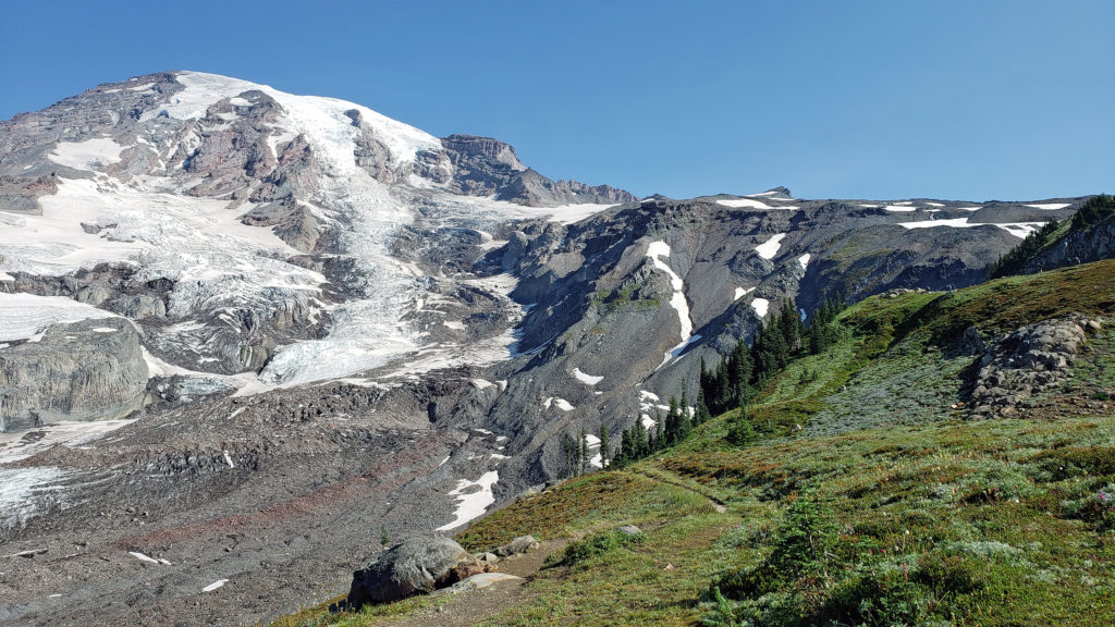 The highlights of the trip were the two hikes we did on the Skyline Trail. The first was the four mile out and back hike to Panorama Point. The second was the roughly four mile Skyline-Golden Gate loop. Both are listed as “moderate” hikes, but both have significant elevation gains (1700′ and 1400′ respectively). We did both hikes early in the day during the week, but we were far from the only ones on the trail, especially on the hike to Panorama Point. But the area above Paradise is so incredibly scenic that the crowds didn’t diminish the experience much.
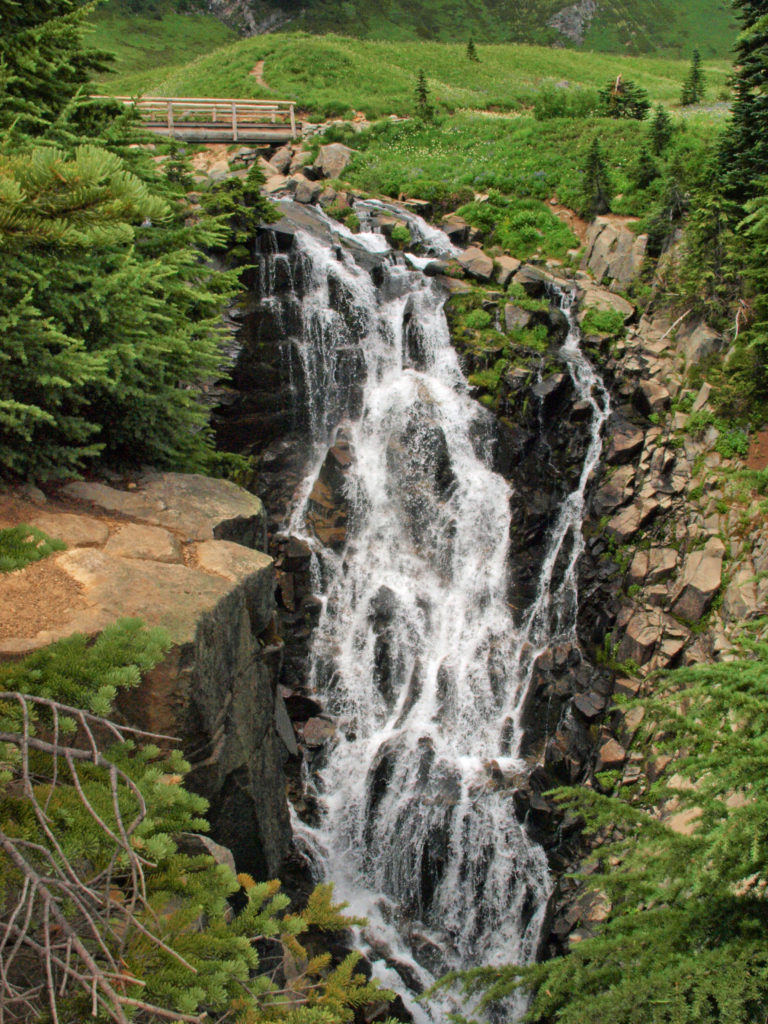

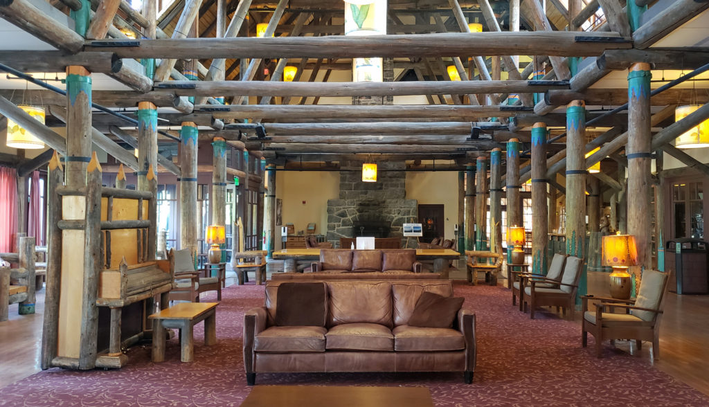 Close to Paradise Inn, the Jackson Memorial Visitor Center, named after long-time U.S. Senator Henry M. Jackson, offers general information, exhibits, a park film, guided ranger programs, a book/gift store and a cafeteria. Unfortunately, all visitor centers in the park are currently closed due to the ongoing pandemic.
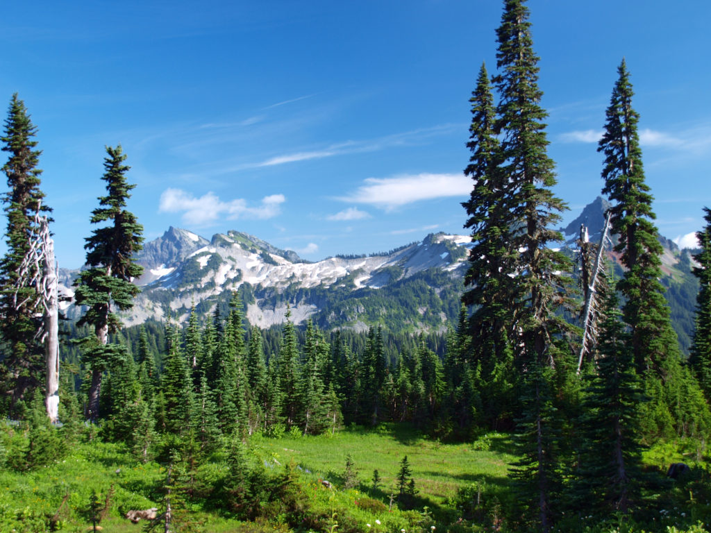

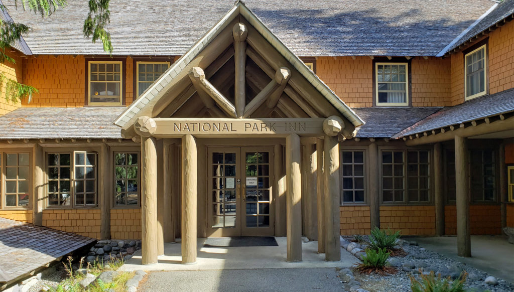 Both Paradise Inn and the National Park Inn have full service restaurants, but both were operating on a reduced scale due to the pandemic when we were there in August. The National Park Inn dining room was closed, but take out meals could be ordered and picked up at the reception desk in the lobby. The dining room at Paradise Inn was open for dinner only for most of our visit, but closed (unexpectedly) for the season on our last day there. Paradise Inn also has a limited service cafe, and there is a cafeteria at the Jackson Memorial Visitor Center that is open daily during the summer season and on most weekends and holidays in the winter (depending on road conditions). The National Park Inn restaurant is open year round.
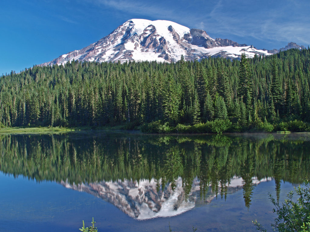
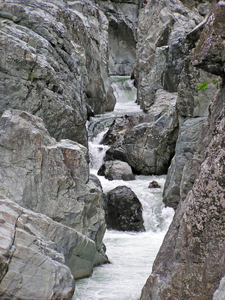
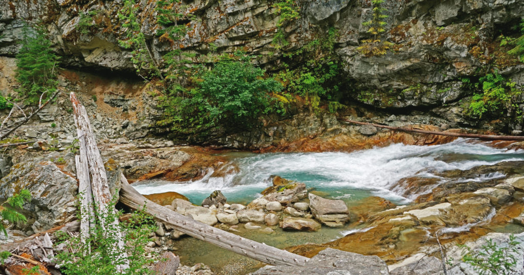
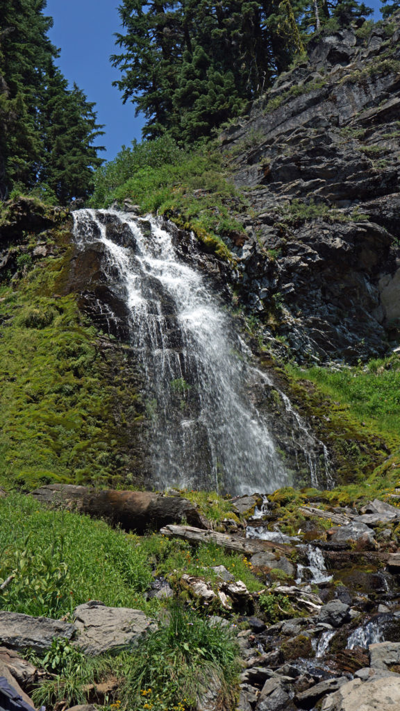
 The nearby Snow Lake Trail is an easy and worthwhile hike. To the east, the Stevens Canyon area has a number of interesting areas, including Box Canyon, a 180 foot deep slot canyon, and a number of roadside waterfalls.
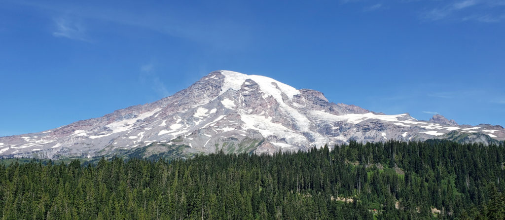 The Longmire area has some interesting history, a museum, nice hiking trails, and the National Park Inn offers both lodging and dining options for the visitor. The road to Longmire is also plowed in the winter, so it’s a year round destination. (The road from Longmire to Paradise is open in winter when the weather allows.)
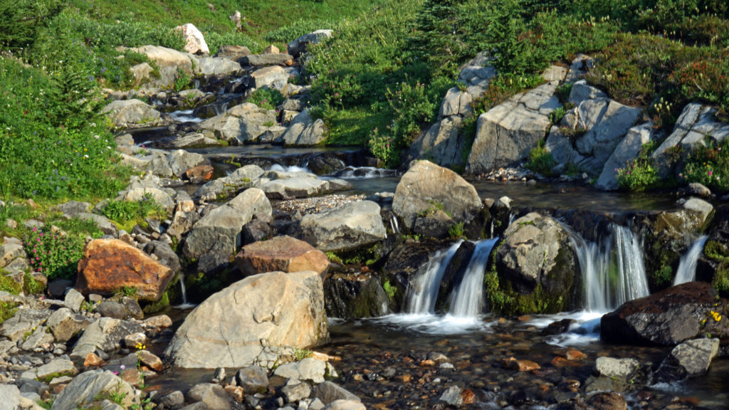
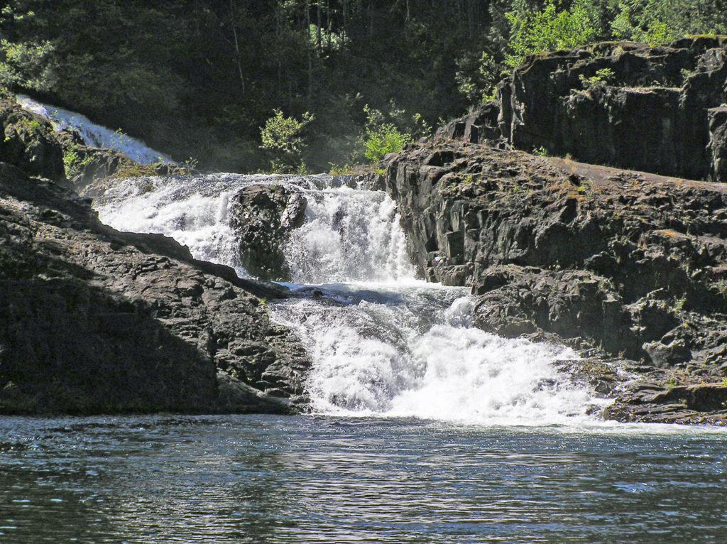
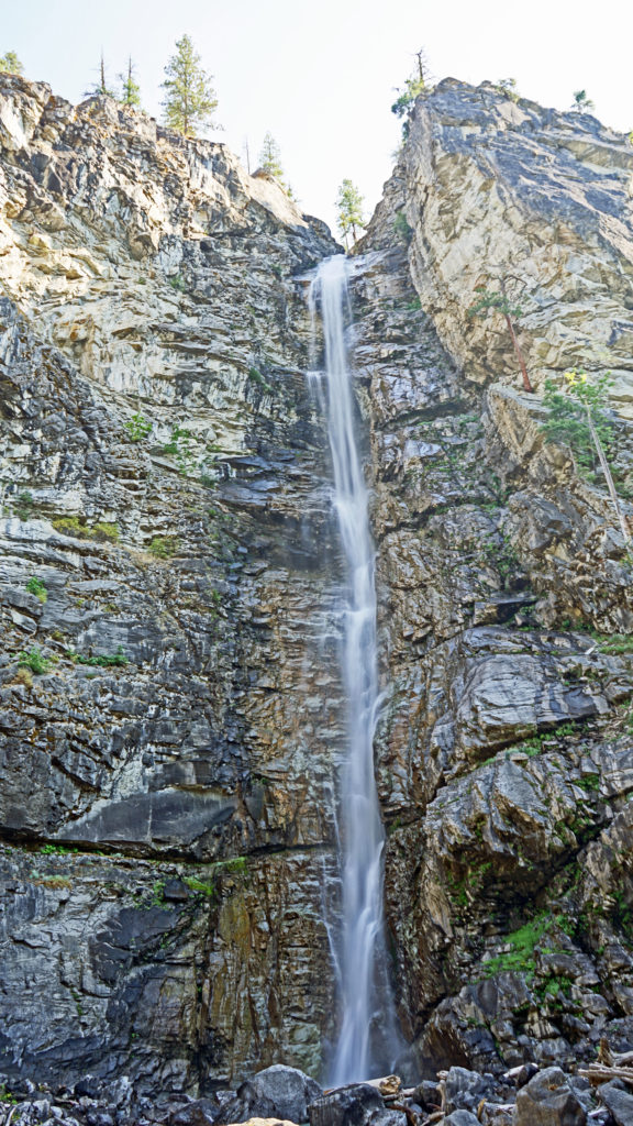
 In the Ohanapecosh area in the southeastern corner of the park, the Grove of the Patriarchs Trail is a good family friendly outing. And the nearby Silver Falls Trail is a must for waterfall lovers. In the northeastern section of the park, the Sunrise area offers beautiful views of the eastern side of the mountain and has an abundance of hiking trails.

 The Lake
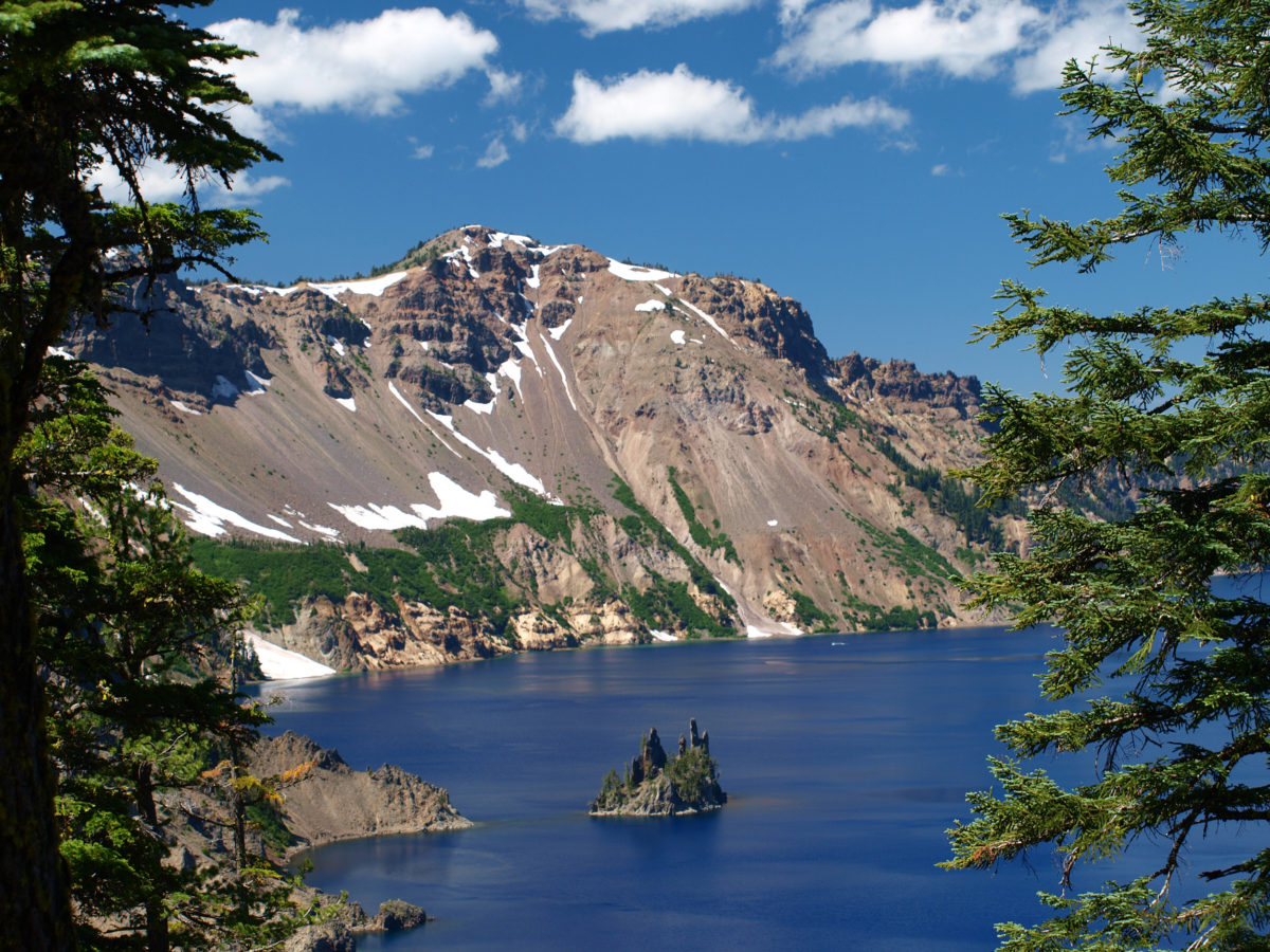
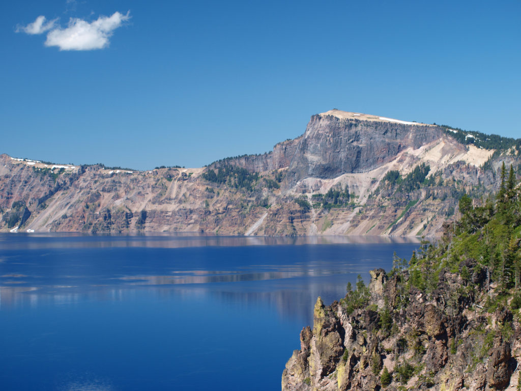 Crater Lake is 1943 feet deep, making it the deepest lake in the United States, second deepest in North America, and ninth deepest in the world. It is also one of the cleanest and clearest lakes in the world. It’s that combination of depth and clarity that results in its intense deep blue color.
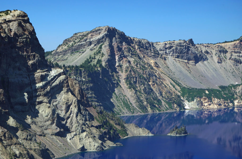 The caldera that Crater Lake occupies was formed 7700 years ago when the summit of 12,000 foot tall Mount Mazama collapsed after a massive eruption. Over time rain and snow filled the caldera to its present level. The lake has no outlet. The level of the lake remains nearly the same because the amount of evaporation from the surface of the lake closely matches the amount of precipitation falling on it in any given year.
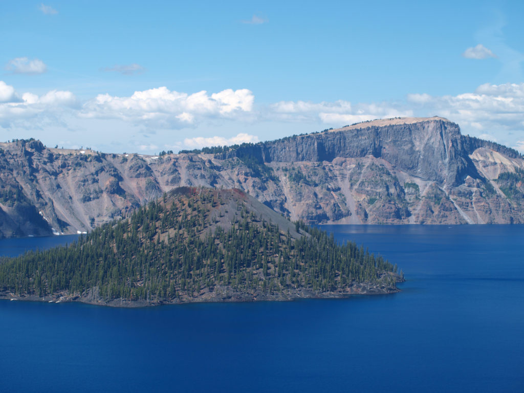 Wizard Island formed sometime after the eruption that formed the caldera. It rises 770 feet above the surface of the lake, 2713 feet above the deepest point in the lake. It last erupted about 5000 years ago, but it is considered dormant, not extinct. Conceivably, it could erupt again at any time. Merriam Cone also erupted after the caldera was formed, but never reached the lake surface. Its summit lies almost 500 feet below the average lake level.
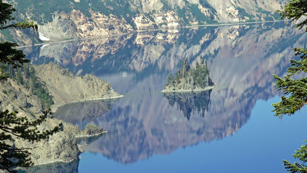
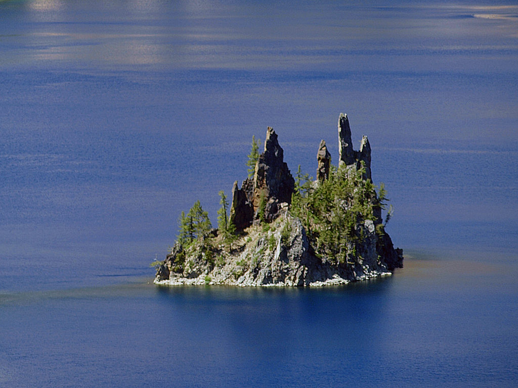 Phantom Ship, a remnant of an eruption 400,000 ago, rises 170 feet above the lake surface. Its formation predates that of Mount Mazama itself.
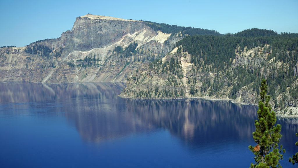 The Park
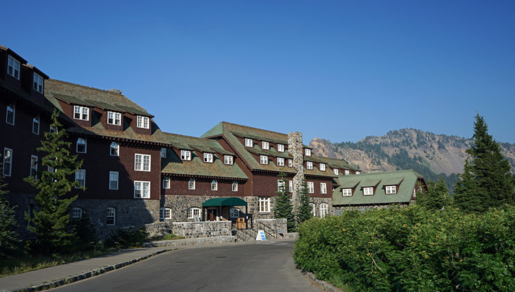 Crater Lake Lodge
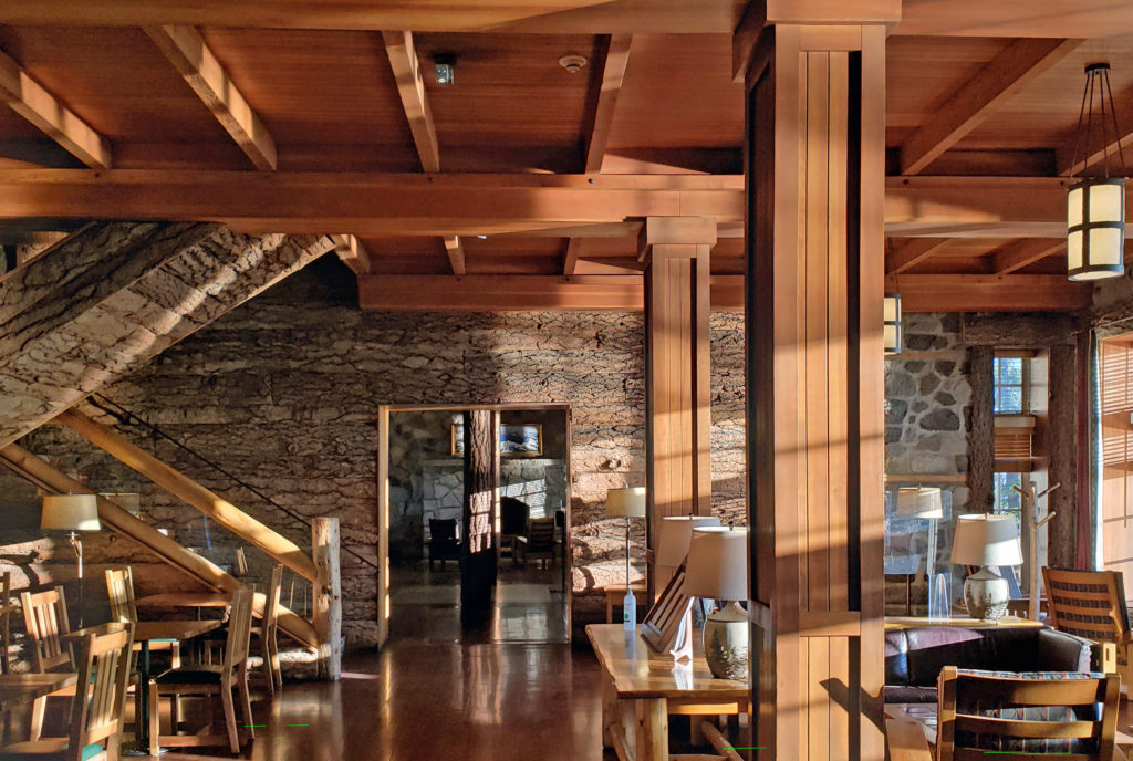 My wife and I recently spent three nights at the lodge. Although it lacks the amenities of a luxury hotel, our room was comfortable, with a private bathroom, and the location more than makes up any lack of luxuries.
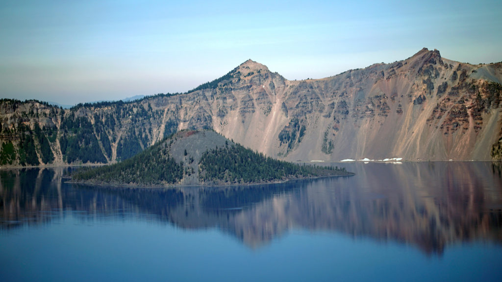 The Rim Drive
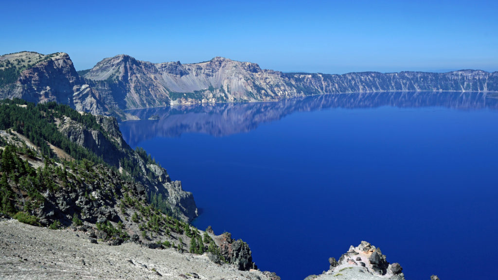
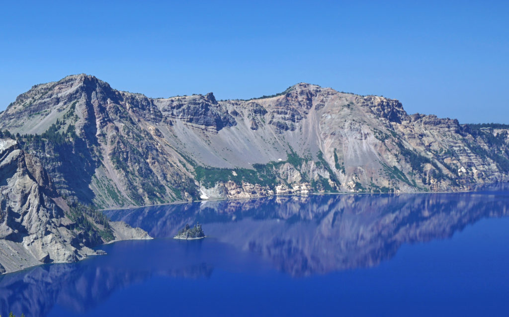 You’ll want to stop at all of the viewpoints. Maybe combine the drive with a hike down to Cleetwood Cove and a boat tour of the lake. You can get off at Wizard Island and hike to the summit and then catch a later boat back.
 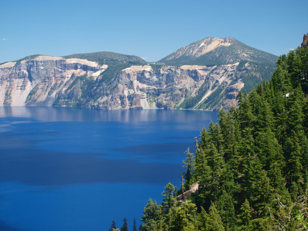 For a more adventurous day, hike to the summit of Mount Scott, the highest point in the park. It’s a two mile hike to the summit with 1250 feet of elevation gain, so it’s not an easy hike (All Trails rates it “moderate”), but the view might just be worth the effort.
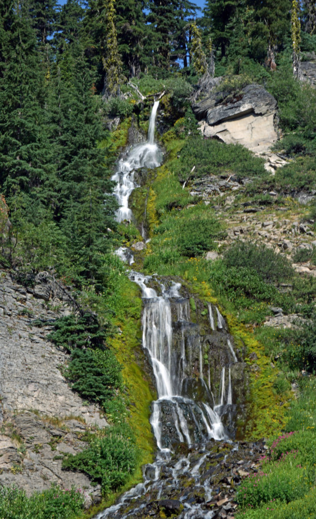
 Hiking Trails
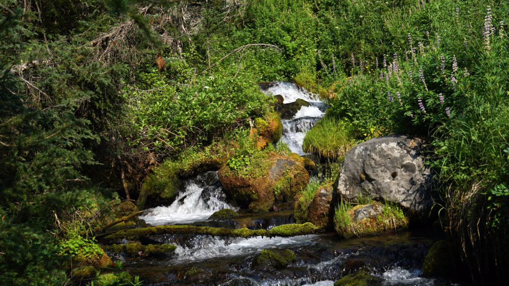 The Pacific Crest Trail passes through the park, but does not ascend to the rim of the caldera. Hikers on the PCT can take the Dutton Creek Trail that climbs up to the Rim Village, then hike the trail that parallels the West Rim Drive and reconnect with the PCT north of the lake.
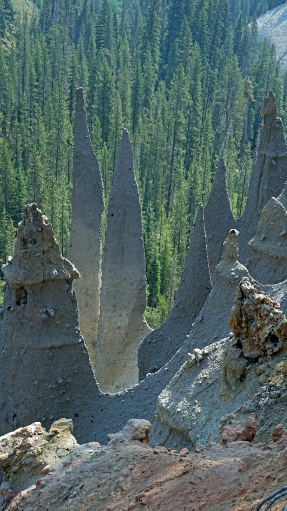
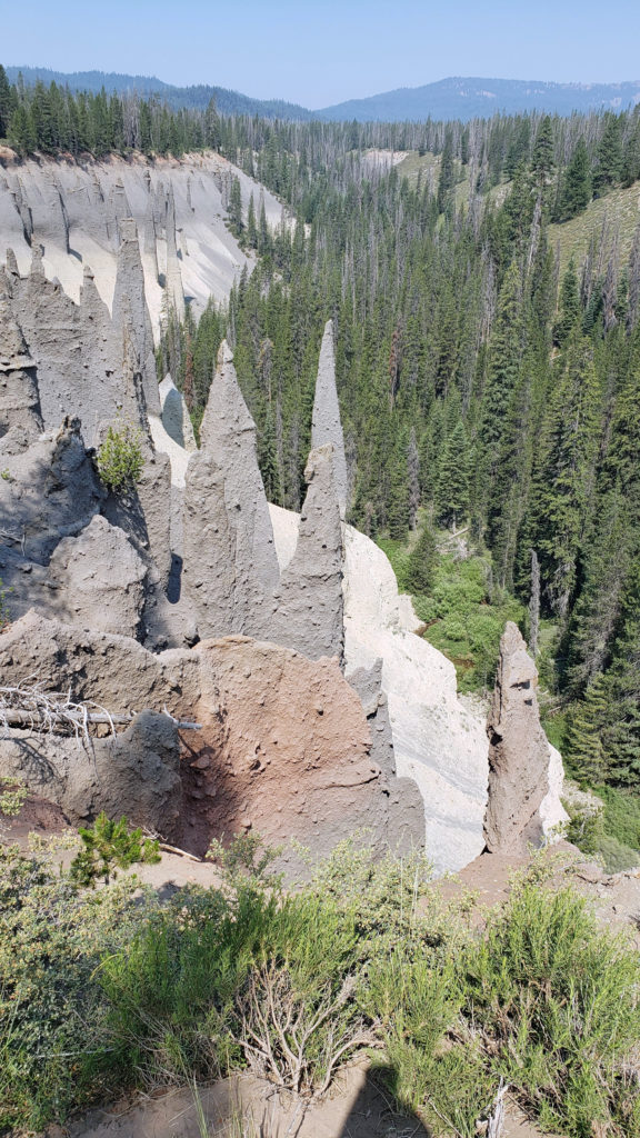 The Pinnacles
 Practical Info
 There are two lodges in the park, Crater Lake Lodge in the Rim Village and The Cabins At Mazama Village that are open for the summer season. Crater Lake Lodge has 71 rooms, starting at $246/night. The Cabins At Mazama Village has 40 rooms, all at $160/night. Prices listed are for the 2024 season. Note that the concessionaire that operates both lodges is changing, so prices may also change. Check the park website (linked above) for current information.
 There are two campgrounds in the park. Mazama Campground has 75 RV sites, 18 tent sites with electricity, and 121 tent sites without electricity. Tent sites start at $22. RV sites run from $32 to $44 per night. Mazama Campground is usually open from early June through late to September. Lost Creek Campground, located on Pinnacles Road, is a primitive tent only campground with 18 sites, operated by the park service. Lost Creek Campground is currently closed and will not be open for the 2024 season. Backcountry camping is allowed in the park by
 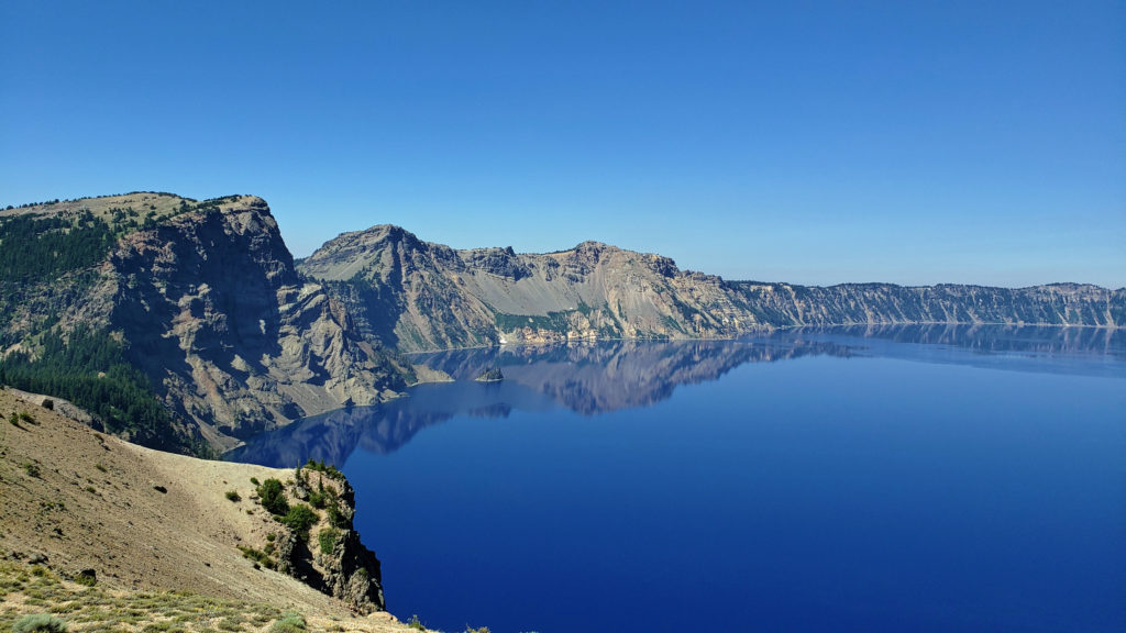 Dining options in the park are somewhat limited. The dining room at Crater Lake Lodge is open to all visitors, but reservations can only be made by people staying in the park. The Rim Village Cafe offers “grab and go” sandwiches and salads (I had a pulled pork sandwich from there on our recent visit that was very good). It is open from 9am to 8pm in the summer and 10am to 5pm in the winter. The Annie Creek Restaurant in Mazama Village is open from 7am until 9pm. The Mazama Village Store sells packaged sandwiches and snacks.
 Summer park entrance fees are $30 for private vehicles and $25 for motorcycles. Winter fees are $10 less. Snowmobilers, bicyclists, and pedestrians are charged $15 per individual. All entrance fees are good for seven days. Entry reservations do not need to be made.
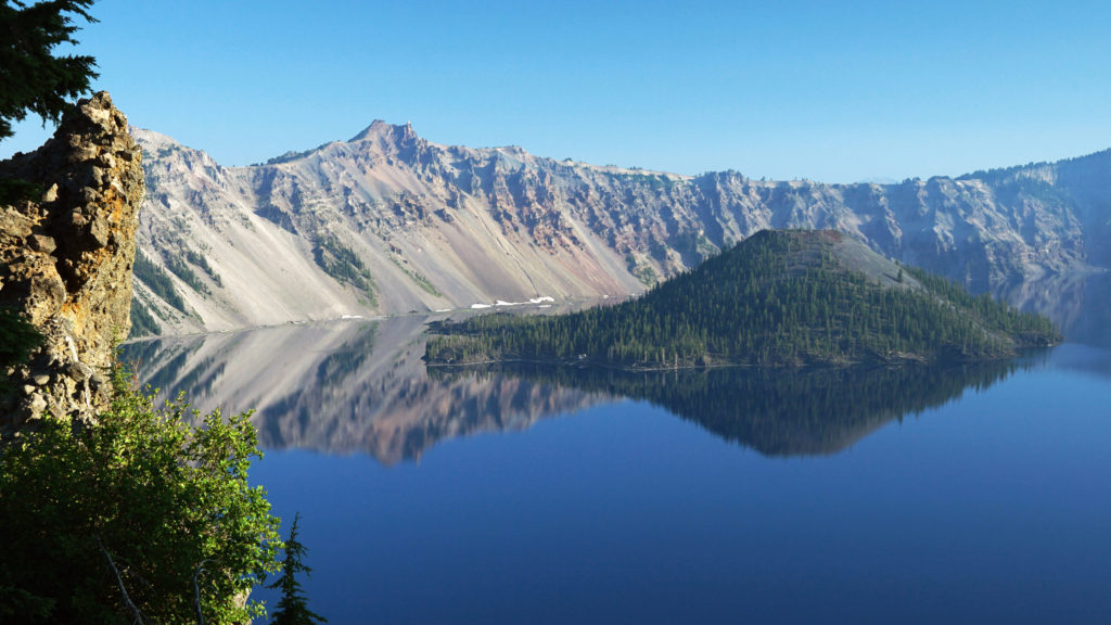
 Originally posted September 13, 2021. Most recently updated April 6, 2024.


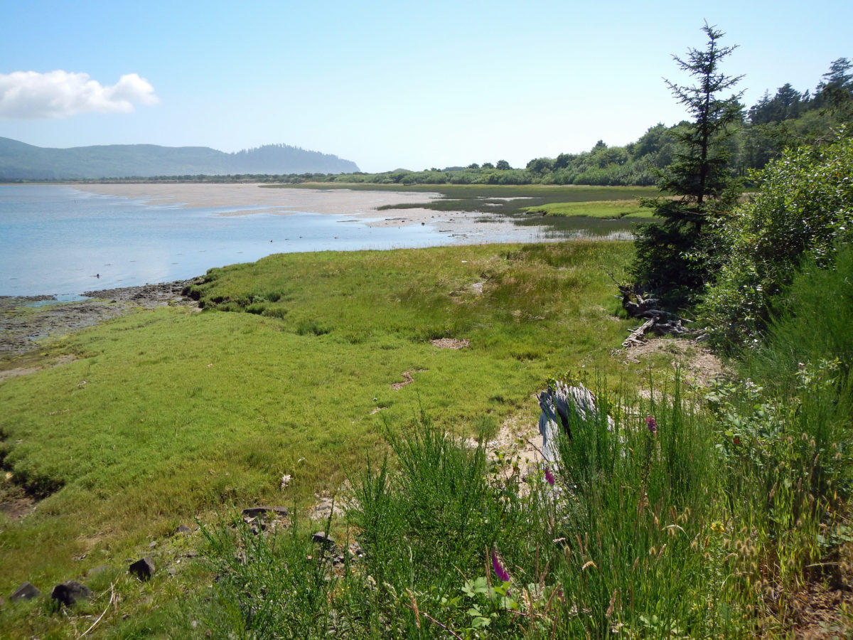
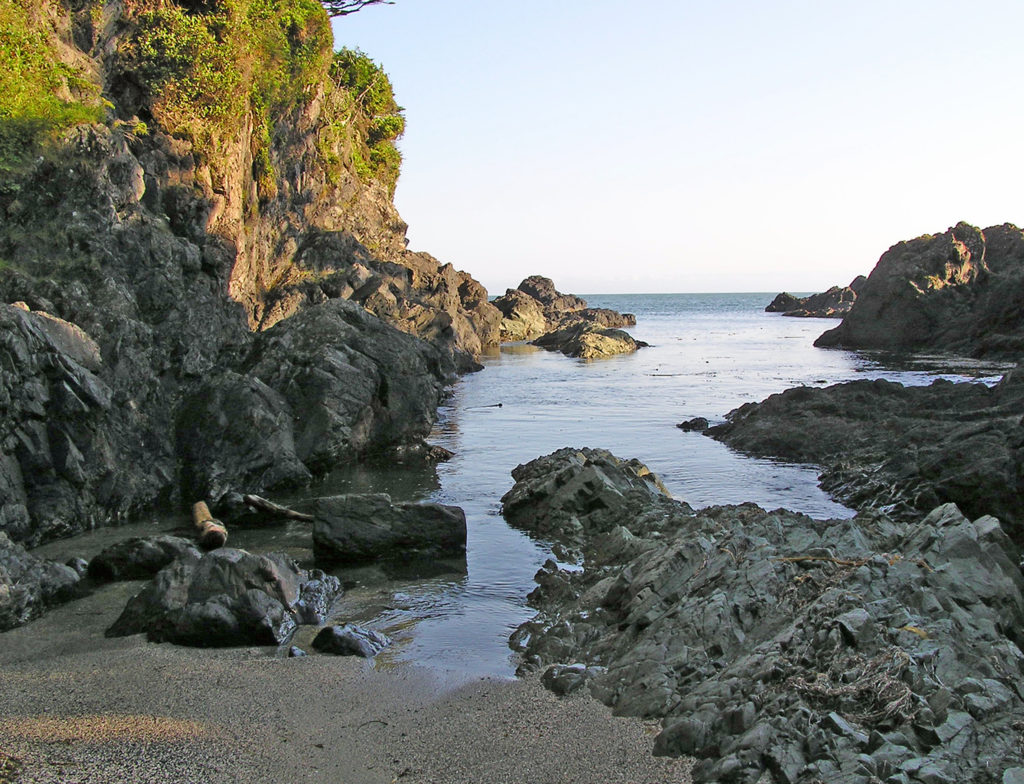
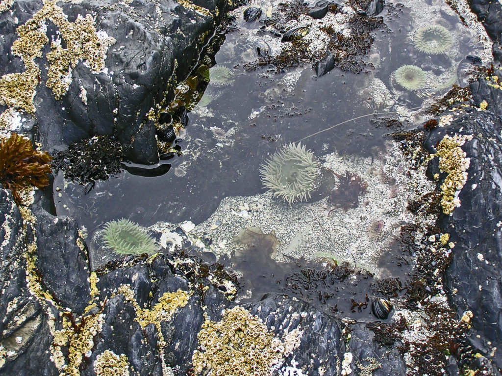
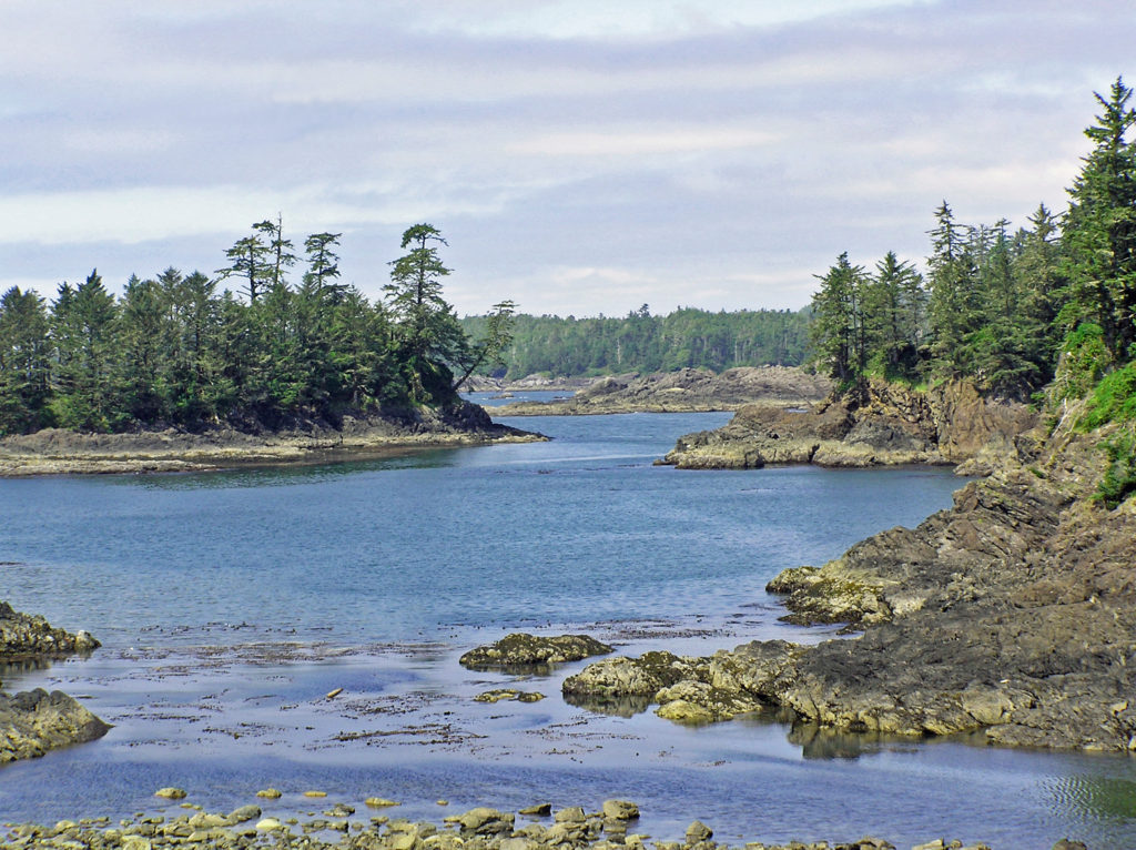
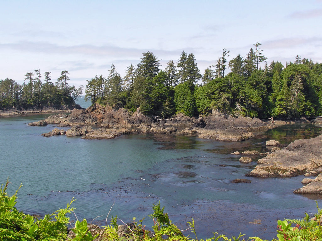
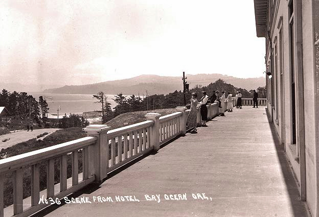
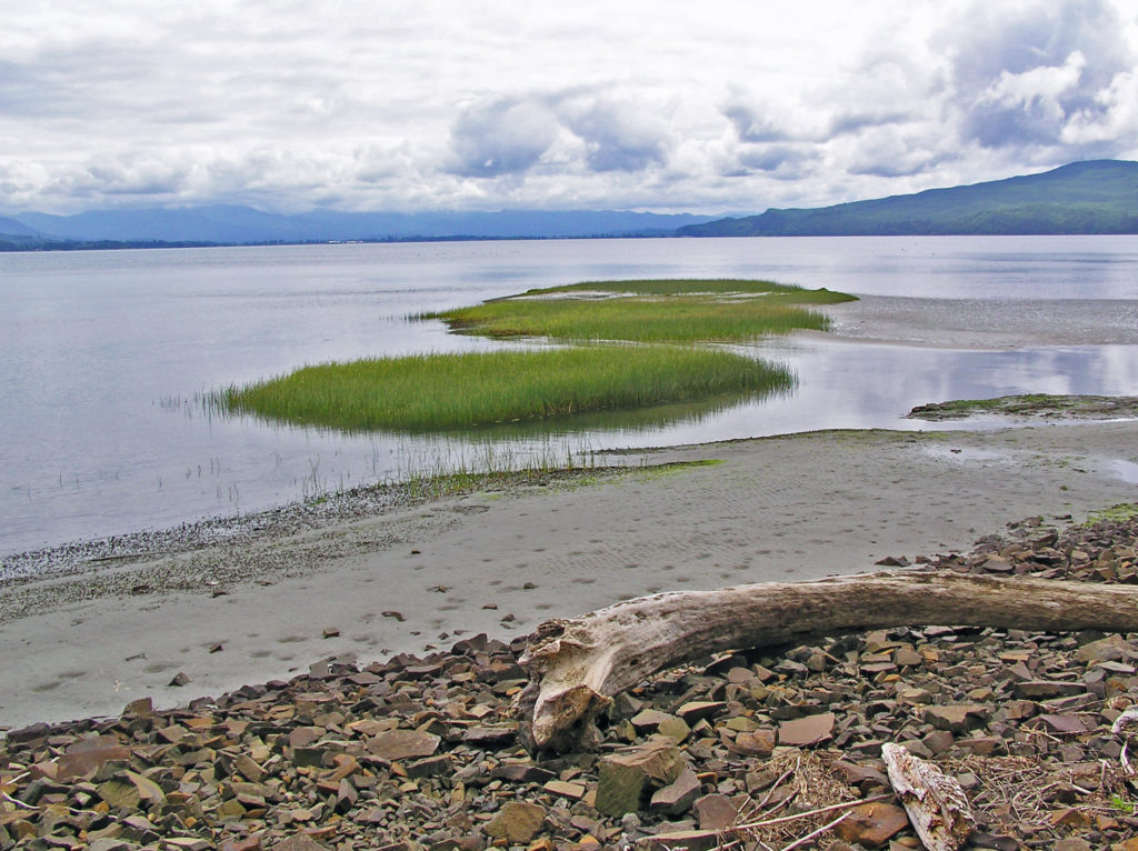
 Bayocean Peninsula, on the northern Oregon coast, is a sandspit that separates Tillamook Bay and the Pacific Ocean. It is, by any measure, a nature lover’s paradise, whether you’re a beachcomber, hiker, mountain biker, boater, birder, wildlife lover, or photographer.
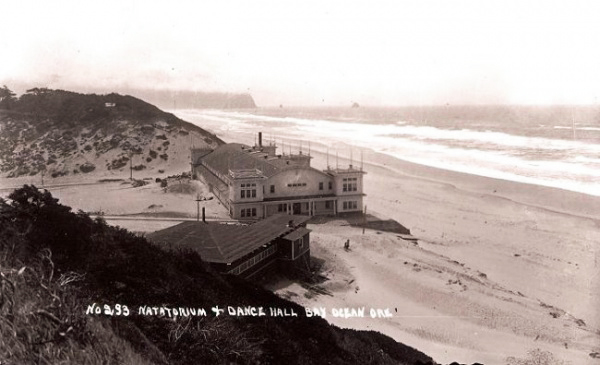
 To make crossing the Tillamook bar safer, the Army Corps of Engineers recommended jetties be built on both the north and south sides of the bay’s mouth. But half of the cost (a then considerable $2.2 million) would have to be paid by local residents. To cut the cost to a more affordable amount, the local port district proposed building only one jetty. The resulting north jetty, completed in 1917, did make crossing the bar much smoother and safer, but it also contributed to the town’s demise by changing the near shore currents, which began eroding away the beach in the 1920s.
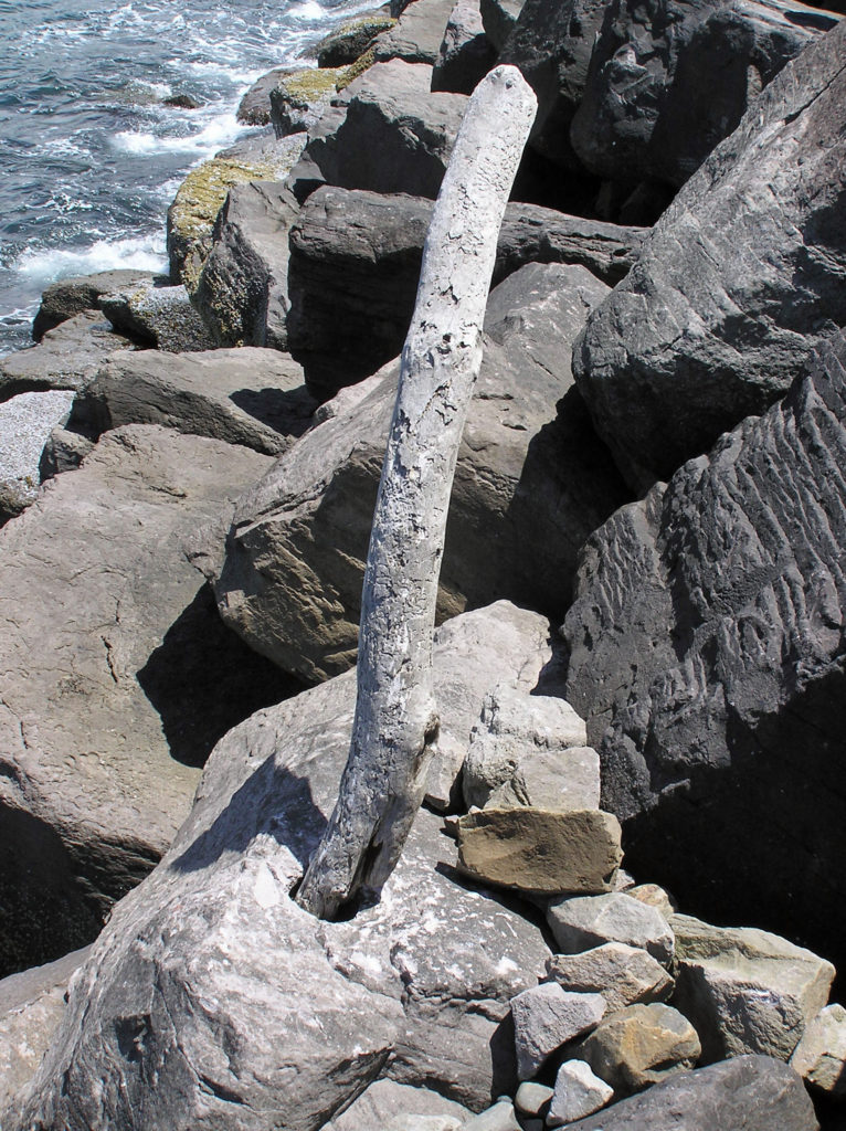 In 1932 the north jetty was extended, further accelerating the erosion. The natatorium was destroyed by waves during a massive storm that winter. By 1938 almost 60 homes had fallen into the sea. Other storms over the years took many of the remaining buildings, and in 1952 another major storm breached the southern end of the peninsula, turning Bayocean Peninsula into an island. The Bay Ocean Park post office closed in 1953 and most of what was left of the town was bulldozed by the Corps of Engineers in 1956 during a project to build a dike across the breach created in 1952. The last house on the peninsula washed away in 1960, and the last structure, a long abandoned garage, fell into the sea in 1971.
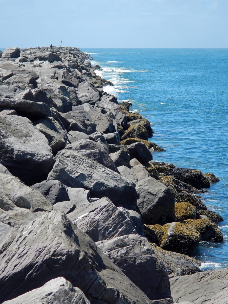
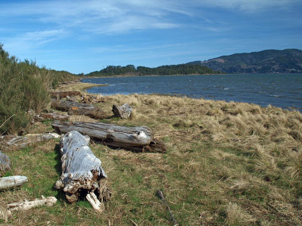 The south jetty was eventually built in the 1970s and that stopped the erosion of the peninsula, but by then the town of Bay Ocean Park was long gone. Today, nothing remains of the town. What’s left, though, is a treasure trove of delights for the outdoor enthusiast: miles of untrammeled beach, unspoiled dunes, a bay shore sheltered from the prevailing winds, an upland spruce and pine forest, and an abundance of waterfowl and other wildlife. The haul road used in building the south jetty is now an ideal mountain bike and hiking trail on the bay side of the peninsula.
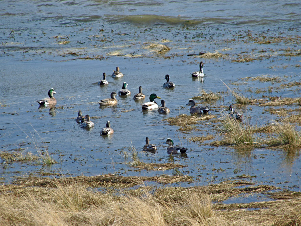 To reach Bayocean from the town of Tillamook, follow the signs for the Three Capes Scenic Route (Oregon Highway 131). After crossing the Tillamook River bridge, turn right onto Bayocean Road toward Cape Meares. At milepost five, turn right onto the old south jetty haul road (aka the dike road) and proceed to the trailhead parking area. There are pit toilets at the trailhead, but no water.
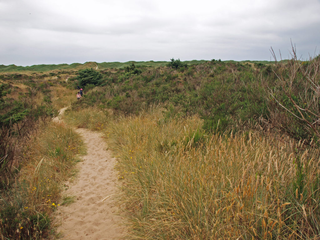 From the trailhead, the road continues north beyond a locked gate. You can also hike through the dunes to the beach from the trailhead parking area. The road along the bay shore is mostly gravel, with a few sandy stretches, and mostly flat. It’s an easy four mile bike ride to the south jetty.
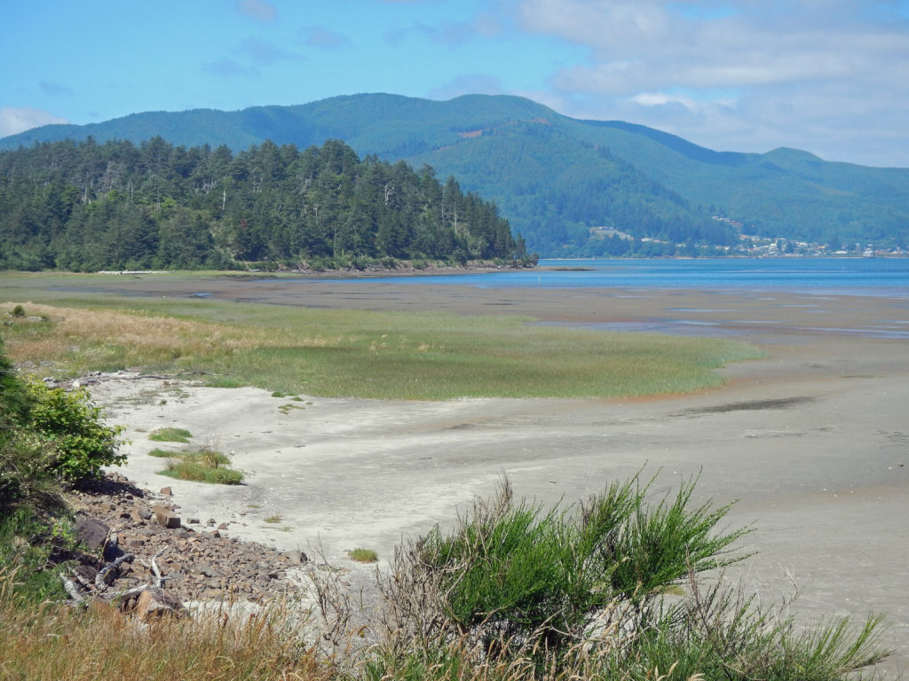 Hikers can do a 7½ mile loop by hiking through the dunes to the beach, walking the beach to the south jetty, and returning along the bay side on the gravel road. There are several trails connecting the dike road to the beach, making shorter loops possible. And a longer hike or bike ride (10 mile loop or 9 mile out and back along the beach) can be done by starting at the beach access in the town of Cape Meares, instead of the Bayocean trailhead. See my
 The north Oregon coast has much to offer beyond Bayocean Peninsula, of course.
  Originally posted April 23, 2019 by Alan K. Lee, updated July 8, 2021 and March 4, 2024