Sitka, Alaska

by Alan K. Lee

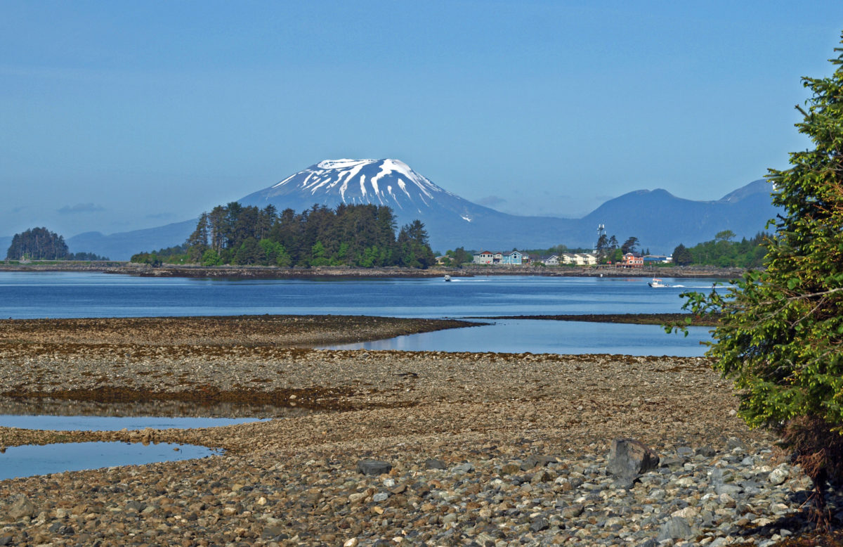
Sitka, Alaska is located on a protected harbor on the western shore of stunningly beautiful  Baranof Island in Southeast Alaska. To the west of the city many small islands dot Sitka Sound, and Mt. Edgecumbe, a dormant volcanic cone, rises 3200′ above the sound on Kruzof Island. To the north and east, Harbor Mountain and Mount Verstovia tower over the city, forming a dramatic backdrop.

Sitka Waterfront

My most recent visit to Sitka came in 2018 when my wife and I flew there to visit a friend of hers who had recently moved back to Sitka after having lived in Portland for many years. It had been more than twenty years since we had last visited, but not a lot had changed in those two decades. The town was a little bigger, maybe a little more touristy, but still a low key, relaxed place where people don’t lock their car, and usually leave the keys in it without fear of it being stolen.

Sea Otter, Sitka Sound

Southeast Alaska is not traditionally considered part of the Pacific Northwest, but they are close geographically, are similar ecologically, and have closely linked cultures and histories, so I’m going to stretch the definition of the Pacific Northwest a little and include Sitka in the Northwest Destinations category here.

Sitka Sound

The weather in Southeast Alaska is always chancy. On our first visit, there were low clouds blocking views of the surrounding mountains the whole time we were in Sitka, and the only sunshine we saw on our two week trip was in Ketchikan on the day we flew in and again on the day we flew out. But this time we had sunshine and blue skies for most of our four days in Sitka.

Indian River

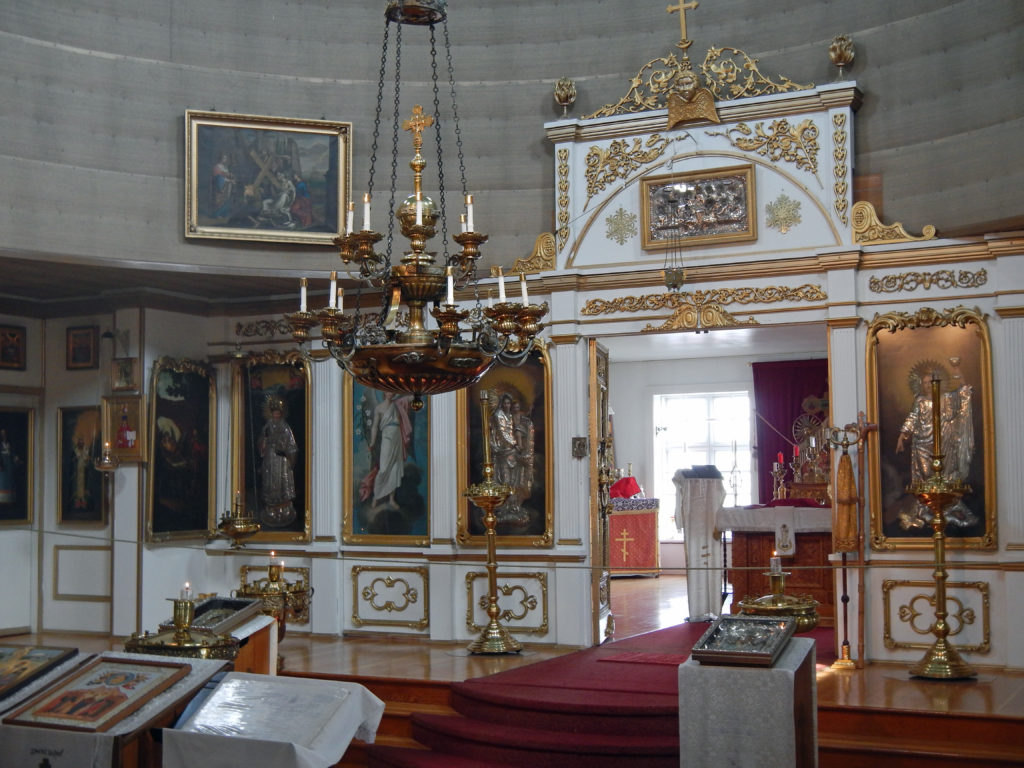
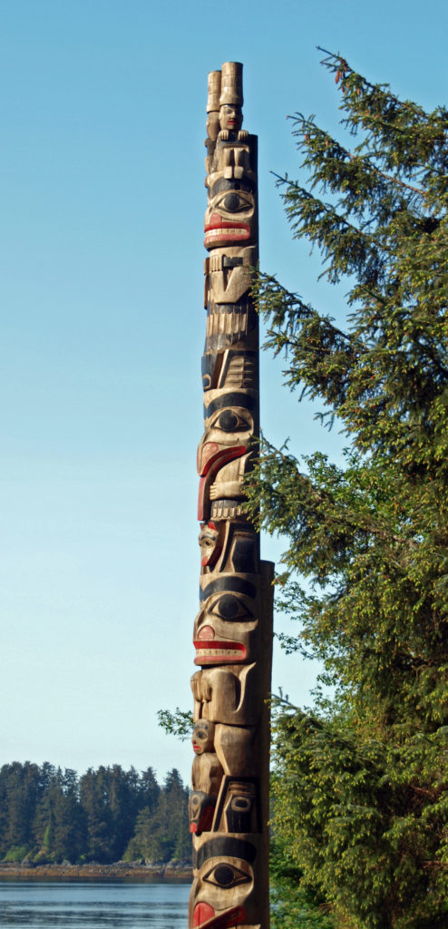
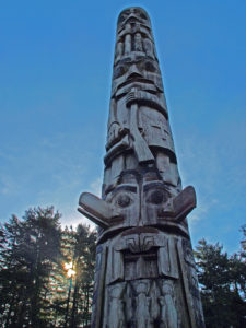
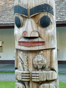
Sitka is an interesting and unique blend of Native American, Russian, and American cultures. The Tlingit people have inhabited the area for thousands of years. The name Sitka derives from the Tlingit name for the area, Shee Atika. In the 1740s Russians began exploring the area, and in 1799 Fort St. Michael was established at the present site of Sitka. The Tlingits burned down the fort in 1802, but the Russians returned two years later and forced the Tlingits out of the area. The Russian community of New Archangel, which became Sitka when the United States purchased Alaska from Russia in 1867, was founded in 1804 on the site of the destroyed Fort St. Michael. In the early 1820s some of the Tlingit people returned to the area, and there is still a Tlingit community in Sitka today. The Russian influence is also still present in modern Sitka. St. Michael’s Cathedral is an active Russian Orthodox church.

St. Michael’s Cathedral

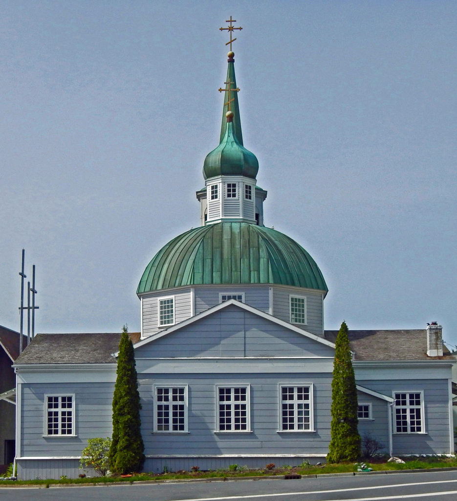
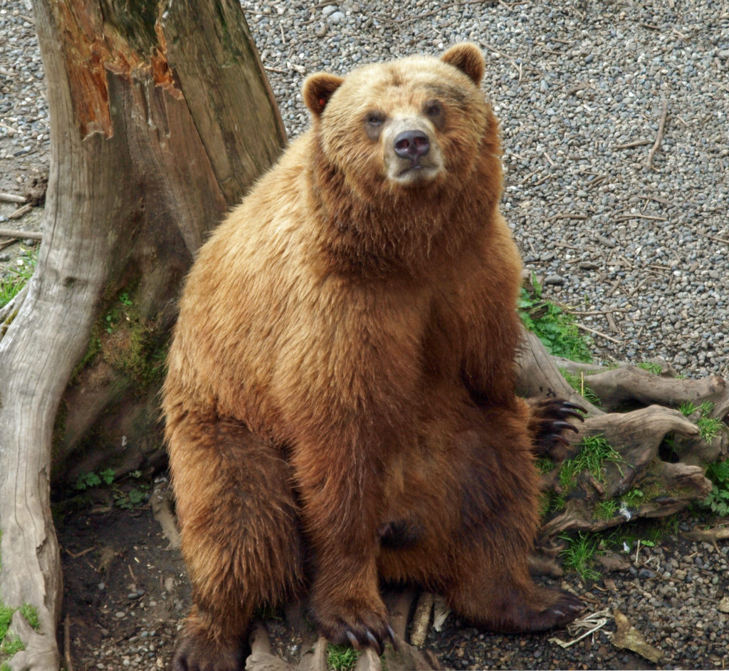
In town, the Sitka National Historical Park (locally known as Totem Park) is a must see, as are the Alaska Raptor Center, St. Michael’s Cathedral (built between 1844 and 1848), the Russian Bishop’s House (1842), and the Sitka Historic Museum. The Sheldon Jackson Museum, the Sitka Sound Science Center, the Lutheran Cemetery, and the Russian Cemetery are also definitely worth visiting. Sitka is a very walkable city, and all of the above are within easy walking distance of the city center. It’s also a very bike friendly city, and renting a bicycle is a good way to get around town. A few miles outside of town, the Fortress of the Bear, a non-profit refuge for orphaned cubs, offers close up views of brown bears, if you are so inclined.

Bald Eagle, Alaska Raptor Center
Sitka National Historical Park


Alaska Brown Bear, Fortress of the Bear

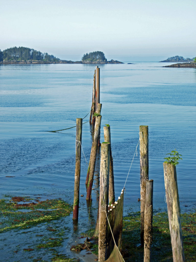
If you’re a fisherman, Sitka offers world class salmon and halibut fishing in the offshore waters. The Sitka Salmon Derby is held every May and June. The inland streams and lakes also offer quality fly fishing opportunities. For hikers, there are several trails that begin in Sitka, from the relatively flat Indian River Trail to the much steeper Verstovia Mountain Trail and Gavin Hill/Harbor Mountain Trail. Other hiking trails begin north and south of the city. Kayaks and boats can be rented in the city, and Sitka Sound looks to be a kayaker’s paradise.

American mink, Indian River

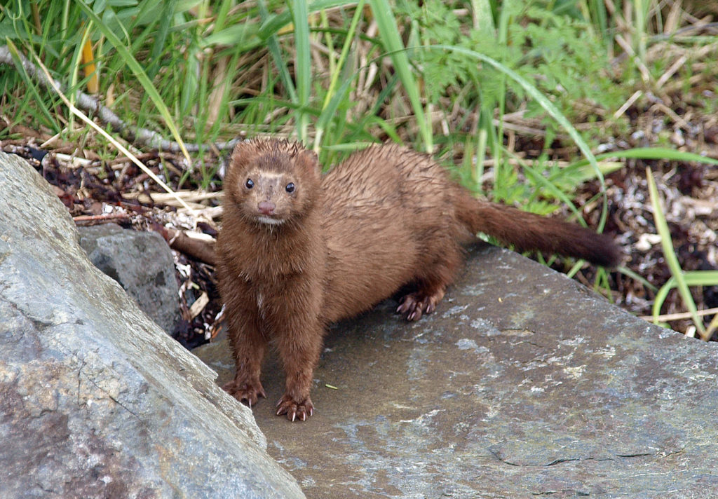
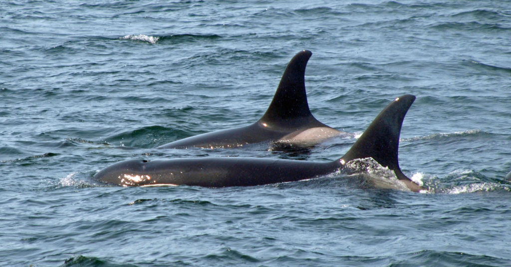
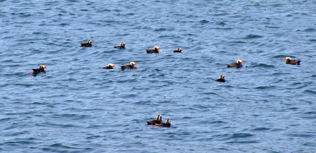
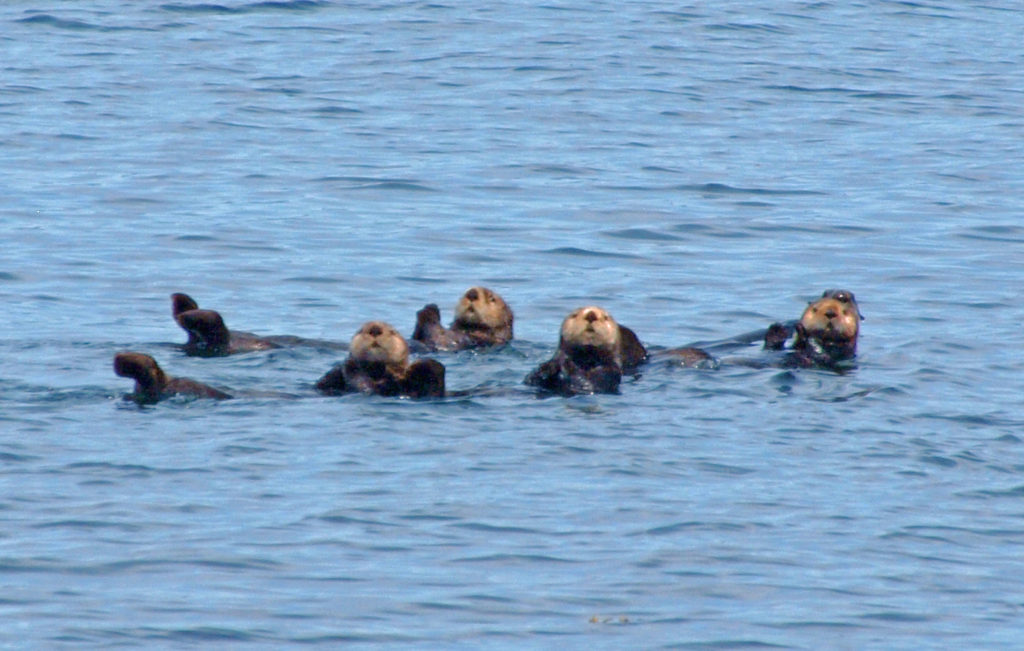
Flightseeing, ATV tours, hiking tours, city walking tours, car tours, kayak tours, and wildlife boat tours are all available in Sitka. On our trip, we took a sightseeing tour of Sitka Sound that was nothing short of incredible. I would highly encourage anyone who is planning a visit to find the time to do the same. We saw dozens of sea otters up close, probably fifty or more bald eagles, many other seabirds, seals, dolphins, humpback whales, and a pod of orcas, all within the space of about three hours.

Humpback Whale, Sitka Sound
Orcas, Sitka Sound

Sitka is also a very arts oriented town. In addition to numerous galleries in the city, the Sitka Jazz Festival is held every February, the Sitka Summer Music Festival is held in June or July, and the Sitka Fine Arts Camp and Arts & Science Festival for young artists is also held every summer. Other festivals include the Sitka Seafood Festival in August, The Alaska Day Festival (celebrating the transfer of Alaska from Russia to the United States) in October and the Sitka Whalefest in November.

Sitka National Historical Park


Sea Otter, Sitka Sound

Sitka, despite its remote location, is relatively easy to get to. Alaska Air has non-stop flights daily from both Portland and Seattle, making it possible to visit Sitka on a long weekend. If you have more time, Sitka is a stop on most Alaska cruises. And Sitka can also be reached by ferry, which is how my wife and I traveled there on our first visit. Check the Alaska Marine Highway website for schedules, fares, and other information. Other useful websites include Visit Sitka , Travel Alaska , Welcome To Sitka , and Trip Advisor.

Tufted Puffins, Sitka Sound

On our 2018 trip to Sitka we also visited Ketchikan and Juneau. The weather was so bad in Ketchikan that I took few photos and didn’t post anything from there. The weather was better in Juneau. Click here to view my post from Juneau.

Sea Otters, Sitka Sound

Originally posted July 30, 2018. Most recently updated May 30, 2023.

All photos © Alan K. Lee


Beaver Creek Loop Trail

Beaver Creek Loop Trail

Where:   Beaver Creek State Natural Area (now part of Brian Booth State Park)                       on the central Oregon coast

Distance:   2.7 to 3.3 miles, depending on starting point

Elevation gain:   Minimal

Difficulty:   Easy

Map:    Beaver Creek State Natural Area website

Overview:

You might not find this hike in any guide book, and that is a big part of its appeal. Thousands of people flock to the Oregon coast every weekend, even in the winter, but very few will make their way to Beaver Creek. You won’t find the trails crowded, even on a sunny day when Ona Beach, where Beaver Creek flows into the ocean, is elbow to elbow with people. You won’t find an old growth forest on this hike, nor any grand views or waterfalls. The woods and marsh are pretty enough, but can’t compete with the scenic attractions of the beaches and headlands only a few miles away. But what you will find at Beaver Creek is peace and quiet. You may see blacktail deer, maybe a beaver or river otter in the creek, possibly a bald eagle or an osprey flying overhead. More than 75 species of birds can be found at Beaver Creek, so bring your binoculars. You’ll probably encounter a few other hikers on the trail or see people paddling the creek. But you’ll also be able to find some solitude here.

Beaver Creek Marsh

Getting there:

Beaver Creek State Natural Area is located about eight miles south of Newport, just off Hwy 101 on the central Oregon coast. At Ona Beach, turn east off of Hwy 101 onto North Beaver Creek Road instead of west into the beach parking lot. In 1.2 miles, you’ll come to the park’s visitor center (called the Welcome Center) on your right. The visitor center is open daily from 12:00 to 5:00. The staff will be happy to answer any questions you may have. You can get a map and brochure there, but I’d print out the map from the park website (linked above) before you leave home just in case. The first time I hiked this loop I didn’t have a map. The trail junctions we’re signed for the most part, but there were a few places where a map would have been a big help.

Trailheads:

Beaver Creek Loop Trail

You can start the hike at the visitor center in the summer and fall when the water level in the marsh is low. Ask at the visitor center if the trail across the marsh is passable.

There’s also a parking area along the road a few hundred yards east of the Welcome Center, so you can also start the hike there if you choose. You may also be able to get a map at the kiosk there.

From late fall through late spring the trail across the marsh will likely be submerged. If so, head back toward the beach on North Beaver Creek Road. In about a quarter mile, turn left onto South Beaver Creek Road. In just over one mile, look for a gate on the left side of the road with an Oregon State Park sign. Park at a pullout on the right side of the road just beyond the gate. Walk around the gate and up a service road. In a little less than half a mile you’ll come to a junction with the Beaver Creek Loop Trail on your right. You can either turn right onto the trail there (to do the loop in a counterclockwise direction), or walk up the road a couple hundred yards and pick up the trail just beyond a group of agricultural buildings (to do the loop in a clockwise direction).

Beaver Marsh Trail

The hike:

Starting at the visitor center, take the Beaver Marsh Trail east. In little over a quarter mile you’ll come to a boardwalk that takes you to a viewing platform out in the marsh. Beyond the boardwalk, the trail leads through the marsh to a bridge over Beaver Creek. On the other side of the bridge, you’ll come to a junction with the Beaver Creek Loop Trail. The loop can be hiked in either direction, but for our purposes we’ll turn right and do the hike counterclockwise.

Beaver Creek Loop Trail

From the bridge the trail follows an old access road (this area was privately owned until the early 2000s). In a quarter of a mile you’ll come to the junction with the North Fork Trail. If you’re pressed for time or just want a short hike, the North Fork Trail offers the shortest loop here (1.6 miles, starting and ending at the boardwalk parking area). Continuing on the main loop trail, you’ll come to the junction with the Snaggy Point Trail in another quarter of a mile. This is a popular trail that climbs 360 feet to a viewpoint overlooking the marsh and the Pacific Ocean beyond, then continues east to rejoin the main loop trail.

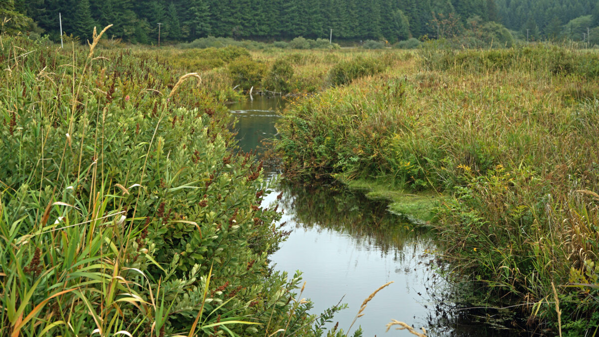
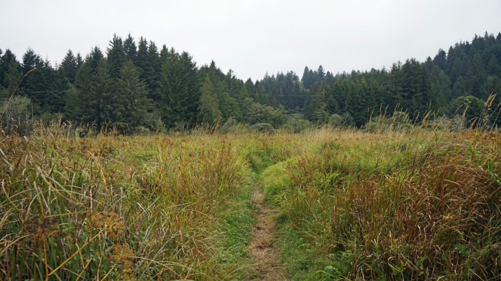
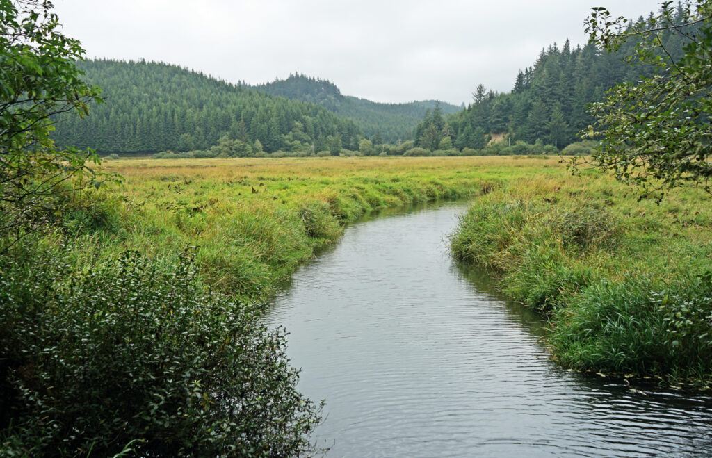
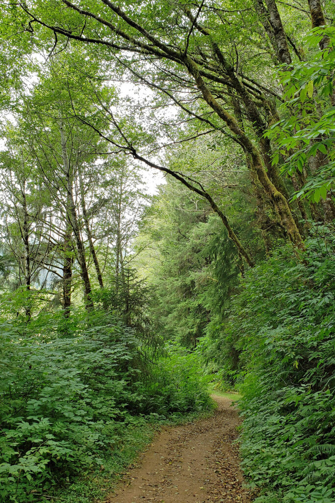
Beyond the Snaggy Point Trail junction, the loop trail continues through the forest along the edge of the marsh to a junction with the Antler Overlook Trail, which connects to the Cooper Ridge Trail and provides another overcrossing of the upland area. The main loop trail then continues through the forest to the agricultural  buildings mentioned in the winter trailhead description. Beyond the buildings walk up the service road for a couple hundred yards and look for the loop trail branching off to the left. The trail follows the edge of an open field.

Beaver Creek Loop Trail

In another quarter of a mile you’ll come to a junction with the Elk Meadows Trail, an 0.8 mile loop through the woods and a couple of meadows. The main loop trail continues along the eastern edge of the Beaver Creek State Natural Area for another three quarters of a mile, passing the Cooper Ridge and Snaggy Point trail junctions, to the bridge across Beaver Creek and the trail back across the marsh.

Beaver Creek

With the out and back Beaver Marsh Trail, the full hike is 3.3 miles from the visitor center, 2.7 miles if you start and end the hike at the boardwalk parking area instead of the visitor center, and 2.9 miles from the winter trailhead. Add 0.8 mile to those numbers for Elk Meadow Trail extension. You can also make it a longer hike by taking a side trip through the upland area. All together there are a little over six miles of trails to explore in the park.

Beaver Creek

Other area attractions and activities:

Besides hiking the Beaver Creek Loop and the upland trails, another way to explore the area is by canoe or kayak. Just east of Hwy 101, there is a parking area and boat ramp on Beaver Creek that is an ideal launching point. The creek is a flat water paddle with little current, so it’s a good place for kids and beginners to try their hand at getting out on the water. It’s also possible to launch a canoe or kayak at the boardwalk parking area east of the visitor center and paddle across the marsh to the creek.

Ona Beach

And, of course, the beach is right there. Rest your legs after your hike and lounge on the sand at Ona Beach for a while and watch the waves. Or, if you’re up for more hiking, it’s only a 1.5 mile walk on the beach to Seal Rock, one of the more scenic spots on the central coast.

God’s Thumb

Other interesting hikes in the central coast area that could easily be paired with Beaver Creek include God’s Thumb and Drift Creek Falls in the Lincoln City area. (Look for a post on the Drift Creek Falls hike later this spring.)

Tufted Puffin. Photo from the Oregon Coast Aquarium website.

And in the South Beach section of Newport, just south of the bay bridge, there are two attractions well worth a stop on your way to or from Beaver Creek. The Oregon Coast Aquarium is one of the Pacific Coast’s premier aquariums, and Oregon State University’s Hatfield Marine Science Center is home to one of the country’s top marine science education and research programs. The Oregon Coast Aquarium is open 10:00-5:00 daily. Ticket prices range from $15 for children 3-12 to $25 for adults. Admission for seniors (65+) and teens (3-17) is $20. Infants and toddlers get in free. Tickets can be purchased online or at the gate. The visitor center at the Hatfield Center is open 10:00-4:00 Thu-Mon. Admission is $5 (ages five and up) and tickets need to be purchased online on the center’s website.

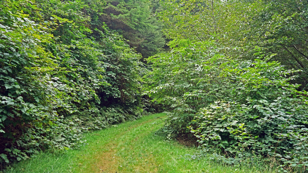
Posted March 14, 2023 by Alan K. Lee

All photos ©Alan K. Lee, except as noted