
The Trail of Ten Falls
Where: Silver Falls State Park
Distance: 7.2 miles
Elevation gain: 800 feet
Difficulty: Moderate (for length a steep climb out of the canyon)
Map: Oregon State Parks map and brochure
Guidebooks:
Hiking Waterfalls in Oregon by Adam Sawyer
Afoot & Afield: Portland/Vancouver by Douglas Lorain
100 Hikes in the Central Oregon Cascades by William L Sullivan
Waterfall Lover’s Guide: Pacific Northwest by Gregory A. Plumb
Waterfalls of the Pacific Northwest by David L. Anderson
Overview:
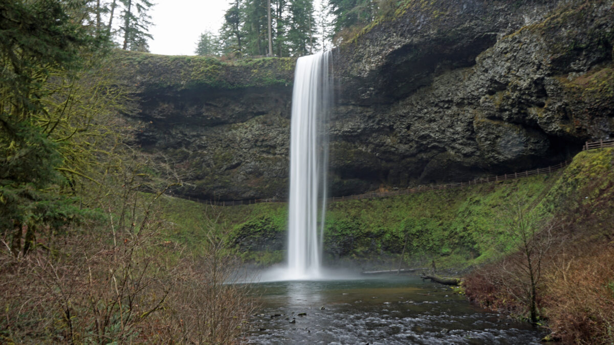
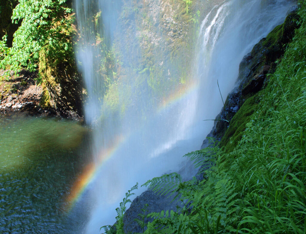
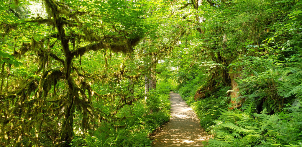
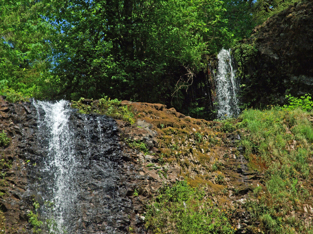
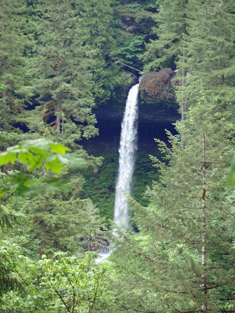
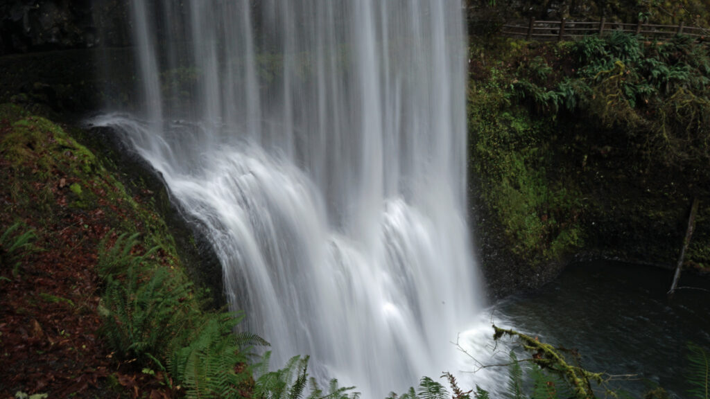
 Silver Falls was voted Oregon’s favorite state park a few years ago, and for good reason. With more than ten waterfalls, six of them more than 90 feet in height, Silver Falls is a waterfall lovers paradise. And the Trail of Ten Falls (there are actually eleven named and at least one unnamed falls along the trail) is one of the finest hiking trails in the Pacific Northwest. I don’t know of anywhere else where you can see a dozen falls on a single hike, and four of them here have trails that actually take you behind the falls.
It’s no wonder, then, that Silver Falls can be crowded. The area around South Falls gets by far the most use and can be very crowded on summer weekends. But this is a spectacularly beautiful hike and is worth doing even at the park’s busiest times.
Best Times to Go:
Flows in the creeks are at their highest, and the falls at their most spectacular, in winter and early spring. Late September through October is best for fall color. Summer is best for reliably good weather, but the park is almost always crowded with other hikers in summer. For my money, the best times are weekday mornings in spring and fall. But there is no bad time to hike here, except when there is snow or ice on the trails. But even in mid-winter, the trails are usually open and snow free, and you might even have the trail to yourself.
Getting there:
Silver Falls State Park is located about fifteen miles east of Salem, Oregon. Coming from Salem or south, take Ore Hwy 22 east and look for signs to Silver Falls. The turn off onto Ore Hwy 214 is about five miles east of Interstate-5. The South Falls day use area is about 15 miles from Hwy 22.
Coming from the north, take exit 271 off I-5 at Woodburn. Proceed through Woodburn on Ore Hwy 214, which will take you through the towns of Mount Angel and Silverton. The park is about 12 miles from Silverton.
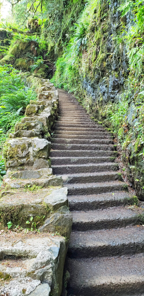
There are two primary trailheads that can be used for this hike. The North Falls trailhead has a fairly small parking lot, but the recent (July 2023) opening of the North Canyon day-use area more than doubles the amount of parking on the north end of the park. And the new North Rim Trail connects the two parking areas, so either can be used as the north end trailhead. The South Falls area gets much more use than the north end, but also has much more parking, so it is the most common starting point for this hike. The trail can also be accessed from the Winter Falls trailhead.
The hike:
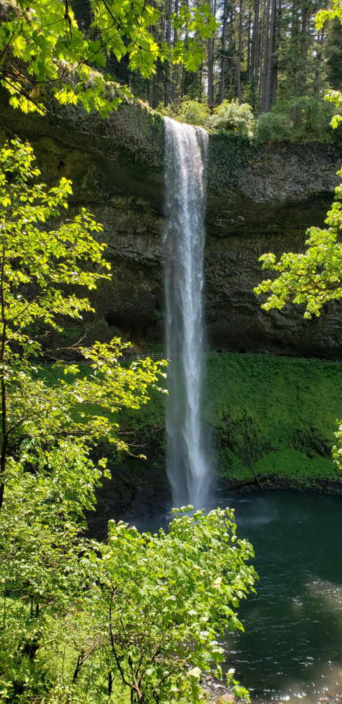
Most people start and end their hikes at the South Falls Day Use Area, so I’ll start there as well. From the parking area, follow the signs to the top of South Falls. There is a viewpoint there, and seeing the creek disappear over the edge of the cliff is a pretty awesome sight. From there, the trail descends to a good vantage point a quarter of a mile or so down the trail. There are several more places where you can get a good view of the entire falls farther down the trail before it dives behind the falls.
Just below the first viewpoint look for a signed side trail to Frenchie Falls. This is the eleventh named falls and the smallest by volume. When I was last there, in early June, it was just a trickle, and it often dries out by mid-summer. But it’s worth a look.

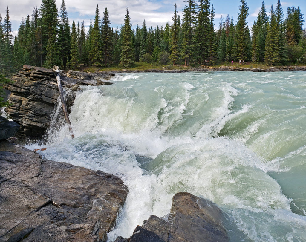
Continue down the main trail, which will take you behind South Falls. Here you will be between two layers of the Columbia River Basalt lava flows that are about 15-16 million years old. In between is a softer layer of sedimentary rock laid down by an ancient stream. This softer layer has eroded away to form the “cave” behind the falls.
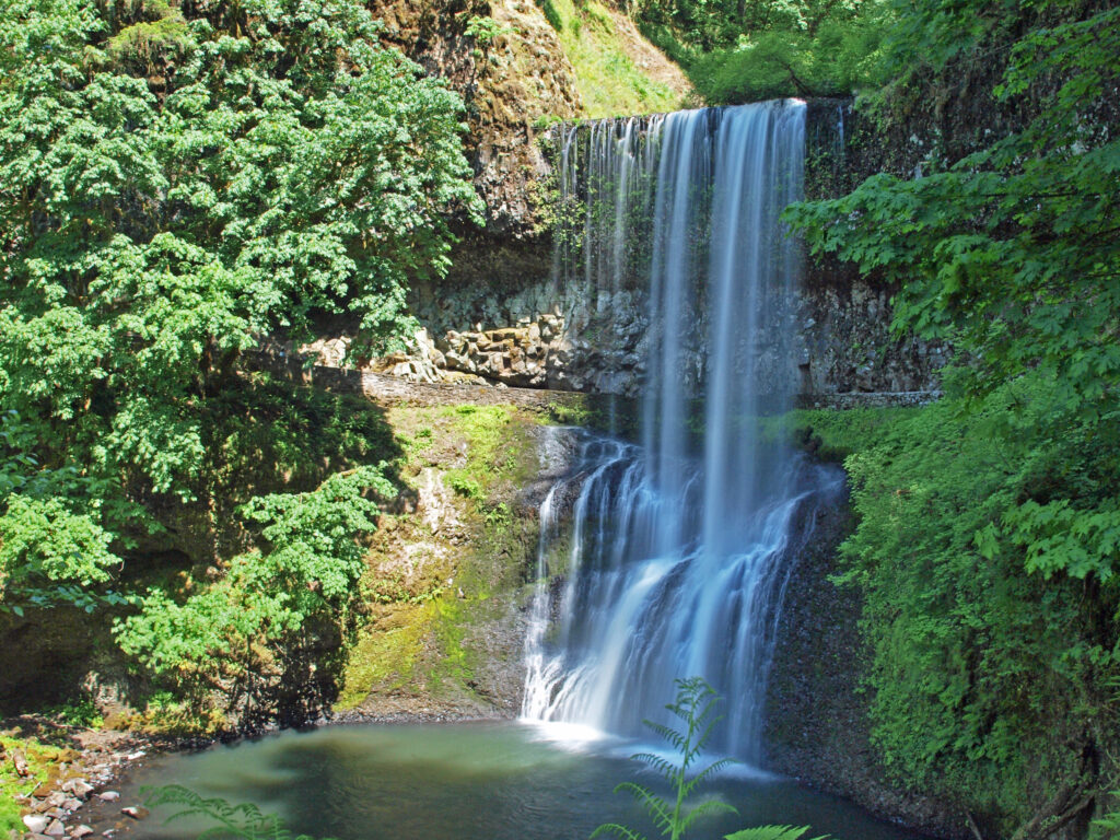
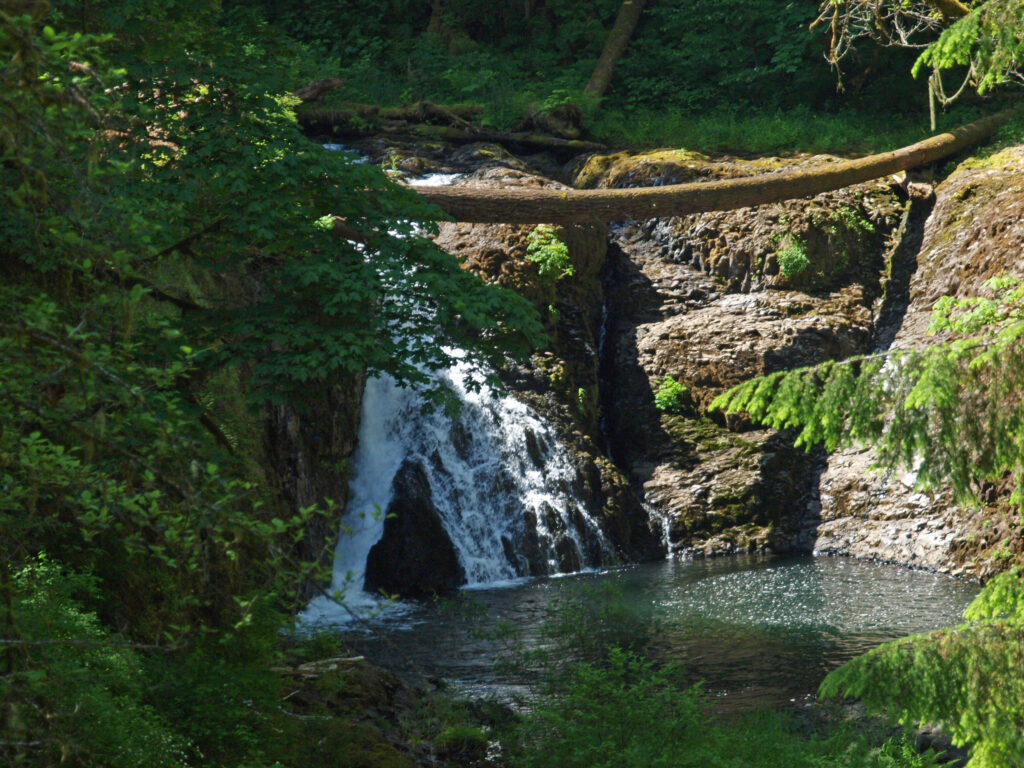
Below the falls there are several good viewpoints. Just downstream of the falls you’ll come to the first trail junction. The trail across the bridge will take you back to the parking area. Continuing on the Canyon Trail, you’ll next come to Lower South Falls at approximately the one-mile mark. Here the trail also goes behind the falls.
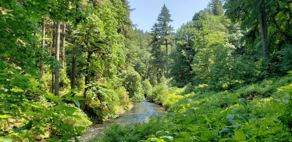
Below the falls, you’ll come to the junction with the Maple Ridge Trail at the 1.4-mile mark. The Maple Ridge Trail climbs out of the canyon and returns to the parking area, making for a 2.5-mile loop. Beyond the Maple Ridge Trail junction, the Canyon Trail leaves the south fork of Silver Creek and joins the north fork. Following the creek upstream, look for an intermittent waterfall across the creek at the 1.9-mile mark.
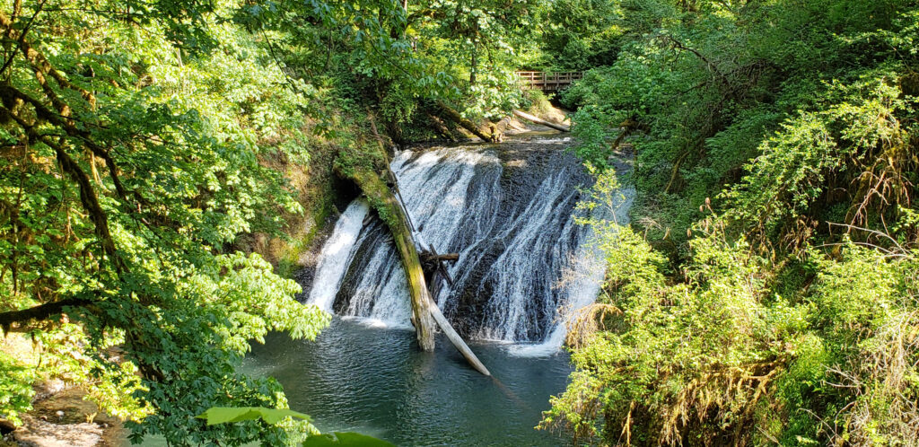
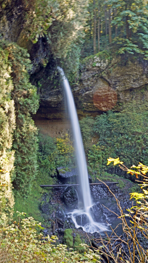
The trail then takes you to Lower North Falls (30 feet) at the 2.4-mile mark. Just above the falls a side trail leads to Double Falls, the highest in the park at 184 feet (combined drops). The volume of water flowing over Double Falls is much less than the falls on the two forks of Silver Creek, but still worth a look.


Next up is Drake Falls (27 feet), then the 106-foot drop of Middle North Falls. A side trail here leads behind the falls, but dead ends on the other side. Back on the main trail, you will come to the junction of the Winter Falls Trail at the 2.9-mile mark. A half mile out and back side trip will take you to the base of Winter Falls.

Like Double Falls, Winter Falls is on a side stream and the volume of water is much less than the falls on North and South Silver Creeks. From the falls, the Winter Falls Trail will take you up out of the canyon to a junction with the Rim Trail. From there you can return to the South Falls Day Use Area to complete a 4.5-mile loop.
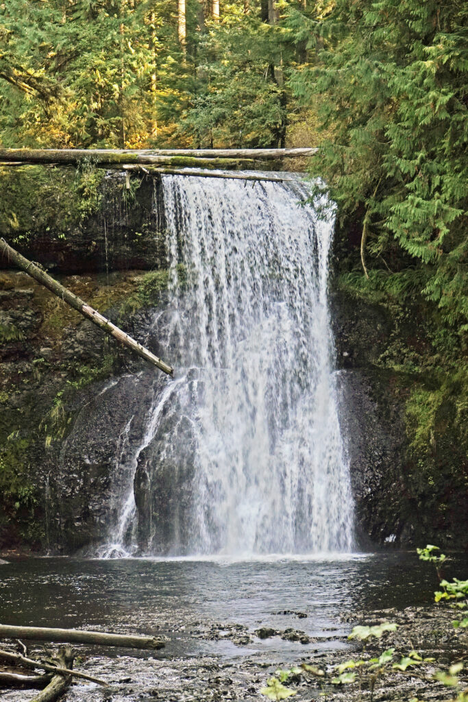
If you return to the Canyon Trail, you will next come to Twin Falls (31 feet), three tenths of a mile from the Winter Falls Trail junction. Just beyond Twin Falls there is a steep side trail leading up to the new North Canyon day-use area (the old group camp area) trailhead.
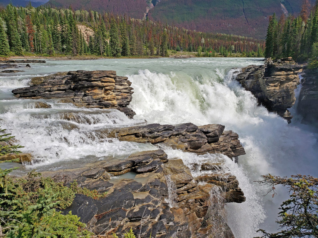
Stay on the Canyon Trail for another mile to North Falls (134 feet). Here once again the trail goes behind the falls. Look up to the ceiling of the overhang and you may be able make out cylindrical indentations that were formed when lava flowed around tree trunks and solidified before the trees burned. From North Falls, the trail climbs steeply to the North Falls trailhead three tenths of a mile beyond the falls.
The 0.6 mile out and back trail to Upper North Falls (65 feet) passes under the highway bridge at the North Falls parking area.
Back at the North Falls trailhead, take the Rim Trail. At about 0.3 miles from the North Falls trailhead you’ll come to a nice view back to North Falls. From there, it is 1.6 miles on a mostly flat trail back to the South Falls parking area.
 Other area attractions and activities:
Silver Falls State Park is Oregon’s largest state park. In addition to the Trail of Ten Falls, the park has 35 miles of back country trails open to hiking, mountain biking, and horseback riding. There is also a campground with 91 camp sites and 14 cabins, and a café and a nature store at the South Falls Day Use Area.
The nearby town of Silverton has a variety of dining and lodging options. Stop in at the Silver Falls Brewery and Alehouse after your hike for a bite to eat and a pint of craft brewed beer. Or try the Benedictine Brewery near Mount Angel that is operated by monks from the Mount Angel Abbey. Silverton is also home to the Oregon Garden, one of the state’s leading botanical gardens. Next door to the Oregon Garden is the Gordon House, the only surviving Frank Lloyd Wright designed house in Oregon.
 The Trail of Ten Falls is an iconic hiking trail that every serious hiker in the state has likely done multiple times. It’s so spectacular that it alone is worth making the trek to Oregon from wherever you reside, no matter how far away that is. As an Oregon resident, I know I’m a little biased, but I don’t think I’m exaggerating here. If you’re a waterfall lover, come see for yourself. A trip to Silver Falls, combined with a visit to the waterfalls of the Columbia River Gorge will make for an unforgettable experience.
Posted March 27, 2023 by Alan K. Lee. Updated August 2, 2023.
All photos © Alan K. Lee
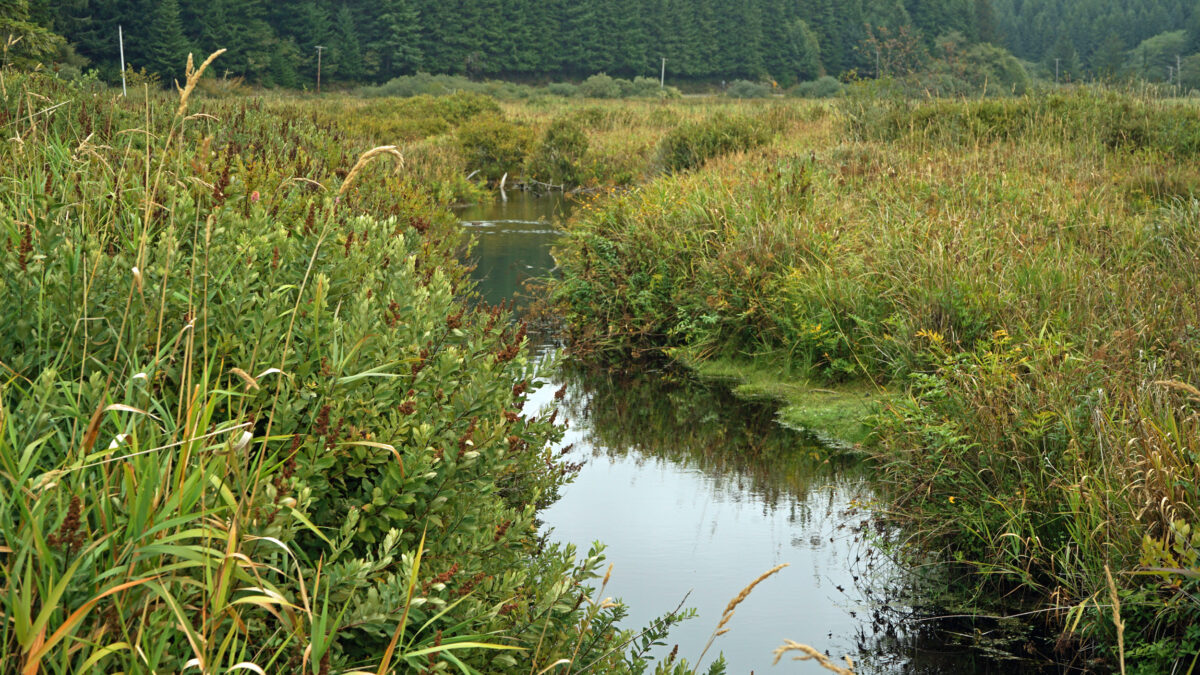
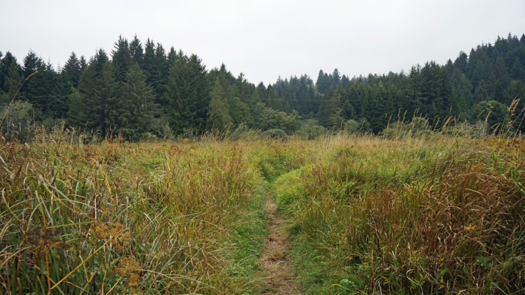

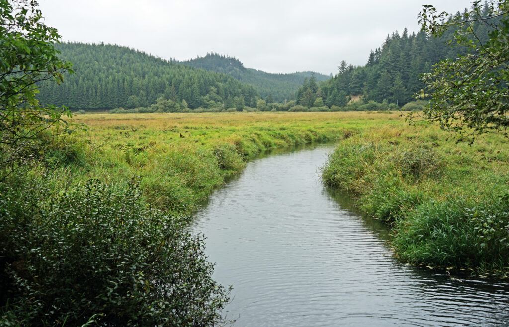
 Beyond the Snaggy Point Trail junction, the loop trail continues through the forest along the edge of the marsh to a junction with the Antler Overlook Trail, which connects to the Cooper Ridge Trail and provides another overcrossing of the upland area. The main loop trail then continues through the forest to the agricultural buildings mentioned in the winter trailhead description. Beyond the buildings walk up the service road for a couple hundred yards and look for the loop trail branching off to the left. The trail follows the edge of an open field.
 Posted March 14, 2023 by Alan K. Lee
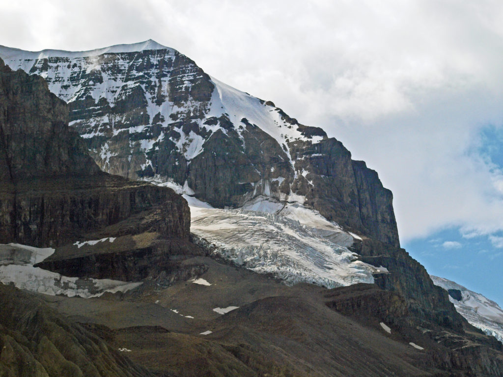
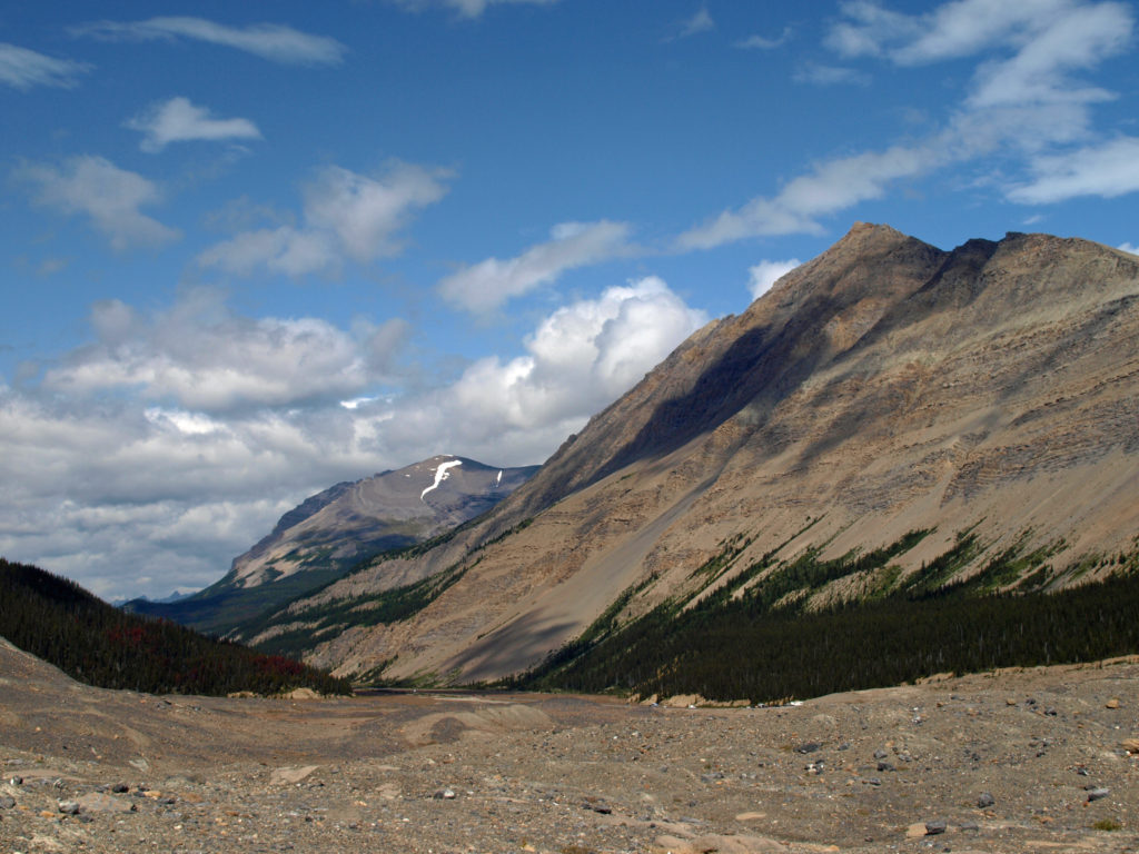
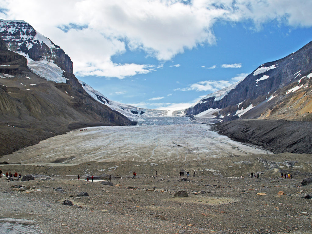
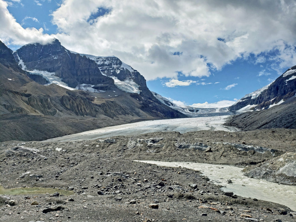
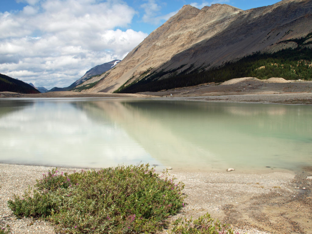
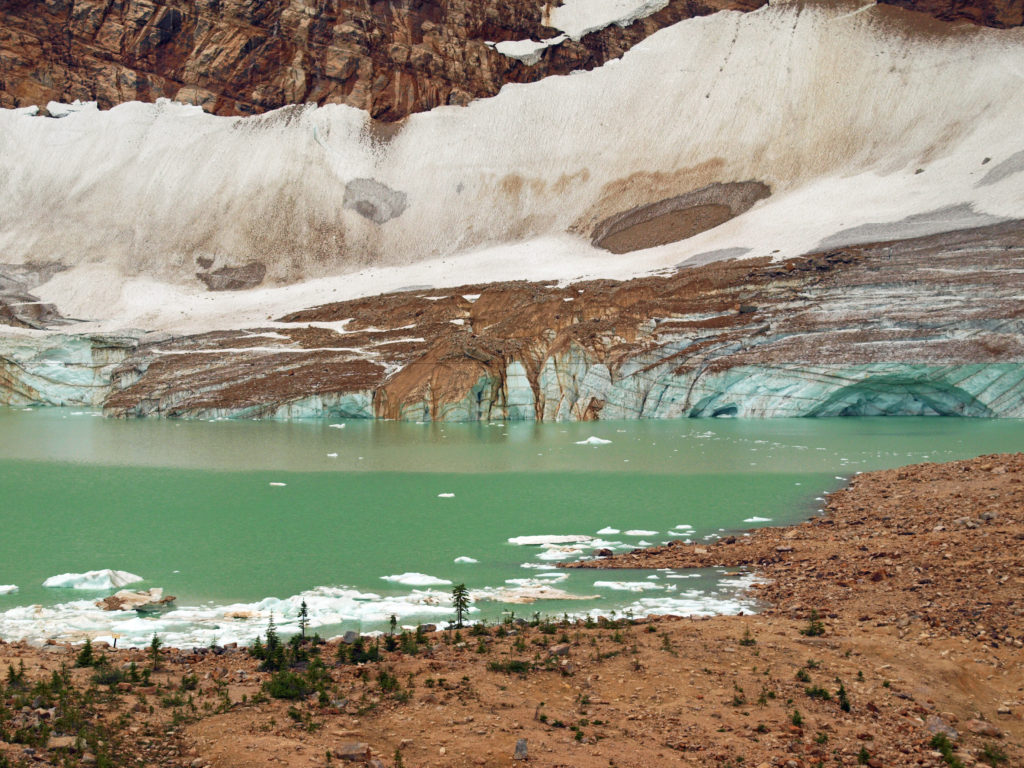
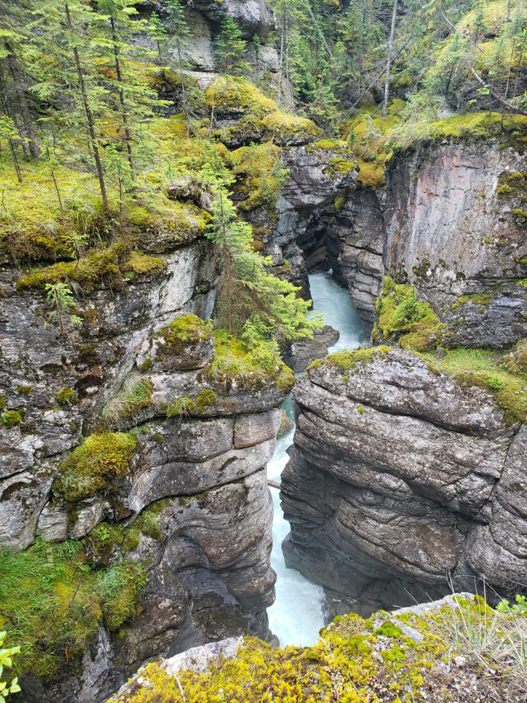
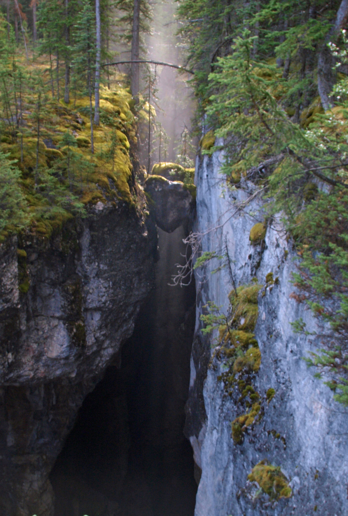
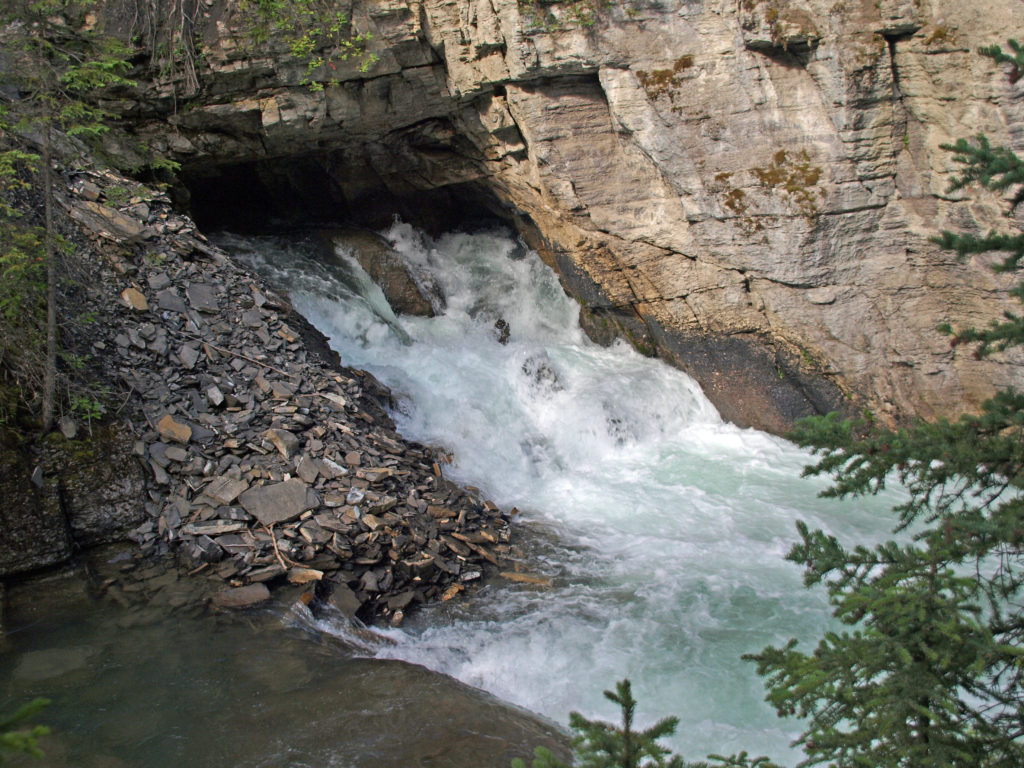
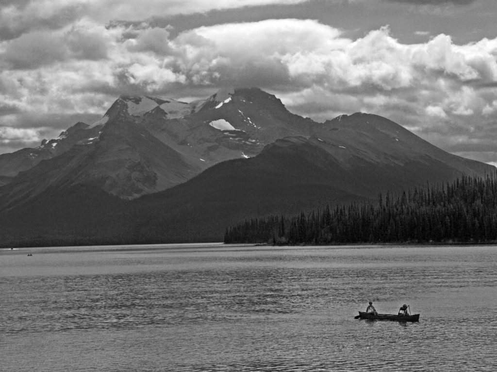
 The Icefields Parkway ends at the town of Jasper, a smaller, less crowded, and lower key version of Banff. There are abundant restaurants, pubs, galleries, and shops there, but accommodations are limited, and hotels and motels are expensive. Book your stay well in advance. We opted for staying in a travel trailer at an RV park 30 miles (48 km) from Jasper, just outside the park boundary, because that was the only thing available through Airbnb when we were planning our trip. It was a little inconvenient, but in the end it worked fine.
 The Quinault Rain Forest lies in the southwestern corner of Olympic National Park, the adjacent Olympic National Forest, and the Quinault Indian Reservation in western Washington. It’s less than a four hour drive from either Portland or Seattle, but it seems a world apart, and more than a little stuck in time. It looks much as I remember it from when I first visited as a child more than a half century ago. Cell phone service and wi-fi availability are spotty. There are no big resorts and no towns of any size. Urban America is nowhere to be found.
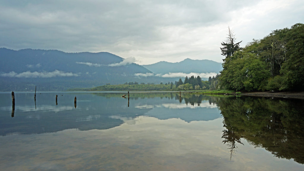 The pandemic has kept all of us from traveling as much as maybe we’d like. That certainly applies to my wife and I. Most of our vacation plans for 2020 had to be cancelled. And just when the parks and recreation areas were beginning to reopen, wildfires in western Oregon and Washington shut them down again. But the Olympic Peninsula was largely unaffected by the fires. So, my wife and I decided that the Olympics would be an ideal, and much needed, escape from Portland, and in September 2020 we headed to the Olympic Peninsula. Our first stop was Lake Quinault.
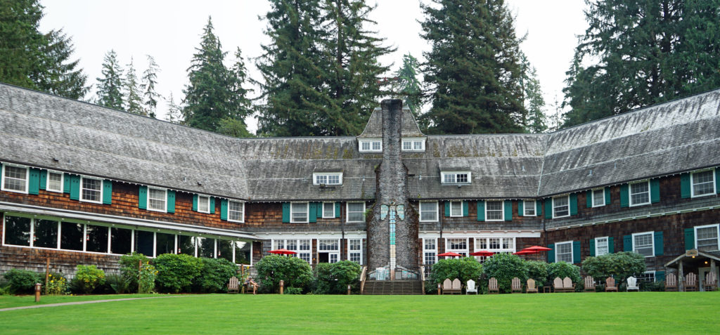 We treated ourselves to a stay at the historic Lake Quinault Lodge, one of the iconic grand lodges of the American West. The original Lake Quinault Lodge was built in 1904. The Boathouse annex was built in 1923. The original lodge burned down in 1924 and the current main lodge was constructed in 1926 on the site of the older lodge. Two additional annexes have been added since then. The existing lodge was placed on the National Register of Historic Places in 1998.
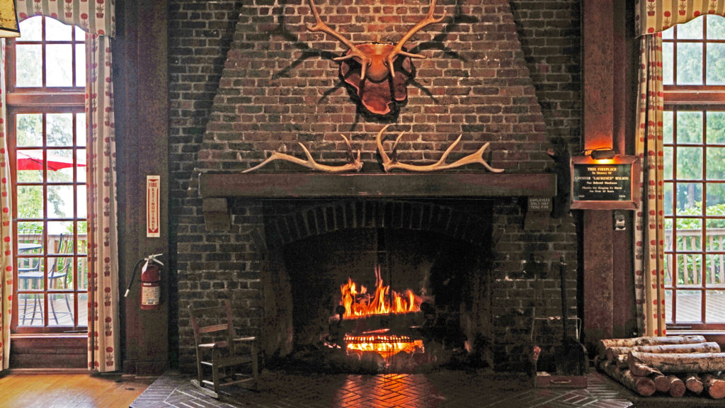 Rooms at the lodge are a little pricey, but you’re paying for the history, charm, and iconic nature of the lodge more than for the amenities provided. There are no TVs in any of the main lodge rooms, no fridges, or microwaves, no phones and no cell phone service. But that’s all part of the charm. The Boathouse and the other two annexes offer a few more amenities. Some come with fireplaces, the Lakeside Rooms are billed as family friendly, and the Boathouse Rooms are pet friendly. Our room in the main lodge came with all we needed, a comfortable bed and a view of the lake.
 Services at the lodge were limited by the pandemic during our stay. The swimming pool, sauna, and game room were closed. The restaurant served take out meals, but the dining room was closed (outside seating was available and you could eat in the main hall or in your room). However, all services have been restored to pre-pandemic levels.
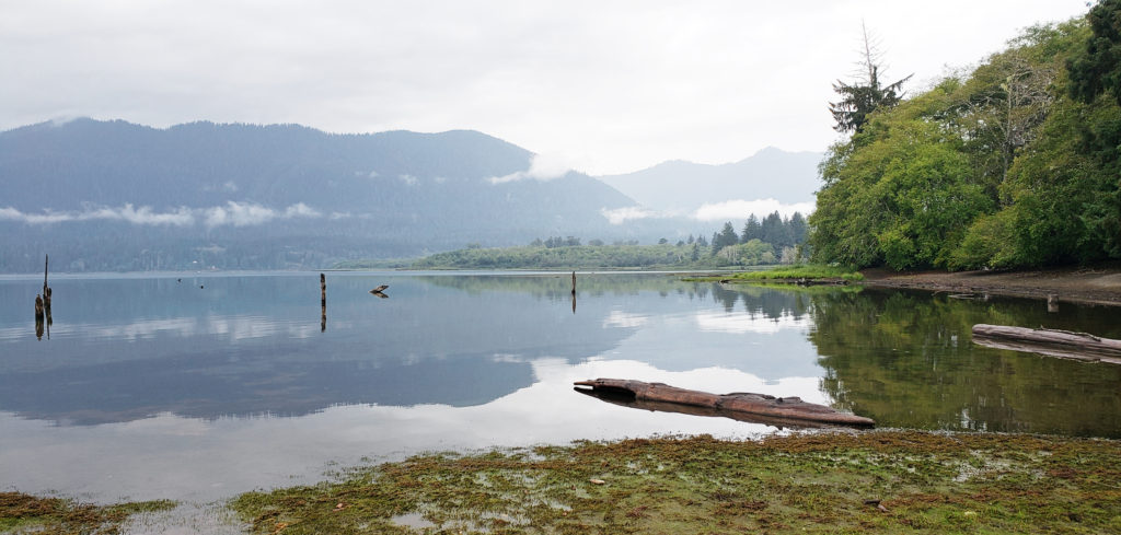 A somewhat cheaper alternative to Lake Quinault Lodge is the nearby Rain Forest Resort, which has a 16 room lodge, cabins (some with hot tubs), an RV park, and a restaurant. The world’s largest Sitka Spruce grows a short walk from the resort. Other options are the Quinault River Inn on Hwy 101 in Amanda Park, and Lochaerie Resort on North Shore Road. And there are three campgrounds on the south shore of Lake Quinault, and two (one a walk-in) on the north shore.
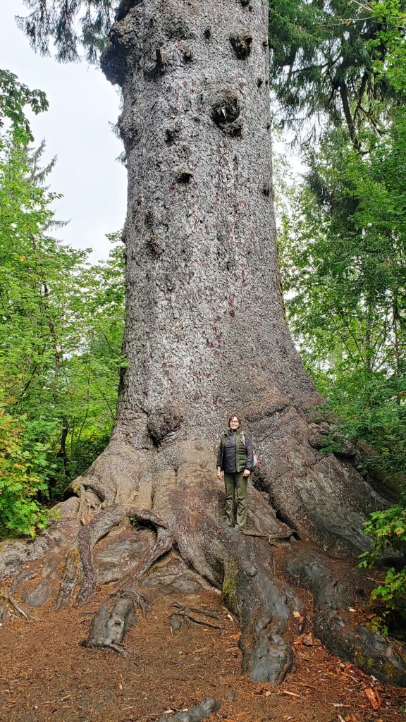 Lake Quinault Lodge, the Rain Forest Resort, or any of the three south shore campgrounds make an ideal base for exploring the area. Hikers have a variety of options, from the half mile Rain Forest Nature Trail Loop to a loop of about seven miles that takes you to Gatton Creek Falls, Cascade Falls, the Cedar Bog, the Rain Forest Nature Trail, and along the lake shore. Cutoff trails make shorter loops of various distances possible. Other hiking trails are a short drive from the lodge.
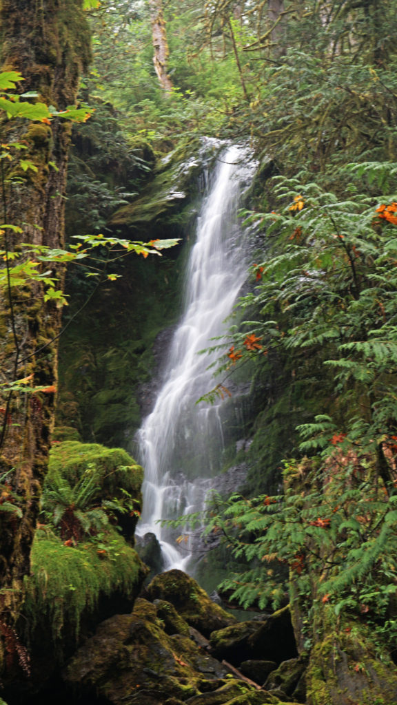 Two stops along South Shore Road worth making are Merriman Falls and Bunch Falls. Both are just east of Lake Quinault and both are right by the road, so no hiking required.
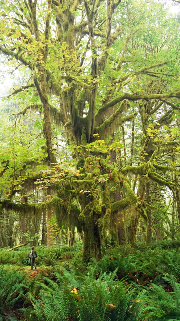
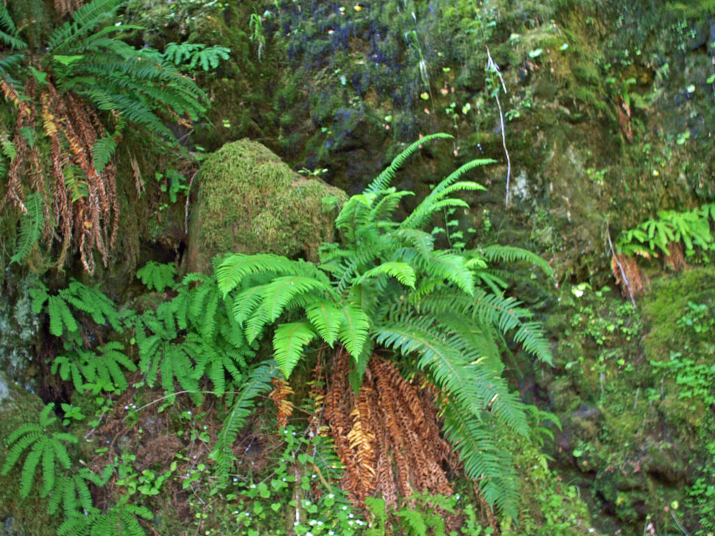
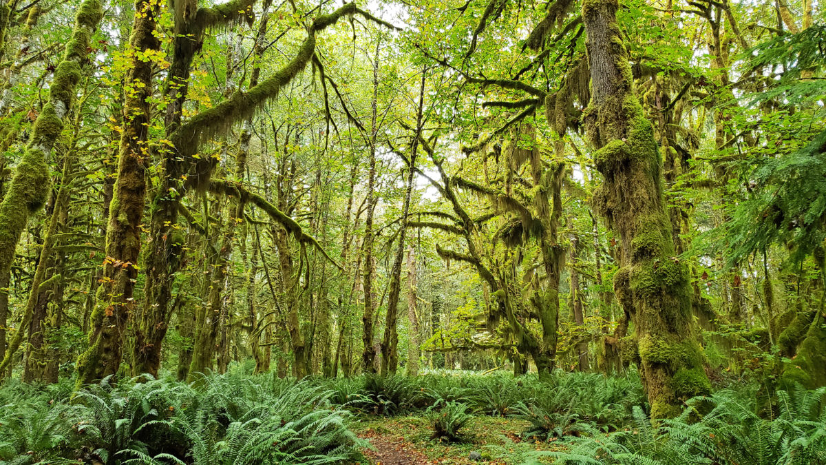
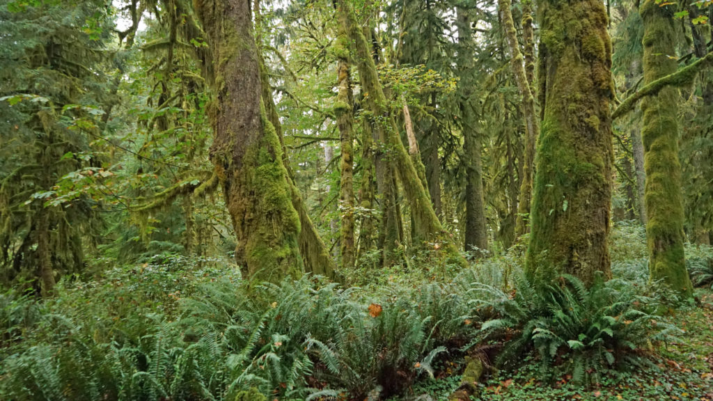
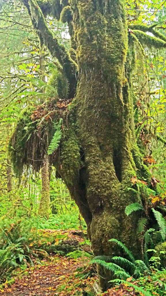
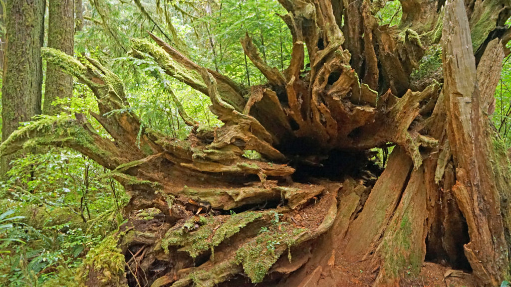
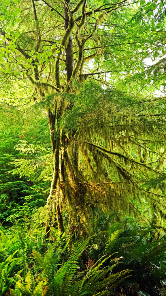
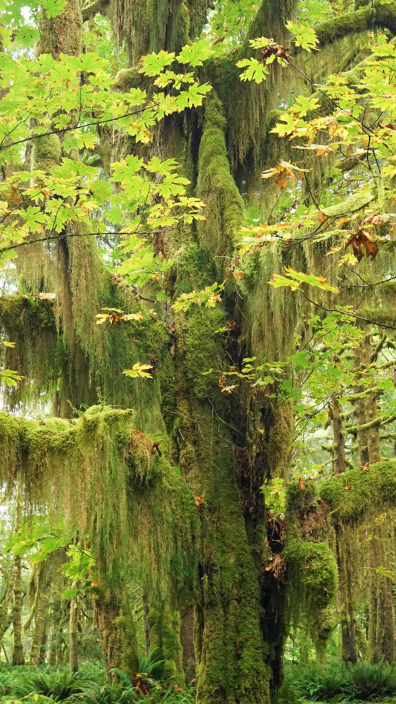 One hike that everyone should do is the Maple Glade Trail at the Quinault River Ranger Station on North Shore Road. It is spectacularly beautiful, and like the Rain Forest Nature Trail, it’s an easy 0.5 mile loop. But, unlike the Rain Forest Nature Trail, which takes you through a coniferous forest of Douglas Fir, Western Hemlock, and Western Red Cedar, the Maple Glade Trail immerses you in a Bigleaf Maple forest. There the ground is covered in ferns and other low growing shrubs and the maples soar overhead, but in between is mostly open and airy. The effect is like being in a gigantic room carpeted with ferns and roofed with a canopy of maple leaves.
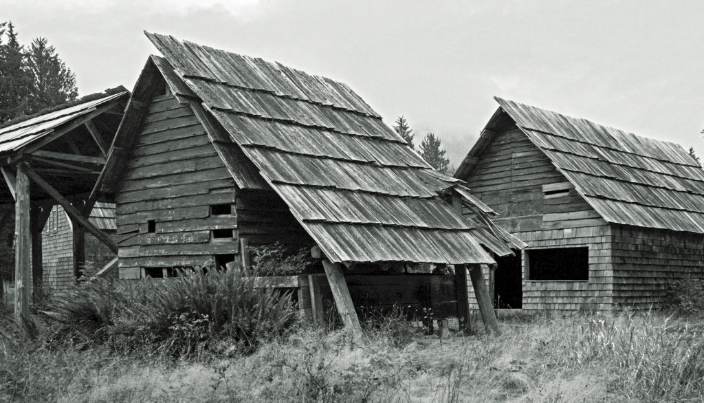 The Maple Glade Trail can be extended by taking the connecting trail to the Kestner Homestead. There you’ll find the Kestner house, barn, outbuildings, and a cool old rusted delivery truck.
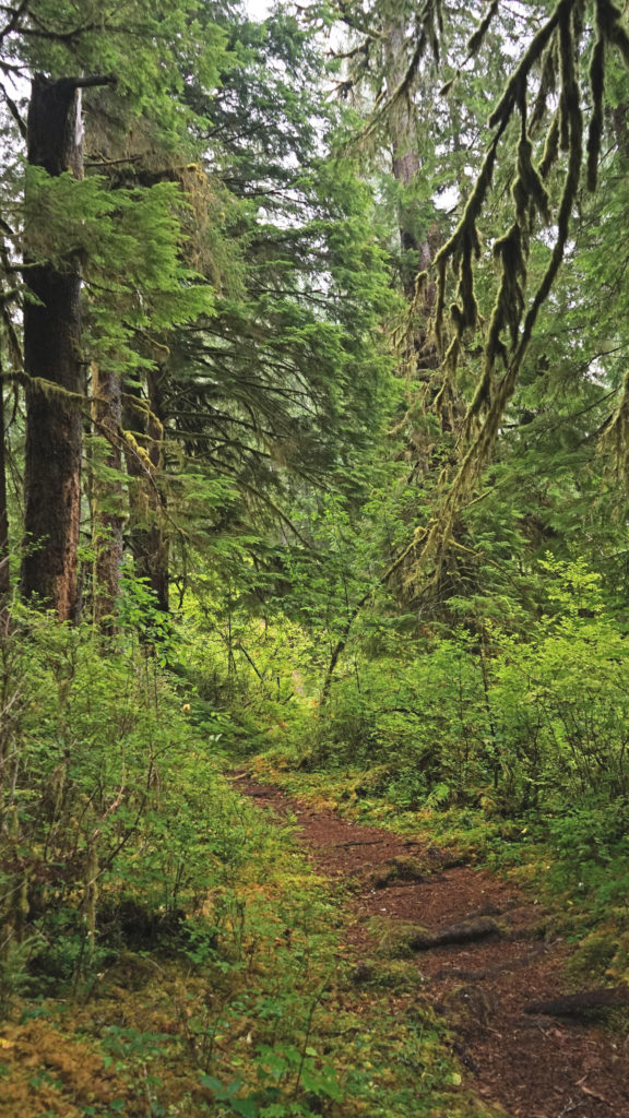
 There are also much longer hikes that can be taken into the Olympic National Park from the Quinault Valley. The most famous, and probably most hiked, is the Enchanted Valley Trail. It’s a 13 mile hike along the East Fork of the Quinault River to reach the Enchanted Valley, so it is not a casual outing. Most people do it as a 3-5 day backpacking trip. My backpacking days are behind me, but the Enchanted Valley is one of the hikes that I regret having never done.
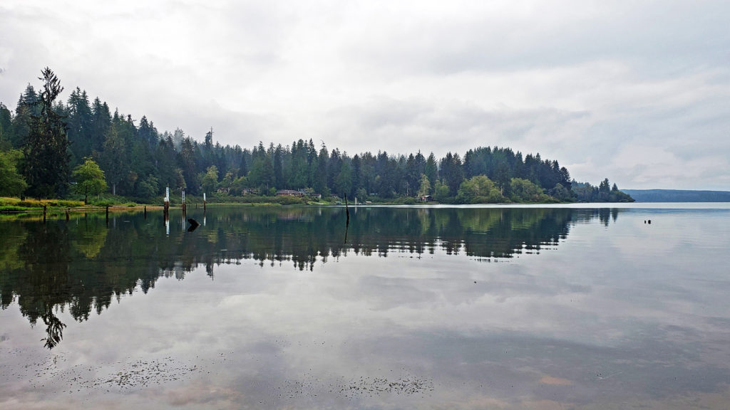
 Originally posted October 26, 2020. Updated and re-posted August 11, 2022.