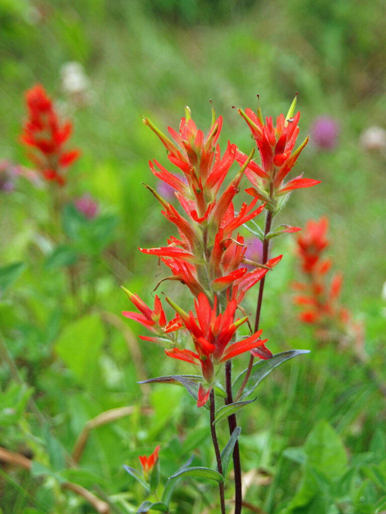
Banff National Park in the Canadian Rockies is flat out gorgeous, one of the most beautiful places I’ve ever been. My wife and I made our first visit a couple of decades ago and loved it. But it took us twenty years to get back. We finally made it back to Banff in August 2019 as part of a long road trip from our home in the Portland, Oregon area.
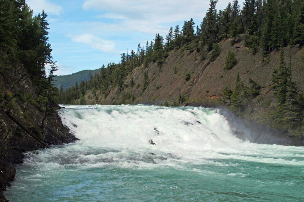
Bow Falls
It was a long drive. It’s more than 700 miles from Portland to Banff by the shortest route, even farther by the route we took. We took our time, though, and stopped in a number of places in southern British Columbia on the way. (Banff is a long ways from pretty much everywhere. If you don’t want to make the long drive, another option is to fly to Calgary and rent a car. Banff is less than a two hour drive west of Calgary.)
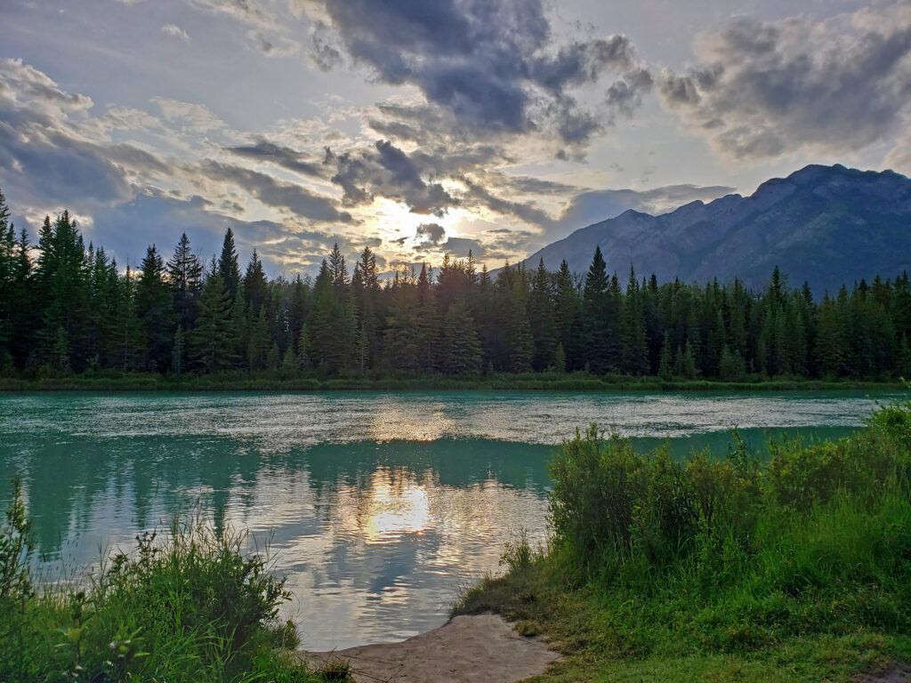
Bow River
Besides being incredibly scenic, Banff is also significant in that it is part of one of the largest protected areas in North America. The park borders three other Canadian national parks, Kootenay, Yoho, and Jasper. The four national parks in turn border more than half a dozen provincial parks and protected areas. Altogether, the contiguous protected area totals more than 12,000 square miles (31,500 square kilometers). That’s almost four times the size of Yellowstone National Park, for comparison.
Policeman’s CreekHistoric North West Mounted Police Barracks, Canmore
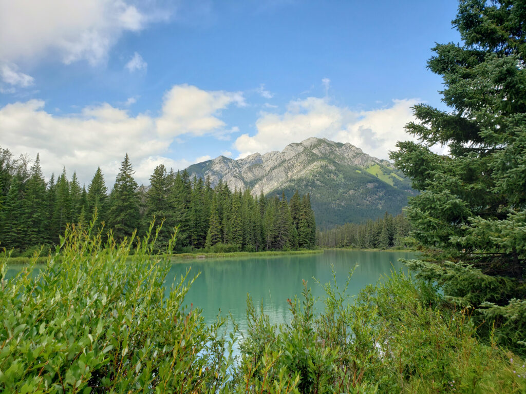
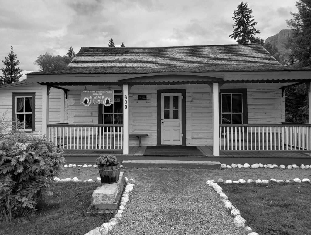
On our 2019 trip, we rented a house in Canmore, just outside the park, since it was more affordable than staying in the park itself. Canmore turned out to be a pretty interesting place in its own right. It has a compact and very walkable downtown area with plenty of cafes and restaurants, brew pubs (try Canmore Brewing), interesting art galleries (don’t miss the Jeff Walker Gallery), and some interesting historical sites. There’s also a nice walking trail along Policeman’s Creek. And Canmore is only about a five minute drive from the southern entrance to Banff National Park.
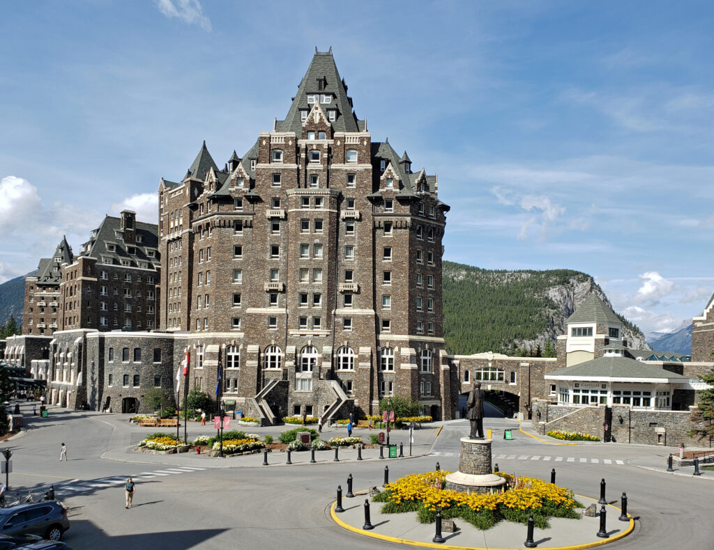
Banff Springs Hotel
The town of Banff, although crowded and touristy, is charming enough to warrant at least a few hours of your time. The Banff Springs Hotel is also worth a visit, even if you’re not staying there. If you’re a hiker, try the Tunnel Mountain Trail. We didn’t hike all the way to the top, but still got some great views of the town and the surrounding mountains, and a good workout.
Upper Falls, Johnston Canyon
One of the best hikes you’ll find anywhere is the Johnston Canyon Trail, about 15 miles north of the town of Banff. Here Johnston Creek cascades through a narrow gorge with many small waterfalls and two larger ones.
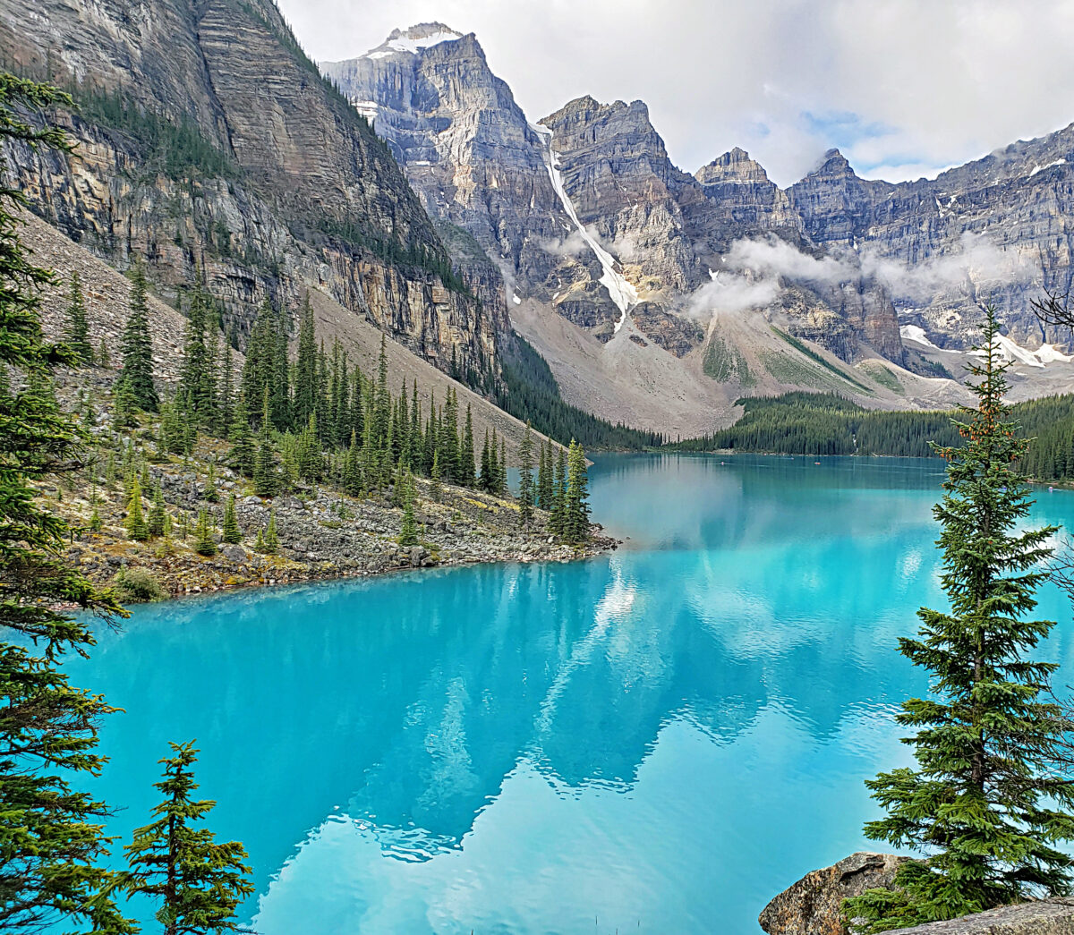
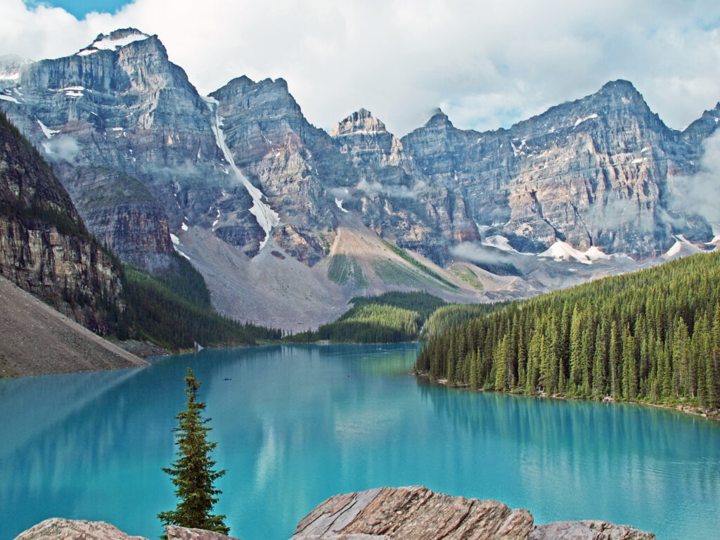
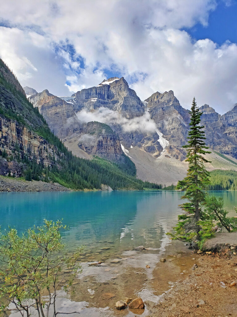
Moraine Lake
Another must see destination in Banff National Park is Moraine Lake. The turquoise blue water and soaring peaks surrounding the lake make it one of the most beautiful lakes in the world. It’s an easy walk up to a stunning viewpoint from the parking lot, and there is a trail along the shoreline that gives you more incredible views of this beautiful lake and the high peaks above it. You can also rent a canoe there and get out on the water for more spectacular views. And again, go early. Parking at the lake is limited and traffic on the road to the lake may be restricted if the parking lot is full.
Moraine Lake
You can avoid the parking hassles and the crowds, at least in the morning or evening, by booking a room at the Moraine Lake Lodge. It’s expensive, but if you can afford it, it might be worth it.
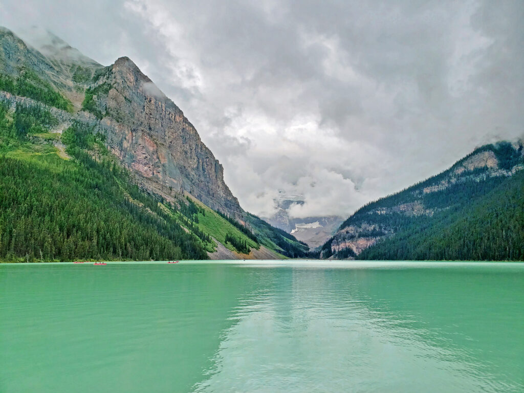
Lake Louise
Lake Louise is justifiably famous, but fame brings people. Lots of people. There’s a lot more parking here than at Moraine Lake, but even though we were there early, we still had to park in one of the lower lots and walk up to the lake. And honestly, Moraine Lake is even prettier and less crowded. But if you’ve never been there, seeing Lake Louise is worth fighting the crowds. Rent a canoe and get out on the water, or take a hike along the shore to get away from the crowds. And, like the Banff Springs Hotel, Chateau Lake Louise is a destination in itself.
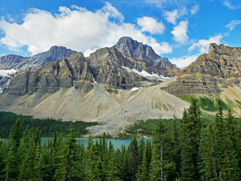
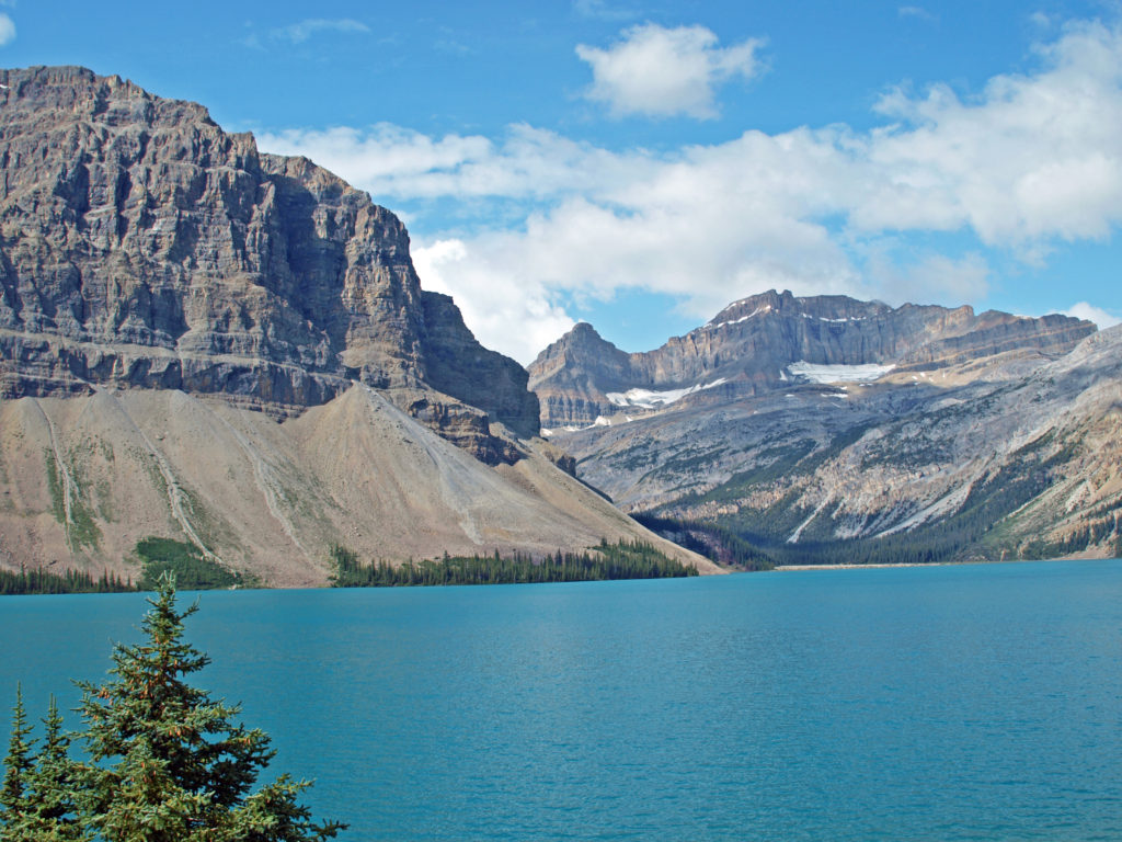
The portion of Banff National Park north of Lake Louise has a lot of attractions that many visitors never see. This part of the park was new to me. On our first trip we were among the many that didn’t venture north of Lake Louise. On this trip we did, though. Our journey took us on into Jasper National Park on the Icefields Parkway.
Hector Lake
Drive a few miles north from Lake Louise on the Trans Canada Highway, turn onto the Icefields Parkway, and you’re in a different world. The crowds thin out and the country becomes wilder, more open, and more removed from civilization.
Bow Lake
Unfortunately, we didn’t have enough time to really explore that part of the park. We made a quick stop at Hector Lake viewpoint, only a few miles from Lake Louise, and stopped for a little longer at Bow Lake before motoring on into Jasper National Park. (Click here to go to our post on Jasper.)
Bow River
There’s much more to Banff than I have described here, of course. It’s a big park, and you could easily spend a couple of weeks there without running out of things to do, longer if you also visit some of the surrounding parks. But it’s worth the effort to get there at least once in your life, even if you can only spend a few days there.
“B’Air of Importance” by Shannon Ford, Banff Springs Hotel
Originally posted December 26, 2022. Most recently updated July 31, 2024.
Bandon, Oregon, on the southern Oregon coast, happens to have been my home for the first seven years of my life. Although I did most of my growing up in Salem, I consider Bandon my home town as much or more than I do Salem. I go back to Bandon often, most recently in July this year (2025).
History
Bandon was founded almost 150 years ago by George Bennett (often referred to as Lord Bennett), an Irish peer from Bandon, Ireland. In its early days, the economy of Bandon, Oregon was primarily agricultural. Bandon has been known for both its cheese and cranberries since the 1880s. The first jetty was also constructed in the 1880s, and Bandon was soon home to a fishing fleet and a robust shipping industry.
One of the things Lord Bennett brought to Bandon from Ireland was gorse, a thorny, thick growing plant with bright yellow flowers. In Ireland it was used for privacy hedges and property boundaries because it is almost impenetrable. In Oregon it went wild and was one of the state’s first invasive plants. Besides being thick and thorny, it is also a very oily plant and burns readily. In 1936 a small forest fire started from a slash burn that got out of hand, spread to the gorse near the town, and then to the town itself, destroying all but 16 of the 500 structures in the town. The fire decimated the community and all but ended shipping to and from the harbor.
In my youth, Bandon was primarily a mill town, with fishing and agriculture secondary industries. Today, the lumber and plywood mills are long gone. There is still a small fishing fleet that operates out of the harbor, Bandon is still one of the leading cranberry producing areas of the country, and dairy farming is still an important component of the economy. But it is tourism that drives the economy today. The three main tourist draws are the beaches, Bandon Dunes Golf Resort, and the old town section of Bandon.
The Beaches
The beaches on either side of the Coquille River are dramatically different. To the north, a wide flat beach stretches for ten miles to the Cape Arago headland, interrupted only by Fivemile Point. The north beach can be accessed from Bullards Beach State Park, Whisky Run, located just north of Bandon Dunes, and Seven Devils State Park, another mile or so to the north.
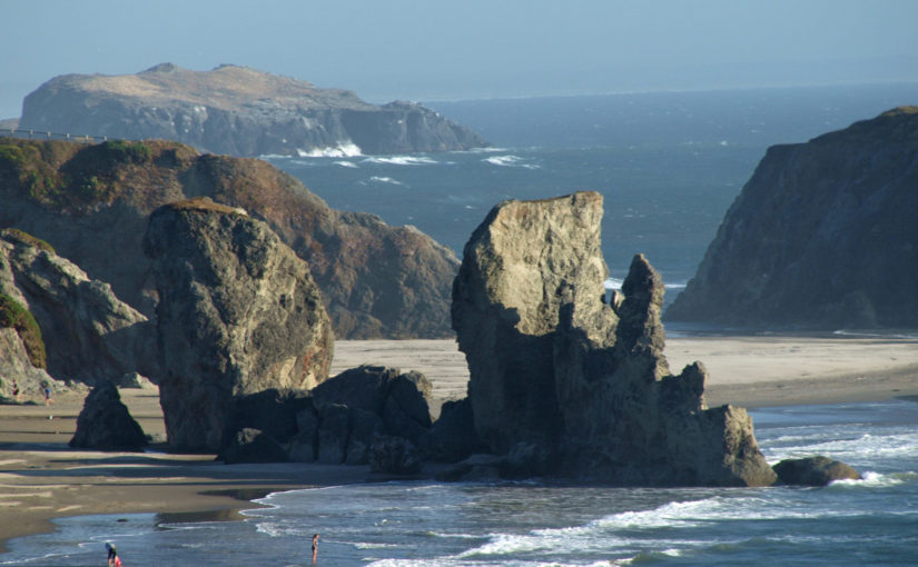
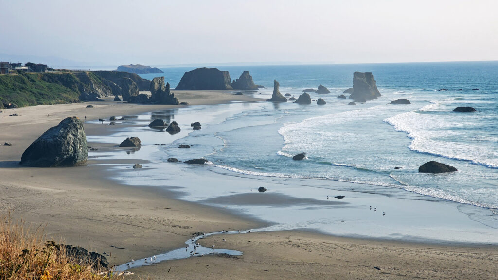
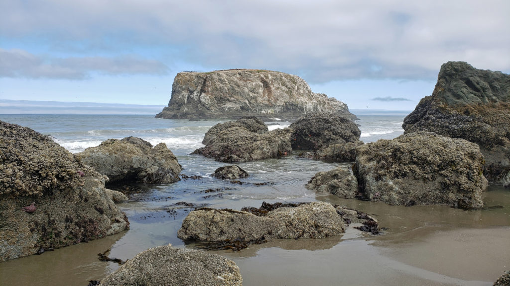
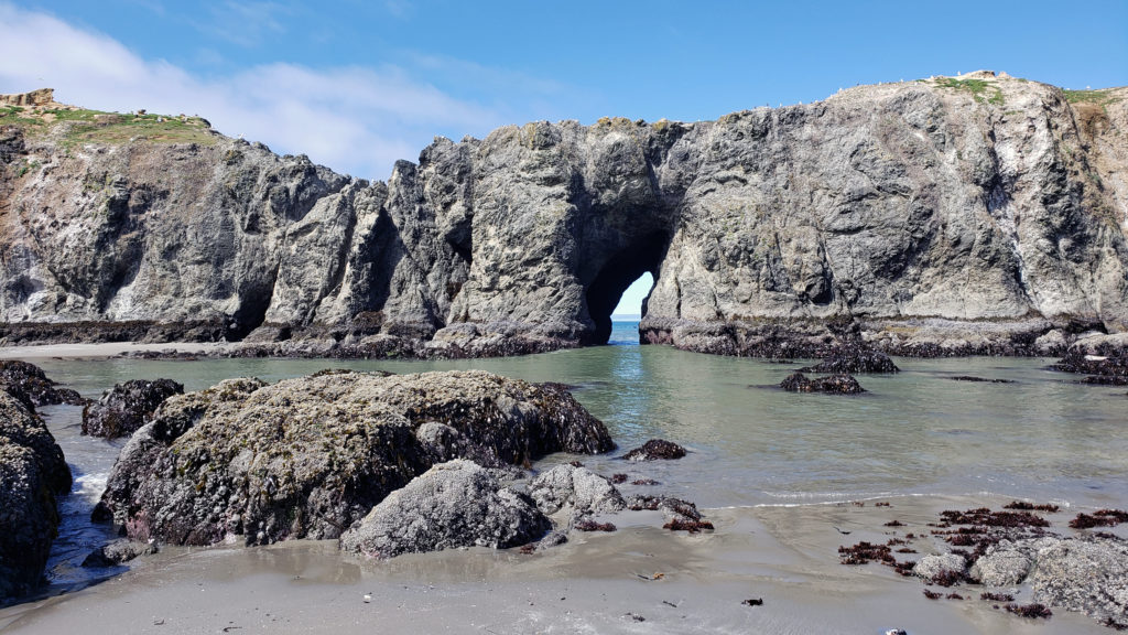
The beach to the south of the Coquille River is a spectacular collection of sea stacks and offshore islands, including Face Rock and Table Rock, that are part of the Oregon Islands National Wildlife Refuge. This is rightly regarded as one of the most beautiful beaches on the Oregon Coast.
Access can be had from the south jetty area, from the wayside at the end of 11th Street, and from Face Rock State Scenic Viewpoint on the Beach Loop Road. Farther south on the Beach Loop Road are other beach access points at Devils Kitchen and Bandon State Natural Area.
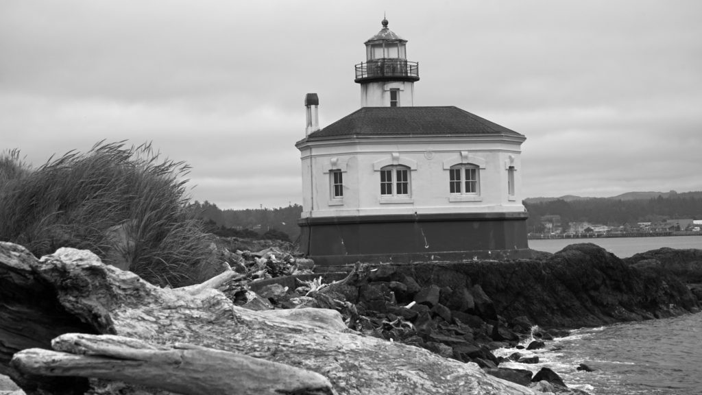
Coquille River Lighthouse
The Coquille River Lighthouse is located at the mouth of the Coquille River on the north jetty, across the river from the old town section of Bandon. It was constructed in 1895-96 and began operating on February 29, 1896. In addition to the lighthouse itself, there was a foghorn, a lighthouse keeper’s residence, and a barn. Various improvements were made in the following years, including a boathouse for the lighthouse tender. None of the other structures remain.
In 1939 the Coast Guard took over the lighthouse and deemed it unnecessary. The lighthouse was replaced by an automated light on the south jetty. The lighthouse sat abandoned for 24 years until it became part of the new Bullards Beach State Park in 1963. It was another 13 years before renovation of the lighthouse began, but it finally opened to the public in 1979. In 1991, during Bandon’s centennial celebration, a solar powered light was installed, ending the Coquille River Lighthouse’s 52 years of darkness. Further renovation of the lighthouse was done in 2007. The bottom floor of the lighthouse is staffed by volunteers and open to the public, but the tower and the light are not.
Circles in the Sand
Denny Dyke began creating labyrinths on the Bandon beach in 2011 as part of his ministry, Sacred Journeys. The labyrinths are intended as a form of walking meditation. Over the next few years Dyke created hundreds of labyrinths, and he and a team of volunteers continue to create dozens of labyrinths every year, each unique and lasting only until the next high tide.
The Circles in the Sand labyrinths have become true works of art in the thirteen years that Dyke and his team have been creating them. They have also become very popular events, as have other walking labyrinths in other locations.
Golf
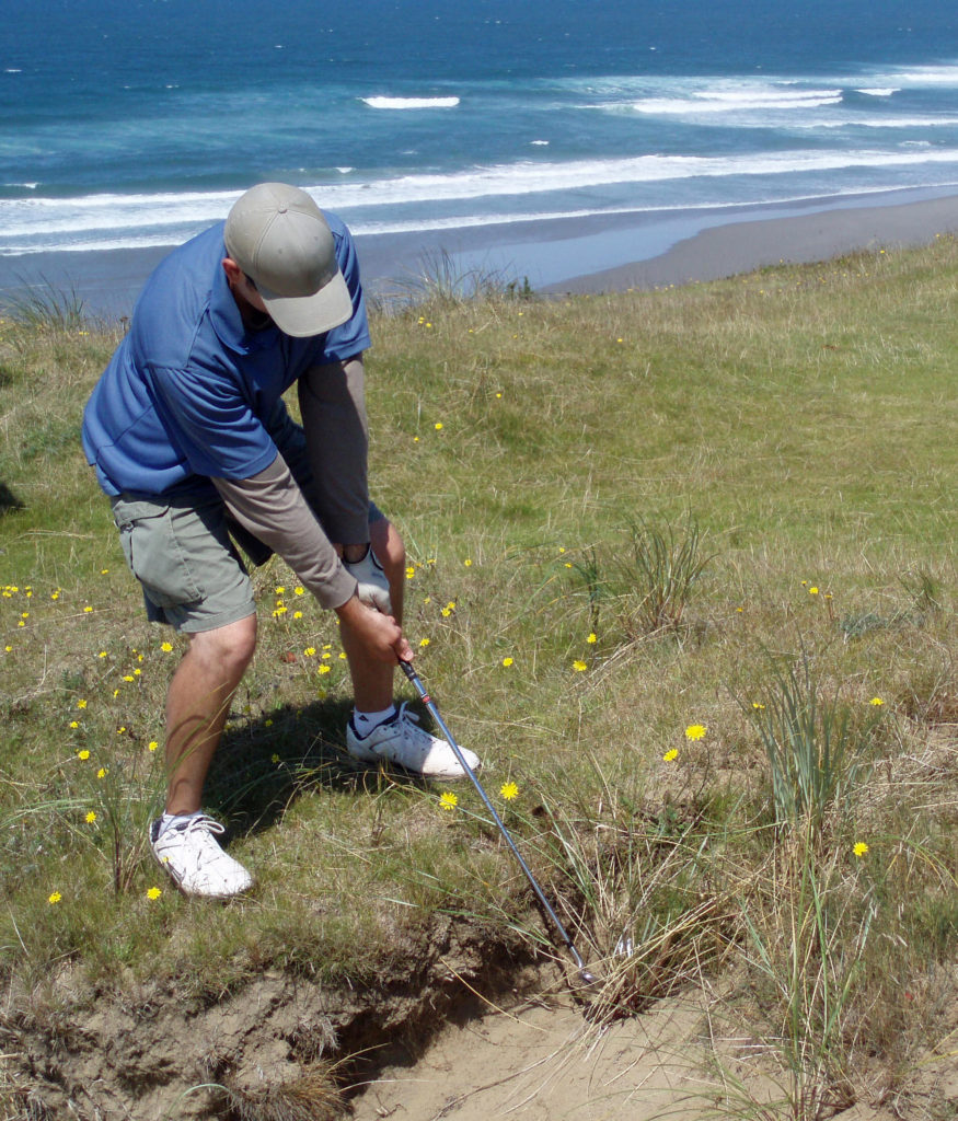
If you’re a golfer, you have likely heard a lot about Bandon Dunes Golf Resort. There are now five full length courses: Bandon Dunes, Pacific Dunes, Bandon Trails, Old MacDonald, and Sheep Ranch.
All of the Bandon Dunes courses are consistently rated in the top 100 courses in the United States, and the 13 hole par three course, Bandon Preserve, is a challenge in itself. A few miles south of town, Bandon Crossings offers a lesser known, much less expensive, and equally challenging course that should be on every golfer’s radar.
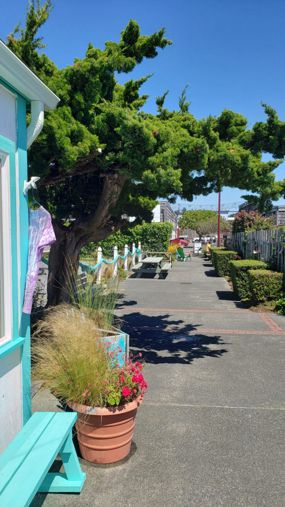
Old Town
Bandon’s Old Town area is loaded with restaurants, galleries, gift shops, and outdoor art exhibits. Art lovers will want to visit Second Street Gallery, and everyone should take in the Washed Ashore exhibit, which displays sculptures and other artworks created entirely from marine debris picked up from the beach. Washed Ashore is a non-profit organization dedicated to educating the public about plastic pollution of the oceans and waterways, and to making positive changes in consumer habits.
Good eats abound in Old Town. Start your day at Bandon Coffee Cafe or Bandon Baking Company. Stop at Face Rock Creamery to sample locally made cheeses and ice cream. Seafood lovers will want to sample the fare at Tony’s Crab Shack and Bandon Fish Market. Pub fare and quality draft beer are both to be had at Foley’s Irish Pub and Bandon Brewing Company. Decent and affordable Mexican food can be had at La Fiesta. And if more upscale dining is what you’re looking for, try The Loft Restaurant and Bar or Alloro Wine Bar and Restaurant.
There is a campground at Bullards Beach State Park with 103 full-hookup sites and 82 sites with water and electricity. And there are a number of commercial RV parks in the immediate area.
Getting There
Bandon isn’t exactly easy to get to. It’s about a 2½ hour drive from Eugene, three hours from Medford, and 4½-5 hours from Portland. There are no commercial flights to Bandon Airport. United Express does have daily flights from San Francisco and twice weekly flights from Denver to the Southwest Regional Airport in North Bend, but there are no direct flights between North Bend and Portland or other cities. There is no railroad serving Bandon, and there does not appear to be any bus service to Bandon. But Bandon’s remoteness means that it is less crowded than the northern or central Oregon coast, and the spectacularly beautiful beaches and interesting old town make it worth the trip. And, of course, there is Bandon Dunes, if you’re a golf fanatic.
Consider combining a visit to Bandon with a drive south along the spectacular Southern Oregon Coast and through the Redwoods of the northern California coast, one of the most beautiful and least visited sections of the Pacific coast. My wife and I did just that in 2022. Give yourself a week or more for that trip because there is just so much to see and do.
Best Times To Visit
For my money, September and October are the best months to visit Bandon and the rest of the Oregon coast. The summer crowds are gone, the high winds that frequently makes the beaches uncomfortable on summer afternoons are less frequent and the weather is often better in the fall than any other time of the year. But there is really no bad time to visit.
Originally posted July 24, 2018. Most recently updated November 8, 2025.
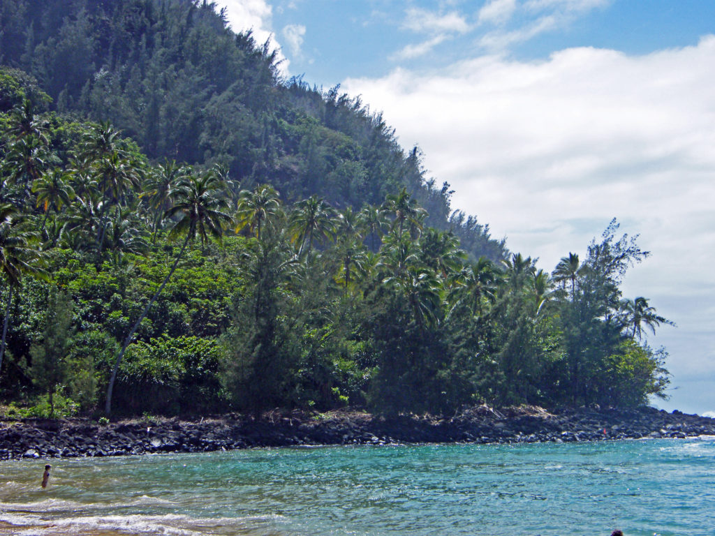
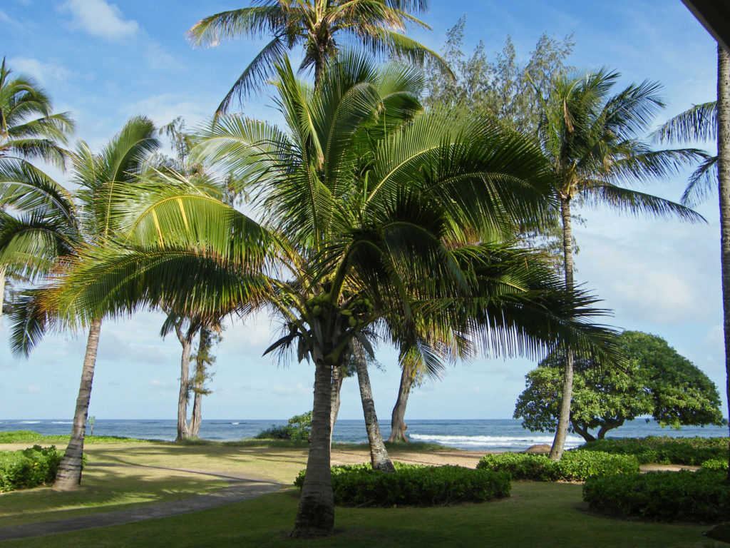
My wife and I have been to Hawai’i many times, but only once to Kaua’i. But that was a memorable trip, and I’ve been contemplating a return to Kaua’i lately.
Kapa’a Creek
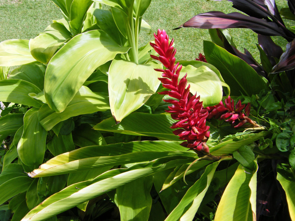
Kaua’i is called the Garden Isle, and for good reason. Abundant rainfall and the tropical climate make the island a botanical paradise. Think of the jungle depicted in the movie Jurassic Park. Much of the original movie and sequels were filmed on Kaua’i.
McBryde Garden
No trip to Kaua’i is complete without visiting at least one of the island’s famed botanical gardens. Three of the five National Tropical Botanical Gardens are located on Kaua’i. Other notable botanical gardens on Kaua’i include Na ‘Aina Kai Botanical Garden and Princeville Botanical Garden on the north shore, and Smith’s Tropical Paradise on the east shore in Wailua River State Park. Check the park websites for ticket prices, open dates, and details. Na ‘Aina Kai and Princeville require advanced purchase of tickets. Tickets to Smith’s are available only at the park entrance.
McBryde Garden
National Tropical Botanical Garden is a non-profit corporation chartered by the U.S. Congress in 1964, dedicated to “discovering, saving, and studying the world’s tropical plants and sharing what is learned.” The three NTBG gardens on Kaua’i are Limahuli Garden and Preserve on the north shore, and Allerton Garden and McBryde Garden on the south shore in the Lawa’i Valley.
McBryde Garden
We toured McBryde Garden on our visit and it was one of the highlights of our trip. Advanced purchase of tickets is not required, but is strongly advised. Tickets are limited and are likely to be sold out. Tickets are $30 for adults and $15 for children, and stays are limited to 2.75 hours. Open Tuesday, Thursday, and Saturday in 2025. The adjacent Allerton Garden also requires you to buy timed entry tickets ($65 for adults, $32.50 for children under 13). All Allerton Garden tours are 2.5 hour guided tours. McBryde Garden tours are self-guided. Combined McBryde and Allerton guided tours are available for the same price as Allerton Garden guided tours and are available for Tuesday and Saturday tours.
McBryde Garden
Limahuli Garden self-guided tours are $30 for adults and free for children under 13. Timed entry tickets are required if arriving by car and parking must be reserved at the time of purchase. Timed entry tickets are not required if arriving by North Shore Shuttle and there is a $5 discount off ticket prices. Limahuli guided tours are available for $60 (adults only, no children allowed) and parking is included. Tours are 2.5 hours long and are available at 9 a.m. only on Tuesday and Thursday. Advance reservations are required.
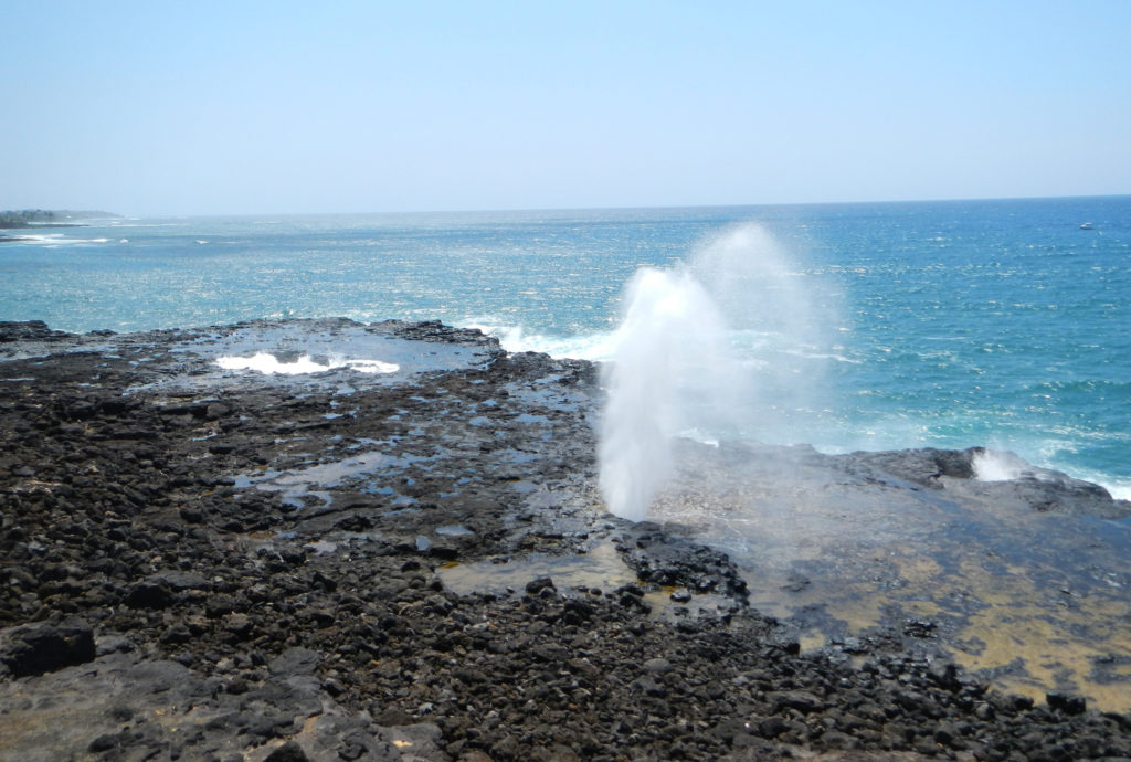
Spouting Horn Park
If you tour McBryde or Allerton Garden, also stop at the nearby Spouting Horn Park, especially if the surf is up. Spouting Horn is a blowhole that shoots water fifty to a hundred feet into the air every ten seconds or so when it is most active, an impressive sight to say the least.
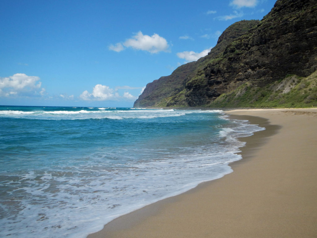
Polihale Beach
There’s more to do on Kaua’i than touring botanical gardens, of course. Relaxing on a tropical beach has to be high on every visitor’s priority list, and Kaua’i has many, many fine beaches. One of the best beaches on the island, and listed in one article I’ve read as one of the best beaches in the world, is Polihale Beach on the west end of the island.
Polihale Beach
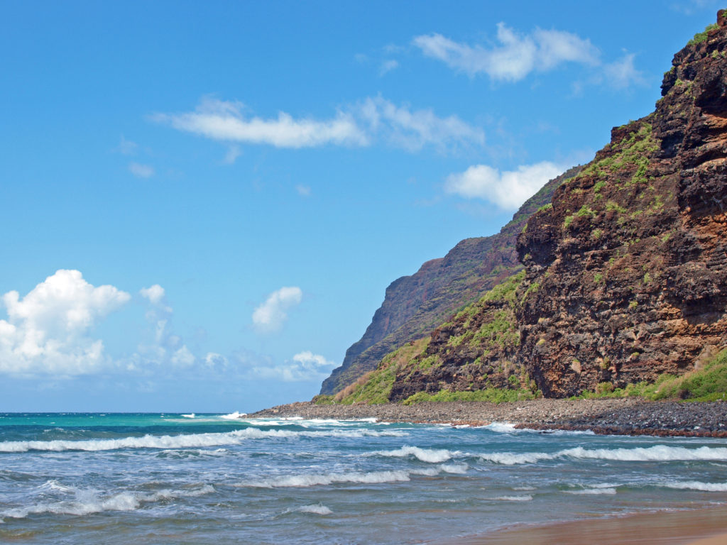
The last few miles of the road to Polihale is a rough, pothole filled sand, gravel and dirt track that is best tackled with an SUV or pickup. We managed it in a compact rental car, though, so it can be done if you take your time. But the road was clearly not being maintained, and it may have gotten worse in the decade since we were there. But if you can manage to get there, you’ll be rewarded with three miles of uninterrupted and uncrowded beach ending at the spectacular cliffs of the NaPali Coast.
NaPali cliffs and Polihale Beach
Polihale State Park has no lifeguards and there are strong currents, so it’s not a good swimming beach. Best to stay out of the water. And there is no drinking water available (or any services), so if you go, plan on bringing everything you’ll need. But despite all that, the scenery and the solitude that you can find there make it well worth it.
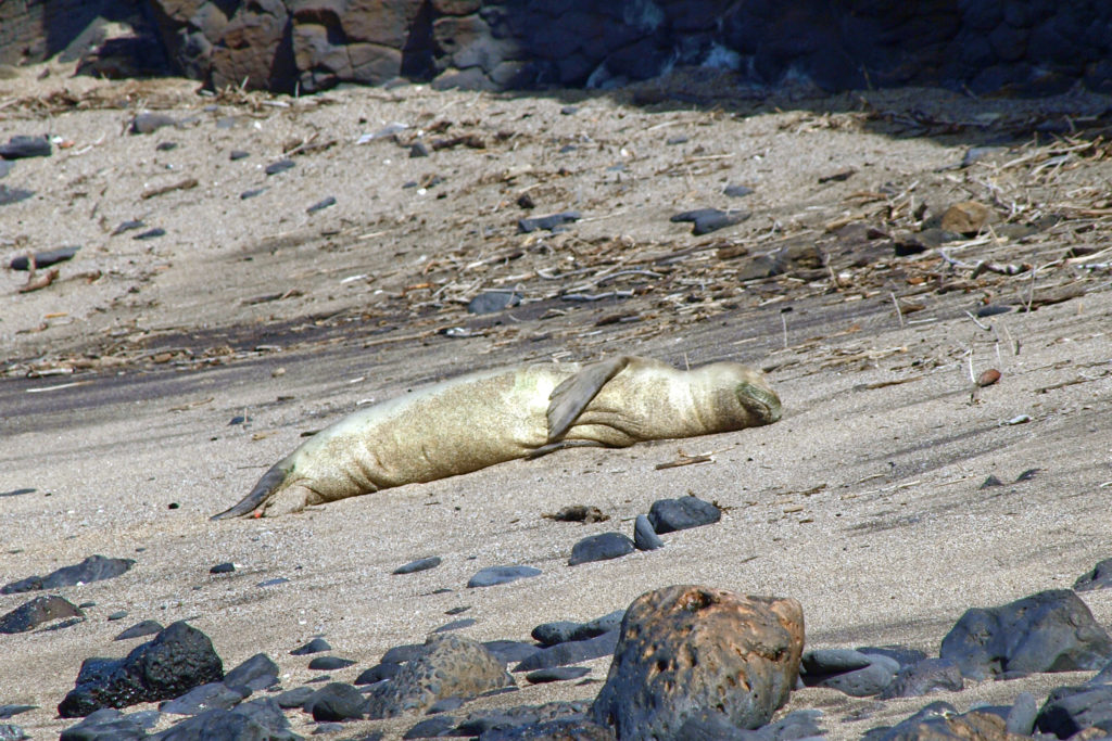
Hawaiian Monk Seal
A more accessible beach on the west end of the island is Kekaha Beach Park. Located at the southern end of a nearly five mile long stretch of sand, Kekaha Beach is one of the best places on the island to view the sunset, but lacks Polihale’s scenery and seclusion. Glass Beach is also a worthwhile stop.
Poipu Beach
Poipu Beach on the south shore is all things Polihale is not. It’s a very popular and always crowded tourist destination. You won’t find anything resembling solitude there and the scenery doesn’t compare to Polihale. But it’s easy to get to, a good swimming beach, and one of the best places on the island to snorkel. And all of the amenities you could ask for are close at hand.
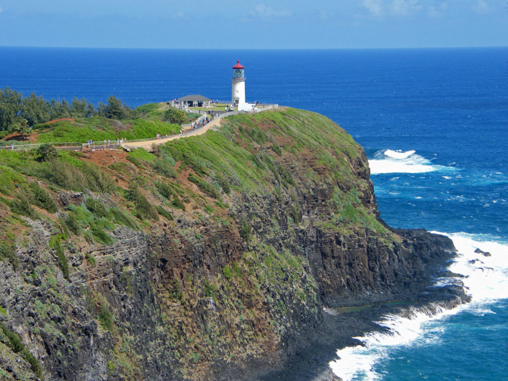
Kilauea Lighthouse
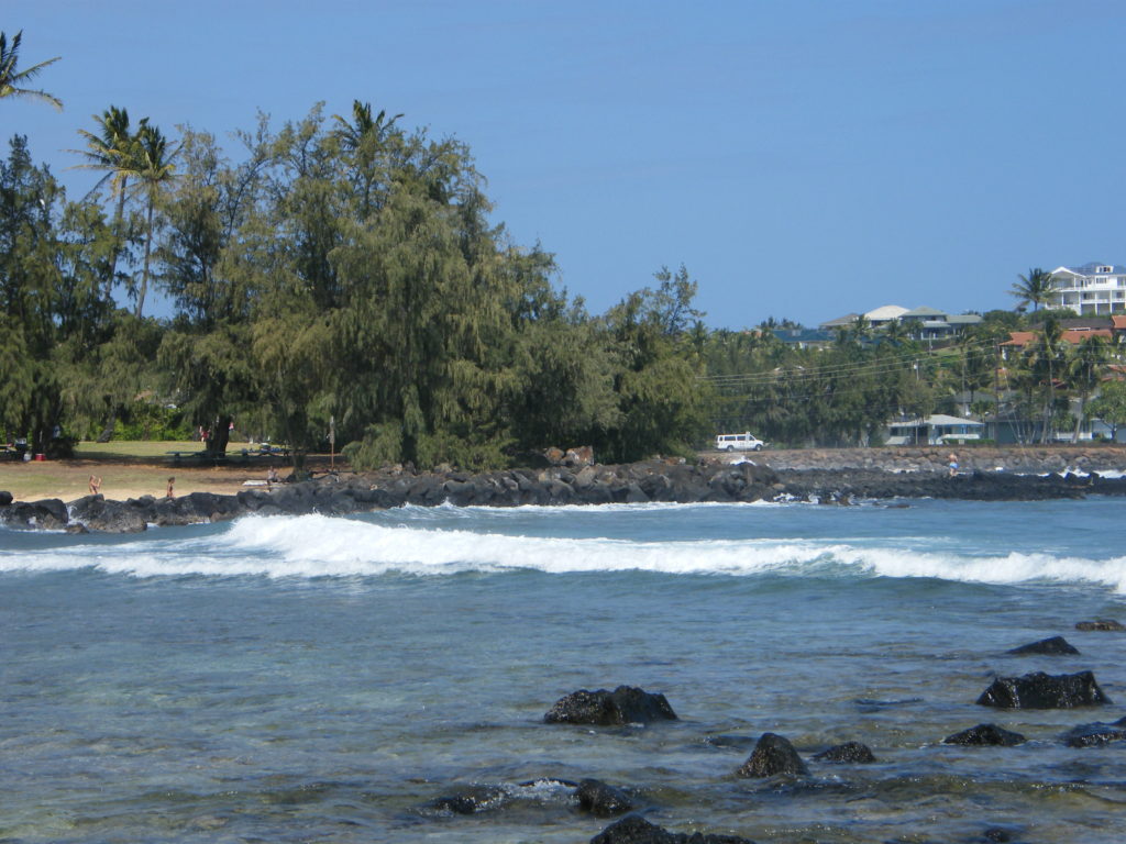
Many of the best beaches on Kaua’i are on the north shore. Moloa’a is a nice uncrowded beach on the north shore where you’re likely to find more locals than tourists. Kauapea Beach (aka Secret Beach) is a not so secret beach just west of the town of Kilauea. The trailhead is at the end of Secret Beach Road. Anini Beach is another place where you might find more locals than tourists. Kalihikai Park at Anini Beach has picnic tables, restrooms, and outdoor showers. Hanalei, farther east, also has a nice beach and the town is an interesting place that would be worth a visit on its own, even without the beach.
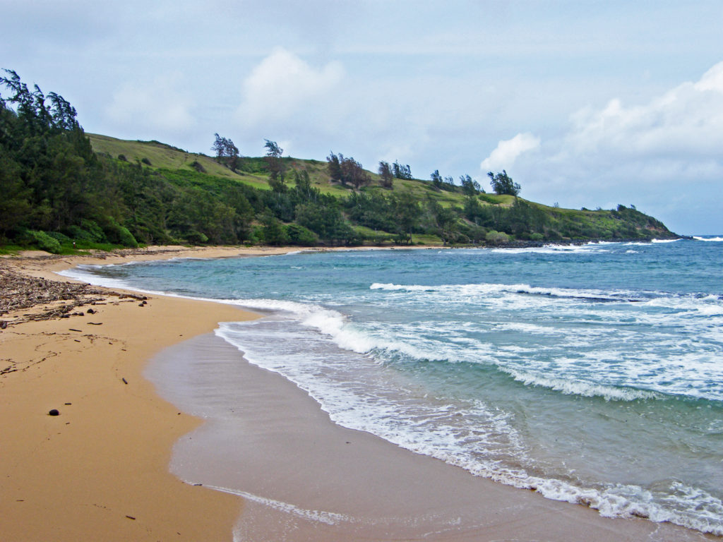
Moloa’a Beach
Tunnels Beach is another popular north shore beach. It’s best to park at Ha’ena Beach Park, although there are now entrance and parking fees for non-residents ($5 per person and $10 per vehicle) which must be purchased in advance. Tunnels is about a third of a mile east of Ha’ena Beach. There is a shorter trail to the beach from the highway, but parking is very limited and I don’t believe it is signed, so it may be easy to miss. There are restrooms, showers and lifeguards at Ha’ena Beach, but not at Tunnels.
Ke’e Beach
Ke’e Beach, at the end of the road, is protected by a reef, making it good for swimming and snorkeling, except in the winter months when all of the north shore beaches can be subject to high surf and strong currents. Even when we were there around the first of April there were warnings of dangerous conditions. Ke’e is part of Ha’ena Beach Park and the same entry and parking fees apply. The parking lot at the end of the road fills up early, partly because it is also the trailhead for the famed Kalalau Trail. There is an overflow parking area about a quarter mile from the end of the road that might be a better option. There are restrooms and showers at Ke’e, and lifeguards on duty.
Kapa’a Beach
These are only a few of the dozens of beaches on Kaua’i. For a more comprehensive list, check out the beaches page of the Kauai.com website.
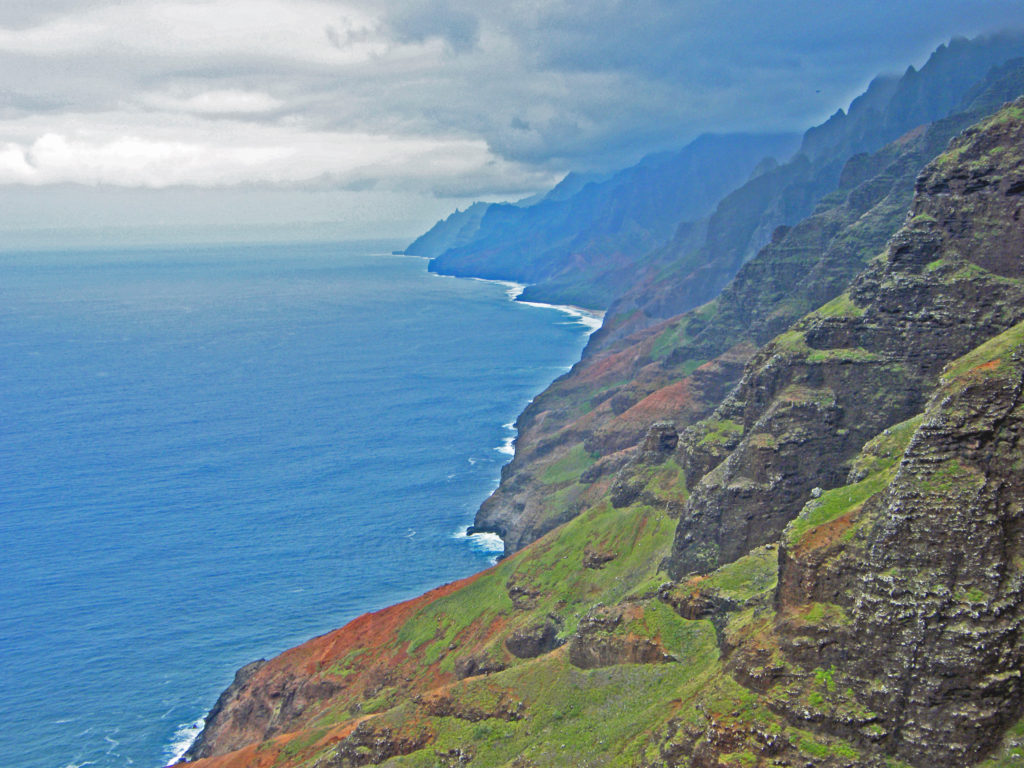
A good way to see the whole island is by helicopter. Most one hour helicopter tours run from $220 to $320 per adult. We opted for a “doors off” tour because we wanted to get better photos than you can get by shooting through a helicopter window. I had never flown in a helicopter before and I have to admit to being a bit nervous before the flight, and not just because we were going doorless. But the whole thing was a blast and I never felt in any danger. And we both got some great photos.
NaPali Coast
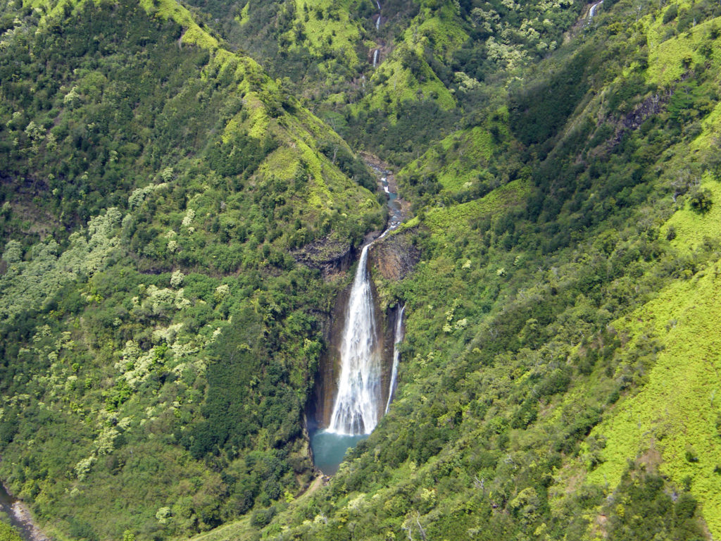
The only disappointment was that the NaPali Coast had some low clouds obscuring the tops of the cliffs. But I highly recommend the experience. There is no other way to see the whole island the way you can by helicopter. And the only way to view the 400 foot high Manawaiopuna Falls (aka Jurassic Park Falls) is from the air.
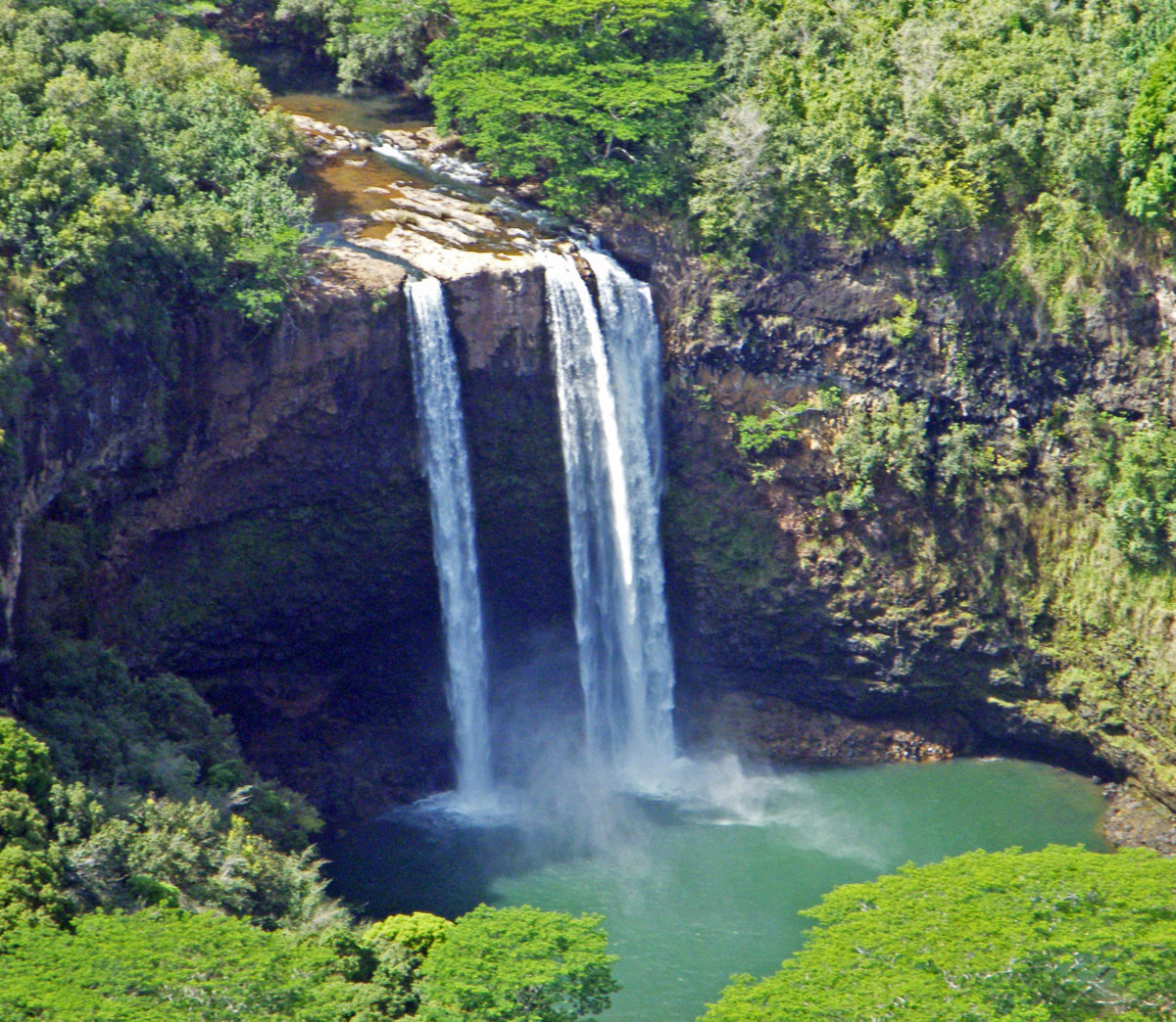
Manawaiopuna FallsWailua Falls
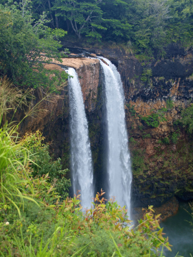
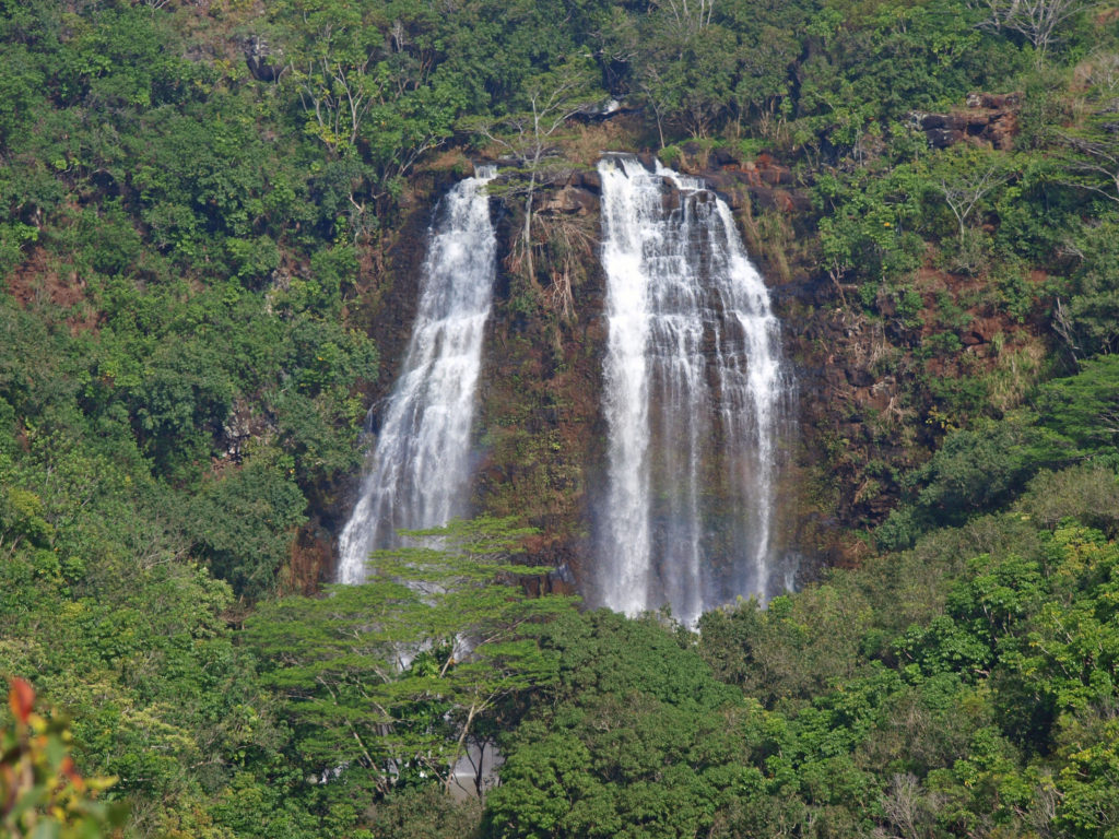
Kaua’i’s abundant rain and mountainous terrain result in many spectacular waterfalls. One of the prettiest is the twin cascades of Wailua Falls, about five miles west of Lihue. The falls are at the end of Maalo Road (Hwy 583). You can get a decent view of the falls from the observation area adjacent to the road. There is a very steep unmaintained trail down to the base of the falls where you probably can get better photos, but there are prominent danger signs that are probably there for a reason, so I wouldn’t risk the trail, especially if it is wet. (If you opt for a helicopter tour you will get a very good view of the falls from the air.)
Opaeka’a Falls
Another beautiful waterfall in the same area is Opaeka’a Falls. Again, no trail to the falls, but a good view from the highway. Opaeka’a Falls is two miles west of Wailua on Kuamo’o Road (Hwy 580).
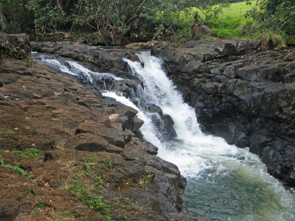
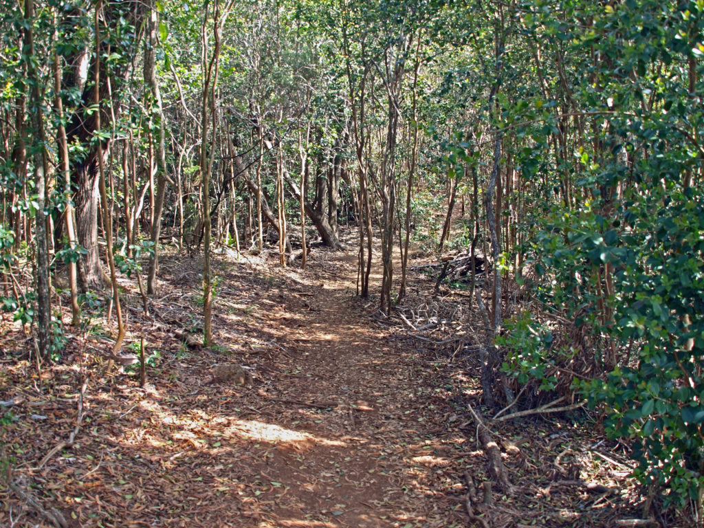
Ho’opi’i Falls
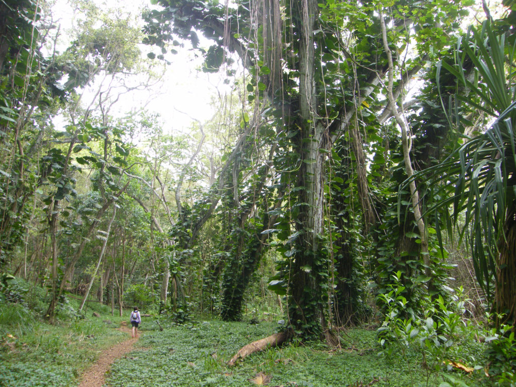
An interesting waterfall, this one at the end of a hike through a Jurassic Park-like tropical rain forest, is Ho’opi’i Falls (actually two separate falls). These are a little harder to find, and they’re not big falls, but the trail to them is absolutely awesome. If its raining or has rained recently, the trail will likely be muddy and slippery, but I think it would still be worth the effort. We were lucky enough to do this hike when it was dry, so it was an easy and thoroughly enjoyable outing for us.
Ho’opi’i Falls Trail
The trailhead is on Kapahi Road west of Kapa’a. Please note that Kapahi Road is a residential area and not all of the residents welcome tourists, so be respectful of the locals. Park in the gravel area provided, not in front of any of their homes, please be quiet (especially early in the day), and don’t leave any trash behind when you depart.
Red Dirt Falls
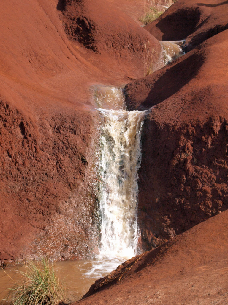
One more interesting falls is Red Dirt Falls on Waimea Canyon Drive, north of the town of Waimea. This is a seasonal falls, so it may not be flowing when you’re there, and it’s a very small waterfall that would be totally unremarkable if it weren’t carved out of the striking red dirt that gives it its name. It’s located at about the 23 mile marker on Hwy 550.
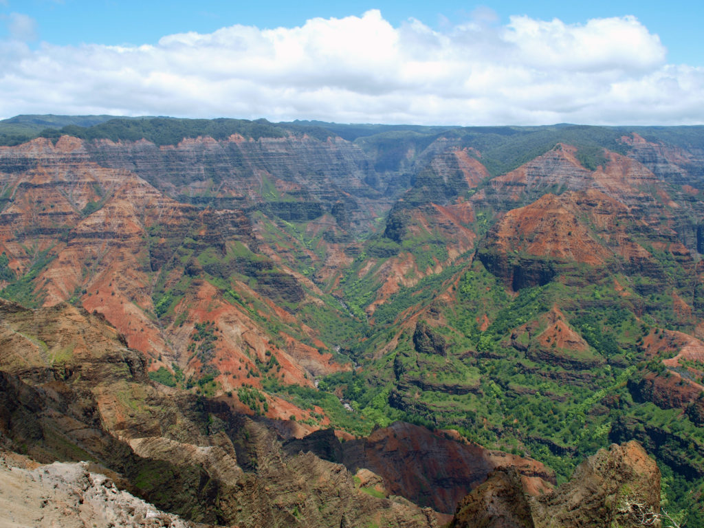
Waimea Canyon
There are more waterfalls to be seen farther up Waimea Canyon, which is one of the must see destination on Kaua’i. It’s often called the Grand Canyon of the Pacific. The red dirt that makes Red Dirt Falls so compelling also gives the canyon a much different look than most of the other scenic attractions on the island. The canyon is 14 miles long, a mile wide, and as much as 3500 feet deep – not as big or as deep as the real Grand Canyon, but still pretty impressive.
Waimea Canyon
There are two state parks, Waimea Canyon and Koke’e in the canyon. For non-residents there is the same $5 per person entrance fee and $10 per vehicle parking fee as at Haena Beach State Park. The fees get you into both parks. You don’t have to pay twice.
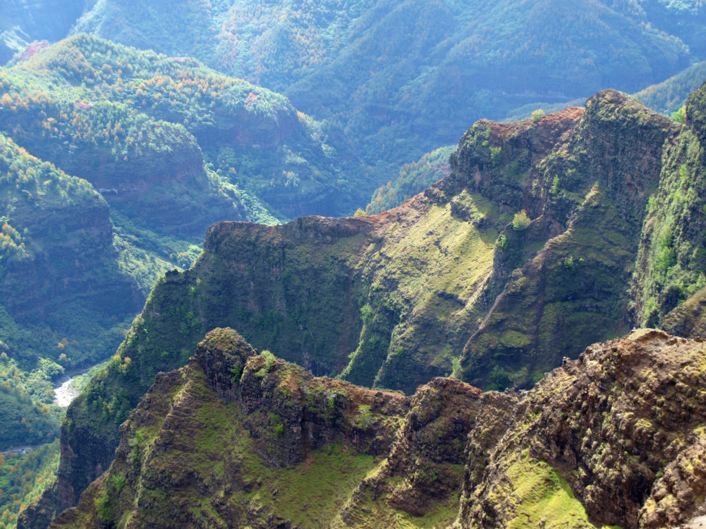
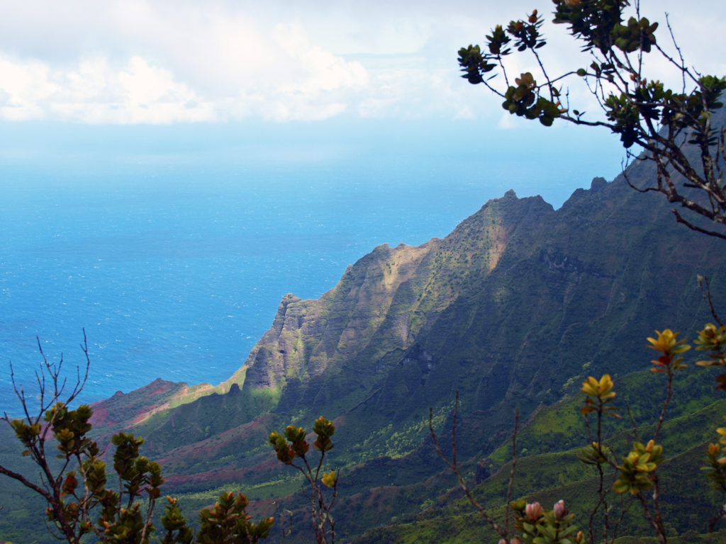
View from Kalalau Overlook, Koke’e State Park
There are numerous viewpoints along the highway in the two parks that give you expansive views of the canyon and its waterfalls. And the highway takes you to the top of the NaPali Coast cliffs. Two truly spectacular viewpoints in Koke’e Park give you views down to the NaPali Coast and the ocean more than 4000 feet below you.
For hikers, there are more than 45 miles of trails in the canyon. You could easily spend days in the canyon and not hike all of the trails. For those that do want to spend multiple days hiking or sightseeing, Koke’e Lodge offers rustic cabins with kitchens. There is also a campground in Koke’e State Park and there are other cabins available nearby. And Waimea town at the base of the canyon has many lodging options.
Russian Fort Elizabeth Park
Updating this post brought back a lot of memories and stoked my desire to go back to Kaua’i and revisit some of the places we explored in 2012.
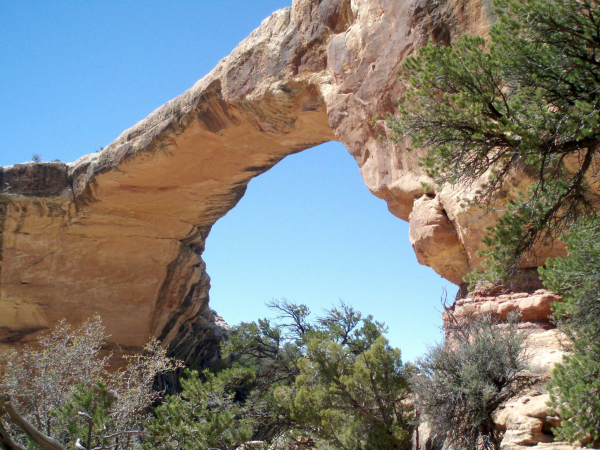
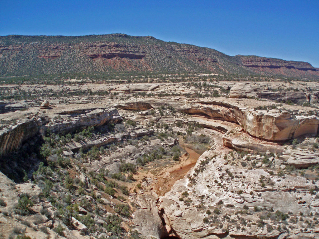
Among the many national parks and monuments of southern Utah, Natural Bridges National Monument often gets overlooked. The Big Five national parks – Zion, Bryce Canyon, Capitol Reef, Canyonlands, and Arches (and Grand Staircase- Escalante National Monument) are all deserving of the accolades they receive. They all are full of spectacularly beautiful and awe inspiring places. But if a trip to southern Utah is on your bucket list, don’t leave out a visit to Natural Bridges.
First Impressions
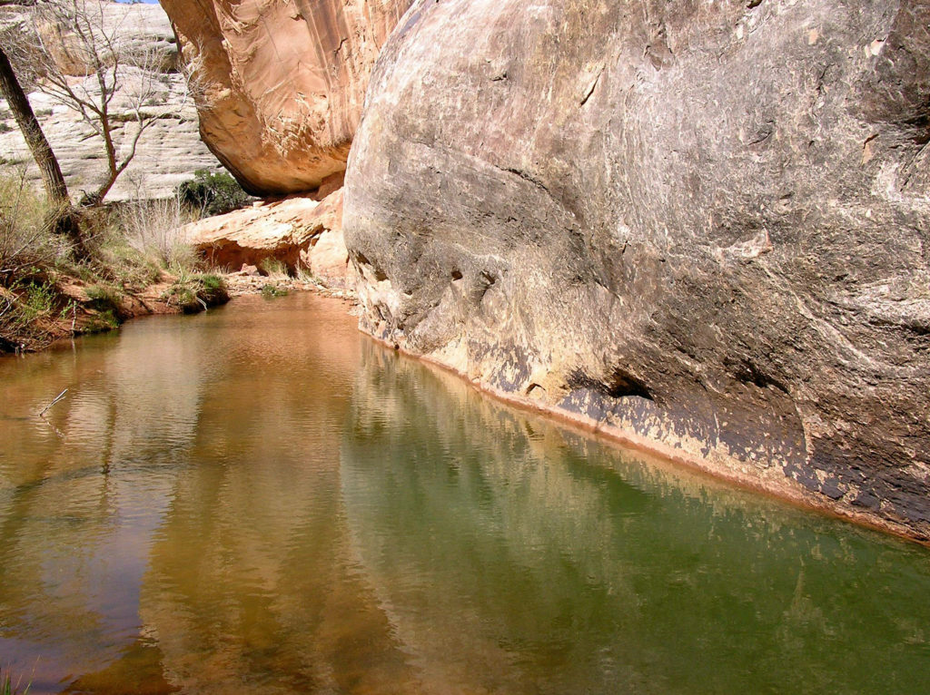
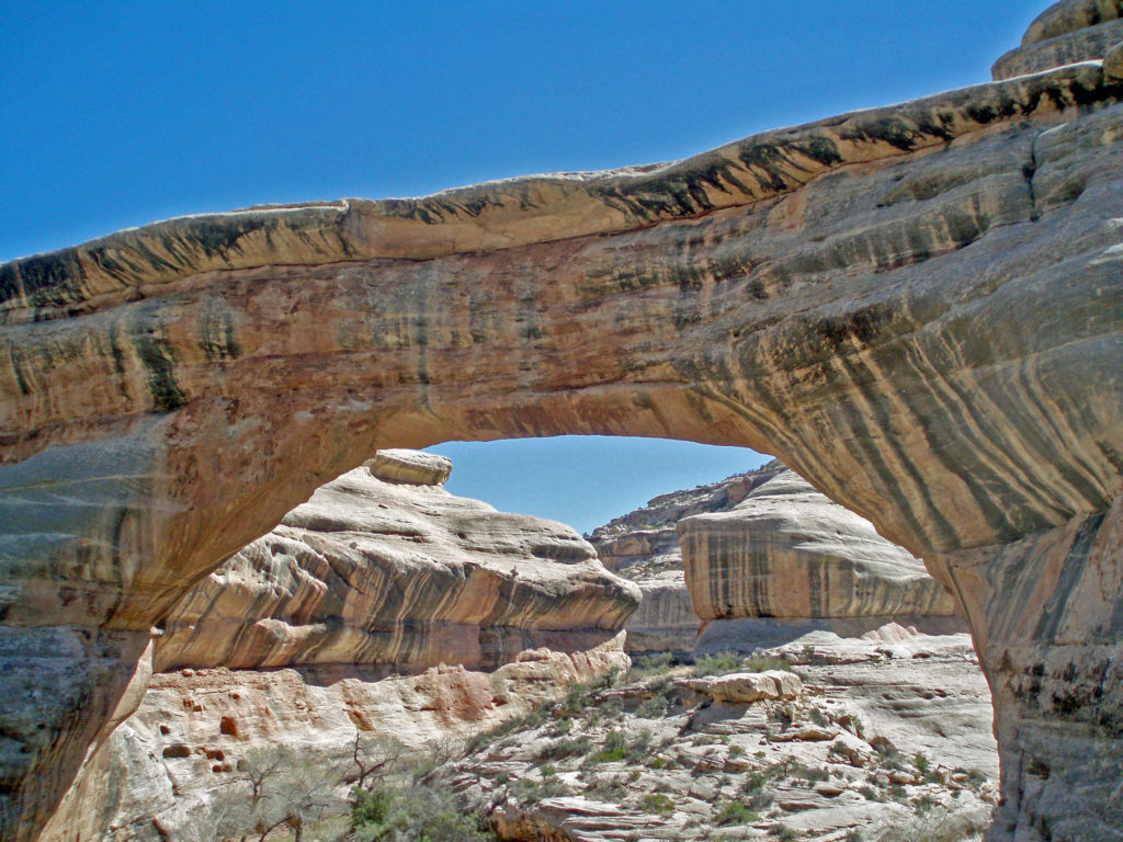
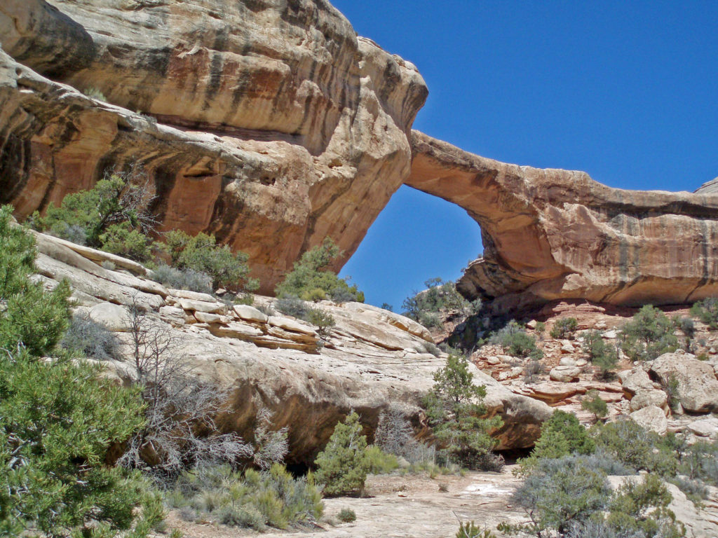
My first visit to Natural Bridges made a lasting impression on me almost immediately. We were there on a very hot day, but once we descended into the canyon, we entered a cool, shaded riparian environment very different from the hot desert landscape above. Natural bridges, unlike arches, are formed by the erosive action of flowing water. And it is that water that makes this place such a welcoming oasis.
My wife and I have been back once since that first visit. The photos here were taken on that second trip in 2008. I think we’re long overdue for a third visit.
Geology
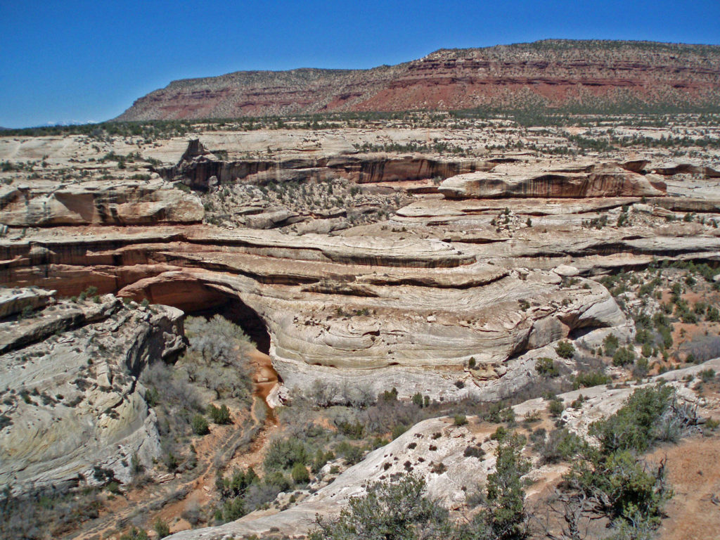
Some 260 million years ago eastern Utah was on the shores of an ancient sea. Over many millions of years the sand deposited on the sea floor was compressed into sandstone, then uplifted by tectonic forces that created the Colorado Plateau. Rivers and streams have since cut their way into the relatively soft sandstone, leaving arches where harder rock overlaid softer, more easily eroded rock.
The white Cedar Mesa Sandstone of the canyons in Natural Bridges was formed from white quartz sand with relatively little iron. The red and orange sandstone of the mesa tops gets its color from more iron rich rocks. Oxygen and hydrogen react with the iron, forming compounds that vary in color depending on the relative proportions of oxygen and hydrogen in the rock.
Human Presence
The Natural Bridges area has been inhabited periodically for about 9000 years. For most of that period, nomadic hunter-gatherers passed through the area. Many of the petroglyphs you’ll find on the canyon walls were done by these Archaic peoples.
The Ancestral Puebloan people began farming the mesa tops around 1500 years ago, but later abandoned the area, presumably because of a prolonged drought. After 300 years, the ancestors of modern day Hopi and Navajo returned to the Natural Bridges area, only to abandon the area again around the year 1280 CE. Modern Hopi, Navaho, and Paiute peoples reoccupied the area once again at later dates.
Europeans didn’t discover the area until 1883 when prospector Cass Hite ventured into the canyons looking for gold. He didn’t find any gold, but he did find the three magnificent natural bridges. Twenty years later, National Geographic Magazine published an article about the bridges, gaining the attention of President Theodore Roosevelt, who established Natural Bridges National Monument in 1908, Utah’s first national monument.
The bridges were named President, Senator and Congressman by Cass Hite. Later explorers gave them the names Augusta, Caroline and Edwin. But neither set of names stuck. In 1909 the bridges were given the Hopi names they carry today: Sipapu, Kachina, and Owachomo.
Getting There
Natural Bridges is located in southeastern Utah, south of Canyonlands National Park. From the town of Blanding drive south on US 191 then turn west on Utah Highway 95. In about 30 miles turn right on Utah 275. The Natural Bridges Visitor Center is 4.5 miles from the junction with Hwy 95.
Visitor Center
The Natural Bridges Visitor Center is a logical first stop when visiting the monument. Pick up a map of the park, fill your water bottles, and ask the staff for information on current conditions, hiking trails, park history, geology, plants and wildlife, etc. There is also a small store and public restrooms. The restrooms and water are available even when the visitor center is closed.
Bridge View Drive
Bridge View Drive is a nine mile one way loop road through the monument, with about a dozen viewpoints, all worth stopping at. There are maintained trails descending into the canyon to all three bridges from Bridge View Drive. All are short, easy hikes down into the canyons, without a huge amount of elevation gain on the return to the canyon rim. There is also an unmaintained trail in the canyon bottoms linking the three bridges, and there is a trail on top of the mesa between the Sipapu Bridge and Kachina Bridge viewpoints.
Night Skies
As beautiful and spectacular as Natural Bridges is during the day, it may be even more so at night. I say it may be only because I’ve not been there after dark. But by all accounts, star gazing is one of the park’s top attractions. Of the 104 International Dark Sky Parks in the world, Natural Bridges was the first so designated.
Where To Stay
There is a small first come first served campground adjacent to the visitor center in the monument, but there are no water, electric, or sewer hookups. The nearest town of any size is Blanding. There are several RV parks and a variety of motels and other accommodations in Blanding, as well as a number of cafes and restaurants.
Roadtripping
Natural Bridges can be included in a gigantic loop that includes Zion, Cedar Breaks, Bryce Canyon, Grand Staircase-Escalante, Capitol Reef, Arches, Canyonlands, Mesa Verde, Monument Valley, Lake Powell, and the North Rim of the Grand Canyon – a truly epic road trip that might take a month or longer to fully experience. And, of course, there are a variety of shorter loops that can be done if you can’t fit all of those destinations into your plans.
Conclusion
Any road trip to southeastern Utah should include a visit to Natural Bridges. It’s a beautiful, interesting, and unique place very worthy of its place among the other parks and monuments of the region. And the surrounding region, part of the 1.3 million acre Bears Ears National Monument, is also well worth exploring.
Originally posted July 10, 2021. Updated July 21, 2024.


 History
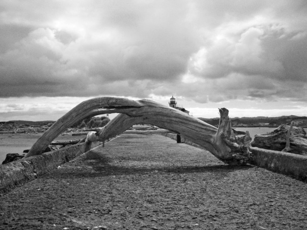 One of the things Lord Bennett brought to Bandon from Ireland was gorse, a thorny, thick growing plant with bright yellow flowers. In Ireland it was used for privacy hedges and property boundaries because it is almost impenetrable. In Oregon it went wild and was one of the state’s first invasive plants. Besides being thick and thorny, it is also a very oily plant and burns readily. In 1936 a small forest fire started from a slash burn that got out of hand, spread to the gorse near the town, and then to the town itself, destroying all but 16 of the 500 structures in the town. The fire decimated the community and all but ended shipping to and from the harbor.
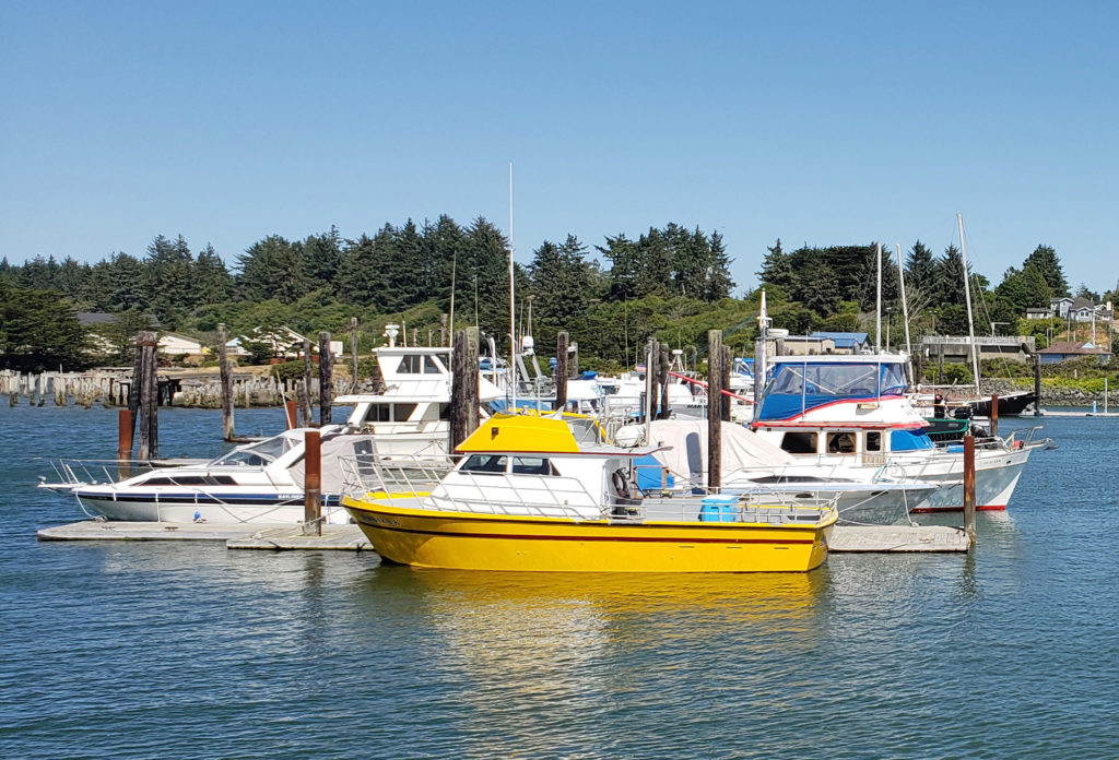 In my youth, Bandon was primarily a mill town, with fishing and agriculture secondary industries. Today, the lumber and plywood mills are long gone. There is still a small fishing fleet that operates out of the harbor, Bandon is still one of the leading cranberry producing areas of the country, and dairy farming is still an important component of the economy. But it is tourism that drives the economy today. The three main tourist draws are the beaches, Bandon Dunes Golf Resort, and the old town section of Bandon.
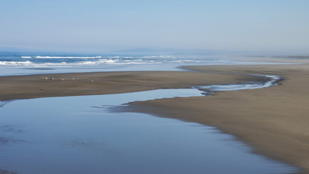 The Beaches
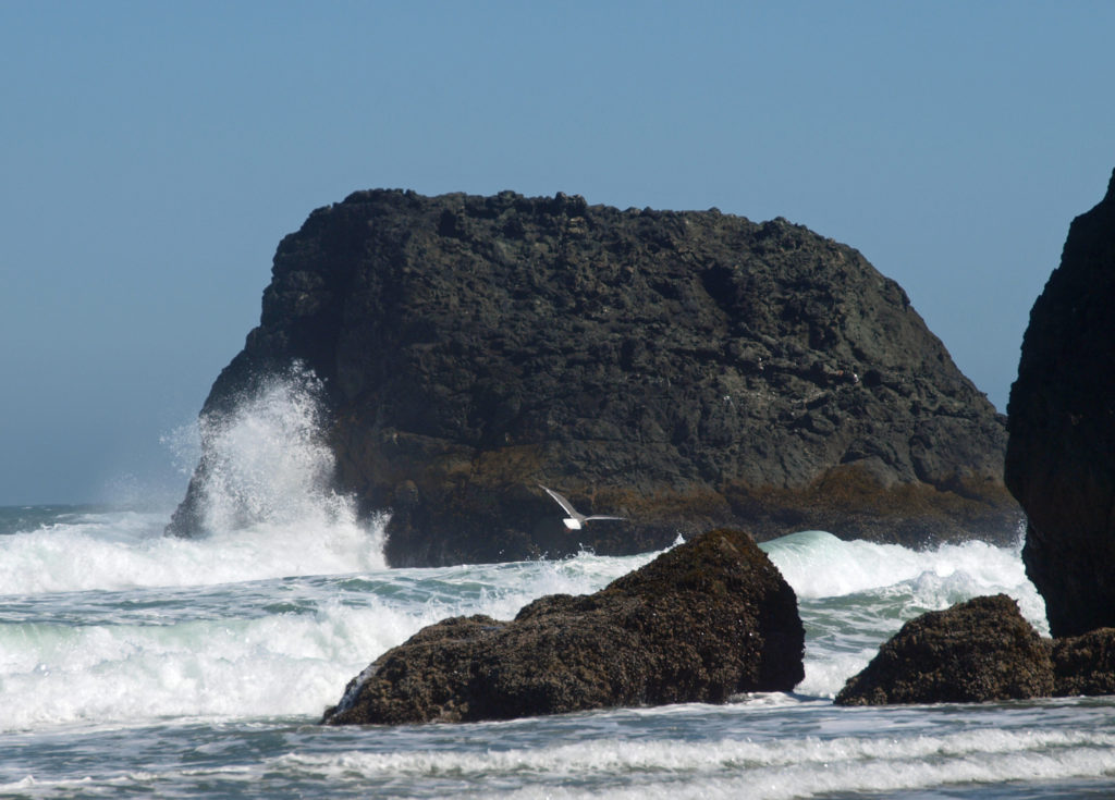
 Access can be had from the south jetty area, from the wayside at the end of 11th Street, and from Face Rock State Scenic Viewpoint on the Beach Loop Road. Farther south on the Beach Loop Road are other beach access points at Devils Kitchen and Bandon State Natural Area.
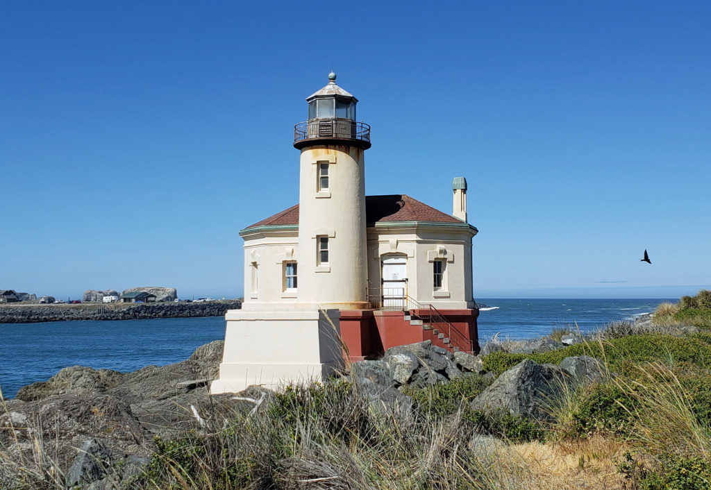
 In 1939 the Coast Guard took over the lighthouse and deemed it unnecessary. The lighthouse was replaced by an automated light on the south jetty. The lighthouse sat abandoned for 24 years until it became part of the new Bullards Beach State Park in 1963. It was another 13 years before renovation of the lighthouse began, but it finally opened to the public in 1979. In 1991, during Bandon’s centennial celebration, a solar powered light was installed, ending the Coquille River Lighthouse’s 52 years of darkness. Further renovation of the lighthouse was done in 2007. The bottom floor of the lighthouse is staffed by volunteers and open to the public, but the tower and the light are not.
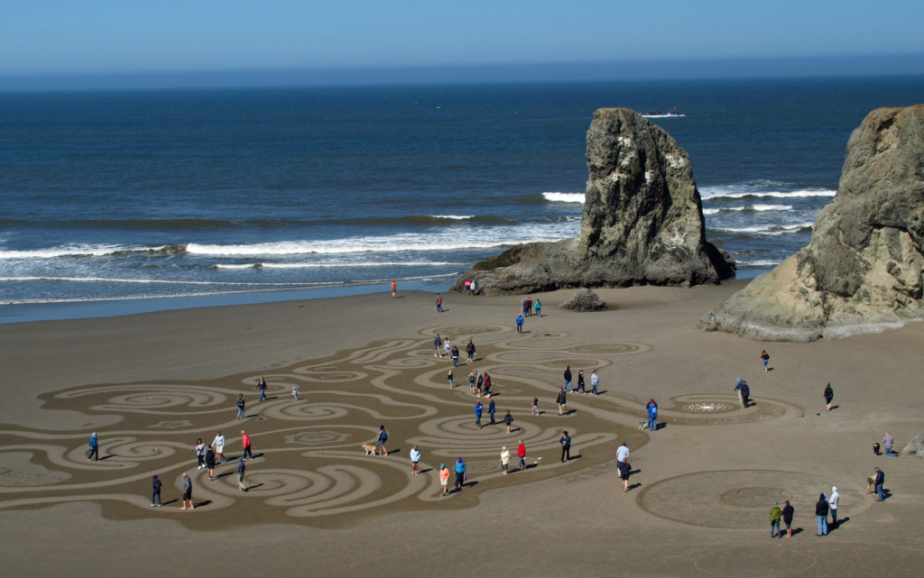 Circles in the Sand
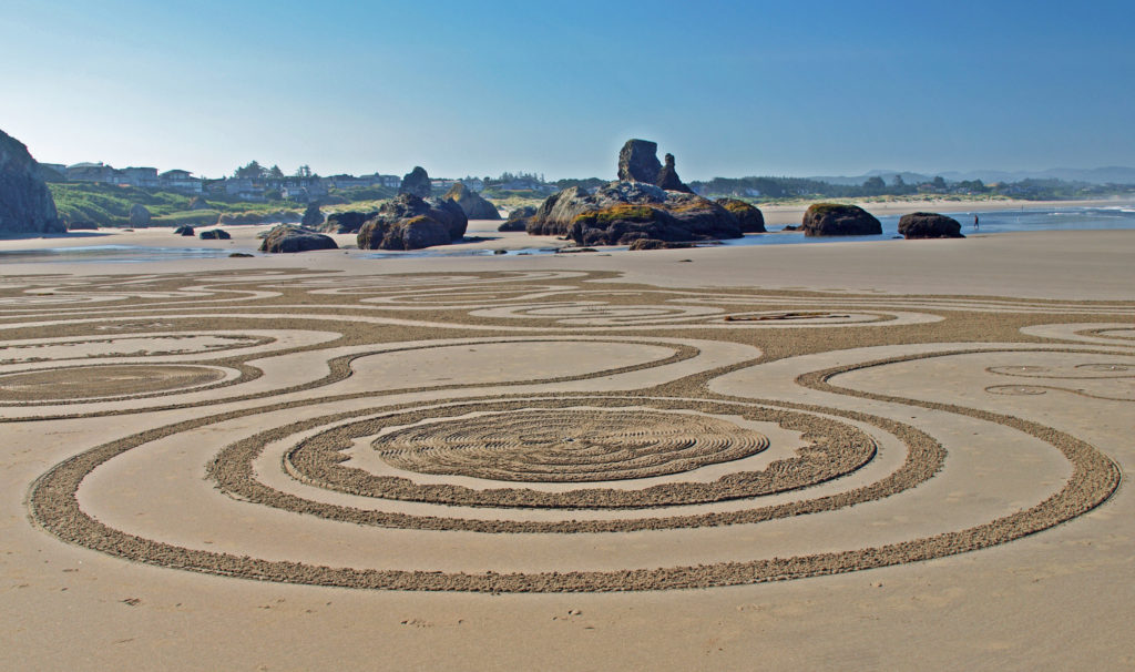 The
The 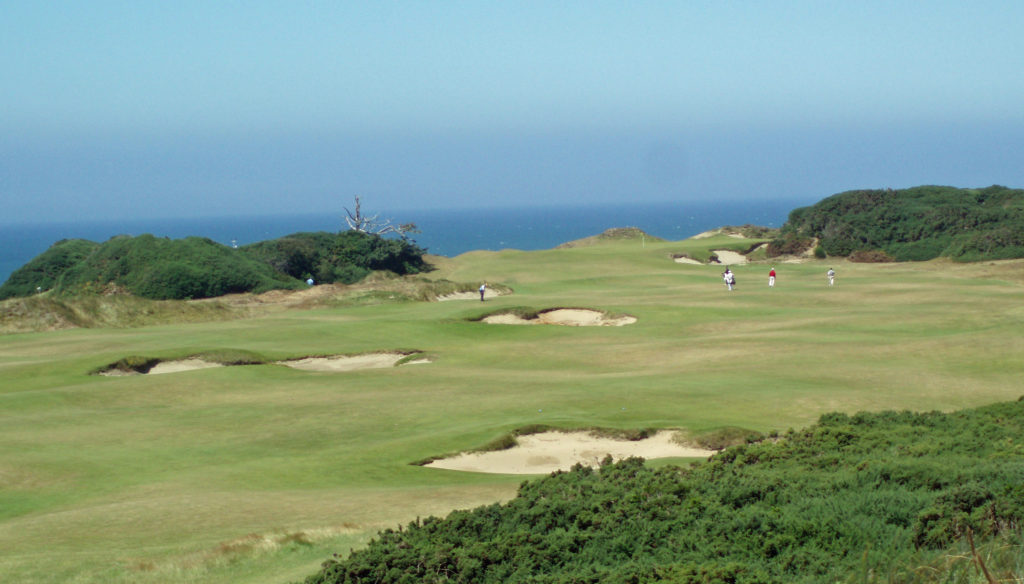
 All of the Bandon Dunes courses are consistently rated in the top 100 courses in the United States, and the 13 hole par three course, Bandon Preserve, is a challenge in itself. A few miles south of town,
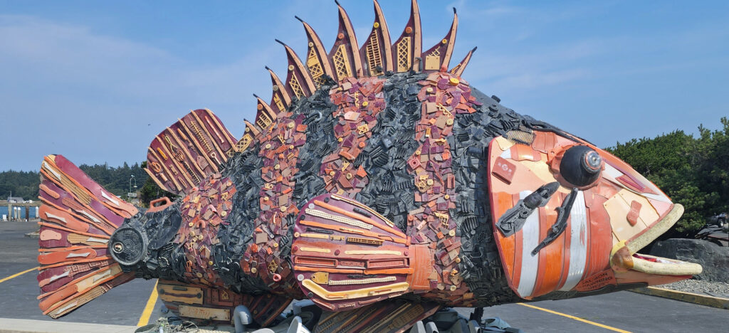
 Good eats abound in Old Town. Start your day at Bandon Coffee Cafe or Bandon Baking Company. Stop at
 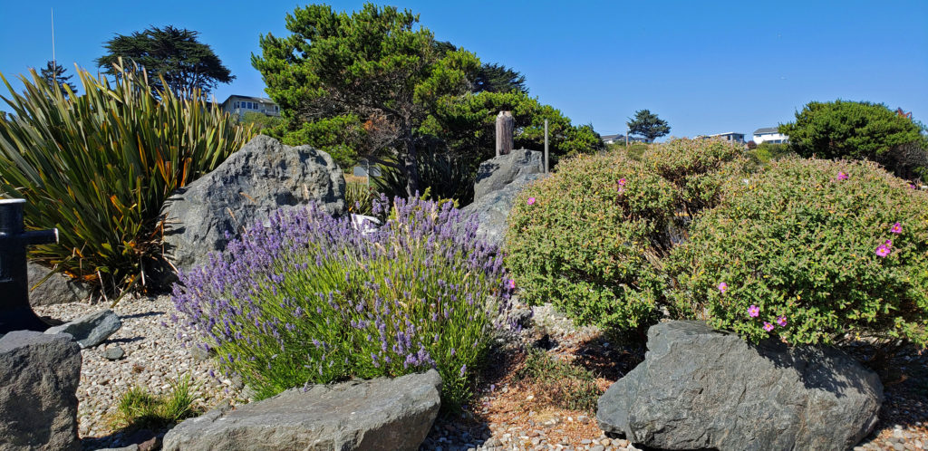 Accommodations
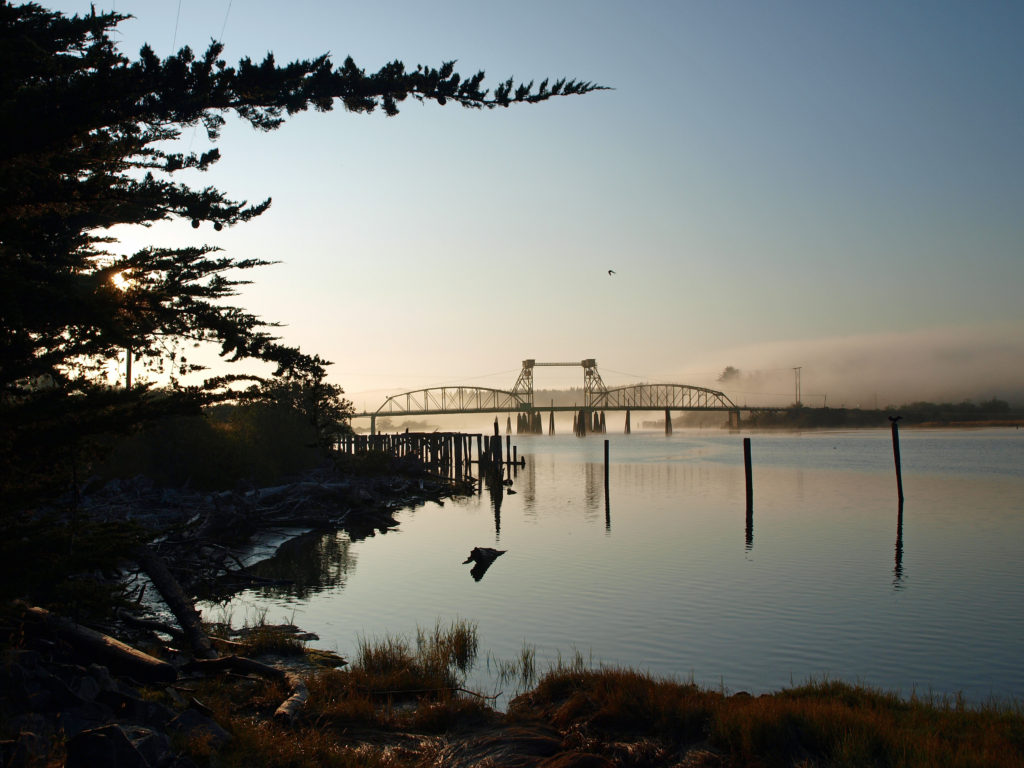 There is a campground at
 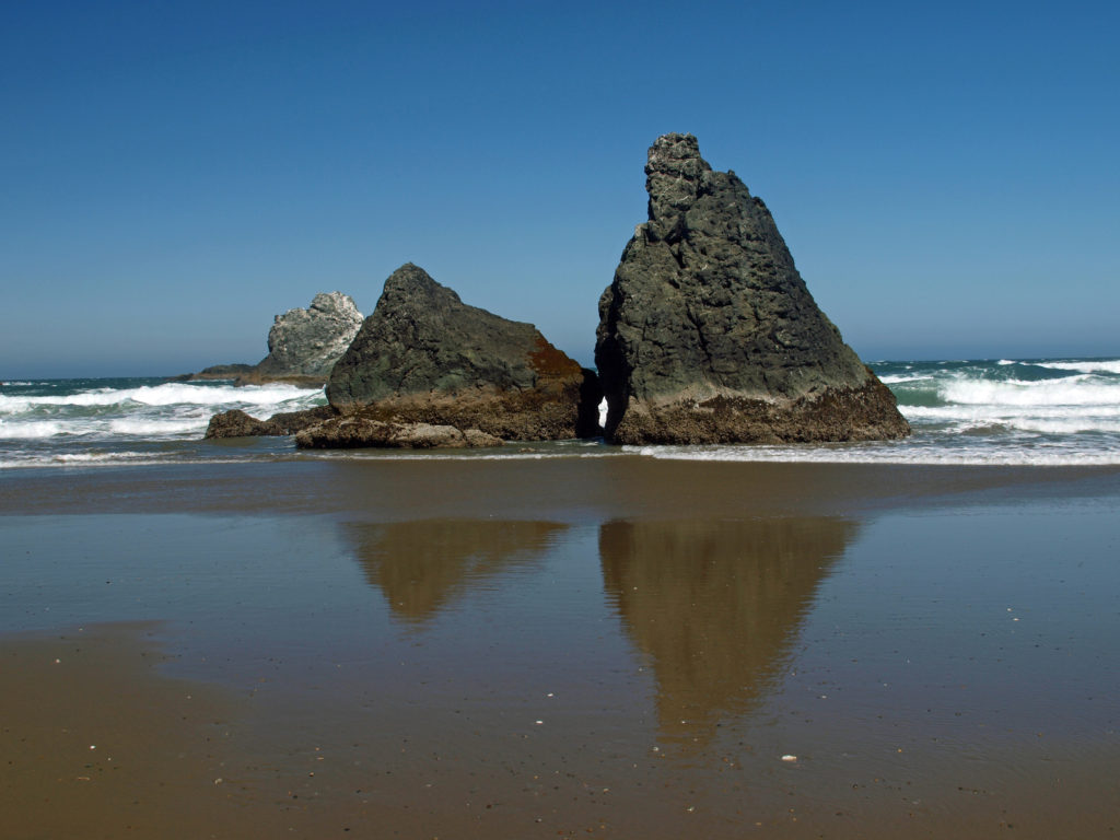 Getting There
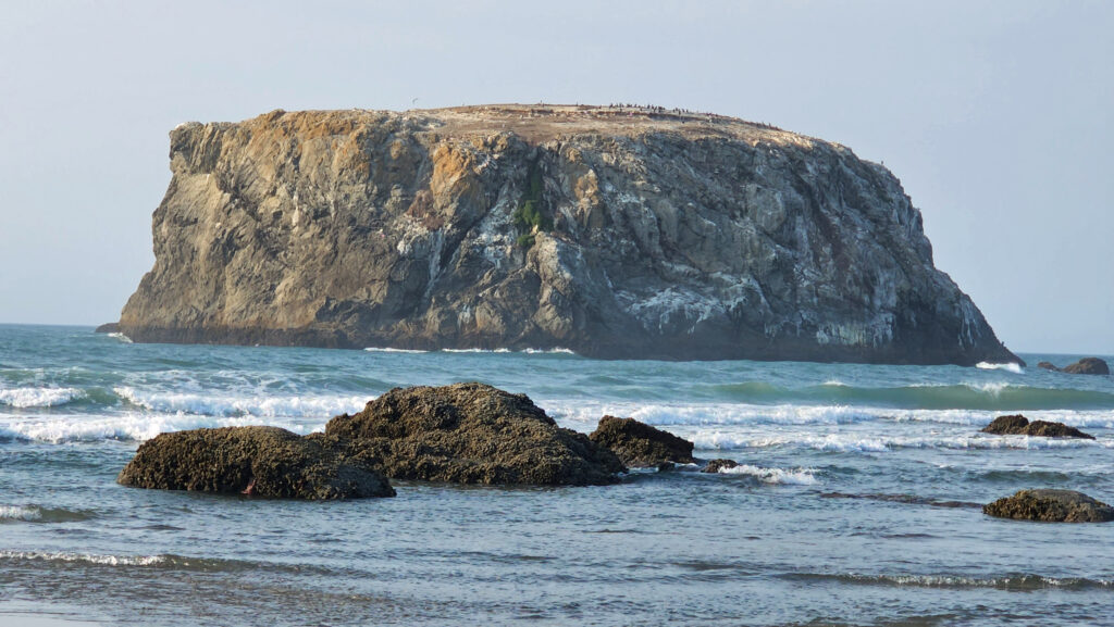 Consider combining a visit to Bandon with a drive south along the spectacular

 For hikers, there are more than 45 miles of trails in the canyon. You could easily spend days in the canyon and not hike all of the trails. For those that do want to spend multiple days hiking or sightseeing,
 First Impressions
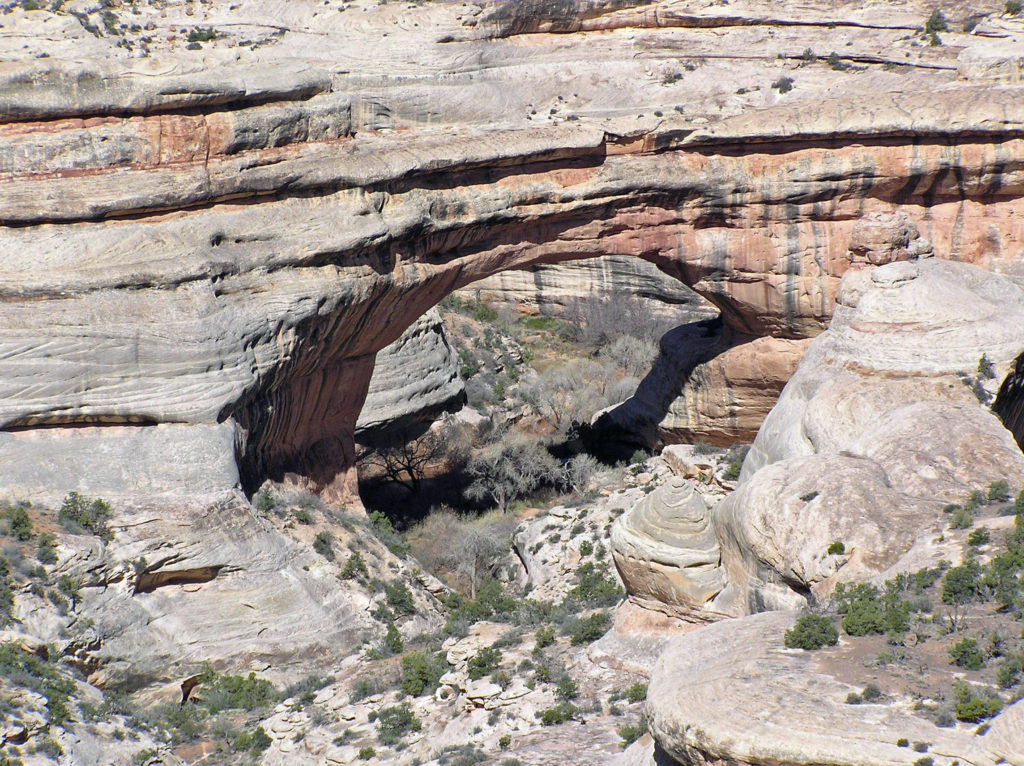 My wife and I have been back once since that first visit. The photos here were taken on that second trip in 2008. I think we’re long overdue for a third visit.
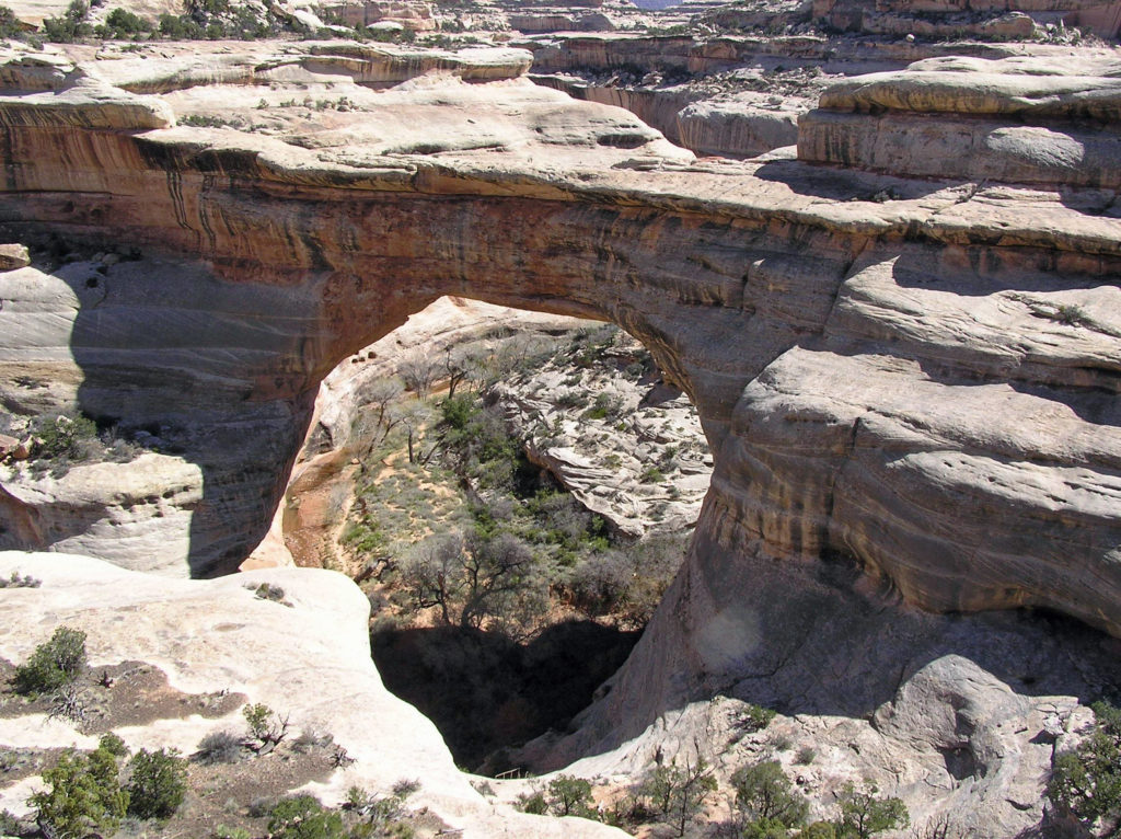
 The white Cedar Mesa Sandstone of the canyons in Natural Bridges was formed from white quartz sand with relatively little iron. The red and orange sandstone of the mesa tops gets its color from more iron rich rocks. Oxygen and hydrogen react with the iron, forming compounds that vary in color depending on the relative proportions of oxygen and hydrogen in the rock.
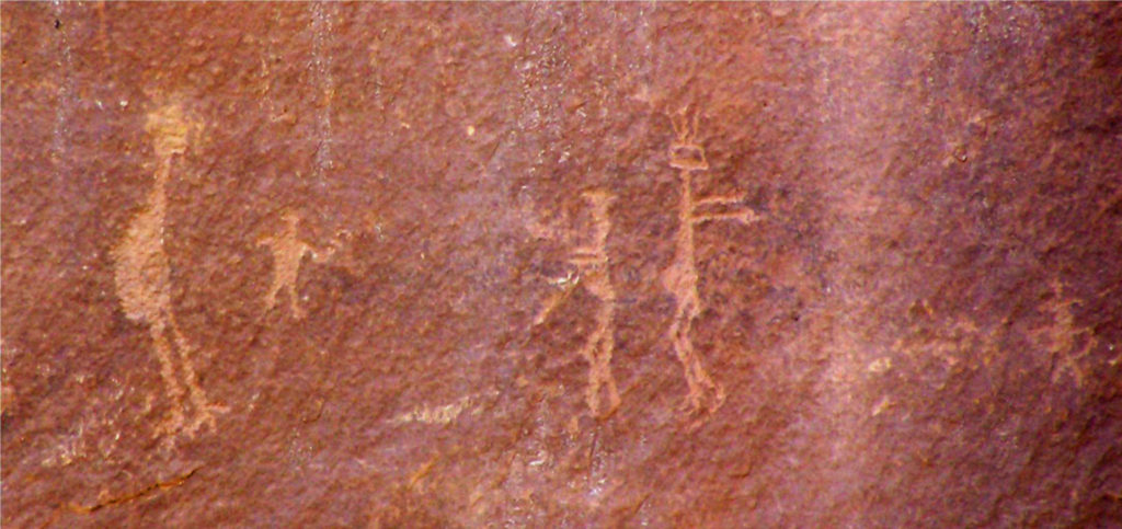 Human Presence
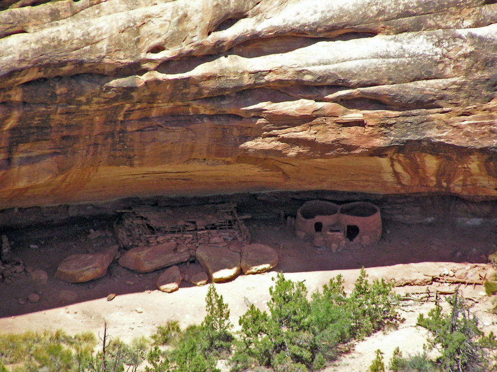 The Ancestral Puebloan people began farming the mesa tops around 1500 years ago, but later abandoned the area, presumably because of a prolonged drought. After 300 years, the ancestors of modern day Hopi and Navajo returned to the Natural Bridges area, only to abandon the area again around the year 1280 CE. Modern Hopi, Navaho, and Paiute peoples reoccupied the area once again at later dates.
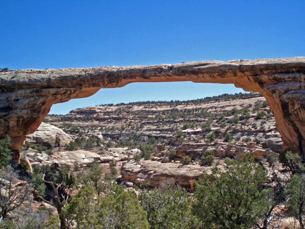 Europeans didn’t discover the area until 1883 when prospector Cass Hite ventured into the canyons looking for gold. He didn’t find any gold, but he did find the three magnificent natural bridges. Twenty years later, National Geographic Magazine published an article about the bridges, gaining the attention of President Theodore Roosevelt, who established
 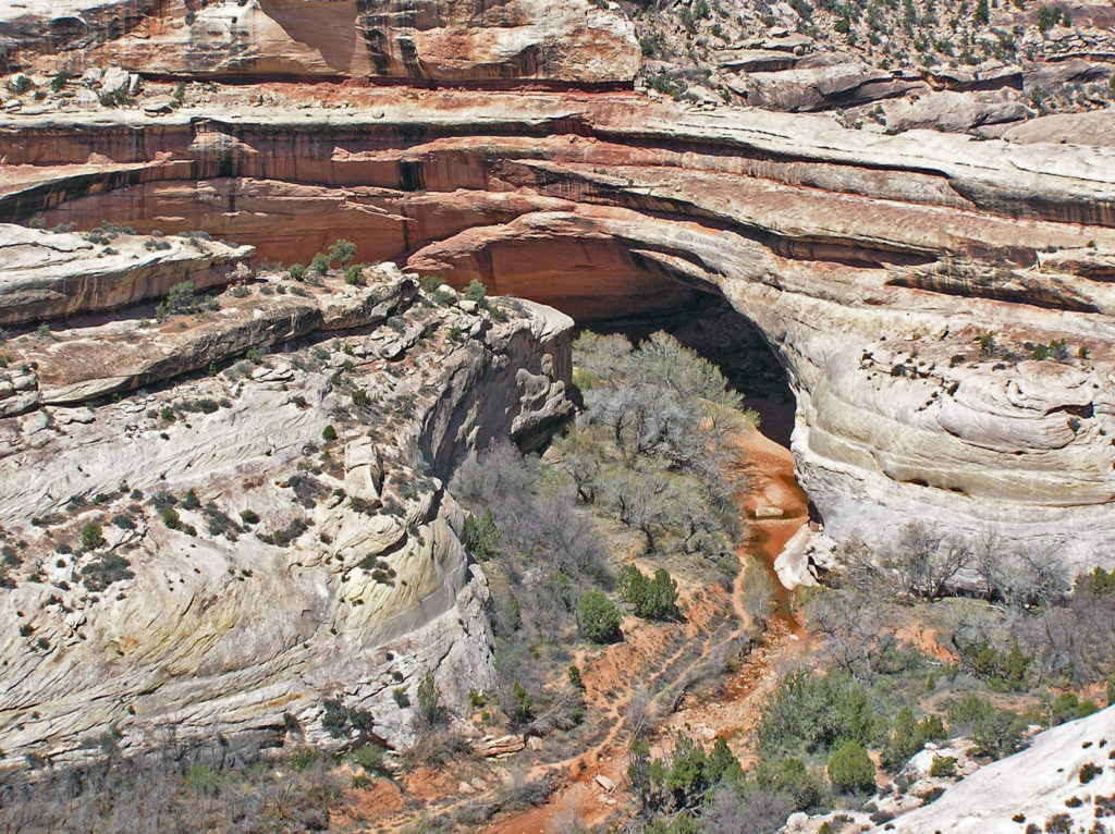 The bridges were named President, Senator and Congressman by Cass Hite. Later explorers gave them the names Augusta, Caroline and Edwin. But neither set of names stuck. In 1909 the bridges were given the Hopi names they carry today: Sipapu, Kachina, and Owachomo.
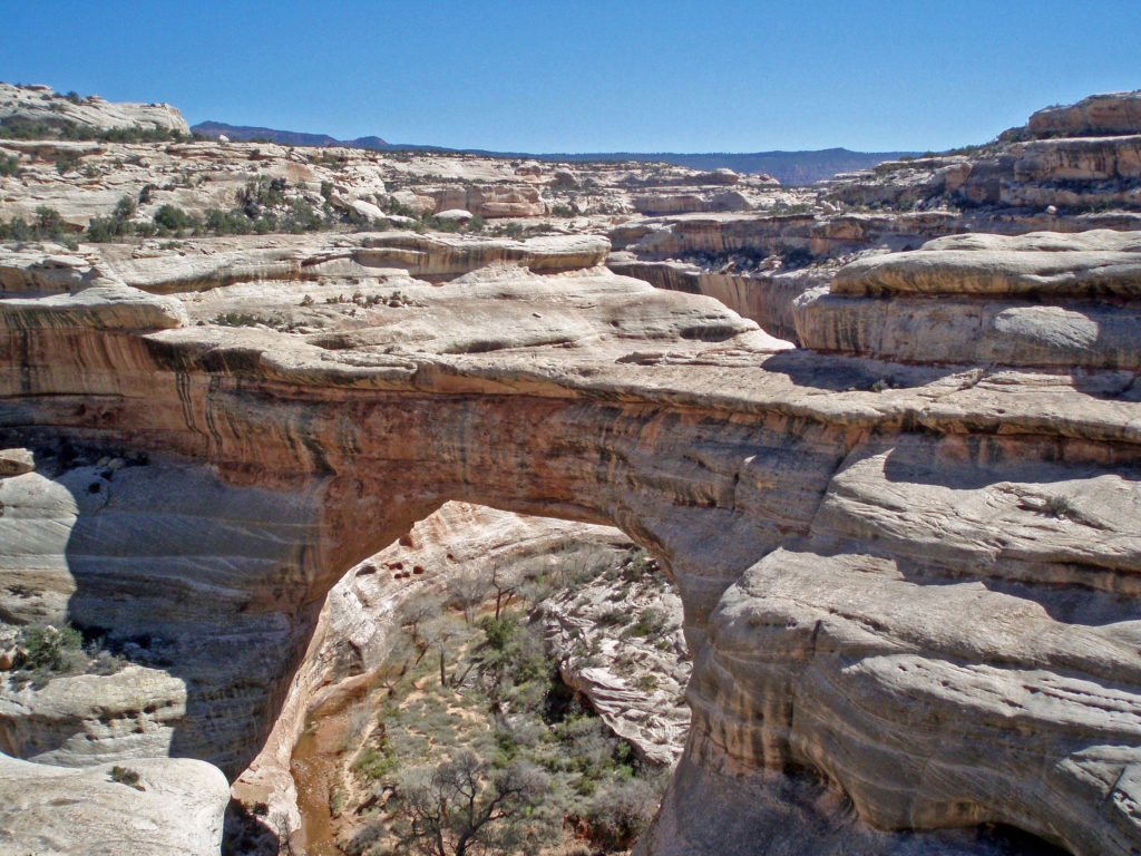
 Visitor Center
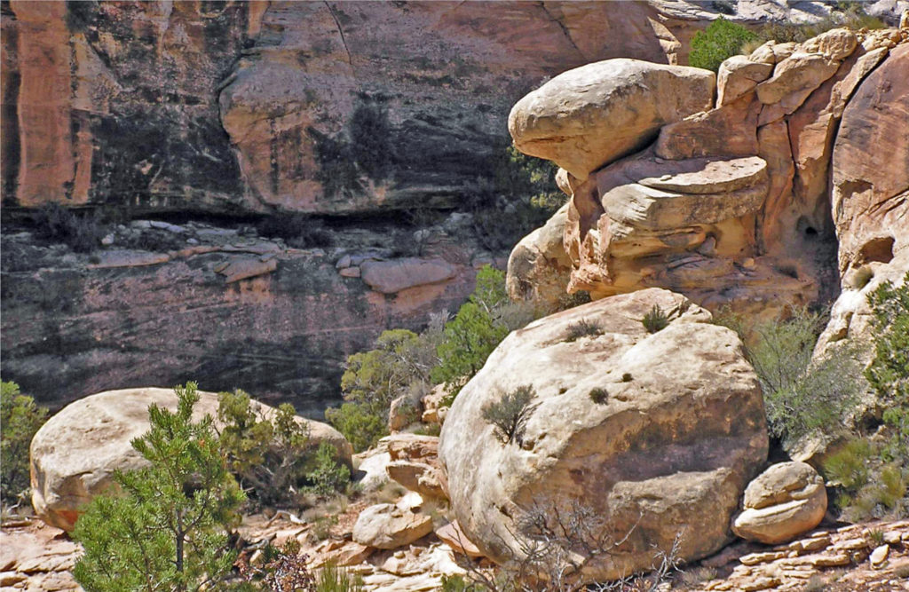


 Conclusion
 Originally posted July 10, 2021. Updated July 21, 2024.