By Alan K. Lee
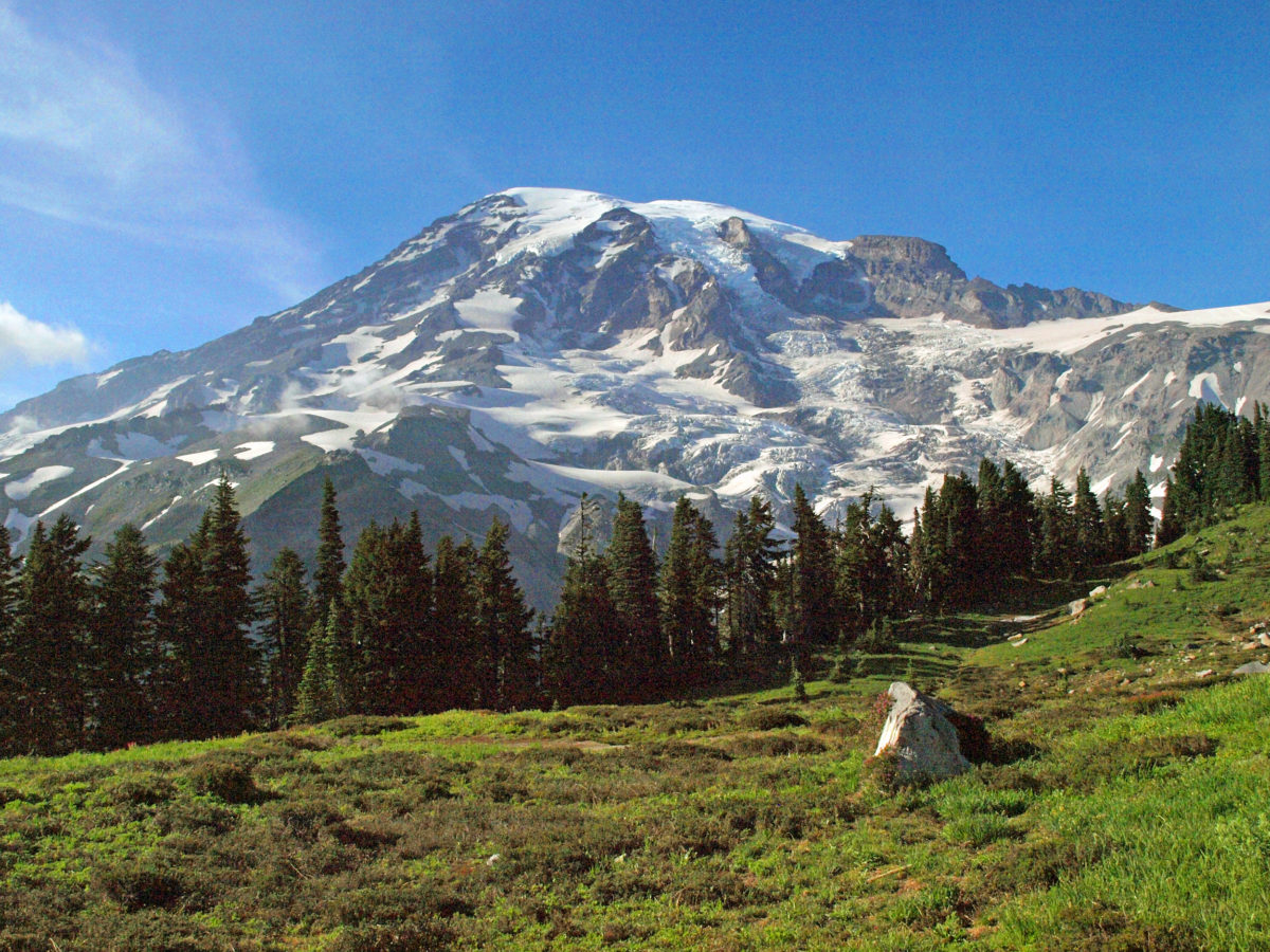
One of the benefits of living in the Pacific Northwest is that you have incredible places like Mount Rainier National Park almost in your back yard. Mount Rainier is close enough to both Seattle and Portland that it’s possible to visit the mountain as a day trip, which many people do. But Rainier is so large, and there is so much to explore, that you can’t even begin to experience all it has to offer in a day, or even a week.
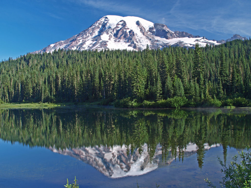
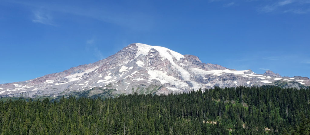
My wife and I have vacationed in Mount Rainier National Park a number of times over the years. Our favorite part of the park is the aptly named Paradise area, located on the south slope of the mountain at an elevation of 5400 feet, 9000 feet below the summit. The name Paradise was bestowed on the area by Martha Longmire, one of the early developers of tourist facilities in the area, more than a century ago. But appreciation for the beauty of this spot goes back much farther. Native Americans frequented the area long before it was discovered by white settlers, and they apparently appreciated its beauty just as much. Their name for the area, Saghalie Illahe, translates to Heavenly Place or Land of Peace.
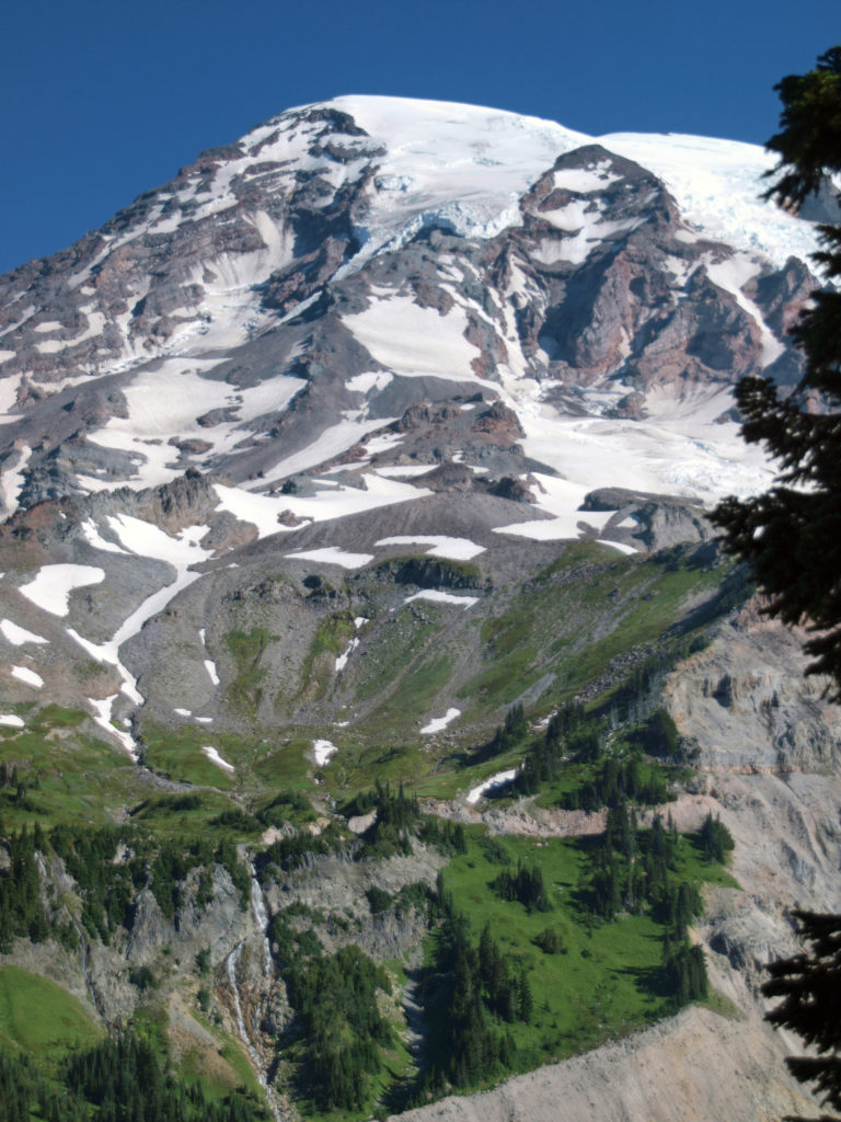
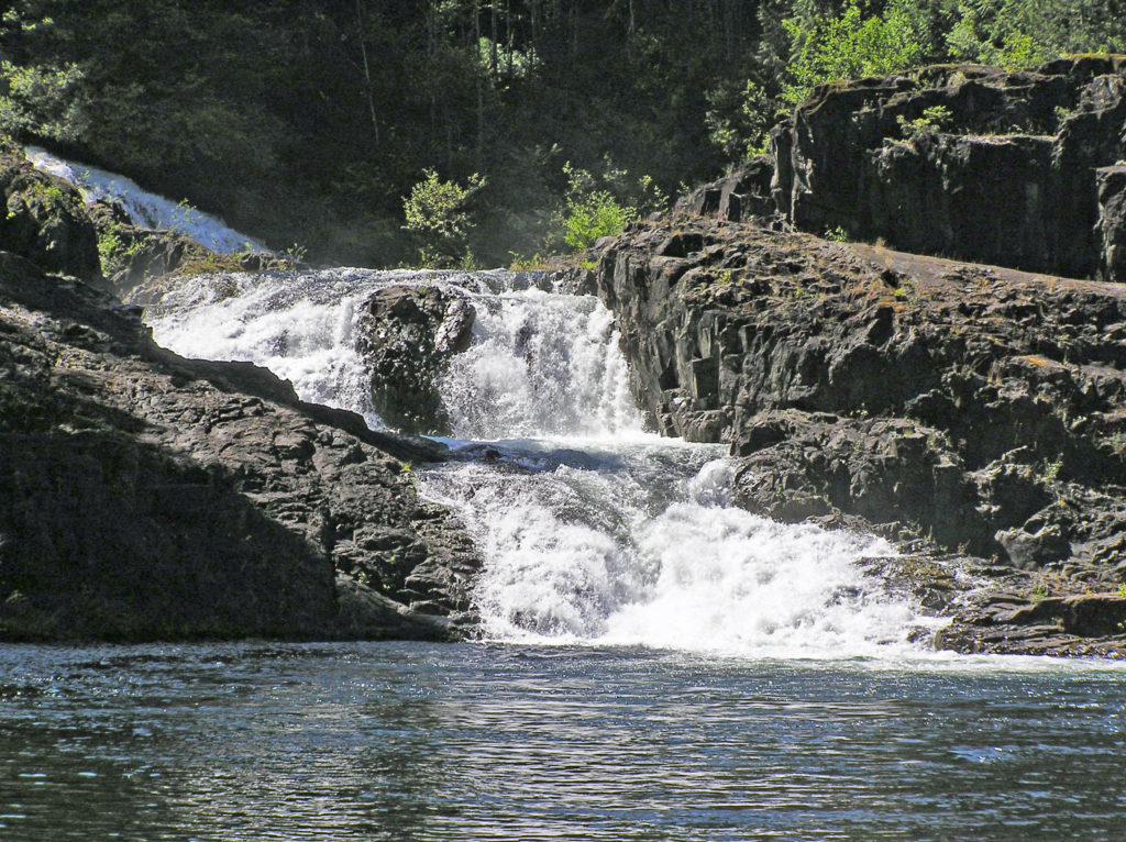
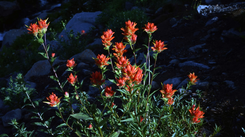
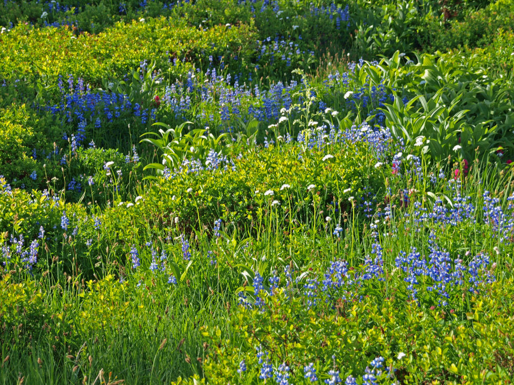
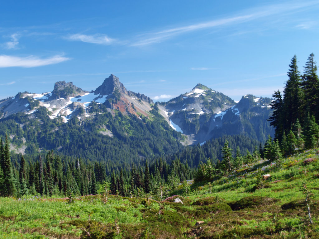
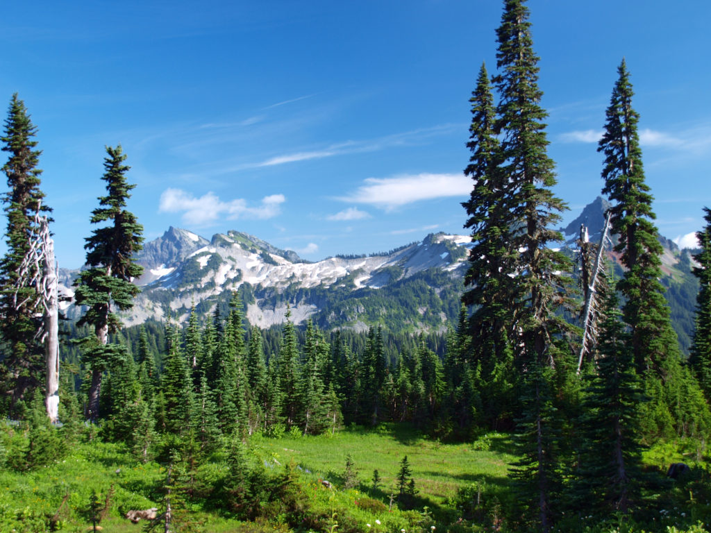
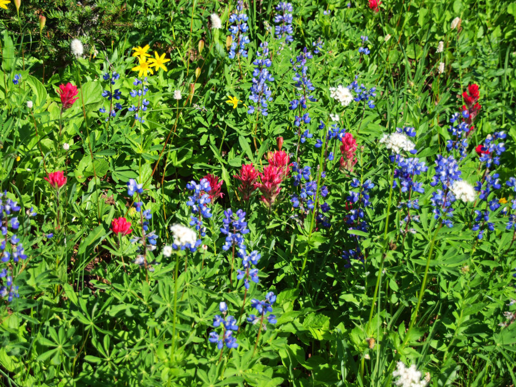
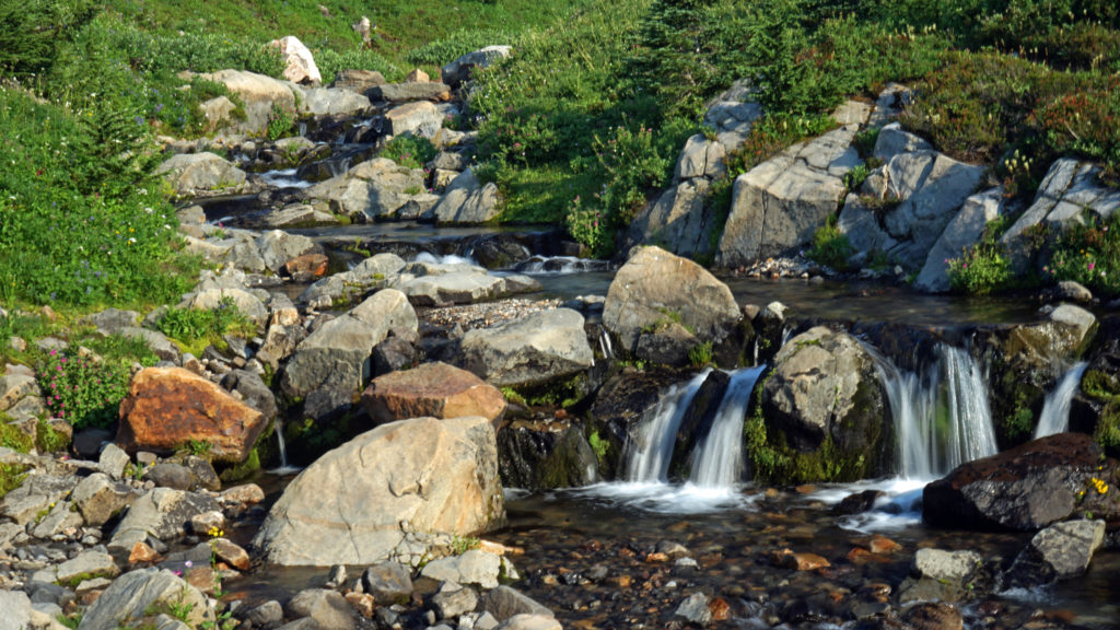
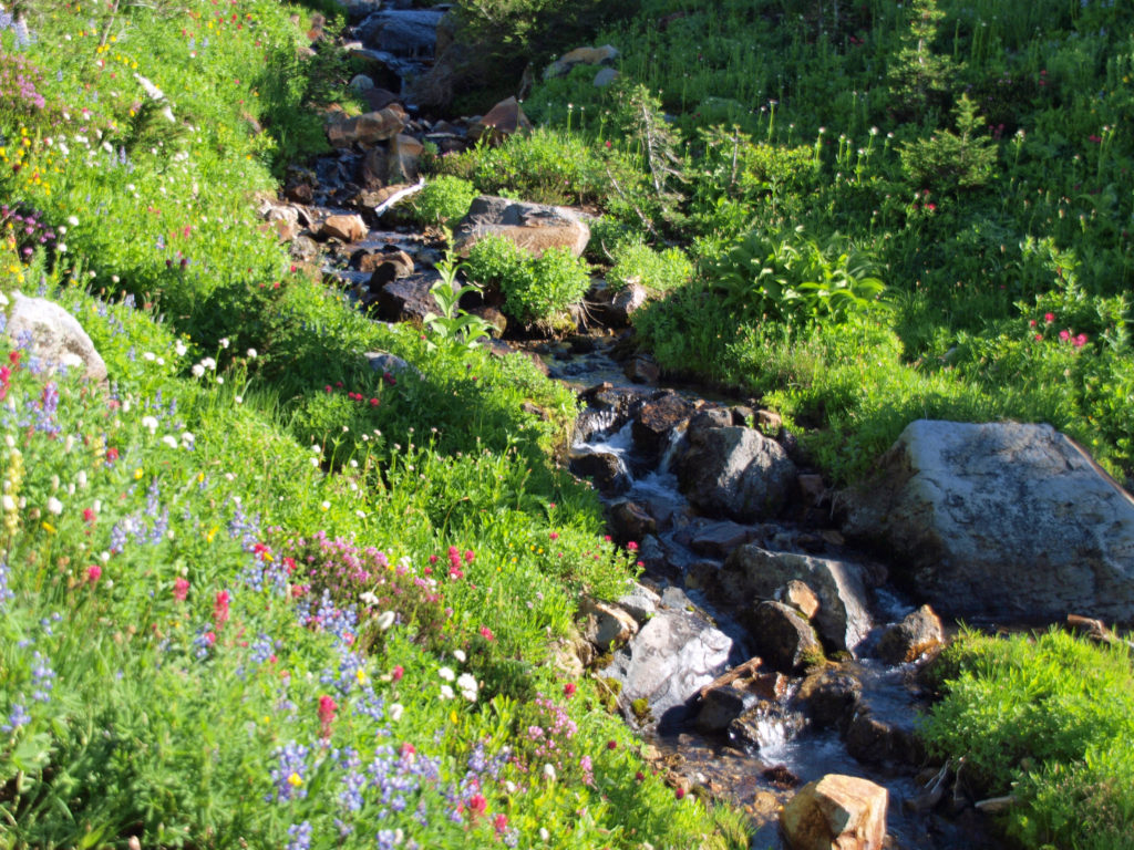
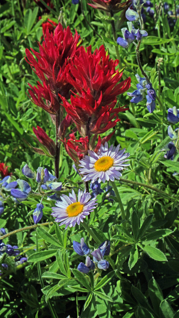
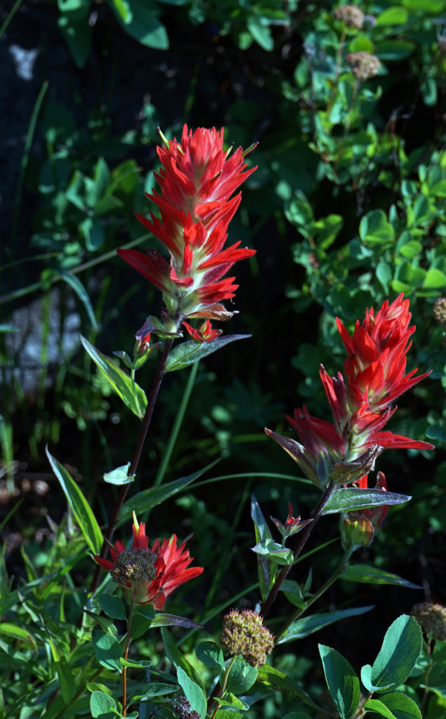
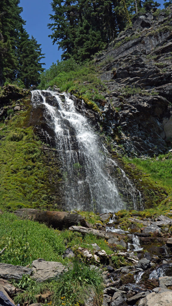
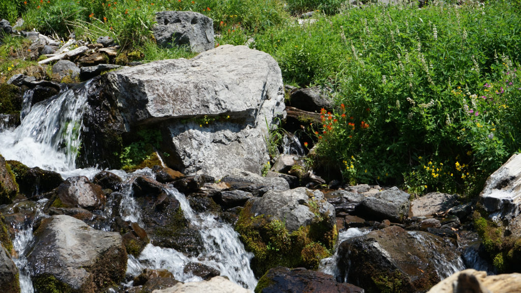
Paradise is the most visited section of Mount Rainier National Park for good reason. Subalpine meadows abound with lupine, paintbrush, and dozens of other wildflowers. Small streams and waterfalls course down the mountain. There are many trails in the area that offer spectacular views of the Tatoosh Range to the south, and, of course, of Rainier itself.
Summer weekends are usually very, very crowded. There may be long lines at the Nisqually Entrance to the park, and you’re unlikely to find a parking spot anywhere close to the Jackson Visitor Center or Paradise Inn after mid-morning. Even if you get there early, you’ll still be elbow to elbow with other visitors. If you can visit during the week, I’d highly recommend doing so, and even then I would recommend getting there as early in the day as possible. But even if you can only visit on a summer weekend, Paradise is such an incredible place to see that it’s worth putting up with the crowds, provided that you can actually find a place to park. If you can’t, though, there are many other places in the park worth visiting.
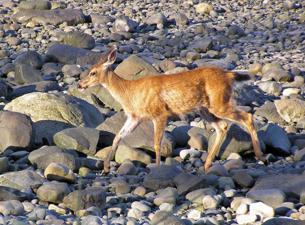
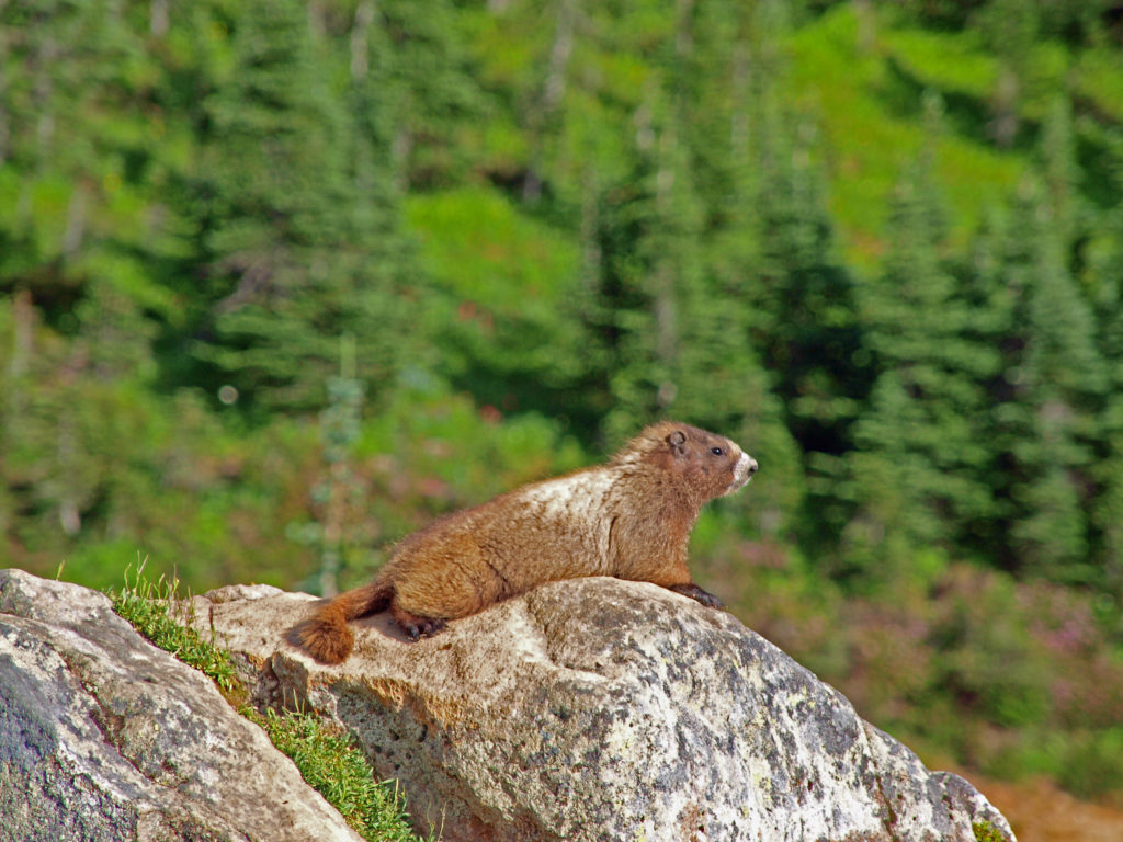
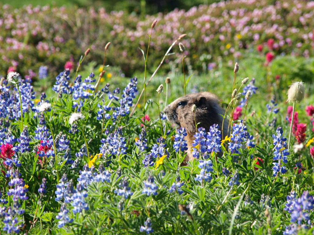
The popularity of Paradise has certainly impacted the area. The meadows above Paradise Inn are crisscrossed with trails, many of them paved, and the sheer number of people using them can’t help but have a negative effect on the quality of the area in terms of wildlife habitat. But even close to Paradise Inn and the Jackson Memorial Visitor Center, you are almost certain to see wildlife such as hoary marmots and golden-mantled ground squirrels.
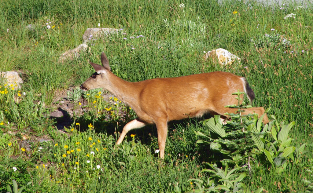
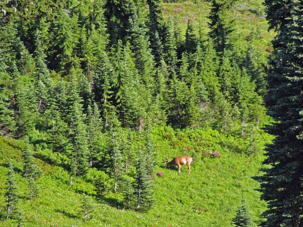
Yellow-pine chipmunks are also frequently seen in the meadows. Black-tailed deer are abundant in the area and may be seen even close to the visitor facilities. Gray Jays and Clark’s Nutcrackers are frequently seen in the area, and more than sixty other species of birds are known to inhabit the subalpine areas of Mount Rainier, almost fifty of which nest in the park.
On the trails above Paradise, you are likely to see other wildlife. Look for mountain goats on the slopes above you. Black bears, elk, coyotes, bobcats, and cougars also frequent the area. Look (and listen) for pikas on talus slopes.
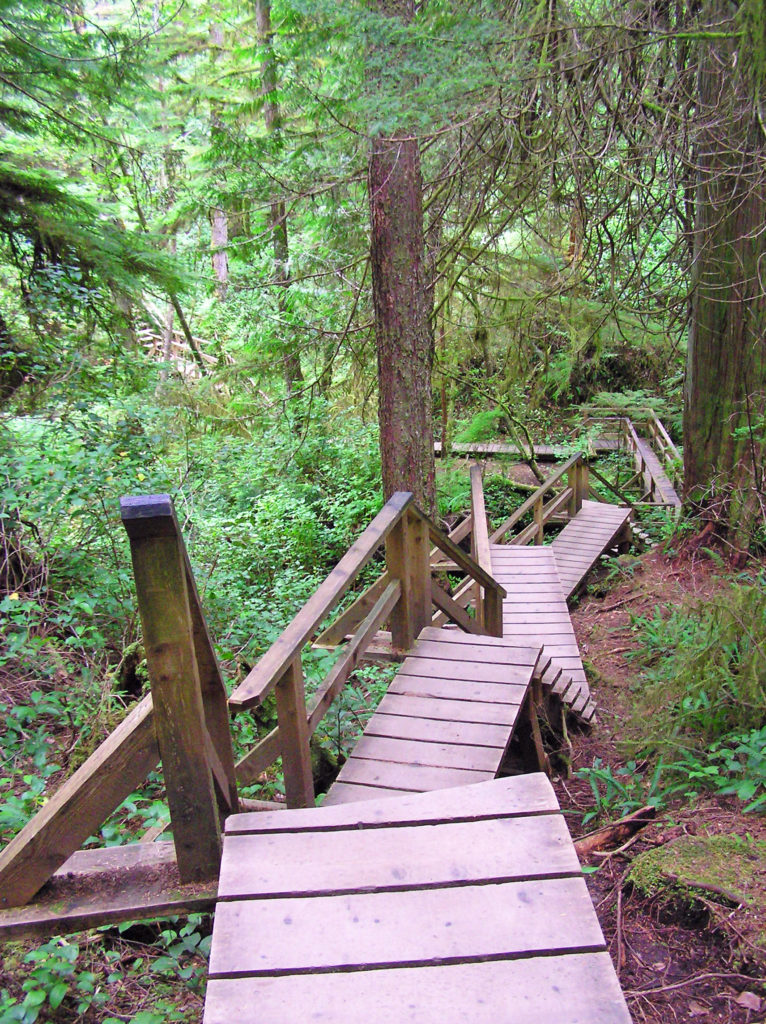
Hiking opportunities are abundant in the Paradise area. The Falcon Guide, Hiking Mount Rainier National Park, is a good resource. On our most recent trip (in August 2021) we spent five days in Paradise and did at least one hike every day.
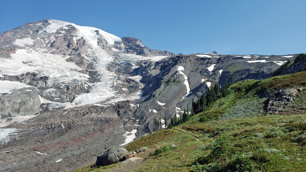 The highlights of the trip were the two hikes we did on the Skyline Trail. The first was the four mile out and back hike to Panorama Point. The second was the roughly four mile Skyline-Golden Gate loop. Both are listed as “moderate” hikes, but both have significant elevation gains (1700′ and 1400′ respectively). We did both hikes early in the day during the week, but we were far from the only ones on the trail, especially on the hike to Panorama Point. But the area above Paradise is so incredibly scenic that the crowds didn’t diminish the experience much.
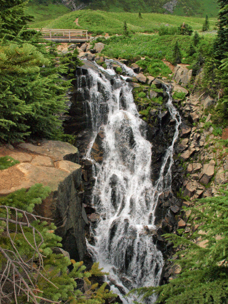
There are also plenty of easy hikes in the Paradise area for people who don’t want to (or aren’t able to) hike to the higher areas on the mountain. Myrtle Falls, for example, is an easy one mile round trip hike from Paradise Inn.
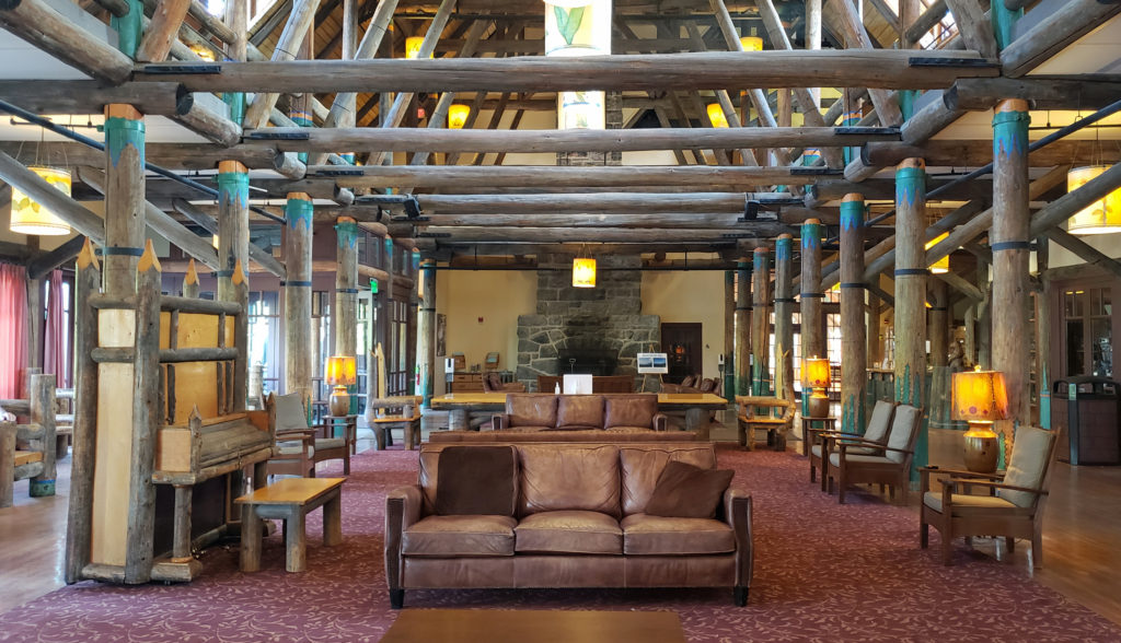
On our last few visits, we have stayed at Paradise Inn. It is one of the grand lodges of the Northwest, on a par with Crater Lake Lodge, Timberline Lodge on Mt. Hood, and Lake Quinault Lodge in Olympic National Park. It’s worth visiting, even if you’re not staying there. It’s an amazing structure.
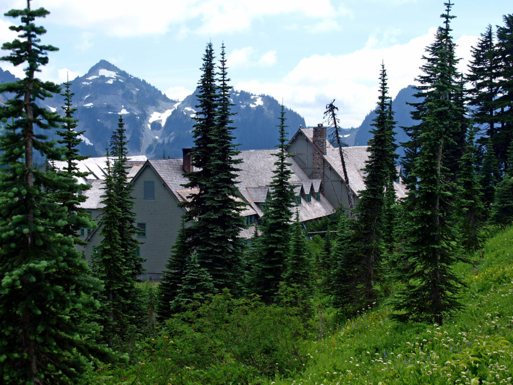
Paradise Inn was constructed in 1915-16 opened July 1, 1917. The attached Annex was completed three years later. The combined structures are listed in the National Register of Historic Places.
 Close to Paradise Inn, the Jackson Memorial Visitor Center, named after long-time U.S. Senator Henry M. Jackson, offers general information, exhibits, a park film, guided ranger programs, a book/gift store and a cafeteria. Unfortunately, all visitor centers in the park are currently closed due to the ongoing pandemic.
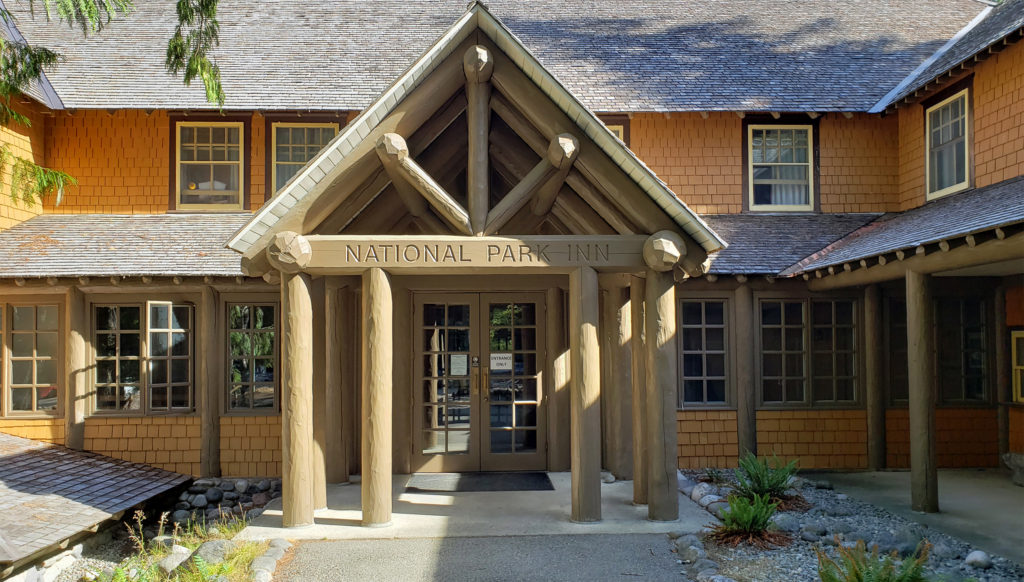
Accommodations in the area are somewhat limited. Paradise Inn has 121 rooms, 42 in the main lodge and 79 in the attached Annex. The National Park Inn in Longmire has 25 rooms. Reservations for both can be made through Mount Rainier Guest Services, 360-569-2275. Information on accommodations outside of the park can be obtained from the Mount Rainier Visitor Association . All reservations should be made well in advance.
There are two large campgrounds in the southern part of Mount Rainier National Park. Cougar Rock Campground, between Longmire and Paradise, has 173 individual sites and five group camp areas. Ohanapecosh Campground, in the southeast part of the park near the Stevens Canyon Entrance, has 188 individual sites and two group camp areas. Both have RV sites that can accommodate up to 27 foot trailers and 32 foot motor homes (35 foot at Cougar Rock), but there are no hookups. Both do have dump stations. Reservations can be made through the Mount Rainier National Park website.
 Both Paradise Inn and the National Park Inn have full service restaurants, but both were operating on a reduced scale due to the pandemic when we were there in August. The National Park Inn dining room was closed, but take out meals could be ordered and picked up at the reception desk in the lobby. The dining room at Paradise Inn was open for dinner only for most of our visit, but closed (unexpectedly) for the season on our last day there. Paradise Inn also has a limited service cafe, and there is a cafeteria at the Jackson Memorial Visitor Center that is open daily during the summer season and on most weekends and holidays in the winter (depending on road conditions). The National Park Inn restaurant is open year round.
There is far more to Mount Rainier National Park than just the Paradise, of course. Below Paradise, the Reflection Lakes along the highway offer beautiful views of Mount Rainier.
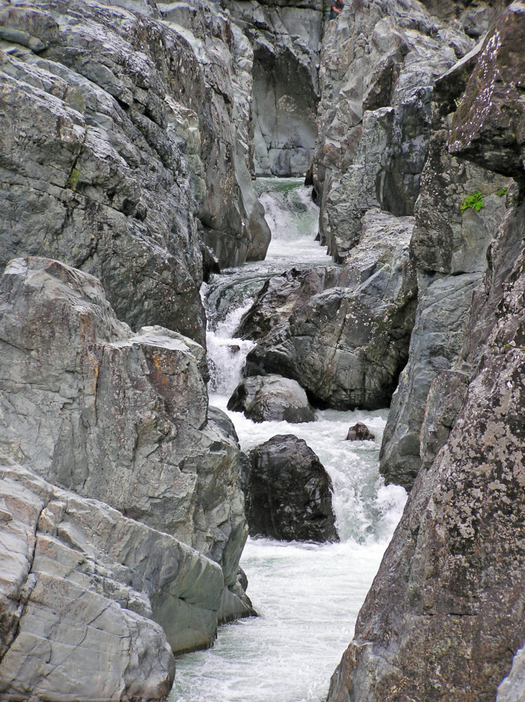
 The nearby Snow Lake Trail is an easy and worthwhile hike. To the east, the Stevens Canyon area has a number of interesting areas, including Box Canyon, a 180 foot deep slot canyon, and a number of roadside waterfalls.
 The Longmire area has some interesting history, a museum, nice hiking trails, and the National Park Inn offers both lodging and dining options for the visitor. The road to Longmire is also plowed in the winter, so it’s a year round destination. (The road from Longmire to Paradise is open in winter when the weather allows.)
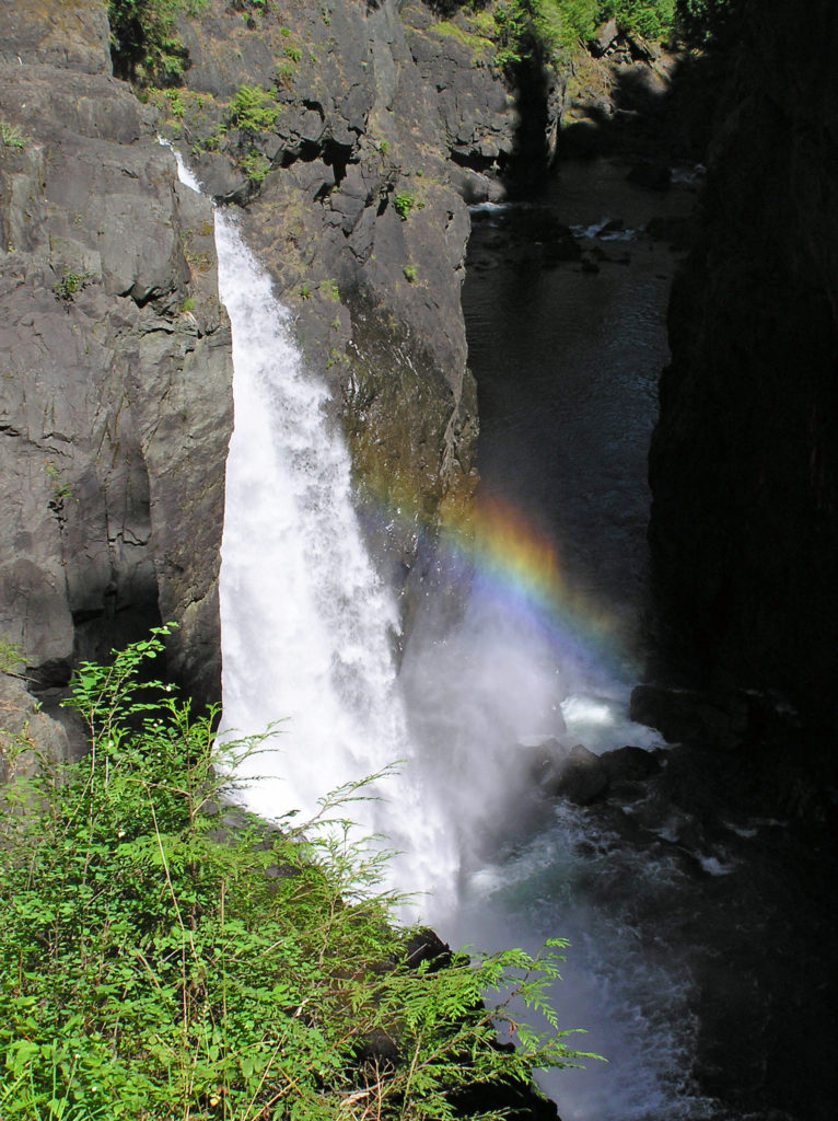
 In the Ohanapecosh area in the southeastern corner of the park, the Grove of the Patriarchs Trail is a good family friendly outing. And the nearby Silver Falls Trail is a must for waterfall lovers. In the northeastern section of the park, the Sunrise area offers beautiful views of the eastern side of the mountain and has an abundance of hiking trails.
You could probably spend an entire summer in Mount Rainier National Park and not see it all.
Originally posted July 10, 2018. Updated and re-posted September 18, 2021.
All photos © Alan K. Lee
 The Lake
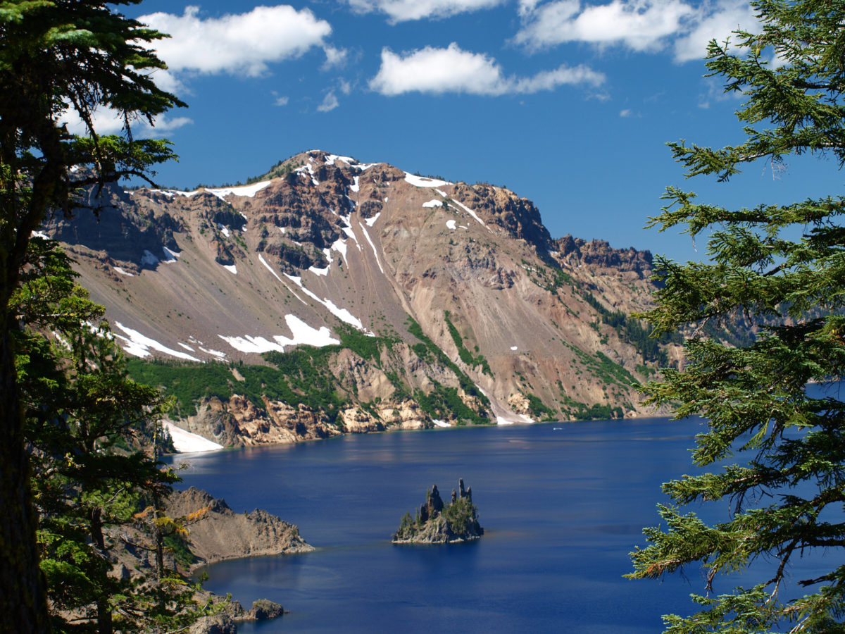
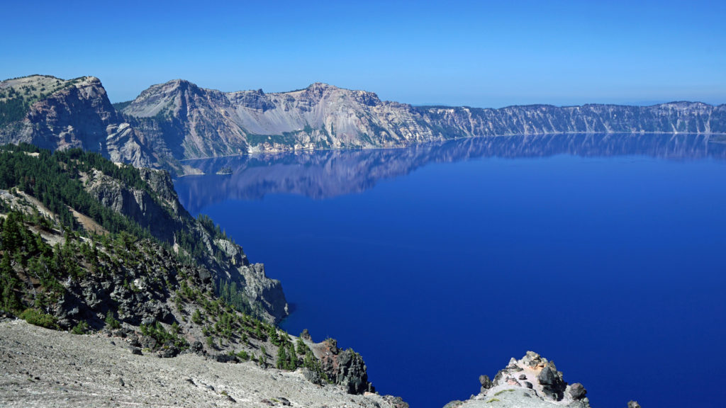
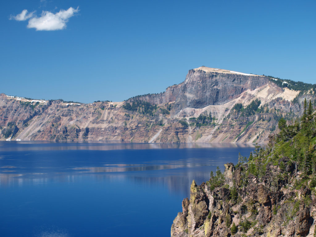 Crater Lake is 1943 feet deep, making it the deepest lake in the United States, second deepest in North America, and ninth deepest in the world. It is also one of the cleanest and clearest lakes in the world. It’s that combination of depth and clarity that results in its intense deep blue color.
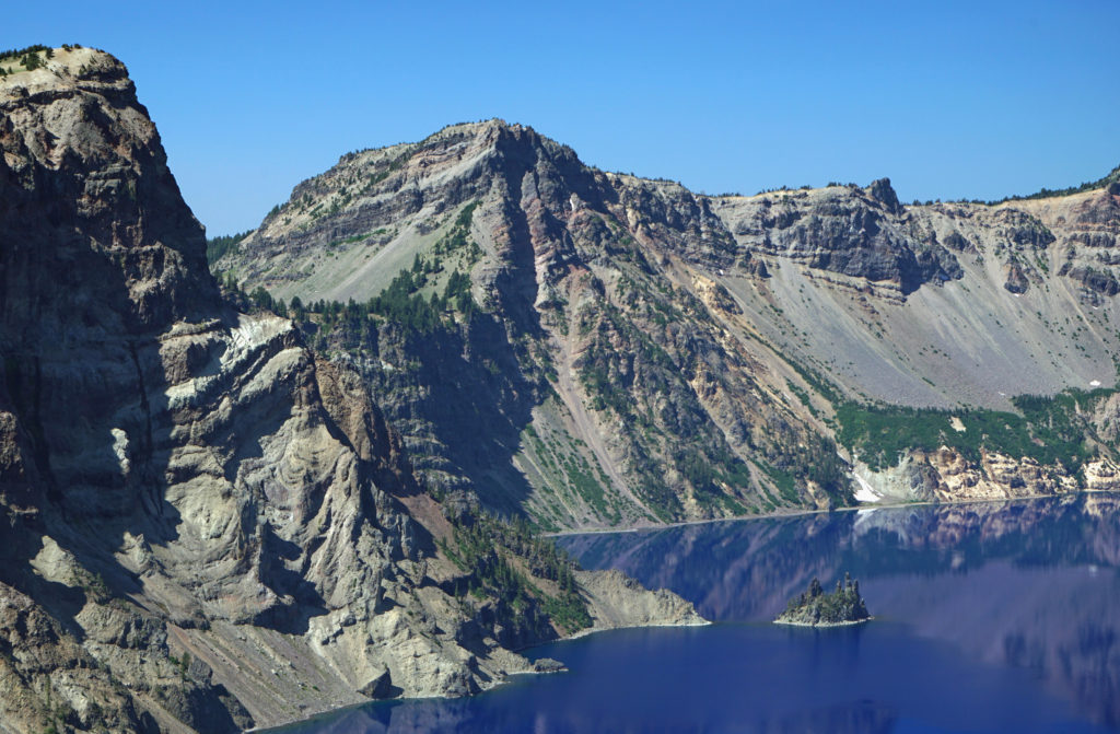 The caldera that Crater Lake occupies was formed 7700 years ago when the summit of 12,000 foot tall Mount Mazama collapsed after a massive eruption. Over time rain and snow filled the caldera to its present level. The lake has no outlet. The level of the lake remains nearly the same because the amount of evaporation from the surface of the lake closely matches the amount of precipitation falling on it in any given year.
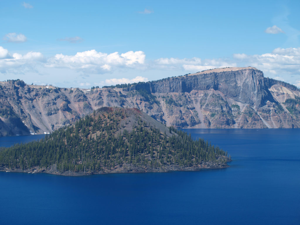 Wizard Island formed sometime after the eruption that formed the caldera. It rises 770 feet above the surface of the lake, 2713 feet above the deepest point in the lake. It last erupted about 5000 years ago, but it is considered dormant, not extinct. Conceivably, it could erupt again at any time. Merriam Cone also erupted after the caldera was formed, but never reached the lake surface. Its summit lies almost 500 feet below the average lake level.
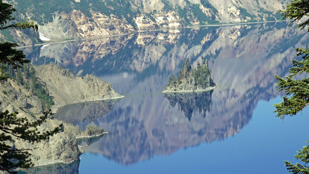
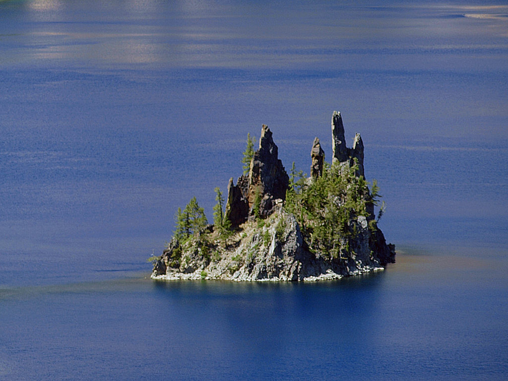 Phantom Ship, a remnant of an eruption 400,000 ago, rises 170 feet above the lake surface. Its formation predates that of Mount Mazama itself.
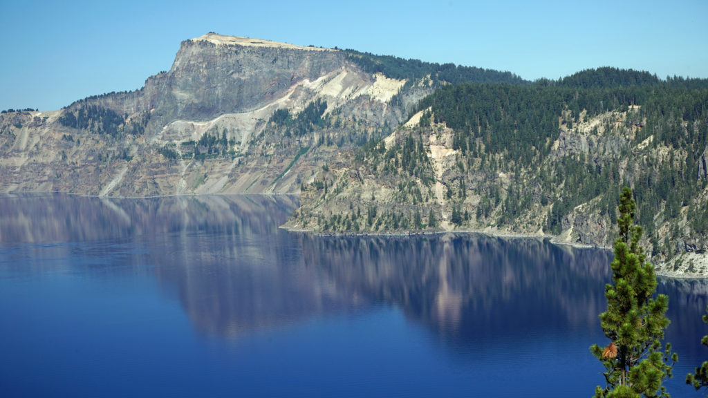 The Park
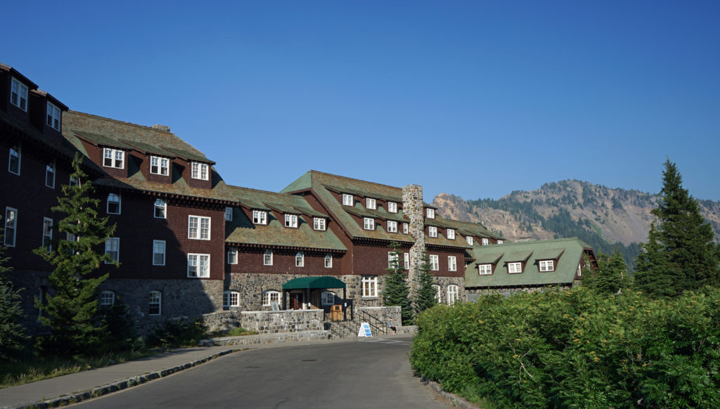 Crater Lake Lodge
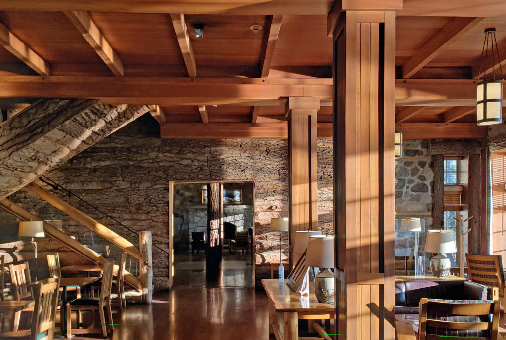 My wife and I recently spent three nights at the lodge. Although it lacks the amenities of a luxury hotel, our room was comfortable, with a private bathroom, and the location more than makes up any lack of luxuries.
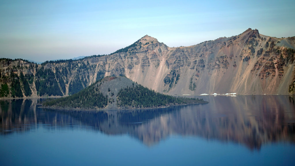 The Rim Drive
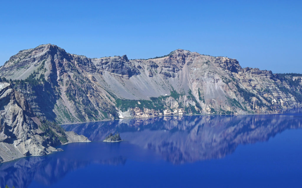 You’ll want to stop at all of the viewpoints. Maybe combine the drive with a hike down to Cleetwood Cove and a boat tour of the lake. You can get off at Wizard Island and hike to the summit and then catch a later boat back.
 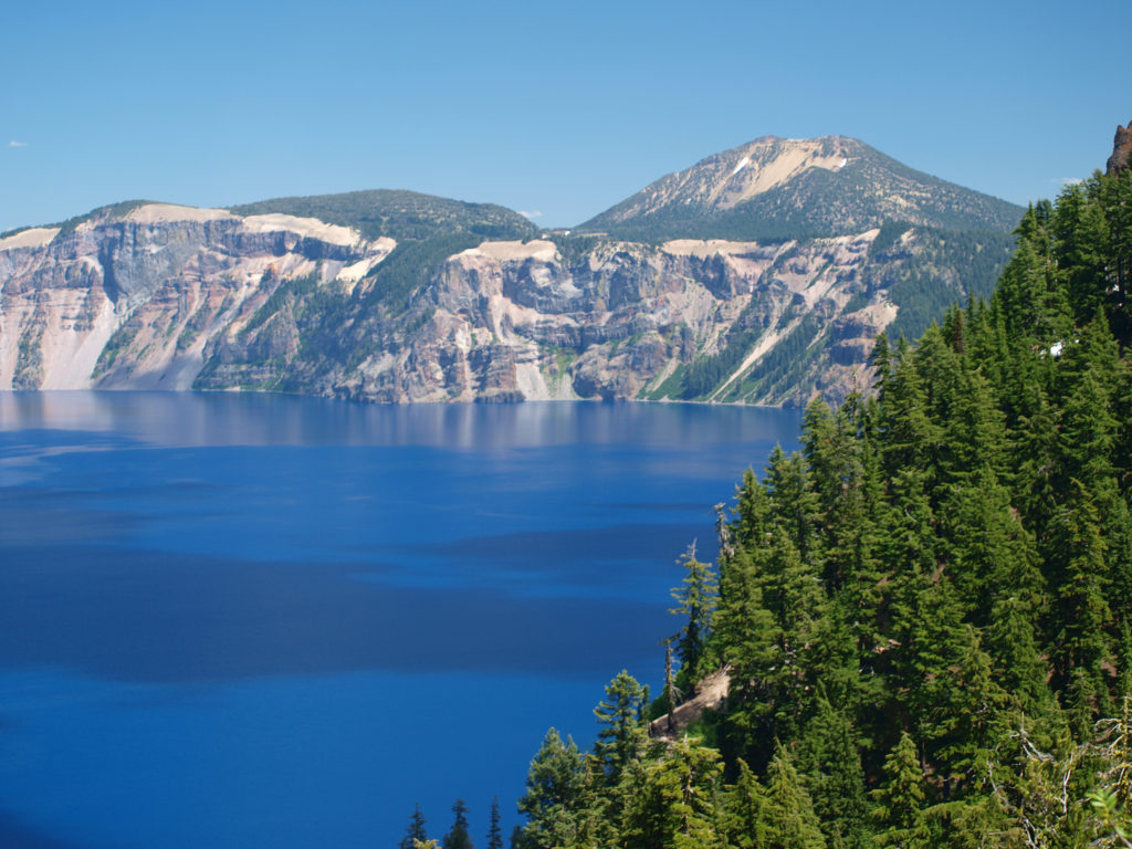 For a more adventurous day, hike to the summit of Mount Scott, the highest point in the park. It’s a two mile hike to the summit with 1250 feet of elevation gain, so it’s not an easy hike (All Trails rates it “moderate”), but the view might just be worth the effort.
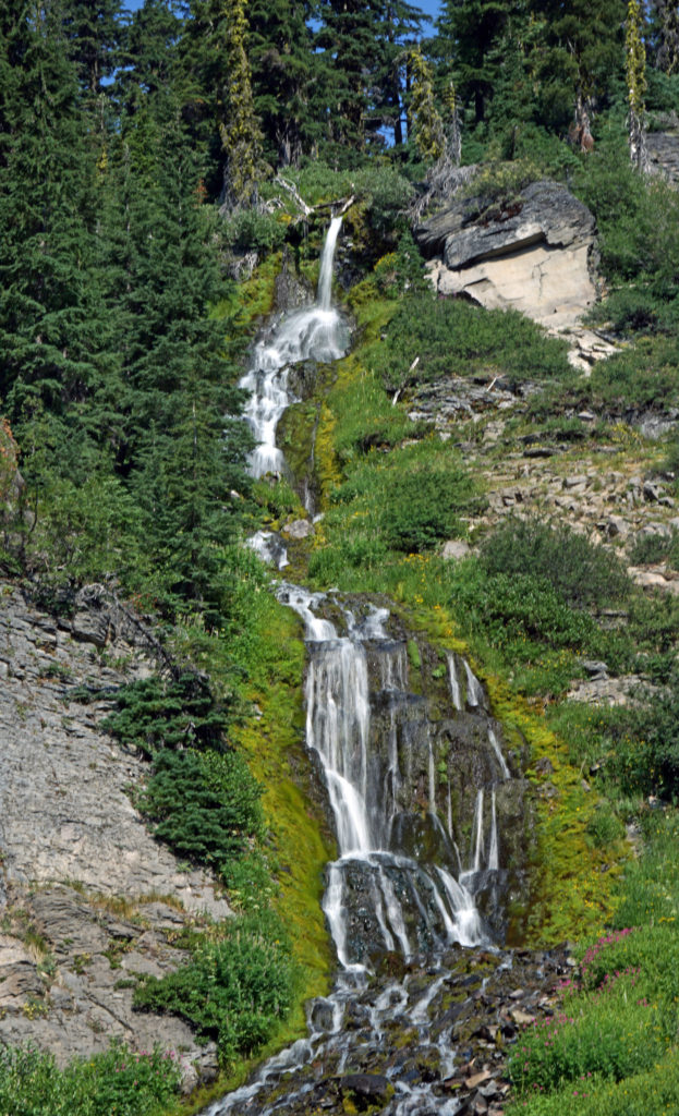
 Hiking Trails
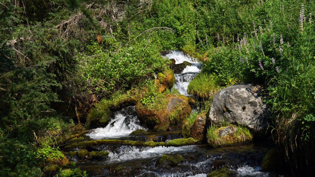 The Pacific Crest Trail passes through the park, but does not ascend to the rim of the caldera. Hikers on the PCT can take the Dutton Creek Trail that climbs up to the Rim Village, then hike the trail that parallels the West Rim Drive and reconnect with the PCT north of the lake.
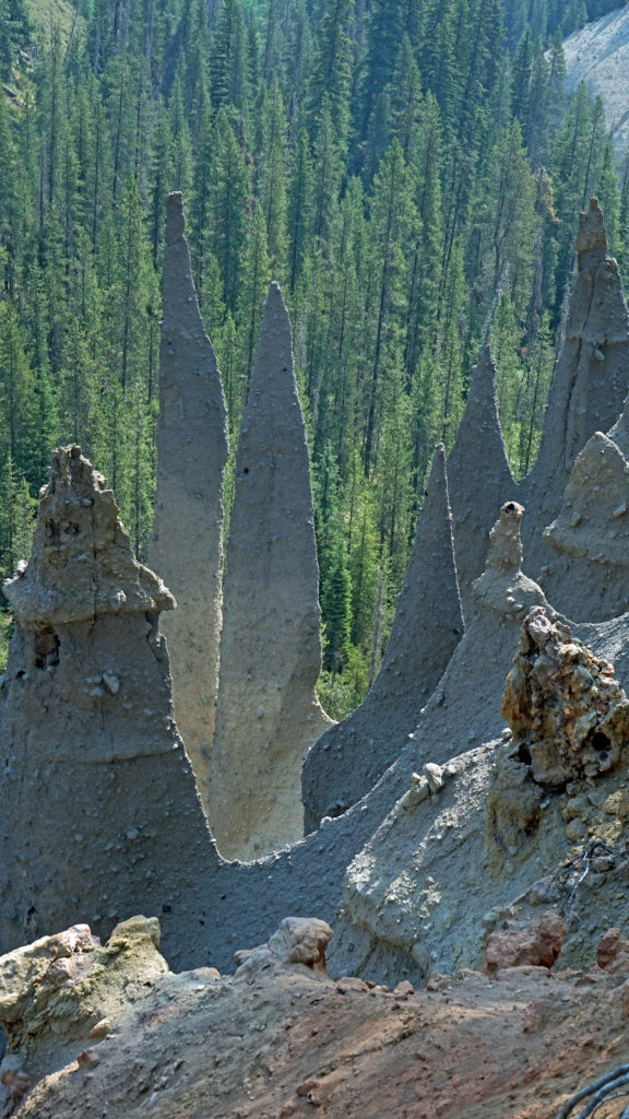
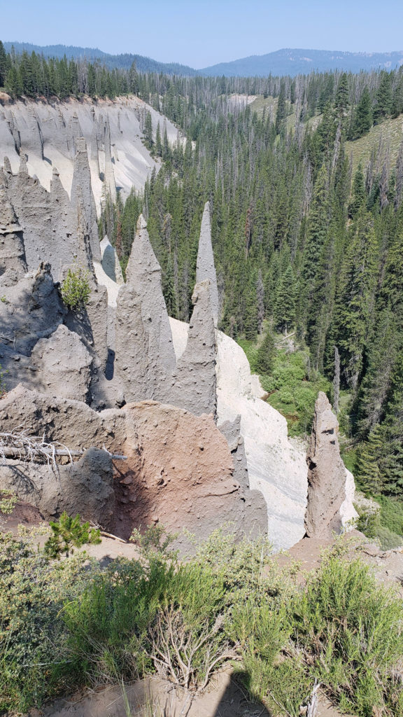 The Pinnacles
 Practical Info
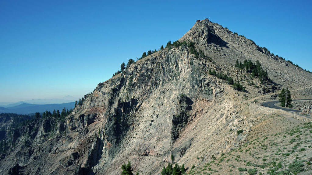
 There are two lodges in the park, Crater Lake Lodge in the Rim Village and The Cabins At Mazama Village that are open for the summer season. Crater Lake Lodge has 71 rooms, starting at $246/night. The Cabins At Mazama Village has 40 rooms, all at $160/night. Prices listed are for the 2024 season. Note that the concessionaire that operates both lodges is changing, so prices may also change. Check the park website (linked above) for current information.
 There are two campgrounds in the park. Mazama Campground has 75 RV sites, 18 tent sites with electricity, and 121 tent sites without electricity. Tent sites start at $22. RV sites run from $32 to $44 per night. Mazama Campground is usually open from early June through late to September. Lost Creek Campground, located on Pinnacles Road, is a primitive tent only campground with 18 sites, operated by the park service. Lost Creek Campground is currently closed and will not be open for the 2024 season. Backcountry camping is allowed in the park by
 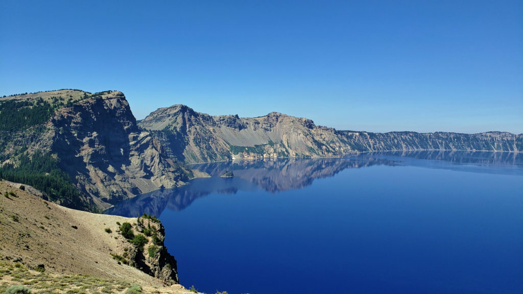 Dining options in the park are somewhat limited. The dining room at Crater Lake Lodge is open to all visitors, but reservations can only be made by people staying in the park. The Rim Village Cafe offers “grab and go” sandwiches and salads (I had a pulled pork sandwich from there on our recent visit that was very good). It is open from 9am to 8pm in the summer and 10am to 5pm in the winter. The Annie Creek Restaurant in Mazama Village is open from 7am until 9pm. The Mazama Village Store sells packaged sandwiches and snacks.
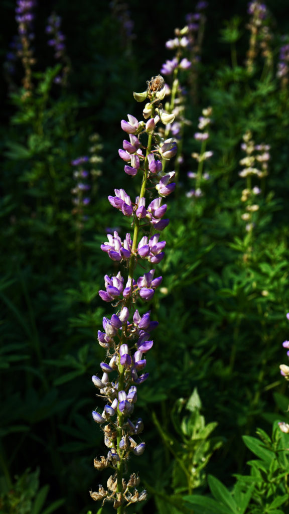 Summer park entrance fees are $30 for private vehicles and $25 for motorcycles. Winter fees are $10 less. Snowmobilers, bicyclists, and pedestrians are charged $15 per individual. All entrance fees are good for seven days. Entry reservations do not need to be made.
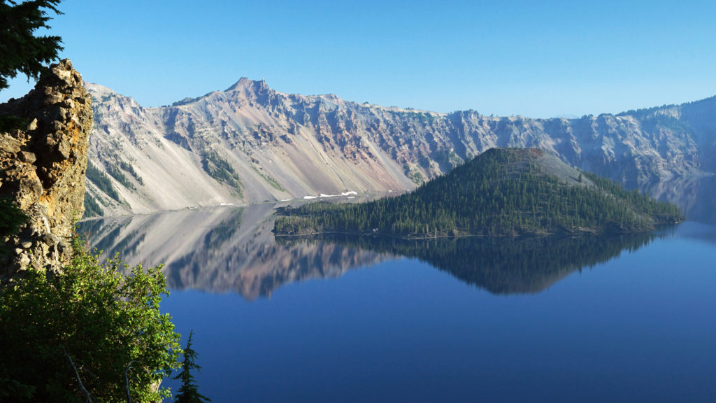
 Originally posted September 13, 2021. Most recently updated April 6, 2024.

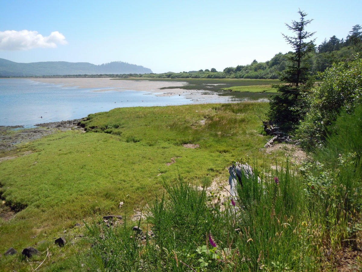
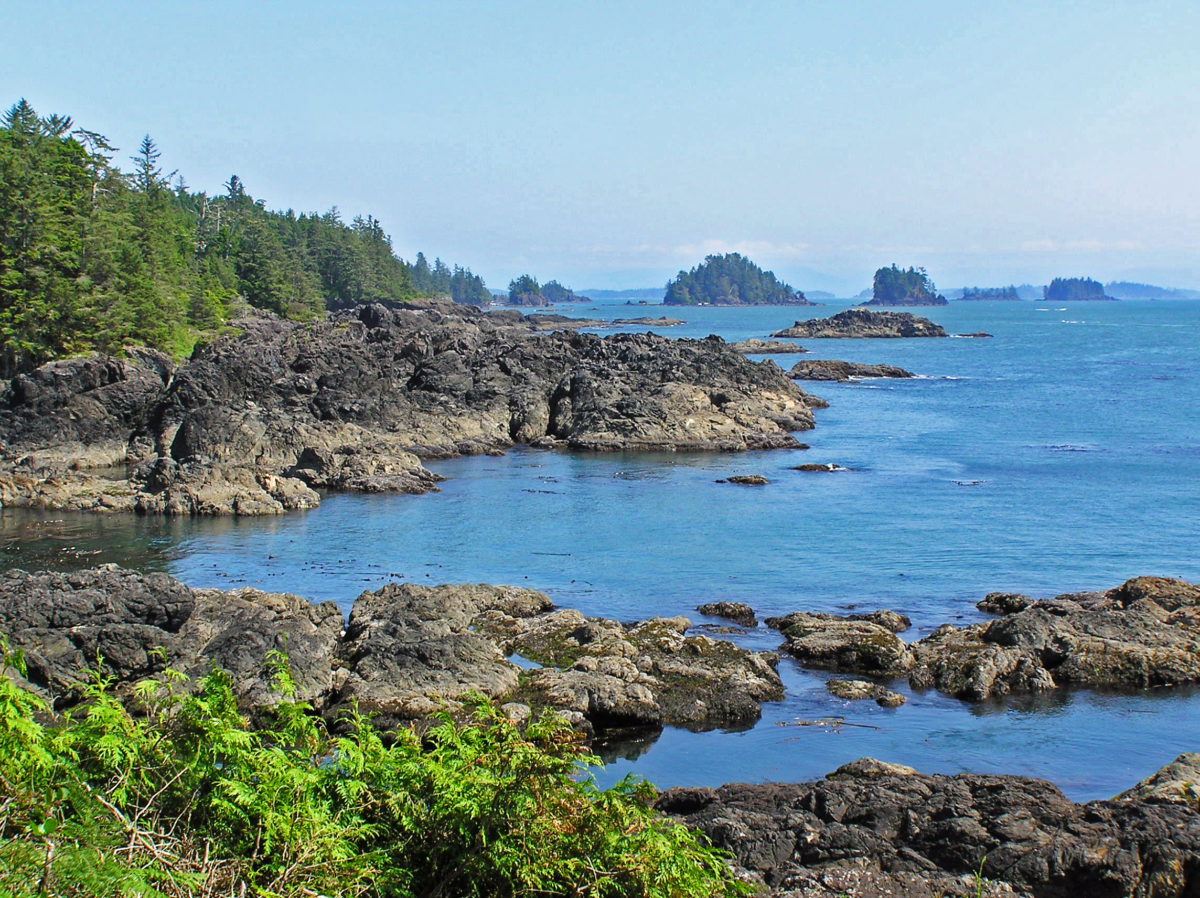
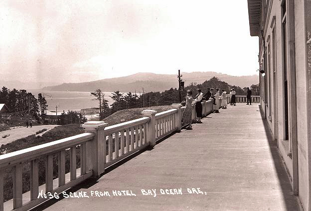
 Bayocean Peninsula, on the northern Oregon coast, is a sandspit that separates Tillamook Bay and the Pacific Ocean. It is, by any measure, a nature lover’s paradise, whether you’re a beachcomber, hiker, mountain biker, boater, birder, wildlife lover, or photographer.
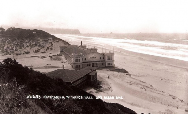
 To make crossing the Tillamook bar safer, the Army Corps of Engineers recommended jetties be built on both the north and south sides of the bay’s mouth. But half of the cost (a then considerable $2.2 million) would have to be paid by local residents. To cut the cost to a more affordable amount, the local port district proposed building only one jetty. The resulting north jetty, completed in 1917, did make crossing the bar much smoother and safer, but it also contributed to the town’s demise by changing the near shore currents, which began eroding away the beach in the 1920s.
 In 1932 the north jetty was extended, further accelerating the erosion. The natatorium was destroyed by waves during a massive storm that winter. By 1938 almost 60 homes had fallen into the sea. Other storms over the years took many of the remaining buildings, and in 1952 another major storm breached the southern end of the peninsula, turning Bayocean Peninsula into an island. The Bay Ocean Park post office closed in 1953 and most of what was left of the town was bulldozed by the Corps of Engineers in 1956 during a project to build a dike across the breach created in 1952. The last house on the peninsula washed away in 1960, and the last structure, a long abandoned garage, fell into the sea in 1971.
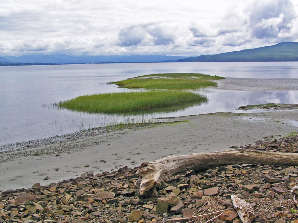
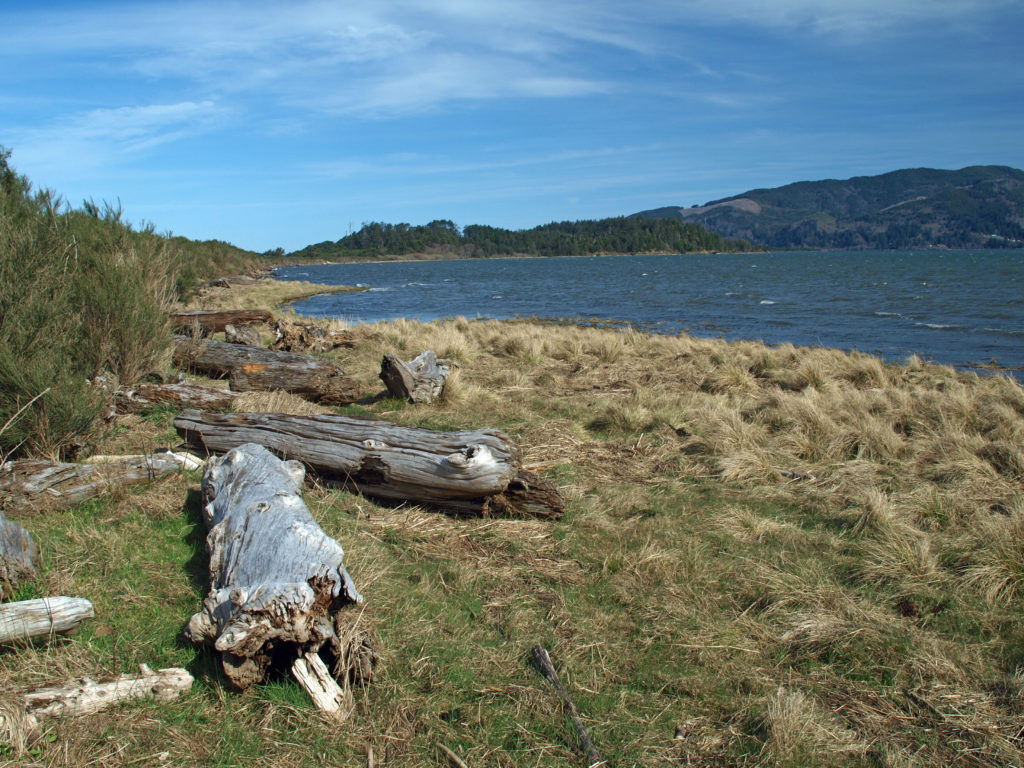 The south jetty was eventually built in the 1970s and that stopped the erosion of the peninsula, but by then the town of Bay Ocean Park was long gone. Today, nothing remains of the town. What’s left, though, is a treasure trove of delights for the outdoor enthusiast: miles of untrammeled beach, unspoiled dunes, a bay shore sheltered from the prevailing winds, an upland spruce and pine forest, and an abundance of waterfowl and other wildlife. The haul road used in building the south jetty is now an ideal mountain bike and hiking trail on the bay side of the peninsula.
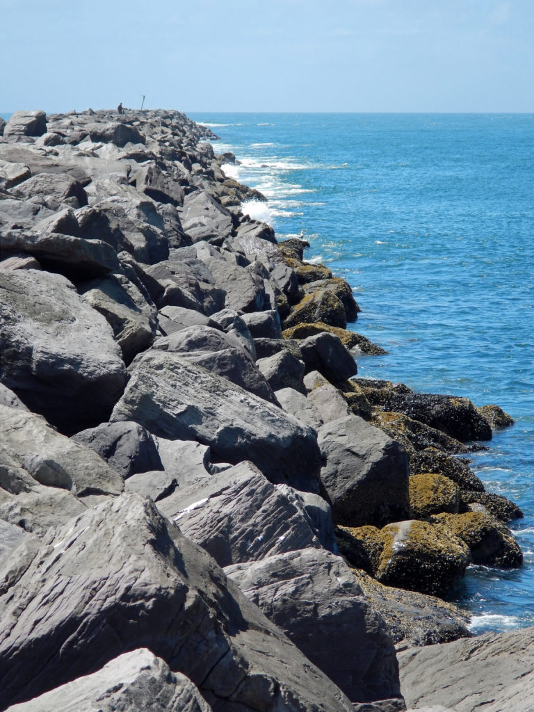
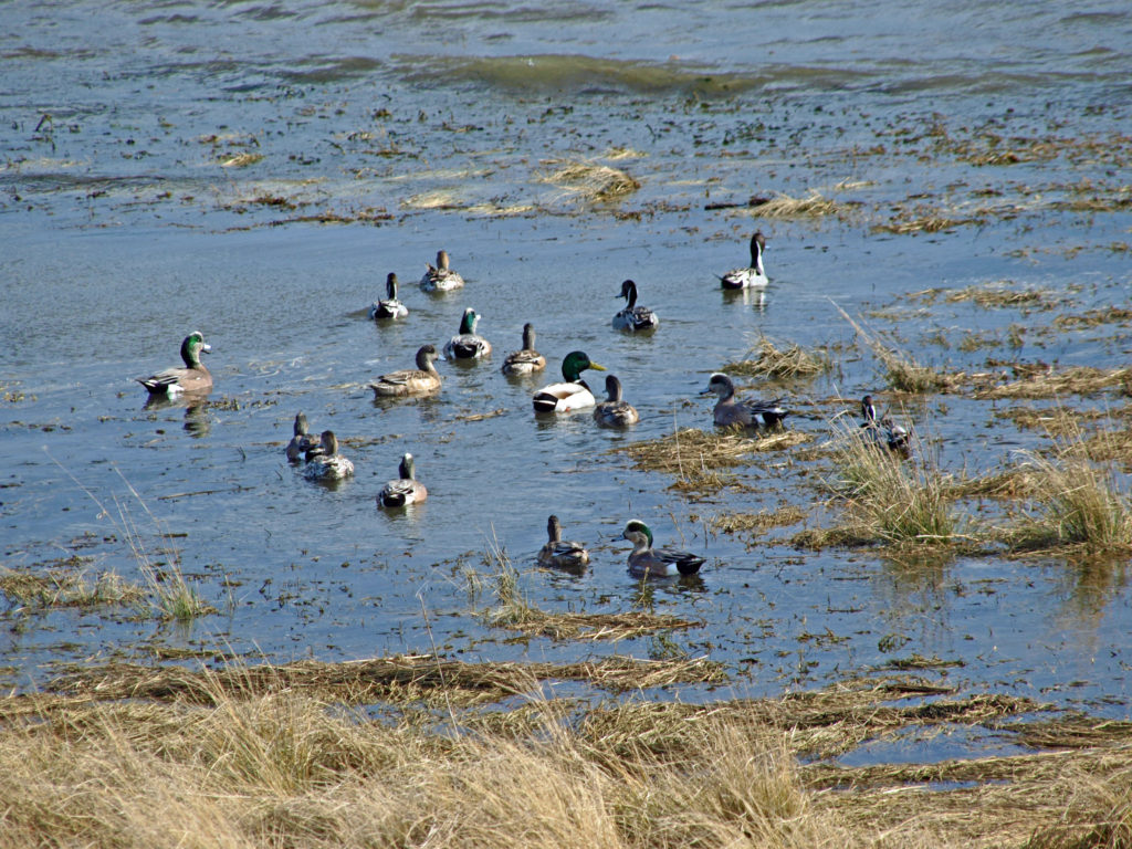 To reach Bayocean from the town of Tillamook, follow the signs for the Three Capes Scenic Route (Oregon Highway 131). After crossing the Tillamook River bridge, turn right onto Bayocean Road toward Cape Meares. At milepost five, turn right onto the old south jetty haul road (aka the dike road) and proceed to the trailhead parking area. There are pit toilets at the trailhead, but no water.
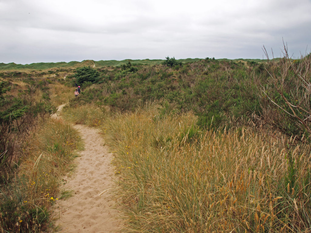 From the trailhead, the road continues north beyond a locked gate. You can also hike through the dunes to the beach from the trailhead parking area. The road along the bay shore is mostly gravel, with a few sandy stretches, and mostly flat. It’s an easy four mile bike ride to the south jetty.
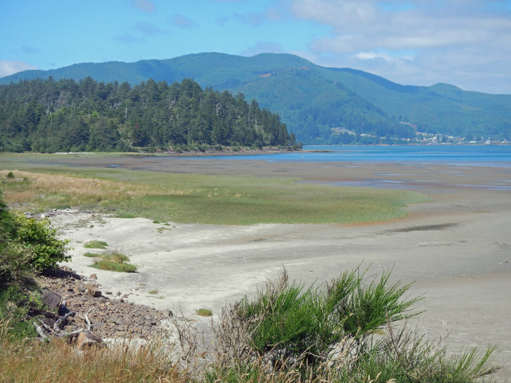 Hikers can do a 7½ mile loop by hiking through the dunes to the beach, walking the beach to the south jetty, and returning along the bay side on the gravel road. There are several trails connecting the dike road to the beach, making shorter loops possible. And a longer hike or bike ride (10 mile loop or 9 mile out and back along the beach) can be done by starting at the beach access in the town of Cape Meares, instead of the Bayocean trailhead. See my
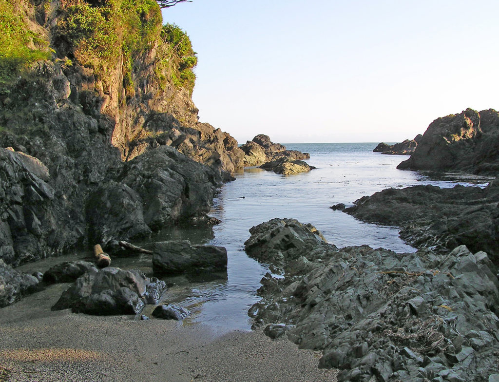
 The north Oregon coast has much to offer beyond Bayocean Peninsula, of course.
  Originally posted April 23, 2019 by Alan K. Lee, updated July 8, 2021 and March 4, 2024