
Harry’s Ridge Hike
Where: Mount St. Helens National Volcanic Monument
Distance: 7.8 miles
Type: Out and back
Elevation gain: 1500 feet
Difficulty: Moderate (for length)
Overview:
The trail to Harry’s Ridge is one of my favorite hikes on Mount St. Helens. My wife and I spent a long weekend exploring Mount St. Helens a few years ago, and I was eager to see what changes had taken place since my last visit. My wife had been up to the mountain only a couple of weeks before, kayaking Coldwater Lake with a friend of hers, but it had been many years since I had been there.

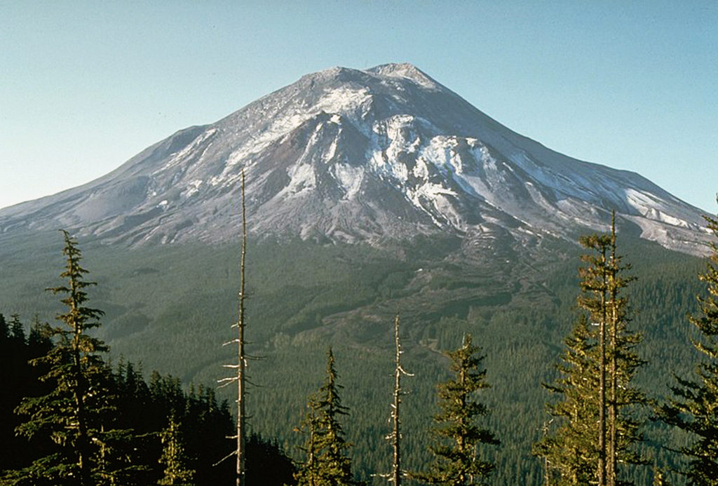
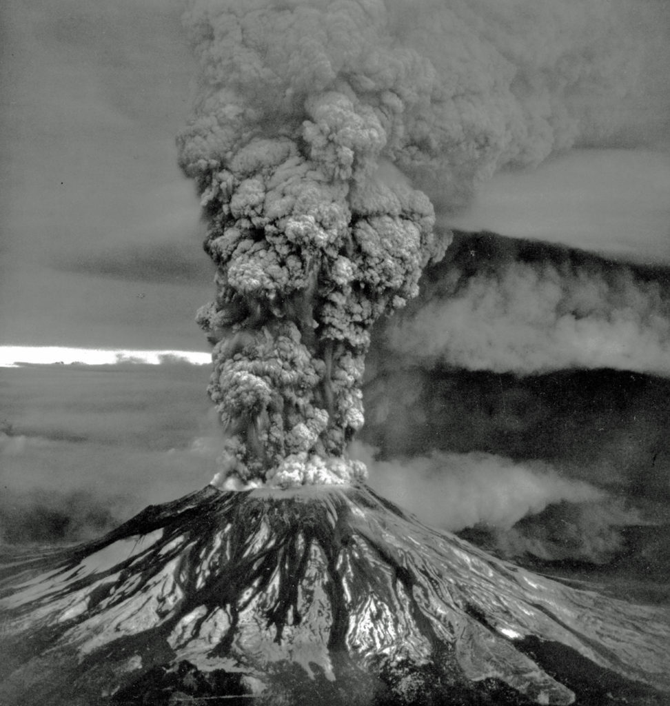
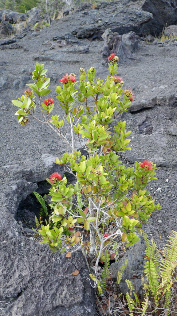
Everyone knows about the eruption of Mount St. Helens, so I won’t go into any detail here. Check out my Mount St. Helens post for more information on the eruption and see more photos of the mountain and the blast zone, if you’re interested.

Harry’s Ridge is named for Harry R. Truman, the 83-year-old curmudgeon and owner of Spirit Lake Lodge who refused to evacuate and died in the May 18, 1980 eruption. The hike begins at the Johnston Ridge Observatory, named for volcanologist David A. Johnston, who was camping near where the observatory is now located and was also killed in the eruption).
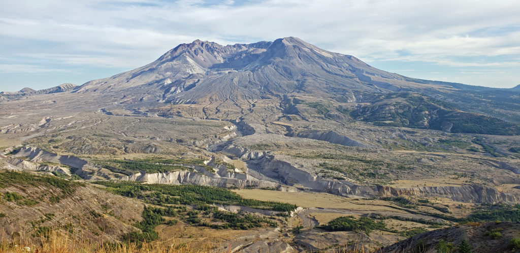
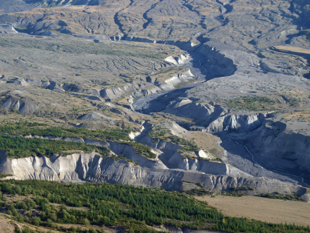
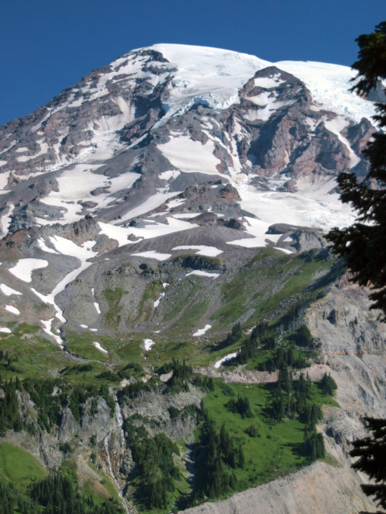
The observatory provides a panoramic view into the crater of the mountain and down to the valley below that was filled by the eruption landslide, pyroclastic flows, and lahars. It’s an otherworldly vista that you will not find anywhere else in the country.
Getting there:
The observatory is located at the end of the Spirit Lake Highway (WA 504). To get there from the Seattle area, travel south on I-5 and take WA 505 (Exit 63) through the town of Toledo to the junction with WA 504. From Portland, take Exit 49 off I-5 at Castle Rock. Johnston Ridge is approximately 50 miles east of I-5.
2023 update: As of July 6, the Johnston Ridge Observatory is inaccessible due to a landslide near the Coldwater Visitor Center on Hwy 504. Check the Observatory website linked above for more information.
Trailhead:
Park in the Johnston Ridge Observatory parking lot. There is an $8.00 per person per day charge payable in the Observatory. National Park Senior Passes and America the Beautiful Passes allow the holder entry without charge. A Northwest Forest Pass will allow one person entry without charge. But you need to check in at the Observatory before heading out on the trail, even if you have a pass. Trail maps, restrooms and drinking water are available in the Observatory.
The hike:
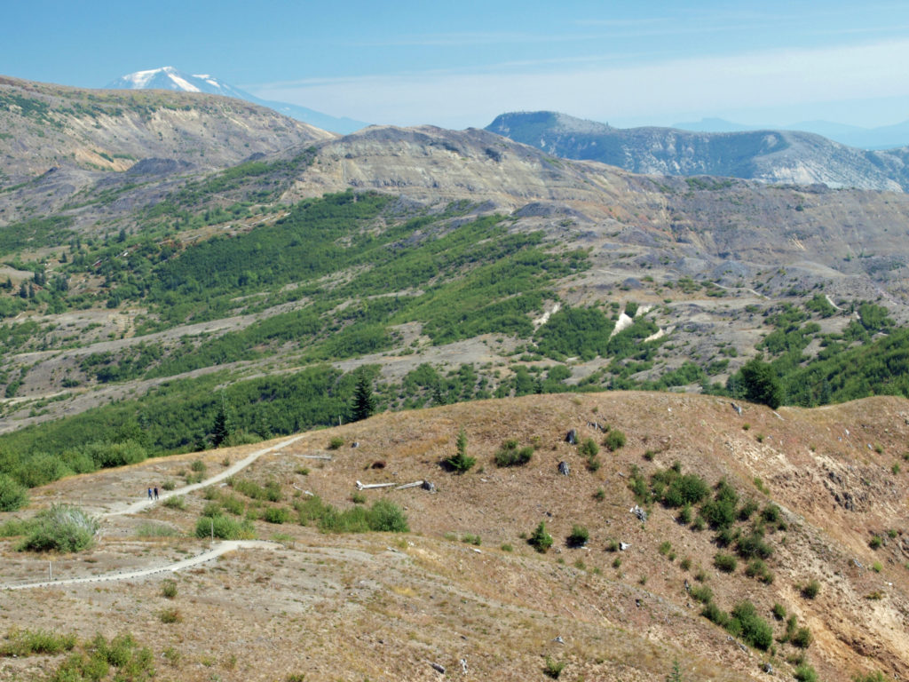
From the Observatory, follow the paved trail to an overlook on Johnston Ridge near the Observatory. There are good views here into the crater of the mountain and the blast zone. At the junction just beyond the overlook, turn right onto the Boundary Trail.
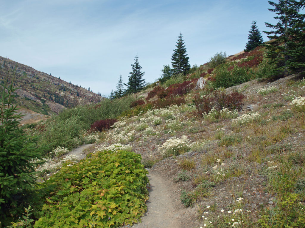
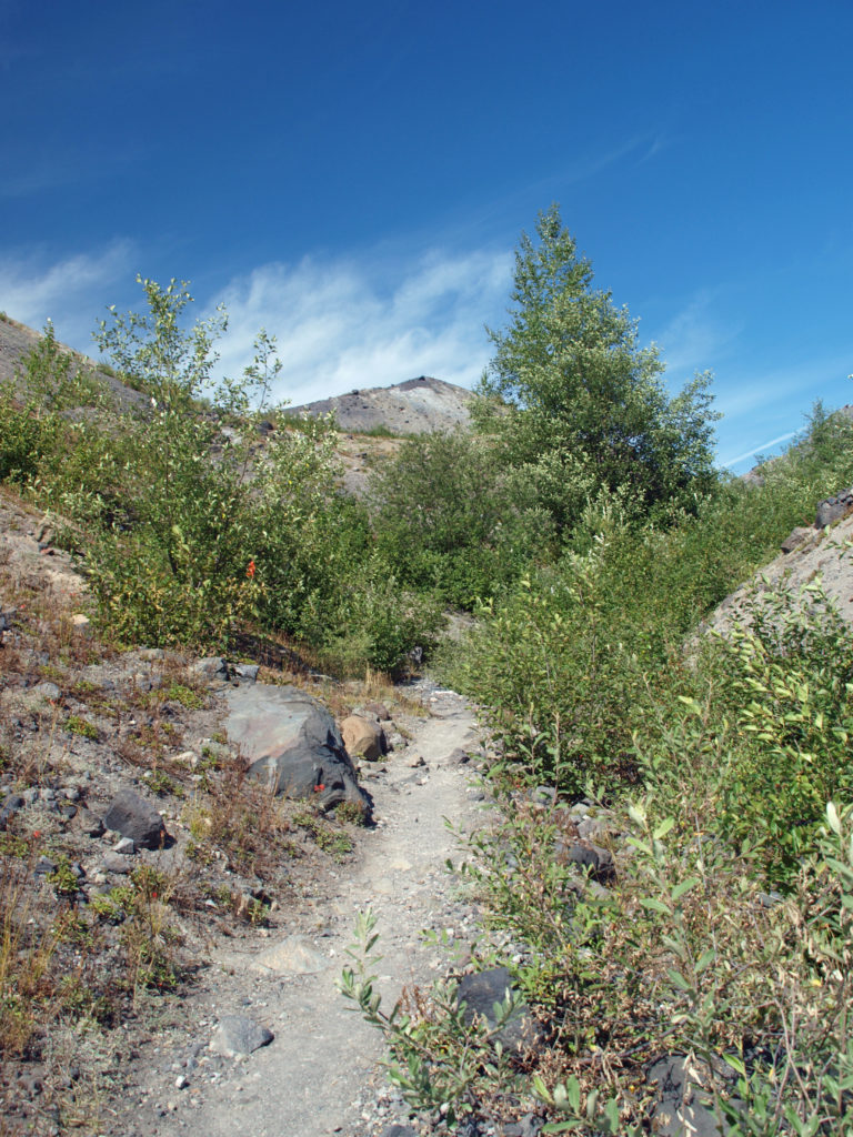
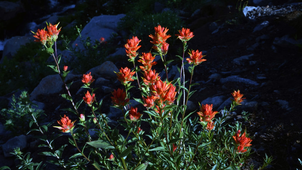
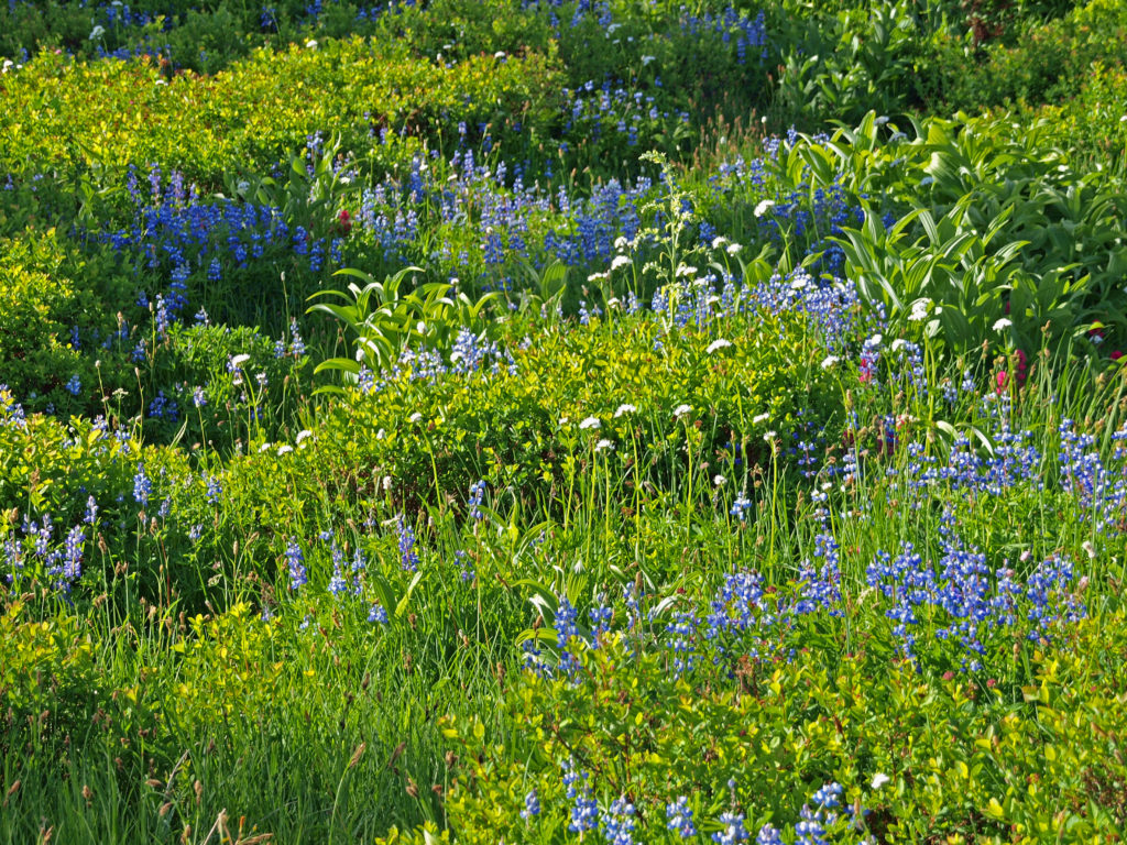
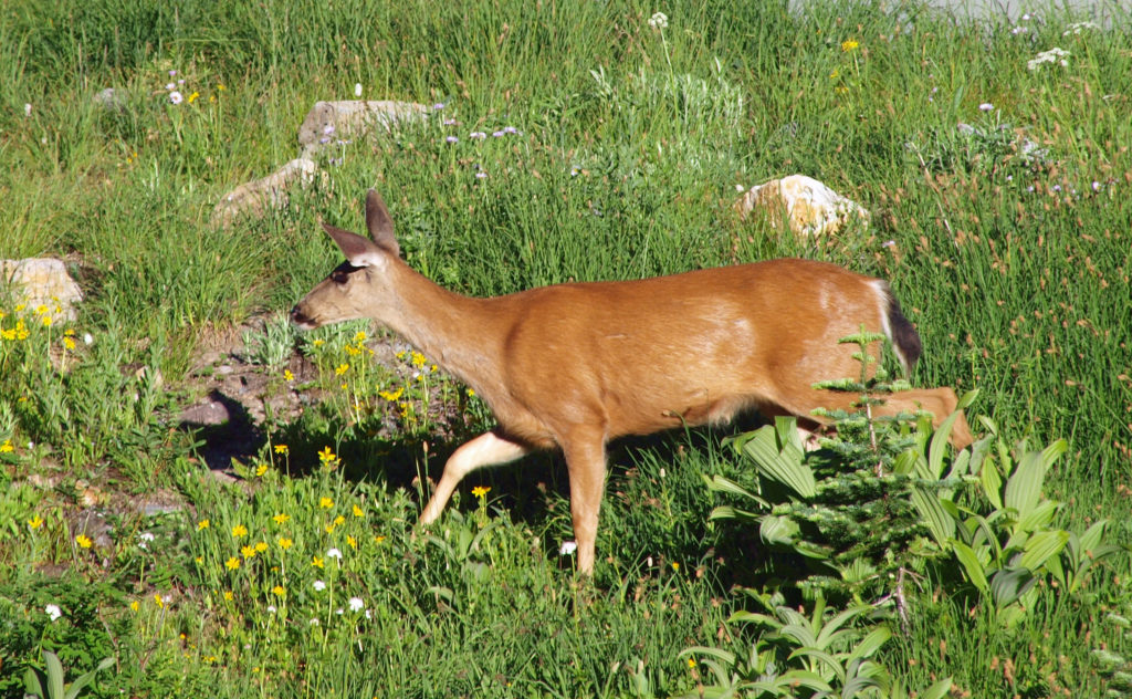
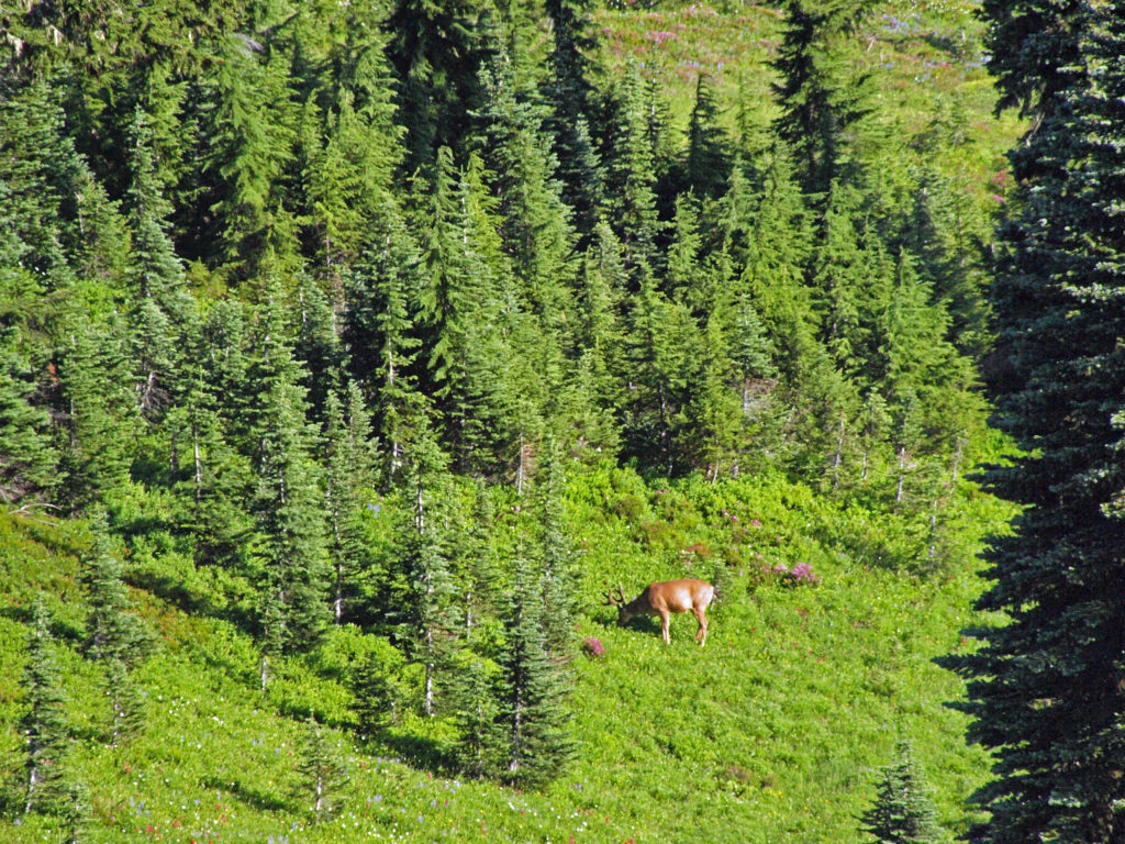
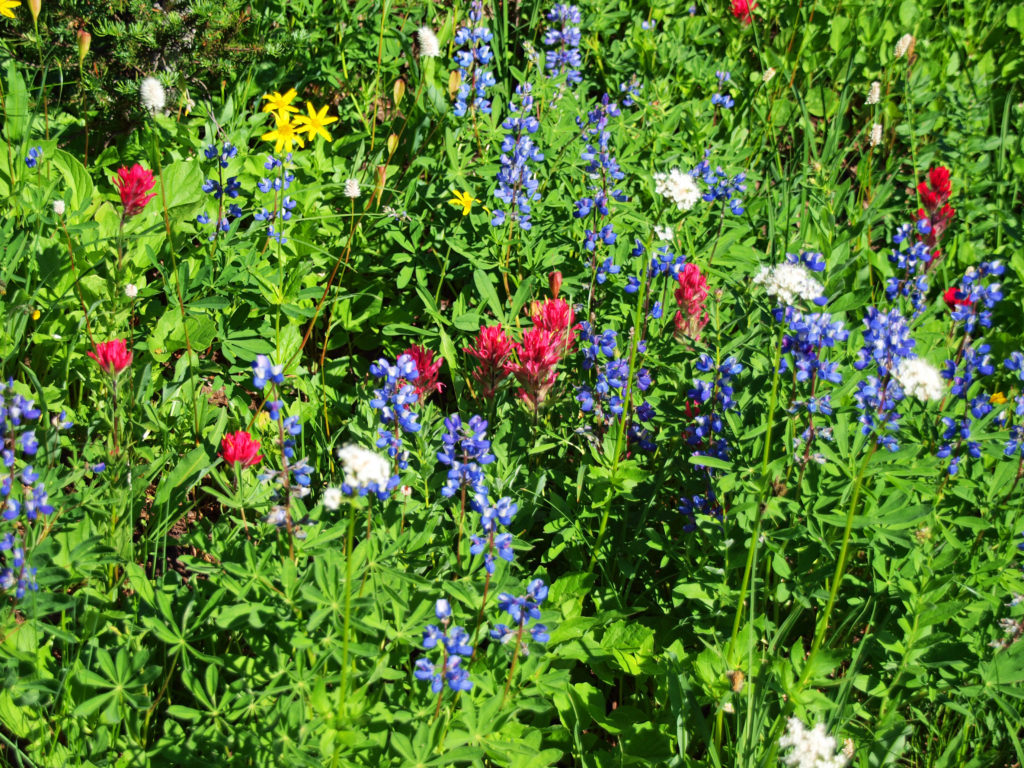
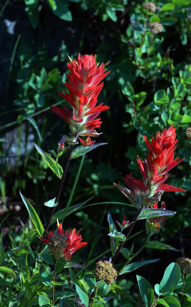
There are great views all along the trail. Wildflowers were still abundant when my wife and I did this hike in late August. On the north side of the ridge, you will see a new forest beginning to grow. The trail descends gradually for about a mile and a half through mostly open terrain to a trail junction. Stay left here on a new portion of the trail to avoid a traverse of a steep slope on the old trail. At the 1.8-mile mark you will come to another trail junction. Stay left on the Boundary Trail. The trail to the right takes you to the Devil’s Point viewpoint.
At about the two-mile point in the hike the trail descends the south side of the ridge to a junction with the Truman Trail at the 2.2-mile mark. At the junction, continue straight on the Boundary Trail. This section of trail has some shaded spots with small trees and shrubs. The trail then climbs steadily for about another mile and a half to the junction with the Harry’s Ridge Trail.
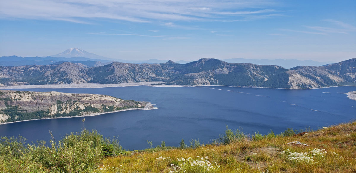
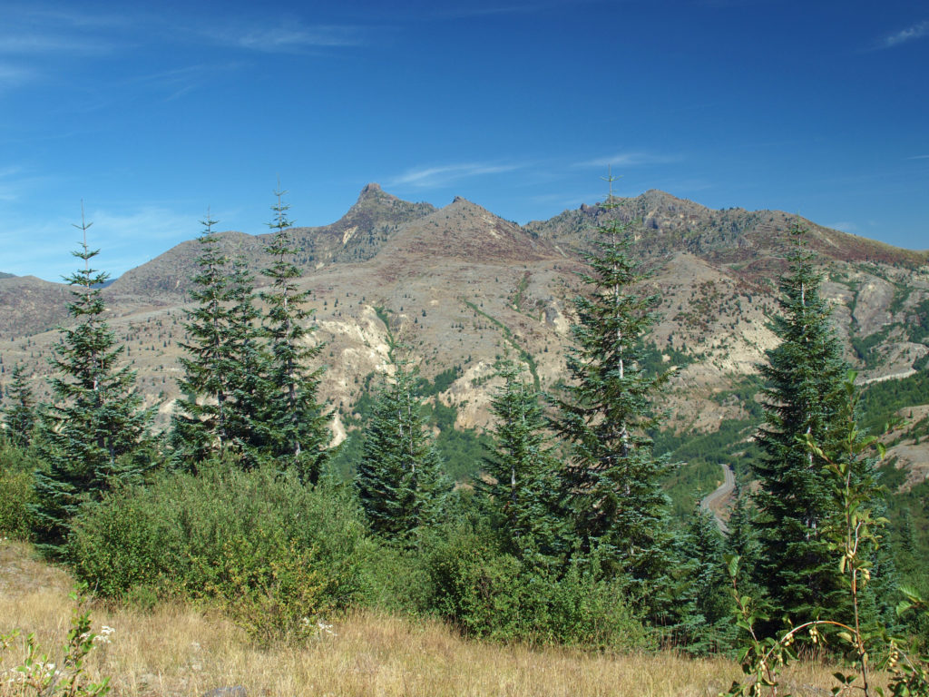
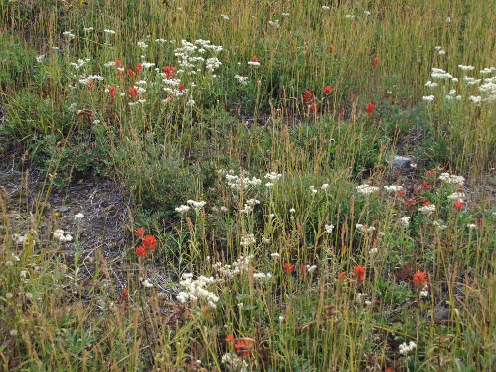
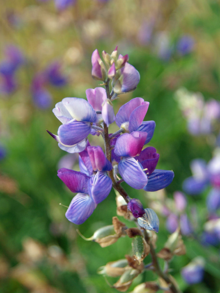
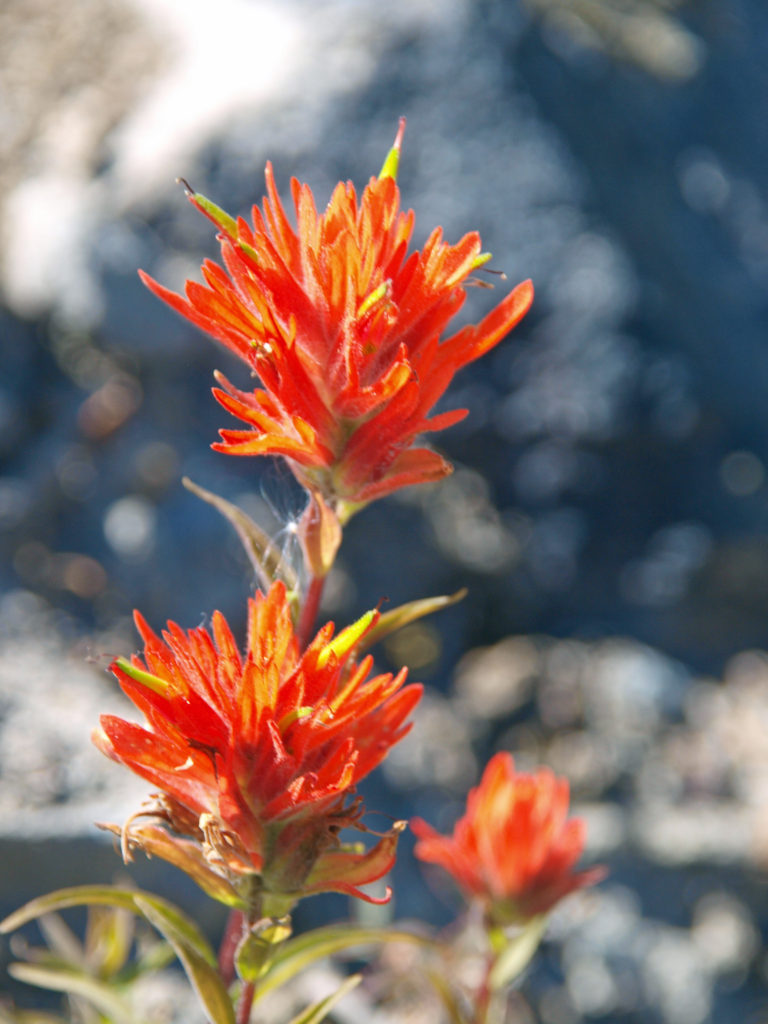
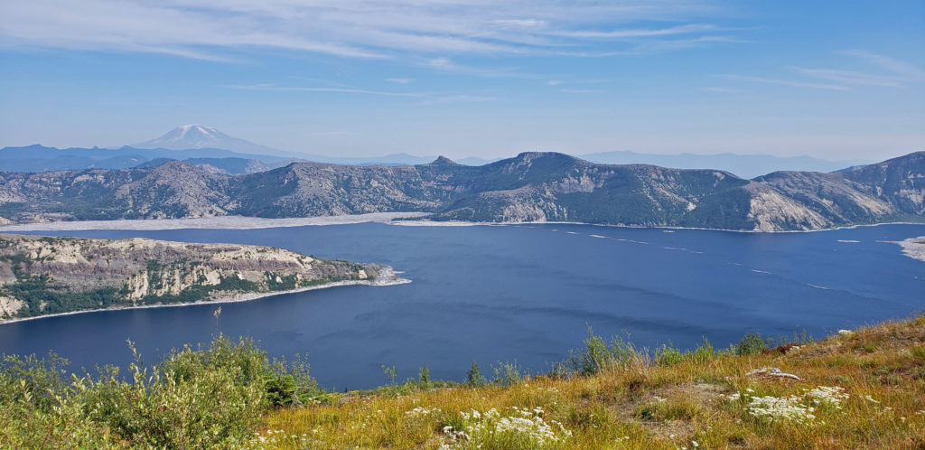
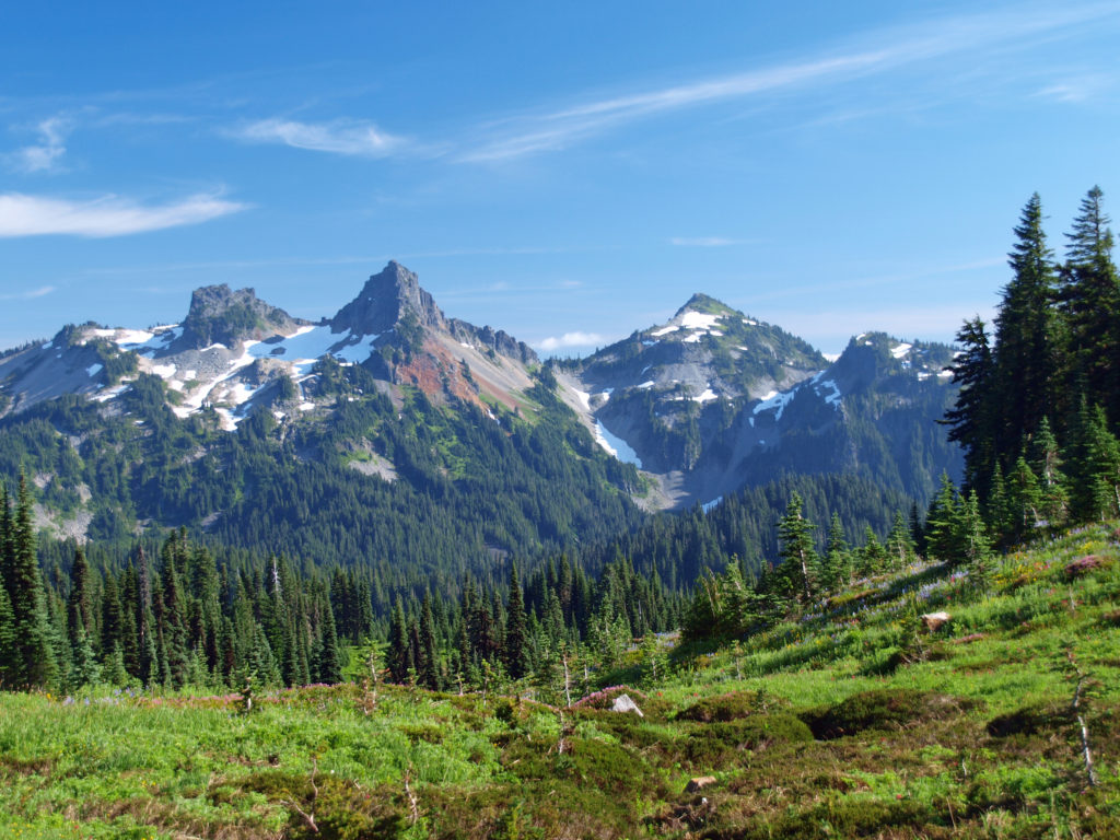
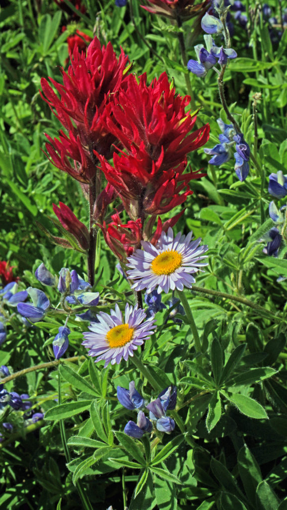
There are good views of Spirit Lake on the Boundary Trail just beyond the junction. Huckleberry bushes, lupine, and Indian paintbrush are abundant here. Back at the junction, take the Harry’s Ridge Trail up to the summit of the ridge. Along the trail to the summit there are more views of Spirit Lake, Windy Ridge to the east of the lake, and Mt. Adams in the distance.
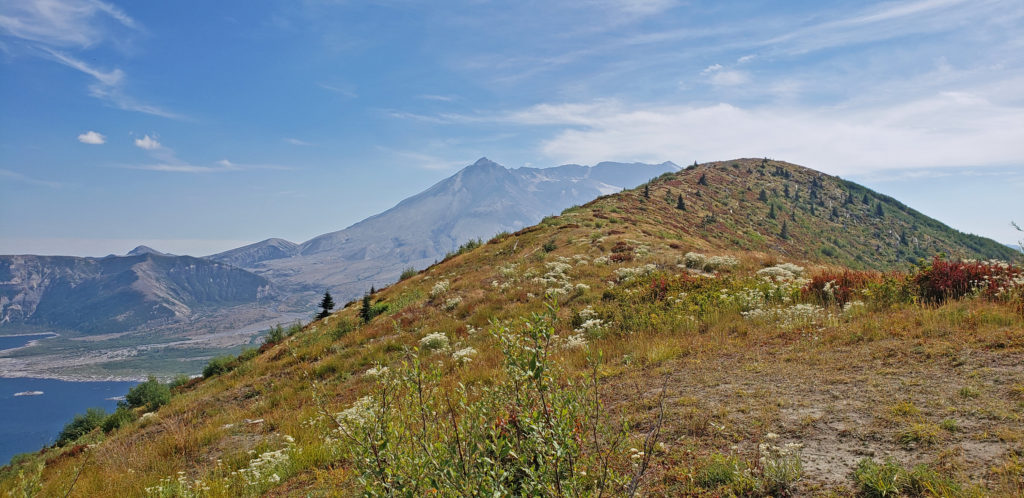
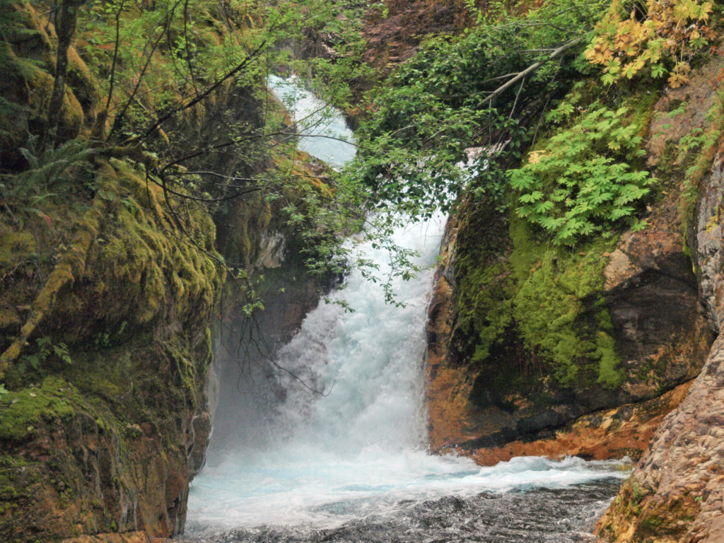
At the summit of Harry’s Ridge there is a closer view into the crater than can be had from the Observatory, and the blast zone extends around you in all directions. You’ll want to linger here and take in the view. It’s a good spot for lunch, too, and a good turnaround point. The trail continues down the ridge to another lower viewpoint, if you want an even closer view into the crater. When you’re ready to leave, return to the Observatory the way you came.
Other area attractions and activities:
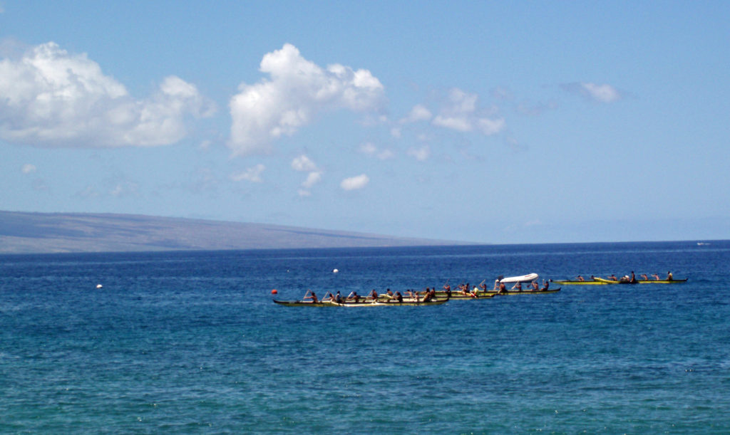
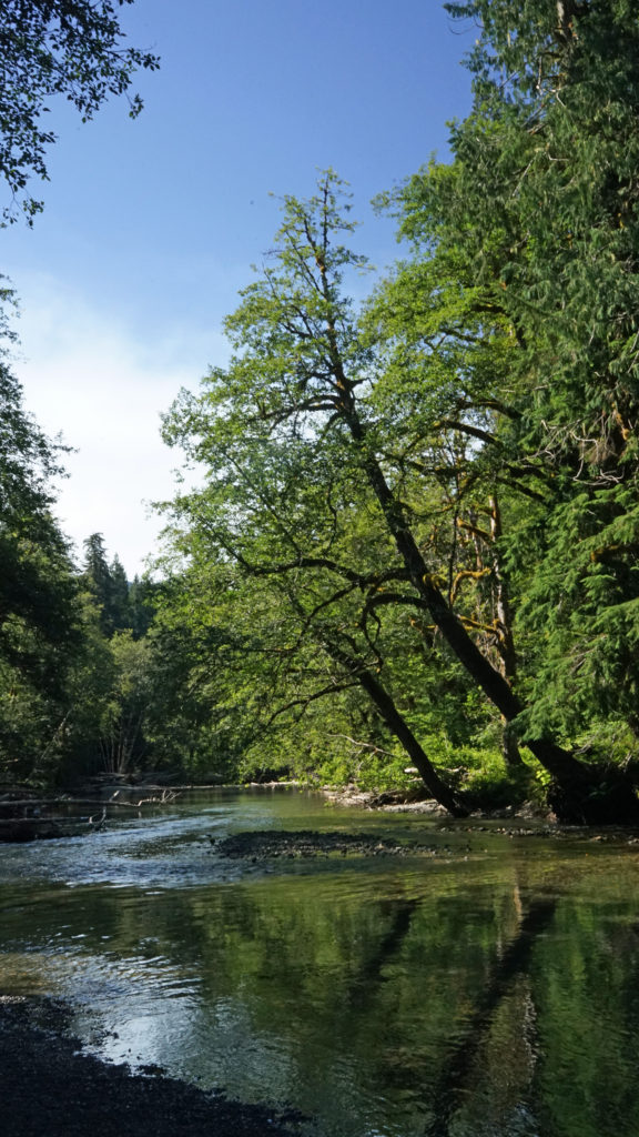
There are other worthwhile hikes that start at Johnston Ridge, as well. The Truman Trail, for example, will take you into the blast zone directly below the crater. Check at the Observatory or the Observatory website for more information. There is also a nice trail around Coldwater Lake, and the lake is a good place to canoe or kayak. And the day after we hiked to Harry’s Ridge my wife and I hiked Lava Canyon, on the southeast side of Mount St. Helens, another hike that is very much worth doing.
Originally posted September 25, 2018 by Alan K. Lee. Most recently updated July 6, 2023.
All photos ©Alan K. Lee, except as noted
 Overview:
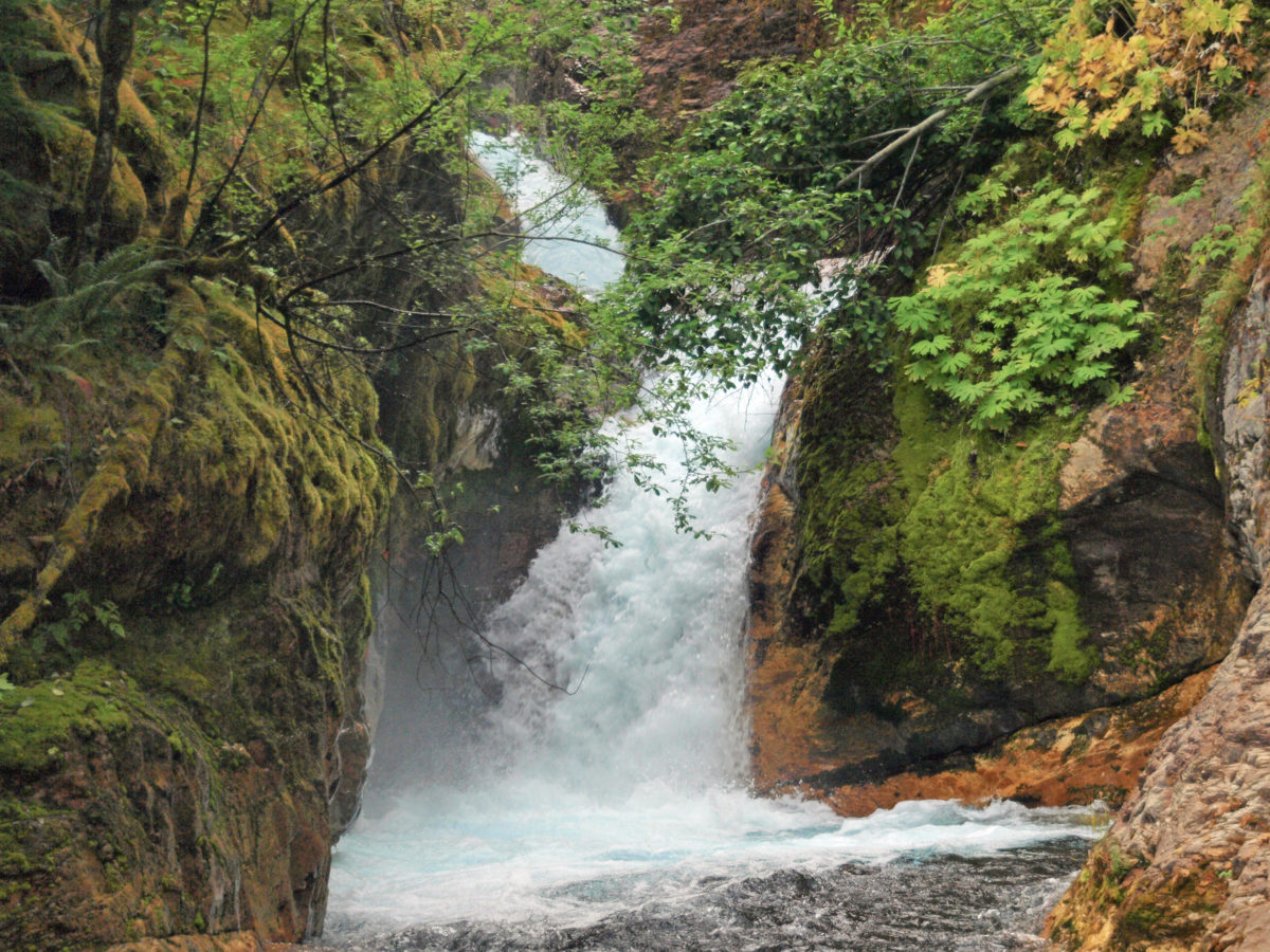
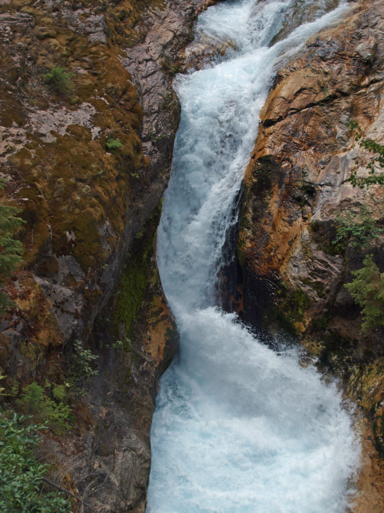
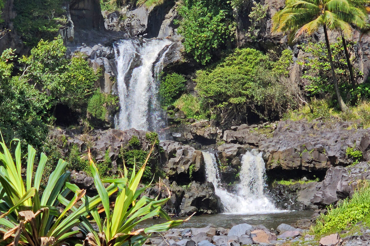
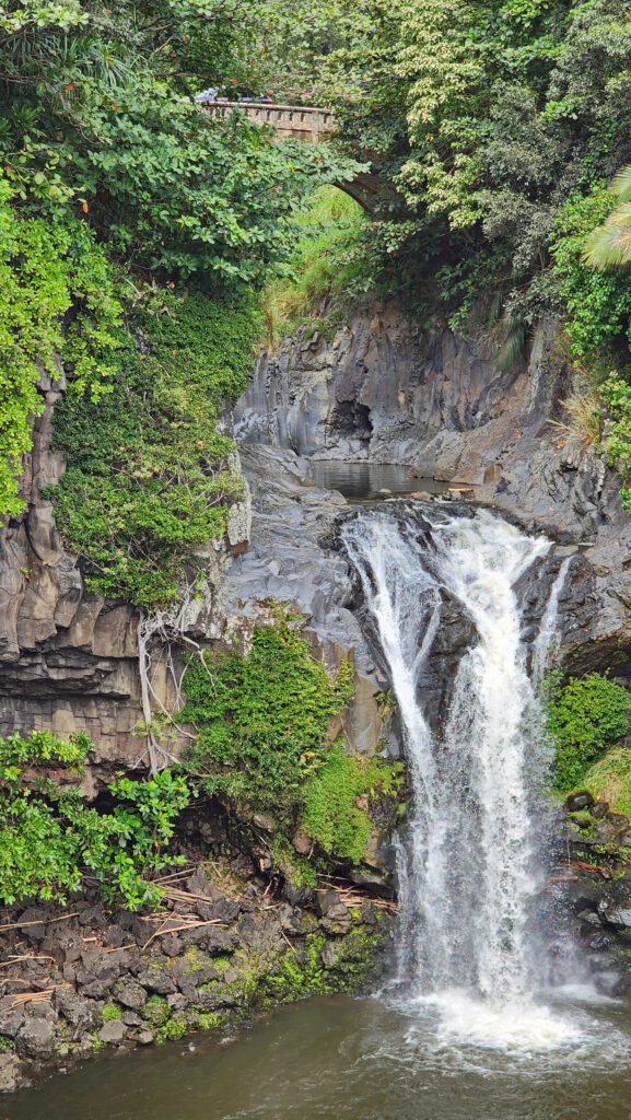
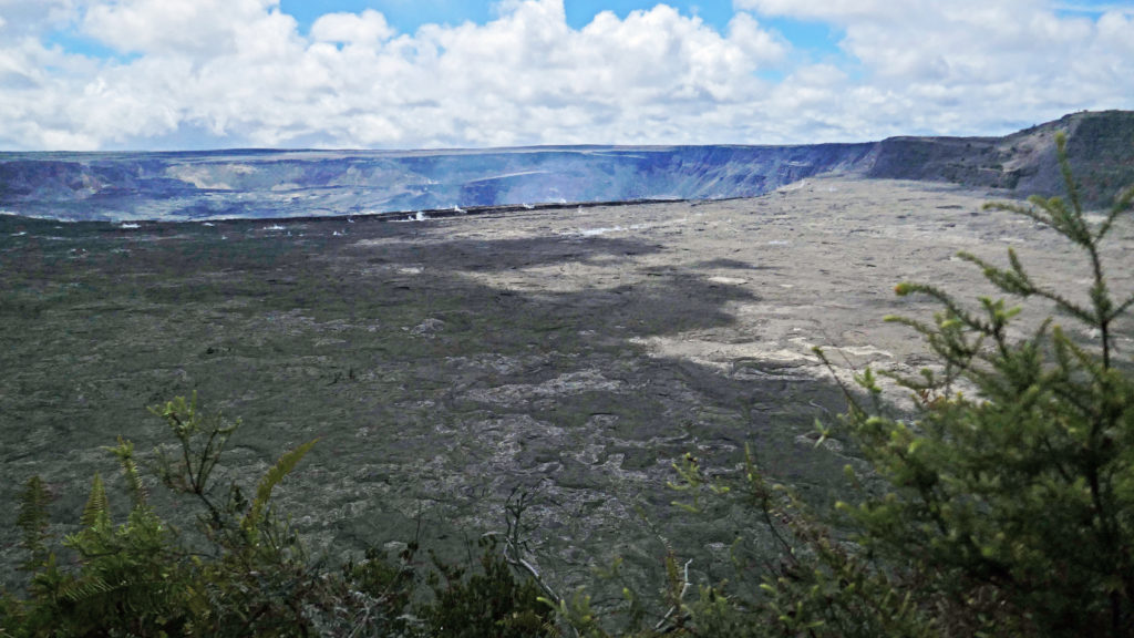
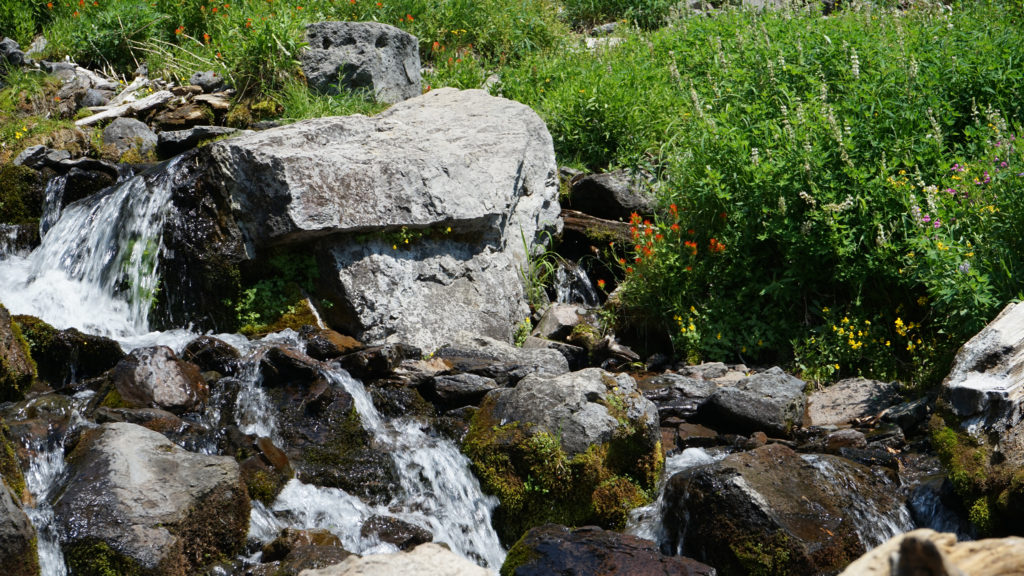
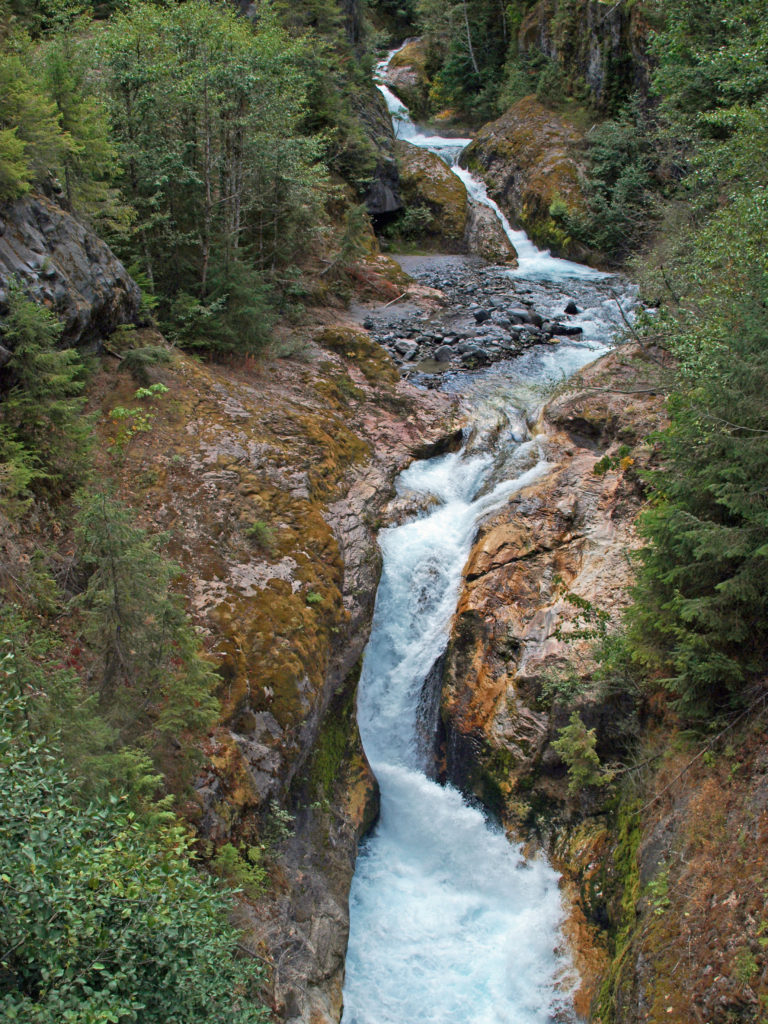 The history of Lava Canyon begins about 3500 years ago when an eruption of Mount St. Helens sent a flow of lava down the old valley of the Muddy River, destroying the forest and filling the valley with molten rock. Over the intervening years, the Muddy River cut a new course through the lava flow, and the canyon gradually filled with sediment. Then came the 1980 eruption, which melted the summit glaciers and sent a huge lahar (volcanic mudflow) down the valley, destroying the rebuilt forest and scouring out the built-up sediment, exposing the remnants of the earlier lava flow. What was left is a steeply descending canyon with an almost continuous series of spectacular waterfalls and cascades. (For more information on the 1980 eruption, see my
  Getting there:
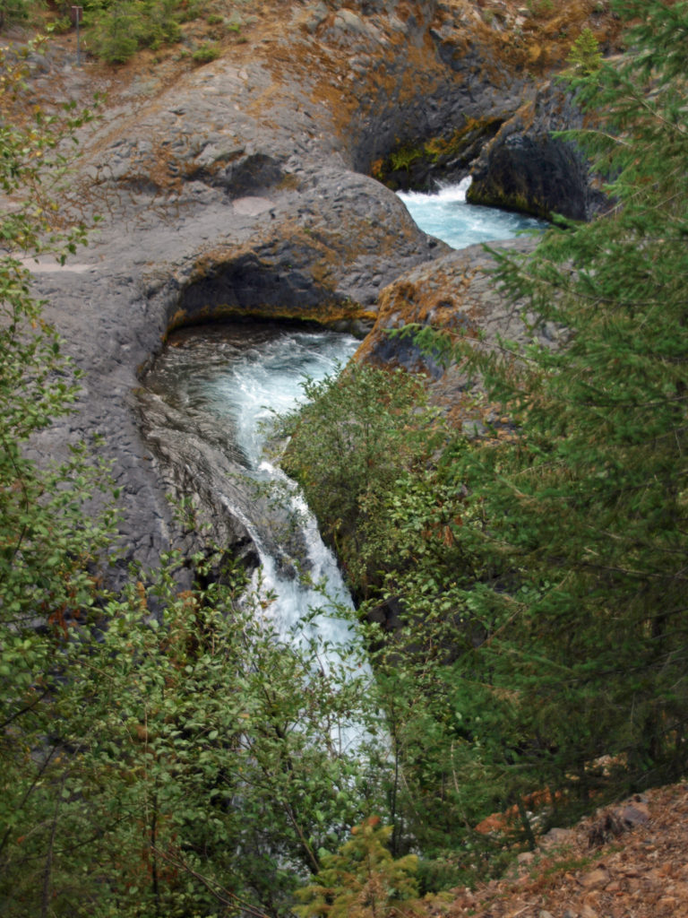 Trailheads:
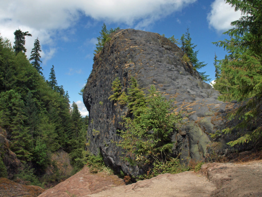 The hike:
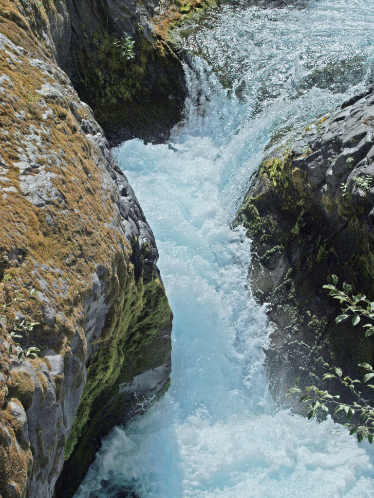
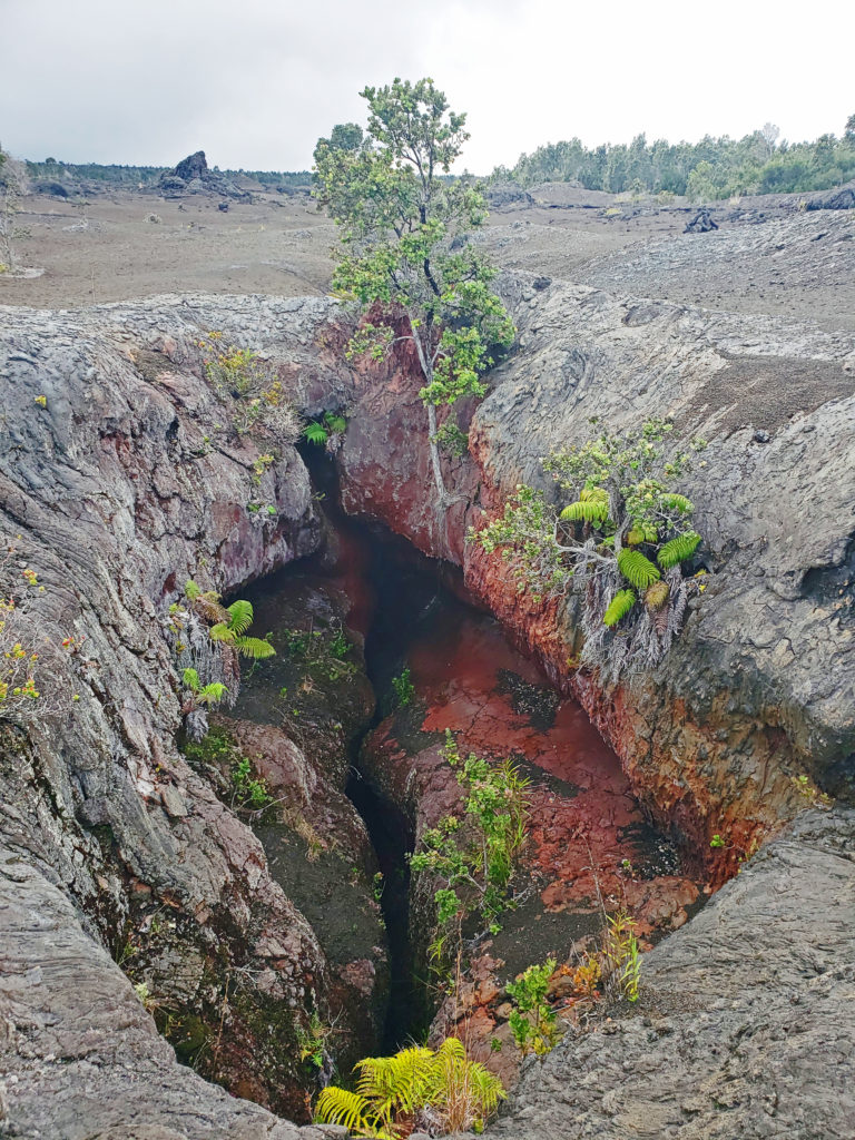
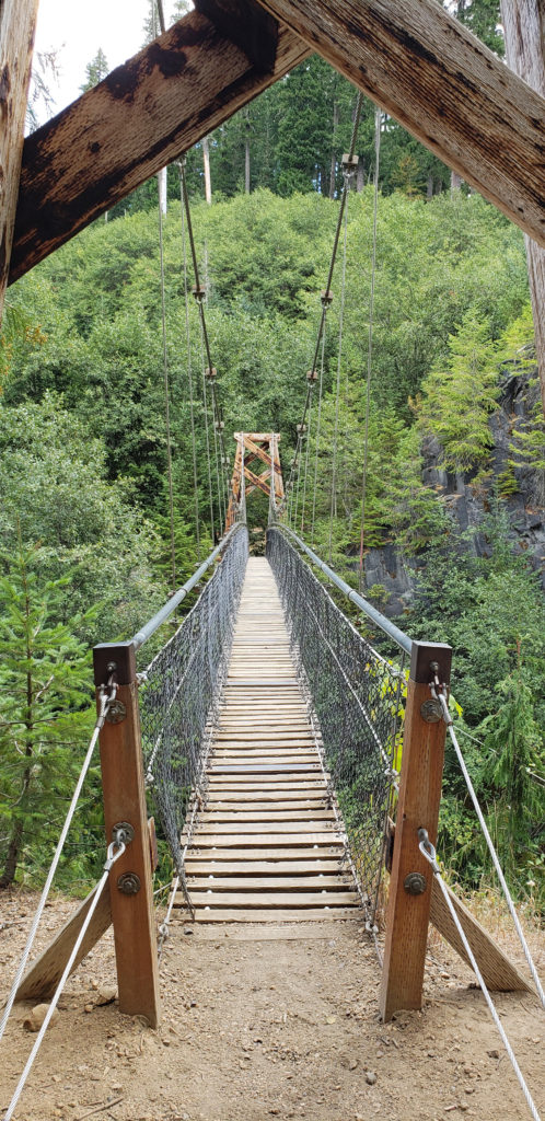 Below the overlook, the path is rock and dirt, steep in places. After another three tenths of a mile, you come to another side trail and a suspension bridge over the river that gives a bird’s eye view of the canyon and waterfalls. On the other side of the bridge is a connecting trail that takes you back to the upper bridge, making for a 1.4-mile loop. (Update: As of June 2023 the suspension bridge is closed. Check the National Forest Service’s
 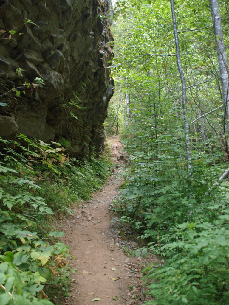 At about the 1.3-mile mark, the trail descends a 40-foot ladder to the base of the rock formation known as The Ship. Before 1980, sediment filled the canyon to the top of The Ship, to give you an idea of how much sediment was scoured out of the canyon. A short but steep side trail (and another ladder) leads to the top of The Ship.
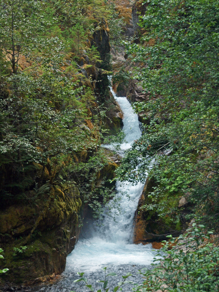 (Below The Ship, the trail continues another 1.5 miles to the lower trailhead. The entire hike from upper to lower trailhead and back is about six miles and the elevation gain coming back is 1350 feet.)
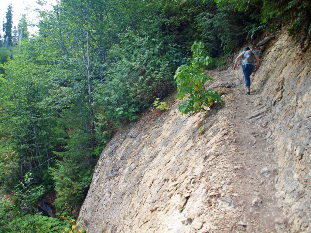 Return from The Ship the way you came. Cross the suspension bridge if it is open and take the trail on the opposite bank to the upper bridge and re-cross the river. The two bridges both give you great views of the river and canyon below.
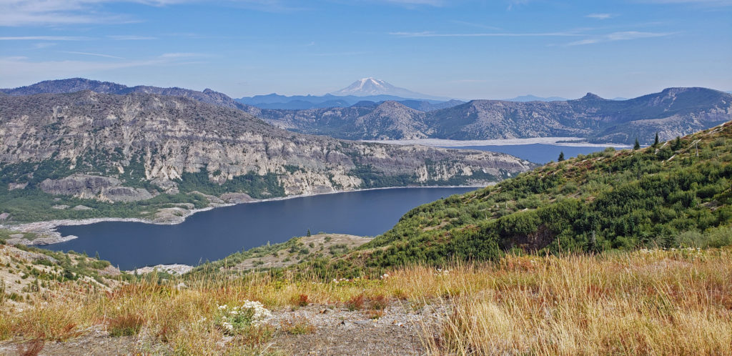
 Originally posted in a different format September 29, 2018 by Alan K. Lee. Updated and re-posted March 23, 2021. Edited, updated and posted in this format June 29, 2023.
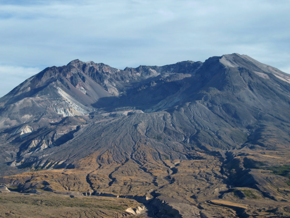

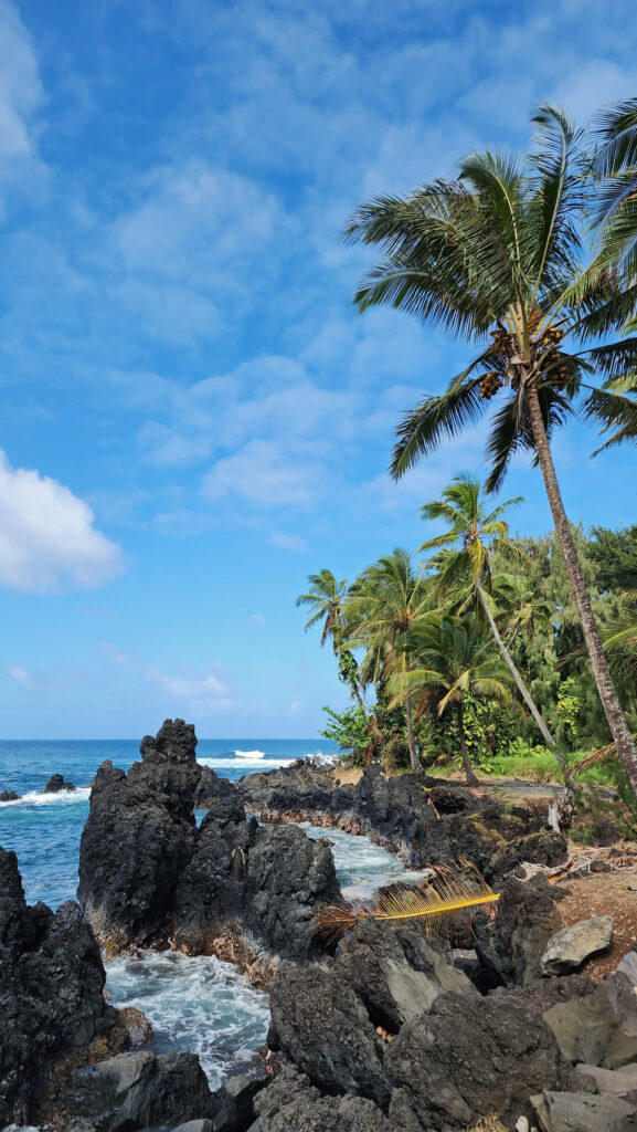
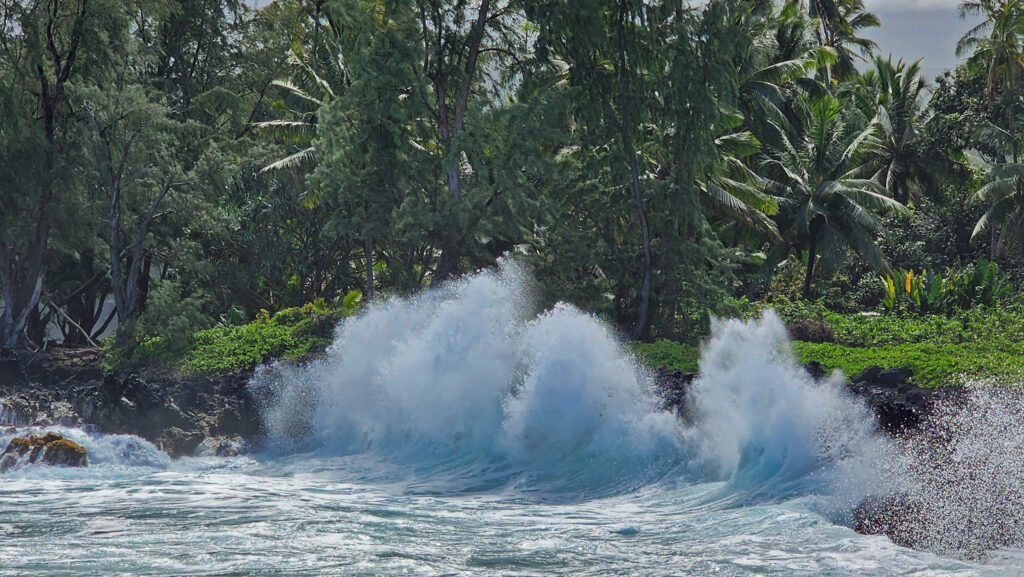
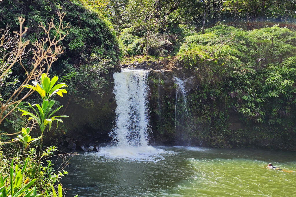
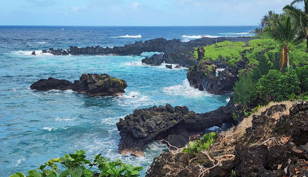
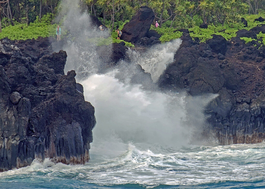
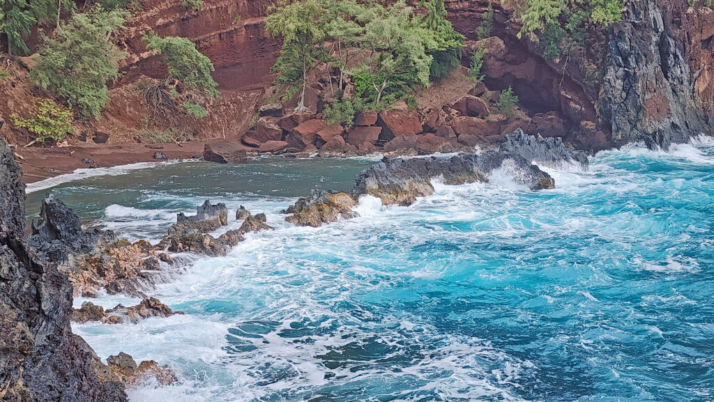
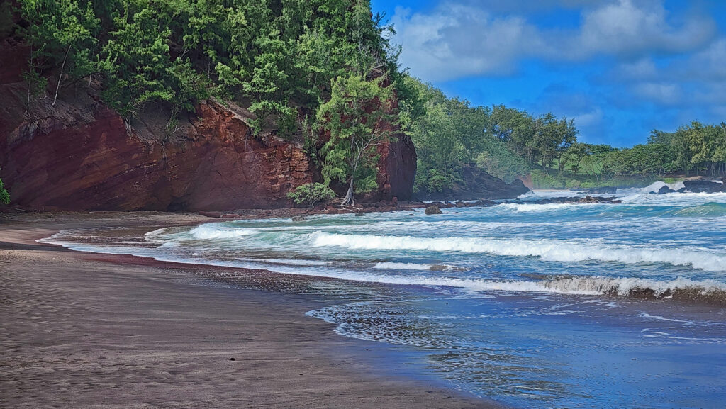
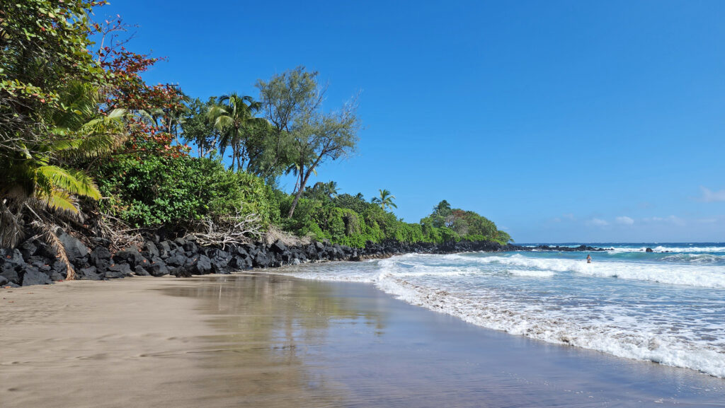
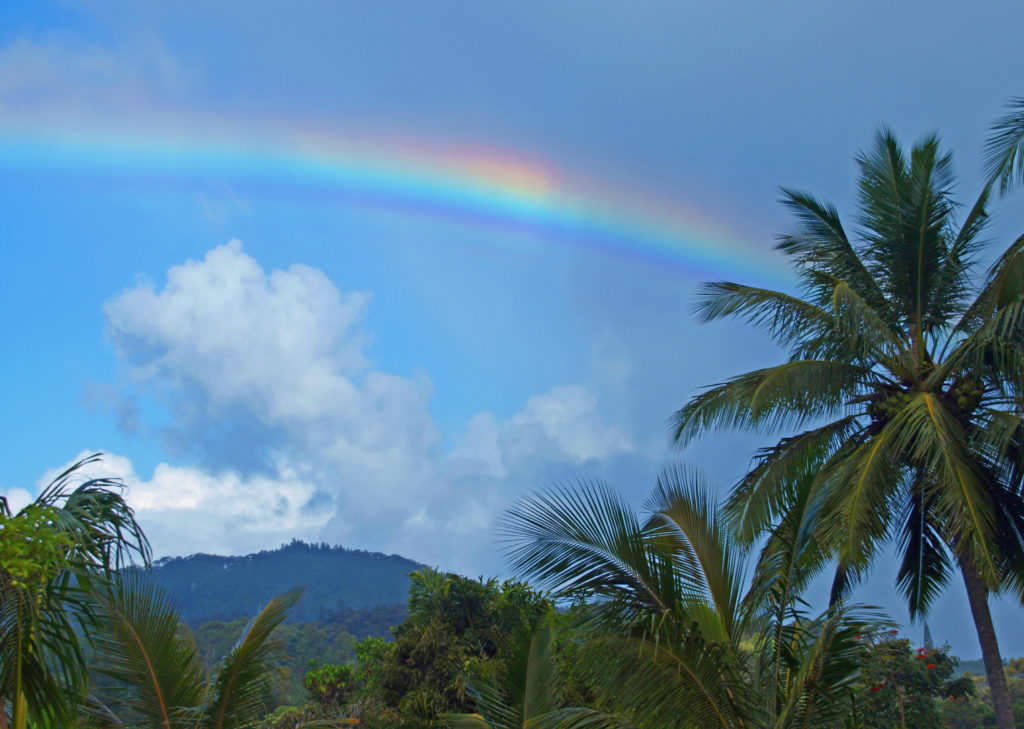
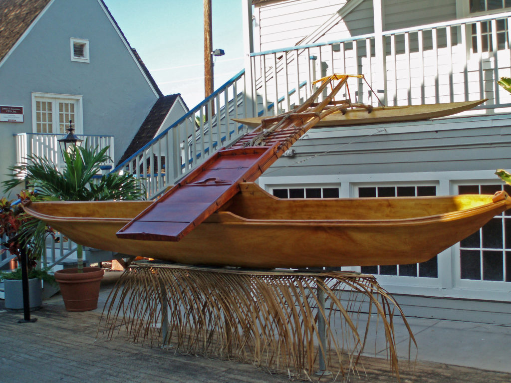
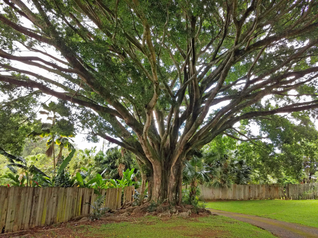
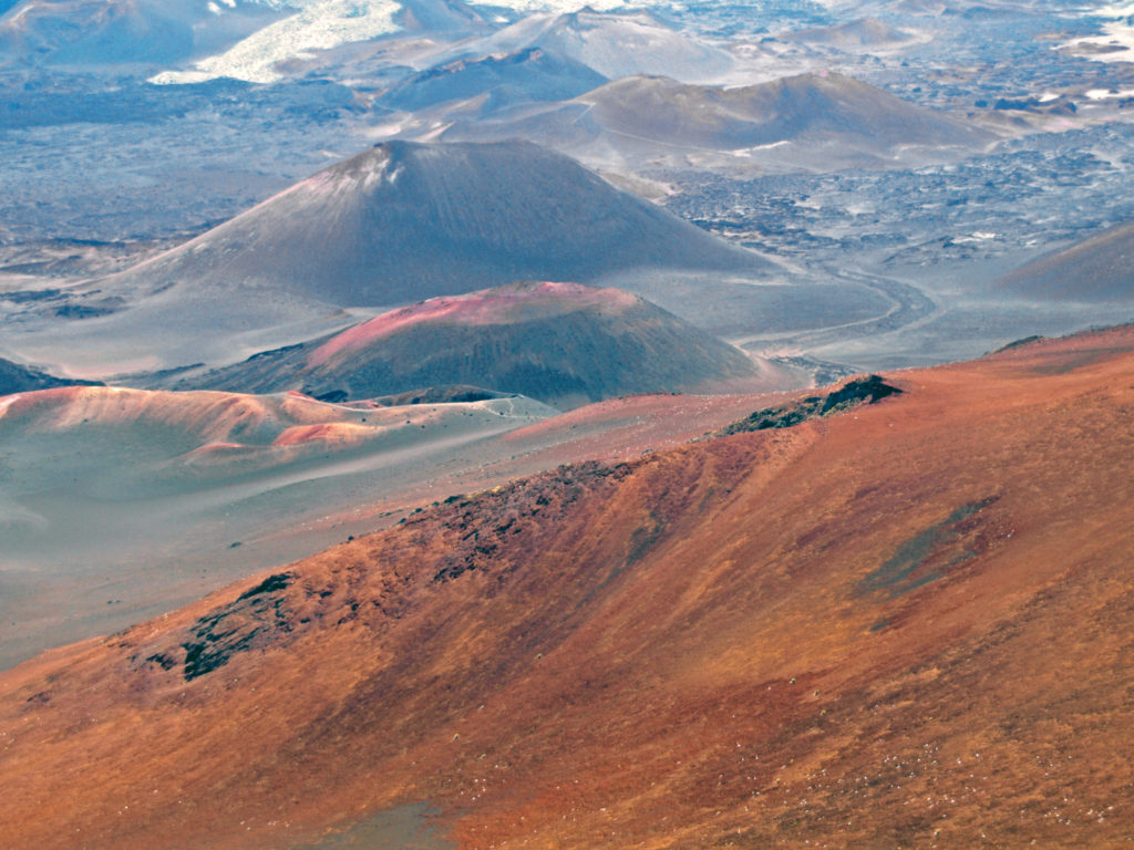
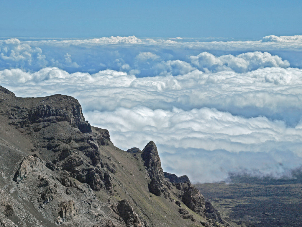
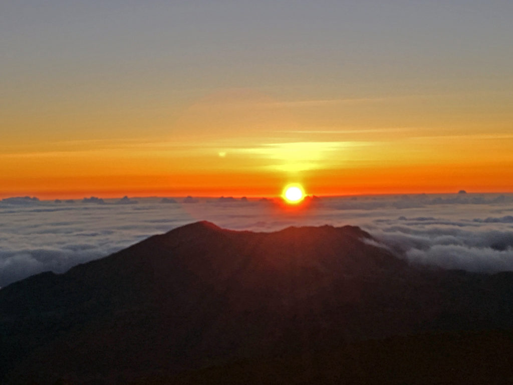
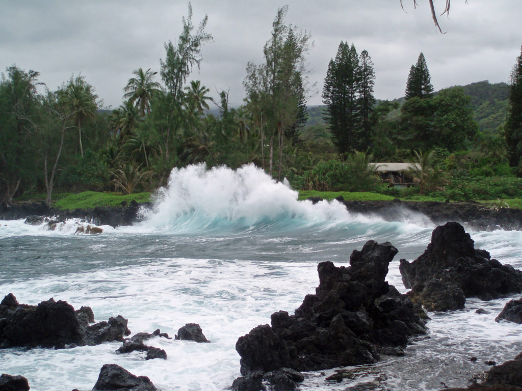
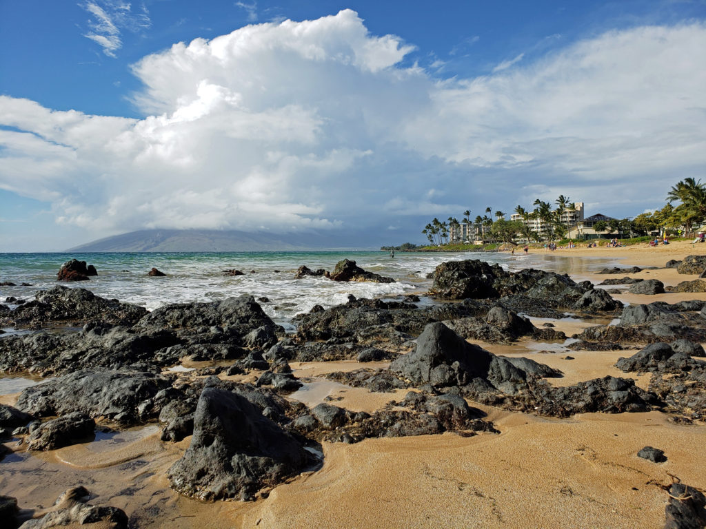
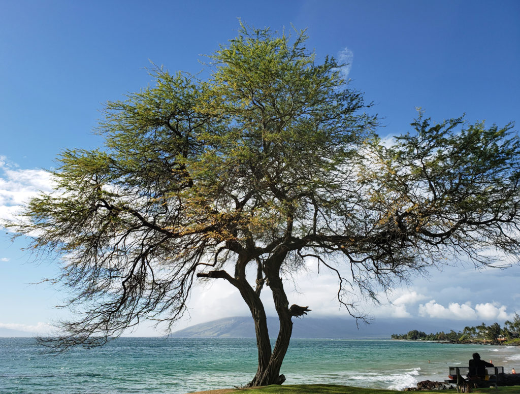
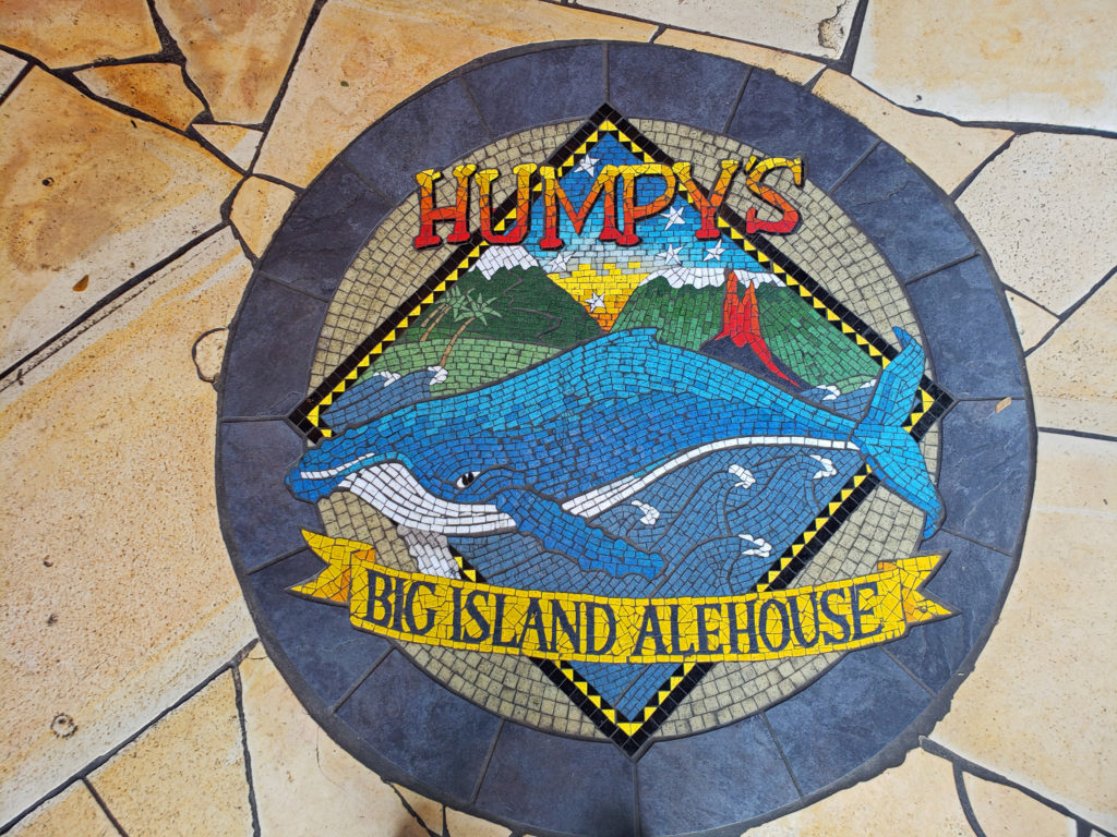
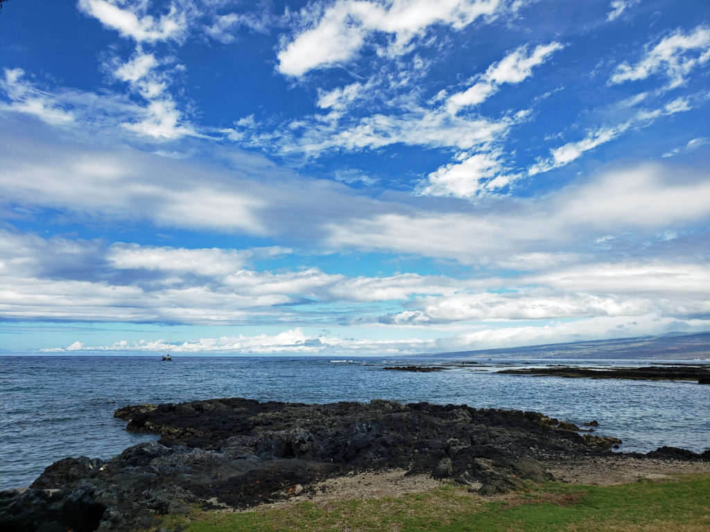
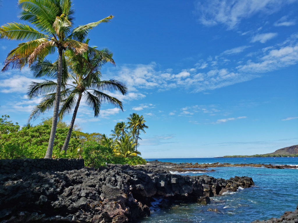
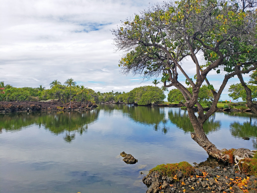
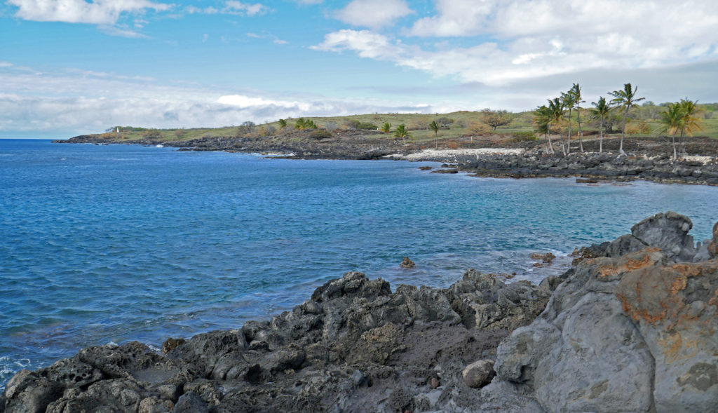
 There are a lot of things that you’ll miss if you’re visiting Hana as a day trip. Better to do as we did and spend a night or two. That will give you enough time to really see and enjoy the East Maui area. But be forewarned, Hana is expensive.
 Posted March 3, 2023.
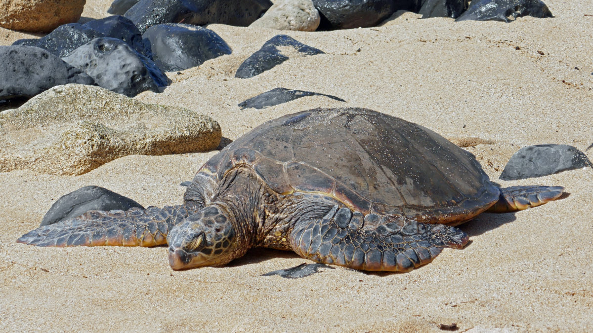
 Originally posted August 6, 2019. Updated and re-posted November 19, 2022.
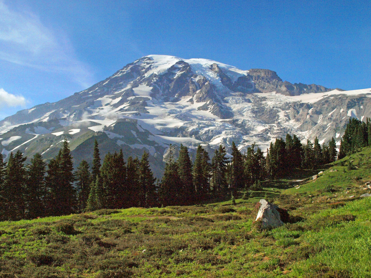
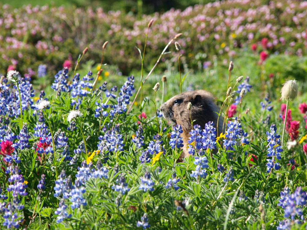
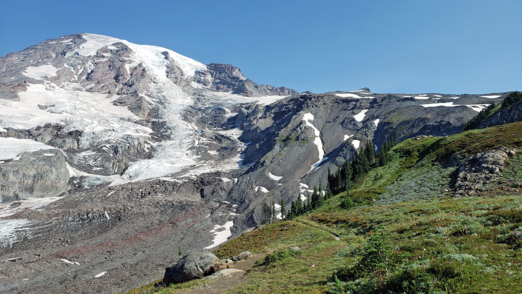 The highlights of the trip were the two hikes we did on the Skyline Trail. The first was the four mile out and back hike to Panorama Point. The second was the roughly four mile Skyline-Golden Gate loop. Both are listed as “moderate” hikes, but both have significant elevation gains (1700′ and 1400′ respectively). We did both hikes early in the day during the week, but we were far from the only ones on the trail, especially on the hike to Panorama Point. But the area above Paradise is so incredibly scenic that the crowds didn’t diminish the experience much.
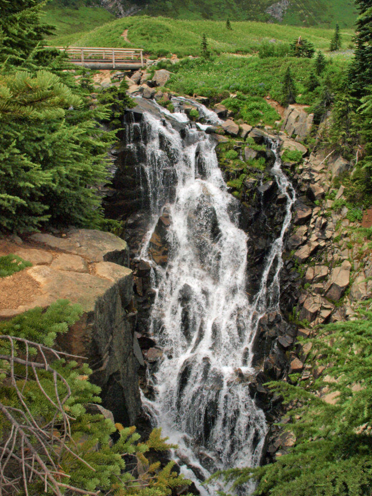
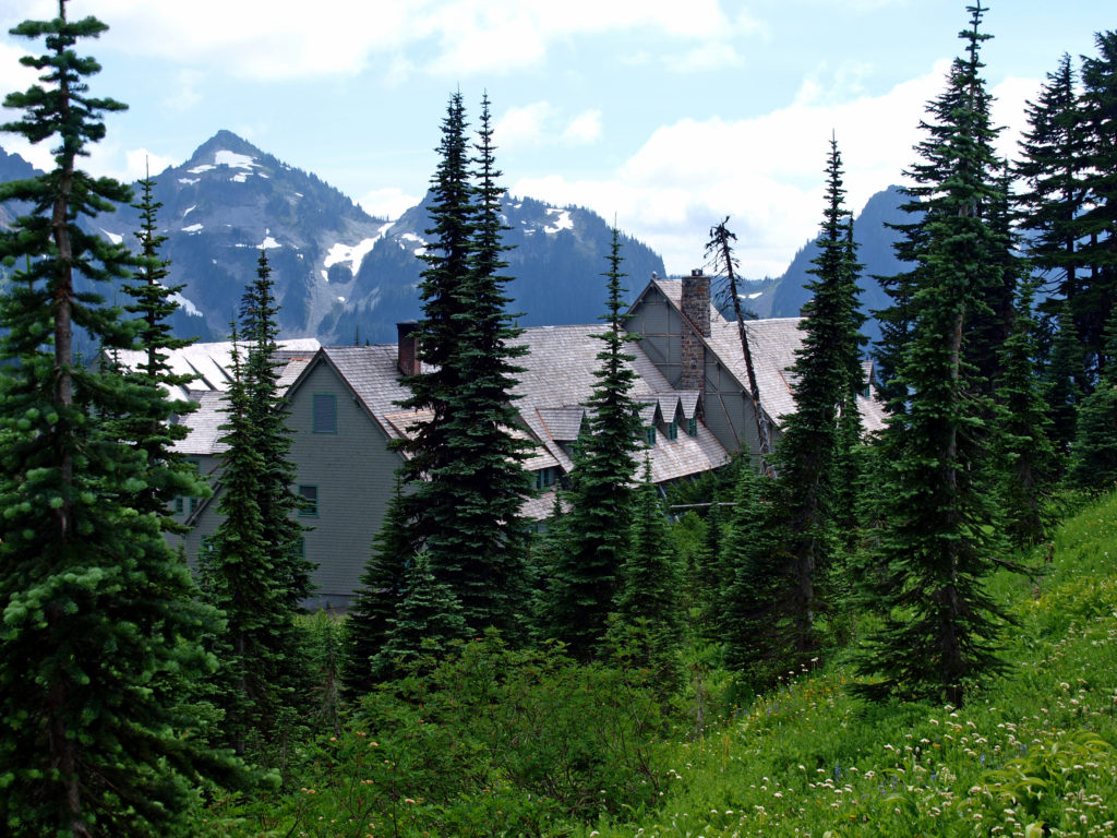
 Close to Paradise Inn, the Jackson Memorial Visitor Center, named after long-time U.S. Senator Henry M. Jackson, offers general information, exhibits, a park film, guided ranger programs, a book/gift store and a cafeteria. Unfortunately, all visitor centers in the park are currently closed due to the ongoing pandemic.
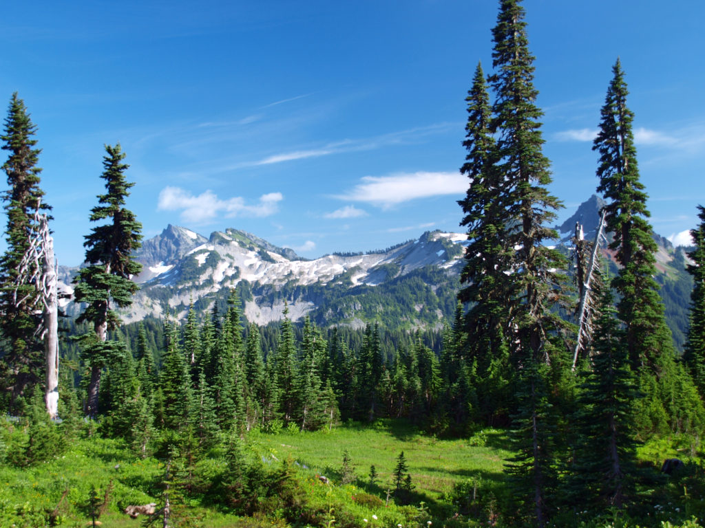
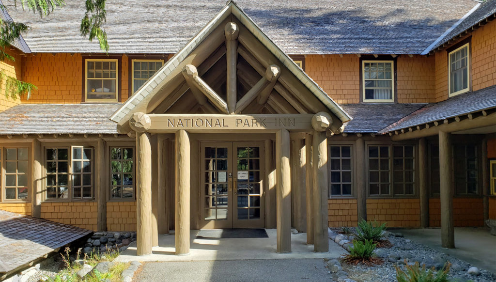 Both Paradise Inn and the National Park Inn have full service restaurants, but both were operating on a reduced scale due to the pandemic when we were there in August. The National Park Inn dining room was closed, but take out meals could be ordered and picked up at the reception desk in the lobby. The dining room at Paradise Inn was open for dinner only for most of our visit, but closed (unexpectedly) for the season on our last day there. Paradise Inn also has a limited service cafe, and there is a cafeteria at the Jackson Memorial Visitor Center that is open daily during the summer season and on most weekends and holidays in the winter (depending on road conditions). The National Park Inn restaurant is open year round.
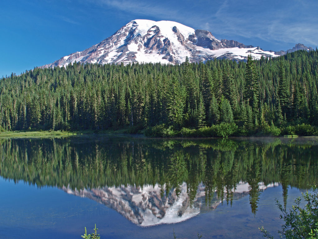
 The nearby Snow Lake Trail is an easy and worthwhile hike. To the east, the Stevens Canyon area has a number of interesting areas, including Box Canyon, a 180 foot deep slot canyon, and a number of roadside waterfalls.
 The Longmire area has some interesting history, a museum, nice hiking trails, and the National Park Inn offers both lodging and dining options for the visitor. The road to Longmire is also plowed in the winter, so it’s a year round destination. (The road from Longmire to Paradise is open in winter when the weather allows.)
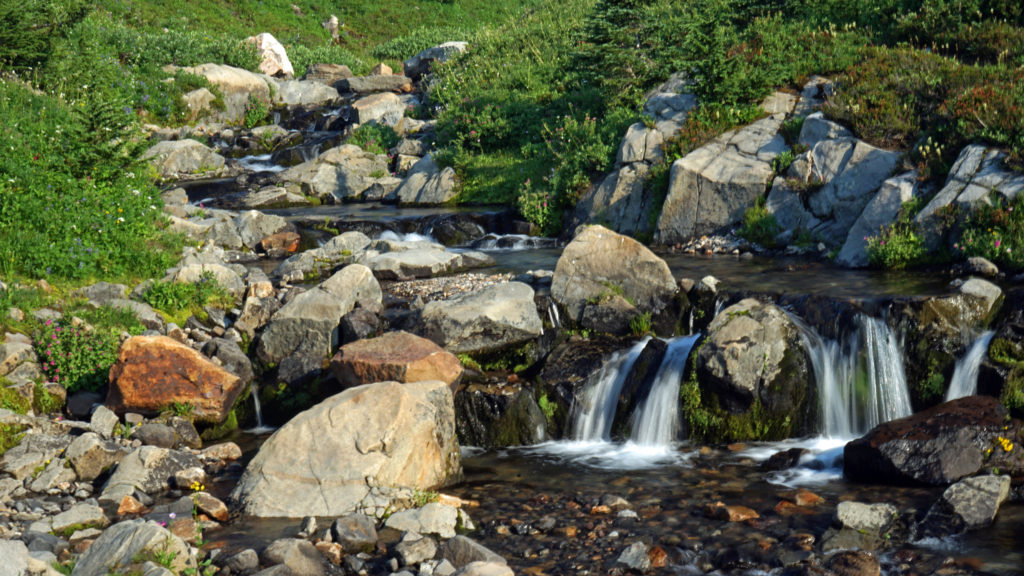
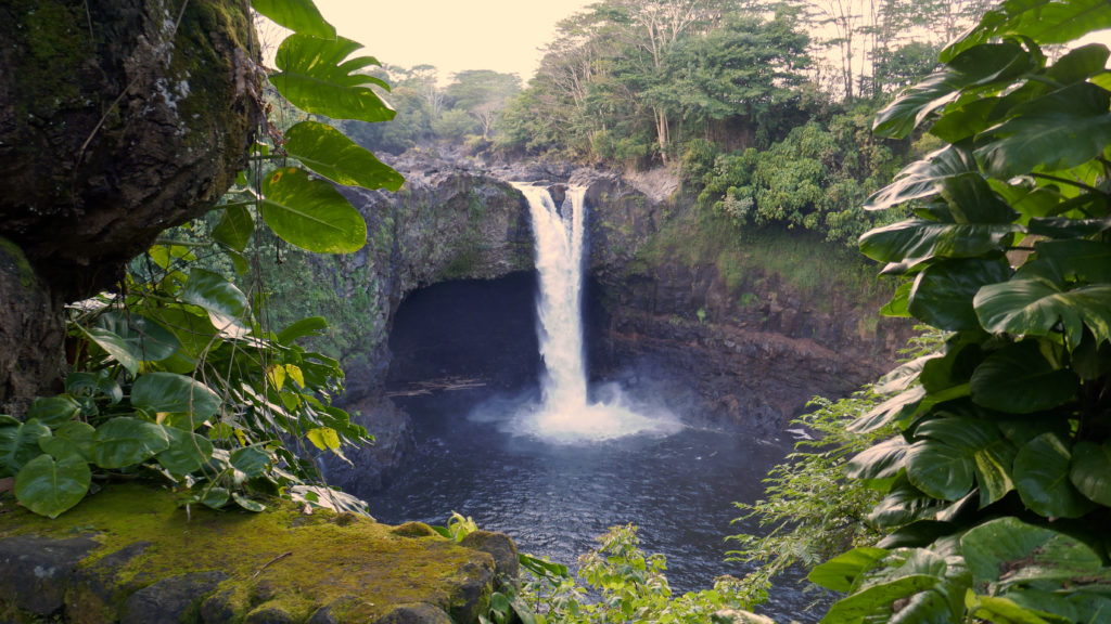
 In the Ohanapecosh area in the southeastern corner of the park, the Grove of the Patriarchs Trail is a good family friendly outing. And the nearby Silver Falls Trail is a must for waterfall lovers. In the northeastern section of the park, the Sunrise area offers beautiful views of the eastern side of the mountain and has an abundance of hiking trails.
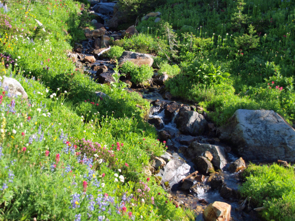
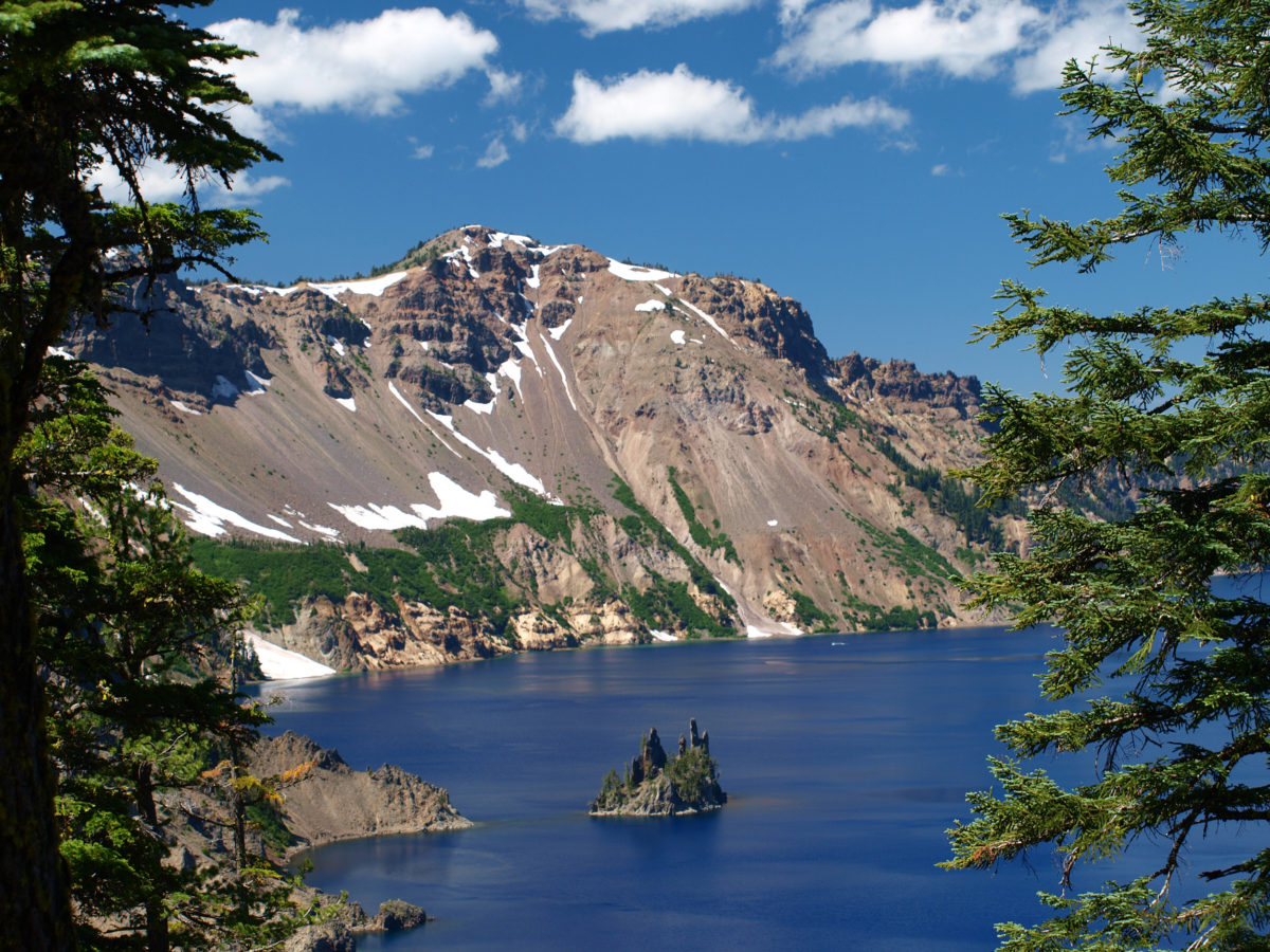
 The Lake
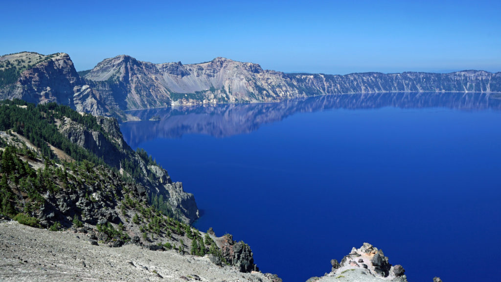
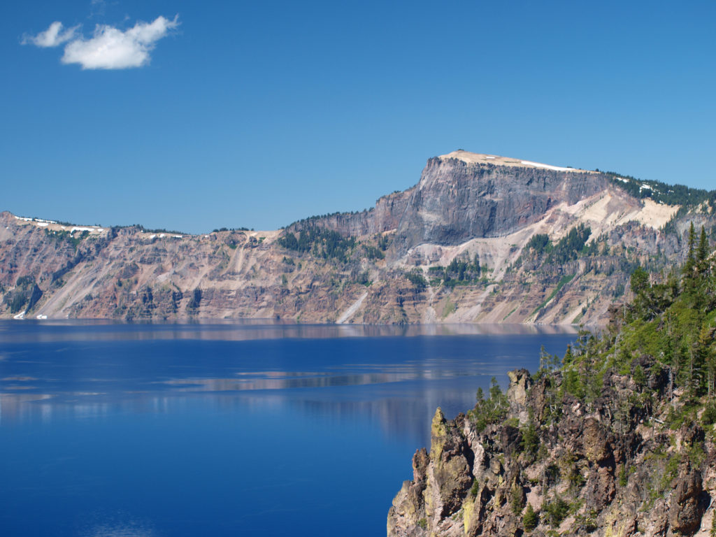 Crater Lake is 1943 feet deep, making it the deepest lake in the United States, second deepest in North America, and ninth deepest in the world. It is also one of the cleanest and clearest lakes in the world. It’s that combination of depth and clarity that results in its intense deep blue color.
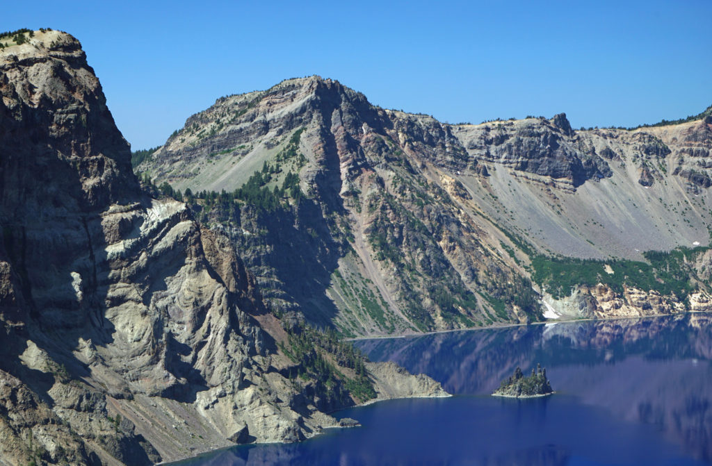 The caldera that Crater Lake occupies was formed 7700 years ago when the summit of 12,000 foot tall Mount Mazama collapsed after a massive eruption. Over time rain and snow filled the caldera to its present level. The lake has no outlet. The level of the lake remains nearly the same because the amount of evaporation from the surface of the lake closely matches the amount of precipitation falling on it in any given year.
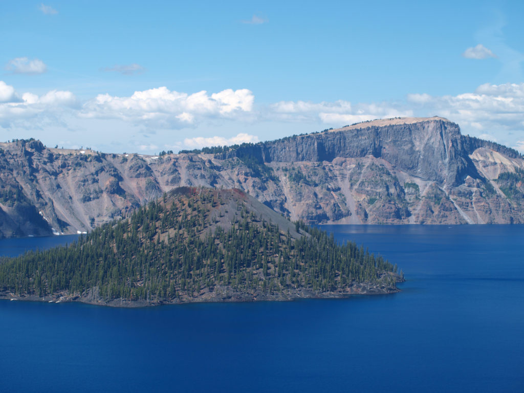 Wizard Island formed sometime after the eruption that formed the caldera. It rises 770 feet above the surface of the lake, 2713 feet above the deepest point in the lake. It last erupted about 5000 years ago, but it is considered dormant, not extinct. Conceivably, it could erupt again at any time. Merriam Cone also erupted after the caldera was formed, but never reached the lake surface. Its summit lies almost 500 feet below the average lake level.
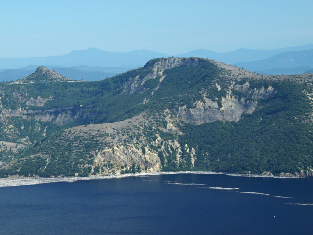
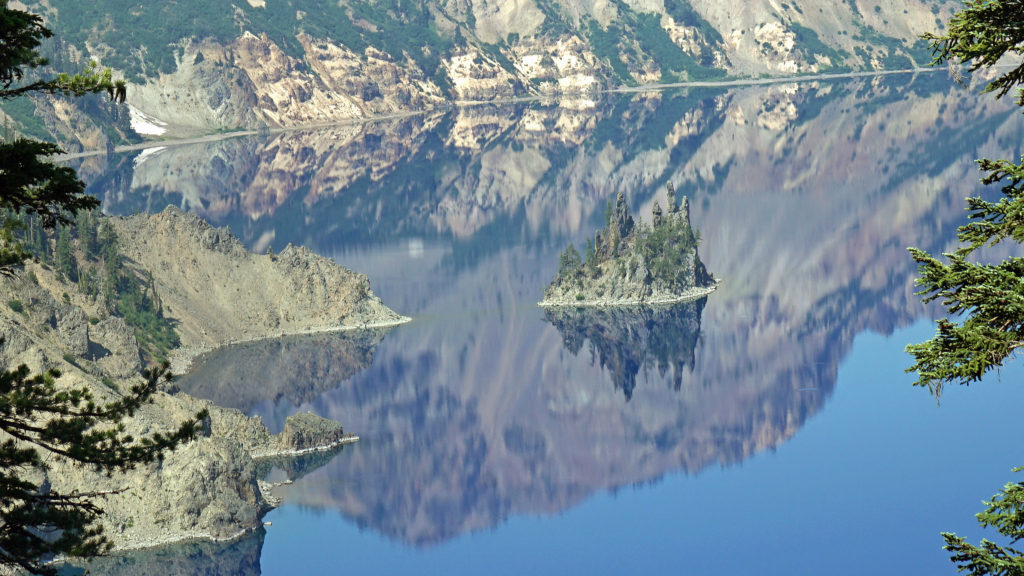
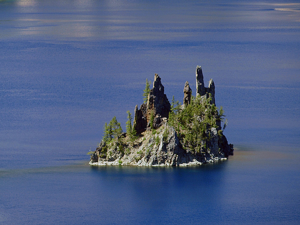 Phantom Ship, a remnant of an eruption 400,000 ago, rises 170 feet above the lake surface. Its formation predates that of Mount Mazama itself.
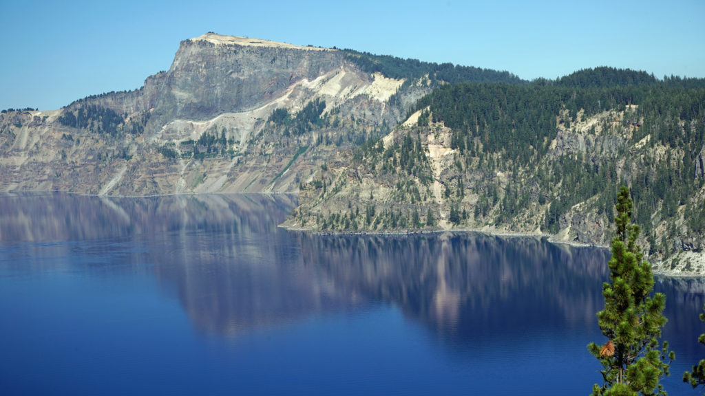 The Park
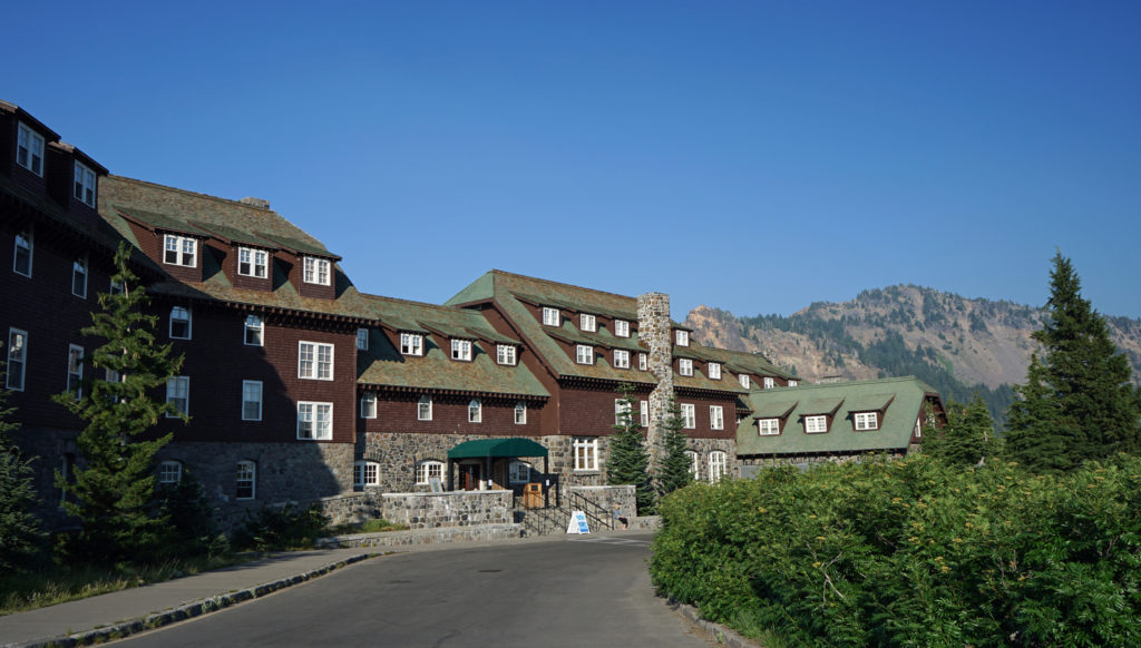 Crater Lake Lodge
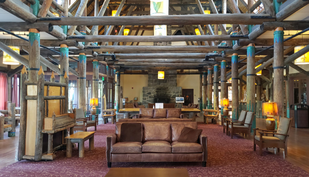
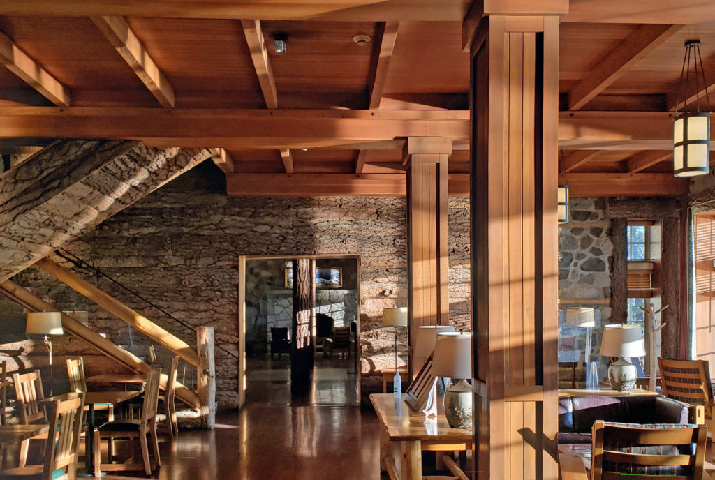 My wife and I recently spent three nights at the lodge. Although it lacks the amenities of a luxury hotel, our room was comfortable, with a private bathroom, and the location more than makes up any lack of luxuries.
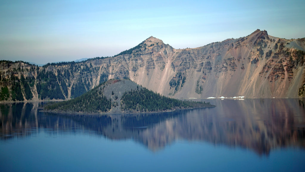 The Rim Drive
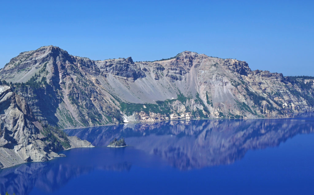 You’ll want to stop at all of the viewpoints. Maybe combine the drive with a hike down to Cleetwood Cove and a boat tour of the lake. You can get off at Wizard Island and hike to the summit and then catch a later boat back.
 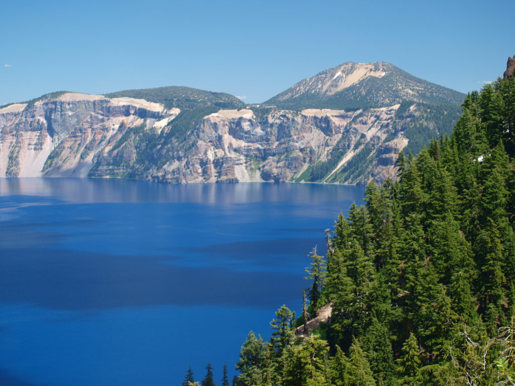 For a more adventurous day, hike to the summit of Mount Scott, the highest point in the park. It’s a two mile hike to the summit with 1250 feet of elevation gain, so it’s not an easy hike (All Trails rates it “moderate”), but the view might just be worth the effort.
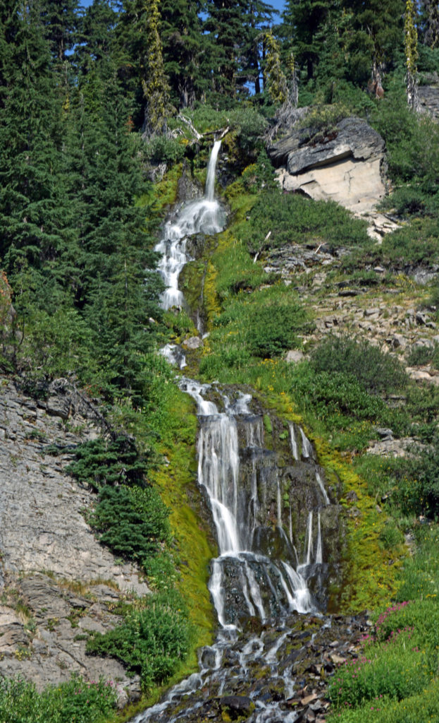
 Hiking Trails
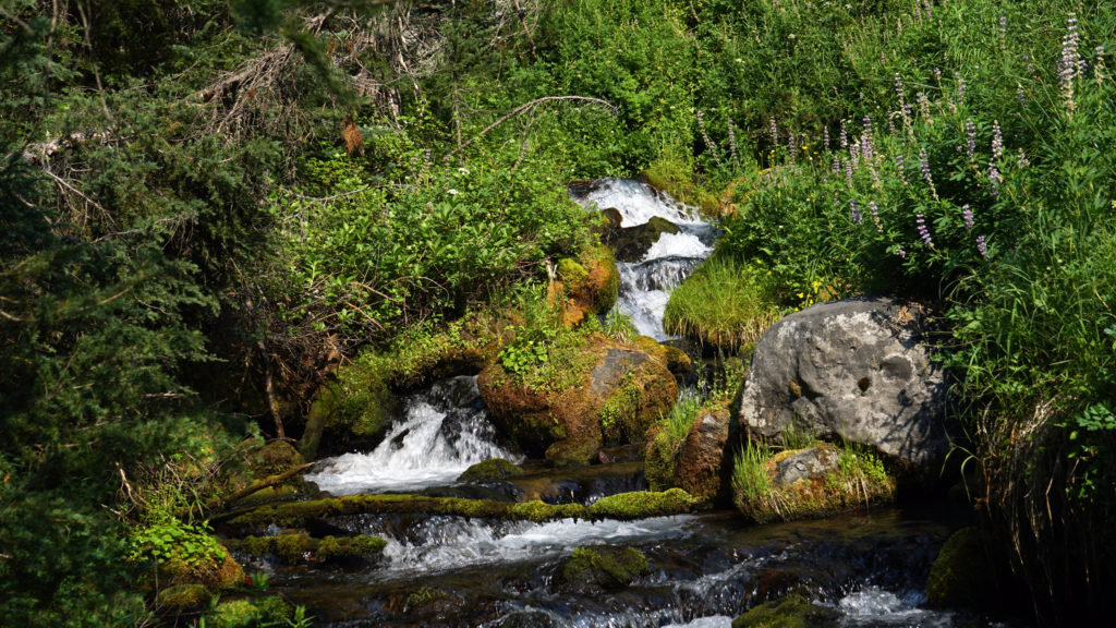 The Pacific Crest Trail passes through the park, but does not ascend to the rim of the caldera. Hikers on the PCT can take the Dutton Creek Trail that climbs up to the Rim Village, then hike the trail that parallels the West Rim Drive and reconnect with the PCT north of the lake.
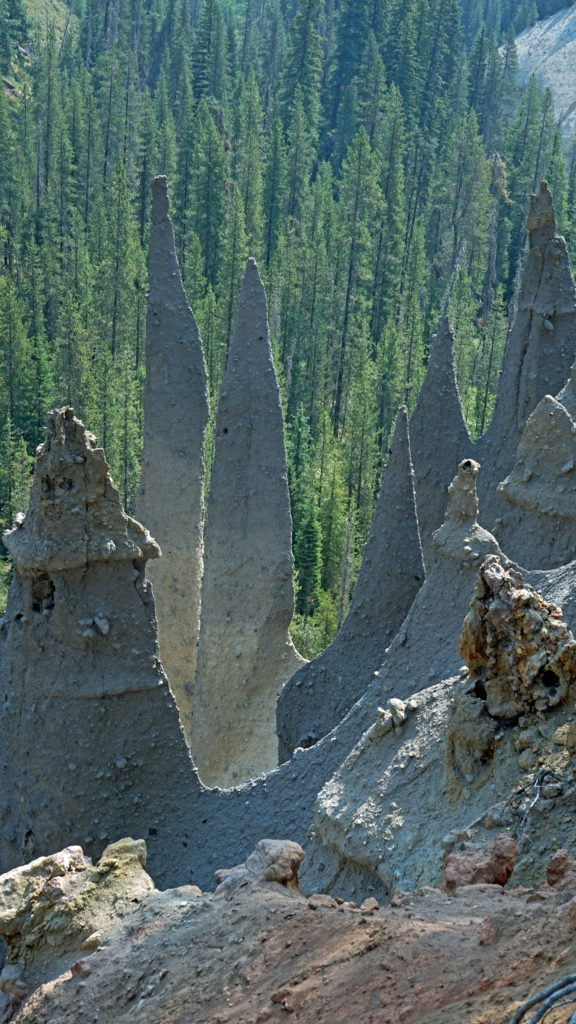
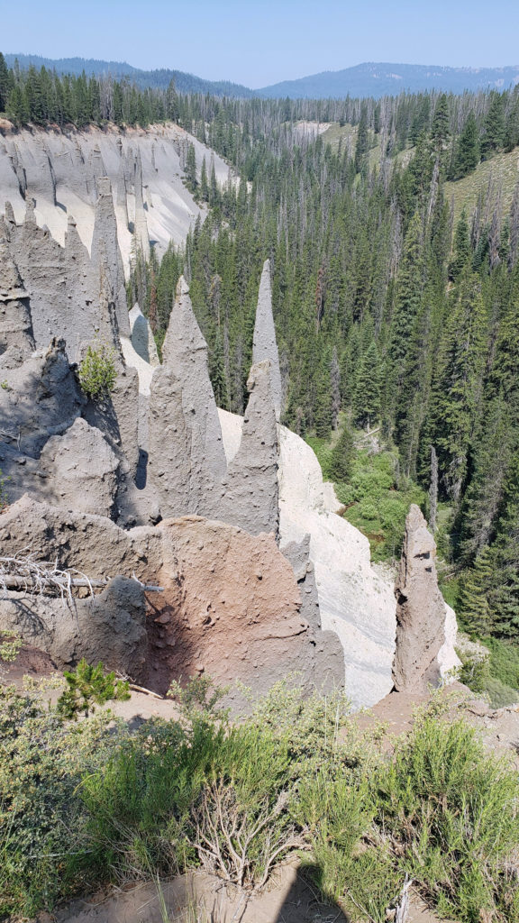 The Pinnacles
 Practical Info
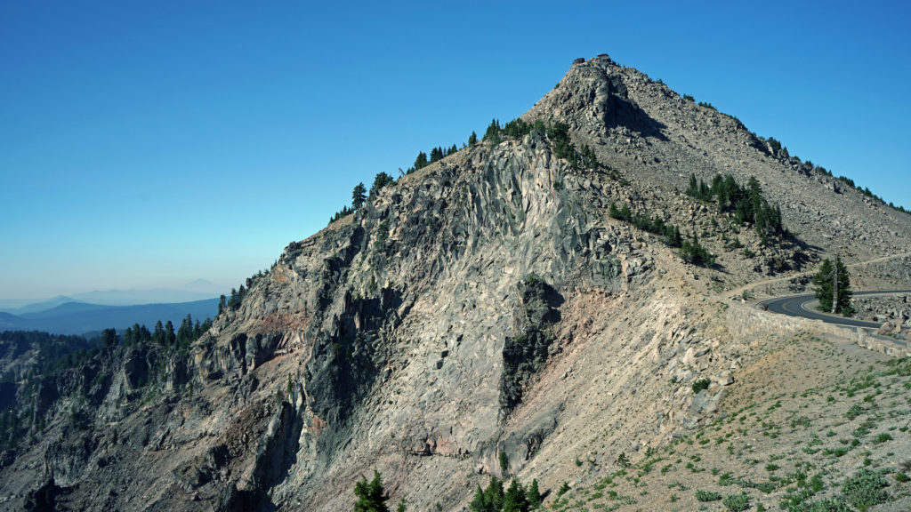
 There are two lodges in the park, Crater Lake Lodge in the Rim Village and The Cabins At Mazama Village that are open for the summer season. Crater Lake Lodge has 71 rooms, starting at $246/night. The Cabins At Mazama Village has 40 rooms, all at $160/night. Prices listed are for the 2024 season. Note that the concessionaire that operates both lodges is changing, so prices may also change. Check the park website (linked above) for current information.
 There are two campgrounds in the park. Mazama Campground has 75 RV sites, 18 tent sites with electricity, and 121 tent sites without electricity. Tent sites start at $22. RV sites run from $32 to $44 per night. Mazama Campground is usually open from early June through late to September. Lost Creek Campground, located on Pinnacles Road, is a primitive tent only campground with 18 sites, operated by the park service. Lost Creek Campground is currently closed and will not be open for the 2024 season. Backcountry camping is allowed in the park by
 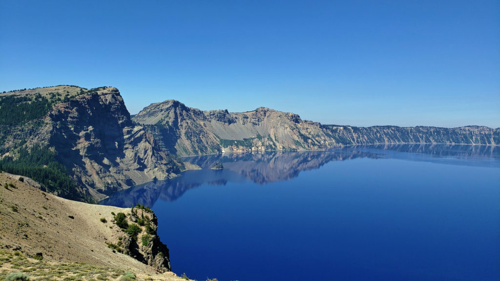 Dining options in the park are somewhat limited. The dining room at Crater Lake Lodge is open to all visitors, but reservations can only be made by people staying in the park. The Rim Village Cafe offers “grab and go” sandwiches and salads (I had a pulled pork sandwich from there on our recent visit that was very good). It is open from 9am to 8pm in the summer and 10am to 5pm in the winter. The Annie Creek Restaurant in Mazama Village is open from 7am until 9pm. The Mazama Village Store sells packaged sandwiches and snacks.
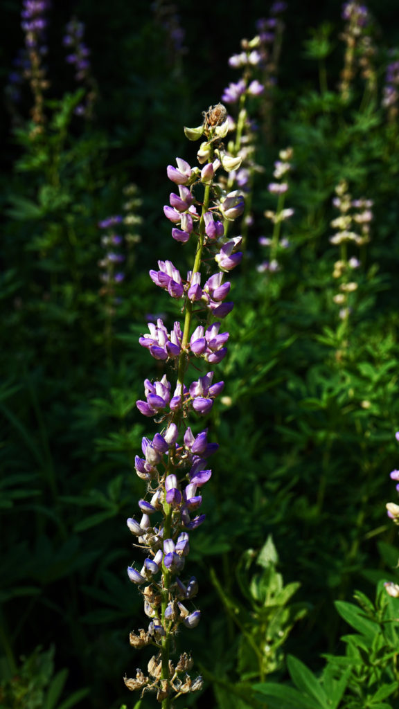 Summer park entrance fees are $30 for private vehicles and $25 for motorcycles. Winter fees are $10 less. Snowmobilers, bicyclists, and pedestrians are charged $15 per individual. All entrance fees are good for seven days. Entry reservations do not need to be made.
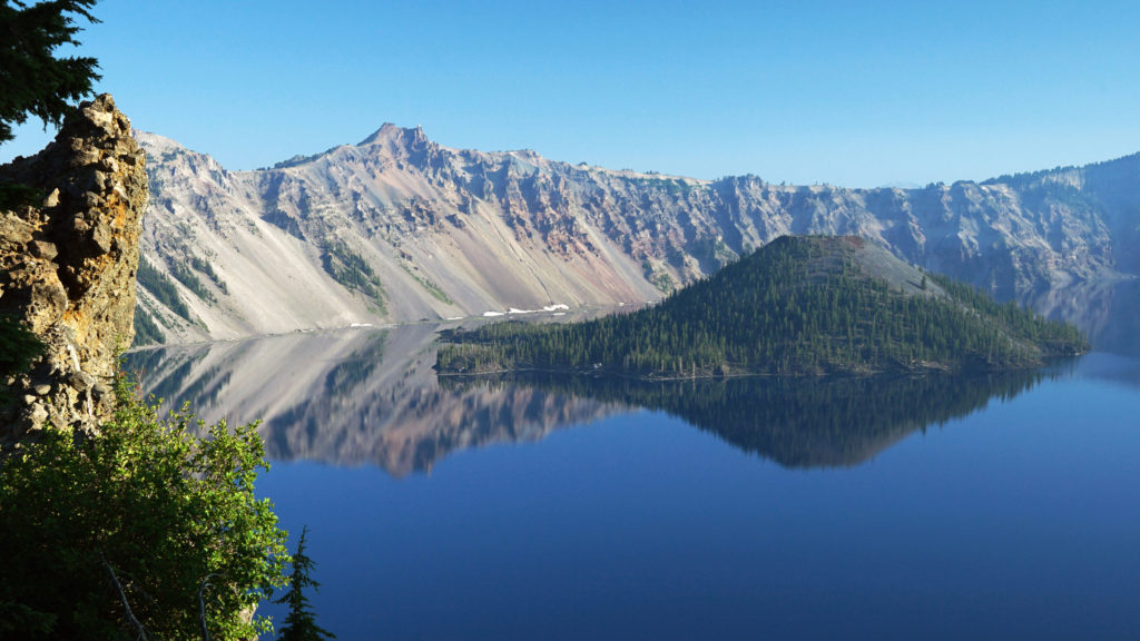
 Originally posted September 13, 2021. Most recently updated April 6, 2024.