By Alan K. Lee
My wife and I have been to Hawai’i many times, but only once to Kaua’i. But that was a memorable trip, and I’ve been contemplating a return to Kaua’i lately.
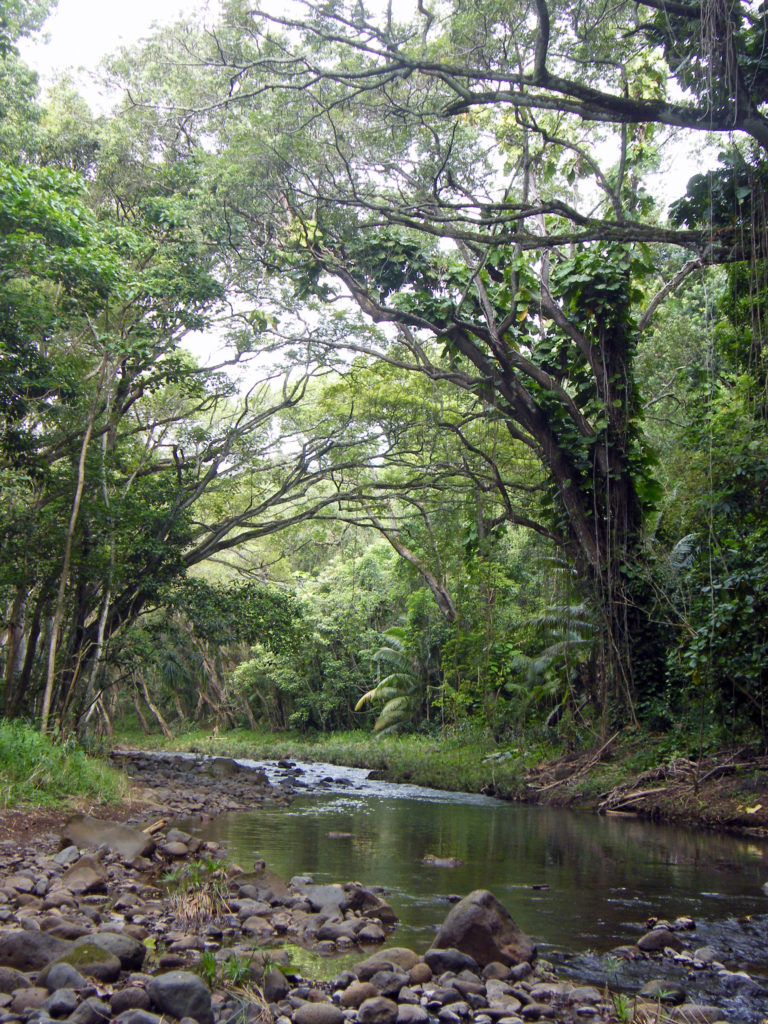
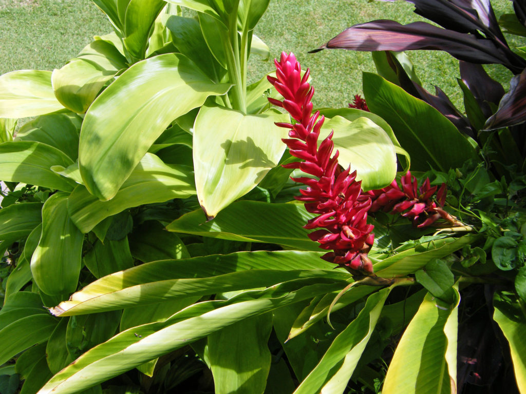
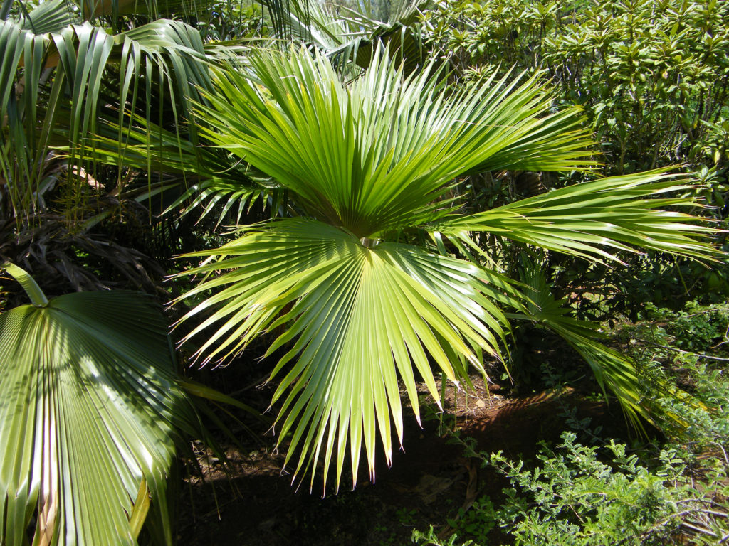
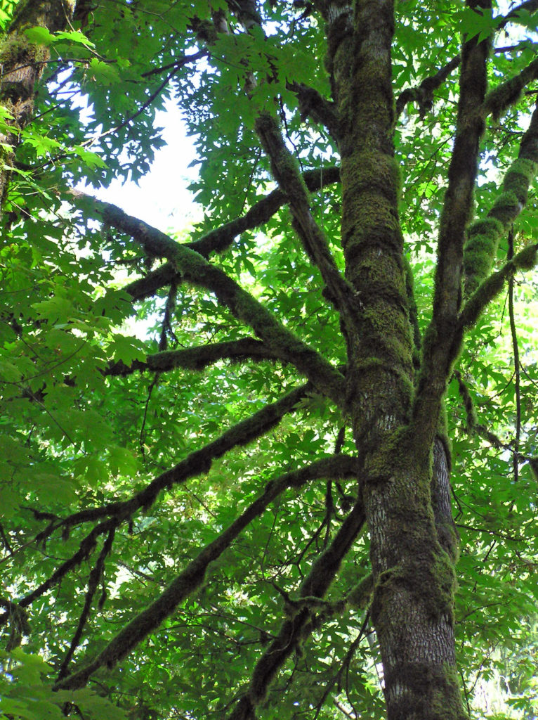
Kaua’i is called the Garden Isle, and for good reason. Abundant rainfall and the tropical climate make the island a botanical paradise. Think of the jungle depicted in the movie Jurassic Park. Much of the original movie and sequels were filmed on Kaua’i.
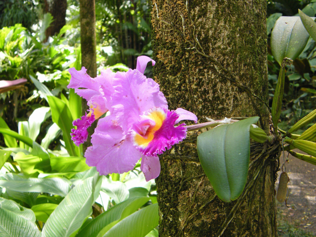
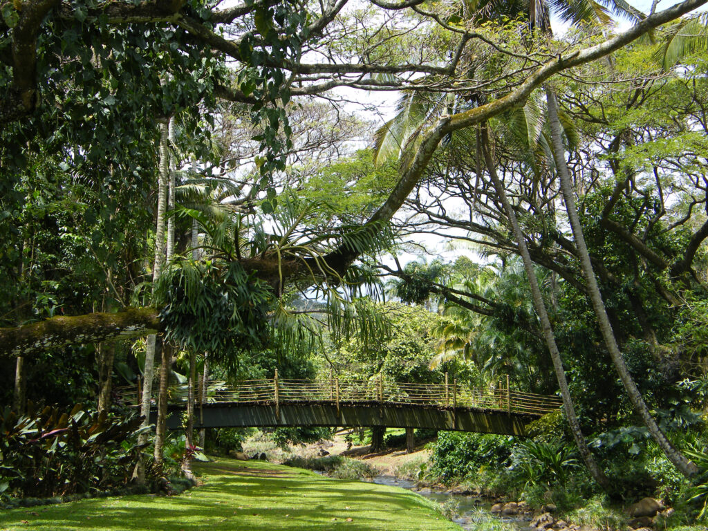
No trip to Kaua’i is complete without visiting at least one of the island’s famed botanical gardens. Three of the five National Tropical Botanical Gardens are located on Kaua’i. Other notable botanical gardens on Kaua’i include Na ‘Aina Kai Botanical Garden and Princeville Botanical Garden on the north shore, and Smith’s Tropical Paradise on the east shore in Wailua River State Park. Check the park websites for ticket prices, open dates, and details. Na ‘Aina Kai and Princeville require advanced purchase of tickets. Tickets to Smith’s are available only at the park entrance.
National Tropical Botanical Garden is a non-profit corporation chartered by the U.S. Congress in 1964, dedicated to “discovering, saving, and studying the world’s tropical plants and sharing what is learned.” The three NTBG gardens on Kaua’i are Limahuli Garden and Preserve on the north shore, and Allerton Garden and McBryde Garden on the south shore in the Lawa’i Valley.
We toured McBryde Garden on our visit and it was one of the highlights of our trip. Advanced purchase of tickets is not required, but is strongly advised. Tickets are limited and are likely to be sold out. Tickets are $30 for adults and $15 for children, and stays are limited to 2.75 hours. Open Tuesday, Thursday, and Saturday in 2025. The adjacent Allerton Garden also requires you to buy timed entry tickets ($65 for adults, $32.50 for children under 13). All Allerton Garden tours are 2.5 hour guided tours. McBryde Garden tours are self-guided. Combined McBryde and Allerton guided tours are available for the same price as Allerton Garden guided tours and are available for Tuesday and Saturday tours.
Limahuli Garden self-guided tours are $30 for adults and free for children under 13. Timed entry tickets are required if arriving by car and parking must be reserved at the time of purchase. Timed entry tickets are not required if arriving by North Shore Shuttle and there is a $5 discount off ticket prices. Limahuli guided tours are available for $60 (adults only, no children allowed) and parking is included. Tours are 2.5 hours long and are available at 9 a.m. only on Tuesday and Thursday. Advance reservations are required.
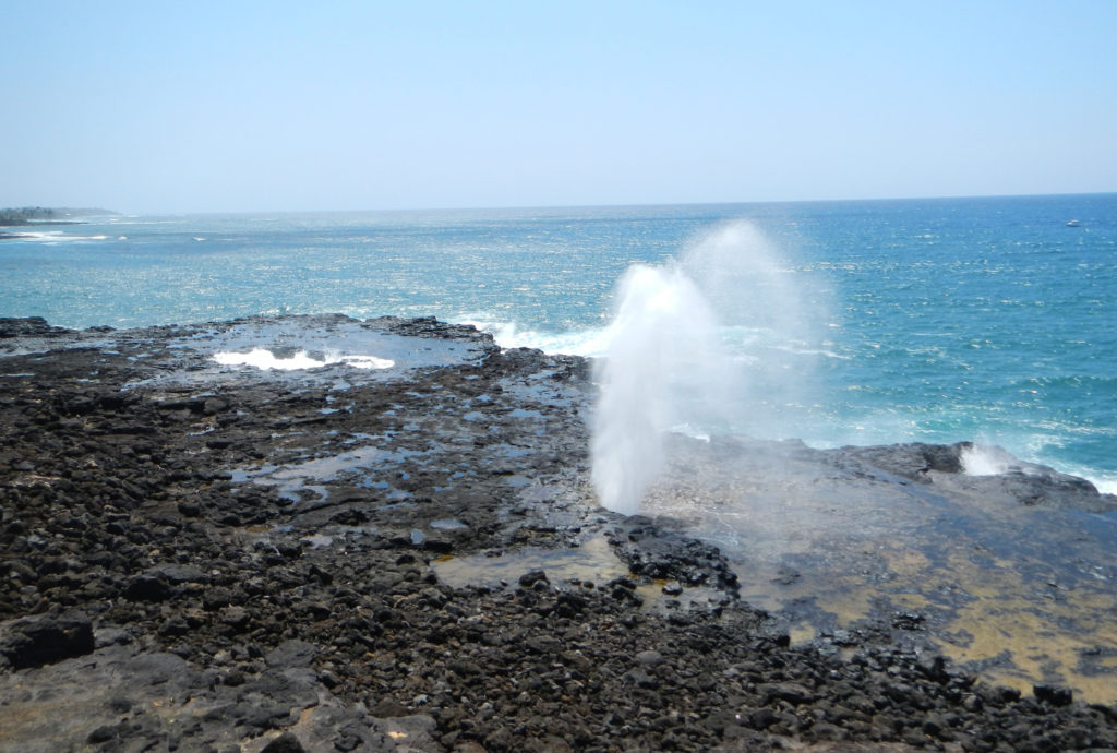
If you tour McBryde or Allerton Garden, also stop at the nearby Spouting Horn Park, especially if the surf is up. Spouting Horn is a blowhole that shoots water fifty to a hundred feet into the air every ten seconds or so when it is most active, an impressive sight to say the least.
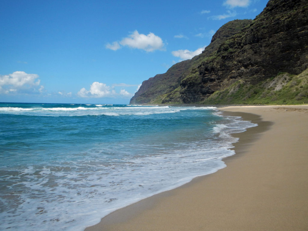
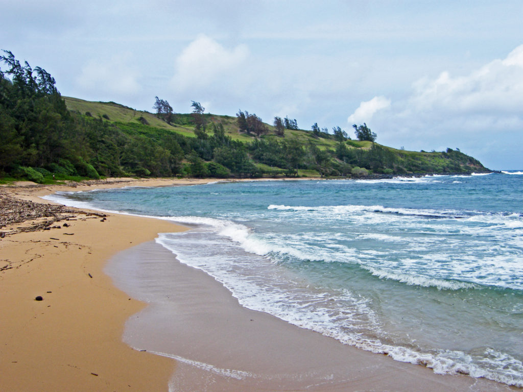
There’s more to do on Kaua’i than touring botanical gardens, of course. Relaxing on a tropical beach has to be high on every visitor’s priority list, and Kaua’i has many, many fine beaches. One of the best beaches on the island, and listed in one article I’ve read as one of the best beaches in the world, is Polihale Beach on the west end of the island.
The last few miles of the road to Polihale is a rough, pothole filled sand, gravel and dirt track that is best tackled with an SUV or pickup. We managed it in a compact rental car, though, so it can be done if you take your time. But the road was clearly not being maintained, and it may have gotten worse in the decade since we were there. But if you can manage to get there, you’ll be rewarded with three miles of uninterrupted and uncrowded beach ending at the spectacular cliffs of the NaPali Coast.
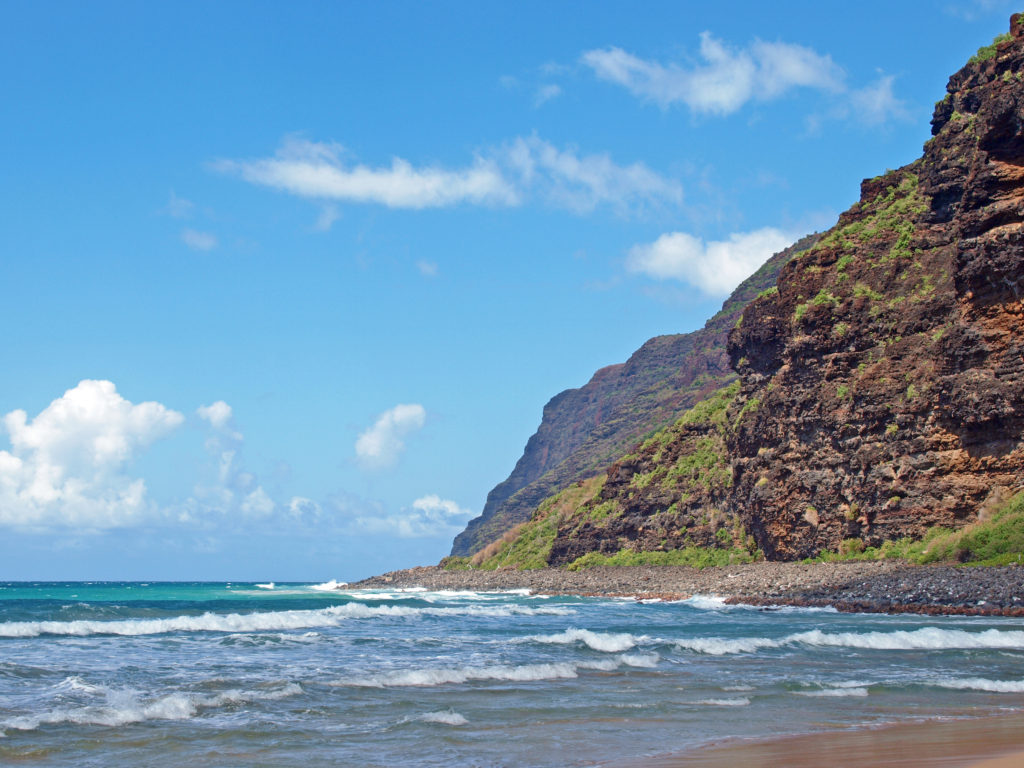
Polihale State Park has no lifeguards and there are strong currents, so it’s not a good swimming beach. Best to stay out of the water. And there is no drinking water available (or any services), so if you go, plan on bringing everything you’ll need. But despite all that, the scenery and the solitude that you can find there make it well worth it.
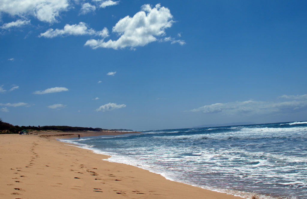
A more accessible beach on the west end of the island is Kekaha Beach Park. Located at the southern end of a nearly five mile long stretch of sand, Kekaha Beach is one of the best places on the island to view the sunset, but lacks Polihale’s scenery and seclusion. Glass Beach is also a worthwhile stop.
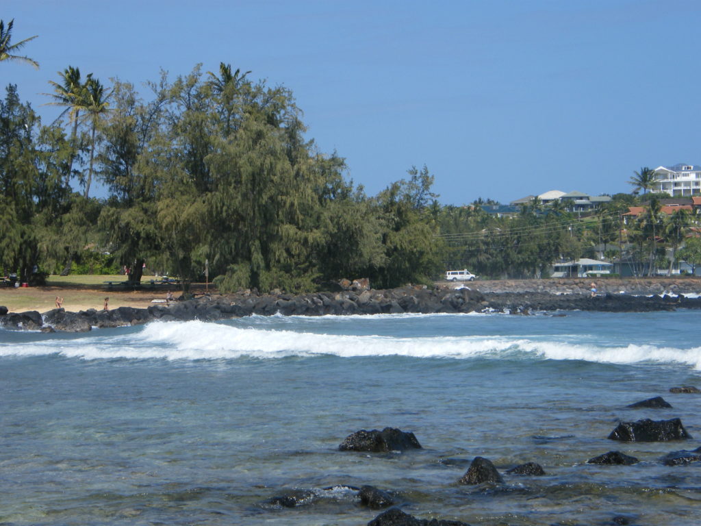
Poipu Beach on the south shore is all things Polihale is not. It’s a very popular and always crowded tourist destination. You won’t find anything resembling solitude there and the scenery doesn’t compare to Polihale. But it’s easy to get to, a good swimming beach, and one of the best places on the island to snorkel. And all of the amenities you could ask for are close at hand.
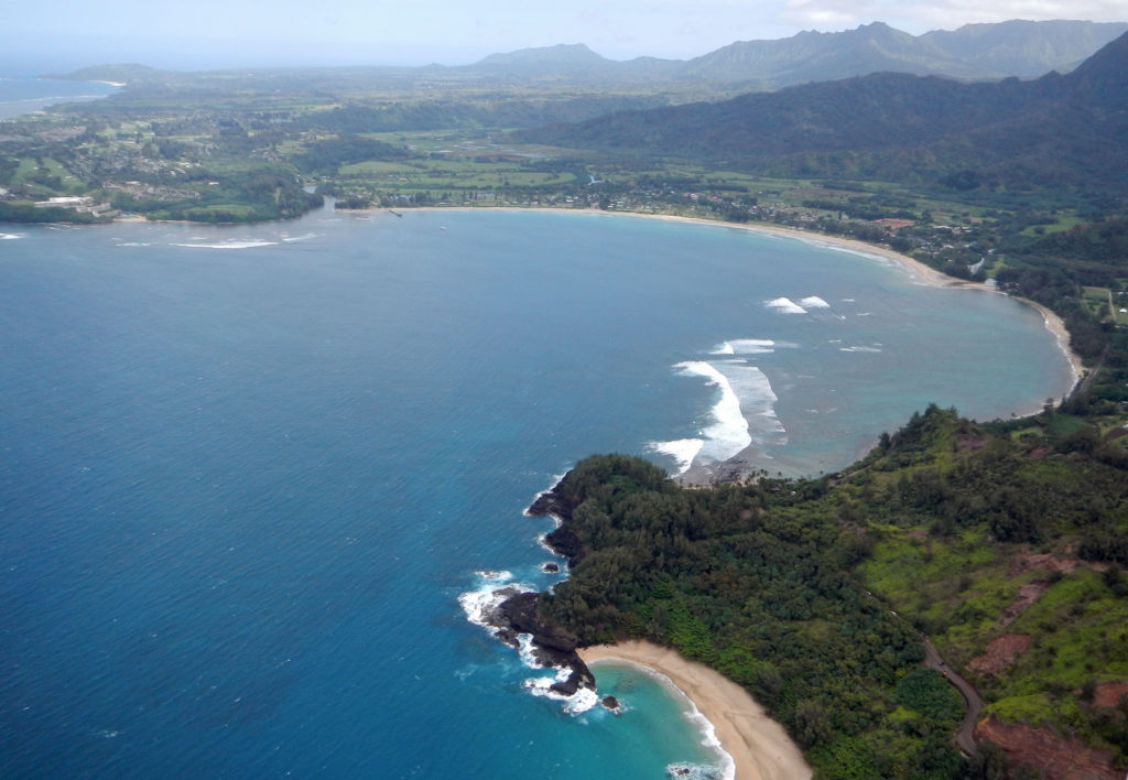
Many of the best beaches on Kaua’i are on the north shore. Moloa’a is a nice uncrowded beach on the north shore where you’re likely to find more locals than tourists. Kauapea Beach (aka Secret Beach) is a not so secret beach just west of the town of Kilauea. The trailhead is at the end of Secret Beach Road. Anini Beach is another place where you might find more locals than tourists. Kalihikai Park at Anini Beach has picnic tables, restrooms, and outdoor showers. Hanalei, farther east, also has a nice beach and the town is an interesting place that would be worth a visit on its own, even without the beach.
Tunnels Beach is another popular north shore beach. It’s best to park at Ha’ena Beach Park, although there are now entrance and parking fees for non-residents ($5 per person and $10 per vehicle) which must be purchased in advance. Tunnels is about a third of a mile east of Ha’ena Beach. There is a shorter trail to the beach from the highway, but parking is very limited and I don’t believe it is signed, so it may be easy to miss. There are restrooms, showers and lifeguards at Ha’ena Beach, but not at Tunnels.
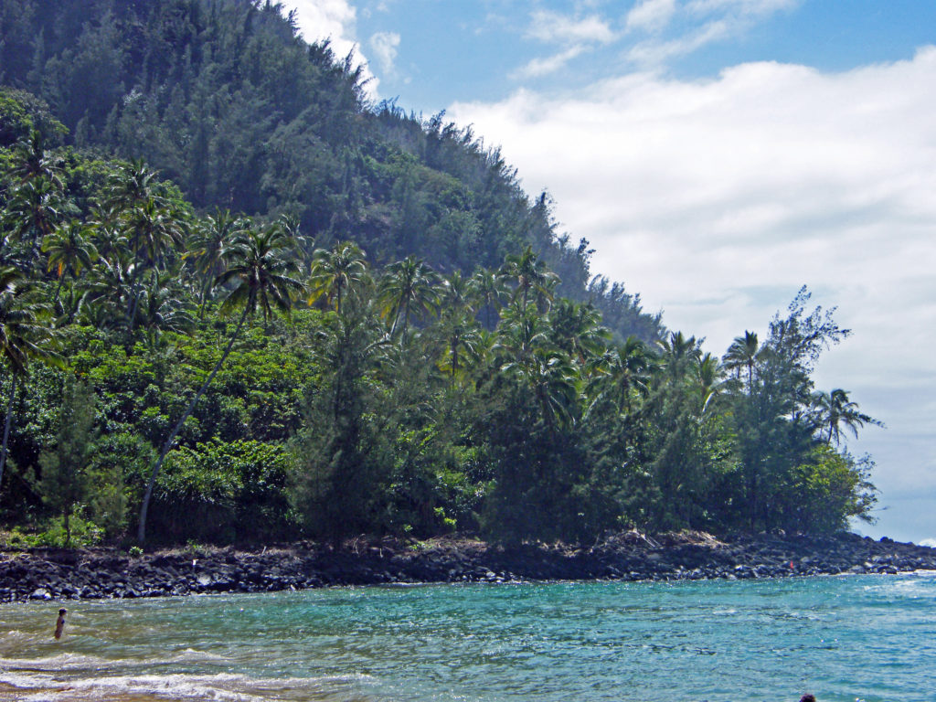
Ke’e Beach, at the end of the road, is protected by a reef, making it good for swimming and snorkeling, except in the winter months when all of the north shore beaches can be subject to high surf and strong currents. Even when we were there around the first of April there were warnings of dangerous conditions. Ke’e is part of Ha’ena Beach Park and the same entry and parking fees apply. The parking lot at the end of the road fills up early, partly because it is also the trailhead for the famed Kalalau Trail. There is an overflow parking area about a quarter mile from the end of the road that might be a better option. There are restrooms and showers at Ke’e, and lifeguards on duty.
These are only a few of the dozens of beaches on Kaua’i. For a more comprehensive list, check out the beaches page of the Kauai.com website.

A good way to see the whole island is by helicopter. Most one hour helicopter tours run from $220 to $320 per adult. We opted for a “doors off” tour because we wanted to get better photos than you can get by shooting through a helicopter window. I had never flown in a helicopter before and I have to admit to being a bit nervous before the flight, and not just because we were going doorless. But the whole thing was a blast and I never felt in any danger. And we both got some great photos.
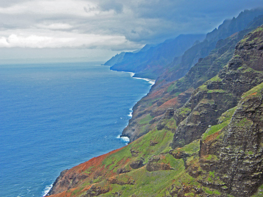
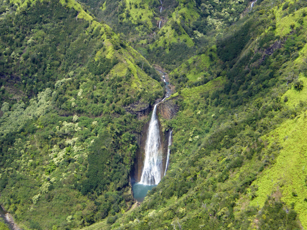
The only disappointment was that the NaPali Coast had some low clouds obscuring the tops of the cliffs. But I highly recommend the experience. There is no other way to see the whole island the way you can by helicopter. And the only way to view the 400 foot high Manawaiopuna Falls (aka Jurassic Park Falls) is from the air.
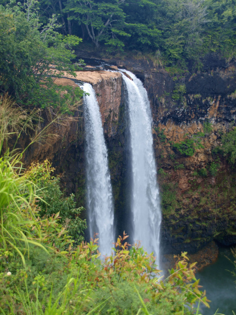
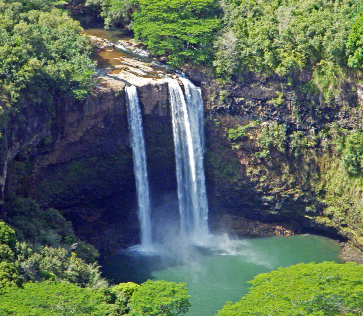
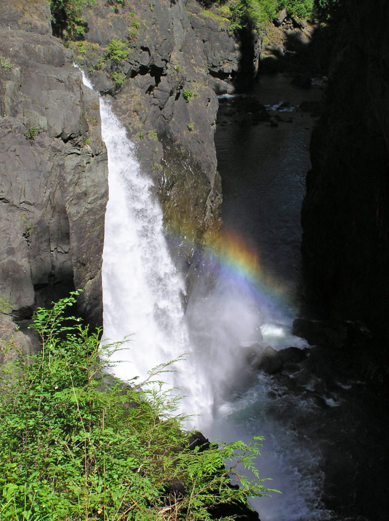
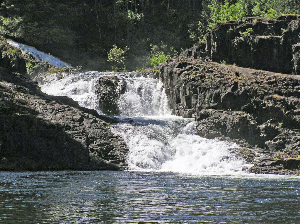
Kaua’i’s abundant rain and mountainous terrain result in many spectacular waterfalls. One of the prettiest is the twin cascades of Wailua Falls, about five miles west of Lihue. The falls are at the end of Maalo Road (Hwy 583). You can get a decent view of the falls from the observation area adjacent to the road. There is a very steep unmaintained trail down to the base of the falls where you probably can get better photos, but there are prominent danger signs that are probably there for a reason, so I wouldn’t risk the trail, especially if it is wet. (If you opt for a helicopter tour you will get a very good view of the falls from the air.)
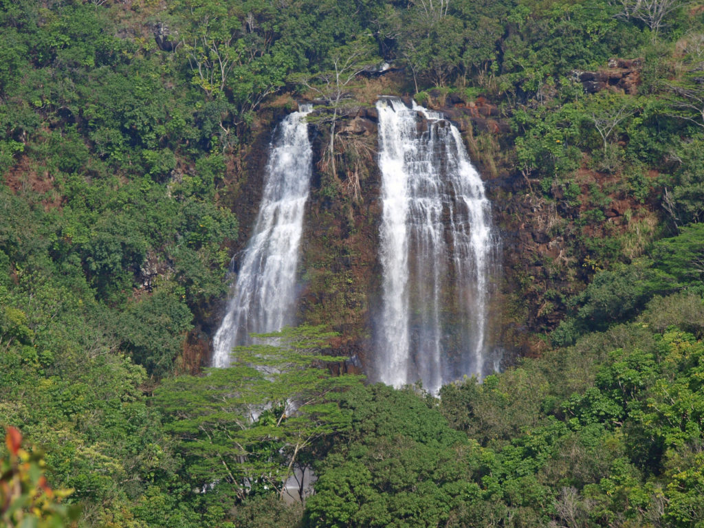
Another beautiful waterfall in the same area is Opaeka’a Falls. Again, no trail to the falls, but a good view from the highway. Opaeka’a Falls is two miles west of Wailua on Kuamo’o Road (Hwy 580).
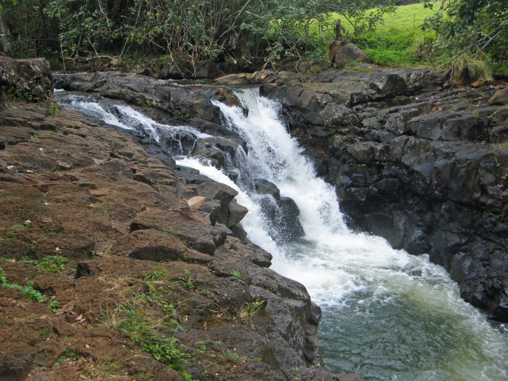
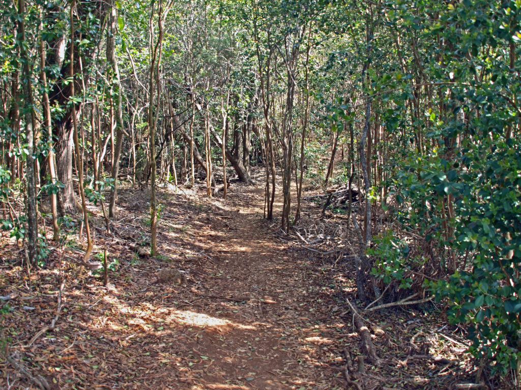
An interesting waterfall, this one at the end of a hike through a Jurassic Park-like tropical rain forest, is Ho’opi’i Falls (actually two separate falls). These are a little harder to find, and they’re not big falls, but the trail to them is absolutely awesome. If its raining or has rained recently, the trail will likely be muddy and slippery, but I think it would still be worth the effort. We were lucky enough to do this hike when it was dry, so it was an easy and thoroughly enjoyable outing for us.
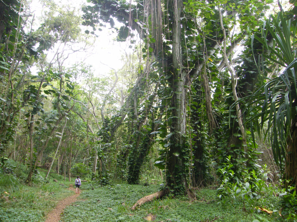
The trailhead is on Kapahi Road west of Kapa’a. Please note that Kapahi Road is a residential area and not all of the residents welcome tourists, so be respectful of the locals. Park in the gravel area provided, not in front of any of their homes, please be quiet (especially early in the day), and don’t leave any trash behind when you depart.
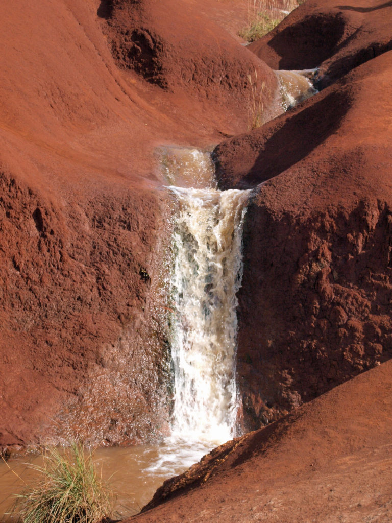
One more interesting falls is Red Dirt Falls on Waimea Canyon Drive, north of the town of Waimea. This is a seasonal falls, so it may not be flowing when you’re there, and it’s a very small waterfall that would be totally unremarkable if it weren’t carved out of the striking red dirt that gives it its name. It’s located at about the 23 mile marker on Hwy 550.
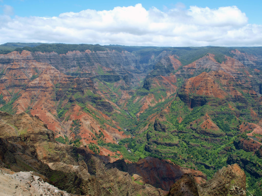
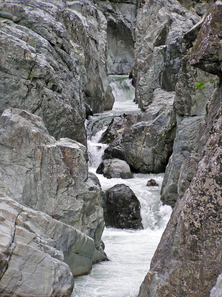
There are more waterfalls to be seen farther up Waimea Canyon, which is one of the must see destination on Kaua’i. It’s often called the Grand Canyon of the Pacific. The red dirt that makes Red Dirt Falls so compelling also gives the canyon a much different look than most of the other scenic attractions on the island. The canyon is 14 miles long, a mile wide, and as much as 3500 feet deep – not as big or as deep as the real Grand Canyon, but still pretty impressive.
There are two state parks, Waimea Canyon and Koke’e in the canyon. For non-residents there is the same $5 per person entrance fee and $10 per vehicle parking fee as at Haena Beach State Park. The fees get you into both parks. You don’t have to pay twice.
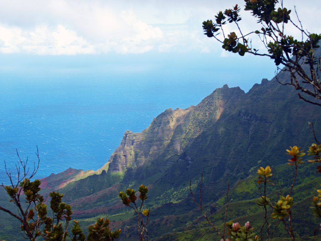
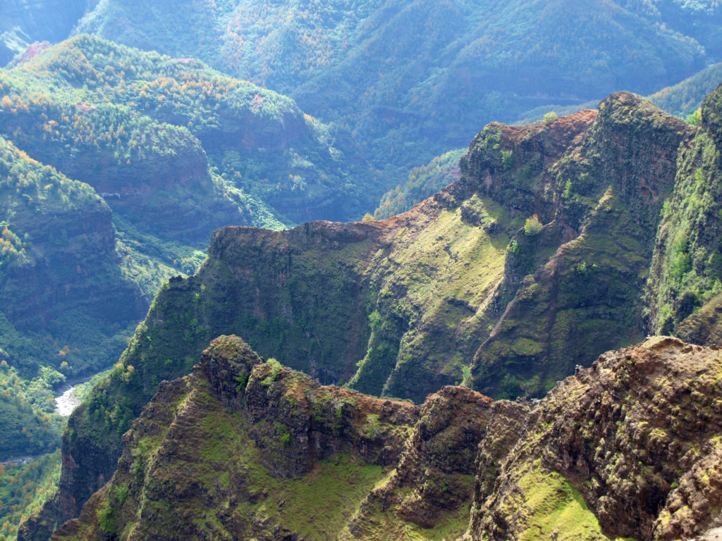
There are numerous viewpoints along the highway in the two parks that give you expansive views of the canyon and its waterfalls. And the highway takes you to the top of the NaPali Coast cliffs. Two truly spectacular viewpoints in Koke’e Park give you views down to the NaPali Coast and the ocean more than 4000 feet below you.
 For hikers, there are more than 45 miles of trails in the canyon. You could easily spend days in the canyon and not hike all of the trails. For those that do want to spend multiple days hiking or sightseeing, Koke’e Lodge offers rustic cabins with kitchens. There is also a campground in Koke’e State Park and there are other cabins available nearby. And Waimea town at the base of the canyon has many lodging options.
Updating this post brought back a lot of memories and stoked my desire to go back to Kaua’i and revisit some of the places we explored in 2012.
Posted July 28, 2021. Updated October 20, 2024.
All photos © Alan K. Lee
 First Impressions
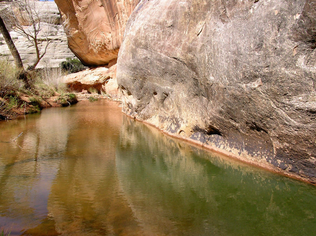
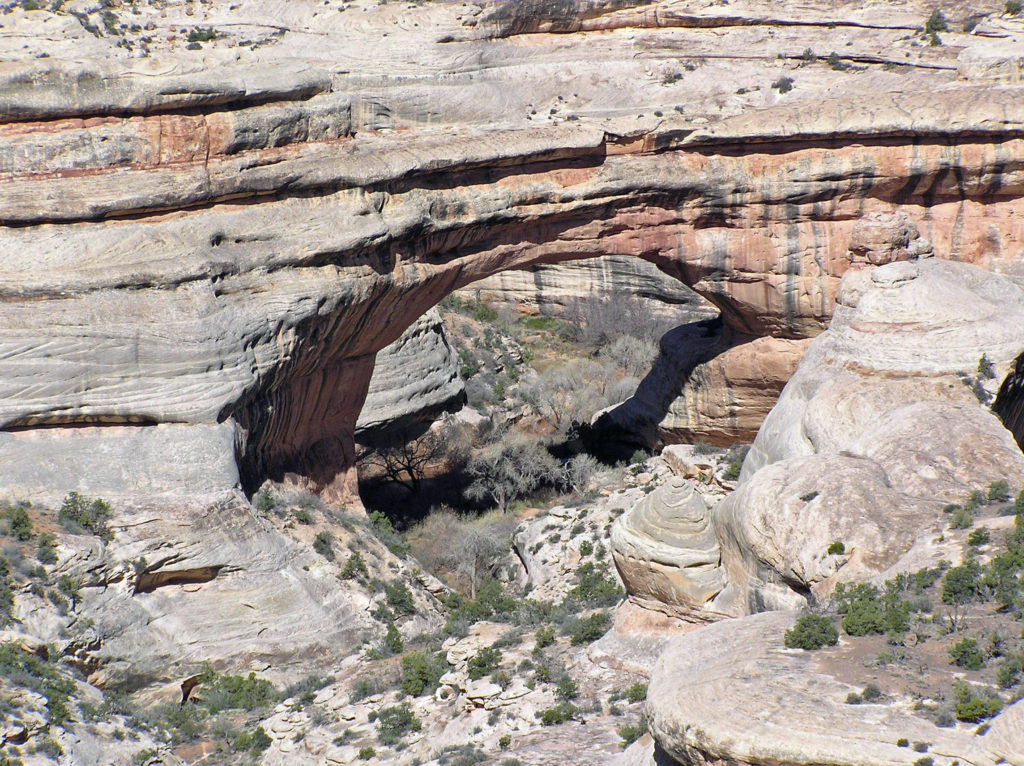 My wife and I have been back once since that first visit. The photos here were taken on that second trip in 2008. I think we’re long overdue for a third visit.
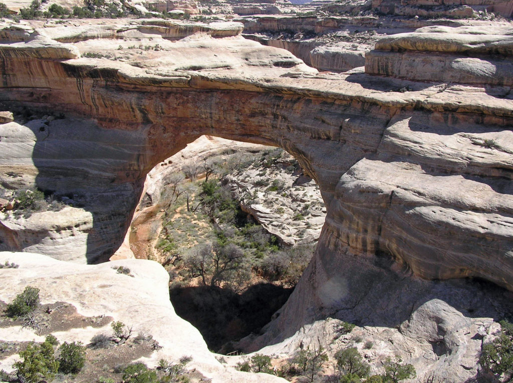
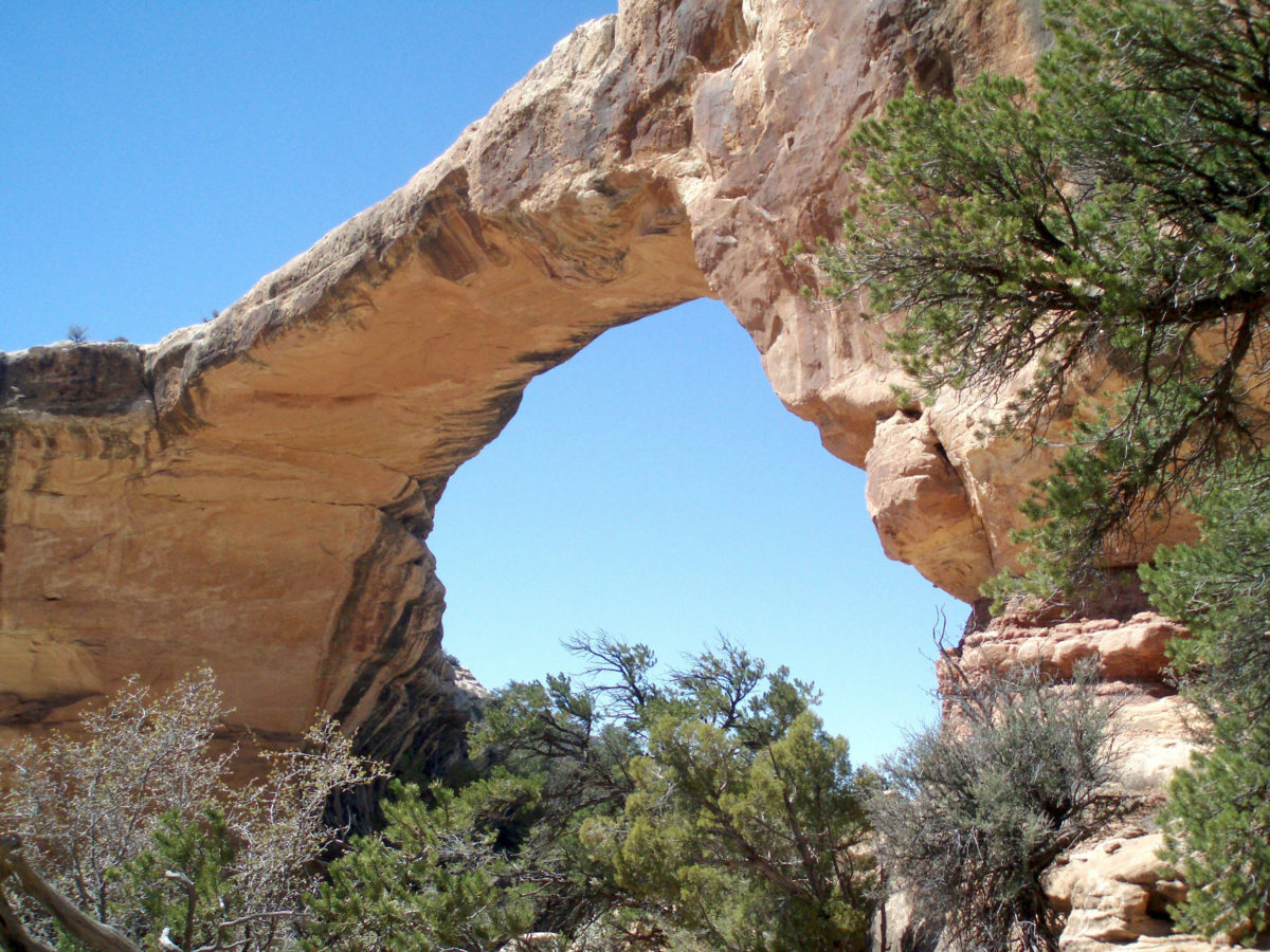
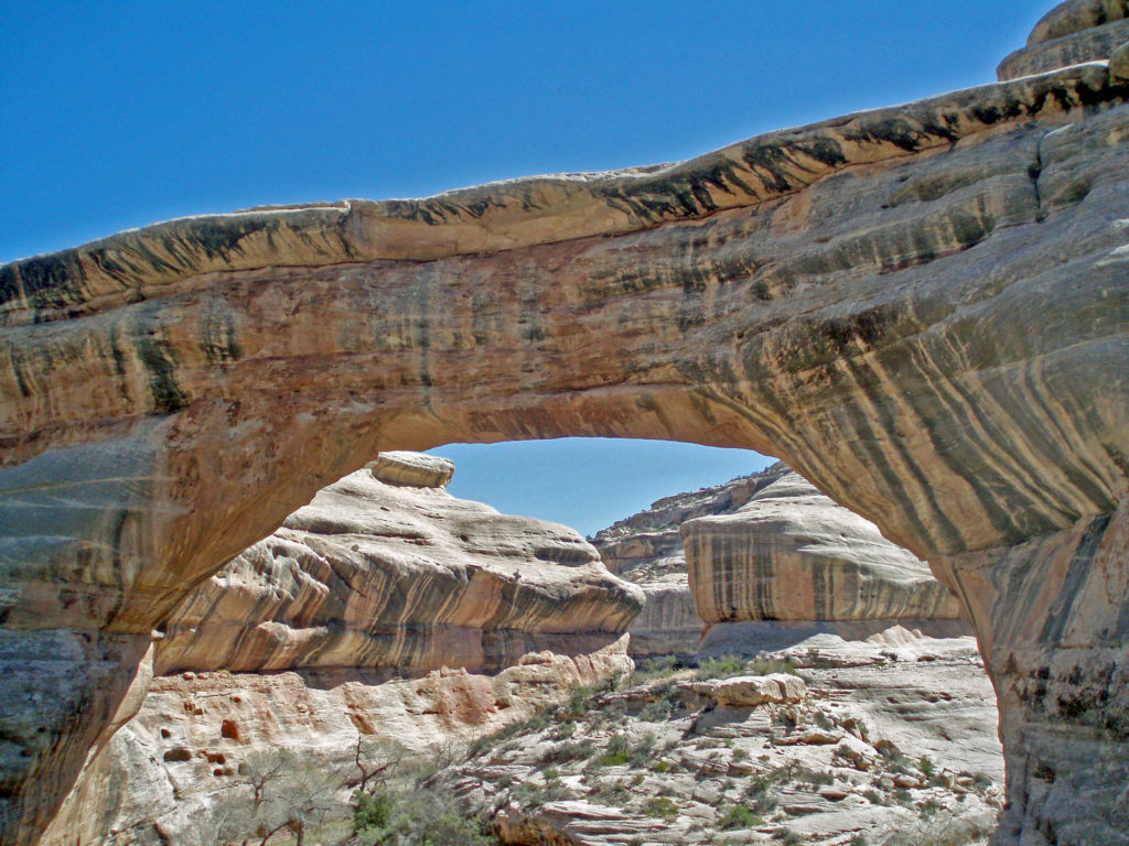
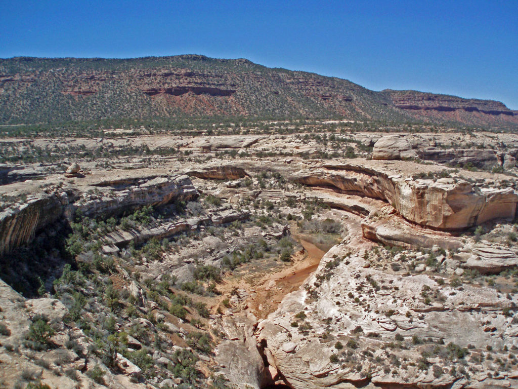
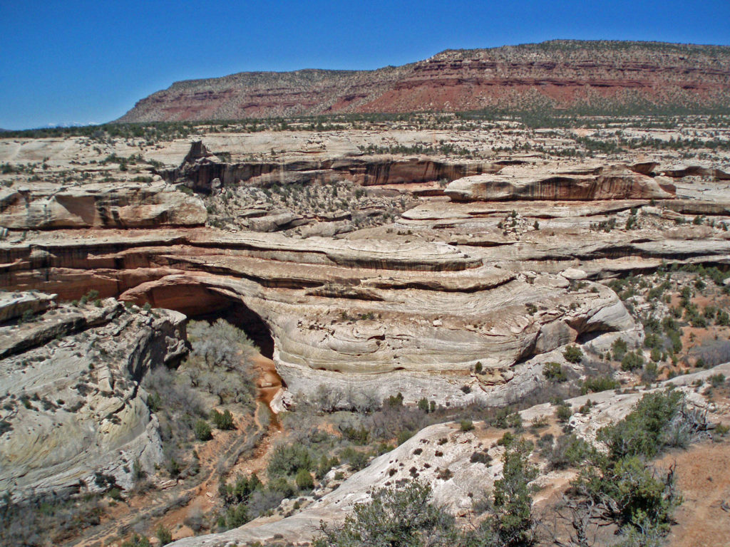 The white Cedar Mesa Sandstone of the canyons in Natural Bridges was formed from white quartz sand with relatively little iron. The red and orange sandstone of the mesa tops gets its color from more iron rich rocks. Oxygen and hydrogen react with the iron, forming compounds that vary in color depending on the relative proportions of oxygen and hydrogen in the rock.
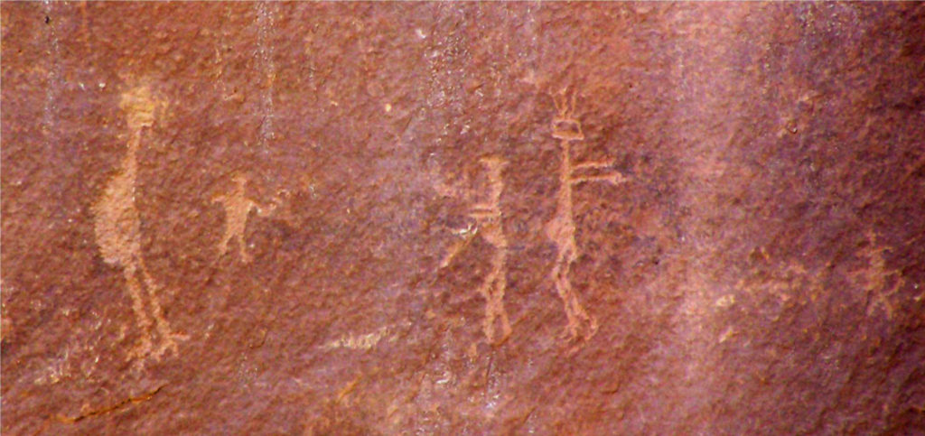 Human Presence
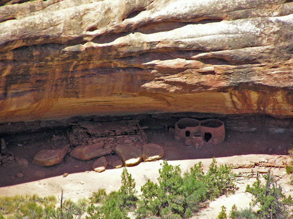 The Ancestral Puebloan people began farming the mesa tops around 1500 years ago, but later abandoned the area, presumably because of a prolonged drought. After 300 years, the ancestors of modern day Hopi and Navajo returned to the Natural Bridges area, only to abandon the area again around the year 1280 CE. Modern Hopi, Navaho, and Paiute peoples reoccupied the area once again at later dates.
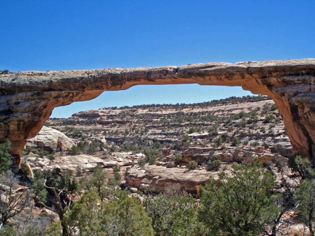 Europeans didn’t discover the area until 1883 when prospector Cass Hite ventured into the canyons looking for gold. He didn’t find any gold, but he did find the three magnificent natural bridges. Twenty years later, National Geographic Magazine published an article about the bridges, gaining the attention of President Theodore Roosevelt, who established
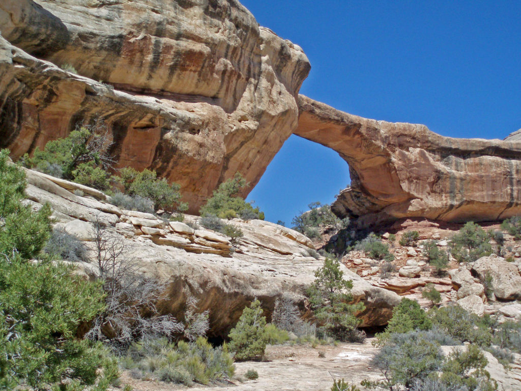
 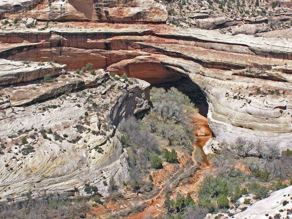 The bridges were named President, Senator and Congressman by Cass Hite. Later explorers gave them the names Augusta, Caroline and Edwin. But neither set of names stuck. In 1909 the bridges were given the Hopi names they carry today: Sipapu, Kachina, and Owachomo.
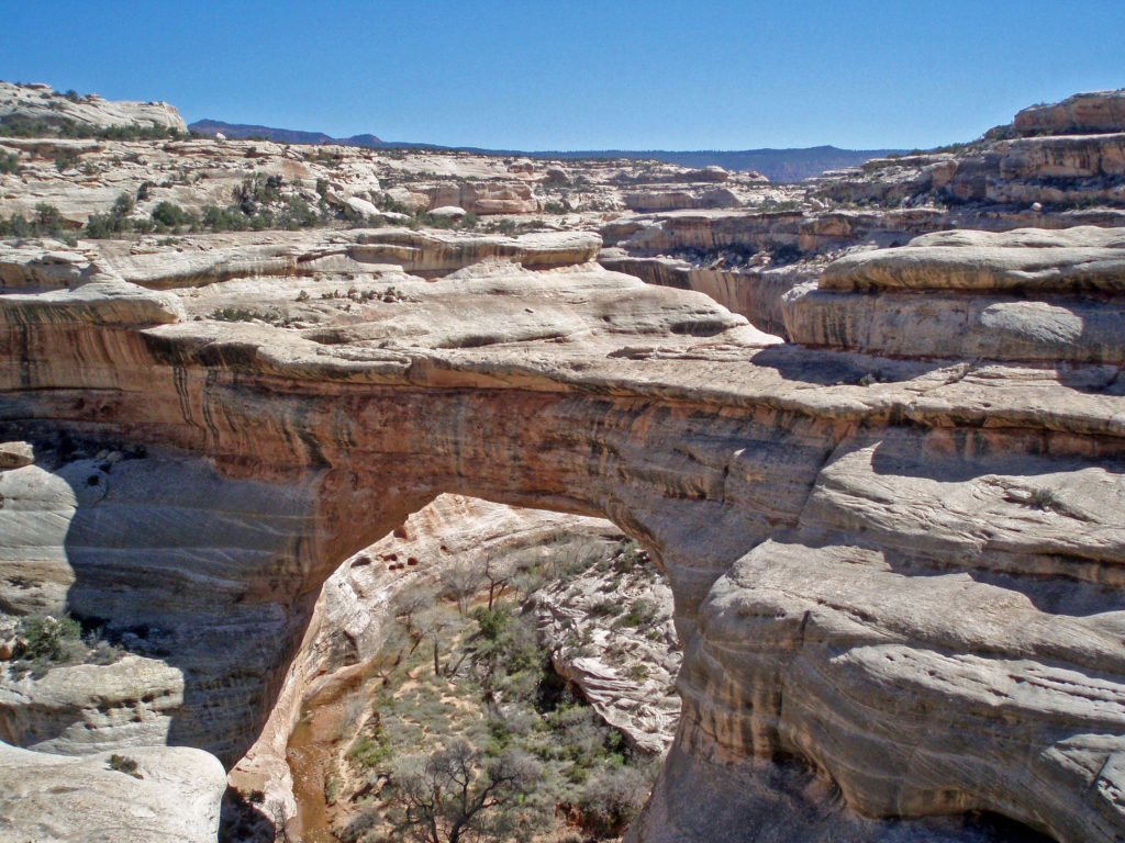
 Visitor Center
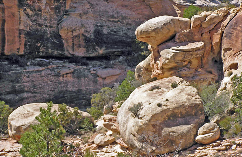


 Conclusion
 Originally posted July 10, 2021. Updated July 21, 2024.
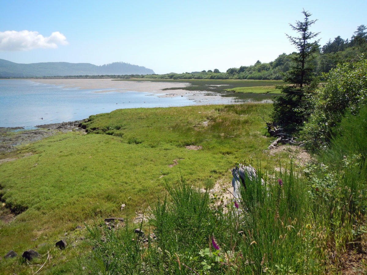
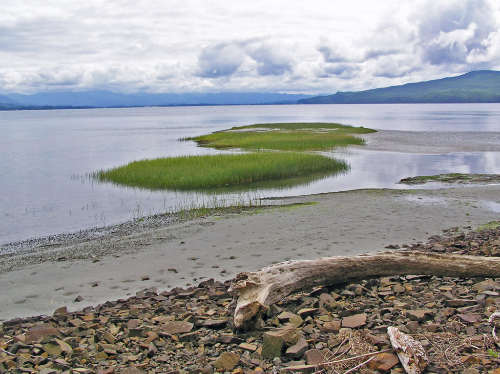
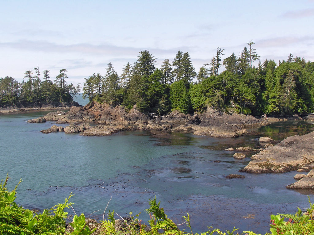
 Bayocean Peninsula, on the northern Oregon coast, is a sandspit that separates Tillamook Bay and the Pacific Ocean. It is, by any measure, a nature lover’s paradise, whether you’re a beachcomber, hiker, mountain biker, boater, birder, wildlife lover, or photographer.
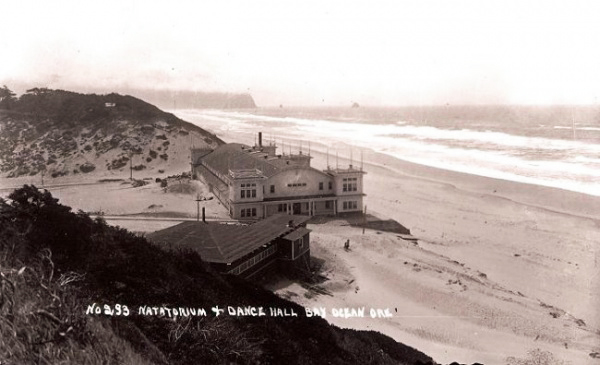
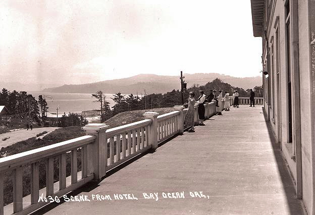
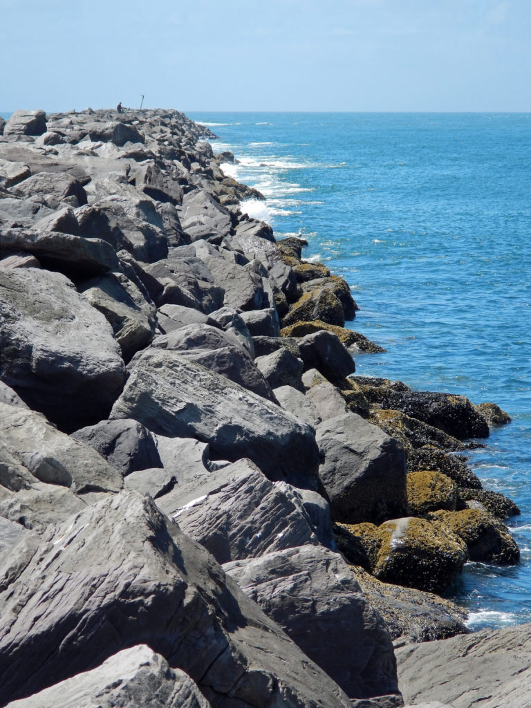 To make crossing the Tillamook bar safer, the Army Corps of Engineers recommended jetties be built on both the north and south sides of the bay’s mouth. But half of the cost (a then considerable $2.2 million) would have to be paid by local residents. To cut the cost to a more affordable amount, the local port district proposed building only one jetty. The resulting north jetty, completed in 1917, did make crossing the bar much smoother and safer, but it also contributed to the town’s demise by changing the near shore currents, which began eroding away the beach in the 1920s.
 In 1932 the north jetty was extended, further accelerating the erosion. The natatorium was destroyed by waves during a massive storm that winter. By 1938 almost 60 homes had fallen into the sea. Other storms over the years took many of the remaining buildings, and in 1952 another major storm breached the southern end of the peninsula, turning Bayocean Peninsula into an island. The Bay Ocean Park post office closed in 1953 and most of what was left of the town was bulldozed by the Corps of Engineers in 1956 during a project to build a dike across the breach created in 1952. The last house on the peninsula washed away in 1960, and the last structure, a long abandoned garage, fell into the sea in 1971.
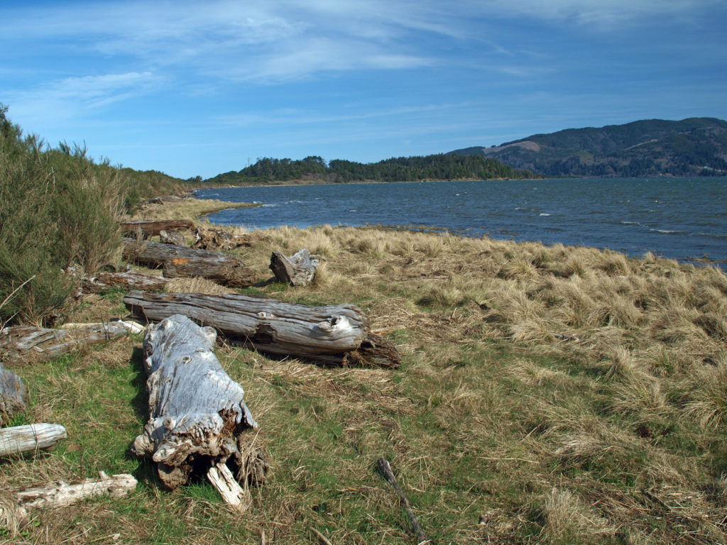 The south jetty was eventually built in the 1970s and that stopped the erosion of the peninsula, but by then the town of Bay Ocean Park was long gone. Today, nothing remains of the town. What’s left, though, is a treasure trove of delights for the outdoor enthusiast: miles of untrammeled beach, unspoiled dunes, a bay shore sheltered from the prevailing winds, an upland spruce and pine forest, and an abundance of waterfowl and other wildlife. The haul road used in building the south jetty is now an ideal mountain bike and hiking trail on the bay side of the peninsula.
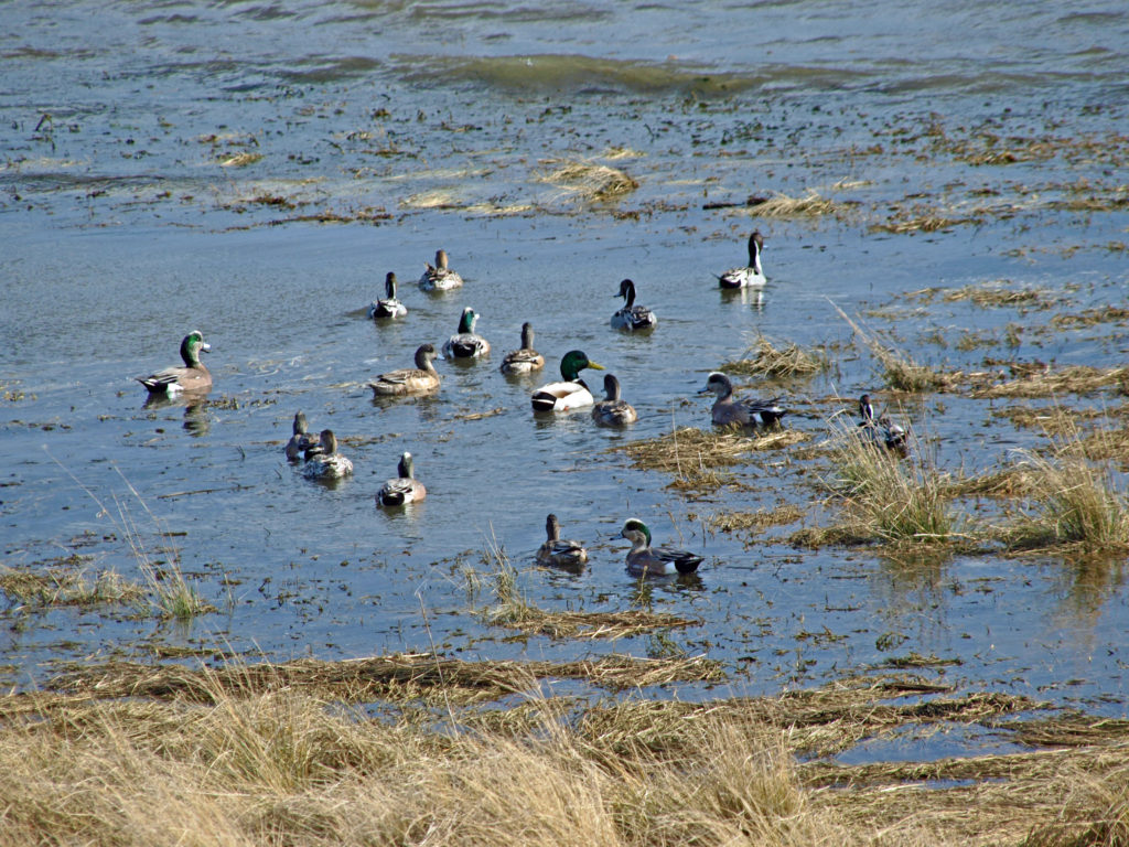 To reach Bayocean from the town of Tillamook, follow the signs for the Three Capes Scenic Route (Oregon Highway 131). After crossing the Tillamook River bridge, turn right onto Bayocean Road toward Cape Meares. At milepost five, turn right onto the old south jetty haul road (aka the dike road) and proceed to the trailhead parking area. There are pit toilets at the trailhead, but no water.
 From the trailhead, the road continues north beyond a locked gate. You can also hike through the dunes to the beach from the trailhead parking area. The road along the bay shore is mostly gravel, with a few sandy stretches, and mostly flat. It’s an easy four mile bike ride to the south jetty.
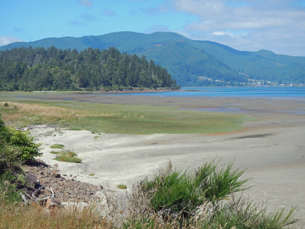 Hikers can do a 7½ mile loop by hiking through the dunes to the beach, walking the beach to the south jetty, and returning along the bay side on the gravel road. There are several trails connecting the dike road to the beach, making shorter loops possible. And a longer hike or bike ride (10 mile loop or 9 mile out and back along the beach) can be done by starting at the beach access in the town of Cape Meares, instead of the Bayocean trailhead. See my
 The north Oregon coast has much to offer beyond Bayocean Peninsula, of course.
 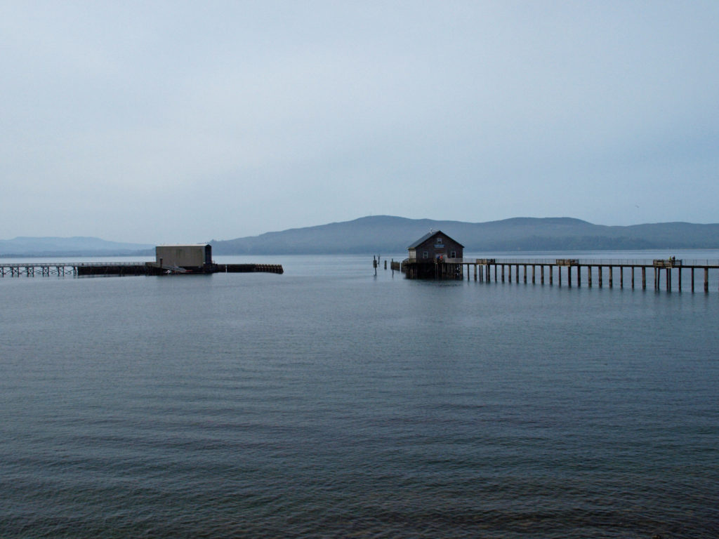 Originally posted April 23, 2019 by Alan K. Lee, updated July 8, 2021 and March 4, 2024
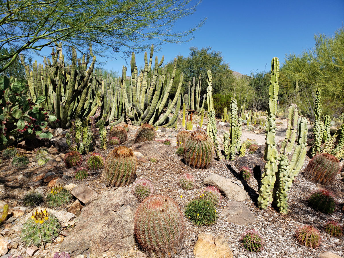

 There is so much here that you probably can’t see it all in one visit. My wife and I have visited the museum on a couple of our Arizona excursions, and on our last visit I was surprised at how much I had missed on our earlier visit. Plan to spend at least two hours at the museum. Allow half a day to more fully explore what the museum has to offer, if you can.
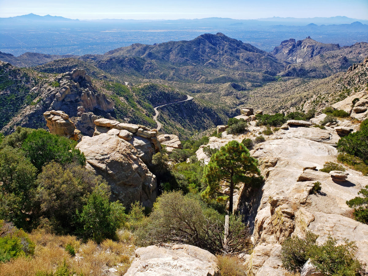
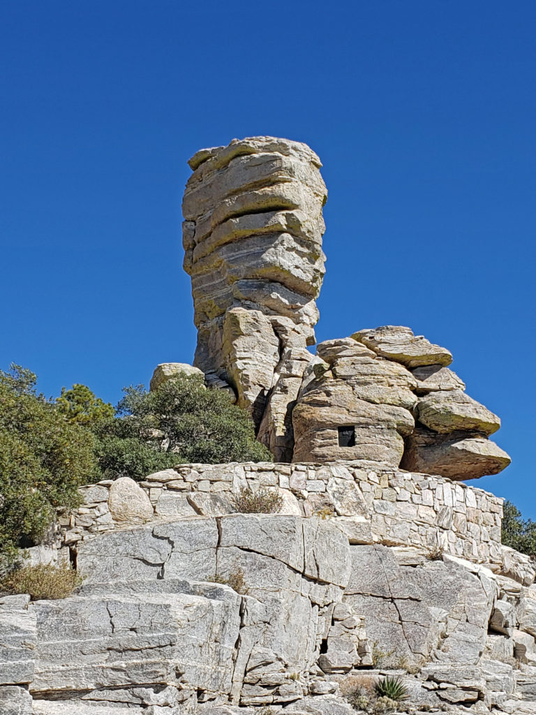
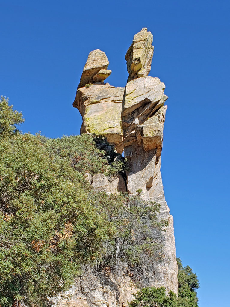
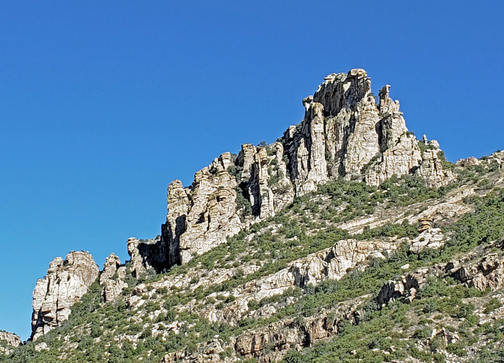 If you’re ever in the Tucson area, consider making the drive to the top of Mount Lemmon. A paved road takes you to the summit, more than 6500 feet above the valley floor. Numerous viewpoints along the way provide spectacular vistas of the mountain, the surrounding desert below, and the mountains beyond. And numerous trailheads provide access to the ridges and canyons beyond the road for those who want to lace up their hiking boots and immerse themselves in the desert or mountain environment.
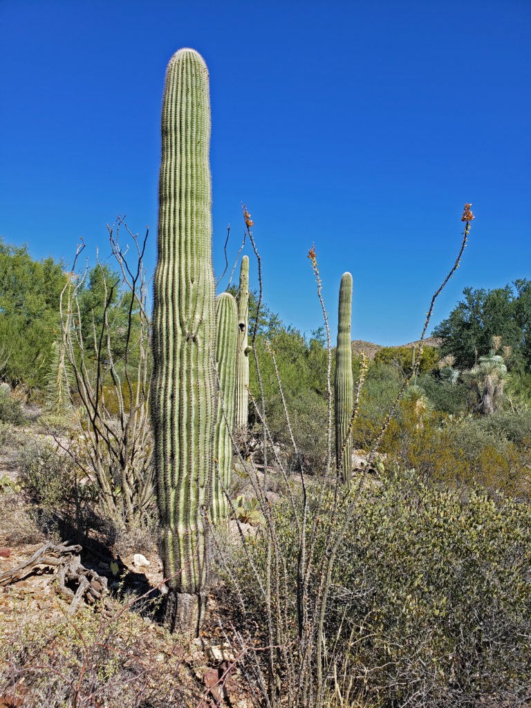
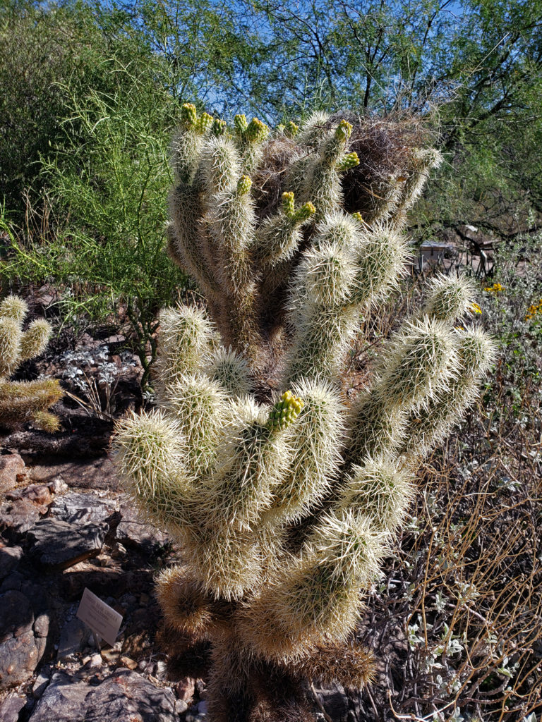
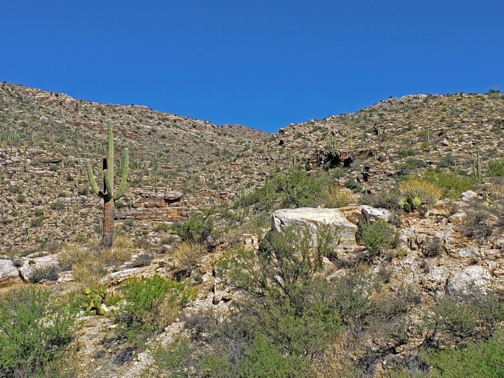 The drive takes you through numerous climatic and ecological zones, from the iconic saguaro cactus of the Sonoran Desert at the base of the mountain to an aspen and ponderosa pine forest at the summit.
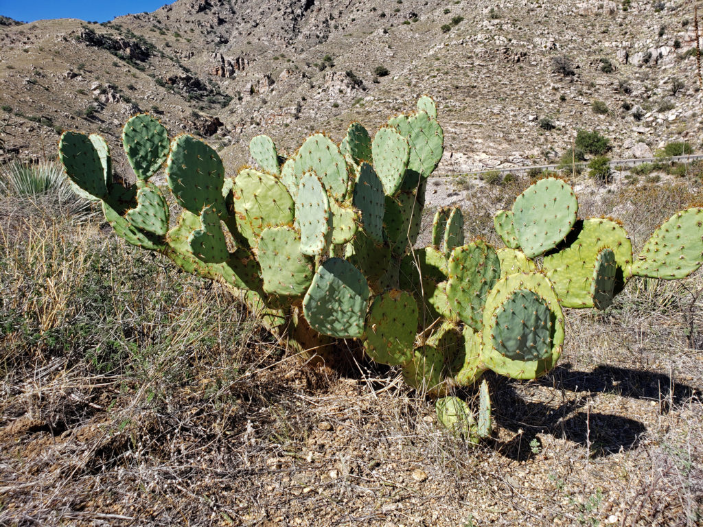 My wife and I made the drive to the summit in October 2019 while in Arizona to visit my brother and attend a wedding. I had never heard of Mount Lemmon and I wasn’t keen on making that long of a side trip, but my wife convinced me that it would be worthwhile, and she nailed this one. Mount Lemmon is more than just worthwhile, and worth more than just a side trip. It’s a worthy destination in its own right.
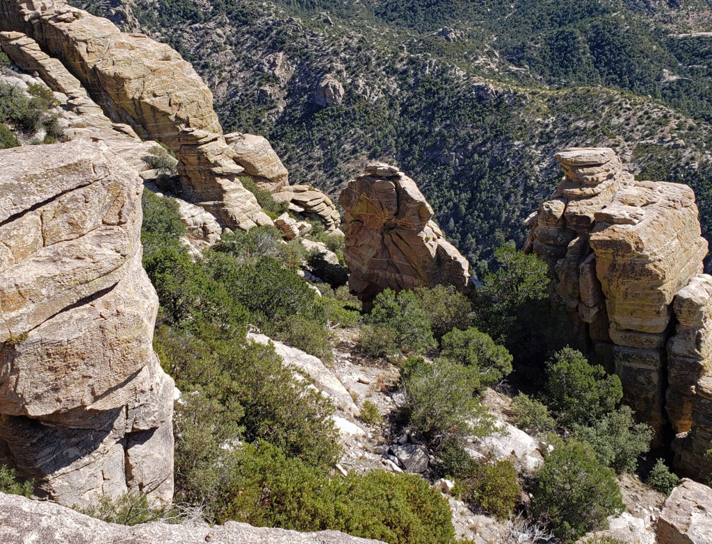
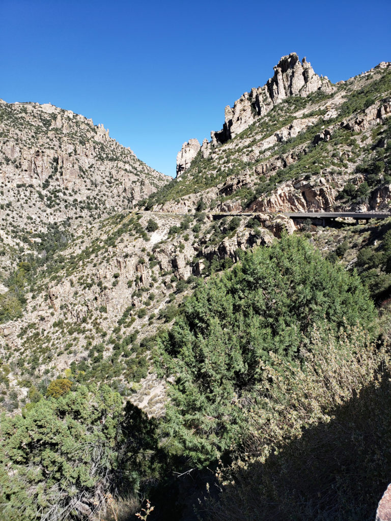
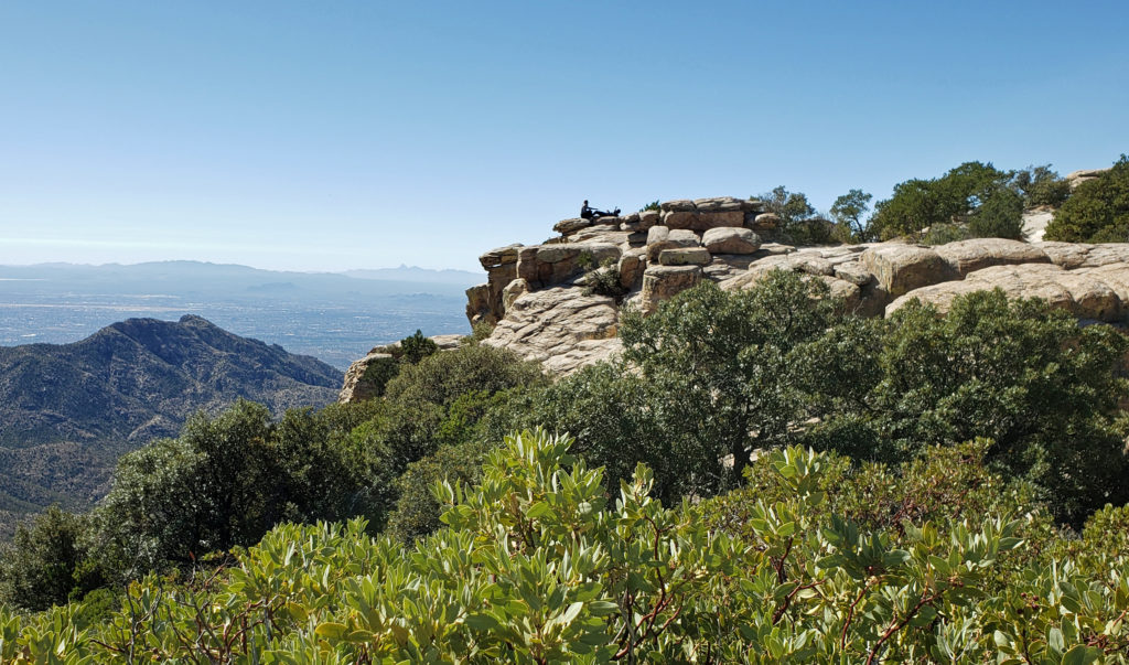 Windy Point, about seventeen miles from the beginning of the highway in Tanque Verde, has got to be one of the most spectacular viewpoints in southern Arizona. You’ll want to stop here and just wander around for a while. Take in the views of Tucson and the desert far below, the mountains beyond, and the rock formations around you. About four miles farther up the highway you’ll come to the San Pedro Vista, which gives you a panoramic view east across the San Pedro Valley to the Galiuro Mountains.
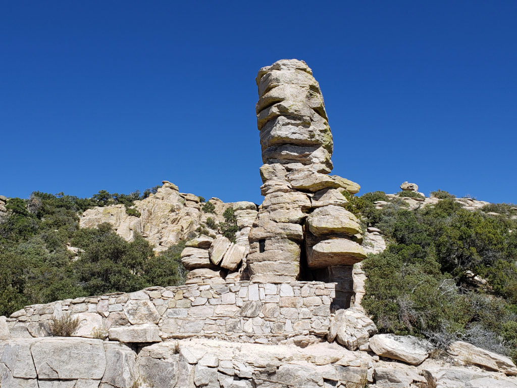 Another couple miles brings you to the
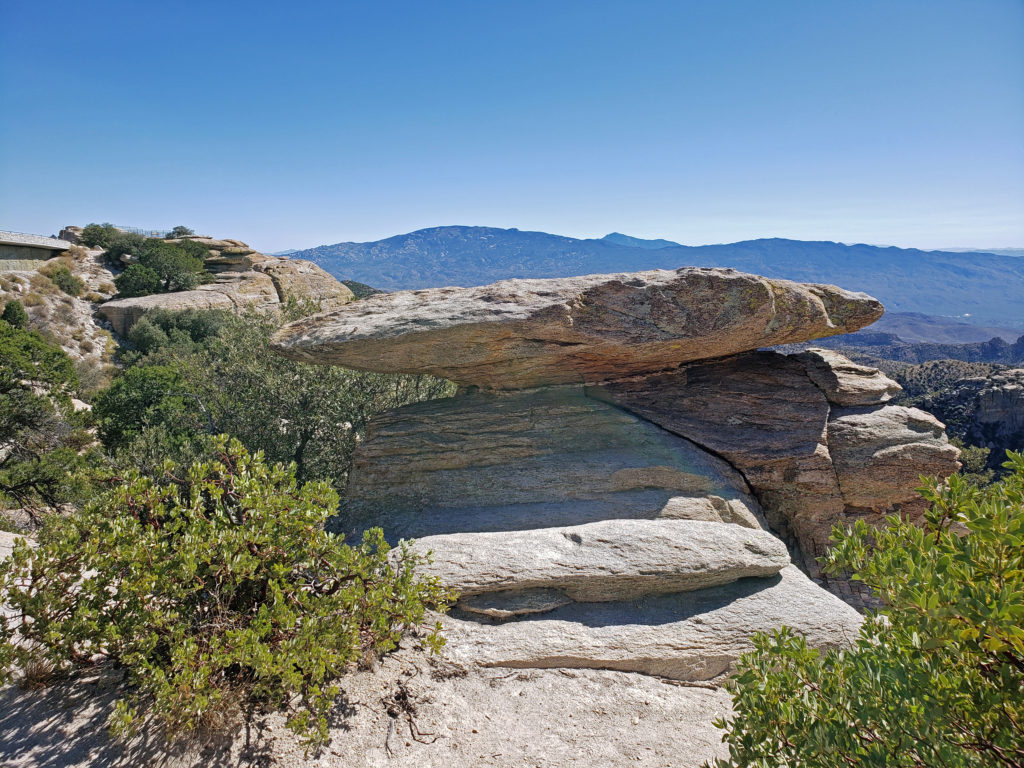
 If you go, note that the summit of Mount Lemmon can be thirty degrees cooler than Tucson, so dress accordingly. And if you plan to do any hiking, avoid mid-summer if possible and always bring plenty of water. There are no sources of safe drinking water on any of the hiking trails in the area, to my knowledge.
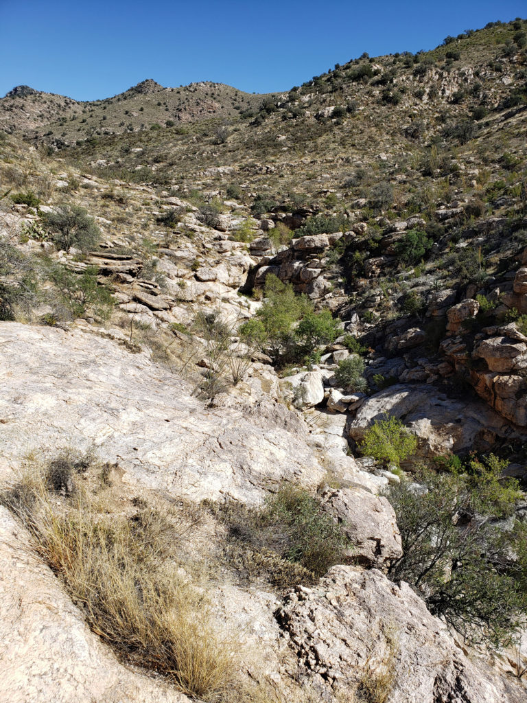
 Not only am I glad we took the drive, I wish we could have spent more time exploring the mountain. For those that do have the time, there are several picnic areas along the highway and a few places to eat in Summerhaven, and there are several campgrounds a short ways off of the highway if you want to spend more than a day on the mountain. If you don’t want to camp, Summerhaven also has a few rental cabins, and a newly built small hotel. Check the
 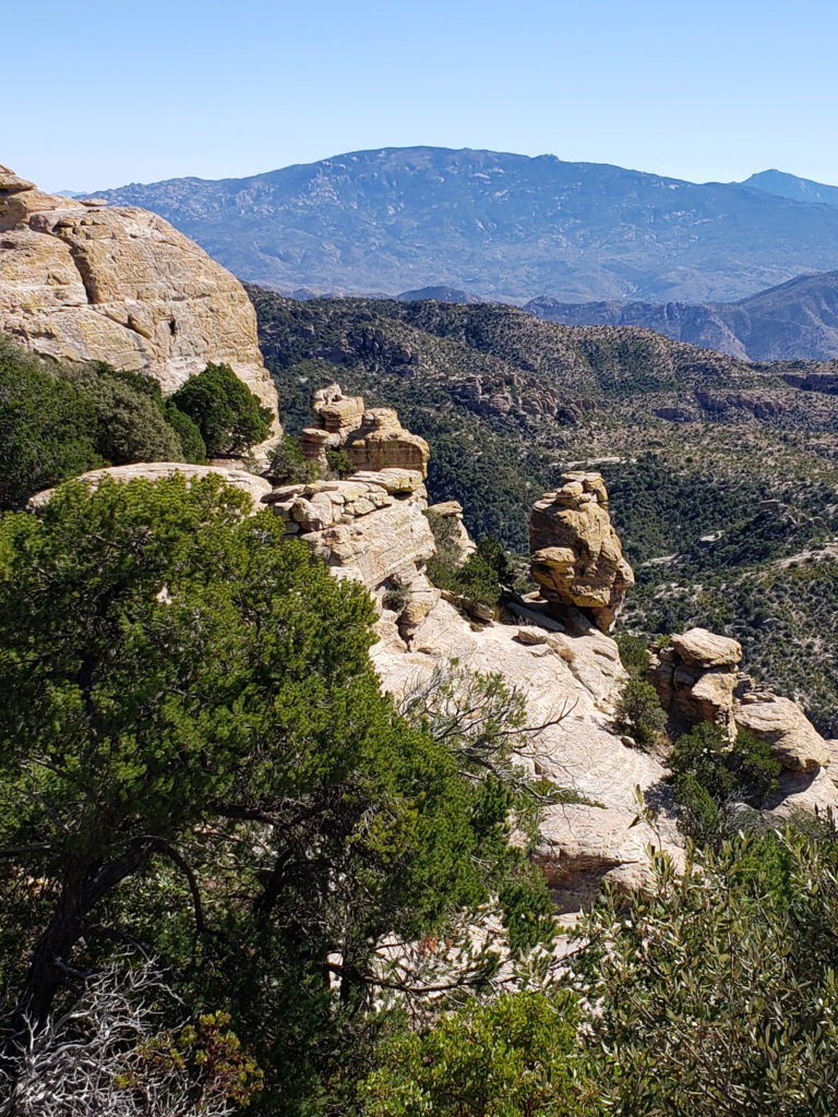 Note: In the summer of 2020 the entire area was closed to the public because of the Bighorn Fire that burned 120,000 acres in the Santa Catalina Mountains. Photos taken after the fire showed some badly burned areas, but others that were largely untouched. All of the area is open again, including the Palisades Visitor Center.
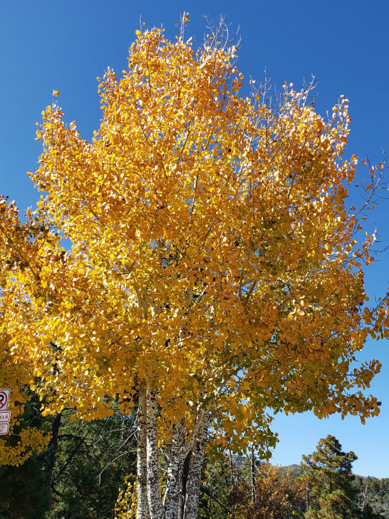


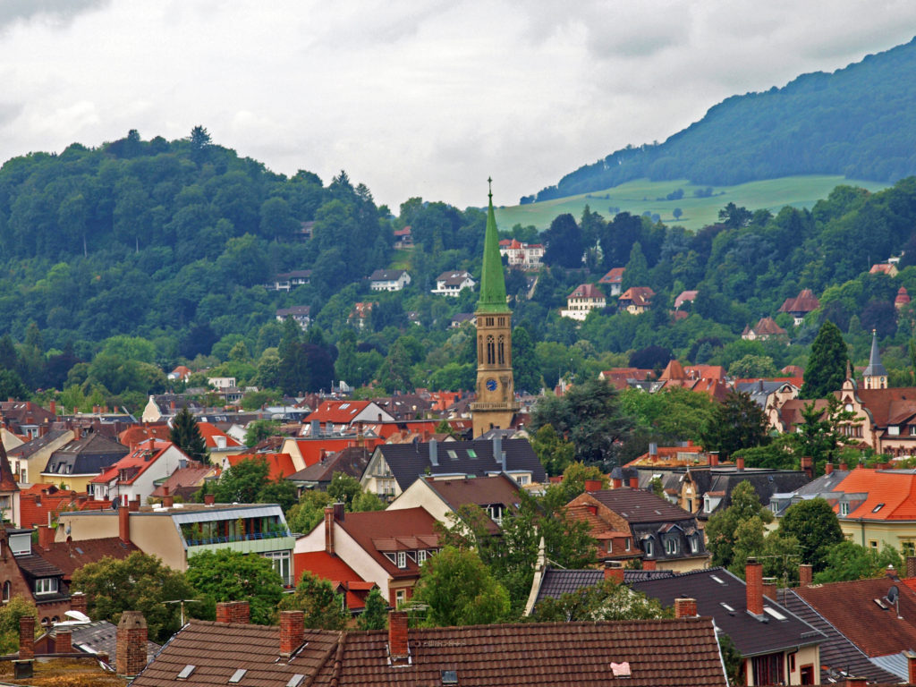

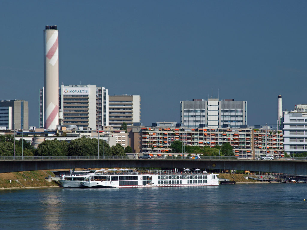
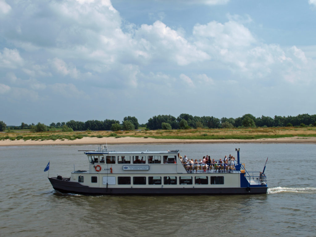
 We spent the rest of the day exploring the city center, including Basel Cathedral (Basel Munster), and the Basel Town Hall, and sampling Swiss cuisine. All in all, Basel was a delightful surprise, and a fitting end to our Rhine River cruise.
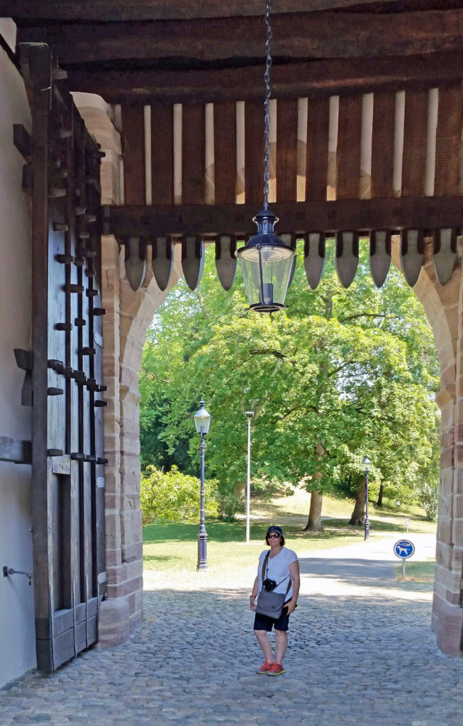
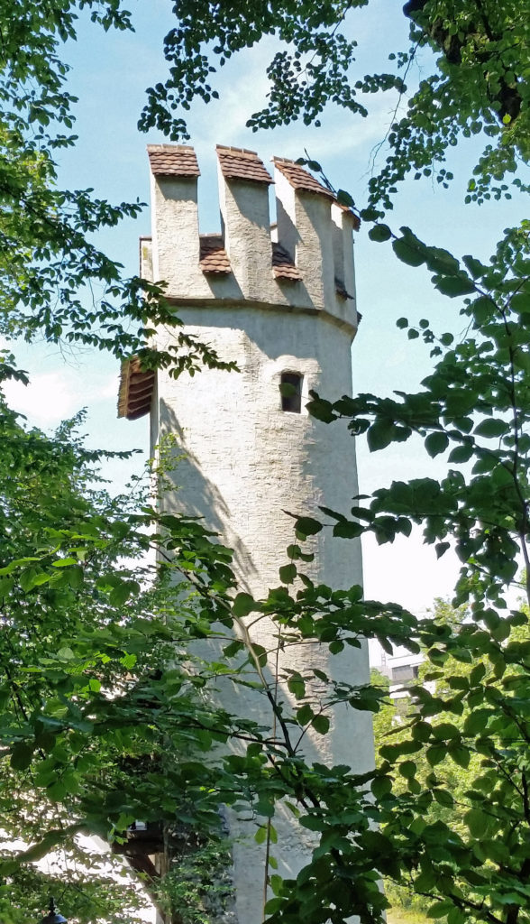
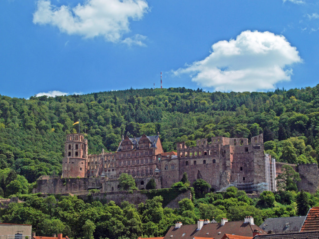
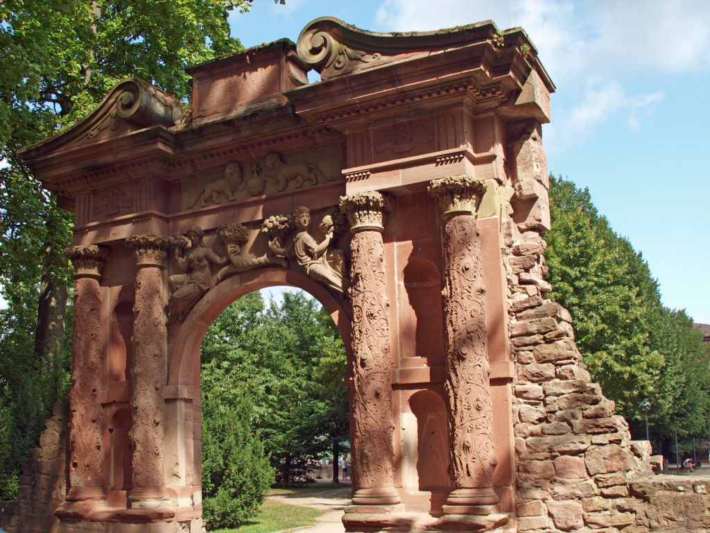
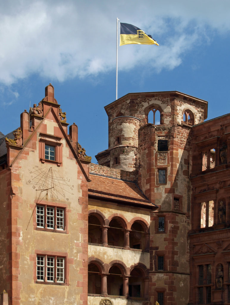
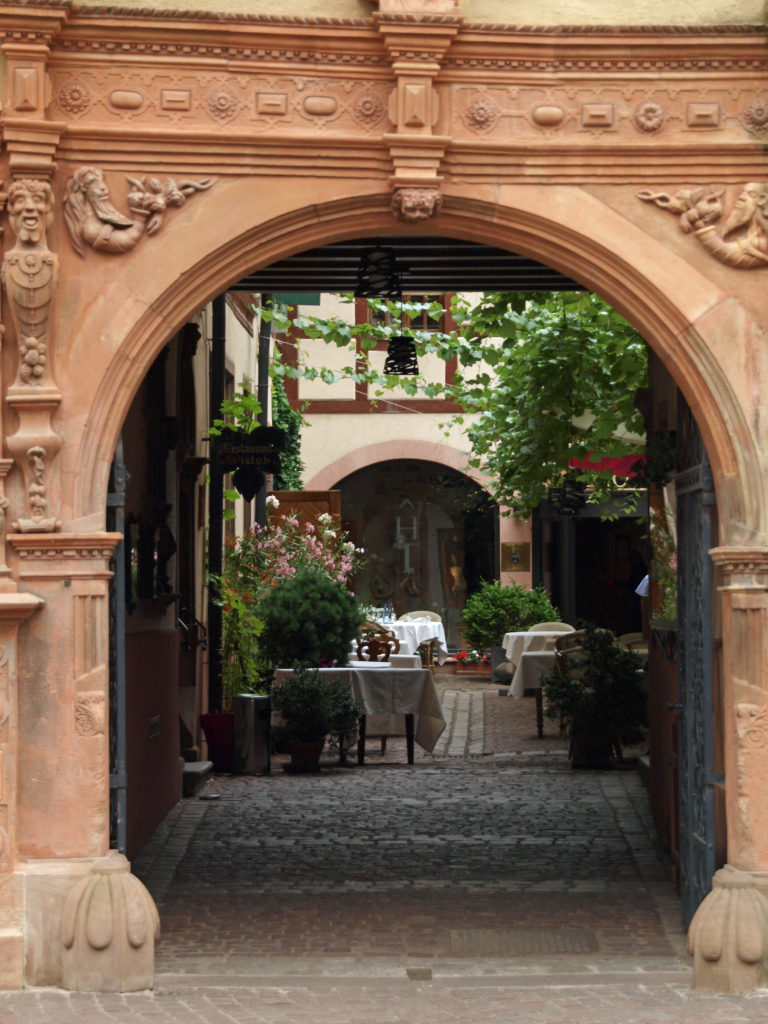
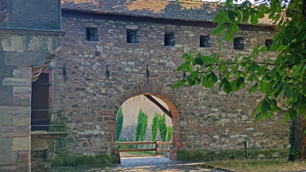
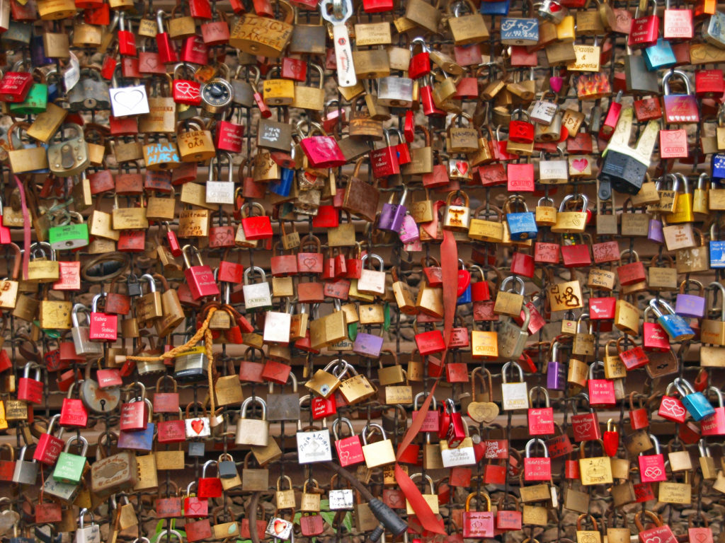
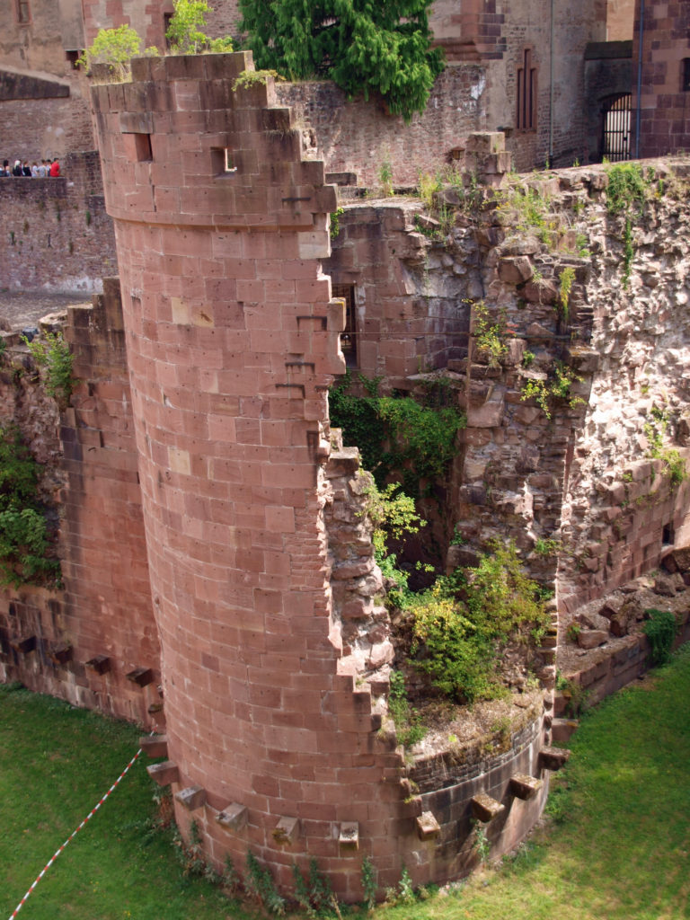 Our tour guide was a graduate student working on his doctorate in history at Heidelberg University, so we got a wealth of local history during our tour, told in an entertaining and often humorous manner. The castle ruins are a treasure trove of photo opportunities, as well. I could easily have spent a full day, or more, at the castle, but had to move on with the group.
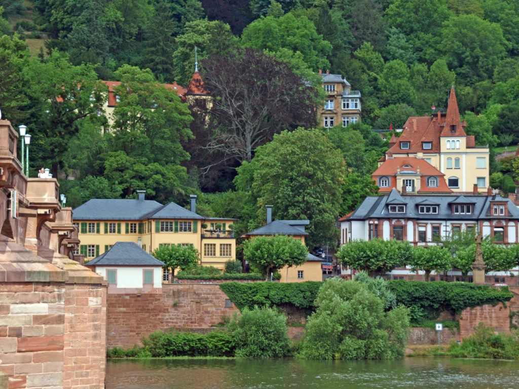
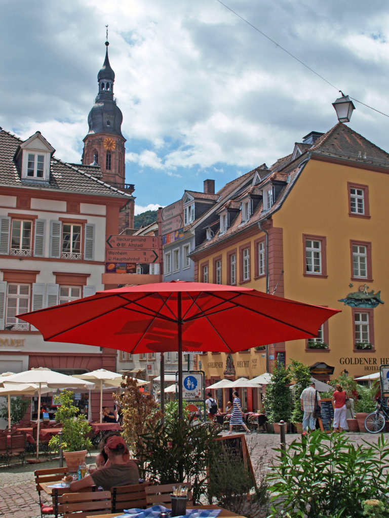
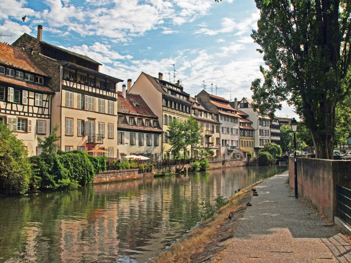
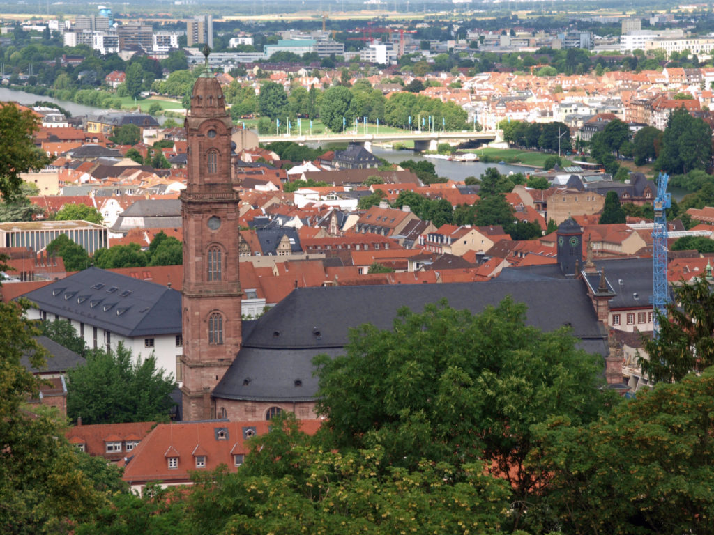
 We spent an hour or so exploring the old city, then stopped at a sidewalk cafe at one of the hotels for lunch. While there, another of the couples on the cruise joined us. Fran and Victor, from Santiago, Chile, were one of the few non-American couples on the cruise. Coincidentally, Victor, who is a surgeon, had been sent to Heidelberg some time previously by the university hospital where he practiced (they had some sort of reciprocal relationship with Heidelberg University), and had stayed in the same hotel at which we were dining.
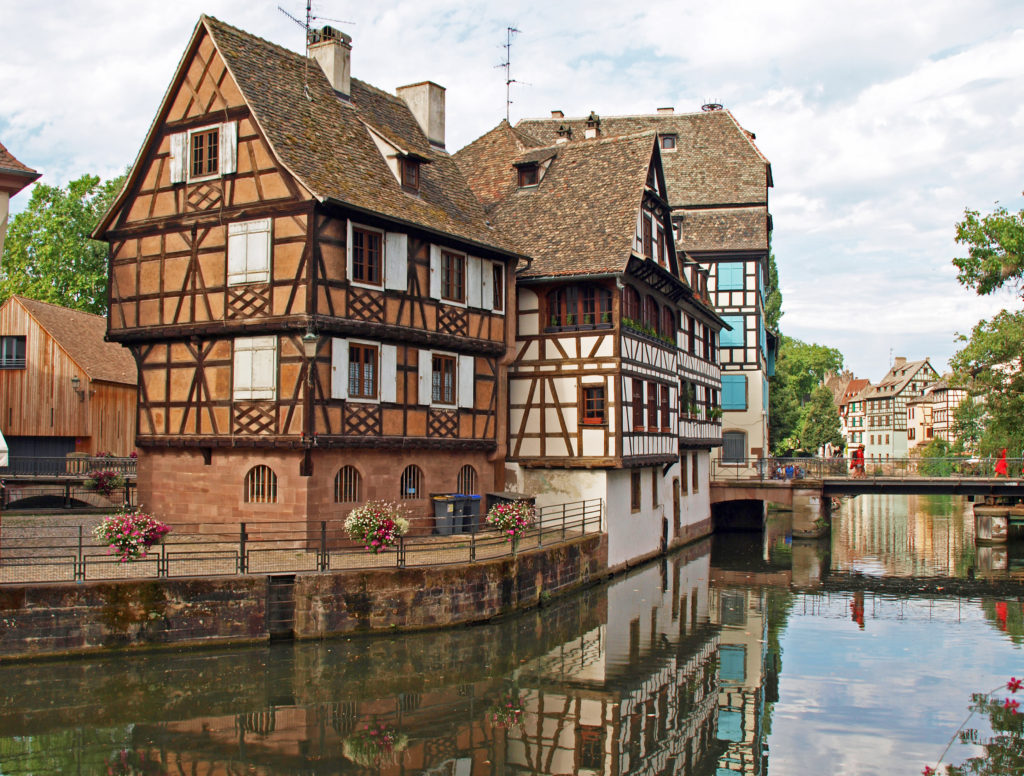
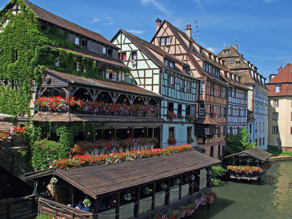


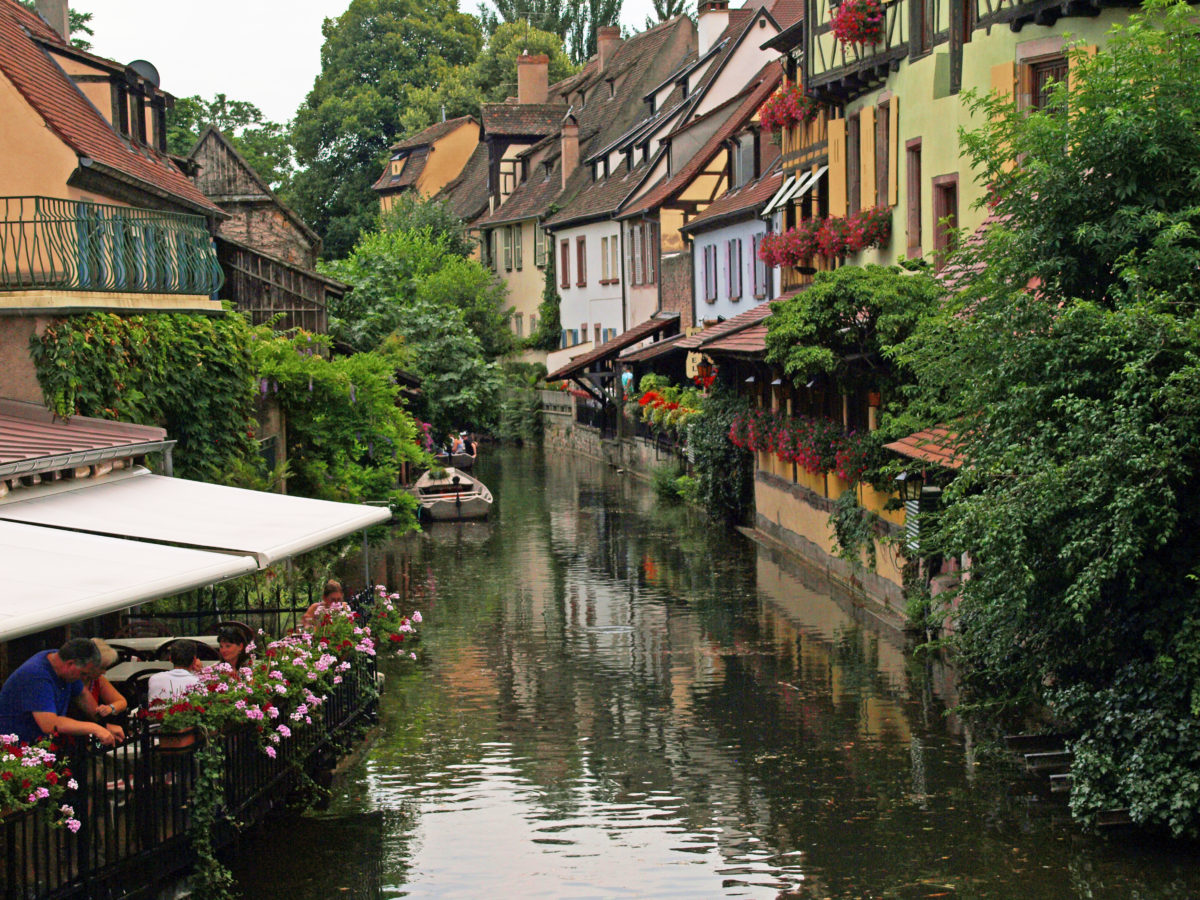
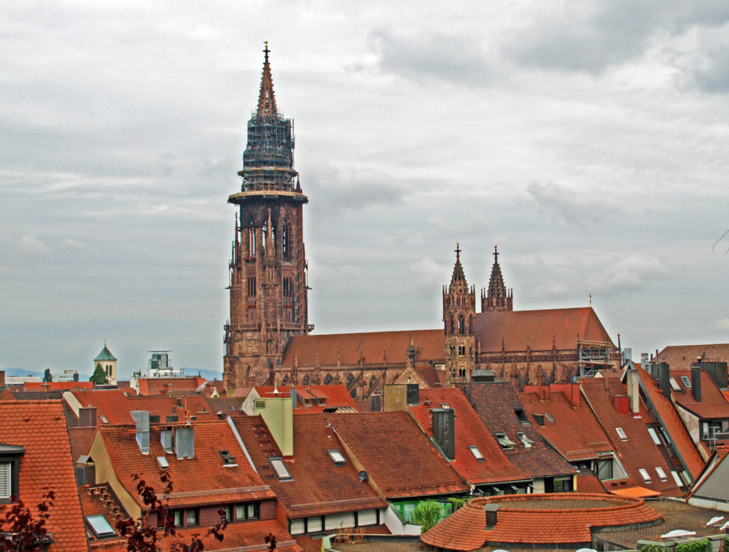
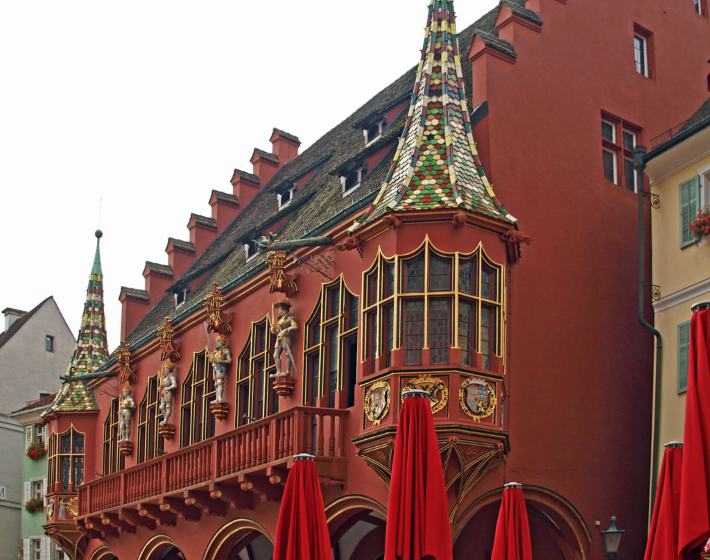
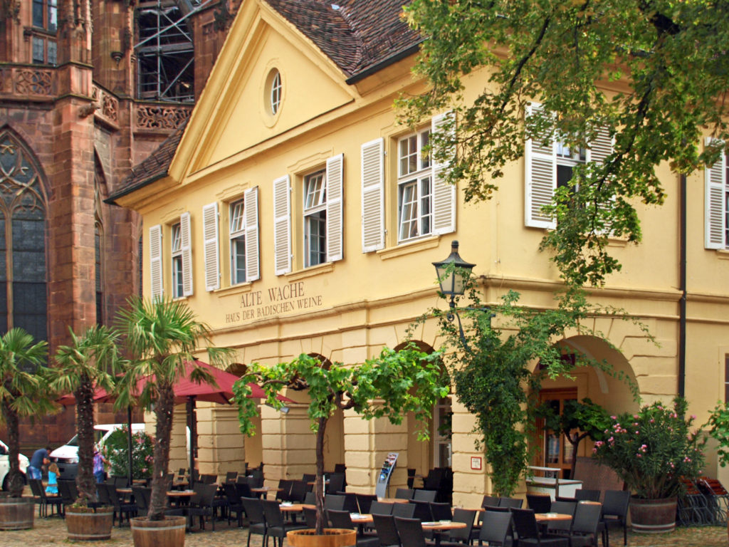
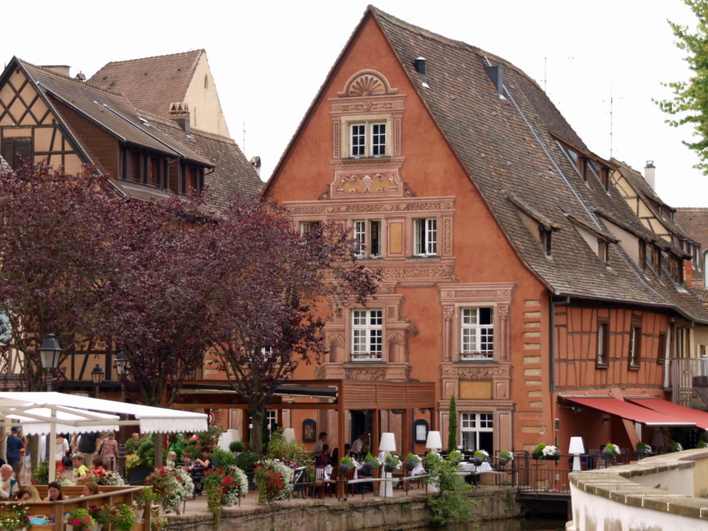
 From Kehl, the ship sailed that evening to Breisach, Germany. Our excursions on the following day took us to Freiburg, Germany and Colmar, France. Look for an upcoming post on those outings.


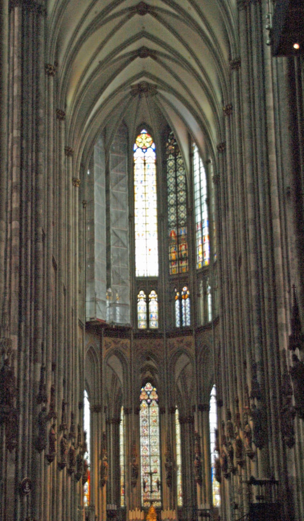 Construction of the Cologne Cathedral began in 1248. In 1478 construction was halted and the cathedral remained unfinished for another 400 years. It wasn’t until 1880 that it was completed to the original medieval plan. The cathedral was damaged by a number of bombing raids in WWII, but remained standing, and repairs were completed in 1956.
 Our second tour in Cologne was an optional pub crawl that evening, led by a local guide. In Cologne each pub has a working agreement with one of the local breweries that produce the local brew, called