by Alan K. Lee
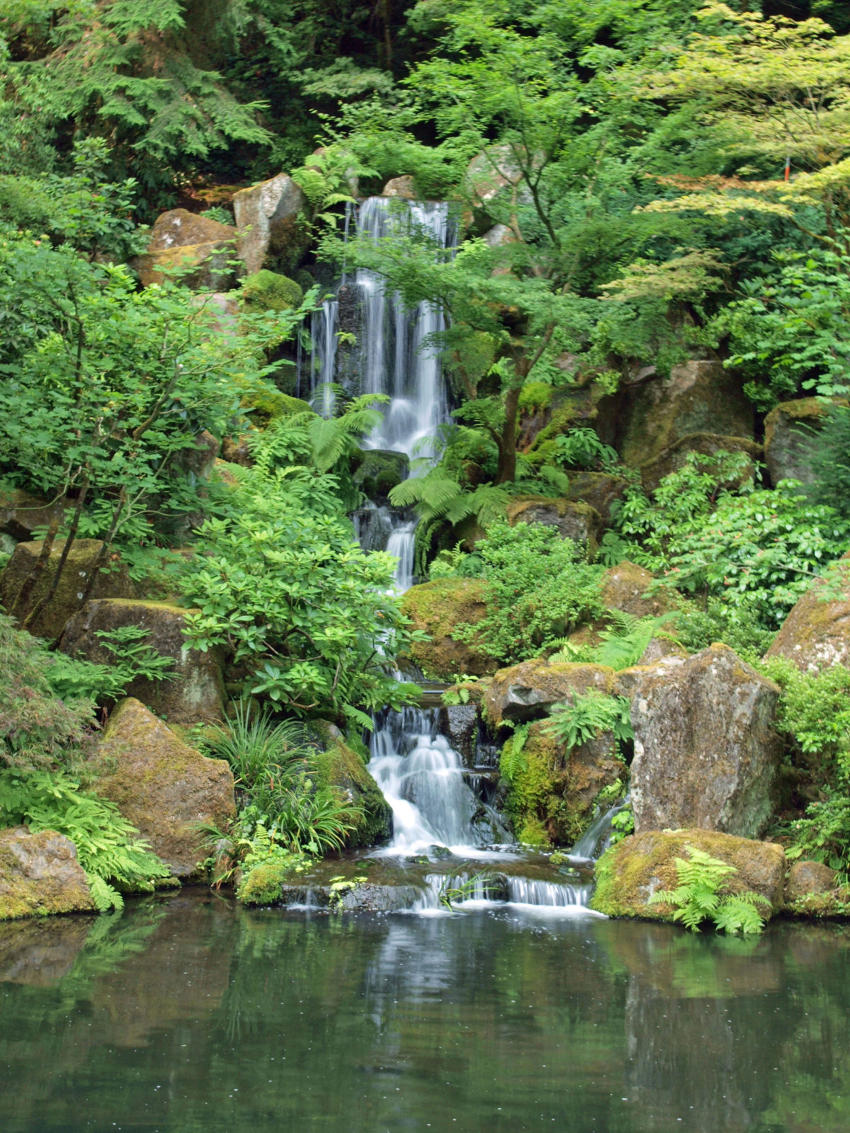
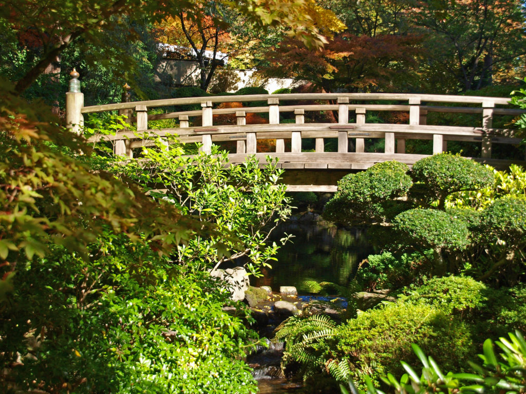
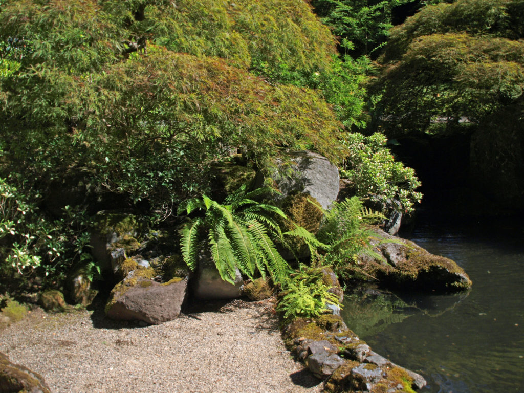
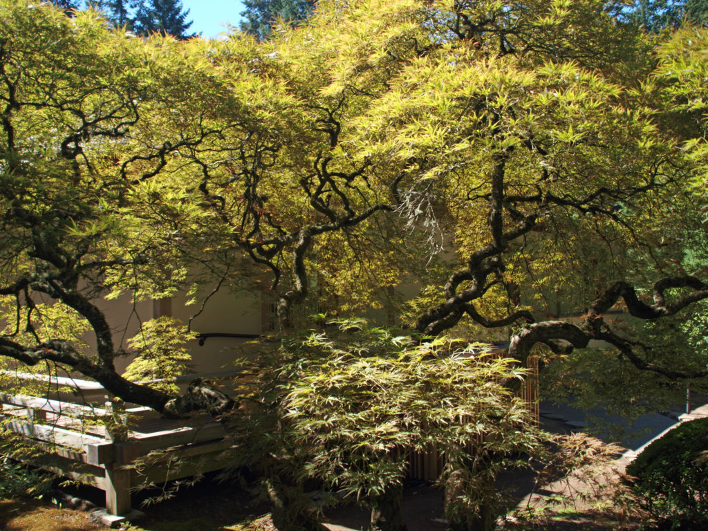
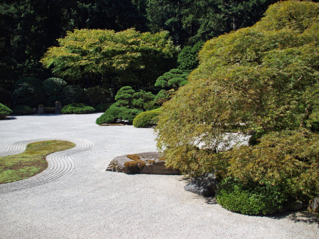
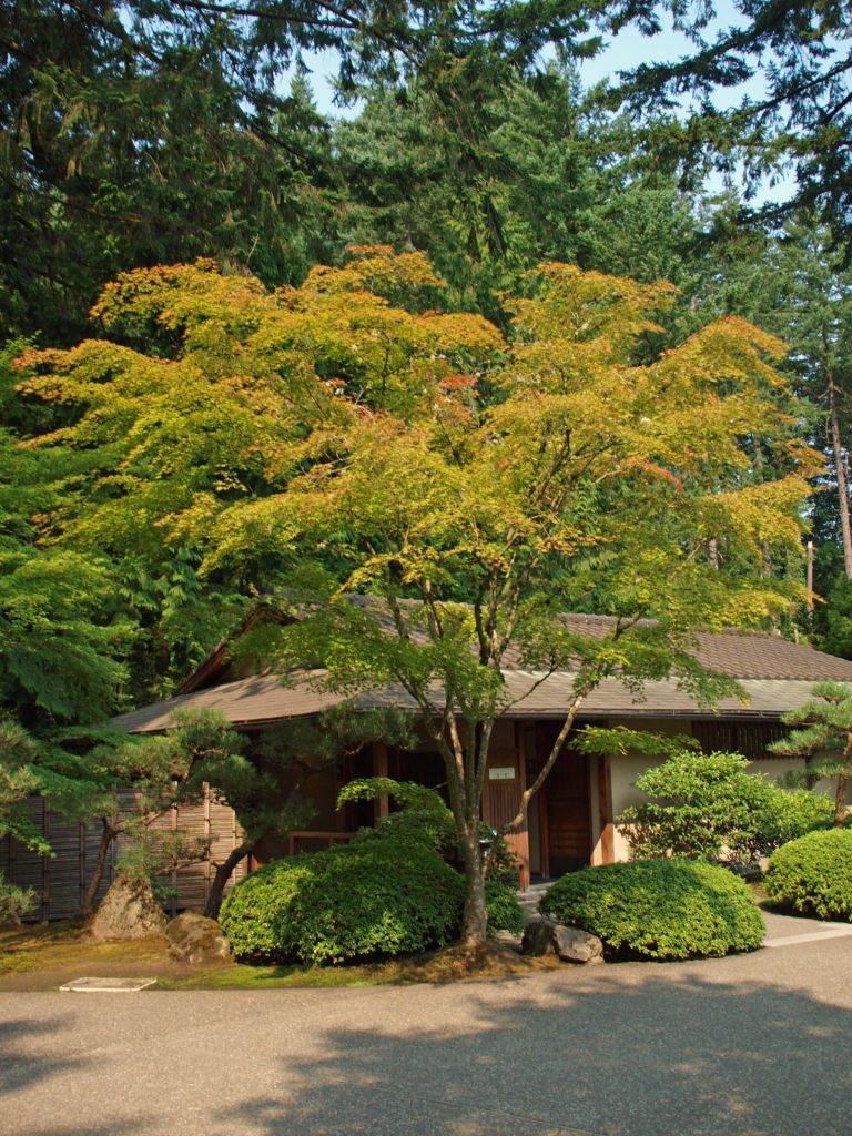
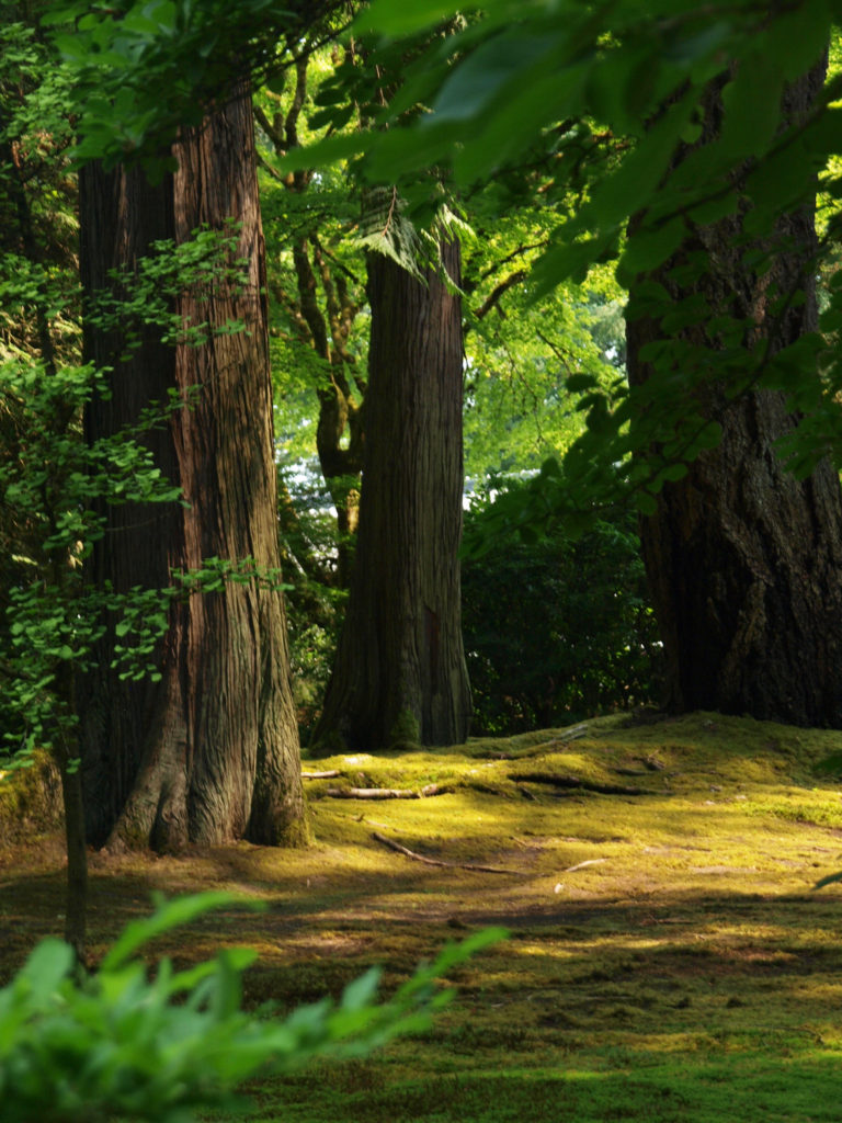
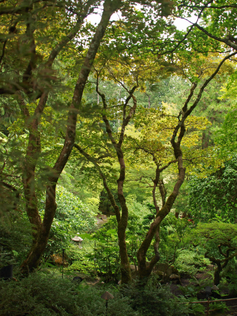
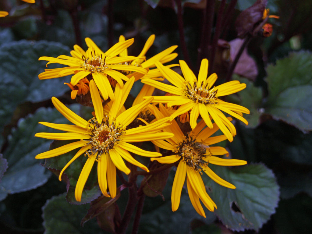
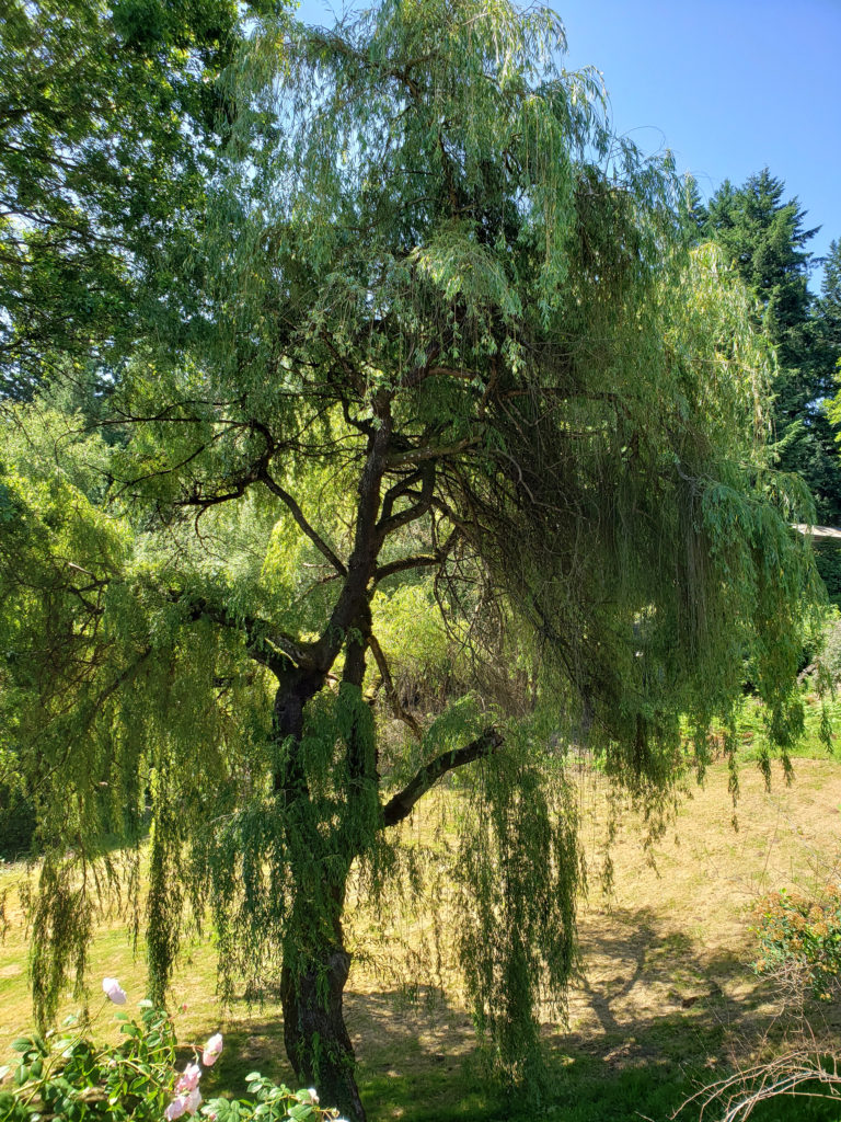
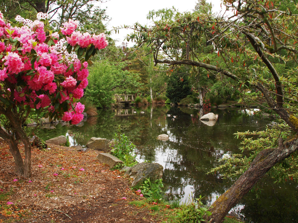
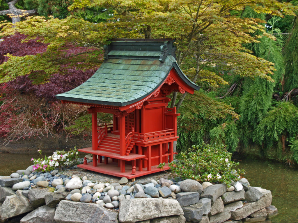
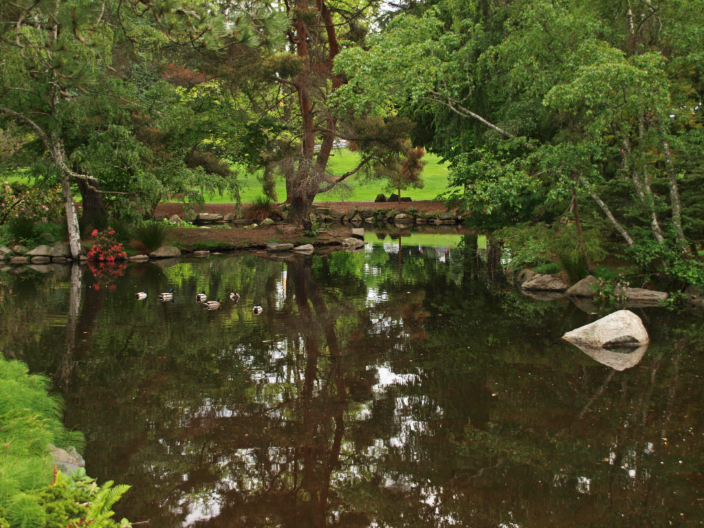
 The serenity and transcendent beauty of the Portland Japanese Garden make it one of my favorite places in the Pacific Northwest. Located in Washington Park in Portland’s West Hills, the garden overlooks downtown Portland, but it is worlds away from the hustle and bustle of the city. The tranquility that the garden aspires to is somewhat compromised by the 450,000 annual visitors that it attracts, but the beauty of the gardens make it more than worth visiting despite any crowds.
 Former Japanese Ambassador to the United States Nobuo Matsunaga has called the Portland Japanese Garden “the most beautiful and authentic Japanese garden in the world outside of Japan.”
 The Portland Japanese Garden came out of the sister city relationship between Portland and Sapporo, Japan, which was created at least in part as an effort to heal the wounds of World War II. The garden website says it best: “Born out of a hope that the experience of peace can contribute to a long lasting peace. Born out of a belief in the power of cultural exchange. Born out of a belief in the excellence of craft, evidence in the Garden itself and the activities that come from it. Born out of a realization that all of these things are made more real and possible if we honor our connection to nature.”
 The site, once the location of the Washington Park Zoo, was dedicated in 1961. Construction of the garden began in 1963, and the garden opened to the public in the summer of 1967. Designed by Professor Takuma Tono of Tokyo Agricultural University, the garden originally consisted of five different garden styles spread over 5.5 acres.
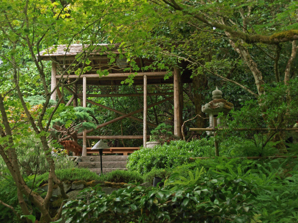
 Over its more than half a century of existence, the garden has evolved and more than doubled in size. The Kashintei Tea House was built in Japan in 1968, dismantled, and shipped to Portland. But it wasn’t until 1980 that it was reconstructed on its present site. It was dedicated on May 18, 1980, the same day that Mount St. Helens erupted.
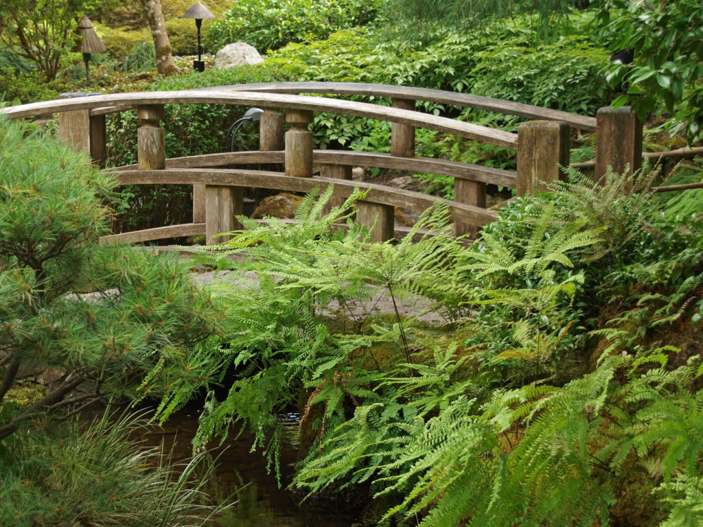
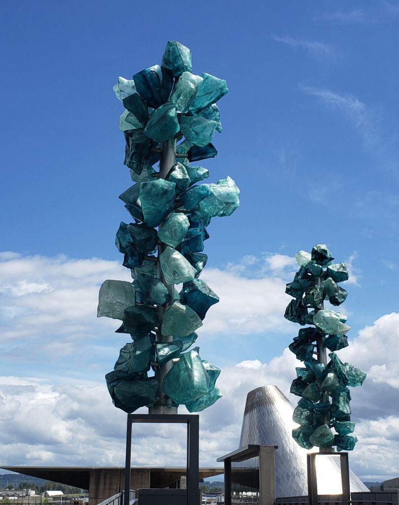
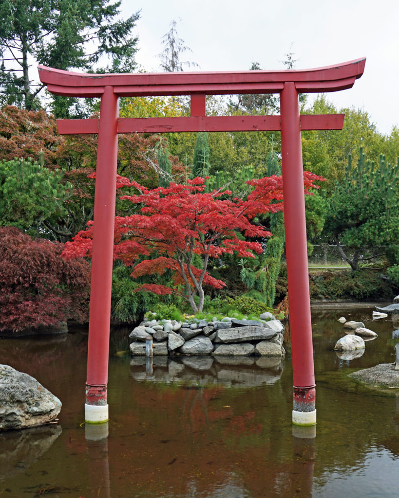
 The most recent expansion, completed in 2017, added a new entrance and entry garden, a courtyard garden, a bonsai terrace, and a Cultural Village consisting of three new buildings designed by Japanese architect Kengo Kuma: the Jordan Schnitzer Japanese Arts Learning Center; the Garden House; and the Umami Cafe. Today, the Portland Japanese Garden consists of eight gardens covering 12 acres.
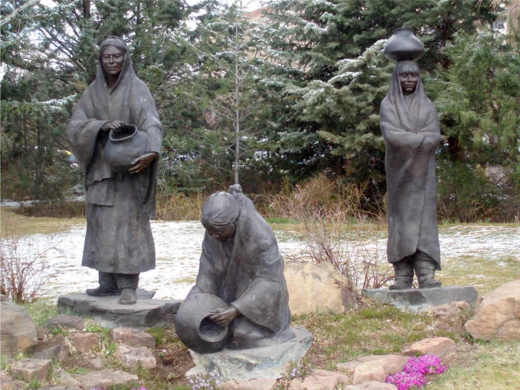
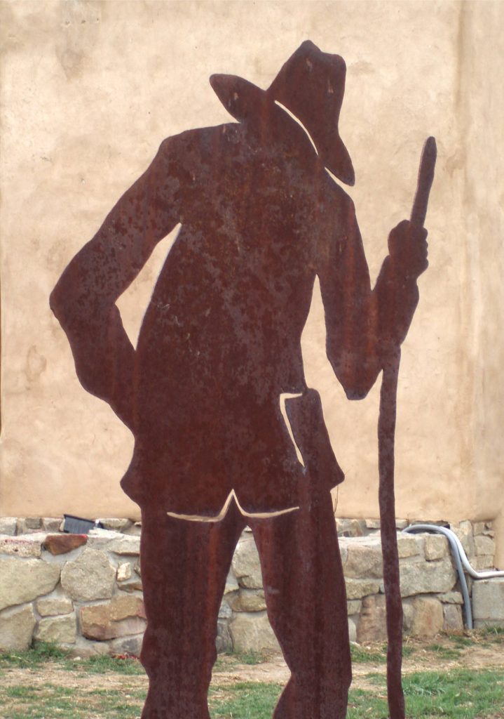
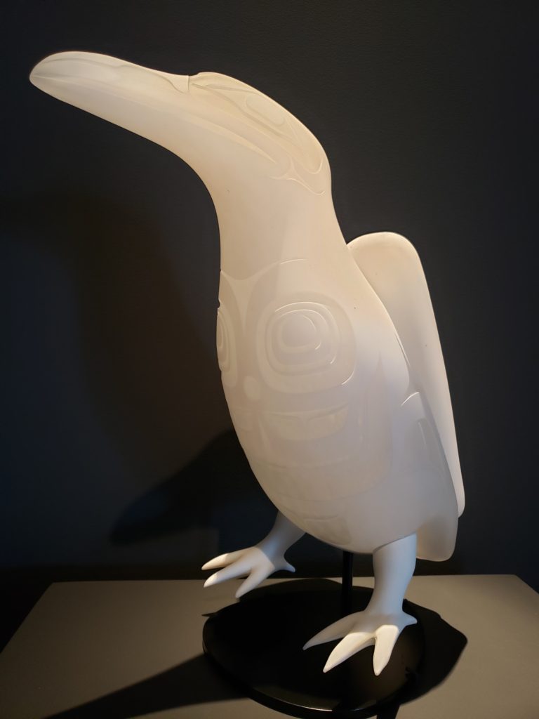
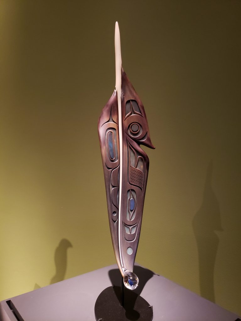
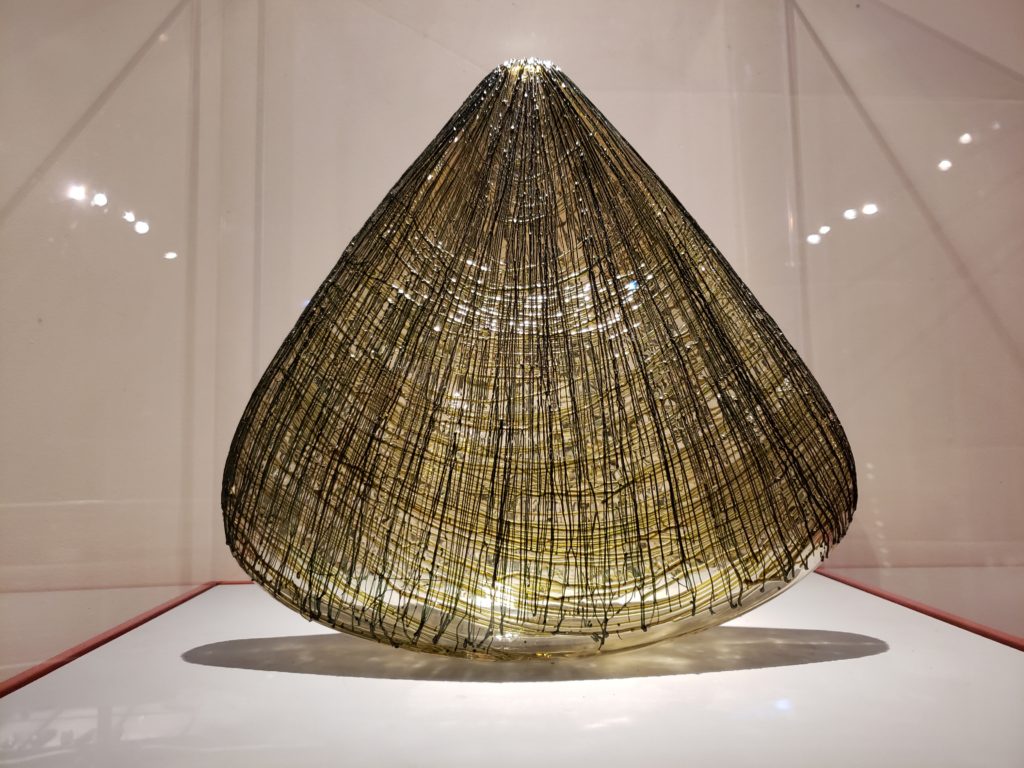
Each year the garden presents Art in the Garden, a series of works by a variety of Japanese artists (or works inspired by Japanese design or tradition) “to explore the ideas and aesthetics integral to the fabric of life in Japan.”
The garden is located within Washington Park, but is operated by a non-profit organization. In addition to maintaining the garden, the organization operates the International Japanese Garden Training Center, which teaches the traditional skills and techniques for creating Japanese gardens (the only program of its kind outside of Japan), offers tours and teaching materials for schools, offers a variety of classes and workshops for the public, and conducts public tours of the garden. The organization also operates the Bill de Weese Chabana Research Garden, the only garden of its type in North America.
 The garden is open Wednesday through Monday. Summer hour are 10:00 to 5:30. Admission is $18.95 for adults, $16.25 for seniors (65+), $15.25 for students (with ID), and $13.50 for youths (6-17). Children under six are free. Group tickets (for 15 or more people) are offered at a discount. Tickets must be purchased in advance through the garden’s website. Individual garden memberships are available for $60. Dual memberships (two people) are $85 and household memberships are $110.
 Covid-19 update (April 2022): The garden is open to everyone, and masks are required only on the garden shuttle that runs from the parking area up the hill to the old garden entrance. (You do not have to take the shuttle and masks are not required if you walk). Some of the paths are one way only, and entrance to the Umami Cafe requires proof of vaccination. all garden staff are fully vaccinated.

 The Portland Japanese Garden is, in my opinion, a must see for anyone visiting Portland. And you’ll probably also want to visit the International Rose Test Garden, located across the street from the Japanese Garden entrance.
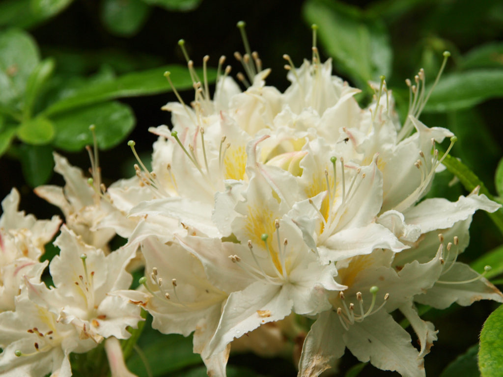
 Other gardens featured on this site include Crystal Springs Rhododendron Garden, Butchart Gardens, Hulda Klager Lilac Gardens, Lan Su Chinese Garden, and the Connie Hansen Garden. Those and other Northwest gardens have been or will soon be featured on this site. Check the Recent Posts list or click on the Upcoming Posts tab at the top of this post for gardens to be featured this spring.
 Originally posted August 13, 2018. Updated December 20, 2020 and April 4, 2022.
All photos © Alan K. Lee


 Jeanette (Jenny) Butchart created the gardens in the early 20th century. Her husband, Robert, owned a cement manufacturing business. He was drawn to Vancouver Island because of its abundant limestone deposits, a key ingredient in Portland cement. Near the turn of the 20th century he purchased the site of what is now Butchart Gardens and began mining limestone and manufacturing cement. In 1904 the Butcharts built their estate on land adjacent to the quarry. Shortly thereafter, Jenny Butchart hired Isaburo Kishida to design and build the Japanese Garden at the estate.


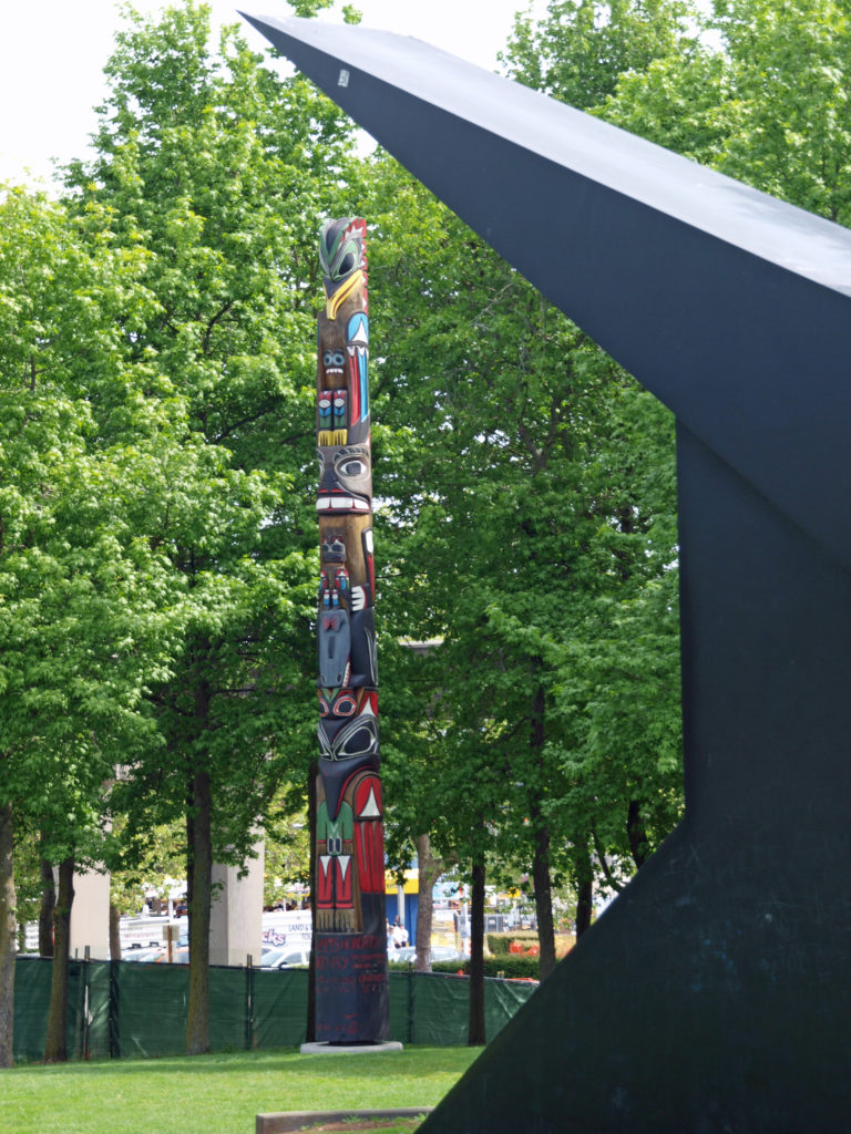
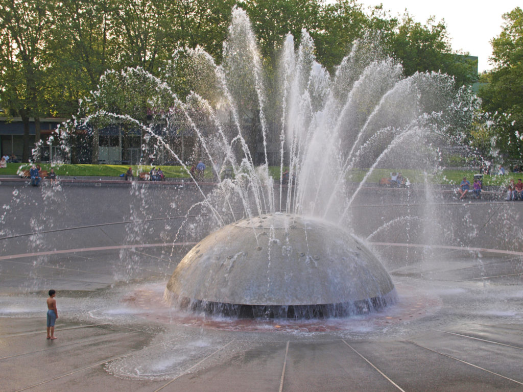
 Numerous improvements and additions to the Gardens have been made over the years. In 1953 Ian Ross added lighting to illuminate the Gardens at night, and in 1964 the Ross Fountain was installed in the lower reservoir in the Sunken Garden. The two large totem poles next to the Fireworks Lawn were erected in 2004. In 2009 Robin-Lee Clarke added the Children’s Pavillion and the Rose Carousel.
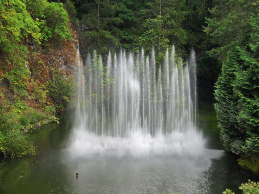


 There have been a few reviews that have called the Gardens overpriced and under-whelming, but that’s definitely a minority opinion. And I’m siding with the majority here. Butchart Gardens may not be my favorite garden, but in my opinion the Gardens reputation and World Heritage Site designation are well deserved. And the Gardens are so beautiful that the cost of admission and the crowds shouldn’t dissuade anyone from visiting. If you have never been to Butchart Gardens, they should be on your bucket list, if they aren’t already. And now is as good a time as any to start planning a trip to
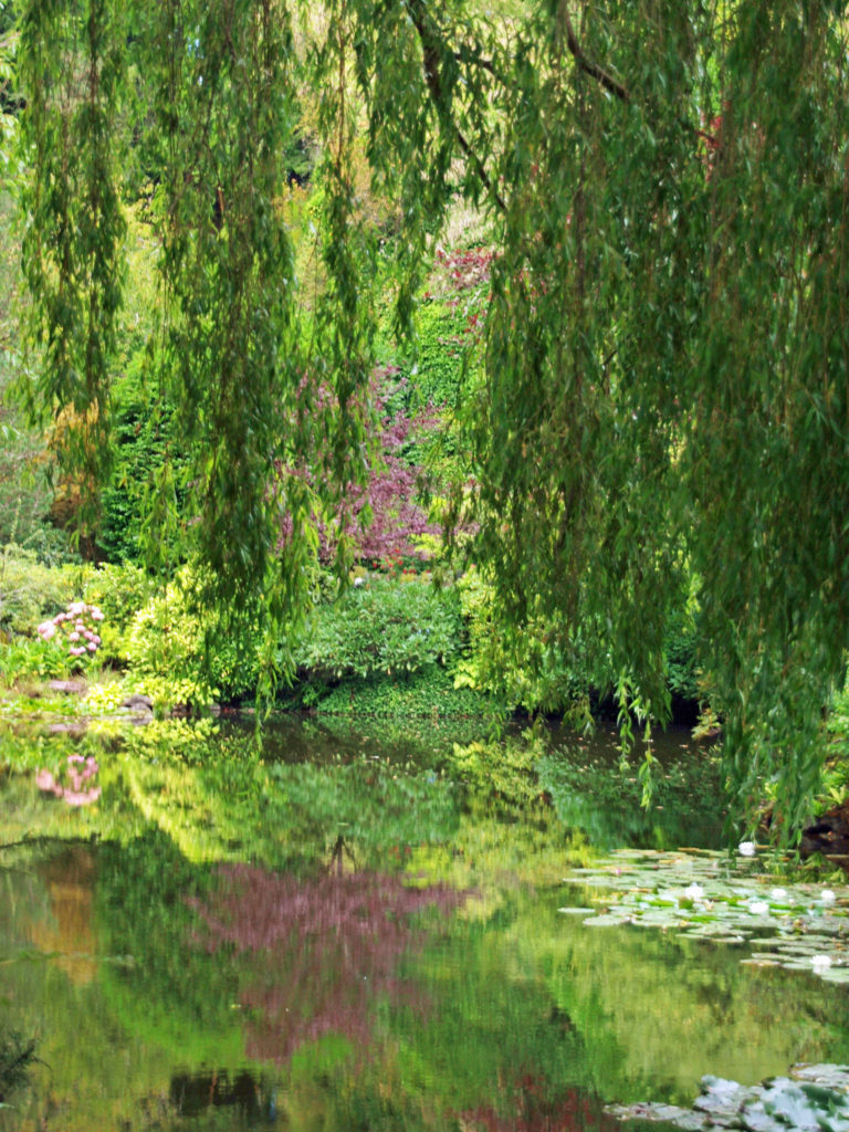

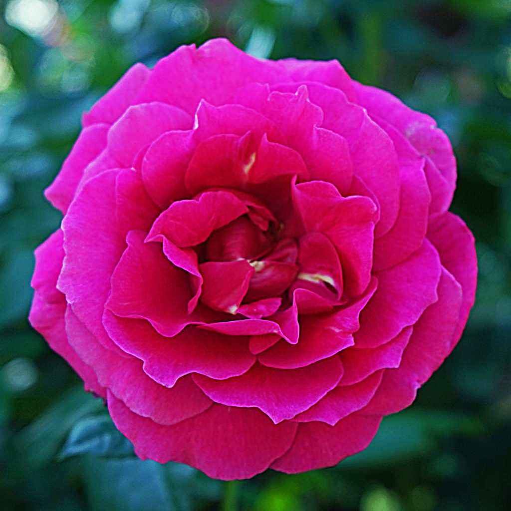
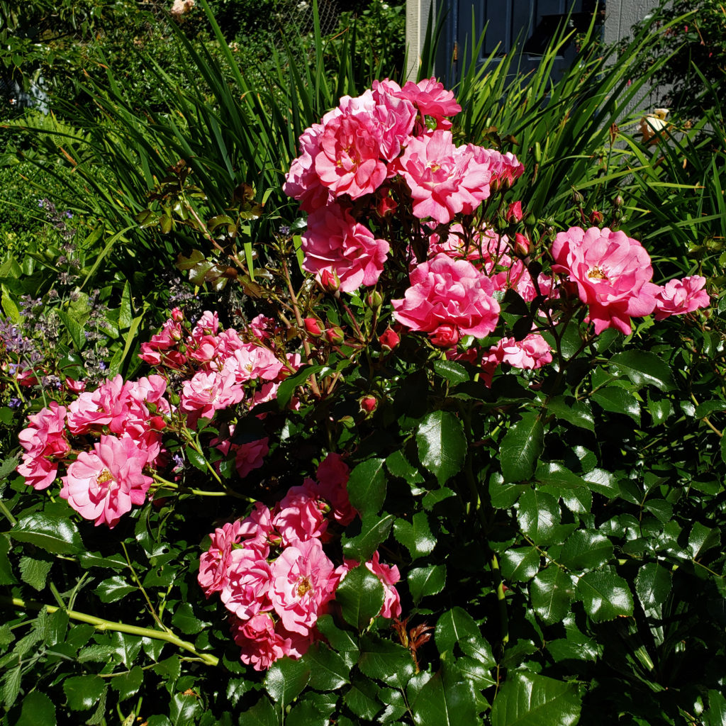
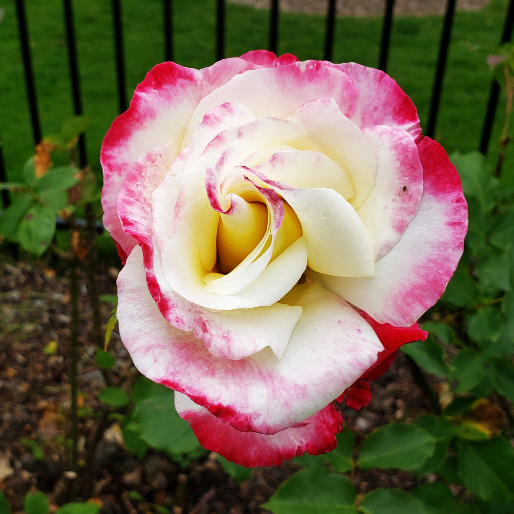
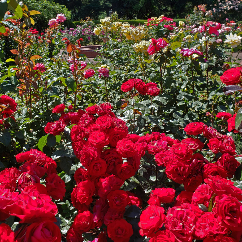 Portland, Oregon is known as the Rose City, and has long had a love affair with roses. The Portland Rose Society has been in existence for more than 130 years. Portland’s premier festival is the annual Rose Festival, held in June every year since 1907. And one of the city’s best, if not the best, botanical gardens is the International Rose Test Garden.
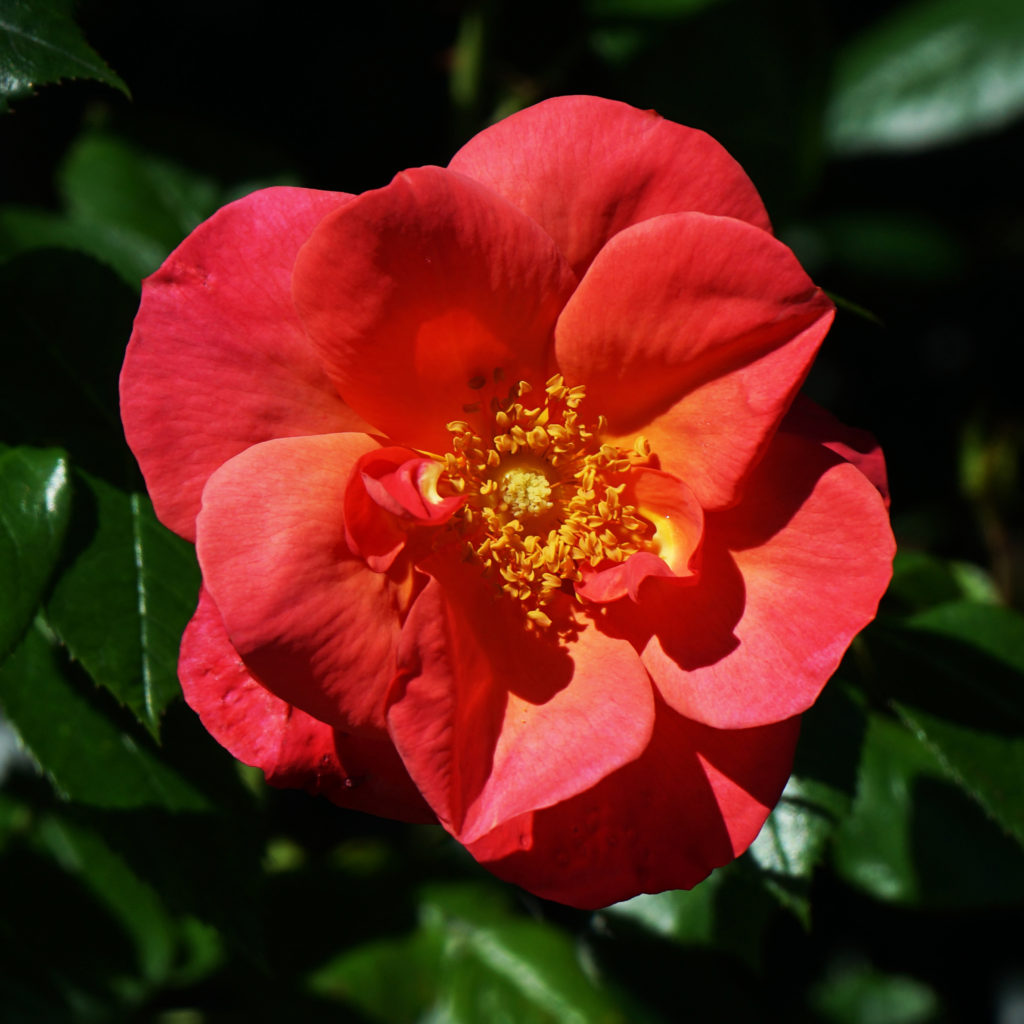
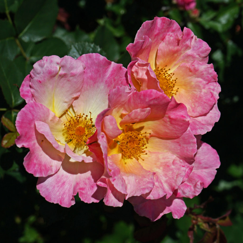
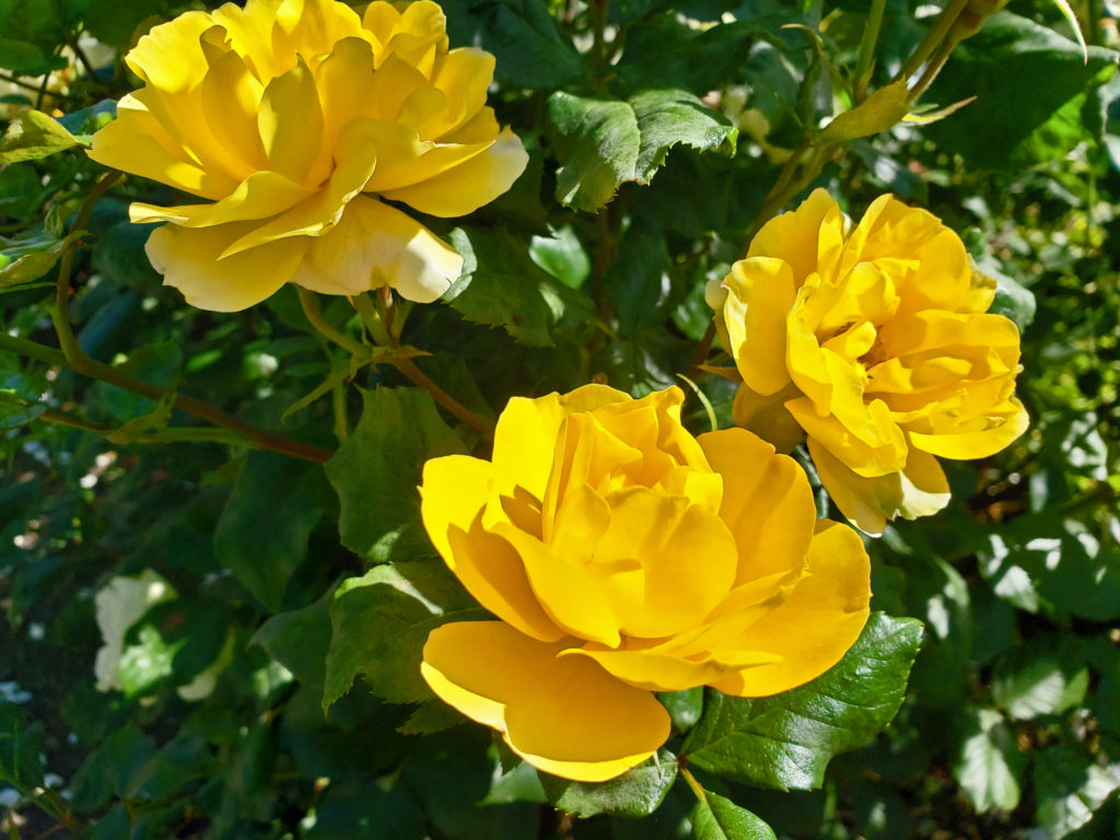 The International Rose Test Garden was conceived in 1915 as a safe haven during World War I for hybrid roses grown in Europe, and rose hybridists in England began sending roses to Portland in 1918. Over the years, other hybridists have sent roses to Portland from all over the world.
 The primary purpose of the Garden is to serve as a testing ground for new rose varieties. The Garden is home to a variety of formal rose evaluation programs in designated test beds. Rose companies send potential variety introductions for evaluation. How each variety performs determines if it makes it onto the
 Today, the
  The Rose Garden is located in Washington Park, west of Portland’s downtown. Admission is free. To get there from downtown, take Burnside Street west, turn left onto Tichner Drive, then right onto Kingston Avenue. The Rose Garden will be on your left, behind the public tennis courts. Parking is limited, though, and will be hard to find on a summer weekend. Come on a weekday, if possible, and come early in the day to have the best chance to find a spot. Or consider parking in the downtown area and taking the Washington Park
 If you want a souvenir of your visit, or information on growing roses, check out the
 Posted March 16, 2022
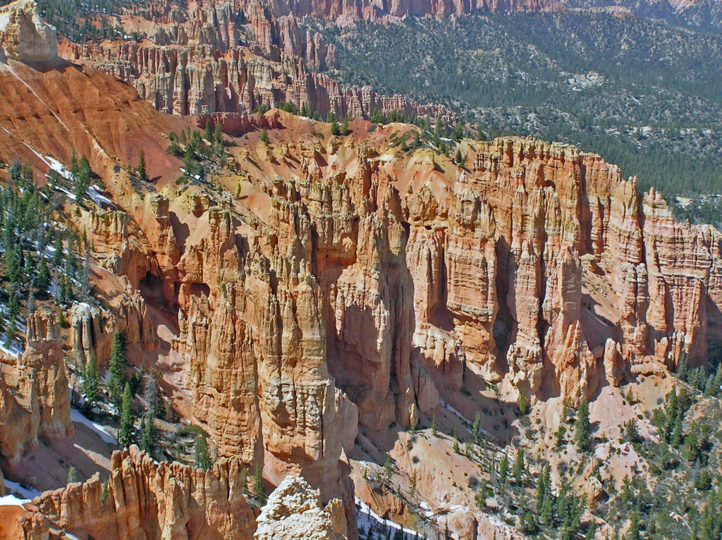
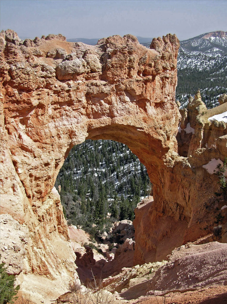

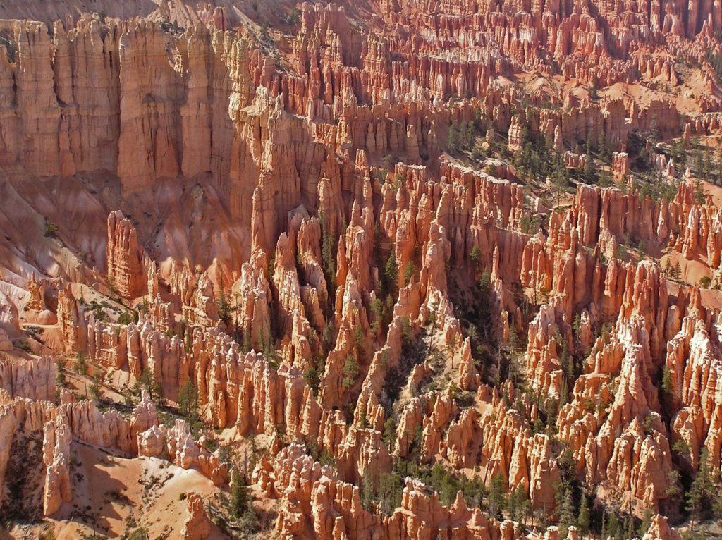
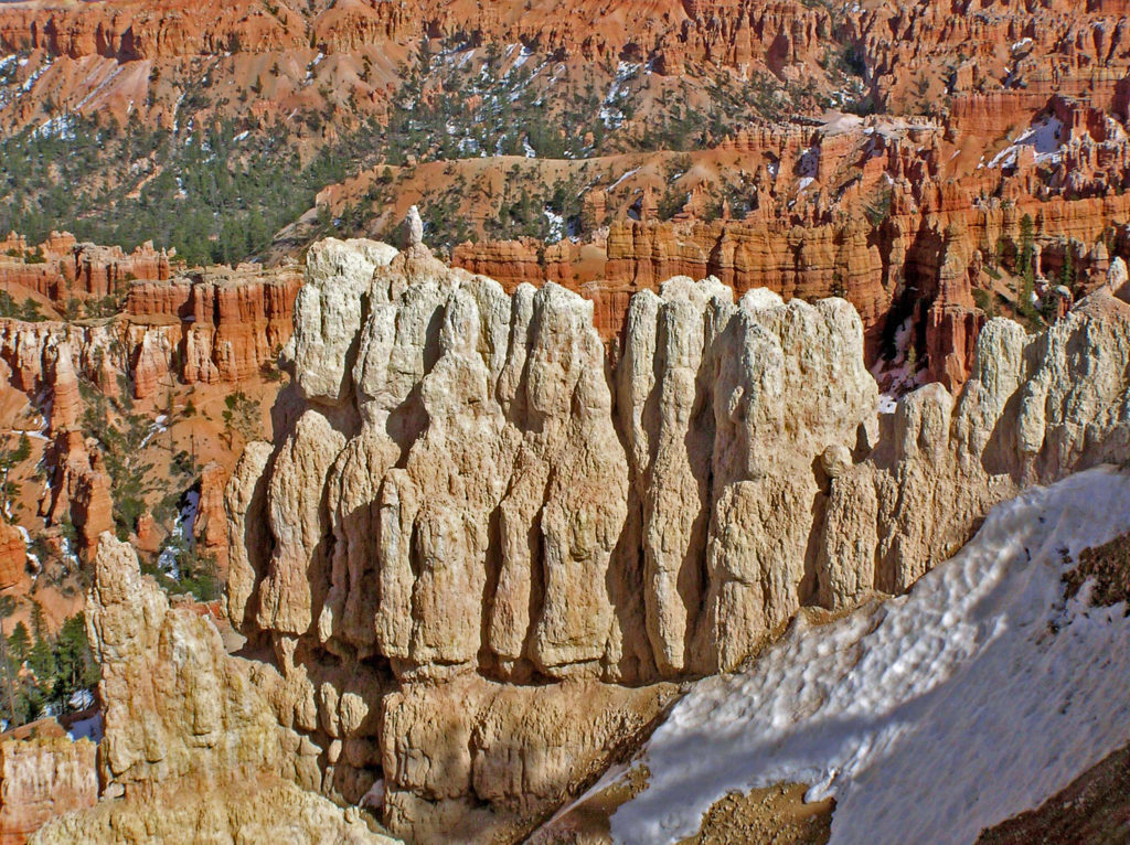
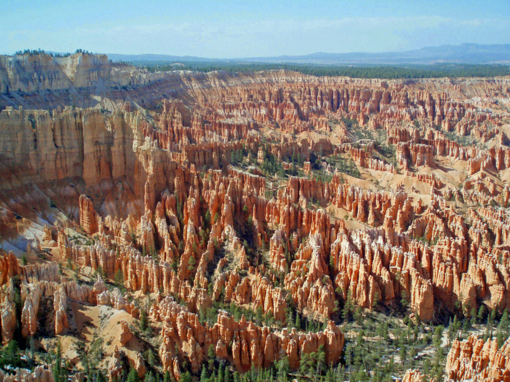
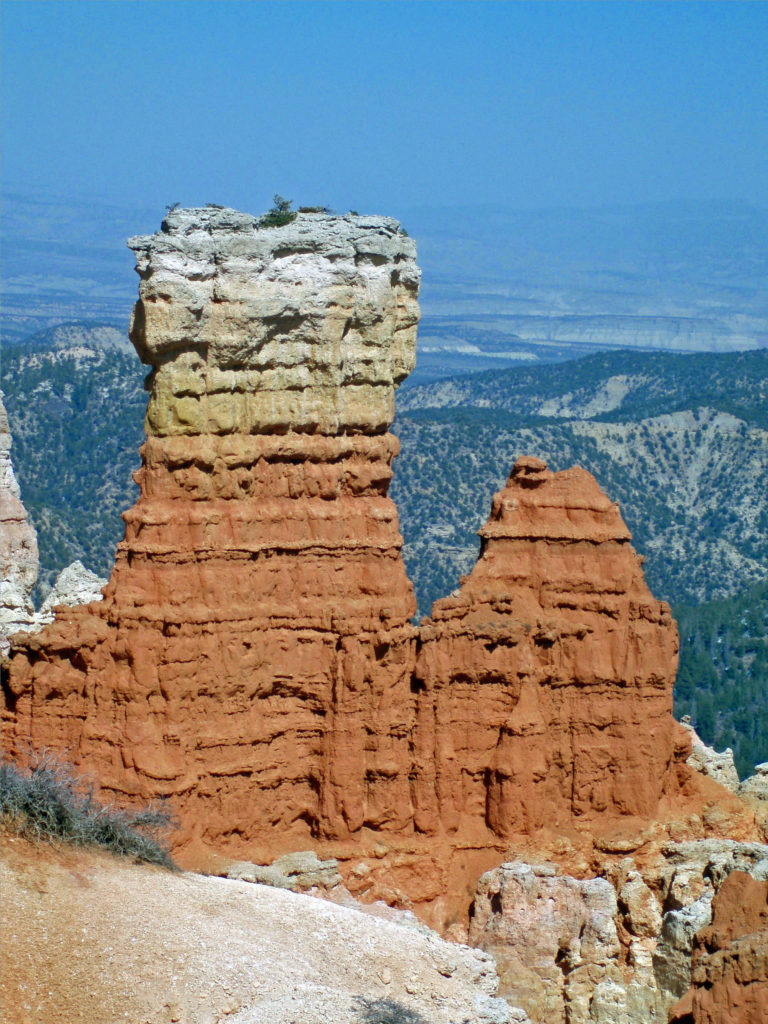
 The altitude also means that nights can be cold there even in the middle of summer. And in spring and fall, it’s not uncommon to encounter cold weather even in the middle of the day. (The photos here were taken in early May and, as you can see, there was still snow in places). Winters are cold, sometimes very, and can be snowy. Many of the trails are closed in winter. But winter also has its charms. Most of the best photos I’ve seen of Bryce Canyon have been taken when the hoodoos were covered in snow.
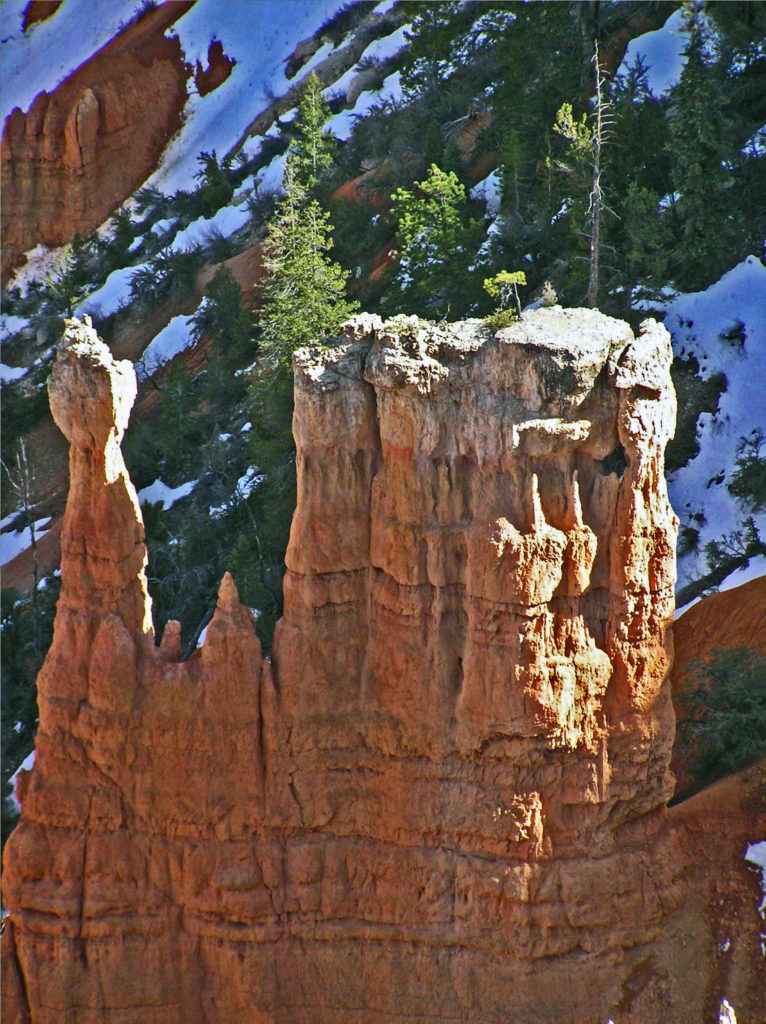

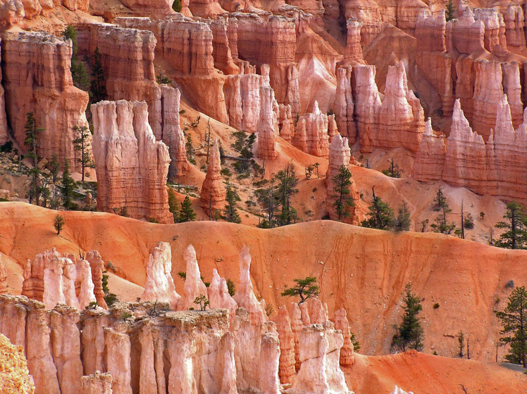
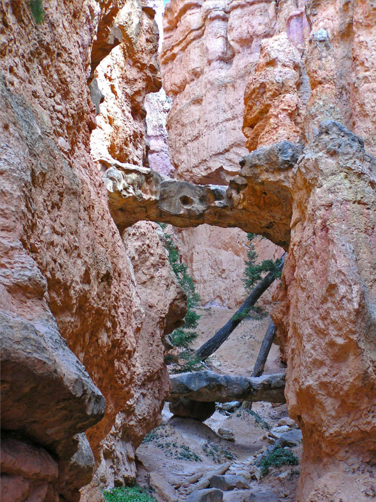
 The good news is that you don’t have to hike very far into the hoodoos to get away from the crowds. There are a number of loop and out-and-back trails that will get you away from the crowds, some of them fairly easy hikes. The rim trail along the edge of the Bryce Amphitheater can also get you away from the worst of the crowds without actually descending into the hoodoos. And if you don’t want to (or can’t) hike into the amphitheaters, there are mule rides available. Check at the visitor center when you arrive. Some of the trails in the park are also paved and wheelchair accessible.
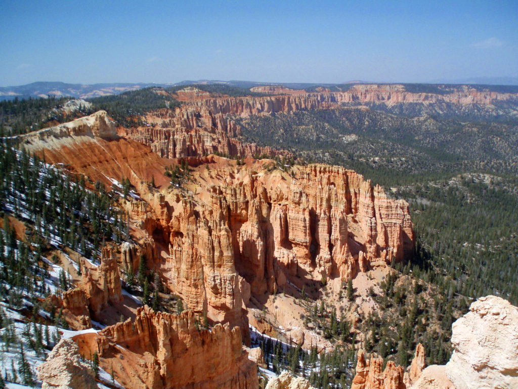
 The only road in the park (other than a section of Utah Hwy 12 that cuts across the far northern end of the park) runs north to south along the top of the Paunsaugunt Plateau from the park entrance to Yovimpa Point and Rainbow Point at the southern end of the plateau. Because the park receives so many visitors in the summer, traffic congestion can be a problem. Consider parking your car at the visitor center or the lodge and taking the free shuttle that runs the length of the park. The buses run frequently and you can hop off at any of the viewpoints and catch a later shuttle if you want to do some hiking or just sit and enjoy the scenery for awhile. Taking the shuttle also makes point to point hikes possible without having two cars.
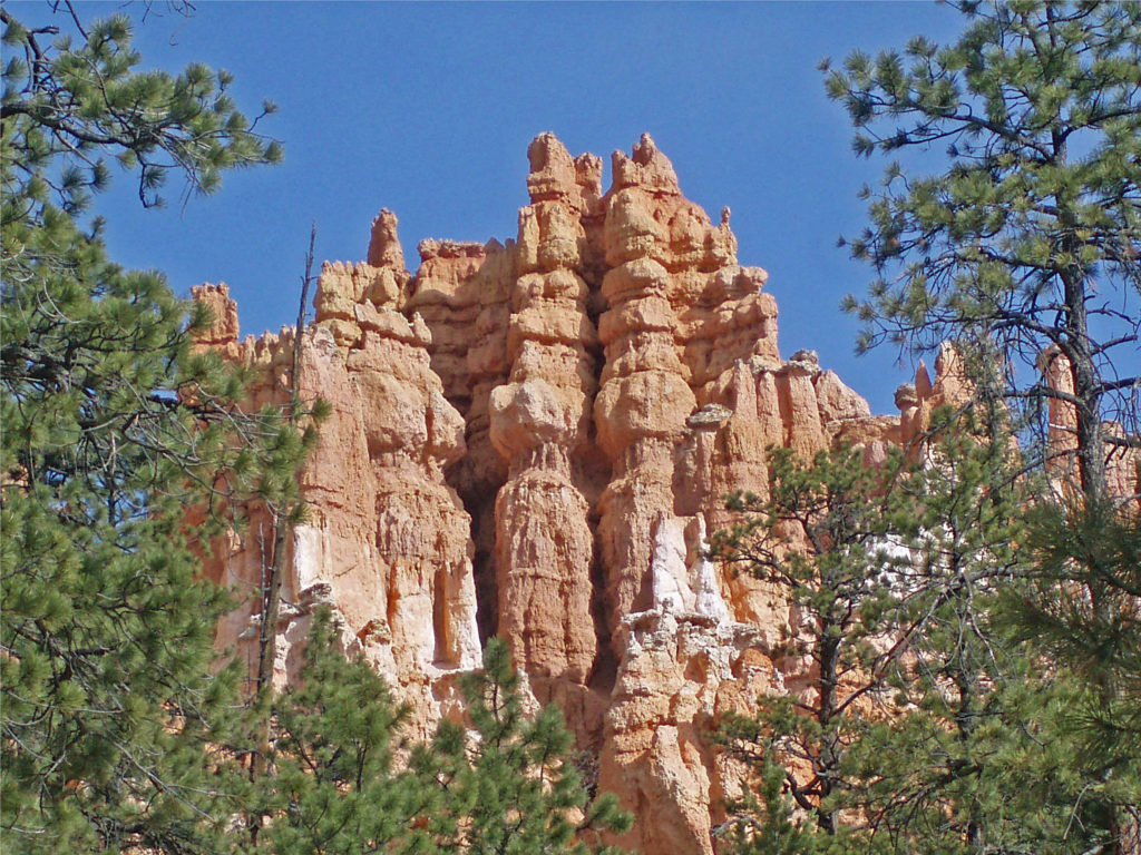 Besides being a spectacularly beautiful place during the day, Bryce Canyon is also great place to star gaze. It’s far from any light polluting urban areas, and the night skies in the park can be incredible. The park offers both astronomy programs and guided full moon hikes. Check the Bryce Canyon National Park
  The park website is a good place to begin when planning a trip to Bryce. The
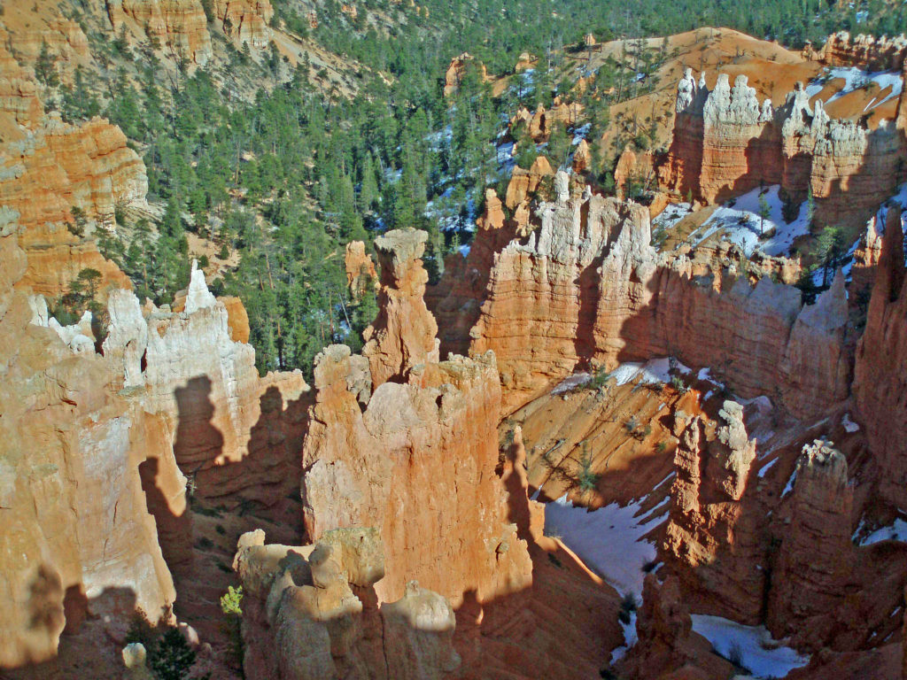
 The Covid-19 pandemic is still with us as I write this (Feb. 2022), but the park is open with only a few restrictions. Masks are still required for everyone, regardless of vaccination status, in all NPS buildings, crowded outdoor spaces, and all forms of enclosed public transportation. But there are no other restrictions and all facilities are open. Additional details are available on the park website and at
  If you’re not ready to begin traveling again, though, here are links to a short video by
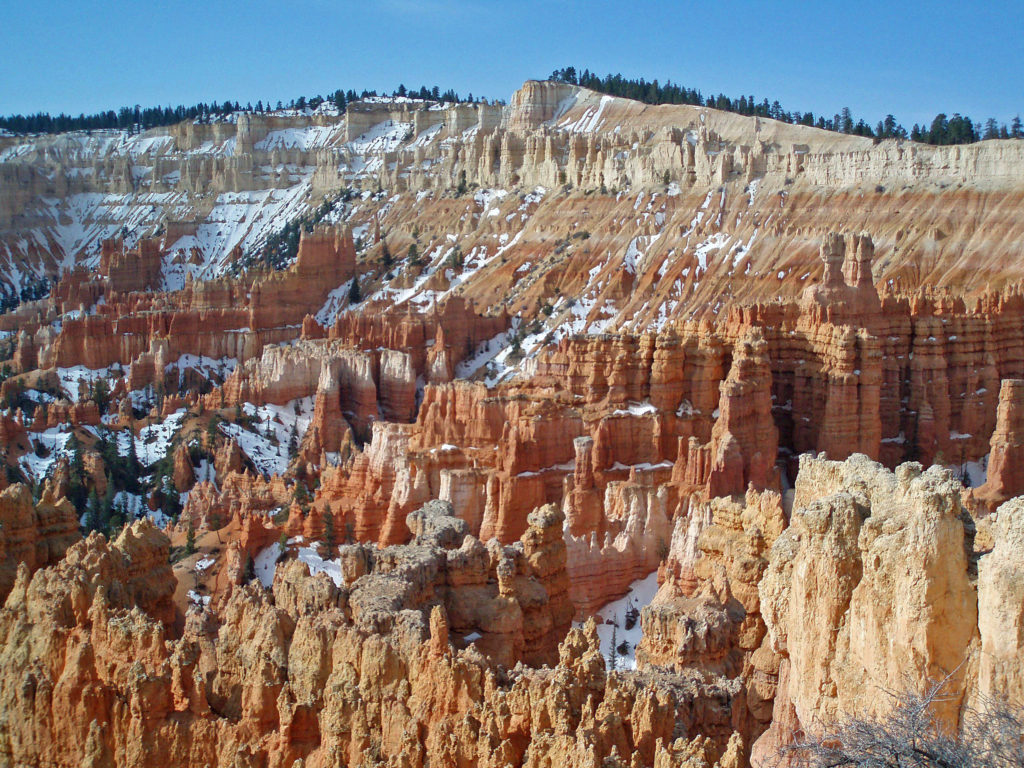
 Originally posted March 20, 2020. Updated and re-posted February 19, 2022.
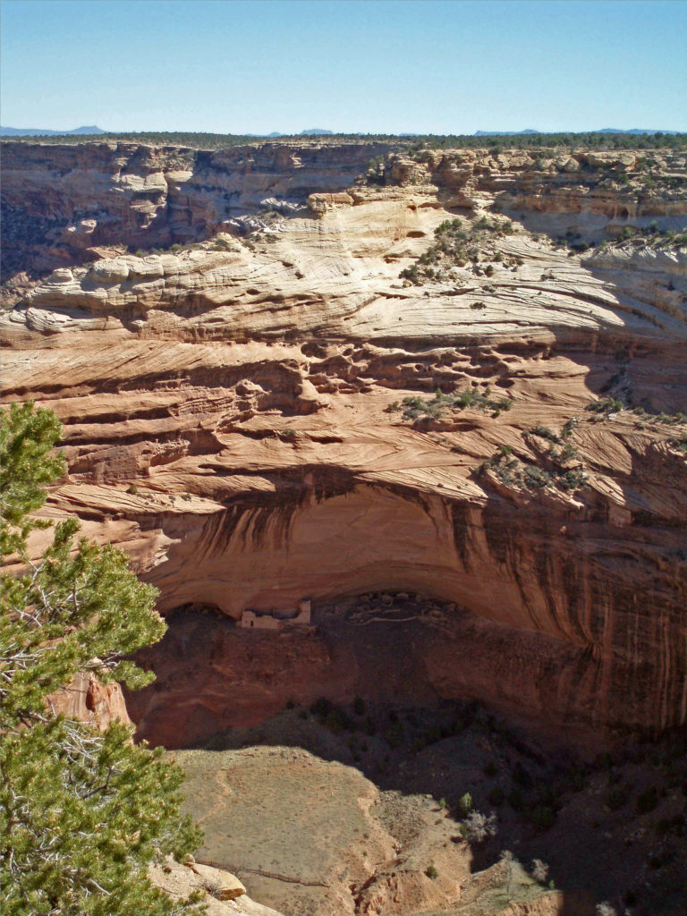
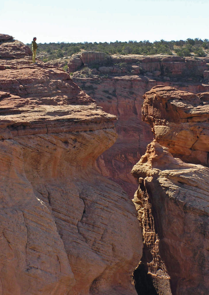
 The name Chelly comes from the Spanish spelling of the Navajo name for canyon, tseyi, which translates literally as “within the rock.” Over time the Spanish pronunciation, “chay-ee”, has evolved into the current pronunciation, “shay”.
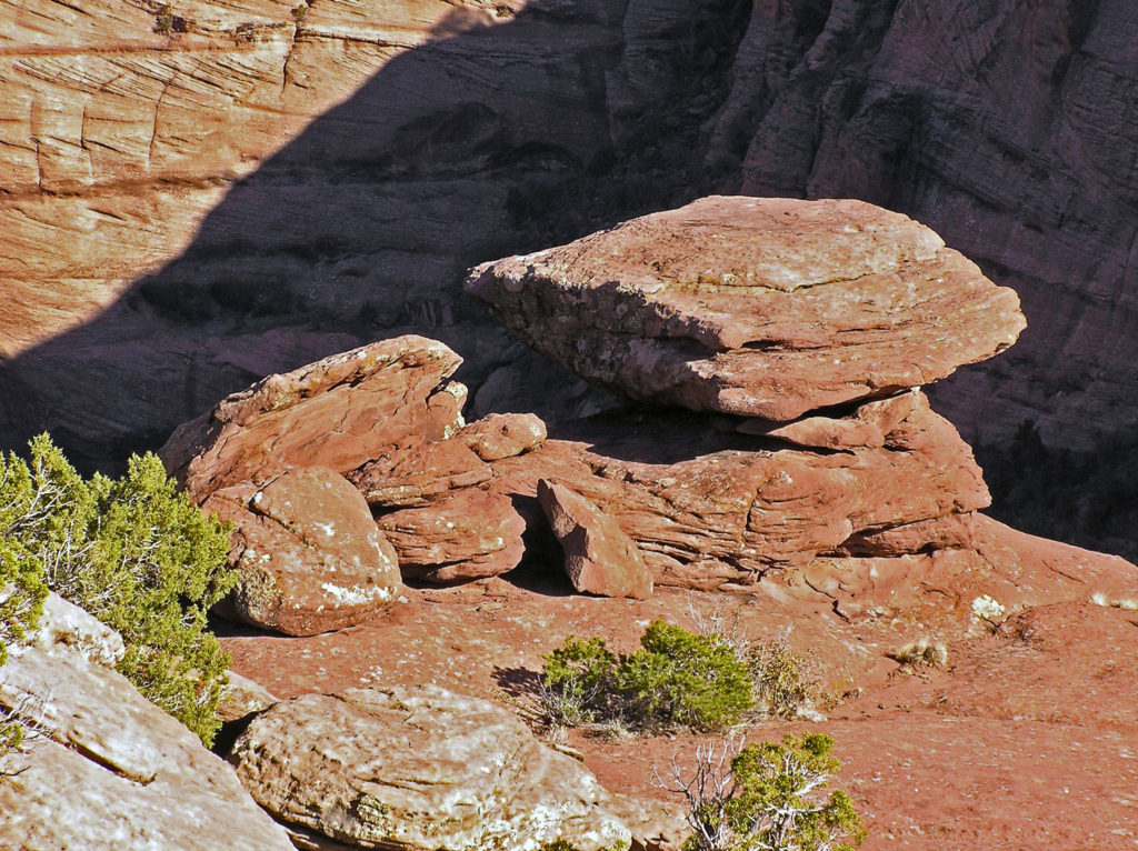
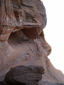
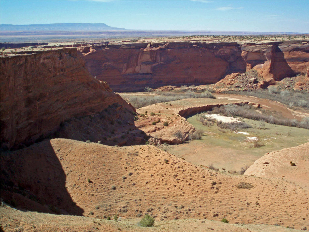
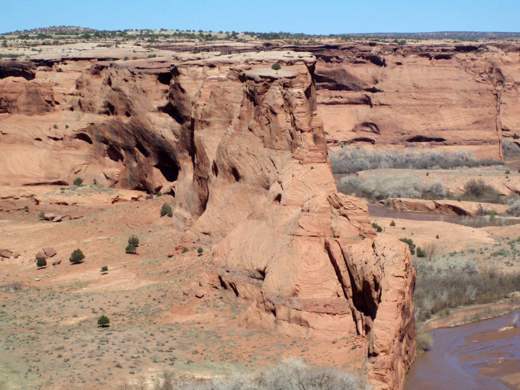
 Located a couple of miles east of Chinle, Arizona, the monument’s Welcome Center is a good place to start your visit. Pick up a free map of the monument and watch a short film about the monument to orient yourself. The park rangers can answer any questions you have about tours of the canyon, accommodations, the canyon’s history or geology, what plants and animals you’ll find in the park, or any other questions you might have. There is also a gift shop where souvenirs of your visit can be purchased.
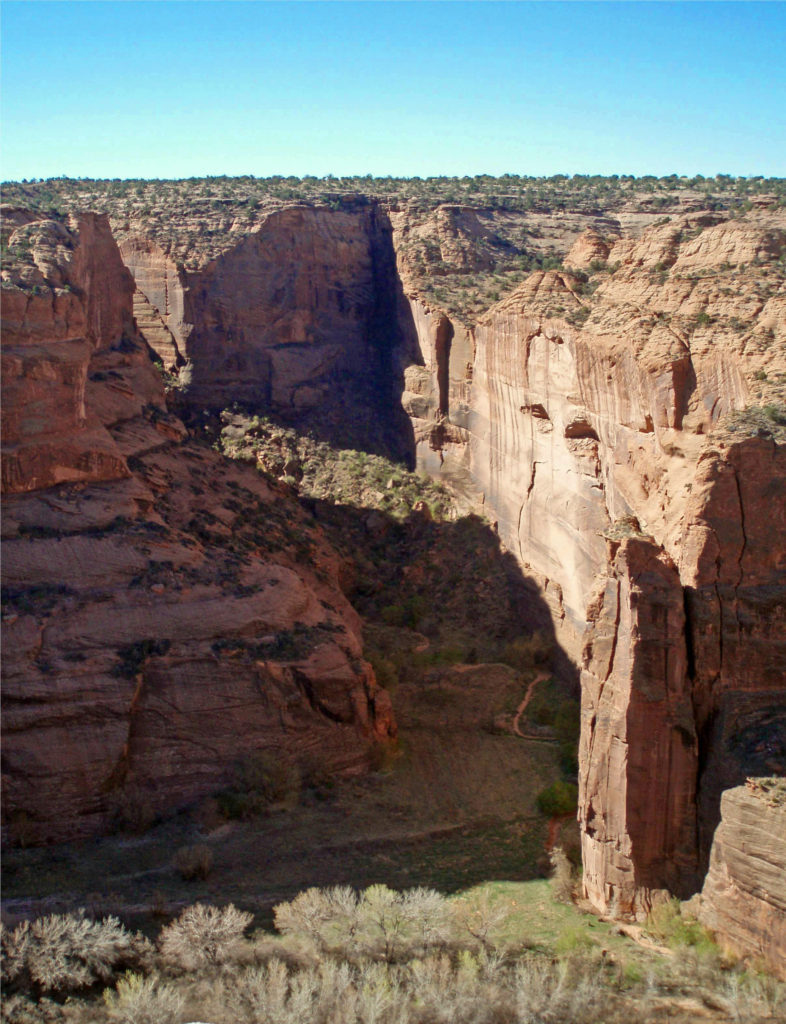
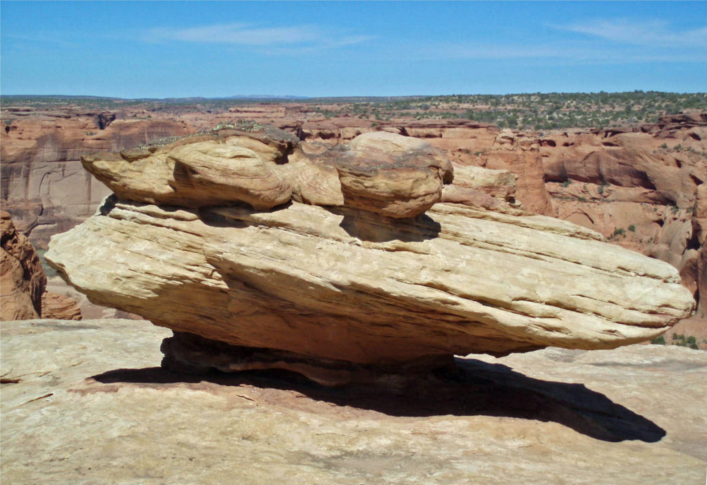
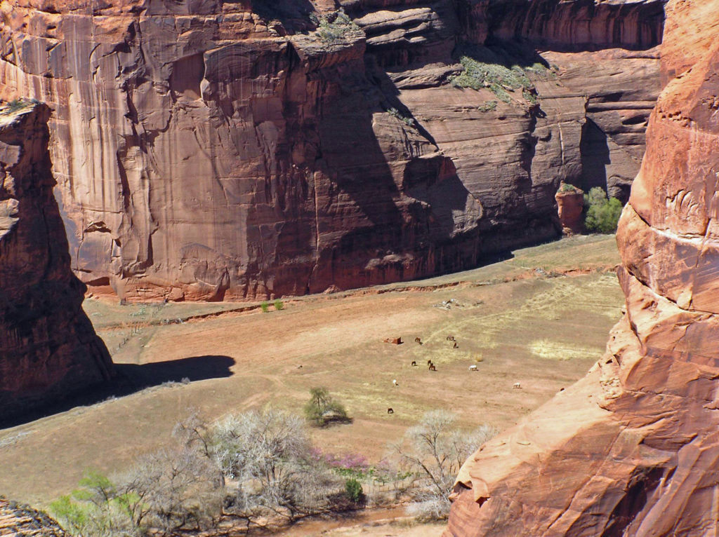
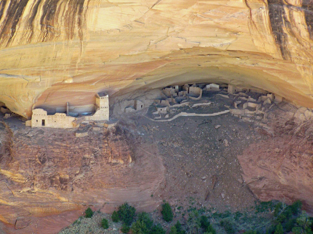
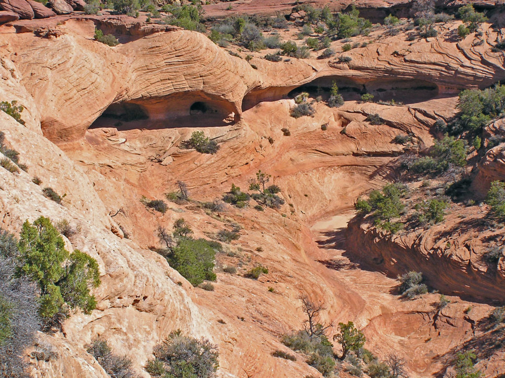
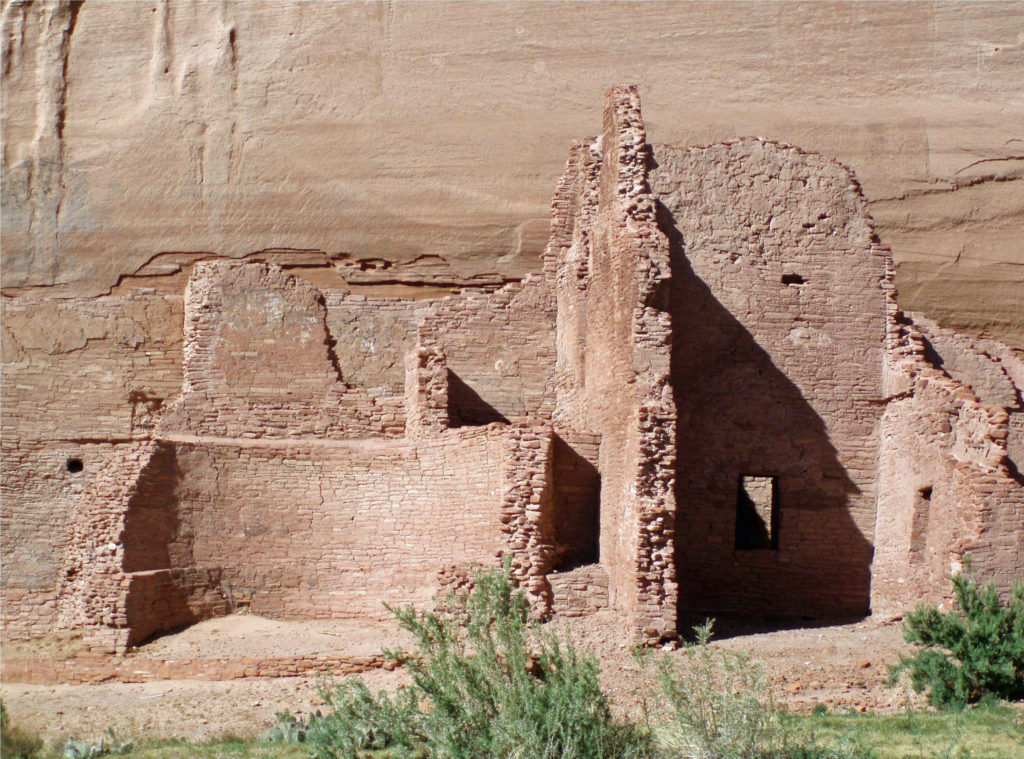
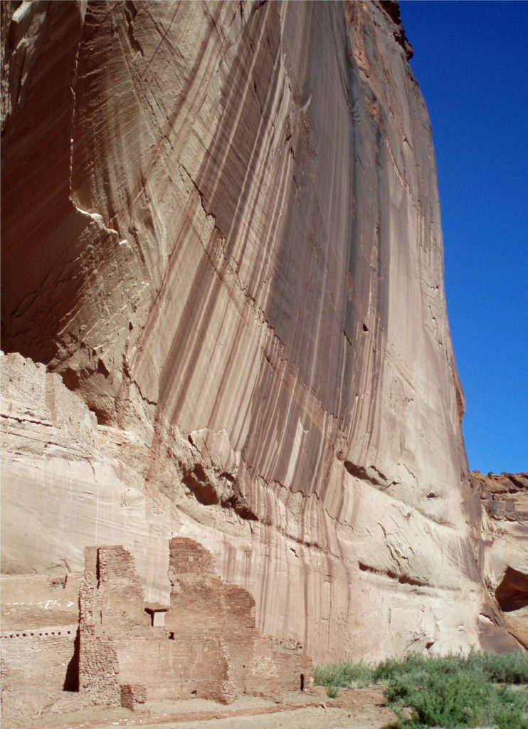
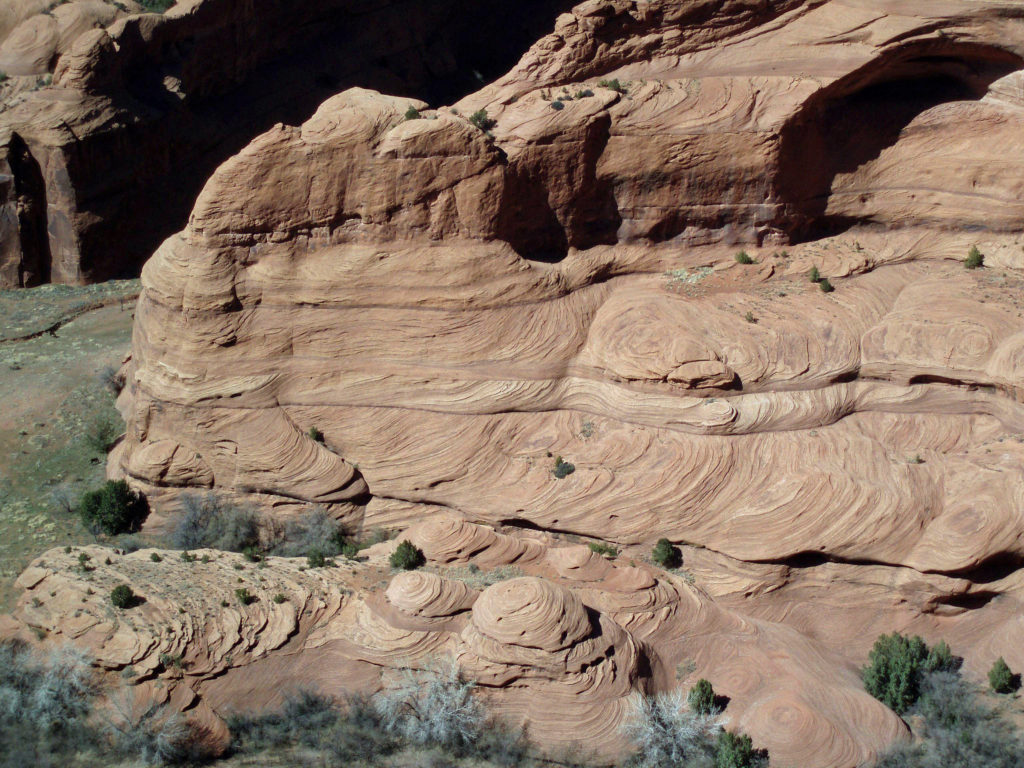
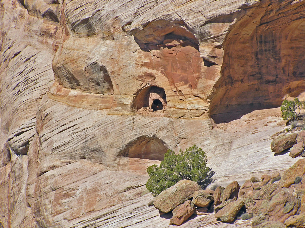
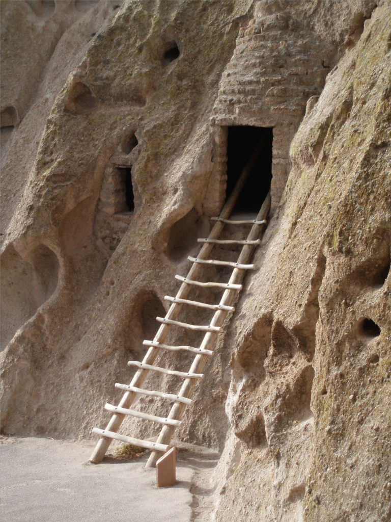
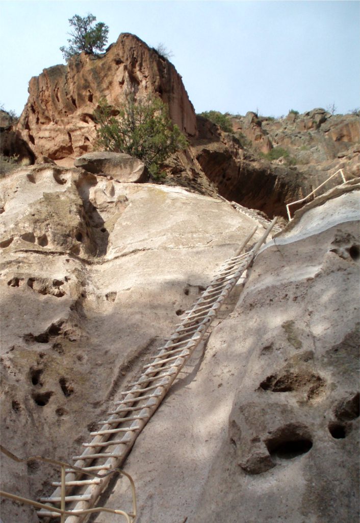
 Canyon de Chelly is worth a visit just for the spectacular scenery it affords, but it is also an important cultural and historic site. The canyon is one of the longest continuously inhabited places in North America. The Ancestral Puebloans (also known as the Anasazi) first settled in the area some 4,000 years ago. The canyon was later occupied by the Hopi, descendents of the Ancestral Puebloans, and more recently by the Navaho.
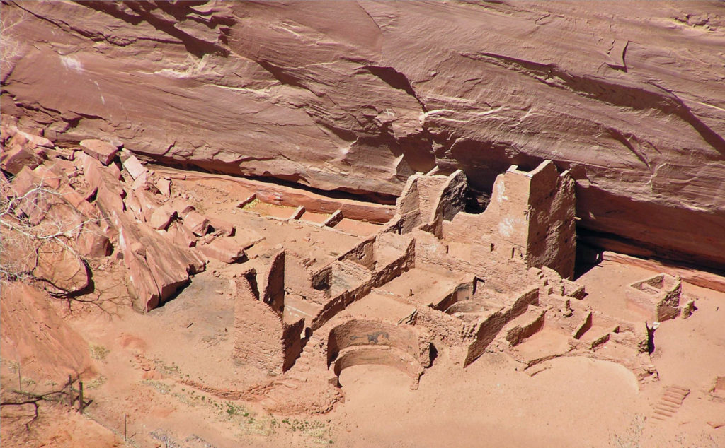
 Originally posted May 14, 2020. Updated and re-posted February 14, 2022.
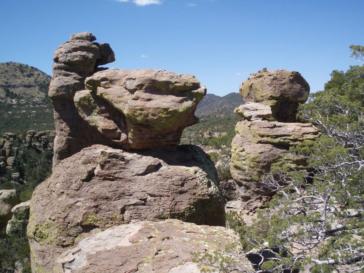

 Originally posted April 28, 2020. Edited, updated, and re-posted February 5, 2022
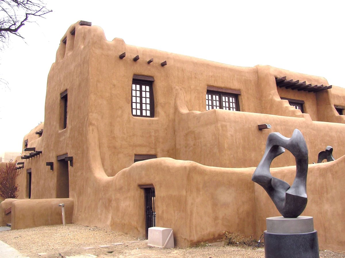
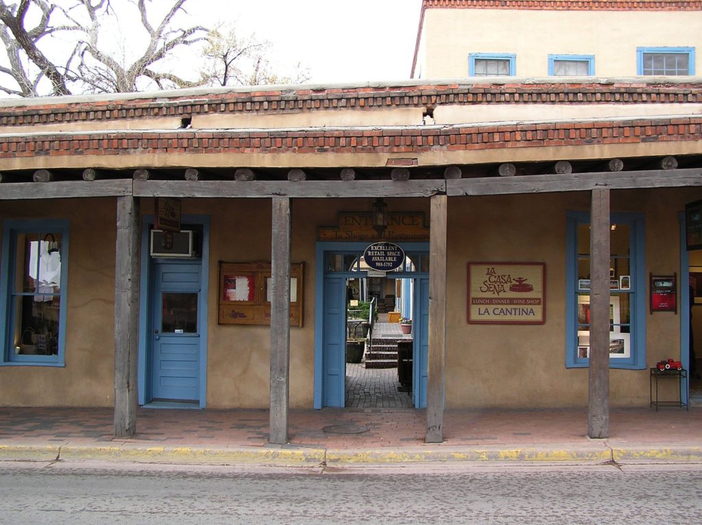
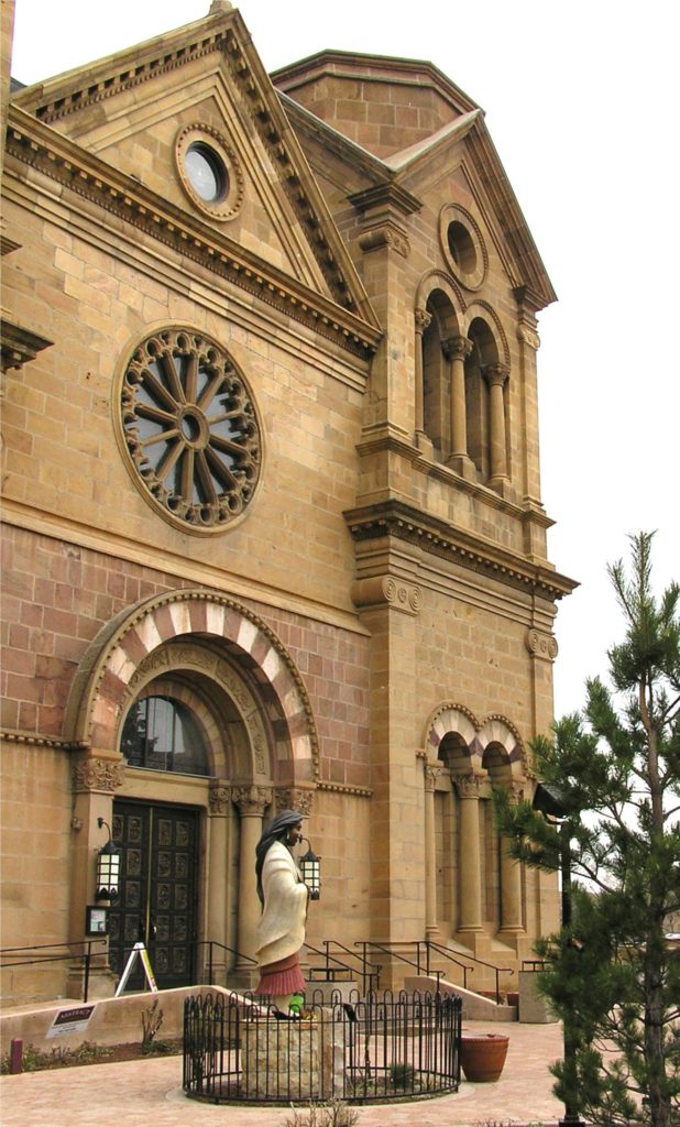
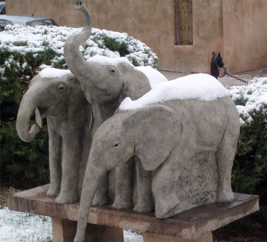 The Plaza is an ideal place to begin your exploration of Santa Fe, particularly if you are an art lover, as my wife and I are. The New Mexico Museum of Art and the
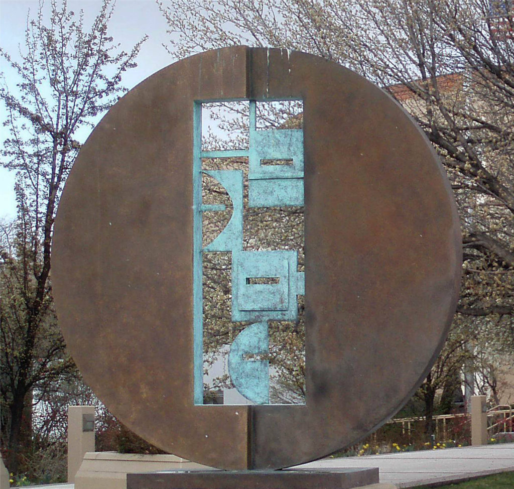
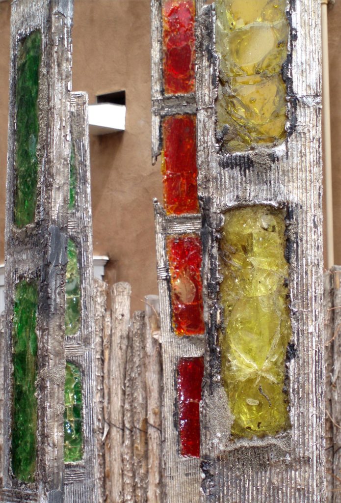
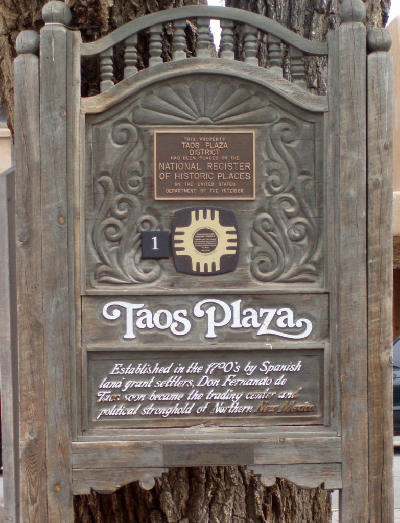
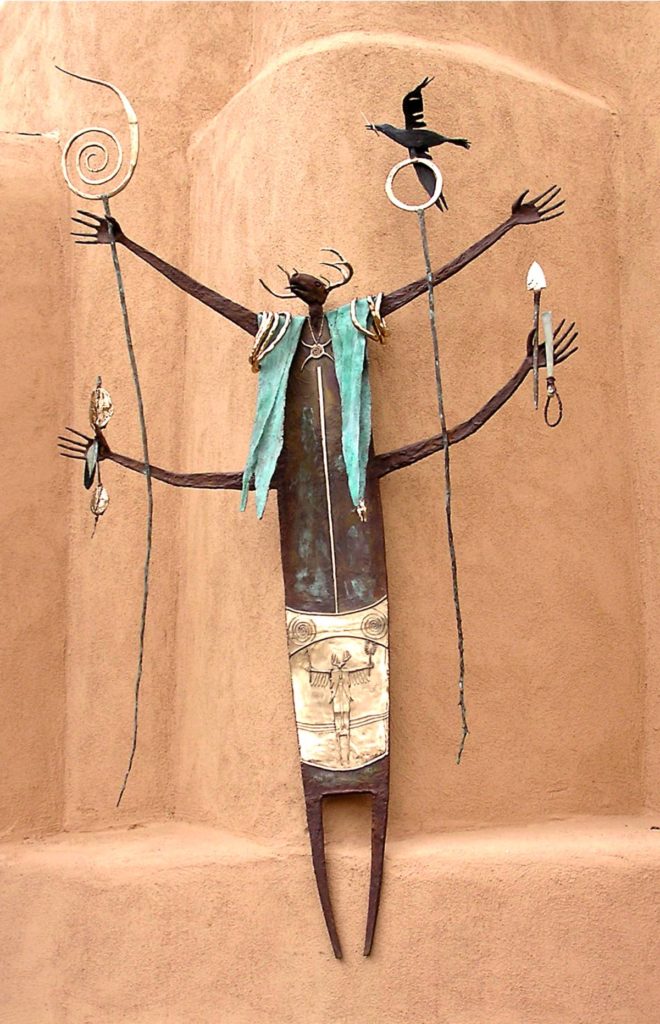
 Puebloan history and culture is an even more pronounced component of modern day Taos than it is in Santa Fe. The nearby
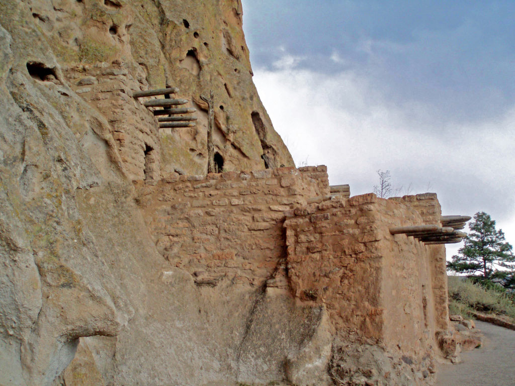


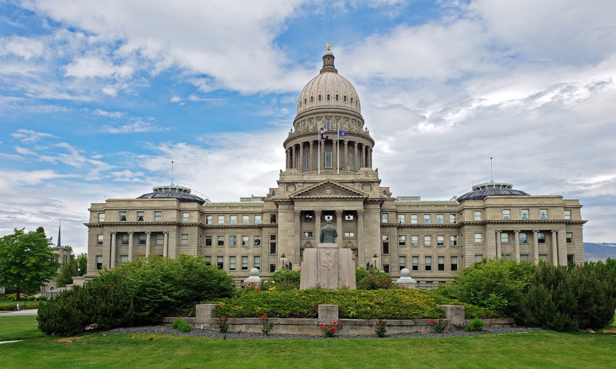
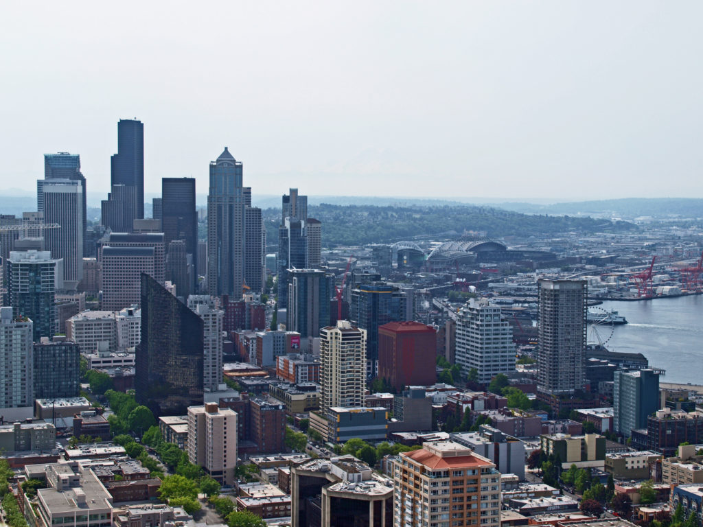
 Boise is Idaho’s capital and largest city, with a metropolitan area population of around 750,000. It’s large enough to have many of the amenities of a big city, but small enough to still retain something of a small town feel. And it’s a surprisingly modern and cosmopolitan city, blending elements of both West Coast and Rocky Mountain cultures.


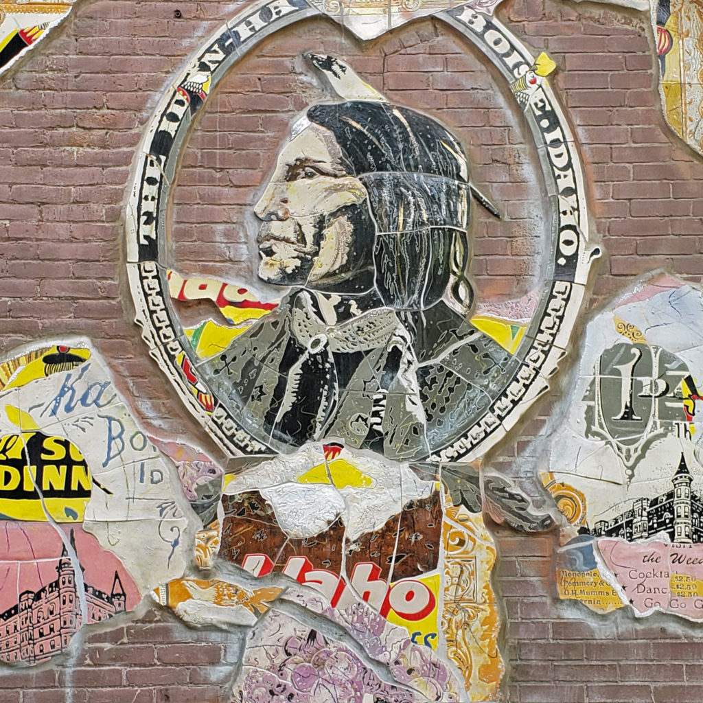
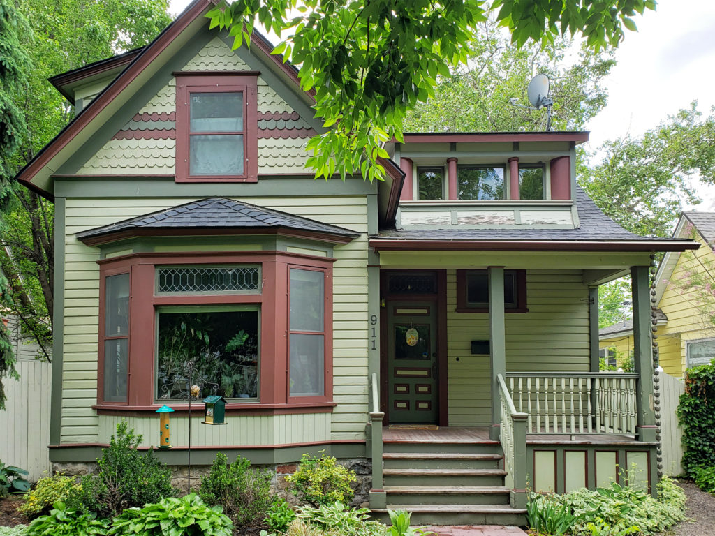
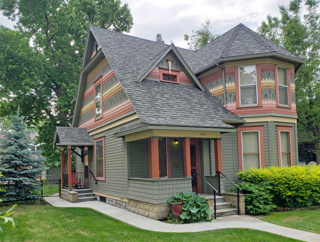 Many fine Victorian houses and architecturally interesting buildings can also be found in the downtown area.
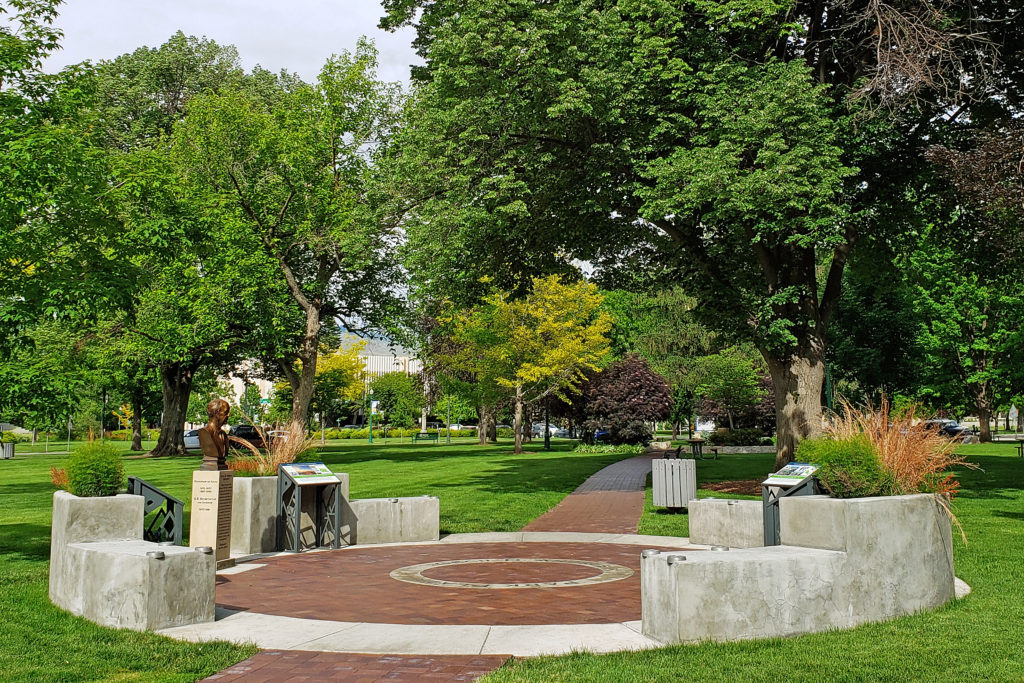
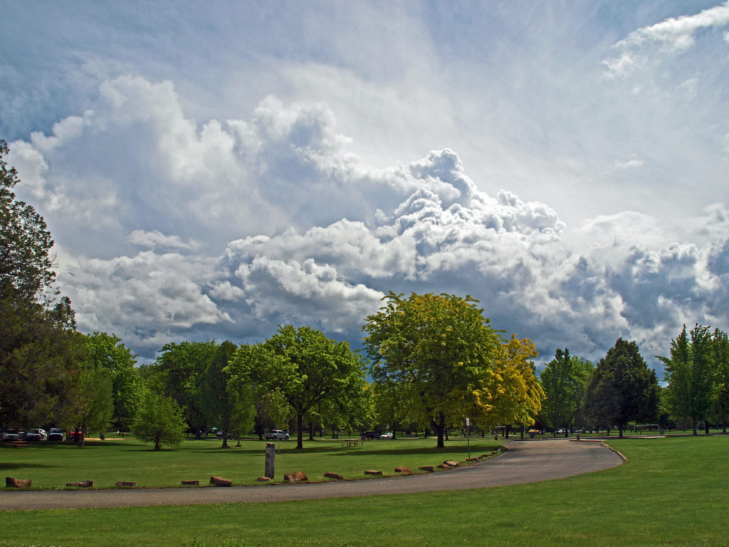
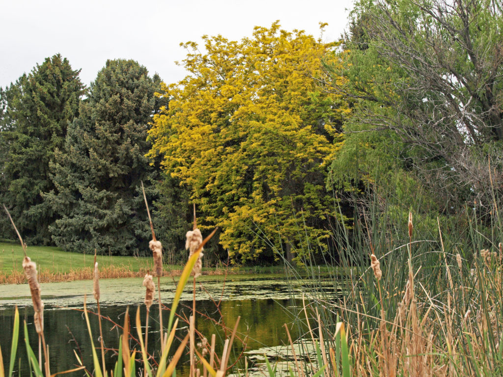
 Anne Morrison Memorial Park on the south bank of the river, and the Julia Davis Park, just south of the downtown area on the north bank, are large urban parks with a variety of open spaces and tree lined paths along the river.
 Boise is definitely worth visiting, and southwest Idaho has many truly unique, beautiful, and enjoyable places to visit, all within a short drive of each other. For more on those, check out my other Exploring Southwest Idaho posts:
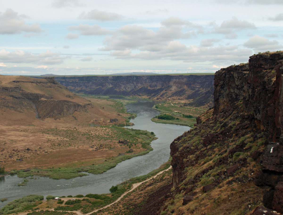
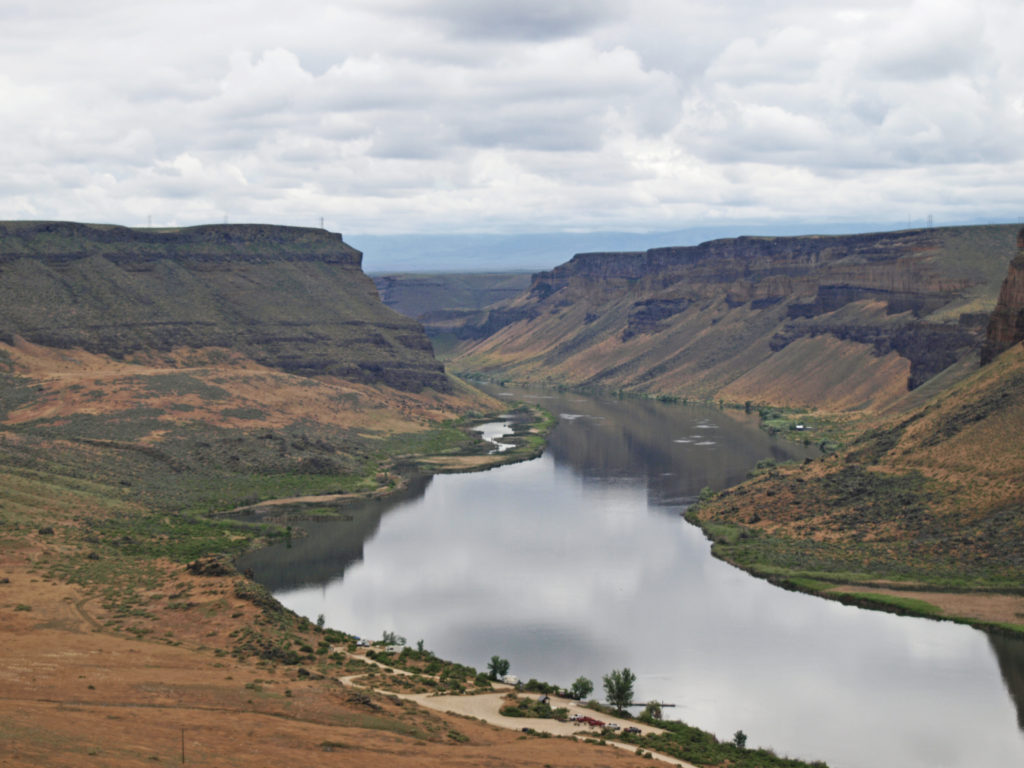
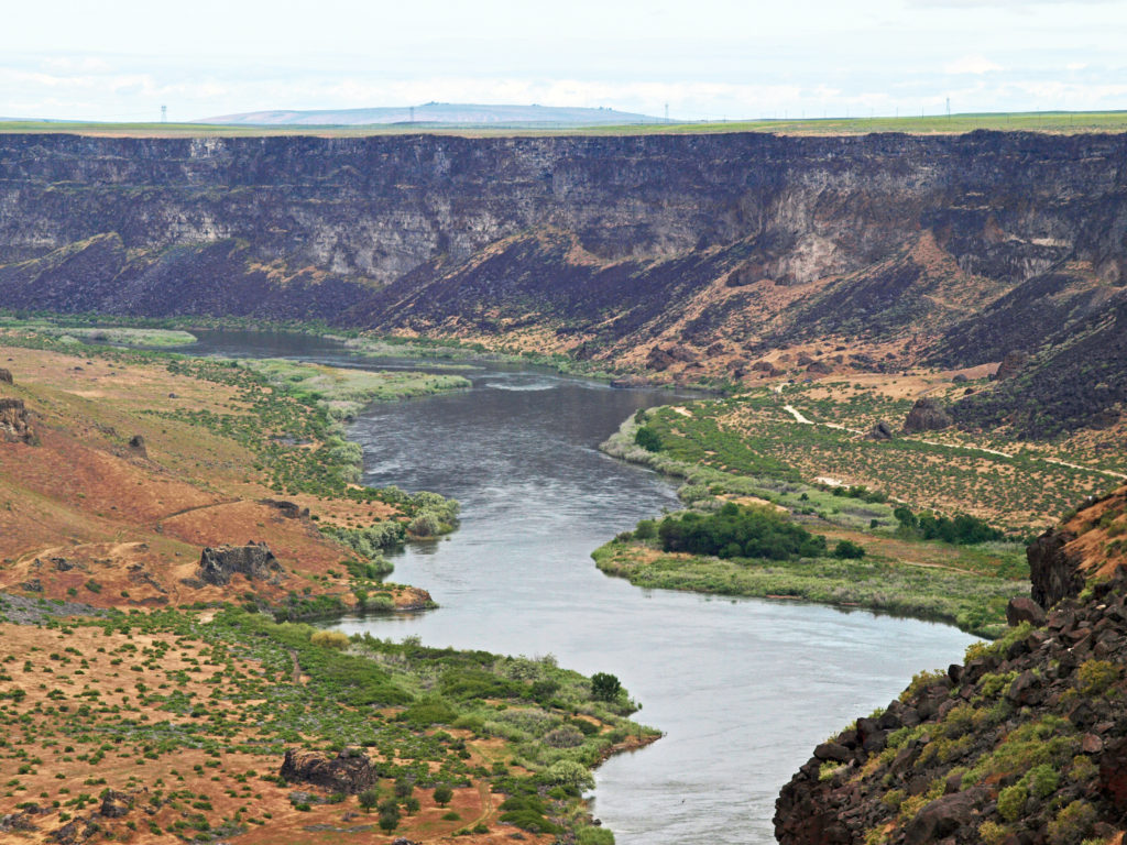
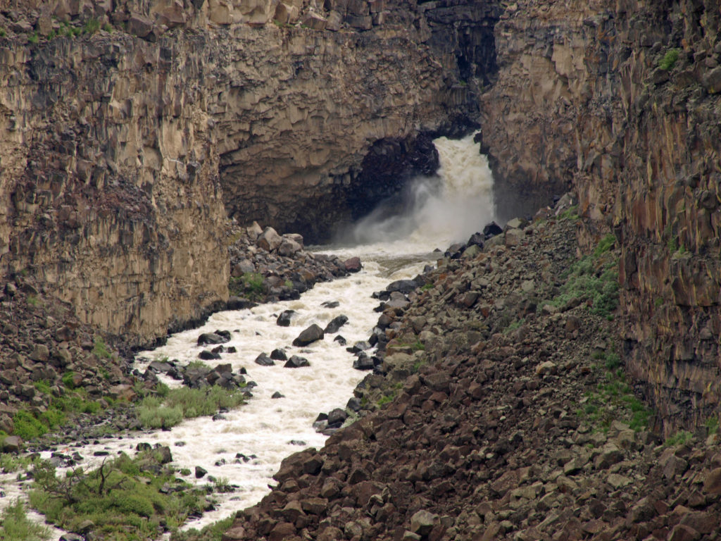
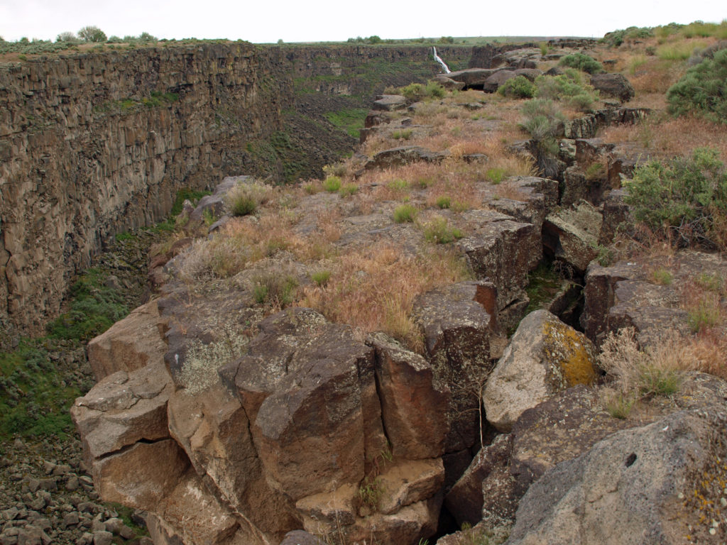
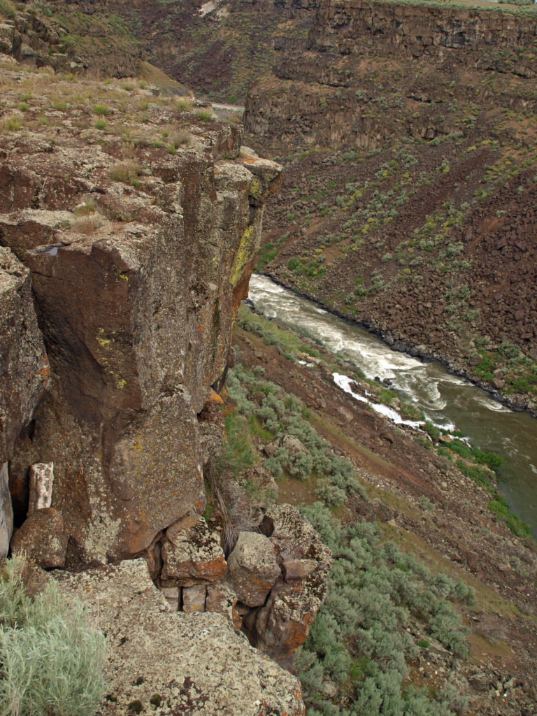
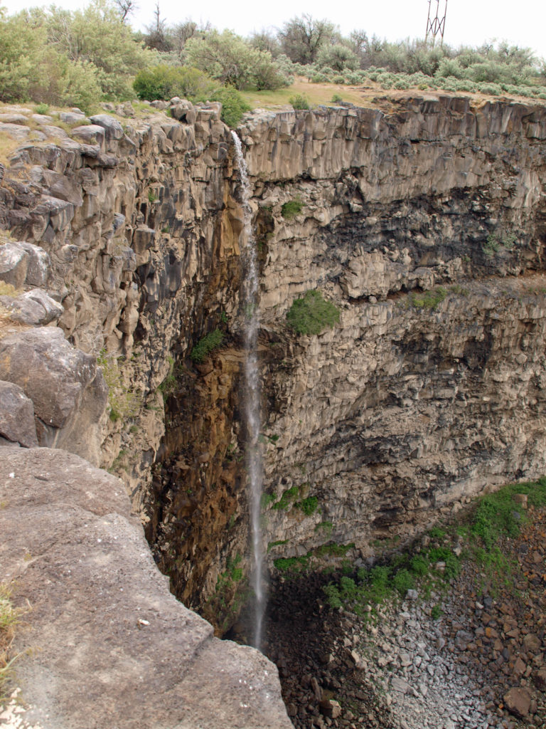
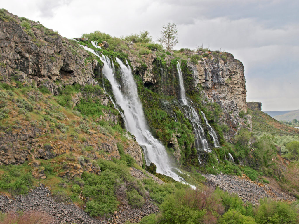
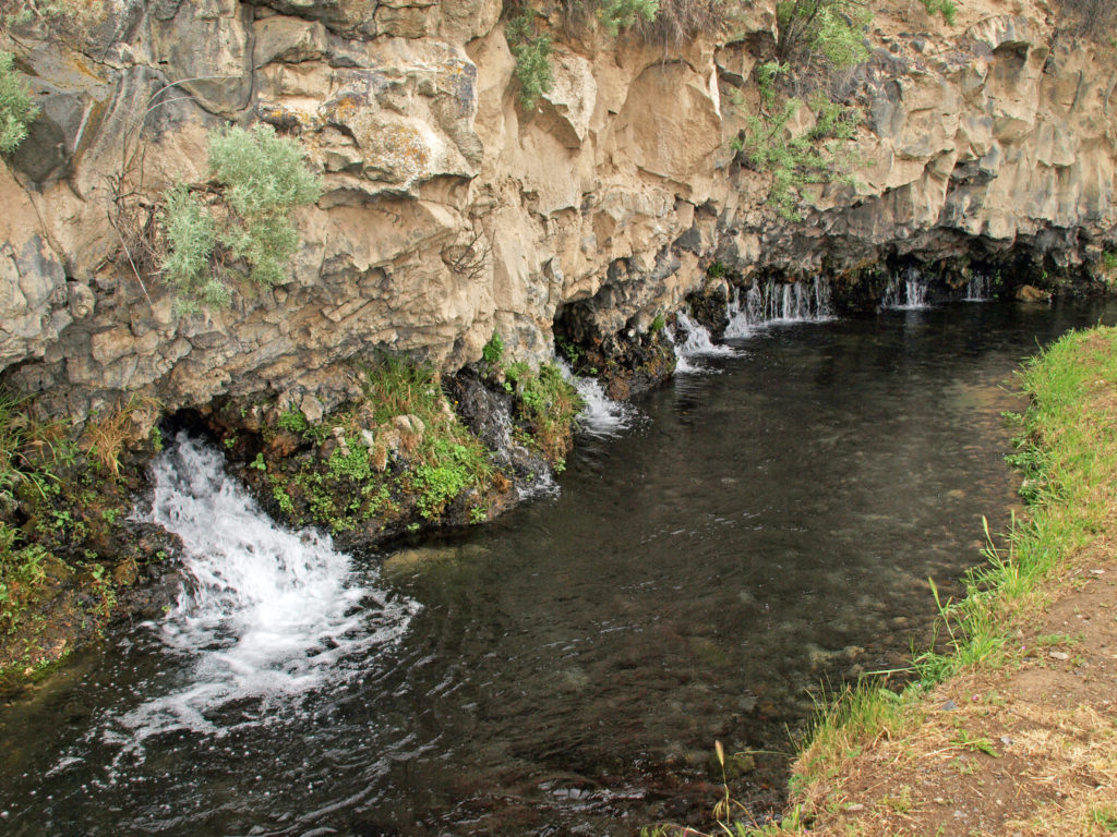
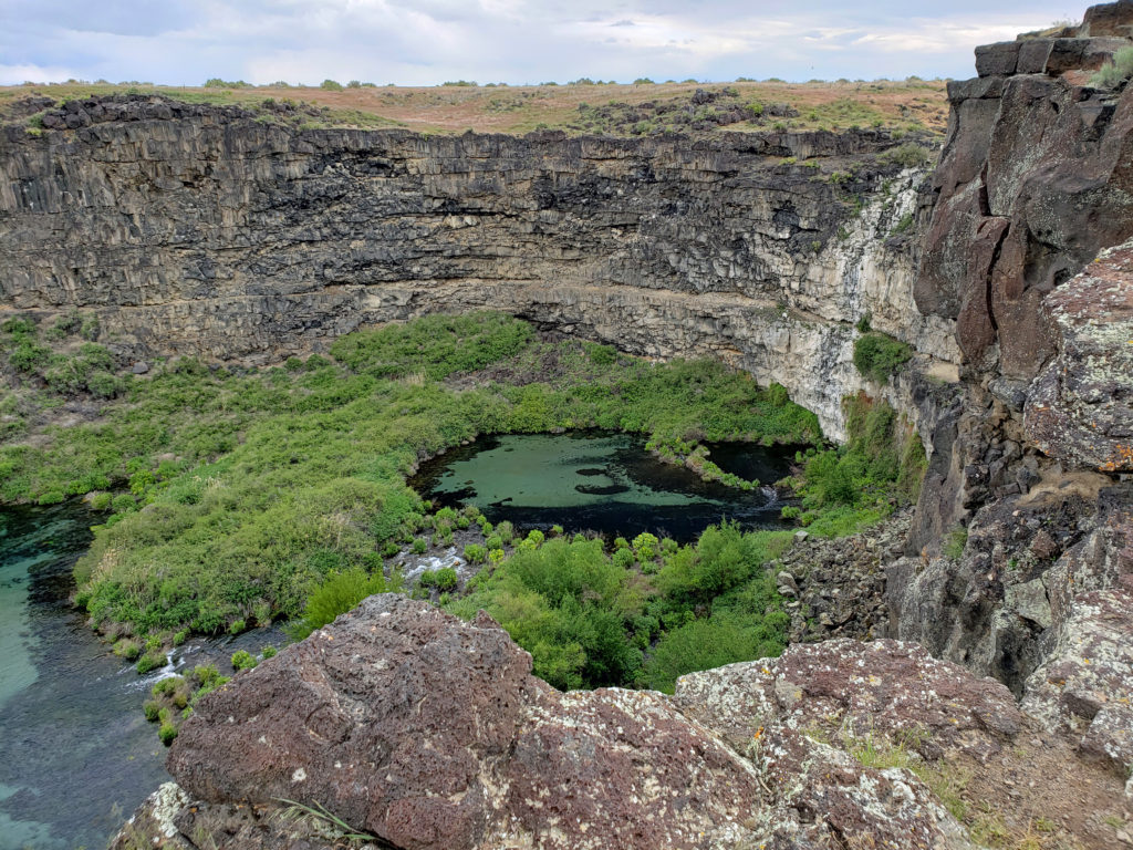
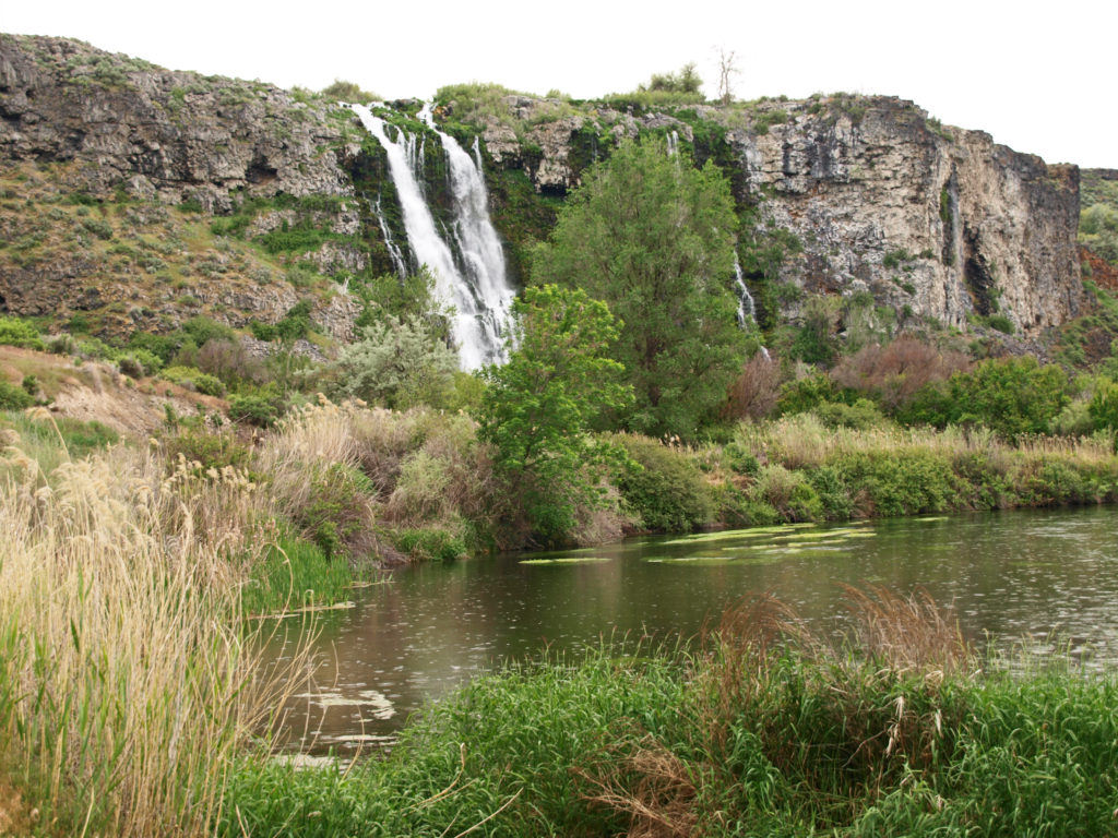
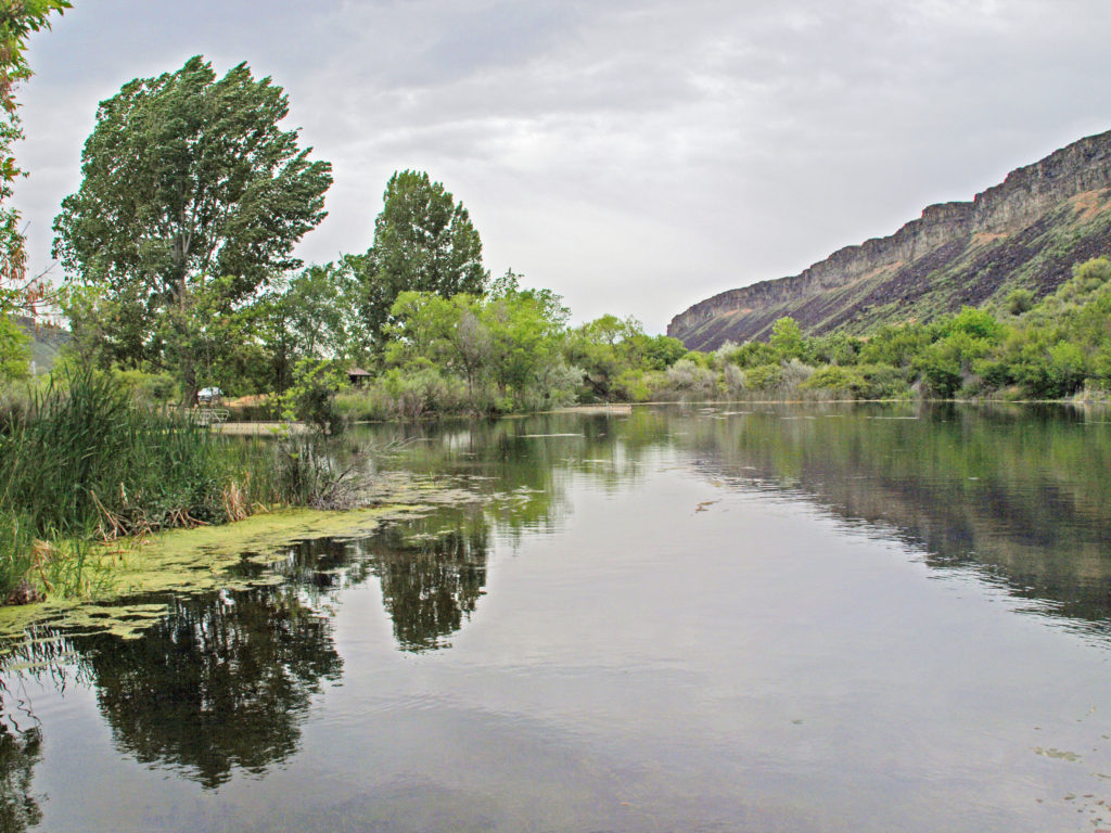
 The falls are long gone, flooded by construction of Swan Falls Dam in the early 1900s. Swan Falls was the first hydroelectric project on the Snake River. A fish ladder was constructed, but was largely ineffective, and the dam effectively blocked salmon and steelhead passage. That was a different era, and the fish ladder was never made functional. Newer dams were built both upstream and downstream with no fish ladders at all. Electricity was the point. The fish didn’t matter. But it’s a historically interesting and beautiful area, so it’s worth a visit even if, like me, you’d rather see the dam gone.
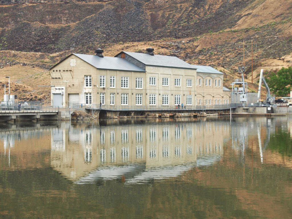
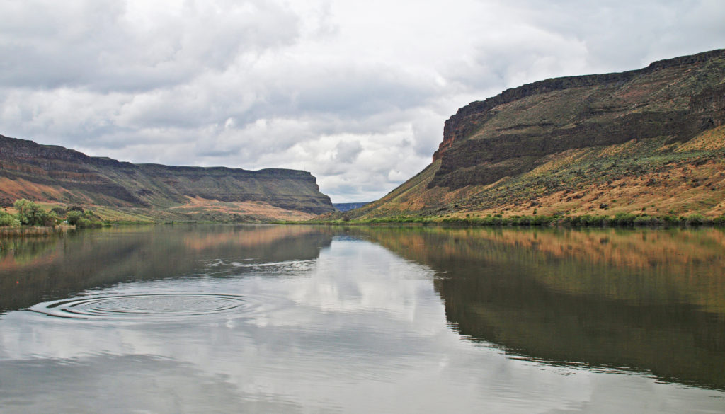
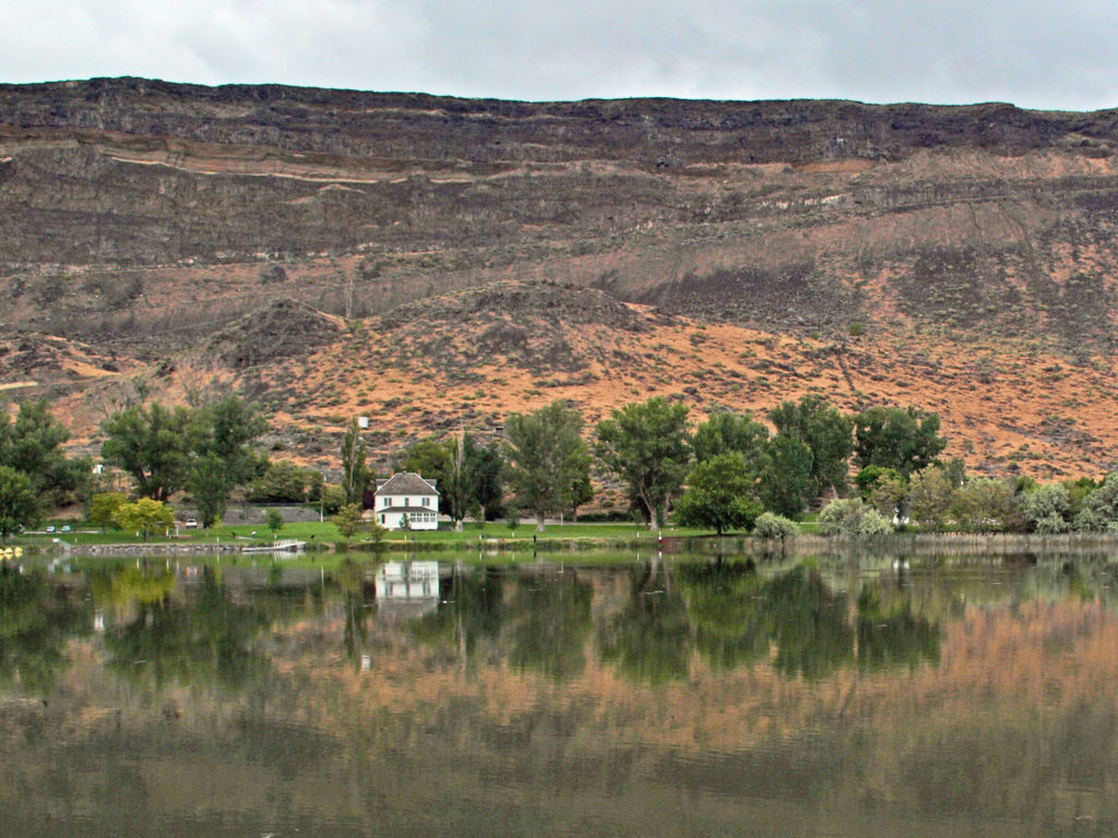
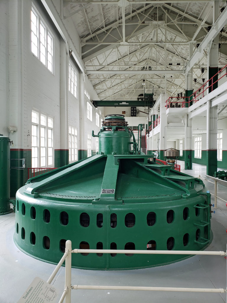 A new power generation facility was constructed at Swan Falls Dam in the 1990s. The dam’s original power plant is now open to the public, with some of the century-old generators and other equipment still in place. There are also displays depicting the history of the area, and the construction and operation of the dam. We walked across the dam after visiting the power house museum, then drove down the canyon a ways. The road was too rough for the car, though, and we turned around and drove back up to Dedication Point, and then on to Celebration Park.
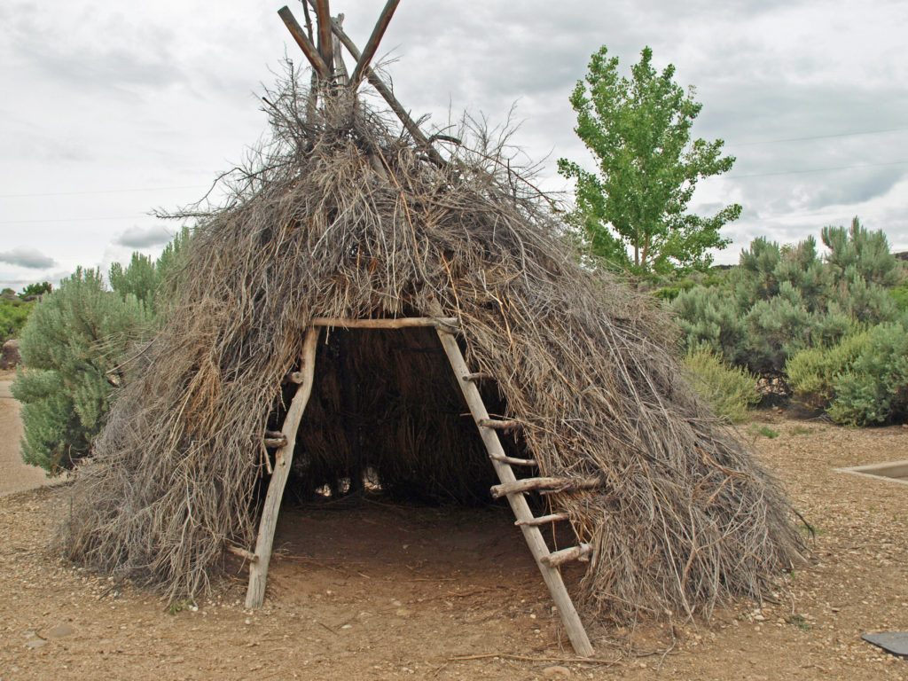 Celebration Park is Idaho’s only archaeological park. Petroglyphs dating back as far as 10,000 years can be found there. Visitors can learn about the Native American “lifeways” at the visitor center, try their hand at throwing a spear with an atlatl, and explore the petroglyph area on a self-guided walk. There is a picnic ground, and a small tent campground. The visitor center is open from 10:00 to 2:00 daily, except holidays. Check the park
 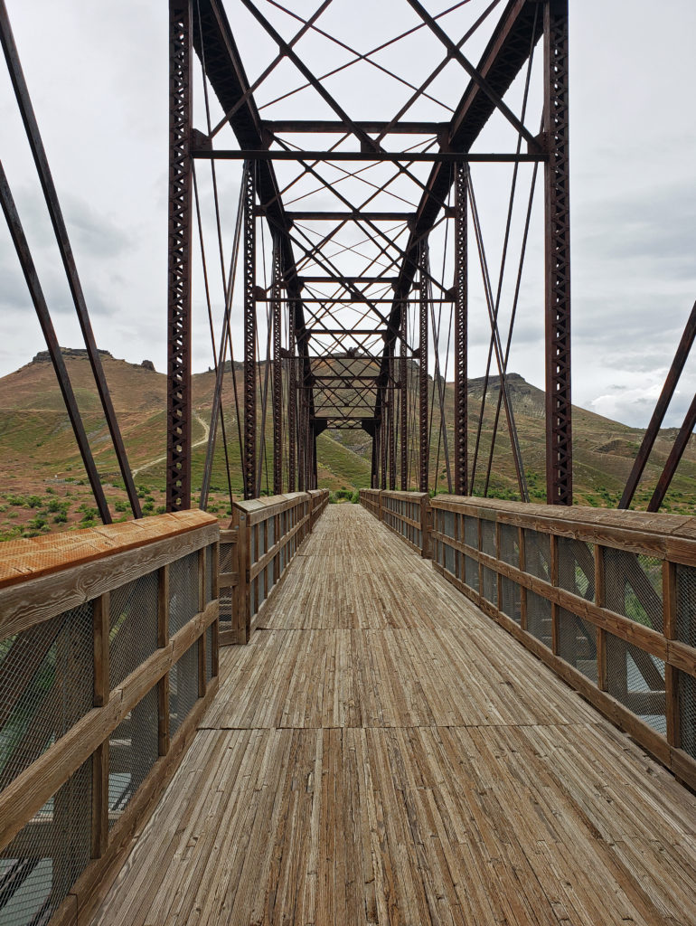 A short ways downstream, the Guffey Railroad Bridge provides pedestrian and equestrian access to the south bank of the Snake River and the Guffey Butte area. The bridge was built in the late 19th century and carried rail traffic until the 1940s. It is listed in the National Register of Historic Places. Guided tours of the area highlighting the area’s early mining and railroad history are conducted periodically.
 Back in Boise, we toured the
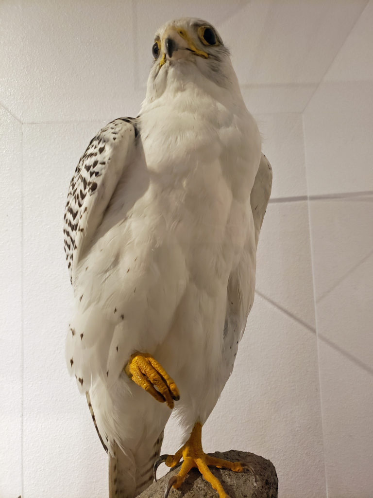
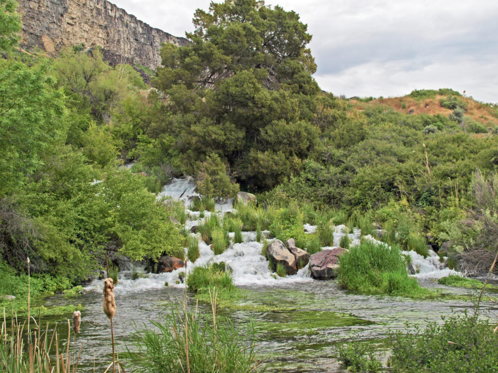
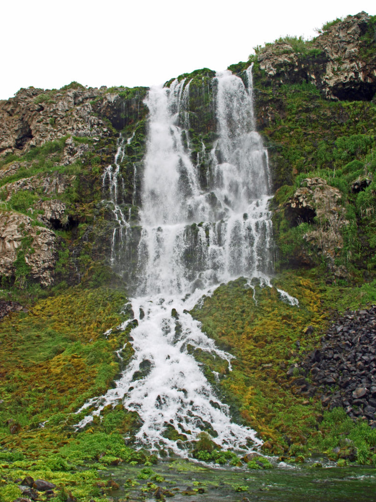
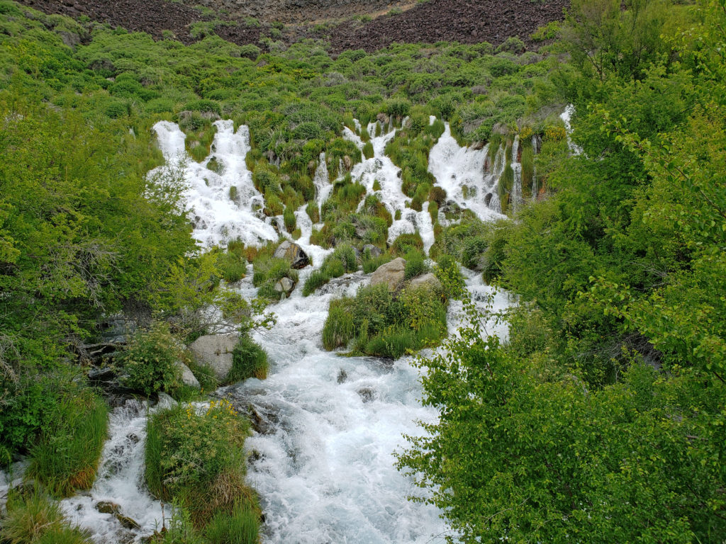
 After touring the Thousand Springs area at the beginning of an extended Memorial Day weekend trip to Southwest Idaho, my wife and I took a short side trip to
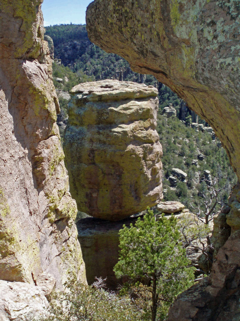
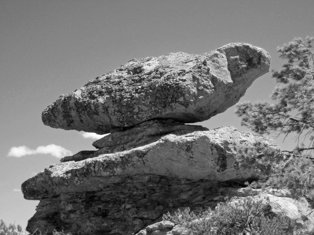
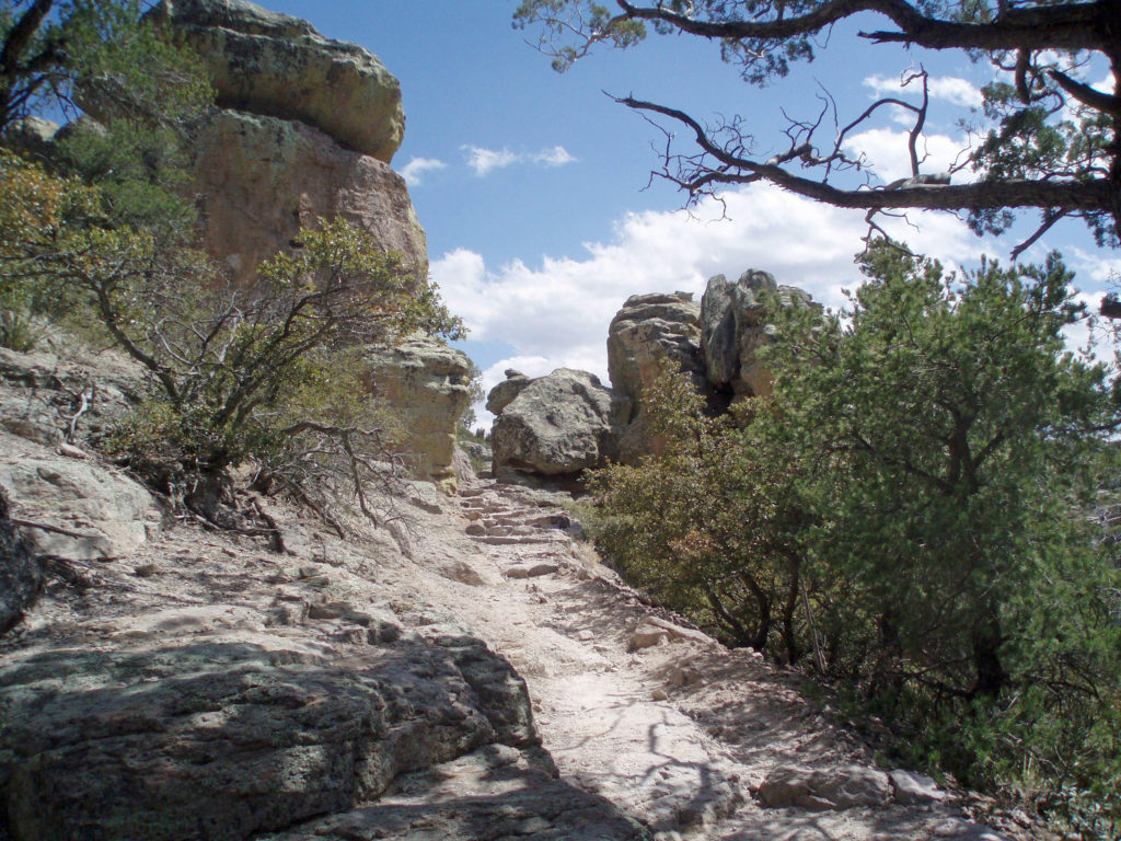
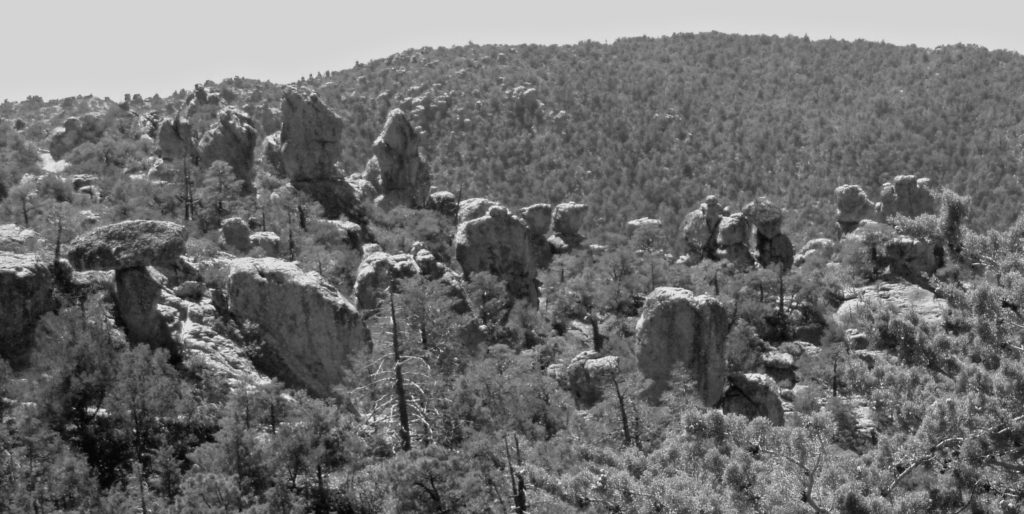
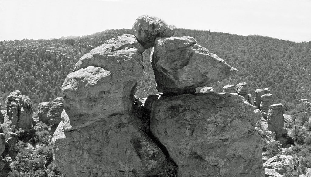
 Balanced Rock is located about twenty miles west of Twin Falls and ten miles from Buhl, the nearest town. The area around Buhl is flat, featureless farm land that looks more like Kansas than the pictures I had seen of Balanced Rock, which had more the look of the Arizona or Utah deserts. But after a few miles, the road began to drop into a canyon and the view and landscape changed radically.
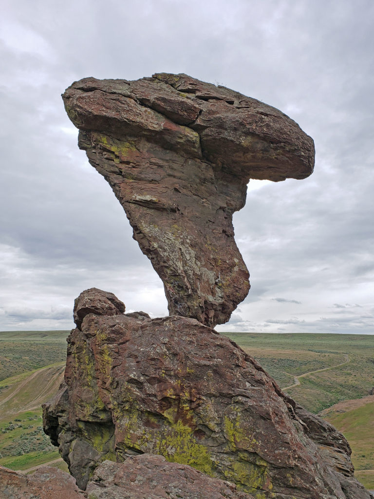 Balanced Rock is nearly fifty feet tall, weighs forty tons, and is supported precariously by a stem of rock less than three feet in diameter. It is, to say the least, a striking sight. We climbed up to the rock and hiked along the hillside above the rock formations (there’s quite a lot more than just Balanced Rock). It’s not a large area, and the trail is short and not difficult. It’s easy to explore in an hour or so, and I found it definitely worth the time and effort. But you can still get a good view of Balanced Rock and the other rock formations from the parking area if you don’t want to, or are unable to, climb up to them.
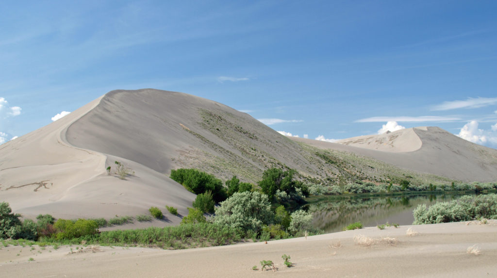 Bruneau Dunes
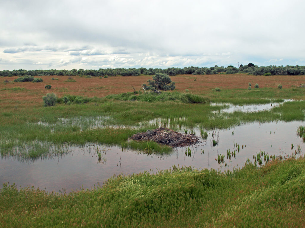
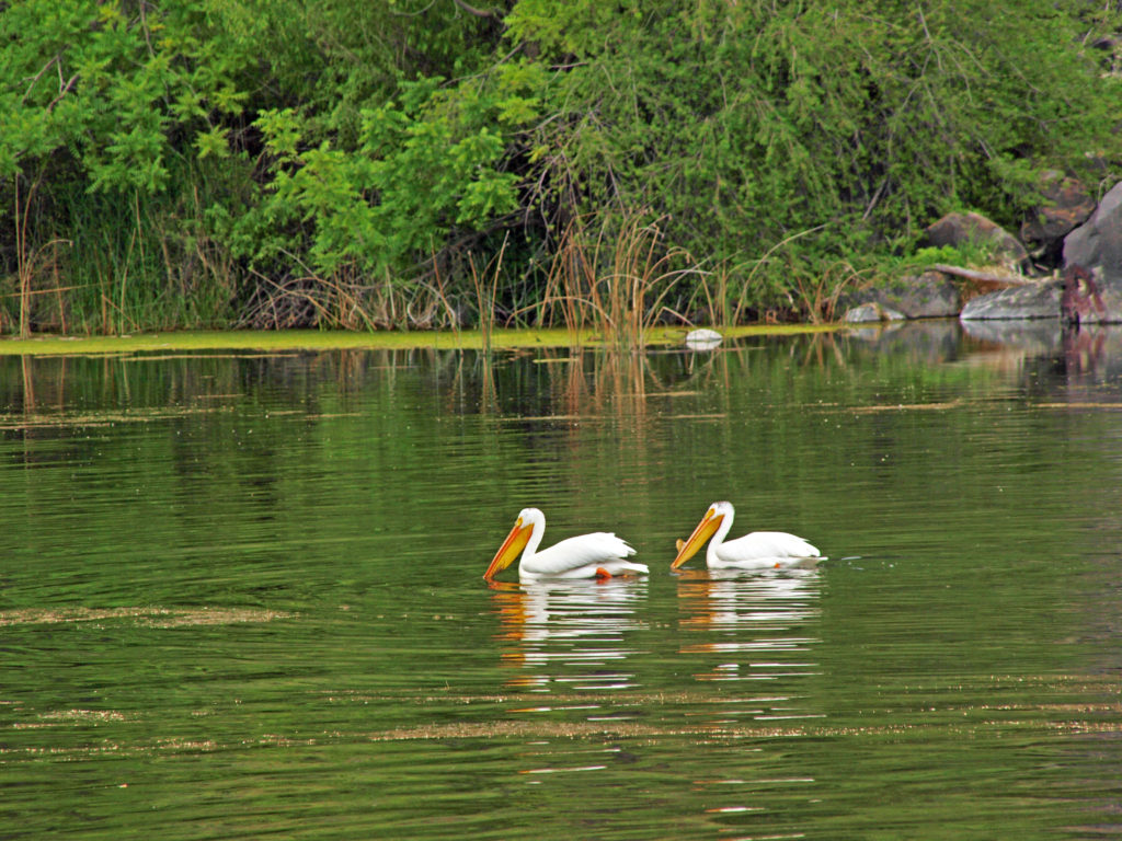
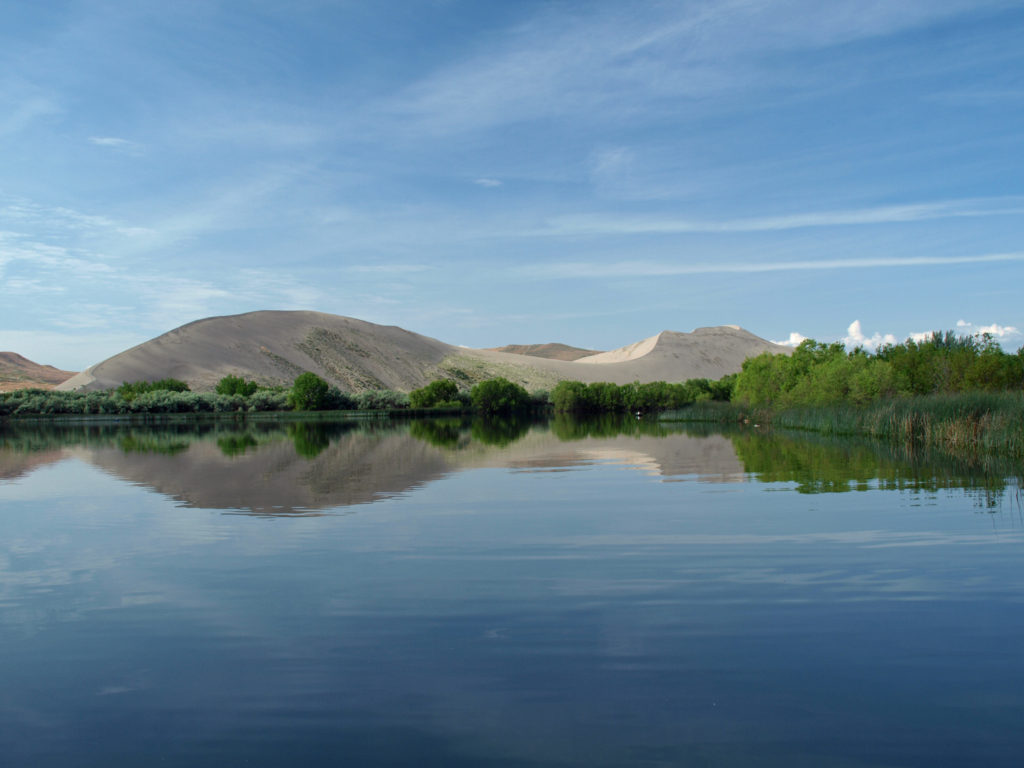 The dunes are impressive and certainly the main attraction here, but the park also has two small lakes, marshes and wetland areas, and open desert areas to explore. The marshes and lakes are full of waterfowl, and coyotes, jackrabbits, lizards, and gopher snakes can be found in the drier areas of the park. In the spring, desert wildflowers are abundant.
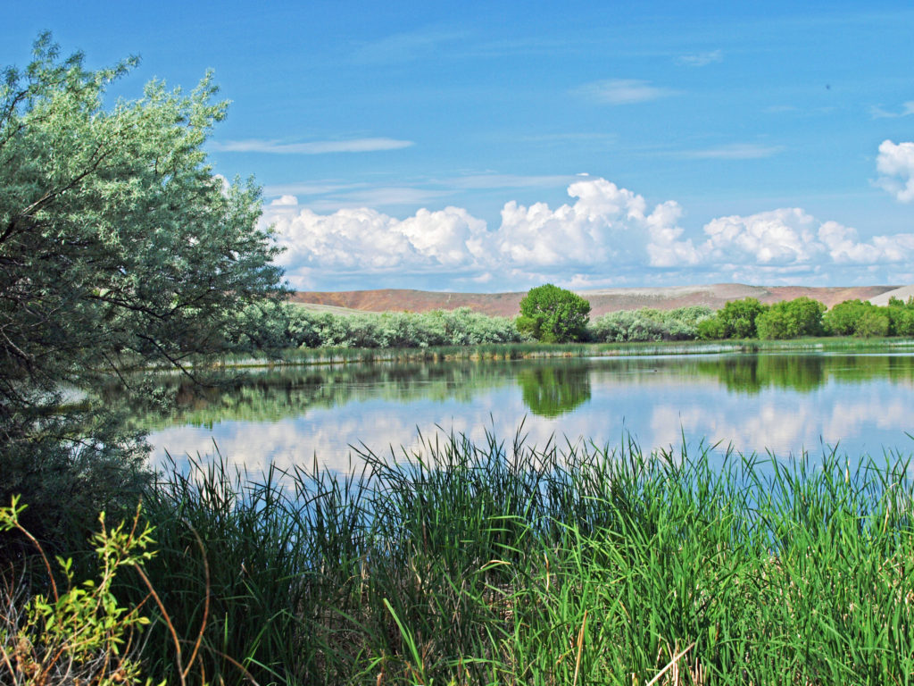 For hikers, there’s a six mile loop trail that takes you over the top of the dunes. There is also an equestrian camp and a ten mile long horse trail, two campgrounds, a picnic area, and a visitor center. We didn’t do the six mile hike, but did climb the Small Dune, hiked around the smaller lake, checked out the picnic area on the Big Lake, and, of course, spent a lot of time photographing the area.
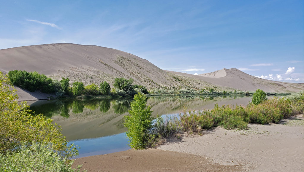 Bruneau Dunes is also an outstanding “dark skies” area, and the Boise Astronomical Society has constructed an observatory at the park. On weekends, visitors can view the depths of space through the observatory’s 25 inch telescope.
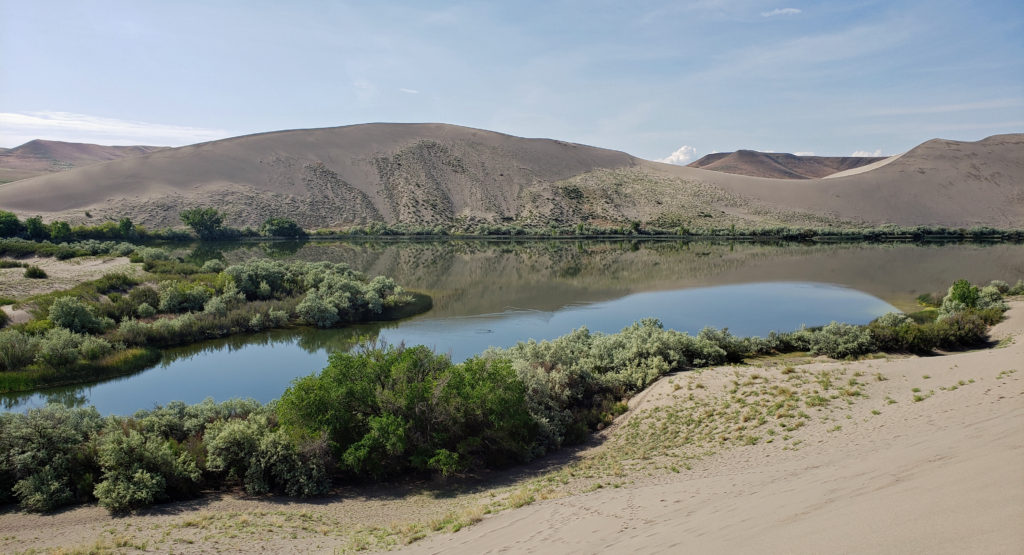 The weather was better than it was for our Thousand Springs and Balanced Rock visits on the previous day, and the sunshine made for some good photo ops. But it got a little warm on the dunes after awhile, and there were swarms of mosquitoes by the water where it was cooler. Still, it was a nice morning’s outing. The dunes and the small lakes between them are incredibly beautiful, and climbing the dunes was a fun adventure.
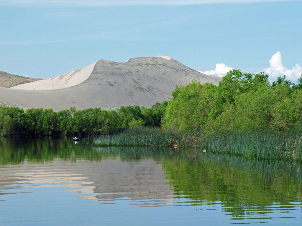 Bruneau Dunes definitely exceeded my expectations. The dunes are huge, much bigger than I expected, and the area around them is interesting and very beautiful. The park is small enough that it can be explored in half a day, which is what we did, but there’s enough there to keep you occupied for a few days, at least. It’s also a place where you can slow down, relax, and spend some time just enjoying the views and the peace and quiet, which won’t be marred by the presence of dune buggies and trail bikes. They’re prohibited in the park to protect the dunes.
 We returned to Boise that afternoon and spent some time exploring the downtown area and the parks and paths along the Boise River Greenway. The next day it was on to the Snake River Canyon, the Birds of Prey National Conservation Area, and the World Center for Birds of Prey. Click on the links below to view other posts from our trip.
 Originally posted June 20, 2019. Most recently updated April 2, 2025.
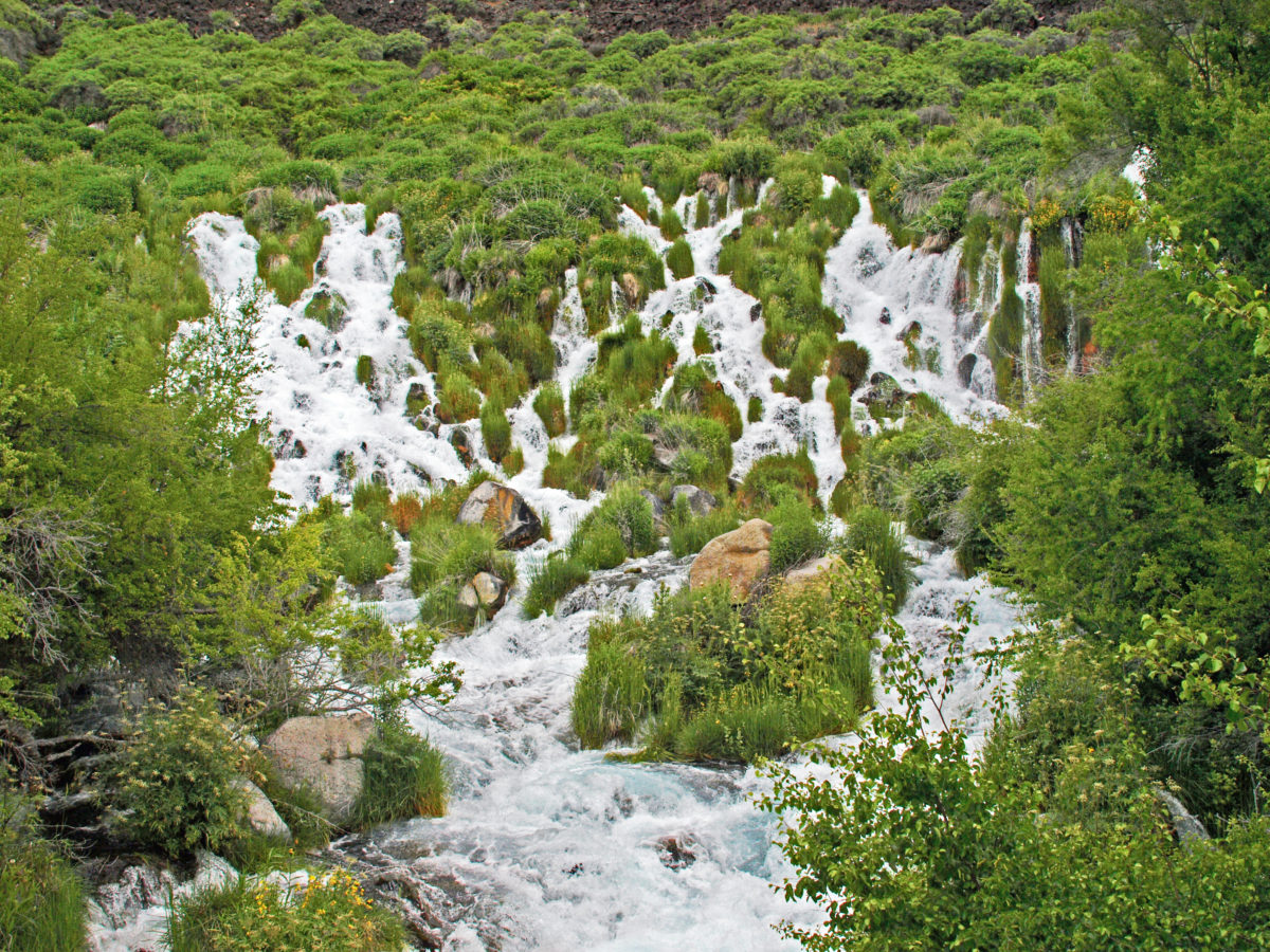


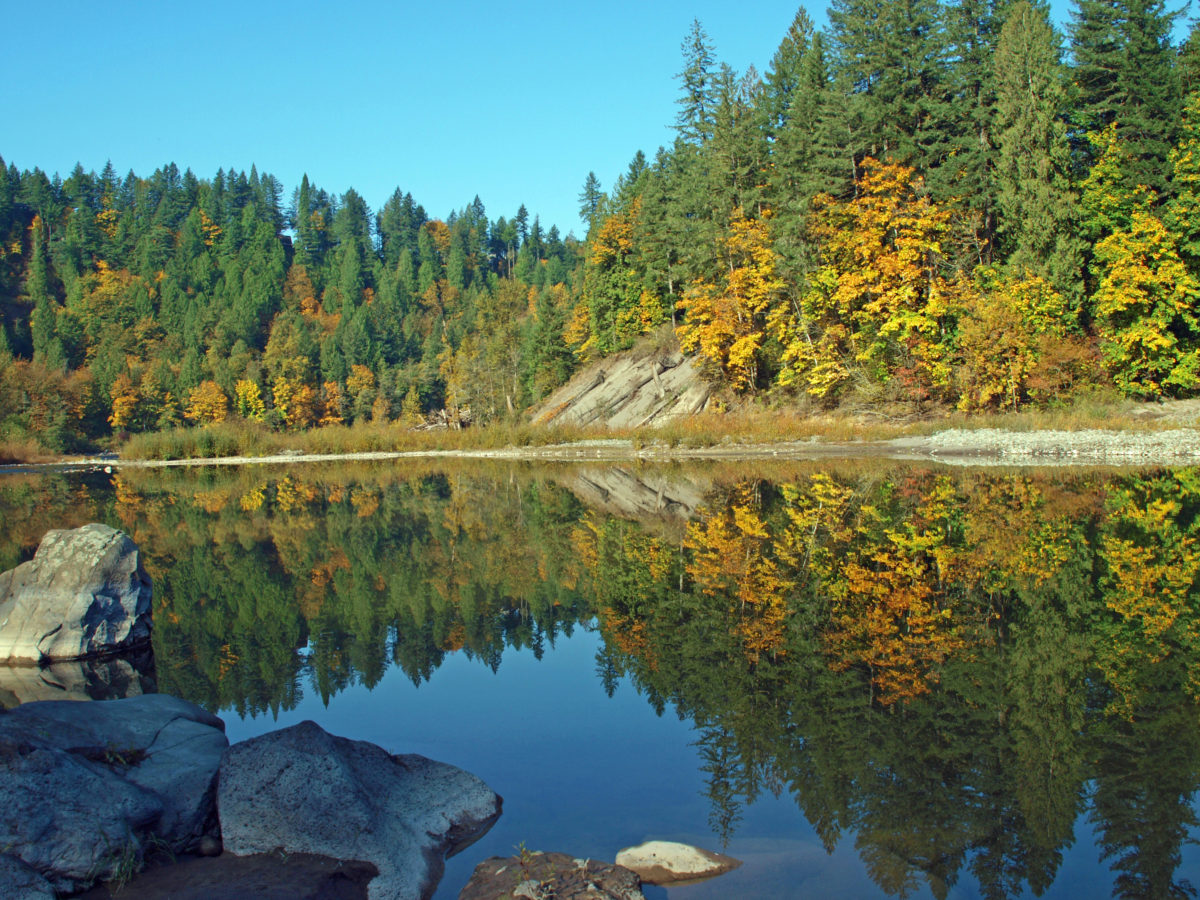

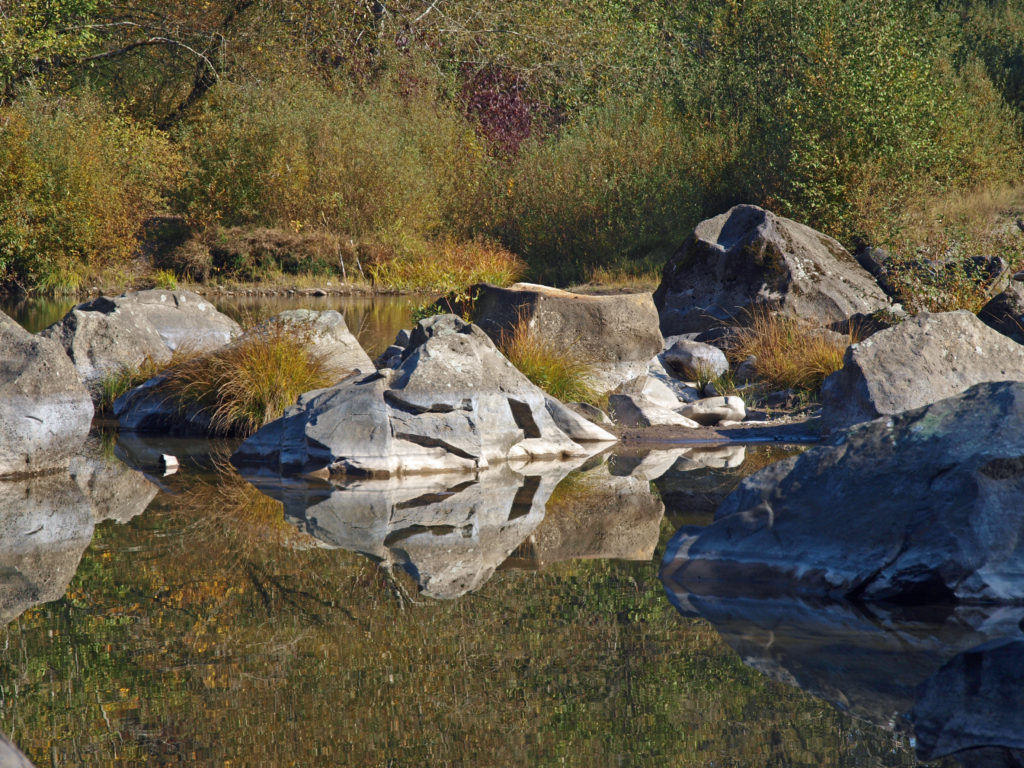
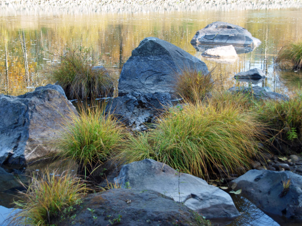
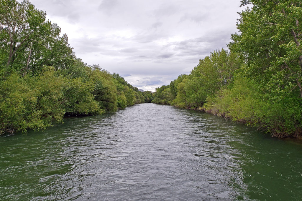
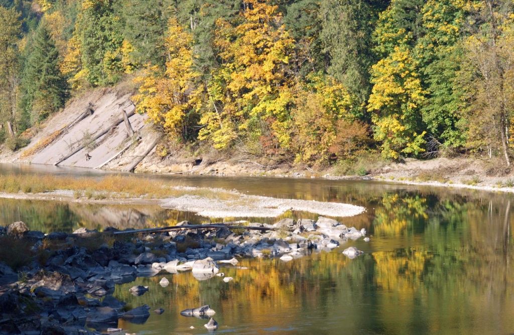
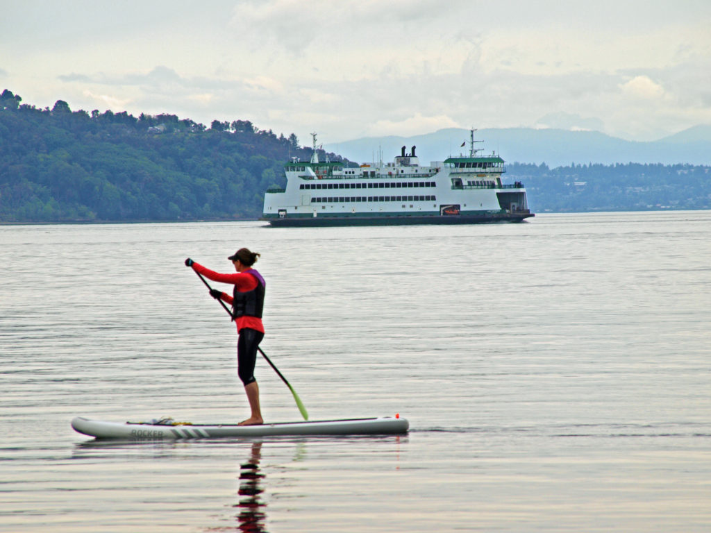
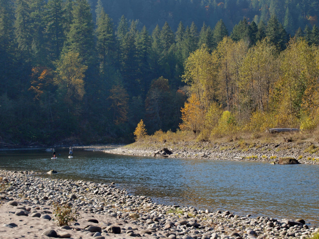 The park can be very crowded on summer weekends, but gets much less use after Labor Day. Even on a sunny October day there were just a few people fishing from the river bank and some out for a hike or just enjoying the sunshine. This section of the river is popular with kayakers and rafters in the summer, but we didn’t see anyone on the river other than one family that floated by on stand up paddle boards.
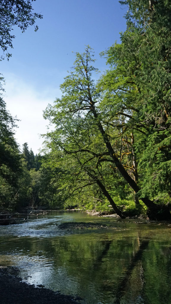
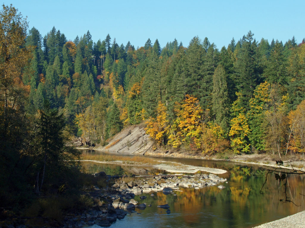 The Sandy River flows from its headwaters on Mount Hood to the Columbia River at Troutdale. Two sections of the river totaling 25 miles are designated Wild and Scenic, including the section of the river that runs through Oxbow Park.
 In 2007 the Marmot Dam on the Sandy River was demolished, making the river free flowing for its entire 57 mile course for the first time in nearly a century, and opening up miles of restored spawning grounds for salmon and steelhead. A smaller dam on the Little Sandy River was also demolished.
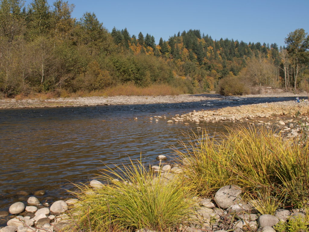 One of the more popular events at Oxbow is the annual
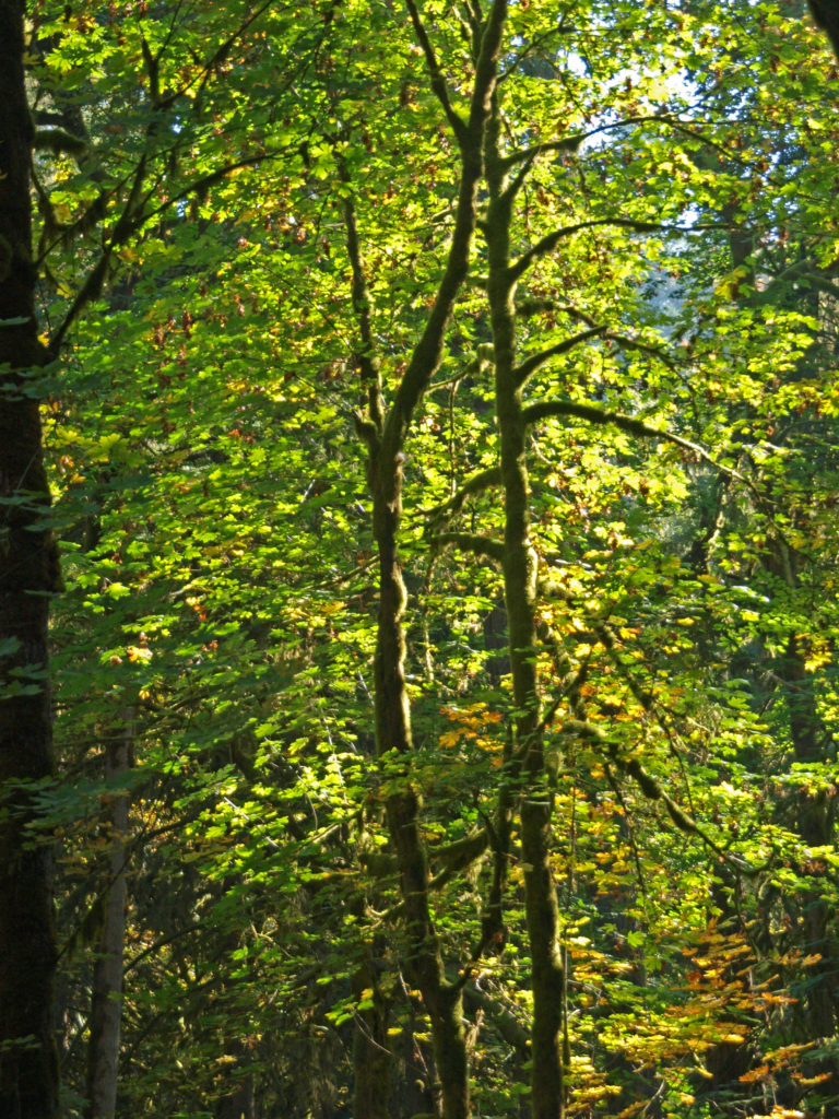
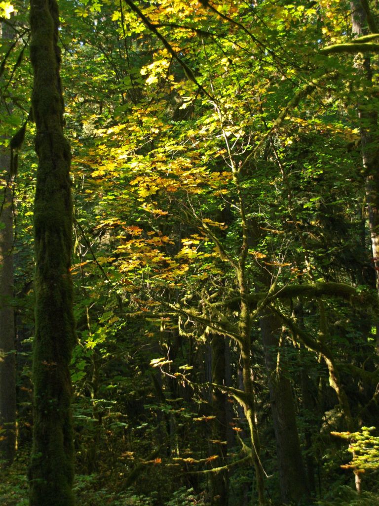 Most of the visitor activity at the park takes place along the banks of the river. The upland trails through the mixed conifer and hardwood forest get much less use. But the forest is beautiful, quiet, and peaceful. If you’re looking for tranquility, head away from the river. On our visit when these photos were taken, we hiked some of the forest trails and saw almost no one.
 To get to the park, take I-84 east from Portland to Exit 17 at Troutdale. Turn right onto Graham Road, then left onto the Historic Columbia River Highway. In two blocks, turn right onto Buxton Road. Follow Buxton (which becomes South Troutdale Road) to Division Street. Turn left on Division and follow the signs to the park.
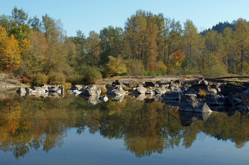 One of the great things about the Pacific Northwest is that there are so many beautiful places like this that are within a half hour drive of even the biggest cities. Just one of the reasons that I think this is one of the best places in the world to live.
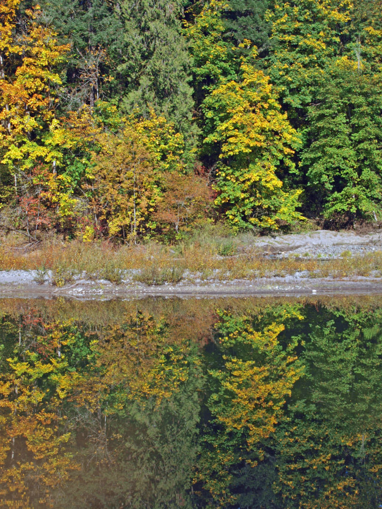
 If you’ve never been to Point Defiance, check out the park’s
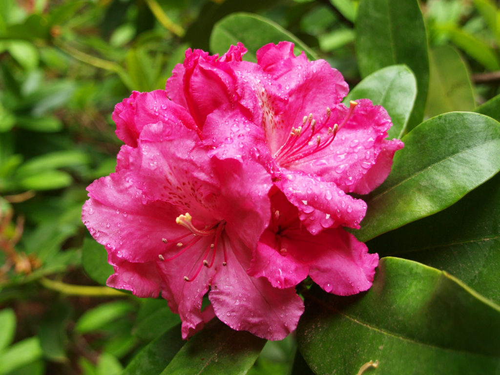
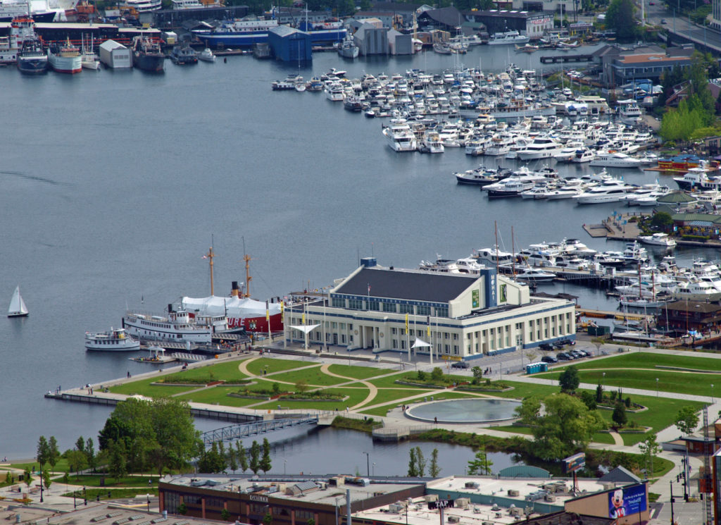
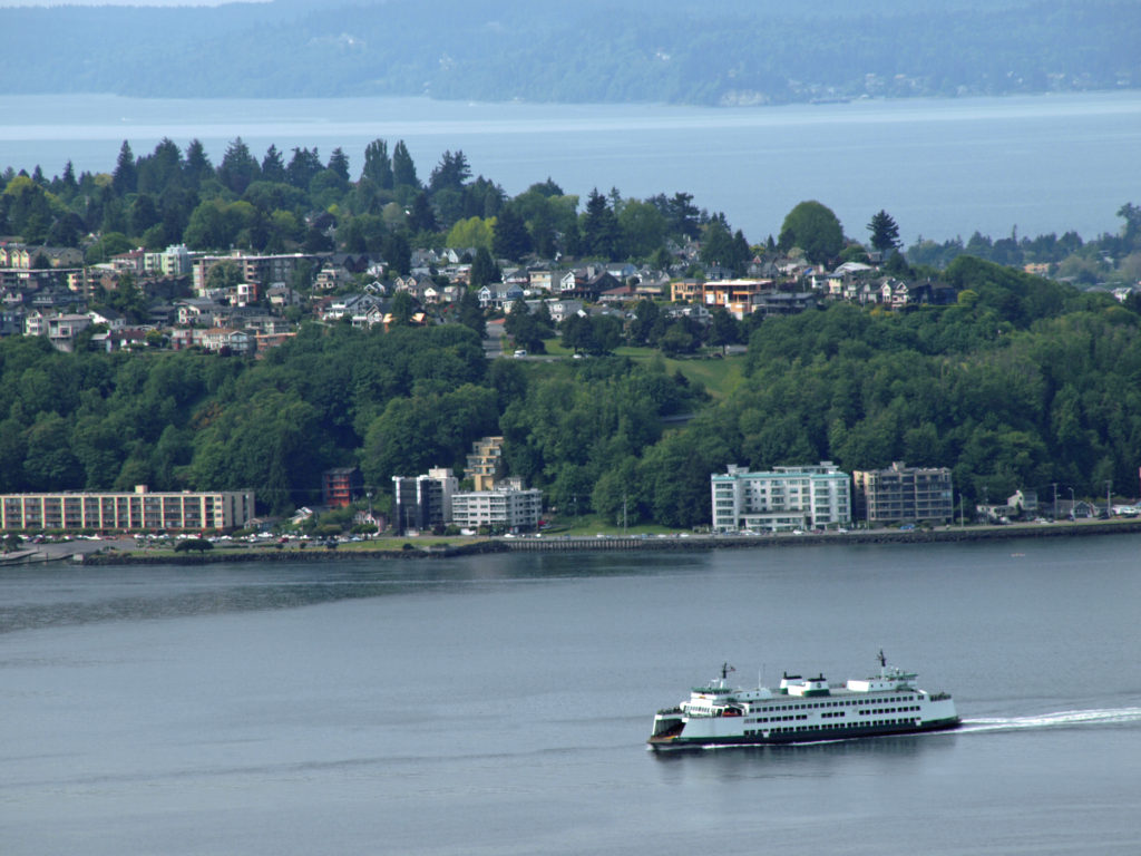
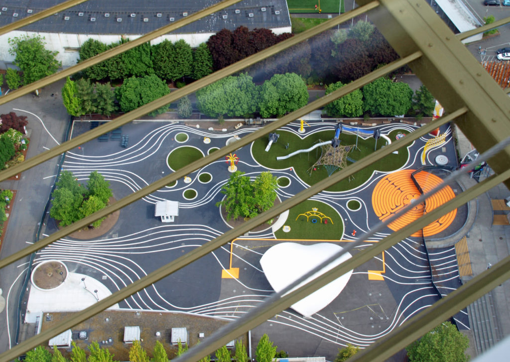
 There is a wide, paved, ADA accessible path (the Promenade) connecting the beach with the marina area of the park and the Point Ruston Waterwalk, giving unhindered pedestrian and bicycle access to the park from the Tacoma waterfront. And a construction project completed in 2022 expanded the parking lot, created new entry and exit paths for pedestrians and cyclists separated from the vehicle roadway, a new beach pavilion, new restrooms, a new ADA accessible children’s playground, new ADA accessible plazas and pathways, and a renovated WPA-era picnic shelter.
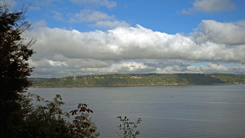 The outer loop of the Five Mile Drive provides numerous waterfront access points with views across Dalco Passage to Vashon Island and across The Narrows to the
 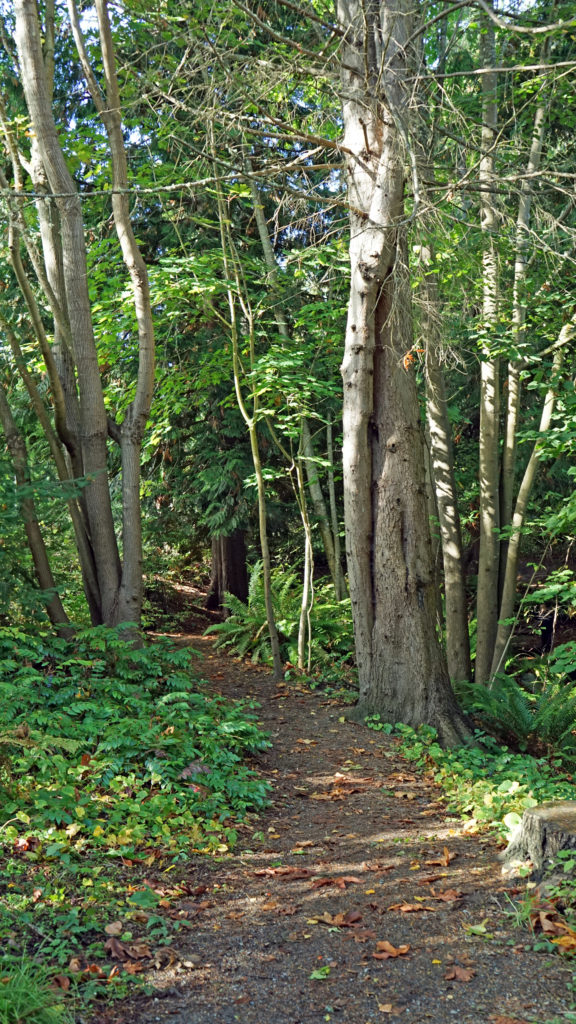 The outer loop is closed to vehicular traffic part of the day to give cyclists, runners, and pedestrians access to the northern half of the park free from conflicts with motor vehicles. On our most recent visit it was closed after 2:00 pm, but on our previous visit it was, I believe, closed in the morning. Check the Point Defiance Park website (linked above) for the current schedule if you plan to visit the park.
 On both of our recent visits our final, and longest, stop was at the botanical gardens area near the entrance to the park. Here there is a large pond with a waterfall, an herb garden, a large rose garden, a dahlia garden, an iris garden, and a Japanese garden. We could easily have spent even more time here than we did on either visit. And if you visit the
 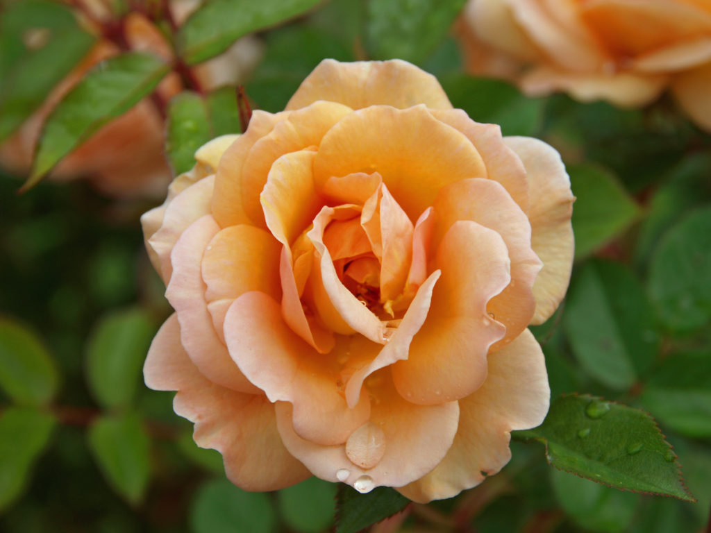 Point Defiance Park is one of the largest, and best, city parks in the Pacific Northwest. The park is similar in many ways to Vancouver, BC’s Stanley Park. Point Defiance is, without question, one of Tacoma’s top attractions.
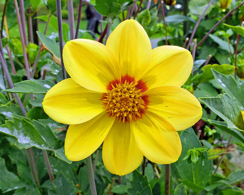 Originally posted May 19, 2019. Most recently updated February 18, 2025.
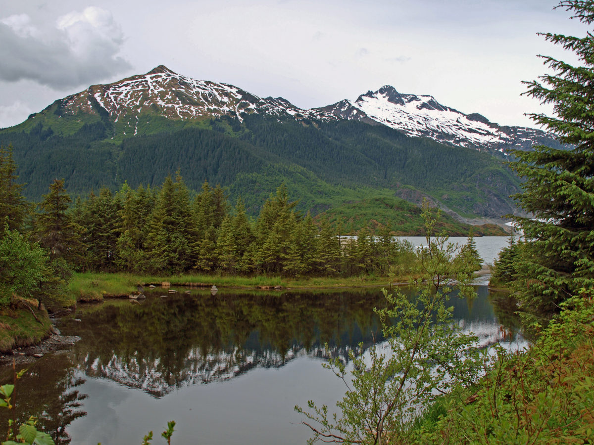
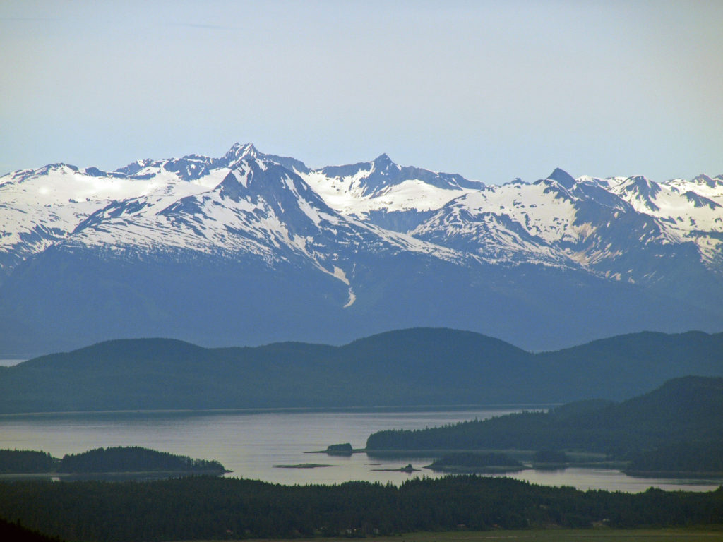
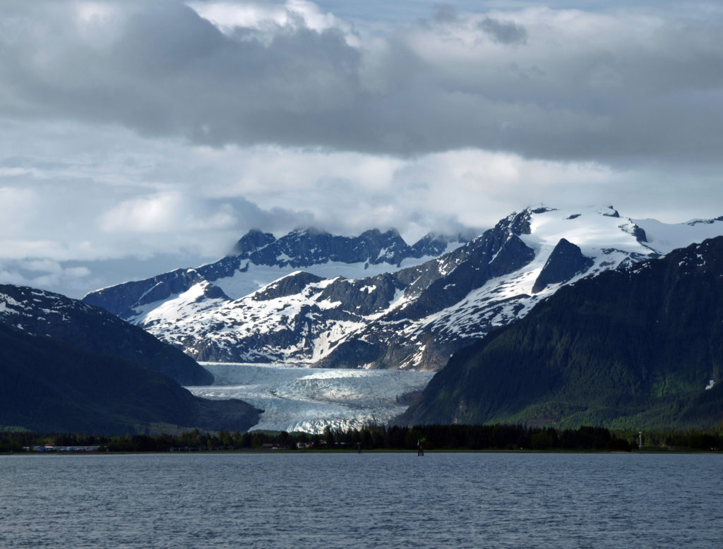
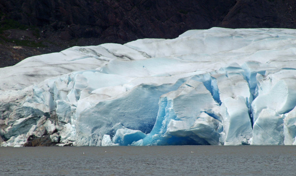
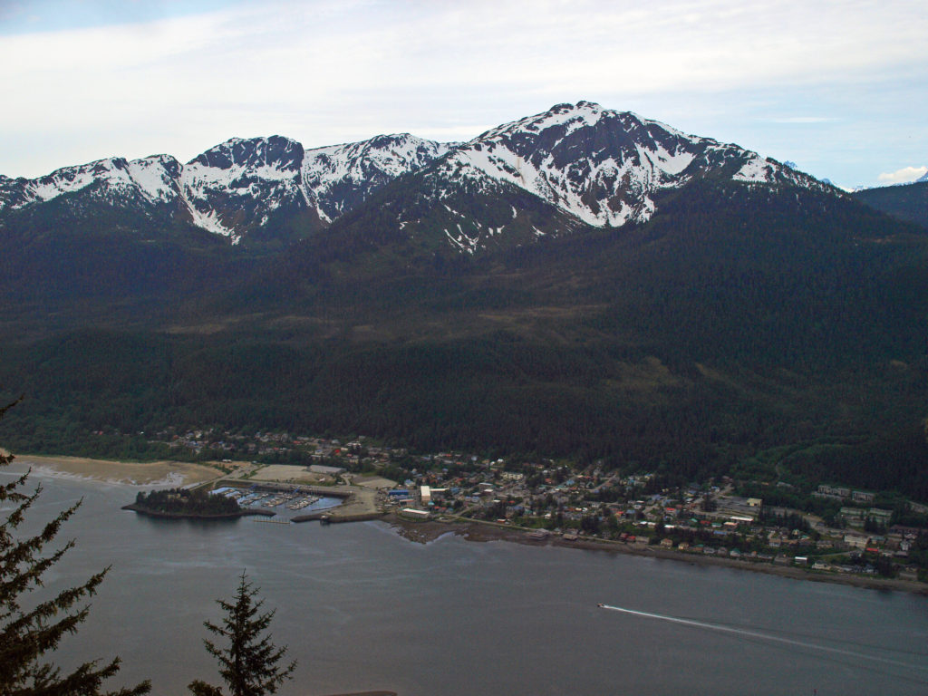
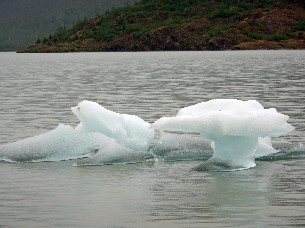
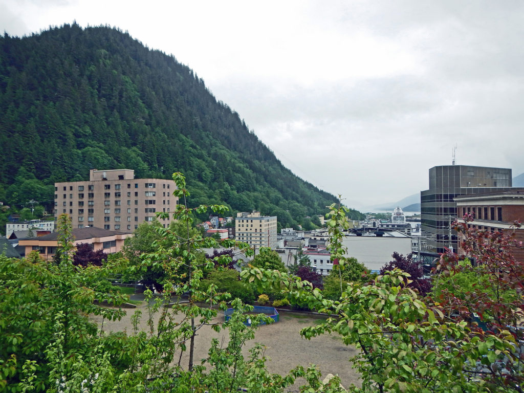
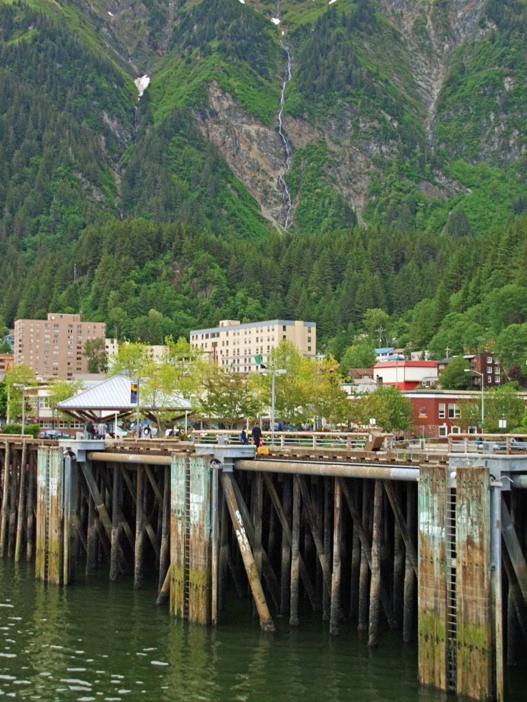
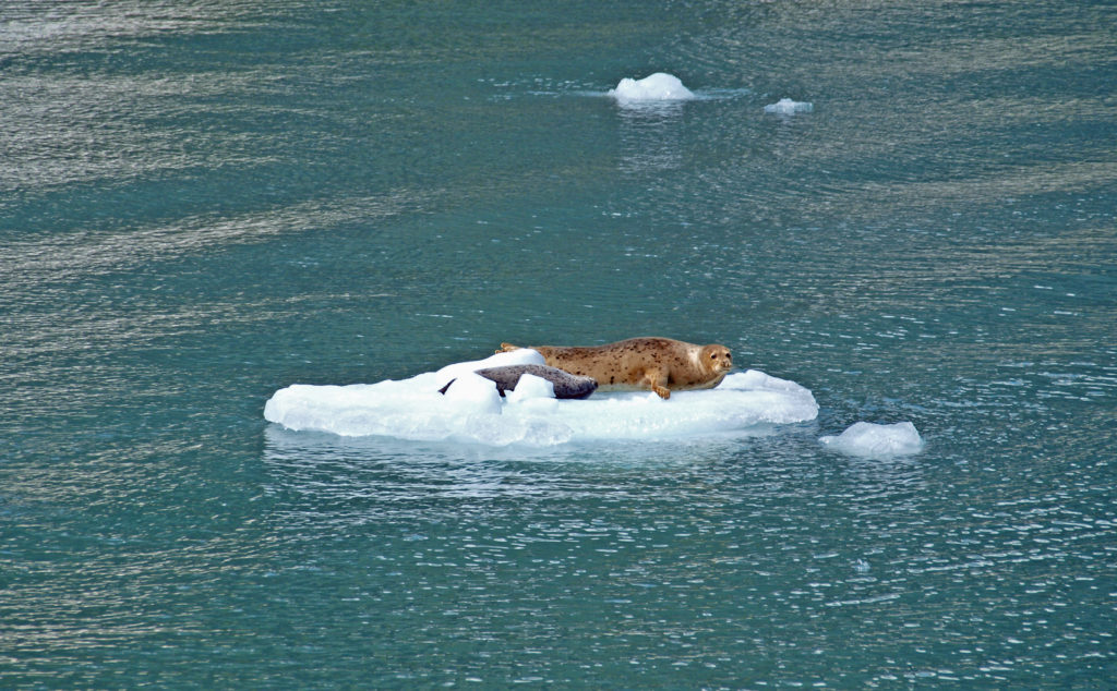 Seals often haul out on the bergs to rest and sleep. At the head of the inlet you’ll get a close up view of South Sawyer Glacier. How close you get will depend on the boat that you’re on and the amount of ice in the water, but you will get a spectacular look at the face of the glacier and there’s a chance that you’ll witness large blocks of ice calving off the face and crashing into the water below. The cruise was one of the highlights of our trip. We didn’t have time to repeat the cruise on latest visit, but if you can fit it into your itinerary, I highly recommend that you do so. Day trips start at about $275 per person.
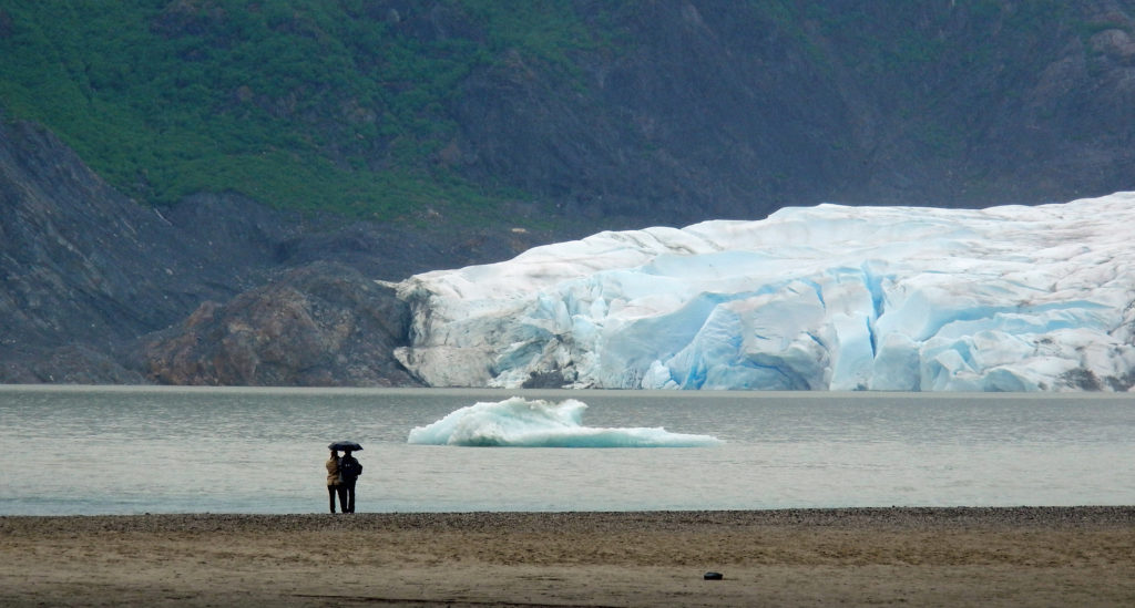

 The High Desert Museum consistently rates as one of the top attractions of the Bend area, and it won the 2021 National Medal from the Institute of Museum and Library Services. My most recent trip to the museum came as part of a family vacation to the nearby
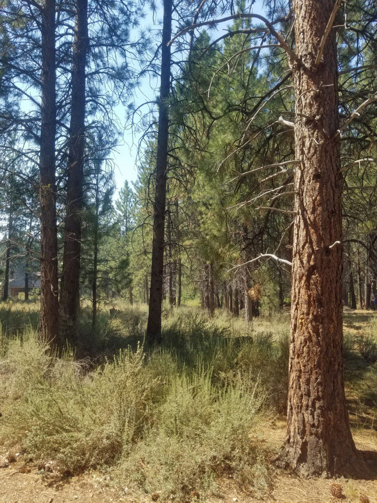
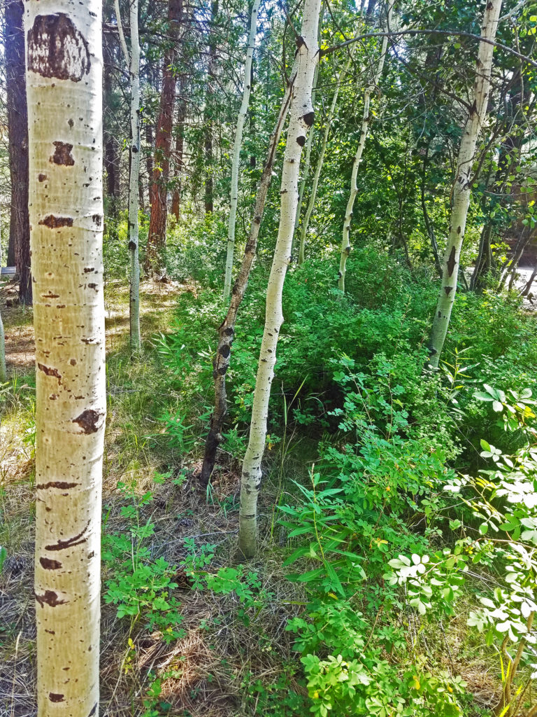
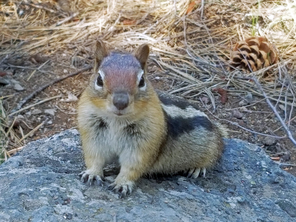
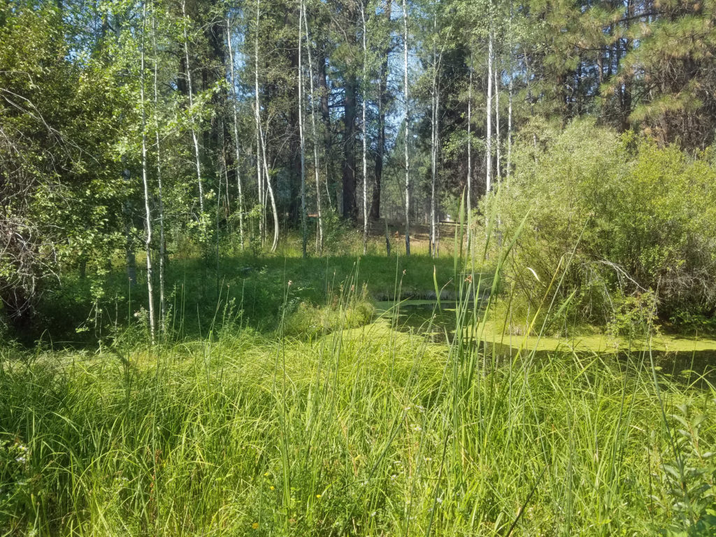 There is a small stream that runs through the museum grounds and several small ponds, giving the museum riparian as well as forest habitats. You can explore the pine forest and riparian areas on the trails that wander through the 135 acres of the museum grounds.
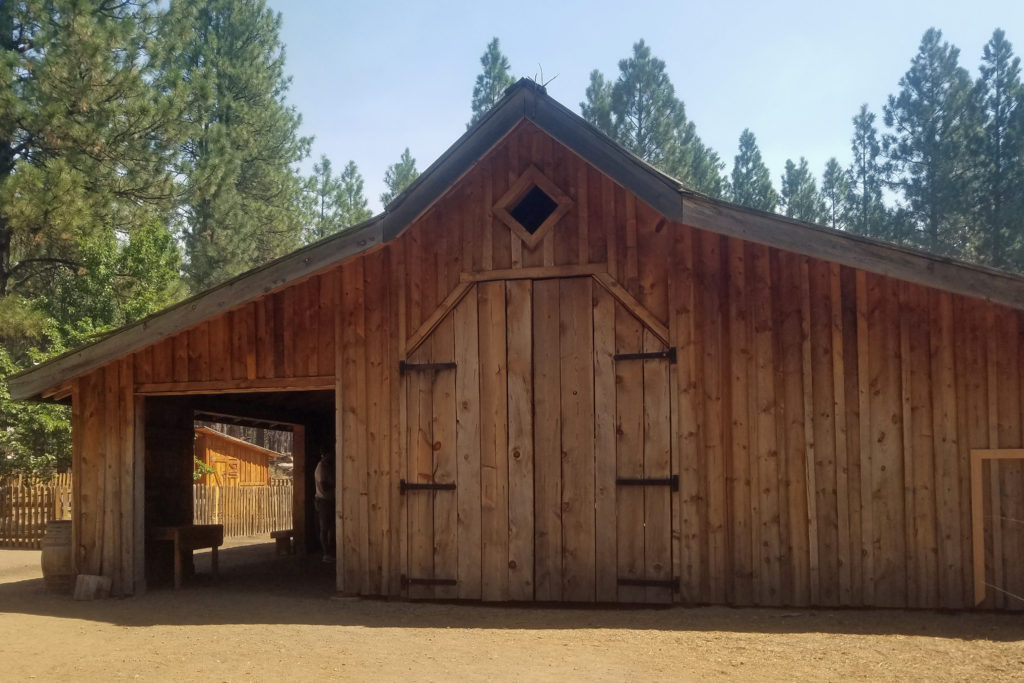
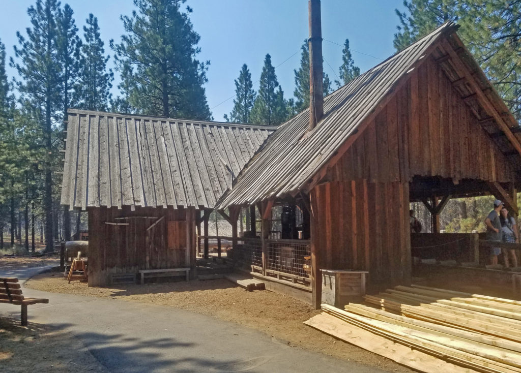 The Lazinka Sawmill is a working mill, originally located in Pilot Rock, Oregon. Originally driven by steam power, the mill is now powered by electricity. The lumber used to build the barn at the Miller homestead exhibit was cut at the Lazinka Mill. Museum staff fire up the mill once a month during the summer months, so check the museum’s schedule (linked below) if you are interested in seeing it in operation.
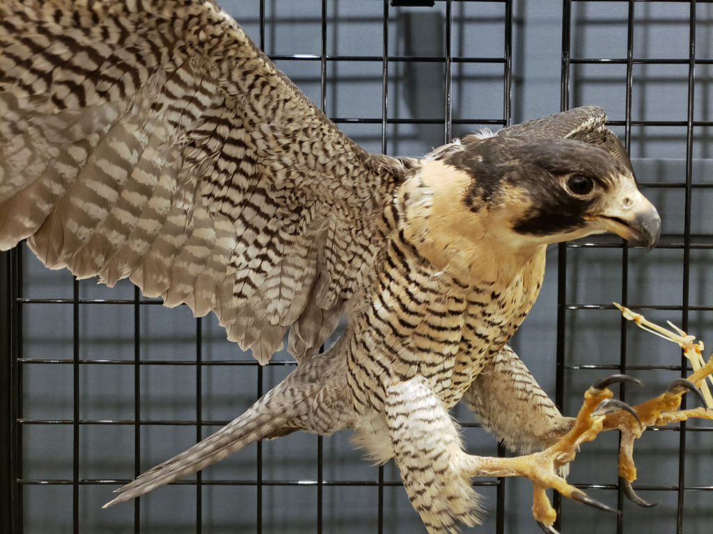
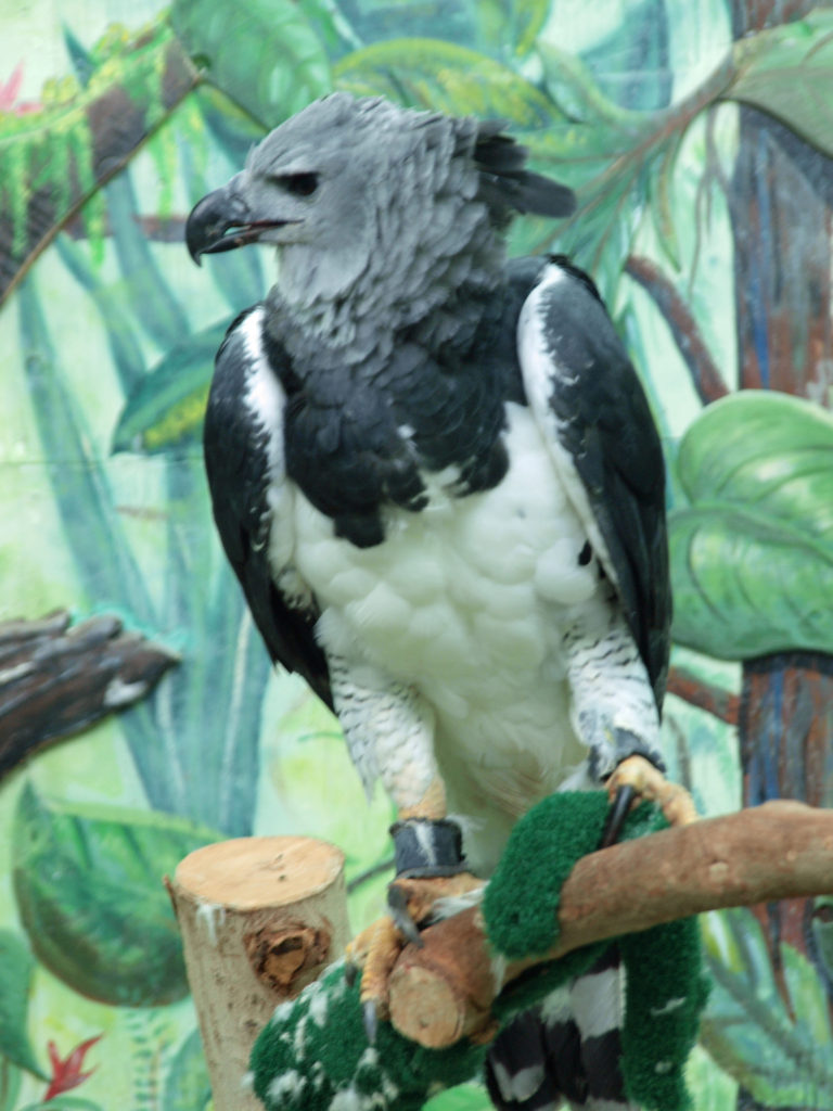
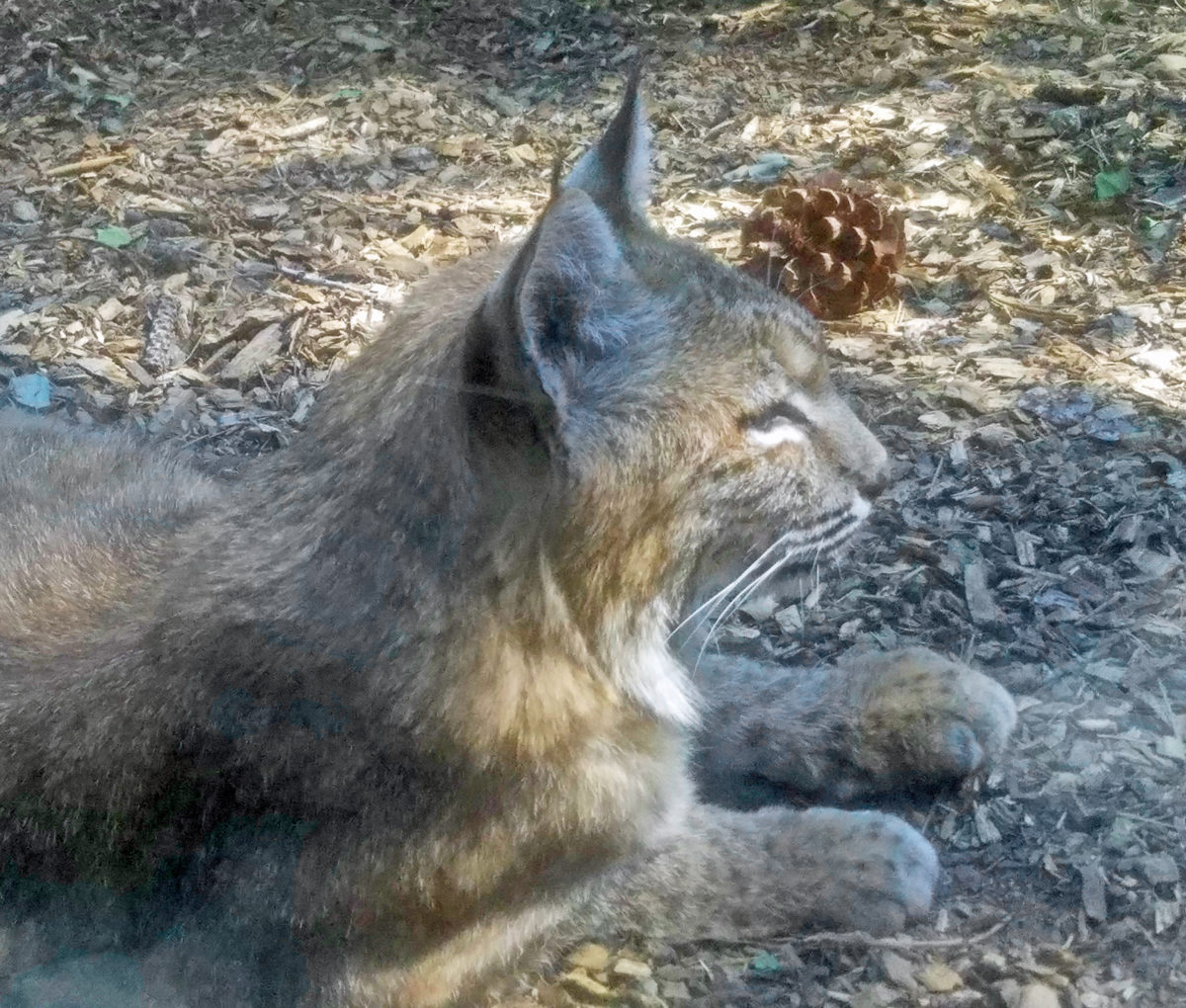
 Get an up close look at some of the raptors of the high desert and learn about desert carnivores, otters, and other desert dwellers at the Donald M. Kerr Birds of Prey Center. Check the museum
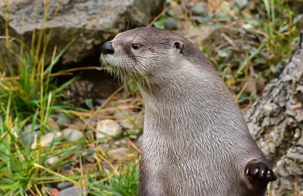
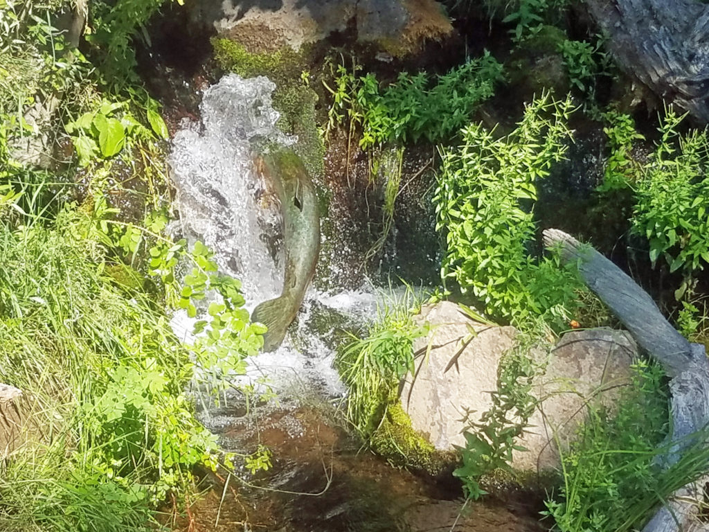
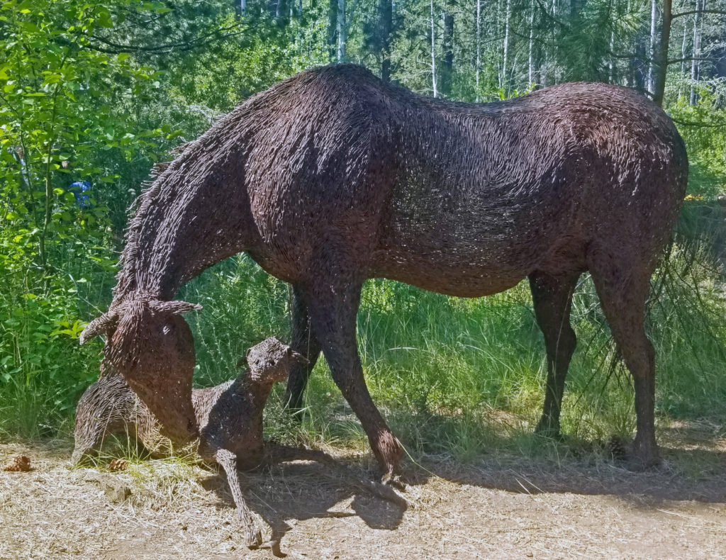 Throughout the grounds, you will find sculptures and other works of art. I particularly like the wire sculptured mare and foal, the bronze beavers, and the frozen-in-time bronze of a salmon in mid-leap.
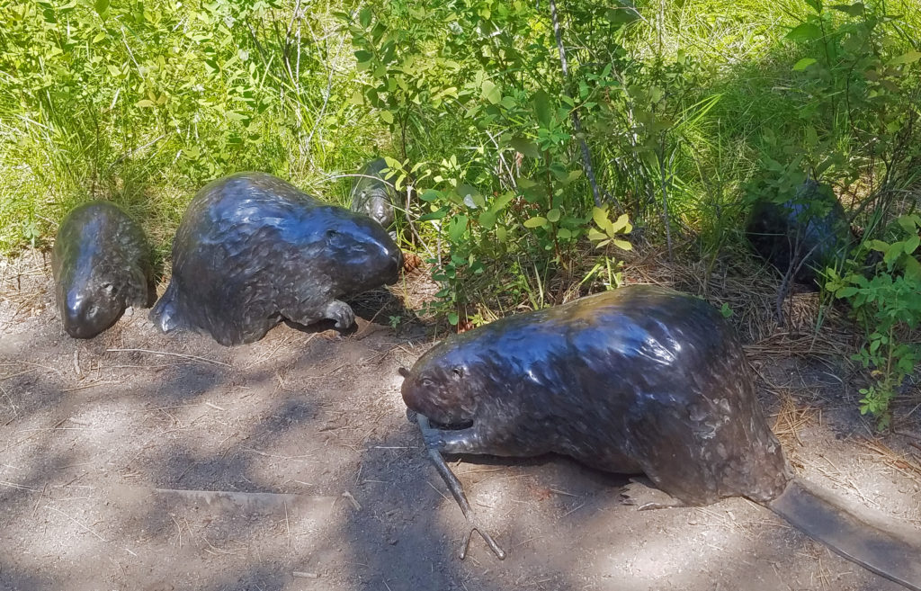
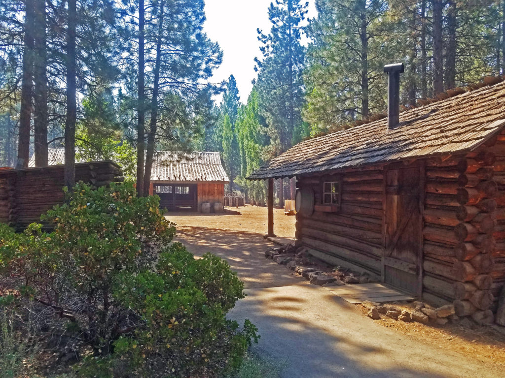
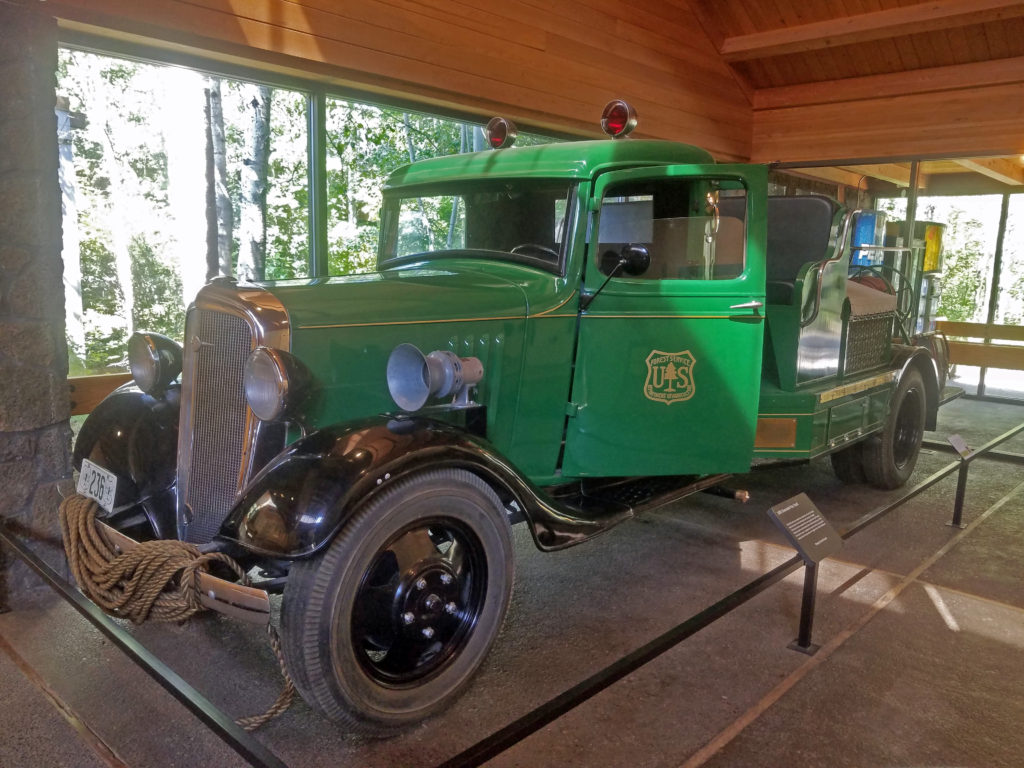
 Other features of the museum include a Forest Service ranger office built in 1933, vintage logging equipment, a forest service fire truck from the 1930s, and a WWII army motorcycle made by Harley-Davidson. The museum’s most recent addition is the E. L. Wiegand Ponderosa Playscape, a children’s play area near the otter exhibit.
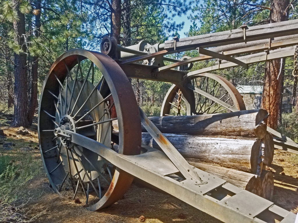
 Inside the main building, the Desertarium Exhibit showcases some of the animals that make the High Desert home, including snakes, lizards, and desert tortoises. Other permanent indoor exhibits include Spirit of the West, which documents the history of the people of the region, and By Hand Through Memory, a look at the history and culture of the Plateau Indian Nations.
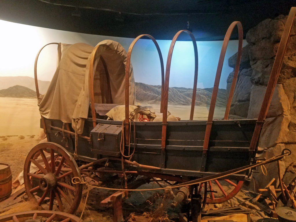 The museum also hosts changing exhibits. Check the museum’s website for what exhibits are currently on display.
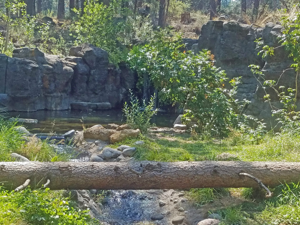 In addition to enjoying all the museum’s exhibits, you can get made-to-order sandwiches and wraps, and a variety of beverages at the newly remodeled Rimrock Cafe inside the main building. The cafe features locally made food and drink from Big Ed’s Artisan Bread, Humm Kombucha, and Strictly Organic Coffee. And souvenirs of your visit and books and other educational materials are available at Silver Sage Trading, the museum store.
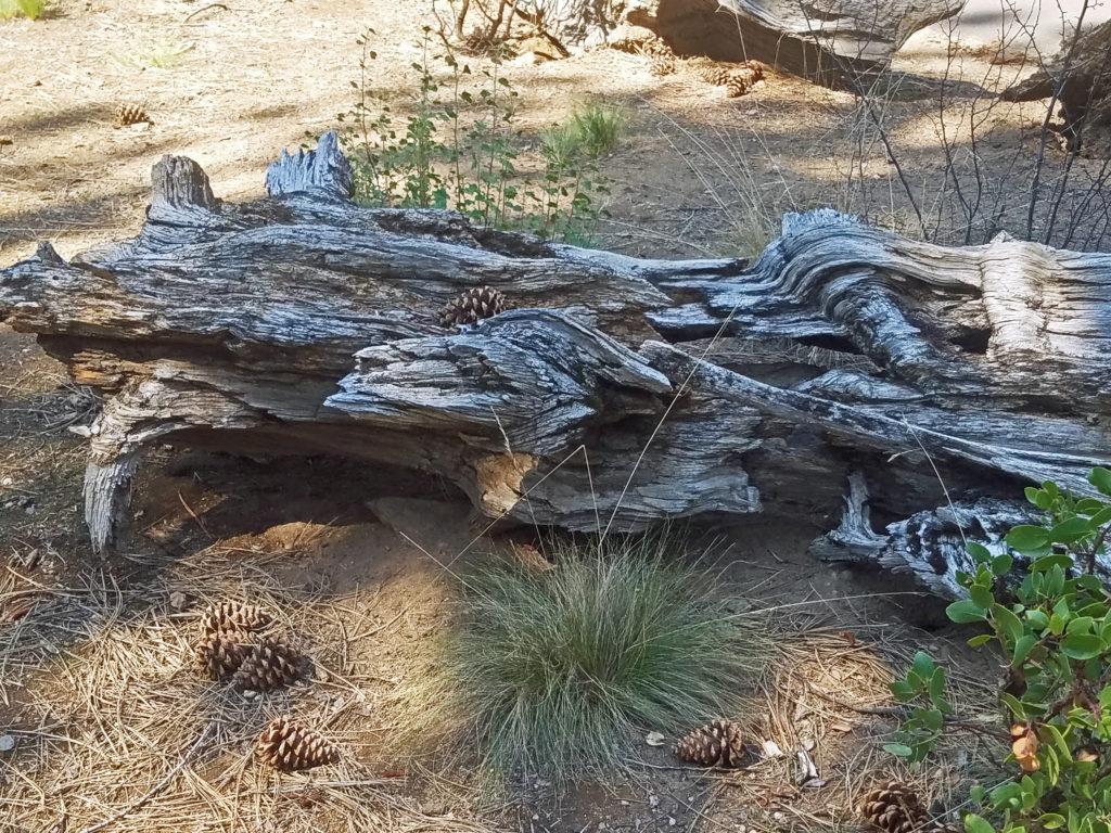 Plan on spending at least several hours at the museum, especially if you have kids in tow. There’s too much worth seeing to experience it all in less time. Check the museum website for hours and admission fees. Tickets are available for purchase on the website, but advance purchase is not required.
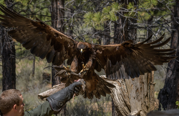
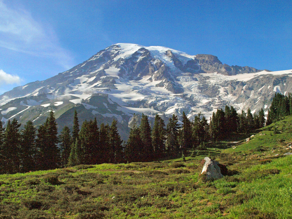
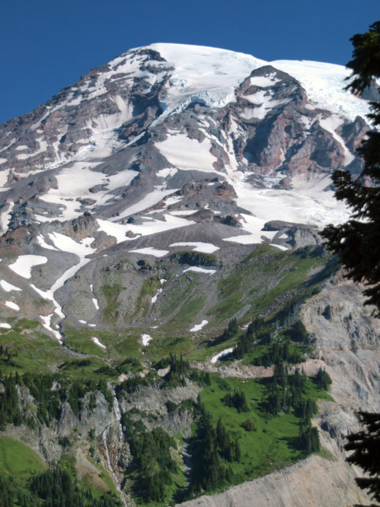
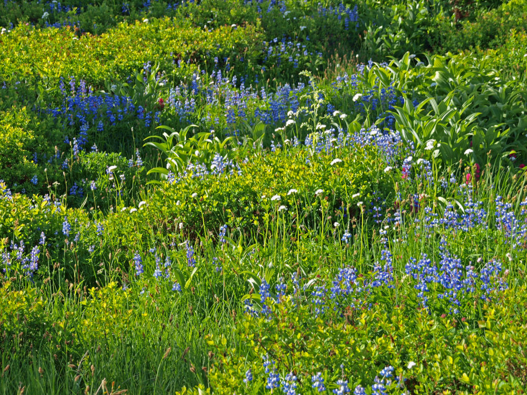
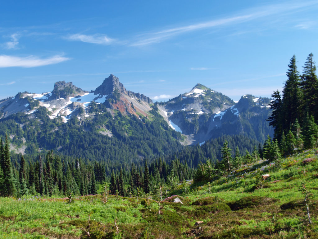
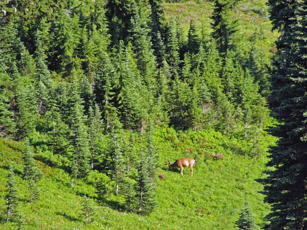
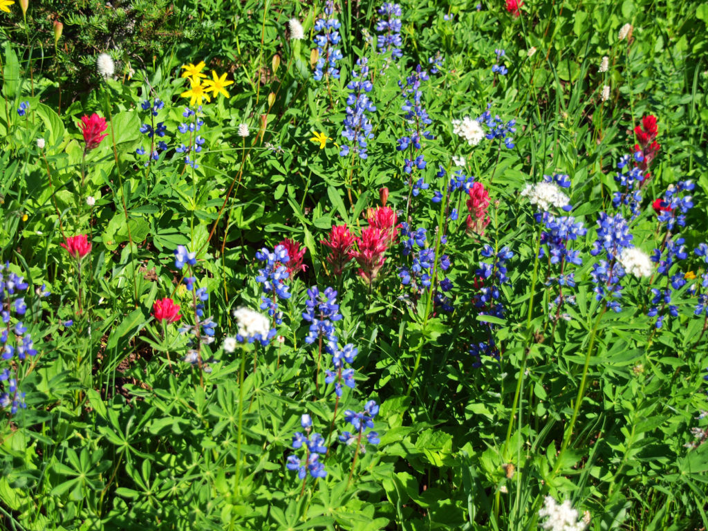
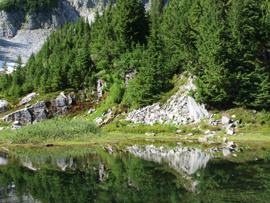
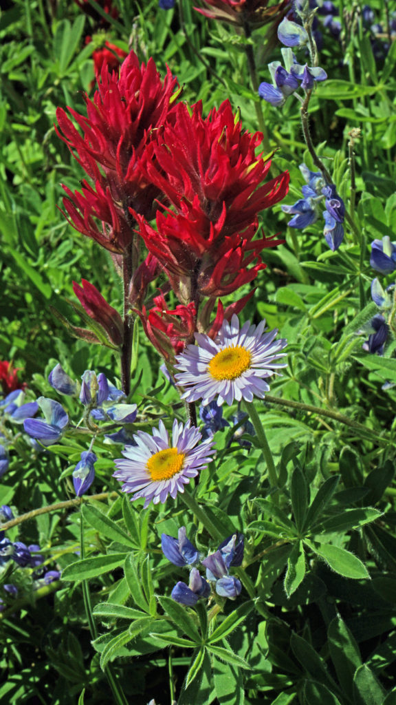
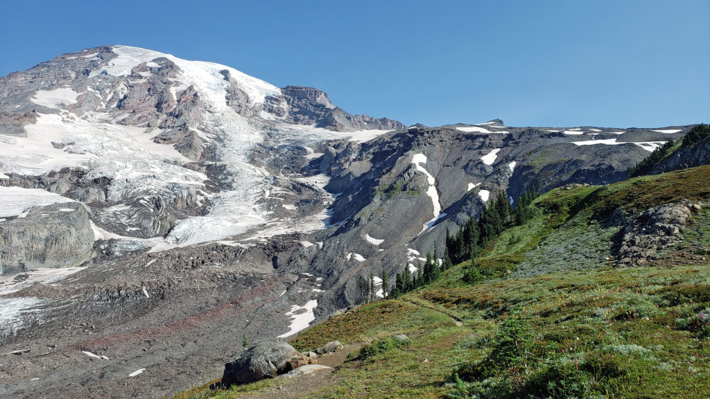 The highlights of the trip were the two hikes we did on the Skyline Trail. The first was the four mile out and back hike to Panorama Point. The second was the roughly four mile Skyline-Golden Gate loop. Both are listed as “moderate” hikes, but both have significant elevation gains (1700′ and 1400′ respectively). We did both hikes early in the day during the week, but we were far from the only ones on the trail, especially on the hike to Panorama Point. But the area above Paradise is so incredibly scenic that the crowds didn’t diminish the experience much.
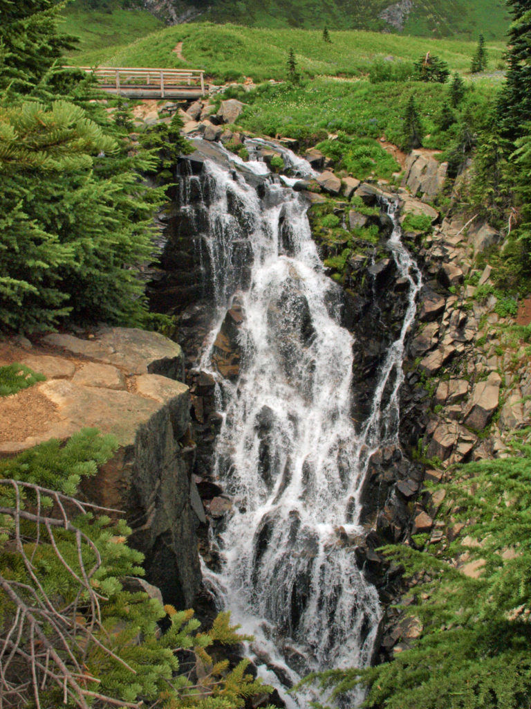

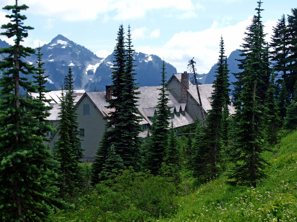
 Close to Paradise Inn, the Jackson Memorial Visitor Center, named after long-time U.S. Senator Henry M. Jackson, offers general information, exhibits, a park film, guided ranger programs, a book/gift store and a cafeteria. Unfortunately, all visitor centers in the park are currently closed due to the ongoing pandemic.
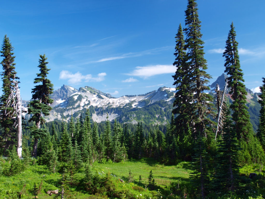
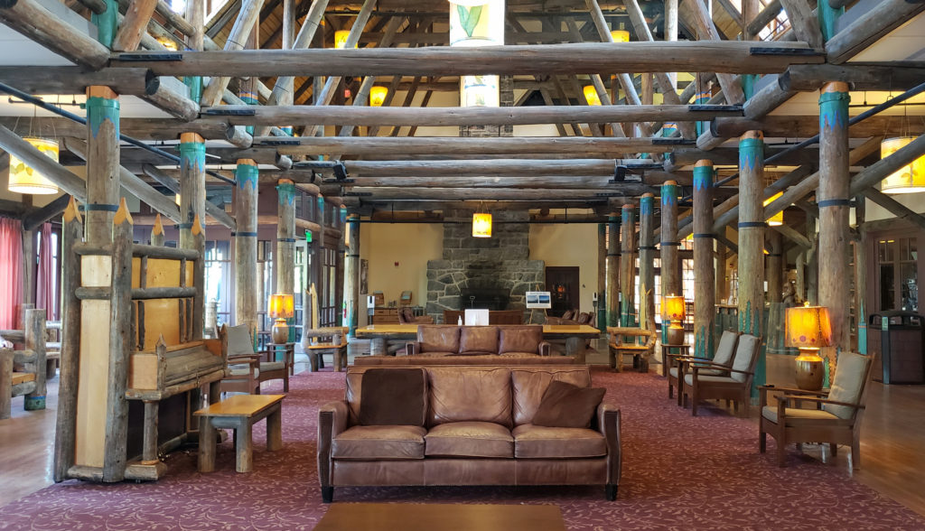
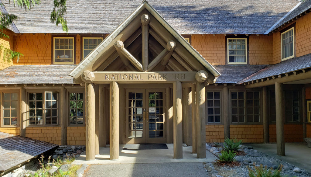 Both Paradise Inn and the National Park Inn have full service restaurants, but both were operating on a reduced scale due to the pandemic when we were there in August. The National Park Inn dining room was closed, but take out meals could be ordered and picked up at the reception desk in the lobby. The dining room at Paradise Inn was open for dinner only for most of our visit, but closed (unexpectedly) for the season on our last day there. Paradise Inn also has a limited service cafe, and there is a cafeteria at the Jackson Memorial Visitor Center that is open daily during the summer season and on most weekends and holidays in the winter (depending on road conditions). The National Park Inn restaurant is open year round.
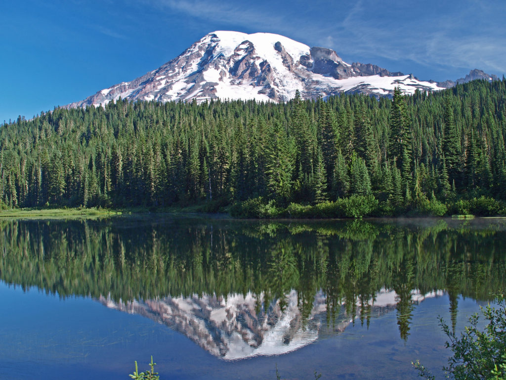
 The nearby Snow Lake Trail is an easy and worthwhile hike. To the east, the Stevens Canyon area has a number of interesting areas, including Box Canyon, a 180 foot deep slot canyon, and a number of roadside waterfalls.
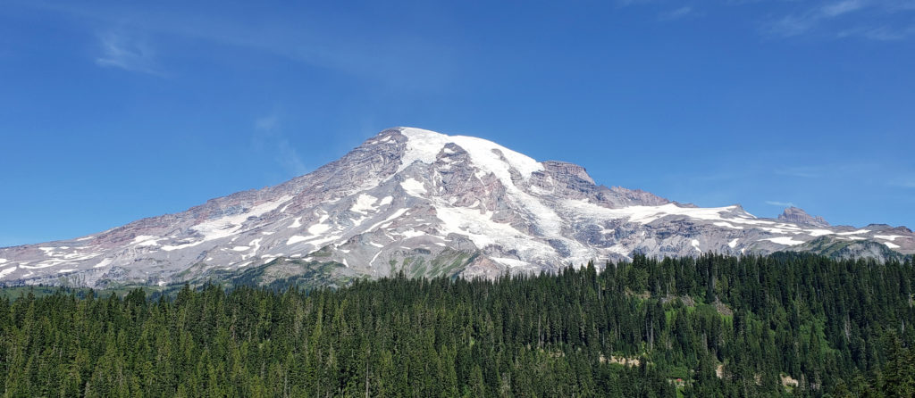 The Longmire area has some interesting history, a museum, nice hiking trails, and the National Park Inn offers both lodging and dining options for the visitor. The road to Longmire is also plowed in the winter, so it’s a year round destination. (The road from Longmire to Paradise is open in winter when the weather allows.)
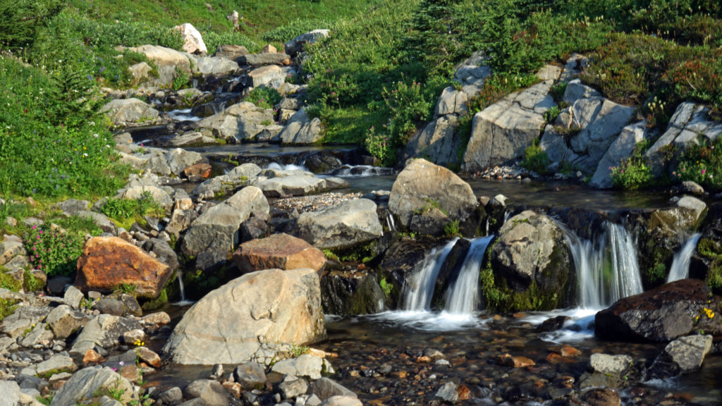
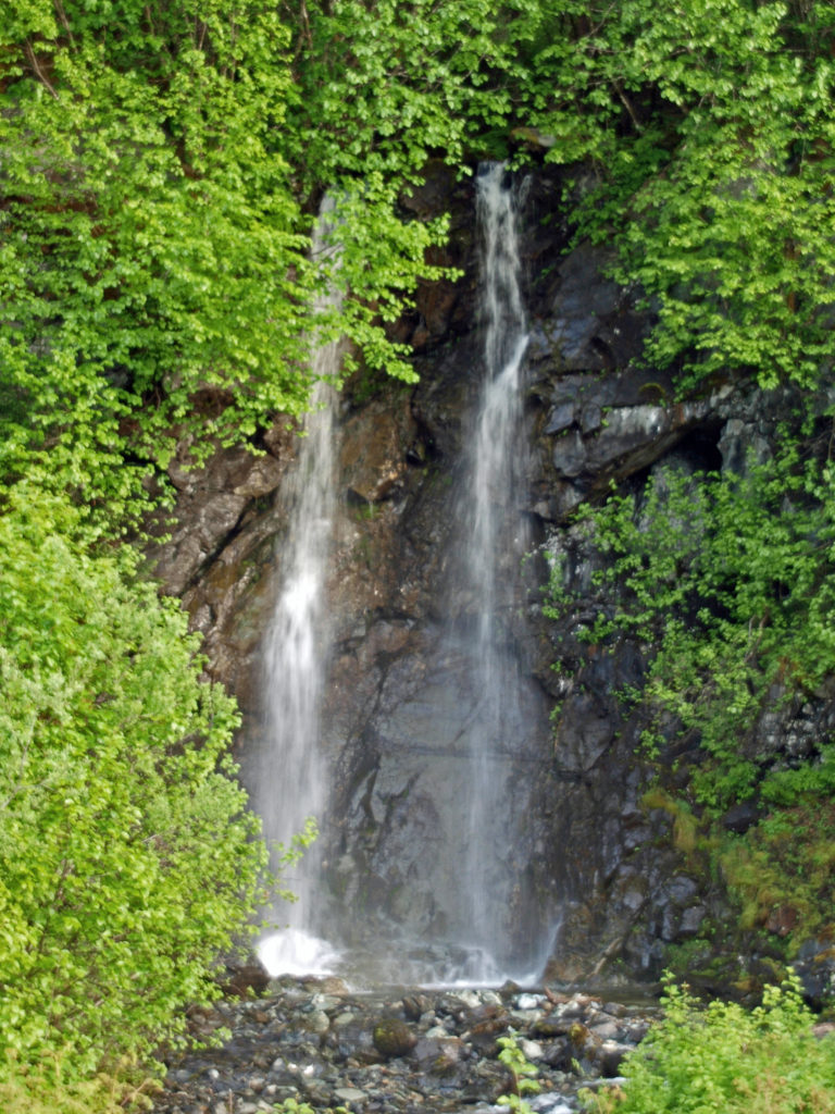
 In the Ohanapecosh area in the southeastern corner of the park, the Grove of the Patriarchs Trail is a good family friendly outing. And the nearby Silver Falls Trail is a must for waterfall lovers. In the northeastern section of the park, the Sunrise area offers beautiful views of the eastern side of the mountain and has an abundance of hiking trails.
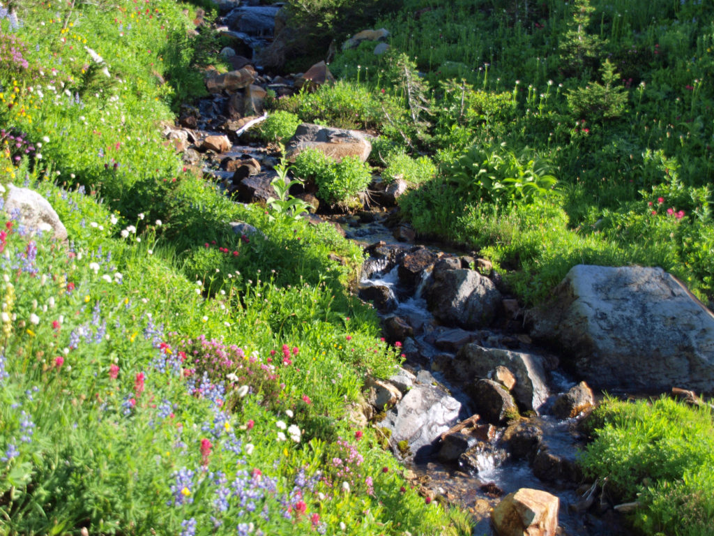
 The Lake
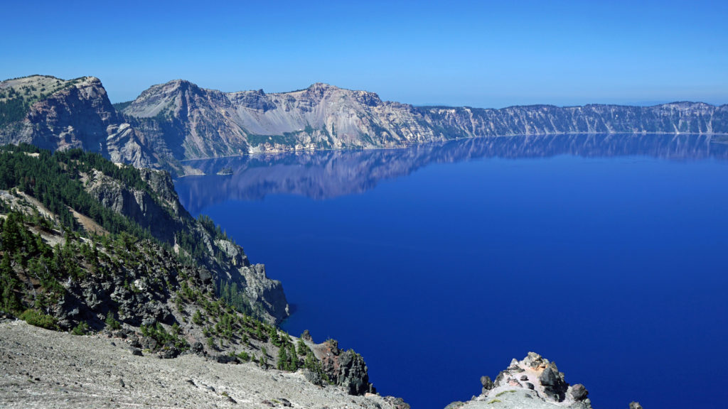
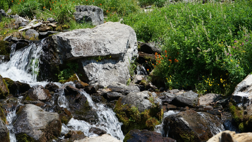
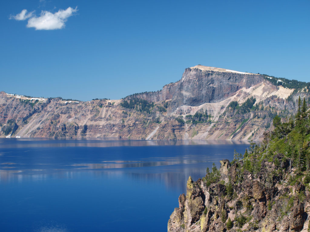 Crater Lake is 1943 feet deep, making it the deepest lake in the United States, second deepest in North America, and ninth deepest in the world. It is also one of the cleanest and clearest lakes in the world. It’s that combination of depth and clarity that results in its intense deep blue color.
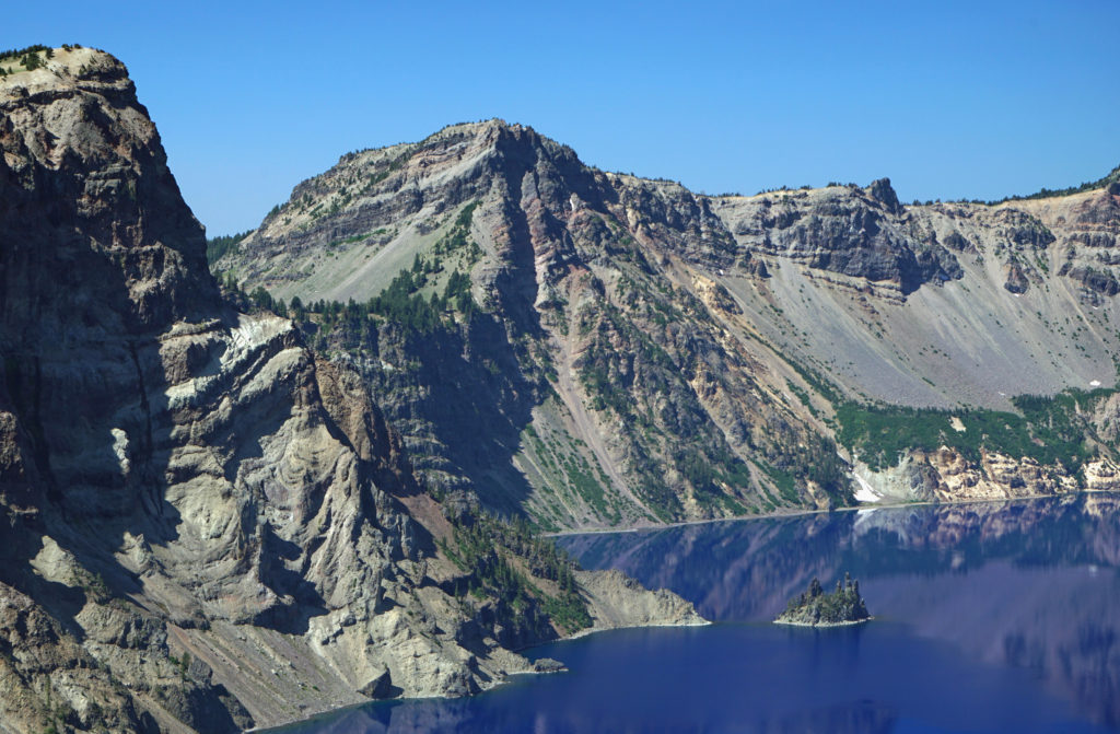 The caldera that Crater Lake occupies was formed 7700 years ago when the summit of 12,000 foot tall Mount Mazama collapsed after a massive eruption. Over time rain and snow filled the caldera to its present level. The lake has no outlet. The level of the lake remains nearly the same because the amount of evaporation from the surface of the lake closely matches the amount of precipitation falling on it in any given year.
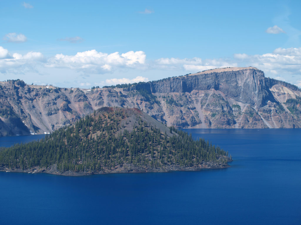 Wizard Island formed sometime after the eruption that formed the caldera. It rises 770 feet above the surface of the lake, 2713 feet above the deepest point in the lake. It last erupted about 5000 years ago, but it is considered dormant, not extinct. Conceivably, it could erupt again at any time. Merriam Cone also erupted after the caldera was formed, but never reached the lake surface. Its summit lies almost 500 feet below the average lake level.
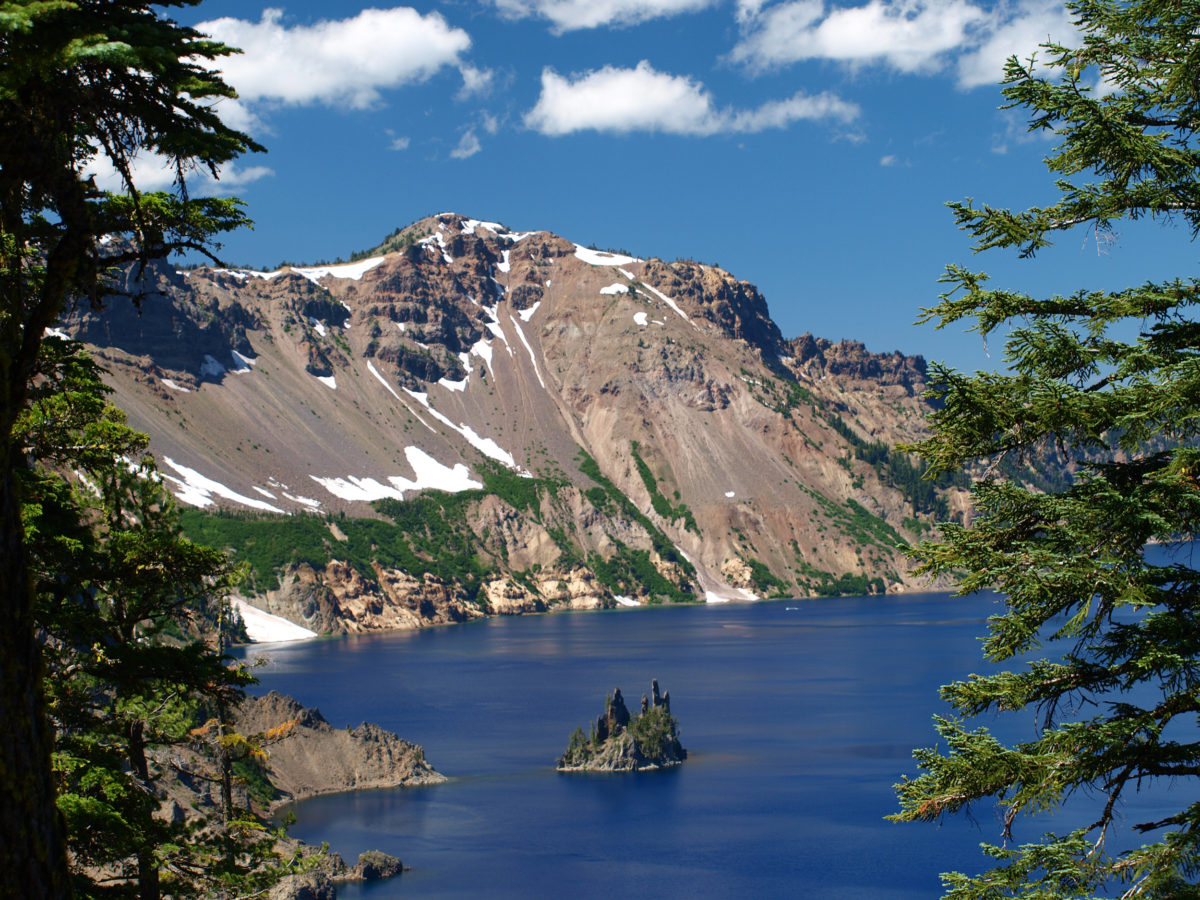
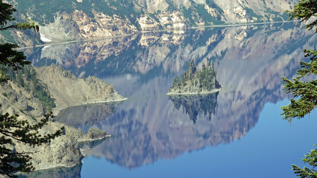
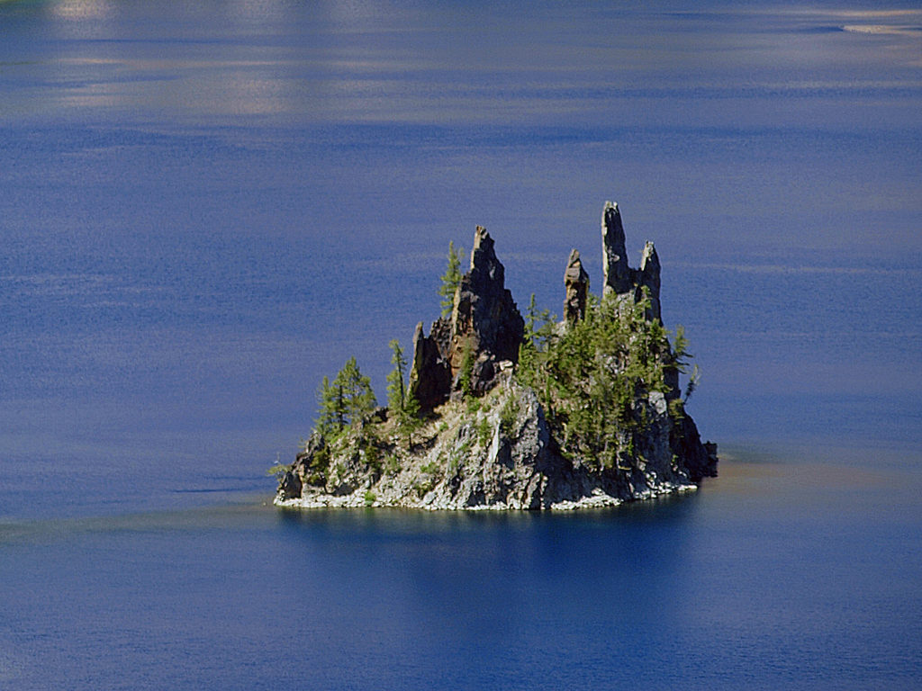 Phantom Ship, a remnant of an eruption 400,000 ago, rises 170 feet above the lake surface. Its formation predates that of Mount Mazama itself.
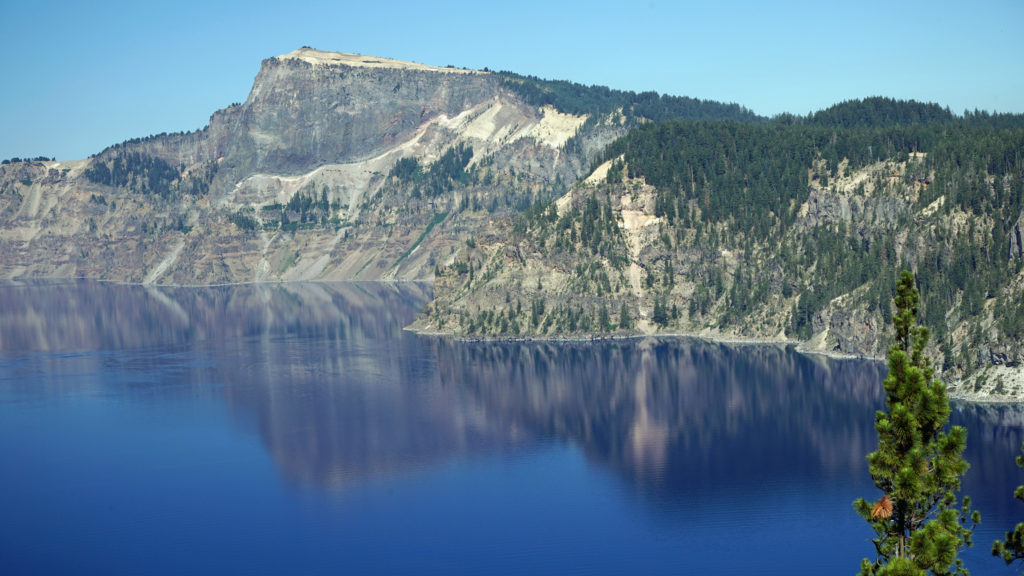 The Park
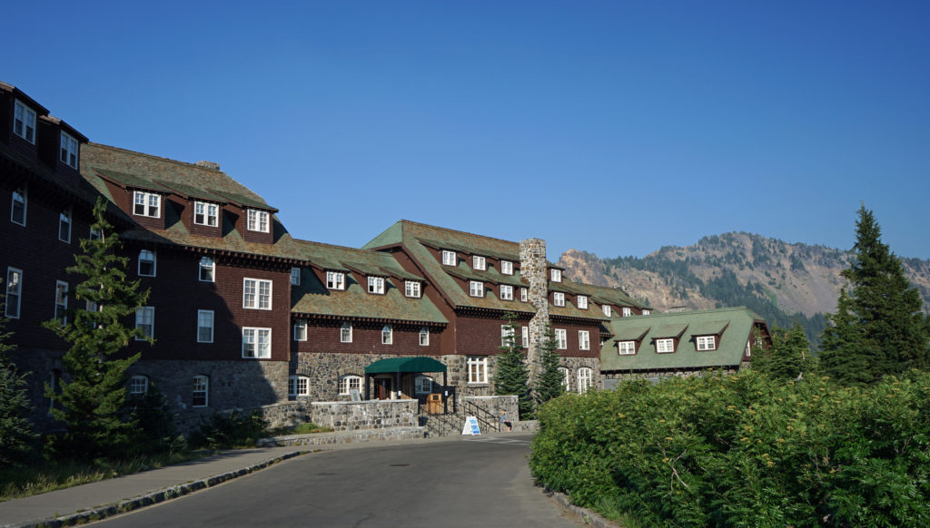 Crater Lake Lodge
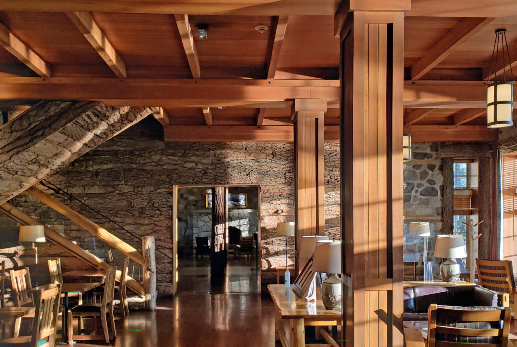 My wife and I recently spent three nights at the lodge. Although it lacks the amenities of a luxury hotel, our room was comfortable, with a private bathroom, and the location more than makes up any lack of luxuries.
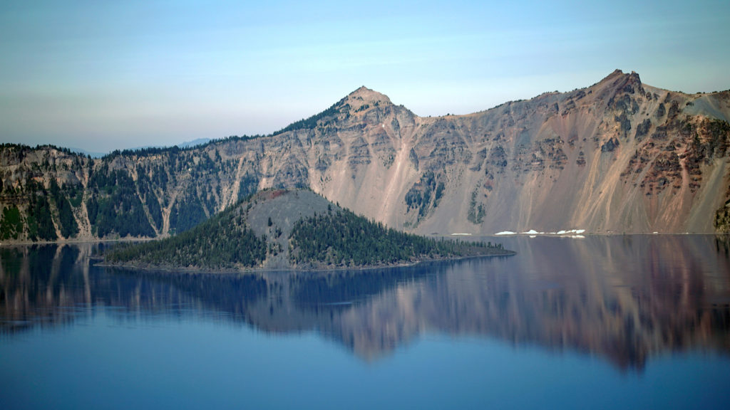 The Rim Drive
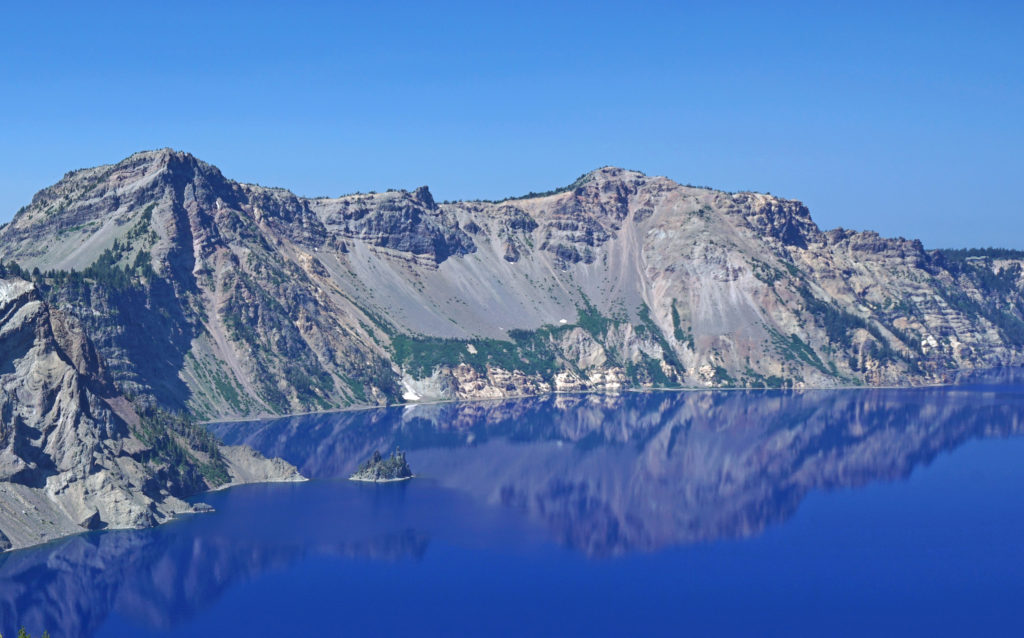 You’ll want to stop at all of the viewpoints. Maybe combine the drive with a hike down to Cleetwood Cove and a boat tour of the lake. You can get off at Wizard Island and hike to the summit and then catch a later boat back.
  For a more adventurous day, hike to the summit of Mount Scott, the highest point in the park. It’s a two mile hike to the summit with 1250 feet of elevation gain, so it’s not an easy hike (All Trails rates it “moderate”), but the view might just be worth the effort.
 Hiking Trails
 The Pacific Crest Trail passes through the park, but does not ascend to the rim of the caldera. Hikers on the PCT can take the Dutton Creek Trail that climbs up to the Rim Village, then hike the trail that parallels the West Rim Drive and reconnect with the PCT north of the lake.
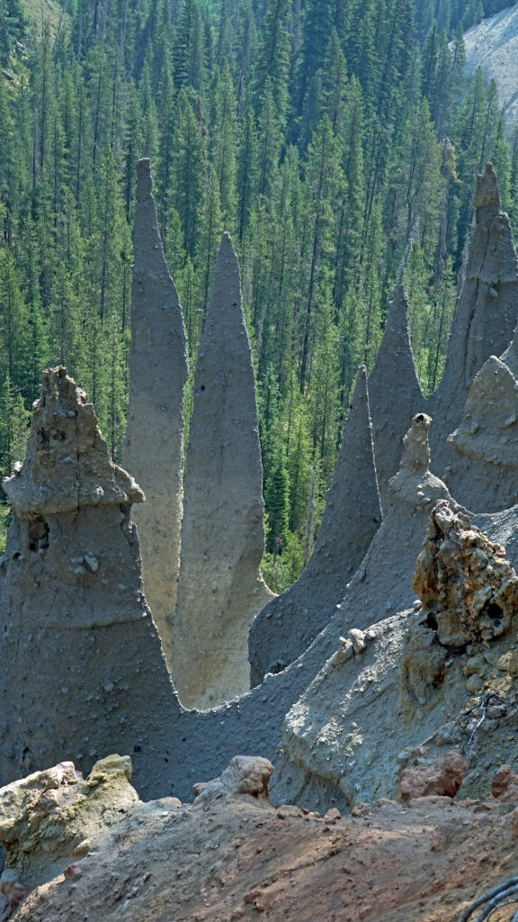
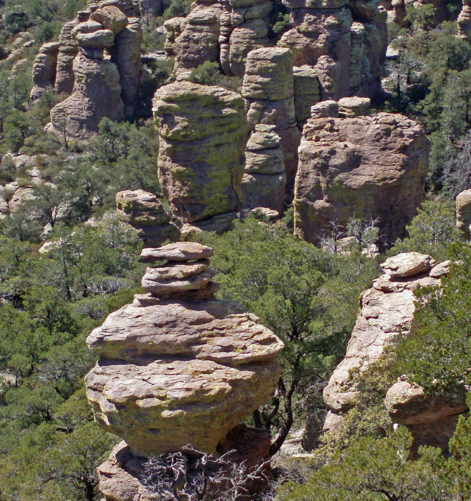
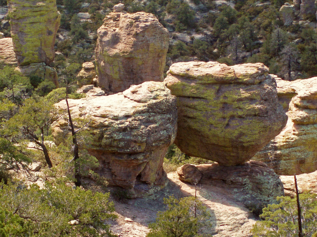
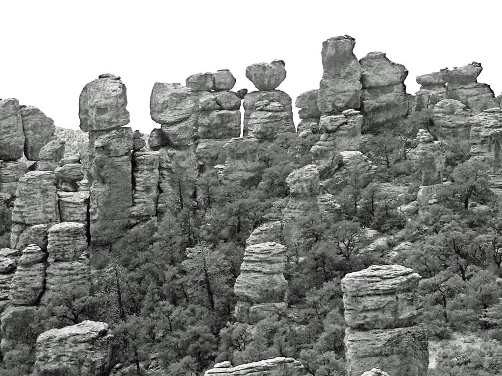
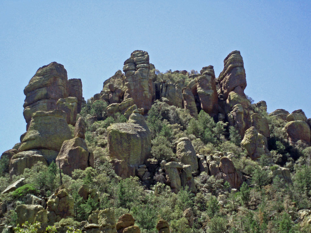
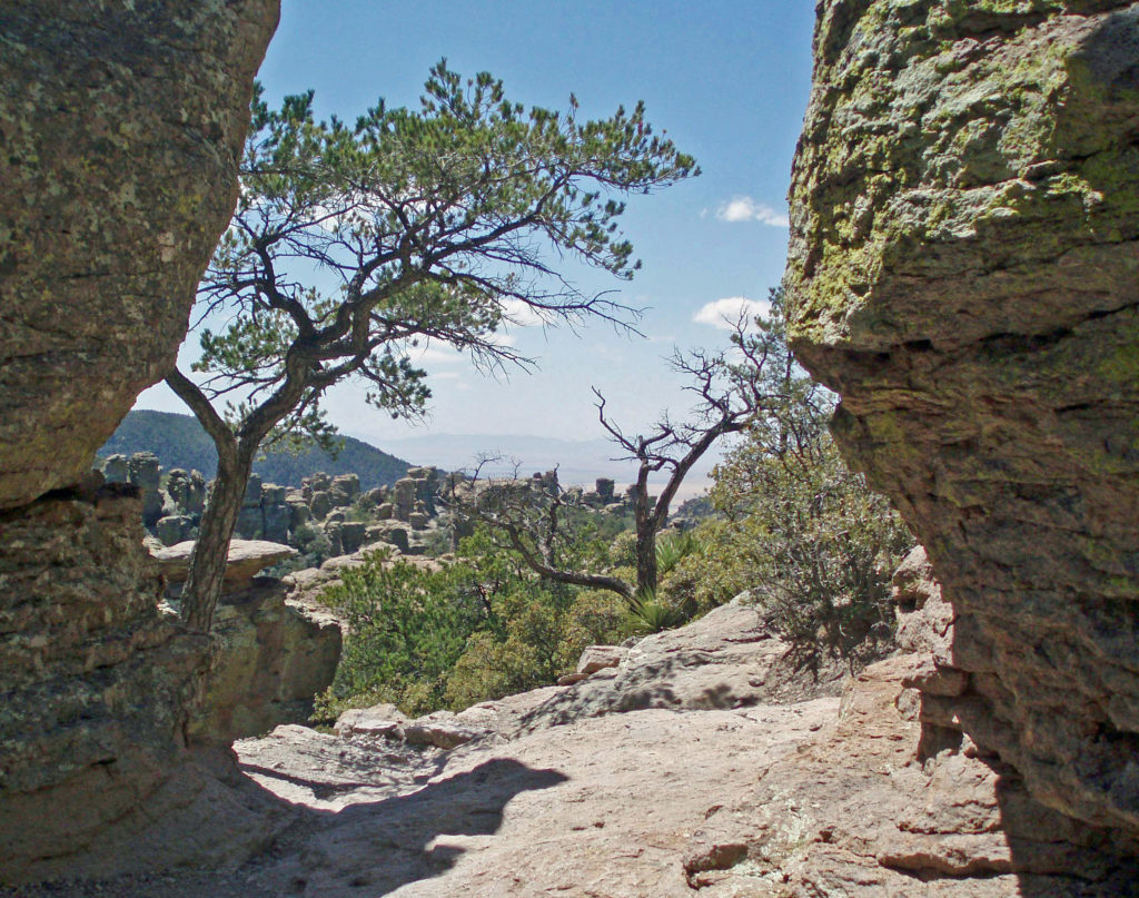
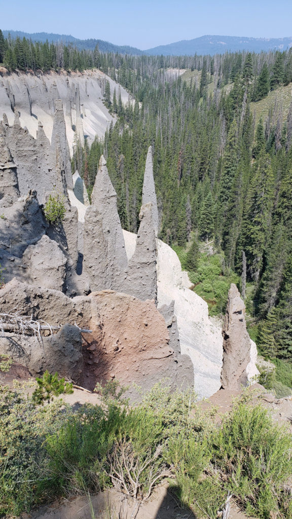 The Pinnacles
 Practical Info
 There are two lodges in the park, Crater Lake Lodge in the Rim Village and The Cabins At Mazama Village that are open for the summer season. Crater Lake Lodge has 71 rooms, starting at $246/night. The Cabins At Mazama Village has 40 rooms, all at $160/night. Prices listed are for the 2024 season. Note that the concessionaire that operates both lodges is changing, so prices may also change. Check the park website (linked above) for current information.
 There are two campgrounds in the park. Mazama Campground has 75 RV sites, 18 tent sites with electricity, and 121 tent sites without electricity. Tent sites start at $22. RV sites run from $32 to $44 per night. Mazama Campground is usually open from early June through late to September. Lost Creek Campground, located on Pinnacles Road, is a primitive tent only campground with 18 sites, operated by the park service. Lost Creek Campground is currently closed and will not be open for the 2024 season. Backcountry camping is allowed in the park by
 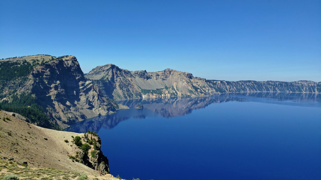 Dining options in the park are somewhat limited. The dining room at Crater Lake Lodge is open to all visitors, but reservations can only be made by people staying in the park. The Rim Village Cafe offers “grab and go” sandwiches and salads (I had a pulled pork sandwich from there on our recent visit that was very good). It is open from 9am to 8pm in the summer and 10am to 5pm in the winter. The Annie Creek Restaurant in Mazama Village is open from 7am until 9pm. The Mazama Village Store sells packaged sandwiches and snacks.
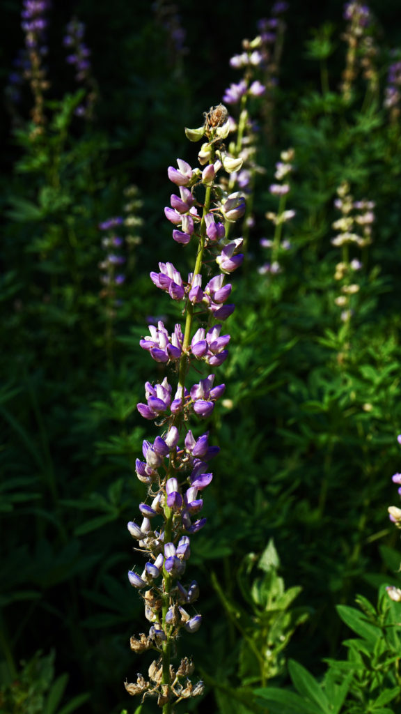 Summer park entrance fees are $30 for private vehicles and $25 for motorcycles. Winter fees are $10 less. Snowmobilers, bicyclists, and pedestrians are charged $15 per individual. All entrance fees are good for seven days. Entry reservations do not need to be made.
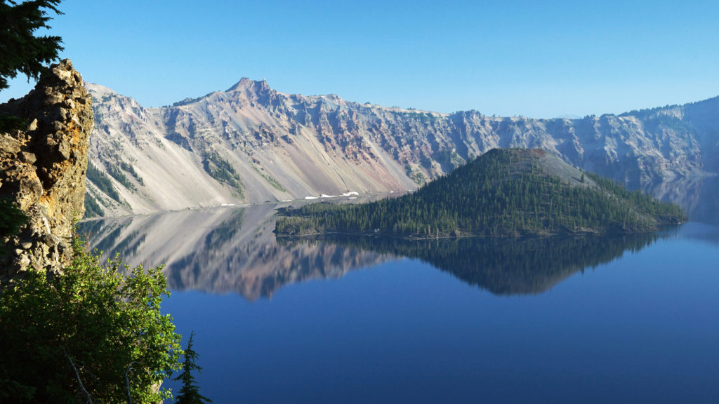
 Originally posted September 13, 2021. Most recently updated April 6, 2024.