by Alan K. Lee
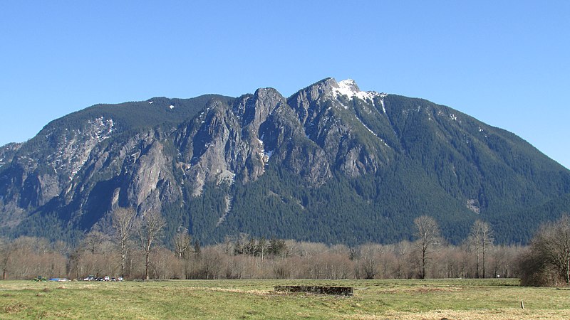
Lake Crescent, the nearby the Sol Duc Valley, and Hurricane Ridge are three of the prime attractions of Olympic National Park. My wife and I had the pleasure of visiting Lake Crescent and vicinity on an “escape from the pandemic” tour of the Olympic Peninsula in September 2020.
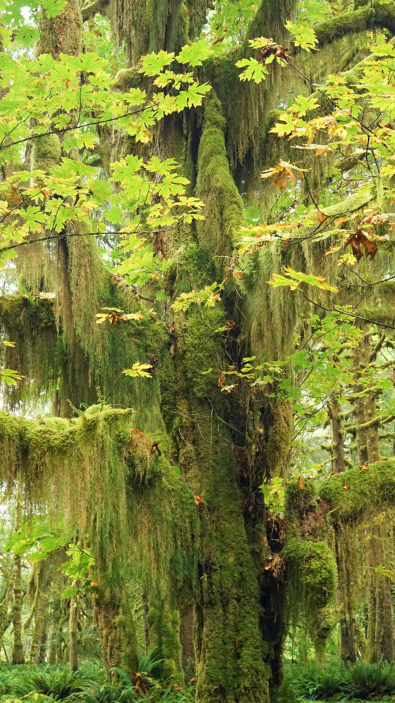
After spending three days in the magnificent Quinault Rain Forest, we made stops at Ruby Beach and Rialto Beach before heading on to Lake Crescent.
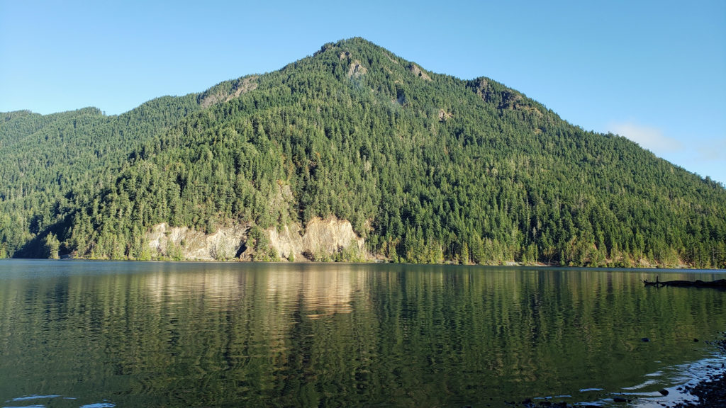
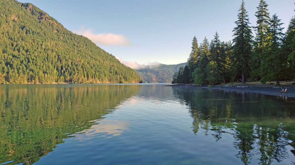
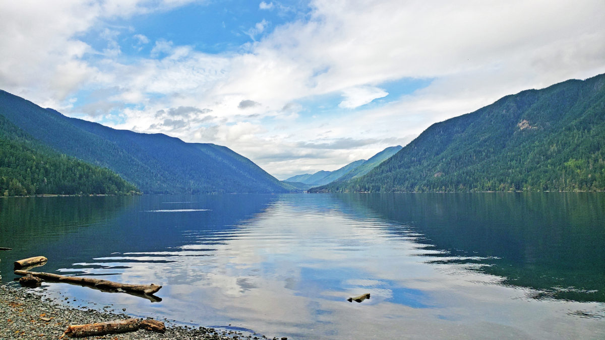
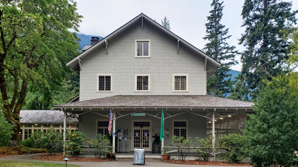
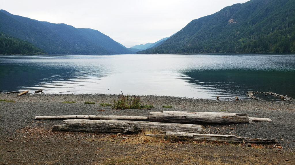
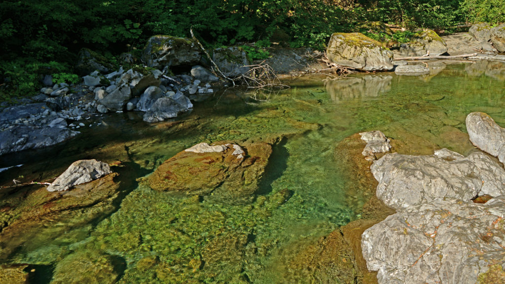
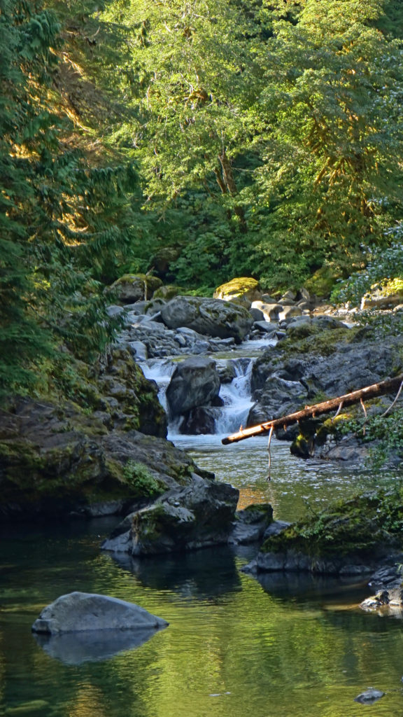
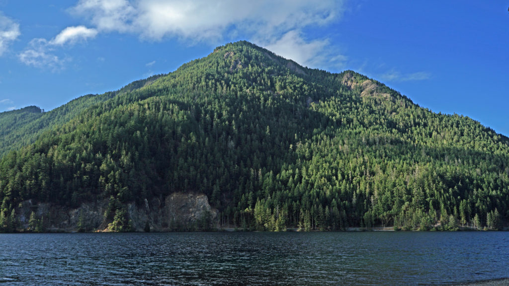
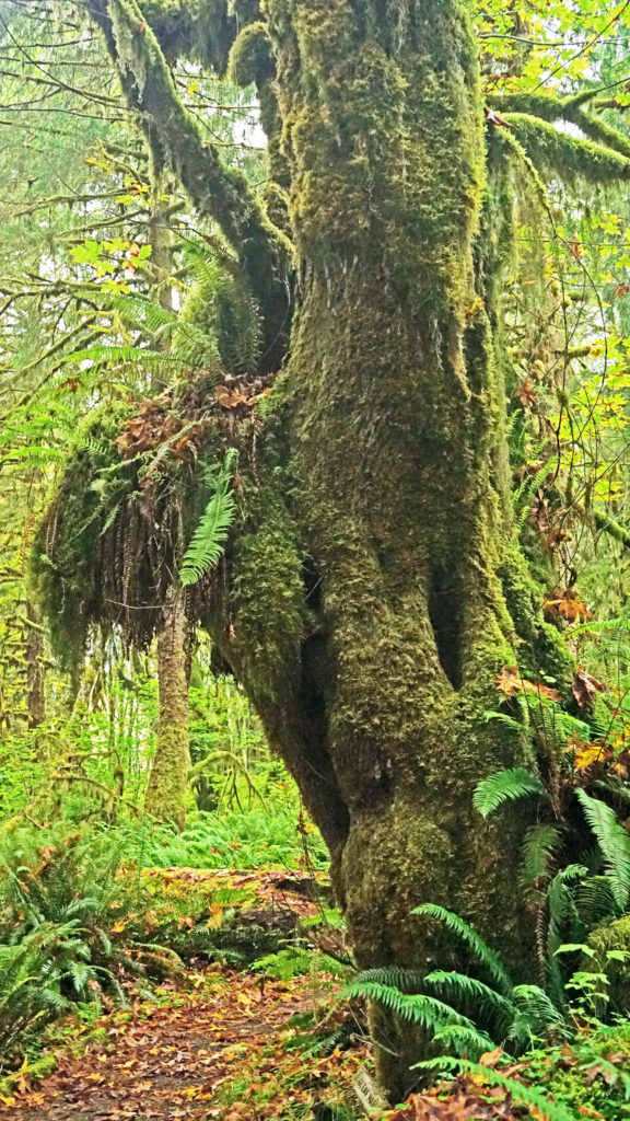
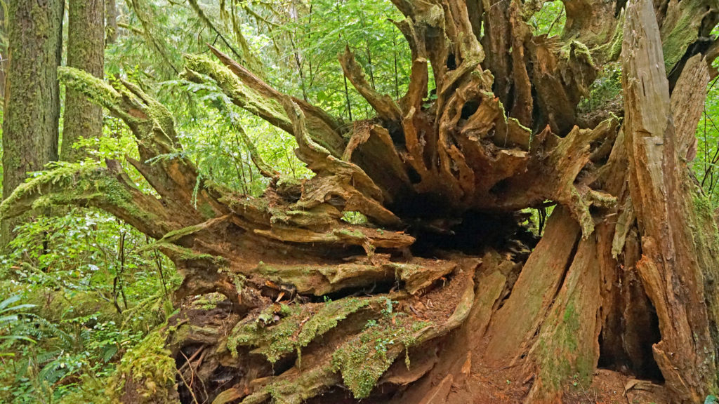
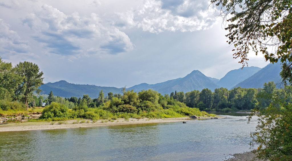
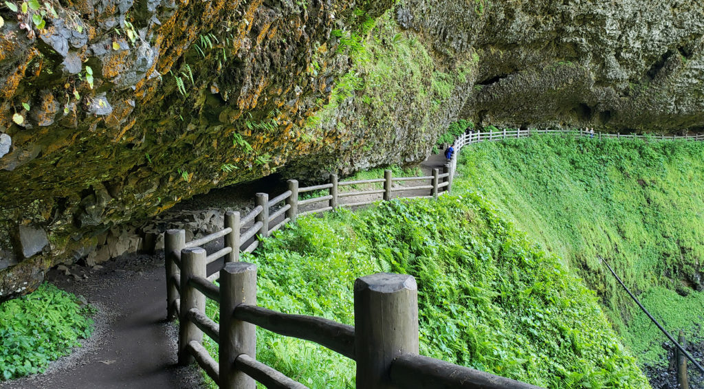
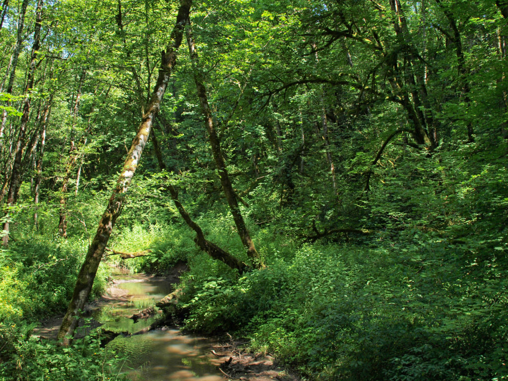
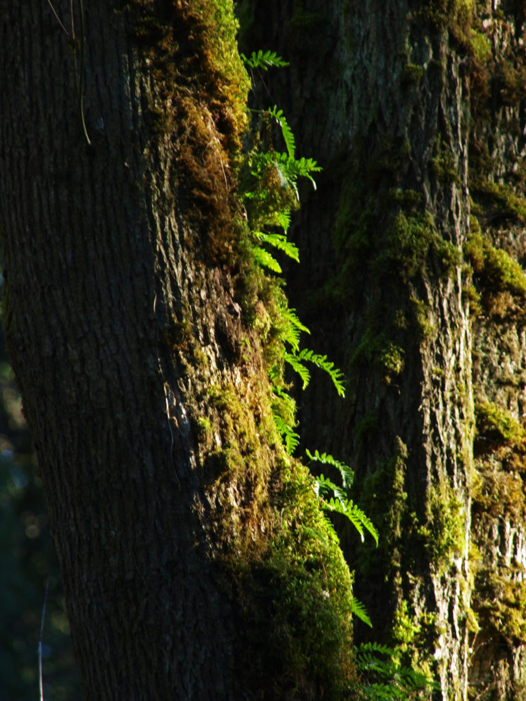
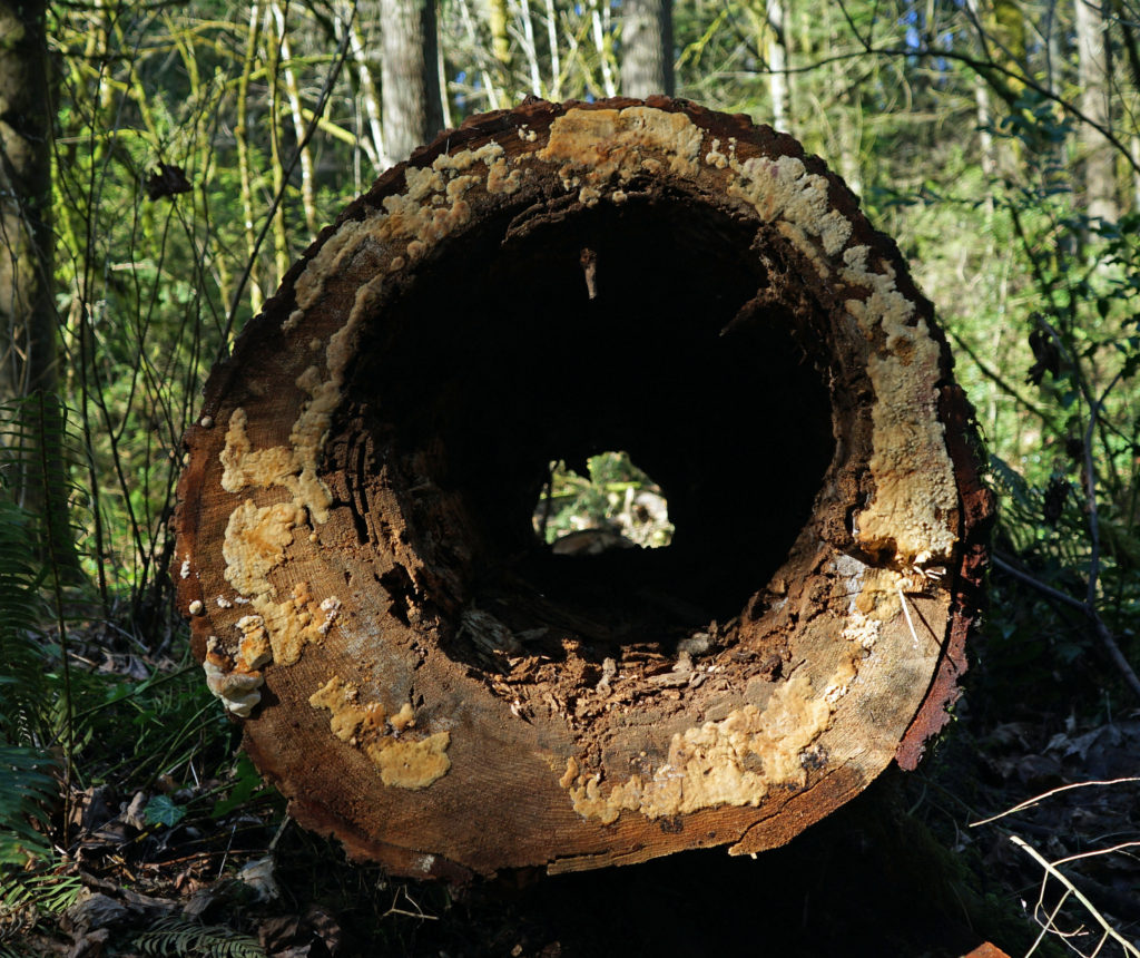
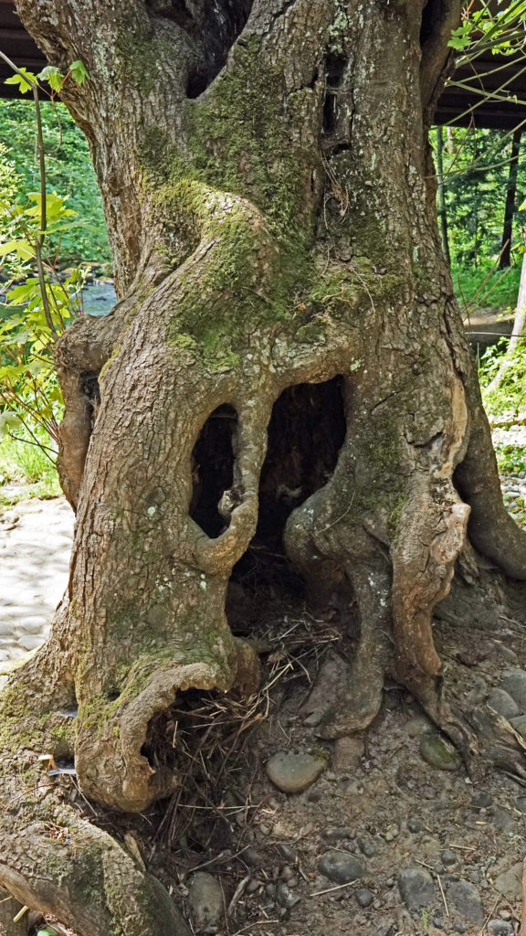
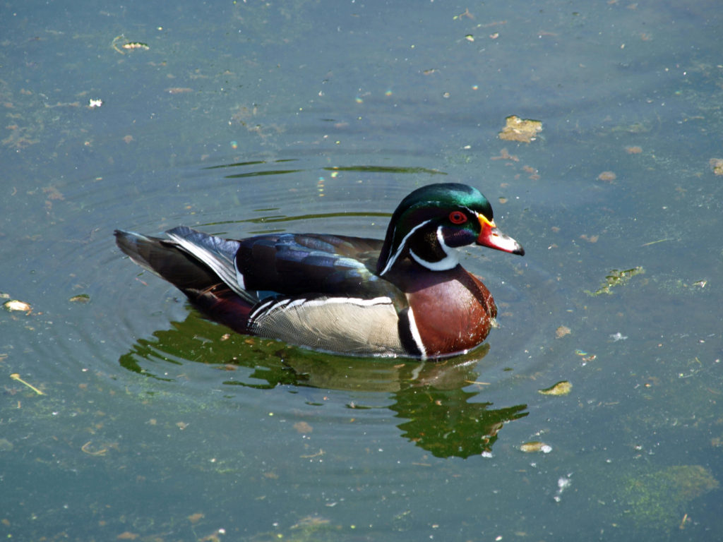
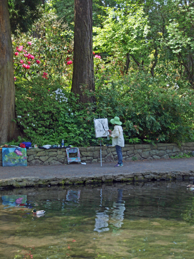
After checking in at Lake Crescent Lodge, we did a short but scenic and relaxing loop hike along the lake shore and through the forest east of the lodge. Lake Crescent lies in a glacier carved valley in the northern portion of Olympic National Park. The lake’s depth (nearly 600 feet) and clarity give the lake a brilliant deep blue color. Lake Crescent and nearby Lake Sutherland were once a single body of water, but a huge landslide about 7000 years ago divided the original lake into the separate lakes found today.
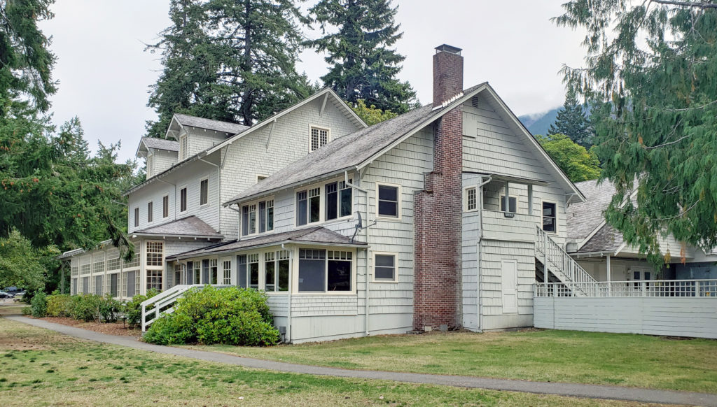
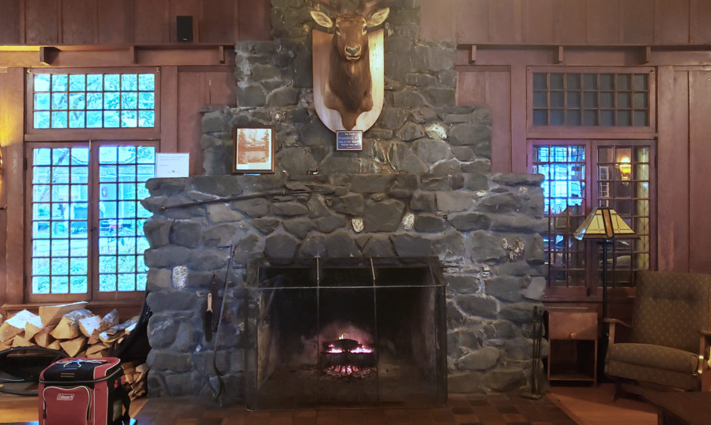
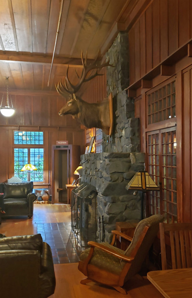
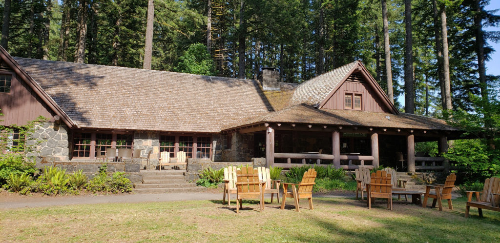
Lake Crescent Lodge, like Lake Quinault Lodge where we stayed on the first part of our trip, is one of the iconic grand lodges of the American West. Built in 1915, Lake Crescent Lodge is perhaps a little less grand than the other grand lodges, but it is no less significant in terms of its history and its romantic appeal. The main lodge is smaller than Lake Quinault Lodge, and the lodge rooms do not have private bathrooms. But there are many individual one and two bedroom cabins on the lake shore – the Singer Tavern Cottages and the Roosevelt Fireplace Cabins – that Lake Quinault and the other comparable lodges lack. More modern additions – the Storm King Rooms, Marymere Rooms, and Pyramid Mountain Rooms – are tucked into the woods a ways back from the shore. Our Storm King Room still had a view of the lake, though, and a nice balcony. All of the cabins and modern additions have private bathrooms.
As at Lake Quinault Lodge, the restaurant at Lake Crescent Lodge served only take out meals when we were there because of the corona virus pandemic. The lodge dining room was open for seating, however, so after our hike that first afternoon we claimed a window table looking out over the lake. Our meals were both very good, but Joan’s salmon “catch of the day” was a small (maybe 4 oz.) portion, and probably not worth the $28 price tag. My fish and chips were cheaper and more substantial, but we chose to drive to nearby Port Angeles for dinner the next two nights.
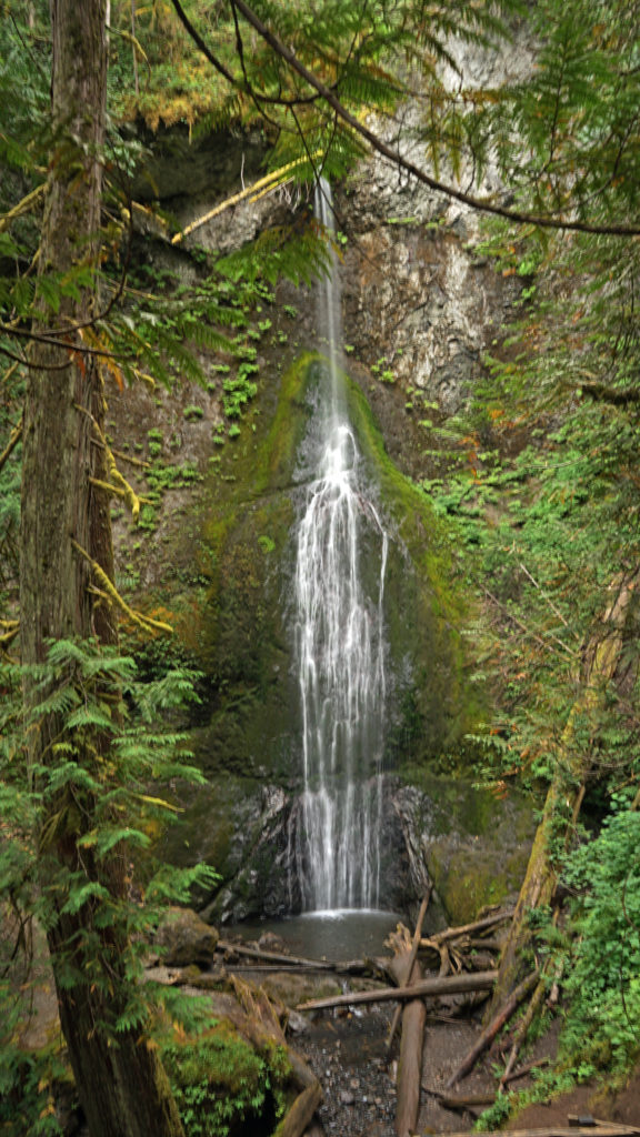
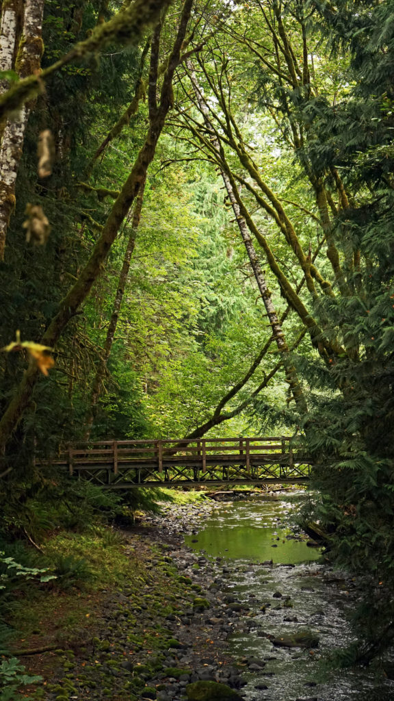
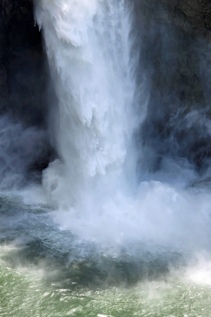
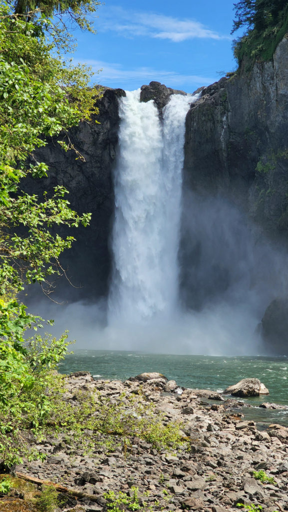
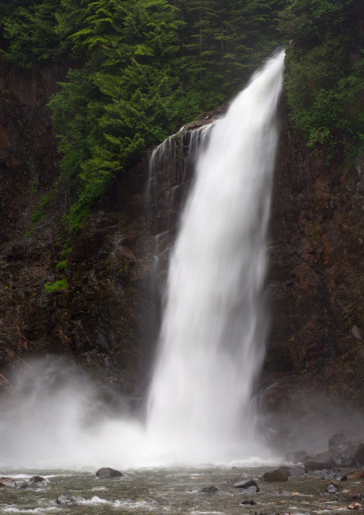
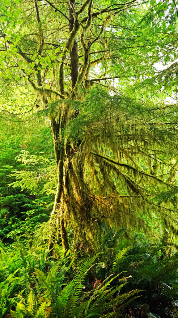
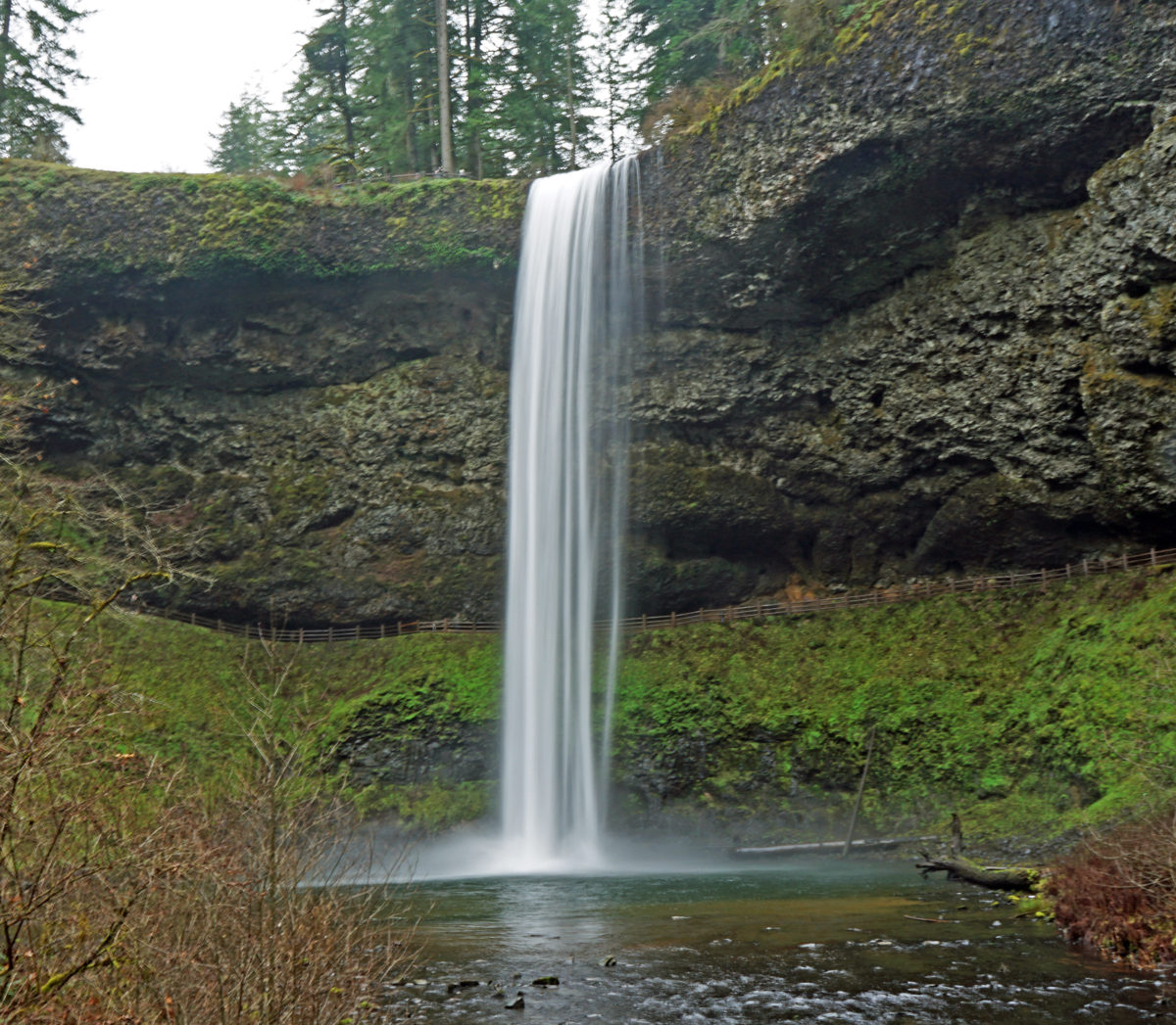
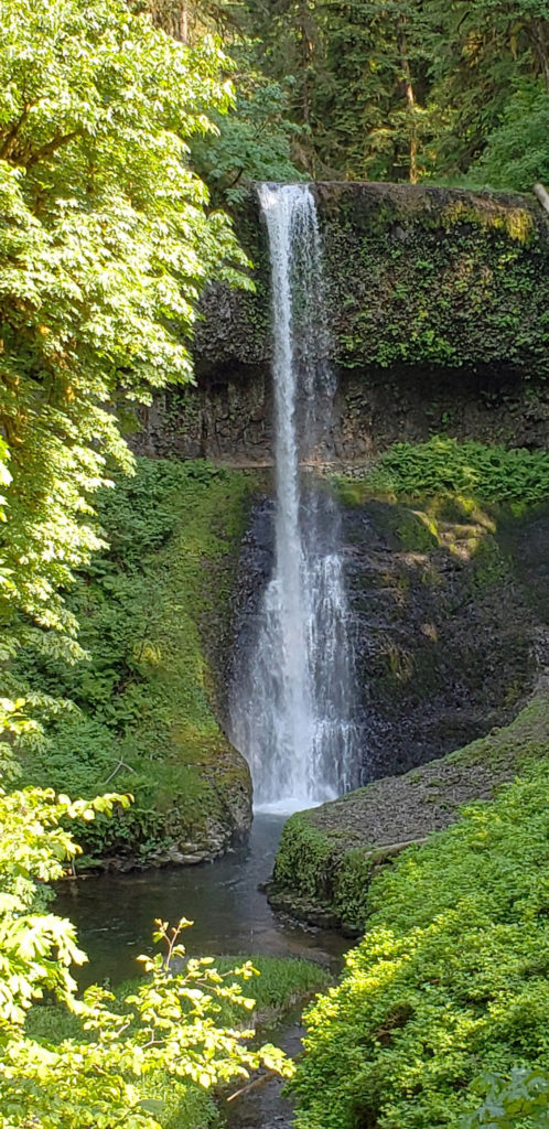
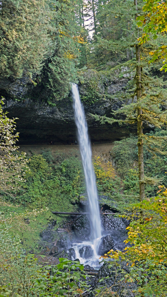
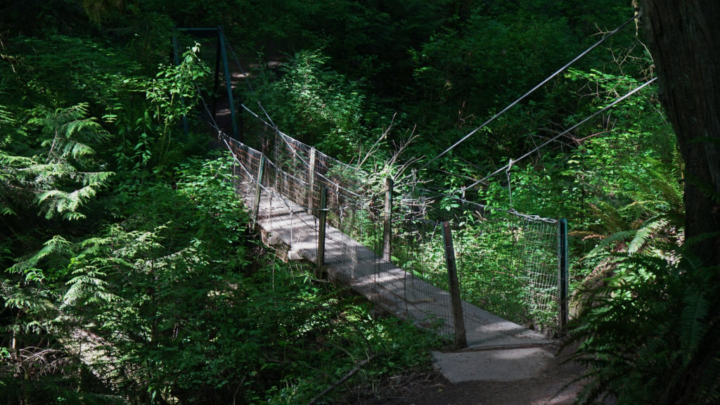
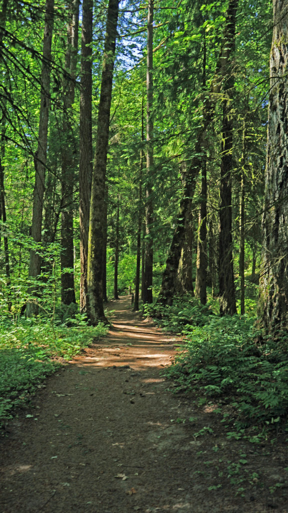
The next morning we hiked from the lodge to Marymere Falls, a picturesque 90 foot waterfall on Falls Creek. The trail is an easy 1.5 mile hike through old growth forest with minimal elevation gain to the lower viewpoint. From there the trail climbs steeply to an upper viewpoint. Both viewpoints offer unobstructed views of the falls.
My wife took her kayak out for a paddle on the lake that afternoon while I relaxed on our room’s balcony with a good book (Graham Greene’s Travels With My Aunt).
That evening we drove into Port Angeles, about 20 miles to the east, and dined at Next Door Gastropub. They have a good selection of beers and the Cuban pork sandwich that I had was quite good. After dinner we wandered around a bit, searching out some of the many public artworks scattered around the downtown area, before returning to Lake Crescent.
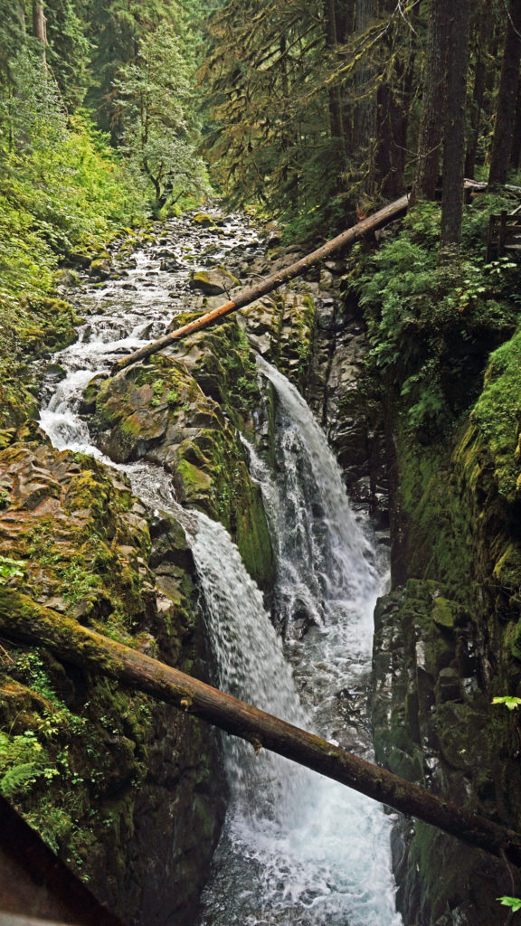
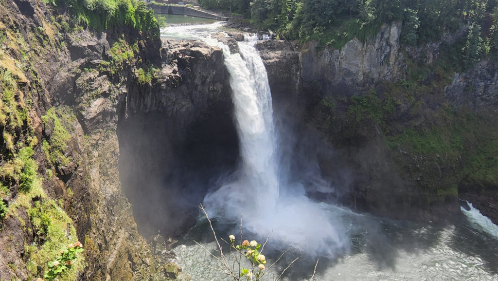
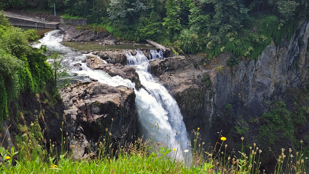
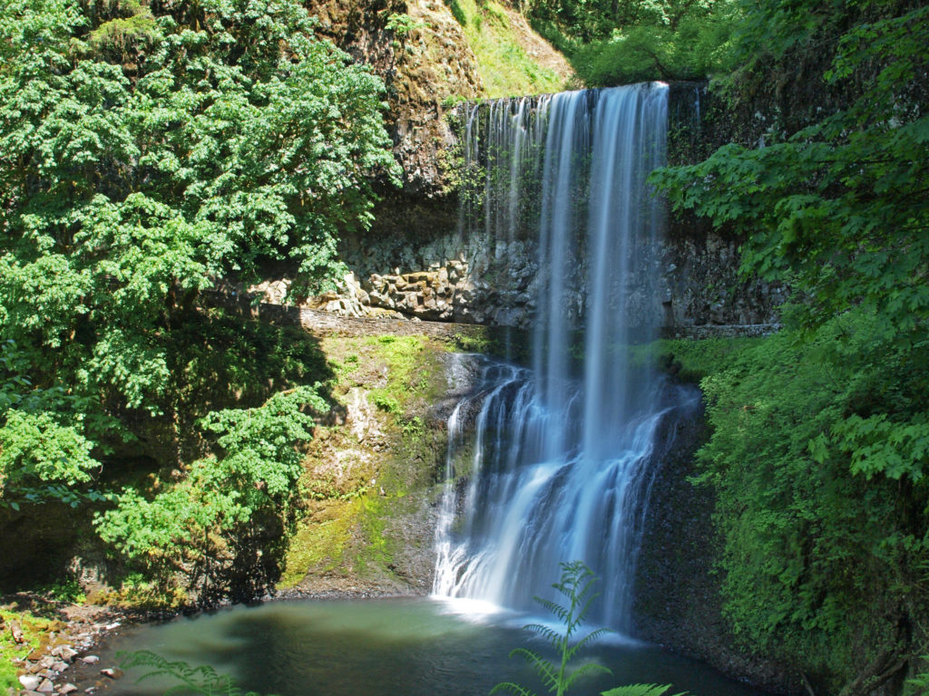
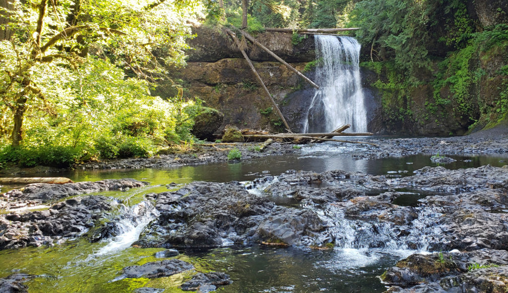
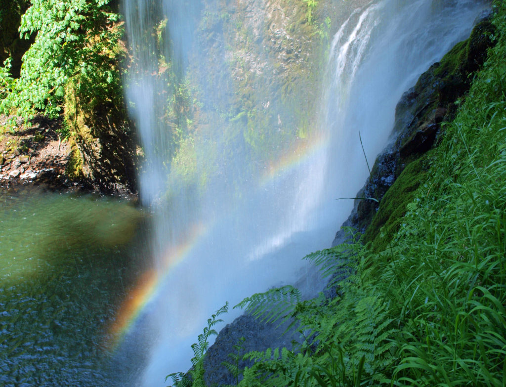
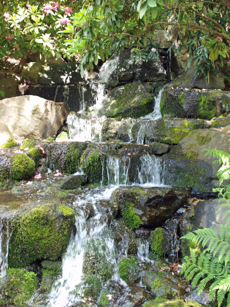
The following morning, we drove to the Sol Duc Valley west of Lake Crescent and hiked to Sol Duc Falls. Originally called “Sole Duck,” the spelling was officially changed to Sol Duc in 1922 to more accurately reflect its derivation from a Quileute language word meaning sparkling waters. The family friendly trail (less than a mile long) takes you through a dense forest with minimal elevation gain to the 48 foot falls. There the Sol Duc River breaks into a number of channels before making a sideways drop into a deeper gorge. There are many bigger and more spectacular waterfalls in Olympic National Park, but certainly none more scenic.
 The nearby Sol Duc Hot Springs was once the site of a five star hotel. Built in 1912, the hotel lasted only four years, though, before burning down in 1916. The resort was rebuilt on a less grand scale in the 1920s and operated for a half century before closing in the 1970s. After being vacant for a number of years, it was renovated and reopened in the 1980s. Today the resort includes a restaurant and a variety of cabins with private bathrooms and modern amenities. Those staying at the resort have free access to a swimming pool, soaking pools, and hot tubs, all heated by water from the hot springs. People not staying at the resort can also enjoy the hot springs for a small fee.
A 17 unit RV campground that will accommodate RVs up to 36 feet is located a quarter mile from the resort. The RV campground sites have water and electric hookups, and there is a sewer dump station. A separate 82 unit “dry” campground is located nearby. The campground has restrooms, but no showers. The camp sites will accommodate small RVs, but do not have water or electric hookups.
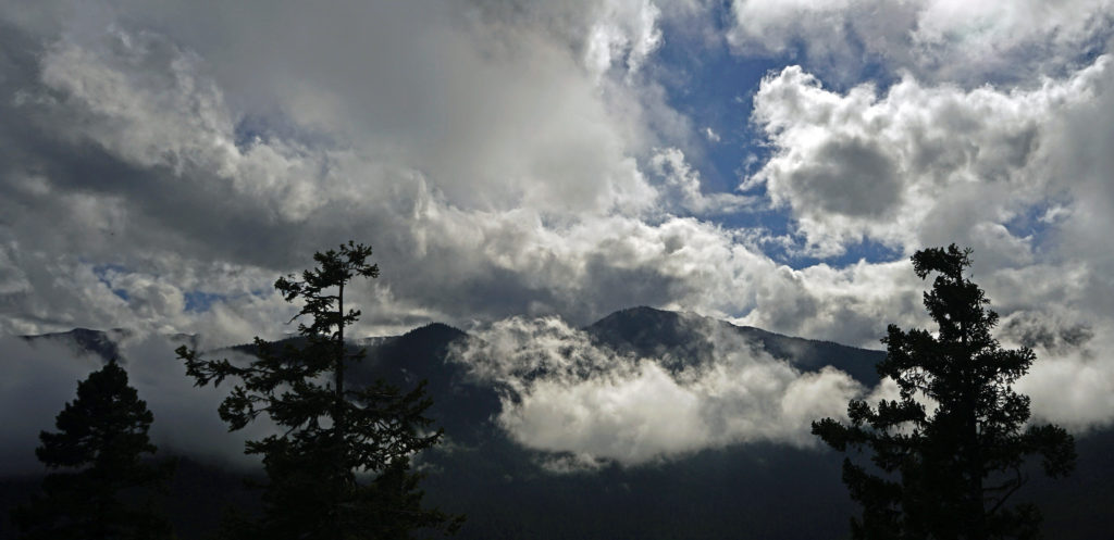
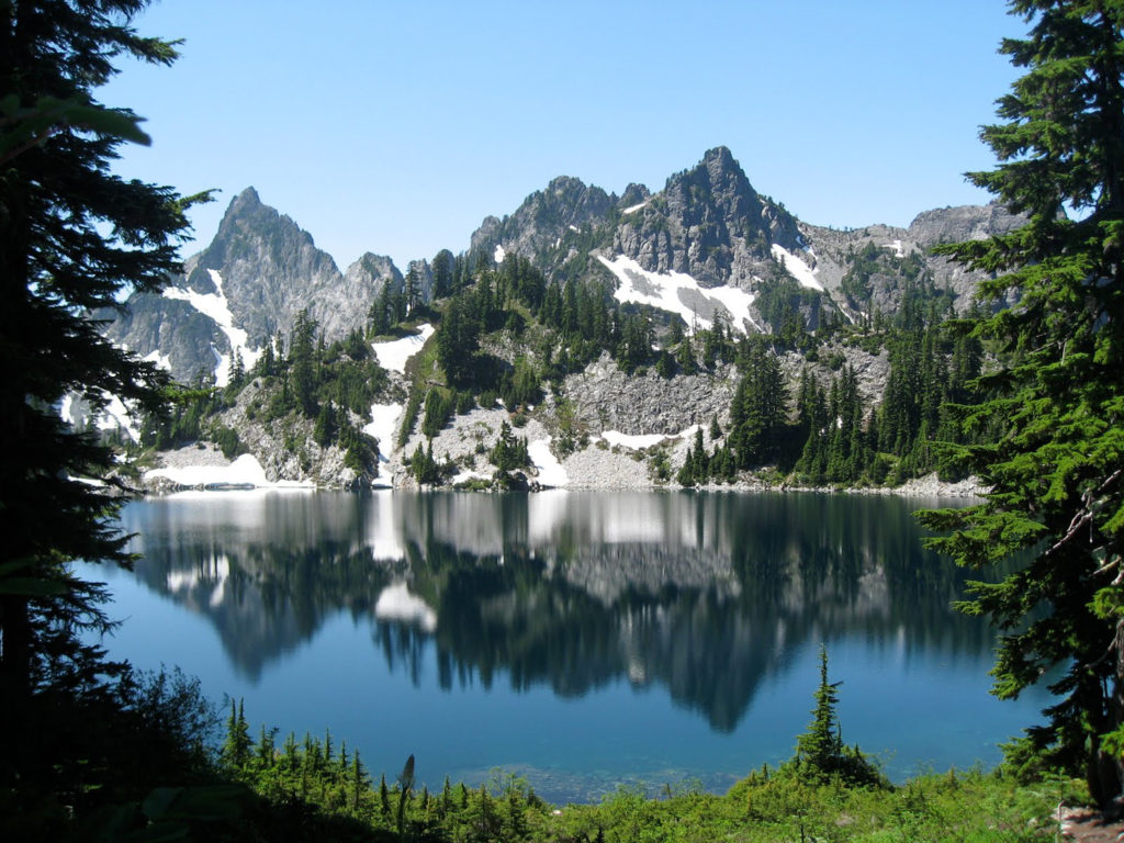
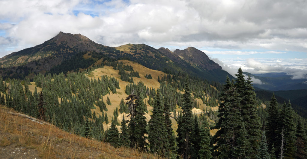 After our hike to Sol Duc Falls we drove to the Hurricane Ridge Visitor Center to do some more hiking and sightseeing. The visitor center is located 17 miles south of Port Angeles at an elevation of 5242 feet above sea level. Hurricane Ridge is the only alpine area in Olympic National Park accessible by car, which makes it very popular and means it can be very crowded, especially on summer weekends. We were there in the middle of the week in late September, though, so crowds weren’t much of an issue.
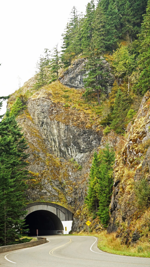 The Hurricane Ridge Road is paved, but winding with poor sight lines and several tunnels. It is also a popular challenge for cyclists because of the elevation gain, so go slow and watch for bicycles on the road.
The visitor center’s gift shop and restrooms were open, but the main part of the center was closed due to the corona virus pandemic. The rangers were manning an information desk outside on the sidewalk, though, where they were giving out maps and answering questions.
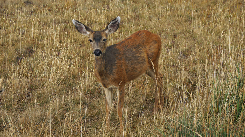
Several short loop and out and back hikes ranging from a half mile to a mile and a half take you from the visitor center to viewpoints with great views in all directions. Look for wildlife when you’re there. We’ve seen mountain goats there in the past, and on this visit a doe was grazing only a few feet off one of the trails, almost within arms reach. Past the visitor center, at the end of the road, you’ll find the trailhead for a longer 3.2 mile round trip hike to Hurricane Hill with even more spectacular panoramic views.
The following morning we somewhat reluctantly checked out of the lodge. Our six days in the Olympics were a much needed getaway from both the pandemic and the wildfires that had threatened many of the populated areas of western Oregon. We in the Pacific Northwest are lucky to have such a magnificent place so close at hand. Olympic National Park is a jewel worth visiting, no matter how far you have to come to experience it.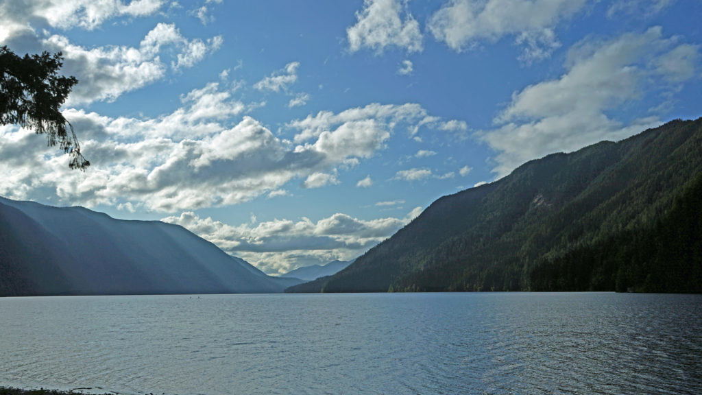
From Crescent Lake, we headed on to Port Townsend for the final part of our trip. Look for an upcoming post on Port Townsend, one of my favorite places in the Northwest, and home of the annual Wooden Boat Festival.
 Originally posted November 7, 2020. Updated and re-posted November 9, 2022.
All photos © Alan K. Lee
 History
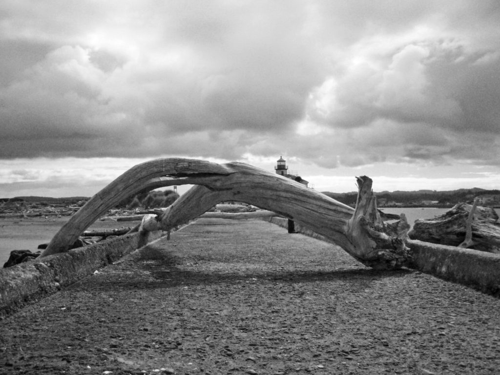 One of the things Lord Bennett brought to Bandon from Ireland was gorse, a thorny, thick growing plant with bright yellow flowers. In Ireland it was used for privacy hedges and property boundaries because it is almost impenetrable. In Oregon it went wild and was one of the state’s first invasive plants. Besides being thick and thorny, it is also a very oily plant and burns readily. In 1936 a small forest fire started from a slash burn that got out of hand, spread to the gorse near the town, and then to the town itself, destroying all but 16 of the 500 structures in the town. The fire decimated the community and all but ended shipping to and from the harbor.
 In my youth, Bandon was primarily a mill town, with fishing and agriculture secondary industries. Today, the lumber and plywood mills are long gone. There is still a small fishing fleet that operates out of the harbor, Bandon is still one of the leading cranberry producing areas of the country, and dairy farming is still an important component of the economy. But it is tourism that drives the economy today. The three main tourist draws are the beaches, Bandon Dunes Golf Resort, and the old town section of Bandon.
 The Beaches
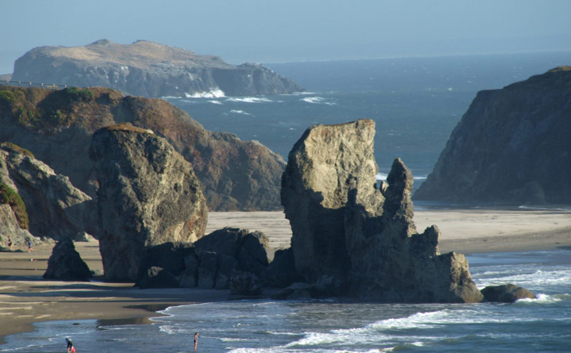
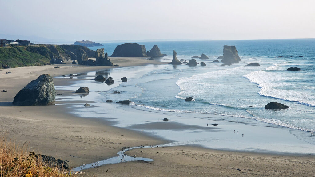
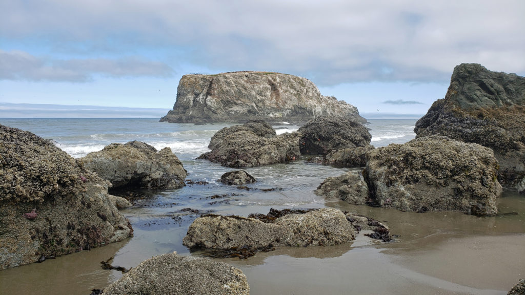
 Access can be had from the south jetty area, from the wayside at the end of 11th Street, and from Face Rock State Scenic Viewpoint on the Beach Loop Road. Farther south on the Beach Loop Road are other beach access points at Devils Kitchen and Bandon State Natural Area.
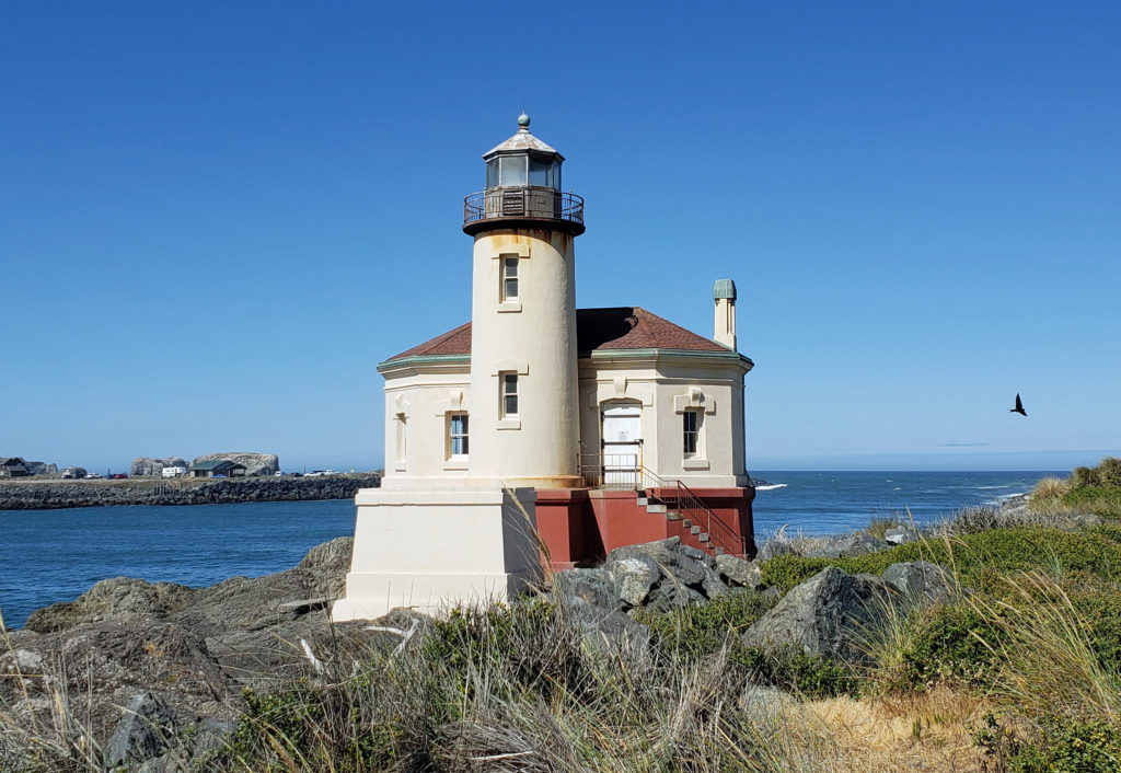
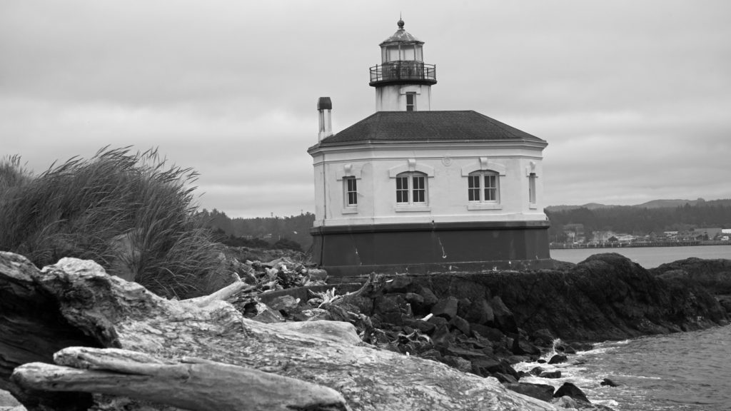 In 1939 the Coast Guard took over the lighthouse and deemed it unnecessary. The lighthouse was replaced by an automated light on the south jetty. The lighthouse sat abandoned for 24 years until it became part of the new Bullards Beach State Park in 1963. It was another 13 years before renovation of the lighthouse began, but it finally opened to the public in 1979. In 1991, during Bandon’s centennial celebration, a solar powered light was installed, ending the Coquille River Lighthouse’s 52 years of darkness. Further renovation of the lighthouse was done in 2007. The bottom floor of the lighthouse is staffed by volunteers and open to the public, but the tower and the light are not.
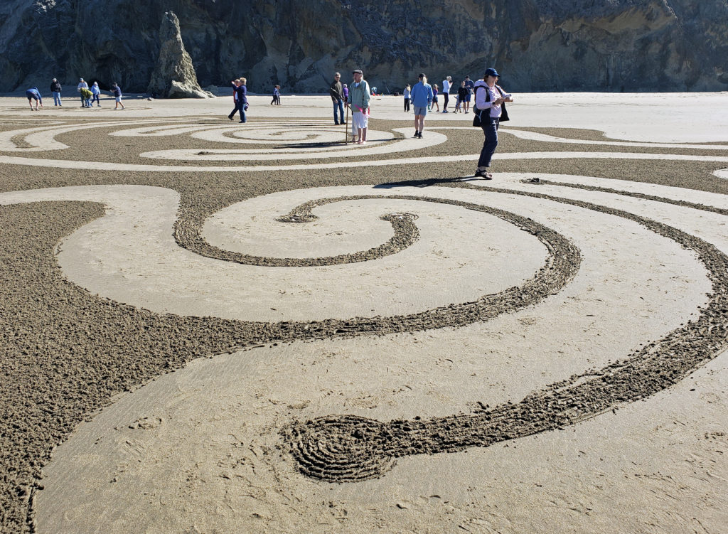
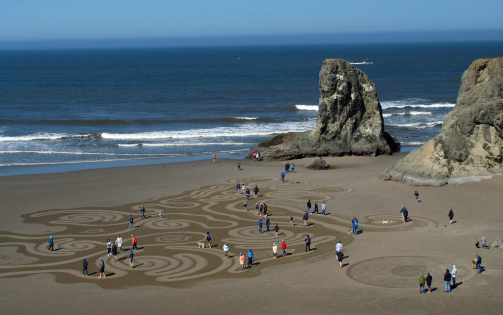 Circles in the Sand
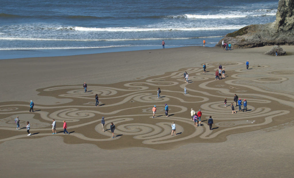
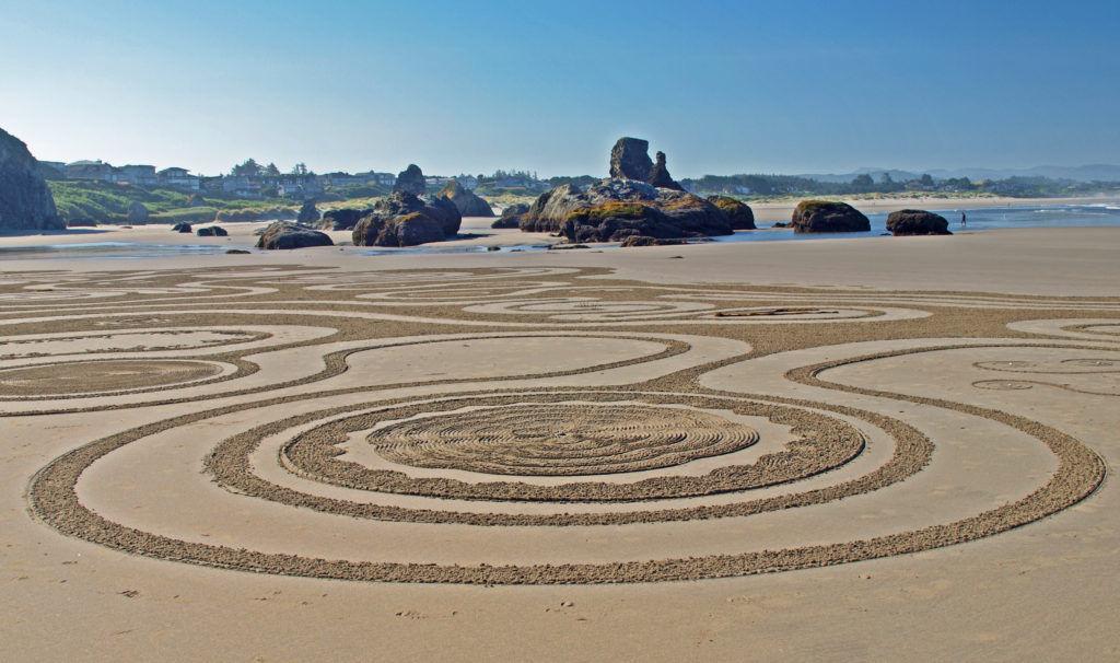
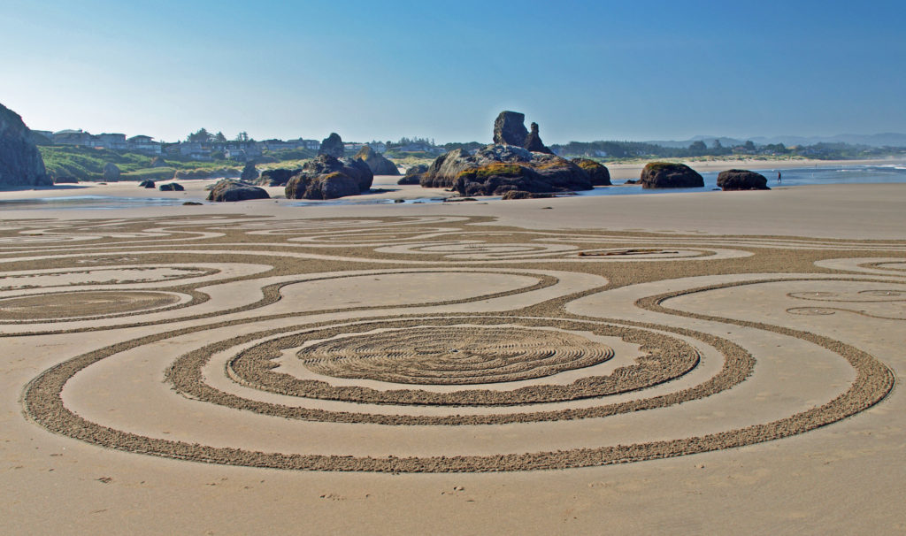 The
The 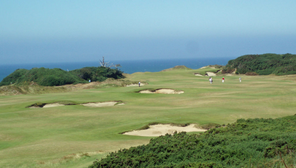
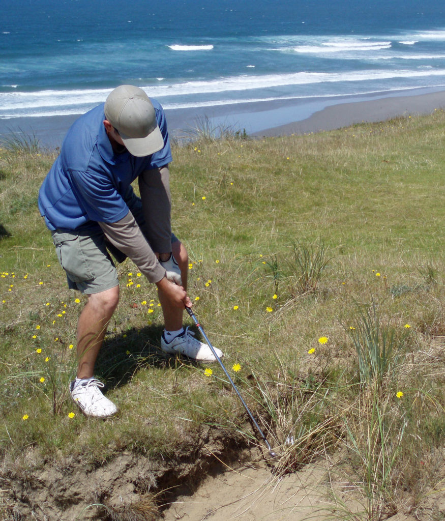 All of the Bandon Dunes courses are consistently rated in the top 100 courses in the United States, and the 13 hole par three course, Bandon Preserve, is a challenge in itself. A few miles south of town,
 Good eats abound in Old Town. Start your day at Bandon Coffee Cafe or Bandon Baking Company. Stop at
  Accommodations
 There is a campground at
  Getting There
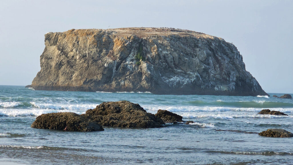 Consider combining a visit to Bandon with a drive south along the spectacular
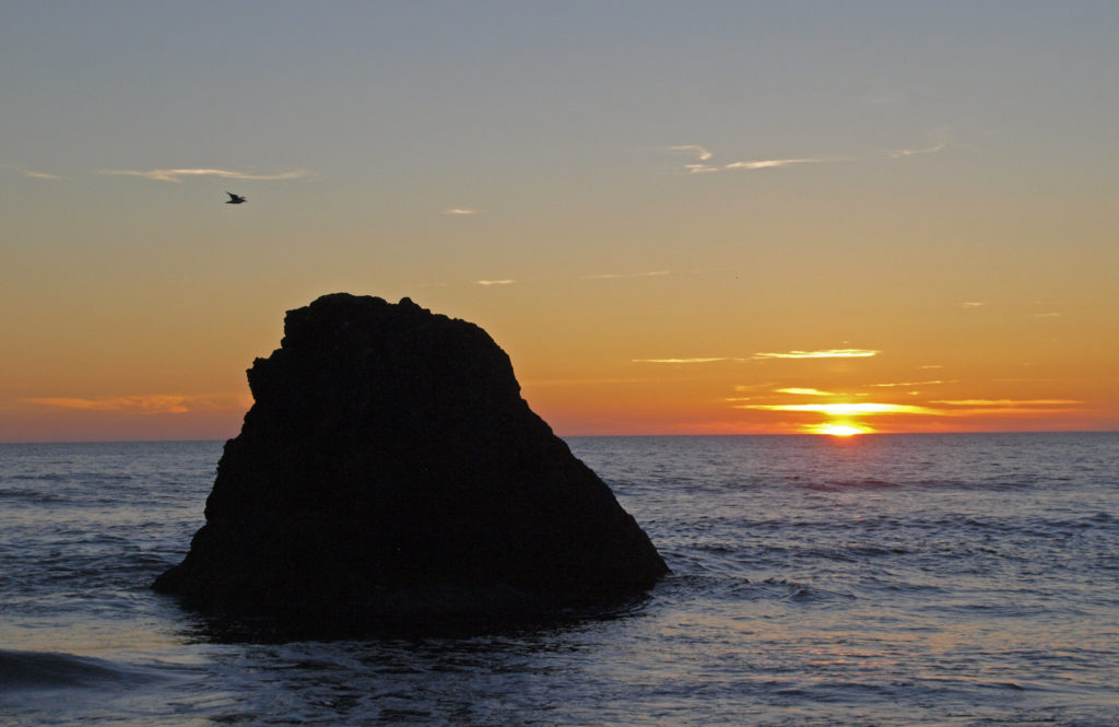
 That year, I decided to attend the festival only a month or so before it started, so most of the accommodations in
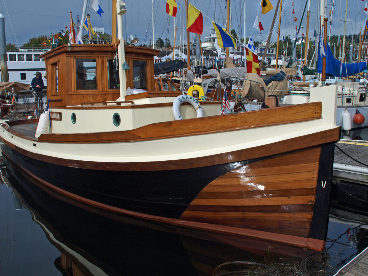
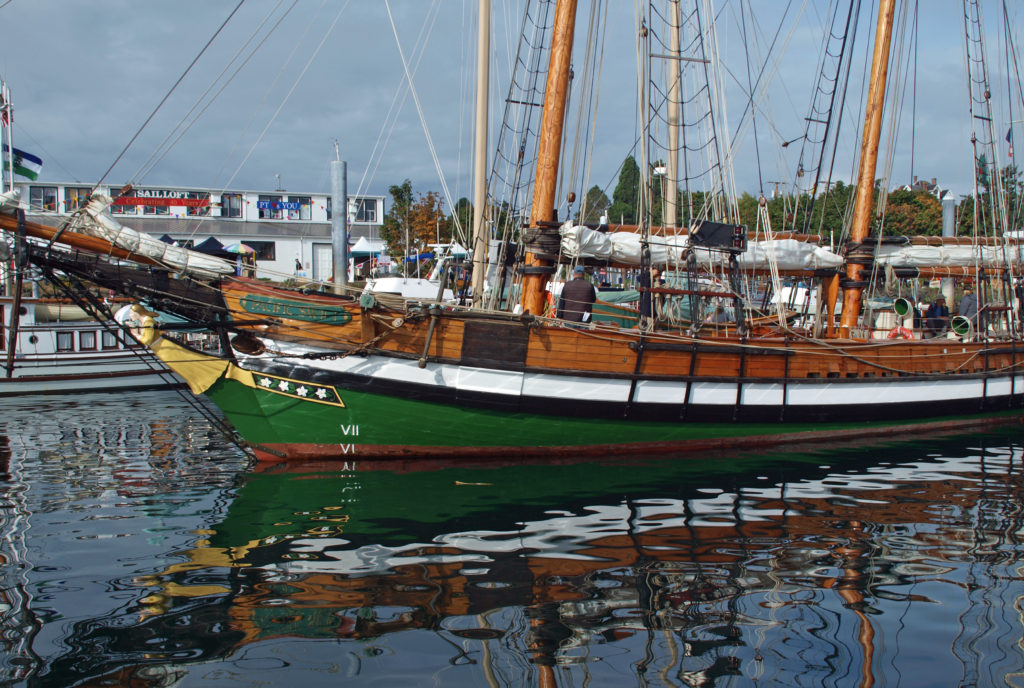
 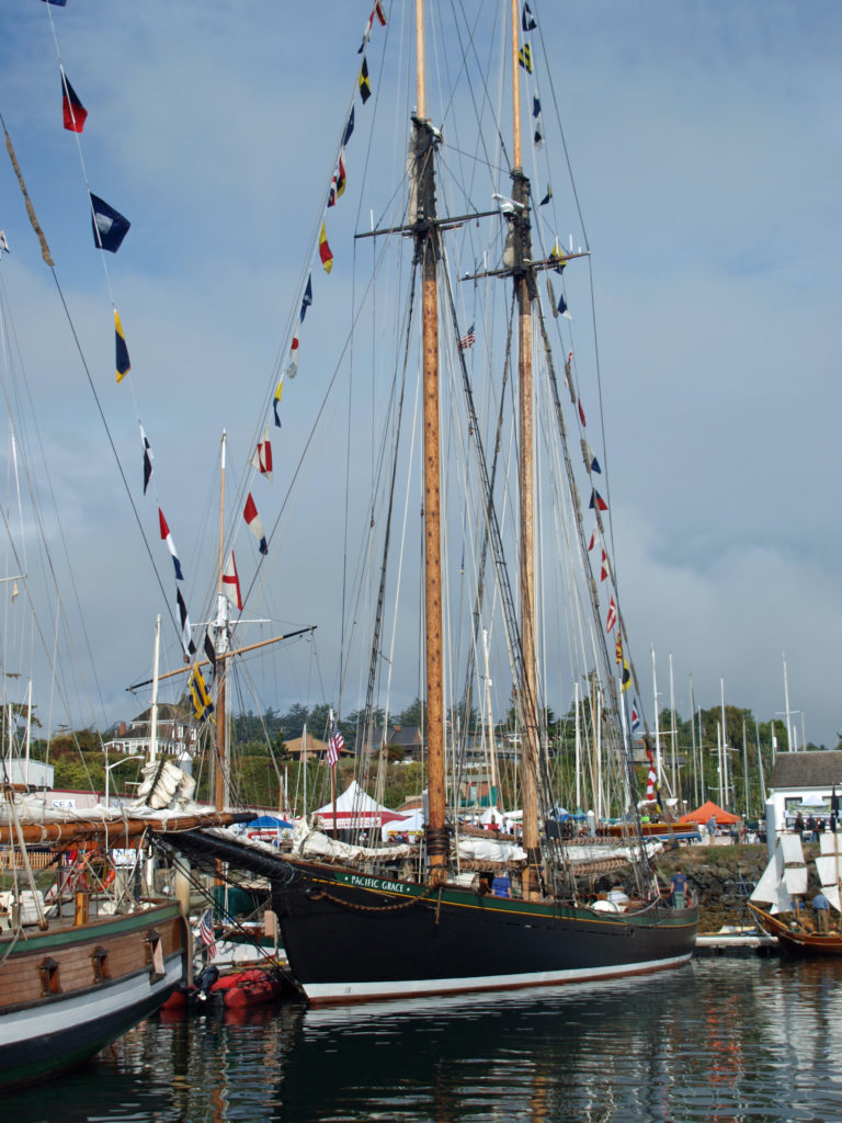 I found the Wooden Boat Festival to be as amazing an event as I had imagined, and maybe then some. It was quite a treat to see so many beautiful boats in one place. There were more than 300 boats featured at the 2018 show. Many of the owners welcomed guests aboard their boats and all were happy to talk about their boats and answer any questions.
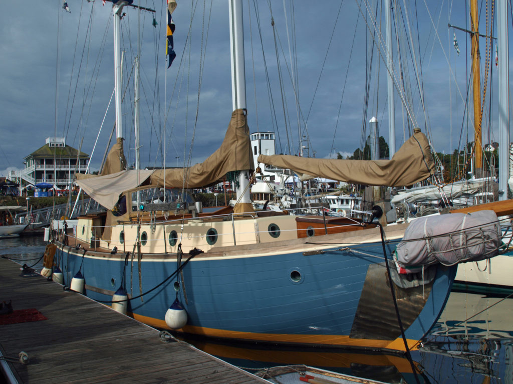 There were sailing, paddling, and rowing races, panel discussions, music, food and drink, films, and dozens of classes on boat designing and building, boat maintenance, sailing, navigation, living aboard, and much more. You could sail on one of several tall ships, try your hand at paddle boarding, or crew on a replica of one of Captain George Vancouver’s longboats from 1792. There was also a boat building competition in which teams endeavored to build boats from scratch in three days. And there were lots of activities for kids.
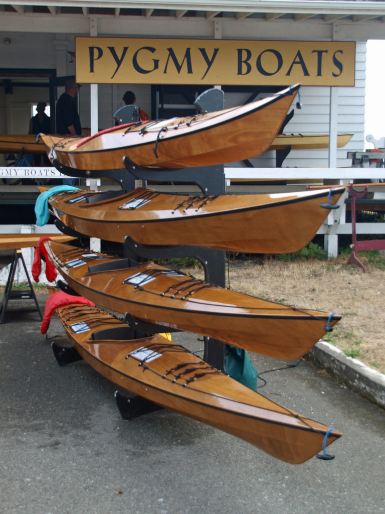 One of the highlights for me was being able to talk to some of the many boat builders at the festival, and seeing some of the boats that they’ve built. Casey Wilkerson of
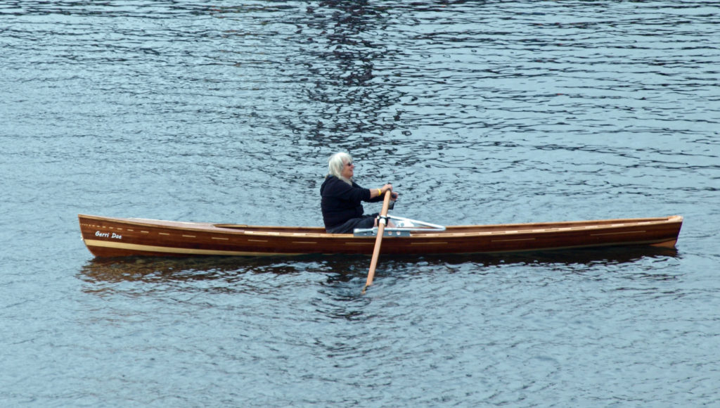
 All in all, there was far too much to see and do in a single day. I haven’t been back since the 2018 festival, but I’m hoping to attend the 2023 festival, to be held September 8-10. This time I’ll plan a little farther ahead, stay in Port Townsend, and take in the entire three days of the festival. And by the way, even if you’re not a wooden boat fan, Port Townsend is a pretty cool town, well worth a visit any time of the year.
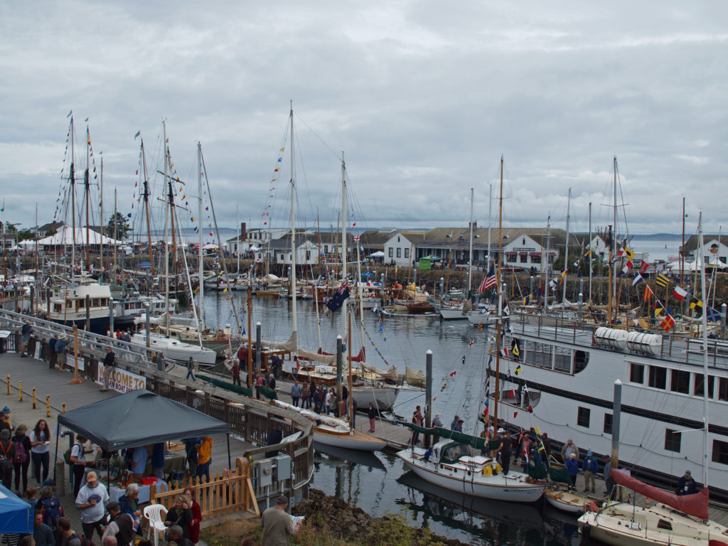 For more information about the festival, check out the festival’s
 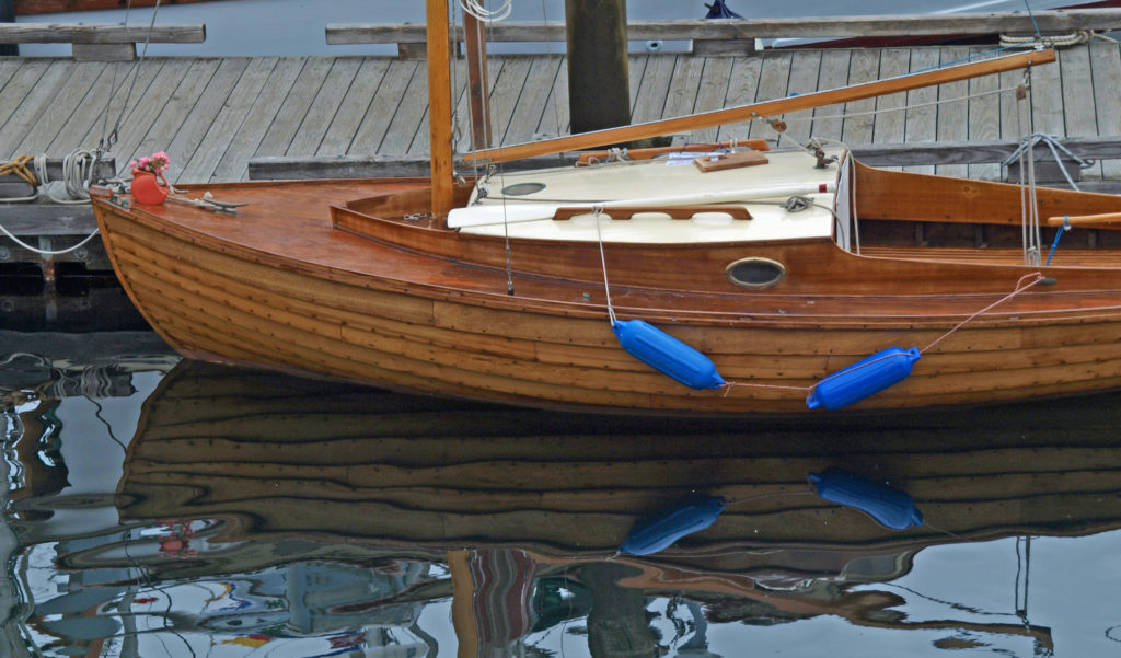 Originally posted September 13, 2018. Edited and re-posted September 20, 2022.
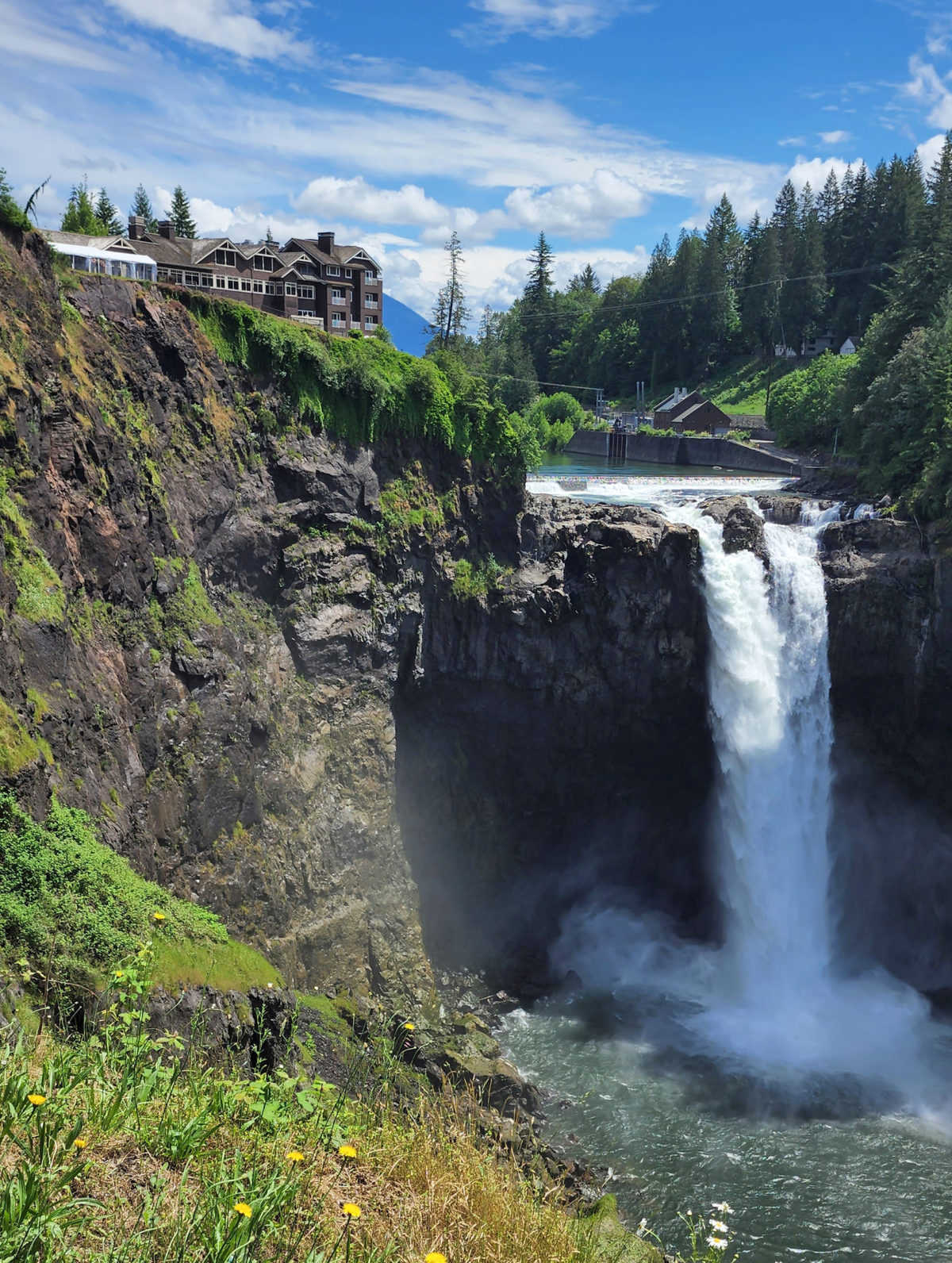
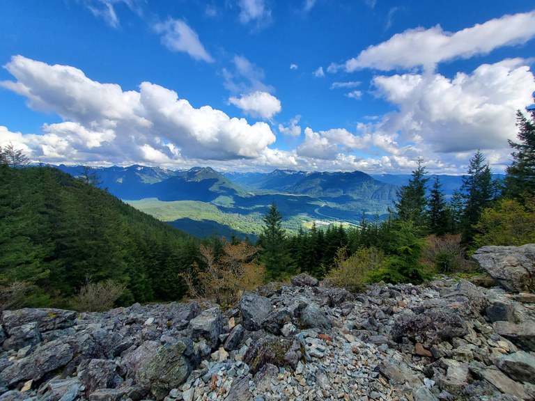
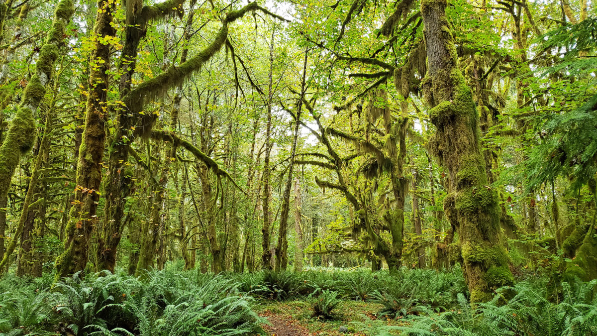
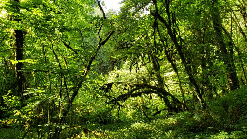
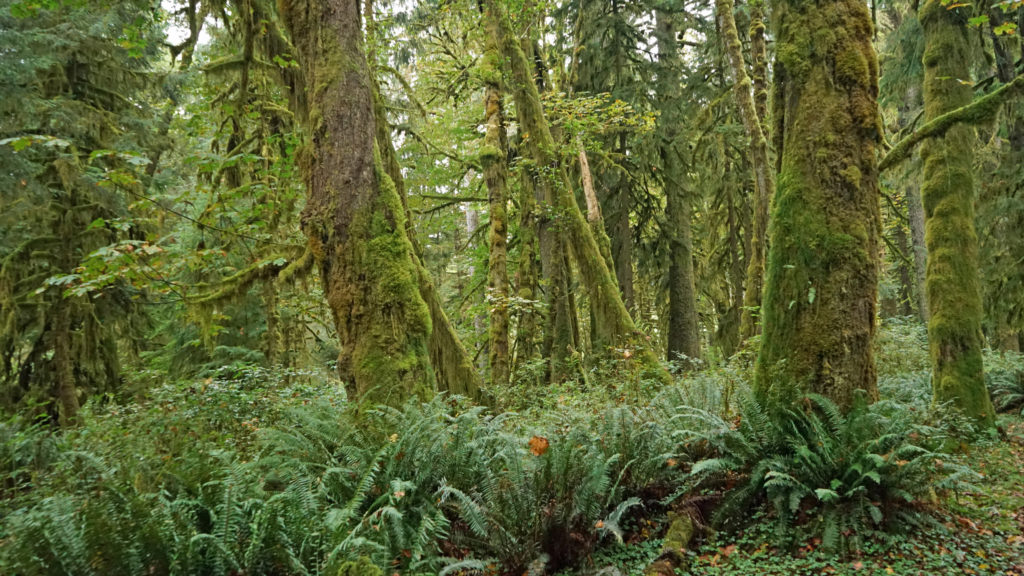 The Quinault Rain Forest lies in the southwestern corner of Olympic National Park, the adjacent Olympic National Forest, and the Quinault Indian Reservation in western Washington. It’s less than a four hour drive from either Portland or Seattle, but it seems a world apart, and more than a little stuck in time. It looks much as I remember it from when I first visited as a child more than a half century ago. Cell phone service and wi-fi availability are spotty. There are no big resorts and no towns of any size. Urban America is nowhere to be found.
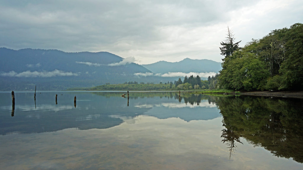 The pandemic has kept all of us from traveling as much as maybe we’d like. That certainly applies to my wife and I. Most of our vacation plans for 2020 had to be cancelled. And just when the parks and recreation areas were beginning to reopen, wildfires in western Oregon and Washington shut them down again. But the Olympic Peninsula was largely unaffected by the fires. So, my wife and I decided that the Olympics would be an ideal, and much needed, escape from Portland, and in September 2020 we headed to the Olympic Peninsula. Our first stop was Lake Quinault.
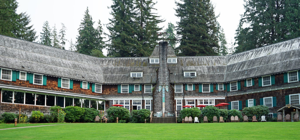 We treated ourselves to a stay at the historic Lake Quinault Lodge, one of the iconic grand lodges of the American West. The original Lake Quinault Lodge was built in 1904. The Boathouse annex was built in 1923. The original lodge burned down in 1924 and the current main lodge was constructed in 1926 on the site of the older lodge. Two additional annexes have been added since then. The existing lodge was placed on the National Register of Historic Places in 1998.
 Rooms at the lodge are a little pricey, but you’re paying for the history, charm, and iconic nature of the lodge more than for the amenities provided. There are no TVs in any of the main lodge rooms, no fridges, or microwaves, no phones and no cell phone service. But that’s all part of the charm. The Boathouse and the other two annexes offer a few more amenities. Some come with fireplaces, the Lakeside Rooms are billed as family friendly, and the Boathouse Rooms are pet friendly. Our room in the main lodge came with all we needed, a comfortable bed and a view of the lake.
 Services at the lodge were limited by the pandemic during our stay. The swimming pool, sauna, and game room were closed. The restaurant served take out meals, but the dining room was closed (outside seating was available and you could eat in the main hall or in your room). However, all services have been restored to pre-pandemic levels.
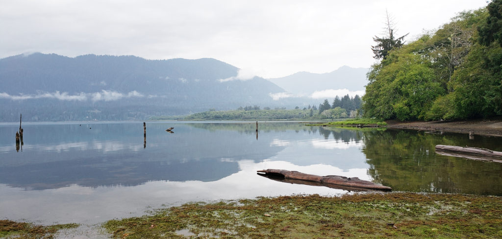 A somewhat cheaper alternative to Lake Quinault Lodge is the nearby Rain Forest Resort, which has a 16 room lodge, cabins (some with hot tubs), an RV park, and a restaurant. The world’s largest Sitka Spruce grows a short walk from the resort. Other options are the Quinault River Inn on Hwy 101 in Amanda Park, and Lochaerie Resort on North Shore Road. And there are three campgrounds on the south shore of Lake Quinault, and two (one a walk-in) on the north shore.
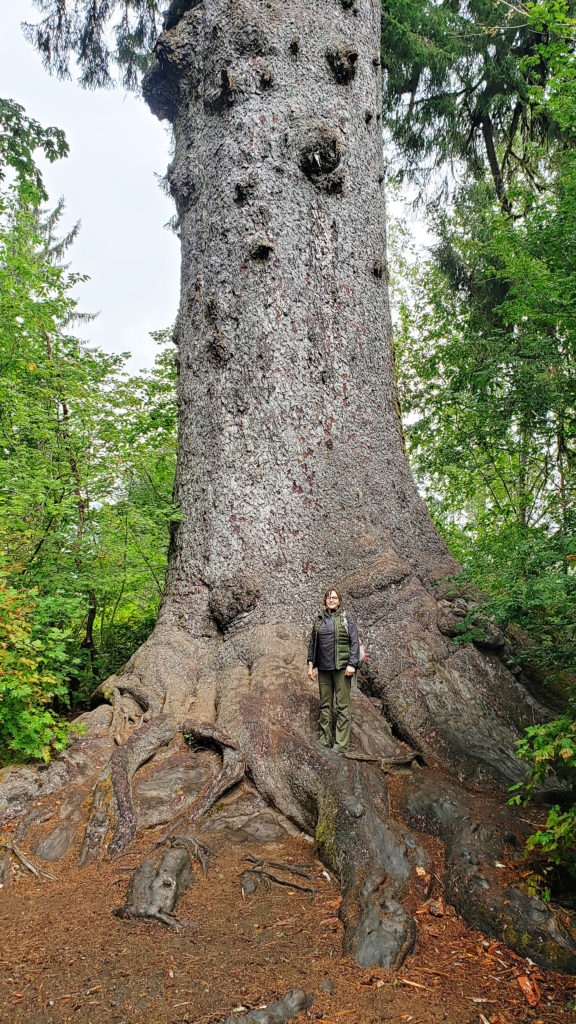 Lake Quinault Lodge, the Rain Forest Resort, or any of the three south shore campgrounds make an ideal base for exploring the area. Hikers have a variety of options, from the half mile Rain Forest Nature Trail Loop to a loop of about seven miles that takes you to Gatton Creek Falls, Cascade Falls, the Cedar Bog, the Rain Forest Nature Trail, and along the lake shore. Cutoff trails make shorter loops of various distances possible. Other hiking trails are a short drive from the lodge.
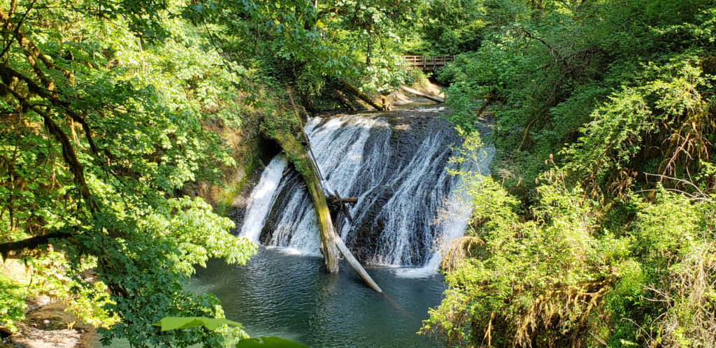
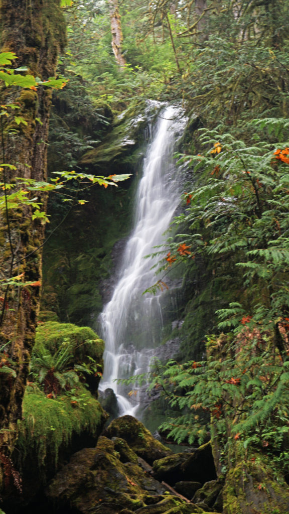 Two stops along South Shore Road worth making are Merriman Falls and Bunch Falls. Both are just east of Lake Quinault and both are right by the road, so no hiking required.
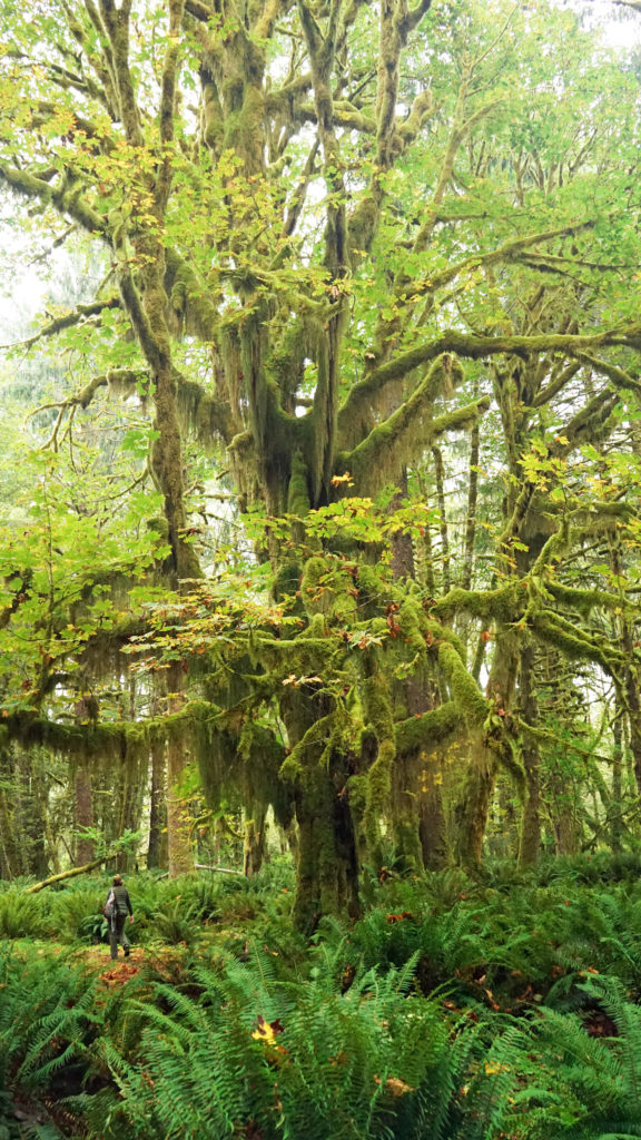
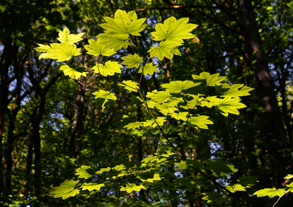
 One hike that everyone should do is the Maple Glade Trail at the Quinault River Ranger Station on North Shore Road. It is spectacularly beautiful, and like the Rain Forest Nature Trail, it’s an easy 0.5 mile loop. But, unlike the Rain Forest Nature Trail, which takes you through a coniferous forest of Douglas Fir, Western Hemlock, and Western Red Cedar, the Maple Glade Trail immerses you in a Bigleaf Maple forest. There the ground is covered in ferns and other low growing shrubs and the maples soar overhead, but in between is mostly open and airy. The effect is like being in a gigantic room carpeted with ferns and roofed with a canopy of maple leaves.
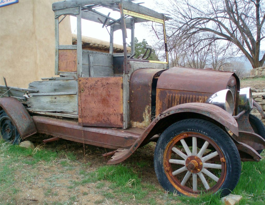
 The Maple Glade Trail can be extended by taking the connecting trail to the Kestner Homestead. There you’ll find the Kestner house, barn, outbuildings, and a cool old rusted delivery truck.
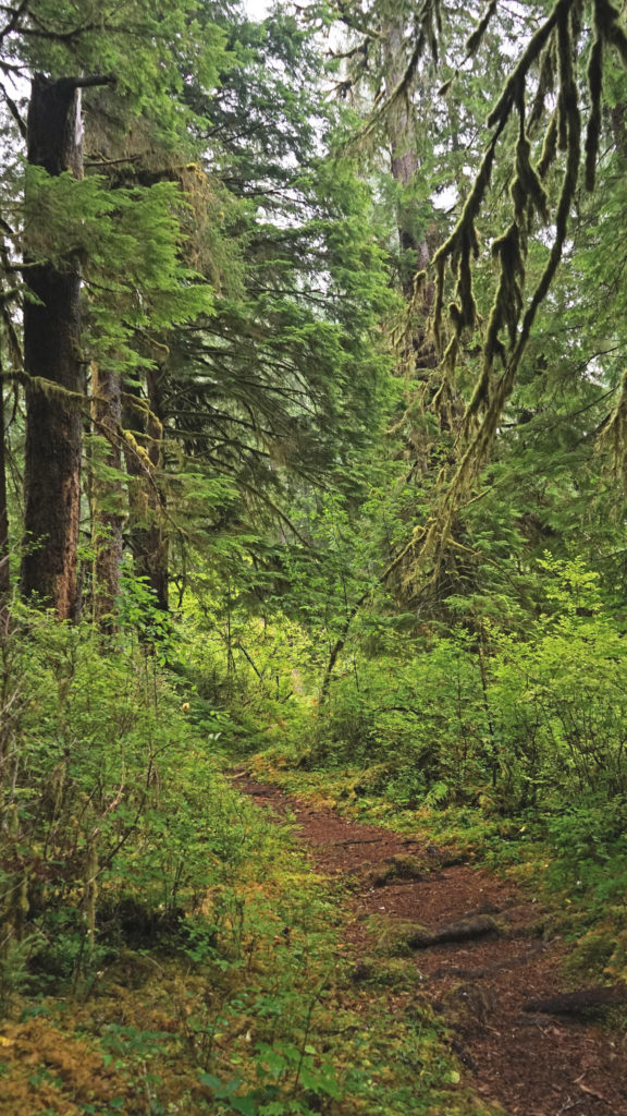
 There are also much longer hikes that can be taken into the Olympic National Park from the Quinault Valley. The most famous, and probably most hiked, is the Enchanted Valley Trail. It’s a 13 mile hike along the East Fork of the Quinault River to reach the Enchanted Valley, so it is not a casual outing. Most people do it as a 3-5 day backpacking trip. My backpacking days are behind me, but the Enchanted Valley is one of the hikes that I regret having never done.
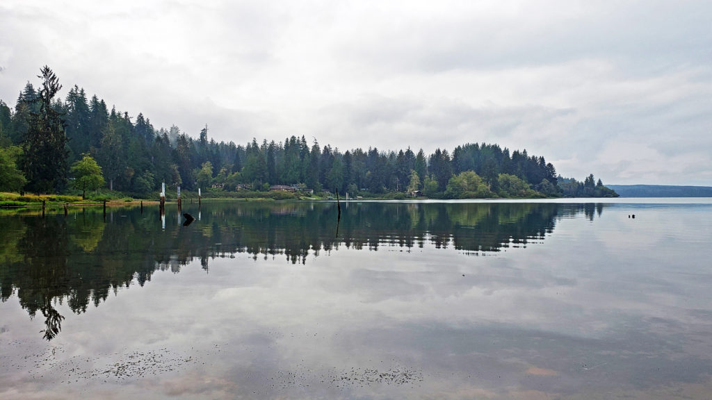
 Originally posted October 26, 2020. Updated and re-posted August 11, 2022.


 Originally posted June 30, 2018. Most recently updated November 13, 2025.
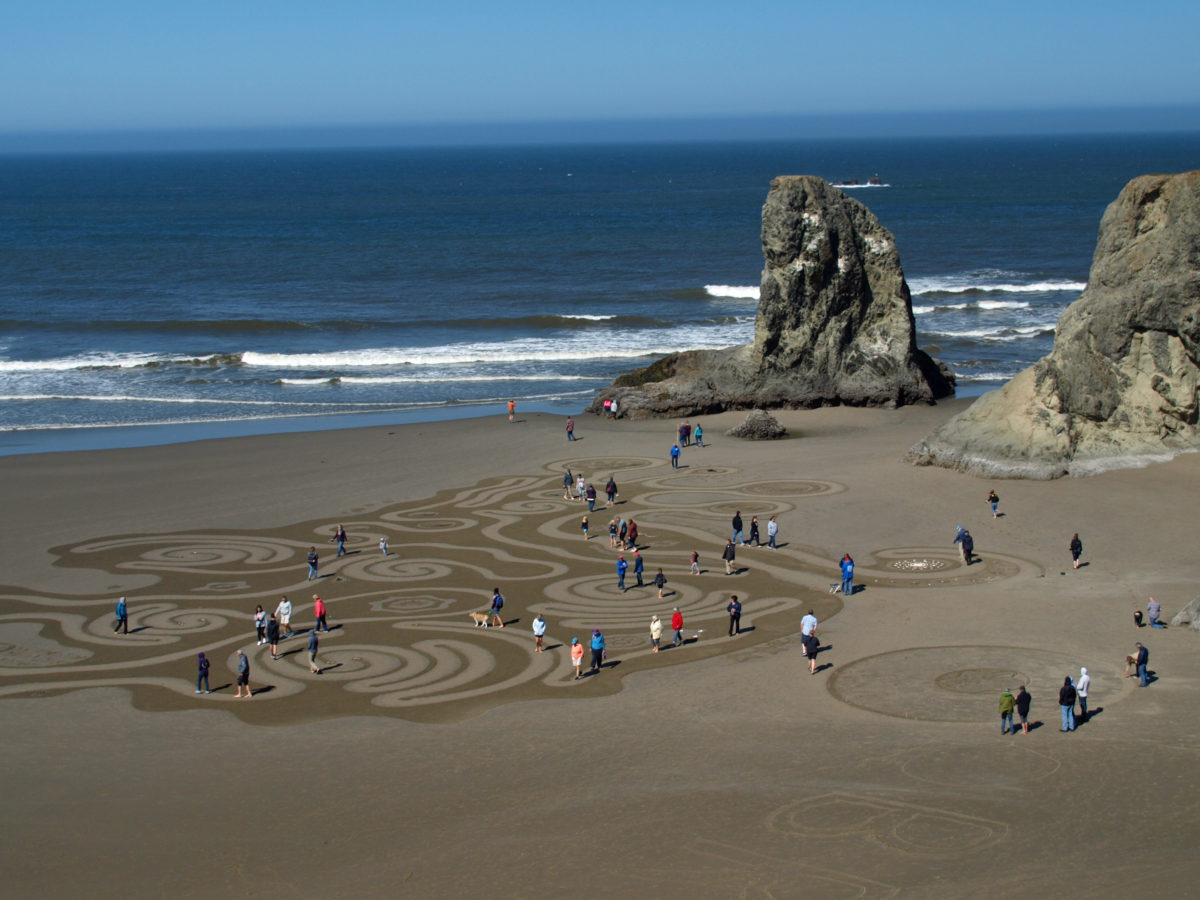
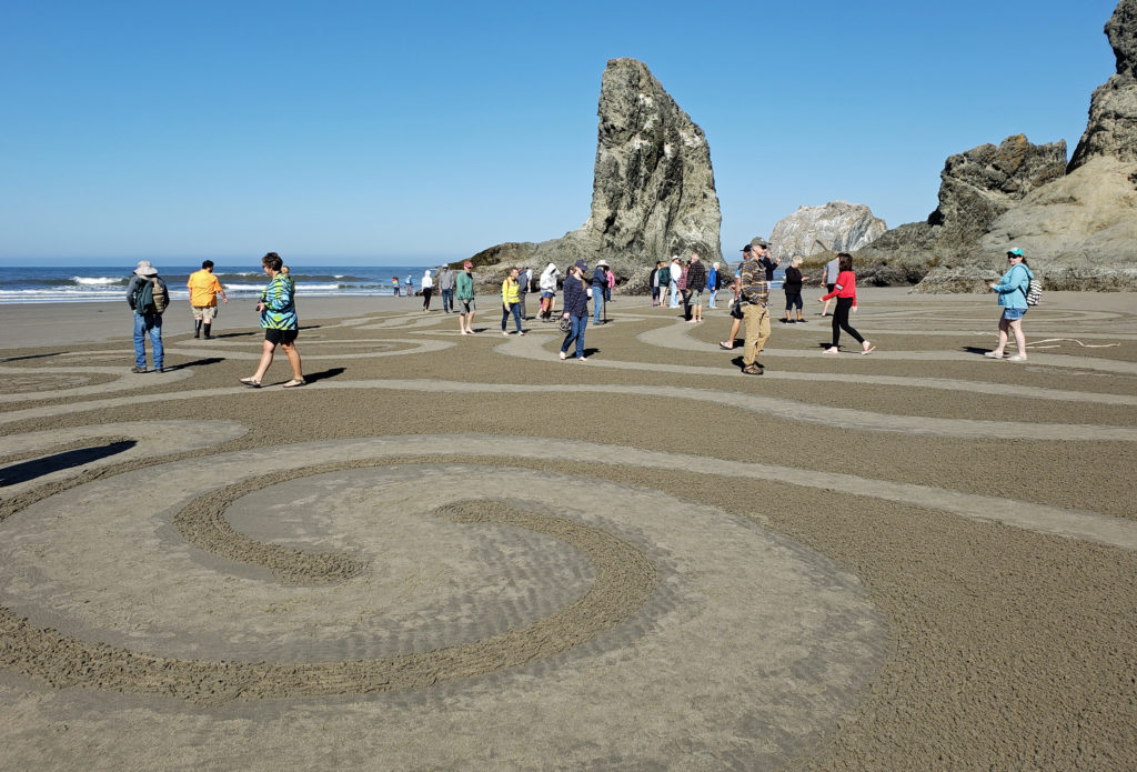
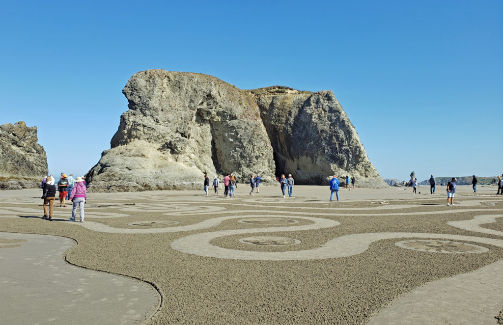
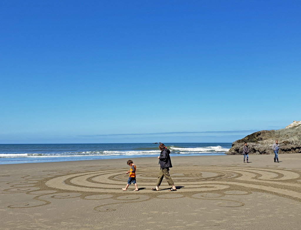
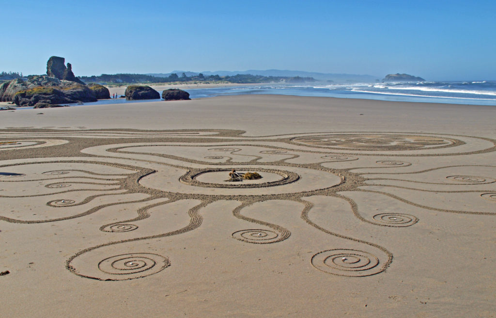
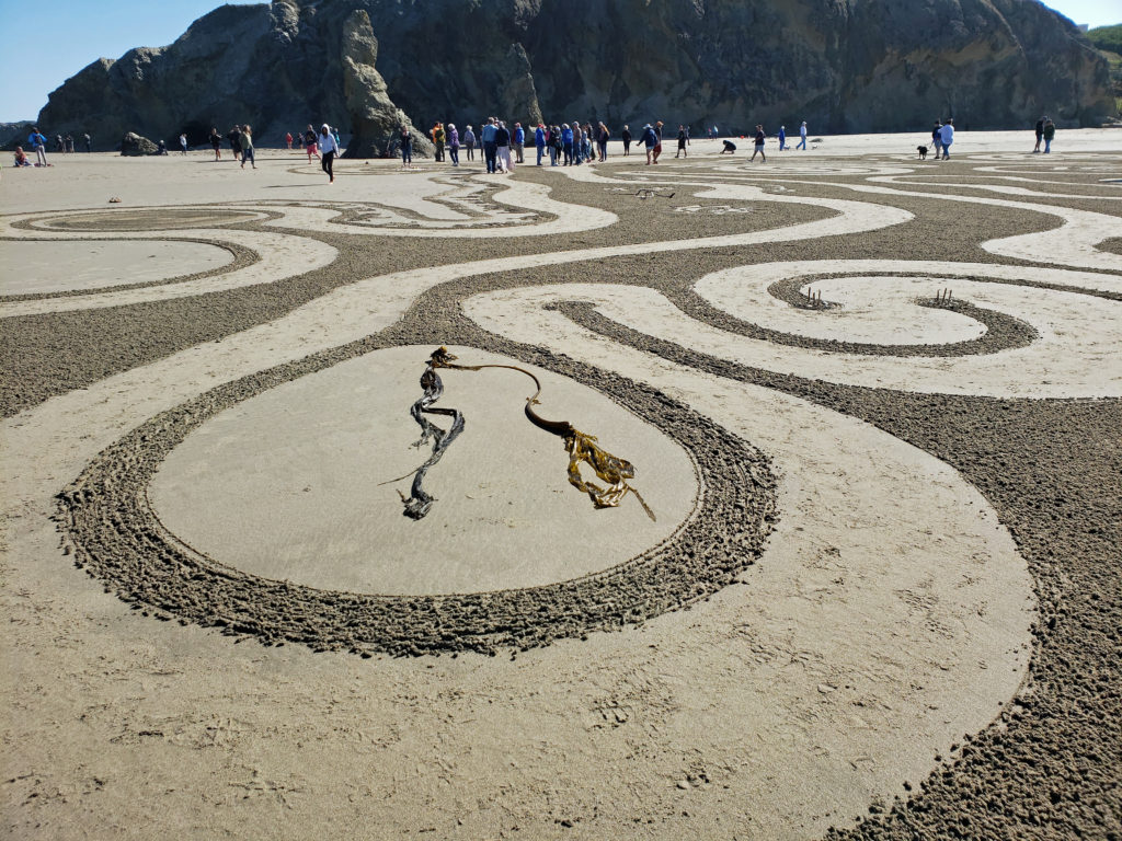
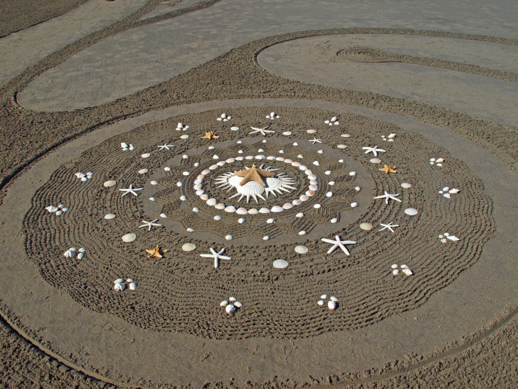
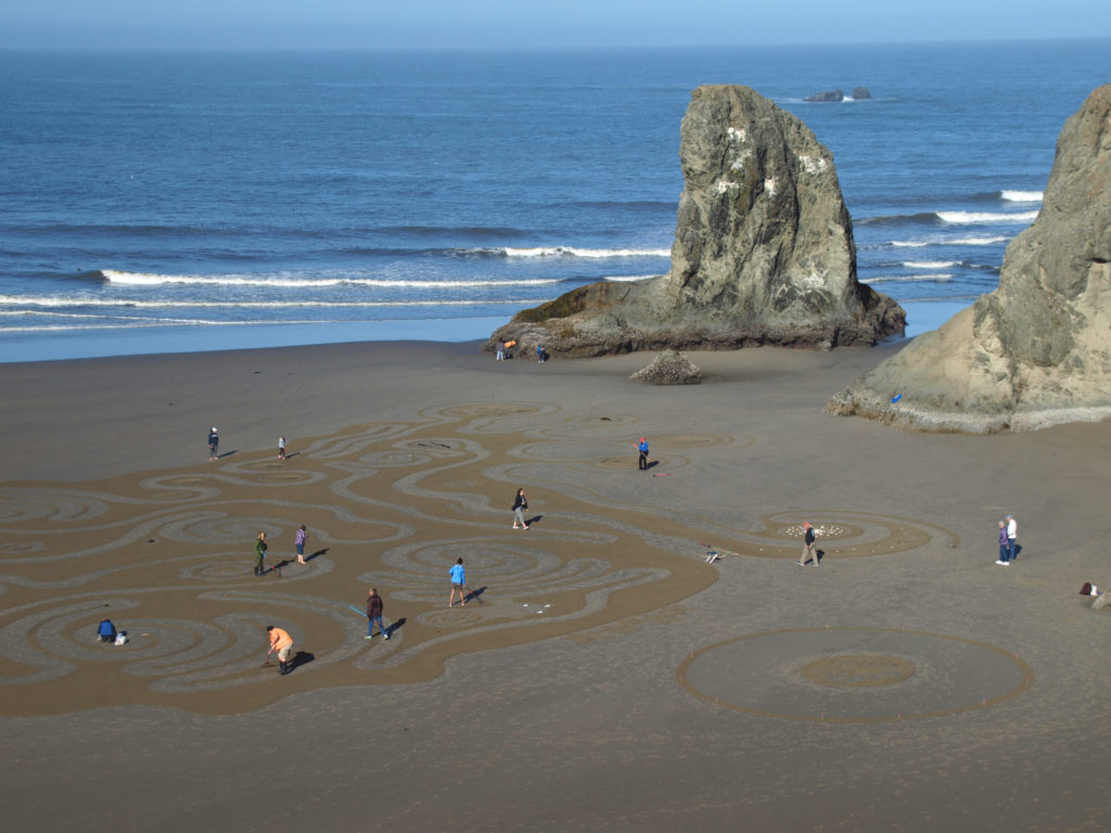 The Circles in the Sand labyrinths are created on the beach below the Face Rock Wayside in
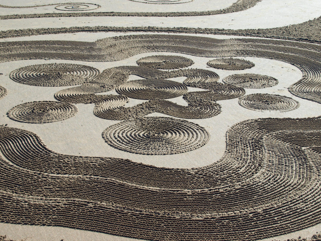
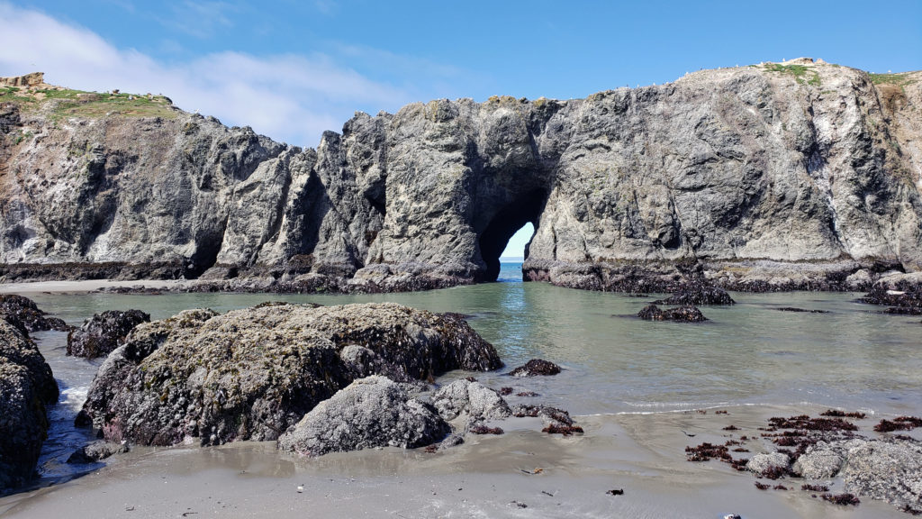
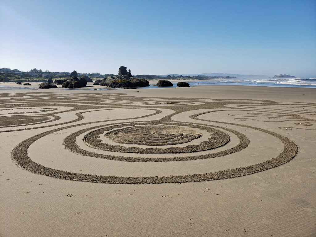 Together with the rock formations at Coquille Point, a short distance north of the Face Rock Wayside, this stretch of beach is truly spectacular, well worth a visit at any time of the year. Combining a visit with the opportunity to experience Circles in the Sand makes for a unique and memorable experience.
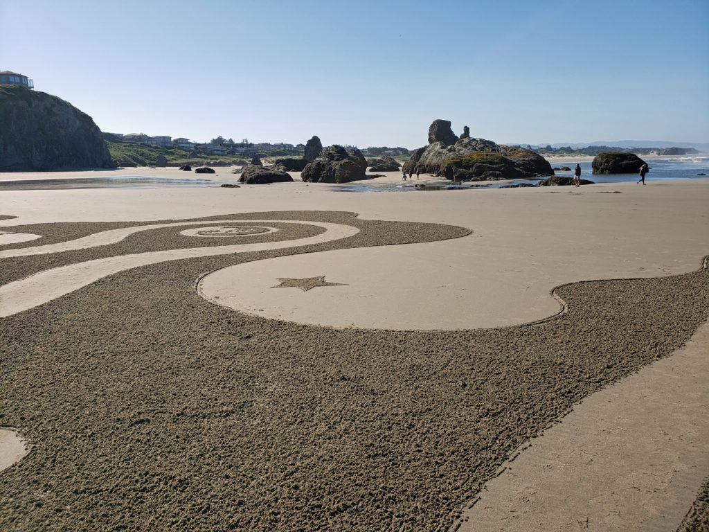
 Originally posted July 24, 2019. Updated and re-posted June 18, 2022.
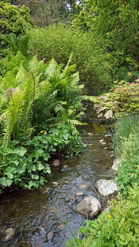
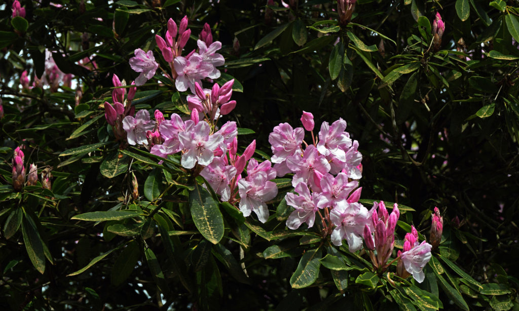
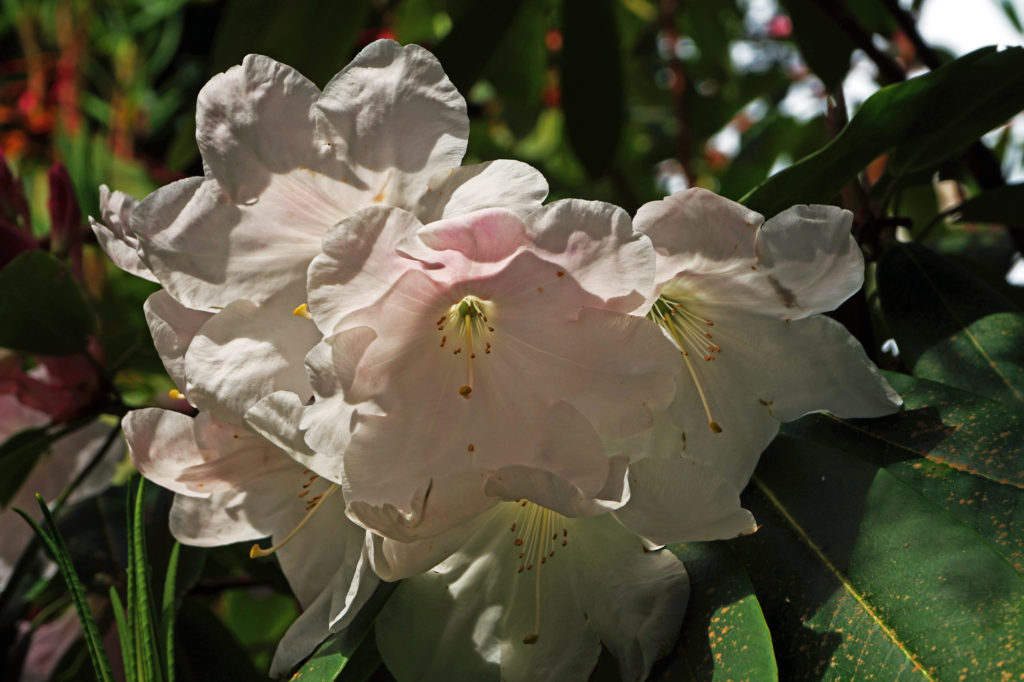
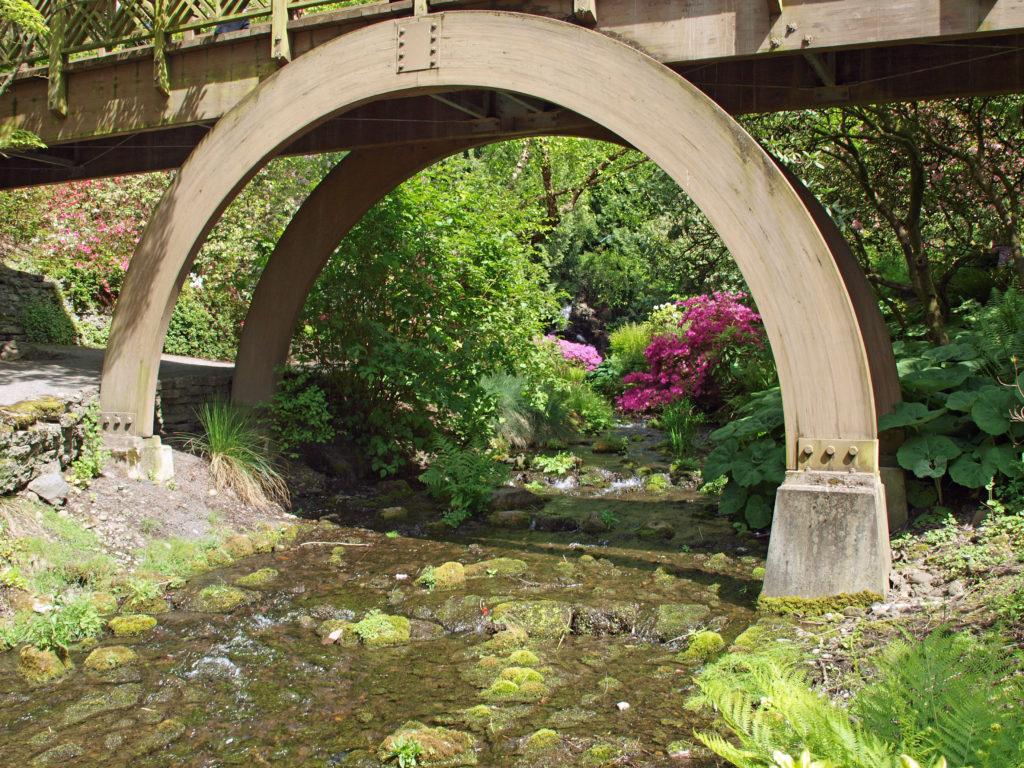
 Powells Wood Garden is located at 430 S. Dash Point Road in Federal Way. The garden is open Tuesday through Saturday from 10am to 3pm. Admission is $7 per person (children 12 and under are free). Tickets can be purchased online on the Garden’s
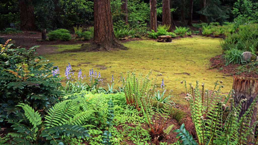
 If you visit Powells Wood Garden, you might also want to stop in at
 While Powells Wood Garden is probably not worth a trip to Tacoma on its own, the Tacoma area has a lot of other attractions, not the least of which are the Museum of Glass and the Tacoma Art Museum, both part of the
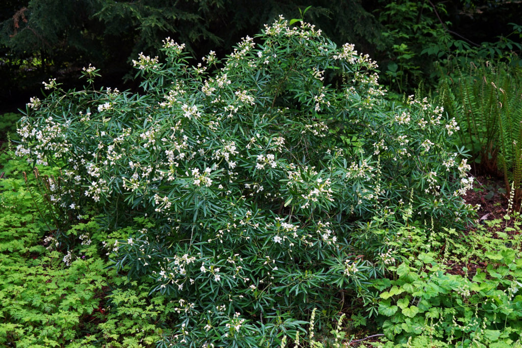
 Nearly 300 different forest plants and flowers grow in the park. Blacktail deer, raccoons, coyotes, red foxes, beaver, and more than two dozen other mammals roam the park. More than 70 species of birds have been seen in the park. And cutthroat trout, coho and chinook salmon, and steelhead can be found in Tryon Creek.
 The area was saved from development in the late 1960s and early 1970s by a combination of dedicated citizens, the
 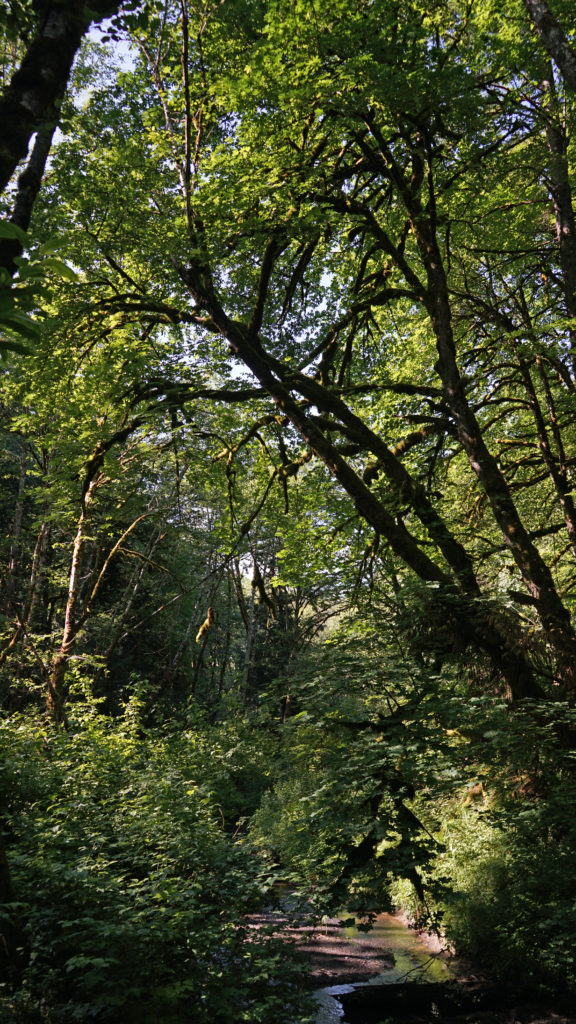 Many, if not most, of the park’s visitors come to hike the nearly fifteen miles of hiking and mixed use trails. Some bring their horses to ride the three and a half miles of equestrian trails. There is also a three mile paved bike path running through the park and a paved all abilities trail. The Nature Center, with a friendly staff, interpretive exhibits, a small store, and public restrooms, is a popular starting point for many visitors.
 Many of the events and programs sponsored by the park were cancelled or available only online during the majority of the Covid-19 pandemic. The Nature Center was closed and entrance to the park was limited at times. While we’re still living with Covid, most, if not all, of the park’s programs have been restored, and the Nature Center is open again.
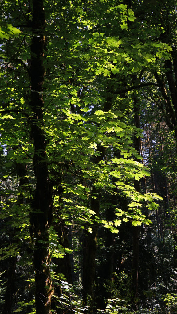

 Originally posted July 29, 2020. Updated and re-posted May 25, 2022.
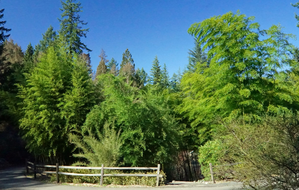
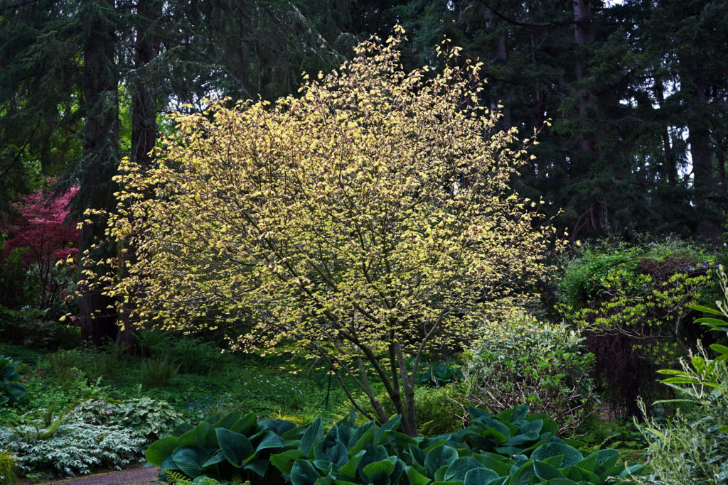
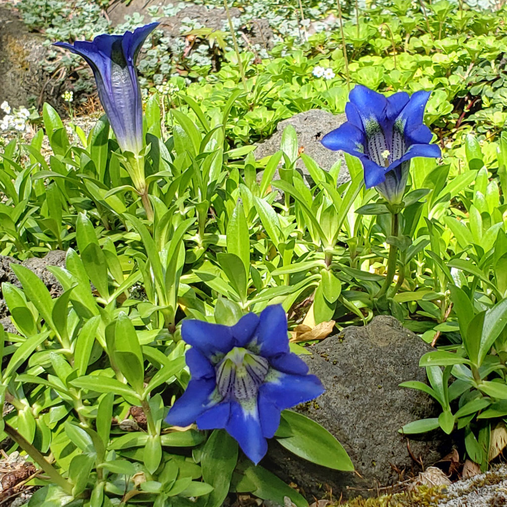
 Today, the arboretum features more than 100 collections of trees and plants, organized by taxonomy and geography, spread over 189 acres in Washington Park in Portland’s West Hills. There are more than 2300 species native to six continents represented in the arboretum collections.

 More information on the arboretum, directions, and parking and public transit information can be found on the arboretum’s website (linked above).
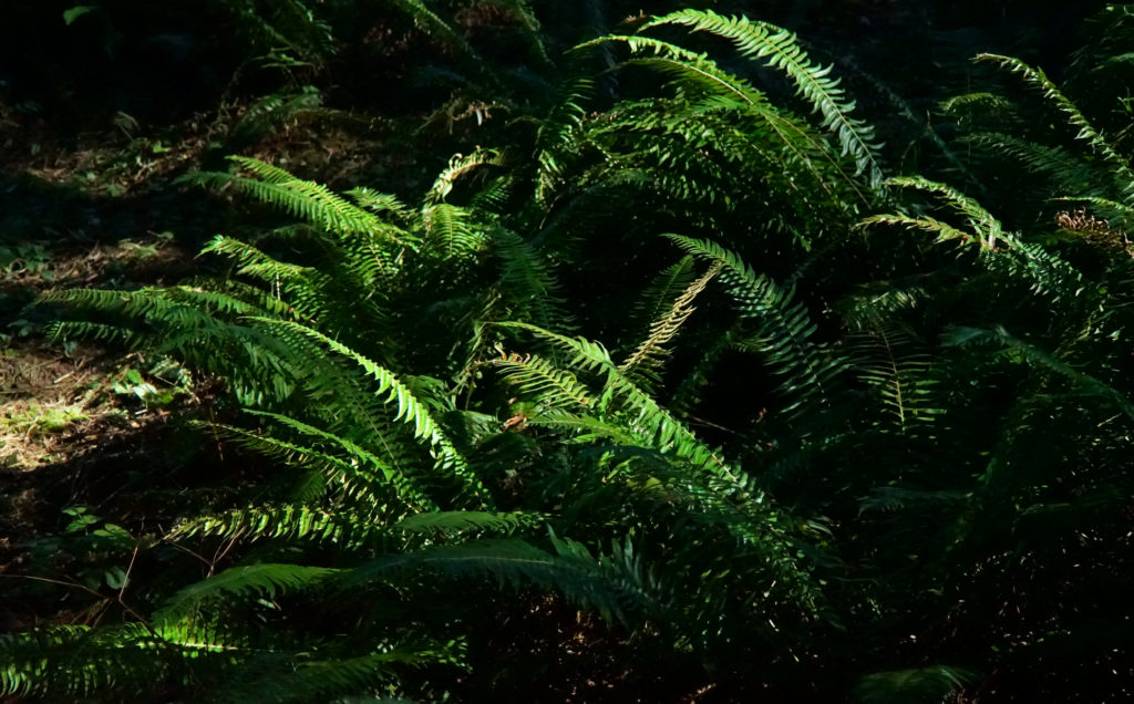
 Originally posted April 8, 2020. Updated July 15, 2020 and May 5, 2022.
 Both the Stone Cabin and the Manor House still stand. The Manor House now houses the garden’s gift shop and is a popular wedding venue and event space. (The part of the garden south of Johnson Creek, including the Stone Cabin, is currently closed to the public).
 Lilla Leach was an amateur botanist and discovered five plants previously unknown to science. One, Kalmiopsis leachiana, is named after her, and the southwest Oregon wilderness where she discovered it is now known as the Kalmiopsis Wilderness. Over the years she planted many native plant species, some of them rare, on the estate they called Sleepy Hollow.
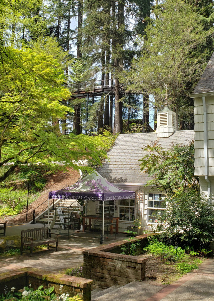
 There is currently no admission charge, but donations are encouraged and go to support operation of the garden and the garden’s educational programs. You can also register for a garden tour on the website, which is currently the only way to visit the Stone Cabin and the historic Outdoor Kitchen on the south side of Johnson Creek..
 The garden is located at 5801 SE 28th Avenue. The small parking lot fills up early in spring and summer, and there is no on street parking on 28th or other nearby streets, so come early if you’re coming by car (and do not park in the Reed College lot across the street from the garden). Or take the bus (Tri-Met bus #19 Woodstock).
 Whether you are a garden lover, birder, photographer, artist, or just looking for a beautiful place to spend some time in, Crystal Springs is a place you’ll love. For my money, only the


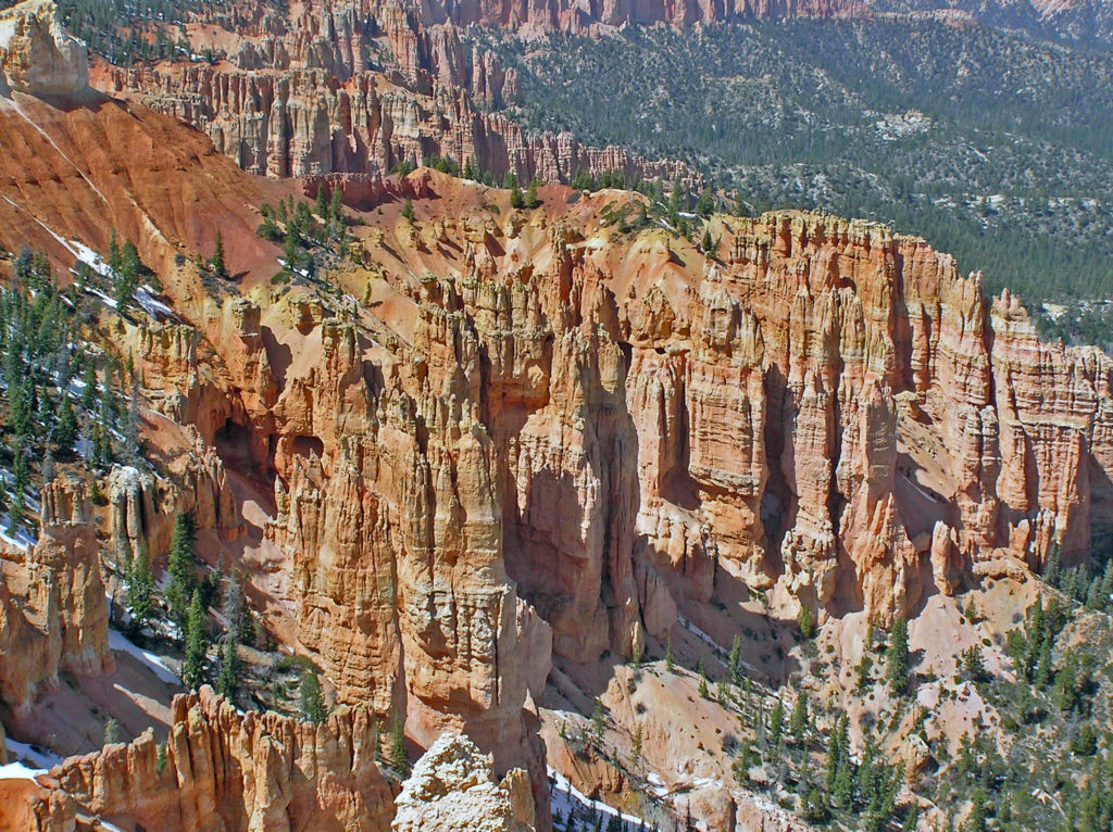
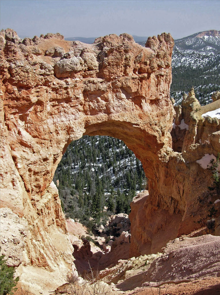

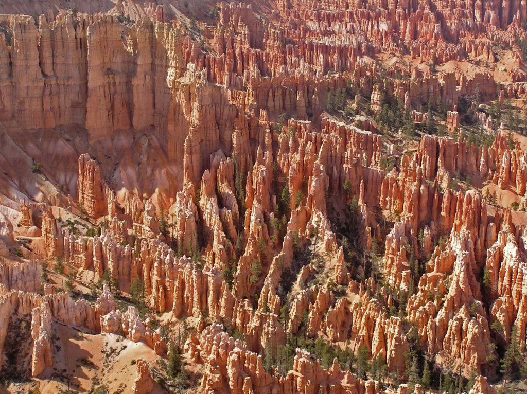
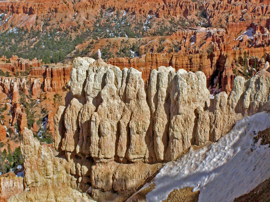
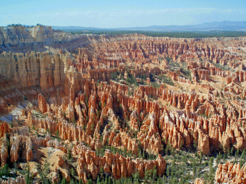
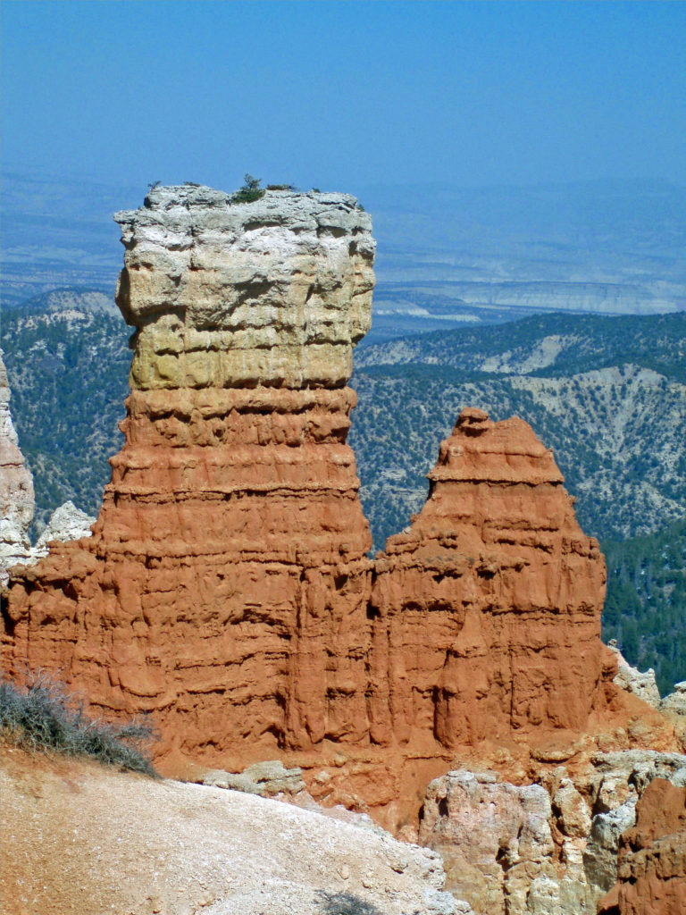
 The altitude also means that nights can be cold there even in the middle of summer. And in spring and fall, it’s not uncommon to encounter cold weather even in the middle of the day. (The photos here were taken in early May and, as you can see, there was still snow in places). Winters are cold, sometimes very, and can be snowy. Many of the trails are closed in winter. But winter also has its charms. Most of the best photos I’ve seen of Bryce Canyon have been taken when the hoodoos were covered in snow.
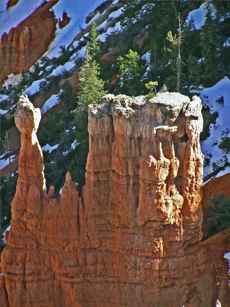

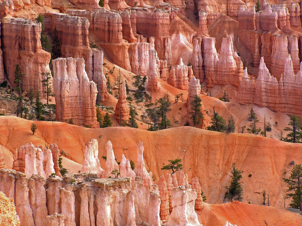
 The good news is that you don’t have to hike very far into the hoodoos to get away from the crowds. There are a number of loop and out-and-back trails that will get you away from the crowds, some of them fairly easy hikes. The rim trail along the edge of the Bryce Amphitheater can also get you away from the worst of the crowds without actually descending into the hoodoos. And if you don’t want to (or can’t) hike into the amphitheaters, there are mule rides available. Check at the visitor center when you arrive. Some of the trails in the park are also paved and wheelchair accessible.
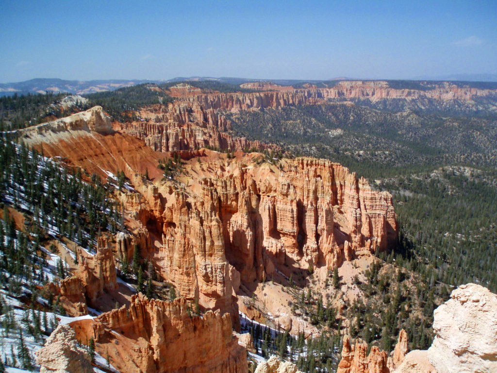
 The only road in the park (other than a section of Utah Hwy 12 that cuts across the far northern end of the park) runs north to south along the top of the Paunsaugunt Plateau from the park entrance to Yovimpa Point and Rainbow Point at the southern end of the plateau. Because the park receives so many visitors in the summer, traffic congestion can be a problem. Consider parking your car at the visitor center or the lodge and taking the free shuttle that runs the length of the park. The buses run frequently and you can hop off at any of the viewpoints and catch a later shuttle if you want to do some hiking or just sit and enjoy the scenery for awhile. Taking the shuttle also makes point to point hikes possible without having two cars.
 Besides being a spectacularly beautiful place during the day, Bryce Canyon is also great place to star gaze. It’s far from any light polluting urban areas, and the night skies in the park can be incredible. The park offers both astronomy programs and guided full moon hikes. Check the Bryce Canyon National Park
  The park website is a good place to begin when planning a trip to Bryce. The
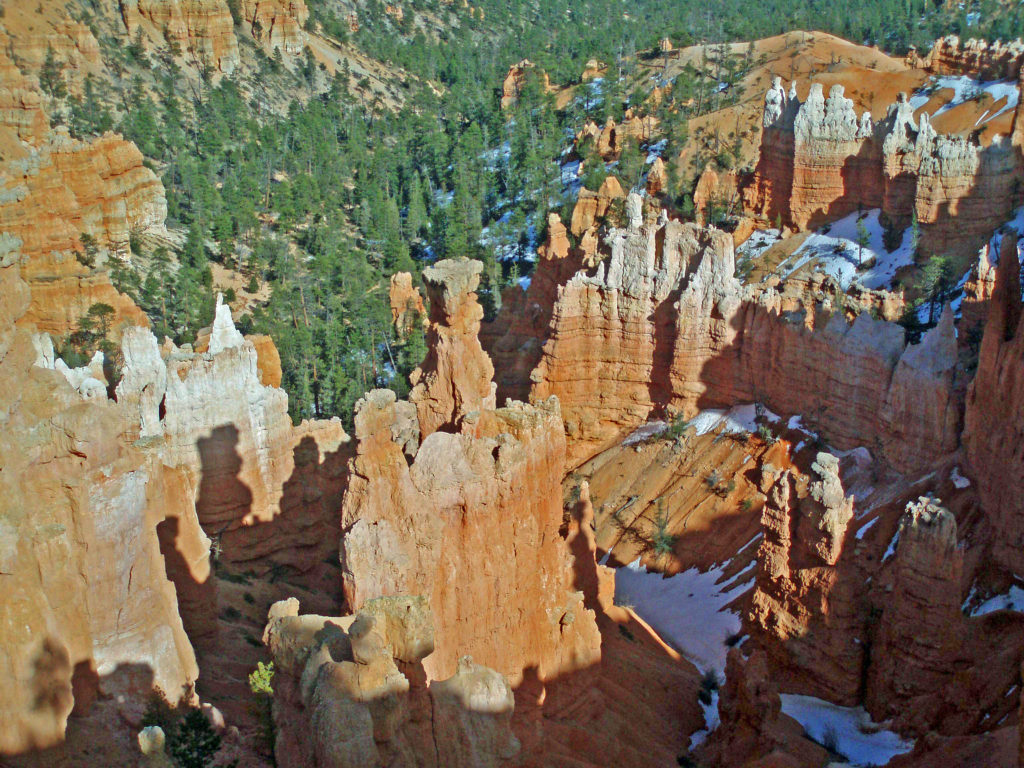
 The Covid-19 pandemic is still with us as I write this (Feb. 2022), but the park is open with only a few restrictions. Masks are still required for everyone, regardless of vaccination status, in all NPS buildings, crowded outdoor spaces, and all forms of enclosed public transportation. But there are no other restrictions and all facilities are open. Additional details are available on the park website and at
  If you’re not ready to begin traveling again, though, here are links to a short video by
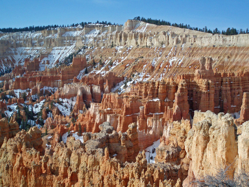
 Originally posted March 20, 2020. Updated and re-posted February 19, 2022.
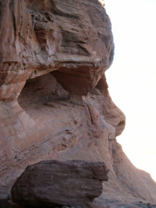
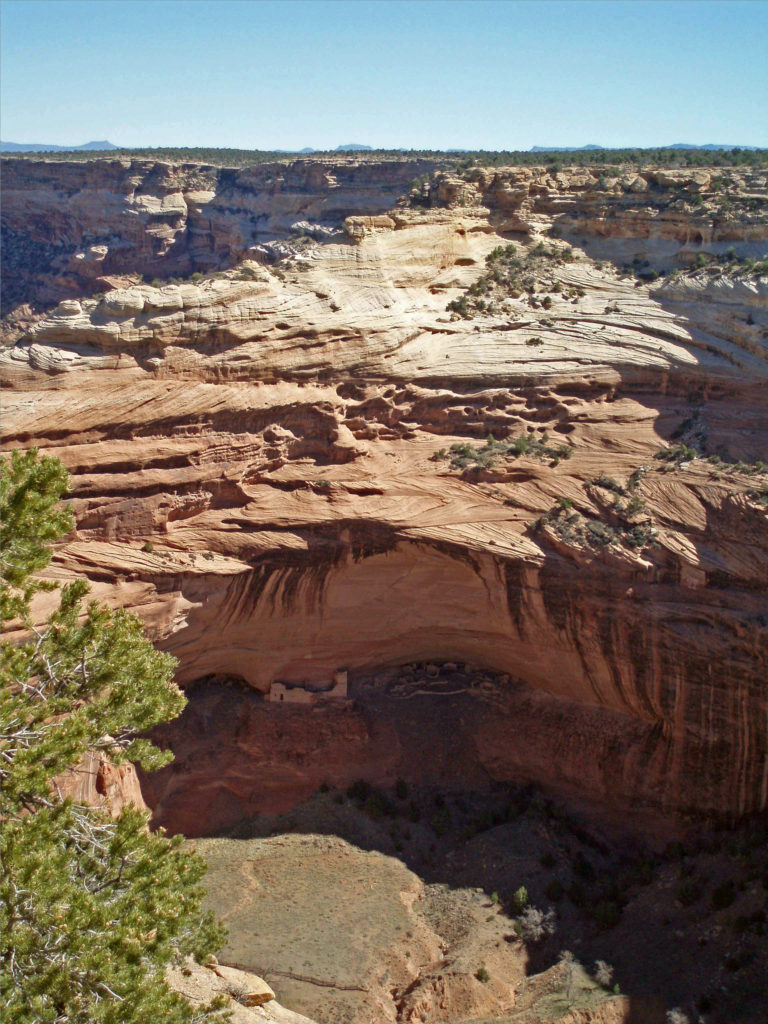
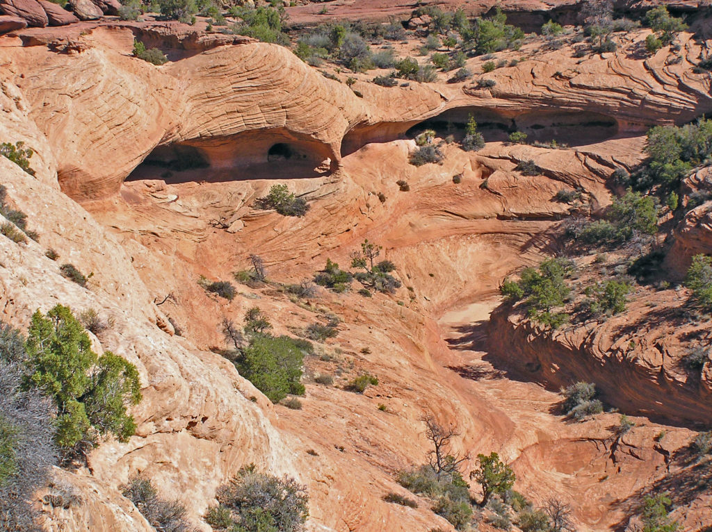
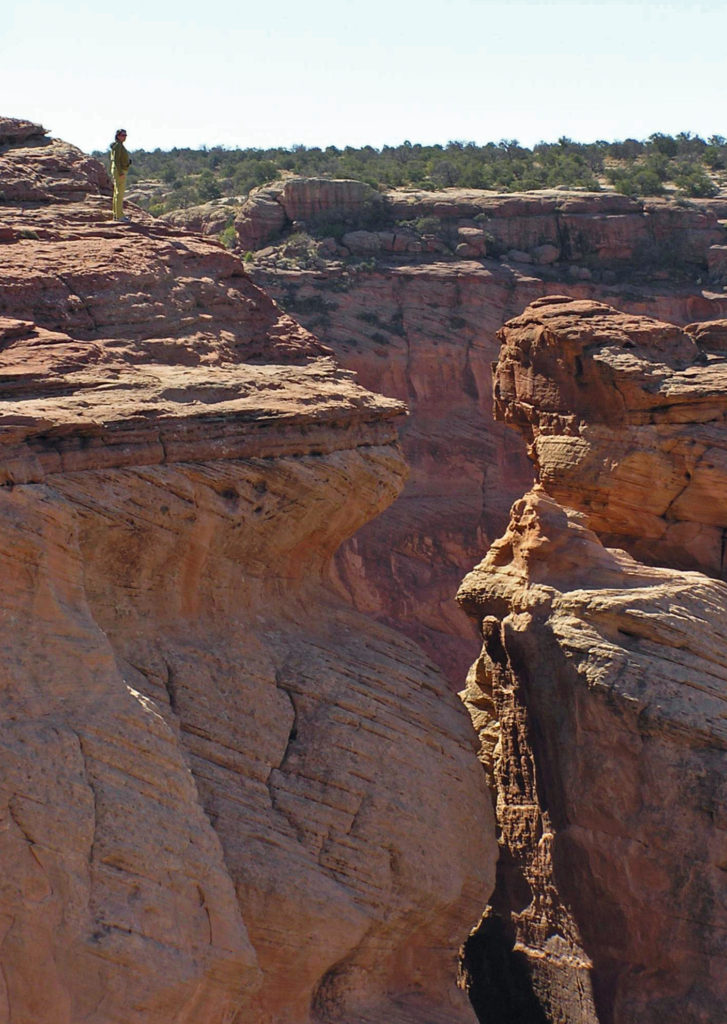
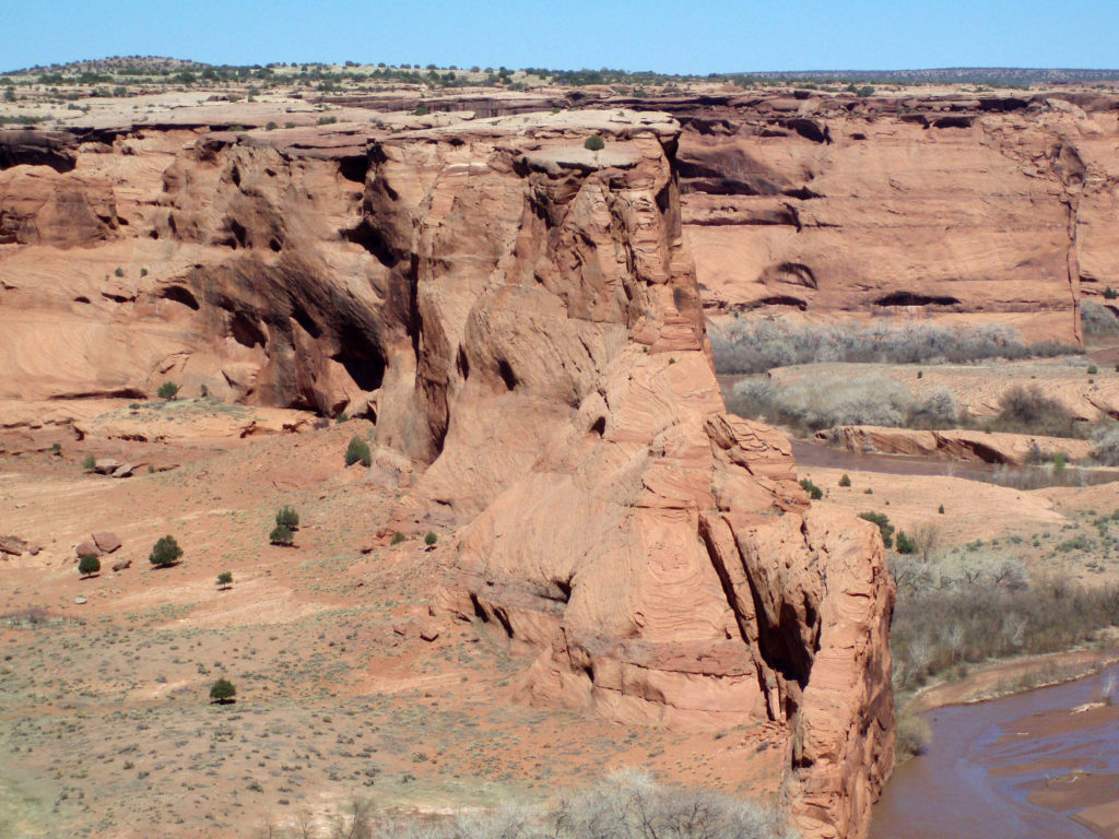
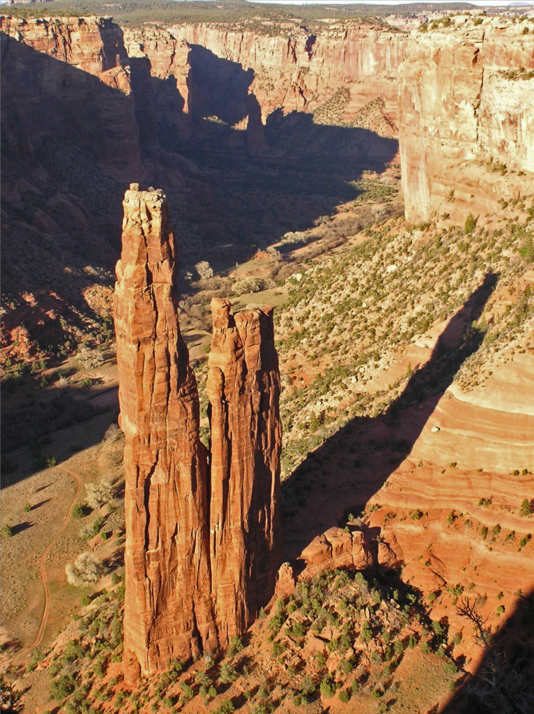 The name Chelly comes from the Spanish spelling of the Navajo name for canyon, tseyi, which translates literally as “within the rock.” Over time the Spanish pronunciation, “chay-ee”, has evolved into the current pronunciation, “shay”.
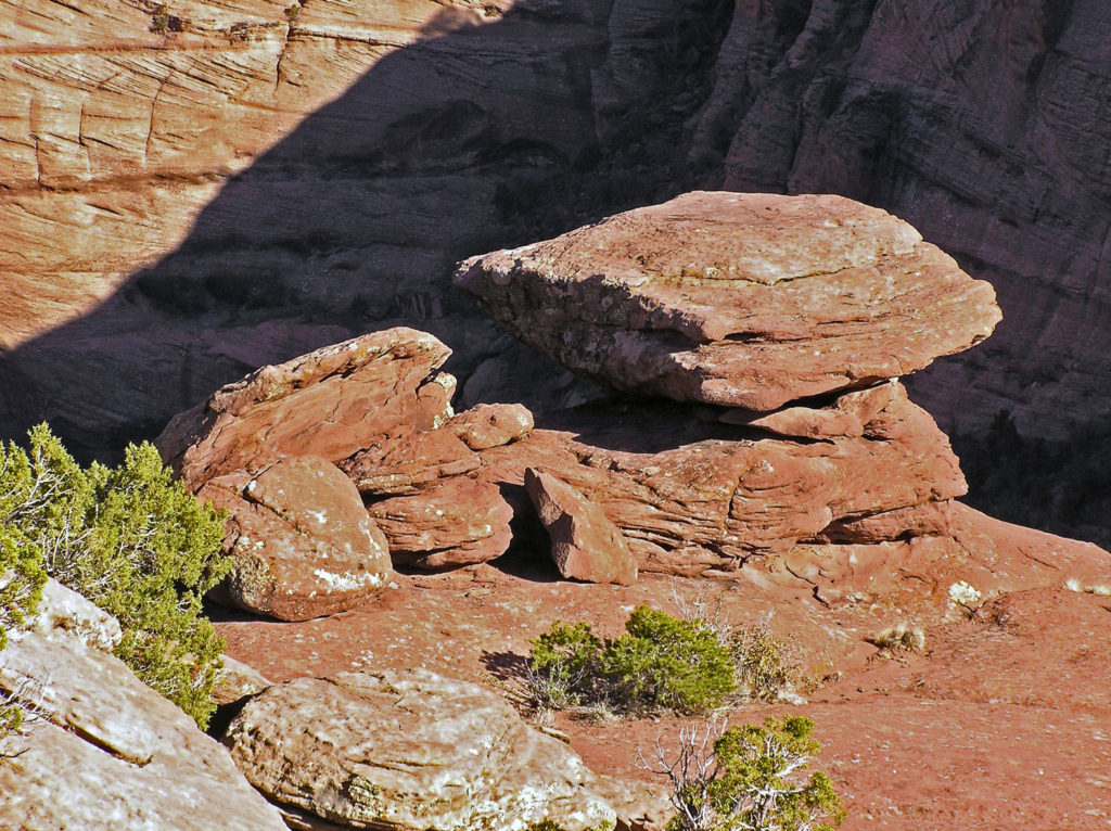
 Located a couple of miles east of Chinle, Arizona, the monument’s Welcome Center is a good place to start your visit. Pick up a free map of the monument and watch a short film about the monument to orient yourself. The park rangers can answer any questions you have about tours of the canyon, accommodations, the canyon’s history or geology, what plants and animals you’ll find in the park, or any other questions you might have. There is also a gift shop where souvenirs of your visit can be purchased.
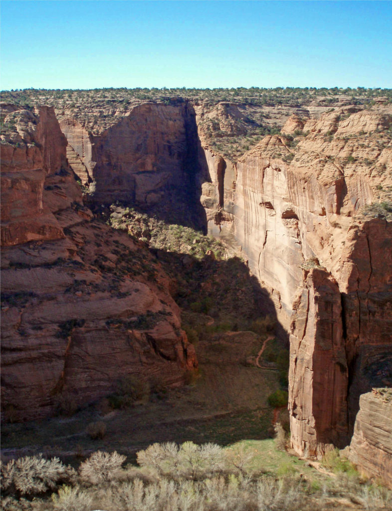
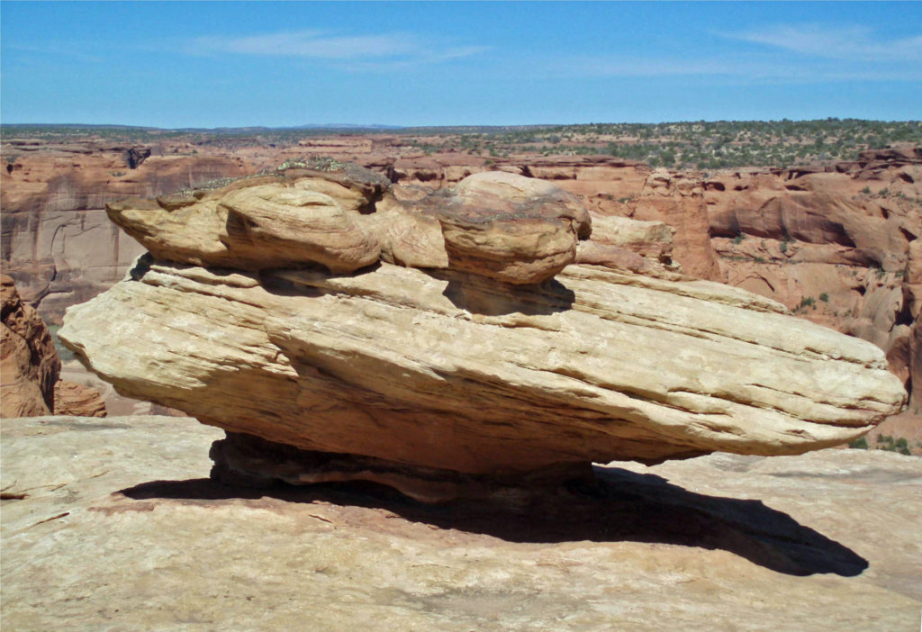
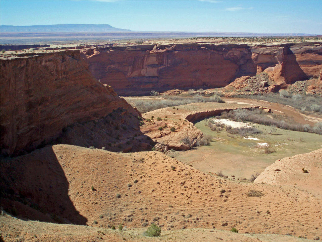
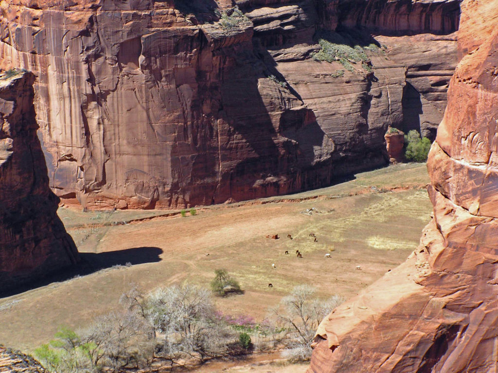
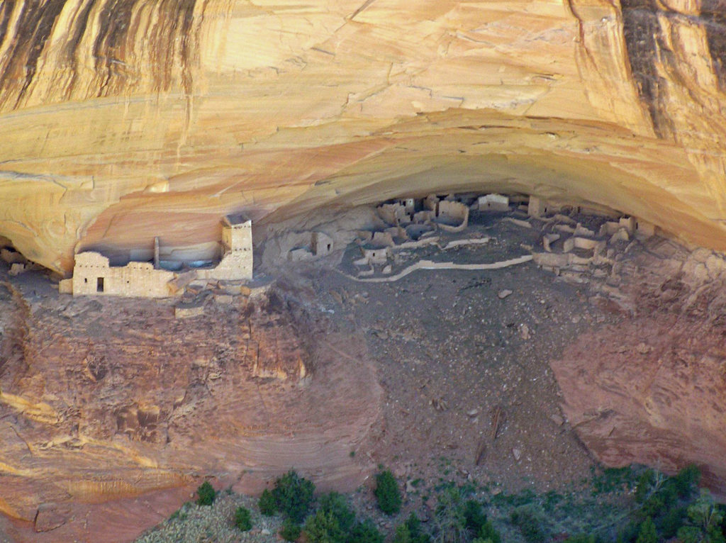
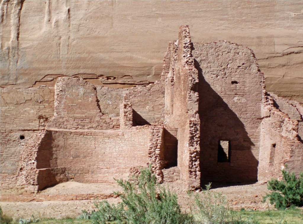
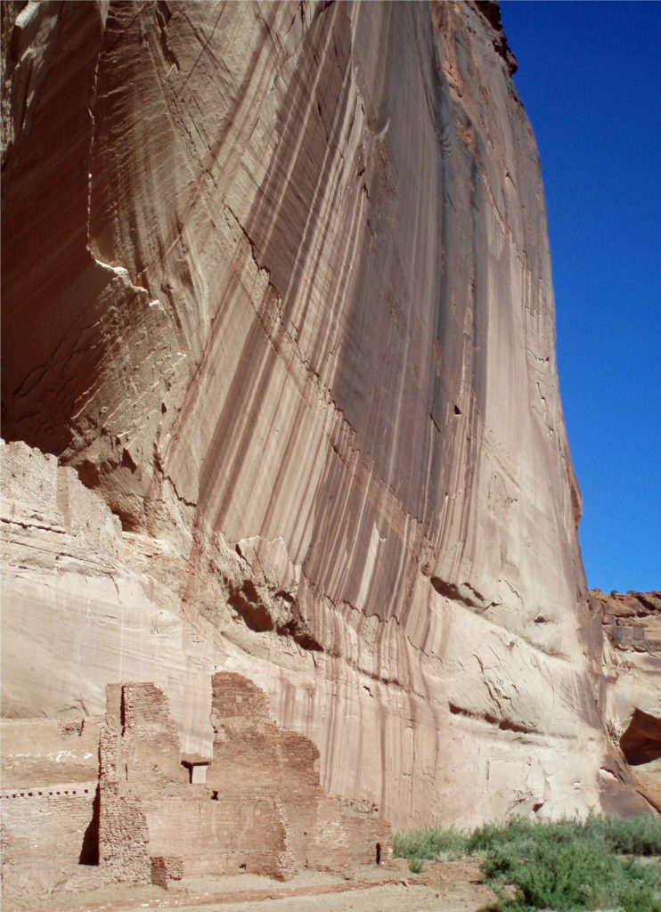
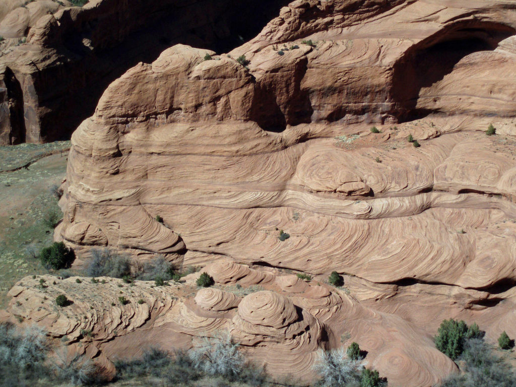
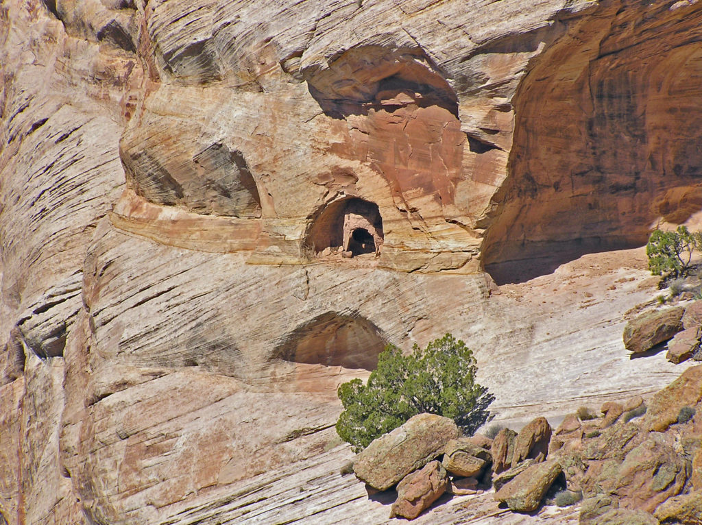
 Canyon de Chelly is worth a visit just for the spectacular scenery it affords, but it is also an important cultural and historic site. The canyon is one of the longest continuously inhabited places in North America. The Ancestral Puebloans (also known as the Anasazi) first settled in the area some 4,000 years ago. The canyon was later occupied by the Hopi, descendents of the Ancestral Puebloans, and more recently by the Navaho.
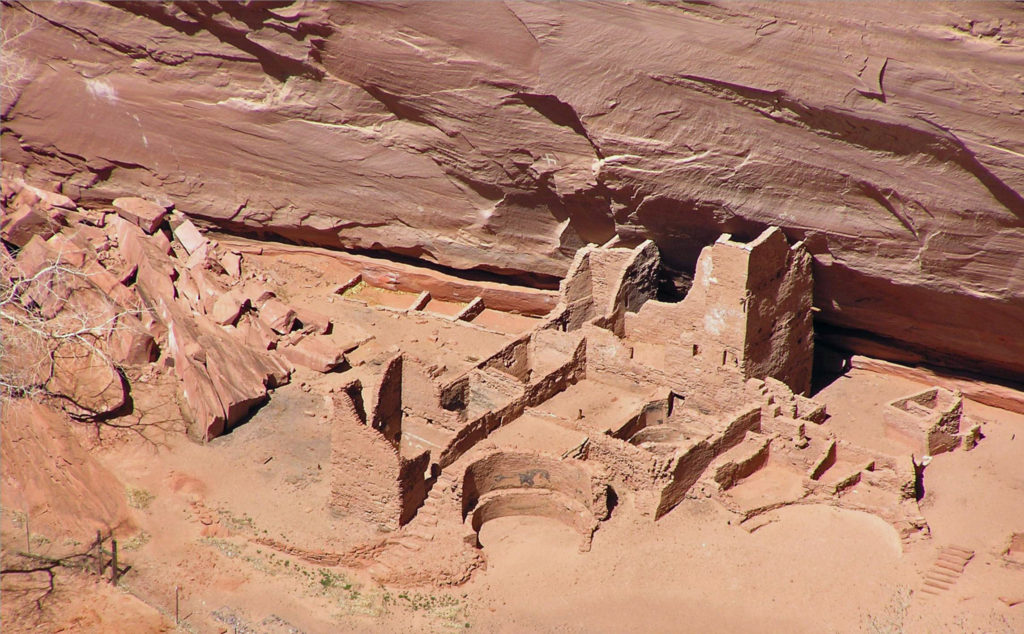
 Originally posted May 14, 2020. Updated and re-posted February 14, 2022.

 Originally posted April 28, 2020. Edited, updated, and re-posted February 5, 2022
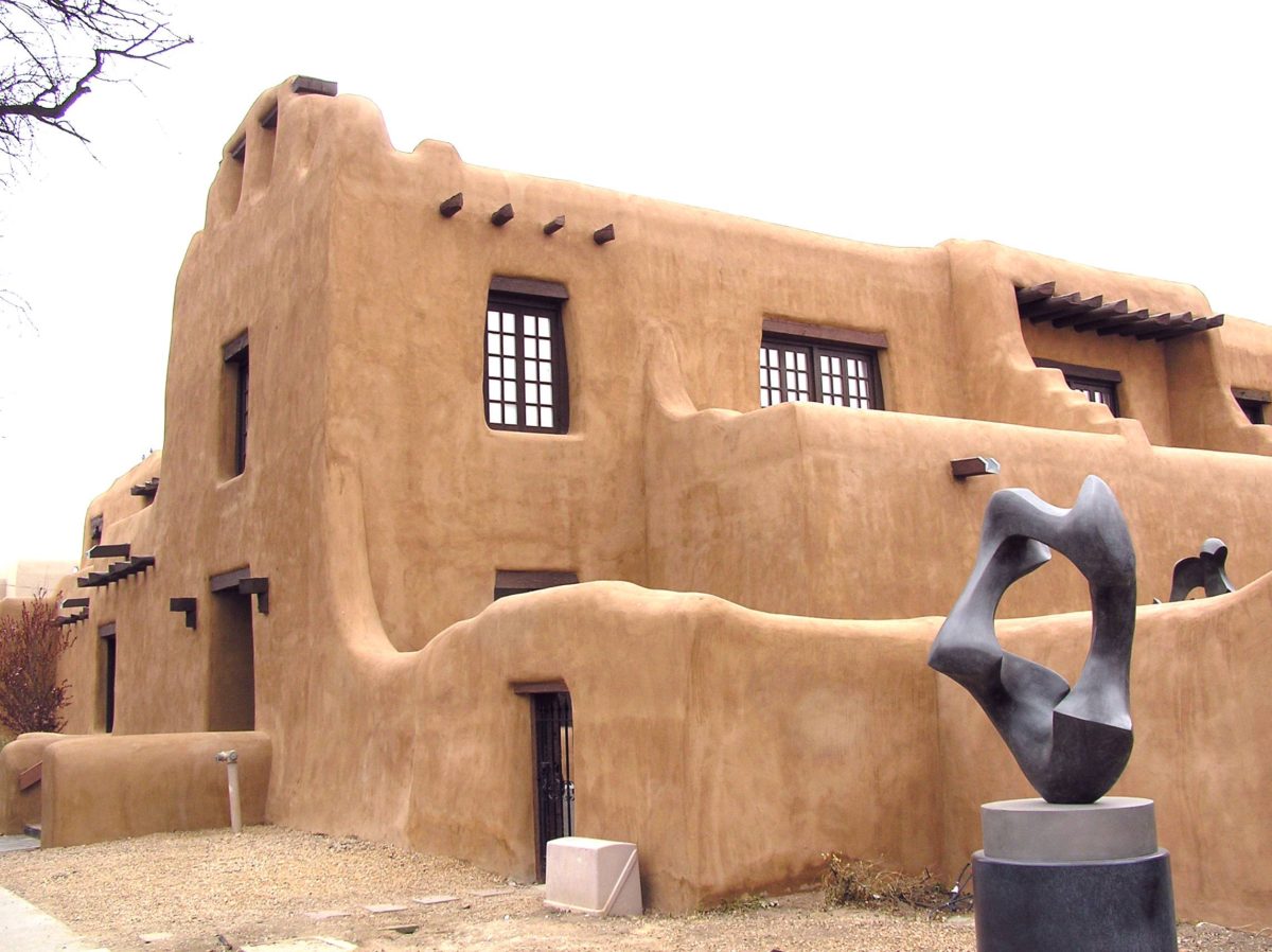
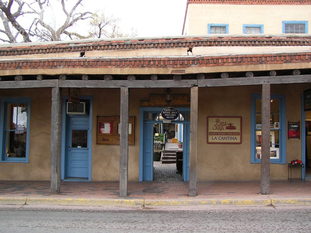
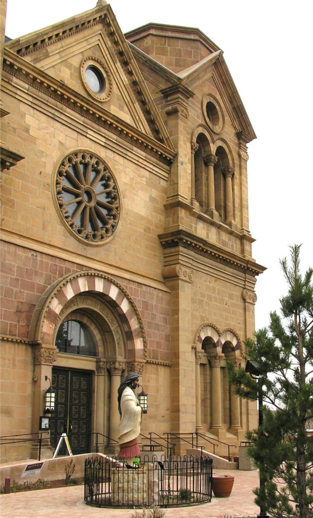
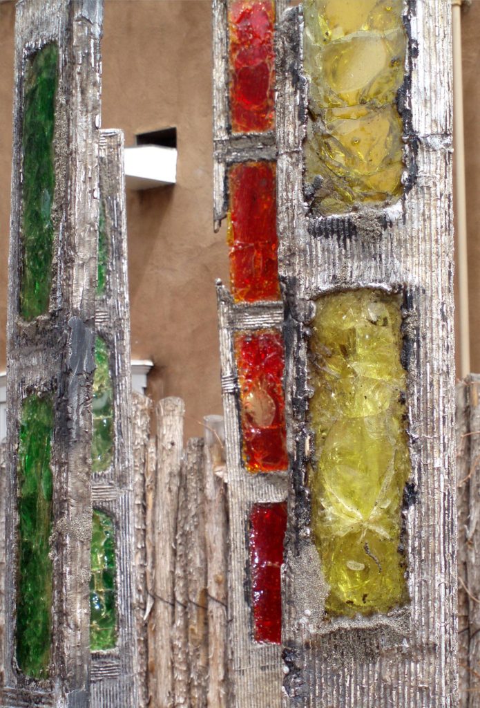
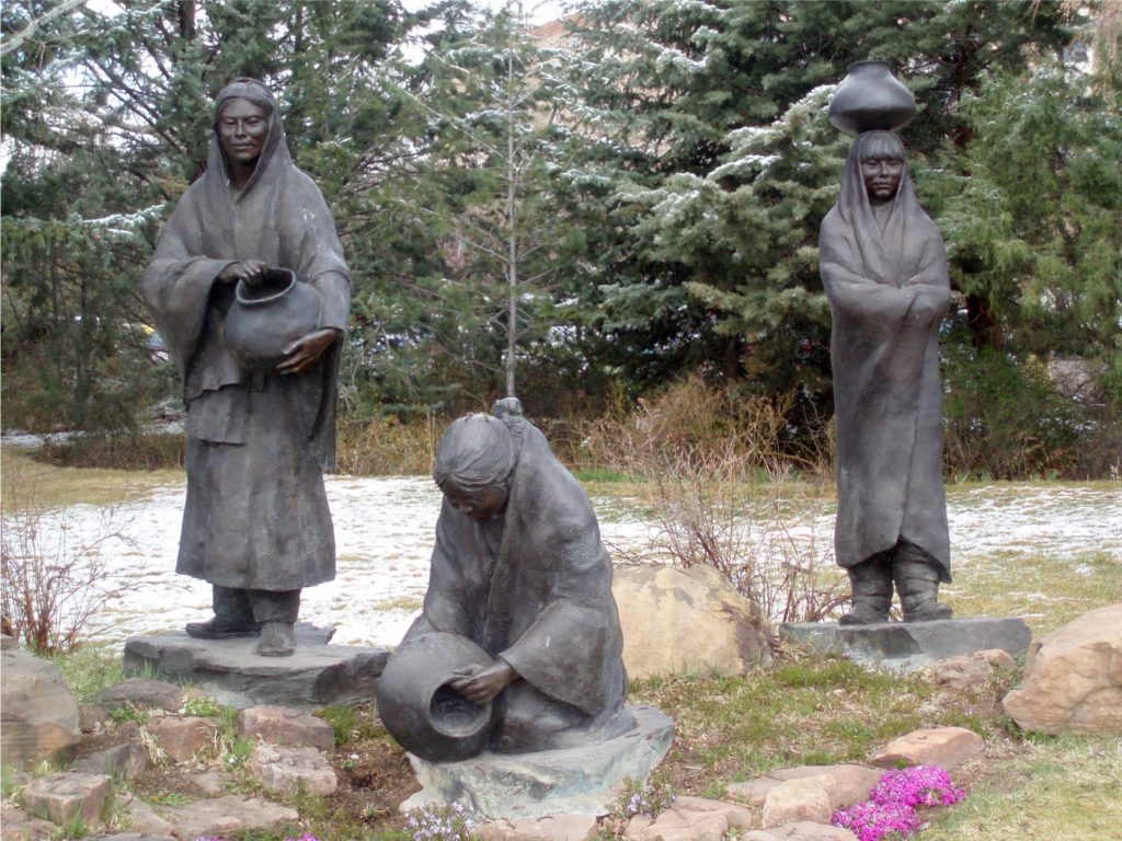
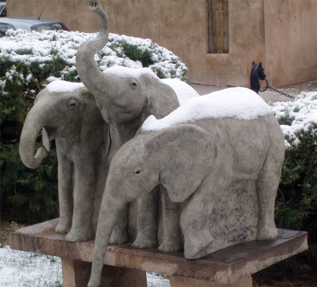 The Plaza is an ideal place to begin your exploration of Santa Fe, particularly if you are an art lover, as my wife and I are. The New Mexico Museum of Art and the
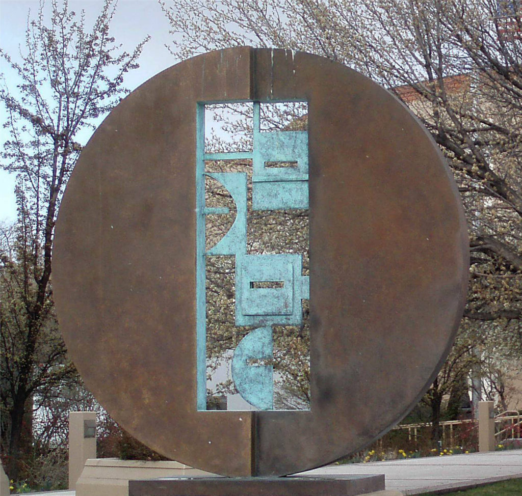
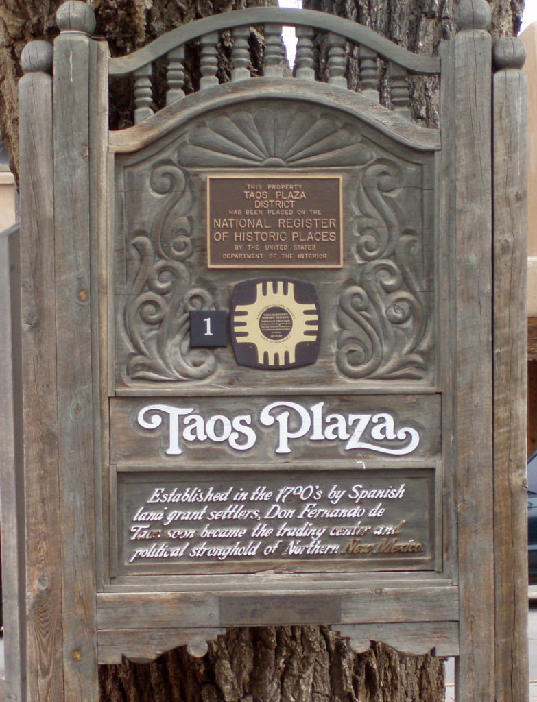
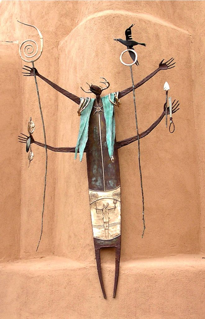
 Puebloan history and culture is an even more pronounced component of modern day Taos than it is in Santa Fe. The nearby
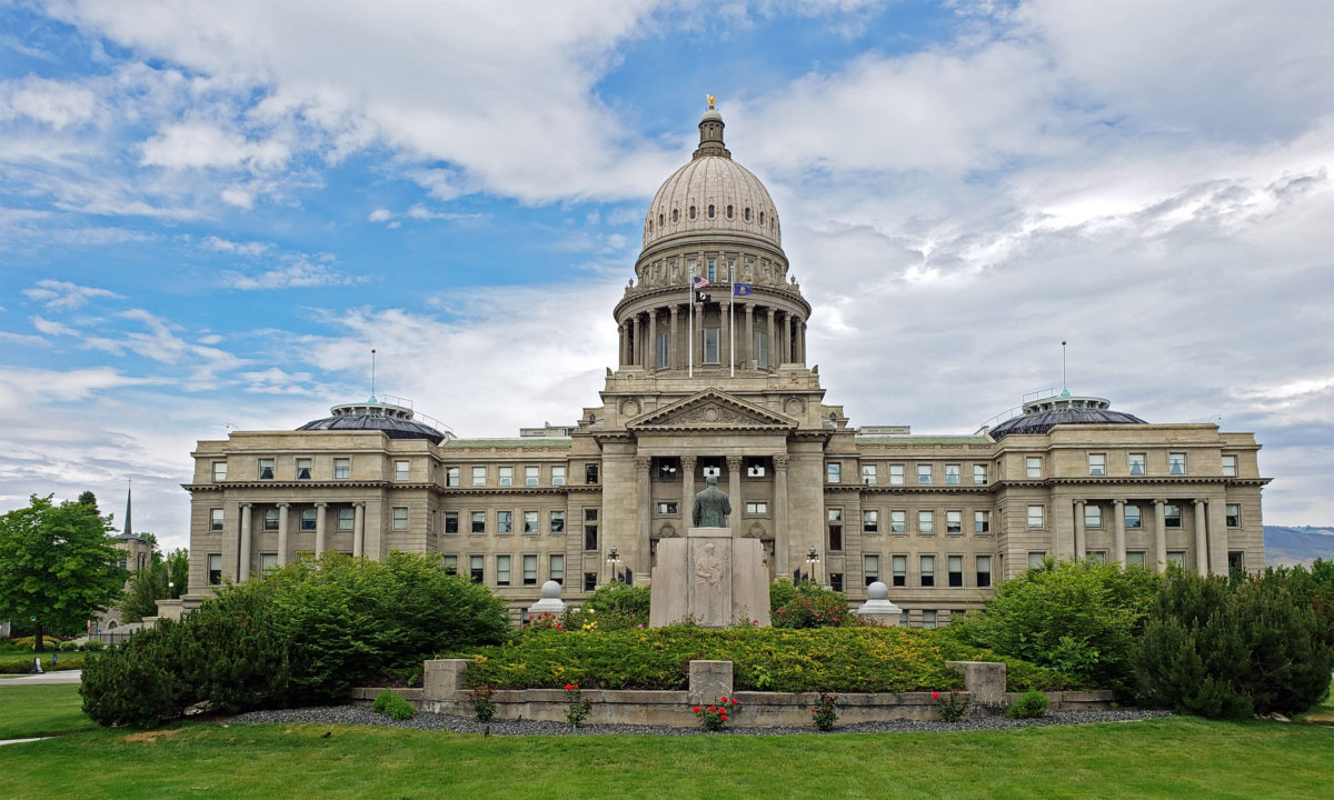
 Boise is Idaho’s capital and largest city, with a metropolitan area population of around 750,000. It’s large enough to have many of the amenities of a big city, but small enough to still retain something of a small town feel. And it’s a surprisingly modern and cosmopolitan city, blending elements of both West Coast and Rocky Mountain cultures.
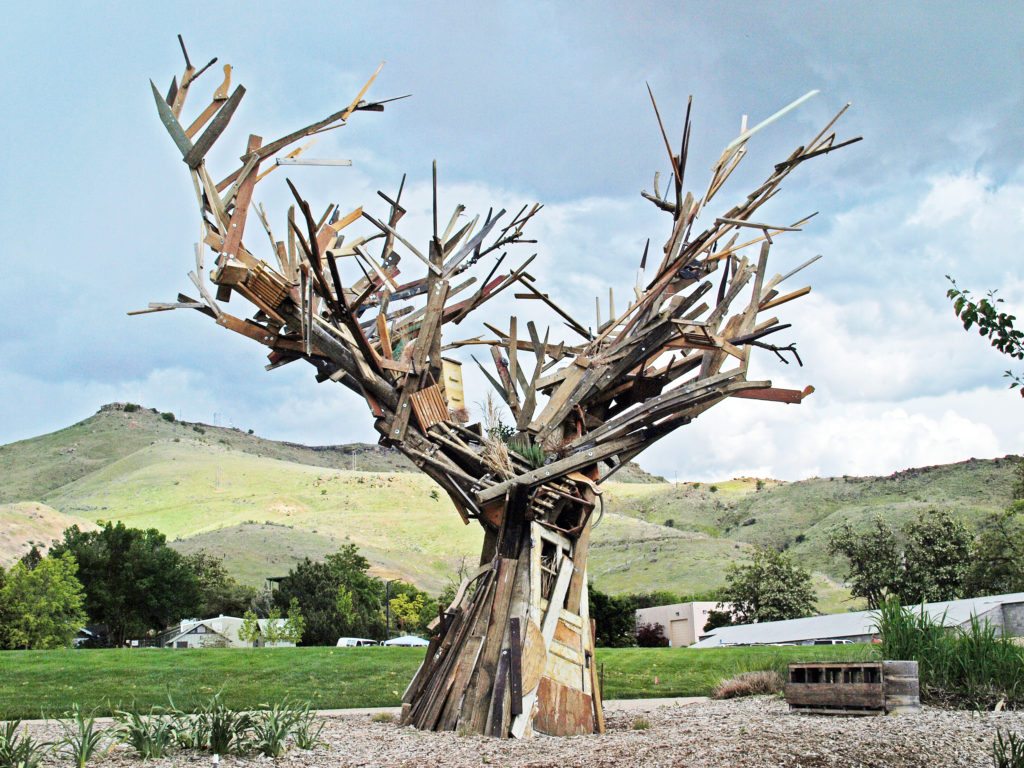
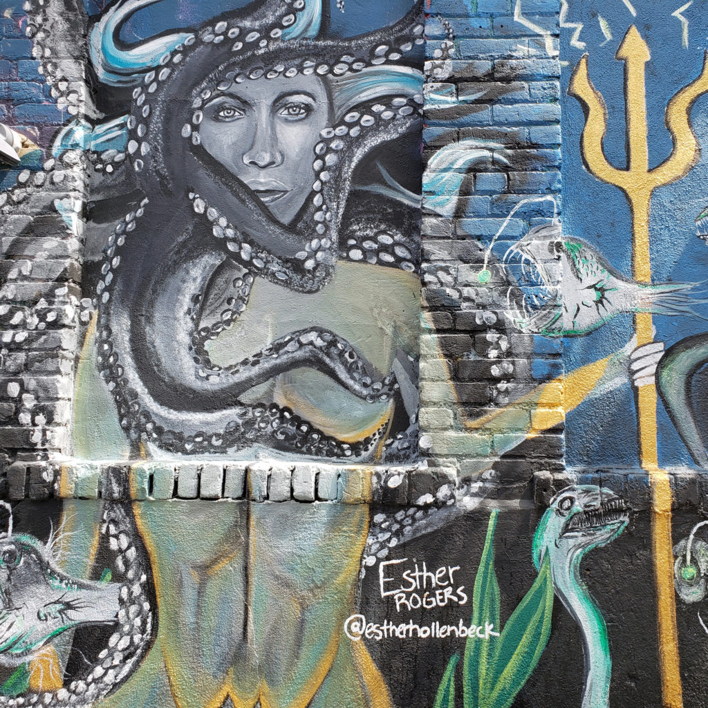
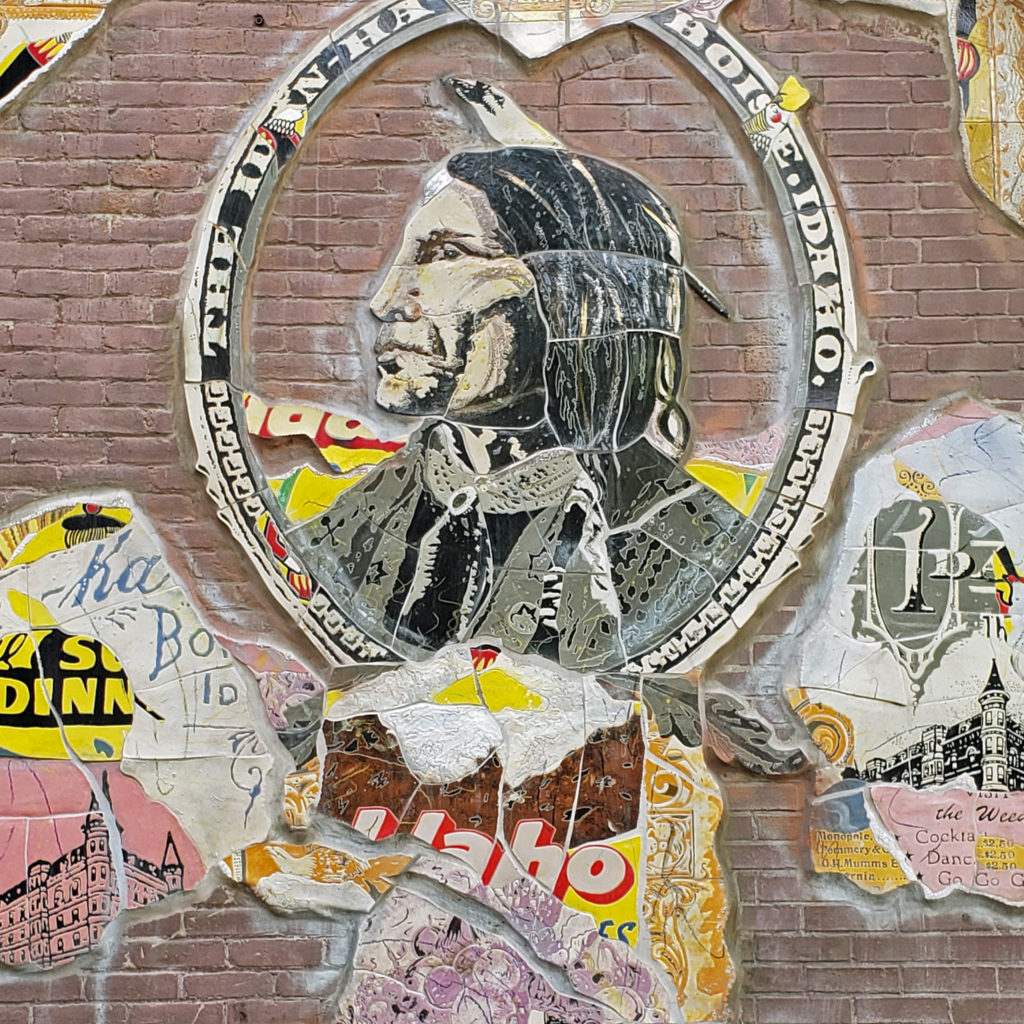
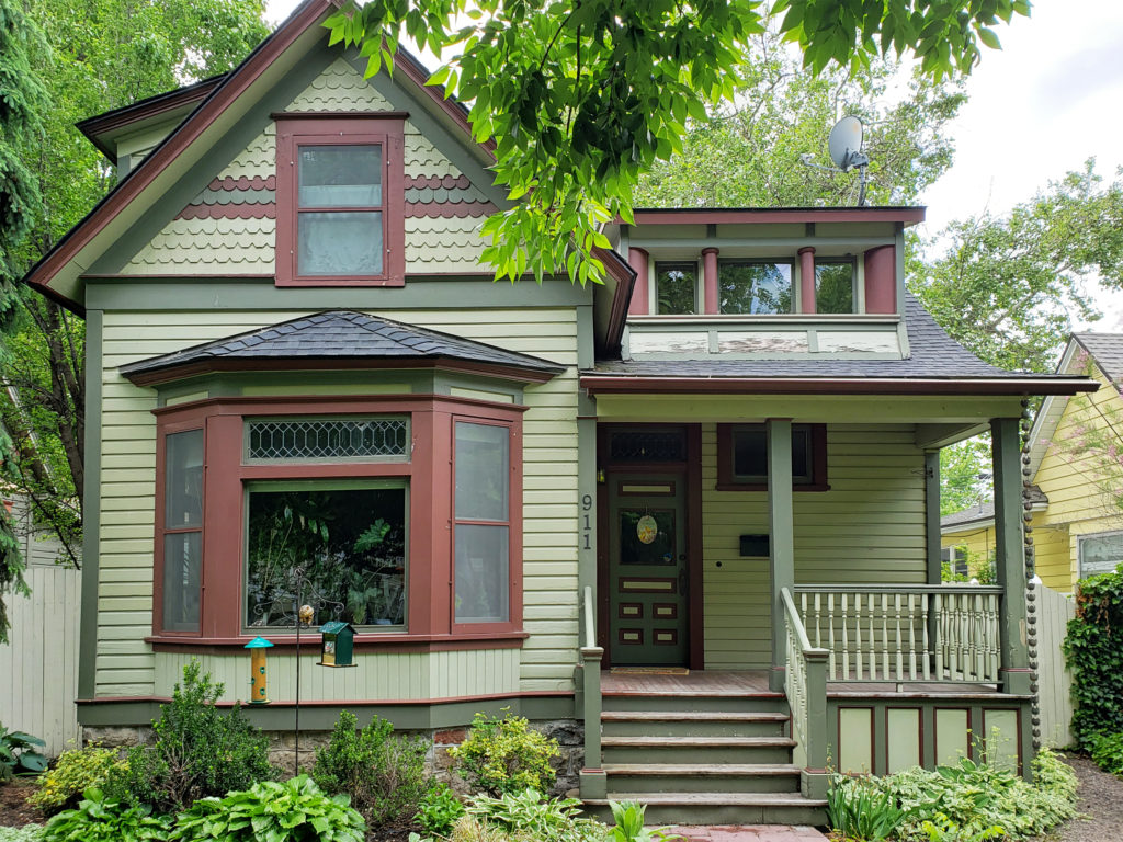
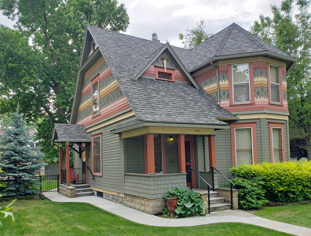 Many fine Victorian houses and architecturally interesting buildings can also be found in the downtown area.
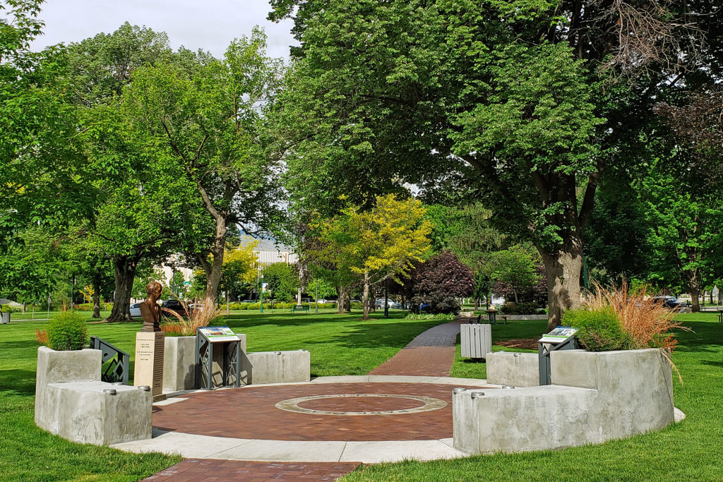
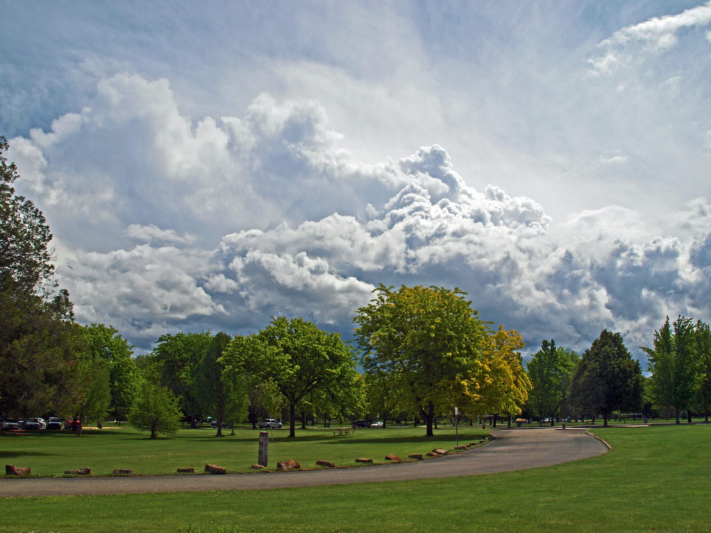
 Anne Morrison Memorial Park on the south bank of the river, and the Julia Davis Park, just south of the downtown area on the north bank, are large urban parks with a variety of open spaces and tree lined paths along the river.
 Boise is definitely worth visiting, and southwest Idaho has many truly unique, beautiful, and enjoyable places to visit, all within a short drive of each other. For more on those, check out my other Exploring Southwest Idaho posts:
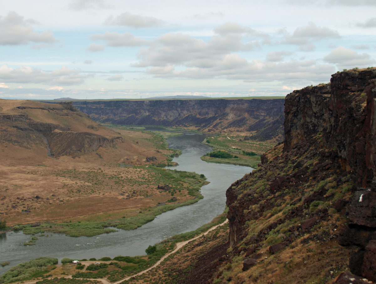
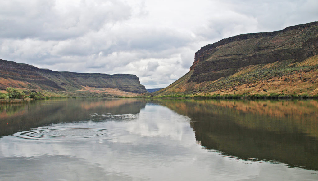
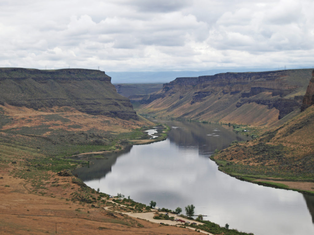
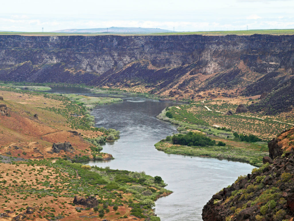
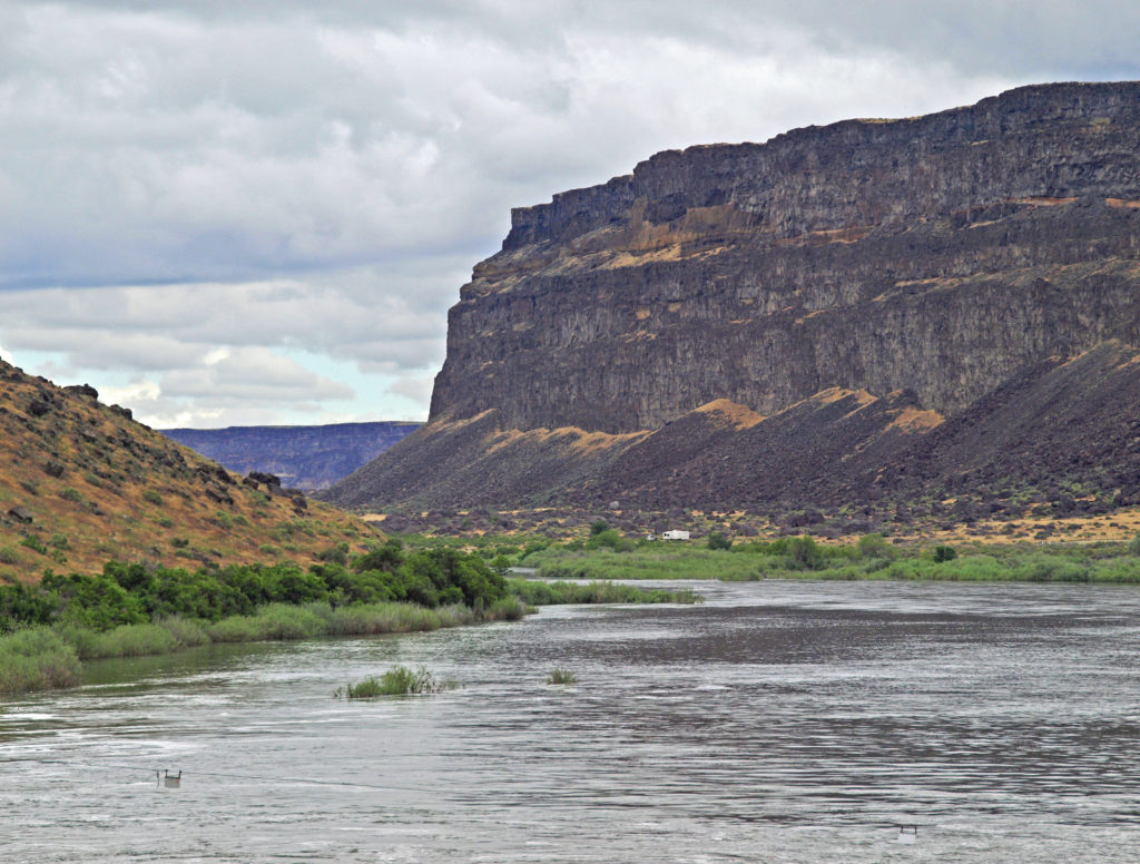
 The falls are long gone, flooded by construction of Swan Falls Dam in the early 1900s. Swan Falls was the first hydroelectric project on the Snake River. A fish ladder was constructed, but was largely ineffective, and the dam effectively blocked salmon and steelhead passage. That was a different era, and the fish ladder was never made functional. Newer dams were built both upstream and downstream with no fish ladders at all. Electricity was the point. The fish didn’t matter. But it’s a historically interesting and beautiful area, so it’s worth a visit even if, like me, you’d rather see the dam gone.
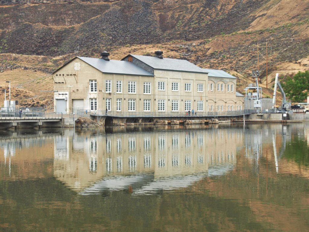
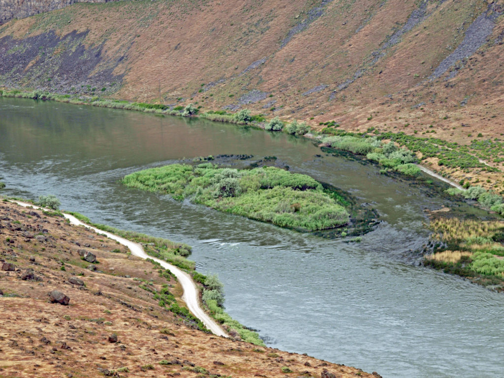
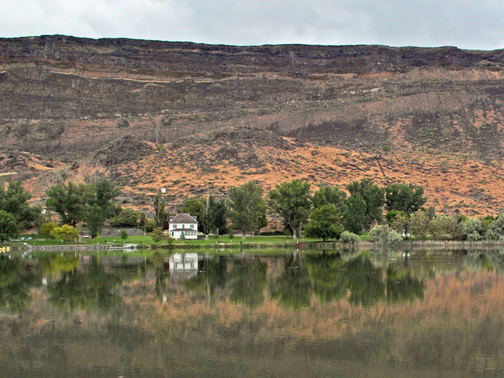
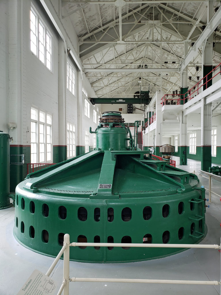 A new power generation facility was constructed at Swan Falls Dam in the 1990s. The dam’s original power plant is now open to the public, with some of the century-old generators and other equipment still in place. There are also displays depicting the history of the area, and the construction and operation of the dam. We walked across the dam after visiting the power house museum, then drove down the canyon a ways. The road was too rough for the car, though, and we turned around and drove back up to Dedication Point, and then on to Celebration Park.
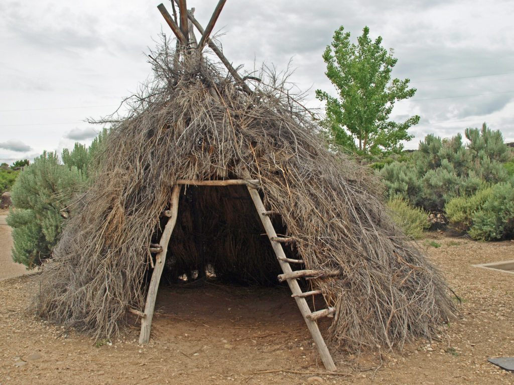 Celebration Park is Idaho’s only archaeological park. Petroglyphs dating back as far as 10,000 years can be found there. Visitors can learn about the Native American “lifeways” at the visitor center, try their hand at throwing a spear with an atlatl, and explore the petroglyph area on a self-guided walk. There is a picnic ground, and a small tent campground. The visitor center is open from 10:00 to 2:00 daily, except holidays. Check the park
 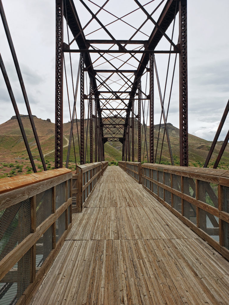 A short ways downstream, the Guffey Railroad Bridge provides pedestrian and equestrian access to the south bank of the Snake River and the Guffey Butte area. The bridge was built in the late 19th century and carried rail traffic until the 1940s. It is listed in the National Register of Historic Places. Guided tours of the area highlighting the area’s early mining and railroad history are conducted periodically.
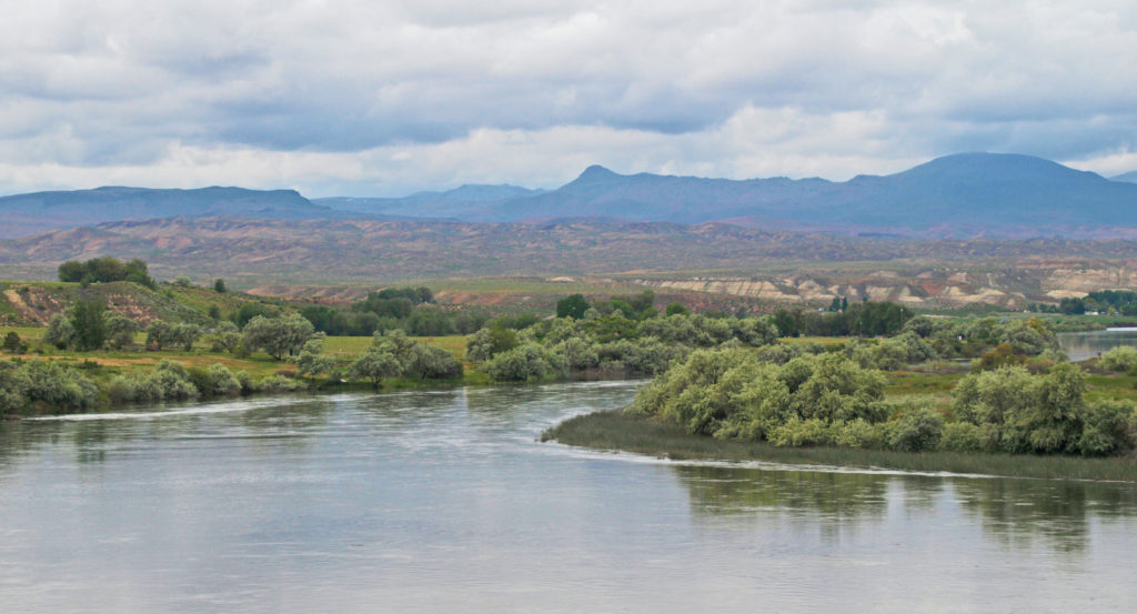
 Back in Boise, we toured the