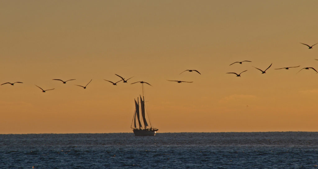
We all need to get away from home on occasion, sometimes far away, and the Florida Keys are about as far from the Pacific Northwest as you can get and still be in one of the fifty U.S. states – Honolulu is closer to Seattle than Key West is. And the Keys make for a great winter getaway. My wife and I had a great time in Key West on our only visit and I would love to return to someday.
 The following was originally posted on this site a couple of years ago. I checked all of the links, but things can change, so check the Keys News website for current information if you’re contemplating a visit in the near future.
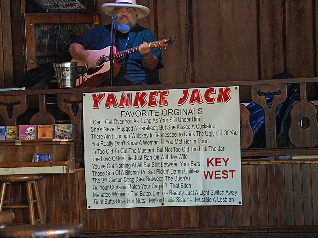
If you are thinking about a visit to Key West, the first thing you should do is track down a copy of Jon Breakfield’s book “Key West: Tequila, a Pinch of Salt and a Quirky Slice of America.” Breakfield and his wife were living in Scotland and took a winter vacation to Key West one year. Two days into their visit they decided not to go back to Scotland. Breakfield’s book is an absolutely hilarious account of their first year in Key West. It’s also a good introduction to the Key West culture and works as a weird sort of travel guide. After reading the book, you’ll probably want to visit The Bull, a bar on Duval Street, and the Whistle Bar, which occupies the floor above. The Whistle Bar has a wrap around veranda that is one of the best people watching perches in Key West. Both figure prominently in the book. And if you’re really adventurous, you might even want to venture up one more flight to the clothing optional rooftop bar called The Garden of Eden.
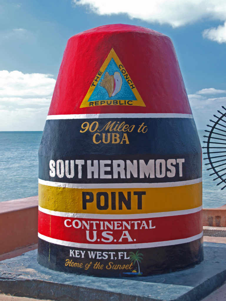
Key West is a quirky place, and nothing exemplifies that better than the city’s tongue in check secession from the United States in 1982. After the Border Patrol set up a roadblock on the highway between Key Largo and Miami (to stem the flow of drugs into the country via the Keys), creating huge traffic backups and inhibiting island residents from commuting to jobs on the mainland, the mayor and city council of Key West decided that if the Border Patrol was going to treat them like they were a foreign country by setting up a de facto border crossing station, they would become one. Thus was born the Conch Republic. The move was pure political theater (the mayor “surrendered” to the commander of the naval air station at Key West the day after declaring the Conch Republic’s independence), but it resonated with the anti-establishment sentiment common among island residents, and the spirit of the Conch Republic persists to this day.

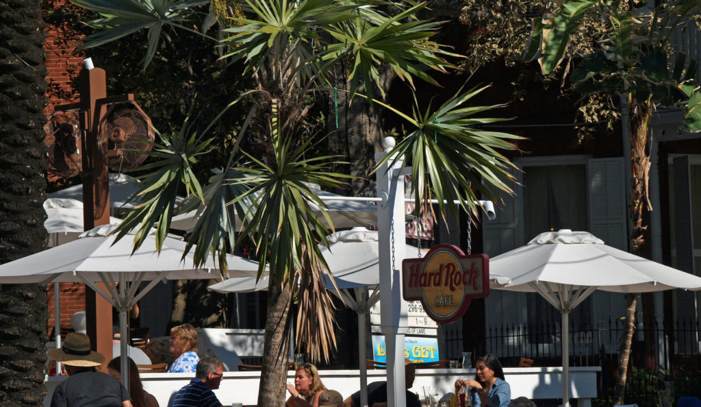
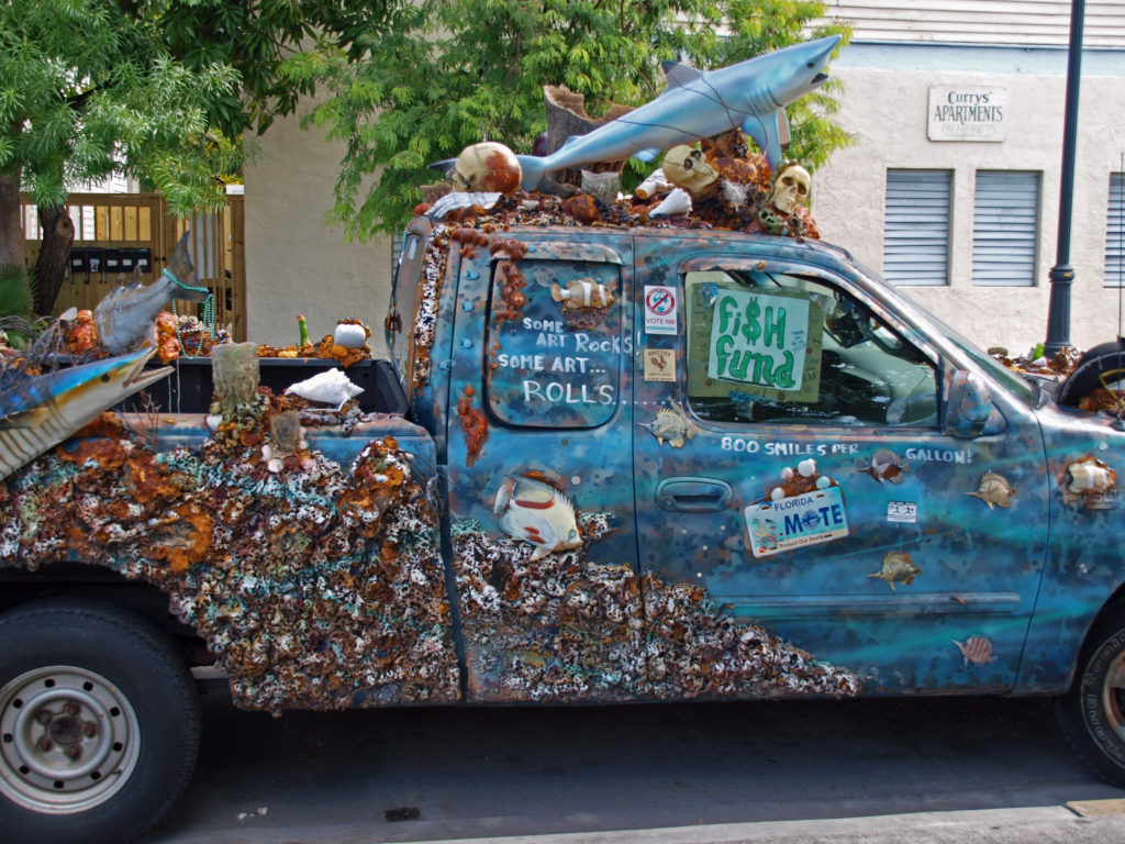
Duval Street is the main drag in Key West. It’s lined with bars and restaurants, galleries, gift shops, and much more. You can eat your way down one side of the street and drink your way back up the other, if you’re so inclined. You’ll probably meet fifty other tourists for every local, but everyone will be having a good time and you won’t care that it’s not the real Key West.
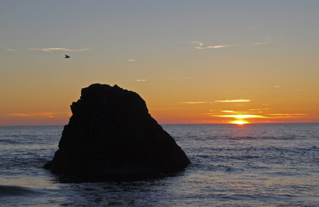
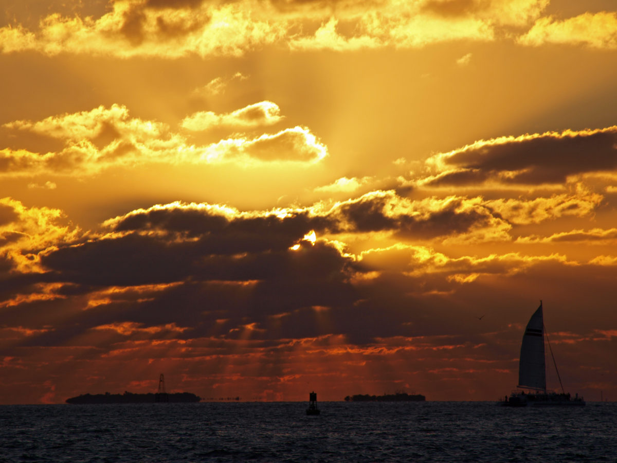
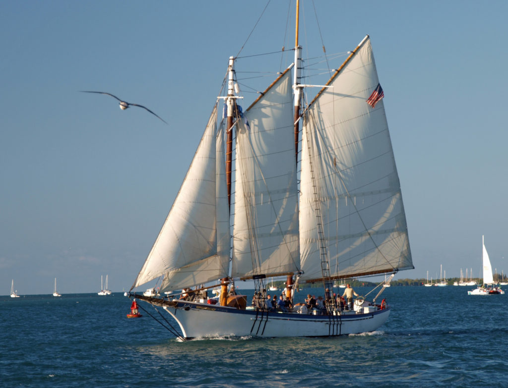
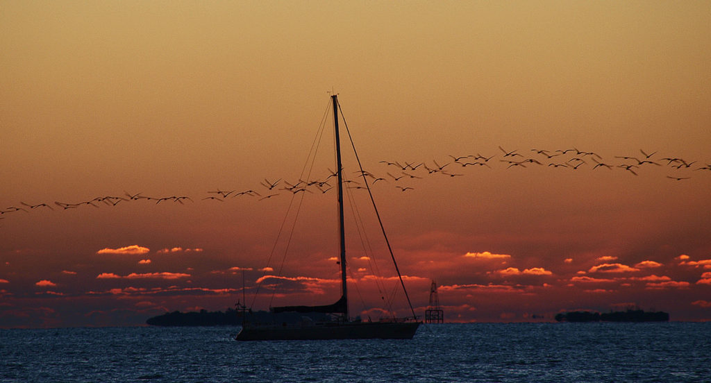
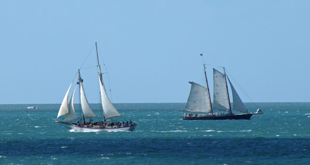
Besides Duval Street, another major tourist draw is Mallory Square and the daily Sunset Celebration. Key West is known for its sunsets and didn’t disappoint on our visit. And every evening about two hours before sunset dozens of artists, crafters, food vendors, and street performers of every stripe congregate at Mallory Square to hawk whatever it is they’re selling to the tourists gathered there to watch the sunset. It’s weird, wild, and enormously entertaining. And then there’s a beautiful sunset to cap it all off.
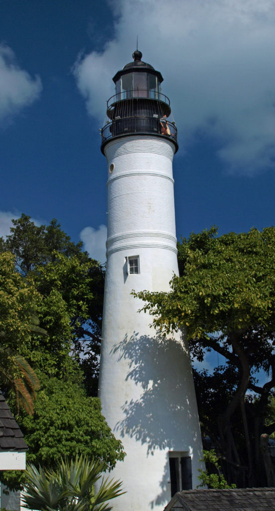
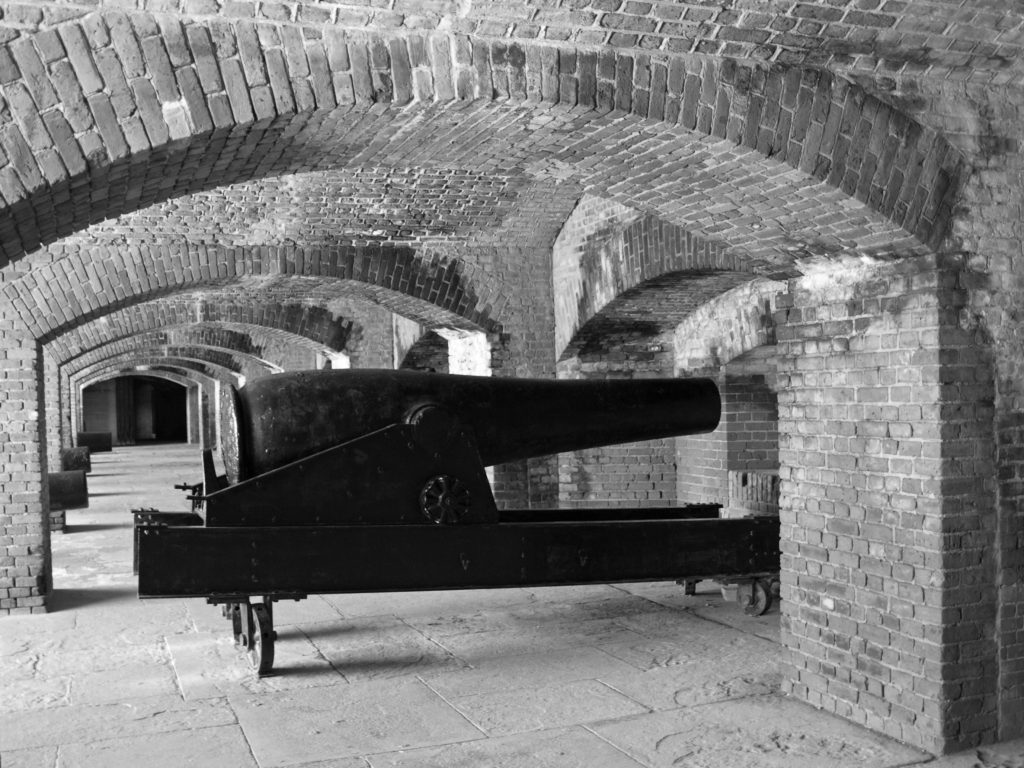
Key West has plenty of places of interest beyond Duval Street and Mallory Square, too. The Hemingway House is another major tourist draw. Get there early if you’re going or buy your tickets online. The line was around the block both times we thought about taking a look. The Audubon House, Key West Lighthouse Museum, Eco-Discovery Center , Fort Zachary Taylor Historic State Park , the Mel Fisher Maritime Museum, and the Key West Aquarium are all worth a visit.
![]() If you just want to hang out at the beach, Fort Zach Park has a nice swimming beach (with an adjacent bar). South Beach at the end of Duval Street also has a beach bar and grill. Higgs Beach is four or five blocks east and has a nice beach for sunbathing and swimming. And across the street, Astro City Playground is a fun place for kids to play. To the east of Higgs Beach are C.B. Harvey Memorial Rest Beach (no bar or other amenities) and Smathers Beach. Dog Beach, a couple of blocks east of South Beach, is literally for the dogs – a dog friendly, off leash park.
If you just want to hang out at the beach, Fort Zach Park has a nice swimming beach (with an adjacent bar). South Beach at the end of Duval Street also has a beach bar and grill. Higgs Beach is four or five blocks east and has a nice beach for sunbathing and swimming. And across the street, Astro City Playground is a fun place for kids to play. To the east of Higgs Beach are C.B. Harvey Memorial Rest Beach (no bar or other amenities) and Smathers Beach. Dog Beach, a couple of blocks east of South Beach, is literally for the dogs – a dog friendly, off leash park.
Key West has dozens of fine restaurants. All of the places we dined at were excellent. We had a couple of great breakfasts at a place called Camille’s Cafe, but it appears to be closed. Blue Heaven, Cafe Sole, and a Cuban restaurant called El Siboney all had excellent food. We also lunched at a couple of Duval Street eateries (whose names I’ve forgotten) that were very good. The Lobster Shack, The Flaming Bouy, Louie’s Backyard, Sarabeth’s Kitchen, Santiago’s Bodega (tapas), Cafe Marquesa, The Cafe (vegetarian), Ambrosia (Japanese), and B.O.’s Fish Wagon (fresh and very affordable seafood) are all highly rated, also.
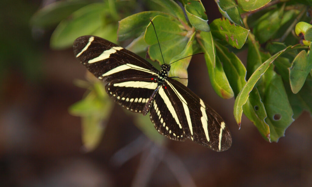
Nature lovers will want to check out Key West Butterfly and Nature Conservancy, Indigenous Park, Key West Nature Preserve, and Key West Wildlife Center.
If you’re interested in fishing, Trip Advisor lists more than two dozen fishing charters and tours. If scuba diving is your thing, Finz Dive Center, Captain’s Corner Dive Center, and Lost Reef Adventures all offer diving tours and are highly rated.
Tourism drives Key West’s economy and there is no shortage of available accommodations , from luxury resorts to whole house rentals to budget motels and inexpensive Airbnb rentals. We went the Airbnb route and found a reasonably affordable room in Old Town. But the closer to the historic district and Duval Street, the more expensive the accommodations become, and the longer ahead that you will need to make reservations. It’s an advantage to stay within walking distance of Old Town, as parking is limited, but if you have a car and don’t mind spending some time looking for a place to park, staying in the New Town section or on Stock Island can save you some money. Key West is bicycle friendly, has a public transit system, and taxis are readily available (some with bicycle racks), so driving into Old Town is not strictly necessary, even if you are not staying close by. Uber and Lyft are also options.
The bottom line is there are as many reasons to visit Key West as there are tourists visiting. It’s a great party town and a great place to lounge on the beach and soak up the sunshine, but it’s much more than just that. Key West is soaked in history, has a great food scene, has great fishing and diving, and is located in an incredibly beautiful natural setting.
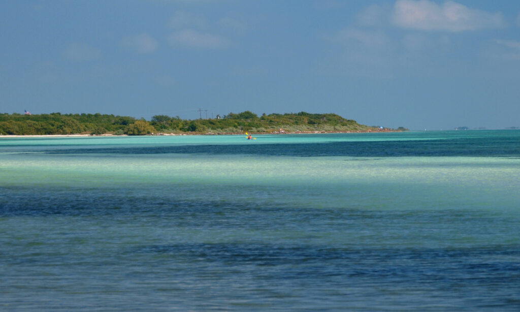
The other Florida Keys have their own attractions, too, and the drive from Miami to Key West is an attraction on its own.
Key Largo is the closest of the keys to the mainland and many of the residents commute to the mainland, but it has many attractions that draw travelers, too. It’s the self-proclaimed “dive capital of the world” and home to the world’s largest artificial reef, among other attractions. If fishing is your thing, Islamorada bills itself as the “sport-fishing capital of the world.”
There were a number of other interesting places in the Keys that we stopped at on our way to and from Key West. One of those was the National Key Deer Refuge on Sugarloaf Key. Key deer are tiny – not much bigger than a German shepherd. Another stop we made was Bahia Honda State Park, which has a nice swimming beach and clear waters in multiple hues of blue.
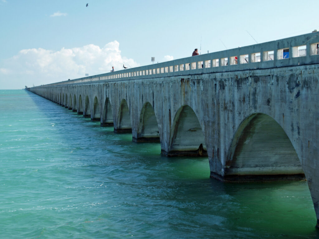
The Overseas Highway through the Keys is an engineering marvel and driving it is an amazing journey, even if you don’t stop at any of the Keys along the way. The Seven Mile Bridge itself is one of the main attractions in the Keys.
If you’re contemplating a visit, flying to Key West is an option, but I’d do as we did – fly to Miami or Fort Lauderdale, rent a car, and drive the Overseas Highway. Visit the other Keys and go diving, snorkeling, fishing, or just find an uncrowded beach and soak up the sunshine away from the crowds. And, of course, take in Key West and all it has to offer. You won’t regret it. And while you’re in Florida, the Everglades are only a short drive from Miami.
Originally posted by Alan K. Lee on August 10, 2018. Updated with Covid-19 info December 14, 2020. Updated and expanded September 15, 2023.
All photos © Alan K. Lee
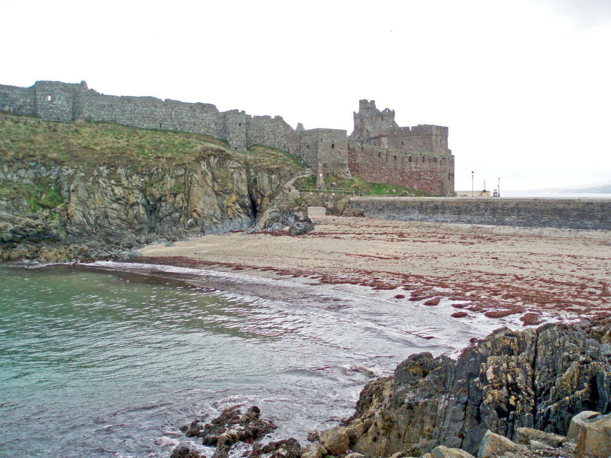

 Not quite an independent country, the
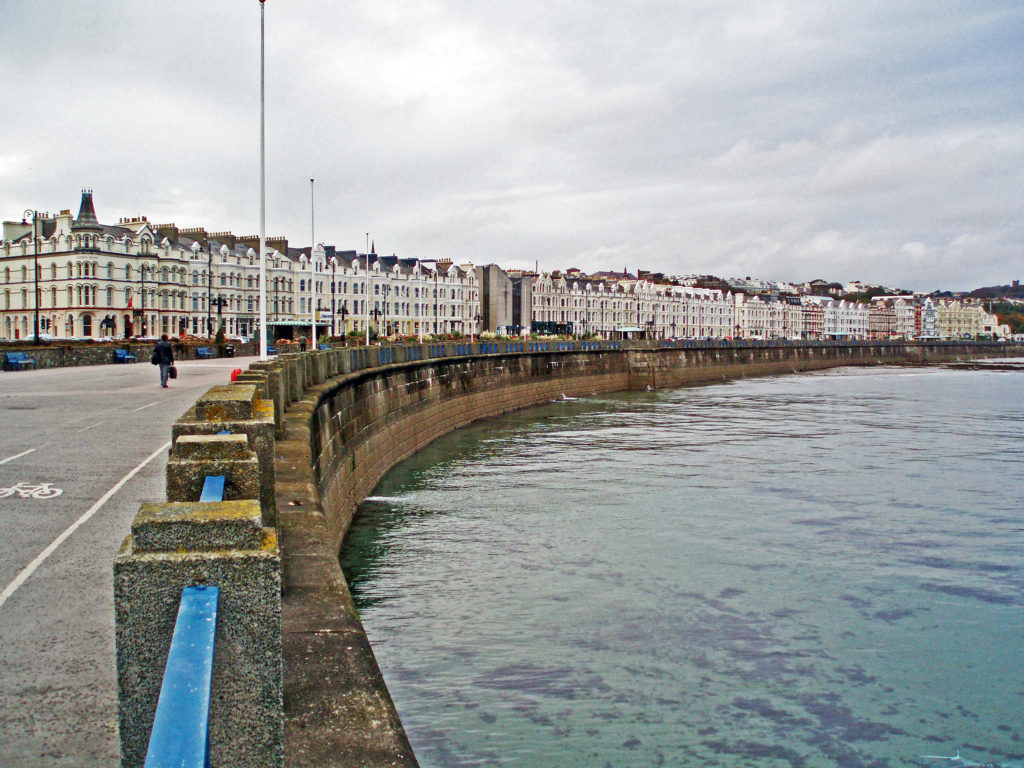
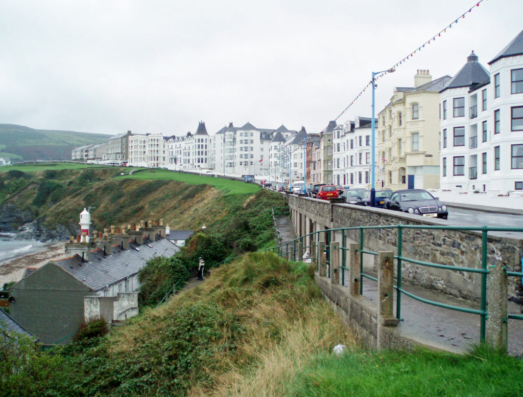
 Getting to the island is relatively easy. It is no more than a 30 minute flight from any major city in the UK or Ireland. We, however, traveled to the island by passenger ferry from Heysham, England, which takes about two and a half hours. Ferries from Heysham and Liverpool run year round. In the summer months, there are also ferries from Belfast and Dublin to Douglas, the capital and largest city on the island.
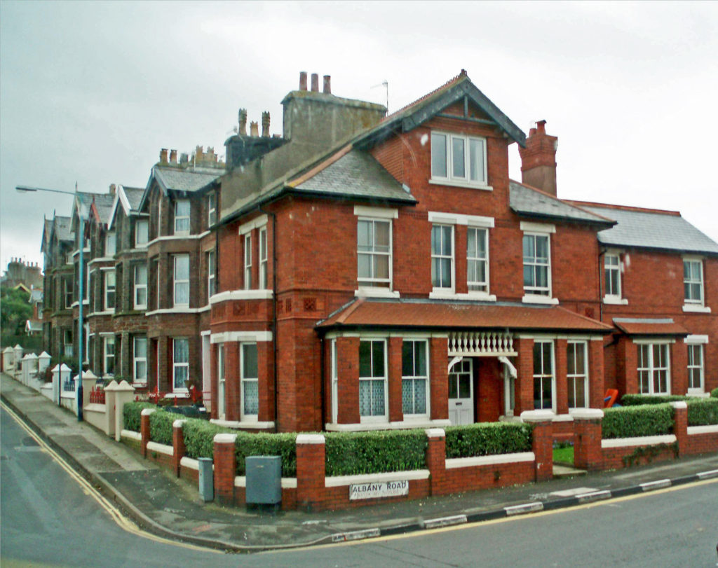
 On our train ride we met a local gentleman who was happy to pass on some of his knowledge of the island and its history. We found the Manx people to be friendly and welcoming.
 The Isle of Man has an interesting history. It has been ruled by the Celts and the Vikings, and it has, at various times, been part of Norway, Scotland, and England. But the Manx people have a strong sense of their own identity and have managed to maintain that identity for more than a millennia, regardless of who ruled the island. Tynwald, the Isle of Man parliament, is one of the oldest, if not the oldest, in the world. And human occupation of the island goes back to at least 6500 BC.
 The Isle of Man is known for the short-tailed Manx breed of cats. The island is also the home of a four- and sometimes six-horned breed of sheep, and a population of red-necked wallaby, which have become established on the island after escaping from a wildlife park. We saw many of the odd looking sheep, but no cats or wallabies, sorry to say.
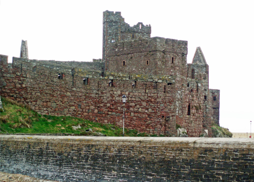 Motor sports fans know the island for the Isle of Man
 While the Isle of Man might not be a tourist destination in its own right, at least for those of us from North America, we thoroughly enjoyed our time there, and I would like to go back someday. It has been some time since we visited, but given the island’s long history, I doubt that its essential character has changed much over the past seventeen years. I’m sure it remains a worthy addition to any trip to Great Britain or Ireland.
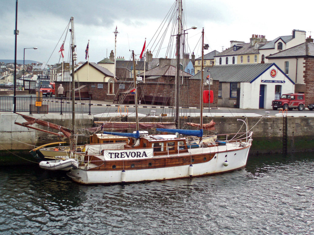 Originally posted by Alan K. Lee, December 4, 2020. Updated and re-posted August 28, 2023.
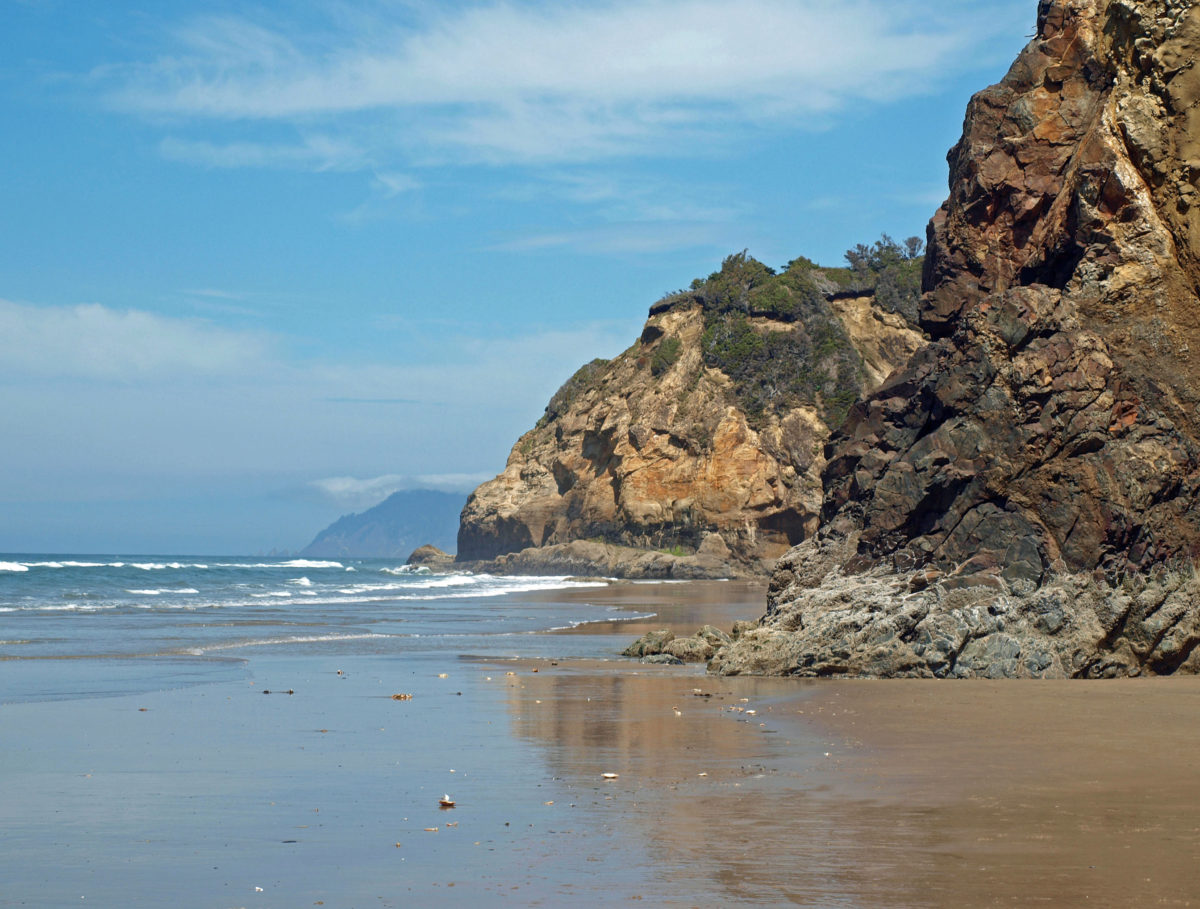
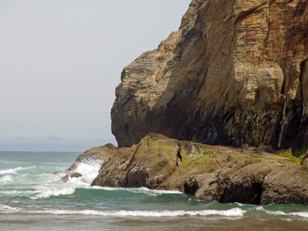
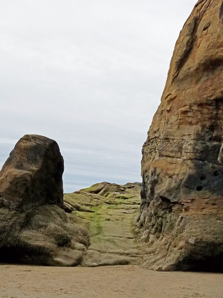
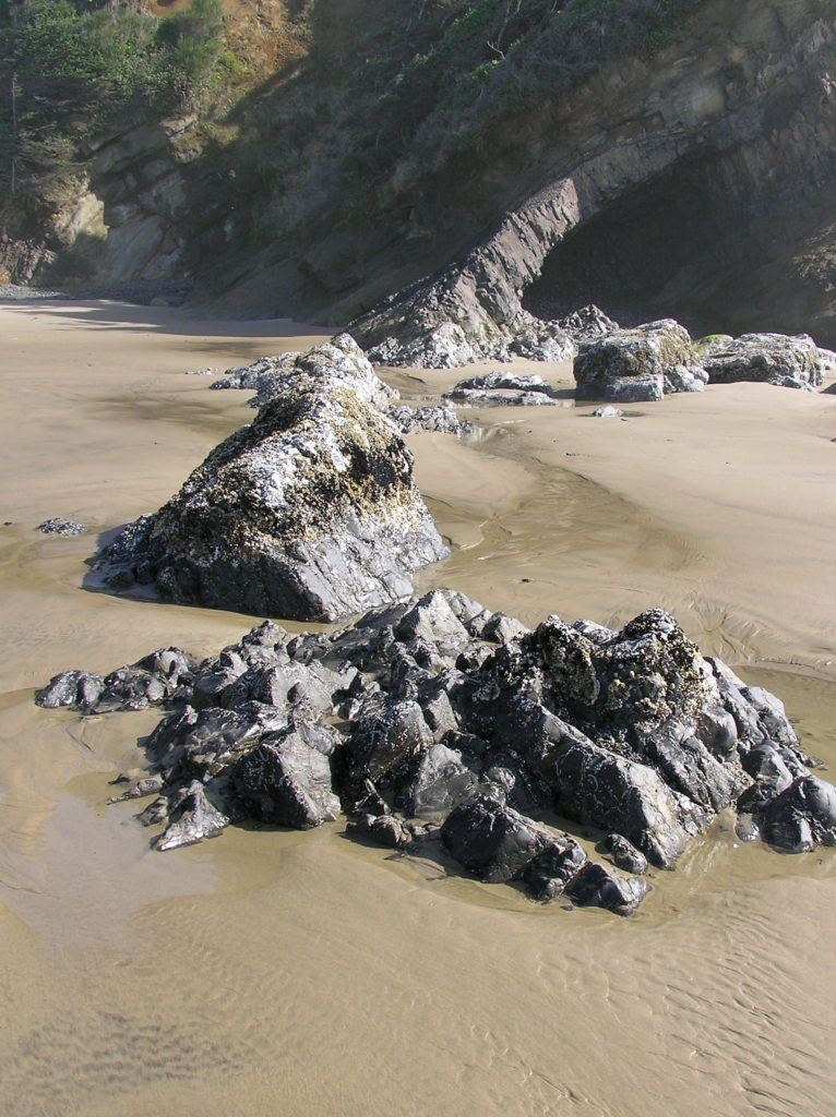
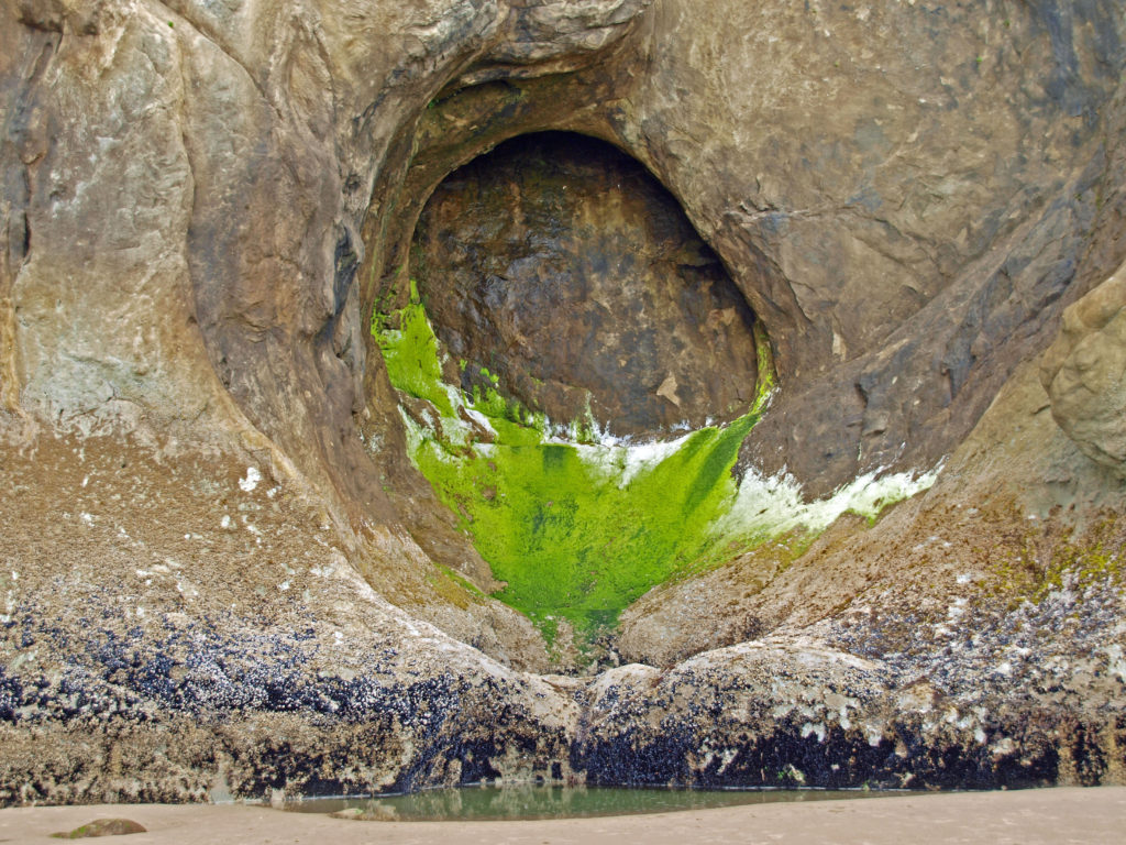
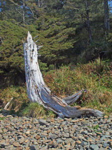
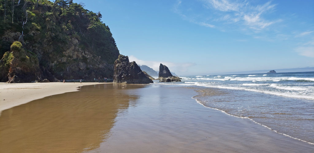
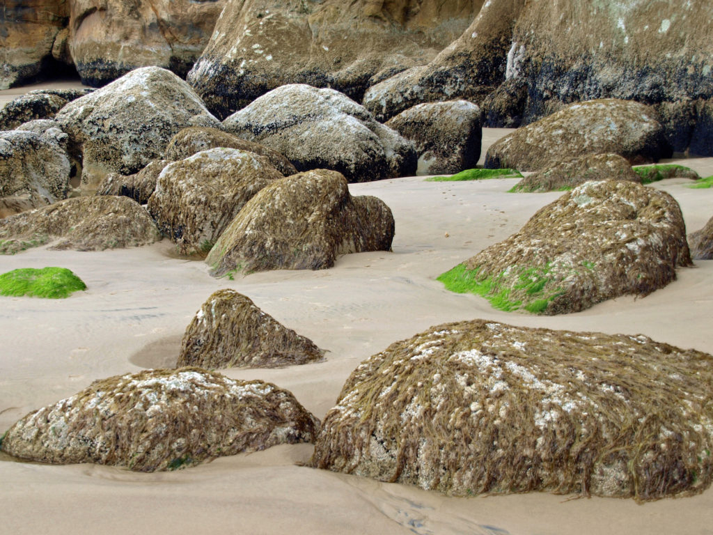
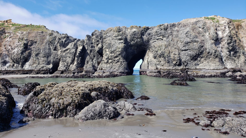
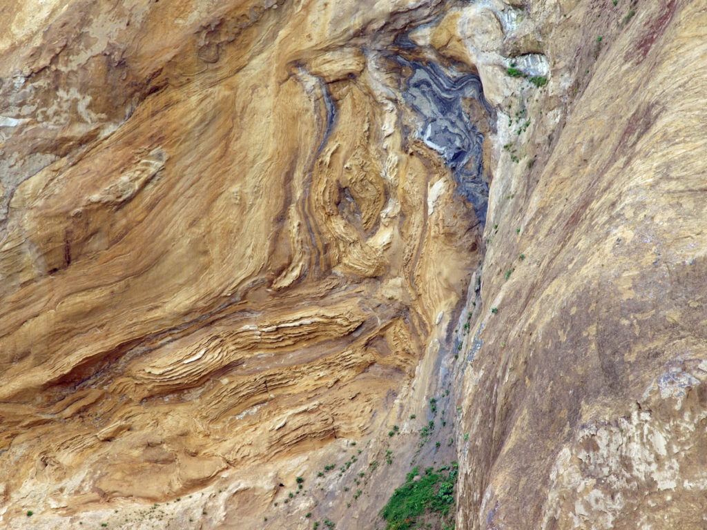 I love the eroded sandstone rock formations found at Hug Point. The layered sandstone of the point has been warped and folded by tectonic processes and eroded by wind and water into fantastic formations. The tidewater rocks are covered in green algae and seaweed, barnacles, and mussels. The rocks, sand, colorful vegetation, waves, and ever changing light make for great photo opportunities.
 Hug Point State Park is located about five miles south of Cannon Beach. The point can also be reached from Arcadia Beach State Park, about a mile to the north. It’s an easy day trip from the Portland area, but there many other attractions in the area, so many visitors spend a weekend or longer in the area.
 The nearby towns of Cannon Beach, Seaside, and Manzanita all have numerous motels, BNBs, and other accommodations, as well as many restaurants and cafes serving fresh seafood and other locally sourced foods.
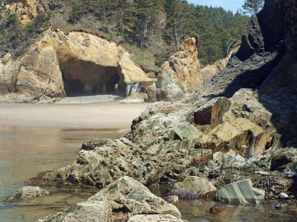
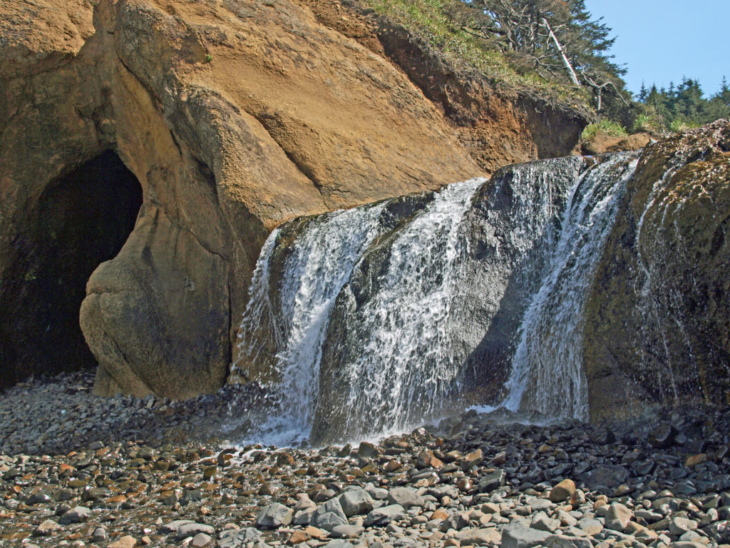
 One note of caution, though. If you go, pay attention to the tides. The waterfall and caves that draw most of the visitors to Hug Point State Park are nestled between Adair Point, immediately north of the beach access, and Hug Point itself. At high tide it can be difficult or impossible to get around these two points, so it is possible to get trapped between them.
 That trip was more than 15 years ago and some things may have changed greatly since then, so I won’t go into much detail as to what to do, where to stay, where to eat, what things cost, and so forth. But there’s much to Edinburgh that is timeless, and undoubtedly has not changed in the years since our visit.
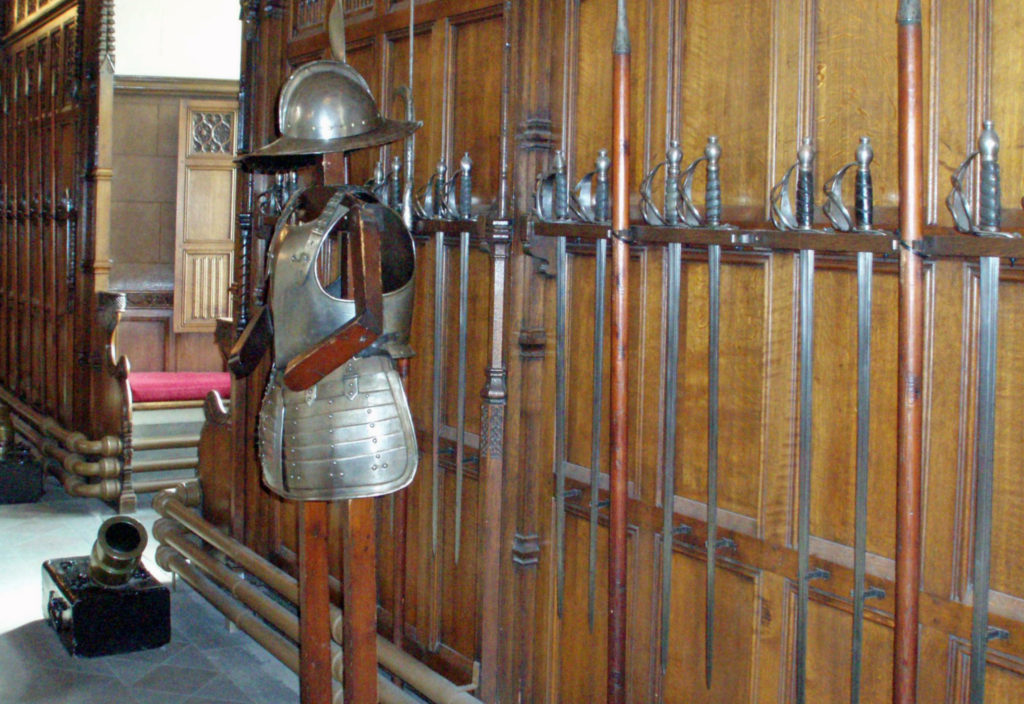
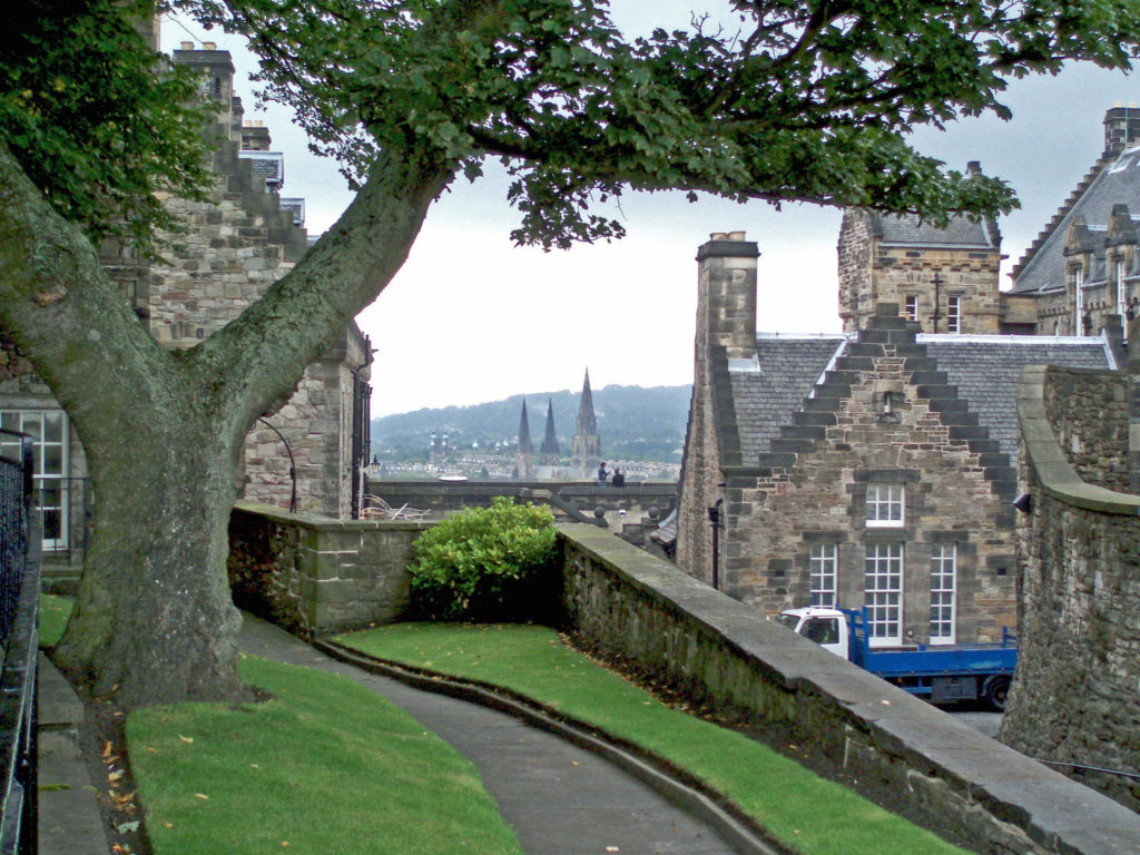
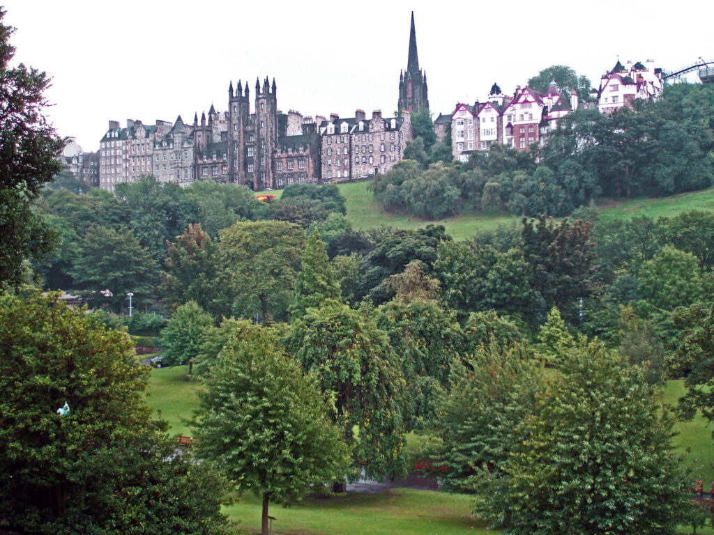
 Central Edinburgh is divided into the Old Town and the New Town. The Old Town includes Edinburgh Castle, the Palace of Holyroodhouse, the Royal Mile connecting the two, and the area to the south. The New Town stretches from Princes Street Gardens, directly below the Castle, to Queen Street Gardens and the adjacent area to the north. The Old Town is the historic center of Edinburgh, and also the site of the present-day Parliament. As far as the New Town goes, new is a relative term since construction of the New Town began in the 1760s.
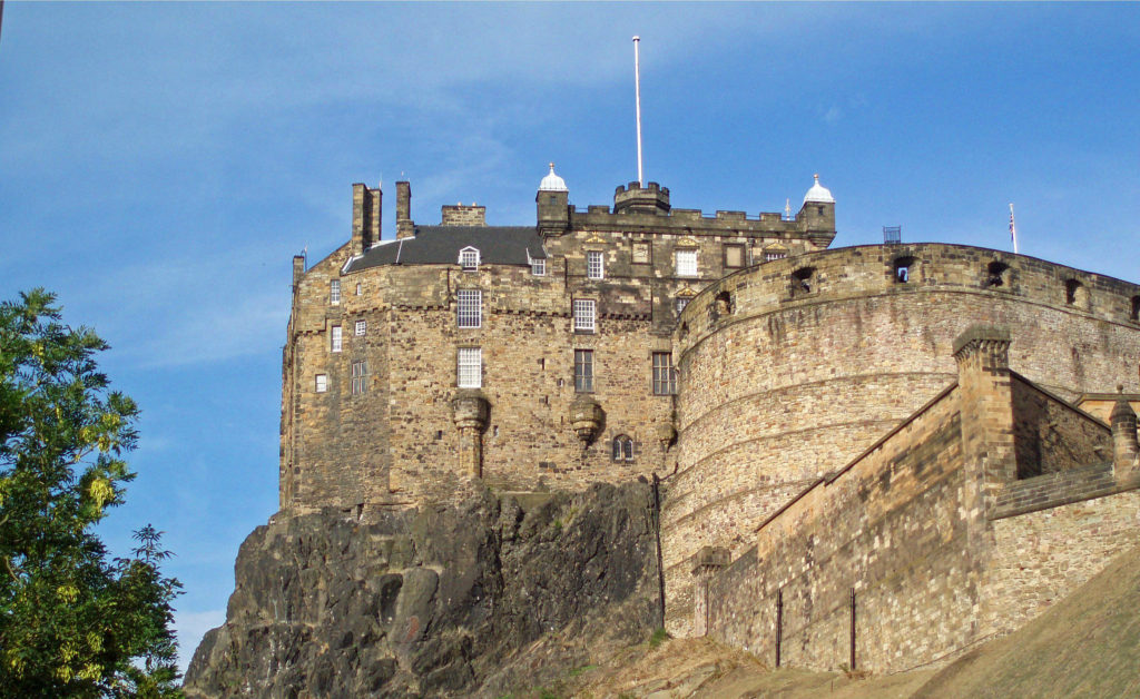 Both the Old Town and the New Town have their charms, and both deserve at least some of your attention. We spent most of our four days in Edinburgh exploring the Old Town, so I’ll focus on that part of the city.
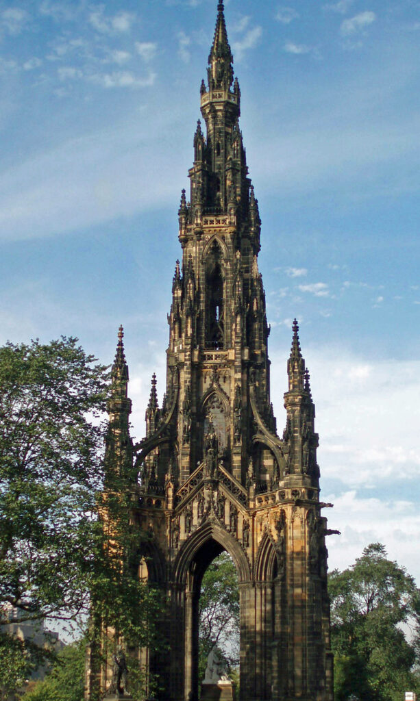
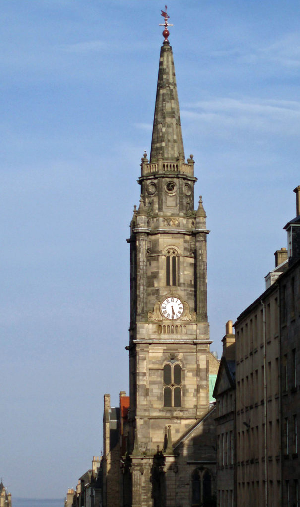 Although we didn’t go inside, St. Giles Cathedral, also known as the High Kirk of Edinburgh, is a magnificent structure that predates most of the structures in Edinburgh Castle. The cathedral was built between the late 14th and early 16th centuries. Entrance to the cathedral is free, but a small donation is requested.
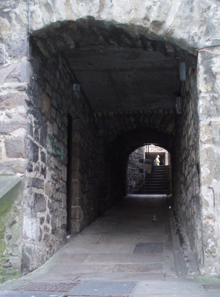 One of the attractions of the Royal Mile are the “closes,” underground passageways that were once narrow streets or walkways between houses. The upper floors of some the houses were demolished and the lower stories used as foundation for the Royal Exchange, built in the mid 18th century, leaving the closes below ground. Some of the closes remain as passages between the Royal Mile and the streets to the south, and organized tours of some of the more subterranean closes, such as the
  Other attractions of the Royal Mile include the John Knox House, the Writers’ Museum, the Huntly House, and The People’s Story, a museum housed in the historic Canongate Tolbooth, built in 1591.
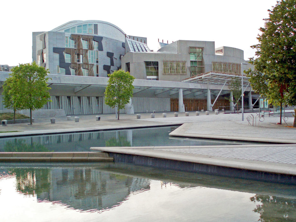 You will also find the Scottish Parliament buildings at the lower end of the Royal Mile near Holyroodhouse. Their contemporary, modernist design stands in stark contrast to the traditional and historical structures around them. And while I in fact like the design, to me they look out of place in their setting.
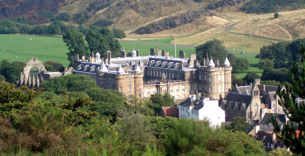
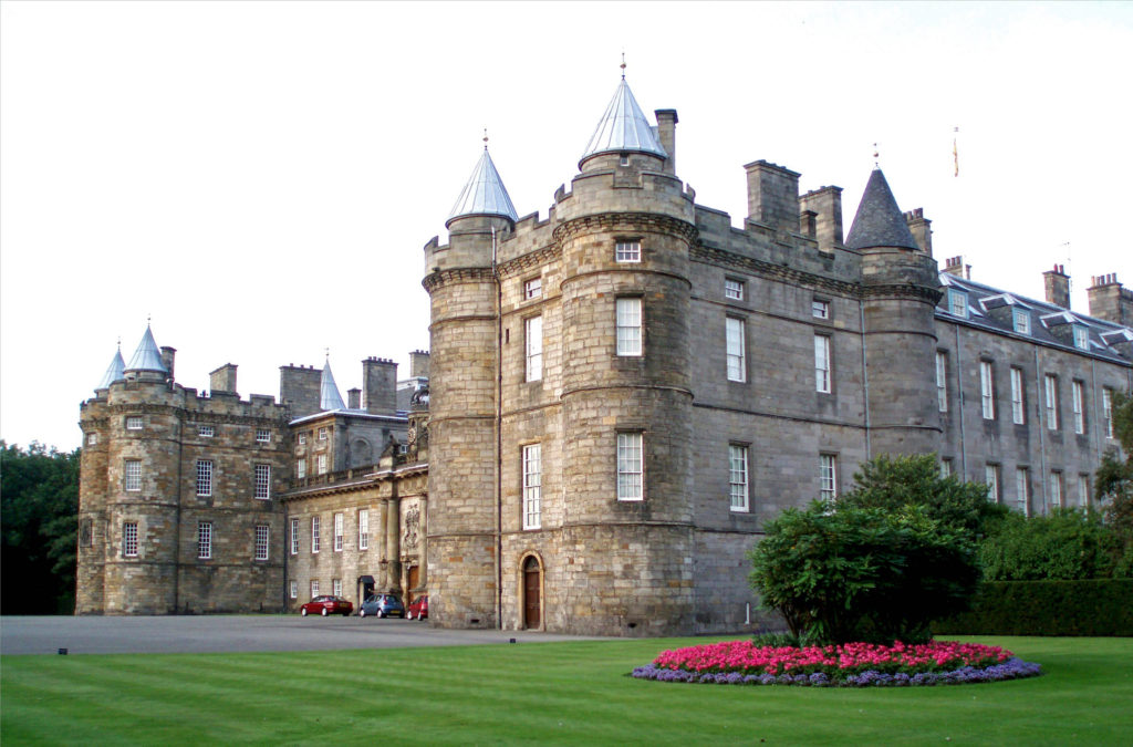 The Palace of Holyroodhouse is the official residence of the Monarchy in Scotland, but the palace is open to the public when King Charles III is not in residence. We did not tour the interior, but it comes highly rated. You can visit the Throne Room, the Picture Gallery, and the King’s Bedchamber, and Tour the King James Tower, where Mary Queen of Scots lived. For more information, check the Royal Collection Trust
 We didn’t make it to Queen Street and Queen Street Gardens, but the photos I’ve seen and the guidebook descriptions make me think we missed something there.
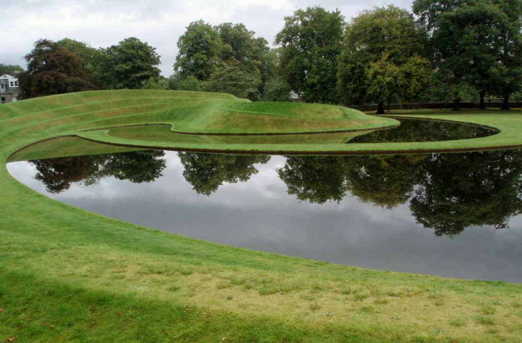 A little farther afield in the West End, though within easy walking distance of the New Town, is the
  On the walk back we discovered a path along the Water of Leith that took us to
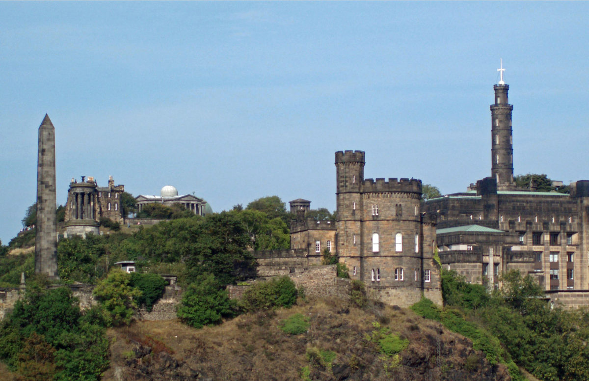
 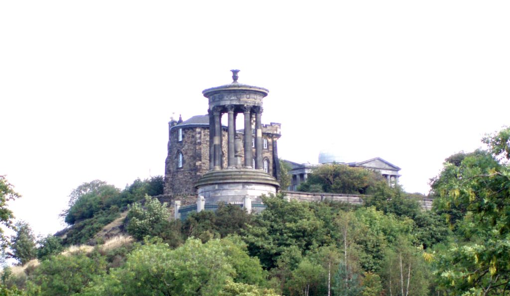 On our visit we stayed at an old hotel just east of Calton Hill. With its many monuments, including the Nelson Monument and the Lincoln Monument (which is in fact dedicated to Abraham Lincoln), Calton Hill is one of the more scenic and picturesque locations in Edinburgh. From the top of the hill you have a panoramic view over the city and to the Firth of Forth and the Port of Leith, where the
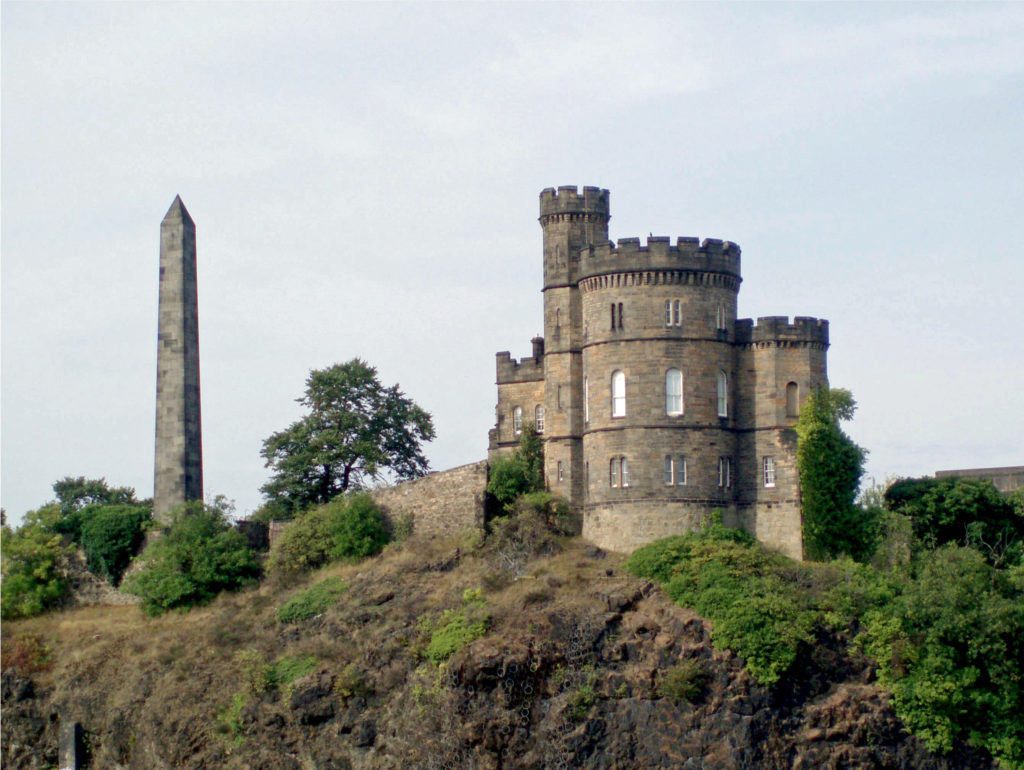


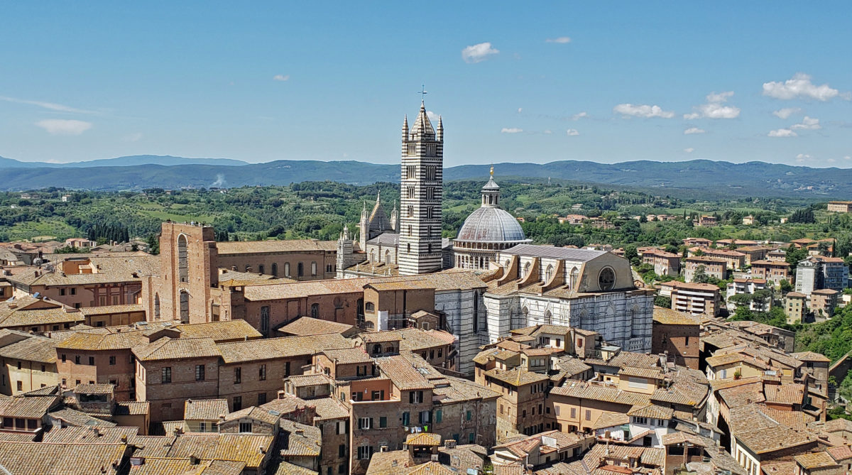


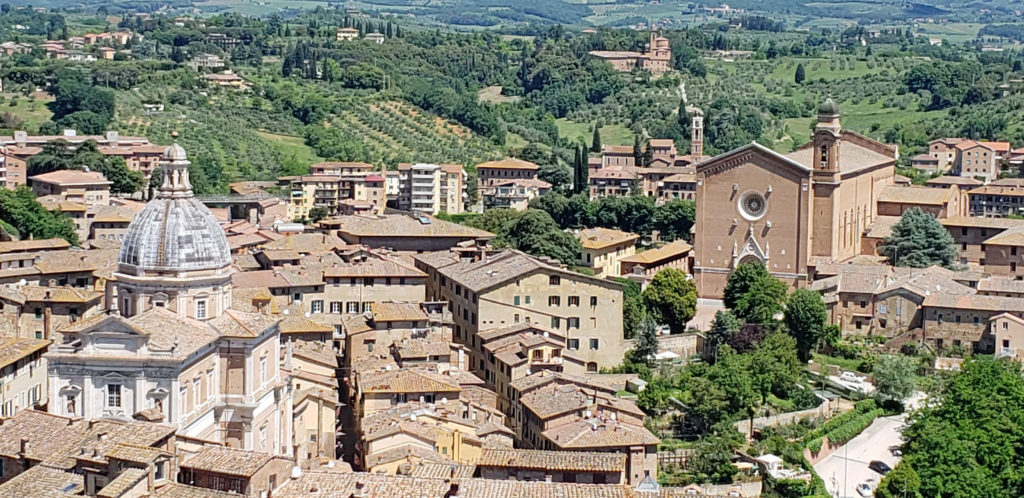

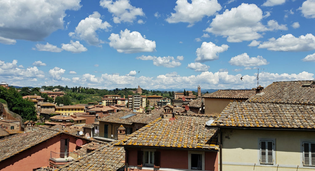


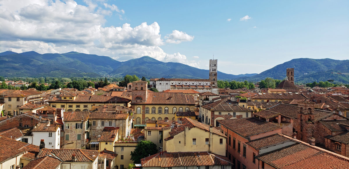
 Lucca, Italy is a modern city of about 85,000 people, located about ten miles northeast of Pisa and 40 miles west of Florence. But the old walled city was what my wife and I came to see. Lucca has one of the most intact medieval city centers you will find anywhere in Europe. The historic center, or centro storico, is relatively compact, easily walkable, and almost unchanged from medieval times.
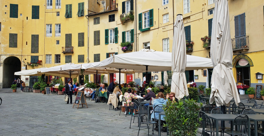 Lucca is an ancient city, founded by the Etruscans, probably on the site of an earlier Ligurian settlement. It became a Roman colony in 180 BC. Little remains of the Roman city, though. Most of the old city is of medieval origin, but some of the streets date to the Roman settlement, and a hint of the Roman amphitheater can be seen in the Piazza dell’ Anfiteatro. The popular Piazza San Michele occupies the site of the old Roman forum.
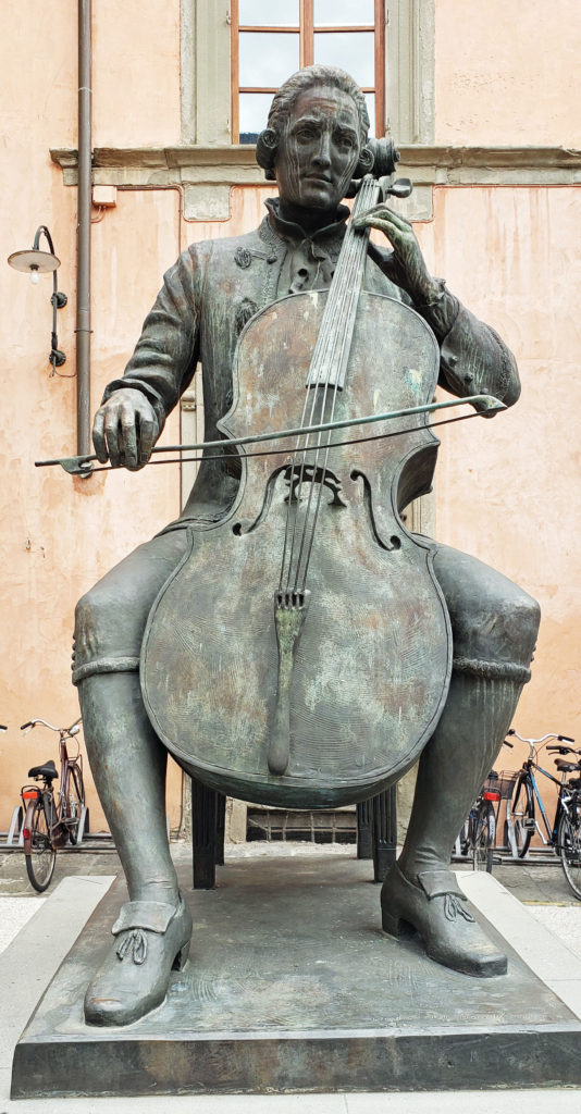
 One of the attractions of Lucca is the medieval city wall. Lucca is one of the few ancient cities in Europe with an intact wall. The wall is a wide earthen structure faced with brick, constructed between 1550 and 1650. The top of the wall is now a tree-lined park with a wide pedestrian/bicycle path. The 2.5-mile-long path is a popular walking, jogging, and cycling path.
 Bicycles can be rented for about €5/hour or €20/day at several shops in the old city. Riding or walking the wall is a good way to get a view of the city, and a good place to people watch, too. You will see many locals, as well as fellow tourists, walking and riding the walls or just relaxing on park benches. There are also several places where there are tunnels inside the structure of the wall that are surprisingly interesting and well worth seeking out.
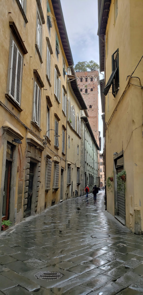 Inside the walls, the old city has many fine old churches, plazas (piazzas), palaces (palazzos), and villas. Getting around can be confusing, as the streets are narrow and lined with tall (4-6 story) buildings, and some much taller towers that block out any visual reference points. On a cloudy day it can be difficult to orient yourself. You may come out onto the street and have no idea which way is north. A city map and a good guidebook are essential. Rick Steves’ guide to Florence and Tuscany has a chapter on Lucca and is a good reference. His walking tour is a good way to see the major sights.
 We wandered around without a set itinerary and got lost on several occasions. Wandering aimlessly and getting lost has a certain appeal, but one time we couldn’t find the side street where we had left the bikes that we borrowed from the owner of the Airbnb we were staying in. Eventually we figured out that we were on the opposite side of the city than we thought we were. We retrieved the bikes and rode back to our rental, but only after walking almost all of the 2.5-mile wall.
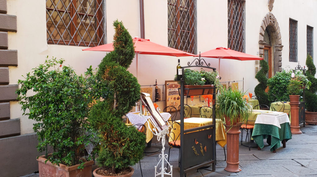 Some of the major attractions in Lucca are the Piazza San Michele and the Church of San Michele (Chiesa di San Michele), the Cathedral Museum (Museo della Cattedrale), the Guingi Tower (Torre Guingi) and Villa Guingi, the Casa di Puccini (the birthplace of the opera composer Giacomo Pucccini), the San Martino Cathedral, the San Giovanni Church, the Church of San Fediano, the Pallazzo Mansi, and the Palazzo Pfanner. All of these are described in the Rick Steves guide, as well as other guidebooks.
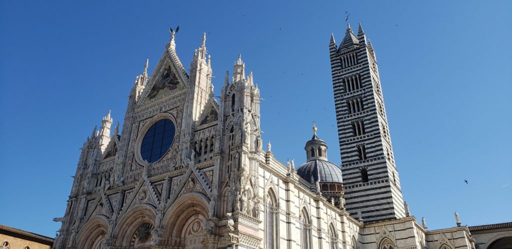
 Climbing the 220 steps of the Torre Guinigi gives you a good view of the city and you’ll find an interesting little grove of trees growing on the summit of the tower. This was the first of our tower climbs during our trip. More would come in Siena and Florence, culminating with our back-to-back climbs of the Duomo and Campanile (Giotto’s Tower) in Florence (both 400+ steps). Lucca once had 160 towers like the Torre Guingi, all private residences of wealthy merchant families. Only a few remain. A combination ticket that gets you into both the Torre Guinigi and the Clock Tower costs less than €10. Most of the other attractions in Lucca are similarly inexpensive, mostly between €5 and €10.
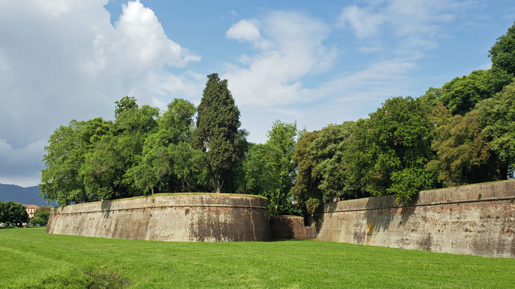 There are no shortages of places in Lucca to get a good meal, something we found true everywhere we went in Italy. There are some fine dining establishments that are recommended the guidebooks, but we found the sidewalk and piazza cafes that are so abundant all had very good food at surprisingly affordable prices. It’s hard to go wrong, wherever you choose to dine. Gelato is serious stuff in Lucca, too, as it is everywhere in Italy.
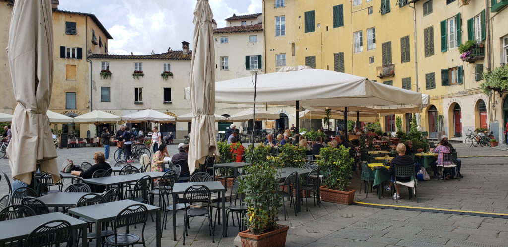 If you’re visiting Tuscany, Lucca should be on your itinerary, even if you only have an afternoon to explore it. Siena is prettier, and Lucca doesn’t have the history or art and culture of Florence, but it is more authentic and much less touristy, and has its own appeal. You won’t regret it.
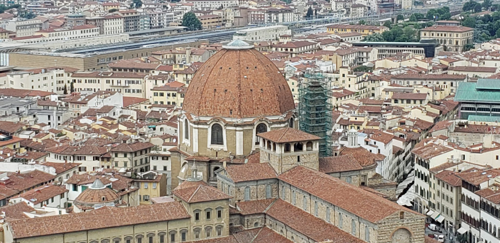
 Originally posted September 17, 2018. Updated and re-posted April 14, 2021 and May 21, 2023.
 The peninsula is now an undeveloped county park. There has never been a campground, but in the past backcountry camping was permitted. That has changed, however, and overnight camping is no longer allowed.
 Getting there:
 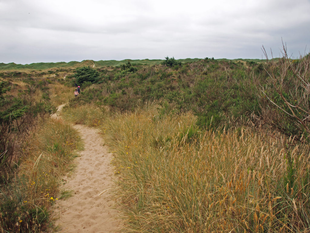 The hike:
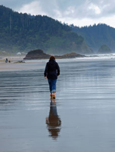
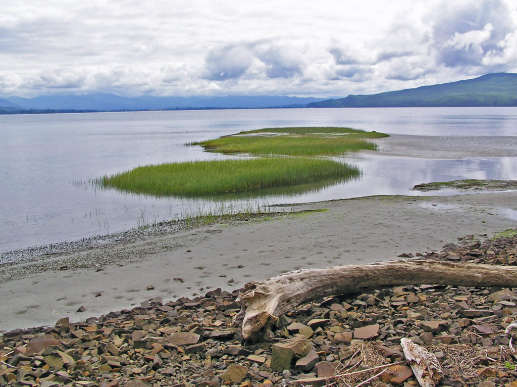
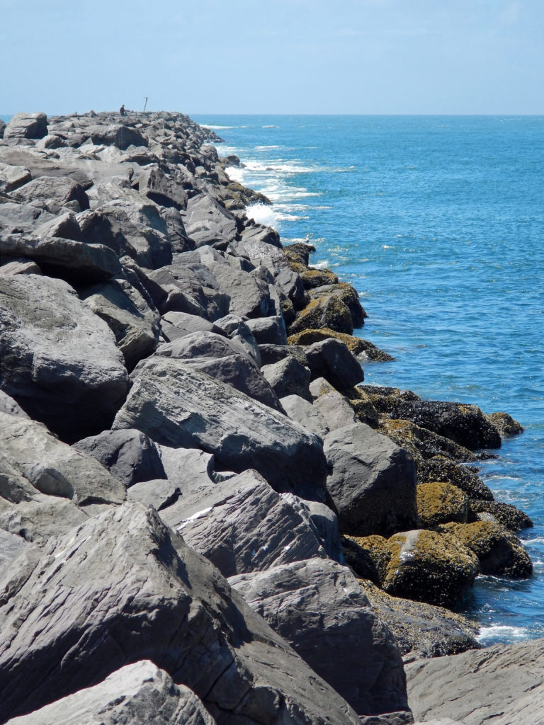 Or, continue along the beach until you reach the south jetty at the mouth of Tillamook Bay. You’ll be rewarded with one of the least crowded beaches on the entire coast. You might have the beach to yourself even on summer weekends.
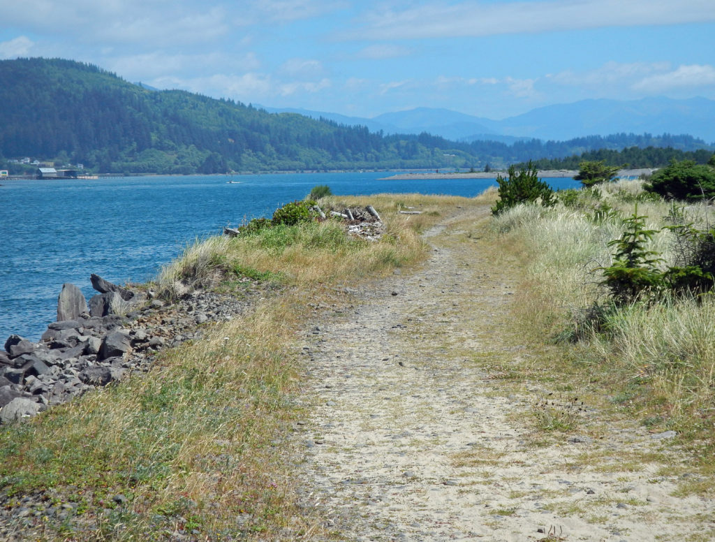 From the jetty you can return the way you came for 7.2 mile out and back beach walk or complete the 7.7-mile loop hike by following the jetty inland to the old jetty haul road and following it back to the trailhead. The road is rock and gravel with some sandy stretches. It runs along the bayshore, with good views of the shore and bay, with a couple of stretches in the pine and spruce forest of the peninsula interior.
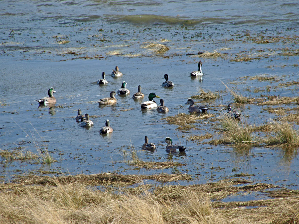 Look for ducks and geese on the water and shorebirds along the water’s edge. This is one of the best birding areas for waterfowl on the coast.
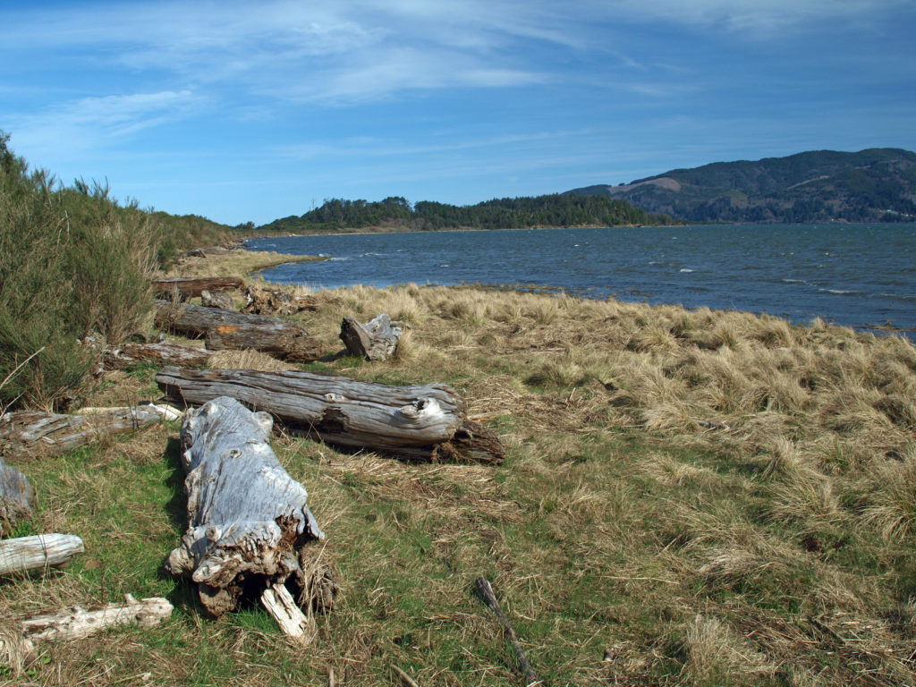 Near the end of the hike look for a sign labeled Bayocean Townsite. Here a trail leads toward the beach to the old townsite. The trail loops south through what was then the bayfront (the whole peninsula has shifted a couple of hundred yards to the east and much of the old townsite is now under the waves), then returns to the haul road, where there is an interpretive display that tells the tale of the town and its demise. From there, return to the parking area. (If you started at the town of Cape Meares, hike from the Dike Road parking area through the dunes and return to Cape Meares on the beach.)
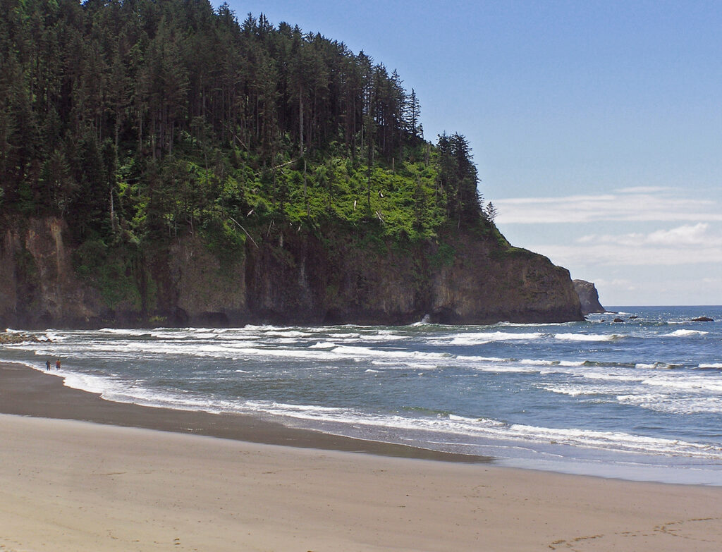
 Farther south,
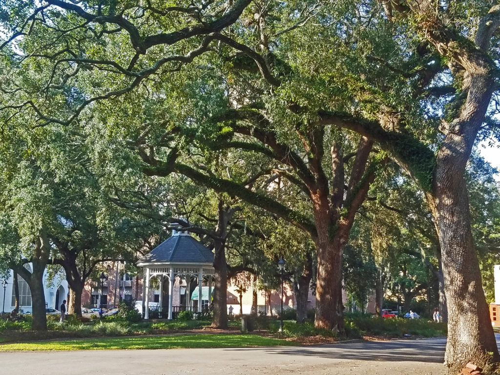
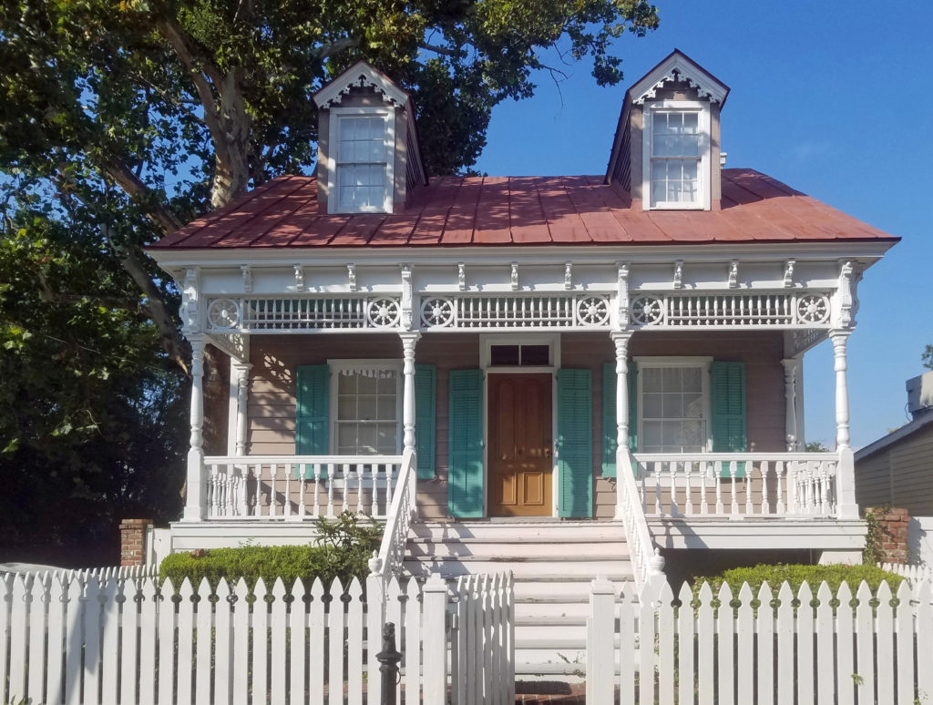
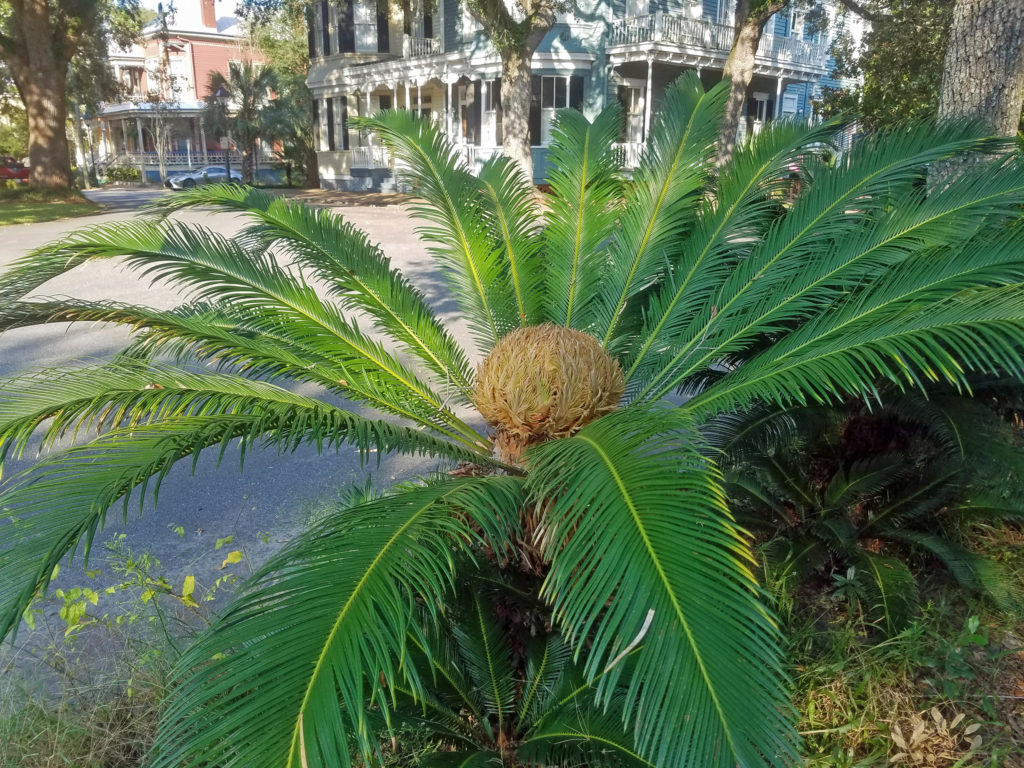
 Savannah is an old city, founded in 1733. It was the first European settlement in Georgia, and the city’s history is an important aspect of its spirit and culture. Walking around in the Historic District, it’s not hard to envision yourself in another, long past, era.
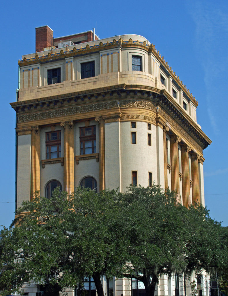 The entire Historic District was named a National Historic Landmark in 1966. The
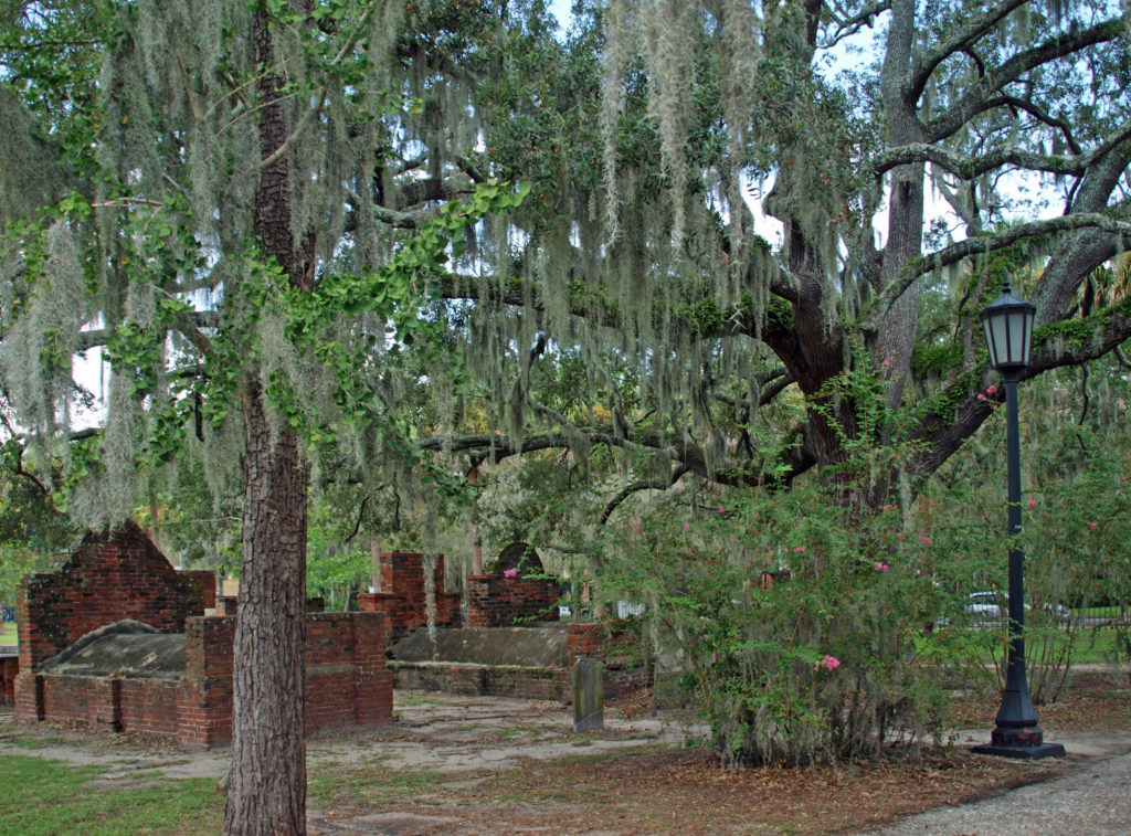
 Savannah is a very walkable city. Guided walking tours of the Historic District are available for about $25 per person. There are also guided bike tours and public carriage tours available at similar rates. Private carriage tours run $100-125 for two people. Hop-on/hop-off trolley tours run $30-35 per person. Ghost tours are also a popular option for visitors.
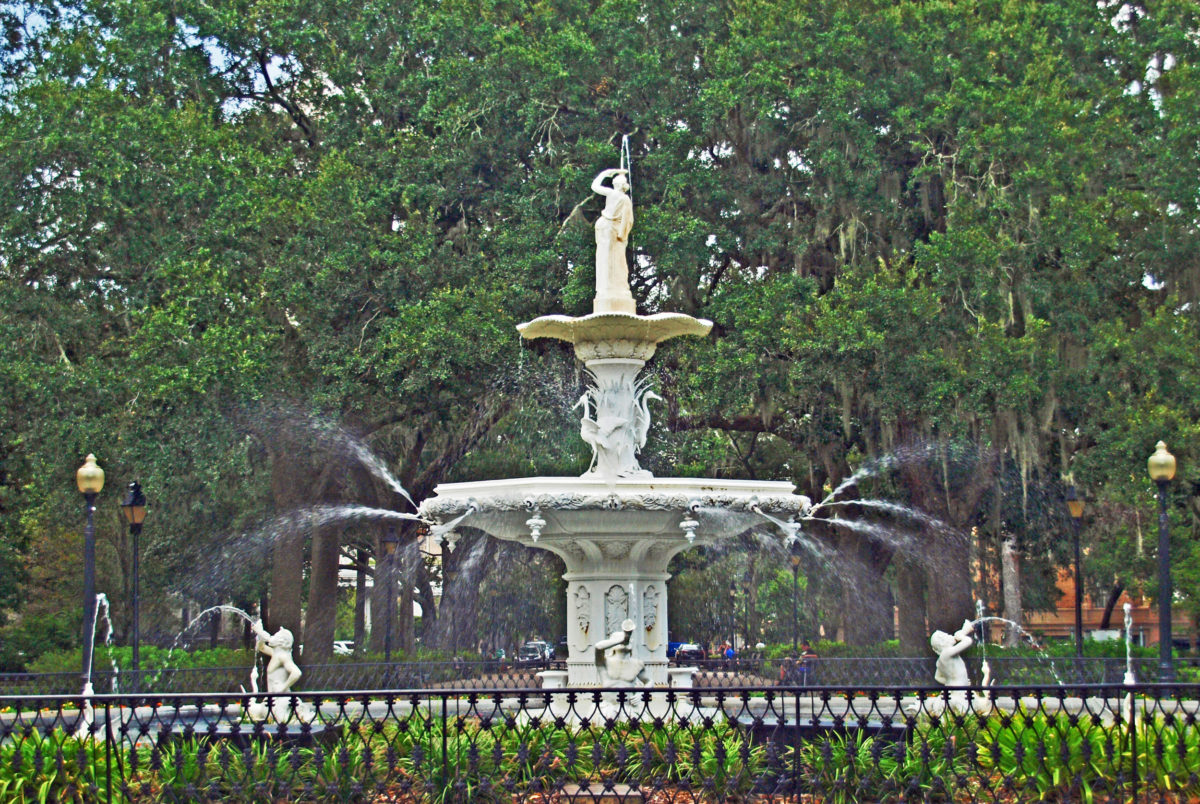
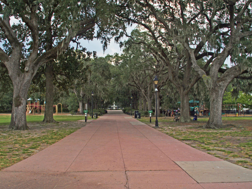 We opted to wander around on our own (but probably missed out on a lot of interesting information about the city). A good place to start a walking tour of your own is Forsyth Park, a 30 acre park at the south end of the Historic District. Its most notable feature is the Forsyth Fountain, but there is a lot more there to see. Enjoy the park’s gardens, paths, monuments, and the fountain, then head north toward the river and take in some (or all) of the 22 Squares and innumerable historic buildings, churches, and Victorian houses.
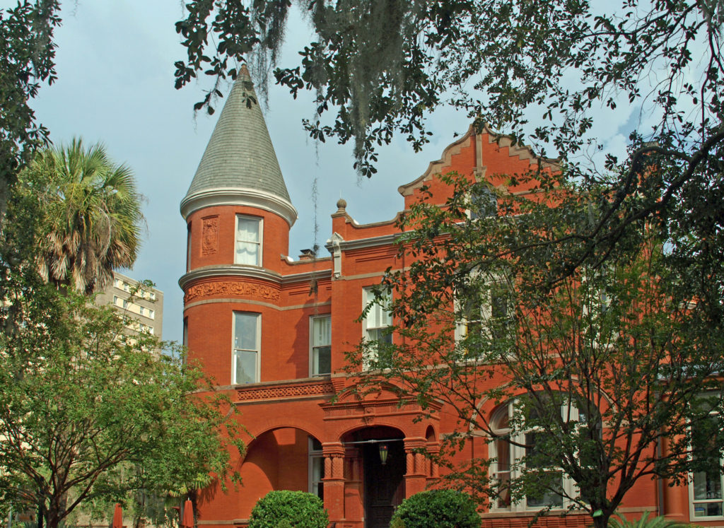
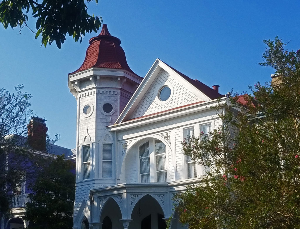
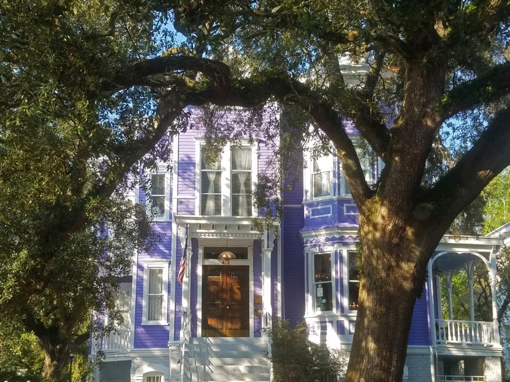
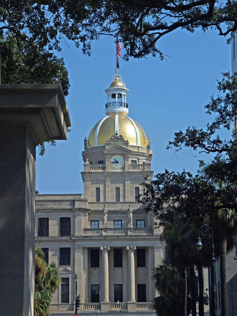 Some of the more interesting structures in the Historic District include The Pirate’s House, mentioned in Robert Louis Stevenson’s Treasure Island, the city’s oldest building and now a popular restaurant, and The Olde Pink House, another of the city’s oldest structures and also a highly regarded restaurant. Not quite as old, but equally interesting, the Mercer House (officially the Mercer-Williams House Museum) was the site of the 1980s killing of a male prostitute that inspired the book (and movie) Midnight In the Garden of Good and Evil.
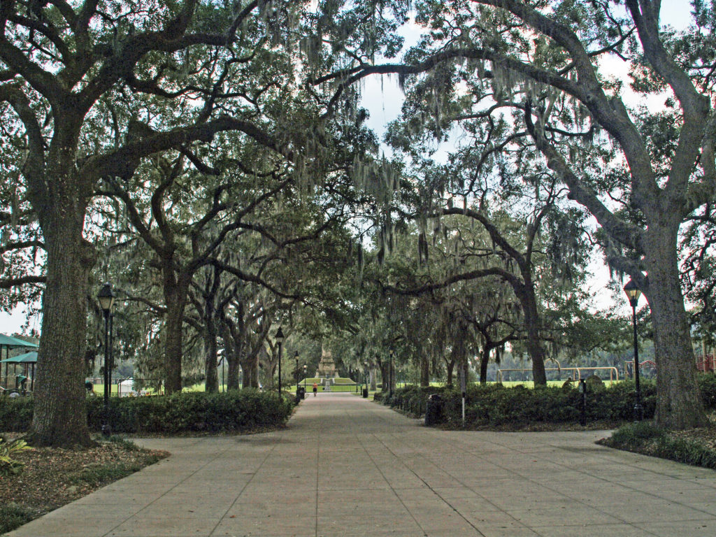
 Near the north end of the Historic District,
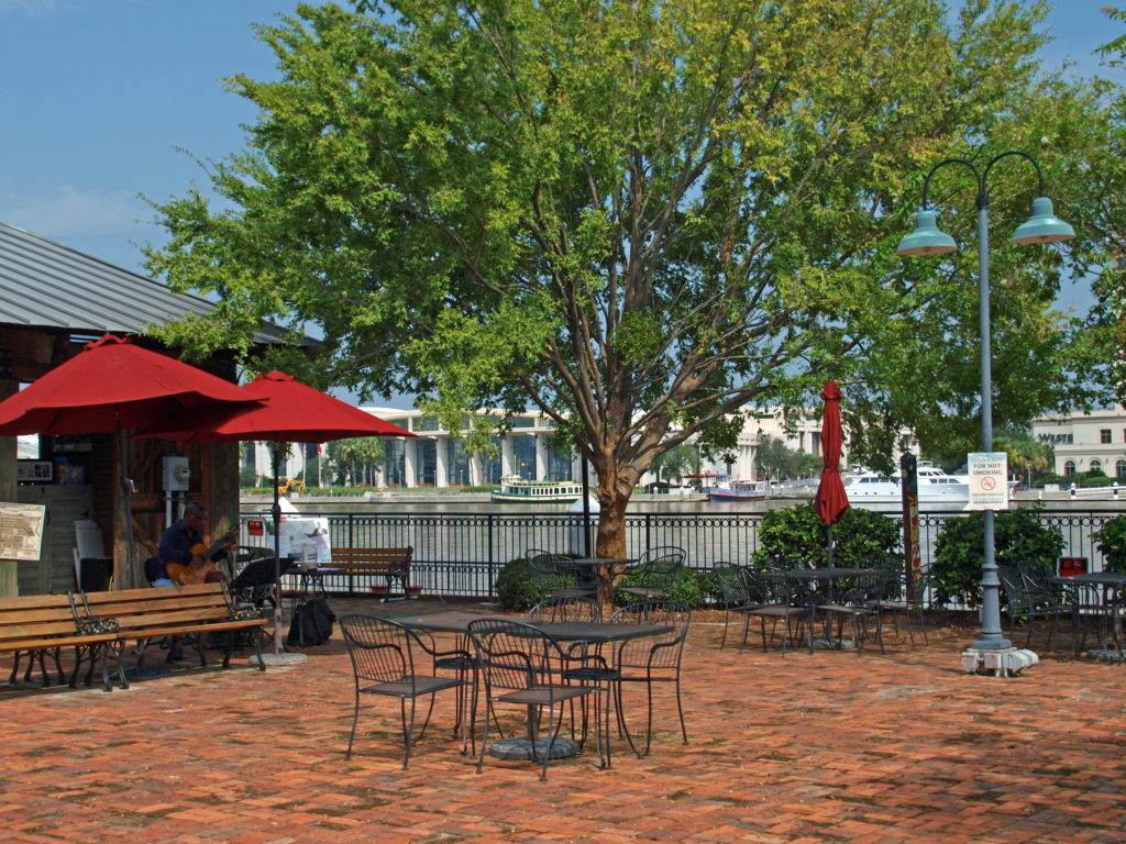
 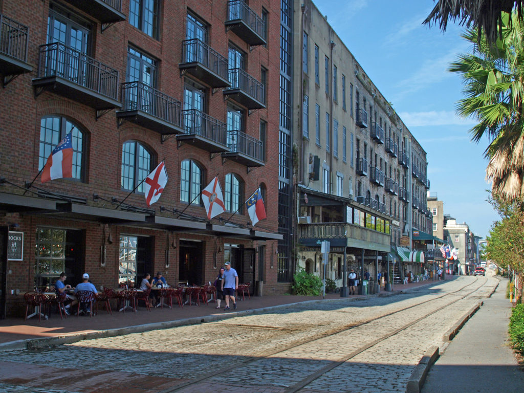 The buildings along River Street were once cotton warehouses. Today they house shops, restaurants, bars, and art galleries. River Street has its share of tacky gift shops, but it also has some interesting boutiques, antique shops, and art galleries. Among the many restaurants are Vic’s On the River, Huey’s, The Shrimp Factory, and Joe’s Crab Shack. If you need a frozen daiquiri refill, there’s another Wet Willie’s on River Street.
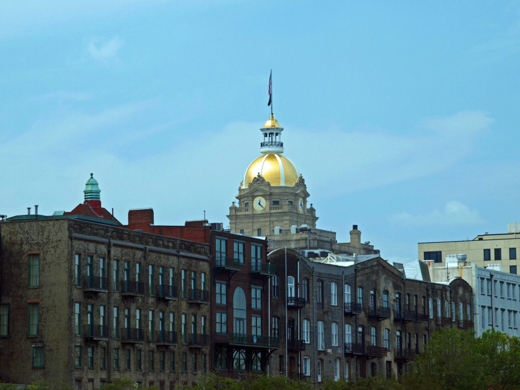
 There are no shortage of other places along the river to wet your whistle, including The Warehouse Bar and Grill, Dub’s Public House, The Cotton Exchange Tavern, and a couple of rooftop bars, Top Deck Bar and Rocks On the Roof. And there are more restaurants and bars on Bay Street on the top of the bluff.
 There’s much to see and do in Savannah that time didn’t allow. We had to skip many things. We checked out only a couple of the city’s art galleries, for example, and didn’t make it to other nearby destinations such as
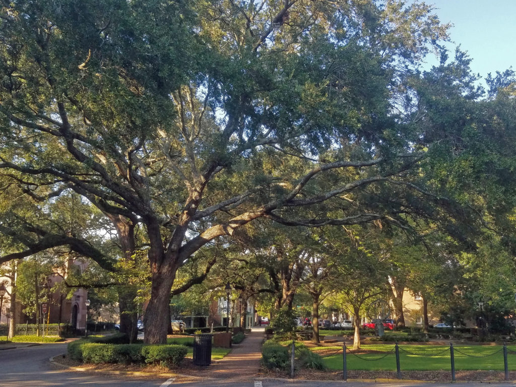
 Originally posted January 24, 2020. Updated and re-posted April 15, 2023.
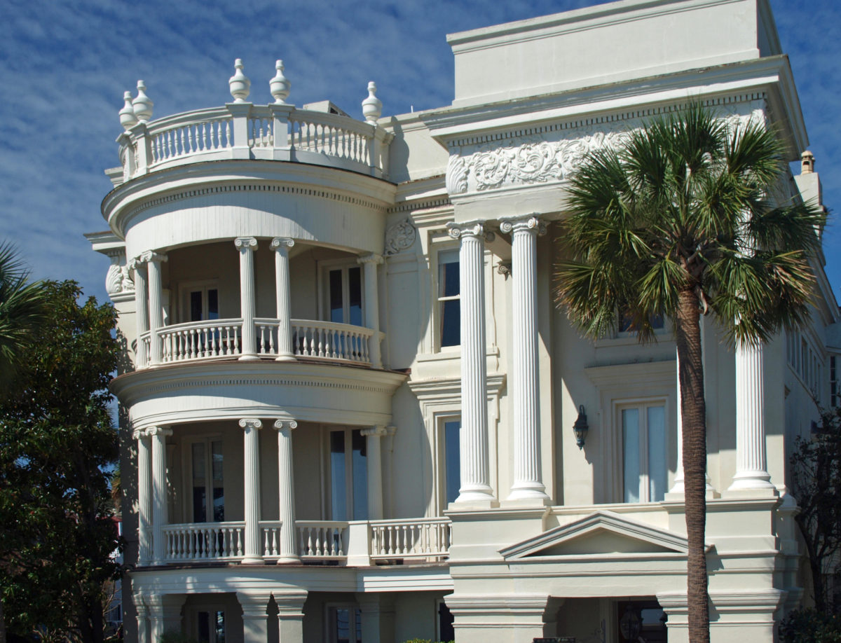
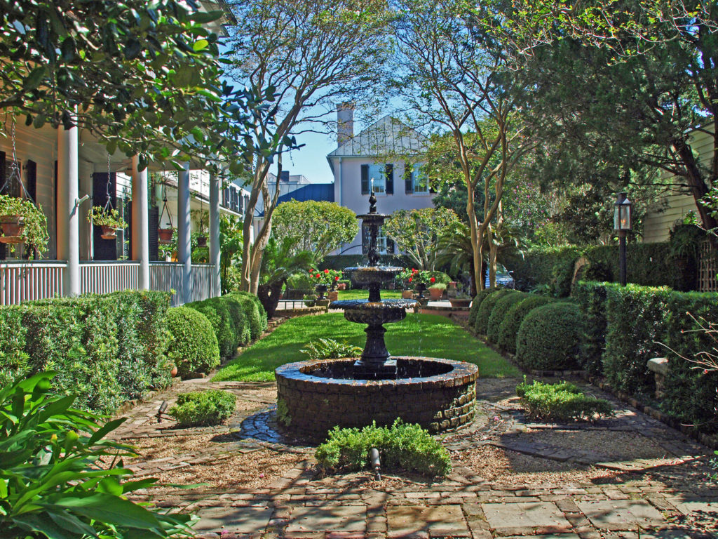
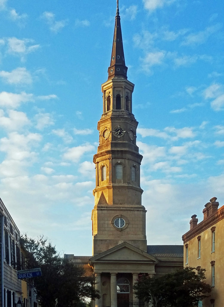
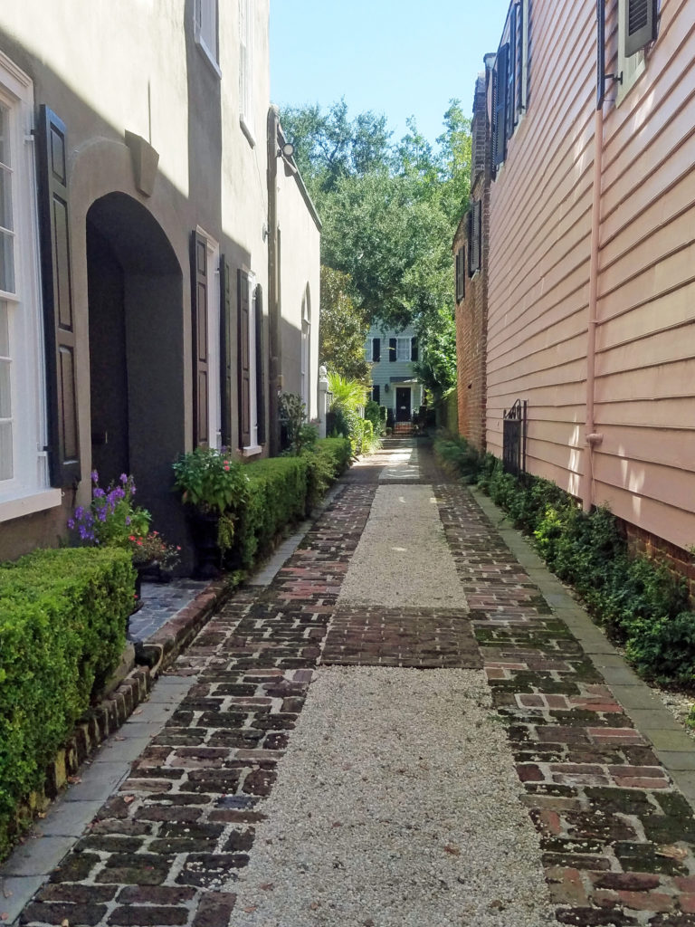
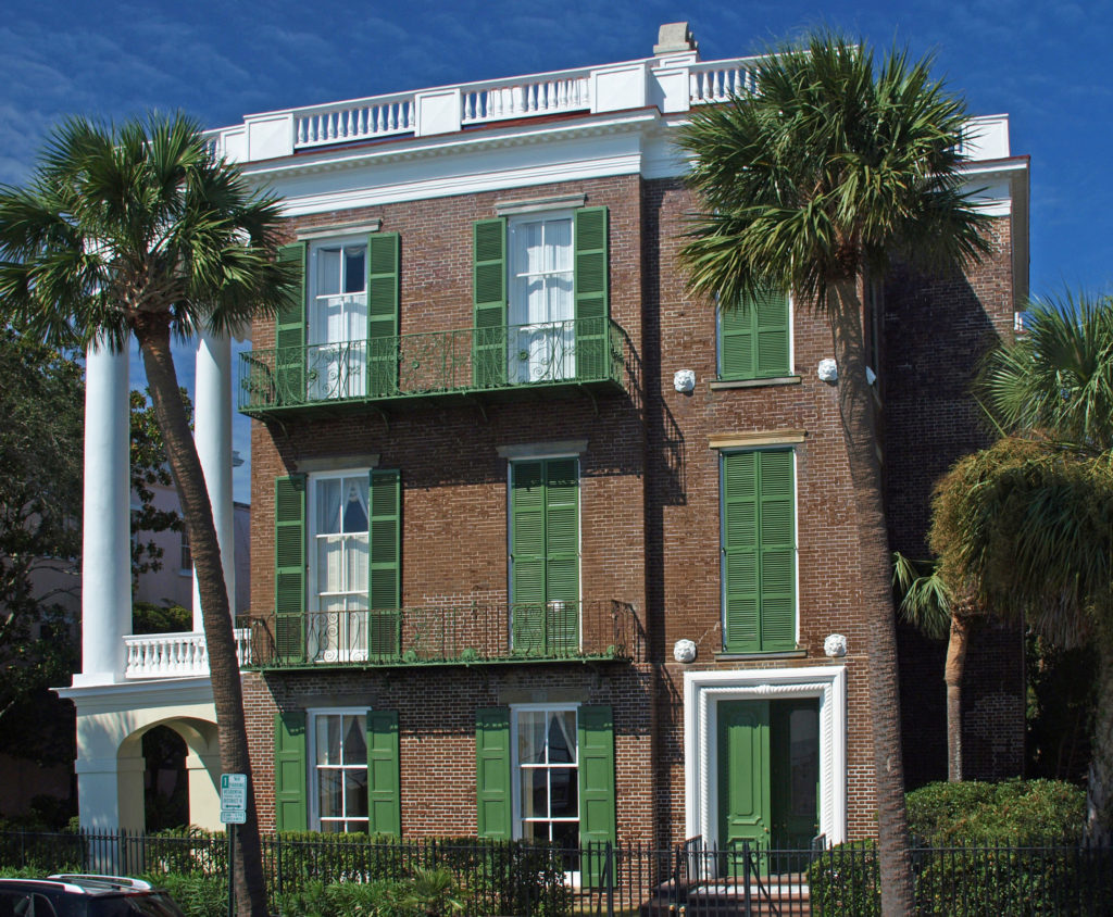

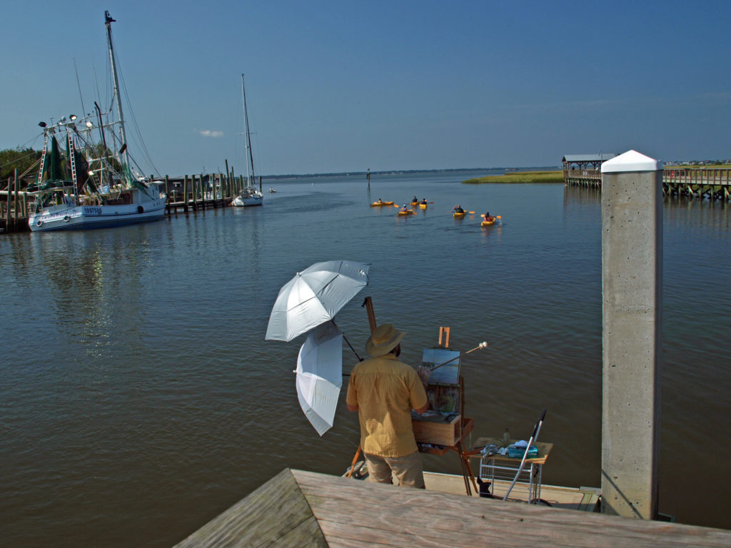
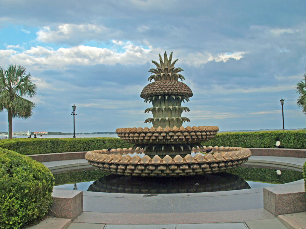 We had a great time exploring Charleston. It’s really a beautiful and charming place. But to really see all it has to offer, you need to plan for more than a three-day visit. For more information, check out the
  Originally posted Jan. 20, 2020. Updated and re-posted April 9, 2023.
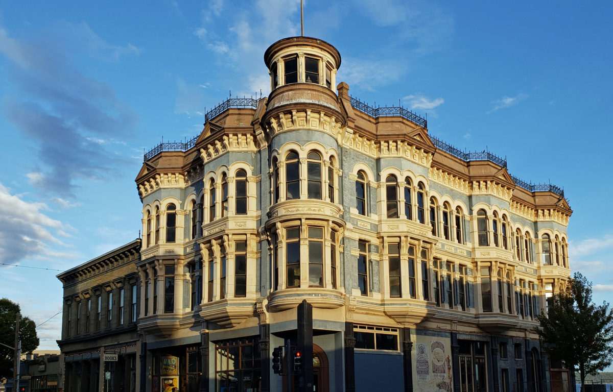
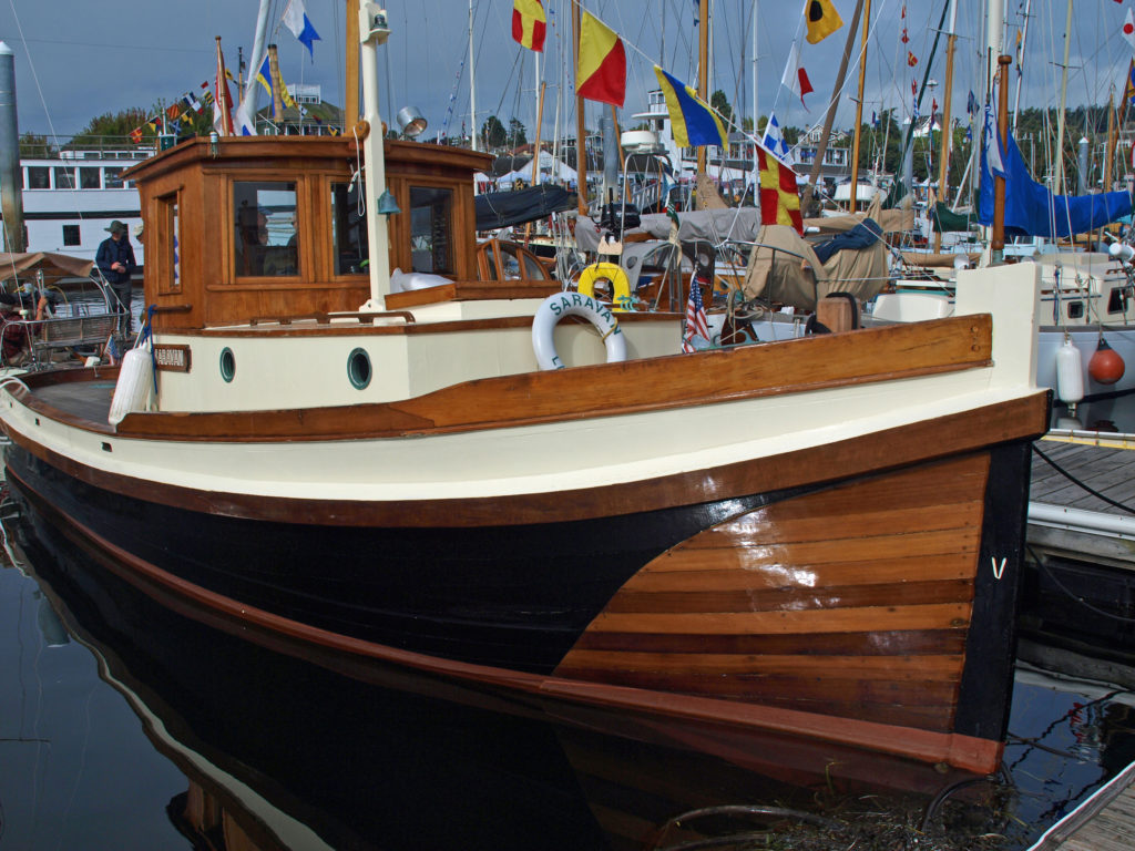
 Wooden sailing ships were key to the town’s early economy and history, and the boatbuilding and woodworking crafts live on in Port Townsend. The Northwest School of Wooden Boat Building in nearby Port Hadlock and the Port Townsend School of Woodworking help preserve and promote the skills that were so vital to the early history of Port Townsend.
 more than a dozen fine art and craft galleries can be found in the historic waterfront section of town.
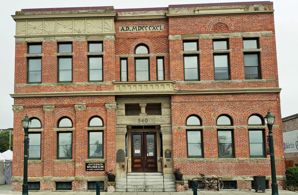
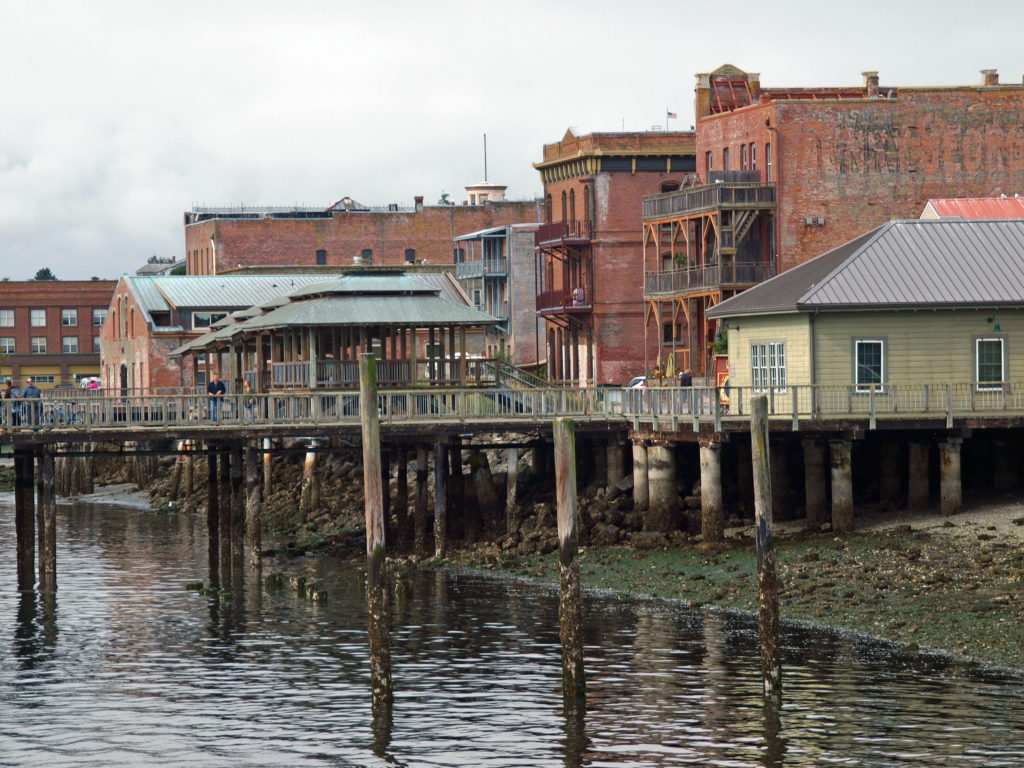
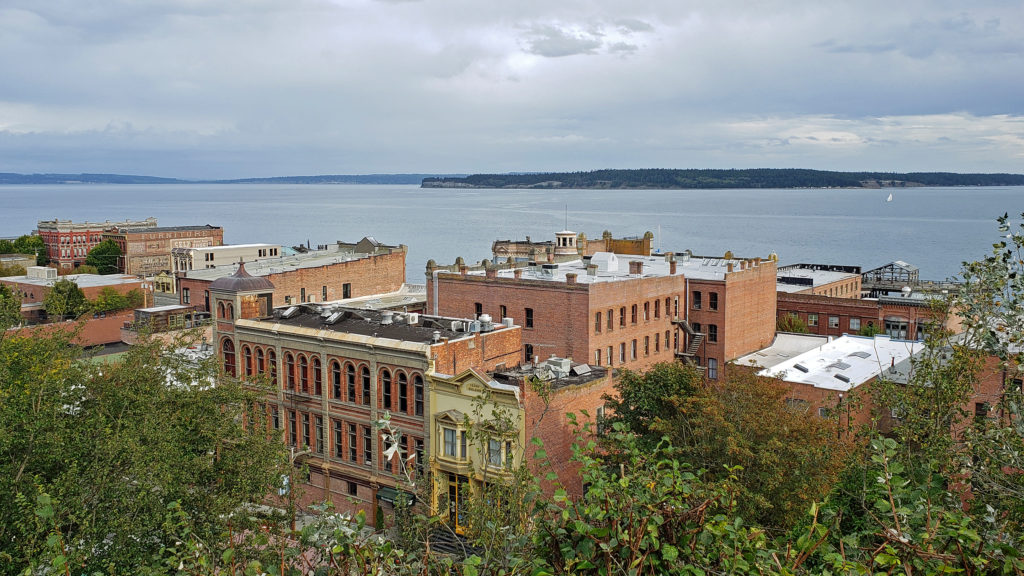
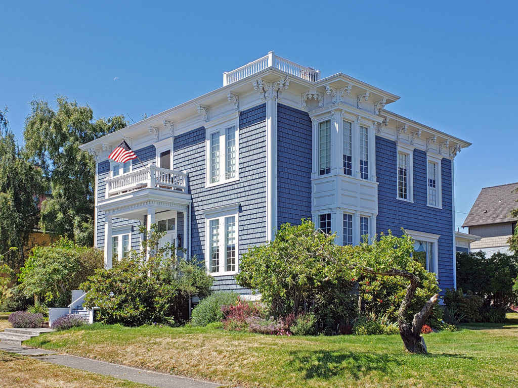 Take a walk along Water Street. It’s not hard to imagine what the town was like 130 years ago because most of the buildings you see today date from that period. Venture up to the bluff above the waterfront and you’ll find many Victorian era homes, most of which have been well preserved or restored. If you visit in the summer months you can tour the
 Even if you’re not interested in the town’s history, its maritime traditions, or the arts, Port Townsend is still worth visiting, if only to take in its beautiful setting and indulge in its food and drink scene.
 On the food side, Owl Spirit Cafe is a good place to grab a sandwich or burrito for lunch. If you have pizza in mind, try Waterfront Pizza. My go to spot for breakfast and lunch is
  My wife and I stayed at the Water Street Hotel on our most recent visit, recently renamed the
 Originally posted November 20, 2020. Updated and re-posted January 12, 2023.
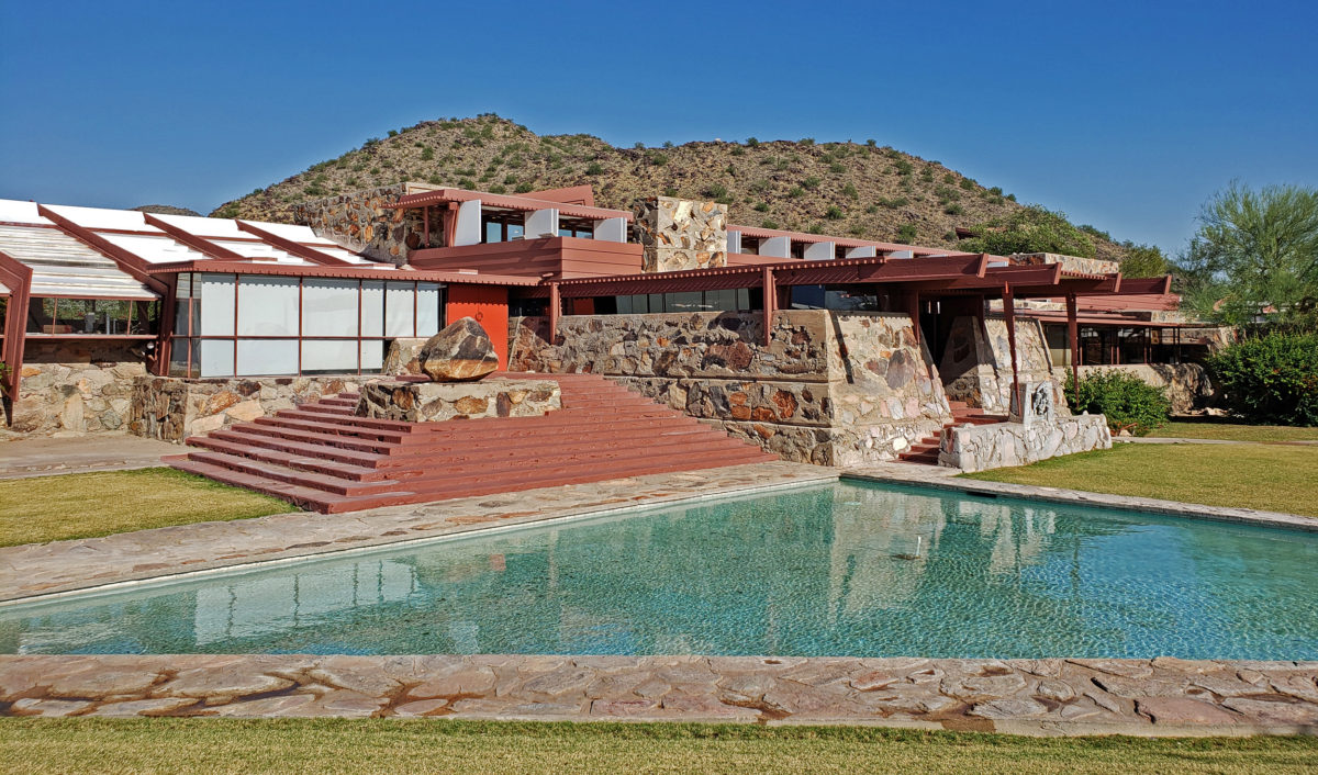
 Taliesin West was founded as the winter home for the Frank Lloyd Wright Fellowship, Wright’s school of architecture. It was always a school of architecture as well as Wright’s winter home. The Fellowship evolved into the Frank Lloyd Wright School of Architecture, which conducted classes at Taliesin West until 2020, when it separted from the Frank Lloyd Wright Foundation, changed its name to The School of Architecture, and moved its campus to Cosanti and Arcosanti, Arizona.
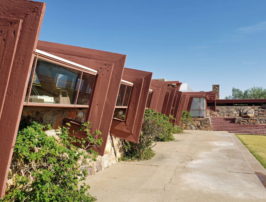
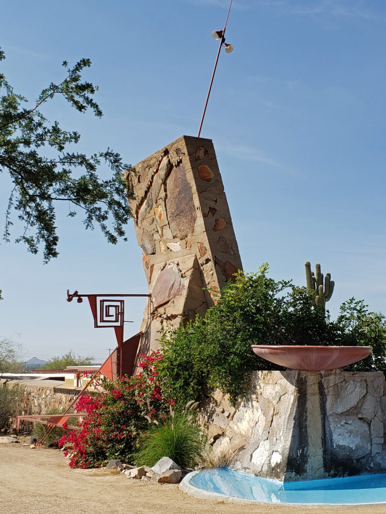
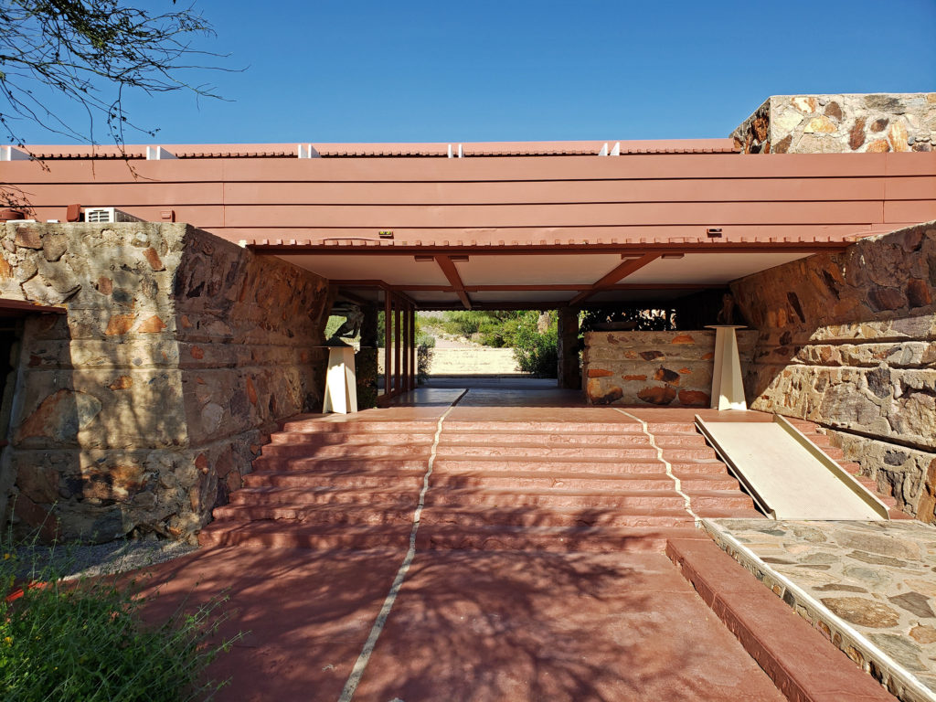
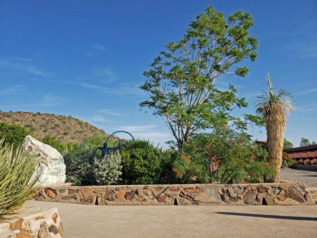
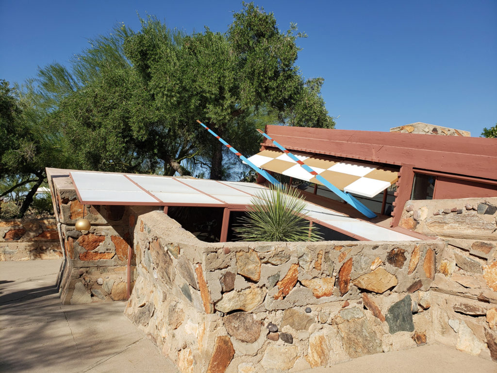
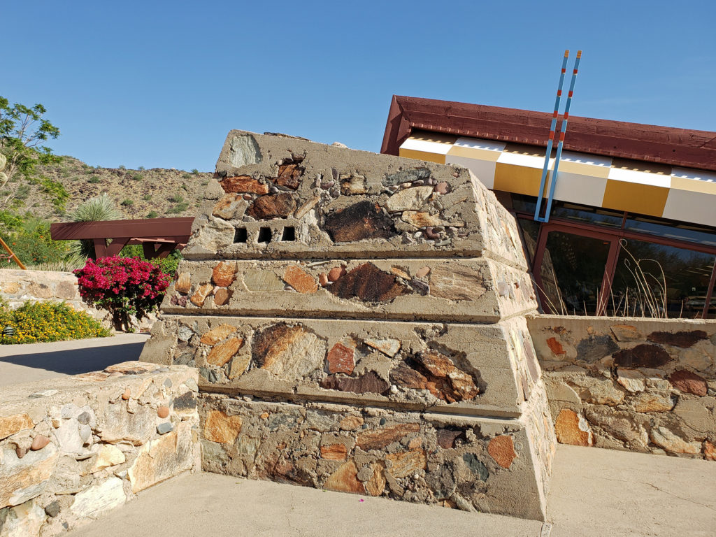
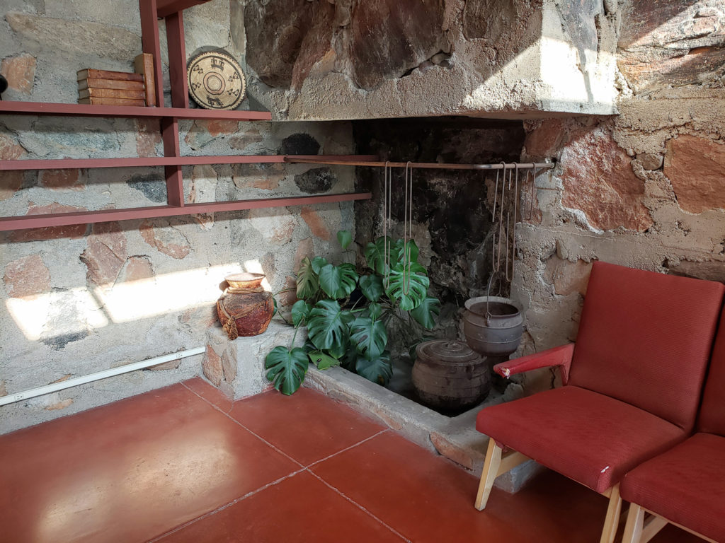
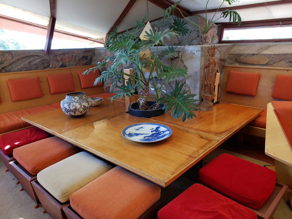
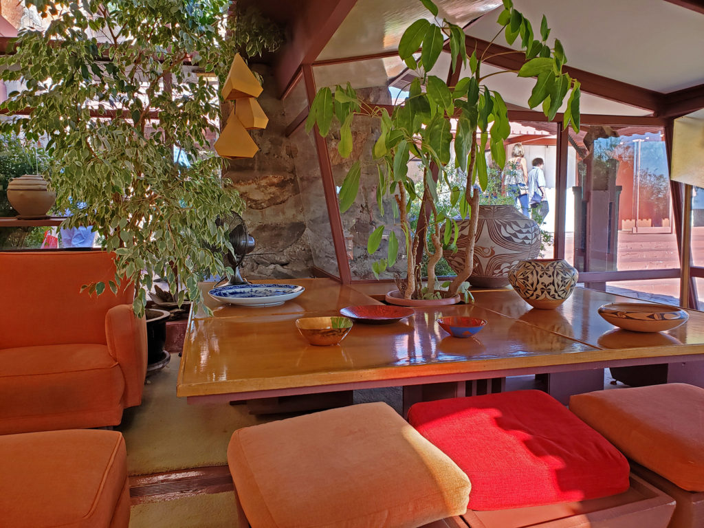
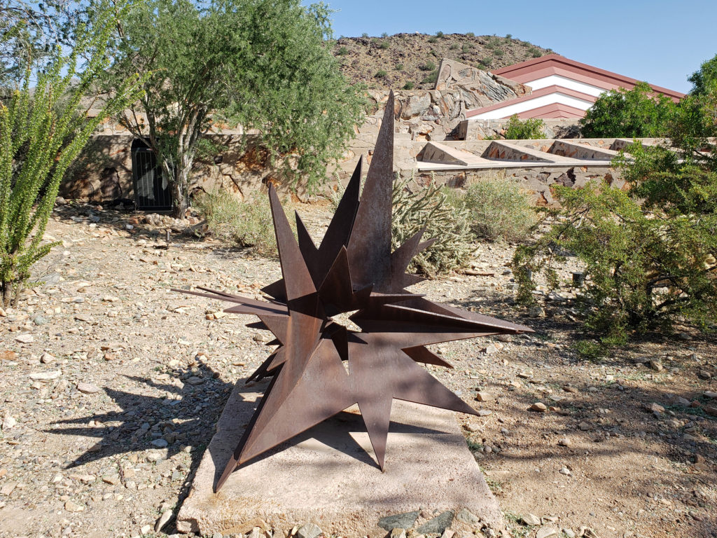
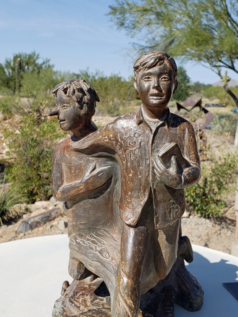
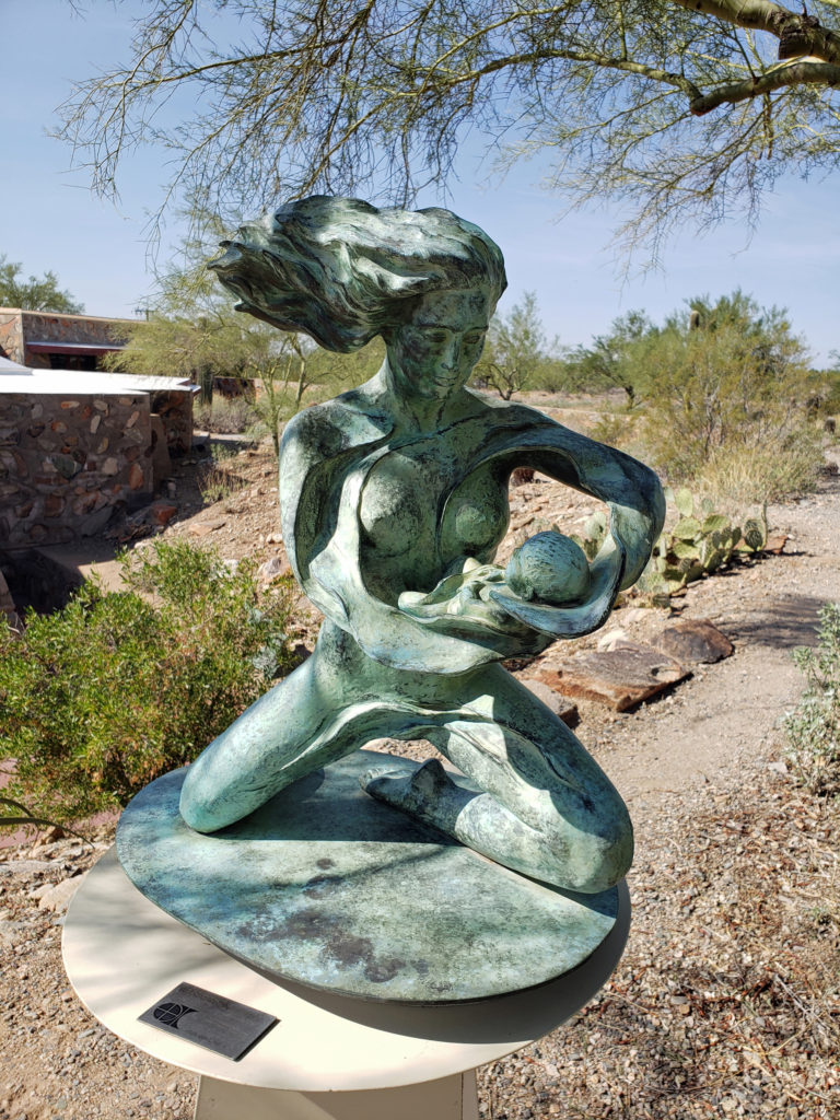
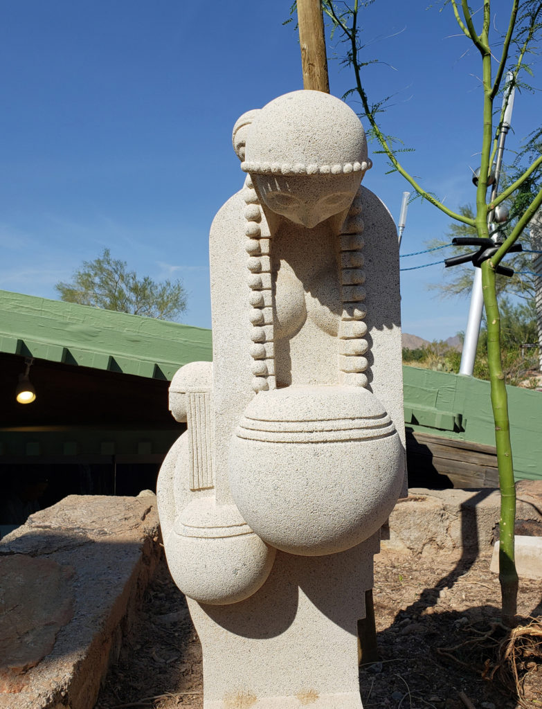
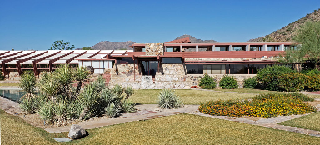
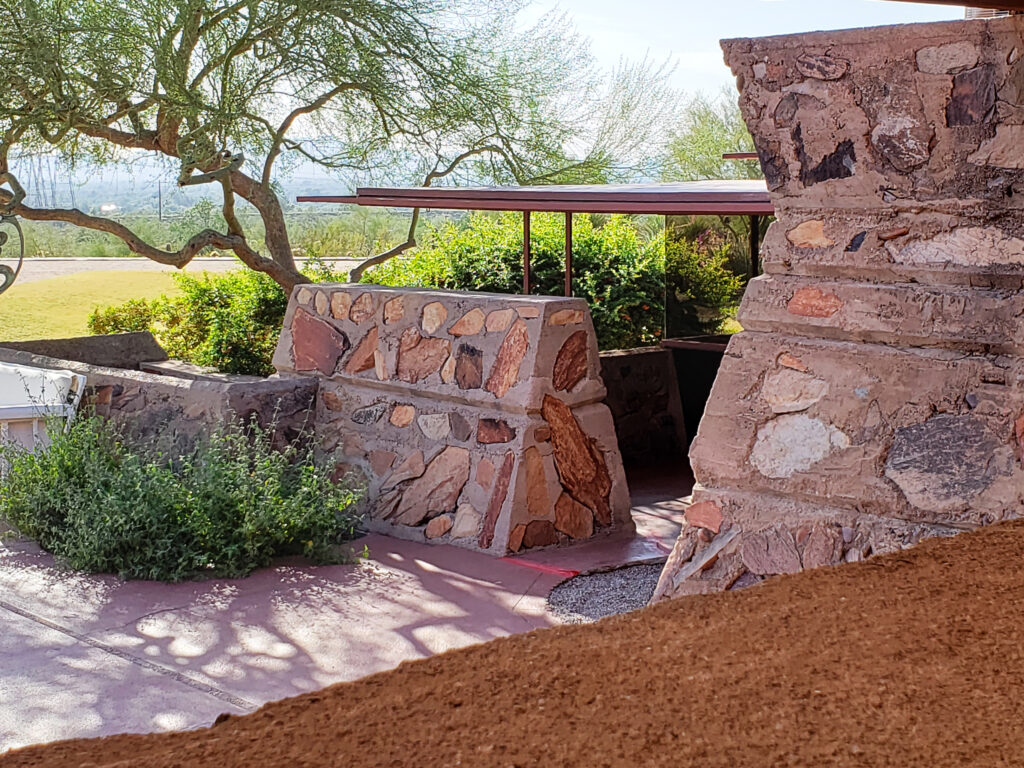
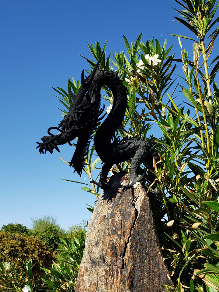
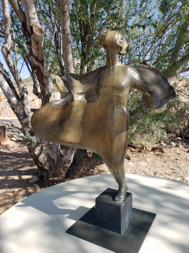 The grounds of Taliesin West are beautifully landscaped and feature many outdoor works of art by various artists. Wright saw architecture as the “mother” of all the arts, and art was an important component of his designs, as was the landscaping.
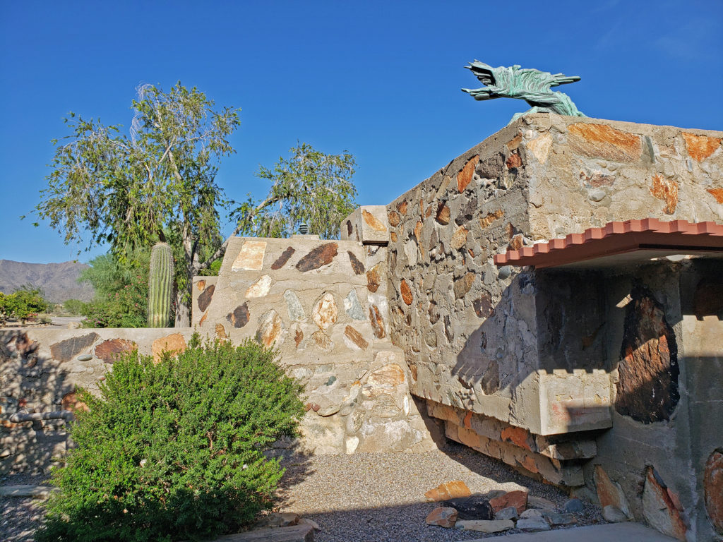
 Taliesin West is located in Scottsdale, Arizona, about 20 miles northeast of downtown Phoenix.
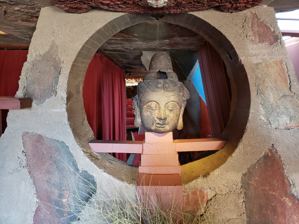 Originally posted November 26, 2019. Updated and re-posted January 7, 2022.
 Originally posted August 6, 2019. Updated and re-posted November 19, 2022.
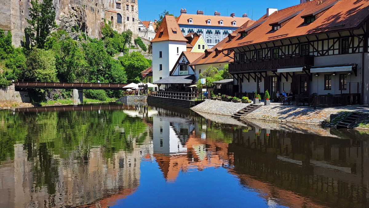
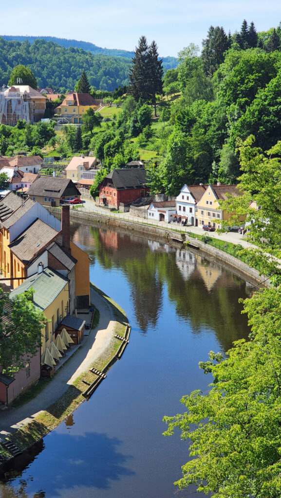
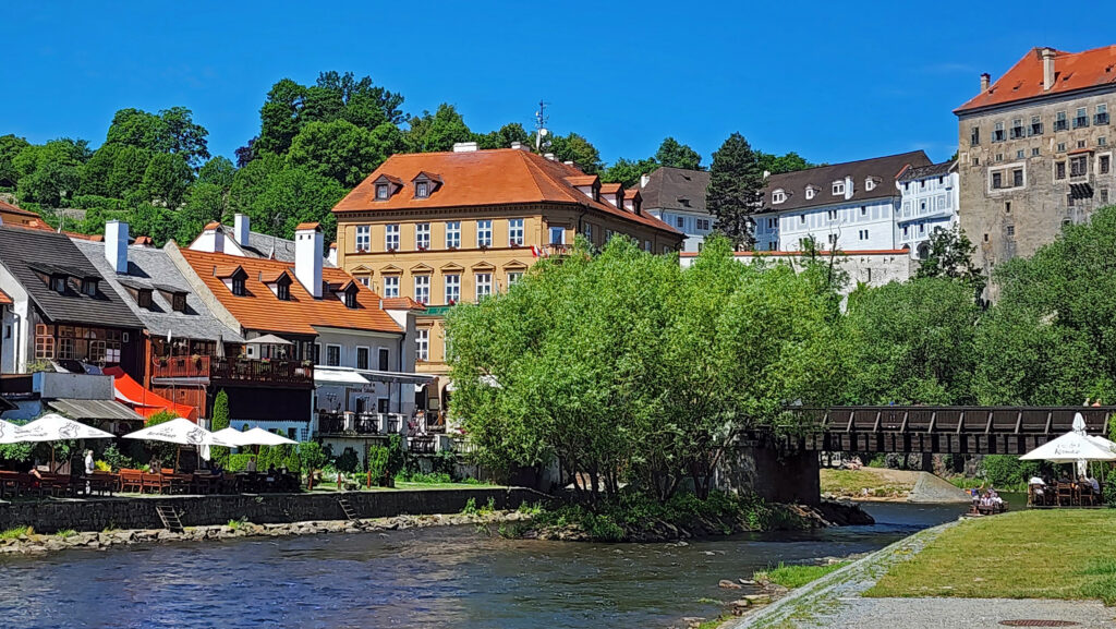
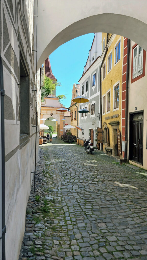
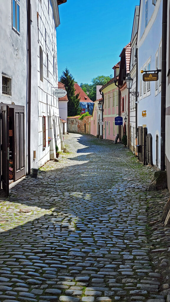
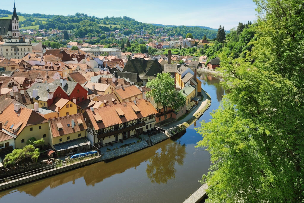
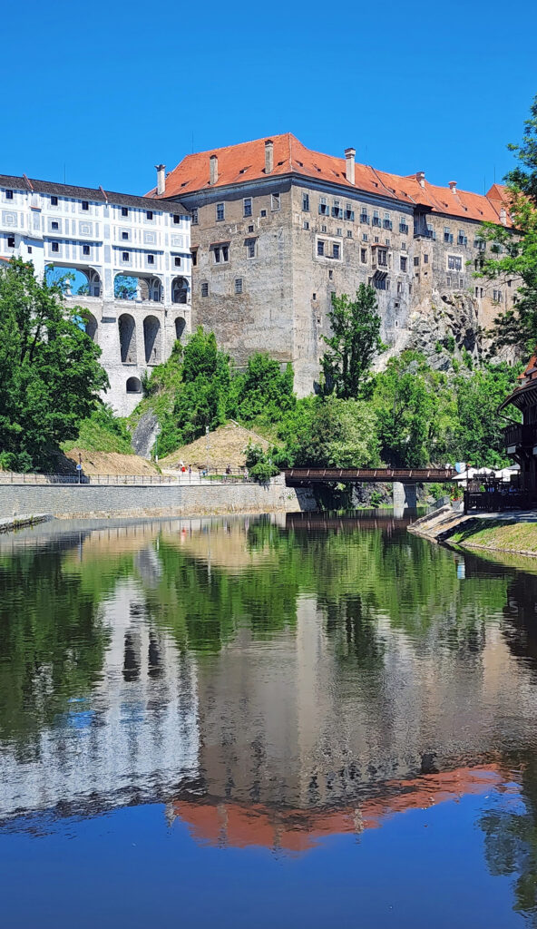

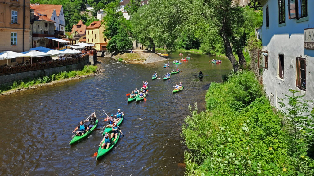
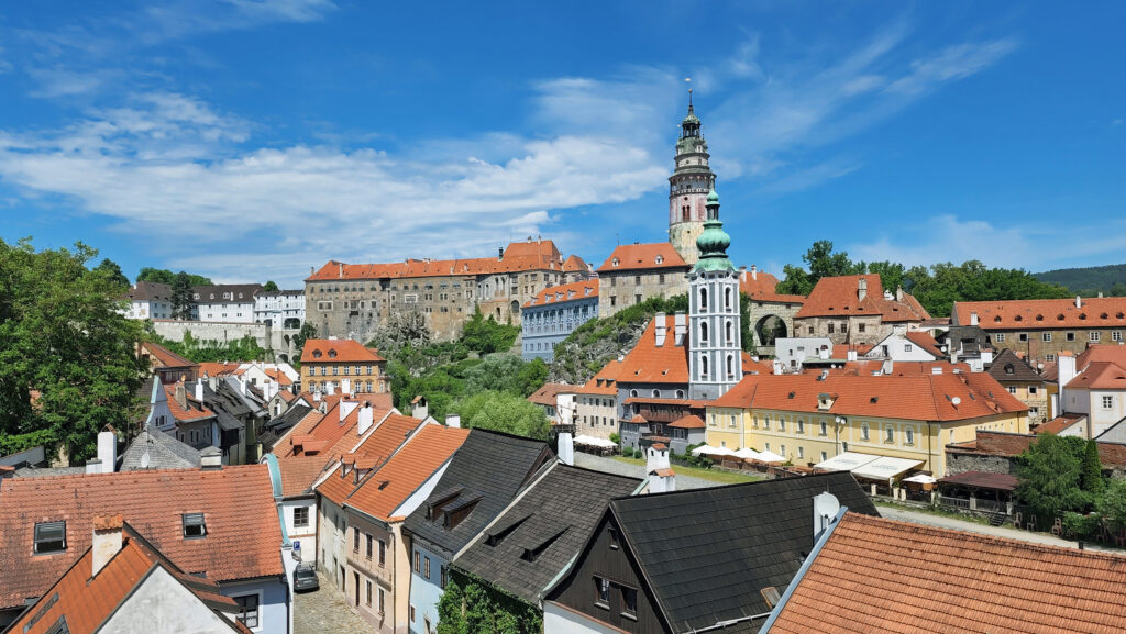
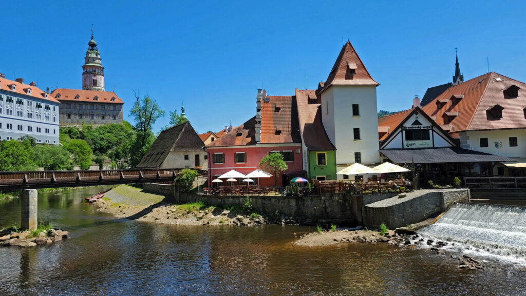
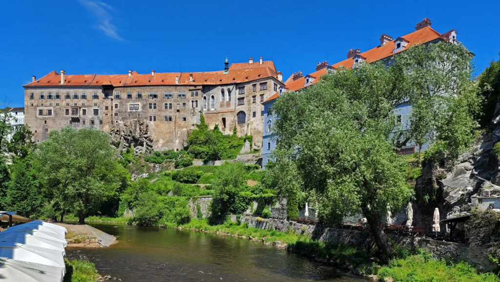
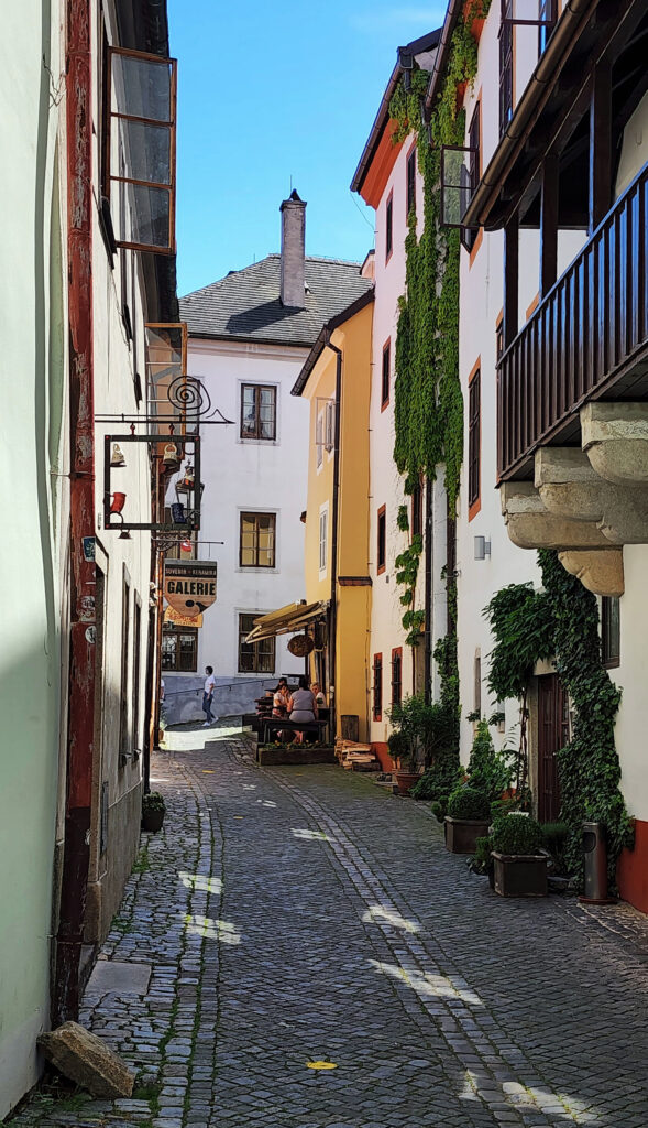
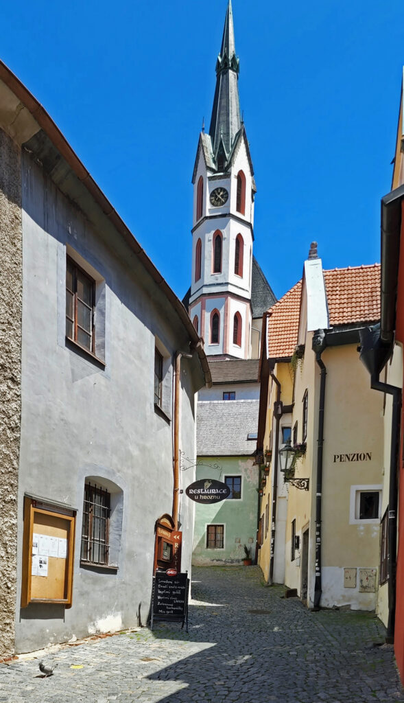
 For my money, the best part of our visit was simply wandering around the historic center, walking the cobblestone streets and taking in the wonderful architecture, the beauty of the Vltava River that meanders around and through the town, and finding some of the charming and quirky things that set Czesky Krumlov apart. The old town area is car free and pedestrian friendly.
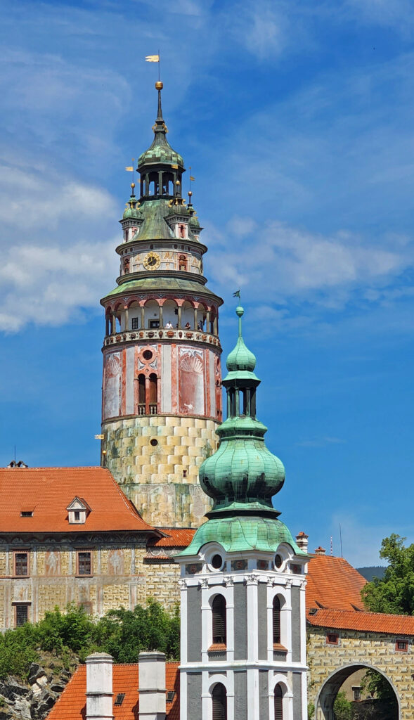
 History
 One of the things Lord Bennett brought to Bandon from Ireland was gorse, a thorny, thick growing plant with bright yellow flowers. In Ireland it was used for privacy hedges and property boundaries because it is almost impenetrable. In Oregon it went wild and was one of the state’s first invasive plants. Besides being thick and thorny, it is also a very oily plant and burns readily. In 1936 a small forest fire started from a slash burn that got out of hand, spread to the gorse near the town, and then to the town itself, destroying all but 16 of the 500 structures in the town. The fire decimated the community and all but ended shipping to and from the harbor.
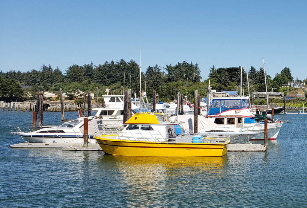 In my youth, Bandon was primarily a mill town, with fishing and agriculture secondary industries. Today, the lumber and plywood mills are long gone. There is still a small fishing fleet that operates out of the harbor, Bandon is still one of the leading cranberry producing areas of the country, and dairy farming is still an important component of the economy. But it is tourism that drives the economy today. The three main tourist draws are the beaches, Bandon Dunes Golf Resort, and the old town section of Bandon.
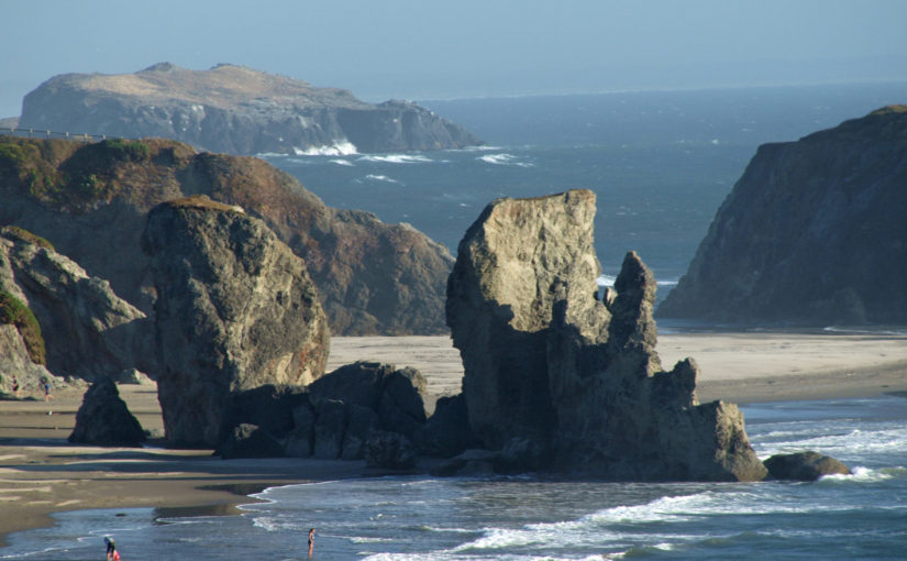
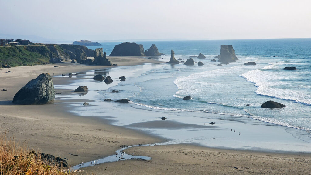
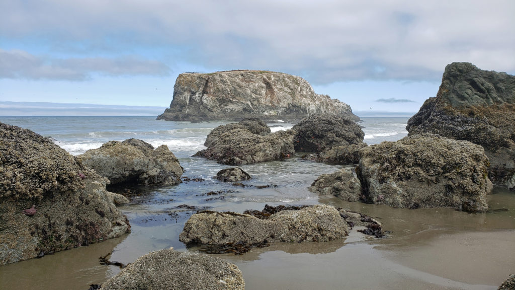
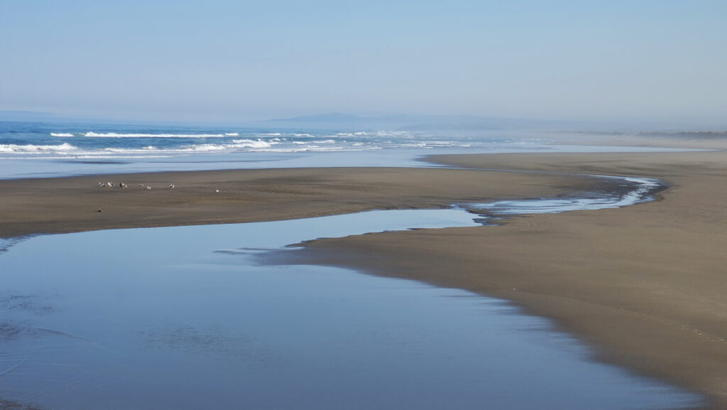 The Beaches
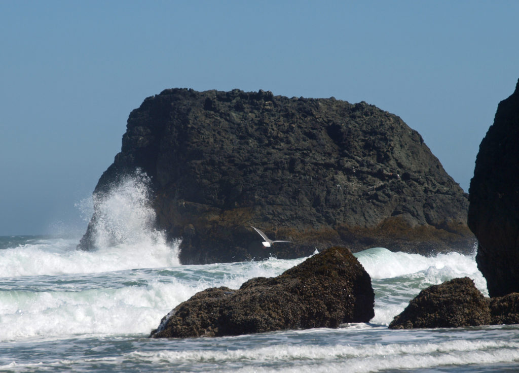
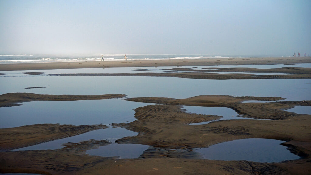
 Access can be had from the south jetty area, from the wayside at the end of 11th Street, and from Face Rock State Scenic Viewpoint on the Beach Loop Road. Farther south on the Beach Loop Road are other beach access points at Devils Kitchen and Bandon State Natural Area.
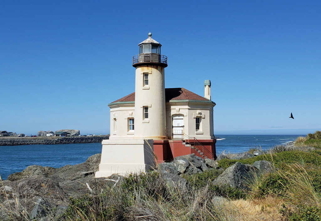
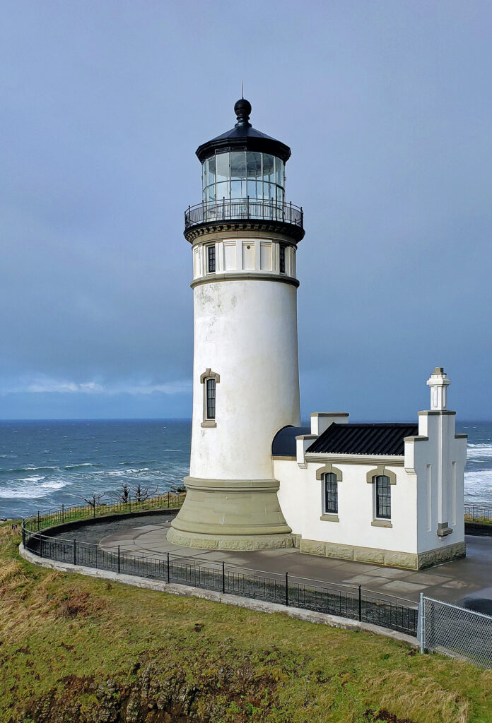
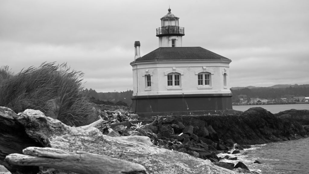 In 1939 the Coast Guard took over the lighthouse and deemed it unnecessary. The lighthouse was replaced by an automated light on the south jetty. The lighthouse sat abandoned for 24 years until it became part of the new Bullards Beach State Park in 1963. It was another 13 years before renovation of the lighthouse began, but it finally opened to the public in 1979. In 1991, during Bandon’s centennial celebration, a solar powered light was installed, ending the Coquille River Lighthouse’s 52 years of darkness. Further renovation of the lighthouse was done in 2007. The bottom floor of the lighthouse is staffed by volunteers and open to the public, but the tower and the light are not.
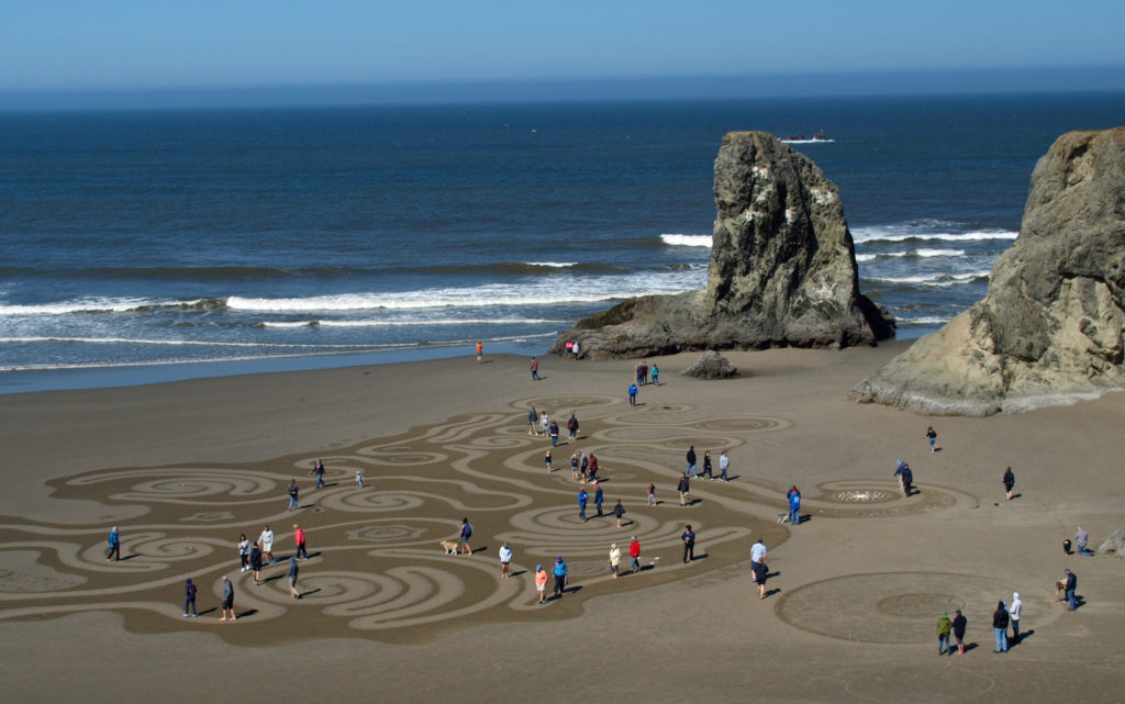 Circles in the Sand
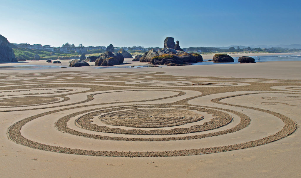 The
The 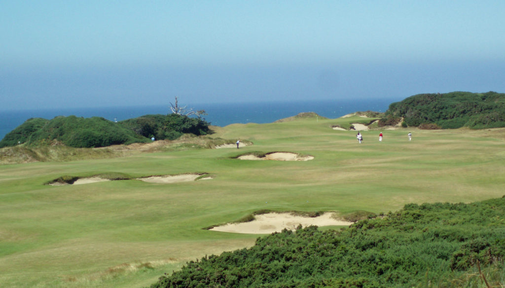
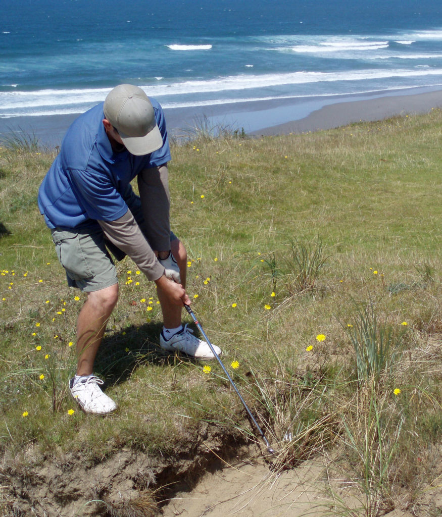 All of the Bandon Dunes courses are consistently rated in the top 100 courses in the United States, and the 13 hole par three course, Bandon Preserve, is a challenge in itself. A few miles south of town,
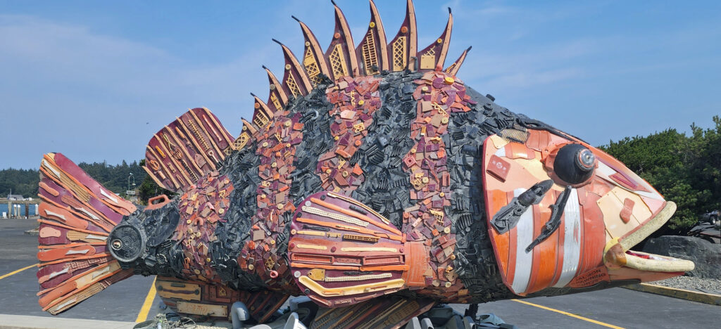
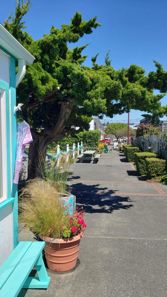 Good eats abound in Old Town. Start your day at Bandon Coffee Cafe or Bandon Baking Company. Stop at
  Accommodations
 There is a campground at
 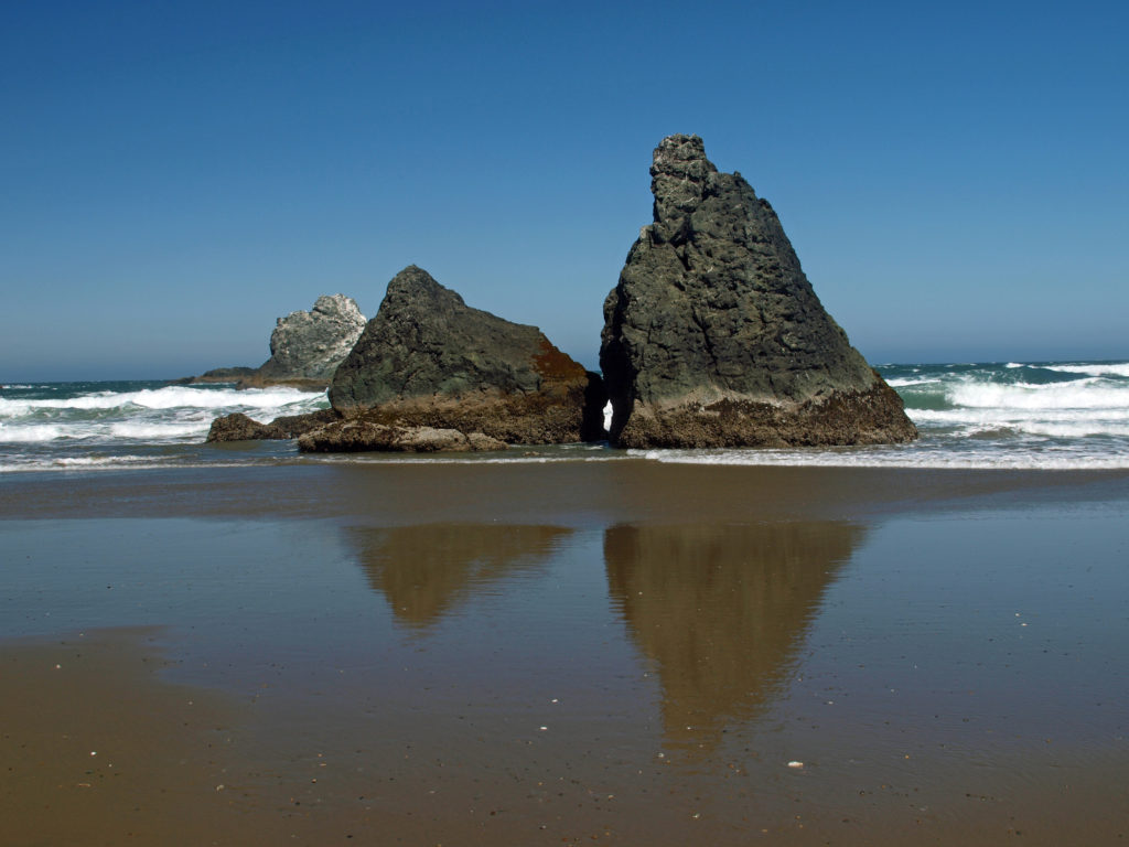 Getting There
 Consider combining a visit to Bandon with a drive south along the spectacular