During our exploration of southwest Idaho, my wife and I used Boise as our base and did day trips to Thousand Springs, Balanced Rock, Bruneau Dunes, and the Snake River Birds of Prey National Conservation Area, as I’ve documented in the past few posts.
Boise is Idaho’s capital and largest city, with a metropolitan area population of around 750,000. It’s large enough to have many of the amenities of a big city, but small enough to still retain something of a small town feel. And it’s a surprisingly modern and cosmopolitan city, blending elements of both West Coast and Rocky Mountain cultures.
My wife and I are both art lovers, and Boise has a vibrant arts community featuring both visual and performing arts. The Velma V. Morrison Performing Arts Center on the Boise State University campus is home to the Boise Philharmonic, Ballet Idaho, the Trey McIntyre Project (modern dance company), and the Boise Shakespeare Festival. The Gene Harris Jazz Festival is held each spring, also on the Boise State campus.
The Boise Art Museum in Julia Davis Park, just south of the downtown center, features permanent American, Northwest, Native American, and Asian Art collections, and rotating temporary exhibits. In addition to the Boise Art Museum, there are a number of notable art galleries in the downtown area, including the Art Source Gallery, Capitol Contemporary Gallery, the Delia Dante Gallery and FireFusion Studio, and MING Studios.
There is also an interesting street art scene in Boise, featured prominently in the building murals of the outdoor gallery known as Freak Alley in the downtown center.
Many fine Victorian houses and architecturally interesting buildings can also be found in the downtown area.
Other points of interest in the downtown area include the Anne Frank Human Rights Memorial and the Wassmuth Center For Human Rights, the Idaho Black History Museum, the Idaho State Museum, the Basque Museum and Cultural Center, and the Idaho Discovery Center, a hands-on, interactive science, technology, engineering, and mathematics (STEM) educational center.
If you want to take a break, grab a bite to eat, and have a glass of wine or a pint of beer, there are plenty of places in downtown Boise to do just that. Moon’s Kitchen Cafe, Wild Root Cafe, and the vegan High Note Cafe are all within a few blocks of the capitol building. Goldy’s Corner is a small cafe and bakery that features a take-a-book/leave-a-book free library. For beer lovers, Ten Barrel Brewing Boise, Prost German Pub, Mad Swede Brew Hall, and Bittercreek Alehouse are all within a few blocks of the Capitol. Near Julia Davis Park you’ll find Boise Brewing, White Dog Brewing, Mother Earth Brew Company, and the Double Tap Pub. If you’re an oenophile, Les Bois Wines, Voodoo Cellar Boise, Thick As Thieves, Press and Pony, and Ochos are all within two blocks of the Capitol. I’m sure Boise has an interesting night life scene, but we didn’t explore that aspect of the city on this trip.
We did explore a number of Boise’s many parks and natural areas. The nearly 25-mile long Boise River Greenbelt has many miles of trails along both banks of the river.
Anne Morrison Memorial Park on the south bank of the river, and the Julia Davis Park, just south of the downtown area on the north bank, are large urban parks with a variety of open spaces and tree lined paths along the river.
Julia Davis Park is also home to the Boise Rose Garden and Zoo Boise. Idaho Botanical Garden, a mile or so southeast of downtown, is also definitely worth a visit.
Kathryn Albertson Park , across Americana Blvd from Anne Morrison Park, is a nature park with several large ponds that is home to a variety of wildlife and provides the visitor with more intimate natural areas to explore.
I hadn’t been in Boise for quite a few years. The last time had been for an environmental conference and I didn’t see much of the city on that trip. And, honestly, we didn’t come to Idaho to explore Boise on this trip. But I found it surprisingly beautiful and interesting on a number of different levels. It’s definitely not the cowboy town I remember visiting in my younger days. Boise has grown up a lot (and maybe it was never as much of a cow town as I remember it being).
We had a great time exploring Boise, but there is far too much there to experience it all in in the short time we had on this trip. We’ll almost certainly be visiting Idaho again in the near future, and I’m sure we’ll spend another few days exploring more of what Boise has to offer. We may even see what Boise nightlife is like on our next visit.
Boise is definitely worth visiting, and southwest Idaho has many truly unique, beautiful, and enjoyable places to visit, all within a short drive of each other. For more on those, check out my other Exploring Southwest Idaho posts:
The roughly 100 mile (as the crow flies) stretch of the Snake River, from south of Boise to just west of Twin Falls, is a geologically interesting area, wildlife is abundant, the scenery is outstanding, and there’s plenty there for those interested in the history of the American West, as well. Thousand Springs, Balanced Rock, Bruneau Dunes, and the Snake River Canyon are all beautiful, unique, and well worth visiting.
Snake River Birds of Prey
People from all over the world come to the Morley Nelson Snake River Birds of Prey National Conservation Area to view, photograph, and study the hawks, owls, eagles, and falcons that make the Snake River Canyon home. And Boise is home to the World Center For Birds of Prey, the home base of the Peregrine Fund, a non-profit environmental organization that played a key role in bringing the Peregrine Falcon back from the brink of extinction. The Peregrine Fund now runs raptor recovery and protection programs around the world. The canyon is not just for hardcore birders, though. It is spectacularly beautiful for one thing. And there are cultural and historic attractions as well.
There are two primary access points to the Snake River Canyon in the Birds Of Prey NCA – Swan Falls and Celebration Park. Our first stop was the Dedication Point Overlook on the rim of the canyon above the Swan Falls area. The canyon here is about 600 feet deep, with sheer vertical walls several hundred feet high below the rim. There was a group of photographers there attempting to get photos of raptors. We saw a few hawks soaring overhead, but too high to get decent photos. It’s a scenic spot, though, and we hung around for awhile, before heading down to Swan Falls.
The falls are long gone, flooded by construction of Swan Falls Dam in the early 1900s. Swan Falls was the first hydroelectric project on the Snake River. A fish ladder was constructed, but was largely ineffective, and the dam effectively blocked salmon and steelhead passage. That was a different era, and the fish ladder was never made functional. Newer dams were built both upstream and downstream with no fish ladders at all. Electricity was the point. The fish didn’t matter. But it’s a historically interesting and beautiful area, so it’s worth a visit even if, like me, you’d rather see the dam gone.
A new power generation facility was constructed at Swan Falls Dam in the 1990s. The dam’s original power plant is now open to the public, with some of the century-old generators and other equipment still in place. There are also displays depicting the history of the area, and the construction and operation of the dam. We walked across the dam after visiting the power house museum, then drove down the canyon a ways. The road was too rough for the car, though, and we turned around and drove back up to Dedication Point, and then on to Celebration Park.
Celebration Park is Idaho’s only archaeological park. Petroglyphs dating back as far as 10,000 years can be found there. Visitors can learn about the Native American “lifeways” at the visitor center, try their hand at throwing a spear with an atlatl, and explore the petroglyph area on a self-guided walk. There is a picnic ground, and a small tent campground. The visitor center is open from 10:00 to 2:00 daily, except holidays. Check the park website for more information.
A short ways downstream, the Guffey Railroad Bridge provides pedestrian and equestrian access to the south bank of the Snake River and the Guffey Butte area. The bridge was built in the late 19th century and carried rail traffic until the 1940s. It is listed in the National Register of Historic Places. Guided tours of the area highlighting the area’s early mining and railroad history are conducted periodically.
Hikers will find trails on both sides of the river. On the north side a trail follows the river upstream for about five miles to the end of the road from Swan Falls Dam. A side trail leads to Halverson Lake, nestled against the cliffs of the canyon wall.
We didn’t have time to do any hiking at Celebration Park, but the trail to Swan Falls would be an interesting outing, and a good place to do some serious raptor watching, if you’re so inclined, away from most of the human influences in the Conservation Area.
Back in Boise, we toured the World Center For Birds of Prey the following morning. The staff there are friendly and knowledgeable, and dedicated to the mission of educating the public about birds of prey and protecting the vulnerable populations of raptors around the world. We sat in on a talk given by two of the staff that was fascinating, informative, and entertaining.
There are a number of raptors from around the world on display there, birds that for one reason or another could not be returned to the wild. Being able to see these magnificent birds up close was a highlight of our trip. The center is also home to a pair of California Condors, North America’s largest bird, that are part of the captive breeding program that has helped save the species from extinction.
For more on Boise, a lively, surprisingly cosmopolitan city that still has a small town vibe, and the other posts in this series, click on the links below:
Southwest Idaho is full of interesting and unusual places, Balanced Rock and Bruneau Dunes prominent among them. They’re a couple of the most unique places you’ll find anywhere, and stunningly beautiful, as well.
Balanced Rock
After touring the Thousand Springs area at the beginning of an extended Memorial Day weekend trip to Southwest Idaho, my wife and I took a short side trip to Balanced Rock, a rock formation sculpted by wind and the freeze/thaw cycle of countless millennia.
Balanced Rock is located about twenty miles west of Twin Falls and ten miles from Buhl, the nearest town. The area around Buhl is flat, featureless farm land that looks more like Kansas than the pictures I had seen of Balanced Rock, which had more the look of the Arizona or Utah deserts. But after a few miles, the road began to drop into a canyon and the view and landscape changed radically.
Balanced Rock is nearly fifty feet tall, weighs forty tons, and is supported precariously by a stem of rock less than three feet in diameter. It is, to say the least, a striking sight. We climbed up to the rock and hiked along the hillside above the rock formations (there’s quite a lot more than just Balanced Rock). It’s not a large area, and the trail is short and not difficult. It’s easy to explore in an hour or so, and I found it definitely worth the time and effort. But you can still get a good view of Balanced Rock and the other rock formations from the parking area if you don’t want to, or are unable to, climb up to them.
Bruneau Dunes
The second day of our Idaho trip took us to Bruneau Dunes State Park, about fifteen miles south of Mountain Home, and about forty miles northwest of Balanced Rock. The 470 foot tall Big Dune at Bruneau Dunes is the tallest free standing dune in North America.
The dunes are impressive and certainly the main attraction here, but the park also has two small lakes, marshes and wetland areas, and open desert areas to explore. The marshes and lakes are full of waterfowl, and coyotes, jackrabbits, lizards, and gopher snakes can be found in the drier areas of the park. In the spring, desert wildflowers are abundant.
For hikers, there’s a six mile loop trail that takes you over the top of the dunes. There is also an equestrian camp and a ten mile long horse trail, two campgrounds, a picnic area, and a visitor center. We didn’t do the six mile hike, but did climb the Small Dune, hiked around the smaller lake, checked out the picnic area on the Big Lake, and, of course, spent a lot of time photographing the area.
Bruneau Dunes is also an outstanding “dark skies” area, and the Boise Astronomical Society has constructed an observatory at the park. On weekends, visitors can view the depths of space through the observatory’s 25 inch telescope.
The weather was better than it was for our Thousand Springs and Balanced Rock visits on the previous day, and the sunshine made for some good photo ops. But it got a little warm on the dunes after awhile, and there were swarms of mosquitoes by the water where it was cooler. Still, it was a nice morning’s outing. The dunes and the small lakes between them are incredibly beautiful, and climbing the dunes was a fun adventure.
Bruneau Dunes definitely exceeded my expectations. The dunes are huge, much bigger than I expected, and the area around them is interesting and very beautiful. The park is small enough that it can be explored in half a day, which is what we did, but there’s enough there to keep you occupied for a few days, at least. It’s also a place where you can slow down, relax, and spend some time just enjoying the views and the peace and quiet, which won’t be marred by the presence of dune buggies and trail bikes. They’re prohibited in the park to protect the dunes.
We returned to Boise that afternoon and spent some time exploring the downtown area and the parks and paths along the Boise River Greenway. The next day it was on to the Snake River Canyon, the Birds of Prey National Conservation Area, and the World Center for Birds of Prey. Click on the links below to view other posts from our trip.
In eastern Idaho, northwest of Idaho Falls, the Big Lost River, Little Lost River, and other smaller streams sink into the lava fields and disappear. That water re-emerges a hundred miles to the southwest, from springs on the north side of the Snake River west of Twin Falls – the Thousand Springs.
Niagara Springs
I can remember seeing part of the Thousand Springs somewhere along US Hwy 30 on a family vacation when I was a kid, back in the late 1950s or early 60s. We didn’t stop back then, but seeing all that water gushing out of the canyon wall obviously made a big impression on me, as I have retained that memory for more than fifty years. And I had a chance to chase down that memory a couple of years ago when my wife and I spent five days exploring southwest Idaho. We spent the first day at Thousand Springs State Park, which consists of seven separate units spread out along the Snake River.
Devil’s Washbowl
The Malad Gorge unit was our first stop. It’s the most accessible of the seven sections of the park, just off I-84. In what the signs still called Malad Gorge State Park, there is a short trail from a parking area near the park entrance to a viewpoint on the rim of the canyon overlooking the narrow gorge and the 60-foot waterfall and plunge pool known as the Devil’s Washbowl.
Malad GorgeCanyon rim at Malad Gorge
The trail continues across a foot bridge 250 feet above the river to another viewpoint a short ways downstream. The road through the park continues from the first parking area to other viewpoints, a large picnic area, and a campground.
Upland area near Malad GorgeMarsh at Malad Gorge State Park
Near the campground is another canyon called Woody’s Cove. Although not as impressive as Malad Gorge, the springs at the head of Woody’s Cove were the first of the Thousand Springs that we had a chance to see. (The source of the Malad River is in the Sawtooth Mountains to the north, near Sun Valley, not the Thousand Springs).
Malad GorgeWoody’s Cove
There are no trails to the bottom of either Malad Gorge or Woody’s Cove, but the views from the rims of both make the park well worth the five dollar entrance fee. On the other side of I-84 from Malad Gorge is the Kelton Trail section of the park. Here there is a section of the historic Oregon Trail where the wagon wheel ruts can still be seen.
Billingsley Creek Wildlife Management AreaFarm pond adjacent to Billingsley Creek
Two of the park’s units are along Billingsley Creek. The lower unit, Billingsley Creek Wildlife Management Area, just north of the town of Hagerman, is an area of marsh and open water that is prime waterfowl and wildlife habitat. Upstream, a few miles east of Hagerman, the Vardis Fisher Day Use Area runs along Billingsley Creek in a narrow valley. The unit is named for the Idaho author of the novel Mountain Man, which was the basis for the 1972 movie Jeremiah Johnson. The ruins of the Fisher home are located in the park unit.
Canyon wall above Ritter Island
A few miles to the south is the Ritter Island unit of the park. The island was once home to the historic Thousand Springs Dairy Farm run by a locally famous woman named Minnie Miller in the first half of the 20th Century. Ritter Island was also the site of the Payne Lewis Ferry Crossing on the Kelton Road from Boise to Utah. This was an important transportation route in the 19th Century prior to the coming of the railroad.
Ritter Island Unit, Thousand Springs State Park
Some of the structures from the farm and ferry crossing are still standing. There are several miles of hiking trails on the island and, according to the park literature, an abundance of wildlife and wonderful views of the Hagerman Valley. It’s also a good place to kayak, according to the reviews I read. Unfortunately, the island is only open from Memorial Day to Labor Day, and we were there a few days before the island’s opening. It was disappointing that we couldn’t get onto the island, but the springs here made the area worth visiting, regardless.
Ritter Island springs
There are literally hundreds of springs midway up the canyon wall above Ritter Island, and Sand Spring Creek emerges full blown from the cliff face. Much of the water from the springs and the creek have been diverted to a hydroelectric generating plant, and some of the spring water is also diverted to the Ten Springs Fish Hatchery. But there is still lots of water pouring down the canyon walls to a side channel of the Snake River.
Falls below Ten Springs Fish Hatchery
The outfall from the fish hatchery tumbles over the cliff face in an impressive waterfall. And below the hatchery there is a Nature Conservancy preserve that has a nice trail along the river below the canyon walls.
Box CanyonBox Canyon Springs
Our next stop was the Box Canyon unit of the park (officially the Earl M. Hardy Box Canyon Springs Preserve), a couple of miles south of Ritter Island. The springs at the head of the canyon flow at an impressive 180,000 gallons per minute.
Box Canyon Springs
Like at Malad Gorge, there is no trail to the bottom of the canyon here. There is a trail to a viewing platform that overlooks a small waterfall. That trail was closed when we were there, but the views from the canyon rim, here too, were impressive enough.
Niagara Springs
The final stop on our tour of the Thousand Springs was Niagara Springs, eight miles southeast of Box Canyon. The springs are on the left side of the access road just beyond a fish hatchery. If you have your windows rolled down, you’ll probably hear them before you see them. The roar the springs make is no doubt the inspiration for their name.
There is a short trail to a viewing platform directly below the springs, which flow out of a 150 foot wide section of the canyon wall at a rate of almost 2,000 gallons per second. Just beyond the springs there’s a picnic area and a small tent campground on the right side of the road adjacent to the fish hatchery.
White Pelicans on Crystal LakeCrystal Springs
About a mile beyond Niagara Springs you’ll find Crystal Springs and Crystal Lake, which is a popular swimming and fishing spot. But we were there on a Thursday and it was quiet and peaceful, almost deserted. The only swimmers were a pair of white pelicans.
Balanced Rock
After leaving Niagara Springs and getting a bite to eat in Buhl, we took a short side trip to the rock formation known as Balanced Rock. After climbing up to the base of the rock, we resumed our journey back to Boise, where we were staying. The road from Balanced Rock took us back to Hwy 30 and the Snake River, not far from the Ritter Island area..
Ritter Island Unit, Thousand Springs State Park
I was curious if I could find the spot along the highway that had made such an impression on me on that family vacation so long ago, and I think I did. I’m pretty sure what I saw back then was the springs above Ritter Island. The highway is on the opposite side of the river, but if the hydroelectric plant had not yet been built and none of the spring water was being diverted, there must have been an incredible amount of water pouring out of the canyon wall and tumbling down to the river. No wonder it made such an lasting impression on me. Even with the water diversions, the springs there are still quite a sight from the highway. That was the end of our first day’s outing. Not a bad start, to say the least.
Snake River CanyonBruneau Dunes
Our trip continued in the following days with visits to Bruneau Dunes State Park, the Snake River Birds of Prey National Conservation Area, and the World Center For Birds of Prey in Boise. We also spent time exploring downtown Boise and the parks and trails of the Boise River Greenbelt. Check out the rest of our southwest Idaho exploration:
Oxbow Park is a popular picnicking and camping area located on the Sandy River just east of Portland, Oregon at the base of the Cascade foothills. The photos here were taken a few years ago when my wife and I visited on a beautiful fall day.
Oxbow Regional Park is owned and operated by the Metropolitan Service District (Metro for short), the regional government agency covering Multnomah, Washington, and Clackamas. The park covers 1000 acres on both sides of the river. There are twelve miles of hiking trails, five group picnic areas that can accommodate groups as large as 300 people, many smaller picnicking areas, a public campground with 74 tent sites, 12 RV sites, and four ADA accessible sites, and two group campgrounds available to non-profit youth organizations.
In past years, Metro has conducted a variety of nature education programs and activities at Oxbow, including school and group field trips, nature programs for families and individuals, and custom programs for groups. Most of those activities have been put on hold due to the Covid-19 pandemic, but the park still sees plenty of use.
The park can be very crowded on summer weekends, but gets much less use after Labor Day. Even on a sunny October day there were just a few people fishing from the river bank and some out for a hike or just enjoying the sunshine. This section of the river is popular with kayakers and rafters in the summer, but we didn’t see anyone on the river other than one family that floated by on stand up paddle boards.
The Sandy River flows from its headwaters on Mount Hood to the Columbia River at Troutdale. Two sections of the river totaling 25 miles are designated Wild and Scenic, including the section of the river that runs through Oxbow Park.
In 2007 the Marmot Dam on the Sandy River was demolished, making the river free flowing for its entire 57 mile course for the first time in nearly a century, and opening up miles of restored spawning grounds for salmon and steelhead. A smaller dam on the Little Sandy River was also demolished.
One of the more popular events at Oxbow is the annual Salmon Homecoming weekend held in mid-October when you can watch salmon spawning in the gravel beds of the river.
Most of the visitor activity at the park takes place along the banks of the river. The upland trails through the mixed conifer and hardwood forest get much less use. But the forest is beautiful, quiet, and peaceful. If you’re looking for tranquility, head away from the river. On our visit when these photos were taken, we hiked some of the forest trails and saw almost no one.
To get to the park, take I-84 east from Portland to Exit 17 at Troutdale. Turn right onto Graham Road, then left onto the Historic Columbia River Highway. In two blocks, turn right onto Buxton Road. Follow Buxton (which becomes South Troutdale Road) to Division Street. Turn left on Division and follow the signs to the park.
One of the great things about the Pacific Northwest is that there are so many beautiful places like this that are within a half hour drive of even the biggest cities. Just one of the reasons that I think this is one of the best places in the world to live.
Originally posted 10/31/18. Updated and re-posted 12/6/21.
Point Defiance Park in Tacoma, Washington is a 760 acre urban oasis located on a peninsula jutting into Puget Sound. The park has something for almost everyone – a variety of botanical gardens, old growth temperate rain forest areas, a large salt water beach, an off-leash dog park, 15 miles of hiking and biking trails, an ADA accessible waterfront path, a recreation of Fort Nisqually, a marina, and the Point Defiance Zoo and Aquarium. All together, the park’s attractions draw more than three million visitors every year.
If you’ve never been to Point Defiance, check out the park’s website to see all of what the park offers visitors.
Our first stop on our most recent visit was the Rhododendron Garden. Resembling a natural old growth forest more than a formal garden, the trails through the garden are quiet and peaceful, and in the spring and early summer, when the rhodies are in full bloom, this is probably the most beautiful of the park’s gardens.
Owen Beach is a very popular spot on summer weekends. The beach is wide (at least at low tide) and extends for quite a ways along the shore, so it can probably absorb the crowds. On our last visit it was almost completely deserted, though.
There is a wide, paved, ADA accessible path (the Promenade) connecting the beach with the marina area of the park and the Point Ruston Waterwalk, giving unhindered pedestrian and bicycle access to the park from the Tacoma waterfront. And a construction project completed in 2022 expanded the parking lot, created new entry and exit paths for pedestrians and cyclists separated from the vehicle roadway, a new beach pavilion, new restrooms, a new ADA accessible children’s playground, new ADA accessible plazas and pathways, and a renovated WPA-era picnic shelter.
The outer loop of the Five Mile Drive provides numerous waterfront access points with views across Dalco Passage to Vashon Island and across The Narrows to the Gig Harbor area of the Kitsap Peninsula.
The outer loop is closed to vehicular traffic part of the day to give cyclists, runners, and pedestrians access to the northern half of the park free from conflicts with motor vehicles. On our most recent visit it was closed after 2:00 pm, but on our previous visit it was, I believe, closed in the morning. Check the Point Defiance Park website (linked above) for the current schedule if you plan to visit the park.
Most of the outer loop section of the park is heavily forested. There are miles of trails winding through the forest. It’s beautiful, serene, and it’s not hard to forget that you’re only a few miles from the second largest city in Washington.
The Fort Nisqually reconstruction is a living history museum where volunteers and staff, dressed in period clothing, demonstrate the crafts of the 19th century. This Hudson’s Bay Company trading post was the first non-Native settlement on Puget Sound. The original fort was located in what is now DuPont, Washington. The recreation here was built in the 1930s by the Works Progress Administration. It is currently scheduled for updating, beginning with the Clerk’s House, that will start this year (2025).
The Northwest Native Garden’s emphasis is, as the name suggests, on plants native to the Northwest’s temperate rain forest. There’s a small pond, small streams and waterfalls, a meadow, and rock formations. It’s a relatively small area, and the trails can be walked in fifteen minutes or so, but you’ll want to linger.
On both of our recent visits our final, and longest, stop was at the botanical gardens area near the entrance to the park. Here there is a large pond with a waterfall, an herb garden, a large rose garden, a dahlia garden, an iris garden, and a Japanese garden. We could easily have spent even more time here than we did on either visit. And if you visit the zoo and aquarium, you could easily spend most of the day just in this section of the park.
Point Defiance Park is one of the largest, and best, city parks in the Pacific Northwest. The park is similar in many ways to Vancouver, BC’s Stanley Park. Point Defiance is, without question, one of Tacoma’s top attractions.
Originally posted May 19, 2019. Most recently updated February 18, 2025.
I’ve been to Juneau a couple of times, the latest being a few years ago. While it’s not my favorite destination in Alaska (that would be Sitka) or the culturally richest (Anchorage), it is a unique and very interesting place, and a well worth a visit.
Looking north across Auke Bay from Mount Roberts
Getting to Juneau can be a bit difficult. No roads lead to Juneau, so it’s either fly in or come by boat. On both of my trips to southeast Alaska I traveled to Juneau by way of Sitka. On the first trip, my wife and I traveled via the Alaska Ferry system from Ketchikan to Skagway and back, except for the segment from Sitka to Juneau. The ferry schedule and our itinerary didn’t match up, so we flew from Sitka to Juneau and resumed our journey by ferry from there. The ferry schedule didn’t work for us on our more recent visit, either, so we made the short flight from Sitka this time, also.
Mendenhall Glacier from Douglas Island
The Juneau airport is about 10 miles north of the city. You can get to the city by taxi, the municipal bus system, or rental car. Once downtown, you don’t really need a car to explore the city. The downtown is compact and easily walkable. The bus system is also free in the downtown area. But having a car makes getting to Mendenhall Glacier and other outlying areas much easier.
Mendenhall Glacier
Mendenhall Glacier is a must see when visiting Juneau. It’s located near the airport and the ferry terminal dock. The Mendenhall Glacier Visitor Center is a good place to start, but if you’re getting around by bus, the closest stop is a mile and a half away. You also have to buy a five dollar (per person) pass to enter. The pass is also required to access some of the area hiking trails. Check the visitor center website for more information. You can park and hike some of the trails, including the popular Nugget Falls Trail that takes you close to the glacier, without buying the pass, so many people skip the visitor center.
Nugget Falls
Nugget Falls is a short walk (less than a mile) from the parking area and visitor center. It’s more of a cascade down the steep slope of the mountain than a free fall, but the sheer volume and velocity of water crashing down into Mendenhall Lake is awesome. It’s one of my favorite waterfalls anywhere. It would be a great destination in itself, but being so close to the face of Mendenhall Glacier actually draws your attention away from the falls. There are a couple of other short interpretive trails starting from or near the visitor center, and the East Glacier Trail (3.5 mile loop rated moderate) offers great views of the glacier. Across the lake, the West Glacier Trail gets you closer to the glacier than the trails around the visitor center. It’s a four mile out and back hike rated moderate.
Douglas Island from Mount Roberts
Another must see in the Juneau area is the view from Mount Roberts, just southeast of downtown Juneau. You can hike to the 3819 foot summit via a 4.5 mile trail, but a more practical alternative is to take the Mount Roberts Tramway to the 1800 foot level. The tram only takes you halfway to the summit, but the view from the top of the tram is still pretty spectacular. You’re looking down on the city directly below, the town of Douglas across Gastineau Channel, and across to the mountains of Douglas Island. You can also see for miles up and down Gastineau Channel.
Rock formation on Mount Roberts
But if that’s not good enough for you, you can access the Mount Roberts Trail from the top of the tram to get higher up the mountain. The top of the tramway is at about timberline, so the views from above are unimpeded. The tram is operated by a Native American corporation, and The Mountain House at the top of the tram features a 120 seat theater that shows a free 18 minute film depicting Tlingit history and culture. There is also a restaurant and gift store in the Mountain House. And Gastineau Guiding operates the Nature Store at the top of the tram where you can get information on area hiking trails and the mountain ecosystem. The tram costs $60 per person ($45 for kids), but it’s money well spent.
View across Fritz Cove from Douglas Island
Whale watching is another popular tourist activity in Juneau. A number of companies offer half and full day cruises in the waters around Juneau. Most tours are 3-5 hours long and cost $150-250 per person. Humpback Whales are common and sightings are generally guaranteed. Orcas also frequent the area. Sea kayaking tours are also popular. Five-hour tours in Auke Bay run about $200 per person. Experienced kayakers can rent single kayaks for about $60 per day. Double kayaks run slightly higher. Canoe and kayak tours of Mendenhall Lake are also available and are a great way to see both the glacier and Nugget Falls.
Douglas Island
On our first trip to southeast Alaska back in 1995 we took a day-long small boat cruise up Tracy Arm, a glacial fjord about 45 miles south of Juneau. It’s stunningly beautiful, with dozens of waterfalls, some as high as 1000 feet, cascading down the sometimes vertical walls of the fjord. You’ll almost certainly see seals, porpoises, bald eagles, and many other marine birds. Orcas and humpback whales frequent the area. You may see black bears along the shore and mountain goats on the cliffs. You’ll navigate between small icebergs.
Seals often haul out on the bergs to rest and sleep. At the head of the inlet you’ll get a close up view of South Sawyer Glacier. How close you get will depend on the boat that you’re on and the amount of ice in the water, but you will get a spectacular look at the face of the glacier and there’s a chance that you’ll witness large blocks of ice calving off the face and crashing into the water below. The cruise was one of the highlights of our trip. We didn’t have time to repeat the cruise on latest visit, but if you can fit it into your itinerary, I highly recommend that you do so. Day trips start at about $275 per person.
Mendenhall Lake and Glacier
Another highly rated outing is a helicopter tour of the Juneau Icefield. I haven’t done this one, but several of the reviews I read called it “the adventure of a lifetime,” and the photos I’ve seen are pretty awesome. A 2-3 hour tour of the 1500 square mile icefield that lands and lets you set foot on the ice starts at around $425 per person. Salmon and halibut fishing charters are another popular activity in Juneau (although Ketchikan is probably a more popular fishing destination). Costs vary by operator, but figure around $600 per person for a four hour trip.
Icebergs on Mendenhall Lake
The area around Juneau is so wild, unspoiled, and spectacularly beautiful that it is the main draw, but the city has plenty of appeal in itself. The downtown area is compact and easily walkable, and most attractions are close by each other.
Sealaska Heritage Institute
If you’re interested in local history, you’ll find the Alaska State Museum of interest. It houses an extensive collection of Native Alaskan artifacts, including fragments of three baskets that are more than 5000 years old. The museum also has a collection of artifacts from the Russian colonial period and early American presence, as well as works by contemporary Native artists. The Juneau-Douglas City Museum, might also be of interest. It’s located across the street from the State Capitol, in the Veteran’s Memorial Building, which is listed in the National Register of Historic Places. The Sealaska Heritage Institute, dedicated to the “study and sharing of Tlingit, Haida, and Tsimshian cultures” is another place that you can learn more about the history and culture of the area. The St. Nicholas Orthodox Church will also be of interest. All four are within easy walking distance of each other in downtown Juneau.
Downtown Juneau
Juneau also has a number of outstanding art galleries, including the Juneau Artists Gallery, the Louise Miller Fine Art Studio, and Annie Kaill’s Fine Crafts Gallery.
Juneau waterfront
Juneau has no shortage of places to get top notch seafood. You won’t find fresher fish anywhere. Try Tracy’s King Crab Shack, Twisted Fish Company, The Hangar On the Wharf, or Deckhand Dave’s Fish Tacos. There are other good places to eat (and drink), as well. We found a cool local hangout, The Island Pub, in Douglas where our B&B was located, that had both good food and good beer. We also stumbled onto a little hole-in-the-wall brewery (more like a home brew operation than a commercial brewery) in downtown Juneau, and visited the Alaskan Brewing Company brewery tasting room (definitely not a hobby scale brewery) in Lemon Creek, near the airport.
Juneau building mural
There are a number of quality hotels in the downtown area. Expect to pay $250 and up for any hotel in downtown Juneau during the summer. The Juneau Hotel has 72 suites, all with full kitchens and a washer and dryer. Summer rates start at around $400 per night. There are also many B&Bs and vacation rentals that are much more affordable. Our Airbnb rental in Douglas was more than adequate and was reasonably priced.
Douglas Island
A note on the weather. Be prepared for rain and cold any time of the year. We were in Juneau the first week in June and saw the sun only briefly in the four days we spent there. High temperatures were in the mid 50s with some light rain. After leaving Juneau we spent three days in Ketchikan and it rained sideways for a good two days straight. Prior to arriving in Juneau, though, our stay in Sitka had been sunny and beautiful. On our 1995 trip, it was sunny in Ketchikan both on our arrival and our departure two weeks later, but those were the only times we saw the sun. The moral of the story is the weather you get is the weather you get. But regardless, Juneau and all of southeast Alaska is such an incredible place that experiencing bad weather there is almost inconsequential. Come prepared, but don’t worry about the weather. It’ll be worth it.
Nugget Falls
Originally posted Nov. 6, 2021. Most recent update Jan. 15, 2025.
The High Desert Museum, located about five miles south of Bend, Oregon, offers visitors a chance to see native wildlife up close and learn about both the pioneering history of the area and the culture and lifestyles of the Native American tribes that lived in the area for thousands of years prior to the arrival of white settlers. All told, the museum has 100,000 square feet of exhibit space on its 135 acre campus.
The High Desert Museum consistently rates as one of the top attractions of the Bend area, and it won the 2021 National Medal from the Institute of Museum and Library Services. My most recent trip to the museum came as part of a family vacation to the nearby Sunriver Resort, and everyone, especially the kids, thoroughly enjoyed the visit. It’s one of the most interesting museums that I’ve ever visited. There is something for everyone there.
“High desert” can be a bit of a misnomer, as the term is often generically applied to all of central and eastern Oregon. The Bend area actually straddles the boundary between the ponderosa and lodgepole pine forest of the eastern slope of the Cascade Range and the sagerush and juniper lands to the east that are more typical of true desert habitat. The High Desert Museum is located in an area of pine forest, so the museum has no true desert habitat. But that does not detract from its appeal.
There is a small stream that runs through the museum grounds and several small ponds, giving the museum riparian as well as forest habitats. You can explore the pine forest and riparian areas on the trails that wander through the 135 acres of the museum grounds.
The Miller Family Ranch, one of the museum’s permanent outdoor exhibits, is a historically accurate recreation of an early 20th century homestead. The exhibit includes a cabin, barn, bunkhouse, root cellar, woodshop, and sawmill. Volunteers give visitors hands-on experience of what life on the homestead was like. Mrs. Miller and her son James will put your kids to work doing chores – and the kids will like it! The kids can also play some of the games that the children of the pioneers played.
The Lazinka Sawmill is a working mill, originally located in Pilot Rock, Oregon. Originally driven by steam power, the mill is now powered by electricity. The lumber used to build the barn at the Miller homestead exhibit was cut at the Lazinka Mill. Museum staff fire up the mill once a month during the summer months, so check the museum’s schedule (linked below) if you are interested in seeing it in operation.
Get an up close look at some of the raptors of the high desert and learn about desert carnivores, otters, and other desert dwellers at the Donald M. Kerr Birds of Prey Center. Check the museum website for current programs and schedule.
Photo from the museum website
Three river otters live at the Autzen Otter Exhibit, although all three were apparently napping when we were there. I have seen them in the past visits, though, and when they’re out and about they are playful, funny, and very entertaining to watch. The exhibit includes both outdoor and indoor viewing areas, including viewing windows below the water level of their pool where you can watch them in their underwater habitat.
Tumbleweed (photo from the museum website)Gert (photo from museum website)
The museum also is home to two porcupines, siblings Tumbleweed and Juniper. Tumbleweed stars in the museum’s summer Desert Dwellers program. Both were born in captivity, and like all of the animals at the High Desert Museum, cannot live in the wild. The museum also recently added a resident gray fox, Gert, to their family.
Throughout the grounds, you will find sculptures and other works of art. I particularly like the wire sculptured mare and foal, the bronze beavers, and the frozen-in-time bronze of a salmon in mid-leap.
Other features of the museum include a Forest Service ranger office built in 1933, vintage logging equipment, a forest service fire truck from the 1930s, and a WWII army motorcycle made by Harley-Davidson. The museum’s most recent addition is the E. L. Wiegand Ponderosa Playscape, a children’s play area near the otter exhibit.
Inside the main building, the Desertarium Exhibit showcases some of the animals that make the High Desert home, including snakes, lizards, and desert tortoises. Other permanent indoor exhibits include Spirit of the West, which documents the history of the people of the region, and By Hand Through Memory, a look at the history and culture of the Plateau Indian Nations.
The museum also hosts changing exhibits. Check the museum’s website for what exhibits are currently on display.
In addition to enjoying all the museum’s exhibits, you can get made-to-order sandwiches and wraps, and a variety of beverages at the newly remodeled Rimrock Cafe inside the main building. The cafe features locally made food and drink from Big Ed’s Artisan Bread, Humm Kombucha, and Strictly Organic Coffee. And souvenirs of your visit and books and other educational materials are available at Silver Sage Trading, the museum store.
Plan on spending at least several hours at the museum, especially if you have kids in tow. There’s too much worth seeing to experience it all in less time. Check the museum website for hours and admission fees. Tickets are available for purchase on the website, but advance purchase is not required.
Photo from museum website
Originally posted Sept. 9, 2019. Most recently updated May 4, 2025.
My wife and I have visited the small community of Stehekin at the head of Lake Chelan in central Washington several times. Our most recent visit came on a week-long escape during the pandemic in 2021.
Lake Chelan from the Lakeshore Trail
Lake Chelan is a fjord-like body of water, fifty miles long and no more than two miles wide at any point. It is also one of the deepest lakes in the United States, with a maximum depth of 1486 feet. Only Crater Lake and Lake Tahoe in the U.S. are deeper. The upper end of the lake is part of Lake Chelan National Recreation Area, which borders North Cascades National Park.
Upper end of Lake Chelan at Stehekin
The Lake Chelan Basin was formed by two glaciers during the last ice age, an alpine glacier that came down the valley from the North Cascades, and a lobe of the Cordilleran ice sheet that later came up the valley from the east. The terminal morraine of the Cordilleran glacier, at what is known as The Narrows, forms the narrowest and shallowest part of the lake.
Riverwalk Park, Chelan
The town of Chelan, 170 miles east of Seattle and 160 miles west of Spokane, lies at the lower, eastern end of the lake, and is the jumping off spot for exploring the lake. While Chelan offers a lot for the visitor to enjoy, we spent only one night there before heading up the lake in 2021. We stayed at the Riverwalk Inn, a 13 room hotel across the street from Riverwalk Park that has been in operation since 1918. There is also a café on the property, but, unfortunately, it was closed when we were there.
Lake Chelan from Riverwalk Park
While I can recommend the Riverwalk Inn, Chelan has a wide variety of other lodging options, from rustic cabins to full service hotels. Chelan also has a variety of places to eat and drink. If you’re a fan of craft beers, you’ll want to check out Stormy Mountain Brewery. While the service was somewhat lacking, the beer selection and quality were both good and the pulled pork nachos we had were superb.
Lake Chelan at Fields Point Landing
The lower end of the Lake Chelan is easily accessible and can be explored by car. From Chelan, the South Lakeshore Road goes as far as Twenty-five Mile Creek State Park, twenty miles from Chelan. On the north shore, you can drive as far as Green Point, about ten miles from Chelan. Beyond those two points, though, there are no roads along either shore of the lake, and no access to the lake by road. The only way to explore the majority of the lake is by boat.
Near upper end of Lake Chelan
Between Twenty-five Mile Creek State Park and Stehekin the surrounding mountains drop steeply to the shore. The only structures you will see are a few isolated cabins along the shore and a small group of cabins at Lucerne.
Lucerne LandingStehekin Landing
Stehekin lies near the upper end of the lake, surrounded by the peaks of the North Cascades. It is a strikingly beautiful and totally unique place. What sets Stehekin apart from almost all other communities in the Pacific Northwest is that you cannot get there by car. The only road out of Stehekin dead ends in North Cascades National Park. You have to come by boat, float plane, or on foot. The Stehekin area has fewer than 100 year round residents, but, despite its isolation, bustles with tourists, summer residents, Pacific Crest Trail through-hikers, and seasonal workers from spring through fall.
Lady of the Lake II
Getting to Stehekin from Chelan requires some advance planning. If you don’t have a boat of your own, you can rent one in Chelan, but most visitors to Stehekin come by passenger ferry. Lake Chelan Boat Company (better known as Lady of the Lake) operates three ferries that run from Chelan to Stehekin. Another option is the Stehekin Ferry, which runs from Fields Point Landing (about 17 miles from Chelan on the south shore of the lake) to Stehekin. In the summer months, demand is high and tickets sell out well in advance. Reservations need to be several months before your planned visit. Note: Lake Chelan Boat Company is in the process of acquiring the Stehekin Ferry business, so you should be able to reserve a trip on the Stehekin Ferry through the Lady of the Lake website linked above beginning sometime in the spring or summer of 2025.
Private cabin at Stehekin
You can do a day tour from Chelan to Stehekin and back via ferry, and many visitors to Stehekin are day trippers. But the length of the ferry ride (from an hour and a half to four hours each way, depending on which ferry) limits the amount of time you have to explore the area. Many people, my wife and I included, prefer to spend multiple days in Stehekin, but lodging options are limited and also require some advance planning.
North Cascades Lodge (photo from lodge website)
North Cascades Lodge in Stehekin is located at the ferry landing. It’s the most convenient and has by far the most rooms available. The only other lodging options are private cabin rentals, the Stehekin Valley Ranch, ten miles up the valley from the ferry landing, and a few primitive campgrounds. Lodging reservations must also be made well in advance, and must be coordinated with your ferry reservations.
North Cascades Lodge
We have stayed at North Cascades Lodge several times. You can rent a room (some with fireplaces) with a private bath, a cabin with a small kitchen, or an entire lakefront house that sleeps as many as 12. Our room was fairly basic, but comfortable and large enough to serve our needs well. The lodge also has a store and a full service restaurant, one of the few dining options in Stehekin. Stehekin Valley Ranch also has a dining room (reservations required), and you can get breakfasts and lunches at Stehekin Valley Pastry Company (aka The Bakery), located a couple of miles from the ferry landing. The only other dining option is renting a cabin with a kitchen and cooking your own meals.
Stehekin River at High Bridge
A few people arrive in Stehekin by float plane. A surprising number arrive on foot, many of them Pacific Crest Trail through-hikers. The PCT crosses the Stehekin River at High Bridge about ten miles up the valley from the head of the lake. The National Park Service operates a shuttle bus (called the Red Bus for obvious reasons) between Stehekin and High Bridge. There is also a post office in Stehekin where through-hikers can send supplies for the final leg of their hike to the Canadian border and the end of their journey. And a few backpackers make it to Stehekin via the 23 mile hike over Cascade Pass from the west side of the Cascades.
The Red Bus
Stehekin is one of the most isolated communities in the country. Not only is there no road access, there’s no cell phone service and only very limited wi-fi. But that’s part of its appeal. Turn off your phone. Forget about TV. The sheer beauty of the place and its proximity to North Cascades National Park and Glacier Peak Wilderness, as well as the PCT, make it an ideal destination for the outdoor oriented traveler. And there are plenty of things to keep you entertained while there.
The Bakery
The Golden West Visitor Center, operated by the National Park Service, is located near the ferry terminal and is a good starting point for your exploration of the area. There is an information desk there, and you can find books, maps, and other items related to the area. And audiovisual programs are available throughout the day. It was closed due to the Covid-19 pandemic when we were last there, and was closed during the Pioneer Fire in 2024, but should reopen for the 2025 season. Check the North Cascades National Park website for more information.
The House That Jack Built
Just uphill from the North Cascades Lodge, adjacent to the visitor center, there is a craft shop, The House That Jack Built, that displays and sells souvenirs, hand crafted gifts, and artwork created by local artisans. It’s small, but worth checking out.
The Old Stehekin School
You can rent bikes (or bring your own) and ride the road up the valley to The Bakery (a must stop), 320 foot high Rainbow Falls (another must stop), The Garden, an organic produce farm, the Old Stehekin School (now a free museum), or all the way to High Bridge. The Red Bus also makes daily runs to The Bakery, Rainbow Falls, and High Bridge. You can even rent ATVs and explore the valley that way (no off-roading allowed, though).
Rainbow Falls
You can rent kayaks or an electric boat at Stehekin to explore the lake, and there are a number of hiking options, from short loop trails in the Stehekin area to longer outings along the shore of the lake or from the Rainbow Falls and High Bridge areas. Or you can just relax in Stehekin and enjoy the view of the lake and the surrounding mountains.
On our most recent outing we rented bikes and rode to the Bakery and Rainbow Falls one morning. That is a very easy ride on a paved road. We also stopped at The Garden and the Old Stehekin School. Above Harlequin Bridge the road is gravel and a little more challenging, although on a previous visit we rode all the way to High Bridge and back.
Agnes Creek
The next day we rode the Red Bus to High Bridge in the morning to hike and photograph the upper end of the valley, and returned on the Red Bus that afternoon. There are several worthwhile hikes starting at High Bridge. The 5.5 mile out and back Agnes Gorge Trail leads to a 200 foot deep canyon and a very scenic section of Agnes Creek in Glacier Peak Wilderness. You can also do the 3.3 mile out and back hike from High Bridge to Howard Lake on the PCT. It’s also possible to do a longer loop that takes you past Howard Lake and returns to High Bridge along the Stehekin River. Or you can hike a portion of the PCT that follows Agnes Creek. High Bridge is also the starting point for the 16 mile roundtrip to the summit of McGregor Mountain, more than 6500 vertical feet above High Bridge – more than a bit beyond my capabilities at this point, I’m afraid.
Upper end of Lake Chelan at Stehekin
We had planned to get out on the lake on our final day in Stehekin, but it was very windy that day, so we spent the day reading and relaxing at the lodge instead. No problem, though. The beauty and uniqueness of the Stehekin area make it a wonderful place even when the weather doesn’t cooperate. It’s one of my favorite places in the Northwest to visit despite the difficulty in getting there. The only reason that we haven’t visited more often is that there are so many other wonderful places in the Pacific Northwest (and beyond) to explore.
View from Stehekin Landing
The Garden
Originally posted September 30, 2021. Most recently updated February 22, 2025.
One of the benefits of living in the Pacific Northwest is that you have incredible places like Mount Rainier National Park almost in your back yard. Mount Rainier is close enough to both Seattle and Portland that it’s possible to visit the mountain as a day trip, which many people do. But Rainier is so large, and there is so much to explore, that you can’t even begin to experience all it has to offer in a day, or even a week.
My wife and I have vacationed in Mount Rainier National Park a number of times over the years. Our favorite part of the park is the aptly named Paradise area, located on the south slope of the mountain at an elevation of 5400 feet, 9000 feet below the summit. The name Paradise was bestowed on the area by Martha Longmire, one of the early developers of tourist facilities in the area, more than a century ago. But appreciation for the beauty of this spot goes back much farther. Native Americans frequented the area long before it was discovered by white settlers, and they apparently appreciated its beauty just as much. Their name for the area, Saghalie Illahe, translates to Heavenly Place or Land of Peace.
Paradise is the most visited section of Mount Rainier National Park for good reason. Subalpine meadows abound with lupine, paintbrush, and dozens of other wildflowers. Small streams and waterfalls course down the mountain. There are many trails in the area that offer spectacular views of the Tatoosh Range to the south, and, of course, of Rainier itself.
Summer weekends are usually very, very crowded. There may be long lines at the Nisqually Entrance to the park, and you’re unlikely to find a parking spot anywhere close to the Jackson Visitor Center or Paradise Inn after mid-morning. Even if you get there early, you’ll still be elbow to elbow with other visitors. If you can visit during the week, I’d highly recommend doing so, and even then I would recommend getting there as early in the day as possible. But even if you can only visit on a summer weekend, Paradise is such an incredible place to see that it’s worth putting up with the crowds, provided that you can actually find a place to park. If you can’t, though, there are many other places in the park worth visiting.
The popularity of Paradise has certainly impacted the area. The meadows above Paradise Inn are crisscrossed with trails, many of them paved, and the sheer number of people using them can’t help but have a negative effect on the quality of the area in terms of wildlife habitat. But even close to Paradise Inn and the Jackson Memorial Visitor Center, you are almost certain to see wildlife such as hoary marmots and golden-mantled ground squirrels.
Yellow-pine chipmunks are also frequently seen in the meadows. Black-tailed deer are abundant in the area and may be seen even close to the visitor facilities. Gray Jays and Clark’s Nutcrackers are frequently seen in the area, and more than sixty other species of birds are known to inhabit the subalpine areas of Mount Rainier, almost fifty of which nest in the park.
On the trails above Paradise, you are likely to see other wildlife. Look for mountain goats on the slopes above you. Black bears, elk, coyotes, bobcats, and cougars also frequent the area. Look (and listen) for pikas on talus slopes.
Hiking opportunities are abundant in the Paradise area. The Falcon Guide, Hiking Mount Rainier National Park, is a good resource. On our most recent trip (in August 2021) we spent five days in Paradise and did at least one hike every day.
The highlights of the trip were the two hikes we did on the Skyline Trail. The first was the four mile out and back hike to Panorama Point. The second was the roughly four mile Skyline-Golden Gate loop. Both are listed as “moderate” hikes, but both have significant elevation gains (1700′ and 1400′ respectively). We did both hikes early in the day during the week, but we were far from the only ones on the trail, especially on the hike to Panorama Point. But the area above Paradise is so incredibly scenic that the crowds didn’t diminish the experience much.
There are also plenty of easy hikes in the Paradise area for people who don’t want to (or aren’t able to) hike to the higher areas on the mountain. Myrtle Falls, for example, is an easy one mile round trip hike from Paradise Inn.
On our last few visits, we have stayed at Paradise Inn. It is one of the grand lodges of the Northwest, on a par with Crater Lake Lodge, Timberline Lodge on Mt. Hood, and Lake Quinault Lodge in Olympic National Park. It’s worth visiting, even if you’re not staying there. It’s an amazing structure.
Paradise Inn was constructed in 1915-16 opened July 1, 1917. The attached Annex was completed three years later. The combined structures are listed in the National Register of Historic Places.
Close to Paradise Inn, the Jackson Memorial Visitor Center, named after long-time U.S. Senator Henry M. Jackson, offers general information, exhibits, a park film, guided ranger programs, a book/gift store and a cafeteria. Unfortunately, all visitor centers in the park are currently closed due to the ongoing pandemic.
Accommodations in the area are somewhat limited. Paradise Inn has 121 rooms, 42 in the main lodge and 79 in the attached Annex. The National Park Inn in Longmire has 25 rooms. Reservations for both can be made through Mount Rainier Guest Services, 360-569-2275. Information on accommodations outside of the park can be obtained from the Mount Rainier Visitor Association . All reservations should be made well in advance.
There are two large campgrounds in the southern part of Mount Rainier National Park. Cougar Rock Campground, between Longmire and Paradise, has 173 individual sites and five group camp areas. Ohanapecosh Campground, in the southeast part of the park near the Stevens Canyon Entrance, has 188 individual sites and two group camp areas. Both have RV sites that can accommodate up to 27 foot trailers and 32 foot motor homes (35 foot at Cougar Rock), but there are no hookups. Both do have dump stations. Reservations can be made through the Mount Rainier National Park website.
Both Paradise Inn and the National Park Inn have full service restaurants, but both were operating on a reduced scale due to the pandemic when we were there in August. The National Park Inn dining room was closed, but take out meals could be ordered and picked up at the reception desk in the lobby. The dining room at Paradise Inn was open for dinner only for most of our visit, but closed (unexpectedly) for the season on our last day there. Paradise Inn also has a limited service cafe, and there is a cafeteria at the Jackson Memorial Visitor Center that is open daily during the summer season and on most weekends and holidays in the winter (depending on road conditions). The National Park Inn restaurant is open year round.
There is far more to Mount Rainier National Park than just the Paradise, of course. Below Paradise, the Reflection Lakes along the highway offer beautiful views of Mount Rainier.
The nearby Snow Lake Trail is an easy and worthwhile hike. To the east, the Stevens Canyon area has a number of interesting areas, including Box Canyon, a 180 foot deep slot canyon, and a number of roadside waterfalls.
The Longmire area has some interesting history, a museum, nice hiking trails, and the National Park Inn offers both lodging and dining options for the visitor. The road to Longmire is also plowed in the winter, so it’s a year round destination. (The road from Longmire to Paradise is open in winter when the weather allows.)
In the Ohanapecosh area in the southeastern corner of the park, the Grove of the Patriarchs Trail is a good family friendly outing. And the nearby Silver Falls Trail is a must for waterfall lovers. In the northeastern section of the park, the Sunrise area offers beautiful views of the eastern side of the mountain and has an abundance of hiking trails.
You could probably spend an entire summer in Mount Rainier National Park and not see it all.
Originally posted July 10, 2018. Updated and re-posted September 18, 2021.
Crater Lake makes a tremendous first impression. The first time a person sees the lake with their own eyes will likely be a sight they will never forget, especially if it’s a sunny day with the lake at its deepest blue. There just is no way to describe the depth and intensity of the lake’s color, and photos don’t really do it justice. If there’s a more beautiful lake anywhere in the world, I haven’t laid eyes on it.
Crater Lake is 1943 feet deep, making it the deepest lake in the United States, second deepest in North America, and ninth deepest in the world. It is also one of the cleanest and clearest lakes in the world. It’s that combination of depth and clarity that results in its intense deep blue color.
The caldera that Crater Lake occupies was formed 7700 years ago when the summit of 12,000 foot tall Mount Mazama collapsed after a massive eruption. Over time rain and snow filled the caldera to its present level. The lake has no outlet. The level of the lake remains nearly the same because the amount of evaporation from the surface of the lake closely matches the amount of precipitation falling on it in any given year.
Wizard Island formed sometime after the eruption that formed the caldera. It rises 770 feet above the surface of the lake, 2713 feet above the deepest point in the lake. It last erupted about 5000 years ago, but it is considered dormant, not extinct. Conceivably, it could erupt again at any time. Merriam Cone also erupted after the caldera was formed, but never reached the lake surface. Its summit lies almost 500 feet below the average lake level.
Phantom Ship, a remnant of an eruption 400,000 ago, rises 170 feet above the lake surface. Its formation predates that of Mount Mazama itself.
The Park
Crater Lake is such a stunningly beautiful place that it should be on everyone’s bucket list. It’s one of the few places I’ve ever been that seeing it for the first time could be a transformative, life changing experience. It was exactly that for William Gladstone Steel, an experience that ultimately led to the creation of Crater Lake National Park. Steel, known as “The Father of Crater Lake,” first laid eyes on the lake in 1885 after a journey by rail, stage coach, and on foot for the final 20 miles. That experience led to a 17 year quest to preserve, protect, and promote the lake. Largely through Steel’s efforts, Crater Lake was included in the Cascade Range Forest Reserve in 1893, and became the nation’s sixth national park on May 22, 1902. More information about the park can be found on the park website.
Crater Lake Lodge
Crater Lake Lodge sits on the rim of the caldera in the Rim Village. One of the grand lodges of the American West, the lodge has been welcoming guests since it opened in 1915, except during WWII and from 1989 to 1994 when the lodge underwent a complete restoration.
My wife and I recently spent three nights at the lodge. Although it lacks the amenities of a luxury hotel, our room was comfortable, with a private bathroom, and the location more than makes up any lack of luxuries.
The Rim Drive
Any visit to Crater Lake should include a drive around the lake on the 33 mile Rim Drive. The lake can be circumnavigated in little more than an hour, but plan to spend at least half a day.
You’ll want to stop at all of the viewpoints. Maybe combine the drive with a hike down to Cleetwood Cove and a boat tour of the lake. You can get off at Wizard Island and hike to the summit and then catch a later boat back.
For a more adventurous day, hike to the summit of Mount Scott, the highest point in the park. It’s a two mile hike to the summit with 1250 feet of elevation gain, so it’s not an easy hike (All Trails rates it “moderate”), but the view might just be worth the effort.
Hiking Trails
My wife and I are avid hikers, and Crater Lake offers the hiker a variety of options, from the very easy Pinnacles Trail to the more challenging Mount Scott Trail. Other trails of interest include The Watchman, Cleetwood Cove, Plaikni Falls, Garfield Peak, Pinnacles, and Annie Creek trails. All are very worthwhile outings. Check out the AllTrails website for detailed descriptions of the park’s many trails.
The Pacific Crest Trail passes through the park, but does not ascend to the rim of the caldera. Hikers on the PCT can take the Dutton Creek Trail that climbs up to the Rim Village, then hike the trail that parallels the West Rim Drive and reconnect with the PCT north of the lake.
The Pinnacles
Many visitors to Crater Lake don’t make the short side trip to the Pinnacles area, and even fewer hike the 1.4 mile out and back trail along the rim of the canyon, but it’s a worthwhile detour off the Rim Road.
Practical Info
Crater Lake is located in the southern Oregon Cascades, about 250 miles south of Portland, 140 miles southeast of Eugene, and 75 miles north of Medford. A number of private companies offer bus or van tours to Crater Lake from Medford, Bend, or Eugene, but there is no commercial bus or rail service to the park.
The south entrance to the park, the Mazama Village area, and the Rim Village are open year round. The north entrance and the Rim Drive are closed in winter.
There are two lodges in the park, Crater Lake Lodge in the Rim Village and The Cabins At Mazama Village that are open for the summer season. Crater Lake Lodge has 71 rooms, starting at $246/night. The Cabins At Mazama Village has 40 rooms, all at $160/night. Prices listed are for the 2024 season. Note that the concessionaire that operates both lodges is changing, so prices may also change. Check the park website (linked above) for current information.
There are two campgrounds in the park. Mazama Campground has 75 RV sites, 18 tent sites with electricity, and 121 tent sites without electricity. Tent sites start at $22. RV sites run from $32 to $44 per night. Mazama Campground is usually open from early June through late to September. Lost Creek Campground, located on Pinnacles Road, is a primitive tent only campground with 18 sites, operated by the park service. Lost Creek Campground is currently closed and will not be open for the 2024 season. Backcountry camping is allowed in the park by permit only.
Dining options in the park are somewhat limited. The dining room at Crater Lake Lodge is open to all visitors, but reservations can only be made by people staying in the park. The Rim Village Cafe offers “grab and go” sandwiches and salads (I had a pulled pork sandwich from there on our recent visit that was very good). It is open from 9am to 8pm in the summer and 10am to 5pm in the winter. The Annie Creek Restaurant in Mazama Village is open from 7am until 9pm. The Mazama Village Store sells packaged sandwiches and snacks.
Summer park entrance fees are $30 for private vehicles and $25 for motorcycles. Winter fees are $10 less. Snowmobilers, bicyclists, and pedestrians are charged $15 per individual. All entrance fees are good for seven days. Entry reservations do not need to be made.
Gasoline is available at the Mazama Village Store. There is a Tesla charging station just outside the Annie Spring entrance station near Mazama Village, but no other electric vehicle charging stations in the park.
Other lodging, dining, and services are available outside the park at Diamond Lake, Union Creek, and Fort Klamath.
Conclusion
if you’ve never been to Crater Lake, you’ve missed out on an experience available nowhere else in North America, and perhaps nowhere else in the world. The place is that unique and that fantastically beautiful.
Originally posted September 13, 2021. Most recently updated April 6, 2024.
My wife and I have been to Hawai’i many times, but only once to Kaua’i. But that was a memorable trip, and I’ve been contemplating a return to Kaua’i lately.
Kapa’a Creek
Kaua’i is called the Garden Isle, and for good reason. Abundant rainfall and the tropical climate make the island a botanical paradise. Think of the jungle depicted in the movie Jurassic Park. Much of the original movie and sequels were filmed on Kaua’i.
McBryde Garden
No trip to Kaua’i is complete without visiting at least one of the island’s famed botanical gardens. Three of the five National Tropical Botanical Gardens are located on Kaua’i. Other notable botanical gardens on Kaua’i include Na ‘Aina Kai Botanical Garden and Princeville Botanical Garden on the north shore, and Smith’s Tropical Paradise on the east shore in Wailua River State Park. Check the park websites for ticket prices, open dates, and details. Na ‘Aina Kai and Princeville require advanced purchase of tickets. Tickets to Smith’s are available only at the park entrance.
McBryde Garden
National Tropical Botanical Garden is a non-profit corporation chartered by the U.S. Congress in 1964, dedicated to “discovering, saving, and studying the world’s tropical plants and sharing what is learned.” The three NTBG gardens on Kaua’i are Limahuli Garden and Preserve on the north shore, and Allerton Garden and McBryde Garden on the south shore in the Lawa’i Valley.
McBryde Garden
We toured McBryde Garden on our visit and it was one of the highlights of our trip. Advanced purchase of tickets is not required, but is strongly advised. Tickets are limited and are likely to be sold out. Tickets are $30 for adults and $15 for children, and stays are limited to 2.75 hours. Open Tuesday, Thursday, and Saturday in 2025. The adjacent Allerton Garden also requires you to buy timed entry tickets ($65 for adults, $32.50 for children under 13). All Allerton Garden tours are 2.5 hour guided tours. McBryde Garden tours are self-guided. Combined McBryde and Allerton guided tours are available for the same price as Allerton Garden guided tours and are available for Tuesday and Saturday tours.
McBryde Garden
Limahuli Garden self-guided tours are $30 for adults and free for children under 13. Timed entry tickets are required if arriving by car and parking must be reserved at the time of purchase. Timed entry tickets are not required if arriving by North Shore Shuttle and there is a $5 discount off ticket prices. Limahuli guided tours are available for $60 (adults only, no children allowed) and parking is included. Tours are 2.5 hours long and are available at 9 a.m. only on Tuesday and Thursday. Advance reservations are required.
Spouting Horn Park
If you tour McBryde or Allerton Garden, also stop at the nearby Spouting Horn Park, especially if the surf is up. Spouting Horn is a blowhole that shoots water fifty to a hundred feet into the air every ten seconds or so when it is most active, an impressive sight to say the least.
Polihale Beach
There’s more to do on Kaua’i than touring botanical gardens, of course. Relaxing on a tropical beach has to be high on every visitor’s priority list, and Kaua’i has many, many fine beaches. One of the best beaches on the island, and listed in one article I’ve read as one of the best beaches in the world, is Polihale Beach on the west end of the island.
Polihale Beach
The last few miles of the road to Polihale is a rough, pothole filled sand, gravel and dirt track that is best tackled with an SUV or pickup. We managed it in a compact rental car, though, so it can be done if you take your time. But the road was clearly not being maintained, and it may have gotten worse in the decade since we were there. But if you can manage to get there, you’ll be rewarded with three miles of uninterrupted and uncrowded beach ending at the spectacular cliffs of the NaPali Coast.
NaPali cliffs and Polihale Beach
Polihale State Park has no lifeguards and there are strong currents, so it’s not a good swimming beach. Best to stay out of the water. And there is no drinking water available (or any services), so if you go, plan on bringing everything you’ll need. But despite all that, the scenery and the solitude that you can find there make it well worth it.
Hawaiian Monk Seal
A more accessible beach on the west end of the island is Kekaha Beach Park. Located at the southern end of a nearly five mile long stretch of sand, Kekaha Beach is one of the best places on the island to view the sunset, but lacks Polihale’s scenery and seclusion. Glass Beach is also a worthwhile stop.
Poipu Beach
Poipu Beach on the south shore is all things Polihale is not. It’s a very popular and always crowded tourist destination. You won’t find anything resembling solitude there and the scenery doesn’t compare to Polihale. But it’s easy to get to, a good swimming beach, and one of the best places on the island to snorkel. And all of the amenities you could ask for are close at hand.
Kilauea Lighthouse
Many of the best beaches on Kaua’i are on the north shore. Moloa’a is a nice uncrowded beach on the north shore where you’re likely to find more locals than tourists. Kauapea Beach (aka Secret Beach) is a not so secret beach just west of the town of Kilauea. The trailhead is at the end of Secret Beach Road. Anini Beach is another place where you might find more locals than tourists. Kalihikai Park at Anini Beach has picnic tables, restrooms, and outdoor showers. Hanalei, farther east, also has a nice beach and the town is an interesting place that would be worth a visit on its own, even without the beach.
Moloa’a Beach
Tunnels Beach is another popular north shore beach. It’s best to park at Ha’ena Beach Park, although there are now entrance and parking fees for non-residents ($5 per person and $10 per vehicle) which must be purchased in advance. Tunnels is about a third of a mile east of Ha’ena Beach. There is a shorter trail to the beach from the highway, but parking is very limited and I don’t believe it is signed, so it may be easy to miss. There are restrooms, showers and lifeguards at Ha’ena Beach, but not at Tunnels.
Ke’e Beach
Ke’e Beach, at the end of the road, is protected by a reef, making it good for swimming and snorkeling, except in the winter months when all of the north shore beaches can be subject to high surf and strong currents. Even when we were there around the first of April there were warnings of dangerous conditions. Ke’e is part of Ha’ena Beach Park and the same entry and parking fees apply. The parking lot at the end of the road fills up early, partly because it is also the trailhead for the famed Kalalau Trail. There is an overflow parking area about a quarter mile from the end of the road that might be a better option. There are restrooms and showers at Ke’e, and lifeguards on duty.
Kapa’a Beach
These are only a few of the dozens of beaches on Kaua’i. For a more comprehensive list, check out the beaches page of the Kauai.com website.
A good way to see the whole island is by helicopter. Most one hour helicopter tours run from $220 to $320 per adult. We opted for a “doors off” tour because we wanted to get better photos than you can get by shooting through a helicopter window. I had never flown in a helicopter before and I have to admit to being a bit nervous before the flight, and not just because we were going doorless. But the whole thing was a blast and I never felt in any danger. And we both got some great photos.
NaPali Coast
The only disappointment was that the NaPali Coast had some low clouds obscuring the tops of the cliffs. But I highly recommend the experience. There is no other way to see the whole island the way you can by helicopter. And the only way to view the 400 foot high Manawaiopuna Falls (aka Jurassic Park Falls) is from the air.
Manawaiopuna FallsWailua Falls
Kaua’i’s abundant rain and mountainous terrain result in many spectacular waterfalls. One of the prettiest is the twin cascades of Wailua Falls, about five miles west of Lihue. The falls are at the end of Maalo Road (Hwy 583). You can get a decent view of the falls from the observation area adjacent to the road. There is a very steep unmaintained trail down to the base of the falls where you probably can get better photos, but there are prominent danger signs that are probably there for a reason, so I wouldn’t risk the trail, especially if it is wet. (If you opt for a helicopter tour you will get a very good view of the falls from the air.)
Opaeka’a Falls
Another beautiful waterfall in the same area is Opaeka’a Falls. Again, no trail to the falls, but a good view from the highway. Opaeka’a Falls is two miles west of Wailua on Kuamo’o Road (Hwy 580).
Ho’opi’i Falls
An interesting waterfall, this one at the end of a hike through a Jurassic Park-like tropical rain forest, is Ho’opi’i Falls (actually two separate falls). These are a little harder to find, and they’re not big falls, but the trail to them is absolutely awesome. If its raining or has rained recently, the trail will likely be muddy and slippery, but I think it would still be worth the effort. We were lucky enough to do this hike when it was dry, so it was an easy and thoroughly enjoyable outing for us.
Ho’opi’i Falls Trail
The trailhead is on Kapahi Road west of Kapa’a. Please note that Kapahi Road is a residential area and not all of the residents welcome tourists, so be respectful of the locals. Park in the gravel area provided, not in front of any of their homes, please be quiet (especially early in the day), and don’t leave any trash behind when you depart.
Red Dirt Falls
One more interesting falls is Red Dirt Falls on Waimea Canyon Drive, north of the town of Waimea. This is a seasonal falls, so it may not be flowing when you’re there, and it’s a very small waterfall that would be totally unremarkable if it weren’t carved out of the striking red dirt that gives it its name. It’s located at about the 23 mile marker on Hwy 550.
Waimea Canyon
There are more waterfalls to be seen farther up Waimea Canyon, which is one of the must see destination on Kaua’i. It’s often called the Grand Canyon of the Pacific. The red dirt that makes Red Dirt Falls so compelling also gives the canyon a much different look than most of the other scenic attractions on the island. The canyon is 14 miles long, a mile wide, and as much as 3500 feet deep – not as big or as deep as the real Grand Canyon, but still pretty impressive.
Waimea Canyon
There are two state parks, Waimea Canyon and Koke’e in the canyon. For non-residents there is the same $5 per person entrance fee and $10 per vehicle parking fee as at Haena Beach State Park. The fees get you into both parks. You don’t have to pay twice.
View from Kalalau Overlook, Koke’e State Park
There are numerous viewpoints along the highway in the two parks that give you expansive views of the canyon and its waterfalls. And the highway takes you to the top of the NaPali Coast cliffs. Two truly spectacular viewpoints in Koke’e Park give you views down to the NaPali Coast and the ocean more than 4000 feet below you.
For hikers, there are more than 45 miles of trails in the canyon. You could easily spend days in the canyon and not hike all of the trails. For those that do want to spend multiple days hiking or sightseeing, Koke’e Lodge offers rustic cabins with kitchens. There is also a campground in Koke’e State Park and there are other cabins available nearby. And Waimea town at the base of the canyon has many lodging options.
Russian Fort Elizabeth Park
Updating this post brought back a lot of memories and stoked my desire to go back to Kaua’i and revisit some of the places we explored in 2012.
Among the many national parks and monuments of southern Utah, Natural Bridges National Monument often gets overlooked. The Big Five national parks – Zion, Bryce Canyon, Capitol Reef, Canyonlands, and Arches (and Grand Staircase- Escalante National Monument) are all deserving of the accolades they receive. They all are full of spectacularly beautiful and awe inspiring places. But if a trip to southern Utah is on your bucket list, don’t leave out a visit to Natural Bridges.
First Impressions
My first visit to Natural Bridges made a lasting impression on me almost immediately. We were there on a very hot day, but once we descended into the canyon, we entered a cool, shaded riparian environment very different from the hot desert landscape above. Natural bridges, unlike arches, are formed by the erosive action of flowing water. And it is that water that makes this place such a welcoming oasis.
My wife and I have been back once since that first visit. The photos here were taken on that second trip in 2008. I think we’re long overdue for a third visit.
Geology
Some 260 million years ago eastern Utah was on the shores of an ancient sea. Over many millions of years the sand deposited on the sea floor was compressed into sandstone, then uplifted by tectonic forces that created the Colorado Plateau. Rivers and streams have since cut their way into the relatively soft sandstone, leaving arches where harder rock overlaid softer, more easily eroded rock.
The white Cedar Mesa Sandstone of the canyons in Natural Bridges was formed from white quartz sand with relatively little iron. The red and orange sandstone of the mesa tops gets its color from more iron rich rocks. Oxygen and hydrogen react with the iron, forming compounds that vary in color depending on the relative proportions of oxygen and hydrogen in the rock.
Human Presence
The Natural Bridges area has been inhabited periodically for about 9000 years. For most of that period, nomadic hunter-gatherers passed through the area. Many of the petroglyphs you’ll find on the canyon walls were done by these Archaic peoples.
The Ancestral Puebloan people began farming the mesa tops around 1500 years ago, but later abandoned the area, presumably because of a prolonged drought. After 300 years, the ancestors of modern day Hopi and Navajo returned to the Natural Bridges area, only to abandon the area again around the year 1280 CE. Modern Hopi, Navaho, and Paiute peoples reoccupied the area once again at later dates.
Europeans didn’t discover the area until 1883 when prospector Cass Hite ventured into the canyons looking for gold. He didn’t find any gold, but he did find the three magnificent natural bridges. Twenty years later, National Geographic Magazine published an article about the bridges, gaining the attention of President Theodore Roosevelt, who established Natural Bridges National Monument in 1908, Utah’s first national monument.
The bridges were named President, Senator and Congressman by Cass Hite. Later explorers gave them the names Augusta, Caroline and Edwin. But neither set of names stuck. In 1909 the bridges were given the Hopi names they carry today: Sipapu, Kachina, and Owachomo.
Getting There
Natural Bridges is located in southeastern Utah, south of Canyonlands National Park. From the town of Blanding drive south on US 191 then turn west on Utah Highway 95. In about 30 miles turn right on Utah 275. The Natural Bridges Visitor Center is 4.5 miles from the junction with Hwy 95.
Visitor Center
The Natural Bridges Visitor Center is a logical first stop when visiting the monument. Pick up a map of the park, fill your water bottles, and ask the staff for information on current conditions, hiking trails, park history, geology, plants and wildlife, etc. There is also a small store and public restrooms. The restrooms and water are available even when the visitor center is closed.
Bridge View Drive
Bridge View Drive is a nine mile one way loop road through the monument, with about a dozen viewpoints, all worth stopping at. There are maintained trails descending into the canyon to all three bridges from Bridge View Drive. All are short, easy hikes down into the canyons, without a huge amount of elevation gain on the return to the canyon rim. There is also an unmaintained trail in the canyon bottoms linking the three bridges, and there is a trail on top of the mesa between the Sipapu Bridge and Kachina Bridge viewpoints.
Night Skies
As beautiful and spectacular as Natural Bridges is during the day, it may be even more so at night. I say it may be only because I’ve not been there after dark. But by all accounts, star gazing is one of the park’s top attractions. Of the 104 International Dark Sky Parks in the world, Natural Bridges was the first so designated.
Where To Stay
There is a small first come first served campground adjacent to the visitor center in the monument, but there are no water, electric, or sewer hookups. The nearest town of any size is Blanding. There are several RV parks and a variety of motels and other accommodations in Blanding, as well as a number of cafes and restaurants.
Roadtripping
Natural Bridges can be included in a gigantic loop that includes Zion, Cedar Breaks, Bryce Canyon, Grand Staircase-Escalante, Capitol Reef, Arches, Canyonlands, Mesa Verde, Monument Valley, Lake Powell, and the North Rim of the Grand Canyon – a truly epic road trip that might take a month or longer to fully experience. And, of course, there are a variety of shorter loops that can be done if you can’t fit all of those destinations into your plans.
Conclusion
Any road trip to southeastern Utah should include a visit to Natural Bridges. It’s a beautiful, interesting, and unique place very worthy of its place among the other parks and monuments of the region. And the surrounding region, part of the 1.3 million acre Bears Ears National Monument, is also well worth exploring.
Originally posted July 10, 2021. Updated July 21, 2024.
Bayocean Peninsula, on the northern Oregon coast, is a sandspit that separates Tillamook Bay and the Pacific Ocean. It is, by any measure, a nature lover’s paradise, whether you’re a beachcomber, hiker, mountain biker, boater, birder, wildlife lover, or photographer.
Source: Wikimedia Commons
Now an undeveloped county park, a century ago it was home to a thriving resort community of 2000 people. The town of Bay Ocean Park boasted a large hotel, dance hall, 1000 seat movie theater, bowling alley, shooting range, tennis courts, and a heated natatorium housing what was billed as the largest salt water swimming pool on the west coast, complete with a wave generator. The town featured paved and lighted streets, a public water system, telephone system, and a diesel powered generating station that provided the town with electricity, all at a time when most small towns in Oregon had few, if any, of those things.
Source: Wikimedia Commons
Despite having paved streets and its own gas station, there was no road connection between Bayocean and the other coastal communities, much less to Portland and the Willamette Valley. Many residents and visitors traveled to and from Bayocean by steamship, a three day journey from Portland that involved crossing the notorious Columbia River bar and navigating the unprotected mouth of Tillamook Bay, a sometimes rough, frightening, and potentially dangerous experience.
To make crossing the Tillamook bar safer, the Army Corps of Engineers recommended jetties be built on both the north and south sides of the bay’s mouth. But half of the cost (a then considerable $2.2 million) would have to be paid by local residents. To cut the cost to a more affordable amount, the local port district proposed building only one jetty. The resulting north jetty, completed in 1917, did make crossing the bar much smoother and safer, but it also contributed to the town’s demise by changing the near shore currents, which began eroding away the beach in the 1920s.
In 1932 the north jetty was extended, further accelerating the erosion. The natatorium was destroyed by waves during a massive storm that winter. By 1938 almost 60 homes had fallen into the sea. Other storms over the years took many of the remaining buildings, and in 1952 another major storm breached the southern end of the peninsula, turning Bayocean Peninsula into an island. The Bay Ocean Park post office closed in 1953 and most of what was left of the town was bulldozed by the Corps of Engineers in 1956 during a project to build a dike across the breach created in 1952. The last house on the peninsula washed away in 1960, and the last structure, a long abandoned garage, fell into the sea in 1971.
The south jetty was eventually built in the 1970s and that stopped the erosion of the peninsula, but by then the town of Bay Ocean Park was long gone. Today, nothing remains of the town. What’s left, though, is a treasure trove of delights for the outdoor enthusiast: miles of untrammeled beach, unspoiled dunes, a bay shore sheltered from the prevailing winds, an upland spruce and pine forest, and an abundance of waterfowl and other wildlife. The haul road used in building the south jetty is now an ideal mountain bike and hiking trail on the bay side of the peninsula.
To reach Bayocean from the town of Tillamook, follow the signs for the Three Capes Scenic Route (Oregon Highway 131). After crossing the Tillamook River bridge, turn right onto Bayocean Road toward Cape Meares. At milepost five, turn right onto the old south jetty haul road (aka the dike road) and proceed to the trailhead parking area. There are pit toilets at the trailhead, but no water.
From the trailhead, the road continues north beyond a locked gate. You can also hike through the dunes to the beach from the trailhead parking area. The road along the bay shore is mostly gravel, with a few sandy stretches, and mostly flat. It’s an easy four mile bike ride to the south jetty.
Hikers can do a 7½ mile loop by hiking through the dunes to the beach, walking the beach to the south jetty, and returning along the bay side on the gravel road. There are several trails connecting the dike road to the beach, making shorter loops possible. And a longer hike or bike ride (10 mile loop or 9 mile out and back along the beach) can be done by starting at the beach access in the town of Cape Meares, instead of the Bayocean trailhead. See my Bayocean Peninsula Hike post for more details.
Back country camping is no longer permitted on the peninsula and there are no campgrounds. In the past, boaters frequently camped along the bay shore at a cove called Crab Harbor near the north end of the peninsula and backpackers sometimes camped in the woods or dunes near the middle of the peninsula.
The north Oregon coast has much to offer beyond Bayocean Peninsula, of course. Oswald West State Park and Hug Point to the north, and Cape Meares and Cape Lookout to the south are some of my favorite places on the north coast. But Bayocean Peninsula is unique. Nowhere else on the northern Oregon coast can you find such an extended stretch of roadless, yet accessible, beach. And it’s close enough to Portland and the rest of the population centers of the Willamette Valley to be an easy day trip. I’ve hiked and biked the peninsula a number of times and I’m sure I will return many more times. I never get tired of its sights and sounds.
Originally posted April 23, 2019 by Alan K. Lee, updated July 8, 2021 and March 4, 2024
Not your typical museum, the Arizona-Sonora Desert Museum will surprise you. Equal parts zoo, botanical garden, natural history museum, and educational institution, this museum packs a lot into a single site.
Throw in an art gallery for good measure. And maybe most surprisingly, since it’s located in the middle of the Sonora Desert where water is scarce, an aquarium.
There’s also a (man made) underground cavern to explore, where you can learn about the geology of the area.
The zoological exhibits feature big cats (bobcats, an ocelot, and a mountain lion), desert bighorn sheep, prairie dogs, a gray fox, and other desert mammals and lizards. There is also a riparian area with beavers, a river otter, and fish and other aquatic creatures. And on the desert trail loop you might encounter coyotes or javalinas.
Don’t miss the aviary where you can get up close looks at free flying hummingbirds and other desert birds.
Take a walk through the botanical garden where you can learn about the flora and fauna of the Sonora Desert environment.
The museum also features a cafe, a casual food court, a coffee bar, and an ice cream parlor. You can even get a beer to go at the food court or coffee bar, and take it with you as you explore the exhibits and walk the paved trail through the botanical garden and the gravel desert trail loop.
The Arizona-Sonora Desert Museum is one of the Tucson area’s must see attractions, especially for families. There are a lot of opportunities for kids (and adults) to both learn about the desert and its denizens and have fun in the process. There’s something for everyone there.
There is so much here that you probably can’t see it all in one visit. My wife and I have visited the museum on a couple of our Arizona excursions, and on our last visit I was surprised at how much I had missed on our earlier visit. Plan to spend at least two hours at the museum. Allow half a day to more fully explore what the museum has to offer, if you can.
The museum is located west of Tucson, adjacent to the west unit of Saguaro National Park . See the museum’s website for more detailed directions. Tucson Mountain Park and Old Tucson are also nearby.
General admission is $29.95 per person. Seniors (65+) and active military personnel get a $2.00 discount. Children (3-12) get in for $19.95, and children under three are free. The museum is open from 8:30 to 5:00 from October through May and 7:30 to 4:00 from June through September. Strollers ($7.00), wheelchairs ($8.00), and electric scooters ($25.00) are available for rent.
Mount Lemmon
And while you’re in the Tucson area, you may want to visit nearby Mount Lemmon. It’s a bit of a drive to the top of the mountain, but well worth it.
Originally posted June 29, 2021. Updated December 16, 2024.
Surrounded by the salt waters of the Pacific Ocean and Inside Passage, dotted with freshwater lakes and streams, recipient of abundant precipitation (more than 120″ per year along its west coast), Vancouver Island is a land defined by water.
Deer on the Campbell River waterfront
The island’s relatively mild, wet climate makes it one of the most productive and diverse terrestrial ecosystems on the planet. And the cold, nutrient rich ocean waters make the marine environment equally productive.
Forest trail on the west coast of the islandBigleaf Maple
Anyone planning a visit to Vancouver Island should note that it’s a big place.It’s 280 miles long by 60 miles wide. Look at a map of British Columbia and it looks small in comparison to the province as a whole. But British Columbia is huge – far bigger than the state of Texas – and Vancouver Island by itself is larger than nine U.S. states. It’s just too big to fully explore in a single trip.
Any trip to Vancouver Island should include a stay in Victoria, but beyond that it’s best to pick one or two areas and plan your visit around those. It’s also far too large and has far too many outstanding areas to cover in a single blog post. We’ll focus here on the area near the town Campbell River (including Quadra Island), Strathcona Provincial Park, and the west coast of the island near Tofino and Ucluelet.
Campbell River harbor
Roughly midway up the east coast of the island, the town of Campbell River, the self-proclaimed “salmon capital of the world,” is a good base from which to explore the area. Fishermen have flocked to Campbell River since at least the 1880s. In the 1920s the Campbell River Tyee Club popularized the area with fishermen world-wide. Painter’s Lodge, opened in 1929, attracted Hollywood stars such as Bob Hope and Bing Crosby, which further popularized the area.
Painter’s Lodge recently reopened, and offers lodging, event space, helicopter tours, whale watching, grizzly bear tours, and wildlife tours, in addition to guided fishing trips. Campbell River has a variety of other accommodations, including a nice campground at Elk Falls Provincial Park on the outskirts of town. In 2015 a suspension bridge was built just downstream of Elk Falls. Check out the video on the park website.
Elk Falls
Campbell River has a variety of dining options for any budget. Anglers Dining Room at Dolphins Resort gets consistently good reviews. Ideal Cafe, Locals, and Quay West also get good reviews. Check out Beach Fire Brewing and Cornerstone Taphouse for good craft beers.
Quadra Island
Only a short 15 minute ferry ride across Discovery Passage from Campbell River, Quadra Island has a full range of tourist facilities, including a number of cafes and lodging options if you desire a quieter, more rural environment than you’ll find in Campbell River. Quadra, largest of the Discovery Islands, provides the outdoor enthusiast with a network of hiking and mountain biking trails, kayak and boat launching facilities, and beach access points. The northern end of the island has several lakes and parks, the largest being Main Lakes Provincial Park. Hike, bike, paddle, or just take in the scenery and enjoy the quiet, natural area.
Strathcona Provincial Park, established in 1911, is the oldest provincial park in British Columbia. With the highest peaks on Vancouver Island and the highest waterfall in Canada, Strathcona’s scenery is hard to beat. Located 15 miles west of Campbell River, the majority of the park is wilderness.
Kennedy River
Fabulous hiking trails can be found throughout the park. Paddling and fishing can be had at Buttle Lake. There are two fairly large campgrounds – Buttle Lake Campground (85 sites) and Ralph River Campground (75 sites). There are also three group camp areas available by reservation only, and a variety of back country campsites not accessible by road.
Myra FallsButtle Lake
Accommodations a bit more upscale than camping can be found at Strathcona Park Lodge and Outdoor Education Centre on Buttle Lake a few miles outside of the park. You can rent small motor boats, canoes and kayaks, and stand up paddle boards there. For the more adventurous, there is a zip line and a high ropes course. And you can get information there about local hiking and mountain bike trails, and whitewater and sea kayaking opportunities.
Tidepool near Ucluelet
On the west side of the island, the stretch of coastline from Ucluelet to Tofino is part of the Pacific Rim National Park Reserve (https://www.pc.gc.ca/en/pn-np/bc/pacificrim). The tamer sibling of the more remote and wild section of the park that includes the 47 mile West Coast Trail, the Long Beach unit of the park is easily accessible and has numerous small inlets, rocky coves, and beautiful sandy beaches.
Totem pole in Tofino
Tofino has long been a popular tourist destination and can be crowded in the summer, but the other seasons also bring people to Tofino. Storm watchers flock to the area in the winter. Surfers come for Rip Curl Pro Tofino, the official Canadian surfing championship, in May, and the all-female Queen of the Peak competition in October. There are a variety of festivals throughout the year that bring people to Tofino, including ArtSplash in March, the Tofino Shorebird Festival in May, the Clayoquot Salmon Festival in August and September, and the Tofino Winterlights Festival in December.
Pacific Rim National Park Preserve
Ucluelet, about 25 miles south of Tofino, is less touristy and more down to earth than its glitzier neighbor. The town is situated on a peninsula between Ucluth Inlet and the Pacific Ocean. It’s a popular fishing port and the rugged coastline has a number of secluded coves and beaches that, for my money, are about as pretty as it gets. Hike the easy 1.6 mile Wild Pacific Trail loop at the tip of the peninsula for some of the most spectacular scenery you’ll find anywhere on the island.
Shoreline near Ucluelet viewed from the Wild Pacific Trail
Ucluelet has fewer dining and lodging options than Tofino, but you shouldn’t have any trouble finding a place to stay, and you’ll find some of the freshest and best seafood anywhere.
Moose Falls
There is, of course, way more to Vancouver Island than this post covers, and it’s hard to go wrong regardless what part of the island you choose to explore. My wife and I will be making another trip to the island soon, perhaps this fall if the covid-19 pandemic eases and the border reopens.
If you’re ever in the Tucson area, consider making the drive to the top of Mount Lemmon. A paved road takes you to the summit, more than 6500 feet above the valley floor. Numerous viewpoints along the way provide spectacular vistas of the mountain, the surrounding desert below, and the mountains beyond. And numerous trailheads provide access to the ridges and canyons beyond the road for those who want to lace up their hiking boots and immerse themselves in the desert or mountain environment.
The drive takes you through numerous climatic and ecological zones, from the iconic saguaro cactus of the Sonoran Desert at the base of the mountain to an aspen and ponderosa pine forest at the summit.
My wife and I made the drive to the summit in October 2019 while in Arizona to visit my brother and attend a wedding. I had never heard of Mount Lemmon and I wasn’t keen on making that long of a side trip, but my wife convinced me that it would be worthwhile, and she nailed this one. Mount Lemmon is more than just worthwhile, and worth more than just a side trip. It’s a worthy destination in its own right.
The summit of Mount Lemmon is only 17 miles as the crow flies from downtown Tucson, but you have to navigate your way across the city and then up the 30 mile long Catalina Highway. The highway is winding and slow, and there was a lot of tourist traffic when we were there. It takes about 90 minutes to make the drive from downtown Tucson to the top of the mountain, but you’ll want to stop and admire the views in numerous places, and you’ll want to spend some time exploring the top of the mountain, so allow at least half a day for the trip. But I guarantee that you will not be sorry you did.
Windy Point, about seventeen miles from the beginning of the highway in Tanque Verde, has got to be one of the most spectacular viewpoints in southern Arizona. You’ll want to stop here and just wander around for a while. Take in the views of Tucson and the desert far below, the mountains beyond, and the rock formations around you. About four miles farther up the highway you’ll come to the San Pedro Vista, which gives you a panoramic view east across the San Pedro Valley to the Galiuro Mountains.
Another couple miles brings you to the Palisades Visitor Center, with still more panoramic views. You can get information about the area there, and the non-profit Public Lands Interpretive Association operates a bookstore at the center. Another few miles up the mountain is the Aspen Vista Point, another place you’ll want to stop and explore, especially if you’re there in the fall when the aspens are pure gold.
I was surprised to find a small community, Summerhaven, near the summit of the mountain, and even more surprised to find a small ski area. Snow skiing is not something I would have ever associated with Tucson or any place in southern Arizona. But at an elevation of 9157 feet, the top of the mountain gets enough snow in the winter to support an active ski area. There’s also a small astronomical observatory on the summit. The Mount Lemmon Sky Center Observatory is operated by the University of Arizona, and provides public viewing programs using their 24″ and 32″ telescopes.
If you go, note that the summit of Mount Lemmon can be thirty degrees cooler than Tucson, so dress accordingly. And if you plan to do any hiking, avoid mid-summer if possible and always bring plenty of water. There are no sources of safe drinking water on any of the hiking trails in the area, to my knowledge.
Not only am I glad we took the drive, I wish we could have spent more time exploring the mountain. For those that do have the time, there are several picnic areas along the highway and a few places to eat in Summerhaven, and there are several campgrounds a short ways off of the highway if you want to spend more than a day on the mountain. If you don’t want to camp, Summerhaven also has a few rental cabins, and a newly built small hotel. Check the Mount Lemmon General Store website for more information (click on the attractions tab).
Note: In the summer of 2020 the entire area was closed to the public because of the Bighorn Fire that burned 120,000 acres in the Santa Catalina Mountains. Photos taken after the fire showed some badly burned areas, but others that were largely untouched. All of the area is open again, including the Palisades Visitor Center.
Arizona-Sonora Desert Museum
If you’re in the Tucson area, or even just passing through, the drive to the top of Mount Lemmon is definitely worth your while. It’s too spectacular to pass up. Another place in the area well worth visiting is the Arizona-Sonora Desert Museum, a few miles west of Tucson.
Originally posted April 25, 2021. Updated September 27, 2024.

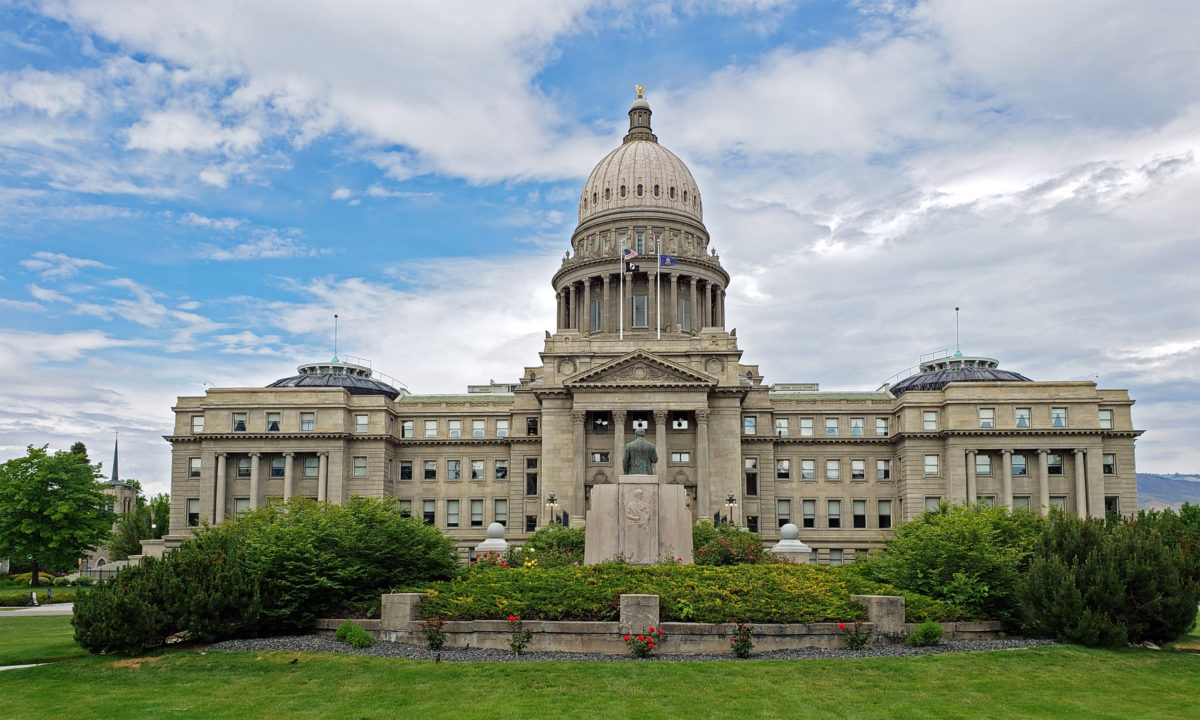
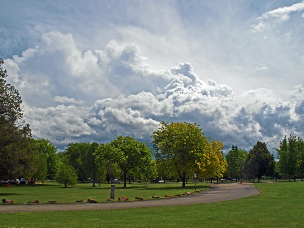 Boise is Idaho’s capital and largest city, with a metropolitan area population of around 750,000. It’s large enough to have many of the amenities of a big city, but small enough to still retain something of a small town feel. And it’s a surprisingly modern and cosmopolitan city, blending elements of both West Coast and Rocky Mountain cultures.
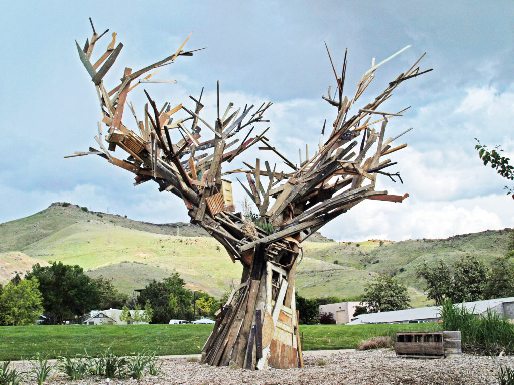

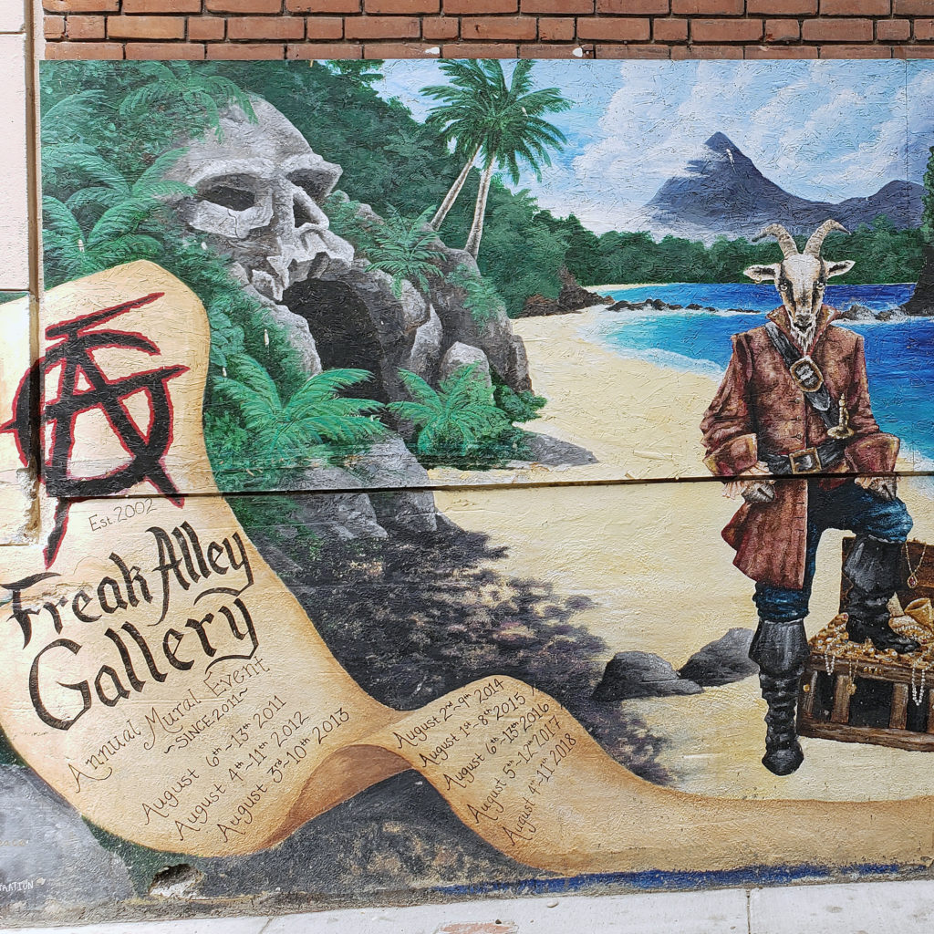
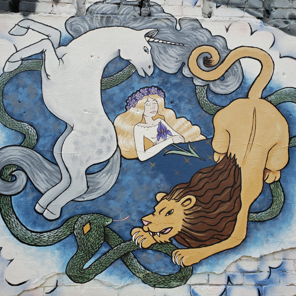
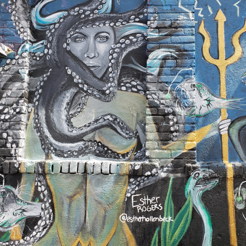
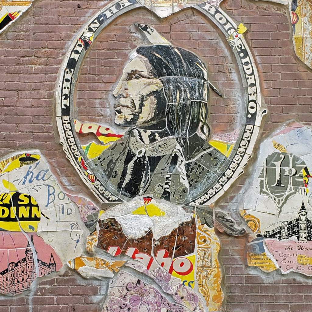
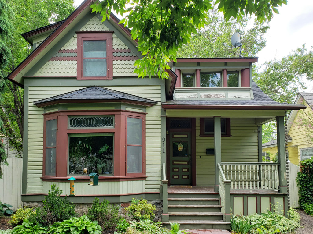
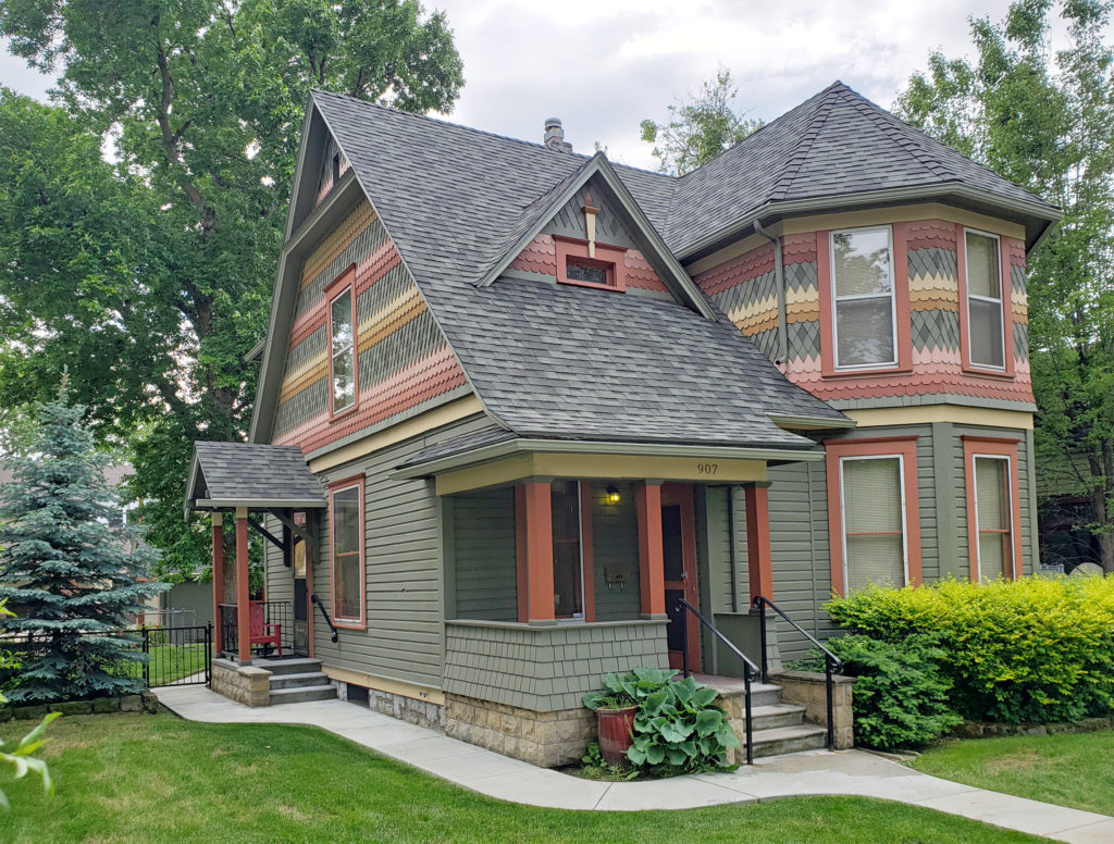 Many fine Victorian houses and architecturally interesting buildings can also be found in the downtown area.
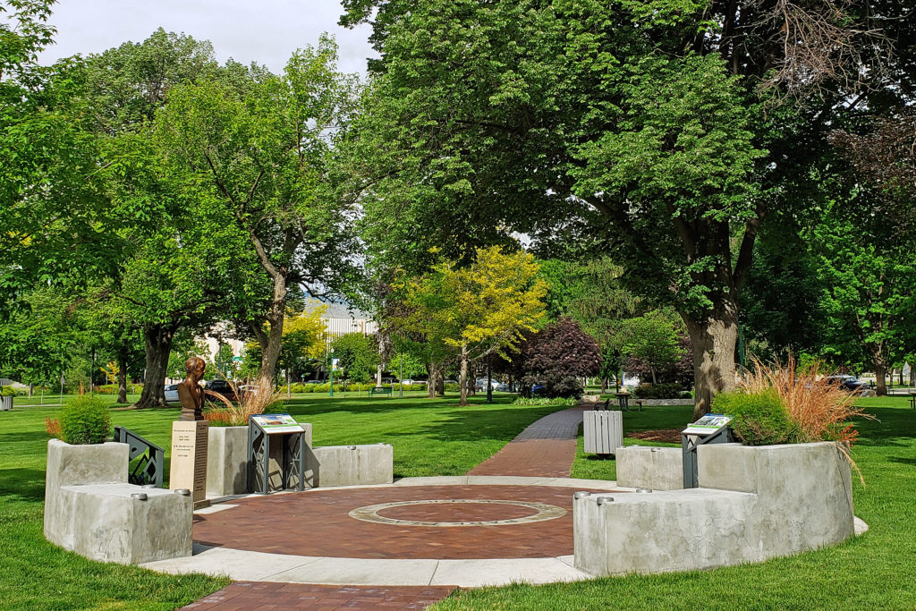
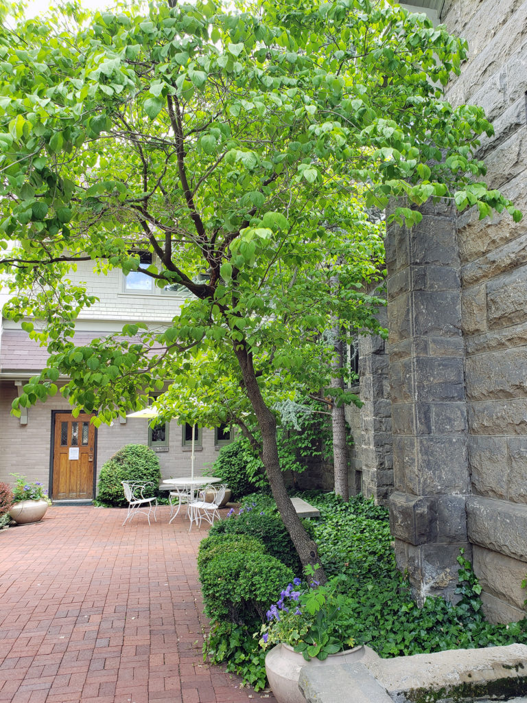
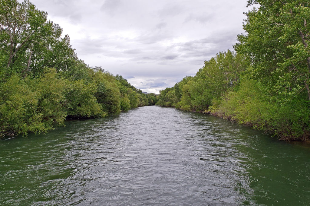
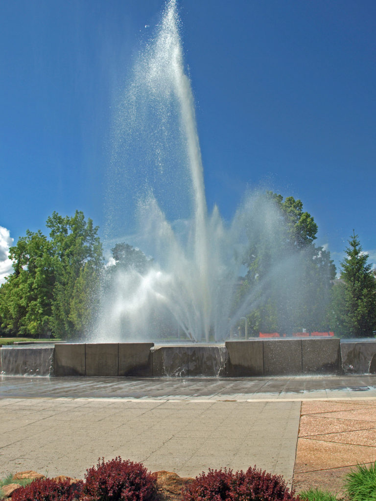 Anne Morrison Memorial Park on the south bank of the river, and the Julia Davis Park, just south of the downtown area on the north bank, are large urban parks with a variety of open spaces and tree lined paths along the river.
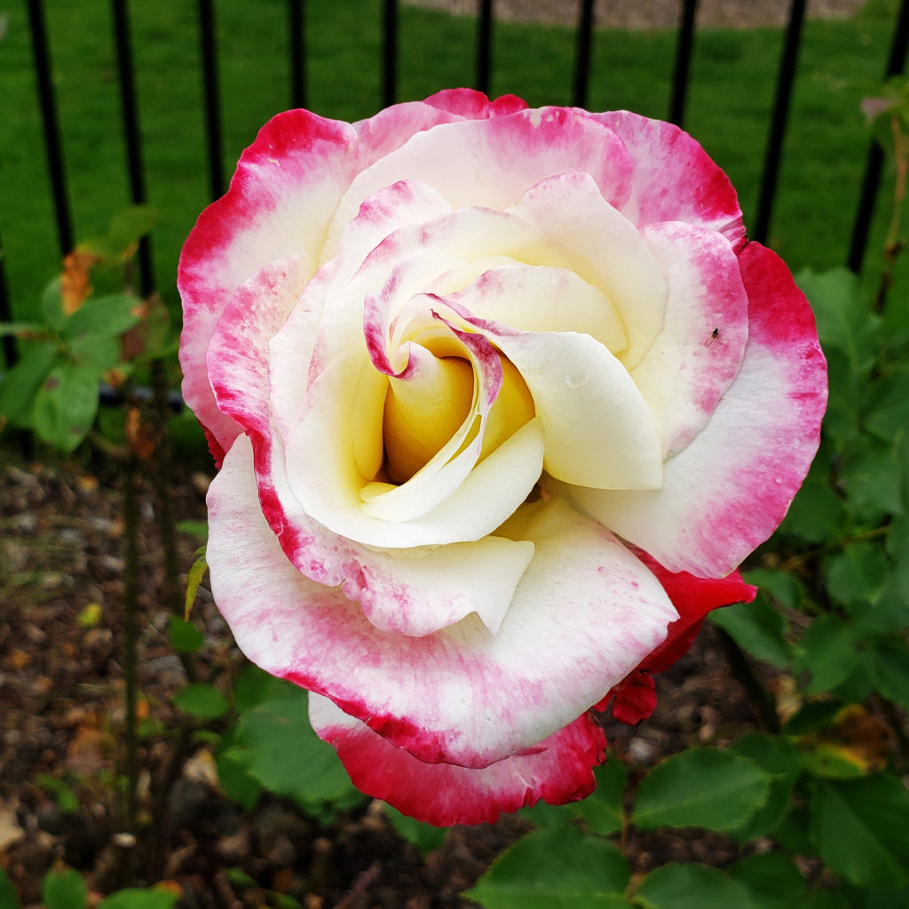
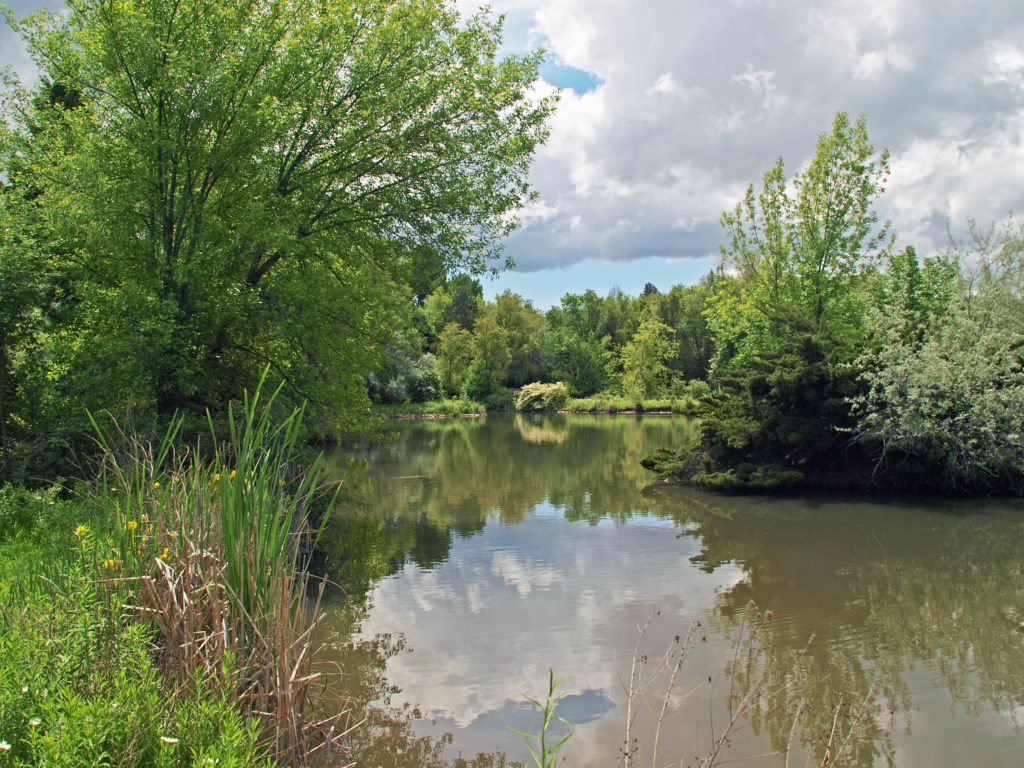
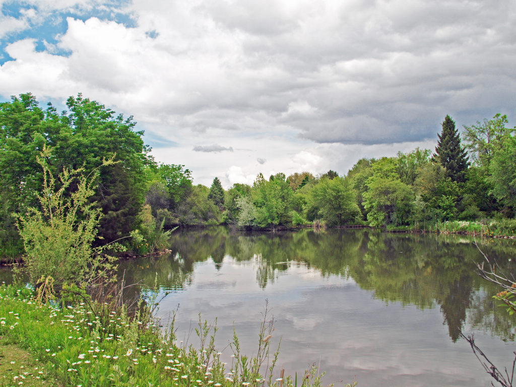
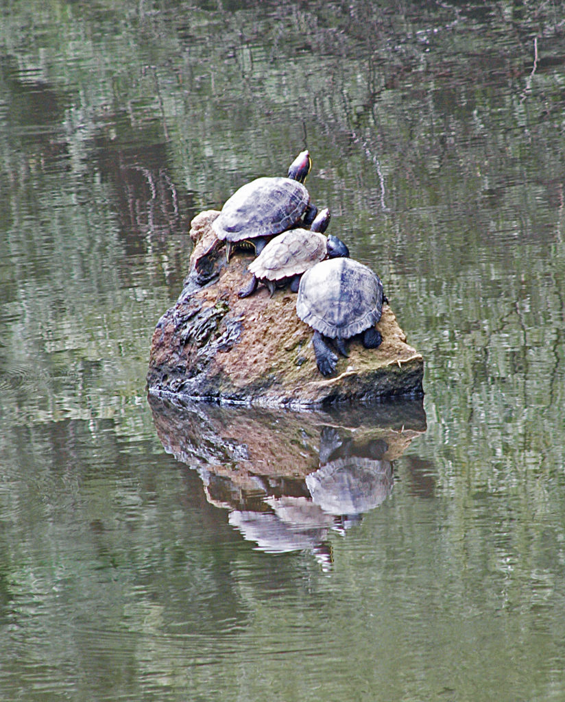
 Boise is definitely worth visiting, and southwest Idaho has many truly unique, beautiful, and enjoyable places to visit, all within a short drive of each other. For more on those, check out my other Exploring Southwest Idaho posts:
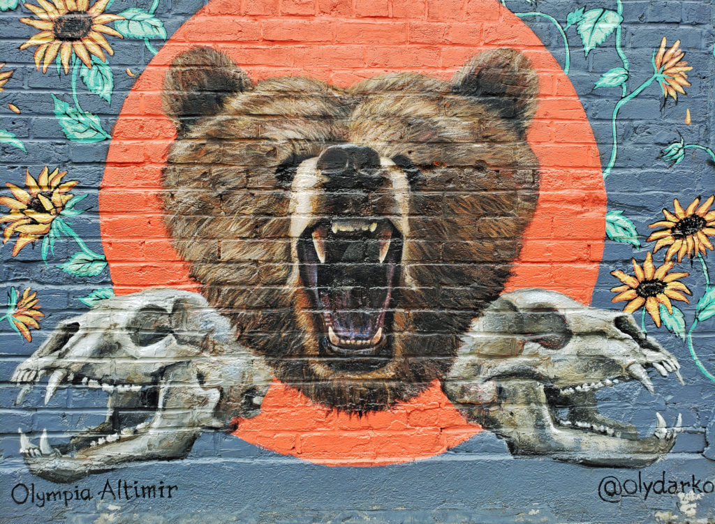
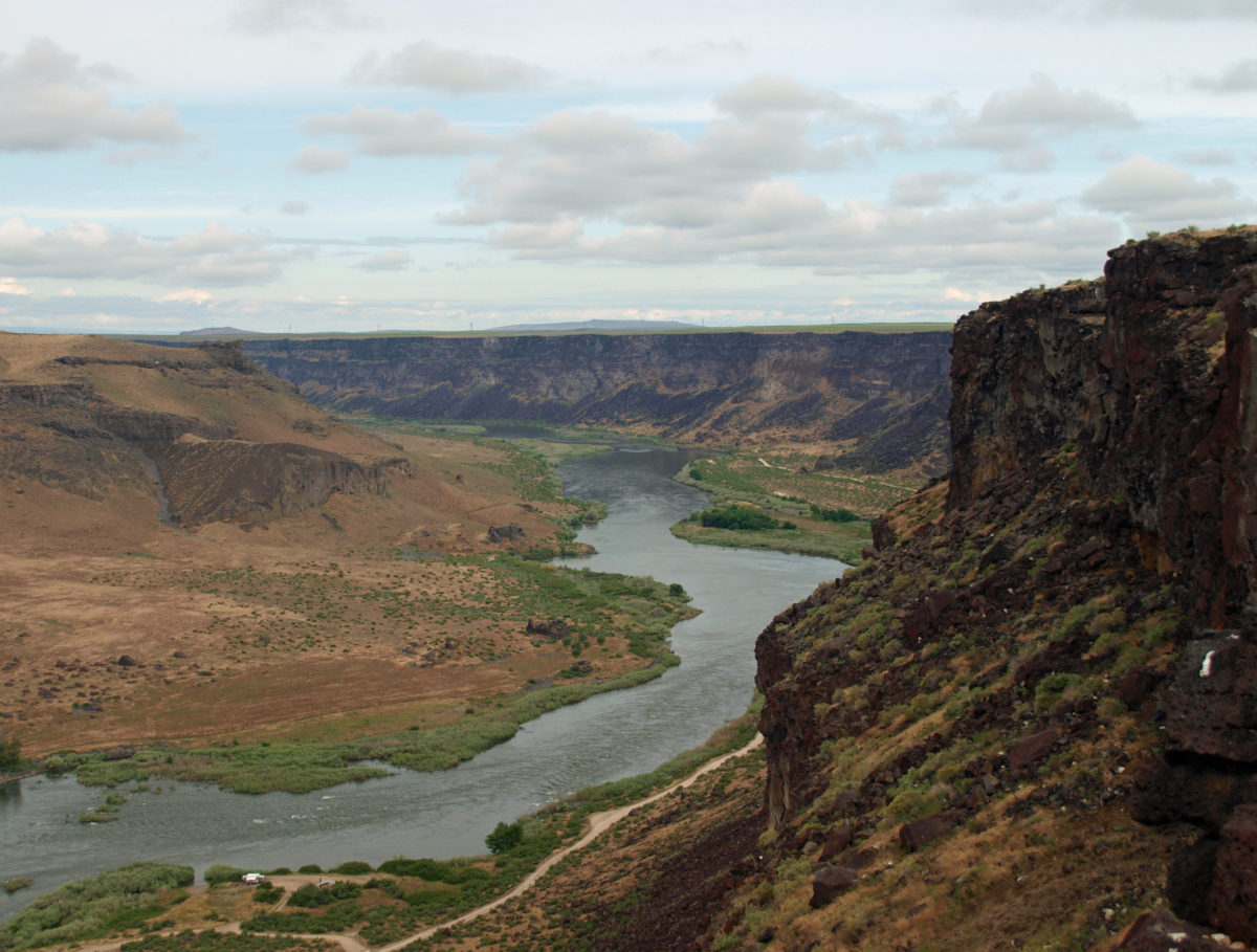
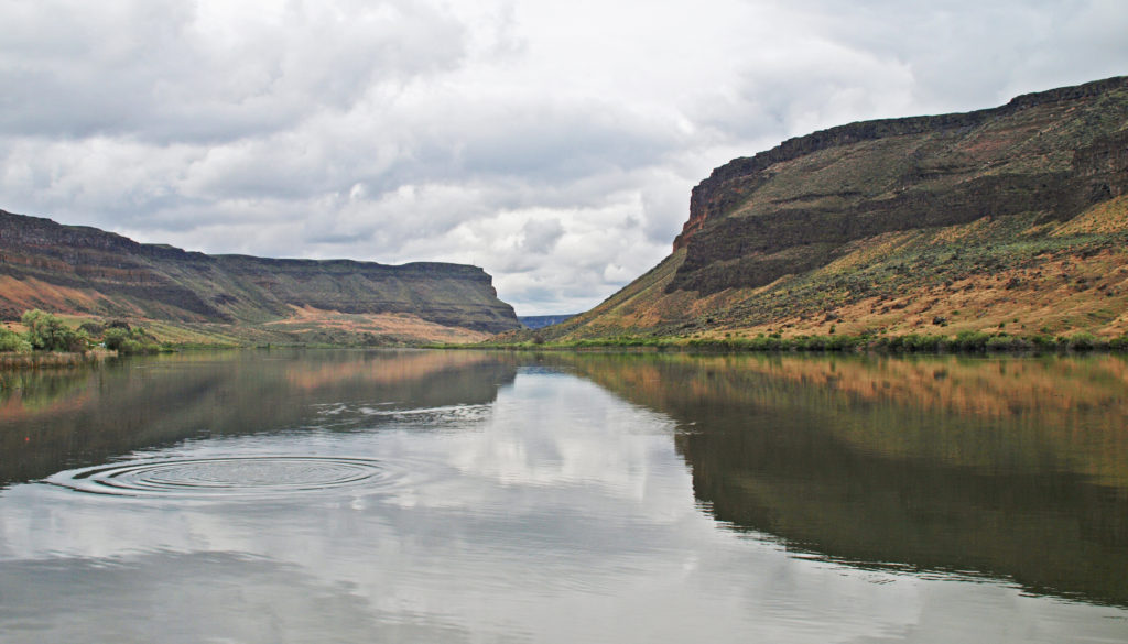
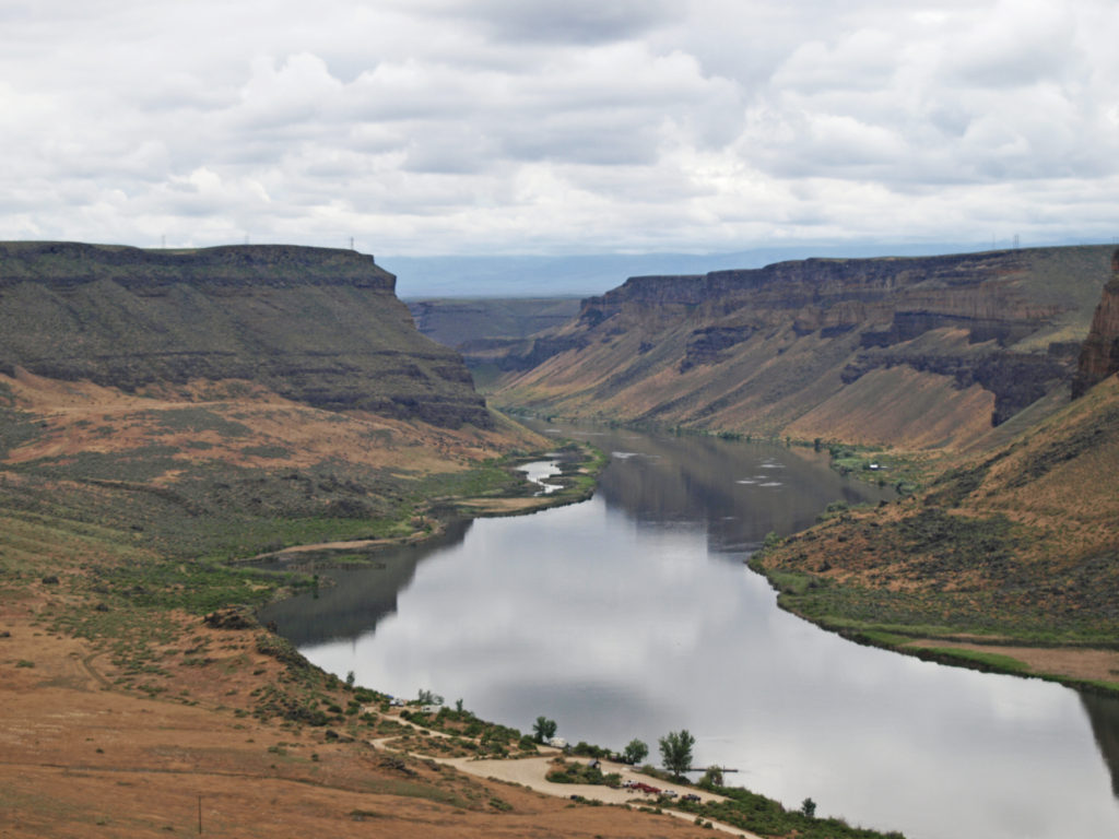
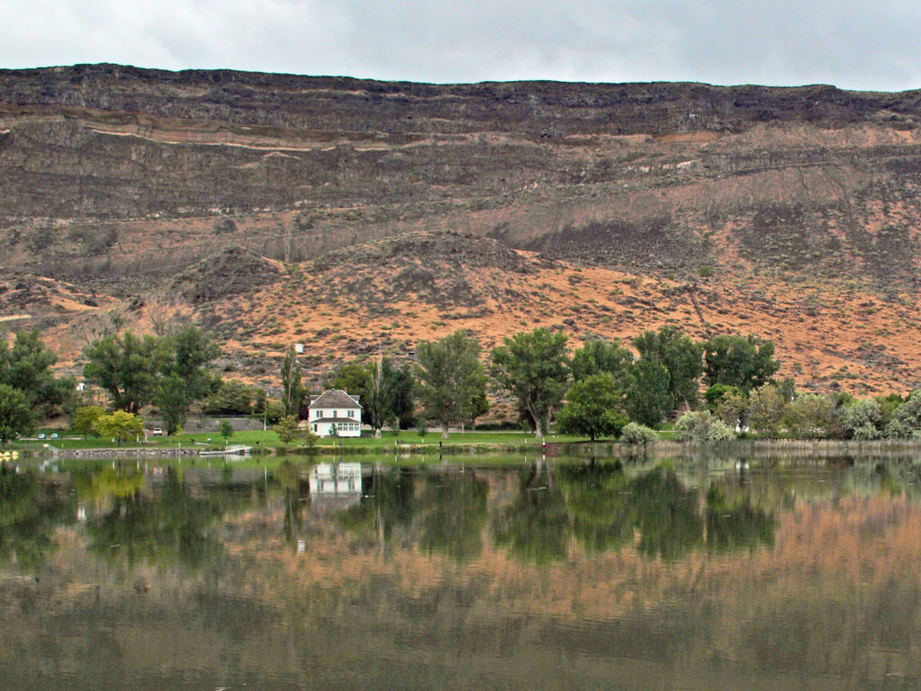 The falls are long gone, flooded by construction of Swan Falls Dam in the early 1900s. Swan Falls was the first hydroelectric project on the Snake River. A fish ladder was constructed, but was largely ineffective, and the dam effectively blocked salmon and steelhead passage. That was a different era, and the fish ladder was never made functional. Newer dams were built both upstream and downstream with no fish ladders at all. Electricity was the point. The fish didn’t matter. But it’s a historically interesting and beautiful area, so it’s worth a visit even if, like me, you’d rather see the dam gone.
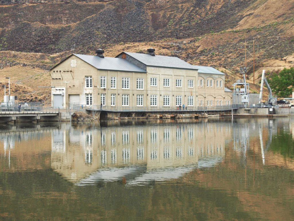
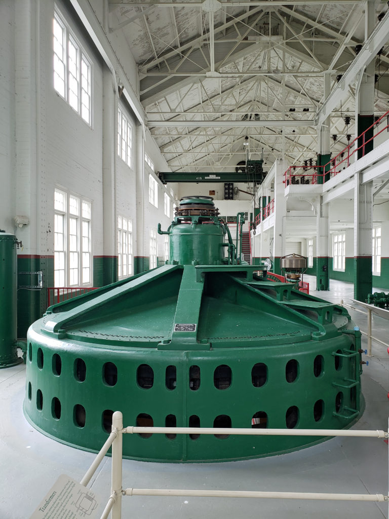 A new power generation facility was constructed at Swan Falls Dam in the 1990s. The dam’s original power plant is now open to the public, with some of the century-old generators and other equipment still in place. There are also displays depicting the history of the area, and the construction and operation of the dam. We walked across the dam after visiting the power house museum, then drove down the canyon a ways. The road was too rough for the car, though, and we turned around and drove back up to Dedication Point, and then on to Celebration Park.
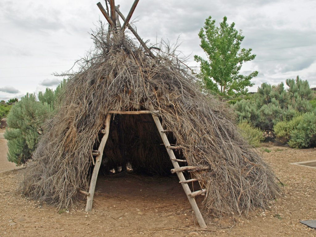 Celebration Park is Idaho’s only archaeological park. Petroglyphs dating back as far as 10,000 years can be found there. Visitors can learn about the Native American “lifeways” at the visitor center, try their hand at throwing a spear with an atlatl, and explore the petroglyph area on a self-guided walk. There is a picnic ground, and a small tent campground. The visitor center is open from 10:00 to 2:00 daily, except holidays. Check the park
 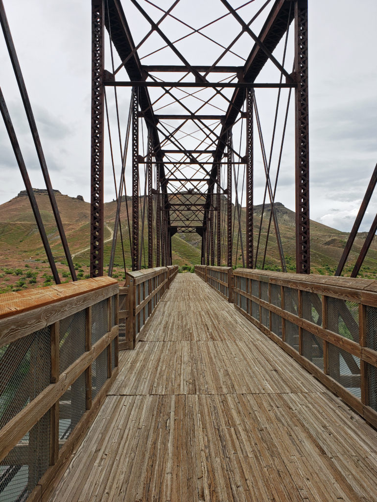 A short ways downstream, the Guffey Railroad Bridge provides pedestrian and equestrian access to the south bank of the Snake River and the Guffey Butte area. The bridge was built in the late 19th century and carried rail traffic until the 1940s. It is listed in the National Register of Historic Places. Guided tours of the area highlighting the area’s early mining and railroad history are conducted periodically.
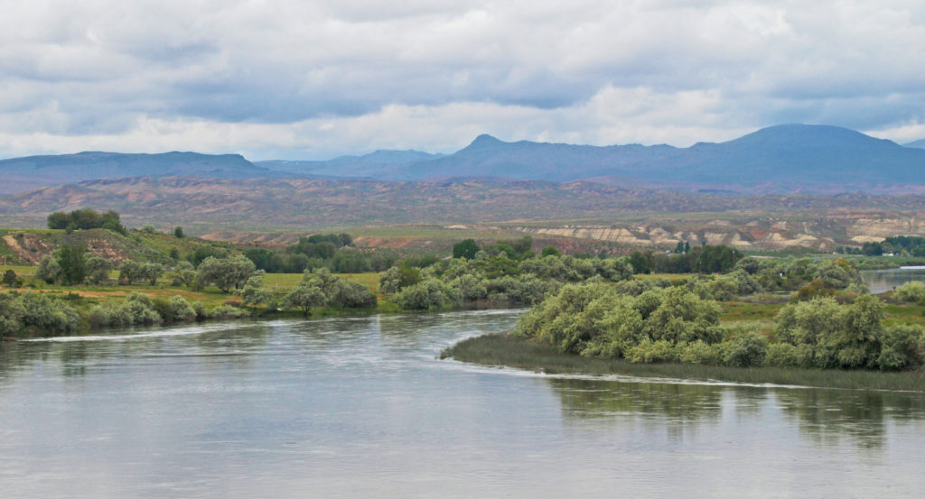
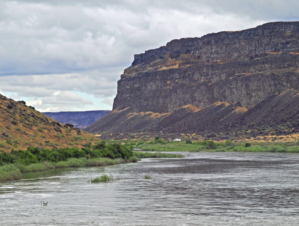
 Back in Boise, we toured the
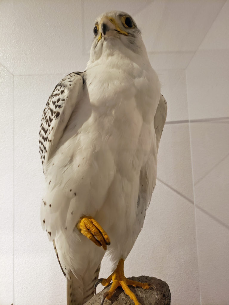
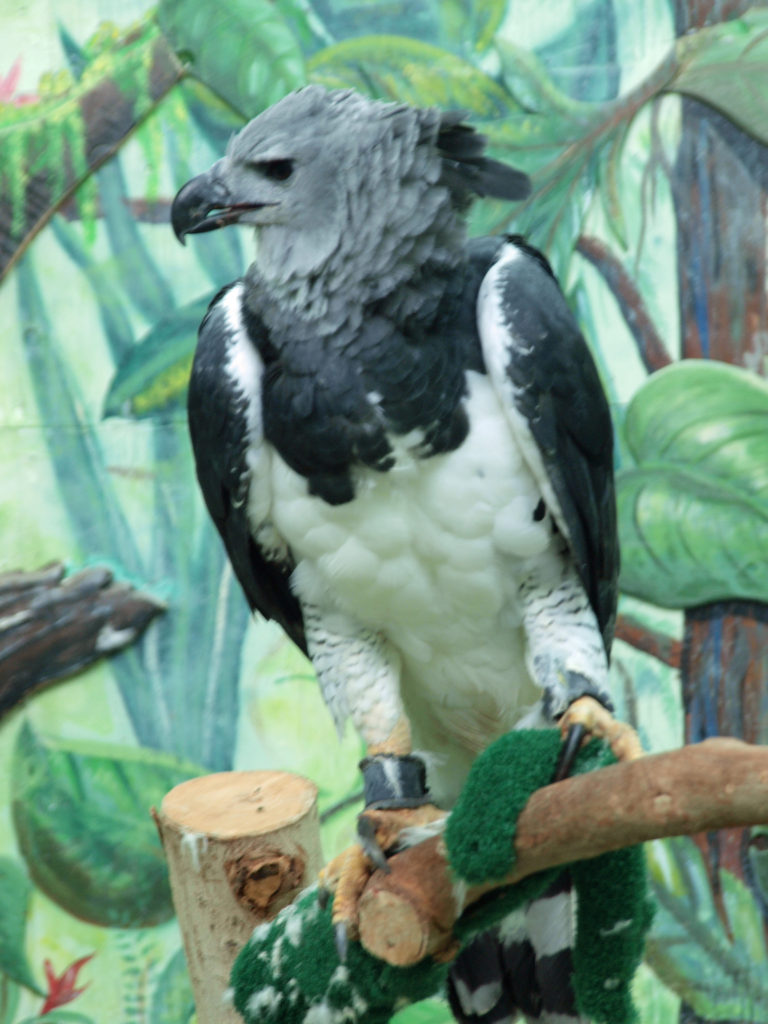
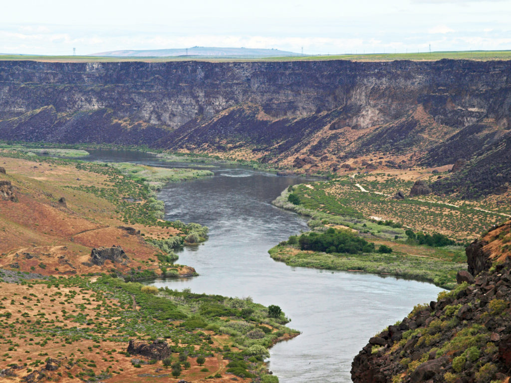
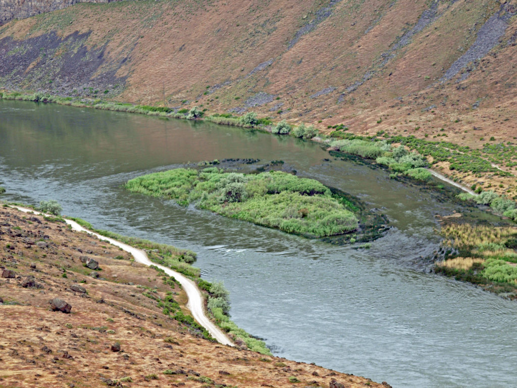
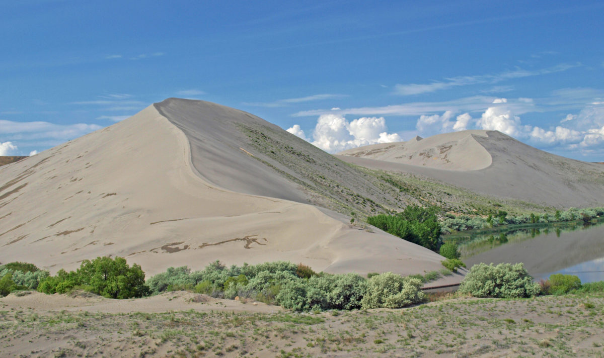
 After touring the Thousand Springs area at the beginning of an extended Memorial Day weekend trip to Southwest Idaho, my wife and I took a short side trip to
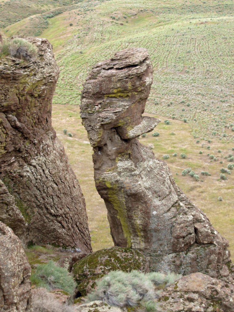
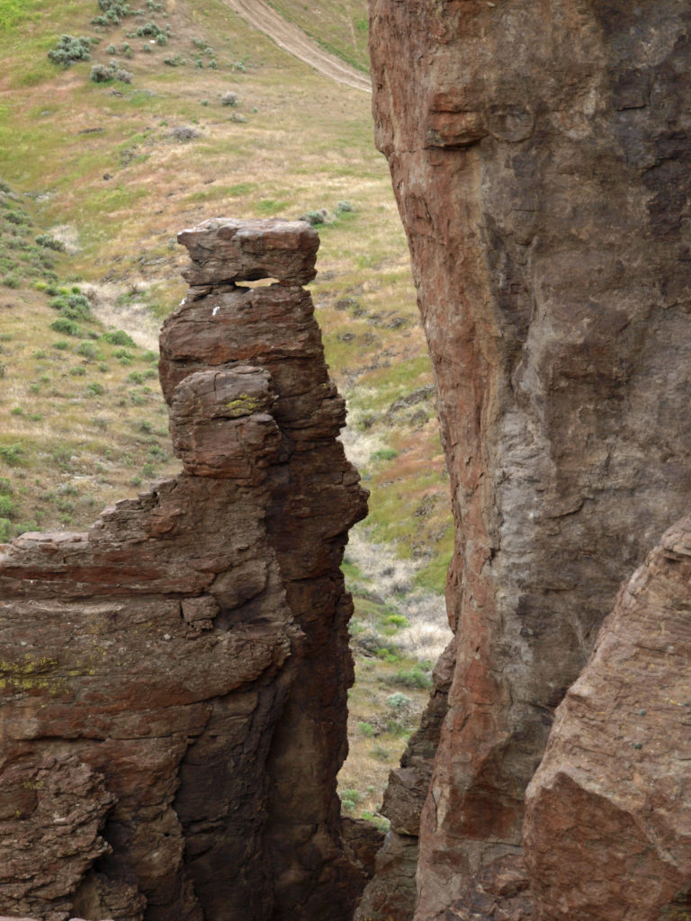 Balanced Rock is located about twenty miles west of Twin Falls and ten miles from Buhl, the nearest town. The area around Buhl is flat, featureless farm land that looks more like Kansas than the pictures I had seen of Balanced Rock, which had more the look of the Arizona or Utah deserts. But after a few miles, the road began to drop into a canyon and the view and landscape changed radically.
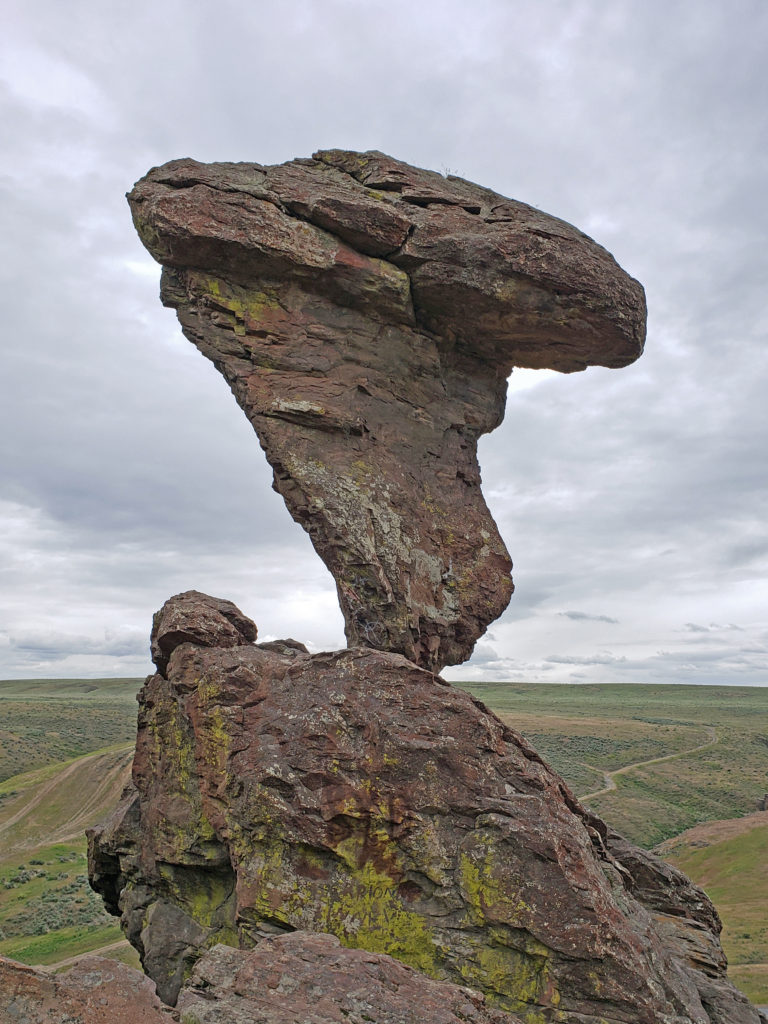 Balanced Rock is nearly fifty feet tall, weighs forty tons, and is supported precariously by a stem of rock less than three feet in diameter. It is, to say the least, a striking sight. We climbed up to the rock and hiked along the hillside above the rock formations (there’s quite a lot more than just Balanced Rock). It’s not a large area, and the trail is short and not difficult. It’s easy to explore in an hour or so, and I found it definitely worth the time and effort. But you can still get a good view of Balanced Rock and the other rock formations from the parking area if you don’t want to, or are unable to, climb up to them.
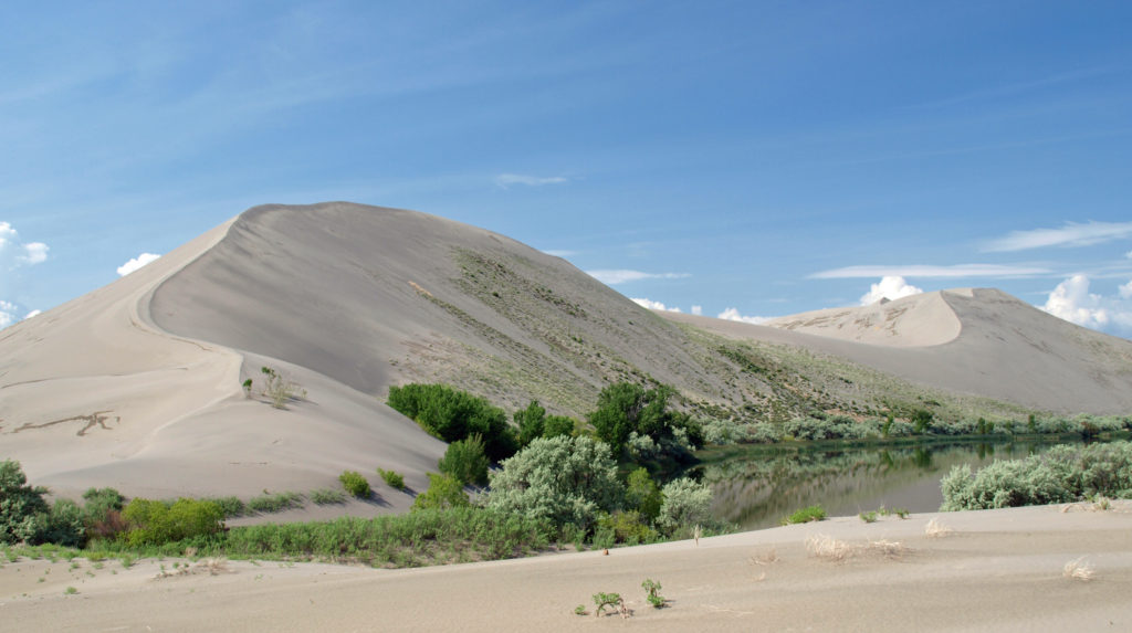 Bruneau Dunes
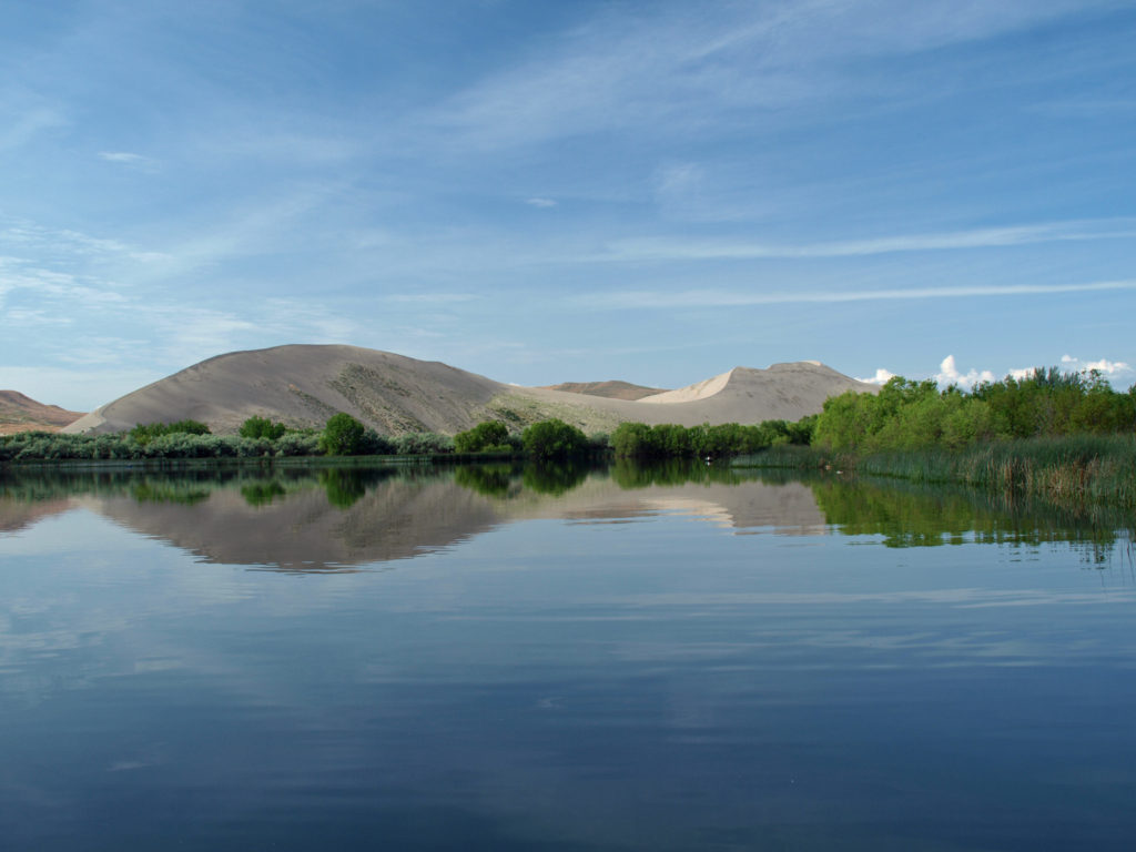 The dunes are impressive and certainly the main attraction here, but the park also has two small lakes, marshes and wetland areas, and open desert areas to explore. The marshes and lakes are full of waterfowl, and coyotes, jackrabbits, lizards, and gopher snakes can be found in the drier areas of the park. In the spring, desert wildflowers are abundant.
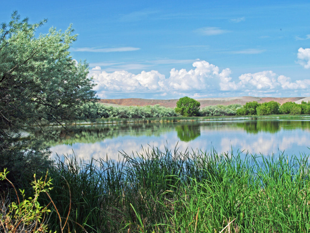 For hikers, there’s a six mile loop trail that takes you over the top of the dunes. There is also an equestrian camp and a ten mile long horse trail, two campgrounds, a picnic area, and a visitor center. We didn’t do the six mile hike, but did climb the Small Dune, hiked around the smaller lake, checked out the picnic area on the Big Lake, and, of course, spent a lot of time photographing the area.
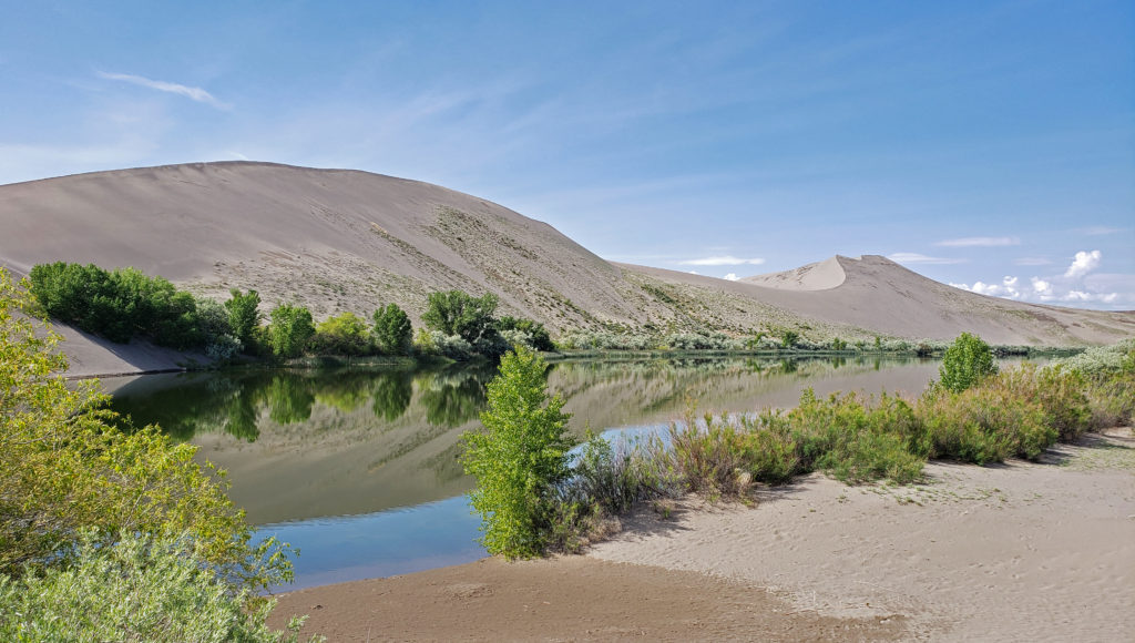 Bruneau Dunes is also an outstanding “dark skies” area, and the Boise Astronomical Society has constructed an observatory at the park. On weekends, visitors can view the depths of space through the observatory’s 25 inch telescope.
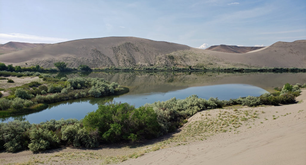 The weather was better than it was for our Thousand Springs and Balanced Rock visits on the previous day, and the sunshine made for some good photo ops. But it got a little warm on the dunes after awhile, and there were swarms of mosquitoes by the water where it was cooler. Still, it was a nice morning’s outing. The dunes and the small lakes between them are incredibly beautiful, and climbing the dunes was a fun adventure.
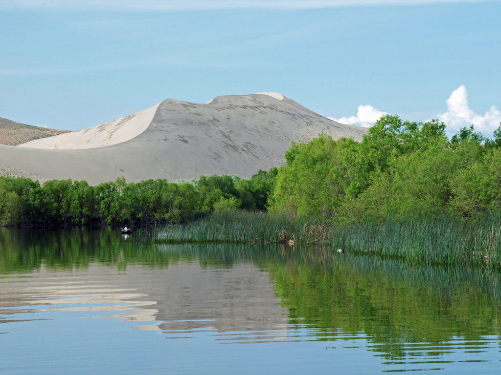 Bruneau Dunes definitely exceeded my expectations. The dunes are huge, much bigger than I expected, and the area around them is interesting and very beautiful. The park is small enough that it can be explored in half a day, which is what we did, but there’s enough there to keep you occupied for a few days, at least. It’s also a place where you can slow down, relax, and spend some time just enjoying the views and the peace and quiet, which won’t be marred by the presence of dune buggies and trail bikes. They’re prohibited in the park to protect the dunes.
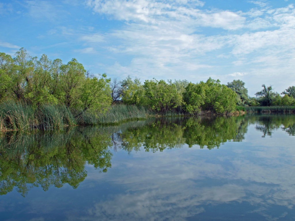 We returned to Boise that afternoon and spent some time exploring the downtown area and the parks and paths along the Boise River Greenway. The next day it was on to the Snake River Canyon, the Birds of Prey National Conservation Area, and the World Center for Birds of Prey. Click on the links below to view other posts from our trip.
 Originally posted June 20, 2019. Most recently updated April 2, 2025.
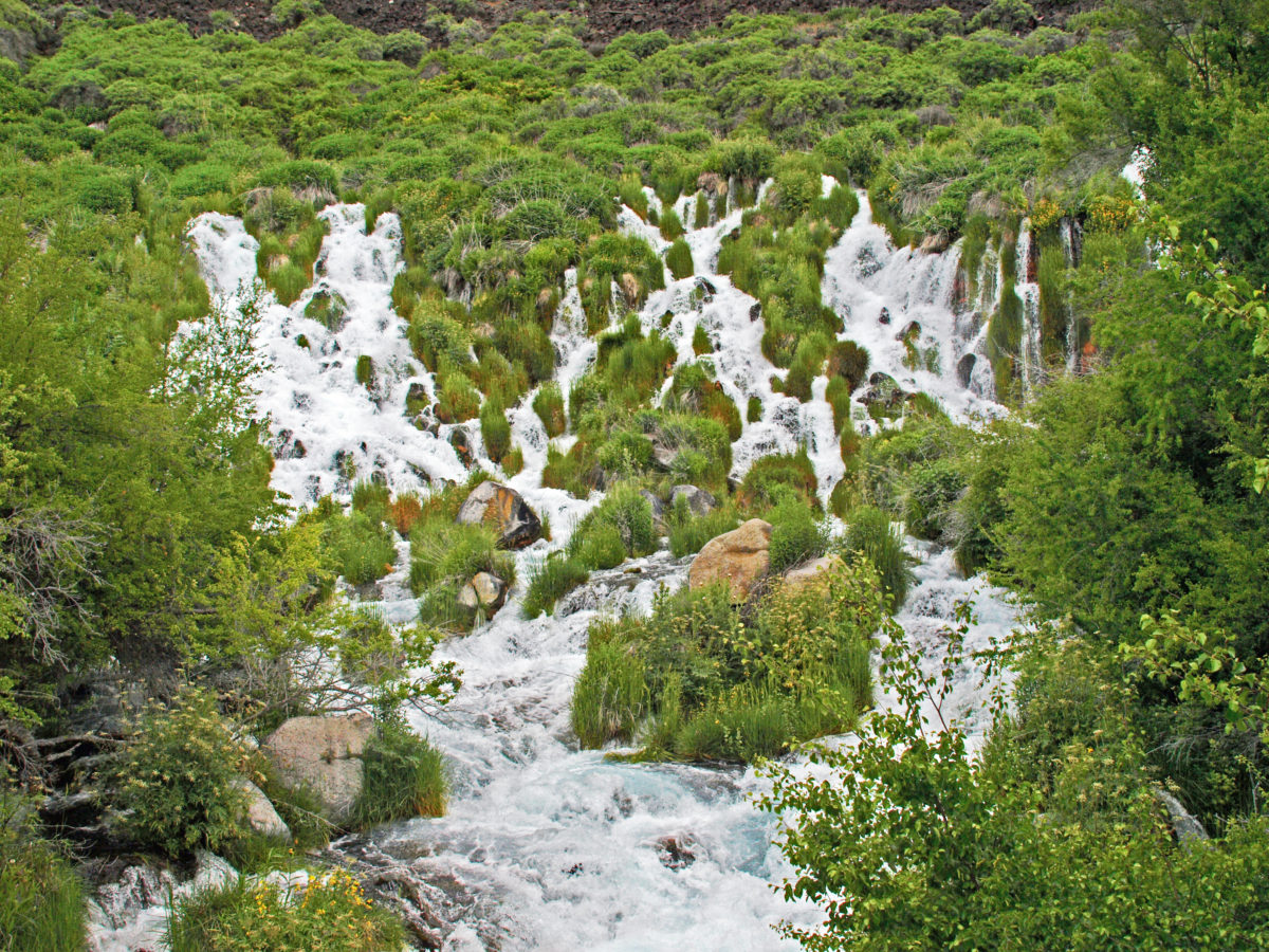
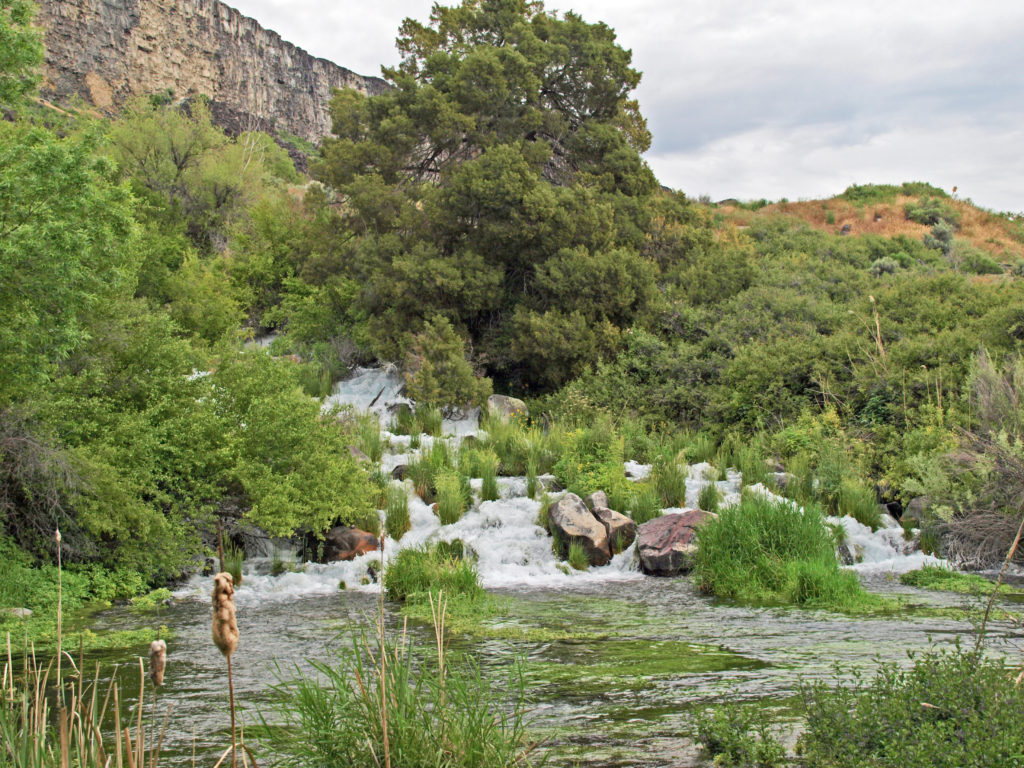

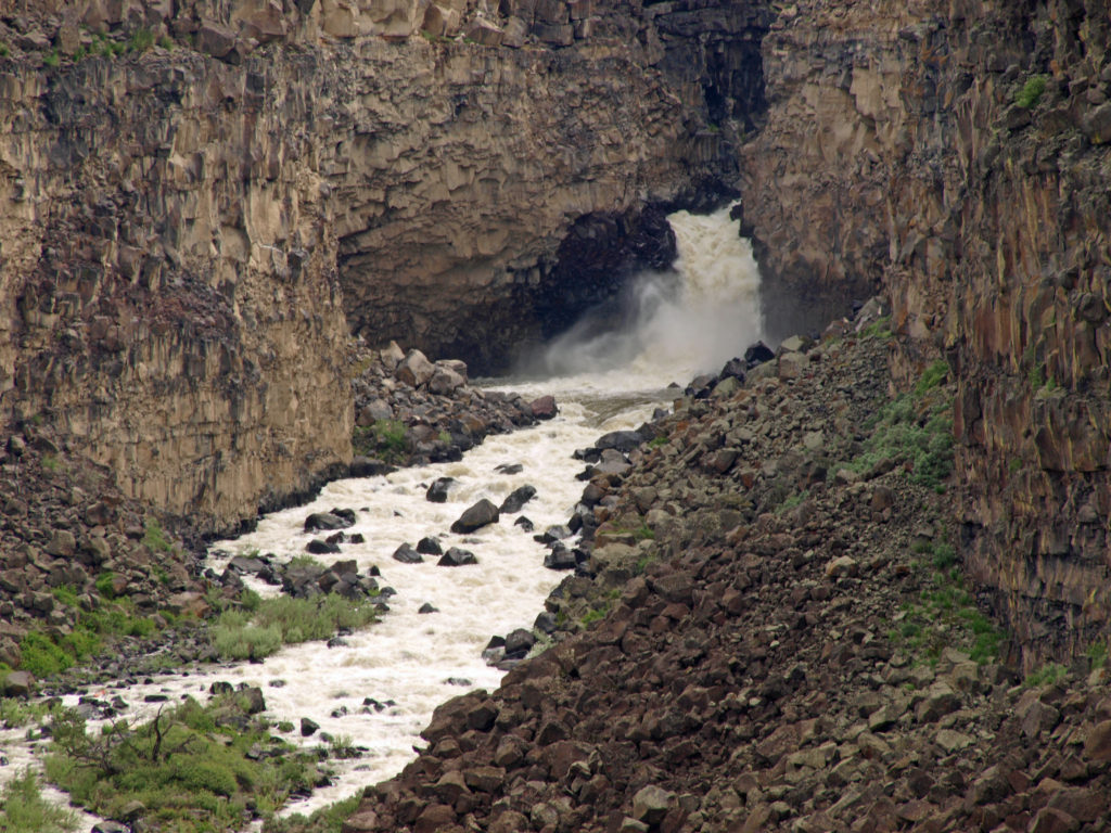
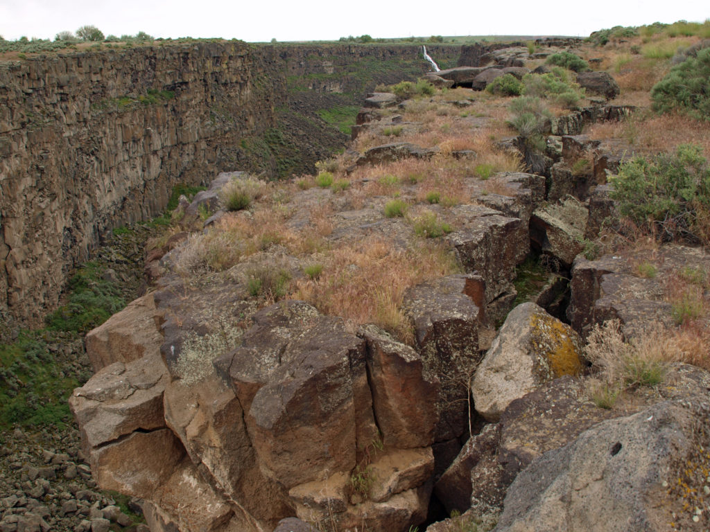

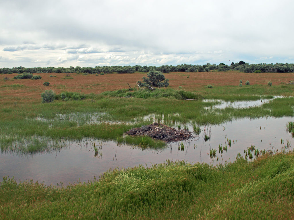
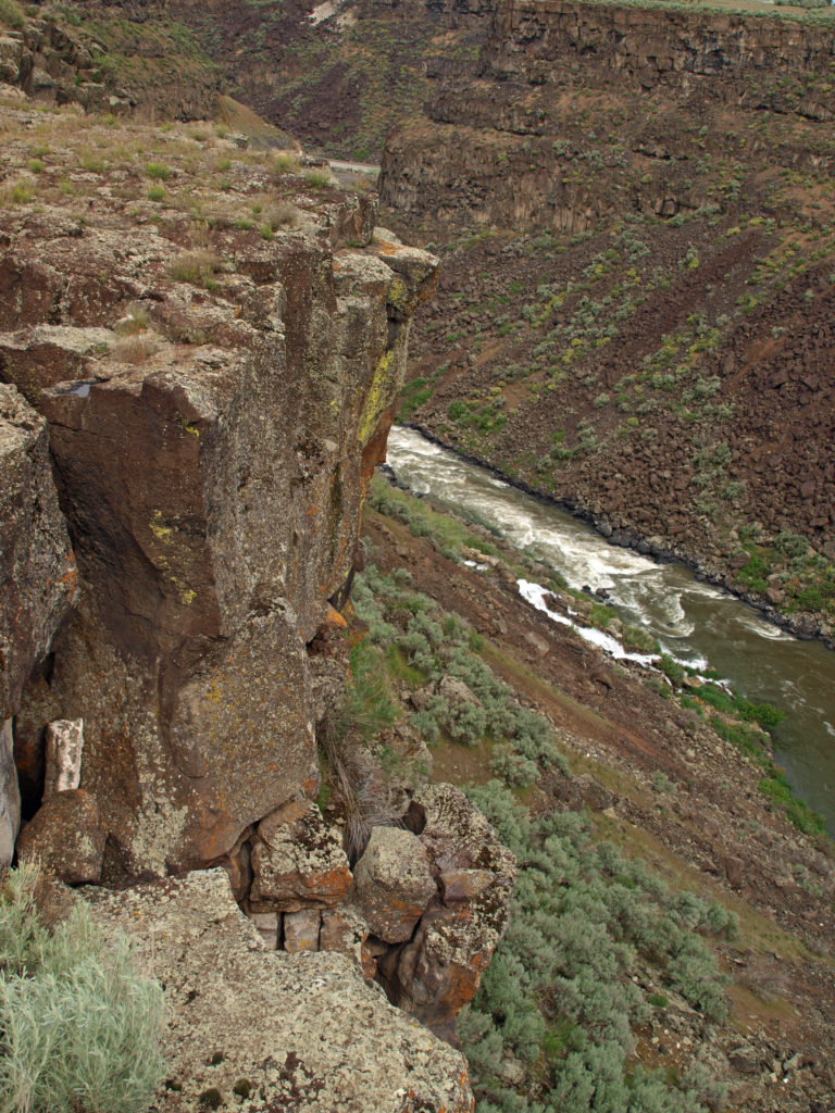
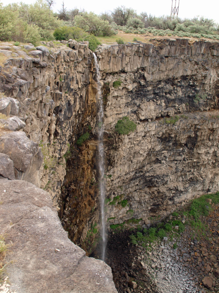

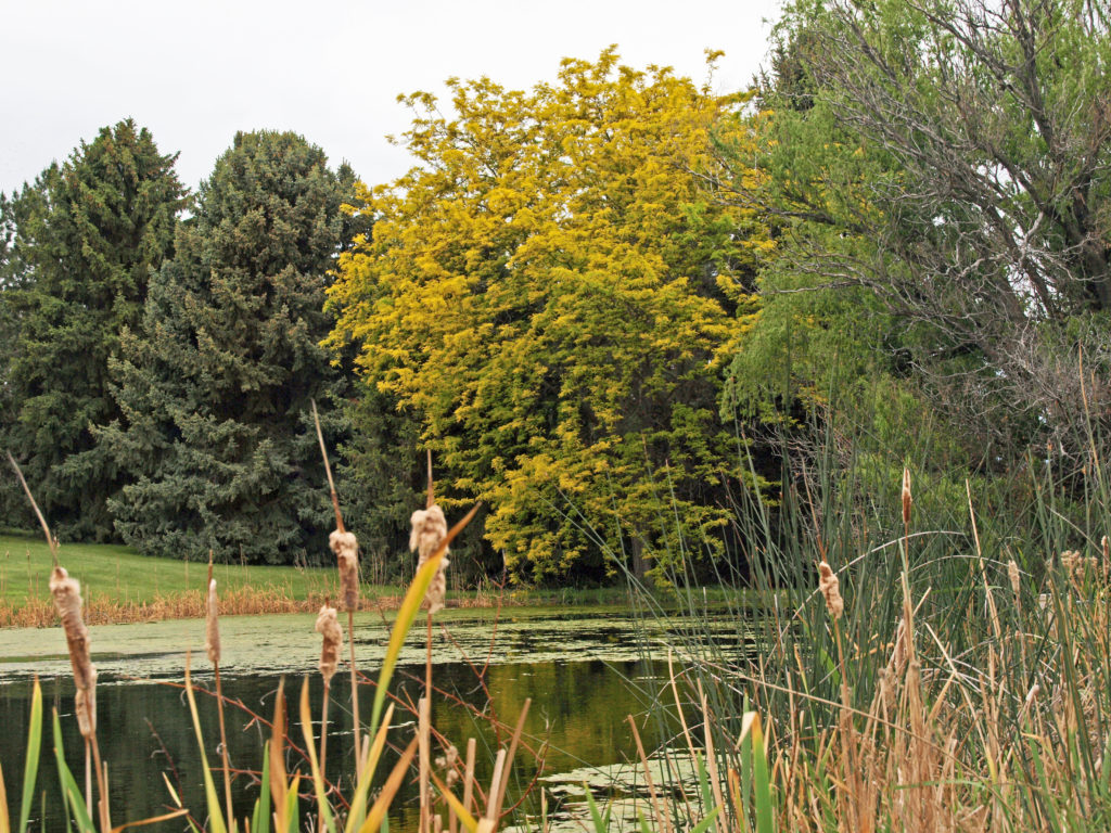
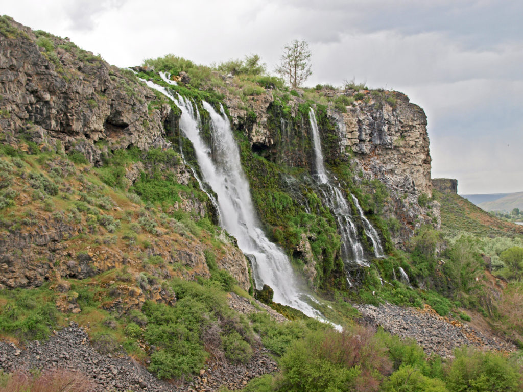

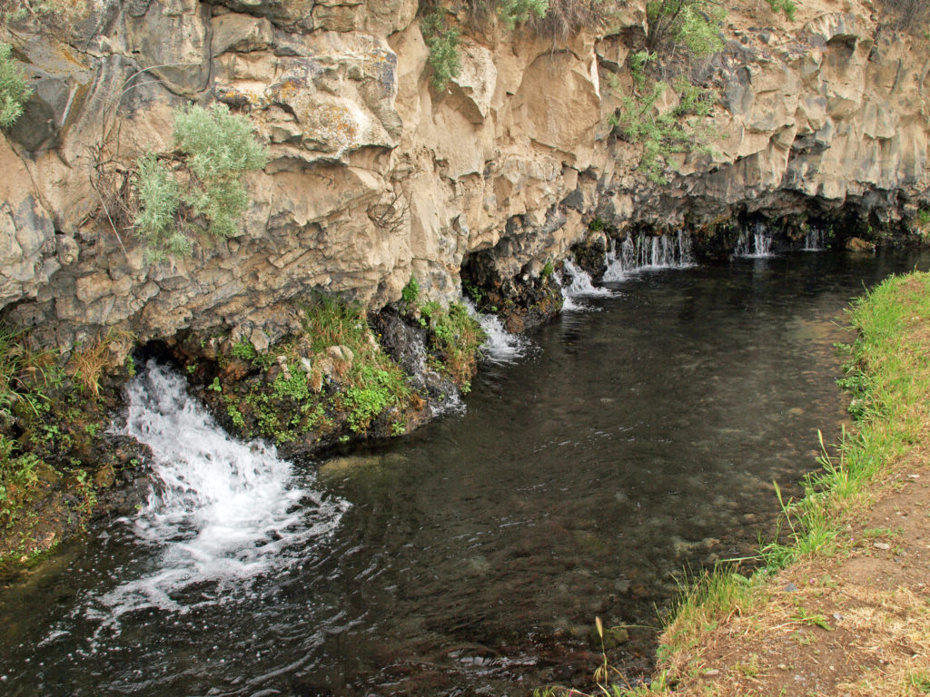
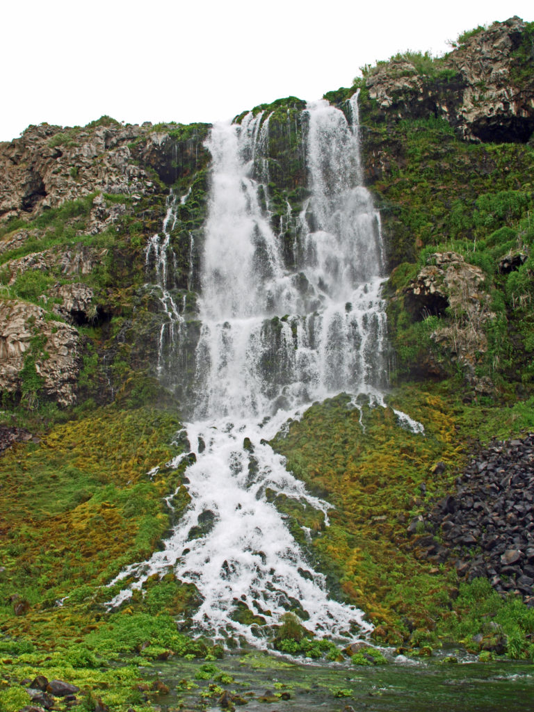


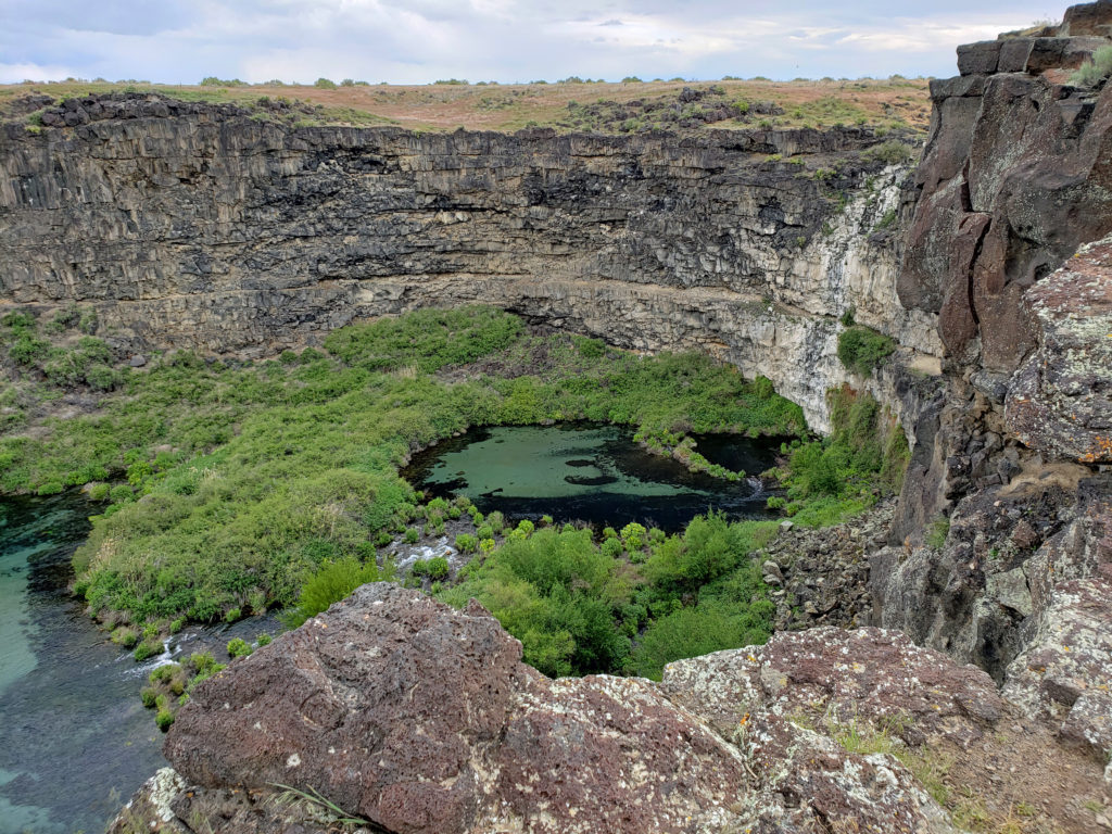
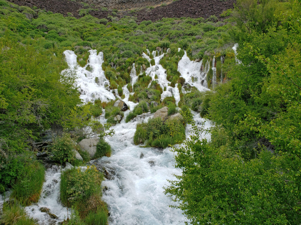
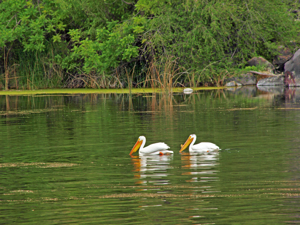

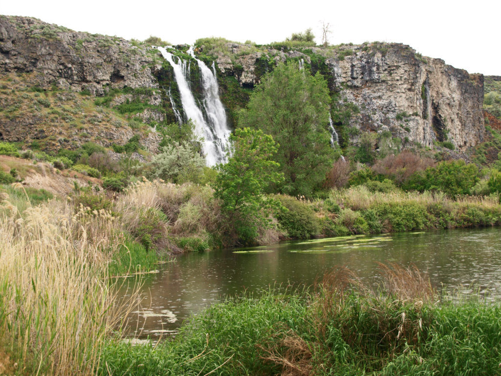
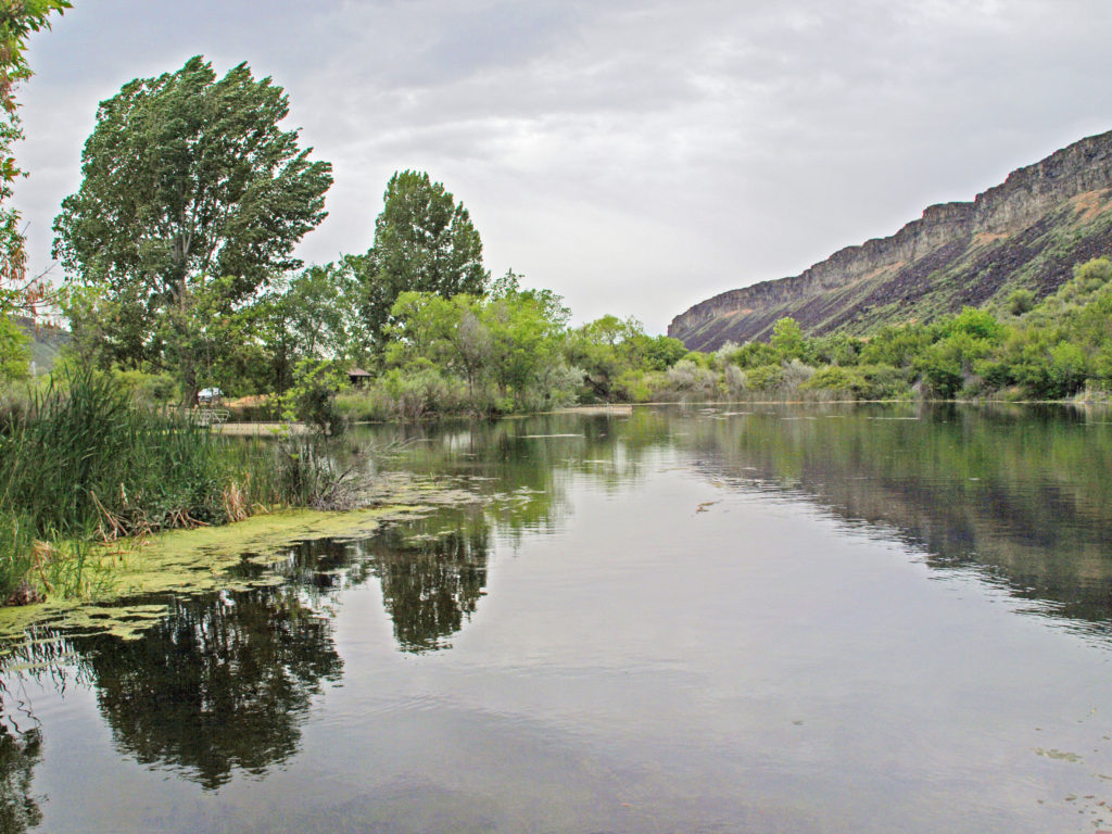
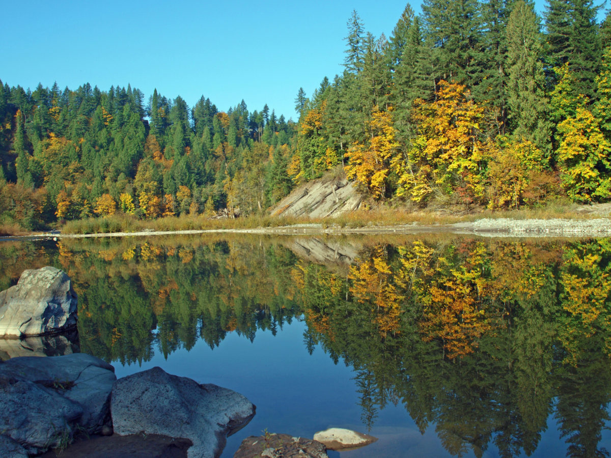

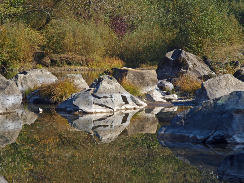
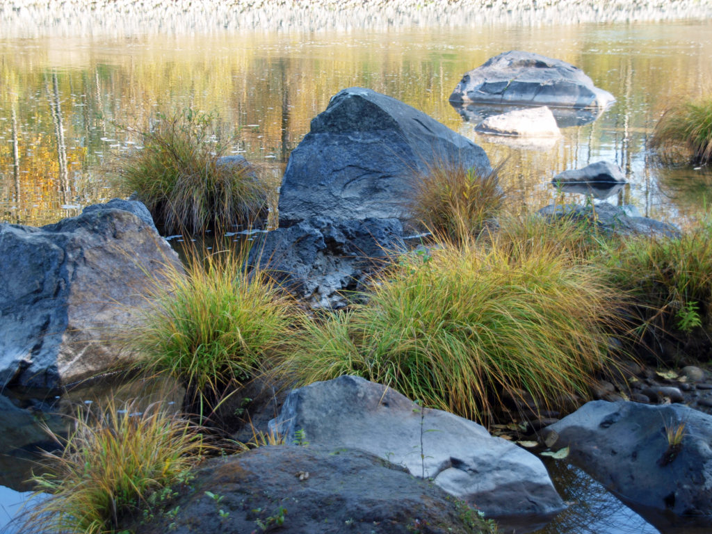
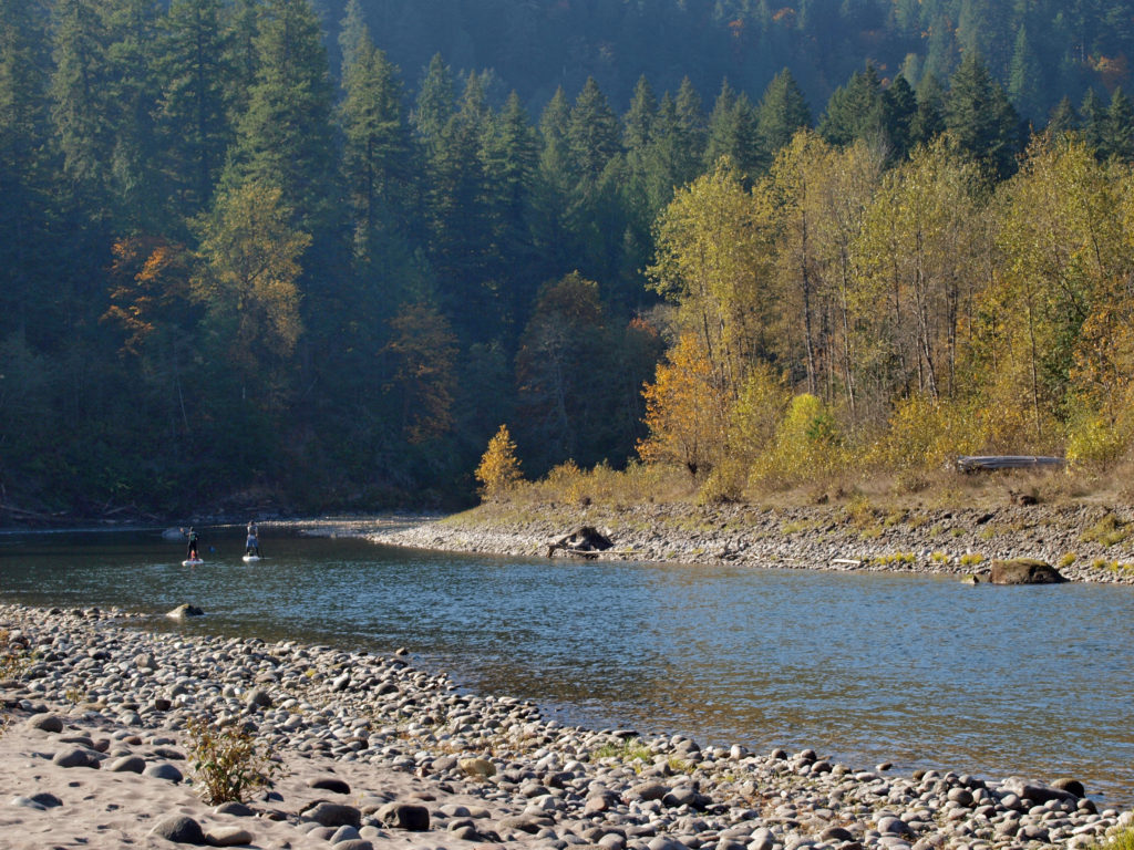 The park can be very crowded on summer weekends, but gets much less use after Labor Day. Even on a sunny October day there were just a few people fishing from the river bank and some out for a hike or just enjoying the sunshine. This section of the river is popular with kayakers and rafters in the summer, but we didn’t see anyone on the river other than one family that floated by on stand up paddle boards.
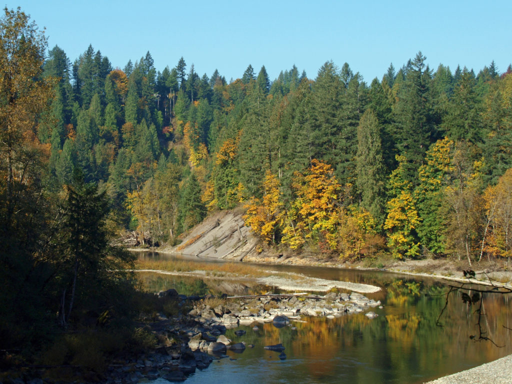 The Sandy River flows from its headwaters on Mount Hood to the Columbia River at Troutdale. Two sections of the river totaling 25 miles are designated Wild and Scenic, including the section of the river that runs through Oxbow Park.
 In 2007 the Marmot Dam on the Sandy River was demolished, making the river free flowing for its entire 57 mile course for the first time in nearly a century, and opening up miles of restored spawning grounds for salmon and steelhead. A smaller dam on the Little Sandy River was also demolished.
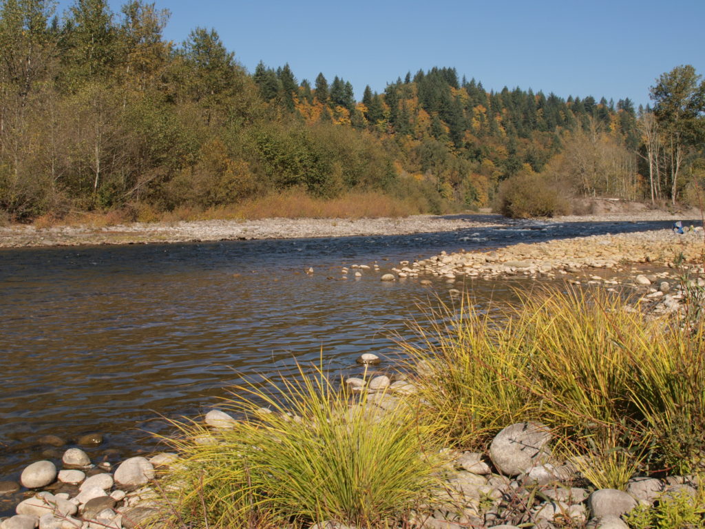 One of the more popular events at Oxbow is the annual
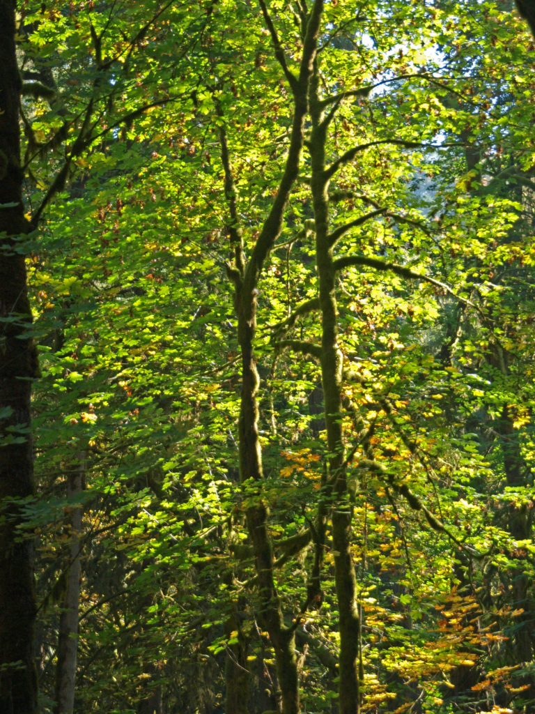
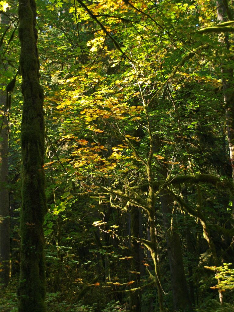 Most of the visitor activity at the park takes place along the banks of the river. The upland trails through the mixed conifer and hardwood forest get much less use. But the forest is beautiful, quiet, and peaceful. If you’re looking for tranquility, head away from the river. On our visit when these photos were taken, we hiked some of the forest trails and saw almost no one.
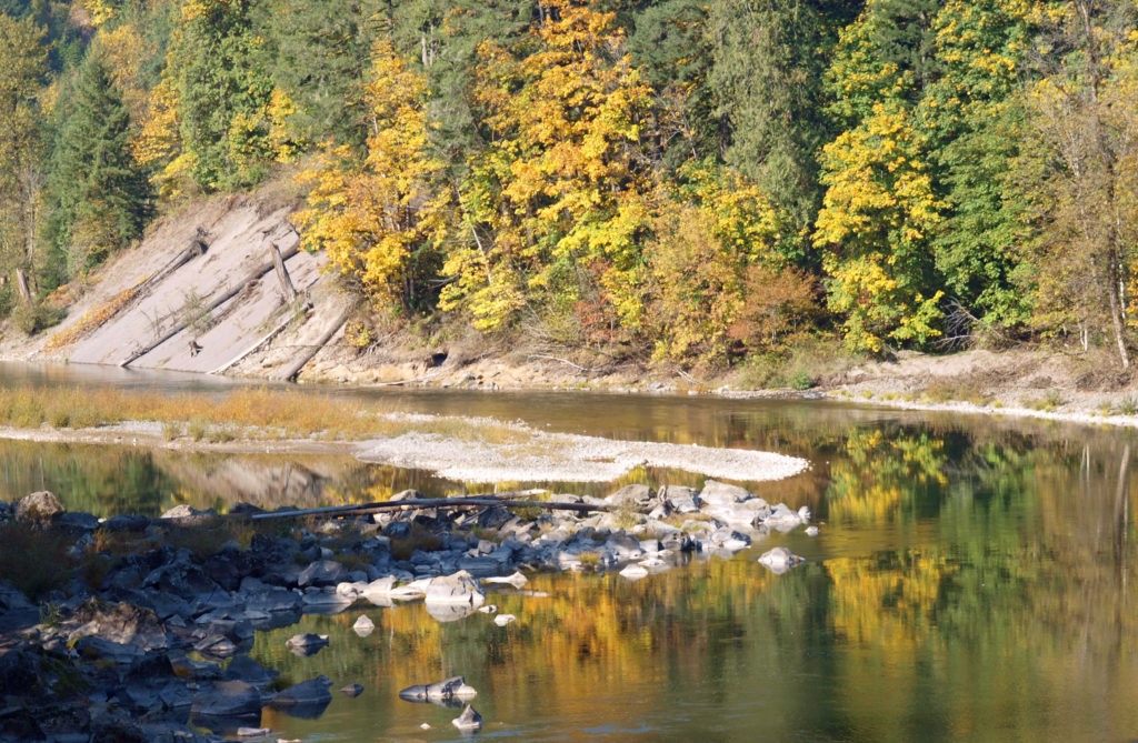 To get to the park, take I-84 east from Portland to Exit 17 at Troutdale. Turn right onto Graham Road, then left onto the Historic Columbia River Highway. In two blocks, turn right onto Buxton Road. Follow Buxton (which becomes South Troutdale Road) to Division Street. Turn left on Division and follow the signs to the park.
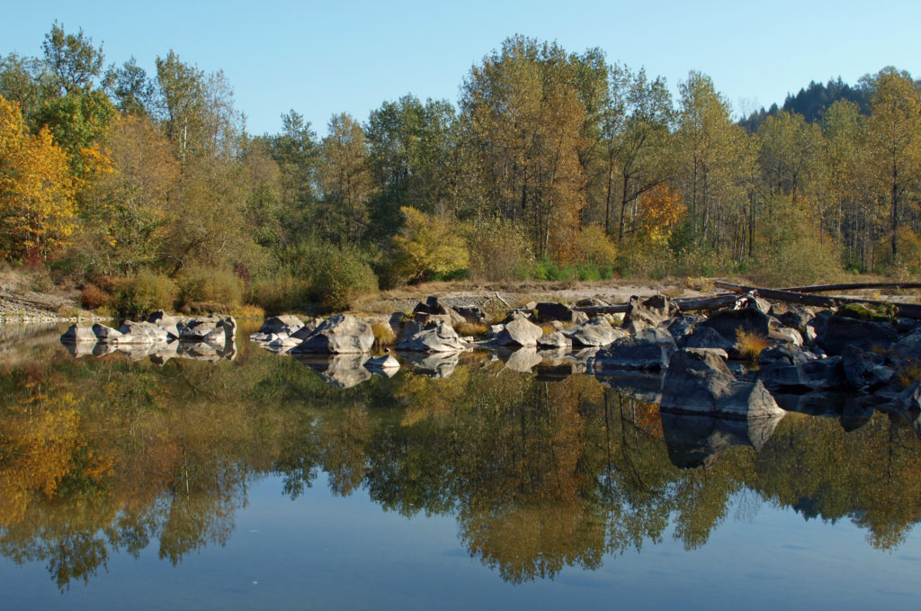 One of the great things about the Pacific Northwest is that there are so many beautiful places like this that are within a half hour drive of even the biggest cities. Just one of the reasons that I think this is one of the best places in the world to live.
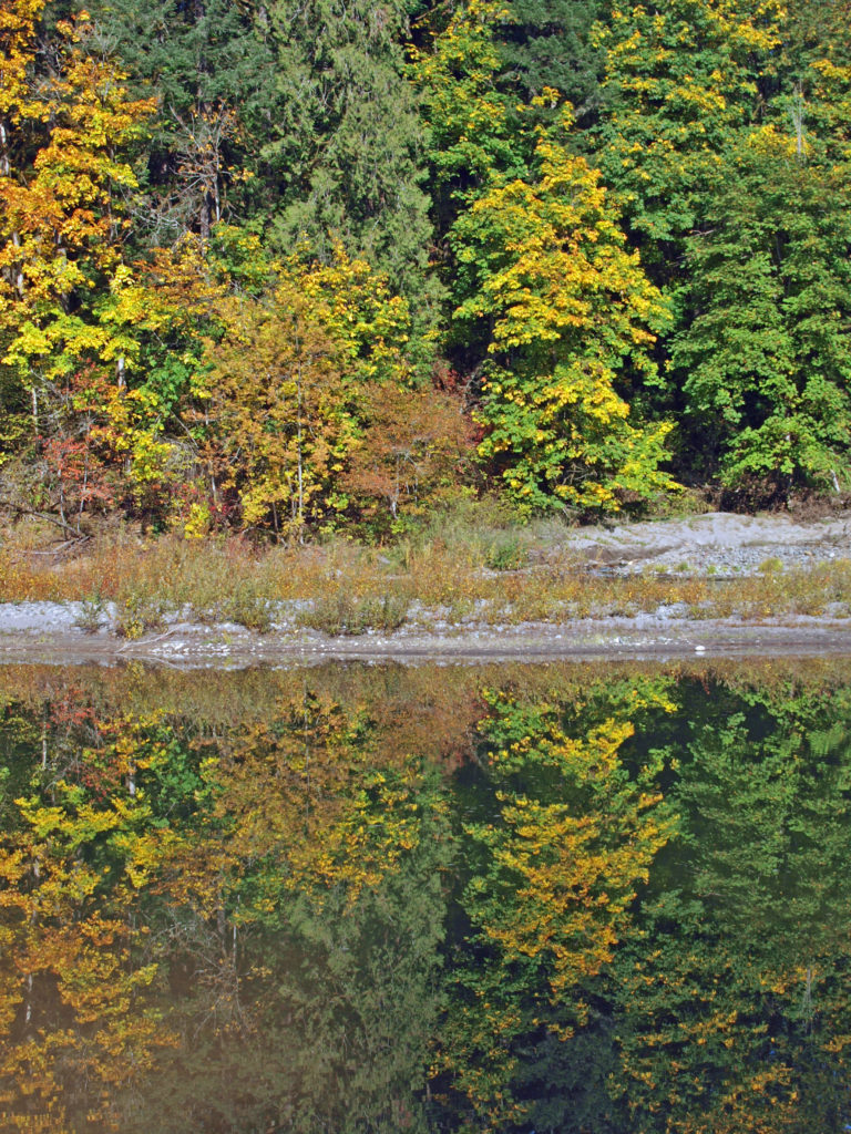
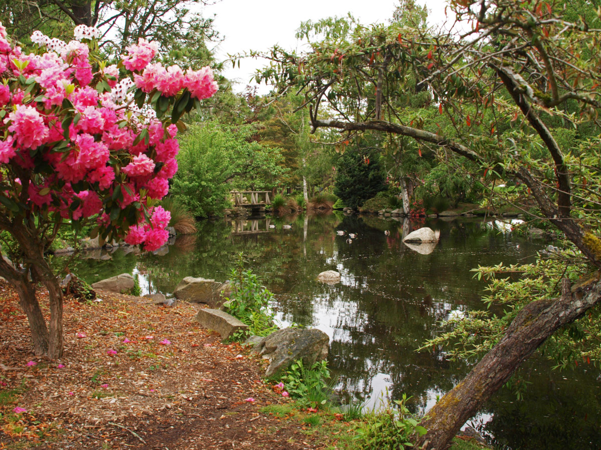
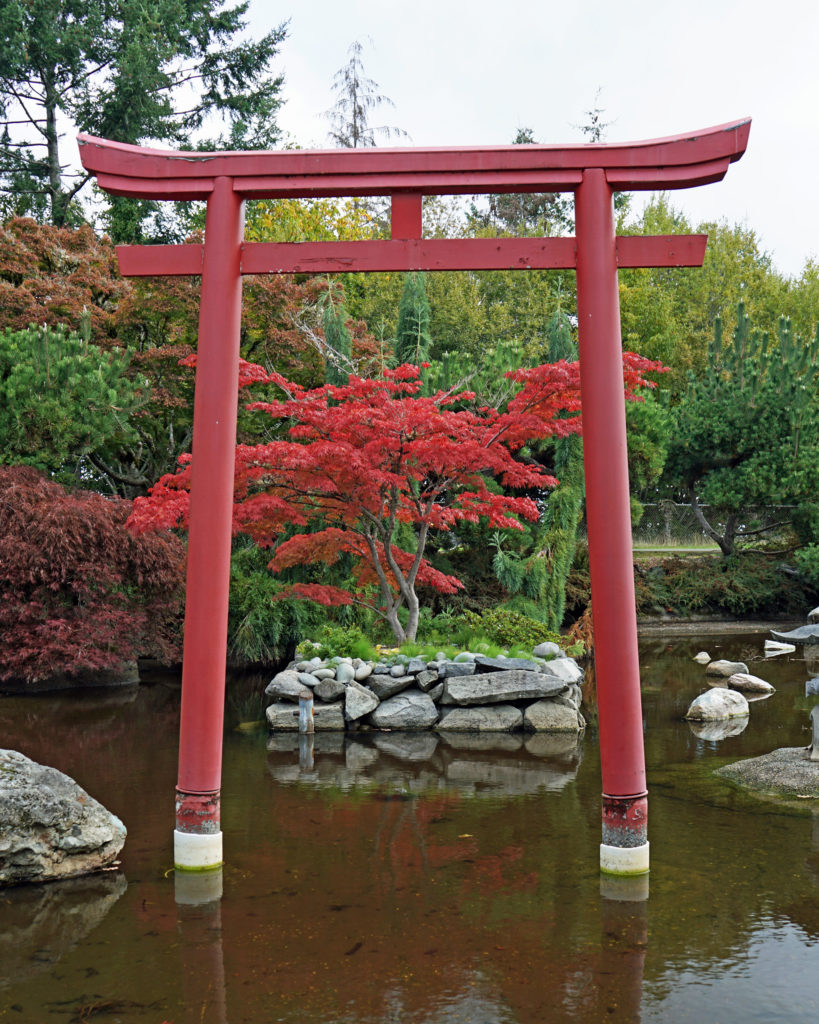 If you’ve never been to Point Defiance, check out the park’s
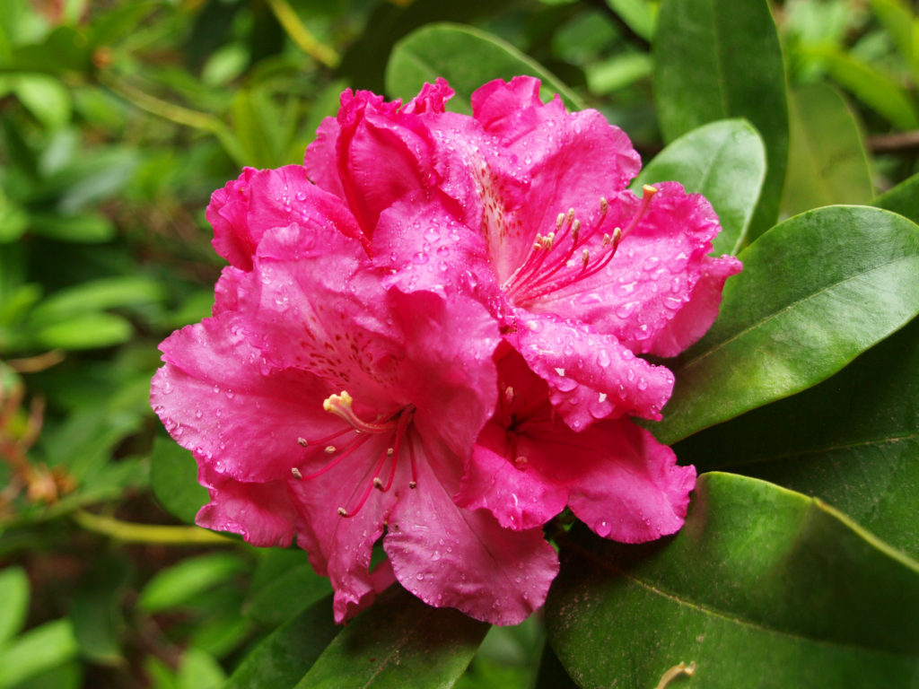
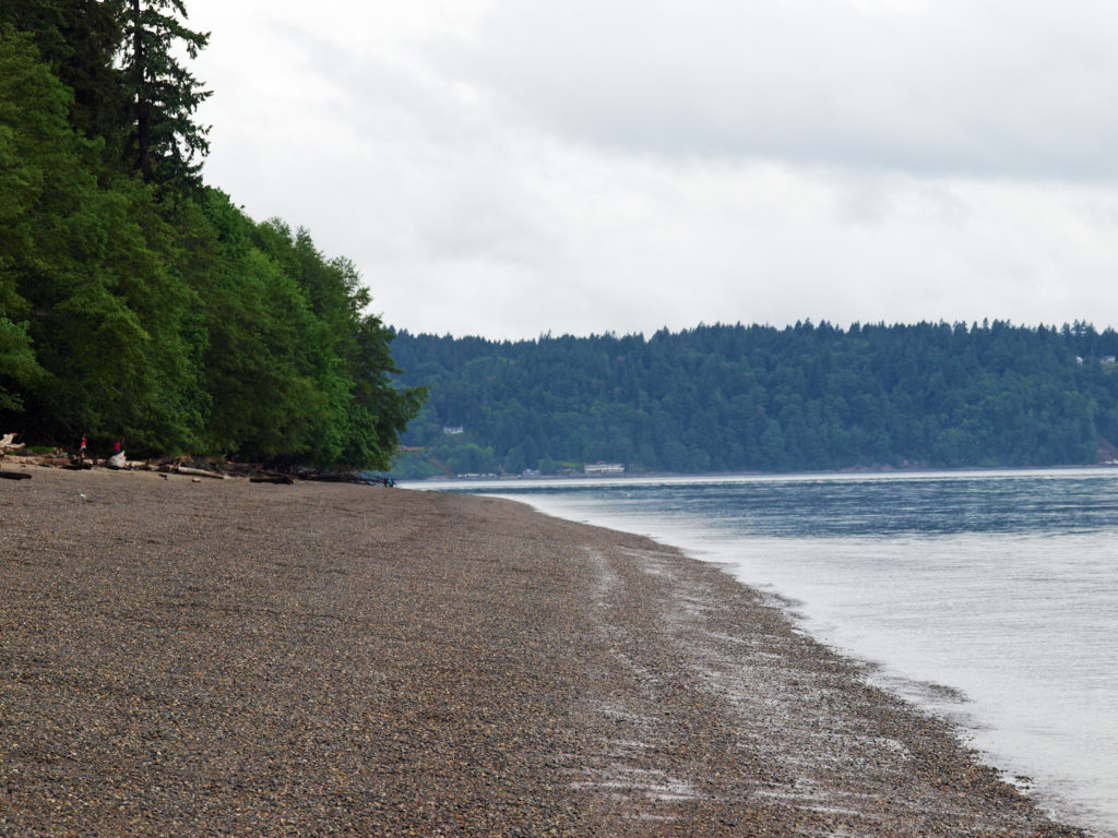
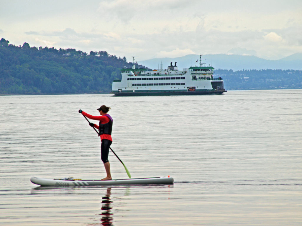 There is a wide, paved, ADA accessible path (the Promenade) connecting the beach with the marina area of the park and the Point Ruston Waterwalk, giving unhindered pedestrian and bicycle access to the park from the Tacoma waterfront. And a construction project completed in 2022 expanded the parking lot, created new entry and exit paths for pedestrians and cyclists separated from the vehicle roadway, a new beach pavilion, new restrooms, a new ADA accessible children’s playground, new ADA accessible plazas and pathways, and a renovated WPA-era picnic shelter.
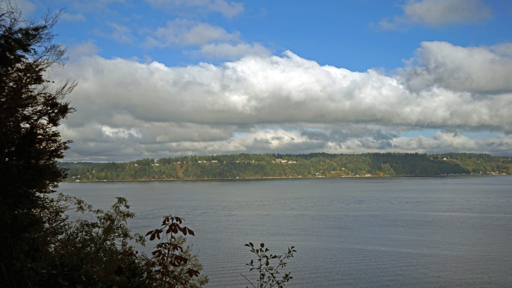 The outer loop of the Five Mile Drive provides numerous waterfront access points with views across Dalco Passage to Vashon Island and across The Narrows to the
 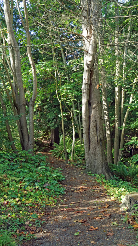 The outer loop is closed to vehicular traffic part of the day to give cyclists, runners, and pedestrians access to the northern half of the park free from conflicts with motor vehicles. On our most recent visit it was closed after 2:00 pm, but on our previous visit it was, I believe, closed in the morning. Check the Point Defiance Park website (linked above) for the current schedule if you plan to visit the park.
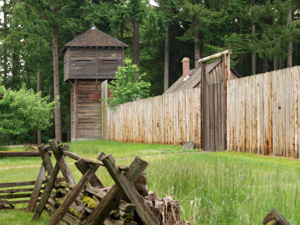
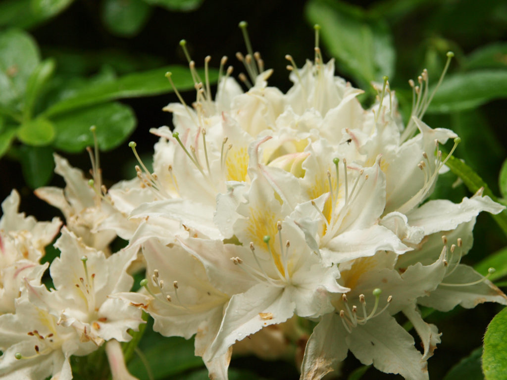
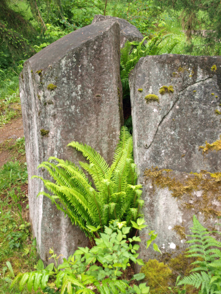
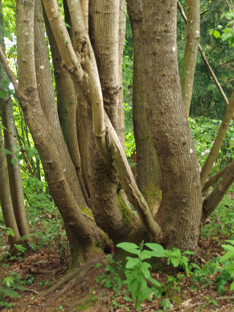
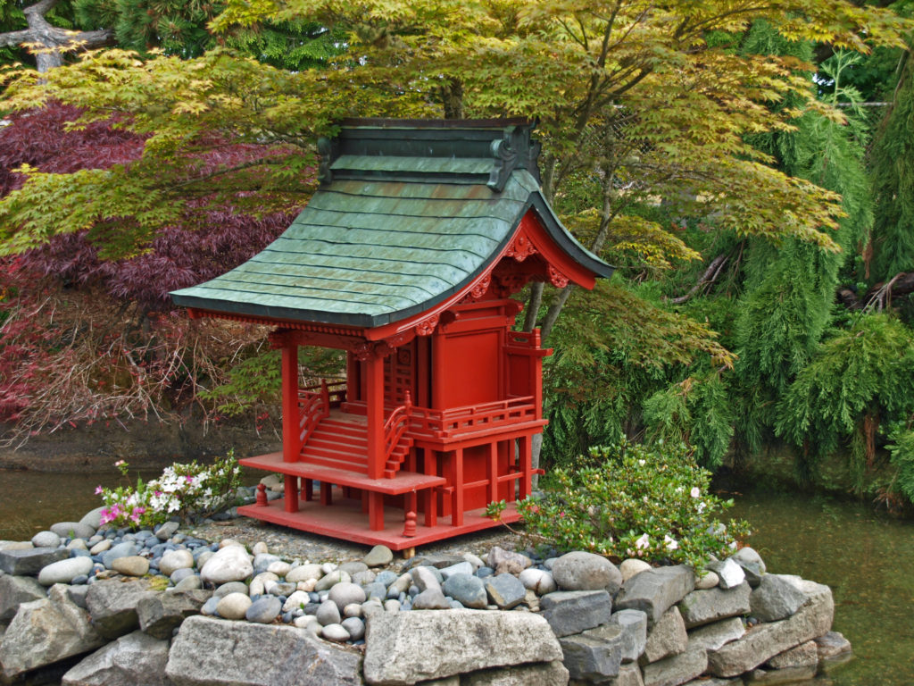
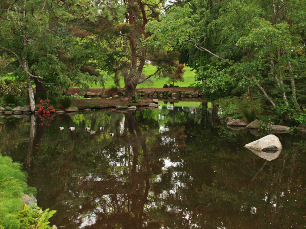 On both of our recent visits our final, and longest, stop was at the botanical gardens area near the entrance to the park. Here there is a large pond with a waterfall, an herb garden, a large rose garden, a dahlia garden, an iris garden, and a Japanese garden. We could easily have spent even more time here than we did on either visit. And if you visit the
  Point Defiance Park is one of the largest, and best, city parks in the Pacific Northwest. The park is similar in many ways to Vancouver, BC’s Stanley Park. Point Defiance is, without question, one of Tacoma’s top attractions.
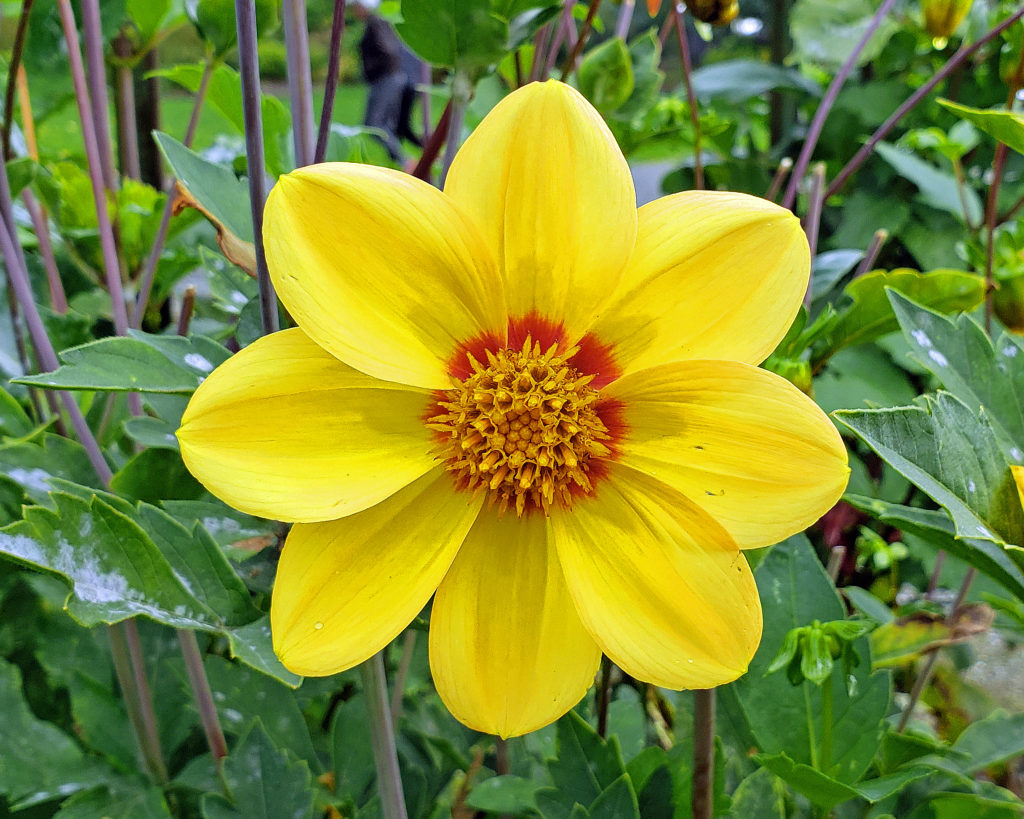 Originally posted May 19, 2019. Most recently updated February 18, 2025.
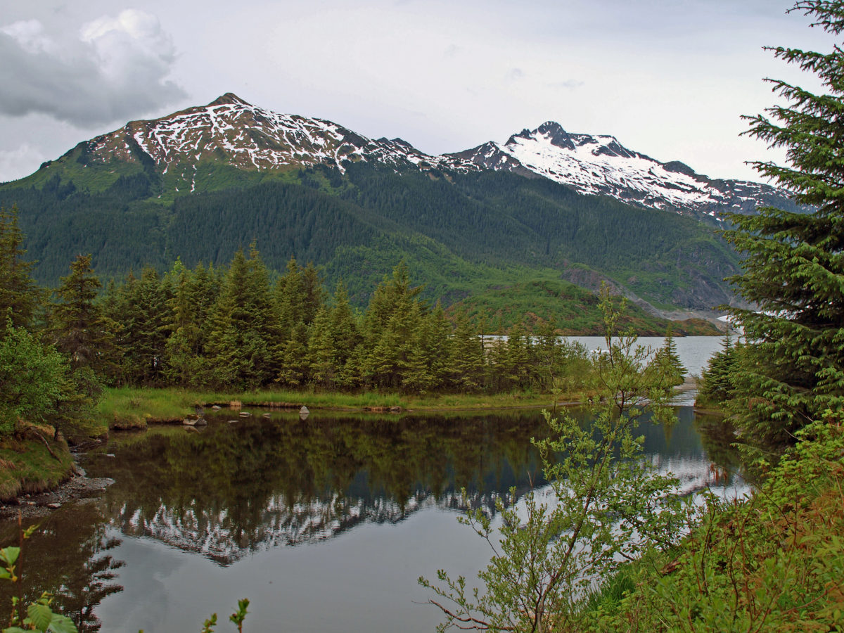
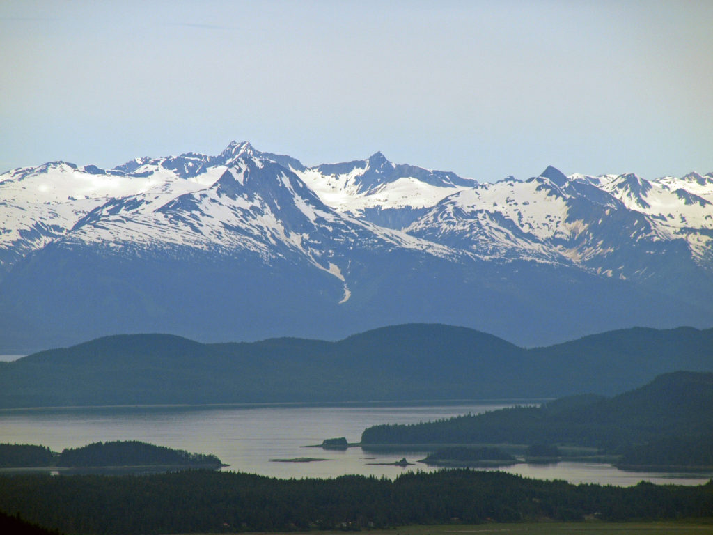
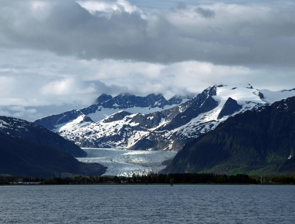
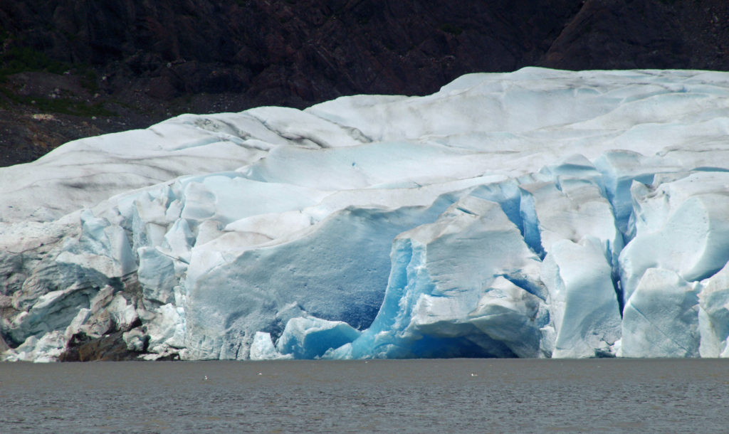
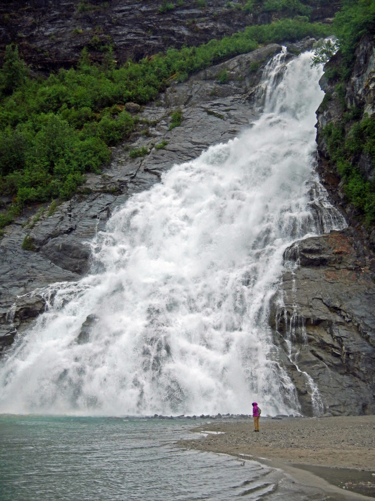
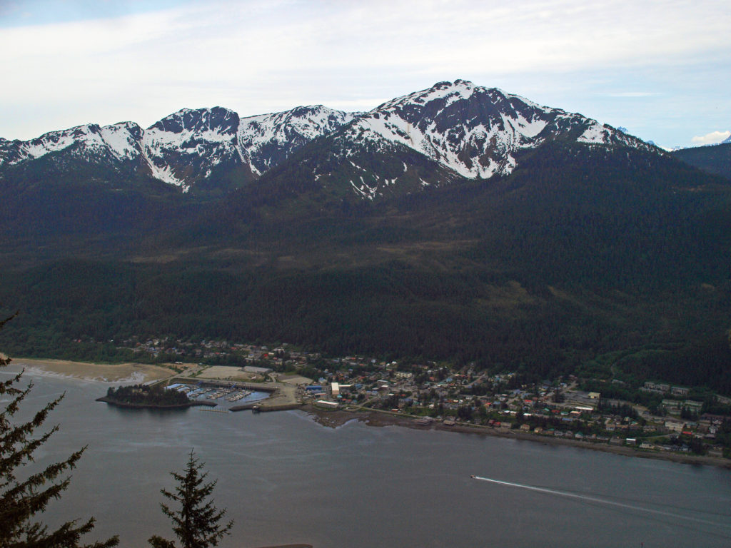
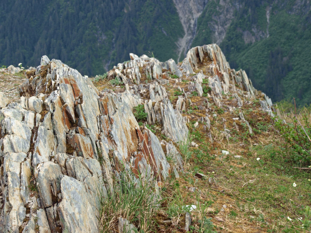
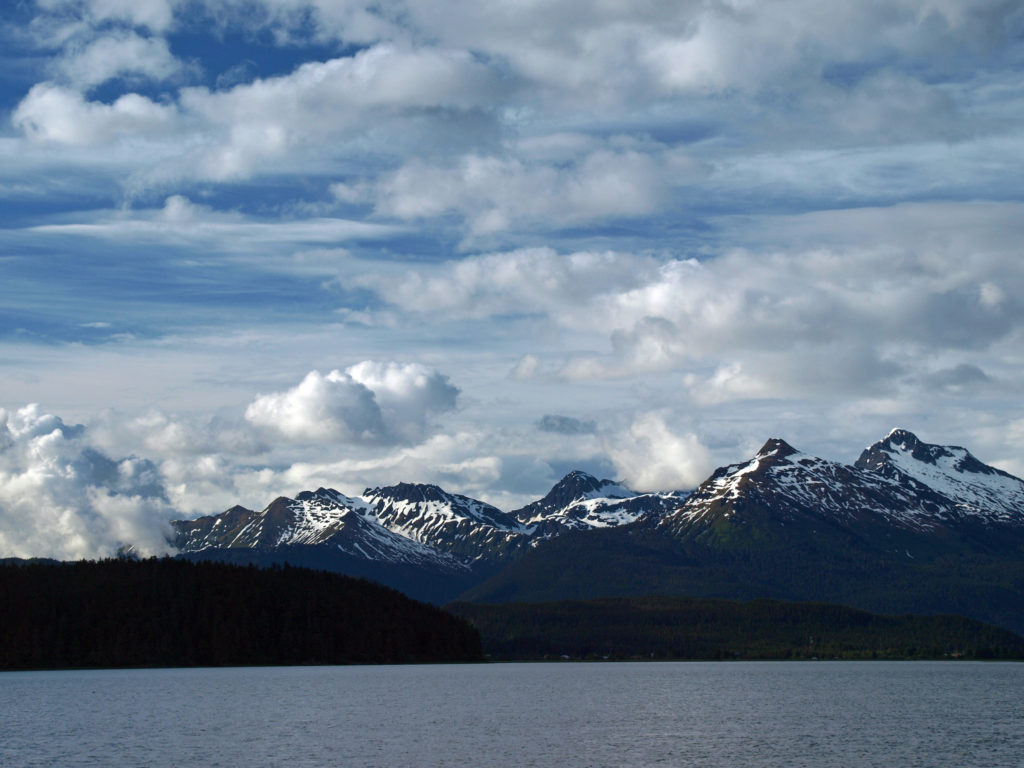
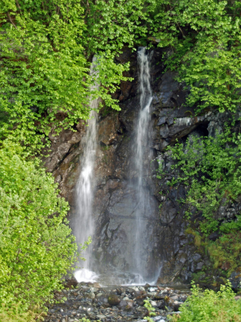
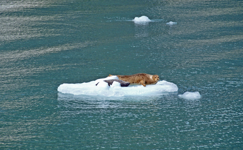 Seals often haul out on the bergs to rest and sleep. At the head of the inlet you’ll get a close up view of South Sawyer Glacier. How close you get will depend on the boat that you’re on and the amount of ice in the water, but you will get a spectacular look at the face of the glacier and there’s a chance that you’ll witness large blocks of ice calving off the face and crashing into the water below. The cruise was one of the highlights of our trip. We didn’t have time to repeat the cruise on latest visit, but if you can fit it into your itinerary, I highly recommend that you do so. Day trips start at about $275 per person.
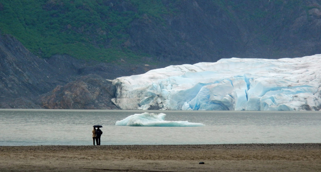
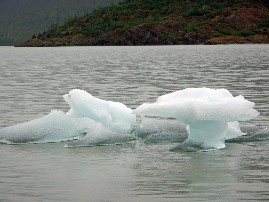
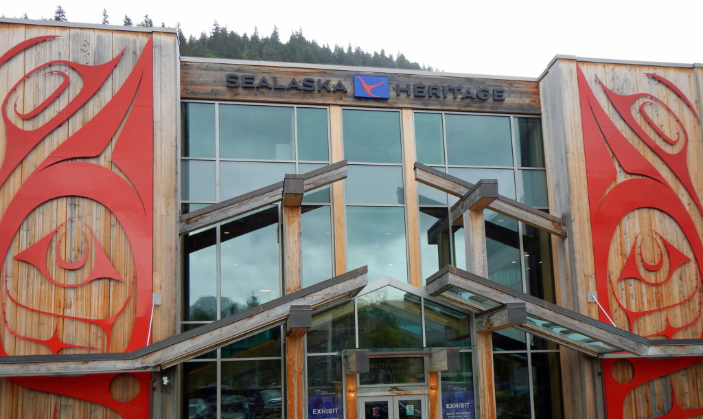
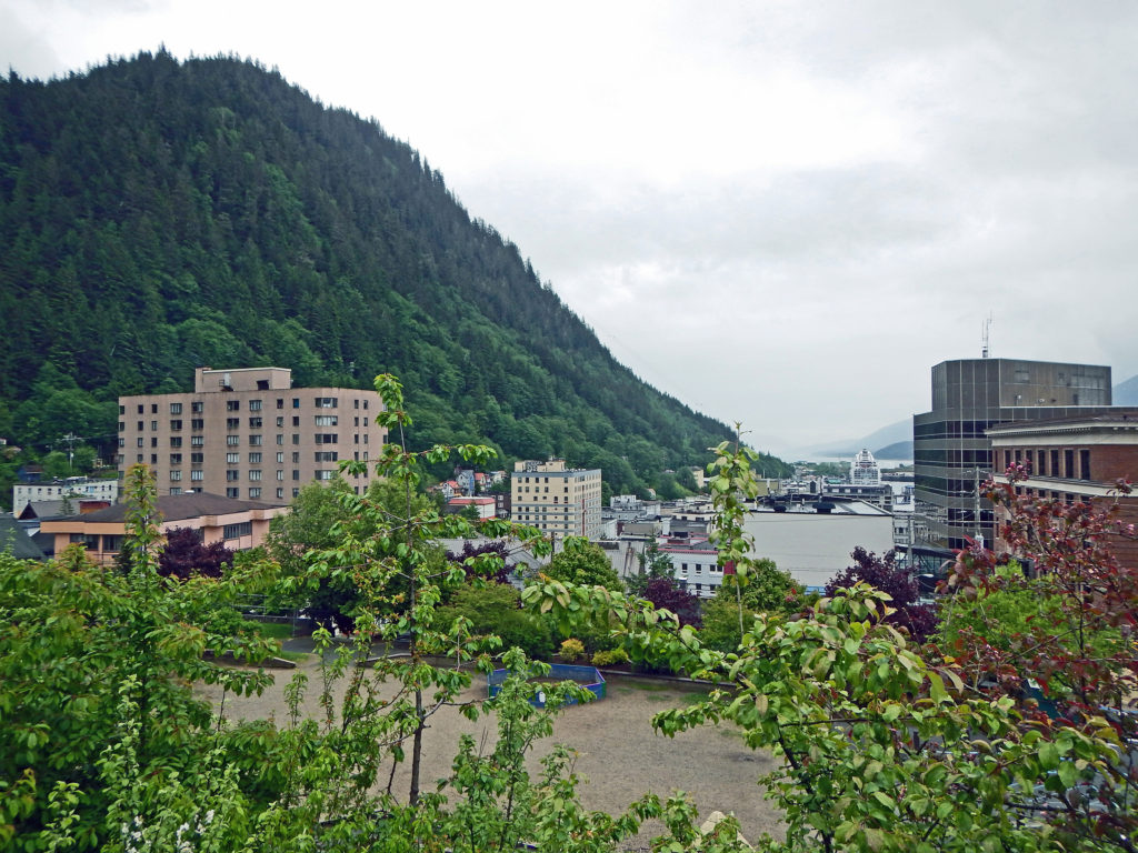
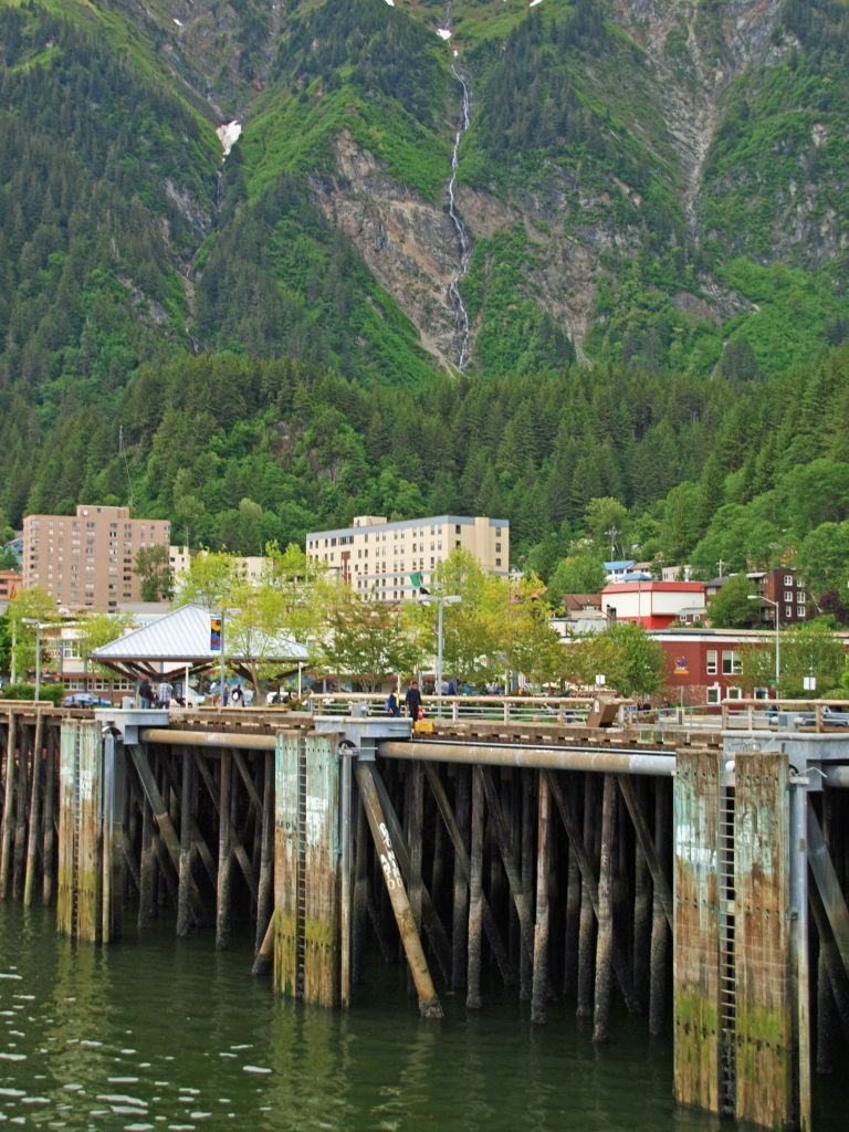

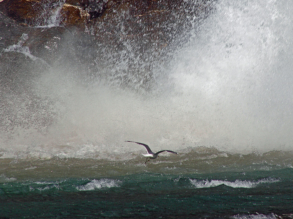
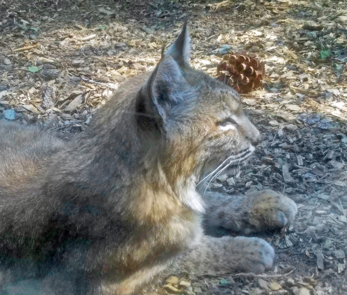
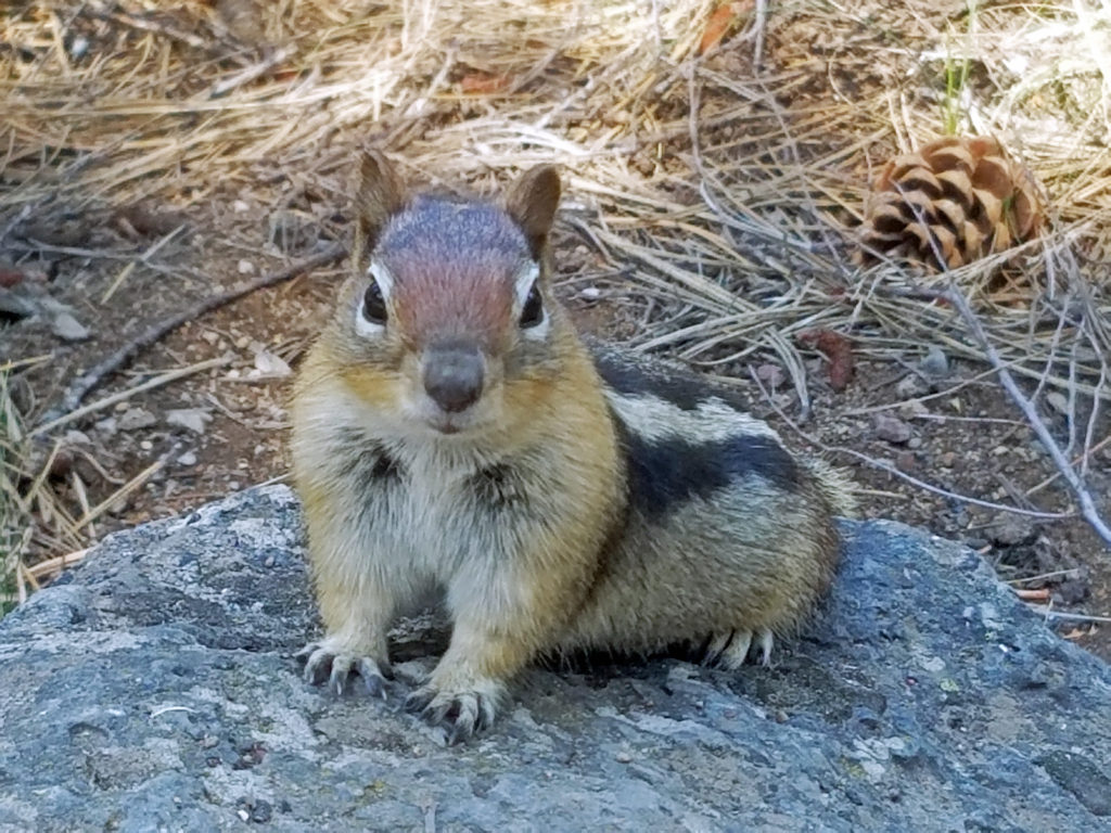 The High Desert Museum consistently rates as one of the top attractions of the Bend area, and it won the 2021 National Medal from the Institute of Museum and Library Services. My most recent trip to the museum came as part of a family vacation to the nearby
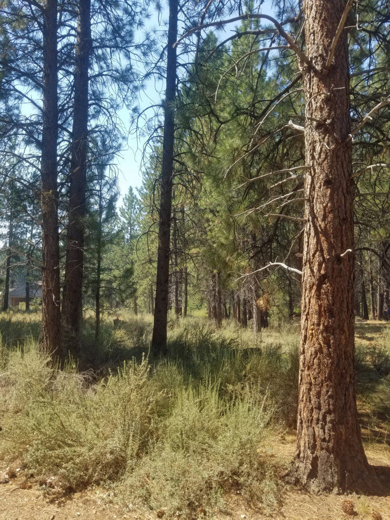
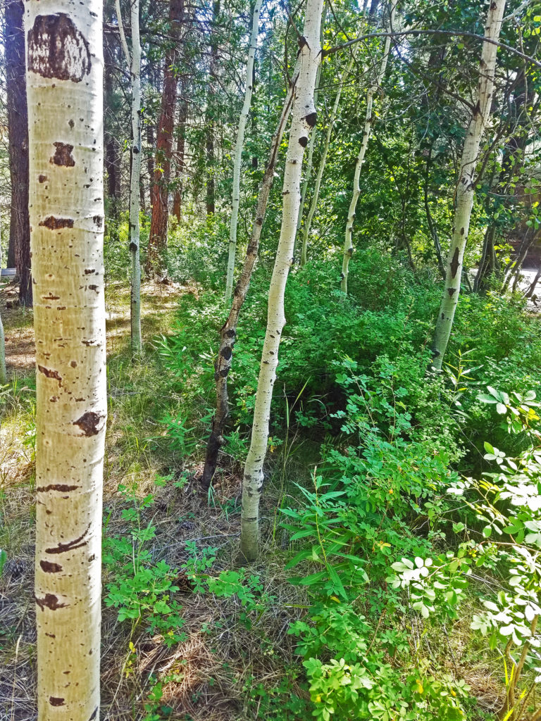
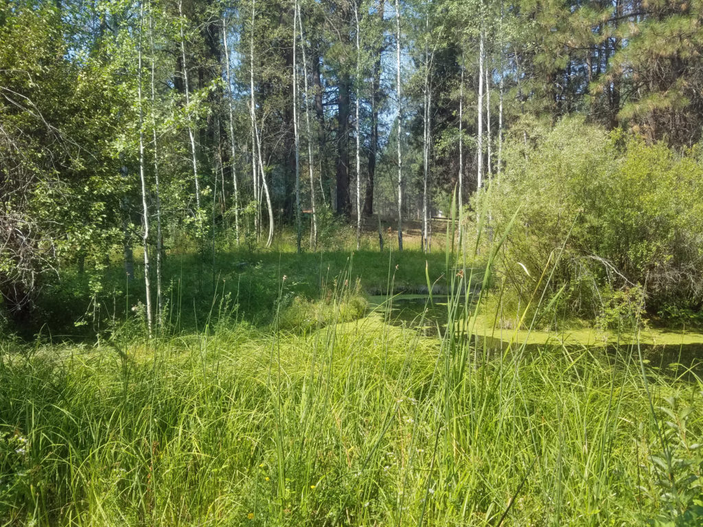 There is a small stream that runs through the museum grounds and several small ponds, giving the museum riparian as well as forest habitats. You can explore the pine forest and riparian areas on the trails that wander through the 135 acres of the museum grounds.
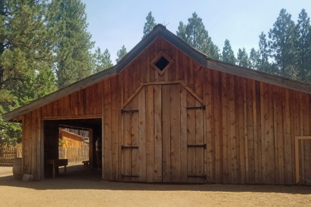
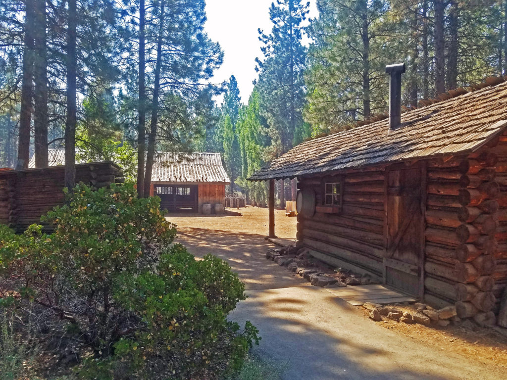
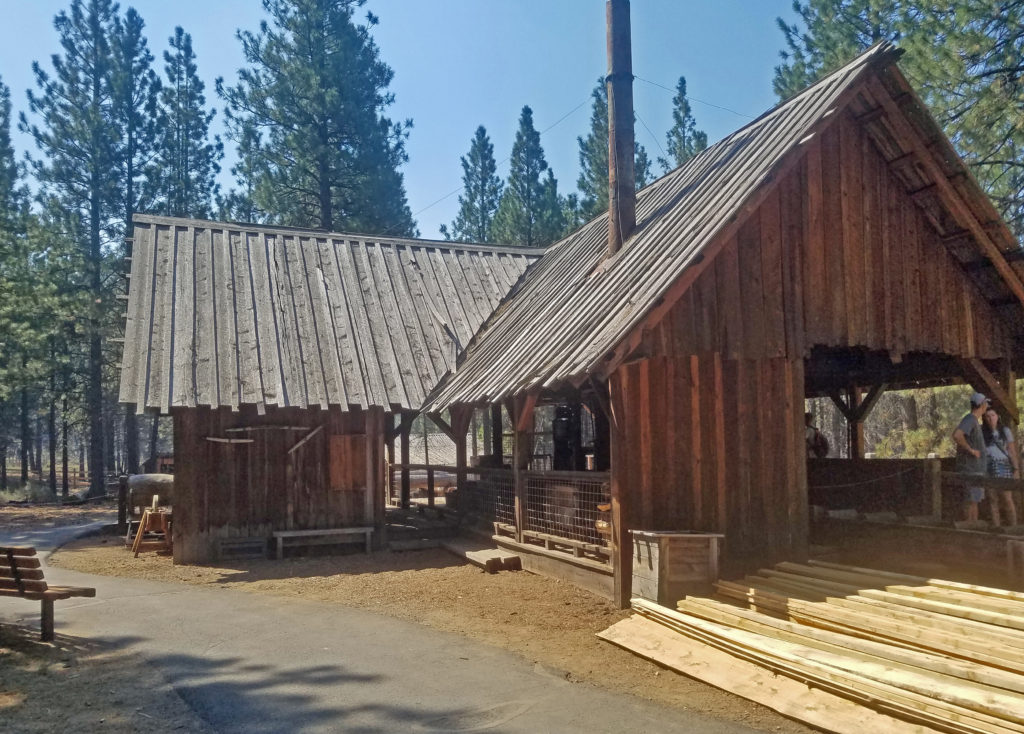 The Lazinka Sawmill is a working mill, originally located in Pilot Rock, Oregon. Originally driven by steam power, the mill is now powered by electricity. The lumber used to build the barn at the Miller homestead exhibit was cut at the Lazinka Mill. Museum staff fire up the mill once a month during the summer months, so check the museum’s schedule (linked below) if you are interested in seeing it in operation.
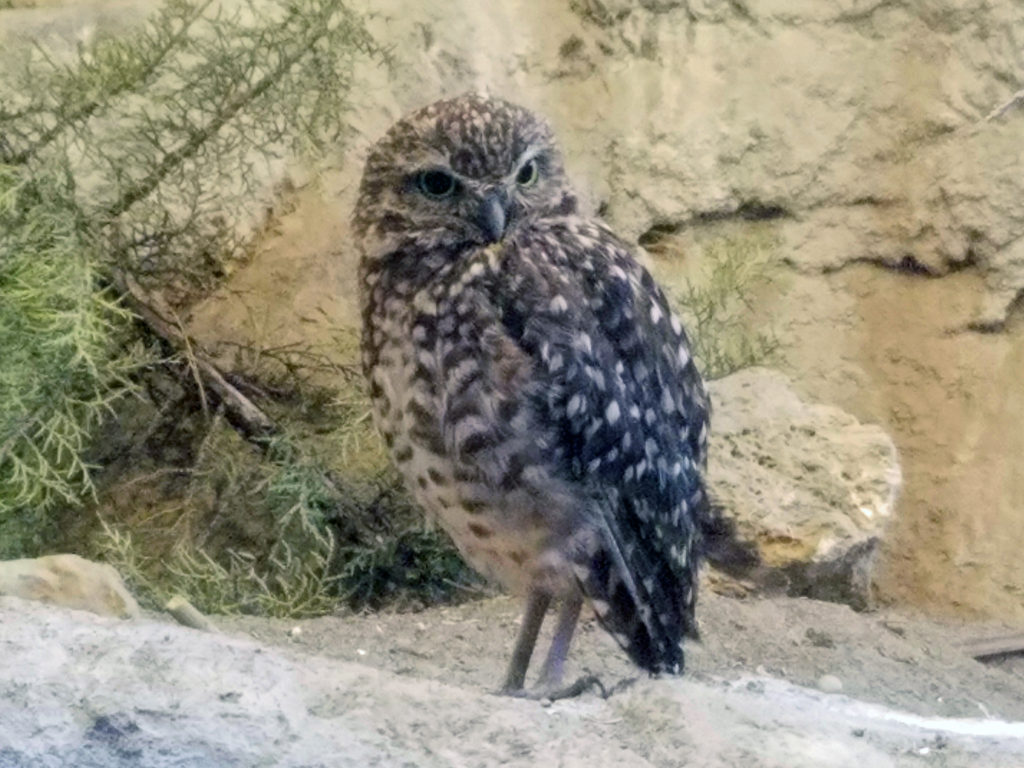 Get an up close look at some of the raptors of the high desert and learn about desert carnivores, otters, and other desert dwellers at the Donald M. Kerr Birds of Prey Center. Check the museum
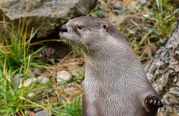
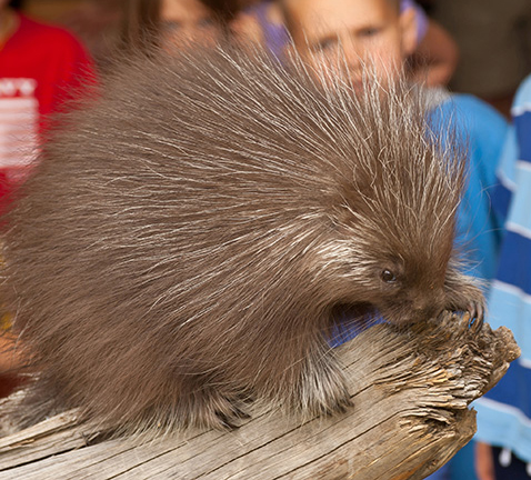
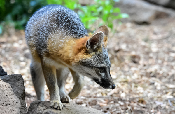
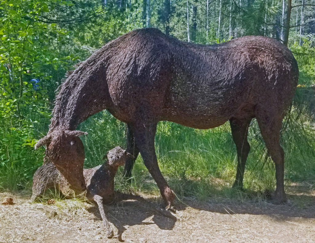 Throughout the grounds, you will find sculptures and other works of art. I particularly like the wire sculptured mare and foal, the bronze beavers, and the frozen-in-time bronze of a salmon in mid-leap.
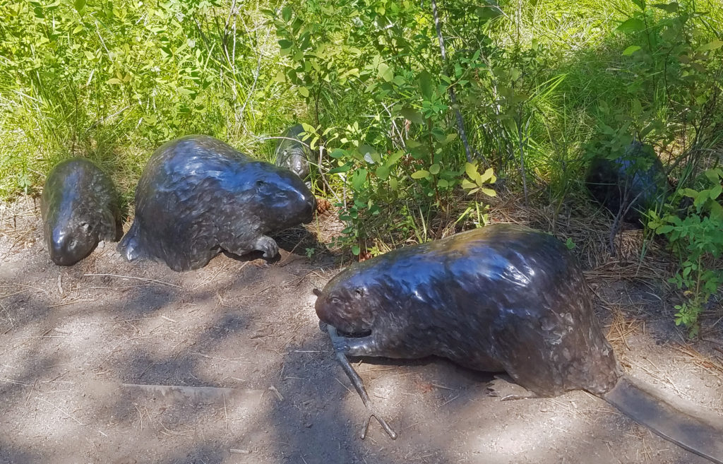
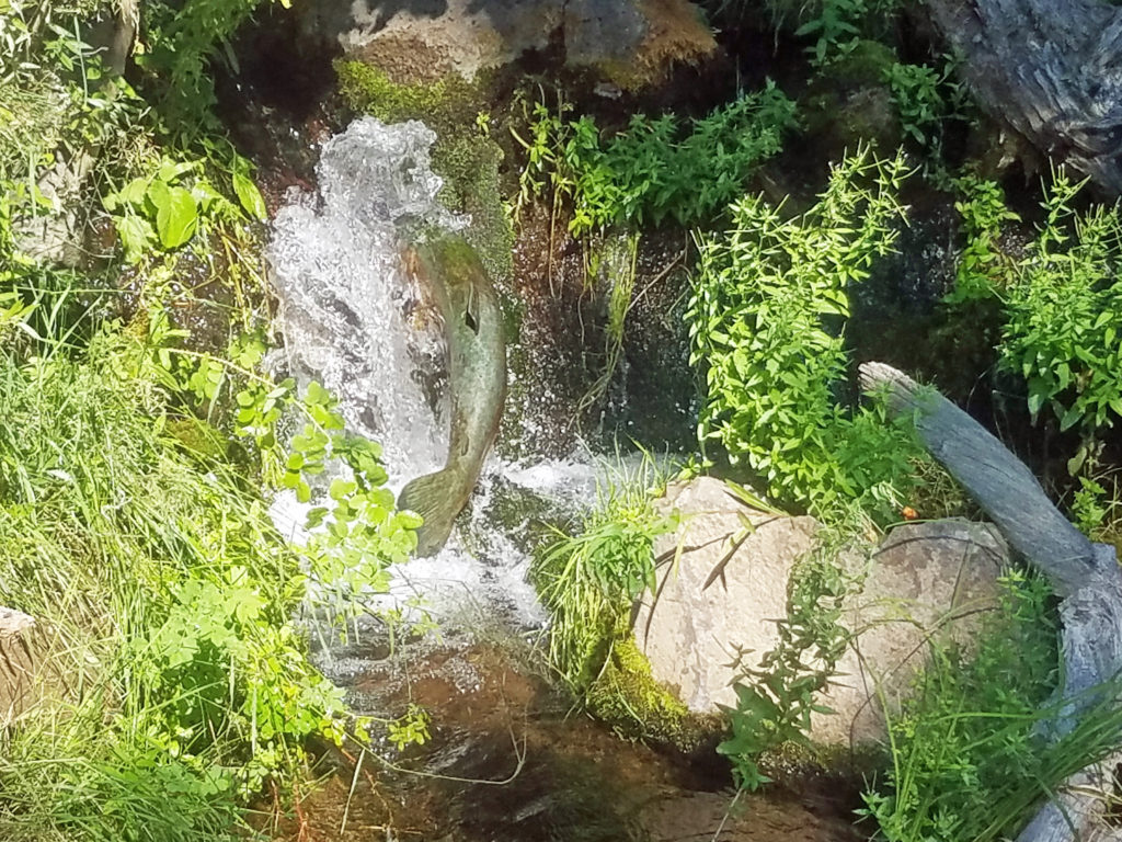 Other features of the museum include a Forest Service ranger office built in 1933, vintage logging equipment, a forest service fire truck from the 1930s, and a WWII army motorcycle made by Harley-Davidson. The museum’s most recent addition is the E. L. Wiegand Ponderosa Playscape, a children’s play area near the otter exhibit.
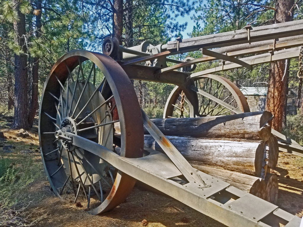
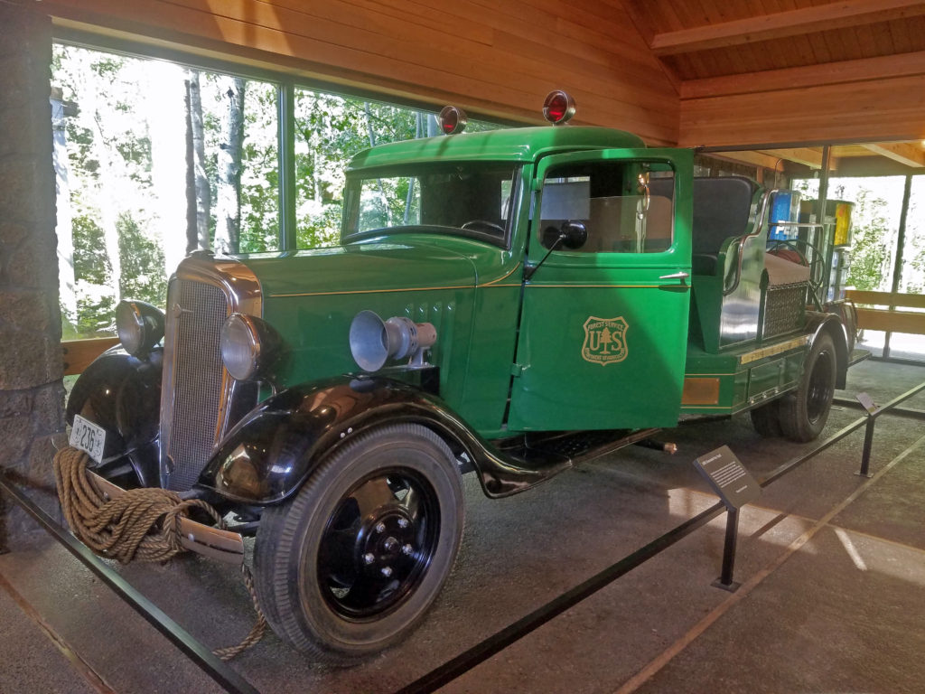 Inside the main building, the Desertarium Exhibit showcases some of the animals that make the High Desert home, including snakes, lizards, and desert tortoises. Other permanent indoor exhibits include Spirit of the West, which documents the history of the people of the region, and By Hand Through Memory, a look at the history and culture of the Plateau Indian Nations.
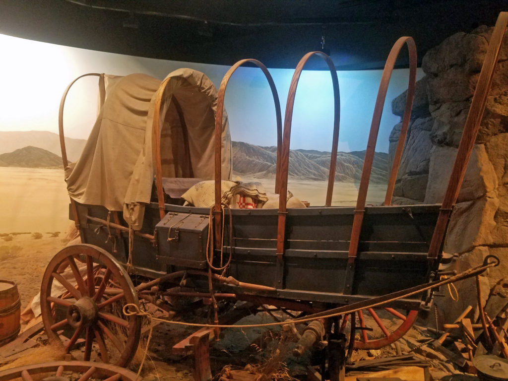 The museum also hosts changing exhibits. Check the museum’s website for what exhibits are currently on display.
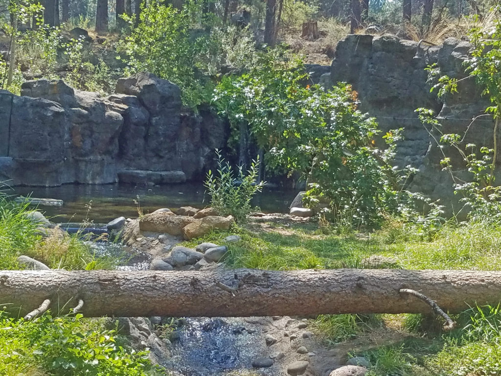 In addition to enjoying all the museum’s exhibits, you can get made-to-order sandwiches and wraps, and a variety of beverages at the newly remodeled Rimrock Cafe inside the main building. The cafe features locally made food and drink from Big Ed’s Artisan Bread, Humm Kombucha, and Strictly Organic Coffee. And souvenirs of your visit and books and other educational materials are available at Silver Sage Trading, the museum store.
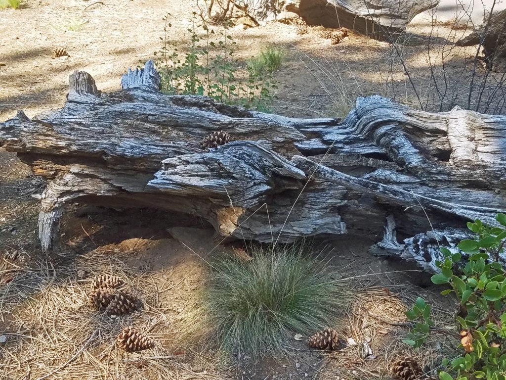 Plan on spending at least several hours at the museum, especially if you have kids in tow. There’s too much worth seeing to experience it all in less time. Check the museum website for hours and admission fees. Tickets are available for purchase on the website, but advance purchase is not required.
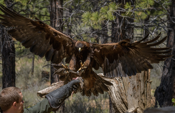
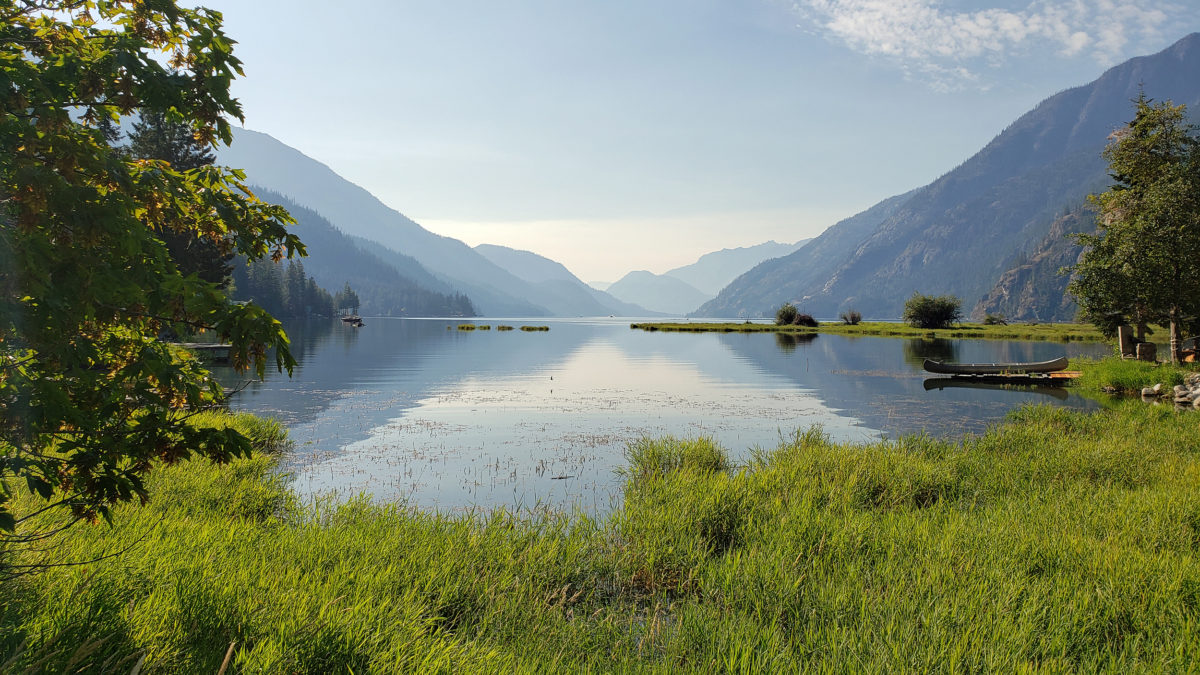
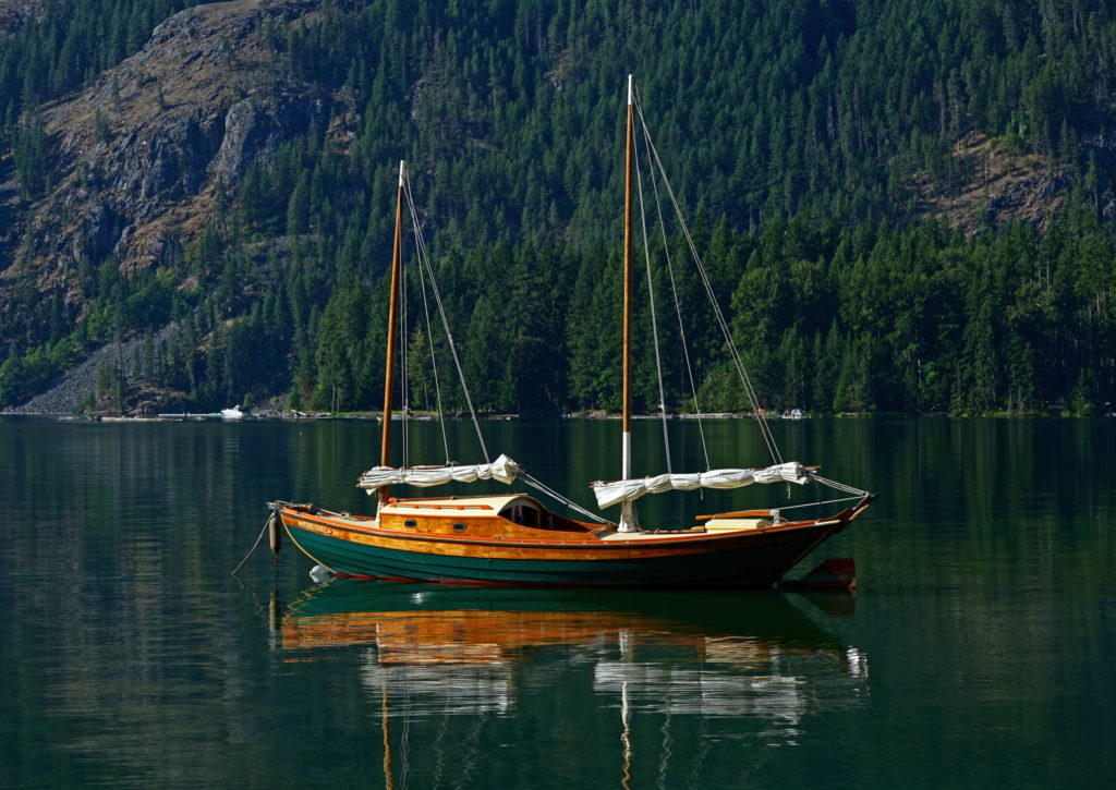 My wife and I have visited the small community of Stehekin at the head of Lake Chelan in central Washington several times. Our most recent visit came on a week-long escape during the pandemic in 2021.
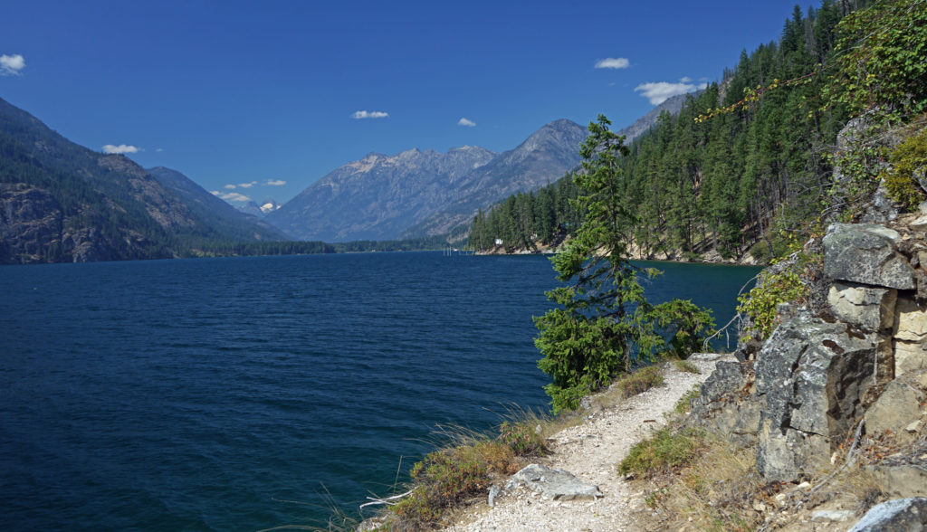
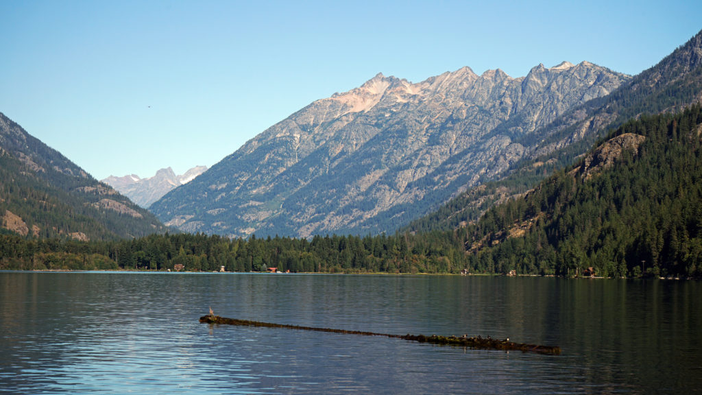
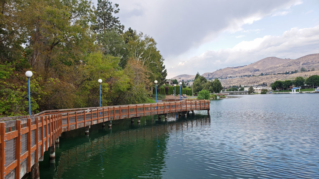
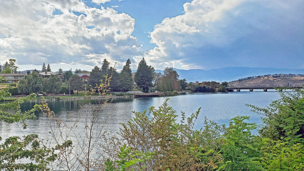
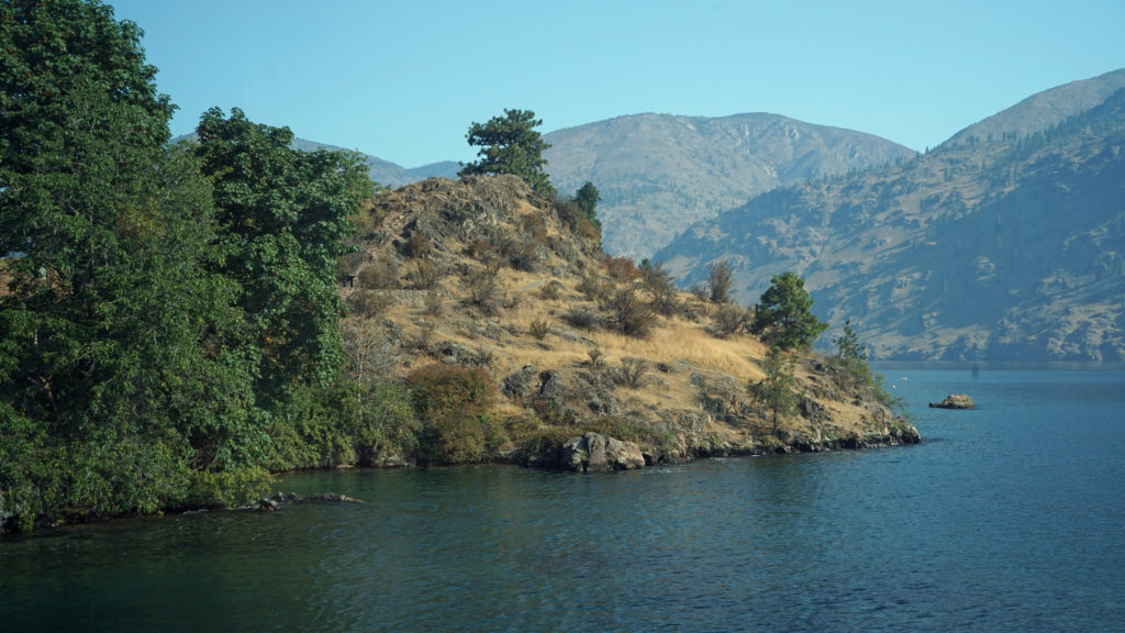
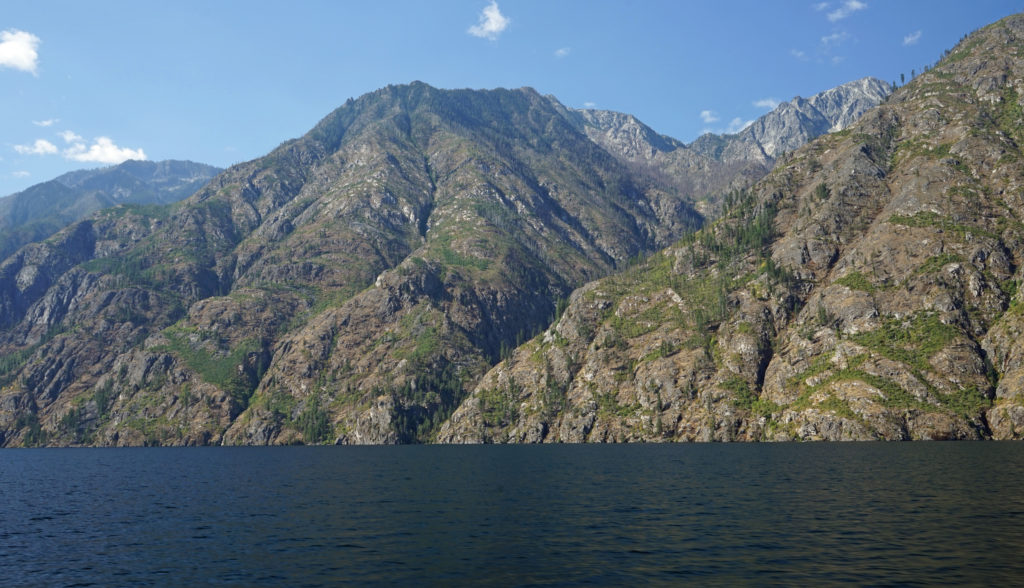
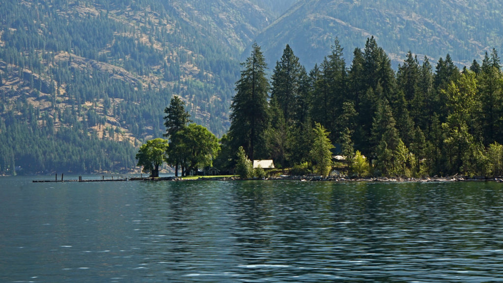
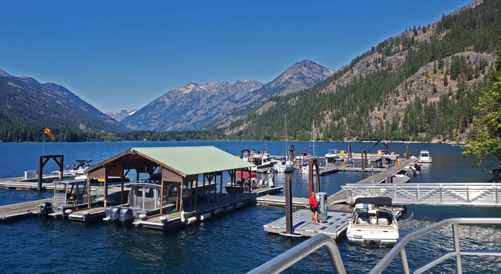
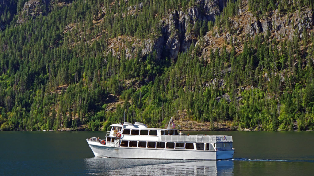
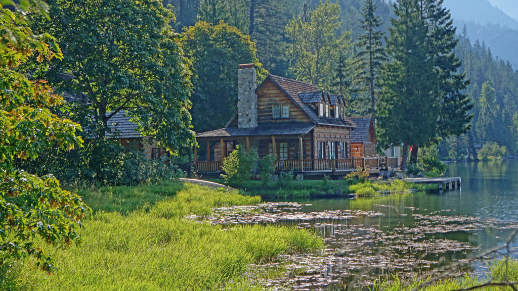
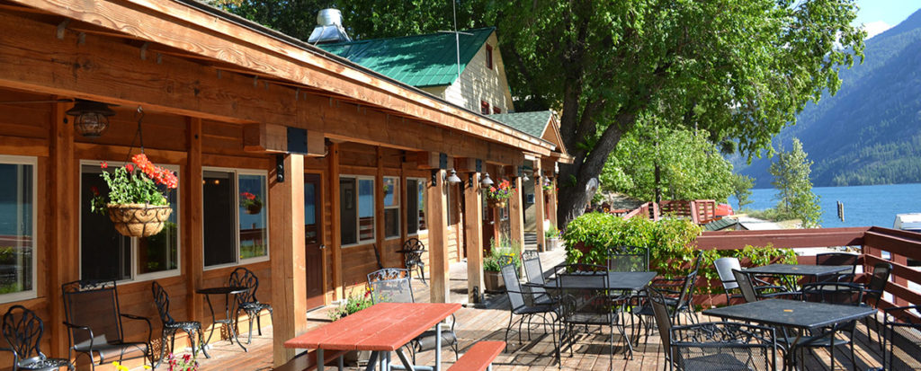
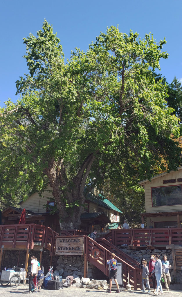
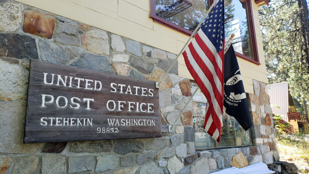
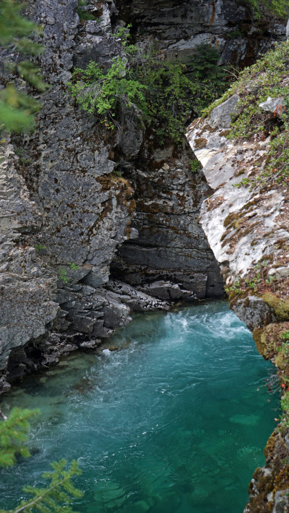
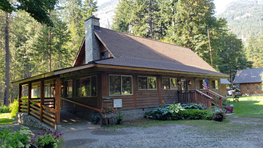
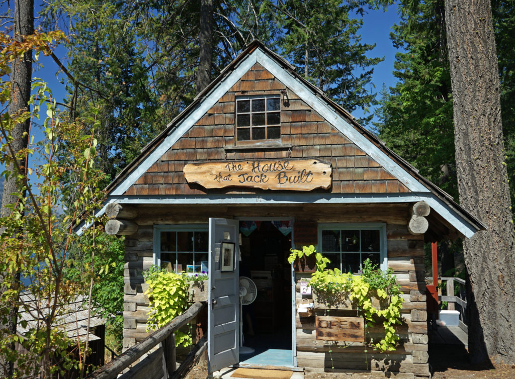
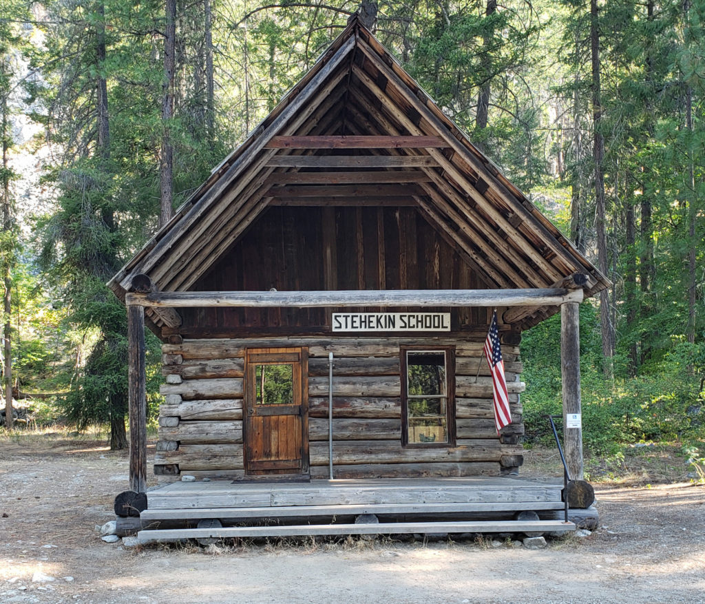
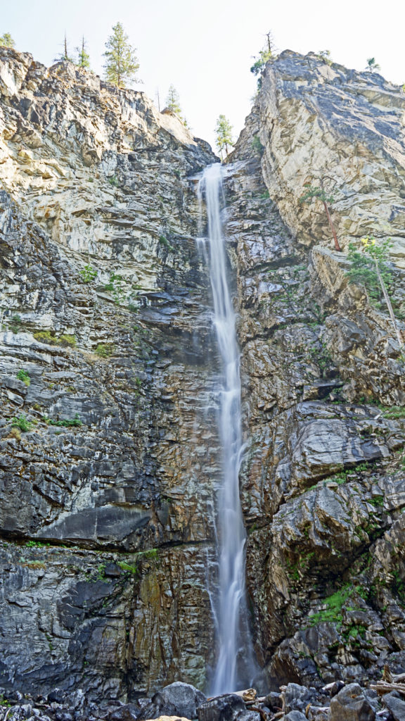
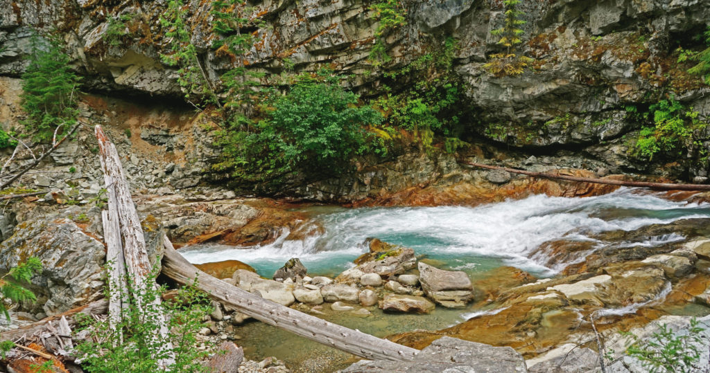
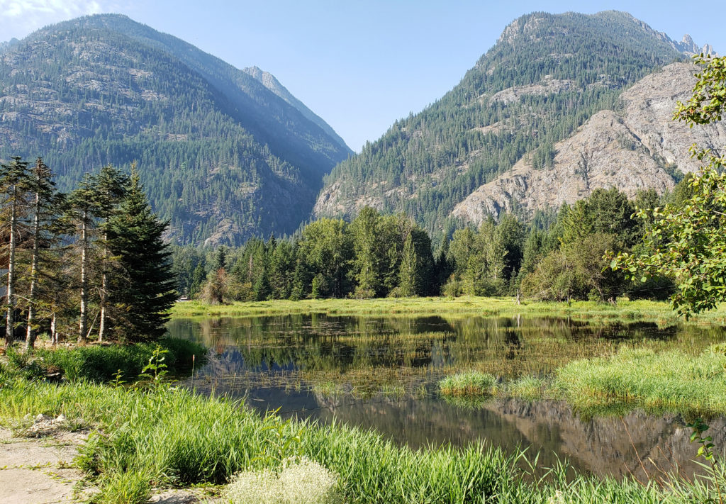
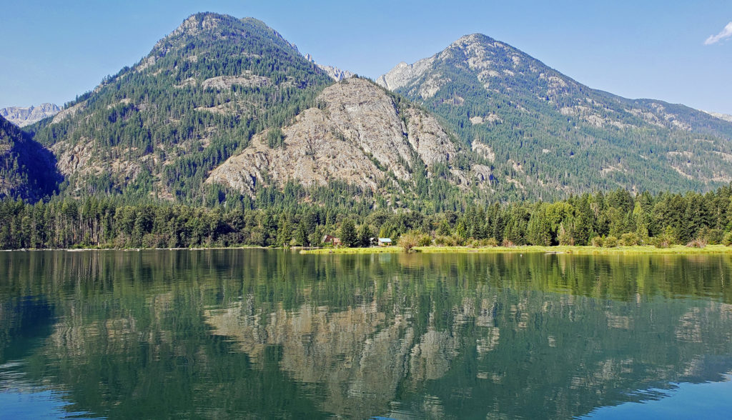

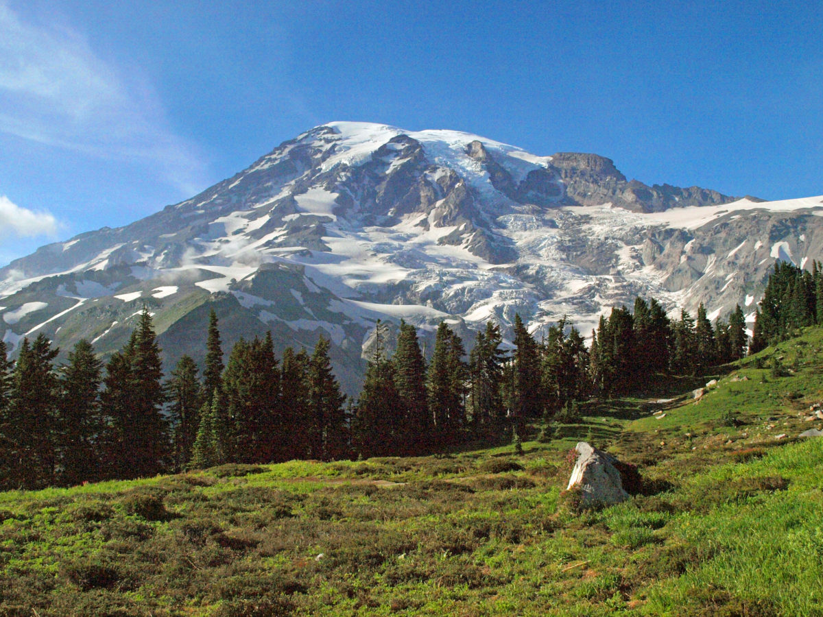
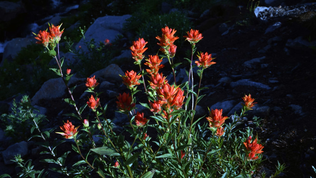
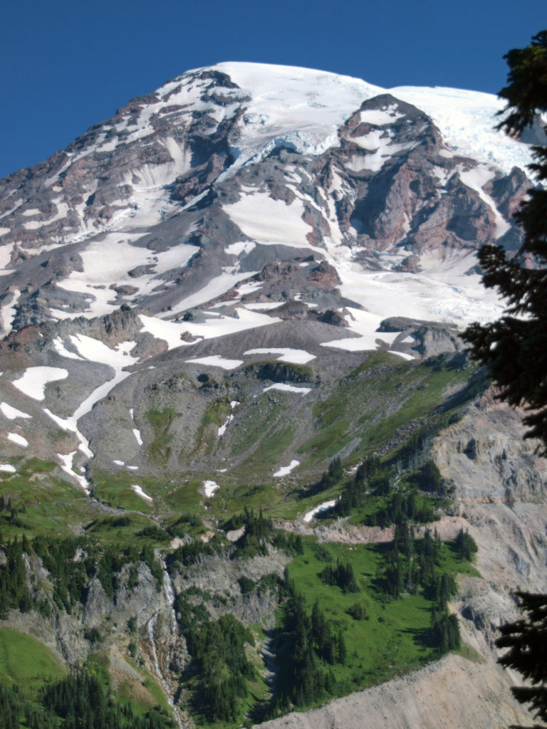
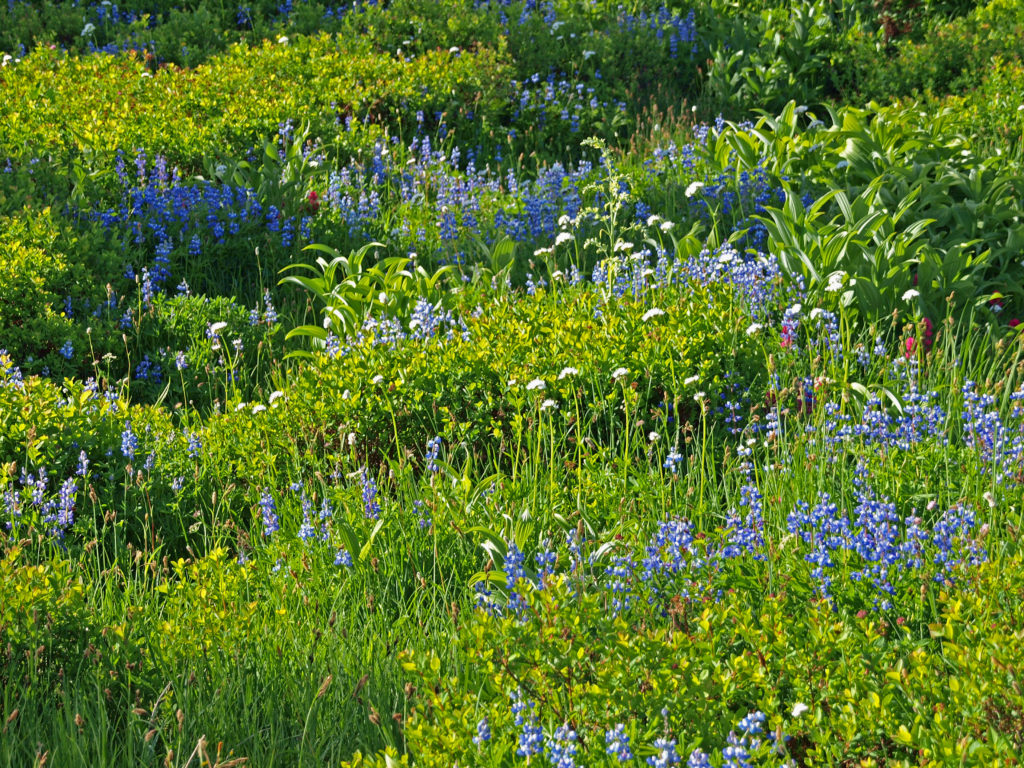
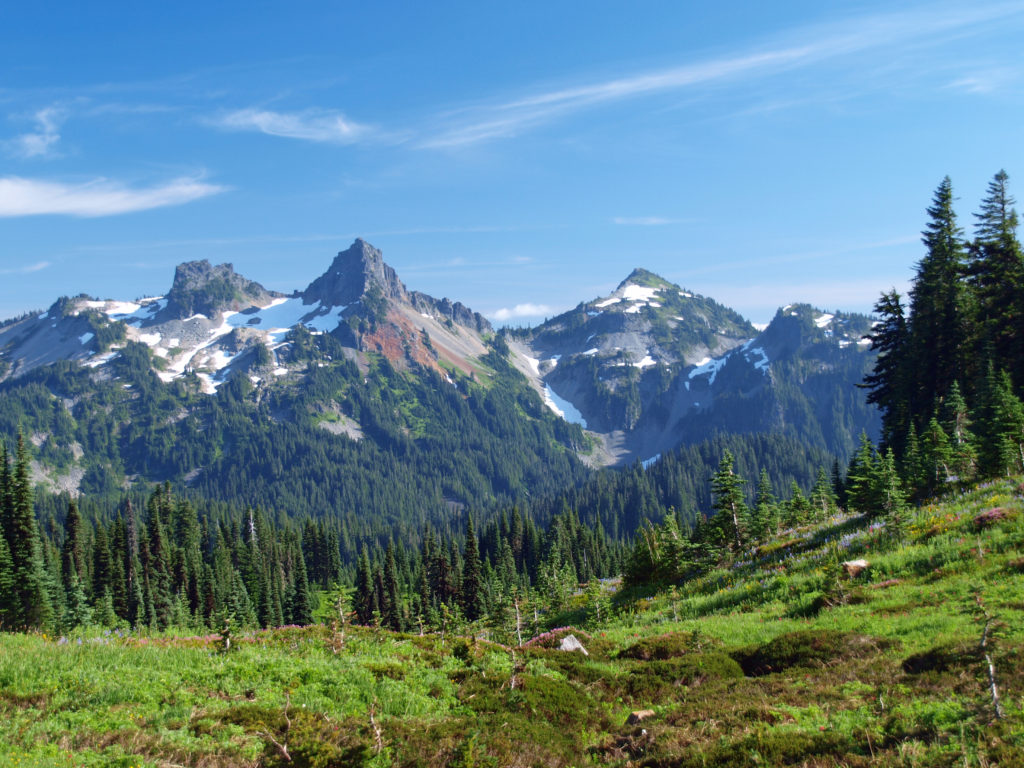
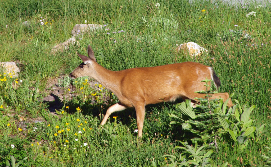
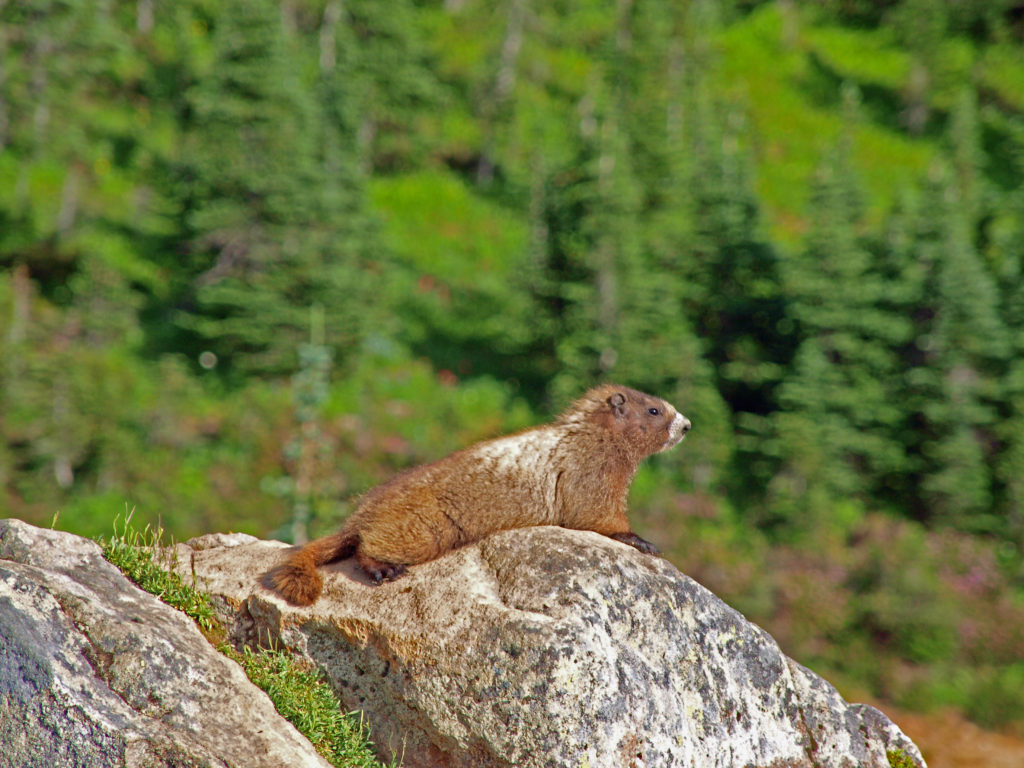
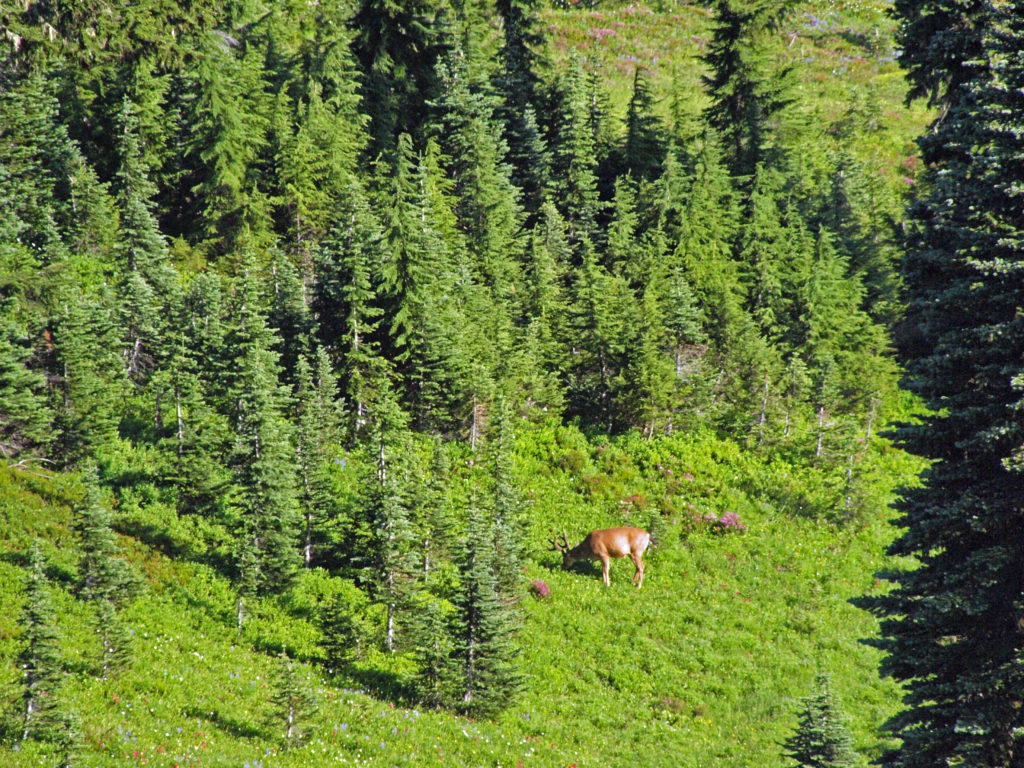
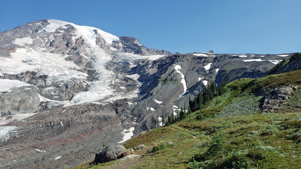 The highlights of the trip were the two hikes we did on the Skyline Trail. The first was the four mile out and back hike to Panorama Point. The second was the roughly four mile Skyline-Golden Gate loop. Both are listed as “moderate” hikes, but both have significant elevation gains (1700′ and 1400′ respectively). We did both hikes early in the day during the week, but we were far from the only ones on the trail, especially on the hike to Panorama Point. But the area above Paradise is so incredibly scenic that the crowds didn’t diminish the experience much.
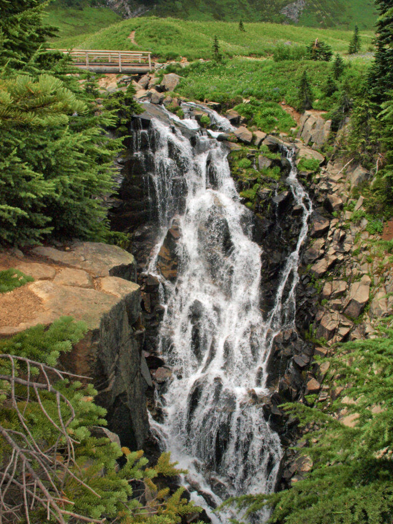
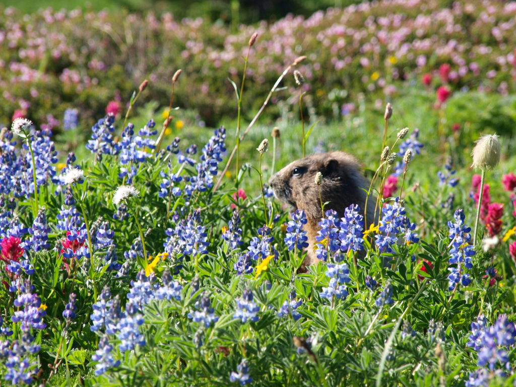
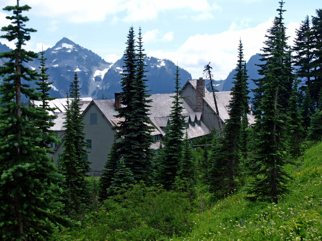
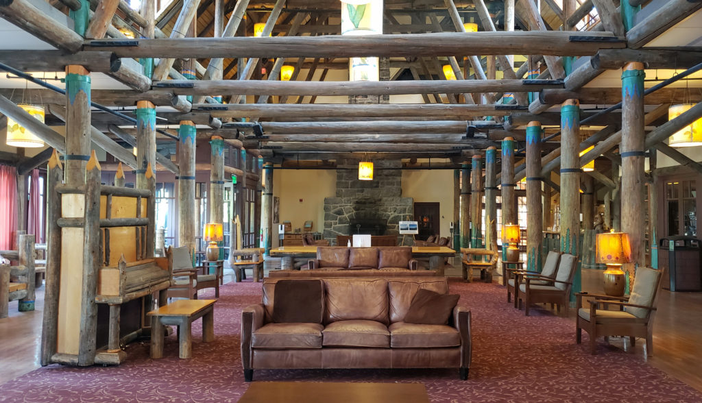 Close to Paradise Inn, the Jackson Memorial Visitor Center, named after long-time U.S. Senator Henry M. Jackson, offers general information, exhibits, a park film, guided ranger programs, a book/gift store and a cafeteria. Unfortunately, all visitor centers in the park are currently closed due to the ongoing pandemic.
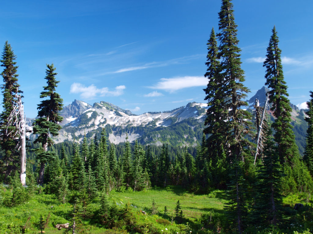
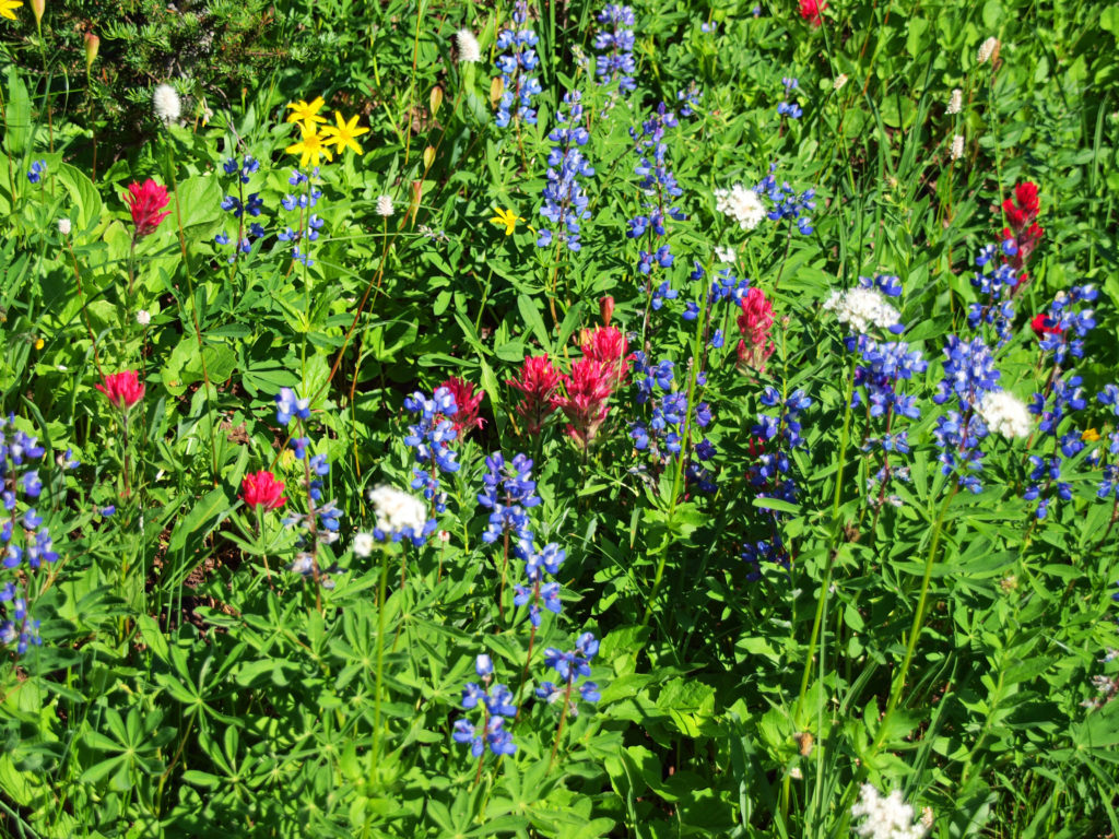
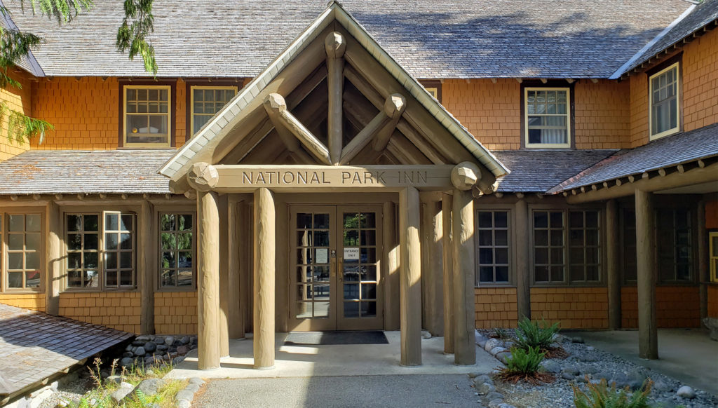 Both Paradise Inn and the National Park Inn have full service restaurants, but both were operating on a reduced scale due to the pandemic when we were there in August. The National Park Inn dining room was closed, but take out meals could be ordered and picked up at the reception desk in the lobby. The dining room at Paradise Inn was open for dinner only for most of our visit, but closed (unexpectedly) for the season on our last day there. Paradise Inn also has a limited service cafe, and there is a cafeteria at the Jackson Memorial Visitor Center that is open daily during the summer season and on most weekends and holidays in the winter (depending on road conditions). The National Park Inn restaurant is open year round.
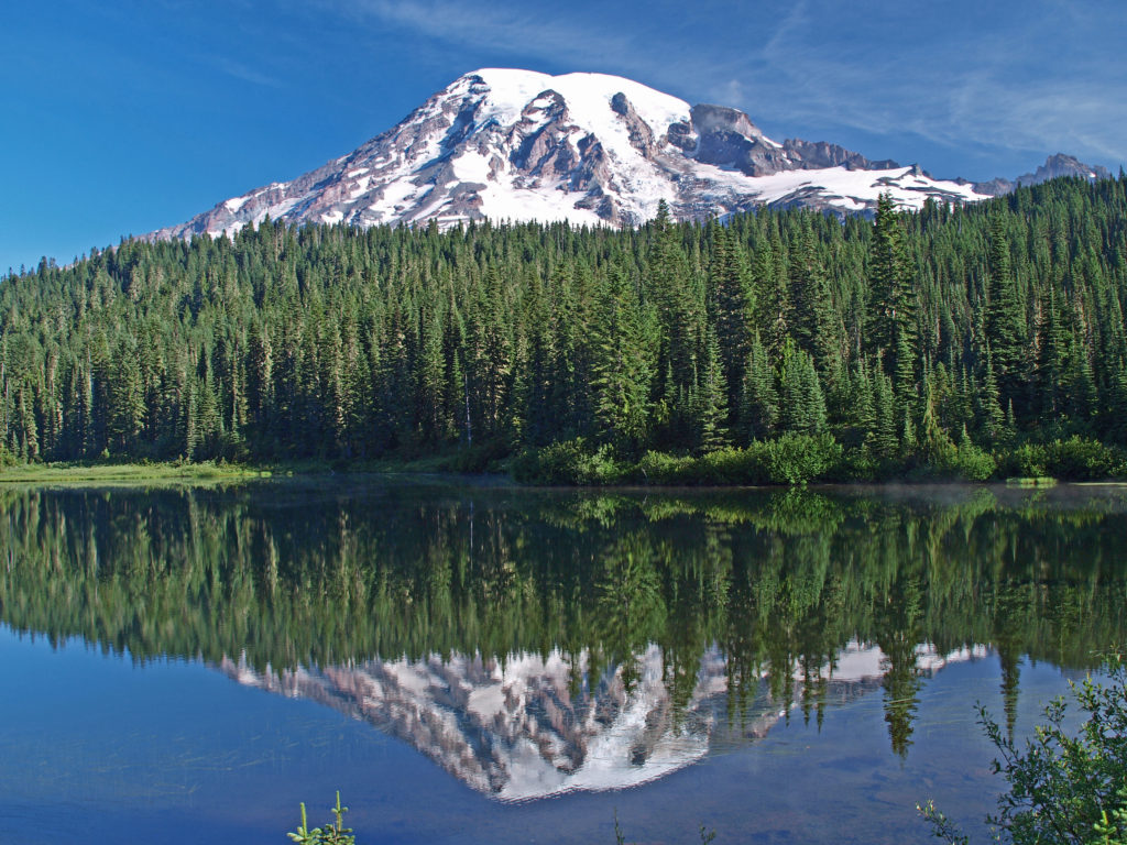
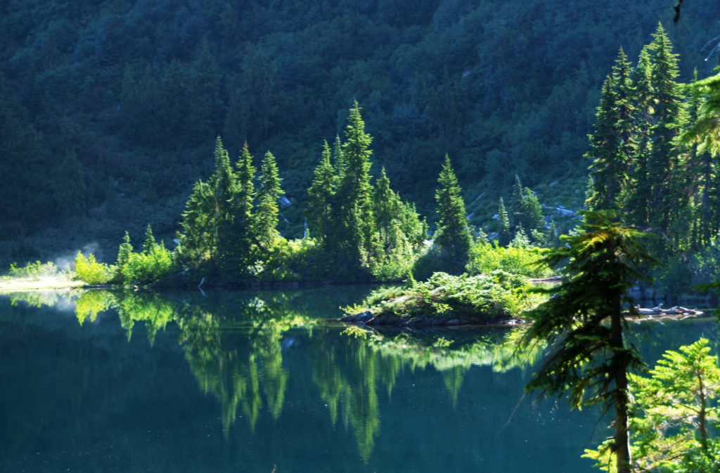 The nearby Snow Lake Trail is an easy and worthwhile hike. To the east, the Stevens Canyon area has a number of interesting areas, including Box Canyon, a 180 foot deep slot canyon, and a number of roadside waterfalls.
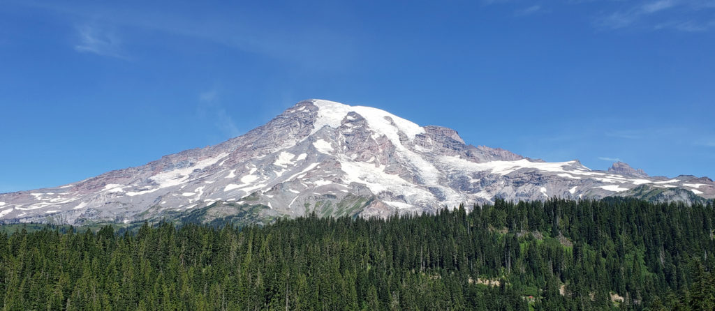 The Longmire area has some interesting history, a museum, nice hiking trails, and the National Park Inn offers both lodging and dining options for the visitor. The road to Longmire is also plowed in the winter, so it’s a year round destination. (The road from Longmire to Paradise is open in winter when the weather allows.)
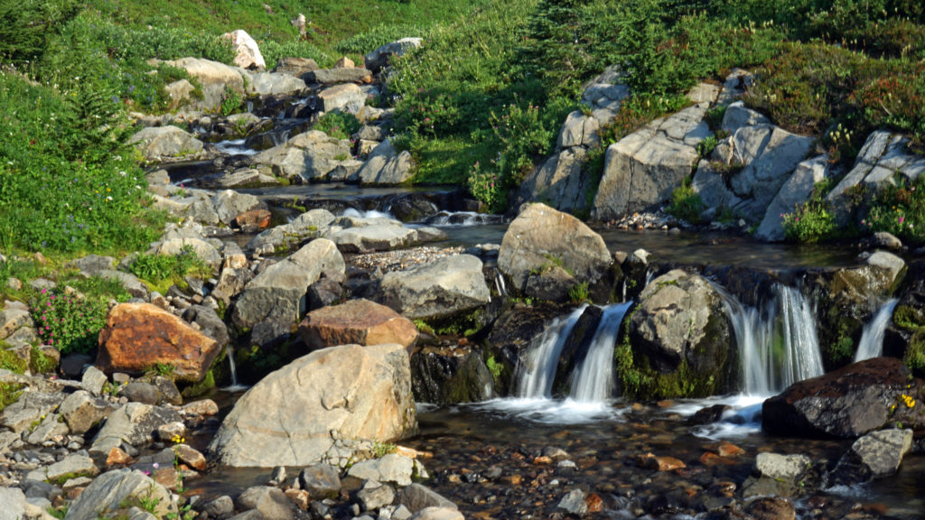
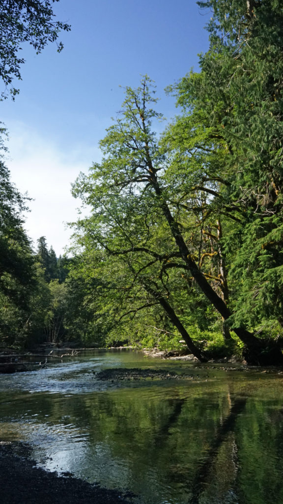 In the Ohanapecosh area in the southeastern corner of the park, the Grove of the Patriarchs Trail is a good family friendly outing. And the nearby Silver Falls Trail is a must for waterfall lovers. In the northeastern section of the park, the Sunrise area offers beautiful views of the eastern side of the mountain and has an abundance of hiking trails.
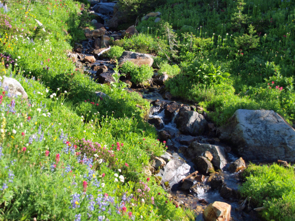
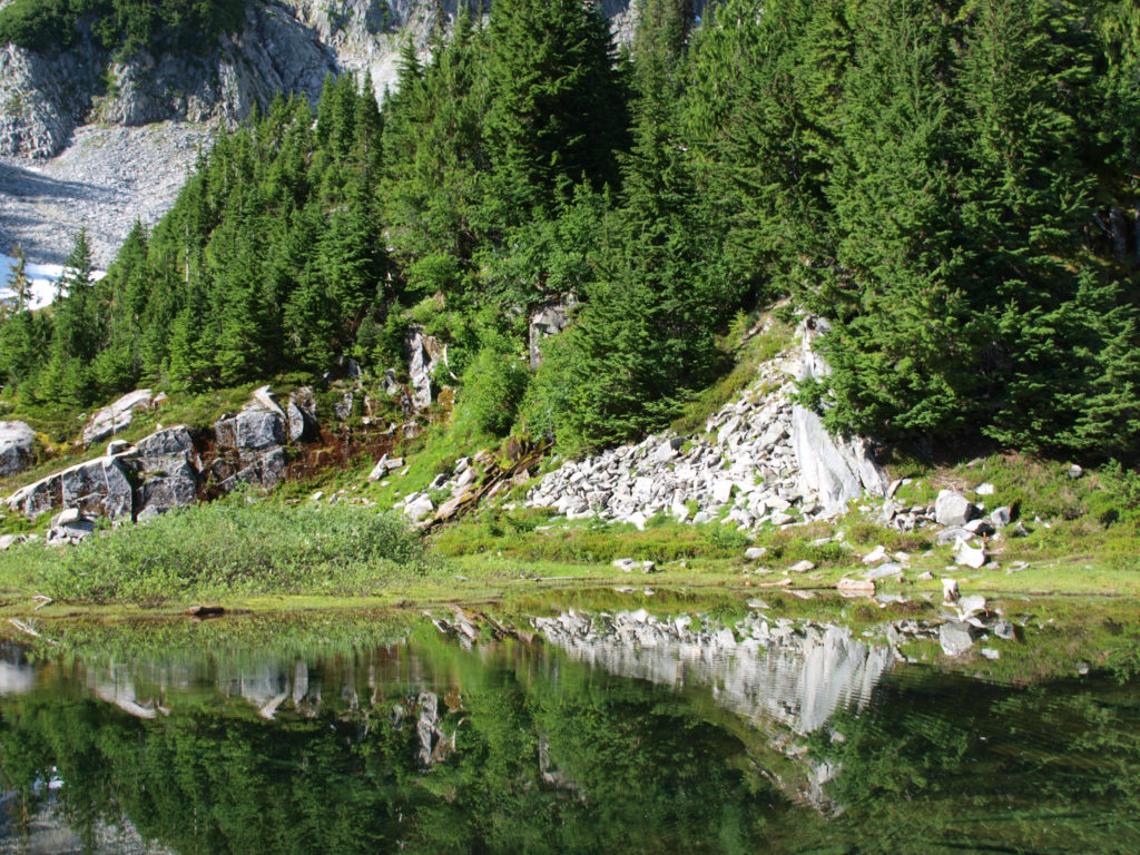
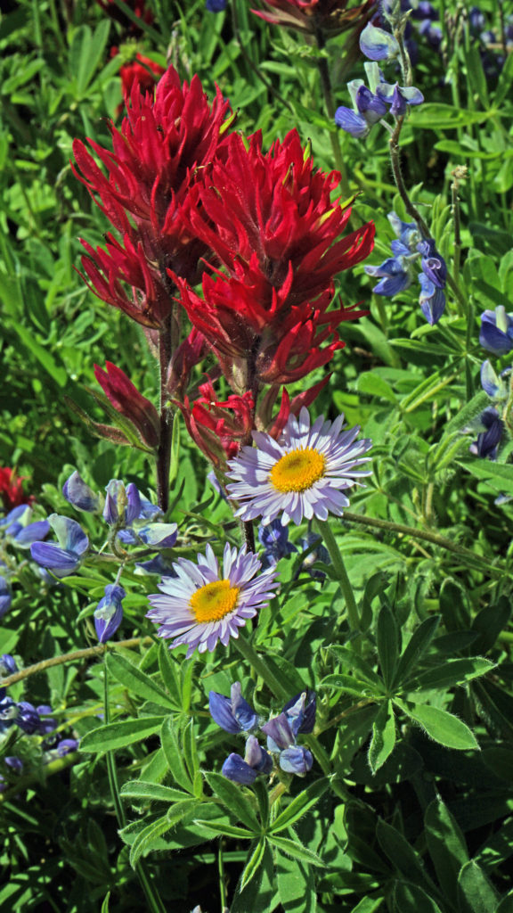
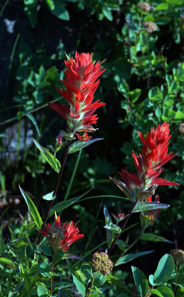
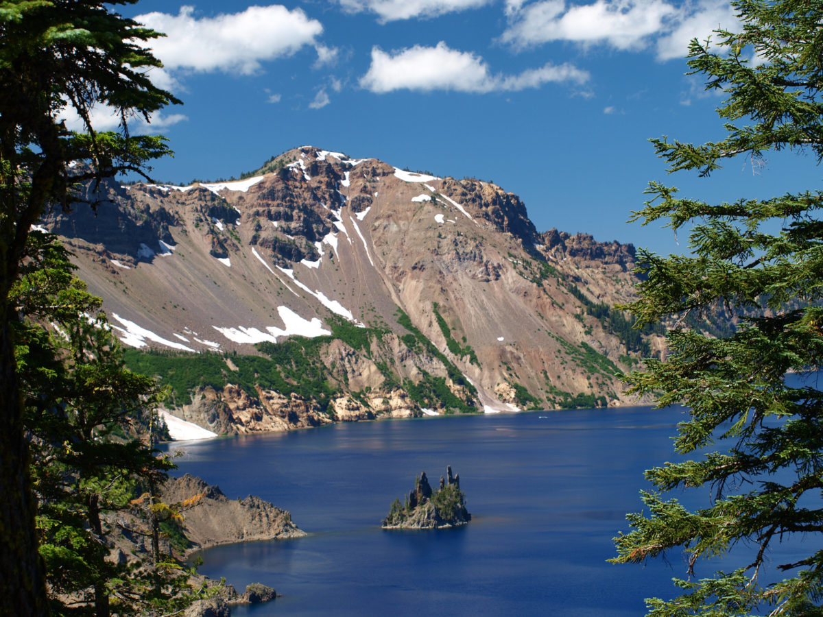
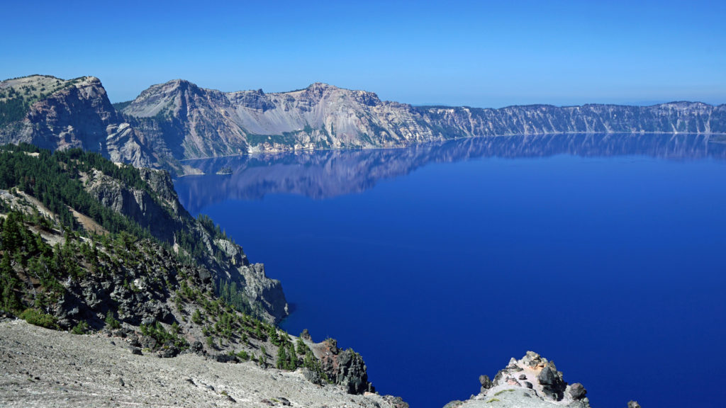 The Lake
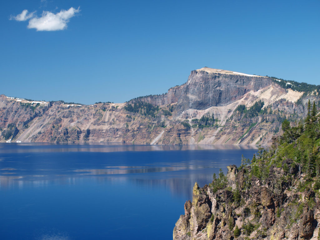 Crater Lake is 1943 feet deep, making it the deepest lake in the United States, second deepest in North America, and ninth deepest in the world. It is also one of the cleanest and clearest lakes in the world. It’s that combination of depth and clarity that results in its intense deep blue color.
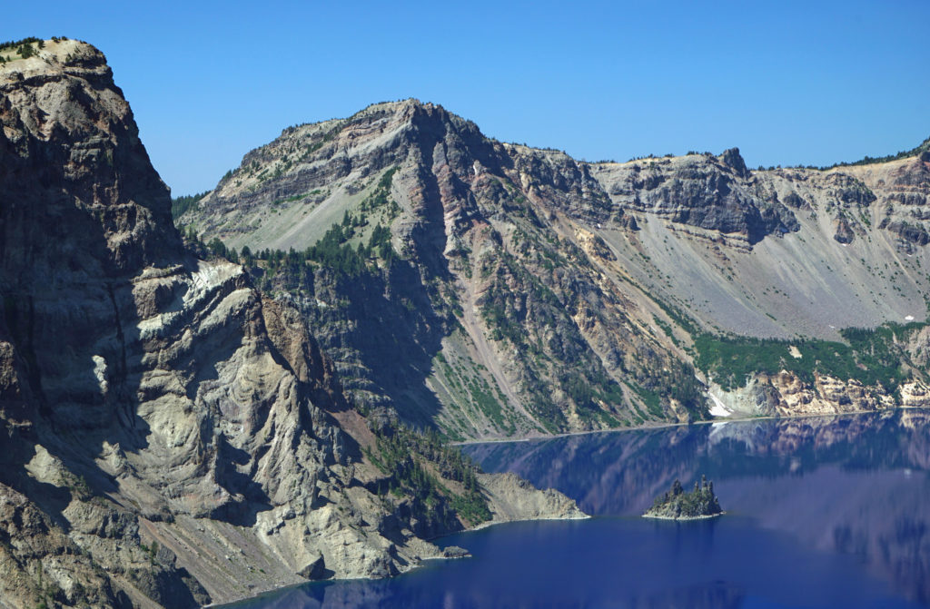 The caldera that Crater Lake occupies was formed 7700 years ago when the summit of 12,000 foot tall Mount Mazama collapsed after a massive eruption. Over time rain and snow filled the caldera to its present level. The lake has no outlet. The level of the lake remains nearly the same because the amount of evaporation from the surface of the lake closely matches the amount of precipitation falling on it in any given year.
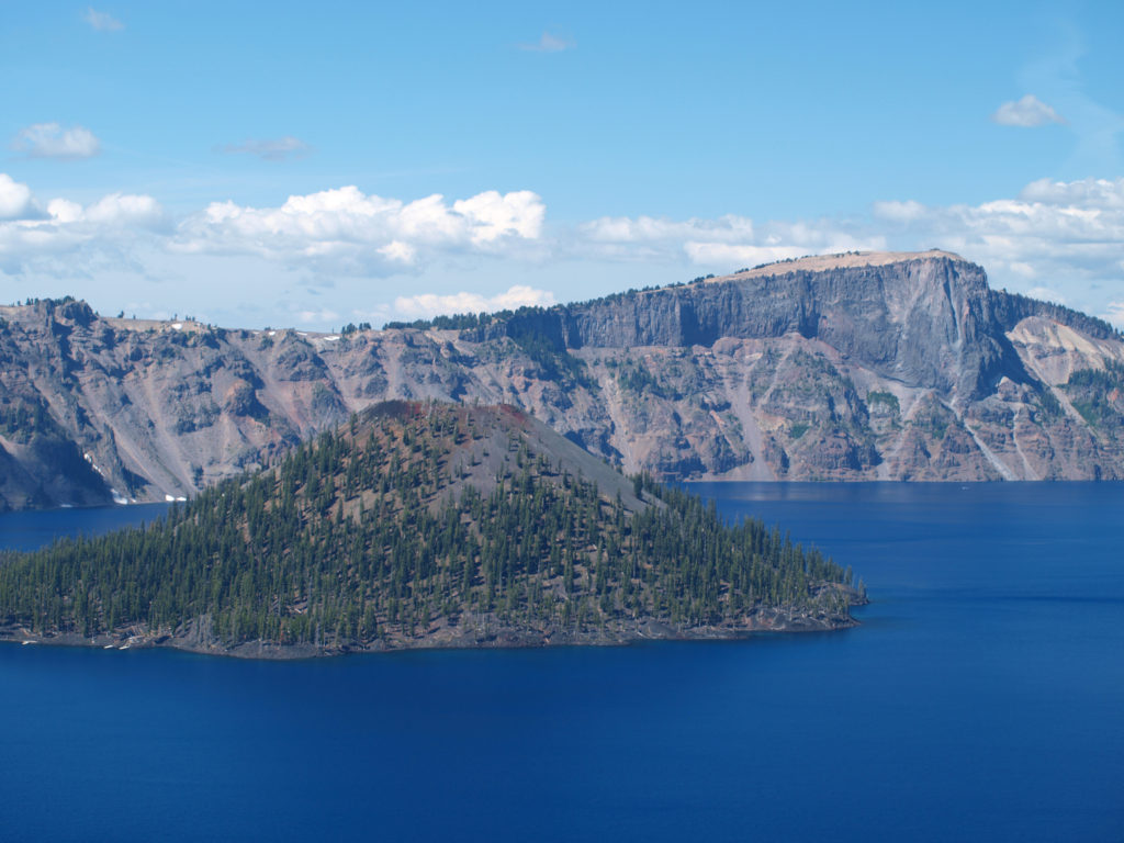 Wizard Island formed sometime after the eruption that formed the caldera. It rises 770 feet above the surface of the lake, 2713 feet above the deepest point in the lake. It last erupted about 5000 years ago, but it is considered dormant, not extinct. Conceivably, it could erupt again at any time. Merriam Cone also erupted after the caldera was formed, but never reached the lake surface. Its summit lies almost 500 feet below the average lake level.
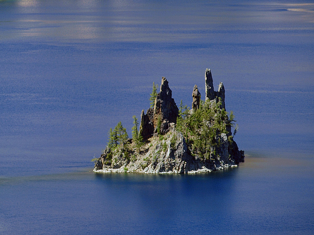 Phantom Ship, a remnant of an eruption 400,000 ago, rises 170 feet above the lake surface. Its formation predates that of Mount Mazama itself.
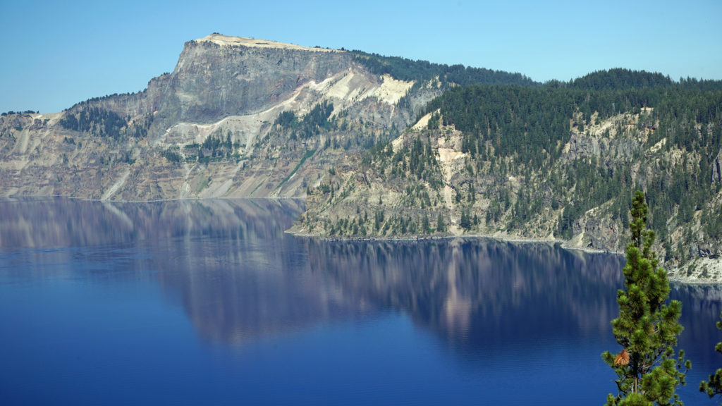 The Park
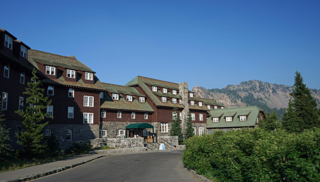 Crater Lake Lodge
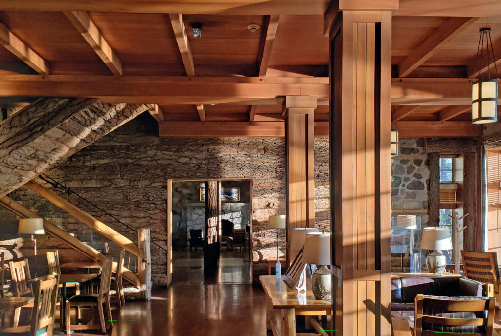 My wife and I recently spent three nights at the lodge. Although it lacks the amenities of a luxury hotel, our room was comfortable, with a private bathroom, and the location more than makes up any lack of luxuries.
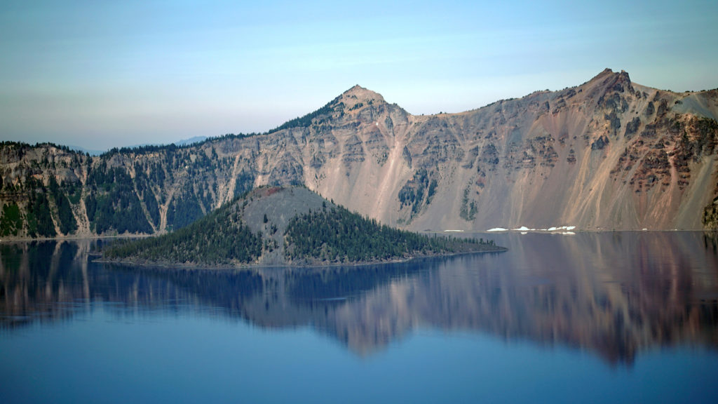 The Rim Drive
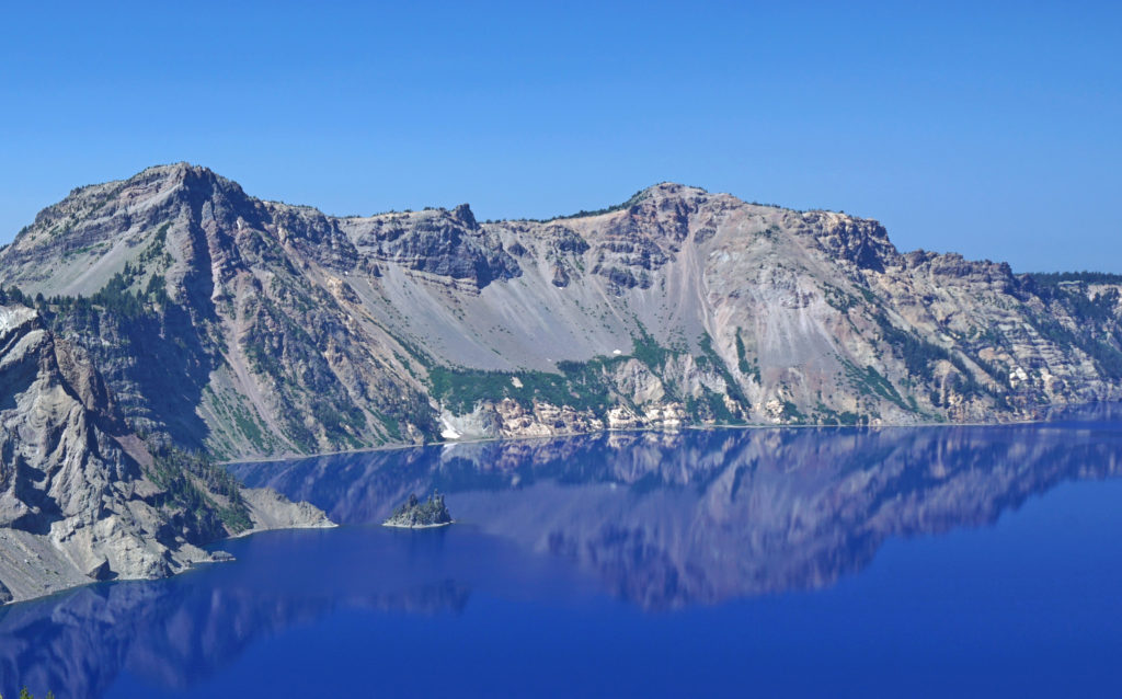 You’ll want to stop at all of the viewpoints. Maybe combine the drive with a hike down to Cleetwood Cove and a boat tour of the lake. You can get off at Wizard Island and hike to the summit and then catch a later boat back.
 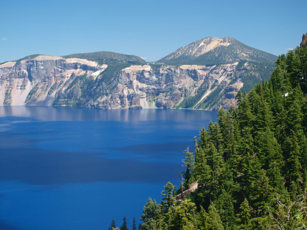 For a more adventurous day, hike to the summit of Mount Scott, the highest point in the park. It’s a two mile hike to the summit with 1250 feet of elevation gain, so it’s not an easy hike (All Trails rates it “moderate”), but the view might just be worth the effort.
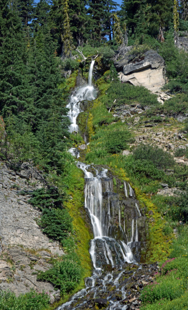
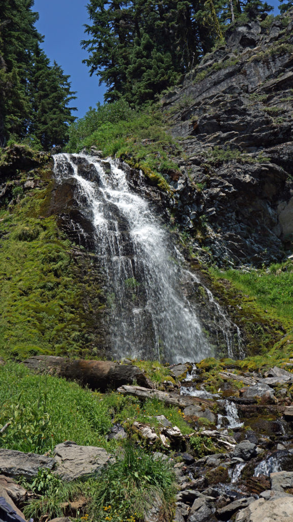 Hiking Trails
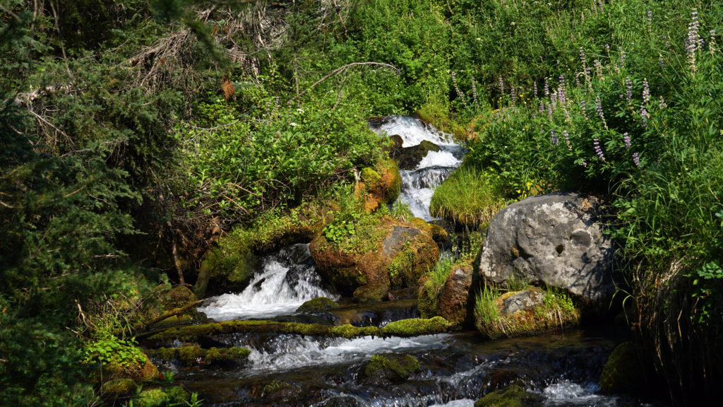 The Pacific Crest Trail passes through the park, but does not ascend to the rim of the caldera. Hikers on the PCT can take the Dutton Creek Trail that climbs up to the Rim Village, then hike the trail that parallels the West Rim Drive and reconnect with the PCT north of the lake.
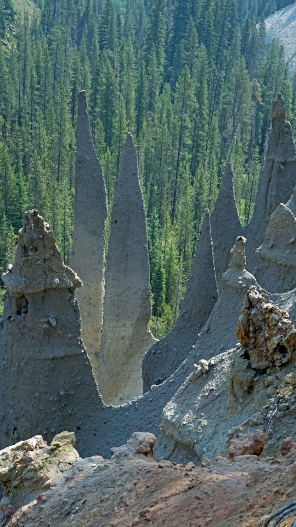
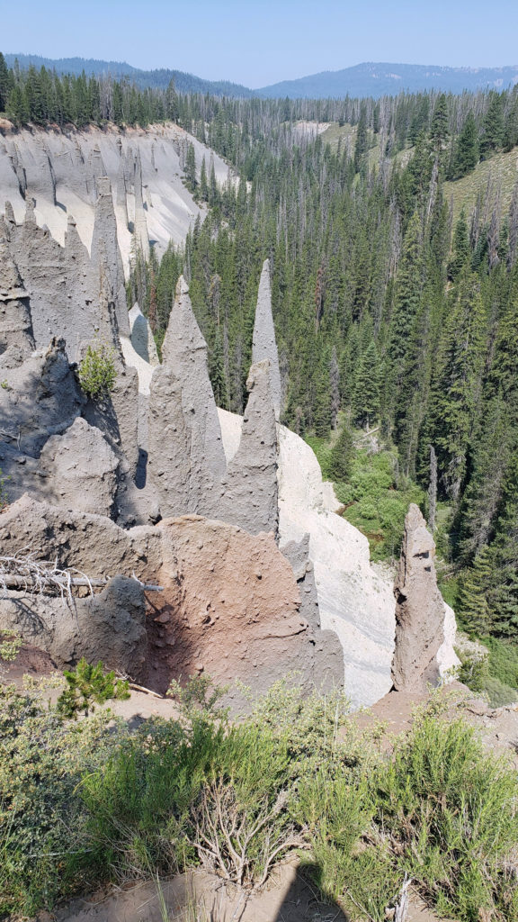 The Pinnacles
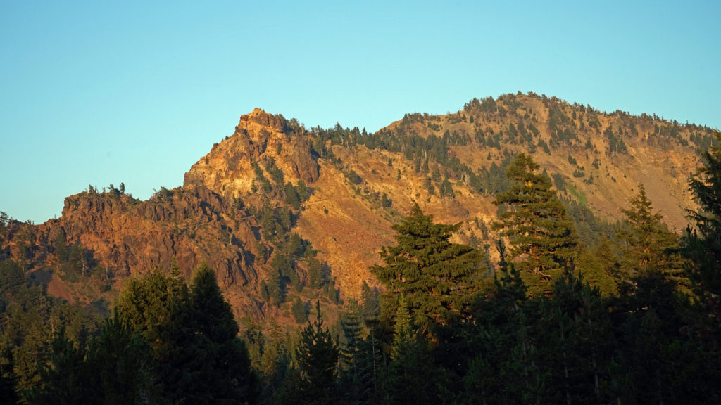 Practical Info
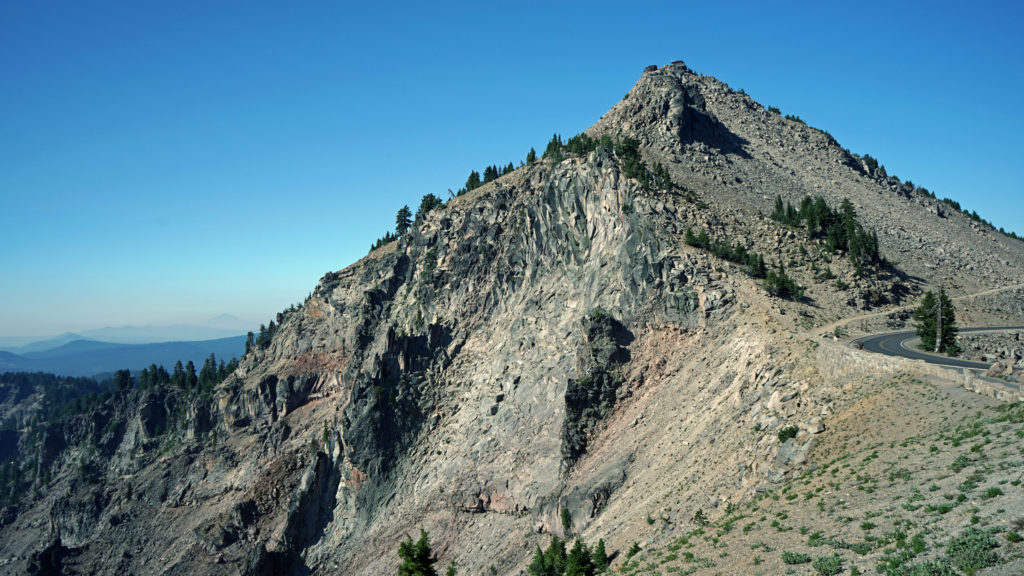
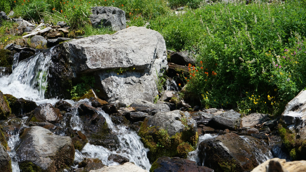 There are two lodges in the park, Crater Lake Lodge in the Rim Village and The Cabins At Mazama Village that are open for the summer season. Crater Lake Lodge has 71 rooms, starting at $246/night. The Cabins At Mazama Village has 40 rooms, all at $160/night. Prices listed are for the 2024 season. Note that the concessionaire that operates both lodges is changing, so prices may also change. Check the park website (linked above) for current information.
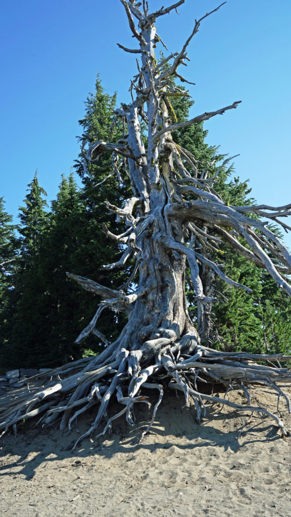
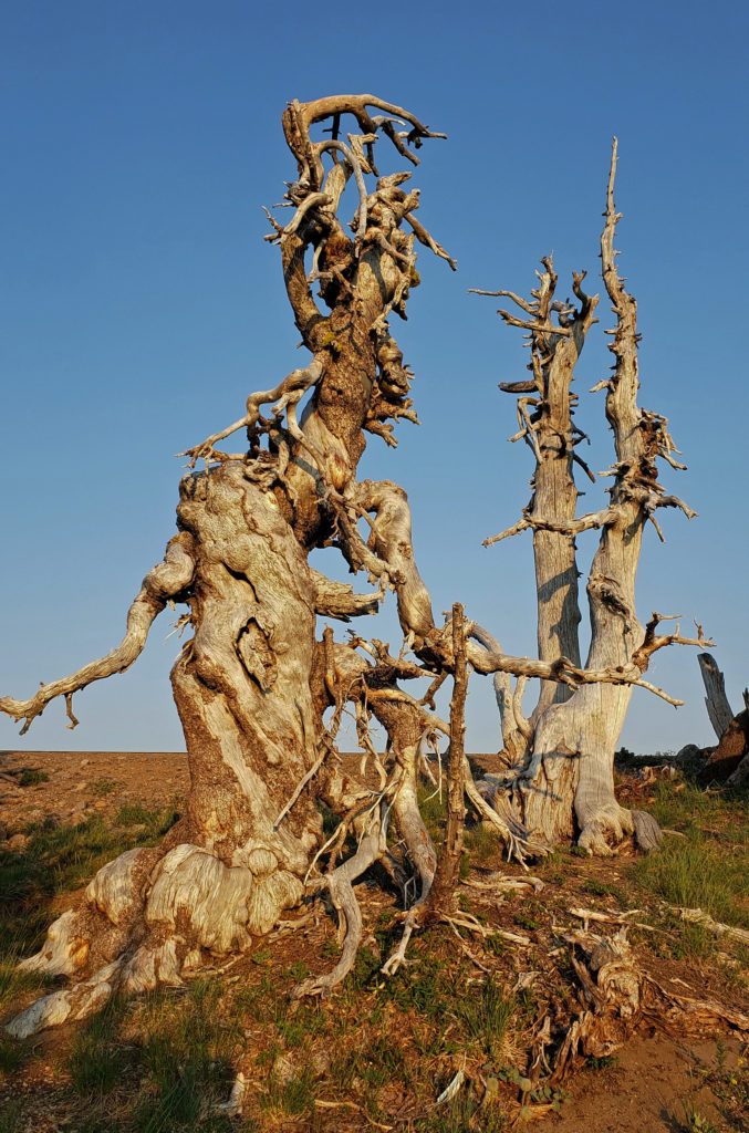 There are two campgrounds in the park. Mazama Campground has 75 RV sites, 18 tent sites with electricity, and 121 tent sites without electricity. Tent sites start at $22. RV sites run from $32 to $44 per night. Mazama Campground is usually open from early June through late to September. Lost Creek Campground, located on Pinnacles Road, is a primitive tent only campground with 18 sites, operated by the park service. Lost Creek Campground is currently closed and will not be open for the 2024 season. Backcountry camping is allowed in the park by
 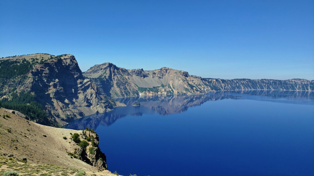 Dining options in the park are somewhat limited. The dining room at Crater Lake Lodge is open to all visitors, but reservations can only be made by people staying in the park. The Rim Village Cafe offers “grab and go” sandwiches and salads (I had a pulled pork sandwich from there on our recent visit that was very good). It is open from 9am to 8pm in the summer and 10am to 5pm in the winter. The Annie Creek Restaurant in Mazama Village is open from 7am until 9pm. The Mazama Village Store sells packaged sandwiches and snacks.
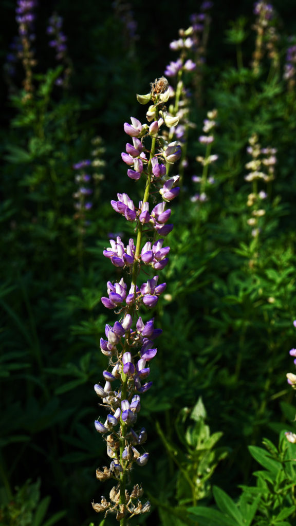 Summer park entrance fees are $30 for private vehicles and $25 for motorcycles. Winter fees are $10 less. Snowmobilers, bicyclists, and pedestrians are charged $15 per individual. All entrance fees are good for seven days. Entry reservations do not need to be made.
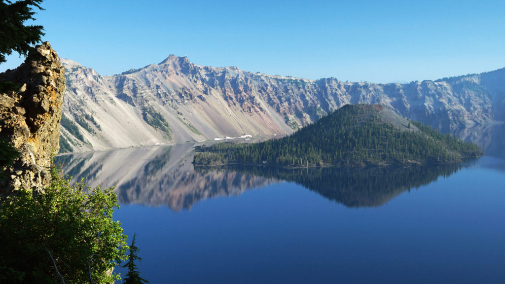
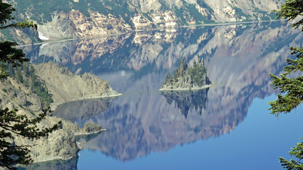 Originally posted September 13, 2021. Most recently updated April 6, 2024.
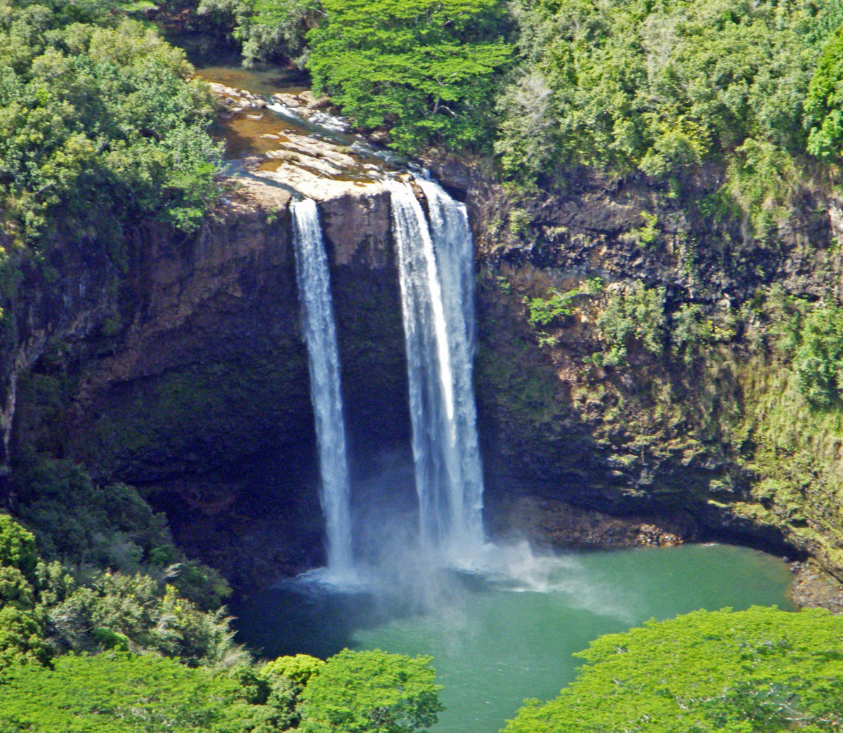
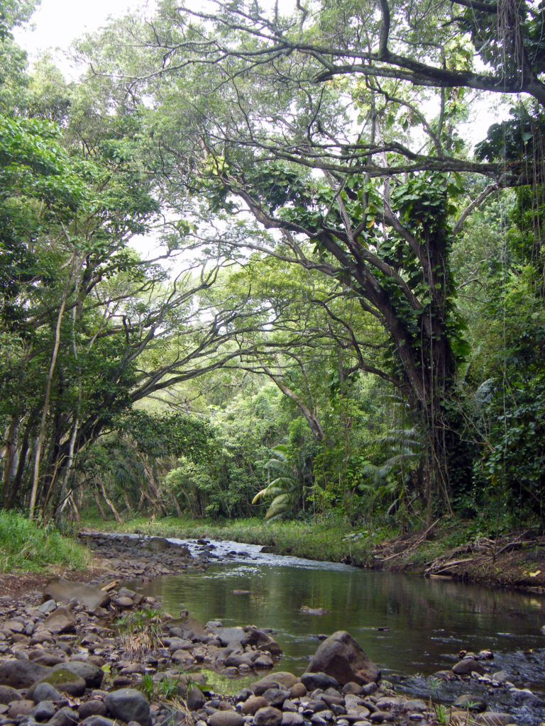
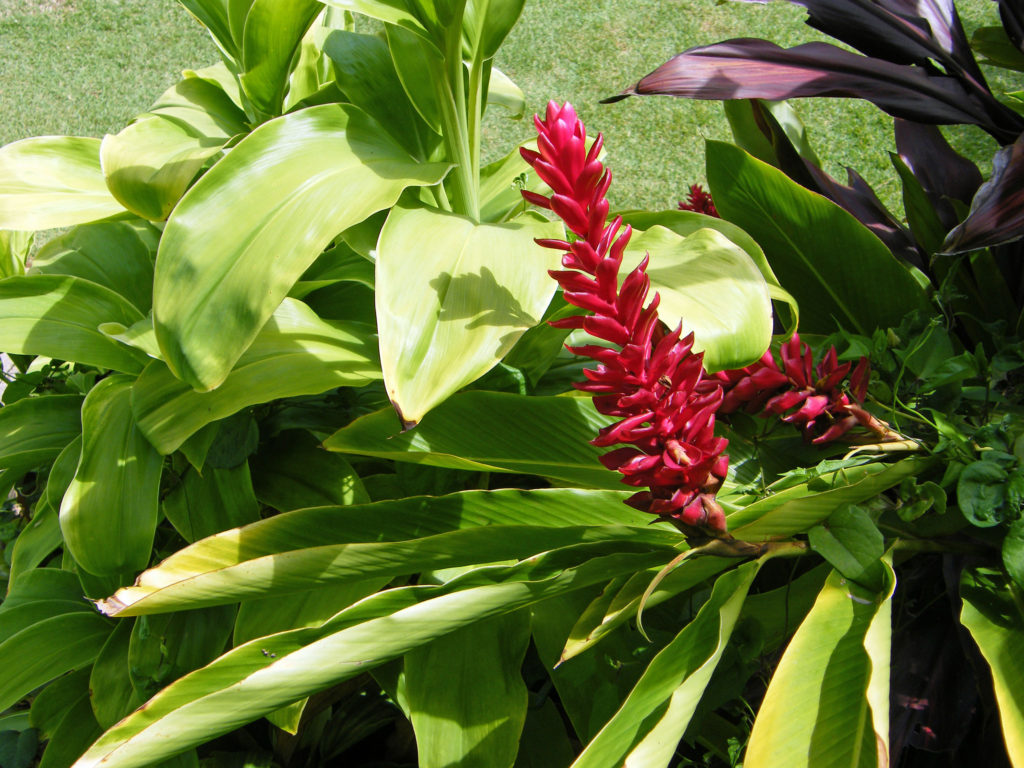
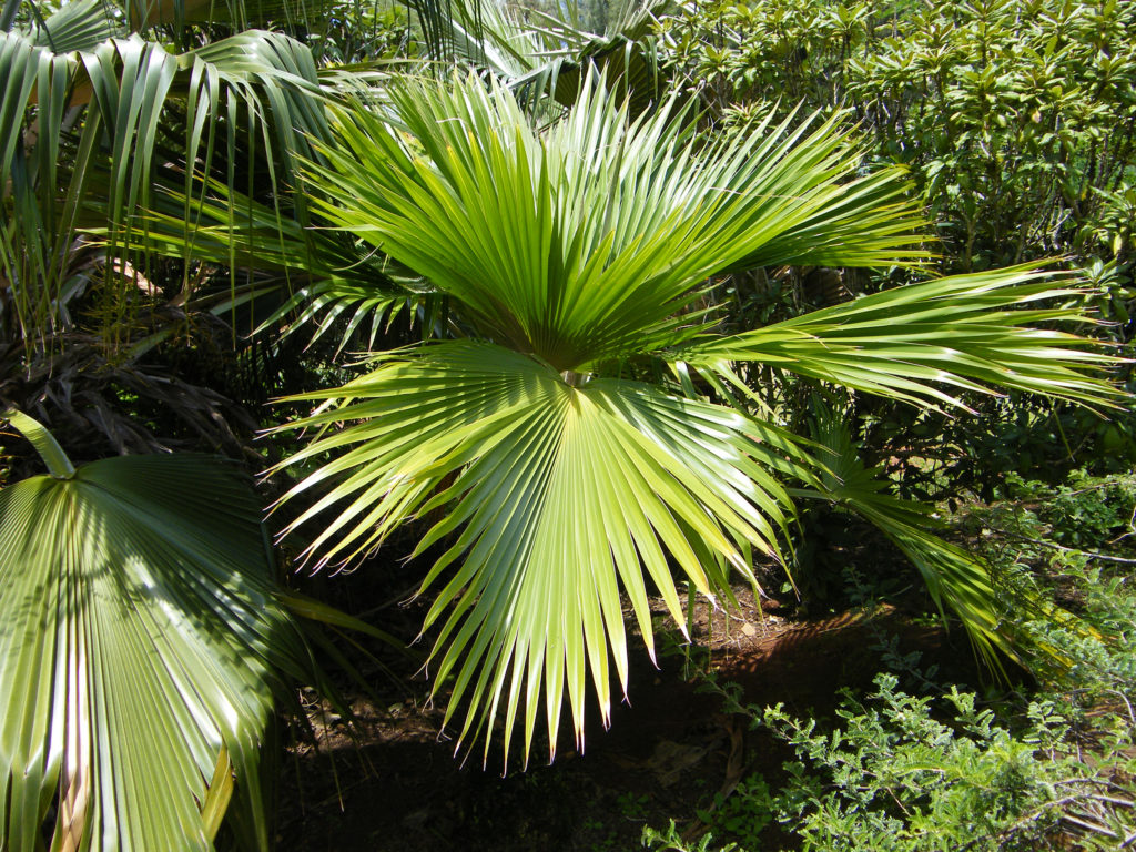
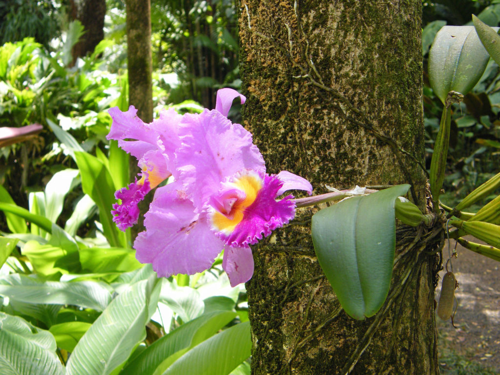
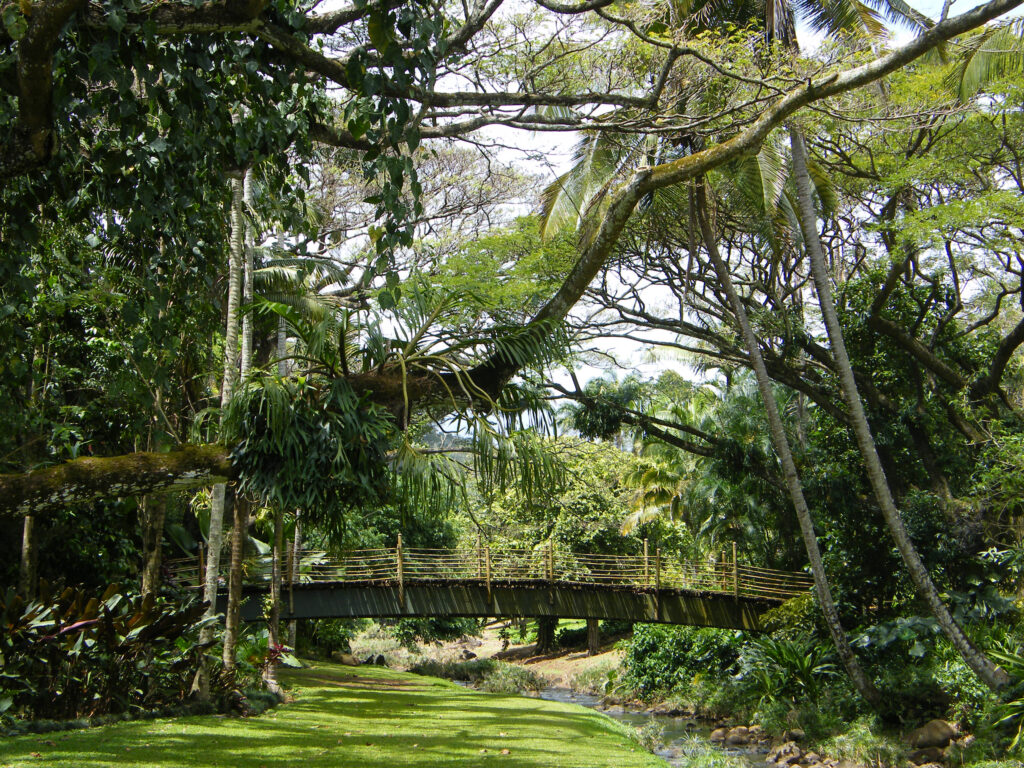
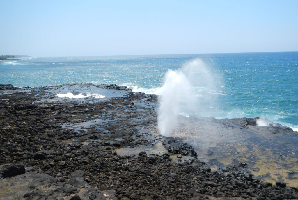
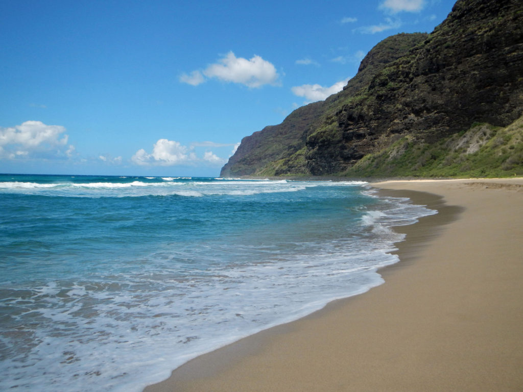
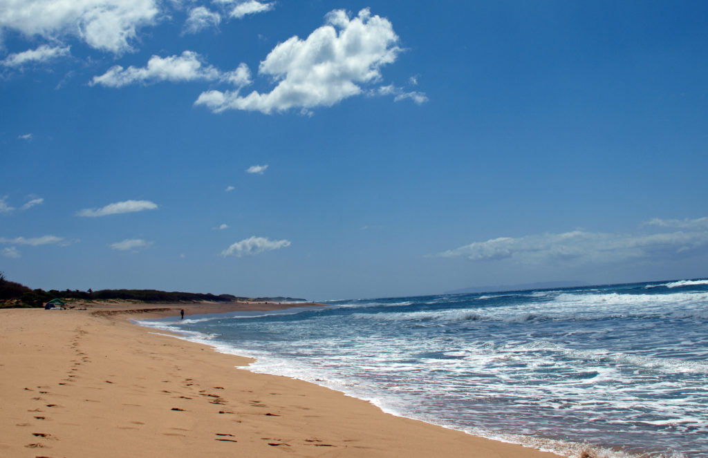
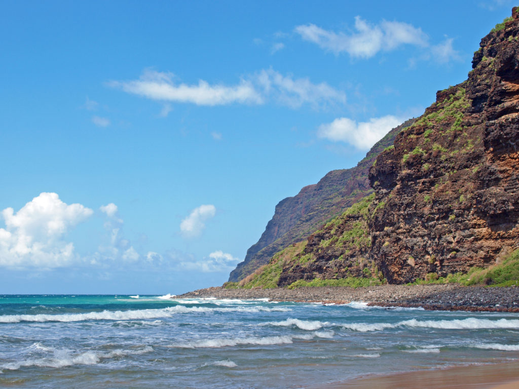
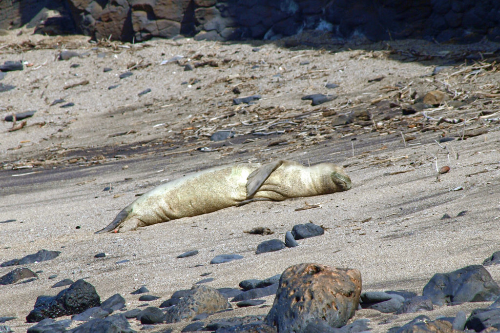
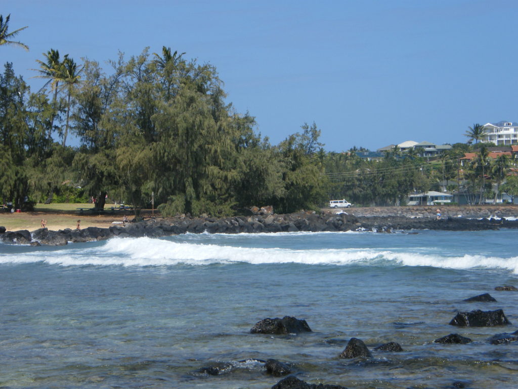
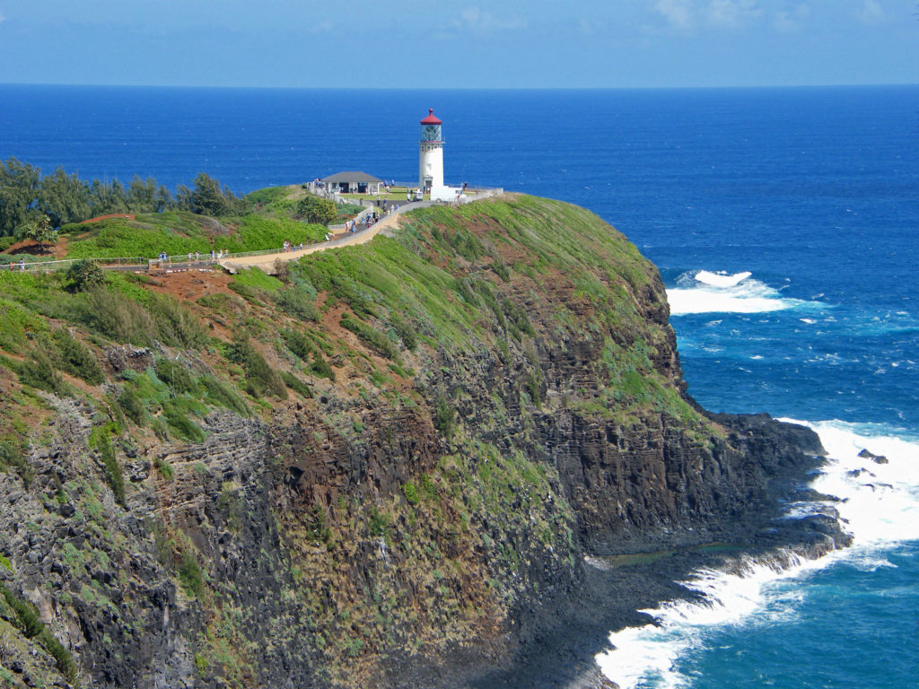
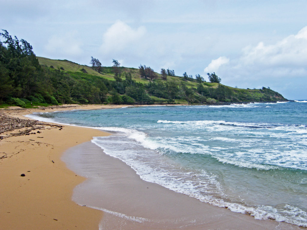
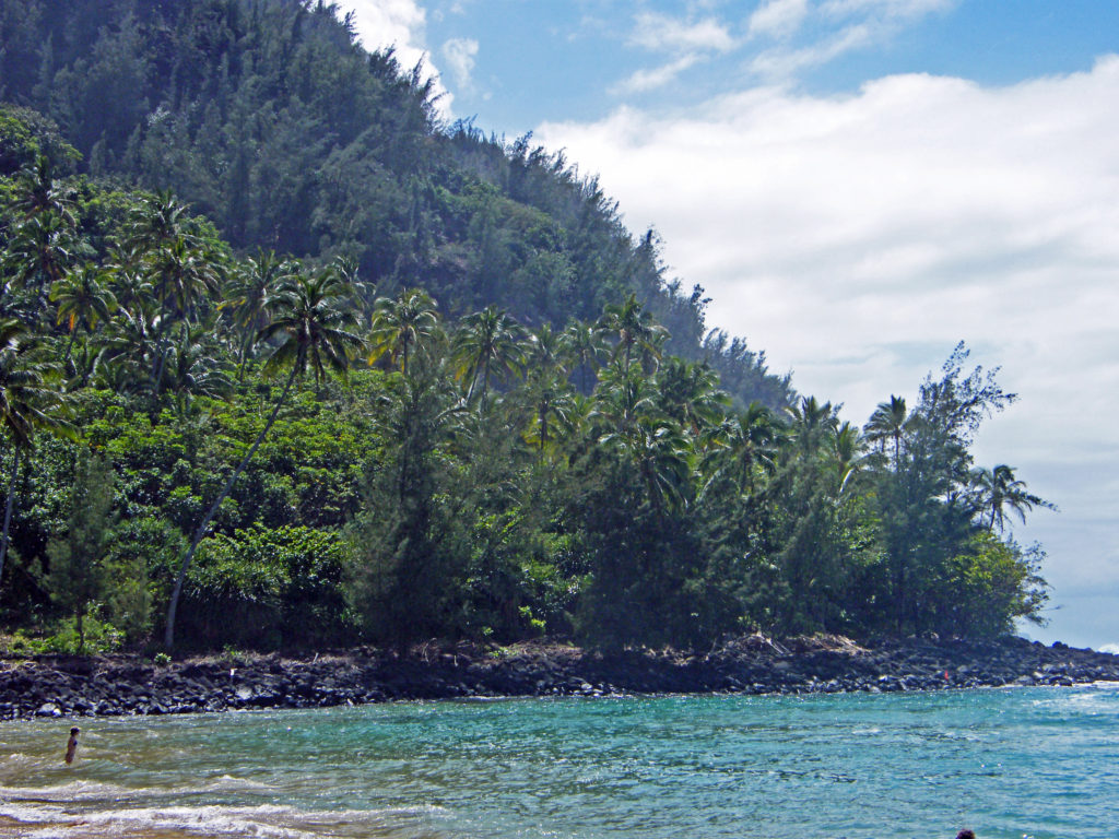
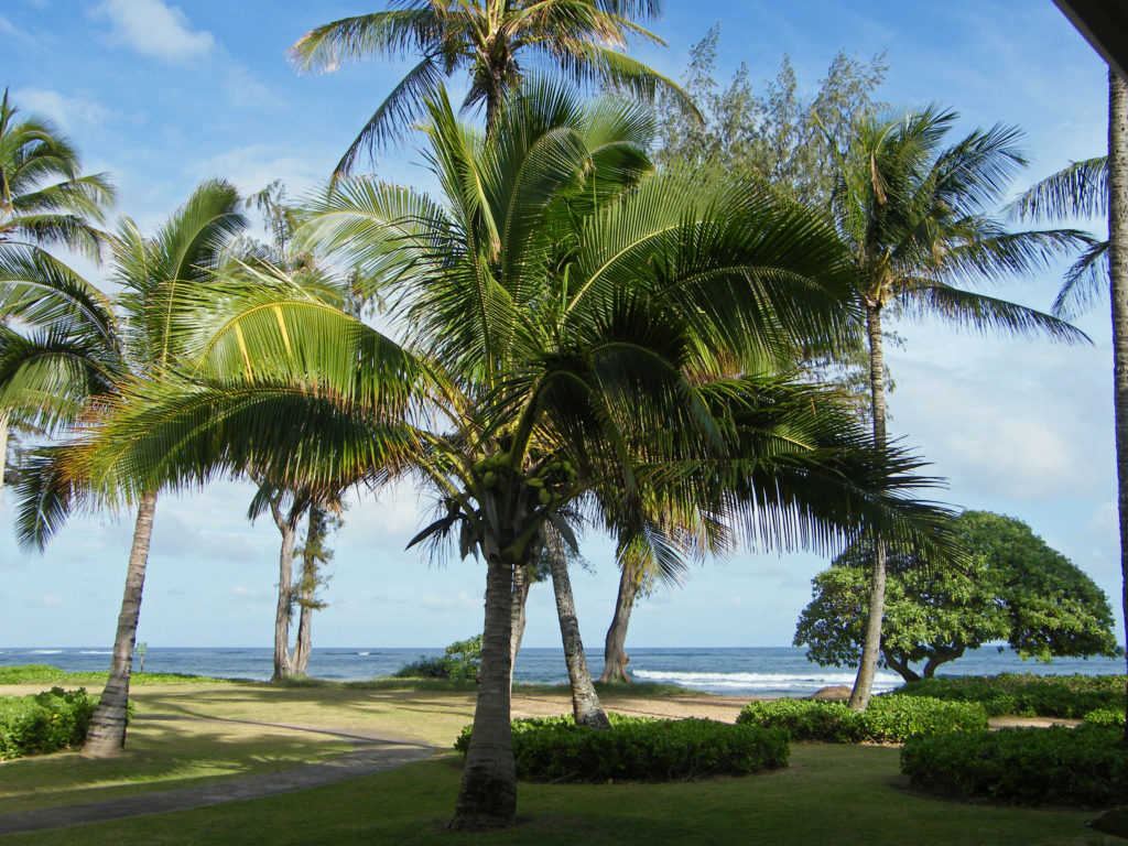
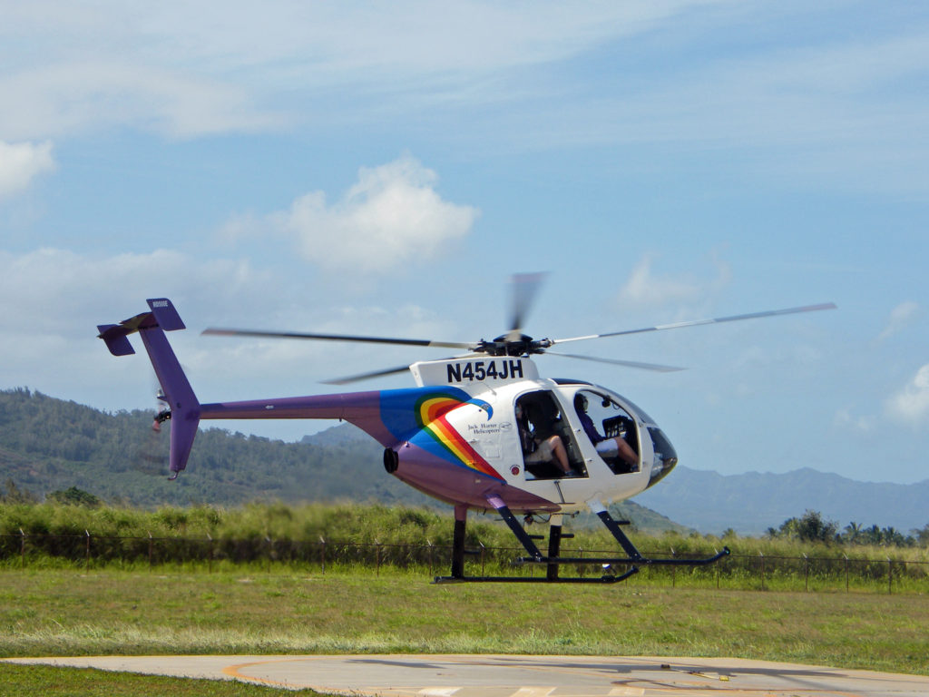
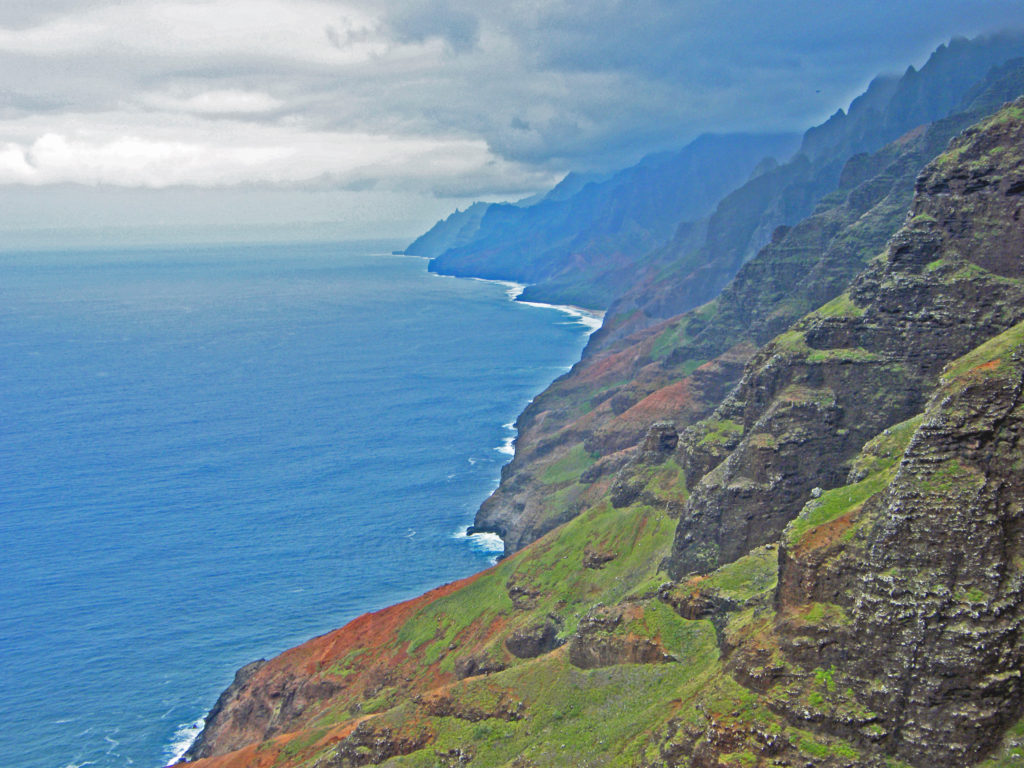
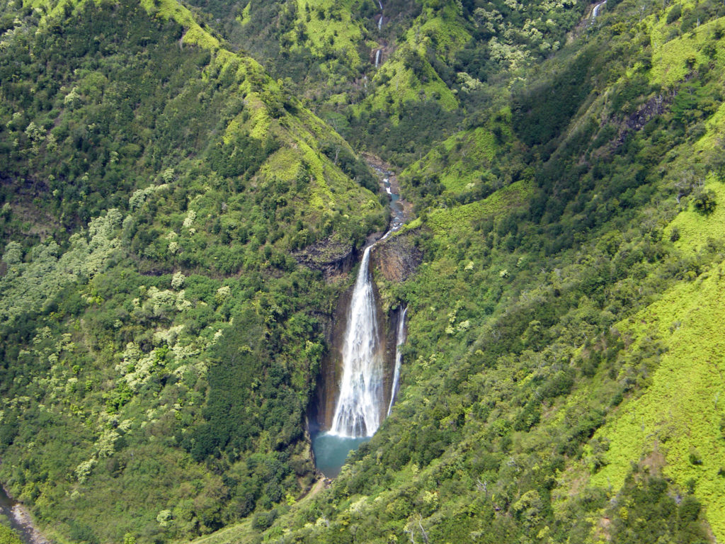
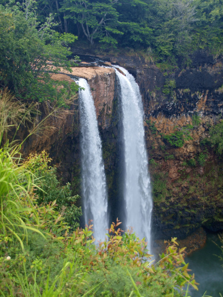
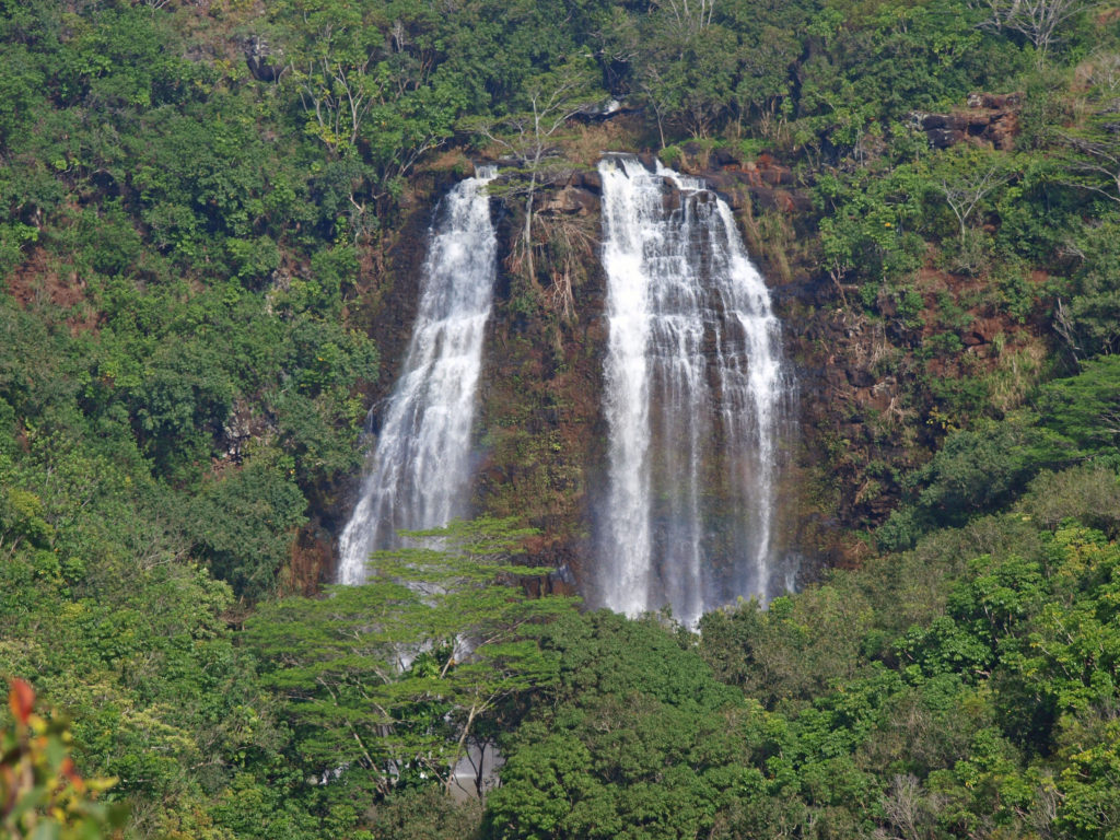
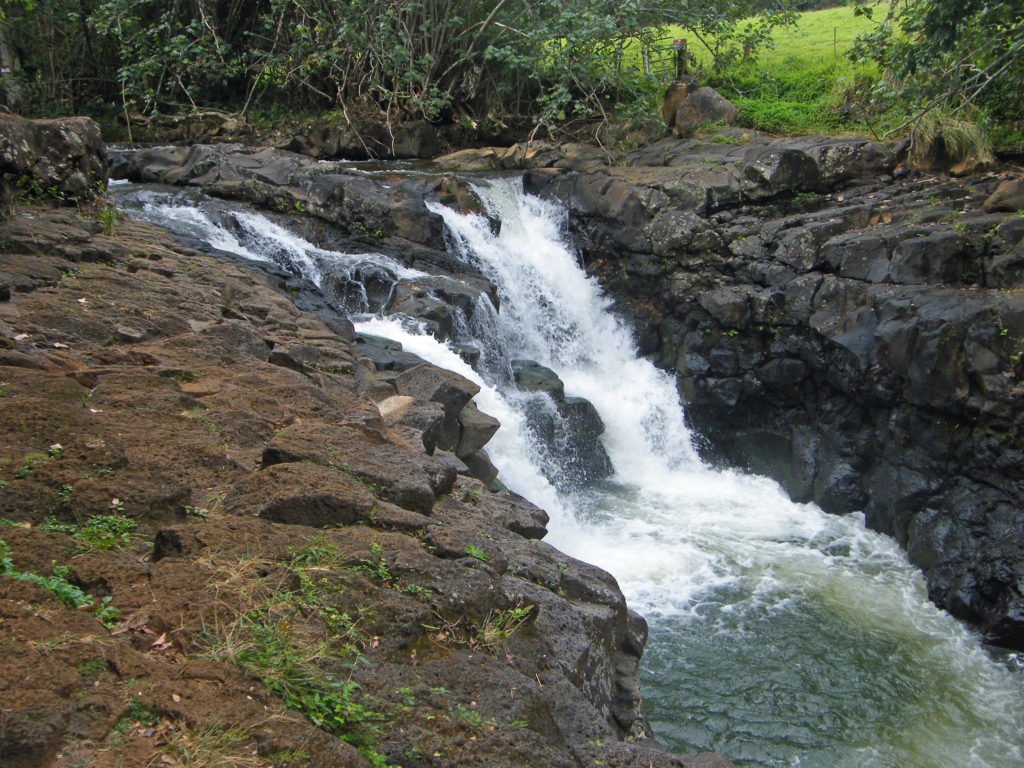
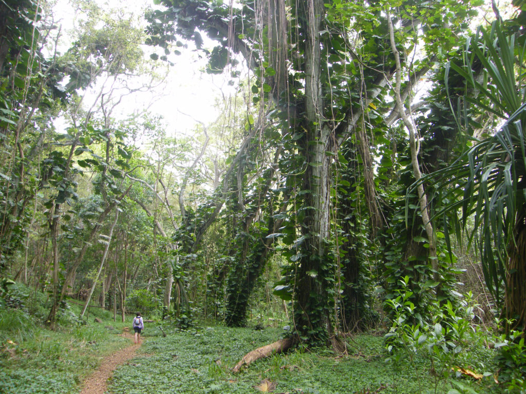
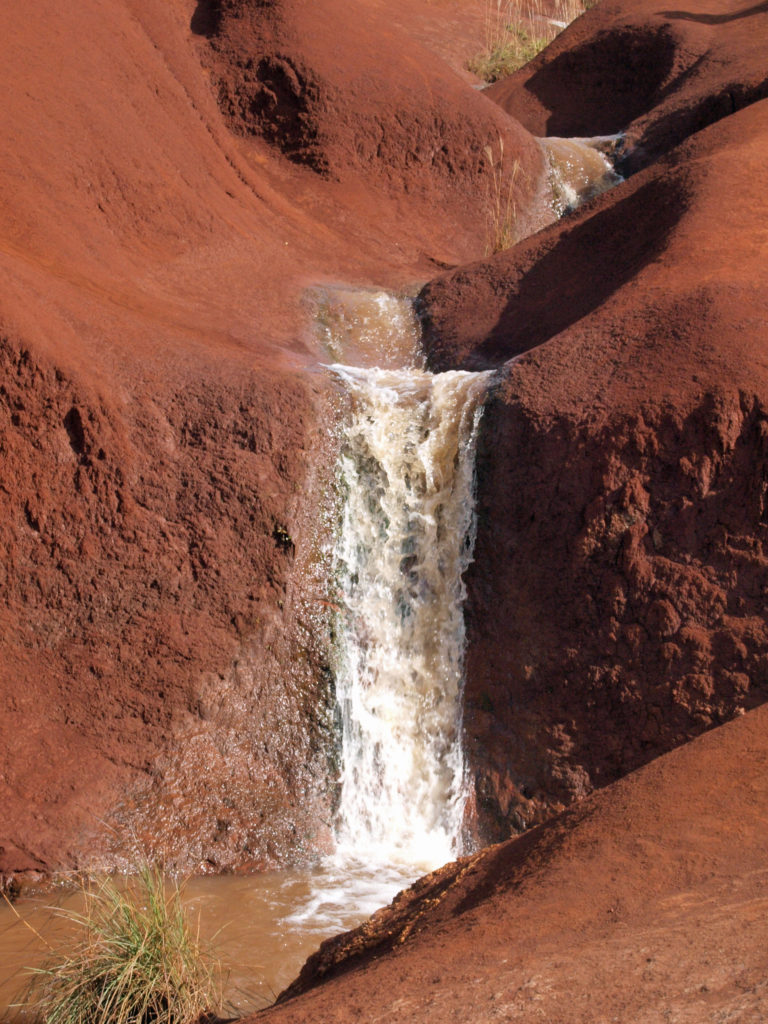
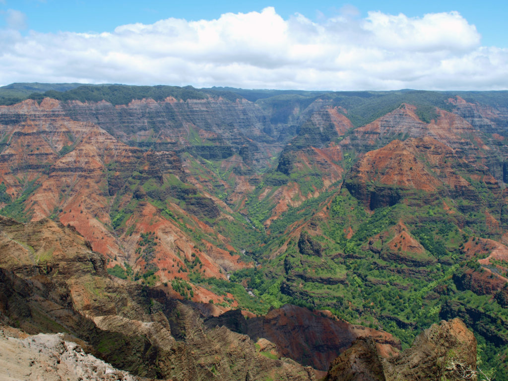
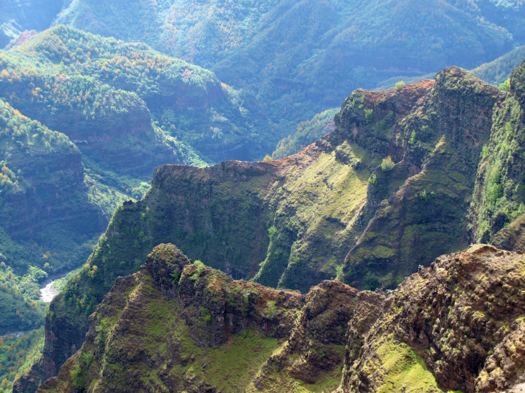
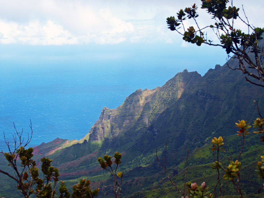
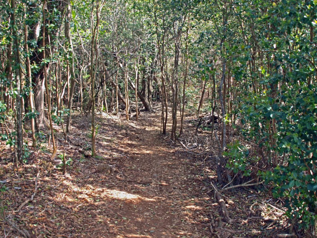 For hikers, there are more than 45 miles of trails in the canyon. You could easily spend days in the canyon and not hike all of the trails. For those that do want to spend multiple days hiking or sightseeing,
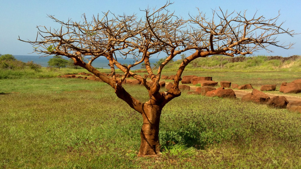
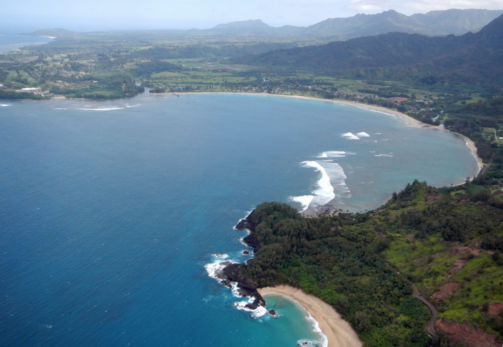
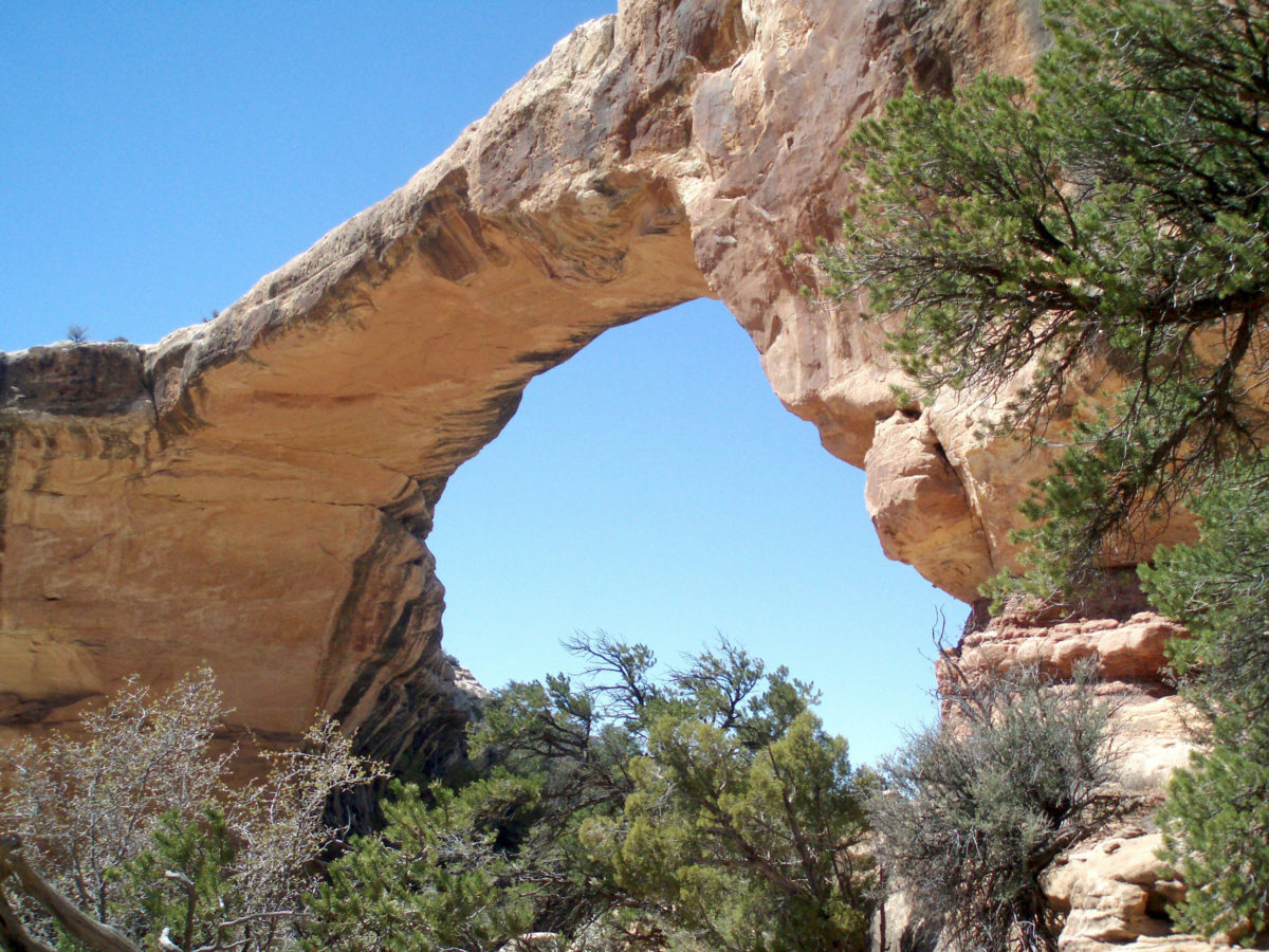
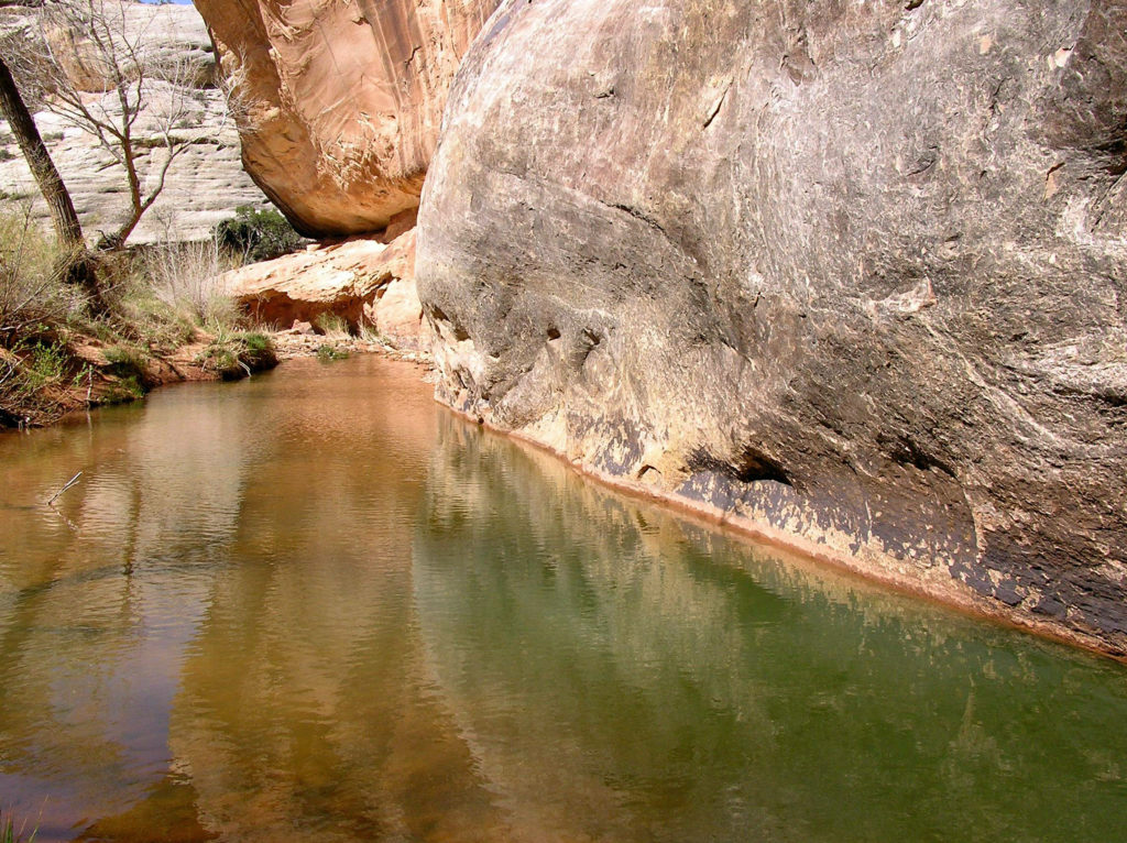 First Impressions
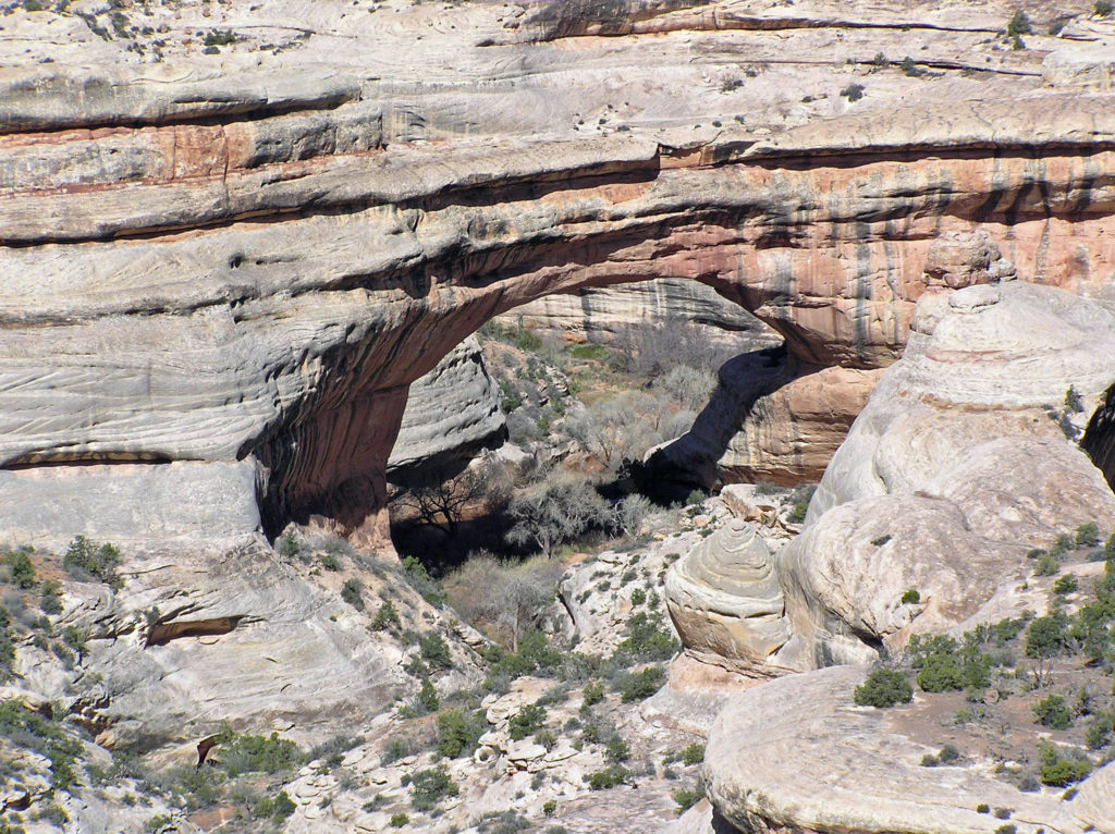 My wife and I have been back once since that first visit. The photos here were taken on that second trip in 2008. I think we’re long overdue for a third visit.
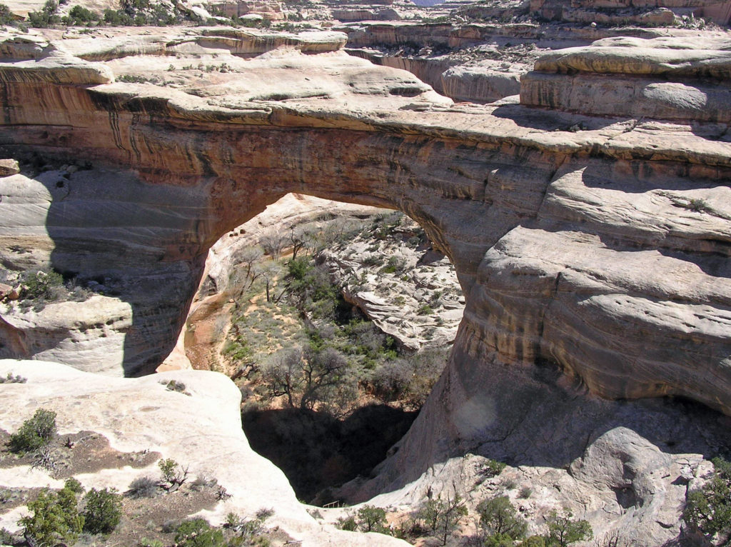
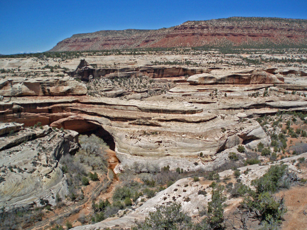 The white Cedar Mesa Sandstone of the canyons in Natural Bridges was formed from white quartz sand with relatively little iron. The red and orange sandstone of the mesa tops gets its color from more iron rich rocks. Oxygen and hydrogen react with the iron, forming compounds that vary in color depending on the relative proportions of oxygen and hydrogen in the rock.
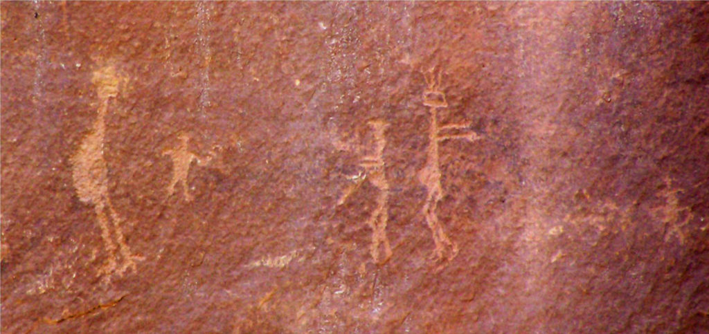 Human Presence
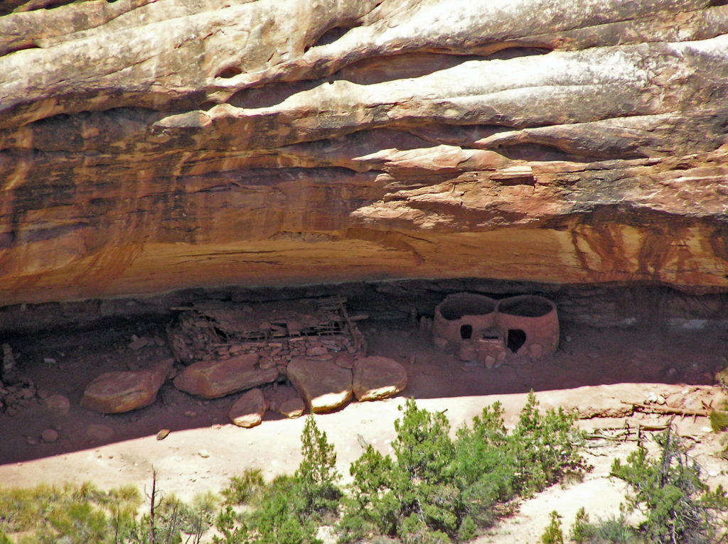 The Ancestral Puebloan people began farming the mesa tops around 1500 years ago, but later abandoned the area, presumably because of a prolonged drought. After 300 years, the ancestors of modern day Hopi and Navajo returned to the Natural Bridges area, only to abandon the area again around the year 1280 CE. Modern Hopi, Navaho, and Paiute peoples reoccupied the area once again at later dates.
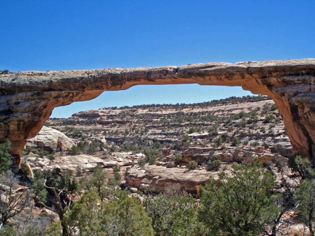 Europeans didn’t discover the area until 1883 when prospector Cass Hite ventured into the canyons looking for gold. He didn’t find any gold, but he did find the three magnificent natural bridges. Twenty years later, National Geographic Magazine published an article about the bridges, gaining the attention of President Theodore Roosevelt, who established
 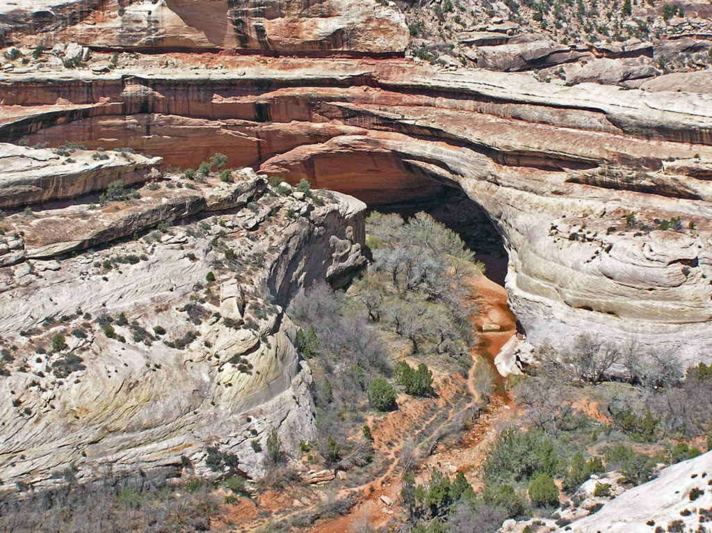 The bridges were named President, Senator and Congressman by Cass Hite. Later explorers gave them the names Augusta, Caroline and Edwin. But neither set of names stuck. In 1909 the bridges were given the Hopi names they carry today: Sipapu, Kachina, and Owachomo.
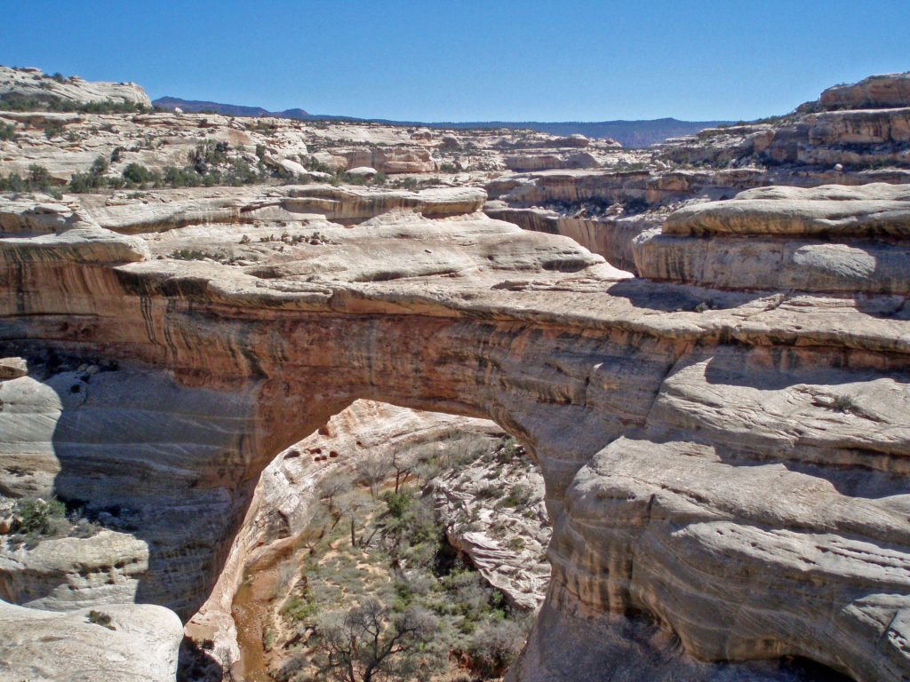
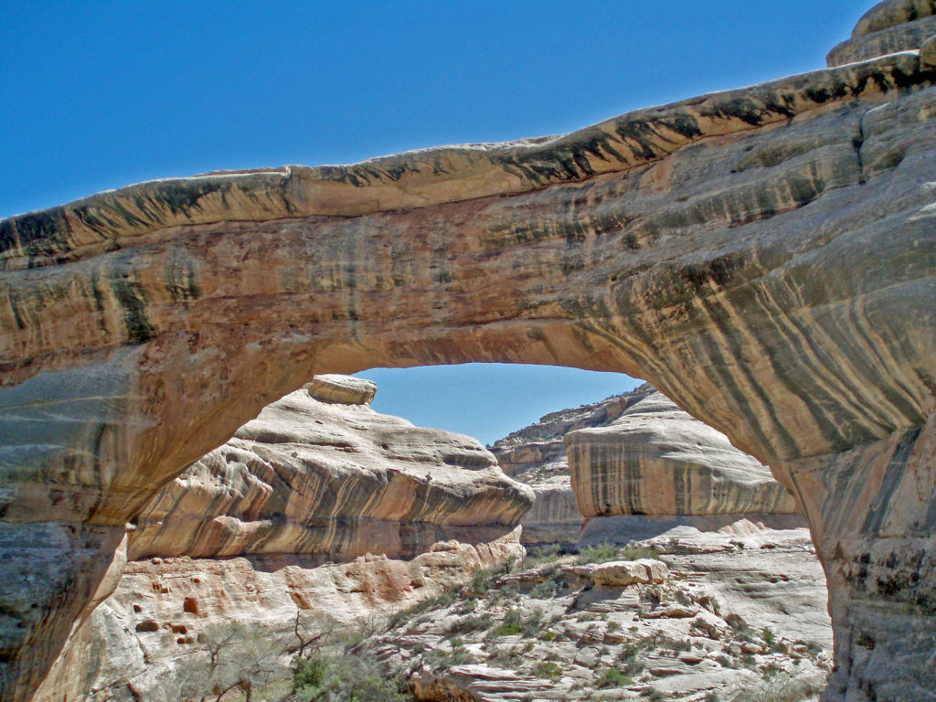 Visitor Center
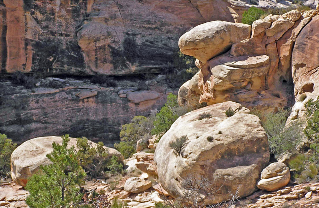
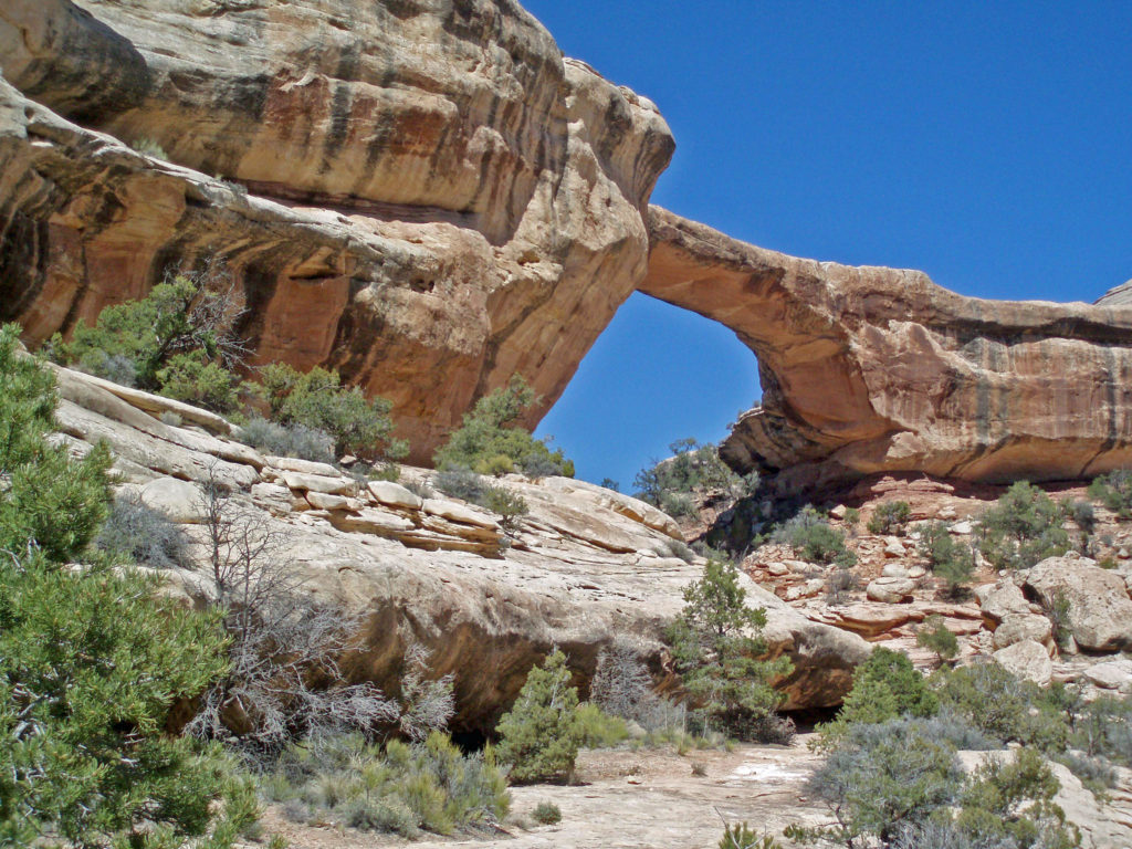


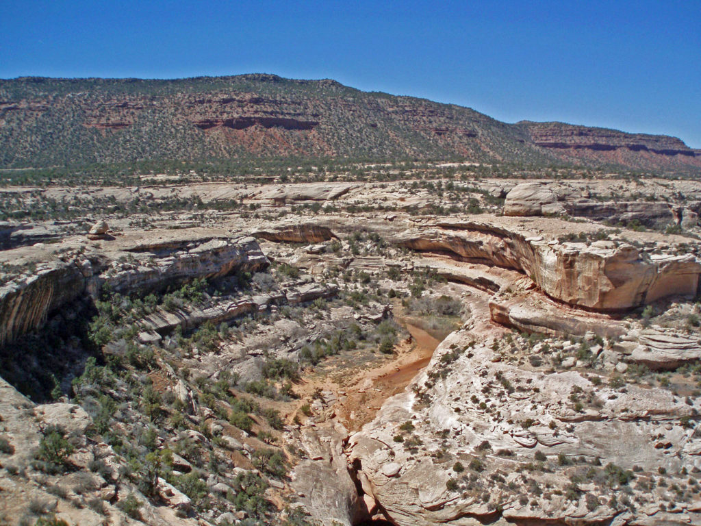 Conclusion
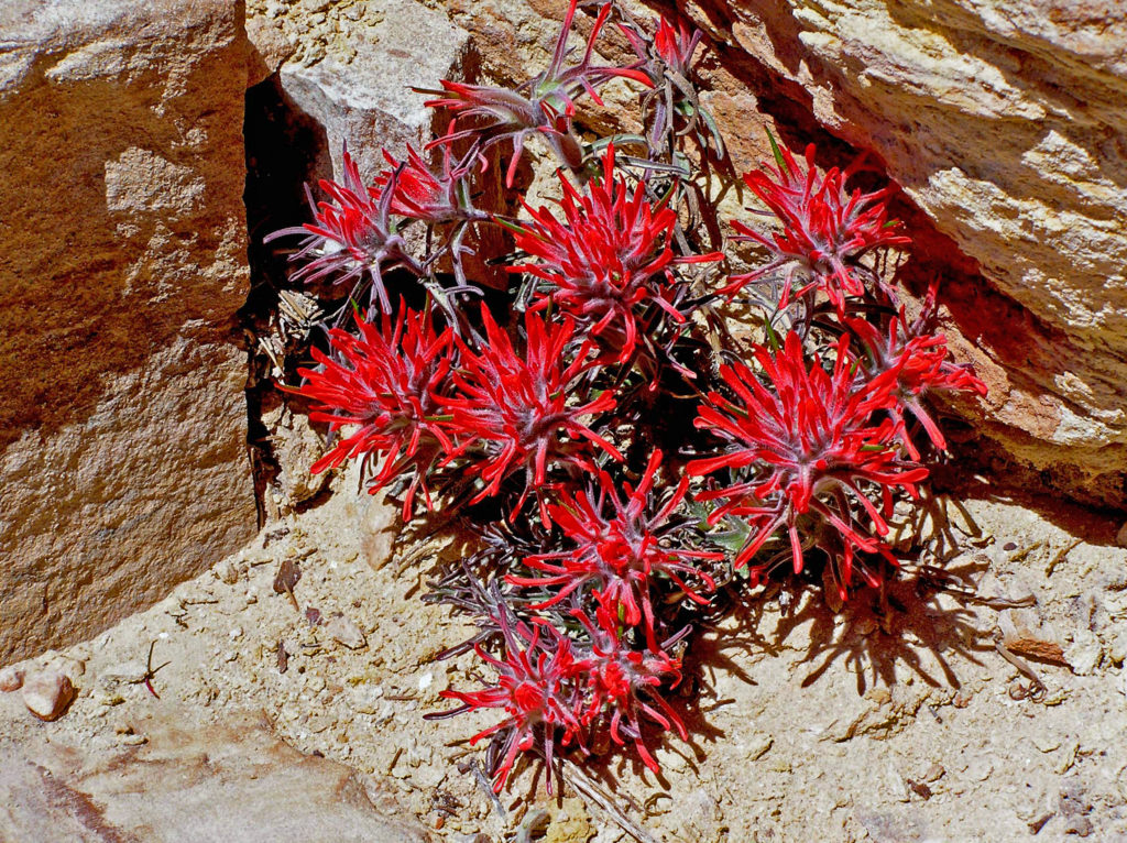 Originally posted July 10, 2021. Updated July 21, 2024.
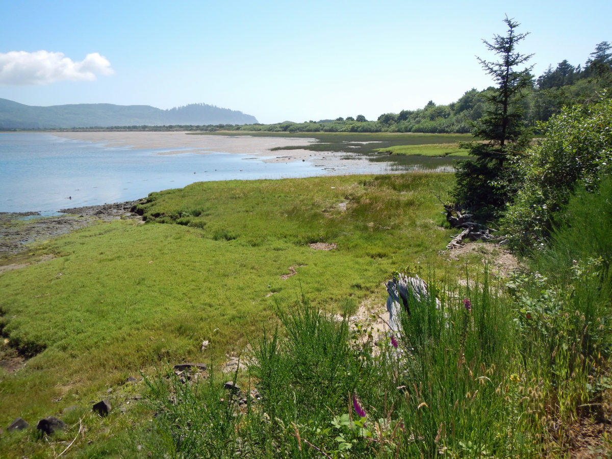
 Bayocean Peninsula, on the northern Oregon coast, is a sandspit that separates Tillamook Bay and the Pacific Ocean. It is, by any measure, a nature lover’s paradise, whether you’re a beachcomber, hiker, mountain biker, boater, birder, wildlife lover, or photographer.
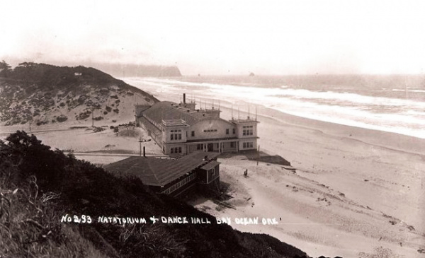
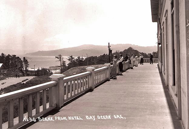
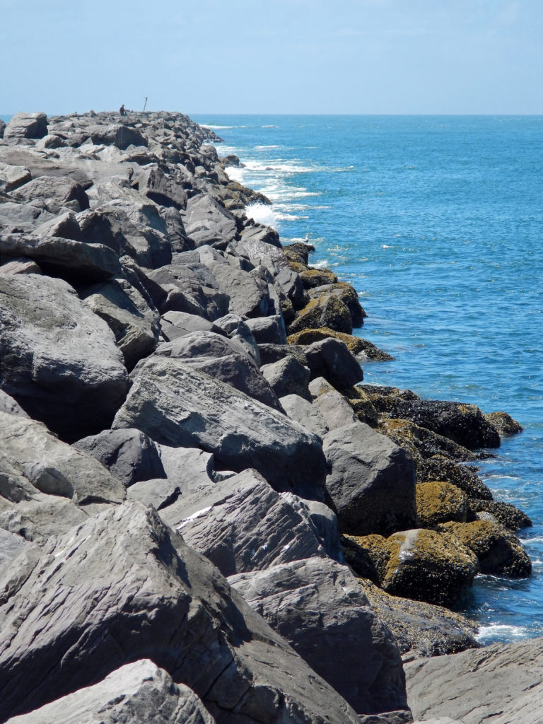 To make crossing the Tillamook bar safer, the Army Corps of Engineers recommended jetties be built on both the north and south sides of the bay’s mouth. But half of the cost (a then considerable $2.2 million) would have to be paid by local residents. To cut the cost to a more affordable amount, the local port district proposed building only one jetty. The resulting north jetty, completed in 1917, did make crossing the bar much smoother and safer, but it also contributed to the town’s demise by changing the near shore currents, which began eroding away the beach in the 1920s.
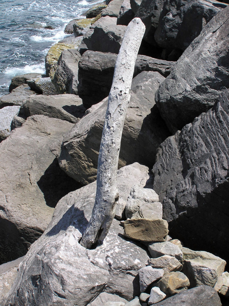 In 1932 the north jetty was extended, further accelerating the erosion. The natatorium was destroyed by waves during a massive storm that winter. By 1938 almost 60 homes had fallen into the sea. Other storms over the years took many of the remaining buildings, and in 1952 another major storm breached the southern end of the peninsula, turning Bayocean Peninsula into an island. The Bay Ocean Park post office closed in 1953 and most of what was left of the town was bulldozed by the Corps of Engineers in 1956 during a project to build a dike across the breach created in 1952. The last house on the peninsula washed away in 1960, and the last structure, a long abandoned garage, fell into the sea in 1971.
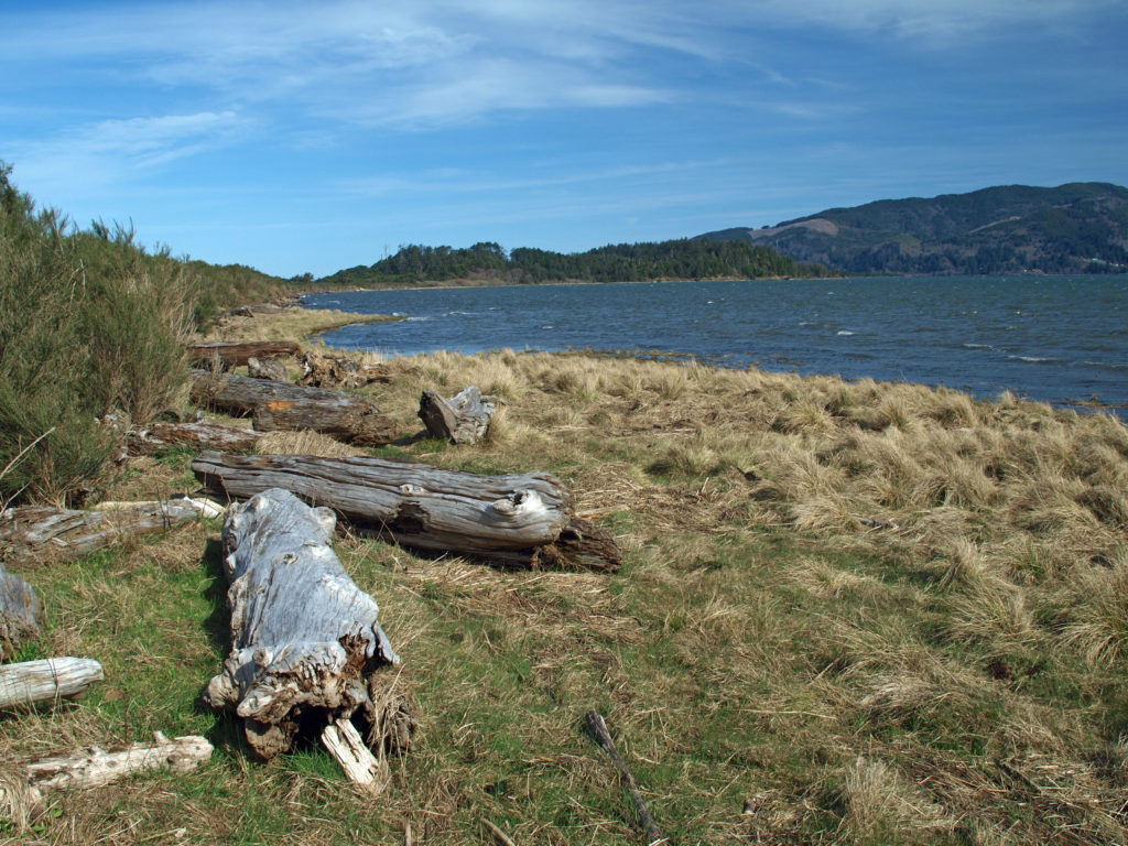 The south jetty was eventually built in the 1970s and that stopped the erosion of the peninsula, but by then the town of Bay Ocean Park was long gone. Today, nothing remains of the town. What’s left, though, is a treasure trove of delights for the outdoor enthusiast: miles of untrammeled beach, unspoiled dunes, a bay shore sheltered from the prevailing winds, an upland spruce and pine forest, and an abundance of waterfowl and other wildlife. The haul road used in building the south jetty is now an ideal mountain bike and hiking trail on the bay side of the peninsula.
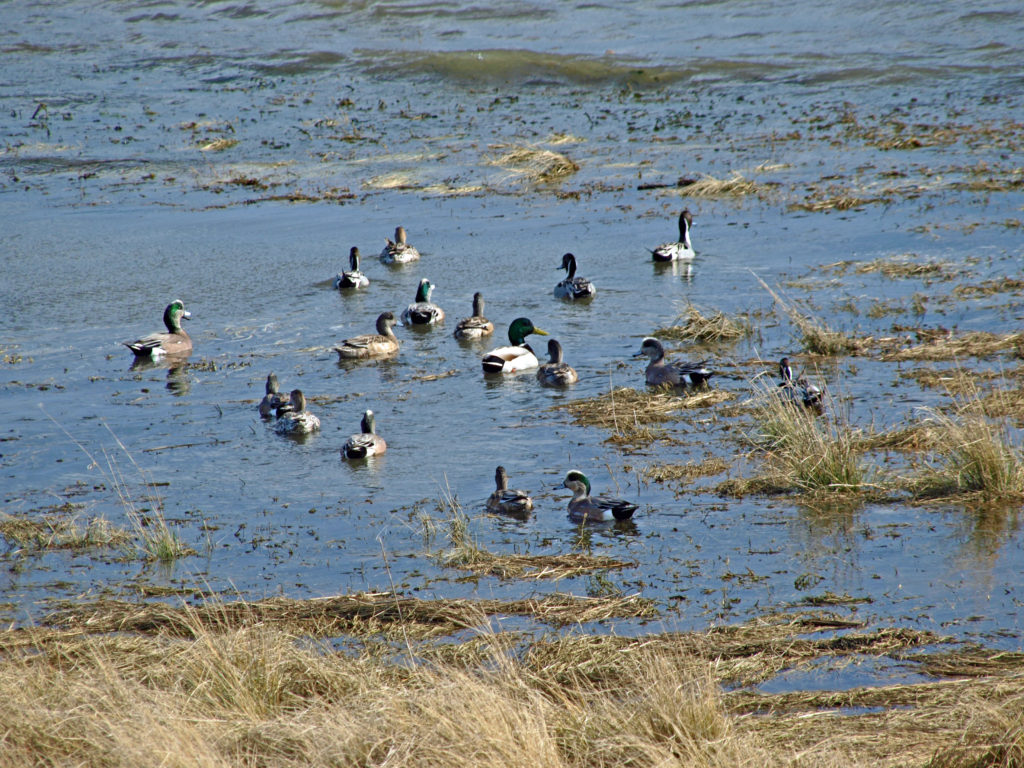 To reach Bayocean from the town of Tillamook, follow the signs for the Three Capes Scenic Route (Oregon Highway 131). After crossing the Tillamook River bridge, turn right onto Bayocean Road toward Cape Meares. At milepost five, turn right onto the old south jetty haul road (aka the dike road) and proceed to the trailhead parking area. There are pit toilets at the trailhead, but no water.
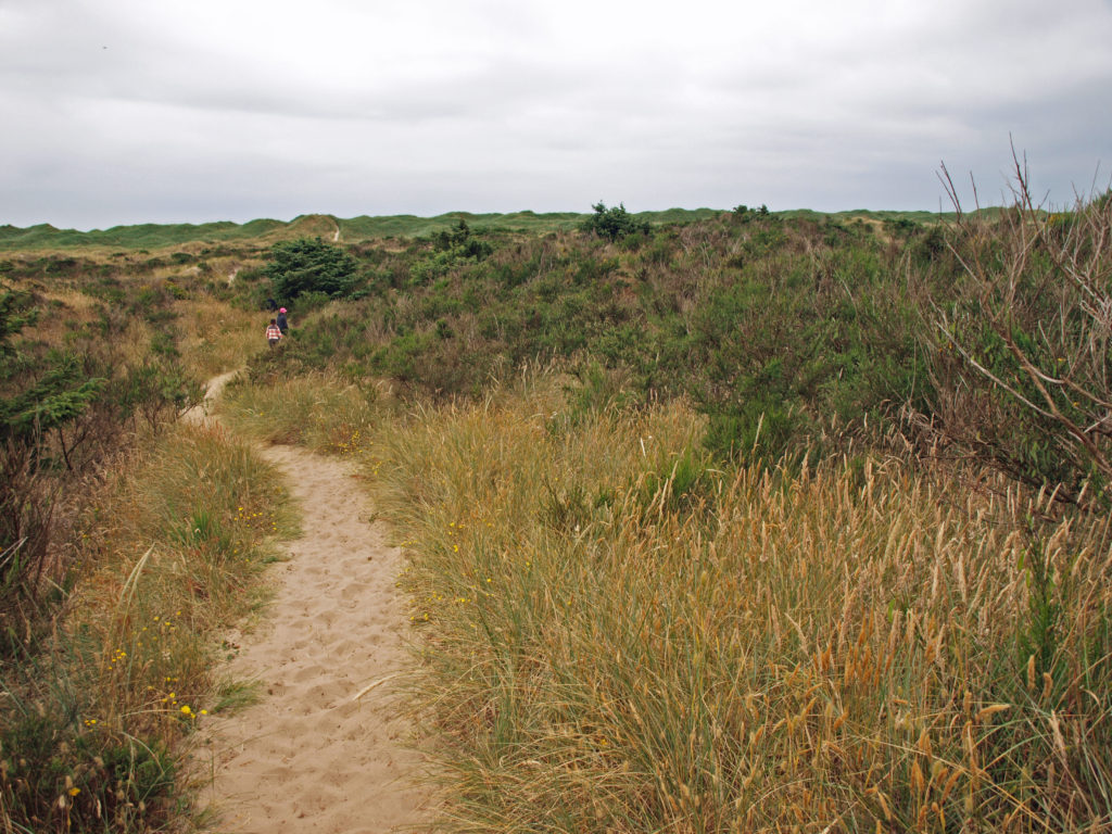 From the trailhead, the road continues north beyond a locked gate. You can also hike through the dunes to the beach from the trailhead parking area. The road along the bay shore is mostly gravel, with a few sandy stretches, and mostly flat. It’s an easy four mile bike ride to the south jetty.
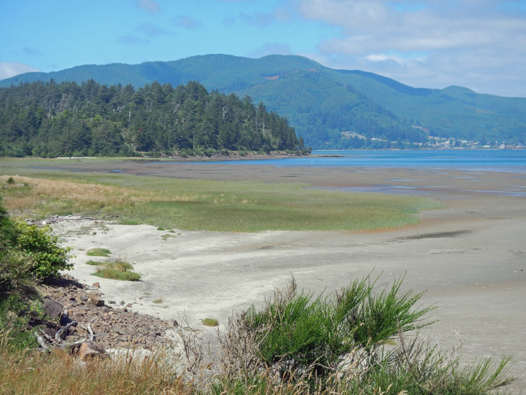 Hikers can do a 7½ mile loop by hiking through the dunes to the beach, walking the beach to the south jetty, and returning along the bay side on the gravel road. There are several trails connecting the dike road to the beach, making shorter loops possible. And a longer hike or bike ride (10 mile loop or 9 mile out and back along the beach) can be done by starting at the beach access in the town of Cape Meares, instead of the Bayocean trailhead. See my
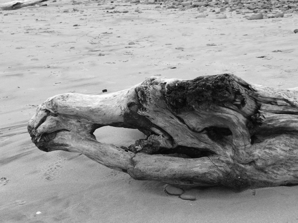
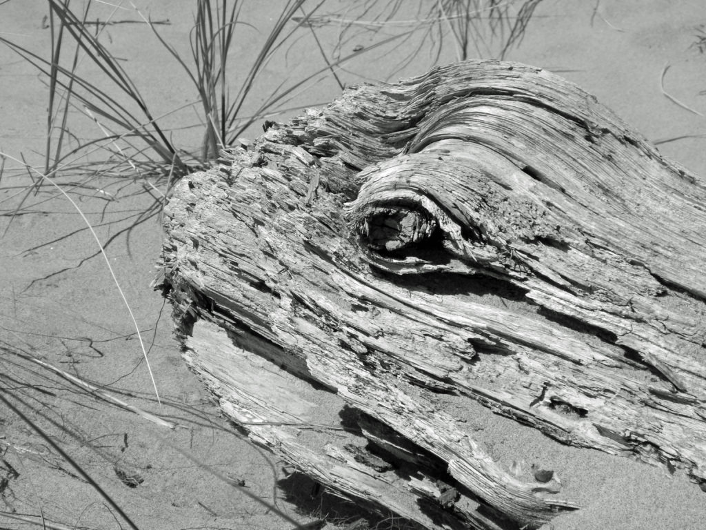
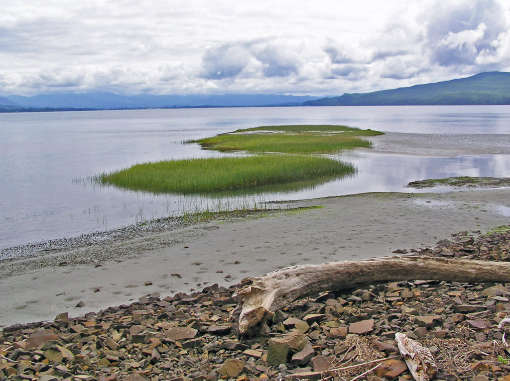 The north Oregon coast has much to offer beyond Bayocean Peninsula, of course.
 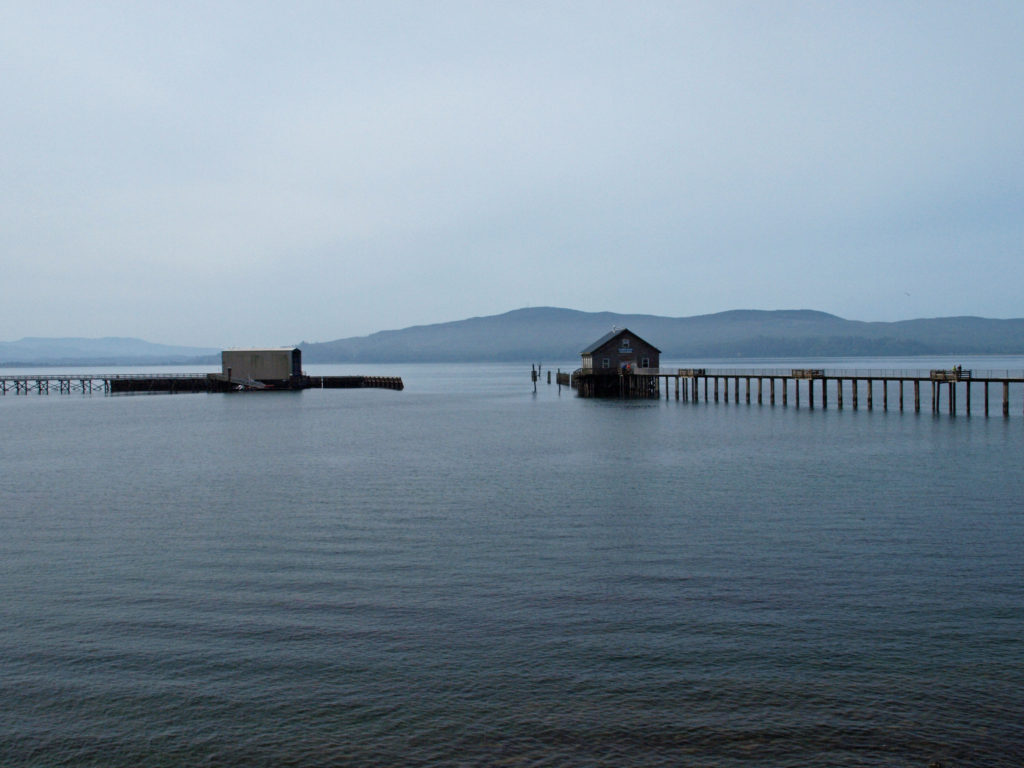 Originally posted April 23, 2019 by Alan K. Lee, updated July 8, 2021 and March 4, 2024
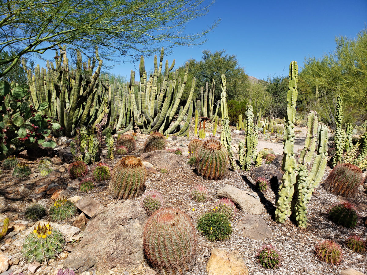

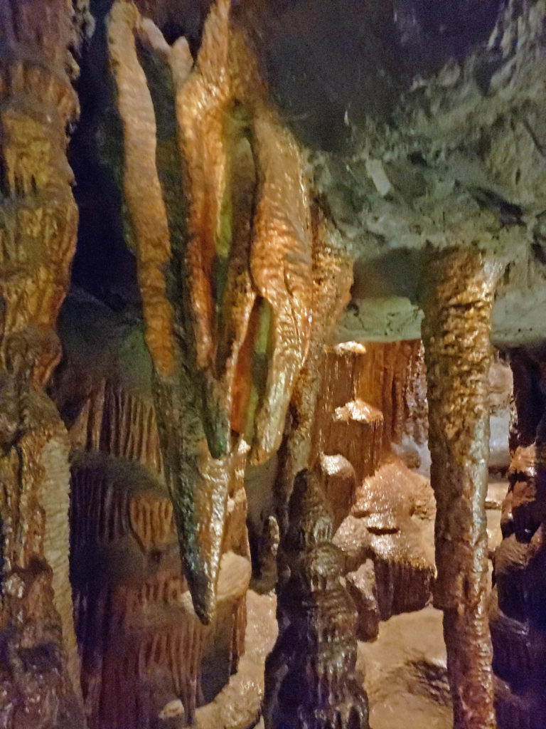
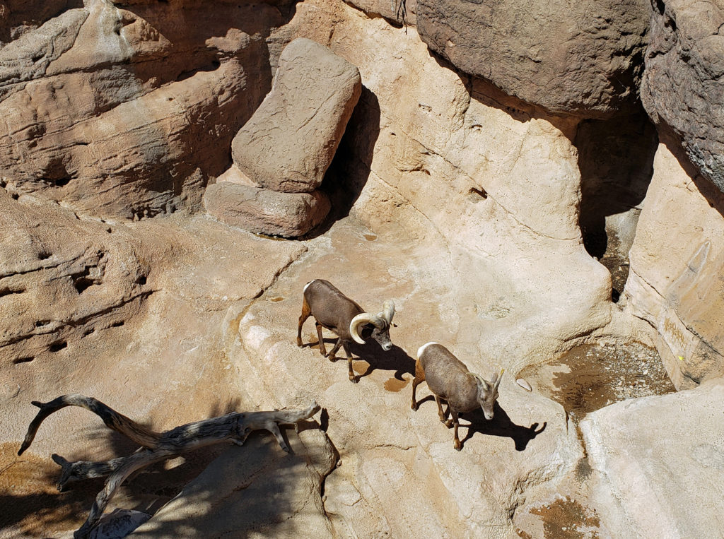
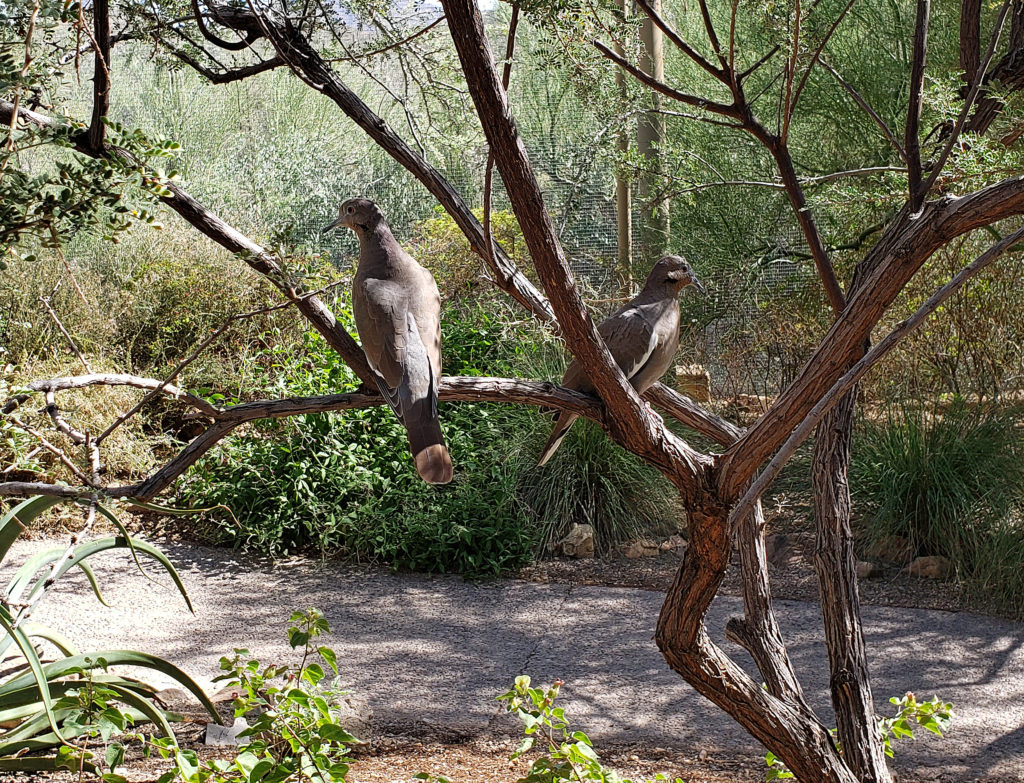
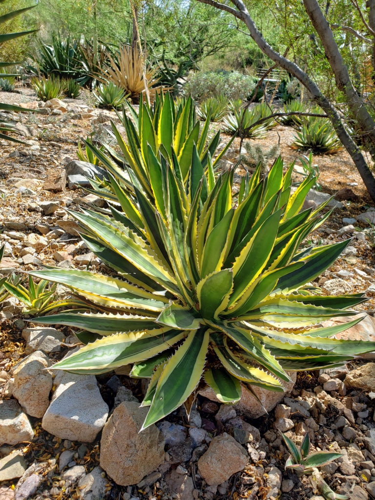
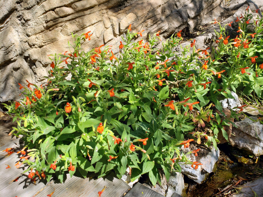
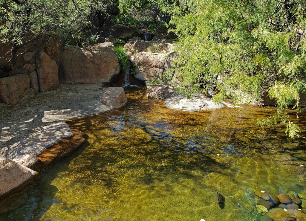
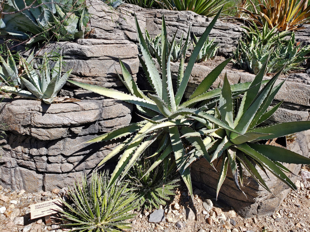 There is so much here that you probably can’t see it all in one visit. My wife and I have visited the museum on a couple of our Arizona excursions, and on our last visit I was surprised at how much I had missed on our earlier visit. Plan to spend at least two hours at the museum. Allow half a day to more fully explore what the museum has to offer, if you can.
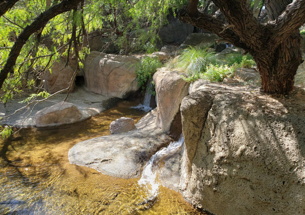
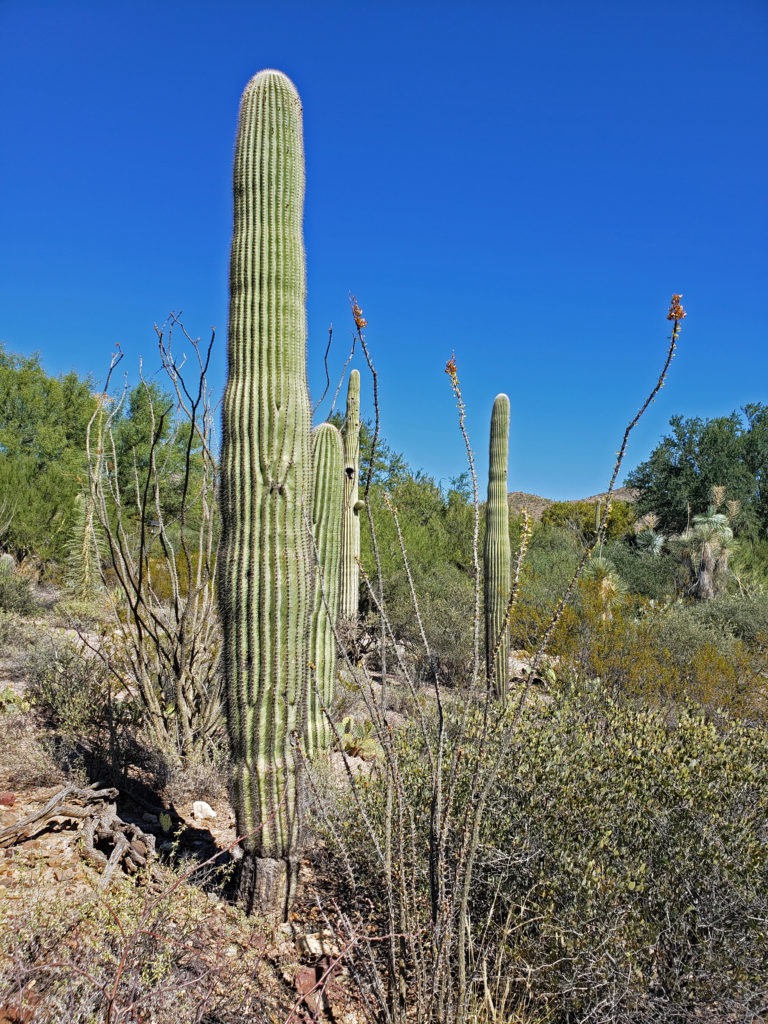
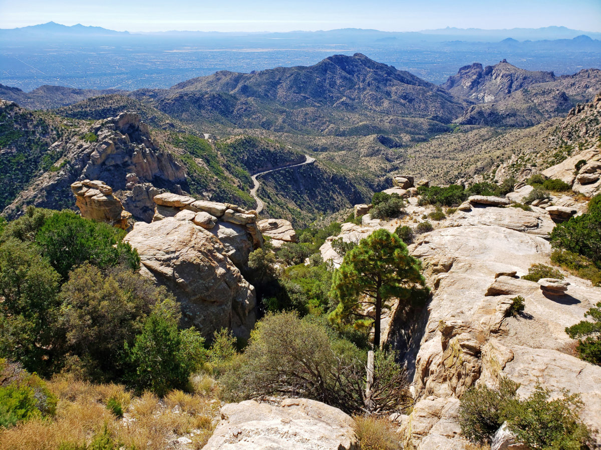
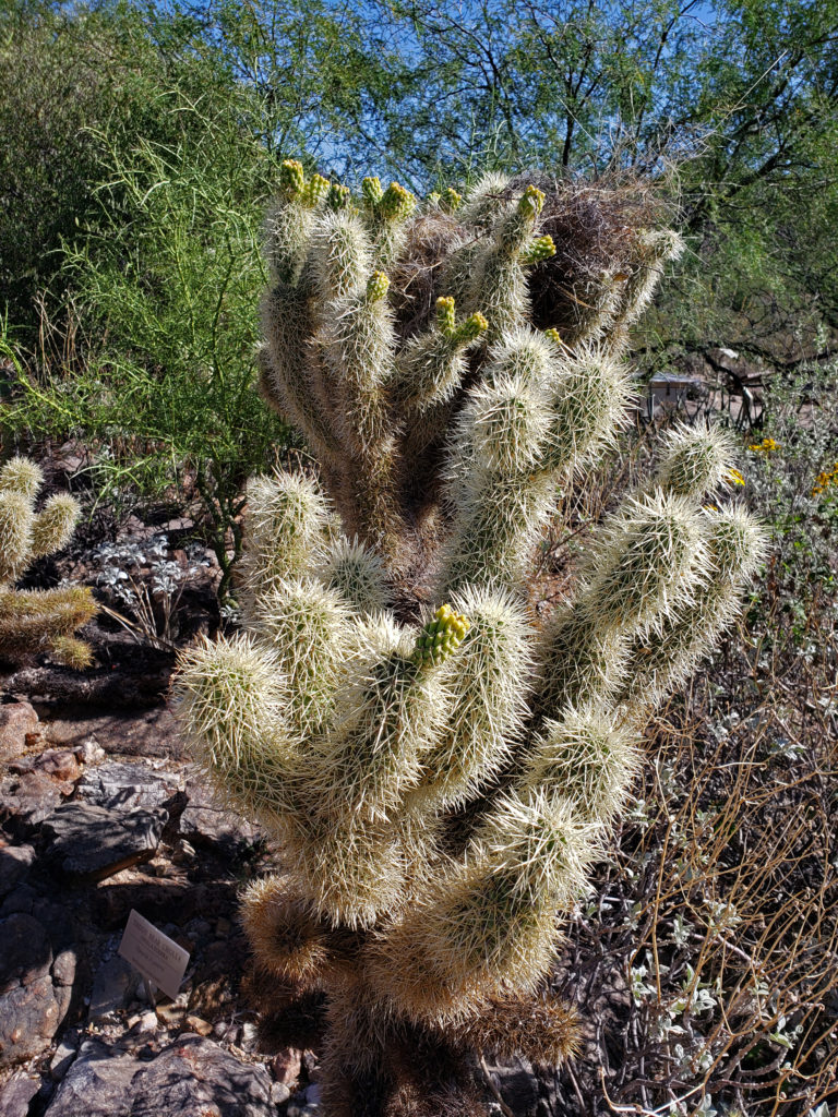
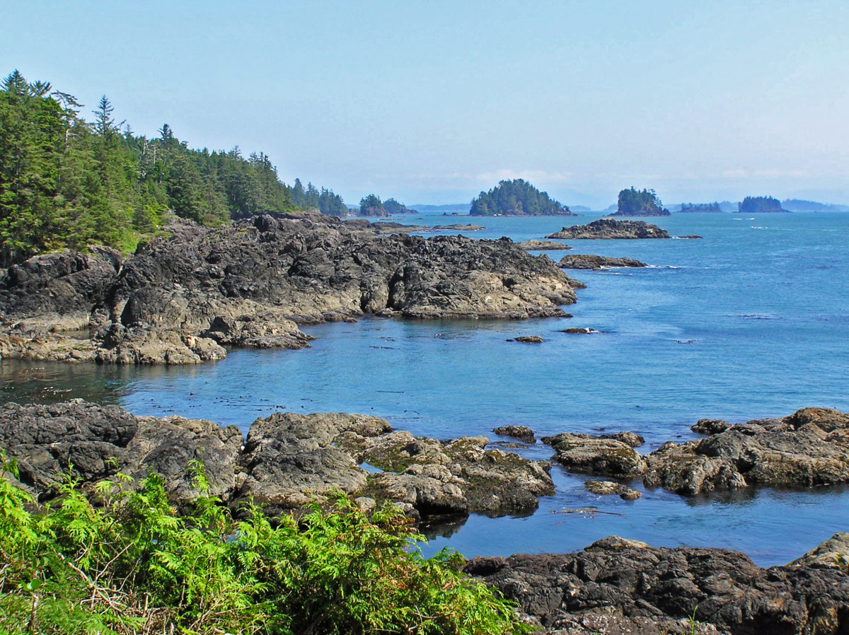
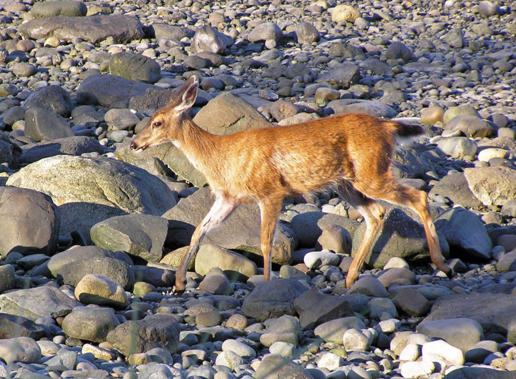
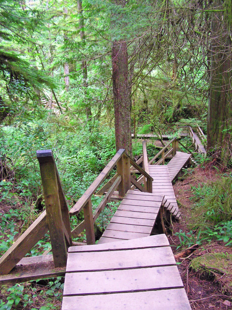
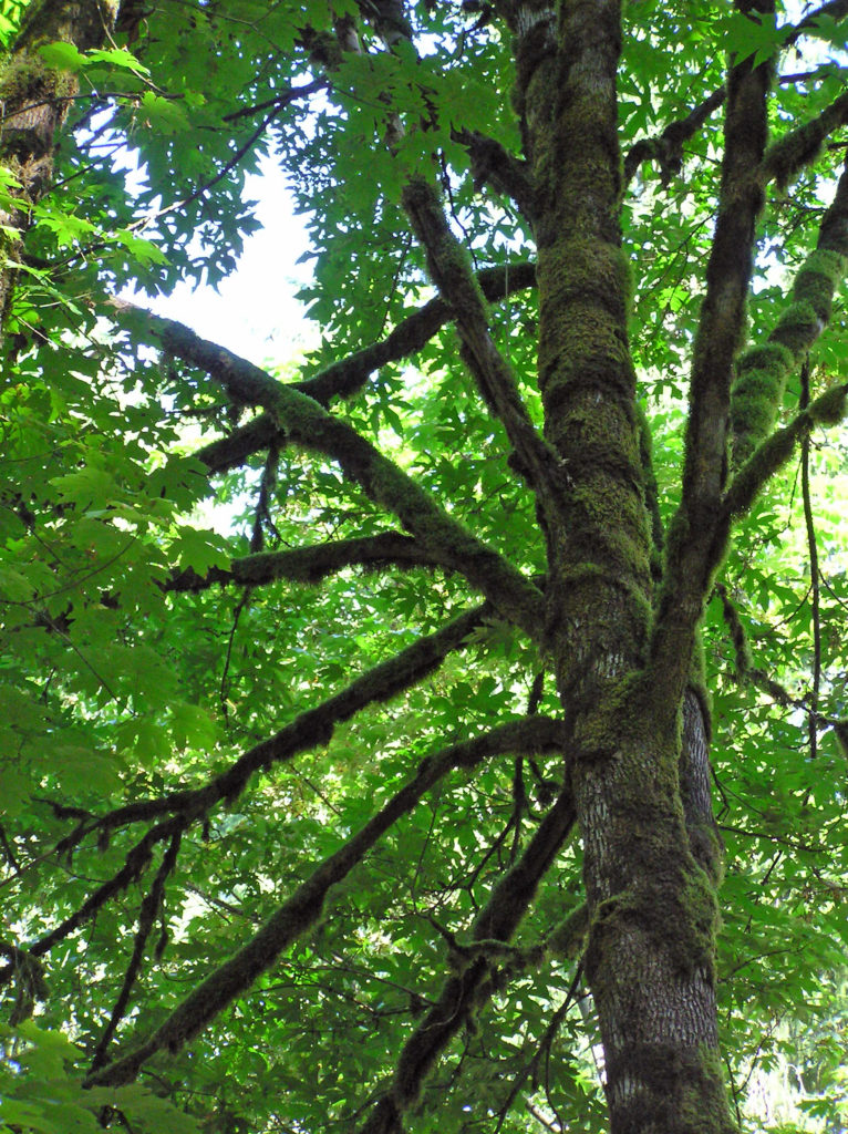
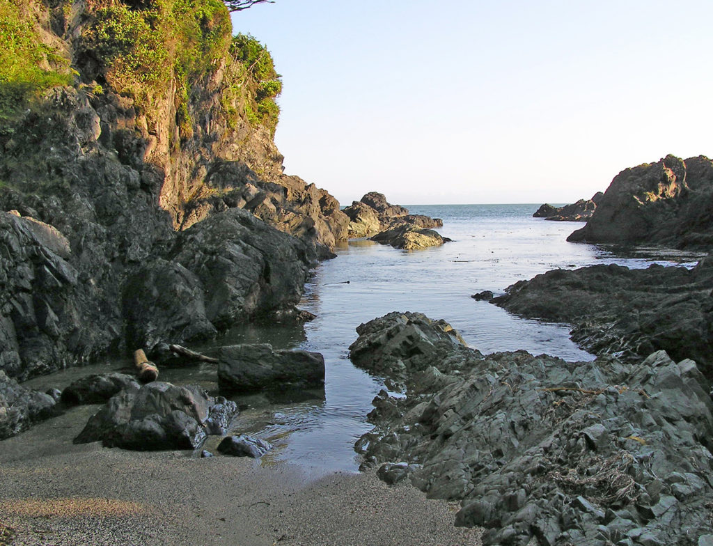
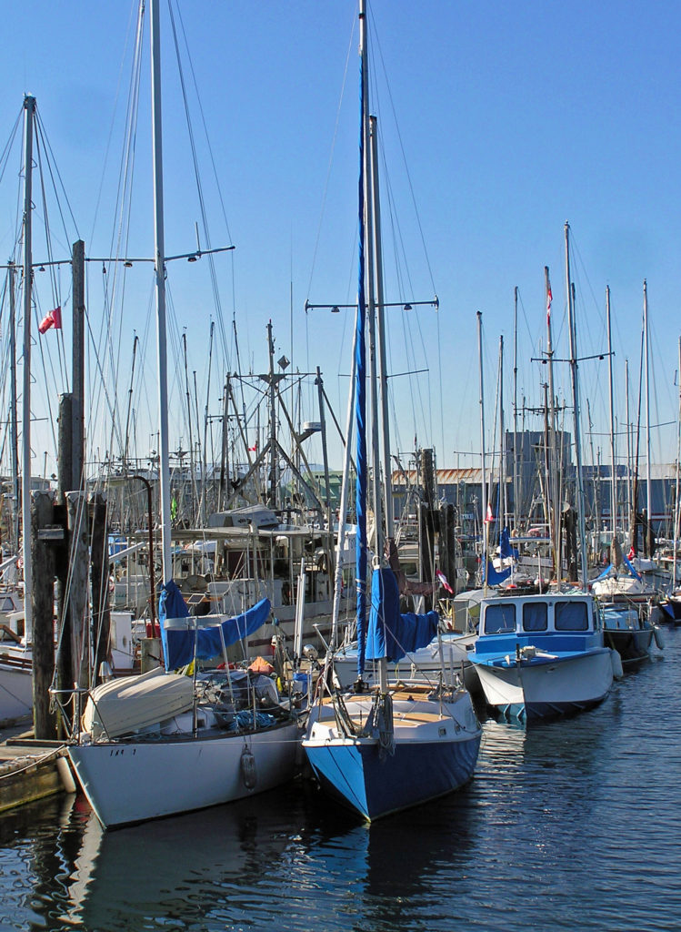
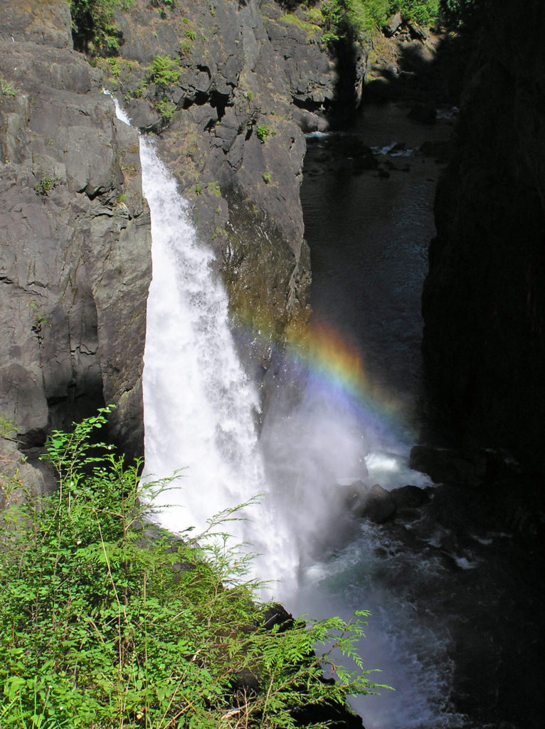
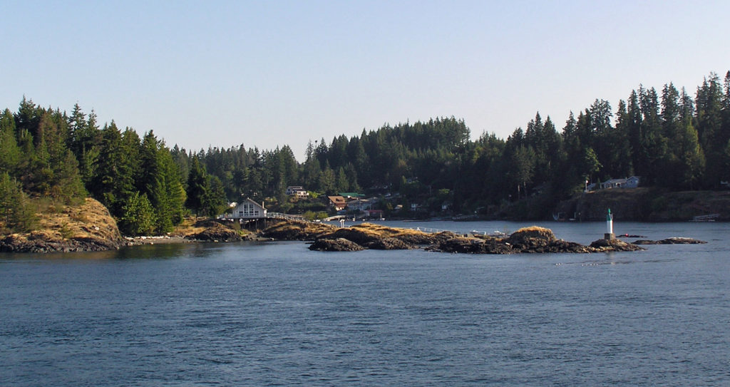
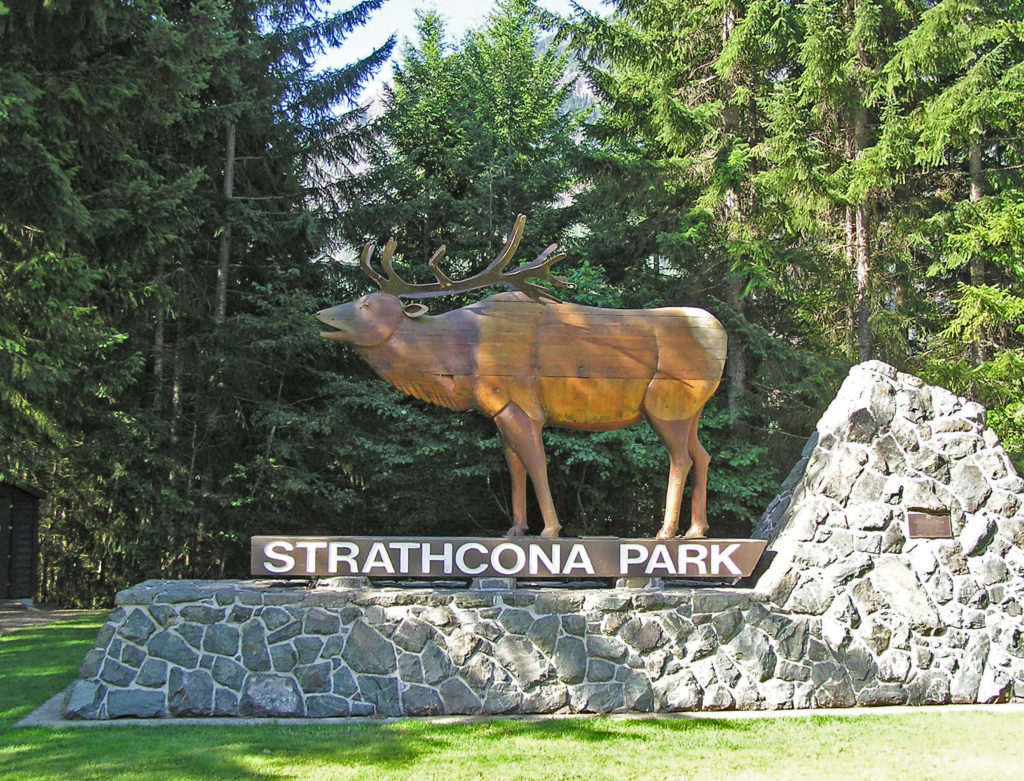
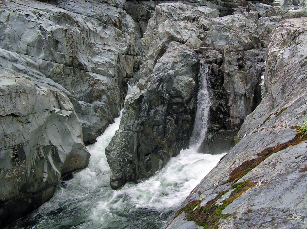
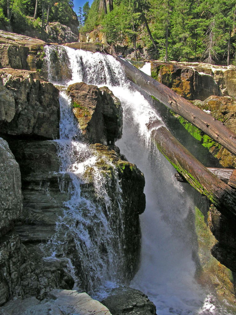
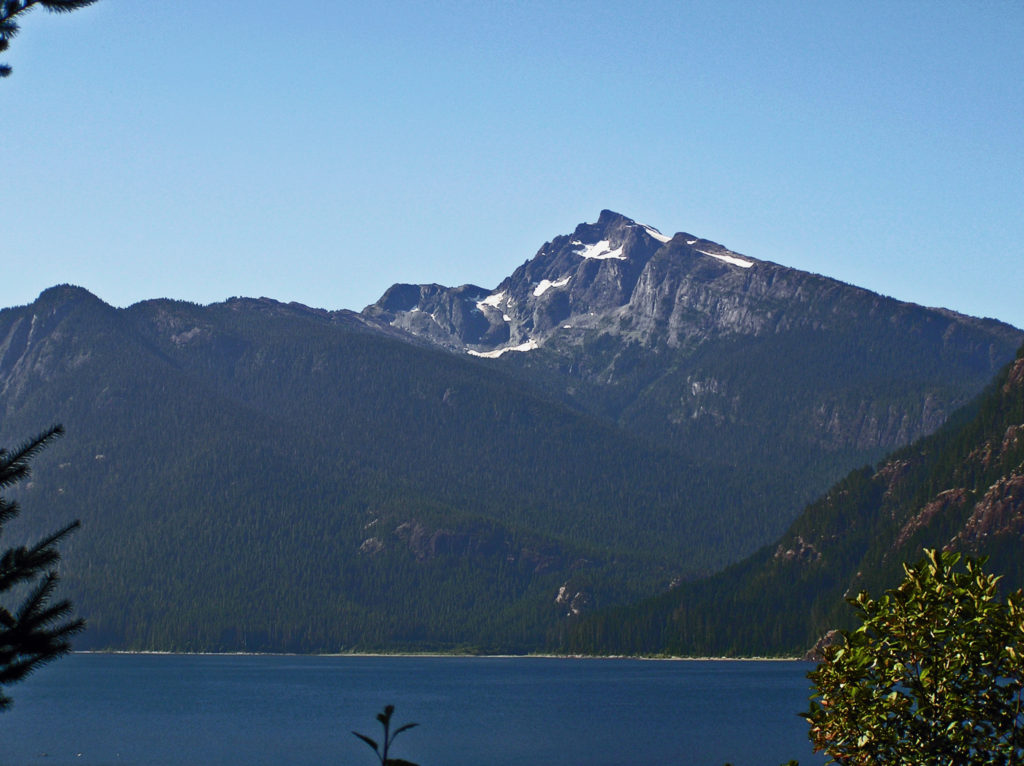
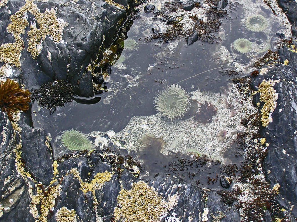
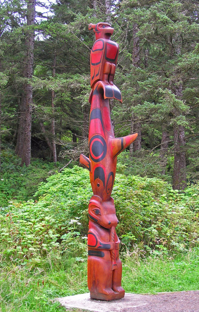
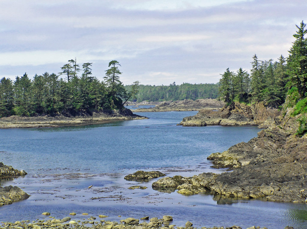
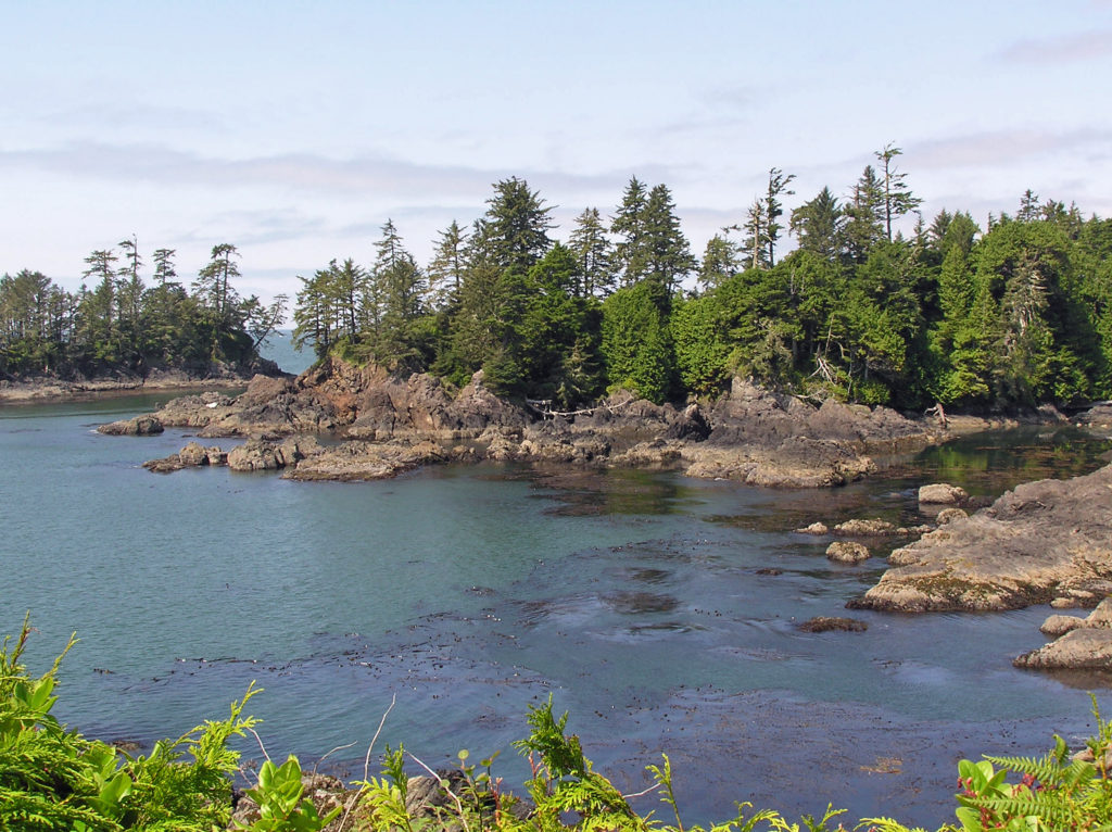
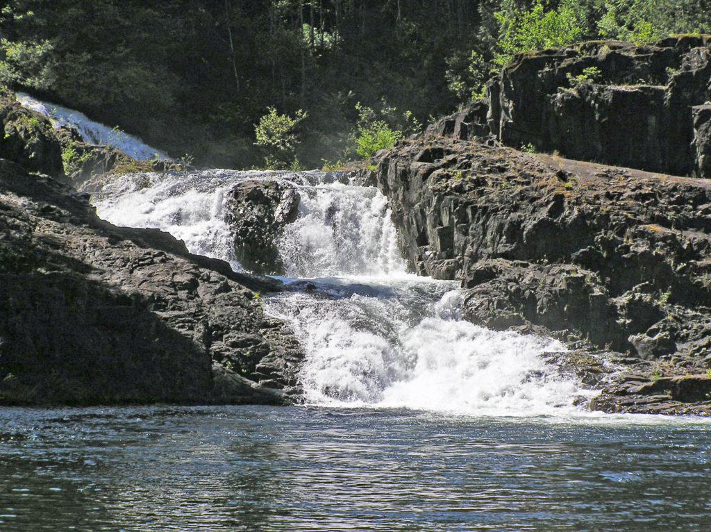
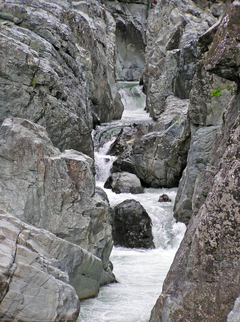
 If you’re ever in the Tucson area, consider making the drive to the top of Mount Lemmon. A paved road takes you to the summit, more than 6500 feet above the valley floor. Numerous viewpoints along the way provide spectacular vistas of the mountain, the surrounding desert below, and the mountains beyond. And numerous trailheads provide access to the ridges and canyons beyond the road for those who want to lace up their hiking boots and immerse themselves in the desert or mountain environment.
 The drive takes you through numerous climatic and ecological zones, from the iconic saguaro cactus of the Sonoran Desert at the base of the mountain to an aspen and ponderosa pine forest at the summit.
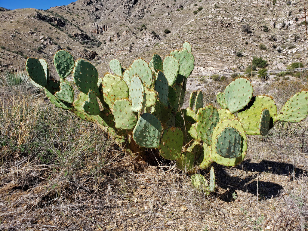 My wife and I made the drive to the summit in October 2019 while in Arizona to visit my brother and attend a wedding. I had never heard of Mount Lemmon and I wasn’t keen on making that long of a side trip, but my wife convinced me that it would be worthwhile, and she nailed this one. Mount Lemmon is more than just worthwhile, and worth more than just a side trip. It’s a worthy destination in its own right.
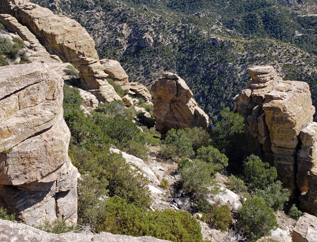
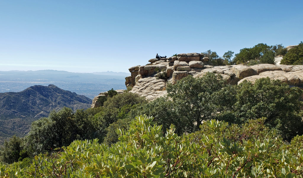 Windy Point, about seventeen miles from the beginning of the highway in Tanque Verde, has got to be one of the most spectacular viewpoints in southern Arizona. You’ll want to stop here and just wander around for a while. Take in the views of Tucson and the desert far below, the mountains beyond, and the rock formations around you. About four miles farther up the highway you’ll come to the San Pedro Vista, which gives you a panoramic view east across the San Pedro Valley to the Galiuro Mountains.
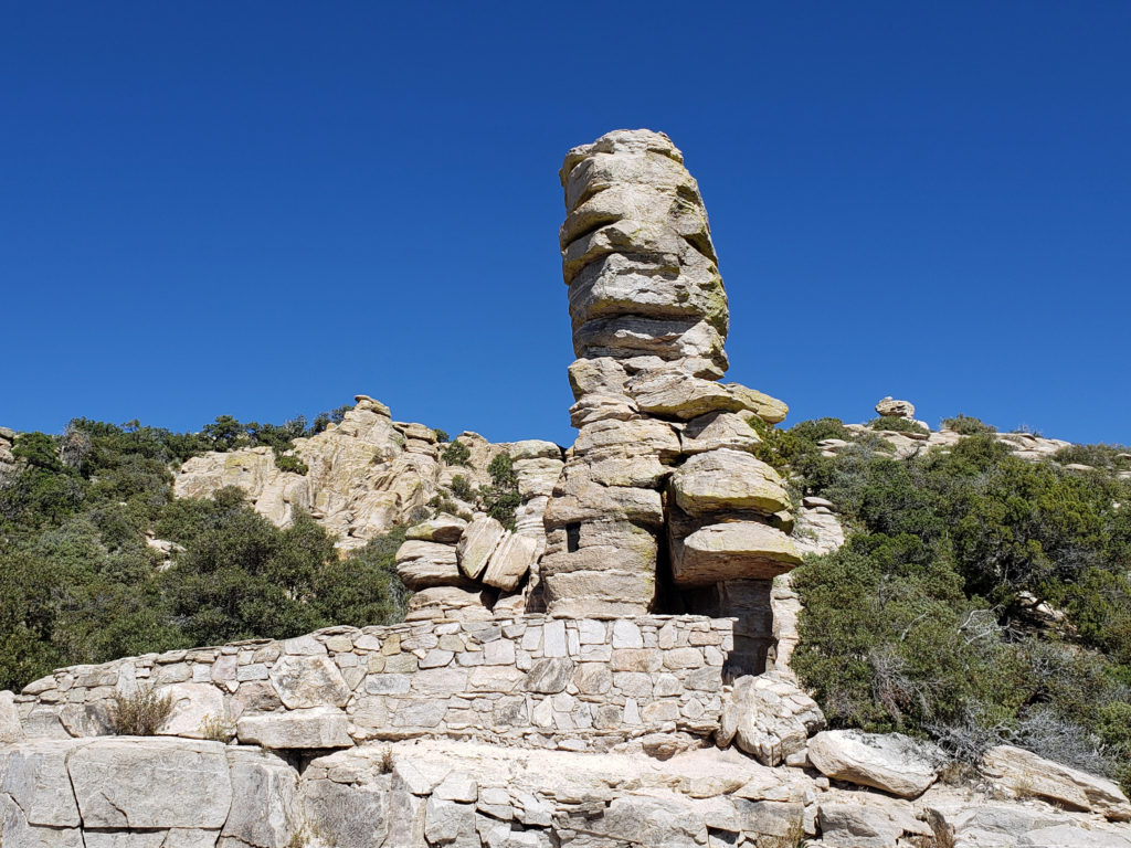 Another couple miles brings you to the
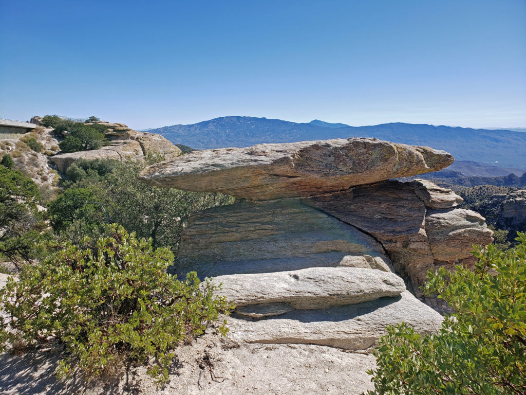
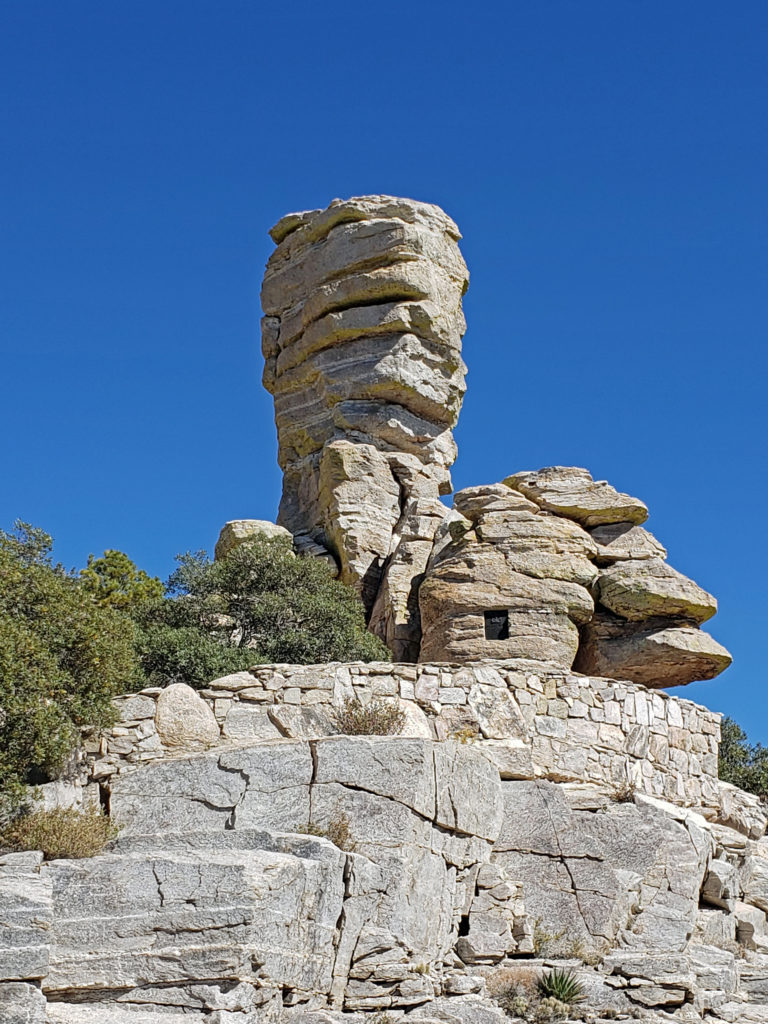
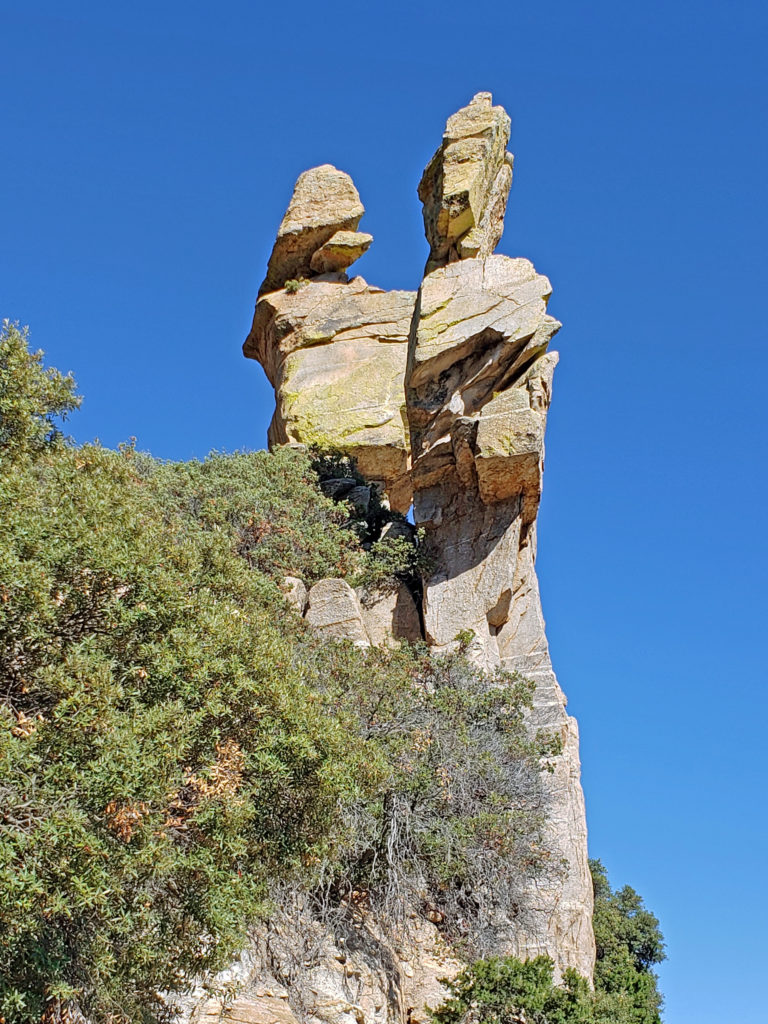 If you go, note that the summit of Mount Lemmon can be thirty degrees cooler than Tucson, so dress accordingly. And if you plan to do any hiking, avoid mid-summer if possible and always bring plenty of water. There are no sources of safe drinking water on any of the hiking trails in the area, to my knowledge.
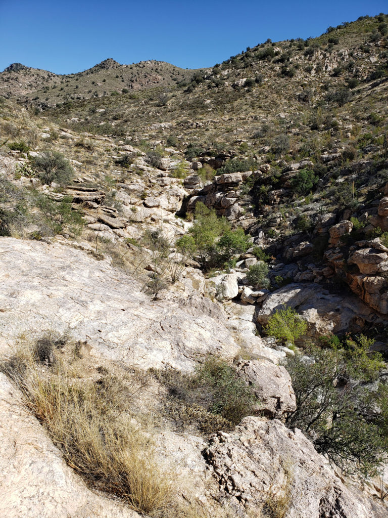
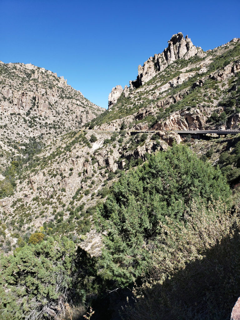 Not only am I glad we took the drive, I wish we could have spent more time exploring the mountain. For those that do have the time, there are several picnic areas along the highway and a few places to eat in Summerhaven, and there are several campgrounds a short ways off of the highway if you want to spend more than a day on the mountain. If you don’t want to camp, Summerhaven also has a few rental cabins, and a newly built small hotel. Check the
 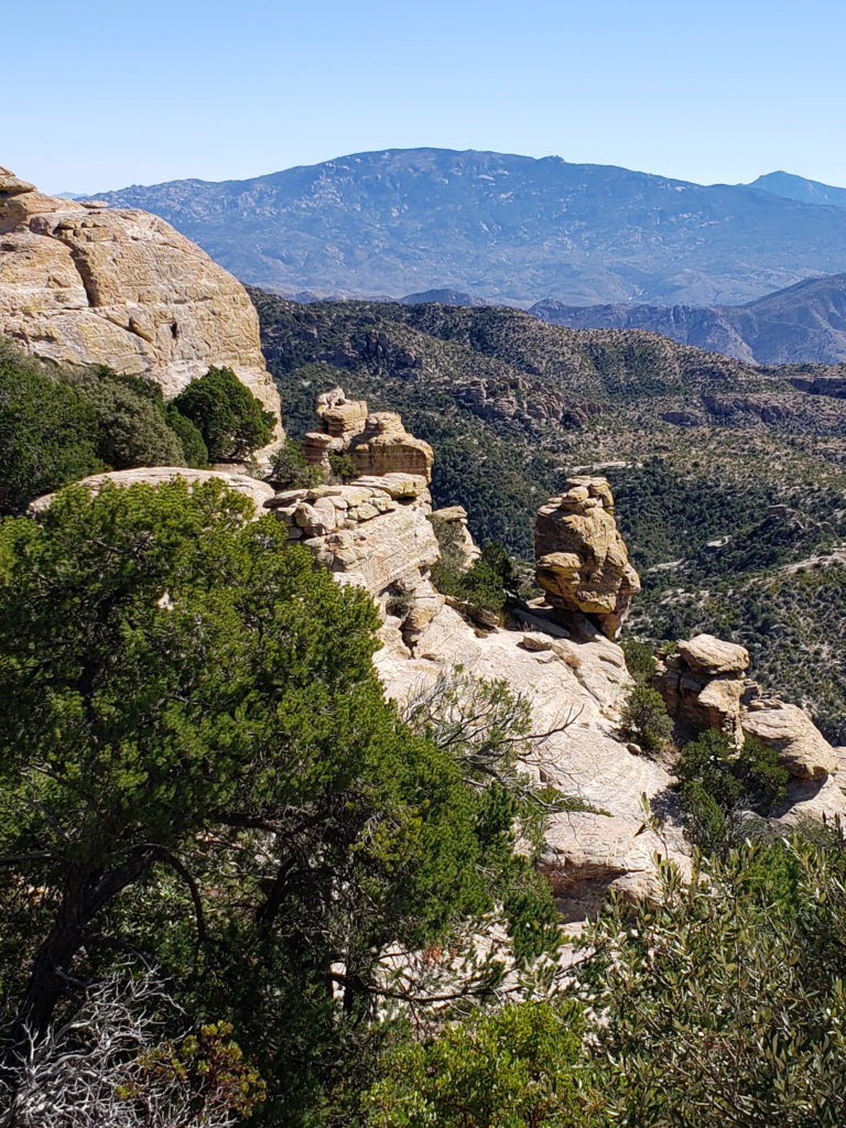 Note: In the summer of 2020 the entire area was closed to the public because of the Bighorn Fire that burned 120,000 acres in the Santa Catalina Mountains. Photos taken after the fire showed some badly burned areas, but others that were largely untouched. All of the area is open again, including the Palisades Visitor Center.