
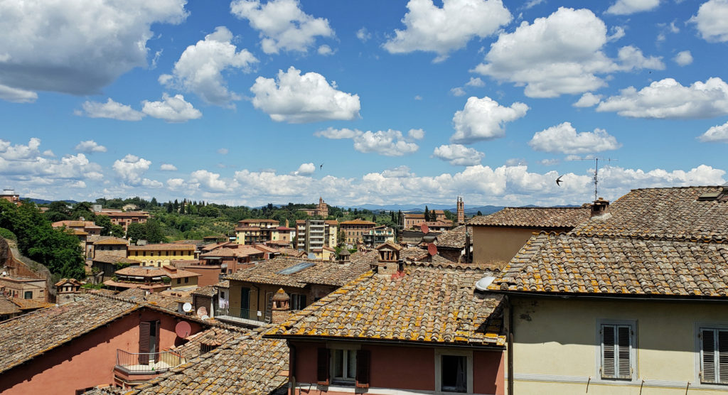
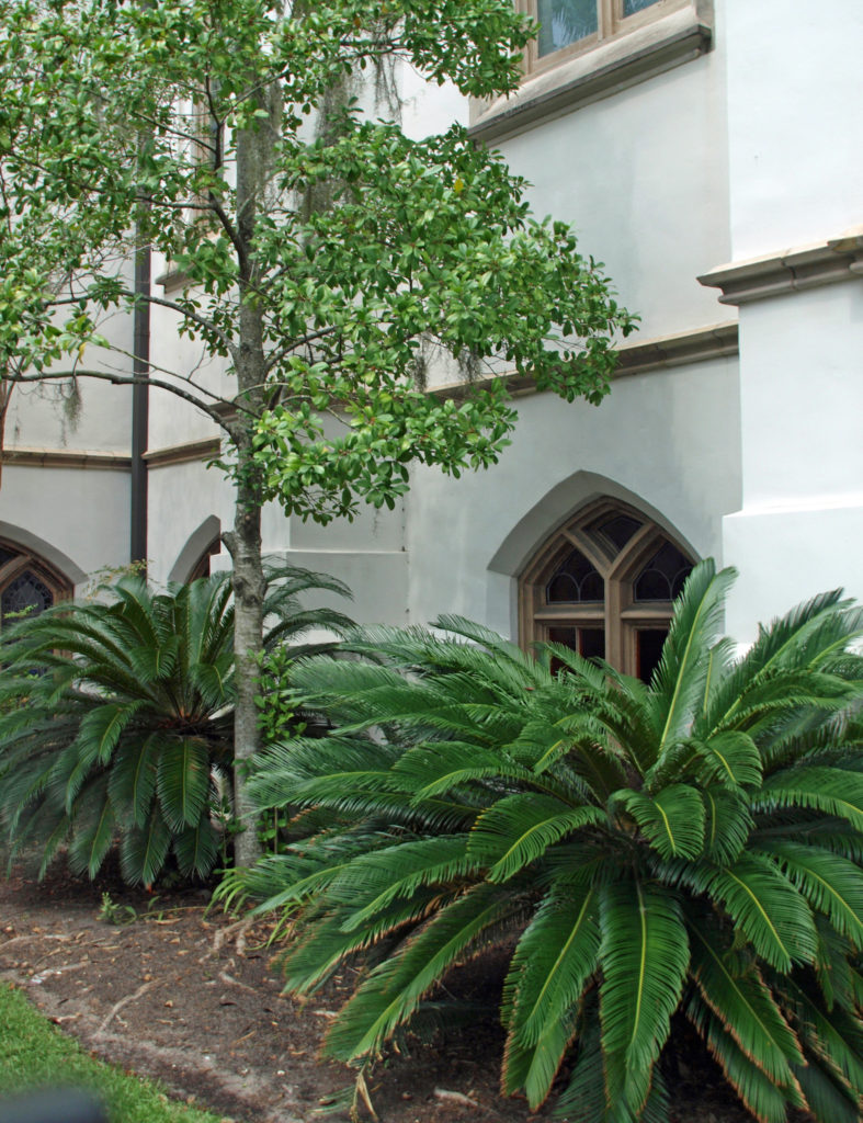
Edinburgh
The City
When my wife and I were planning our first trip to Europe, Scotland was the destination we settled on, and we were not disappointed. Beautiful wild lands, castles everywhere, friendly people, 1500 years (or more) of history – that trip had everything. And Edinburgh was where we spent the most time. Edinburgh is the capital of Scotland and the historic heart of the country. It’s a beautiful and fascinating city, and no visit to Scotland is complete without spending at least a day or two in Edinburgh.
 That trip was more than 15 years ago and some things may have changed greatly since then, so I won’t go into much detail as to what to do, where to stay, where to eat, what things cost, and so forth. But there’s much to Edinburgh that is timeless, and undoubtedly has not changed in the years since our visit.
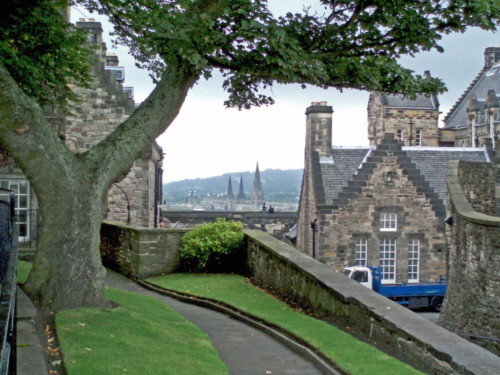
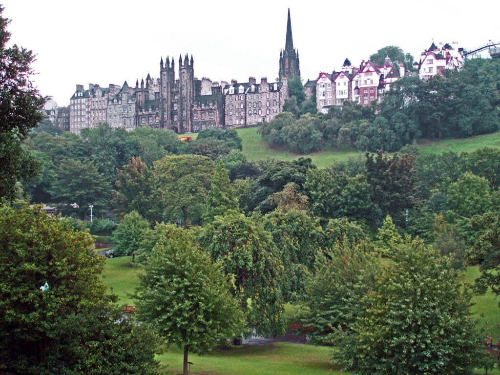
 Central Edinburgh is divided into the Old Town and the New Town. The Old Town includes Edinburgh Castle, the Palace of Holyroodhouse, the Royal Mile connecting the two, and the area to the south. The New Town stretches from Princes Street Gardens, directly below the Castle, to Queen Street Gardens and the adjacent area to the north. The Old Town is the historic center of Edinburgh, and also the site of the present-day Parliament. As far as the New Town goes, new is a relative term since construction of the New Town began in the 1760s.
 Both the Old Town and the New Town have their charms, and both deserve at least some of your attention. We spent most of our four days in Edinburgh exploring the Old Town, so I’ll focus on that part of the city.

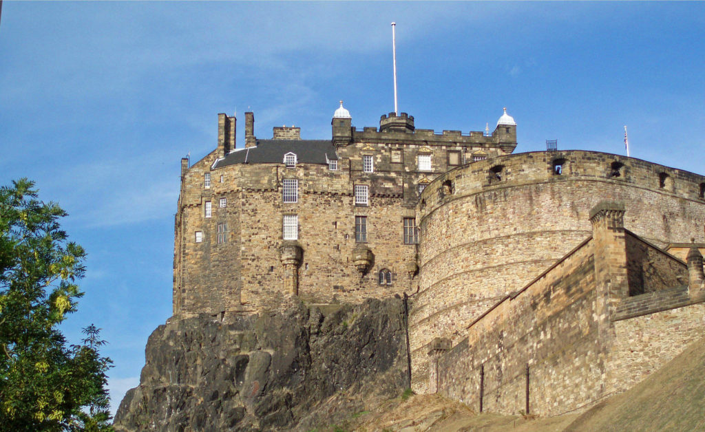
Edinburgh Castle
Built atop a volcanic outcropping called, appropriately enough, Castle Rock, Edinburgh Castle dominates the skyline of the city. The first castle on Castle Rock is thought to have been built in the 12th century, but none of that structure remains. The oldest remaining structure in the Castle is St. Margaret’s Chapel, dating to the mid 13th century. Most of the other remaining structure dates to the 16th century or later.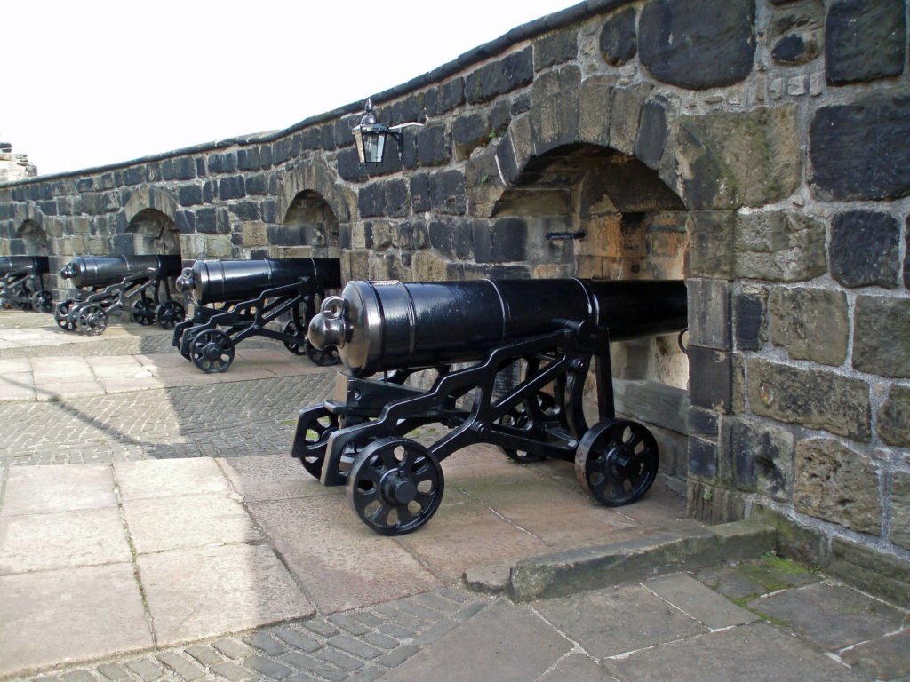
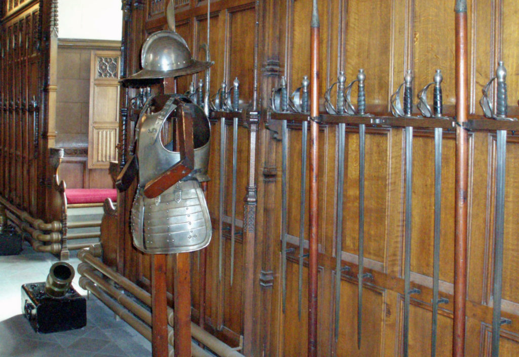
At the Castle, history and legend abound. You can visit the Great Hall, where the Scottish Parliament once convened, and Queen Mary’s Bedroom, where Mary Queen of Scots gave birth to James VI. You can see the Scottish Crown Jewels in the Crown Chamber, tour the French Prisons, and see the huge five-ton cannon known as Mons Meg. Plan to spend several hours at a minimum exploring the Castle.
![]()
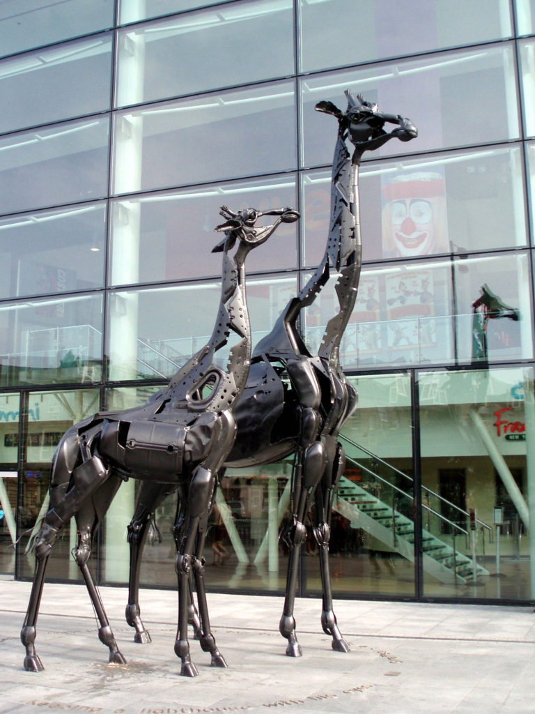
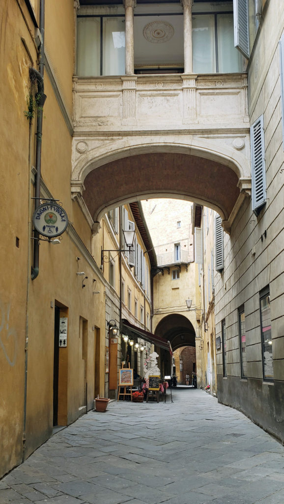
The Royal Mile
The Royal Mile begins at Edinburgh Castle and runs downhill to the Palace of Holyroodhouse. I was surprised by how much there was to see and do in that mile long stretch. We spent most of two full days exploring it.
Just below the Castle, the Overlook Tower and the Camera Obscura are worth a visit. The camera obscura casts a fascinating real-time revolving image of the surrounding area onto a circular table. Nearby is the Scotch Whisky Heritage Center where you can learn about the making of Scotch Whisky and sample a variety of different whiskies.
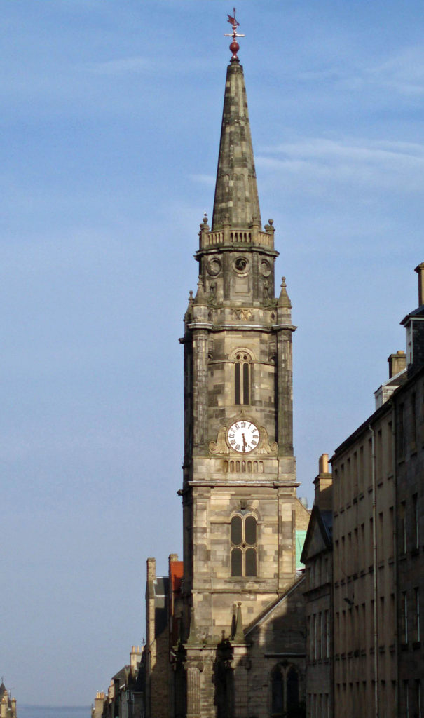 Although we didn’t go inside, St. Giles Cathedral, also known as the High Kirk of Edinburgh, is a magnificent structure that predates most of the structures in Edinburgh Castle. The cathedral was built between the late 14th and early 16th centuries. Entrance to the cathedral is free, but a small donation is requested.
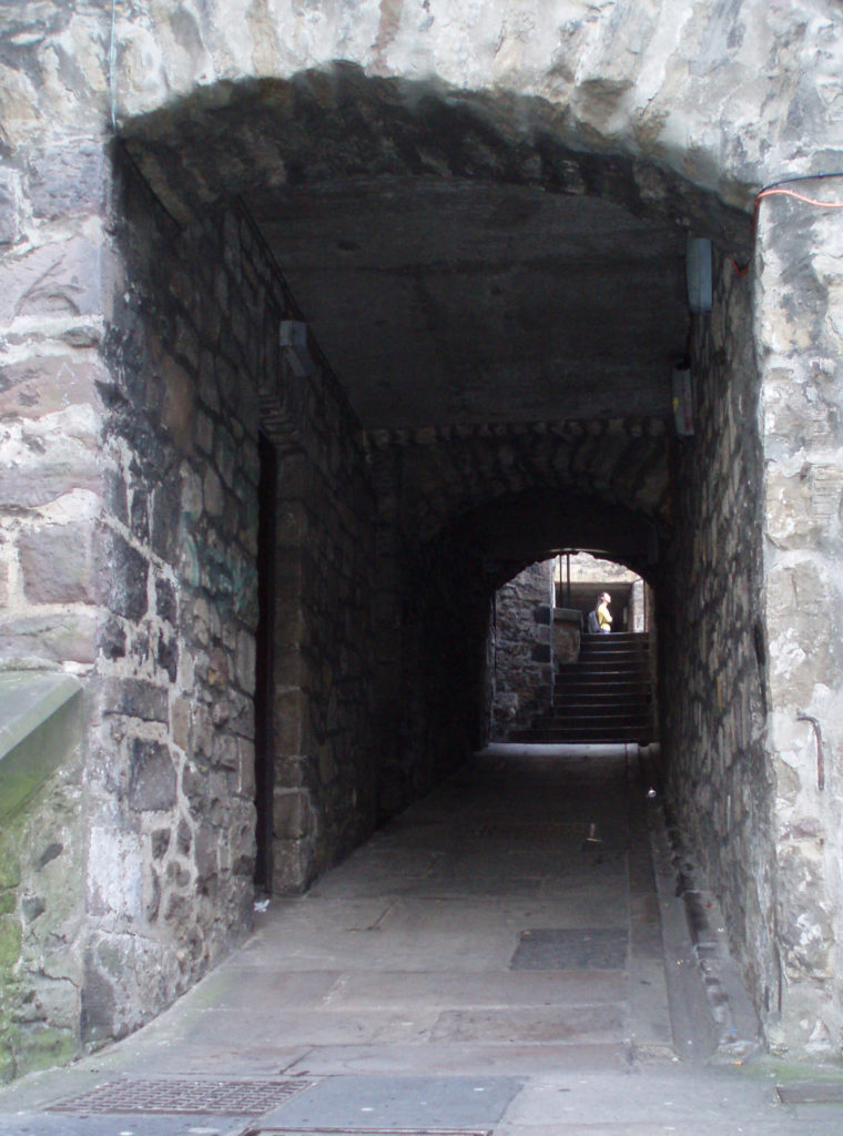 One of the attractions of the Royal Mile are the “closes,” underground passageways that were once narrow streets or walkways between houses. The upper floors of some the houses were demolished and the lower stories used as foundation for the Royal Exchange, built in the mid 18th century, leaving the closes below ground. Some of the closes remain as passages between the Royal Mile and the streets to the south, and organized tours of some of the more subterranean closes, such as the Real Mary King’s Close, are available.
 Other attractions of the Royal Mile include the John Knox House, the Writers’ Museum, the Huntly House, and The People’s Story, a museum housed in the historic Canongate Tolbooth, built in 1591.
 You will also find the Scottish Parliament buildings at the lower end of the Royal Mile near Holyroodhouse. Their contemporary, modernist design stands in stark contrast to the traditional and historical structures around them. And while I in fact like the design, to me they look out of place in their setting.
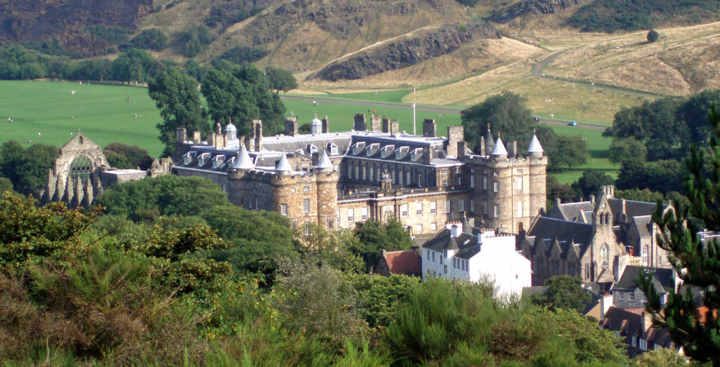
The Palace of Holyroodhouse
At the bottom of the Royal Mile lies the Palace of Holyroodhouse. All that remains of the original palace, built by James IV in the 16th century, is the North Tower. Most of the existing structure was built by Charles II about a century later. Adjacent to the palace are the ruins of the nave of an Augustinian abbey built in the 12th century.
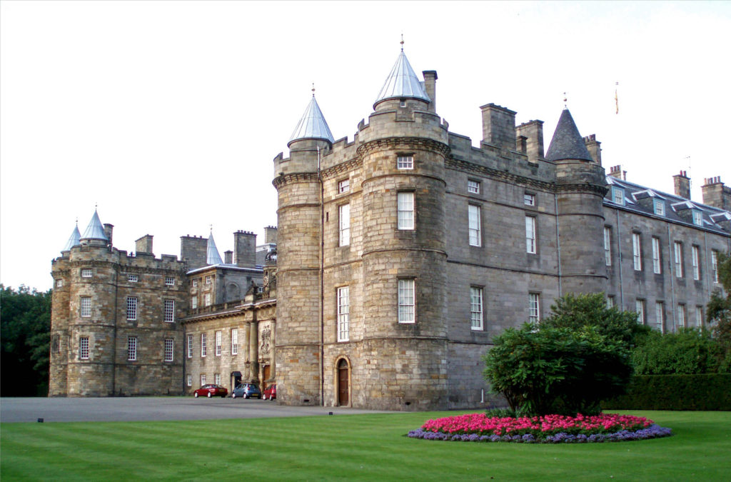 The Palace of Holyroodhouse is the official residence of the Monarchy in Scotland, but the palace is open to the public when King Charles III is not in residence. We did not tour the interior, but it comes highly rated. You can visit the Throne Room, the Picture Gallery, and the King’s Bedchamber, and Tour the King James Tower, where Mary Queen of Scots lived. For more information, check the Royal Collection Trust website.
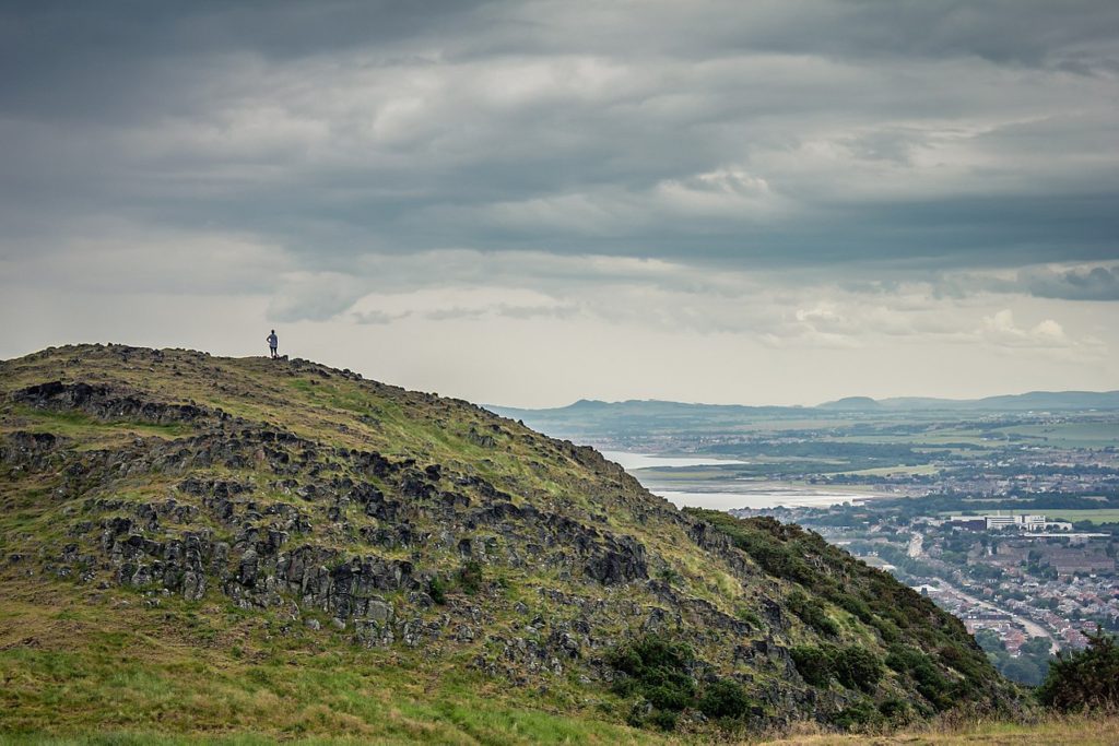
Adjacent to the palace is Holyrood Park. Here you can climb to the top of the 823-foot-high Arthur’s Seat where you can get a panoramic view of Edinburgh Castle and the city beyond.
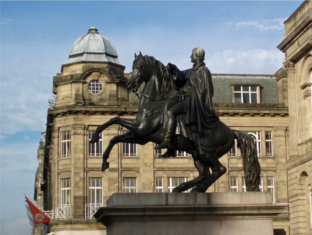
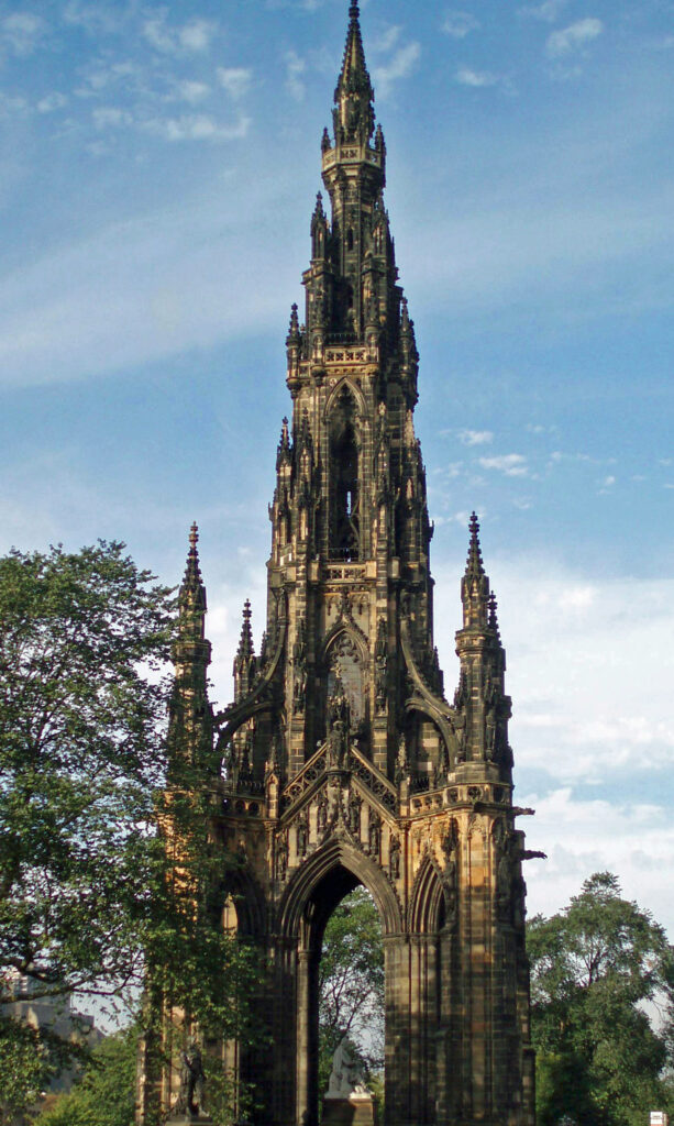
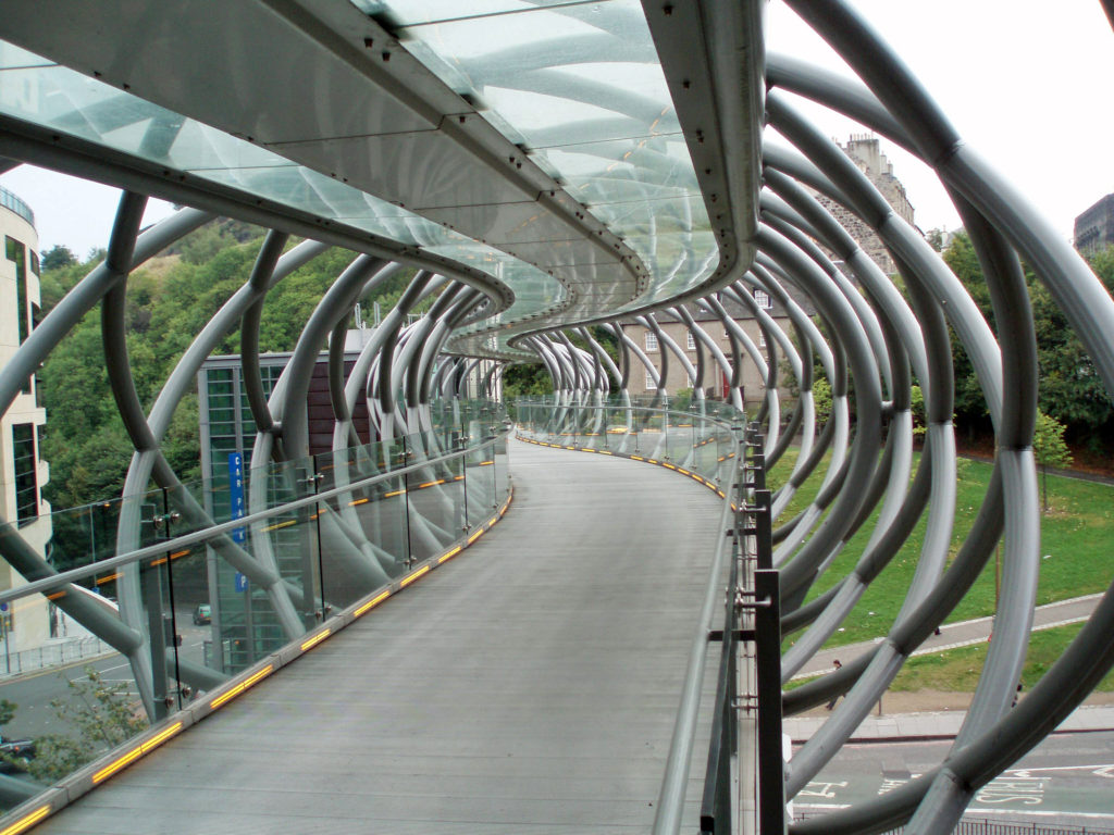
Beyond the Old Town
The most striking features of the New Town are the Princes Street Gardens, pictured above, and the Scott Memorial, pictured below.
 We didn’t make it to Queen Street and Queen Street Gardens, but the photos I’ve seen and the guidebook descriptions make me think we missed something there.
 A little farther afield in the West End, though within easy walking distance of the New Town, is the Scottish Gallery of Modern Art, one of Edinburgh’s many museums. After days of being immersed in ancient history and medieval art, it was nice to see something more contemporary.
 On the walk back we discovered a path along the Water of Leith that took us to Dean Village, a charming little community that dates to the 12th century. (The Bald Hiker website just published a post on the Water of Leith walk – all 13 miles of it. Click here to view the post).
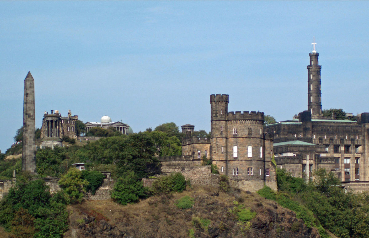
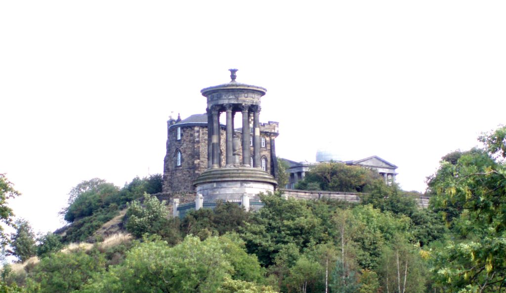 On our visit we stayed at an old hotel just east of Calton Hill. With its many monuments, including the Nelson Monument and the Lincoln Monument (which is in fact dedicated to Abraham Lincoln), Calton Hill is one of the more scenic and picturesque locations in Edinburgh. From the top of the hill you have a panoramic view over the city and to the Firth of Forth and the Port of Leith, where the Royal Yacht Britannia, once Queen Elizabeth II’s private yacht, is berthed. Since its decommissioning in 1997, the yacht has been open to the public.
Festivals
Edinburgh is not completely lost in its history. It has a modern, contemporary side as well, and it is a city of festivals. The biggest and most famous is the Edinburgh International Festival, held every August. Running simultaneously with it is the Edinburgh Festival Fringe in which anyone and everyone is given free rein to put on whatever kind of performance they choose, wherever they can find a place to perform it. The Fringe bills itself as the largest artistic festival in the world. And if that were not enough, there is a film festival, a jazz festival, a television festival, and (some years) a book festival that also run simultaneously with the International Festival.
Conclusion

I don’t know if we’ll ever return to Edinburgh. I would love to, but traveling to Europe is not something we can do every year, and there are probably too many places that we have not yet visited for us to be retracing past steps. If you have not been to Edinburgh, though, I highly recommend that you visit at some point, if possible. It’s a wonderful place and visiting is a much richer experience than I can convey in words and images. And Edinburgh was just the beginning of our travels in Scotland. Look for an updated post on the Isle of Skye, and perhaps one or two others down the road.
Originally posted by Alan K. Lee, September 16, 2020. Updated and re-posted July 10, 2023.
All photos © Alan K. Lee, except as noted


 Overview:
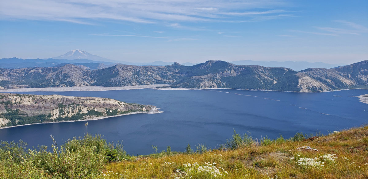
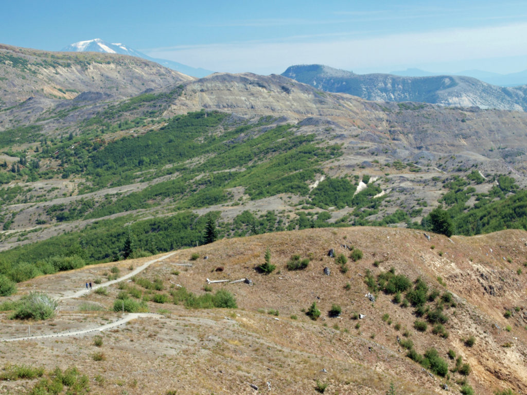
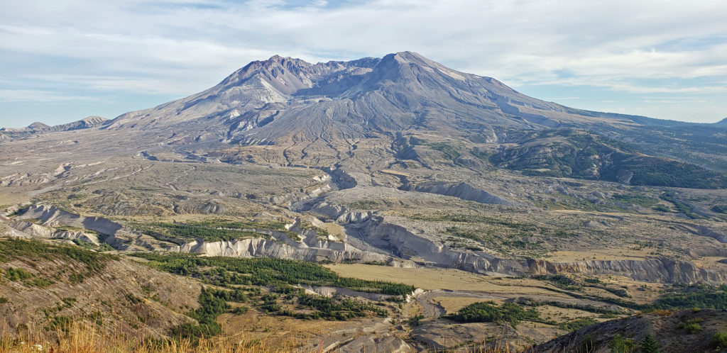
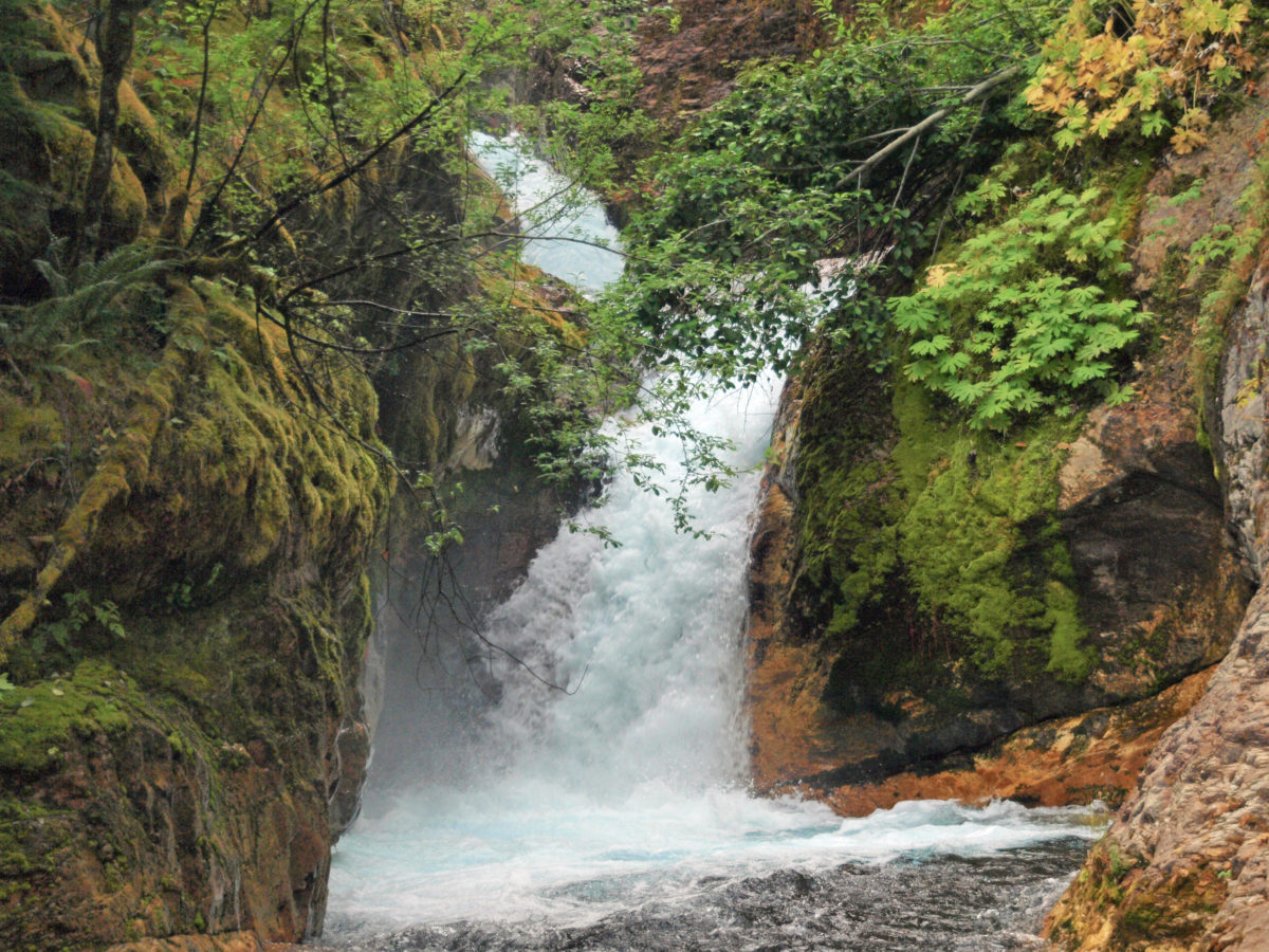
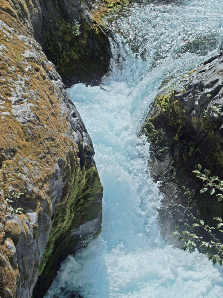
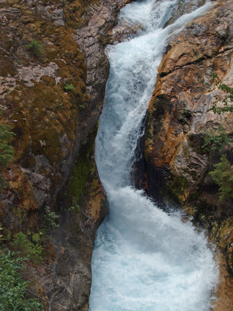
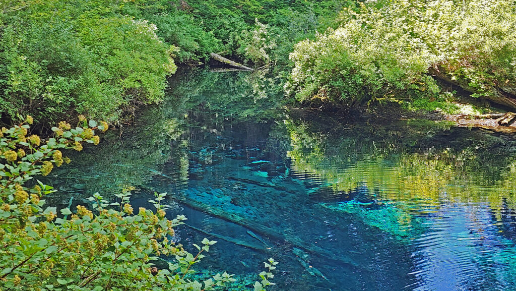
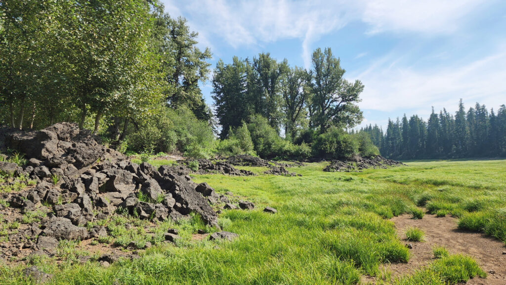
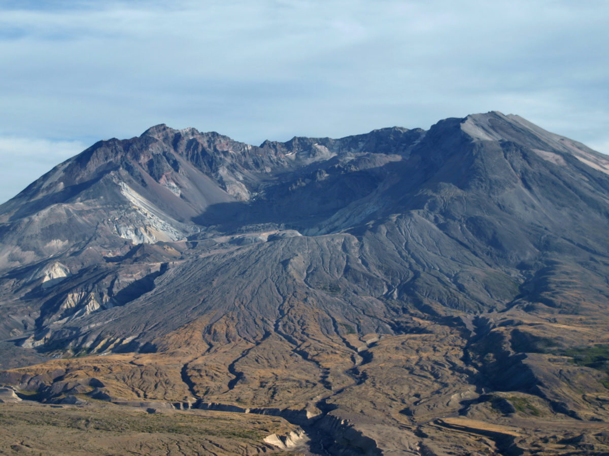
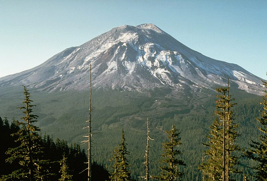
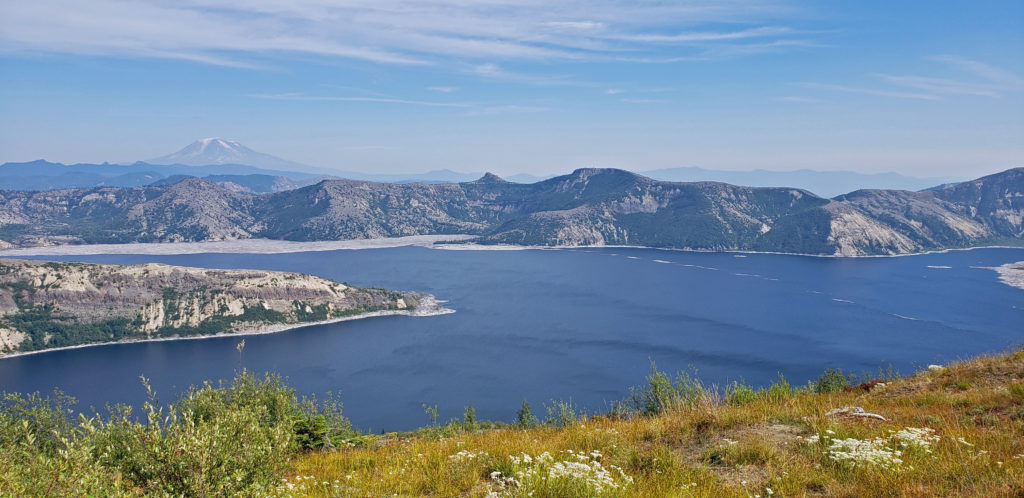
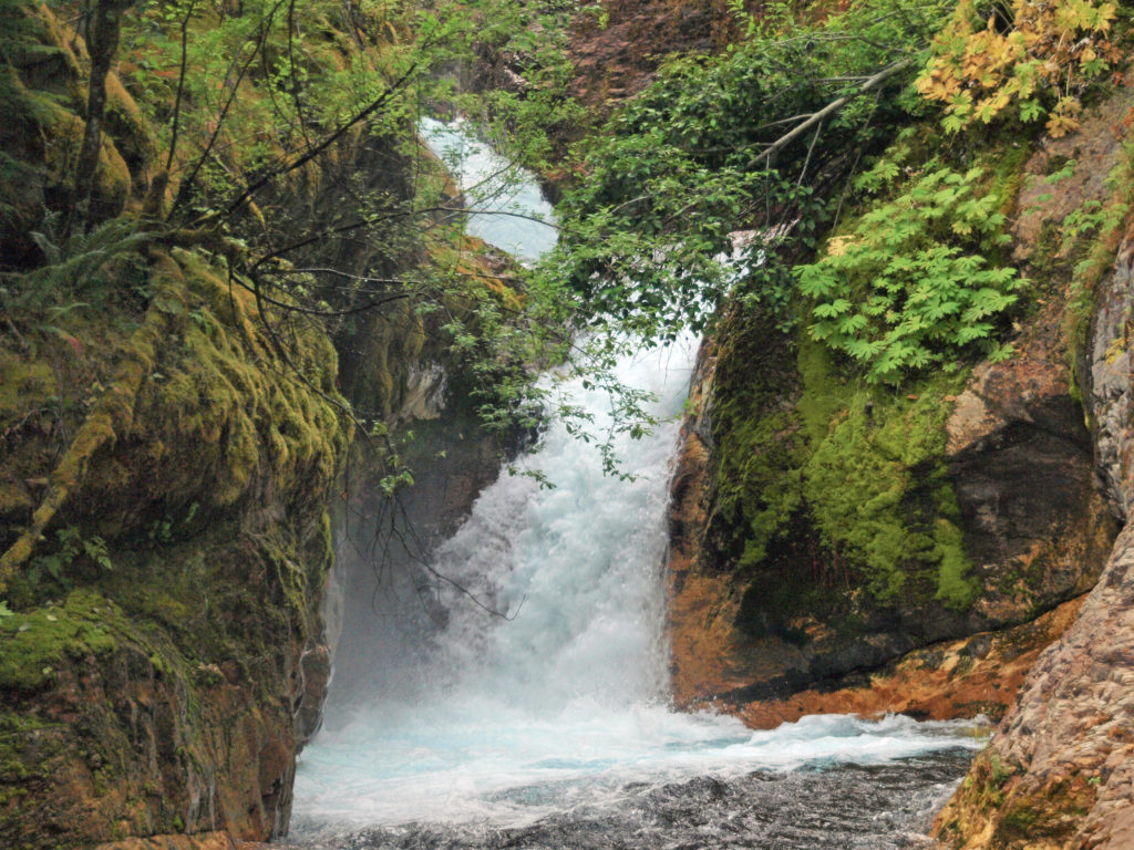
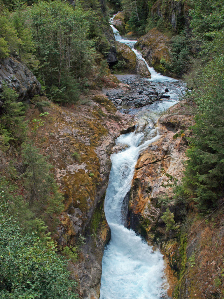 The history of Lava Canyon begins about 3500 years ago when an eruption of Mount St. Helens sent a flow of lava down the old valley of the Muddy River, destroying the forest and filling the valley with molten rock. Over the intervening years, the Muddy River cut a new course through the lava flow, and the canyon gradually filled with sediment. Then came the 1980 eruption, which melted the summit glaciers and sent a huge lahar (volcanic mudflow) down the valley, destroying the rebuilt forest and scouring out the built-up sediment, exposing the remnants of the earlier lava flow. What was left is a steeply descending canyon with an almost continuous series of spectacular waterfalls and cascades. (For more information on the 1980 eruption, see my
  Getting there:
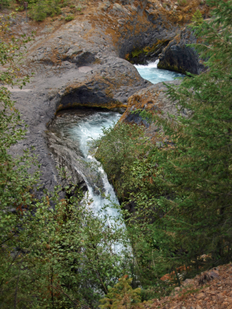 Trailheads:
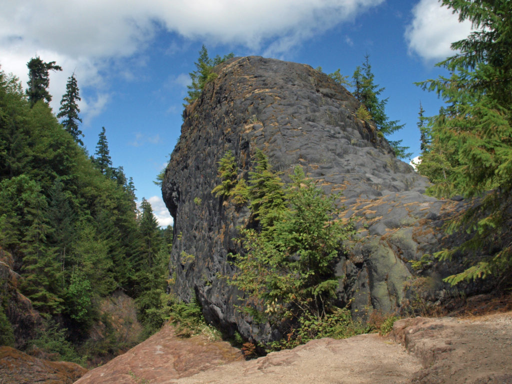 The hike:
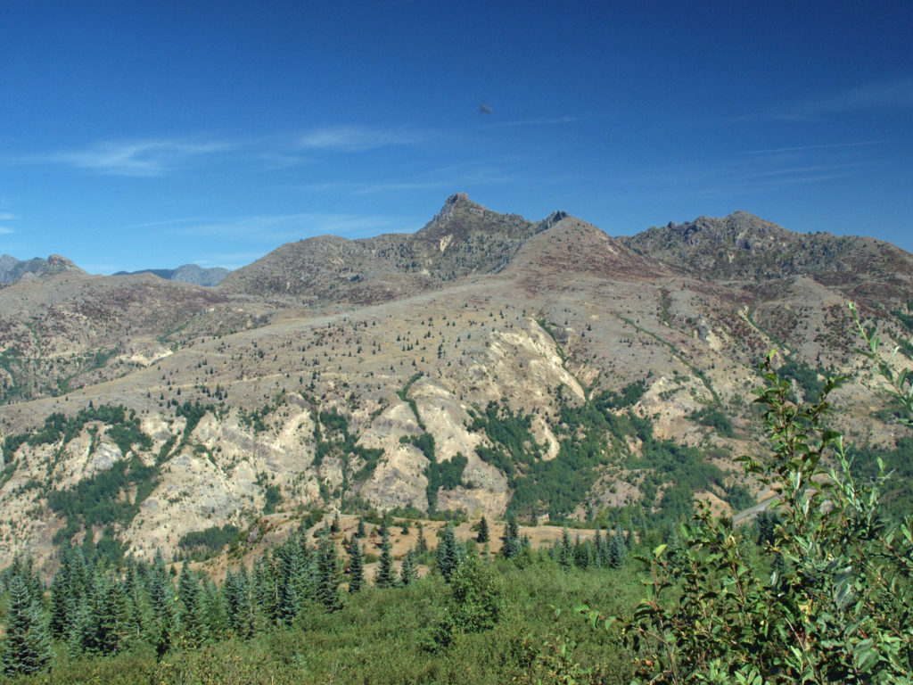
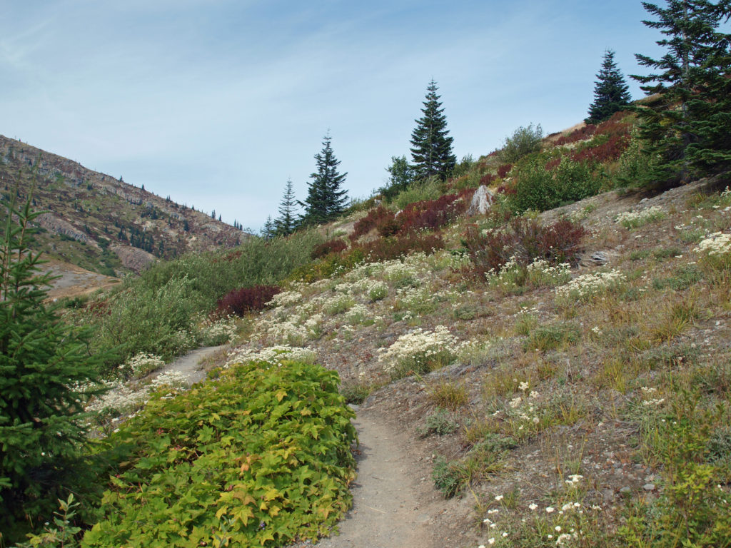
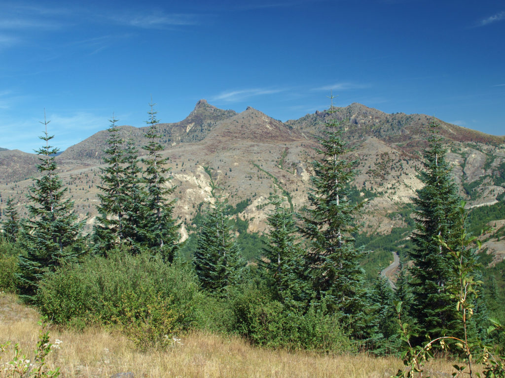
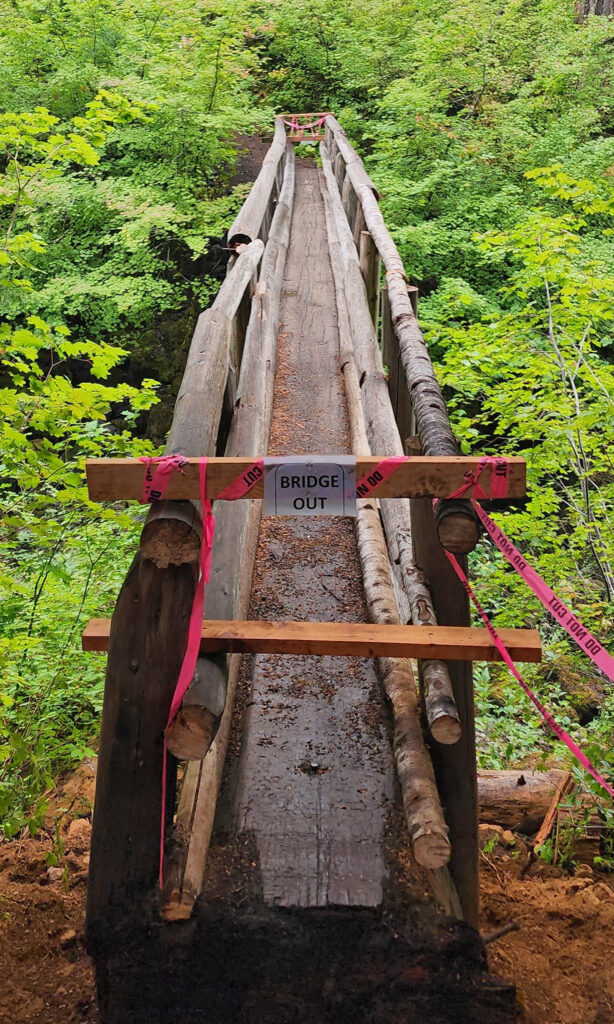
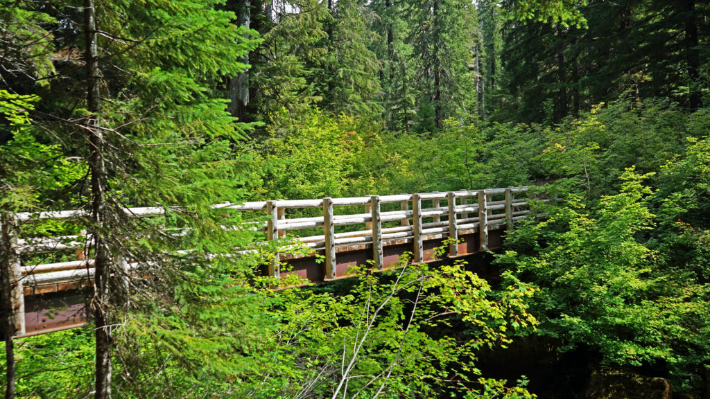
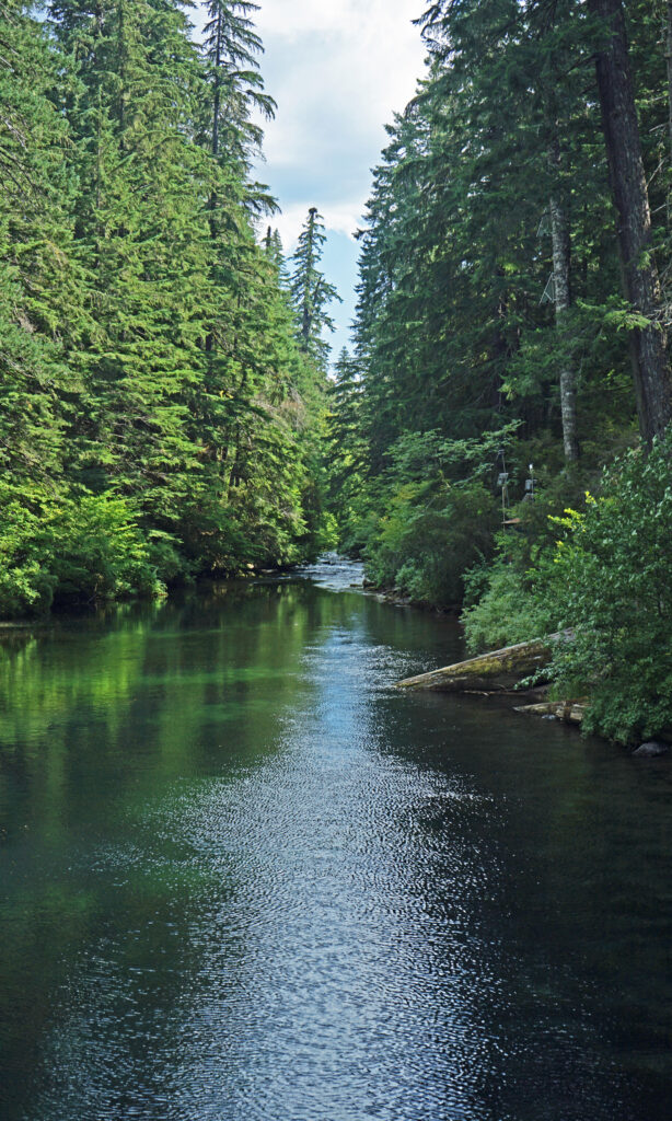
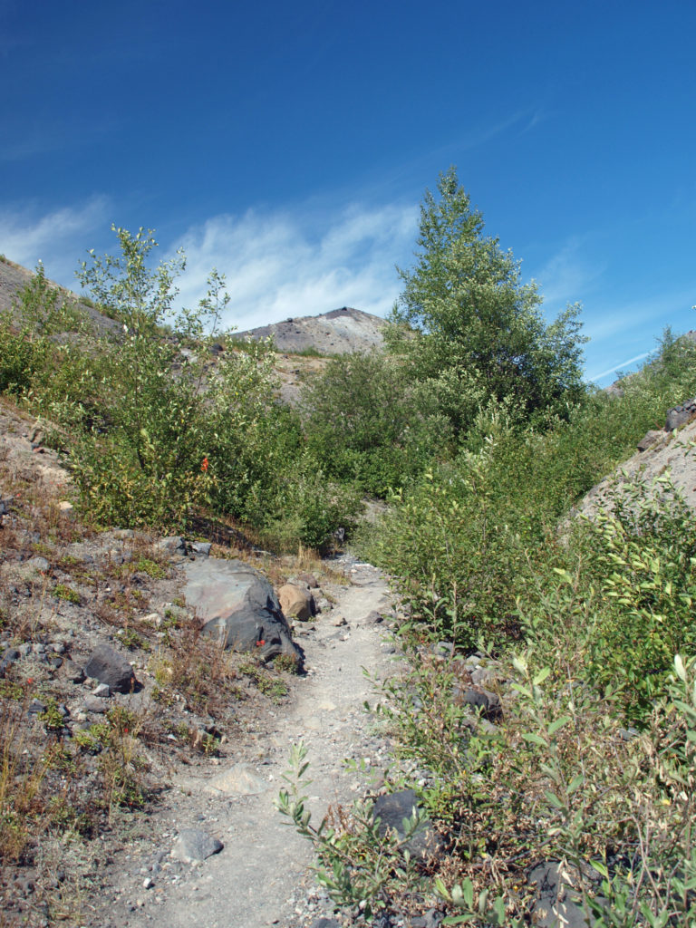
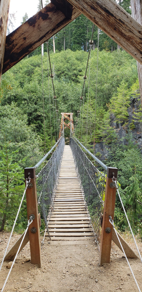 Below the overlook, the path is rock and dirt, steep in places. After another three tenths of a mile, you come to another side trail and a suspension bridge over the river that gives a bird’s eye view of the canyon and waterfalls. On the other side of the bridge is a connecting trail that takes you back to the upper bridge, making for a 1.4-mile loop. (Update: As of June 2023 the suspension bridge is closed. Check the National Forest Service’s
 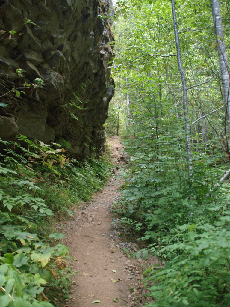 At about the 1.3-mile mark, the trail descends a 40-foot ladder to the base of the rock formation known as The Ship. Before 1980, sediment filled the canyon to the top of The Ship, to give you an idea of how much sediment was scoured out of the canyon. A short but steep side trail (and another ladder) leads to the top of The Ship.
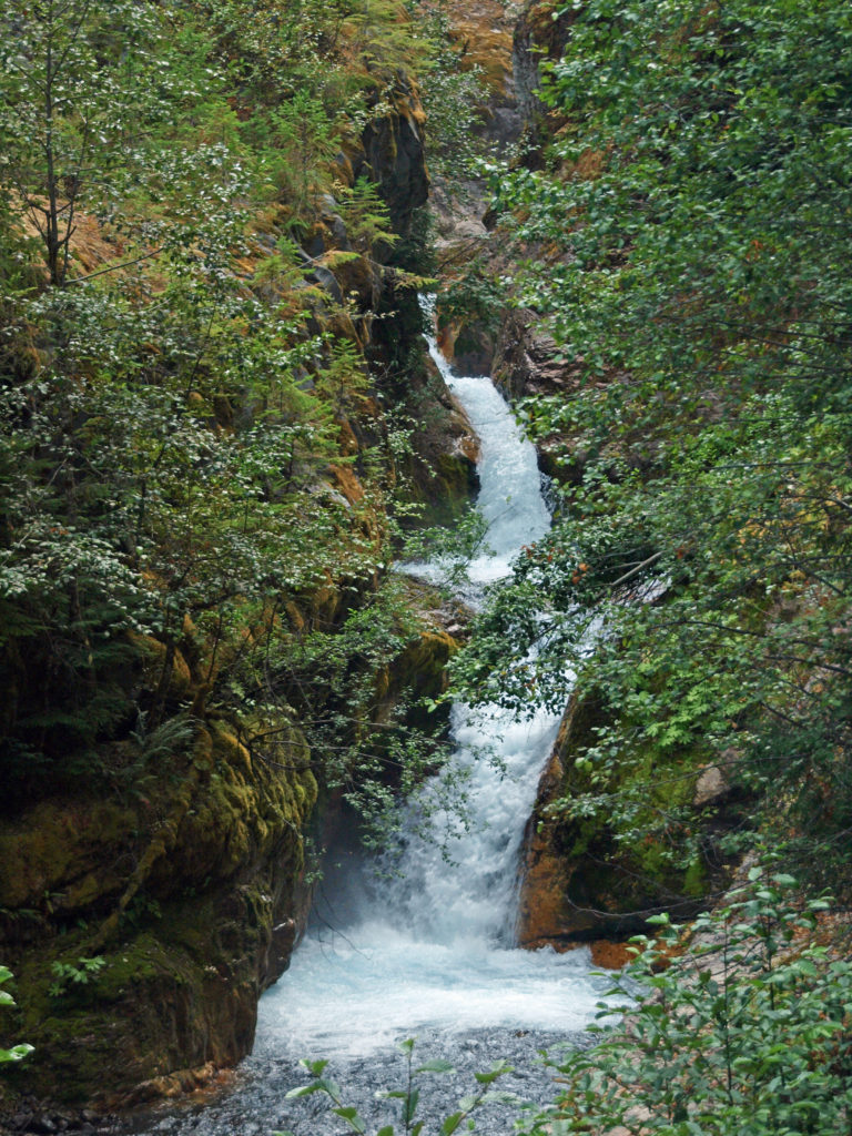 (Below The Ship, the trail continues another 1.5 miles to the lower trailhead. The entire hike from upper to lower trailhead and back is about six miles and the elevation gain coming back is 1350 feet.)
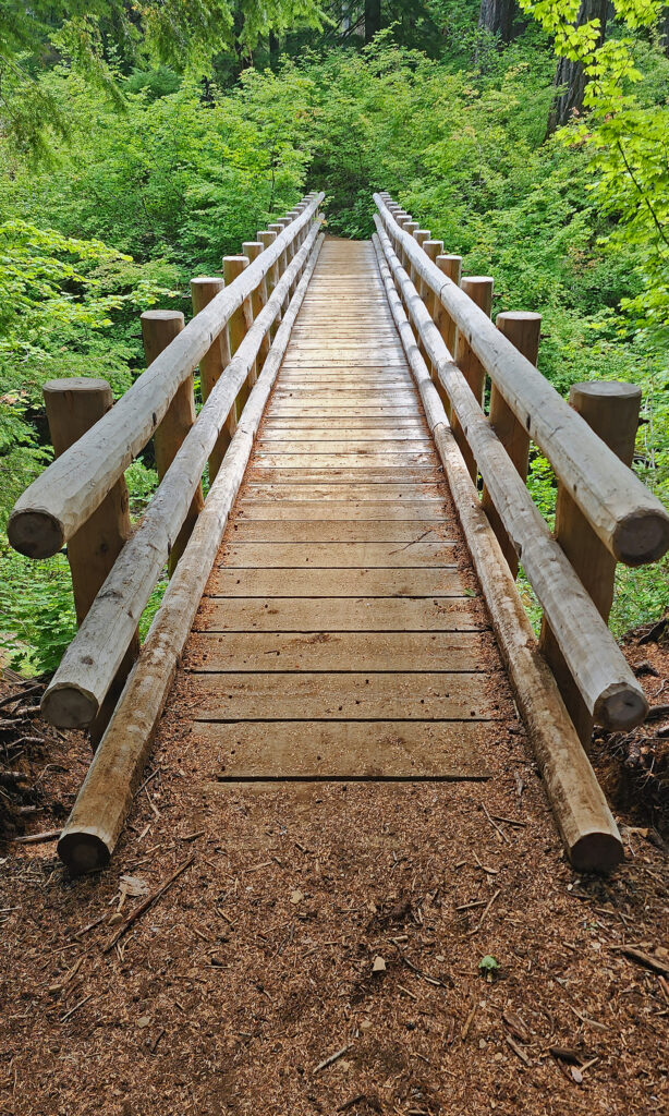
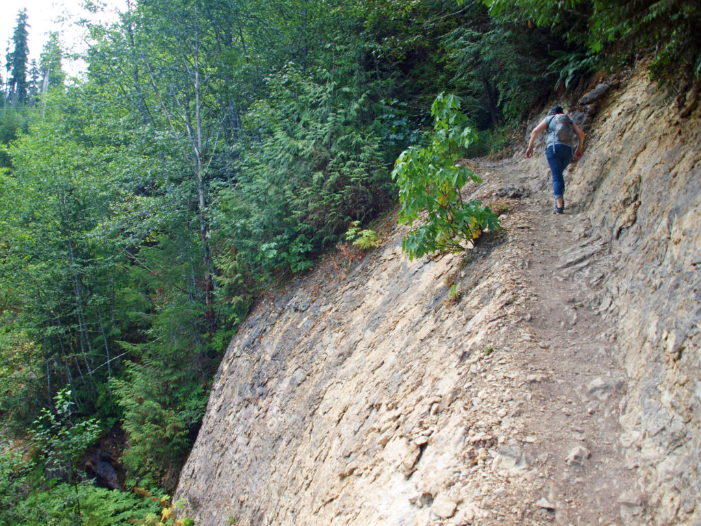 Return from The Ship the way you came. Cross the suspension bridge if it is open and take the trail on the opposite bank to the upper bridge and re-cross the river. The two bridges both give you great views of the river and canyon below.
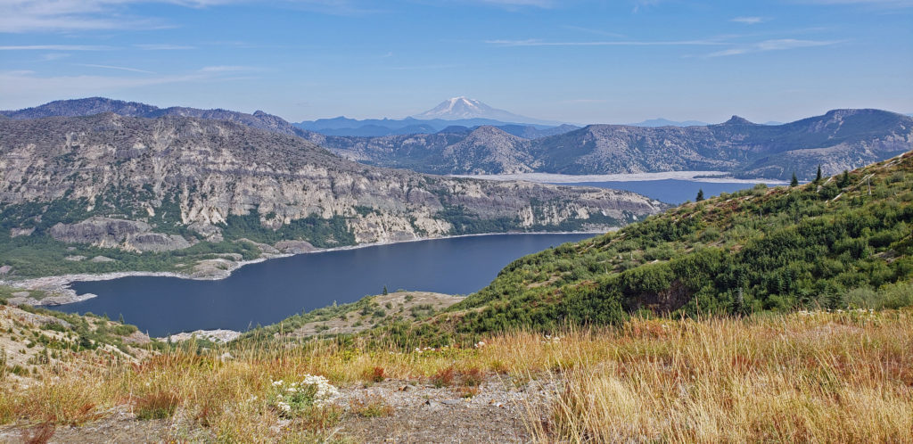
 Originally posted in a different format September 29, 2018 by Alan K. Lee. Updated and re-posted March 23, 2021. Edited, updated and posted in this format June 29, 2023.

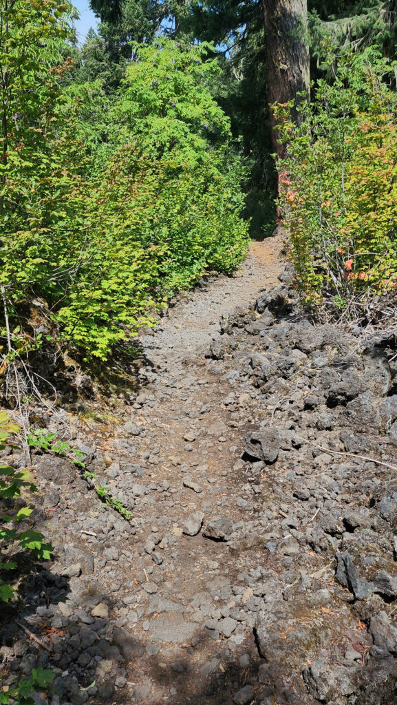
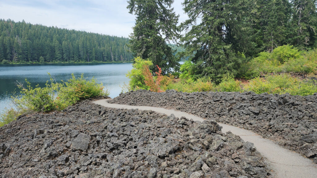
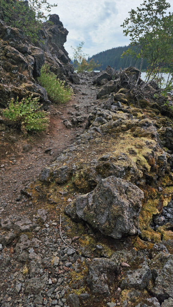 From the Great Spring the trail follows the east shore through the lava fields and forest. Parts of the trail are pretty rough. Good quality hiking boots are advised, although I did this hike in sneakers on my latest visit. But open toed sandals or flip flops are definitely not acceptable footwear on this section of the trail.
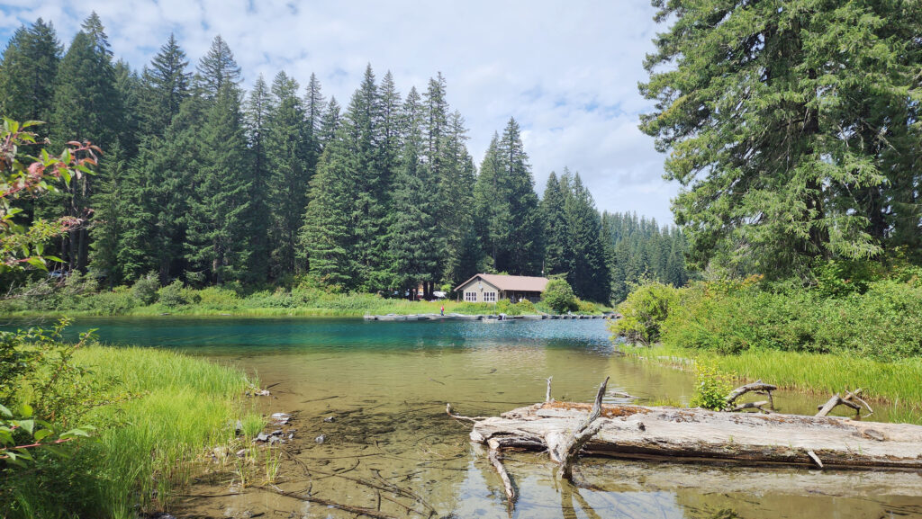


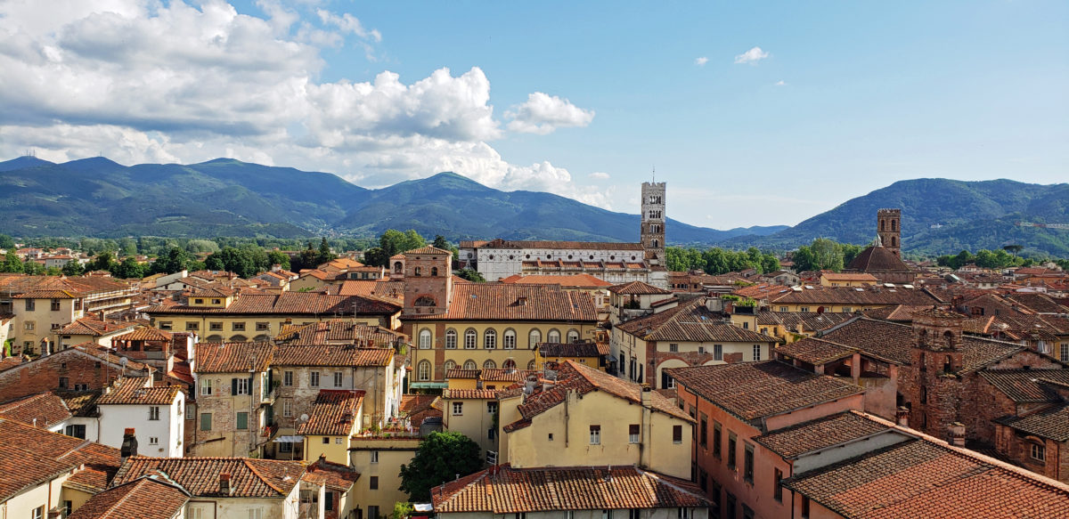
 Lucca, Italy is a modern city of about 85,000 people, located about ten miles northeast of Pisa and 40 miles west of Florence. But the old walled city was what my wife and I came to see. Lucca has one of the most intact medieval city centers you will find anywhere in Europe. The historic center, or centro storico, is relatively compact, easily walkable, and almost unchanged from medieval times.
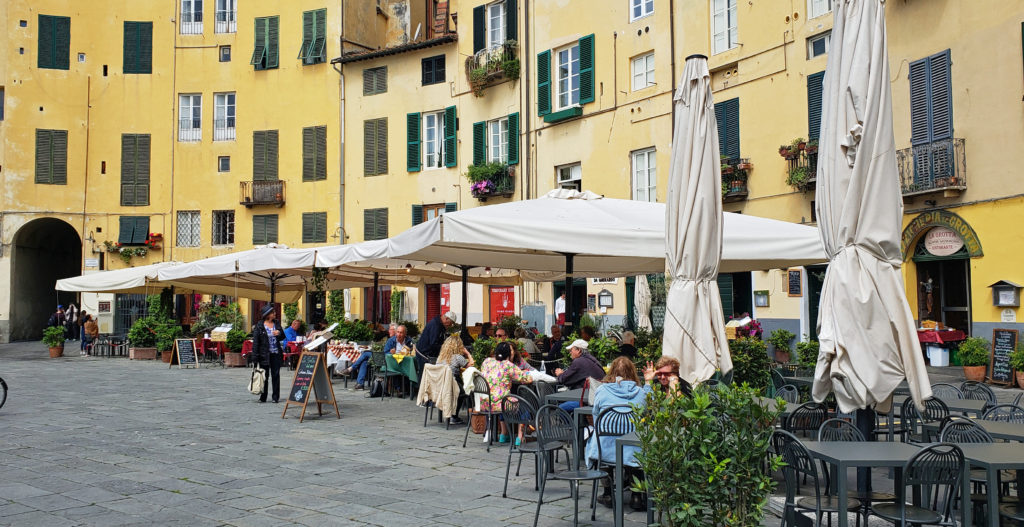 Lucca is an ancient city, founded by the Etruscans, probably on the site of an earlier Ligurian settlement. It became a Roman colony in 180 BC. Little remains of the Roman city, though. Most of the old city is of medieval origin, but some of the streets date to the Roman settlement, and a hint of the Roman amphitheater can be seen in the Piazza dell’ Anfiteatro. The popular Piazza San Michele occupies the site of the old Roman forum.
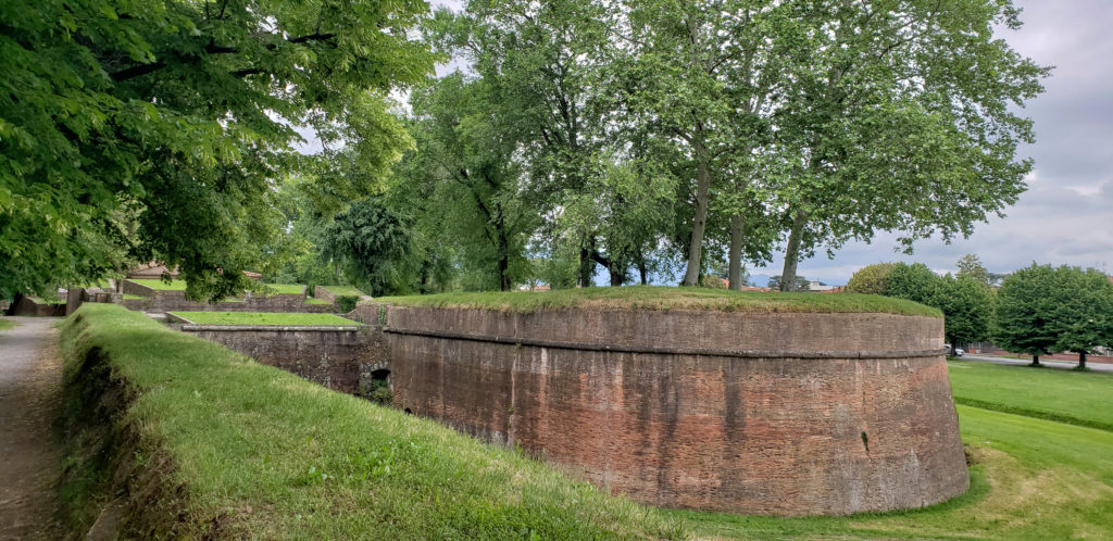
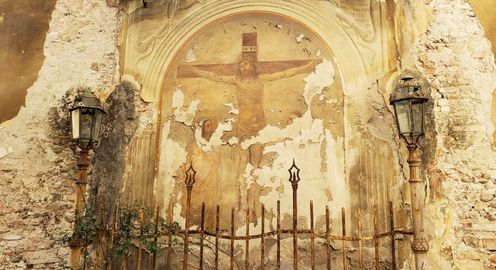
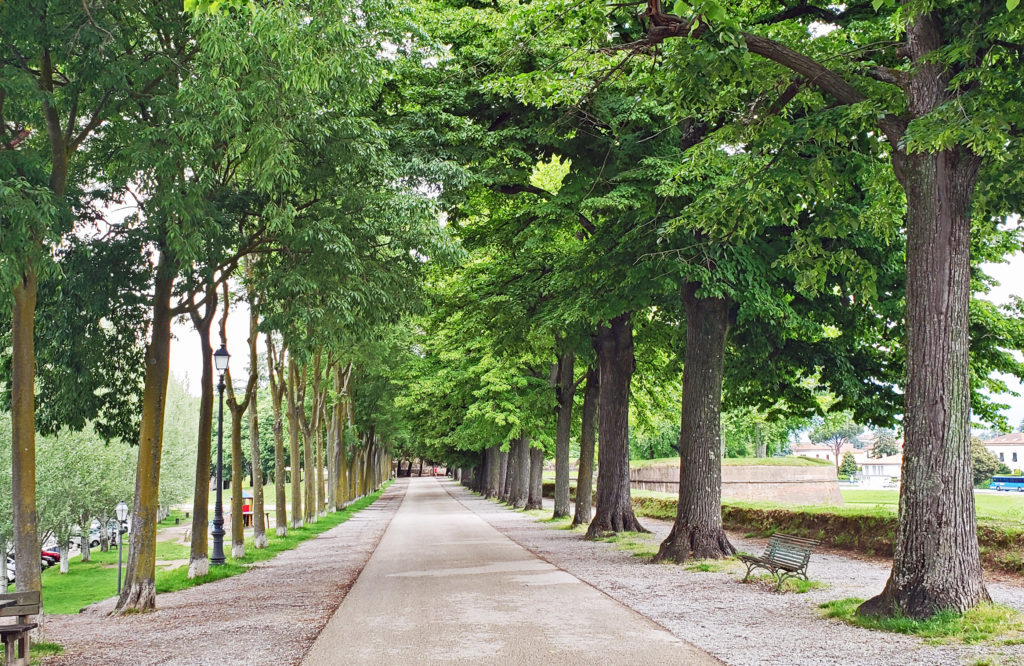 One of the attractions of Lucca is the medieval city wall. Lucca is one of the few ancient cities in Europe with an intact wall. The wall is a wide earthen structure faced with brick, constructed between 1550 and 1650. The top of the wall is now a tree-lined park with a wide pedestrian/bicycle path. The 2.5-mile-long path is a popular walking, jogging, and cycling path.
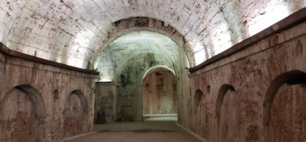 Bicycles can be rented for about €5/hour or €20/day at several shops in the old city. Riding or walking the wall is a good way to get a view of the city, and a good place to people watch, too. You will see many locals, as well as fellow tourists, walking and riding the walls or just relaxing on park benches. There are also several places where there are tunnels inside the structure of the wall that are surprisingly interesting and well worth seeking out.
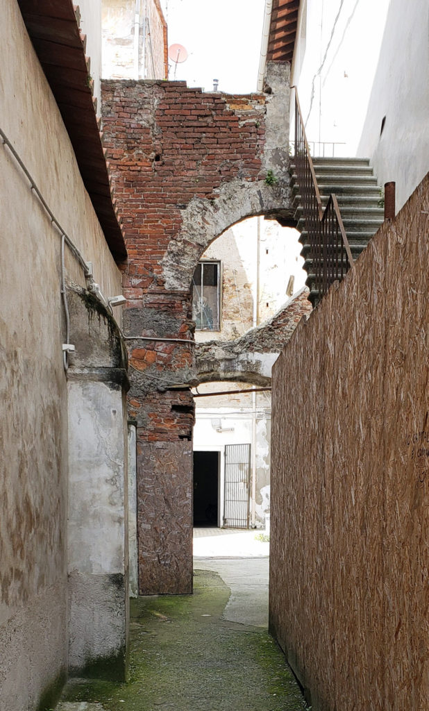
 Inside the walls, the old city has many fine old churches, plazas (piazzas), palaces (palazzos), and villas. Getting around can be confusing, as the streets are narrow and lined with tall (4-6 story) buildings, and some much taller towers that block out any visual reference points. On a cloudy day it can be difficult to orient yourself. You may come out onto the street and have no idea which way is north. A city map and a good guidebook are essential. Rick Steves’ guide to Florence and Tuscany has a chapter on Lucca and is a good reference. His walking tour is a good way to see the major sights.
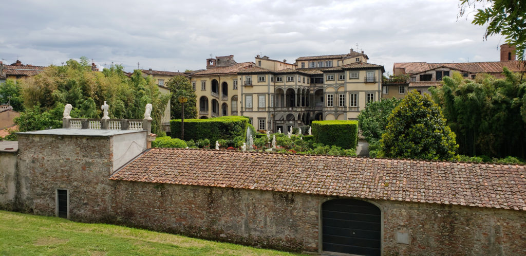 We wandered around without a set itinerary and got lost on several occasions. Wandering aimlessly and getting lost has a certain appeal, but one time we couldn’t find the side street where we had left the bikes that we borrowed from the owner of the Airbnb we were staying in. Eventually we figured out that we were on the opposite side of the city than we thought we were. We retrieved the bikes and rode back to our rental, but only after walking almost all of the 2.5-mile wall.
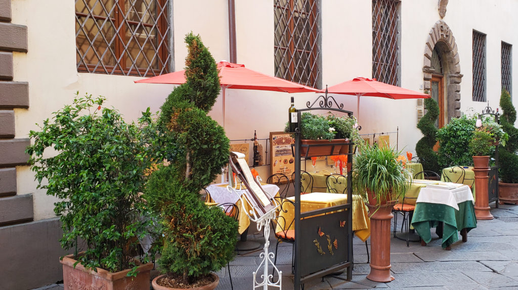 Some of the major attractions in Lucca are the Piazza San Michele and the Church of San Michele (Chiesa di San Michele), the Cathedral Museum (Museo della Cattedrale), the Guingi Tower (Torre Guingi) and Villa Guingi, the Casa di Puccini (the birthplace of the opera composer Giacomo Pucccini), the San Martino Cathedral, the San Giovanni Church, the Church of San Fediano, the Pallazzo Mansi, and the Palazzo Pfanner. All of these are described in the Rick Steves guide, as well as other guidebooks.
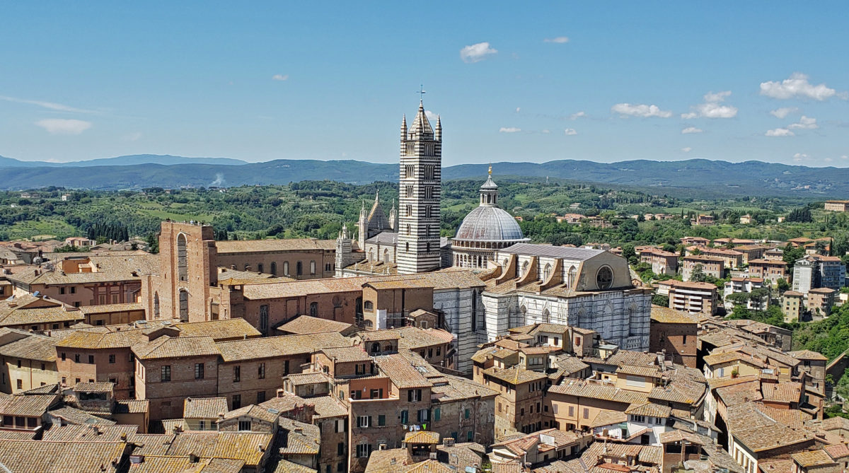
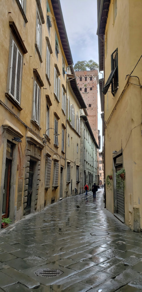
 Climbing the 220 steps of the Torre Guinigi gives you a good view of the city and you’ll find an interesting little grove of trees growing on the summit of the tower. This was the first of our tower climbs during our trip. More would come in Siena and Florence, culminating with our back-to-back climbs of the Duomo and Campanile (Giotto’s Tower) in Florence (both 400+ steps). Lucca once had 160 towers like the Torre Guingi, all private residences of wealthy merchant families. Only a few remain. A combination ticket that gets you into both the Torre Guinigi and the Clock Tower costs less than €10. Most of the other attractions in Lucca are similarly inexpensive, mostly between €5 and €10.
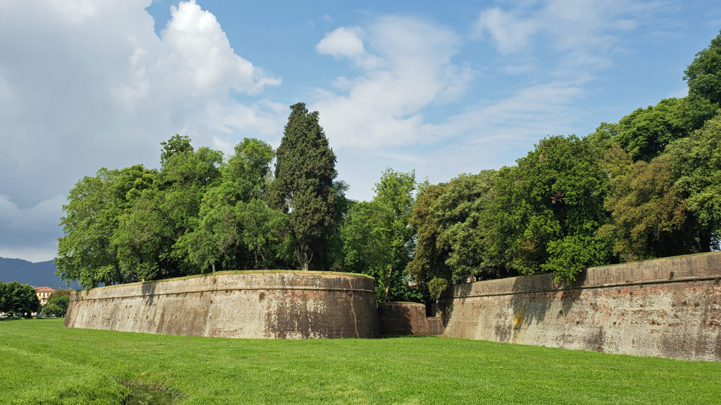 There are no shortages of places in Lucca to get a good meal, something we found true everywhere we went in Italy. There are some fine dining establishments that are recommended the guidebooks, but we found the sidewalk and piazza cafes that are so abundant all had very good food at surprisingly affordable prices. It’s hard to go wrong, wherever you choose to dine. Gelato is serious stuff in Lucca, too, as it is everywhere in Italy.
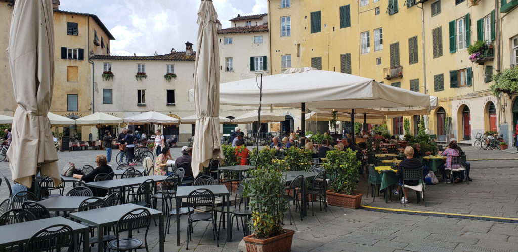 If you’re visiting Tuscany, Lucca should be on your itinerary, even if you only have an afternoon to explore it. Siena is prettier, and Lucca doesn’t have the history or art and culture of Florence, but it is more authentic and much less touristy, and has its own appeal. You won’t regret it.
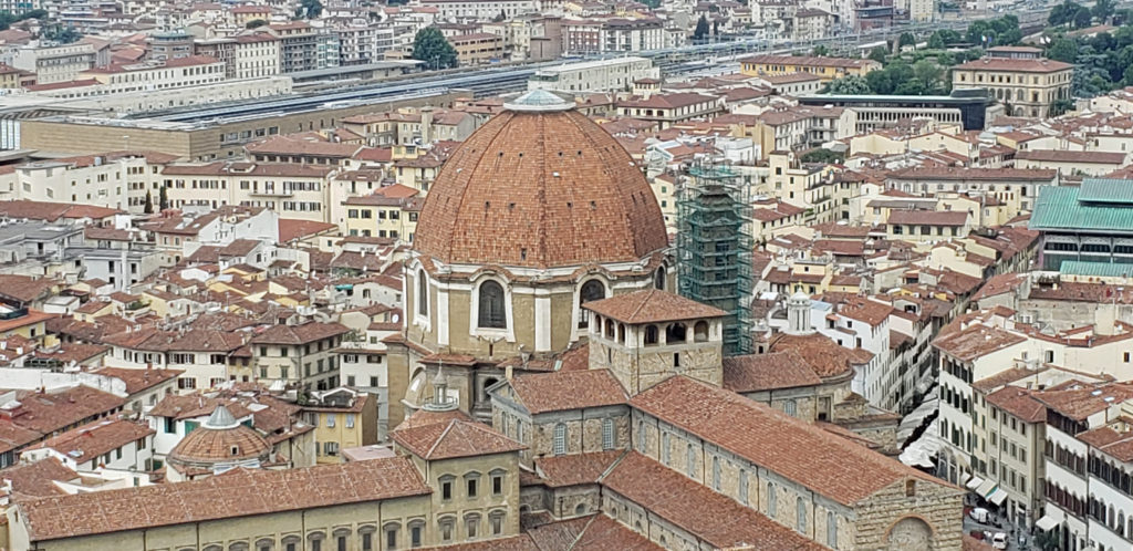
 Originally posted September 17, 2018. Updated and re-posted April 14, 2021 and May 21, 2023.
 The following is an expanded and updated version of an August 2018 post on this site.
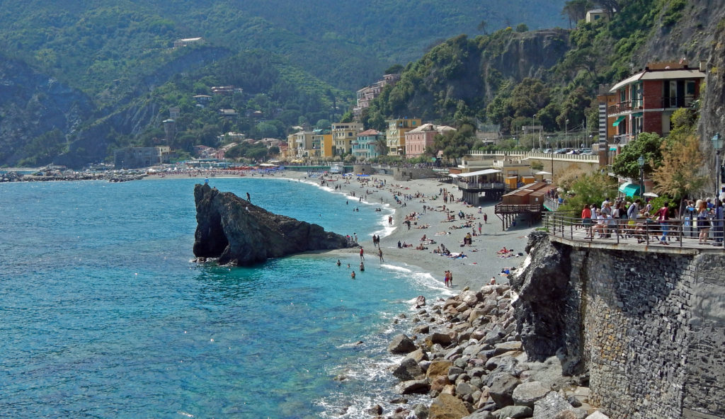
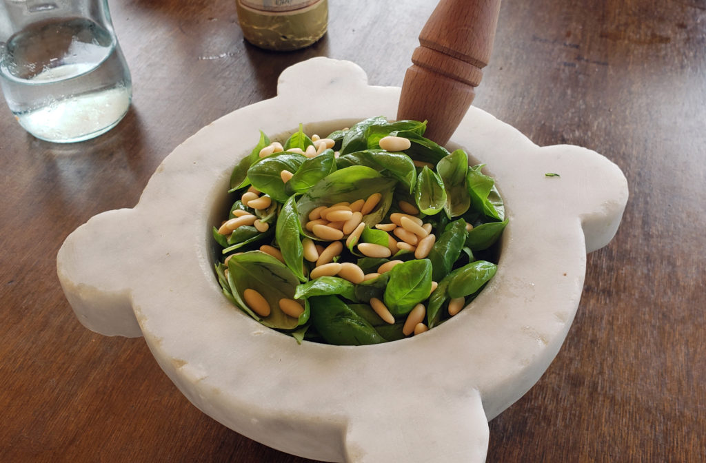 Because we would not be home on Mother’s Day, my two stepdaughters bought my wife (and me) tickets to a pesto making class and lunch at the Nessum Dorma Restaurant in Manarola, something I would not have done on my own, but which turned out to be both a good introduction to Italian cuisine and loads of fun. And the food was very good, including the pesto that we made ourselves.
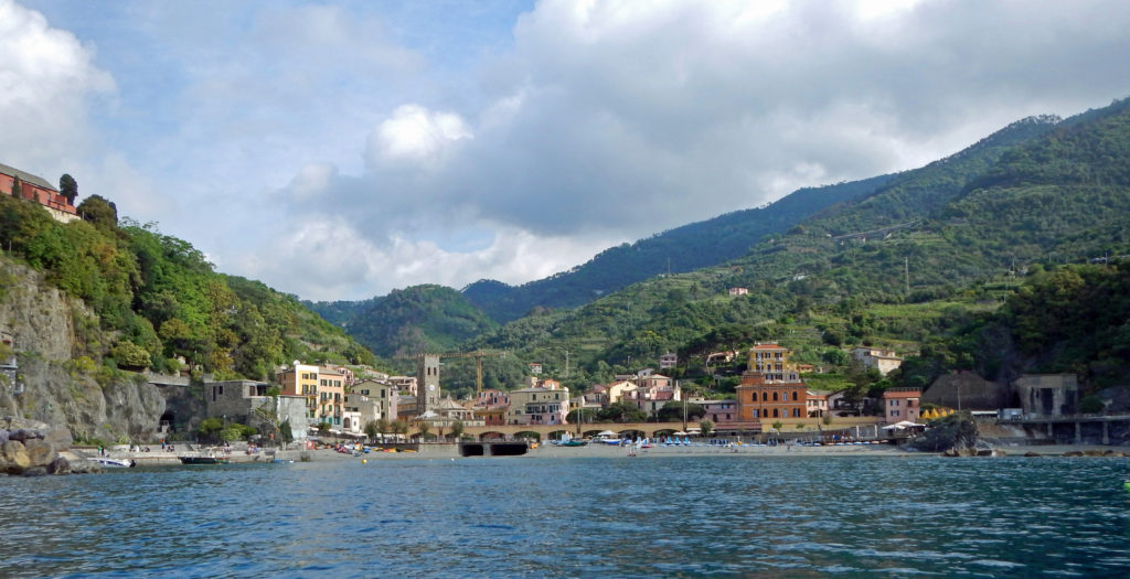

 Overview:
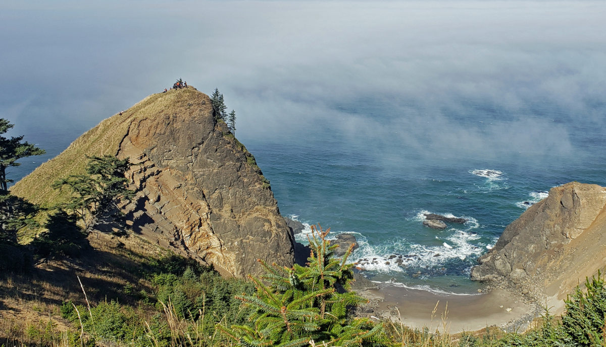
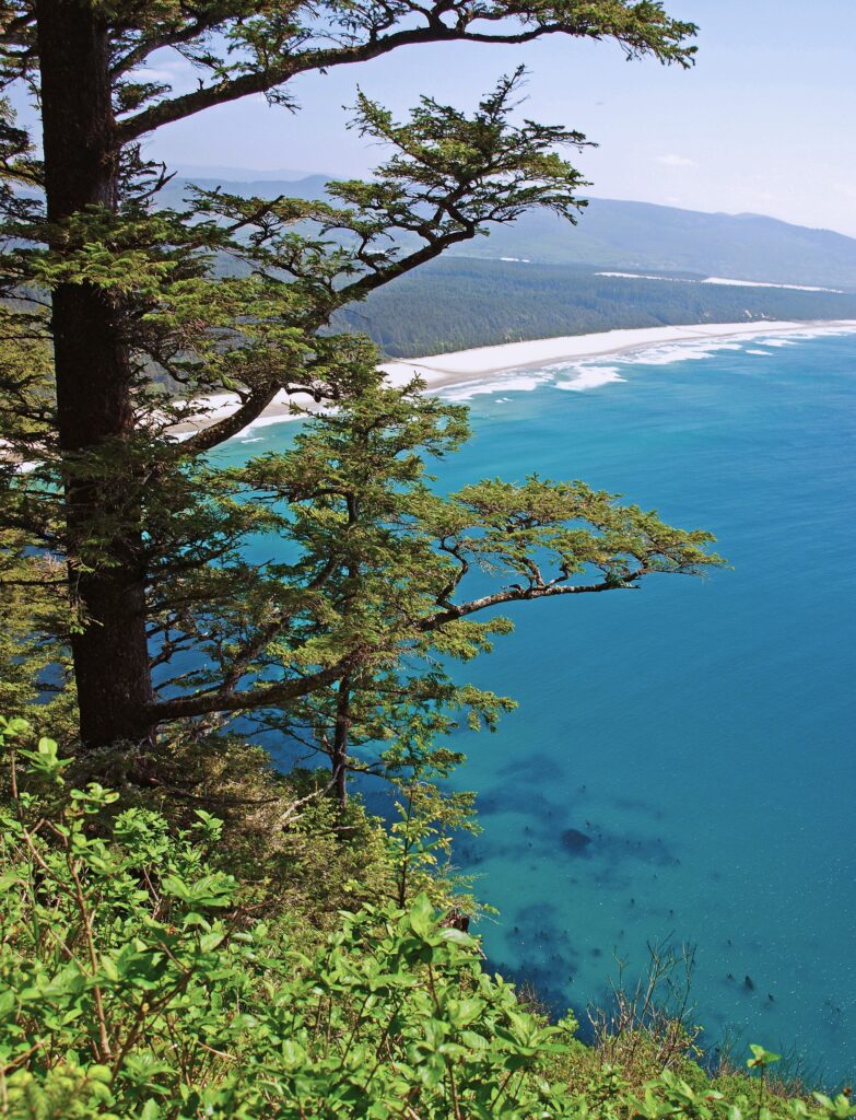
 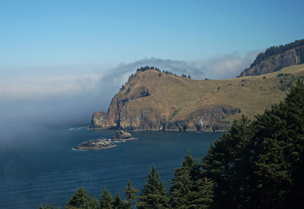 The God’s Thumb hike remained closed to the public until about a decade ago. Although people occasionally trespassed across private property to get to it, God’s Thumb remained largely unknown. But in 2013 Lincoln City purchased about 500 acres of property that was the site of a failed subdivision and negotiated an easement with the owner of the neighboring property, making God’s Thumb legally accessible to the public for the first time.
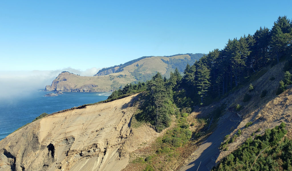 Trailhead:
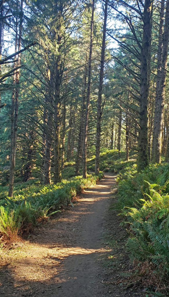 The hike:
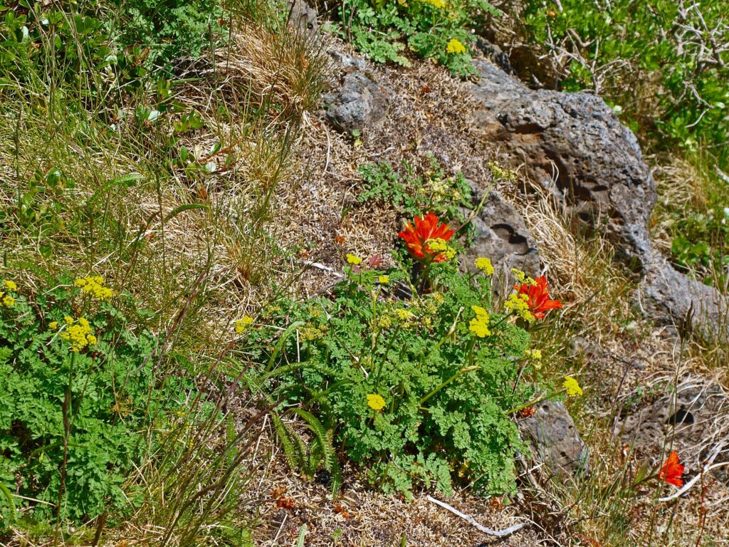
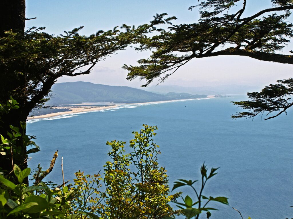
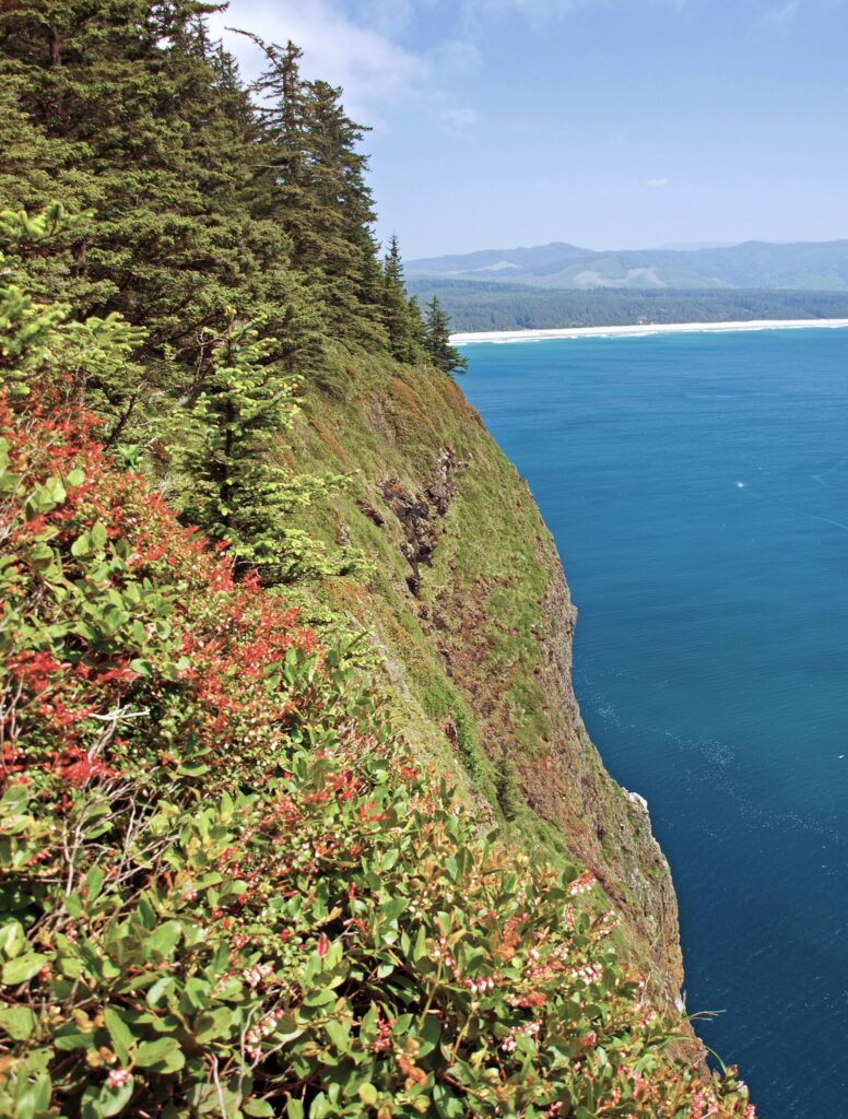
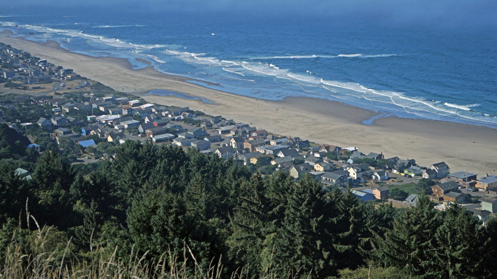 You don’t want to skip this because the view here is spectacular. The Pacific Ocean is spread out before you in all its glory. The Road’s End section of Lincoln City is directly below you. Lincoln City stretches out before you, with Devil’s Lake to the east and Siletz Bay to the south. The view extends south to Cape Foulweather. You might want to park yourself on the grassy summit and just sit for a while. Apparently, the local herd of elk also like the view because they often bed down here at night.
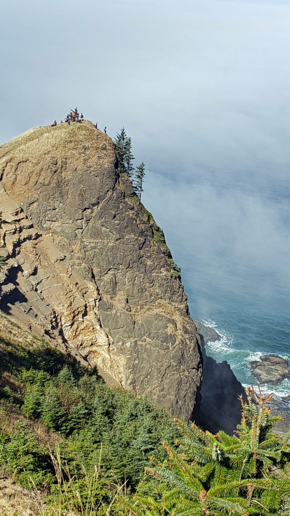
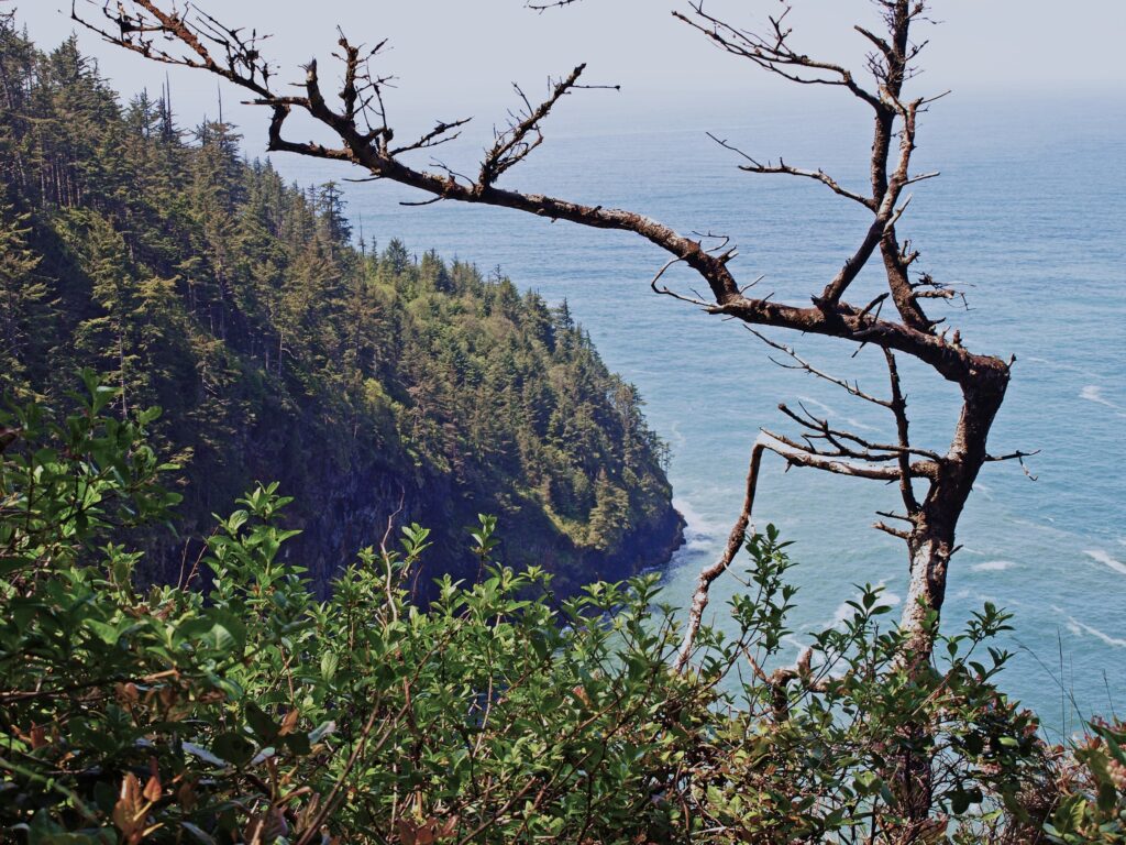
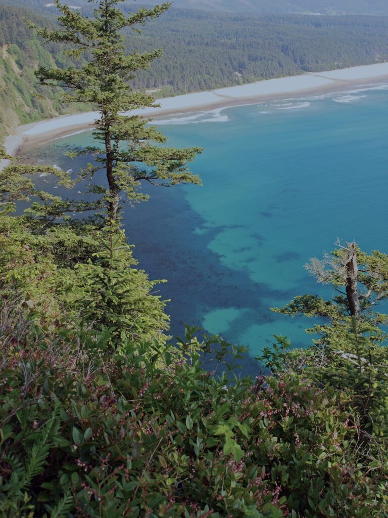
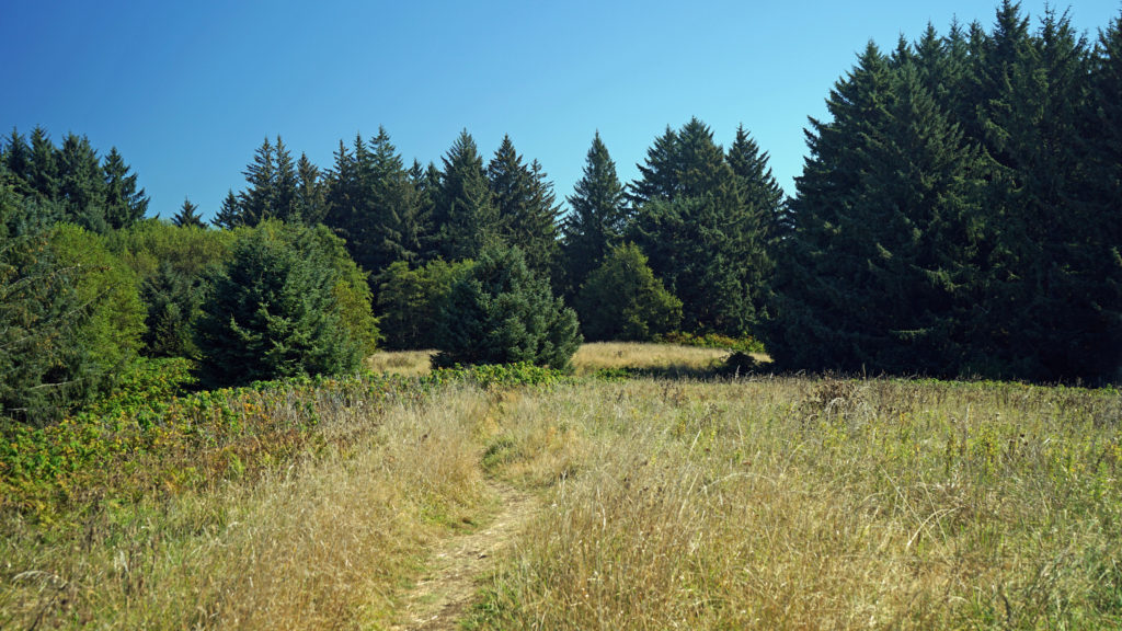 When you’re done taking in the view from The Knoll, return to the main trail and continue north. This portion of the trail is on the easement granted to the city by the property owner. The trail takes you through a spruce and hemlock forest and across a small meadow. Parts of the trail are steep, but the elevation gain is modest, and most people won’t have any difficulty. You’ll soon come to a trail junction. Stay left to continue on to God’s Thumb. You’ll pass through more spruce, hemlock and alder forest, and across several grassy meadows before the trail swings to the west and comes to another trail junction. The trail to the right comes up from the private Camp Westwind on the Salmon River Estuary. Stay left at the junction and you’ll soon see God’s Thumb in front of you. Stop here and admire the view of The Thumb and the surrounding cliffs, the two coves and beaches on either side of The Thumb, and Cascade Head to the north.
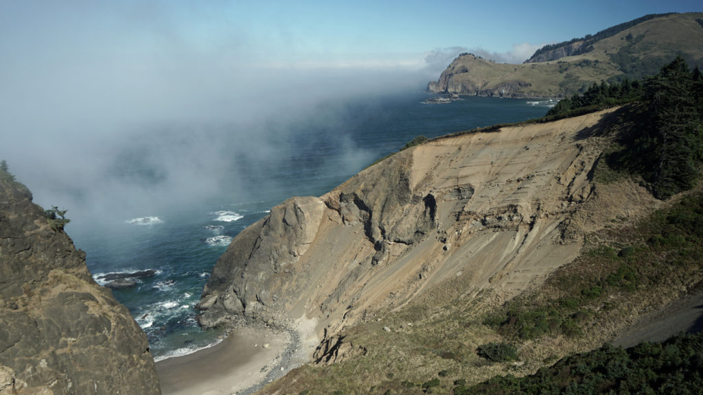 The trail then drops steeply down the slope and across along a narrow ridge before climbing very steeply up the slope to the summit of God’s Thumb. This section can be tricky to navigate and can also be slippery if the trail is wet. Some people choose not to venture down and then up to the summit. But if you do, you’ll be rewarded with magnificent views in all directions. Even if you don’t, the views you do get make the hike well worthwhile.
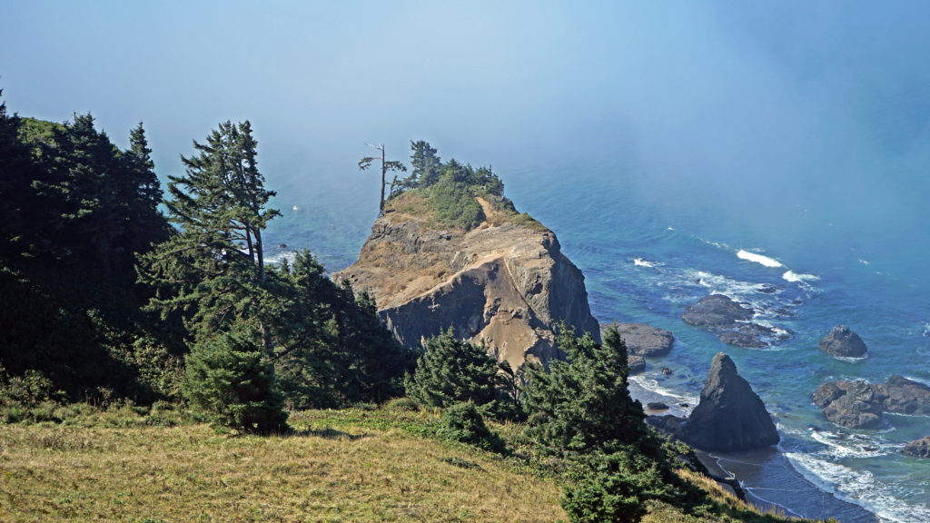 When you’re done taking in the views, return the way you came. When you reach the second trail junction, before you get to The Knoll, you have the option of taking the trail to the left for an alternate, slightly longer route back to the end of Devil’s Lake Boulevard where you left your car. Check the Oregon Hikers
 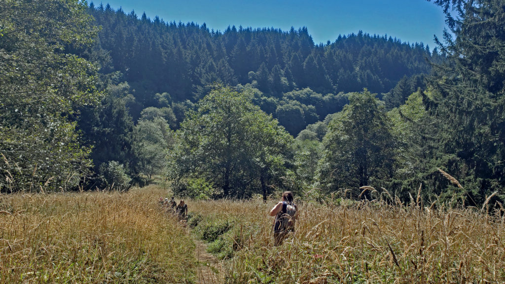 A few notes on parking:
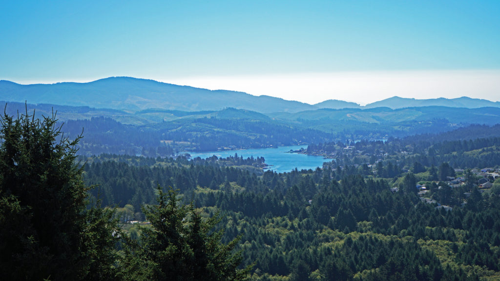 Other area hikes and other attractions:
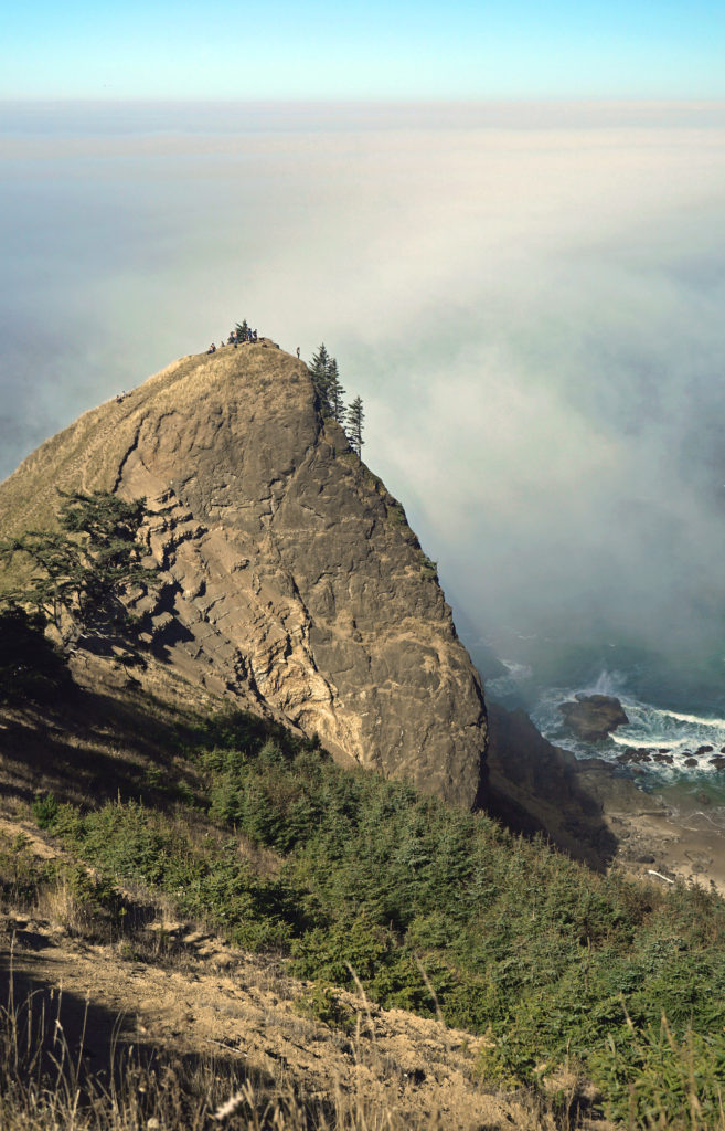
 The
The 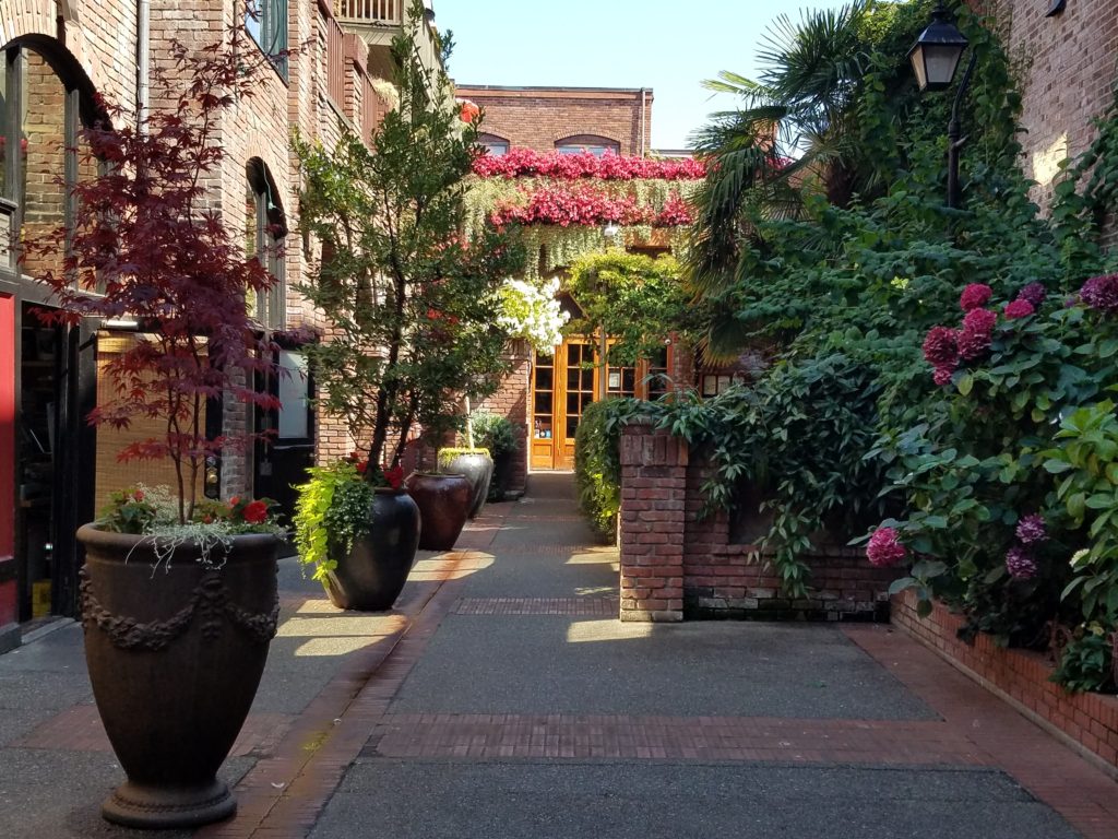

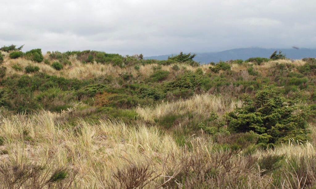
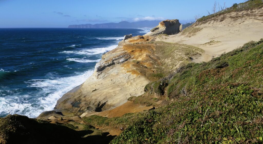
 The peninsula is now an undeveloped county park. There has never been a campground, but in the past backcountry camping was permitted. That has changed, however, and overnight camping is no longer allowed.
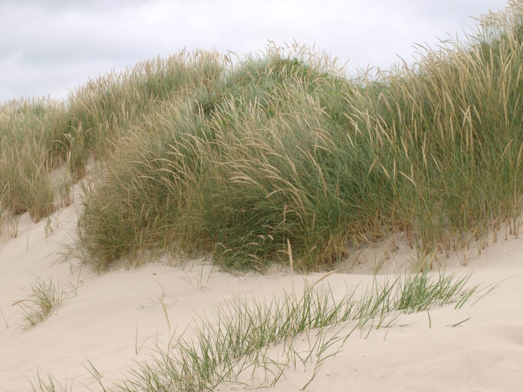 Getting there:
 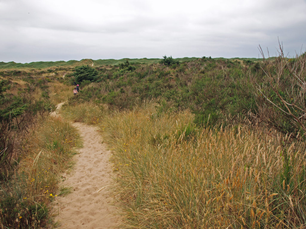 The hike:
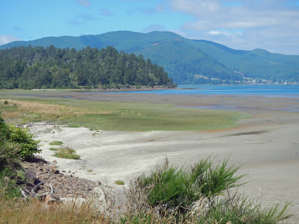
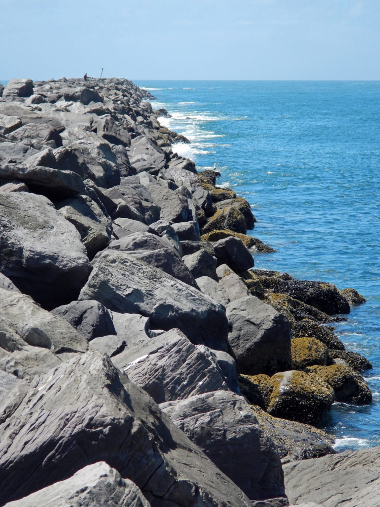 Or, continue along the beach until you reach the south jetty at the mouth of Tillamook Bay. You’ll be rewarded with one of the least crowded beaches on the entire coast. You might have the beach to yourself even on summer weekends.
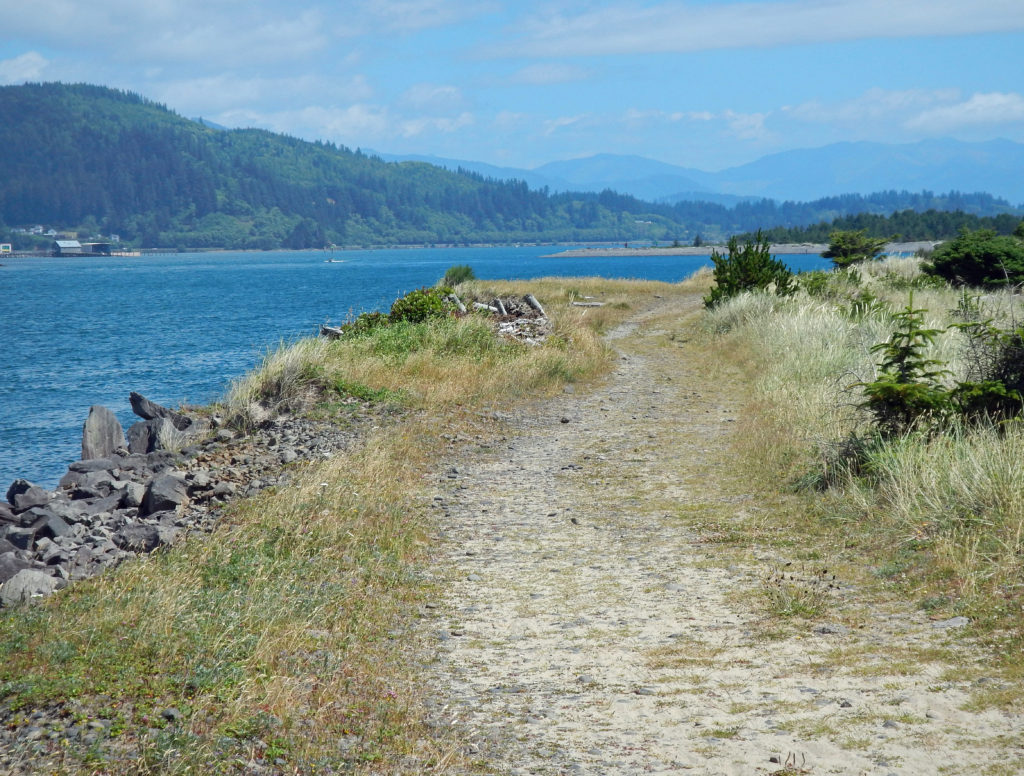 From the jetty you can return the way you came for 7.2 mile out and back beach walk or complete the 7.7-mile loop hike by following the jetty inland to the old jetty haul road and following it back to the trailhead. The road is rock and gravel with some sandy stretches. It runs along the bayshore, with good views of the shore and bay, with a couple of stretches in the pine and spruce forest of the peninsula interior.
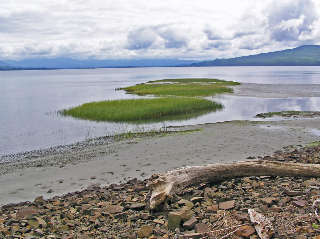
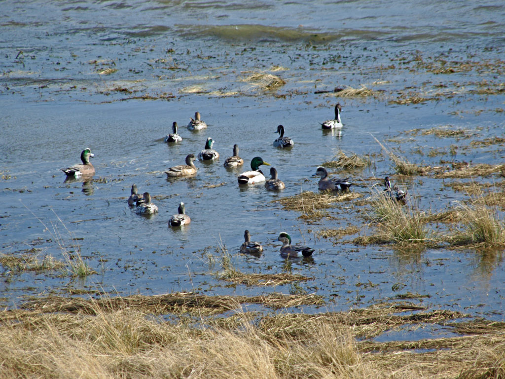 Look for ducks and geese on the water and shorebirds along the water’s edge. This is one of the best birding areas for waterfowl on the coast.
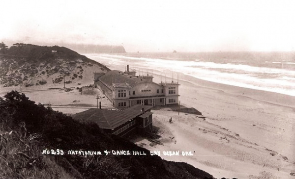
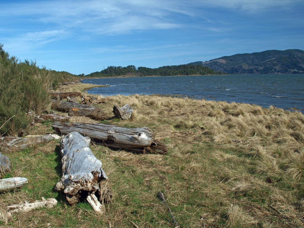 Near the end of the hike look for a sign labeled Bayocean Townsite. Here a trail leads toward the beach to the old townsite. The trail loops south through what was then the bayfront (the whole peninsula has shifted a couple of hundred yards to the east and much of the old townsite is now under the waves), then returns to the haul road, where there is an interpretive display that tells the tale of the town and its demise. From there, return to the parking area. (If you started at the town of Cape Meares, hike from the Dike Road parking area through the dunes and return to Cape Meares on the beach.)
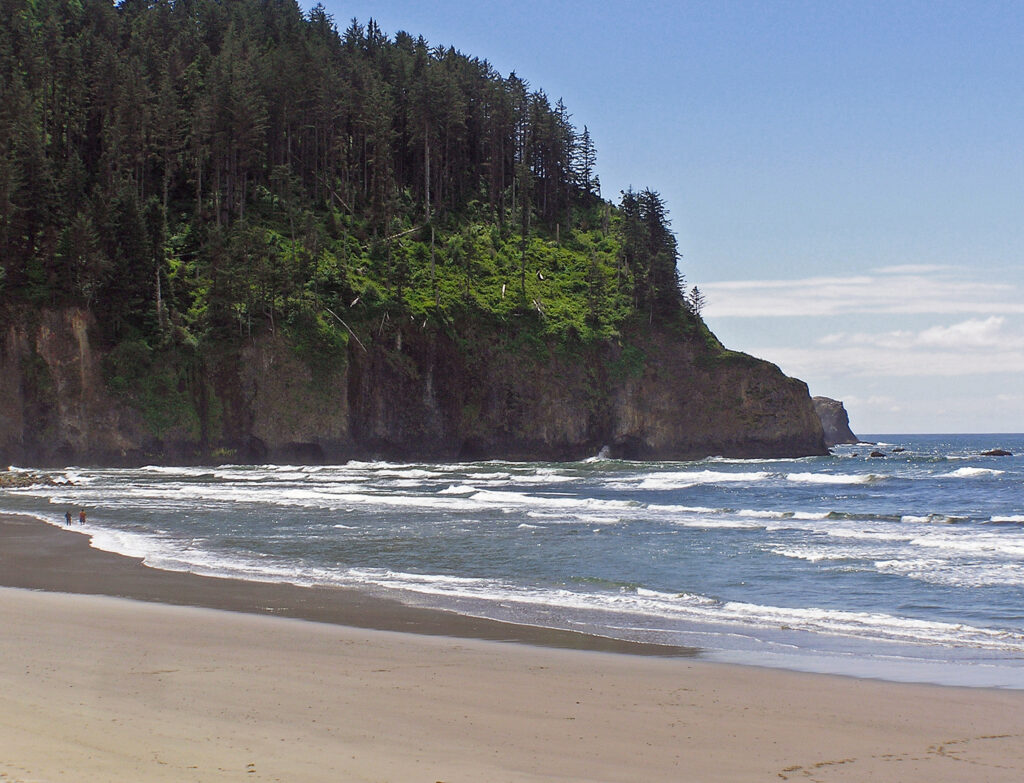
 Farther south,
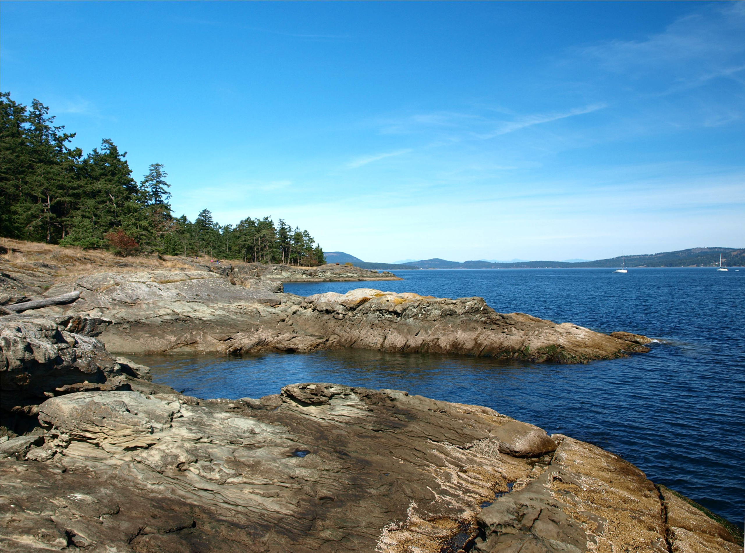
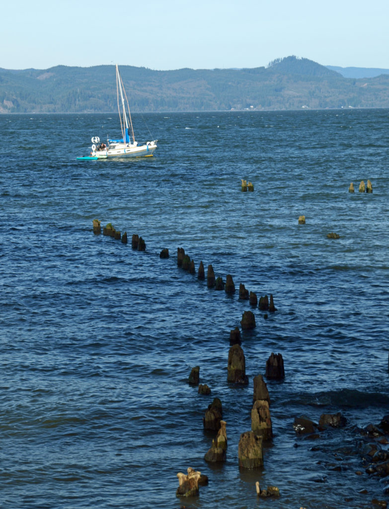
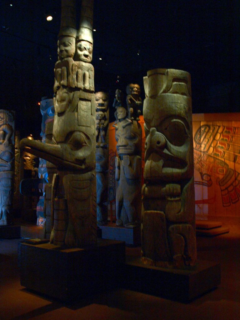
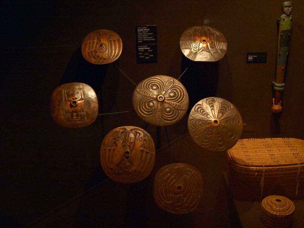
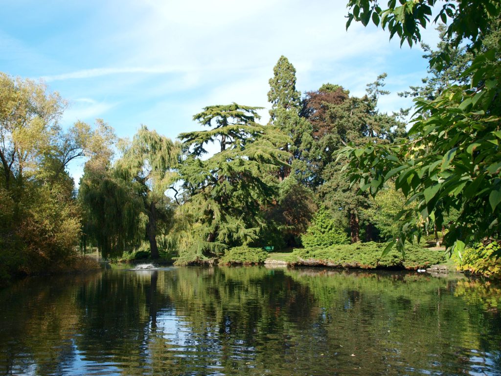
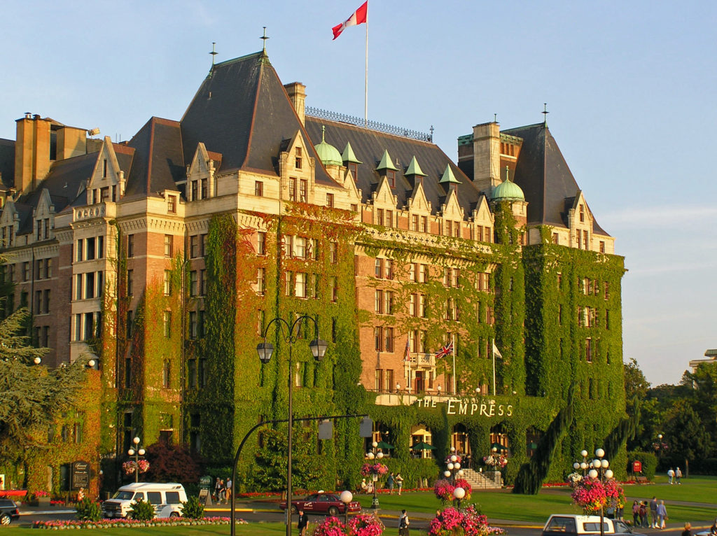
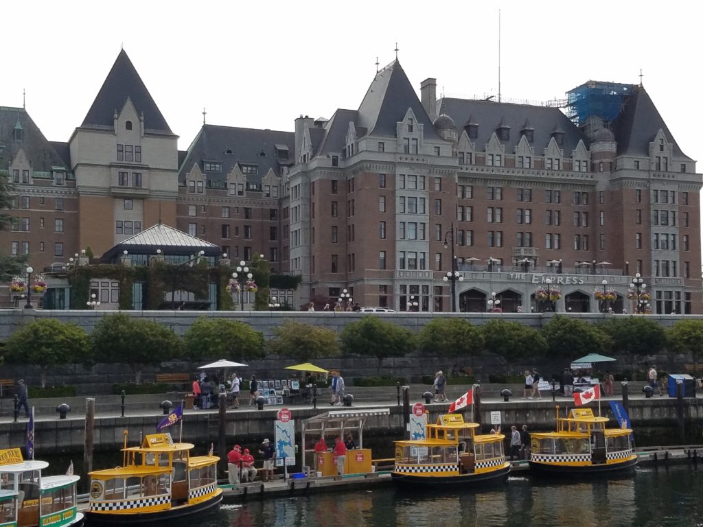
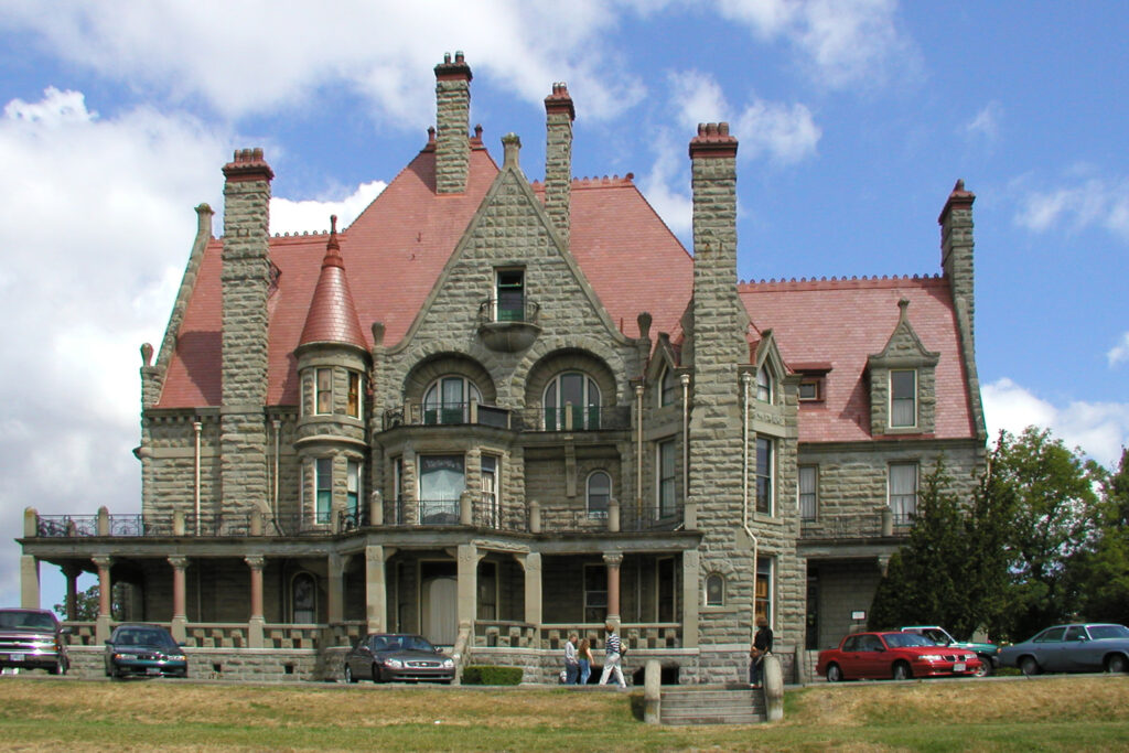
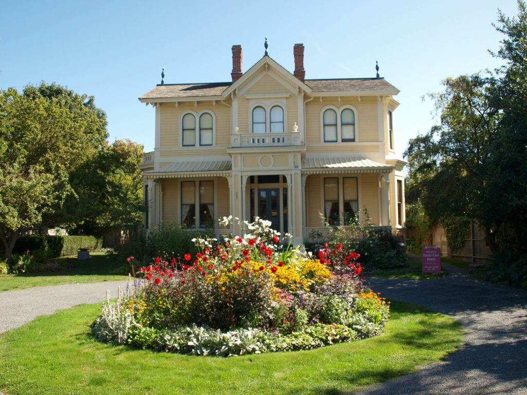
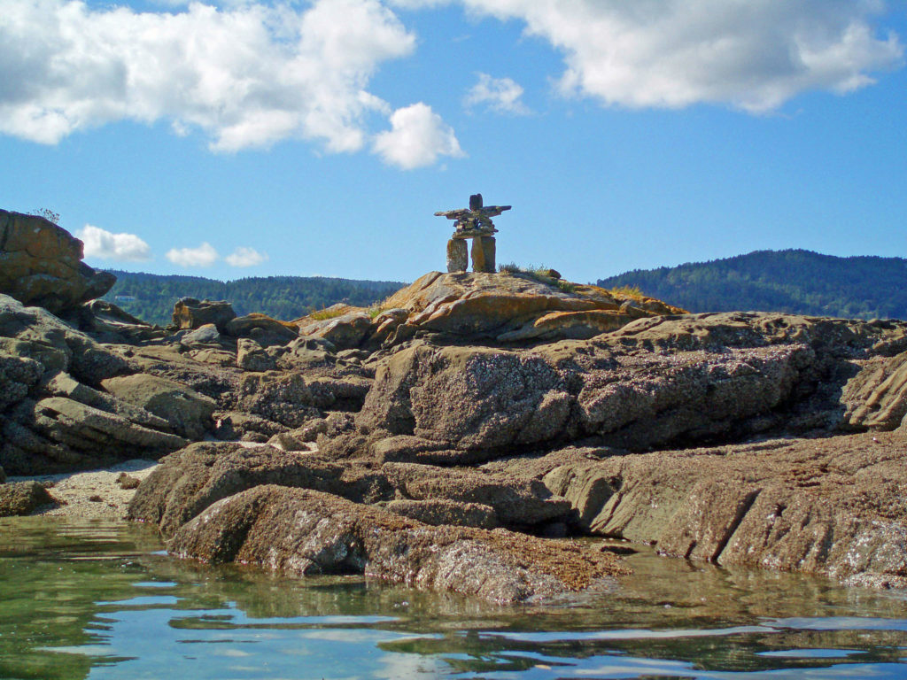
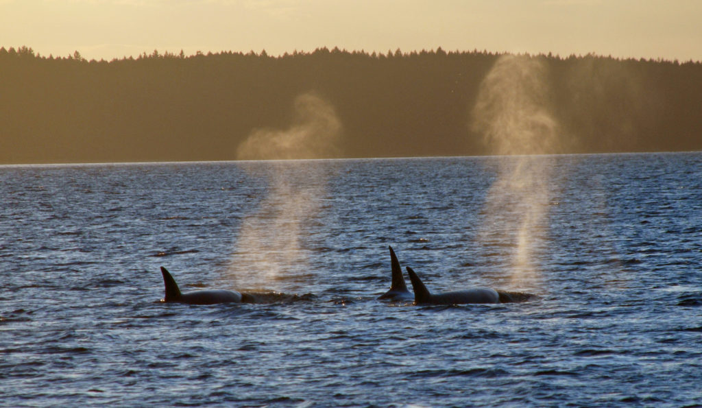
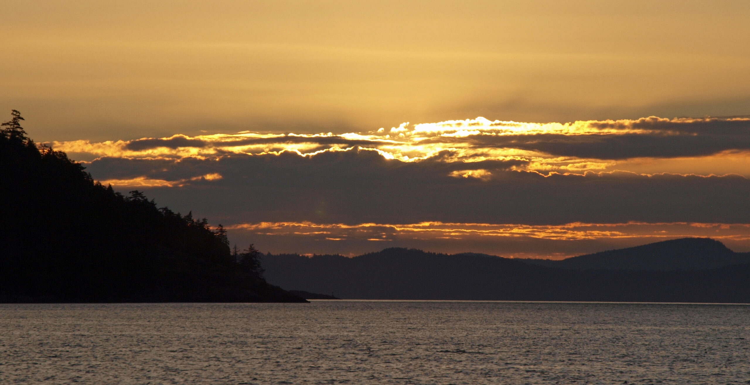
 The Gulf Islands are located off the southeast coast of Vancouver Island. There are six main islands in the Southern Gulf Islands: Salt Spring, Mayne, North Pender, South Pender, Saturna, and Galiano. The Northern Gulf Islands consist of Thetis, Penelakut, Valdes, and Gabriola Islands. Each island has its own particular charms, and all are well worth exploring.
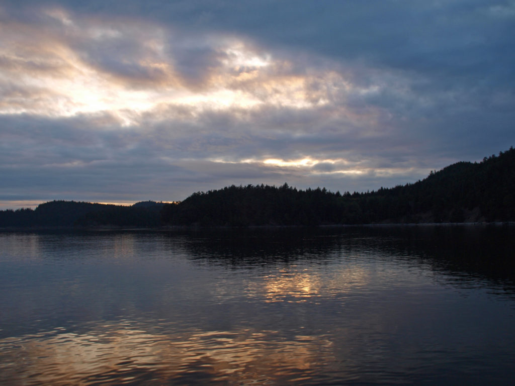 The
The 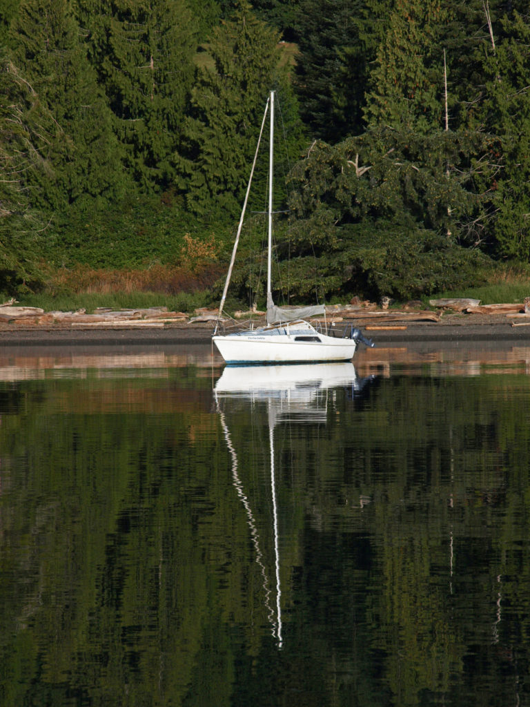
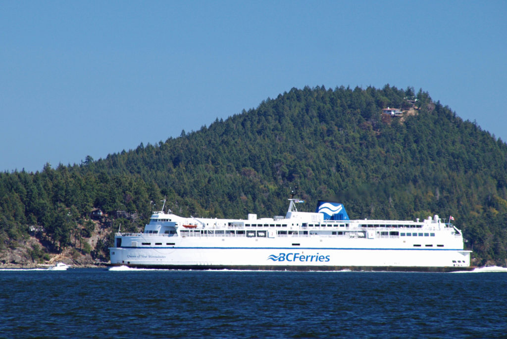
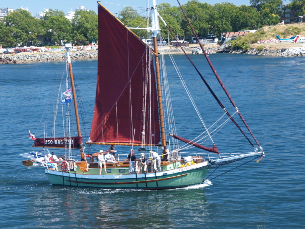
 Thetis and Penelakut Islands are reached by ferries from Chemainus on Vancouver Island. Gabriola Island is a short ferry ride from Nanaimo. Be sure to check the ferry schedules on the BC Ferries website. Reservations may be required, especially on summer weekends, and the ferry system is designed to serve island residents, not tourists, so island hopping can be difficult. Getting from one island to another in the Southern Islands by ferry sometimes requires going back to Salt Spring Island and then taking a second ferry from there. And there are no ferries from Thetis or Penelakut to Gabriola.
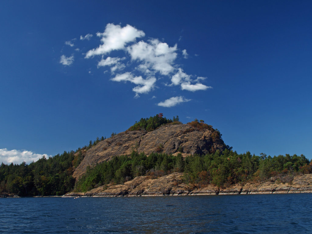 I’ve found that a good way to explore the Southern Gulf Islands by car is to base yourself on Salt Spring and pick an island to explore each day. North and South Pender Islands are connected by a bridge, so they can be explored in a day. Take another three days to explore Mayne, Saturna, and Galiano. That still leaves you several days to see all Salt Spring has to offer, or to explore the Northern Gulf Islands, even if you have only a week.
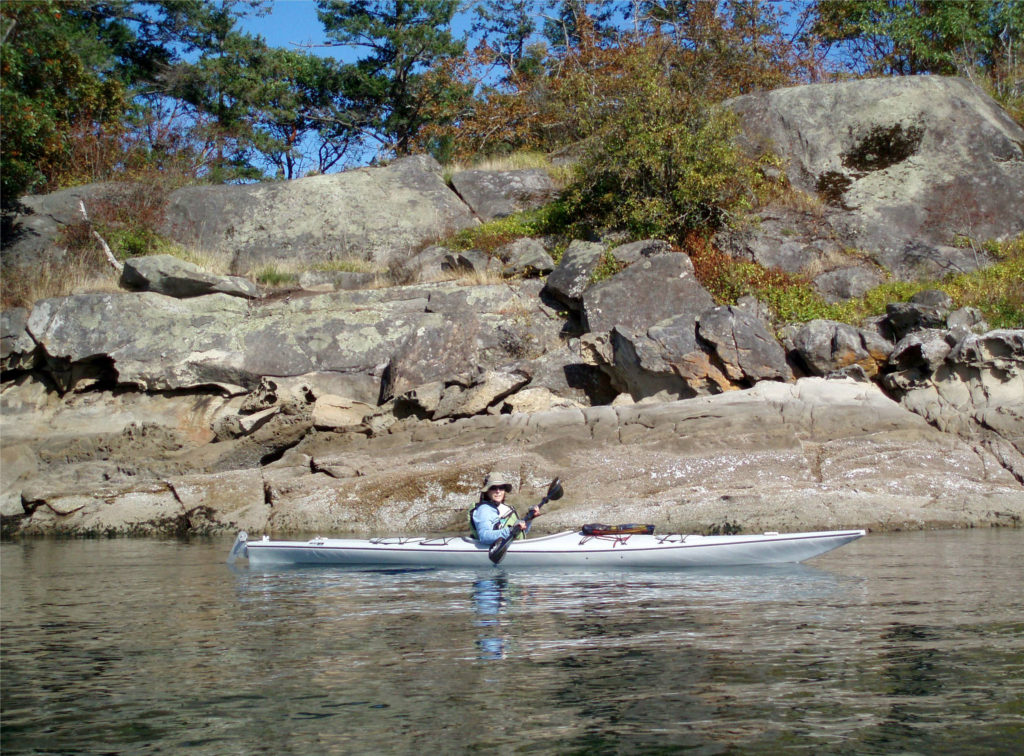 There is a bus system on Salt Spring Island, but public transportation is limited or nonexistent on the other islands. You can get around without a car, though. There is a unique
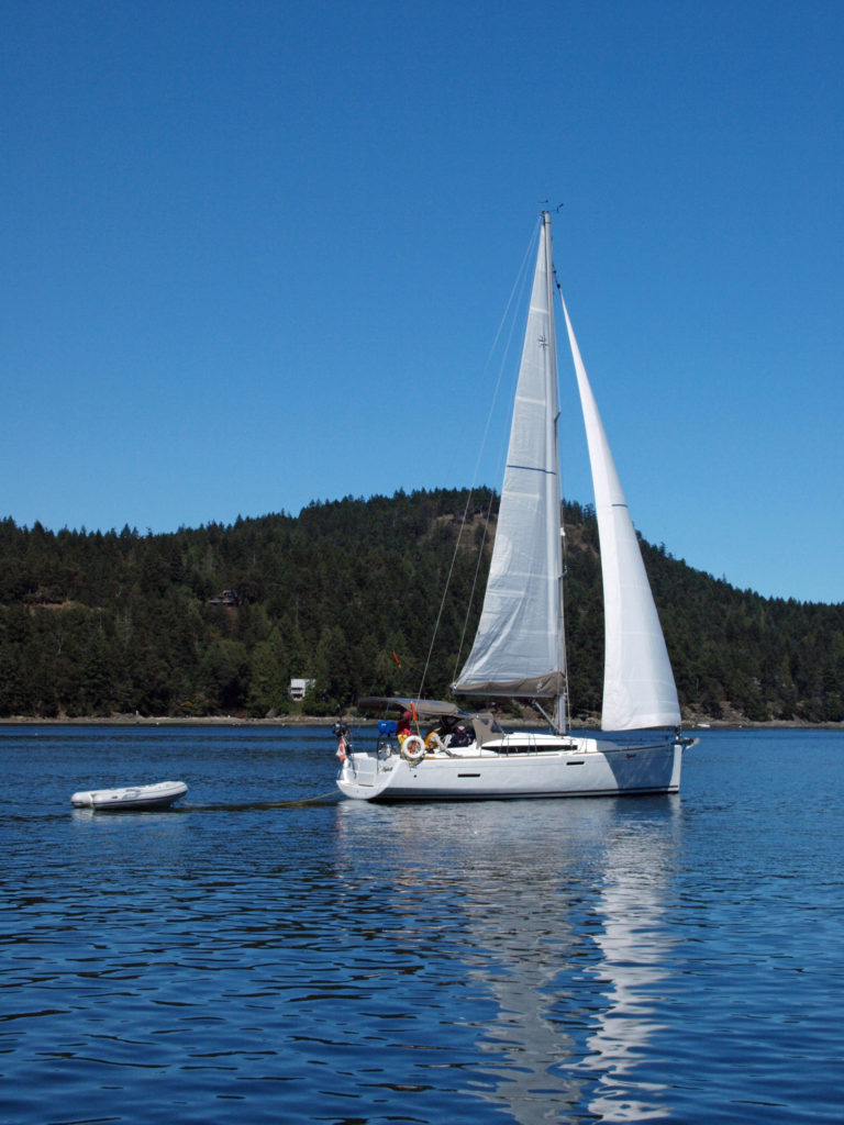
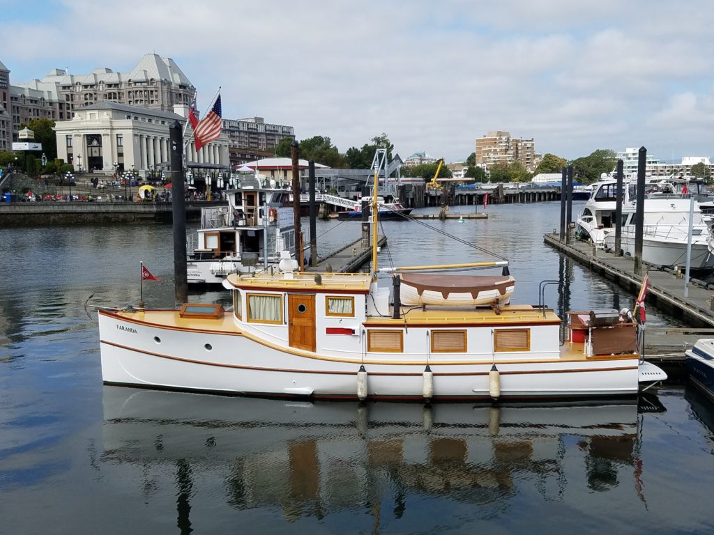
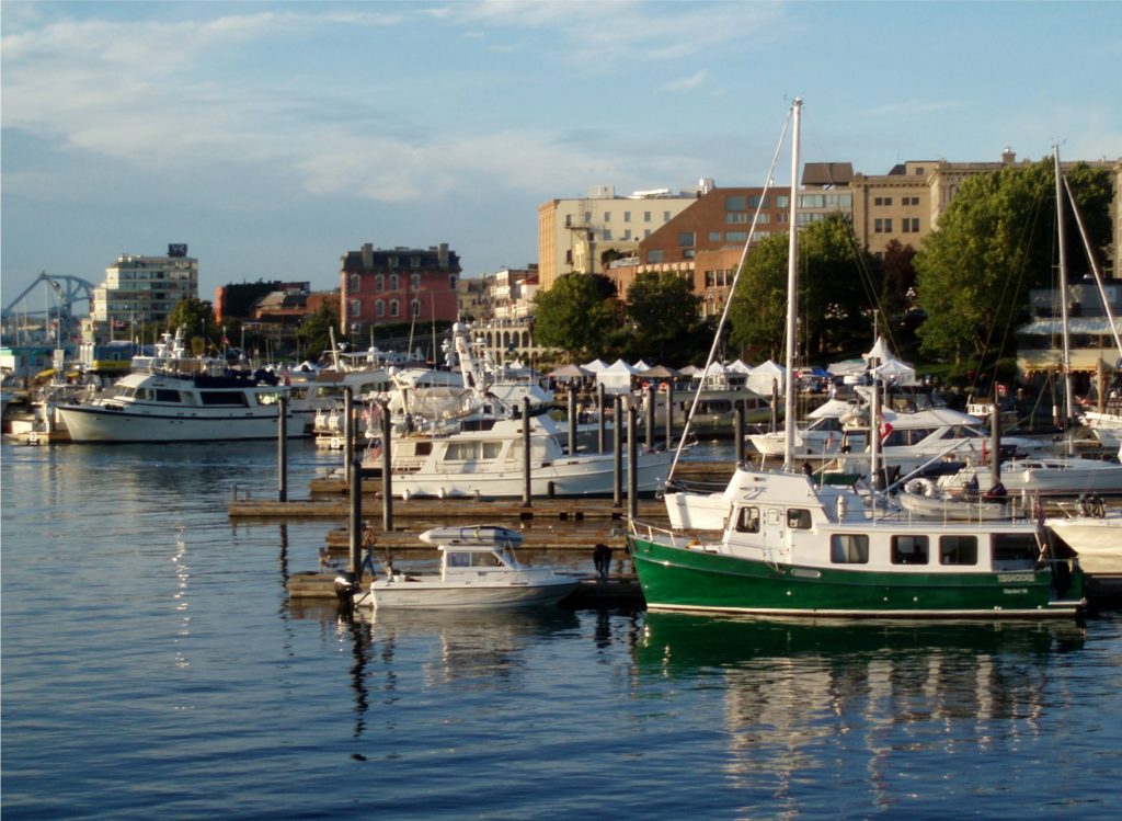
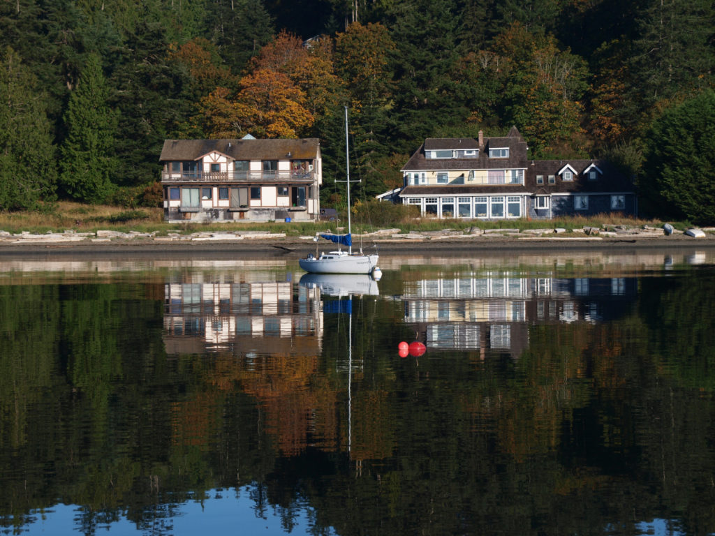
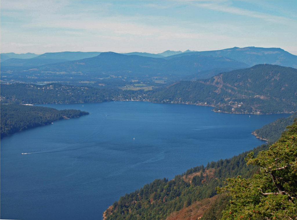
 There are a wide variety of accommodations available on the islands, from full-service resorts and hotels to traditional B&Bs to single rooms available through Airbnb. Most of the accommodations are on Salt Spring Island, but you can find small resorts and many individual houses for rent on the other islands. If you’re a kayaker, this is a perfect jumping off point. Ganges Harbor and its numerous islands are well worth exploring. Prevost Island, a short paddle to the southeast of Ganges Harbor is also worth a visit. A portion of Prevost is set aside as part of the
 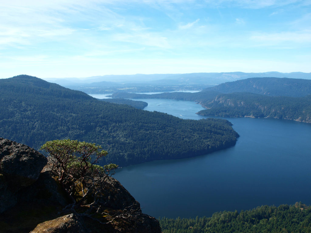 There are a number of
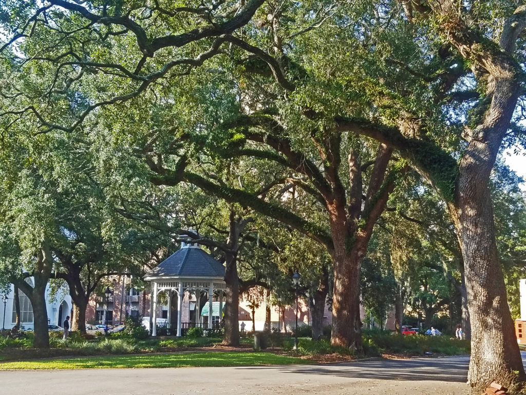
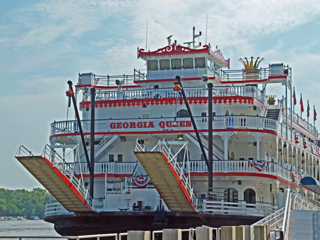
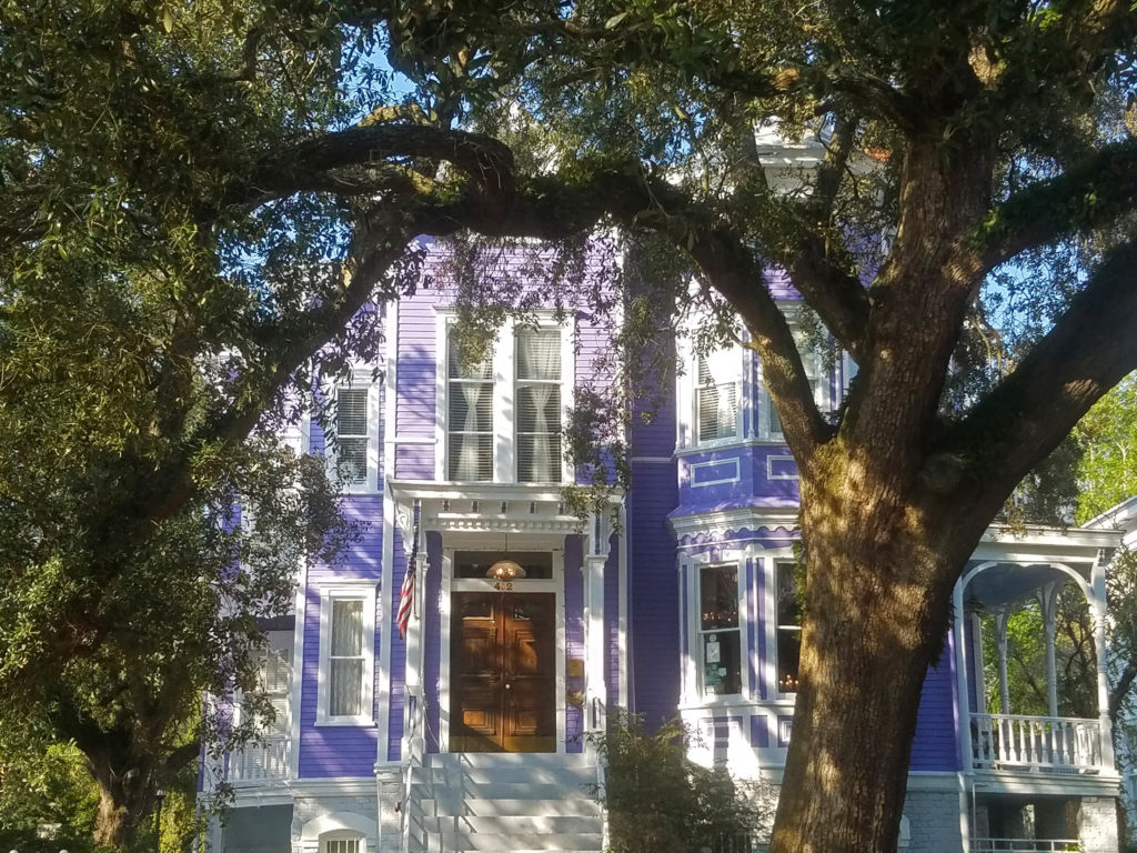
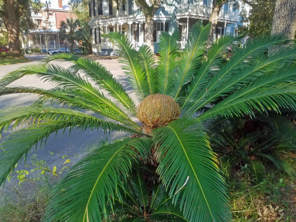
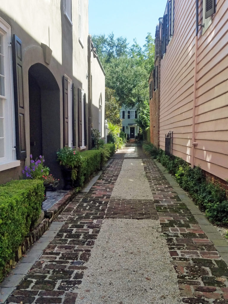
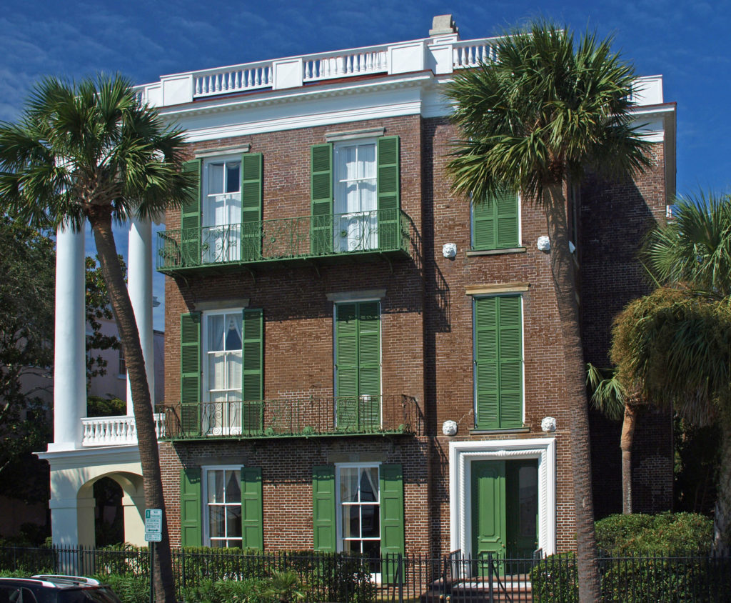
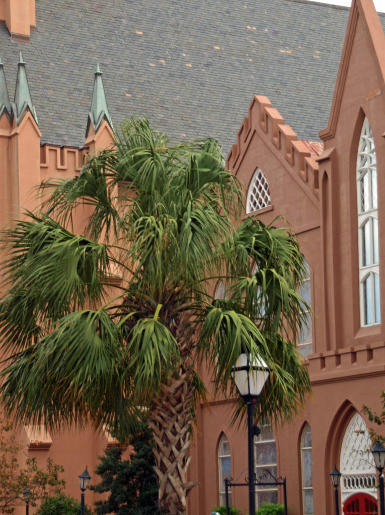
 Savannah is an old city, founded in 1733. It was the first European settlement in Georgia, and the city’s history is an important aspect of its spirit and culture. Walking around in the Historic District, it’s not hard to envision yourself in another, long past, era.
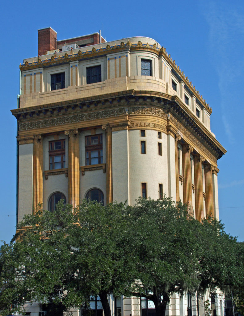 The entire Historic District was named a National Historic Landmark in 1966. The
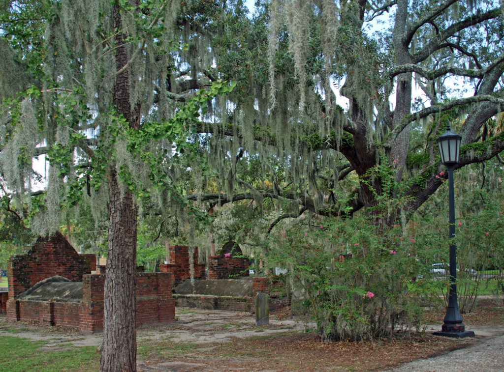
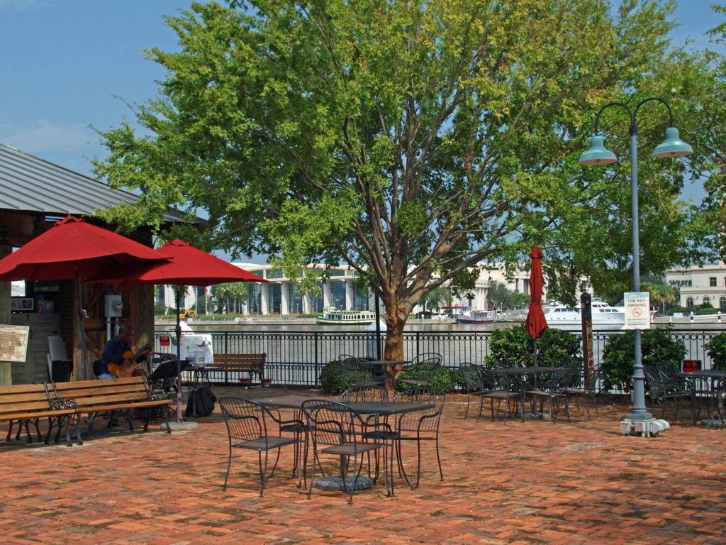
 Savannah is a very walkable city. Guided walking tours of the Historic District are available for about $25 per person. There are also guided bike tours and public carriage tours available at similar rates. Private carriage tours run $100-125 for two people. Hop-on/hop-off trolley tours run $30-35 per person. Ghost tours are also a popular option for visitors.
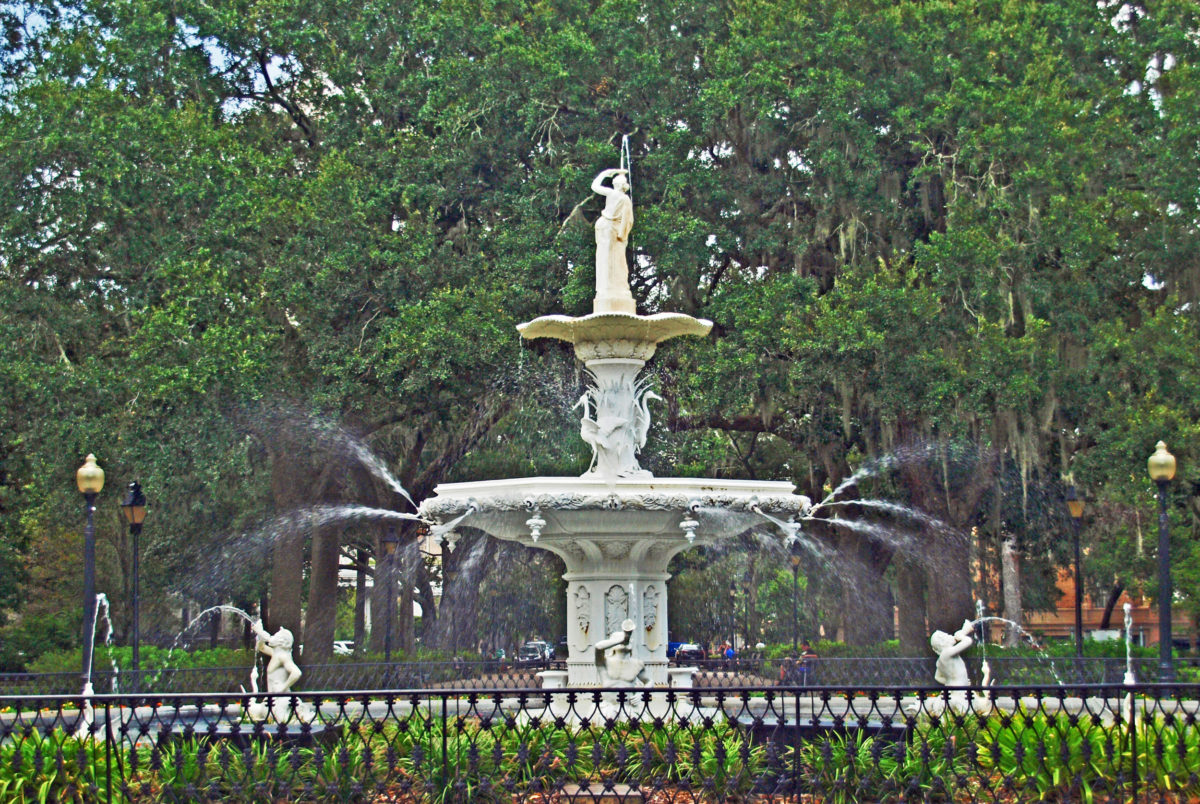
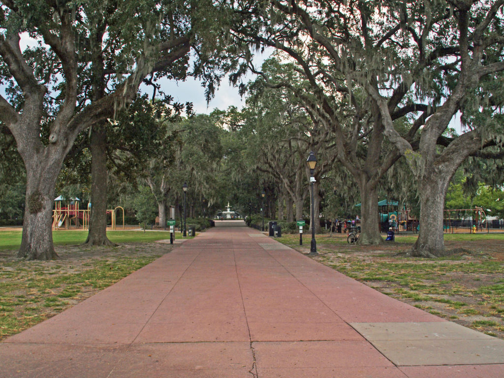 We opted to wander around on our own (but probably missed out on a lot of interesting information about the city). A good place to start a walking tour of your own is Forsyth Park, a 30 acre park at the south end of the Historic District. Its most notable feature is the Forsyth Fountain, but there is a lot more there to see. Enjoy the park’s gardens, paths, monuments, and the fountain, then head north toward the river and take in some (or all) of the 22 Squares and innumerable historic buildings, churches, and Victorian houses.
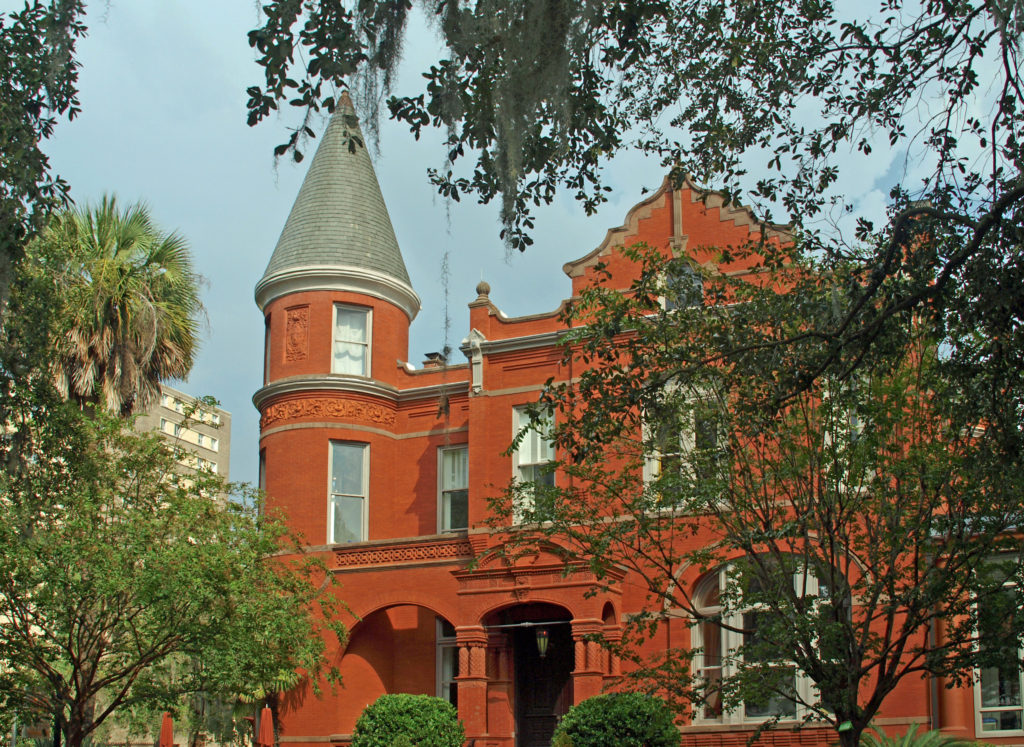
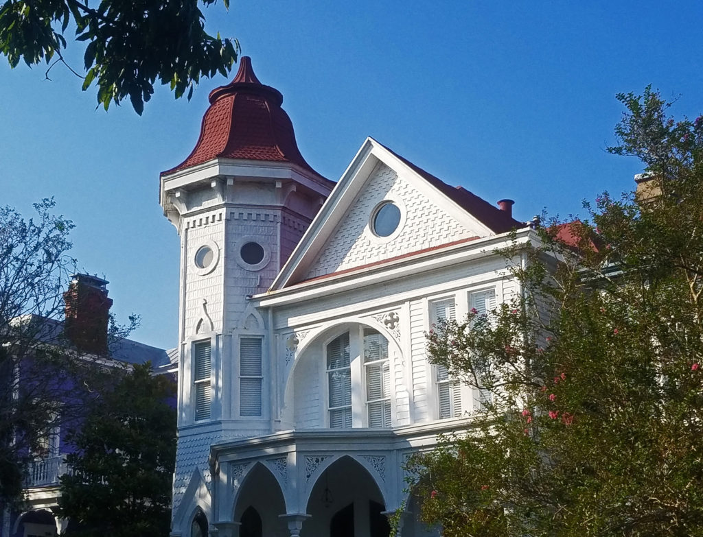
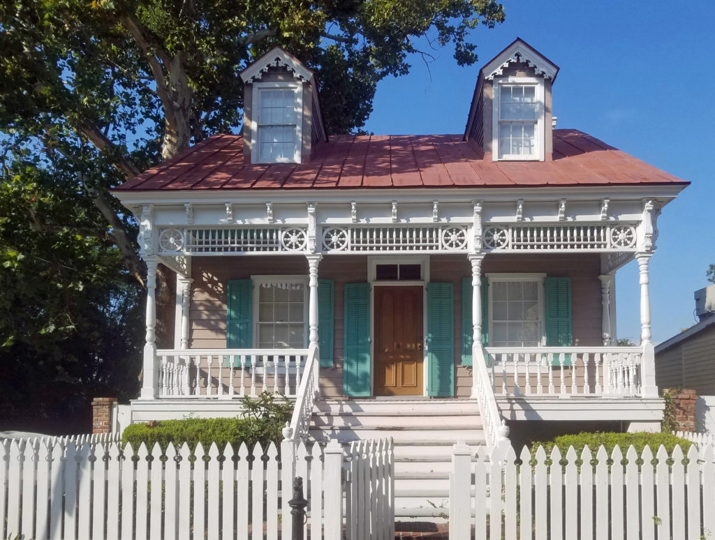
 Some of the more interesting structures in the Historic District include The Pirate’s House, mentioned in Robert Louis Stevenson’s Treasure Island, the city’s oldest building and now a popular restaurant, and The Olde Pink House, another of the city’s oldest structures and also a highly regarded restaurant. Not quite as old, but equally interesting, the Mercer House (officially the Mercer-Williams House Museum) was the site of the 1980s killing of a male prostitute that inspired the book (and movie) Midnight In the Garden of Good and Evil.
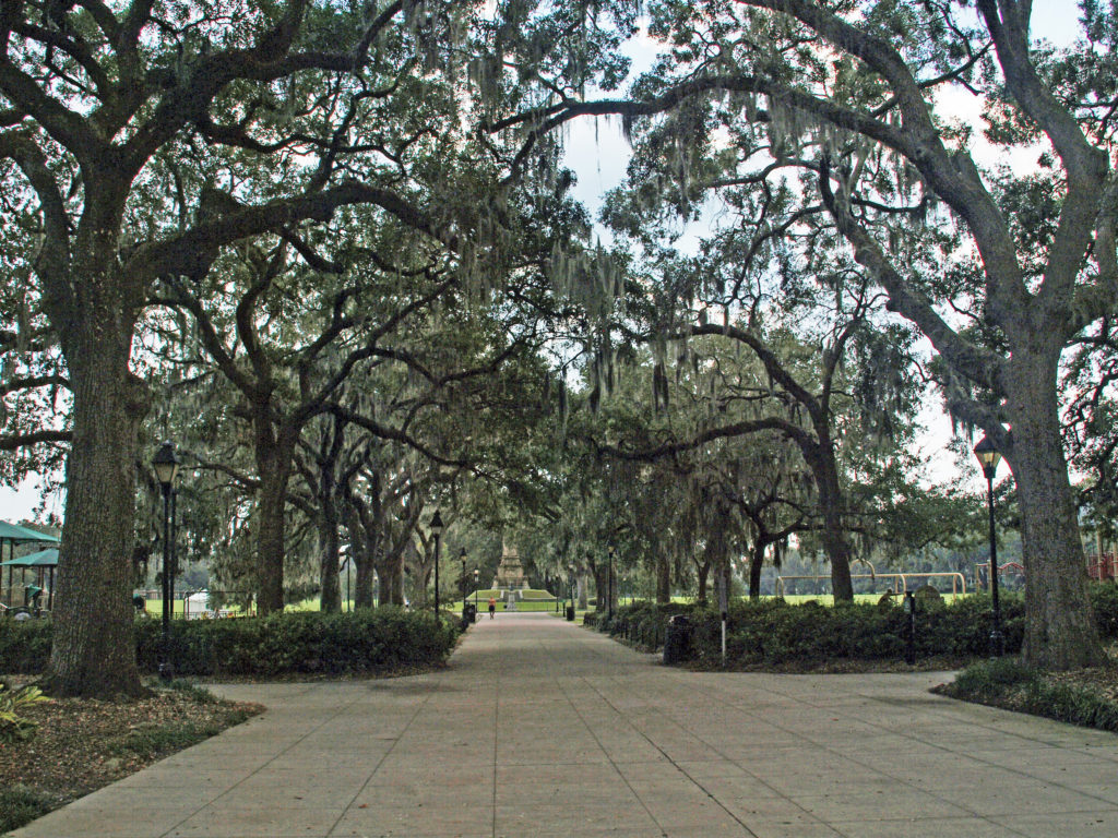
 Near the north end of the Historic District,
 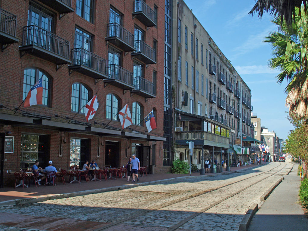 The buildings along River Street were once cotton warehouses. Today they house shops, restaurants, bars, and art galleries. River Street has its share of tacky gift shops, but it also has some interesting boutiques, antique shops, and art galleries. Among the many restaurants are Vic’s On the River, Huey’s, The Shrimp Factory, and Joe’s Crab Shack. If you need a frozen daiquiri refill, there’s another Wet Willie’s on River Street.
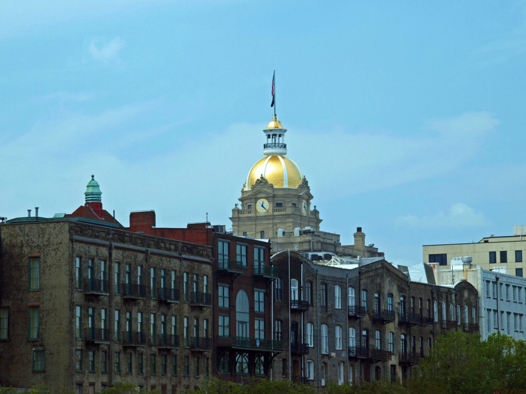
 There are no shortage of other places along the river to wet your whistle, including The Warehouse Bar and Grill, Dub’s Public House, The Cotton Exchange Tavern, and a couple of rooftop bars, Top Deck Bar and Rocks On the Roof. And there are more restaurants and bars on Bay Street on the top of the bluff.
 There’s much to see and do in Savannah that time didn’t allow. We had to skip many things. We checked out only a couple of the city’s art galleries, for example, and didn’t make it to other nearby destinations such as
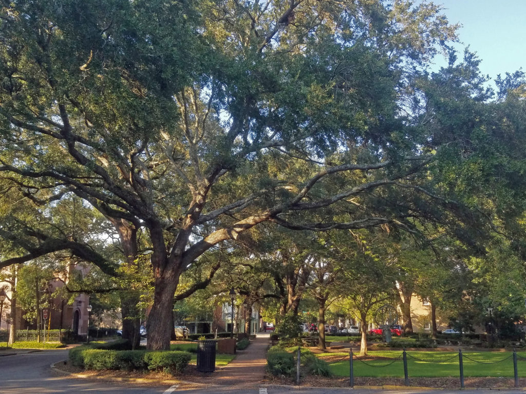
 Originally posted January 24, 2020. Updated and re-posted April 15, 2023.
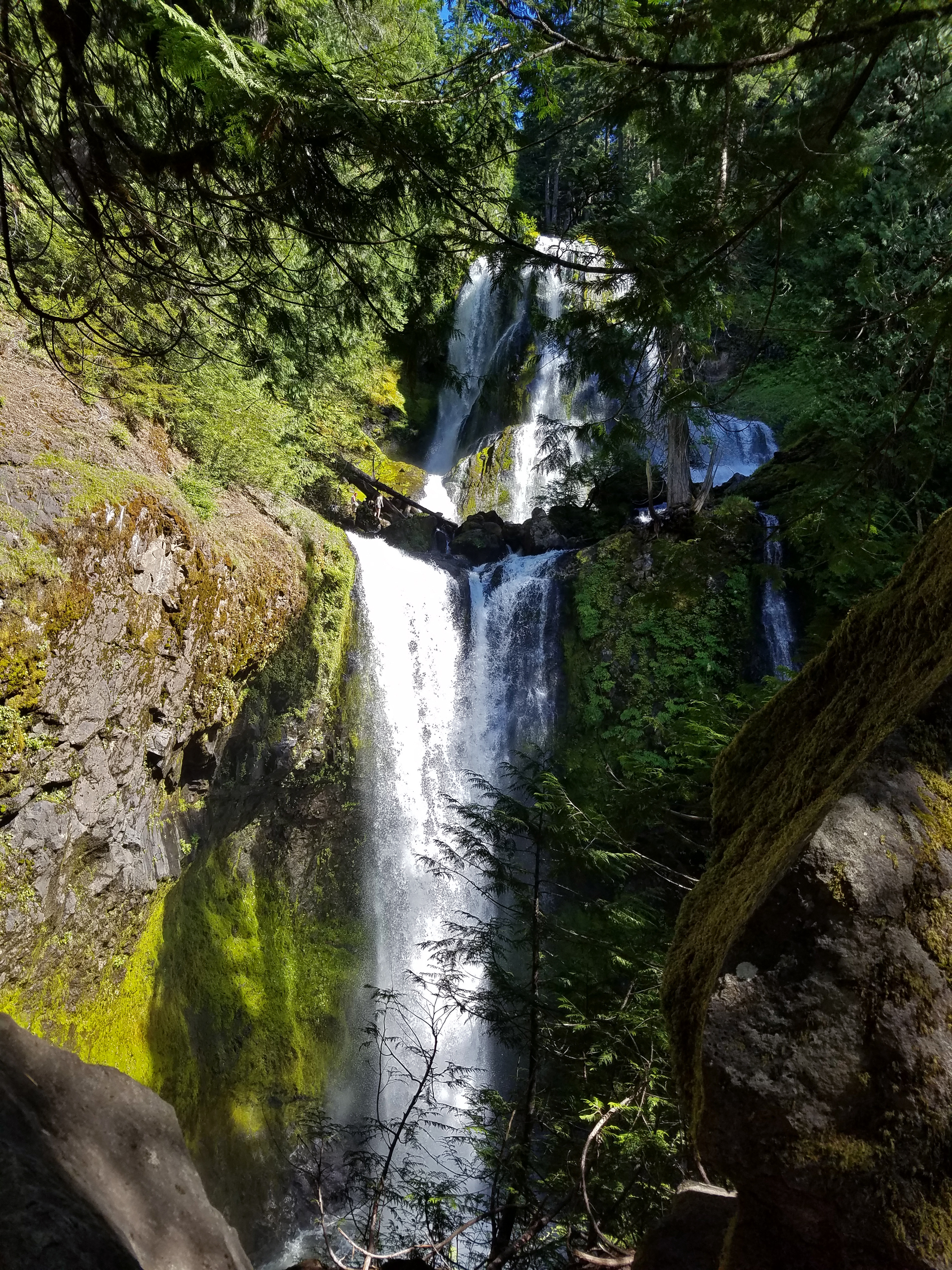
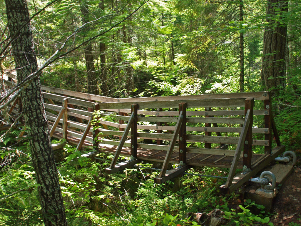
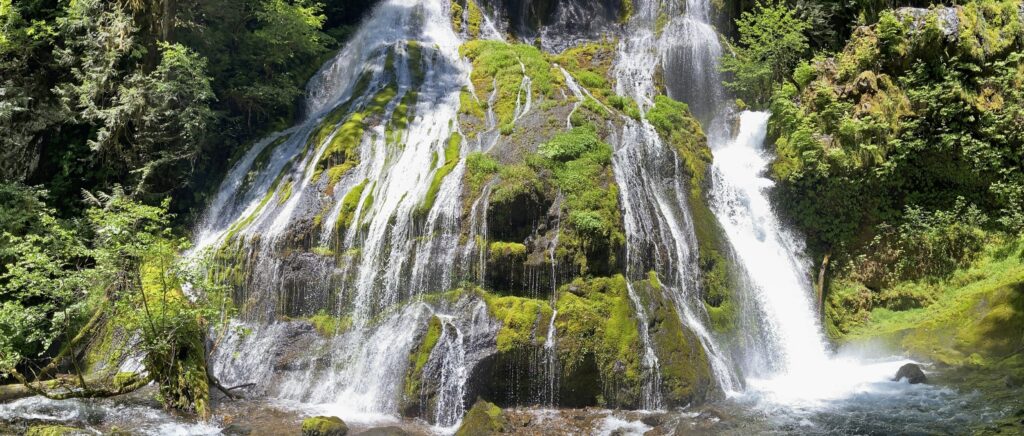
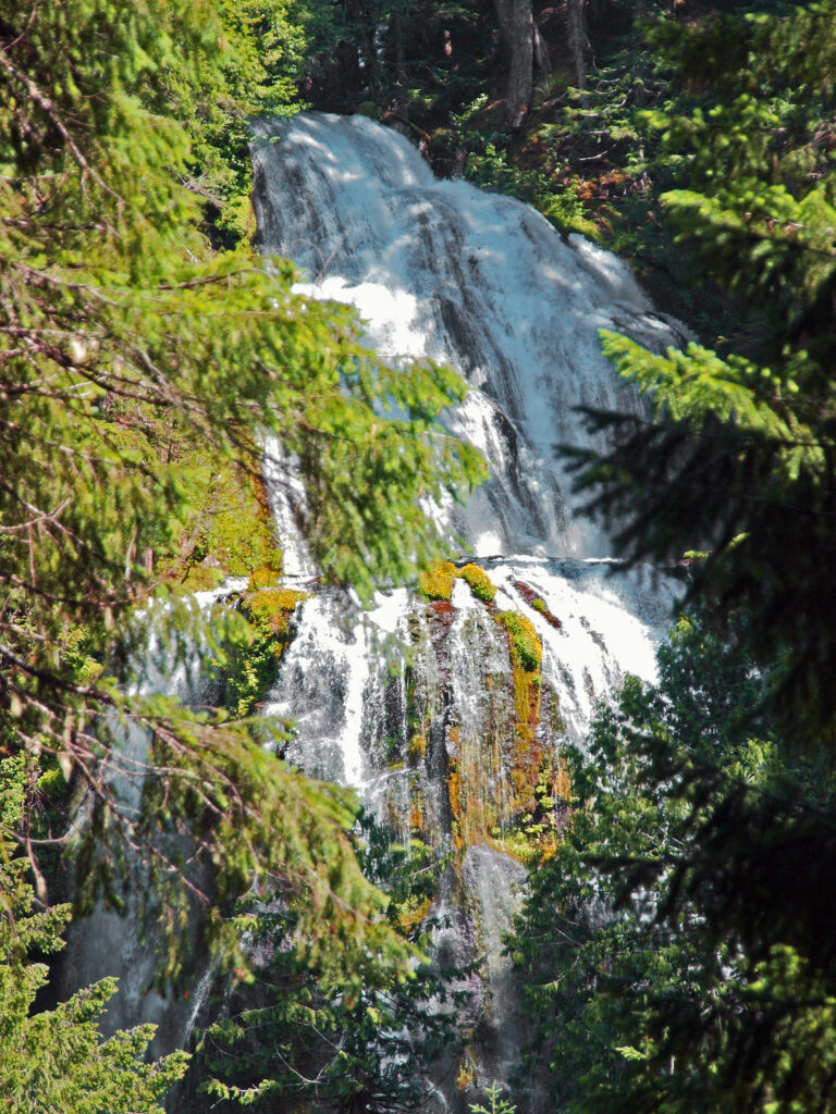 Where: Washington side of the Columbia River Gorge
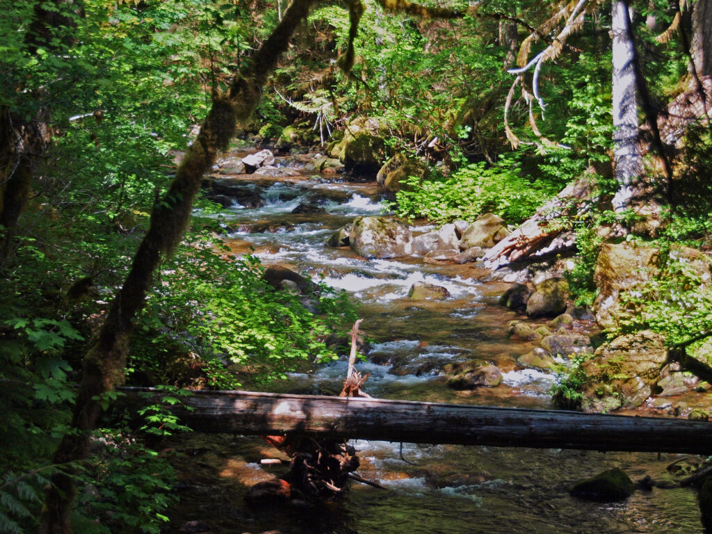 Overview:
 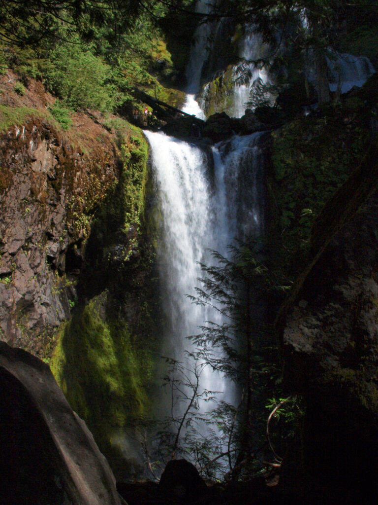 Best time to go:
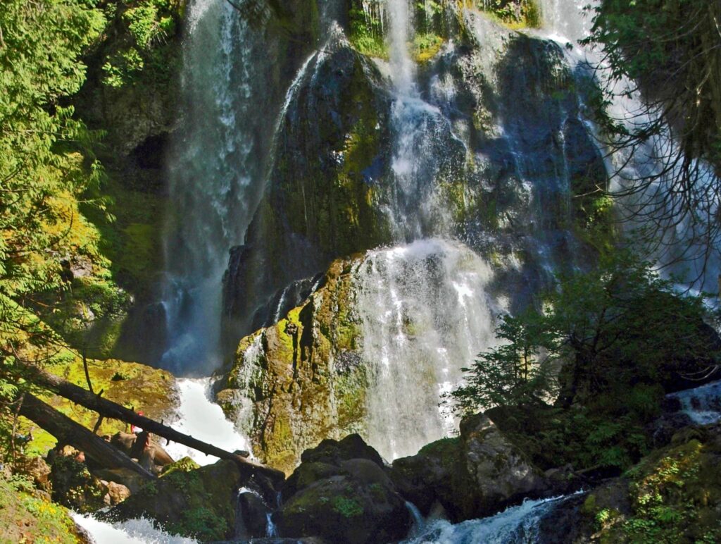
 Posted April 12, 2023 by Alan K. Lee
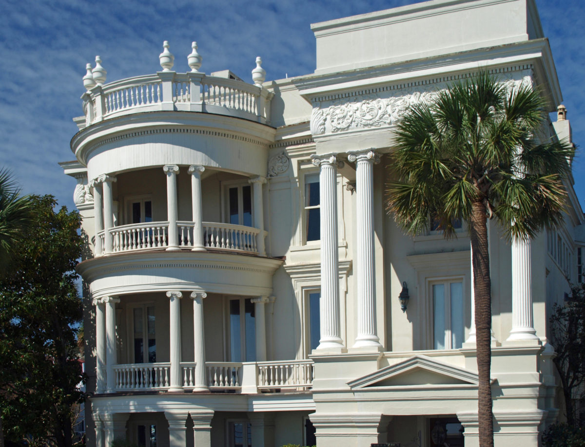
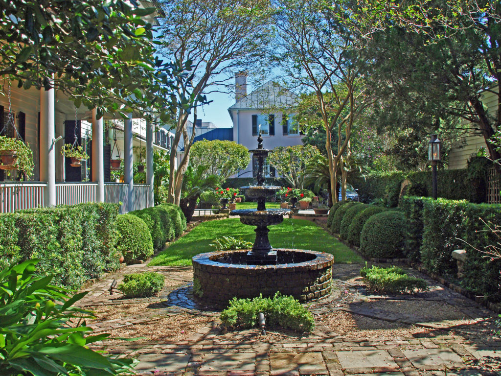
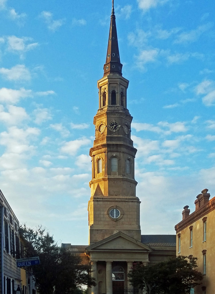

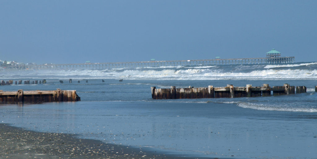
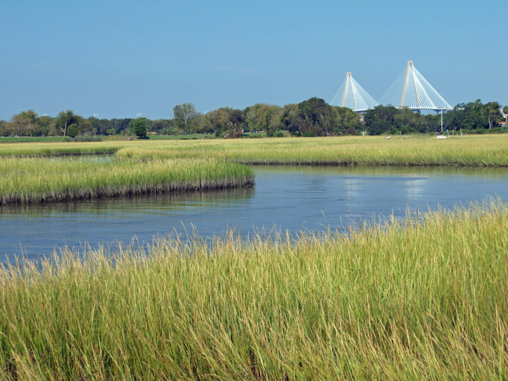
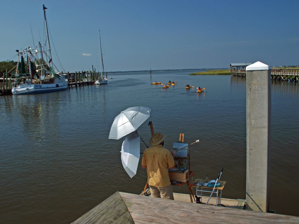
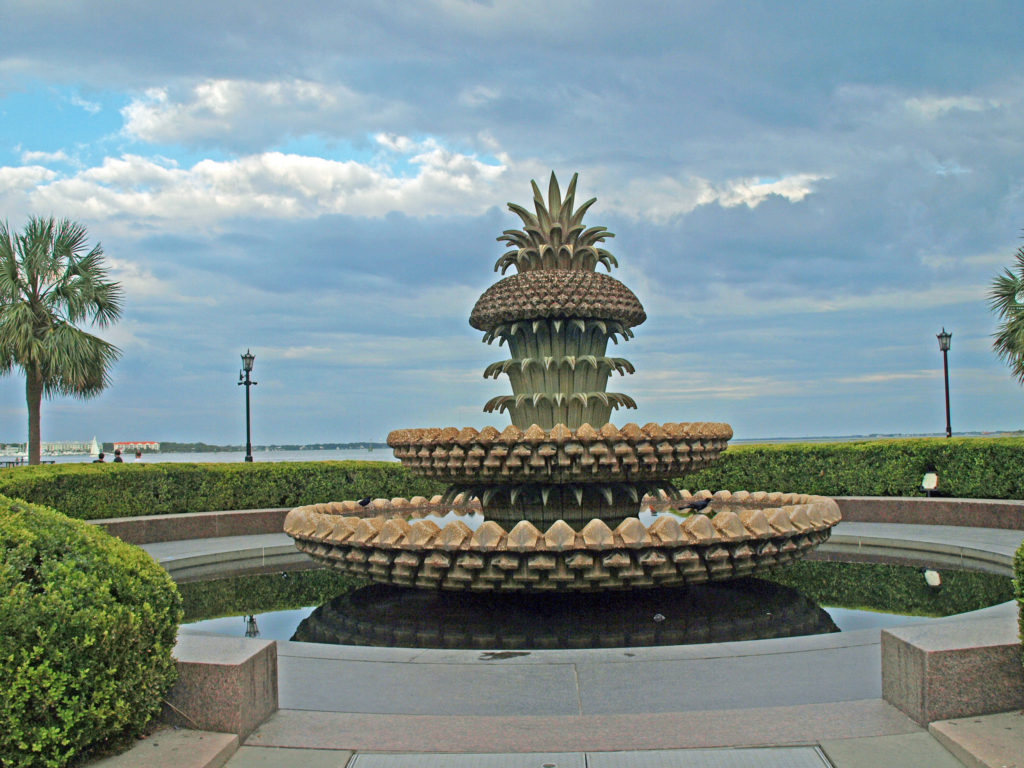 We had a great time exploring Charleston. It’s really a beautiful and charming place. But to really see all it has to offer, you need to plan for more than a three-day visit. For more information, check out the
  Originally posted Jan. 20, 2020. Updated and re-posted April 9, 2023.
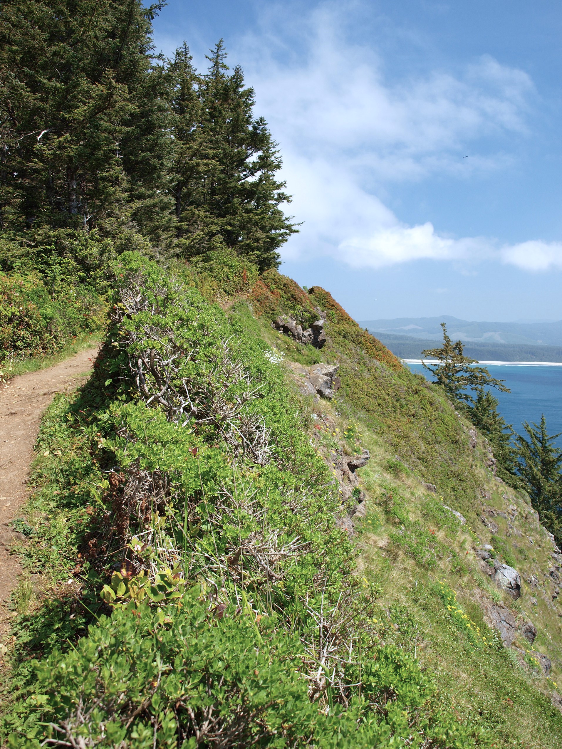
 Trailhead: Cape Lookout State Park
 From there, the trail crosses to the north side of the cape and comes to a viewpoint at the 1.2-mile mark. Here you can see north to Cape Meares and Three Arch Rocks. Just west of the viewpoint, the original trail slid into the ocean about 30 years ago. The present trail detours away from the cliff through a boggy area on a boardwalk.
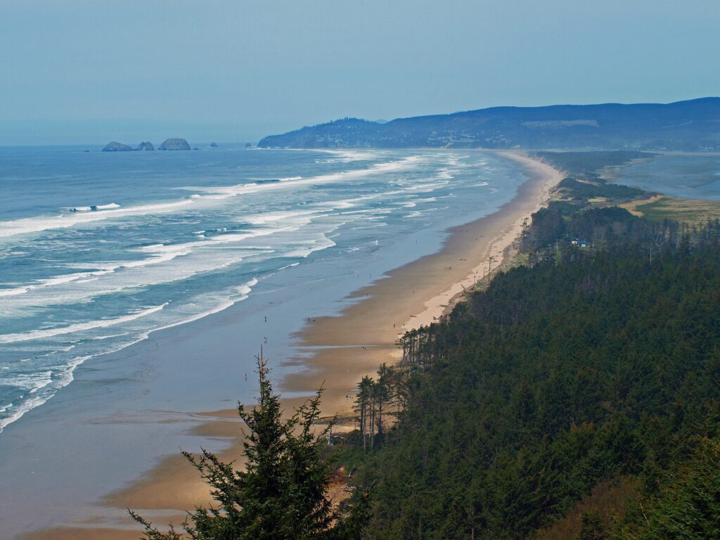
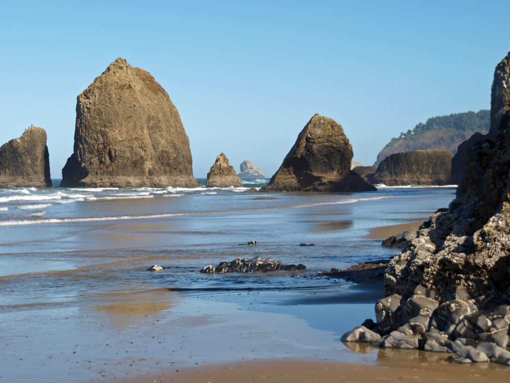
 The trail returns to the south side of the cape and continues for another 1.2 miles, climbing and descending several times, to a viewpoint at the end of the cape, 400 feet above the ocean. Views there stretch from Cape Foulweather, 40 miles to the south, to Neahkannie Mountain, 40 miles to the north.
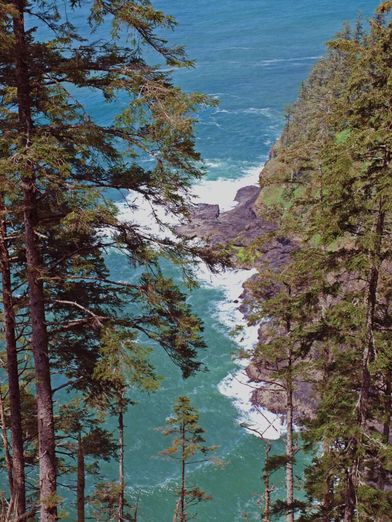 You’ll probably linger for a while at the end of the trail, but when you’ve had your fill of sightseeing and whale watching, return to the parking area the way you came.
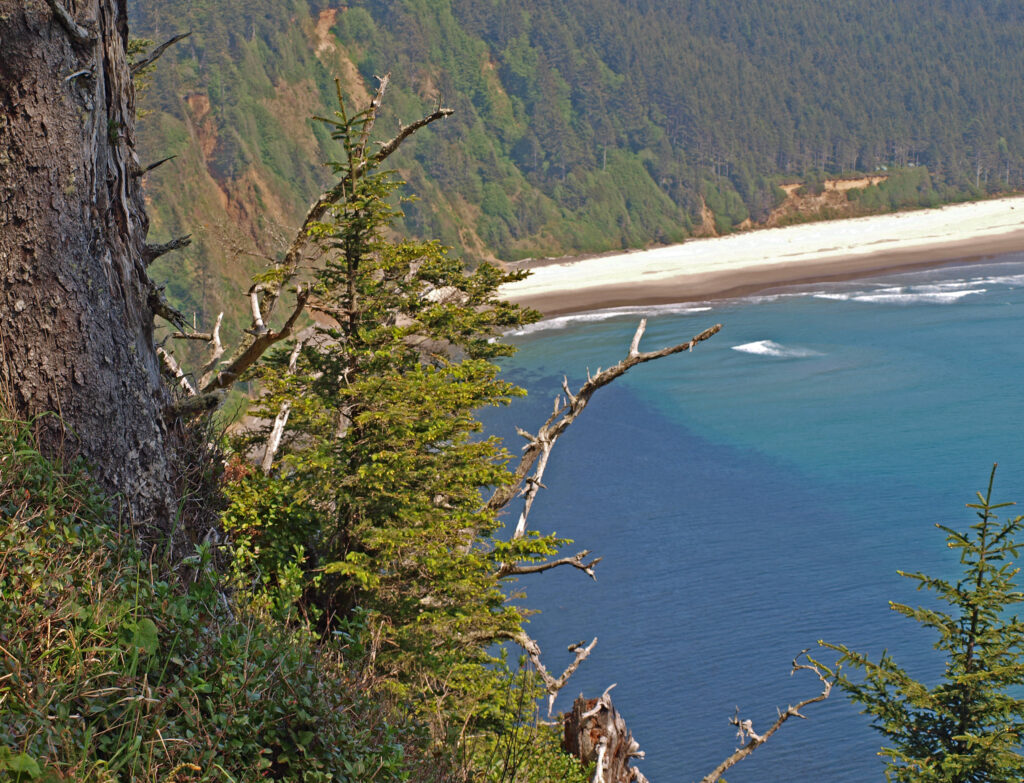
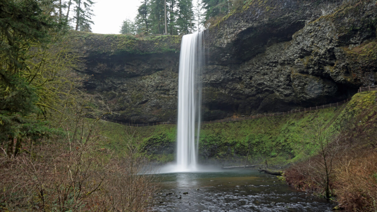
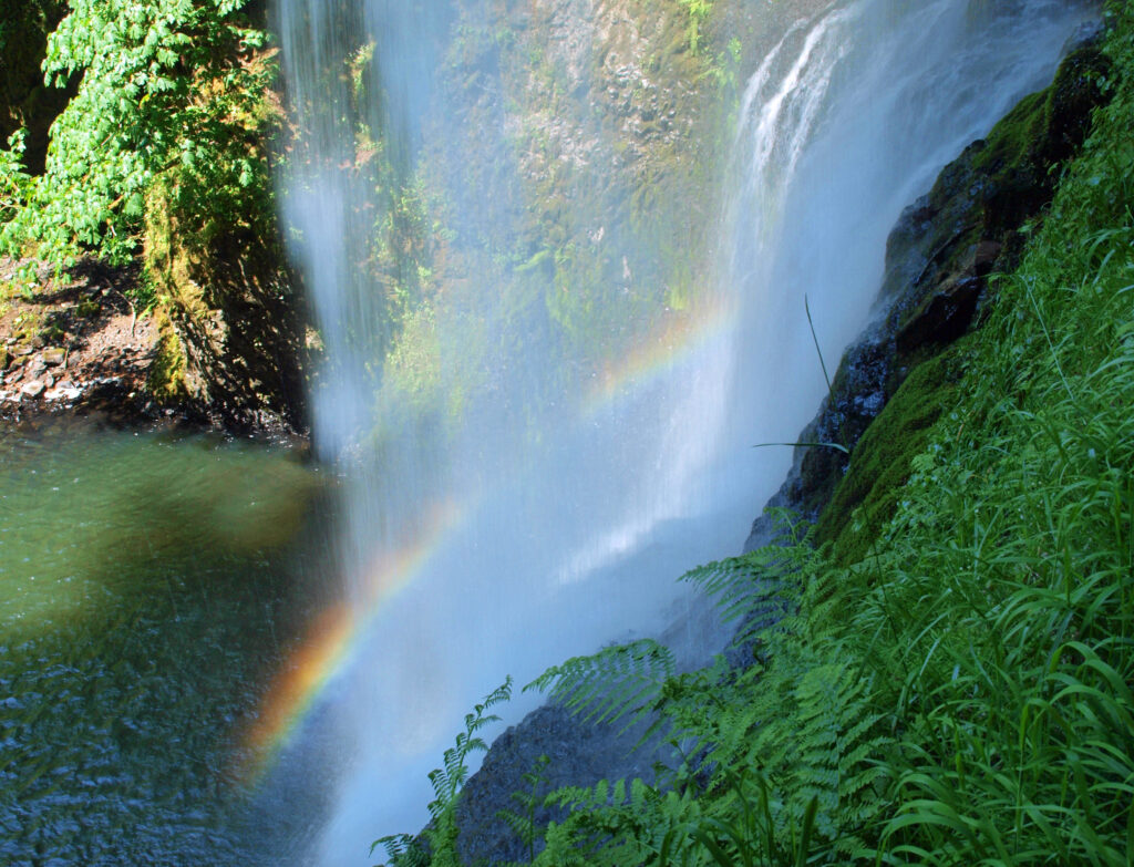
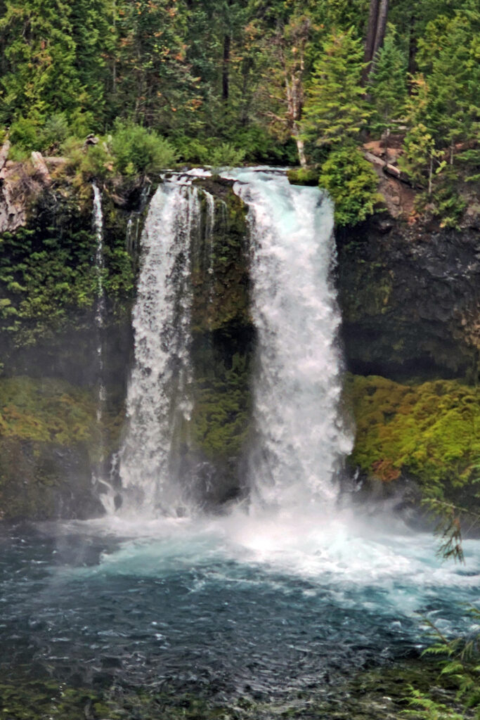
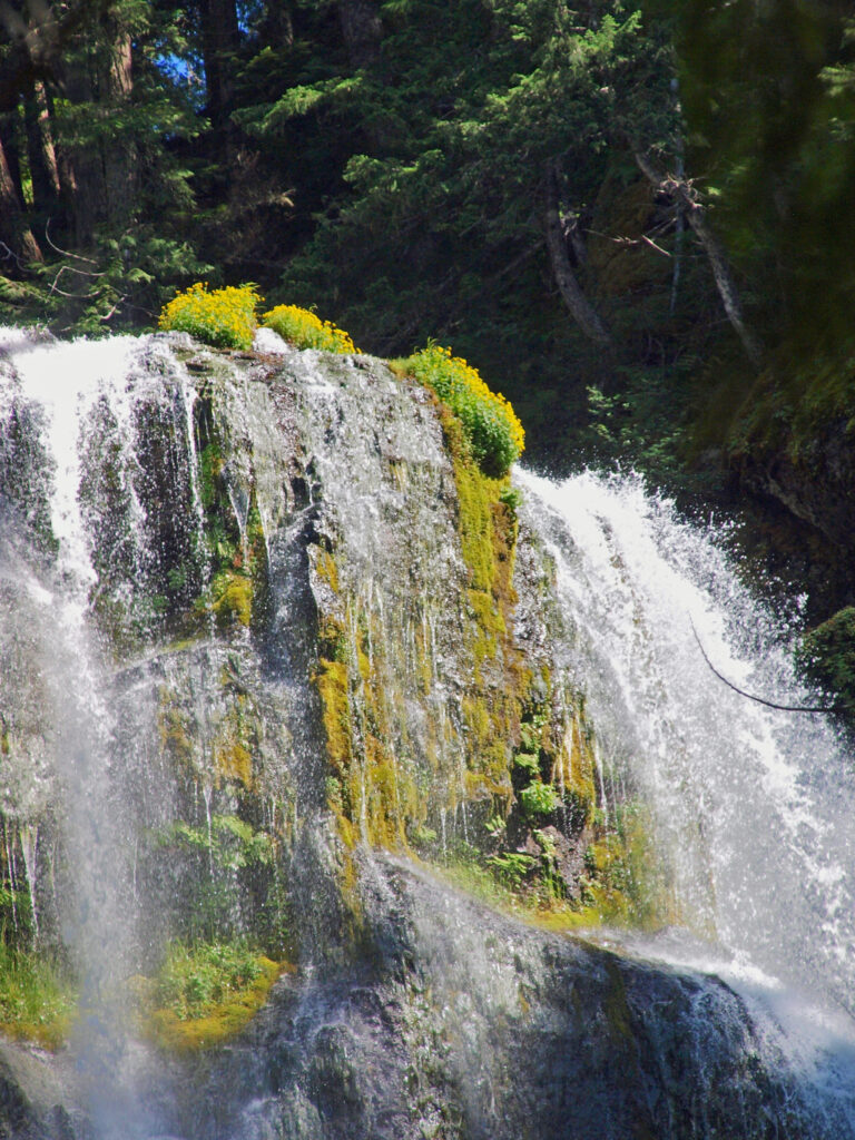
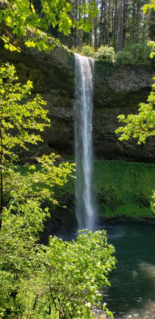
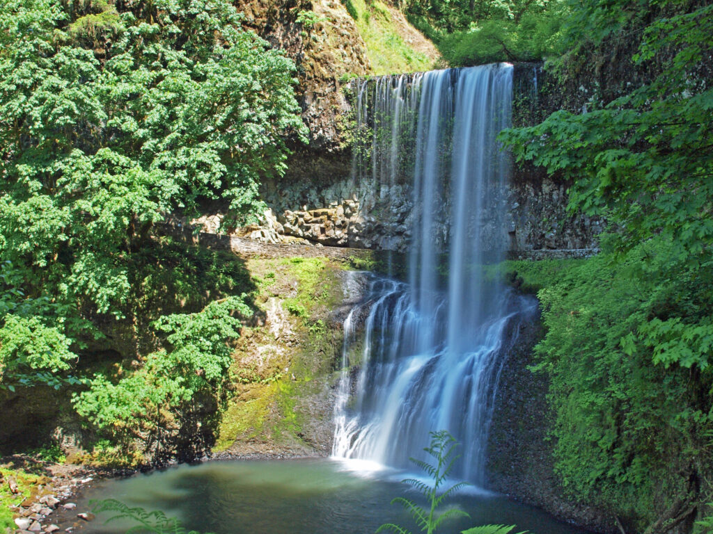
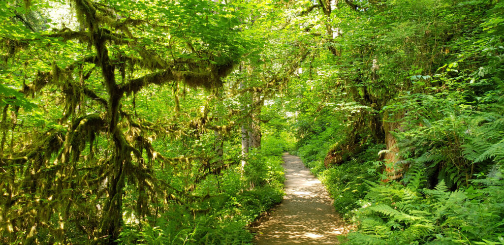
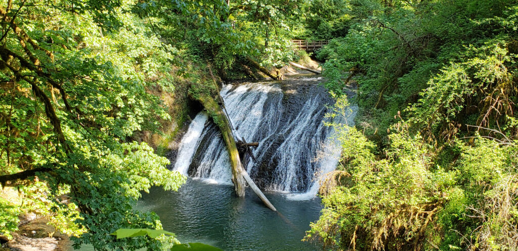
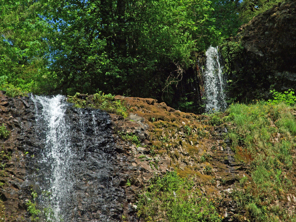
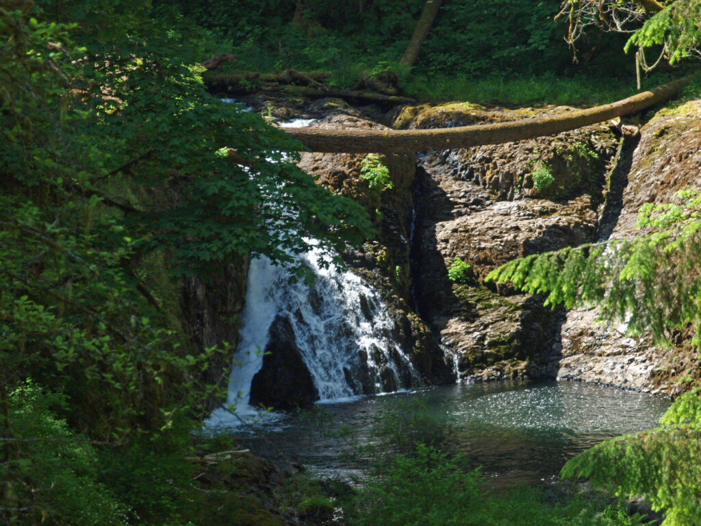
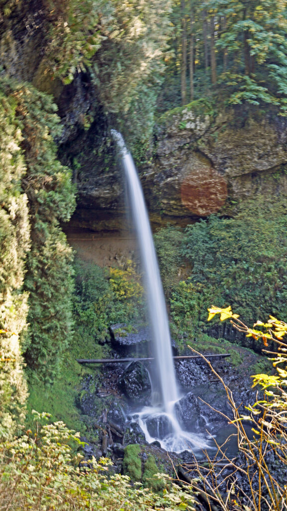
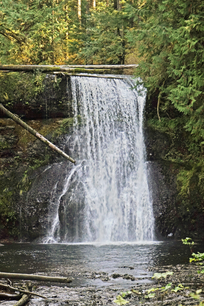
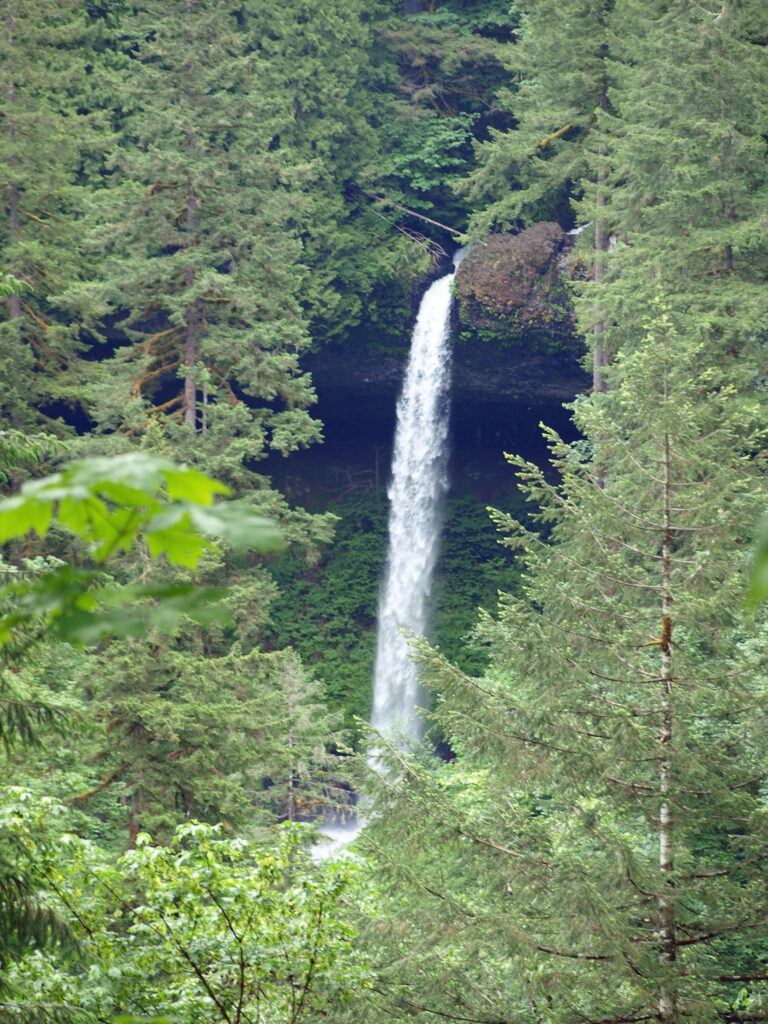
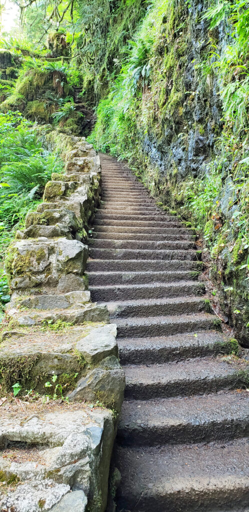 Silver Falls was voted Oregon’s favorite state park a few years ago, and for good reason. With more than ten waterfalls, six of them more than 90 feet in height, Silver Falls is a waterfall lovers paradise. And the Trail of Ten Falls (there are actually eleven named and at least one unnamed falls along the trail) is one of the finest hiking trails in the Pacific Northwest. I don’t know of anywhere else where you can see a dozen falls on a single hike, and four of them here have trails that actually take you behind the falls.
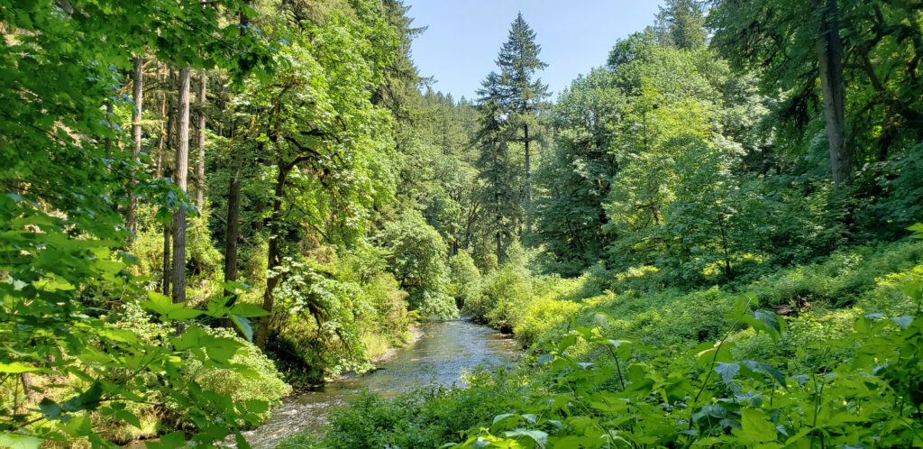


 Other area attractions and activities:
 The Trail of Ten Falls is an iconic hiking trail that every serious hiker in the state has likely done multiple times. It’s so spectacular that it alone is worth making the trek to Oregon from wherever you reside, no matter how far away that is. As an Oregon resident, I know I’m a little biased, but I don’t think I’m exaggerating here. If you’re a waterfall lover, come see for yourself. A trip to Silver Falls, combined with a visit to the waterfalls of the Columbia River Gorge will make for an unforgettable experience.
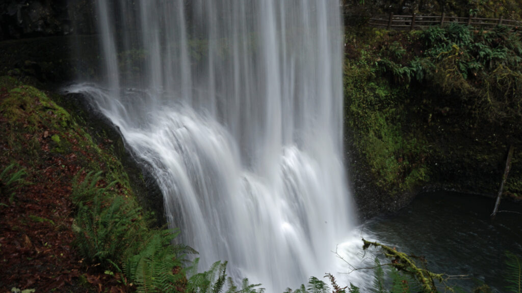