
by Alan K. Lee
The following is an edited and expanded version of a post first published (in a different format) on this site on December 31, 2019.
Winter Hikes at Silver Falls
Where: Silver Falls State Park, Oregon, USA
Distance: One to eight miles
Elevation gain: 300 to 800 feet
Difficulty: Easy to moderate
Map: Oregon State Parks map and brochure
Overview:
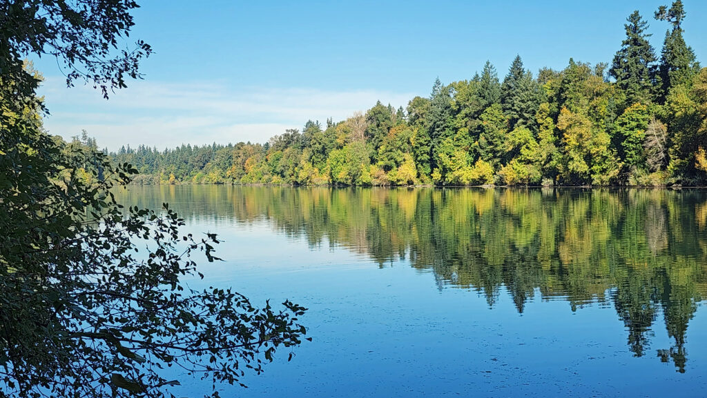
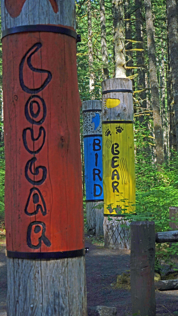
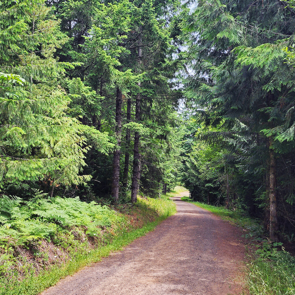
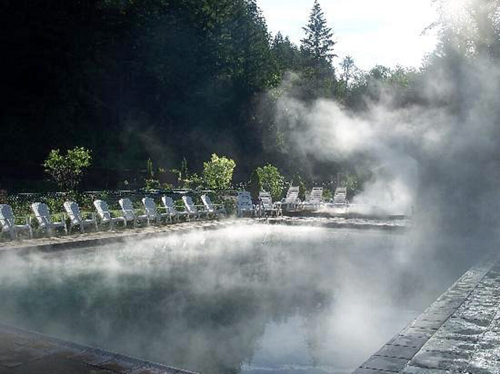
Winter is closing in, but that doesn’t mean there aren’t still good hiking options in the Willamette Valley. Silver Falls State Park near Silverton, Oregon offers a number of loops and out and back hikes from barely one mile to nearly eight miles in length that take you to one or more of the eleven named waterfalls in the park. There are also back country trails in the park offering even longer hikes (though no waterfalls). And the park is once again holding its Winter Festival in December that will offer ranger-guided hikes in the park and informational displays about the plants and animals found in the park.
Silver Falls has been called the crown jewel of the Oregon state parks system. You’ll get no argument from me. It’s a spectacularly beautiful and unique place. Where else can you see 10 (or more) waterfalls on a single hike? I grew up in Salem, about a 30 minute drive from the falls. I’ve been there countless times, and it has never failed to delight and sometimes amaze me. When I started this blog in 2018, Silver Falls was my first post.
Winter can bring snow and ice and dangerous conditions to the trails in the park. But at an elevation of about 1500 feet, the park isn’t high enough for snow to remain on the ground all winter. And on my last winter visit to the park the temperature was in the mid 40s and there was no sign of snow.
Getting there:
Silver Falls State Park is located about fifteen miles east of Salem, Oregon. Coming from Salem or south, take Ore Hwy 22 east and look for signs to Silver Falls. The turn off onto Ore Hwy 214 is about five miles east of Interstate-5. The South Falls day use area is about 15 miles from Hwy 22. Coming from the north, take exit 271 off I-5 at Woodburn. Proceed through Woodburn on Ore Hwy 214, which then takes you through the towns of Mount Angel and Silverton. The park is about 12 miles beyond Silverton.

Trailheads:
There are four trailheads in the main canyon area. By far the largest parking area is at South Falls. There is a small parking area (eight spaces) at the Winter Falls trailhead. The North Falls and new North Canyon trailheads have parking for 30-50 vehicles. There are no facilities at the Winter Falls trailhead, but the other three have restrooms and drinking water available. The South Falls area also has a cafe and a nature store. All parking areas require an Oregon State Parks day use pass. Daily passes are $5 and can be purchased at the South Falls, North Falls, and North Canyon trailheads. Annual passes are $30 for one year and $50 for two years, and can be purchased online through the at the Oregon State Parks website. (The 12-month pass increases to $60 and the 24-month pass will no longer be sold beginning January 1, 2026).
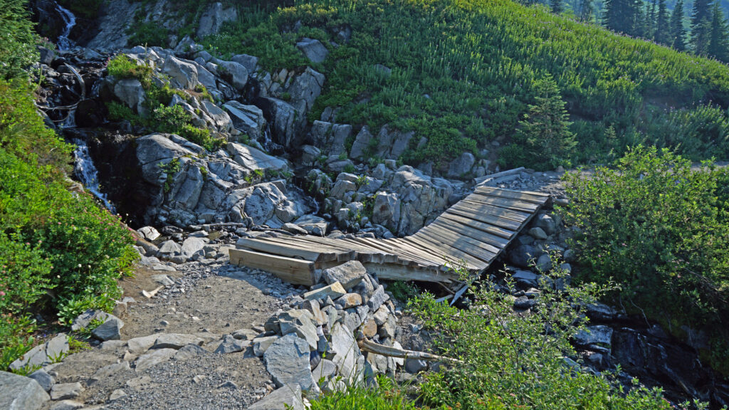
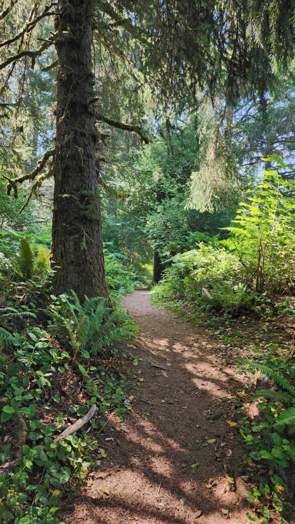
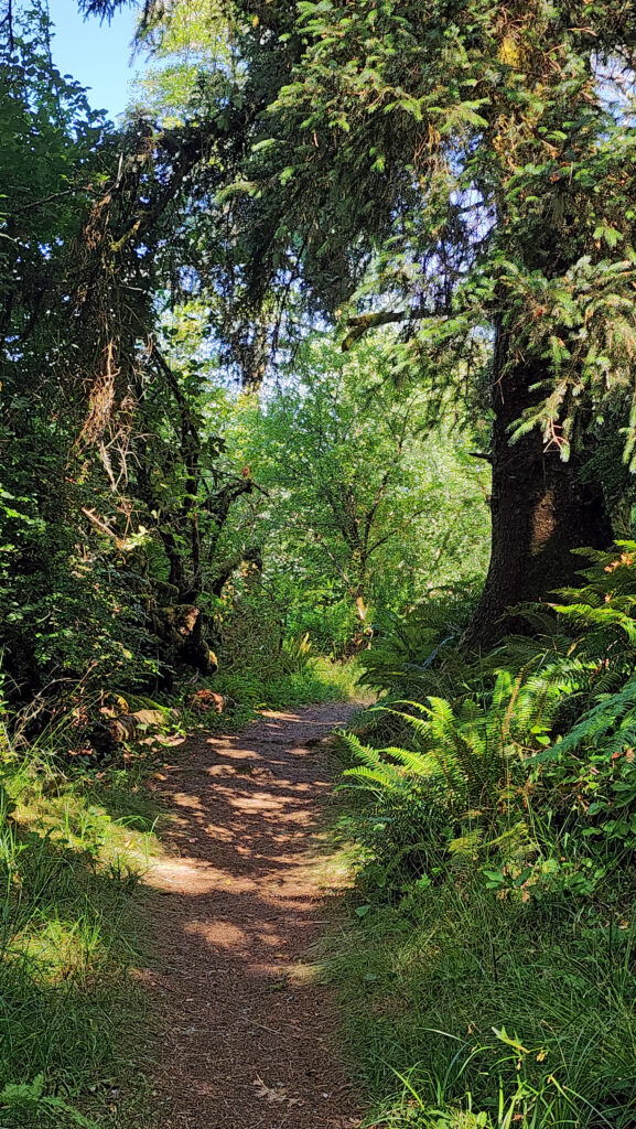
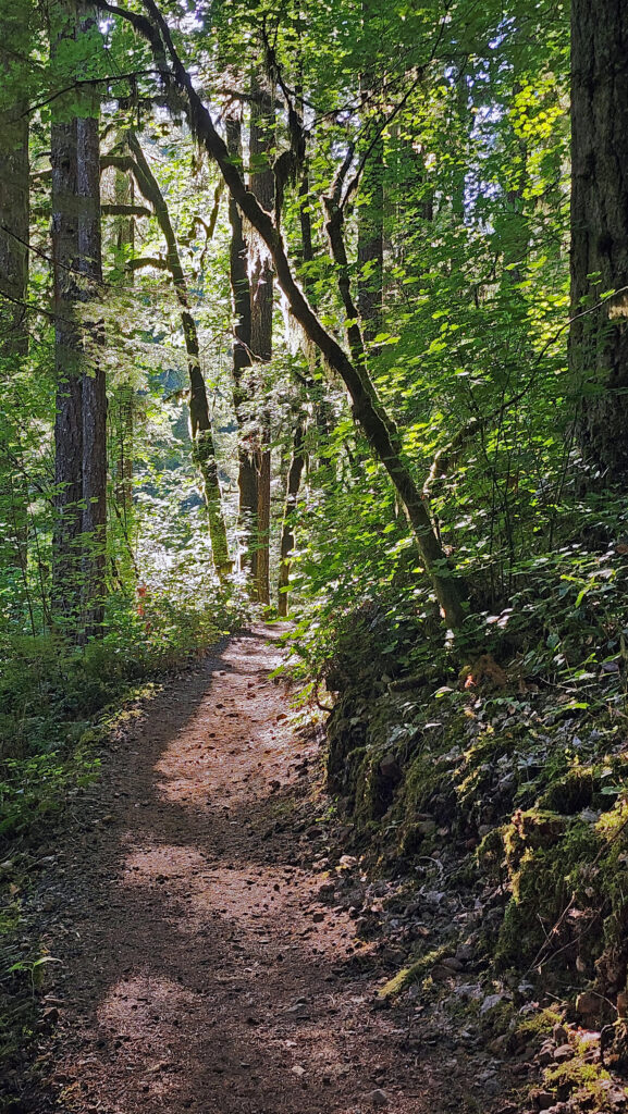
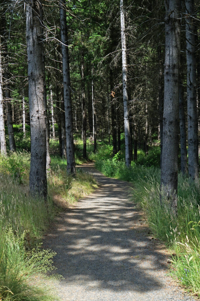
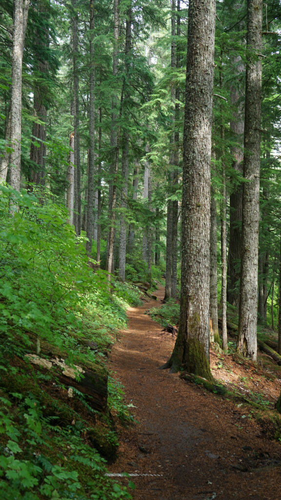
The South Falls-Maple Ridge hike:
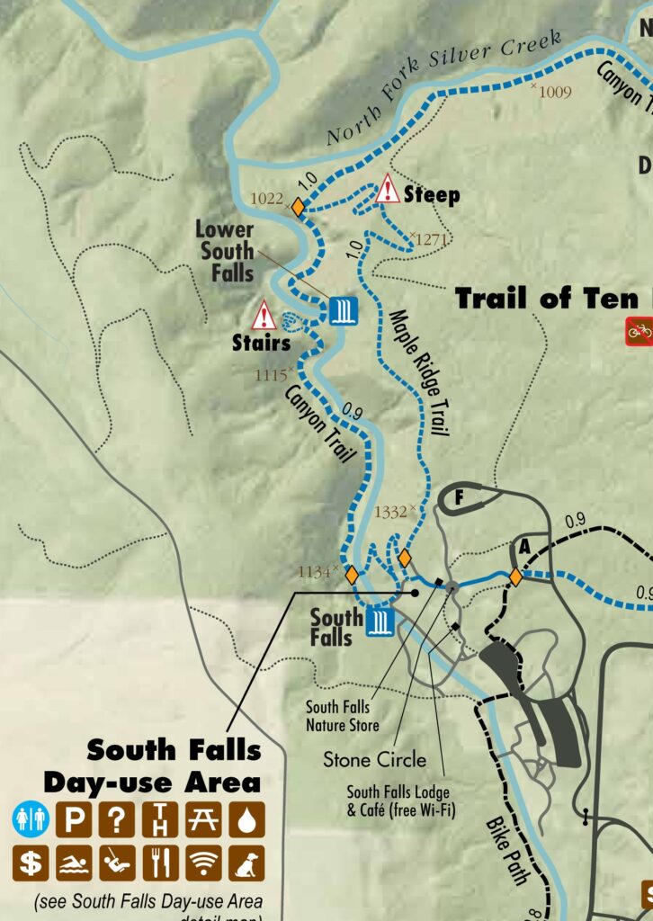
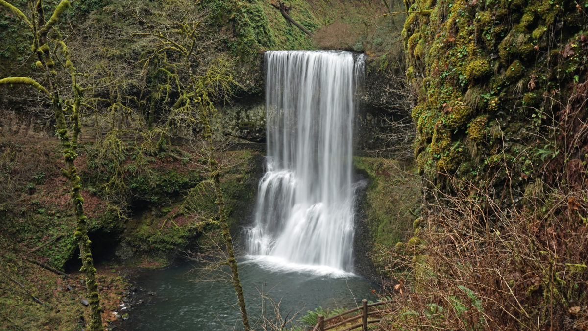
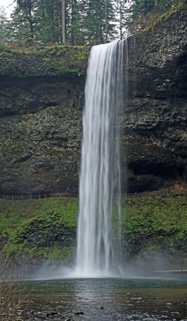
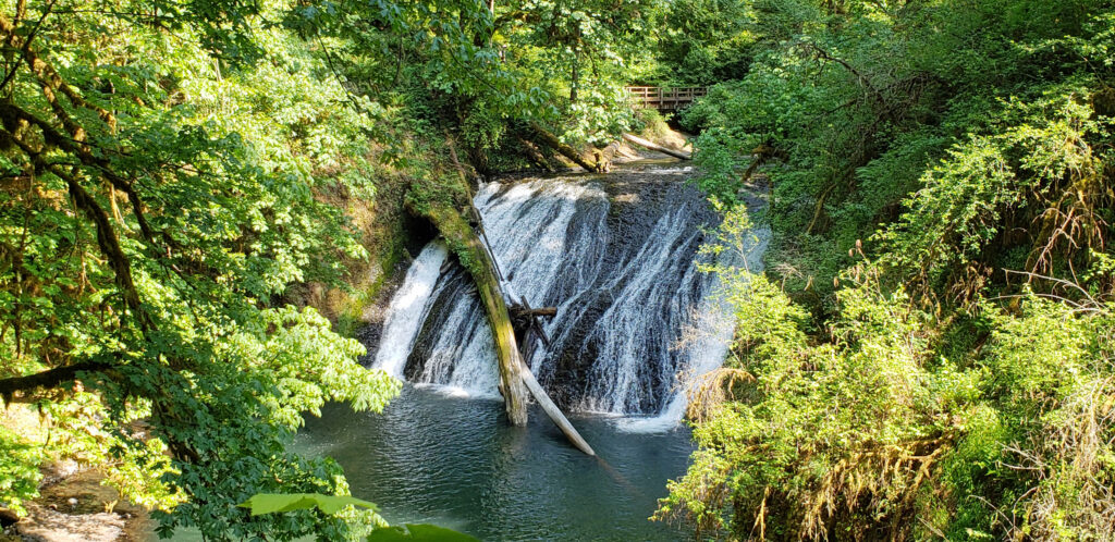
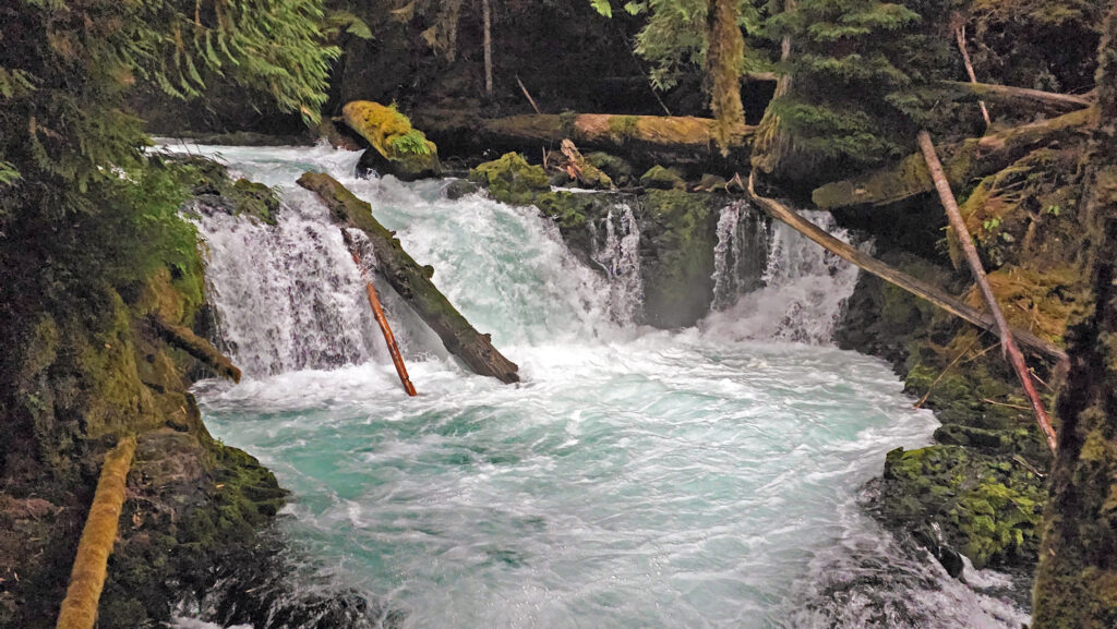
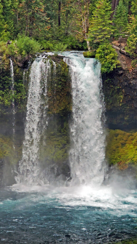
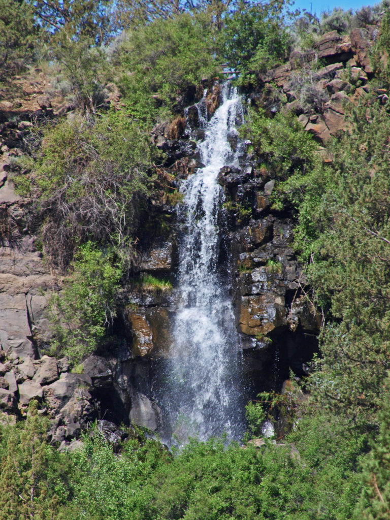
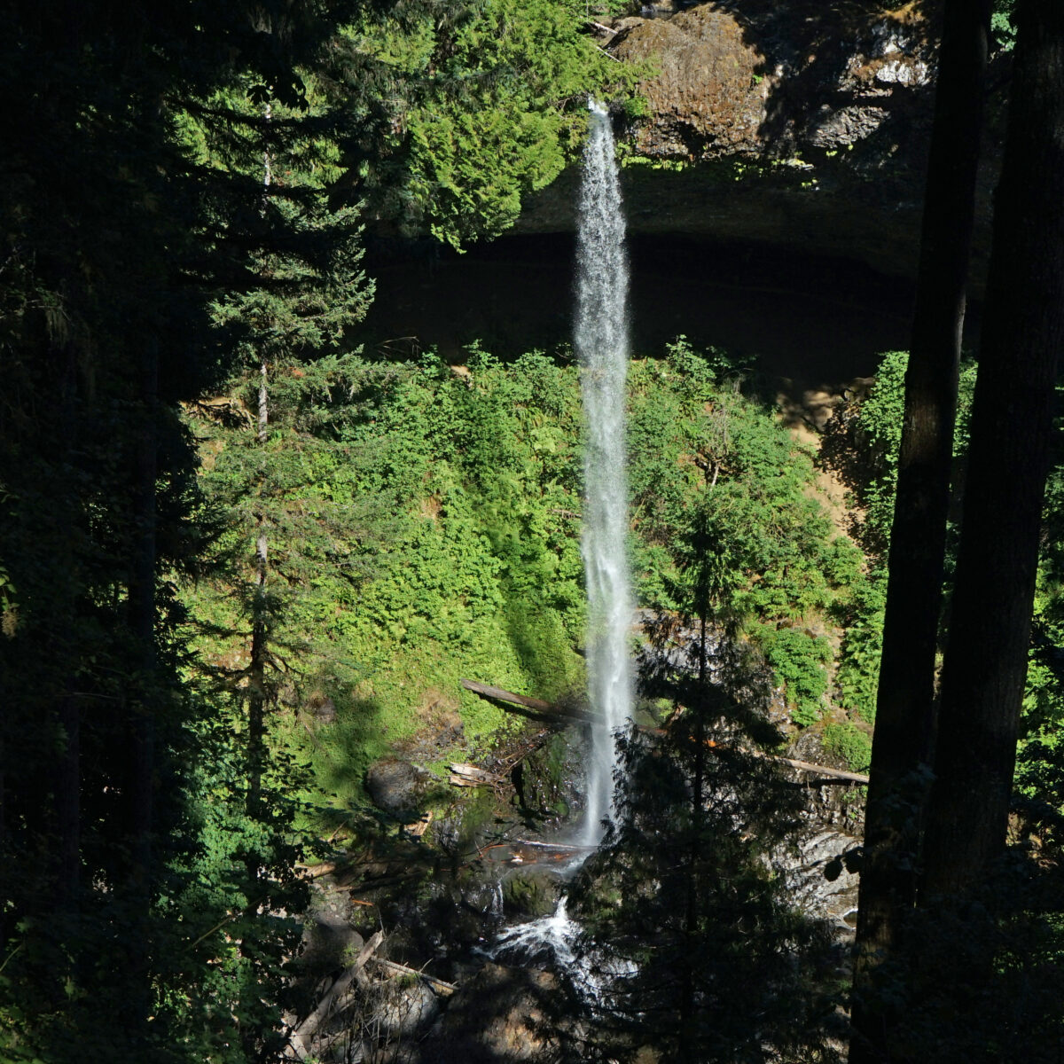
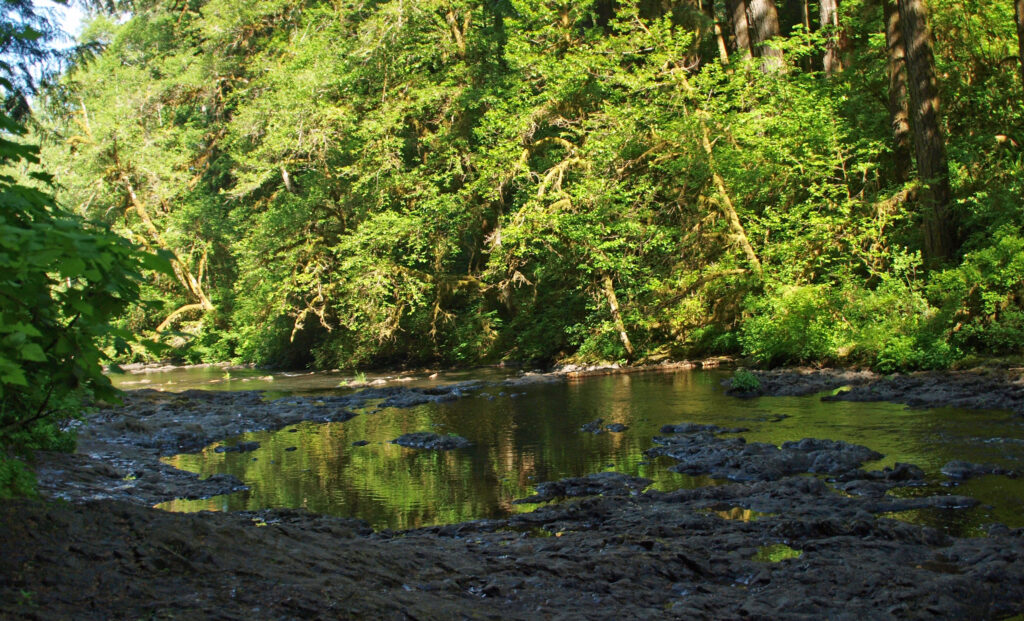
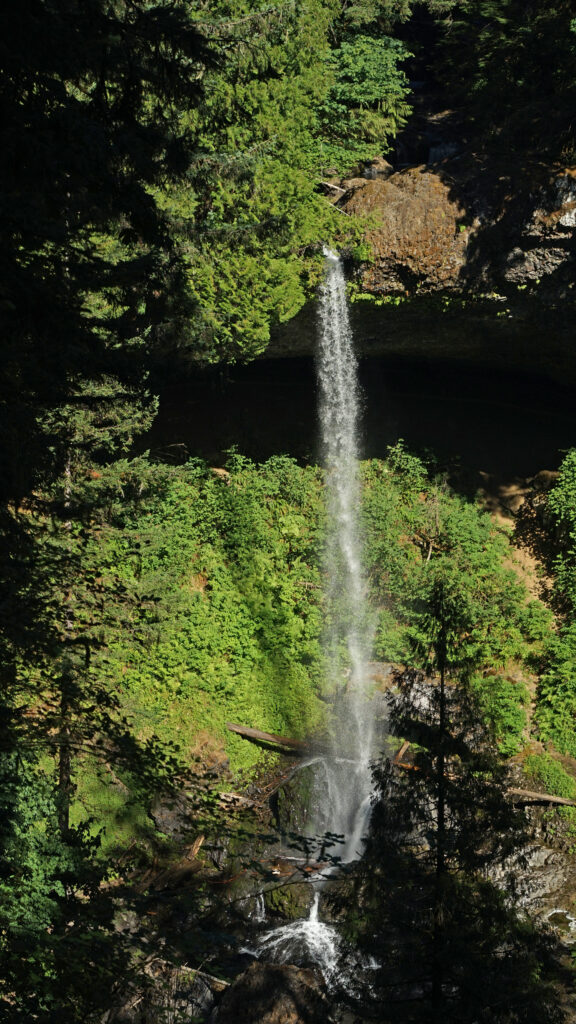
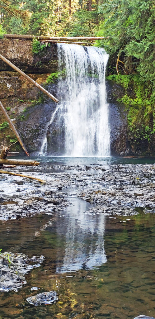
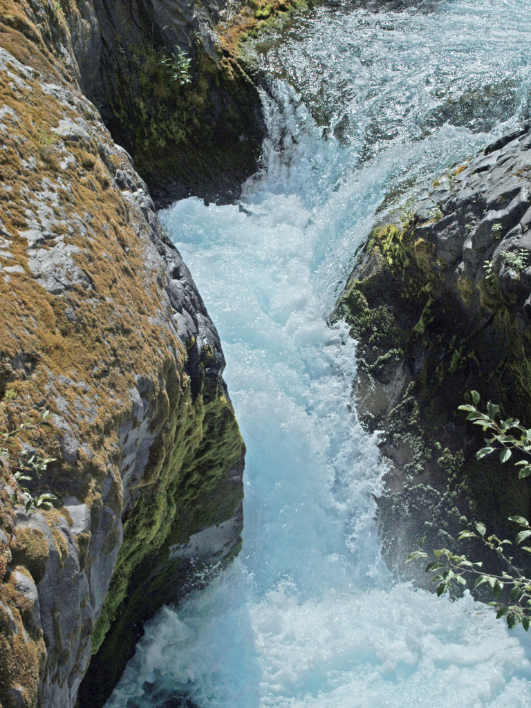
This 2.2-mile loop is a good option if you don’t have time to do any of the longer hikes possible in the park. Starting at the South Falls parking area, make your way to the creek above the falls and follow it downstream to the viewing area at the top of the falls. At 177 feet, South Falls is the highest falls on the north or south forks of Silver Creek and the second highest in the park. From the top of the falls the trail descends to a good vantage point a short way down the trail. Just below the first viewpoint look for a signed side trail to Frenchie Falls. This is the eleventh named falls and the smallest by volume, but it’s worth a look. Back on the main Canyon Trail there are several more places where you can get a good view of South Falls.

Continue down the main trail, which will take you behind South Falls. Here you will be between two layers of the Columbia River Basalt lava flows that are about 15-16 million years old. You’ll be tempted to linger behind the falls because it’s a pretty cool spot, but be prepared to get wet. Spray from the falls often soaks the whole “cave” behind the falls.
Below the falls there are several good viewpoints. Just downstream of the falls you’ll come to the first trail junction. The trail across the bridge will take you back to the parking area for a one-mile loop hike.
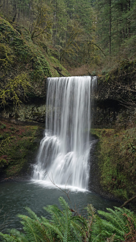
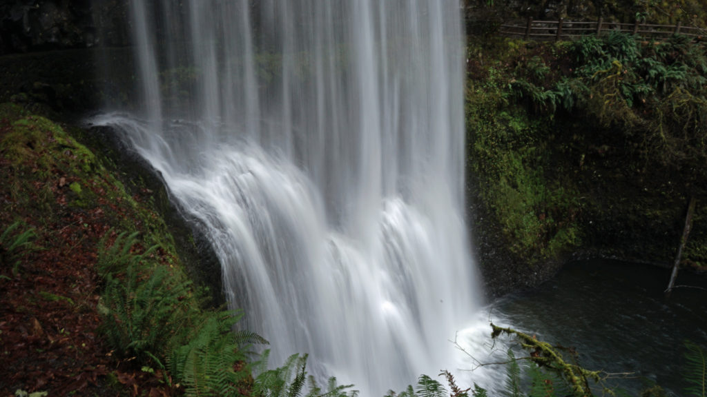
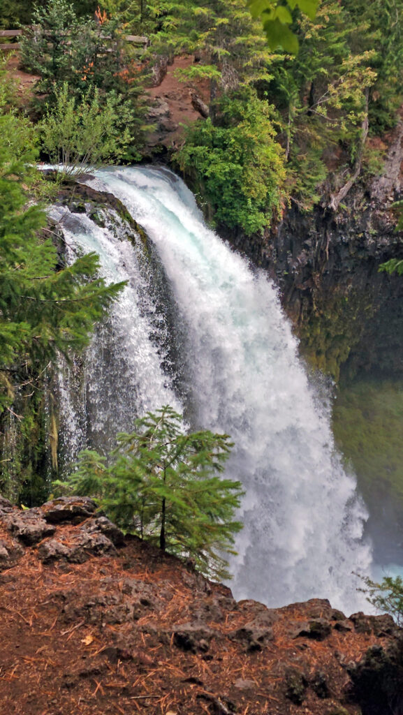
Continuing on the Canyon Trail, you’ll next come to Lower South Falls at approximately the one-mile mark. Here the trail also goes behind the falls. Below the falls, you’ll come to the junction with the Maple Ridge Trail at the 1.4-mile mark of the hike. Take the Maple Ridge Trail and climb out of the canyon.
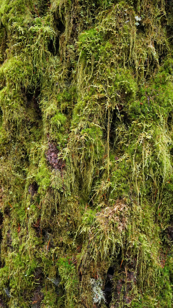
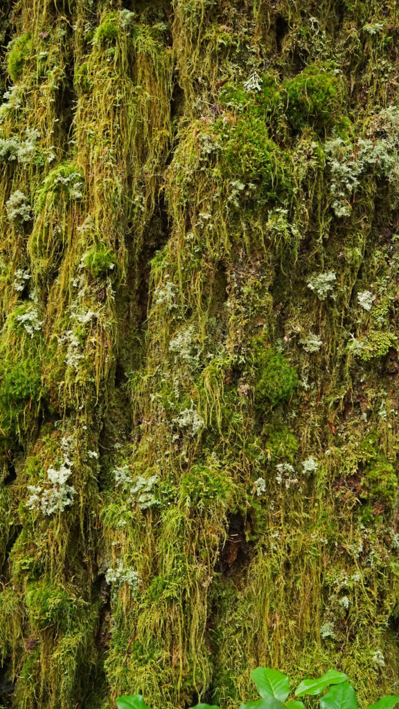
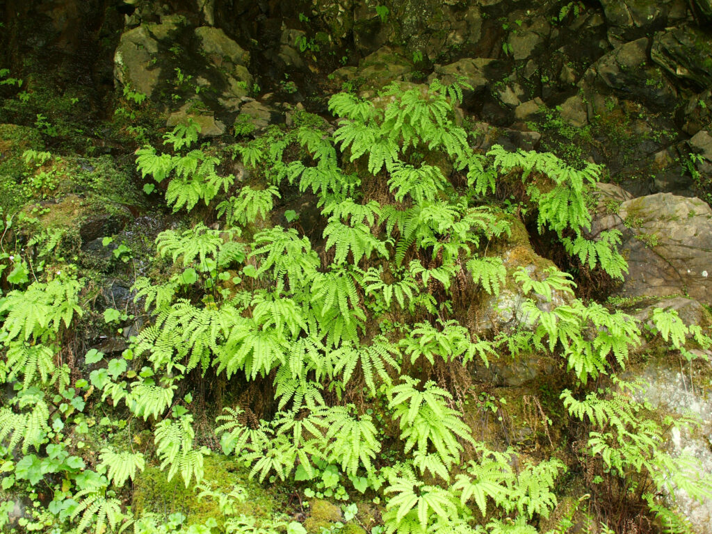
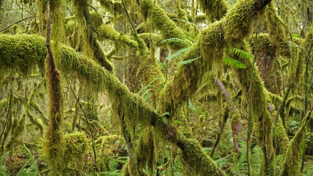
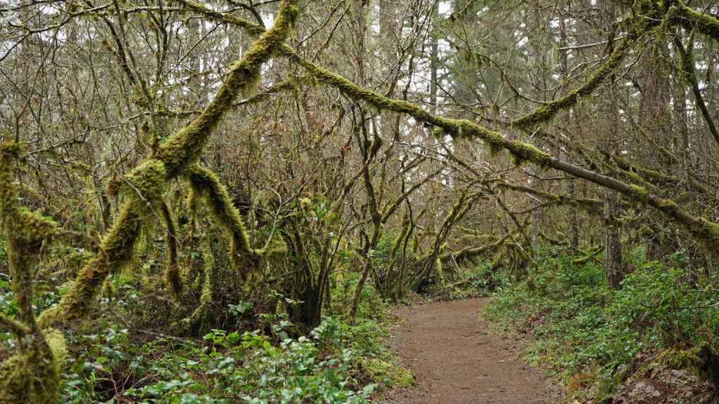
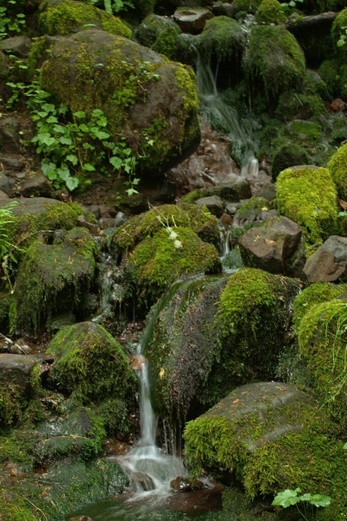
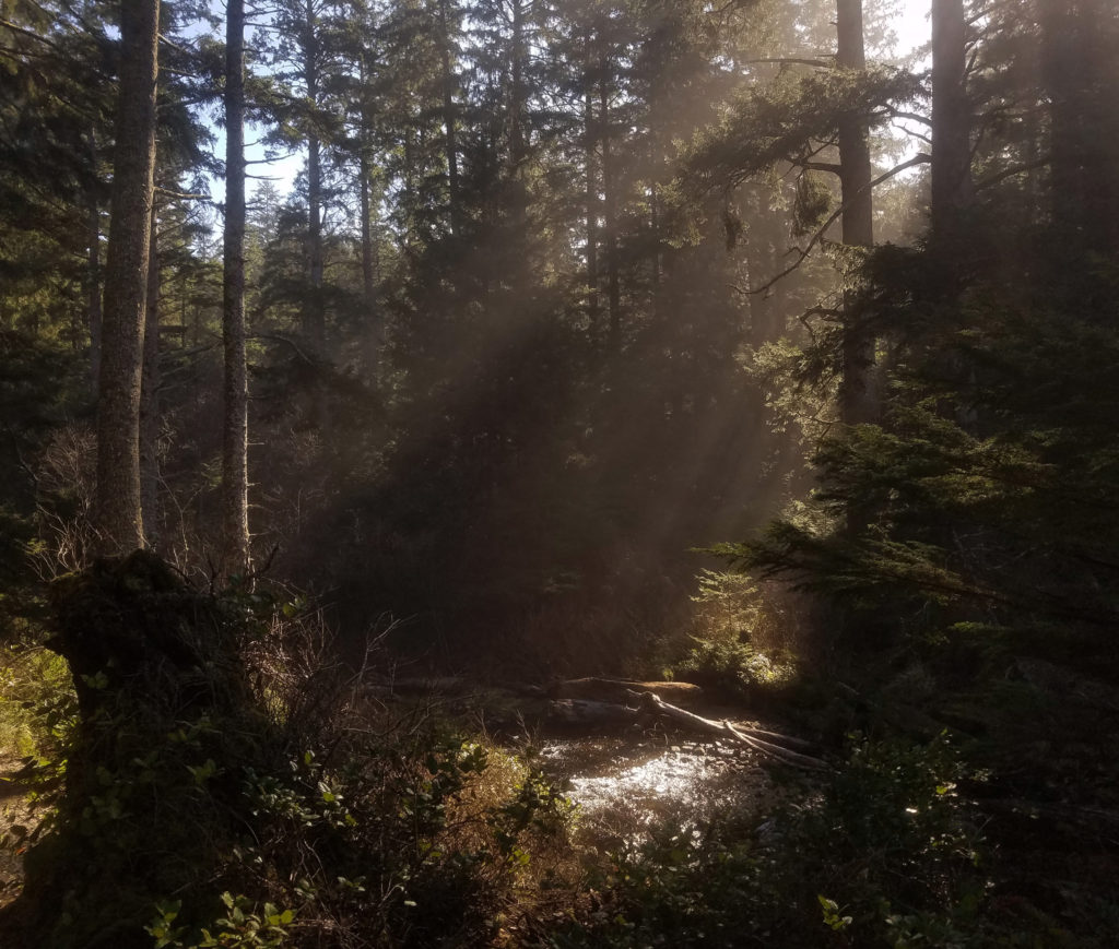
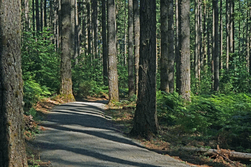
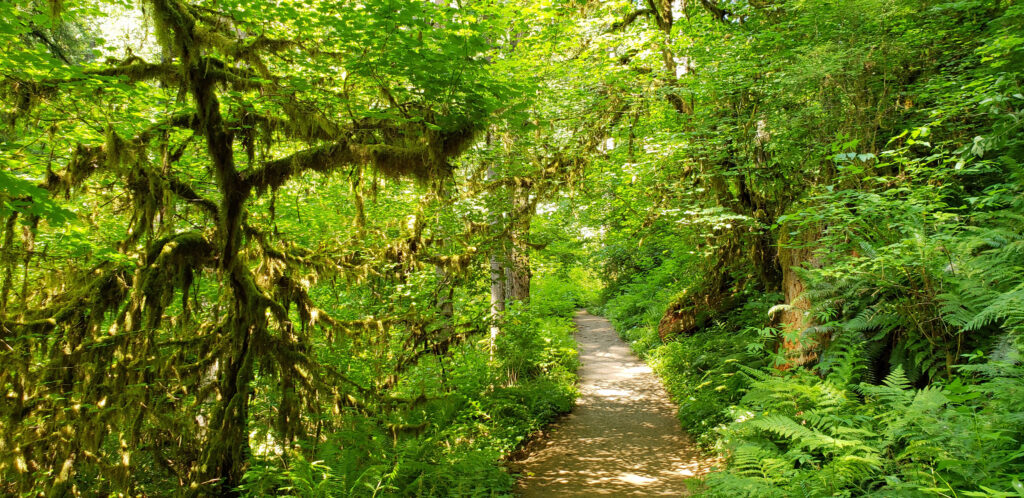
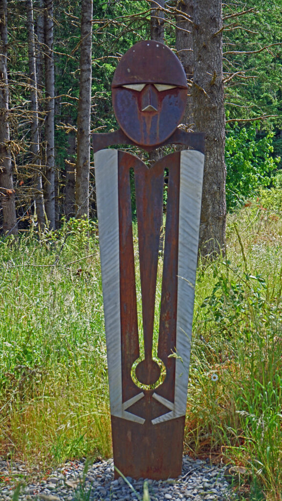
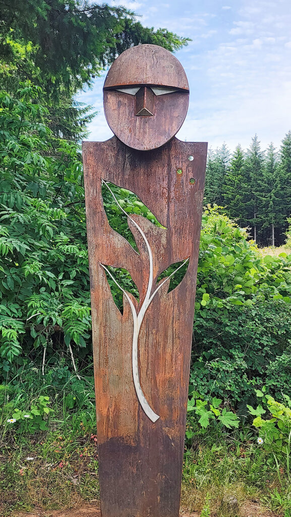
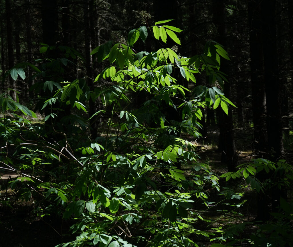
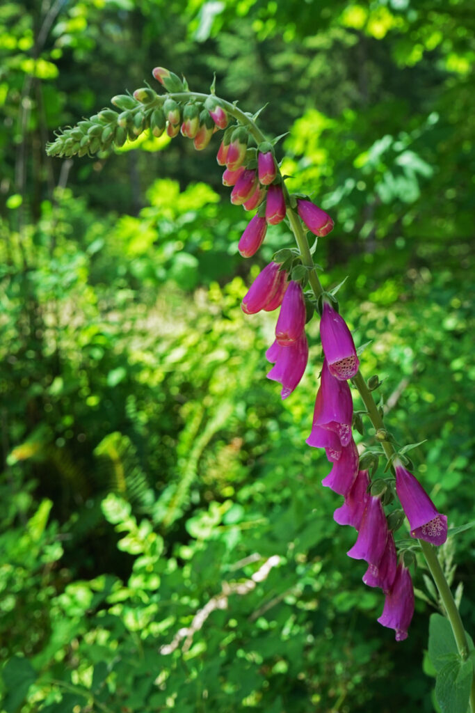
Along the rim of the canyon the Myrtle Ridge Trail takes you through a world of moss and ferns. In the summer it’s shaded by the many Bigleaf Maples and Douglas Firs that line the trail, but in the winter it’s more open and, if you’re lucky enough to get some sunshine, the moss-covered trees and rocks and the ferns can be a vibrant green that is captivating. There wasn’t any sunshine on my last winter hike there, but the moss and ferns still provided a shot of greenery that contrasts with the darker green of the conifers above. Follow the Myrtle Ridge Trail back to the South Falls day use area where you started.

South Falls-Winter Falls loop:
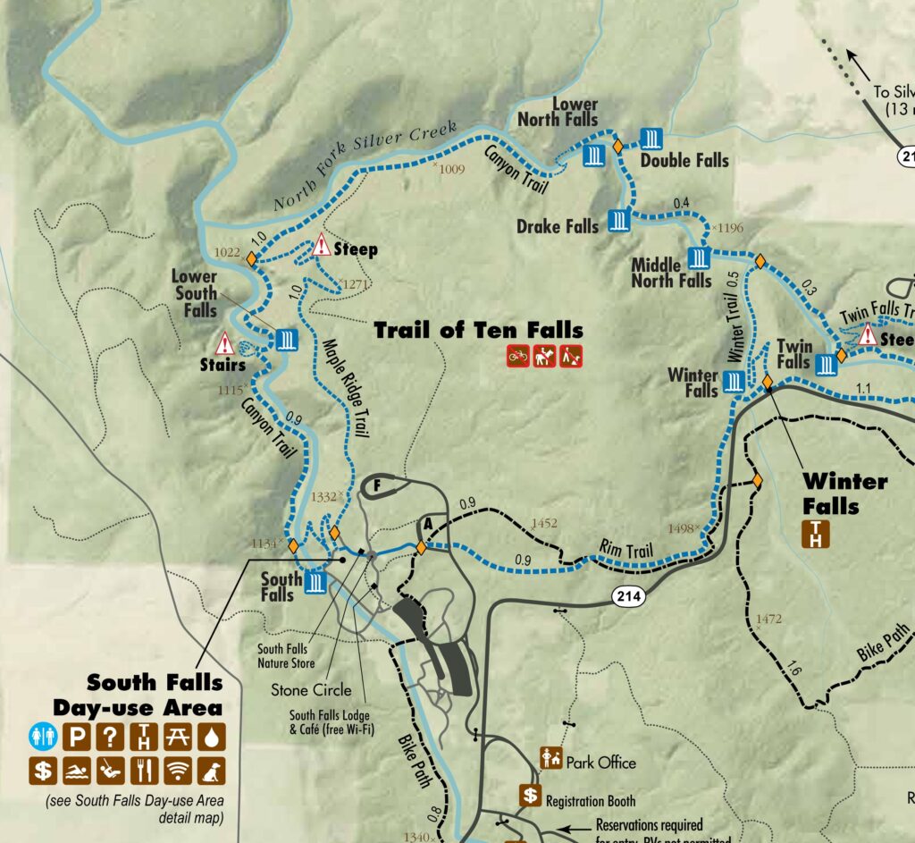
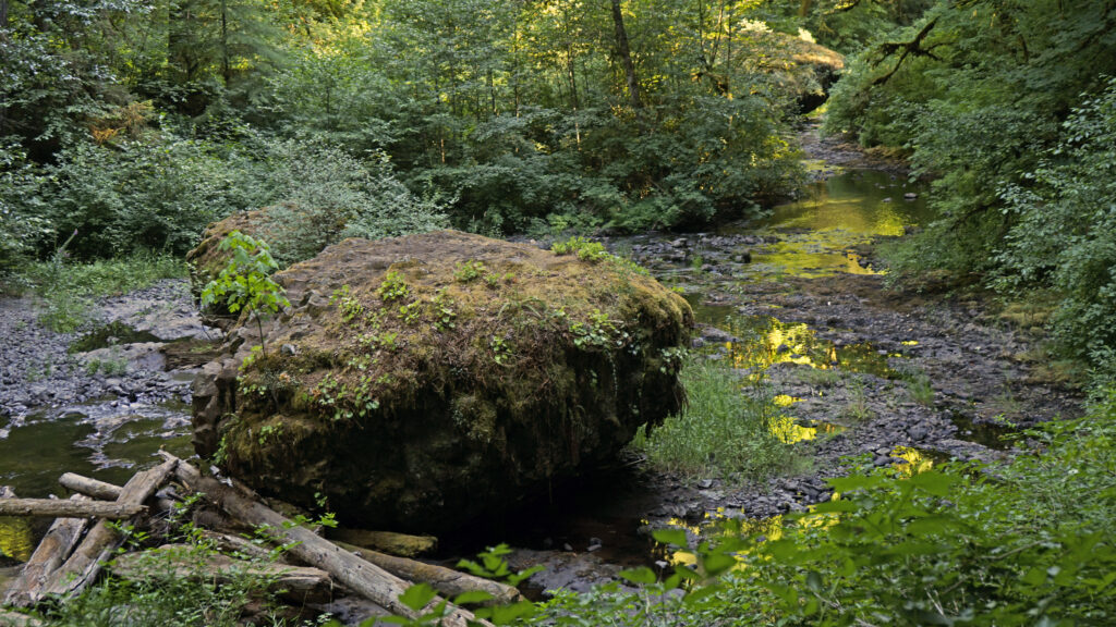
The South Falls-Winter Falls loop is a longer hike (approximately 4.5 miles) than the South Falls-Myrtle Ridge loop. Follow the trail as described above, but at the Myrtle Ridge Trail junction, continue on the Canyon Trail. Here the Canyon Trail leaves the south fork of Silver Creek and joins the north fork. Following the north fork upstream, look for an intermittent waterfall across the creek at the 1.9-mile mark.
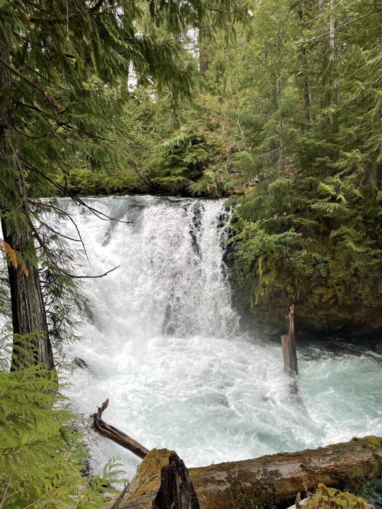
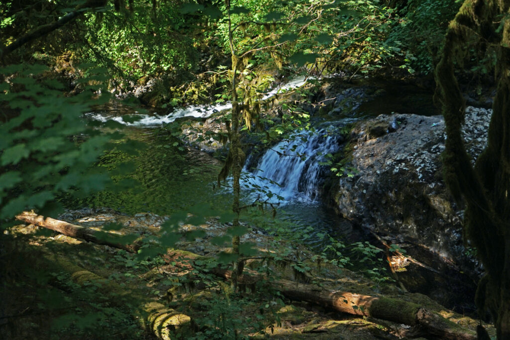
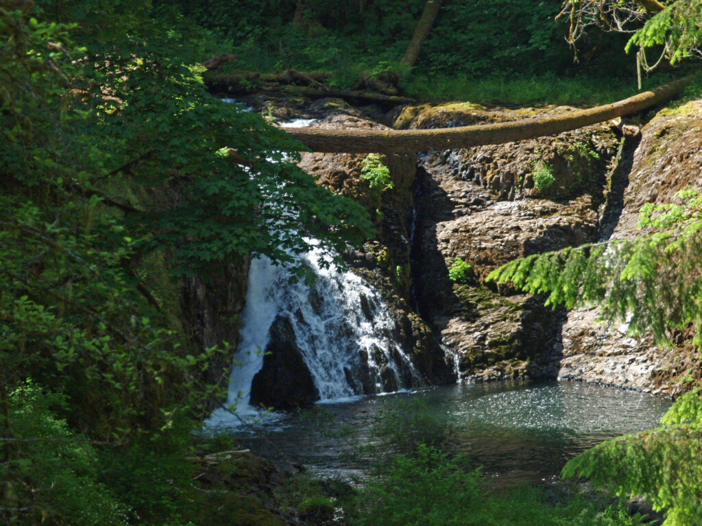
The trail then takes you to Lower North Falls (30 feet) at the 2.4-mile mark. Just above the falls a side trail leads to Double Falls, the highest in the park at 184 feet (combined drops). The volume of water flowing over Double Falls is much less than the falls on the two forks of Silver Creek, but still worth a look.

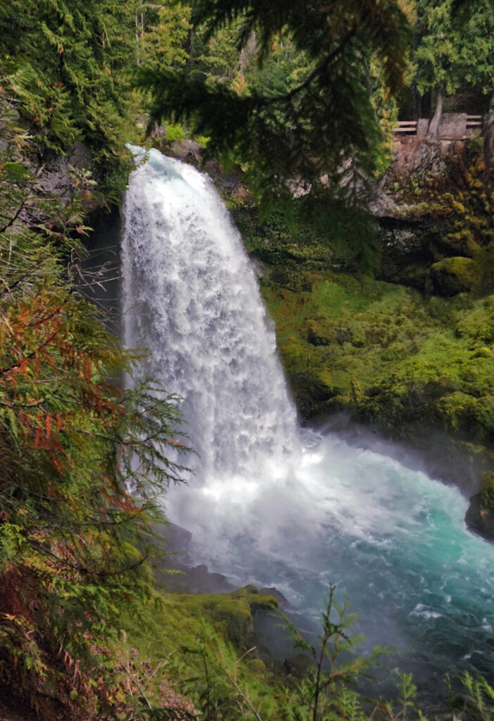
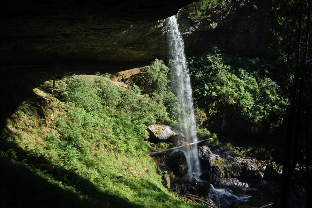
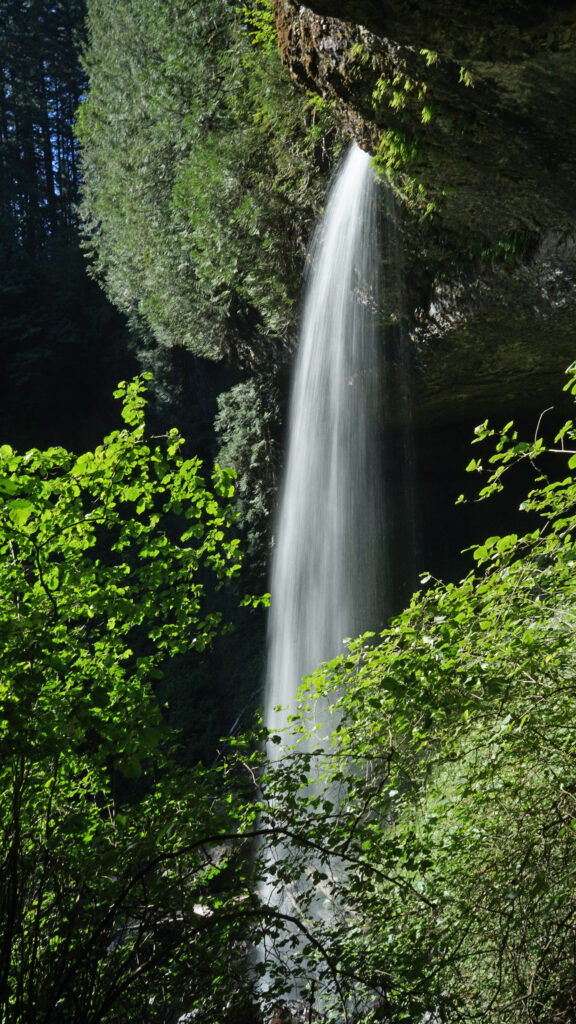
Next up is Drake Falls (27 feet), then the 106-foot drop of Middle North Falls. A side trail here leads behind the falls, but dead ends on the other side. Back on the main trail, you will come to the junction of the Winter Falls Trail at the 2.9-mile mark. Take the Winter Falls Trail to the base of the falls. Like Double Falls, Winter Falls is on a tributary creek with less volume than either fork of Silver Creek.

From the base of the falls, continue up the trail to the rim of the canyon and return to the South Falls day use area on the Rim Trail.
Other winter hikes:
The new North Canyon trailhead and North Canyon Trail makes possible a new loop hike that I’m calling the North Canyon Loop that takes you to North and Twin Falls. And the 0.6-mile out and back hike to Upper North Falls is an easy addition to extend the hike to 3.0 miles. And of course the full 7.2-mile Trail of Ten Falls is doable year-round.
Other area attractions:
The Silverton area has a number of decent places to grab a bite to eat or a pint of beer after your hike. Try the Silver Falls Brewery and Alehouse in Silverton or the Benedictine Brewery near Mount Angel that is operated by monks from the Mount Angel Abbey. Silverton is also home to the Oregon Garden, one of the state’s leading botanical gardens. Next door to the Oregon Garden is the Gordon House, the only surviving Frank Lloyd Wright designed house in Oregon.
Posted November 27, 2023. Most recently updated November 14, 2025.
All photos © Alan K. Lee
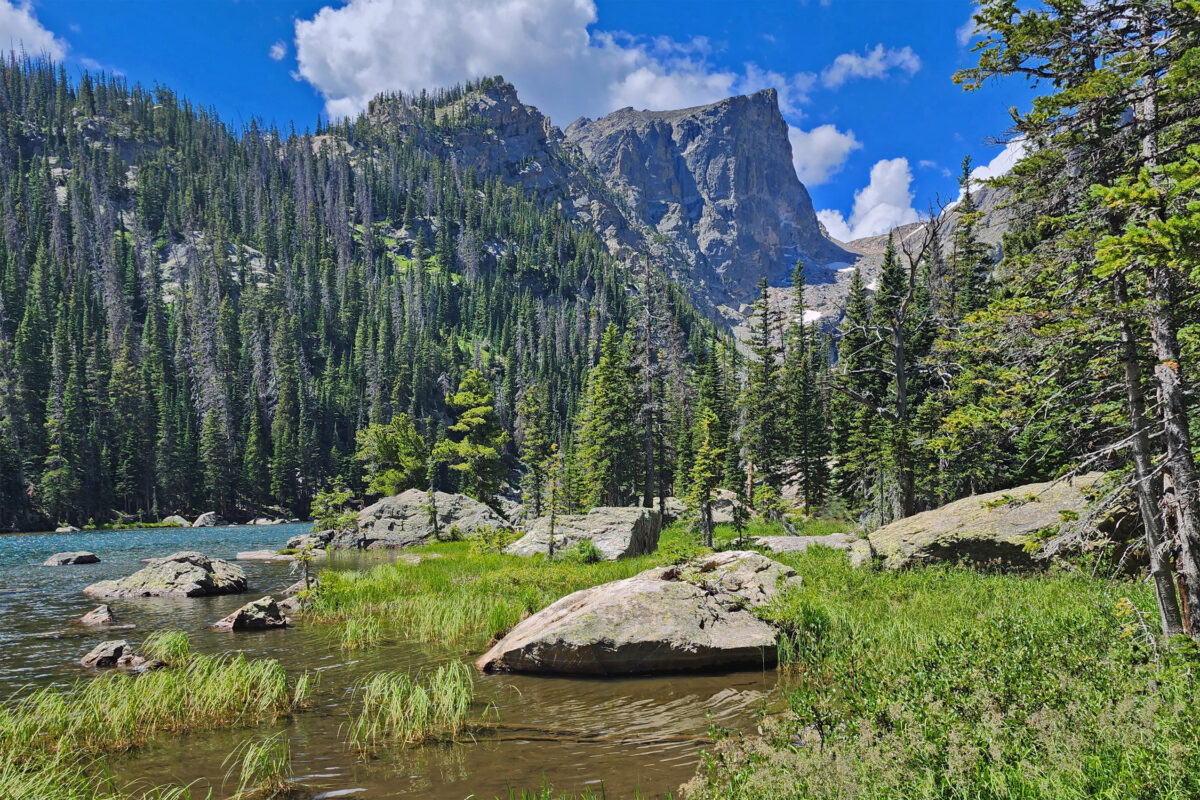
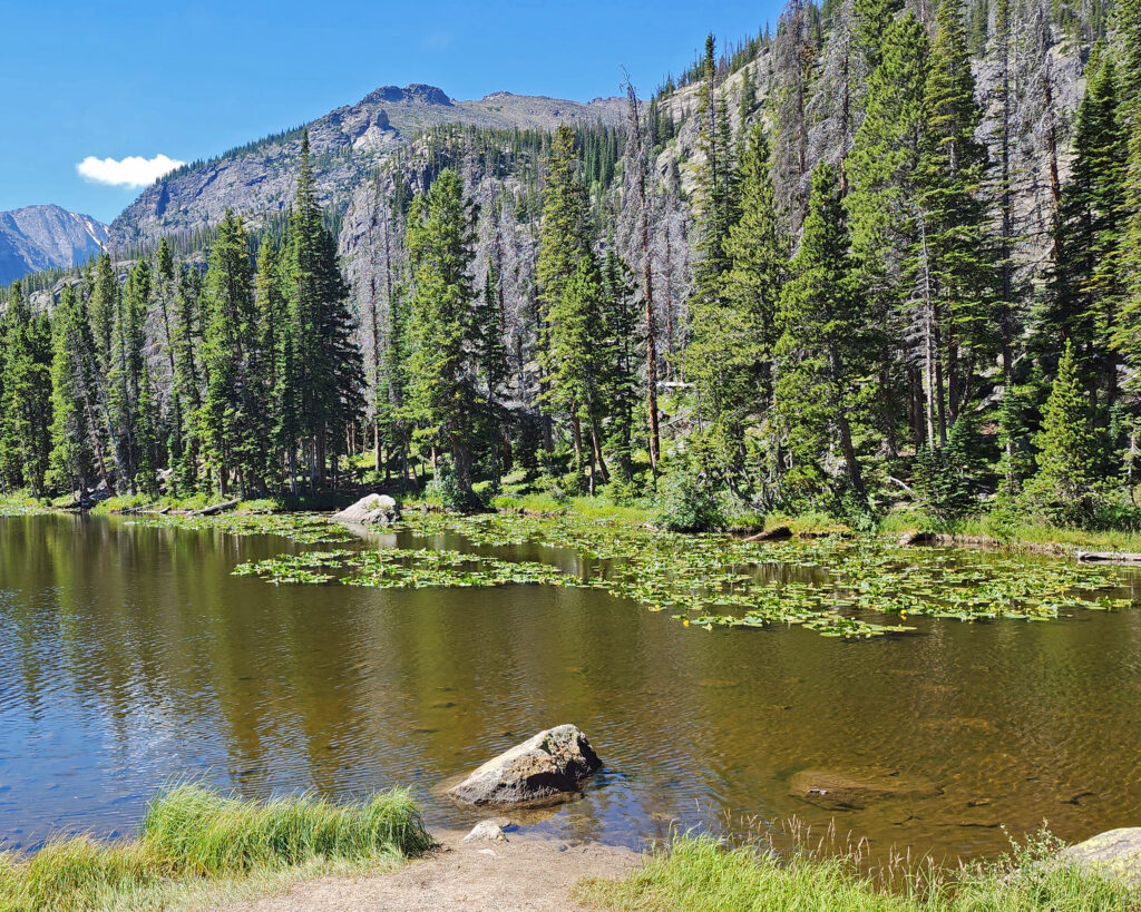
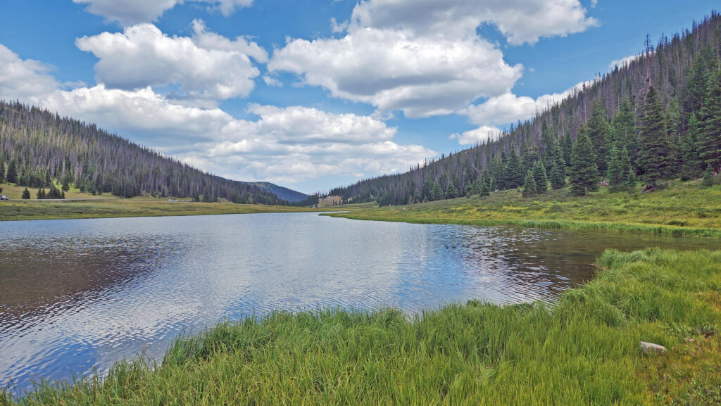
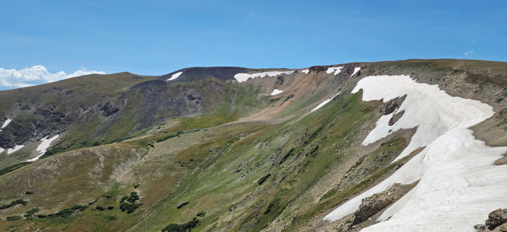
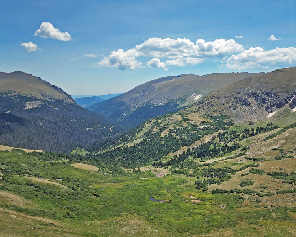
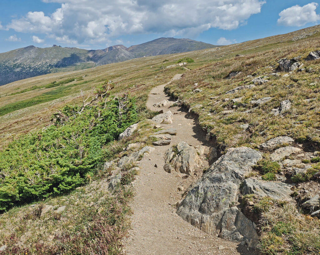
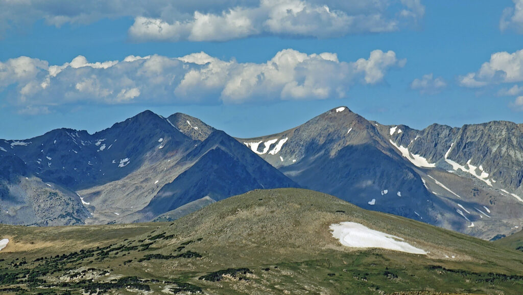
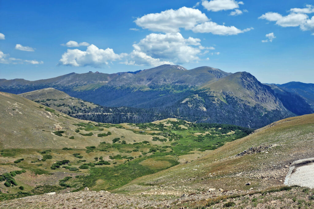
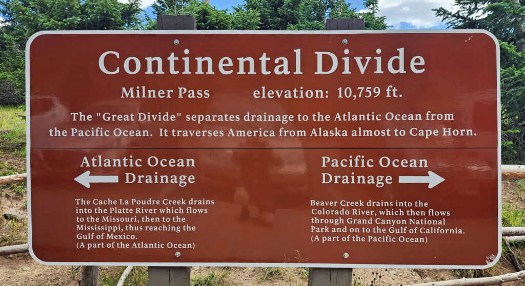 Coming down off Trail Ridge we stopped on the continental divide at Milner Pass (at 10,759 feet you actually come down in elevation from Trail Ridge to the divide). We did a short walk there along the shore of Poudre Lake and, of course, took a photo of the continental divide sign before heading south.
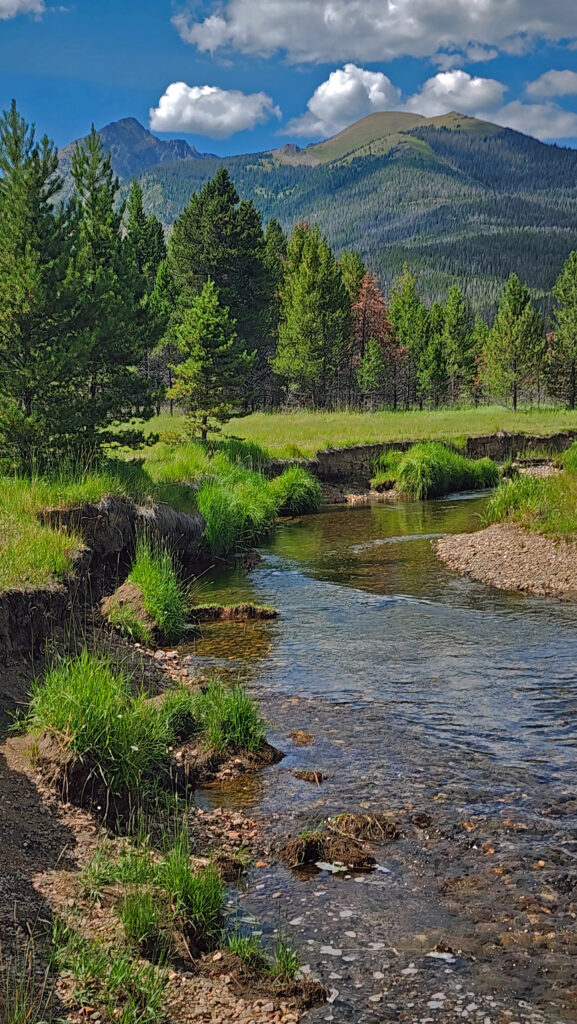
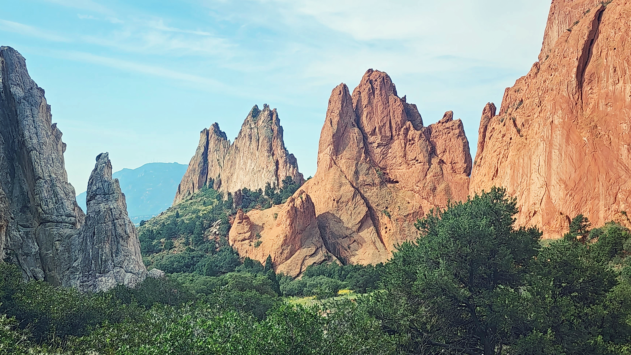

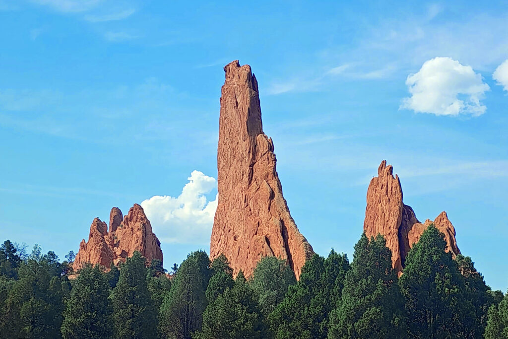
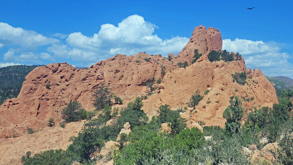
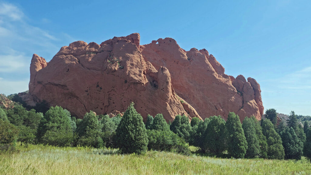
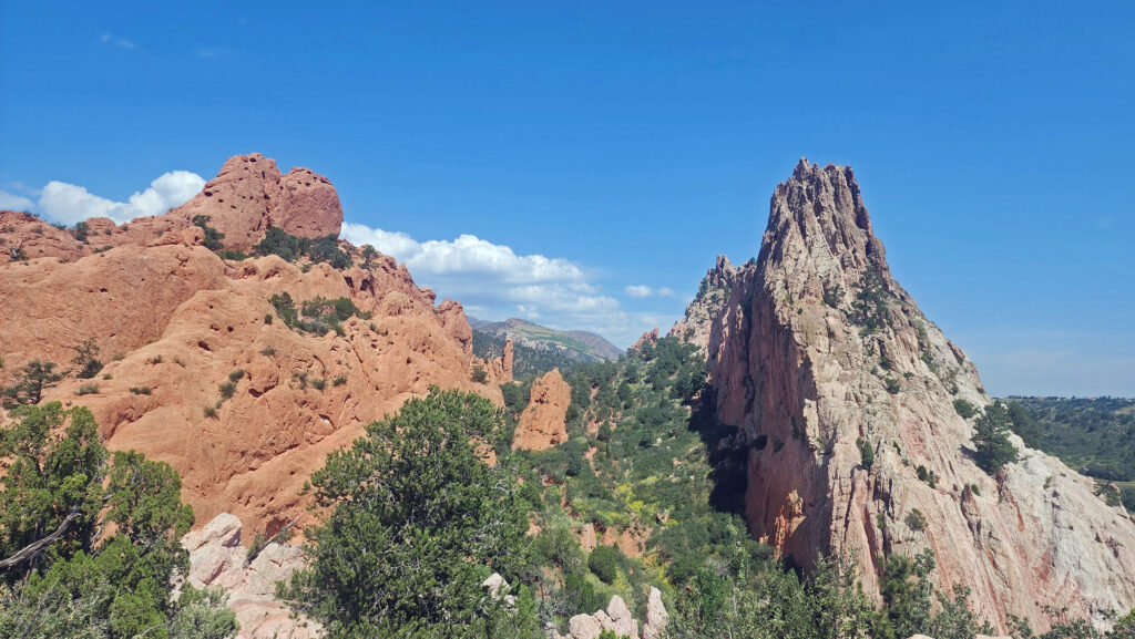
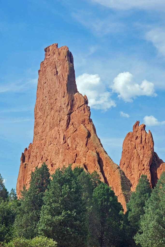
 In 1859, Colorado City was founded and later became the capital of the Colorado Territory before the capital was moved first to Golden, then Denver. Colorado Springs was founded in 1871 just east of what became known as Old Colorado City. Colorado Springs grew rapidly and eventually Old Colorado City became incorporated into the growing city, and is now a neighborhood west of downtown Colorado Springs.
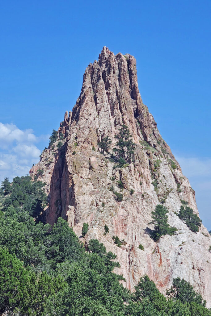
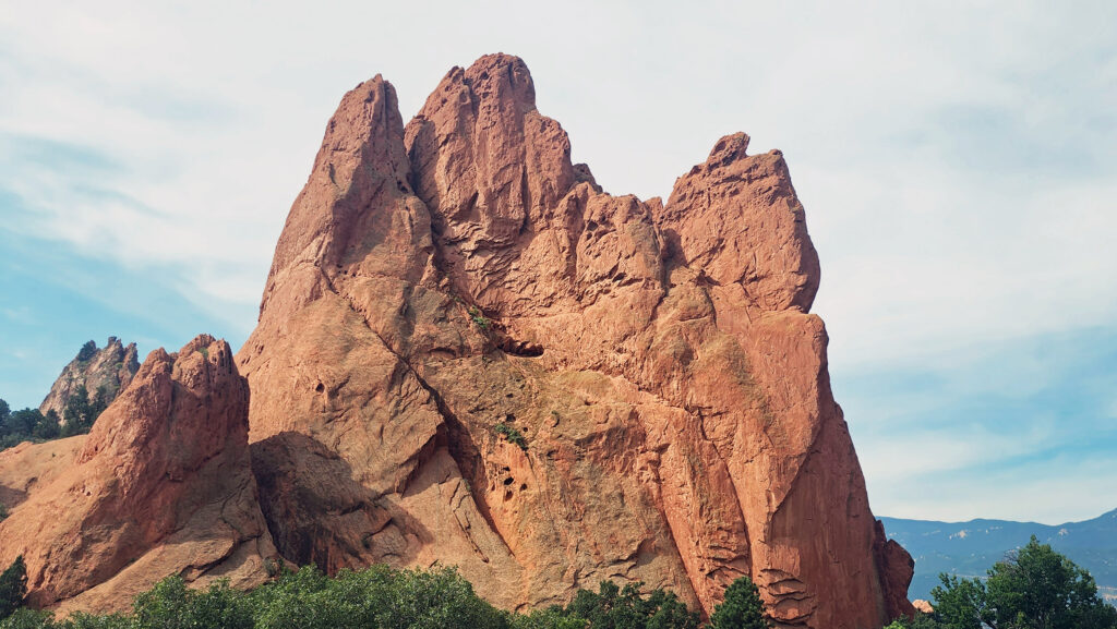
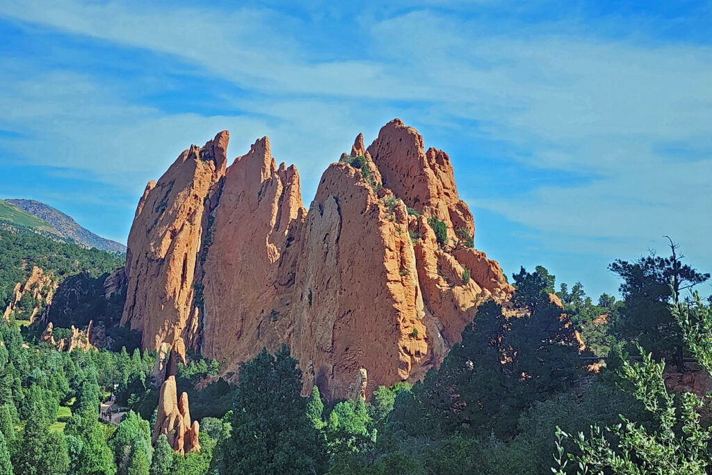
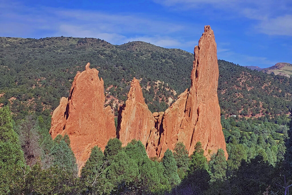 The park is very popular and parking can be a problem, but there is also a large overflow parking area just west of 30th Street if the visitor center parking lot is full. There is a pedestrian tunnel under 30th Street to get from the overflow lot to the visitor center. The park also operates a free shuttle bus in the summer that runs from the visitor center to the center of the park with stops at the overflow parking area and the Rock Ledge Ranch Historic Site.
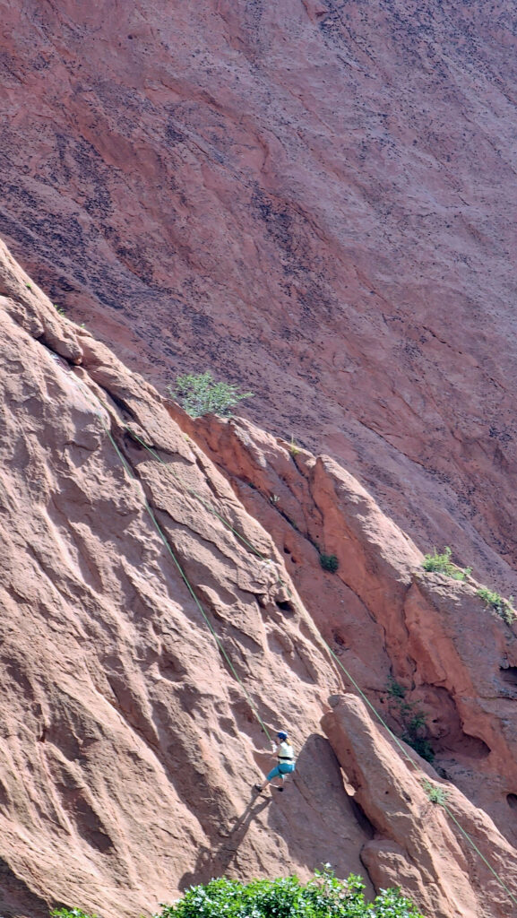
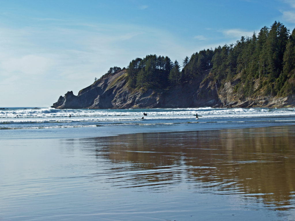
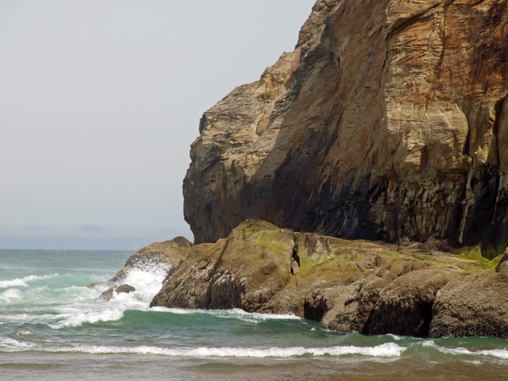
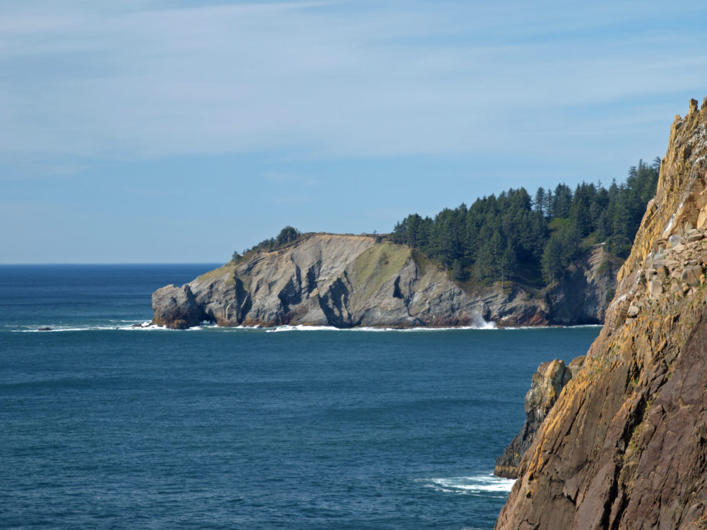 The park, originally called Short Sand Beach State Park, was created in 1931 through the efforts of Oregon’s first State Parks Superintendent, Samuel H. Boardman. Boardman was a fervent believer that of as much of the coast should be preserved in public ownership as possible. Many of the state parks along the coast were created under his stewardship. Short Sand Beach State Park was renamed in 1958 to honor former Oregon Governor
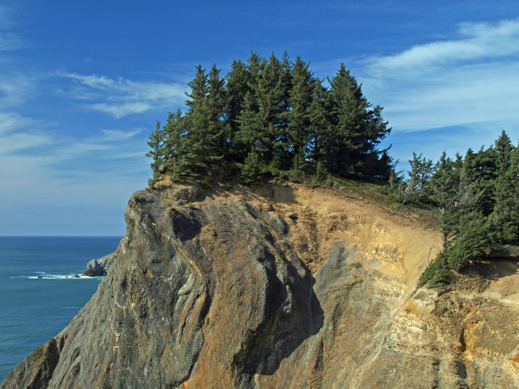
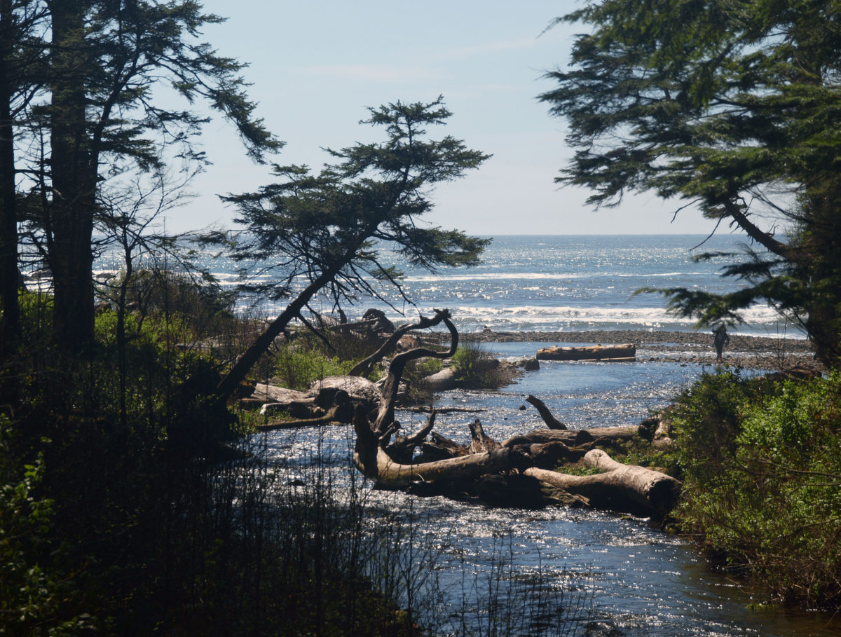
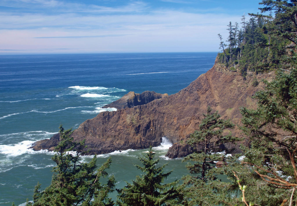
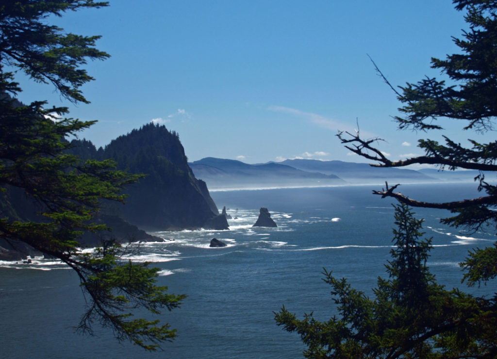
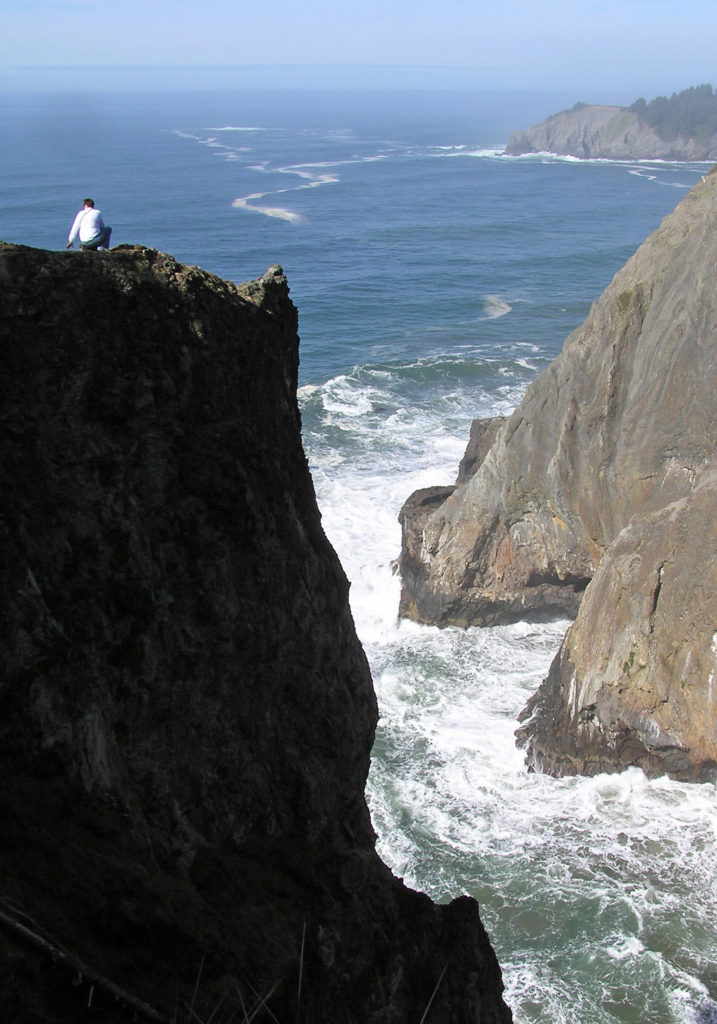
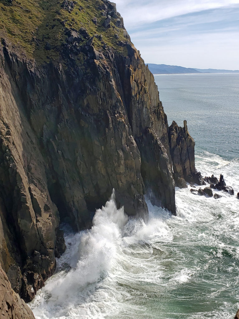
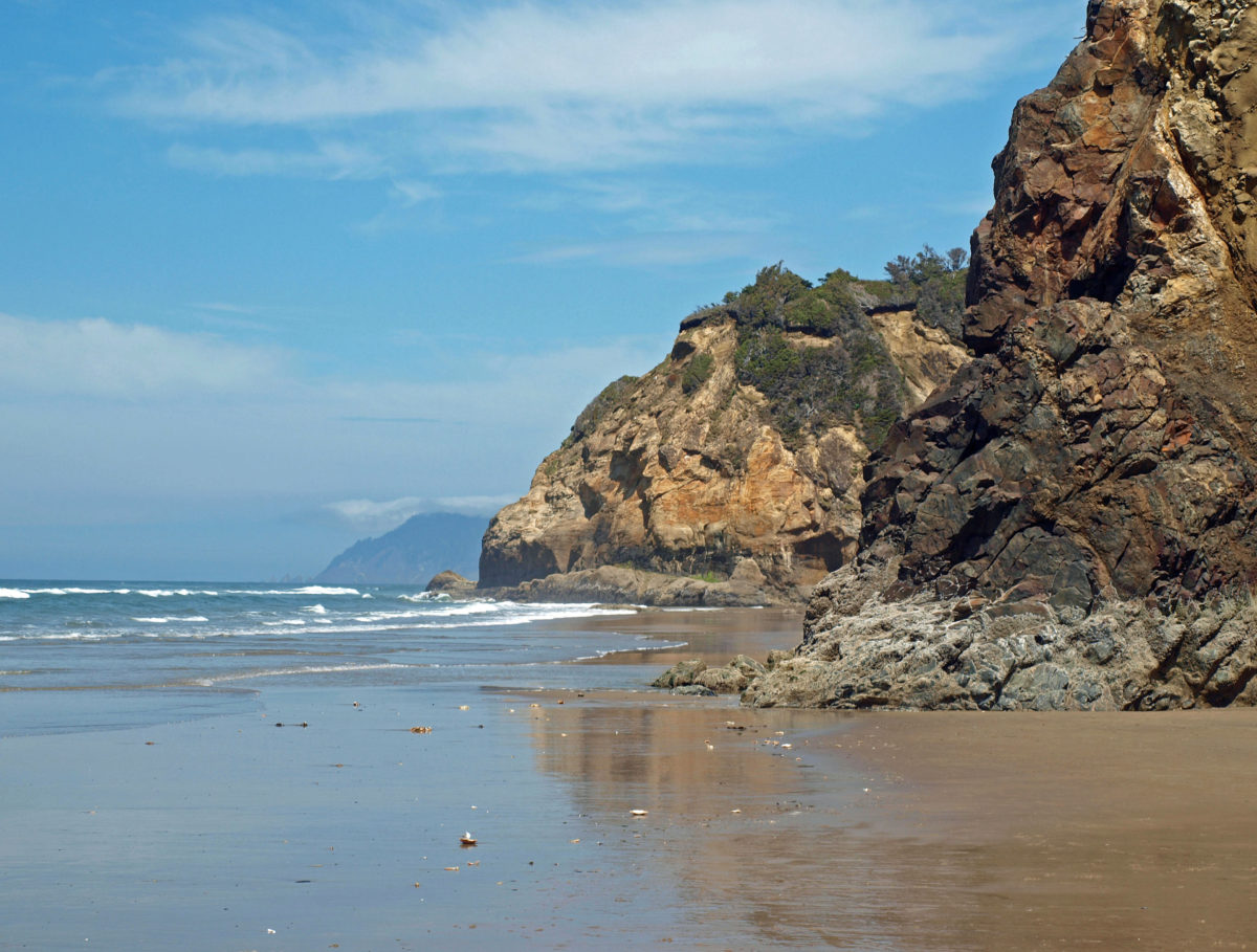
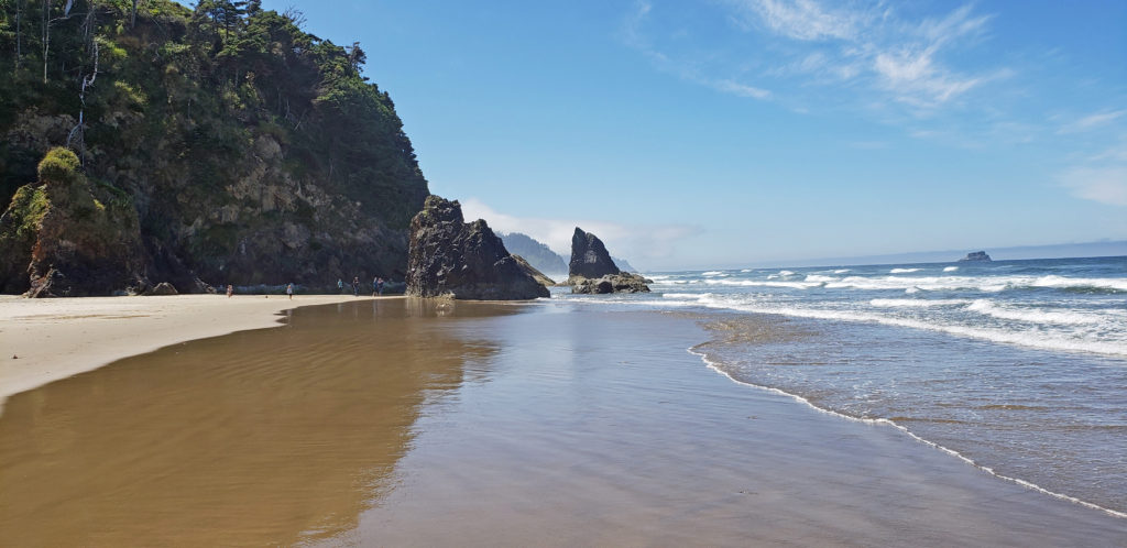
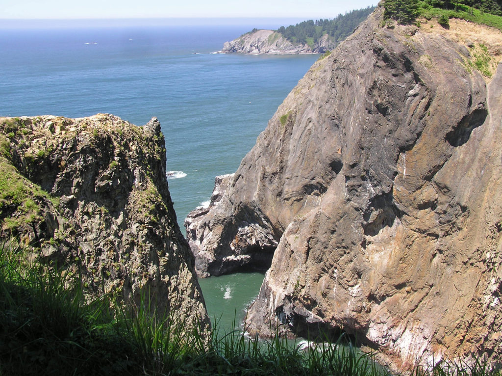 Devils Cauldron is a spectacularly beautiful little cove on the north side of Neahkahnie Mountain. It can be reached by either a one mile hike from Short Sand Beach or a much shorter hike from where the Coast Trail crosses Hwy 101. To access the shorter route, drive south on Hwy 101 from the Short Sand Beach parking lots and look for a gravel parking area on the ocean side of the highway. Follow the Coast Trail north a short ways to a signed junction. The Devils Cauldron viewpoint is just a quarter mile walk from the parking area.
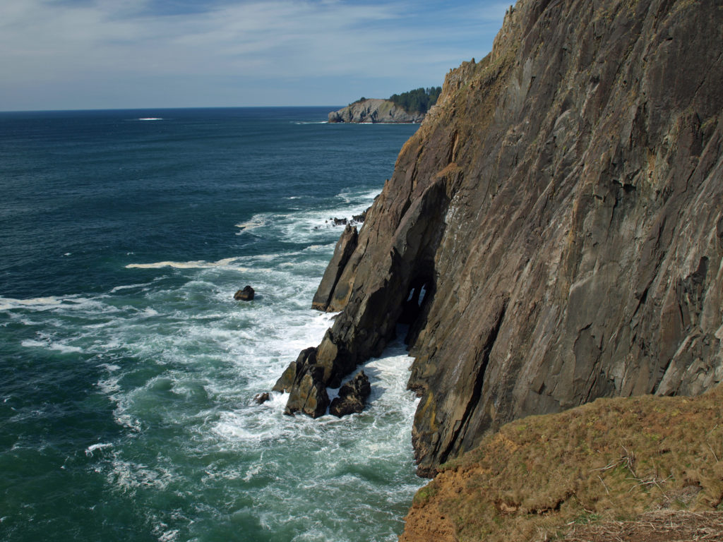 On your way back to the trailhead look for another trail branching off to the south. The junction here is unsigned and the trail is sometimes overgrown and impassable. But if it’s open, the trail leads to a narrow shelf of rock that falls away on three sides to the ocean below, and the cliffs of Neahkahnie Mountain tower over the viewpoint to both the north and south. It may not be a place for people with a fear of heights, but it’s one of the most awesome places on the entire coast.
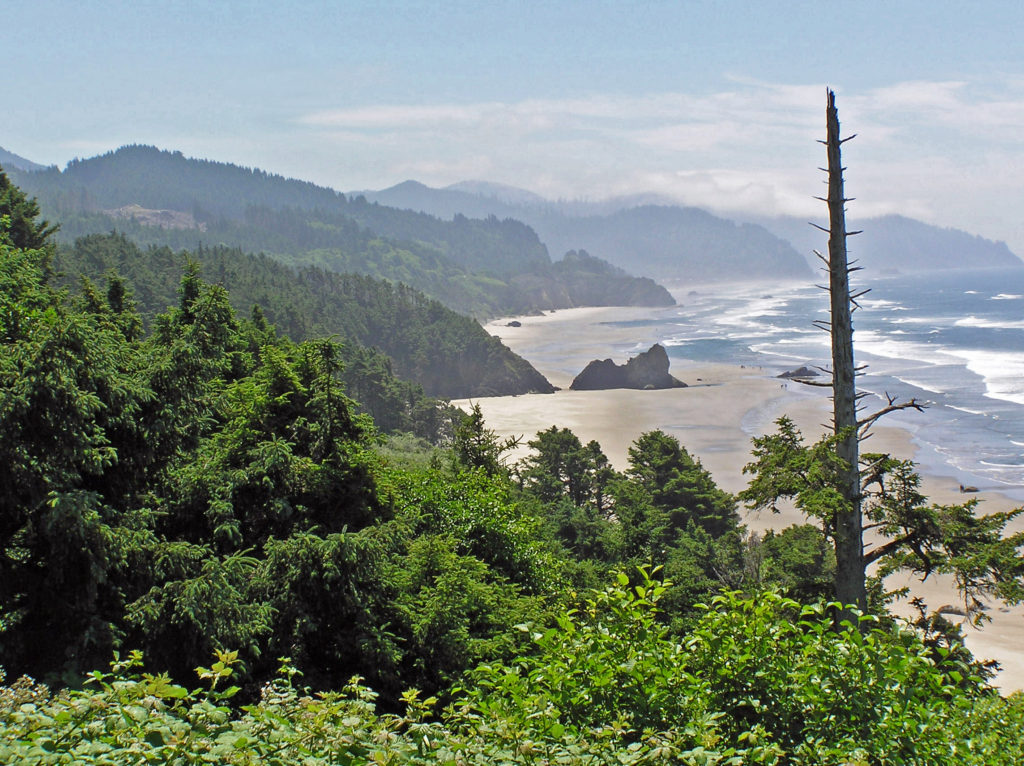
 Oswald West State Park is about a two hour drive from Portland, so it’s easily doable as a day trip if you’re from the Portland area or are visiting Portland. But if you want to make a weekend of it, there are plenty of other attractions on the north Oregon coast beyond Oswald West.
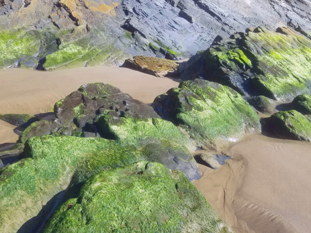
 Overview:
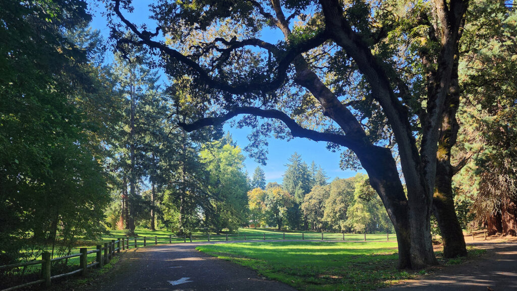 Getting there:
 Trailhead:
 The hike:
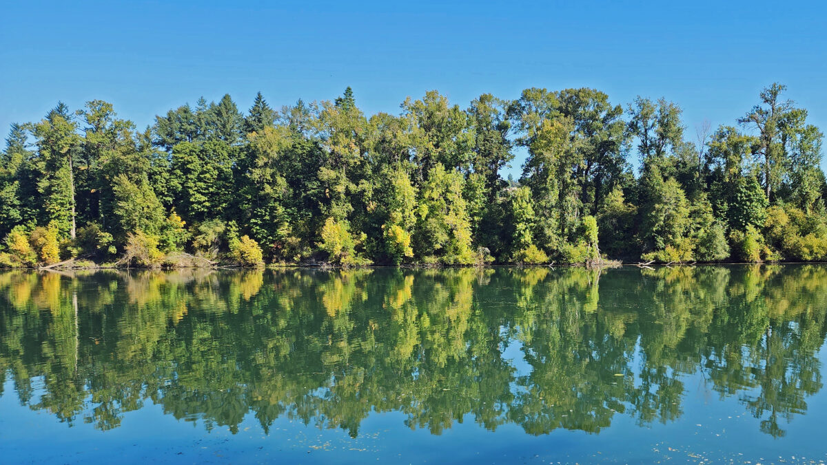
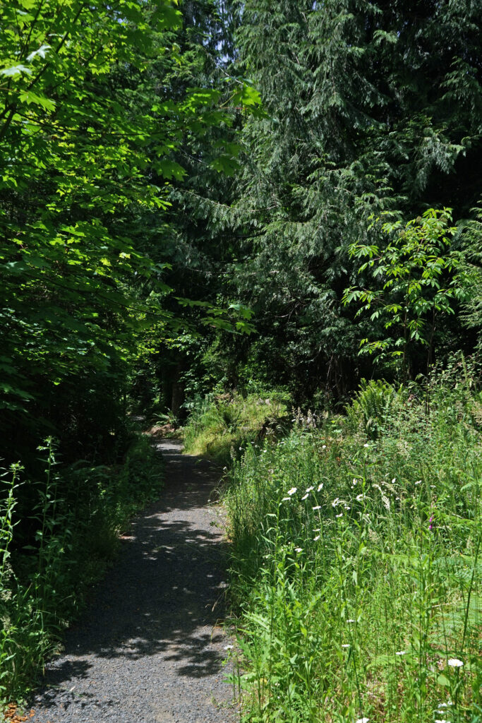
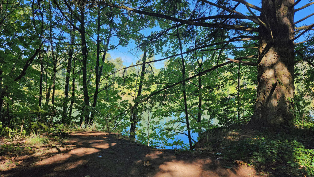 The Townsite Trail takes you along the river through a mixed woodland of Douglas fir, bigleaf maple, and red alder with partially screened views of the river. There are several user-made trails leading down to the water, but they are steep (and dangerous if the ground is wet), so be careful if you want to get to the water for a better view of the river.
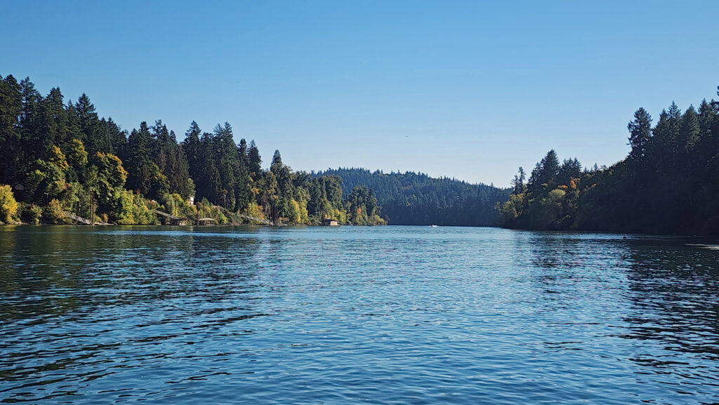 At about the one-mile mark you’ll come to an open field on your right and you’ll see a boat dock ahead on your left. There is a small parking area here with a restroom. Head down to the dock for the best views of the river on this hike.
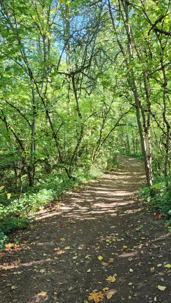
 Coming back up from the dock, look for a trail to your left. This will take you to Champoeg Creek where it flows into the Willamette. The trail then loops back through the forest and comes out into a clearing. Follow the edge of the clearing back to the restroom above the dock. From there, retrace your route back to the trailhead at the Riverside picnic area.
 Best time to go:
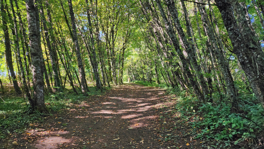 Champoeg State Park:
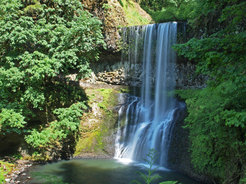
 Posted October 26, 2023 by Alan K. Lee
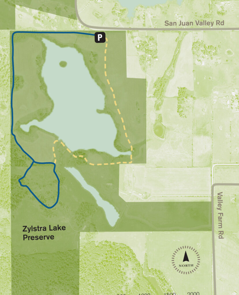
 The property was formerly a privately owned farm that was the site of a proposed housing development. Instead, the property was sold to the land bank in 2015 and the trust obtained the conservation easement. Thirty acres of the property, including the farmhouse and agricultural buildings, were sold by the land bank to Island Haven, a non-profit animal sanctuary, with a conservation easement to protect the land.
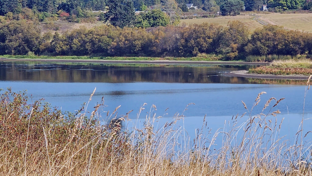 Currently, there is no public access to the lakeshore, and the eastern and southern portions of the trail around the lake are closed from October through March. The northern and western portions of the loop are open year-round and can be hiked as a lollipop loop during the winter.
 Getting there:
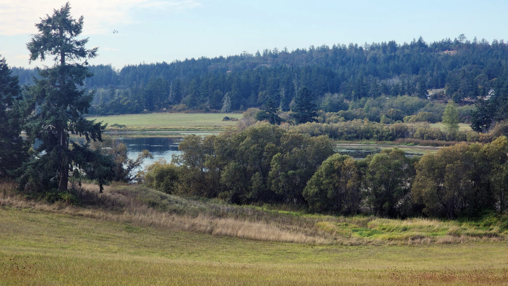 Trailhead:
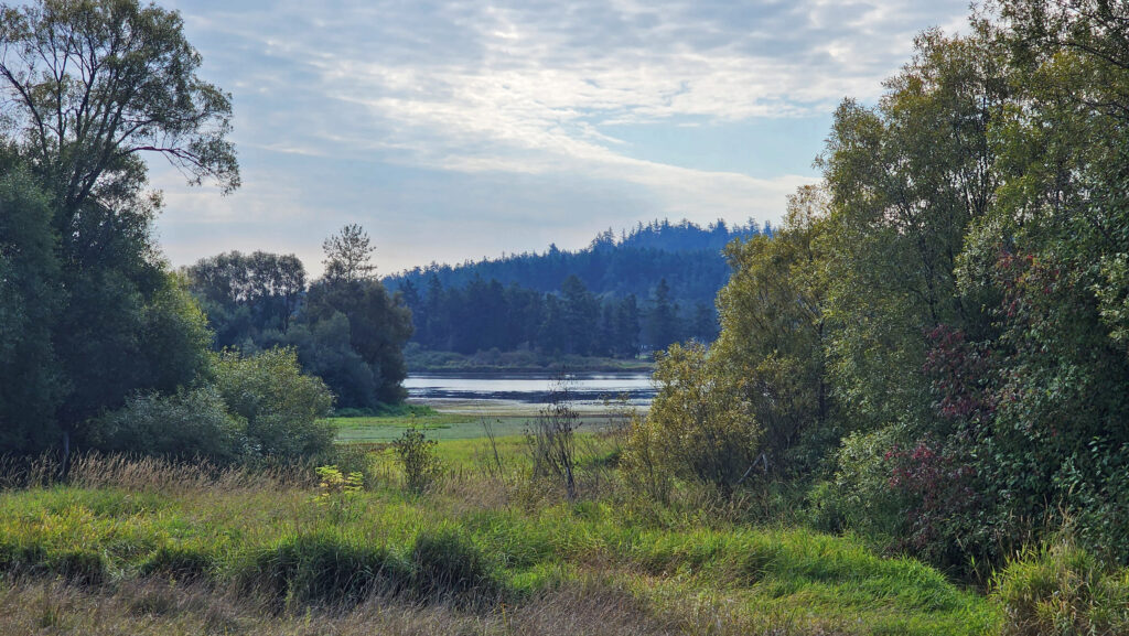 The hike:
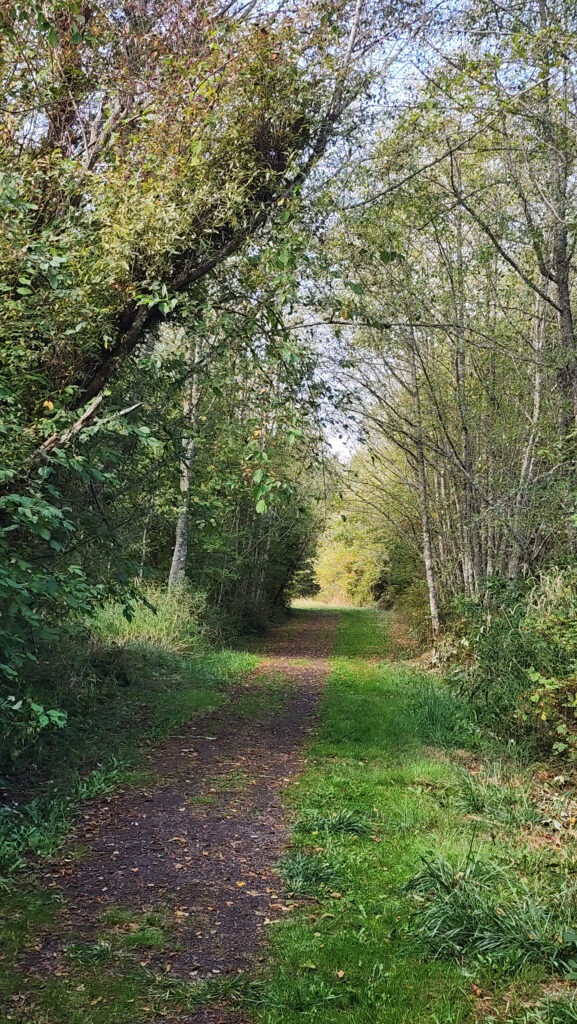
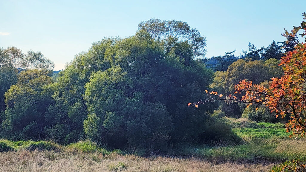
 At 0.3 miles the trail turns south and runs along the western boundary of the preserve for another 0.4 miles. The trail then turns southeast and follows the edge of an open field with good views of the lake.
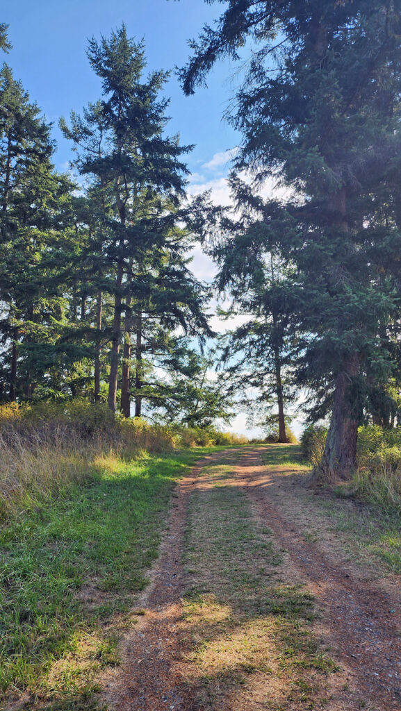
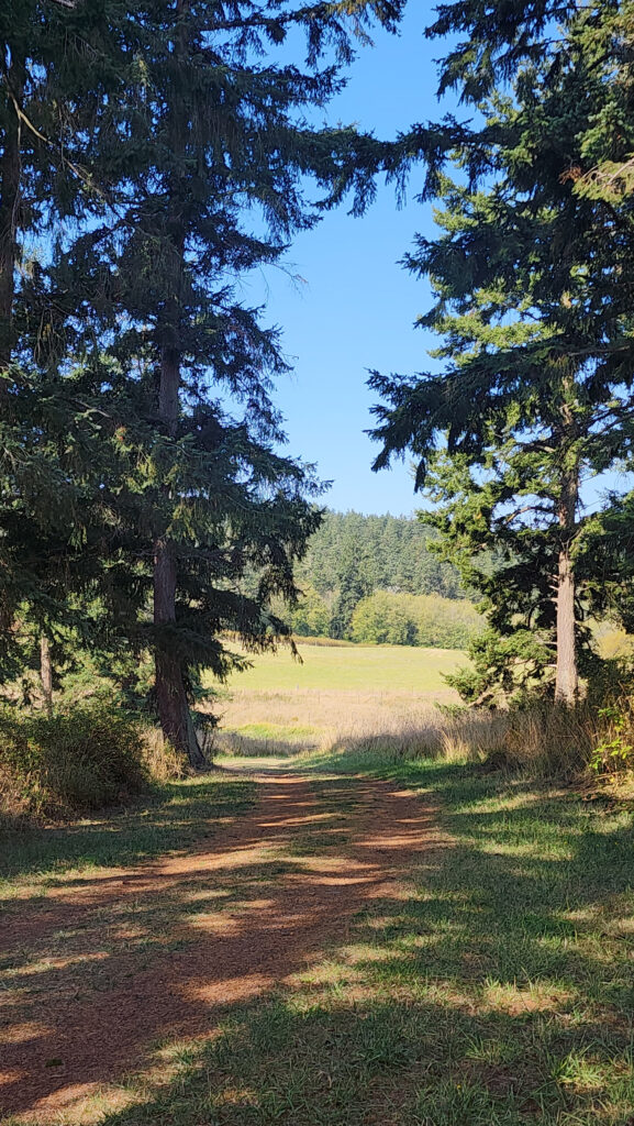 At the 0.85-mile mark, turn right onto a trail that leads through a mix of open fields and partially logged woodland.
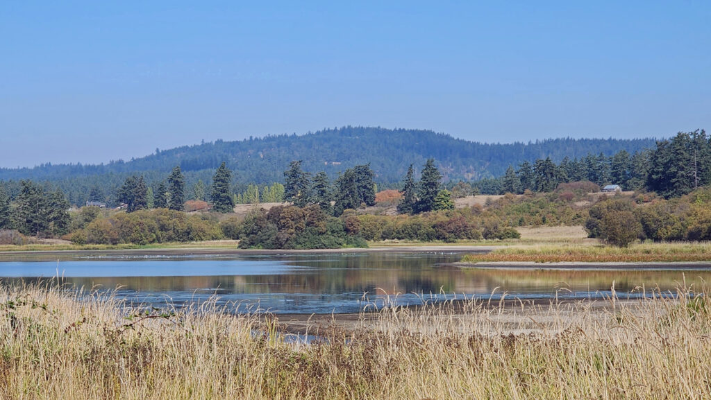 At the 1.25-mile mark, the trail returns to the open field. In winter, the trail ahead is closed, so you need to turn left and retrace your route back to the trailhead parking area.
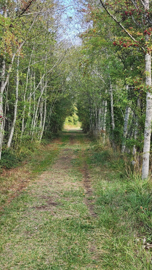
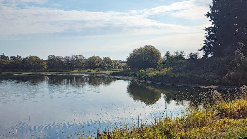 In summer, you can continue straight. The trail then turns right and crosses a bridge over the creek that flows from the lake. Beyond the bridge, the trail runs along the top of the dam that forms the lake, then passes through a small grove of trees.
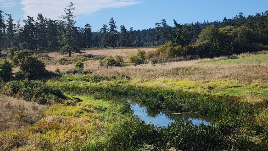 From there, the trail runs between fields to the old farmhouse site that is now home to the Island Haven animal sanctuary. The trail turns left there and follows a gravel farm road back to the trailhead.
 Posted October 12, 2023 by Alan K. Lee
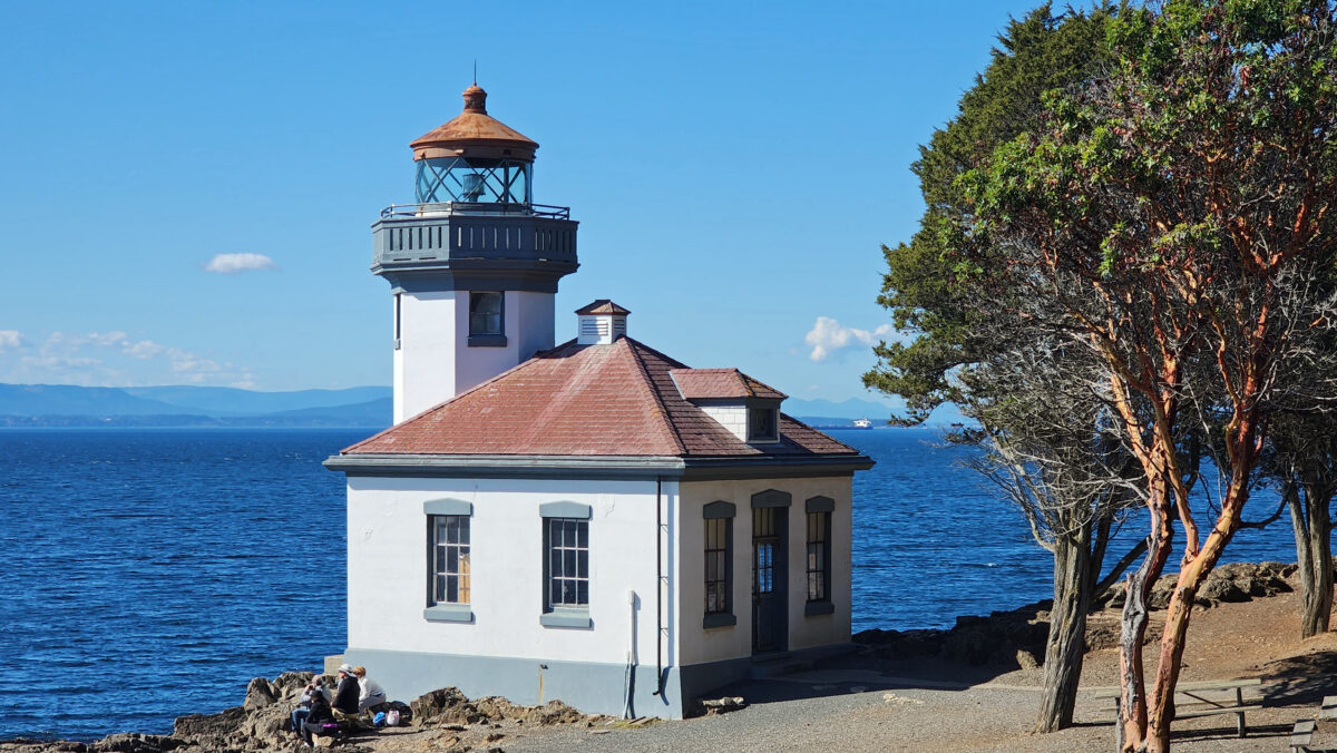
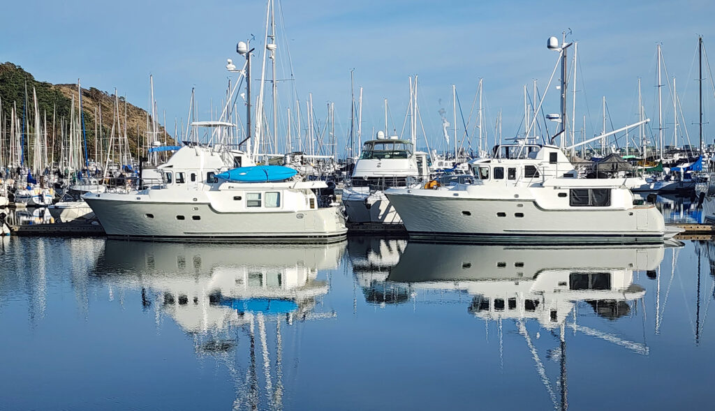
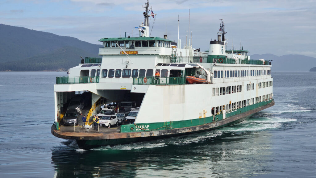
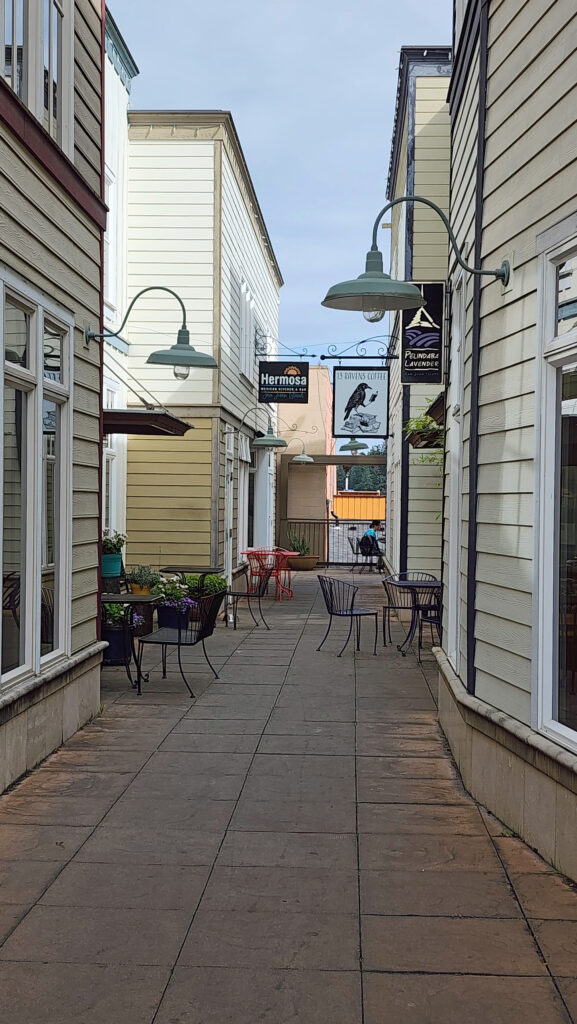

 There is no shortage of places to eat in Friday Harbor. For breakfast and lunch, I can personally recommend both Rocky Bay Café and Tina’s Place. For dining with a view, go to Downriggers on the bayfront. Classic Italian food can be found at Vinny’s Ristorante. Vegetarian and vegan food can be had at Mike’s Café and Wine Bar. For quality craft beers and upscale pub food, try San Juan Brewing. For seafood in a casual dining space, check out Friday’s Crab House. We ate at all of those, and all were good. But that’s just a sampling of what Friday Harbor offers. I wish we had had a few more days to sample more of the town’s eateries. What’s a vacation for, after all.
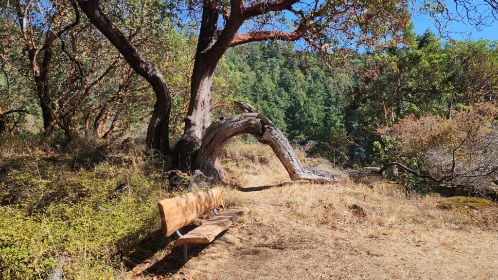
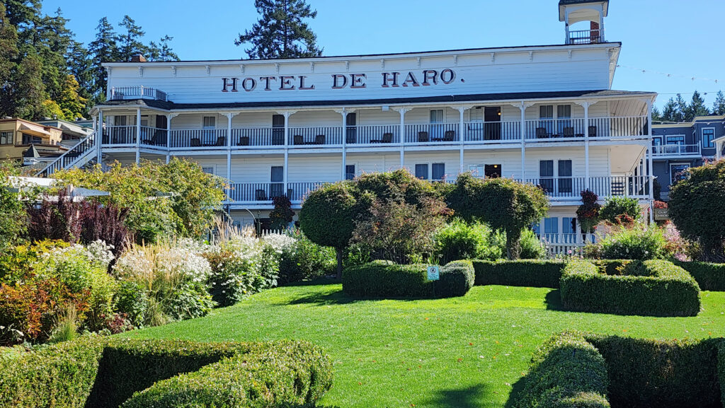
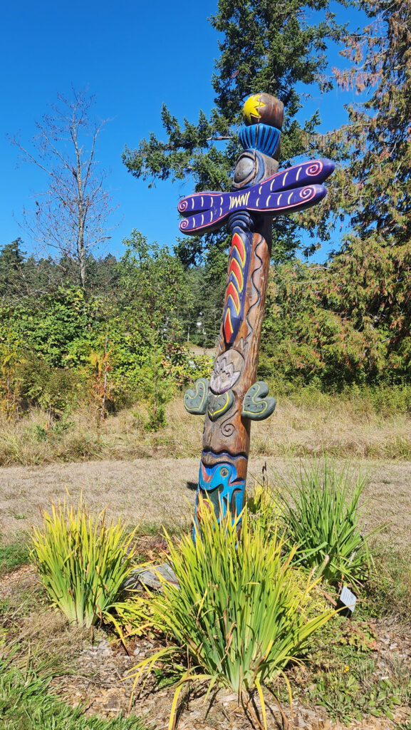

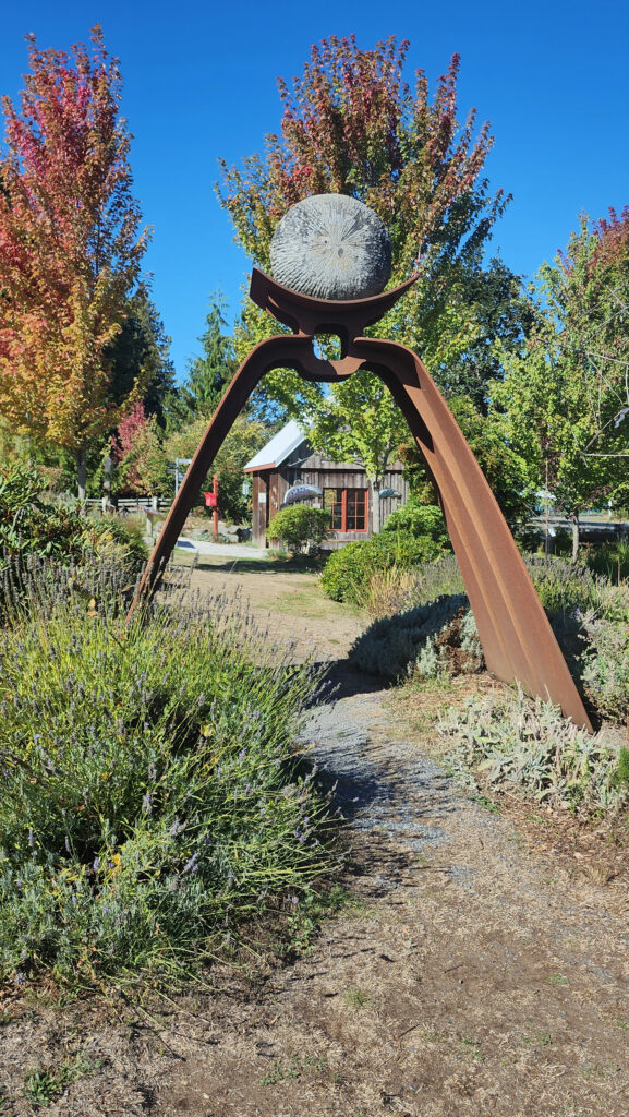
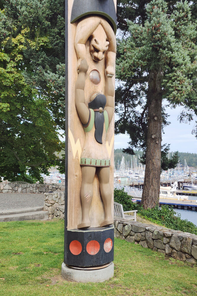
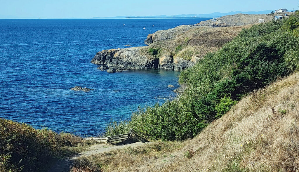
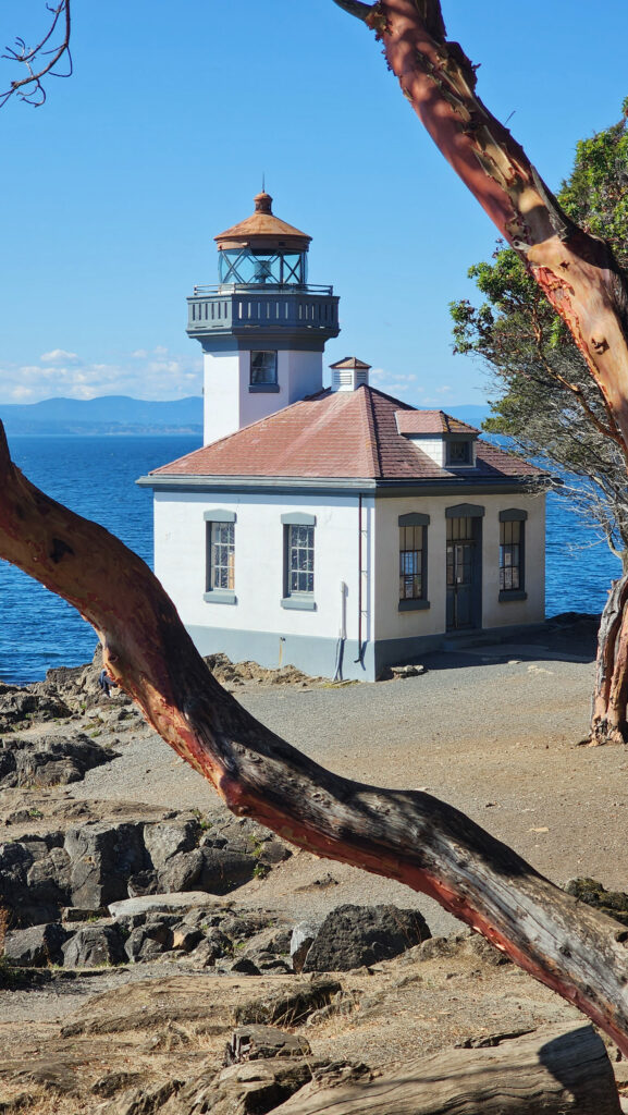
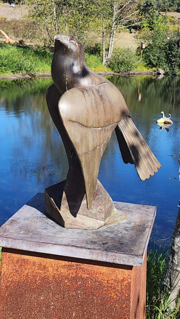 Near Roche Harbor (I think it’s actually part of the resort), the San Juan Islands Sculpture Park is a must see if you’re at all interested in sculpture. There are over 100 works of art (it seemed like many more) spread out over the twenty acres of the garden. Plan to spend at least an hour here. We spent more than that and still didn’t see it all. Admission is free, but donations are requested.
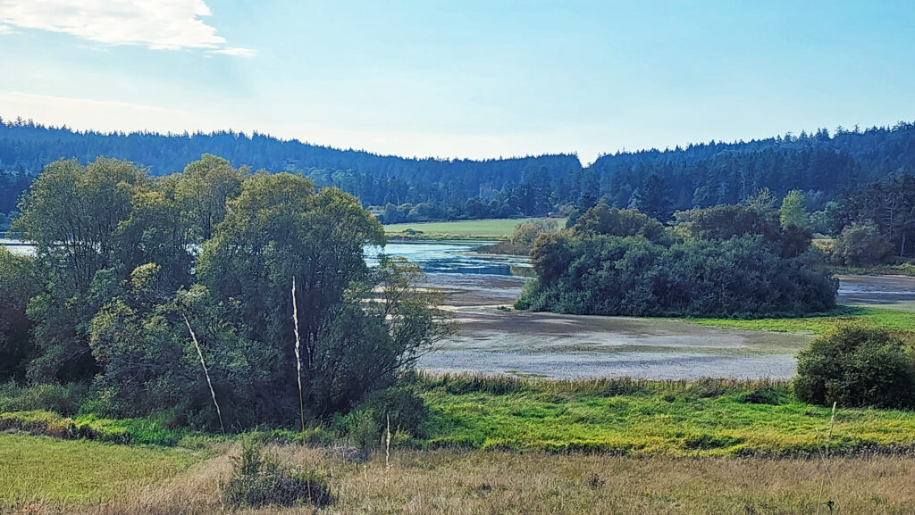
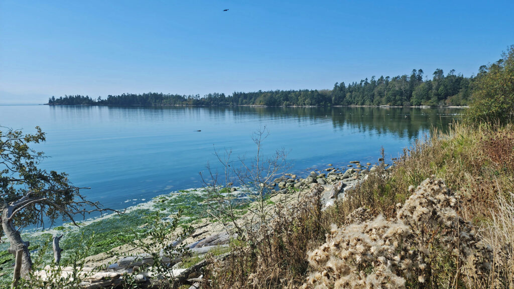
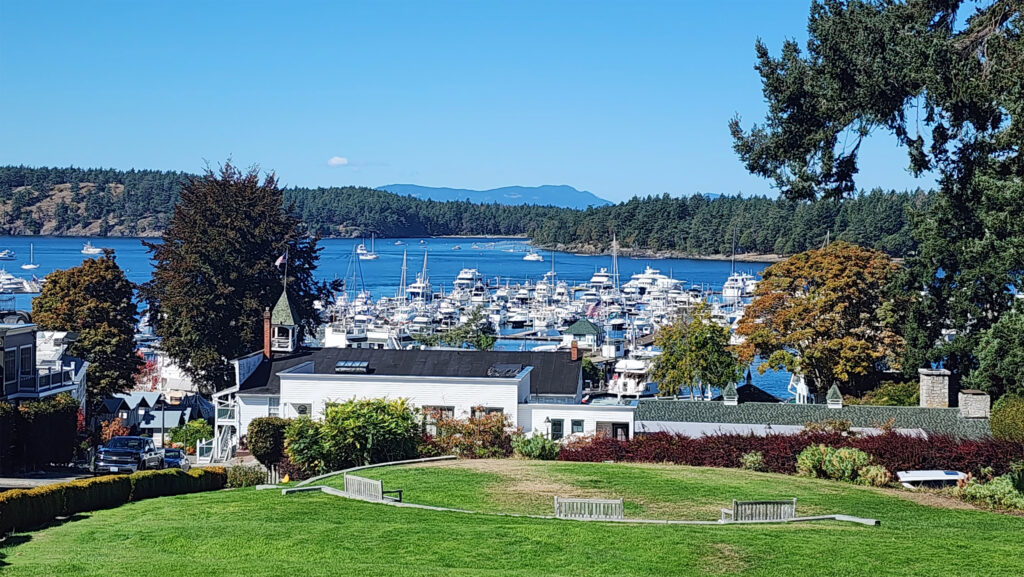
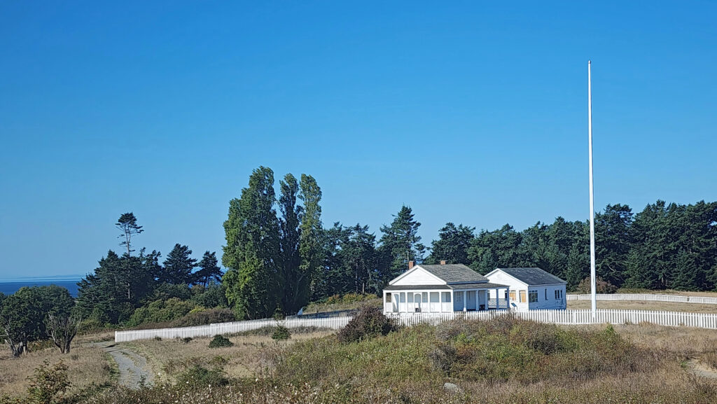
 Tensions between the American and British contingents led both England and the U.S. to send military forces to the island. From 1859 to 1872, when the boundary dispute was finally settled in favor of the United States, the island was jointly occupied by both forces. No actual combat occurred, and no one was injured in the Pig War. The sites of the two country’s military installations are now part of
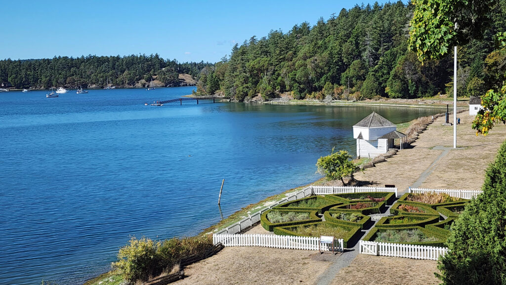

 Conclusion
 Posted October 12, 2023 by Alan K. Lee

 I’ve been lucky enough to experience Lincoln City’s kite festivals when the weather was perfect for kite flying. And my wife and I even got the last available parking spot at the D River Wayside, where the festivals are held, one year. Luck really was with us. There was a brisk, but not cold, breeze on the beach that time – perfect kite flying weather and a pretty near perfect day for just hanging out on the beach.
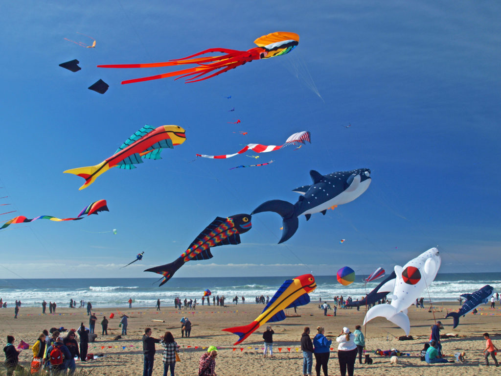 The festivals typically feature a lot of very big kites, and quite a few performance kite fliers demonstrating their talents. One of the all time highlights for me was a flier named Spence Watson flying two quad strings kites. Normally it takes two hands to fly a single quad string. Flying one one-handed is a feat in itself, but he was flying one right-handed and one left-handed, and controlling each one perfectly. Pretty amazing.
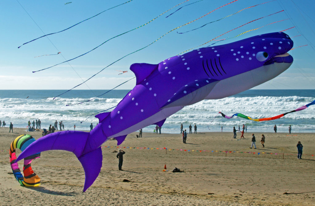
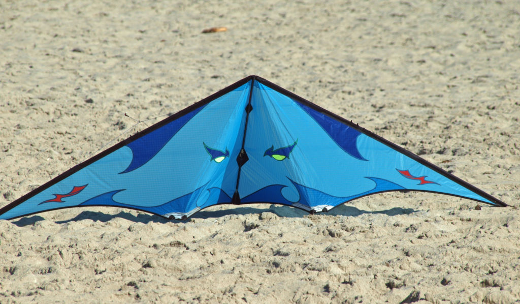
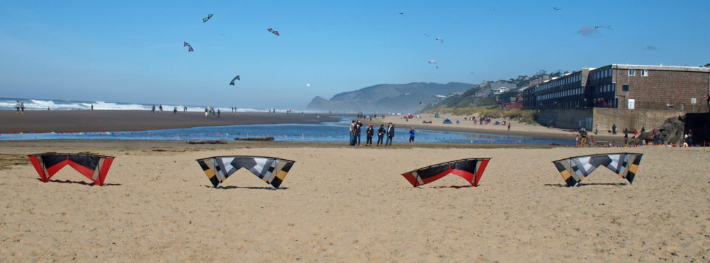 Watching the kite flyers is often as entertaining as watching the kites. It’s really a very physical dance that they’re doing. Their movements are perfectly coordinated with the music, but everyone’s moves are a little bit different. If you watch long enough you begin to see the different styles of the flyers. It’s really quite interesting.
 There’s plenty to do at the festivals for the whole family. Kids can take part in kite making classes, get their faces painted, learn about ocean conservation, fly their own kites, and, of course, just play in the sand.
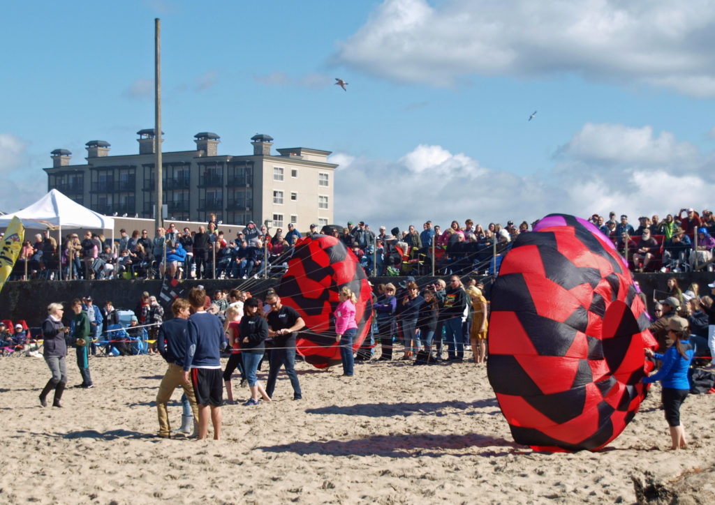
 I lived in Lincoln city for most of the 1980s, so I sometimes take a walking tour of the downtown area when I visit Lincoln City. The whole town has changed a great deal since I lived there, including the house that I lived in for a time. It’s been extensively remodeled and added on to, so it’s nothing like it was when I lived there. And that’s a fitting description of the whole city.
 There are numerous other kite fests up and down the Oregon and Washington coasts in addition to the Lincoln City festivals, including the Southern Oregon Kite Festival in Brookings in July, and the

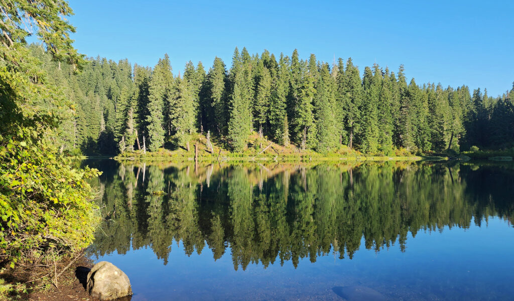
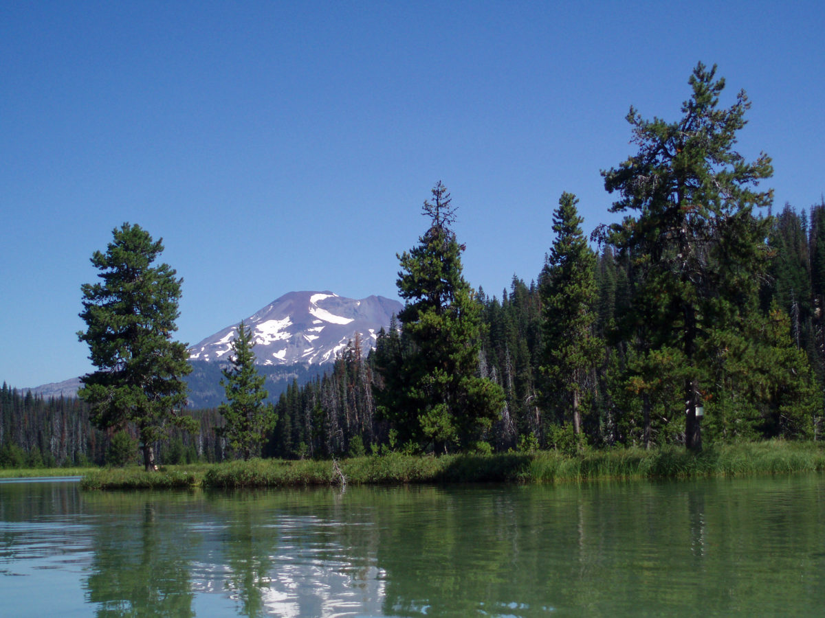
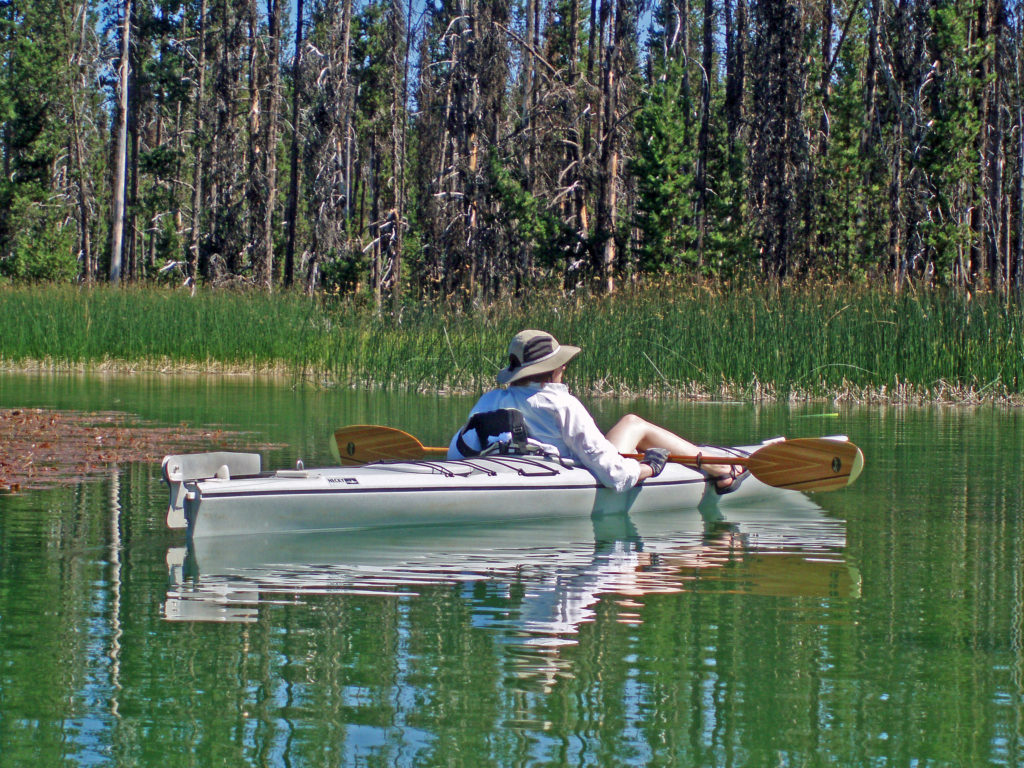
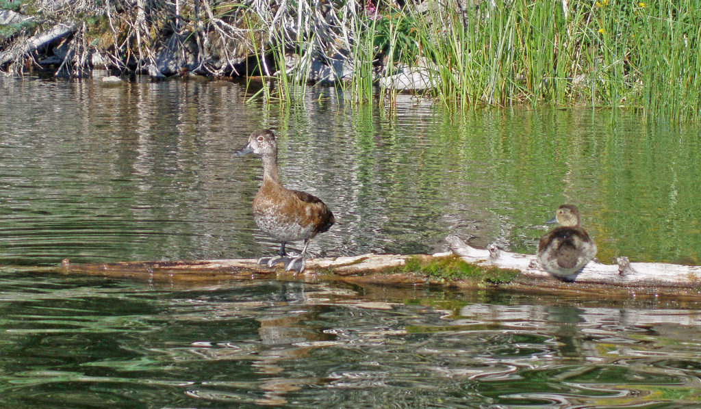
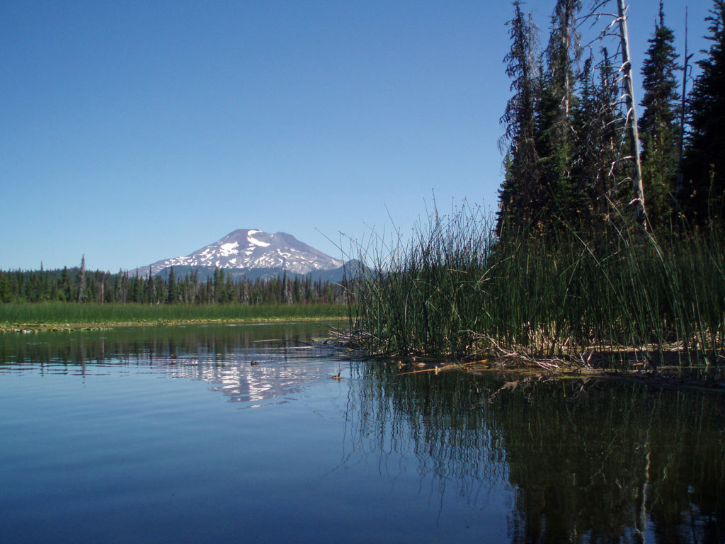
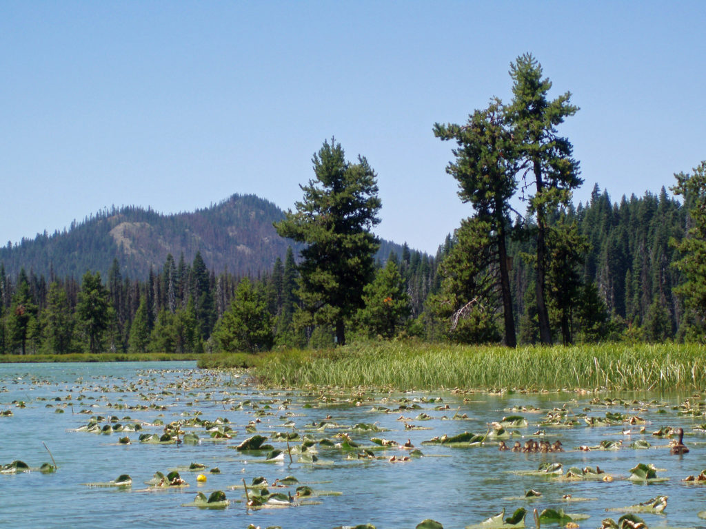
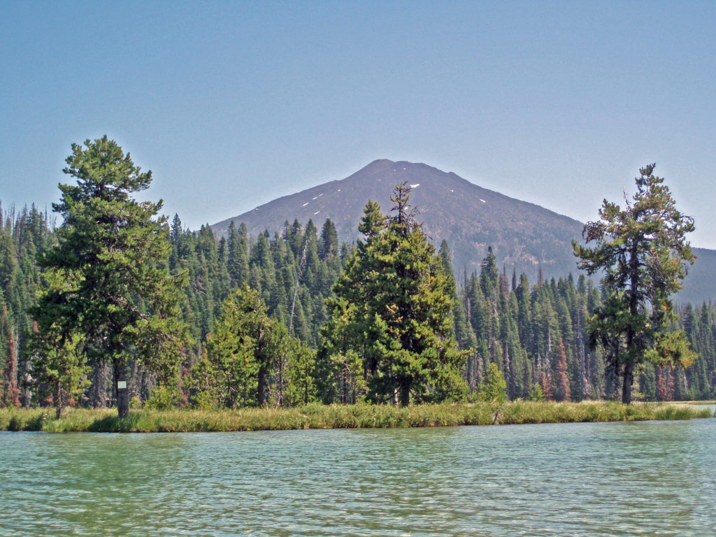 Hosmer Lake is a mix of open water and reeds, rushes, water lilies, and other marsh plants. Motorized craft (except for electric motor powered) are not allowed on the lake, which makes it ideal for kayaking or canoeing. It’s also not a big lake at 160 acres, so you can easily explore it all in an afternoon.
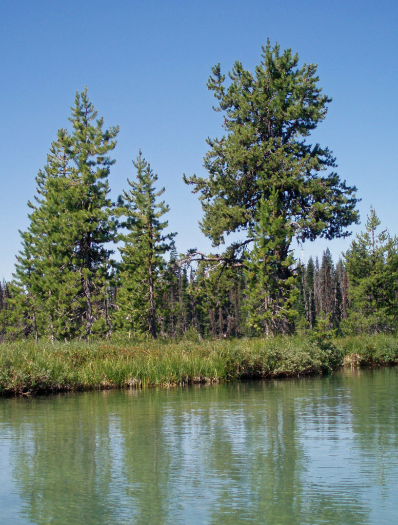
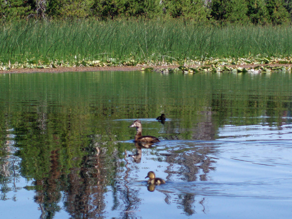
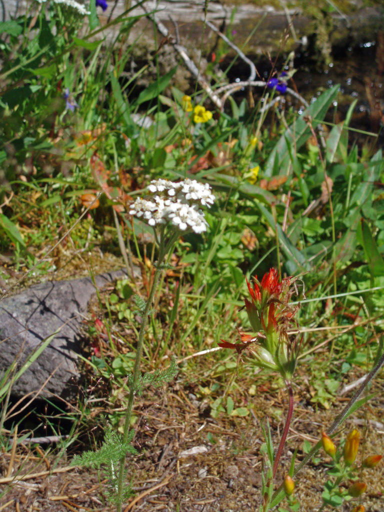
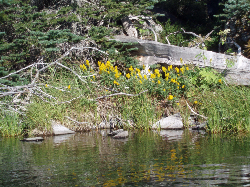
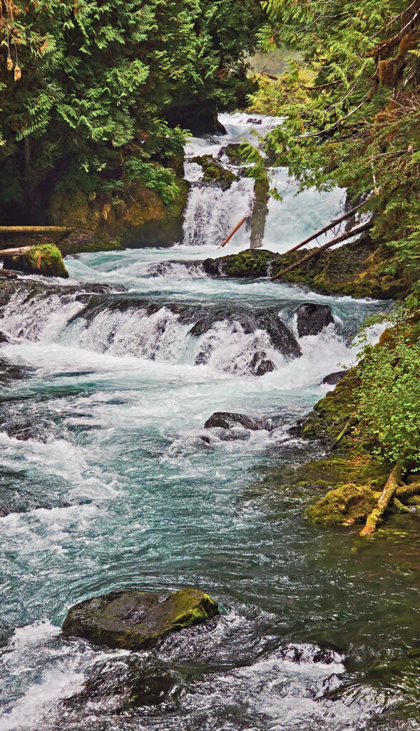
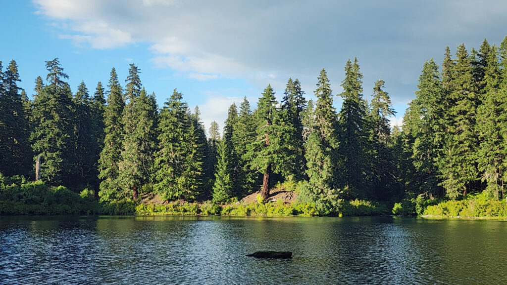
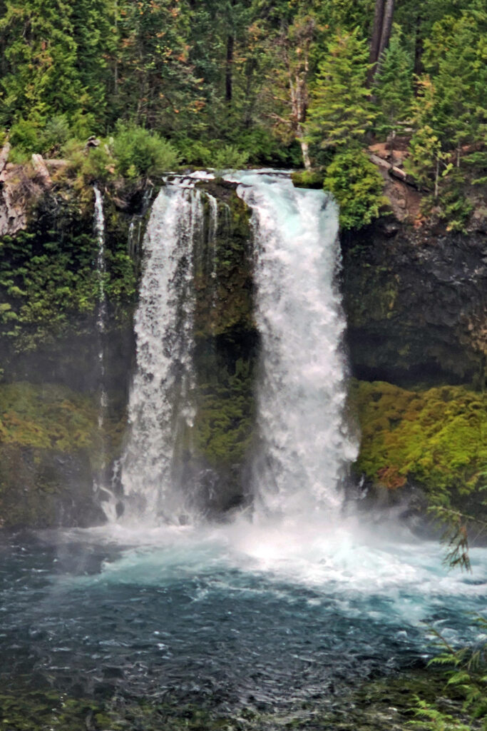
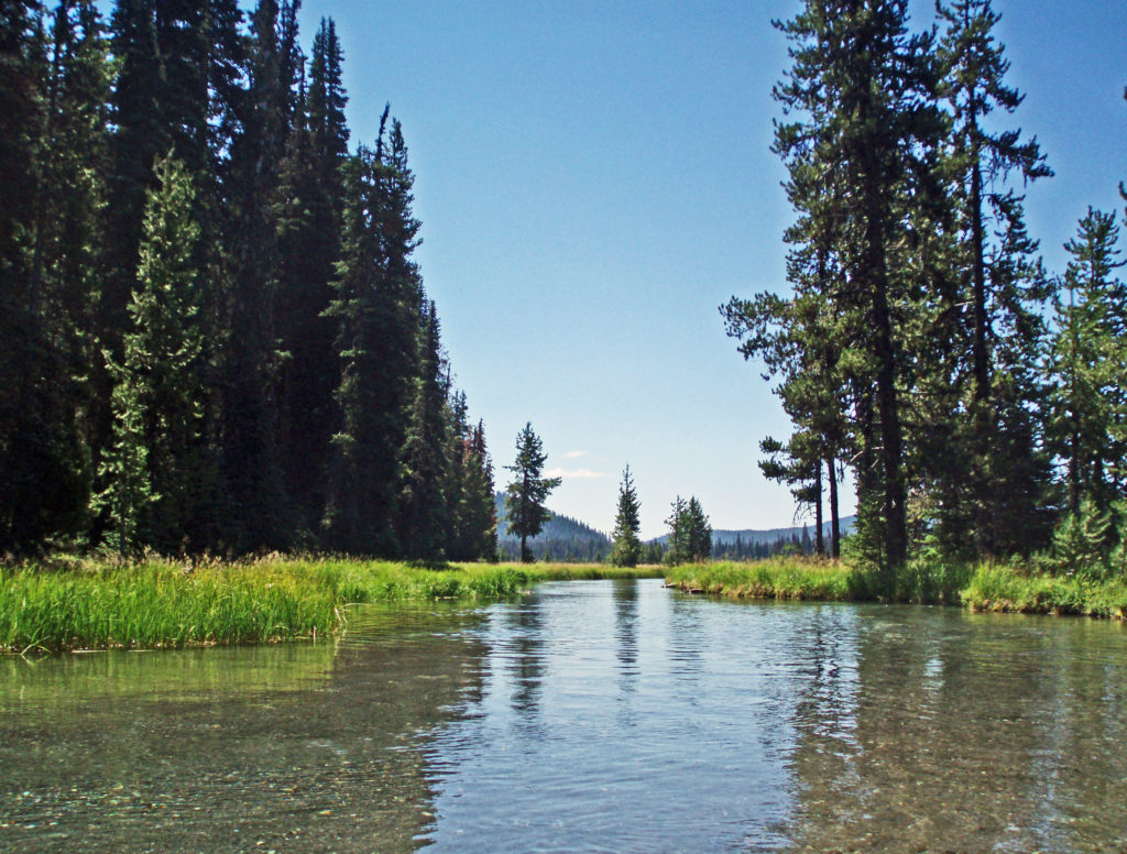 Hosmer Lake is fed by Quinn Creek, which flows into the north end of the lake. Quinn Creek is narrow and shallow, but it is possible to paddle up it for a ways. When we were there last, downed trees blocked our passage a few hundred yards from the mouth of the creek. We hauled our kayaks out of the water at that point and hiked along the creek to a small waterfall where we ate lunch and lingered awhile before heading back out on the water.
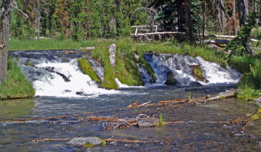 Recalling our visits to Hosmer Lake, I’m eager now to get back to the area and get back on the water again. It’s a beautiful place, and one of my favorite destinations.
 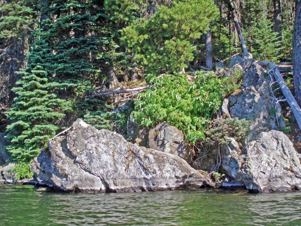 Hosmer Lake is located in the Deschutes National Forest. Check the Forest Service
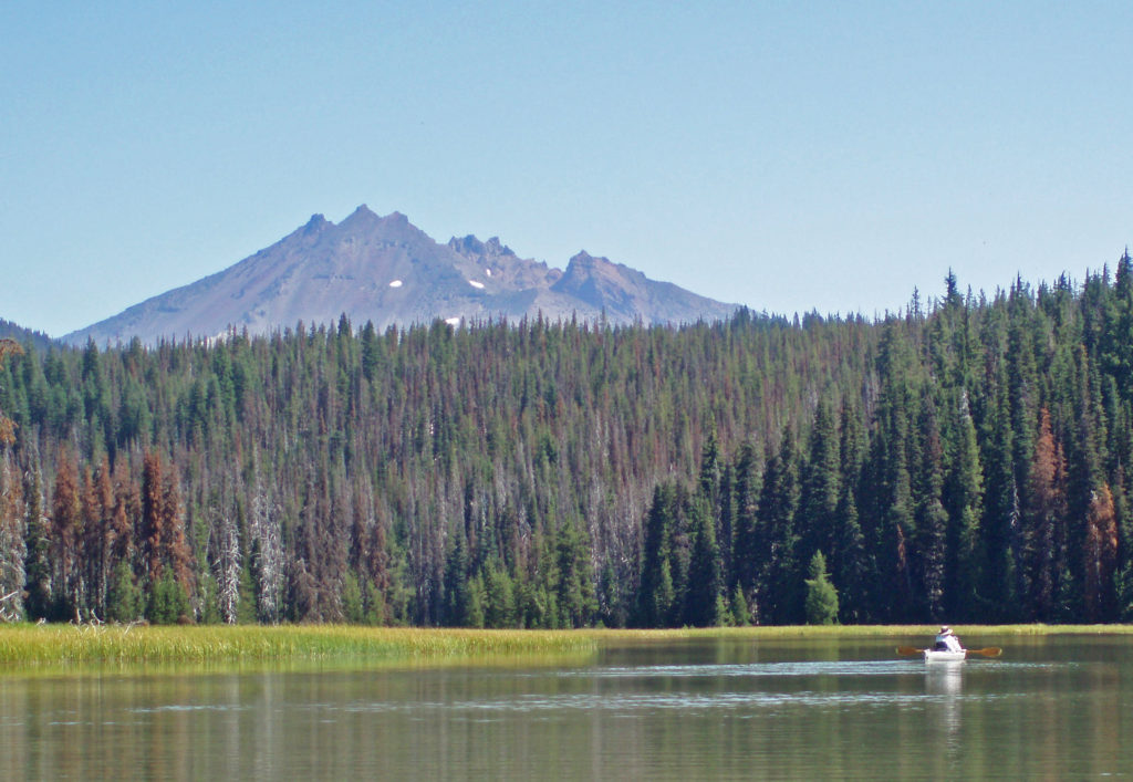

 The following was originally posted on this site a couple of years ago. I checked all of the links, but things can change, so check the


 Best Times to Go:
 The hike:
 Other area attractions and activities:
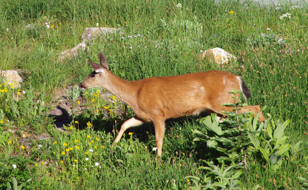
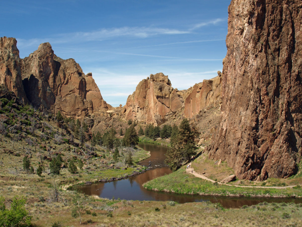
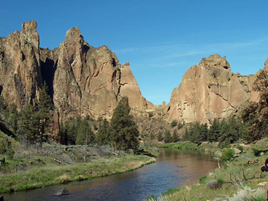
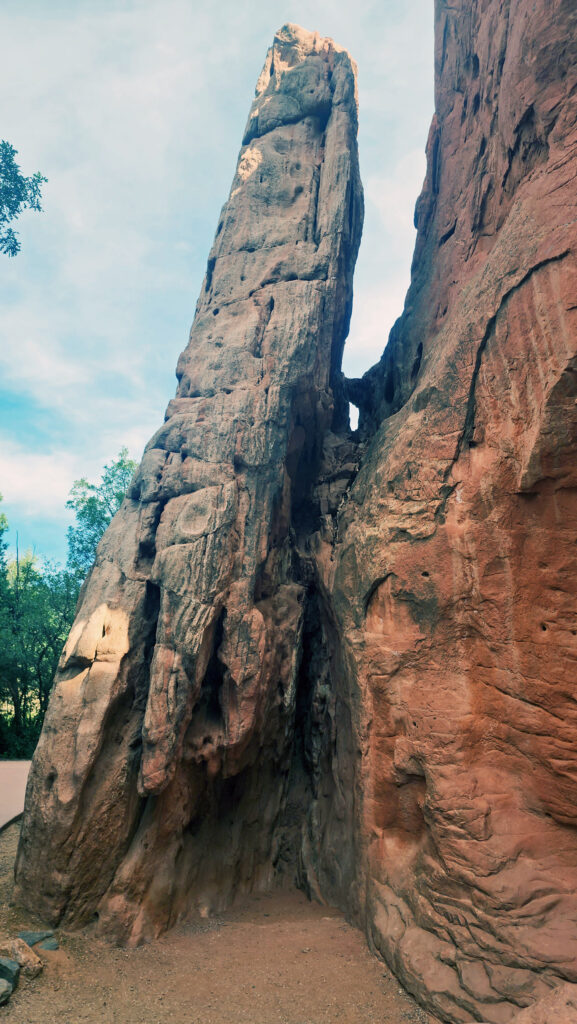
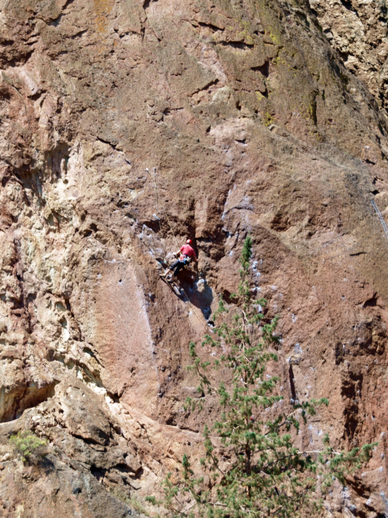
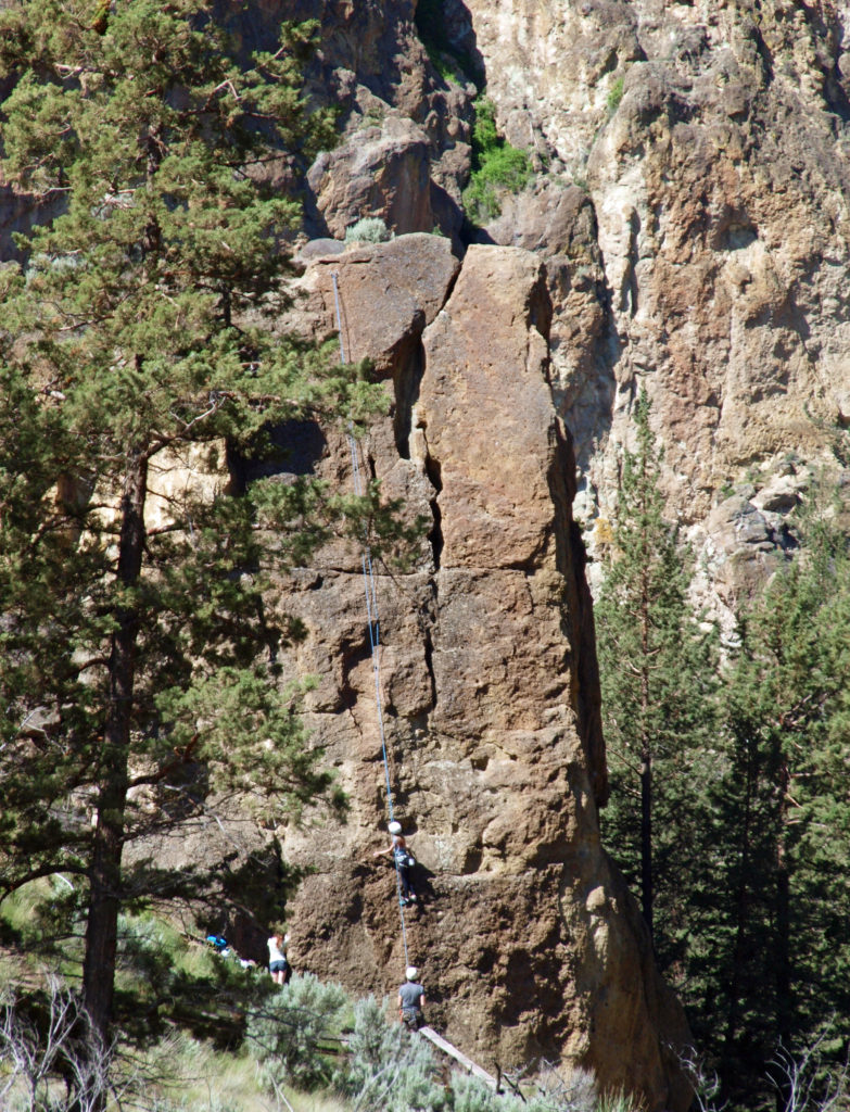
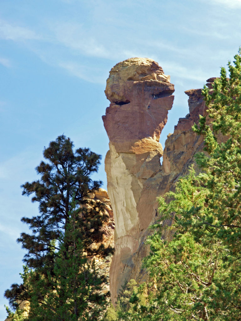 Several thousand climbing routes exist within the park, including more than a thousand bolted routes. Climbers literally come from all over the globe to climb here. And an extensive trail system within the park offers hikers a variety of routes of varying lengths and difficulty. Many of the trails are multi-use trails, open also to mountain bikers and horseback riders. Click
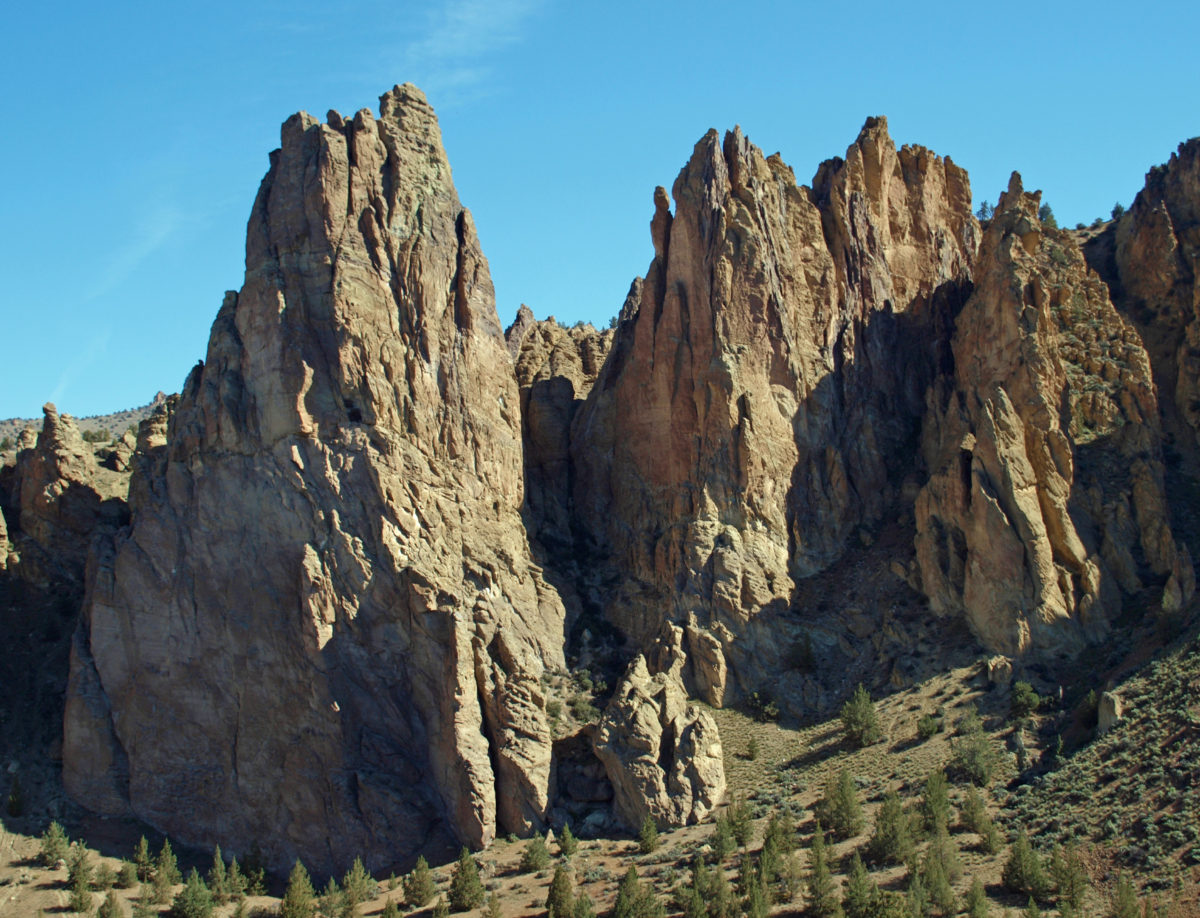
 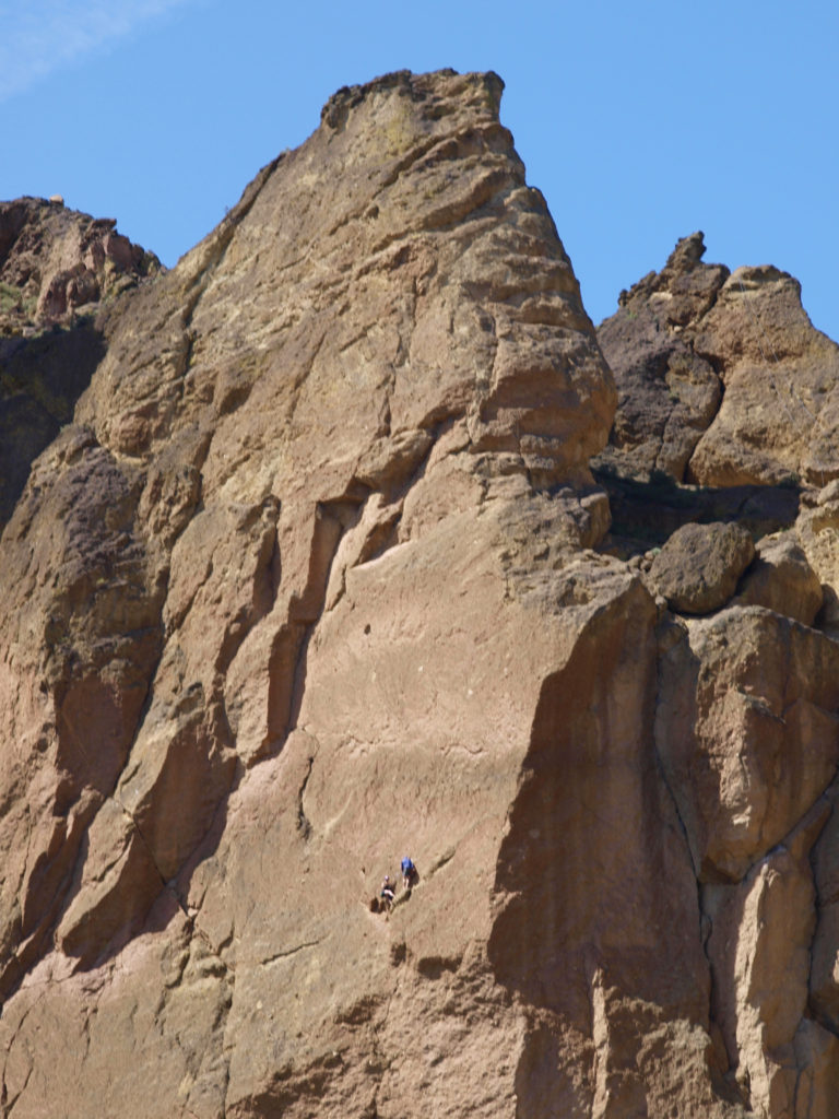 Thirty million years ago the area that is now Smith Rock was on the western rim of the Crooked River Caldera. Over time, nearby volcanic eruptions filled the caldera with ash that compacted into volcanic tuff. The tuff was later overtopped with basalt lava flows from vents about fifty miles away. The Crooked River then eroded much of that, leaving the formations we see today.
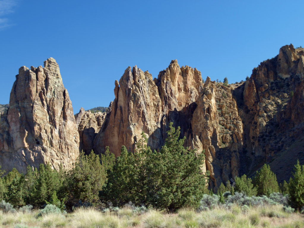
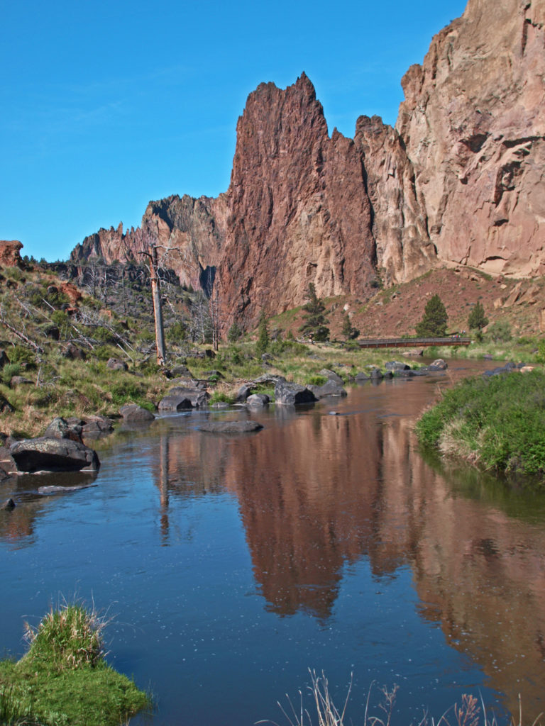
 On summer weekends you need to come early to have a chance of finding a place to park. The parking areas fill up quickly, and it’s not unusual to see cars parked along both sides of the road leading to the park and people walking in the road. There has been a shuttle system proposed that would allow visitors to park in the nearby town of Terrebonne and bus into the park, but that (to the best of my knowledge) has yet to be implemented. Even during the week, and on spring and fall weekends, parking can be a problem.
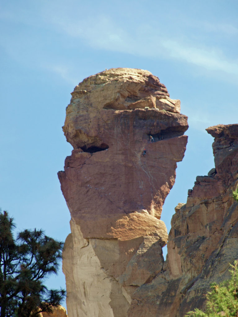
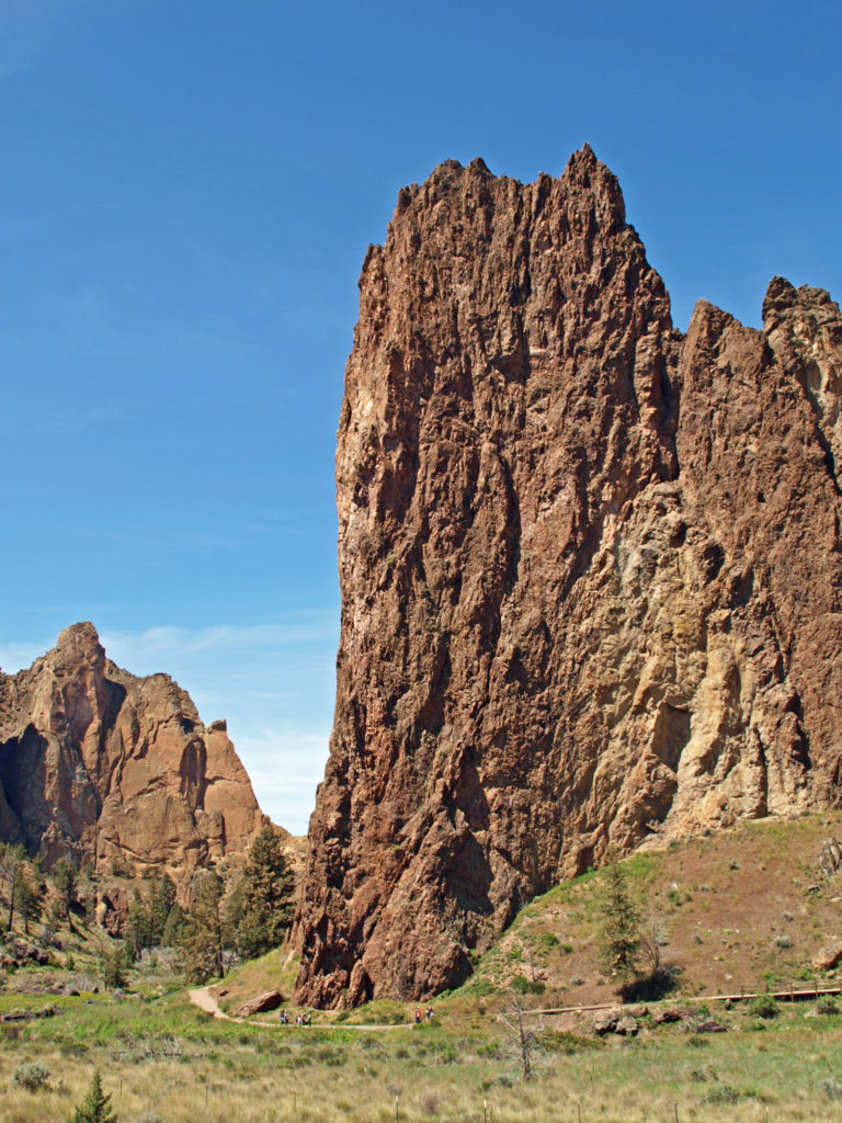
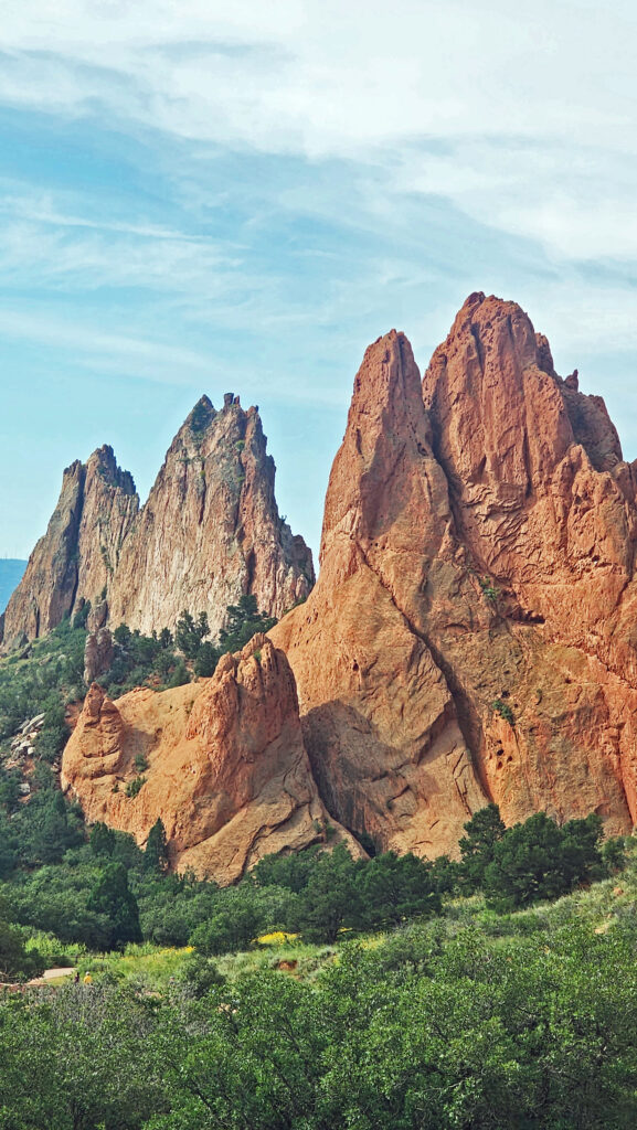
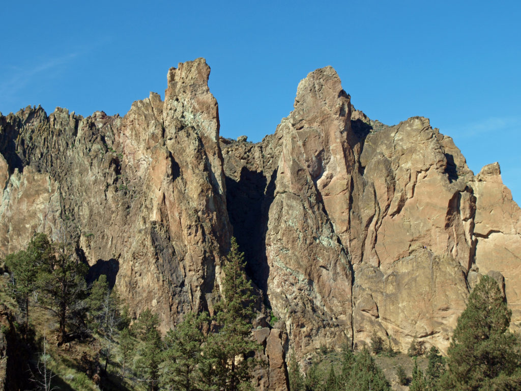 Despite the crowds and other problems, Smith Rock is a Pacific Northwest bucket list destination, not to be missed. It’s a spectacularly beautiful place. But if you’re looking for a wilderness experience, you won’t find it at Smith Rock (except maybe in the middle of winter). If you don’t mind sharing the place with others, though, the park is large enough that visitors tend to spread out, and even at full capacity the park doesn’t feel overly crowded if you get a little ways away from the parking areas. (A recent visitor survey found that 69% of the respondents felt the park to be somewhat to very crowded, however.)
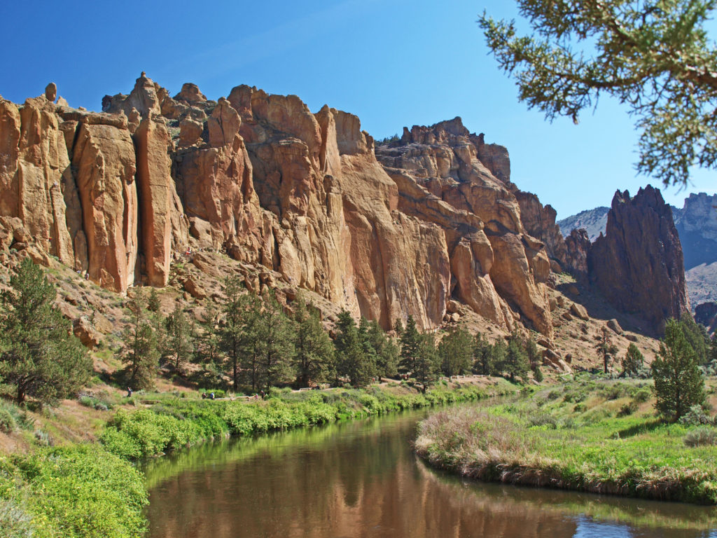
 The park is located just east of the town of Terrebonne, which is about 25 miles north of Bend, Oregon, and about 140 miles southeast of Portland. For more information, go to the

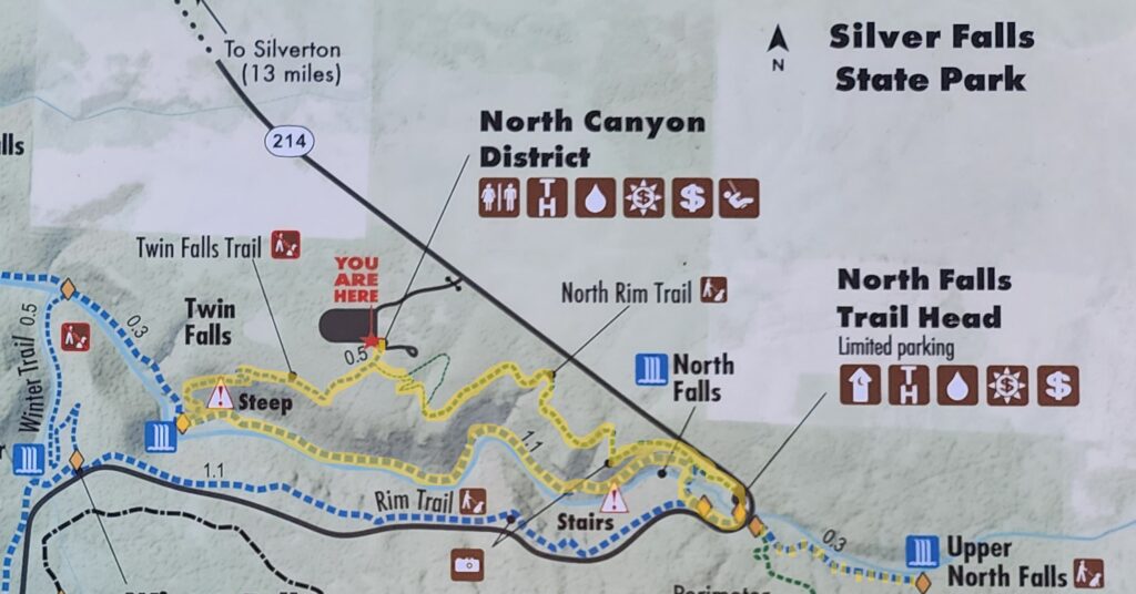

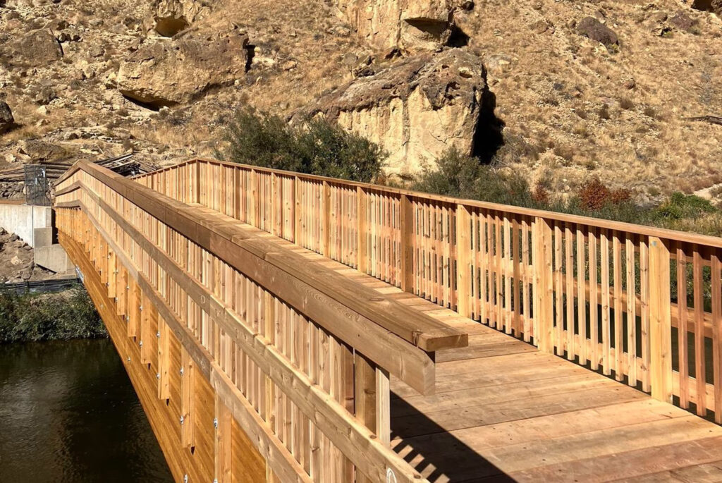
 Beyond the Twin Falls Trail junction, the North Rim Trail meanders through the forest, passing a children’s play area and a small two-table picnic area.
 For a map of the entire park, click
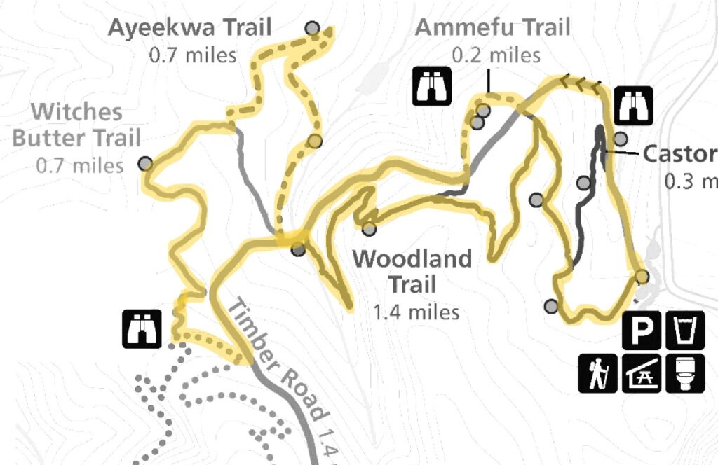
 Chehalem Ridge Nature Park is in a rural area with no other close by hiking or biking opportunities, but the west metro area, not far from Chehalem Ridge, has an abundance. Some of my favorite hikes in the area include
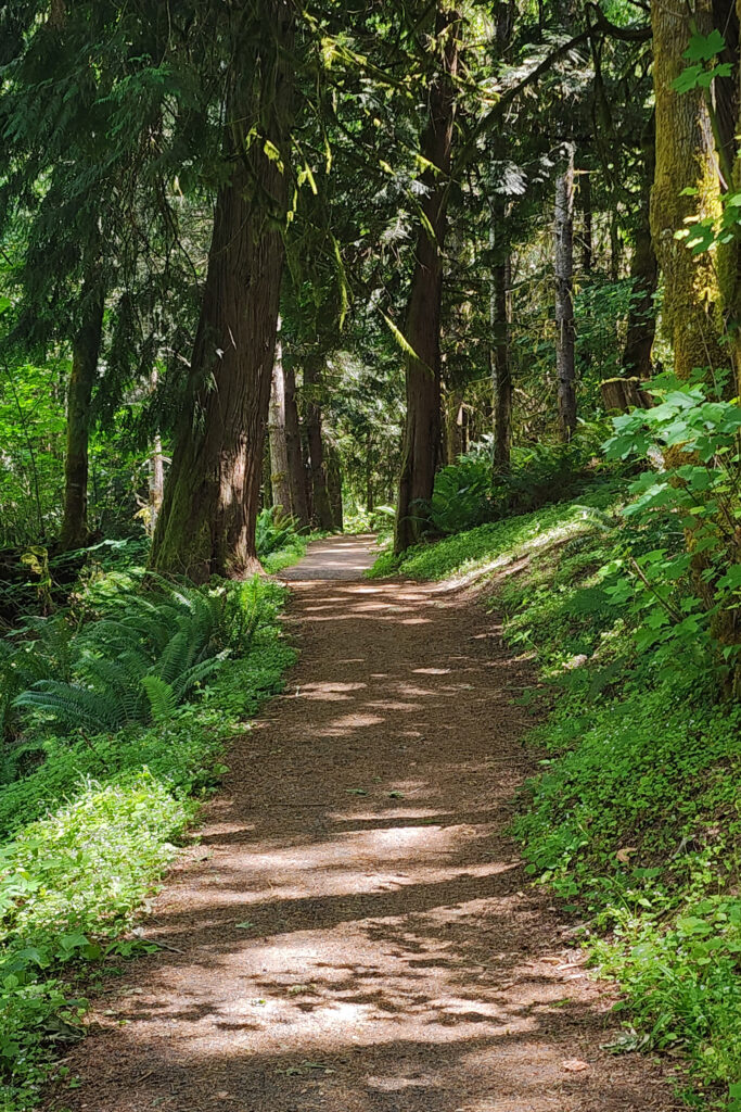

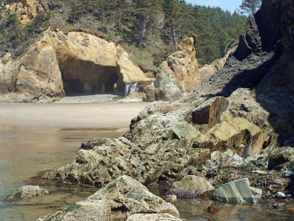
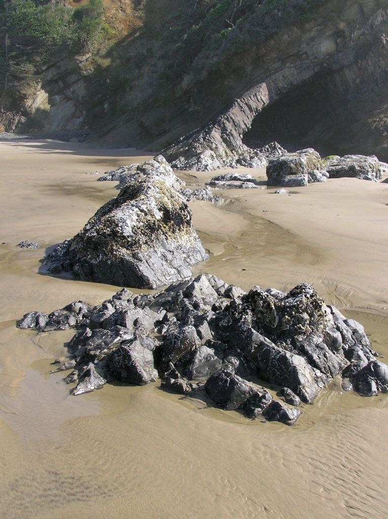
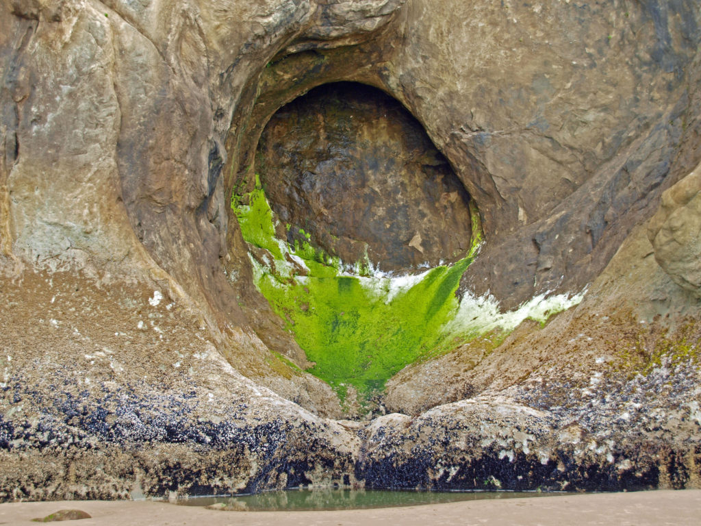
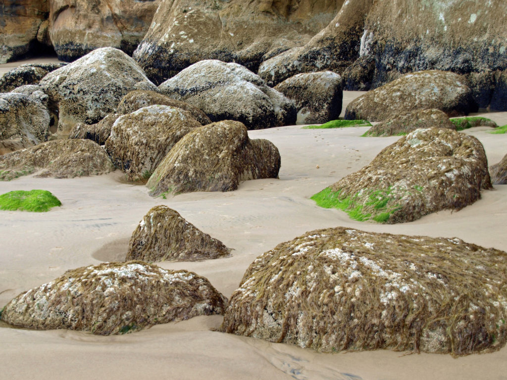
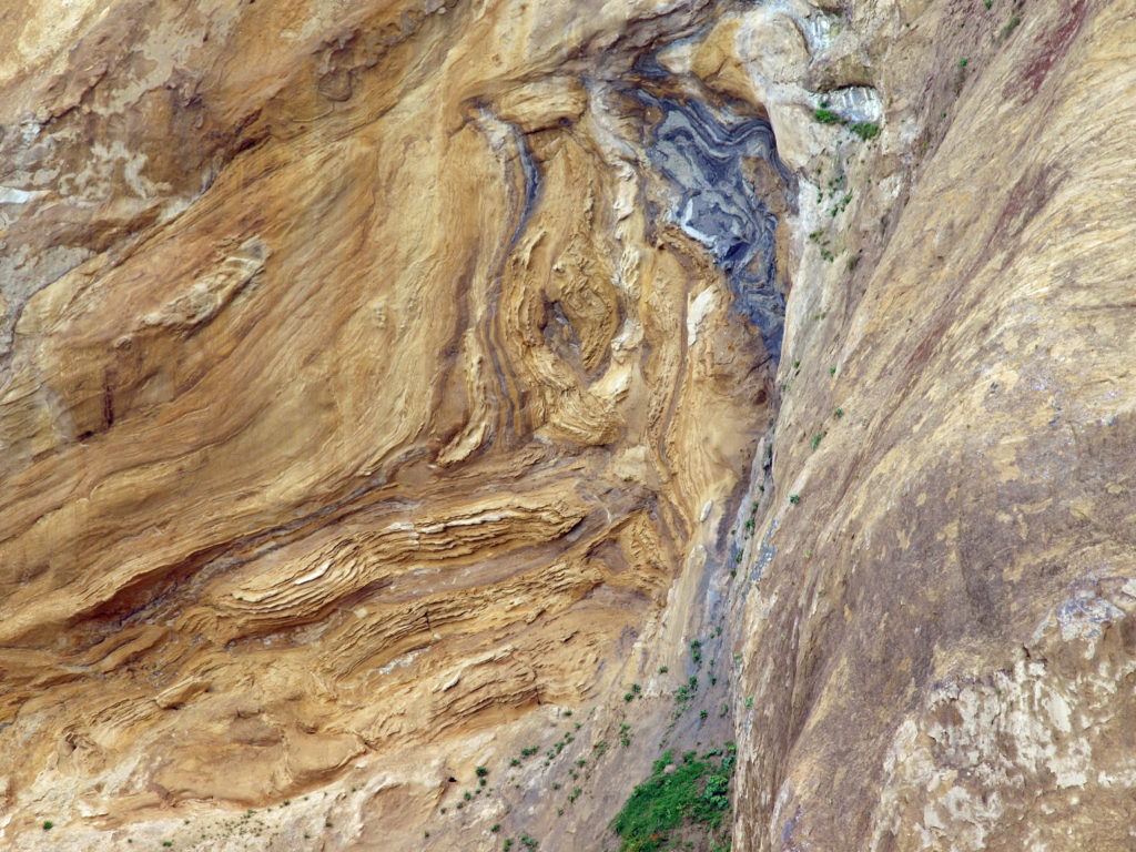 I love the eroded sandstone rock formations found at Hug Point. The layered sandstone of the point has been warped and folded by tectonic processes and eroded by wind and water into fantastic formations. The tidewater rocks are covered in green algae and seaweed, barnacles, and mussels. The rocks, sand, colorful vegetation, waves, and ever changing light make for great photo opportunities.
 Hug Point State Park is located about five miles south of Cannon Beach. The point can also be reached from Arcadia Beach State Park, about a mile to the north. It’s an easy day trip from the Portland area, but there many other attractions in the area, so many visitors spend a weekend or longer in the area.
 The nearby towns of Cannon Beach, Seaside, and Manzanita all have numerous motels, BNBs, and other accommodations, as well as many restaurants and cafes serving fresh seafood and other locally sourced foods.
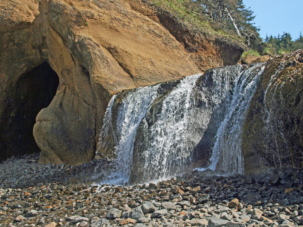
 One note of caution, though. If you go, pay attention to the tides. The waterfall and caves that draw most of the visitors to Hug Point State Park are nestled between Adair Point, immediately north of the beach access, and Hug Point itself. At high tide it can be difficult or impossible to get around these two points, so it is possible to get trapped between them.

 Overview:
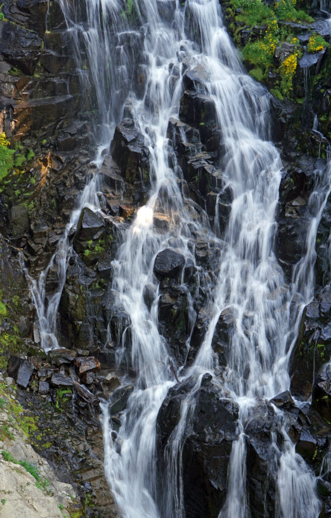
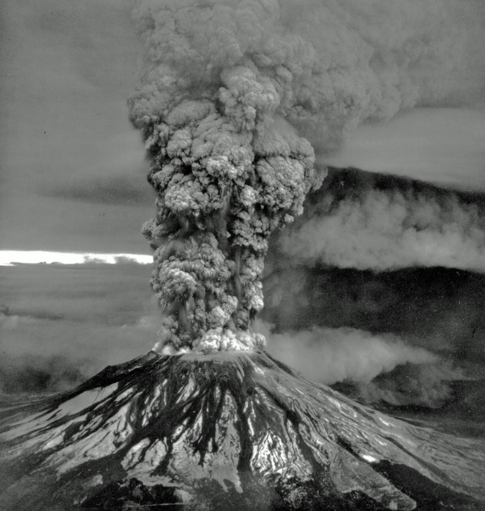
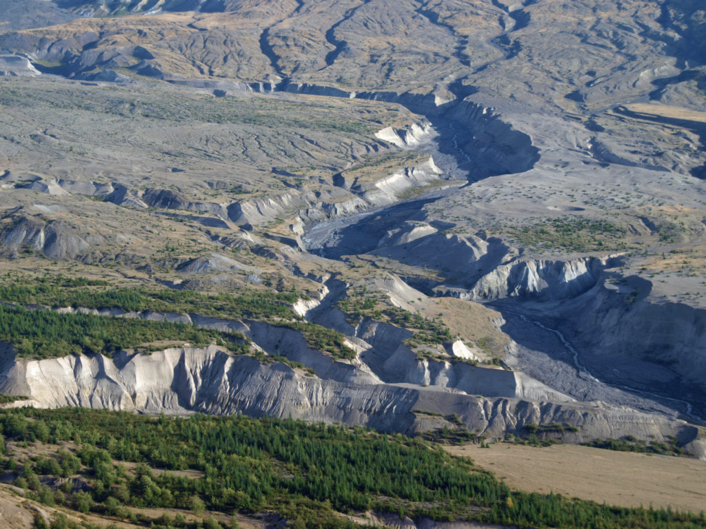
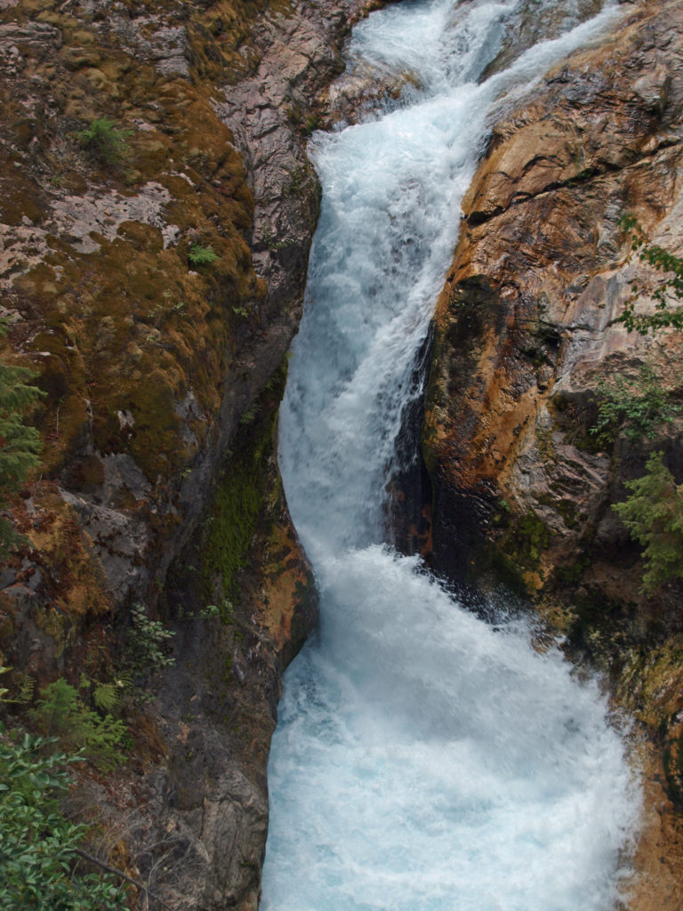
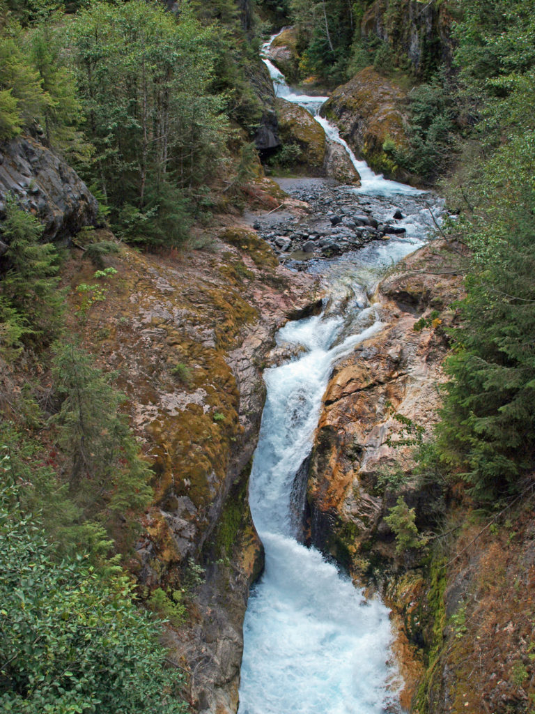 The history of Lava Canyon begins about 3500 years ago when an eruption of Mount St. Helens sent a flow of lava down the old valley of the Muddy River, destroying the forest and filling the valley with molten rock. Over the intervening years, the Muddy River cut a new course through the lava flow, and the canyon gradually filled with sediment. Then came the 1980 eruption, which melted the summit glaciers and sent a huge lahar (volcanic mudflow) down the valley, destroying the rebuilt forest and scouring out the built-up sediment, exposing the remnants of the earlier lava flow. What was left is a steeply descending canyon with an almost continuous series of spectacular waterfalls and cascades. (For more information on the 1980 eruption, see my
  Getting there:
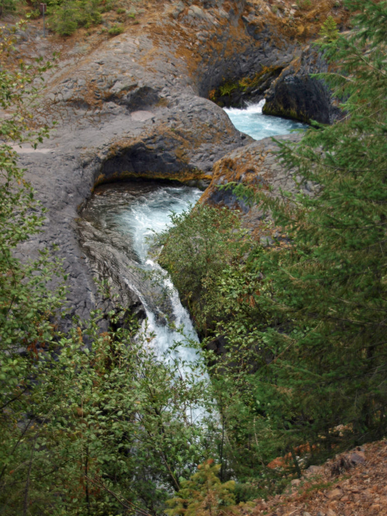 Trailheads:
 The hike:
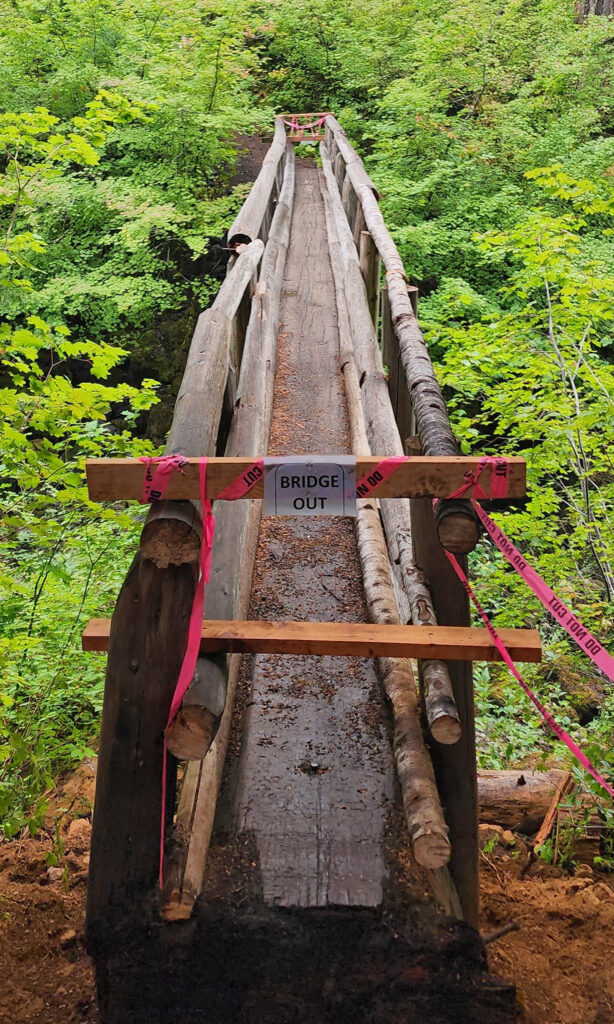
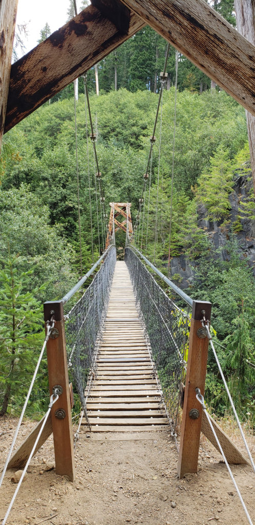 Below the overlook, the path is rock and dirt, steep in places. After another three tenths of a mile, you come to another side trail and a suspension bridge over the river that gives a bird’s eye view of the canyon and waterfalls. On the other side of the bridge is a connecting trail that takes you back to the upper bridge, making for a 1.4-mile loop. (Update: As of June 2023 the suspension bridge is closed. Check the National Forest Service’s
 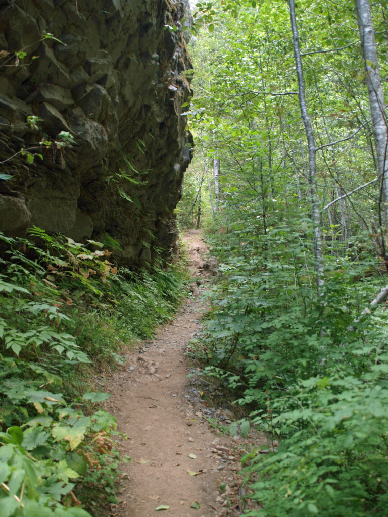 At about the 1.3-mile mark, the trail descends a 40-foot ladder to the base of the rock formation known as The Ship. Before 1980, sediment filled the canyon to the top of The Ship, to give you an idea of how much sediment was scoured out of the canyon. A short but steep side trail (and another ladder) leads to the top of The Ship.
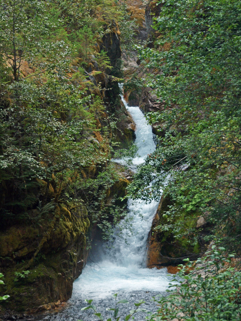 (Below The Ship, the trail continues another 1.5 miles to the lower trailhead. The entire hike from upper to lower trailhead and back is about six miles and the elevation gain coming back is 1350 feet.)
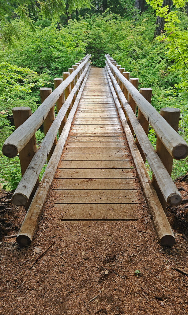
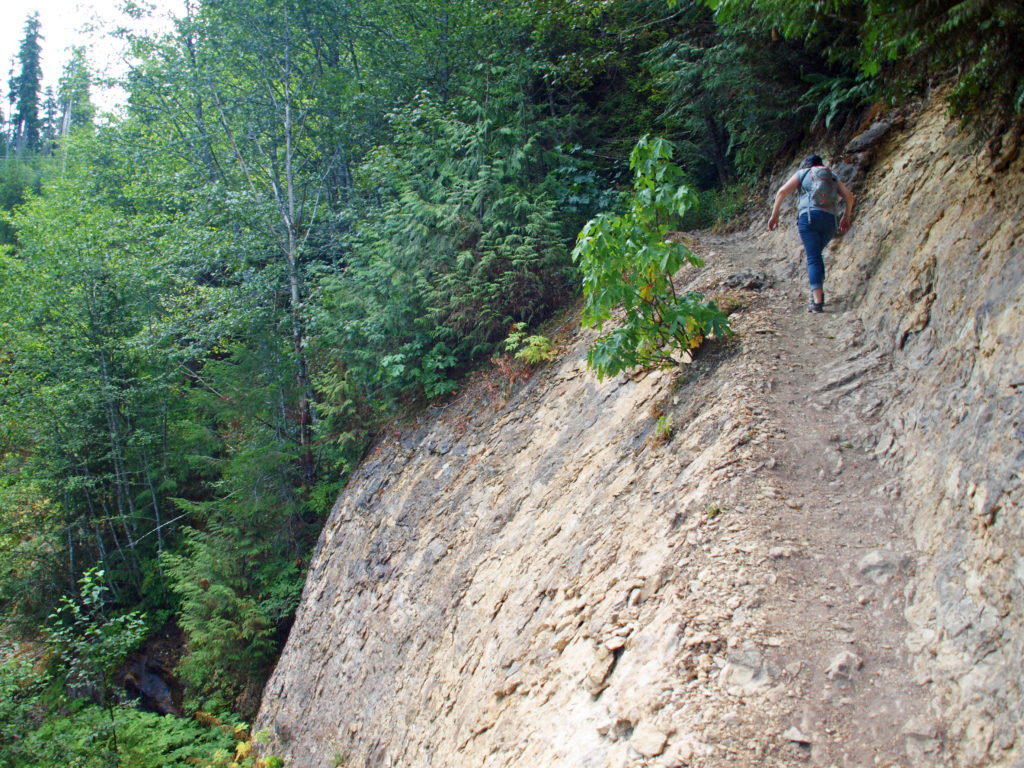 Return from The Ship the way you came. Cross the suspension bridge if it is open and take the trail on the opposite bank to the upper bridge and re-cross the river. The two bridges both give you great views of the river and canyon below.
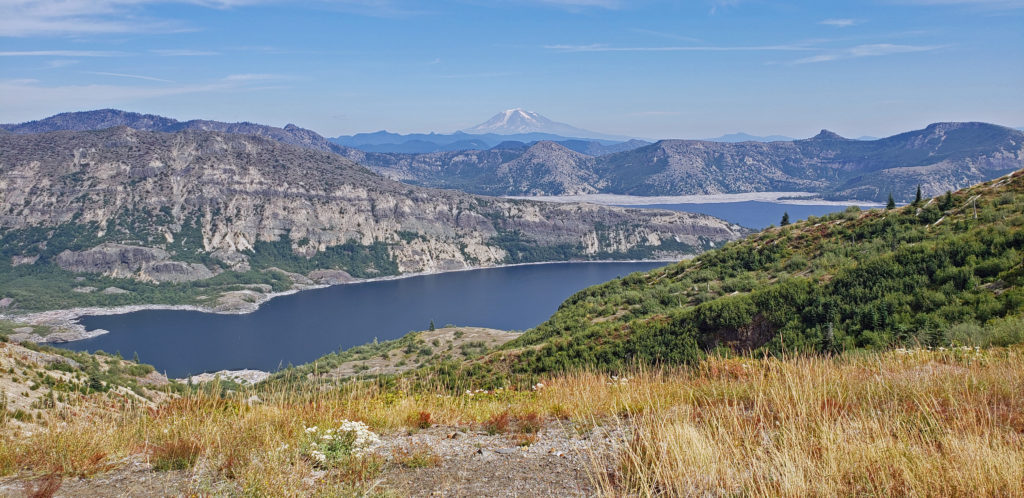
 Originally posted in a different format September 29, 2018 by Alan K. Lee. Updated and re-posted March 23, 2021. Edited, updated and posted in this format June 29, 2023.
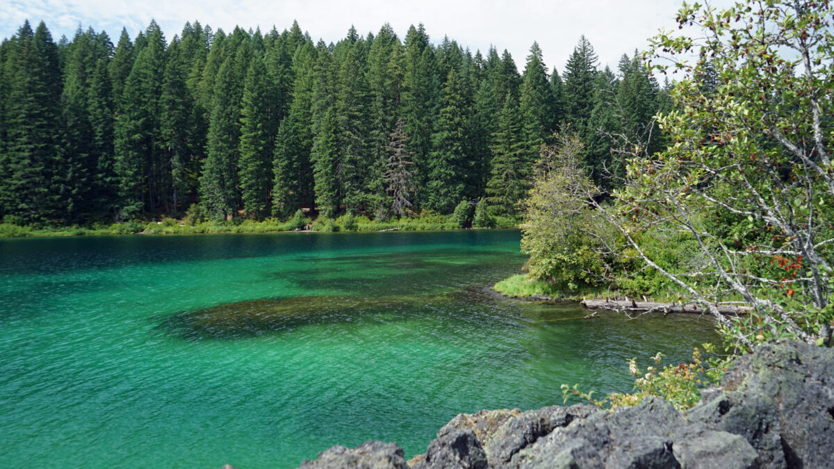

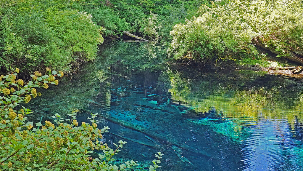
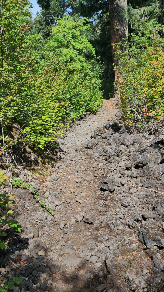
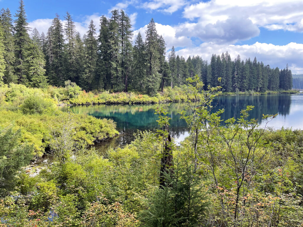
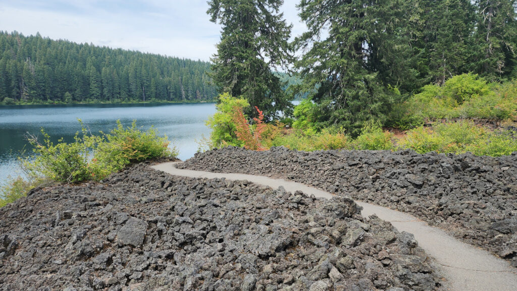
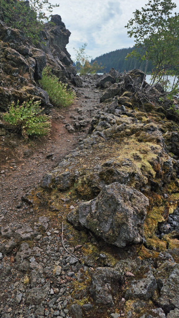 From the Great Spring the trail follows the east shore through the lava fields and forest. Parts of the trail are pretty rough. Good quality hiking boots are advised, although I did this hike in sneakers on my latest visit. But open toed sandals or flip flops are definitely not acceptable footwear on this section of the trail.

